Embed Size (px)
Citation preview
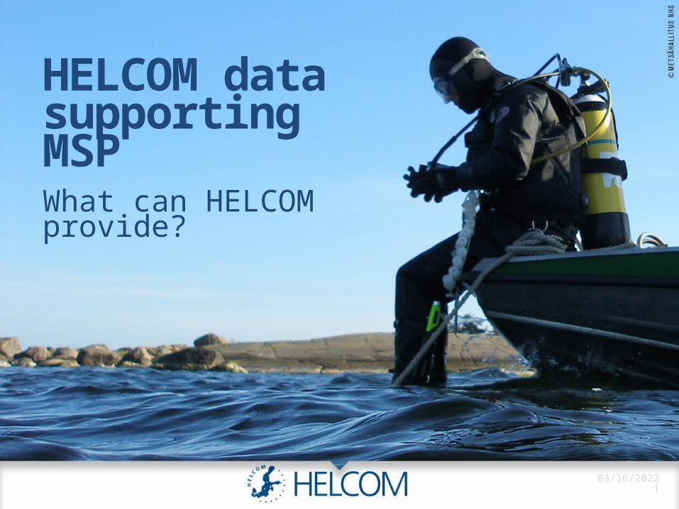
HELCOM data supporting MSPWhat can HELCOM provide?
04/18/20231
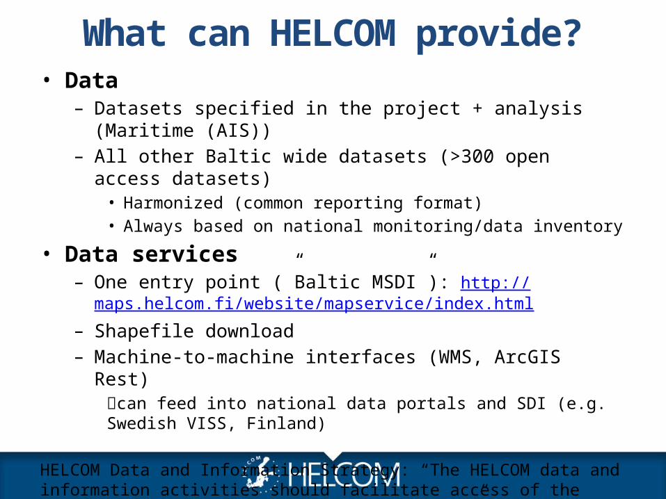
What can HELCOM provide?• Data
– Datasets specified in the project + analysis (Maritime (AIS))– All other Baltic wide datasets (>300 open access datasets)
• Harmonized (common reporting format)• Always based on national monitoring/data inventory
• Data services– One entry point (”Baltic MSDI”): http://
maps.helcom.fi/website/mapservice/index.html– Shapefile download– Machine-to-machine interfaces (WMS, ArcGIS Rest)
can feed into national data portals and SDI (e.g. Swedish VISS, Finland)
HELCOM Data and Information Strategy: “The HELCOM data and information activities should facilitate access of the general public to environmental information”
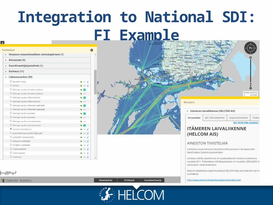
Integration to National SDI: FI Example
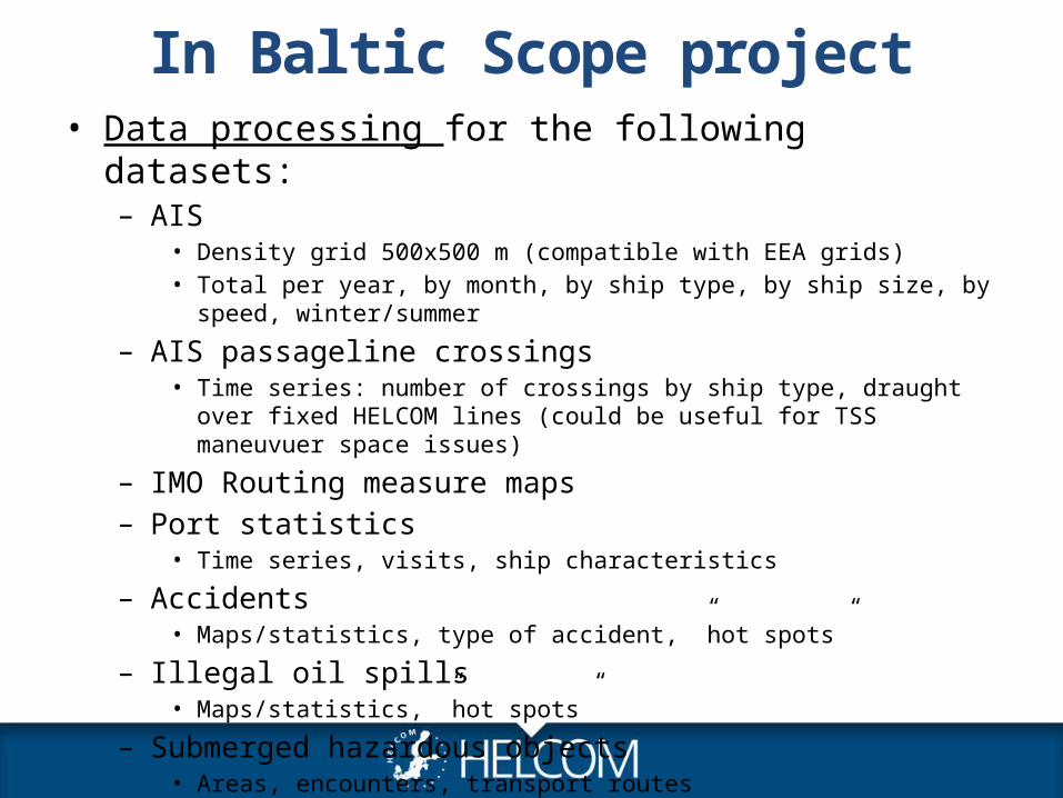
In Baltic Scope project• Data processing for the following datasets:
– AIS• Density grid 500x500 m (compatible with EEA grids)• Total per year, by month, by ship type, by ship size, by speed, winter/summer
– AIS passageline crossings• Time series: number of crossings by ship type, draught over fixed HELCOM lines
(could be useful for TSS maneuvuer space issues)
– IMO Routing measure maps– Port statistics
• Time series, visits, ship characteristics
– Accidents• Maps/statistics, type of accident, ”hot spots”
– Illegal oil spills• Maps/statistics, ”hot spots”
– Submerged hazardous objects• Areas, encounters, transport routes
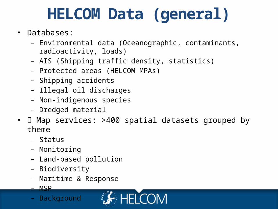
HELCOM Data (general)• Databases:
– Environmental data (Oceanographic, contaminants, radioactivity, loads)– AIS (Shipping traffic density, statistics)– Protected areas (HELCOM MPAs)– Shipping accidents– Illegal oil discharges– Non-indigenous species– Dredged material
• Map services: >400 spatial datasets grouped by theme– Status– Monitoring– Land-based pollution– Biodiversity– Maritime & Response– MSP– Background
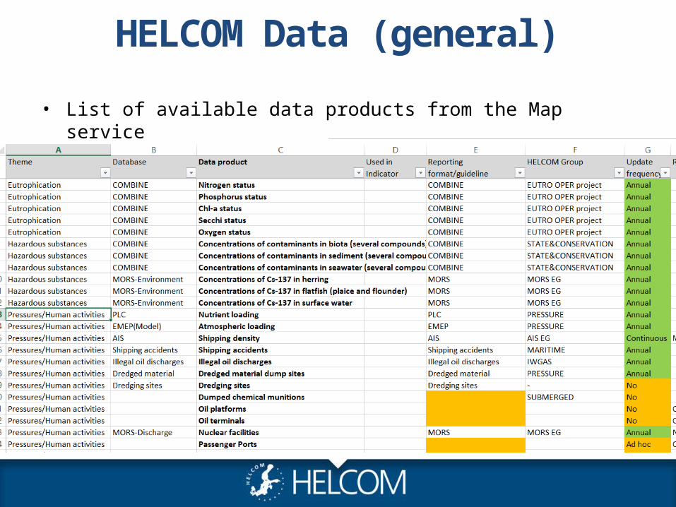
HELCOM Data (general)
Pressures/Human activities
• List of available data products from the Map service
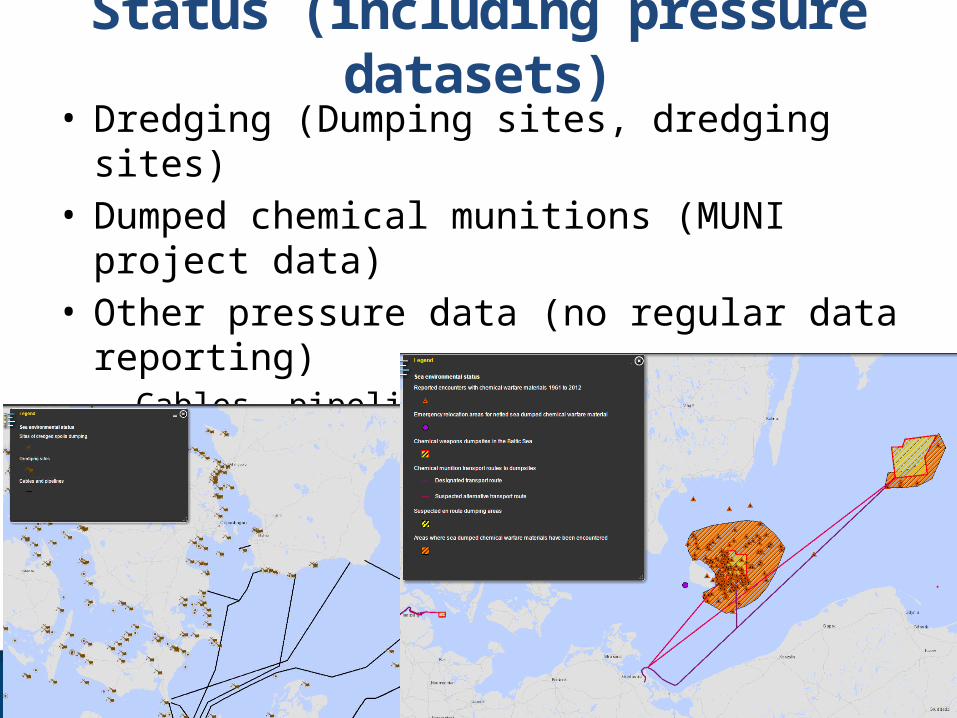
Status (including pressure datasets)• Dredging (Dumping sites, dredging sites)• Dumped chemical munitions (MUNI project data)• Other pressure data (no regular data reporting)– Cables, pipelines, energy (to be updated)– HOLAS II project to update data (current from HOLAS I in
2010)
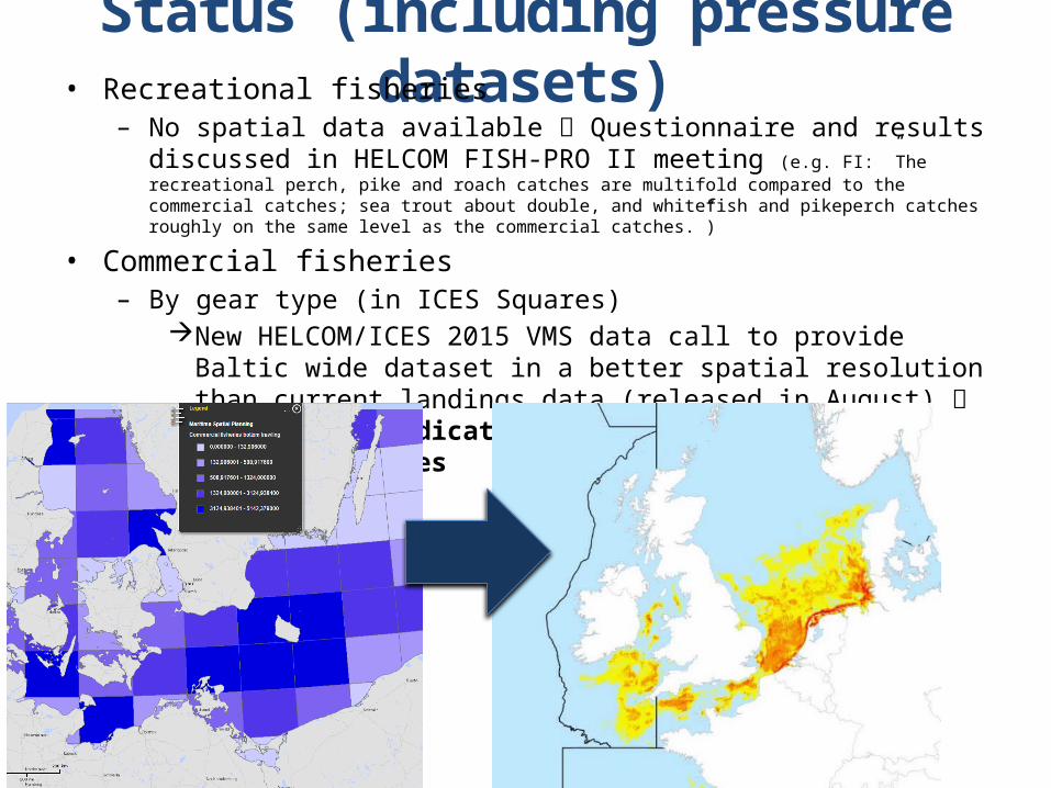
Status (including pressure datasets)• Recreational fisheries
– No spatial data available Questionnaire and results discussed in HELCOM FISH-PRO II meeting (e.g. FI: ”The recreational perch, pike and roach catches are multifold compared to the commercial catches; sea trout about double, and whitefish and pikeperch catches roughly on the same level as the commercial catches.”)
• Commercial fisheries– By gear type (in ICES Squares)
New HELCOM/ICES 2015 VMS data call to provide Baltic wide dataset in a better spatial resolution than current landings data (released in August) HELCOM core indicator: Cumulative impacts on benthic biotopes
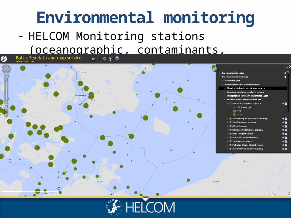
Environmental monitoring- HELCOM Monitoring stations (oceanographic,
contaminants, coastal fish)
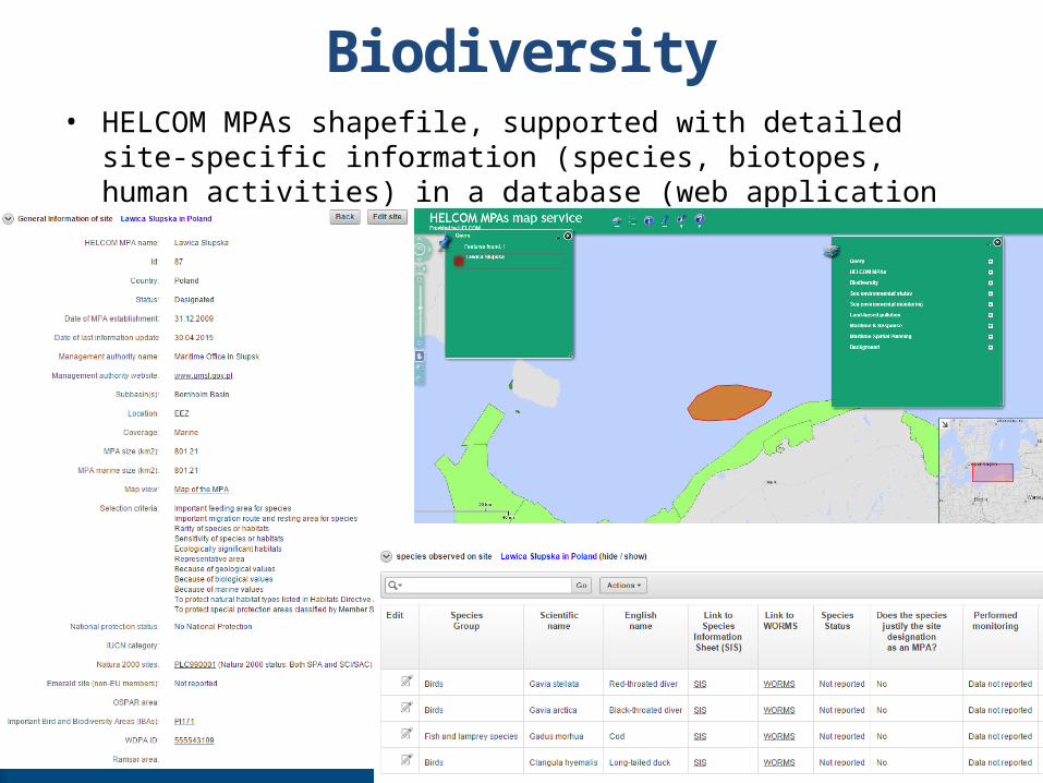
Biodiversity• HELCOM MPAs shapefile, supported with detailed site-specific information
(species, biotopes, human activities) in a database (web application to be published in September) to know what is protected and why
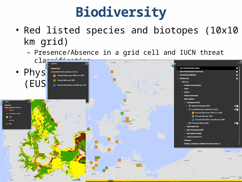
Biodiversity• Red listed species and biotopes (10x10 km grid)
– Presence/Absence in a grid cell and IUCN threat classification
• Physical features (e.g. sediment) (EUSeaMap/BALANCE)
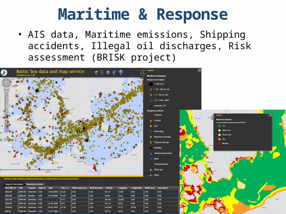
Maritime & Response• AIS data, Maritime emissions, Shipping accidents, Illegal oil
discharges, Risk assessment (BRISK project)
Summary• Data processing within the project:
– Maritime data (AIS) maps and statistics. We can also provide environmental data
• All HELCOM data is publicly available via map service– Data products ”as is” available from map service
• Download• Web services: WMS, ArcGIS REST
• Questions from our side:– What are the priorities in terms of datasets?
• We thought that AIS density maps would be the most important, Agree? We plan to deliver density maps and stats for year 2014 to start with.
– Exact delivery dates? • When does the project need the data? August 2015?
– Priorities: General opinions?