Embed Size (px)
Citation preview
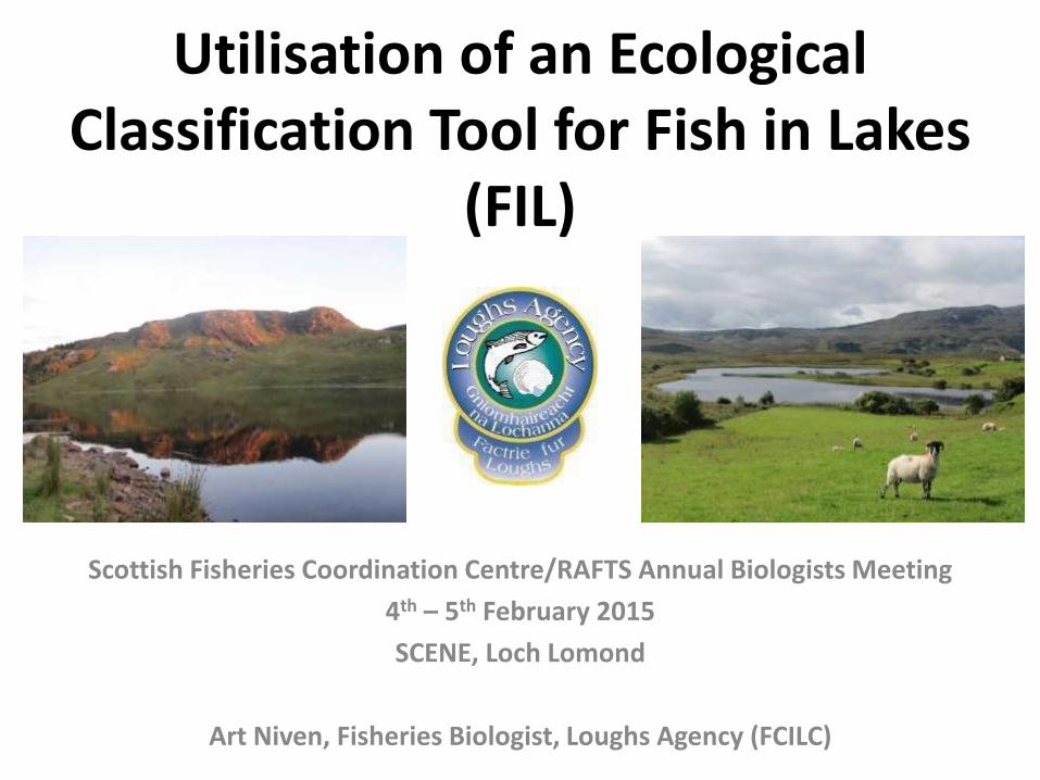
Utilisation of an Ecological Classification Tool for Fish in Lakes
(FIL)
Scottish Fisheries Coordination Centre/RAFTS Annual Biologists Meeting
4th – 5th February 2015
SCENE, Loch Lomond
Art Niven, Fisheries Biologist, Loughs Agency (FCILC)

OVERVIEW
• Introduction to the Fish In Lakes (FIL) methodology
• Application of FIL methodology by the Loughs Agency
• Benefits of FIL methodology

Introduction• Developed by North South Shared
Aquatic Resources (NS Share) an INTERREG IIIA project running from 2004 -2008.
• Included publicly accessible methods manual and classification tool. (issues accessing online at present)
• Large partnership. Fish tool developed primarily by CFB and AFBI.
• Classification tool refined by Inland Fisheries Ireland.
• Kelly, F.L., Harrison, A.J., Allen, M., Connor, L. and Rosell, R. (2012) Development and application of an ecological classification tool for fish in lakes in Ireland. Ecological Indicators, 18, 608-619.

OVERVIEW OF METHOD
• Method developed for WFD lake fish monitoring in Ecoregion 17 (Island of Ireland)
• Shortened version of the CEN standard (1/2 CEN)
• Can be supplemented with additional nets if required to facilitate comparison with previous survey results
• Standardised approach for lake fish surveying facilitating comparison of catch over time and space
• FIL methodology provides a step by step guide/recipe book approach

OVERVIEW OF METHOD
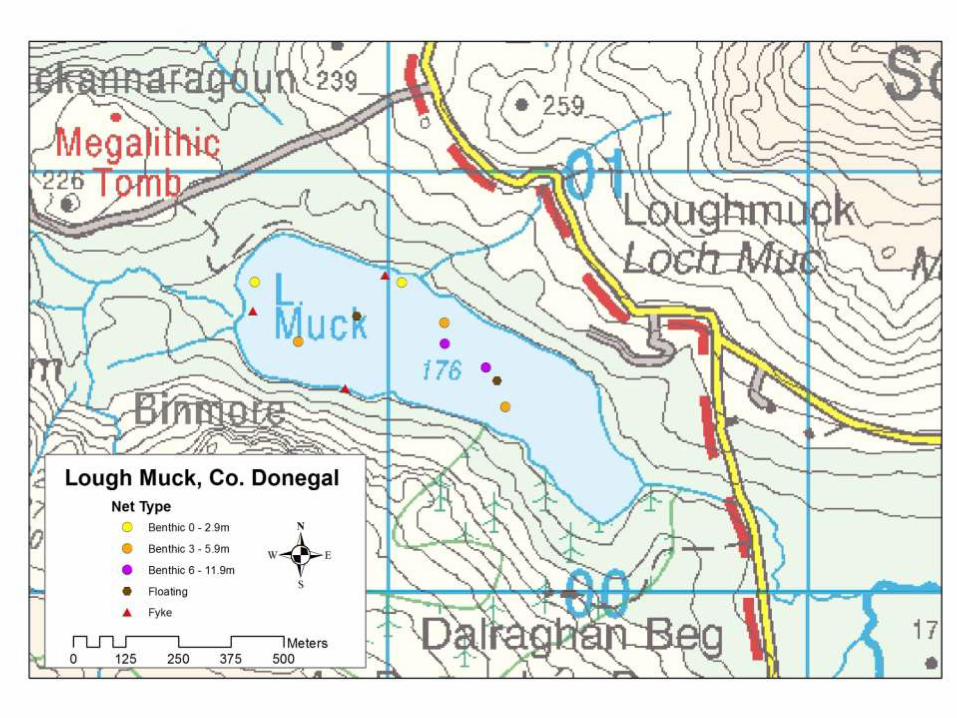
• Bathymetric survey required before fish survey to facilitate calculating survey effort requirement
• The number of nets to be deployed is dependant on the area and depth of the lake/loch/lough
• The lough is divided into 50m grid squares and squares are randomly selected for placement of benthic gill nets to be deployed for each depth stratum as outlined in the survey methods manual. (this has been determined to detect a 50% change in catch over time)
• Fyke nets are deployed in representative habitats perpendicular to the shore
• Floating gill nets are set over the deepest parts of the lough.

MESH SIZE DISTRIBUTION (KNOT TO KNOT)

BENTHIC MULTI MESH GILL NETS

FLOATING NETS
FYKE NETS


FIELD RECORDS

CATCH RECORDS

• Originally 5 WFD surveillance sites in the Loughs Agency jurisdiction
• Reduced to 0 after minimum size for surveillance lakes was increased to >50 hectares
• Loughs Agency have adopted the FIL methodology to develop a growing lake fish survey baseline and to monitor index sites over time
• Approx 10 lakes surveyed in recent years (minimum of two surveyed per year)
• Rationale is to facilitate sustainable development of wild lough fisheries
APPLICATION OF METHOD BY THE LOUGHS AGENCY

• For WFD purposes the classification tool is used which requires input metrics to be calculated
• The FIL tool requires that fish community type is established as salmonid lake, perch lake or roach lake
THE CLASSIFICATION TOOL

THE CLASSIFICATION TOOL
• There are 17 input metrics that need to be calculated for salmonid lakes

THE CLASSIFICATION TOOL

0
1
2
3
4
5
6
7
8
9
10
0 -
9
10
- 1
9
20
- 2
9
30
- 3
9
40
- 4
9
50
- 5
9
60
- 6
9
70
- 7
9
80
- 8
9
90
- 9
9
10
0 -
10
9
11
0 -
11
9
12
0 -
12
9
13
0 -
13
9
14
0 -
14
9
15
0 -
15
9
16
0 -
16
9
17
0 -
17
9
18
0 -
18
9
19
0 -
19
9
20
0 -
20
9
21
0 -
21
9
22
0 -
22
9
23
0 -
23
9
24
0 -
24
9
Fre
qu
en
cy
Length (mm)
Length Frequency Trout, Lough Nambraddan 2014 (N=59)
ADDITIONAL OUTPUTS


CONCLUSION
• Benefits of the FIL methods include
• Inter-calibrated WFD compliant methodology
• Consistent approach which is easily repeatable in space and time
• Great for comparing loughs and assessing development potential
• Can tailor equipment to meet access requirements
• Facilitates baseline surveying and long term monitoring programes


![Casque-micro sans fil Gold - PlayStation · Sur système PS4™, le casque-micro sans fil est réglé par défaut sur [Tout l'audio]. Utilisation du casque-micro avec un PC Le casque-micro](https://img.pdfslide.net/doc/110x75/5e7a6776434b7c0d814e8303/casque-micro-sans-fil-gold-playstation-sur-systme-ps4a-le-casque-micro-sans.jpg)