Embed Size (px)
Citation preview

ArcGIS Add-in Development
In Python and C# for LIDAR Product Quality Control
Tools Developed by
David Eliseo Martínez CastellanosFor
The Salvadoran Ministry of Environment and Natural Resources
(MARN)
Background: El Salvador’s LIDAR survey
“Digital elevation data which describes El Salvador’s landforms and seabed is crucial for
addressing issues relating to the impacts of climate change, disaster management, water
security, environmental management, urban planning and infrastructure design.”
“The intent of this project is to support MARN throughout the El Salvador National Territory with
more accurate data by the generation of Digital Elevation and Surface Models using the Laser
Imaging Detection and Ranging (LIDAR) technology, and with multi-spectral orthoimagery. The
project requires the collection and delivery of high-density LIDAR data and digital imagery for
the totality of El Salvador.”
From El Salvador National Lidar & Orthophotography Specifications and Tender Template.
To help in the Quality Control Workflow of the LIDAR Survey, some software tools where
developed, including ArcGIS Add-ins, using both Python and the ArcObjects .Net SDK with
C#, this tools are integrated with a PostgreSQL Database.
The complete Quality Control methodology will be documented later, here we talk about
the tools [my participation].

Database Support
As part of the tool Development to support the Quality Control of the LIDAR
products, a Database was build on a PostgreSQL Server with PostGIS Spatial
Extension.
This database stores:
• The geometries of sample LAS tiles received
• A table of the storage path of each tile, to be used on a loader tool.
• LAS header and statistics for each tile
• Tables to store the results of quality control for each product and each tile.
Some of the quality control criteria are evaluated by programs (automatic
check) and some are evaluated by a GIS technician.
• Spatial table to store polygons to be drawn over defects on the LIDAR
products.

Loader tool
Each GIS technician is provided with a tiles shapefile containing the set of tiles to
be checked and the set of LIDAR products corresponding (DEM, DSM, LAS, etc.).
The tool allows the graphical selection of the product to check. This tool was
developed using Python
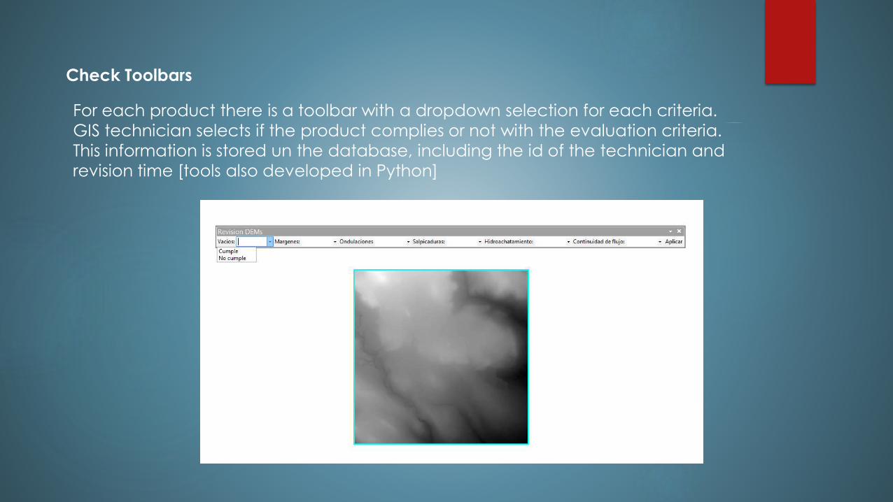
Check Toolbars
For each product there is a toolbar with a dropdown selection for each criteria.
GIS technician selects if the product complies or not with the evaluation criteria.
This information is stored un the database, including the id of the technician and
revision time [tools also developed in Python]

Check Toolbars
Each LIDAR product has its own check toolbar, showing the criteria to be evaluated by
a GIS Technician, the database contains more criteria for each product that are
automatically checked by a program [cell size, data type, spatial reference, etc.]
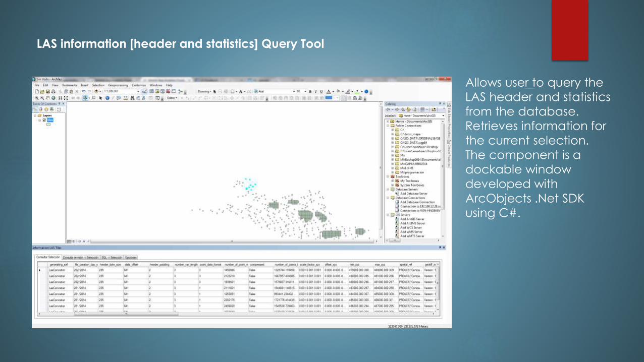
LAS information [header and statistics] Query Tool
Allows user to query the
LAS header and statistics
from the database.
Retrieves information for
the current selection.
The component is a
dockable window
developed with
ArcObjects .Net SDK
using C#.
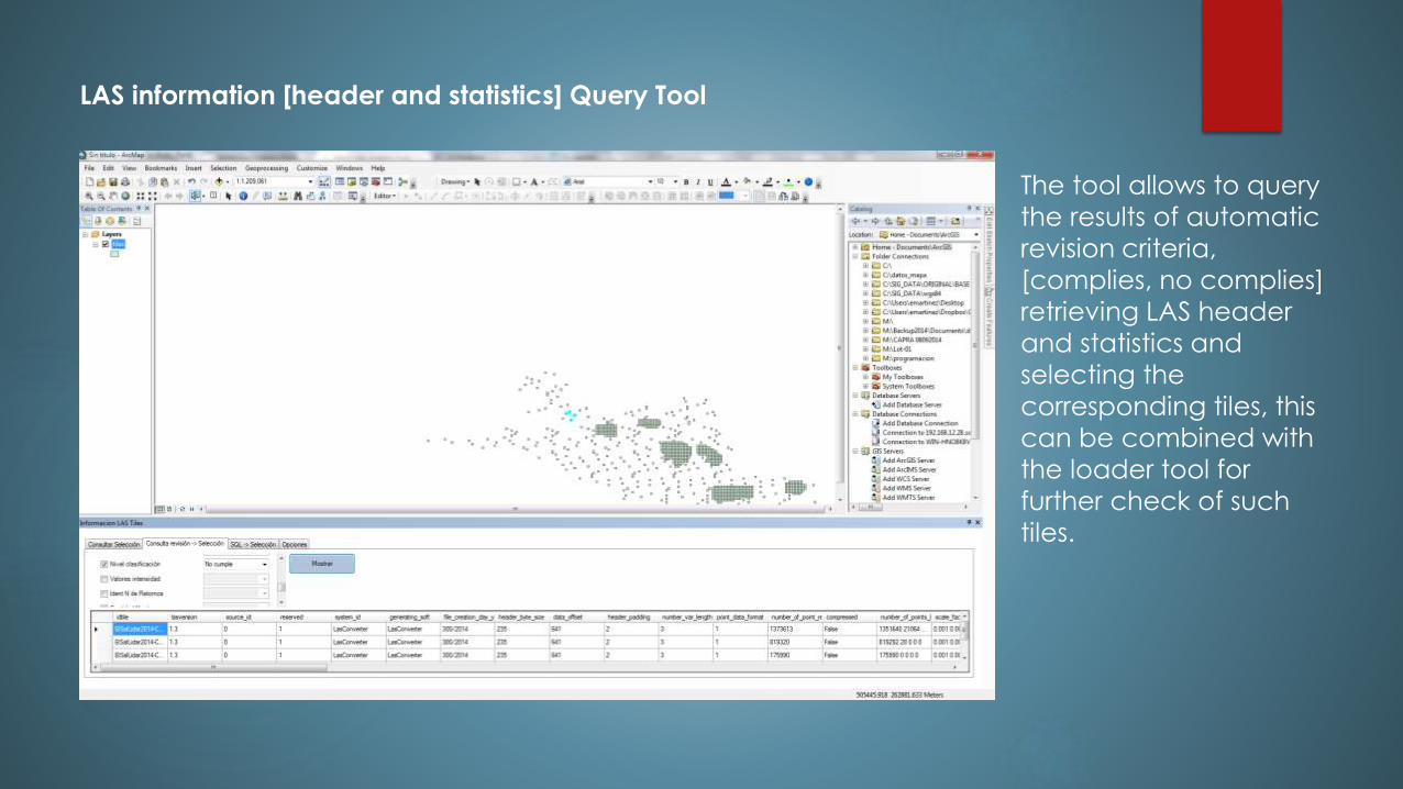
LAS information [header and statistics] Query Tool
The tool allows to query
the results of automatic
revision criteria,
[complies, no complies]
retrieving LAS header
and statistics and
selecting the
corresponding tiles, this
can be combined with
the loader tool for
further check of such
tiles.
LAS information [header and statistics] Query Tool
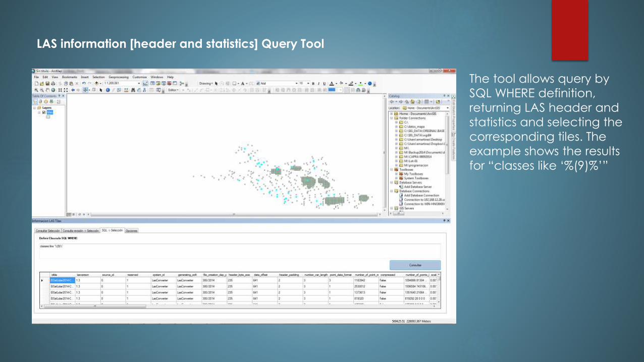
The tool allows query by
SQL WHERE definition,
returning LAS header and
statistics and selecting the
corresponding tiles. The
example shows the results
for “classes like ‘%(9)%’”
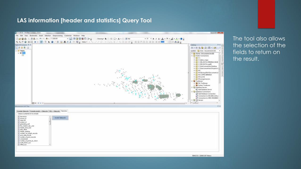
LAS information [header and statistics] Query Tool
The tool also allows
the selection of the
fields to return on
the result.
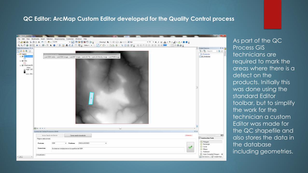
QC Editor: ArcMap Custom Editor developed for the Quality Control process
As part of the QC
Process GIS
technicians are
required to mark the
areas where there is a
defect on the
products. Initially this
was done using the
standard Editor
toolbar, but to simplify
the work for the
technician a custom
Editor was made for
the QC shapefile and
also stores the data in
the database
including geometries.
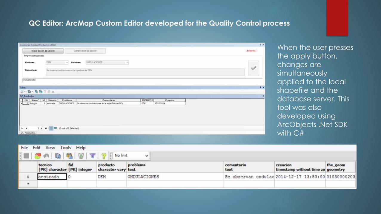
QC Editor: ArcMap Custom Editor developed for the Quality Control process
When the user presses
the apply button,
changes are
simultaneously
applied to the local
shapefile and the
database server. This
tool was also
developed using
ArcObjects .Net SDK
with C#
What is next?
The project is currently on going. User feedback is expected and we will look for
ways to improve the process.
Next is the development of tools to manage all data products and make them
accessible to Salvadoran people, decision makers, planners, etc. More is to
come.
THANKS!
David Eliseo Martínez Castellanos
Software Developer
MARN El Salvador
Linked-in:sv.linkedin.com/pub/david-eliseo-martinez-castellanos/35/71b/7b5/