Embed Size (px)
Citation preview
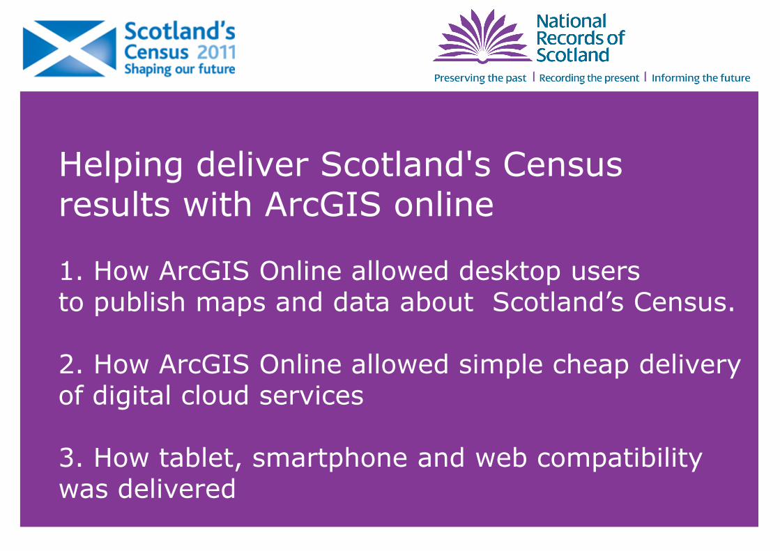
Helping deliver Scotland's Census results with ArcGIS online
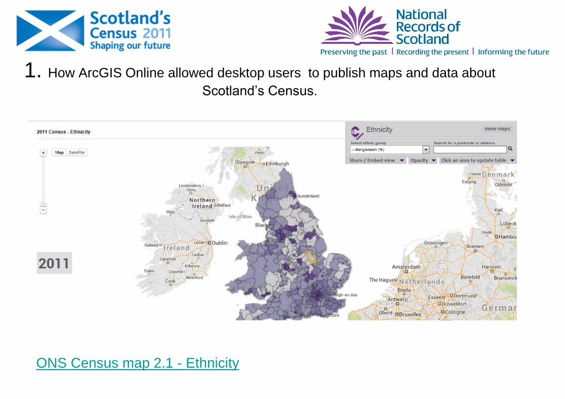
1. How ArcGIS Online allowed desktop users to publish maps and data about Scotland’s Census.
2. How ArcGIS Online allowed simple cheap delivery of digital cloud services
3. How tablet, smartphone and web compatibility was delivered
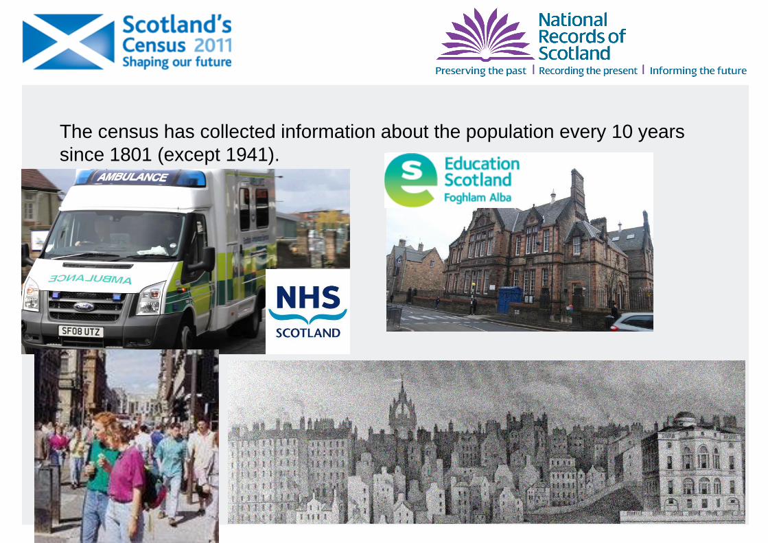
The census has collected information about the population every 10 years
since 1801 (except 1941).

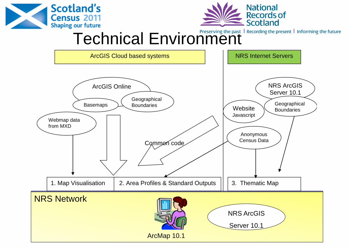
NRS Network
Technical Environment
ArcMap 10.1
NRS ArcGIS
Server 10.1
ArcGIS Online
NRS ArcGIS Server 10.1
1. Map Visualisation 2. Area Profiles & Standard Outputs 3. Thematic Map
Geographical
Boundaries
Webmap data
from MXD
Basemaps
ArcGIS Cloud based systems NRS Internet Servers
Website Javascript
Geographical
Boundaries
Anonymous
Census Data Common code
1. How ArcGIS Online allowed desktop users to publish maps and data about
Scotland’s Census.
ONS Census map 2.1 - Ethnicity
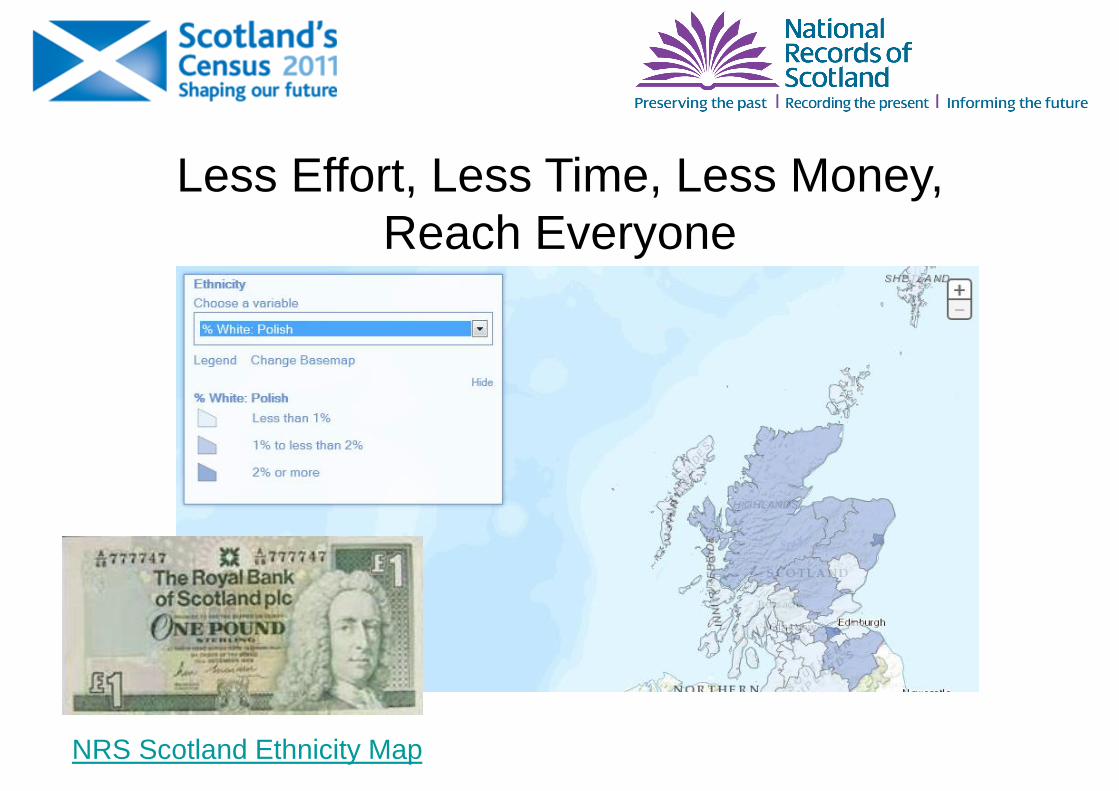
NRS Scotland Ethnicity Map
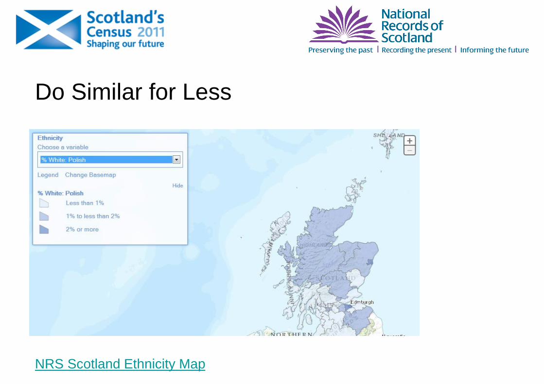
Do Similar for Less
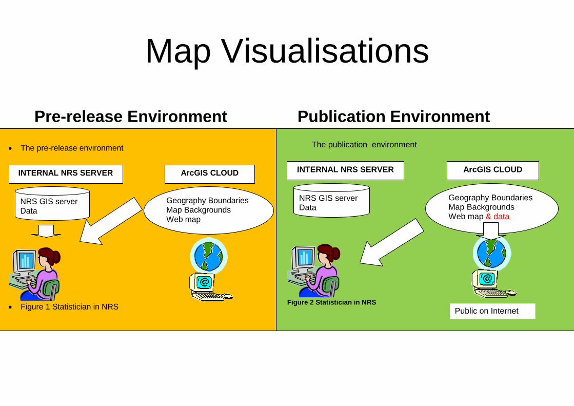
Map Visualisations
Pre-release Environment Publication Environment
The pre-release environment
Figure 1 Statistician in NRS
NRS GIS server Data
Geography Boundaries Map Backgrounds Web map
INTERNAL NRS SERVER ArcGIS CLOUD
The publication environment
Figure 2 Statistician in NRS
NRS GIS server Data
Geography Boundaries Map Backgrounds Web map & data
INTERNAL NRS SERVER ArcGIS CLOUD
Public on Internet
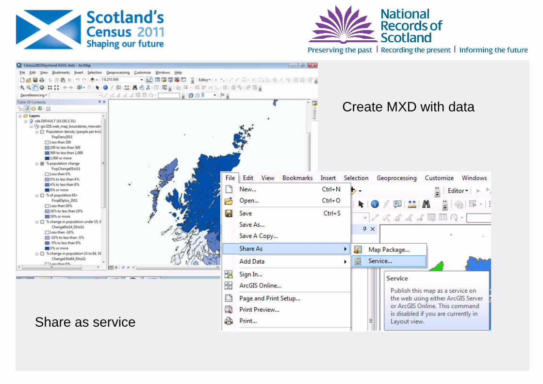
Create MXD with data
Share as service
NRS Scotland Ethnicity Map
Less Effort, Less Time, Less Money,
Reach Everyone
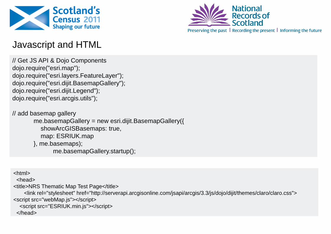
// Get JS API & Dojo Components
dojo.require("esri.map");
dojo.require("esri.layers.FeatureLayer");
dojo.require("esri.dijit.BasemapGallery");
dojo.require("esri.dijit.Legend");
dojo.require("esri.arcgis.utils");
// add basemap gallery
me.basemapGallery = new esri.dijit.BasemapGallery({
showArcGISBasemaps: true,
map: ESRIUK.map
}, me.basemaps);
me.basemapGallery.startup();
Javascript and HTML
<html>
<head>
<title>NRS Thematic Map Test Page</title>
<link rel="stylesheet" href="http://serverapi.arcgisonline.com/jsapi/arcgis/3.3/js/dojo/dijit/themes/claro/claro.css">
<script src="webMap.js"></script>
<script src="ESRIUK.min.js"></script>
</head>
NRS Network
Technical Environment
ArcMap 10.1
NRS ArcGIS
Server 10.1
ArcGIS Online
NRS ArcGIS Server 10.1
1. Map Visualisation 2. Area Profiles & Standard Outputs 3. Thematic Map
Geographical
Boundaries
Webmap data
from MXD
Basemaps
ArcGIS Cloud based systems NRS Internet Servers
Website Javascript
Geographical
Boundaries
Anonymous
Census Data Common code
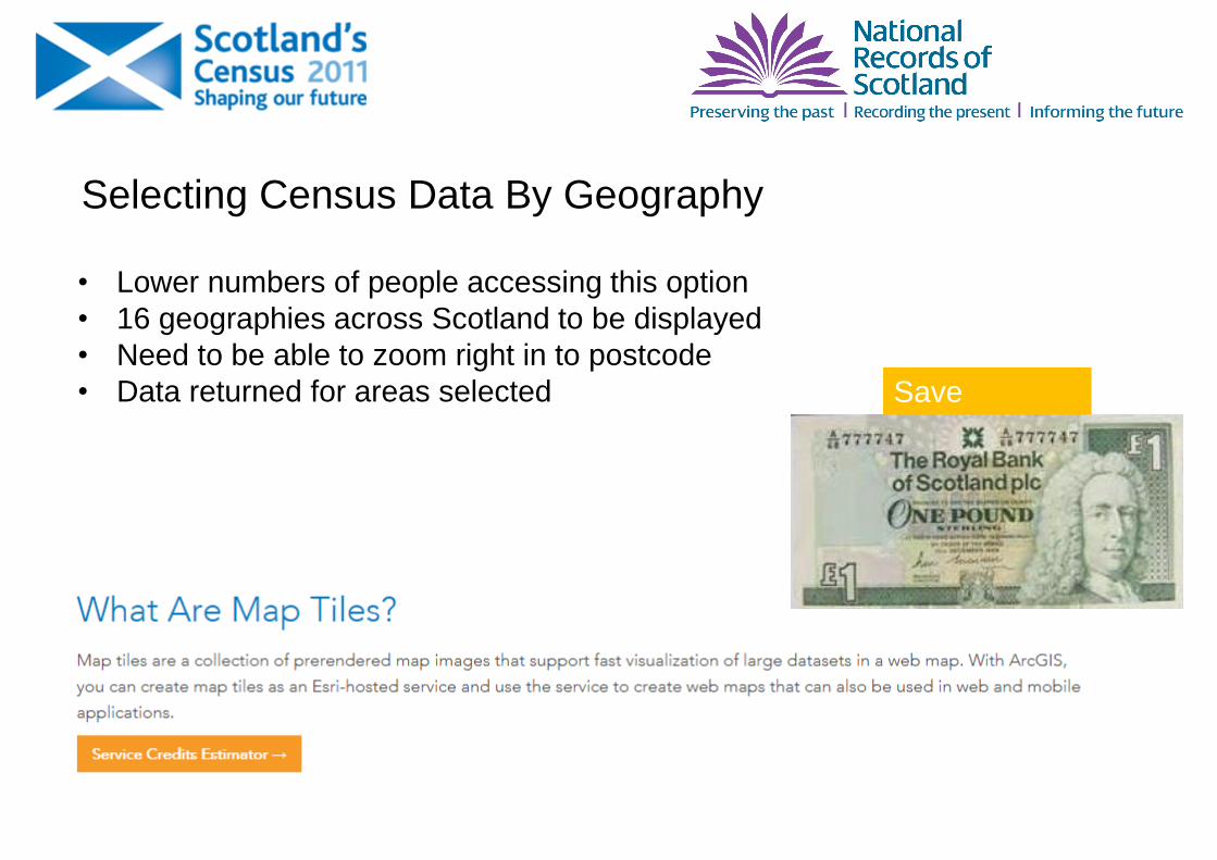
Selecting Census Data By Geography
• Lower numbers of people accessing this option
• 16 geographies across Scotland to be displayed
• Need to be able to zoom right in to postcode
• Data returned for areas selected Save
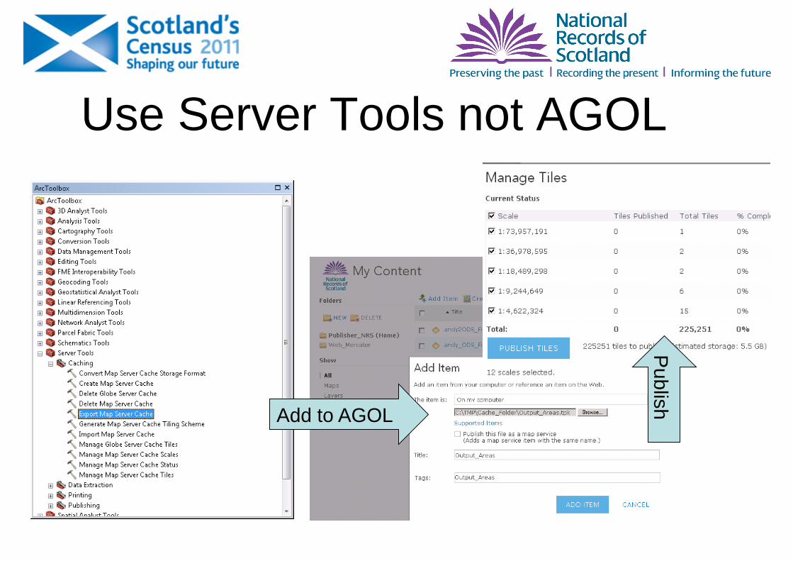
Use Server Tools not AGOL
Add to AGOL
Pub
lish
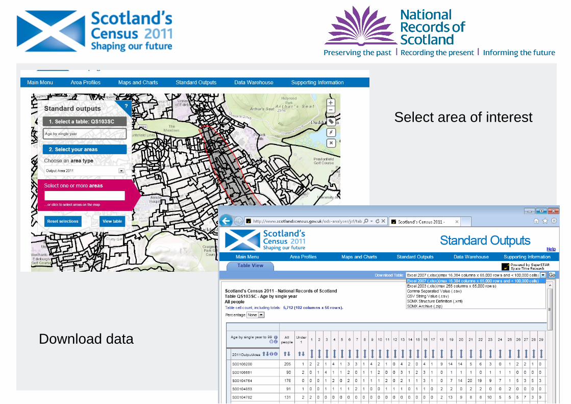
Create MXD with dataDownload data
Select area of interest
NRS Scotland Ethnicity Map
Demo
Census Outputs Geographical election