Embed Size (px)
Citation preview
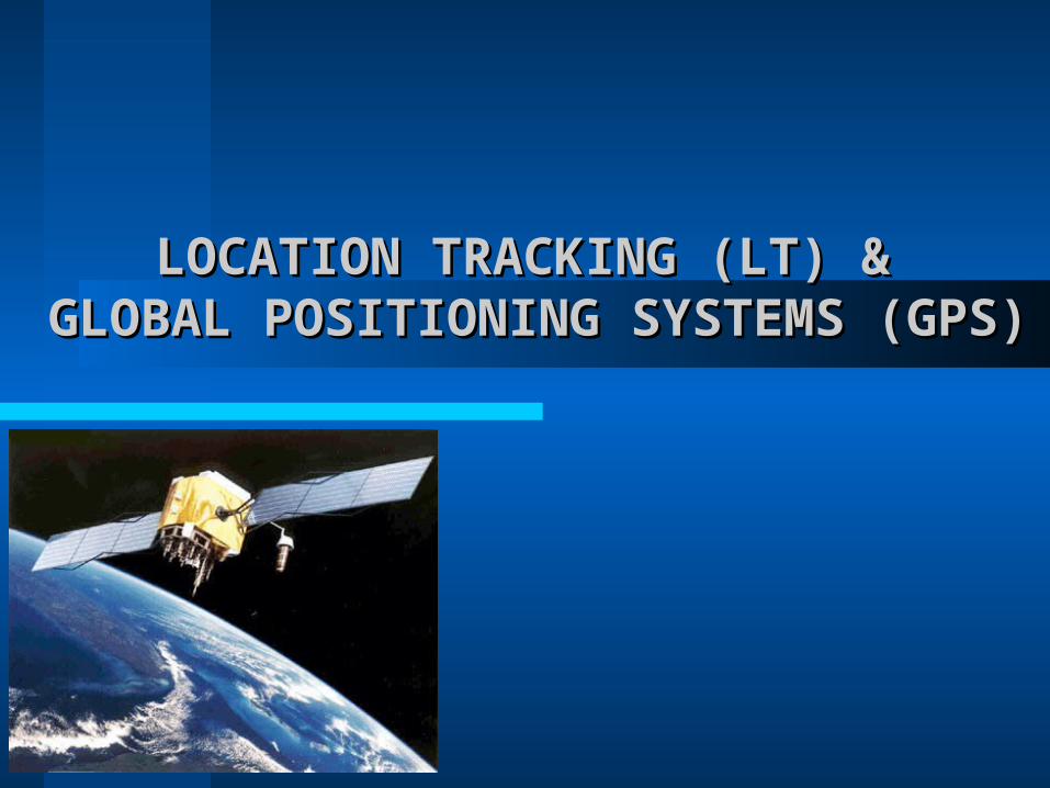
LOCATION TRACKING (LT) & LOCATION TRACKING (LT) & GLOBAL POSITIONING SYSTEMS (GPS)GLOBAL POSITIONING SYSTEMS (GPS)
AGENDAAGENDA
Introduction to LT & GPS
Necessity of technology
Architecture and design
Functionality
Utilities and Applications
Drawbacks of GPS
INTRODUCTIONINTRODUCTION
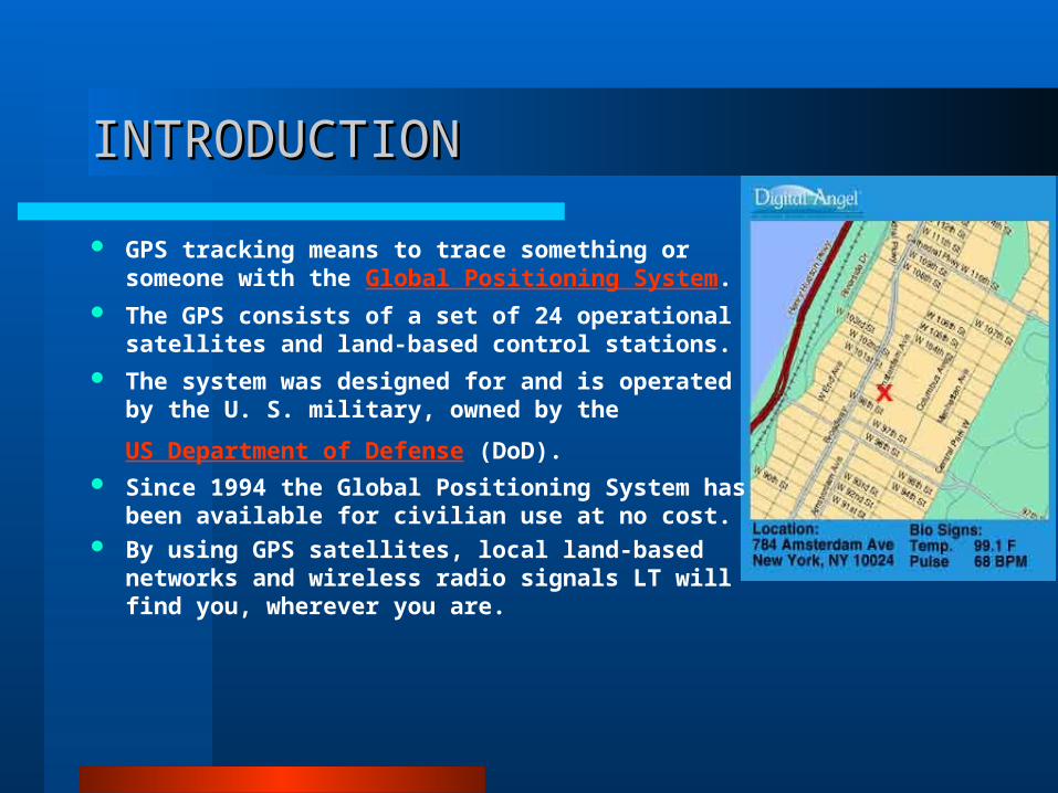
GPS tracking means to trace something or someone with the Global Positioning System.
The GPS consists of a set of 24 operational satellites and land-based control stations.
The system was designed for and is operated by the U. S. military, owned by the
US Department of Defense (DoD). Since 1994 the Global Positioning System has
been available for civilian use at no cost. By using GPS satellites, local land-based
networks and wireless radio signals LT will find you, wherever you are.
NECESSITY OF TECHNOLOGYNECESSITY OF TECHNOLOGY
Department of Defense were facing challenges to increase security of the US.
During emergencies we require immediate tracking of important people.
Logistic companies need tracing of their fleet for reliable operations.
Personal valuables vehicles and goods when stolen or lost were not easier to locate.
Architecture and design Architecture and design
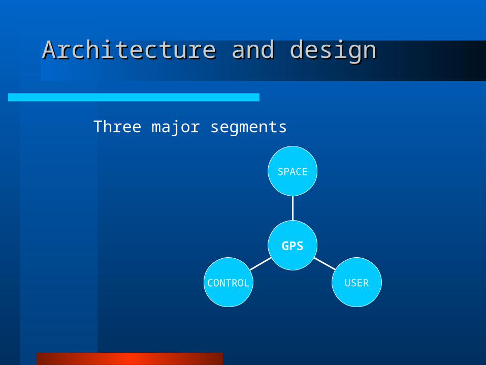
CONTROL USER
SPACE
GPS
Three major segments
SPACE SEGMENTSPACE SEGMENT

SPACE SEGMENTSPACE SEGMENT
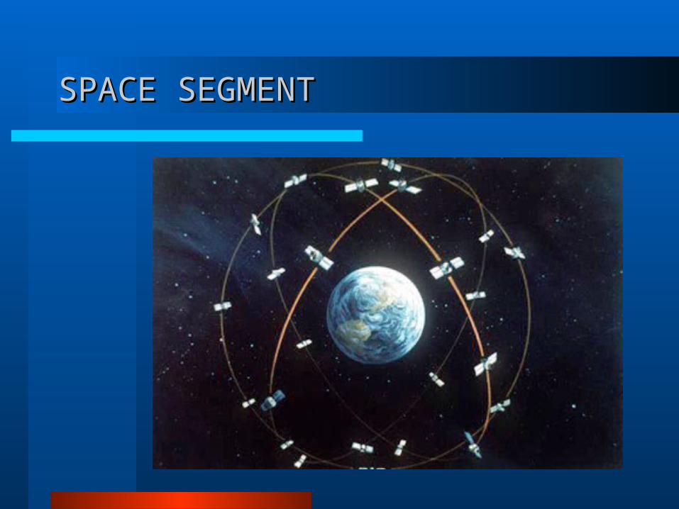
The space segment consists of 27 Earth-orbiting satellites (24 in operation and three extras in case one fails).
Each in its own orbit 20,200 kilometers above the Earth.
Orbit the earth in 12 hours.
There are six orbital planes with nominally four satellites in each, equally spaced (60 degrees apart).
This constellation provides the user with between five to eight satellites visible (with respect to communication) from any point on the earth.

CONTROL SEGMENTCONTROL SEGMENT

CONTROL SEGMENTCONTROL SEGMENT
Master controlStation
Monitorstation
Monitorstation
Monitorstation
Monitorstation
HAWAII
KWAJALEIN
DIEGO GARCIA
ASCENSION ISLAND
COLORADO
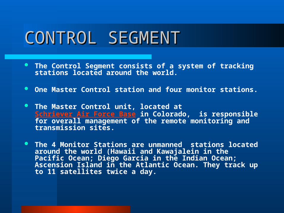
CONTROL SEGMENTCONTROL SEGMENT The Control Segment consists of a system of tracking stations
located around the world.
One Master Control station and four monitor stations.
The Master Control unit, located at Schriever Air Force Base in Colorado, is responsible for overall management of the remote monitoring and transmission sites.
The 4 Monitor Stations are unmanned stations located around the world (Hawaii and Kawajalein in the Pacific Ocean; Diego Garcia in the Indian Ocean; Ascension Island in the Atlantic Ocean. They track up to 11 satellites twice a day.

USER SEGMENTUSER SEGMENT
USER SEGMENTUSER SEGMENT
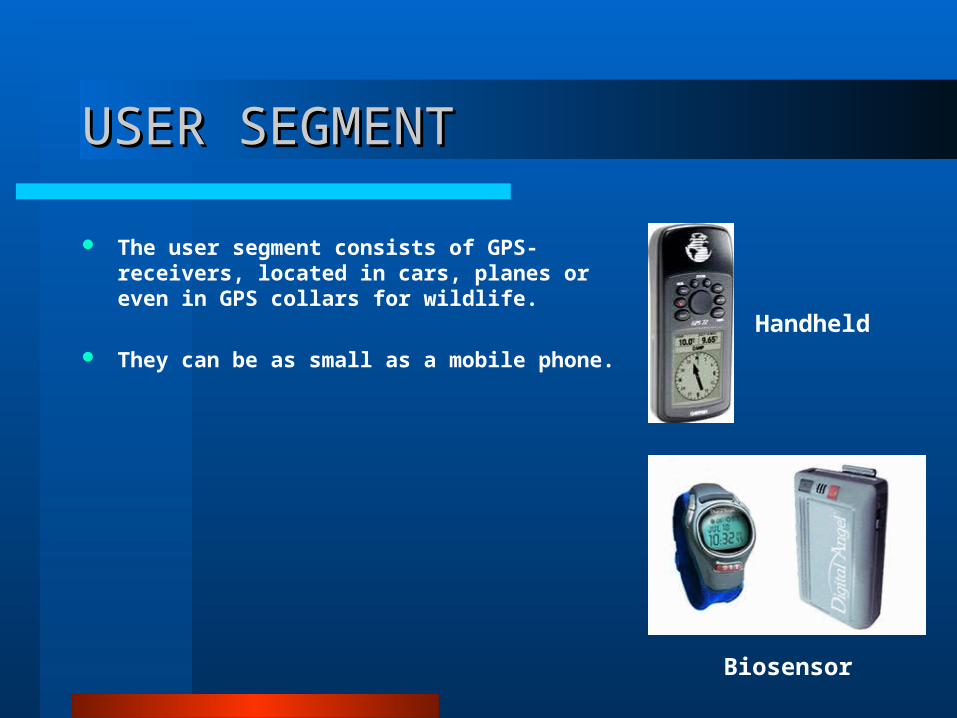
The user segment consists of GPS-receivers, located in cars, planes or even in GPS collars for wildlife.
They can be as small as a mobile phone.
Biosensor
Handheld
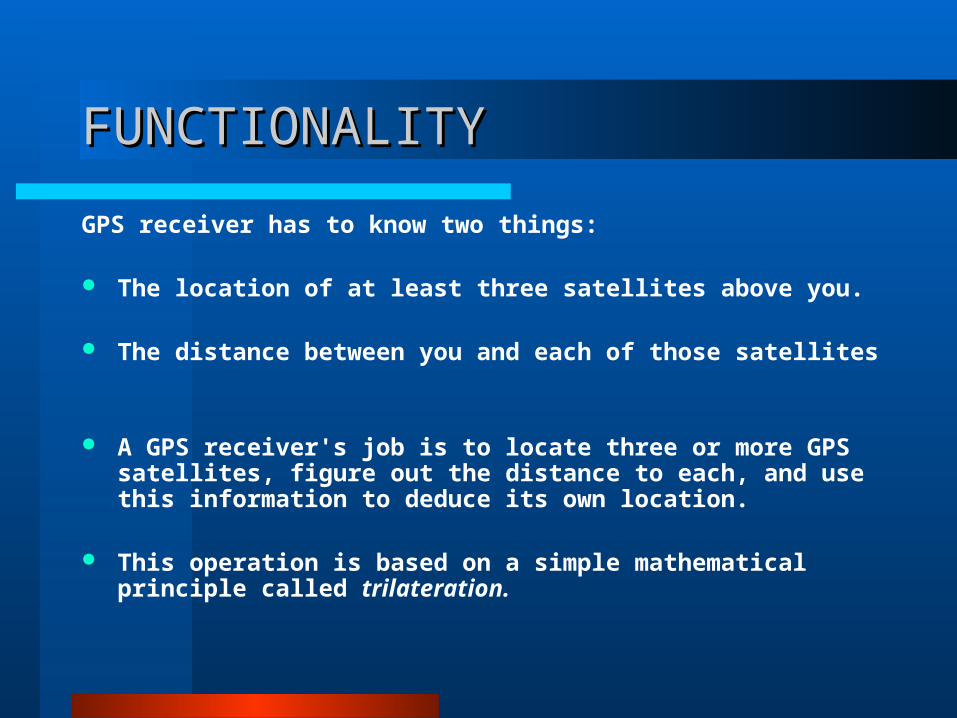
FUNCTIONALITYFUNCTIONALITY
GPS receiver has to know two things:
The location of at least three satellites above you.
The distance between you and each of those satellites
A GPS receiver's job is to locate three or more GPS satellites, figure out the distance to each, and use this information to deduce its own location.
This operation is based on a simple mathematical principle called trilateration.
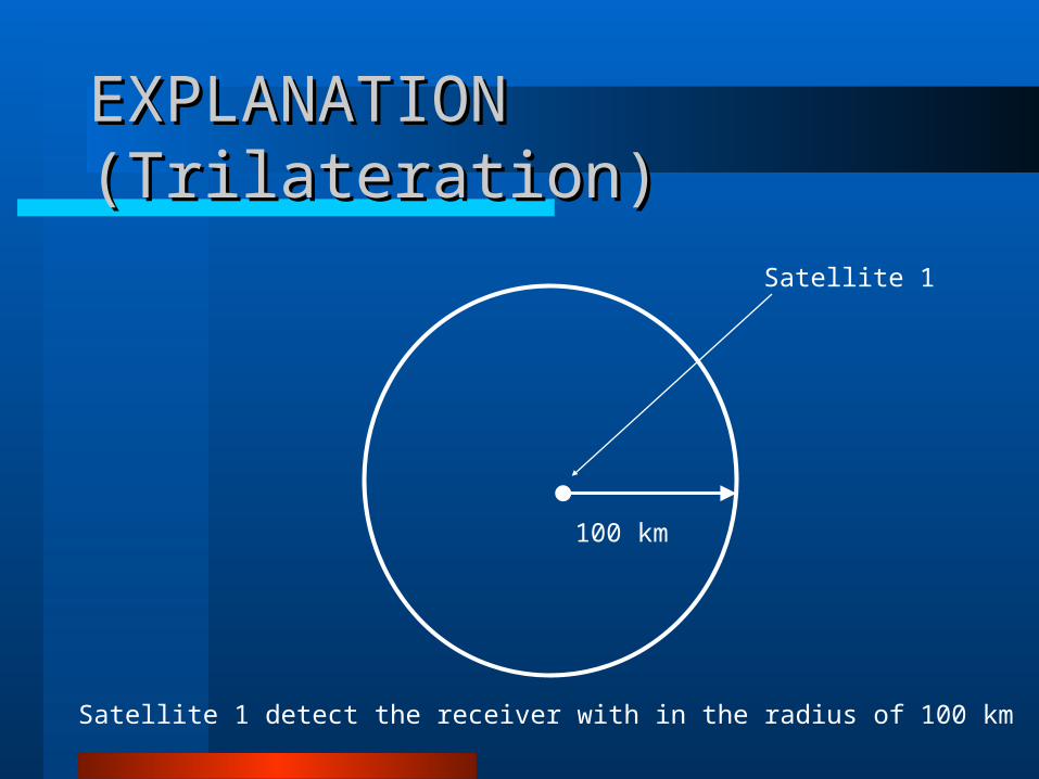
EXPLANATION (Trilateration)EXPLANATION (Trilateration)
Satellite 1
100 km
Satellite 1 detect the receiver with in the radius of 100 km
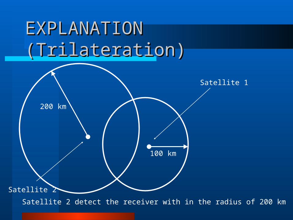
EXPLANATION (Trilateration)EXPLANATION (Trilateration)
Satellite 1
100 km
Satellite 2 detect the receiver with in the radius of 200 km
200 km
Satellite 2
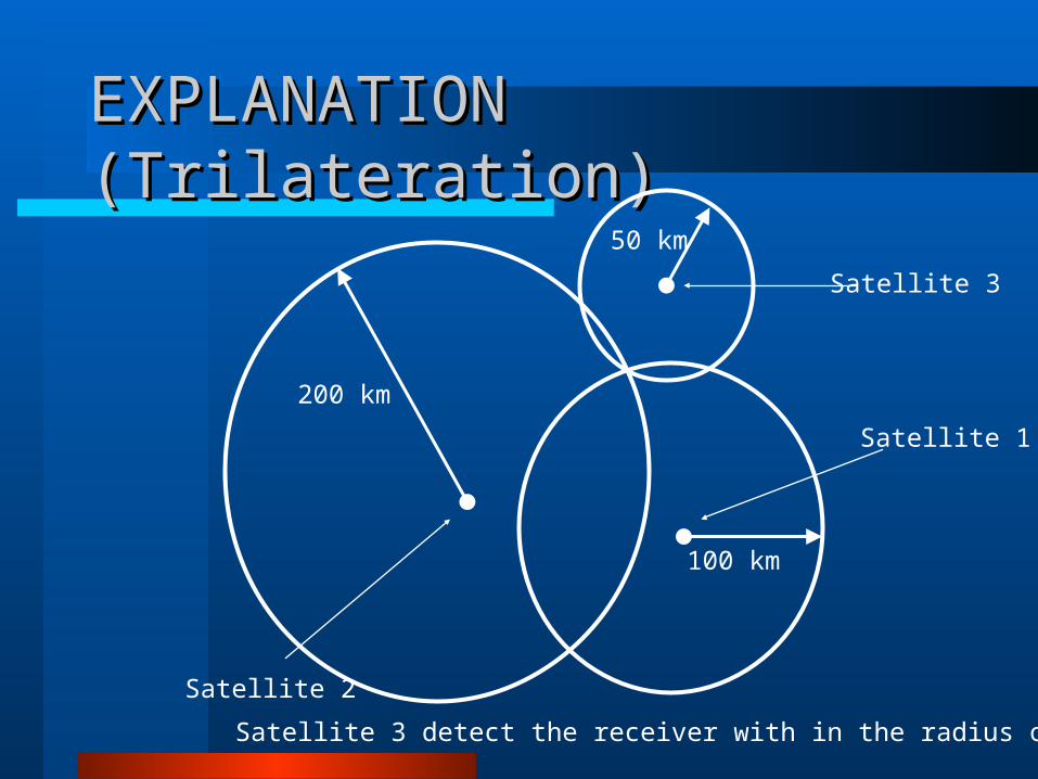
EXPLANATION (Trilateration)EXPLANATION (Trilateration)
Satellite 1
100 km
Satellite 3 detect the receiver with in the radius of 50 km
200 km
Satellite 2
50 km
Satellite 3
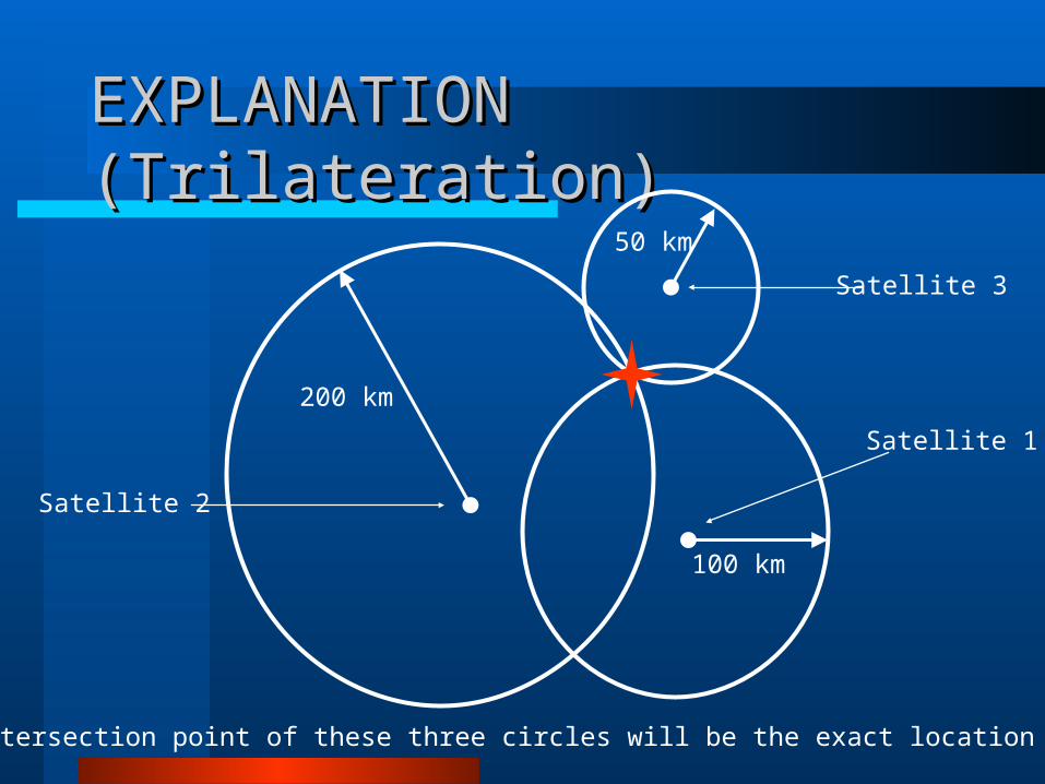
EXPLANATION (Trilateration)EXPLANATION (Trilateration)
Satellite 1
100 km
The intersection point of these three circles will be the exact location of Target
200 km
Satellite 2
50 km
Satellite 3
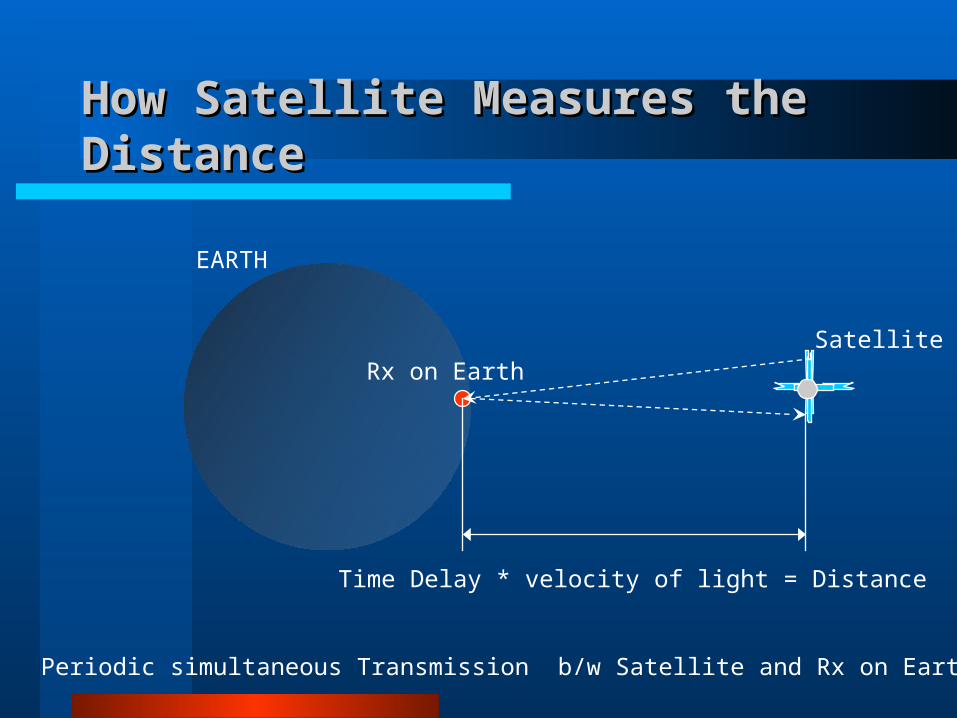
How Satellite Measures the DistanceHow Satellite Measures the Distance
SatelliteRx on Earth
EARTH
Periodic simultaneous Transmission b/w Satellite and Rx on Earth station
Time Delay * velocity of light = Distance

Measuring Distance ExplanationMeasuring Distance Explanation
The receiver and satellite both need clocks that can be synchronized down to the nanosecond.
For best synchronization Atomic clocks are required at both ends.
But atomic clocks cost somewhere between $50,000 and $100,000, which makes them a just a bit too expensive for everyday consumer use.
The Global Positioning System has a clever, effective solution to this problem. Every satellite contains an expensive atomic clock, but the receiver itself uses an ordinary quartz clock, which it constantly resets.
UTILITES & APPLICATIONUTILITES & APPLICATION
Vehicle Fleet Tracking
GPS Single Vehicle Tracking
GPS Data Logging
Real Time Tracking
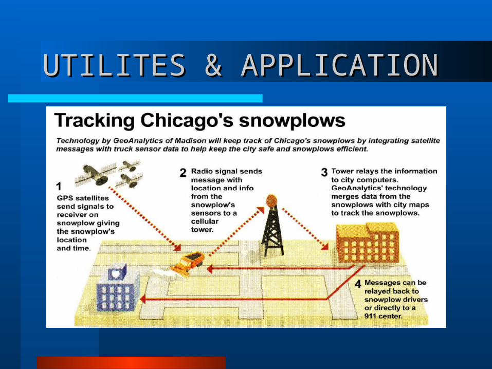
UTILITES & APPLICATIONUTILITES & APPLICATION
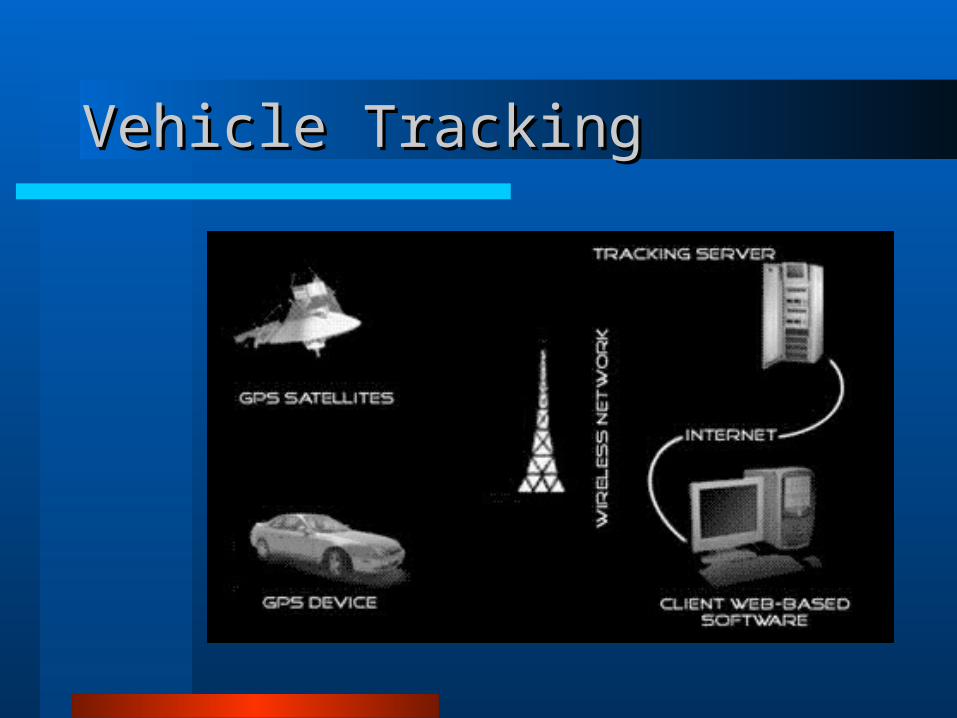
Vehicle Tracking Vehicle Tracking
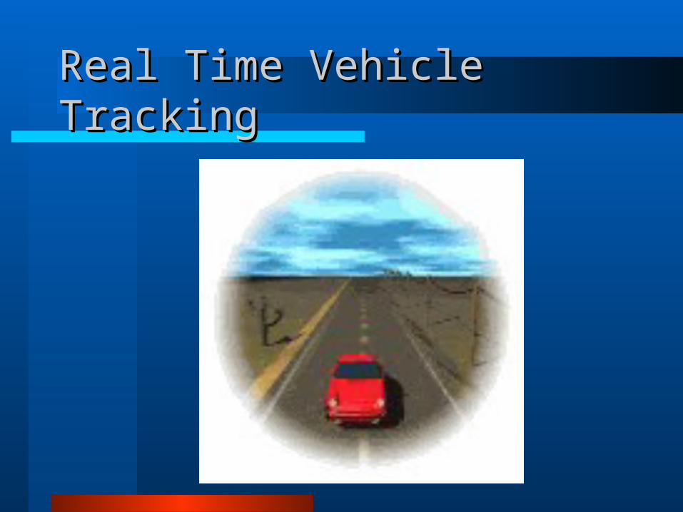
Real Time Vehicle TrackingReal Time Vehicle Tracking
DRAWBACKS OF GPSDRAWBACKS OF GPS
System are very costly and required professional experience.
A stolen object can’t be traced out if Receiver is switched off or facing power failure.
Position of the receiver can’t be traced if kept under high EM insulation.
The drawbacks to GPS are that it requires a minimum of 4-5 satellites in order to give accurate locations.
The Hijacker is not guaranteed to catch.

Thank YouThank You