Embed Size (px)
Citation preview
Initial Environmental Examination Document Stage: Draft Project Number: 41603-024 May 2017
IND: Bihar Urban Development Investment Program — Bhagalpur Water Supply Phase 2 (BWSP2) Subproject Prepared by Urban Development and Housing Department, Government of Bihar for the Asian Development Bank. This draft initial environmental examination report is a document of the borrower. The views expressed herein do not necessarily represent those of ADB's Board of Directors, Management, or staff, and may be preliminary in nature. In preparing any country program or strategy, financing any project, or by making any designation of or reference to a particular territory or geographic area in this document, the Asian Development Bank does not intend to make any judgments as to the legal or other status of any territory or area

CURRENCY EQUIVALENTS (as of 8 May 2017)
Currency Unit = INR INR1.00 = $ 0.0155
$1.00 = INR 64.32
ABBREVIATIONS
ADB — Asian Development Bank
AP — affected person
ASI — Archaeological Survey of India
BOQ — bill of quantity
BPL — below poverty line
BSPCB — Bihar State Pollution Control Board
BUDIP — Bihar Urban Development Investment Program
BUIDCo — Bihar Urban Infrastructure Development Corporation BMC — Bihar Municipal Corporation
CBO — community-based organization
CBD — central business district
CDTA — Capacity Development Technical Assistance
CSD — cutter section dredger
CTE — Consent to Establish
CTO — Consent to Operate
CGWB — Central Ground Water Board
CPCB — Central Pollution Control Board
CPHEEO — Central Public Health and Environmental Engineering Organization CWR — clear water reservoir
DBO — design build and operate
DFO — Divisional Forest Officer
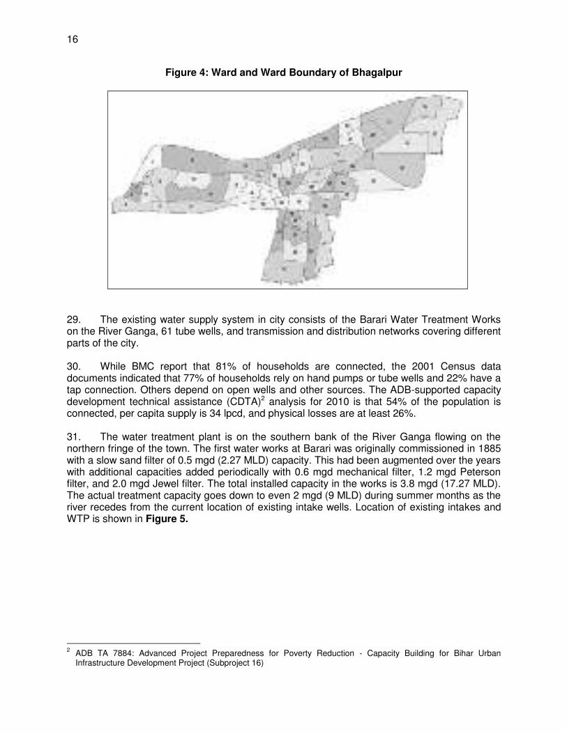
DLAO — District Land Acquisition Officer
DSC — design and supervision consultant
EAC — Expert Appraisal Committee
EARF — environmental assessment and review framework
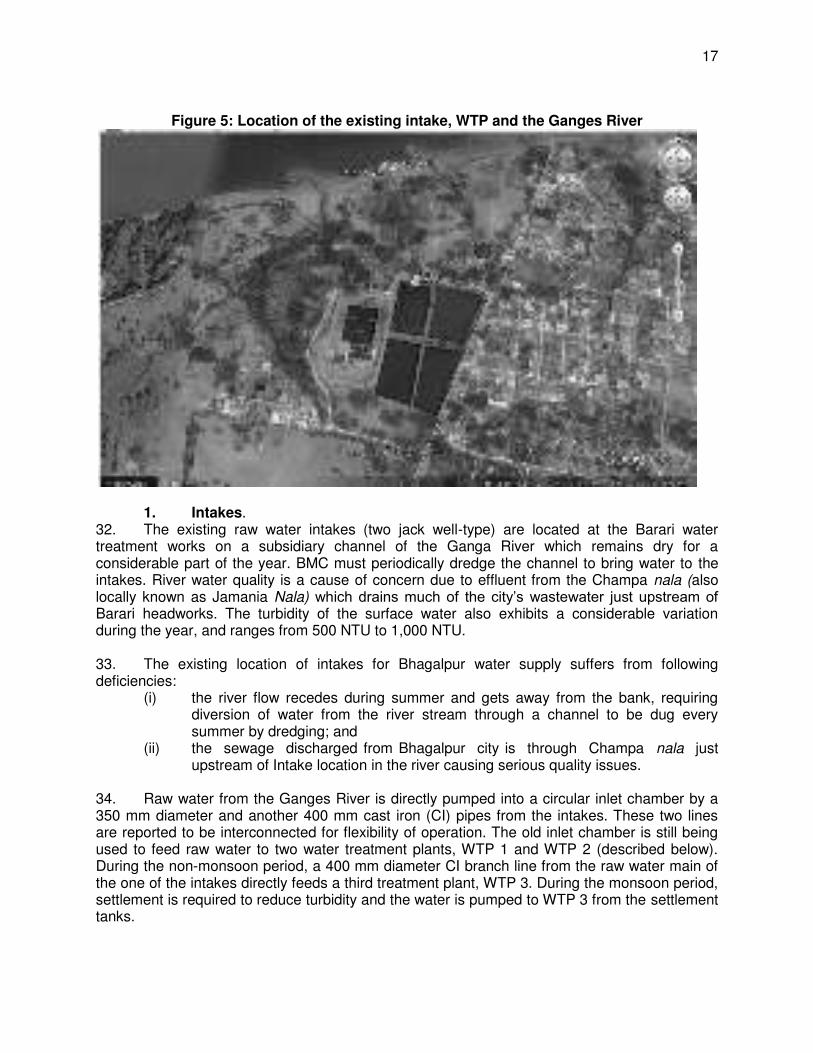
EIA — environmental impact assessment
EMP — environmental management plan
EMS — environmental monitoring specialist
EPA — Environmental Protection Agency
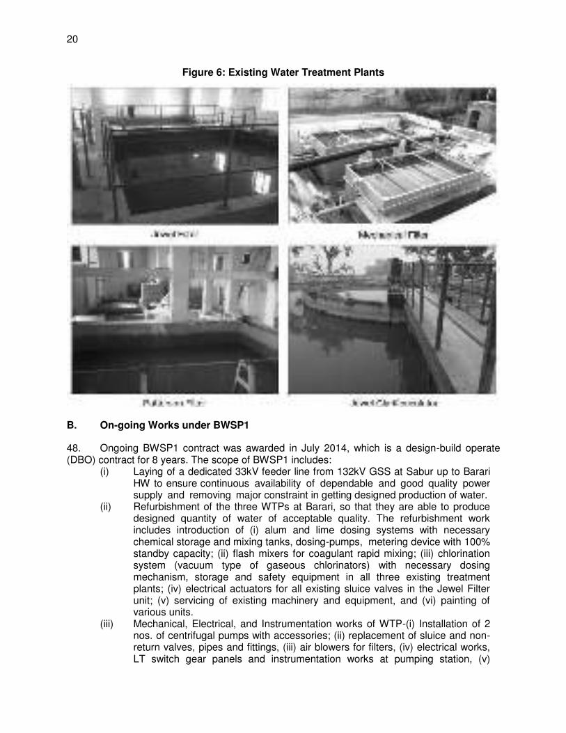
ESMC — Environment and Social Management Coordinator
ESZ — eco-sensitive zone
GoB — Government of Bihar
GRC — grievance redress committee
GRM — grievance redress mechanism
GSHAP — Global Seismic Hazard Assessment Program
H&S — health and safety
IR — involuntary resettlement
IEE — initial environmental examination
IEC — information education and communication
IWAI — Inland Waterways Authority of India
JNNURM — Jawaharlal Nehru National Urban Renewal Mission
LAA — Land Acquisition Act
MFF — multitranche financing facility
MoEFCC — Ministry of Environment, Forests and Climate Change
NAAQS — National Ambient Air Quality Standards
NGO — nongovernment organization
NRRP — National Resettlement and Rehabilitation Policy
NRW — nonrevenue water
O&M — operation and maintenance
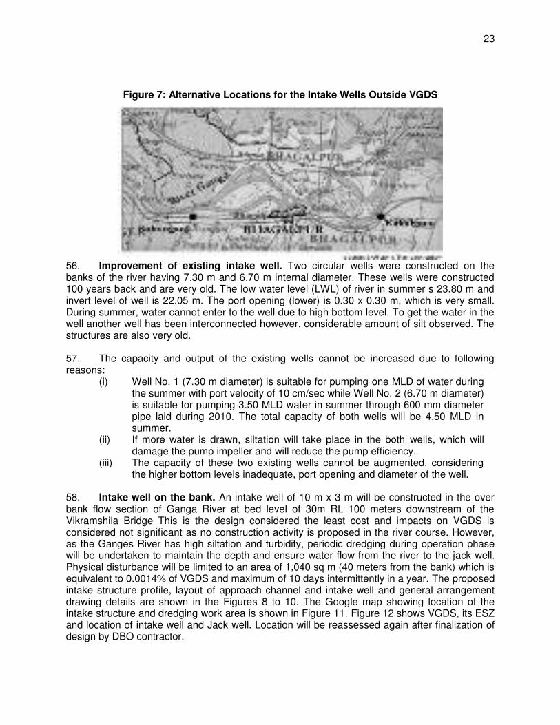
OHSA — Occupational Health and Safety Administration
OHT — overhead tank
PHED — Public Health Engineering Department
PIU — project implementation unit
PMC — project management consultant
PMU — project management unit RF — resettlement framework RCCF — Regional Chief Conservator of Forest
SEIAA — State Environment Impact Assessment Authority
SEP — site environment plan
STP Sewe
— sewage treatment plant
UDHD — Urban Development and Housing Department
VGDS — Vikramshila Gangetic Dolphin Sanctuary
WEIGHTS AND MEASURES
lakh – 100 thousand = 100,000 crore – 100 lakhs = 10,000,000 µg/m3 – micrograms per cubic meter km – kilometer lpd – liters per day m – meter m3/s – cubic meters per second mg/l – milligrams per liter MLD – million liters per day mm – millimeter ppm – parts per million
NOTES
In this report, "$" refers to US dollars. INR and “Rs.” refer to Indian rupees
TABLE OF CONTENTS
I. INTRODUCTION 1
A. Background 1 B. Project Proponents 1 C. Purpose of this Report 2
II. POLICY, LEGAL, AND ADMINISTRATIVE FRAMEWORK 4
A. ADB Policy 4 B. National Laws 5 C. International Treaties and Relevance to the Project 14
III. DESCRIPTION OF THE PROJECT 15
A. Existing Condition 15 B. On-going Works under BWSP1 20 C. Proposed Project 21 D. Implementation Schedule 34
IV. DESCRIPTION OF THE ENVIRONMENT 48
A. Physical Conditions 48 B. Biologocial Conditions 76 C. Socio-economic Conditions 90
V. ANTICIPATED ENVIRONMENTAL IMPACTS AND MITIGATION MEASURES 94
A. Review of Past Environmental Assessment and Related Studies 94 B. Integration with Planning and Design 95 C. Assessment of Impacts 95 D. Pre-construction Impacts and Mitigation Measures 97 E. Anticipated Construction Impacts and Mitigation Measures 103 F. Post-Construction Impacts and Mitigation Measures 140 G. Anticipated O&M Impacts and Mitigation Measures 140 H. Proposed Project 2 Activities in Support of the VGDS Management Plan 147 I. Cumulative Impact Assessment 148
VI. INFORMATION DISCLOSURE, CONSULTATION AND PARTICIPATION 150
A. ADB Disclosure Policy 150 B. Project Stakeholders 150 C. Methodology Adopted for Stakeholder Consultations 151 D. Records of Consultations 152 E. Future Consultation and Disclosure and Community Involvement 165
VII. GRIEVANCE REDRESS MECHANISM 166
VIII. ENVIRONMENTAL MANAGEMENT PLAN 169
A. Responsibilities for EMP Implementation 170 B. Institutional Capacity Building 174 C. Environmental Management Plan 176 D. Summary of Site- and Activity-Specific Plans as per EMP 230 E. Environmental Monitoring Program 231 F. Environmental Management and Monitoring Cost 237 G. Monitoring and Reporting 240
IX. RECOMMENDATIONS AND CONCLUSIONS 241
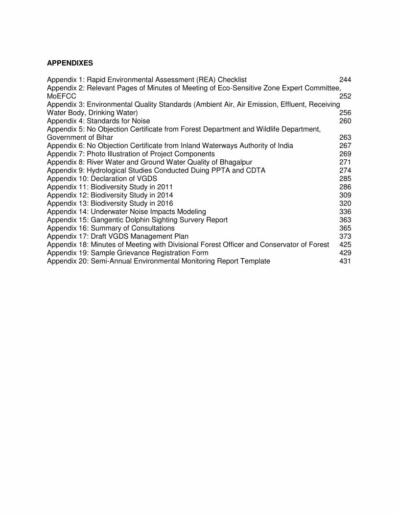
APPENDIXES Appendix 1: Rapid Environmental Assessment (REA) Checklist 244 Appendix 2: Relevant Pages of Minutes of Meeting of Eco-Sensitive Zone Expert Committee, MoEFCC 252 Appendix 3: Environmental Quality Standards (Ambient Air, Air Emission, Effluent, Receiving Water Body, Drinking Water) 256 Appendix 4: Standards for Noise 260 Appendix 5: No Objection Certificate from Forest Department and Wildlife Department, Government of Bihar 263 Appendix 6: No Objection Certificate from Inland Waterways Authority of India 267 Appendix 7: Photo Illustration of Project Components 269 Appendix 8: River Water and Ground Water Quality of Bhagalpur 271 Appendix 9: Hydrological Studies Conducted Duing PPTA and CDTA 274 Appendix 10: Declaration of VGDS 285 Appendix 11: Biodiversity Study in 2011 286 Appendix 12: Biodiversity Study in 2014 309 Appendix 13: Biodiversity Study in 2016 320 Appendix 14: Underwater Noise Impacts Modeling 336 Appendix 15: Gangentic Dolphin Sighting Survery Report 363 Appendix 16: Summary of Consultations 365 Appendix 17: Draft VGDS Management Plan 373 Appendix 18: Minutes of Meeting with Divisional Forest Officer and Conservator of Forest 425 Appendix 19: Sample Grievance Registration Form 429 Appendix 20: Semi-Annual Environmental Monitoring Report Template 431
EXECUTIVE SUMMARY 1. On 1 March 2012 the Asian Development Bank (ADB) approved the multitranche financing facility (MFF) for the Bihar Urban Development Investment Program (BUDIP), or the Investment Program, for an aggregate amount not exceeding $200 million. The BUDIP supports the Government of India’s strategy to provide sustainable urban infrastructure and services leading to better quality of life for people in two cities in Bihar, Bhagalpur and Gaya. BUDIP will improve and expand the water and sewerage infrastructure in the two cities, and help its urban local bodies, infrastructure owners, to ensure discipline and structures for operations that result in sustainable operation and maintenance. 2. One tranche has been approved to date under BUDIP the $65 million (Project 1) that was approved on 13 April 2012 and became effective on 6 June 2013. There is only one civil works contract - the Bhagalpur Water Supply Project Phase 1 (BWSP1) design-build-operate contract, which was awarded on 11 July 2014 and is currently ongoing. Project 2 will include physical investments in water supply improvement in Bhagalpur and Gaya, and non-physical investments to continue supporting project implementation and reforms in these two cities. 3. Proposed project. Bhagalpur Water Supply Project Phase 2 (BWSP2) under Project 2 will include development of a bulk water supply system in Bhagalpur town. It will include construction of (i) water intake to abstract water from Ganges River at the rate of 135 – 140 MLD, (ii) water treatment plant (WTP) with capacity of 90 MLD, and (iii) transmission mains. BWSP2 is needed because the present water supply system is inadequate for the needs of the growing population. The population of Bhagalpur town as per 2011 census is 400,146. The population of the town has been projected for the design year 2047 as 766,000 and water demand as 130 MLD. The capacity of water production from existing three WTPs even after all rehabilitation works proposed under Phase 1 and all tube wells will not be more than 28.3 MLD. Accordingly, it is essential to go for augmentation of water production to provide for water demand for design year 2047. Phase 2, therefore provides for producing balance demand of water. 4. The subproject sites are in the built-up area of Bhagalpur city and are generally flat. While the Bihar region is classified as prone to earthquakes, cyclones and floods, historically the only recorded incidents in Bhagalpur are some water logging and flash flooding in the Barari water works (risks and hazards addressed in the rehabilitation of Barari WTP under Phase 1). Trees, vegetation (mostly shrubs and grasses), and animals in the subproject area are those commonly found in urban areas. The subproject sites are not located in agricultural lands. The subproject sites are not located in or near any historically, culturally, archaeologically or architecturally significant or tourist areas. There are no wetlands, mangroves, or estuaries in or within the subproject sites. However, Bhagalpur city is in the middle of the 50-km Vikramshila Gangetic Dolphin Sanctuary (VGDS), designated in 1991 as a protected area for Gangetic dolphins which makes the location of the intakes as the most-environmentally sensitive component of BUDIP Project 2. The implementing agency conducted analysis of alternatives for the design and location of the intakes to avoid potential impacts to the biodiversity recorded in the area. The design considered for the water intakes will involve construction of a jack well on the land/river bank and assessed to cause the least impact and will be in an already developed area. No construction activity is proposed in the river course however as the Ganges River has high siltation and turbidity, periodic dredging during operation phase will be undertaken to maintain the depth and ensure water flow from the river to the jack well. Physical disturbance will be limited to an area of 1,040 sq m (40 meters from the bank) which is equivalent to 0.0014% of VGDS and maximum of 10 days intermittently in a year.
5. Biodiversity studies. Three biodiversity studies were undertaken in 2011, 2014, and 2016 experts from Bhagalpur University as part of biodiversity assessment for proposed designs during analysis of designs. The 2016 Biodiversity Study considered the current design and included (i) baseline data of river biodiversity in the direct impact area of 2,000 sq m (termed as “active area” during construction and operation) and 500 m radial buffer zone area around the active area; and (ii) assessment of impacts of dredging operations and dredging noise on river biodiversity found in the study area. The findings of the study are as follows:
(i) collisions between dolphins and dredge vessels are possible, but unlikely, given the slow speed of dredgers and avoidance behavior of dolphins
(ii) the dolphins are likely to avoid immediate vicinity of dredge vessels such that hearing damage is unlikely to occur
(iii) noise radiating from the dredge vessel is not expected to significantly interfere with the echolocation ability of the dolphins
(iv) the risk of significantly impacting on the dolphin's communication and echolocations is low
(v) significant and sustained avoidance behavior is predicted to occur up to 60 m from the dredger producing noise
(vi) there are available and easily accessible alternate habitats for dolphin biological important behaviors thus impact on breeding, feeding and resting is identified as low
(vii) impacts of dredging activities on phytoplankton, zooplankton, other associated fauna and riparian vegetation are identified as temporary, short-term and insignificant
(viii) management and mitigation measures have been identified to minimize risks of dredger noise
(ix) World Wide Fund India's River Species Expert consulted during study supports the project and proposed mitigation measures
(x) IUCN Country representative consulted during the study finds the report adequate, recommended items to be further assessed and provided mitigation measures to minimize impacts
6. Categorization – Category B. ADB confirmed the proposed project’s environmental categorization on 22 February 2017. BWSP2 will be implemented using a design, build operate (DBO) contract. The locations of the components and the technologies for the water intakes have been fixed. Thus, this Initial Environmental Examination (IEE) has been prepared to meet ADB Safeguard Policy Statement (SPS), 2009 requirements for Category B projects. 7. This IEE was prepared based on preliminary designs therefore, is required to be updated during the detailed design stage, to reflect any changes, or amendments to the subproject. This IEE primarily: (i) provides information on the project and its environmental requirements; (ii) provides the necessary baseline conditions of the physical, ecological, physical cultural and socio-economic environments and/or resources in and surrounding the project’s area of influence; (ii) identifies and assesses potential impacts arising from the implementation of the project on these environments and/or resources; (iii) recommends measures to avoid, mitigate, and compensate for the adverse impacts; (iv) presents information on stakeholder consultations and participation during project preparation (v) recommends a mechanism to address grievances on the environmental performance of the project; and (vi) provides an environmental management plan (EMP) which includes an environmental monitoring program, and the responsible entities for mitigation and monitoring. The IEE will guide the environmentally sound detail design, construction and operation and maintenance
(O&M) of the subproject. It will ensure efficient lines of communication among the Project Management Unit (PMU), Project Implementation Unit (PIU) in Bhagalpur, consultant teams, and contractors. The IEE will be made binding on all BWSP2 contractors and a copy is required to be kept on site always. 8. Potential impacts. Results of the IEE show any impacts due to construction and operation will be site-specific, short in duration, not significant and can be avoided and/or mitigated. During the construction phase, impacts mainly arise from the need to dispose of large quantities of waste soil, dredged silt, dried sludge and import a similar amount of sand to support the pipes in the trenches, and from the disturbance of residents, businesses, traffic by the construction work. These are common impacts of construction in urban areas, and there are well-developed methods for their mitigation. Once the system is operating, the facilities (WTP, intake, jack well, pump houses) will operate with routine maintenance, which should not affect the environment. Leaks in the transmission pipeline will need to be repaired from time to time, but environmental impacts will be much less than those of the construction period as the work will be infrequent, affecting small areas only. 9. In the current subproject, no construction works are planned in the River Ganges. Only dredging of silt from River Ganges for construction of approach channel is required. Short term impact on aquatic biodiversity is expected but not significant and site-specific only. Mitigation measures have been developed for all the identified adverse impacts to bring the impacts to acceptable levels. These were discussed with specialists responsible for the engineering aspects, and as a result, some measures have already been included in the outline designs for the infrastructure. This means that the number of impacts and their significance has already been reduced by amending the design. 10. Environmental management plan. Mitigation measures will be implemented as per EMP and Government of India/ IFC EHS Guidelines (most stringent). Noise level in the intake area will not exceed 55 dB(A) daytime at the nearest receptor and there will be no more than a 3 dB increase over the background noise level. No works will be conducted during night time and periods of dolphins’ biological important behaviors (breeding, feeding and resting). 11. The contractors will be required to submit to Bhagalpur PIU, for review and approval, a site-specific EMP (SEMP) including (i) proposed sites/locations for construction work camps, storage areas, hauling roads, lay down areas, disposal areas for solid and hazardous wastes; (ii) specific mitigation measures following the approved EMP; (iii) monitoring program as per SEMP; and (iv) budget for SEMP implementation. No works can commence prior to approval of SEMP. Non-compliance with, or any deviation from, the conditions set out in this document constitutes a failure in compliance. 12. The environmental monitoring program will include observations on- and off-site, document checks, and interviews with workers and beneficiaries, and any requirements for remedial action will be reported to the PMU through Bhagalpur PIU. There will also be longer-term surveys to monitor the expected improvements in the quality of domestic water and the health of the population. 13. Consultation, disclosure and grievance redress mechanism. The public participation processes undertaken during BWSP2 preparation ensured stakeholders1 are engaged during
1 Various stakeholders at different levels were consulted as follows: (i) Local Level (BMC; fisherfolks); (ii) District
Level; (iii) Institutional Level (Regional Conservator of Forest Bhagalpur; Chief Wildlife Warden of Bihar; Member
the preparation of this IEE through face-to-face discussions on site and large public meeting held in the city. Views expressed were incorporated into the IEE and the planning and development of the subproject. The consultation process will be continued and expanded during project implementation. This IEE, including any revision/ update and environmental monitoring reports will be made available at public locations and will be disclosed to a wider audience via the ADB website. 14. BUDIP Project 2’s Grievance Redressal Mechanism will provide the citizens with a platform for redressal of their grievances and describes the informal and formal channels, time frame and mechanisms for resolving complaints about environmental performance. 15. Monitoring and Reporting. The Design and Supervision Consultants (DSC), Project Implementation Unit (PIU), Project Management Consultants (PMC), and Project Management Unit (PMU) will be responsible for environmental monitoring. PMC has an overall task of monitoring the BWSP1 and BWSP2 contracts. The PMU will appoint/ensure independent Biodiversity monitoring expert/s for supervision, monitoring and compliance of several BWSP2, including that of (i) EMP given the draft IEE Report; (ii) terms and conditions set forth in the NOC given by Chief Wildlife Warden, Govt. of Bihar ; (iii) compliance with ADB SPS, 2009; and (iv) other requirements laid down in the bid documents and with respect to the General and Specific Environmental Conditions given in the DBO contract. The PMC will assist the PMU in supervising the BWSP1 and BWSP2 contracts, including the compliance monitoring of environmental compliance in the field for both these contracts. 16. The PIU with support from the DSC will submit monthly monitoring reports to the PMU. The PMU with assistance from PMC will consolidate the monthly reports and will send semi-annual monitoring reports to ADB. ADB will post the environmental monitoring reports on its website. 17. Cumulative impacts. BWSP2 will benefit the citizens of Bhagalpur as they will be provided with a continuous pressurized supply of safe water. BWSP2 will serve great proportion of the population, including the urban poor and other disadvantaged communities. This will improve the quality of life of people, improving public health and the environment in general. This will reduce the incidence of disease associated with poor quality of water supply and sanitation. This will also lead to economic gains as people will have a reliable and secure water supply available all the time relieving their efforts in coping with intermittent water supply, and the time thus saved would result in an increase in their income and savings in medical care costs. Cumulative impacts from the drawdown of river water is considered insignificant since the withdrawal by the project will only be at 2 m3/s compared to the river flow of 1,002 – 48,000 m3/s. Cumulative impacts on biodiversity is also not expected based on the biodiversity study conducted in 2016 wherein assessment of impacts of dredging operations and dredging noise on river biodiversity found in the study are insignificant. 18. Conclusion. BWSP2 will bring about a net-positive benefit in terms of improved water supply to Bhagalpur city. Environmental impacts are mainly temporary or reversible, phased over a period, localized, and manageable. The project will not have any significant impacts on Ganges river dolphins. The impacts on biodiversity and other protected ecological resources are
Secretary of BSPCB; National Wildlife Board MoEFCC; Associate Director of River Basins and Biodiversity, WWF India Office; Country Representative of IUCN India Chapter); and (iv) State Level (Principal Secretary of PHED; Principal Secretary Environment; Chief Wildlife Warden; SPCB; BRJP; MD and Chief Engineer, Chief General Manager BSNL, etc.).

insignificant. However, monitoring measures have been recommended to ensure that any unforeseen impacts on Ganges river dolphins can be identified and mitigated during the project implementation phase. 19. Based on the above, this draft IEE report concludes that, all mitigation measures for potential impacts identified in this report are implemented as per EMP, no significant unacceptable changes in the baseline environmental conditions of the project area will occur. All the impacts after mitigation are insignificant, reversible and of short-term duration.

1
I. INTRODUCTION
A. Background
1. On 1 March 2012, the Asian Development Bank (ADB) approved the multitranche financing facility (MFF) for the Bihar Urban Development Investment Program (BUDIP), or the Investment Program, for an aggregate amount not exceeding $200 million. The BUDIP supports the Government of India’s strategy to provide sustainable urban infrastructure and services leading to better quality of life for people in two four cities in Bihar, Bhagalpur and Gaya. BUDIP will improve and expand the water and sewerage infrastructure in the two four cities, and help its urban local bodies, infrastructure owners, to ensure discipline and structures for operations that result in sustainable O&M. 2. One tranche has been approved to date under BUDIP – the $65 million (Project 1) that was approved on 13 April 2012 and became effective on 6 June 2013. There is only one civil works contract, the Bhagalpur Water Supply Project Phase 1 (BWSP1) design build operate contract, which was awarded on 11 July 2014 and is currently ongoing. Project 2 will include physical investments in water supply improvement in Bhagalpur and Gaya, and non-physical investments to continue supporting project implementation and reforms in these two cities. 3. Proposed project. Bhagalpur Water Supply Project Phase 2 (BWSP2) under Project 2 will include development of a bulk water supply system in Bhagalpur town. BWSP2 will be carried out on a DBO basis. The preliminary design, as specified in BWSP2 detailed project report, is the conceptual design of the project worked out to certain detail to verify their technical feasibility (i.e. whether an experienced contractor would be able to construct it), and estimate the costs. The BWSP2 contractor will prepare the detailed design in such manner that it meets the functional and structural criteria. 4. BWSP2 will include (i) construction of new twin D type intake; (ii) construction of one Jack well and pump house; (iii) installation of 6 raw water pumps and 13 clear water pumps; (iv) construction of 2.55 km of raw water transmission mains and 28.7 km clear water transmission mains; (v) construction of a water treatment plant of around 90 MLD capacity; (vi) construction of clear water reservoir of around 9.1 ML; and (vii) installation of SCADA system. B. Project Proponents
5. The executing agency is the state government of Bihar, acting through Urban Development and Housing Department. The implementing agency is the Bihar Urban Infrastructure Development Corporation (BUIDCo).
Executing Agency : Urban Development and Housing Department,
Government of Bihar Address : Vikas Bhawan, Bailey Road, Patna-800 001: Contact Person : Principal Secretary Urban Development Contact Numbers : +9161222217992 Email Address/es : [email protected] Implementing Agency: Bihar Urban Infrastructure Development Corporation Ltd. Address : Khadya Bhawan, 2nd Floor, Daroga Rai Path,
Patna-800 001 Contact Person : Managing Director Contact Numbers : +916122506208
2
Email Address/es : [email protected]
C. Purpose of this Report
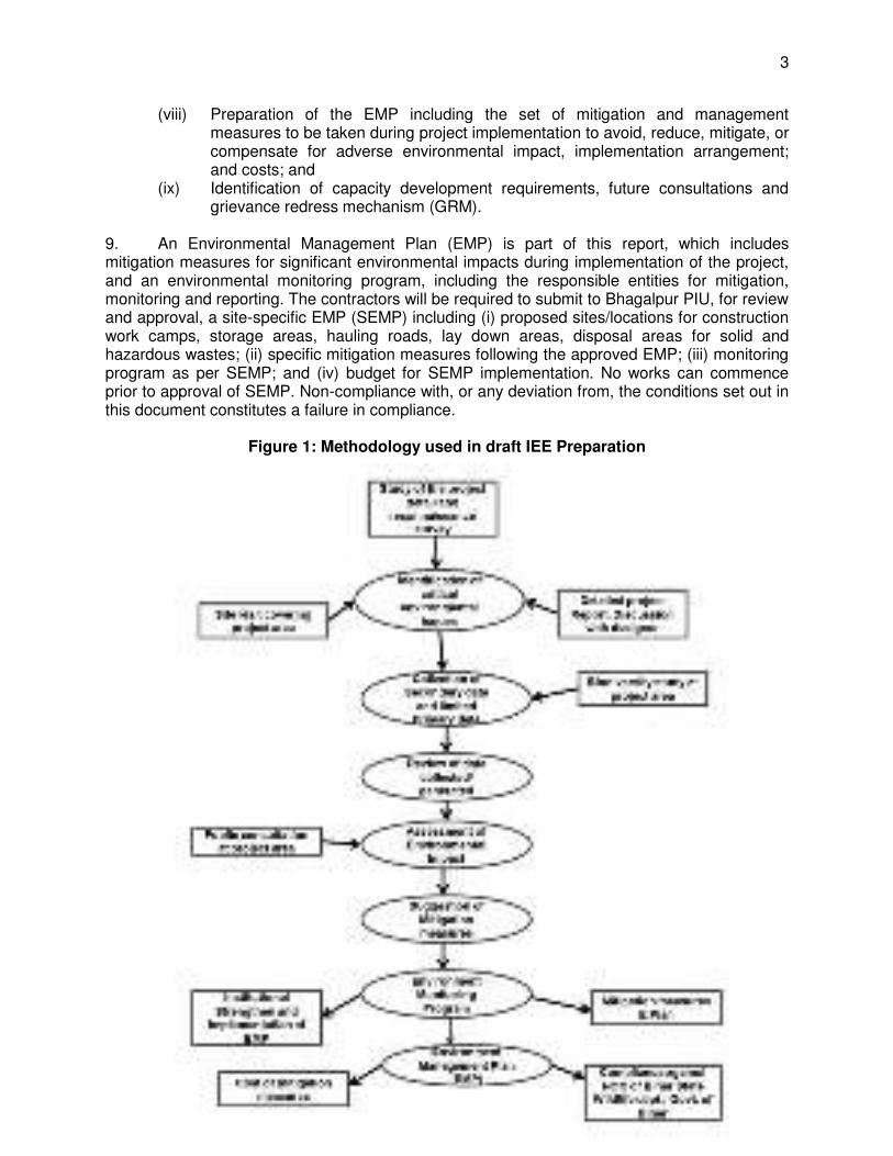
6. Categorization – Category B. ADB confirmed the proposed project’s environmental categorization on 22 February 2017 (REA checklist - Appendix 1). Although BWSP2 will be implemented using a design, build and operate (DBO) contract, the locations of the components and the technologies for the water intakes have been fixed. Thus, this Initial Environmental Examination (IEE) has been prepared to meet ADB Safeguard Policy Statement (SPS), 2009 requirements for Category B projects. 7. This IEE was prepared based on preliminary designs therefore, is required to be updated during the detailed design stage, to reflect any changes, or amendments to the subproject. This IEE primarily: (i) provides information on the project and its environmental requirements; (ii) provides the necessary baseline conditions of the physical, ecological, physical cultural and socio-economic environments and/or resources in and surrounding the project’s area of influence; (ii) identifies and assesses potential impacts arising from the implementation of the project on these environments and/or resources; (iii) recommends measures to avoid, mitigate, and compensate for the adverse impacts; (iv) presents information on stakeholder consultations and participation during project preparation (v) recommends a mechanism to address grievances on the environmental performance of the project; and (vi) provides an environmental management plan (EMP) which includes an environmental monitoring program, and the responsible entities for mitigation and monitoring. The IEE will guide the environmentally sound detail design, construction and operation and maintenance (O&M) of the subproject. It will ensure efficient lines of communication between the Project Management Unit (PMU), Project Implementation Unit (PIU) in Bhagalpur, consultant teams, and contractors. The IEE will be made binding on all BWSP2 contractors and a copy is required to be kept on site always. 8. The steps covered in the preparation of this draft IEE are as follows (Figure 1):
(i) Review of documents prepared in the previous PPTA (footnote 1);2 (ii) Reconnaissance surveys of proposed locations of intake wells and water
transmission mains, and WTP;3 (iii) Collection of primary (surface and groundwater quality and biodiversity) and
additional secondary data to augment data collected in BWSP 2 and to update draft IEE report;
(iv) Stakeholder consultations at local, institutional, district, and state level, with various organizations such as World Wide Fund (WWF) and International Union for Conservation of Nature (IUCN), and potentially affected persons in the project locations.
(v) Assessment of potential impacts; (vi) Identification of mitigation and enhancement measures; (vii) Analysis of alternatives to minimize impacts; and
2 Documents include BUDIP’s environmental assessment and review framework, draft initial environmental
examination prepared during PPTA, summary appraisal report for BUDIP1, preliminary design of BWSP2, hydrology reports, study on under water noise impacts on Ganges River dolphins, and biodiversity reports conducted in the project area.
3 The surveys were physical visits and discussion with the operating staff of existing WTP. These surveys and discussions were taken on 05 to 06 January, 2013, 28 to 31 October 2013, 11 to 12 November 2013, and 20 to 21 May 2014.
3
(viii) Preparation of the EMP including the set of mitigation and management measures to be taken during project implementation to avoid, reduce, mitigate, or compensate for adverse environmental impact, implementation arrangement; and costs; and
(ix) Identification of capacity development requirements, future consultations and grievance redress mechanism (GRM).
9. An Environmental Management Plan (EMP) is part of this report, which includes mitigation measures for significant environmental impacts during implementation of the project, and an environmental monitoring program, including the responsible entities for mitigation, monitoring and reporting. The contractors will be required to submit to Bhagalpur PIU, for review and approval, a site-specific EMP (SEMP) including (i) proposed sites/locations for construction work camps, storage areas, hauling roads, lay down areas, disposal areas for solid and hazardous wastes; (ii) specific mitigation measures following the approved EMP; (iii) monitoring program as per SEMP; and (iv) budget for SEMP implementation. No works can commence prior to approval of SEMP. Non-compliance with, or any deviation from, the conditions set out in this document constitutes a failure in compliance.
Figure 1: Methodology used in draft IEE Preparation
4
II. POLICY, LEGAL, AND ADMINISTRATIVE FRAMEWORK
A. ADB Policy
10. ADB requires the consideration of environmental issues in all aspects of ADB’s operations, and the requirements for environmental assessment are described in ADB SPS, 2009. This states that ADB requires environmental assessment of all project loans, program loans, sector loans, sector development program loans, loans involving financial intermediaries, and private sector loans. 11. Screening and categorization. The nature of the environmental assessment required for a project depends on the significance of its environmental impacts, which are related to the type and location of the project; the sensitivity, scale, nature, and magnitude of its potential impacts; and the availability of cost-effective mitigation measures. Projects are screened for their expected environmental impacts, and are assigned to one of the following four categories:
(i) Category A. Projects could have significant adverse environmental impacts. An EIA is required to address significant impacts.
(ii) Category B. Projects could have some adverse environmental impacts, but of lesser degree or significance than those in category A. An IEE is required to determine whether significant environmental impacts warranting an EIA are likely. If an EIA is not needed, the IEE is regarded as the final environmental assessment report.
(iii) Category C. Projects are unlikely to have adverse environmental impacts. No EIA or IEE is required, although environmental implications are reviewed.
(iv) Category FI. Projects involve a credit line through a financial intermediary or an equity investment in a financial intermediary. The financial intermediary must apply an environmental management system, unless all projects will result in insignificant impacts.
12. Environmental management plan (EMP). An EMP, which addresses the potential impacts and risks identified by the environmental assessment, shall be prepared. The level of detail and complexity of the EMP and the priority of the identified measures and actions will be commensurate with the project’s impact and risks. 13. Public disclosure. ADB will post the following safeguard documents on its website as well as disclose relevant information in accessible manner in local communities:
(i) for environmental category A projects, draft EIA report at least 120 days before Board consideration;
(ii) final or updated EIA and/or IEE upon receipt; and (iii) environmental monitoring reports submitted by the project management unit
(PMU) during project implementation upon receipt.
14. Pollution Prevention and Control Technologies. During the design, construction, and operation of the project the PMU and PIUs will apply pollution prevention and control technologies and practices consistent with international good practice, as reflected in internationally recognized standards such as the World Bank Group’s Environment, Health and Safety Guidelines.4 These standards contain performance levels and measures that are 4 The EHS Guidelines (www.ifc.org/guidelines) are technical reference documents with general and industry-specific
examples of Good International Industry Practice (GIIP). The EHS Guidelines contain the performance levels and measures that are normally acceptable to IFC, and that are generally considered to be achievable in new facilities at reasonable costs by existing technology.
5
normally acceptable and applicable to projects. When Government of India regulations differ from these levels and measures, the PMU and PIUs will achieve whichever is more stringent. If less stringent levels or measures are appropriate in view of specific project circumstances, the PMU and PIUs will provide full and detailed justification for any proposed alternatives that are consistent with the requirements presented in ADB SPS. B. National Laws
15. Implementation of BWSP2 will be governed by Government of India’s environmental acts, rules, and policies. These regulations impose restrictions on activities to minimize/mitigate likely impacts on the environment. It is the responsibility of the project executing and implementing agencies to ensure BWSP2 is consistent with the legal framework, whether national, state or municipal/local. Compliance is required in all stages of project implementation including design, construction, and O&M. 16. Legal framework for Environmental Impact Assessment. The Government of India EIA Notification of 2006 sets out the requirement for environmental assessment in India. Schedule 15 of the notification provides a list of activities/projects that require environmental clearance before any construction work or land preparation (except land acquisition). Activities/projects are categorized as A or B depending on the scale of the proposed activity/project and nature of its impacts:
(i) Category A project requires environmental clearance from Ministry of Environment, Forests and Climate Change (MoEFCC). The proponent is required to provide preliminary details of the project in the form of a notification, after which MoEFCC expert appraisal committee (EAC) prepares a comprehensive terms of reference for the EIA study to be completed within 60 days. The EAC reviews the EIA and provides recommendations which are the basis of MoEFCC for issuance of the environmental clearance.
(ii) Category B projects require environmental clearance from the State Environment Impact Assessment Authority (SEIAA). The state-level EAC further classify Category B projects as B1 (requiring EIA study) or B2 (no EIA study). The state-level EAC reviews the required study and provides recommendations which are the basis of the SEIAA in the issuance of the environmental clearance. Any Category B activity/project will be treated as category A if it is located in whole or in part within 10 km from the boundary of protected areas, notified areas or inter-state or international boundaries.
17. The proposed BWSP 2 is not included in Schedule 1 of EIA Notification of 2006 therefore an environmental clearance from MoEFCC/SEIAA is not required. 18. Applicable Environmental Legislations. The following legislations are applicable to BWSP2:
(i) Environmental (Protection) Act of 1986, its rules and amendments; (ii) Central Pollution Control Board (CPCB) environmental standards; (iii) Wild Life Protection Act 1972, its rules and amendments; (iv) Water (Prevention and Control of Pollution) Act of 1974, its rules, and
amendments; (v) Air (Prevention and Control of Pollution) Act of 1981, its rules and amendments;
5 EIA Notification Schedule of Projects Requiring Prior Environmental Clearance available at
http://envfor.nic.in/legis/eia/so1533.pdf
6
(vi) Hazardous Wastes (Management, Handling and Trans-boundary Movement) Rules 2008
(vii) Noise Pollution (Regulation and Control) Rules of 2000 as amended up to 2011. (viii) Indian Standard Drinking Water – Specification, IS 10500, 1991: Bureau of Indian
Standards as per revised second revision 2004 and draft revision of 2009 (ix) Manufacture, storage and import of hazardous chemical Rules, 1989 (x) Ancient Monuments and Archaeological Sites and Remains Rules of 1959; and (xi) The Child Labor (Prohibition and Regulation) Act, 1986
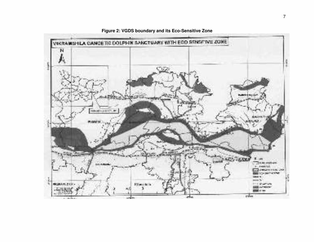
19. VGDS and its Eco-Sensitive Zone. Ganga River on either side of the Bhagalpur city is within VGDS. Apart from that, up to 5 km stretch (varies from 100 m to 5,000 m) from the VGDS boundary is declared as ESZ. Figure 2 shows VGDS boundary and its ESZ.
7
Figure 2: VGDS boundary and its Eco-Sensitive Zone
8
20. Draft {S.O. 3030(E) dated 9 November 2015 from MoEFCC} and notification of Eco- Sensitive Zone of VGDS. Under draft notification, it is mentioned under the regulated activities that “the extraction of surface water and ground water shall be allowed only for bona fide agricultural use and domestic consumption of the occupier of the land.” It is also mentioned in the draft notification “no new construction of any kind shall be allowed within one kilometer from the boundary of the Protected Area:”1 Till date final notification has not been published but the Government of Bihar Environment and Forest Department informed the Government of Bihar that the following recommendation has been made to include the following statement in the final notification:
(i) the extraction of surface water and ground water shall be allowed only for bona fide agricultural use and domestic consumption of the occupier of the land and public sector domestic water supply projects in Bhagalpur and other urban areas in an adjoining the Eco – Sensitive Zone; and (ii) constructions and installations related to public sector domestic water supply projects for Bhagalpur and other urban areas in and adjoining the Eco-Sensitive Zone shall be permitted.
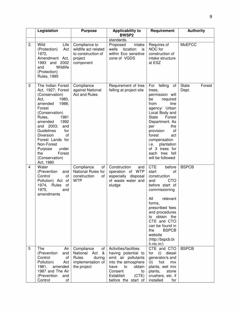
21. 18th Expert Committee for “declaration of ESZ around wildlife sanctuaries/ National Parks” under Ministry of Environment, Forest & Climate change (MoEFCC) recommended for reduction of ESZ of VGDS to 50 m at Barari ghat area and instructed for final notification. Relevant part of the Expert Committee meeting (May, 2016) is attached as Appendix 2. Accordingly, only the intake will be located within the ESZ but outside the boundary of VGDS. All other components of the project will be located outside the boundaries of ESZ and VGDS. Once the notification is issued, BWSP2 will require a no objection certificate (NOC) for intake structure at the bank of river Ganges. 22. The summary of applicable regulations and mandatory requirements for BWSP2 is shown in Table 1.
Table 1: Applicable Environmental Acts and Rules
Legislation Purpose Applicability to BWSP2
Requirement Authority
1. Environment (Protection) Act, 1986 and CPCB Environmental Standards.
Compliance of National Act
Appendix 3 provides applicable standards for ambient air, air emission, effluents, receiving water bodies, and drinking water at the consumer end. Contractor will be required to ensure all emissions and discharges during civil works conform to all applicable
Emissions, discharges, and noise levels shall comply with the notified standards.
CPCB thru the Bihar State Pollution Control Board (BSPCB)
1 Conditions in the Draft S.O. 3030(E) dated 9 November 2015 have been included in the No Objection Certificate
issued on 6 March 2017.
9
Legislation Purpose Applicability to BWSP2
Requirement Authority
standards. 2. Wild Life
(Protection) Act 1972, Amendment Act, 1993 and 2002 and Wildlife (Protection) Rules, 1995
Compliance to wildlife act related to construction of project component
Proposed intake wells location is within Eco sensitive zone of VGDS
Requires of NOC for construction of intake structure at ESZ
MoEFCC
3 The Indian Forest Act, 1927; Forest (Conservation) Act, 1980, amended 1988; Forest (Conservation) Rules, 1981 amended 1992 and 2003; and Guidelines for Diversion of Forest Lands for Non-Forest Purpose under the Forest (Conservation) Act, 1980
Compliance against National Act and Rules
Requirement of tree felling at project site
For felling of trees, permission will be required from line agency/ Urban Local Body and State Forest Department. As per the provision of forest act compensation i.e. plantation of 3 trees for each tree fell will be followed
State Forest Dept.
4 Water (Prevention and Control of Pollution) Act of 1974, Rules of 1975, and amendments
Compliance of National Rules for construction of WTP
Construction and operation of WTP especially disposal of waste water and sludge
CTE before start of construction and CTO before start of commissioning All relevant forms, prescribed fees and procedures to obtain the CTE and CTO can be found in the BSPCB website (http://bspcb.bih.nic.in/)
BSPCB
5 The Air (Prevention and Control of Pollution) Act 1981, amended 1987 and The Air (Prevention and Control of
Compliance of National Act & Rules during implementation of the project
Activities/facilities having potential to emit air pollutants into the atmosphere have to obtain Consent to Establish (CTE) before the start of
CTE and CTO for (i) diesel generator/s and (ii) hot mix plants, wet mix plants, stone crushers, etc. if installed for
BSPCB
10
Legislation Purpose Applicability to BWSP2
Requirement Authority
Pollution) Rules, 1982
implementation and consent to operate (CTO) before commissioning. The occupier of the project/facility has the responsibility to adopt necessary air pollution control measures for abating air pollution.
construction. Pollution under control certificate (PUC) by the contractor for all vehicles and equipment potential to emit air pollutants All relevant forms, prescribed fees and procedures to obtain the CTE and CTO can be found in the BSPCB website (http://bspcb.bih.nic.in/)
6. Hazardous and Other Wastes (Management and Transboundary Movement) Rules, 2016
Compliance against National rule during implementation of the project
Hazardous wastes are wastes having constituents specified in Schedule II of the Rules and if their concentration is equal to or more than the limit indicated in the said schedule
If during excavation works, the excavated material is analyzed to be hazardous, contractors will be required to store and dispose of only in such facilities as may be authorized by the BSPCB for the purpose
BSPCB
7. The Noise Pollution (regulation and control) rules, 2000, as amended
Compliance against National rule related to noise standard
Appendix 4 provides applicable noise standards Rule 3 of the Act specifies ambient air quality standards in respect of noise for different areas/zones.
Contractor/s required to ensure all noise-producing activities during civil works and O&M conform to applicable standards.
BSPCB
7. Indian Standard (IS) 10500 Drinking Water – Specification,
Compliance against drinking water standard during operation
Provides permissible and desirable limits of various parameters
Treated water quality to be supplied to end users must
BUIDCo
11
Legislation Purpose Applicability to BWSP2
Requirement Authority
2012 of plant and supply of water
in drinking water to check the effectiveness of water treatment and supply
conform with limits at all times
8. Manufacture, storage and import of hazardous chemical Rules, 1989
Comply to National Rule related to chemical storage
Storage of chlorine (threshold quantity greater than 10 tons but less than 25 tons) in WTP will require clearance
Contractor/s required to (i) identify major accident hazards and steps for prevention; (ii) obtain approval of the sites; (iii) prepare on-site emergency plan; (iv) provide information to persons potential to be affected
BSPCB
10.
Ancient Monuments and Archaeological Sites and Remains Rules, 1959. Bihar Ancient Monuments and Archaeological Sites, remains And Art Treasures Act, 1976.
Compliance of National and state rules related to protection of archeological sites
No development or activity (including mining operations and construction) is permitted in “protected area” and all development/ activities likely to damage the protected property are not permitted in the “controlled area” without prior permission of the Archaeological Survey of India (ASI). Protected property includes the site, remains, and monuments protected by ASI or the State Department of Archaeology.
There are no protected properties in Bhagalpur. However, in case of chance finds, contractors will be required to follow a protocol as defined in the EMP.
ASI or the State Department of Archaeology.
11.
The Child Labour (Prohibition and Regulation) Act, 1986
Comply with National act related to engagement of child labor
No child below 14 years of age will be employed or permitted to work in any of the occupations set forth in the Act’s
No children between the age of 14 to 18 years shall be engaged in the project
BUIDCo
12
Legislation Purpose Applicability to BWSP2
Requirement Authority
Part A of the Schedule or in any workshop wherein any of the processes set forth in Part B of the Schedule.
23. Status of Compliance. The National Board for Wildlife in the MoEFCC issued the NOC for diverting water for BWSP2 on 4 December 2013 and the Supreme Court of India granted permission of the project in early 2014. These statutory clearances were based on the design considering the intake location in the river. As part of the MoEFCC NOC, several conditions were considered in finalizing the design of the intake, including (but not limited to) the need to mitigate vibration and noise, sensitizing fishers, and the need for a long-term monitoring program. The design engineers considered a new design to avoid vibration and noise impacts to Gangetic dolphins and changed the location of intake from river (within core VGDS area) to the bank of the river. However, with the new design periodic river dredging will be required to bring water to intake. The NOC for dredging activities was issued by the Principal Chief Conservator of Forest (Wildlife)/Chief Wildlife Warden of the Bihar of State Wildlife Board on 6 March 2017 (Appendix 5). 24. Table 2 provides information on how the implementing agency plans to comply with the NOC. Table 2: Compliance of the condition of NOC from Wildlife Department Compliance
of BWSP2 to MoEFCC NOC Conditions (ref. 6th March 2017 NOC from Chief Wildlife Warden, Bihar)
S.No Issues discussed (ref. NOC) Compliance 1 Custody of the portion of the river course to
be used for the project: The Forest & Environment Department, GoB shall retain the custody in the nature of the sanctuary of the portion of river course in the VGDS to be used for this project viz.access channel and dredging operation for that purpose etc
It was decided an Undertaking would be given by Project Implementation/ User Agency.
2 (II) The project proponent/User agency shall not construct or install any other permanent structure in the sanctuary area and shall not change/obstruct or cause to change the course of flow of the Ganges
It was decided an Undertaking will be given by Project proponent/User agency “as suggested” in NOC.
3 (III) Regulation and monitoring of project execution and operation:
a) The work plan and time schedule of the initial dredging operations will be intimated in advance to the Divisional Forest Officer (DFO), Bhagalpur who is the Wild Life Warden and subsequent dredging operations will also be periodically informed in advance to Divisional Forest Officer, Bhagalpur .The Divisional Forest Officer Bhagalpur will arrange for
As agreed work plan and time schedule of the initial dredging operations will be intimated in advance to the DFO and subsequent dredging operations will also be periodically informed in advance to DFO Bhagalpur for their necessary observation.
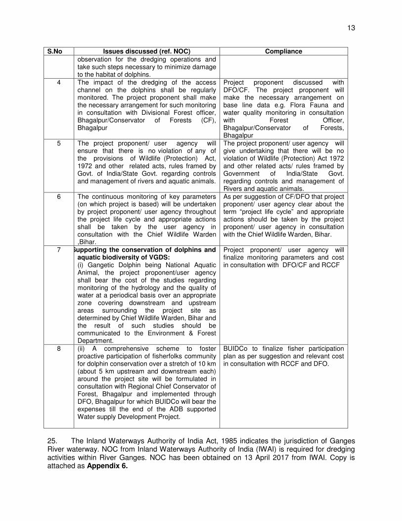
13
S.No Issues discussed (ref. NOC) Compliance observation for the dredging operations and take such steps necessary to minimize damage to the habitat of dolphins.
4 b) The impact of the dredging of the access channel on the dolphins shall be regularly monitored. The project proponent shall make the necessary arrangement for such monitoring in consultation with Divisional Forest officer, Bhagalpur/Conservator of Forests (CF), Bhagalpur
Project proponent discussed with DFO/CF. The project proponent will make the necessary arrangement on base line data e.g. Flora Fauna and water quality monitoring in consultation with Forest Officer, Bhagalpur/Conservator of Forests, Bhagalpur
5 c) The project proponent/ user agency will ensure that there is no violation of any of the provisions of Wildlife (Protection) Act, 1972 and other related acts, rules framed by Govt. of India/State Govt. regarding controls and management of rivers and aquatic animals.
The project proponent/ user agency will give undertaking that there will be no violation of Wildlife (Protection) Act 1972 and other related acts/ rules framed by Government of India/State Govt. regarding controls and management of Rivers and aquatic animals.
6 d) The continuous monitoring of key parameters (on which project is based) will be undertaken by project proponent/ user agency throughout the project life cycle and appropriate actions shall be taken by the user agency in consultation with the Chief Wildlife Warden ,Bihar.
As per suggestion of CF/DFO that project proponent/ user agency clear about the term “project life cycle” and appropriate actions should be taken by the project proponent/ user agency in consultation with the Chief Wildlife Warden, Bihar.
7 Supporting the conservation of dolphins and aquatic biodiversity of VGDS: (i) Gangetic Dolphin being National Aquatic Animal, the project proponent/user agency shall bear the cost of the studies regarding monitoring of the hydrology and the quality of water at a periodical basis over an appropriate zone covering downstream and upstream areas surrounding the project site as determined by Chief Wildlife Warden, Bihar and the result of such studies should be communicated to the Environment & Forest Department.
Project proponent/ user agency will finalize monitoring parameters and cost in consultation with DFO/CF and RCCF
8 (ii) A comprehensive scheme to foster proactive participation of fisherfolks community for dolphin conservation over a stretch of 10 km (about 5 km upstream and downstream each) around the project site will be formulated in consultation with Regional Chief Conservator of Forest, Bhagalpur and implemented through DFO, Bhagalpur for which BUIDCo will bear the expenses till the end of the ADB supported Water supply Development Project.
BUIDCo to finalize fisher participation plan as per suggestion and relevant cost in consultation with RCCF and DFO.
25. The Inland Waterways Authority of India Act, 1985 indicates the jurisdiction of Ganges River waterway. NOC from Inland Waterways Authority of India (IWAI) is required for dredging activities within River Ganges. NOC has been obtained on 13 April 2017 from IWAI. Copy is attached as Appendix 6.
14
C. International Treaties and Relevance to the Project
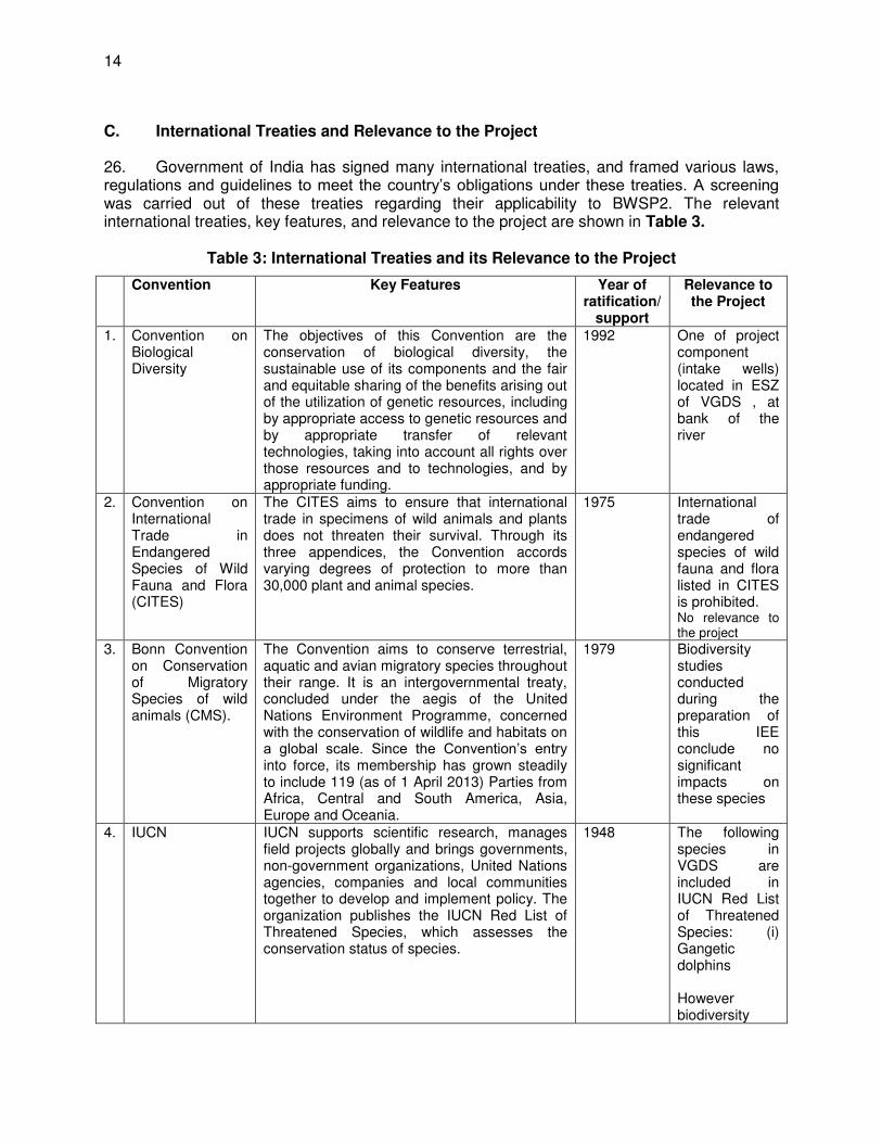
26. Government of India has signed many international treaties, and framed various laws, regulations and guidelines to meet the country’s obligations under these treaties. A screening was carried out of these treaties regarding their applicability to BWSP2. The relevant international treaties, key features, and relevance to the project are shown in Table 3.
Table 3: International Treaties and its Relevance to the Project
Convention Key Features Year of ratification/
support
Relevance to the Project
1. Convention on Biological Diversity
The objectives of this Convention are the conservation of biological diversity, the sustainable use of its components and the fair and equitable sharing of the benefits arising out of the utilization of genetic resources, including by appropriate access to genetic resources and by appropriate transfer of relevant technologies, taking into account all rights over those resources and to technologies, and by appropriate funding.
1992 One of project component (intake wells) located in ESZ of VGDS , at bank of the river
2. Convention on International Trade in Endangered Species of Wild Fauna and Flora (CITES)
The CITES aims to ensure that international trade in specimens of wild animals and plants does not threaten their survival. Through its three appendices, the Convention accords varying degrees of protection to more than 30,000 plant and animal species.
1975 International trade of endangered species of wild fauna and flora listed in CITES is prohibited. No relevance to the project
3. Bonn Convention on Conservation of Migratory Species of wild animals (CMS).
The Convention aims to conserve terrestrial, aquatic and avian migratory species throughout their range. It is an intergovernmental treaty, concluded under the aegis of the United Nations Environment Programme, concerned with the conservation of wildlife and habitats on a global scale. Since the Convention’s entry into force, its membership has grown steadily to include 119 (as of 1 April 2013) Parties from Africa, Central and South America, Asia, Europe and Oceania.
1979 Biodiversity studies conducted during the preparation of this IEE conclude no significant impacts on these species
4. IUCN IUCN supports scientific research, manages field projects globally and brings governments, non-government organizations, United Nations agencies, companies and local communities together to develop and implement policy. The organization publishes the IUCN Red List of Threatened Species, which assesses the conservation status of species.
1948 The following species in VGDS are included in IUCN Red List of Threatened Species: (i) Gangetic dolphins However biodiversity
15
Convention Key Features Year of ratification/
support
Relevance to the Project
studies conducted during the preparation of this IEE conclude no significant impacts on these species
III. DESCRIPTION OF THE PROJECT
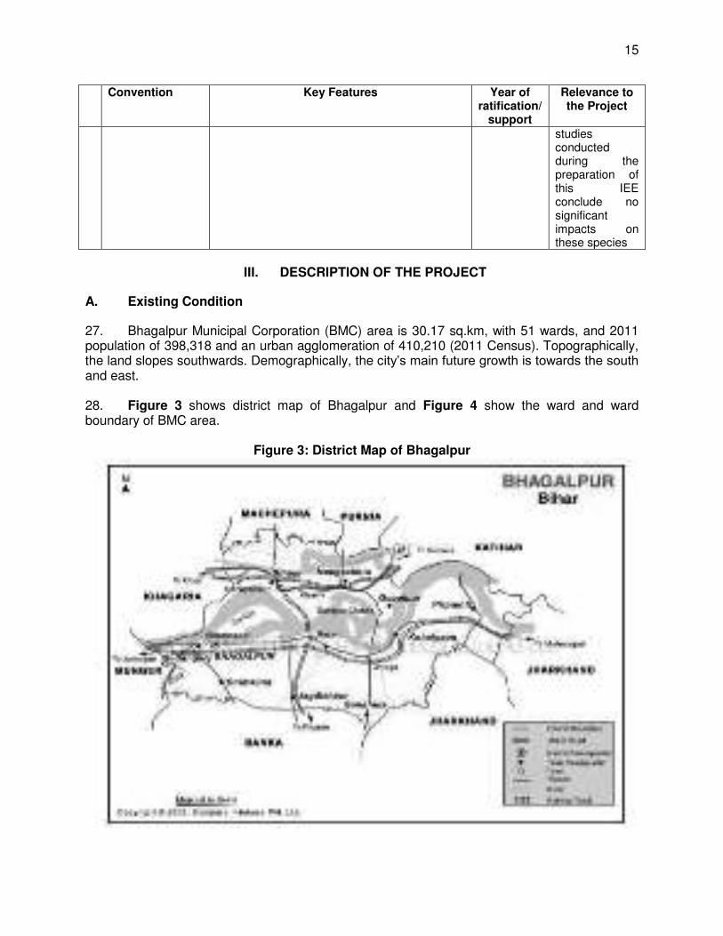
A. Existing Condition
27. Bhagalpur Municipal Corporation (BMC) area is 30.17 sq.km, with 51 wards, and 2011 population of 398,318 and an urban agglomeration of 410,210 (2011 Census). Topographically, the land slopes southwards. Demographically, the city’s main future growth is towards the south and east. 28. Figure 3 shows district map of Bhagalpur and Figure 4 show the ward and ward boundary of BMC area.
Figure 3: District Map of Bhagalpur
16
Figure 4: Ward and Ward Boundary of Bhagalpur
29. The existing water supply system in city consists of the Barari Water Treatment Works on the River Ganga, 61 tube wells, and transmission and distribution networks covering different parts of the city. 30. While BMC report that 81% of households are connected, the 2001 Census data documents indicated that 77% of households rely on hand pumps or tube wells and 22% have a tap connection. Others depend on open wells and other sources. The ADB-supported capacity development technical assistance (CDTA)2 analysis for 2010 is that 54% of the population is connected, per capita supply is 34 lpcd, and physical losses are at least 26%. 31. The water treatment plant is on the southern bank of the River Ganga flowing on the northern fringe of the town. The first water works at Barari was originally commissioned in 1885 with a slow sand filter of 0.5 mgd (2.27 MLD) capacity. This had been augmented over the years with additional capacities added periodically with 0.6 mgd mechanical filter, 1.2 mgd Peterson filter, and 2.0 mgd Jewel filter. The total installed capacity in the works is 3.8 mgd (17.27 MLD). The actual treatment capacity goes down to even 2 mgd (9 MLD) during summer months as the river recedes from the current location of existing intake wells. Location of existing intakes and WTP is shown in Figure 5.
2 ADB TA 7884: Advanced Project Preparedness for Poverty Reduction - Capacity Building for Bihar Urban
Infrastructure Development Project (Subproject 16)
17
Figure 5: Location of the existing intake, WTP and the Ganges River
1. Intakes. 32. The existing raw water intakes (two jack well-type) are located at the Barari water treatment works on a subsidiary channel of the Ganga River which remains dry for a considerable part of the year. BMC must periodically dredge the channel to bring water to the intakes. River water quality is a cause of concern due to effluent from the Champa nala (also locally known as Jamania Nala) which drains much of the city’s wastewater just upstream of Barari headworks. The turbidity of the surface water also exhibits a considerable variation during the year, and ranges from 500 NTU to 1,000 NTU. 33. The existing location of intakes for Bhagalpur water supply suffers from following deficiencies:
(i) the river flow recedes during summer and gets away from the bank, requiring diversion of water from the river stream through a channel to be dug every summer by dredging; and
(ii) the sewage discharged from Bhagalpur city is through Champa nala just upstream of Intake location in the river causing serious quality issues.
34. Raw water from the Ganges River is directly pumped into a circular inlet chamber by a 350 mm diameter and another 400 mm cast iron (CI) pipes from the intakes. These two lines are reported to be interconnected for flexibility of operation. The old inlet chamber is still being used to feed raw water to two water treatment plants, WTP 1 and WTP 2 (described below). During the non-monsoon period, a 400 mm diameter CI branch line from the raw water main of the one of the intakes directly feeds a third treatment plant, WTP 3. During the monsoon period, settlement is required to reduce turbidity and the water is pumped to WTP 3 from the settlement tanks.
18
2. Water treatment plants 35. WTP 1 was constructed in 1886 and is known as a Patterson Filter. Initially a slow sand filter was used to filter the raw water which was later modified to an alum dosing and clariflocculator system followed by rapid sand filter some 70 to 80 years back. Rated capacity is 5.455 MLD. In the 1930s another 2.728 MLD mechanical filter (WTP 2) was built. The last plant known as a Jewel Filter (or WTP 3) was constructed about 50 years back having capacity 9.092 MLD. Total design capacity is therefore about 17.3 MLD. 36. Sedimentation tanks. There are four sedimentation tanks (or pre-settling tanks) for WTP 1 and WTP 2. From the inlet chamber an open channel conveys water to the first sedimentation tank, supernatant of the first tank being passed to the second tank and so on. These tanks are earthen reservoirs with no bottom lining but with some limited embankment protection. Raw water fed into WTP 3 does not normally undergo any preliminary sedimentation. 37. Inlet and outlet pipelines of these three WTPs are now interconnected. However, the chemical dosage systems (alum for clariflocculation, lime for pH adjustment, and bleaching powder for disinfection) are separate for each WTP. Almost all pipeline works in these WTPs are of CI and more than a hundred years old. 38. Alum and Lime Dosing. Alum and lime dosing in each of these plants is done manually. Alum cakes are kept in the water channel and are gradually dissolved by continuous flow of water. The current method of application is crude and purely based on the experience of the operators. 39. Flocculation and Clarification. WTPs 1 and 2 have rectangular clariflocculator but without any flocculating blades or any scrapper assembly for sludge collection. WTP 3 has a circular clariflocculator with clearly demarcated flocculation and clarification zones. It also has a scrapper assembly which is in working condition. Currently, underflow from all clariflocculators is drained to nearby drainage channels and there is no system of recycling settled sludge water. 40. Filtration. The slow sand filters are now abandoned. WTP 1 was modified with two rectangular rapid sand filters. Two mechanical filters of equal size are also provided in the open air at the downstream side of the clariflocculator in WTP 2. WTP 3 also has two filter beds in the new filter house building. The backwash is normally done once in a day. There are also air compressors for cleaning of beds by air-scouring which is normally done once in a week. 41. Disinfection. Currently disinfection of treated water is done by adding bleaching powder directly into the flowing raw water with alum/lime dosing. 42. Clear water storage. Clear water from both WTP 1 and WTP 2 is stored in an old underground reservoir (Sump 1) constructed in brick masonry with guiding baffle walls to reduce short-circuiting of flow. This reservoir is at a higher elevation and is connected to two other clear water reservoirs (Sump 2 and Sump 3) at lower level adjacent to the old clear water pump house. Total capacity of the underground sumps is 8,200 m3. Out of this, 5,400 m3 is available to store treated water from WTP 1 and 2,700 m3 for treated water from WTP 2. Treated water is pumped to the city by two separate transmission mains, 300 mm and 350 mm diameters, both originating from the old clear water pump house. 43. Treated water from WTP 3 is conveyed by one 400 mm diameter CI line and stored in a separate sump (Sump 4) of capacity 9,100 m3 with adjoining new clear water pump house.
19
Sump 4 is located at a higher elevation and connected by a gravity line of 300 mm diameter (with a sluice valve) to Sump 1 for operational flexibility. All these underground sumps are provided with either access stairs or hatches and air vents. Except Sump 1, none of the sumps are said to have any baffle wall to avoid short circuiting of flow and give the incoming treated water adequate travel time for disinfection following addition of bleaching powder. 44. Tube wells. In addition to the surface water described above, there are 61 tube wells in the city, which are operated primarily by BMC, as well as Bihar Rajya Jal Parshad (BRJP), and one tube well by Public Health and Engineering Department (PHED). The tube wells are fitted with pumps and motors of varying capacity ranging from 7.5 HP to 30 HP. Power supply is intermittent in nature, with 6 to 14 hours average in a day. Total output from the tube wells is estimated at between 10 to 18 MLD depending on availability of electricity. 45. All blocks of the Bhagalpur district come under safe category from ground water development point of view; hence no area is notified either by Central Groundwater Board authority or state ground water development authority till date. 46. Overhead water storage reservoirs. Table 4 shows information on seven existing overhead tanks (OHTs), ranging from 450 to 550 cubic meters capacity, and with staging height ranges from 18 to 22 m. Only four are functional at present (2 made of steel and rest are made of reinforced cement concrete (RCC).
Table 4: Existing OHT Locations and Status
Location of existing Over head Tank Status Capacity 1 Housing Board Discarded - New construction under the project 450 cum 2 Manik Sarkar Dismantled- New construction under the project 450 cum 3 Sikandarpur Dismantled-New construction under the project 550 cum 4 Iskchak No change 450 cum 5 CTS No change 450 cum 6 Ghantaghar No change 450 cum 7 Gosala No change 450 cum
47. Distribution system. The distribution system has a total pipe length of about 55 km out of 328 km of road length, excluding those newly laid by BRJP. The distribution system is of CI pipes, ranging in size from 100 mm to 300 mm diameter. These pipelines were to be replaced under BWSP1. Table 5 provides details of the existing distribution pipe network. Old connections use GI pipe and new connections will use PVC.
Table 5: Existing Distribution Pipe Size and Lengths
Pipe Size Length (km) 100 mm 22.5 150 mm 22.05 200 mm 12.081 250 mm 0.69 Total 57.319 km
20
Figure 6: Existing Water Treatment Plants
B. On-going Works under BWSP1
48. Ongoing BWSP1 contract was awarded in July 2014, which is a design-build operate (DBO) contract for 8 years. The scope of BWSP1 includes:
(i) Laying of a dedicated 33kV feeder line from 132kV GSS at Sabur up to Barari HW to ensure continuous availability of dependable and good quality power supply and removing major constraint in getting designed production of water.
(ii) Refurbishment of the three WTPs at Barari, so that they are able to produce designed quantity of water of acceptable quality. The refurbishment work includes introduction of (i) alum and lime dosing systems with necessary chemical storage and mixing tanks, dosing-pumps, metering device with 100% standby capacity; (ii) flash mixers for coagulant rapid mixing; (iii) chlorination system (vacuum type of gaseous chlorinators) with necessary dosing mechanism, storage and safety equipment in all three existing treatment plants; (iv) electrical actuators for all existing sluice valves in the Jewel Filter unit; (v) servicing of existing machinery and equipment, and (vi) painting of various units.
(iii) Mechanical, Electrical, and Instrumentation works of WTP-(i) Installation of 2 nos. of centrifugal pumps with accessories; (ii) replacement of sluice and non-return valves, pipes and fittings, (iii) air blowers for filters, (iv) electrical works, LT switch gear panels and instrumentation works at pumping station, (v)
21
electro- magnetic flow meter, ultrasonic type level indicator, pressure loggers, and (viii) online residual chlorine monitoring system, and chlorine leak detection system.
(iv) Rehabilitation/Replacement of existing distribution pipelines to reduce leakage losses and pipe breakdowns. Extension of distribution network to uncovered areas to achieve coverage of at least 95% households. The length of new pipes to be laid is estimated at about 460.636 km. The pipe materials will be Ductile Iron.
(v) Construction of new Overhead storage Reservoir (OHSRs to provide required overhead storage for supply of water with a minimum terminal pressure of 12m on 24x7 basis. Nineteen (19) number of water storage reservoirs have been considered.
(vi) Construction of Customer service center. The location of CSC is identified to establish at Barari WTP. In addition, two CSCs, one at Bhagalpur Municipality office, and other at Nath nagar will be rehabilitated. In future CSCs offices will be developed at different parts of the city area.
(vii) Provide metered service connections to all existing and future consumers in conjunction with introduction of volumetric tariff by BMC and provide customer service.
(viii) Operation and Maintenance of existing water supply system including running tube wells and any new assets created under the tranche for a period up to 2021.
(ix) Rehabilitation of four Overhead Water Storage Reservoirs- 4 nos. existing reservoirs will be rehabilitated under the proposed sub project. The locations are at Ghosala, CTS, Ghantaghar and Ishakchak
C. Proposed Project
49. Need. Main focus of the BWSP2 is to provide bulk water to the town of Bhagalpur, i.e., to meet the gap between projected water demand and water availability from existing water sources after interventions proposed in BWSP1. 50. BWSP1 already addresses the issues of physical water losses and unauthorized connections, significant improvements in the service is expected. However, considering the very big gap between the actual demand based on the designed service level of 135 liters per capita per day (lpcd) and the current production levels, even after discounting the physical losses due to leakage, source augmentation needs urgent attention. 51. It is proposed in detailed project report (DPR) of BWSP1 that Patterson WTP at Barari will be taken out of service because their age and physical condition after new WTP is constructed under Project 2. The Jewel WTP is proposed to be used maximum until 2032. The DPR also proposes that no sustainable quantity of water will be available from tube wells and they may have to be closed on commissioning of new WTP under Project 2. Under these circumstances, it is proposed to provide a system under Project 2 to produce 135 MLD treated water for the design year 2047. 52. Groundwater is not considered a sustainable potable source of water; Bhagalpur needs to depend on surface water source. Ganga River is flowing close to the town and is a perennial river with adequate flow during lean season. Ganga is already used as partial source for Bhagalpur water supply. Accordingly, Ganga River has been taken as source of water supply for Bhagalpur on a long-term basis. Hydrological studies conducted during project preparation
22
stage show adequate flow in river 1,002 m3/s in lean season and 48,000 m3/s in monsoon and indicate impacts to water levels are minimal (3.6 mm drop in water level due to withdrawal). 1. Intake and associated facilities 53. Considering the identified issues with the existing intakes, the project preparatory team looked for alternative location for drawing river water. The following criteria for selection of site for intake were adopted: (i) concave side of the river flow having reduced possibility of siltation; (ii) intake location is approximately 3 km away from the discharge point of Champa nala which carries wastewater of Bhagalpur town thus, dilution effect will be more and pollution effect will be less; and (iii) availability of water throughout the year (from local enquiry). However, the locations considered are: (i) located in the VGDS ESZ; and (ii) under the navigation route of Inland Waterway Authority, Government of India. 54. The proposal to construct two caisson type Intake wells (9m diameter) with overhead pump house was proposed at 100 m downstream of Vikramshila Bridge and 100 m from the right bank of river. However, this proposal was rejected by the Inland Waterways Authorities since it falls under their navigation route. The PMU, PIU and the consultant therefore studied in detail further alternatives proposal for locating intake structure to ensure location of the intakes will not impact VGDS and not within the navigation channel of Inland Waterway Authority. Three alternatives were analyzed:
(i) construction of Intake well at a distance away from VGDS and IWAI navigation route;
(ii) improving the existing source to cater the intermediate requirement (iii) alternate method of drawing water i.e. by proposing intake well at banks and
dredging approach channel in the river to bring the water to the intake well.
55. Locating outside VGDS and Inland Waterway Authority Navigation Route. The project preparatory team identified possible intake well locations: (i) outside VGDS at Sultanganj about 25 km upstream of Bhagalpur; and (ii) outside VGDS at Kahalgaon some 25 km downstream of the town. Moving the intake out of the protected area means locating the intake either downstream of Kahalgaon or upstream of Sultanganj (Figure 7). Both the locations are about 25 km distance from the proposed location. The capital cost of laying 35 km long pumping main will be more than Rs.200 Crores and due to high-head pump annual power cost will increase by about Rs.3.00 Crores / year. The location of intake at upstream of Sultanganj is rejected due to narrow width of road and encroachment along the road. Similarly, the intake downstream of Kahalgaon was rejected due to high-head pump sets and longer length of rising main.
23
Figure 7: Alternative Locations for the Intake Wells Outside VGDS
56. Improvement of existing intake well. Two circular wells were constructed on the banks of the river having 7.30 m and 6.70 m internal diameter. These wells were constructed 100 years back and are very old. The low water level (LWL) of river in summer s 23.80 m and invert level of well is 22.05 m. The port opening (lower) is 0.30 x 0.30 m, which is very small. During summer, water cannot enter to the well due to high bottom level. To get the water in the well another well has been interconnected however, considerable amount of silt observed. The structures are also very old. 57. The capacity and output of the existing wells cannot be increased due to following reasons:
(i) Well No. 1 (7.30 m diameter) is suitable for pumping one MLD of water during the summer with port velocity of 10 cm/sec while Well No. 2 (6.70 m diameter) is suitable for pumping 3.50 MLD water in summer through 600 mm diameter pipe laid during 2010. The total capacity of both wells will be 4.50 MLD in summer.
(ii) If more water is drawn, siltation will take place in the both wells, which will damage the pump impeller and will reduce the pump efficiency.
(iii) The capacity of these two existing wells cannot be augmented, considering the higher bottom levels inadequate, port opening and diameter of the well.
58. Intake well on the bank. An intake well of 10 m x 3 m will be constructed in the over bank flow section of Ganga River at bed level of 30m RL 100 meters downstream of the Vikramshila Bridge This is the design considered the least cost and impacts on VGDS is considered not significant as no construction activity is proposed in the river course. However, as the Ganges River has high siltation and turbidity, periodic dredging during operation phase will be undertaken to maintain the depth and ensure water flow from the river to the jack well. Physical disturbance will be limited to an area of 1,040 sq m (40 meters from the bank) which is equivalent to 0.0014% of VGDS and maximum of 10 days intermittently in a year. The proposed intake structure profile, layout of approach channel and intake well and general arrangement drawing details are shown in the Figures 8 to 10. The Google map showing location of the intake structure and dredging work area is shown in Figure 11. Figure 12 shows VGDS, its ESZ and location of intake well and Jack well. Location will be reassessed again after finalization of design by DBO contractor.
24
59. The LWL of Ganga River in summer is 24.00 m RL near Vikramshila Bridge. The bed level of dredged approach channel will be kept at 18.00m RL. The bottom width of channel will be kept 5.0m with side slope of 1(v):3 (H) up to bed level of 25.00 m RL. Onwards sides of the channel will have a slope of 1 (v) to 2.5 (H) with required bank protection work (Ghat Development) in the form of stone Masonry with sheet piling. The approach channel will be terminated at bed level of 30.00 m RL at Intake well. Silt pocket of 2.0 m will be kept in the channel and intake well be provided with submerged grating having opening of 80 mm c/c at two different levels. Lower port will be 2.0m x 2.50m size 4 nos. at invert level of 20.0 m. The upper strainer port will be of same size and located at invert level of 25.00 m. The approach velocities of water will be kept less than 8m/minutes (13 cm/sec) by providing suitable size of submerged screen. Total length of approach channel will be about 60 m. 60. The intake well be connected to the Jack well and pump house by pipeline having design velocity of 0.90 m/sec by gravity flow. The length of connecting pipe will be 50 m up to the Jack well and it will be laid by trenchless technology. The bottom of the Jack well and pump house will be 3.00 m deeper than invert level of the connecting pipe at Jack well to accommodate the impeller of the pumps. The pump house will be placed over the Jack well and will be designed for housing the Vertical Turbine pump sets for ultimate stage design flow requirement. It will be twin D shape well having 9 x 9 m size with two semi–hemispheres at the end. The pump house will be single floor structure with 3 m projection at plinth level to accommodate the delivery pipe. Three pumps in each D shaped well is proposed. Total (4W+2S) pumps are proposed. 61. Upper level intake (strainer) invert level will be kept at 25.00 m RL to permit the water to enter in the well during rainy season/floods to avoid silting due to high turbidity water entering into the well. 62. Dredging process and estimation of dredging interval. The mechanisms involved in the dredging process may be classified in the following phases:
(i) prior treatment - usually applied in rocky bottoms, consists of fragmenting the material before carrying out the dredging itself. This is done either by blasting or with the use of special drop hammers;
(ii) extraction - this phase implies the movement of the soil from its original position, whether it has been subject to prior treatment and the delivery thereof to the means of transportation;
(iii) frequently both the operations are combined, the first one disintegrates or displaces the material and the second one moves it;
(iv) transportation - this phase covers the movement of material from the dredging site to the place where dredged material will be deposited; and
(v) disposal - discharge of dredged material to the established areas or sites.
63. Dredging Plan. A cutter suction dredger (CSD)3 will be used and the following will be 3 CSDs have the ability to dredge nearly all kinds of soils/sediments (sand, clay, rock) and are used where the ground
is too hard for trailing suction hopper dredgers. All CSDs are equipped with a rotating cutter head, which is able to cut hard soil or rock into fragments. The cutter head is a rotating mechanical device, mounted in front of the suction head and rotating along the axis of the suction pipe. The cut soil is then sucked in by dredge pumps. CSDs cut the soil according to a pre-set profile. The dredged material is then pumped ashore using pumps and a floating pipeline or loaded into a split hopper barge moored alongside, which in turn can then offload the dredged sediment at the designated location. The cutting action of a CSD is powerful and, combined with the suction action; the material can be ‘cut’ into suitably sized pieces. These pieces are then sucked into the suction pipe as a solid/water slurry and pumped to the surface using pumps mounted on a structural device which extends towards the seabed known as ‘the ladder’. The primary advantage of a CSD is that it is able to dredge hard materials that most trailing suction hopper
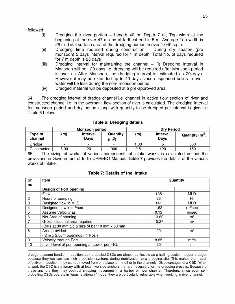
25
followed: (i) Dredging the river portion – Length 40 m, Depth 7 m, Top width at the
beginning of the river 47 m and at farthest end is 5 m. Average Top width is 26 m. Total surface area of the dredging portion in river 1,040 sq m.
(ii) Dredging time required during construction – During dry season (pre monsoon) 5 days interval required for 1 m depth. Total No. of days required for 7 m depth is 25 days
(iii) Dredging interval for maintaining the channel – (i) Dredging interval in Monsoon will be 120 days i.e. dredging will be required after Monsoon period is over (ii) After Monsoon, the dredging interval is estimated as 20 days. However it may be extended up to 40 days since suspended solids in river water will be less during the non- monsoon period.
(iv) Dredged material will be deposited at a pre-approved area.
64. The dredging interval of dredge channel i.e. channel in active flow section of river and constructed channel i.e. in the overbank flow section of river is calculated. The dredging interval for monsoon period and dry period along with quantity to be dredged per interval is given in Table 6 below.
Table 6: Dredging details
Monsoon period Dry Period Type of channel
(m) Interval Days
Quantity
(m3)
(m) Interval Days
Quantity (m3)
Dredge - - - 1.00 5 600 Constructed 6.00 20 900 0.5 120 150
65. The sizing of works of various components of intake works is calculated as per the provisions in Government of India CPHEEO Manual. Table 7 provides the details of the various works of Intake.
Table 7: Details of the Intake
Sr no..
Item Quantity
Design of Port opening 1 Flow 135 MLD 2 Hours of pumping 23 Hr 3 Designed flow in MLD 141 MLD 4 Designed flow in m³/sec 1.63 m³/sec 5 Assume Velocity as 0.12 m/sec 6 Net Area of opening 13.60 m² 7 Gross sectional area required 15.27 m² (Bars at 80 mm c/c & size of bar 10 mm x 50 mm 8 Area provided 20 m² ( 2 m x 2.50m openings - 4 Nos ) 9 Velocity through Port 8.85 m³/s 10 Invert level of port opening at Lower port- RL 20 m
dredgers cannot handle. In addition, self-propelled CSDs are almost as flexible as a trailing suction hopper dredger, because they too can use their propulsion systems during mobilization to a dredging site. This makes them cost-effective. In addition, they can be moved from one place to the other in the channels. Disadvantages of a CSD: When at work the CSD is stationary with at least two side anchors that are necessary for the dredging process. Because of these anchors they may obstruct shipping movement in a harbor or river channel. Therefore, since even self-propelling CSDs operate in “quasi-stationary” mode, they are particularly vulnerable when working in river channel.
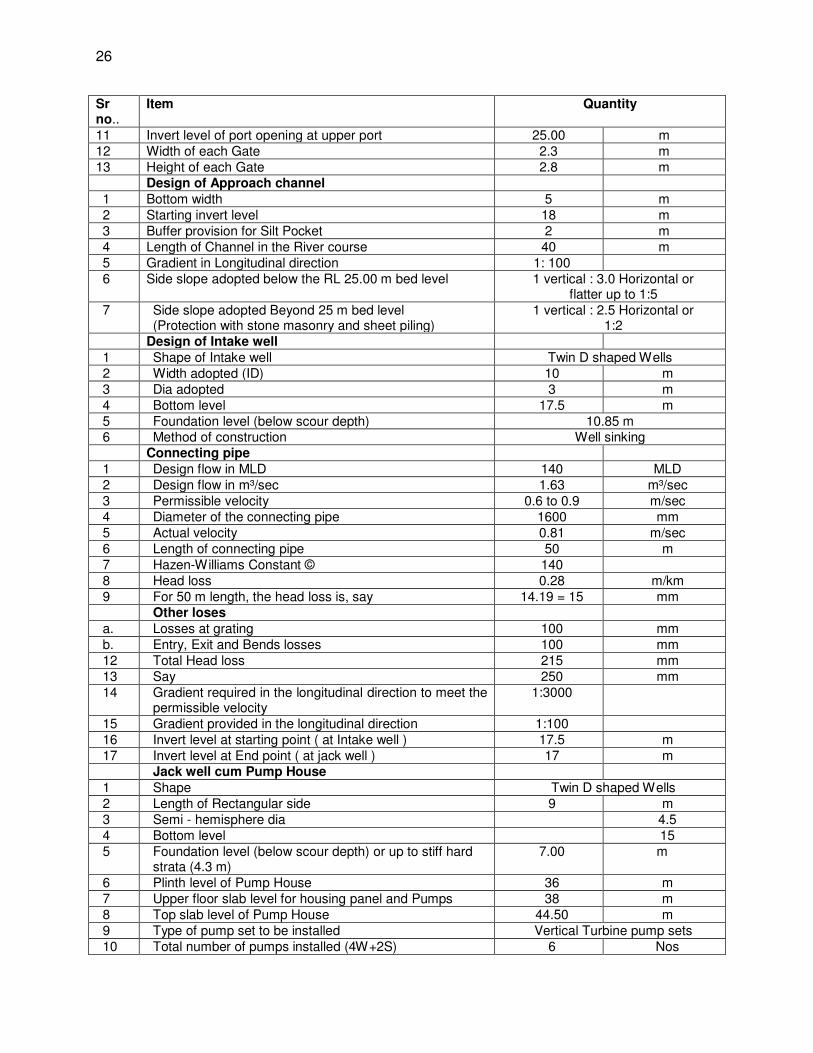
26
Sr no..
Item Quantity
11 Invert level of port opening at upper port 25.00 m 12 Width of each Gate 2.3 m 13 Height of each Gate 2.8 m Design of Approach channel 1 Bottom width 5 m 2 Starting invert level 18 m 3 Buffer provision for Silt Pocket 2 m 4 Length of Channel in the River course 40 m 5 Gradient in Longitudinal direction 1: 100 6 Side slope adopted below the RL 25.00 m bed level 1 vertical : 3.0 Horizontal or
flatter up to 1:5 7 Side slope adopted Beyond 25 m bed level
(Protection with stone masonry and sheet piling) 1 vertical : 2.5 Horizontal or
1:2 Design of Intake well 1 Shape of Intake well Twin D shaped Wells 2 Width adopted (ID) 10 m 3 Dia adopted 3 m 4 Bottom level 17.5 m 5 Foundation level (below scour depth) 10.85 m 6 Method of construction Well sinking
Connecting pipe 1 Design flow in MLD 140 MLD 2 Design flow in m³/sec 1.63 m³/sec 3 Permissible velocity 0.6 to 0.9 m/sec 4 Diameter of the connecting pipe 1600 mm 5 Actual velocity 0.81 m/sec 6 Length of connecting pipe 50 m 7 Hazen-Williams Constant © 140 8 Head loss 0.28 m/km 9 For 50 m length, the head loss is, say 14.19 = 15 mm Other loses a. Losses at grating 100 mm b. Entry, Exit and Bends losses 100 mm 12 Total Head loss 215 mm 13 Say 250 mm 14 Gradient required in the longitudinal direction to meet the
permissible velocity 1:3000
15 Gradient provided in the longitudinal direction 1:100 16 Invert level at starting point ( at Intake well ) 17.5 m 17 Invert level at End point ( at jack well ) 17 m Jack well cum Pump House 1 Shape Twin D shaped Wells 2 Length of Rectangular side 9 m 3 Semi - hemisphere dia 4.5 4 Bottom level 15 5 Foundation level (below scour depth) or up to stiff hard
strata (4.3 m) 7.00 m
6 Plinth level of Pump House 36 m 7 Upper floor slab level for housing panel and Pumps 38 m 8 Top slab level of Pump House 44.50 m 9 Type of pump set to be installed Vertical Turbine pump sets 10 Total number of pumps installed (4W+2S) 6 Nos
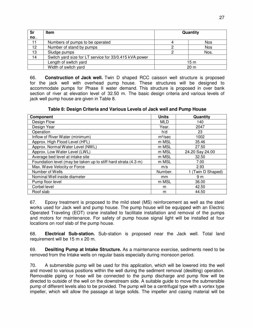
27
Sr no..
Item Quantity
11 Numbers of pumps to be operated 4 Nos 12 Number of stand by pumps 2 Nos 13 Sludge pumps 2 Nos. 14 Switch yard size for LT service for 33/0.415 kVA power Length of switch yard 15 m Width of switch yard 20 m
66. Construction of Jack well. Twin D shaped RCC caisson well structure is proposed for the jack well with overhead pump house. These structures will be designed to accommodate pumps for Phase II water demand. This structure is proposed in over bank section of river at elevation level of 32.50 m. The basic design criteria and various levels of jack well pump house are given in Table 8.
Table 8: Design Criteria and Various Levels of Jack well and Pump House
Component Units Quantity Design Flow MLD 140 Design Year Year. 2047 Operation h/d 23 Inflow of River Water (minimum) m³/sec 1002 Approx. High Flood Level (HFL) m MSL 35.46 Approx. Normal Water Level (NWL) m MSL 27.50 Approx. Low Water Level (LWL) m MSL 24.20 Say 24.00 Average bed level at intake site m MSL 32.50 Foundation level (may be taken up to stiff hard strata (4.3 m) m MSL 7.00 Max. Wave Velocity or Force m/s 2.93 Number of Wells Number. 1 (Twin D Shaped) Nominal Well inside diameter mm 9 m Pump floor level m MSL 36.00 Corbel level m 42.50 Roof slab m 44.50
67. Epoxy treatment is proposed to the mild steel (MS) reinforcement as well as the steel works used for Jack well and pump house. The pump house will be equipped with an Electric Operated Traveling (EOT) crane installed to facilitate installation and removal of the pumps and motors for maintenance. For safety of pump house signal light will be installed at four locations on roof slab of the pump house. 68. Electrical Sub-station. Sub-station is proposed near the Jack well. Total land requirement will be 15 m x 20 m. 69. Desilting Pump at Intake Structure. As a maintenance exercise, sediments need to be removed from the Intake wells on regular basis especially during monsoon period. 70. A submersible pump will be used for this application, which will be lowered into the well and moved to various positions within the well during the sediment removal (desilting) operation. Removable piping or hose will be connected to the pump discharge and pump flow will be directed to outside of the well on the downstream side. A suitable guide to move the submersible pump of different levels also to be provided. The pump will be a centrifugal type with a vortex type impeller, which will allow the passage at large solids. The impeller and casing material will be
28
selected to the abrasion resistance for pumping of sand and grit. 71. It would thus be prudent to go for a combination of 4 working with 2 standby pumps. As it will be evident from above calculations, more suitable pump for present requirement is a pump with Single stage with an operating speed of 1000 RPM (synchronous). It should therefore go for (4W + 2S) V.T. Pumps Single stage 1000 RPM (synchronous). After year 2032 (4W + 2S) pump will be replaced for 140 MLD flow and will give better efficiency due to higher specific speed (2690). LT substation is adequate since kW input to mortar will be less than 250 kW. 72. Hence, the intake pumps shall be of 1027 m³/h at 29 m average head, minimum head will be 19m and maximum head will be 30.3m. The pumps are required to have best efficiency point at average head and should have stable characteristic to suitably work between minimum and maximum head. Four pumps shall run in parallel and pumps should be suitable to work in parallel operation. 2. Raw Water Rising Main 73. Raw water from Jack well is proposed to be carried to WTP at Barari water works by raw water pumping main of 1321 mm outer diameter MS pipes. The length of raw water rising main will be 2,550 m. The MS pipes shall have internal cement mortar lining and tap coating cubide. Proper cathodic protection will be provided to the MS pipeline since soil is corrosive nature. 3. Water Treatment Plant 74. New WTP. A WTP of 90 MLD capacity is proposed within present Barari WTP campus for fulfilling the demand of intermediate year (2032). Another unit of 45 MLD is proposed to be provided in 2032 for meeting water demand of design year 2047. Provision has been in the layout plan for this additional unit. Methodology adopted for water treatment is conventional treatment process with plate settler. Various units are sized for flow rates corresponding to plant operation of 22/23 hours per day to match with the raw water discharges. All hydraulic conveyance units like channels, piping, valves, under drainage, and weirs are designed for 20% overloading 75. WTP will consist of pre-sedimentation tank (4 nos.), pump house for pre-sedimentation tank with 6 (nos.) of settled water pumps, Parshall flume (1 no.), flash mixer (1 no.), clariflocculator 2 units for intermediate year (1 unit to be added in 2032), filter bed 10 units for intermediate year, chlorine contact tank (1 no.), CWR (1 no.), Clear Water Pump House, chemical building, chlorine building, sludge collection tank, sludge pump house consisting of 2 sets of pumps and a sludge thickener tank and a centrifuge. 76. As indicated earlier, the four existing pre-sedimentation basins have an area of 10,000 sqm and are capable of catering to almost 200 MLD if used only for pre-sedimentation at an overflow rate of 50m ᵌ/m²/d for discrete settling. It is therefore, proposed to utilize all settling tanks. 77. This is proposed to be catered to by desludging at least once in a year, in months of October- November when raw water quality improves. 78. Raw water from the intake will normally be taken to the inlet channel but during rainy
29
season when turbidity level is high, raw water will first be taken to the Sedimentation Tanks and settled raw water will be pumped through a Raw Water pump house (RWPH) to inlet channel. A settled water sump of 10 minutes capacity will be constructed attached to last sedimentation tank. The SWPH will have 6 VT pump sets (4W+2S) of 1027 m³/hr and 8m head capacity. The switch gear for these pump sets will be provided in the control room attached to the Clear Water Pump House (CWPH). 79. It is proposed to construct a sump attached to the Clear Water Reservoir (CWR) and a Clear Water Pump House will be constructed on its top of 50 m x 15 m to accommodate 6 VT pump sets of 978 m³/h at 40 m head (4W+2S) and backwash pumps etc. 80. An electric sub-station will be provided to cater the power demand of CWPH, SWPH and WTP by drawing power from the 33kV feeder being laid under Tranche 1. The Switch Yard will have 2 Nos. of Transformers of 2000 kVA for 2047 requirement. 81. Residue Management (Sludge Treatment). The following are included in the design to manage sludge to be generated in the WTP.
(i) Back wash water recycling: The back wash water from filters shall be carried through the channel pipe and collected in pre- sedimentation tank basin.
(ii) Sludge buffer tank: Sludge buffer tank shall be provided to store the sludge from clariflocculator. A detention time of 0.15 days shall be provided. A rectangular buffer tank of 15m x 15m and 4m depth shall be provided. Sludge pump shall be provided to pump the sludge to sludge thickener.
(iii) Sludge thickener: Sludge from sludge buffer tank will be pumped to sludge thickener to reduce the volume of sludge. The consistency of thickened sludge is expected to be 5%. The solid loading rate of 130 /m3/m2/d is used in calculating the surface area of thickener 17m dia, 3 Nos. of thickeners having 4m depth are proposed.
82. The supernatant from the thickener shall be collected in separate supernatant sump from where it will be pumped to Inlet chamber for recycling. The thickened sludge from sludge thickener shall be collected to the thickened sludge sump from where it will be pumped to sludge dehydrator. 83. Thickened sludge from sludge thickener shall be pumped to sludge dehydrator, where its consistency can be increased to 20% and from there it will be handled based on the sludge management plan prepared by the contractor following the guidelines of the Central Pollution Control Board. This will be part of the O&M of the WTP. 84. It is proposed to provide two tipping trucks of 12 m3 capacity. If required more trucks can be engaged during monsoon period for the purpose. 85. The centrifuge type dehydrators will be installed on the first floor of residue management building and chutes shall be provided for each of the centrifuge to discharge the cakes to the truck directly. Hard standing area shall be provided for these trucks at an appropriate location. 86. Sub Station: Sub- station shall be provided for uninterrupted power supply to all units at raw and treated water pumping station. Motor input is less than 250 kW and thus LT substation of 2000 kW is adequate. 87. Figure 13 shows proposed location of intake, WTP and raw water pipeline in Google map. Figure 14 shows for proposed location of intake, WTP and raw water main drawing.
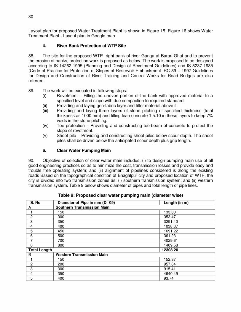
30
Layout plan for proposed Water Treatment Plant is shown in Figure 15. Figure 16 shows Water Treatment Plant - Layout plan in Google map. 4. River Bank Protection at WTP Site 88. The site for the proposed WTP right bank of river Ganga at Barari Ghat and to prevent the erosion of banks, protection work is proposed as below. The work is proposed to be designed according to IS 14262-1995 (Planning and Design of Revetment Guidelines) and IS 8237-1985 (Code of Practice for Protection of Slopes of Reservoir Embankment IRC 89 – 1997 Guidelines for Design and Construction of River Training and Control Works for Road Bridges are also referred. 89. The work will be executed in following steps:
(i) Revetment – Filling the uneven portion of the bank with approved material to a specified level and slope with due compaction to required standard.
(ii) Providing and laying geo-fabric layer and filter material above it. (iii) Providing and laying three layers of stone pitching of specified thickness (total
thickness as 1000 mm) and filling lean concrete 1:5:10 in these layers to keep 7% voids in the stone pitching.
(iv) Toe protection – Providing and constructing toe-beam of concrete to protect the slope of revetment.
(v) Sheet pile – Providing and constructing sheet piles below scour depth. The sheet piles shall be driven below the anticipated scour depth plus grip length.
6. Clear Water Pumping Main 90. Objective of selection of clear water main includes: (i) to design pumping main use of all good engineering practices so as to minimize the cost, transmission losses and provide easy and trouble free operating system; and (ii) alignment of pipelines considered is along the existing roads Based on the topographical condition of Bhagalpur city and proposed location of WTP, the city is divided into two transmission zones as: (i) southern transmission system; and (ii) western transmission system. Table 9 below shows diameter of pipes and total length of pipe lines.
Table 9: Proposed clear water pumping main (diameter wise)
S. No Diameter of Pipe in mm (DI K9) Length (in m) A Southern Transmission Main 1 150 133.30 2 300 353.47 3 350 3291.40 4 400 1038.37 5 450 1691.22 6 500 361.23 7 700 4029.61 8 800 1409.58
Total Length 12308.20 B Western Transmission Main 1 150 152.37 2 200 957.64 3 300 915.41 4 350 4640.49 5 400 93.74
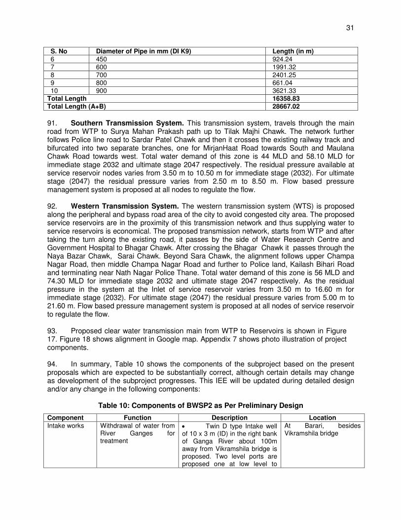
31
S. No Diameter of Pipe in mm (DI K9) Length (in m) 6 450 924.24 7 600 1991.32 8 700 2401.25 9 800 661.04 10 900 3621.33
Total Length 16358.83 Total Length (A+B) 28667.02
91. Southern Transmission System. This transmission system, travels through the main road from WTP to Surya Mahan Prakash path up to Tilak Majhi Chawk. The network further follows Police line road to Sardar Patel Chawk and then it crosses the existing railway track and bifurcated into two separate branches, one for MirjanHaat Road towards South and Maulana Chawk Road towards west. Total water demand of this zone is 44 MLD and 58.10 MLD for immediate stage 2032 and ultimate stage 2047 respectively. The residual pressure available at service reservoir nodes varies from 3.50 m to 10.50 m for immediate stage (2032). For ultimate stage (2047) the residual pressure varies from 2.50 m to 8.50 m. Flow based pressure management system is proposed at all nodes to regulate the flow. 92. Western Transmission System. The western transmission system (WTS) is proposed along the peripheral and bypass road area of the city to avoid congested city area. The proposed service reservoirs are in the proximity of this transmission network and thus supplying water to service reservoirs is economical. The proposed transmission network, starts from WTP and after taking the turn along the existing road, it passes by the side of Water Research Centre and Government Hospital to Bhagar Chawk. After crossing the Bhagar Chawk it passes through the Naya Bazar Chawk, Sarai Chawk. Beyond Sara Chawk, the alignment follows upper Champa Nagar Road, then middle Champa Nagar Road and further to Police land, Kailash Bihari Road and terminating near Nath Nagar Police Thane. Total water demand of this zone is 56 MLD and 74.30 MLD for immediate stage 2032 and ultimate stage 2047 respectively. As the residual pressure in the system at the Inlet of service reservoir varies from 3.50 m to 16.60 m for immediate stage (2032). For ultimate stage (2047) the residual pressure varies from 5.00 m to 21.60 m. Flow based pressure management system is proposed at all nodes of service reservoir to regulate the flow. 93. Proposed clear water transmission main from WTP to Reservoirs is shown in Figure 17. Figure 18 shows alignment in Google map. Appendix 7 shows photo illustration of project components. 94. In summary, Table 10 shows the components of the subproject based on the present proposals which are expected to be substantially correct, although certain details may change as development of the subproject progresses. This IEE will be updated during detailed design and/or any change in the following components:
Table 10: Components of BWSP2 as Per Preliminary Design
Component Function Description Location Intake works Withdrawal of water from
River Ganges for treatment
Twin D type Intake well of 10 x 3 m (ID) in the right bank of Ganga River about 100m away from Vikramshila bridge is proposed. Two level ports are proposed one at low level to
At Barari, besides Vikramshila bridge
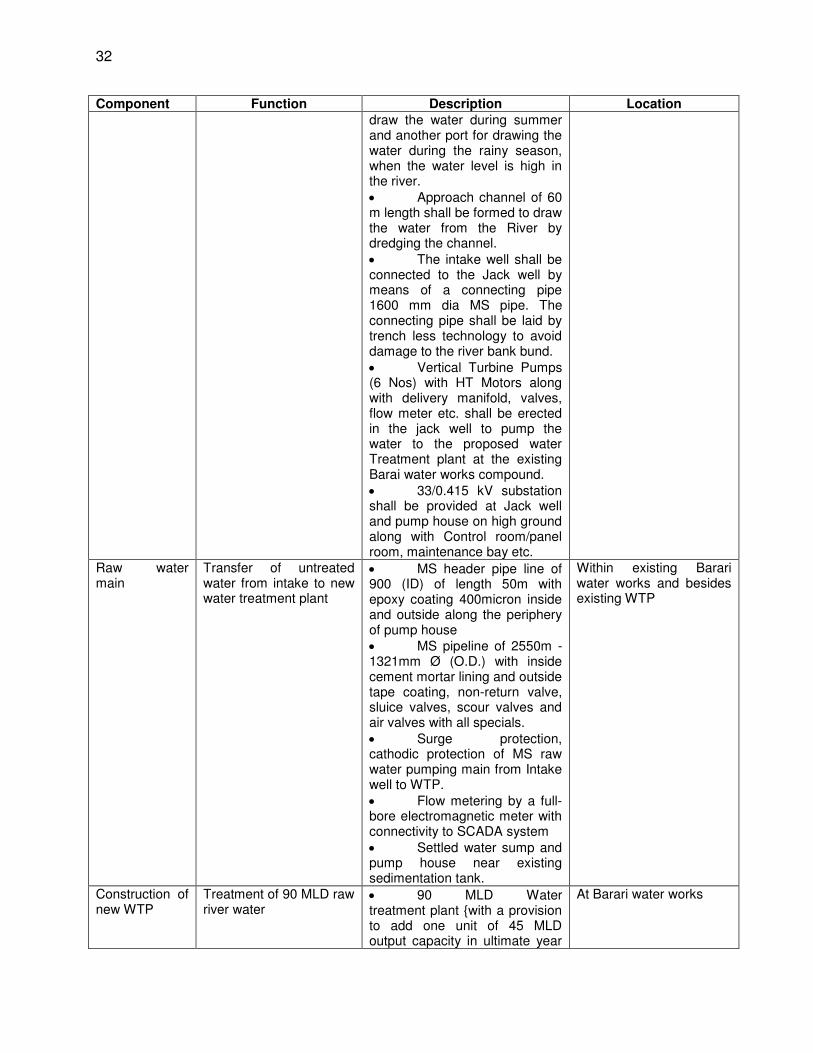
32
Component Function Description Location draw the water during summer and another port for drawing the water during the rainy season, when the water level is high in the river. Approach channel of 60 m length shall be formed to draw the water from the River by dredging the channel. The intake well shall be connected to the Jack well by means of a connecting pipe 1600 mm dia MS pipe. The connecting pipe shall be laid by trench less technology to avoid damage to the river bank bund. Vertical Turbine Pumps (6 Nos) with HT Motors along with delivery manifold, valves, flow meter etc. shall be erected in the jack well to pump the water to the proposed water Treatment plant at the existing Barai water works compound. 33/0.415 kV substation shall be provided at Jack well and pump house on high ground along with Control room/panel room, maintenance bay etc.
Raw water main
Transfer of untreated water from intake to new water treatment plant
MS header pipe line of 900 (ID) of length 50m with epoxy coating 400micron inside and outside along the periphery of pump house MS pipeline of 2550m - 1321mm Ø (O.D.) with inside cement mortar lining and outside tape coating, non-return valve, sluice valves, scour valves and air valves with all specials. Surge protection, cathodic protection of MS raw water pumping main from Intake well to WTP. Flow metering by a full-bore electromagnetic meter with connectivity to SCADA system Settled water sump and pump house near existing sedimentation tank.
Within existing Barari water works and besides existing WTP
Construction of new WTP
Treatment of 90 MLD raw river water
90 MLD Water treatment plant {with a provision to add one unit of 45 MLD output capacity in ultimate year
At Barari water works
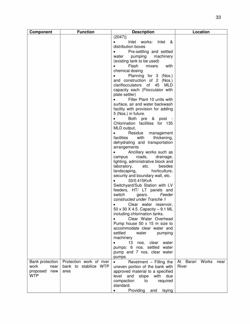
33
Component Function Description Location (2047)} Inlet works: Inlet & distribution boxes Pre-settling and settled water pumping machinery (existing tank to be used) Flash mixers with chemical dosing Planning for 3 (Nos.) and construction of 2 (Nos.) clariflocculators of 45 MLD capacity each (Flocculator with plate settler) Filter Plant 10 units with surface, air and water backwash facility with provision for adding 5 (Nos.) in future. Both pre & post -Chlorination facilities for 135 MLD output, Residue management facilities with thickening, dehydrating and transportation arrangements Ancillary works such as campus roads, drainage, lighting, administrative block and laboratory, etc. besides landscaping, horticulture, security and boundary wall, etc. 33/0.415KvA Switchyard/Sub Station with LV feeders, HT/ LT panels and switch gears. Feeder constructed under Tranche 1
Clear water reservoir, 50 x 30 X 4.5. Capacity – 9.1 ML including chlorination tanks. Clear Water Overhead Pump house 50 x 15 m size to accommodate clear water and settled water pumping machinery 13 nos. clear water pumps: 6 nos. settled water pump and 7 nos. clear water pumps
Bank protection work near proposed new WTP
Protection work of river bank to stabilize WTP area
Revetment – Filling the uneven portion of the bank with approved material to a specified level and slope with due compaction to required standard. Providing and laying
At Barari Works near River
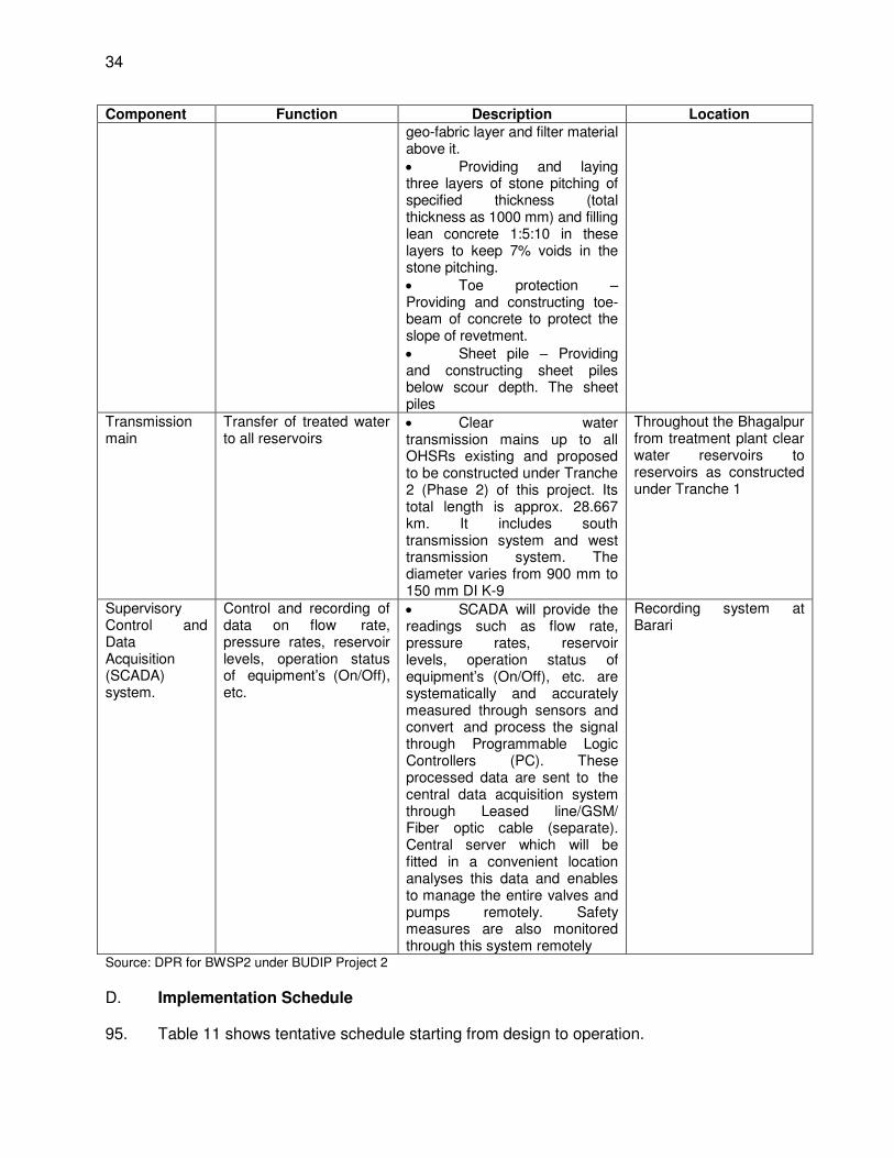
34
Component Function Description Location geo-fabric layer and filter material above it. Providing and laying three layers of stone pitching of specified thickness (total thickness as 1000 mm) and filling lean concrete 1:5:10 in these layers to keep 7% voids in the stone pitching. Toe protection – Providing and constructing toe-beam of concrete to protect the slope of revetment. Sheet pile – Providing and constructing sheet piles below scour depth. The sheet piles
Transmission main
Transfer of treated water to all reservoirs
Clear water transmission mains up to all OHSRs existing and proposed to be constructed under Tranche 2 (Phase 2) of this project. Its total length is approx. 28.667 km. It includes south transmission system and west transmission system. The diameter varies from 900 mm to 150 mm DI K-9
Throughout the Bhagalpur from treatment plant clear water reservoirs to reservoirs as constructed under Tranche 1
Supervisory Control and Data Acquisition (SCADA) system.
Control and recording of data on flow rate, pressure rates, reservoir levels, operation status of equipment’s (On/Off), etc.
SCADA will provide the readings such as flow rate, pressure rates, reservoir levels, operation status of equipment’s (On/Off), etc. are systematically and accurately measured through sensors and convert and process the signal through Programmable Logic Controllers (PC). These processed data are sent to the central data acquisition system through Leased line/GSM/ Fiber optic cable (separate). Central server which will be fitted in a convenient location analyses this data and enables to manage the entire valves and pumps remotely. Safety measures are also monitored through this system remotely
Recording system at Barari
Source: DPR for BWSP2 under BUDIP Project 2
D. Implementation Schedule
95. Table 11 shows tentative schedule starting from design to operation.
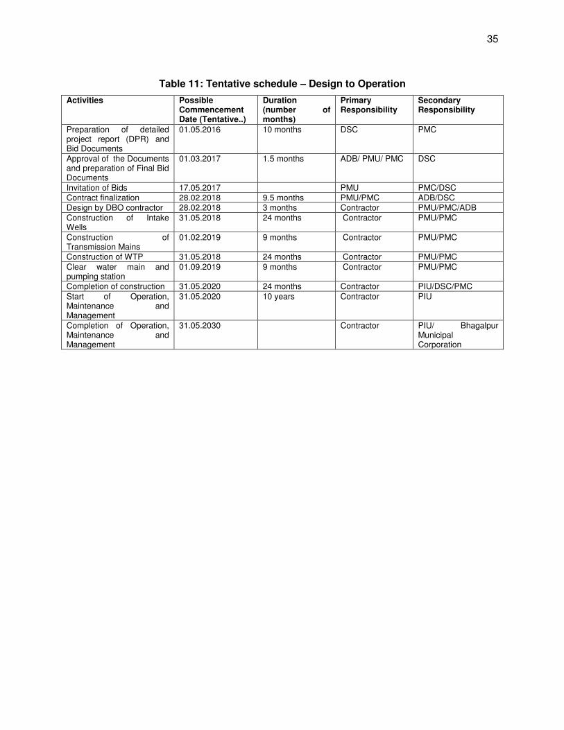
35
Table 11: Tentative schedule – Design to Operation
Activities Possible Commencement Date (Tentative..)
Duration (number of months)
Primary Responsibility
Secondary Responsibility
Preparation of detailed project report (DPR) and Bid Documents
01.05.2016 10 months DSC PMC
Approval of the Documents and preparation of Final Bid Documents
01.03.2017 1.5 months ADB/ PMU/ PMC DSC
Invitation of Bids 17.05.2017 PMU PMC/DSC Contract finalization 28.02.2018 9.5 months PMU/PMC ADB/DSC Design by DBO contractor 28.02.2018 3 months Contractor PMU/PMC/ADB Construction of Intake Wells
31.05.2018 24 months Contractor PMU/PMC
Construction of Transmission Mains
01.02.2019 9 months Contractor PMU/PMC
Construction of WTP 31.05.2018 24 months Contractor PMU/PMC Clear water main and pumping station
01.09.2019 9 months Contractor PMU/PMC
Completion of construction 31.05.2020 24 months Contractor PIU/DSC/PMC Start of Operation, Maintenance and Management
31.05.2020 10 years Contractor PIU
Completion of Operation, Maintenance and Management
31.05.2030 Contractor PIU/ Bhagalpur Municipal Corporation
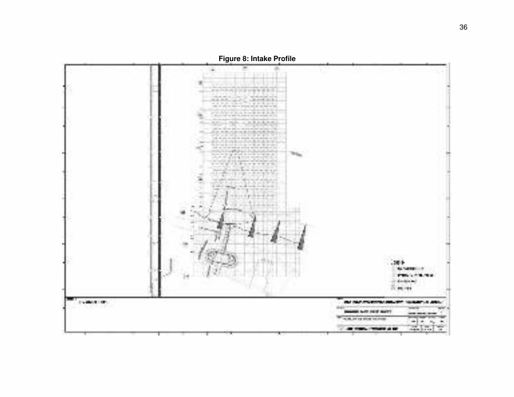
36
Figure 8: Intake Profile
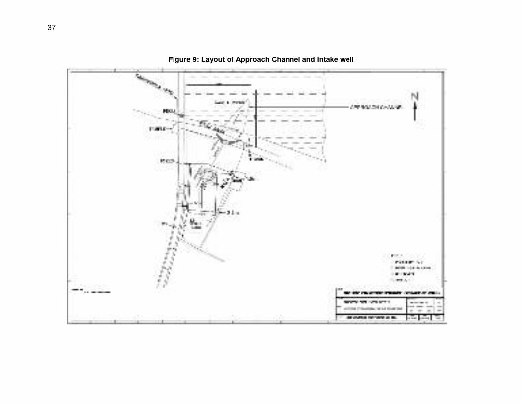
37
Figure 9: Layout of Approach Channel and Intake well
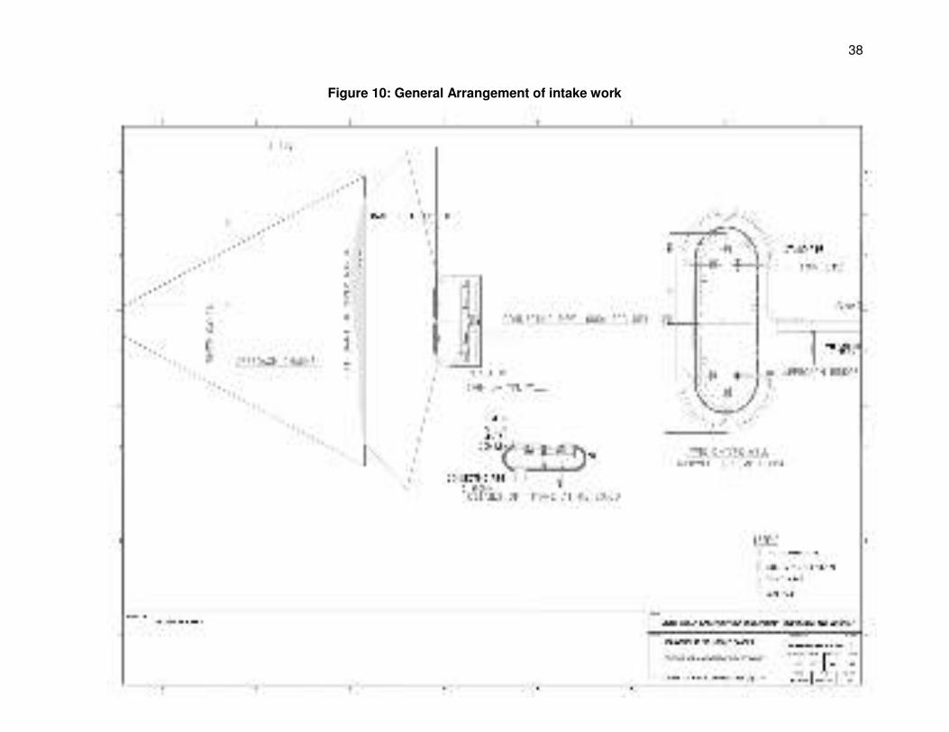
38
Figure 10: General Arrangement of intake work
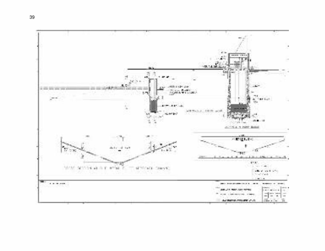
39
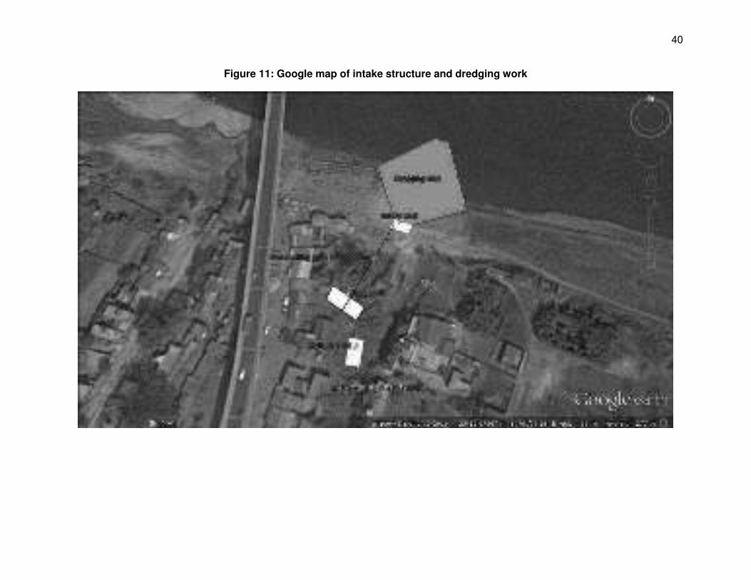
40
Figure 11: Google map of intake structure and dredging work
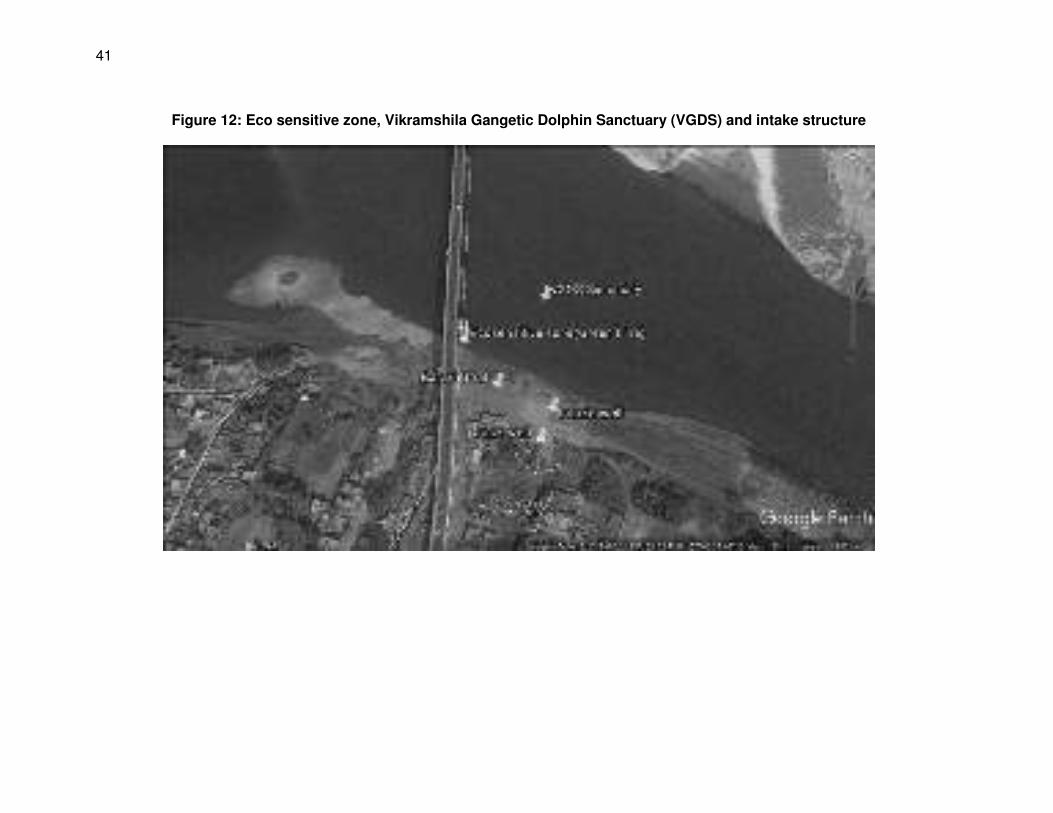
41
Figure 12: Eco sensitive zone, Vikramshila Gangetic Dolphin Sanctuary (VGDS) and intake structure
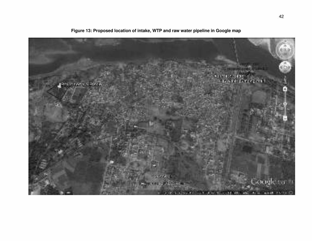
42
Figure 13: Proposed location of intake, WTP and raw water pipeline in Google map
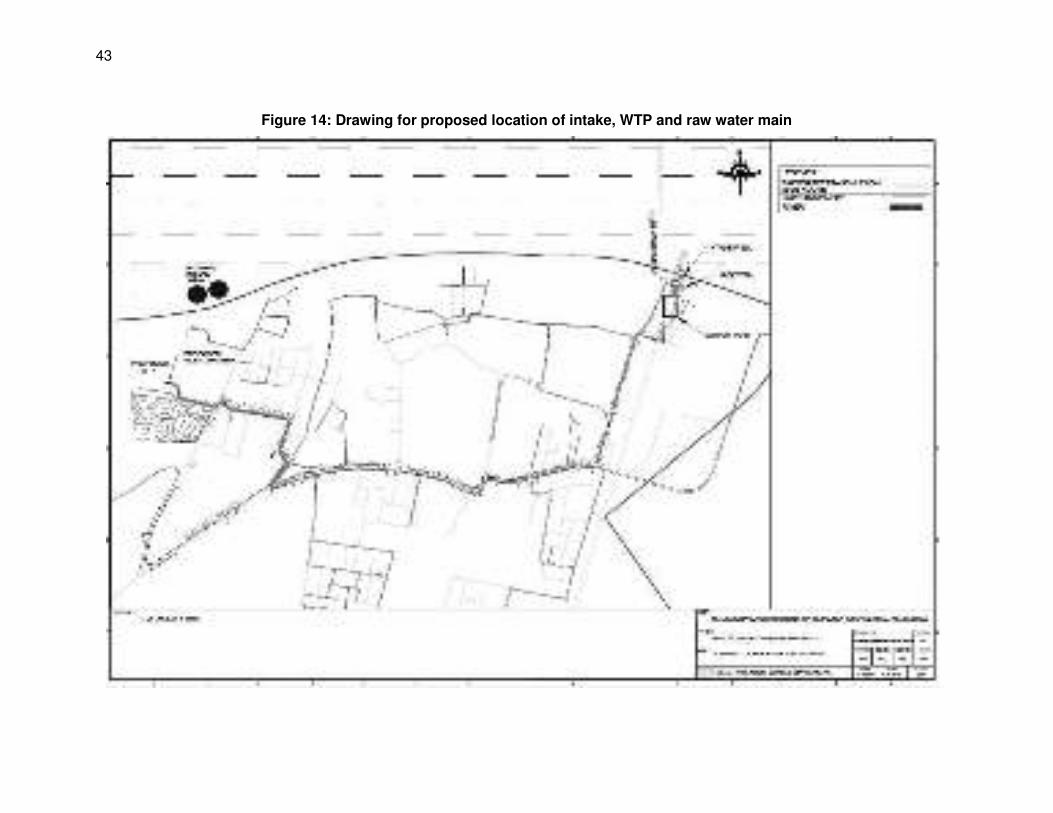
43
Figure 14: Drawing for proposed location of intake, WTP and raw water main
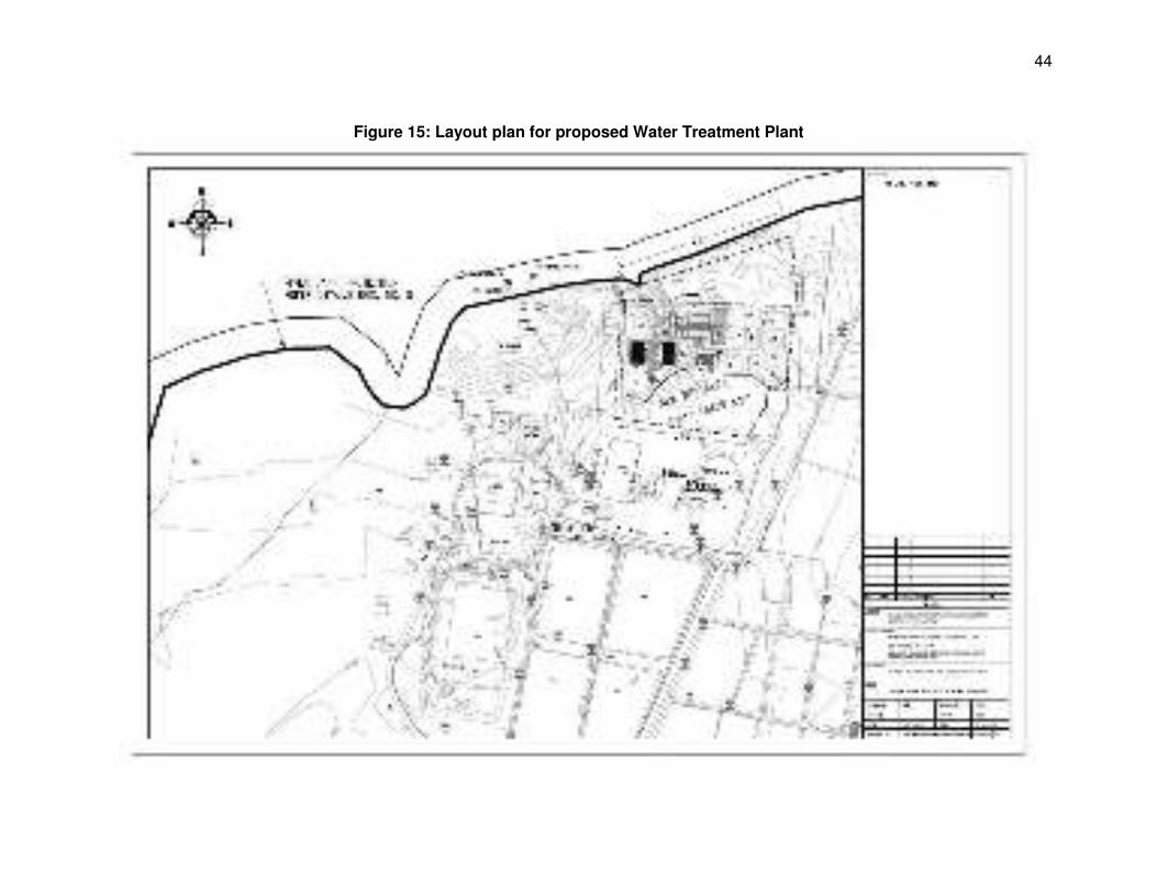
44
Figure 15: Layout plan for proposed Water Treatment Plant
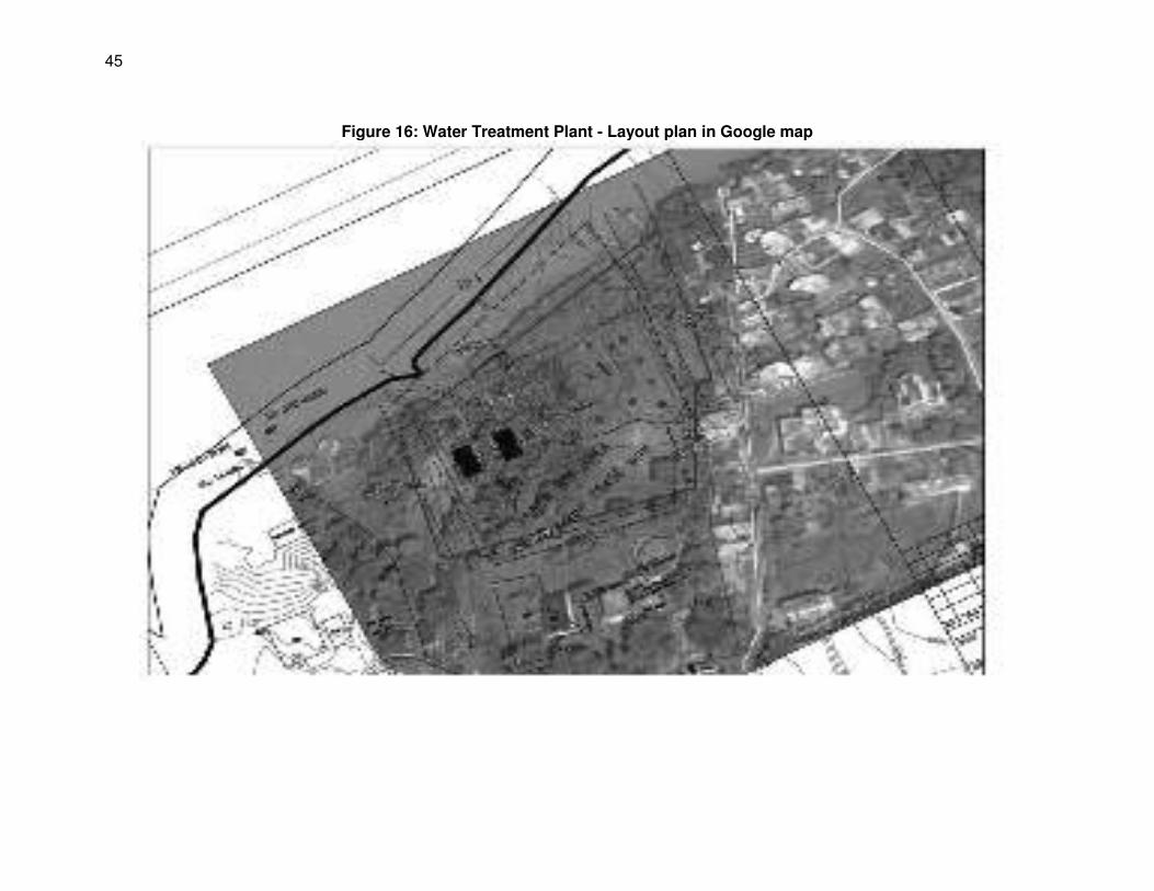
45
Figure 16: Water Treatment Plant - Layout plan in Google map
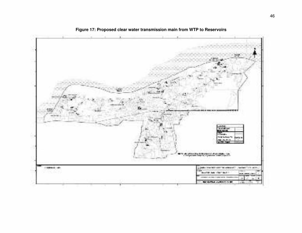
46
Figure 17: Proposed clear water transmission main from WTP to Reservoirs
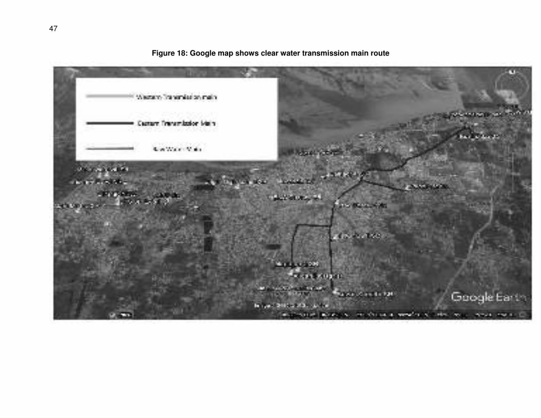
47
Figure 18: Google map shows clear water transmission main route
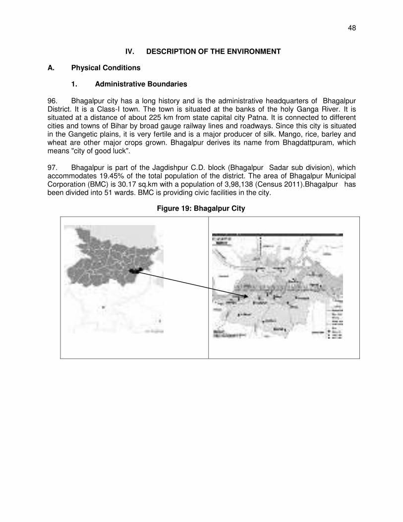
48
IV. DESCRIPTION OF THE ENVIRONMENT
A. Physical Conditions
1. Administrative Boundaries 96. Bhagalpur city has a long history and is the administrative headquarters of Bhagalpur District. It is a Class-I town. The town is situated at the banks of the holy Ganga River. It is situated at a distance of about 225 km from state capital city Patna. It is connected to different cities and towns of Bihar by broad gauge railway lines and roadways. Since this city is situated in the Gangetic plains, it is very fertile and is a major producer of silk. Mango, rice, barley and wheat are other major crops grown. Bhagalpur derives its name from Bhagdattpuram, which means "city of good luck". 97. Bhagalpur is part of the Jagdishpur C.D. block (Bhagalpur Sadar sub division), which accommodates 19.45% of the total population of the district. The area of Bhagalpur Municipal Corporation (BMC) is 30.17 sq.km with a population of 3,98,138 (Census 2011).Bhagalpur has been divided into 51 wards. BMC is providing civic facilities in the city.
Figure 19: Bhagalpur City
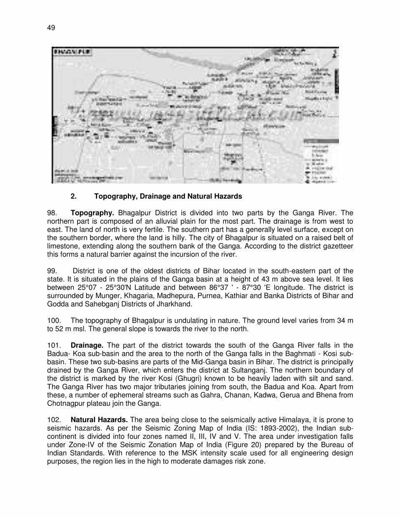
49
2. Topography, Drainage and Natural Hazards 98. Topography. Bhagalpur District is divided into two parts by the Ganga River. The northern part is composed of an alluvial plain for the most part. The drainage is from west to east. The land of north is very fertile. The southern part has a generally level surface, except on the southern border, where the land is hilly. The city of Bhagalpur is situated on a raised belt of limestone, extending along the southern bank of the Ganga. According to the district gazetteer this forms a natural barrier against the incursion of the river. 99. District is one of the oldest districts of Bihar located in the south-eastern part of the state. It is situated in the plains of the Ganga basin at a height of 43 m above sea level. It lies between 25°07 - 25°30'N Latitude and between 86°37 ' - 87°30 'E longitude. The district is surrounded by Munger, Khagaria, Madhepura, Purnea, Kathiar and Banka Districts of Bihar and Godda and Sahebganj Districts of Jharkhand. 100. The topography of Bhagalpur is undulating in nature. The ground level varies from 34 m to 52 m msl. The general slope is towards the river to the north. 101. Drainage. The part of the district towards the south of the Ganga River falls in the Badua- Koa sub-basin and the area to the north of the Ganga falls in the Baghmati - Kosi sub-basin. These two sub-basins are parts of the Mid-Ganga basin in Bihar. The district is principally drained by the Ganga River, which enters the district at Sultanganj. The northern boundary of the district is marked by the river Kosi (Ghugri) known to be heavily laden with silt and sand. The Ganga River has two major tributaries joining from south, the Badua and Koa. Apart from these, a number of ephemeral streams such as Gahra, Chanan, Kadwa, Gerua and Bhena from Chotnagpur plateau join the Ganga. 102. Natural Hazards. The area being close to the seismically active Himalaya, it is prone to seismic hazards. As per the Seismic Zoning Map of India (IS: 1893-2002), the Indian sub-continent is divided into four zones named II, III, IV and V. The area under investigation falls under Zone-IV of the Seismic Zonation Map of India (Figure 20) prepared by the Bureau of Indian Standards. With reference to the MSK intensity scale used for all engineering design purposes, the region lies in the high to moderate damages risk zone.
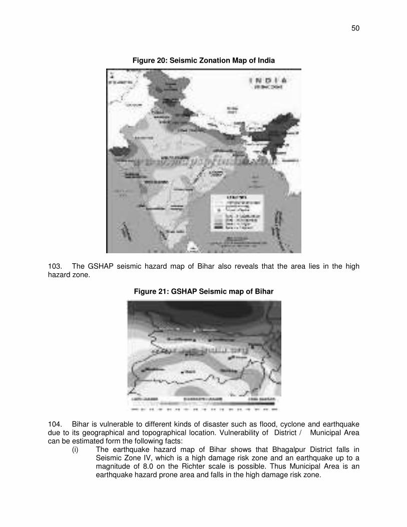
50
Figure 20: Seismic Zonation Map of India
103. The GSHAP seismic hazard map of Bihar also reveals that the area lies in the high hazard zone.
Figure 21: GSHAP Seismic map of Bihar
104. Bihar is vulnerable to different kinds of disaster such as flood, cyclone and earthquake due to its geographical and topographical location. Vulnerability of District / Municipal Area can be estimated form the following facts:
(i) The earthquake hazard map of Bihar shows that Bhagalpur District falls in Seismic Zone IV, which is a high damage risk zone and an earthquake up to a magnitude of 8.0 on the Richter scale is possible. Thus Municipal Area is an earthquake hazard prone area and falls in the high damage risk zone.
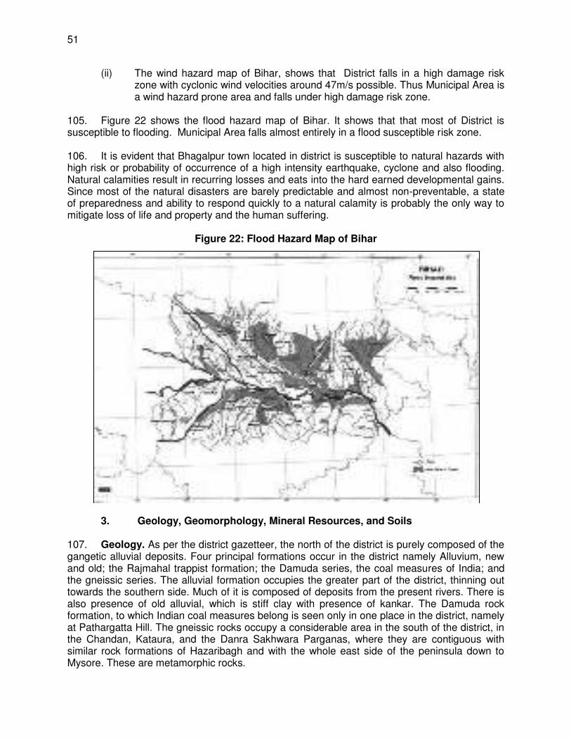
51
(ii) The wind hazard map of Bihar, shows that District falls in a high damage risk zone with cyclonic wind velocities around 47m/s possible. Thus Municipal Area is a wind hazard prone area and falls under high damage risk zone.
105. Figure 22 shows the flood hazard map of Bihar. It shows that that most of District is susceptible to flooding. Municipal Area falls almost entirely in a flood susceptible risk zone. 106. It is evident that Bhagalpur town located in district is susceptible to natural hazards with high risk or probability of occurrence of a high intensity earthquake, cyclone and also flooding. Natural calamities result in recurring losses and eats into the hard earned developmental gains. Since most of the natural disasters are barely predictable and almost non-preventable, a state of preparedness and ability to respond quickly to a natural calamity is probably the only way to mitigate loss of life and property and the human suffering.
Figure 22: Flood Hazard Map of Bihar
3. Geology, Geomorphology, Mineral Resources, and Soils 107. Geology. As per the district gazetteer, the north of the district is purely composed of the gangetic alluvial deposits. Four principal formations occur in the district namely Alluvium, new and old; the Rajmahal trappist formation; the Damuda series, the coal measures of India; and the gneissic series. The alluvial formation occupies the greater part of the district, thinning out towards the southern side. Much of it is composed of deposits from the present rivers. There is also presence of old alluvial, which is stiff clay with presence of kankar. The Damuda rock formation, to which Indian coal measures belong is seen only in one place in the district, namely at Pathargatta Hill. The gneissic rocks occupy a considerable area in the south of the district, in the Chandan, Kataura, and the Danra Sakhwara Parganas, where they are contiguous with similar rock formations of Hazaribagh and with the whole east side of the peninsula down to Mysore. These are metamorphic rocks.
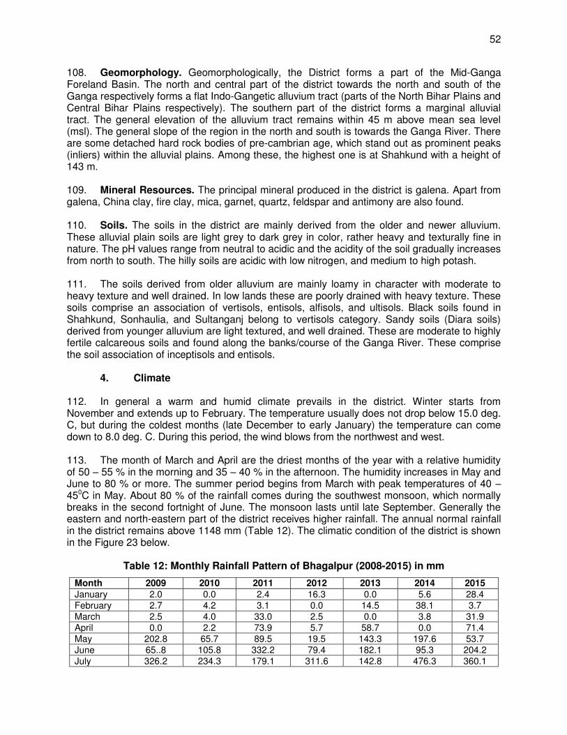
52
108. Geomorphology. Geomorphologically, the District forms a part of the Mid-Ganga Foreland Basin. The north and central part of the district towards the north and south of the Ganga respectively forms a flat Indo-Gangetic alluvium tract (parts of the North Bihar Plains and Central Bihar Plains respectively). The southern part of the district forms a marginal alluvial tract. The general elevation of the alluvium tract remains within 45 m above mean sea level (msl). The general slope of the region in the north and south is towards the Ganga River. There are some detached hard rock bodies of pre-cambrian age, which stand out as prominent peaks (inliers) within the alluvial plains. Among these, the highest one is at Shahkund with a height of 143 m. 109. Mineral Resources. The principal mineral produced in the district is galena. Apart from galena, China clay, fire clay, mica, garnet, quartz, feldspar and antimony are also found. 110. Soils. The soils in the district are mainly derived from the older and newer alluvium. These alluvial plain soils are light grey to dark grey in color, rather heavy and texturally fine in nature. The pH values range from neutral to acidic and the acidity of the soil gradually increases from north to south. The hilly soils are acidic with low nitrogen, and medium to high potash. 111. The soils derived from older alluvium are mainly loamy in character with moderate to heavy texture and well drained. In low lands these are poorly drained with heavy texture. These soils comprise an association of vertisols, entisols, alfisols, and ultisols. Black soils found in Shahkund, Sonhaulia, and Sultanganj belong to vertisols category. Sandy soils (Diara soils) derived from younger alluvium are light textured, and well drained. These are moderate to highly fertile calcareous soils and found along the banks/course of the Ganga River. These comprise the soil association of inceptisols and entisols.
4. Climate 112. In general a warm and humid climate prevails in the district. Winter starts from November and extends up to February. The temperature usually does not drop below 15.0 deg. C, but during the coldest months (late December to early January) the temperature can come down to 8.0 deg. C. During this period, the wind blows from the northwest and west. 113. The month of March and April are the driest months of the year with a relative humidity of 50 – 55 % in the morning and 35 – 40 % in the afternoon. The humidity increases in May and June to 80 % or more. The summer period begins from March with peak temperatures of 40 – 450C in May. About 80 % of the rainfall comes during the southwest monsoon, which normally breaks in the second fortnight of June. The monsoon lasts until late September. Generally the eastern and north-eastern part of the district receives higher rainfall. The annual normal rainfall in the district remains above 1148 mm (Table 12). The climatic condition of the district is shown in the Figure 23 below.
Table 12: Monthly Rainfall Pattern of Bhagalpur (2008-2015) in mm
Month 2009 2010 2011 2012 2013 2014 2015 January 2.0 0.0 2.4 16.3 0.0 5.6 28.4 February 2.7 4.2 3.1 0.0 14.5 38.1 3.7 March 2.5 4.0 33.0 2.5 0.0 3.8 31.9 April 0.0 2.2 73.9 5.7 58.7 0.0 71.4 May 202.8 65.7 89.5 19.5 143.3 197.6 53.7 June 65..8 105.8 332.2 79.4 182.1 95.3 204.2 July 326.2 234.3 179.1 311.6 142.8 476.3 360.1
53
Month 2009 2010 2011 2012 2013 2014 2015 August 500.9 195.6 358.8 142.7 266.8 203.3 300.7 September 220.0 127.5 152.6 124.0 160.4 149.6 188 October 172.1 19.9 39.9 54.0 319.3 9.0 11.4 November 2.8 5.3 0.0 16.7 6.8 0.0 0.0 December 0.8 0.7 0.0 0.0 0.0 0.2 0.0 Total 1498.6 765.2 1264.5 772.4 1294.7 1178.8 1253.5
Source-India Meteorological Department
Figure 23: Climatic Condition of the District
5. Ambient Air Quality
114. There are no data on ambient air quality for Bhagalpur city, which is not subject to monitoring by the Bihar State Pollution Control Board as there are no major industries. The nearest station is located at Patna. Traffic is the only significant pollutant in the city, so levels of oxides of sulphur and nitrogen are likely to be well within the National Ambient Air Quality Standards (NAAQS). The particulate matter (PM10 and PM2.5) are also likely to be within the limits as the city has significant cover under the vegetation. Since the proposed project will not contribute any air emissions, the ambient air quality is not a valued environmental component (VEC) in the project. 115. Ambient air quality monitoring has been conducted at different project locations (covering sensitive areas) and Table 13 shows monitoring result. Values of all parameters are within the standard.
Table 13: Ambient air quality monitoring result
Status of Ambient Air Quality of Bhagalpur S.No
Site name
Main Pollutants 2015 (µg/m3)
PM10 PM2.5 SO2 NO2
CPCB standard 100
CPCB standard 60
CPCB standard 80
CPCB standard 80
1 Tilakmanjhi Chowk 79 36 24 52 2 Collectriate 68 31 17 39
54
Status of Ambient Air Quality of Bhagalpur S.No
Site name
Main Pollutants 2015 (µg/m3)
3 Mahashay Deorhy 64 28 14 46 4 Barari Housing 74 26 21 44 5 Thakurbari 69 28 23 56 6 Constable Training
School, CTS 61 24 12 46
7 Mount Assisi School 56 19 12 30 8 T.M. University 78 45 24 56 9 S.M. College 59 24 19 43 10 Sadar Hospital 87 56 26 41 11 WTP Barari 76 34 18 41 12 Beside WTP
boundary-Transmission Rising main route
84 32 16 44
(BUDIP project data, Date of sampling: 2.11.15 to 5.11.15)
6. Ambient Noise levels
116. The noise level measurements have been carried out recently as part of primary baseline data generation activity to establish ambient noise levels in the project area and surroundings. The measured noise levels have been provided in Table 14 below.
Table 14: Ambient Noise Level Monitoring Data at Project Location Sites and Surroundings
Monitoring Locations
Noise Level in dB (A)
Day Time 6 AM- 10 PM
Night Time 10 PM—6 AM
Leq in dB(A) Standard (dB(A)
Leq in dB(A) Standard (dB(A)
1. Tilakmanjhi Chowk
62.6 65 52.4 55
2. Collectorate 63.1 65 51.6 55
3. Mahashay Deorhy
62.7 65 54.3 55
4. Barari Housing
53.4 65 44.1 55
5. Thakurbari 64.7 65 51.8 55
6. Constable Training School, CTS
63..8 65 54.3 55
7. Mount Assisi School
49.2 50 39.1 40
8. T.M. University
48.6 50 39.7 40
9. S.M. College 48.7 50 41.8 40 10. Sadar
Hospital 48.6 50 38.2 40
11 WTP Barari 61.6 65 54.7 55
55
Monitoring Locations
Noise Level in dB (A)
Day Time 6 AM- 10 PM
Night Time 10 PM—6 AM
Leq in dB(A) Standard (dB(A)
Leq in dB(A) Standard (dB(A)
12 Beside WTP boundary-Transmission main route
64.2 65 52.9 55
(BUDIP project data, Date of sampling: 2.11.15 to 5.11.15)
117. Recently ambient noise level monitoring has been conducted at Bhagalpur as a part of monitoring program for Tranche 1 sub projects. Results are shown in Table 15.
Table 15: Recent Ambient Noise Level Monitoring Data at Project Location Sites and
Surroundings
Monitoring Locations
Noise Level in dB (A)
Day Time 6 AM- 10 PM
Night Time 10 PM—6 AM
Leq in dB(A) Standard (dB(A)
Leq in dB(A) Standard (dB(A)
1. Dry Intake well
62.80 65 56.82 55
2. Wet Intake well
71.91 65 62.41 55
3. Old Clear Water Pump House
73.43 65 63.37 55
4. Samsan Ghat near proposed intake location
- - 52.78 55
5. New Clear Water Pump House
73.49 65 63.77 55
(BUDIP project data, Date of Monitoring: 14.07.16)
118. It is clear from the above results that noise levels are well within the stipulated limits in the year 2015. But in the year 2016 average noise level sometime exceeds the standard. The generation of noise is mainly due to commercial and human activities.
7. Water Resources
a. Surface Water 119. The river system of the district consists of a reach of the Ganga about sixty miles in length to the north; and to the south, there are a few hill streams, which are sandy narrow water courses for most of the year, but are torrential during monsoons. 120. The main rivers include:
The Ganga: The Ganges flows from the west to the east cutting the district to its northern side. In the middle, a great mass of granite divides the river into two
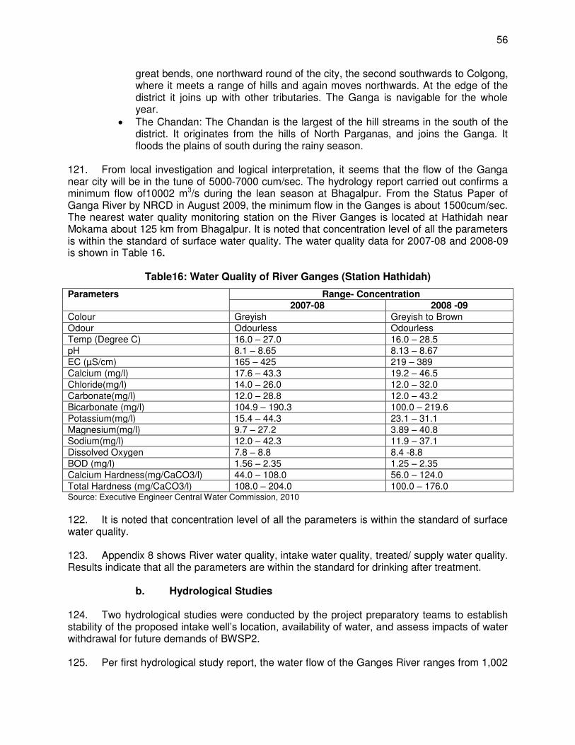
56
great bends, one northward round of the city, the second southwards to Colgong, where it meets a range of hills and again moves northwards. At the edge of the district it joins up with other tributaries. The Ganga is navigable for the whole year.
The Chandan: The Chandan is the largest of the hill streams in the south of the district. It originates from the hills of North Parganas, and joins the Ganga. It floods the plains of south during the rainy season.
121. From local investigation and logical interpretation, it seems that the flow of the Ganga near city will be in the tune of 5000-7000 cum/sec. The hydrology report carried out confirms a minimum flow of10002 m3/s during the lean season at Bhagalpur. From the Status Paper of Ganga River by NRCD in August 2009, the minimum flow in the Ganges is about 1500cum/sec. The nearest water quality monitoring station on the River Ganges is located at Hathidah near Mokama about 125 km from Bhagalpur. It is noted that concentration level of all the parameters is within the standard of surface water quality. The water quality data for 2007-08 and 2008-09 is shown in Table 16.
Table16: Water Quality of River Ganges (Station Hathidah)
Parameters Range- Concentration 2007-08 2008 -09
Colour Greyish Greyish to Brown Odour Odourless Odourless Temp (Degree C) 16.0 – 27.0 16.0 – 28.5 pH 8.1 – 8.65 8.13 – 8.67 EC (µS/cm) 165 – 425 219 – 389 Calcium (mg/l) 17.6 – 43.3 19.2 – 46.5 Chloride(mg/l) 14.0 – 26.0 12.0 – 32.0 Carbonate(mg/l) 12.0 – 28.8 12.0 – 43.2 Bicarbonate (mg/l) 104.9 – 190.3 100.0 – 219.6 Potassium(mg/l) 15.4 – 44.3 23.1 – 31.1 Magnesium(mg/l) 9.7 – 27.2 3.89 – 40.8 Sodium(mg/l) 12.0 – 42.3 11.9 – 37.1 Dissolved Oxygen 7.8 – 8.8 8.4 -8.8 BOD (mg/l) 1.56 – 2.35 1.25 – 2.35 Calcium Hardness(mg/CaCO3/l) 44.0 – 108.0 56.0 – 124.0 Total Hardness (mg/CaCO3/l) 108.0 – 204.0 100.0 – 176.0 Source: Executive Engineer Central Water Commission, 2010
122. It is noted that concentration level of all the parameters is within the standard of surface water quality. 123. Appendix 8 shows River water quality, intake water quality, treated/ supply water quality. Results indicate that all the parameters are within the standard for drinking after treatment.
b. Hydrological Studies
124. Two hydrological studies were conducted by the project preparatory teams to establish stability of the proposed intake well’s location, availability of water, and assess impacts of water withdrawal for future demands of BWSP2. 125. Per first hydrological study report, the water flow of the Ganges River ranges from 1,002
57
to 48,000 m3/s. The hydrological study indicates there will be no change in the Ganges River water level due to construction of intake wells and withdrawal of water at rate of 156 MLD. The water level will remain 23.22 m in the lean season. Drop in water level due to water withdrawal for BWSP2 is to the extent of 2 m3/s, which the study considers insignificant. The study has no specific recommendation as it was intended to assess the impact of water withdrawal for BWSP2. 126. The second hydrological study titled “Hydrologist Interpretation-2 (May 2011)” was undertaken to assess hydrological impacts on VGDS due to water withdrawal for BWSP2 to the extent of 156 MLD.9 In this study, flood discharge duration and lean season discharge duration along with flows have been identified. The study also used hydraulic data of Vikramshila Bridge which is 100 m upstream of the intake wells location. The following analysis were made in this study:
(i) Comparative change in water level from July 10 to April 11 at Munger, Bhagalpur and Bateshwarasthan;
(ii) Change in water level and discharge, in lean season; and (iii) Plotting of water level and depth near the proposed intake well area against the
discharge. 127. As per second hydrological study, construction of 156 MLD capacity intake wells for BWSP2 will have negligible change in water level. The maximum reduction will be of the order of 3.6 mm and the influence will be in the perimeter of 20 to 25 m from the intake wells only. The study further concluded that there will be no cumulative and synergistic impact in the upstream and downstream water levels of the intake wells. The study concludes that there will be no change in water level within VGDS due to withdrawal of 156 MLD for BWSP2.The study has no specific recommendation as it was intended to assess the impact of water withdrawal for the water supply project. See Appendix 9 for details of the study. 128. Surface Water Quality of Drains at Outfall in Ganges River and River Water Quality. As a part of water and sanitation study conducted by the CDTA, over 100 km upstream of proposed location of intake wells under the project all major drains falling in the river have been identified. At the location of outfall of these drains water quality of these drains has been assessed by collecting the samples. During this process water samples from Ganges River have also been collected. The drains joining the Ganges within a stretch of 100km upstream of the intake point are given in Table 17:
Table 17: Drains/Streams Joining the Ganges and Distance from Intake Point
Habitation Name of Drain/Stream Distance ( km) 1 Bhagalpur Bridge Ghat,Barari drain 0.100 2 Nilkothi Ghat,Barari drain 0.350 3 Piplidham Ghat,Barari drain 1.766 4 Kuppa Ghat,Mayaganj drain 3.520 5 Koila Ghat, Choti Khanjarpur drain 6.510 6 Sakichand Ghat, Boorahanath drain 8.180 7 University campus nala 9.600 8 Champanala, Nathnagar 14.450 9 Sultanganj Murliphad balu Ghat drain 10 Mani river,Ghorghat drain 11 Gangania Belhari river,Fatepur drain
9 This study was undertaken by Dr. A.K. Misra, Hydrologist at Bhagalpur University.
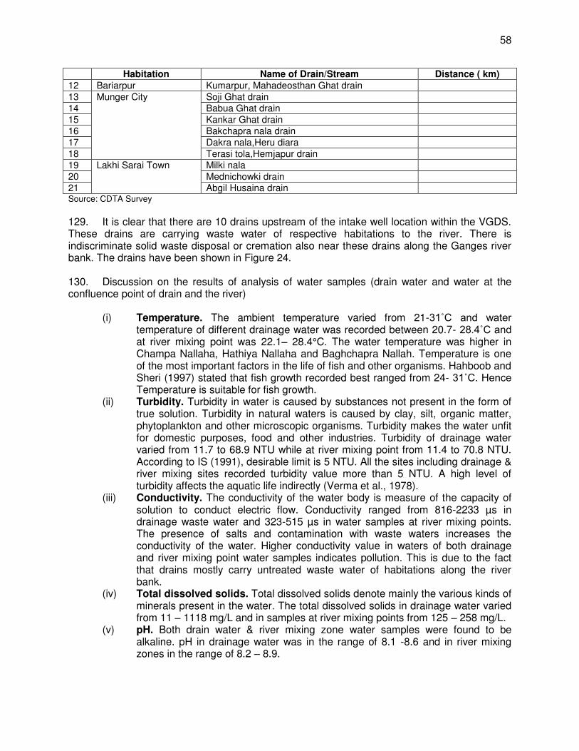
58
Habitation Name of Drain/Stream Distance ( km) 12 Bariarpur Kumarpur, Mahadeosthan Ghat drain 13 Munger City Soji Ghat drain 14 Babua Ghat drain 15 Kankar Ghat drain 16 Bakchapra nala drain 17 Dakra nala,Heru diara 18 Terasi tola,Hemjapur drain 19 Lakhi Sarai Town Milki nala 20 Mednichowki drain 21 Abgil Husaina drain Source: CDTA Survey
129. It is clear that there are 10 drains upstream of the intake well location within the VGDS. These drains are carrying waste water of respective habitations to the river. There is indiscriminate solid waste disposal or cremation also near these drains along the Ganges river bank. The drains have been shown in Figure 24. 130. Discussion on the results of analysis of water samples (drain water and water at the confluence point of drain and the river)
(i) Temperature. The ambient temperature varied from 21-31˚C and water temperature of different drainage water was recorded between 20.7- 28.4˚C and at river mixing point was 22.1– 28.4°C. The water temperature was higher in Champa Nallaha, Hathiya Nallaha and Baghchapra Nallah. Temperature is one of the most important factors in the life of fish and other organisms. Hahboob and Sheri (1997) stated that fish growth recorded best ranged from 24- 31˚C. Hence Temperature is suitable for fish growth.
(ii) Turbidity. Turbidity in water is caused by substances not present in the form of true solution. Turbidity in natural waters is caused by clay, silt, organic matter, phytoplankton and other microscopic organisms. Turbidity makes the water unfit for domestic purposes, food and other industries. Turbidity of drainage water varied from 11.7 to 68.9 NTU while at river mixing point from 11.4 to 70.8 NTU. According to IS (1991), desirable limit is 5 NTU. All the sites including drainage & river mixing sites recorded turbidity value more than 5 NTU. A high level of turbidity affects the aquatic life indirectly (Verma et al., 1978).
(iii) Conductivity. The conductivity of the water body is measure of the capacity of solution to conduct electric flow. Conductivity ranged from 816-2233 µs in drainage waste water and 323-515 µs in water samples at river mixing points. The presence of salts and contamination with waste waters increases the conductivity of the water. Higher conductivity value in waters of both drainage and river mixing point water samples indicates pollution. This is due to the fact that drains mostly carry untreated waste water of habitations along the river bank.
(iv) Total dissolved solids. Total dissolved solids denote mainly the various kinds of minerals present in the water. The total dissolved solids in drainage water varied from 11 – 1118 mg/L and in samples at river mixing points from 125 – 258 mg/L.
(v) pH. Both drain water & river mixing zone water samples were found to be alkaline. pH in drainage water was in the range of 8.1 -8.6 and in river mixing zones in the range of 8.2 – 8.9.
59
(vi) Dissolved oxygen. In the present investigation, dissolved oxygen in drainage water was found in the range of 0.4 – 6.8 mg/L and at river mixing points in the range of 2.4 – 6.8 mg/L. In both set of water samples, the value of dissolved oxygen was from moderate to very low. It might be due to high pollution load of organic and inorganic wastes. Champman (1986) reported that low level of dissolved oxygen affects growth and reproduction of freshwater aquatic organisms.
(vii) Free carbon dioxide. Free carbon dioxide was found to be in the range of 9.2 – 400 mg/L in drainage water and from 10 – 140 mg/L in river mixing zone waters. Free carbon dioxide in polluted water is generally high due to high inflow and decomposition of organic matter.
(viii) Carbonate. Carbonate alkalinity was absent in both the set of water samples. (ix) Bicarbonate alkalinity. Bicarbonate alkalinity varied from 26 – 174 mg/L in
drainage water while in river mixing point samples it ranged from 28 – 112 mg/L. Banerjea (1967) stated that alkalinity in aquatic ecosystem with less than 20 mg/L indicates of poor production.
(x) Total hardness. The total hardness refers to the concentration of divalent metal ions in water, which may be soft (0 – 75 mg/L) , moderately hard (75 – 150 mg/L), hard (150 – 300 mg/L) and very hard (>800 mg/L). Total hardness of drainage water was recorded in the range of 108 – 1000mg/L while at river water mixing points in the range of 108 – 550 mg/L. The drainage water may be kept under moderately hard to very hard category while river water at mixing points in moderately to hard category.
(xi) Chloride. Chloride is one of the major anions found in water. Higher concentration of chlorides indicates higher degree of organic pollution. Chloride varied from 14.98 - 280.71 mg/L in drainage water while in river water mixing point samples, it varied from 4.99 – 128.97 mg/L. The presence of high level of chlorides indicates that the water is organically rich.
(xii) Phosphate-phosphorus. Phosphorus in the natural freshwaters is present mostly in organic forms. The major sources of phosphorus are domestic sewage, detergents, agricultural effluents with fertilizers, and industrial waste waters. The higher concentration of phosphorus is indicative of pollution. According to U.S. EPA (1976), the concentration of it should not exceed 0.05mg/l in any tributary to river. Phosphate-phosphorus in analyzed samples was found in low amount below 0.05 mg/l.
(xiii) Nitrate–nitrogen. Nitrate represents the highest oxidised form of nitrogen. The most important source of the nitrate is biological oxidation of organic nitrogenous substances which come in sewage and industrial wastes. Domestic sewage contains very high amounts of nitrogenous compounds. Its value was recorded in the range of 0.018 – 0.367 mg/L in drainage water while in river mixing point samples; the range was from 0.016 -0.089 mg/L.
(xiv) Biochemical Oxygen Demand (BOD). It is a measure of oxygen required to oxidize the organic matter through microscopic organisms. BOD is an essential parameter in stream pollution control management and evaluation of self- purification capacity of streams. The permissible limit of BOD for surface water is 2 mg/L. The BOD of drainage water varied from 0 – 5.92 mg/L while in river water mixing point samples, it varied from 0 – 6,72 mg/L. The high level of BOD indicated the level of pollution.
131. On the basis of the investigation of the drainage water and river water at mixing points, (water quality parameters analyzed at 21 sampling stations distributed over 101.2 km length of
60
the river, upstream of the proposed location site), it may be concluded that the river stretch under investigation is not free from pollution. The river water pollution is mainly due to direct discharge of untreated waste water (sewage) & other wastes, both organic & inorganic in nature from the habitations along the river bank. 132. Potential Sources of Water Source Contamination. The potential sources of contamination have been identified as part of water and sanitation impact assessment in 100 km upstream of proposed intake well location. All the drains/streams in 100 km have been listed below in Table 18. The table also provides dimensions of drains at outfall point in Ganges River along with prevailing activities around outfall points.,
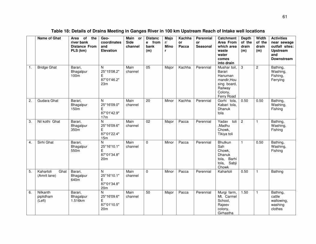
61
Table 18: Details of Drains Meeting in Ganges River in 100 km Upstream Reach of Intake well locations
Name of Ghat Area of the river bank Distance From PLS (km)
Geo-coordinates and Elevation
Main or Side channel
Distance from bank (m)
Major/ Minor
Kachha or Pacca
Perennial or Seasonal
Catchment Area From which area waste water comes into drain
Depth of the drain (m)
Width of the drain (m)
Activities near sewage outfall sites: Upstream and Downstream
1. Bridge Ghat Barari, Bhagalpur 100m
N 25°15 08.2 E 87°01 46.2 23m
Main channel
05 Major Kachha Perennial Mushar toil, Barari Hanuman mandir,Housing board, Railway Colony, Ferry Road
3 2 Bathing, Washing, Fishing, Ferrying
2. Gudara Ghat Barari, Bhagalpur 150m
N 25°16 09.0 E 87°01 42.9 17m
Main channel
20 Minor Kachha Perennial Gorhi tola, Kabari tola, Dhanuk tola
0.50 0.50 Bathing, Washing, Fishing
3. Nil kothi Ghat Barari, Bhagalpur 350m
N 25°16 09.6 E 87°01 22.4 15m
Main channel
02 Major Pacca Perennial Yadav toli ,Madhu Chowk, Tikiya toli
2 1 Bathing, Washing, Fishing
4. Sirhi Ghat Barari, Bhagalpur 550m
N 25°16 10.1 E 87°01 34.8 20m
Main channel
0 Minor Pacca Perennial Bhutkun Sah Chowk, Dhanuk tola, Barhi tola, Sabji Chowk
1 0.50 Bathing, Washing, Fishing
5. Kahartoli Ghat (Amrit lane)
Barari, Bhagalpur 640m
N 25°16 10.1 E 87°01 34.8 20m
Main channel
0 Minor Pacca Perennial Kahartoli 0.50 1 Bathing
6. Nilkanth piplidham (Left)
Barari, Bhagalpur 1.516km
N 25°16 09.6 E 87°01 10.5 20m
Main channel
50 Major Pacca Perennial Murgi farm, Mt. Carmel School, Rajeev colony, Girhastha
1.50 1 Bathing, cattle wallowing, washing clothes
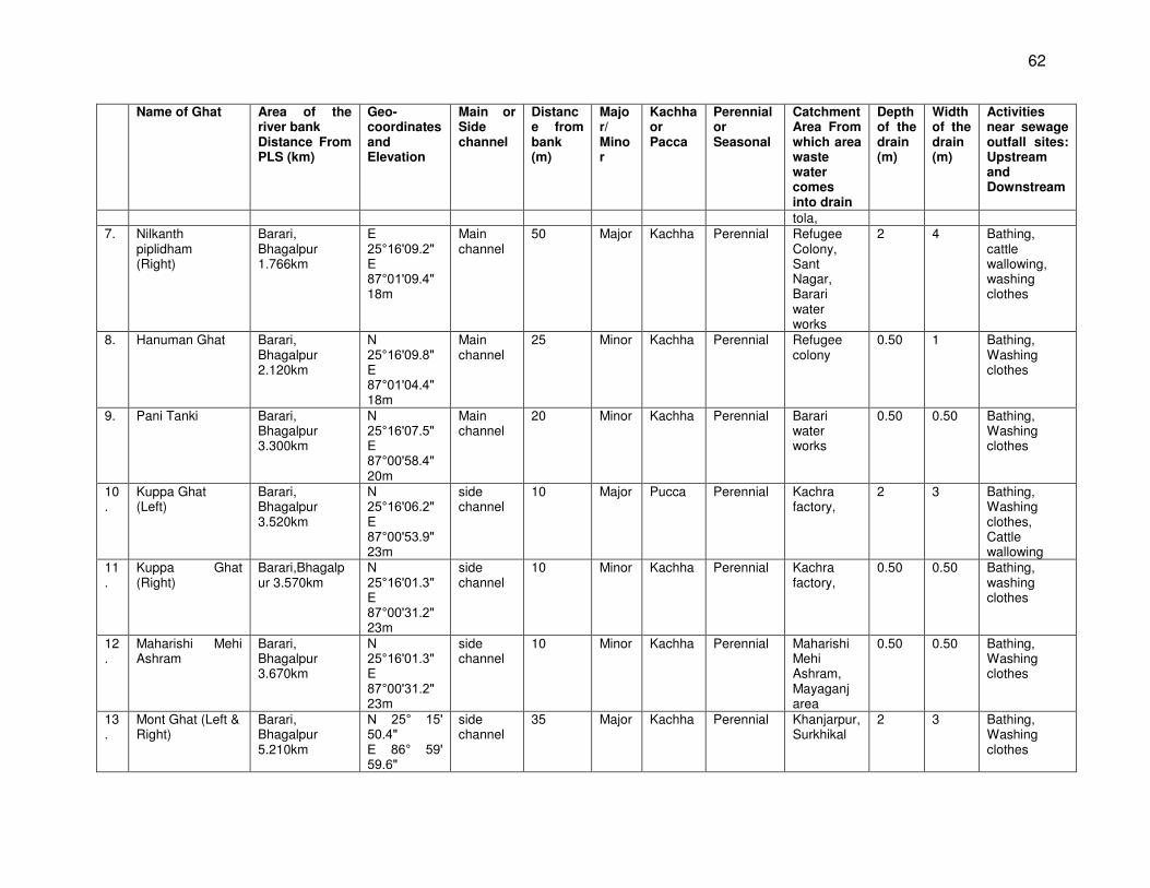
62
Name of Ghat Area of the river bank Distance From PLS (km)
Geo-coordinates and Elevation
Main or Side channel
Distance from bank (m)
Major/ Minor
Kachha or Pacca
Perennial or Seasonal
Catchment Area From which area waste water comes into drain
Depth of the drain (m)
Width of the drain (m)
Activities near sewage outfall sites: Upstream and Downstream
tola, 7. Nilkanth
piplidham (Right)
Barari, Bhagalpur 1.766km
E 25°16 09.2 E 87°01 09.4 18m
Main channel
50 Major Kachha Perennial Refugee Colony, Sant Nagar, Barari water works
2 4 Bathing, cattle wallowing, washing clothes
8. Hanuman Ghat Barari, Bhagalpur 2.120km
N 25°16 09.8 E 87°01 04.4 18m
Main channel
25 Minor Kachha Perennial Refugee colony
0.50 1 Bathing, Washing clothes
9. Pani Tanki Barari, Bhagalpur 3.300km
N 25°16 07.5 E 87°00 58.4 20m
Main channel
20 Minor Kachha Perennial Barari water works
0.50 0.50 Bathing, Washing clothes
10.
Kuppa Ghat (Left)
Barari, Bhagalpur 3.520km
N 25°16 06.2 E 87°00 53.9 23m
side channel
10 Major Pucca Perennial Kachra factory,
2 3 Bathing, Washing clothes, Cattle wallowing
11.
Kuppa Ghat (Right)
Barari,Bhagalpur 3.570km
N 25°16 01.3 E 87°00 31.2 23m
side channel
10 Minor Kachha Perennial Kachra factory,
0.50 0.50 Bathing, washing clothes
12.
Maharishi Mehi Ashram
Barari, Bhagalpur 3.670km
N 25°16 01.3 E 87°00 31.2 23m
side channel
10 Minor Kachha Perennial Maharishi Mehi Ashram, Mayaganj area
0.50 0.50 Bathing, Washing clothes
13.
Mont Ghat (Left & Right)
Barari, Bhagalpur 5.210km
N 25° 15 50.4 E 86° 59 59.6
side channel
35 Major Kachha Perennial Khanjarpur, Surkhikal
2 3 Bathing, Washing clothes
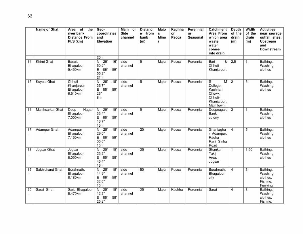
63
Name of Ghat Area of the river bank Distance From PLS (km)
Geo-coordinates and Elevation
Main or Side channel
Distance from bank (m)
Major/ Minor
Kachha or Pacca
Perennial or Seasonal
Catchment Area From which area waste water comes into drain
Depth of the drain (m)
Width of the drain (m)
Activities near sewage outfall sites: Upstream and Downstream
20m 14.
Khirni Ghat Barari, Bhagalpur 5.450km
N 25° 16 50.2 E 86° 59 55.2 21m
side channel
5 Major Pucca Perennial Bari & Chhoti Khanjarpur,
2.5 1 Bathing, Washing clothes
15.
Koyala Ghat Chhoti Khanjarpur Bhagalpur 6.510km
N 25° 15 36.7 E 86° 59 26 8m
side channel
5 Major Pucca Perennial S M College, Kachhari Chowk, Chhoti- Khanjarpur, Main town
2 6 Bathing, Washing clothes
16.
Maniksarkar Ghat Deep Nagar Bhagalpur 7.000km
N 25° 15 33.4 E 86° 59 16.7 15m
side channel
5 Major Pucca Perennial Deepnagar, Bank colony
2 1 Bathing, Washing clothes
17.
Adampur Ghat Adampur Bhagalpur 7.150km
N 25° 15 29.0 E 86° 59 05.6 15m
side channel
20 Major Pucca Perennial Ghantaghar Adampur, Radha Rani Sinha Road
4 5 Bathing, Washing clothes
18.
Jogsar Ghat Jogsar Bhagalpur 8.050km
N 25° 15 23.2 E 86° 58 45.4 16m
side channel
25 Major Pucca Perennial Shankar Takij Area, Jogsar
1 1.50 Bathing, Washing clothes
19.
Sakhichand Ghat Burahnath, Bhagalpur 8.180km
N 25° 15 14.9 E 86° 58 32.6 15m
side channel
50 Major Pucca Perennial Burahnath, Bhagalpur city
4 3 Bathing, Washing clothes, Fishing, Ferrying
20.
Sarai Ghat Sari, Bhagalpur 8.470km
N 25° 15 12.2 E 86° 58 25.2
side channel
25 Major Kachha Perennial Sarai 4 3 Bathing, Washing clothes, Fishing,
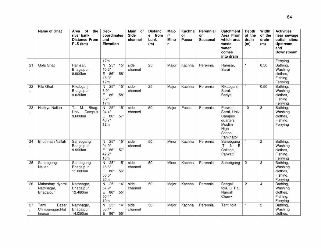
64
Name of Ghat Area of the river bank Distance From PLS (km)
Geo-coordinates and Elevation
Main or Side channel
Distance from bank (m)
Major/ Minor
Kachha or Pacca
Perennial or Seasonal
Catchment Area From which area waste water comes into drain
Depth of the drain (m)
Width of the drain (m)
Activities near sewage outfall sites: Upstream and Downstream
17m Ferrying 21.
Gola Ghat Ramsar, Bhagalpur 8.900km
N 25° 15 10.2 E 86° 58 18.0 17m
side channel
25 Major Kachha Perennial Ramsar, Sarai
1 0.50 Bathing, Washing clothes, Fishing, Ferrying
22.
Kila Ghat Rikabganj Bhagalpur 9.030km
N 25° 15 6.9 E 86° 58 6.2 17m
side channel
25 Major Kachha Perennial Rikabganj, Sarai, Bariya
1 0.50 Bathing, Washing clothes, Fishing, Ferrying
23.
Hathiya Nallah T. M. Bhag. Univ. Campus 9.600km
N 25° 15 04.4 E 86° 57 46.7 12m
side channel
50 Major Pucca Perennial Parwatti, Sarai, Univ. Campus quarters, Muslim High School, Pankhatoli
10 8 Bathing, Washing clothes, Fishing, Ferrying
24.
Bhuthnath Nallah Sahebgang Bhagalpur 9.990km
N 25° 15 04.9 E 86° 57 42.2 16m
side channel
50 Minor Kachha Perennial Sahebgang ,T N B College, Parwatti
1 2 Bathing, Washing clothes, Fishing, Ferrying
25.
Sahebgang Nallah
Sahebgang Bhagalpur 11.000km
N 25° 15 15.6 E 86° 56 55.5 20m
side channel
50 Minor Kachha Perennial Sahebgang 2 3 Bathing, Washing clothes, Fishing, Ferrying
26.
Mahashay dyorhi, Nathnagar, Bhagalpur
Nathnagar, Bhagalpur 12.480km
N 25° 14 57.9 E 86° 55 50.4 19m
side channel
50 Major Kachha Perennial Bengali tola, C T S, Nargah Chowk
2 4 Bathing, Washing clothes, Fishing, Ferrying
27.
Tanti Bazar, Chmpanagar,Nathnagar,
Nathnagar, Bhagalpur 14.050km
N 25° 14 55.4 E 86° 55
side channel
50 Major Kachha Perennial Tanti tola
1 2 Bathing, Washing clothes,
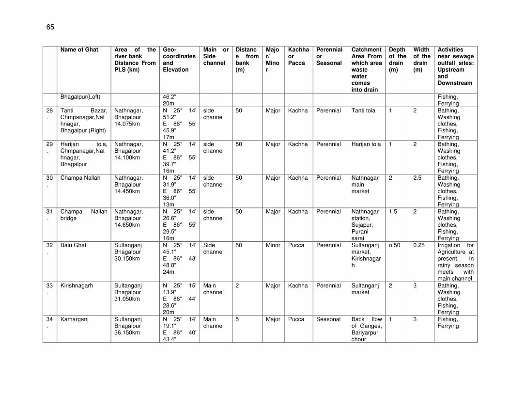
65
Name of Ghat Area of the river bank Distance From PLS (km)
Geo-coordinates and Elevation
Main or Side channel
Distance from bank (m)
Major/ Minor
Kachha or Pacca
Perennial or Seasonal
Catchment Area From which area waste water comes into drain
Depth of the drain (m)
Width of the drain (m)
Activities near sewage outfall sites: Upstream and Downstream
Bhagalpur(Left) 46.2 20m
Fishing, Ferrying
28.
Tanti Bazar, Chmpanagar,Nathnagar, Bhagalpur (Right)
Nathnagar, Bhagalpur 14.075km
N 25° 14 51.2 E 86° 55 45.9 17m
side channel
50 Major Kachha Perennial Tanti tola 1 2 Bathing, Washing clothes, Fishing, Ferrying
29.
Harijan tola, Chmpanagar,Nathnagar, Bhagalpur
Nathnagar, Bhagalpur 14.100km
N 25° 14 41.2 E 86° 55 39.7 16m
side channel
50 Major Kachha Perennial Harijan tola 1 2 Bathing, Washing clothes, Fishing, Ferrying
30.
Champa Nallah Nathnagar, Bhagalpur 14.450km
N 25° 14 31.9 E 86° 55 36.0 13m
side channel
50 Major Kachha Perennial Nathnagar main market
2 2.5 Bathing, Washing clothes, Fishing, Ferrying
31.
Champa Nallah bridge
Nathnagar, Bhagalpur 14.650km
N 25° 14 26.6 E 86° 55 29.5 16m
side channel
50 Major Kachha Perennial Nathnagar station, Sujapur, Purani sarai
1.5 2 Bathing, Washing clothes, Fishing, Ferrying
32.
Balu Ghat Sultanganj Bhagalpur 30.150km
N 25° 14 45.1 E 86° 43 48.8 24m
Side channel
50 Minor Pucca Perennial Sultanganj market, Kirishnagarh
o.50 0.25 Irrigation for Agriculture at present, In rainy season meets with main channel
33.
Kirishnagarh Sultanganj Bhagalpur 31.050km
N 25° 15 13.9 E 86° 44 28.6 20m
Main channel
2 Major Kachha Perennial Sultanganj market
2 3 Bathing, Washing clothes, Fishing, Ferrying
34.
Kamarganj Sultanganj Bhagalpur 36.150km
N 25° 14 19.1 E 86° 40 43.4
Main channel
5 Major Pucca Seasonal Back flow of Ganges, Bariyarpur chour,
1 3 Fishing, Ferrying
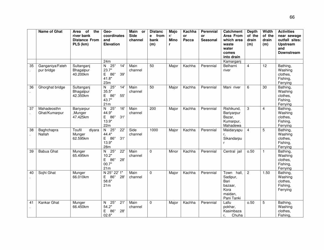
66
Name of Ghat Area of the river bank Distance From PLS (km)
Geo-coordinates and Elevation
Main or Side channel
Distance from bank (m)
Major/ Minor
Kachha or Pacca
Perennial or Seasonal
Catchment Area From which area waste water comes into drain
Depth of the drain (m)
Width of the drain (m)
Activities near sewage outfall sites: Upstream and Downstream
24m Kamarganj 35.
Ganganiya/Fatehpur bridge
Sultanganj Bhagalpur 40.200km
N 25° 14 23.7 E 86° 39 41.8 23m
Main channel
50 Major Kachha Perennial Belharni river
4 12 Bathing, Washing clothes, Fishing, Ferrying
36.
Ghorghat bridge Sultanganj Bhagalpur 42.350km
N 25° 14 35.5 E 86° 55 43.7 21m
Main channel
50 Major Kachha Perennial Mani river 6 30 Bathing, Washing clothes, Fishing, Ferrying
37.
Mahadeosthn Ghat/Kumarpur
Bariyarpur ,Munger 47.425km
N 25° 16 44.9 E 86° 31 13.9 22m
Main channel
200 Major Kachha Perennial Rishikund, Bariyarpur Bazar, Kumarpur, Mahadewa
3 4 Bathing, Washing clothes, Fishing, Ferrying
38.
Baghchapra Nallah
Toufil diyara Munger 62.595km
N 25° 22 44.4 E 86° 31 13.9 28m
Side channel
1000 Major Kachha Perennial Maidaryapur, Sikandarpur
4 5 Bathing, Washing clothes, Fishing, Ferrying
39 Babua Ghat Munger 65.495km
N 25° 22 10.2 E 86° 28 00.7 21m
Main channel
0 Minor Kachha Perennial Central jail o.50 1 Bathing, Washing clothes, Fishing, Ferrying
40.
Sojhi Ghat Munger 66.010km
N 25° 22 1 E 86° 28 58.6 21m
Main channel
0 Major Kachha Perennial Town hall, Sadipur, Bari bazaar, Kora maidan, Pani Tanki
2 1.50 Bathing, Washing clothes, Fishing, Ferrying
41.
Kankar Ghat Munger 66.450km
N 25° 21 54.2 E 86° 28 02.6
Main channel
0 Major Kachha Perennial Lallu pokhar, Kasimbazar, Chuha
o.50 5 Bathing, Washing clothes, Fishing,
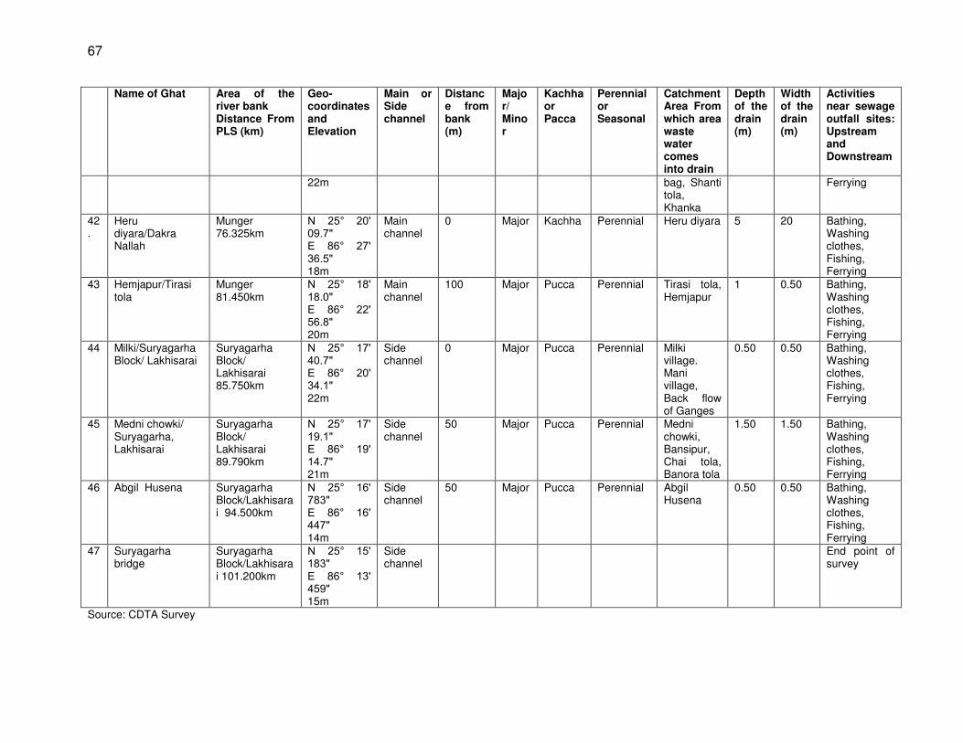
67
Name of Ghat Area of the river bank Distance From PLS (km)
Geo-coordinates and Elevation
Main or Side channel
Distance from bank (m)
Major/ Minor
Kachha or Pacca
Perennial or Seasonal
Catchment Area From which area waste water comes into drain
Depth of the drain (m)
Width of the drain (m)
Activities near sewage outfall sites: Upstream and Downstream
22m bag, Shanti tola, Khanka
Ferrying
42.
Heru diyara/Dakra Nallah
Munger 76.325km
N 25° 20 09.7 E 86° 27 36.5 18m
Main channel
0 Major Kachha Perennial Heru diyara 5 20 Bathing, Washing clothes, Fishing, Ferrying
43 Hemjapur/Tirasi tola
Munger 81.450km
N 25° 18 18.0 E 86° 22 56.8 20m
Main channel
100 Major Pucca Perennial Tirasi tola, Hemjapur
1 0.50 Bathing, Washing clothes, Fishing, Ferrying
44 Milki/Suryagarha Block/ Lakhisarai
Suryagarha Block/ Lakhisarai 85.750km
N 25° 17 40.7 E 86° 20 34.1 22m
Side channel
0 Major Pucca Perennial Milki village. Mani village, Back flow of Ganges
0.50 0.50 Bathing, Washing clothes, Fishing, Ferrying
45 Medni chowki/ Suryagarha, Lakhisarai
Suryagarha Block/ Lakhisarai 89.790km
N 25° 17 19.1 E 86° 19 14.7 21m
Side channel
50 Major Pucca Perennial Medni chowki, Bansipur, Chai tola, Banora tola
1.50 1.50 Bathing, Washing clothes, Fishing, Ferrying
46 Abgil Husena Suryagarha Block/Lakhisarai 94.500km
N 25° 16 783 E 86° 16 447 14m
Side channel
50 Major Pucca Perennial Abgil Husena
0.50 0.50
Bathing, Washing clothes, Fishing, Ferrying
47 Suryagarha bridge
Suryagarha Block/Lakhisarai 101.200km
N 25° 15 183 E 86° 13 459 15m
Side channel
End point of survey
Source: CDTA Survey
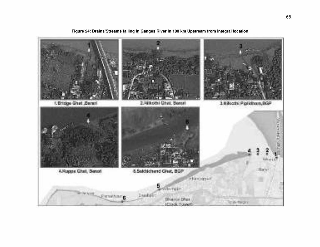
68
Figure 24: Drains/Streams falling in Ganges River in 100 km Upstream from integral location
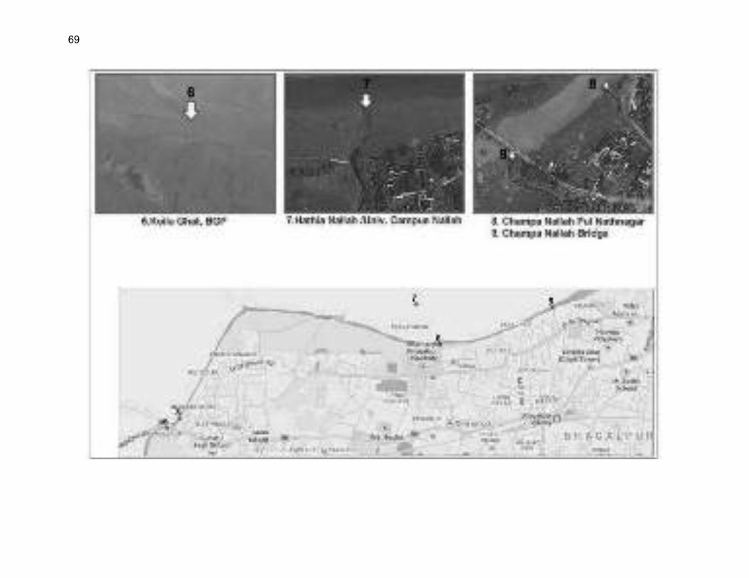
69
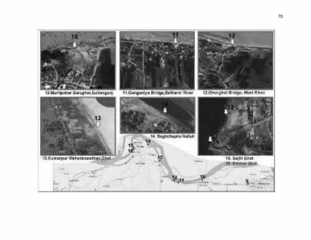
70
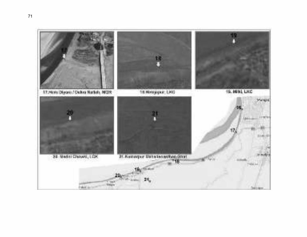
71
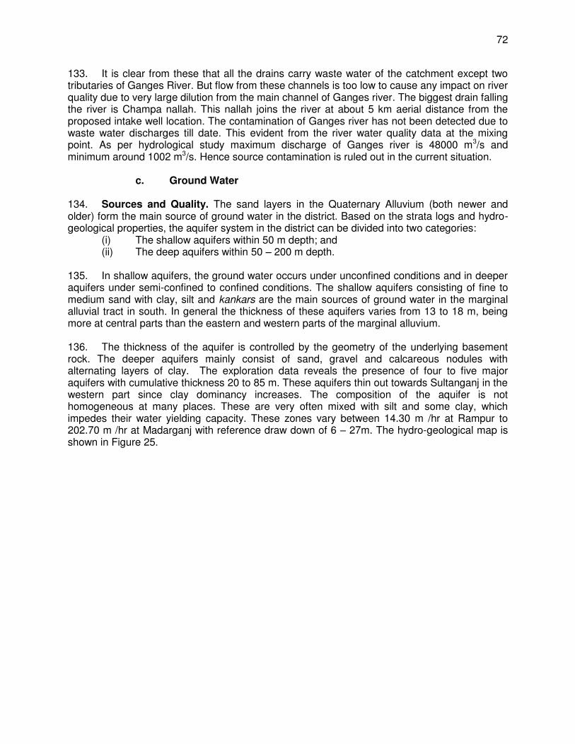
72
133. It is clear from these that all the drains carry waste water of the catchment except two tributaries of Ganges River. But flow from these channels is too low to cause any impact on river quality due to very large dilution from the main channel of Ganges river. The biggest drain falling the river is Champa nallah. This nallah joins the river at about 5 km aerial distance from the proposed intake well location. The contamination of Ganges river has not been detected due to waste water discharges till date. This evident from the river water quality data at the mixing point. As per hydrological study maximum discharge of Ganges river is 48000 m3/s and minimum around 1002 m3/s. Hence source contamination is ruled out in the current situation.
c. Ground Water
134. Sources and Quality. The sand layers in the Quaternary Alluvium (both newer and older) form the main source of ground water in the district. Based on the strata logs and hydro-geological properties, the aquifer system in the district can be divided into two categories:
(i) The shallow aquifers within 50 m depth; and (ii) The deep aquifers within 50 – 200 m depth.
135. In shallow aquifers, the ground water occurs under unconfined conditions and in deeper aquifers under semi-confined to confined conditions. The shallow aquifers consisting of fine to medium sand with clay, silt and kankars are the main sources of ground water in the marginal alluvial tract in south. In general the thickness of these aquifers varies from 13 to 18 m, being more at central parts than the eastern and western parts of the marginal alluvium. 136. The thickness of the aquifer is controlled by the geometry of the underlying basement rock. The deeper aquifers mainly consist of sand, gravel and calcareous nodules with alternating layers of clay. The exploration data reveals the presence of four to five major aquifers with cumulative thickness 20 to 85 m. These aquifers thin out towards Sultanganj in the western part since clay dominancy increases. The composition of the aquifer is not homogeneous at many places. These are very often mixed with silt and some clay, which impedes their water yielding capacity. These zones vary between 14.30 m /hr at Rampur to 202.70 m /hr at Madarganj with reference draw down of 6 – 27m. The hydro-geological map is shown in Figure 25.
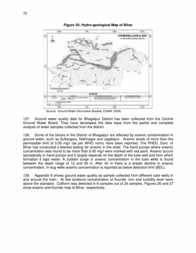
73
Figure 25: Hydro-geological Map of Bihar
Source: Ground Water Information Booklet, CGWB, 2009)
137. Ground water quality data for Bhagalpur District has been collected from the Central Ground Water Board. They have developed the data base from the partial and complete analysis of water samples collected from the district. 138. Some of the blocks in the District of Bhagalpur are affected by arsenic contamination in ground water, such as Sultanganj, Nathnagar and Jagdispur. Arsenic levels of more than the permissible limit of 0.05 mg/l (as per WHO norm) have been reported. The PHED, Govt. of Bihar has conducted a blanket testing for arsenic in the state. The hand pumps where arsenic concentration was found to be more than 0.05 mg/l were marked with red paint. Arsenic occurs sporadically in hand pumps and it largely depends on the depth of the tube well and from which formation it taps water. A sudden surge in arsenic concentration in the tube wells is found between the depth range of 12 and 40 m. After 40 m there is a drastic decline in arsenic concentration. In dug wells arsenic concentration is reported as below detection limit (BDL). 139. Appendix 8 shows ground water quality as sample collected from different tube wells in and around the town. At few locations concentration of fluoride, iron and turbidity level were above the standard. Coliform was detected in 6 samples out of 24 samples. Figures 26 and 27 show arsenic and fluoride map of Bihar, respectively.
74
Figure 26: Arsenic map of Bihar
Source: International Research Journal of Environment Sciences Vol. 4(2), 70-76, February (2015)
Source: Ashoka Ghosh 2009, AN Patna
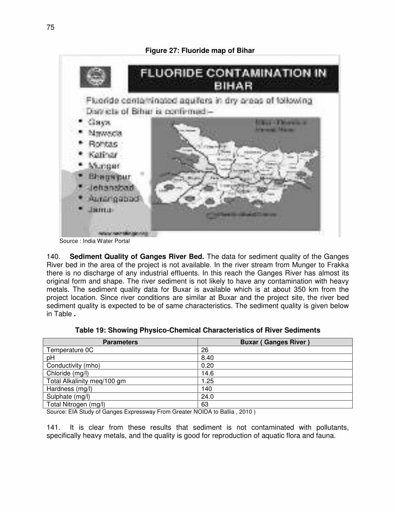
75
Figure 27: Fluoride map of Bihar
Source : India Water Portal
140. Sediment Quality of Ganges River Bed. The data for sediment quality of the Ganges River bed in the area of the project is not available. In the river stream from Munger to Frakka there is no discharge of any industrial effluents. In this reach the Ganges River has almost its original form and shape. The river sediment is not likely to have any contamination with heavy metals. The sediment quality data for Buxar is available which is at about 350 km from the project location. Since river conditions are similar at Buxar and the project site, the river bed sediment quality is expected to be of same characteristics. The sediment quality is given below in Table .
Table 19: Showing Physico-Chemical Characteristics of River Sediments
Parameters Buxar ( Ganges River ) Temperature 0C 26 pH 8.40 Conductivity (mho) 0.20 Chloride (mg/l) 14.6 Total Alkalinity meq/100 gm 1.25 Hardness (mg/l) 140 Sulphate (mg/l) 24.0 Total Nitrogen (mg/l) 63 Source: EIA Study of Ganges Expressway From Greater NOIDA to Ballia , 2010 )
141. It is clear from these results that sediment is not contaminated with pollutants, specifically heavy metals, and the quality is good for reproduction of aquatic flora and fauna.
76
B. Biologocial Conditions
1. Transmission mains alignment and WTP site 142. There are no wetlands, mangroves, or estuaries in or within the sites as the transmission main alignment and WTP site are within the built up municipal limits of the city, and the trees and vegetation (mostly shrubs and grasses) are those commonly found in urban areas. 143. There are no dense woodlands in the area, but there are patches of low jungles. Major species of trees found here include Sal, Bamboo, Khair, Salai, and Kasambar. The main fruit trees indigenous to the district include: mango (Mangifera indica), mahua (Bassia latifolia), jackfruit (Artocarpus integrifolia), banana (Musa Sapientum), date palm or khajur, and tal tree, tamarind (Tamarindus Indica), plums, the jamun (Eugenia Jambulina), custard apple, guava and lime. 144. There is one forest area of 24 acres, Sundarban (ward no. 3 of Bhagalpur), which is located within 100 m of the proposed water treatment plant. As per the state notification, that area is protected for conservation of tree species only. No wildlife is present in Sundarban. Trees are mainly Teak, Mehagani, Mango, Litchi, Jamun, Arjun, Tamarind and Rubber. There will be no cutting of trees in Sundarban during project implementation. At the WTP site there are 20 trees that need to be cut. But final assessment can be done after finalization of exact location of WTP within existing WTP campus at barari. 145. The district is known for its variety of monkeys and bats. Two species of Indian bear are also found in the district. Other species includes hyena, wolf, several species of cats, mongoose, Indian fox, the wild dog, jackal, deers such as barakhamba, the spotted deer, the four horned antelope and the barking deer are also found in the district. However, many of these species are now found rarely in the district. None have been recorded in BWSP2 sites.
2. Intake 146. Vikramshila Gangetic Dolphin Sanctuary (VGDS). It is a 50 km stretch of the Ganges River from Sultanganj to Kahalgaon. Designated in 1991 (the Notification copy is attached as Appendix 10), it is the only protected area for the endangered Gangetic dolphins in Asia. Once found in abundance, only a few hundred remain, of which half are found here. The Gangetic dolphins (Platanista gangetica gangetica) have been declared as the National Aquatic Animal of India. This decision was taken in the first meeting of the National Ganges River Basin Authority (NGRBA) chaired by Prime Minister Dr. Manmohan Singh on 5th October, 2009. Gangetic Dolphins (known as Soons by locals) are classified as endangered on the 2006 IUCN Red List of Threatened Species and included in Schedule-I of the Indian Wildlife Protection Act, 1972. The sanctuary also contains rich diversity of other threatened aquatic wildlife, including the Indian smooth-coated otter (Lutrogale perspicillata), gharial (Gavialis gangeticus), a variety of freshwater turtles, and 135 species of waterfowl. 147. The Vikramshila Biodiversity Research and Education Centre (VBREC) in Bhagalpur has conducted extensive conservation and bio-monitoring work in VGDS over the last decade (Choudhary et al., 2006). Choudhary et al. (2004) observed the greater adjutant stork, (Liptoptilos dubius), an Endangered species (IUCN, 1994) that had never before been recorded in the Ganges basin. The VBREC has prepared a comprehensive annotated checklist of about 190 bird species recorded from the river stretch (within river habitats from Sultanganj to Bhagalpur) and the precinct areas of the floodplain stretching on the Ganges’s banks. The
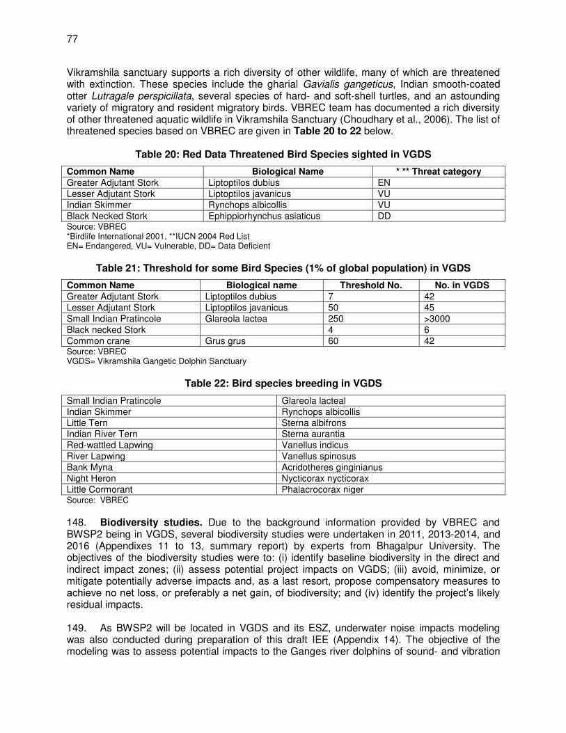
77
Vikramshila sanctuary supports a rich diversity of other wildlife, many of which are threatened with extinction. These species include the gharial Gavialis gangeticus, Indian smooth-coated otter Lutragale perspicillata, several species of hard- and soft-shell turtles, and an astounding variety of migratory and resident migratory birds. VBREC team has documented a rich diversity of other threatened aquatic wildlife in Vikramshila Sanctuary (Choudhary et al., 2006). The list of threatened species based on VBREC are given in Table 20 to 22 below.
Table 20: Red Data Threatened Bird Species sighted in VGDS
Common Name Biological Name * ** Threat category Greater Adjutant Stork Liptoptilos dubius EN Lesser Adjutant Stork Liptoptilos javanicus VU Indian Skimmer Rynchops albicollis VU Black Necked Stork Ephippiorhynchus asiaticus DD Source: VBREC *Birdlife International 2001, **IUCN 2004 Red List EN= Endangered, VU= Vulnerable, DD= Data Deficient
Table 21: Threshold for some Bird Species (1% of global population) in VGDS
Common Name Biological name Threshold No. No. in VGDS Greater Adjutant Stork Liptoptilos dubius 7 42 Lesser Adjutant Stork Liptoptilos javanicus 50 45 Small Indian Pratincole Glareola lactea 250 >3000 Black necked Stork 4 6 Common crane Grus grus 60 42 Source: VBREC VGDS= Vikramshila Gangetic Dolphin Sanctuary
Table 22: Bird species breeding in VGDS
Small Indian Pratincole Glareola lacteal Indian Skimmer Rynchops albicollis Little Tern Sterna albifrons Indian River Tern Sterna aurantia Red-wattled Lapwing Vanellus indicus River Lapwing Vanellus spinosus Bank Myna Acridotheres ginginianus Night Heron Nycticorax nycticorax Little Cormorant Phalacrocorax niger Source: VBREC
148. Biodiversity studies. Due to the background information provided by VBREC and BWSP2 being in VGDS, several biodiversity studies were undertaken in 2011, 2013-2014, and 2016 (Appendixes 11 to 13, summary report) by experts from Bhagalpur University. The objectives of the biodiversity studies were to: (i) identify baseline biodiversity in the direct and indirect impact zones; (ii) assess potential project impacts on VGDS; (iii) avoid, minimize, or mitigate potentially adverse impacts and, as a last resort, propose compensatory measures to achieve no net loss, or preferably a net gain, of biodiversity; and (iv) identify the project’s likely residual impacts. 149. As BWSP2 will be located in VGDS and its ESZ, underwater noise impacts modeling was also conducted during preparation of this draft IEE (Appendix 14). The objective of the modeling was to assess potential impacts to the Ganges river dolphins of sound- and vibration
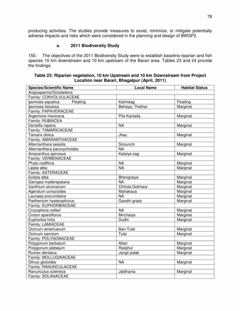
78
producing activities. The studies provide measures to avoid, minimize, or mitigate potentially adverse impacts and risks which were considered in the planning and design of BWSP2.
a. 2011 Biodiversity Study 150. The objectives of the 2011 Biodiversity Study were to establish baseline riparian and fish species 10 km downstream and 10 km upstream of the Barari area. Tables 23 and 24 provide the findings.
Table 23: Riparian vegetation, 10 km Upstream and 10 km Downstream from Project Location near Barari, Bhagalpur (April, 2011)
Species/Scientific Name Local Name Habitat Status Angiosperms/Dictoledons Family: CONVOLVULACEAE Ipomoea aquatica Floating Kalmisag Floating Ipomoea fistulosa Behaya, Thethar Marginal Family: PAPAVERACEAE Argemone mexicana Pila Kantaila Marginal Family: RUBIACEA Dentella repens NA Marginal Family: TAMARICACEAE Tamarix dioica Jhau Marginal Family: AMARANTHACEAE Alternanthera sessilis Sirounchi Marginal Alternanthera paronychoides NA Amaranthus spinosus Kataiya sag Marginal Family: VERBENACEAE Phyla nodiflora NA Marginal Lippia alba NA Marginal Family: ASTERACEAE Eclipta alba Bhengraiya Marginal Garngea maderspatana NA Marginal Xanthium strumarium Chhota Gokhara Marginal Ageratum conyzoides Mahakaua Marginal Launaea procumbens NA Marginal Parthenium hysterophorus Gandhi grass Marginal Family: EUPHORBIACEAE Crozophora rottleri NA Marginal Croton sparsiflorus Mirchaiya Marginal Euphorbia hirta Dudhi Marginal Family: LAMIACEAE Ocimum americanum Ban-Tulsi Marginal Ocimum sanctum Tulsi Marginal Family: POLYGONACEAE Polygonum barbatum Atlari Marginal Polygonum plebejum Raiiphul Marginal Rumex dentatus Jangli palak Marginal Family: MOLLUGINACEAE Glinus glotoides NA Marginal Family: RANUNCULACEAE Ranunculus scleretus Jaldhania Marginal Family: SOLANACEAE
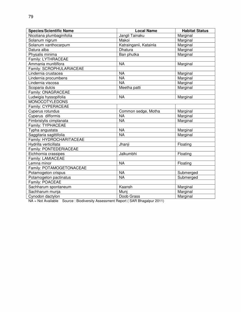
79
Species/Scientific Name Local Name Habitat Status Nicotiana plumbaginifolia Jangli Tainaku Marginal Solanum nigrum Makoi Marginal Solanum xanthocarpum Katrainganii, Katainla Marginal Datura alba Dhatura Marginal Physalis minima Ban phutka Marginal Family: LYTHRACEAE Ammania munltiflora NA Marginal Family: SCROPHULARIACEAE Lindernia crustacea NA Marginal Lindernia procumbens NA Marginal Lindernia viscosa NA Marginal Scoparia dulcis Meetha patti Marginal Family: ONAGRACEAE Ludwigia hyssopifolia NA Marginal MONOCOTYLEDONS Family: CYPERACEAE Cyperus rotundus Common sedge, Motha Marginal Cyperus difformis NA Marginal Fimbristylis cimplanata NA Marginal Family: TYPHACEAE Typha angustata NA Marginal Saggitaria sagittifolia NA Marginal Family: HYDROCHARITACEAE Hydrilla verticillata Jhanji Floating Family: PONTEDERIACEAE Eichhornia crassipes Jalkumbhi Floating Family: LAMIACEAE Lemna minor NA Floating Family: POTAMOGETONACEAE Potamogeton crispus NA Submerged Potamogeton pactinatus NA Submerged Family: POACEAE Sachharum spontaneum Kaansh Marginal Sachharum munja Munj Marginal Cynodon dactylon Doob Grass Marginal NA = Not Available Source : Biodiversity Assessment Report ( SAR Bhagalpur 2011)
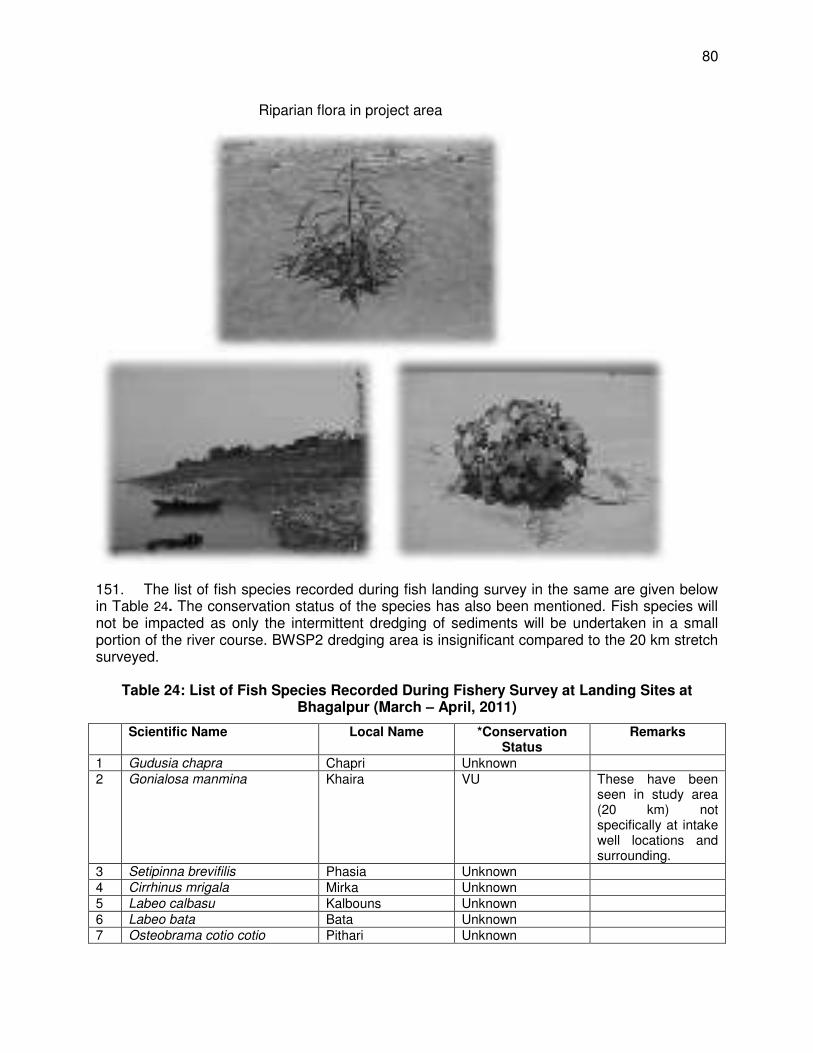
80
151. The list of fish species recorded during fish landing survey in the same are given below in Table 24. The conservation status of the species has also been mentioned. Fish species will not be impacted as only the intermittent dredging of sediments will be undertaken in a small portion of the river course. BWSP2 dredging area is insignificant compared to the 20 km stretch surveyed.
Table 24: List of Fish Species Recorded During Fishery Survey at Landing Sites at Bhagalpur (March – April, 2011)
Scientific Name Local Name *Conservation Status
Remarks
1 Gudusia chapra Chapri Unknown 2 Gonialosa manmina Khaira VU These have been
seen in study area (20 km) not specifically at intake well locations and surrounding.
3 Setipinna brevifilis Phasia Unknown 4 Cirrhinus mrigala Mirka Unknown 5 Labeo calbasu Kalbouns Unknown 6 Labeo bata Bata Unknown 7 Osteobrama cotio cotio Pithari Unknown
Riparian flora in project area
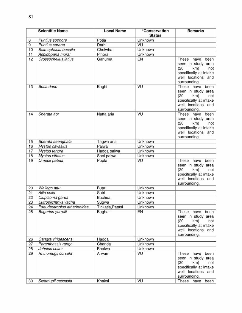
81
Scientific Name Local Name *Conservation Status
Remarks
8 Puntius sophore Potia Unknown 9 Puntius sarana Darhi VU 10 Salmophasia bacaila Chelwha Unknown 11 Aspidoparia morar Pihora Unknown 12 Crossocheilus latius Gahuma EN These have been
seen in study area (20 km) not specifically at intake well locations and surrounding.
13 Botia dario Baghi VU These have been seen in study area (20 km) not specifically at intake well locations and surrounding.
14 Sperata aor Natta aria VU These have been seen in study area (20 km) not specifically at intake well locations and surrounding.
15 Sperata seenghala Tagwa aria Unknown 16 Mystus cavasius Palwa Unknown 17 Mystus tengra Hadda palwa Unknown 18 Mystus vittatus Soni palwa Unknown 19 Ompok pabda Popta VU These have been
seen in study area (20 km) not specifically at intake well locations and surrounding.
20 Wallago attu Buari Unknown 21 Ailia coila Sutri Unknown 22 Clupisoma garua Bachua Unknown 23 Eutropiichthys vacha Sugwa Unknown 24 Pseudeutropius atherinoides Tinkatia,Patasi Unknown 25 Bagarius yarrelli Baghar EN These have been
seen in study area (20 km) not specifically at intake well locations and surrounding.
26 Gangra viridescens Hadda Unknown 27 Parambassis ranga Chanda Unknown 28 Johnius coitor Bholwa Unknown 29 Rhinomugil corsula Arwari VU These have been
seen in study area (20 km) not specifically at intake well locations and surrounding.
30 Sicamugil cascasia Khaksi VU These have been
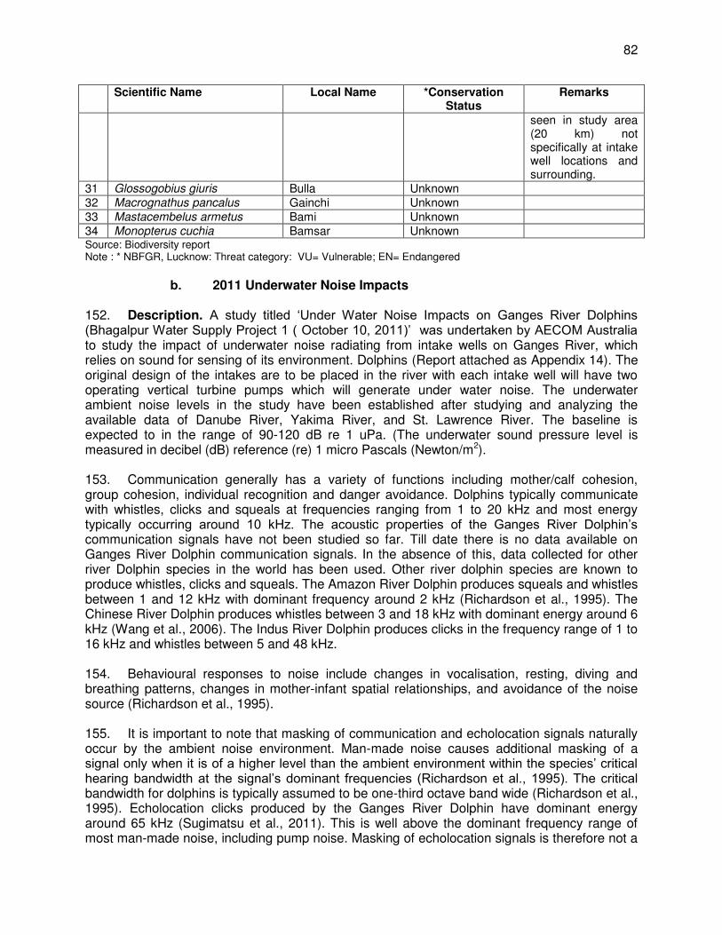
82
Scientific Name Local Name *Conservation Status
Remarks
seen in study area (20 km) not specifically at intake well locations and surrounding.
31 Glossogobius giuris Bulla Unknown 32 Macrognathus pancalus Gainchi Unknown 33 Mastacembelus armetus Bami Unknown 34 Monopterus cuchia Bamsar Unknown Source: Biodiversity report Note : * NBFGR, Lucknow: Threat category: VU= Vulnerable; EN= Endangered
b. 2011 Underwater Noise Impacts
152. Description. A study titled ‘Under Water Noise Impacts on Ganges River Dolphins (Bhagalpur Water Supply Project 1 ( October 10, 2011)’ was undertaken by AECOM Australia to study the impact of underwater noise radiating from intake wells on Ganges River, which relies on sound for sensing of its environment. Dolphins (Report attached as Appendix 14). The original design of the intakes are to be placed in the river with each intake well will have two operating vertical turbine pumps which will generate under water noise. The underwater ambient noise levels in the study have been established after studying and analyzing the available data of Danube River, Yakima River, and St. Lawrence River. The baseline is expected to in the range of 90-120 dB re 1 uPa. (The underwater sound pressure level is measured in decibel (dB) reference (re) 1 micro Pascals (Newton/m2). 153. Communication generally has a variety of functions including mother/calf cohesion, group cohesion, individual recognition and danger avoidance. Dolphins typically communicate with whistles, clicks and squeals at frequencies ranging from 1 to 20 kHz and most energy typically occurring around 10 kHz. The acoustic properties of the Ganges River Dolphin’s communication signals have not been studied so far. Till date there is no data available on Ganges River Dolphin communication signals. In the absence of this, data collected for other river Dolphin species in the world has been used. Other river dolphin species are known to produce whistles, clicks and squeals. The Amazon River Dolphin produces squeals and whistles between 1 and 12 kHz with dominant frequency around 2 kHz (Richardson et al., 1995). The Chinese River Dolphin produces whistles between 3 and 18 kHz with dominant energy around 6 kHz (Wang et al., 2006). The Indus River Dolphin produces clicks in the frequency range of 1 to 16 kHz and whistles between 5 and 48 kHz. 154. Behavioural responses to noise include changes in vocalisation, resting, diving and breathing patterns, changes in mother-infant spatial relationships, and avoidance of the noise source (Richardson et al., 1995). 155. It is important to note that masking of communication and echolocation signals naturally occur by the ambient noise environment. Man-made noise causes additional masking of a signal only when it is of a higher level than the ambient environment within the species’ critical hearing bandwidth at the signal’s dominant frequencies (Richardson et al., 1995). The critical bandwidth for dolphins is typically assumed to be one-third octave band wide (Richardson et al., 1995). Echolocation clicks produced by the Ganges River Dolphin have dominant energy around 65 kHz (Sugimatsu et al., 2011). This is well above the dominant frequency range of most man-made noise, including pump noise. Masking of echolocation signals is therefore not a
83
significant issue for most man-made sources (Richardson et al., 1995). To explain this further it can be said that ecolocation signals frequency (through which Ganges Dolphin senses prey base, obstruction, danger, etc.) shall not be impacted or interfered by the manmade noise activities. This further implies that Dolphins are able to carry out their activities in the absence of manmade noise generating activities also. This is evident from the fact that Inland Water Ways Authority of India (IWAI) is operating water way No.1 in Ganges River through project area right from Haldia to Patna. The vessels of IWAI occasionally pass through river channel through VGDS also since a long time and no impact in numbers and behavior has been noted by the Cetacean experts. 156. The Ganges river dolphin is likely to produce communication signals, such as whistles, squeals or clicks, based on communication signals known to be produced by other river dolphins. These signals generally have energy at much lower frequencies than the echolocation clicks, i.e. as low as 1-6 kHz. The communication signals are for interacting with other dolphins or calves. Communication signals are therefore more likely masked by man-made noise than echolocation clicks. In other words the pump noise will have impact in interacting with each other. 157. The study modeled potential behavioral effects on the Ganges River dolphins from pump noise sound energy level (SEL) is summarized below:
Table 25: Noise Exposure Criteria for Assessing Impacts on Ganges River Dolphins
Damage SEL ( dB(A) 1 re Pa s2) Remarks 1 Permanent Threshold Shift 215 Permanent damage 2 Temporary Threshold Shift 120 Temporary Problem in hearing 3 Behavioural Response 120 Problem in Diving, Foraging Reference: National Oceanic and Atmospheric Administration (NOAA, 2011) and Marine Mammal Noise Exposure Criteria , Aquatic Mammals , 339( 4), South et.al 2007
158. The source level of one vertical turbine pump has been established with one past data of a cooling water pump. It has been established that sound pressure level of 175 dB re 1 uPa at 1 m distance will be generated from two pumps operation in an intake well. The dominant frequency range of this pressure level will be 24.5 Hz.10 159. Findings. The risk of hearing damage was identified as negligible, even when using higher speed pumps, as predictions indicated that it occurs only within a few meters from the intake wells after a full day of noise exposure. The dolphins are likely to avoid the immediate vicinity of the wells such that hearing damage is unlikely to occur.
(i) The risk of hearing damage was identified as negligible as predictions indicated that it occurs only within a few meters from the intake wells after a full day of noise exposure. The dolphins are likely to avoid the immediate vicinity of the wells such that hearing damage is unlikely to occur.
(ii) Noise radiating from the intake wells is not expected to significantly interfere with the echolocation ability of the Ganges River dolphin as their echolocation clicks have dominant energy around 65 kHz which is well above the dominant frequency range of the pump noise. Communication signals are more likely to be masked by the pump noise but only within a few tens of meters from the intake
10
However, during DPR preparation, lower speed pumps than the ones envisaged during this report preparation have been prescribed, which is 980 rpm/16.7 Hz (instead of 1470 rpm/24.5 Hz).
84
wells. The risk of significantly impacting on the dolphin’s communication and echolocation abilities is therefore low.
(iii) Significant and sustained avoidance behavior is predicted to occur up 40 m from the intake wells. The expected avoidance reaction will further mitigate the risk of hearing damage.
(iv) Biologically important behaviors, such as breeding, feeding and resting, may potentially be affected up to 575 m from the intake wells.11 The associated risk depends on the biological significance of the noise-affected area. If it provides important habitat for breeding, resting and/or feeding, and alternative habitat is not available or easily accessible, the risk is identified as moderate to high. If the area is not known to provide significant habitat or alternative habitat is available and easily accessible, the risk is identified as low.
(v) Management and mitigation measures that could be implemented to minimize the identified risks of underwater pump noise include using low-speed pumps, properly balancing rotating equipment, replacing worn, loose or unbalanced parts of the pump and motor assembly, and implementation of a condition monitoring program.
160. Recommendations. The noise modeling study recommends use of low-speed pumps, properly balancing rotating equipment, replacing worn, loose or unbalanced parts of the pump and motor assembly, and implementation of a condition monitoring program. In the study data of Indian Pump manufacturer has been taken for the realistic predictions. The pump running frequency used by this study is 1,470 rpm or 24.5 Hz, which are specifications of already low speed pumps. The report recommends and concludes that it is very important that motor, pumps and shafts are maintained in highly good conditions. 161. However, BWSP2 design engineers changed the locations and design of the intake (originally within river, then relocated to the bank of the river) considering the limitations of the study, i.e., the hearing sensitivity of the Ganges River dolphin has not been investigated and AECOM’s predictions are primarily based on the data available on the Chinese and Amazon River Dolphins. With this, the noise modeling study becomes irrelevant since all noise-producing components will aready be located at the river bank. The dredging activity during the O&M phase has been assessed in the 2016 biodiversity study wherein it was concluded that impact on the dolphins is insignificant. Related findings were the following:
(i) collisions between dolphins and dredge vessels are possible, but unlikely, given the slow speed of dredgers and avoidance behavior of dolphins;
(ii) the dolphins are likely to avoid immediate vicinity of dredge vessels such that hearing damage is unlikely to occur;
(iii) noise radiating from the dredge vessel is not expected to significantly interfere with the echolocation ability of the dolphins;
(iv) the risk of significantly impacting on the dolphin's communication and echolocations is low; and
(v) significant and sustained avoidance behavior is predicted to occur up to 60 m from the dredger producing noise.
c. 2013-2014 Biodiversity Study
11
This is likely to be lowered as the DPR prescribed pump speed and frequency is lower than the ones used for noise modeling
85
162. Background. Locating the intakes outside VDGS is not a feasible option due to high cost of water conveyance, design engineers considered several locations within VGDS. The most feasible location identified is 100 meters downstream of the Vikramshila Bridge. A study titled ‘Biodiversity of Ganges River in and around Bhagalpur’ was taken up for a 10 km distance on either side of the proposed location of intake well. This study was undertaken within an objective to assess biodiversity of water source and to meet the requirements of MoEFCC application for the Wild Life Clearance. The other objective of study was to plan proper mitigation measures for any construction and O&M activities which may be need in the river area so that impacts are minimum.12 163. Findings. The river stretch in project area has 88 teleostean species belonging to 22 families and a single species of elasmor branchii. About 35 species have been identified as having a high commercial value. About 140 algal species have been identified in the river as per secondary data. The zooplanktons in the Ganges River are mainly represented by the protozoans, rotifers, cladocerans and coperpods. The recorded protozoan density at Bhagalpur in summer, monsoon and winter seasons is 47-55, 11-17 and 32-39 U/L. The seasonal variations have profound effect on zooplankton density. The riparian vegetation species recorded are 77 of dicots and 34 of monocots. There are estimated 200+ dolphins in the sanctuary area as per the survey results. The dolphin has been listed in Schedule-1 of the Wild Life (Protection) Act, 1972 of India, categorized as “endangered” in IUCN Red List, and included in Appendix I of the CMS. There are 4 bird species declared as “threatened” within VGDS. These species have been seen in VGDS area (20 km) not specifically at intake well location and surroundings. These will not be impacted as there are no activities in the river course. BWSP2 intake dredging area is insignificant compared to the 20 km stretch surveyed13. 164. Recommendations: There are no specific recommendations in the report. But looking at the biodiversity in the Ganges River and surroundings it is concluded that the region has a high biodiversity.
d. 2013-2014 Dolphin Sighting Survey 165. Background. Dolphin sighting surveys were also undertaken by a Dolphin Expert14 as part of the 2013-2014 Biodiversity Study. The dolphin sighting survey reports are provided as Appendix 15. The summary of the reports and methodology used are given below:
(i) An assessment was done for the abundance and distribution of Ganges river Dolphins in the VGDS in November 2013 when the water in the river receded considerably. One vessel-based visual survey for dolphins was conducted of the 30 km stretch of the river in both upstream (15 km) and downstream (15 km) directions from the project intake well location at Barari, using motorized country boat.
12
Original design of intake is discussed in paras. 54 – 61. 13 Considered as critical habitat as per ADB SPS, 2009. Critical habitat is defined as a subset of both natural and
modified habitat that deserves particular attention. Critical habitat includes areas with high biodiversity value, including habitat required for the survival of critically endangered or endangered species; areas having special significance for endemic or restricted-range species; sites that are critical for the survival of migratory species; areas supporting globally significant concentrations or numbers of individuals of congregatory species; areas with unique assemblages of species or that are associated with key evolutionary processes or provide key ecosystem services; and areas having biodiversity of significant social, economic, or cultural importance to local communities.
14 Dolphin expert, engaged under the CDTA, is the VBREC and professor of Bhagalpur University.
86
(ii) Two primary observers, one each on the right and left sides of the vessel, searched by eye in a 90-degree cone in front of the vessel. A third observer served as data recorder and also searched for dolphins when not filling out the data forms. Two independent observers positioned behind the primary observers recorded any sightings missed by the primary team. Sightings made by the primary and secondary teams were pooled for calculating encounter rates and the best minimum abundance estimate.
(iii) A Global Positioning System (GPS) was used to record the distance travelled and the geographical coordinates of dolphin sightings.
(iv) Group sizes were recorded according to best, high and low estimates. This allowed team to evaluate sightings in terms of a range of abundance estimates, rather than an absolute count, which would not reflect the inherent uncertainty about the actual number of animals present in a certain area. The double count was avoided by maintaining close communication among the primary observers and, for some sightings, team used a zero for low and occasionally best group size estimates if there was a possibility that the animals had already been counted. The number of calves, defined as <1.0 m long (Brownell, 1984), was also recorded.
(v) Mean encounter rates calculated from the best estimates of group size were 4.6 dolphins per km and 1.93 dolphins per km for the single upstream and downstream survey, respectively (15 km in both directions from the project location site at Barari). Upstream counts were significantly different from downstream counts, with upstream counts 40.9% greater than downstream. The overall mean survey speed was 4.57 km/hr for downstream and 4.91 km /hr for upstream survey. The count for the upstream survey was 69 dolphins and for the downstream survey was 29 based on the sum of best estimates of group size for both primary and secondary observers. The percentage of observed calf was relatively low during both upstream and downstream surveys. The mean group size of dolphins based on best estimate in upstream was 4.05 (SD ± 2.38, Range: 1-9) per km and in downstream was 1.93 (SD ± 1.12, Range: 1-5) pervkm.
166. Findings. The dolphin encounter rates recorded by the survey team in VGDS compare favorably to other areas where the species has been surveyed using similar techniques. For example, the encounter rate for a downstream survey of a comparable segment in the middle Brahmaputra River between Guwahati and Goalpara in India was 0.30 dolphins per km during April 1999 (B.D. Smith, unpubl. data) and 0.76 dolphins per km for downstream surveys in the Karnaphuli-Sangu Rivers of Bangladesh from January to April 1999 (Smith et al., 2001). Overall the pattern of dolphin occurrence was consistent with a preference for reaches characterized by complex morphological features that induce hydraulic heterogeneity and bottom scouring (Smith, 1993; Smith, et al., 1998, 2001). Dolphins were also frequently sighted in large groups in counter-current pools induced by mid-channel islands and pilings of the Vikramshila Bridge, just 100 m upstream from the project location site. 167. The team identified 3 types of habitats in the river segment surveyed:
(i) Mid-channel island (MCI); (ii) Wide single meandering (WSM); and (iii) Wide single straight (WSS).
168. The WSM constituted the highest part of the total length of the river segment surveyed followed by WSS and MCI respectively, but compared to other channel types, MCI had more
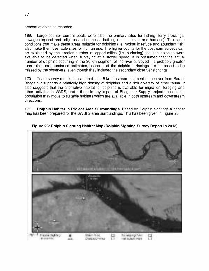
87
percent of dolphins recorded. 169. Large counter current pools were also the primary sites for fishing, ferry crossings, sewage disposal and religious and domestic bathing (both animals and humans). The same conditions that make these areas suitable for dolphins (i.e. hydraulic refuge and abundant fish) also make them desirable sites for human use. The higher counts for the upstream surveys can be explained by the greater number of opportunities (i.e. surfacing) that the dolphins were available to be detected when surveying at a slower speed. It is presumed that the actual number of dolphins occurring in the 30 km segment of the river surveyed is probably greater than minimum abundance estimates, as some of the dolphin surfacings are supposed to be missed by the observers, even though they included the secondary observer sightings. 170. Team survey results indicate that the 15 km upstream segment of the river from Barari, Bhagalpur supports a relatively high density of dolphins and a rich diversity of other fauna. It also suggests that the alternative habitat for dolphins is available for migration, foraging and other activities in VGDS, and if there is any impact of Bhagalpur Supply project, the dolphin population may move to suitable habitats which are available in both upstream and downstream directions. 171. Dolphin Habitat in Project Area Surroundings. Based on Dolphin sightings a habitat map has been prepared for the BWSP2 area surroundings. This has been given in Figure 28.
Figure 28: Dolphin Sighting Habitat Map (Dolphin Sighting Survey Report in 2013)
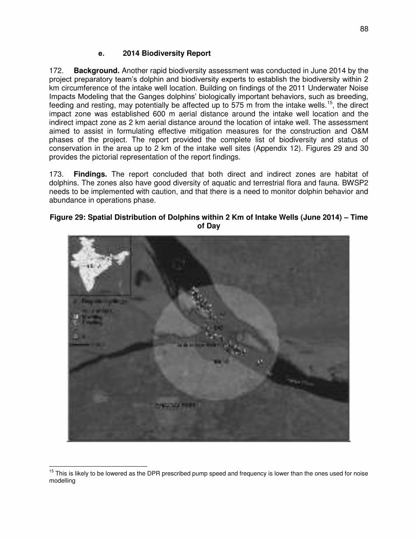
88
e. 2014 Biodiversity Report 172. Background. Another rapid biodiversity assessment was conducted in June 2014 by the project preparatory team’s dolphin and biodiversity experts to establish the biodiversity within 2 km circumference of the intake well location. Building on findings of the 2011 Underwater Noise Impacts Modeling that the Ganges dolphins’ biologically important behaviors, such as breeding, feeding and resting, may potentially be affected up to 575 m from the intake wells.15, the direct impact zone was established 600 m aerial distance around the intake well location and the indirect impact zone as 2 km aerial distance around the location of intake well. The assessment aimed to assist in formulating effective mitigation measures for the construction and O&M phases of the project. The report provided the complete list of biodiversity and status of conservation in the area up to 2 km of the intake well sites (Appendix 12). Figures 29 and 30 provides the pictorial representation of the report findings. 173. Findings. The report concluded that both direct and indirect zones are habitat of dolphins. The zones also have good diversity of aquatic and terrestrial flora and fauna. BWSP2 needs to be implemented with caution, and that there is a need to monitor dolphin behavior and abundance in operations phase.
Figure 29: Spatial Distribution of Dolphins within 2 Km of Intake Wells (June 2014) – Time
of Day
15
This is likely to be lowered as the DPR prescribed pump speed and frequency is lower than the ones used for noise modelling
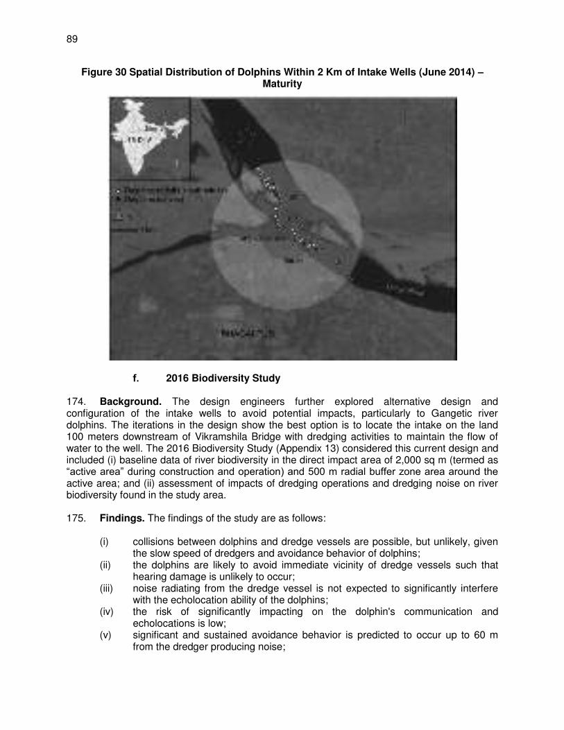
89
Figure 30 Spatial Distribution of Dolphins Within 2 Km of Intake Wells (June 2014) – Maturity
f. 2016 Biodiversity Study 174. Background. The design engineers further explored alternative design and configuration of the intake wells to avoid potential impacts, particularly to Gangetic river dolphins. The iterations in the design show the best option is to locate the intake on the land 100 meters downstream of Vikramshila Bridge with dredging activities to maintain the flow of water to the well. The 2016 Biodiversity Study (Appendix 13) considered this current design and included (i) baseline data of river biodiversity in the direct impact area of 2,000 sq m (termed as “active area” during construction and operation) and 500 m radial buffer zone area around the active area; and (ii) assessment of impacts of dredging operations and dredging noise on river biodiversity found in the study area. 175. Findings. The findings of the study are as follows:
(i) collisions between dolphins and dredge vessels are possible, but unlikely, given the slow speed of dredgers and avoidance behavior of dolphins;
(ii) the dolphins are likely to avoid immediate vicinity of dredge vessels such that hearing damage is unlikely to occur;
(iii) noise radiating from the dredge vessel is not expected to significantly interfere with the echolocation ability of the dolphins;
(iv) the risk of significantly impacting on the dolphin's communication and echolocations is low;
(v) significant and sustained avoidance behavior is predicted to occur up to 60 m from the dredger producing noise;
90
(vi) there are available and easily accessible alternate habitats for dolphin biological important behaviors thus impact on breeding, feeding and resting is identified as low;
(vii) impacts of dredging activities on phytoplanktons, zooplankton, other associated fauna and riparian vegetation are identified as temporary, short-term and insignificant;
(viii) management and mitigation measures have been identified to minimize risks of dredger noise;
(ix) IUCN Country representative consulted during the study finds the report adequate, recommended items to be further assessed and provided mitigation measures to minimize impacts.16; and
(x) World Wide Fund (WWF) India's River Species Expert consulted during study and supports the project and the proposed mitigation measures by IUCN.
C. Socio-economic Conditions
176. Bhagalpur, being a district headquarter, has been functioning as an administrative town with sustained growth in tertiary economic activities. The major economic activities are related to trade and commerce, thus it offers a number of wholesale and retail markets which act as a distribution center for nearby towns and villages. 177. Land use. The existing land use distribution of Bhagalpur Municipal Area based on the primary survey is tabulated in Table 26.
Table 26: Existing Land Use of Bhagalpur Municipal Area, 2007
Land Use Category Existing Land Use Range as per Urban Development Plan Formulation & Implementation (UDPFI)
guidelines in % Area in Ha Land Use in
% 1 Residential 1129 37.42 40-45 2 Commercial 127 4.22 3-4 3 Industrial 214 7.10 8-10 4 Public & Semi-public 436 14.44 10-12 5 Recreational 128 4.24 18-20 6 Transport 533 17.64 12-14 7 Open land &Water
bodies 449 14.88
8 Special area 1 0.04 Total 3018 100 Note – The above table is taken from ‘Town of Bhagalpur – Draft master Plan Vision 2027’ - Prepared by Department of Urban Development, Government of Bihar, May 2009.
178. The residential land use at 37.42% is slightly below the standard guideline of 40-45%. Of the total residential land use around 2% is under mixed use. Commercial is 4.22%, which is fractionally higher than the standard guideline of 3-4%. 179. The percentage of land under industrial use is 7.1%, lower than the norm of 8-10% given by UDPFI. However it is interesting to note that the industrial use within the town is confined to household industries and thus land under industrial use has a mixed character. This indicates that the town is significantly lacking in proper industrial infrastructure and a major thrust is
16
Mitigation measures are included in the EMP.
91
required for the development of the industrial sector. Diversification and broadening of the economic base is imperative in order to help generation of greater employment opportunities for the local community at large. 180. The public and semi-public land use at 14.44 % is more than sufficient in comparison to the standard guidelines, the main intervention that is required is in providing enough schools and quality educational, health, recreational and socio-cultural facilities to the inhabitants. 181. Recreational land use at 4.24% is grossly inadequate against the standard guideline of 18-20% showing that there is an ample scope and need for accommodating more recreational facilities. Land use under transportation at 17.64% shows a higher level of traffic and transportation infrastructure existing in the town in comparison to the standard guidelines. This is mainly because of the airport landing ground within the town, which accounts for almost 17% of the total land use under the category of transport and 2.98% of the total land use. However, there is an urgent need for improving the existing roads, creation of more transport terminals and parking areas to cater to the increasing demand for the same by the local population in the town. 182. Commerce. The economy of Bhagalpur city is to a large extent dependent on agriculture and silk. Bhagalpur is famous worldwide for its silk production. The silk industry in this town is hundreds of years old, and the town has a famous Silk Institute. The town also has rice and sugar mills, and silk and wool weaving factories. The town has flourishing commercial activity in areas mostly concentrated in the central region, along the national highways and major roads within the town. Most of the developments in the older parts of the town are haphazard in nature. However the development and the commercial activity in the newly developed areas are mostly planned and organized. 183. The commercial activities present in the city may be broadly divided into retail and wholesale shopping, service and repairing shops, cold storage facilities, godowns and warehouse, breweries and distilleries, restaurants, hotels and dharamshalas and a sizable informal sector. The nature of commercial establishments on local streets mostly comprises of general stores, STD booths, dhabas etc. The informal sector is mostly in the form of small shops on footpaths or roadsides and thelas. A significant part of the population is engaged in the service sector and is self-employed. Thus trade and commerce is providing employment to a large section of the population in the town. The present area under commercial use is 137 ha. This includes the area under the commercial use along the major roads, the agriculture marketing board land, and other commercial uses in the town. The godowns are also calculated under the commercial use. 184. Centralised and uncontrolled commercial development has caused a lot of chaos and congestion in wards no 34, 35, 36, 37, and 38, which is the CBD area, especially along the major roads. The Sujanagar Bazaar area is the most congested area that requires immediate improvement. Overall, the growth of commercial activities needs to be controlled and new developments channelled to newer areas to reduce congestion in the existing areas. 185. Industrial development. According to the district gazetteer, the district of Bhagalpur has been industrially active for a long time. It was famous for its Tussar Silk, dyeing, salt, indigo, and glassware industries in earlier times. Apart from that small-scale industries, such as basket weaving and distilleries making Taari from Mahua flowers were also prevalent. 186. Handloom silk industry in Nath Nagar, Hussainabad and Mirzanhat area are the existing
92
industrial areas in the town. It may be noted that most of the households within the ward number 1 to 10 around the Nathnagar area have looms and could be categorized under small-scale household industries. 187. The bigger industries and industrial zones in the town are mostly confined to areas like Barari and Bahadurpur, which are just outside the present town boundary. The Industrial Estate at Barari is on the left side of the road leading to Vikramshila Setu, spread over an area of approximately 51 acres. The Bahadurpur area is spread around an area of 15 acres along Bhagalpur-Savore road, which houses the Bihar Spun Silk Mill. 188. Agriculture. The economy of Bhagalpur District is dependent mainly on agriculture and silk. The Gangetic plains are very fertile and the main crops include rice, wheat, maize, barley, sugarcane and oilseeds. 189. Water supply. The present supply of water in Bhagalpur is described in Section III. 190. Sewerage and Sanitation. There is no organized sewerage system in the city. Absence of a proper waste water disposal system has resulted in septic tank effluent and sullage getting discharged into the storm water drains which are mostly open. Under the Ganges Action Plan, intercepting sewers have been laid in part of the town intercepting major drainage outfalls on the River Ganges. The intercepted flow is diverted through a collection chamber, into a grit chamber for grit removal and biologically treated in an aerated lagoon before its disposal into the Ganges River. Absence of a sewerage system is also linked to the poor water supply conditions in the town. The per capita supply is currently too low to ensure effective operation of a sewerage system. 191. The present sewage treatment plant (STP) at Sahebganj has a capacity of 11 MLD. As part of the Ganges Action Plan, a trunk sewer was laid from Maharajghat to the western side of the University in Sahebganj and the STP provided to treat the sewage before its disposal into river Ganges. 192. Drainage. In all, there are 25 major drains in the town. This covers the area north of the railway line which flows northwards into the Ganges and westwards into the Jamunia Nala. The areas covered include the Barari railway drain, Barari, Mayaganj, Mayaganj Bari Khanjarpur, Maharajghat, Khirnighat, Koilaghat, Adampur, Manik Sarkar, Mansoorganj, Sakhichand, Naya bazaar, University (Sahebganj), Champanagar Mehraw and Tanti Bazaar. On the south of the railway line, there are 10 major drains that follow the slope towards the south and south-east discharging into the low lying areas as well as a few water bodies. These drains act as sewer lines for all practical purposes during the dry weather season. 193. Solid waste. The generation of solid waste in Bhagalpur is estimated to be of the order of about 132 tonnes per day. There are a total of 108 dustbins placed in various locations within the municipal corporation area. There are 24 big containers, 100 drums in various corners, 12 five tonner trolleys, 2 loader machines, one swiping machine and 2 jet machines, 2 compacters, 45 hand trolleys which are used for transportation of the solid waste. For transporting the wastes, there are 12 trailers and 19 bullock carts. Presently, there is no organized solid waste management (SWM) for the town. BMC is responsible for SWM. There are no organized places for solid waste disposal, and random dumping is practiced by the municipal team looking after SWM. The wastes are dumped in low lying areas, along the road sides and also along the open drains. The drainage lines are the worst affected and have almost become solid waste dumping channels, resulting in the silting, obstruction and over flow
93
of the sewerage and drainage at many places. There are 8 locations in which such ad-hoc dumping is undertaken at present. Segregation at source is not practiced and the collection is made from cement bins placed at various locations within the town. The transporting vehicles are also open, and during transportation the waste is scattered throughout the town roads. 194. Transportation. In Bhagalpur, the east-west axis of the town running parallel to the River Ganges is the most important and active transport corridor. Bhagalpur being an important node in the region (the district headquarters) and being a commercial town attracts a lot of traffic, of which intercity through traffic forms a sizable portion. There are seven major roads in the city, out of which three are most important. The first and foremost is the National Highway-80 (Zero Mile to Champa nallah via Tilkamanjhi, Bhagalpur Railway Station and Kabirpur Chowk), next is the PWD road stretch from Barari More to Champa nallah, and third is the Bhagalpur alternative bye pass (Zero Mile to Kabirpur Chowk) passing through the southern side. The other major roads are Baunsi Road from the Railway station towards Maheshpur and Mirjanhat Road from Bholanath pul to Krishi Bazar. 195. Demography. Bhagalpur District has a population of 3,037,766 people (Census 2011) which comprises about 3 % of the total population of the State. It is the fifteenth largest district in Bihar in 2011 in terms of population. It is the third most urbanized district in the state with an urbanization level of 18.67%. Bhagalpur city has a total population of 3,98,138 (Census 2011). The city alone accounts for 13.17% of the total population of the district. The area of Bhagalpur Municipal Corporation is 30.17 sq.km. Thus the gross density of the city is about 13,263 persons per sq km or 133 persons per Ha in 2011. The average literacy rate of Bhagalpur city is 68.40 %, which is considerably higher than the State average of 47.53%. 196. Health and educational facilities. In terms of the number of educational institutions as per the Town Directory, Census of India, 2011, Bhagalpur is not deficient in any level of educational facilities from primary to college level as per UDPFI norms. There are 5 major colleges (including one medical college) and 2 universities (agriculture and general). 197. Planning for health is very important since it has a direct bearing on the human resource development and as an indicator of quality of life. As per the data provided by the Town Directory, Census of India, 2011, Bhagalpur is deficient in higher order hospital facilities although it has enough number of nursing homes to cater to the future projected population. 198. History, culture, and tourism. Bhagalpur District is named after its main city, and corresponds to some portions of the ancient kingdoms of Anga and Mithila. References to Bhagalpur can be found in Indian epics like the Ramayana and the Mahabharata where Bhagalpur has been described as the kingdom of Anga. Mandar Hill, situated 52 km south from Bhagalpur, is believed to have been used as Churner during Samudra-Manthan by God and Danav according to Hindu mythology. Ancient cave sculptures of Emperor Ashoka's regime are found in the neighbourhood, and at Sultangunj, 20 km west of Bhagalpur, a temple of the Gupta period still exists. The tomb of Suja, brother of Moghul emperor Aurangzeb, in the heart of the town, is reminiscent of the city's association with the Mughal period. Ruins of ancient Vikramshila University are located 44 km east of Bhagalpur. It was the medieval centre to the conservation and propagation of Buddhist education, established by King Dharampal of Bengal at the end of the 8th century. 199. Chhath Puja, Laxmi Puja, Kali Puja and Dussehra are the major festivals in Bhagalpur. Bihula and Bishahari puja is specially celebrated in Bhagalpur. 200. Within the city one can visit Karngarh and the four hillocks, attractive Jain temples, a
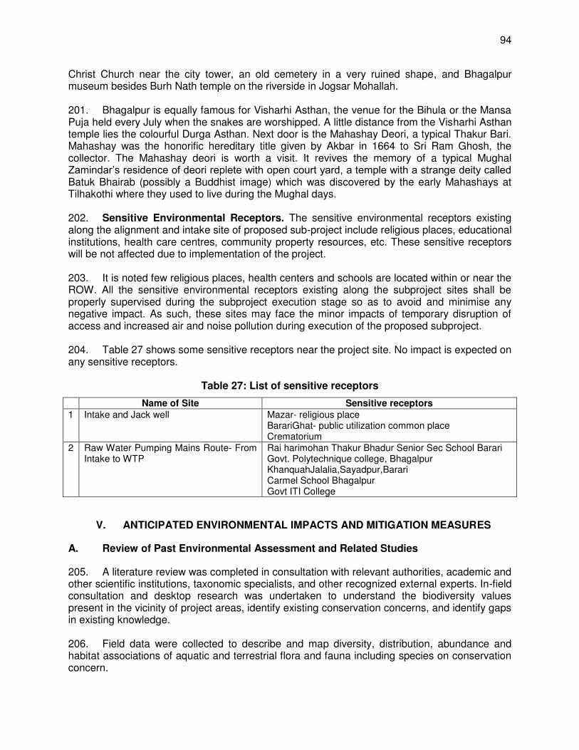
94
Christ Church near the city tower, an old cemetery in a very ruined shape, and Bhagalpur museum besides Burh Nath temple on the riverside in Jogsar Mohallah. 201. Bhagalpur is equally famous for Visharhi Asthan, the venue for the Bihula or the Mansa Puja held every July when the snakes are worshipped. A little distance from the Visharhi Asthan temple lies the colourful Durga Asthan. Next door is the Mahashay Deori, a typical Thakur Bari. Mahashay was the honorific hereditary title given by Akbar in 1664 to Sri Ram Ghosh, the collector. The Mahashay deori is worth a visit. It revives the memory of a typical Mughal Zamindar’s residence of deori replete with open court yard, a temple with a strange deity called Batuk Bhairab (possibly a Buddhist image) which was discovered by the early Mahashays at Tilhakothi where they used to live during the Mughal days. 202. Sensitive Environmental Receptors. The sensitive environmental receptors existing along the alignment and intake site of proposed sub-project include religious places, educational institutions, health care centres, community property resources, etc. These sensitive receptors will be not affected due to implementation of the project. 203. It is noted few religious places, health centers and schools are located within or near the ROW. All the sensitive environmental receptors existing along the subproject sites shall be properly supervised during the subproject execution stage so as to avoid and minimise any negative impact. As such, these sites may face the minor impacts of temporary disruption of access and increased air and noise pollution during execution of the proposed subproject. 204. Table 27 shows some sensitive receptors near the project site. No impact is expected on any sensitive receptors.
Table 27: List of sensitive receptors
Name of Site Sensitive receptors 1 Intake and Jack well Mazar- religious place
BarariGhat- public utilization common place Crematorium
2 Raw Water Pumping Mains Route- From Intake to WTP
Rai harimohan Thakur Bhadur Senior Sec School Barari Govt. Polytechnique college, Bhagalpur KhanquahJalalia,Sayadpur,Barari Carmel School Bhagalpur Govt ITI College
V. ANTICIPATED ENVIRONMENTAL IMPACTS AND MITIGATION MEASURES
A. Review of Past Environmental Assessment and Related Studies
205. A literature review was completed in consultation with relevant authorities, academic and other scientific institutions, taxonomic specialists, and other recognized external experts. In-field consultation and desktop research was undertaken to understand the biodiversity values present in the vicinity of project areas, identify existing conservation concerns, and identify gaps in existing knowledge. 206. Field data were collected to describe and map diversity, distribution, abundance and habitat associations of aquatic and terrestrial flora and fauna including species on conservation concern.
95
B. Integration with Planning and Design
207. All components have been located on government land. The transmission mains of raw and clear water have been planned through vacant space of road ROWs. 208. The project has been designed to minimize the impacts on environment. This minimization of impacts consideration has been given in each component of the project. 209. Intake wells. Intake wells location in the bank of River Ganges has been finalized after detailed hydrological and biodiversity studies mentioned earlier. The hydrological studies confirm negligible impacts (3.6 mm drop in water level in about 20 to 22 m distance around location of intake wells) due to water withdrawal. Potential impacts will be limited to 1,040 sqm (0.0014% of VGDS) and the biodiversity studies indicates (i) collisions between dolphins and dredge vessels are possible, but unlikely, given the slow speed of dredgers and avoidance behavior of dolphins; (ii) the dolphins are likely to avoid immediate vicinity of dredge vessels such that hearing damage is unlikely to occur. Use of Pinger in Dredging equipment will create generate behaviours of Dolphin ; (iii) noise radiating from the dredge vessel is not expected to significantly interfere with the echolocation ability of the dolphins; (iv) the risk of significantly impacting on the dolphin's communication and echolocations is low; (v) significant and sustained avoidance behavior is predicted to occur up to 60 m from the dredger producing noise; (vi) there are available and easily accessible alternate habitats for dolphin biological important behaviors thus impact on breeding, feeding and resting is identified as low; and (vii) impacts of dredging activities on phytoplanktons, zooplankton, other associated fauna and riparian vegetation are identified as temporary, short-term and insignificant. 210. Before dredging activities, dredging plan and schedule will be given to DFO/CF. Representatives from the office of the Wildlife/Forest Department of Bihar will be requested to oversee dredging activity to avoid any serious impact. 211. In addition, the EMP in this IEE includes a stringent biodiversity monitoring program. The biodiversity and surrounding environment will be monitored before construction (particularly before dredging activity), during construction, and rest of the project period after commissioning. This means any change can be detected and responded to. The intake well and dredging area will remain protected and monitoring of biodiversity will continue. 212. Transmission Mains. DPR has considered pipe laying of transmission main through public ROWs with sufficient space for construction and alignments that will require no road closure and no cutting of trees. 213. WTP. The proposed location of water treatment plant has been planned on land that is: (i) adjacent plot to existing WTPs so no change in land use is envisaged; (ii) owned by government to avoid resettlement issues; (iii) not part of any community usage activity; (iv) no risk of flooding/inundation; and (v) not near river banks to avoid risk of erosion. The water treatment technology has been designed considering efficient operation and least maintenance. Sludge handling, storage and disposal has been included in the design. C. Assessment of Impacts
214. Determination of Area of Influence. The primary impact areas are (i) the sites for intake well and dredging area, WTP, pumping houses, raw and clear water transmission mains;
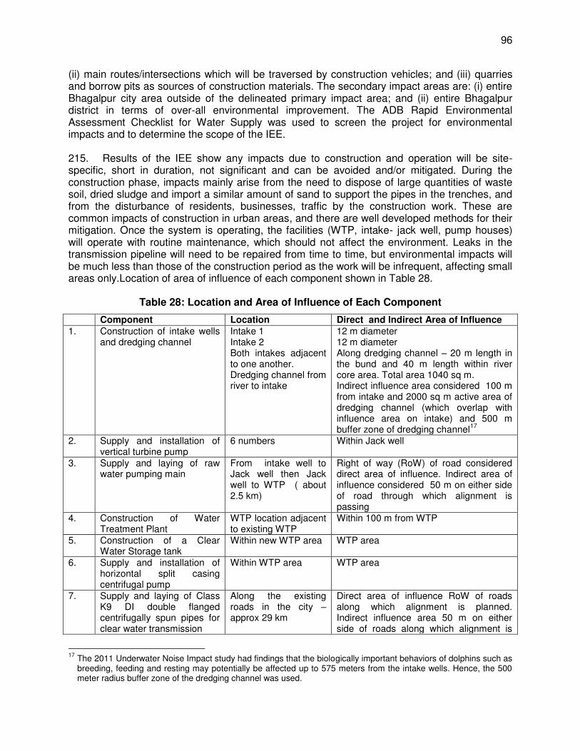
96
(ii) main routes/intersections which will be traversed by construction vehicles; and (iii) quarries and borrow pits as sources of construction materials. The secondary impact areas are: (i) entire Bhagalpur city area outside of the delineated primary impact area; and (ii) entire Bhagalpur district in terms of over-all environmental improvement. The ADB Rapid Environmental Assessment Checklist for Water Supply was used to screen the project for environmental impacts and to determine the scope of the IEE. 215. Results of the IEE show any impacts due to construction and operation will be site-specific, short in duration, not significant and can be avoided and/or mitigated. During the construction phase, impacts mainly arise from the need to dispose of large quantities of waste soil, dried sludge and import a similar amount of sand to support the pipes in the trenches, and from the disturbance of residents, businesses, traffic by the construction work. These are common impacts of construction in urban areas, and there are well developed methods for their mitigation. Once the system is operating, the facilities (WTP, intake- jack well, pump houses) will operate with routine maintenance, which should not affect the environment. Leaks in the transmission pipeline will need to be repaired from time to time, but environmental impacts will be much less than those of the construction period as the work will be infrequent, affecting small areas only.Location of area of influence of each component shown in Table 28.
Table 28: Location and Area of Influence of Each Component
Component Location Direct and Indirect Area of Influence 1. Construction of intake wells
and dredging channel Intake 1 Intake 2 Both intakes adjacent to one another. Dredging channel from river to intake
12 m diameter 12 m diameter Along dredging channel – 20 m length in the bund and 40 m length within river core area. Total area 1040 sq m. Indirect influence area considered 100 m from intake and 2000 sq m active area of dredging channel (which overlap with influence area on intake) and 500 m buffer zone of dredging channel
17
2. Supply and installation of vertical turbine pump
6 numbers Within Jack well
3. Supply and laying of raw water pumping main
From intake well to Jack well then Jack well to WTP ( about 2.5 km)
Right of way (RoW) of road considered direct area of influence. Indirect area of influence considered 50 m on either side of road through which alignment is passing
4. Construction of Water Treatment Plant
WTP location adjacent to existing WTP
Within 100 m from WTP
5. Construction of a Clear Water Storage tank
Within new WTP area WTP area
6. Supply and installation of horizontal split casing centrifugal pump
Within WTP area WTP area
7. Supply and laying of Class K9 DI double flanged centrifugally spun pipes for clear water transmission
Along the existing roads in the city – approx 29 km
Direct area of influence RoW of roads along which alignment is planned. Indirect influence area 50 m on either side of roads along which alignment is
17
The 2011 Underwater Noise Impact study had findings that the biologically important behaviors of dolphins such as breeding, feeding and resting may potentially be affected up to 575 meters from the intake wells. Hence, the 500 meter radius buffer zone of the dredging channel was used.
97
Component Location Direct and Indirect Area of Influence planned
8. Supply and installation of Supervisory Control and Data Acquisition (SCADA) system
No physical site required
not applicable
D. Pre-construction Impacts and Mitigation Measures
216. Consents, permits, clearances, no objection certificates (NOCs). Failure to obtain necessary consents, permits, NOCs can result in design revisions and/or stoppage of works. 217. Mitigation measures. The following will be conducted during detailed design phase:
(i) Obtain all necessary consents, permits, clearance, NOCs, prior to start of civil works.
(ii) Acknowledge in writing and provide report on compliance all obtained consents, permits, clearance, NOCs.
(iii) Include in detailed design drawings and documents all conditions and provisions if necessary.
218. Construction activities could result in modification of species composition or benthic structure which can impact on the endangered ecological communities. Potential impacts, e.g., major disturbance to biodiversity, can also arise if work active ities and access in the VGDS are not managed effectively. 219. Mitigation measures. In general, the aim is to ensure that no habitat loss or significant disturbance results from any of the work within VGDS. The contractor will be required to:
(i) Designate a part time environment/ biodiversity expert who will be in charge of coordination with BUIDCo for (i) updating this draft IEE and developing the SEMP as per detailed design; (ii) implementing SEMP including biodiversity monitoring during pre-construction for one year (to take into account seasonal variability and establish baseline data), during and post-construction, and during O&M; (iii) conducting site induction ensuring all personnel are familiar with SEMP and relevant safeguards for their work; (iv) establishing principle, environmental performance criteria, and biodiversity indicator as per detailed design; (v) ensuring protected, endangered, threatened, or near-threatened ecological communities are not affected; (vi) consulting stakeholders and disseminating information; (vii) consulting species experts to understand threats and predicted project effects to determine feasibility of offsetting project impacts and achieving net gains; (viii) addressing grievances on site level; (ix) reporting; and (x) implementing corrective action plan/s.
(ii) Consider mitigation hierarchy18 and demonstrate no net loss or a net gain of biodiversity. Determine the need for an offset based on residual adverse effects
18
The mitigation hierarchy is defined as: (i) avoidance - measures taken to avoid creating impacts from the outset, such as careful spatial or temporal placement of elements of infrastructure, in order to completely avoid impacts on certain components of biodiversity; (ii) minimization - measures taken to reduce the duration, intensity and / or extent of impacts (including direct, indirect and cumulative impacts, as appropriate) that cannot be completely avoided, as far as is practically feasible; (iii) rehabilitation/restoration - measures taken to rehabilitate degraded ecosystems or restore cleared ecosystems following exposure to impacts that cannot be completely avoided and/ or minimized; and (iv) offset - measures taken to compensate for any residual significant, adverse impacts that cannot be avoided, minimized and/or rehabilitated or restored, in order to achieve no net loss or a net gain of
98
of the project. Where biodiversity offsets are proposed, contractor must demonstrate through an assessment that the project’s significant residual impacts on biodiversity will be mitigated to meet ADB SPS requirements.
(iii) Establish a detailed design-specific monitoring program to determine biodiversity to be conducted prior to construction, during construction, and after commissioning. The overall objective of the monitoring program is to determine whether the implementation of the proposed mitigation measures has been successful, and if not, to determine the reasons for partial success or failure of the works implemented.
220. Erosion control. Most of the impacts will occur due to excavation and earth movements during construction phase. Prior to commencement of civil works, the contractor will be required to:
(i) Develop an erosion control and re-vegetation plan (particularly near WTP bank protection area) to minimize soil loss and reduce sedimentation to protect water quality.
(ii) Minimize the potential for erosion by balancing cuts and fills to the extent feasible. (iii) Identify and avoid areas with unstable slopes and local factors that can cause slope
instability (groundwater conditions, precipitation, seismic activity, slope angles, and geologic structure).
(iv) Minimize the amount of land disturbed as much as possible. Use existing roads, disturbed areas, and borrow pits and quarries when possible. Minimize vegetation removal. Stage construction to limit the exposed area at any one time.
221. Utilities. The most noticeable effect will be the potential interruption of services and utilities to residents and businesses in the project area. These interruptions will be scheduled and intermittently related to localized construction activities. Telephone lines, electric poles and wires, water and sewer lines within road ROWs may be damaged if these are falling in the alignment of the transmission mains. To mitigate the adverse impacts due to relocation of the utilities, the contractor will:
(i) Identify and include locations and operators of these utilities in the detailed design documents to prevent unnecessary disruption of services during the construction phase.
(ii) Prepare a contingency plan to include actions to be done in case of unintentional interruption of services.
(iii) Obtain from the PIU and/or DSC the list of affected utilities and operators and coordinate closely with relevant government departments.
(iv) If relocations are necessary, coordinate with the providers to relocate the utility. 222. Water Supply. A different but no less significant impact is the effect on people and communities if water supplies are closed down for extended periods when work is conducted for the pipe laying. This would be inconvenient in the short term, and there could be health risks if the water supply was unavailable for several successive days or longer. It will therefore be important to take the necessary measures to avoid such a situation. This will require the IA and BMC and the appointed Contractor to:
(i) Organise a structured and sustained communications program to inform the residents about the disruption of services and the alternate arrangements made
biodiversity. Offsets can take the form of positive management interventions such as restoration of degraded habitat, arrested degradation or averted risk, protecting areas where there is imminent or projected loss of biodiversity.
99
to minimise the inconvenience; (ii) Plan the construction program to keep the cessation of water supplies to the
minimum possible (in both area and duration); (iii) In coordination with BMC, provide alternative potable water to affected
households and businesses for the duration of the shut-down; and (iv) Liaise with affected persons to inform them of any cessation in advance, and to
ensure that they are provided with an alternative supply. 223. Social and Cultural Resources. There is a risk that any work involving ground disturbance can uncover and damage archaeological and historical remains. Although no such sites have been identified. For this project, excavation will occur in and around existing RoWs and specified government land and in the river, so no risk is foreseen to these structures. Nevertheless, the contractor, with help from PIU and DSC, will:
(i) Consult Archaeological Survey of India to obtain an expert assessment of the archaeological potential of the sites.
(ii) Consider alternatives if the site is found to be of medium or high risk. (iii) Include state and local archaeological, cultural and historical authorities, and
interest groups in consultation forums as project stakeholders so that their expertise can be made available.
(iv) Develop a protocol for use by the construction contractors in conducting any excavation work, to ensure that any chance finds are recognized and measures are taken to ensure they are protected and conserved.
224. Site selection of construction work camps, stockpile areas, storage areas, and disposal areas. Priority is to locate these near the subproject locations. However, if it is deemed necessary to locate elsewhere, sites to be considered will not promote instability and result in destruction of property, vegetation and drinking water supply systems. Thickly populated residential areas will not be considered for setting up camps to protect the human environment (i.e., to curb accident risks, health risks due to air and water pollution and dust, and noise, and to prevent social conflicts, shortages of amenities, and crime). Extreme care will be taken to avoid disposals near the water bodies or in areas which will inconvenience the community. All locations would be included in the design specifications and on plan drawings. Locations are selected without impacting the local habitation. 225. Site selection for equipment lay-down and storage area. Improper selection will affect local environment and inconvenience to public. Possible mitigation measures are,
(i) Choice of location for equipment lay-down and storage areas must take into account distances to adjacent land uses, general onsite topography and water erosion potential of the soil. Impervious surfaces must be provided where necessary.
(ii) Storage area should be sufficiently away from water body (iii) Storage areas shall be secure so as to minimize the risk of crime. They shall also
be safe from access by children / animals etc. (iv) Residents living adjacent to the construction site must be notified of the existence
of the hazardous storage area. (v) Equipment lay-down and storage areas must be designated, demarcated and
fenced if necessary. (vi) Fire prevention facilities must be present at all storage facilities. (vii) Proper storage facilities for the storage of oils, paints, grease, fuels, chemicals
and any hazardous materials to be used must be provided to prevent the
100
migration of spillage into the ground and groundwater regime around the temporary storage areas.
(viii) The storage facilities (including any tanks) must be on an impermeable surface that is protected from the ingress of storm water from surrounding areas in order to ensure that accidental spillage does not pollute local soil or water resources.
(ix) Fuel tanks must meet relevant specifications and be elevated so that leaks may be easily detected.
(x) Staff dealing with these materials / substances must be aware of their potential impacts and follow the appropriate safety measures.
226. Sources of construction materials. Significant amounts of gravel, sand, and cement will be required for this subproject. Approximately 12,000 m3 of sand, 25,000 m3 of stone chips and 3000 MT of cement are expected to be required for the project19. Extraction of materials can disrupt natural land contours and vegetation resulting in accelerated erosion, disturbance in natural drainage patterns, ponding and water logging, and water pollution. The contractor will be required to:
(i) Use quarry sites and sources permitted by government. (ii) Verify suitability of all material sources and obtain approval from DSC and PIU. (iii) If additional quarries are required after construction has started, obtain written
approval from PMU. (iv) Submit to DSC on a monthly basis documentation of sources of materials.
227. It will be the construction contractor’s responsibility to verify the suitability of all material sources and to obtain the approval of PIU and other relevant authorities, as required. If additional quarries are required after construction is started, then the contractor obtains written approval of BUIDCo and BMC. 228. Access. Hauling of construction materials and operation of equipment on-site can cause traffic problems and conflicts in ROWs along alignments of transmission mains. The amount of construction truck traffic near the intake wells will be substantial due to the amount of earthwork. Construction traffic will access most work areas from the existing roads/highway therefore potential impacts will be of short-duration, localized and can be mitigated. The contractor will need to adopt the following mitigation measures:
(i) Plan transportation routes so that heavy vehicles do not use narrow local roads, except in the immediate vicinity of delivery sites.
(ii) Schedule transport and hauling activities during non-peak hours. (iii) Locate entry and exit points in areas where there is low potential for traffic
congestion. (iv) Keep the site free from all unnecessary obstructions. (v) Drive vehicles in a considerate manner. (vi) Coordinate with the Traffic Police Department for temporary road diversions and
for provision of traffic aids if transportation activities cannot be avoided during peak hours.
(vii) Notify affected sensitive receptors by providing sign boards with information about the nature and duration of construction works and contact numbers for concerns/complaints.
(viii) Provide free access to households along the alignments of raw and clear water transmission routes during the construction phase.
19
This will be updated by the contractor after detailed design, which will be verified by DSC and PMC.
101
229. Maintaining Core Labor Standard. The Contractor and PMU are responsible for ensuring that international CLS20 – as reflected in national labour laws and regulations are adhered to. PMU is ultimately responsible for monitoring compliance with national labour laws and regulations, provided that these national laws are consistent with CLS. ADB will carry out due diligence – during loan review missions - to ensure that executing and implementing agencies and contractors comply with applicable (national) core labour standards and labour laws. PMU/PIU/PMC will ensure that bidding and contract documents include specific provisions requiring contractors to comply with all: (i) applicable labour laws and core labour standards on: (a) prohibition of child labour as defined in national legislation for construction and maintenance activities; (b) equal pay for equal work of equal value regardless of gender, ethnicity or caste; and (c) elimination of forced labour; and (ii) the requirement to disseminate information on sexually transmitted diseases including HIV/AIDS to employees and local communities surrounding the project sites. These will be monitored as part of the project’s safeguards reporting requirements. 230. Summary of pre-construction activities is presented in Table 29. The responsibilities, monitoring program and costs are provided in detailed in the EMP (Section VIII). The contractor is required to update the information during detailed design phase.
Table 29: Summary of Pre-Construction Mitigation Measures
Parameters Mitigation Measures Consents, permits, clearances, no objection certificate (NOC), etc.
Obtain all necessary consents, permits, clearance, NOCs, prior to start of civil works.
Acknowledge in writing and provide report on compliance all obtained consents, permits, clearance, NOCs.
Include in detailed design drawings and documents all conditions and provisions if necessary.
Biodiversity conservation
Designate a full time environment/biodiversity nodal expert who will be in charge of coordination with BUIDCo for (i) updating this draft IEE and developing the SEMP as per detailed design; (ii) implementing SEMP including biodiversity monitoring during pre-construction for one year (to take into account seasonal variability and establish baseline data), during and post-construction, and during O&M; (iii) conducting site induction ensuring all personnel are familiar with SEMP and relevant safeguards for their work; (iv) establishing principle, environmental performance criteria, and indicator as per detailed design; (v) ensuring protected, endangered, threatened, or near-threatened ecological communities are not affected; (vi) consulting stakeholders and disseminating information; (vi) consulting species experts to understand threats and predicted project effects to determine feasibility of offsetting project impacts and achieving net gains; (vii) addressing grievances on site level; (vii) reporting; and (viii) implementing corrective action plan/s.
Consider mitigation hierarchy21
and demonstrate no net loss or a net gain of biodiversity. Determine the need for an offset based on residual adverse effects
20
Core Labor Standards (CLSs) are a set of four internationally recognized basic rights and principles at work: (i) freedom of association and the right to collective bargaining; (ii) elimination of all forms of forced or compulsory labor; (iii) effective abolition of child labor; and (iv) elimination of discrimination in respect of employment and occupation.
21 The mitigation hierarchy is defined as: (i) avoidance - measures taken to avoid creating impacts from the outset, such as careful spatial or temporal placement of elements of infrastructure, in order to completely avoid impacts on certain components of biodiversity; (ii) minimization - measures taken to reduce the duration, intensity and / or extent of impacts (including direct, indirect and cumulative impacts, as appropriate) that cannot be completely avoided, as far as is practically feasible; (iii) rehabilitation/restoration - measures taken to rehabilitate degraded ecosystems or restore cleared ecosystems following exposure to impacts that cannot be completely avoided and/
102
Parameters Mitigation Measures of the project. Where biodiversity offsets are proposed, contractor must demonstrate through an assessment that the project’s significant residual impacts on biodiversity will be mitigated to meet ADB SPS requirements.
Establish a detailed design-specific monitoring program to determine biodiversity to be conducted prior to construction, during construction, and after commissioning. The overall objective of the monitoring program is to determine whether the implementation of the proposed mitigation measures has been successful, and if not, to determine the reasons for partial success or failure of the works implemented.
Erosion control Develop an erosion control and re-vegetation plan to minimize soil loss and reduce sedimentation to protect water quality.
Minimize the potential for erosion by balancing cuts and fills to the extent feasible.
Identify and avoid areas with unstable slopes and local factors that can cause slope instability (groundwater conditions, precipitation, seismic activity, slope angles, and geologic structure).
Minimize the amount of land disturbed as much as possible. Use existing roads, disturbed areas, and borrow pits and quarries when possible. Minimize vegetation removal. Stage construction to limit the exposed area at any one time.
Utilities Identify and include locations and operators of these utilities in the detailed design documents to prevent unnecessary disruption of services during the construction phase.
Require contractor to prepare a contingency plan to include actions to be done in case of unintentional interruption of services.
Obtain from the PIU and/or DSC the list of affected utilities and operators; Prepare a contingency plan to include actions to be done in case of
unintentional interruption of services. If relocations are necessary, coordinate with the providers to relocate the utility.
Water Supply Plan the construction program to keep the cessation of water supplies to the minimum possible (in both area and duration).
In coordination with BMC, provide alternative potable water to affected households and businesses for the duration of the shut-down.
Liaise with affected persons to inform them of any cessation in advance, and to ensure that they are provided with an alternative supply.
Social and Cultural Resources
Consult Archaeological Survey of India to obtain an expert assessment of the archaeological potential of the sites.
Consider alternatives if the site is found to be of medium or high risk. Include state and local archaeological, cultural and historical authorities, and
interest groups in consultation forums as project stakeholders so that their expertise can be made available.
Develop a protocol for use by the construction contractors in conducting any excavation work, to ensure that any chance finds are recognized and measures are taken to ensure they are protected and conserved.
Sites for construction work camps, areas for stockpile, storage
Avoid instability that results in destruction of property, vegetation, irrigation, and drinking water supply systems, etc.
Do not consider residential areas so as to protect the human environment (i.e., to curb accident risks, health risks due to air and water pollution and dust, and
or minimized; and (iv) offset - measures taken to compensate for any residual significant, adverse impacts that cannot be avoided, minimized and/or rehabilitated or restored, in order to achieve no net loss or a net gain of biodiversity. Offsets can take the form of positive management interventions such as restoration of degraded habitat, arrested degradation or averted risk, protecting areas where there is imminent or projected loss of biodiversity.
103
Parameters Mitigation Measures and disposal noise, and to prevent social conflicts, shortages of amenities, and crime).
Do not allow disposal near sensitive areas which will inconvenience the community.
Avoid construction camp, storage of fuel and lubricants at the river bank. The construction camp site for intake well should be finalized in consultation with DSC and PIU.
Sources of construction materials
Use quarry sites and sources permitted by government. Verify suitability of all material sources and obtain approval from PMU. If additional quarries are required after construction has started, obtain written
approval from PMU. Submit to DSC on a monthly basis documentation of sources of materials.
Access Plan transportation routes so that heavy vehicles do not use narrow local roads, except in the immediate vicinity of delivery sites.
Schedule transport and hauling activities during non-peak hours. Locate entry and exit points in areas where there is low potential for traffic
congestion. Keep the site free from all unnecessary obstructions. Drive vehicles in a considerate manner. Coordinate with the Traffic Police Department for temporary road diversions
and for provision of traffic aids if transportation activities cannot be avoided during peak hours.
Notify affected sensitive receptors by providing sign boards with information about the nature and duration of construction works and contact numbers for concerns/complaints.
Provide free access to households along the alignments of raw and clear water transmission routes during the construction phase.
E. Anticipated Construction Impacts and Mitigation Measures
231. Table 30 presents an indication of what activities and facilities are likely to be undertaken during construction of the subproject, including the associated inputs and outputs.
Table 30: Summary of Activities and Facilities, Resource Use, and Produced Outputs during Construction Phase
Activities and Facilities Inputs/Resource Use Outputs/Waste Production Construction camp and its
associated facilities (including lay-down areas)
Storage camps and lay-down areas
Materials and equipment stockpiles
Handling and storage of hazardous materials including
Bitumen Cement Chemical additives used in
concrete Aggregate (sand and stone) Gravel (fill material and selected
material for sub-base and base layers)
Water
Old asphalt (removed from road carriageway during laying of pipelines)
22
Waste concrete and other construction rubble
Waste bitumen23
Used fuels, lubricants, solvents
and other hazardous waste General waste
22
The water supply improvement works affecting roads may involve the stripping and demolition of old asphalt layers. Ideally, old asphalt shall be reused during construction of the new road in order to avoid large quantities of waste being produced. However, depending on the availability and cost of virgin aggregate in the area through which the road is aligned, reusing the old asphalt may be more costly than using virgin aggregate. 23
Bitumen has relatively low levels of polycyclic aromatic hydrocarbons (PAHs) and is largely inert. However, certain other potentially hazardous chemical may be added to the bitumen or to the aggregate during the construction process in order to render the compound more workable. The objective is to use the least hazardous chemicals available and to locate asphalt plants, aggregate stockpiles and mixing areas where they do not pose a significant environmental risk.
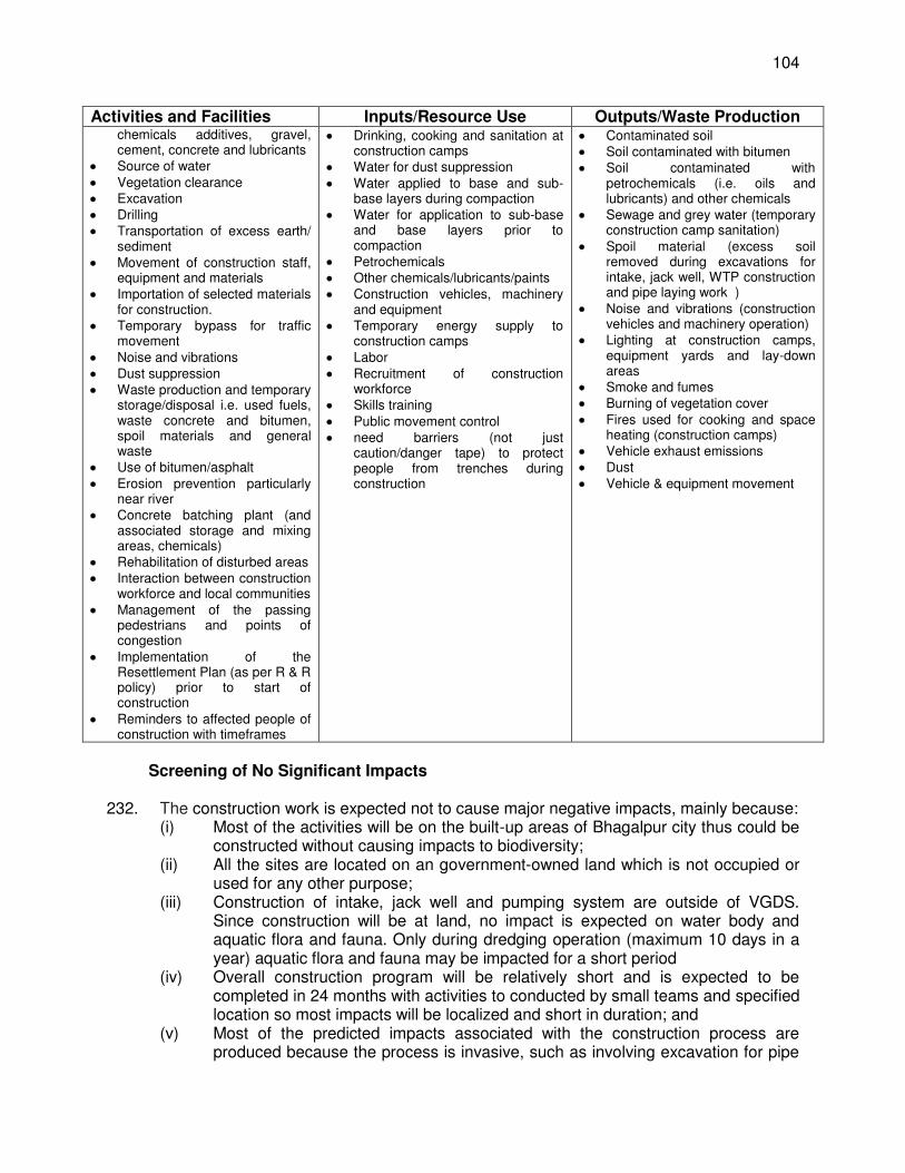
104
Activities and Facilities Inputs/Resource Use Outputs/Waste Production chemicals additives, gravel, cement, concrete and lubricants
Source of water Vegetation clearance Excavation Drilling Transportation of excess earth/
sediment Movement of construction staff,
equipment and materials Importation of selected materials
for construction. Temporary bypass for traffic
movement Noise and vibrations Dust suppression Waste production and temporary
storage/disposal i.e. used fuels, waste concrete and bitumen, spoil materials and general waste
Use of bitumen/asphalt Erosion prevention particularly
near river Concrete batching plant (and
associated storage and mixing areas, chemicals)
Rehabilitation of disturbed areas Interaction between construction
workforce and local communities Management of the passing
pedestrians and points of congestion
Implementation of the Resettlement Plan (as per R & R policy) prior to start of construction
Reminders to affected people of construction with timeframes
Drinking, cooking and sanitation at construction camps
Water for dust suppression Water applied to base and sub-
base layers during compaction Water for application to sub-base
and base layers prior to compaction
Petrochemicals Other chemicals/lubricants/paints Construction vehicles, machinery
and equipment Temporary energy supply to
construction camps Labor Recruitment of construction
workforce Skills training Public movement control need barriers (not just
caution/danger tape) to protect people from trenches during construction
Contaminated soil Soil contaminated with bitumen Soil contaminated with
petrochemicals (i.e. oils and lubricants) and other chemicals
Sewage and grey water (temporary construction camp sanitation)
Spoil material (excess soil removed during excavations for intake, jack well, WTP construction and pipe laying work )
Noise and vibrations (construction vehicles and machinery operation)
Lighting at construction camps, equipment yards and lay-down areas
Smoke and fumes Burning of vegetation cover Fires used for cooking and space
heating (construction camps) Vehicle exhaust emissions Dust Vehicle & equipment movement
Screening of No Significant Impacts
232. The construction work is expected not to cause major negative impacts, mainly because:
(i) Most of the activities will be on the built-up areas of Bhagalpur city thus could be constructed without causing impacts to biodiversity;
(ii) All the sites are located on an government-owned land which is not occupied or used for any other purpose;
(iii) Construction of intake, jack well and pumping system are outside of VGDS. Since construction will be at land, no impact is expected on water body and aquatic flora and fauna. Only during dredging operation (maximum 10 days in a year) aquatic flora and fauna may be impacted for a short period
(iv) Overall construction program will be relatively short and is expected to be completed in 24 months with activities to conducted by small teams and specified location so most impacts will be localized and short in duration; and
(v) Most of the predicted impacts associated with the construction process are produced because the process is invasive, such as involving excavation for pipe
105
laying and construction of intake, jack well and WTP. However the routine nature of the impacts means that most can be easily mitigated and the impacts are clearly a result of the construction process rather than the design or location, as impacts will not occur if excavation or other ground disturbance is not involved.
233. As a result, there are several aspects of the environment which are not expected to be affected by the construction process and these can be screened out of the assessment at this stage as required by ADB procedure. These are shown in Table 31. These environmental factors are screened out presently but will be assessed again before starting of the construction activities.
Table 31: Fields in which construction is not expected to have significant impacts
Field Rationale Topography, Drainage, and Natural Hazards
Activities are not large enough to affect these features. Drainage will be not affected
Geology, Geomorphology, Mineral Resources, and Soils
Activities are not large enough to affect these features. No mineral resources in the subproject sites.
Climate Activities are not large enough to affect this feature. Air Quality Short-term production of dust is the only effect on atmosphere Geo-hydrology and Groundwater Activities will not be large enough to affect these features Protected Areas No impact is anticipated Vikramshila Gangetic Dolphin Sanctuary
as there will be no construction activity in Ganga River as part of this subproject. Only there will be some impact on biodiversity during de-silting of river channel towards intake by dredging operation.
Flora No rare or endangered species. Land Use No change in land use. Socio-economic Subproject site is mostly located on government-owned land so
there is no need major acquisition of land Commerce, Industry, and Agriculture
Activities are not large enough to affect these features
Population Activities are not large enough to affect this feature. Health and education facilities Activities are not large enough to affect this feature. Historical, Archaeological, Paleontological, or Architectural sites
No scheduled historical, archaeological, paleontological, or architectural sites within project areas
1. Intakes
a. Construction Schedule and Method
234. The methodology for construction of intake and Jack well will be provided by the bidder who can give his own concept under method statement. DBO contractor will develop methodology for construction of intake, jack well, and WTP.
b. Erosion Hazards 235. The location of intake well and associated facilities (switchyard/control road/electricity substations) are already developed, have remained stable and not exhibiting signs of erosion. The area is relatively flat therefore risk of erosion is low and limited. 236. Mitigation Measures. The contractor will be required to:
106
(i) Use dust abatement techniques on unpaved, non-vegetated surfaces to minimize windblown erosion.
(ii) Provide temporary stabilization of disturbed areas that are not actively under construction.
(iii) Apply erosion controls (e.g., jute netting, silt fences, and check dams) to prevent/minimize soil erosion from vehicular traffic and during construction activities.
(iv) Save topsoil removed during construction and use to reclaim disturbed areas, as soon as it is possible to do so.
(v) Maintain vegetative cover within road ROWs to prevent erosion and periodically monitor ROWs to assess erosion.
(vi) Clean and maintain catch basins, drainage ditches, and culverts regularly. (vii) Conduct routine site inspections to assess the effectiveness of and the
maintenance requirements for erosion and sediment control systems. c. Impacts on Water Quality
237. As per design, intake will be constructed at bank of the rivar and Jack well will be 50 m from the intke. Excavated materials may end up in drainages particularly during monsoon season. Other risks of pollution may be caused by: (i) poorly managed construction sediments, wastes and hazardous substances; and (ii) poor sanitation practices of construction workers. 238. Mitigation measures. The contractor will be required to:
(i) Collect sand and silt extracted from the wells sinking and utilize locally for construction of road
(ii) Dispose any residuals at identified disposal site (PMU/PIU will identify approved sites).
(iii) Dispose waste oil and lubricants generated as per provisions of Hazardous Waste (Management and Handling) Rules, 1989.
(iv) Cure concrete sufficiently prior to contact with water to avoid leaching (i.e., prohibit fresh concrete from coming into contact with waters.
(v) Locate staging and stockpile areas away from the river. (vi) Develop a spill prevention and containment plan, educate workers about the
plan, and have the necessary materials on site prior to and during construction. (vii) Refuel equipment within the designated refueling containment area away from
the river bank. (viii) Inspect all vehicles daily for fluid leaks before leaving the vehicle staging area,
and repair any leaks before the vehicle resumes operation.
d. Impacts on Air Quality 239. Emissions from construction vehicles, equipment, and machinery used for excavation and construction will induce impacts on the air quality in the construction sites. Anticipated impacts include dusts and increase in concentration of vehicle-related pollutants such as carbon monoxide, sulfur oxides, particulate matter, nitrogen oxides, and hydrocarbons. But these will be temporary and during the construction phase only. 240. Mitigation measures. The contractor will be required to:
(i) Damp down exposed soil and any soil stockpiled on site by spraying with water when necessary.
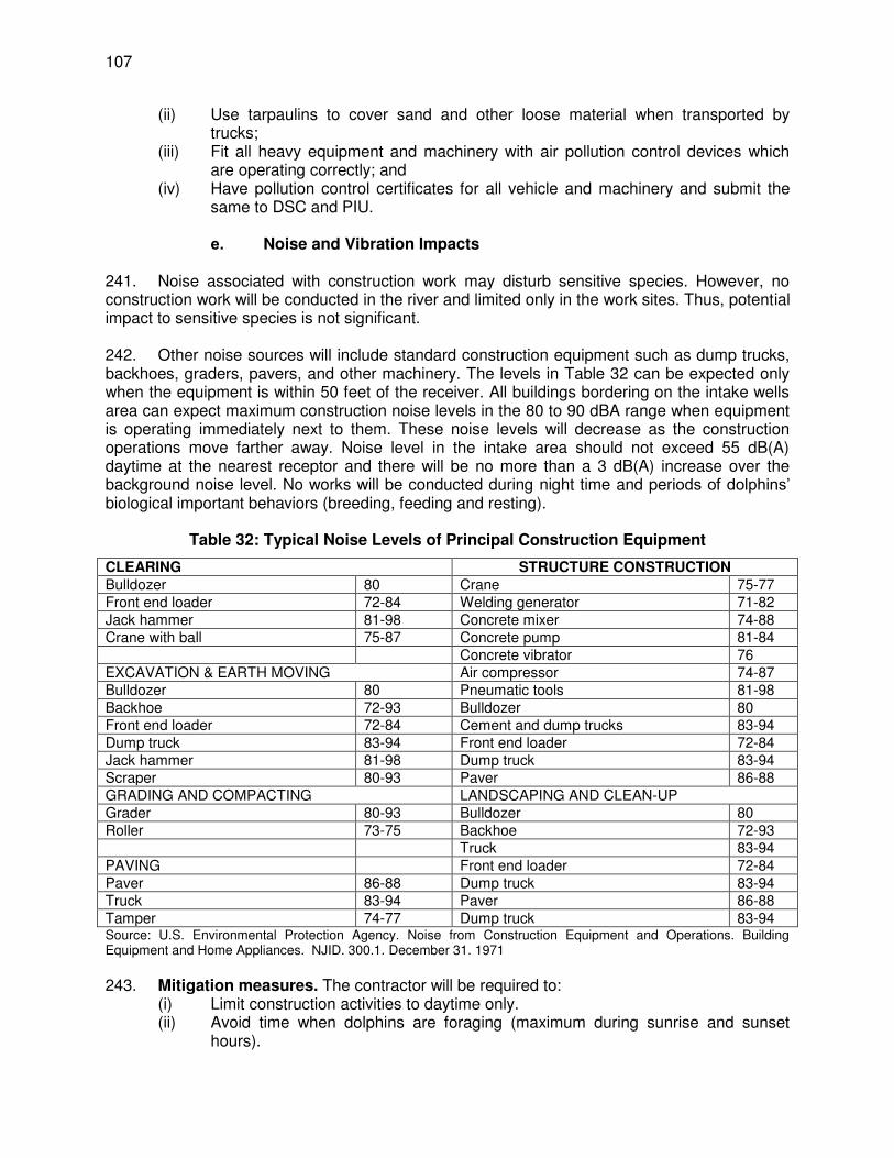
107
(ii) Use tarpaulins to cover sand and other loose material when transported by trucks;
(iii) Fit all heavy equipment and machinery with air pollution control devices which are operating correctly; and
(iv) Have pollution control certificates for all vehicle and machinery and submit the same to DSC and PIU.
e. Noise and Vibration Impacts
241. Noise associated with construction work may disturb sensitive species. However, no construction work will be conducted in the river and limited only in the work sites. Thus, potential impact to sensitive species is not significant. 242. Other noise sources will include standard construction equipment such as dump trucks, backhoes, graders, pavers, and other machinery. The levels in Table 32 can be expected only when the equipment is within 50 feet of the receiver. All buildings bordering on the intake wells area can expect maximum construction noise levels in the 80 to 90 dBA range when equipment is operating immediately next to them. These noise levels will decrease as the construction operations move farther away. Noise level in the intake area should not exceed 55 dB(A) daytime at the nearest receptor and there will be no more than a 3 dB(A) increase over the background noise level. No works will be conducted during night time and periods of dolphins’ biological important behaviors (breeding, feeding and resting).
Table 32: Typical Noise Levels of Principal Construction Equipment
CLEARING STRUCTURE CONSTRUCTION Bulldozer 80 Crane 75-77 Front end loader 72-84 Welding generator 71-82 Jack hammer 81-98 Concrete mixer 74-88 Crane with ball 75-87 Concrete pump 81-84 Concrete vibrator 76 EXCAVATION & EARTH MOVING Air compressor 74-87 Bulldozer 80 Pneumatic tools 81-98 Backhoe 72-93 Bulldozer 80 Front end loader 72-84 Cement and dump trucks 83-94 Dump truck 83-94 Front end loader 72-84 Jack hammer 81-98 Dump truck 83-94 Scraper 80-93 Paver 86-88 GRADING AND COMPACTING LANDSCAPING AND CLEAN-UP Grader 80-93 Bulldozer 80 Roller 73-75 Backhoe 72-93 Truck 83-94 PAVING Front end loader 72-84 Paver 86-88 Dump truck 83-94 Truck 83-94 Paver 86-88 Tamper 74-77 Dump truck 83-94 Source: U.S. Environmental Protection Agency. Noise from Construction Equipment and Operations. Building Equipment and Home Appliances. NJID. 300.1. December 31. 1971
243. Mitigation measures. The contractor will be required to:
(i) Limit construction activities to daytime only. (ii) Avoid time when dolphins are foraging (maximum during sunrise and sunset
hours).
108
(iii) Conduct regular monitoring of noise levels as per EMP. (iv) Minimize noise from construction equipment by using vehicle silencers, fitting
jackhammers with noise-reducing mufflers, and portable street barriers to limit the sound impact to surroundings.
(v) Noise level in the intake area will not exceed 55dB(A) daytime at the nearest receptor and there will be no more than a 3 dB(A) increase over the background noise level.
(vi) Ensure vehicles comply with Government of India noise limits for vehicles. The test method to be followed shall be IS:3028-1998.
(vii) Avoid loud random noise from sirens, air compression, etc. (viii) If specific noise complaints are received during construction, the contractor may
be required to implement one or more of the following noise mitigation measures, as directed by the project manager:
(ix) Locate stationary construction equipment as far from nearby noise-sensitive properties as possible.
(x) Shut off idling equipment. (xi) Reschedule construction operations to avoid periods of noise annoyance
identified in the complaint. (xii) Notify nearby residents whenever extremely noisy work will be occurring. (xiii) Install temporary or portable acoustic barriers around stationary construction
noise sources. f. Impacts on Flora and Fauna
244. Although potential for reduction in value, disturbance, and removal of biodiversity during construction of intake well is not significant, there is potential for contractors and workers to catch animals (fishes, dolphins, turtles, birds, etc.) and/or kill other aquatic life within the direct impact zone. 245. Mitigation measures. Making staff and others who have access to any part of the sites be aware of environmental sensitivities and issues is the most effective way to avoid environmental impact to the VGDS during construction. The contractor will be required to:
(i) Conduct compulsory induction and environmental awareness to all personnel working onsite.
(ii) Conduct site preparation activities, including vegetation removals, outside of the breeding season for wildlife, including migratory birds.
(iii) Prevent access to areas located beyond the construction zone. (iv) Limit activities within the work area. (v) Prohibit workers from disturbing biodiversity within the impact zones. (vi) Instruct workers to stop work immediately and report to supervisor/contractor’s
environment nodal person any work/activity any on-site presence of protected, endangered, threatened, and/or near-threatened species.
(vii) BUIDCo will hire Biodiversity Expert to Monitor biodiversity for changes over time during 2 year construction period and compare results to baseline data. The objective of the biodiversity monitoring program is to record changes as a result of construction and dredging operation. Monitoring will consist of three components; biodiversity quadrats (within the direct impact zone), photo monitoring points, and biodiversity maps.
(viii) Prepare biodiversity monitoring report as per Wildlife Dept. NOC. The consistency in the timing of the reports is important to allow comparison over time and to align with historic biodiversity reports.
109
g. Impacts on Physical Cultural Resources
246. Presence of construction materials and workers may affect ongoing socio-economic activities, aesthetics, and access to/from the area (e.g., bathing ghat, crematorium, mosque, small businesses, etc.). Temporary increase in traffic may be experienced during delivery of materials and transport of debris, grabbed silts/sediments from the river bed, and other wastes to disposal sites. Temporary clutter (e.g., equipment, workers, debris, materials, signs, etc.) may appear in some foreground and background views. There is low probability of archaeological resources but low to medium probability for ethno-botanical resources to be found in the area. Only one Muslim Mazar is located within 100 m of the intake, but no project activity is proposed at or nearby that sites. 247. Mitigation measures. The contractor will be required to:
(i) Provide walkways and metal sheets where required to maintain access for people and vehicles.
(ii) Consult businesses, operators of the ghat, and crematorium regarding operating hours and factor this in to work schedules.
(iii) Provide sign boards to inform nature and duration of construction works and contact numbers for concerns/complaints.
(iv) Implement good housekeeping. Remove wastes immediately. Avoid stockpiling of excavated soils/silt/sediments.
(v) Ensure workers will not use nearby/adjacent areas as toilet facility. (vi) Coordinate with PIU and DSC on transportation routes and schedule. Ensure
heavy vehicles do not use narrow local roads, except in the immediate vicinity of delivery sites. Schedule transport and hauling activities during non-peak hours.
(vii) Provide instructions on event of chance finds for archaeological and/or ethno-botanical resources. Works must be stopped immediately until such time chance finds are cleared by experts. h. Impact due to Waste Generation
248. There will be generation of construction waste and debris. The construction works is estimated to produce 30,000 m3 of excavated soils, excess construction materials, and solid waste (removed concrete, wood, trees and plants, packaging materials, empty containers, oils, lubricants, and other similar items)24. These impacts are negative but short-term and reversible by mitigation measures.
Table 33: Quantification of Spoil Materials
S.No Name of Work
Total Excavated excess Earth
(m3)
Remarks
1 Intake well 210 Exact quantity to be determined during detailed design phase
2 Connecting pipe
120 Exact quantity to be determined during detailed design phase
3 Jackwell 10,800 Exact quantity to be determined during detailed design phase
4 Raw water 3,518 Exact quantity to be determined during detailed design
24
To be updated by the contractor upon completion of detailed design.
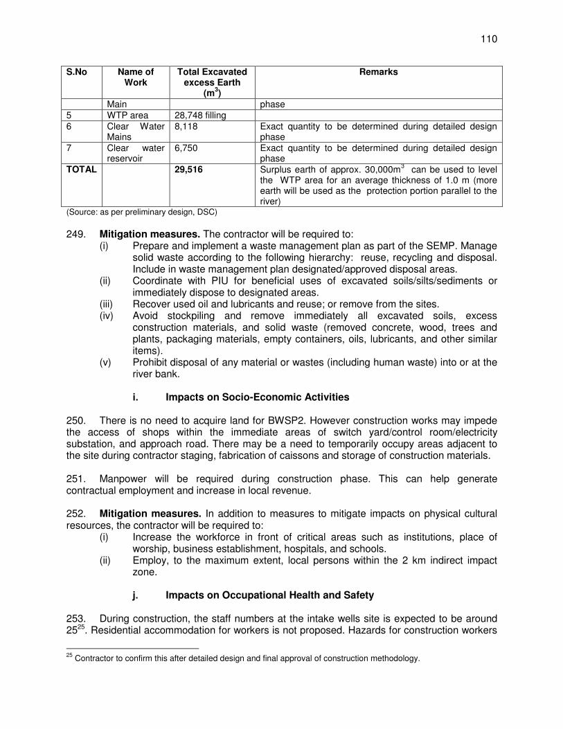
110
S.No Name of Work
Total Excavated excess Earth
(m3)
Remarks
Main phase 5 WTP area 28,748 filling 6 Clear Water
Mains 8,118 Exact quantity to be determined during detailed design
phase 7 Clear water
reservoir 6,750 Exact quantity to be determined during detailed design
phase TOTAL 29,516 Surplus earth of approx. 30,000m
3 can be used to level
the WTP area for an average thickness of 1.0 m (more earth will be used as the protection portion parallel to the river)
(Source: as per preliminary design, DSC)
249. Mitigation measures. The contractor will be required to:
(i) Prepare and implement a waste management plan as part of the SEMP. Manage solid waste according to the following hierarchy: reuse, recycling and disposal. Include in waste management plan designated/approved disposal areas.
(ii) Coordinate with PIU for beneficial uses of excavated soils/silts/sediments or immediately dispose to designated areas.
(iii) Recover used oil and lubricants and reuse; or remove from the sites. (iv) Avoid stockpiling and remove immediately all excavated soils, excess
construction materials, and solid waste (removed concrete, wood, trees and plants, packaging materials, empty containers, oils, lubricants, and other similar items).
(v) Prohibit disposal of any material or wastes (including human waste) into or at the river bank.
i. Impacts on Socio-Economic Activities
250. There is no need to acquire land for BWSP2. However construction works may impede the access of shops within the immediate areas of switch yard/control room/electricity substation, and approach road. There may be a need to temporarily occupy areas adjacent to the site during contractor staging, fabrication of caissons and storage of construction materials. 251. Manpower will be required during construction phase. This can help generate contractual employment and increase in local revenue. 252. Mitigation measures. In addition to measures to mitigate impacts on physical cultural resources, the contractor will be required to:
(i) Increase the workforce in front of critical areas such as institutions, place of worship, business establishment, hospitals, and schools.
(ii) Employ, to the maximum extent, local persons within the 2 km indirect impact zone.
j. Impacts on Occupational Health and Safety
253. During construction, the staff numbers at the intake wells site is expected to be around 2525. Residential accommodation for workers is not proposed. Hazards for construction workers
25
Contractor to confirm this after detailed design and final approval of construction methodology.
111
are typically of four classes: chemical, physical, biological and social.26 Workers need to be mindful of the occupational hazards which can arise from working near and within water areas and high elevations. Exposure to any work-related hazard in the construction site is typically intermittent and of short duration, but is likely to reoccur. Potential impacts are negative and long-term but reversible by mitigation measures. 254. Mitigation measures. Overall, the contractor should comply with IFC EHS Guidelines on Occupational Health and Safety (this can be downloaded from http://www1.ifc.org/wps/wcm/connect/9aef2880488559a983acd36a6515bb18/2%2BOccupational%2BHealth%2Band%2BSafety.pdf?MOD=AJPERES). The contractor will be required to:
(i) Provide workers with access to safe anchorage points that reduce the risk for falls.
(ii) Develop comprehensive site-specific health and safety (H&S) plan as part of the EMP. The overall objective is to provide guidance to contractors on establishing a management strategy and applying practices that are intended to eliminate, or reduce, fatalities, injuries and illnesses for workers performing activities and tasks associated with the project.
(iii) Include in H&S plan measures such as: (i) type of hazards in the intake wells site; (ii) corresponding personal protective equipment for each identified hazard; (iii) H&S training for all site personnel; (iv) procedures to be followed for all site activities; and (v) documentation of work-related accidents.
(iv) Provide compulsory H&S orientation training to all new workers to ensure that they are apprised of the rules of work at the site, personal protective protection, and preventing injury to fellow workers.
(v) Ensure that qualified first-aid can be provided at all times. Equipped first-aid stations shall be easily accessible throughout the site as well as at construction camps.
(vi) Provide medical insurance coverage for workers. (vii) Secure all installations from unauthorized intrusion and accident risks. (viii) Provide supplies of potable drinking water. (ix) Provide clean eating areas where workers are not exposed to hazardous or
noxious substances. (x) Provide visitor orientation if visitors to the site can gain access to areas where
hazardous conditions or substances may be present. Ensure also that visitor/s do not enter hazard areas unescorted.
26
(i) Chemical hazards are often airborne and can appear as dusts, fumes, mists, vapors or gases; thus, exposure usually occurs by inhalation, although some airborne hazards may settle on and be absorbed through intact skin (e.g., pesticides and some organic solvents). Chemical hazards also occur in liquid or semi-liquid state (e.g., glues or adhesives, tar) or as powders (e.g., dry cement). Skin contact with chemicals in this state can occur in addition to possible inhalation of the vapor resulting in systemic poisoning or contact dermatitis. Chemicals might also be ingested with food or water, or might be inhaled by smoking. (ii) Physical hazards are include noise, heat and cold, vibration and barometric pressure. (iii) Biological hazards are presented by exposure to infectious microorganisms, to toxic substances of biological origin or animal attacks. Excavation workers, for example, can develop histoplasmosis, an infection of the lung caused by a common soil fungus. Since there is constant change in the composition of the labor force on any one project, individual workers come in contact with other workers and, as a consequence, may become infected with contagious diseases—influenza or tuberculosis, for example. Workers may also be at risk of malaria, yellow fever or Lyme disease if work is conducted in areas where these organisms and their insect vectors are prevalent. Toxic substances of plant origin may cause skin eruptions. Some wood dusts are carcinogenic, and some (e.g., western red cedar) are allergenic. Attacks by animals are rare but may occur whenever a construction project disturbs them or encroaches on their habitat. (iv) Social hazards stem from social organization of construction industry. Features of construction work such as heavy workload, limited control and limited social support are factors associated with increased stress.
112
(xi) Ensure the visibility of workers through their use of high visibility vests when working in or walking through heavy equipment operating areas.
(xii) Ensure moving equipment is outfitted with audible back-up alarms. (xiii) Mark and provide sign boards for hazardous areas such as energized electrical
devices and lines, service rooms housing high voltage equipment, and areas for storage and disposal. Signage shall be in accordance with international standards and be well known to, and easily understood by workers, visitors, and the general public as appropriate.
(xiv) Disallow worker exposure to noise level greater than 85 dBA for a duration of more than 8 hours per day without hearing protection. The use of hearing protection shall be enforced actively.
k. Summary of Mitigation Measures during Construction of Intake Well
and Associated Structures 255. Table 34 provides summary of mitigation measures to be considered by the contractor during construction of the intake wells. The detailed mitigation measures, environmental monitoring and reporting requirements, emergency response procedures, related implementation arrangements, capacity development and training measures, implementation schedule, cost estimates, and performance indicators are provided in the EMP (Section VIII). Table 34: Summary of Mitigation Measures for Construction of Intake Wells and Ancillary
Structures
Potential Impacts
Mitigation Measures
Erosion hazards
Use dust abatement techniques on unpaved, non-vegetated surfaces to minimize windblown erosion.
Provide temporary stabilization of disturbed areas that are not actively under construction.
Apply erosion controls (e.g., jute netting, silt fences, and check dams) to prevent/minimize soil erosion from vehicular traffic and during construction activities.
Save topsoil removed during construction and use to reclaim disturbed areas, as soon as it is possible to do so.
Maintain vegetative cover within road ROWs to prevent erosion and periodically monitor ROWs to assess erosion.
Clean and maintain catch basins, drainage ditches, and culverts regularly. Conduct routine site inspections to assess the effectiveness of and the maintenance
requirements for erosion and sediment control systems. Impacts on Air Quality
Damp down exposed soil and any soil stockpiled on site by spraying with water when necessary.
Use tarpaulins to cover sand and other loose material when transported by trucks; Fit all heavy equipment and machinery with air pollution control devices which are
operating correctly; and Have pollution control certificates for all vehicle and machinery and submit the same
to DSC and PIU. Noise and vibrations impacts
Limit construction activities to daytime only. Avoid time when dolphins are foraging (maximum during sunrise and sunset hours). Conduct regular monitoring of noise levels as per EMP. Minimize noise from construction equipment by using vehicle silencers, fitting
jackhammers with noise-reducing mufflers, and portable street barriers to limit the sound impact to surroundings.
Noise level in the intake area will not exceed 55dB(A) daytime at the nearest
113
Potential Impacts
Mitigation Measures
receptor and there will be no more than a 3dB(A) increase over the background noise level.
Ensure vehicles comply with Government of India noise limits for vehicles. The test method to be followed shall be IS:3028-1998.
Avoid loud random noise from sirens, air compression, etc. If specific noise complaints are received during construction, the contractor may be
required to implement one or more of the following noise mitigation measures, as directed by the project manager:
- Locate stationary construction equipment as far from nearby noise-sensitive properties as possible.
- Shut off idling equipment. - Reschedule construction operations to avoid periods of noise annoyance identified
in the complaint. - Install temporary or portable acoustic barriers around stationary construction noise
sources. Impacts on flora and fauna
Conduct compulsory induction and environmental awareness to all personnel working onsite.
Conduct site preparation activities, including vegetation removals Prevent access to areas located beyond the construction zone. Limit activities within the work area. Prohibit workers from disturbing biodiversity within the impact zones. Provide to workers or post in public places for the workers, illustrations or pictures of
protected, endangered, threatened, and/or near-threatened species, which can be found in the work area or its immediate surroundings.
Instruct workers to stop work immediately and report to supervisor/contractor’s environment nodal person any work/activity any on-site presence of protected, endangered, threatened, and/or near-threatened species.
Monitor biodiversity for changes over time during 2 year construction period and compare results to baseline data. The objective of the biodiversity monitoring program is to record changes as a result of construction and dredging operation. Monitoring will consist of three components; biodiversity quadrats (within the direct impact zone), photo monitoring points, and biodiversity maps.
Prepare biodiversity monitoring report as per Wildlife Dept NOC. The consistency in the timing of the reports is important to allow comparison over time and to align with historic biodiversity reports.
Impacts on physical cultural resources
Provide walkways and metal sheets where required to maintain access for people and vehicles.
Consult businesses, operators of the ghat, and crematorium regarding operating hours and factor this in to work schedules.
Provide sign boards to inform nature and duration of construction works and contact numbers for concerns/complaints.
Implement good housekeeping. Remove wastes immediately. Avoid stockpiling of excavated soils/silt/sediments.
Ensure workers will not use nearby/adjacent areas as toilet facility. Coordinate with PIU and DSC on transportation routes and schedule. Ensure heavy
vehicles do not use narrow local roads, except in the immediate vicinity of delivery sites. Schedule transport and hauling activities during non-peak hours.
Provide instructions on event of chance finds for archaeological and/or ethno-botanical resources. Works must be stopped immediately until such time chance finds are cleared by experts.
Impacts due to waste
Prepare and implement a waste management plan. Manage solid waste according to the following hierarchy: reuse, recycling and disposal. Include in waste
114
Potential Impacts
Mitigation Measures
generation management plan designated/approved disposal areas. Coordinate with PIU for beneficial uses of excavated soils/silts/sediments or
immediately dispose to designated areas. Recover used oil and lubricants and reuse; or remove from the sites. Avoid stockpiling and remove immediately all excavated soils, excess construction
materials, and solid waste (removed concrete, wood, trees and plants, packaging materials, empty containers, oils, lubricants, and other similar items).
Prohibit disposal of any material or wastes (including human waste) into or at the river bank.
Impacts on socio-economic activities
Increase the workforce in front of critical areas such as institutions, place of worship, business establishment, hospitals, and schools.
Employ to the maximum extent, local persons within the 2 km indirect impact zone.
Impacts on occupational health and safety
Comply with IFC EHS Guidelines on Occupational Health and Safety Provide workers with access to safe anchorage points that reduce the risk for falls. Develop comprehensive site-specific health and safety (H&S) plan. The overall
objective is to provide guidance to contractors on establishing a management strategy and applying practices that are intended to eliminate, or reduce, fatalities, injuries and illnesses for workers performing activities and tasks associated with the project.
Include in H&S plan measures such as: (i) type of hazards in the intake wells site; (ii) corresponding personal protective equipment for each identified hazard; (iii) H&S training for all site personnel; (iv) procedures to be followed for all site activities; and (v) documentation of work-related accidents.
Provide H&S orientation training to all new workers to ensure that they are apprised of the rules of work at the site, personal protective protection, and preventing injury to fellow workers.
Ensure that qualified first-aid can be provided at all times. Equipped first-aid stations shall be easily accessible throughout the site as well as at construction camps.
Provide medical insurance coverage for workers. Secure all installations from unauthorized intrusion and accident risks. Provide supplies of potable drinking water. Provide clean eating areas where workers are not exposed to hazardous or noxious
substances. Provide visitor orientation if visitors to the site can gain access to areas where
hazardous conditions or substances may be present. Ensure also that visitor/s do not enter hazard areas unescorted.
Ensure the visibility of workers through their use of high visibility vests when working in or walking through heavy equipment operating areas.
Ensure moving equipment is outfitted with audible back-up alarms. Mark and provide sign boards for hazardous areas such as energized electrical
devices and lines, service rooms housing high voltage equipment, and areas for storage and disposal. Signage shall be in accordance with international standards and be well known to, and easily understood by workers, visitors, and the general public as appropriate.
Disallow worker exposure to noise level greater than 85 dBA for a duration of more than 8 hours per day without hearing protection. The use of hearing protection shall be enforced actively.
2. Transmission Mains
a. Construction Method

115
256. Raw and clear water mains will be buried in trenches adjacent to roads using available rights-of-way (ROW). In some areas occupied by drains or edges of shops and houses, trenches may be dug into the edge of the road to avoid damage to utilities and properties. 257. Trenches will be dug using a backhoe digger, supplemented by manual digging where necessary. Excavated soil will be placed alongside, and the pipe bedding will be prepared with the sand from local quarries placed manually in the trench and the pipes (brought to site on trucks and stored on pre-identified yards) will be placed in the trench by hand or using a small rig for the larger Ductile Iron (DI) pipes and MS pipes. Pipes will be joined by hand, after which sand will be shovelled into the trench around the pipe for support and protection. Soil will then be replaced manually on top of the pipe and compacted in layers by a vibrating compactor. Where trenches are dug into an existing roadway, the bitumen or concrete surface will be broken by hand- held pneumatic drills, after which the trench will be excavated by backhoe, and the appropriate surface will be reapplied on completion. 258. Pipes are normally covered by 1.2-1.5 m of soil, and a clearance of 300 mm is left between the pipe and each side of the trench to allow backfilling. During the construction there will be piling of excavated earth from the trench. There will be storage of sand also as this has be put after laying pipes for support. Tasks to be performed for the transmission main works are listed in the order of priority as:
(i) obtain excavation permits; (ii) arrange road closure, finalize detours, inform traffic police, and inform public
transport agencies and affected road users; (iii) inform BMC and other relevant users of required water supply interruptions; (iv) excavate trial pits and identify existing utilities; (v) set out pipe routes, prepare shop drawings, and obtain PMU approval; (vi) identify bad soil areas to ascertain backfill material requirement; (vii) identify borrow pits; (viii) identify disposal sites for excess and unsuitable excavated materials; (ix) transport pipes to nearby locations; (x) implement road detours; (xi) excavate trenches, lay pipes, provide anchor blocks, backfill trenches, and
construct chambers, and provide special bedding where specified; (xii) carry out pressure test; (xiii) flush and disinfect; (xiv) reinstate road; and (xv) operate.
b. Erosion Hazards
259. The alignment of transmission mains are along ROWs in the built up area of the city. The area is relatively flat therefore risk of erosion is low, limited during laying of pipes and not expected to have any negative impact on the drainage and hydrology of the area. Runoff from pipe laying will produce a highly variable discharge in terms of volume and quality, and in most instances will have no discernable environmental impact. 260. Mitigation measures. The contractor will be required to:
(i) Save topsoil removed during excavation and use to reclaim disturbed areas, as soon as it is possible to do so.
(ii) Use dust abatement such as water spraying to minimize windblown erosion.
116
(iii) Provide temporary stabilization of disturbed/excavated areas that are not actively under construction.
(iv) Apply erosion controls (e.g., silt traps) along the drainage leading to the water bodies.
(v) Maintain vegetative cover within road ROWs to prevent erosion and periodically monitor ROWs to assess erosion.
(vi) Clean and maintain catch basins, drainage ditches, and culverts regularly. (vii) Conduct routine site inspections to assess the effectiveness of and the
maintenance requirements for erosion and sediment control systems. c. Impacts on Water Quality
261. As per preliminary design, transmission main will not cross any water bodies. However, excavated materials may end up in drainages particularly during monsoon season. Other risks of pollution may be caused by: (i) poorly managed construction sediments, wastes and hazardous substances; and (ii) poor sanitation practices of construction workers. 262. Mitigation measures. The contractor will be required to:
(i) Schedule and prioritize pipe laying works during non-monsoon season. (ii) Ensure drainages within the construction zones are kept free of obstructions. (iii) Keep loose soil material and stockpiles out of drains, flow-lines and
watercourses. (iv) Avoid stockpiling of excavated and construction materials (sand, gravel, cement,
etc.) unless covered by tarpaulins or plastic sheets. (v) Re-use/utilize, to maximum extent possible, excavated materials. (vi) Dispose any residuals at identified disposal site27. (vii) Dispose waste oil and lubricants generated as per provisions of Hazardous
Waste (Management and Handling) Rules, 1989. (viii) Develop a spill prevention and containment plan as part of EMP, educate
workers about the plan, and have the necessary materials on site prior to and during construction.
(ix) Refuel equipment within the designated refueling containment area away from drainages, nallahs, or any water body.
(x) Inspect all vehicles daily for fluid leaks before leaving the vehicle staging area, and repair any leaks before the vehicle resumes operation.
d. Impacts on Air Quality
263. There is potential for increased dust particularly during summer/dry season due to stockpiling of excavated materials. Emissions from vehicles transporting workers, construction materials and debris/materials to be disposed may cause increased in air pollutants within the construction zone. These are inherent impacts which are site-specific, low magnitude, short in duration and can be easily mitigated. 264. Mitigation measures. The contractor will be required to:
(i) Conduct regular water spraying on earth piles, trenches and sand piles. (ii) Conduct regular visual inspection along alignments and construction zones to
ensure no excessive dust emissions.
27
To be approved by the DSC and PIU.
117
(iii) Spread crushed gravel over backfilled surfaces, if re-surfacing of disturbed ROWs cannot be done immediately.
(iv) Maintain construction vehicles and obtain “pollution under control” certificate from BSPCB.
(v) Obtain CTE and CTO for hot mix plants, crushers, diesel generators, etc., if to be used in the project.
e. Noise and Vibration Impacts
265. Noise and vibration-emitting construction activities include earthworks, rock crushing, concrete mixing, movement and operation of construction vehicles and equipment, and loading and unloading of coarse aggregates. The significance of noise and vibration impacts will be high in areas where noise-sensitive institutions such as health care and educational facilities are situated. These impacts will be temporary, short-term, intermittent, and expected to be in the range of 80 to 100 dB(A) as per Table 32 (typical noise levels of principal construction equipment). 266. Mitigation measures. The contractor will be required to:
(i) Limit construction activities to daytime only. (ii) Plan activities in consultation with the PIU and DSC so that activities with the
greatest potential to generate noise are conducted during periods of the day which will result in least disturbance.
(iii) Minimize noise from construction equipment by using vehicle silencers and fitting jackhammers with noise-reducing mufflers.
(iv) Avoid loud random noise from sirens, air compression, etc. (v) Require drivers to not use horns unless it is necessary to warn other road users
or animals of the vehicle’s approach. (vi) If specific noise complaints are received during construction, the contractor may
be required to implement one or more of the following noise mitigation measures, as directed by the project manager: - Locate stationary construction equipment as far from nearby noise-
sensitive properties as possible. - Shut off idling equipment. - Reschedule construction operations to avoid periods of noise annoyance
identified in the complaint. - Notify nearby residents whenever extremely noisy work will be occurring.
(vii) Follow Noise Pollution (Regulation and Control) Rules, day time ambient noise levels should not exceed 65 dB(A) in commercial areas, 55 dB(A) in residential areas, and 50 dB(A) in silence zone.28
(viii) Ensure vehicles comply with Government of India noise limits for vehicles. The test method to be followed shall be IS:3028-1998.
f. Impacts on Flora and Fauna
267. As per preliminary design, tree-cutting along alignment of transmission mains is not required. This will be reassessed by DBO contractor during detailed design phase. There are no protected areas in the direct and indirect impact zones and no diverse ecological biodiversity as
28
Day time shall mean from 6.00 am to 10.00 pm. Silence zone is an area comprising not less than 100 meters around hospitals, educational institutions, courts, religious places or any other area which is declared as such by BSPCB. Mixed categories of areas may be declared as one of the above mentioned categories by BSPCB.
118
vegetation and animals found in the construction zones are common in built up/urban areas. 268. Mitigation measures. The contractor will be required to:
(i) Conduct site induction and environmental awareness. (ii) Limit activities within the work area. (iii) Replant trees in the area using minimum ratio of 2 new trees for every 1 tree cut,
if any. Replacement species must be approved by Chief Conservator of Forest of Bihar State Forest Department.
g. Impacts on Physical Cultural Resources
269. As per preliminary design, there are no structures, encroachers or utilities to be shifted along ROWs to be excavated for pipe laying. The alignments are not within any historical, cultural or tourist areas identified in Section IV. This will be reassessed during detailed design phase. However, there may be inconvenience to road users due to slower flow of traffic in areas with narrow roads. This potential impact is site-specific, short-term and can be mitigated. 270. Mitigation measures. The contractor will be required to:
(i) Ensure no damage to structures/properties near construction zone. (ii) Provide walkways and metal sheets where required to maintain access of people
and vehicles. (iii) Provide sign boards to inform nature and duration of construction works and
contact numbers for concerns/complaints. (iv) Increase the workforce in front of critical areas such as institutions, place of
worship, business establishment, hospitals, and schools; (v) Implement good housekeeping. Remove wastes immediately. Prohibit stockpiling
of materials that may obstruct/slow down pedestrians and/or vehicle movement. (vi) Ensure workers will not use nearby/adjacent areas as toilet facility. (vii) Coordinate with PIU and DSC on transportation routes and schedule. Schedule
transport and hauling activities during non-peak hours. Communicate road detours via visible boards, advertising, pamphlets, etc.
(viii) Ensure heavy vehicles do not use narrow local roads, except in the immediate vicinity of delivery sites.
(ix) Provide instructions on event of chance finds for archaeological and/or ethno-botanical resources. Works must be stopped immediately until such time chance finds are cleared by experts.
h. Impact due to Waste Generation
271. Pipe laying works will produce excess excavated soils, excess construction materials, and solid wastes (such as removed concrete, wood, trees and plants, packaging materials, empty containers, oils, lubricants, and other similar items)29. These impacts are negative but short-term and reversible by mitigation measures. 272. Mitigation measures. The contractor will need to adopt the following mitigation measures:
(i) Prepare and implement a waste management plan as part of SEMP. Manage solid waste according to the following hierarchy: reuse, recycling and disposal. Include in waste management plan designated/approved disposal areas.
29
Contractor to update these figures after detailed design.
119
(ii) Coordinate with BMC for beneficial uses of excavated soils/silts/sediments or immediately dispose to designated areas.
(iii) Recover used oil and lubricants and reuse; or remove from the sites. (iv) Avoid stockpiling and remove immediately all excavated soils, excess
construction materials, and solid waste (removed concrete, wood, trees and plants, packaging materials, empty containers, oils, lubricants, and other similar items).
(v) Prohibit disposal of any material or wastes (including human waste) into drainage, nallah, or watercourse.
i. Impacts on Occupational Health and Safety
273. During construction, the staff numbers at the transmission mains construction zone is estimated to be around 40. Residential accommodation for workers is not proposed. Workers need to be mindful of occupational hazards which can arise from excavation works in high-traffic and busy areas. Exposure to work-related chemical, physical, biological and social hazard is typically intermittent and of short duration, but is likely to reoccur. Potential impacts are negative and long-term but reversible by mitigation measures. 274. Mitigation measures. Overall, the contractor should comply with IFC EHS Guidelines on Occupational Health and Safety (this can be downloaded from http://www1.ifc.org/wps/wcm/connect/9aef2880488559a983acd36a6515bb18/2%2BOccupational%2BHealth%2Band%2BSafety.pdf?MOD=AJPERES). The contractor will be required to:
(i) Avoid worker exposure to noise level greater than 85 dBA for a duration of more than 8 hours per day without hearing protection. The use of hearing protection shall be enforced actively.
(ii) Develop comprehensive site-specific health and safety (H&S) plan as part of EMP. The overall objective is to provide guidance to contractors on establishing a management strategy and applying practices that are intended to eliminate, or reduce, fatalities, injuries and illnesses for workers performing activities and tasks associated with the project.
(iii) Include in H&S plan measures such as: (i) type of hazards during excavation works; (ii) corresponding personal protective equipment for each identified hazard; (iii) H&S training for all site personnel; (iv) procedures to be followed for all site activities; and (v) documentation of work-related accidents.
(iv) Provide compulsory H&S orientation training to all new workers to ensure that they are apprised of the rules of work at the site, personal protective protection, and preventing injury to fellow workers.
(v) Ensure that qualified first-aid can be provided at all times. Equipped first-aid stations shall be easily accessible throughout the site as well as at construction camps.
(vi) Provide medical insurance coverage for workers. (vii) Secure construction zone from unauthorized intrusion and accident risks. (viii) Provide supplies of potable drinking water. (ix) Provide clean eating areas where workers are not exposed to hazardous or
noxious substances. (x) Provide visitor orientation if visitors to the site can gain access to areas where
hazardous conditions or substances may be present. Ensure also that visitor/s do not enter hazard areas unescorted.
(xi) Ensure the visibility of workers through their use of high visibility vests when working in or walking through heavy equipment operating areas.
120
(xii) Ensure moving equipment is outfitted with audible back-up alarms. (xiii) Mark and provide sign boards in the construction zone, and areas for storage
and disposal. Signage shall be in accordance with international standards and be well known to, and easily understood by workers, visitors, and the general public as appropriate.
j. Impacts on Socio-Economic Activities
275. As per preliminary design, land acquisition beyond ROWs and closure of roads are not required for the transmission mains. However, pipe laying works may impede access of residents and customers to shops along trenches. The potential impacts are negative and moderate but short-term and temporary. 276. Manpower is expected to be required during the 24 months of construction phase. This can help generate contractual employment and increase in local revenue. Thus potential impact is positive and long-term. 277. Mitigation measures. The contractor will need to adopt the following mitigation measures:
(i) Leave space for access between mounds of soil. (ii) Provide walkways and metal sheets where required to maintain access to
shops/businesses along trenches. (iii) Consult businesses and institutions regarding operating hours and factoring this
in to work schedules. (iv) Provide sign boards for pedestrians to inform nature and duration of construction
works and contact numbers for concerns/complaints. (v) Employ at least 50% of the labor force, or to the maximum extent, local persons
within the 2-km immediate area if manpower is available. k. Summary of Mitigation Measures during Construction of
Transmission Mains 278. Table 35 provides summary of mitigation measures to be considered by the contractor during pipe laying for the transmission mains. The detailed mitigation measures, environmental monitoring and reporting requirements, emergency response procedures, related implementation arrangements, capacity development and training measures, implementation schedule, cost estimates, and performance indicators are provided in the EMP (Section VIII).
Table 35: Summary of Mitigation Measures during Transmission Mains Pipe Laying
Potential Impact
Mitigation Measures
Erosion hazards
Save topsoil removed during excavation and use to reclaim disturbed areas, as soon as it is possible to do so.
Use dust abatement such as water spraying to minimize windblown erosion. Provide temporary stabilization of disturbed/excavated areas that are not actively
under construction. Apply erosion controls (e.g., silt traps) along the drainage leading to the water
bodies. Maintain vegetative cover within road ROWs to prevent erosion and periodically
monitor ROWs to assess erosion. Clean and maintain catch basins, drainage ditches, and culverts regularly.
121
Potential Impact
Mitigation Measures
Conduct routine site inspections to assess the effectiveness of and the maintenance requirements for erosion and sediment control systems.
Impacts on water quality
Schedule pipe laying works during non-monsoon season. Ensure drainages within the construction zones are kept free of obstructions. Keep loose soil material and stockpiles out of drains, flow-lines and watercourses. Avoid stockpiling of excavated and construction materials (sand, gravel, cement,
etc.) unless covered by tarpaulins or plastic sheets. Re-use/utilize, to maximum extent possible, excavated materials. Dispose any residuals at identified disposal site (PMU/PIU will identify approved
sites). Dispose waste oil and lubricants generated as per provisions of Hazardous Waste
(Management and Handling) Rules, 1989. Develop a spill prevention and containment plan, educate workers about the plan,
and have the necessary materials on site prior to and during construction. Refuel equipment within the designated refueling containment area away from
drainages, nallahs, or any water body. Inspect all vehicles daily for fluid leaks before leaving the vehicle staging area, and
repair any leaks before the vehicle resumes operation. Impacts on air quality
Conduct regular water spraying on earth piles, trenches and sand piles. Conduct regular visual inspection along alignments and construction zones to
ensure no excessive dust emissions. Spreading crushed gravel over backfilled surfaces if re-surfacing of disturbed ROWs
cannot be done immediately. Maintain construction vehicles and obtain “pollution under control” certificate from
BSPCB. Obtain CTE and CTO for hot mix plants, crushers, diesel generators, etc., if to be
used in the project. Noise and vibrations impacts
Limit construction activities to daytime only. Plan activities in consultation with the PIU/DSC so that activities with the greatest
potential to generate noise are conducted during periods of the day which will result in least disturbance.
Minimize noise from construction equipment by using vehicle silencers and fitting jackhammers with noise-reducing mufflers.
Avoid loud random noise from sirens, air compression, etc. Require drivers that horns not be used unless it is necessary to warn other road
users or animals of the vehicle’s approach. If specific noise complaints are received during construction, the contractor may be
required to implement one or more of the following noise mitigation measures, as directed by the project manager:
o Locate stationary construction equipment as far from nearby noise-sensitive properties as possible.
o Shut off idling equipment. o Reschedule construction operations to avoid periods of noise annoyance
identified in the complaint. o Notify nearby residents whenever extremely noisy work will be occurring.
Follow Noise Pollution (Regulation and Control) Rules, day time ambient noise levels should not exceed 65 dB(A) in commercial areas, 55 dB(A) in residential areas, and 50 dB(A) in silence zone.
30
30
Day time shall mean from 6.00 am to 10.00 pm. Silence zone is an area comprising not less than 100 meters around hospitals, educational institutions, courts, religious places or any other area which is declared as such by BSPCB. Mixed categories of areas may be declared as one of the above mentioned categories by BSPCB.
122
Potential Impact
Mitigation Measures
Ensure vehicles comply with Government of India noise limits for vehicles. The test method to be followed shall be IS:3028-1998.
Impacts on flora and fauna
Conduct site induction and environmental awareness. Limit activities within the work area. Replant trees in the area using minimum ratio of 2 new trees for every 1 tree cut, if
any. Replacement species must be approved by Chief Conservator of Forest of Bihar State Forest Department.
Impacts on physical resources
Ensure no damage to structures/properties near construction zone. Provide walkways and metal sheets where required to maintain access of people
and vehicles. Provide sign boards to inform nature and duration of construction works and contact
numbers for concerns/complaints. Increase the workforce in front of critical areas such as institutions, place of worship,
business establishment, hospitals, and schools; Implement good housekeeping. Remove wastes immediately. Prohibit stockpiling of
materials that may obstruct/slow down pedestrians and/or vehicle movement. Ensure workers will not use nearby/adjacent areas as toilet facility. Coordinate with DSC for transportation routes and schedule. Schedule transport and
hauling activities during non-peak hours. Communicate road detours via visible boards, advertising, pamphlets, etc.
Ensure heavy vehicles do not use narrow local roads, except in the immediate vicinity of delivery sites.
Provide instructions on event of chance finds for archaeological and/or ethno-botanical resources. Works must be stopped immediately until such time chance finds are cleared by experts.
Impacts on waste generation
Prepare and implement a waste management plan. Manage solid waste according to the following hierarchy: reuse, recycling and disposal. Include in waste management plan designated/approved disposal areas.
Coordinate with BMC for beneficial uses of excavated soils/silts/sediments or immediately dispose to designated areas.
Recover used oil and lubricants and reuse; or remove from the sites. Avoid stockpiling and remove immediately all excavated soils, excess construction
materials, and solid waste (removed concrete, wood, trees and plants, packaging materials, empty containers, oils, lubricants, and other similar items).
Prohibit disposal of any material or wastes (including human waste) into drainage, nallah, or watercourse.
Impacts on occupational health and safety
Comply with IFC EHS Guidelines on Occupational Health and Safety Disallow worker exposure to noise level greater than 85 dBA for a duration of more
than 8 hours per day without hearing protection. The use of hearing protection shall be enforced actively.
Develop comprehensive site-specific health and safety (H&S) plan. The overall objective is to provide guidance to contractors on establishing a management strategy and applying practices that are intended to eliminate, or reduce, fatalities, injuries and illnesses for workers performing activities and tasks associated with the project.
Include in H&S plan measures such as: (i) type of hazards during excavation works; (ii) corresponding personal protective equipment for each identified hazard; (iii) H&S training for all site personnel; (iv) procedures to be followed for all site activities; and (v) documentation of work-related accidents.
Provide H&S orientation training to all new workers to ensure that they are apprised of the rules of work at the site, personal protective protection, and preventing injury to fellow workers.
123
Potential Impact
Mitigation Measures
Ensure that qualified first-aid can be provided at all times. Equipped first-aid stations shall be easily accessible throughout the site as well as at construction camps.
Provide medical insurance coverage for workers. Secure construction zone from unauthorized intrusion and accident risks. Provide supplies of potable drinking water. Provide clean eating areas where workers are not exposed to hazardous or noxious
substances. Provide visitor orientation if visitors to the site can gain access to areas where
hazardous conditions or substances may be present. Ensure also that visitor/s do not enter hazard areas unescorted.
Ensure the visibility of workers through their use of high visibility vests when working in or walking through heavy equipment operating areas.
Ensure moving equipment is outfitted with audible back-up alarms. Mark and provide sign boards in the construction zone, and areas for storage and
disposal. Signage shall be in accordance with international standards and be well known to, and easily understood by workers, visitors, and the general public as appropriate.
Impacts on socio-economic activities
Leave space for access between mounds of soil. Provide walkways and metal sheets where required to maintain access to
shops/businesses along trenches. Consult businesses and institutions regarding operating hours and factoring this in
to work schedules. Provide sign boards for pedestrians to inform nature and duration of construction
works and contact numbers for concerns/complaints. Employ at least 50% of the labor force, or to the maximum extent, local persons
within the 2-km immediate area if manpower is available.
3. WTP
a. Construction Method
279. Construction of the WTP and clear water reservoirs will not require special construction method. Medium to large size WTPs are largely made of RCC. Foundations will be dug and aggregate and concrete poured in to create the floors, after which the brick walls and roof materials will be added by hand. Some parts of the piping system like bends may be manufactured on site from steel pipes. Chlorine cylinders and other equipment (including flow-meters) will be brought in on trucks and offloaded and attached by hand. A small cavity for the chlorination sump and trenches for pipe-work will also be dug, and the sump will constructed from concrete and brick. There will be construction of small rooms alongside WTP modules to house the chlorination plant and other facilities.
b. Erosion Hazards
280. The WTP site is relatively flat therefore risk of erosion is low. However due to site preparation and removal of soil for WTP foundations and components, excavated materials if not managed properly, may affect drainage of construction zone. Runoffs are considered highly variable discharge in terms of volume and quality, and in most instances will have no discernable environmental impact. 281. Mitigation measures. The contractor will be required to:
124
(i) Save topsoil removed during excavation and use to reclaim disturbed areas, as soon as it is possible to do so.
(ii) Use dust abatement such as water spraying to minimize windblown erosion. (iii) Provide temporary stabilization of disturbed/excavated areas that are not actively
under construction. (iv) Apply erosion controls (e.g., silt traps) along the drainage leading to the water
bodies. (v) Conduct routine site inspections to assess the effectiveness of and the
maintenance requirements for erosion and sediment control systems.
c. Impacts on Water Quality 282. As per design, WTP site is near existing WTP at Barari and near River. Excavated materials may end up in drainages particularly during monsoon season. Other risks of pollution may be caused by: (i) poorly managed construction sediments, wastes and hazardous substances; and (ii) poor sanitation practices of construction workers. 283. Mitigation measures. The contractor will be required to:
(i) Schedule construction activities during non-monsoon season. (ii) Ensure drainages within the construction zones are kept free of obstructions. (iii) Keep loose soil material and stockpiles out of drains and flow-lines. (iv) Avoid stockpiling of excavated and construction materials (sand, gravel, cement,
etc.) unless covered by tarpaulins or plastic sheets. (v) Re-use/utilize, to maximum extent possible, excavated materials. (vi) Dispose any residuals at identified disposal site (PMU/PIU will identify approved
sites). (vii) Dispose waste oil and lubricants generated as per provisions of Hazardous
Waste (Management and Handling) Rules, 1989. (viii) Develop a spill prevention and containment plan as part of EMP, educate
workers about the plan, and have the necessary materials on site prior to and during construction.
(ix) Refuel equipment within the designated refueling containment area away from drainages, nallahs, or water body.
(x) Inspect all vehicles daily for fluid leaks before leaving the vehicle staging area, and repair any leaks before the vehicle resumes operation.
d. Impacts on Air Quality
284. The WTP site is not adjacent to any residences/business center. Communities along routes may experience increased air pollutants during daily ingress/egress of workers, transport of construction materials and hauling of debris/materials. These are inherent impacts which are site-specific, low magnitude, short in duration and can be easily mitigated. 285. Mitigation measures. The contractor will be required to:
(i) Conduct baseline wind direction and ensure stockpiles are located away from the hospital and other sensitive receptors
(ii) Conduct regular water spraying on stockpiles. (iii) Conduct regular visual inspection in the construction zones to ensure no
excessive dust emissions. (iv) Maintain construction vehicles and obtain “pollution under control” certificate from
BSPCB.
125
(v) Obtain CTE and CTO for hot mix plants, crushers, diesel generators, etc., if to be used in the project.
e. Noise and Vibration Impacts
286. Noise- and vibration-emitting construction activities include earthworks, rock crushing, concrete mixing, movement and operation of construction vehicles and equipment, and loading and unloading of coarse aggregates. Proposed WTP is located within existing Barari WTP campus. 287. Mitigation measures. The contractor will be required to:
(i) Limit construction activities to daytime only. (ii) Plan activities in consultation with PIU/DSC so that activities with the greatest
potential to generate noise are conducted during periods of the day which will result in least disturbance.
(iii) Minimize noise from construction equipment by using vehicle silencers and fitting jackhammers with noise-reducing mufflers.
(iv) Avoid loud random noise from sirens, air compression, etc. (v) Require drivers that horns not be used unless it is necessary to warn other road
users or animals of the vehicle’s approach. (vi) If specific noise complaints are received during construction, the contractor may
be required to implement one or more of the following noise mitigation measures, as directed by the project manager: - Shut off idling equipment. - Reschedule construction operations to avoid periods of noise annoyance
identified in the complaint. - Follow Noise Pollution (Regulation and Control) Rules, day time ambient noise
levels should not exceed 65 dB(A) in commercial areas, 55 dB(A) in residential areas, and 50 dB(A) in silence zone.31
(vii) Ensure vehicles comply with Government of India noise limits for vehicles. The test method to be followed shall be IS: 3028-1998.
f. Impacts on Flora and Fauna
288. As per preliminary design, 20 number of tree is expected to be cut in the WTP construction zone. The layout of the WTP components will be reassessed during detailed design phase to consider minimal tree-cutting. There are no protected areas around the WTP site and ecological biodiversity is not diverse as vegetation and animals found in the sites and immediate surroundings are common in built up/urban areas. 289. Mitigation measures. The contractor will be required to:
(i) Conduct site induction and environmental awareness of all workers. (ii) Limit activities within the work area. (iii) Replant trees in the area using minimum ratio of 2 new trees for every 1 tree cut.
Replacement species must be approved by Chief Conservator of Forest of Bihar State Forest Department.
31
Day time shall mean from 6.00 am to 10.00 pm. Silence zone is an area comprising not less than 100 meters around hospitals, educational institutions, courts, religious places or any other area which is declared as such by BSPCB. Mixed categories of areas may be declared as one of the above mentioned categories by BSPCB.
126
g. Impacts on Physical Cultural Resources 290. As per site inspections conducted during preparation of this draft IEE, there are no structures or encroachers in the WTP site. It is also not within any historical, cultural or tourist areas identified in Section IV. Propsed WTP is located within existing WTP campus. There may be inconvenience to road users due to slower flow of traffic in narrow roads along project-related transport routes. This potential impact is site-specific, short-term and can be mitigated. 291. Mitigation measures. The contractor will be required to:
(i) Provide sign boards to inform nature and duration of construction works and contact numbers for concerns/complaints.
(ii) Implement good housekeeping. Remove wastes immediately. (iii) Ensure workers will not use nearby/adjacent areas as toilet facility. (iv) Coordinate with PIU/DSC for transportation routes and schedule. Schedule
transport and hauling activities during non-peak hours. Communicate road detours via visible boards, advertising, pamphlets, etc.
(v) Ensure heavy vehicles do not use narrow local roads, except in the immediate vicinity of delivery sites.
(vi) Provide instructions on event of chance finds for archaeological and/or ethno-botanical resources. Works must be stopped immediately until such time chance finds are cleared by experts.
h. Impact due to Waste Generation
292. WTP works will produce excess excavated soils, excess construction materials, and solid wastes (such as removed concrete, wood, trees and plants, packaging materials, empty containers, oils, lubricants, and other similar items). These impacts are negative but short-term and reversible by mitigation measures. 293. Mitigation measures. The contractor will be required to:
(i) Prepare and implement a waste management plan. Manage solid waste according to the following hierarchy: reuse, recycling and disposal. Include in waste management plan designated/approved disposal areas.
(ii) Coordinate with PIU/DSC for beneficial uses of excavated soils or immediately dispose to designated areas.
(iii) Recover used oil and lubricants and reuse; or remove from the site. (iv) Avoid stockpiling and remove immediately all excavated soils, excess
construction materials, and solid waste (removed concrete, wood, trees and plants, packaging materials, empty containers, oils, lubricants, and other similar items).
(v) Prohibit disposal of any material or wastes (including human waste) into drainage, nallah, or watercourse.
i. Impacts on Occupational Health and Safety
294. During construction the staff numbers at the WTP construction zone is estimated to be around 30. Residential accommodation for workers is not proposed. Workers need to be mindful of occupational hazards which can arise from excavation works. Exposure to work-related chemical, physical, biological and social hazard is typically intermittent and of short duration, but is likely to reoccur. Potential impacts are negative and long-term but reversible by mitigation measures.
127
295. Mitigation measures. Overall, the contractor should comply with IFC EHS Guidelines on Occupational Health and Safety (this can be downloaded from http://www1.ifc.org/wps/wcm/connect/9aef2880488559a983acd36a6515bb18/2%2BOccupational%2BHealth%2Band%2BSafety.pdf?MOD=AJPERES). The contractor will be required to:
(i) Avoid worker exposure to noise level greater than 85 dBA for a duration of more than 8 hours per day without hearing protection. The use of hearing protection shall be enforced actively.
(ii) Develop comprehensive site-specific health and safety (H&S) plan. The overall objective is to provide guidance to contractors on establishing a management strategy and applying practices that are intended to eliminate, or reduce, fatalities, injuries and illnesses for workers performing activities and tasks associated with the project.
(iii) Include in H&S plan measures such as: (1) type of hazards during excavation works; (2) corresponding personal protective equipment for each identified hazard; (3) H&S training for all site personnel; (4) procedures to be followed for all site activities; and (5) documentation of work-related accidents.
(iv) Provide H&S orientation training to all new workers to ensure that they are apprised of the rules of work at the site, personal protective protection, and preventing injury to fellow workers.
(v) Ensure that qualified first-aid can be provided at all times. Equipped first-aid stations shall be easily accessible throughout the site as well as at construction camps.
(vi) Provide medical insurance coverage for workers. (vii) Secure construction zone from unauthorized intrusion and accident risks. (viii) Provide supplies of potable drinking water. (ix) Provide clean eating areas where workers are not exposed to hazardous or
noxious substances. (x) Provide visitor orientation if visitors to the site can gain access to areas where
hazardous conditions or substances may be present. Ensure also that visitor/s do not enter hazard areas unescorted.
(xi) Ensure the visibility of workers through their use of high visibility vests when working in or walking through heavy equipment operating areas.
(xii) Ensure moving equipment is outfitted with audible back-up alarms. (xiii) Mark and provide sign boards in the construction zone, and areas for storage
and disposal. Signage shall be in accordance with international standards and be well known to, and easily understood by workers, visitors, and the general public as appropriate.
j. Impacts on Socio-Economic Activities
296. As per preliminary design, land acquisition is not required for construction of WTP. 297. Manpower is expected to be required during the 24 months of construction phase. This can help generate contractual employment and increase in local revenue. Thus potential impact is positive and long-term. 298. Mitigation measures. The contractor will need to adopt the following mitigation measures:
(i) Employ at least 50% of the labor force, or to the maximum extent, local persons within the 2-km immediate area if manpower is available.
128
k. Summary of Mitigation Measures during WTP Construction
299. Table 36 provides summary of mitigation measures to be considered by the contractor during WTP construction. The detailed mitigation measures, environmental monitoring and reporting requirements, emergency response procedures, related implementation arrangements, capacity development and training measures, implementation schedule, cost estimates, and performance indicators are provided in the EMP (Section VIII).
Table 36: Summary of Mitigation Measures during WTP Construction
Potential Impact
Mitigation Measures
Erosion hazards
Save topsoil removed during excavation and use to reclaim disturbed areas, as soon as it is possible to do so.
Use dust abatement such as water spraying to minimize windblown erosion. Provide temporary stabilization of disturbed/excavated areas that are not actively
under construction. Apply erosion controls (e.g., silt traps) along the drainage leading to the water
bodies. Conduct routine site inspections to assess the effectiveness of and the maintenance
requirements for erosion and sediment control systems. Impacts on water quality
Schedule construction activities during non-monsoon season. Ensure drainages within the construction zones are kept free of obstructions. Keep loose soil material and stockpiles out of drains and flow-lines. Avoid stockpiling of excavated and construction materials (sand, gravel, cement,
etc.) unless covered by tarpaulins or plastic sheets. Re-use/utilize, to maximum extent possible, excavated materials. Dispose any residuals at identified disposal site (PMU/PIU will identify approved
sites). Dispose waste oil and lubricants generated as per provisions of Hazardous Waste
(Management and Handling) Rules, 1989. Develop a spill prevention and containment plan, educate workers about the plan,
and have the necessary materials on site prior to and during construction. Refuel equipment within the designated refueling containment area away from
drainages, nallahs, or water body. Inspect all vehicles daily for fluid leaks before leaving the vehicle staging area, and
repair any leaks before the vehicle resumes operation. Impacts on air quality
Conduct cement mixing in the farthest area possible, away from the hospital and sensitive receptors.
Conduct regular water spraying on stockpiles. Conduct regular visual inspection in the construction zones to ensure no excessive
dust emissions. Maintain construction vehicles and obtain “pollution under control” certificate from
BSPCB. Obtain CTE and CTO for hot mix plants, crushers, diesel generators, etc., if to be
used in the project. Noise and vibrations impacts
Limit construction activities to daytime only. Minimize noise from construction equipment by using vehicle silencers and fitting
jackhammers with noise-reducing mufflers. Avoid loud random noise from sirens, air compression, etc. Require drivers that horns not be used unless it is necessary to warn other road
users or animals of the vehicle’s approach. If specific noise complaints are received during construction, the contractor may be
129
Potential Impact
Mitigation Measures
required to implement one or more of the following noise mitigation measures, as directed by the project manager:
- Shut off idling equipment. - Reschedule construction operations to avoid periods of noise annoyance identified
in the complaint. Follow Noise Pollution (Regulation and Control) Rules, day time ambient noise
levels should not exceed 65 dB(A) in commercial areas, 55 dB(A) in residential areas, and 50 dB(A) in silence zone.32
Ensure vehicles comply with Government of India noise limits for vehicles. The test method to be followed shall be IS:3028-1998.
Impacts on flora and fauna
Conduct site induction and environmental awareness. Limit activities within the work area. Replant trees in the area using minimum ratio of 2 new trees for every 1 tree cut.
Replacement species must be approved by Chief Wildlife Warden of Bihar State Forest Department.
Impacts on physical cultural resources
Ensure no damage to structures/properties adjacent to construction zone. Provide sign boards to inform nature and duration of construction works and contact
numbers for concerns/complaints. Implement good housekeeping. Remove wastes immediately. Ensure workers will not use nearby/adjacent areas as toilet facility. Coordinate with PIU/DSC for transportation routes and schedule. Schedule transport
and hauling activities during non-peak hours. Communicate road detours via visible boards, advertising, pamphlets, etc.
Ensure heavy vehicles do not use narrow local roads, except in the immediate vicinity of delivery sites.
Provide instructions on event of chance finds for archaeological and/or ethno-botanical resources. Works must be stopped immediately until such time chance finds are cleared by experts.
Impact due to waste generation
Prepare and implement a waste management plan. Manage solid waste according to the following hierarchy: reuse, recycling and disposal. Include in waste management plan designated/approved disposal areas.
Coordinate with PIU/DSC for beneficial uses of excavated soils or immediately dispose to designated areas.
Recover used oil and lubricants and reuse; or remove from the site. Avoid stockpiling and remove immediately all excavated soils, excess construction
materials, and solid waste (removed concrete, wood, trees and plants, packaging materials, empty containers, oils, lubricants, and other similar items).
Prohibit disposal of any material or wastes (including human waste) into drainage, nallah, or watercourse.
Impacts on occupational health and safety
Comply with IFC EHS Guidelines on Occupational Health and Safety Disallow worker exposure to noise level greater than 85 dBA for a duration of more
than 8 hours per day without hearing protection. The use of hearing protection shall be enforced actively.
Develop comprehensive site-specific health and safety (H&S) plan. The overall objective is to provide guidance to contractors on establishing a management strategy and applying practices that are intended to eliminate, or reduce, fatalities, injuries and illnesses for workers performing activities and tasks associated with the project.
Include in H&S plan measures such as: (i) type of hazards during excavation works;
32
Day time shall mean from 6.00 am to 10.00 pm. Silence zone is an area comprising not less than 100 meters around hospitals, educational institutions, courts, religious places or any other area which is declared as such by BSPCB. Mixed categories of areas may be declared as one of the above mentioned categories by BSPCB.
130
Potential Impact
Mitigation Measures
(ii) corresponding personal protective equipment for each identified hazard; (iii) H&S training for all site personnel; (iv) procedures to be followed for all site activities; and (v) documentation of work-related accidents.
Provide H&S orientation training to all new workers to ensure that they are apprised of the rules of work at the site, personal protective protection, and preventing injury to fellow workers.
Ensure that qualified first-aid can be provided at all times. Equipped first-aid stations shall be easily accessible throughout the site as well as at construction camps.
Provide medical insurance coverage for workers. Secure construction zone from unauthorized intrusion and accident risks. Provide supplies of potable drinking water. Provide clean eating areas where workers are not exposed to hazardous or noxious
substances. Provide visitor orientation if visitors to the site can gain access to areas where
hazardous conditions or substances may be present. Ensure also that visitor/s do not enter hazard areas unescorted.
Ensure the visibility of workers through their use of high visibility vests when working in or walking through heavy equipment operating areas.
Ensure moving equipment is outfitted with audible back-up alarms. Mark and provide sign boards in the construction zone, and areas for storage and
disposal. Signage shall be in accordance with international standards and be well known to, and easily understood by workers, visitors, and the general public as appropriate.
Impacts on socio-economic activities
Employ at least 50% of the labor force, or to the maximum extent, local persons within the 2-km immediate area if manpower is available.
4. Approach Channel to Intake - Construction
300. An approach channel to be dredged in the river bed such that water can enter the intake well and from the intake well the water will be conveyed to the Jack well by gravity. In this, no construction activity is proposed in the river course. Only dredging will be undertaken to form an approach channel towards the intake well. During construction of intake once dredging will be carried out and after that dredging will be continued as per given plan. A Cutter Section Dredger will be used. Table 37 shows activities during construction of approach channel.
Table 37: Activities During Construction of the Approach Channel
Earthwork in the bund portion of the River
Dredging the river portion Dredging time required during construction
1 Length 20 m, Depth 12m, Top width at end of bund 65 m and in the beginning of the river 47 m. Top average width is 56 m. Total surface area of the bund portion is 1120 sq m
Length 40 m, Depth 7 m, Top width at the beginning of the river 47 m and at farthest end is 5 m. Average Top width is 26 m. Total surface area of the dredging portion in river 1040 sq m.
During dry season (pre monsoon) 5 days interval required for 1 m depth. Total No. of days required for 7 m depth is 25 days
301. The impact study area was divided into two zones, one was an area of 2000 sq m, which was designated as the active area (direct impact zone) and the other zone was the 500 m radial buffer zone area around the active zone. The active area is the place where dredging for
131
making a deep channel for abstraction of water from the river will be done by a cutter suction dredger (CSD).The two zones comprised of a main channel (main channel has been divided into two channels by formation of a big island in front of the city) of the river and a portion of a big mid channel island. The study area was divided into upstream and downstream buffer and active zone within the river channel. The total length of the river channel within the area was 1.086 km (500 m + 20 m + 23 m upstream + 23 m + 20 m + 500 m downstream). Dredging will be required during operation of intake to get river water. Potential impacts are assessed as follows:
Table 38: Potential impacts of dredging on River Biodiversity
Taxa /Potential impacts (Environmental issues)
Scope Type of Impact
Degree of Impact
Potential significance prior to mitigation
General Dredger Cutter Suction Dredge
Highly manoeuvrable, material transported directly in a pipe, creates least amount of turbidity in dredging areas. Highly economic & efficient method of dredging. Cutter head suction dredge with closed-nose basket to be used to minimize re-suspension of sediments & maximize capture of dredged material. Dredger to be fitted with DGPS navigation & positioning system & depth sounding to allow the dredger to accurately dredge within the proposed dredge area.
Construction of channel for supply of water through channel during Operation Dredging
Long-term Significant
Positive effect
Moderate Improvement in depth & width of river channels
Sediment plume Short-term/Temporary
Positive effect
Low Release of organic nutrients from the sediment plume enhances diversity and abundance of benthic fauna near dredged channels; potential to increase the amount of food available temporarily to river dolphins
Dredged material from riverbed
Long-term Significant
Positive effect
High
Dredged material – valuable resource for future use & applications
Substrate removal Short-term/Temporary
Negative effect
Low Alteration of bottom topography & hydrography resulting into loss of habitats & the risk of physical & mechanical stress to benthic communities
Turbidity Increased turbidity in Active dredging zone due to dredging activities
Local effect Short-lived Not significant
Negative effect
Moderate Interference with the photosynthesis of phytoplankton and feeding of zooplankton due to turbidity and general effects in the plankton, nekton and benthos
Re-suspension of Short-lived Negative Low Dredging in the dredged area
132
Taxa /Potential impacts (Environmental issues)
Scope Type of Impact
Degree of Impact
Potential significance prior to mitigation
suspended solids Not significant effect creates the re-suspension of suspended solids that usually increase and impacts the biodiversity of the river system by magnifying the turbidity
Phytoplankton Not significant Negative effect
Low Phytoplankton standing stock expected to be disturbed due to dredging (increased turbidity) because of drop in Chlorophyll - a concentration and low light penetration
Zooplankton & macro-benthic fauna
Local effect Short-term
Negative effect
Low Influence the colonization of these groups influenced by reallocation of river bed in dredged area; impact of entrainment on zooplankton & macro-benthos population
Fish Long-term Negative effect
Moderate Possible regime shift in fish species, alteration in fish-foraging ability and spawning due to increased turbidity, entrainment of fish eggs & yolk sac fry
Gangetic dolphins Collision / Interaction between dolphin and dredge head
Temporary/Short-term
Negative effect
Very low Dolphins likely to temporarily move away from active dredge area at commencement of dredging works
Hearing damage due to underwater noise associated with dredging
Negligible Negative effect
Very low
Hearing damage predicted to occur only within a few meters from the dredger whereas sustained avoidance behavior is predicted to occur up to 60 m from the dredger
Masking of communication, and behavioural responses due to dredger noise
Significant Negative effect
Moderate Not a significant issue in Active dredging area as Gangetic dolphin has dominant energy around 65 kHz well above the dominant frequency range of most man-made noise including dredger noise. However in Buffer zone, potential impact in biologically important behaviours of dolphins such as foraging, breeding and resting due to masking of echolocation signals.
Decline in prey base of dolphin due to dredging disturbance
Short-term Negative effect
Low Dolphins likely to compensate for small-scale changes in prey abundance by switching prey species and moving to alternative foraging grounds
Other associated aquatic fauna
Local effect Short-term
Negative effect
Very low Fish eating birds & Otters occasional visitor in the proposed active dredging area and show avoidance behaviour
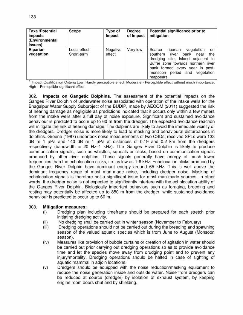
133
Taxa /Potential impacts (Environmental issues)
Scope Type of Impact
Degree of Impact
Potential significance prior to mitigation
Riparian vegetation
Local effect Short-term
Negative effect
Very low Scarce riparian vegetation on southern river bank near the dredging site, Island adjacent to Buffer zone towards northern river bank formed every year in post-monsoon period and vegetation reappears.
* Impact Qualification Criteria Low: Hardly perceptible effect; Moderate - Perceptible effect without much importance; High – Perceptible significant effect 302. Impacts on Gangetic Dolphins. The assessment of the potential impacts on the Ganges River Dolphin of underwater noise associated with operation of the intake wells for the Bhagalpur Water Supply Subproject of the BUDIP, made by AECOM (2011) suggested the risk of hearing damage as negligible as predictions indicated that it occurs only within a few meters from the intake wells after a full day of noise exposure. Significant and sustained avoidance behaviour is predicted to occur up to 60 m from the dredger. The expected avoidance reaction will mitigate the risk of hearing damage. The dolphins are likely to avoid the immediate vicinity of the dredgers. Dredger noise is more likely to lead to masking and behavioural disturbances in dolphins. Greene (1987) undertook noise measurements of two CSDs; received SPLs were 133 dB re 1 µPa and 140 dB re 1 µPa at distances of 0.19 and 0.2 km from the dredgers respectively (bandwidth = 20 Hz–1 kHz). The Ganges River Dolphin is likely to produce communication signals, such as whistles, squeals or clicks, based on communication signals produced by other river dolphins. These signals generally have energy at much lower frequencies than the echolocation clicks, i.e. as low as 1-6 kHz. Echolocation clicks produced by the Ganges River Dolphin have dominant energy around 65 kHz. This is well above the dominant frequency range of most man-made noise, including dredger noise. Masking of echolocation signals is therefore not a significant issue for most man-made sources. In other words, the dredger noise is not expected to significantly interfere with the echolocation ability of the Ganges River Dolphin. Biologically important behaviors such as foraging, breeding and resting may potentially be affected up to 850 m from the dredger, while sustained avoidance behaviour is predicted to occur up to 60 m. 303. Mitigation measures:
(i) Dredging plan including timeframe should be prepared for each stretch prior initiating dredging activity.
(ii) No dredging shall be carried out in winter season (November to February) (iii) Dredging operations should not be carried out during the breeding and spawning
season of the valued aquatic species which is from June to August (Monsoon season).
(iv) Measures like provision of bubble curtains or creation of agitation in water should be carried out prior carrying out dredging operations so as to provide avoidance time and let the species move away from drudging point and to prevent any injury/mortality. Dredging operations should be halted in case of sighting of aquatic mammal in adjoin locations.
(v) Dredgers should be equipped with the noise reduction/masking equipment to reduce the noise generation inside and outside water. Noise from dredgers can be reduced at source (dredger) by isolation of exhaust system, by keeping engine room doors shut and by shielding.
134
(vi) Pinger can be placed in Dredger to create avoidance behaviour of Dolphin from work zone
304. Impact on other Aquatic Biodiversity. A big island has emerged 10-15 m from the outer periphery of the Buffer Zone. Interview with local fisherfolks and perusal of previous report confirm that this island emerges in post-monsoonal months every year and gradually becomes larger with upcoming summer months. This island is home to variety of birds and Smooth coated otters.33 305. Mitigation measures:
(i) Dredging operations should be restricted primarily to day time, i.e. 10:00 am-4:00 pm only to minimize noise impacts
(ii) Dredgers should be equipped with the noise reduction/masking equipment to reduce the noise generation inside and outside water. Noise from dredgers can be reduced at source (dredger) by isolation of exhaust system, by keeping engine room doors shut and by shielding.
306. Impacts on Fish eating birds occasionally visit both active dredging area and buffer zone. Dredging activities and noise will not have any direct or indirect impact on avifauna in the area proposed for dredging and in buffer zone. However, presence of the dredger and barge might disturb the birds from settling near the edge of the islands adjacent to Buffer Zone which are used for feeding by wading and aquatic birds. 307. Mitigation measures:
(i) Dredged material should not be dumped on river bank as river banks are habitat for birds feeding on aquatic organisms and other species
(ii) Noise from dredgers can be reduced at source (dredger) by isolation of exhaust system, by keeping engine room doors shut and by shielding.
(iii) No dredging shall be carried out in winter season (November to February) to minimize impact on avifauna/ bird.
308. Impacts on smooth coated otters also visit the proposed dredging area and buffer zone occasionally and opportunistically for food i.e. fish. Presence of the dredger and its activities will discourage the animal to use its prepared feeding grounds. 309. Mitigation measures:
(i) Dredged material should not be dumped on river bank as river banks are habitat for otter, birds feeding on aquatic organisms and other species
(ii) Dredging operations should not be carried out during the breeding and spawning season of the valued aquatic species which is from June to August (Monsoon season).
310. There is no report of sightings of gharials and muggers in the proposed dredging area and buffer zone. 311. Impacts on Riparian vegetation. Proposed dredging area is adjacent to southern bank and dredged material deposit area is supposed to be located at the southern bank. Southern bank is almost devoid of vegetation due to intense human activities. In case of sparse vegetation available on the bank, impact due to storage of dredged material will be very low or
33
The area of the island formation is part of the 2014 biodiversity study area, which is about 600 meters from the dredging area and bank of the river.
135
negligible. Macrophytes in the littoral zone of the river do not play any major role in primary production of riverine ecosystems. Available information indicate that there will be insignificant or no impact on riparian vegetation due to dredging activities. 312. Mitigation Measures .
(i) Scarce riparian vegetation on southern river bank near the dredging site, Island adjacent to Buffer zone towards northern river bank formed every year in post-monsoon period and vegetation reappears.
(ii) Use of Cutter Suction Dredger with closed-net basket, (iii) Speed of dredger while moving to be maintained at 1-3 k knots
a. Erosion Hazards
313. Dredging operation will be continued for 10 days maximum in a year. There is no chance of erosion during dredging.
b. Impacts on Air Quality
314. Chances of release of emission due to operation of dredger. 315. Mitigation measures. The contractor will be required to:
(i) Contractor will discussed with dredging company for maintenance of their drdging equipment
(ii) Testing of emission during dredging time (iii) Collection of consent from pollution control board for dredger
c. Noise and Vibration Impacts
316. There will be no sensitive area nearby the dredging site (except VGDS) within the river. During dredging operation noise will be generated for a short period. It has some impact on bio environment. Low level hearing damage predicted to occur for aquatic life only within a few meters from the dredger whereas sustained avoidance behavior is predicted to occur up to 60 m from the dredger. 317. Mitigation measures. The contractor will be required to:
(i) to minimize the identified risks of dredger noise include use of Cutter Suction Dredger with closed-net basket,
(ii) regular maintenance of dredger to reduce any sound from machine (iii) speed of dredger while moving to be maintained at 1-3 k knots, (iv) no dredging in dolphin’s peak feeding hours, (v) no dredging during fish spawning period i. e.g. June – August, (vi) Hearing sensitivity for Gangetic dolphins not assessed thoroughly yet, hence to
predict impacts of dredger noise on dolphin population & behaviour conclusively not possible. Study on dolphin acoustic is required
(vii) regular monitoring of dolphin population, dolphin prey species, dolphin acoustics, fish & fisheries d. Impacts on Flora and Fauna
318. Impact of dredging on River Biodiversity (Aquatic flora & fauna species type wise) in Active Dredging Area (Direct Impact Zone) & Buffer Zone (Indirect Impact Zone): A
136
study has been conducted to assess the possible impacts on the impact of dredging on the river biodiversity (aquatic flora & fauna) near Barari Vikramshila Bridge (Project location) in active area of 2000 sq m along with buffer zone of 500 m radius around the area to be dredged. Total surface area of the dredging portion in river is 1040 sq m. (Length 40 m, Depth 7 m, Top width at the beginning of the river 47 m and at farthest end is 5 m. Average Top width is 26 m) during construction and during the Operation & Maintenance Phase. 319. Phytoplankton: Altogether 24 species of algae have been recorded from different sampling sites of active and buffer zone (Active dredging area – 16 species & Buffer zone – 15 species). These species represent four major groups of algae, Chlorophyceae, Cyanophyceae, Bacillariophyceae and Euglenophyceae. Bacillariophyceae (diatoms) were dominant (10 species). Oscillatoria, Synedra, Navicula and Gyrosigma species are microbenthos. Phytoplanktons are main producers in the river system and are the food source of zooplankton and many fish species.
(i) Direct Impact: No impact (ii) Indirect Impact: Light and nutrient status is major growth – limiting factors for
phytoplankton. Light limitation for the photosynthesis of primary producers may be caused by dredging activities due to increasing turbidity. Phytoplankton standing stock will be disturbed due to dredging (increased turbidity) because of drop in Chlorophyll - a concentration and low light penetration. Many toxicants such as heavy metals and organic materials tend to stick to particulate matter and sink to sediment. Some of these contaminants are very persistent in the sediment and some changes their oxidant state. If these sediments are disturbed due to dredging, the contaminants can be released to water column and will affect phytoplankton population with subsequent effect on fish and zooplankton diversity.
320. However, the natural silt content in the river at the dredging sites is already high and other activities such as discharge of sewage, extensive bathing, boat traffic movements, cremation of dead bodies and fishing in and around proposed dredging area also contributing to the turbidity, hence the impact of dredging on phytoplankton will be temporary and negligible. 321. Zooplankton and macro-benthic fauna: In the present study zooplanktons were mainly represented by 3-major groups, Copepoda, Cladocera and Rotifera. Altogether 19 species of zooplankton with some naupli and few eggs were recorded from both the active dredging area and buffer zone. Rotifers (50%) were found to be dominant in the present study followed by Copepoda (34%) and Cladocera (28%). The dominance of Rotifera at the dredging site indicates meso-eutrophic condition of the river. Among benthos, Gastropods were dominant followed by bivalves (Pelecypoda) and Insecta in both the active dredging area and buffer zone. The proper composition of zooplankton and macro-benthic fauna are vitally important in the water column to maintain the food chain as they are in the base of trophic level.
(i) Direct impacts: The dredging activity will directly influence the colonization of these groups by reallocation of river bed in dredged area and sedimentation in active dredging area and buffer zone. Abundance and diversity of macro-benthos population are expected to sharply decline reducing the available food base in dredged areas due to physical disturbance of benthic substrata
(ii) Indirect impacts: Suction dredging can cause significant short–term, localized alterations of river substrates as well as adverse effects on the habitat and abundance of aquatic invertebrates including zooplankton and macro-benthos. Entrainment due to dredging may also impact zooplankton and macro-benthos population.
137
322. However, impacts due to dredging on zooplankton and maco-benthos species both in direct and indirect impact zones appear to be localized and temporary. 323. Fish (Ichthyofauna): A total of 11 species of fish belonging to 10 genera and 6 families were recorded from within the impact study zone. All the fish were trapped in fishing nets within the buffer zone (500 m). Out of all the species recorded, four are considered to be prey species of the dolphins namely Sperata seenghala, Mystus cavasius, Catla catla and Setipinna brevifilis. Wallago attu is the only recorded species that is Near Threatened (NT) as per the IUCN Red List of Threatened Species (2010), all other fish species are listed under IUCN Least Concern (LC) Threat Category and threat status of one species has not been evaluated by the IUCN. 324. Mitigation measures on aquatic flora and fauna discussed under operation phase impact and mitigation.
e. Impacts on Physical Cultural Resources
325. There is no physico cultural resource near dredging location.
f. Impact due to Waste Generation
326. Due to dredging operation river silt will be generated for disposal. Disposal will be carried out after due permission from pollution control board. Volume of silt to be generated from dredging operation will be finalized after finalization of design. 327. Mitigation measures. The operating agency will be required to:
(i) Prepare and implement a waste management plan as part of the SEMP. (ii) Coordinate with PIU for beneficial uses of silt or immediately dispose to
designated areas. (iii) Prohibit disposal of any material or wastes into or at the river bank.
g. Impacts on Occupational Health and Safety
328. Workers need to be mindful of the occupational hazards which can arise from working near and within water areas during dredging. Exposure to any work-related hazard in the construction site is typically intermittent and of short duration, but is likely to reoccur. Potential impacts are negative and long-term but reversible by mitigation measures. 329. Mitigation measures. Overall, the operator of dredger and worker should comply with IFC EHS Guidelines on Occupational Health and Safety (this can be downloaded from http://www1.ifc.org/wps/wcm/connect/9aef2880488559a983acd36a6515bb18/2%2BOccupational%2BHealth%2Band%2BSafety.pdf?MOD=AJPERES). The contractor will be required to:
(i) Develop comprehensive site-specific health and safety (H&S) plan as part of the EMP. The overall objective is to provide guidance to workers on establishing a management strategy and applying practices that are intended to eliminate, or reduce, fatalities, injuries and illnesses for workers performing activities and tasks associated with the project.
(ii) Include in H&S plan measures such as: (i) type of hazards in the dredging area; (ii) corresponding personal protective equipment for each identified hazard; (iii)
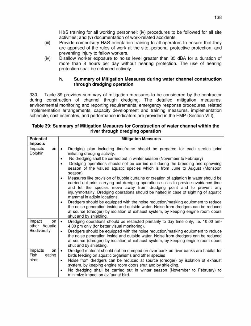
138
H&S training for all working personnel; (iv) procedures to be followed for all site activities; and (v) documentation of work-related accidents.
(iii) Provide compulsory H&S orientation training to all operators to ensure that they are apprised of the rules of work at the site, personal protective protection, and preventing injury to fellow workers.
(iv) Disallow worker exposure to noise level greater than 85 dBA for a duration of more than 8 hours per day without hearing protection. The use of hearing protection shall be enforced actively. h. Summary of Mitigation Measures during water channel construction
through dredging operation 330. Table 39 provides summary of mitigation measures to be considered by the contractor during construction of channel thrugh dredging. The detailed mitigation measures, environmental monitoring and reporting requirements, emergency response procedures, related implementation arrangements, capacity development and training measures, implementation schedule, cost estimates, and performance indicators are provided in the EMP (Section VIII).
Table 39: Summary of Mitigation Measures for Construction of water channel within the
river through dredging operation
Potential Impacts
Mitigation Measures
Impacts on Dolphin
Dredging plan including timeframe should be prepared for each stretch prior initiating dredging activity.
No dredging shall be carried out in winter season (November to February) Dredging operations should not be carried out during the breeding and spawning
season of the valued aquatic species which is from June to August (Monsoon season).
Measures like provision of bubble curtains or creation of agitation in water should be carried out prior carrying out dredging operations so as to provide avoidance time and let the species move away from drudging point and to prevent any injury/mortality. Dredging operations should be halted in case of sighting of aquatic mammal in adjoin locations.
Dredgers should be equipped with the noise reduction/masking equipment to reduce the noise generation inside and outside water. Noise from dredgers can be reduced at source (dredger) by isolation of exhaust system, by keeping engine room doors shut and by shielding.
Impact on other Aquatic Biodiversity
Dredging operations should be restricted primarily to day time only, i.e. 10:00 am-4:00 pm only (for better visual monitoring).
Dredgers should be equipped with the noise reduction/masking equipment to reduce the noise generation inside and outside water. Noise from dredgers can be reduced at source (dredger) by isolation of exhaust system, by keeping engine room doors shut and by shielding.
Impacts on Fish eating birds
Dredged material should not be dumped on river bank as river banks are habitat for birds feeding on aquatic organisms and other species
Noise from dredgers can be reduced at source (dredger) by isolation of exhaust system, by keeping engine room doors shut and by shielding.
No dredging shall be carried out in winter season (November to February) to minimize impact on avifauna/ bird.
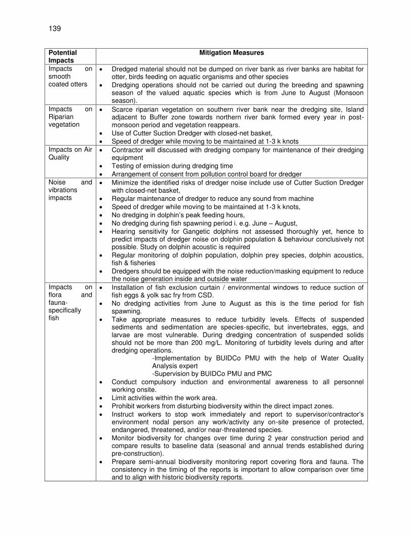
139
Potential Impacts
Mitigation Measures
Impacts on smooth coated otters
Dredged material should not be dumped on river bank as river banks are habitat for otter, birds feeding on aquatic organisms and other species
Dredging operations should not be carried out during the breeding and spawning season of the valued aquatic species which is from June to August (Monsoon season).
Impacts on Riparian vegetation
Scarce riparian vegetation on southern river bank near the dredging site, Island adjacent to Buffer zone towards northern river bank formed every year in post-monsoon period and vegetation reappears.
Use of Cutter Suction Dredger with closed-net basket, Speed of dredger while moving to be maintained at 1-3 k knots
Impacts on Air Quality
Contractor will discussed with dredging company for maintenance of their dredging equipment
Testing of emission during dredging time Arrangement of consent from pollution control board for dredger
Noise and vibrations impacts
Minimize the identified risks of dredger noise include use of Cutter Suction Dredger with closed-net basket,
Regular maintenance of dredger to reduce any sound from machine Speed of dredger while moving to be maintained at 1-3 k knots, No dredging in dolphin’s peak feeding hours, No dredging during fish spawning period i. e.g. June – August, Hearing sensitivity for Gangetic dolphins not assessed thoroughly yet, hence to
predict impacts of dredger noise on dolphin population & behaviour conclusively not possible. Study on dolphin acoustic is required
Regular monitoring of dolphin population, dolphin prey species, dolphin acoustics, fish & fisheries
Dredgers should be equipped with the noise reduction/masking equipment to reduce the noise generation inside and outside water
Impacts on flora and fauna- specifically fish
Installation of fish exclusion curtain / environmental windows to reduce suction of fish eggs & yolk sac fry from CSD.
No dredging activities from June to August as this is the time period for fish spawning.
Take appropriate measures to reduce turbidity levels. Effects of suspended sediments and sedimentation are species-specific, but invertebrates, eggs, and larvae are most vulnerable. During dredging concentration of suspended solids should not be more than 200 mg/L. Monitoring of turbidity levels during and after dredging operations.
-Implementation by BUIDCo PMU with the help of Water Quality Analysis expert -Supervision by BUIDCo PMU and PMC
Conduct compulsory induction and environmental awareness to all personnel working onsite.
Limit activities within the work area. Prohibit workers from disturbing biodiversity within the direct impact zones. Instruct workers to stop work immediately and report to supervisor/contractor’s
environment nodal person any work/activity any on-site presence of protected, endangered, threatened, and/or near-threatened species.
Monitor biodiversity for changes over time during 2 year construction period and compare results to baseline data (seasonal and annual trends established during pre-construction).
Prepare semi-annual biodiversity monitoring report covering flora and fauna. The consistency in the timing of the reports is important to allow comparison over time and to align with historic biodiversity reports.
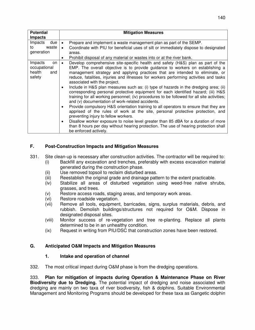
140
Potential Impacts
Mitigation Measures
Impacts due to waste generation
Prepare and implement a waste management plan as part of the SEMP. Coordinate with PIU for beneficial uses of silt or immediately dispose to designated
areas. Prohibit disposal of any material or wastes into or at the river bank.
Impacts on occupational health and safety
Develop comprehensive site-specific health and safety (H&S) plan as part of the EMP. The overall objective is to provide guidance to workers on establishing a management strategy and applying practices that are intended to eliminate, or reduce, fatalities, injuries and illnesses for workers performing activities and tasks associated with the project.
Include in H&S plan measures such as: (i) type of hazards in the dredging area; (ii) corresponding personal protective equipment for each identified hazard; (iii) H&S training for all working personnel; (iv) procedures to be followed for all site activities; and (v) documentation of work-related accidents.
Provide compulsory H&S orientation training to all operators to ensure that they are apprised of the rules of work at the site, personal protective protection, and preventing injury to fellow workers.
Disallow worker exposure to noise level greater than 85 dBA for a duration of more than 8 hours per day without hearing protection. The use of hearing protection shall be enforced actively.
F. Post-Construction Impacts and Mitigation Measures
331. Site clean-up is necessary after construction activities. The contractor will be required to: (i) Backfill any excavation and trenches, preferably with excess excavation material
generated during the construction phase. (ii) Use removed topsoil to reclaim disturbed areas. (iii) Reestablish the original grade and drainage pattern to the extent practicable. (iv) Stabilize all areas of disturbed vegetation using weed-free native shrubs,
grasses, and trees. (v) Restore access roads, staging areas, and temporary work areas. (vi) Restore roadside vegetation. (vii) Remove all tools, equipment, barricades, signs, surplus materials, debris, and
rubbish. Demolish buildings/structures not required for O&M. Dispose in designated disposal sites.
(viii) Monitor success of re-vegetation and tree re-planting. Replace all plants determined to be in an unhealthy condition.
(ix) Request in writing from PIU/DSC that construction zones have been restored.
G. Anticipated O&M Impacts and Mitigation Measures
1. Intake and operation of channel 332. The most critical impact during O&M phase is from the dredging operations. 333. Plan for mitigation of impacts during Operation & Maintenance Phase on River Biodiversity due to Dredging. The potential impact of dredging and noise associated with dredging are mainly on two taxa of river biodiversity, fish & dolphins. Suitable Environmental Management and Monitoring Programs should be developed for these taxa as Gangetic dolphin
141
is endangered species and National Aquatic Animal of India and several fish species are dolphin prey species. Moreover, dredging for deepening the river channel is proposed in a Protected Area. 334. Recommended Mitigation Measures for protection of biodiversity,
(i) Dredger (a) Dredger undertaking work to be fitted with Differential Global Positioning
System (DGPS) navigation & positioning system & depth sounding to allow the dredger to accurately dredge within the proposed dredge area.
(b) Dredger to be fitted with DGPS navigation & positioning system & depth sounding to allow the dredger to accurately dredge within the proposed dredge area.
(c) Dredger will be fitted with Pinger (d) Dredging operation to be conducted only in day hours, not in night hours
as it will disturb the river fauna including dolphins in rest. (e) Regular maintenance of dredge vessel and assisting motor boats to be
conducted to the manufacturer’s specifications. (f) All vessels would operate in accordance with appropriate equipment
noise and vibration standards. − Implementation of above activities by Contractor − Supervision of above activities by BUIDCo PMU and PMC
(ii) Disposal of dredge spoils (a) Discharge of residual liquid into the river not allowed as it results into river
water contamination. (b) Petroleum and oily wastes to be taken in drums for final disposal. (c) Dredged material to be disposed at Designated Confined Disposal facility.
- Implementation of above activities by Contractor. - Supervision of above activities by BUIDCo PMU and PMC
(iii) Fish (a) Installation of fish exclusion curtain / environmental windows to reduce
suction of fish eggs & yolk sac fry from CSD. (b) No dredging activities from June to August as this is the time period for
fish spawning. (c) Take appropriate measures to reduce turbidity levels. Effects of
suspended sediments and sedimentation are species-specific, but invertebrates, eggs, and larvae are most vulnerable. During dredging concentration of suspended solids should not be more than 200 mg/L. Monitoring of turbidity levels during and after dredging operations.
− Implementation by Contractor in consultation with PIU/ PMU − Supervision by BUIDCo PMU and PMC
(iv) Gangetic Dolphin (a) Maintain speed of dredger while moving at 1-3 km knots to minimize the
risk of collision. (b) Stop dredging if dolphins are sighted within 30 m of dredge head. (c) Hearing sensitivity for Gangetic dolphins not assessed thoroughly yet,
hence to predict impacts of dredger noise on dolphin population & behaviour conclusively not possible. Study on dolphin acoustic recommended.
(d) Dredging operation to be conducted only after the dolphin’s morning peak feeding hours and before its evening peak feeding hours. Operation timings should be between 10 am – 3 pm.
142
(e) All sightings during dredging operations both in active dredging area and buffer zone should be reported.
(f) Execute dolphin monitoring program as per recommendation of Wildlife warden, Govt. of Bihar
(g) Pre and post – dredging and/or monsoon study on dolphin population abundance and dolphin behaviour such as foraging, diving, resting & breeding due to masking of echolocation signals (produced by dolphins) due to noise generated by dredger during dredging operations should be undertaken every year.
(h) The mitigation measures for protection of aquatic life especially Dolphins in post dredging phase should be monitored by a third party monitoring consultant. This will help in objective evaluation of mitigation measures being implemented.
(i) Studies and monitoring of dolphin population abundance and dolphin behaviour such as foraging, diving, resting & breeding by biodiversity Expert.
(v) General (a) Ensure all personnel performing activities related to environmental
management of dredging are trained, qualified and competent. (b) Ensure all personnel performing activities are aware of their
responsibilities under the EMP. (c) Regular Education and Awareness programs for dredging associated
impacts on river biodiversity and mitigation measures to be undertaken among local stakeholders.
(d) For implementation of EMP and Mitigation of identified threats, particularly for dolphins, support from Local Wildlife Authority (Wildlife Warden of Vikramshila Gangetic Dolphin Sanctuary) to be ensured.
a. Accidental spill of oil and lubricants
335. The impact is considered low and limited during maintenance of pumps which is intermittent. The motor rooms have sufficient space to contain oils and lubricants during maintenance works. 336. Mitigation measures. The contractor will be required to:
(i) Develop a spill prevention and containment plan, educate workers about the plan, and have the necessary materials on site prior to and during maintenance.
(ii) Dispose waste oil and lubricants generated as per provisions of Hazardous Waste (Management and Handling) Rules, 1989.
(iii) Clean equipment that is used for in-water work prior to maintenance activities and prevent wash and rinse water from discharging into the river.
(iv) Refuel equipment within the designated refueling containment area away from the river bank.
(v) Inspect maintenance vehicles daily for fluid leaks before leaving the vehicle staging area, and repair any leaks before the vehicle resumes operation. b. Noise and vibrations from dredging equipment above water
337. This impact is considered low and not significant as pump specifications in the design are specified as low noise (within the range of 80 dB(A).
143
338. Mitigation measures. The contractor will be required to: (i) Conduct regular noise level monitoring. (ii) Inspect regularly the installed noise and vibrations barriers (cork sandwich pads
under the motors, insulating covers, etc.). (iii) Ensure good working condition of balancing rotating equipment. Replace worn,
loose and unbalanced parts of the pump and motor assembly to reduce structural vibrations (to be included in O&M manuals).
(iv) Conduct regular condition monitoring to ensure that excessive vibrations are detected and resolved (to be included in O&M manuals). c. Impacts on socio-economic activities near the intake wells
339. As per results of consultations and site inspections conducted during preparation of this draft IEE, local fisherfolks are present within the intake wells location. Their livelihood may be affected due to lesser area as fishing activities will not be permitted within the vicinity of the intake wells (area about 2,500 m2). 340. Mitigation measures. The contractor will be required to:
(i) Coordinate with PIU/DSC on the implementation of BWSP2 implementation plan. (ii) Include affected fisherfolks and stakeholders in BWSP2 information, education
and communication (IEC) program (as part of EMP and suggested by State Forest Department).
(iii) Support Bihar State Forest Department, as may be issued relevant to VGDS management d. Summary of mitigation measures during O&M of intake wells
341. Table 40 provides summary of mitigation measures to be considered by the contractor during O&M of the intake wells. The detailed mitigation measures, environmental monitoring and reporting requirements, emergency response procedures, related implementation arrangements, capacity development and training measures, implementation schedule, cost estimates, and performance indicators are provided in the EMP (Section VIII). Table 40: Summary of Mitigation Measures for O&M of Intake Wells, dredging operation
and Ancillary Structures
Potential Impacts
Mitigation Measures
Dredger activity
Dredger undertaking work to be fitted with Differential Global Positioning System (DGPS) navigation & positioning system & depth sounding to allow the dredger to accurately dredge within the proposed dredge area.
Dredger to be fitted with DGPS navigation & positioning system & depth sounding to allow the dredger to accurately dredge within the proposed dredge area.
Dredging operation to be conducted only in day hours, not in night hours as it will disturb the river fauna including dolphins in rest.
Regular maintenance of dredge vessel and assisting motor boats to be conducted to the manufacturer’s specifications.
All vessels would operate in accordance with appropriate equipment noise and vibration standards.
Disposal of dredge soil
Discharge of residual liquid into the river not allowed as it results into river water contamination.
Petroleum and oily wastes to be taken in drums for final disposal.

144
Potential Impacts
Mitigation Measures
Dredged material to be disposed at Designated Confined Disposal facility. Impact on fish due to dredging
Installation of fish exclusion curtain / environmental windows to reduce suction of fish eggs & yolk sac fry from CSD.
No dredging activities from June to August as this is the time period for fish spawning.
Take appropriate measures to reduce turbidity levels. Effects of suspended sediments and sedimentation are species-specific, but invertebrates, eggs, and larvae are most vulnerable. During dredging concentration of suspended solids should not be more than 200 mg/L. Monitoring of turbidity levels during and after dredging operations.
Impact on gangetic Dolphin during dredging operation
Maintain speed of dredger while moving at 1-3 km knots to minimize the risk of collision.
Stop dredging if dolphins are sighted within 30 m of dredge head. Hearing sensitivity for Gangetic dolphins not assessed thoroughly yet, hence to
predict impacts of dredger noise on dolphin population & behaviour conclusively not possible. Study on dolphin acoustic recommended.
Dredging operation to be conducted only after the dolphin’s morning peak feeding hours and before its evening peak feeding hours. Operation timings should be between 10 am – 3 pm.
All sightings during dredging operations both in active dredging area and buffer zone should be reported.
Execute dolphin monitoring program as per recommendation of Wildlife warden, Govt. of Bihar
Pre and post – dredging and/or monsoon study on dolphin population abundance and dolphin behaviour such as foraging, diving, resting & breeding due to masking of echolocation signals (produced by dolphins) due to noise generated by dredger during dredging operations should be undertaken every year.
The mitigation measures for protection of aquatic life especially Dolphins in post dredging phase should be monitored by a third party monitoring consultant. This will help in objective evaluation of mitigation measures being implemented.
Studies and monitoring of dolphin population abundance and dolphin behaviour such as foraging, diving, resting & breeding by biodiversity Expert.
General impact
Ensure all personnel performing activities related to environmental management of dredging are trained, qualified and competent.
Ensure all personnel performing activities are aware of their responsibilities under the EMP.
Regular Education and Awareness programs for dredging associated impacts on river biodiversity and mitigation measures to be undertaken among local stakeholders.
For implementation of EMP and Mitigation of identified threats, particularly for dolphins, support from Local Wildlife Authority (Wildlife Warden of Vikramshila Gangetic Dolphin Sanctuary) to be ensured.
Impingement and entrapment
Develop a site-specific response plan for possibility of impingement and/or entrapment.
Conduct biodiversity studies within the direct impact zones. Accidental spill of oil and lubricants
Develop a spill prevention and containment plan, educate workers about the plan, and have the necessary materials on site prior to and during maintenance.
Dispose waste oil and lubricants generated as per provisions of Hazardous Waste (Management and Handling) Rules, 1989.
Clean equipment that is used for in-water work prior to maintenance activities and prevent wash and rinse water from discharging into the river.
Refuel equipment within the designated refueling containment area away from the
145
Potential Impacts
Mitigation Measures
river bank. Inspect maintenance vehicles daily for fluid leaks before leaving the vehicle staging
area, and repair any leaks before the vehicle resumes operation. Noise and vibrations from dredging equipment above water
Conduct noise level monitoring during dredging. Inspect regularly the installed noise and vibrations barriers (cork sandwich pads
under the motors, insulating covers, etc.). Ensure good working condition of balancing rotating equipment. Replace worn,
loose and unbalanced parts of the pump and motor assembly to reduce structural vibrations (to be included in O&M manuals).
Conduct regular condition monitoring to ensure that excessive vibrations are detected and resolved (to be included in O&M manuals).
Visual impact on the surroundings
Keep the area and surrounding clean. Practice good housekeeping. Prepare and implement a waste management plan. Manage solid waste according
to the following hierarchy: reuse, recycling and disposal. Include in waste management plan designated/approved disposal areas.
Prohibit workers from disposing any material or wastes (including human waste) into or at the river bank.
Impacts on socio-economic activities near the intake wells
Coordinate with PIU/DSC on the implementation of BWSP2 implementation plan. Include affected fisherfolks and stakeholders in BWSP2 information, education and
communication (IEC) program (as part of EMP and suggested by State Forest Department).
Support Bihar State Forest Department, as may be issued relevant to VGDS management
2. Transmission Mains
342. There may be reduction in pressure and if leakage is significant water may not reach WTP. This will hamper WTP operations. The impacts and mitigations for clear water transmission main will be similar in nature as for raw water transmission main. The only difference is that this component covers more length and spread over the city to connect the OHTs (existing and as part of BWSP Project 1 works). However, this component will also be connected to SCADA which will indicate leakage location in the control room through alarms. The operator will promptly take corrective action to repair the leakage. Impacts in O&M phase are not expected due to only occasional repairs of leakages and similar to construction impacts during pipe laying but much lesser magnitude, duration and site-specific. 343. Mitigation measures. The contractor will be required to:
(i) Save topsoil removed during excavation and use to reclaim disturbed areas, as soon as it is possible to do so.
(ii) Schedule pipe laying works during non-monsoon season. (iii) Ensure drainages within the construction zones are kept free of obstructions. (iv) Keep loose soil material and stockpiles out of drains, flow-lines and
watercourses. (v) Avoid stockpiling of excavated and construction materials (sand, gravel, cement,
etc.) unless covered by tarpaulins or plastic sheets. (vi) Dispose any residuals at identified disposal site (PIU will identify approved sites).
Dispose waste oil and lubricants generated as per provisions of Hazardous Waste (Management and Handling) Rules, 1989.
(vii) Develop a spill prevention and containment plan, educate workers about the plan, and have the necessary materials on site prior to and during construction.
146
(viii) Spread crushed gravel over backfilled surfaces if re-surfacing of disturbed ROWs cannot be done immediately.
(ix) Limit construction activities to daytime only. (x) Plan activities in consultation with PIU and DSC/PMC so that activities with the
greatest potential to generate noise are conducted during periods of the day which will result in least disturbance.
(xi) Notify nearby residents whenever extremely noisy work will be occurring. (xii) Limit activities within the work area. (xiii) Ensure no damage to structures/properties near construction zone. (xiv) Provide walkways and metal sheets where required to maintain access of people
and vehicles. (xv) Provide sign boards to inform nature and duration of construction works and
contact numbers for concerns/complaints. (xvi) Increase the workforce in front of critical areas such as institutions, place of
worship, business establishment, hospitals, and schools; (xvii) Implement good housekeeping. Remove wastes immediately. Prohibit stockpiling
of materials that may obstruct/slow down pedestrians and/or vehicle movement. (xviii) Ensure workers will not use nearby/adjacent areas as toilet facility. (xix) Prohibit disposal of any material or wastes (including human waste) into
drainage, nallah, or watercourse. (xx) Comply with IFC EHS Guidelines on Occupational Health and Safety
3. WTP
344. The operation of the WTP will be monitored through the SCADA system. There will be a remote telemetry unit at raw water intake well with electronic sensors monitoring the pump speed, electricity consumption, temperature, vibration, and sound levels. Continuous online monitoring of the parameters would be ensured with necessary triggers of alarms and messages to the supervisors, escalating protocols to senior operational managers and generating periodical reports. 345. Environmental issues associated with the operation of WTP include: (i) solid waste; (ii) wastewater; (iii) hazardous chemicals; and (iv) air emissions 346. Solid Waste. Solid waste residuals which may be generated by the WTP include process residuals, used filtration membranes, spent media and miscellaneous wastes. Process residuals primarily consist of settled suspended solids from source water and chemicals added in the treatment process, such as lime and coagulants/ polyelectrolite. Pre-sedimentation, coagulation (e.g. with aluminum hydroxide [alum] or ferric hydroxide), and iron will produce sludge. Composition of the sludge depends on the treatment process and the characteristics of the source water, lime, and other organic compounds, microorganisms, etc. BMC needs to require its O and M contractor to:
Minimize the quantity of solids generated by the water treatment process through optimizing coagulation processes;
Dispose of lime sludge by land application if allowed, limiting application rates to about 20 dry metric tons per hectare (9 dry tons per acre) to minimize the potential for mobilization of metals into plant tissue and groundwater34,
34
Management of Water Treatment Plant Residuals, Technology Transfer Handbook,” EPA/625/R-95/008, April 1996.
147
Dispose of ferric and alum sludge by land application, if allowed and if such application can be shown through modelling and sampling to have no adverse impacts on groundwater or surface water (e.g. from nutrient runoff); and
Potential impact on soil, groundwater, and surface water, in the context of protection, conservation and long term sustainability of water and land resources, should be assessed when land is used as part of any waste or wastewater treatment system
347. Wastewater. Wastewater from water treatment projects include filter backwash. These waste streams may contain suspended solids and organics from the raw water, dissolved solids, high or low pH, heavy metals, etc. BMC needs to require its O and M contractor to:
(i) Land application of wastes with high dissolved solids concentrations is generally preferred over discharge to surface water subject to an evaluation of potential impact on soil, groundwater, and surface water resulting from such application;
(ii) Recycle filter backwash into the process if possible; and (iii) Treat and dispose of reject streams, consistent with CPHEEO requirements.
348. Appendix 3 shows the Indian standard for discharge of effluent in environment. 349. Hazardous Chemicals. Water treatment may involve the use of chemicals for coagulation, disinfection and water conditioning. For WTP that will use chlorine gas, BMC needs to require its O and M contractor to:
(i) Store chlorine gas cylinder in cool, dry, and dark conditions for no more than one month, and use equipment constructed of corrosion-resistant materials;
(ii) Minimize the amount of chlorination chemicals stored on site while maintaining a sufficient inventory to cover intermittent disruptions in supply;
(iii) Develop and implement a prevention program that includes identification of potential hazards, written operating procedures, training, maintenance, and accident investigation procedures; and
(iv) Material safety data sheet to be maintained at chlorine/ common salt storage area
(v) Regular laboratory testing for dosing and residual chlorine (vi) Chlorination in water will be done as per CPHEEO manual and ensure residual
chlorine within permissible limit. (vii) Trained workers will be depute for selected dosage of chlorine to be added in the
water supply (viii) Develop and implement a plan for responding to accidental releases.
350. Air Emissions. Air emissions from water treatment operations may include gaseous or volatile chemicals used for disinfection processes (e.g., chlorine). Measures related to hazardous chemicals discussed above will mitigate risks of chlorine release. 351. Mitigation measures summary. The contractor will be required to:
(i) Prepare a sludge disposal plan and include it in the O&M manuals to avoid any generation of gases from sludge.
(ii) Conduct air quality monitoring at WTP H. Proposed Project 2 Activities in Support of the VGDS Management Plan
352. The following activities will be implemented in BWSP2 in support of the implementation
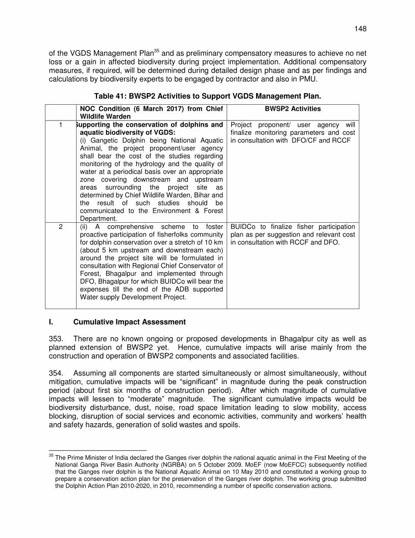
148
of the VGDS Management Plan35 and as preliminary compensatory measures to achieve no net loss or a gain in affected biodiversity during project implementation. Additional compensatory measures, if required, will be determined during detailed design phase and as per findings and calculations by biodiversity experts to be engaged by contractor and also in PMU.
Table 41: BWSP2 Activities to Support VGDS Management Plan.
NOC Condition (6 March 2017) from Chief Wildlife Warden
BWSP2 Activities
1 Supporting the conservation of dolphins and aquatic biodiversity of VGDS: (i) Gangetic Dolphin being National Aquatic Animal, the project proponent/user agency shall bear the cost of the studies regarding monitoring of the hydrology and the quality of water at a periodical basis over an appropriate zone covering downstream and upstream areas surrounding the project site as determined by Chief Wildlife Warden, Bihar and the result of such studies should be communicated to the Environment & Forest Department.
Project proponent/ user agency will finalize monitoring parameters and cost in consultation with DFO/CF and RCCF
2 (ii) A comprehensive scheme to foster proactive participation of fisherfolks community for dolphin conservation over a stretch of 10 km (about 5 km upstream and downstream each) around the project site will be formulated in consultation with Regional Chief Conservator of Forest, Bhagalpur and implemented through DFO, Bhagalpur for which BUIDCo will bear the expenses till the end of the ADB supported Water supply Development Project.
BUIDCo to finalize fisher participation plan as per suggestion and relevant cost in consultation with RCCF and DFO.
I. Cumulative Impact Assessment
353. There are no known ongoing or proposed developments in Bhagalpur city as well as planned extension of BWSP2 yet. Hence, cumulative impacts will arise mainly from the construction and operation of BWSP2 components and associated facilities. 354. Assuming all components are started simultaneously or almost simultaneously, without mitigation, cumulative impacts will be “significant” in magnitude during the peak construction period (about first six months of construction period). After which magnitude of cumulative impacts will lessen to “moderate” magnitude. The significant cumulative impacts would be biodiversity disturbance, dust, noise, road space limitation leading to slow mobility, access blocking, disruption of social services and economic activities, community and workers’ health and safety hazards, generation of solid wastes and spoils.
35
The Prime Minister of India declared the Ganges river dolphin the national aquatic animal in the First Meeting of the National Ganga River Basin Authority (NGRBA) on 5 October 2009. MoEF (now MoEFCC) subsequently notified that the Ganges river dolphin is the National Aquatic Animal on 10 May 2010 and constituted a working group to prepare a conservation action plan for the preservation of the Ganges river dolphin. The working group submitted the Dolphin Action Plan 2010-2020, in 2010, recommending a number of specific conservation actions.
149
355. To bring cumulative impacts down to acceptable levels: (i) Civil works must be well-planned, strategized, and completed promptly. (ii) Contractor should implement ADB-cleared site-specific EMP fully. (iii) DSC and PMC should monitor the compliance to EMP fully. (iv) Key institutions to effectively act their roles as per EMP implementation
arrangement. (v) Pre-construction, construction and O&M monitoring, including noise monitoring,
should be carried out as prescribed in the EMP and O&M manuals. (vi) O&M manuals must be complied with fully. (vii) There must be adequate consultations with stakeholders and local authorities
and proper coordination, particularly regarding expected cumulative impacts. (viii) The grievance redress mechanism should be disclosed (through public meetings,
display at strategic places and media) to the communities affected by the cumulative impacts.
356. The regional induced impacts due to water withdrawal is negligible as supported by hydrological studies conducted during preparation of this draft IEE report. As per preliminary design, water withdrawal will be maximum of 2 m3/s for 156 MLD requirement which is negligible compared with the huge river flow (1,002 m3/s in lean season and 48,000 m3/s in monsoon season). This withdrawal is only 0.2 % in lean season and 0.004 % in monsoon season. The water withdrawal will have the effect of only a 3.6 mm drop in water level within a distance of 20 to 25 m from the location of the intake wells. The studies have also confirmed that there will be no rise in water level of river due construction of intake well structures. 357. Cumulative impacts of underwater noise and vibrations on Ganges river dolphins and biodiversity within the project area of influence are not anticipated. As per biodiversity studies conducted during the preparation of this draft IEE (through PPTA, CDTA, and loan consultants) and report of BUIDCo to MoEFCC, the Ganges river dolphin population trend is increasing and dolphin movements within VGDS are varied between and within years. The location of the intake wells are relatively near the banks compared to the width of the Ganges River even during lean season. CDTA dolphin experts concluded that Ganges river dolphin behaviors will not be affected due to inherent with “avoidance” behavior. To ensure potential impacts are minimized and residual impacts are mitigated, the preliminary design of BWSP2 has included “best technology available” and mitigation measures as per internationally-accepted best management practices. BUIDCo, BMC, DSC and PMC consultants and contractors will support the implementation of conservation of Dolphin and aquatic biodiversty with VGDS as per conditions given in the NOC of APCCF cum chief wild life warden, Government of Bihar. 358. The indirect and induced impact of a reliable and sufficient water supply would be increased generation of wastewater and sewage. If inadequately managed, this situation would lead to contamination of supplied water through leaks or broken pipes in the distribution system. Mitigation measures would be: (i) prompt action on broken pipes/leaks; and (ii) monitoring incidence of water-borne disease during dry and wet seasons. There is no organized sewerage system in the city. Absence of a proper waste water disposal system has resulted in septic tank effluent and sullage getting discharged into the storm water drains which are mostly open. Under the Ganges Action Plan, intercepting sewers have been laid in part of the city intercepting major drainage outfalls on the River Ganges. The intercepted flow is diverted through a collection chamber, into a grit chamber for grit removal and biologically treated in an aerated lagoon before its disposal into the Ganges River. Absence of a sewerage system is also linked to the poor water supply conditions in the city. The per capita supply is currently too low to ensure effective operation of a sewerage system. The present sewage treatment plant (STP) at
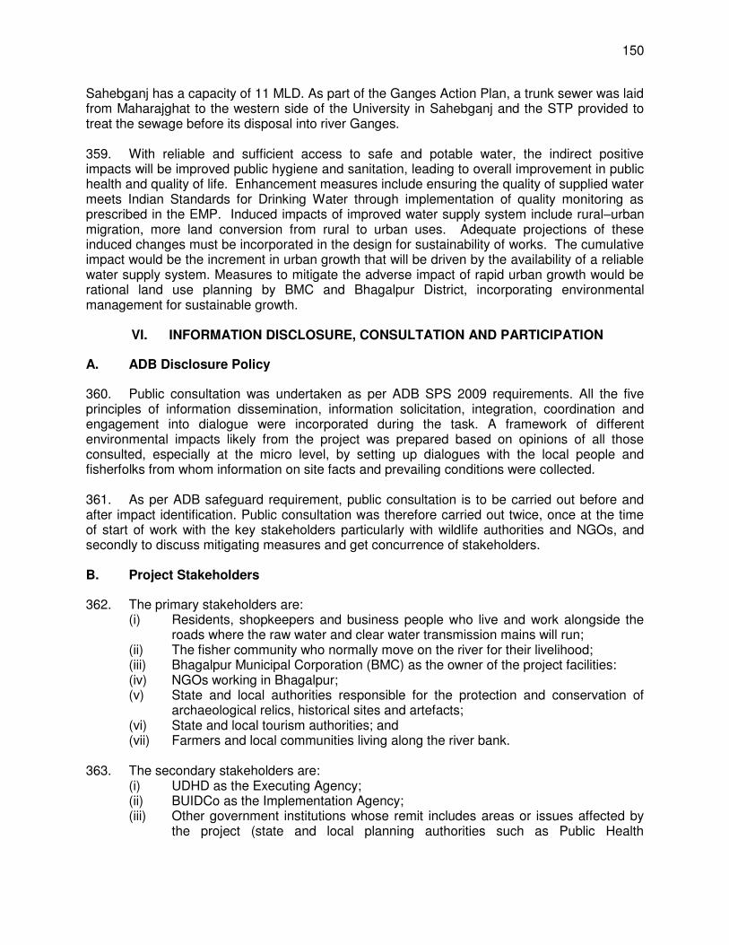
150
Sahebganj has a capacity of 11 MLD. As part of the Ganges Action Plan, a trunk sewer was laid from Maharajghat to the western side of the University in Sahebganj and the STP provided to treat the sewage before its disposal into river Ganges. 359. With reliable and sufficient access to safe and potable water, the indirect positive impacts will be improved public hygiene and sanitation, leading to overall improvement in public health and quality of life. Enhancement measures include ensuring the quality of supplied water meets Indian Standards for Drinking Water through implementation of quality monitoring as prescribed in the EMP. Induced impacts of improved water supply system include rural–urban migration, more land conversion from rural to urban uses. Adequate projections of these induced changes must be incorporated in the design for sustainability of works. The cumulative impact would be the increment in urban growth that will be driven by the availability of a reliable water supply system. Measures to mitigate the adverse impact of rapid urban growth would be rational land use planning by BMC and Bhagalpur District, incorporating environmental management for sustainable growth.
VI. INFORMATION DISCLOSURE, CONSULTATION AND PARTICIPATION
A. ADB Disclosure Policy
360. Public consultation was undertaken as per ADB SPS 2009 requirements. All the five principles of information dissemination, information solicitation, integration, coordination and engagement into dialogue were incorporated during the task. A framework of different environmental impacts likely from the project was prepared based on opinions of all those consulted, especially at the micro level, by setting up dialogues with the local people and fisherfolks from whom information on site facts and prevailing conditions were collected. 361. As per ADB safeguard requirement, public consultation is to be carried out before and after impact identification. Public consultation was therefore carried out twice, once at the time of start of work with the key stakeholders particularly with wildlife authorities and NGOs, and secondly to discuss mitigating measures and get concurrence of stakeholders. B. Project Stakeholders
362. The primary stakeholders are: (i) Residents, shopkeepers and business people who live and work alongside the
roads where the raw water and clear water transmission mains will run; (ii) The fisher community who normally move on the river for their livelihood; (iii) Bhagalpur Municipal Corporation (BMC) as the owner of the project facilities: (iv) NGOs working in Bhagalpur; (v) State and local authorities responsible for the protection and conservation of
archaeological relics, historical sites and artefacts; (vi) State and local tourism authorities; and (vii) Farmers and local communities living along the river bank.
363. The secondary stakeholders are:
(i) UDHD as the Executing Agency; (ii) BUIDCo as the Implementation Agency; (iii) Other government institutions whose remit includes areas or issues affected by
the project (state and local planning authorities such as Public Health
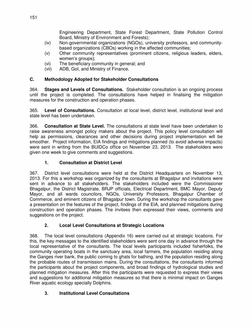
151
Engineering Department, State Forest Department, State Pollution Control Board, Ministry of Environment and Forests);
(iv) Non-governmental organizations (NGOs), university professors, and community-based organizations (CBOs) working in the affected communities;
(v) Other community representatives (prominent citizens, religious leaders, elders, women’s groups);
(vi) The beneficiary community in general; and (vii) ADB, GoI, and Ministry of Finance.
C. Methodology Adopted for Stakeholder Consultations
364. Stages and Levels of Consultations. Stakeholder consultation is an ongoing process until the project is completed. The consultations have helped in finalising the mitigation measures for the construction and operation phases. 365. Level of Consultations. Consultation at local level, district level, institutional level and state level has been undertaken. 366. Consultation at State Level. The consultations at state level have been undertaken to raise awareness amongst policy makers about the project. This policy level consultation will help as permissions, clearances and other decisions during project implementation will be smoother. Project information, EIA findings and mitigations planned (to avoid adverse impacts) were sent in writing from the BUIDCo office on November 23, 2013. The stakeholders were given one week to give comments and suggestions.
1. Consultation at District Level 367. District level consultations were held at the District Headquarters on November 13, 2013. For this a workshop was organized by the consultants at Bhagalpur and invitations were sent in advance to all stakeholders. The stakeholders included were the Commissioner Bhagalpur, the District Magistrate, BRJP officials, Electrical Department, BMC Mayor, Deputy Mayor, and all wards councilors, NGOs, University Professors, Bhagalpur Chamber of Commerce, and eminent citizens of Bhagalpur town. During the workshop the consultants gave a presentation on the features of the project, findings of the EIA, and planned mitigations during construction and operation phases. The invitees then expressed their views, comments and suggestions on the project.
2. Local Level Consultations at Strategic Locations 368. The local level consultations (Appendix 16) were carried out at strategic locations. For this, the key messages to the identified stakeholders were sent one day in advance through the local representative of the consultants. The local levels participants included fisherfolks, the community operating boats in the sanctuary area, local farmers, the population residing along the Ganges river bank, the public coming to ghats for bathing, and the population residing along the probable routes of transmission mains. During the consultations, the consultants informed the participants about the project components, and broad findings of hydrological studies and planned mitigation measures. After this the participants were requested to express their views and suggestions for additional mitigation measures so that there is minimal impact on Ganges River aquatic ecology specially Dolphins.
3. Institutional Level Consultations
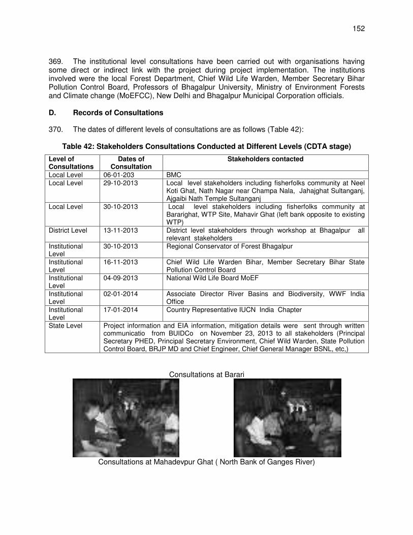
152
369. The institutional level consultations have been carried out with organisations having some direct or indirect link with the project during project implementation. The institutions involved were the local Forest Department, Chief Wild Life Warden, Member Secretary Bihar Pollution Control Board, Professors of Bhagalpur University, Ministry of Environment Forests and Climate change (MoEFCC), New Delhi and Bhagalpur Municipal Corporation officials. D. Records of Consultations
370. The dates of different levels of consultations are as follows (Table 42):
Table 42: Stakeholders Consultations Conducted at Different Levels (CDTA stage)
Level of Consultations
Dates of Consultation
Stakeholders contacted
Local Level 06-01-203 BMC Local Level 29-10-2013 Local level stakeholders including fisherfolks community at Neel
Koti Ghat, Nath Nagar near Champa Nala, Jahajghat Sultanganj, Ajgaibi Nath Temple Sultanganj
Local Level 30-10-2013 Local level stakeholders including fisherfolks community at Bararighat, WTP Site, Mahavir Ghat (left bank opposite to existing WTP)
District Level 13-11-2013 District level stakeholders through workshop at Bhagalpur all relevant stakeholders
Institutional Level
30-10-2013 Regional Conservator of Forest Bhagalpur
Institutional Level
16-11-2013 Chief Wild Life Warden Bihar, Member Secretary Bihar State Pollution Control Board
Institutional Level
04-09-2013 National Wild Life Board MoEF
Institutional Level
02-01-2014 Associate Director River Basins and Biodiversity, WWF India Office
Institutional Level
17-01-2014 Country Representative IUCN India Chapter
State Level Project information and EIA information, mitigation details were sent through written communicatio from BUIDCo on November 23, 2013 to all stakeholders (Principal Secretary PHED, Principal Secretary Environment, Chief Wild Warden, State Pollution Control Board, BRJP MD and Chief Engineer, Chief General Manager BSNL, etc,)
Consultations at Barari
Consultations at Mahadevpur Ghat ( North Bank of Ganges River)
153
Consultations at Sultanganj ( Near Ahagiabi nath Temple)
Institutional Level Consultations
With Regional Chief Conservator of Forest
Bhagalpur Consultations at Bihar Pollution Control Board
District Level Consultations
371. The issues raised during different level of consultations are summarized in Table 43
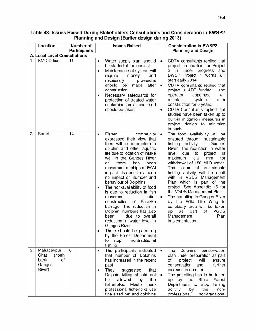
154
Table 43: Issues Raised During Stakeholders Consultations and Consideration in BWSP2 Planning and Design (Earlier design during 2013)
Location Number of Participants
Issues Raised Consideration in BWSP2 Planning and Design
A. Local Level Consultations 1. BMC Office 11 Water supply plant should
be started at the earliest Maintenance of system will
require money and necessary provisions should be made after construction
Necessary safeguards for protection of treated water contamination at user end should be taken
CDTA consultants replied that project preparation for Project 2 in under progress and BWSP Project 1 works will start early 2014
CDTA consultants replied that project is ADB funded and operator appointed will maintain system after construction for 5 years.
CDTA Consultants replied that studies have been taken up to built-in mitigation measures in project design to minimize impacts.
2. Barari 14 Fisher community expressed their view that there will be no problem to dolphin and other aquatic life due to location of intake well in the Ganges River as there has been movement of ships of IWAI in past also and this made no impact on number and behaviour of Dolphins
The non-availability of food is due to reduction in fish movement after construction of Farakka barrage. The reduction in Dolphin numbers has also been due to overall reduction in water level in Ganges River
There should be patrolling by the Forest Department to stop nontraditional fishing
The food availability will be ensured through sustainable fishing activity in Ganges River. The reduction in water level due to project is maximum 3.6 mm for withdrawal of 156 MLD water. The issue of sustainable fishing activity will be dealt with in VGDS Management Plan which is part of the project. See Appendix 16 for the VGDS Management Plan.
The patrolling in Ganges River by the Wild Life Wing in sanctuary area will be taken up as part of VGDS Management Plan implementation.
3. Mahadevpur Ghat (north bank of Ganges River)
6 The participants indicated that number of Dolphins has increased in the recent past
They suggested that Dolphin killing should not be allowed by the fisherfolks. Mostly non-professional fisherfolks use fine sized net and dolphins
The Dolphins conservation plan under preparation as part of project will ensure conservation and further increase in numbers
The patrolling has to be taken up by the State Forest Department to stop fishing activity by the non-professional/ non-traditional
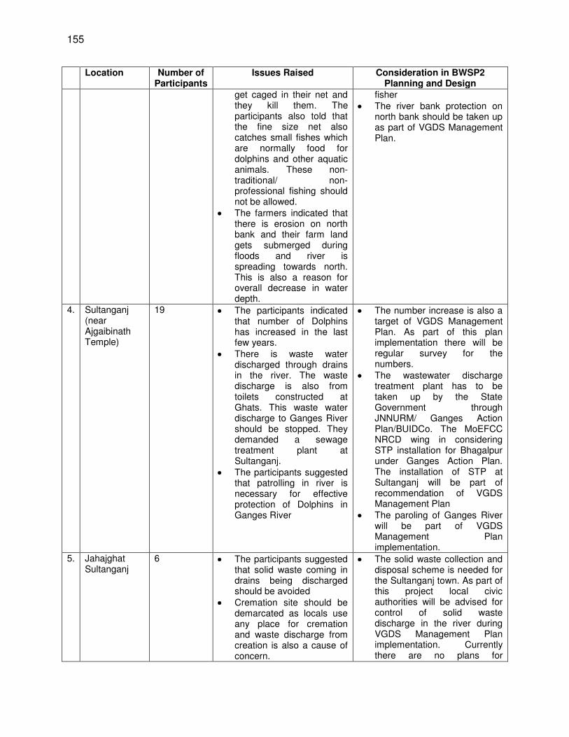
155
Location Number of Participants
Issues Raised Consideration in BWSP2 Planning and Design
get caged in their net and they kill them. The participants also told that the fine size net also catches small fishes which are normally food for dolphins and other aquatic animals. These non-traditional/ non-professional fishing should not be allowed.
The farmers indicated that there is erosion on north bank and their farm land gets submerged during floods and river is spreading towards north. This is also a reason for overall decrease in water depth.
fisher The river bank protection on
north bank should be taken up as part of VGDS Management Plan.
4. Sultanganj (near Ajgaibinath Temple)
19 The participants indicated that number of Dolphins has increased in the last few years.
There is waste water discharged through drains in the river. The waste discharge is also from toilets constructed at Ghats. This waste water discharge to Ganges River should be stopped. They demanded a sewage treatment plant at Sultanganj.
The participants suggested that patrolling in river is necessary for effective protection of Dolphins in Ganges River
The number increase is also a target of VGDS Management Plan. As part of this plan implementation there will be regular survey for the numbers.
The wastewater discharge treatment plant has to be taken up by the State Government through JNNURM/ Ganges Action Plan/BUIDCo. The MoEFCC NRCD wing in considering STP installation for Bhagalpur under Ganges Action Plan. The installation of STP at Sultanganj will be part of recommendation of VGDS Management Plan
The paroling of Ganges River will be part of VGDS Management Plan implementation.
5. Jahajghat Sultanganj
6 The participants suggested that solid waste coming in drains being discharged should be avoided
Cremation site should be demarcated as locals use any place for cremation and waste discharge from creation is also a cause of concern.
The solid waste collection and disposal scheme is needed for the Sultanganj town. As part of this project local civic authorities will be advised for control of solid waste discharge in the river during VGDS Management Plan implementation. Currently there are no plans for
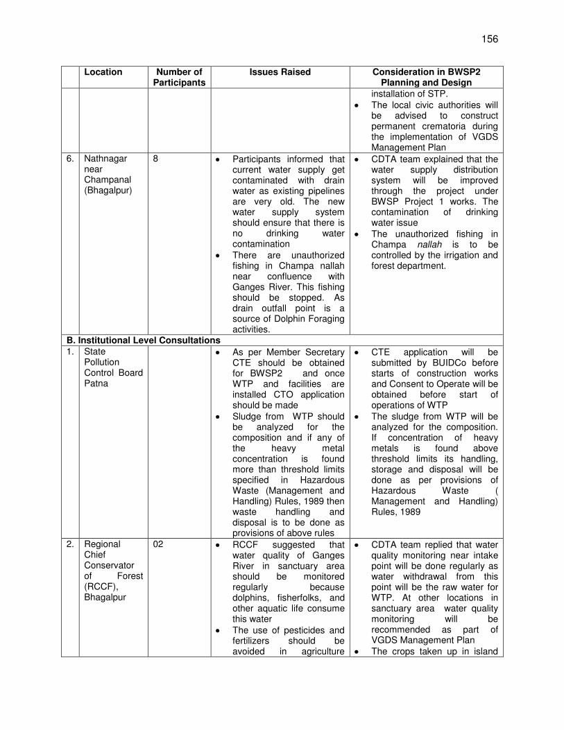
156
Location Number of Participants
Issues Raised Consideration in BWSP2 Planning and Design
installation of STP. The local civic authorities will
be advised to construct permanent crematoria during the implementation of VGDS Management Plan
6. Nathnagar near Champanal (Bhagalpur)
8 Participants informed that current water supply get contaminated with drain water as existing pipelines are very old. The new water supply system should ensure that there is no drinking water contamination
There are unauthorized fishing in Champa nallah near confluence with Ganges River. This fishing should be stopped. As drain outfall point is a source of Dolphin Foraging activities.
CDTA team explained that the water supply distribution system will be improved through the project under BWSP Project 1 works. The contamination of drinking water issue
The unauthorized fishing in Champa nallah is to be controlled by the irrigation and forest department.
B. Institutional Level Consultations 1. State
Pollution Control Board Patna
As per Member Secretary CTE should be obtained for BWSP2 and once WTP and facilities are installed CTO application should be made
Sludge from WTP should be analyzed for the composition and if any of the heavy metal concentration is found more than threshold limits specified in Hazardous Waste (Management and Handling) Rules, 1989 then waste handling and disposal is to be done as provisions of above rules
CTE application will be submitted by BUIDCo before starts of construction works and Consent to Operate will be obtained before start of operations of WTP
The sludge from WTP will be analyzed for the composition. If concentration of heavy metals is found above threshold limits its handling, storage and disposal will be done as per provisions of Hazardous Waste ( Management and Handling) Rules, 1989
2. Regional Chief Conservator of Forest (RCCF), Bhagalpur
02 RCCF suggested that water quality of Ganges River in sanctuary area should be monitored regularly because dolphins, fisherfolks, and other aquatic life consume this water
The use of pesticides and fertilizers should be avoided in agriculture
CDTA team replied that water quality monitoring near intake point will be done regularly as water withdrawal from this point will be the raw water for WTP. At other locations in sanctuary area water quality monitoring will be recommended as part of VGDS Management Plan
The crops taken up in island
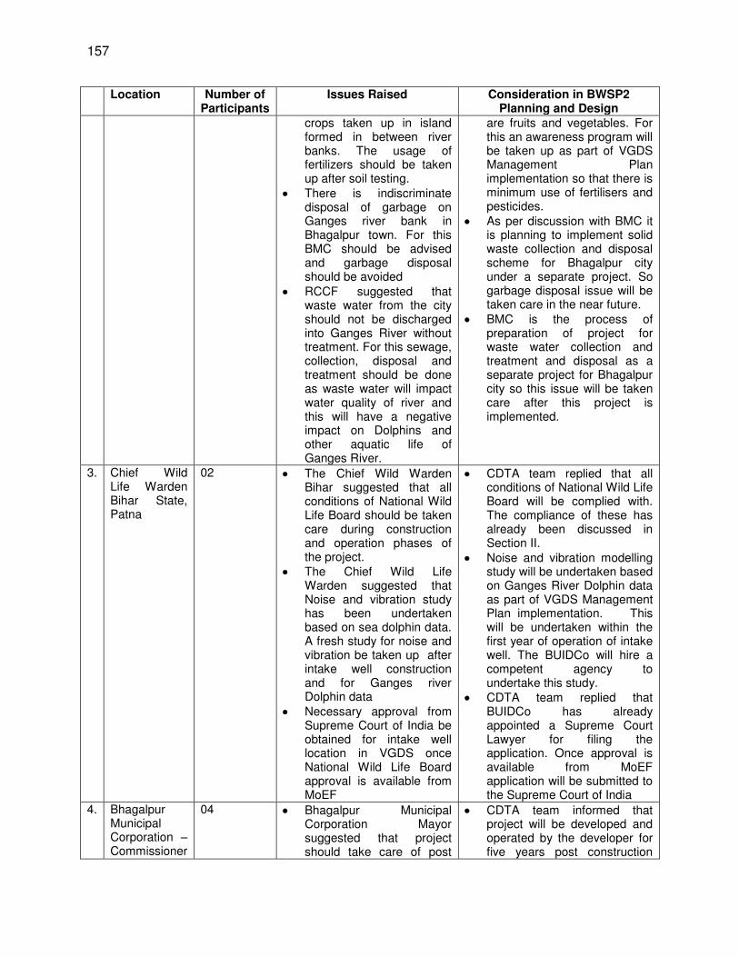
157
Location Number of Participants
Issues Raised Consideration in BWSP2 Planning and Design
crops taken up in island formed in between river banks. The usage of fertilizers should be taken up after soil testing.
There is indiscriminate disposal of garbage on Ganges river bank in Bhagalpur town. For this BMC should be advised and garbage disposal should be avoided
RCCF suggested that waste water from the city should not be discharged into Ganges River without treatment. For this sewage, collection, disposal and treatment should be done as waste water will impact water quality of river and this will have a negative impact on Dolphins and other aquatic life of Ganges River.
are fruits and vegetables. For this an awareness program will be taken up as part of VGDS Management Plan implementation so that there is minimum use of fertilisers and pesticides.
As per discussion with BMC it is planning to implement solid waste collection and disposal scheme for Bhagalpur city under a separate project. So garbage disposal issue will be taken care in the near future.
BMC is the process of preparation of project for waste water collection and treatment and disposal as a separate project for Bhagalpur city so this issue will be taken care after this project is implemented.
3. Chief Wild Life Warden Bihar State, Patna
02 The Chief Wild Warden Bihar suggested that all conditions of National Wild Life Board should be taken care during construction and operation phases of the project.
The Chief Wild Life Warden suggested that Noise and vibration study has been undertaken based on sea dolphin data. A fresh study for noise and vibration be taken up after intake well construction and for Ganges river Dolphin data
Necessary approval from Supreme Court of India be obtained for intake well location in VGDS once National Wild Life Board approval is available from MoEF
CDTA team replied that all conditions of National Wild Life Board will be complied with. The compliance of these has already been discussed in Section II.
Noise and vibration modelling study will be undertaken based on Ganges River Dolphin data as part of VGDS Management Plan implementation. This will be undertaken within the first year of operation of intake well. The BUIDCo will hire a competent agency to undertake this study.
CDTA team replied that BUIDCo has already appointed a Supreme Court Lawyer for filing the application. Once approval is available from MoEF application will be submitted to the Supreme Court of India
4. Bhagalpur Municipal Corporation – Commissioner
04 Bhagalpur Municipal Corporation Mayor suggested that project should take care of post
CDTA team informed that project will be developed and operated by the developer for five years post construction
158
Location Number of Participants
Issues Raised Consideration in BWSP2 Planning and Design
and Mayor installation phase up keep and maintenance of WTP and distribution network
Commissioner and Mayor assured all cooperation for the project and requested that project should be implemented on a fast track basis
phase so maintenance issue is taken care.
Consultants informed that project will be implemented by BUIDCo and a PIU will be established at Bhagalpur to closely monitor progress and work quality during implementation. For this a Design Supervision consultant has also been appointed.
5. Ministry of Environment Forests and climate change, New Delhi
16-20 CDTA consultants along with BUICO Managing Director made a presentation to National Wild Life Board on September 04, 2013 for getting approval for location on intake well in VGDS. In this presentation findings of hydrological report, mitigation planned for dolphin protection were presented.
The National Wild Life Board accepted proposal and approved intake well location in VGDS. At the same time suggested monitoring during construction and operation phases. It was suggested by the National Wild Life Board that all approval conditions be followed during the construction and operation phases.
C. Consultations at District Level 1. PG Botany
Department TM Bhagalpur University Conference Hall
50 One BMC councilor pointed out that Nathnagar area of city has Fluoride concentration in ground water and project should avoid ground water
One participant from NGO suggested that location of OHTs should be planned strategically so that entire area gets proper supply in post implementation phase
The Nagar Sachiv of Bhagalpur municipal corporation suggested that water testing kits at a reasonable cost should be made available to the Bhagalpur citizens so that they can test water quality at supply point as there may be chances of contamination during the distribution
One Councilor raised the issue of waste water as without taking waste water and drainage system care
CDTA team explained that after completion of BWSP2 works ground water withdrawal will not be there and no ground water supply will be supplemented from Nathnagar locality till Trache-2 works are implemented.
CDTA team replied that location of storage reservoirs have been planned considering topography, future expansion of city and population of wards. The OHTs are planned to be constructed under BWSP Project 1 works along with distribution system
CDTA team replied that water quality tests will be in laboratory at WTP for treated water and a SCADA system will be installed which will detect any leak in the distribution network. The distribution network will be rehabilitated in BWSP Project 1 works. Further as part of
159
Location Number of Participants
Issues Raised Consideration in BWSP2 Planning and Design
water supply project may not be successful
A representative from Bhagalpur chamber of commerce suggested that a Dolphin park or some entertainment zone may be established at Ganges river bank to educate public about Dolphin protection to give information on Dolphin behavior to the public.
One participant from Bhagalpur university expressed his concern that Dolphin protection should be foremost priority as these are now existing at few locations in the World
One participant enquired whether breeding of Ganges Dolphin is possible in artificial environment and can these be trained for entertainment as sea water Dolphins
All participants welcomed the project and assured of full cooperation during the project implementation.
One participant suggested that proper precautions and safety should be taken to minimise disturbance to local public.
EMP monitoring plan consultants have suggested treated water quality monitoring at 8 locations in the city in operation phase
BMC Mayor and Deputy Mayor informed the Public that for drainage and waste water a separate project is being prepared by BMC and soon DPR will be available for this.
The mayor replied that the suggestion is good and BMC will consider the suggestion. Consultants suggested that awareness program may be taken up during VGDS Management Plan implementation
CDTA team replied that adequate studies and precautions have been taken as shown in the presentation for Dolphin protection and VGDS Management Plan under preparation will be implemented with the help of state forest Department.
The senior Vikramshila Dolphin expert explained that breeding of Ganges dolphin not possible in artificial environment and these being blind cannot be trained for entertainment. The Ganges Dolphin survives in non-transparent Ganges water aquatic environment.
Consultants thanked all the participants for their participation and suggestions.
372. Consultations with WWF. The consultations were held with WWF Dolphin expert in India office - Dr. Sandeep Behara. The draft EIA report was sent to him about one week in advance. The presentation material of consultations as done at MoEFCC and other stakeholders was also shared. A hard copy of draft EIA report was also handed over to him. The issues raised by him and consideration in project design are given below in Table 44.
Table 44: Comments and Suggestions of WWF and Incorporation in Project Design
Comments /Suggestions Incorporation/Consideration In Project Design 1. The Ganges river Dolphins are blind and
impact of noise of construction and intake CDTA team replied that construction area for intake well is limited to maximum of 100 mx 100 m at intake
160
Comments /Suggestions Incorporation/Consideration In Project Design well operations will have multiplier impact as velocity of sound is more in water in comparison to air. There should be carrying capacity study of project locations and surroundings. If required the dolphins can be rehabilitated in other area of sanctuary if enough space is available. This should be part of VGDS Management Plan under preparation.
well locations. No construction activity is planned in early morning, evening hours, which is the time for foraging and diving activities. Construction activities not planned in night hours also as these are resting times. The river width at intake location is around 2 km. There is no space problem. The carrying capacity will be made part of VGDS Management Plan under preparation.
2. Local people should be involved in the VGDS Management Plan implementation.
CDTA team replied that under the project there are components for dolphin awareness campaign. The local people will be involved during project implementation. As part of project implementation Project management Consultants (PMC) have also been appointed. The awareness campaign will also be undertaken by PMC as part of their training and capacity building component.
3. There should be regular monitoring of impacts of intake well construction and operation
The impacts shall be regularly monitored. There will be monitoring of numbers, prey base of dolphins, and dolphin behavior such as foraging, diving and migration through Cetacean experts during pre-construction, construction and operation phases. This has been included in the VGDS Management Plan. There will be continuous monitoring of hydrological parameters such as depth and velocity through SCADA system and water quality of river Ganges at intake well location will also be monitored.
4. VGDS Management Plan once ready should be reviewed by the other dolphin experts also. the final EIA report should be made available to WWF by ADB
CDTA team replied that once VGDS Management plan is ready, it will be shared with other experts including WWF Dolphin expert. The implementing agency (BUIDCo) will circulate this document. The final EIA report once ready will be made available through BUIDCo and ADB websites as part of compliance to disclosure requirements of ADB SPS.
5. All mitigation measures should be made part of Dolphin Conservation. This is very important.
CDTA team explained that all mitigation measures will be part of VGDS Management plan. The VGDS Management Plan is being prepared by Senior Dolphin Expert who is part of Consultants; team. .
6. Acoustic study to assess the noise impact on Gangetic Dolphin shoud be carried out.
CDTA team replied that budget provisions have been made in the project for such study as same suggestion has been made by the Chief Wild Life Warden Bihar.
373. Consultations with IUCN. The consultations were held with Mr. P.R. Sinha Country Representative IUCN India chapter. The draft EIA report was sent to him on mail and at time of consultations hard copy of draft EIA and copy of presentation material (September 04 MoEF presentation copy) was also shared. His views and comments were also received on email. The views, comments and suggestions and considerations have been summarized below in Table 45.
161
Table 45: Comments and Suggestions of IUCN and Incorporation in Project Design (2013, CDTA stage)
Comments /Suggestions Incorporation/Consideration In Project Design 1. In this project, the most important
thing to consider is the requirement of water both in terms of spread and depth particularly in lean months. The impact of drawl of water on the flow has to be assessed vis a vis requirement of the flagship species the Dolphin
It was explained that two hydrological studies were undertaken and these studies have confirmed drop in water level to the tune of 3.6 mm due to 156 MLD water withdrawals for the project. This drop will be confined within 20-25 m distance around proposed intake well location. The minimum and maximum water flow of River is 10002 and 48000 m3/s in lean and monsoon season. The depth of active channel will be 23.22 m minimum (during lean season) after withdrawal. The flagship species Dolphin requires depth of 5-13 m and mother calf pair occur in slightly shallower habitat (2.5-5 m). Hence water availability for Dolphins will not be a problem impacted
2. In case other projects are also planned the cumulative impact of drawl should be assessed.
It was informed that consultants have interacted with various Government departments during course of assignment and there is no proposal to draw water from river in 100 km upstream and up to end point of VGDS downstream. Hence hydrological assessment will hold good for the project scenario.
3. There should be regular monitoring of impacts of water depth and spread around intake well location.
The water depth and spread shall be regularly monitored. There will also be monitoring of numbers, prey base of dolphins, and dolphin behaviour such as foraging, diving and migration through Cetacean experts during pre-construction, construction and operation phases. This has been included in the VGDS Management Plan. There will be continuous monitoring of hydrological parameters such as depth and velocity through SCADA system and water quality of river Ganges at intake well location will also be monitored.
4. Pollution load should also be monitored in the upstream as this will impact dolphin food chain availability.
As part of EIA study all drains have been identified and water quality of drains and river at outfall point analysed. In future also water quality will be assessed and based on consultations with other stakeholders a STP and storm drainage system has been recommended for Bhagalpur and Sultanganj town to minimise the impact.
5. Who is suggesting mitigation measures - multiplication of dolphin numbers and protection?
He was informed that Dr. Sunil Chaudhary is Senior Dolphin Expert on the team and is preparing VGDS Management plan and his input has been taken on multiplication of dolphin numbers and protection. Mr. Sinha confirmed that Dr. Choudhury is the right person.
6. CDTA team informed that ADB proposes draft (final) EIA report to be reviewed by IUCN.
Mr. Sinha informed that IUCN has a Cetacean Specialist Group. The report may be sent to the group Chair who generally refer the report to one or more group members who all works for the cause. He informed that amongst others P K Sinha and Sandeep Behera (WWF) are the group members. He was not sure if Dr. Choudharyis also a member.
7. On the acoustic study Mr. Sinha was informed that a study was previously undertaken based on sea dolphin behavioral response data. Mr. Sinha was requested to suggest if behavioral response data for noise levels for Gangetic Dolphins is available.
Mr. Sinha confirmed that behavioral response data for Gangetic Dolphin is not available and therefore the earlier study conducted using likewise species - sea Dolphin - behavioral response data is not out of context. Any new study on behavioral data generation needs to be taken up covering all four seasons to have all type of conditions. In the light of this, acoustic study may be undertaken during implementation period.
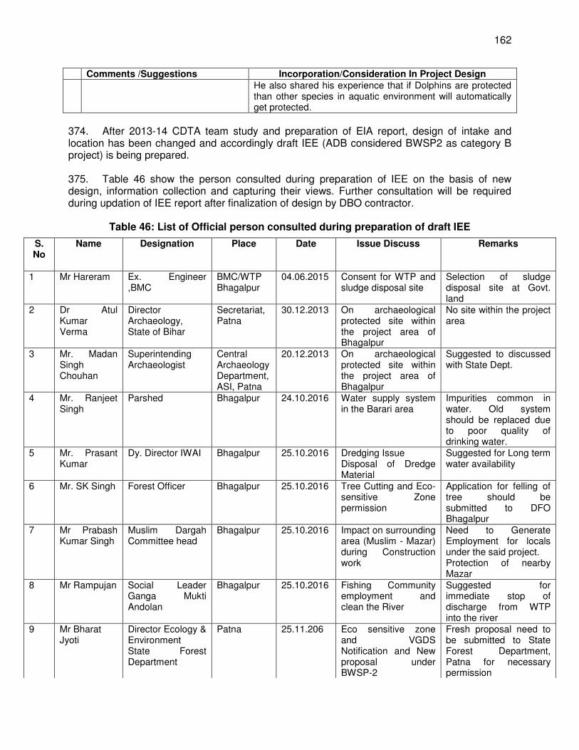
162
Comments /Suggestions Incorporation/Consideration In Project Design He also shared his experience that if Dolphins are protected than other species in aquatic environment will automatically get protected.
374. After 2013-14 CDTA team study and preparation of EIA report, design of intake and location has been changed and accordingly draft IEE (ADB considered BWSP2 as category B project) is being prepared. 375. Table 46 show the person consulted during preparation of IEE on the basis of new design, information collection and capturing their views. Further consultation will be required during updation of IEE report after finalization of design by DBO contractor.
Table 46: List of Official person consulted during preparation of draft IEE
S. No
Name Designation Place Date Issue Discuss Remarks
1 Mr Hareram Ex. Engineer ,BMC
BMC/WTP Bhagalpur
04.06.2015 Consent for WTP and sludge disposal site
Selection of sludge disposal site at Govt. land
2 Dr Atul Kumar Verma
Director Archaeology, State of Bihar
Secretariat, Patna
30.12.2013 On archaeological protected site within the project area of Bhagalpur
No site within the project area
3 Mr. Madan Singh Chouhan
Superintending Archaeologist
Central Archaeology Department, ASI, Patna
20.12.2013 On archaeological protected site within the project area of Bhagalpur
Suggested to discussed with State Dept.
4 Mr. Ranjeet Singh
Parshed Bhagalpur 24.10.2016 Water supply system in the Barari area
Impurities common in water. Old system should be replaced due to poor quality of drinking water.
5 Mr. Prasant Kumar
Dy. Director IWAI Bhagalpur
25.10.2016 Dredging Issue Disposal of Dredge Material
Suggested for Long term water availability
6 Mr. SK Singh Forest Officer Bhagalpur 25.10.2016 Tree Cutting and Eco-sensitive Zone permission
Application for felling of tree should be submitted to DFO Bhagalpur
7 Mr Prabash Kumar Singh
Muslim Dargah Committee head
Bhagalpur 25.10.2016 Impact on surrounding area (Muslim - Mazar) during Construction work
Need to Generate Employment for locals under the said project. Protection of nearby Mazar
8 Mr Rampujan Social Leader Ganga Mukti Andolan
Bhagalpur 25.10.2016 Fishing Community employment and clean the River
Suggested for immediate stop of discharge from WTP into the river
9 Mr Bharat Jyoti
Director Ecology & Environment State Forest Department
Patna 25.11.206 Eco sensitive zone and VGDS Notification and New proposal under BWSP-2
Fresh proposal need to be submitted to State Forest Department, Patna for necessary permission
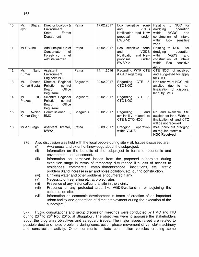
163
376. Also discussion was held with the local people during site visit. Issues discussed are:
(i) Awareness and extent of knowledge about the subproject. (ii) Information on the benefits of the subproject in terms of economic and
environmental enhancement. (iii) Information on perceived losses from the proposed subproject during
execution stage in terms of temporary disturbance like loss of access to residences, commercial establishments/shops, institutions, etc., traffic problem 8iand increase in air and noise pollution, etc. during construction.
(iv) Drinking water and other problems encountered if any (v) Necessity of tree felling etc. at project sites (vi) Presence of any historical/cultural site in the vicinity. (vii) Presence of any protected area like VGDS/wetland in or adjoining the
construction site. (viii) Information on economic development in terms of creation of an important
urban facility and generation of direct employment during the execution of the subproject.
377. Public consultations and group discussion meetings were conducted by PMC and PIU during 23rd to 26th Nov 2015, at Bhagalpur. The objectives were to appraise the stakeholders about the program’s objectives and safeguard issues. The major issues raised are related to possible dust and noise problems during construction phase movement of vehicle/ machinery and construction activity. Other comments include construction vehicles creating some
10 Mr. Bharat Jyoti
Director Ecology & Environment State Forest Department
Patna 17.02.2017 Eco sensitive zone and VGDS Notification and New proposal under BWSP-2
Relating to NOC for dredging operation within VGDS and construction of intake within Eco sensitive zone
11 Mr US Jha Add rincipal Chief Conservator of Forest- cum chief wild life warden
Patna 17.02.2017 Eco sensitive zone and VGDS Notification and New proposal under BWSP-2
Relating to NOC for dredging operation within VGDS and construction of intake within Eco sensitive zone
12 Mr. Nand Kumar
Assistant Environment Engineer PCB
Patna 14.11.2016 Regarding WTP CTE & CTO regarding
CTE NOC not received and suggested for apply for CTO.
13 Mr. Dinesh Kumar Gupta
Director, Regional Pollution control Board Office Begusarai
Begusarai 02.02.2017 Regarding CTE & CTO NOC
Non receive of NOC- still awaited due to non finalization of disposal land by BMC
14 Mr HD Prakash
Scientist Regional Pollution control Board Office Begusarai
Begusarai 02.02.2017 Regarding CTE & CTO NOC
15 Mr. Avnish Kumar Singh
Commissioner , BMC
Bhagalpur 03.02.2017 Regarding land availability related to CTE & CTO NOC
No land available. Still awaited for land. Without finalization of land CTO will be not received
16 Mr AK Singh Assistant Director, IWWA
Patna 09.03.2017 Dredging operation within VGDS
IWAI carry out dredging on regular intervals. NOC Received
164
disturbances to the local people daily activities, necessity of proper safety arrangements. The issues and comments have been considered and incorporated in the design of the subproject and mitigation measures for the potential environmental impacts raised during the public consultations. 378. Consultation particularly related to Bhagalpur bulk water supply project has been carried out during 25.10.2016 and 21.02.2017 with local people, community – fishers and religious. Their suggestions are being included in environment management plan. Appendix 16 included that consultation details. 379. Consultation has also been done with WWF and IUCN representative in context to biodiversity impact study (year 2016) related to the project. Their view related to dredging and impact on biodiversity is as follows. Consultations made with WWF – India & IUCN Country Representative India on environmental impacts of Dredging on River Biodiversity & for seeking support
Dr. Suresh Babu, Director, Rivers, Wetlands & Water Policy & Dr. Asghar Nawab, River Species Expert, WWF-India
380. Consultations on “Impact of dredging on River Biodiversity” with reference to Bhagalpur Water Supply Project were done with Dr. Suresh Babu, Director, Rivers, Wetlands & Water Policy & Dr. Asghar Nawab, River Species Expert, WWF-India in WWF-India Secretariat office, New Delhi on November 30, 2016. After appraisal of the River Biodiversity Assessment Report and discussion with Biodiversity Expert working for Bhagalpur Water Supply Project, both Dr. Suresh Babu and Dr. Asghar Nawab have made following comments and recommended for the followings:
(i) The report has been carefully compiled incorporating secondary data as well. (ii) The selected study area represents the river and river conditions at Bhagalpur. (iii) With limited data available at this point of time, it appears difficult to predict
conclusively about the impact of dredging operations on river biodiversity. Since dredging will be ongoing activity for maintaining the depth of the proposed river channel, monitoring of impacts of dredge noise on dolphin population and on important dolphin behaviours like feeding & foraging, diving, resting and breeding should be done on long-term basis.
(iv) Education and awareness programs should be conducted among local stakeholders particularly fishing community about the importance and need of Bhagalpur Water Supply Project.
(v) WWF-India is willing to extend its opinion on operation and maintenance phase of the project. Sharing final assessment report with WWF-India will be highly appreciated
(vi) WWF-India is well aware of the importance of Bhagalpur Water Supply Project. It agrees that the project should go ahead as it is related to supply of drinking water to more than 4-lacs people of Bhagalpur city provided suitable mitigation measures as recommended in the report are taken to minimize the dredging impacts and further included in Dolphin Conservation Plan.
Mr. P. R. Sinha, Country Representative, IUCN: After discussion with Biodiversity Expert working for Bhagalpur Water Supply Project on December 2, 2016, Mr. P. R, Sinha commented and recommended the followings:
165
(i) The assessment and likely impacts on river ecology on river biodiversity appears to be adequate.
(ii) Mitigation measures to minimize impacts particularly due to dredging are continually being refined across the globe. As dredging would be annual activity, our suggestion would be that the technology adopted for undertaking this operation should also be periodically upgraded in line with emerging technology in this field.
(iii) If other projects are also coming up then the cumulative impact of dredging has to be assessed.
(iv) Turbidity level should be monitored at the time of operation and maintenance phase.
(v) When acoustic data on Ganges river dolphin is not available, data of likewise species is used so usage of data of sea water dolphin is not out of context. The behavioural data generation needs to be taken up covering all the seasons to have all type of conditions. This will need one full year time.
(vi) Scientific support during implementation of the project and the dredging operations would be advisable.
(vii) There should be regular monitoring of impacts of dredging on River Biodiversity, particularly on fish (dolphin prey species) and dolphins.
(viii) Mr. Sinha also commented that if dolphins are protected then other species in the river will automatically get protected.
(ix) If required, Species Survival Commission Cetacean Specialist Group Chair of the IUCN may be contacted in this regard.
381. Recently on 17 March 2017 consultation has been conducted with Divisional Forest Officer and Conservator of Forest at Bhagalpur on “compliance of NOC” as received from Forest Dept. related to dredging operation within VGDS and construction of intake within Eco Sensitive zone. Minutes of the Meeting is attached as Appendix 18. E. Future Consultation and Disclosure and Community Involvement
382. Consultation is an ongoing process. This will continue throughout the project life cycle. Indicative consultations to be carried out are given below. 383. Consultations and community involvement during construction include:
(i) Public meetings with affected communities, fishers operating boats in VGDS, and state forest department to discuss and plan work programs, and to discuss implementation of the VGDS Management Plan and allow issues to be raised and addressed once construction has started.
(ii) Smaller-scale meetings to discuss and plan construction work with individual communities to reduce disturbance and other impacts, and provide a mechanism through which stakeholders can participate in subproject monitoring and evaluation.
384. The consultations will be carried out by the social and environmental expert of the PMC team in close coordination with PIU, BMC, and contractor; necessary monitoring is suggested as part of the EMP. 385. Consultations and community involvement post construction include:
(i) The community to be involved will be fishers, the local population of the town and villages along the southern bank of the Ganges River in the sanctuary area.
166
(ii) Necessary monitoring and surveys for dolphin numbers will be undertaken. 386. Project Disclosure. Public information campaigns (via newspaper, TV and radio) to explain the project to the wider town population and prepare them for disruption they may experience once the construction program is underway. This public information campaign will also be taken up to educate the stakeholders about dolphin behavior, dolphin activities (migration, foraging and diving) and dolphin protection measures within VGDS. It will involve (i) public disclosure meetings at key project stages to inform the public of progress and future plans, and to provide copies of summary documents in Hindi and (ii) formal disclosure of completed project reports by making copies available at convenient locations in Bhagalpur town. 387. Based on ADB requirements, the following will be posted on the ADB website:
(i) This draft IEE report (ii) Updated IEE report as per detailed design (iii) Environmental monitoring reports (iv) Corrective action plan/s prepared during project implementation to address
unanticipated environmental impacts and to rectify non-compliance to EMP provisions.
VII. GRIEVANCE REDRESS MECHANISM
388. The GRM will provide an accessible platform for receiving and facilitating resolution of affected persons’ grievances related to the Program. A common grievance redress mechanism (GRM) will be in place for social, environmental or any other Project/sub-project related grievances; each resettlement plan (RP), indigenous peoples plan (IPP), and initial environment examination (IEE)/ environmental impact assessment (EIA) will follow the grievance redress mechanism described below. 389. Grievance Redress Process: Grievances/suggestions of APs can be dropped in suggestion boxes or conveyed through phone or mail (Sample Format attached). The Community Liaison Officer (CLO) of the implementing NGO or Safeguard Officer of PIU (who deals with social issues/ RP implementation) will be responsible for conducting periodic community meetings with affected communities to understand their concerns and help them through the process of grievance redressal (including translation from local dialect/language, recording and registering grievances of non-literate APs and explaining the process of grievance redressal). 390. Grievances will first be registered at the Complaints Cell36 of the implementing NGO/PIU, who will resolve smaller issues and in case of not resolved issues it will go to PMU. Safeguard officer and for larger issues, consult/seek the assistance of the BUIDCo. Grievances not redressed through this process within one month of registration will be brought to the notice of the Town Level Committee/City Level Committees (CLC) set up to monitor project implementation in each town/city. As a Grievance Redressal Committee, the town level committee will meet the pending issues (if there are pending, registered grievances), determine the merit of each grievance, and resolve grievances within a month of receiving the complaint—failing which the grievance will be addressed by the state-level Program Steering Committee (PSC)37. Further grievances will be referred by APs to the appropriate courts of law. The 36
Complaints Cells to be established at the ULB/PIU office or in a location easily accessible to affected communities (e.g. fishing community / riverbank communities)
37 Grievances pertaining to broader concerns related to the program/sub-project, i.e., those not necessarily confined to the city/district shall be directly forwarded to the PSC if received at the city-level Complaints Cell. There will be a
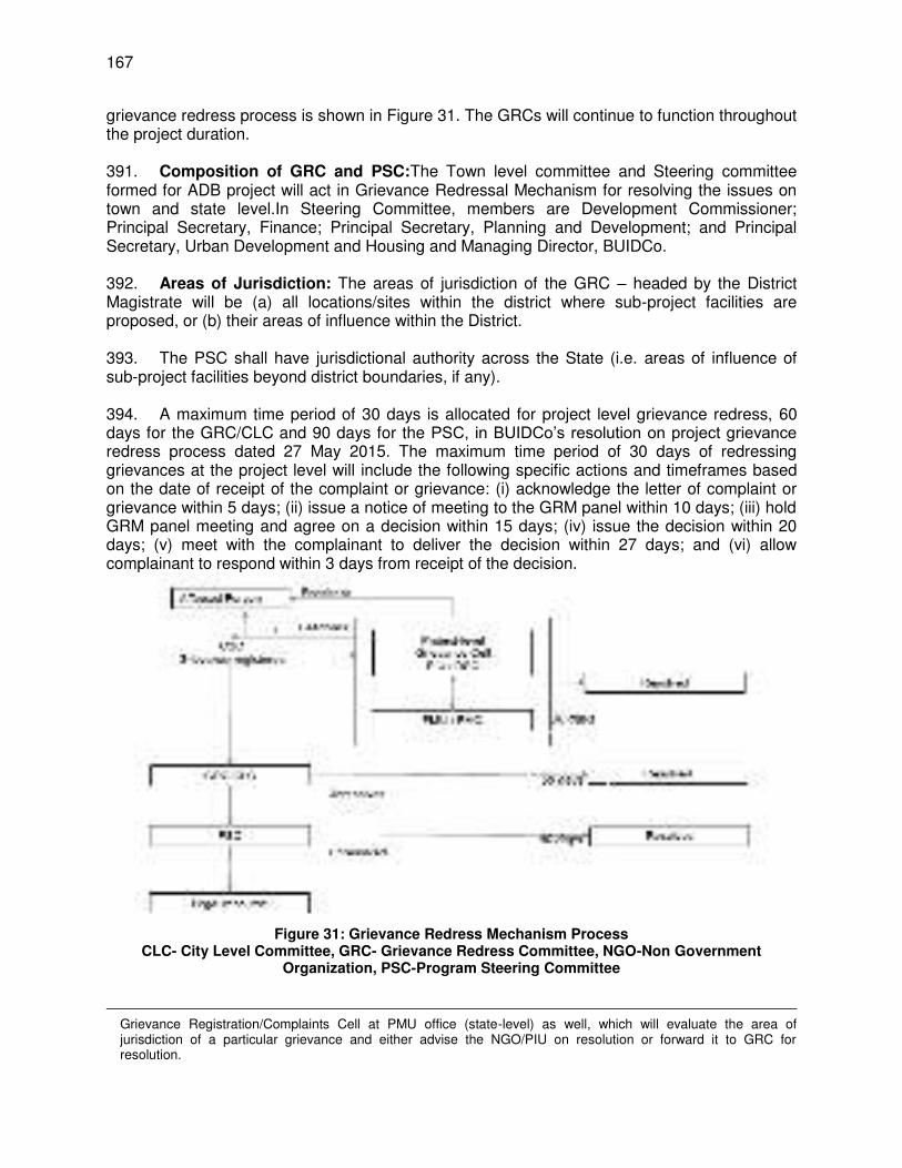
167
grievance redress process is shown in Figure 31. The GRCs will continue to function throughout the project duration. 391. Composition of GRC and PSC:The Town level committee and Steering committee formed for ADB project will act in Grievance Redressal Mechanism for resolving the issues on town and state level.In Steering Committee, members are Development Commissioner; Principal Secretary, Finance; Principal Secretary, Planning and Development; and Principal Secretary, Urban Development and Housing and Managing Director, BUIDCo. 392. Areas of Jurisdiction: The areas of jurisdiction of the GRC – headed by the District Magistrate will be (a) all locations/sites within the district where sub-project facilities are proposed, or (b) their areas of influence within the District. 393. The PSC shall have jurisdictional authority across the State (i.e. areas of influence of sub-project facilities beyond district boundaries, if any). 394. A maximum time period of 30 days is allocated for project level grievance redress, 60 days for the GRC/CLC and 90 days for the PSC, in BUIDCo’s resolution on project grievance redress process dated 27 May 2015. The maximum time period of 30 days of redressing grievances at the project level will include the following specific actions and timeframes based on the date of receipt of the complaint or grievance: (i) acknowledge the letter of complaint or grievance within 5 days; (ii) issue a notice of meeting to the GRM panel within 10 days; (iii) hold GRM panel meeting and agree on a decision within 15 days; (iv) issue the decision within 20 days; (v) meet with the complainant to deliver the decision within 27 days; and (vi) allow complainant to respond within 3 days from receipt of the decision.
Figure 31: Grievance Redress Mechanism Process
CLC- City Level Committee, GRC- Grievance Redress Committee, NGO-Non Government Organization, PSC-Program Steering Committee
Grievance Registration/Complaints Cell at PMU office (state-level) as well, which will evaluate the area of jurisdiction of a particular grievance and either advise the NGO/PIU on resolution or forward it to GRC for resolution.
168
395. Consultation Arrangements: This will include (a) group meetings and discussions with APs, to be announced in advance and conducted at the time of day agreed on with APs (based on their availability) and conducted by the Community Liaison Officer (CLO) of the implementing NGO and PIU-PMU at least quarterly in the first year and half-yearly in subsequent years of RP implementation to address general/common grievances; and (b) availability of CLO of Implementing NGO and Environment and Social Management Coordinator of PMU on a fixed day of every fortnight (as required, based on the number of grievances) for one-to-one consultations. The Implementing NGO will be responsible for ensuring that non-literate APs/ vulnerable APs are assisted to understand the grievance redress process, to register complaints and with follow-up actions at different stages in the process.Records will be kept by the PIU/PMU of all grievances received including contact details of complainant, date the complaint was received, nature of grievance, agreed corrective actions and the date these were effected, and final outcome. 396. Information Dissemination Methods of the GRM: The Implementing NGO and PIU shall be responsible for information dissemination to APs on grievance redressal procedure, who to contact and when, where/how to register grievance, various stages of grievance redress process, time likely to be taken for redressal of minor and major grievances etc. A Sample Grievance Registration Form has been attached in Appendix 19. 397. Costs: All costs involved in resolving the complaints (meetings, consultations, communication and reporting / information dissemination) will be borne by the PMU. Summary statement of community members shown below. 398. Committee member – Summary Level of GRM Members Action 1
st Tier First level
(PIU level) 1.Project director-PIU, 2.Safeguard officer and 3.Hired NGO(if issues are related to implementation of Resettlement Plan
Attending Grievances/suggestions of APs and local level smaller environmental/ social issues related to project.
Second level (PMU level)
1.Environment & Social Management Coordinator (ESMC), 2.Resettlement Officer and 3.Environmental Engineer
1.Grievances related to Environmental & Social issues if remain unresolved at PIU level. 2.Members will conduct quarterly meeting at PIU toresolve the issues. 3. Grievances not redressed by ESMC within one month of registration, case will be placed at third level means BUIDCo.
Third level (BUIDCo level)
1.MD BUIDCo (Programme director ADB Project) 2.Nodal Officer ADB project (Joint Programme director)
1.Grievances related to larger Environmental & Social issues and need special attention and policy level decision. 2. Grievances not redressed by BUIDCo within one month of registration, case will be placed in Town Committee/CLC/ GRC
2nd
Tier Town Committee/City Level Committees (CLC)/ Grievance Redress committee (GRC) in
1.Town committee formed for ADB Project will work as City Level Committee or GRC for addressing
169
Level of GRM Members Action each project town – Town Committee is already formed under ADB project act as CLC/GRC and members are as follows for town committee:- 1.District Magistrate(Respective district)-Chairmain 2.Municipal Commissioner/Executive Officer (Respective Urban Local Bodies (ULBs))-Member Secretary 3.Executive Engineer(Respective ULBs) 4.Line agencies representative(Respective district) 5.NGOs/Civil Society of respective district.
grievances related to project. 2.Whenever meeting of town committee shall be conducted, pending issues of GRC will be addressed. 3.Letter of Town Committee formed for ADB project is attached as Annexure-1.
3rd
Tier Steering Committee (SC) – Members include 1.Development Commissione, Bihar-Chairmain; 2.Principal Secretary, Finance-Member; 3.Principal Secretary, Planning and Development-Member; 4.Principal Secretary, Urban Development and Housing-Member Secretary,and 5.MD,BUIDCo (Programme Director,ADB Project)-Member
1.Steering Committee is already formed for ADB project (Annexure-2). 2.Grievance will be addressed in the state-level Steering Committee (SC) in case of strong grievances and not resolved in Town Committee/CLC/ GRC.
VIII. ENVIRONMENTAL MANAGEMENT PLAN
399. The purpose of the environmental management plan (EMP) is to ensure that the activities are undertaken in a responsible, non-detrimental manner with the objectives of: (i) providing a proactive, feasible, and practical working tool to enable the measurement and monitoring of environmental performance on-site; (ii) guiding and controlling the implementation of findings and recommendations of the environmental assessment conducted for the project; (iii) detailing specific actions deemed necessary to assist in mitigating the environmental impact of the project; and (iv) ensuring that safety recommendations are complied with. 400. A copy of the EMP must be kept on work sites at all times and at operator’s office during O&M phase. This EMP will be included in the bid documents and will be further reviewed and updated during implementation. The EMP will be made binding on all contractors operating on the site and will be included in the contractual clauses. Non-compliance with, or any deviation from, the conditions set out in this document constitutes a failure in compliance. 401. The contractor will be required to (i) establish an operational system for managing environmental impacts (ii) carry out all of the monitoring and mitigation measures set forth in the EMP; and (iii) implement any corrective or preventative actions set out in safeguards monitoring reports that BUIDCo, PIU, DSC, or PMC will prepare from time to time to monitor
170
implementation of this IEE and EMP. The contractor shall allocate a budget for compliance with these EMP measures, requirements and actions. A. Responsibilities for EMP Implementation
402. The following agencies will be responsible for EMP Implementation: (i) UDHD is the Executing Agency (EA) responsible for overall management,
coordination, and execution of all activities funded under the loan; (ii) BUIDCo is the Implementing Agency (IA) responsible for coordinating
procurement and construction of the project. BUIDCo through its Project Management Unit (PMU) at Patna will be implementing the project;
(iii) The Project Management Consultant (PMC) assists BUIDCo/PMU in managing the project including procurement and assures technical quality of design and construction and also acts as monitor of works and operations of all contractors under BUDIP;
(iv) The Design and Supervision Consultant (DSC) will prepare the DPR of the project and will carry out construction supervision during project implementation. Their responsibility will also include EMP implementation supervision;
(v) A Project Implementation Unit (PIU) will be established at Bhagalpur. This PIU will look into progress and coordination of day to day construction works with the assistance of DSC; and
(vi) The contractor for BWSP2 will be responsible for final design, execution of all construction works, and operation and maintenance. The contractor will work under the guidance of the PIU Bhagalpur and DSC. The environmental related mitigation measures will also be implemented by the contractor.
403. In addition to this intensive involvement of biodiversity expert and Forest Dept., Govt. of Bihar will be required for safeguarding the impact on biodiversity during implantation and operation of the project. 404. PMU’s Role in Safeguards. The PMU within BUIDCo has an Environmental and Social Management Coordinator (ESMC) who addresses environmental and social safeguards issues with assistance from Program Management Consultants (PMC). The PMC includes an Environmental Specialist and a Social Safeguards Specialist engaged. The ESMC will ensure that the EARF, resettlement framework, and IPPF are followed during subproject implementation as well as the environmental management plan and resettlement plan prepared for different Tranches. 405. The ESMC in the PMU will:
(i) coordinate with PIUs’ Safeguards Officers for the day-to-day monitoring of subproject implementation
(ii) ensure overall compliance with all government rules and regulations regarding site and environmental clearances, as well as any other environmental requirements (e.g., location clearance certificates, environmental clearance certificates, etc.), as relevant;
(iii) confirm existing IEEs are updated based on detailed designs and that new IEEs/EMPs are prepared in accordance with the EARF and subproject selection criteria related to safeguards;
(iv) confirm IEEs are included in bidding documents and civil works contracts; (v) for DBO contract/s, coordinate with contractor/s in the updating of the draft IEE
once detailed design is available;
171
(vi) provide oversight on environmental management aspects of subprojects and ensure EMPs are implemented by the contractors;
(vii) establish a system to monitor environmental safeguards of the project including monitoring the indicators set out in the monitoring plan of the EMP;
(viii) facilitate and confirm overall compliance with all Government rules and regulations regarding site and environmental clearances as well as any other environmental requirements (e.g., No Objection Certificates, Consent for Establishment, Forest Clearance, Consent for Operations, etc.), as relevant; All necessary environmental clearances should be obtained prior to contract awards to avoid delay in physical progress of relevant subprojects;
(ix) approve contractor’s including subcontractor/s site environmental plans (SEPs);38 (x) supervise and provide guidance to the contractors to properly carry out the
environmental monitoring and assessments as per approved IEEs, EMPs and SEPs;
(xi) review, monitor and evaluate the effectiveness with which the EMPs and SEPs are implemented, and recommend necessary corrective actions to be taken as necessary;
(xii) consolidate monthly environmental monitoring reports from contractors and submit semi-annual monitoring reports to ADB;
(xiii) ensure timely disclosure of final IEEs in locations and form and language accessible to the public and local communities; and
(xiv) address any grievances brought about through the Grievance Redress Mechanism (GRM) in a timely manner;
(xv) ensure adequate measures for climate change adaption and mitigation are incorporated in the detailed engineering design and implementation;
(xvi) coordinate with Chief Wildlife Warden for activities relevant to the Vikramshila Gangetic Dolphin Sanctuary (VGDS) Dolphin Management plan;
(xvii) ensure environmental considerations are incorporated in design of BWSP2 are in accordance with the recommendations specified in the IEE to avoid impacts on identified biodiversity in VGDS , and
(xviii) organize an induction course for the contractors covering, including among others, EMP implementation, health and safety, grievance redressal, and community protection.
406. One biodiversity expert will be included in the monitoring team for carry out biodiversity study and liaison with Forest / Wildlife Dept. for necessary compliance as per NOC. 407. The Project Management Consultants (PMC) has an Environmental Specialist (ES) and Resettlement/Social Development Specialist who are responsible for the preparation/ updating of IEE. The Environment Specialist of PMC will review and finalize all reports in consultation with the ESMC of PMU. The Environmental Specialist (ES) of PMC will submit periodic monitoring and implementation reports to PMU, who will take follow-up actions, if necessary.
38
The contractor will be required to submit to PIU, for review and approval, a site environmental plan (SEP) including (i) proposed sites/locations for construction work camps, storage areas, hauling roads, lay down areas, disposal areas for solid and hazardous wastes; (ii) specific mitigation measures following the approved EMP; (iii) monitoring program as per SEP; and (iv) budget for SEP implementation. No works are allowed to commence prior to approval of SEP. A copy of the EMP/approved SEP will be kept on site during the construction period at all times. The EMP included in the bid and contract documents. Non-compliance with, or any deviation from, the conditions set out in this document constitutes a failure in compliance.
172
408. The ESMC of PMU will endorse/submit periodic monitoring reports received from PMC to the Program Director, PMU who will then submit these to ADB by way of semi-annual environmental monitoring reports. The monitoring report will focus on the progress of implementation of the IEE and EARF, issues encountered and measures adopted, follow-up actions required, if any, as well as the status of compliance with subproject selection criteria, and relevant loan covenants. The PMU will seek GoB clearance for submission and disclosure of the environmental (including biodiversity impact assessment) and social monitoring report to ADB. Report format for semi-annual environmental monitoring report is attached as Appendix 20. 409. PIU’s Role in Safeguards. The PIU is primarily tasked with the day-to-day implementation of safeguards plans. PIU field offices will have a Safeguard Officer who will be responsible for data collection for IEE and implementation. PIU field offices will obtain right of way clearances and prepare progress reports with respect to IEE. PIU will be responsible for obtaining statutory clearances and obtaining NOCs from government agencies/ other entities and entering into agreements with them for use of their land. It will also co-ordinate for obtaining right of way clearances with related State and National agencies. The Safeguards Officers will:
(i) oversee day-to-day implementation of SEPs by contractors, including contractors’ compliance with all government rules and regulations;
(ii) take necessary action for obtaining right of ways; (iii) approve contractors and subcontractors SEPs; (iv) supervise implementation of SEPs including environmental monitoring by
contractors; (v) take corrective actions when necessary to ensure no environmental impacts; (vi) conduct continuous public consultation and awareness; (vii) address any grievances brought about through the GRM in a timely manner; (viii) ensure contractors attend safeguards induction course prior to mobilization; (ix) organize workshops/seminars on EMP implementation, environmental monitoring
requirements related to mitigation measures, and on taking immediate action to remedy unexpected adverse impacts or ineffective mitigation measures found during the course of implementation;
(x) consolidate monthly environmental monitoring reports; and (xi) Ensure timely disclosure of final IEEs in locations and form accessible to the
public. 410. The contractor’s conformity with contract procedures and specifications during construction will be carefully monitored by the PIU. The contractor is required to:
(i) complies with all applicable legislation, is conversant with the requirements of the EMP, and briefs staff about the requirements of same;
(ii) ensures any sub-contractors/ suppliers, who are utilized within the context of the contract, comply with the environmental requirements of the EMP. The Contractor will be held responsible for non-compliance on their behalf;
(iii) supplies method statements for all activities requiring special attention as specified and/or requested by the Engineer or Environmental Specialist during the duration of the Contract;
(iv) provides environmental awareness training to staff; (v) bears the costs of any damages/ compensation resulting from non-adherence to
the EMP or written site instructions; (vi) conducts all activities in a manner that minimizes disturbance to directly affected
residents and the public in general, and foreseeable impacts on the environment.
173
(vii) ensures that the Engineer is informed in a timely manner of any foreseeable activities that will require input from the Environmental Specialist
(viii) appoints one full time Environment & Safety Officer for implementation of EMP, community liaison, reporting and grievance redressal on day to day basis.
(ix) receives complaints/grievances from the public, immediately implements the remedial measures and reports to the Engineer (DSC) and PIU within 48 hours
411. Consider mitigation hierarchy39 and demonstrate no net loss or a net gain of biodiversity. Determine the need for an offset based on residual adverse effects of the project. Where biodiversity offsets are proposed, biodiversity expert must demonstrate through an assessment that the project’s residual impacts on biodiversity will be mitigated to meet ADB SPS requirements.
(i) Establish a detailed design-specific monitoring program to determine biodiversity to be conducted prior to construction, during construction, and after commissioning. The overall objective of the monitoring program is to determine whether the implementation of the proposed mitigation measures has been successful, and if not, to determine the reasons for partial success or failure of the works implemented.
(ii) Achieve no net loss or a gain in affected biodiversity until O&M phase. 412. PMU with the help of PMC and DSC will be responsible for updating IEE. 413. Responsibility for monitoring. During construction, DSC’s Environmental Specialist , PMC’s Environment Specialist and the safeguard officer of the PIU will monitor the contractor’s environmental performance. During the operation phase, monitoring will be the responsibility of the contractor. PMC will have a responsibility for compliance monitoring as a third party. 414. Safeguard implementation arrangement for the program is shown below.
39
The mitigation hierarchy is defined as: (i) avoidance - measures taken to avoid creating impacts from the outset, such as careful spatial or temporal placement of elements of infrastructure, in order to completely avoid impacts on certain components of biodiversity; (ii) minimization - measures taken to reduce the duration, intensity and / or extent of impacts (including direct, indirect and cumulative impacts, as appropriate) that cannot be completely avoided, as far as is practically feasible; (iii) rehabilitation/restoration - measures taken to rehabilitate degraded ecosystems or restore cleared ecosystems following exposure to impacts that cannot be completely avoided and/ or minimized; and (iv) offset - measures taken to compensate for any residual significant, adverse impacts that cannot be avoided, minimized and/or rehabilitated or restored, in order to achieve no net loss or a net gain of biodiversity. Offsets can take the form of positive management interventions such as restoration of degraded habitat, arrested degradation or averted risk, protecting areas where there is imminent or projected loss of biodiversity.
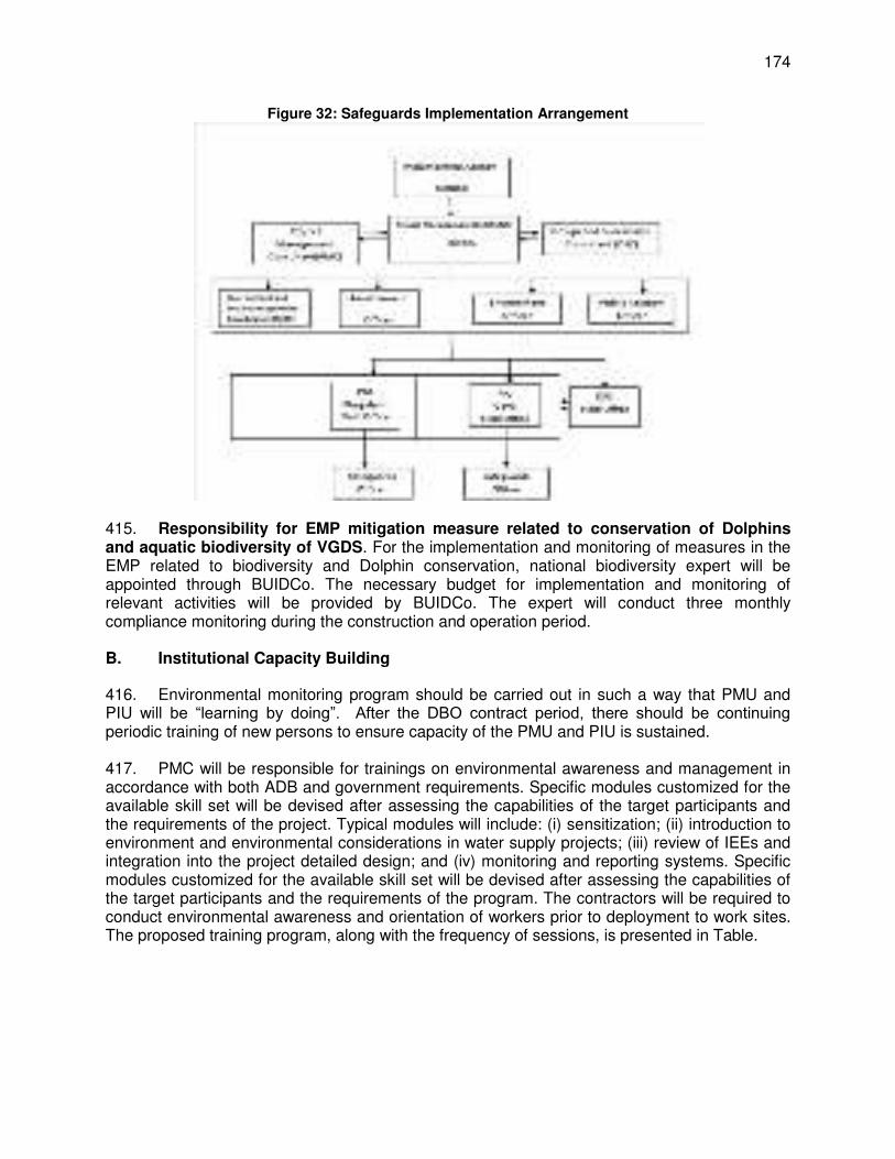
174
Figure 32: Safeguards Implementation Arrangement
415. Responsibility for EMP mitigation measure related to conservation of Dolphins and aquatic biodiversity of VGDS. For the implementation and monitoring of measures in the EMP related to biodiversity and Dolphin conservation, national biodiversity expert will be appointed through BUIDCo. The necessary budget for implementation and monitoring of relevant activities will be provided by BUIDCo. The expert will conduct three monthly compliance monitoring during the construction and operation period. B. Institutional Capacity Building
416. Environmental monitoring program should be carried out in such a way that PMU and PIU will be “learning by doing”. After the DBO contract period, there should be continuing periodic training of new persons to ensure capacity of the PMU and PIU is sustained. 417. PMC will be responsible for trainings on environmental awareness and management in accordance with both ADB and government requirements. Specific modules customized for the available skill set will be devised after assessing the capabilities of the target participants and the requirements of the project. Typical modules will include: (i) sensitization; (ii) introduction to environment and environmental considerations in water supply projects; (iii) review of IEEs and integration into the project detailed design; and (iv) monitoring and reporting systems. Specific modules customized for the available skill set will be devised after assessing the capabilities of the target participants and the requirements of the program. The contractors will be required to conduct environmental awareness and orientation of workers prior to deployment to work sites. The proposed training program, along with the frequency of sessions, is presented in Table.
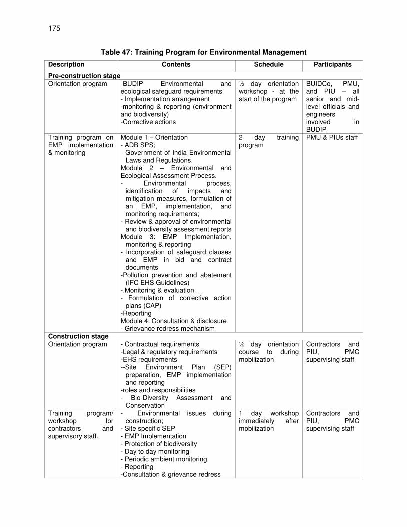
175
Table 47: Training Program for Environmental Management
Description Contents Schedule Participants
Pre-construction stage Orientation program -BUDIP Environmental and
ecological safeguard requirements - Implementation arrangement -monitoring & reporting (environment and biodiversity) -Corrective actions
½ day orientation workshop - at the start of the program
BUIDCo, PMU, and PIU – all senior and mid-level officials and engineers involved in BUDIP
Training program on EMP implementation & monitoring
Module 1 – Orientation - ADB SPS; - Government of India Environmental
Laws and Regulations. Module 2 – Environmental and Ecological Assessment Process. - Environmental process,
identification of impacts and mitigation measures, formulation of an EMP, implementation, and monitoring requirements;
- Review & approval of environmental and biodiversity assessment reports
Module 3: EMP Implementation, monitoring & reporting
- Incorporation of safeguard clauses and EMP in bid and contract documents
-Pollution prevention and abatement (IFC EHS Guidelines)
-.Monitoring & evaluation - Formulation of corrective action
plans (CAP) -Reporting Module 4: Consultation & disclosure - Grievance redress mechanism
2 day training program
PMU & PIUs staff
Construction stage Orientation program - Contractual requirements
-Legal & regulatory requirements -EHS requirements --Site Environment Plan (SEP)
preparation, EMP implementation and reporting
-roles and responsibilities - Bio-Diversity Assessment and
Conservation
½ day orientation course to during mobilization
Contractors and PIU, PMC supervising staff
Training program/ workshop for contractors and supervisory staff.
- Environmental issues during construction;
- Site specific SEP - EMP Implementation - Protection of biodiversity - Day to day monitoring - Periodic ambient monitoring - Reporting -Consultation & grievance redress
1 day workshop immediately after mobilization
Contractors and PIU, PMC supervising staff
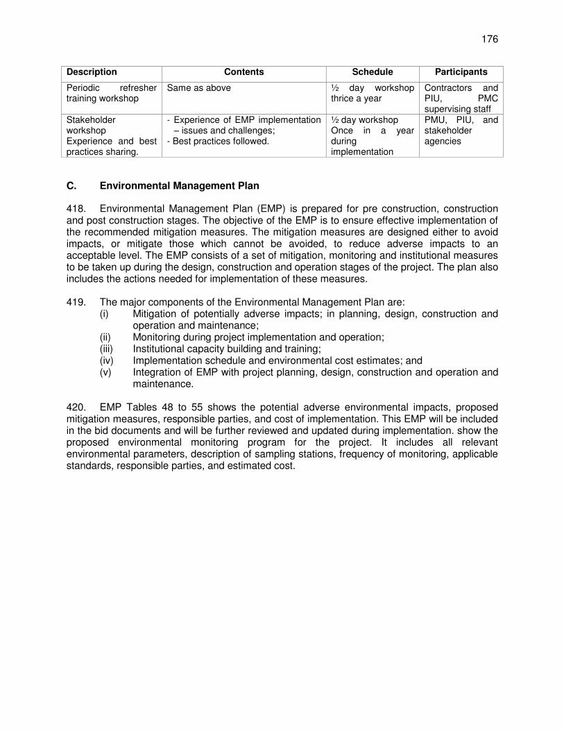
176
Description Contents Schedule Participants
Periodic refresher training workshop
Same as above ½ day workshop thrice a year
Contractors and PIU, PMC supervising staff
Stakeholder workshop Experience and best practices sharing.
- Experience of EMP implementation – issues and challenges;
- Best practices followed.
½ day workshop Once in a year during implementation
PMU, PIU, and stakeholder agencies
C. Environmental Management Plan
418. Environmental Management Plan (EMP) is prepared for pre construction, construction and post construction stages. The objective of the EMP is to ensure effective implementation of the recommended mitigation measures. The mitigation measures are designed either to avoid impacts, or mitigate those which cannot be avoided, to reduce adverse impacts to an acceptable level. The EMP consists of a set of mitigation, monitoring and institutional measures to be taken up during the design, construction and operation stages of the project. The plan also includes the actions needed for implementation of these measures. 419. The major components of the Environmental Management Plan are:
(i) Mitigation of potentially adverse impacts; in planning, design, construction and operation and maintenance;
(ii) Monitoring during project implementation and operation; (iii) Institutional capacity building and training; (iv) Implementation schedule and environmental cost estimates; and (v) Integration of EMP with project planning, design, construction and operation and
maintenance. 420. EMP Tables 48 to 55 shows the potential adverse environmental impacts, proposed mitigation measures, responsible parties, and cost of implementation. This EMP will be included in the bid documents and will be further reviewed and updated during implementation. show the proposed environmental monitoring program for the project. It includes all relevant environmental parameters, description of sampling stations, frequency of monitoring, applicable standards, responsible parties, and estimated cost.
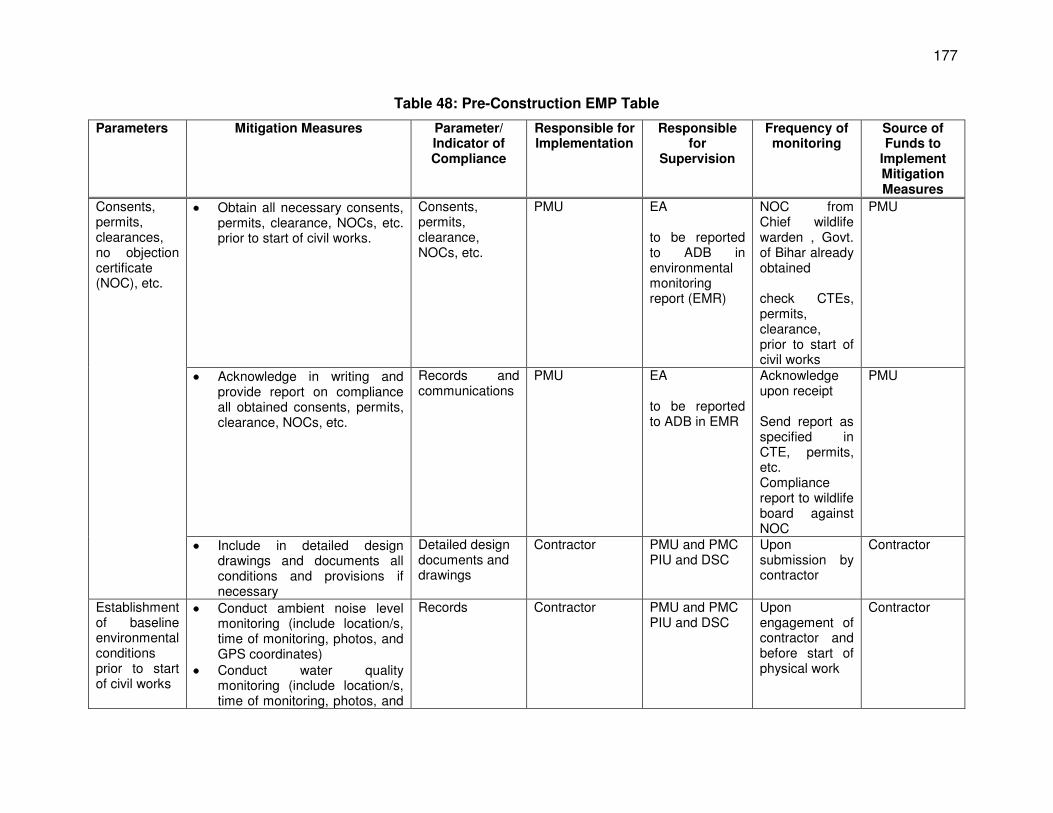
177
Table 48: Pre-Construction EMP Table
Parameters Mitigation Measures Parameter/ Indicator of Compliance
Responsible for Implementation
Responsible for
Supervision
Frequency of monitoring
Source of Funds to
Implement Mitigation Measures
Consents, permits, clearances, no objection certificate (NOC), etc.
Obtain all necessary consents, permits, clearance, NOCs, etc. prior to start of civil works.
Consents, permits, clearance, NOCs, etc.
PMU EA to be reported to ADB in environmental monitoring report (EMR)
NOC from Chief wildlife warden , Govt. of Bihar already obtained check CTEs, permits, clearance, prior to start of civil works
PMU
Acknowledge in writing and provide report on compliance all obtained consents, permits, clearance, NOCs, etc.
Records and communications
PMU EA to be reported to ADB in EMR
Acknowledge upon receipt Send report as specified in CTE, permits, etc. Compliance report to wildlife board against NOC
PMU
Include in detailed design drawings and documents all conditions and provisions if necessary
Detailed design documents and drawings
Contractor PMU and PMC PIU and DSC
Upon submission by contractor
Contractor
Establishment of baseline environmental conditions prior to start of civil works
Conduct ambient noise level monitoring (include location/s, time of monitoring, photos, and GPS coordinates)
Conduct water quality monitoring (include location/s, time of monitoring, photos, and
Records Contractor PMU and PMC PIU and DSC
Upon engagement of contractor and before start of physical work
Contractor
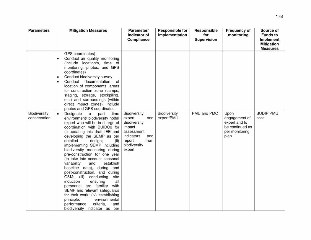
178
Parameters Mitigation Measures Parameter/ Indicator of Compliance
Responsible for Implementation
Responsible for
Supervision
Frequency of monitoring
Source of Funds to
Implement Mitigation Measures
GPS coordinates) Conduct air quality monitoring
(include location/s, time of monitoring, photos, and GPS coordinates)
Conduct biodiversity survey Conduct documentation of
location of components, areas for construction zone (camps, staging, storage, stockpiling, etc.) and surroundings (within direct impact zones). Include photos and GPS coordinates
Biodiversity conservation
Designate a part time environment/ biodiversity nodal expert who will be in charge of coordination with BUIDCo for (i) updating this draft IEE and developing the SEMP as per detailed design; (ii) implementing SEMP including biodiversity monitoring during pre-construction for one year (to take into account seasonal variability and establish baseline data), during and post-construction, and during O&M; (iii) conducting site induction ensuring all personnel are familiar with SEMP and relevant safeguards for their work; (iv) establishing principle, environmental performance criteria, and biodiversity indicator as per
Biodiversity expert and Biodiversity impact assessment indicators and report from biodiversity expert
Biodiversity expert/PMU
PMU and PMC
Upon engagement of expert and to be continued as per monitoring plan
BUDIP PMU cost
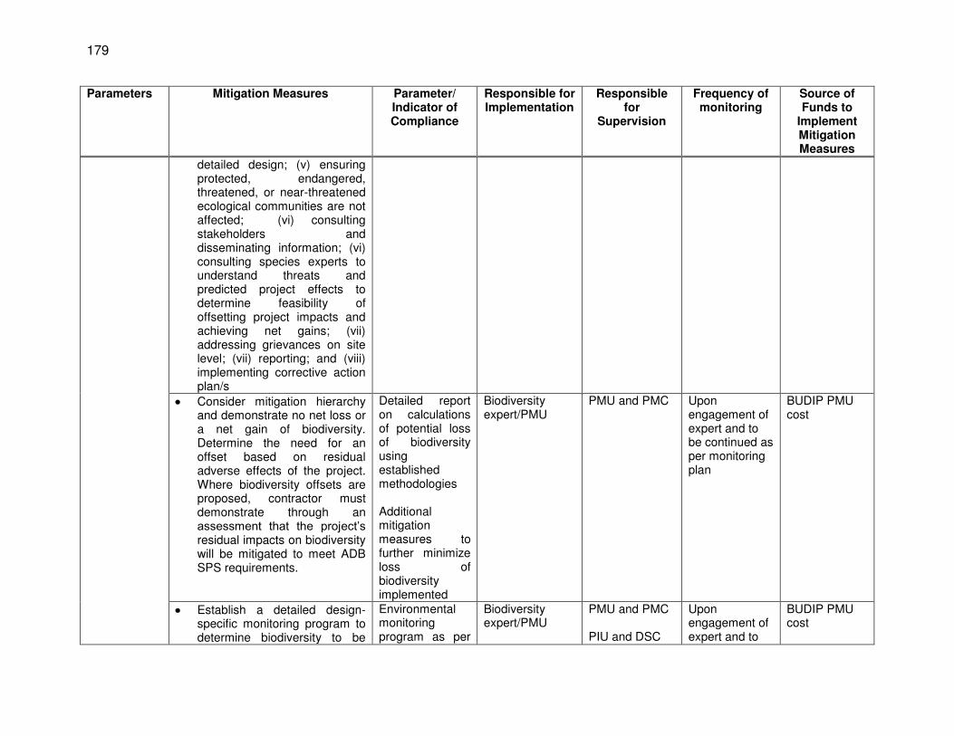
179
Parameters Mitigation Measures Parameter/ Indicator of Compliance
Responsible for Implementation
Responsible for
Supervision
Frequency of monitoring
Source of Funds to
Implement Mitigation Measures
detailed design; (v) ensuring protected, endangered, threatened, or near-threatened ecological communities are not affected; (vi) consulting stakeholders and disseminating information; (vi) consulting species experts to understand threats and predicted project effects to determine feasibility of offsetting project impacts and achieving net gains; (vii) addressing grievances on site level; (vii) reporting; and (viii) implementing corrective action plan/s
Consider mitigation hierarchy and demonstrate no net loss or a net gain of biodiversity. Determine the need for an offset based on residual adverse effects of the project. Where biodiversity offsets are proposed, contractor must demonstrate through an assessment that the project’s residual impacts on biodiversity will be mitigated to meet ADB SPS requirements.
Detailed report on calculations of potential loss of biodiversity using established methodologies Additional mitigation measures to further minimize loss of biodiversity implemented
Biodiversity expert/PMU
PMU and PMC
Upon engagement of expert and to be continued as per monitoring plan
BUDIP PMU cost
Establish a detailed design-specific monitoring program to determine biodiversity to be
Environmental monitoring program as per
Biodiversity expert/PMU
PMU and PMC PIU and DSC
Upon engagement of expert and to
BUDIP PMU cost
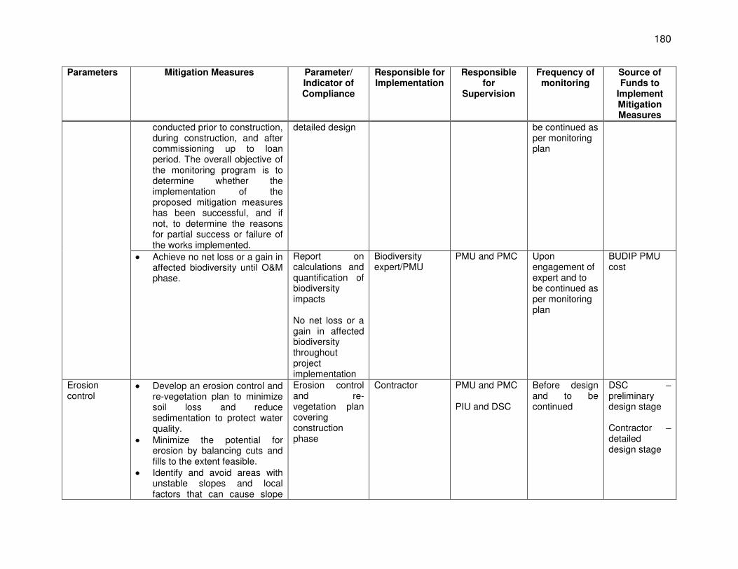
180
Parameters Mitigation Measures Parameter/ Indicator of Compliance
Responsible for Implementation
Responsible for
Supervision
Frequency of monitoring
Source of Funds to
Implement Mitigation Measures
conducted prior to construction, during construction, and after commissioning up to loan period. The overall objective of the monitoring program is to determine whether the implementation of the proposed mitigation measures has been successful, and if not, to determine the reasons for partial success or failure of the works implemented.
detailed design be continued as per monitoring plan
Achieve no net loss or a gain in affected biodiversity until O&M phase.
Report on calculations and quantification of biodiversity impacts No net loss or a gain in affected biodiversity throughout project implementation
Biodiversity expert/PMU
PMU and PMC
Upon engagement of expert and to be continued as per monitoring plan
BUDIP PMU cost
Erosion control
Develop an erosion control and re-vegetation plan to minimize soil loss and reduce sedimentation to protect water quality.
Minimize the potential for erosion by balancing cuts and fills to the extent feasible.
Identify and avoid areas with unstable slopes and local factors that can cause slope
Erosion control and re-vegetation plan covering construction phase
Contractor PMU and PMC PIU and DSC
Before design and to be continued
DSC – preliminary design stage Contractor – detailed design stage
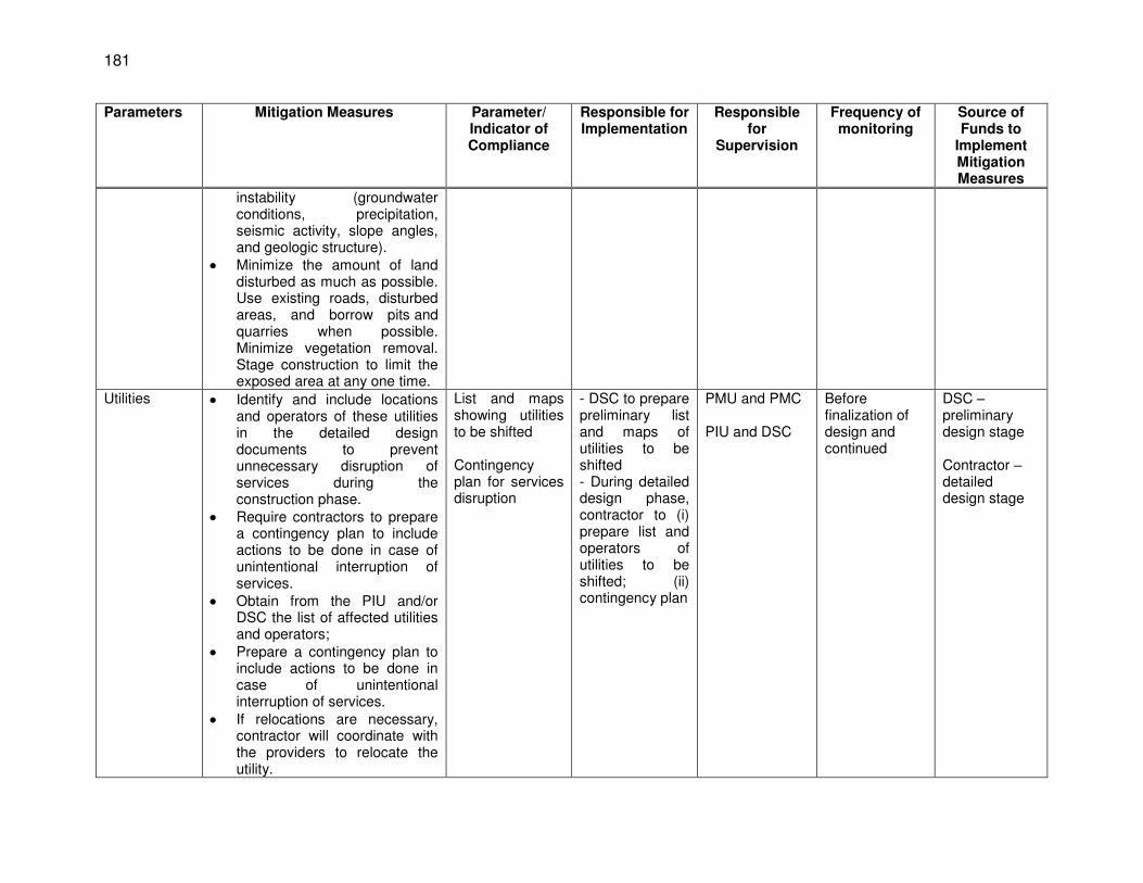
181
Parameters Mitigation Measures Parameter/ Indicator of Compliance
Responsible for Implementation
Responsible for
Supervision
Frequency of monitoring
Source of Funds to
Implement Mitigation Measures
instability (groundwater conditions, precipitation, seismic activity, slope angles, and geologic structure).
Minimize the amount of land disturbed as much as possible. Use existing roads, disturbed areas, and borrow pits and quarries when possible. Minimize vegetation removal. Stage construction to limit the exposed area at any one time.
Utilities Identify and include locations and operators of these utilities in the detailed design documents to prevent unnecessary disruption of services during the construction phase.
Require contractors to prepare a contingency plan to include actions to be done in case of unintentional interruption of services.
Obtain from the PIU and/or DSC the list of affected utilities and operators;
Prepare a contingency plan to include actions to be done in case of unintentional interruption of services.
If relocations are necessary, contractor will coordinate with the providers to relocate the utility.
List and maps showing utilities to be shifted Contingency plan for services disruption
- DSC to prepare preliminary list and maps of utilities to be shifted - During detailed design phase, contractor to (i) prepare list and operators of utilities to be shifted; (ii) contingency plan
PMU and PMC PIU and DSC
Before finalization of design and continued
DSC – preliminary design stage Contractor – detailed design stage
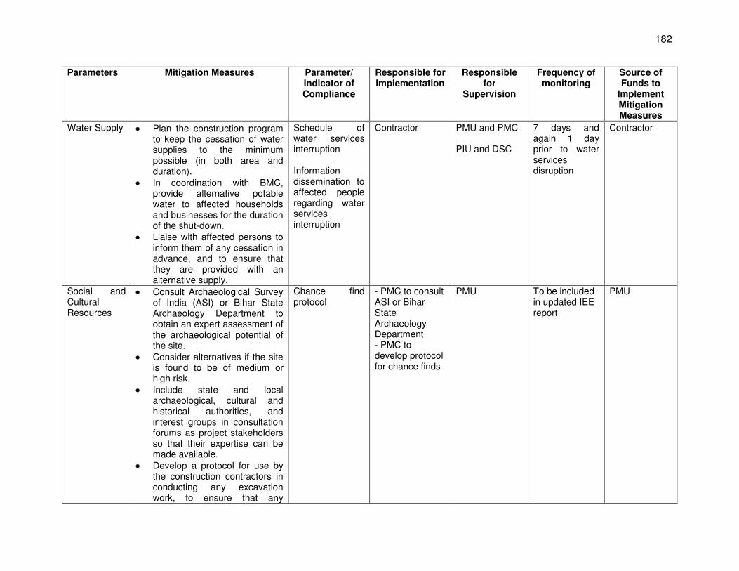
182
Parameters Mitigation Measures Parameter/ Indicator of Compliance
Responsible for Implementation
Responsible for
Supervision
Frequency of monitoring
Source of Funds to
Implement Mitigation Measures
Water Supply Plan the construction program to keep the cessation of water supplies to the minimum possible (in both area and duration).
In coordination with BMC, provide alternative potable water to affected households and businesses for the duration of the shut-down.
Liaise with affected persons to inform them of any cessation in advance, and to ensure that they are provided with an alternative supply.
Schedule of water services interruption Information dissemination to affected people regarding water services interruption
Contractor PMU and PMC PIU and DSC
7 days and again 1 day prior to water services disruption
Contractor
Social and Cultural Resources
Consult Archaeological Survey of India (ASI) or Bihar State Archaeology Department to obtain an expert assessment of the archaeological potential of the site.
Consider alternatives if the site is found to be of medium or high risk.
Include state and local archaeological, cultural and historical authorities, and interest groups in consultation forums as project stakeholders so that their expertise can be made available.
Develop a protocol for use by the construction contractors in conducting any excavation work, to ensure that any
Chance find protocol
- PMC to consult ASI or Bihar State Archaeology Department - PMC to develop protocol for chance finds
PMU To be included in updated IEE report
PMU
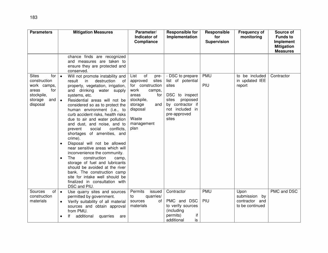
183
Parameters Mitigation Measures Parameter/ Indicator of Compliance
Responsible for Implementation
Responsible for
Supervision
Frequency of monitoring
Source of Funds to
Implement Mitigation Measures
chance finds are recognized and measures are taken to ensure they are protected and conserved.
Sites for construction work camps, areas for stockpile, storage and disposal
Will not promote instability and result in destruction of property, vegetation, irrigation, and drinking water supply systems, etc.
Residential areas will not be considered so as to protect the human environment (i.e., to curb accident risks, health risks due to air and water pollution and dust, and noise, and to prevent social conflicts, shortages of amenities, and crime).
Disposal will not be allowed near sensitive areas which will inconvenience the community.
The construction camp, storage of fuel and lubricants should be avoided at the river bank. The construction camp site for intake well should be finalized in consultation with DSC and PIU.
List of pre-approved sites for construction work camps, areas for stockpile, storage and disposal Waste management plan
- DSC to prepare list of potential sites DSC to inspect sites proposed by contractor if not included in pre-approved sites
PMU PIU
to be included in updated IEE report
Contractor
Sources of construction materials
Use quarry sites and sources permitted by government.
Verify suitability of all material sources and obtain approval from PMU.
If additional quarries are
Permits issued to quarries/ sources of materials
Contractor PMC and DSC to verify sources (including permits) if additional is
PMU PIU
Upon submission by contractor and to be continued
PMC and DSC
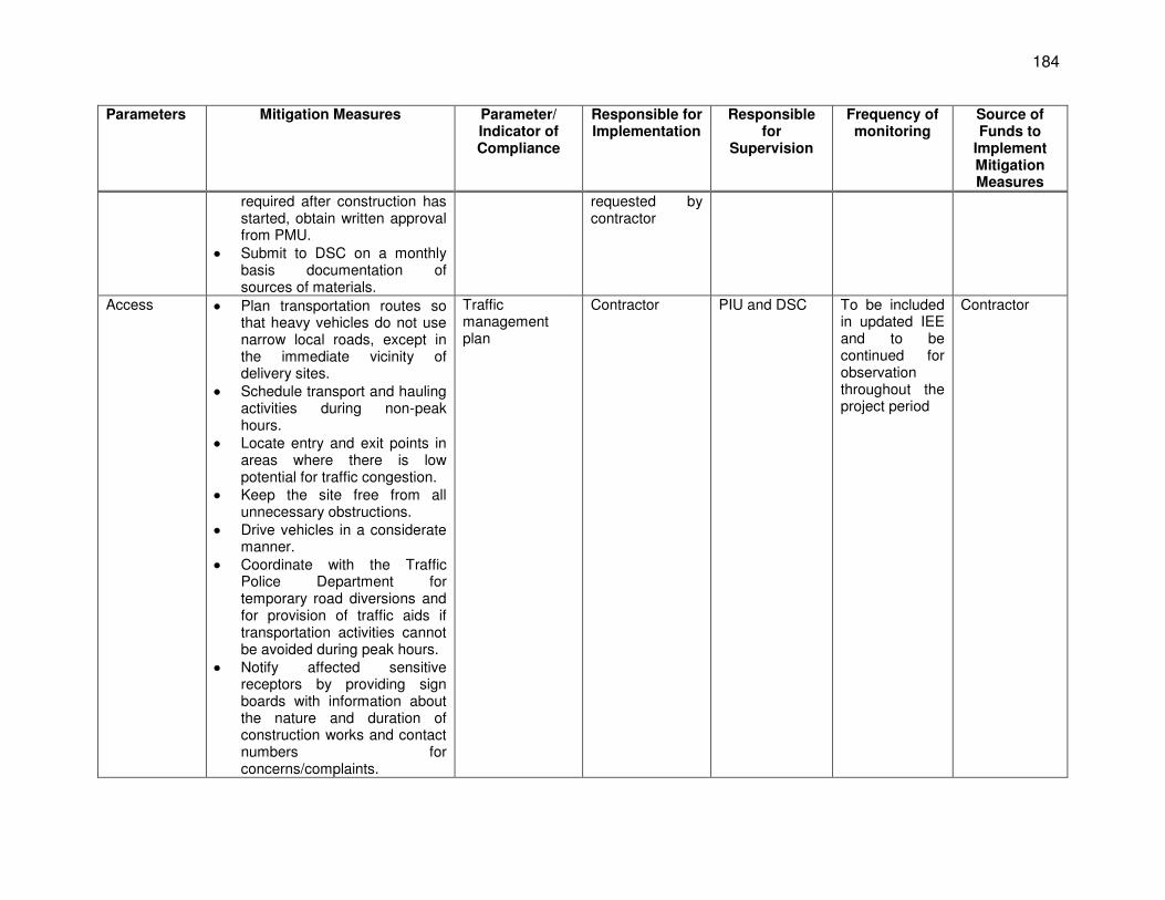
184
Parameters Mitigation Measures Parameter/ Indicator of Compliance
Responsible for Implementation
Responsible for
Supervision
Frequency of monitoring
Source of Funds to
Implement Mitigation Measures
required after construction has started, obtain written approval from PMU.
Submit to DSC on a monthly basis documentation of sources of materials.
requested by contractor
Access Plan transportation routes so that heavy vehicles do not use narrow local roads, except in the immediate vicinity of delivery sites.
Schedule transport and hauling activities during non-peak hours.
Locate entry and exit points in areas where there is low potential for traffic congestion.
Keep the site free from all unnecessary obstructions.
Drive vehicles in a considerate manner.
Coordinate with the Traffic Police Department for temporary road diversions and for provision of traffic aids if transportation activities cannot be avoided during peak hours.
Notify affected sensitive receptors by providing sign boards with information about the nature and duration of construction works and contact numbers for concerns/complaints.
Traffic management plan
Contractor PIU and DSC To be included in updated IEE and to be continued for observation throughout the project period
Contractor
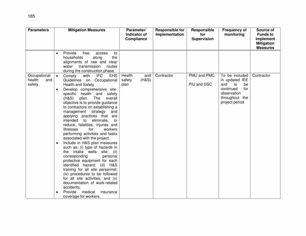
185
Parameters Mitigation Measures Parameter/ Indicator of Compliance
Responsible for Implementation
Responsible for
Supervision
Frequency of monitoring
Source of Funds to
Implement Mitigation Measures
Provide free access to households along the alignments of raw and clear water transmission routes during the construction phase.
Occupational health and safety
Comply with IFC EHS Guidelines on Occupational Health and Safety
Develop comprehensive site-specific health and safety (H&S) plan. The overall objective is to provide guidance to contractors on establishing a management strategy and applying practices that are intended to eliminate, or reduce, fatalities, injuries and illnesses for workers performing activities and tasks associated with the project.
Include in H&S plan measures such as: (i) type of hazards in the intake wells site; (ii) corresponding personal protective equipment for each identified hazard; (iii) H&S training for all site personnel; (iv) procedures to be followed for all site activities; and (v) documentation of work-related accidents.
Provide medical insurance coverage for workers.
Health and safety (H&S) plan
Contractor PMU and PMC PIU and DSC
To be included in updated IEE and to be continued for observation throughout the project period
Contractor
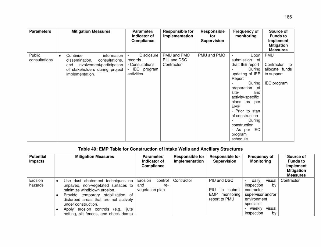
186
Parameters Mitigation Measures Parameter/ Indicator of Compliance
Responsible for Implementation
Responsible for
Supervision
Frequency of monitoring
Source of Funds to
Implement Mitigation Measures
Public consultations
Continue information dissemination, consultations, and involvement/participation of stakeholders during project implementation.
- Disclosure records - Consultations - IEC program activities
PMU and PMC PIU and DSC Contractor
PMU and PMC - Upon submission of draft IEE report - During updating of IEE Report - During preparation of site- and activity-specific plans as per EMP - Prior to start of construction - During construction - As per IEC program schedule
PMU Contractor to allocate funds to support IEC program
Table 49: EMP Table for Construction of Intake Wells and Ancillary Structures
Potential Impacts
Mitigation Measures Parameter/ Indicator of Compliance
Responsible for Implementation
Responsible for Supervision
Frequency of Monitoring
Source of Funds to
Implement Mitigation Measures
Erosion hazards
Use dust abatement techniques on unpaved, non-vegetated surfaces to minimize windblown erosion.
Provide temporary stabilization of disturbed areas that are not actively under construction.
Apply erosion controls (e.g., jute netting, silt fences, and check dams)
Erosion control and re-vegetation plan
Contractor PIU and DSC PIU to submit EMP monitoring report to PMU
- daily visual inspection by contractor supervisor and/or environment specialist - weekly visual inspection by
Contractor
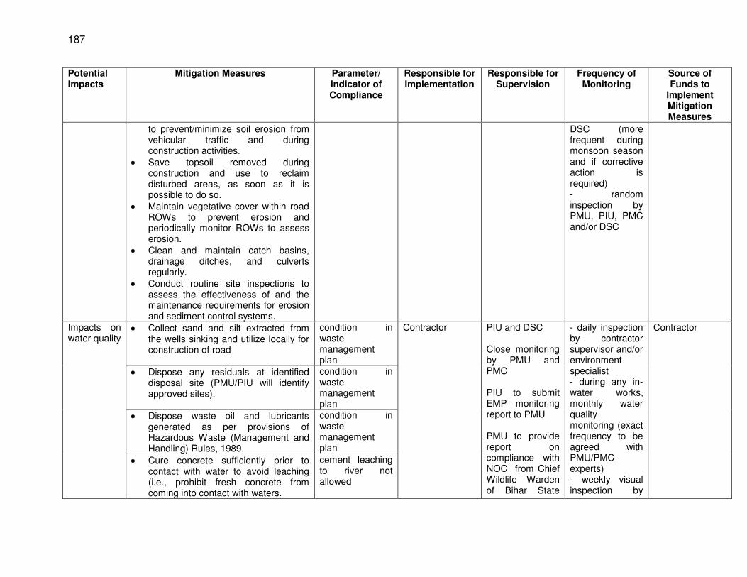
187
Potential Impacts
Mitigation Measures Parameter/ Indicator of Compliance
Responsible for Implementation
Responsible for Supervision
Frequency of Monitoring
Source of Funds to
Implement Mitigation Measures
to prevent/minimize soil erosion from vehicular traffic and during construction activities.
Save topsoil removed during construction and use to reclaim disturbed areas, as soon as it is possible to do so.
Maintain vegetative cover within road ROWs to prevent erosion and periodically monitor ROWs to assess erosion.
Clean and maintain catch basins, drainage ditches, and culverts regularly.
Conduct routine site inspections to assess the effectiveness of and the maintenance requirements for erosion and sediment control systems.
DSC (more frequent during monsoon season and if corrective action is required) - random inspection by PMU, PIU, PMC and/or DSC
Impacts on water quality
Collect sand and silt extracted from the wells sinking and utilize locally for construction of road
condition in waste management plan
Contractor PIU and DSC Close monitoring by PMU and PMC PIU to submit EMP monitoring report to PMU PMU to provide report on compliance with NOC from Chief Wildlife Warden of Bihar State
- daily inspection by contractor supervisor and/or environment specialist - during any in-water works, monthly water quality monitoring (exact frequency to be agreed with PMU/PMC experts) - weekly visual inspection by
Contractor
Dispose any residuals at identified disposal site (PMU/PIU will identify approved sites).
condition in waste management plan
Dispose waste oil and lubricants generated as per provisions of Hazardous Waste (Management and Handling) Rules, 1989.
condition in waste management plan
Cure concrete sufficiently prior to contact with water to avoid leaching (i.e., prohibit fresh concrete from coming into contact with waters.
cement leaching to river not allowed
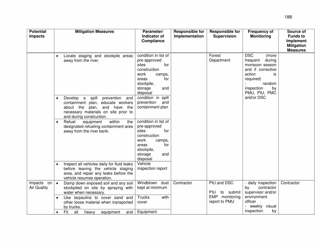
188
Potential Impacts
Mitigation Measures Parameter/ Indicator of Compliance
Responsible for Implementation
Responsible for Supervision
Frequency of Monitoring
Source of Funds to
Implement Mitigation Measures
Locate staging and stockpile areas away from the river.
condition in list of pre-approved sites for construction work camps, areas for stockpile, storage and disposal
Forest Department
DSC (more frequent during monsoon season and if corrective action is required) - random inspection by PMU, PIU, PMC and/or DSC Develop a spill prevention and
containment plan, educate workers about the plan, and have the necessary materials on site prior to and during construction.
condition in spill prevention and containment plan
Refuel equipment within the designated refueling containment area away from the river bank.
condition in list of pre-approved sites for construction work camps, areas for stockpile, storage and disposal
Inspect all vehicles daily for fluid leaks before leaving the vehicle staging area, and repair any leaks before the vehicle resumes operation.
Vehicle inspection report
Impacts on Air Quality
Damp down exposed soil and any soil stockpiled on site by spraying with water when necessary.
Windblown dust kept at minimum
Contractor PIU and DSC PIU to submit EMP monitoring report to PMU
- daily inspection by contractor supervisor and/or environment officer - weekly visual inspection by
Contractor
Use tarpaulins to cover sand and other loose material when transported by trucks.
Trucks with cover
Fit all heavy equipment and Equipment
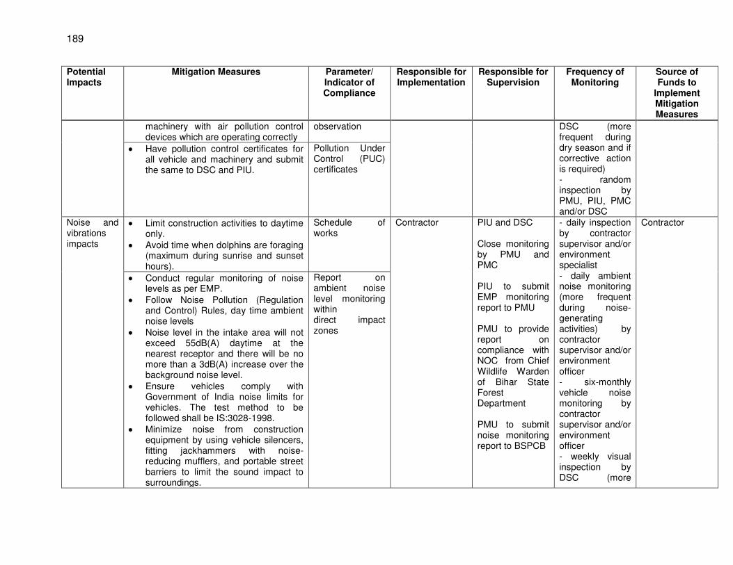
189
Potential Impacts
Mitigation Measures Parameter/ Indicator of Compliance
Responsible for Implementation
Responsible for Supervision
Frequency of Monitoring
Source of Funds to
Implement Mitigation Measures
machinery with air pollution control devices which are operating correctly
observation DSC (more frequent during dry season and if corrective action is required) - random inspection by PMU, PIU, PMC and/or DSC
Have pollution control certificates for all vehicle and machinery and submit the same to DSC and PIU.
Pollution Under Control (PUC) certificates
Noise and vibrations impacts
Limit construction activities to daytime only.
Avoid time when dolphins are foraging (maximum during sunrise and sunset hours).
Schedule of works
Contractor
PIU and DSC Close monitoring by PMU and PMC PIU to submit EMP monitoring report to PMU PMU to provide report on compliance with NOC from Chief Wildlife Warden of Bihar State Forest Department PMU to submit noise monitoring report to BSPCB
- daily inspection by contractor supervisor and/or environment specialist - daily ambient noise monitoring (more frequent during noise-generating activities) by contractor supervisor and/or environment officer - six-monthly vehicle noise monitoring by contractor supervisor and/or environment officer - weekly visual inspection by DSC (more
Contractor
Conduct regular monitoring of noise levels as per EMP.
Follow Noise Pollution (Regulation and Control) Rules, day time ambient noise levels
Noise level in the intake area will not exceed 55dB(A) daytime at the nearest receptor and there will be no more than a 3dB(A) increase over the background noise level.
Ensure vehicles comply with Government of India noise limits for vehicles. The test method to be followed shall be IS:3028-1998.
Minimize noise from construction equipment by using vehicle silencers, fitting jackhammers with noise-reducing mufflers, and portable street barriers to limit the sound impact to surroundings.
Report on ambient noise level monitoring within direct impact zones
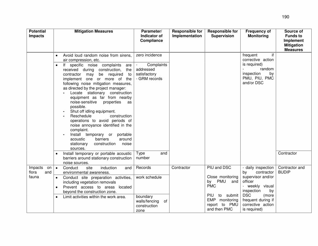
190
Potential Impacts
Mitigation Measures Parameter/ Indicator of Compliance
Responsible for Implementation
Responsible for Supervision
Frequency of Monitoring
Source of Funds to
Implement Mitigation Measures
Avoid loud random noise from sirens, air compression, etc.
zero incidence frequent if corrective action is required) - random inspection by PMU, PIU, PMC and/or DSC
If specific noise complaints are received during construction, the contractor may be required to implement one or more of the following noise mitigation measures, as directed by the project manager: - Locate stationary construction
equipment as far from nearby noise-sensitive properties as possible.
- Shut off idling equipment. - Reschedule construction
operations to avoid periods of noise annoyance identified in the complaint.
- Install temporary or portable acoustic barriers around stationary construction noise sources.
- Complaints addressed satisfactory - GRM records
Install temporary or portable acoustic barriers around stationary construction noise sources.
Type and number
Contractor
Impacts on flora and fauna
Conduct site induction and environmental awareness.
Records Contractor PIU and DSC Close monitoring by PMU and PMC PIU to submit EMP monitoring report to PMU and then PMC
- daily inspection by contractor supervisor and/or officer - weekly visual inspection by DSC (more frequent during if corrective action is required)
Contractor and BUDIP
Conduct site preparation activities, including vegetation removals
Prevent access to areas located beyond the construction zone.
work schedule
Limit activities within the work area. boundary walls/fencing of construction zone
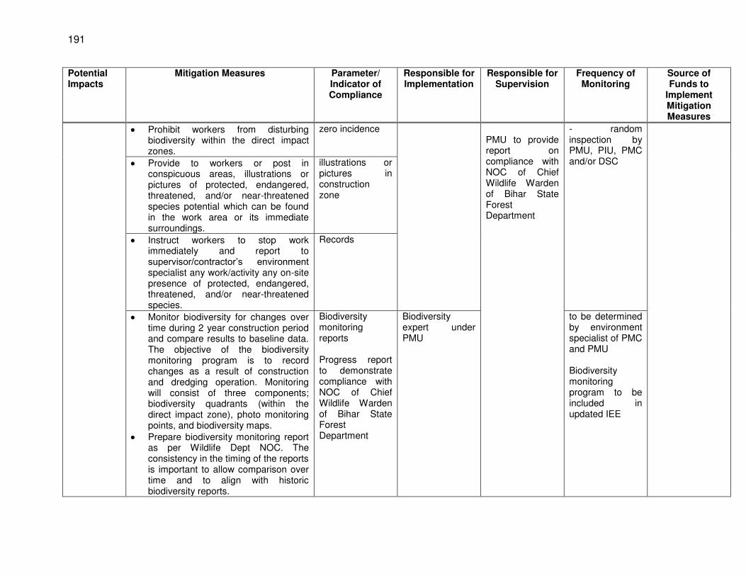
191
Potential Impacts
Mitigation Measures Parameter/ Indicator of Compliance
Responsible for Implementation
Responsible for Supervision
Frequency of Monitoring
Source of Funds to
Implement Mitigation Measures
Prohibit workers from disturbing biodiversity within the direct impact zones.
zero incidence PMU to provide report on compliance with NOC of Chief Wildlife Warden of Bihar State Forest Department
- random inspection by PMU, PIU, PMC and/or DSC Provide to workers or post in
conspicuous areas, illustrations or pictures of protected, endangered, threatened, and/or near-threatened species potential which can be found in the work area or its immediate surroundings.
illustrations or pictures in construction zone
Instruct workers to stop work immediately and report to supervisor/contractor’s environment specialist any work/activity any on-site presence of protected, endangered, threatened, and/or near-threatened species.
Records
Monitor biodiversity for changes over time during 2 year construction period and compare results to baseline data. The objective of the biodiversity monitoring program is to record changes as a result of construction and dredging operation. Monitoring will consist of three components; biodiversity quadrants (within the direct impact zone), photo monitoring points, and biodiversity maps.
Prepare biodiversity monitoring report as per Wildlife Dept NOC. The consistency in the timing of the reports is important to allow comparison over time and to align with historic biodiversity reports.
Biodiversity monitoring reports Progress report to demonstrate compliance with NOC of Chief Wildlife Warden of Bihar State Forest Department
Biodiversity expert under PMU
to be determined by environment specialist of PMC and PMU Biodiversity monitoring program to be included in updated IEE
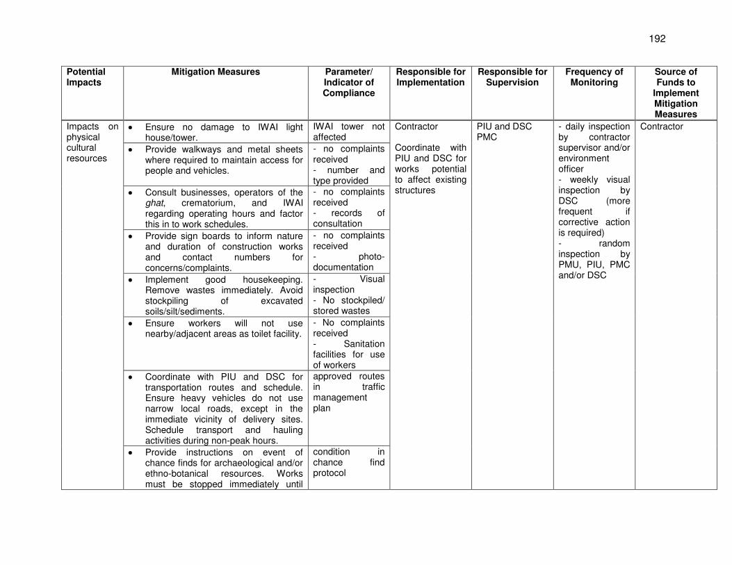
192
Potential Impacts
Mitigation Measures Parameter/ Indicator of Compliance
Responsible for Implementation
Responsible for Supervision
Frequency of Monitoring
Source of Funds to
Implement Mitigation Measures
Impacts on physical cultural resources
Ensure no damage to IWAI light house/tower.
IWAI tower not affected
Contractor Coordinate with PIU and DSC for works potential to affect existing structures
PIU and DSC PMC
- daily inspection by contractor supervisor and/or environment officer - weekly visual inspection by DSC (more frequent if corrective action is required) - random inspection by PMU, PIU, PMC and/or DSC
Contractor
Provide walkways and metal sheets where required to maintain access for people and vehicles.
- no complaints received - number and type provided
Consult businesses, operators of the ghat, crematorium, and IWAI regarding operating hours and factor this in to work schedules.
- no complaints received - records of consultation
Provide sign boards to inform nature and duration of construction works and contact numbers for concerns/complaints.
- no complaints received - photo-documentation
Implement good housekeeping. Remove wastes immediately. Avoid stockpiling of excavated soils/silt/sediments.
- Visual inspection - No stockpiled/ stored wastes
Ensure workers will not use nearby/adjacent areas as toilet facility.
- No complaints received - Sanitation facilities for use of workers
Coordinate with PIU and DSC for transportation routes and schedule. Ensure heavy vehicles do not use narrow local roads, except in the immediate vicinity of delivery sites. Schedule transport and hauling activities during non-peak hours.
approved routes in traffic management plan
Provide instructions on event of chance finds for archaeological and/or ethno-botanical resources. Works must be stopped immediately until
condition in chance find protocol
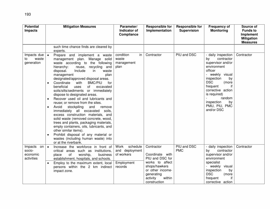
193
Potential Impacts
Mitigation Measures Parameter/ Indicator of Compliance
Responsible for Implementation
Responsible for Supervision
Frequency of Monitoring
Source of Funds to
Implement Mitigation Measures
such time chance finds are cleared by experts.
Impacts due to waste generation
Prepare and implement a waste management plan. Manage solid waste according to the following hierarchy: reuse, recycling and disposal. Include in waste management plan designated/approved disposal areas.
Coordinate with BMC/PIU for beneficial uses of excavated soils/silts/sediments or immediately dispose to designated areas.
Recover used oil and lubricants and reuse; or remove from the sites.
Avoid stockpiling and remove immediately all excavated soils, excess construction materials, and solid waste (removed concrete, wood, trees and plants, packaging materials, empty containers, oils, lubricants, and other similar items).
Prohibit disposal of any material or wastes (including human waste) into or at the riverbank.
condition in waste management plan
Contractor PIU and DSC - daily inspection by contractor supervisor and/or environment officer - weekly visual inspection by DSC (more frequent if corrective action is required) - random inspection by PMU, PIU, PMC and/or DSC
Contractor
Impacts on socio-economic activities
Increase the workforce in front of critical areas such as institutions, place of worship, business establishment, hospitals, and schools.
Work schedule and deployment of workers
Contractor Coordinate with PIU and DSC for works to affect shops/hawkers or other income-generating activity within construction
PIU and DSC PMC
- daily inspection by contractor supervisor and/or environment specialist - weekly visual inspection by DSC (more frequent if corrective action
Contractor
Employ to the maximum extent, local persons within the 2 km indirect impact zone.
Employment records
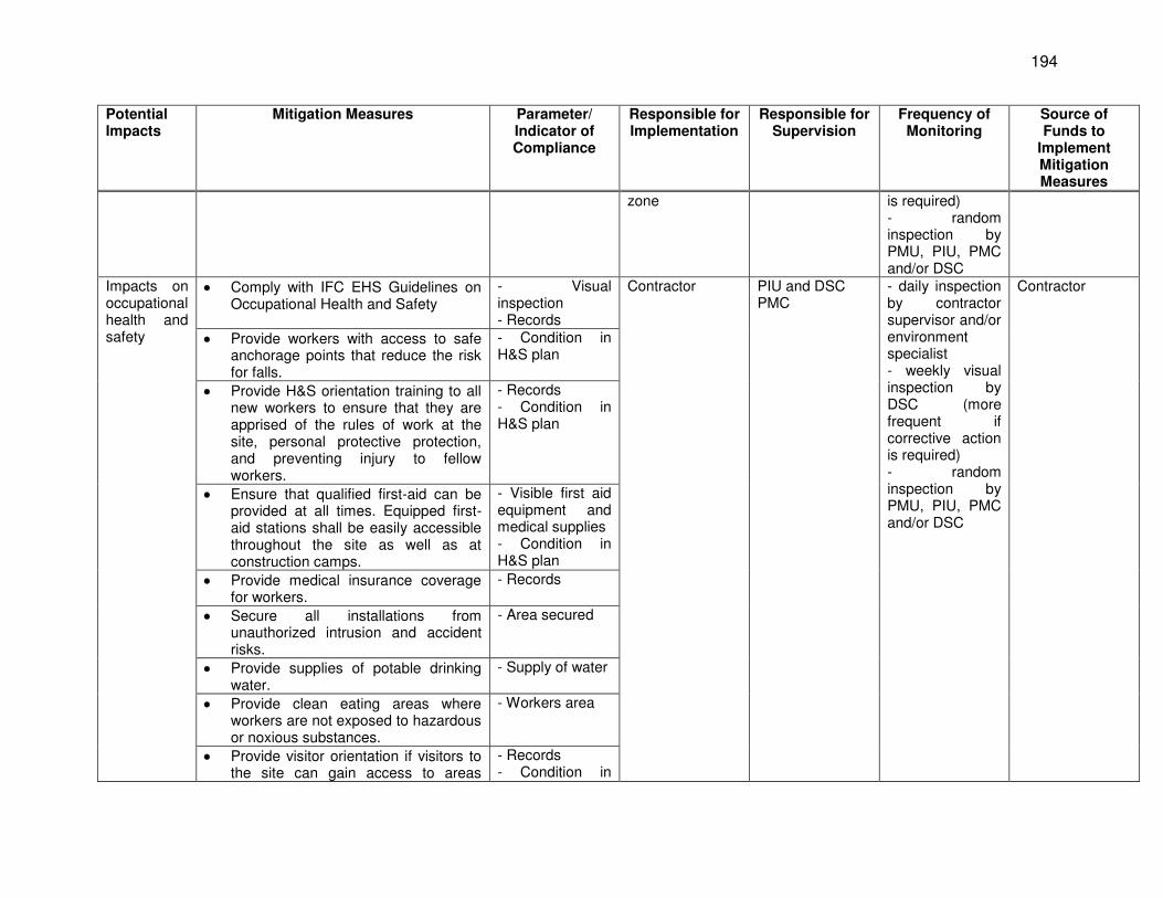
194
Potential Impacts
Mitigation Measures Parameter/ Indicator of Compliance
Responsible for Implementation
Responsible for Supervision
Frequency of Monitoring
Source of Funds to
Implement Mitigation Measures
zone is required) - random inspection by PMU, PIU, PMC and/or DSC
Impacts on occupational health and safety
Comply with IFC EHS Guidelines on Occupational Health and Safety
- Visual inspection - Records
Contractor PIU and DSC PMC
- daily inspection by contractor supervisor and/or environment specialist - weekly visual inspection by DSC (more frequent if corrective action is required) - random inspection by PMU, PIU, PMC and/or DSC
Contractor
Provide workers with access to safe anchorage points that reduce the risk for falls.
- Condition in H&S plan
Provide H&S orientation training to all new workers to ensure that they are apprised of the rules of work at the site, personal protective protection, and preventing injury to fellow workers.
- Records - Condition in H&S plan
Ensure that qualified first-aid can be provided at all times. Equipped first-aid stations shall be easily accessible throughout the site as well as at construction camps.
- Visible first aid equipment and medical supplies - Condition in H&S plan
Provide medical insurance coverage for workers.
- Records
Secure all installations from unauthorized intrusion and accident risks.
- Area secured
Provide supplies of potable drinking water.
- Supply of water
Provide clean eating areas where workers are not exposed to hazardous or noxious substances.
- Workers area
Provide visitor orientation if visitors to the site can gain access to areas
- Records - Condition in
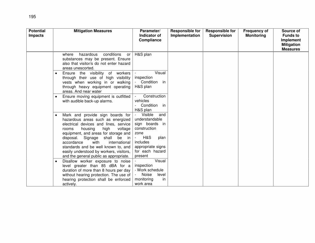
195
Potential Impacts
Mitigation Measures Parameter/ Indicator of Compliance
Responsible for Implementation
Responsible for Supervision
Frequency of Monitoring
Source of Funds to
Implement Mitigation Measures
where hazardous conditions or substances may be present. Ensure also that visitor/s do not enter hazard areas unescorted.
H&S plan
Ensure the visibility of workers through their use of high visibility vests when working in or walking through heavy equipment operating areas. And near water
- Visual inspection - Condition in H&S plan
Ensure moving equipment is outfitted with audible back-up alarms.
- Construction vehicles - Condition in H&S plan
Mark and provide sign boards for hazardous areas such as energized electrical devices and lines, service rooms housing high voltage equipment, and areas for storage and disposal. Signage shall be in accordance with international standards and be well known to, and easily understood by workers, visitors, and the general public as appropriate.
- Visible and understandable sign boards in construction zone - H&S plan includes appropriate signs for each hazard present
Disallow worker exposure to noise level greater than 85 dBA for a duration of more than 8 hours per day without hearing protection. The use of hearing protection shall be enforced actively.
- Visual inspection - Work schedule - Noise level monitoring in work area
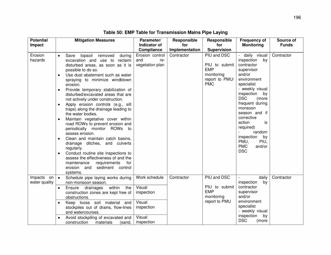
196
Table 50: EMP Table for Transmission Mains Pipe Laying
Potential Impact
Mitigation Measures Parameter/ Indicator of Compliance
Responsible for
Implementation
Responsible for
Supervision
Frequency of Monitoring
Source of Funds
Erosion hazards
Save topsoil removed during excavation and use to reclaim disturbed areas, as soon as it is possible to do so.
Use dust abatement such as water spraying to minimize windblown erosion.
Provide temporary stabilization of disturbed/excavated areas that are not actively under construction.
Apply erosion controls (e.g., silt traps) along the drainage leading to the water bodies.
Maintain vegetative cover within road ROWs to prevent erosion and periodically monitor ROWs to assess erosion.
Clean and maintain catch basins, drainage ditches, and culverts regularly.
Conduct routine site inspections to assess the effectiveness of and the maintenance requirements for erosion and sediment control systems.
Erosion control and re-vegetation plan
Contractor PIU and DSC PIU to submit EMP monitoring report to PMU/ PMC
- daily visual inspection by contractor supervisor and/or environment specialist - weekly visual inspection by DSC (more frequent during monsoon season and if corrective action is required) - random inspection by PMU, PIU, PMC and/or DSC
Contractor
Impacts on water quality
Schedule pipe laying works during non-monsoon season.
Work schedule Contractor PIU and DSC PIU to submit EMP monitoring report to PMU
- daily inspection by contractor supervisor and/or environment specialist - weekly visual inspection by DSC (more
Contractor
Ensure drainages within the construction zones are kept free of obstructions.
Visual inspection
Keep loose soil material and stockpiles out of drains, flow-lines and watercourses.
Visual inspection
Avoid stockpiling of excavated and construction materials (sand,
Visual inspection
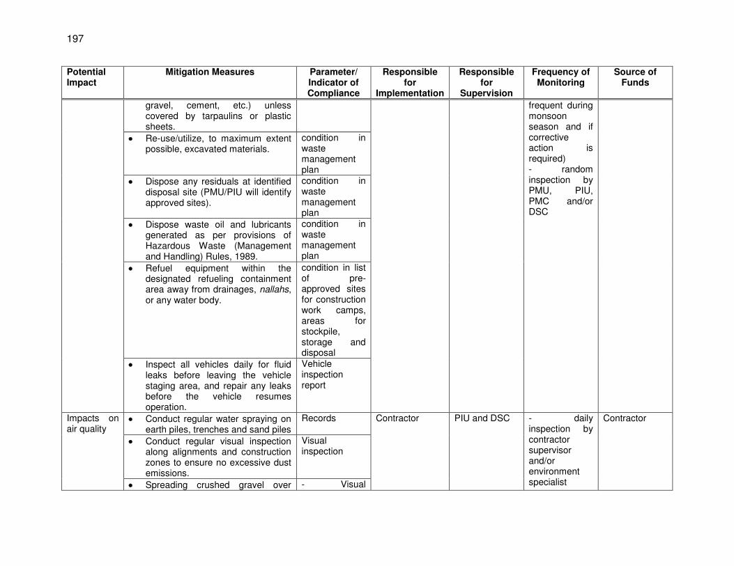
197
Potential Impact
Mitigation Measures Parameter/ Indicator of Compliance
Responsible for
Implementation
Responsible for
Supervision
Frequency of Monitoring
Source of Funds
gravel, cement, etc.) unless covered by tarpaulins or plastic sheets.
frequent during monsoon season and if corrective action is required) - random inspection by PMU, PIU, PMC and/or DSC
Re-use/utilize, to maximum extent possible, excavated materials.
condition in waste management plan
Dispose any residuals at identified disposal site (PMU/PIU will identify approved sites).
condition in waste management plan
Dispose waste oil and lubricants generated as per provisions of Hazardous Waste (Management and Handling) Rules, 1989.
condition in waste management plan
Refuel equipment within the designated refueling containment area away from drainages, nallahs, or any water body.
condition in list of pre-approved sites for construction work camps, areas for stockpile, storage and disposal
Inspect all vehicles daily for fluid leaks before leaving the vehicle staging area, and repair any leaks before the vehicle resumes operation.
Vehicle inspection report
Impacts on air quality
Conduct regular water spraying on earth piles, trenches and sand piles
Records Contractor PIU and DSC - daily inspection by contractor supervisor and/or environment specialist
Contractor
Conduct regular visual inspection along alignments and construction zones to ensure no excessive dust emissions.
Visual inspection
Spreading crushed gravel over - Visual
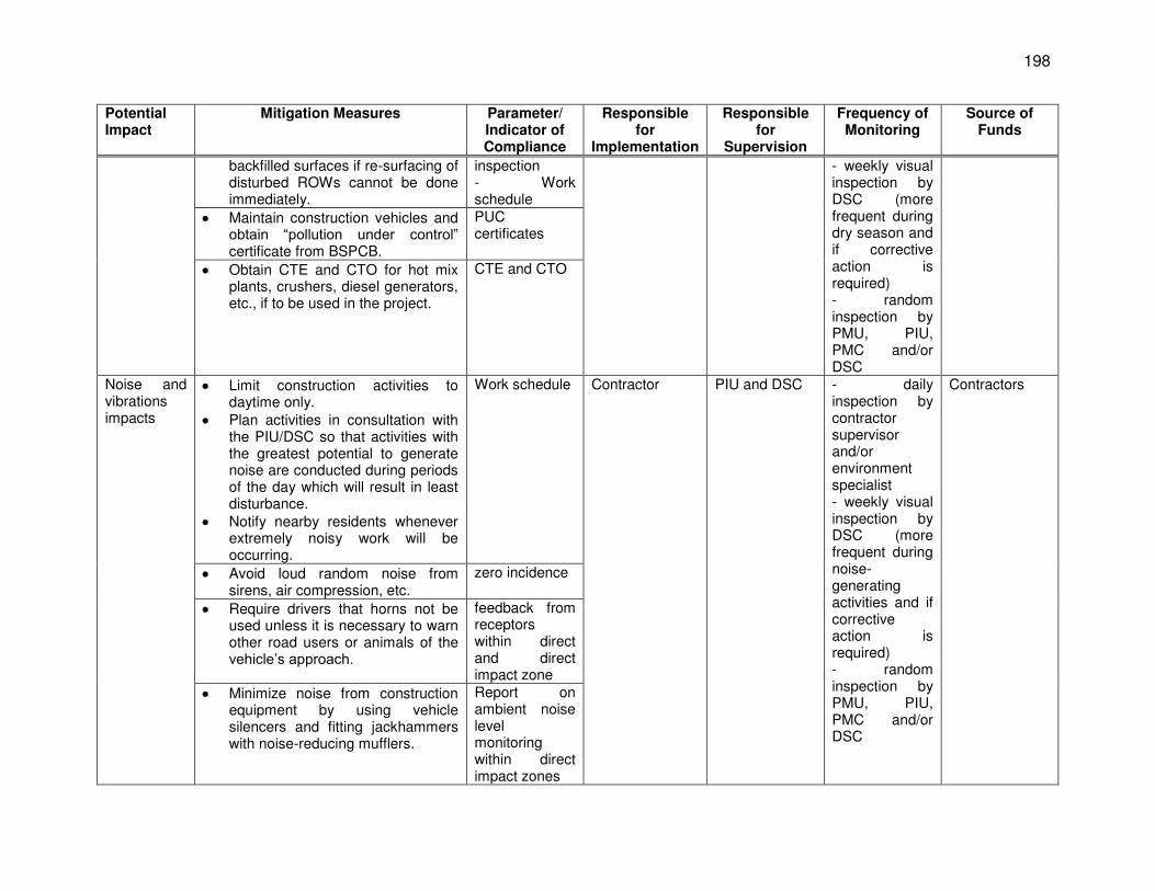
198
Potential Impact
Mitigation Measures Parameter/ Indicator of Compliance
Responsible for
Implementation
Responsible for
Supervision
Frequency of Monitoring
Source of Funds
backfilled surfaces if re-surfacing of disturbed ROWs cannot be done immediately.
inspection - Work schedule
- weekly visual inspection by DSC (more frequent during dry season and if corrective action is required) - random inspection by PMU, PIU, PMC and/or DSC
Maintain construction vehicles and obtain “pollution under control” certificate from BSPCB.
PUC certificates
Obtain CTE and CTO for hot mix plants, crushers, diesel generators, etc., if to be used in the project.
CTE and CTO
Noise and vibrations impacts
Limit construction activities to daytime only.
Plan activities in consultation with the PIU/DSC so that activities with the greatest potential to generate noise are conducted during periods of the day which will result in least disturbance.
Notify nearby residents whenever extremely noisy work will be occurring.
Work schedule Contractor PIU and DSC - daily inspection by contractor supervisor and/or environment specialist - weekly visual inspection by DSC (more frequent during noise-generating activities and if corrective action is required) - random inspection by PMU, PIU, PMC and/or DSC
Contractors
Avoid loud random noise from sirens, air compression, etc.
zero incidence
Require drivers that horns not be used unless it is necessary to warn other road users or animals of the vehicle’s approach.
feedback from receptors within direct and direct impact zone
Minimize noise from construction equipment by using vehicle silencers and fitting jackhammers with noise-reducing mufflers.
Report on ambient noise level monitoring within direct impact zones
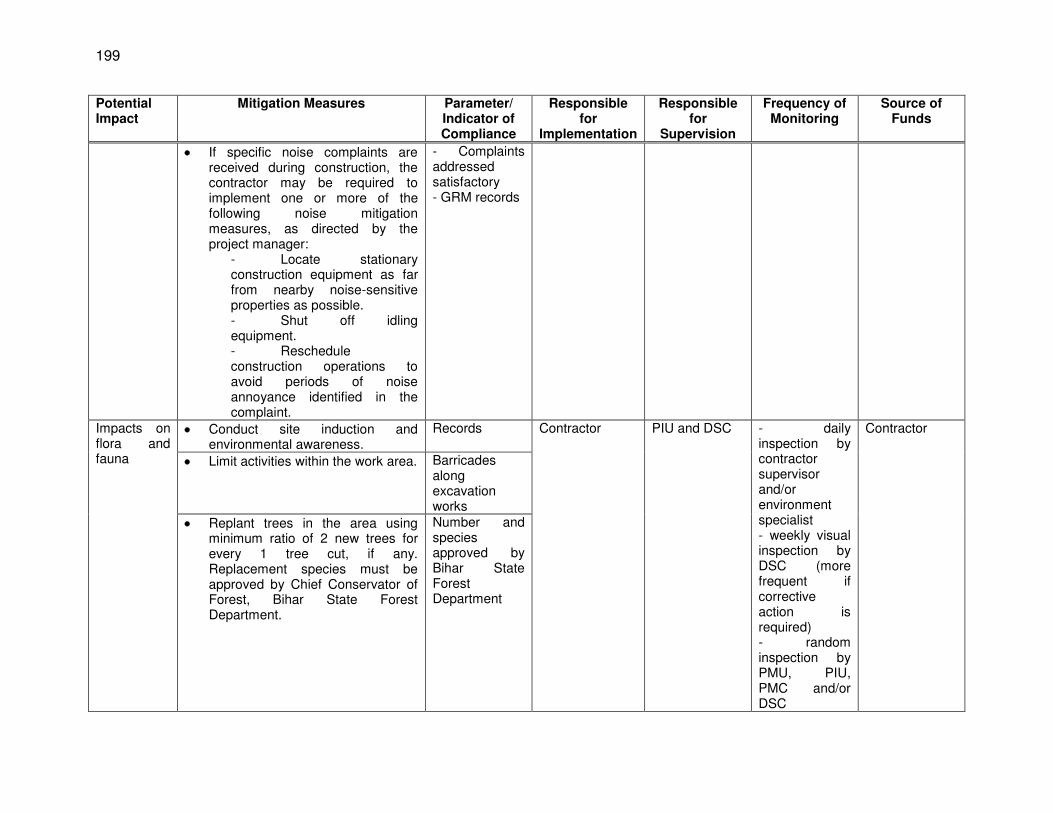
199
Potential Impact
Mitigation Measures Parameter/ Indicator of Compliance
Responsible for
Implementation
Responsible for
Supervision
Frequency of Monitoring
Source of Funds
If specific noise complaints are received during construction, the contractor may be required to implement one or more of the following noise mitigation measures, as directed by the project manager:
- Locate stationary construction equipment as far from nearby noise-sensitive properties as possible. - Shut off idling equipment. - Reschedule construction operations to avoid periods of noise annoyance identified in the complaint.
- Complaints addressed satisfactory - GRM records
Impacts on flora and fauna
Conduct site induction and environmental awareness.
Records Contractor PIU and DSC - daily inspection by contractor supervisor and/or environment specialist - weekly visual inspection by DSC (more frequent if corrective action is required) - random inspection by PMU, PIU, PMC and/or DSC
Contractor
Limit activities within the work area. Barricades along excavation works
Replant trees in the area using minimum ratio of 2 new trees for every 1 tree cut, if any. Replacement species must be approved by Chief Conservator of Forest, Bihar State Forest Department.
Number and species approved by Bihar State Forest Department
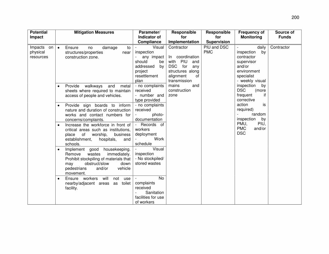
200
Potential Impact
Mitigation Measures Parameter/ Indicator of Compliance
Responsible for
Implementation
Responsible for
Supervision
Frequency of Monitoring
Source of Funds
Impacts on physical resources
Ensure no damage to structures/properties near construction zone.
- Visual inspection - any impact should be addressed by project resettlement plan
Contractor In coordination with PIU and DSC for any structures along alignment of transmission mains and construction zone
PIU and DSC PMC
- daily inspection by contractor supervisor and/or environment specialist - weekly visual inspection by DSC (more frequent if corrective action is required) - random inspection by PMU, PIU, PMC and/or DSC
Contractor
Provide walkways and metal sheets where required to maintain access of people and vehicles.
- no complaints received - number and type provided
Provide sign boards to inform nature and duration of construction works and contact numbers for concerns/complaints.
- no complaints received - photo-documentation
Increase the workforce in front of critical areas such as institutions, place of worship, business establishment, hospitals, and schools.
- Records of workers deployment - Work schedule
Implement good housekeeping. Remove wastes immediately. Prohibit stockpiling of materials that may obstruct/slow down pedestrians and/or vehicle movement.
- Visual inspection - No stockpiled/ stored wastes
Ensure workers will not use nearby/adjacent areas as toilet facility.
- No complaints received - Sanitation facilities for use of workers
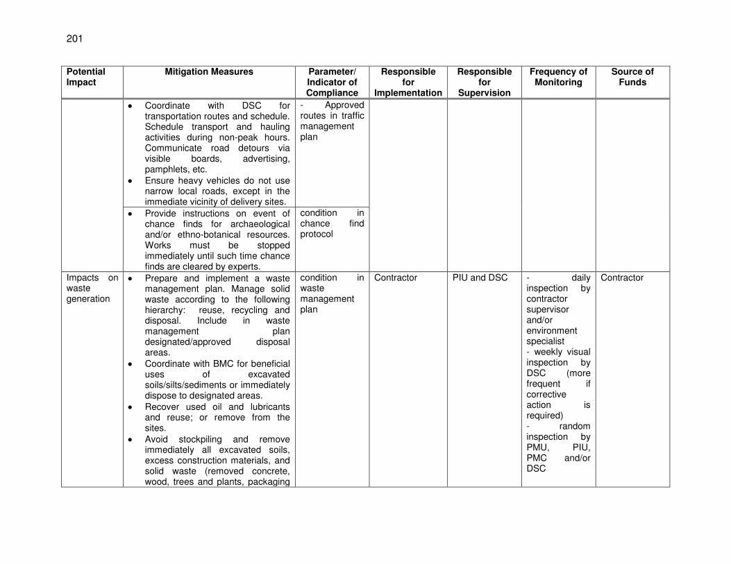
201
Potential Impact
Mitigation Measures Parameter/ Indicator of Compliance
Responsible for
Implementation
Responsible for
Supervision
Frequency of Monitoring
Source of Funds
Coordinate with DSC for transportation routes and schedule. Schedule transport and hauling activities during non-peak hours. Communicate road detours via visible boards, advertising, pamphlets, etc.
Ensure heavy vehicles do not use narrow local roads, except in the immediate vicinity of delivery sites.
- Approved routes in traffic management plan
Provide instructions on event of chance finds for archaeological and/or ethno-botanical resources. Works must be stopped immediately until such time chance finds are cleared by experts.
condition in chance find protocol
Impacts on waste generation
Prepare and implement a waste management plan. Manage solid waste according to the following hierarchy: reuse, recycling and disposal. Include in waste management plan designated/approved disposal areas.
Coordinate with BMC for beneficial uses of excavated soils/silts/sediments or immediately dispose to designated areas.
Recover used oil and lubricants and reuse; or remove from the sites.
Avoid stockpiling and remove immediately all excavated soils, excess construction materials, and solid waste (removed concrete, wood, trees and plants, packaging
condition in waste management plan
Contractor PIU and DSC - daily inspection by contractor supervisor and/or environment specialist - weekly visual inspection by DSC (more frequent if corrective action is required) - random inspection by PMU, PIU, PMC and/or DSC
Contractor
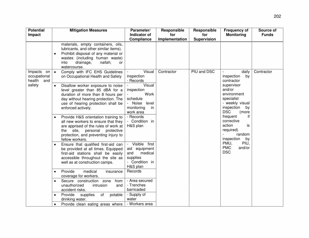
202
Potential Impact
Mitigation Measures Parameter/ Indicator of Compliance
Responsible for
Implementation
Responsible for
Supervision
Frequency of Monitoring
Source of Funds
materials, empty containers, oils, lubricants, and other similar items).
Prohibit disposal of any material or wastes (including human waste) into drainage, nallah, or watercourse.
Impacts on occupational health and safety
Comply with IFC EHS Guidelines on Occupational Health and Safety
- Visual inspection - Records
Contractor PIU and DSC - daily inspection by contractor supervisor and/or environment specialist - weekly visual inspection by DSC (more frequent if corrective action is required) - random inspection by PMU, PIU, PMC and/or DSC
Contractor
Disallow worker exposure to noise level greater than 85 dBA for a duration of more than 8 hours per day without hearing protection. The use of hearing protection shall be enforced actively.
- Visual inspection - Work schedule - Noise level monitoring in work area
Provide H&S orientation training to all new workers to ensure that they are apprised of the rules of work at the site, personal protective protection, and preventing injury to fellow workers.
- Records - Condition in H&S plan
Ensure that qualified first-aid can be provided at all times. Equipped first-aid stations shall be easily accessible throughout the site as well as at construction camps.
- Visible first aid equipment and medical supplies - Condition in H&S plan
Provide medical insurance coverage for workers.
Records
Secure construction zone from unauthorized intrusion and accident risks.
- Area secured - Trenches barricaded
Provide supplies of potable drinking water.
- Supply of water
Provide clean eating areas where - Workers area
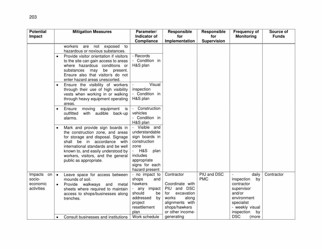
203
Potential Impact
Mitigation Measures Parameter/ Indicator of Compliance
Responsible for
Implementation
Responsible for
Supervision
Frequency of Monitoring
Source of Funds
workers are not exposed to hazardous or noxious substances.
Provide visitor orientation if visitors to the site can gain access to areas where hazardous conditions or substances may be present. Ensure also that visitor/s do not enter hazard areas unescorted.
- Records - Condition in H&S plan
Ensure the visibility of workers through their use of high visibility vests when working in or walking through heavy equipment operating areas.
- Visual inspection - Condition in H&S plan
Ensure moving equipment is outfitted with audible back-up alarms.
- Construction vehicles - Condition in H&S plan
Mark and provide sign boards in the construction zone, and areas for storage and disposal. Signage shall be in accordance with international standards and be well known to, and easily understood by workers, visitors, and the general public as appropriate.
- Visible and understandable sign boards in construction zone - H&S plan includes appropriate signs for each hazard present
Impacts on socio-economic activities
Leave space for access between mounds of soil.
Provide walkways and metal sheets where required to maintain access to shops/businesses along trenches.
- no impact to shops and hawkers - any impact should be addressed by project resettlement plan
Contractor Coordinate with PIU and DSC for excavation works along alignments with shops/hawkers or other income-generating
PIU and DSC PMC
- daily inspection by contractor supervisor and/or environment specialist - weekly visual inspection by DSC (more
Contractor
Consult businesses and institutions Work schedule
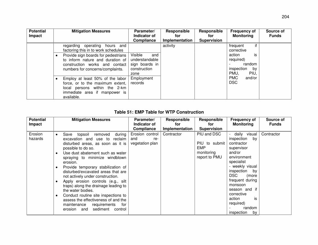
204
Potential Impact
Mitigation Measures Parameter/ Indicator of Compliance
Responsible for
Implementation
Responsible for
Supervision
Frequency of Monitoring
Source of Funds
regarding operating hours and factoring this in to work schedules
activity frequent if corrective action is required) - random inspection by PMU, PIU, PMC and/or DSC
Provide sign boards for pedestrians to inform nature and duration of construction works and contact numbers for concerns/complaints.
Visible and understandable sign boards in construction zone
Employ at least 50% of the labor force, or to the maximum extent, local persons within the 2-km immediate area if manpower is available.
Employment records
Table 51: EMP Table for WTP Construction
Potential Impact
Mitigation Measures Parameter/ Indicator of Compliance
Responsible for
Implementation
Responsible for
Supervision
Frequency of Monitoring
Source of Funds
Erosion hazards
Save topsoil removed during excavation and use to reclaim disturbed areas, as soon as it is possible to do so.
Use dust abatement such as water spraying to minimize windblown erosion.
Provide temporary stabilization of disturbed/excavated areas that are not actively under construction.
Apply erosion controls (e.g., silt traps) along the drainage leading to the water bodies.
Conduct routine site inspections to assess the effectiveness of and the maintenance requirements for erosion and sediment control
Erosion control and re-vegetation plan
Contractor PIU and DSC PIU to submit EMP monitoring report to PMU
- daily visual inspection by contractor supervisor and/or environment specialist - weekly visual inspection by DSC (more frequent during monsoon season and if corrective action is required) - random inspection by
Contractor
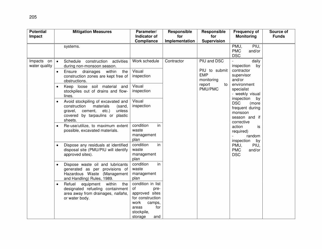
205
Potential Impact
Mitigation Measures Parameter/ Indicator of Compliance
Responsible for
Implementation
Responsible for
Supervision
Frequency of Monitoring
Source of Funds
systems. PMU, PIU, PMC and/or DSC
Impacts on water quality
Schedule construction activities during non-monsoon season.
Work schedule Contractor PIU and DSC PIU to submit EMP monitoring report to PMU/PMC
- daily inspection by contractor supervisor and/or environment specialist - weekly visual inspection by DSC (more frequent during monsoon season and if corrective action is required) - random inspection by PMU, PIU, PMC and/or DSC
Ensure drainages within the construction zones are kept free of obstructions.
Visual inspection
Keep loose soil material and stockpiles out of drains and flow-lines.
Visual inspection
Avoid stockpiling of excavated and construction materials (sand, gravel, cement, etc.) unless covered by tarpaulins or plastic sheets.
Visual inspection
Re-use/utilize, to maximum extent possible, excavated materials.
condition in waste management plan
Dispose any residuals at identified disposal site (PMU/PIU will identify approved sites).
condition in waste management plan
Dispose waste oil and lubricants generated as per provisions of Hazardous Waste (Management and Handling) Rules, 1989.
condition in waste management plan
Refuel equipment within the designated refueling containment area away from drainages, nallahs, or water body.
condition in list of pre-approved sites for construction work camps, areas for stockpile, storage and
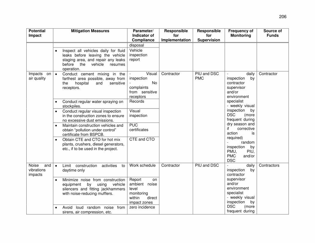
206
Potential Impact
Mitigation Measures Parameter/ Indicator of Compliance
Responsible for
Implementation
Responsible for
Supervision
Frequency of Monitoring
Source of Funds
disposal
Inspect all vehicles daily for fluid leaks before leaving the vehicle staging area, and repair any leaks before the vehicle resumes operation.
Vehicle inspection report
Impacts on air quality
Conduct cement mixing in the farthest area possible, away from the hospital and sensitive receptors.
- Visual inspection - No complaints from sensitive receptors
Contractor PIU and DSC PMC
- daily inspection by contractor supervisor and/or environment specialist - weekly visual inspection by DSC (more frequent during dry season and if corrective action is required) - random inspection by PMU, PIU, PMC and/or DSC
Contractor
Conduct regular water spraying on stockpiles.
Records
Conduct regular visual inspection in the construction zones to ensure no excessive dust emissions.
Visual inspection
Maintain construction vehicles and obtain “pollution under control” certificate from BSPCB.
PUC certificates
Obtain CTE and CTO for hot mix plants, crushers, diesel generators, etc., if to be used in the project.
CTE and CTO
Noise and vibrations impacts
Limit construction activities to daytime only
Work schedule Contractor PIU and DSC - daily inspection by contractor supervisor and/or environment specialist - weekly visual inspection by DSC (more frequent during
Contractors
Minimize noise from construction equipment by using vehicle silencers and fitting jackhammers with noise-reducing mufflers.
Report on ambient noise level monitoring within direct impact zones
Avoid loud random noise from sirens, air compression, etc.
zero incidence
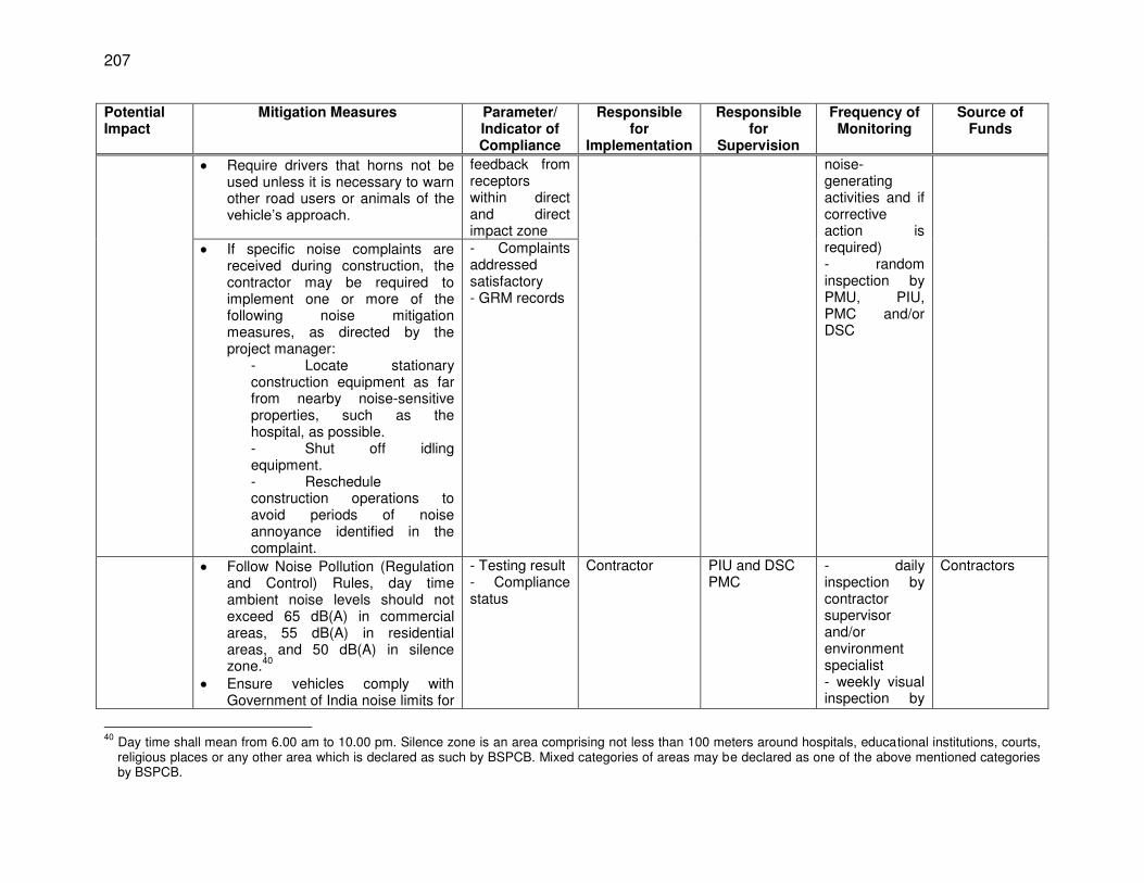
207
Potential Impact
Mitigation Measures Parameter/ Indicator of Compliance
Responsible for
Implementation
Responsible for
Supervision
Frequency of Monitoring
Source of Funds
Require drivers that horns not be used unless it is necessary to warn other road users or animals of the vehicle’s approach.
feedback from receptors within direct and direct impact zone
noise-generating activities and if corrective action is required) - random inspection by PMU, PIU, PMC and/or DSC
If specific noise complaints are received during construction, the contractor may be required to implement one or more of the following noise mitigation measures, as directed by the project manager:
- Locate stationary construction equipment as far from nearby noise-sensitive properties, such as the hospital, as possible. - Shut off idling equipment. - Reschedule construction operations to avoid periods of noise annoyance identified in the complaint.
- Complaints addressed satisfactory - GRM records
Follow Noise Pollution (Regulation and Control) Rules, day time ambient noise levels should not exceed 65 dB(A) in commercial areas, 55 dB(A) in residential areas, and 50 dB(A) in silence zone.
40
Ensure vehicles comply with Government of India noise limits for
- Testing result - Compliance status
Contractor PIU and DSC PMC
- daily inspection by contractor supervisor and/or environment specialist - weekly visual inspection by
Contractors
40
Day time shall mean from 6.00 am to 10.00 pm. Silence zone is an area comprising not less than 100 meters around hospitals, educational institutions, courts, religious places or any other area which is declared as such by BSPCB. Mixed categories of areas may be declared as one of the above mentioned categories by BSPCB.
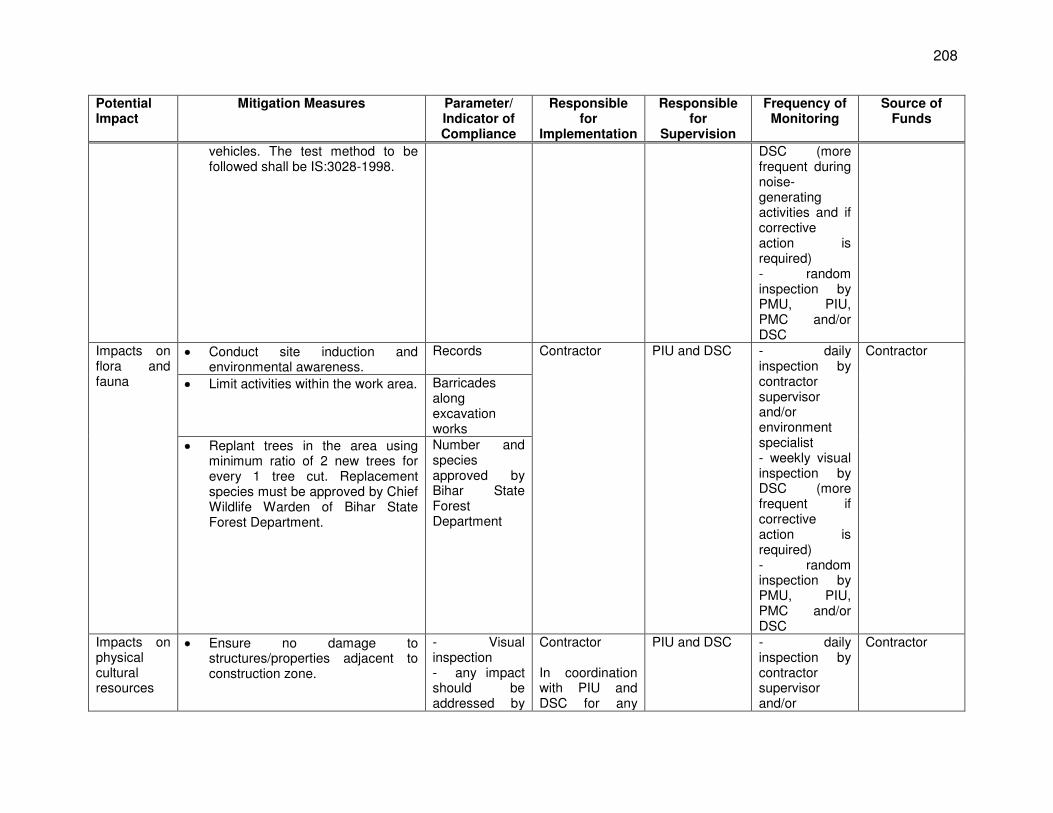
208
Potential Impact
Mitigation Measures Parameter/ Indicator of Compliance
Responsible for
Implementation
Responsible for
Supervision
Frequency of Monitoring
Source of Funds
vehicles. The test method to be followed shall be IS:3028-1998.
DSC (more frequent during noise-generating activities and if corrective action is required) - random inspection by PMU, PIU, PMC and/or DSC
Impacts on flora and fauna
Conduct site induction and environmental awareness.
Records Contractor PIU and DSC - daily inspection by contractor supervisor and/or environment specialist - weekly visual inspection by DSC (more frequent if corrective action is required) - random inspection by PMU, PIU, PMC and/or DSC
Contractor
Limit activities within the work area. Barricades along excavation works
Replant trees in the area using minimum ratio of 2 new trees for every 1 tree cut. Replacement species must be approved by Chief Wildlife Warden of Bihar State Forest Department.
Number and species approved by Bihar State Forest Department
Impacts on physical cultural resources
Ensure no damage to structures/properties adjacent to construction zone.
- Visual inspection - any impact should be addressed by
Contractor In coordination with PIU and DSC for any
PIU and DSC - daily inspection by contractor supervisor and/or
Contractor
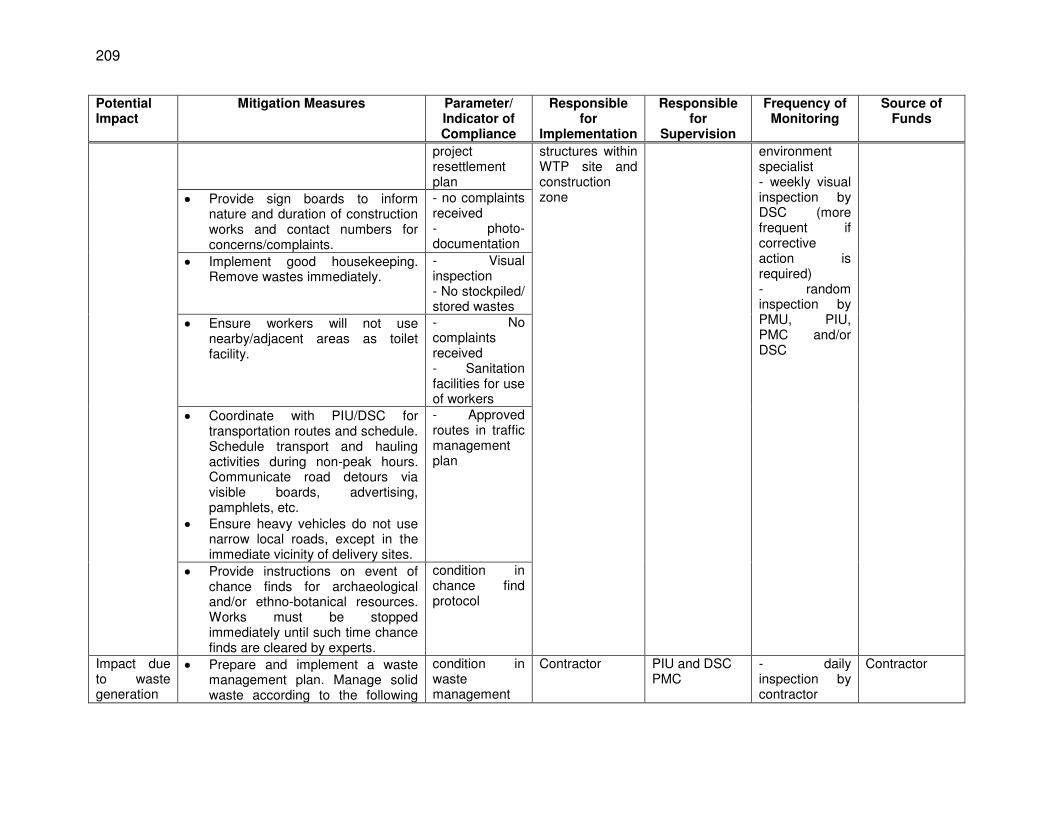
209
Potential Impact
Mitigation Measures Parameter/ Indicator of Compliance
Responsible for
Implementation
Responsible for
Supervision
Frequency of Monitoring
Source of Funds
project resettlement plan
structures within WTP site and construction zone
environment specialist - weekly visual inspection by DSC (more frequent if corrective action is required) - random inspection by PMU, PIU, PMC and/or DSC
Provide sign boards to inform nature and duration of construction works and contact numbers for concerns/complaints.
- no complaints received - photo-documentation
Implement good housekeeping. Remove wastes immediately.
- Visual inspection - No stockpiled/ stored wastes
Ensure workers will not use nearby/adjacent areas as toilet facility.
- No complaints received - Sanitation facilities for use of workers
Coordinate with PIU/DSC for transportation routes and schedule. Schedule transport and hauling activities during non-peak hours. Communicate road detours via visible boards, advertising, pamphlets, etc.
Ensure heavy vehicles do not use narrow local roads, except in the immediate vicinity of delivery sites.
- Approved routes in traffic management plan
Provide instructions on event of chance finds for archaeological and/or ethno-botanical resources. Works must be stopped immediately until such time chance finds are cleared by experts.
condition in chance find protocol
Impact due to waste generation
Prepare and implement a waste management plan. Manage solid waste according to the following
condition in waste management
Contractor PIU and DSC PMC
- daily inspection by contractor
Contractor
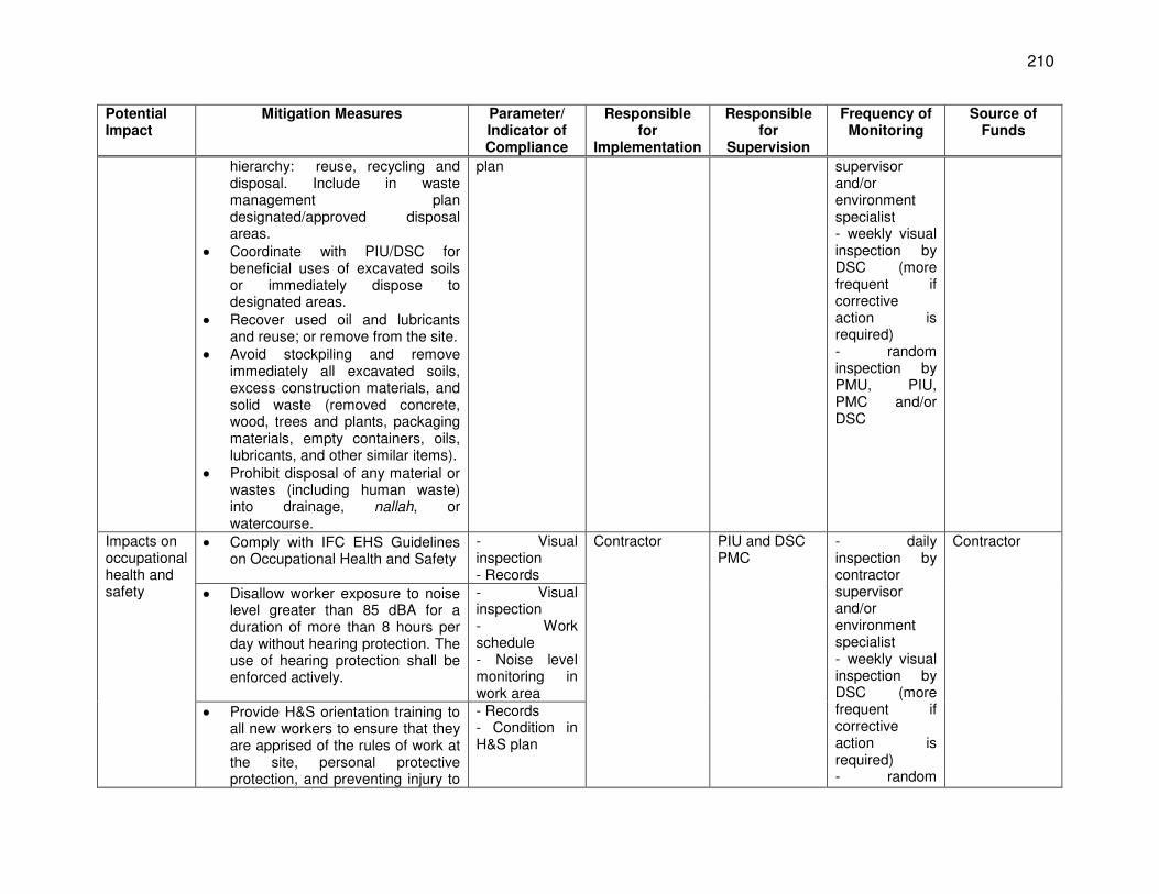
210
Potential Impact
Mitigation Measures Parameter/ Indicator of Compliance
Responsible for
Implementation
Responsible for
Supervision
Frequency of Monitoring
Source of Funds
hierarchy: reuse, recycling and disposal. Include in waste management plan designated/approved disposal areas.
Coordinate with PIU/DSC for beneficial uses of excavated soils or immediately dispose to designated areas.
Recover used oil and lubricants and reuse; or remove from the site.
Avoid stockpiling and remove immediately all excavated soils, excess construction materials, and solid waste (removed concrete, wood, trees and plants, packaging materials, empty containers, oils, lubricants, and other similar items).
Prohibit disposal of any material or wastes (including human waste) into drainage, nallah, or watercourse.
plan supervisor and/or environment specialist - weekly visual inspection by DSC (more frequent if corrective action is required) - random inspection by PMU, PIU, PMC and/or DSC
Impacts on occupational health and safety
Comply with IFC EHS Guidelines on Occupational Health and Safety
- Visual inspection - Records
Contractor PIU and DSC PMC
- daily inspection by contractor supervisor and/or environment specialist - weekly visual inspection by DSC (more frequent if corrective action is required) - random
Contractor
Disallow worker exposure to noise level greater than 85 dBA for a duration of more than 8 hours per day without hearing protection. The use of hearing protection shall be enforced actively.
- Visual inspection - Work schedule - Noise level monitoring in work area
Provide H&S orientation training to all new workers to ensure that they are apprised of the rules of work at the site, personal protective protection, and preventing injury to
- Records - Condition in H&S plan
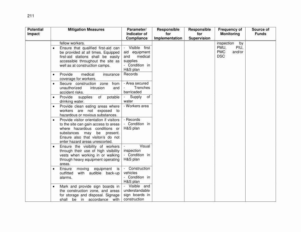
211
Potential Impact
Mitigation Measures Parameter/ Indicator of Compliance
Responsible for
Implementation
Responsible for
Supervision
Frequency of Monitoring
Source of Funds
fellow workers. inspection by PMU, PIU, PMC and/or DSC
Ensure that qualified first-aid can be provided at all times. Equipped first-aid stations shall be easily accessible throughout the site as well as at construction camps.
- Visible first aid equipment and medical supplies - Condition in H&S plan
Provide medical insurance coverage for workers.
Records
Secure construction zone from unauthorized intrusion and accident risks.
- Area secured - Trenches barricaded
Provide supplies of potable drinking water.
- Supply of water
Provide clean eating areas where workers are not exposed to hazardous or noxious substances.
- Workers area
Provide visitor orientation if visitors to the site can gain access to areas where hazardous conditions or substances may be present. Ensure also that visitor/s do not enter hazard areas unescorted.
- Records - Condition in H&S plan
Ensure the visibility of workers through their use of high visibility vests when working in or walking through heavy equipment operating areas.
- Visual inspection - Condition in H&S plan
Ensure moving equipment is outfitted with audible back-up alarms.
- Construction vehicles - Condition in H&S plan
Mark and provide sign boards in the construction zone, and areas for storage and disposal. Signage shall be in accordance with
- Visible and understandable sign boards in construction
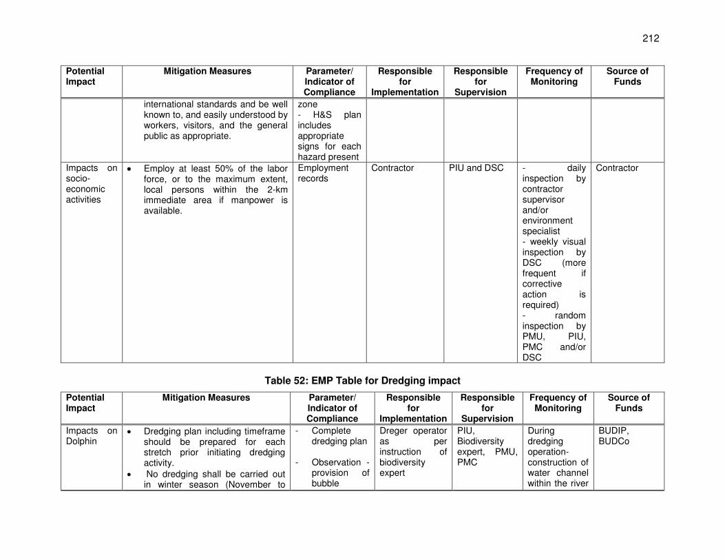
212
Potential Impact
Mitigation Measures Parameter/ Indicator of Compliance
Responsible for
Implementation
Responsible for
Supervision
Frequency of Monitoring
Source of Funds
international standards and be well known to, and easily understood by workers, visitors, and the general public as appropriate.
zone - H&S plan includes appropriate signs for each hazard present
Impacts on socio-economic activities
Employ at least 50% of the labor force, or to the maximum extent, local persons within the 2-km immediate area if manpower is available.
Employment records
Contractor PIU and DSC - daily inspection by contractor supervisor and/or environment specialist - weekly visual inspection by DSC (more frequent if corrective action is required) - random inspection by PMU, PIU, PMC and/or DSC
Contractor
Table 52: EMP Table for Dredging impact
Potential Impact
Mitigation Measures Parameter/ Indicator of Compliance
Responsible for
Implementation
Responsible for
Supervision
Frequency of Monitoring
Source of Funds
Impacts on Dolphin
Dredging plan including timeframe should be prepared for each stretch prior initiating dredging activity.
No dredging shall be carried out in winter season (November to
- Complete dredging plan
- Observation -
provision of bubble
Dreger operator as per instruction of biodiversity expert
PIU, Biodiversity expert, PMU, PMC
During dredging operation- construction of water channel within the river
BUDIP, BUDCo
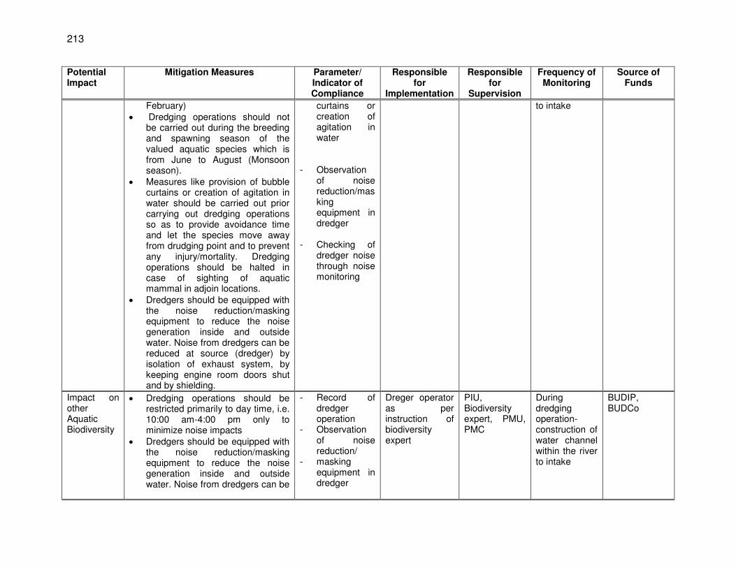
213
Potential Impact
Mitigation Measures Parameter/ Indicator of Compliance
Responsible for
Implementation
Responsible for
Supervision
Frequency of Monitoring
Source of Funds
February) Dredging operations should not
be carried out during the breeding and spawning season of the valued aquatic species which is from June to August (Monsoon season).
Measures like provision of bubble curtains or creation of agitation in water should be carried out prior carrying out dredging operations so as to provide avoidance time and let the species move away from drudging point and to prevent any injury/mortality. Dredging operations should be halted in case of sighting of aquatic mammal in adjoin locations.
Dredgers should be equipped with the noise reduction/masking equipment to reduce the noise generation inside and outside water. Noise from dredgers can be reduced at source (dredger) by isolation of exhaust system, by keeping engine room doors shut and by shielding.
curtains or creation of agitation in water
- Observation
of noise reduction/masking equipment in dredger
- Checking of
dredger noise through noise monitoring
to intake
Impact on other Aquatic Biodiversity
Dredging operations should be restricted primarily to day time, i.e. 10:00 am-4:00 pm only to minimize noise impacts
Dredgers should be equipped with the noise reduction/masking equipment to reduce the noise generation inside and outside water. Noise from dredgers can be
- Record of dredger operation
- Observation of noise reduction/
- masking equipment in dredger
Dreger operator as per instruction of biodiversity expert
PIU, Biodiversity expert, PMU, PMC
During dredging operation- construction of water channel within the river to intake
BUDIP, BUDCo
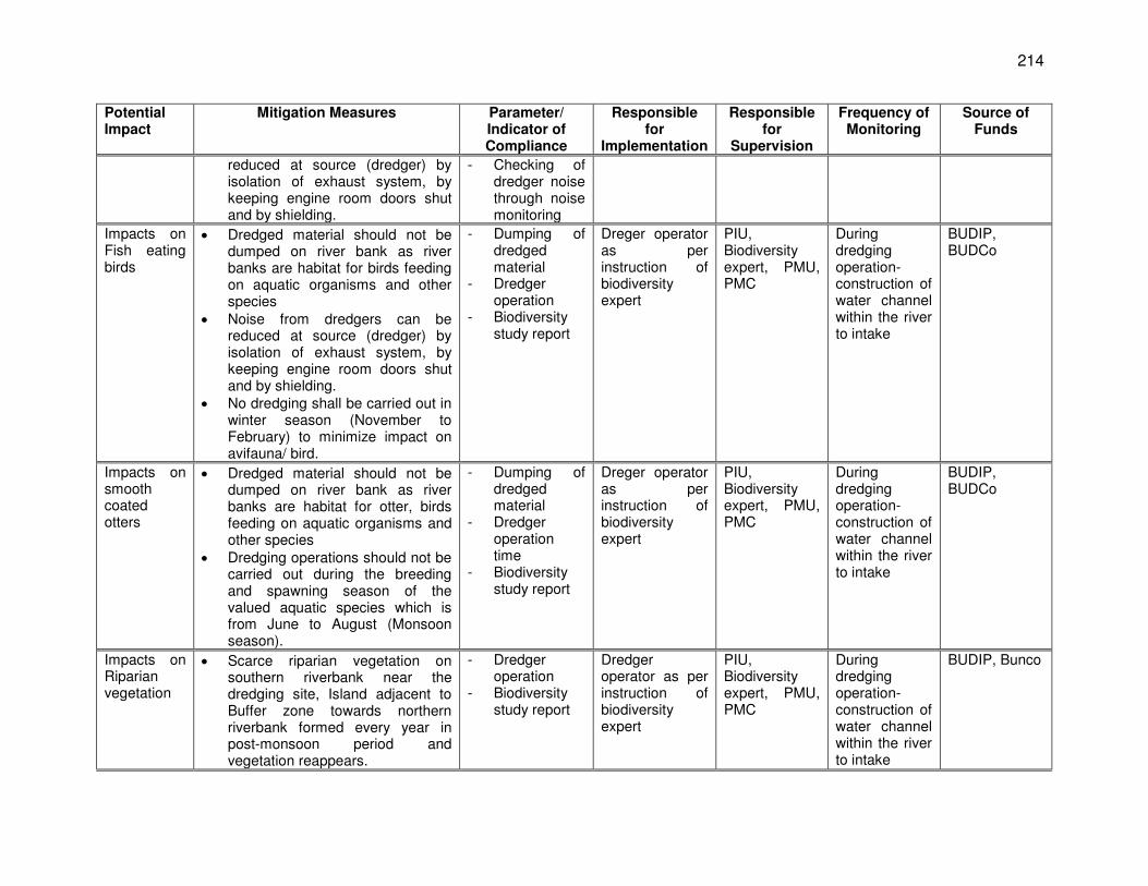
214
Potential Impact
Mitigation Measures Parameter/ Indicator of Compliance
Responsible for
Implementation
Responsible for
Supervision
Frequency of Monitoring
Source of Funds
reduced at source (dredger) by isolation of exhaust system, by keeping engine room doors shut and by shielding.
- Checking of dredger noise through noise monitoring
Impacts on Fish eating birds
Dredged material should not be dumped on river bank as river banks are habitat for birds feeding on aquatic organisms and other species
Noise from dredgers can be reduced at source (dredger) by isolation of exhaust system, by keeping engine room doors shut and by shielding.
No dredging shall be carried out in winter season (November to February) to minimize impact on avifauna/ bird.
- Dumping of dredged material
- Dredger operation
- Biodiversity study report
Dreger operator as per instruction of biodiversity expert
PIU, Biodiversity expert, PMU, PMC
During dredging operation- construction of water channel within the river to intake
BUDIP, BUDCo
Impacts on smooth coated otters
Dredged material should not be dumped on river bank as river banks are habitat for otter, birds feeding on aquatic organisms and other species
Dredging operations should not be carried out during the breeding and spawning season of the valued aquatic species which is from June to August (Monsoon season).
- Dumping of dredged material
- Dredger operation time
- Biodiversity study report
Dreger operator as per instruction of biodiversity expert
PIU, Biodiversity expert, PMU, PMC
During dredging operation- construction of water channel within the river to intake
BUDIP, BUDCo
Impacts on Riparian vegetation
Scarce riparian vegetation on southern riverbank near the dredging site, Island adjacent to Buffer zone towards northern riverbank formed every year in post-monsoon period and vegetation reappears.
- Dredger operation
- Biodiversity study report
Dredger operator as per instruction of biodiversity expert
PIU, Biodiversity expert, PMU, PMC
During dredging operation- construction of water channel within the river to intake
BUDIP, Bunco
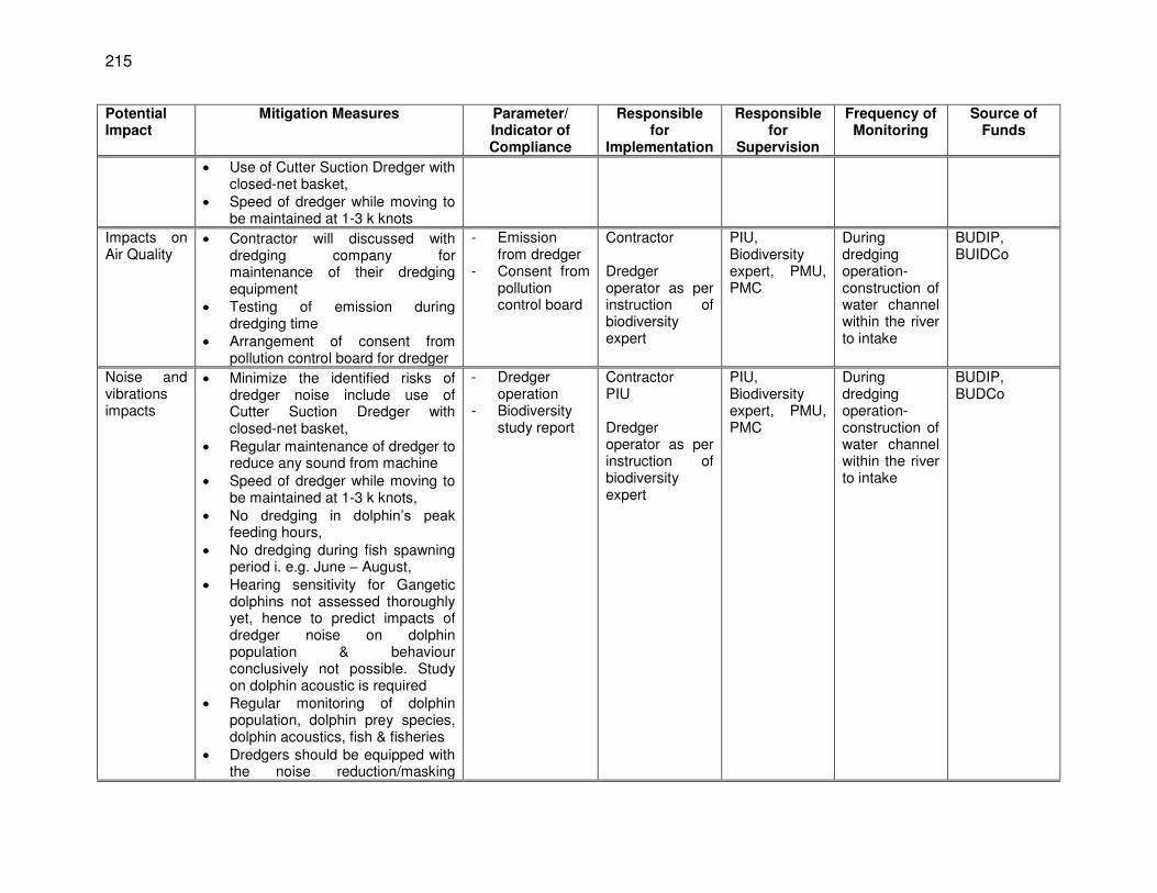
215
Potential Impact
Mitigation Measures Parameter/ Indicator of Compliance
Responsible for
Implementation
Responsible for
Supervision
Frequency of Monitoring
Source of Funds
Use of Cutter Suction Dredger with closed-net basket,
Speed of dredger while moving to be maintained at 1-3 k knots
Impacts on Air Quality
Contractor will discussed with dredging company for maintenance of their dredging equipment
Testing of emission during dredging time
Arrangement of consent from pollution control board for dredger
- Emission from dredger
- Consent from pollution control board
Contractor Dredger operator as per instruction of biodiversity expert
PIU, Biodiversity expert, PMU, PMC
During dredging operation- construction of water channel within the river to intake
BUDIP, BUIDCo
Noise and vibrations impacts
Minimize the identified risks of dredger noise include use of Cutter Suction Dredger with closed-net basket,
Regular maintenance of dredger to reduce any sound from machine
Speed of dredger while moving to be maintained at 1-3 k knots,
No dredging in dolphin’s peak feeding hours,
No dredging during fish spawning period i. e.g. June – August,
Hearing sensitivity for Gangetic dolphins not assessed thoroughly yet, hence to predict impacts of dredger noise on dolphin population & behaviour conclusively not possible. Study on dolphin acoustic is required
Regular monitoring of dolphin population, dolphin prey species, dolphin acoustics, fish & fisheries
Dredgers should be equipped with the noise reduction/masking
- Dredger operation
- Biodiversity study report
Contractor PIU Dredger operator as per instruction of biodiversity expert
PIU, Biodiversity expert, PMU, PMC
During dredging operation- construction of water channel within the river to intake
BUDIP, BUDCo
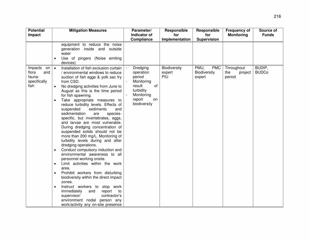
216
Potential Impact
Mitigation Measures Parameter/ Indicator of Compliance
Responsible for
Implementation
Responsible for
Supervision
Frequency of Monitoring
Source of Funds
equipment to reduce the noise generation inside and outside water
Use of pingers (Noise emiting devices)
Impacts on flora and fauna- specifically fish
Installation of fish exclusion curtain / environmental windows to reduce suction of fish eggs & yolk sac fry from CSD.
No dredging activities from June to August as this is the time period for fish spawning.
Take appropriate measures to reduce turbidity levels. Effects of suspended sediments and sedimentation are species-specific, but invertebrates, eggs, and larvae are most vulnerable. During dredging concentration of suspended solids should not be more than 200 mg/L. Monitoring of turbidity levels during and after dredging operations.
Conduct compulsory induction and environmental awareness to all personnel working onsite.
Limit activities within the work area.
Prohibit workers from disturbing biodiversity within the direct impact zones.
Instruct workers to stop work immediately and report to supervisor/ contractor’s environment nodal person any work/activity any on-site presence
- Dredging operation period
- Monitoring result of turbidity
- Monitoring report on biodiversity
Biodiversity expert PIU
PMU, PMC Biodiversity expert
Throughout the project period
BUDIP, BUDCo
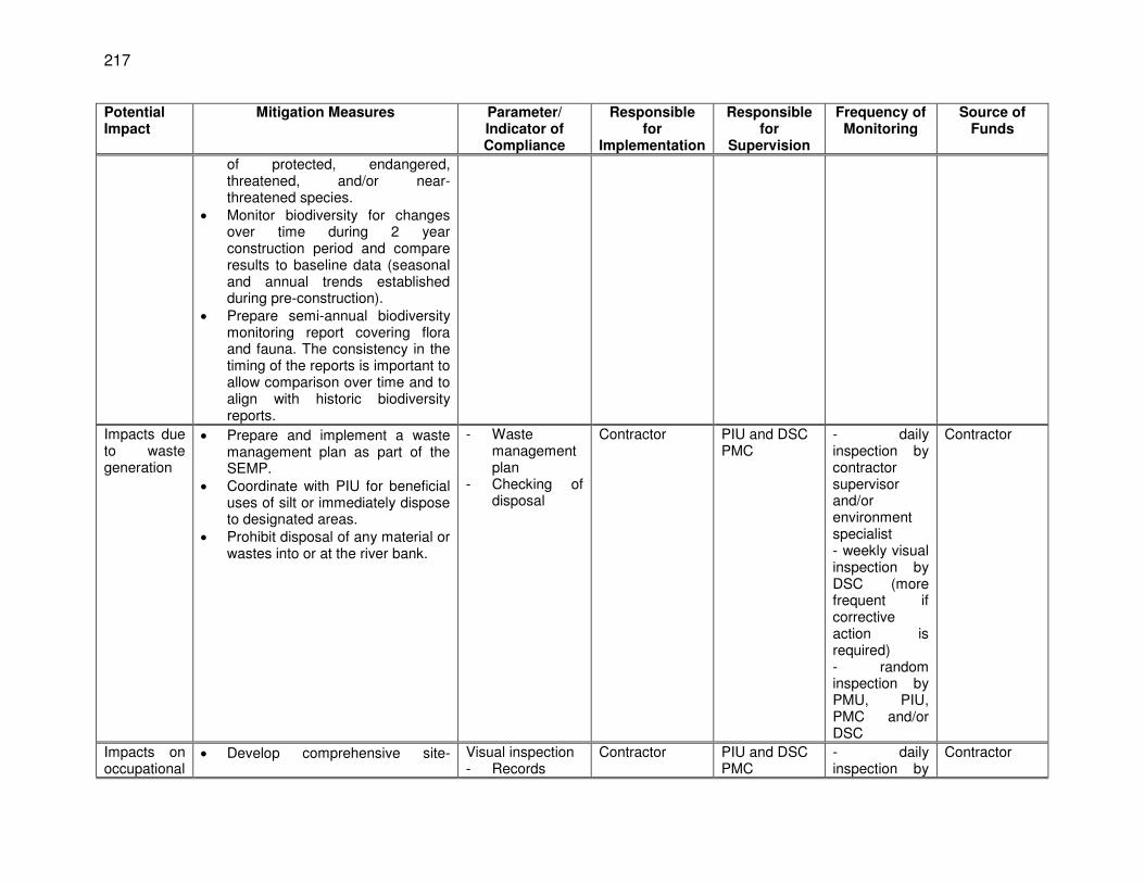
217
Potential Impact
Mitigation Measures Parameter/ Indicator of Compliance
Responsible for
Implementation
Responsible for
Supervision
Frequency of Monitoring
Source of Funds
of protected, endangered, threatened, and/or near-threatened species.
Monitor biodiversity for changes over time during 2 year construction period and compare results to baseline data (seasonal and annual trends established during pre-construction).
Prepare semi-annual biodiversity monitoring report covering flora and fauna. The consistency in the timing of the reports is important to allow comparison over time and to align with historic biodiversity reports.
Impacts due to waste generation
Prepare and implement a waste management plan as part of the SEMP.
Coordinate with PIU for beneficial uses of silt or immediately dispose to designated areas.
Prohibit disposal of any material or wastes into or at the river bank.
- Waste management plan
- Checking of disposal
Contractor PIU and DSC PMC
- daily inspection by contractor supervisor and/or environment specialist - weekly visual inspection by DSC (more frequent if corrective action is required) - random inspection by PMU, PIU, PMC and/or DSC
Contractor
Impacts on occupational
Develop comprehensive site- Visual inspection - Records
Contractor PIU and DSC PMC
- daily inspection by
Contractor
218
Potential Impact
Mitigation Measures Parameter/ Indicator of Compliance
Responsible for
Implementation
Responsible for
Supervision
Frequency of Monitoring
Source of Funds
health and safety
specific health and safety (H&S) plan as part of the EMP. The overall objective is to provide guidance to workers on establishing a management strategy and applying practices that are intended to eliminate, or reduce, fatalities, injuries and illnesses for workers performing activities and tasks associated with the project.
Include in H&S plan measures such as: (i) type of hazards in the dredging area; (ii) corresponding personal protective equipment for each identified hazard; (iii) H&S training for all working personnel; (iv) procedures to be followed for all site activities; and (v) documentation of work-related accidents.
Provide compulsory H&S orientation training to all operators to ensure that they are apprised of the rules of work at the site, personal protective protection, and preventing injury to fellow workers.
Disallow worker exposure to noise level greater than 85 dBA for a duration of more than 8 hours per day without hearing protection. The use of hearing protection shall be enforced actively.
- Health and safety plan
contractor supervisor and/or environment specialist - weekly visual inspection by DSC (more frequent if corrective action is required) - random inspection by PMU, PIU, PMC and/or DSC
219
Table 53: EMP Table for O&M of Intake Wells, Ancillary Structures and dredging activity
Potential Impacts
Mitigation Measures Parameter/ Indicator of Compliance
Responsible for Implementation
Responsible for
Supervision
Frequency of Monitoring
Source of Funds
Dredger activity
Dredger undertaking work to be fitted with Differential Global Positioning System (DGPS) navigation & positioning system & depth sounding to allow the dredger to accurately dredge within the proposed dredge area.
Dredger to be fitted with DGPS navigation & positioning system & depth sounding to allow the dredger to accurately dredge within the proposed dredge area.
Dredging operation to be conducted only in day hours, not in night hours as it will disturb the river fauna including dolphins in rest.
Regular maintenance of dredge vessel and assisting motor boats to be conducted to the manufacturer’s specifications.
All vessels would operate in accordance with appropriate equipment noise and vibration standards.
- Dredger operation and maintenance plan
Contractor- Dredger operator Biodiversity expert
Biodiversity expert PIU PMU PMC
Throughout O & M period – dredging operation
BUDIP BUIDCo
Disposal of dredge soil
Discharge of residual liquid into the river not allowed as it results into river water contamination.
Petroleum and oily wastes to be taken in drums for final
- Dredger operation and maintenance plan
- Solid waste disposal plan
Contractor- Dredger operator Biodiversity expert
Biodiversity expert PIU PMU PMC
Throughout O & M period – dredging operation
BUDIP BUIDCo
220
Potential Impacts
Mitigation Measures Parameter/ Indicator of Compliance
Responsible for Implementation
Responsible for
Supervision
Frequency of Monitoring
Source of Funds
disposal. Dredged material to be
disposed at Designated Confined Disposal facility.
Impact on fish due to dredging
Installation of fish exclusion curtain / environmental windows to reduce suction of fish eggs & yolk sac fry from CSD.
No dredging activities from June to August as this is the time period for fish spawning.
Take appropriate measures to reduce turbidity levels. Effects of suspended sediments and sedimentation are species-specific, but invertebrates, eggs, and larvae are most vulnerable. During dredging concentration of suspended solids should not be more than 200 mg/L. Monitoring of turbidity levels during and after dredging operations.
- Dredger operation and maintenance plan
- Testing result - Observation
fish curtain
Contractor- Dredger operator Biodiversity expert
Biodiversity expert PIU PMU PMC
Throughout O & M period – dredging operation
BUDIP BUIDCo
Impact on gangetic Dolphin during dredging operation
Maintain speed of dredger while moving at 1-3 km knots to minimize the risk of collision.
Stop dredging if dolphins are sighted within 30 m of dredge head.
Dredging operation to be conducted only after the dolphin’s morning peak feeding hours and before its evening peak feeding hours. Operation timings should be between 10
- Dredger operation and maintenance plan
- Biodiversity report including Dolphin sigting plan
Contractor- Dredger operator Biodiversity expert
Biodiversity expert PIU PMU PMC
Throughout O & M period – dredging operation
BUDIP BUIDCo
221
Potential Impacts
Mitigation Measures Parameter/ Indicator of Compliance
Responsible for Implementation
Responsible for
Supervision
Frequency of Monitoring
Source of Funds
am – 3 pm. All sightings during dredging
operations both in active dredging area and buffer zone should be reported.
Execute dolphin monitoring program as per recommendation of Wildlife warden, Govt. of Bihar
Pre and post – dredging and/or monsoon study on dolphin population abundance and dolphin behaviour such as foraging, diving, resting & breeding due to masking of echolocation signals (produced by dolphins) due to noise generated by dredger during dredging operations should be undertaken every year.
The mitigation measures for protection of aquatic life especially Dolphins in post dredging phase should be monitored by a third party monitoring consultant. This will help in objective evaluation of mitigation measures being implemented.
Studies and monitoring of dolphin population abundance and dolphin behaviour such as foraging, diving, resting & breeding by biodiversity Expert.
General impact
Ensure all personnel performing activities related to
- Training of personnel
Contractor- Dredger operator
Biodiversity expert PIU
Throughout O & M period –
BUDIP BUIDCo
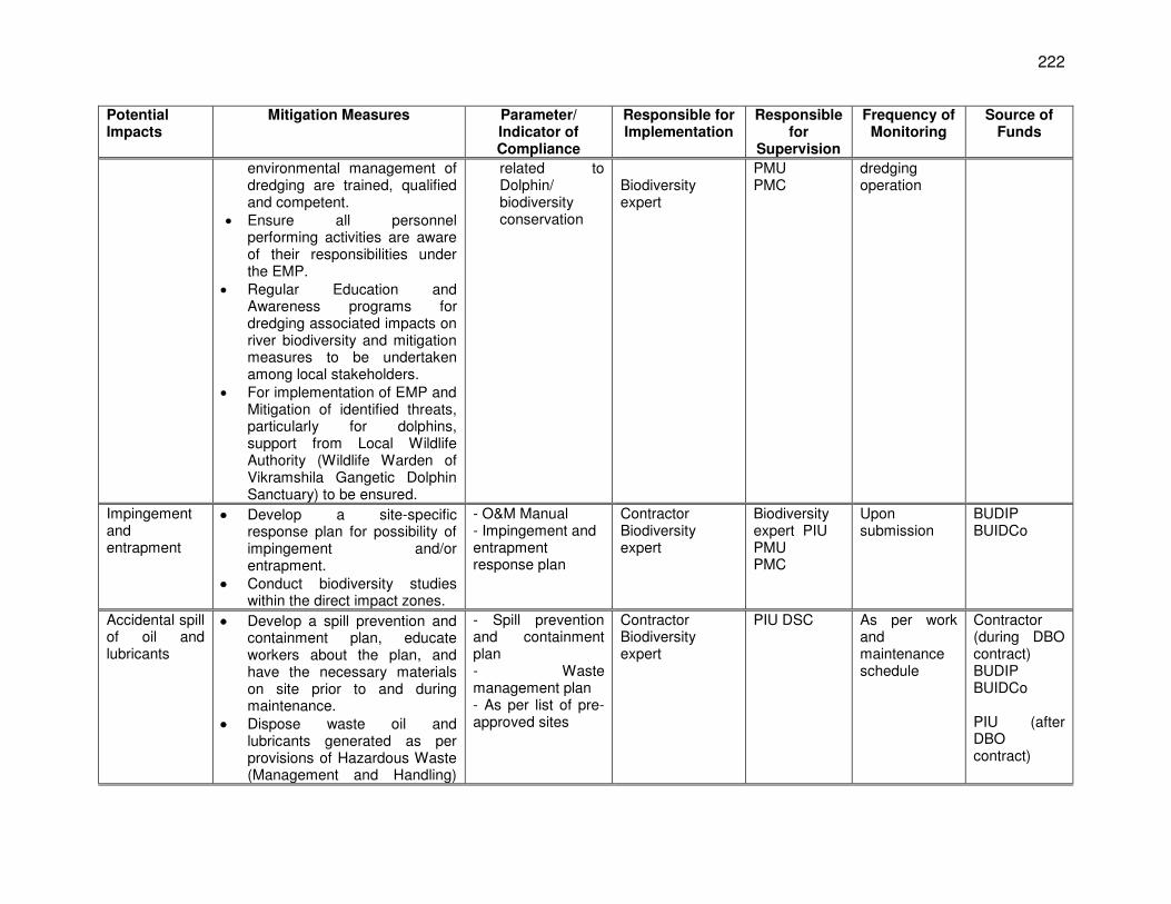
222
Potential Impacts
Mitigation Measures Parameter/ Indicator of Compliance
Responsible for Implementation
Responsible for
Supervision
Frequency of Monitoring
Source of Funds
environmental management of dredging are trained, qualified and competent.
Ensure all personnel performing activities are aware of their responsibilities under the EMP.
Regular Education and Awareness programs for dredging associated impacts on river biodiversity and mitigation measures to be undertaken among local stakeholders.
For implementation of EMP and Mitigation of identified threats, particularly for dolphins, support from Local Wildlife Authority (Wildlife Warden of Vikramshila Gangetic Dolphin Sanctuary) to be ensured.
related to Dolphin/ biodiversity conservation
Biodiversity expert
PMU PMC
dredging operation
Impingement and entrapment
Develop a site-specific response plan for possibility of impingement and/or entrapment.
Conduct biodiversity studies within the direct impact zones.
- O&M Manual - Impingement and entrapment response plan
Contractor Biodiversity expert
Biodiversity expert PIU PMU PMC
Upon submission
BUDIP BUIDCo
Accidental spill of oil and lubricants
Develop a spill prevention and containment plan, educate workers about the plan, and have the necessary materials on site prior to and during maintenance.
Dispose waste oil and lubricants generated as per provisions of Hazardous Waste (Management and Handling)
- Spill prevention and containment plan - Waste management plan - As per list of pre-approved sites
Contractor Biodiversity expert
PIU DSC
As per work and maintenance schedule
Contractor (during DBO contract) BUDIP BUIDCo PIU (after DBO contract)
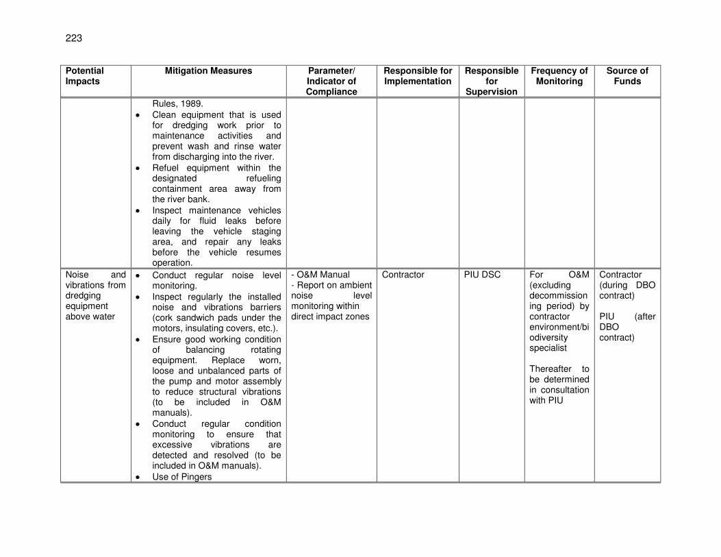
223
Potential Impacts
Mitigation Measures Parameter/ Indicator of Compliance
Responsible for Implementation
Responsible for
Supervision
Frequency of Monitoring
Source of Funds
Rules, 1989. Clean equipment that is used
for dredging work prior to maintenance activities and prevent wash and rinse water from discharging into the river.
Refuel equipment within the designated refueling containment area away from the river bank.
Inspect maintenance vehicles daily for fluid leaks before leaving the vehicle staging area, and repair any leaks before the vehicle resumes operation.
Noise and vibrations from dredging equipment above water
Conduct regular noise level monitoring.
Inspect regularly the installed noise and vibrations barriers (cork sandwich pads under the motors, insulating covers, etc.).
Ensure good working condition of balancing rotating equipment. Replace worn, loose and unbalanced parts of the pump and motor assembly to reduce structural vibrations (to be included in O&M manuals).
Conduct regular condition monitoring to ensure that excessive vibrations are detected and resolved (to be included in O&M manuals).
Use of Pingers
- O&M Manual - Report on ambient noise level monitoring within direct impact zones
Contractor PIU DSC For O&M (excluding decommissioning period) by contractor environment/biodiversity specialist Thereafter to be determined in consultation with PIU
Contractor (during DBO contract) PIU (after DBO contract)
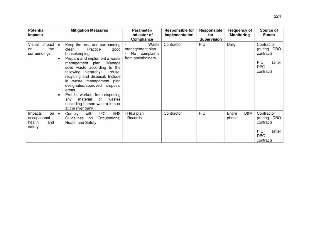
224
Potential Impacts
Mitigation Measures Parameter/ Indicator of Compliance
Responsible for Implementation
Responsible for
Supervision
Frequency of Monitoring
Source of Funds
Visual impact on the surroundings
Keep the area and surrounding clean. Practice good housekeeping.
Prepare and implement a waste management plan. Manage solid waste according to the following hierarchy: reuse, recycling and disposal. Include in waste management plan designated/approved disposal areas.
Prohibit workers from disposing any material or wastes (including human waste) into or at the river bank.
- Waste management plan. - No complaints from stakeholders
Contractor PIU Daily Contractor (during DBO contract) PIU (after DBO contract)
Impacts on occupational health and safety
Comply with IFC EHS Guidelines on Occupational Health and Safety
- H&S plan - Records
Contractor PIU Entire O&M phase
Contractor (during DBO contract) PIU (after DBO contract)
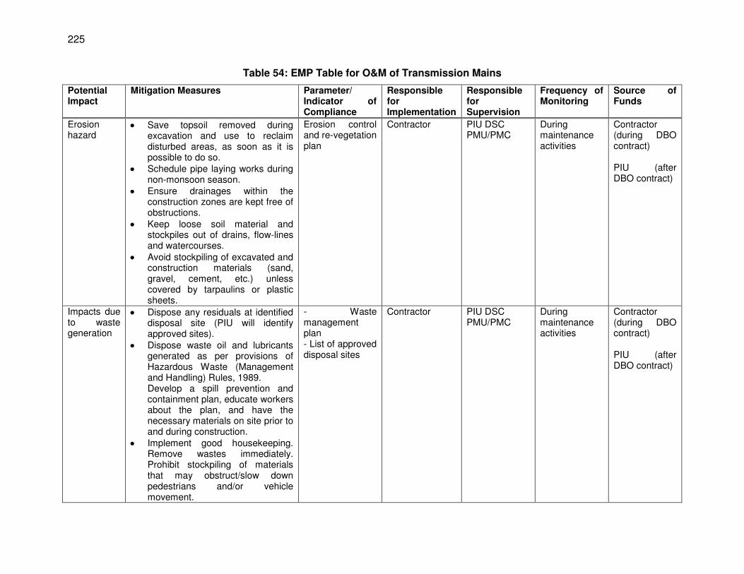
225
Table 54: EMP Table for O&M of Transmission Mains
Potential Impact
Mitigation Measures Parameter/ Indicator of Compliance
Responsible for Implementation
Responsible for Supervision
Frequency of Monitoring
Source of Funds
Erosion hazard
Save topsoil removed during excavation and use to reclaim disturbed areas, as soon as it is possible to do so.
Schedule pipe laying works during non-monsoon season.
Ensure drainages within the construction zones are kept free of obstructions.
Keep loose soil material and stockpiles out of drains, flow-lines and watercourses.
Avoid stockpiling of excavated and construction materials (sand, gravel, cement, etc.) unless covered by tarpaulins or plastic sheets.
Erosion control and re-vegetation plan
Contractor PIU DSC PMU/PMC
During maintenance activities
Contractor (during DBO contract) PIU (after DBO contract)
Impacts due to waste generation
Dispose any residuals at identified disposal site (PIU will identify approved sites).
Dispose waste oil and lubricants generated as per provisions of Hazardous Waste (Management and Handling) Rules, 1989. Develop a spill prevention and containment plan, educate workers about the plan, and have the necessary materials on site prior to and during construction.
Implement good housekeeping. Remove wastes immediately. Prohibit stockpiling of materials that may obstruct/slow down pedestrians and/or vehicle movement.
- Waste management plan - List of approved disposal sites
Contractor PIU DSC PMU/PMC
During maintenance activities
Contractor (during DBO contract) PIU (after DBO contract)
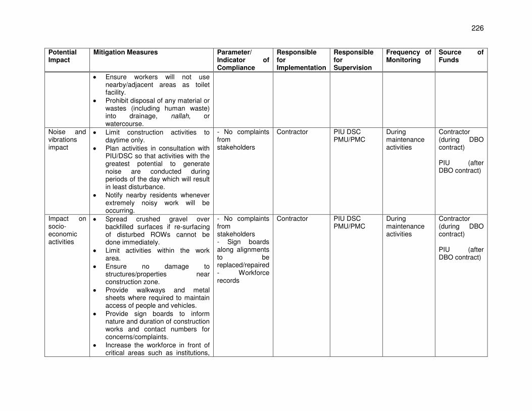
226
Potential Impact
Mitigation Measures Parameter/ Indicator of Compliance
Responsible for Implementation
Responsible for Supervision
Frequency of Monitoring
Source of Funds
Ensure workers will not use nearby/adjacent areas as toilet facility.
Prohibit disposal of any material or wastes (including human waste) into drainage, nallah, or watercourse.
Noise and vibrations impact
Limit construction activities to daytime only.
Plan activities in consultation with PIU/DSC so that activities with the greatest potential to generate noise are conducted during periods of the day which will result in least disturbance.
Notify nearby residents whenever extremely noisy work will be occurring.
- No complaints from stakeholders
Contractor PIU DSC PMU/PMC
During maintenance activities
Contractor (during DBO contract) PIU (after DBO contract)
Impact on socio-economic activities
Spread crushed gravel over backfilled surfaces if re-surfacing of disturbed ROWs cannot be done immediately.
Limit activities within the work area.
Ensure no damage to structures/properties near construction zone.
Provide walkways and metal sheets where required to maintain access of people and vehicles.
Provide sign boards to inform nature and duration of construction works and contact numbers for concerns/complaints.
Increase the workforce in front of critical areas such as institutions,
- No complaints from stakeholders - Sign boards along alignments to be replaced/repaired - Workforce records
Contractor PIU DSC PMU/PMC
During maintenance activities
Contractor (during DBO contract) PIU (after DBO contract)
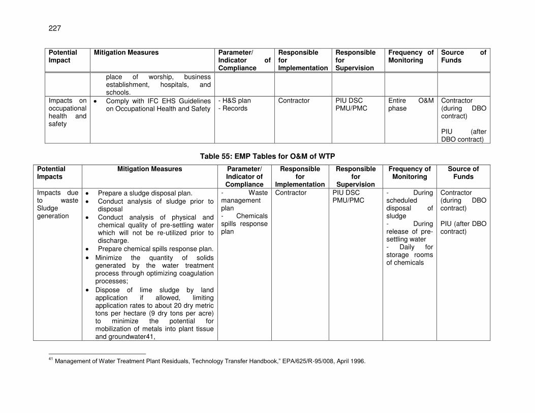
227
Potential Impact
Mitigation Measures Parameter/ Indicator of Compliance
Responsible for Implementation
Responsible for Supervision
Frequency of Monitoring
Source of Funds
place of worship, business establishment, hospitals, and schools.
Impacts on occupational health and safety
Comply with IFC EHS Guidelines on Occupational Health and Safety
- H&S plan - Records
Contractor PIU DSC PMU/PMC
Entire O&M phase
Contractor (during DBO contract) PIU (after DBO contract)
Table 55: EMP Tables for O&M of WTP
Potential Impacts
Mitigation Measures Parameter/ Indicator of Compliance
Responsible for
Implementation
Responsible for
Supervision
Frequency of Monitoring
Source of Funds
Impacts due to waste Sludge generation
Prepare a sludge disposal plan. Conduct analysis of sludge prior to
disposal Conduct analysis of physical and
chemical quality of pre-settling water which will not be re-utilized prior to discharge.
Prepare chemical spills response plan.
Minimize the quantity of solids generated by the water treatment process through optimizing coagulation processes;
Dispose of lime sludge by land application if allowed, limiting application rates to about 20 dry metric tons per hectare (9 dry tons per acre) to minimize the potential for mobilization of metals into plant tissue and groundwater41,
- Waste management plan - Chemicals spills response plan
Contractor PIU DSC PMU/PMC
- During scheduled disposal of sludge - During release of pre-settling water - Daily for storage rooms of chemicals
Contractor (during DBO contract) PIU (after DBO contract)
41
Management of Water Treatment Plant Residuals, Technology Transfer Handbook,” EPA/625/R-95/008, April 1996.
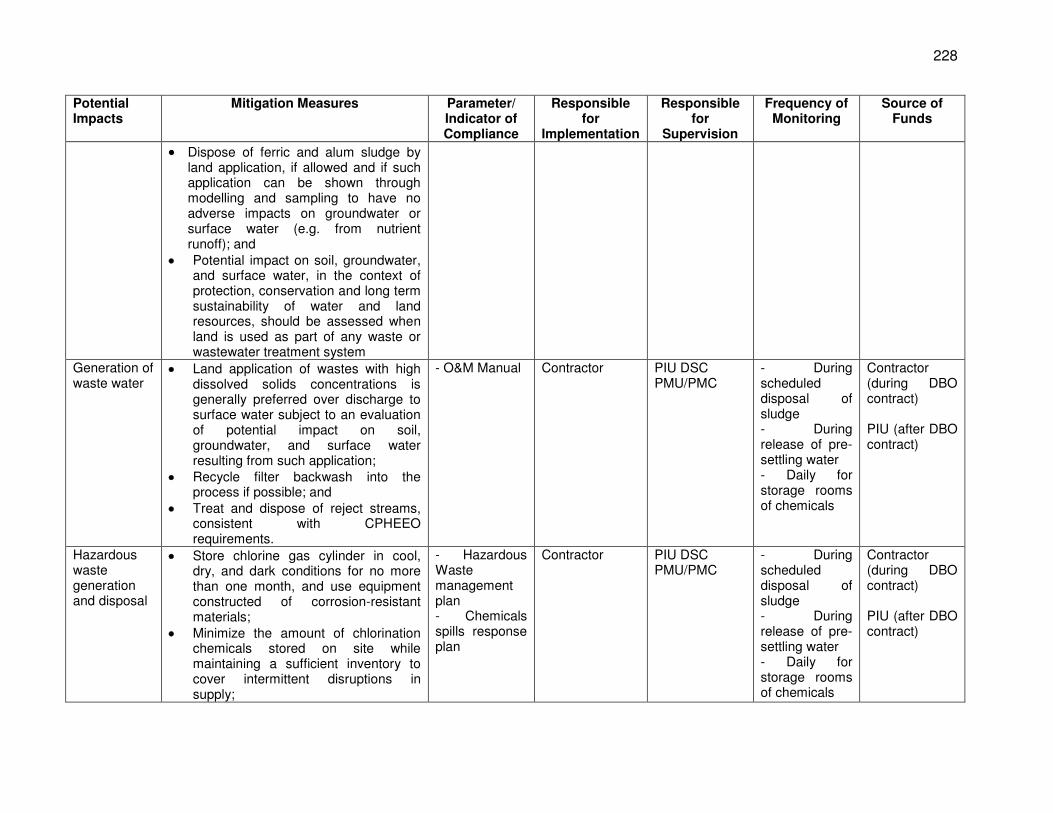
228
Potential Impacts
Mitigation Measures Parameter/ Indicator of Compliance
Responsible for
Implementation
Responsible for
Supervision
Frequency of Monitoring
Source of Funds
Dispose of ferric and alum sludge by land application, if allowed and if such application can be shown through modelling and sampling to have no adverse impacts on groundwater or surface water (e.g. from nutrient runoff); and
Potential impact on soil, groundwater, and surface water, in the context of protection, conservation and long term sustainability of water and land resources, should be assessed when land is used as part of any waste or wastewater treatment system
Generation of waste water
Land application of wastes with high dissolved solids concentrations is generally preferred over discharge to surface water subject to an evaluation of potential impact on soil, groundwater, and surface water resulting from such application;
Recycle filter backwash into the process if possible; and
Treat and dispose of reject streams, consistent with CPHEEO requirements.
- O&M Manual Contractor PIU DSC PMU/PMC
- During scheduled disposal of sludge - During release of pre-settling water - Daily for storage rooms of chemicals
Contractor (during DBO contract) PIU (after DBO contract)
Hazardous waste generation and disposal
Store chlorine gas cylinder in cool, dry, and dark conditions for no more than one month, and use equipment constructed of corrosion-resistant materials;
Minimize the amount of chlorination chemicals stored on site while maintaining a sufficient inventory to cover intermittent disruptions in supply;
- Hazardous Waste management plan - Chemicals spills response plan
Contractor PIU DSC PMU/PMC
- During scheduled disposal of sludge - During release of pre-settling water - Daily for storage rooms of chemicals
Contractor (during DBO contract) PIU (after DBO contract)
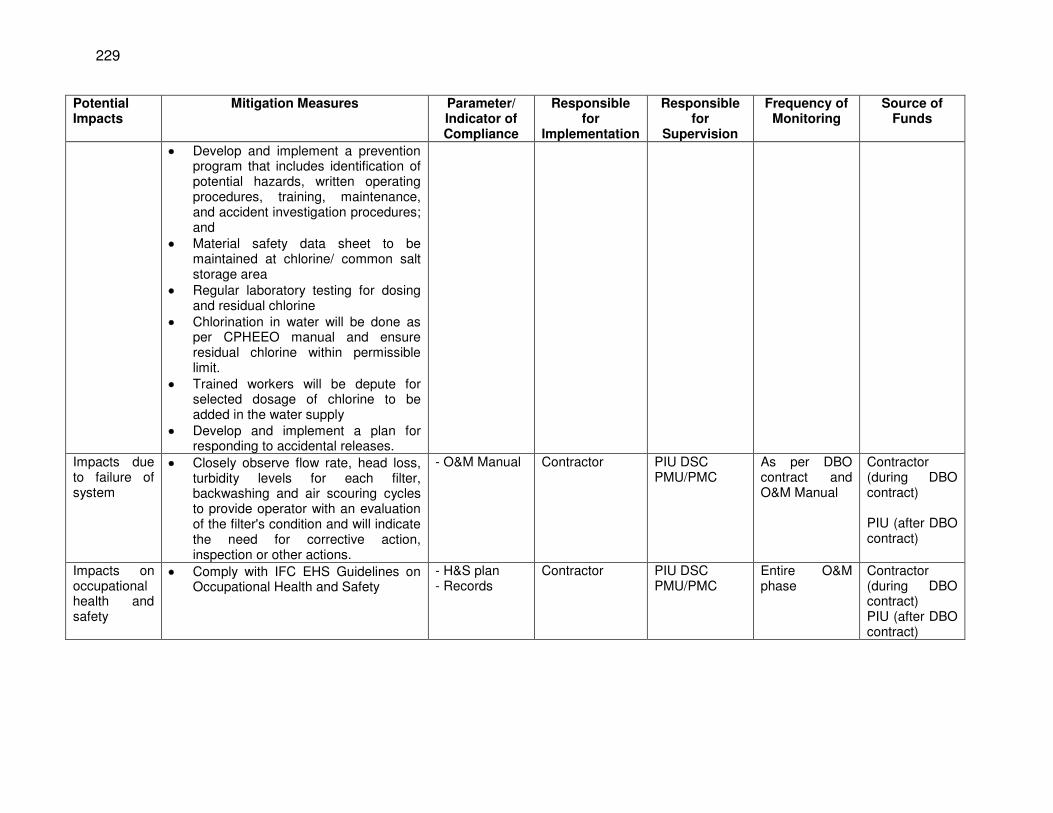
229
Potential Impacts
Mitigation Measures Parameter/ Indicator of Compliance
Responsible for
Implementation
Responsible for
Supervision
Frequency of Monitoring
Source of Funds
Develop and implement a prevention program that includes identification of potential hazards, written operating procedures, training, maintenance, and accident investigation procedures; and
Material safety data sheet to be maintained at chlorine/ common salt storage area
Regular laboratory testing for dosing and residual chlorine
Chlorination in water will be done as per CPHEEO manual and ensure residual chlorine within permissible limit.
Trained workers will be depute for selected dosage of chlorine to be added in the water supply
Develop and implement a plan for responding to accidental releases.
Impacts due to failure of system
Closely observe flow rate, head loss, turbidity levels for each filter, backwashing and air scouring cycles to provide operator with an evaluation of the filter's condition and will indicate the need for corrective action, inspection or other actions.
- O&M Manual Contractor PIU DSC PMU/PMC
As per DBO contract and O&M Manual
Contractor (during DBO contract) PIU (after DBO contract)
Impacts on occupational health and safety
Comply with IFC EHS Guidelines on Occupational Health and Safety
- H&S plan - Records
Contractor PIU DSC PMU/PMC
Entire O&M phase
Contractor (during DBO contract) PIU (after DBO contract)
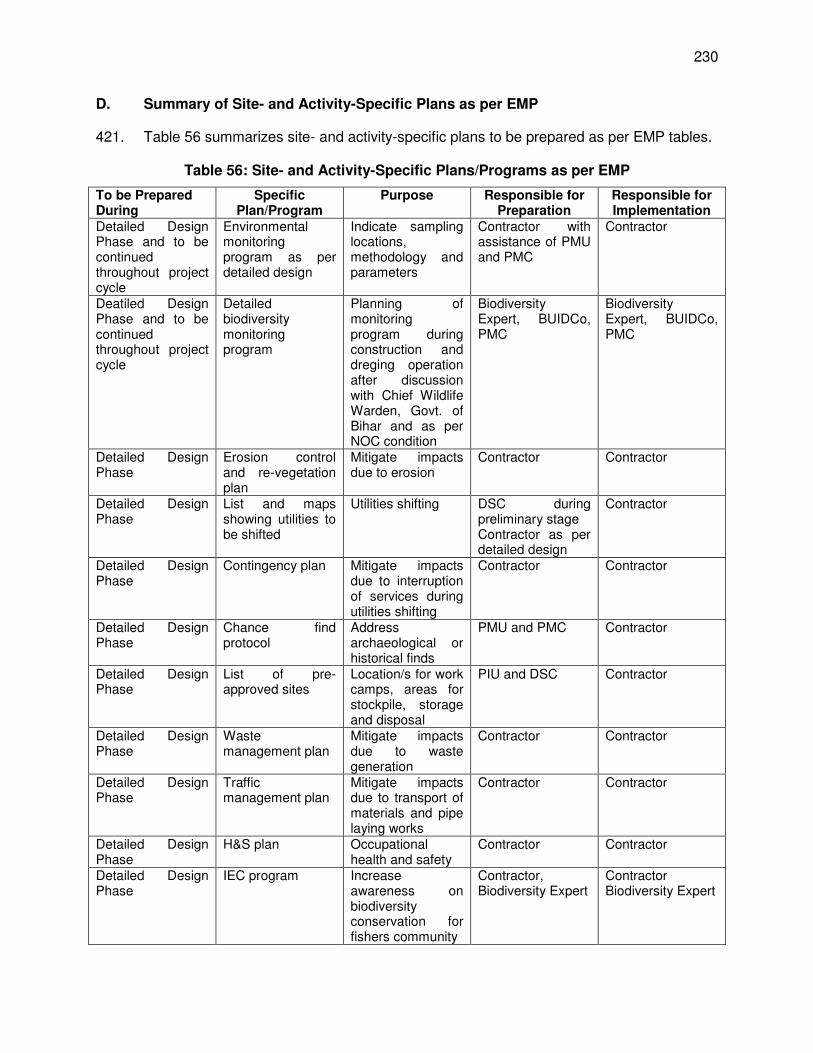
230
D. Summary of Site- and Activity-Specific Plans as per EMP
421. Table 56 summarizes site- and activity-specific plans to be prepared as per EMP tables.
Table 56: Site- and Activity-Specific Plans/Programs as per EMP
To be Prepared During
Specific Plan/Program
Purpose Responsible for Preparation
Responsible for Implementation
Detailed Design Phase and to be continued throughout project cycle
Environmental monitoring program as per detailed design
Indicate sampling locations, methodology and parameters
Contractor with assistance of PMU and PMC
Contractor
Deatiled Design Phase and to be continued throughout project cycle
Detailed biodiversity monitoring program
Planning of monitoring program during construction and dreging operation after discussion with Chief Wildlife Warden, Govt. of Bihar and as per NOC condition
Biodiversity Expert, BUIDCo, PMC
Biodiversity Expert, BUIDCo, PMC
Detailed Design Phase
Erosion control and re-vegetation plan
Mitigate impacts due to erosion
Contractor Contractor
Detailed Design Phase
List and maps showing utilities to be shifted
Utilities shifting DSC during preliminary stage Contractor as per detailed design
Contractor
Detailed Design Phase
Contingency plan Mitigate impacts due to interruption of services during utilities shifting
Contractor Contractor
Detailed Design Phase
Chance find protocol
Address archaeological or historical finds
PMU and PMC Contractor
Detailed Design Phase
List of pre-approved sites
Location/s for work camps, areas for stockpile, storage and disposal
PIU and DSC Contractor
Detailed Design Phase
Waste management plan
Mitigate impacts due to waste generation
Contractor Contractor
Detailed Design Phase
Traffic management plan
Mitigate impacts due to transport of materials and pipe laying works
Contractor Contractor
Detailed Design Phase
H&S plan Occupational health and safety
Contractor Contractor
Detailed Design Phase
IEC program Increase awareness on biodiversity conservation for fishers community
Contractor, Biodiversity Expert
Contractor Biodiversity Expert
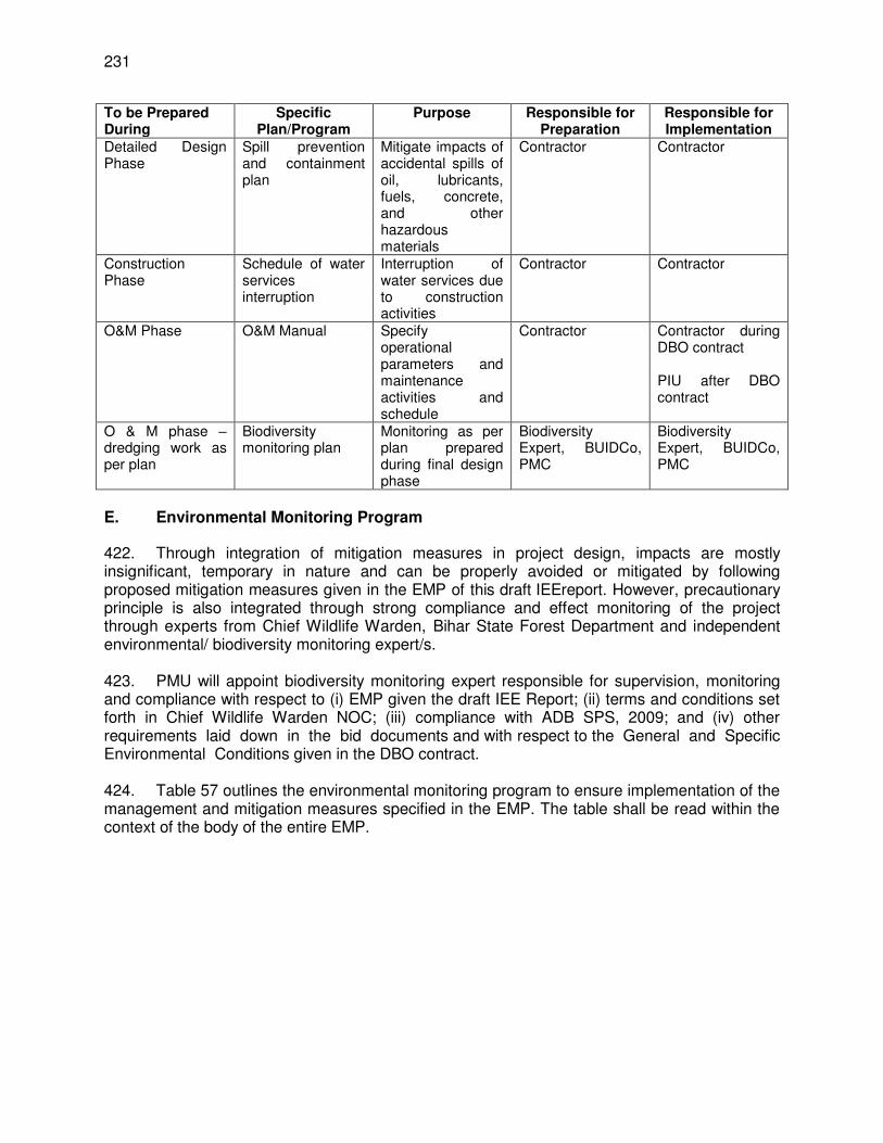
231
To be Prepared During
Specific Plan/Program
Purpose Responsible for Preparation
Responsible for Implementation
Detailed Design Phase
Spill prevention and containment plan
Mitigate impacts of accidental spills of oil, lubricants, fuels, concrete, and other hazardous materials
Contractor Contractor
Construction Phase
Schedule of water services interruption
Interruption of water services due to construction activities
Contractor Contractor
O&M Phase O&M Manual Specify operational parameters and maintenance activities and schedule
Contractor Contractor during DBO contract PIU after DBO contract
O & M phase – dredging work as per plan
Biodiversity monitoring plan
Monitoring as per plan prepared during final design phase
Biodiversity Expert, BUIDCo, PMC
Biodiversity Expert, BUIDCo, PMC
E. Environmental Monitoring Program
422. Through integration of mitigation measures in project design, impacts are mostly insignificant, temporary in nature and can be properly avoided or mitigated by following proposed mitigation measures given in the EMP of this draft IEEreport. However, precautionary principle is also integrated through strong compliance and effect monitoring of the project through experts from Chief Wildlife Warden, Bihar State Forest Department and independent environmental/ biodiversity monitoring expert/s. 423. PMU will appoint biodiversity monitoring expert responsible for supervision, monitoring and compliance with respect to (i) EMP given the draft IEE Report; (ii) terms and conditions set forth in Chief Wildlife Warden NOC; (iii) compliance with ADB SPS, 2009; and (iv) other requirements laid down in the bid documents and with respect to the General and Specific Environmental Conditions given in the DBO contract. 424. Table 57 outlines the environmental monitoring program to ensure implementation of the management and mitigation measures specified in the EMP. The table shall be read within the context of the body of the entire EMP.
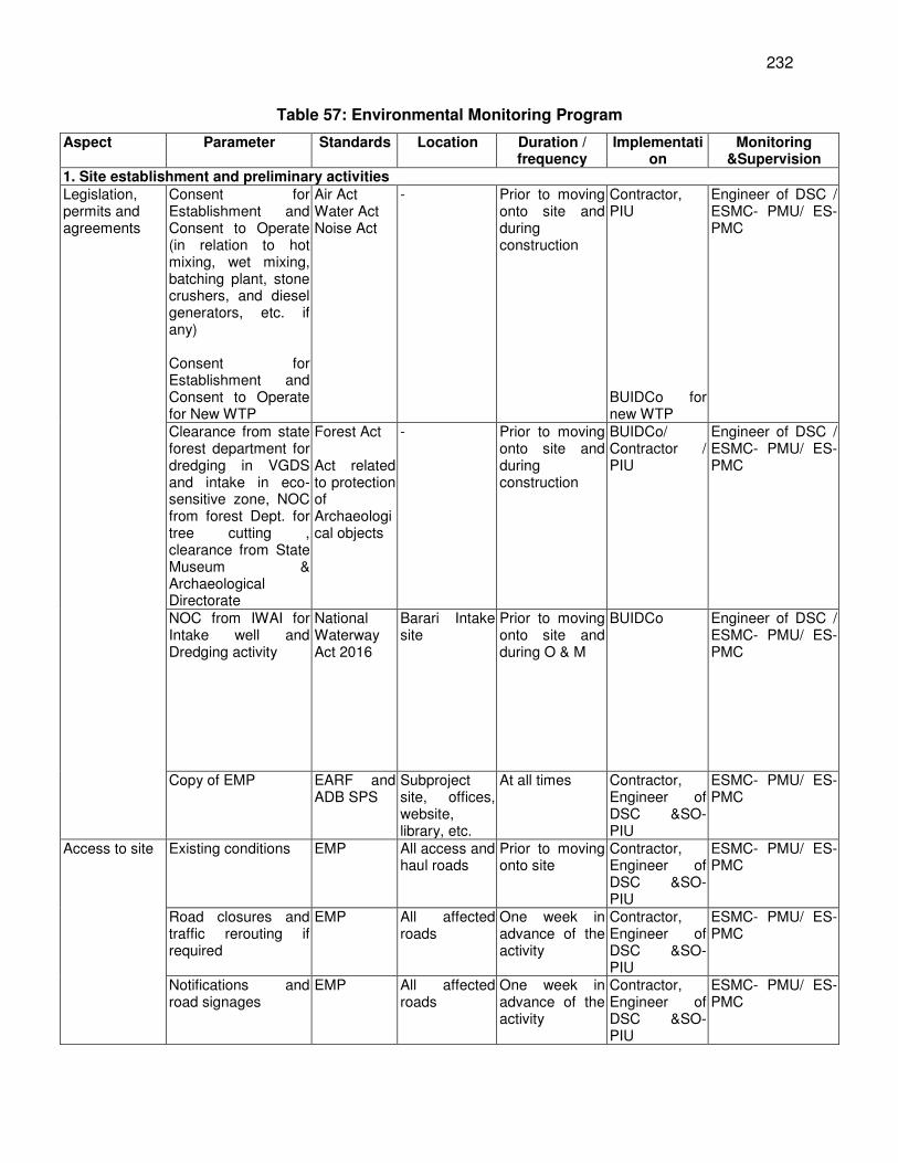
232
Table 57: Environmental Monitoring Program
Aspect Parameter Standards Location Duration / frequency
Implementation
Monitoring &Supervision
1. Site establishment and preliminary activities Legislation, permits and agreements
Consent for Establishment and Consent to Operate (in relation to hot mixing, wet mixing, batching plant, stone crushers, and diesel generators, etc. if any) Consent for Establishment and Consent to Operate for New WTP
Air Act Water Act Noise Act
- Prior to moving onto site and during construction
Contractor, PIU BUIDCo for new WTP
Engineer of DSC / ESMC- PMU/ ES- PMC
Clearance from state forest department for dredging in VGDS and intake in eco-sensitive zone, NOC from forest Dept. for tree cutting , clearance from State Museum & Archaeological Directorate
Forest Act Act related to protection of Archaeological objects
- Prior to moving onto site and during construction
BUIDCo/ Contractor / PIU
Engineer of DSC / ESMC- PMU/ ES- PMC
NOC from IWAI for Intake well and Dredging activity
National Waterway Act 2016
Barari Intake site
Prior to moving onto site and during O & M
BUIDCo Engineer of DSC / ESMC- PMU/ ES- PMC
Copy of EMP EARF and ADB SPS
Subproject site, offices, website, library, etc.
At all times Contractor, Engineer of DSC &SO- PIU
ESMC- PMU/ ES- PMC
Access to site Existing conditions EMP All access and haul roads
Prior to moving onto site
Contractor, Engineer of DSC &SO- PIU
ESMC- PMU/ ES- PMC
Road closures and traffic rerouting if required
EMP All affected roads
One week in advance of the activity
Contractor, Engineer of DSC &SO- PIU
ESMC- PMU/ ES- PMC
Notifications and road signages
EMP All affected roads
One week in advance of the activity
Contractor, Engineer of DSC &SO- PIU
ESMC- PMU/ ES- PMC
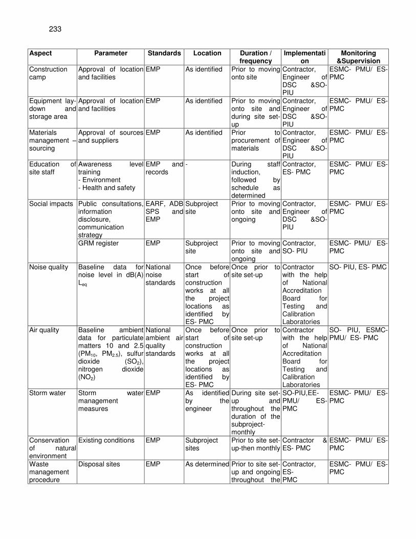
233
Aspect Parameter Standards Location Duration / frequency
Implementation
Monitoring &Supervision
Construction camp
Approval of location and facilities
EMP As identified Prior to moving onto site
Contractor, Engineer of DSC &SO- PIU
ESMC- PMU/ ES- PMC
Equipment lay-down and storage area
Approval of location and facilities
EMP As identified Prior to moving onto site and during site set-up
Contractor, Engineer of DSC &SO- PIU
ESMC- PMU/ ES- PMC
Materials management – sourcing
Approval of sources and suppliers
EMP As identified Prior to procurement of materials
Contractor, Engineer of DSC &SO- PIU
ESMC- PMU/ ES- PMC
Education of site staff
Awareness level training - Environment - Health and safety
EMP and records
- During staff induction, followed by schedule as determined
Contractor, ES- PMC
ESMC- PMU/ ES- PMC
Social impacts Public consultations, information disclosure, communication strategy
EARF, ADB SPS and EMP
Subproject site
Prior to moving onto site and ongoing
Contractor, Engineer of DSC &SO- PIU
ESMC- PMU/ ES- PMC
GRM register EMP Subproject site
Prior to moving onto site and ongoing
Contractor, SO- PIU
ESMC- PMU/ ES- PMC
Noise quality Baseline data for noise level in dB(A) Leq
National noise standards
Once before start of construction works at all the project locations as identified by ES- PMC
Once prior to site set-up
Contractor with the help of National Accreditation Board for Testing and Calibration Laboratories
SO- PIU, ES- PMC
Air quality Baseline ambient data for particulate matters 10 and 2.5 (PM10, PM2.5), sulfur dioxide (SO2), nitrogen dioxide (NO2)
National ambient air quality standards
Once before start of construction works at all the project locations as identified by ES- PMC
Once prior to site set-up
Contractor with the help of National Accreditation Board for Testing and Calibration Laboratories
SO- PIU, ESMC- PMU/ ES- PMC
Storm water Storm water management measures
EMP As identified by the engineer
During site set-up and throughout the duration of the subproject-monthly
SO-PIU,EE- PMU/ ES- PMC
ESMC- PMU/ ES- PMC
Conservation of natural environment
Existing conditions EMP Subproject sites
Prior to site set-up-then monthly
Contractor & ES- PMC
ESMC- PMU/ ES- PMC
Waste management procedure
Disposal sites EMP As determined Prior to site set-up and ongoing throughout the
Contractor, ES- PMC
ESMC- PMU/ ES- PMC
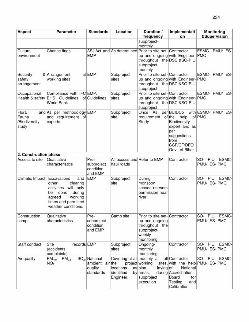
234
Aspect Parameter Standards Location Duration / frequency
Implementation
Monitoring &Supervision
subproject- monthly
Cultural environment
Chance finds ASI Act and EMP
As determined Prior to site set-up and ongoing throughout the subproject- monthly
Contractor with Engineer- DSC &SO-PIU
ESMC- PMU/ ES- PMC
Security & safety arrangement
Arrangement at working sites
EMP Subproject sites
Prior to site set-up and ongoing throughout the subproject
Contractor with Engineer- DSC &SO-PIU
ESMC- PMU/ ES- PMC
Occupational Health & safety
Compliance with IFC EHS Guidelines of World Bank
EMP, Guidelines
Subproject sites
Prior to site set-up and ongoing throughout the subproject
Contractor with Engineer- DSC &SO-PIU
ESMC- PMU/ ES- PMC
Flora and Fauna /Biodiversity study
As per methodology and requirement of experts
EMP Subproject site
Once As per requirement of Study
BUIDCo with the help of Biodiversity expert and as per suggestions from CCF/CF/DFO Govt. of Bihar
ESMC- PMU/ ES- PMC
2. Construction phase Access to site Qualitative
characteristics Pre-subproject condition and EMP
All access and haul roads
Refer to EMP Contractor SO- PIU, ESMC- PMU/ ES- PMC
Climatic Impact Excavations and other clearing activities will only be done during agreed working times and permitted weather conditions.
EMP Subproject site
During monsoon season no work permission near river
Contractor SO- PIU, ESMC- PMU/ ES- PMC
Construction camp
Qualitative characteristics
Pre-subproject condition and EMP
Camp site Prior to site set-up and ongoing throughout the subproject- weekly monitoring
Contractor SO- PIU, ESMC- PMU/ ES- PMC
Staff conduct Site records (accidents, complaints)
EMP Subproject sites
Ongoing- monthly monitoring
Contractor SO- PIU, ESMC- PMU/ ES- PMC
Air quality PM10, PM2.5, SO2, NO2
National ambient air quality standards
Covering at all the project locations as identified by Engineer.
monthly at all working sites, pipe laying areas, during subproject execution
Contractor with the help of National Accreditation Board for Testing and Calibration
SO- PIU, ESMC- PMU/ ES- PMC
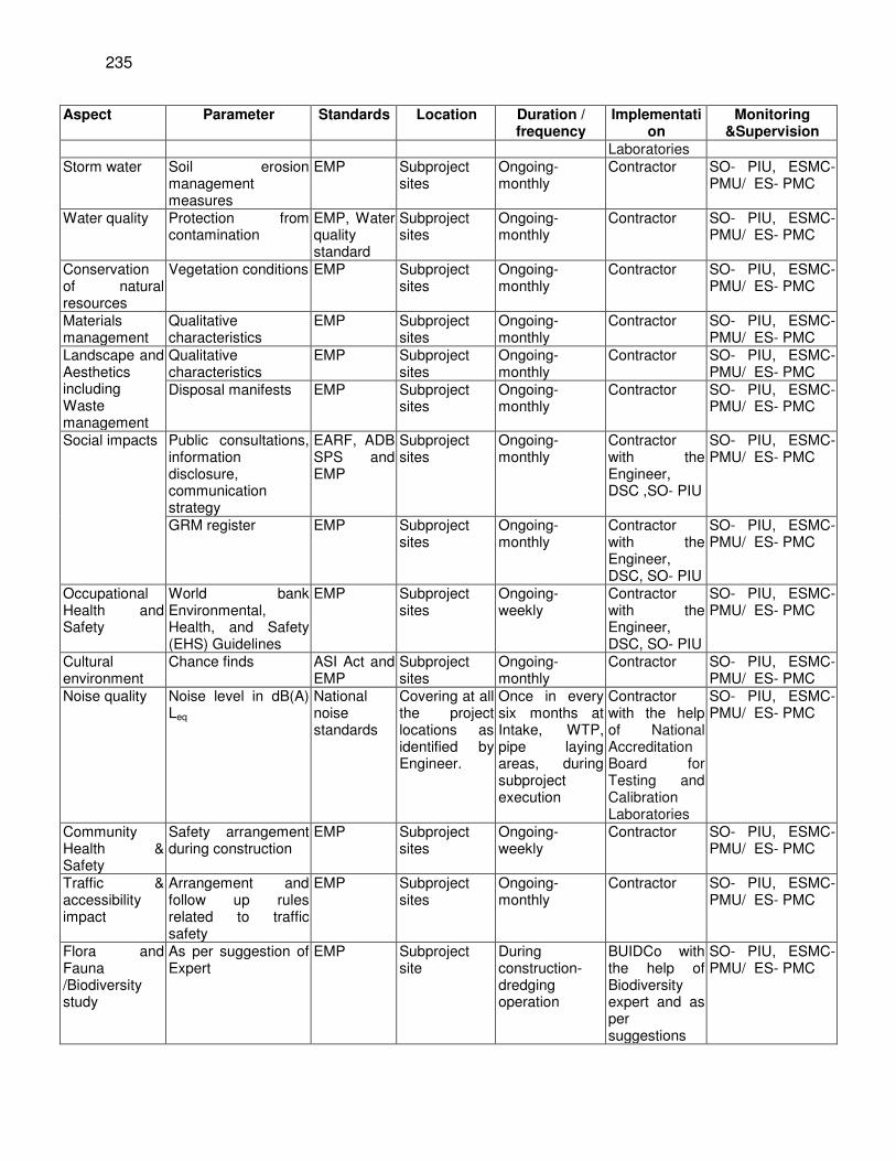
235
Aspect Parameter Standards Location Duration / frequency
Implementation
Monitoring &Supervision
Laboratories Storm water Soil erosion
management measures
EMP Subproject sites
Ongoing- monthly
Contractor SO- PIU, ESMC- PMU/ ES- PMC
Water quality Protection from contamination
EMP, Water quality standard
Subproject sites
Ongoing- monthly
Contractor SO- PIU, ESMC- PMU/ ES- PMC
Conservation of natural resources
Vegetation conditions EMP Subproject sites
Ongoing- monthly
Contractor SO- PIU, ESMC- PMU/ ES- PMC
Materials management
Qualitative characteristics
EMP Subproject sites
Ongoing- monthly
Contractor SO- PIU, ESMC- PMU/ ES- PMC
Landscape and Aesthetics including Waste management
Qualitative characteristics
EMP Subproject sites
Ongoing- monthly
Contractor SO- PIU, ESMC- PMU/ ES- PMC
Disposal manifests EMP Subproject sites
Ongoing- monthly
Contractor SO- PIU, ESMC- PMU/ ES- PMC
Social impacts Public consultations, information disclosure, communication strategy
EARF, ADB SPS and EMP
Subproject sites
Ongoing- monthly
Contractor with the Engineer, DSC ,SO- PIU
SO- PIU, ESMC- PMU/ ES- PMC
GRM register EMP Subproject sites
Ongoing- monthly
Contractor with the Engineer, DSC, SO- PIU
SO- PIU, ESMC- PMU/ ES- PMC
Occupational Health and Safety
World bank Environmental, Health, and Safety (EHS) Guidelines
EMP Subproject sites
Ongoing- weekly
Contractor with the Engineer, DSC, SO- PIU
SO- PIU, ESMC- PMU/ ES- PMC
Cultural environment
Chance finds ASI Act and EMP
Subproject sites
Ongoing- monthly
Contractor SO- PIU, ESMC- PMU/ ES- PMC
Noise quality Noise level in dB(A) Leq
National noise standards
Covering at all the project locations as identified by Engineer.
Once in every six months at Intake, WTP, pipe laying areas, during subproject execution
Contractor with the help of National Accreditation Board for Testing and Calibration Laboratories
SO- PIU, ESMC- PMU/ ES- PMC
Community Health & Safety
Safety arrangement during construction
EMP Subproject sites
Ongoing- weekly
Contractor SO- PIU, ESMC- PMU/ ES- PMC
Traffic & accessibility impact
Arrangement and follow up rules related to traffic safety
EMP Subproject sites
Ongoing- monthly
Contractor SO- PIU, ESMC- PMU/ ES- PMC
Flora and Fauna /Biodiversity study
As per suggestion of Expert
EMP Subproject site
During construction- dredging operation
BUIDCo with the help of Biodiversity expert and as per suggestions
SO- PIU, ESMC- PMU/ ES- PMC
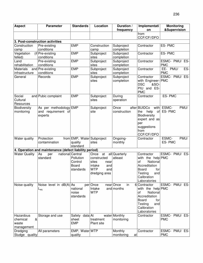
236
Aspect Parameter Standards Location Duration / frequency
Implementation
Monitoring &Supervision
from CCF/CF//DFO
3. Post-construction activities Construction camp
Pre-existing conditions
EMP Construction camp
Subproject completion
Contractor ES- PMC
Vegetation (if felled)
Pre-existing conditions
EMP Subproject sites
Subproject completion
Contractor ES- PMC
Land rehabilitation
Pre-existing conditions
EMP Subproject sites
Subproject completion
Contractor ESMC- PMU/ ES- PMC
Materials and infrastructure
Pre-existing conditions
EMP Subproject sites
Subproject completion
Contractor EE- PMU/ ES- PMC
General Records EMP Subproject sites
Subproject completion
Contractor with Engineer- DSC &SO- PIU and ES-PMC
ESMC- PMU/ ES- PMC
Social and Cultural Resources
Pubic complaint EMP Subproject sites
During operation
Contractor ES- PMC
Biodiversity monitoring
As per methodology and requirement of experts
EMP Subproject site
Once after construction
BUIDCo with the help of Biodiversity expert and as per suggestions from CCF/CF//DFO
ESMC- PMU/ ES- PMC
Water quality Protection from contamination
EMP, Water quality standard
Subproject sites
Ongoing- monthly
Contractor ESMC- PMU/ ES- PMC
4. Operation and maintenance (defect liability period) Water Quality As per national
standard Central Pollution Control Board standards
Once at all constructed sites near intake and WTP and dredging area
Quarterly atleast
Contractor with the help of National Accreditation Board for Testing and Calibration Laboratories
ESMC- PMU/ ES- PMC
Noise quality Noise level in dB(A) Leq
As per national noise standards
Once near Intake and WTP
Once in 6 months
Contractor with the help of National Accreditation Board for Testing and Calibration Laboratories
ESMC- PMU/ ES- PMC
Hazardous chemical & waste management
Storage and use Safety data sheet EMP
At water treatment Plant site
Monthly monitoring
Contractor ESMC- PMU/ ES- PMC
Dredging Sludge quality
All parameters EMP, Water quality
WTP Monthly monitoring at
Contractor ESMC- PMU/ ES- PMC
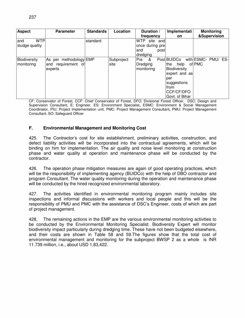
237
Aspect Parameter Standards Location Duration / frequency
Implementation
Monitoring &Supervision
and WTP sludge quality
standard WTP site and once during pre and post dredging
Biodiversity monitoring
As per methodology and requirement of experts
EMP Subproject site
Pre & Post Dredging monitoring
BUIDCo with the help of Biodiversity expert and as per suggestions from CCF/CF/DFO Govt. of Bihar
ESMC- PMU/ ES- PMC
CF: Conservator of Forest, CCF: Chief Conservator of Forest, DFO: Divisional Forest Officer, DSC: Design and Supervision Consultant, E: Engineer, ES: Environment Specialist, ESMC: Environment & Social Management Coordinator, PIU: Project Implementation unit, PMC: Project Management Consultant, PMU: Project Management Consultant, SO: Safeguard Officer
F. Environmental Management and Monitoring Cost
425. The Contractor’s cost for site establishment, preliminary activities, construction, and defect liability activities will be incorporated into the contractual agreements, which will be binding on him for implementation. The air quality and noise level monitoring at construction phase and water quality at operation and maintenance phase will be conducted by the contractor. 426. The operation phase mitigation measures are again of good operating practices, which will be the responsibility of implementing agency (BUIDCo) with the help of DBO contractor and program Consultant. The water quality monitoring during the operation and maintenance phase will be conducted by the hired recognized environmental laboratory. 427. The activities identified in environmental monitoring program mainly includes site inspections and informal discussions with workers and local people and this will be the responsibility of PMU and PMC with the assistance of DSC’s Engineer, costs of which are part of project management. 428. The remaining actions in the EMP are the various environmental monitoring activities to be conducted by the Environmental Monitoring Specialist. Biodiversity Expert will monitor biodiversity impact particularly during dredging time. These have not been budgeted elsewhere, and their costs are shown in Table 58 and 59.The figures show that the total cost of environmental management and monitoring for the subproject BWSP 2 as a whole is INR 11.739 million, i.e., about USD 1,83,422.
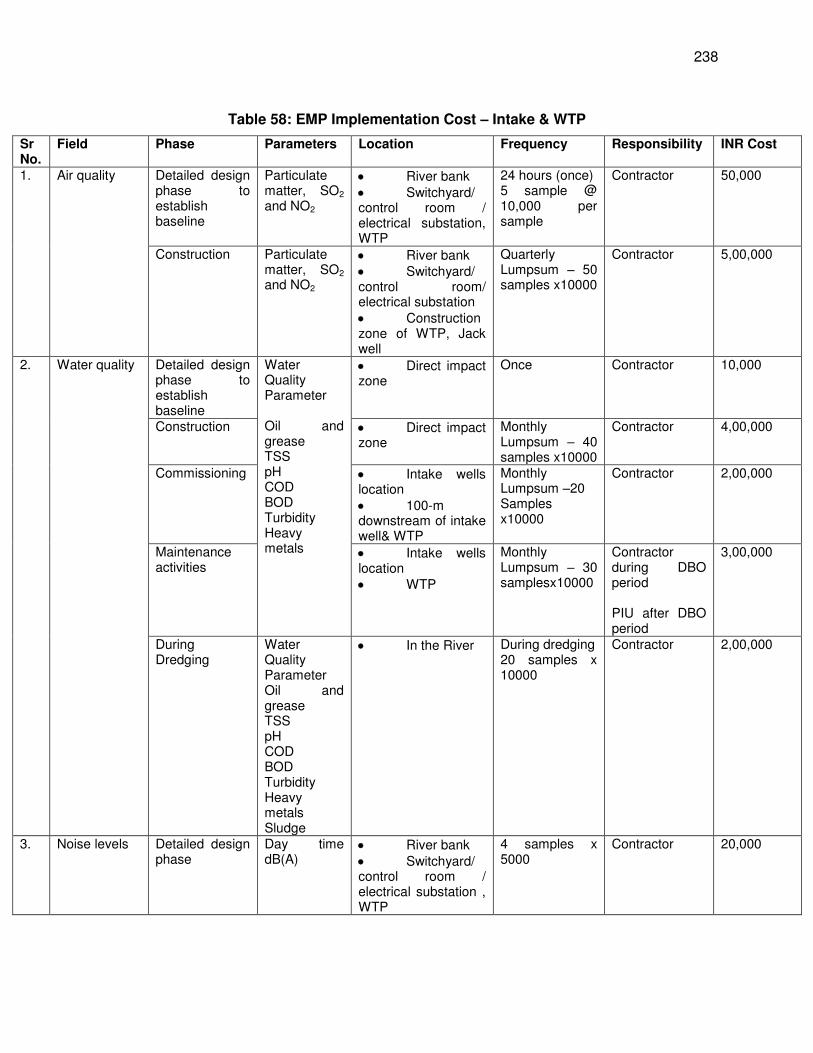
238
Table 58: EMP Implementation Cost – Intake & WTP
Sr No.
Field Phase Parameters Location Frequency Responsibility INR Cost
1. Air quality Detailed design phase to establish baseline
Particulate matter, SO2 and NO2
River bank Switchyard/ control room / electrical substation, WTP
24 hours (once) 5 sample @ 10,000 per sample
Contractor 50,000
Construction Particulate matter, SO2 and NO2
River bank Switchyard/ control room/ electrical substation Construction zone of WTP, Jack well
Quarterly Lumpsum – 50 samples x10000
Contractor 5,00,000
2. Water quality Detailed design phase to establish baseline
Water Quality Parameter Oil and grease TSS pH COD BOD Turbidity Heavy metals
Direct impact zone
Once Contractor 10,000
Construction Direct impact zone
Monthly Lumpsum – 40 samples x10000
Contractor 4,00,000
Commissioning Intake wells location 100-m downstream of intake well& WTP
Monthly Lumpsum –20 Samples x10000
Contractor 2,00,000
Maintenance activities
Intake wells location WTP
Monthly Lumpsum – 30 samplesx10000
Contractor during DBO period PIU after DBO period
3,00,000
During Dredging
Water Quality Parameter Oil and grease TSS pH COD BOD Turbidity Heavy metals Sludge
In the River During dredging 20 samples x 10000
Contractor 2,00,000
3. Noise levels Detailed design phase
Day time dB(A)
River bank Switchyard/ control room / electrical substation , WTP
4 samples x 5000
Contractor 20,000
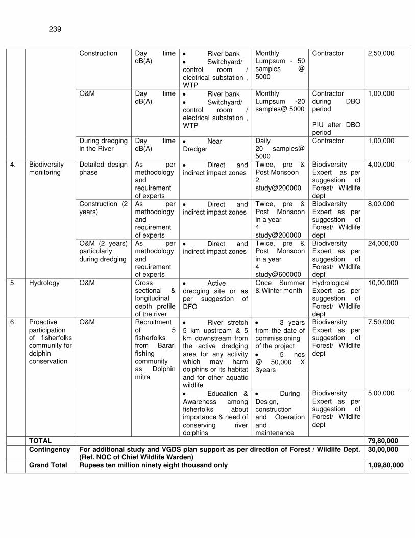
239
Construction Day time dB(A)
River bank Switchyard/ control room / electrical substation , WTP
Monthly Lumpsum - 50 samples @ 5000
Contractor 2,50,000
O&M Day time dB(A)
River bank Switchyard/ control room / electrical substation , WTP
Monthly Lumpsum -20 samples@ 5000
Contractor during DBO period PIU after DBO period
1,00,000
During dredging in the River
Day time dB(A)
Near Dredger
Daily 20 samples@ 5000
Contractor 1,00,000
4. Biodiversity monitoring
Detailed design phase
As per methodology and requirement of experts
Direct and indirect impact zones
Twice, pre & Post Monsoon 2 study@200000
Biodiversity Expert as per suggestion of Forest/ Wildlife dept
4,00,000
Construction (2 years)
As per methodology and requirement of experts
Direct and indirect impact zones
Twice, pre & Post Monsoon in a year 4 study@200000
Biodiversity Expert as per suggestion of Forest/ Wildlife dept
8,00,000
O&M (2 years) particularly during dredging
As per methodology and requirement of experts
Direct and indirect impact zones
Twice, pre & Post Monsoon in a year 4 study@600000
Biodiversity Expert as per suggestion of Forest/ Wildlife dept
24,000,00
5 Hydrology O&M Cross sectional & longitudinal depth profile of the river
Active dredging site or as per suggestion of DFO
Once Summer & Winter month
Hydrological Expert as per suggestion of Forest/ Wildlife dept
10,00,000
6 Proactive participation of fisherfolks community for dolphin conservation
O&M Recruitment of 5 fisherfolks from Barari fishing community as Dolphin mitra
River stretch 5 km upstream & 5 km downstream from the active dredging area for any activity which may harm dolphins or its habitat and for other aquatic wildlife
3 years from the date of commissioning of the project 5 nos @ 50,000 X 3years
Biodiversity Expert as per suggestion of Forest/ Wildlife dept
7,50,000
Education & Awareness among fisherfolks about importance & need of conserving river dolphins
During Design, construction and Operation and maintenance
Biodiversity Expert as per suggestion of Forest/ Wildlife dept
5,00,000
TOTAL 79,80,000
Contingency For additional study and VGDS plan support as per direction of Forest / Wildlife Dept. (Ref. NOC of Chief Wildlife Warden)
30,00,000
Grand Total Rupees ten million ninety eight thousand only 1,09,80,000
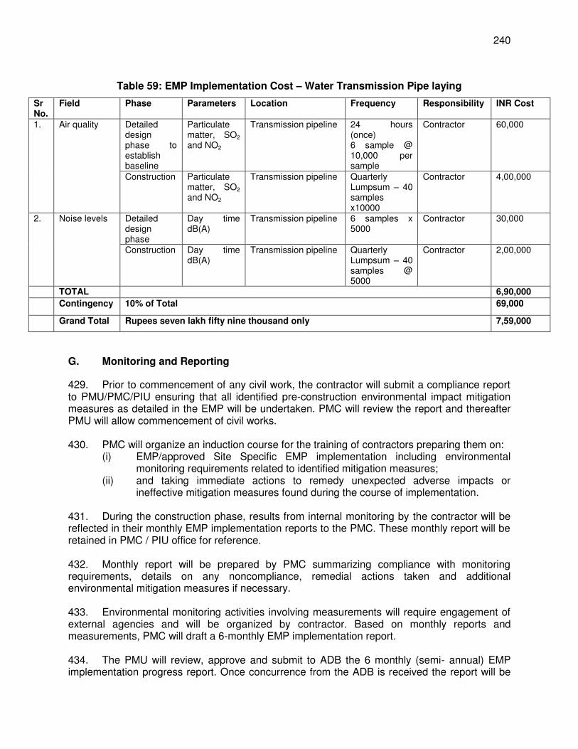
240
Table 59: EMP Implementation Cost – Water Transmission Pipe laying
Sr No.
Field Phase Parameters Location Frequency Responsibility INR Cost
1. Air quality Detailed design phase to establish baseline
Particulate matter, SO2 and NO2
Transmission pipeline 24 hours (once) 6 sample @ 10,000 per sample
Contractor 60,000
Construction Particulate matter, SO2 and NO2
Transmission pipeline Quarterly Lumpsum – 40 samples x10000
Contractor 4,00,000
2. Noise levels Detailed design phase
Day time dB(A)
Transmission pipeline 6 samples x 5000
Contractor 30,000
Construction Day time dB(A)
Transmission pipeline Quarterly Lumpsum – 40 samples @ 5000
Contractor 2,00,000
TOTAL 6,90,000
Contingency 10% of Total 69,000
Grand Total Rupees seven lakh fifty nine thousand only 7,59,000
G. Monitoring and Reporting
429. Prior to commencement of any civil work, the contractor will submit a compliance report to PMU/PMC/PIU ensuring that all identified pre-construction environmental impact mitigation measures as detailed in the EMP will be undertaken. PMC will review the report and thereafter PMU will allow commencement of civil works. 430. PMC will organize an induction course for the training of contractors preparing them on:
(i) EMP/approved Site Specific EMP implementation including environmental monitoring requirements related to identified mitigation measures;
(ii) and taking immediate actions to remedy unexpected adverse impacts or ineffective mitigation measures found during the course of implementation.
431. During the construction phase, results from internal monitoring by the contractor will be reflected in their monthly EMP implementation reports to the PMC. These monthly report will be retained in PMC / PIU office for reference. 432. Monthly report will be prepared by PMC summarizing compliance with monitoring requirements, details on any noncompliance, remedial actions taken and additional environmental mitigation measures if necessary. 433. Environmental monitoring activities involving measurements will require engagement of external agencies and will be organized by contractor. Based on monthly reports and measurements, PMC will draft a 6-monthly EMP implementation report. 434. The PMU will review, approve and submit to ADB the 6 monthly (semi- annual) EMP implementation progress report. Once concurrence from the ADB is received the report will be
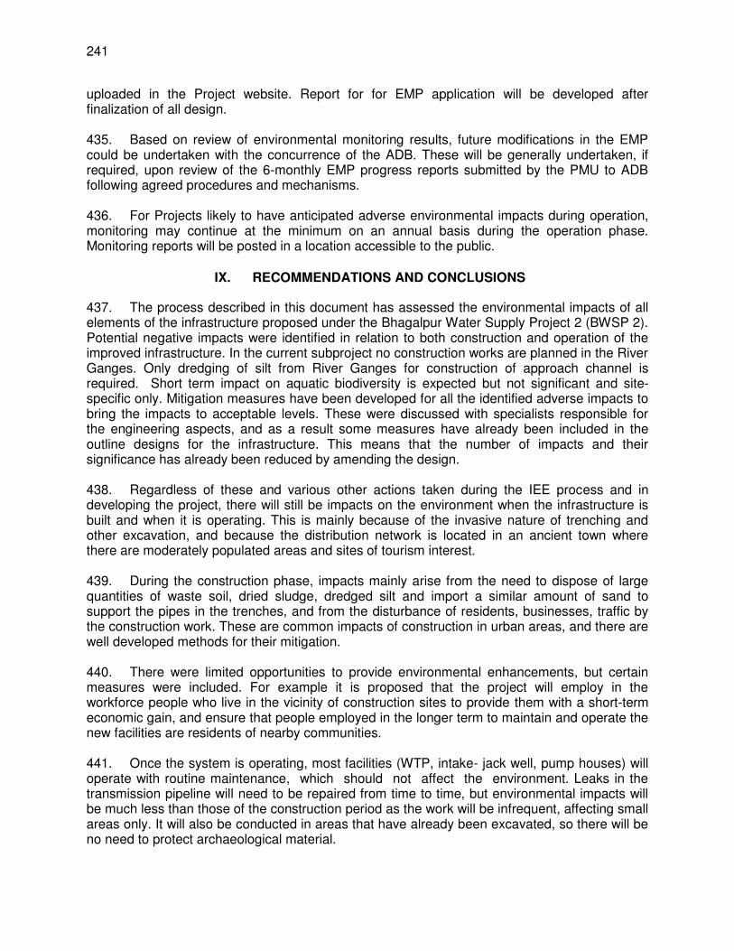
241
uploaded in the Project website. Report for for EMP application will be developed after finalization of all design. 435. Based on review of environmental monitoring results, future modifications in the EMP could be undertaken with the concurrence of the ADB. These will be generally undertaken, if required, upon review of the 6-monthly EMP progress reports submitted by the PMU to ADB following agreed procedures and mechanisms. 436. For Projects likely to have anticipated adverse environmental impacts during operation, monitoring may continue at the minimum on an annual basis during the operation phase. Monitoring reports will be posted in a location accessible to the public.
IX. RECOMMENDATIONS AND CONCLUSIONS
437. The process described in this document has assessed the environmental impacts of all elements of the infrastructure proposed under the Bhagalpur Water Supply Project 2 (BWSP 2). Potential negative impacts were identified in relation to both construction and operation of the improved infrastructure. In the current subproject no construction works are planned in the River Ganges. Only dredging of silt from River Ganges for construction of approach channel is required. Short term impact on aquatic biodiversity is expected but not significant and site-specific only. Mitigation measures have been developed for all the identified adverse impacts to bring the impacts to acceptable levels. These were discussed with specialists responsible for the engineering aspects, and as a result some measures have already been included in the outline designs for the infrastructure. This means that the number of impacts and their significance has already been reduced by amending the design. 438. Regardless of these and various other actions taken during the IEE process and in developing the project, there will still be impacts on the environment when the infrastructure is built and when it is operating. This is mainly because of the invasive nature of trenching and other excavation, and because the distribution network is located in an ancient town where there are moderately populated areas and sites of tourism interest. 439. During the construction phase, impacts mainly arise from the need to dispose of large quantities of waste soil, dried sludge, dredged silt and import a similar amount of sand to support the pipes in the trenches, and from the disturbance of residents, businesses, traffic by the construction work. These are common impacts of construction in urban areas, and there are well developed methods for their mitigation. 440. There were limited opportunities to provide environmental enhancements, but certain measures were included. For example it is proposed that the project will employ in the workforce people who live in the vicinity of construction sites to provide them with a short-term economic gain, and ensure that people employed in the longer term to maintain and operate the new facilities are residents of nearby communities. 441. Once the system is operating, most facilities (WTP, intake- jack well, pump houses) will operate with routine maintenance, which should not affect the environment. Leaks in the transmission pipeline will need to be repaired from time to time, but environmental impacts will be much less than those of the construction period as the work will be infrequent, affecting small areas only. It will also be conducted in areas that have already been excavated, so there will be no need to protect archaeological material.
242
442. The main impact of the operating water supply system will be beneficial as the citizens of Bhagalpur will be provided with a continuous pressurized supply of safe water, which will serve a greater proportion of the population, including the urban poor and other disadvantaged communities. This will improve the quality of life of people especially improving public health in particular and improving the environment in general. This will reduce the incidence of disease associated with poor quality of water supply and sanitation. This will also lead to economic gains as people will have a reliable and secure water supply available all the time relieving their efforts in coping with intermittent water supply, and the time thus saved would result in an increase in their income and savings in medical care costs. 443. Mitigation will be assured by a program of environmental and biodiversity monitoring conducted during construction and operation to ensure that all measures are implemented, and to determine whether the environment and biodiversity is protected as intended. This will include observations on- and off-site, document checks, and interviews with workers and beneficiaries, and any requirements for remedial action will be reported to the PMU. There will also be longer-term surveys to monitor the expected improvements in the quality of domestic water and the health of the population. 444. Finally, stakeholders were involved in developing the IEE through face-to-face discussions on site and a large public meeting held in the town, after which views expressed were incorporated into the IEE and the planning and development of the subproject. The IEE will be made available at public locations in the city and will be disclosed to a wider audience via the ADB website. The consultation process will be continued and expanded during project implementation. 445. The subproject’s Grievance Redressal Mechanism will provide the citizens with a platform for redressal of their grievances and describes the informal and formal channels, time frame and mechanisms for resolving complaints about environmental performance. 446. The EMP will guide the environmentally-sound construction of the subproject and ensure efficient lines of communication between the DSC (Engineer), contractors, PIU and PMU/PMC. The EMP will (i) ensure that the activities are undertaken in a responsible non-detrimental manner; (ii) provide a pro-active, feasible and practical working tool to enable the measurement and monitoring of environmental performance on site; (iii) guide and control the implementation of findings and recommendations of the environmental assessment conducted for the subproject; (iv) detail specific actions deemed necessary to assist in mitigating the environmental impact of the subproject; and (v) ensure that safety recommendations are complied with. 447. A copy of the EMP will be kept on site during the construction period at all times. The EMP will be made binding on all contractors operating on the site and will be included within the Contractual Clauses. Non-compliance with, or any deviation from, the conditions set out in this document constitutes a failure in compliance. 448. The subproject is unlikely to cause significant adverse impacts. The potential adverse impacts that are associated with design, construction, and operation can be mitigated to standard levels without difficulty through proper engineering design and the incorporation or application of recommended mitigation measures and procedures. For the implementation and monitoring of measures in the EMP related to biodiversity and Dolphin conservation, national biodiversity expert will be appointed by BUIDCo. The necessary budget for implementation and monitoring of relevant activities will be provided by BUIDCo. The expert will conduct three

243
monthly compliance monitoring during the construction and operation period. The overall safeguards implementation arrangement is in place and the training program for all the implementation stakeholders (implementing agency, PMU, PIUs, PMC, contractors, etc.) has been outlined. 449. Therefore, as per ADB SPS, the subproject is classified as Environmental Category B and does not require further Environmental Impact Assessment.
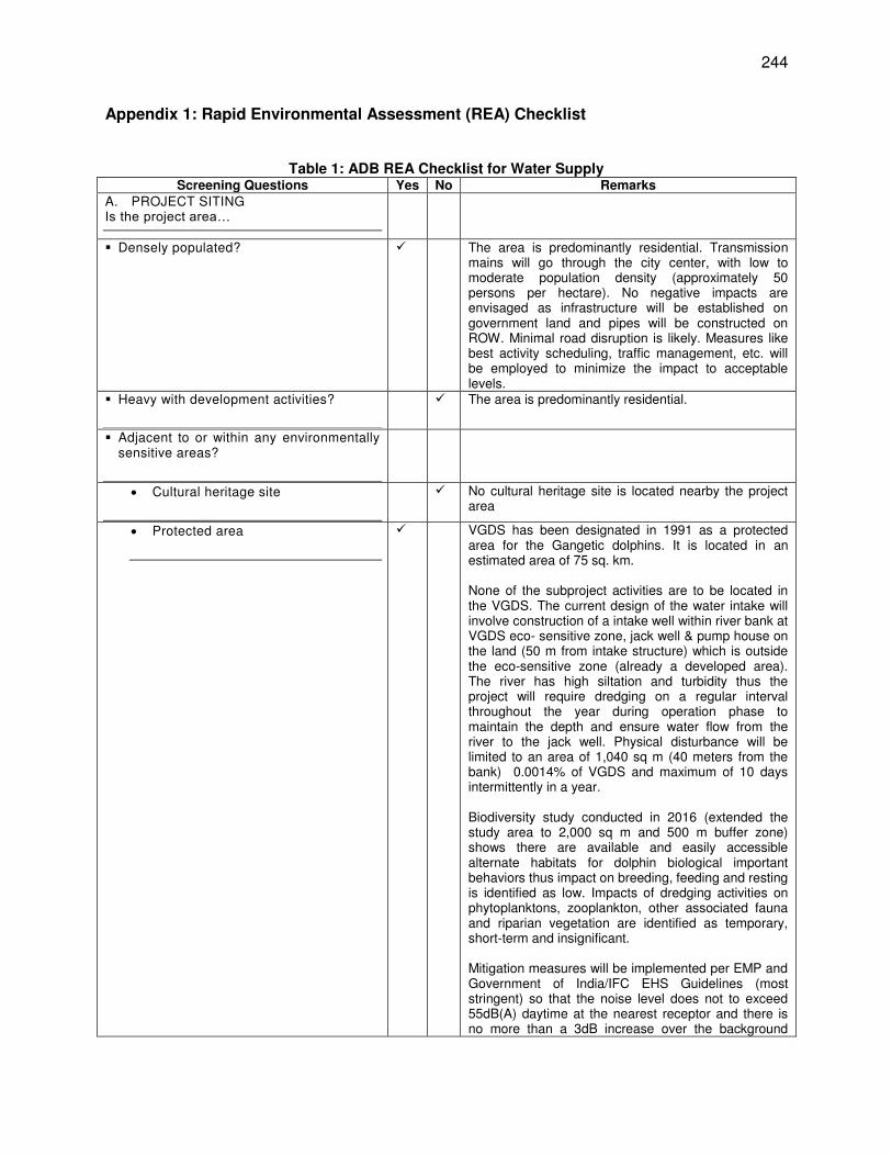
244
Appendix 1: Rapid Environmental Assessment (REA) Checklist
Table 1: ADB REA Checklist for Water Supply Screening Questions Yes No Remarks
A. PROJECT SITING Is the project area…
Densely populated? The area is predominantly residential. Transmission mains will go through the city center, with low to moderate population density (approximately 50 persons per hectare). No negative impacts are envisaged as infrastructure will be established on government land and pipes will be constructed on ROW. Minimal road disruption is likely. Measures like best activity scheduling, traffic management, etc. will be employed to minimize the impact to acceptable levels.
Heavy with development activities?
The area is predominantly residential.
Adjacent to or within any environmentally sensitive areas?
Cultural heritage site
No cultural heritage site is located nearby the project area
Protected area
VGDS has been designated in 1991 as a protected area for the Gangetic dolphins. It is located in an estimated area of 75 sq. km. None of the subproject activities are to be located in the VGDS. The current design of the water intake will involve construction of a intake well within river bank at VGDS eco- sensitive zone, jack well & pump house on the land (50 m from intake structure) which is outside the eco-sensitive zone (already a developed area). The river has high siltation and turbidity thus the project will require dredging on a regular interval throughout the year during operation phase to maintain the depth and ensure water flow from the river to the jack well. Physical disturbance will be limited to an area of 1,040 sq m (40 meters from the bank) 0.0014% of VGDS and maximum of 10 days intermittently in a year. Biodiversity study conducted in 2016 (extended the study area to 2,000 sq m and 500 m buffer zone) shows there are available and easily accessible alternate habitats for dolphin biological important behaviors thus impact on breeding, feeding and resting is identified as low. Impacts of dredging activities on phytoplanktons, zooplankton, other associated fauna and riparian vegetation are identified as temporary, short-term and insignificant. Mitigation measures will be implemented per EMP and Government of India/IFC EHS Guidelines (most stringent) so that the noise level does not to exceed 55dB(A) daytime at the nearest receptor and there is no more than a 3dB increase over the background
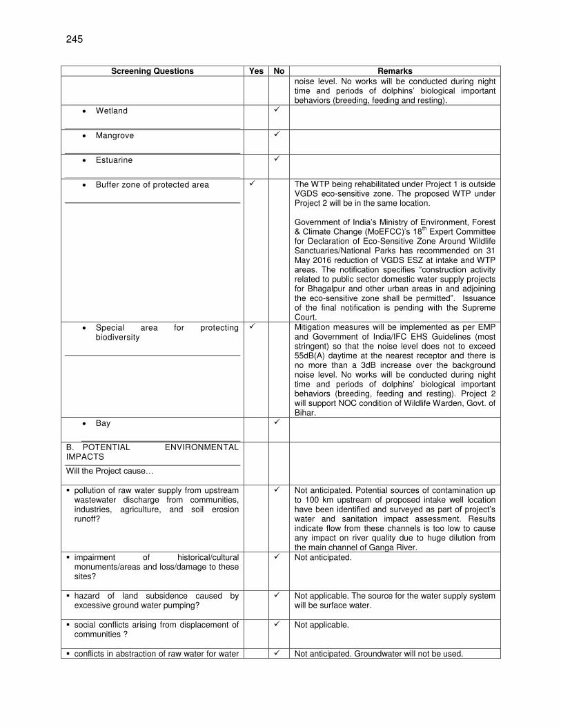
245
Screening Questions Yes No Remarks
noise level. No works will be conducted during night time and periods of dolphins’ biological important behaviors (breeding, feeding and resting).
Wetland
Mangrove
Estuarine
Buffer zone of protected area
The WTP being rehabilitated under Project 1 is outside VGDS eco-sensitive zone. The proposed WTP under Project 2 will be in the same location. Government of India’s Ministry of Environment, Forest & Climate Change (MoEFCC)’s 18th
Expert Committee for Declaration of Eco-Sensitive Zone Around Wildlife Sanctuaries/National Parks has recommended on 31 May 2016 reduction of VGDS ESZ at intake and WTP areas. The notification specifies “construction activity related to public sector domestic water supply projects for Bhagalpur and other urban areas in and adjoining the eco-sensitive zone shall be permitted”. Issuance of the final notification is pending with the Supreme Court.
Special area for protecting biodiversity
Mitigation measures will be implemented as per EMP and Government of India/IFC EHS Guidelines (most stringent) so that the noise level does not to exceed 55dB(A) daytime at the nearest receptor and there is no more than a 3dB increase over the background noise level. No works will be conducted during night time and periods of dolphins’ biological important behaviors (breeding, feeding and resting). Project 2 will support NOC condition of Wildlife Warden, Govt. of Bihar.
Bay
B. POTENTIAL ENVIRONMENTAL IMPACTS
Will the Project cause…
pollution of raw water supply from upstream wastewater discharge from communities, industries, agriculture, and soil erosion runoff?
Not anticipated. Potential sources of contamination up to 100 km upstream of proposed intake well location have been identified and surveyed as part of project’s water and sanitation impact assessment. Results indicate flow from these channels is too low to cause any impact on river quality due to huge dilution from the main channel of Ganga River.
impairment of historical/cultural monuments/areas and loss/damage to these sites?
Not anticipated.
hazard of land subsidence caused by excessive ground water pumping?
Not applicable. The source for the water supply system will be surface water.
social conflicts arising from displacement of communities ?
Not applicable.
conflicts in abstraction of raw water for water Not anticipated. Groundwater will not be used.
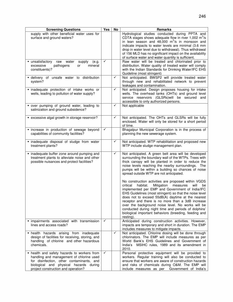
246
Screening Questions Yes No Remarks
supply with other beneficial water uses for surface and ground waters?
Hydrological studies conducted during PPTA and CDTA stages shows adequate flow in river 1,002 m
3/s
in lean season and 48,000 m3/s in monsoon and
indicate impacts to water levels are minimal (3.6 mm drop in water level due to withdrawal). Thus withdrawal of 156 MLD has no significant impact on the availability of surface water and water quantity is sufficient.
unsatisfactory raw water supply (e.g. excessive pathogens or mineral constituents)?
Raw water will be treated and chlorinated prior to distribution. Water quality of treated water will comply with the Indian Standards for Drinking Water/IFC EHS Guideline (most stringent)
delivery of unsafe water to distribution system?
Not anticipated. BWSP2 will provide treated water through new and rehabilitated network to prevent leakages and contamination.
inadequate protection of intake works or wells, leading to pollution of water supply?
Not anticipated. Design proposes housing for intake wells. The overhead tanks (OHTs) and ground level service reservoirs (GLSRs)will be secured and accessible to only authorized persons.
over pumping of ground water, leading to salinization and ground subsidence?
Not applicable
excessive algal growth in storage reservoir?
Not anticipated. The OHTs and GLSRs will be fully enclosed. Water will only be stored for a short period of time.
increase in production of sewage beyond capabilities of community facilities?
Bhagalpur Municipal Corporation is in the process of planning the new sewerage system.
inadequate disposal of sludge from water treatment plants?
Not anticipated. WTP rehabilitation and proposed new WTP include sludge management plan.
inadequate buffer zone around pumping and treatment plants to alleviate noise and other possible nuisances and protect facilities?
Not anticipated. A green belt area will be developed surrounding the boundary wall of the WTPs. Trees with thick canopy will be planted in order to reduce the noise levels reaching the nearby surroundings. The pumps will be within a building so chances of noise spread outside WTP are not anticipated. No construction activities are proposed within VGDS critical habitat. Mitigation measures will be implemented per EMP and Government of India/IFC EHS Guidelines (most stringent) so that the noise level does not to exceed 55dB(A) daytime at the nearest receptor and there is no more than a 3dB increase over the background noise level. No works will be conducted during night time and periods of dolphins’ biological important behaviors (breeding, feeding and resting).
impairments associated with transmission lines and access roads?
Anticipated during construction activities. However, impacts are temporary and short in duration. The EMP includes measures to mitigate impacts.
health hazards arising from inadequate design of facilities for receiving, storing, and handling of chlorine and other hazardous chemicals.
Not anticipated. Chlorine dosing will be done through chlorinators. The EMP will include measures as per World Bank’s EHS Guidelines and Government of India’s MSIHC rules, 1989 and its amendment in 2010.
health and safety hazards to workers from handling and management of chlorine used for disinfection, other contaminants, and biological and physical hazards during project construction and operation?
Personal protective equipment will be provided to workers. Regular training will also be conducted to ensure that workers are aware of construction hazards and risks of chemicals during O&M. The EMP will include measures as per Government of India’s
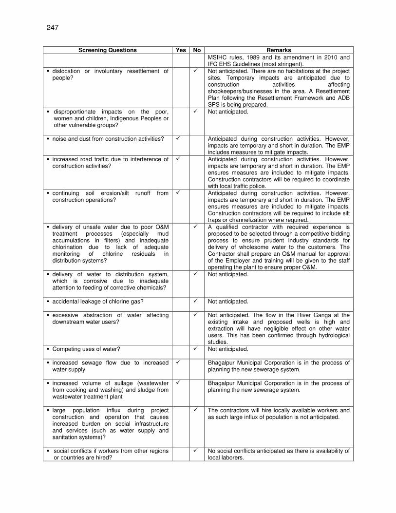
247
Screening Questions Yes No Remarks
MSIHC rules, 1989 and its amendment in 2010 and IFC EHS Guidelines (most stringent).
dislocation or involuntary resettlement of people?
Not anticipated. There are no habitations at the project sites. Temporary impacts are anticipated due to construction activities affecting shopkeepers/businesses in the area. A Resettlement Plan following the Resettlement Framework and ADB SPS is being prepared.
disproportionate impacts on the poor, women and children, Indigenous Peoples or other vulnerable groups?
Not anticipated.
noise and dust from construction activities?
Anticipated during construction activities. However, impacts are temporary and short in duration. The EMP includes measures to mitigate impacts.
increased road traffic due to interference of construction activities?
Anticipated during construction activities. However, impacts are temporary and short in duration. The EMP ensures measures are included to mitigate impacts. Construction contractors will be required to coordinate with local traffic police.
continuing soil erosion/silt runoff from construction operations?
Anticipated during construction activities. However, impacts are temporary and short in duration. The EMP ensures measures are included to mitigate impacts. Construction contractors will be required to include silt traps or channelization where required.
delivery of unsafe water due to poor O&M treatment processes (especially mud accumulations in filters) and inadequate chlorination due to lack of adequate monitoring of chlorine residuals in distribution systems?
A qualified contractor with required experience is proposed to be selected through a competitive bidding process to ensure prudent industry standards for delivery of wholesome water to the customers. The Contractor shall prepare an O&M manual for approval of the Employer and training will be given to the staff operating the plant to ensure proper O&M.
delivery of water to distribution system, which is corrosive due to inadequate attention to feeding of corrective chemicals?
Not anticipated.
accidental leakage of chlorine gas?
Not anticipated.
excessive abstraction of water affecting downstream water users?
Not anticipated. The flow in the River Ganga at the existing intake and proposed wells is high and extraction will have negligible effect on other water users. This has been confirmed through hydrological studies.
Competing uses of water?
Not anticipated.
increased sewage flow due to increased water supply
Bhagalpur Municipal Corporation is in the process of planning the new sewerage system.
increased volume of sullage (wastewater from cooking and washing) and sludge from wastewater treatment plant
Bhagalpur Municipal Corporation is in the process of planning the new sewerage system.
large population influx during project construction and operation that causes increased burden on social infrastructure and services (such as water supply and sanitation systems)?
The contractors will hire locally available workers and as such large influx of population is not anticipated.
social conflicts if workers from other regions or countries are hired?
No social conflicts anticipated as there is availability of local laborers.
248
Screening Questions Yes No Remarks
risks to community health and safety due to
the transport, storage, and use and/or disposal of materials such as explosives, fuel and other chemicals during operation and construction?
There will be no storage and transport of explosives in the project. Fuel and other chemicals will be stored with due care and necessary permissions will be obtained from authorities for storing and handling at project site.
community safety risks due to both accidental and natural hazards, especially where the structural elements or components of the project are accessible to members of the affected community or where their failure could result in injury to the community throughout project construction, operation and decommissioning?
No such community risks anticipated as project facilities planned near River bank which is reasonably away from residential areas.
Table 2: ADB SPS Requirements on Biodiversity Conservation (Critical Habitats)
Requirement Remarks
No project activity will be implemented in areas of critical habitat unless the following requirements are met:
(i) There are no measurable adverse impacts, or likelihood of such, on the critical habitat which could impair its high biodiversity value or the ability to function.
Complied. Physical disturbance will be limited to an area of 1,040 sq m (40 meters from the bank) 0.0014% of VGDS and maximum of 10 days intermittently in a year. Potential risks and impacts are low. There will be potential long-term gain thru Project 2’s support on VGDS Dolphin conservation as per NOC from Chief Wildlife Warden (Annex 1).
(ii) The project is not anticipated to lead to a reduction in the population of any endangered or critically endangered species or a loss in area of the habitat concerned such that the persistence of a viable and representative host ecosystem be compromised.
Complied. Biodiversity study conducted in 2016 shows there are available and easily accessible alternate habitats for dolphins’ biological important behaviors thus impact on breeding, feeding and resting is identified as low. Impacts of dredging activities on phytoplanktons, zooplankton, other associated fauna and riparian vegetation are identified as temporary, short-term and insignificant.
(iii) Any lesser impacts are mitigated in accordance with ADB SPS para 27.
Complied. There will be potential long-term gain thru Project 2’s support on VGDS Dolphin conservation as per NOC from Chief Wildlife Warden (Annex 1).
When a project involves activities in a critical habitat, the borrower/client will retain qualified and experienced external experts to assist in conducting the assessment.
Complied. Experts from Vikramshila Biodiversity Research and Education Centre (VBREC) and Bhagalpur University have been involved since 2011 in the conduct of biodiversity studies and assessments of potential impacts on due to designs.
A Checklist for Preliminary Climate Risk Screening
Country/Project Title: India /Bhagalpur water Supply Project (Tranche-2) Sector: Water Supply Subsector: Urban Development Division/Department: Urban development
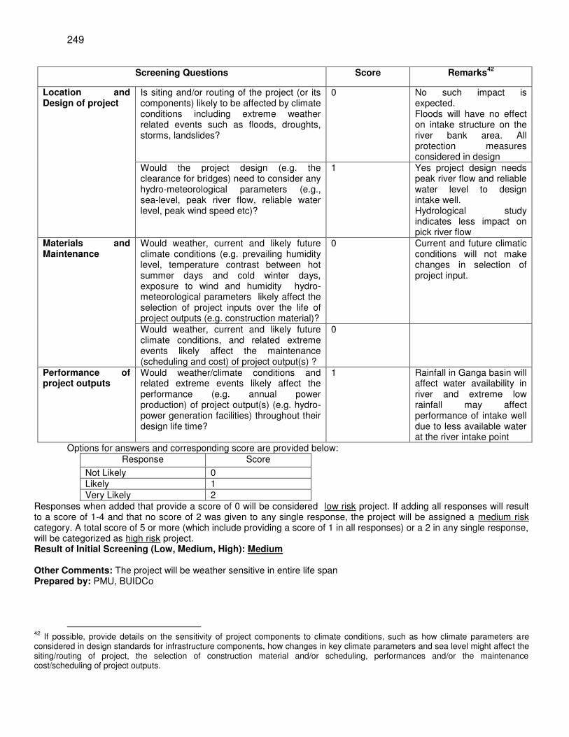
249
Screening Questions Score Remarks42
Location and Design of project
Is siting and/or routing of the project (or its components) likely to be affected by climate conditions including extreme weather related events such as floods, droughts, storms, landslides?
0 No such impact is expected. Floods will have no effect on intake structure on the river bank area. All protection measures considered in design
Would the project design (e.g. the clearance for bridges) need to consider any hydro-meteorological parameters (e.g., sea-level, peak river flow, reliable water level, peak wind speed etc)?
1 Yes project design needs peak river flow and reliable water level to design intake well. Hydrological study indicates less impact on pick river flow
Materials and Maintenance
Would weather, current and likely future climate conditions (e.g. prevailing humidity level, temperature contrast between hot summer days and cold winter days, exposure to wind and humidity hydro-meteorological parameters likely affect the selection of project inputs over the life of project outputs (e.g. construction material)?
0 Current and future climatic conditions will not make changes in selection of project input.
Would weather, current and likely future climate conditions, and related extreme events likely affect the maintenance (scheduling and cost) of project output(s) ?
0
Performance of project outputs
Would weather/climate conditions and related extreme events likely affect the performance (e.g. annual power production) of project output(s) (e.g. hydro-power generation facilities) throughout their design life time?
1 Rainfall in Ganga basin will affect water availability in river and extreme low rainfall may affect performance of intake well due to less available water at the river intake point
Options for answers and corresponding score are provided below: Response Score
Not Likely 0 Likely 1 Very Likely 2
Responses when added that provide a score of 0 will be considered low risk project. If adding all responses will result to a score of 1-4 and that no score of 2 was given to any single response, the project will be assigned a medium risk category. A total score of 5 or more (which include providing a score of 1 in all responses) or a 2 in any single response, will be categorized as high risk project. Result of Initial Screening (Low, Medium, High): Medium
Other Comments: The project will be weather sensitive in entire life span Prepared by: PMU, BUIDCo
42
If possible, provide details on the sensitivity of project components to climate conditions, such as how climate parameters are considered in design standards for infrastructure components, how changes in key climate parameters and sea level might affect the siting/routing of project, the selection of construction material and/or scheduling, performances and/or the maintenance cost/scheduling of project outputs.
250
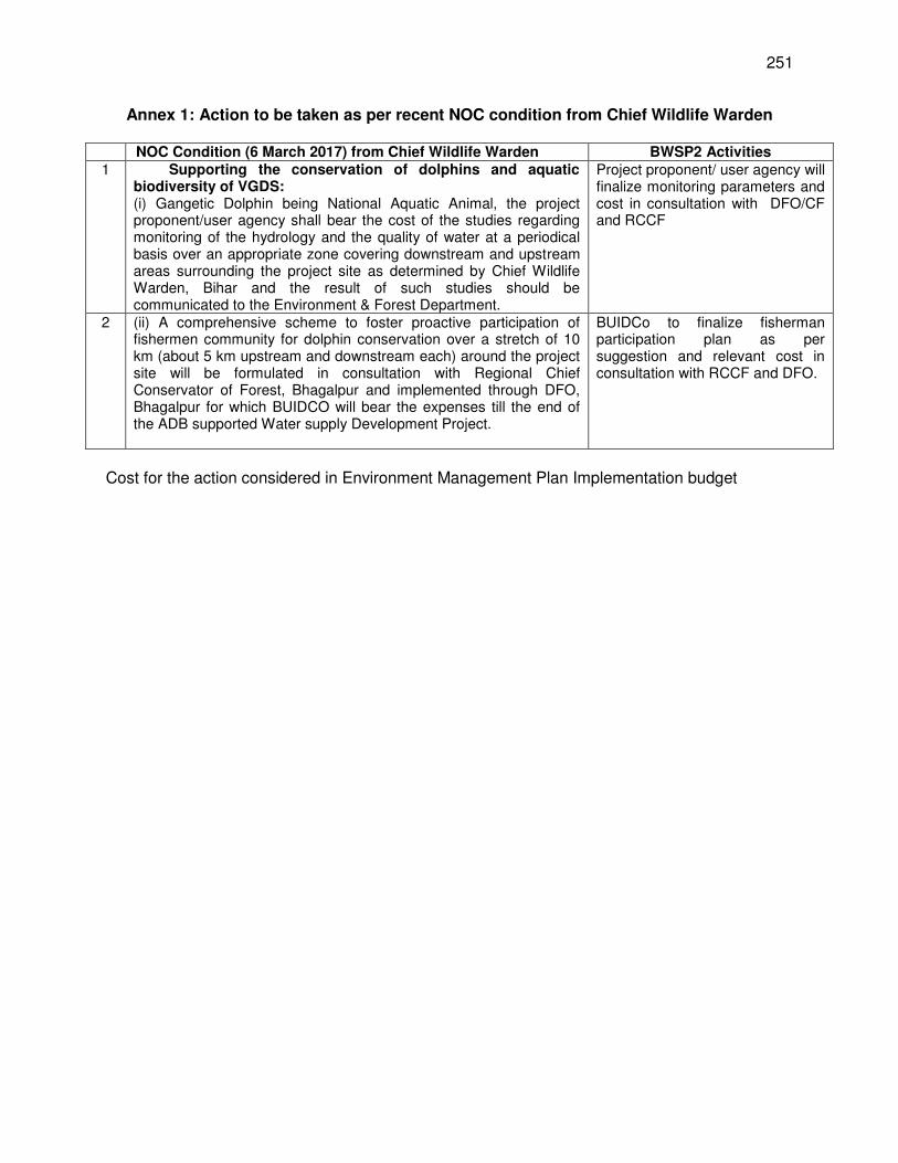
251
Annex 1: Action to be taken as per recent NOC condition from Chief Wildlife Warden
NOC Condition (6 March 2017) from Chief Wildlife Warden BWSP2 Activities 1 Supporting the conservation of dolphins and aquatic
biodiversity of VGDS: (i) Gangetic Dolphin being National Aquatic Animal, the project proponent/user agency shall bear the cost of the studies regarding monitoring of the hydrology and the quality of water at a periodical basis over an appropriate zone covering downstream and upstream areas surrounding the project site as determined by Chief Wildlife Warden, Bihar and the result of such studies should be communicated to the Environment & Forest Department.
Project proponent/ user agency will finalize monitoring parameters and cost in consultation with DFO/CF and RCCF
2 (ii) A comprehensive scheme to foster proactive participation of fishermen community for dolphin conservation over a stretch of 10 km (about 5 km upstream and downstream each) around the project site will be formulated in consultation with Regional Chief Conservator of Forest, Bhagalpur and implemented through DFO, Bhagalpur for which BUIDCO will bear the expenses till the end of the ADB supported Water supply Development Project.
BUIDCo to finalize fisherman participation plan as per suggestion and relevant cost in consultation with RCCF and DFO.
Cost for the action considered in Environment Management Plan Implementation budget
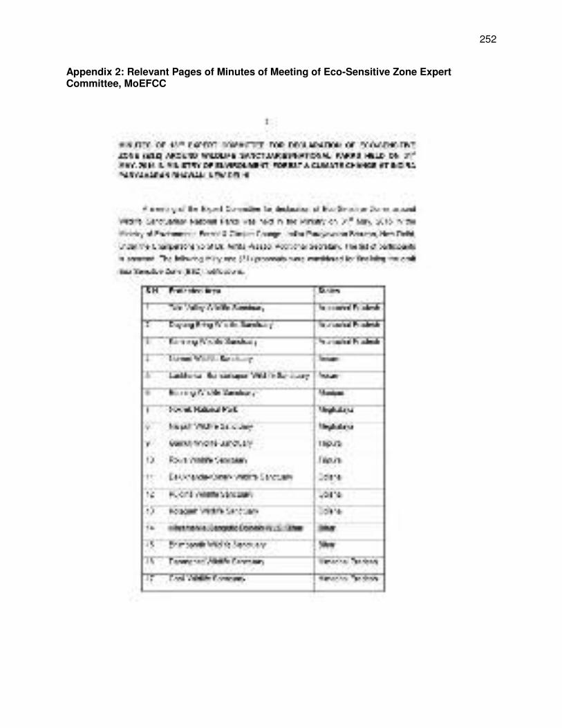
252
Appendix 2: Relevant Pages of Minutes of Meeting of Eco-Sensitive Zone Expert Committee, MoEFCC
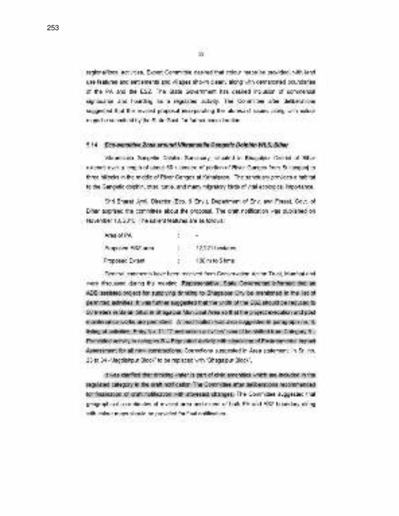
253
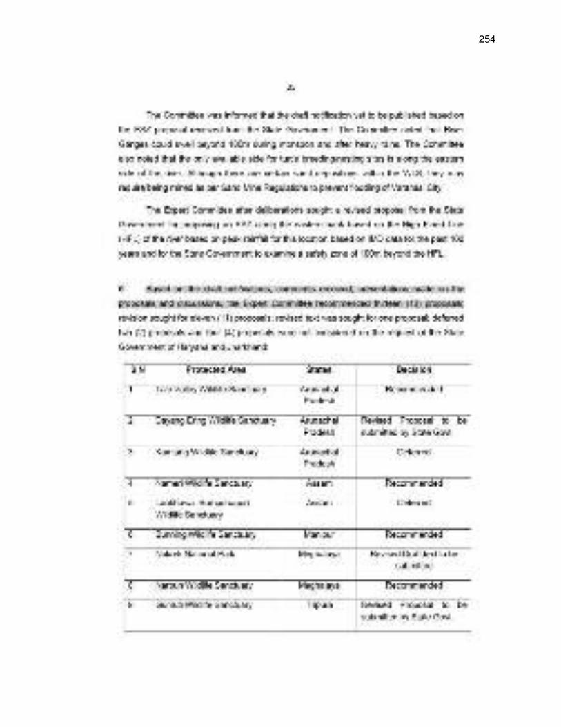
254
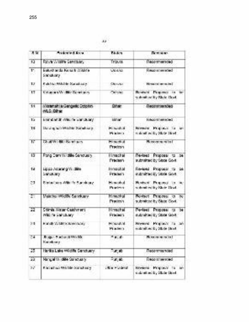
255
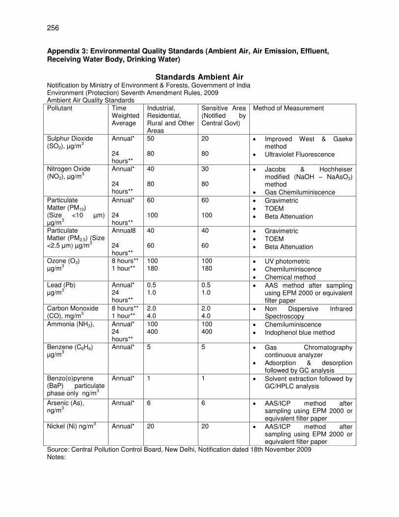
256
Appendix 3: Environmental Quality Standards (Ambient Air, Air Emission, Effluent, Receiving Water Body, Drinking Water)
Standards Ambient Air
Notification by Ministry of Environment & Forests, Government of India Environment (Protection) Seventh Amendment Rules, 2009 Ambient Air Quality Standards Pollutant
Time Weighted Average
Industrial, Residential, Rural and Other Areas
Sensitive Area (Notified by Central Govt)
Method of Measurement
Sulphur Dioxide (SO2), µg/m
3
Annual* 24 hours**
50 80
20 80
Improved West & Gaeke method
Ultraviolet Fluorescence
Nitrogen Oxide (NO2), µg/m
3
Annual* 24 hours**
40 80
30 80
Jacobs & Hochheiser modified (NaOH – NaAsO2) method
Gas Chemiluminiscence Particulate Matter (PM10) (Size <10 µm) µg/m
3
Annual* 24 hours**
60 100
60 100
Gravimetric TOEM Beta Attenuation
Particulate Matter (PM2.5) (Size <2.5 µm) µg/m
3
Annual8 24 hours**
40 60
40 60
Gravimetric TOEM Beta Attenuation
Ozone (O3) µg/m
3
8 hours** 1 hour**
100 180
100 180
UV photometric Chemiluminiscence Chemical method
Lead (Pb) µg/m
3
Annual* 24 hours**
0.5 1.0
0.5 1.0
AAS method after sampling using EPM 2000 or equivalent filter paper
Carbon Monoxide (CO), mg/m
3
8 hours** 1 hour**
2.0 4.0
2.0 4.0
Non Dispersive Infrared Spectroscopy
Ammonia (NH3), Annual* 24 hours**
100 400
100 400
Chemiluminiscence Indophenol blue method
Benzene (C6H6) µg/m
3
Annual*
5
5 Gas Chromatography continuous analyzer
Adsorption & desorption followed by GC analysis
Benzo(o)pyrene (BaP) particulate phase only ng/m
3
Annual*
1 1 Solvent extraction followed by GC/HPLC analysis
Arsenic (As), ng/m
3
Annual*
6
6 AAS/ICP method after sampling using EPM 2000 or equivalent filter paper
Nickel (Ni) ng/m3 Annual*
20 20 AAS/ICP method after sampling using EPM 2000 or equivalent filter paper
Source: Central Pollution Control Board, New Delhi, Notification dated 18th November 2009 Notes:
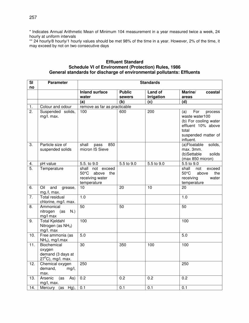
257
* Indicates Annual Arithmetic Mean of Minimum 104 measurement in a year measured twice a week, 24 hourly at uniform intervals ** 24 hourly/8 hourly/1 hourly values should be met 98% of the time in a year. However, 2% of the time, it may exceed by not on two consecutive days
Effluent Standard Schedule VI of Environment (Protection) Rules, 1986
General standards for discharge of environmental pollutants: Effluents Sl no
Parameter Standards
Inland surface water
Public sewers
Land of Irrigation
Marine/ coastal areas
(a) (b) (c) (d) 1. Colour and odour remove as far as practicable 2.
Suspended solids, mg/l. max.
100
600 200 (a) For process waste water100 (b) For cooling water effluent 10% above total suspended matter of influent.
3.
Particle size of suspended solids
shall pass 850 micron IS Sieve
(a)Floatable solids, max. 3mm. (b)Settable solids (max 850 micron)
4. pH value 5.5. to 9.0 5.5 to 9.0 5.5 to 9.0 5.5 to 9.0 5. Temperature
shall not exceed 50°C above the receiving water temperature
shall not exceed 50°C above the receiving water temperature
6. Oil and grease, mg./l, max.
10 20 10 20
7. Total residual chlorine, mg/l. max.
1.0 1.0
8. Ammonical nitrogen (as N.) mg/l max
50 50 50
9. Total Kjeldahl Nitrogen (as NH3) mg/l. max
100 100
10. Free ammonia (as NH3), mg/l.max
5.0 5.0
11. Biochemical oxygen demand (3 days at 27
0C), mg/l. max.
30 350 100 100
12. Chemical oxygen demand, mg/l, max.
250 250
13. Arsenic (as As) mg/l, max.
0.2 0.2 0.2 0.2
14. Mercury (as Hg), 0.1 0.1 0.1 0.1
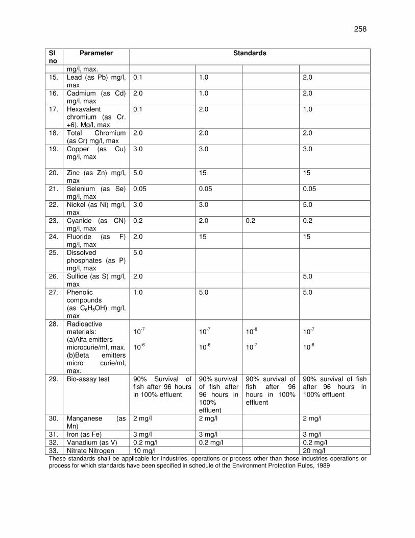
258
Sl no
Parameter Standards
mg/l, max. 15. Lead (as Pb) mg/l,
max 0.1 1.0 2.0
16. Cadmium (as Cd) mg/l. max
2.0 1.0 2.0
17. Hexavalent chromium (as Cr. +6). Mg/l, max
0.1 2.0 1.0
18. Total Chromium (as Cr) mg/l, max
2.0 2.0 2.0
19. Copper (as Cu) mg/l, max
3.0 3.0 3.0
20. Zinc (as Zn) mg/l, max
5.0 15 15
21. Selenium (as Se) mg/l, max
0.05 0.05 0.05
22. Nickel (as Ni) mg/l, max
3.0 3.0 5.0
23. Cyanide (as CN) mg/l, max
0.2 2.0 0.2 0.2
24. Fluoride (as F) mg/l, max
2.0 15 15
25. Dissolved phosphates (as P) mg/l, max
5.0
26. Sulfide (as S) mg/l, max
2.0 5.0
27. Phenolic compounds (as C6H5OH) mg/l, max
1.0 5.0 5.0
28. Radioactive materials: (a)Alfa emitters microcurie/ml, max. (b)Beta emitters micro curie/ml, max.
10
-7
10
-6
10
-7
10
-6
10
-8
10
-7
10
-7
10
-6
29. Bio-assay test
90% Survival of fish after 96 hours in 100% effluent
90% survival of fish after 96 hours in 100% effluent
90% survival of fish after 96 hours in 100% effluent
90% survival of fish after 96 hours in 100% effluent
30. Manganese (as Mn)
2 mg/l 2 mg/l 2 mg/l
31. Iron (as Fe) 3 mg/l 3 mg/l 3 mg/l 32. Vanadium (as V) 0.2 mg/l 0.2 mg/l 0.2 mg/l 33. Nitrate Nitrogen 10 mg/l 20 mg/l These standards shall be applicable for industries, operations or process other than those industries operations or process for which standards have been specified in schedule of the Environment Protection Rules, 1989
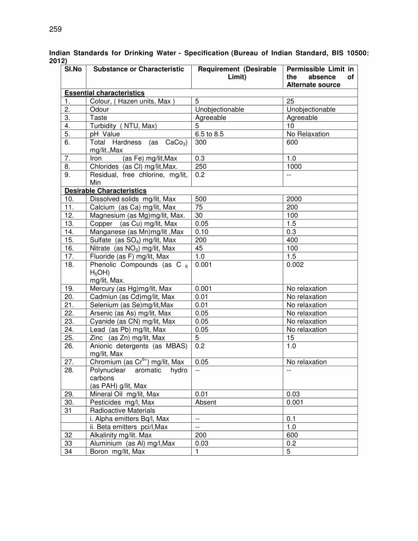
259
Indian Standards for Drinking Water - Specification (Bureau of Indian Standard, BIS 10500: 2012)
Sl.No Substance or Characteristic Requirement (Desirable Limit)
Permissible Limit in the absence of Alternate source
Essential characteristics 1. Colour, ( Hazen units, Max ) 5 25 2. Odour Unobjectionable Unobjectionable 3. Taste Agreeable Agreeable 4. Turbidity ( NTU, Max) 5 10 5. pH Value 6.5 to 8.5 No Relaxation 6. Total Hardness (as CaCo3)
mg/lit.,Max 300 600
7. Iron (as Fe) mg/lit,Max 0.3 1.0 8. Chlorides (as Cl) mg/lit,Max. 250 1000 9. Residual, free chlorine, mg/lit,
Min 0.2 --
Desirable Characteristics 10. Dissolved solids mg/lit, Max 500 2000 11. Calcium (as Ca) mg/lit, Max 75 200 12. Magnesium (as Mg)mg/lit, Max. 30 100 13. Copper (as Cu) mg/lit, Max 0.05 1.5 14. Manganese (as Mn)mg/lit ,Max 0.10 0.3 15. Sulfate (as SO4) mg/lit, Max 200 400 16. Nitrate (as NO3) mg/lit, Max 45 100 17. Fluoride (as F) mg/lit, Max 1.0 1.5 18. Phenolic Compounds (as C 6
H5OH) mg/lit, Max.
0.001 0.002
19. Mercury (as Hg)mg/lit, Max 0.001 No relaxation 20. Cadmiun (as Cd)mg/lit, Max 0.01 No relaxation 21. Selenium (as Se)mg/lit,Max 0.01 No relaxation 22. Arsenic (as As) mg/lit, Max 0.05 No relaxation 23. Cyanide (as CN) mg/lit, Max 0.05 No relaxation 24. Lead (as Pb) mg/lit, Max 0.05 No relaxation 25. Zinc (as Zn) mg/lit, Max 5 15 26. Anionic detergents (as MBAS)
mg/lit, Max 0.2 1.0
27. Chromium (as Cr6+
) mg/lit, Max 0.05 No relaxation 28. Polynuclear aromatic hydro
carbons (as PAH) g/lit, Max
-- --
29. Mineral Oil mg/lit, Max 0.01 0.03 30. Pesticides mg/l, Max Absent 0.001 31 Radioactive Materials i. Alpha emitters Bq/l, Max -- 0.1 ii. Beta emitters pci/l,Max -- 1.0 32 Alkalinity mg/lit. Max 200 600 33 Aluminium (as Al) mg/l,Max 0.03 0.2 34 Boron mg/lit, Max 1 5
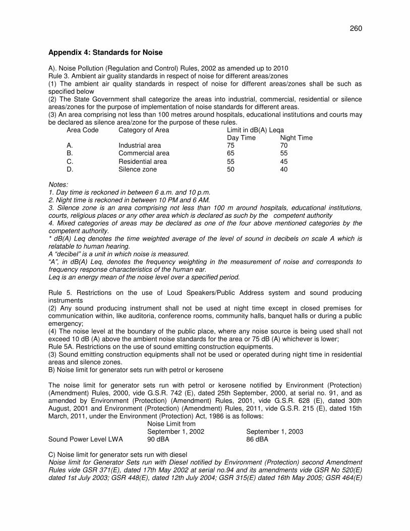
260
Appendix 4: Standards for Noise A). Noise Pollution (Regulation and Control) Rules, 2002 as amended up to 2010 Rule 3. Ambient air guality standards in respect of noise for different areas/zones (1) The ambient air quality standards in respect of noise for different areas/zones shall be such as specified below (2) The State Government shall categorize the areas into industrial, commercial, residential or silence areas/zones for the purpose of implementation of noise standards for different areas. (3) An area comprising not less than 100 metres around hospitals, educational institutions and courts may be declared as silence area/zone for the purpose of these rules.
Area Code
Category of Area Limit in dB(A) Leqa Day Time Night Time
A. Industrial area 75 70 B. Commercial area 65 55
C. Residential area 55 45 D. Silence zone 50 40
Notes: 1. Day time is reckoned in between 6 a.m. and 10 p.m. 2. Night time is reckoned in between 10 PM and 6 AM. 3. Silence zone is an area comprising not less than 100 m around hospitals, educational institutions, courts, religious places or any other area which is declared as such by the competent authority 4. Mixed categories of areas may be declared as one of the four above mentioned categories by the competent authority. * dB(A) Leq denotes the time weighted average of the level of sound in decibels on scale A which is relatable to human hearing. A “decibel” is a unit in which noise is measured. “A”, in dB(A) Leq, denotes the frequency weighting in the measurement of noise and corresponds to frequency response characteristics of the human ear. Leq is an energy mean of the noise level over a specified period. Rule 5. Restrictions on the use of Loud Speakers/Public Address system and sound producing instruments (2) Any sound producing instrument shall not be used at night time except in closed premises for communication within, like auditoria, conference rooms, community halls, banquet halls or during a public emergency; (4) The noise level at the boundary of the public place, where any noise source is being used shall not exceed 10 dB (A) above the ambient noise standards for the area or 75 dB (A) whichever is lower; Rule 5A. Restrictions on the use of sound emitting construction equipments. (3) Sound emitting construction equipments shall not be used or operated during night time in residential areas and silence zones. B) Noise limit for generator sets run with petrol or kerosene The noise limit for generator sets run with petrol or kerosene notified by Environment (Protection) (Amendment) Rules, 2000, vide G.S.R. 742 (E), dated 25th September, 2000, at serial no. 91, and as amended by Environment (Protection) (Amendment) Rules, 2001, vide G.S.R. 628 (E), dated 30th August, 2001 and Environment (Protection) (Amendment) Rules, 2011, vide G.S.R. 215 (E), dated 15th March, 2011, under the Environment (Protection) Act, 1986 is as follows: Noise Limit from September 1, 2002 September 1, 2003 Sound Power Level LWA 90 dBA 86 dBA C) Noise limit for generator sets run with diesel Noise limit for Generator Sets run with Diesel notified by Environment (Protection) second Amendment Rules vide GSR 371(E), dated 17th May 2002 at serial no.94 and its amendments vide GSR No 520(E) dated 1st July 2003; GSR 448(E), dated 12th July 2004; GSR 315(E) dated 16th May 2005; GSR 464(E)
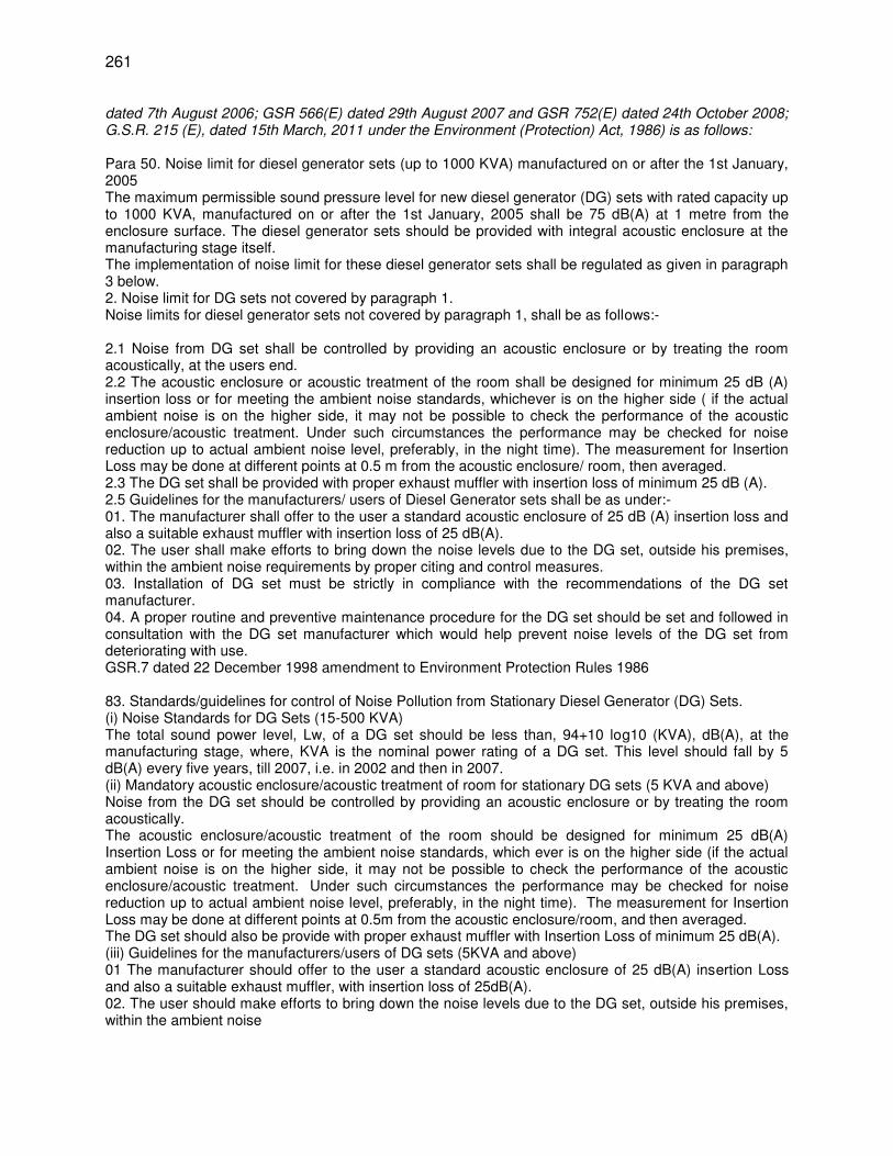
261
dated 7th August 2006; GSR 566(E) dated 29th August 2007 and GSR 752(E) dated 24th October 2008; G.S.R. 215 (E), dated 15th March, 2011 under the Environment (Protection) Act, 1986) is as follows: Para 50. Noise limit for diesel generator sets (up to 1000 KVA) manufactured on or after the 1st January, 2005 The maximum permissible sound pressure level for new diesel generator (DG) sets with rated capacity up to 1000 KVA, manufactured on or after the 1st January, 2005 shall be 75 dB(A) at 1 metre from the enclosure surface. The diesel generator sets should be provided with integral acoustic enclosure at the manufacturing stage itself. The implementation of noise limit for these diesel generator sets shall be regulated as given in paragraph 3 below. 2. Noise limit for DG sets not covered by paragraph 1. Noise limits for diesel generator sets not covered by paragraph 1, shall be as follows:- 2.1 Noise from DG set shall be controlled by providing an acoustic enclosure or by treating the room acoustically, at the users end. 2.2 The acoustic enclosure or acoustic treatment of the room shall be designed for minimum 25 dB (A) insertion loss or for meeting the ambient noise standards, whichever is on the higher side ( if the actual ambient noise is on the higher side, it may not be possible to check the performance of the acoustic enclosure/acoustic treatment. Under such circumstances the performance may be checked for noise reduction up to actual ambient noise level, preferably, in the night time). The measurement for Insertion Loss may be done at different points at 0.5 m from the acoustic enclosure/ room, then averaged. 2.3 The DG set shall be provided with proper exhaust muffler with insertion loss of minimum 25 dB (A). 2.5 Guidelines for the manufacturers/ users of Diesel Generator sets shall be as under:- 01. The manufacturer shall offer to the user a standard acoustic enclosure of 25 dB (A) insertion loss and also a suitable exhaust muffler with insertion loss of 25 dB(A). 02. The user shall make efforts to bring down the noise levels due to the DG set, outside his premises, within the ambient noise requirements by proper citing and control measures. 03. Installation of DG set must be strictly in compliance with the recommendations of the DG set manufacturer. 04. A proper routine and preventive maintenance procedure for the DG set should be set and followed in consultation with the DG set manufacturer which would help prevent noise levels of the DG set from deteriorating with use. GSR.7 dated 22 December 1998 amendment to Environment Protection Rules 1986 83. Standards/guidelines for control of Noise Pollution from Stationary Diesel Generator (DG) Sets. (i) Noise Standards for DG Sets (15-500 KVA) The total sound power level, Lw, of a DG set should be less than, 94+10 log10 (KVA), dB(A), at the manufacturing stage, where, KVA is the nominal power rating of a DG set. This level should fall by 5 dB(A) every five years, till 2007, i.e. in 2002 and then in 2007. (ii) Mandatory acoustic enclosure/acoustic treatment of room for stationary DG sets (5 KVA and above) Noise from the DG set should be controlled by providing an acoustic enclosure or by treating the room acoustically. The acoustic enclosure/acoustic treatment of the room should be designed for minimum 25 dB(A) Insertion Loss or for meeting the ambient noise standards, which ever is on the higher side (if the actual ambient noise is on the higher side, it may not be possible to check the performance of the acoustic enclosure/acoustic treatment. Under such circumstances the performance may be checked for noise reduction up to actual ambient noise level, preferably, in the night time). The measurement for Insertion Loss may be done at different points at 0.5m from the acoustic enclosure/room, and then averaged. The DG set should also be provide with proper exhaust muffler with Insertion Loss of minimum 25 dB(A). (iii) Guidelines for the manufacturers/users of DG sets (5KVA and above) 01 The manufacturer should offer to the user a standard acoustic enclosure of 25 dB(A) insertion Loss and also a suitable exhaust muffler, with insertion loss of 25dB(A). 02. The user should make efforts to bring down the noise levels due to the DG set, outside his premises, within the ambient noise
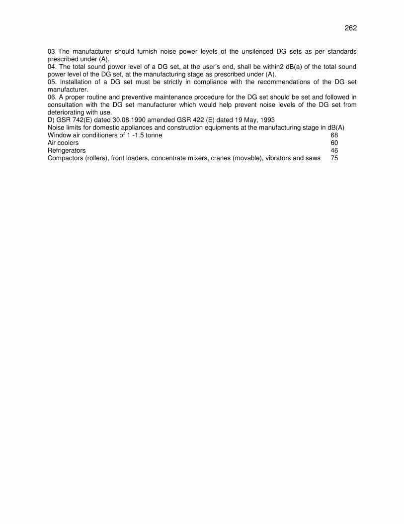
262
03 The manufacturer should furnish noise power levels of the unsilenced DG sets as per standards prescribed under (A). 04. The total sound power level of a DG set, at the user’s end, shall be within2 dB(a) of the total sound power level of the DG set, at the manufacturing stage as prescribed under (A). 05. Installation of a DG set must be strictly in compliance with the recommendations of the DG set manufacturer. 06. A proper routine and preventive maintenance procedure for the DG set should be set and followed in consultation with the DG set manufacturer which would help prevent noise levels of the DG set from deteriorating with use. D) GSR 742(E) dated 30.08.1990 amended GSR 422 (E) dated 19 May, 1993 Noise limits for domestic appliances and construction equipments at the manufacturing stage in dB(A) Window air conditioners of 1 -1.5 tonne 68 Air coolers 60 Refrigerators 46 Compactors (rollers), front loaders, concentrate mixers, cranes (movable), vibrators and saws 75
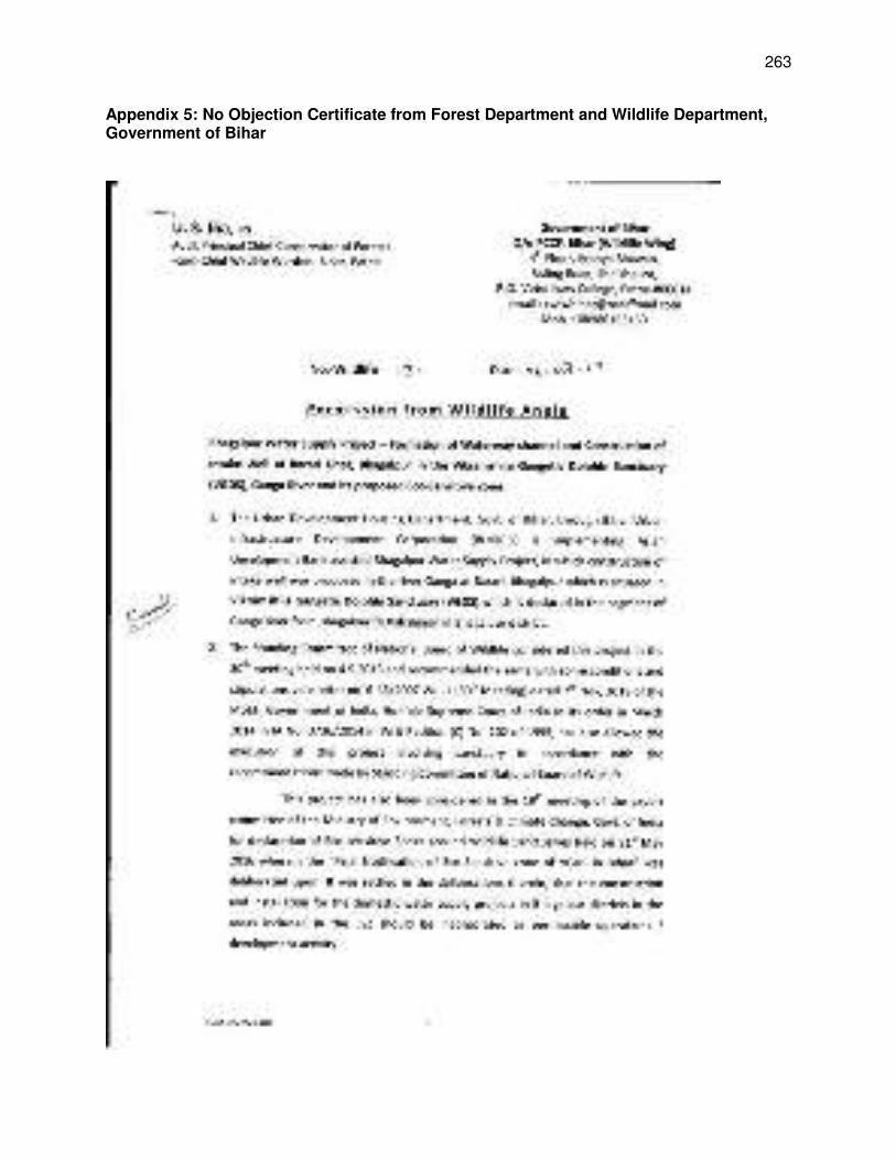
263
Appendix 5: No Objection Certificate from Forest Department and Wildlife Department, Government of Bihar
264
265
266
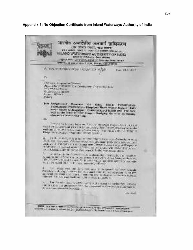
267
Appendix 6: No Objection Certificate from Inland Waterways Authority of India
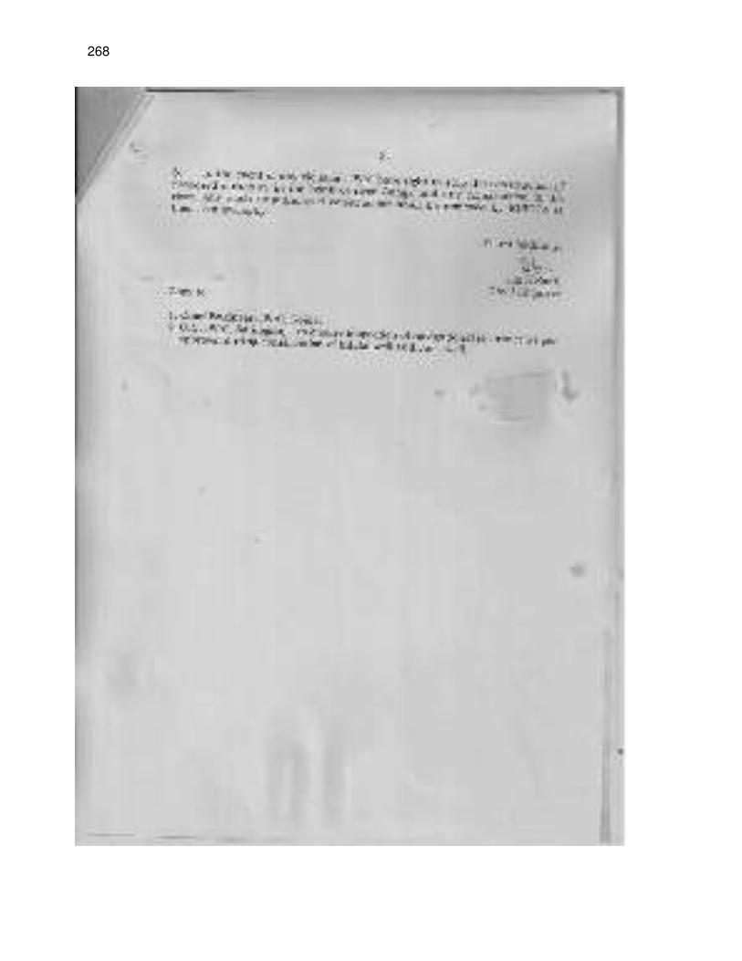
268
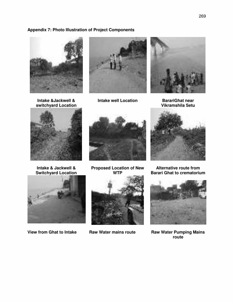
269
Appendix 7: Photo Illustration of Project Components
Intake &Jackwell & switchyard Location
Intake well Location BarariGhat near Vikramshila Setu
Intake & Jackwell & Switchyard Location
Proposed Location of New WTP
Alternative route from Barari Ghat to crematorium
View from Ghat to Intake Raw Water mains route Raw Water Pumping Mains route
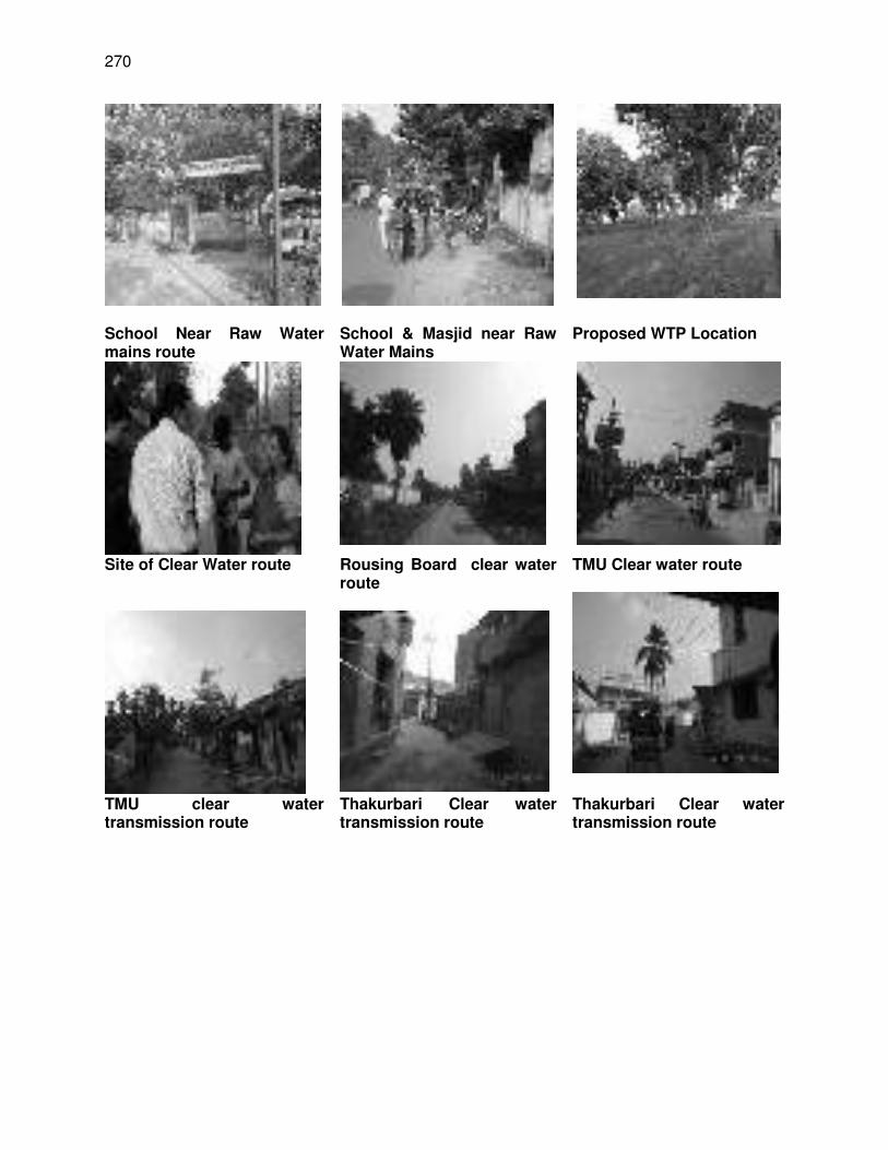
270
School Near Raw Water mains route
School & Masjid near Raw Water Mains
Proposed WTP Location
Site of Clear Water route Rousing Board clear water route
TMU Clear water route
TMU clear water transmission route
Thakurbari Clear water transmission route
Thakurbari Clear water transmission route
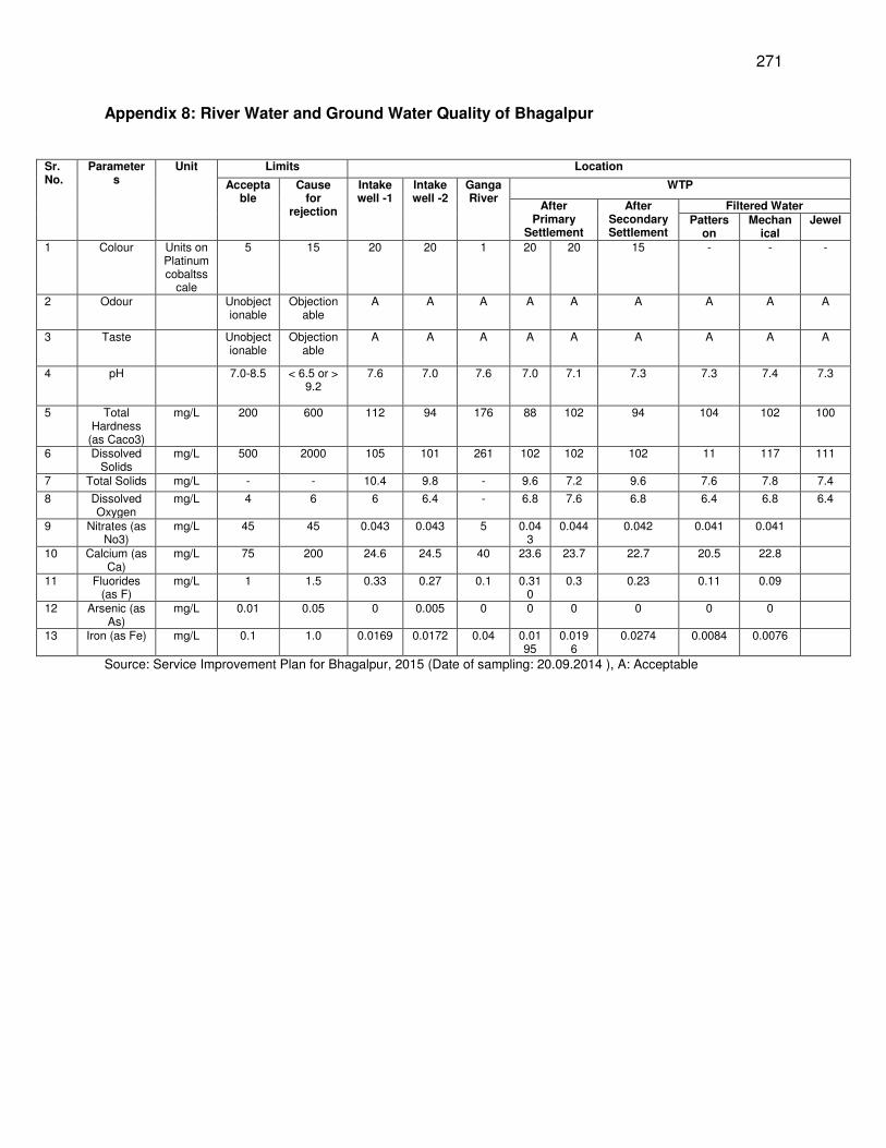
271
Appendix 8: River Water and Ground Water Quality of Bhagalpur
Sr. No.
Parameters
Unit Limits Location
Acceptable
Cause for
rejection
Intake well -1
Intake well -2
Ganga River
WTP
After Primary
Settlement
After Secondary Settlement
Filtered Water Patters
on Mechan
ical Jewel
1 Colour Units on Platinum cobaltss
cale
5 15 20 20 1 20 20 15 - - -
2 Odour Unobjectionable
Objectionable
A A A A A A A A A
3 Taste Unobjectionable
Objectionable
A A A A A A A A A
4 pH 7.0-8.5 < 6.5 or > 9.2
7.6 7.0 7.6 7.0 7.1 7.3 7.3 7.4 7.3
5 Total Hardness
(as Caco3)
mg/L 200 600 112 94 176 88 102 94 104 102 100
6 Dissolved Solids
mg/L 500 2000 105 101 261 102 102 102 11 117 111
7 Total Solids mg/L - - 10.4 9.8 - 9.6 7.2 9.6 7.6 7.8 7.4
8 Dissolved Oxygen
mg/L 4 6 6 6.4 - 6.8 7.6 6.8 6.4 6.8 6.4
9 Nitrates (as No3)
mg/L 45 45 0.043 0.043 5 0.043
0.044 0.042 0.041 0.041
10 Calcium (as Ca)
mg/L 75 200 24.6 24.5 40 23.6 23.7 22.7 20.5 22.8
11 Fluorides (as F)
mg/L 1 1.5 0.33 0.27 0.1 0.310
0.3 0.23 0.11 0.09
12 Arsenic (as As)
mg/L 0.01 0.05 0 0.005 0 0 0 0 0 0
13 Iron (as Fe) mg/L 0.1 1.0 0.0169 0.0172 0.04 0.0195
0.0196
0.0274 0.0084 0.0076
Source: Service Improvement Plan for Bhagalpur, 2015 (Date of sampling: 20.09.2014 ), A: Acceptable
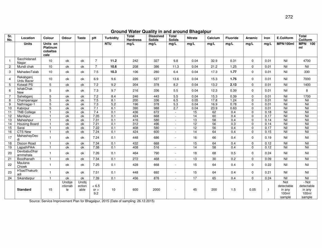
272
Ground Water Quality in and around Bhagalpur Sr. No.
Location Colour Odour Taste pH Turbidity Total Hardness
Dissolved Solids
Total Solids
Nitrate Calcium Fluoride Arsenic Iron E.Coliform Total Coliform
Units Units on Platinum cobaltsscale
NTU mg/L mg/L mg/L mg/L mg/L mg/L mg/L mg/L MPN/100ml MPN/ 100 ml
1 Sacchidanad Nagar
10 ok ok 7 11.2 242 327 9.8 0.04 32.9 0.31 0 0.01 Nil 4700
2 Mundi chak 10 ok ok 7 10.6 208 386 11.3 0.04 21.2 1.25 0 0.01 Nil Nil
3 MahadeoTalab 10 ok ok 7.5 10.3 106 280 6.4 0.04 17.3 1.77 0 0.01 Nil 330
4 Rekabganj Urdu Bazar
10 ok ok 6.9 9.6 226 527 13.6 0.04 15.3 1.75 0 0.01 Nil 7000
5 Kotwali PS 5 ok ok 7.2 9.2 204 378 8.2 0.04 13.2 2.13 0 0.01 Nil 1400
6 IshakChak New
5 ok ok 7.3 9.7 216 336 5.5 0.04 12.3 0.39 0 0.01 Nil 8
7 Sahebganj 5 ok ok 7.2 8.4 246 443 5.5 0.04 15.3 0.39 0 0.01 Nil 1700 8 Champanagar 5 ok ok 7.5 8.1 200 336 6.5 0.05 17.8 1.24 0 0.01 Nil Nil 9 Nathnagar-1 5 ok ok 7.3 5.2 196 378 5.3 0.04 16.9 0.78 0 0.01 Nil Nil
10 Kabirpur 5 ok ok 7.1 6.1 390 988 2.7 0.04 23.9 0.63 0 0.01 Nil Nil 11 TNB College 1 ok ok 7.4 0.1 436 672 - 15 62 0.4 0 0.18 Nil Nil 12 Manikpur 1 ok ok 7.35 0.1 424 668 - 14 60 0.4 0 0.17 Nil Nil 13 Maheshpur 1 ok ok 7.31 0.1 416 580 - 13 58 0.4 0 0.14 Nil Nil 14 Housing Board 1 ok ok 7.21 0.1 312 496 - 12 56 0.3 0 0.14 Nil Nil 15 Sarai 1 ok ok 7.22 0.1 408 580 - 12 56 0.4 0 0.17 Nil Nil 16 CTS New 1 ok ok 7.24 0.1 424 600 - 14 64 0.4 0 0.15 Nil Nil
17 MahashayDeodi
1 ok ok 7.24 0.1 448 686 - 16 66 0.4 0 0.19 Nil Nil
18 Discon Road 1 ok ok 7.34 0.1 432 668 15 64 0.4 0 0.12 Nil Nil 19 LajpathPArk 1 ok ok 7.38 0.1 408 516 - 14 58 0.4 0 0.12 Nil Nil
20 DevibabuDhararnmshala
1 ok ok 7.26 0.1 464 790 - 18 68 0.5 0 0.24 Nil Nil
21 Boodhanath 1 ok ok 7.34 0.1 272 468 - 13 30 0.2 0 0.09 Nil Nil
22 Maulana Chowk
1 ok ok 7.25 0.1 428 668 - 15 64 0.4 0 0.22 Nil Nil
23 H’badThakurbadi
1 ok ok 7.51 0.1 448 692 - 15 64 0.4 0 0.21 Nil Nil
24 Sikandarpur 1 ok ok 7.39 0.1 456 876 - 17 65 0.4 0 0.24 Nil Nil
Standard 15
Unobjectionab
le
Unobjectionable
< 6.5 or > 9.2
10 600 2000 - 45 200 1.5 0.05 .1
Not detectable
in any 100ml sample
- Not detectable
in any 100ml sample
Source: Service Improvement Plan for Bhagalpur, 2015 (Date of sampling: 26.12.2015)
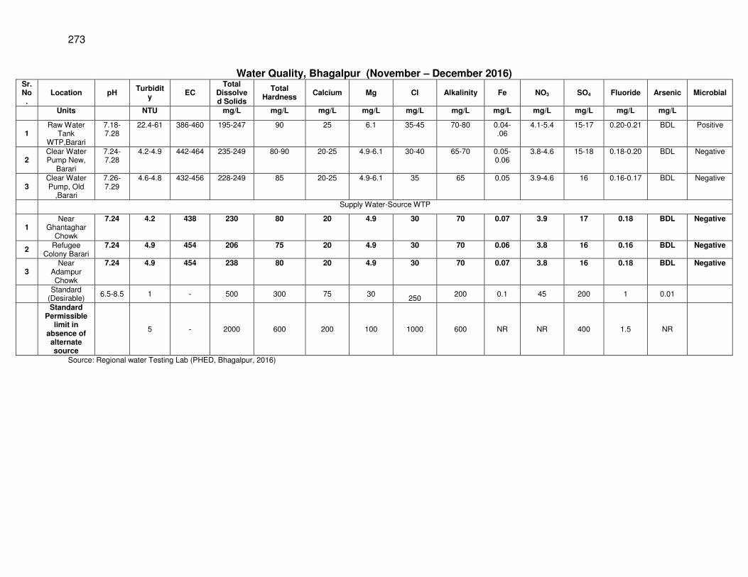
273
Water Quality, Bhagalpur (November – December 2016) Sr. No.
Location pH Turbidit
y EC
Total Dissolved Solids
Total Hardness
Calcium Mg
Cl Alkalinity Fe NO3 SO4 Fluoride Arsenic Microbial
Units NTU mg/L mg/L mg/L mg/L mg/L mg/L mg/L mg/L mg/L mg/L mg/L
1 Raw Water
Tank WTP,Barari
7.18-7.28
22.4-61 386-460 195-247 90 25 6.1 35-45 70-80 0.04-.06
4.1-5.4 15-17 0.20-0.21 BDL Positive
2 Clear Water Pump New,
Barari
7.24-7.28
4.2-4.9 442-464 235-249 80-90 20-25 4.9-6.1 30-40 65-70 0.05-0.06
3.8-4.6 15-18 0.18-0.20 BDL Negative
3 Clear Water Pump, Old
,Barari
7.26-7.29
4.6-4.8 432-456 228-249 85 20-25 4.9-6.1 35 65 0.05 3.9-4.6 16 0.16-0.17 BDL Negative
Supply Water-Source WTP
1 Near
Ghantaghar Chowk
7.24 4.2 438 230 80 20 4.9 30 70 0.07 3.9 17 0.18 BDL Negative
2 Refugee
Colony Barari 7.24 4.9 454 206 75 20 4.9 30 70 0.06 3.8 16 0.16 BDL Negative
3 Near
Adampur Chowk
7.24 4.9 454 238 80 20 4.9 30 70 0.07 3.8 16 0.18 BDL Negative
Standard
(Desirable) 6.5-8.5 1 - 500 300 75 30
250
200 0.1 45 200 1 0.01
Standard Permissible
limit in absence of alternate source
5 - 2000 600 200 100 1000 600 NR NR 400 1.5 NR
Source: Regional water Testing Lab (PHED, Bhagalpur, 2016)
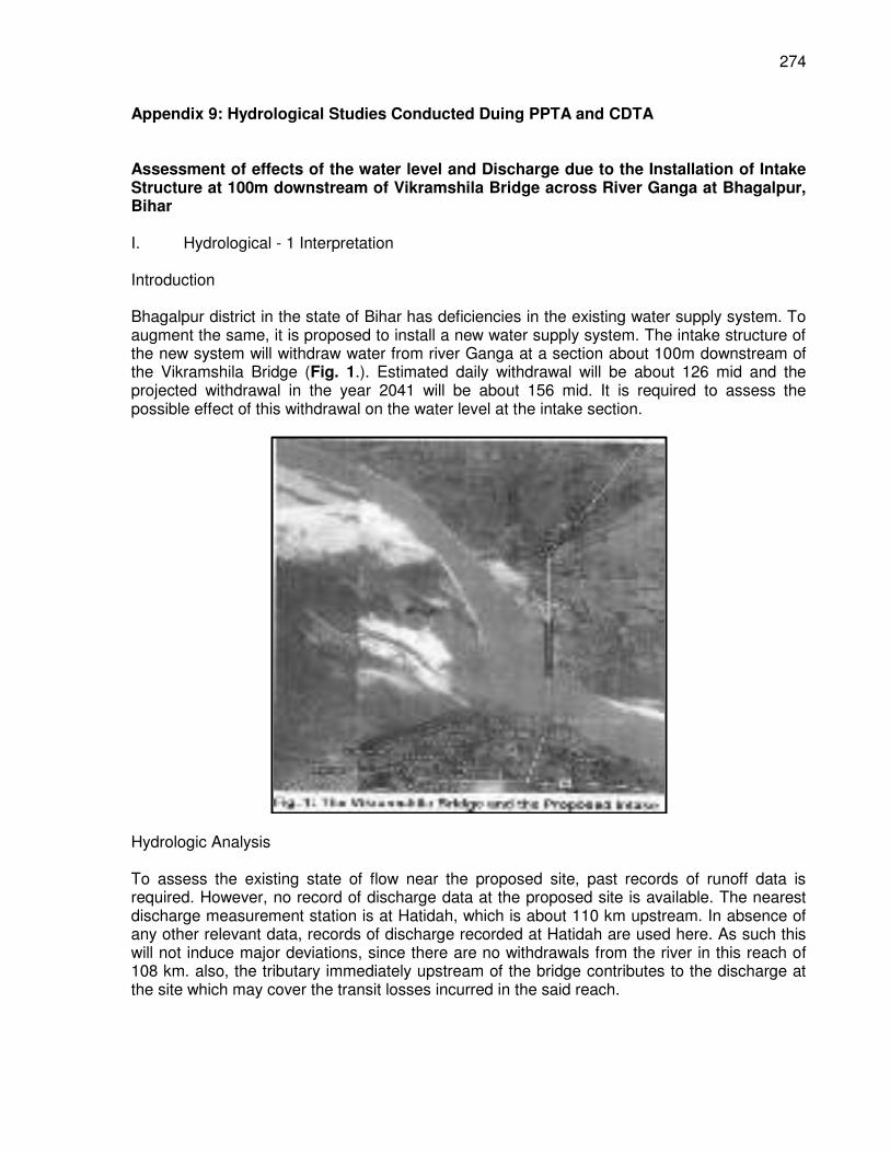
274
Appendix 9: Hydrological Studies Conducted Duing PPTA and CDTA Assessment of effects of the water level and Discharge due to the Installation of Intake Structure at 100m downstream of Vikramshila Bridge across River Ganga at Bhagalpur, Bihar I. Hydrological - 1 Interpretation Introduction Bhagalpur district in the state of Bihar has deficiencies in the existing water supply system. To augment the same, it is proposed to install a new water supply system. The intake structure of the new system will withdraw water from river Ganga at a section about 100m downstream of the Vikramshila Bridge (Fig. 1.). Estimated daily withdrawal will be about 126 mid and the projected withdrawal in the year 2041 will be about 156 mid. It is required to assess the possible effect of this withdrawal on the water level at the intake section.
Hydrologic Analysis To assess the existing state of flow near the proposed site, past records of runoff data is required. However, no record of discharge data at the proposed site is available. The nearest discharge measurement station is at Hatidah, which is about 110 km upstream. In absence of any other relevant data, records of discharge recorded at Hatidah are used here. As such this will not induce major deviations, since there are no withdrawals from the river in this reach of 108 km. also, the tributary immediately upstream of the bridge contributes to the discharge at the site which may cover the transit losses incurred in the said reach.
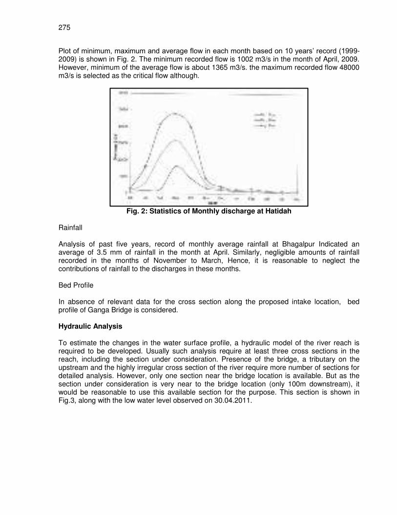
275
Plot of minimum, maximum and average flow in each month based on 10 years’ record (1999-2009) is shown in Fig. 2. The minimum recorded flow is 1002 m3/s in the month of April, 2009. However, minimum of the average flow is about 1365 m3/s. the maximum recorded flow 48000 m3/s is selected as the critical flow although.
Fig. 2: Statistics of Monthly discharge at Hatidah
Rainfall Analysis of past five years, record of monthly average rainfall at Bhagalpur Indicated an average of 3.5 mm of rainfall in the month at April. Similarly, negligible amounts of rainfall recorded in the months of November to March, Hence, it is reasonable to neglect the contributions of rainfall to the discharges in these months. Bed Profile In absence of relevant data for the cross section along the proposed intake location, bed profile of Ganga Bridge is considered. Hydraulic Analysis To estimate the changes in the water surface profile, a hydraulic model of the river reach is required to be developed. Usually such analysis require at least three cross sections in the reach, including the section under consideration. Presence of the bridge, a tributary on the upstream and the highly irregular cross section of the river require more number of sections for detailed analysis. However, only one section near the bridge location is available. But as the section under consideration is very near to the bridge location (only 100m downstream), it would be reasonable to use this available section for the purpose. This section is shown in Fig.3, along with the low water level observed on 30.04.2011.
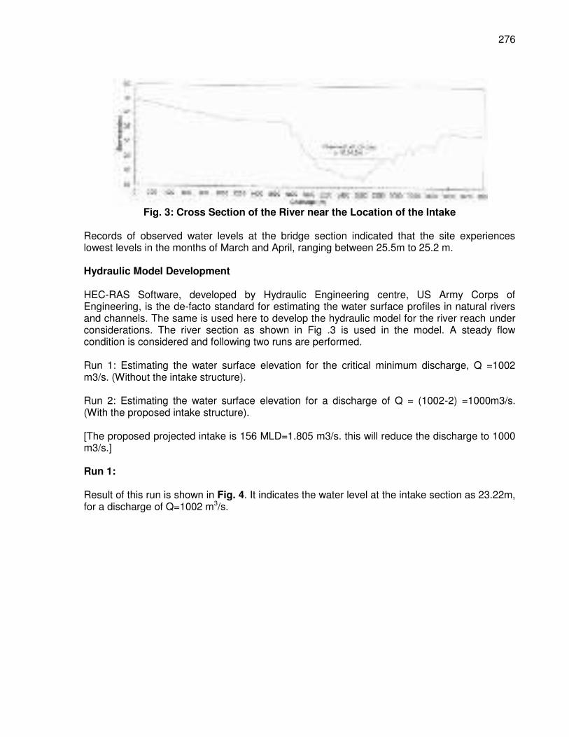
276
Fig. 3: Cross Section of the River near the Location of the Intake
Records of observed water levels at the bridge section indicated that the site experiences lowest levels in the months of March and April, ranging between 25.5m to 25.2 m. Hydraulic Model Development HEC-RAS Software, developed by Hydraulic Engineering centre, US Army Corps of Engineering, is the de-facto standard for estimating the water surface profiles in natural rivers and channels. The same is used here to develop the hydraulic model for the river reach under considerations. The river section as shown in Fig .3 is used in the model. A steady flow condition is considered and following two runs are performed. Run 1: Estimating the water surface elevation for the critical minimum discharge, Q =1002 m3/s. (Without the intake structure). Run 2: Estimating the water surface elevation for a discharge of Q = (1002-2) =1000m3/s. (With the proposed intake structure). [The proposed projected intake is 156 MLD=1.805 m3/s. this will reduce the discharge to 1000 m3/s.] Run 1: Result of this run is shown in Fig. 4. It indicates the water level at the intake section as 23.22m, for a discharge of Q=1002 m3/s.
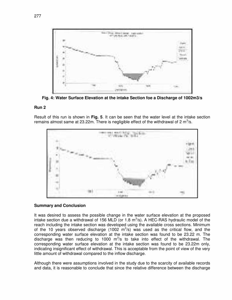
277
Fig. 4: Water Surface Elevation at the intake Section foe a Discharge of 1002m3/s
Run 2 Result of this run is shown in Fig. 5. It can be seen that the water level at the intake section remains almost same at 23.22m. There is negligible effect of the withdrawal of 2 m3/s.
Summary and Conclusion It was desired to assess the possible change in the water surface elevation at the proposed intake section due a withdrawal of 156 MLD (or 1.8 m3/s). A HEC-RAS hydraulic model of the reach including the intake section was developed using the available cross sections. Minimum of the 10 years observed discharge (1002 m3/s) was used as the critical flow, and the corresponding water surface elevation at the intake section was found to be 23.22 m. The discharge was then reducing to 1000 m3/s to take into effect of the withdrawal. The corresponding water surface elevation at the intake section was found to be 23.22m only, indicating insignificant effect of withdrawal. This is acceptable from the point of view of the very little amount of withdrawal compared to the inflow discharge. Although there were assumptions involved in the study due to the scarcity of available records and data, it is reasonable to conclude that since the relative difference between the discharge
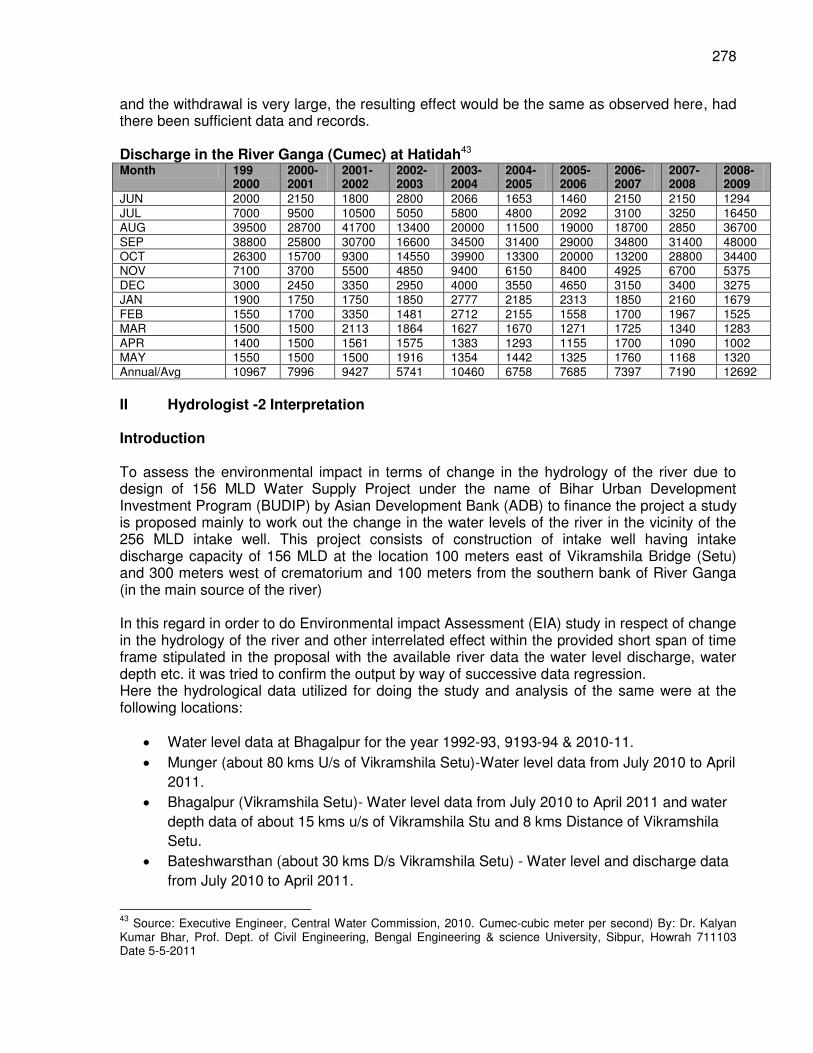
278
and the withdrawal is very large, the resulting effect would be the same as observed here, had there been sufficient data and records. Discharge in the River Ganga (Cumec) at Hatidah43 Month 199
2000 2000- 2001
2001- 2002
2002- 2003
2003- 2004
2004- 2005
2005- 2006
2006- 2007
2007- 2008
2008- 2009
JUN 2000 2150 1800 2800 2066 1653 1460 2150 2150 1294 JUL 7000 9500 10500 5050 5800 4800 2092 3100 3250 16450 AUG 39500 28700 41700 13400 20000 11500 19000 18700 2850 36700 SEP 38800 25800 30700 16600 34500 31400 29000 34800 31400 48000 OCT 26300 15700 9300 14550 39900 13300 20000 13200 28800 34400 NOV 7100 3700 5500 4850 9400 6150 8400 4925 6700 5375 DEC 3000 2450 3350 2950 4000 3550 4650 3150 3400 3275 JAN 1900 1750 1750 1850 2777 2185 2313 1850 2160 1679 FEB 1550 1700 3350 1481 2712 2155 1558 1700 1967 1525 MAR 1500 1500 2113 1864 1627 1670 1271 1725 1340 1283 APR 1400 1500 1561 1575 1383 1293 1155 1700 1090 1002 MAY 1550 1500 1500 1916 1354 1442 1325 1760 1168 1320 Annual/Avg 10967 7996 9427 5741 10460 6758 7685 7397 7190 12692
II Hydrologist -2 Interpretation Introduction To assess the environmental impact in terms of change in the hydrology of the river due to design of 156 MLD Water Supply Project under the name of Bihar Urban Development Investment Program (BUDIP) by Asian Development Bank (ADB) to finance the project a study is proposed mainly to work out the change in the water levels of the river in the vicinity of the 256 MLD intake well. This project consists of construction of intake well having intake discharge capacity of 156 MLD at the location 100 meters east of Vikramshila Bridge (Setu) and 300 meters west of crematorium and 100 meters from the southern bank of River Ganga (in the main source of the river) In this regard in order to do Environmental impact Assessment (EIA) study in respect of change in the hydrology of the river and other interrelated effect within the provided short span of time frame stipulated in the proposal with the available river data the water level discharge, water depth etc. it was tried to confirm the output by way of successive data regression. Here the hydrological data utilized for doing the study and analysis of the same were at the following locations:
Water level data at Bhagalpur for the year 1992-93, 9193-94 & 2010-11.
Munger (about 80 kms U/s of Vikramshila Setu)-Water level data from July 2010 to April
2011.
Bhagalpur (Vikramshila Setu)- Water level data from July 2010 to April 2011 and water
depth data of about 15 kms u/s of Vikramshila Stu and 8 kms Distance of Vikramshila
Setu.
Bateshwarsthan (about 30 kms D/s Vikramshila Setu) - Water level and discharge data
from July 2010 to April 2011.
43
Source: Executive Engineer, Central Water Commission, 2010. Cumec-cubic meter per second) By: Dr. Kalyan Kumar Bhar, Prof. Dept. of Civil Engineering, Bengal Engineering & science University, Sibpur, Howrah 711103 Date 5-5-2011
279
Scope of Work The study for assessment of hydrological impact on river due to the proposed water supply project was confined to the following:
Flow measurement and water level survey report nearby the intake – within sanctuary
area is historical data.
Analysis of data to prove that water level will not change due to intake of 156 MLD
water considered under present scheme.
Cumulative and Synergistic impact of multiple developments 25 km U/s and 25 km D/s
of intake which may affect water level.
Certification water levels within sanctuary not change due to intake of water.
To analyze the available hydrological data and conclude the findings within the scope of work & prescribed time frame, as above the data were presented in best possible graphical shapes. It was also tried to justify the output in extent possible transparent manner. Discussion of data The observation of past river data reveals that the flood Ganga river discharge duration at Bhagalpur is 2.0-2.5 months only i.e., August to mid October, However it remained for about 4.0-5.0 months 20-25 years back. The occurrences of peak discharge were of the order of 40.000 cumecs only. At the same time though the span of lean period (dry season) has increased considerably, the observed lowest water level at the Bhagalpur did not reached recorded LWL with 100 years return period(PLOT-“B”). Accordingly, the available hydrologic data were utilized to arrive an acceptable conclusion. This satisfied they require Hydrological aspects of project. The available data were utilized to plot the following charts.
Comparative water level variation with time (July 10 to April 11) at the Ganga
location Munger (80 kms U/s), Bhagalpur & Bateshwarsthan (3 kms D/s) this cover the
complete salutary area (PLOT – “A”). Discharge Vs water level hydrograph at the location Bateshwarsthan for the
period July’10 April’ 11 i.e. completes flood & leanest (dry) period of the year (PLOT-
“B”). With the available discharge & water level data at Bateshwarsthan a non
dimensional plot of % change in water level Vs % change in discharge (PLOT-“C”). Data was plotted for change in water level & depth at Bhagalpur with respect to
observed discharge at Bateshwarsthan (discharge data not available at Bhagalpur)
(PLOT-“E”). A comparative water level plot for the observed water level at Bhagalpur for the years 1992-93, 1993-94, & 2010-11, to check the change in the water profile with pass time (PLOT-“E”) A data sheet has also been attached of the above plotting for ready reference (SHEET- “1”).
280
Further to above it may be pertinent to mention here the details of hydraulic data of the Vikramshila Setu constructed about 100 m upstream of the proposed site of the intake well for 156 MLD water supply project, are as under.
Length of the bridge-4366 mt
Width of the bridge-7.5 mt.
Design discharge (100 year return period)-94,000 cumecs.
Maximum velocity of the current-4.5 m/s.
Highest flood level (H.F.L.)-RL. 35.46 m
Lowest Water level (L.W.L.)-RL. 24.20 m
Analysis of data Comparative change in the water level from July’ 10 to April 11 at Munger Bhagalpur & Bateshwarsthan (PLOT-“A”):- The similarity in the trend of water level at the respectively three gauge locations i.e. Munger, Bhagalpur & Bteshwarsthan of the stretch depict that during the lean (dry) period of November to April/May the average difference in water level between Munger & Bhagalpur is about 5 m and between Bteshwarsthan (Kahalgaon) & Bhagalpur is about 1 m. This water level difference is mostly constant during the complete adding to the river either during the flood season or in lean season in the stretch of study (Munger to Bateshwarsthan) in Ganga River. The flood period was from August to October, the observed rise in the water level during flood at all the above three gauge stations against the lean season was about 7-8 mt. It is also to mention here that between Munger, Bhagalpur & Bateshwarsthan only one seasonal river i.e. Budi Gandak (E 86-34.00 and N 25-22.00) join the main Ganga carrying nominal % of discharge to Ganga River. The hydrograph itself prove that it has no effect at all. During the lean season this channel had negligible discharge, besides this, no any river discharge was joining to Ganga up to Bateshwarsthan from Munger. Discharge Vs Water Level data at Bateshwarsthan (PLOT-“B”):- The plotted chart and data analysis implies that during the lean (dry) season, when consistent change in the discharge & water level was there with pass of time from during Feb ’11 to April’11 the reduction in Discharge by 200 cumecs affecting the reduction in the water level by 0.40 m only. With this chart analysis it was achieved that in the river stretch under consideration the reduction in discharge by 100 comers shall have effect on change in river water level by 20 cm only. Percent Change in water level Vs Discharge (PLOT-“C”):- In order to arrive a mathematical conclusion toward the quantitative change in water level with respect to channel in discharge a non dimensional plot on % water level change Vs % Discharge change was done to the available data at Bateshwarsthan for the period of 2010-11. This plot reveals that the dry (lean) season has less fluctuation or % variation / consistent variation in Water level with respect to Discharge, the mean variation of this portion with respect to Discharge & water level implies that 1% variation in Discharge had the effect on
281
water level by 0.09% variation. This analysis confirms the observation of finding of Para-b) above. Plotting for water level & depth near the proposed intake well area against the discharge (at Bateshwarsthan)(PLOT-“D”):- Through this plotting it was confirmed that the change in the depth of the channel was not always proportional to change in water level. With this a latest chart showing the soundings of water depth in the main deep channel covering about 24 km upstream and 10 km downstream to the proposed water supply project site has been enclosed for reference (MAP-“A”). In this respect the PLOT-“D” implies that reduction in the discharge & water level during the lean period i.e. when consistent reduction occurs had considerable rise in the depth of the water in the deep channel near the project site only. But this trend was observed near the proposed intake well area. This phenomenon could be technically explained in terms of conversion of potential energy into kinetic energy and further balancing to the gained energy by way of scour to the deep channel bed, since with the reduction in discharge as well water level the spilled over water starts collecting into the main channel. This further increases the quantity of the suspended silt in the water. Water level plot at Bhagalpur in different years (PLOT-“E”):- The water level data at Bhagalpur in the years 1992-93, 1993-94 & 2010-11 were plotted to verify the trend of change (if any) during the pass of time i.e. year. The similar trend for all the years proves the sanctity of data used and analysis done as above based on these data. Discussion Calculation to assess the effect on the water level of the river due to the proposed 156 MLD intake well of Bhagalpur water Supply Project. Here 156 MLD= (156 x 10.-3 cum) / (24 x 60 x 60 Sec) = 1.81 Cumecs Now as per the findings of analysis of the data discussed above in clause-4.0.b), the reduction in river discharge by 100 Cumecs reduces water level in the river by 20 cm only. Hence reduction in discharge by 1.81 cumecs i.e. 156 MLD through the proposed intake well shall reduce water level by 0.36 cm i.e. 3.6 mm in the river. Further on relating with the finding of clause-4.0.c) above i.e. 1% variation in the Discharge of the river will have 0.09% variation in the water level of river by this finding, the discharge, water level variation could be calculated as under. 1.81 Cumecs i.e. 156 MLD discharge of 920 Cumecs (the minimum observed discharge during the year 2010-11) discharge=0.20%. Now as per the finding of clause-4.0.c), the % variation in the water level due to change in discharge by 0.20% = 0.09% X 0.20% = 0.018% (i.e. negligible). This implies that 156 MLD discharge extraction from the river will have no any change in the river water level.
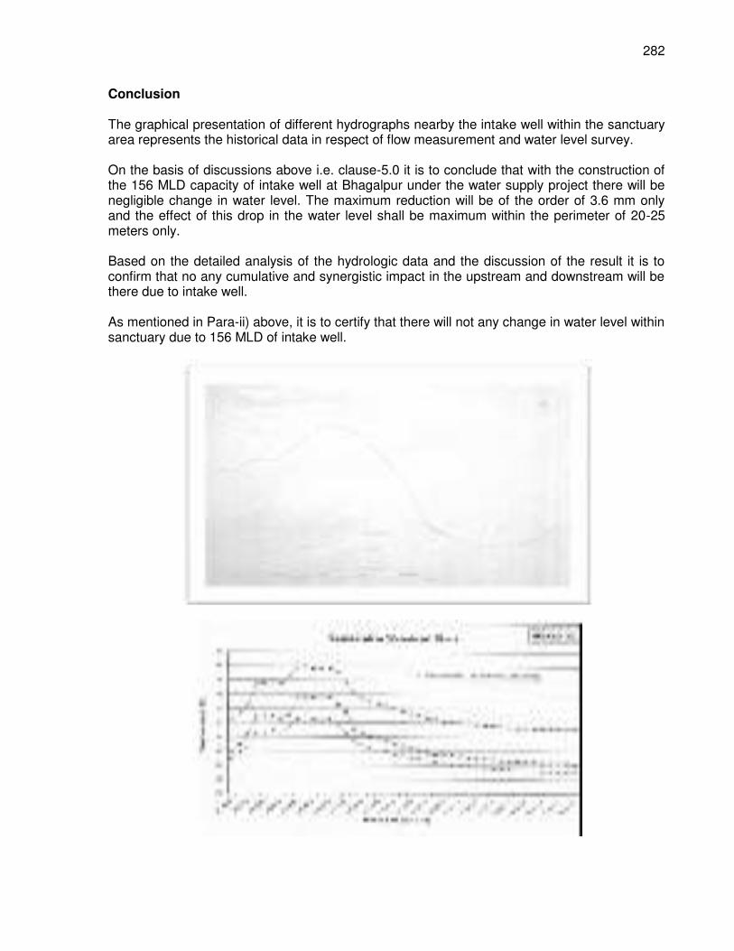
282
Conclusion The graphical presentation of different hydrographs nearby the intake well within the sanctuary area represents the historical data in respect of flow measurement and water level survey. On the basis of discussions above i.e. clause-5.0 it is to conclude that with the construction of the 156 MLD capacity of intake well at Bhagalpur under the water supply project there will be negligible change in water level. The maximum reduction will be of the order of 3.6 mm only and the effect of this drop in the water level shall be maximum within the perimeter of 20-25 meters only. Based on the detailed analysis of the hydrologic data and the discussion of the result it is to confirm that no any cumulative and synergistic impact in the upstream and downstream will be there due to intake well. As mentioned in Para-ii) above, it is to certify that there will not any change in water level within sanctuary due to 156 MLD of intake well.
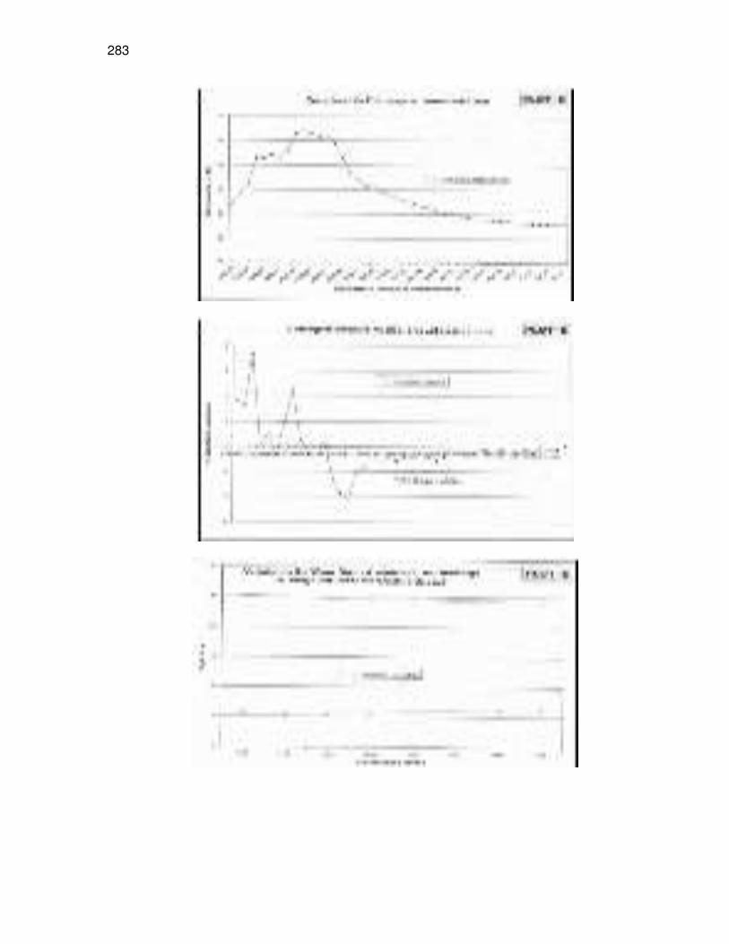
283
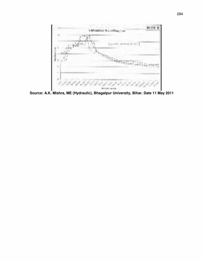
284
Source: A.K. Mishra, ME (Hydraulic), Bhagalpur University, Bihar. Date 11 May 2011
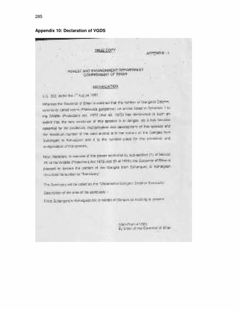
285
Appendix 10: Declaration of VGDS
286
Appendix 11: Biodiversity Study in 2011
Biodiversity of River Ganga in and around Bhagalpur ( Report prepared as part of TA
7106 IND in the Year 2011) Impact Assessment of Biological Environment – specifically in respect to Impact on Aquatic Biodiversity of River Ganga in and around Bhagalpur for construction of Intake structure at Bhagalpur Broad objectives
(i) Description of aquatic flora & fauna (covering both micro and macro) in River Ganges ecosystem
within 10 km upstream and downstream of project location (ii) Listing of threatened, vulnerable, endangered and critically endangered species in River Ganges
at Bhagalpur region (living in water only and living both land and water) (iii) Description of the critical habitat and baseline data on the critical habitat* in river Ganges (recent
data is important) (iv) Assessment of the impacts (during design, construction, operations and maintenance) in respect
to present project on the critical habitat and endangered species (v) Mitigation of impacts to the critically endangered/ endangered/ vulnerable species 1. Aquatic Biodiversity of River Ganga in Vikramshila Gangetic Dolphin Sanctuary near Bhagalpur, Bihar
Bihar is located in the eastern part of India between latitude of 21 58’ 10” N - 27 31’ 15” N and longitude 82 19’ 50” E - 88 17’ 40” E. It is an entirely land-locked state. Bihar lies mid-way between the humid West Bengal in the east and the sub-humid Uttar Pradesh in the west which provides it with a transitional position in respect of climate, economy and culture. It is bounded by Nepal in the north and by Jharkhand in the south. Bihar plain is divided into two unequal halves (North Bihar and South Bihar) by the River Ganga which flows through the middle from west to east. Bihar’s land has average elevation of 173 feet above sea level.
Bhagalpur is the oldest Divisional headquarter of eastern Bihar. The town is situated on the southern bank of River Ganga at 85 59’ East longitude and 25 15’ North latitude. The surface land is plain and the river flows from west to east separating north and south Bhagalpur. Several streams meet the River Ganga in the southern parts which have their origin in the hills of Santhal Parganas. Chanan, the most important river of this region, gets divided in about fifteen smaller channels of which only two are able to touch the River Ganga. One of these streams, Jamania river channel, flows from Champanagar – Nathnagar onwards along the Bhagalpur town parallel to main Ganga and ultimately meets to River Ganga near Vikramshila bridge at Barari. The main course of River Ganga has moved from south to north by about 3-4 km from Nathnagar – Bhagalpur area in recent past (in about last 20 years). Bhagalpur is a flood prone area in the middle Ganga plain. The flood situation aggravates when the river itself is in high spate in monsoon. As both longitudinal as well as lateral slopes in Bihar plains are too mild, the inundations spread over extensive areas. In monsoon, Jamania channel swells due to back flow of water from main Ganga. Active braided channels, meanders, and oxbow lakes, which result from dynamic hydrological processes occurring within a low gradient alluvial plain characterize the geomorphology of the river Ganga in this area. Water levels rise as much as 10 m and the main channel widens to 2-4 km during the monsoon season (Choudhary et al., 2006). The mean discharge from January 1965 to December 1973 at Farakka barrage, 115 km below Bhagalpur, was 11, 558 SD 14, 553 m³ s ¹ (range 1,181 – 65, 072), with the lowest discharge during February – May and the highest during July – October (Vorosmarty et al., 1998). The river channels are not deeply incised in this area, and exposed bank sediments are those of the modern aggrading flood plain systems. Detached flood plains with sand/mud deposits, 10-15 m thick, have developed over years in between Jamania river channel and the main stem of the River Ganga. Presently these detached flood plains are being extensively used for agricultural purposes by local people. Farmers are using synthetic fertilizers,
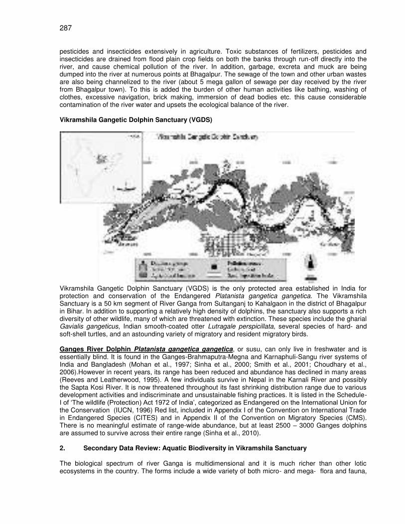
287
pesticides and insecticides extensively in agriculture. Toxic substances of fertilizers, pesticides and insecticides are drained from flood plain crop fields on both the banks through run-off directly into the river, and cause chemical pollution of the river. In addition, garbage, excreta and muck are being dumped into the river at numerous points at Bhagalpur. The sewage of the town and other urban wastes are also being channelized to the river (about 5 mega gallon of sewage per day received by the river from Bhagalpur town). To this is added the burden of other human activities like bathing, washing of clothes, excessive navigation, brick making, immersion of dead bodies etc. this cause considerable contamination of the river water and upsets the ecological balance of the river. Vikramshila Gangetic Dolphin Sanctuary (VGDS)
Vikramshila Gangetic Dolphin Sanctuary (VGDS) is the only protected area established in India for protection and conservation of the Endangered Platanista gangetica gangetica. The Vikramshila Sanctuary is a 50 km segment of River Ganga from Sultanganj to Kahalgaon in the district of Bhagalpur in Bihar. In addition to supporting a relatively high density of dolphins, the sanctuary also supports a rich diversity of other wildlife, many of which are threatened with extinction. These species include the gharial Gavialis gangeticus, Indian smooth-coated otter Lutragale perspicillata, several species of hard- and soft-shell turtles, and an astounding variety of migratory and resident migratory birds. Ganges River Dolphin Platanista gangetica gangetica, or susu, can only live in freshwater and is essentially blind. It is found in the Ganges-Brahmaputra-Megna and Karnaphuli-Sangu river systems of India and Bangladesh (Mohan et al., 1997; Sinha et al., 2000; Smith et al., 2001; Choudhary et al., 2006).However in recent years, its range has been reduced and abundance has declined in many areas (Reeves and Leatherwood, 1995). A few individuals survive in Nepal in the Karnali River and possibly the Sapta Kosi River. It is now threatened throughout its fast shrinking distribution range due to various development activities and indiscriminate and unsustainable fishing practices. It is listed in the Schedule-I of ‘The wildlife (Protection) Act 1972 of India’, categorized as Endangered on the International Union for the Conservation (IUCN, 1996) Red list, included in Appendix I of the Convention on International Trade in Endangered Species (CITES) and in Appendix II of the Convention on Migratory Species (CMS). There is no meaningful estimate of range-wide abundance, but at least 2500 – 3000 Ganges dolphins are assumed to survive across their entire range (Sinha et al., 2010). 2. Secondary Data Review: Aquatic Biodiversity in Vikramshila Sanctuary The biological spectrum of river Ganga is multidimensional and it is much richer than other lotic ecosystems in the country. The forms include a wide variety of both micro- and mega- flora and fauna,
288
and those include phytoplankton (mainly represented by algae), zooplankton, other invertebrates, fishes, reptiles, birds and mammals. 2.1 Ganges River Dolphin Few reports are available for the population estimate of Ganges river dolphin in the Vikramshila sanctuary (Sinha et al., 2000; Choudhary et al., 2006; Kelkar et al., 2010). Sinha (1996) conducted an upstream and downstream survey between Sultanganj and Kahalgaon and observed at least 92 dolphins. Sinha, Sharma and Smith (1998) conducted upstream surveys and observed 63 groups for a total of 81-108 dolphins (overall best estimate = 95, mean group size = 1.5, SD = 1.5, range + 1-9, encounter rate = 1.6 dolphins/km). The same investigators conducted a downstream survey of the same area and observed 33 groups for a total of 47-56 dolphins (overall best estimate = 49, mean group size = 1.5, SD = 0.6, range + 1-12, encounter rate = 0.9 dolphins/km). The difference in the number of animals observed during upstream and downstream surveys was probably related to the faster average speed of the survey vessel while traveling downstream (9.6 km/h vs. 5.2 km/h). Kelkar et al. (2010) estimated dolphin abundance in Vikramshila Sanctuary (65 km rive stretch between Sultanganj and Bhagalpur) at 179 (SE 7, 95% CI 148-208) and 270 (SE 8 95% CI 240-304) in the mid and dry peak seasons, respectively. During these seasons, the average depth of the main channel declined over 1.5 m. An increase in dolphins since 2001 has been reported in VGDS (Choudhary et al., 2008) after initial baseline surveys in 1998 (Sinha et al., 2000). 2.2 Fisheries Fisheries of tropical lowland rivers are essential for the livelihoods and food security of millions of people around the world (Welcomme, 2008). River Ganga is the richest producer and supplier of fish protein in North India. Out of 90% riverine source of spawn in India, more than 70% spawn are collected from this river. Fish populations of the middle River Ganges in eastern India make major contributions to the nutrition needs of millions of people (Sinha & Khan, 2001) and are also critical for the conservation of the endangered Gangetic dolphin, Platanista gangetica gangetica (Roxburgh) (Chouldhary et al., 2006), yet few studies have addressed fisheries ecology in the region. The River Ganges supports a diverse fish fauna, with about 260 fish species reported for Indian waters (Sinha & Khan, 2001). Bilgrami and Datta Munshi (1985) made an extensive survey of the River Ganga from Patna to Farakka and its main tributaries, and recorded 88 teleostean species belonging to 22 families and single species of Elasmobranchii. About 35 species have been identified as having highest commercial value, including carps (Cyprinidae), snakeheads (Channidae), and catfishes (Siluriformes) (Islam et al., 2006). There are indications that catches of these high-value species (primarily major carps and shad) have declined for a variety of factors associated with human population growth and environmental impacts, including fishing pressure, dams and pollution (Jhingran & Ghosh, 1978; Payne & Temple, 1996; Payne et al., 2003). Choudhary et al. (2006) recorded 76 fish species belonging to 10 orders and 27 families from River Ganga at Bhagalpur during 2001 – 2003. Carmen et al. (2010) analyzed the fishery data from five important landing sites near Bhagalpur and observed that Cypriniformes, Siluriformes and Perciformes were the dominant orders both in terms of species richness and yields. The dominant fish species in the catch at Bhagalpur were Wallago attu, Gudusia chapra, Salmostoma bacalia, Pseudeutropius atherinoides, Ailia coila, Sperata aor, Johnius coitor, Cirrhinus mrigala, Setipinna brevifilis and Mystus cavasius. The species composition of fish catch landed at Bhagalpur, near the middle of the sanctuary, is believed to have changed dramatically in recent years, with low economic value catfishes and other miscellaneous species replacing high value carps (Jhingran & Ghosh, 1978; Natrajan, 1989). Choudhary et al. (2006) also observed that the fishing intensity was high throughout the year but with peak periods during the low-water season from October to February, and gill nets made of nylon threads were the most commonly used gear followed by long lines. 2.3 Phytoplankton Phytoplankton, mainly represented by the algae,are the main primary producers and constitute the base of food chain in aquatic ecosystems. They are ubiquitous in flowing waters, their distribution and periodicity largely depends on the environmental conditions. Some algae are good indicators of pollution and unhealthy water, and these can be employed as effective tools for biomonitoring (Vass et al., 1977; Siddiqui, 1980; Singh et al., 1983 Choudhary, 1987). Few reports are available on phytoplankton of the river segment within the Vikramshila sanctuary (Siddiqui, 1980; Singh et al., 1983; Bilgrami & Datta
289
Munshi, 1979, 1983, 1985; Choudhary, 1987). Bilgrami & Datta Munshi (1979) recorded 140 algal species from River Ganga (Patna to Farakka stretch) and further recorded 35 additional forms in the survey conducted in 1985. Members of Chlorophyta dominated all the year round with maximum concentration of Chlorococcales and Conjugales. Blue greens or Cyanophyta occupied the next position, further followed by Bacillariophyta. The Euglenophytes were poorly represented. 14 species were usually confined to urban sewage discharge/ pollution sites (Patna & Bhagalpur). These included Oscillatoria chlorine, O. limosa, O. tenuis, Microcystis aeruginosa, Chlorella vulgaris, Schizomeris leibleinii, Stigeoclonium tenue, Ankistrodesmus falcatus, Scenedesmus quadricauda, Synedra ulna, Navicula viridula, Euglena viridis, E. acus, Phacus caudatus and P. viridis. These species may be used as effective bioindicators. Choudhary (1990) calculated the species diversity index (following Shannon & Weaver’s, 1963, and Wilhm & Dorris, 1968) based on phytoplankton studies of six sites, 3-each at Sultanganj and Bhagalpur. The diversity ranged from 1 – 3 at sewage outfall sites, and that suggested the river water at these sites as moderately polluted. Cremation Sites recorded the least species diversity (<1), thus falling under heavily polluted zone. The low species diversity at these sites may be attributed partly to the organic flux into the river and disturbed surface condition of water which never allowed the phytoplankton to stabilize, settle and multiply. 2.4 Zooplankton Zooplankton are the integral part of the lotic community and contribute significantly in the biological productivity of the freshwater ecosystems (Makarewicz & Likens, 1979). The abundance of some zooplankter as intermediates in the aquatic food web is supposed to be an indicator of gradual eutrophication. These organisms have also been used for ecotoxicological tests in aquatic environments (Gannon & Stremberger, 1979; Laal et al., 1982). The zooplanktons of the River Ganga are mainly represented by the protozoans, rotifers, cladocerans and copepods. Bilgrami and Datta Munshi (1985) recorded zooplankton density as 47-55 U/L, 11-17 U/L and 32-39 U/L at Bhagalpur in summer, monsoon and winter seasons respectively. Seasonal variations had a profound effect on zooplankton population and species composition. Bhowmick (1988) and Verma (1981) also recorded the same pattern. Keratella cochleraris and Brachionus calyciflorus were the most dominant forms. Filinia longiseta, Brachionus angularis, B. falcatus, B. calyciflorus, B. forficula, B. quadridentata, Keratella tropica and K. cochleraris were more frequent in the polluted waters. 2.5 Riparian Vegetation Macrophytes do not play any major role in primary production of riverine ecosystems. The marginal vegetation, however, comprises numerous macrophytes which are ecologically and economically of great value. Plants growing on vast stretches of sand beds are extensively employed as fodder, for house-hold purposes and for cottage industries. The vegetation pattern keeps on changing due to annual floods and high level of water in the rainy season. Water currents play a decisive role in dispersal of seeds and in influencing the pattern of marginal vegetation. The marginal plants also play important role in providing shelter to breeding animals and fishes. After floods new and more fertile land emerges on which sprouts extensive and varied herbaceous vegetation. Such fertile lands also become areas of brisk human activity in post-monsoon period. Such lands are referred to as ‘Diara lands’ and are highly productive. Bilgrami and Datta Munshi (1985) recorded 77 species of dicots and 34 species of monocots from marginal areas of the river (Patna to Farakka). Ranunculus sceleratus, Murdannia nudiflora, Ipomoea aquatica, Scirpus articulatus, S. maritimus, Hygrorhiza aristata, Cyperus iria, C. rotundus, Fimbristylis dichotoma, Kyllinga brevifolia, K. triceps and Saccharum species preferred amphibious habitat. Among the aquatic macrophytes, Eichhornia crassipes, Trapa sp., Lemna sp., Pistia sp. were recorded in the free floating form. Ceratophyllum demersum, Hydrilla verticillata, Najas sp. were completely submerged, while Vallisnaria sp., Aponogeton monostachyon, Potamogeton sp., Saggitaria saggittifolia were submerged rooted floating forms. 2.6 Birds The Vikramshila Gangetic Dolphin Sanctuary (VGDS) gained recognition as an Important Bird Area (IBA) because of the high bird diversity here (Islam & Rahmani, 2004; Choudhary & Mishra, 2008). However, a checklist of the avifauna of VGDS is still unavailable. The Vikramshila Biodiversity Research and Education Centre (VBREC) in Bhagalpur has conducted extensive conservation and biomonitoring work in the Vikramshila Sanctuary over the last decade (Choudhary et al., 2006). Choudhary et al. (2004)
290
observed the greater adjutant VGDS= Vikramshila Gangetic Dolphin Sanctuary stork Liptoptilos dubius, an Endangered species (IUCN, 1994) that had never before been recorded in the Ganges basin. The VBREC has prepared a comprehensive annotated checklist of about 190 bird species recorded from the river stretch (within river habitats from Sultanganj to Bhagalpur) and the precinct areas of the floodplain stretching on the Ganga’s banks. Table 1: Red Data Threatened Bird Species sighted in VGDS Sl. No.
Common Name Biological Name * ** Threat category
1 Greater Adjutant Stork Liptoptilos dubius EN 2 Lesser Adjutant Stork Liptoptilos javanicus VU 3 Indian Skimmer Rynchops albicollis VU 4 Black Necked Stork Ephippiorhynchus asiaticus DD Source: VBREC *Birdlife International 2001, **IUCN 2004 Red List EN= Endangered, VU= Vulnerable, DD= Data Deficient Table 2: Threshold for some bird species (1% of global population) in VGDS Common Name Biological name Threshold
No. No. in VGDS
Greater Adjutant Stork Liptoptilos dubius 7 42 Lesser Adjutant Stork Liptoptilos javanicus 50 45 Small Indian Pratincole Glareola lactea 250 >3000 Black necked Stork 4 6 Common crane Grus grus 60 42 Source: VBREC (Vikramshila Biodiversity Research & Education Center) VGDS= Vikramshila Gangetic Dolphin Sanctuary Table 3: Bird species breeding in VGDS Small Indian Pratincole Glareola lacteal Indian Skimmer Rynchops albicollis Little Tern Sterna albifrons Indian River Tern Sterna aurantia Red-wattled Lapwing Vanellus indicus River Lapwing Vanellus spinosus Bank Myna Acridotheres ginginianus Night Heron Nycticorax nycticorax Little Cormorant Phalacrocorax niger Source: VBREC 2.7 Other Aquatic Wildlife The Vikramshila sanctuary supports a rich diversity of other wildlife, many of which are threatened with extinction. These species include the gharial Gavialis gangeticus, Indian smooth-coated otter Lutragale perspicillata, several species of hard- and soft-shell turtles, and an astounding variety of migratory and resident migratory birds. VBREC team has documented a rich diversity of other threatened aquatic wildlife in Vikramshila Sanctuary (Choudhary et al., 2006) Table 4: Aquatic and terrestrial wildlife recorded during dolphin surveys and field trips in 2001–2003 IUCN Red List status (IUCN, 2004) Species Observation
Dates Number of Individuals seen
¹Red List status
Extra Information Recorded
Indian smooth-coated otter Lutragale perspicillata
12/2/2001 22/6/2001 30/12/2003
2 4 4
NT First two records, presence recorded from fresh scat and tracks. Third record, all adults

291
sleeping & 4 huddled in the open.
Indian water monitor Varanus bengalensis
26/3/2001 2 DD Observed exploring holes in steep mud bank
Indian wild boar Sus scrofa
23/5/2001 3-4 Presence recorded from track on same island where small pratincoles were nesting
Unidentified hard-shell turtle
27/12/2001 50+ Basking on a sand island 16 km upstream from Bhagalpur
Indian Soft-shell Turtle Aspideretes gangeticus
24/05/2001 5 VU Basking on a sand island 33 km upstream from Bhagalpur
Indian Peacock Soft-shell Turtle Aspideratus hurum
20/05/2002 2 VU Recovered from poachers near Kahalgaon
Gharial Gavialis gangeticus
26/2/2002 1 EN Juvenile <2 m , Basking on a sand island upstream from Bhagalpur
Jackal Canis aureus
29/12/2003 1 DD On rock island at Kahalgaon
¹ DD, Data Deficient; NT, Near Threatened; VU, Vulnerable; EN, Endangered. Source: Choudhary et al., 2006; Appendix 2 2.8 River WaterQuality Physico-chemical quality of water is the major determining factor of the pattern of aquatic biota as well as primary and secondary productivity of freshwater ecosystems. Ganga water which is extensively used for domestic, agricultural and industrial purposes shows a substantial variation in its physico-chemical characters in different regions and seasons. Bilgrami and Datta Munshi (1979, 1985) collected the water samples from six sampling sites from Patna to Farakka (including Sultanganj and Bhagalpur) and analyzed the samples for various water variables. They observed that except at the points of discharge of civic and industrial pollutants, the Ganga water was by and large clean and healthy, capable of supporting a large number of plant and animal species. Temperature, pH, dissolved oxygen, alkalinity, hardness and other characters showed a considerable elasticity providing a broad and congenial habitat for different types of aquatic flora and fauna. In general, it was noted that the ionic concentration of sodium, potassium, calcium and magnesium was high in summers and low during rainy season. The conductivity and total dissolved solids were also low while turbidity, nitrates and phosphate levels were high in the rainy season. Although, from physico-chemical angle, the water quality of Ganga showed degradation during the rainy season and the floods, yet this period is highly invigorating for breeding, spawning and growth of fishes of different varieties. The level of dissolved oxygen of water declined substantially during the monsoon period but it was much above the limit (5 mg/l) as per WHO Standards for maintaining healthy aquatic life. Carmen et al. (2011) analyzed the results of seven physico-chemical water parameters measured by VBREC team in the River Ganges at Bhagalpur during surveys in 2003, 2004, 2006 and 2007. For each year, three hydrological seasons were considered: summer (March to mid June), monsoon (mid June to October), and winter (November to February). Physico-chemical environmental parameters included temperature, pH, transparency, dissolved oxygen (DO) concentration, total hardness, chloride, phosphate, nitrate and chemical oxygen demand (COD). pH was close to neutral (6–7.5) with highest values recorded during 2006 and 2007. Transparency was variable between years with the lowest values during the monsoon and winter 2006 and 2007. DO, nitrate (NO3) and phosphate (PO4) had high values during the entire period of study (DO ranging from 6 to 7.5 mg/l), NO3 ranging from 0.02 to 0.04 mg/l), and PO4 ranging from 0.02 to 0.11 mg/l)), with the highest values (0.06 and 0.11 mg/l) during monsoon and winter 2007.
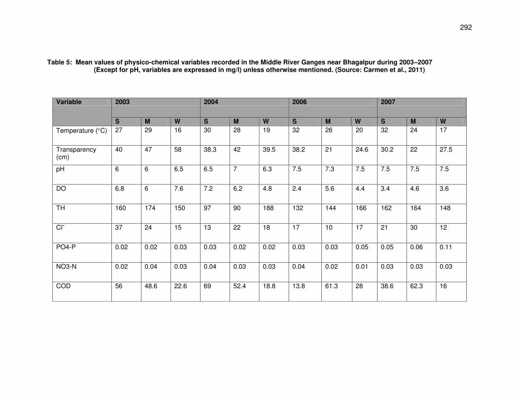
292
Table 5: Mean values of physico-chemical variables recorded in the Middle River Ganges near Bhagalpur during 2003–2007 (Except for pH, variables are expressed in mg/l) unless otherwise mentioned. (Source: Carmen et al., 2011)
Variable 2003 2004 2006 2007
S M W S M W S M W S M W
Temperature (C) 27 29 16 30 28 19 32 26 20 32 24 17
Transparency (cm)
40 47 58 38.3 42 39.5 38.2 21 24.6 30.2 22 27.5
pH 6 6 6.5 6.5 7 6.3 7.5 7.3 7.5 7.5 7.5 7.5
DO 6.8 6 7.6 7.2 6.2 4.8 2.4 5.6 4.4 3.4 4.6 3.6
TH 160 174 150 97 90 188 132 144 166 162 164 148
Clˉ 37 24 15 13 22 18 17 10 17 21 30 12
PO4-P 0.02 0.02 0.03 0.03 0.02 0.02 0.03 0.03 0.05 0.05 0.06 0.11
NO3-N 0.02 0.04 0.03 0.04 0.03 0.03 0.04 0.02 0.01 0.03 0.03 0.03
COD 56 48.6 22.6 69 52.4 18.8 13.8 61.3 28 38.6 62.3 16
293
3. Primary Survey 3.1 Survey Area The primary survey consisted of sampling at project site and sites at 10 km upstream and downstream of the project site. The project site (water intake site) is physically limited to 100 m East of Vikramshila Bridge (Setu) at Barari in Bhagalpur and 300 m West of Crematorium and 100 m from the southern bank of the river Ganga in the main stem of the river. The project site lies in the river segment of the Vikramshila Gangetic Dolphin Sanctuary, the only protected area in the country for the protection and conservation of endangered Ganges river dolphin which has been declared as ‘National Aquatic Animal’ of India in 2010. The project location site is located at 25 16’ 229” N and 87 01’ 680” E. The depth at project location site is 41.2 feet. The Vikramshila Bridge connects southern and northern banks of the river. The length and width of the bridge is 4366 m and 7.5 m respectively. The hydraulic details of the Vikramshila Bridge, constructed about 100 m upstream of the proposed project site are, maximum velocity of the current: 4.5 m/s, highest flood (H.F.L.) level: RL, 35.46 m and lowest water level (L.W.L.): RL, 24.20 m (source: IWAI Terminal Station, Bhagalpur). Human activities are intense near the project site, and those include bathing, washing of clothes, cattle wallowing, navigation and extensive fishing. Kachha nalas drain raw sewage into the river on both the sides of the Bridge.
3.2 Methodology A 10 m wooden rowing boat with a capacity of 10 persons (survey team +crew) was used for the survey. An actual length of 20 km of the River Ganga (10km upstream and 10 km downstream from the project site) was surveyed. The river stretch was divided into equal-length rectangular sampling units of 2 km each (n=20 km), for recording presence/absence of dolphins, otters, turtles and birds. Wherever possible, zigzag line transects (Dawson et al., 2008) were undertaken. A major constraint in carrying out zigzag design based survey throughout the stretch was the highly compromised river flows and shallow depths. The apparatus and equipments used for the survey included a fish finder for recording stream depth, GPS (Garmin Etrek) for recording coordinates of all significant survey events, binoculars 7x50; 8x80; 10x30 (image stabilizing), cameras/handy cams for photo/video-documentation, and the Nikon Laser Range finder. The survey team recorded the following for every kilometer transect of the river: Transect speed, Stream (channel) types: mid-channel island, narrow meandering, narrow straight, wide meandering, wide straight, braided, confluence; Stream depth, Stream width, River bank substrate: boulders/mud/sand, Riparian vegetation, Riparian community activities and Fishing activity. 3.3 Dolphin count Three trained observers surveyed each stretch for river dolphin surfacing (Reeves et al.(eds.), 2000). Sampling was undertaken in excellent sighting conditions. Observers recorded number of dolphins and estimated distance and angle of each dolphin encounter from the boat’s GPS location at the time of survey, with a range finder and compass. Dolphin age-classes (calf, sub-adult, adult) were also estimated and recorded. Care was taken to avoid double counting of dolphins by maintaining close communication among the observers, and also by recording simultaneous resurfacings of more than one dolphin, and by correcting time interval between resurfacing of a single individual by adjusting the time taken by the boat to cover the distance. 3.4 Fisheries During the survey, fish catches of fisherfolks were examined at two landing sites at Bhagalpur. Active single gill net samplings were done at seven different locations in and around the project site. The landing sites are located upstream of the project site in the side channel which opens into the main river near the Vikramshila bridge. One of the landing sites, the ‘Gudara ghat’ is very close to the confluence (100 m approx) and the other ‘Kothi ghat’ is further west to the ‘Gudara ghat’, nearly 400 m from the confluence of Jamania channel and main stem of River Ganga. The active gill net sampling was done with the help of a 24 mm mesh size net measuring 85.34 m in length and 1.21 m in width. Sampling was conducted during the last week of March, 2011. Identifications were made using Talwar & Jhingran (1991) and Srivastava (1994), again with modifications to nomenclature according to Fishbase (2008). Fisherfolks
294
were interviewed at locations of fish sampling to determine what types of gears were used to catch fish species and how many fisherfolks were involved in fishing. During the interview, the names of fisherfolks and the boats they operated from were recorded to count the total number of fisherfolks and boats operating in the area. 3.5 Listing of Birds & other wildlife During the survey, a separate observer searched for water and floodplain birds, and for terrestrial and other aquatic wildlife using the naked eye and binoculars. Bird’s identifications were made using Ali (1979), Ali & Ripley (1978-1980), Sonobe & Usui (1993) and Grimmet et al. (1999). 3.6 Listing of phytoplankton/zooplankton species The locations of phytoplankton/zooplankton sampling stations were marked using a Garmin 12-channel GPS. Water samples containing natural population of algae/zooplankton were collected in glass bottles from the surface by using plankton net (45 mm pore size). 125 ml of the samples were preserved with 5 ml of 4% formaldehyde in the field for microscopic examination. The collections were deposited in the Environmental Biology Research Laboratory of T.M. Bhagalpur University, Bhagalpur. Camera Lucida drawings were made under appropriate magnification. Identifications of phytoplankton were made following West and West (1907), Desikachary (1959), Randhawa (1959), Philipose (1967), Prescott (1969), Cramer (1984) and Sarode and Kamat (1984), whereas identifications of zooplankton were made following Edmondson (1959), Brooks (1959), Hudson et al. (1998), Stemberger (1979), and Thorp and Covich (1991). 3.7 River water variables Physico-chemical environmental parameters, including temperature, pH, transparency and dissolved oxygen (DO) concentration, were estimated Immediately after collection of a sample, whereas analysis of water samples for other chemical factors was carried out in the laboratory at Bhagalpur University. These analyses were performed following standard methods: transparency was measured with a Secchi disk (cm); surface water temperature was measured with a thermometer (C); pH was measured with pH paper over a range of 1–10. DO was analyzed by the modified Winkler method, and total hardness (TH) was determined by the EDTA titrimetric method (APHA 1998). Available phosphorus (PO4) was measured by the stannous chloride method suggested by Wilde et al. (1972). Nitrate (NO3) was determined bythe phenol-disulphonic acid method (Trivedy & Goel, 1986). 4. Dolphin Census Survey A total of 20 dolphins were observed in the upper 10 km stretch of the river from the project site with an encounter rate of 2 dolphins km
-1 (SD = 2.2, CV= 88% ). The dolphin density was high (10 dolphins)
between 8 – 10km segment of the river from the project site followed by 8 dolphins in the 6 – 8 km segment, and 2 dolphins in the 0 – 2km segment. No dolphins were detected between 4 – 6 km and 2 – 4 km segments. The average depth and width of the upper 10km river stretch was 6.2 m and 458.33 m respectively. Most part of the 10km stretch covered was wide (> 200 m) and meandering (66%), and the rest was wide (>200 m) and straight. The river channel was wide and straight up to 4 km from the project site. Different human activities like trap fishing, motorised ferry crossing (country boat), ore ferry crossing, bathing and cattle wallowing were also recorded during the upstream survey. There is a stone embankment on the northern bank of the river between 2 km - 10 km of river segment. The main channel meanders from this point. A total of 10 dolphins were observed in the 10 km downstream segment of the river from the project site with and encounter rate of 1 dolphin km
-1 ( SD = 1.22, CV= 61%). Dolphin counts were higher (5
dolphins) between 2 – 4 km segment from the project site, 2 each were detected in the 4 – 6 km and 8 – 10 km segments, and single dolphin was detected in the 6 – 8 km segment. No dolphin was observed in the 0 – 2 km river segment from the project site. The average depth of the lower stretch was 4.4 m and the average width was 541.66 m. Most of the stretch was wide and straight (83%) and the remaining stretch was wide and meandering. Human activities observed in the downstream survey included mostly cattle wallowing, bathing and scoop net fishing.
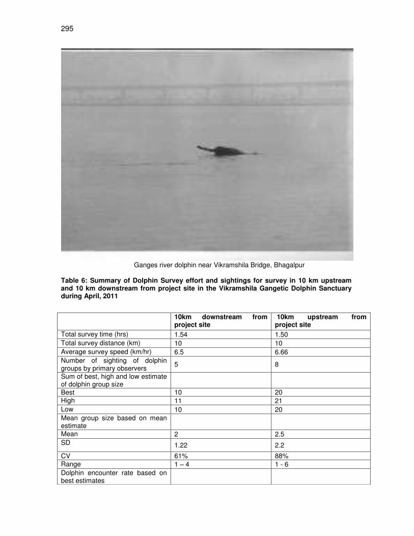
295
Ganges river dolphin near Vikramshila Bridge, Bhagalpur
Table 6: Summary of Dolphin Survey effort and sightings for survey in 10 km upstream and 10 km downstream from project site in the Vikramshila Gangetic Dolphin Sanctuary during April, 2011
10km downstream from project site
10km upstream from project site
Total survey time (hrs) 1.54 1.50 Total survey distance (km) 10 10 Average survey speed (km/hr) 6.5 6.66 Number of sighting of dolphin groups by primary observers
5 8
Sum of best, high and low estimate of dolphin group size
Best 10 20 High 11 21 Low 10 20 Mean group size based on mean estimate
Mean 2 2.5 SD 1.22 2.2
CV 61% 88% Range 1 – 4 1 - 6 Dolphin encounter rate based on best estimates
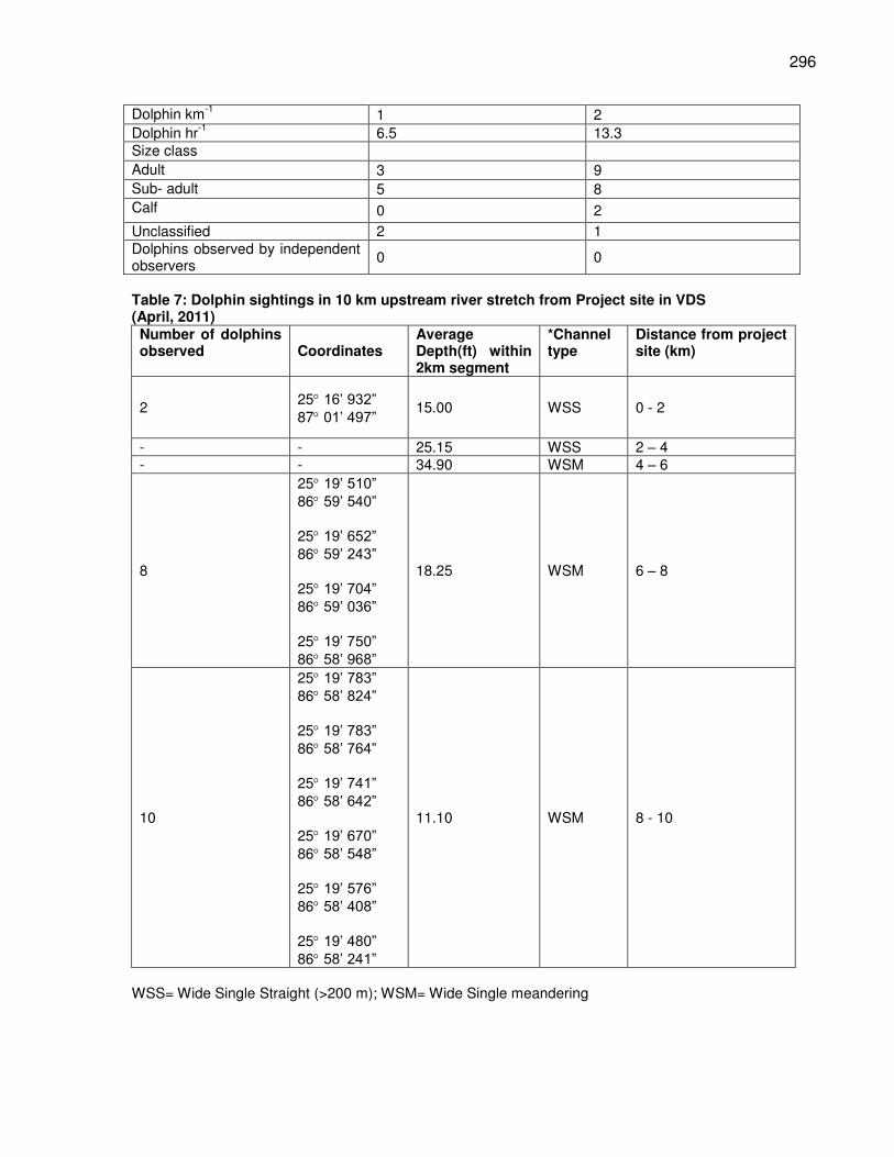
296
Table 7: Dolphin sightings in 10 km upstream river stretch from Project site in VDS (April, 2011) Number of dolphins observed Coordinates
Average Depth(ft) within 2km segment
*Channel type
Distance from project site (km)
2 25 16’ 932” 87 01’ 497” 15.00 WSS 0 - 2
- - 25.15 WSS 2 – 4 - - 34.90 WSM 4 – 6
8
25 19’ 510” 86 59’ 540” 25 19’ 652” 86 59’ 243” 25 19’ 704” 86 59’ 036” 25 19’ 750” 86 58’ 968”
18.25 WSM 6 – 8
10
25 19’ 783” 86 58’ 824” 25 19’ 783” 86 58’ 764” 25 19’ 741” 86 58’ 642” 25 19’ 670” 86 58’ 548” 25 19’ 576” 86 58’ 408” 25 19’ 480” 86 58’ 241”
11.10 WSM 8 - 10
WSS= Wide Single Straight (>200 m); WSM= Wide Single meandering
Dolphin km-1
1 2 Dolphin hr
-1 6.5 13.3
Size class Adult 3 9 Sub- adult 5 8 Calf 0 2
Unclassified 2 1 Dolphins observed by independent observers
0 0
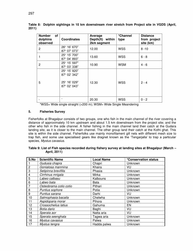
297
Table 8: Dolphin sightings in 10 km downstream river stretch from Project site in VGDS (April, 2011)
Number of dolphins observed
Coordinates Average Depth(ft) within 2km segment
*Channel type
Distance from project site (km)
2 26 16’ 670” 87 07’ 073” 12.00 WSS 8 -10
1 25 15’ 700” 87 04’ 893” 13.60 WSS 6 - 8
2 25 15’ 597” 87 03’ 338” 10.90 WSM 4 - 6
5
25 15’ 920” 87 02’ 342” 25 16’ 029” 87 02’ 043”
12.30 WSS 2 - 4
- - 20.30 WSS 0 - 2
*WSS= Wide single straight (>200 m); WSM= Wide Single Meandering 5. Fisheries Survey Fisherfolks at Bhagalpur consists of two groups, one who fish in the main channel of the river covering a distance of approximately 10 km upstream and about 1.5 km downstream from the project site; and the other who fish in the side channel. A fisher fishing in the main channel land their catch at the Gudara landing site, as it is closer to the main channel. The other group land their catch at the Kothi ghat. This site is within the side channel. Fisherfolks use mainly monofilament gill nets with different mesh size to trap fish, and some use specialised gears like dragnet known as the ‘Tengarjalla’ to trap a particular species, Mystus cavasius. Table 9: List of Fish species recorded during fishery survey at landing sites at Bhagalpur (March –
April, 2011)
S.No Scientific Name Local Name *Conservation status 1 Gudusia chapra Chapri Unknown 2 Gonialosa manmina Khaira VU 3 Setipinna brevifilis Phasia Unknown 4 Cirrhinus mrigala Mirka Unknown 5 Labeo calbasu Kalbouns Unknown 6 Labeo bata Bata Unknown 7 Osteobrama cotio cotio Pithari Unknown 8 Puntius sophore Potia Unknown 9 Puntius sarana Darhi VU 10 Salmophasia bacaila Chelwha Unknown 11 Aspidoparia morar Pihora Unknown 12 Crossocheilus latius Gahuma EN 13 Botia dario Baghi VU 14 Sperata aor Natta aria VU 15 Sperata seenghala Tagwa aria Unknown 16 Mystus cavasius Palwa Unknown 17 Mystus tengra Hadda palwa Unknown
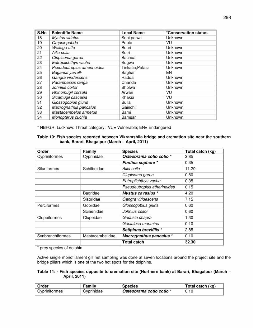
298
S.No Scientific Name Local Name *Conservation status 18 Mystus vittatus Soni palwa Unknown 19 Ompok pabda Popta VU 20 Wallago attu Buari Unknown 21 Ailia coila Sutri Unknown 22 Clupisoma garua Bachua Unknown 23 Eutropiichthys vacha Sugwa Unknown 24 Pseudeutropius atherinoides Tinkatia,Patasi Unknown 25 Bagarius yarrelli Baghar EN 26 Gangra viridescens Hadda Unknown 27 Parambassis ranga Chanda Unknown 28 Johnius coitor Bholwa Unknown 29 Rhinomugil corsula Arwari VU 30 Sicamugil cascasia Khaksi VU 31 Glossogobius giuris Bulla Unknown 32 Macrognathus pancalus Gainchi Unknown 33 Mastacembelus armetus Bami Unknown 34 Monopterus cuchia Bamsar Unknown
* NBFGR, Lucknow: Threat category: VU= Vulnerable; EN= Endangered Table 10: Fish species recorded between Vikramshila bridge and cremation site near the southern
bank, Barari, Bhagalpur (March – April, 2011) Order Family Species Total catch (kg) Cypriniformes Cyprinidae Osteobrama cotio cotio * 2.85
Puntius sophore * 0.35
Siluriformes Schilbeidae Ailia coila 11.20
Clupisoma garua 0.50
Eutropiichthys vacha 0.35
Pseudeutropius atherinoides 0.15
Bagridae Mystus cavasius * 4.20
Sisoridae Gangra viridescens 7.15
Perciformes Gobiidae Glossogobius giuris 0.60
Sciaenidae Johnius coitor 0.60
Clupeiformes Clupeidae Gudusia chapra 1.30
Gonialosa manmina 0.10
Setipinna brevifilis * 2.85
Synbranchiformes Mastacembelidae Macrognathus pancalus * 0.10
Total catch 32.30
* prey species of dolphin Active single monofilament gill net sampling was done at seven locations around the project site and the bridge pillars which is one of the two hot spots for the dolphins. Table 11: - Fish species opposite to cremation site (Northern bank) at Barari, Bhagalpur (March –
April, 2011) Order Family Species Total catch (kg) Cypriniformes Cyprinidae Osteobrama cotio cotio * 0.10
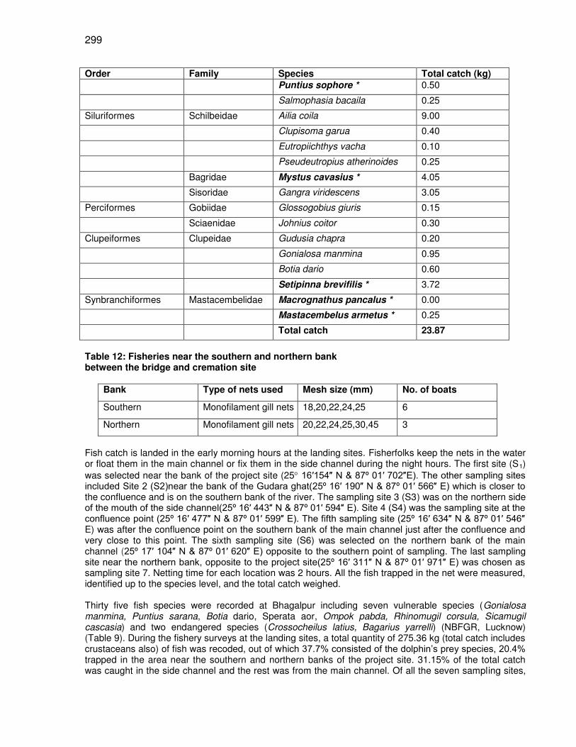
299
Order Family Species Total catch (kg) Puntius sophore * 0.50
Salmophasia bacaila 0.25
Siluriformes Schilbeidae Ailia coila 9.00
Clupisoma garua 0.40
Eutropiichthys vacha 0.10
Pseudeutropius atherinoides 0.25
Bagridae Mystus cavasius * 4.05
Sisoridae Gangra viridescens 3.05
Perciformes Gobiidae Glossogobius giuris 0.15
Sciaenidae Johnius coitor 0.30
Clupeiformes Clupeidae Gudusia chapra 0.20
Gonialosa manmina 0.95
Botia dario 0.60
Setipinna brevifilis * 3.72
Synbranchiformes Mastacembelidae Macrognathus pancalus * 0.00
Mastacembelus armetus * 0.25
Total catch 23.87
Table 12: Fisheries near the southern and northern bank between the bridge and cremation site
Bank Type of nets used Mesh size (mm) No. of boats
Southern Monofilament gill nets 18,20,22,24,25 6
Northern Monofilament gill nets 20,22,24,25,30,45 3
Fish catch is landed in the early morning hours at the landing sites. Fisherfolks keep the nets in the water or float them in the main channel or fix them in the side channel during the night hours. The first site (S1) was selected near the bank of the project site (25 16 154 N & 87º 01 702 E). The other sampling sites included Site 2 (S2)near the bank of the Gudara ghat(25º 16 190 N & 87º 01 566 E) which is closer to the confluence and is on the southern bank of the river. The sampling site 3 (S3) was on the northern side of the mouth of the side channel(25º 16 443 N & 87º 01 594 E). Site 4 (S4) was the sampling site at the confluence point (25º 16 477 N & 87º 01 599 E). The fifth sampling site (25º 16 634 N & 87º 01 546 E) was after the confluence point on the southern bank of the main channel just after the confluence and very close to this point. The sixth sampling site (S6) was selected on the northern bank of the main channel (25º 17 104 N & 87º 01 620 E) opposite to the southern point of sampling. The last sampling site near the northern bank, opposite to the project site(25º 16 311 N & 87º 01 971 E) was chosen as sampling site 7. Netting time for each location was 2 hours. All the fish trapped in the net were measured, identified up to the species level, and the total catch weighed. Thirty five fish species were recorded at Bhagalpur including seven vulnerable species (Gonialosa manmina, Puntius sarana, Botia dario, Sperata aor, Ompok pabda, Rhinomugil corsula, Sicamugil cascasia) and two endangered species (Crossocheilus latius, Bagarius yarrelli) (NBFGR, Lucknow) (Table 9). During the fishery surveys at the landing sites, a total quantity of 275.36 kg (total catch includes crustaceans also) of fish was recoded, out of which 37.7% consisted of the dolphin’s prey species, 20.4% trapped in the area near the southern and northern banks of the project site. 31.15% of the total catch was caught in the side channel and the rest was from the main channel. Of all the seven sampling sites,

300
the least quantity of fish was recorded from the first site that is near the project location. Only three specimen of a single species Osteobrama cotio cotio was recorded from this site and the maximum quantity of fish was trapped from Site 3 (S3) i.e. the total catch was 0.65kg and catch composed eight species at this site.
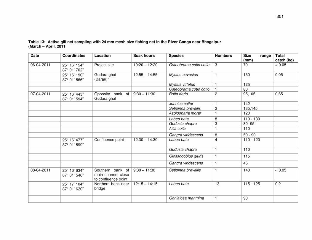
301
Table 13: Active gill net sampling with 24 mm mesh size fishing net in the River Ganga near Bhagalpur (March – April, 2011 Date Coordinates Location Soak hours Species Numbers Size range
(mm) Total catch (kg)
06-04-2011 25 16’ 154” 87 01’ 702”
Project site 10:20 – 12:20 Osteobrama cotio cotio 3 70 < 0.05
25 16’ 190” 87 01’ 566”
Gudara ghat (Barari)*
12:55 – 14:55 Mystus cavasius 1 130 0.05
Mystus vittetus 1 125 Osteobrama cotio cotio 1 80 07-04-2011 25 16’ 443”
87 01’ 594” Opposite bank of Gudara ghat
9:30 – 11:30 Botia dario 2 95,105 0.65
Johnius coitor 1 142 Setipinna brevifilis 2 135,145 Aspidoparia morar 1 120
Labeo bata 8 110 - 130 Gudusia chapra 3 80 -95 Ailia coila 1 110
Gangra viridescens 8 50 - 90 25 16’ 477”
87 01’ 599” Confluence point 12:30 – 14:30 Labeo bata 4 110 - 120
Gudusia chapra 1 110
Glossogobius giuris 1 115
Gangra viridescens 1 45
08-04-2011 25 16’ 634” 87 01’ 546”
Southern bank of main channel close to confluence point
9:30 – 11:30 Setipinna brevifilis 1 140 < 0.05
25 17’ 104” 87 01’ 620”
Northern bank near bridge
12:15 – 14:15 Labeo bata 13 115 - 125 0.2
Gonialosa manmina 1 90
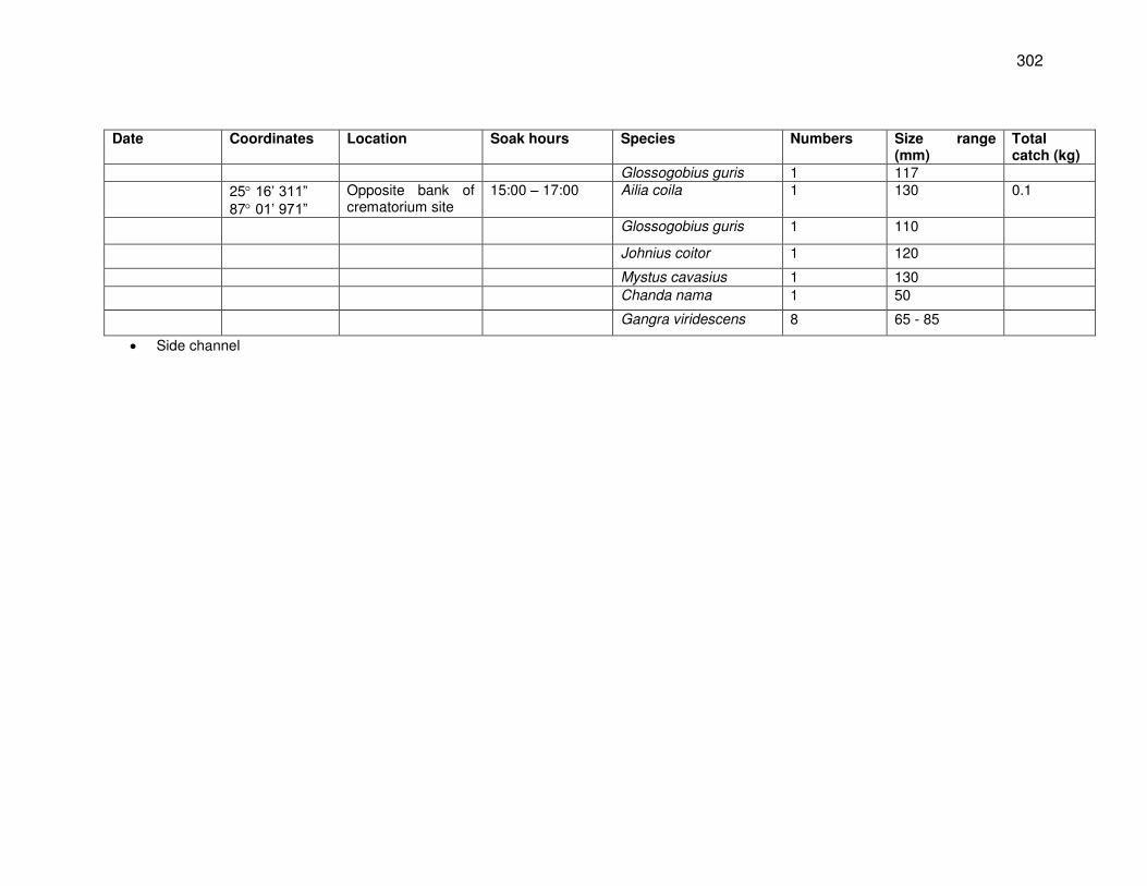
302
Date Coordinates Location Soak hours Species Numbers Size range (mm)
Total catch (kg)
Glossogobius guris 1 117 25 16’ 311”
87 01’ 971” Opposite bank of crematorium site
15:00 – 17:00 Ailia coila 1 130 0.1
Glossogobius guris 1 110
Johnius coitor 1 120
Mystus cavasius 1 130 Chanda nama 1 50
Gangra viridescens 8 65 - 85
Side channel
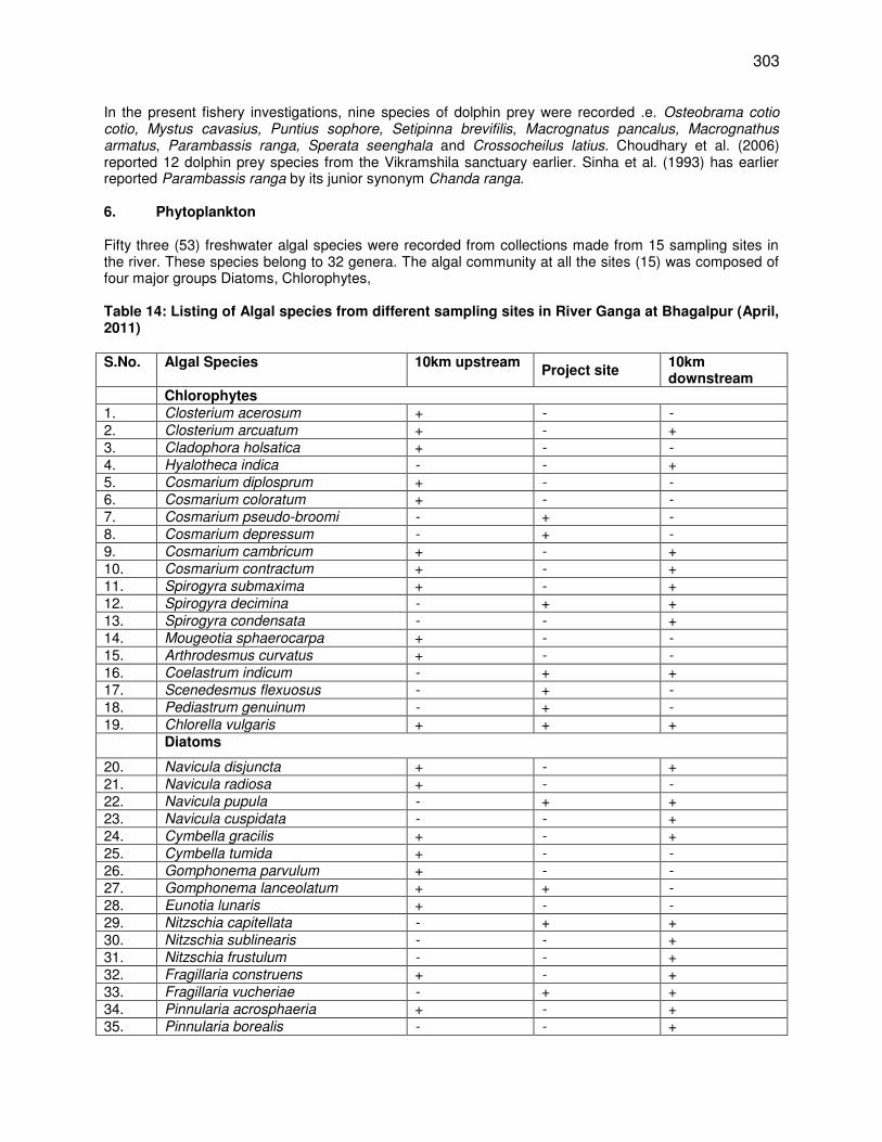
303
In the present fishery investigations, nine species of dolphin prey were recorded .e. Osteobrama cotio cotio, Mystus cavasius, Puntius sophore, Setipinna brevifilis, Macrognatus pancalus, Macrognathus armatus, Parambassis ranga, Sperata seenghala and Crossocheilus latius. Choudhary et al. (2006) reported 12 dolphin prey species from the Vikramshila sanctuary earlier. Sinha et al. (1993) has earlier reported Parambassis ranga by its junior synonym Chanda ranga. 6. Phytoplankton Fifty three (53) freshwater algal species were recorded from collections made from 15 sampling sites in the river. These species belong to 32 genera. The algal community at all the sites (15) was composed of four major groups Diatoms, Chlorophytes, Table 14: Listing of Algal species from different sampling sites in River Ganga at Bhagalpur (April, 2011) S.No. Algal Species 10km upstream
Project site 10km downstream
Chlorophytes 1. Closterium acerosum + - -
2. Closterium arcuatum + - +
3. Cladophora holsatica + - -
4. Hyalotheca indica - - +
5. Cosmarium diplosprum + - -
6. Cosmarium coloratum + - -
7. Cosmarium pseudo-broomi - + -
8. Cosmarium depressum - + -
9. Cosmarium cambricum + - +
10. Cosmarium contractum + - +
11. Spirogyra submaxima + - +
12. Spirogyra decimina - + +
13. Spirogyra condensata - - +
14. Mougeotia sphaerocarpa + - -
15. Arthrodesmus curvatus + - -
16. Coelastrum indicum - + +
17. Scenedesmus flexuosus - + -
18. Pediastrum genuinum - + -
19. Chlorella vulgaris + + +
Diatoms
20. Navicula disjuncta + - +
21. Navicula radiosa + - -
22. Navicula pupula - + +
23. Navicula cuspidata - - +
24. Cymbella gracilis + - +
25. Cymbella tumida + - -
26. Gomphonema parvulum + - -
27. Gomphonema lanceolatum + + -
28. Eunotia lunaris + - -
29. Nitzschia capitellata - + +
30. Nitzschia sublinearis - - +
31. Nitzschia frustulum - - +
32. Fragillaria construens + - +
33. Fragillaria vucheriae - + +
34. Pinnularia acrosphaeria + - +
35. Pinnularia borealis - - +
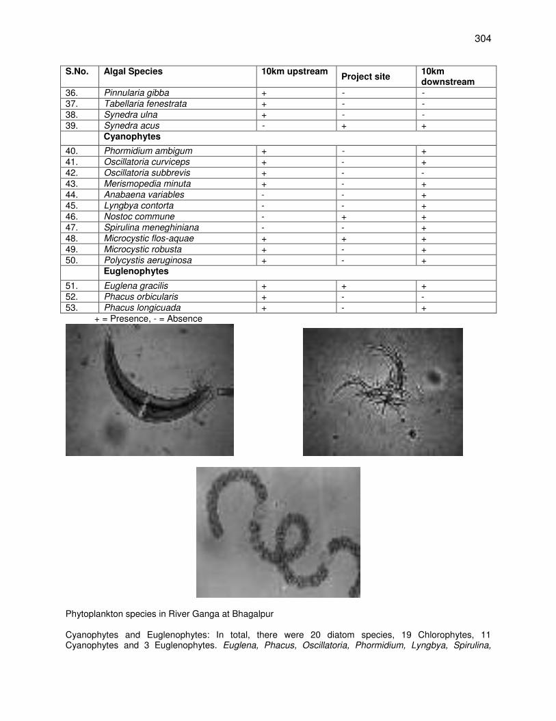
304
S.No. Algal Species 10km upstream Project site
10km downstream
36. Pinnularia gibba + - -
37. Tabellaria fenestrata + - -
38. Synedra ulna + - -
39. Synedra acus - + +
Cyanophytes
40. Phormidium ambigum + - +
41. Oscillatoria curviceps + - + 42. Oscillatoria subbrevis + - - 43. Merismopedia minuta + - + 44. Anabaena variables - - + 45. Lyngbya contorta - - + 46. Nostoc commune - + + 47. Spirulina meneghiniana - - + 48. Microcystic flos-aquae + + + 49. Microcystic robusta + - + 50. Polycystis aeruginosa + - + Euglenophytes
51. Euglena gracilis + + +
52. Phacus orbicularis + - - 53. Phacus longicuada + - +
+ = Presence, - = Absence
Phytoplankton species in River Ganga at Bhagalpur Cyanophytes and Euglenophytes: In total, there were 20 diatom species, 19 Chlorophytes, 11 Cyanophytes and 3 Euglenophytes. Euglena, Phacus, Oscillatoria, Phormidium, Lyngbya, Spirulina,
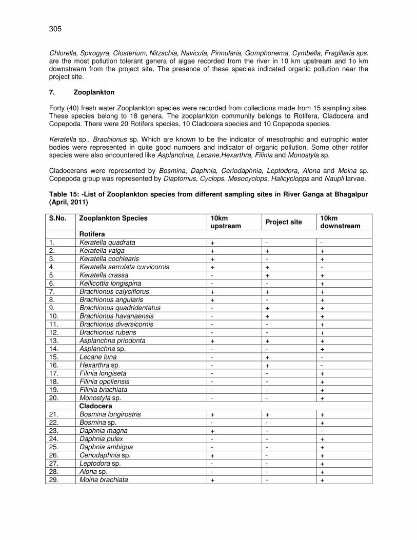
305
Chlorella, Spirogyra, Closterium, Nitzschia, Navicula, Pinnularia, Gomphonema, Cymbella, Fragillaria sps. are the most pollution tolerant genera of algae recorded from the river in 10 km upstream and 1o km downstream from the project site. The presence of these species indicated organic pollution near the project site. 7. Zooplankton Forty (40) fresh water Zooplankton species were recorded from collections made from 15 sampling sites. These species belong to 18 genera. The zooplankton community belongs to Rotifera, Cladocera and Copepoda. There were 20 Rotifers species, 10 Cladocera species and 10 Copepoda species. Keratella sp., Brachionus sp. Which are known to be the indicator of mesotrophic and eutrophic water bodies were represented in quite good numbers and indicator of organic pollution. Some other rotifer species were also encountered like Asplanchna, Lecane,Hexarthra, Filinia and Monostyla sp. Cladocerans were represented by Bosmina, Daphnia, Ceriodaphnia, Leptodora, Alona and Moina sp. Copepoda group was represented by Diaptomus, Cyclops, Mesocyclops, Halicyclopps and Naupli larvae. Table 15: -List of Zooplankton species from different sampling sites in River Ganga at Bhagalpur (April, 2011) S.No. Zooplankton Species 10km
upstream Project site
10km downstream
Rotifera 1. Keratella quadrata + - - 2. Keratella valga + + +
3. Keratella cochlearis + - +
4. Keratella serrulata curvicornis + + -
5. Keratella crassa - + +
6. Kellicottia longispina - - +
7. Brachionus calyciflorus + + +
8. Brachionus angularis + - +
9. Brachionus quadridentatus - + +
10. Brachionus havanaensis - + +
11. Brachionus diversicornis - - +
12. Brachionus rubens - - +
13. Asplanchna priodonta + + +
14. Asplanchna sp. - - + 15. Lecane luna - + -
16. Hexarthra sp. - + - 17. Filinia longiseta - - +
18. Filinia opoliensis - - +
19. Filinia brachiata - - +
20. Monostyla sp. - - + Cladocera 21. Bosmina longirostris + + + 22. Bosmina sp. - - + 23. Daphnia magna + - -
24. Daphnia pulex - - +
25. Daphnia ambigua - - +
26. Ceriodaphnia sp. + - + 27. Leptodora sp. - - + 28. Alona sp. - - + 29. Moina brachiata + - +
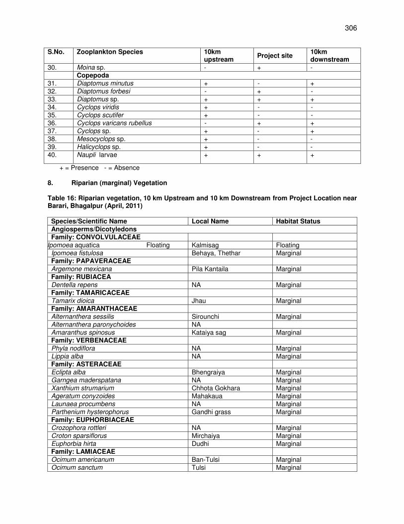
306
S.No. Zooplankton Species 10km upstream
Project site 10km downstream
30. Moina sp. - + - Copepoda 31. Diaptomus minutus + - +
32. Diaptomus forbesi - + -
33. Diaptomus sp. + + + 34. Cyclops viridis + - -
35. Cyclops scutifer + - -
36. Cyclops varicans rubellus - + +
37. Cyclops sp. + - + 38. Mesocyclops sp. + - - 39. Halicyclops sp. + - - 40. Naupli larvae + + +
+ = Presence - = Absence
8. Riparian (marginal) Vegetation Table 16: Riparian vegetation, 10 km Upstream and 10 km Downstream from Project Location near Barari, Bhagalpur (April, 2011) Species/Scientific Name Local Name Habitat Status Angiosperms/Dicotyledons Family: CONVOLVULACEAE
Ipomoea aquatica Floating Kalmisag Floating Ipomoea fistulosa Behaya, Thethar Marginal Family: PAPAVERACEAE Argemone mexicana Pila Kantaila Marginal Family: RUBIACEA Dentella repens NA Marginal Family: TAMARICACEAE Tamarix dioica Jhau Marginal Family: AMARANTHACEAE Alternanthera sessilis Sirounchi Marginal Alternanthera paronychoides NA Amaranthus spinosus Kataiya sag Marginal Family: VERBENACEAE Phyla nodiflora NA Marginal Lippia alba NA Marginal Family: ASTERACEAE Eclipta alba Bhengraiya Marginal Garngea maderspatana NA Marginal Xanthium strumarium Chhota Gokhara Marginal Ageratum conyzoides Mahakaua Marginal Launaea procumbens NA Marginal Parthenium hysterophorus Gandhi grass Marginal Family: EUPHORBIACEAE Crozophora rottleri NA Marginal Croton sparsiflorus Mirchaiya Marginal Euphorbia hirta Dudhi Marginal Family: LAMIACEAE Ocimum americanum Ban-Tulsi Marginal Ocimum sanctum Tulsi Marginal
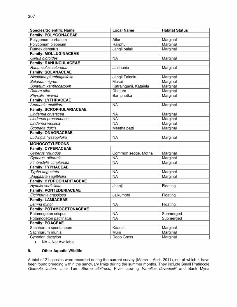
307
Species/Scientific Name Local Name Habitat Status Family: POLYGONACEAE Polygonum barbatum Atlari Marginal Polygonum plebejum Raiiphul Marginal Rumex dentatus Jangli palak Marginal Family: MOLLUGINACEAE Glinus glotoides NA Marginal Family: RANUNCULACEAE Ranunculus scleretus Jaldhania Marginal Family: SOLANACEAE Nicotiana plumbaginifolia Jangli Tainaku Marginal Solanum nigrum Makoi Marginal Solanum xanthocarpum Katrainganii, Katainla Marginal Datura alba Dhatura Marginal Physalis minima Ban phutka Marginal Family: LYTHRACEAE Ammania multiflora NA Marginal Family: SCROPHULARIACEAE Lindernia crustacea NA Marginal Lindernia procumbens NA Marginal Lindernia viscosa NA Marginal Scoparia dulcis Meetha patti Marginal Family: ONAGRACEAE Ludwigia hyssopifolia NA Marginal
MONOCOTYLEDONS Family: CYPERACEAE Cyperus rotundus Common sedge, Motha Marginal Cyperus difformis NA Marginal Fimbristylis cimplanata NA Marginal Family: TYPHACEAE Typha angustata NA Marginal Saggitaria sagittifolia NA Marginal Family: HYDROCHARITACEAE Hydrilla verticillata Jhanji Floating Family: PONTEDERIACEAE Eichhornia crassipes Jalkumbhi Floating Family: LAMIACEAE Lemna minor NA Floating Family: POTAMOGETONACEAE Potamogeton crispus NA Submerged Potamogeton pactinatus NA Submerged Family: POACEAE Sachharum spontaneum Kaansh Marginal Sachharum munja Munj Marginal Cynodon dactylon Doob Grass Marginal
NA = Not Available
9. Other Aquatic Wildlife A total of 21 species were recorded during the current survey (March – April, 2011), out of which 4 have been found breeding within the sanctuary limits during the summer months. They include Small Pratincole Glareola lactea, Little Tern Sterna albifrons, River lapwing Vanellus duvaucelii and Bank Myna
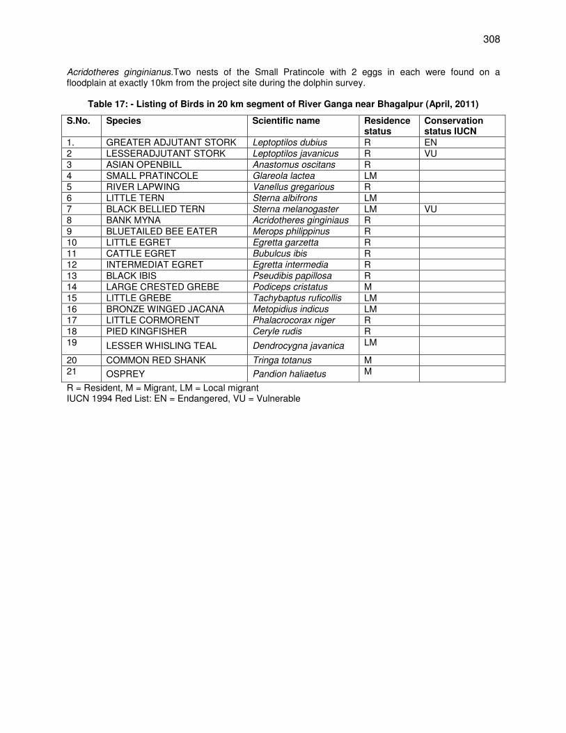
308
Acridotheres ginginianus.Two nests of the Small Pratincole with 2 eggs in each were found on a floodplain at exactly 10km from the project site during the dolphin survey.
Table 17: - Listing of Birds in 20 km segment of River Ganga near Bhagalpur (April, 2011)
S.No. Species Scientific name Residence status
Conservation status IUCN
1. GREATER ADJUTANT STORK Leptoptilos dubius R EN 2 LESSERADJUTANT STORK Leptoptilos javanicus R VU 3 ASIAN OPENBILL Anastomus oscitans R 4 SMALL PRATINCOLE Glareola lactea LM 5 RIVER LAPWING Vanellus gregarious R 6 LITTLE TERN Sterna albifrons LM 7 BLACK BELLIED TERN Sterna melanogaster LM VU 8 BANK MYNA Acridotheres ginginiaus R 9 BLUETAILED BEE EATER Merops philippinus R 10 LITTLE EGRET Egretta garzetta R 11 CATTLE EGRET Bubulcus ibis R 12 INTERMEDIAT EGRET Egretta intermedia R 13 BLACK IBIS Pseudibis papillosa R 14 LARGE CRESTED GREBE Podiceps cristatus M 15 LITTLE GREBE Tachybaptus ruficollis LM 16 BRONZE WINGED JACANA Metopidius indicus LM 17 LITTLE CORMORENT Phalacrocorax niger R 18 PIED KINGFISHER Ceryle rudis R 19 LESSER WHISLING TEAL Dendrocygna javanica LM
20 COMMON RED SHANK Tringa totanus M 21 OSPREY Pandion haliaetus M
R = Resident, M = Migrant, LM = Local migrant IUCN 1994 Red List: EN = Endangered, VU = Vulnerable
309
Appendix 12: Biodiversity Study in 2014
Rapid Biodiversity Survey within Direct Impact Zone (600m) & Indirect Impact Zone (2 km) from the Intake well point in the River Bed (June 2014)
The direct and indirect impacts zones are demarcated as 600 m and 2 km, respectively around the intakes by ADB experts based on information on the EIA report. Dolphin Survey Four dolphin population estimation surveys were conducted from the 14th to 17th June 2014. The survey covered a total distance of 4 km every day. The surveys were conducted by the single observer, direct count upstream method. During the survey, 2km upstream and 2 km downstream distances from the project site were covered. On all the four days the survey was started from an area known as the ‘Shishbandi’ which is behind the Bhagalpur Engineering College and which is 2 km downstream from the project site. From ‘Shishbandi’ an upstream distance of 4 km was covered every day. During the four days, two surveys were conducted during the morning hours and two in the evening hours i.e. 14th June (10:48 am – 11:32 am), 15th June (7:50 am -8:31 am), 16th June (16:19 pm – 17:02 pm) and on 17th June (16:35 pm – 17:19 pm).
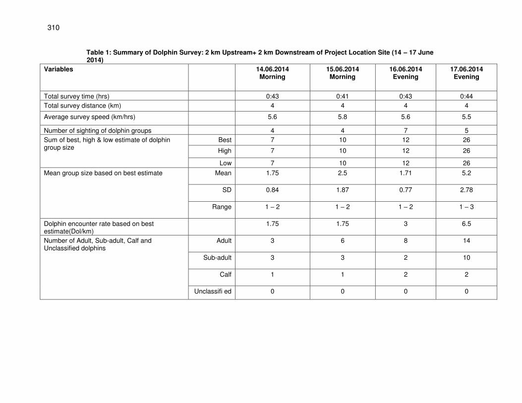
310
Table 1: Summary of Dolphin Survey: 2 km Upstream+ 2 km Downstream of Project Location Site (14 – 17 June 2014)
Variables 14.06.2014 Morning
15.06.2014 Morning
16.06.2014 Evening
17.06.2014 Evening
Total survey time (hrs) 0:43 0:41 0:43 0:44
Total survey distance (km) 4 4 4 4
Average survey speed (km/hrs) 5.6 5.8 5.6 5.5
Number of sighting of dolphin groups 4 4 7 5
Sum of best, high & low estimate of dolphin group size
Best 7 10 12 26
High 7 10 12 26
Low 7 10 12 26
Mean group size based on best estimate Mean 1.75 2.5 1.71 5.2
SD 0.84 1.87 0.77 2.78
Range 1 – 2 1 – 2 1 – 2 1 – 3
Dolphin encounter rate based on best estimate(Dol/km)
1.75 1.75 3 6.5
Number of Adult, Sub-adult, Calf and Unclassified dolphins
Adult 3 6 8 14
Sub-adult 3 3 2 10
Calf 1 1 2 2
Unclassifi ed 0 0 0 0
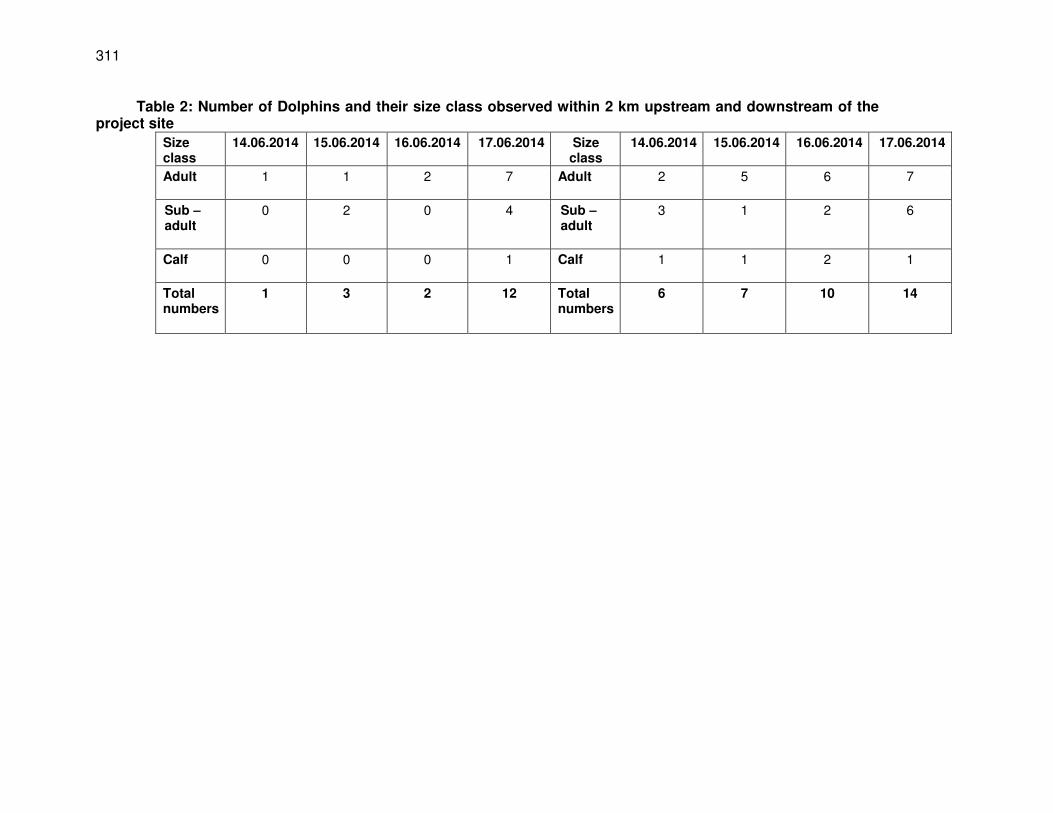
311
Table 2: Number of Dolphins and their size class observed within 2 km upstream and downstream of the project site
Size class
14.06.2014
15.06.2014
16.06.2014
17.06.2014 Size class
14.06.2014
15.06.2014
16.06.2014
17.06.2014
Adult
1 1 2 7 Adult
2 5 6 7
Sub – adult
0 2 0 4 Sub – adult
3 1 2 6
Calf
0 0 0 1 Calf
1 1 2 1
Total numbers
1 3 2 12 Total numbers
6 7 10 14
312
Explanations for Fig 1 & Fig 2 Fig 1: This map basically shows distribution of dolphins throughout the day and over a 4-
day sampling period, so the main useful things are: a). It captures variation across days,
b). It captures two time periods within a single day, suggesting use throughout the day, c). It shows variation at multiple levels - at both DIZ and IIZ scales, d). it gives relative abundance pooled across locations, indicating higher and lower use of habitats around the intake well, and e). It shows only distribution, and hence it tackles the problem of uncertainties in
estimation of abundance. I think what matters is Not whether 1 or many dolphins use the place, what really matters is how those dolphins use it - so all locations must be pooled.
Fig 2: This map pertains to the information on calf-rearing sites specifically. It might be important to consider that this area is regularly used for calf-rearing too, both inside and outside the DIZ. That means a lot of care must be taken to avert impacts of noise and disturbance and flow reduction for local dolphin populations.
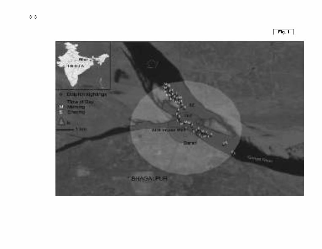
313
Fig. 1
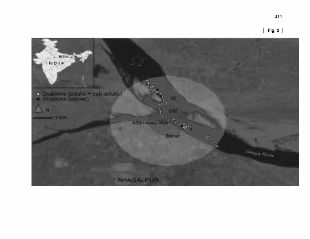
314
Fig. 2
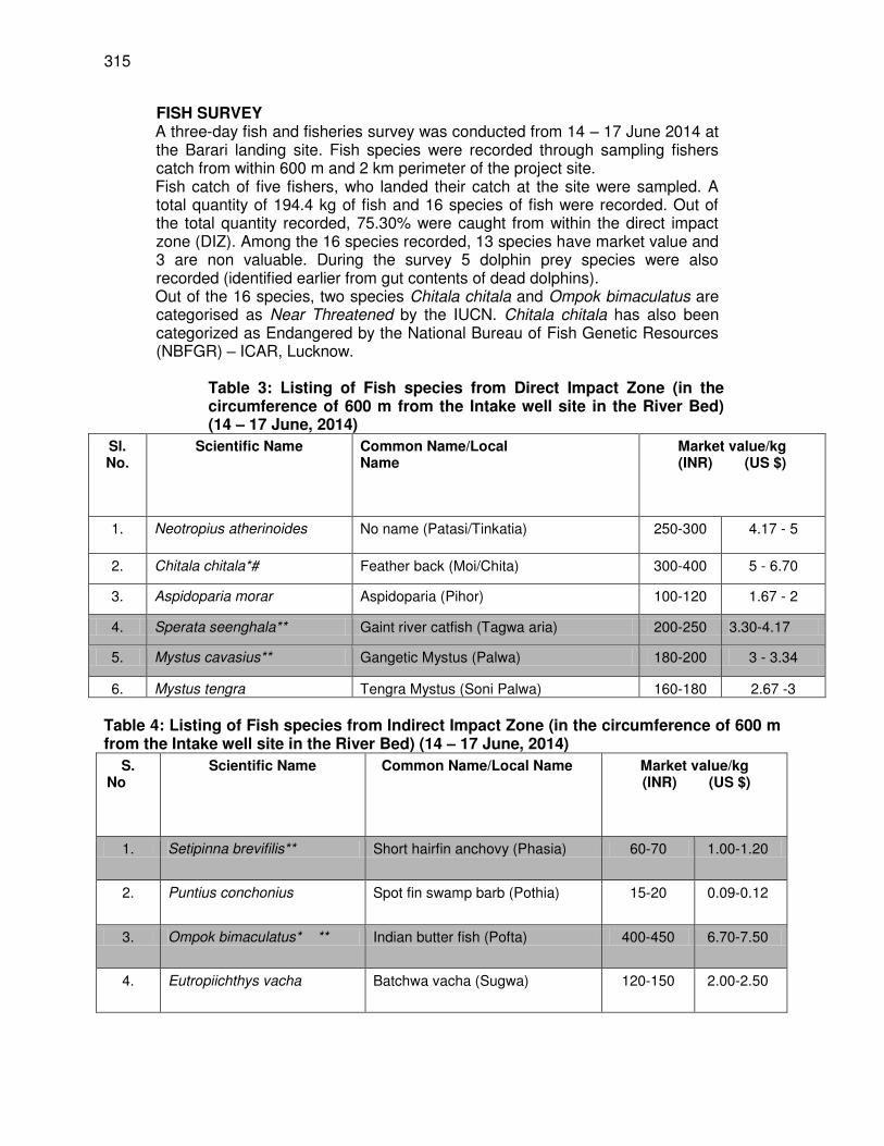
315
FISH SURVEY A three-day fish and fisheries survey was conducted from 14 – 17 June 2014 at the Barari landing site. Fish species were recorded through sampling fishers catch from within 600 m and 2 km perimeter of the project site. Fish catch of five fishers, who landed their catch at the site were sampled. A total quantity of 194.4 kg of fish and 16 species of fish were recorded. Out of the total quantity recorded, 75.30% were caught from within the direct impact zone (DIZ). Among the 16 species recorded, 13 species have market value and 3 are non valuable. During the survey 5 dolphin prey species were also recorded (identified earlier from gut contents of dead dolphins). Out of the 16 species, two species Chitala chitala and Ompok bimaculatus are categorised as Near Threatened by the IUCN. Chitala chitala has also been categorized as Endangered by the National Bureau of Fish Genetic Resources (NBFGR) – ICAR, Lucknow.
Table 3: Listing of Fish species from Direct Impact Zone (in the circumference of 600 m from the Intake well site in the River Bed) (14 – 17 June, 2014)
Sl. No.
Scientific Name Common Name/Local Name
Market value/kg (INR) (US $)
1. Neotropius atherinoides No name (Patasi/Tinkatia) 250-300 4.17 - 5
2. Chitala chitala*# Feather back (Moi/Chita) 300-400 5 - 6.70
3. Aspidoparia morar Aspidoparia (Pihor) 100-120 1.67 - 2
4. Sperata seenghala** Gaint river catfish (Tagwa aria) 200-250 3.30-4.17
5. Mystus cavasius** Gangetic Mystus (Palwa) 180-200 3 - 3.34
6. Mystus tengra Tengra Mystus (Soni Palwa) 160-180 2.67 -3
Table 4: Listing of Fish species from Indirect Impact Zone (in the circumference of 600 m from the Intake well site in the River Bed) (14 – 17 June, 2014)
S. No
Scientific Name Common Name/Local Name Market value/kg (INR) (US $)
1. Setipinna brevifilis** Short hairfin anchovy (Phasia) 60-70 1.00-1.20
2. Puntius conchonius Spot fin swamp barb (Pothia) 15-20 0.09-0.12
3. Ompok bimaculatus* ** Indian butter fish (Pofta) 400-450 6.70-7.50
4. Eutropiichthys vacha Batchwa vacha (Sugwa) 120-150 2.00-2.50
316
5. Glossogobius guris Tank gobi (Bulla/Gulla) 0.00 0.00
6. Rhinomugil corsula Corsula mullet (Arwari) 200-220 3.30-3.67
7. Jhonius coitor Ganges croaker (Bholwa) 30-35 0.50-0.53
8. Gogangra viridescens No name (Hadda/Kanania) 0.00 0.00
9. Parambasis ranga** Indian glassy fish (Chanda) 0.00 0.00
10. Gonialosa manmina Ganges river gizzard shard (Kahi/Chapri)
80-100 1.34-1.67
11. Mystus cavasius** Gangetic Mystus (Palwa) 180-200 3.00-3.34
12. Mystus tengra Tengra Mystus (Soni Palwa) 160-180 2.67-3.00
*= Near threatened (IUCN) # = Endangered (NBFGR) **= Dolphin prey Survey for Avian (Bird) Diversity During the four day biodiversity assessment survey 24 bird species were recorded in the river habitats within the 600m and 2km impact zones and on land a total of 15 bird species were recorded within the two impact zones making a total of 38 species in the two perimeters around the project site. Out of the 23 species from the river habitats 2 species have threatened status by IUCN, the Greater Adjutant Stork (Leptoptilos javanicus) has been put under the Endangered category and the River Lapwing (Vanellus duvaucelii) has been categorized as Near Threatened. Two species the Fulvous Whishtling teal (Dendrocygna bicolor) and the Osprey (Pandion haliaetus ) that were recorded belongs to the Schedule I of the Wildlife Protection Act 1972 of India. During the survey one new species was identified from the mid channel island, the bird is commonly known as the Greater Painted Snipe (Rostratula benghalensis),the bird has no threat status by IUCN but it is believed that its global population is dwindling. There were three habitats in the river where the birds were found - 1) the river edge (bank), 2) mid channel island in front of the project site and 3) agriculture fields. On land all the bird species were recorded during the team trails through urban and semi urban areas. No birds on land has a threat category by IUCN .On land also there were three habitats,1) Trees along the trail path,2) Orchards and 3) River banks.
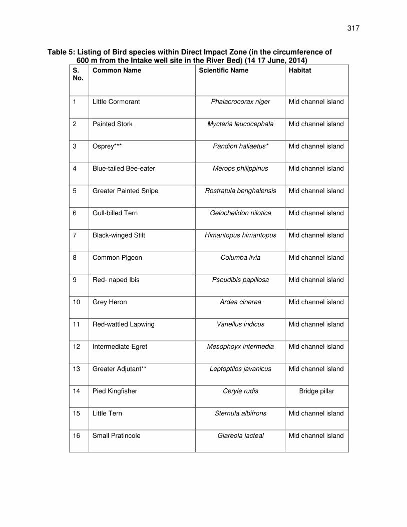
317
Table 5: Listing of Bird species within Direct Impact Zone (in the circumference of 600 m from the Intake well site in the River Bed) (14 17 June, 2014)
S. No.
Common Name Scientific Name Habitat
1 Little Cormorant Phalacrocorax niger Mid channel island
2 Painted Stork Mycteria leucocephala Mid channel island
3 Osprey*** Pandion haliaetus* Mid channel island
4 Blue-tailed Bee-eater Merops philippinus Mid channel island
5 Greater Painted Snipe Rostratula benghalensis Mid channel island
6 Gull-billed Tern Gelochelidon nilotica Mid channel island
7 Black-winged Stilt Himantopus himantopus Mid channel island
8 Common Pigeon Columba livia Mid channel island
9 Red- naped Ibis Pseudibis papillosa Mid channel island
10 Grey Heron Ardea cinerea Mid channel island
11 Red-wattled Lapwing Vanellus indicus Mid channel island
12 Intermediate Egret Mesophoyx intermedia Mid channel island
13 Greater Adjutant** Leptoptilos javanicus Mid channel island
14 Pied Kingfisher Ceryle rudis Bridge pillar
15 Little Tern Sternula albifrons Mid channel island
16 Small Pratincole Glareola lacteal Mid channel island
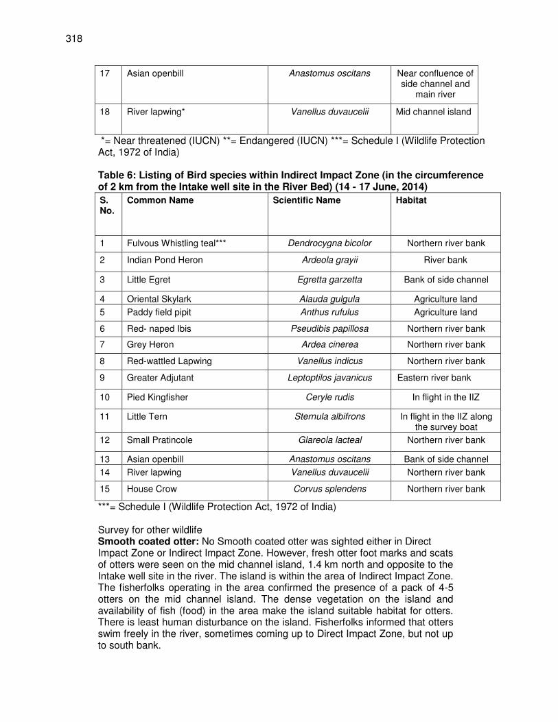
318
17 Asian openbill Anastomus oscitans Near confluence of side channel and
main river
18 River lapwing* Vanellus duvaucelii Mid channel island
*= Near threatened (IUCN) **= Endangered (IUCN) ***= Schedule I (Wildlife Protection Act, 1972 of India) Table 6: Listing of Bird species within Indirect Impact Zone (in the circumference of 2 km from the Intake well site in the River Bed) (14 - 17 June, 2014)
S. No.
Common Name Scientific Name Habitat
1 Fulvous Whistling teal*** Dendrocygna bicolor Northern river bank
2 Indian Pond Heron Ardeola grayii River bank
3 Little Egret Egretta garzetta Bank of side channel
4 Oriental Skylark Alauda gulgula Agriculture land
5 Paddy field pipit Anthus rufulus Agriculture land
6 Red- naped Ibis Pseudibis papillosa Northern river bank
7 Grey Heron Ardea cinerea Northern river bank
8 Red-wattled Lapwing Vanellus indicus Northern river bank
9 Greater Adjutant Leptoptilos javanicus Eastern river bank
10 Pied Kingfisher Ceryle rudis In flight in the IIZ
11 Little Tern Sternula albifrons In flight in the IIZ along the survey boat
12 Small Pratincole Glareola lacteal Northern river bank
13 Asian openbill Anastomus oscitans Bank of side channel
14 River lapwing Vanellus duvaucelii Northern river bank
15 House Crow Corvus splendens Northern river bank
***= Schedule I (Wildlife Protection Act, 1972 of India) Survey for other wildlife Smooth coated otter: No Smooth coated otter was sighted either in Direct Impact Zone or Indirect Impact Zone. However, fresh otter foot marks and scats of otters were seen on the mid channel island, 1.4 km north and opposite to the Intake well site in the river. The island is within the area of Indirect Impact Zone. The fisherfolks operating in the area confirmed the presence of a pack of 4-5 otters on the mid channel island. The dense vegetation on the island and availability of fish (food) in the area make the island suitable habitat for otters. There is least human disturbance on the island. Fisherfolks informed that otters swim freely in the river, sometimes coming up to Direct Impact Zone, but not up to south bank.
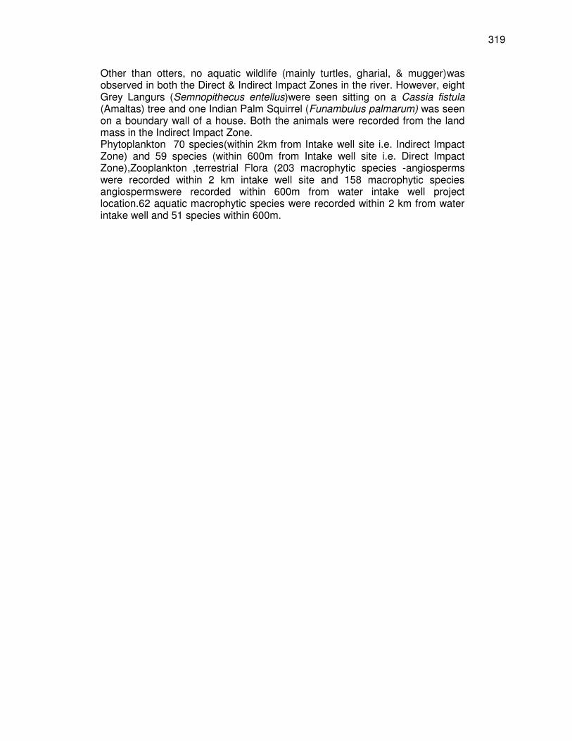
319
Other than otters, no aquatic wildlife (mainly turtles, gharial, & mugger)was observed in both the Direct & Indirect Impact Zones in the river. However, eight Grey Langurs (Semnopithecus entellus)were seen sitting on a Cassia fistula (Amaltas) tree and one Indian Palm Squirrel (Funambulus palmarum) was seen on a boundary wall of a house. Both the animals were recorded from the land mass in the Indirect Impact Zone. Phytoplankton 70 species(within 2km from Intake well site i.e. Indirect Impact Zone) and 59 species (within 600m from Intake well site i.e. Direct Impact Zone),Zooplankton ,terrestrial Flora (203 macrophytic species -angiosperms were recorded within 2 km intake well site and 158 macrophytic species angiospermswere recorded within 600m from water intake well project location.62 aquatic macrophytic species were recorded within 2 km from water intake well and 51 species within 600m.
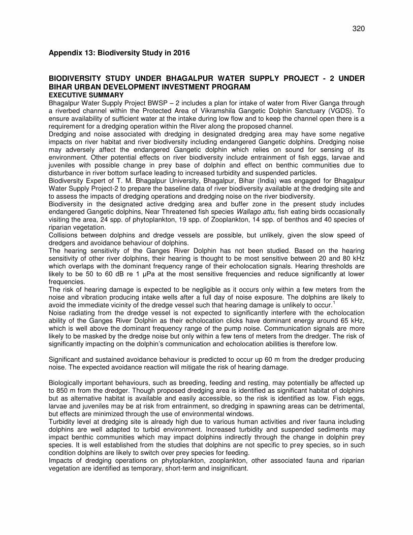
320
Appendix 13: Biodiversity Study in 2016
BIODIVERSITY STUDY UNDER BHAGALPUR WATER SUPPLY PROJECT - 2 UNDER BIHAR URBAN DEVELOPMENT INVESTMENT PROGRAM EXECUTIVE SUMMARY Bhagalpur Water Supply Project BWSP – 2 includes a plan for intake of water from River Ganga through a riverbed channel within the Protected Area of Vikramshila Gangetic Dolphin Sanctuary (VGDS). To ensure availability of sufficient water at the intake during low flow and to keep the channel open there is a requirement for a dredging operation within the River along the proposed channel. Dredging and noise associated with dredging in designated dredging area may have some negative impacts on river habitat and river biodiversity including endangered Gangetic dolphins. Dredging noise may adversely affect the endangered Gangetic dolphin which relies on sound for sensing of its environment. Other potential effects on river biodiversity include entrainment of fish eggs, larvae and juveniles with possible change in prey base of dolphin and effect on benthic communities due to disturbance in river bottom surface leading to increased turbidity and suspended particles. Biodiversity Expert of T. M. Bhagalpur University, Bhagalpur, Bihar (India) was engaged for Bhagalpur Water Supply Project-2 to prepare the baseline data of river biodiversity available at the dredging site and to assess the impacts of dredging operations and dredging noise on the river biodiversity. Biodiversity in the designated active dredging area and buffer zone in the present study includes endangered Gangetic dolphins, Near Threatened fish species Wallago attu, fish eating birds occasionally visiting the area, 24 spp. of phytoplankton, 19 spp. of Zooplankton, 14 spp. of benthos and 40 species of riparian vegetation. Collisions between dolphins and dredge vessels are possible, but unlikely, given the slow speed of dredgers and avoidance behaviour of dolphins. The hearing sensitivity of the Ganges River Dolphin has not been studied. Based on the hearing sensitivity of other river dolphins, their hearing is thought to be most sensitive between 20 and 80 kHz which overlaps with the dominant frequency range of their echolocation signals. Hearing thresholds are likely to be 50 to 60 dB re 1 μPa at the most sensitive frequencies and reduce significantly at lower frequencies. The risk of hearing damage is expected to be negligible as it occurs only within a few meters from the noise and vibration producing intake wells after a full day of noise exposure. The dolphins are likely to avoid the immediate vicinity of the dredge vessel such that hearing damage is unlikely to occur.
1
Noise radiating from the dredge vessel is not expected to significantly interfere with the echolocation ability of the Ganges River Dolphin as their echolocation clicks have dominant energy around 65 kHz, which is well above the dominant frequency range of the pump noise. Communication signals are more likely to be masked by the dredge noise but only within a few tens of meters from the dredger. The risk of significantly impacting on the dolphin’s communication and echolocation abilities is therefore low. Significant and sustained avoidance behaviour is predicted to occur up 60 m from the dredger producing noise. The expected avoidance reaction will mitigate the risk of hearing damage. Biologically important behaviours, such as breeding, feeding and resting, may potentially be affected up to 850 m from the dredger. Though proposed dredging area is identified as significant habitat of dolphins but as alternative habitat is available and easily accessible, so the risk is identified as low. Fish eggs, larvae and juveniles may be at risk from entrainment, so dredging in spawning areas can be detrimental, but effects are minimized through the use of environmental windows. Turbidity level at dredging site is already high due to various human activities and river fauna including dolphins are well adapted to turbid environment. Increased turbidity and suspended sediments may impact benthic communities which may impact dolphins indirectly through the change in dolphin prey species. It is well established from the studies that dolphins are not specific to prey species, so in such condition dolphins are likely to switch over prey species for feeding. Impacts of dredging operations on phytoplankton, zooplankton, other associated fauna and riparian vegetation are identified as temporary, short-term and insignificant.
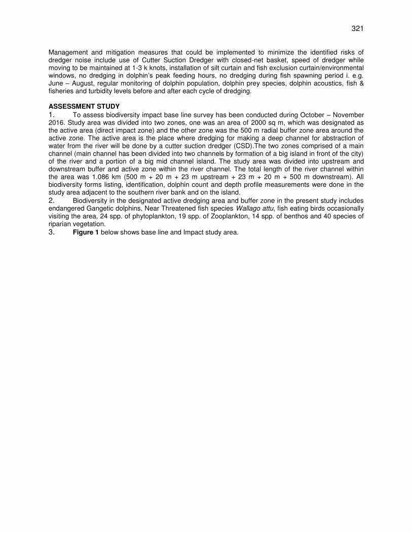
321
Management and mitigation measures that could be implemented to minimize the identified risks of dredger noise include use of Cutter Suction Dredger with closed-net basket, speed of dredger while moving to be maintained at 1-3 k knots, installation of silt curtain and fish exclusion curtain/environmental windows, no dredging in dolphin’s peak feeding hours, no dredging during fish spawning period i. e.g. June – August, regular monitoring of dolphin population, dolphin prey species, dolphin acoustics, fish & fisheries and turbidity levels before and after each cycle of dredging.
ASSESSMENT STUDY
1. To assess biodiversity impact base line survey has been conducted during October – November 2016. Study area was divided into two zones, one was an area of 2000 sq m, which was designated as the active area (direct impact zone) and the other zone was the 500 m radial buffer zone area around the active zone. The active area is the place where dredging for making a deep channel for abstraction of water from the river will be done by a cutter suction dredger (CSD).The two zones comprised of a main channel (main channel has been divided into two channels by formation of a big island in front of the city) of the river and a portion of a big mid channel island. The study area was divided into upstream and downstream buffer and active zone within the river channel. The total length of the river channel within the area was 1.086 km (500 m + 20 m + 23 m upstream + 23 m + 20 m + 500 m downstream). All biodiversity forms listing, identification, dolphin count and depth profile measurements were done in the study area adjacent to the southern river bank and on the island. 2. Biodiversity in the designated active dredging area and buffer zone in the present study includes endangered Gangetic dolphins, Near Threatened fish species Wallago attu, fish eating birds occasionally visiting the area, 24 spp. of phytoplankton, 19 spp. of Zooplankton, 14 spp. of benthos and 40 species of riparian vegetation. 3. Figure 1 below shows base line and Impact study area.
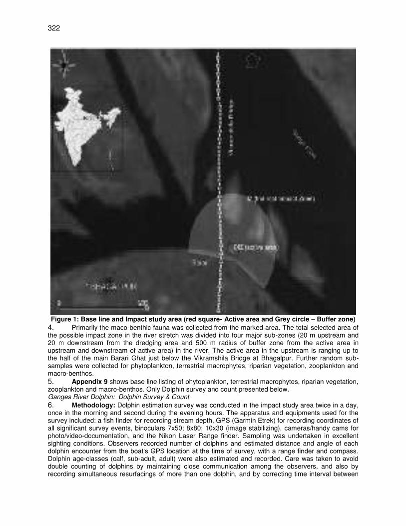
322
Figure 1: Base line and Impact study area (red square- Active area and Grey circle – Buffer zone)
4. Primarily the maco-benthic fauna was collected from the marked area. The total selected area of the possible impact zone in the river stretch was divided into four major sub-zones (20 m upstream and 20 m downstream from the dredging area and 500 m radius of buffer zone from the active area in upstream and downstream of active area) in the river. The active area in the upstream is ranging up to the half of the main Barari Ghat just below the Vikramshila Bridge at Bhagalpur. Further random sub-samples were collected for phytoplankton, terrestrial macrophytes, riparian vegetation, zooplankton and macro-benthos. 5. Appendix 9 shows base line listing of phytoplankton, terrestrial macrophytes, riparian vegetation, zooplankton and macro-benthos. Only Dolphin survey and count presented below. Ganges River Dolphin: Dolphin Survey & Count
6. Methodology: Dolphin estimation survey was conducted in the impact study area twice in a day, once in the morning and second during the evening hours. The apparatus and equipments used for the survey included: a fish finder for recording stream depth, GPS (Garmin Etrek) for recording coordinates of all significant survey events, binoculars 7x50; 8x80; 10x30 (image stabilizing), cameras/handy cams for photo/video-documentation, and the Nikon Laser Range finder. Sampling was undertaken in excellent sighting conditions. Observers recorded number of dolphins and estimated distance and angle of each dolphin encounter from the boat‘s GPS location at the time of survey, with a range finder and compass. Dolphin age-classes (calf, sub-adult, adult) were also estimated and recorded. Care was taken to avoid double counting of dolphins by maintaining close communication among the observers, and also by recording simultaneous resurfacings of more than one dolphin, and by correcting time interval between
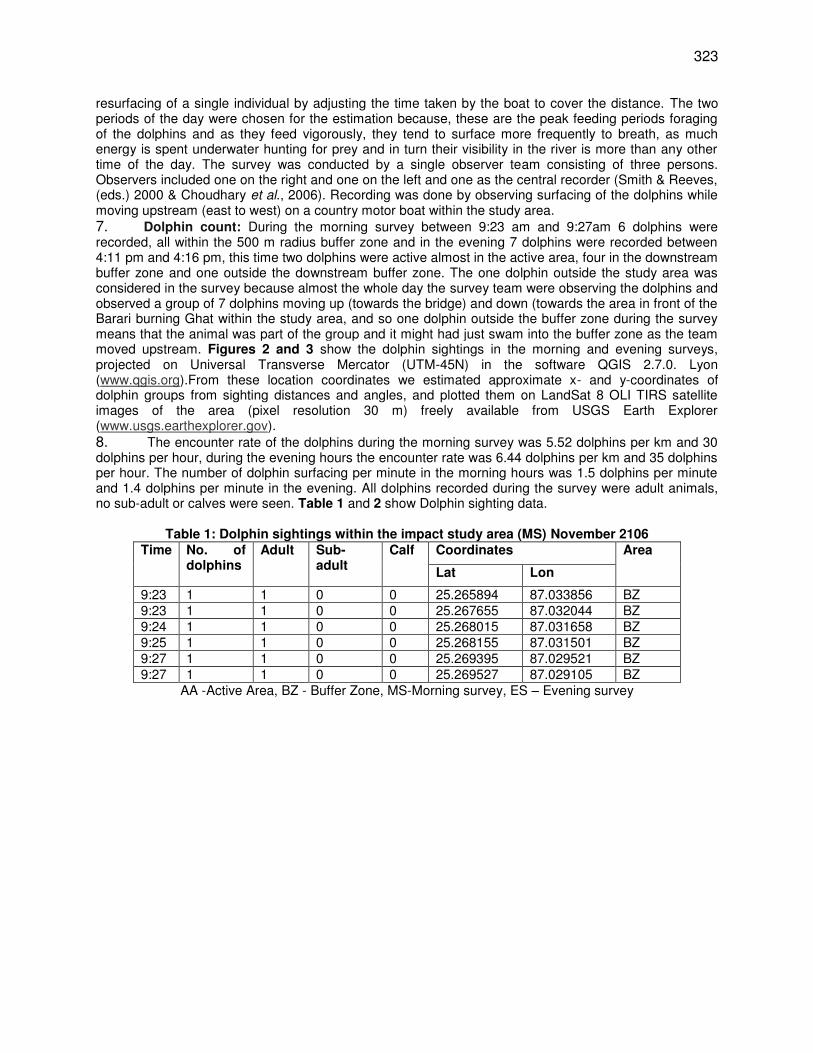
323
resurfacing of a single individual by adjusting the time taken by the boat to cover the distance. The two periods of the day were chosen for the estimation because, these are the peak feeding periods foraging of the dolphins and as they feed vigorously, they tend to surface more frequently to breath, as much energy is spent underwater hunting for prey and in turn their visibility in the river is more than any other time of the day. The survey was conducted by a single observer team consisting of three persons. Observers included one on the right and one on the left and one as the central recorder (Smith & Reeves, (eds.) 2000 & Choudhary et al., 2006). Recording was done by observing surfacing of the dolphins while moving upstream (east to west) on a country motor boat within the study area. 7. Dolphin count: During the morning survey between 9:23 am and 9:27am 6 dolphins were recorded, all within the 500 m radius buffer zone and in the evening 7 dolphins were recorded between 4:11 pm and 4:16 pm, this time two dolphins were active almost in the active area, four in the downstream buffer zone and one outside the downstream buffer zone. The one dolphin outside the study area was considered in the survey because almost the whole day the survey team were observing the dolphins and observed a group of 7 dolphins moving up (towards the bridge) and down (towards the area in front of the Barari burning Ghat within the study area, and so one dolphin outside the buffer zone during the survey means that the animal was part of the group and it might had just swam into the buffer zone as the team moved upstream. Figures 2 and 3 show the dolphin sightings in the morning and evening surveys, projected on Universal Transverse Mercator (UTM-45N) in the software QGIS 2.7.0. Lyon (www.qgis.org).From these location coordinates we estimated approximate x- and y-coordinates of dolphin groups from sighting distances and angles, and plotted them on LandSat 8 OLI TIRS satellite images of the area (pixel resolution 30 m) freely available from USGS Earth Explorer (www.usgs.earthexplorer.gov). 8. The encounter rate of the dolphins during the morning survey was 5.52 dolphins per km and 30 dolphins per hour, during the evening hours the encounter rate was 6.44 dolphins per km and 35 dolphins per hour. The number of dolphin surfacing per minute in the morning hours was 1.5 dolphins per minute and 1.4 dolphins per minute in the evening. All dolphins recorded during the survey were adult animals, no sub-adult or calves were seen. Table 1 and 2 show Dolphin sighting data.
Table 1: Dolphin sightings within the impact study area (MS) November 2106
Time No. of dolphins
Adult Sub-adult
Calf Coordinates Area
Lat Lon
9:23 1 1 0 0 25.265894 87.033856 BZ 9:23 1 1 0 0 25.267655 87.032044 BZ 9:24 1 1 0 0 25.268015 87.031658 BZ 9:25 1 1 0 0 25.268155 87.031501 BZ 9:27 1 1 0 0 25.269395 87.029521 BZ 9:27 1 1 0 0 25.269527 87.029105 BZ
AA -Active Area, BZ - Buffer Zone, MS-Morning survey, ES – Evening survey
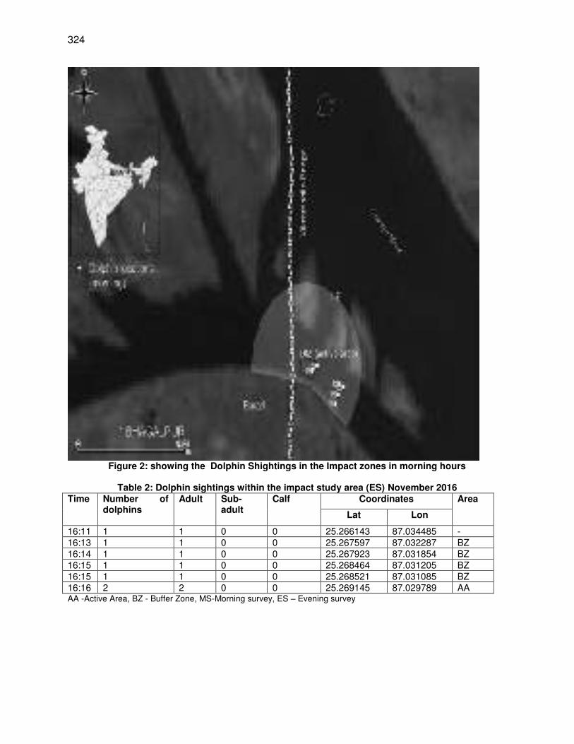
324
Figure 2: showing the Dolphin Shightings in the Impact zones in morning hours
Table 2: Dolphin sightings within the impact study area (ES) November 2016
Time Number of dolphins
Adult Sub-adult
Calf Coordinates Area
Lat Lon
16:11 1 1 0 0 25.266143 87.034485 - 16:13 1 1 0 0 25.267597 87.032287 BZ 16:14 1 1 0 0 25.267923 87.031854 BZ 16:15 1 1 0 0 25.268464 87.031205 BZ 16:15 1 1 0 0 25.268521 87.031085 BZ 16:16 2 2 0 0 25.269145 87.029789 AA AA -Active Area, BZ - Buffer Zone, MS-Morning survey, ES – Evening survey
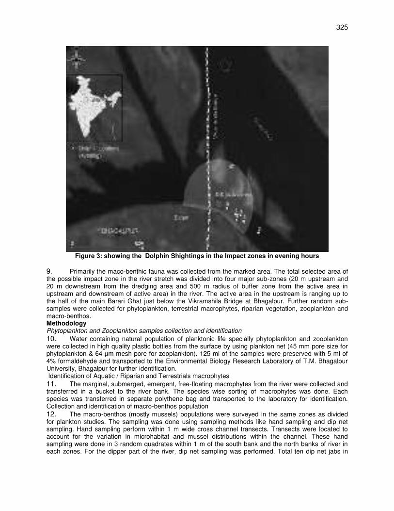
325
Figure 3: showing the Dolphin Shightings in the Impact zones in evening hours
9. Primarily the maco-benthic fauna was collected from the marked area. The total selected area of the possible impact zone in the river stretch was divided into four major sub-zones (20 m upstream and 20 m downstream from the dredging area and 500 m radius of buffer zone from the active area in upstream and downstream of active area) in the river. The active area in the upstream is ranging up to the half of the main Barari Ghat just below the Vikramshila Bridge at Bhagalpur. Further random sub-samples were collected for phytoplankton, terrestrial macrophytes, riparian vegetation, zooplankton and macro-benthos. Methodology Phytoplankton and Zooplankton samples collection and identification
10. Water containing natural population of planktonic life specially phytoplankton and zooplankton were collected in high quality plastic bottles from the surface by using plankton net (45 mm pore size for phytoplankton & 64 µm mesh pore for zooplankton). 125 ml of the samples were preserved with 5 ml of 4% formaldehyde and transported to the Environmental Biology Research Laboratory of T.M. Bhagalpur University, Bhagalpur for further identification. Identification of Aquatic / Riparian and Terrestrials macrophytes 11. The marginal, submerged, emergent, free-floating macrophytes from the river were collected and transferred in a bucket to the river bank. The species wise sorting of macrophytes was done. Each species was transferred in separate polythene bag and transported to the laboratory for identification. Collection and identification of macro-benthos population 12. The macro-benthos (mostly mussels) populations were surveyed in the same zones as divided for plankton studies. The sampling was done using sampling methods like hand sampling and dip net sampling. Hand sampling perform within 1 m wide cross channel transects. Transects were located to account for the variation in microhabitat and mussel distributions within the channel. These hand sampling were done in 3 random quadrates within 1 m of the south bank and the north banks of river in each zones. For the dipper part of the river, dip net sampling was performed. Total ten dip net jabs in
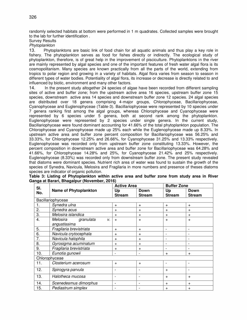
326
randomly selected habitats at bottom were performed in 1 m quadrates. Collected samples were brought to the lab for further identification . Survey Results Phytoplankton
13. Phytoplanktons are basic link of food chain for all aquatic animals and thus play a key role in fishery. The phytoplankton serves as food for fishes directly or indirectly. The ecological study of phytoplankton, therefore, is of great help in the improvement of pisciculture. Phytoplanktons in the river are mainly represented by algal species and one of the important features of fresh water algal flora is its cosmopolitanism. Many species are known practically from all the parts of the world, extending from tropics to polar region and growing in a variety of habitats. Algal flora varies from season to season in different types of water bodies. Potentiality of algal flora, its increase or decrease is directly related to and influenced by biotic, environment and many other factors. 14. In the present study altogether 24 species of algae have been recorded from different sampling sites of active and buffer zone; from the upstream active area 16 species, upstream buffer zone 15 species, downstream active area 14 species and downstream buffer zone 12 species. 24 algal species are distributed over 18 genera comprising 4-major groups, Chlorophyceae, Bacillariophyceae, Cyanophyceae and Euglenophyceae (Table-3). Bacillariophyceae were represented by 10 species under 7 genera ranking first among the algal groups, whereas Chlorophyceae and Cyanophyceae were represented by 6 species under 5 genera, both at second rank among the phytoplankton. Euglenophyceae were represented by 2 species under single genera. In the current study, Bacillariophyceae were found dominant accounting for 41.66% of the total phytoplankton population. The Chlorophyceae and Cyanophyceae made up 25% each while the Euglenophyceae made up 8.33%. In upstream active area and buffer zone percent composition for Bacillariophyceae was 56.25% and 33.33%, for Chlorophyceae 12.25% and 26.66%, for Cyanophyceae 31.25% and 13.33% respectively. Euglenophyceae was recorded only from upstream buffer zone constituting 13.33%. However, the percent composition in downstream active area and buffer zone for Bacillariophyceae was 64.28% and 41.66%, for Chlorophyceae 14.28% and 25%, for Cyanophyceae 21.42% and 25% respectively. Euglenophyceae (8.33%) was recorded only from downstream buffer zone. The present study revealed that diatoms were dominant species. Nutrient rich area of water was found to sustain the growth of the species of Synedra, Navicula, Melosira and Fragilaria in more numbers and presence of theses diatoms species are indicator of organic pollution. Table 3: Listing of Phytoplankton within active area and buffer zone from study area in River Ganga at Barari, Bhagalpur (November, 2016)
Sl. No.
Name of Phytoplankton Active Area Buffer Zone Up Stream
Down Stream
Up Stream
Down Stream
Bacillariophyceae 1. Synedra ulna + + + + 2. Synedra acus + + + + 3. Melosira islandica + + + + 4. Melosira granulata v.
angustissima + + + +
5. Fragilaria brevistriata + + - - 6. Navicula crytocephala + + - - 7. Navicula halophila + + - - 8. Gyrosigma acuminatum + + - - 9. Fragilaria brevistriata + + - - 10. Eunotia gunowii - - + + Chlorophyceae 11. Closterium acerosum + + - -
12. Spirogyra parvula - - + -
13. Halotheca mucosa - - + +
14. Scenedesmus dimorphus - - + + 15. Pediastrum simplex - - + +
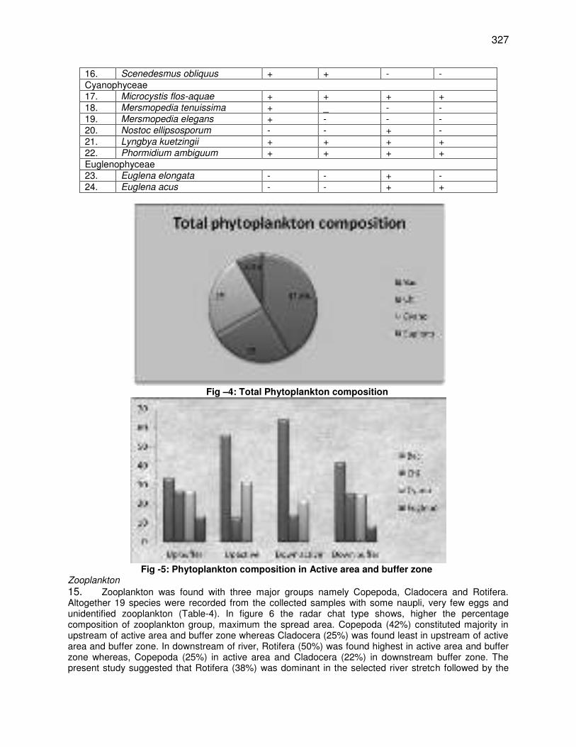
327
16. Scenedesmus obliquus + + - - Cyanophyceae 17. Microcystis flos-aquae + + + + 18. Mersmopedia tenuissima + _ - - 19. Mersmopedia elegans + - - - 20. Nostoc ellipsosporum - - + - 21. Lyngbya kuetzingii + + + + 22. Phormidium ambiguum + + + + Euglenophyceae 23. Euglena elongata - - + - 24. Euglena acus - - + +
Fig –4: Total Phytoplankton composition
Fig -5: Phytoplankton composition in Active area and buffer zone Zooplankton
15. Zooplankton was found with three major groups namely Copepoda, Cladocera and Rotifera. Altogether 19 species were recorded from the collected samples with some naupli, very few eggs and unidentified zooplankton (Table-4). In figure 6 the radar chat type shows, higher the percentage composition of zooplankton group, maximum the spread area. Copepoda (42%) constituted majority in upstream of active area and buffer zone whereas Cladocera (25%) was found least in upstream of active area and buffer zone. In downstream of river, Rotifera (50%) was found highest in active area and buffer zone whereas, Copepoda (25%) in active area and Cladocera (22%) in downstream buffer zone. The present study suggested that Rotifera (38%) was dominant in the selected river stretch followed by the
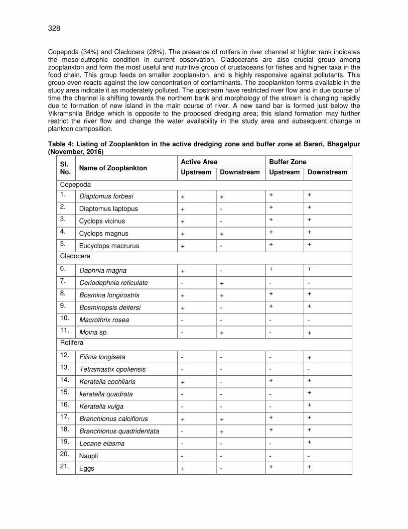
328
Copepoda (34%) and Cladocera (28%). The presence of rotifers in river channel at higher rank indicates the meso-eutrophic condition in current observation. Cladocerans are also crucial group among zooplankton and form the most useful and nutritive group of crustaceans for fishes and higher taxa in the food chain. This group feeds on smaller zooplankton, and is highly responsive against pollutants. This group even reacts against the low concentration of contaminants. The zooplankton forms available in the study area indicate it as moderately polluted. The upstream have restricted river flow and in due course of time the channel is shifting towards the northern bank and morphology of the stream is changing rapidly due to formation of new island in the main course of river. A new sand bar is formed just below the Vikramshila Bridge which is opposite to the proposed dredging area; this island formation may further restrict the river flow and change the water availability in the study area and subsequent change in plankton composition. Table 4: Listing of Zooplankton in the active dredging zone and buffer zone at Barari, Bhagalpur (November, 2016)
Sl. No.
Name of Zooplankton Active Area Buffer Zone
Upstream Downstream Upstream Downstream
Copepoda
1. Diaptomus forbesi + + + +
2. Diaptomus laptopus + - + +
3. Cyclops vicinus + - + +
4. Cyclops magnus + + + +
5. Eucyclops macrurus + - + +
Cladocera
6. Daphnia magna + - + +
7. Ceriodephnia reticulate - + - -
8. Bosmina longirostris + + + +
9. Bosminopsis deitersi + - + +
10. Macrothrix rosea - - - -
11. Moina sp. - + - +
Rotifera
12. Filinia longiseta - - - +
13. Tetramastix opoliensis - - - -
14. Keratella cochliaris + - + +
15. keratella quadrata - - - +
16. Keratella vulga - - - +
17. Branchionus calciflorus + + + +
18. Branchionus quadridentata - + + +
19. Lecane elasma - - - +
20. Naupli - - - -
21. Eggs + - + +
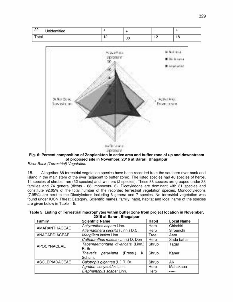
329
22. Unidentified + + - +
Total 12 08 12 18
Fig- 6: Percent composition of Zooplankton in active area and buffer zone of up and downstream
of proposed site in November, 2016 at Barari, Bhagalpur River Bank (Terrestrial) Vegetation
16. Altogether 88 terrestrial vegetation species have been recorded from the southern river bank and island in the main stem of the river (adjacent to buffer zone). The listed species had 40 species of herbs, 14 species of shrubs, tree (32 species) and twinners (2 species). These 88 species are grouped under 33 families and 74 genera (dicots - 68; monocots- 6). Dicotyledons are dominant with 81 species and constitute 92.05% of the total number of the recorded terrestrial vegetation species. Monocotyledons (7.95%) are next to the Dicotyledons including 6 genera and 7 species. No terrestrial vegetation was found under IUCN Threat Category. Scientific names, family, habit, habitat and local name of the species are given below in Table – 5.
Table 5: Listing of Terrestrial macrophytes within buffer zone from project location in November,
2016 at Barari, Bhagalpur Family Scientific Name Habit Local Name
AMARANTHACEAE Achyranthes aspera Linn. Herb Chirchiri Alternanthera sessilis (Linn.) D.C. Herb Sirounchi
ANACARDIACEAE Mangifera indica Linn. Tree Aam
APOCYNACEAE
Catharanthus roseus (Linn.) D. Don Herb Sada bahar Tabernaemontana divaricata (Linn.) R. Br.
Shrub Tagar
Thevetia peruviana (Press.) K. Schum.
Shrub Kaner
ASCLEPIADACEAE Calotropis gigantea (L.) R. Br. Shrub AK
Agretum conyzoides Linn. Herb Mahakaua Elephantopus scaber Linn. Herb -----
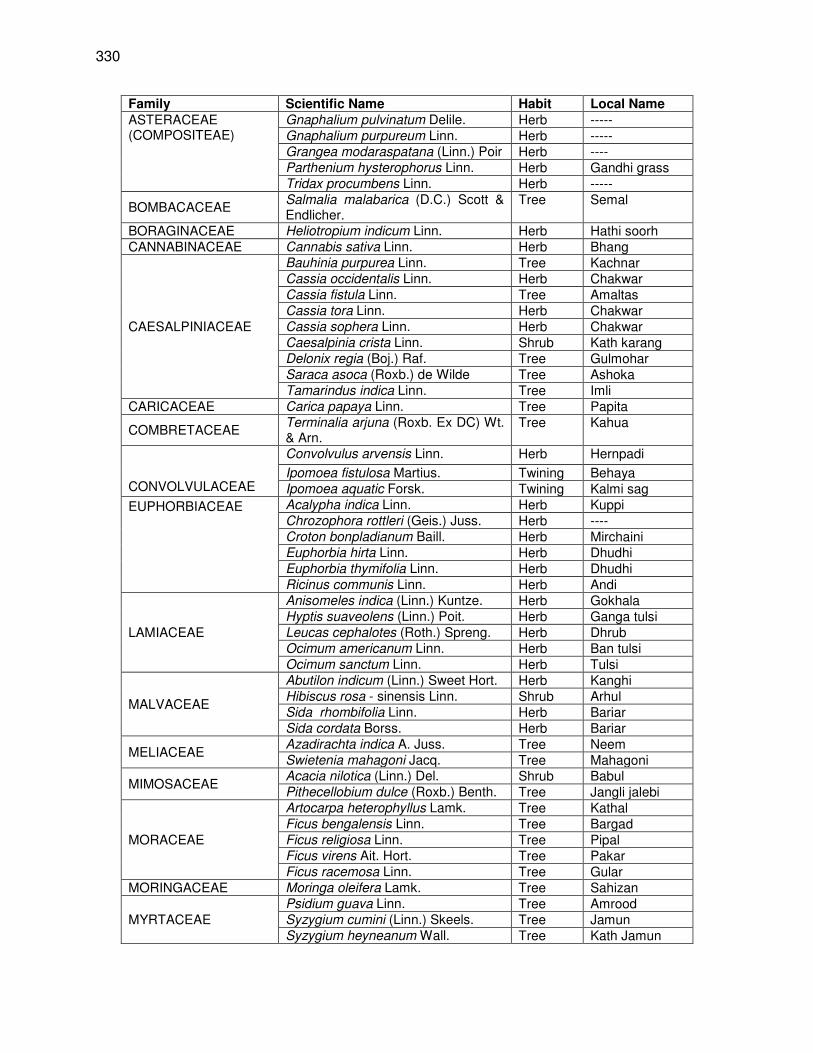
330
Family Scientific Name Habit Local Name ASTERACEAE (COMPOSITEAE)
Gnaphalium pulvinatum Delile. Herb ----- Gnaphalium purpureum Linn. Herb ----- Grangea modaraspatana (Linn.) Poir Herb ---- Parthenium hysterophorus Linn. Herb Gandhi grass Tridax procumbens Linn. Herb -----
BOMBACACEAE Salmalia malabarica (D.C.) Scott & Endlicher.
Tree Semal
BORAGINACEAE Heliotropium indicum Linn. Herb Hathi soorh CANNABINACEAE Cannabis sativa Linn. Herb Bhang
CAESALPINIACEAE
Bauhinia purpurea Linn. Tree Kachnar Cassia occidentalis Linn. Herb Chakwar Cassia fistula Linn. Tree Amaltas Cassia tora Linn. Herb Chakwar Cassia sophera Linn. Herb Chakwar Caesalpinia crista Linn. Shrub Kath karang Delonix regia (Boj.) Raf. Tree Gulmohar Saraca asoca (Roxb.) de Wilde Tree Ashoka Tamarindus indica Linn. Tree Imli
CARICACEAE Carica papaya Linn. Tree Papita
COMBRETACEAE Terminalia arjuna (Roxb. Ex DC) Wt. & Arn.
Tree Kahua
CONVOLVULACEAE
Convolvulus arvensis Linn. Herb Hernpadi
Ipomoea fistulosa Martius. Twining Behaya Ipomoea aquatic Forsk. Twining Kalmi sag
EUPHORBIACEAE
Acalypha indica Linn. Herb Kuppi Chrozophora rottleri (Geis.) Juss. Herb ---- Croton bonpladianum Baill. Herb Mirchaini Euphorbia hirta Linn. Herb Dhudhi Euphorbia thymifolia Linn. Herb Dhudhi Ricinus communis Linn. Herb Andi
LAMIACEAE
Anisomeles indica (Linn.) Kuntze. Herb Gokhala Hyptis suaveolens (Linn.) Poit. Herb Ganga tulsi Leucas cephalotes (Roth.) Spreng. Herb Dhrub Ocimum americanum Linn. Herb Ban tulsi Ocimum sanctum Linn. Herb Tulsi
MALVACEAE
Abutilon indicum (Linn.) Sweet Hort. Herb Kanghi Hibiscus rosa - sinensis Linn. Shrub Arhul Sida rhombifolia Linn. Herb Bariar Sida cordata Borss. Herb Bariar
MELIACEAE Azadirachta indica A. Juss. Tree Neem Swietenia mahagoni Jacq. Tree Mahagoni
MIMOSACEAE Acacia nilotica (Linn.) Del. Shrub Babul Pithecellobium dulce (Roxb.) Benth. Tree Jangli jalebi
MORACEAE
Artocarpa heterophyllus Lamk. Tree Kathal Ficus bengalensis Linn. Tree Bargad Ficus religiosa Linn. Tree Pipal Ficus virens Ait. Hort. Tree Pakar Ficus racemosa Linn. Tree Gular
MORINGACEAE Moringa oleifera Lamk. Tree Sahizan
MYRTACEAE Psidium guava Linn. Tree Amrood Syzygium cumini (Linn.) Skeels. Tree Jamun Syzygium heyneanum Wall. Tree Kath Jamun

331
Family Scientific Name Habit Local Name PAPAVERACEAE Argemone mexicana Linn. Herb Pila kantaila
PAPILIONACEAE (FABACEAE)
Butea monosperma (Lamk.) Taub Tree Palas Dalbergia sissoo Linn. Tree Shisham Desmodium gangeticum (Linn.) D.C. Herb ------ Erythrina variegata Linn. Tree Phard
PUNICACEAE Punica granatum Linn. Shrub Anar
RHAMNACEAE Ziziphus mauritiana Lamk. Tree Ber Ziziphus oenoplia (Linn.) Mill. Shrub Jhar ber
RUBIACEAE Dentella repens (Linn.) Forst. Herb ---- RUTACEAE
Aegle marmelos Linn. Tree Bel Citrus grandis (Linn.) Osbeck. Shrub Tabh nimboo Murraya paniculata (Linn.) Jacq. Shrub Kamini
SAPINDACEAE Litchi chinensis Sonner. Voy. Tree Litchi SOLANACEAE Physalis minima Linn. Herb Banphutka
Solanum xanthocarpum Schrad. Herb Kataila UMBELLIFERAE (APIACEAE)
Centella asiatica (Linn.) Urban Herb Bramhi
VERBENACEAE
Clerodendrum viscosum Vent. Shrub Tit bhant Lantana camara Linn. Shrub Lantana Lippia alba (Mill.) N. E. Br. Shrub ---- Phyla nodiflora (Linn.) Greene. Herb ----- Tectona grandis Linn. Tree Sagvan Vitex negundo Linn. Shrub Sambhalu
CYPERACEAE Cyperus compressus Linn. Herb Mutha Cyperus rotundus Linn. Herb Mutha Kallinga brevifolia Rott. boll. Herb Mutha
MUSACEAE Musa paradisica Linn. Tree Kela
PALMAE
Borassus flabellifer Murr. Tree Tar Cocos nucifera Linn. Tree Nariuyal
Phoenix dactylifera Linn. Tree Khajur Riparian Vegetation
17. Riparian vegetation is a compulsion in understanding the ecological aspects of the plant communities in any ecosystem. The structural attributes through which a plant community is studied are conveniently viewed as analytic and synthetic characters. The analytical characters may be both qualitative and quantitative. The qualitative or subjective analysis comprises the floristic composition. Floristic list of a particular area gives reliable background information about species diversity in a community as each plant species has its own specific ecological amplitude and the same indicates the ecological nature of the habitat. 18. Due to new island formation at the site of active and buffer zone very few riparian vegetation were recorded from the study area. At present, the pioneer species have appeared on the island and are in immature stage. Secondary information collected from the local community of Barari, Bhagalpur suggest that in coming months the plant community will be fully established on the island and by March-April fully grown. Previous studies by Vikramshila Biodiversity Research & Education Center, Bhagalpur University, Bhagalpur indicate that this island in summer months is home and breeding ground of variety of birds and Smooth coated otters. In the present study total 25 riparian/ aquatic angiospermic species have been recorded from active and buffer zone of river and its flood plains. The species have been grouped under different categories, i.e. herbs (23 species), and shrubs (2 species). Further, these species have been also grouped on the basis of their distribution i.e. marginal (21 species), floating (1 species) and in the floodplain (3 species). All the 25 species have been distributed in 22 genera (dicots-16; monocots-6) from 13 families. Dicotyledons are dominant (19 species) and constitute 76% of the total number of the aquatic macrophytic species. Monocotyledons (24%) are next to the Dicotyledons including 6 genera and 6
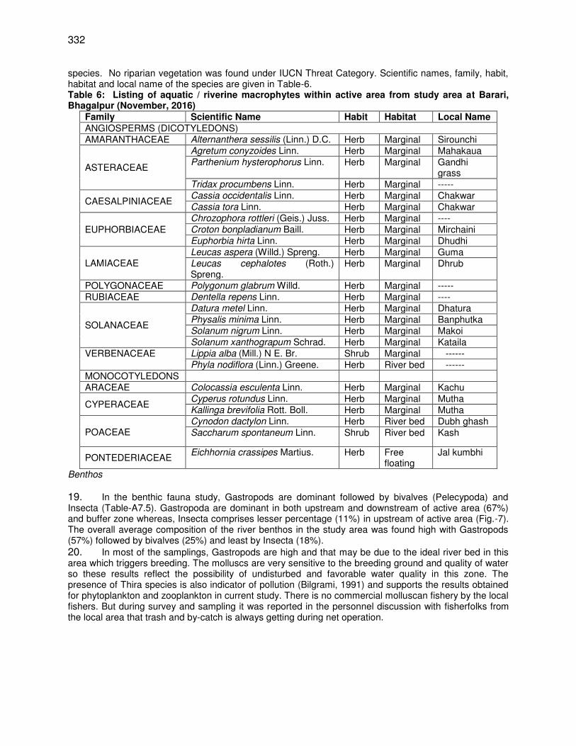
332
species. No riparian vegetation was found under IUCN Threat Category. Scientific names, family, habit, habitat and local name of the species are given in Table-6. Table 6: Listing of aquatic / riverine macrophytes within active area from study area at Barari, Bhagalpur (November, 2016)
Family Scientific Name Habit Habitat Local Name ANGIOSPERMS (DICOTYLEDONS) AMARANTHACEAE Alternanthera sessilis (Linn.) D.C. Herb Marginal Sirounchi
ASTERACEAE
Agretum conyzoides Linn. Herb Marginal Mahakaua Parthenium hysterophorus Linn. Herb Marginal Gandhi
grass Tridax procumbens Linn. Herb Marginal -----
CAESALPINIACEAE Cassia occidentalis Linn. Herb Marginal Chakwar Cassia tora Linn. Herb Marginal Chakwar
EUPHORBIACEAE Chrozophora rottleri (Geis.) Juss. Herb Marginal ---- Croton bonpladianum Baill. Herb Marginal Mirchaini Euphorbia hirta Linn. Herb Marginal Dhudhi
LAMIACEAE Leucas aspera (Willd.) Spreng. Herb Marginal Guma Leucas cephalotes (Roth.) Spreng.
Herb Marginal Dhrub
POLYGONACEAE Polygonum glabrum Willd. Herb Marginal ----- RUBIACEAE Dentella repens Linn. Herb Marginal ----
SOLANACEAE
Datura metel Linn. Herb Marginal Dhatura Physalis minima Linn. Herb Marginal Banphutka Solanum nigrum Linn. Herb Marginal Makoi Solanum xanthograpum Schrad. Herb Marginal Kataila
VERBENACEAE Lippia alba (Mill.) N E. Br. Shrub Marginal ------ Phyla nodiflora (Linn.) Greene. Herb River bed ------
MONOCOTYLEDONS ARACEAE Colocassia esculenta Linn. Herb Marginal Kachu
CYPERACEAE Cyperus rotundus Linn. Herb Marginal Mutha Kallinga brevifolia Rott. Boll. Herb Marginal Mutha
POACEAE
Cynodon dactylon Linn. Herb River bed Dubh ghash Saccharum spontaneum Linn. Shrub River bed Kash
PONTEDERIACEAE Eichhornia crassipes Martius. Herb Free
floating Jal kumbhi
Benthos
19. In the benthic fauna study, Gastropods are dominant followed by bivalves (Pelecypoda) and Insecta (Table-A7.5). Gastropoda are dominant in both upstream and downstream of active area (67%) and buffer zone whereas, Insecta comprises lesser percentage (11%) in upstream of active area (Fig.-7). The overall average composition of the river benthos in the study area was found high with Gastropods (57%) followed by bivalves (25%) and least by Insecta (18%). 20. In most of the samplings, Gastropods are high and that may be due to the ideal river bed in this area which triggers breeding. The molluscs are very sensitive to the breeding ground and quality of water so these results reflect the possibility of undisturbed and favorable water quality in this zone. The presence of Thira species is also indicator of pollution (Bilgrami, 1991) and supports the results obtained for phytoplankton and zooplankton in current study. There is no commercial molluscan fishery by the local fishers. But during survey and sampling it was reported in the personnel discussion with fisherfolks from the local area that trash and by-catch is always getting during net operation.
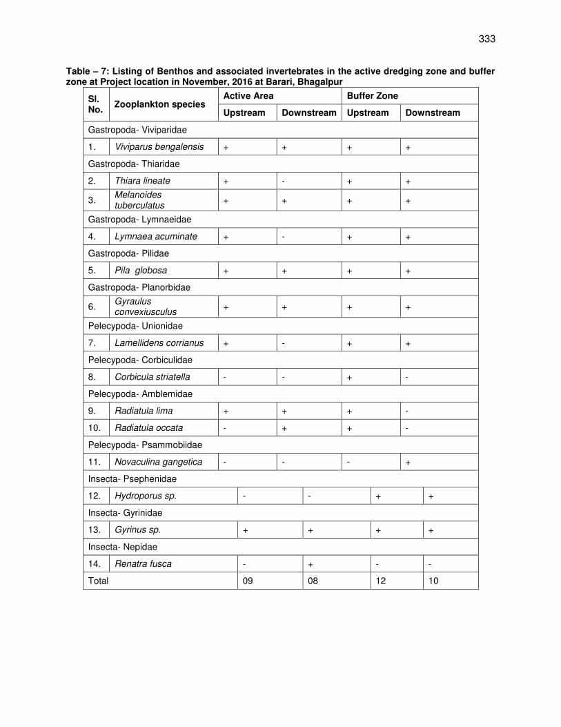
333
Table – 7: Listing of Benthos and associated invertebrates in the active dredging zone and buffer zone at Project location in November, 2016 at Barari, Bhagalpur
Sl. No.
Zooplankton species Active Area Buffer Zone
Upstream Downstream Upstream Downstream
Gastropoda- Viviparidae
1. Viviparus bengalensis + + + +
Gastropoda- Thiaridae
2. Thiara lineate + - + +
3. Melanoides tuberculatus
+ + + +
Gastropoda- Lymnaeidae
4. Lymnaea acuminate + - + +
Gastropoda- Pilidae
5. Pila globosa + + + +
Gastropoda- Planorbidae
6. Gyraulus convexiusculus
+ + + +
Pelecypoda- Unionidae
7. Lamellidens corrianus + - + +
Pelecypoda- Corbiculidae
8. Corbicula striatella - - + -
Pelecypoda- Amblemidae
9. Radiatula lima + + + -
10. Radiatula occata - + + -
Pelecypoda- Psammobiidae
11. Novaculina gangetica - - - +
Insecta- Psephenidae
12. Hydroporus sp. - - + +
Insecta- Gyrinidae
13. Gyrinus sp. + + + +
Insecta- Nepidae
14. Renatra fusca - + - -
Total 09 08 12 10
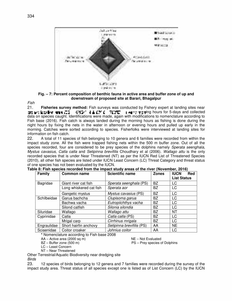
334
Fig. – 7: Percent composition of benthic fauna in active area and buffer zone of up and
downstream of proposed site at Barari, Bhagalpur Fish
21. Fisheries survey method: Fish surveys was conducted by Fishery expert at landing sites near ing hours for 5-days and collected
data on species caught. Identifications were made, again with modifications to nomenclature according to Fish base (2016). Fish catch is always landed during the morning hours as fishing is done during the night hours by fixing the nets in the water in afternoon or evening hours and pulled up early in the morning. Catches were sorted according to species. Fisherfolks were interviewed at landing sites for information on fish catch. 22. A total of 11 species of fish belonging to 10 genera and 6 families were recorded from within the impact study zone. All the fish were trapped fishing nets within the 500 m buffer zone. Out of all the species recorded, four are considered to be prey species of the dolphins namely Sperata seenghala, Mystus cavasius, Catla catla and Setipinna brevifilis Choudhary et al (2006). Wallago attu is the only recorded species that is under Near Threatened (NT) as per the IUCN Red List of Threatened Species (2010), all other fish species are listed under IUCN Least Concern (LC) Threat Category and threat status of one species has not been evaluated by the IUCN. Table 8: Fish species recorded from the impact study areas of the river (November, 2016)
Family Common name Scientific name Zones
IUCN Red List Status
Bagridae Giant river cat fish Sperata seenghala (PS) BZ LC Long whiskered cat fish Sperata aor BZ LC
Gangetic mystus Mystus cavasius (PS) BZ LC Schilbeidae Garua bachcha Clupisoma garua BZ LC
Bachwa vacha Eutropiichthys vacha BZ LC Silond catfish Silonia silondia BZ LC
Siluridae Wallago Wallago attu BZ NT Cyprinidae Catla Catla catla (PS) BZ LC
Mrigal carp Cirrhinus mrigala BZ LC Engraulidae Short hairfin anchovy Setipinna brevifilis (PS) AA NE Sciaenidae Coitor croaker Johnius coitor AA LC
* Nomenclature according to Fish base 2008 AA – Active area (2000 sq m) NE – Not Evaluated BZ – Buffer zone (500 m) PS – Prey species of Dolphins LC – Least Concern NT – Near Threatened
Other Terrestrial/Aquatic Biodiversity near dredging site Birds
23. 12 species of birds belonging to 12 genera and 7 families were recorded during the survey of the impact study area. Threat status of all species except one is listed as of List Concern (LC) by the IUCN
335
Red List of Threatened Species. The species Vanellus duvaucellii commonly known as River Lapwing is the only Near Threatened (NT) species recorded during the survey. All the species were recorded within the buffer zone of the study area. Table –9: Bird species recorded in Impact Study Area of the river (November, 2016)
Family Common name Scientific name Zones
IUCN Red List Status
Acciptridae Black Kite Milvus migrans BZ LC Ospray Pandion haliaetus BZ LC
Charadriidae Little Ringed Plover Charadrius dubius BZ LC River Lapwing Vanellus duvaucellii BZ NT Common Sand Piper Actitis hypoleucos BZ LC
Alcedinidae Pied Kingfisher Ceryle rudis BZ LC White Throated Kingfisher
Halcyon smyrnensis BZ LC
Motacillidae White Wagtail Motacilla alba BZ LC Paddy Field Pipit Anthus rufulus BZ LC
Anatidae Ruddy shelduck Tadorna ferruginea AA LC Laridae Brown Headed Gull Larus brunnicephalus BZ LC Ardeidae Indian Pond Heron Ardeola grayii BZ LC
AA – Active Area; BZ – Buffer Zone; LC – Least Concerned; NT – Near Threatened Otters
There are secondary information that the adjacent area (river channel and mid channel Islands)of the dredging site and active zone is also the hunting ground of the Vulnerable (VU) (IUCN Red List of Threatened Species, assessed in 2014) smooth coated otter (Lutrogale perspicillata)
336
Appendix 14: Underwater Noise Impacts Modeling
337
338
339
340
341
342
343
344
345
346
347
348
349
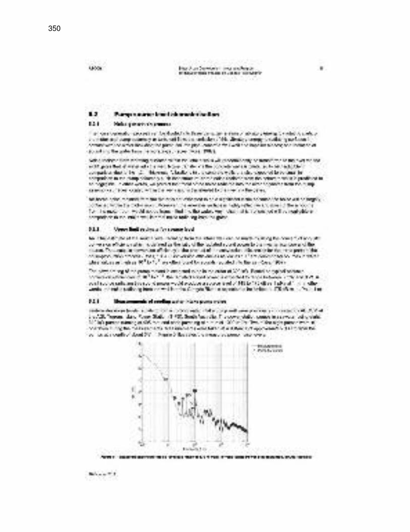
350
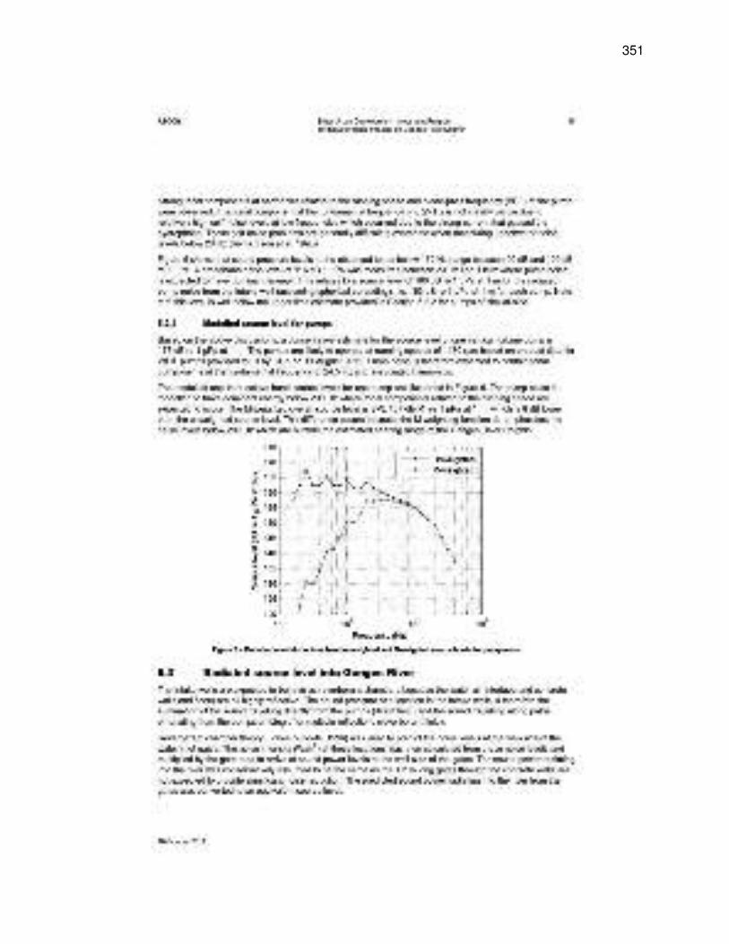
351
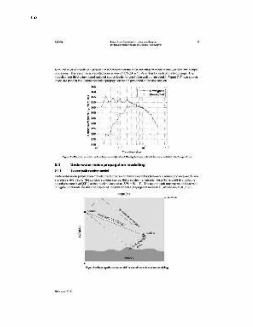
352
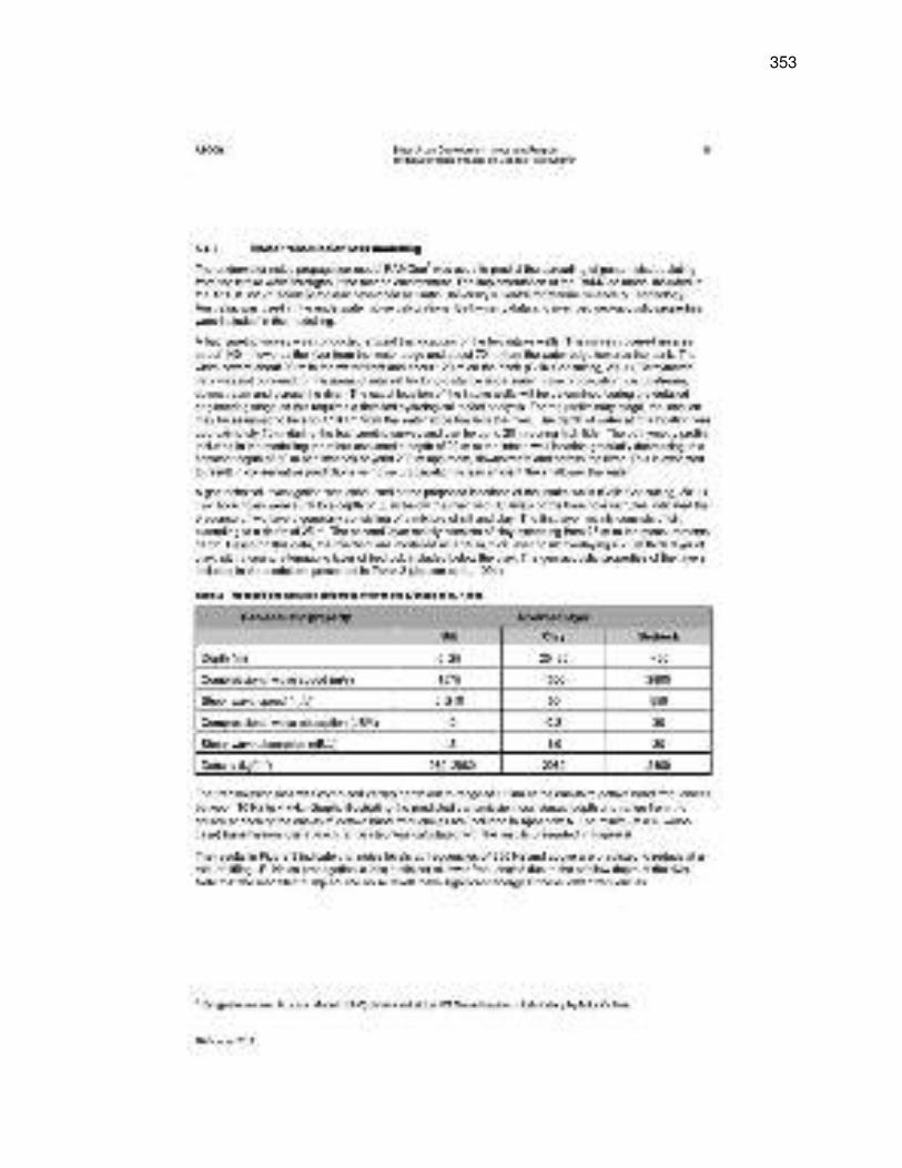
353
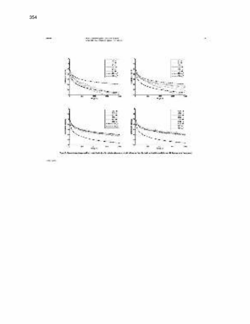
354
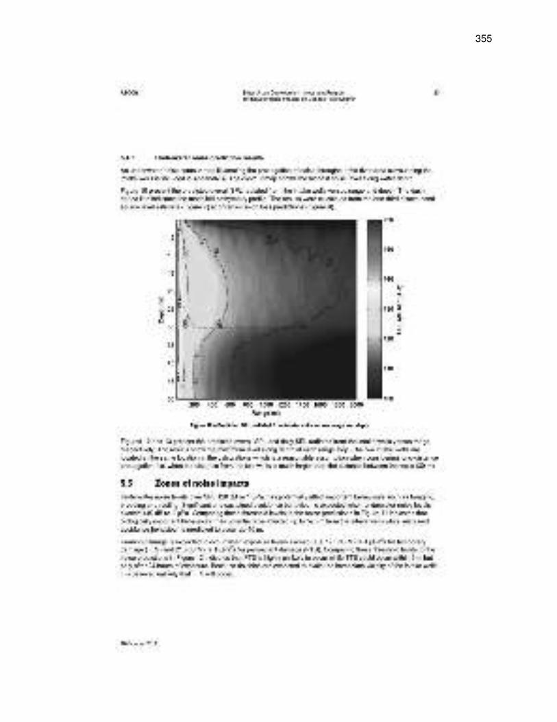
355
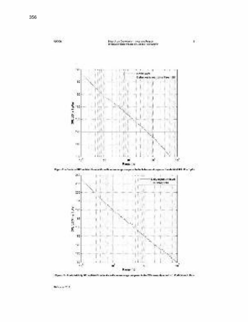
356
357
358
359
360

361
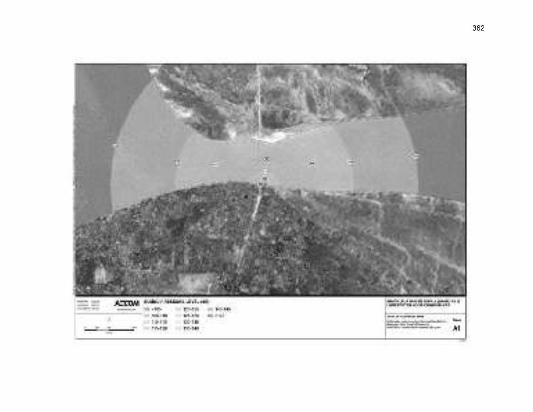
362
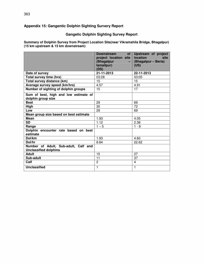
363
Appendix 15: Gangentic Dolphin Sighting Survery Report
Gangetic Dolphin Sighting Survey Report Summary of Dolphin Survey from Project Location Site(near Vikramshila Bridge, Bhagalpur) (15 km upstream & 15 km downstream) Downstream of
project location site (Bhagalpur – Ismailpur) (DS)
Upstream of project location site (Bhagalpur – Beria) (US)
Date of survey 21-11-2013 22-11-2013 Total survey time (hrs) 03:28 03:05 Total survey distance (km) 15 15 Average survey speed (km/hrs) 4.57 4.91 Number of sighting of dolphin groups 15 17
Sum of best, high and low estimate of dolphin group size
Best 29 69 High 30 72 Low 29 69 Mean group size based on best estimate Mean 1.93 4.05 SD 1.12 2.38 Range 1 – 5 1 - 9 Dolphin encounter rate based on best estimate
Dol/km 1.93 4.60 Dol/hr 8.84 22.62 Number of Adult, Sub-adult, Calf and Unclassified dolphins
Adult 15 27 Sub-adult 11 37 Calf 2 4
Unclassified 1 1
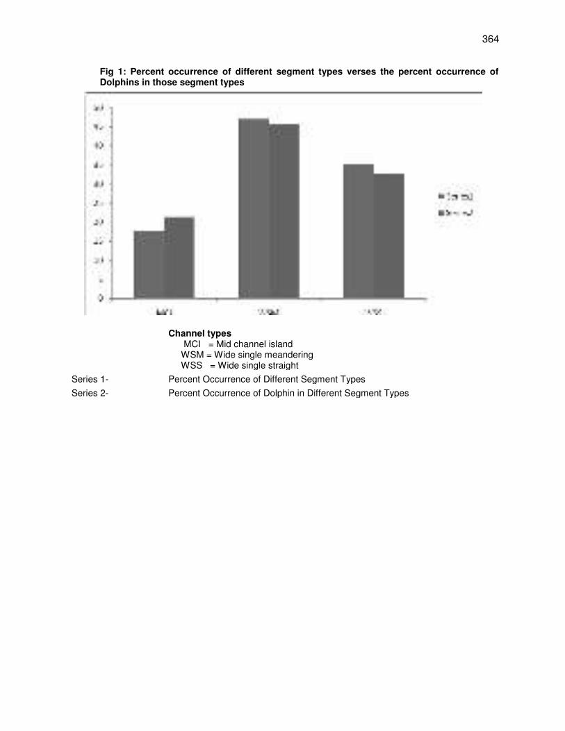
364
Fig 1: Percent occurrence of different segment types verses the percent occurrence of Dolphins in those segment types
Channel types MCI = Mid channel island WSM = Wide single meandering WSS = Wide single straight
Series 1- Percent Occurrence of Different Segment Types Series 2- Percent Occurrence of Dolphin in Different Segment Types
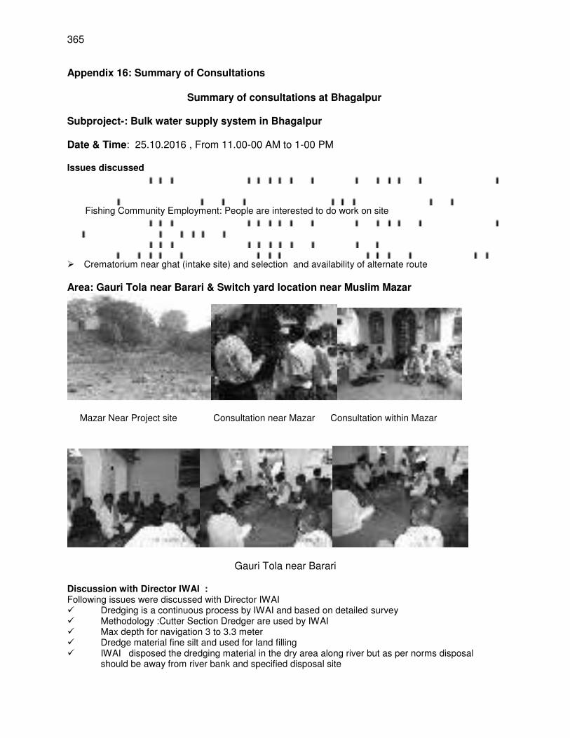
365
Appendix 16: Summary of Consultations
Summary of consultations at Bhagalpur
Subproject-: Bulk water supply system in Bhagalpur Date & Time: 25.10.2016 , From 11.00-00 AM to 1-00 PM Issues discussed
Fishing Community Employment: People are interested to do work on site
Crematorium near ghat (intake site) and selection and availability of alternate route Area: Gauri Tola near Barari & Switch yard location near Muslim Mazar
Mazar Near Project site Consultation near Mazar Consultation within Mazar
Gauri Tola near Barari
Discussion with Director IWAI : Following issues were discussed with Director IWAI Dredging is a continuous process by IWAI and based on detailed survey Methodology :Cutter Section Dredger are used by IWAI Max depth for navigation 3 to 3.3 meter Dredge material fine silt and used for land filling IWAI disposed the dredging material in the dry area along river but as per norms disposal
should be away from river bank and specified disposal site
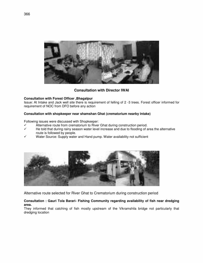
366
Consultation with Director IWAI
Consultation with Forest Officer ,Bhagalpur Issue: At Intake and Jack well site there is requirement of felling of 2 -3 trees. Forest officer informed for requirement of NOC from DFO before any action Consultation with shopkeeper near shamshan Ghat (crematorium nearby intake)
Following issues were discussed with Shopkeeper: Alternative route from crematorium to River Ghat during construction period. He told that during rainy season water level increase and due to flooding of area the alternative
route is followed by people. Water Source: Supply water and Hand pump. Water availability not sufficient
Alternative route selected for River Ghat to Crematorium during construction period Consultation : Gauri Tola Barari- Fishing Community regarding availability of fish near dredging area. They informed that catching of fish mostly upstream of the Vikramshila bridge not particularly that dredging location
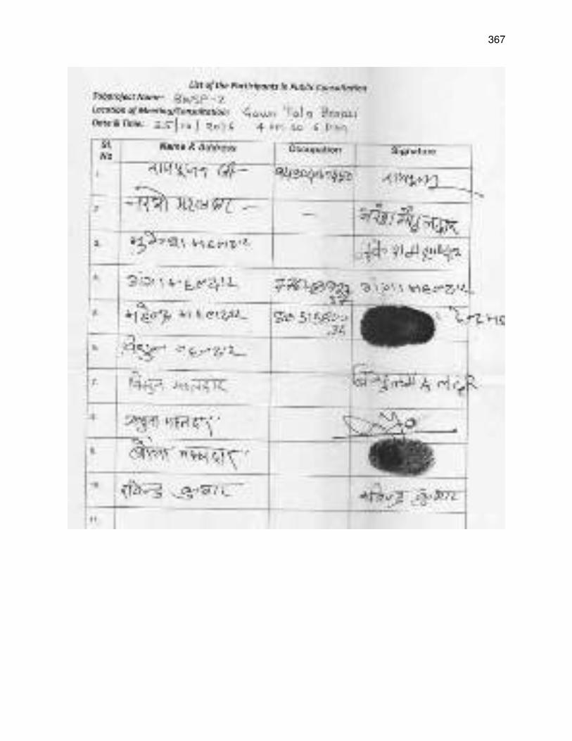
367
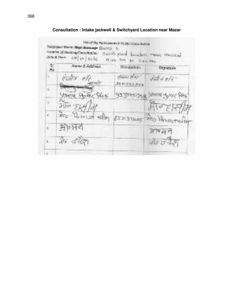
368
Consultation : Intake jackwell & Switchyard Location near Mazar
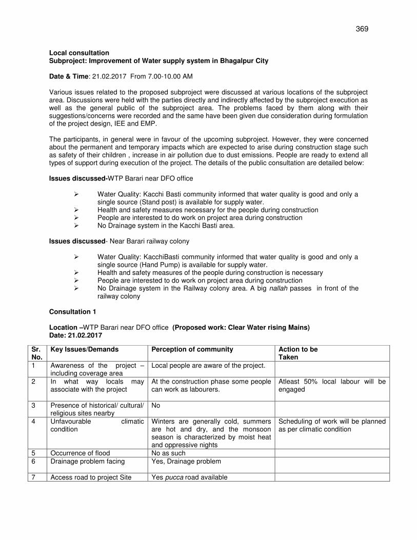
369
Local consultation Subproject: Improvement of Water supply system in Bhagalpur City Date & Time: 21.02.2017 From 7.00-10.00 AM Various issues related to the proposed subproject were discussed at various locations of the subproject area. Discussions were held with the parties directly and indirectly affected by the subproject execution as well as the general public of the subproject area. The problems faced by them along with their suggestions/concerns were recorded and the same have been given due consideration during formulation of the project design, IEE and EMP. The participants, in general were in favour of the upcoming subproject. However, they were concerned about the permanent and temporary impacts which are expected to arise during construction stage such as safety of their children , increase in air pollution due to dust emissions. People are ready to extend all types of support during execution of the project. The details of the public consultation are detailed below: Issues discussed-WTP Barari near DFO office
Water Quality: Kacchi Basti community informed that water quality is good and only a single source (Stand post) is available for supply water.
Health and safety measures necessary for the people during construction People are interested to do work on project area during construction No Drainage system in the Kacchi Basti area.
Issues discussed- Near Barari railway colony
Water Quality: KacchiBasti community informed that water quality is good and only a single source (Hand Pump) is available for supply water.
Health and safety measures of the people during construction is necessary People are interested to do work on project area during construction No Drainage system in the Railway colony area. A big nallah passes in front of the
railway colony
Consultation 1 Location –WTP Barari near DFO office (Proposed work: Clear Water rising Mains) Date: 21.02.2017
Sr. No.
Key Issues/Demands Perception of community Action to be Taken
1 Awareness of the project – including coverage area
Local people are aware of the project.
2 In what way locals may associate with the project
At the construction phase some people can work as labourers.
Atleast 50% local labour will be engaged
3 Presence of historical/ cultural/ religious sites nearby
No
4 Unfavourable climatic condition
Winters are generally cold, summers are hot and dry, and the monsoon season is characterized by moist heat and oppressive nights
Scheduling of work will be planned as per climatic condition
5 Occurrence of flood No as such 6 Drainage problem facing
Yes, Drainage problem
7 Access road to project Site Yes pucca road available
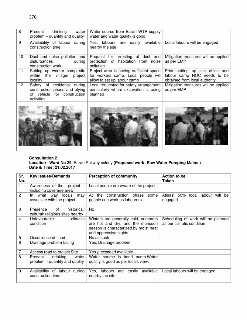
370
Consultation 2 Location –Ward No 29, Barari Railway colony (Proposed work: Raw Water Pumping Mains ) Date & Time: 21.02.2017
8 Present drinking water problem – quantity and quality
Water source from Barari WTP supply water and water quality is good.
9 Availability of labour during construction time
Yes, labours are easily available nearby the site
Local labours will be engaged
10 Dust and noise pollution and disturbances during construction work
Request for arresting of dust and protection of habitation from noise pollution
Mitigation measures will be applied as per EMP
11 Setting up worker camp site within the village/ project locality
Project area is having sufficient space for workers camp. Local people will allow to set up labour camp
Prior setting up site office and labour camp NOC needs to be obtained from local authority
12 Safety of residents during construction phase and plying of vehicle for construction activities
Local requested for safety arrangement particularly where excavation is being planned
Mitigation measures will be applied as per EMP
Sr. No.
Key Issues/Demands Perception of community Action to be Taken
1 Awareness of the project – including coverage area
Local people are aware of the project.
2 In what way locals may associate with the project
At the construction phase some people can work as labourers.
Atleast 50% local labour will be engaged
3 Presence of historical/ cultural/ religious sites nearby
No
4 Unfavourable climatic condition
Winters are generally cold, summers are hot and dry, and the monsoon season is characterized by moist heat and oppressive nights
Scheduling of work will be planned as per climatic condition
5 Occurrence of flood No as such 6 Drainage problem facing
Yes, Drainage problem
7 Access road to project Site Yes puccaroad available 8 Present drinking water
problem – quantity and quality Water source is hand pump.Water quality is good as per locals view.
9 Availability of labour during construction time
Yes, labours are easily available nearby the site
Local labours will be engaged
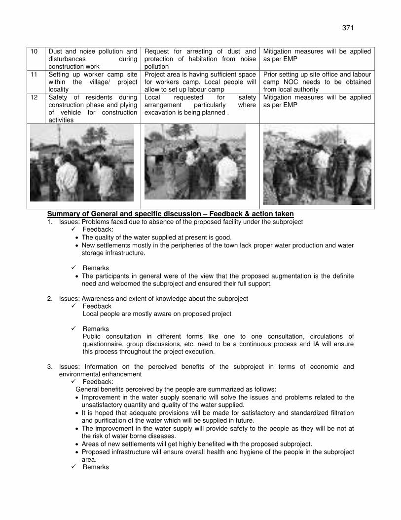
371
Summary of General and specific discussion – Feedback & action taken 1. Issues: Problems faced due to absence of the proposed facility under the subproject
Feedback: The quality of the water supplied at present is good. New settlements mostly in the peripheries of the town lack proper water production and water
storage infrastructure.
Remarks The participants in general were of the view that the proposed augmentation is the definite
need and welcomed the subproject and ensured their full support.
2. Issues: Awareness and extent of knowledge about the subproject Feedback
Local people are mostly aware on proposed project
Remarks Public consultation in different forms like one to one consultation, circulations of questionnaire, group discussions, etc. need to be a continuous process and IA will ensure this process throughout the project execution.
3. Issues: Information on the perceived benefits of the subproject in terms of economic and environmental enhancement
Feedback: General benefits perceived by the people are summarized as follows: Improvement in the water supply scenario will solve the issues and problems related to the
unsatisfactory quantity and quality of the water supplied. It is hoped that adequate provisions will be made for satisfactory and standardized filtration
and purification of the water which will be supplied in future. The improvement in the water supply will provide safety to the people as they will be not at
the risk of water borne diseases. Areas of new settlements will get highly benefited with the proposed subproject. Proposed infrastructure will ensure overall health and hygiene of the people in the subproject
area. Remarks
10 Dust and noise pollution and disturbances during construction work
Request for arresting of dust and protection of habitation from noise pollution
Mitigation measures will be applied as per EMP
11 Setting up worker camp site within the village/ project locality
Project area is having sufficient space for workers camp. Local people will allow to set up labour camp
Prior setting up site office and labour camp NOC needs to be obtained from local authority
12 Safety of residents during construction phase and plying of vehicle for construction activities
Local requested for safety arrangement particularly where excavation is being planned .
Mitigation measures will be applied as per EMP
372
People impacted directly or indirectly due to subproject implementation should be adequately compensated.
During implementation, maximum efforts should be made to minimize hindrances of public access by providing alternative access to roads, streets and homes.
The work should be carried out at a fast pace so that the duration of access disruption is minimized.
4. Issues: Information on perceived losses from the proposed subproject during execution stage in
terms of disruptions in traffic, temporary access disruptions during execution and air and noise pollution, etc.
Feedback: People opined that potential temporary impacts of access disruption for residences,
shops/commercial establishments, and institutions, etc. should be mitigated through good construction practices and an effective environment and contractors construction plan which should ensure providing walkways and metal sheets to maintain access across trenches, increasing the workforce in front of shops/commercial establishments, consulting business and institutions regarding operating hours and factoring this in work schedules, providing advance information on works to be undertaken including appropriate signages etc.
Remarks Effective mitigation measure should be in place so that problems related to traffic
disruptions; air and noise pollution are minimized. 5. Issues: Presence of any historical/cultural site in the vicinity
Presence of any protected area in or adjoining the construction site.
Feedback: There is no historical/cultural site in the corridor of the subproject. There is no protected area in the corridor of the subproject.
Remarks There are some sensitive receptors which include few educational institutions, religious
places etc. in the project area for which proper mitigation measures relevant to the location and nature of the receptor will be kept in place during project execution and same will be part of EMP.
All Feedback and actions (remarks) considered in design
373
Appendix 17: Draft VGDS Management Plan
374
375
376
377
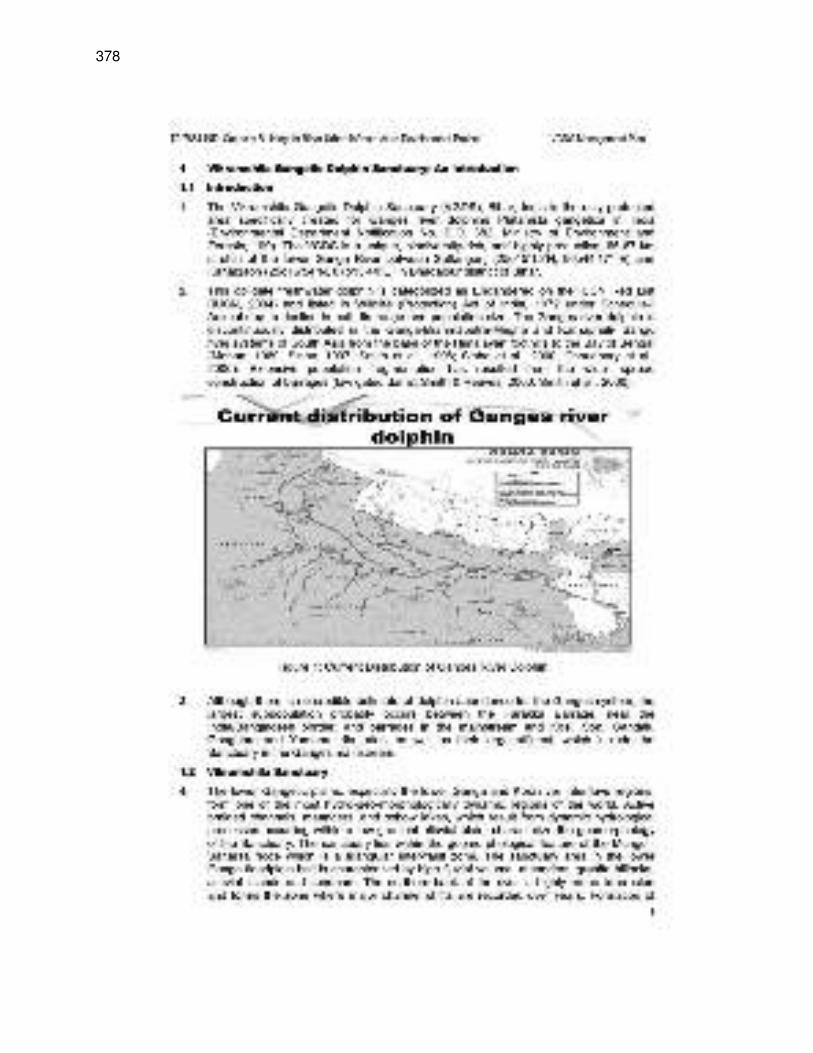
378
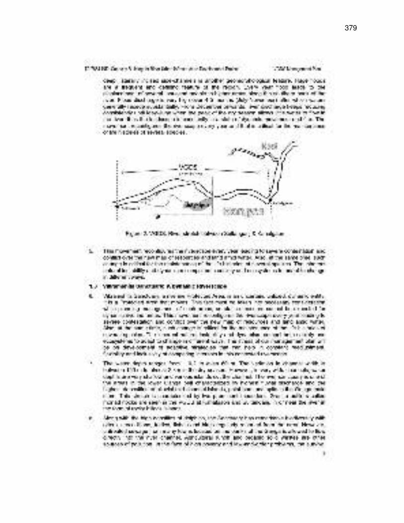
379
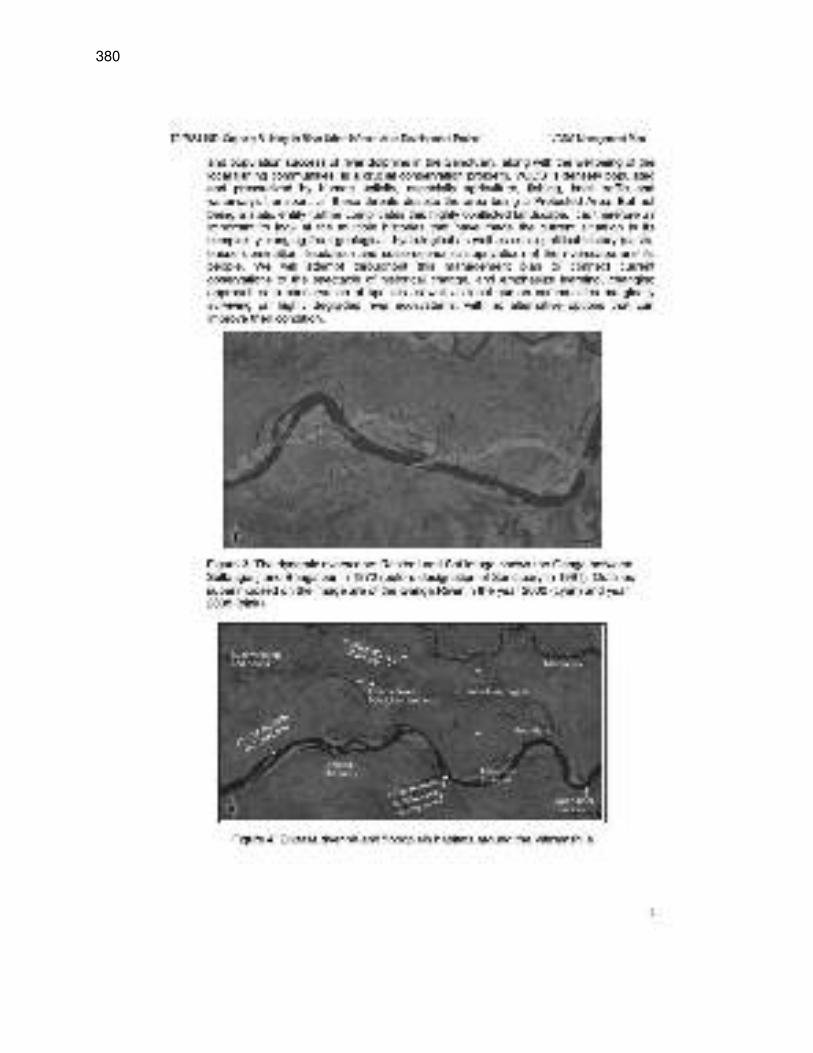
380
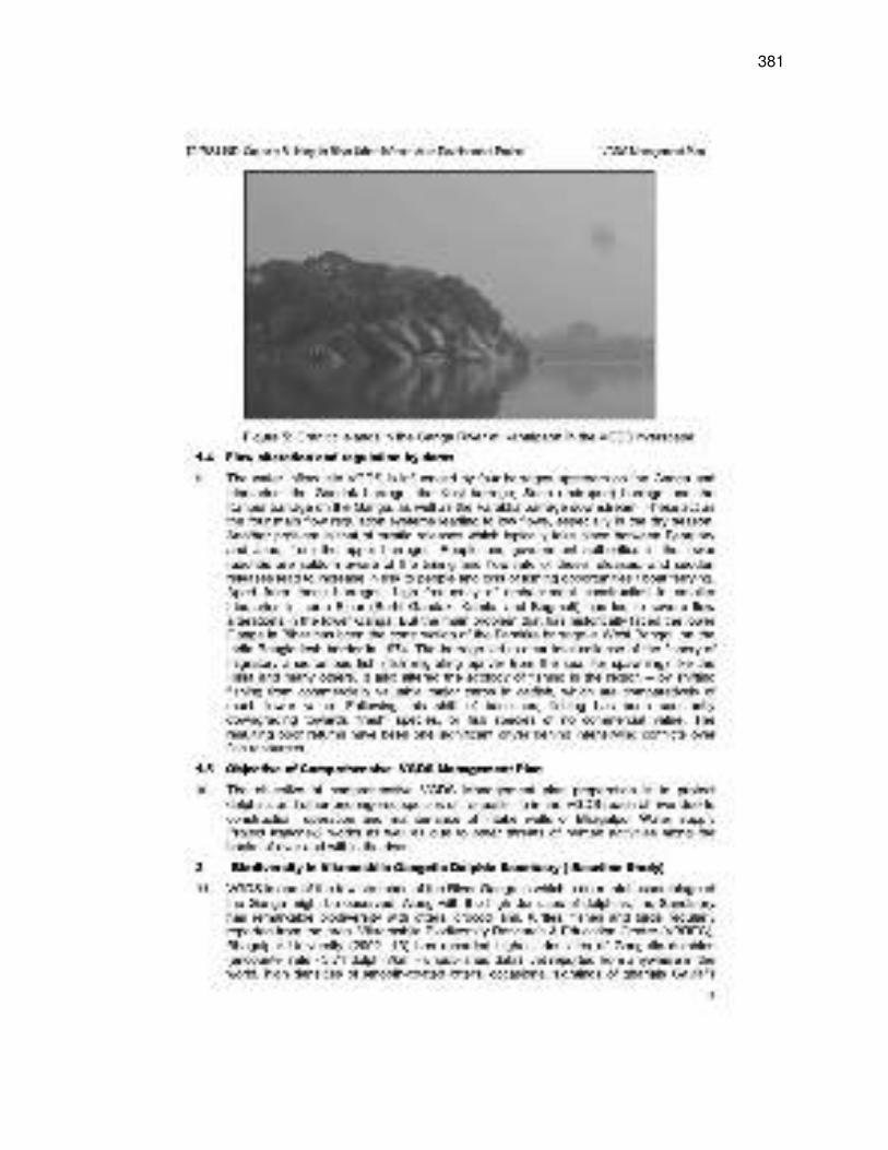
381
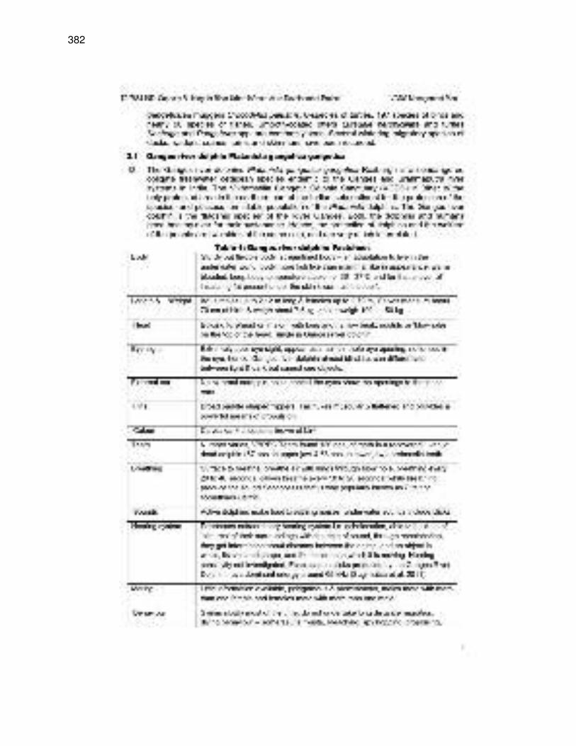
382
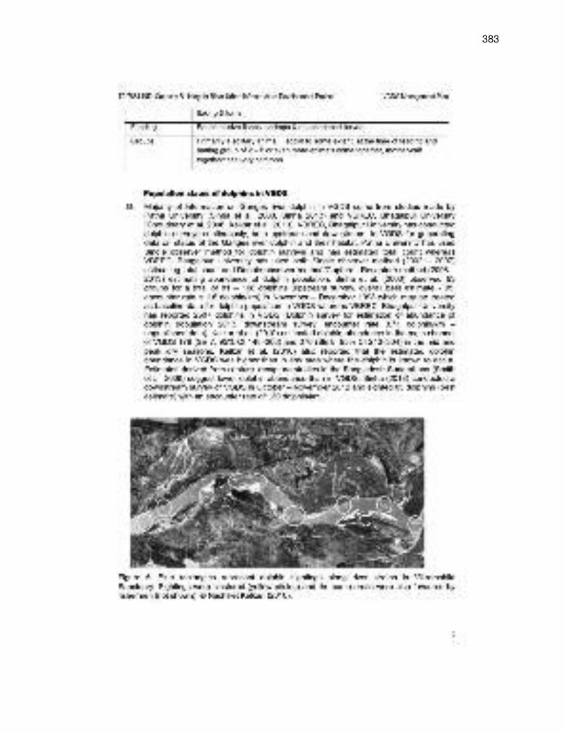
383
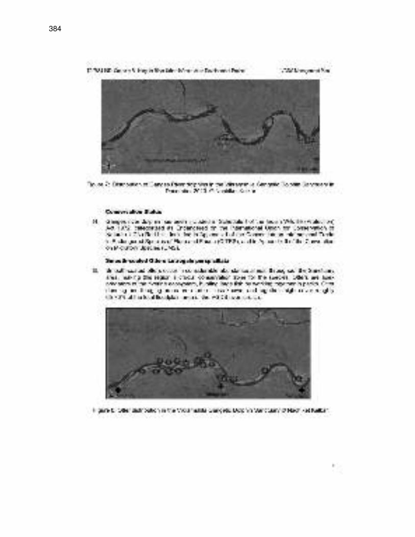
384
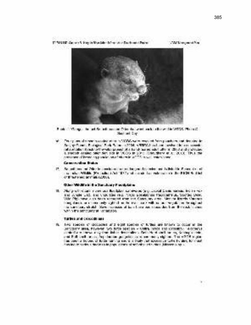
385
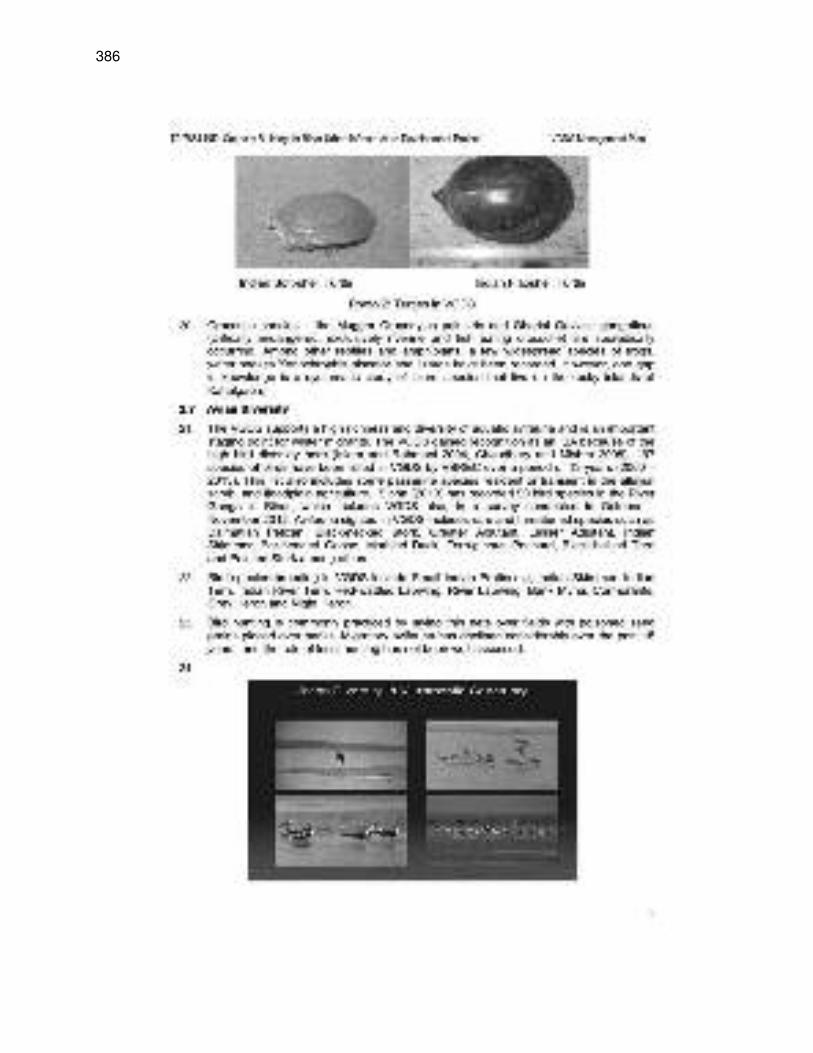
386
387
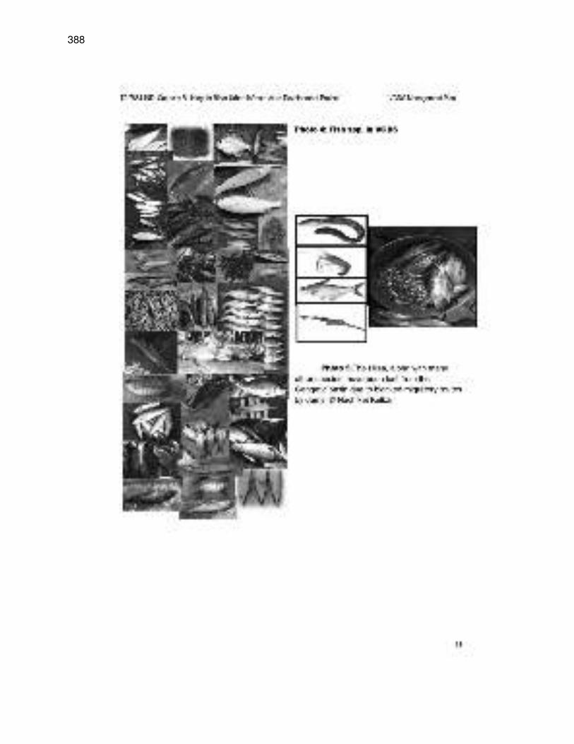
388
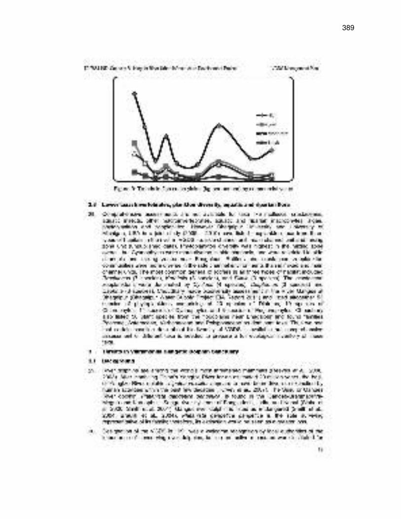
389
390
391
392
393
394
395
396
397
398
399
400
401
402
403
404
405
406
407
408
409
410
411
412
413
414
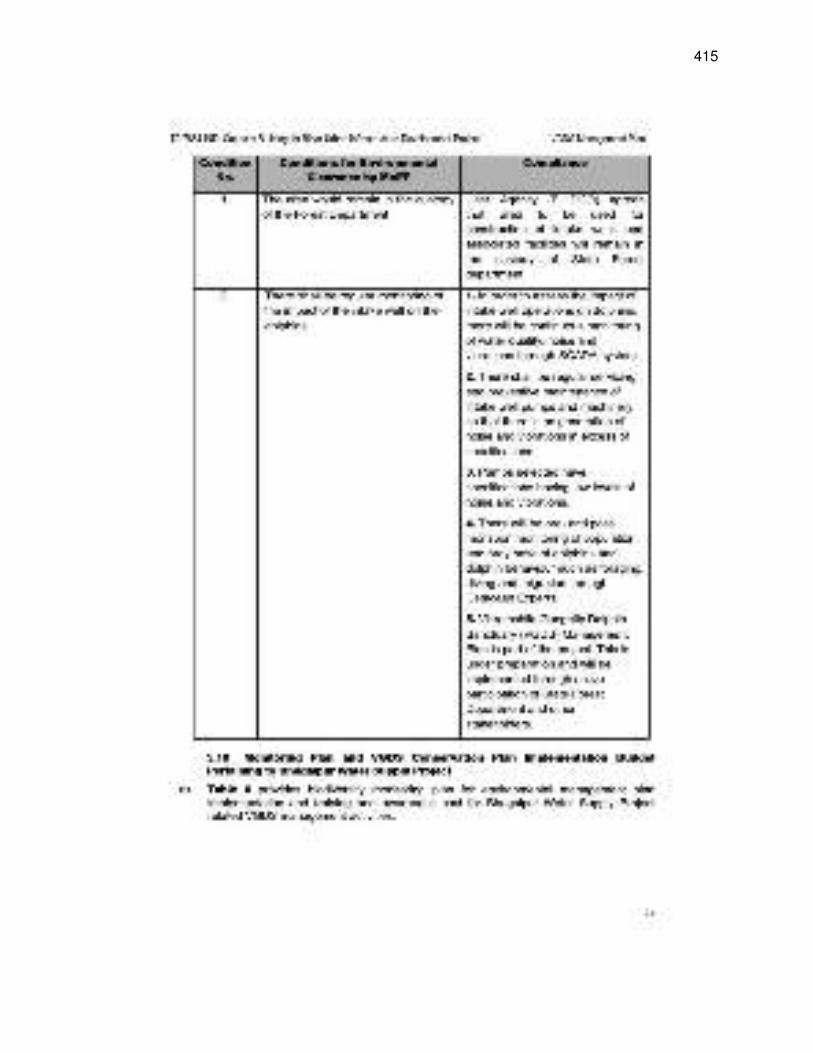
415
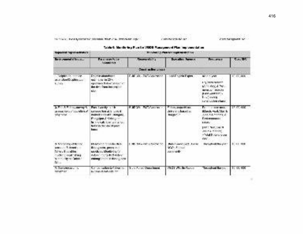
416
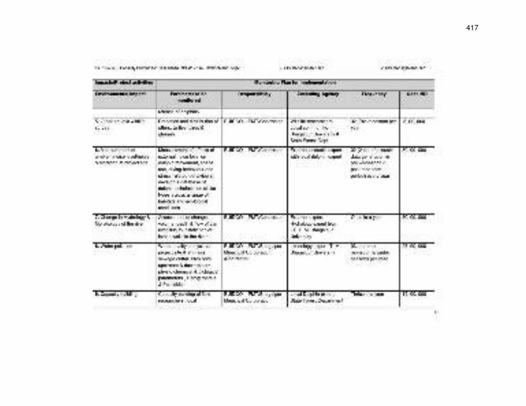
417
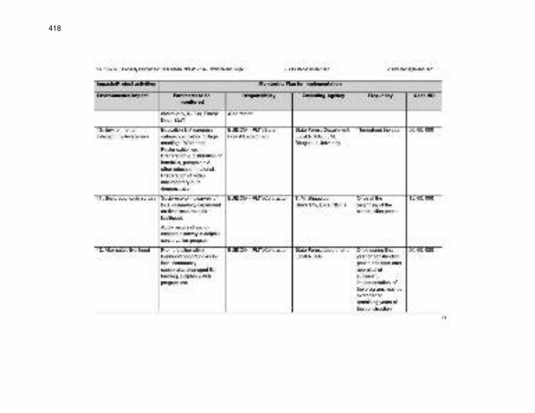
418
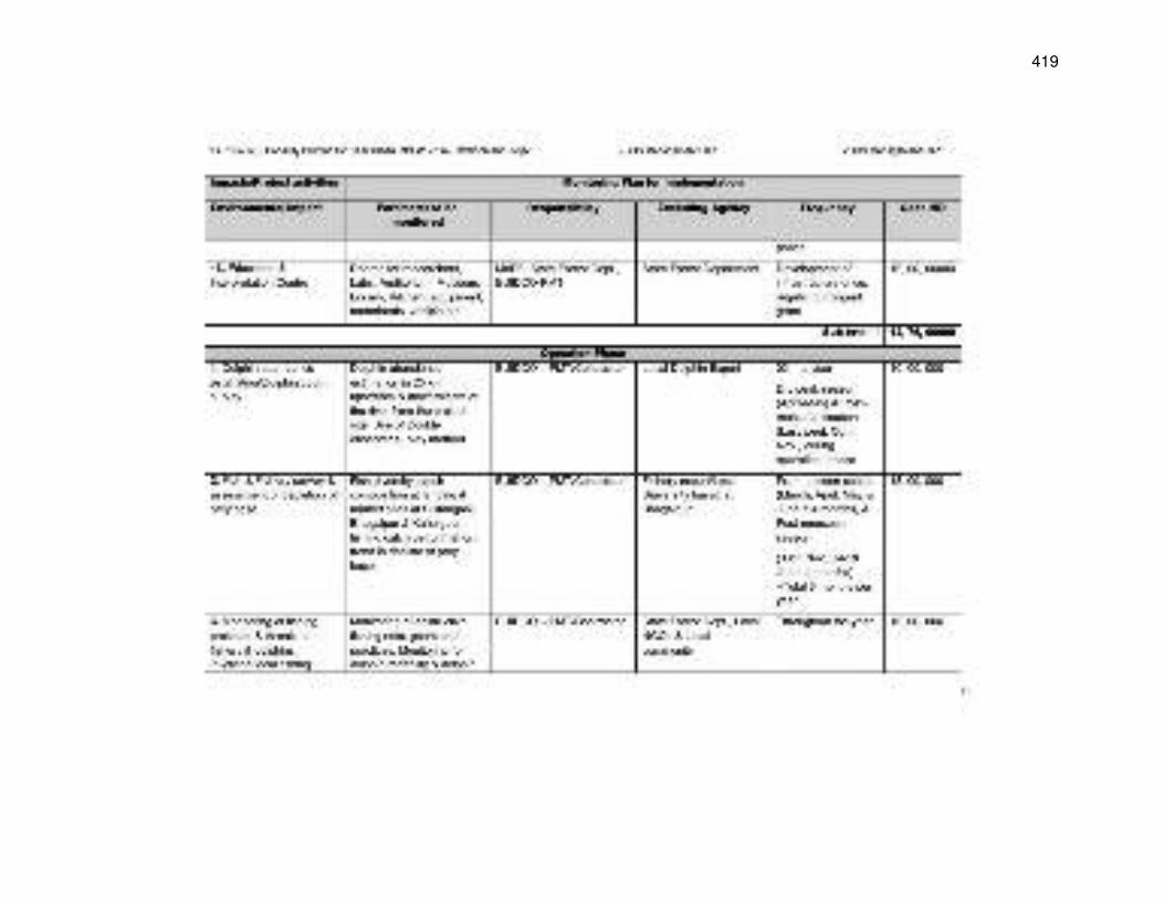
419
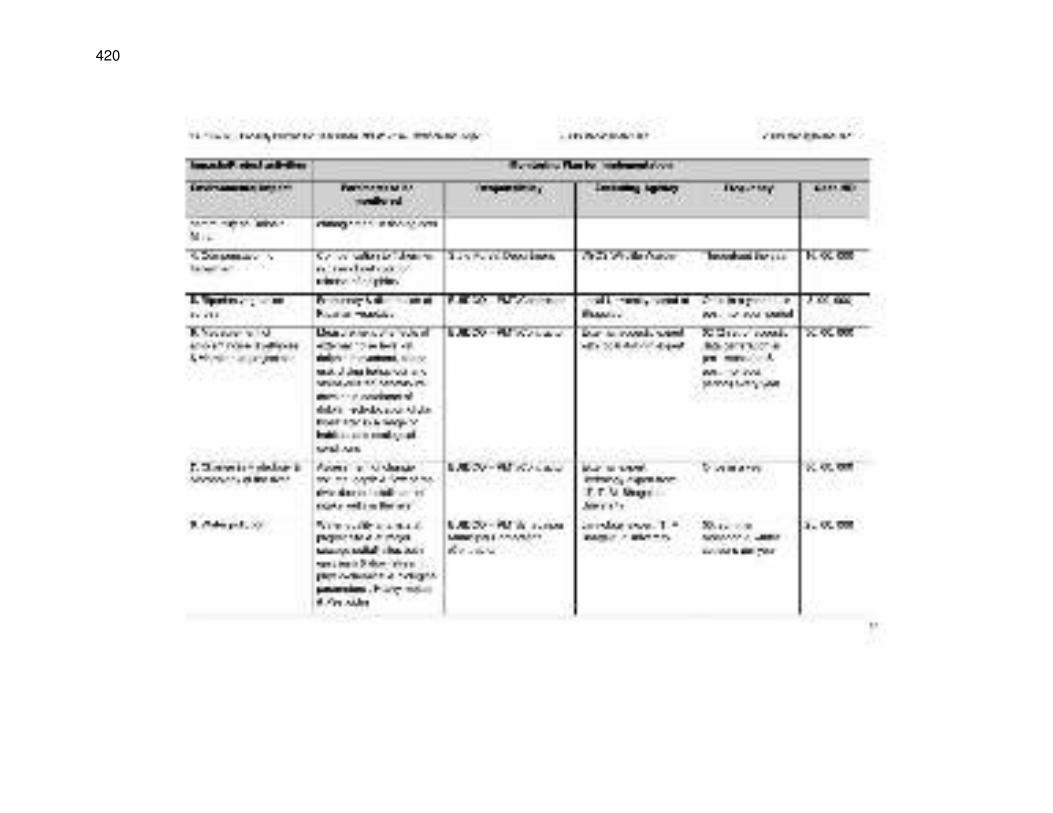
420
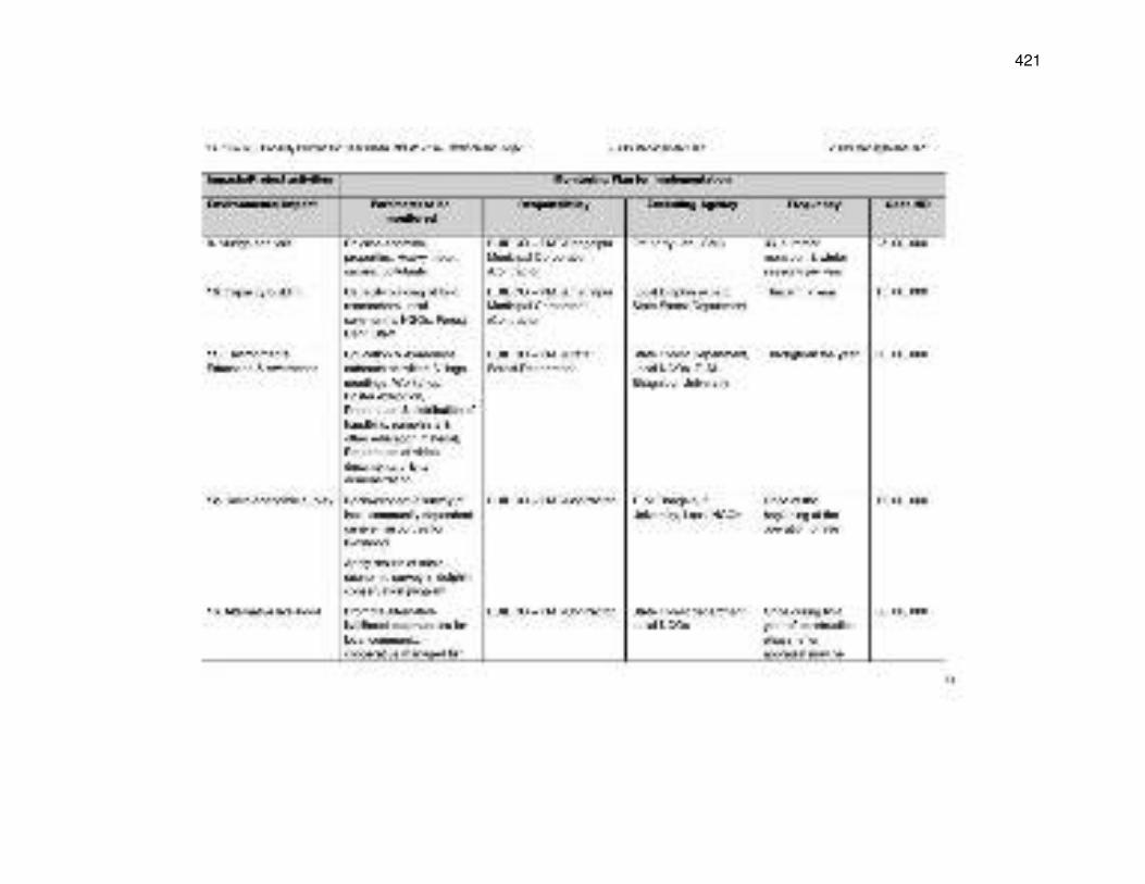
421
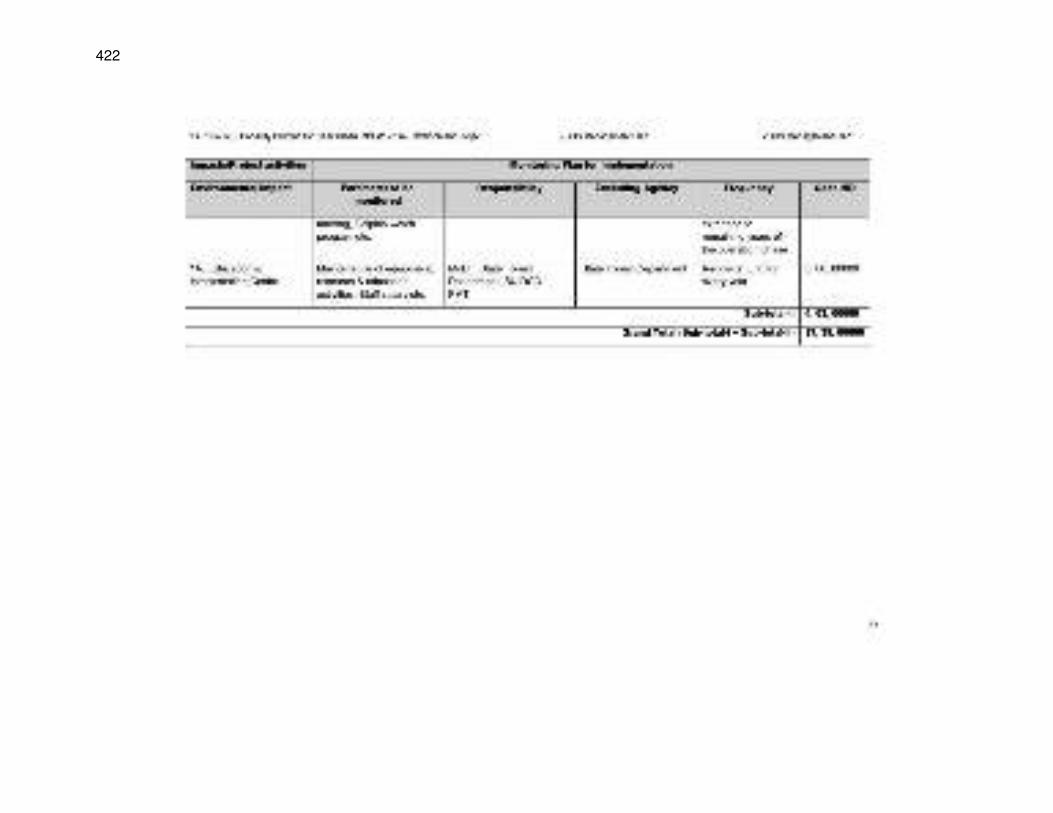
422
423
424

425
Appendix 18: Minutes of Meeting with Divisional Forest Officer and Conservator of Forest
Bihar Urban Development Investment Program
Minutes of Meeting with Conservator of Forest, CF & Divisional Forest Officer, DFO Bhagalpur
17thMarch 2017; 1.00pm, DFO Office, Sundarban, Barari
Participants CF, Bhagalpur DFO, Bhagalpur Range Officer, Bhagalpur
Sanjay Kumar Singh Sanjay Kumar Singh Brij Kishore Singh
ESMC, PMU Environment Specialist, PMC Environment Expert, PMC
Dr. LataChoudhary Dr Ardhendu Mitra Dr. Anil Kumar Patni
Team has visited Forest Department Office, Bhagalpur and met Conservator of Forest & Divisional Forest Officer Bhagalpur for discussion on conditions given in NOC issued by APCCF cum chief wildlife warden, Bihar for dredging operation within VGDS and construction of intake within Eco sensitive zone related to BWSP2. The important points discussed are as follows:
S.No Issues discussed (ref. NOC) Suggestions given by CF/DFO 1 (I) Custody of the portion of the river course
to be used for the project: The Forest & Environment Department, GoB shall retain the custody in the nature of the sanctuary of the portion of river course in the VGDS to be used for this project viz. access channel and dredging operation for that purpose etc
An Undertaking will be given by Project Implementation/ User Agency.
2 (II) The project proponent/User agency shall not construct or install any other permanent structure in the sanctuary area and shall not change/obstruct or cause to change the course of flow of the Ganges
An Undertaking will be given by Project proponent/User agency“ as suggested” in NOC.
3 (III) Regulation and monitoring of project execution and operation: (a) The work plan and time schedule of the initial dredging operations will be intimated in advance to the Divisional Forest Officer, Bhagalpur who is the Wild Life Warden and subsequent dredging operations will also be periodically informed in advance to Divisional Forest Officer, Bhagalpur .The Divisional Forest Officer Bhagalpur will arrange for observation for the dredging operations and take such steps necessary to minimise damage to the habitat of dolphins.
Work plan and time schedule of the initial dredging operations will be intimated in advance to the DFO and subsequent dredging operations will also be periodically informed in advance to DFO Bhagalpur for their necessary observation.
4 (b) The impact of the dredging of the access channel on the dolphins shall be regularly
Divisional Forest officer /Conservator of forest, Bhagalpur suggested that Base
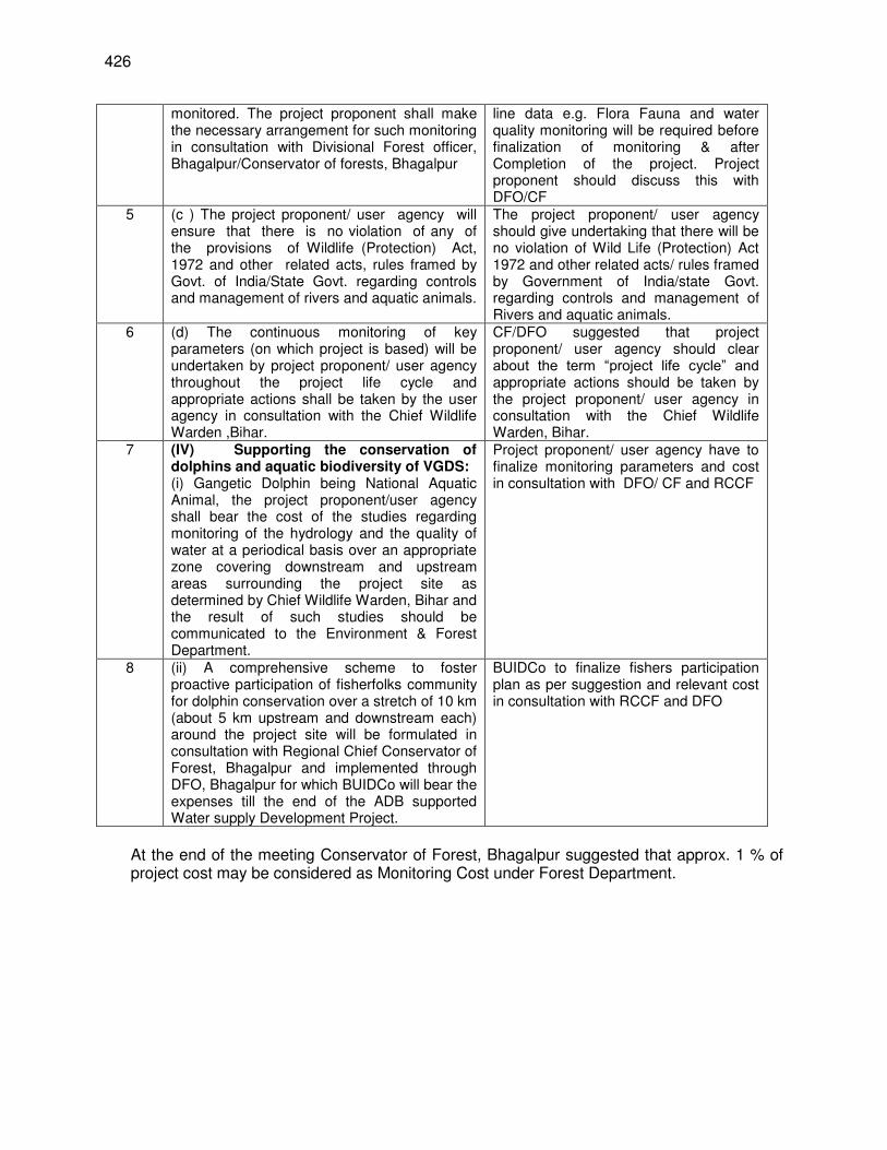
426
monitored. The project proponent shall make the necessary arrangement for such monitoring in consultation with Divisional Forest officer, Bhagalpur/Conservator of forests, Bhagalpur
line data e.g. Flora Fauna and water quality monitoring will be required before finalization of monitoring & after Completion of the project. Project proponent should discuss this with DFO/CF
5 (c ) The project proponent/ user agency will ensure that there is no violation of any of the provisions of Wildlife (Protection) Act, 1972 and other related acts, rules framed by Govt. of India/State Govt. regarding controls and management of rivers and aquatic animals.
The project proponent/ user agency should give undertaking that there will be no violation of Wild Life (Protection) Act 1972 and other related acts/ rules framed by Government of India/state Govt. regarding controls and management of Rivers and aquatic animals.
6 (d) The continuous monitoring of key parameters (on which project is based) will be undertaken by project proponent/ user agency throughout the project life cycle and appropriate actions shall be taken by the user agency in consultation with the Chief Wildlife Warden ,Bihar.
CF/DFO suggested that project proponent/ user agency should clear about the term “project life cycle” and appropriate actions should be taken by the project proponent/ user agency in consultation with the Chief Wildlife Warden, Bihar.
7 (IV) Supporting the conservation of dolphins and aquatic biodiversity of VGDS: (i) Gangetic Dolphin being National Aquatic Animal, the project proponent/user agency shall bear the cost of the studies regarding monitoring of the hydrology and the quality of water at a periodical basis over an appropriate zone covering downstream and upstream areas surrounding the project site as determined by Chief Wildlife Warden, Bihar and the result of such studies should be communicated to the Environment & Forest Department.
Project proponent/ user agency have to finalize monitoring parameters and cost in consultation with DFO/ CF and RCCF
8 (ii) A comprehensive scheme to foster proactive participation of fisherfolks community for dolphin conservation over a stretch of 10 km (about 5 km upstream and downstream each) around the project site will be formulated in consultation with Regional Chief Conservator of Forest, Bhagalpur and implemented through DFO, Bhagalpur for which BUIDCo will bear the expenses till the end of the ADB supported Water supply Development Project.
BUIDCo to finalize fishers participation plan as per suggestion and relevant cost in consultation with RCCF and DFO
At the end of the meeting Conservator of Forest, Bhagalpur suggested that approx. 1 % of project cost may be considered as Monitoring Cost under Forest Department.

427
Annexure 1 Attendance
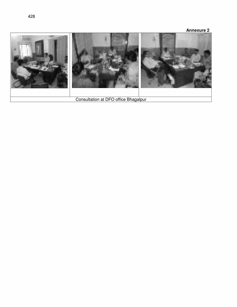
428
Annexure 2
Consultation at DFO office Bhagalpur
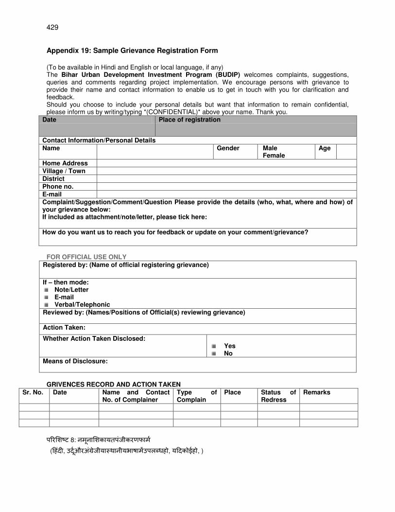
429
Appendix 19: Sample Grievance Registration Form
(To be available in Hindi and English or local language, if any) The Bihar Urban Development Investment Program (BUDIP) welcomes complaints, suggestions, queries and comments regarding project implementation. We encourage persons with grievance to provide their name and contact information to enable us to get in touch with you for clarification and feedback. Should you choose to include your personal details but want that information to remain confidential, please inform us by writing/typing *(CONFIDENTIAL)* above your name. Thank you.
Date Place of registration
Contact Information/Personal Details Name Gender Male
Female Age
Home Address Village / Town District Phone no. E-mail Complaint/Suggestion/Comment/Question Please provide the details (who, what, where and how) of your grievance below: If included as attachment/note/letter, please tick here: How do you want us to reach you for feedback or update on your comment/grievance?
FOR OFFICIAL USE ONLY
Registered by: (Name of official registering grievance)
If – then mode: Note/Letter E-mail Verbal/Telephonic
Reviewed by: (Names/Positions of Official(s) reviewing grievance)
Action Taken:
Whether Action Taken Disclosed:
Yes No
Means of Disclosure:
GRIVENCES RECORD AND ACTION TAKEN
Sr. No. Date Name and Contact No. of Complainer
Type of Complain
Place Status of Redress
Remarks
परिशिट 8: नमनाशिकायतपजीकिणफामम (ह दी, उदमऔिअरजीयाथानीयभाषामउपलध , यहदक ई , )
430
बि ािि िीविकासननििकायमरम (BUDIP) शिकायत, सझाि,
रनऔिपरिय जनाककायामियनकिािमहटपणणयकािागतकिता 1 मल गक शिकायतकसाथउनकनामऔिसपकम जानकािीरदानकिनकशलएर साह तकित ताfक मपटीकिणऔिरनतररयाकशलएआपकसाथसपकम किसक 1
आपक अपनयततगतविििणिाशमलकिनचाह एलरकनउसजानकािीक ग पनीयिखाजायगा1 आपकानामऊपि (ग पनीय) *
लखन / टाइवपगिािा मसचचतकिधयिाद
तािीख पजीकिणकाथान
सपकम किनसिधीजानकािी / यततगतविििण
नाम शलग प ष
मह ला आय
घिकापता
गाि / ि ि
जनपद
फ नन.
ईमल
शिकायत / सझाि / हटपणी / रननीचअपनीशिकायतकाविििण (ज , तया, क ाऔिकस) रदानकि: सलगनक / न ट / परक पम,िाशमल ,कपयाय ाहटककि मआपतकरनतररयाकशलएकसप चसकत याअपनीहटपणी / शिकायतपिनिीनीकिण?
किलकायामलयउपय गकशलए
िािापजीकत:(सिकािीपजीकिणशिकायतकानाम)
यहद -रफिविचध:
न ट / पर
ईमल
म णखक / टलीफ न
ससमीषित:(नाम / अचधकािीकीप जिनसमीिाशिकायत)
कीगईकािमिाई:
कीगईकािमिाईकाखलासा: ा न ी
रकटीकिणकामतलि:
शिकायतरिकॉमऔिकीगईकािमिाई
रमसया तािीख नामऔि complainer
कासपकम निि
शिकायतकरकाि जग ननिािणकीथनत हटपणणया
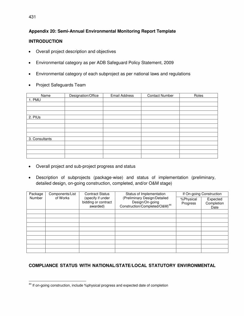
431
Appendix 20: Semi-Annual Environmental Monitoring Report Template
INTRODUCTION
Overall project description and objectives
Environmental category as per ADB Safeguard Policy Statement, 2009
Environmental category of each subproject as per national laws and regulations
Project Safeguards Team
Name Designation/Office Email Address Contact Number Roles
1. PMU 2. PIUs 3. Consultants
Overall project and sub-project progress and status
Description of subprojects (package-wise) and status of implementation (preliminary,
detailed design, on-going construction, completed, and/or O&M stage)
Package Number
Components/List of Works
Contract Status (specify if under
bidding or contract awarded)
Status of Implementation (Preliminary Design/Detailed
Design/On-going Construction/Completed/O&M)
44
If On-going Construction
%Physical Progress
Expected Completion
Date
COMPLIANCE STATUS WITH NATIONAL/STATE/LOCAL STATUTORY ENVIRONMENTAL
44
If on-going construction, include %physical progress and expected date of completion
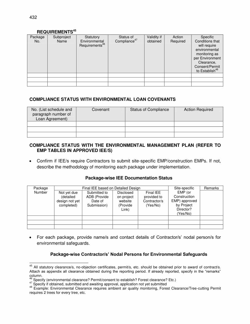
432
REQUIREMENTS45 Package
No. Subproject
Name Statutory
Environmental Requirements
46
Status of Compliance
47
Validity if obtained
Action Required
Specific Conditions that
will require environmental monitoring as
per Environment Clearance,
Consent/Permit to Establish
48
COMPLIANCE STATUS WITH ENVIRONMENTAL LOAN COVENANTS
No. (List schedule and paragraph number of
Loan Agreement)
Covenant Status of Compliance Action Required
COMPLIANCE STATUS WITH THE ENVIRONMENTAL MANAGEMENT PLAN (REFER TO
EMP TABLES IN APPROVED IEE/S)
Confirm if IEE/s require Contractors to submit site-specific EMP/construction EMPs. If not,
describe the methodology of monitoring each package under implementation.
Package-wise IEE Documentation Status
Package Number
Final IEE based on Detailed Design Site-specific EMP (or
Construction EMP) approved
by Project Director? (Yes/No)
Remarks Not yet due
(detailed design not yet
completed)
Submitted to ADB (Provide
Date of Submission)
Disclosed on project website (Provide
Link)
Final IEE provided to Contractor/s
(Yes/No)
For each package, provide name/s and contact details of Contractor/s’ nodal person/s for
environmental safeguards.
Package-wise Contractor/s’ Nodal Persons for Environmental Safeguards
45
All statutory clearance/s, no-objection certificates, permit/s, etc. should be obtained prior to award of contract/s. Attach as appendix all clearance obtained during the reporting period. If already reported, specify in the “remarks” column. 46
Specify (environmental clearance? Permit/consent to establish? Forest clearance? Etc.) 47
Specify if obtained, submitted and awaiting approval, application not yet submitted 48
Example: Environmental Clearance requires ambient air quality monitoring, Forest Clearance/Tree-cutting Permit requires 2 trees for every tree, etc.
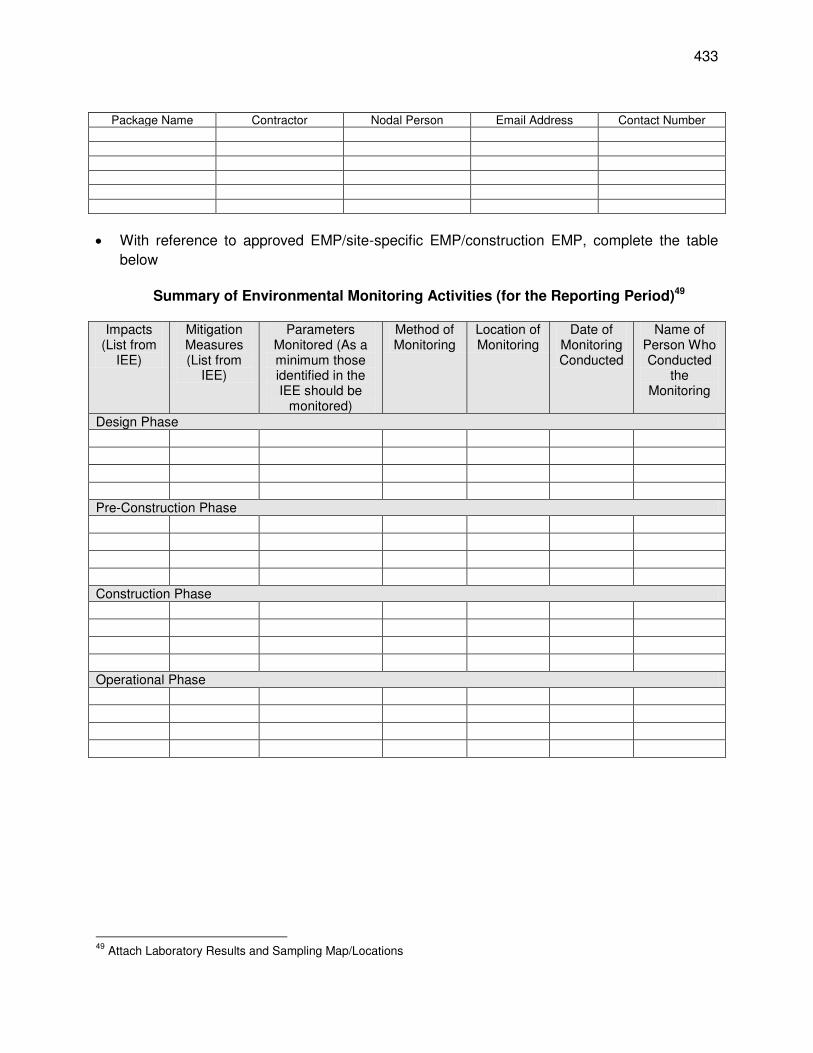
433
Package Name Contractor Nodal Person Email Address Contact Number
With reference to approved EMP/site-specific EMP/construction EMP, complete the table
below
Summary of Environmental Monitoring Activities (for the Reporting Period)49
Impacts
(List from IEE)
Mitigation Measures (List from
IEE)
Parameters Monitored (As a minimum those identified in the IEE should be
monitored)
Method of Monitoring
Location of Monitoring
Date of Monitoring Conducted
Name of Person Who Conducted
the Monitoring
Design Phase Pre-Construction Phase Construction Phase Operational Phase
49
Attach Laboratory Results and Sampling Map/Locations
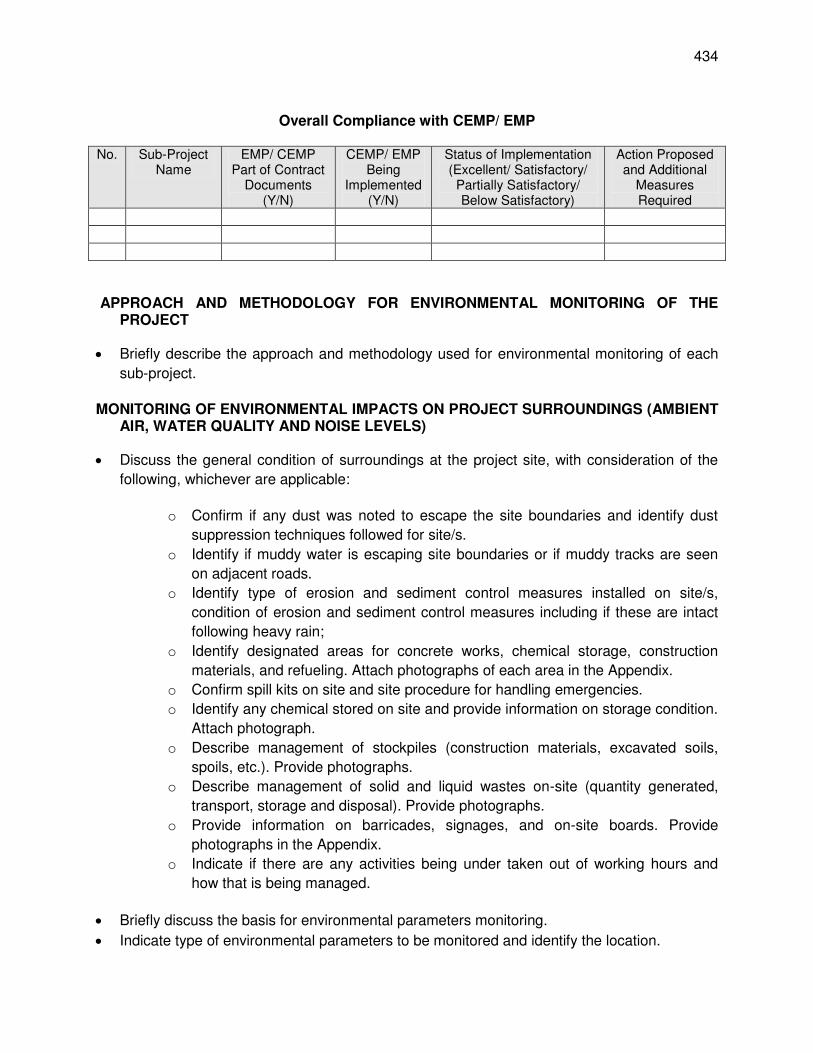
434
Overall Compliance with CEMP/ EMP
No. Sub-Project
Name EMP/ CEMP
Part of Contract Documents
(Y/N)
CEMP/ EMP Being
Implemented (Y/N)
Status of Implementation (Excellent/ Satisfactory/
Partially Satisfactory/ Below Satisfactory)
Action Proposed and Additional
Measures Required
APPROACH AND METHODOLOGY FOR ENVIRONMENTAL MONITORING OF THE
PROJECT
Briefly describe the approach and methodology used for environmental monitoring of each
sub-project.
MONITORING OF ENVIRONMENTAL IMPACTS ON PROJECT SURROUNDINGS (AMBIENT
AIR, WATER QUALITY AND NOISE LEVELS)
Discuss the general condition of surroundings at the project site, with consideration of the
following, whichever are applicable:
o Confirm if any dust was noted to escape the site boundaries and identify dust
suppression techniques followed for site/s.
o Identify if muddy water is escaping site boundaries or if muddy tracks are seen
on adjacent roads.
o Identify type of erosion and sediment control measures installed on site/s,
condition of erosion and sediment control measures including if these are intact
following heavy rain;
o Identify designated areas for concrete works, chemical storage, construction
materials, and refueling. Attach photographs of each area in the Appendix.
o Confirm spill kits on site and site procedure for handling emergencies.
o Identify any chemical stored on site and provide information on storage condition.
Attach photograph.
o Describe management of stockpiles (construction materials, excavated soils,
spoils, etc.). Provide photographs.
o Describe management of solid and liquid wastes on-site (quantity generated,
transport, storage and disposal). Provide photographs.
o Provide information on barricades, signages, and on-site boards. Provide
photographs in the Appendix.
o Indicate if there are any activities being under taken out of working hours and
how that is being managed.
Briefly discuss the basis for environmental parameters monitoring.
Indicate type of environmental parameters to be monitored and identify the location.
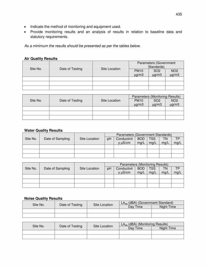
435
Indicate the method of monitoring and equipment used.
Provide monitoring results and an analysis of results in relation to baseline data and
statutory requirements.
As a minimum the results should be presented as per the tables below. Air Quality Results
Site No. Date of Testing Site Location
Parameters (Government Standards)
PM10 µg/m3
SO2 µg/m3
NO2 µg/m3
Site No. Date of Testing Site Location Parameters (Monitoring Results)
PM10 µg/m3
SO2 µg/m3
NO2 µg/m3
Water Quality Results
Site No. Date of Sampling Site Location Parameters (Government Standards)
pH Conductivity µS/cm
BOD mg/L
TSS mg/L
TN mg/L
TP mg/L
Site No. Date of Sampling Site Location Parameters (Monitoring Results)
pH Conductivity µS/cm
BOD mg/L
TSS mg/L
TN mg/L
TP mg/L
Noise Quality Results
Site No. Date of Testing Site Location LAeq (dBA) (Government Standard)
Day Time Night Time
Site No. Date of Testing Site Location LAeq (dBA) (Monitoring Results)
Day Time Night Time
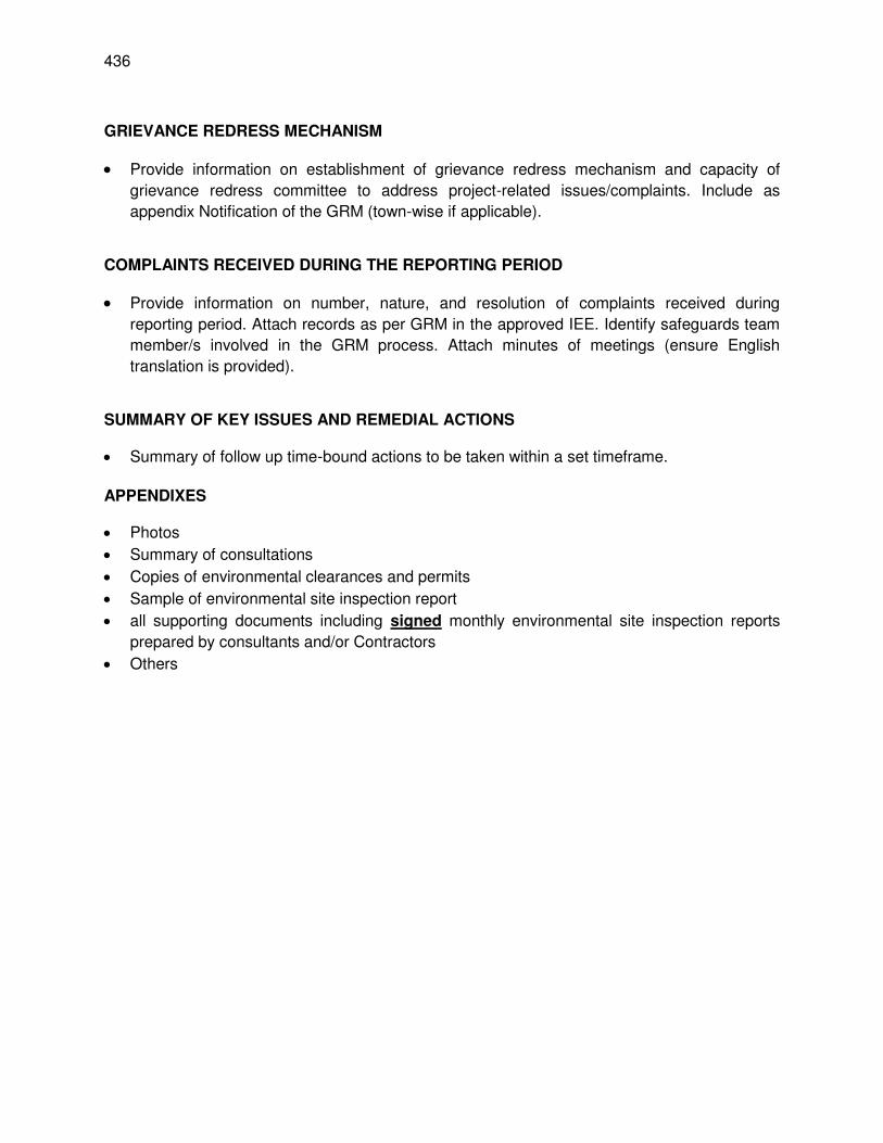
436
GRIEVANCE REDRESS MECHANISM
Provide information on establishment of grievance redress mechanism and capacity of
grievance redress committee to address project-related issues/complaints. Include as
appendix Notification of the GRM (town-wise if applicable).
COMPLAINTS RECEIVED DURING THE REPORTING PERIOD
Provide information on number, nature, and resolution of complaints received during
reporting period. Attach records as per GRM in the approved IEE. Identify safeguards team
member/s involved in the GRM process. Attach minutes of meetings (ensure English
translation is provided).
SUMMARY OF KEY ISSUES AND REMEDIAL ACTIONS
Summary of follow up time-bound actions to be taken within a set timeframe.
APPENDIXES
Photos
Summary of consultations
Copies of environmental clearances and permits
Sample of environmental site inspection report
all supporting documents including signed monthly environmental site inspection reports
prepared by consultants and/or Contractors
Others
437
SAMPLE ENVIRONMENTAL SITE INSPECTION REPORT Project Name Contract Number
NAME: _____________________________________________ DATE: ___________________ TITLE: _____________________________________________ DMA: _____________________ LOCATION: _________________________________________ GROUP: _________________ WEATHER CONDITION: _________________________________________________________________________________ INITIAL SITE CONDITION: _____________________________________________________________ CONCLUDING SITE CONDITION: Satisfactory _____ Unsatisfactory ______ Incident ______ Resolved _______ Unresolved ______ INCIDENT: Nature of incident: _________________________________________________________________________________ Intervention Steps: _________________________________________________________________________________ Incident Issues
Project Activity
Stage
Survey
Design
Implementation
Pre-Commissioning
Guarantee Period
Inspection
Emissions Waste Minimization
Air Quality Reuse and Recycling
Noise pollution Dust and Litter Control
Hazardous Substances Trees and Vegetation
Site Restored to Original Condition Yes No Signature _______________________________________ Sign off _______________________________ ________________________________ Name Name Position Position
Resolution


