Embed Size (px)
Citation preview
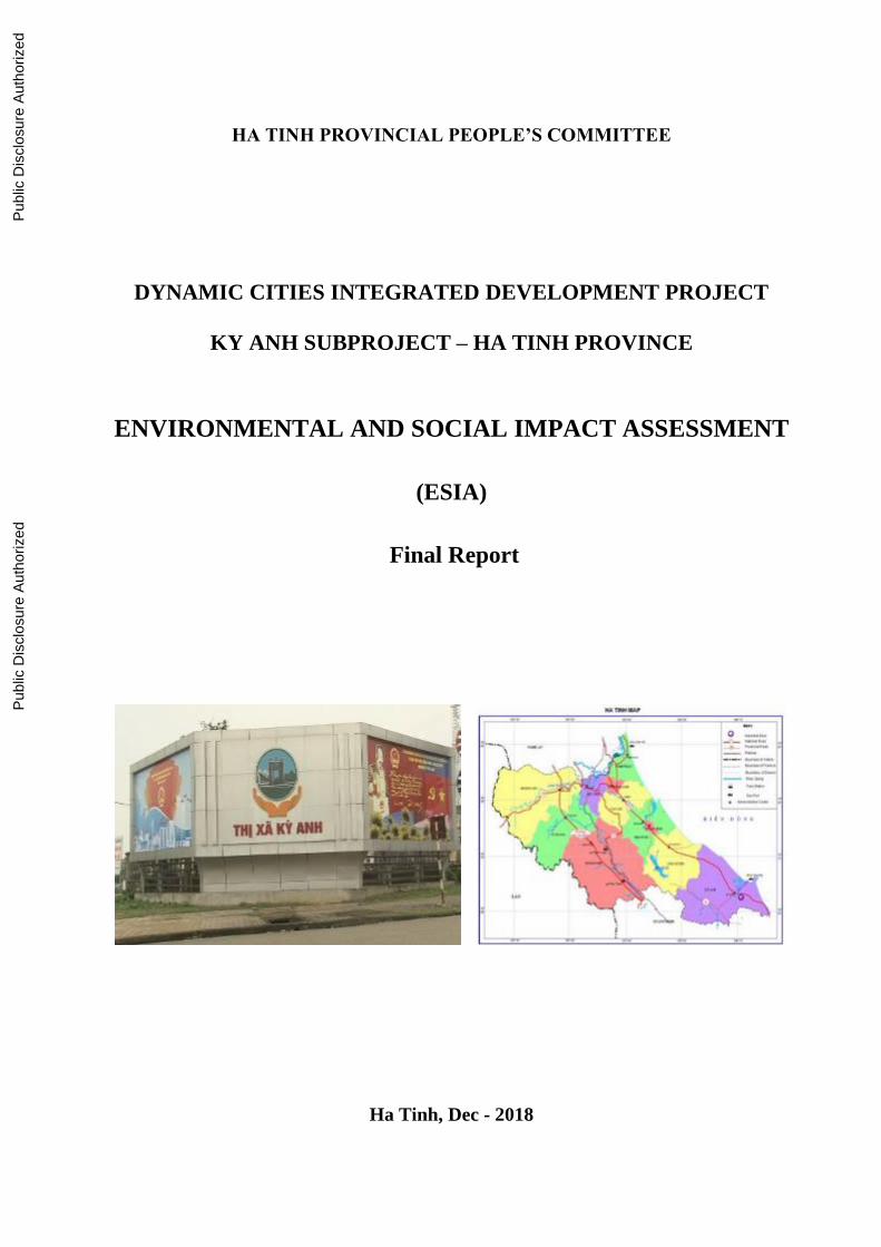
HA TINH PROVINCIAL PEOPLE’S COMMITTEE
DYNAMIC CITIES INTEGRATED DEVELOPMENT PROJECT
KY ANH SUBPROJECT – HA TINH PROVINCE
ENVIRONMENTAL AND SOCIAL IMPACT ASSESSMENT
(ESIA)
Final Report
Ha Tinh, Dec - 2018
Pub
lic D
iscl
osur
e A
utho
rized
Pub
lic D
iscl
osur
e A
utho
rized
Pub
lic D
iscl
osur
e A
utho
rized
Pub
lic D
iscl
osur
e A
utho
rized
Dynamic Cities Integrated Development Project Environmental and Social Impact Assessment
Ky Anh Town Subproject – Ha Tinh Province
i
CONTENTS
CONTENTS ................................................................................................................................ i
ABBREVIATIONS AND ACRONYMS ....................................................................................... iv
LIST OF TABLES ............................................................................................................................. v
LIST OF FIGURES ......................................................................................................................... vii
EXECUTIVE SUMMARY ............................................................................................................... 1
INTRODUCTION .............................................................................................................................. 3
1. Project Background ...................................................................................... 3
2. Relationships between the Project and Masterplans ...................................... 4
3 Technical and Legal Basis for the Preparation of ESIA ................................ 5
3.1 Vietnamese Legal Documents ............................................................................................. 6 3.2 World Bank’s Environmental and Social Safeguard Policies ......................................... 10
4 ESIA Implementation Arrangement ............................................................ 11
5 Methods for Environmental and Social Impact Assessment ........................ 12
5.1 Method for Environmental Impact Assessment ............................................................... 12 5.2 Method for Social Impact Assessment ............................................................................. 13
CHAPTER 1. PROJECT DESCRIPTION .................................................................................. 15
1.1 General Information .................................................................................... 15
1.1.1 Project Objectives .............................................................................................................. 15 1.1.2 Project Location ................................................................................................................. 16
1.2 Scope of Investment ................................................................................... 16
1.2.1 Construction of Trunk Road Connecting Urban Centers................................................. 17 1.2.2 Construction of Wastewater Collection and Treatment System ...................................... 18 1.2.3 Tri River Embankment Lining and Construction of Operation Roads ........................... 21 1.2.4 Upgrading, Rehabilitation of Thuy Son Lake .................................................................. 21
1.3 Auxiliary Works ......................................................................................... 22
1.3.1 Access Roads to the Construction Sites ........................................................................... 22 1.3.2 Worker’s Camp ................................................................................................................. 22
1.4 Demand for Material ................................................................................... 22
1.5 Material Sources ......................................................................................... 23
1.5.1 Waste Generation and Disposal ....................................................................................... 24 1.5.2 Transportation Route......................................................................................................... 24
1.6 Backfill and Excavation Volume ................................................................ 25
1.7 Construction Method .................................................................................. 25
1.7.1 Road Construction .............................................................................................................. 25 1.7.2 Construction of Tri River Embankment ........................................................................... 26 1.7.3 Thuy Son Lake ................................................................................................................... 27 1.7.4 Wastewater Treatment System .......................................................................................... 27
1.8 Expected Machinery, Equipment and Labor ............................................... 28
1.9 Project’s Affected Area .............................................................................. 29
1.10 Project Implementation Schedule ................................................................ 29
1.11 Budget ........................................................................................................ 29
CHAPTER 2. NATURAL, SOCIAL AND ECONOMIC CONDITIONS .............................. 31
2.1 Physical Condition ........................................................................................ 31
2.1.1 Geography ............................................................................................................................... 31 2.1.2. Topography ............................................................................................................................. 31 2.1.3 Geology ............................................................................................................................... 31 2.1.3.1 Geotechnology .................................................................................................................... 31
Dynamic Cities Integrated Development Project Environmental and Social Impact Assessment
Ky Anh Town Subproject – Ha Tinh Province
ii
2.1.3.2 Hydrogeology ..................................................................................................................... 32 2.1.4 Climate ..................................................................................................................................... 32 2.1.5 Hydrology ................................................................................................................................ 32 2.1.6 Existing Environmental Quality ............................................................................................. 33 2.1.7 Biological Resources .............................................................................................................. 39
2.2 Socio-economic Condition ............................................................................ 40
2.2.1 Population, Ethnicity ............................................................................................................... 40 2.2.2. Land Use Status ...................................................................................................................... 41 2.2.3 Economic Mechanism and Growth Rate ............................................................................... 42 2.2.4. Labor and Employment ......................................................................................................... 42 2.2.5. Income .................................................................................................................................... 43 2.2.6. Education ................................................................................................................................ 43 2.2.7. Medical Service and Healthcare ............................................................................................ 43 2.2.8. Physical Cultural Resources .................................................................................................. 44 2.2.9 Gender Issue ............................................................................................................................ 44
2.3 Infrastructure Condition ................................................................................ 45
2.3.1. Transport System ................................................................................................................... 45 2.3.2. Water Supply .......................................................................................................................... 46 2.3.3. Drainage Sewers ..................................................................................................................... 46 2.3.4. Environmental Sanitation ...................................................................................................... 47 2.3.5. Electricity and Lighting System ............................................................................................ 47
2.4 Current Status of The Construction Areas of Work Items ............................. 48
2.4.1 The Main Road Connecting Urban Centers .......................................................................... 48 2.4.2 Main Pipeline........................................................................................................................... 50 2.4.3 Pumping Stations .................................................................................................................... 53 2.4.4 Wastewater Treatment Plant ................................................................................................... 55 2.4.5 Tri River Embankment ........................................................................................................... 56 2.4.6 Thuy Son Lake ........................................................................................................................ 57 2.4.7 Quarries ............................................................................................................................... 58 2.4.8 Worker Camp, Temporary Warehouse, On-Site Office .................................................. 59 2.4.9 Disposal Site ............................................................................................................................ 60 2.4.10 Transportation Route ............................................................................................................ 61 2.4.11 Sensitive Locations in The Project Area ........................................................................... 61
CHAPTER 3: ENVIRONMENTAL AND SOCIAL IMPACTS ASSESSMENT ................. 64
3.1. Positive Impacts .......................................................................................... 64
3.2. Identification of Potential Negative Impacts and Risks ............................... 65
3.3. Potential Negative Environmental & Social Impacts, Pre-Construction ..... 68
3.3.1. Land Acquisition ................................................................................................................ 68 3.3.2. Safety Risks Unexploded Ordnances ................................................................................ 70
3.4. Potential Impacts during Construction Phase .............................................. 70
3.4.1. Air Quality Reduction ........................................................................................................ 73 3.4.2. Wastewater Generation ...................................................................................................... 81 3.4.3. Solid Waste Generation ..................................................................................................... 85 3.4.4. Surface Water Quality Reduction ..................................................................................... 87 3.4.5. Impacts on Biological Resources ...................................................................................... 89 3.4.6. Impacts on Urban Landscape ............................................................................................ 91 3.4.7. Increased Erosion and Landslide Risks ............................................................................ 91 3.4.8. Increased Flooding, Sedimentation Risks ......................................................................... 92 3.4.9. Traffic Disturbance and Increased Traffic Safety Risks .................................................. 93 3.4.10. Damages to Existing Infrastructure and or Disruptions to Related Services ................. 95 3.4.11 Impacts on Agricultural Production Activities ................................................................. 95 3.4.12 Social Impacts .................................................................................................................... 96 3.4.13 Impacts on Cultural, Historical Resources ....................................................................... 98 3.4.14 Community Health and Safety Risks .............................................................................. 100 3.4.15 Health and Safety of Workers ......................................................................................... 100
3.5. Site-Specific Impacts ................................................................................ 102
Dynamic Cities Integrated Development Project Environmental and Social Impact Assessment
Ky Anh Town Subproject – Ha Tinh Province
iii
3.6. Impacts during Operation Phase ............................................................... 137
3.7. Induced Impacts ........................................................................................ 143
CHAPTER 4. ANALYSIS OF ALTERNATIVES.................................................................... 144
4.1 “With Project” and “Without Project” Scenarios ...................................... 144
4.2 Analysis of Road Options ......................................................................... 145
4.3 Analysis of the Main pipeline and WWTP Options ................................... 147
4.4. Construction of Tri River Embankment and Operational Roads ............... 149
4.5. Upgrading, Rehabilitation of Thuy Son Lake ............................................ 150
CHAPTER 5. ENVIRONMENTAL & SOCIAL MANAGEMENT PLAN ......................... 152
5.1 Mitigation Measures ................................................................................. 152
5.1.1 Measures Incorporated in the Feasibility Study and Detailed Design .......................... 152 5.1.2 Measures to be Implemented in Pre-construction Phase ............................................... 155 5.1.3 Measures to be Implemented During Construction Phase ............................................. 159 5.1.3.1. Environmental Codes of Practice (ECOP) ...................................................................... 159 5.1.4 Measures to be Implemented during Operation Phase .................................................. 227
5.2 Implementation Arrangements, Roles and Responsibilities ....................... 228
5.2.1 Institutional Arrangements .............................................................................................. 228 5.2.2 Roles and Responsibilities ............................................................................................... 229
5.3 Environmental Compliance Framework .................................................... 232
5.3.1 Environmental Duties of the Ky Anh PMU/Detail Design Consultants ...................... 232 5.3.2 Environmental Duties of the Contractors ....................................................................... 233 5.3.3 Contractor’s Environmental and Social Management Plan ....................................... 233 5.3.4 Contractor’s Site Environment Officer (SEO) ............................................................... 234 5.3.5 Independent Environmental Monitoring Consultant (IEMC) ....................................... 235 5.3.6 Environmental Supervision during Construction ........................................................... 236 5.3.7 Compliance with Legal and Contractual Requirements ................................................ 236 5.3.8 Penalty System ................................................................................................................. 237 5.3.9 RP and Gender Monitoring .............................................................................................. 237
5.4 Environmental and Social Monitoring Program ........................................ 237
5.5 Capacity building, training........................................................................ 239
5.5.1 PMU Environmental Management Capacity .................................................................. 239 5.5.2 Safeguard Capacity Building Program ........................................................................... 240
5.6 Cost Estimation ........................................................................................ 240
5.7 Grievance Redress Mechanism (GRM) ..................................................... 241
CHAPTER 6. PUBLIC CONSULTATION AND INFORMATION DISCLOSURE ........ 244
6.1. Summary on Consultation Process ............................................................. 244
6.2. Results of Public Consultation ................................................................... 244
6.2.1. Consultation with Authorities of Affected Ward/Communes ........................................... 244 6.2.2. Direct Consultation with Local Affected Communities .................................................... 247
CONCLUSIONS, RECOMMENDATIONS AND COMMITTMENTS .............................. 254
REFERRENCES 255
ANNEX 1- DUE DILIGENCE FOR QUARRIES AND BORROW PITS ........................... 256
ANNEX 2- DCIDP KY ANH DREDGED MATERIALS AND DREDGING
MANAGEMENT PLAN ................................................................................................ 261
ANNEX 3 – SAMPLING LOCATIONS .................................................................................... 267
Dynamic Cities Integrated Development Project Environmental and Social Impact Assessment
Ky Anh Town Subproject – Ha Tinh Province
iv
ABBREVIATIONS AND ACRONYMS
Ahs Affected Households
CC Climate change
AC Asphalt concrete
CeC Cement concrete
CMC Construction monitoring consultant
DED Detailed engineering design
DOC Department of Construction
DOF Department of Finance
DONRE Department of Natural Resources and Environment
DOT Department of Transport
DPI Department of Planning and Investment
EIA Environmental impact assessment
ESIA Environment and Social Impact Assessment
ECOP Environmental Code of Practice
EMC External Monitoring Consultant
ESMP Environmental and Soical Management Plan
EMS Environmental monitoring system
FS Feasibility study
HH Household
MONRE Vietnam Ministry of Natural Resources and Environment
ODA Official Development Assistance
PMU Project Management Unit
RAP Resettlement Action Plan
RPF Resettlement Policy Framework
RP Resettlement Plan
P/CPC Provincial/City People’s Committee
WB World Bank
WWTP Wastewater Treatment Plant
Dynamic Cities Integrated Development Project Environmental and Social Impact Assessment
Ky Anh Town Subproject – Ha Tinh Province
v
LIST OF TABLES
Table 1: List of ESIA Team Members ..................................................................................... 11 Table 2: Scope of Project Investment ...................................................................................... 17 Table 3: Treated Wastewater Quality (QCVN 14:2008) ......................................................... 21 Table 4: Some Tentative Locations for Worker Camps........................................................... 22
Table 5: List and Volume of main Construction Materials Mainly Used for The Project ....... 23 Table 6: Proposed Material Quarries ....................................................................................... 23 Table 7: Backfill, Excavation, Demolition and Dredging Volume ......................................... 25 Table 8: List of Machinery and Equipment for The Project .................................................... 28 Table 9: Project Affected Areas ............................................................................................... 29
Table 10: Project Implementation Progress ............................................................................. 29 Table 11: Ambient Air Quality ................................................................................................ 33 Table 12: Surface Water Sampling Locations ......................................................................... 35
Table 13: Quality of Surface Water Samples Taken in The Project Area ............................... 36 Table 14: Sampled Wastewater Quality ................................................................................... 37 Table 15: Analysing Results of Groundwater Sample Quality ................................................ 37 Table 16: Analysis Results of Soil Quality .............................................................................. 38
Table 17: Analysis Results on Sediment Quality ..................................................................... 39 Table 18: Analysis Results on Aquatic System Quality .......................................................... 40
Table 19: Population in Project Wards/Communes ................................................................. 41 Table 20: Ky Anh town’s Land Use in Wards/Communes...................................................... 41
Table 21: Economic Growth Rate and GDP per capita ........................................................... 42 Table 22: Percentage of Economic Sector of The Town ......................................................... 42
Table 23: Household’s Monthly Average Income ................................................................... 43 Table 24: List of Roadway Headworks .................................................................................... 45
Table 25: List of Sensitive Locations in The Project Area ...................................................... 61 Table 26. Summary of Project’s Environmental and Social Impacts ...................................... 67 Table 27. Land Areas and Types to be Acquired ..................................................................... 68
Table 28. Structures Affected by the Project ........................................................................... 69 Table 29. Impact on Crops/Vegetation and Trees .................................................................... 69
Table 30. Sources and Main Receptors of Common Construction Impacts ............................ 70 Table 31. Forecast on the Dust Concentration at Construction Sites ....................................... 74
Table 32. Number of Vehicle Trips for Transportation of Excavated and Backfilling
Materials (18-tons Truck) ........................................................................................ 75 Table 33. Calculated Volumes of Dust and Emission Gases During Transportation of
Construction Materials (18-ton Truck) ............................................................................ 76
Table 34: List of Sensitive Locations in The Project Area ...................................................... 77 Table 35. List of Machinery and Equipment for the Project.................................................... 79 Table 36. Noise Generated by Construction Machinery and Equipment................................. 80 Table 37. Noise Sensitive Receptors ........................................................................................ 80 Table 38. Vibration Level Caused by Some Types of Construction Machineries ................... 81
Table 39. Effects of Vibration .................................................................................................. 81 Table 40. Calculation of Average Rainwater Runoff for Raining Days at Construction Sites
under the Project .................................................................................................... 82
Table 41. Generated Domestic Wastewater ............................................................................. 83 Table 42. Pollutant Load in Domestic Wastewater .................................................................. 83 Table 43. Calculations of Wastewater Generated from On-Site Wheel Washing during
Excavation, Backfilling and Ground-Levelling Stage..................................................... 84
Table 44. Excavated Materials (Unit: m3)................................................................................ 85 Table 45. Generated Domestic Solid Waste ............................................................................ 86
Dynamic Cities Integrated Development Project Environmental and Social Impact Assessment
Ky Anh Town Subproject – Ha Tinh Province
vi
Table 46. Volume of Bentonite Generated from Bridge Construction Sites ........................... 89 Table 47. Photos of vegetation along the Tri River ................................................................. 90 Table 48. Possibly Affected Roads during Construction Phase ............................................... 94
Table 49: List of Sensitive Works in The Project Area ........................................................... 99 Table 50: Specific Impacts during the Rehabilication of Thuy Son Lake ............................. 103 Table 51: Site-specific Impacts of Tri River Embankment ................................................... 106 Table 52: Site-specific along Main Pineline .......................................................................... 111 Table 53: Site-Specific Impacts of Pumping Stations............................................................ 123
Table 54: Site-specific Impacts of The WWTP ..................................................................... 126 Table 55: Site-specific Impacts along The Main Road Connecting Urban Centers .............. 129 Table 56: Site-specific Impacts of worker camp.................................................................... 136
Table 57: Pollutants Treated by The Project .......................................................................... 138 Table 58: Forecasted Pollutant Concentration in Tri river in Operation Phase ..................... 139 Table 59: Density of Bacteria in The Air at The WWTP ...................................................... 140 Table 60: The Quantity of Bacterium Dispersing from The Wastewater Treatment Plant ... 140
Table 61: Odour-causing Compounds Containing Sulphur from Anaerobic Disintegration . 141 Table 62: H2S Generated from WWTP .................................................................................. 142 Table 63:Analysis of “With” and “Without Project” Alternative .......................................... 145 Table 64: Comparison of Options for the Central Urban Connection Routes ....................... 145
Table 65:Comparison of Options for Wastewater Collection System ................................... 147 Table 66: Comparison and Selection of Options for Wastewater Treatment system ............ 147
Table 67: Comparison of Options for Tri river Embankent and Operation Roads On Its Banks
....................................................................................................................................... 149
Table 68: Comparison and Selection of Options for the Lake Embankment ........................ 150 Table 69: Compensation and Supports to Affected Households .......................................... 156 Table 70: Environmental Codes of Practices (ECOP) ........................................................... 161
Table 71: Site-specific Mitigation Measures during the Rehabilitation of Thuy Son lake (in
dry season) ..................................................................................................................... 182
Table 72: Site-specific Mitigation Measures for Lining of Tri River Embankment.............. 185 Table 73: Site-specific Mitigation Measures for Main pipeline ........................................... 192 Table 74: Site-specific Mitigation Measures for Pumping Stations ..................................... 207
Table 75: Site-specific Mitigation Measures of The WWTP................................................. 212
Table 76: Site-specific Mitigation Measure for The Main Road Connecting Urban Centers
....................................................................................................................................... 215 Table 77: Site-specific Mitigation Measures at Worker Camp .............................................. 226 Table 78: Roles and Responsibilities of Stakeholders ........................................................... 230
Table 79: Environmental Quality Monitoring Program ......................................................... 237 Table 80: Estimated Costs for Environmental Quality Monitoring ....................................... 238 Table 81: Training on Environmental Management .............................................................. 240
Table 82: Total Estimated Cost for Implementing ESMP ..................................................... 241 Table 83: Grievance Redress Mechanism .............................................................................. 242 Table 84: Result of the consultation with local authorities .................................................... 244 Table 85: Result of the consultation with local authorities .................................................... 248
Dynamic Cities Integrated Development Project Environmental and Social Impact Assessment
Ky Anh Town Subproject – Ha Tinh Province
vii
LIST OF FIGURES
Figure 1: Location Map of DCIDP Provinces ........................................................................... 3 Figure 2: Main Urban Operation Structure ................................................................................ 4 Figure 3: Ky Anh Town’s Land Use Planning .......................................................................... 5 Figure 4: Sub-project Location ................................................................................................ 16
Figure 5: Map of Investment Items of Project ......................................................................... 16 Figure 6: Layout on The Trunk Road Connecting Urban Centers ........................................... 18 Figure 7: Design of Road and Bridge Cross-Sections ............................................................. 18 Figure 8: Household’s Wastewater Collection Chart............................................................... 19 Figure 9: Wastewater Collection Chart ................................................................................... 19
Figure 10: Location Maps and Layouts of the WWTP ........................................................... 20 Figure 11: Wastewater Treatment Process .............................................................................. 21 Figure 12: Tri River Embankment ........................................................................................... 21
Figure 13: Thuy Son Lake Embankment ................................................................................. 21 Figure 14: Access Road to The Construction Sitea ................................................................. 22 Figure 15: Main Road for Transportation of Material and Waste ........................................... 24 Figure 16: Ky Anh Town’s Land Use Map ............................................................................. 41
Figure 17: Labor Structure in Economic Sectors in 2016 ........................................................ 42 Figure 18: Domestic Wastewater Causing Pollution ............................................................... 47
Figure 19: Location of The Embankment Section ................................................................... 56 Figure 20: Current Status of Thuy Son Lake ........................................................................... 58
Figure 21: Location of Expected Disposal Sites and Transportation Route ........................... 60 Figure 22: Sensitive Locations on The Route for Waste Transportation and Dumping .......... 61
Figure 23: Main Road for Transportation of Material and Waste ........................................... 75 Figure 24: Sensitive Locations on the Route for Waste Transportation and Dumping ........... 77
Figure 25: Map of Investment Items of Project ....................................................................... 88 Figure 26: Sensitive Locations on the Route for Waste Transportation and Dumping ........... 91 Figure 27: Some Old Houses in The Project Area ................................................................... 92
Figure 28: High Risk Location for Traffic Safety during Construction Phase ........................ 94 Figure 29: The Existing Houses in the Project Area ................................................................ 95
Figure 30: Shops and Small Business Households .................................................................. 96 Figure 31: Nguyen Ca Ancestral Temple................................................................................. 98
Figure 32: Thuy Son Lake...................................................................................................... 102
Figure 33: Location of The Embankment Section ................................................................. 105 Figure 34: Layout on the Main Road Connecting Urban Centers ......................................... 129 Figure 35: The Existing of Cup Coi Disposal Sites .............................................................. 135
Figure 36: Location of Disposal Site .................................................................................... 135 Figure 37: Location of Worker Camp ................................................................................... 135 Figure 38: Ky Anh Town’s Land Use Planning .................................................................... 143 Figure 39: Design Intersections Between the Trunk Road and Existing Road ...................... 153 Figure 40: Drawings of the typical road surface at elevated positions .................................. 154
Figure 41: Typical Cross Section of Embankment ................................................................ 155 Figure 42: Sensitive Locations on the Route for Waste Transportation and Dumping ......... 191 Figure 43: Environmental Management Institutional Chart .................................................. 229
Dynamic Cities Integrated Development Project Environmental and Social Impact Assessment
Ky Anh Town Subproject – Ha Tinh Province
Fina Report 1
EXECUTIVE SUMMARY
Project Background and Proposals. The Dynamic City Integrated Development Project
(DCIDP) has been proposed to “increase access to improve urban technical infrastructure and
capacity building for urban planning and management in the cities of the Project” which is in
line with the Vietnam Masterplan for Urban Development (approved by the Prime Minister
in 2009). The DCIDP covers five cities and towns including Tinh Gia and Ky Anh Towns,
Hai Duong, Thai Nguyen and Yen Bai cities.
The Ky Anh subproject is comprised of two components, including:
Component 1: Construction of Technical and Urban Transport Infrastructure. Under
this Component, construction and rehabilitation of the following infrastructure
has been proposed:
(i) Construction of main road to connect urban centers in new urban
road crossing Ky Trinh, Ky Hung and Ky Chau communes.
L = 3.75 km, the width of Right of Ways (ROW) ranges from 16 to
20m. Three new bridges will be built on this road, B = 16 to 20 m, L =
58 to 83 m
(ii) Construction of wastewater collection and treatment system: Build
a newwastewater collection and treatment system capacity Q = 2,000
m3/day using biological pond technology, 11 pumping stations, and
approximately 40 km of sewers.
(iii) Embankment lining and construction of embankment-side road
along Tri river: - Lining the left and right embankments along 1.5 km
of the Tri river. Build or upgrade the road on the top of the
embankment, B = 13m.
(iv) Upgrading and rehabilitating Thuy Son lake: Dredging Thuy Son
lake with area 1.9ha and constructing 2 km solid embankment around
the lake.
Component 2: Technical Assistance and Implementation Support
An Environmental and Social Assessment and an Environmental and Social Management
Plan (ESIA/ESMP, this document) has been prepared to meet the requirements of the World
Bank’s Safeguard Policies. Public consultations were carried out during the preparation of
the draft ESIA/ESMP. The Project will also comply with applicable Vietnamese
environmental legislations. The draft ESIA/ESMP has been disclosed locally in Project area
at the end of November 2017 and on the Bank website on 28 November 2017. The main
contents of the ESIA/ESMP includes:
Chapter 1: Project Description
Chapter 2: Socio-economic and Environmental Baseline Conditions
Chapter 3: Environmental and social Impacts Assessment
Chapter 4: Analysis of Alternatives
Chapter 5: Environmental and Social Management Plan
Chapter 6: Public Consultations and Information Disclosure
Conclusions and Recommendations
Dynamic Cities Integrated Development Project Environmental and Social Impact Assessment
Ky Anh Town Subproject – Ha Tinh Province
Fina Report 2
The Ky Anh Project is scheduled to be implemented from 2018 to 2022, with a total
investment cost of approximately 54.72 million USD.
Baseline Conditions.
The Ky Anh subproject area is located in the northern central region of Vietnam. Economic
development as well as development of internal traffic system of Ky Anh mainly depend on
National Highway 1A. Existing drainage system is incomplete, and wastewater has not been
collected but being discharged into the environment without being treated. The inner area is
usually get localized inundation due to incompleteness of Tri river embankment. The Thuy
Son lake is located in the central area of the town and has been blocked up, sedimented and
there is no water in the lake in dry weather. Analysis data shows that the tested heavy metal
contents in the sediment samples taken from dredging areas are within allowable limits
specified in relevant Vietnamese Environmental Standard.
Potential Social and Environmental Impacts and Risks.
The Project has been classified as Environmental Category B by the World Bank. The social
and environmental potential impacts and risks have been identified and assessed in Chapter
3 of the ESIA. In general, the proposed subproject would bring significant positive impacts
for the environment and the people in Ky Anh Town. The provisions of the new infrastructure
would contribute to socio-economic development in the subproject area, improving urban
environmental sanitation conditions and landscape, benefiting human health. The
construction of the trunk urban road would help to improve connectivity between Ky Trinh
urban center with the neighboring industrial zones and food supply areas of Ky Anh town.
Local people will be benefited from a healthier and more sustainable living environment.
Public health risks related to water-borne diseases in the subproject areas would be reduced
after untreated wastewater is collected and treated before being discharged into the
environment. Lining the embankment and construction of operational roads along the Tri
river would help to reduce flood and inundation at the riverside area. Urban environment and
landscape would be improved with the rehabilitation of the Thuy Son Lake and the
construction of the wastewater collection and treatment system.
Beside the significant positive impacts, the ESIA assessed that there would be also some
negative impacts and risks during the pre-construction, construction and operations of the
infrastructure provided under the subproject.
Pre-construction Impacts and Risks. In terms of land acquisition and resettlement, the
Project would acquire 170,258m2 of land including approximately 128,595 m2 of agricultural
land and 19,415 m2 of residential land. Total 344 households (HH) will be affected by the
Project, in which 14 HH will have to be relocated, 16 HH are vulnerable and 91HH are
severely affected by agricultural land acquisition. Noticeably, the project will also require the
relocation of the Nguyen Ca family worshipping house (40 m2, built in 2008). The affected
family was consulted, and they indicated they would accept to relocate relocate the
worshipping house if that compensation is reasonable. As the sub-project area was subjected
to civil wars in the past, there would be the risks that some UXO (unexploded materials) have
been left underground in the subproject area.
Construction Impacts and Risks. Most of common construction impacts would be localized,
at low to moderate levels, including: increased dust, noise and vibration levels, solid waste
and wastewater generation, surfacewater quality reduction, localized flooding issues,
sedimentation, landslide and erosion risks, health and safety of the workers and communities,
Dynamic Cities Integrated Development Project Environmental and Social Impact Assessment
Ky Anh Town Subproject – Ha Tinh Province
Fina Report 3
negative impacts on urban landscape, traffic disturbance and increased traffic safety risks,
damages to existing infrastructure (power/water supply, irrigation, roads etc.), disruptions of
related services, social disturbance, concerns about health and safety of local communities
and the workers. About 70,000 m3 of solid waste would be generatd from excavation for
pipe trenching. On the other hand, the construction of the trunk road with ground elevation
could be up to 3.8 m above existing ground level may also cause reduced accessibility to
existing agricultural land located along the two sides of the road. The risks related to labor
influx have also been assessed and considered as low under the subproject. The ESIA also
have identified site-specific impacts and risks of each work item where sensitive receptors
(such as kindergarten, temple, residential clusters, ancestral worshipping etc.) are located, or
water quality reduction related to salinity of dredged materials.
Operation Impacts and Risks. The main social and environmental risks during the operation
of the new roads and bridges are traffic safety risks on the road/bridge, particularly at the
junctions between the new roads and the existing roads. In addition, the new road (of which
the elevation at road surface would be up from 0 m to 3.82 m higher than existing ground
level) may also cause localized flooding risks and reduced accessibility between the two sides
of the new roads, which is mostly agricultural land. Rehabilitation of Thuy Son lake and Tri
river embankment will pose the risks on traffic safety at the intersection and the staircases on
the embankments, particularly Thuy Son lake because the embankment will be more sloping
that existing status. Odors, health and safety of the workers and the public would be the issues
that should be considered during the operation phase of the wastewater treatment plant,
including wastewater pumping stations.
Mitigation Measures.
To address the identified and assessed potential impacts and risks identified in Chapter 3,
mitigation measures have been proposed and presented under the Environmental and Social
Management Plan (ESMP) presented in Chapter 5.
At feasibility study and detail engineering design stages, environmental-firendly and
greening solutions were proposed for addressing some impacts during operation phase. For
examples: combinations between engineering with greening solutions for slop protection at
the new road shoulders and embankment, design of the road intersections includes measures
to maintain accessibility for local communities and to reduce traffic safety risks, staircases
are built at intervals of the embankments to maintain safe and convenience access to water
surface for local communities. Drainage and convenience access has been proposed address
the embankment effect of the trunk road which is higher than the existing ground level. The
WWTP has been design with adequate buffer zone and space for tree planting to reduce odor
and other operational concerns etc.
For pre-construction impacts and risks, a budget estimated at approximately USD 77,677 has
been proposed for UXO clearance. A Resettlement Action Plan (RAP) has been prepared to
address land acquisition impacts of the subproject. An estimated budget at approximately
82.6 billion VND (about 3.7 million USD) for land acquisition and compensation, and for
livelihood compensation program (detail see RAP).
Dynamic Cities Integrated Development Project Environmental and Social Impact Assessment
Ky Anh Town Subproject – Ha Tinh Province
Fina Report 4
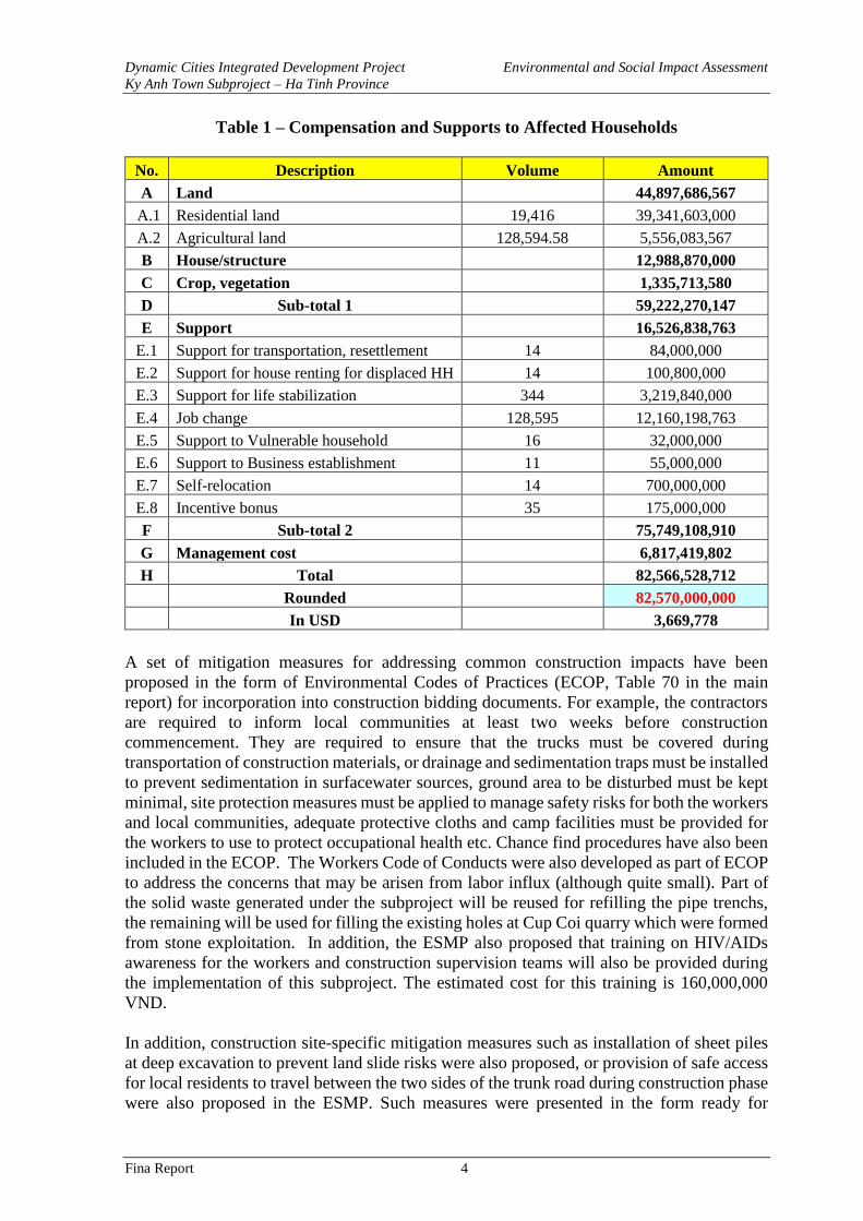
Table 1 – Compensation and Supports to Affected Households
No. Description Volume Amount
A Land 44,897,686,567
A.1 Residential land 19,416 39,341,603,000
A.2 Agricultural land 128,594.58 5,556,083,567
B House/structure 12,988,870,000
C Crop, vegetation 1,335,713,580
D Sub-total 1 59,222,270,147
E Support 16,526,838,763
E.1 Support for transportation, resettlement 14 84,000,000
E.2 Support for house renting for displaced HH 14 100,800,000
E.3 Support for life stabilization 344 3,219,840,000
E.4 Job change 128,595 12,160,198,763
E.5 Support to Vulnerable household 16 32,000,000
E.6 Support to Business establishment 11 55,000,000
E.7 Self-relocation 14 700,000,000
E.8 Incentive bonus 35 175,000,000
F Sub-total 2 75,749,108,910
G Management cost 6,817,419,802
H Total 82,566,528,712
Rounded 82,570,000,000
In USD 3,669,778
A set of mitigation measures for addressing common construction impacts have been
proposed in the form of Environmental Codes of Practices (ECOP, Table 70 in the main
report) for incorporation into construction bidding documents. For example, the contractors
are required to inform local communities at least two weeks before construction
commencement. They are required to ensure that the trucks must be covered during
transportation of construction materials, or drainage and sedimentation traps must be installed
to prevent sedimentation in surfacewater sources, ground area to be disturbed must be kept
minimal, site protection measures must be applied to manage safety risks for both the workers
and local communities, adequate protective cloths and camp facilities must be provided for
the workers to use to protect occupational health etc. Chance find procedures have also been
included in the ECOP. The Workers Code of Conducts were also developed as part of ECOP
to address the concerns that may be arisen from labor influx (although quite small). Part of
the solid waste generated under the subproject will be reused for refilling the pipe trenchs,
the remaining will be used for filling the existing holes at Cup Coi quarry which were formed
from stone exploitation. In addition, the ESMP also proposed that training on HIV/AIDs
awareness for the workers and construction supervision teams will also be provided during
the implementation of this subproject. The estimated cost for this training is 160,000,000
VND.
In addition, construction site-specific mitigation measures such as installation of sheet piles
at deep excavation to prevent land slide risks were also proposed, or provision of safe access
for local residents to travel between the two sides of the trunk road during construction phase
were also proposed in the ESMP. Such measures were presented in the form ready for
Dynamic Cities Integrated Development Project Environmental and Social Impact Assessment
Ky Anh Town Subproject – Ha Tinh Province
Fina Report 5
inclusion into bidding documents. The site-specific mitigation measures at sensitive-
receptors are presented in the Table below:
Table 2 – Site-specific Impacts and Mitigation Measures of Sensitive Receptor
Name, Picture /
Distance to
construction site
Site-specific Impacts and
Risks Site-specific Mitigation Measures
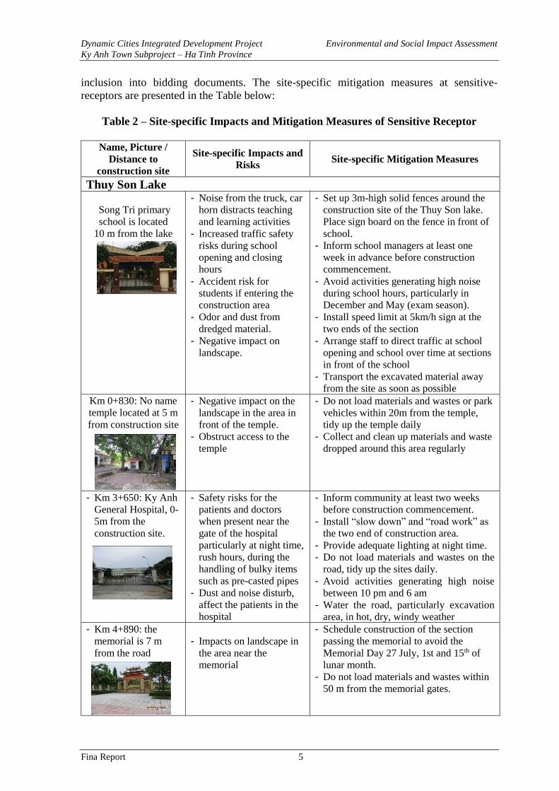
Thuy Son Lake
Song Tri primary
school is located
10 m from the lake
- Noise from the truck, car
horn distracts teaching
and learning activities
- Increased traffic safety
risks during school
opening and closing
hours
- Accident risk for
students if entering the
construction area
- Odor and dust from
dredged material.
- Negative impact on
landscape.
- Set up 3m-high solid fences around the
construction site of the Thuy Son lake.
Place sign board on the fence in front of
school.
- Inform school managers at least one
week in advance before construction
commencement.
- Avoid activities generating high noise
during school hours, particularly in
December and May (exam season).
- Install speed limit at 5km/h sign at the
two ends of the section
- Arrange staff to direct traffic at school
opening and school over time at sections
in front of the school
- Transport the excavated material away
from the site as soon as possible Km 0+830: No name
temple located at 5 m
from construction site
- Negative impact on the
landscape in the area in
front of the temple. - Obstruct access to the
temple
- Do not load materials and wastes or park
vehicles within 20m from the temple,
tidy up the temple daily
- Collect and clean up materials and waste
dropped around this area regularly
- Km 3+650: Ky Anh
General Hospital, 0-
5m from the
construction site.
- Safety risks for the
patients and doctors
when present near the
gate of the hospital
particularly at night time,
rush hours, during the
handling of bulky items
such as pre-casted pipes
- Dust and noise disturb,
affect the patients in the
hospital
- Inform community at least two weeks
before construction commencement.
- Install “slow down” and “road work” as
the two end of construction area.
- Provide adequate lighting at night time.
- Do not load materials and wastes on the
road, tidy up the sites daily.
- Avoid activities generating high noise
between 10 pm and 6 am
- Water the road, particularly excavation
area, in hot, dry, windy weather
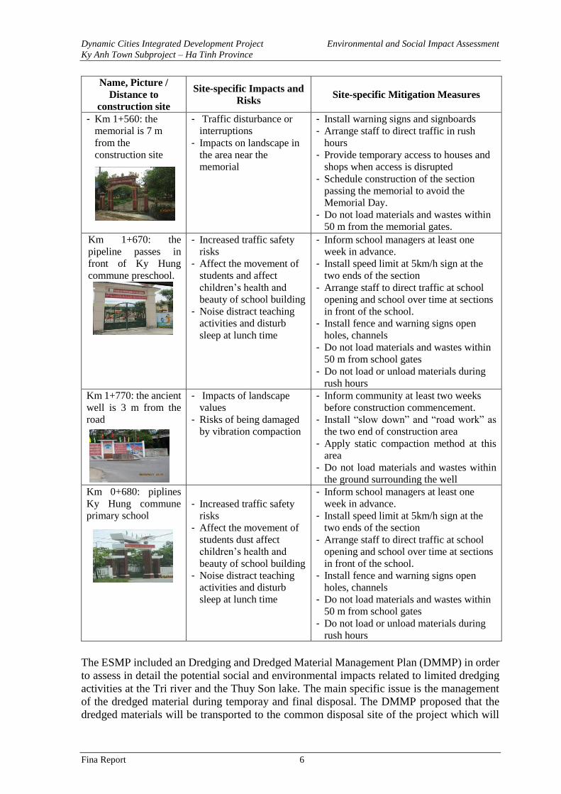
- Km 4+890: the
memorial is 7 m
from the road
- Impacts on landscape in
the area near the
memorial
- Schedule construction of the section
passing the memorial to avoid the
Memorial Day 27 July, 1st and 15th of
lunar month.
- Do not load materials and wastes within
50 m from the memorial gates.
Dynamic Cities Integrated Development Project Environmental and Social Impact Assessment
Ky Anh Town Subproject – Ha Tinh Province
Fina Report 6
Name, Picture /
Distance to
construction site
Site-specific Impacts and
Risks Site-specific Mitigation Measures
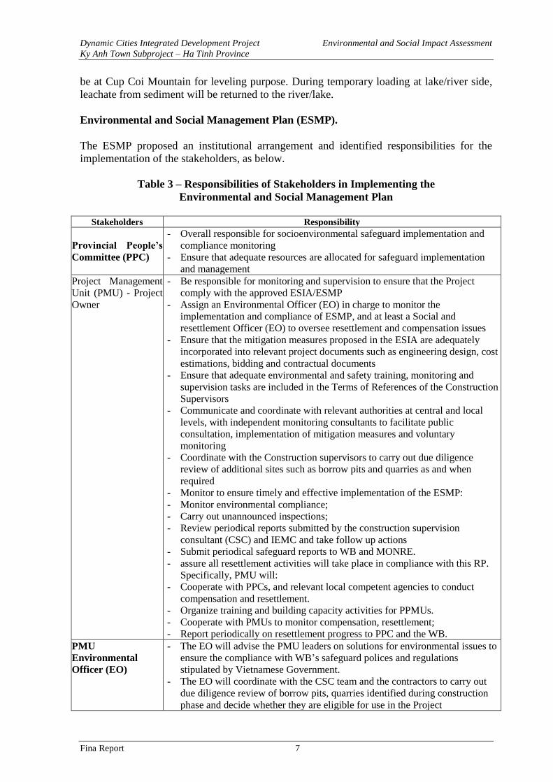
- Km 1+560: the
memorial is 7 m
from the
construction site
- Traffic disturbance or
interruptions
- Impacts on landscape in
the area near the
memorial
- Install warning signs and signboards
- Arrange staff to direct traffic in rush
hours
- Provide temporary access to houses and
shops when access is disrupted
- Schedule construction of the section
passing the memorial to avoid the
Memorial Day.
- Do not load materials and wastes within
50 m from the memorial gates.
Km 1+670: the
pipeline passes in
front of Ky Hung
commune preschool.
- Increased traffic safety
risks
- Affect the movement of
students and affect
children’s health and
beauty of school building
- Noise distract teaching
activities and disturb
sleep at lunch time
- Inform school managers at least one
week in advance.
- Install speed limit at 5km/h sign at the
two ends of the section
- Arrange staff to direct traffic at school
opening and school over time at sections
in front of the school.
- Install fence and warning signs open
holes, channels
- Do not load materials and wastes within
50 m from school gates
- Do not load or unload materials during
rush hours
Km 1+770: the ancient
well is 3 m from the
road
- Impacts of landscape
values
- Risks of being damaged
by vibration compaction
- Inform community at least two weeks
before construction commencement.
- Install “slow down” and “road work” as
the two end of construction area
- Apply static compaction method at this
area
- Do not load materials and wastes within
the ground surrounding the well
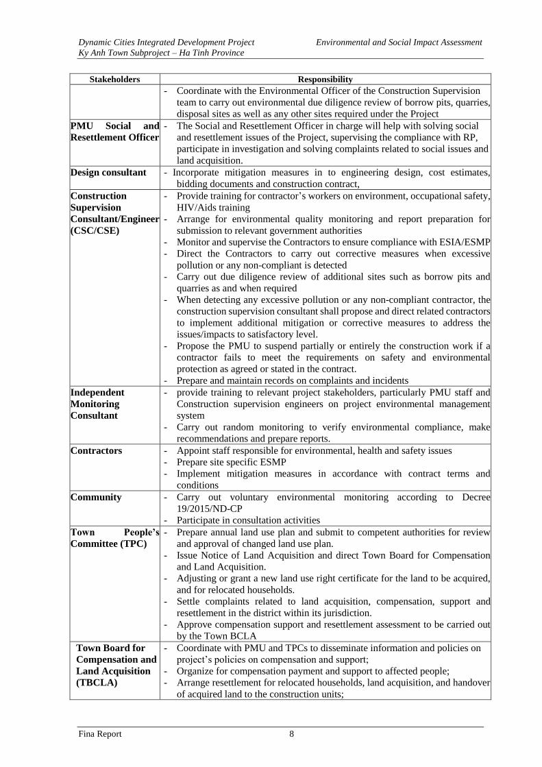
Km 0+680: piplines
Ky Hung commune
primary school
- Increased traffic safety
risks
- Affect the movement of
students dust affect
children’s health and
beauty of school building
- Noise distract teaching
activities and disturb
sleep at lunch time
- Inform school managers at least one
week in advance.
- Install speed limit at 5km/h sign at the
two ends of the section
- Arrange staff to direct traffic at school
opening and school over time at sections
in front of the school.
- Install fence and warning signs open
holes, channels
- Do not load materials and wastes within
50 m from school gates
- Do not load or unload materials during
rush hours
The ESMP included an Dredging and Dredged Material Management Plan (DMMP) in order
to assess in detail the potential social and environmental impacts related to limited dredging
activities at the Tri river and the Thuy Son lake. The main specific issue is the management
of the dredged material during temporay and final disposal. The DMMP proposed that the
dredged materials will be transported to the common disposal site of the project which will
Dynamic Cities Integrated Development Project Environmental and Social Impact Assessment
Ky Anh Town Subproject – Ha Tinh Province
Fina Report 7
be at Cup Coi Mountain for leveling purpose. During temporary loading at lake/river side,
leachate from sediment will be returned to the river/lake.
Environmental and Social Management Plan (ESMP).
The ESMP proposed an institutional arrangement and identified responsibilities for the
implementation of the stakeholders, as below.
Table 3 – Responsibilities of Stakeholders in Implementing the
Environmental and Social Management Plan
Stakeholders Responsibility
Provincial People’s
Committee (PPC)
- Overall responsible for socioenvironmental safeguard implementation and
compliance monitoring
- Ensure that adequate resources are allocated for safeguard implementation
and management
Project Management
Unit (PMU) - Project
Owner
- Be responsible for monitoring and supervision to ensure that the Project
comply with the approved ESIA/ESMP
- Assign an Environmental Officer (EO) in charge to monitor the
implementation and compliance of ESMP, and at least a Social and
resettlement Officer (EO) to oversee resettlement and compensation issues
- Ensure that the mitigation measures proposed in the ESIA are adequately
incorporated into relevant project documents such as engineering design, cost
estimations, bidding and contractual documents
- Ensure that adequate environmental and safety training, monitoring and
supervision tasks are included in the Terms of References of the Construction
Supervisors
- Communicate and coordinate with relevant authorities at central and local
levels, with independent monitoring consultants to facilitate public
consultation, implementation of mitigation measures and voluntary
monitoring
- Coordinate with the Construction supervisors to carry out due diligence
review of additional sites such as borrow pits and quarries as and when
required
- Monitor to ensure timely and effective implementation of the ESMP:
- Monitor environmental compliance;
- Carry out unannounced inspections;
- Review periodical reports submitted by the construction supervision
consultant (CSC) and IEMC and take follow up actions
- Submit periodical safeguard reports to WB and MONRE.
- assure all resettlement activities will take place in compliance with this RP.
Specifically, PMU will:
- Cooperate with PPCs, and relevant local competent agencies to conduct
compensation and resettlement.
- Organize training and building capacity activities for PPMUs.
- Cooperate with PMUs to monitor compensation, resettlement;
- Report periodically on resettlement progress to PPC and the WB.
PMU
Environmental
Officer (EO)
- The EO will advise the PMU leaders on solutions for environmental issues to
ensure the compliance with WB’s safeguard polices and regulations
stipulated by Vietnamese Government.
- The EO will coordinate with the CSC team and the contractors to carry out
due diligence review of borrow pits, quarries identified during construction
phase and decide whether they are eligible for use in the Project
Dynamic Cities Integrated Development Project Environmental and Social Impact Assessment
Ky Anh Town Subproject – Ha Tinh Province
Fina Report 8
Stakeholders Responsibility
- Coordinate with the Environmental Officer of the Construction Supervision
team to carry out environmental due diligence review of borrow pits, quarries,
disposal sites as well as any other sites required under the Project
PMU Social and
Resettlement Officer
- The Social and Resettlement Officer in charge will help with solving social
and resettlement issues of the Project, supervising the compliance with RP,
participate in investigation and solving complaints related to social issues and
land acquisition.
Design consultant - Incorporate mitigation measures in to engineering design, cost estimates,
bidding documents and construction contract,
Construction
Supervision
Consultant/Engineer
(CSC/CSE)
- Provide training for contractor’s workers on environment, occupational safety,
HIV/Aids training
- Arrange for environmental quality monitoring and report preparation for
submission to relevant government authorities
- Monitor and supervise the Contractors to ensure compliance with ESIA/ESMP
- Direct the Contractors to carry out corrective measures when excessive
pollution or any non-compliant is detected
- Carry out due diligence review of additional sites such as borrow pits and
quarries as and when required
- When detecting any excessive pollution or any non-compliant contractor, the
construction supervision consultant shall propose and direct related contractors
to implement additional mitigation or corrective measures to address the
issues/impacts to satisfactory level.
- Propose the PMU to suspend partially or entirely the construction work if a
contractor fails to meet the requirements on safety and environmental
protection as agreed or stated in the contract.
- Prepare and maintain records on complaints and incidents
Independent
Monitoring
Consultant
- provide training to relevant project stakeholders, particularly PMU staff and
Construction supervision engineers on project environmental management
system
- Carry out random monitoring to verify environmental compliance, make
recommendations and prepare reports.
Contractors - Appoint staff responsible for environmental, health and safety issues
- Prepare site specific ESMP
- Implement mitigation measures in accordance with contract terms and
conditions
Community - Carry out voluntary environmental monitoring according to Decree
19/2015/ND-CP
- Participate in consultation activities
Town People’s
Committee (TPC)
- Prepare annual land use plan and submit to competent authorities for review
and approval of changed land use plan.
- Issue Notice of Land Acquisition and direct Town Board for Compensation
and Land Acquisition.
- Adjusting or grant a new land use right certificate for the land to be acquired,
and for relocated households.
- Settle complaints related to land acquisition, compensation, support and
resettlement in the district within its jurisdiction.
- Approve compensation support and resettlement assessment to be carried out
by the Town BCLA
Town Board for
Compensation and
Land Acquisition
(TBCLA)
- Coordinate with PMU and TPCs to disseminate information and policies on
project’s policies on compensation and support;
- Organize for compensation payment and support to affected people;
- Arrange resettlement for relocated households, land acquisition, and handover
of acquired land to the construction units;
Dynamic Cities Integrated Development Project Environmental and Social Impact Assessment
Ky Anh Town Subproject – Ha Tinh Province
Fina Report 9
Stakeholders Responsibility
- Lead and coordinate with PMU and TPCs to implement Livelihood
Restoration Program;
- Assist TPCs to settle complaints concerning land acquisition, compensation
and resettlement.
- Support TPC in issuance of LURCs for land plot in the resettlement site.
- Support the external monitoring consultant for conducting independent
resettlement monitoring.
- Ward/Commune
People’s
Committee:
- Cooperate with TBCLA in arranging compensation payment, resettlement
and livelihood restoration implementation;
- Provide documents related to the origin of land use of AHH; confirming the
eligibility of affected persons and affected assets;
- Assist TPC, TBCLA to organize meetings and public consultations;
- Resolve complaints at the ward/commune level - as prescribed by the existing
law; Assist authorities to resolve land disputes and complaints.
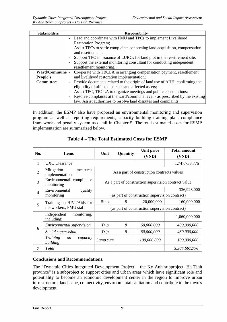
In addition, the ESMP also have proposed an environmental monitoring and supervision
program as well as reporting requirements, capacity building training plan, compliance
framework and penalty system as detail in Chapter 5. The total estimated costs for ESMP
implementation are summarized below.
Table 4 – The Total Estimated Costs for ESMP
No. Items Unit Quantity Unit price Total amount
(VND) (VND)
1 UXO Clearance 1,747,733,776
2 Mitigation measures
implementation As a part of construction contracts values
3 Environmental compliance
monitoring As a part of construction supervision contract value
4 Environmental quality
monitoring
336,928,000
(as part of construction supervision contract)
5 Training on HIV /Aids for
the workers, PMU staff
Sites 8 20,000,000 160,000,000
(as part of construction supervision contract)
6
Independent monitoring,
including: 1,060,000,000
Environmental supervision Trip 8 60,000,000 480,000,000
Social supervision Trip 8 60,000,000 480,000,000
Training on capacity
building Lump sum 100,000,000 100,000,000
7 Total 3,304,661,776
Conclusions and Recommendations.
The "Dynamic Cities Integrated Development Project – the Ky Anh subproject, Ha Tinh
province" is a subproject to support cities and urban areas which have significant role and
potentiality to become an economic development center in the region to improve urban
infrastructure, landscape, connectivity, environmental sanitation and contribute to the town's
development.
Dynamic Cities Integrated Development Project Environmental and Social Impact Assessment
Ky Anh Town Subproject – Ha Tinh Province
Fina Report 10
The ESIA report was prepared in compliance with WB safeguard policies and applicable
Vietnamese regulations. The report will be one of the key documents to be submitted to the
World Bank and releant Vientamese Environmental authorities for appraisal and approval
before Project negotiation.
The environmental impacts were theoretically and empirically assessed with support from the
baseline and statistical data as well as experiences from similar WB projects. The impacts are
relatively quantified as best as they can be for all three stages of project’s pre-construction,
construction and operation.
The subproject is expected to bring about significant positive impacts, particularly
improvement of urban connectivity by constructing the main road connecting urban centers,
improving environmental sanitation by construction of wastewater collection and treatment
system. Tri river dredging and embankment lining will help to reduce flooding risk for
residential areas along the river and improve drainage capacity for the river basin. Thuy Son
lake embankment lining and dredging will contribute to improve environmental condition
and landcape of the town's central area, improving local drainage capacity. Beside the positive
impacts, there would be also some potential negative impacts and risks during the pre-
construction, construction and operation of the facilities provided under the Subproject. Most
of these potential impacts and risks has been predicted to be at low to moderate levels,
localised as these would be taking place in areas around construction sites and/or on transport
routes and at disposal sites. These impacts and risks can be managed by the implementation
of the Environmental and Social Management Plan, taking into account the feedback received
during public consultation on ESIA/ESMP.
This subporoject would bring about significant positive environmental benefits, contributing
to the sustainable growth of Ky Anh town and in particularly helping the town to achieve
several key targets for becoming the class III urban by 2020. Therefore, the subproject should
be implemented.
Dynamic Cities Integrated Development Project Environmental and Social Impact Assessment
Ky Anh Town Subproject – Ha Tinh Province
Fina Report 3
INTRODUCTION
1. Project Background
Viet Nam has set the goal to have urban development together with complete, modern and
environmental-friendly technical infrastructure system. The Prime Minister has approved
many important orientations to promote cities development following plans, such as the
Masterplan for Vietnam’s Urban Development under the Decision No.445/QD-TTg dated
07/04/2009, the National Urban Upgrading Program for the period from 2009 to 2020 under
Decision No. 758/QD-TTg dated 08/06/2009, the National Urban Upgrading Program for the
period 2012-2020 under the Decision No. 1659/QD-TTg dated 07/11/2012. These are the
basis for formation of the country’s large urban areas with socio-economic development.
Over the past years, Government of Vietnam with the assistance of the World Bank has
implemented numbers of urban development projects such as the Vietnam Urban Upgrading
project, Medium Cities Development Project etc which are bringing great benefits with
positive changes in urban landscapes and people’s awareness about urban and project
management in the participating cities.
In order to implement the masterplans and development policy of the Government, the
Dynamic Cities Integrated Development Project has been proposed with five cities
included: Hai Duong city (Hai Duong province), Tinh Gia (Thanh Hoa Province), Yen Bai
city (Yen Bai Province), Thai Nguyen city (Thai Nguyen Province) and Ky Anh town (Ha
Tinh province). The Ky Anh subproject, Ha Tinh province includes two components:
- Component 1: Construction of Technical and Urban Transport Infrastructure
- Component 2: Technical Assistance and Implementation Support.
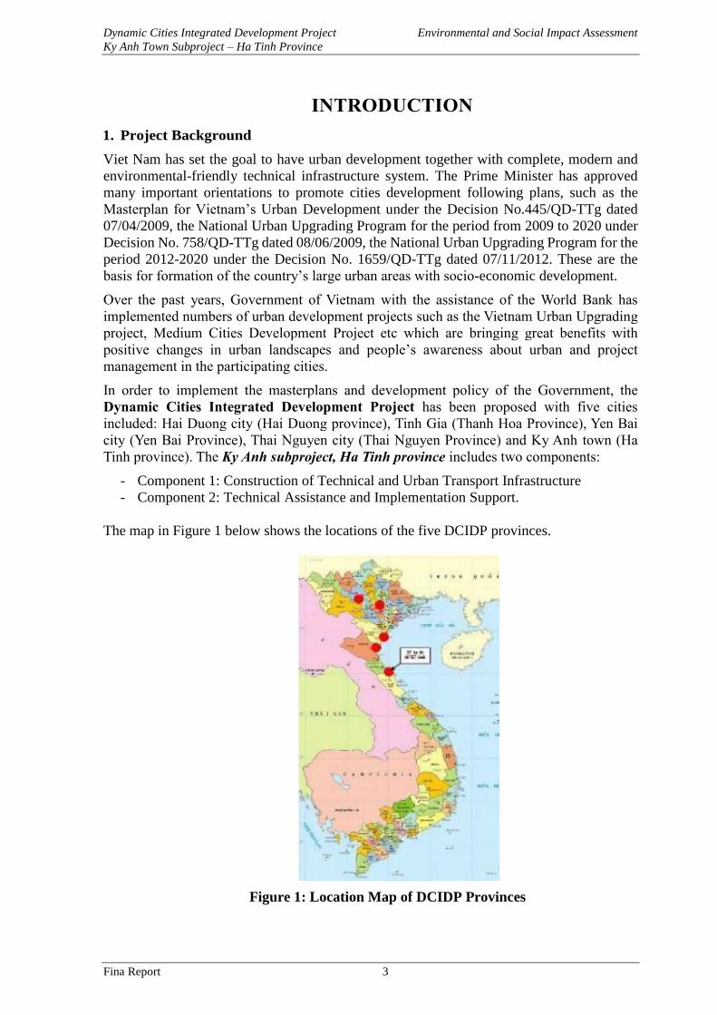
The map in Figure 1 below shows the locations of the five DCIDP provinces.
Figure 1: Location Map of DCIDP Provinces
Dynamic Cities Integrated Development Project Environmental and Social Impact Assessment
Ky Anh Town Subproject – Ha Tinh Province
Fina Report 4
2. Relationships between the Project and Masterplans
The project will comply with the master plan of Ky Anh Town, Ha Tinh province to 2035.
According to this plan, Ky Anh town will be the general economic center in the South of Ha
Tinh province, playing an important role in promoting the socio-economic development of
the North Central region.
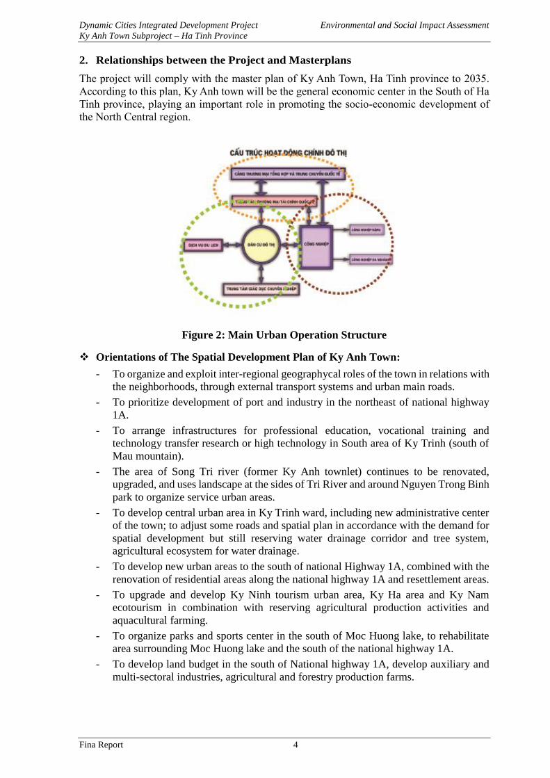
Figure 2: Main Urban Operation Structure
❖ Orientations of The Spatial Development Plan of Ky Anh Town:
- To organize and exploit inter-regional geographycal roles of the town in relations with
the neighborhoods, through external transport systems and urban main roads.
- To prioritize development of port and industry in the northeast of national highway
1A.
- To arrange infrastructures for professional education, vocational training and
technology transfer research or high technology in South area of Ky Trinh (south of
Mau mountain).
- The area of Song Tri river (former Ky Anh townlet) continues to be renovated,
upgraded, and uses landscape at the sides of Tri River and around Nguyen Trong Binh
park to organize service urban areas.
- To develop central urban area in Ky Trinh ward, including new administrative center
of the town; to adjust some roads and spatial plan in accordance with the demand for
spatial development but still reserving water drainage corridor and tree system,
agricultural ecosystem for water drainage.
- To develop new urban areas to the south of national Highway 1A, combined with the
renovation of residential areas along the national highway 1A and resettlement areas.
- To upgrade and develop Ky Ninh tourism urban area, Ky Ha area and Ky Nam
ecotourism in combination with reserving agricultural production activities and
aquacultural farming.
- To organize parks and sports center in the south of Moc Huong lake, to rehabilitate
area surrounding Moc Huong lake and the south of the national highway 1A.
- To develop land budget in the south of National highway 1A, develop auxiliary and
multi-sectoral industries, agricultural and forestry production farms.
Dynamic Cities Integrated Development Project Environmental and Social Impact Assessment
Ky Anh Town Subproject – Ha Tinh Province
Fina Report 5
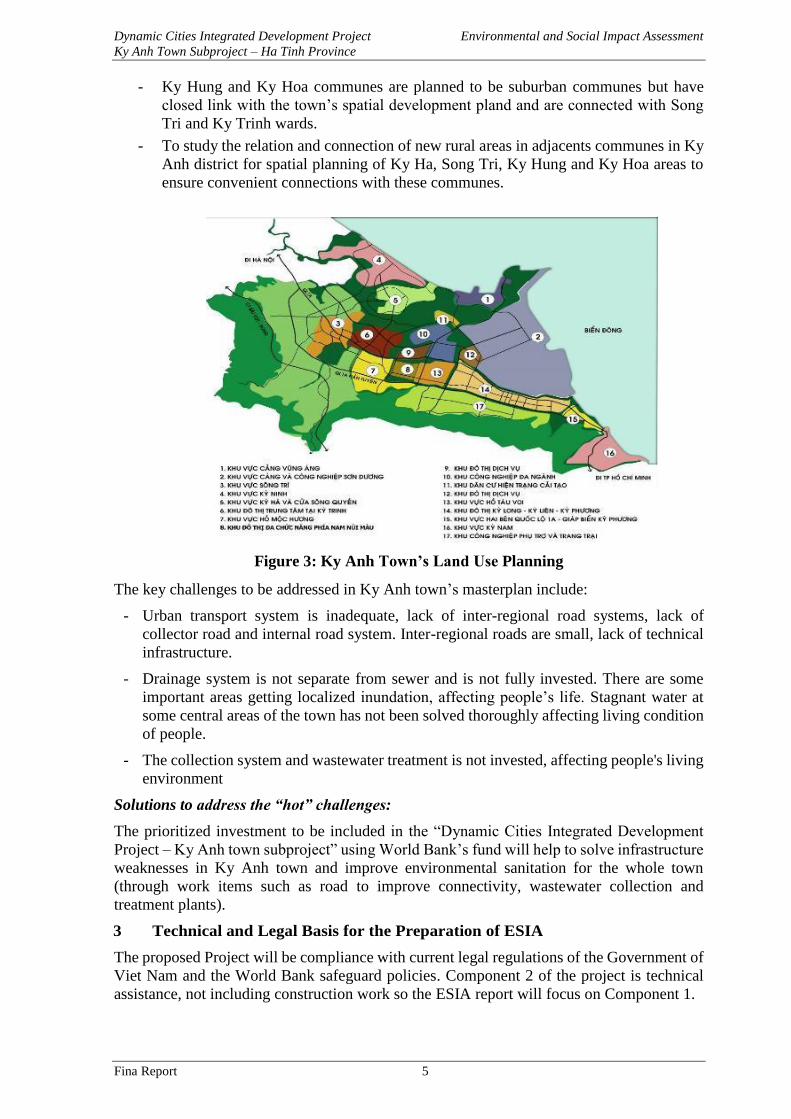
- Ky Hung and Ky Hoa communes are planned to be suburban communes but have
closed link with the town’s spatial development pland and are connected with Song
Tri and Ky Trinh wards.
- To study the relation and connection of new rural areas in adjacents communes in Ky
Anh district for spatial planning of Ky Ha, Song Tri, Ky Hung and Ky Hoa areas to
ensure convenient connections with these communes.
Figure 3: Ky Anh Town’s Land Use Planning
The key challenges to be addressed in Ky Anh town’s masterplan include:
- Urban transport system is inadequate, lack of inter-regional road systems, lack of
collector road and internal road system. Inter-regional roads are small, lack of technical
infrastructure.
- Drainage system is not separate from sewer and is not fully invested. There are some
important areas getting localized inundation, affecting people’s life. Stagnant water at
some central areas of the town has not been solved thoroughly affecting living condition
of people.
- The collection system and wastewater treatment is not invested, affecting people's living
environment
Solutions to address the “hot” challenges:
The prioritized investment to be included in the “Dynamic Cities Integrated Development
Project – Ky Anh town subproject” using World Bank’s fund will help to solve infrastructure
weaknesses in Ky Anh town and improve environmental sanitation for the whole town
(through work items such as road to improve connectivity, wastewater collection and
treatment plants).
3 Technical and Legal Basis for the Preparation of ESIA
The proposed Project will be compliance with current legal regulations of the Government of
Viet Nam and the World Bank safeguard policies. Component 2 of the project is technical
assistance, not including construction work so the ESIA report will focus on Component 1.
Dynamic Cities Integrated Development Project Environmental and Social Impact Assessment
Ky Anh Town Subproject – Ha Tinh Province
Fina Report 6
3.1 Vietnamese Legal Documents
• The Law on Environmental Protection No.55/2014/QH13 was approved by the National
Assembly of the Socialist Republic of Vietnam (session XIII) on 23/6/2014 and became
effective since 01/01/2015;
The Law on Environmental Protection (No. 55/2014/QH13) dated 23/6/2014 and the
Decree No. 18/2015/NĐ-CP) dated 14/2/2015 on Environmental Protection Planning,
Strategic Environmental Assessment, Environmental Impact Assessment and
Environmental Protection Plan are important legal frameworks for environmental
management in Vietnam. The Law on Environmental Protection provides legal provisions
on environmental protection; measures and resources used for environmental protection
purposes; the powers, obligations and responsibilities of agencies, organizations,
households and individuals in environmental protection. The Law on Environmental
Protection regulates the strategic environmental assessment, environmental impact
assessment and environmental protection commitment. In addition, the Law also regulates
the affected community consultation in the process making Environmental Impact
Assessment Report of projects (Article 21, Section 3, Chapter 2).
The Environmental Impact Assessment will be submitted to the Ministry of Natural
Resources and Enviroment for consideration and approval.
• Law on Construction No.50/2014/QH13 passed by National Assembly Session XIII of the
Socialist Republic of Vietnam on 18 June 2014 and took effect on 01/01/2015; The Law
on modification and amendments of a number of articles of the Law on Inland Waterway
Navigation No. 48/2014/QH13 passed by the National Assembly Session XIII of the
Socialist Republic of Vietnam, on 17 June 2014;
• Land Law No. 45/2013/QH13 of the National Assembly of Vietnam dated November 29,
2013, taking effect since 01/7/2014.
• Law on Water Resources No. 17/2012/QH13 of the National Assembly of Vietnam dated
June 21, 2012
• Labor Code 10/2012/QH13 dated 18/06/2012 approved by Socialist Republic of Vietnam
National Assembly Session XIII dated 18/06/2012;
• Law on Urban Planning No. 30/2009/QH12 approved by Socialist Republic of Vietnam
National Assembly Session XII dated 17/06/2009;
• Law on Biodiversity No. 20/2008/QH12 of the National Assembly of Vietnam dated
November 13, 2008
• Law on Chemical No.06/2007/QH127 approved by Socialist Republic of Vietnam
National Assembly Session XII dated 21/11/2007;
• Law on modification and amendments of some articles of Law on Fire Protection
No.40/2013/QH13 approved by Socialist Republic of Vietnam National Assembly Session
XIII dated 22/11/2013.
• The Law on Road Transport No. 23/2008/QH12 dated on 13/11/2008.
• The Law on Standard and technical regulations No.68/2006/QH11 approved by Socialist
Republic of Vietnam National Assembly session XI on 29/6/2006;
• The Law on Inland Waterway Transport No. 23/2004/QH11 approved by the National
Assembly Session XI of the Socialist Republic of Vietnam dated June 15, 2004;
• The Law on People's Health Protection No. 21/LCT/HDNN8 approved on June 30, 1989
by the National Assembly Session VIII of the Socialist Republic of Vietnam.
Dynamic Cities Integrated Development Project Environmental and Social Impact Assessment
Ky Anh Town Subproject – Ha Tinh Province
Fina Report 7
• Decree 59/2015/ND-CP dated 18/6/2015 by the Government on management of
construction investment projects;
• Decree No. 18/2015/ND-CP dated February 14, 2015 by the Government on
environmental protection planning, strategic environmental assessment, environmental
impact assessment, and environmental protection commitment.
• Decree No.19/2015/ND-CP of 14 February 2015 by the Government detailing the
implementation of a number of articles of the Law on Environmental Protection;
• Decree No.38/2015/NĐ-CP dated 24/4/2015 by the Government on waste management;
• Decree No.42/2017/NĐ-CP dated April 05, 2017 by the Government on amending and
supplementing some articles of Decree No. 59/2015/NĐ-CP dated 18/06/2015 by the
Government on management of construction investment works;
• Decree No.43/2014/ND-CP dated May 15, 2014 by the Government providing guidance
on detailed implementation of some articles from the Land Law 2013.
• Decree No.44/2014/ND-CP dated 15 May 2014 by the Government providing regulations
on land prices.
• Decree No.45/2014/NĐ-CP dated 15/5/2014 by the Government on land use levy;
• Decree No 46/2014/NĐ-CP dated 15/5/2014 by the Government on collection of land rent
and water surface rent fee;
• Decree No.47/2014/ND-CP dated 15 May 2014 by the Government on compensation,
support, and resettlement when land acquisition is required by the State.
• Decree 80/2014/ND-CP dated 06/8/2014 by the Government on water drainage and
wastewater treatment;
• Decree No.155/2016/ND-CP dated 18/11/2016 by the Government on the penalties for
administrative violations against the law on environmental protection
• Decree No.154/2016/ND-CP dated 16/11/2016 by the Government on environmental
protection charges for wastewater;
• Decree No. 38/2015/ND-CP dated 24 April 2015 issued by the Government on solid waste
management;
• Decree No. 149/2004/ND-CP dated 27 July 2004 regulating the licensing of water
resource exploration, exploitation and use, and discharge of wastewater into water sources.
• Decree No. 38/2011/ND-CP by the Government amending and supplementing a number
of articles on administrative procedures of Decree No. 181/2004/ND-CP dated October
29, 2004, Decree No. 149/2004/ND-CP dated July 27, 2004 and Decree No.
160/2005/ND-CP dated December 27, 2005.
• Circular No. 27/2015/TT-BTNMT dated 19 May 2015 of the Ministry of Natural
Resources and Environment on strategic environmental assessment, environmental impact
assessment, and environmental protection plan.
• Circular No. 36/2014/TT-BTNMT dated 30 June 2014, specifying detailed methods of
valuation of land prices, construction, adjustment of land prices; specific land prices
valuation and land prices valuation consulting service.
• Circular No. 32/2015/TT-BTNMT dated July 24, 2015 of the Ministry of Transport
regulating environmental protection in the development of transport infrastructure;
• Circular No. 36/2015/TT-BTNMT dated 30 June 2015 on the management of hazardous
Dynamic Cities Integrated Development Project Environmental and Social Impact Assessment
Ky Anh Town Subproject – Ha Tinh Province
Fina Report 8
waste;
• Circular No. 32/2013/TT-BTNMT dated 25/10/2013 of MONRE on the promulgation of
national technical regulations on environment;
• Circular 21/2012/TT-BTNMT dated 19/12/2012 regulating quality assurance and quality
control in environmental monitoring;
• Circular No. 19/2011/TT - BYT of 06 June 2011 of the Minsitry of Health guiding labor
hygiene, laborers’ health and occupational diseases.
• Circular No. 22/2010/TT-BXD dated 03/12/2010 of Ministry of construction providing
labor safety in construction
• Circular No. 16/2009/BTNMT and 25/2009/BTNMT of the MONRE on promulgation of
Vietnam National Standards;
• Circular 02/2009/TT-BTNMT dated March 19, 2009 of the Ministry of Natural Resources
and Environment on the regulation on evaluation of water source to receive wastewater;
• Circular No. 10/2007/TT-BTNMT dated October 22, 2007 guiding for Quality Assurance
and Quality Control in Environmental Monitoring;
• Decision No. 16/2008/QĐ-BTNMT dated 31/12/2008 of the Ministry of Natural
Resources and Environment on promulgation of national technical regulations on
environment;
• Decision No. 22/2006/QD-BTNMT dated 18/12/2006 of the Ministry of Natural
Resources and Environment mandating the application of Vietnam standards on
environment
Applied Standards and Codes:
Preparation of the ESIA applies following current National technical regulations (QCVN):
❖ Water quality
QCVN 01:2009/BYT: National technical regulation on drinking water quality.
QCVN 08-MT:2015/BTNMT– National technical regulation on surface water quality;
QCVN 09-MT 2015/BTNMT– National technical regulation on ground water quality.
QCVN 14:2008/BTNMT: National technical regulation on domestic wastewater.
QCVN 40:2011/BTNMT: National technical regulation on industrial wastewater.
❖ Air quality
QCVN 05:2013/BTNMT: National technical regulation on ambient air quality.
QCVN 06:2009/BTNMT: National technical regulation on hazardous substances in ambient
air.
TCVN 6438:2005 - Road vehicles –Maximum allowable limits of gas emission
❖ Soil quality and sediment
QCVN 03-MT:2015/BTNTM - National technical regulation on the allowable limits of heavy
metals in the soils.
QCVN 15:2008/BTNMT: National technical regulation on the pesticide residues in the soils.
QCVN 43:2012/BTNMT - National technical regulation on sediment quality in fresh water
areas.
❖ Noise and vibration
Dynamic Cities Integrated Development Project Environmental and Social Impact Assessment
Ky Anh Town Subproject – Ha Tinh Province
Fina Report 9
QCVN 26:2010/BTNMT: National technical regulation on noise.
TCVN 5948:1999 - Acoustic - Noise emitted by accelerating road vehicles - Permitted
maximum noise level.
QCVN 27:2010/BTNMT: National technical regulation on vibration.
❖ Water drainage and supply
TCVN 7957:2008 - Drainage and sewerage - External Networks and Facilities - Design
Standard
TCXDVN 33:2006 - Water Supply - Distribution System and Facilities.
❖ Safety and occupational health
Decision No.3733/2002/QĐ-BYT dated 10/10/2002 on application of 21 standards on safety
and occupational health.
Legal Documents Related to The Project:
• Decision No. 758/QD-Ttg dated June 8, 2009 of the Prime Minister approving the
national program on the upgrading of urban centers during 2009-2020;
• Decision No. 1659/QD-Ttg dated November 7, 2012 of the Prime Minister approving
the national development program on the upgrading of urban centers during 2012-2020;
• Decision No. 445/QD-Ttg dated April 7, 2009 of the Prime Minister on approving the
modification of the master plan for development of Vietnam's urban system by 2025
and vision to 2050;
• Decision No. 2623/QD-TTg dated December 31, 2013 of the Prime Minister on
approval of the scheme "Vietnam’s urban development for response to climate change
in 2013-2020 period";
• Decision No. 403/QD-TTg dated 2014 of the Prime Minister on approval for the
national action plan on green growth;
• Decision No. 1810/QD-TTg dated October 4, 2013 of the Prime Minister on approving
the orientation and criteria for using WB's capital in 2014-2018 period and in the
following years;
• Decision No. 4226/QĐ-UBND dated 26/12/2014 by Ha Tinh PPC approving the
Regional planning of Ha Tinh province to 2030 and vision to 2050; Decision No.
528/QĐ-UBND dated 23/01/2017 by Ha Tinh PPC approving the urban development
program of Ha Tinh province in period 2016 - 2030;
• Decision No.938/QĐ-UBND dated 10/4/2017 by Ha Tinh PPC assigning the task for
preparing and implementing the Dynamic Cities Integrated Development project – Ky
Anh town subproject funded by World Bank;
• Document No. 28/HĐND dated 29/5/2017 by Ky Anh town People’s Standing
Councile approving the Investment Policy proposal of Dynamic Cities Integrated
Development Project – Ky Anh town subproject
• Document No. 2318/ VPCP-QHQT dated 14/03/2017 by Office of Government
approving the proposal of the Dynamic Cities Integrated Develoment Project funded
by World Bank;
• Memoradum of Understanding of World Bank’s Task teams.
Dynamic Cities Integrated Development Project Environmental and Social Impact Assessment
Ky Anh Town Subproject – Ha Tinh Province
Fina Report 10
3.2 World Bank’s Environmental and Social Safeguard Policies
The Project has been classified as a environmental category B by the World Bank, i.e. most
of the potential impacts and risks would be at low to moderate level, and manageable. The
project’s Environmental and Social Impact Assessment (ESIA) has been prepared to
determine and evaluate social and environmental impacts and risks. Then , the Environmental
and Social Management Plan (ESMP) has been also be prepared to propose measures for
mitigation and management of the identified potential impacts and risks.
The World Bank’s operational policies triggered inthis project include:
OP/BP 4.011: Environmental Assessment;
OP/BP 4.042: Natural Habitats;
OP/BP 4.113: Physical Cultural Resources;
OP/BP 4.124: Involuntary Resettlement;
OP/BP 4.01 – Environmental Assessment
This policy requires the social and environmental impacts and risks are screened from early
stage of Project preparation in order to propose appropriate mitigation measures and
management plan to minimize the negative adverse impacts during the project
implementation.
To comply with OP 4.01’s requirement, an Environmental and Social Impact Assessment
(this report) has been prepared to assess the project’s potential impacts and risks, and to
propose necessary measures to prevent, minimize or compensate for adverse impacts. The
Environmental and Social Management Plan (ESMP) will also be prepared for the project to
propose specific plan for implementing, monitoring and reporting the implementation of
proposed mitigation measures.
The OP/BP 4.01 also requires that the affected communities are consulted during the
preparation of the ESIA/ESMP. The ESIA/ESMP reports have to be disclosed locally for
public access prior to project appraisal.
Natural Habitats (OP/BP 4.04);
The subproject will be implemented in urban areas and will not involve significant conversion
or degradation of critical natural habitats or other natural habitats. However, as some civil
works such as river embankment lining or the construction of bridges would be implemented
at riverside or on river bed thus the project would cause loss or damages to some riverside
vegetations or benthics, negatively affecting the habitats of some terrestrial or aquatic species.
The potential impacts and their associated mitigation measures have been identified and
addressed in the subproject ESIA and ESMP.
1Detailed information on OP/BP 4.01 can be found at WB website. 2Detailed information on OP/BP 4.04 is presented on http://web.worldbank.org/WBSITE/EXTERNAL/
PROJECTS/EXTPOLICIES/EXTSAFEPOL/0,,contentMDK:20543920~menuPK:1286576~pagePK:6416844
5~piPK:64168309~theSitePK:584435,00.html 3OP/BP 4.11 is presented on http://web.worldbank.org/WBSITE/EXTERNAL/PROJECTS/EXTPOLICIES/
EXTSAFEPOL/0,,contentMDK:20543961~menuPK:1286639~pagePK:64168445~piPK:64168309~theSitePK
:584435,00.html 4Detailed information on OP/BP 4.12 is provided on World Bank’s website :http://web.worldbank.org/
WBSITE/EXTERNAL/PROJECTS/EXTPOLICIES/EXTSAFEPOL/0,,contentMDK:20543978~menuPK:128
6647~pagePK:64168445~piPK:64168309~theSitePK:584435,00.html
Dynamic Cities Integrated Development Project Environmental and Social Impact Assessment
Ky Anh Town Subproject – Ha Tinh Province
Fina Report 11
Physical Cultural Resources (OP/BP 4.11)
This policy aims at avoiding impacts on physical cultural resources such as, historical relics,
pagoda, temple, monuments, worshiping places, structures and objects spiritually important
to local communities etc... This Policy is triggered under the Project due to relative large
volume of excavation will be involved, some graves and a family worshipping house will be
relocated. Chance find procedures and appropriate mitigation measures will be proposed
under the ESMP for implementation.
Involuntary Resettlement (OP/BP 4.12)
This policy aims to avoid involuntary resettlement to the extent possible or to minimize and
mitigate its adverse social and economic impacts. The policy proposes a livelihood restoration
program to ensure the affected households will restore their livelihood to the project living
standards or even improved. This project will have to acquire residential land, agricultural
land of the local people and relocate some affected households. Therefore, the OP/BP 4.12
will be implemented and mentioned in the Resettlement Plan (RP) for this project.
In addition, the project will also follow the World Bank Guidelines on Environmental, Health
and Safety5 (1998).
The project will not affect wet land and natural reserve areas or not generate insoluble organic
pollutants or relate to international trading of endangered species. So no international
environmental agreements of which Viet Nam is member would be applied to the Project.
4 ESIA Implementation Arrangement
The Ky Anh Project Management Unit has contracted the consultants from the International
Engineering Consultant Joint-stock company (INTEC) to prepare the Environmental and
Social Impact Assessment report for Ky Anh town subproject in 2017. The ESIA team
members are presented in Table 1 as follows.
Table 1: List of ESIA Team Members
NO Full name Educational
background
Involvement in ESIA preparation
1 Phùng Công Thành BS. Environmental
Science
ESIA team leader, assess environmental
impacts and recommend mitigation
measures.
2 Phan Thị Hằng BS. Environmental
Science
Conduct surveys to collect information on
natural and socio-economic baselines in the
project areas
3 Nguyễn Minh Chính BS. Environmental
Science
Analyze and assess construction methods
proposed for the project works. Prepare an
environmental monitoring and
management program
4 Lê Thị Phương Khanh Environmental
Engineer
Evaluate existing environmental and socio-
economic baselines of the project areas.
5 Trần Thị Ngọc Bachelor degree in
Sociology
Surveying team leader, conduct public
consultations, write content related to local
existing economic condition and affected
households.
Dynamic Cities Integrated Development Project Environmental and Social Impact Assessment
Ky Anh Town Subproject – Ha Tinh Province
Fina Report 12
5 Methods for Environmental and Social Impact Assessment
5.1 Method for Environmental Impact Assessment
Field research method: survey and research existing status of environmental resources. Study
and select locations, parameters, methods of monitoring and sampling soil, sediment, surface
water, groundwater, wastewater, and air within the project area.
Sociological Investigation and Public Consultation: This is a participatory method for
assessing stakeholder engagement and community involvement in project implementation.
To commence public consultation, Consultant will organize public consultation meetings and
group discussions in all areas where the project’s construction are carried out, ensuring that
there are presence of all representatives of directly affected people, indirectly affected people,
the management agency; participants in the project construction, other organizations and
individuals, etc. The consultations are conducted twice:
• First time: To determine the scope of impact, introduce the project, preliminarily
evaluate the environmental impact of the project activities, ask for comments on
mitigation measures and identify unforseen environmental issues in the project area.
• Second time: To complete the draft ESIA report: To report and discuss ESIA results
and to collect feedback and agree on the results of the environmental impact assessment
of the project.
During consultation process, Consultant informs people about possible negative
environmental impacts during project implementation, proposes mitigation measures to
mitigate those effects. Governments and people in the affected area will provide comments
on the environmental issues raised and mitigation measures to be taken.
Statistical method: to collect, process and analyze meteorological, hydrological and
environmental data for many years in the project area.
Inheritance method: To inherit the research results of the relevant projects.
Expert method: the consultant has participated in and held meetings and discussions to collect
comments and proposal on mitigation measures for negative impacts of the project with
environmental experts, soociologist, ....
Synthetic and analysis method: To analyse and synthesize project impacts on natural
environment and socio-economic condition in the project area.
Rapid assessment method: is the assessment method based on emission factor. The rapid
assessment method is at high efficiency in determining the pollutant concentration and
emissions from the use of machinery and the operation of the material transportation vehicles;
concentration of water pollution caused by wastewater generated from daily activities of
workers during construction of the project; Water pollution due to operation of the works
during project operation. With the rapid assessment method, it is able to forecast
environmental impact of the pollution sources and to forecast the amount of pollutant
discharge from the source.
Comparing method: To evaluate the impacts by comparing the results of measurement,
analysis and calculation of the predicted concentration of pollutants due to the project's
Dynamic Cities Integrated Development Project Environmental and Social Impact Assessment
Ky Anh Town Subproject – Ha Tinh Province
Fina Report 13
activities with the allowable value in Vietnam National standards on soil quality, water, noise,
air quality and sectoral standards approved by Ministry of Health, Ministry of Construction.
Matrix Method: A matrix is made up by comparing every activity of the project with each
parameter or environmental component to assess cause and effect relationship. The matrix
method is very valuable for determining the impact of the project and providing a summary
form of impact assessment. This is a simple, easy-to-use method that does not require a lot of
environmental data, but can clearly analyze a variety of activities on the same element. Using
the environmental matrix method can clearly see the relationship between development and
the environment.
Monitoring, sampling and analysing method of the baseline environment: Based on the
project activities as well as the process of surveying the actual area of the project, the report
carries out monitoring and sampling for analyzing existing status of the baseline environment
of the project area to form the rationale for proposing mitigation measures as well as
environmental management and monitoring plans when the project is implemented. The
environmental components selected for monitoring and sampling include:
Environmental monitoring of soil, surface water and groundwater is carried out in accordance
with the following guidelines/standards:
Ambient air monitoring: Circular 28/2011/TT-BTNMT regulates the monitoring process for
surrounding ambient air and noise.
Surface water and sediment monitoring: Circular No. 29/2011/TT-BTNMT regulates the
technical process of surface water monitoring.
Underground water monitoring: Circular No. 30/2011/TT-BTNMT regulates the technical
process of monitoring underground water environment.
Soil environment monitoring: Circular No. 33/2011/TT-BTNMT regulates the technical
process for soil monitoring procedures.
The samples are taken at the site, stored and brought to the standard laboratory for analysis
of specific environmental parameters. The analysing methods are applied in accordance with
the standards/regulations issued by Vietnam.
5.2 Method for Social Impact Assessment
Data surveying and collecting
After the mentioned screening process, a framework and surveying method will be discussed
to determine the appropriate sample size, technique/method of data collection. Two main
survey techniques are selected, including: (i) using sample forms for the local authorities of
the project wards/communes; (ii) surveying for analyzing socio-economic information of
households.
Secondary data collection
Information and data related to the project are collected from the Development Project
Management Unit and from other socio-economic analyzing sources such as the Statistical
Yearbook of Ha Tinh province, Socio-economic conditions of the province/district/commune
and poverty analysis related to ethnic minority groups.
Quantitative research method
A socio-economic survey is conducted to document the personal profile of people in the
project area, relating to affected households and beneficiaries (or both). The socio-economic
survey was conducted in May 2017.
Qualitative research method
Dynamic Cities Integrated Development Project Environmental and Social Impact Assessment
Ky Anh Town Subproject – Ha Tinh Province
Fina Report 14
Qualitative research is conducted in the form of in-depth interviews with key informants
including: (a) head of residential group/village, (b) leader of commune/ward People's
Committee, (c) households in the project area and (d) affected households and beneficiary
households. The purpose of the in-depth interviews is to collect ideas and desires of people
in the project area in order to provide appropriate solutions to resolve potential conflicts and
identify measures to mitigate the negative impacts of the project. .
Public consultation
Public consultation meetings in the project wards/communes are organized with the
participation of the following stakeholders:
- Representatives of local authorities from the project wards/communes;
- Mass organizations: Fatherland Front, Women's Union, Youth Union, Farmers'
Association, Veteran's Association of project wards/communes.
- Representatives of households in the project area include potentially affected
households, beneficiaries,.
Issues to be discussed by the Consultant include: (i) Introduction on the project components
and work items; (ii) Overview on local socio-economic condition; (iii) Current status of
infrastructure system in residential areas including technical infrastructure and social
infrastructure: electricity, roads, schools, health stations; (iv) Demand for investment in
construction and improvement of local infrastructure; (v) Screening/evaluating potential
impacts that may occur during the construction phase and may affect the socio-economic
consition and cultural life of people in the project area. (Details on information dissemination,
consultation and participation are covered in section 7 of this document.)
Dynamic Cities Integrated Development Project Environmental and Social Impact Assessment
Ky Anh Town Subproject – Ha Tinh Province
Fina Report 15
CHAPTER 1. PROJECT DESCRIPTION
1.1 General Information
Project’s name in Vietnamese: Dự án phát triển Tổng hợp các đô thị động lực –
Tiểu dự án đô thị Kỳ Anh, tỉnh Hà Tĩnh
Project’s name in English: Dynamic Cities Integrated Development Project (DCIDP)Ky
Anh Subproject
Donor: The World Bank
Executive agency: Ha Tinh Provincial People’s Committee
Project’s owner: Ky Anh town People’s committee
Project owner representative: Ky Anh town Project Management Unit
Address: Road 3/2, Song Tri ward, Ky Anh town, Ha Tinh province
Telephone/Fax: (8491) 2999 123, Email: [email protected]
The project includes two components:
- Component 1: Construction of technical and urban road infrastructure
- Component 2: Technical assistance and implementation support
Component 2 is technical assistance with no construction work so the report will focus on
analyzing environmental and social impacts caused by work items in Component 1.
1.1.1 Project Objectives
❖ Project objectives:
General objectives: The Project’s general objective is to support the important and potential
urban areas to become provincial and regional center of urban economic development. Along with
the twin goals of reducing extreme poverty and promoting common prosperity, this activity is
designed to:
- To address the challenges of economic growth and urban development which the selected
urbans are facing.
- To increase the accessibility and reliability of urban services for 40% of the population with
difficulities ;
- To support the economic growth of the selected urban ;
- To strengthen institutional capability for management and operation of the improved urban
planning.
Specific objectives:
- To strengthen connectivity between the industrial parks, urban center of Ky Trinh and the
southern area of Ky Anh district to support the sustainable development of Vung Ang economic
zone by investing in the construction of the arterial roads connecting the central city.
- To develop urban space, aiming to create a motive force for development of multi-purpose city,
attracting more investment.
- To improve living environment and improve the quality of urban services, through the
construction of the waste water collection and treatment system, lining the embankments of the
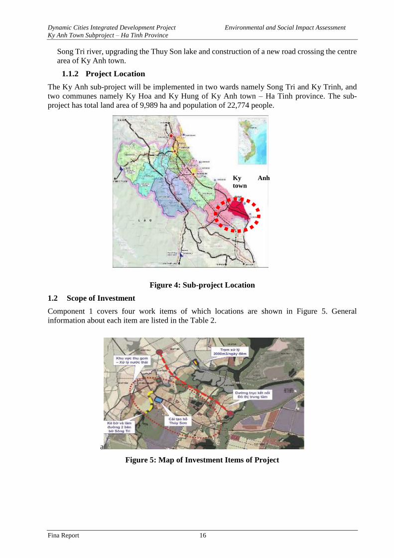
Dynamic Cities Integrated Development Project Environmental and Social Impact Assessment
Ky Anh Town Subproject – Ha Tinh Province
Fina Report 16
Song Tri river, upgrading the Thuy Son lake and construction of a new road crossing the centre
area of Ky Anh town.
1.1.2 Project Location
The Ky Anh sub-project will be implemented in two wards namely Song Tri and Ky Trinh, and
two communes namely Ky Hoa and Ky Hung of Ky Anh town – Ha Tinh province. The sub-
project has total land area of 9,989 ha and population of 22,774 people.
Figure 4: Sub-project Location
1.2 Scope of Investment
Component 1 covers four work items of which locations are shown in Figure 5. General
information about each item are listed in the Table 2.
a
Figure 5: Map of Investment Items of Project
Ky Anh
town
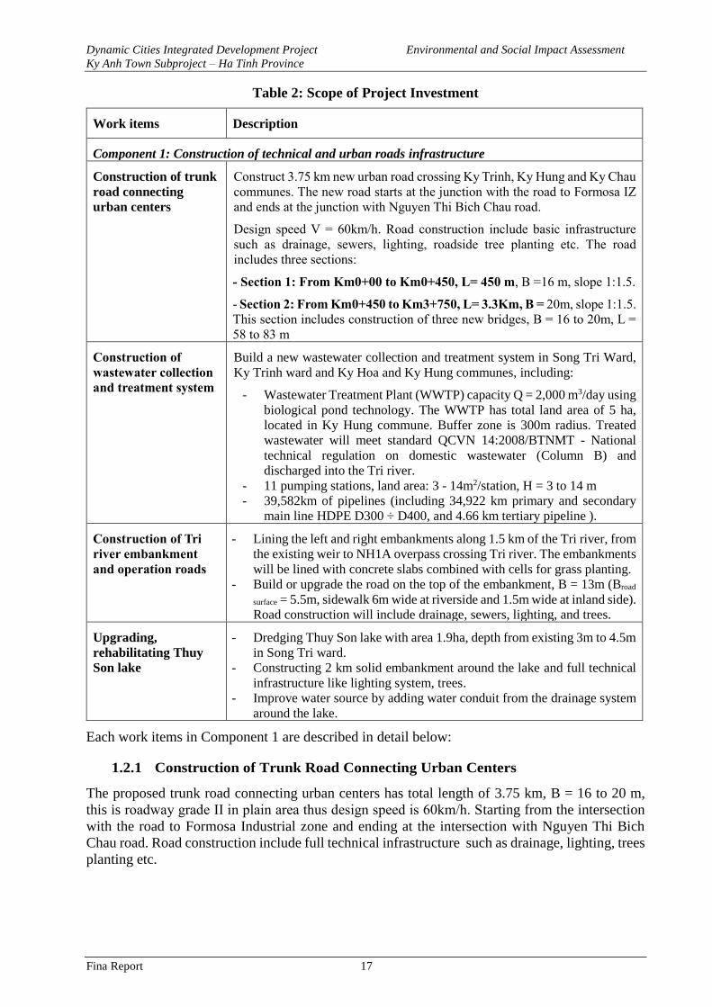
Dynamic Cities Integrated Development Project Environmental and Social Impact Assessment
Ky Anh Town Subproject – Ha Tinh Province
Fina Report 17
Table 2: Scope of Project Investment
Work items Description
Component 1: Construction of technical and urban roads infrastructure
Construction of trunk
road connecting
urban centers
Construct 3.75 km new urban road crossing Ky Trinh, Ky Hung and Ky Chau
communes. The new road starts at the junction with the road to Formosa IZ
and ends at the junction with Nguyen Thi Bich Chau road.
Design speed V = 60km/h. Road construction include basic infrastructure
such as drainage, sewers, lighting, roadside tree planting etc. The road
includes three sections:
- Section 1: From Km0+00 to Km0+450, L= 450 m, B =16 m, slope 1:1.5.
- Section 2: From Km0+450 to Km3+750, L= 3.3Km, B = 20m, slope 1:1.5.
This section includes construction of three new bridges, B = 16 to 20m, L =
58 to 83 m
Construction of
wastewater collection
and treatment system
Build a new wastewater collection and treatment system in Song Tri Ward,
Ky Trinh ward and Ky Hoa and Ky Hung communes, including:
- Wastewater Treatment Plant (WWTP) capacity Q = 2,000 m3/day using
biological pond technology. The WWTP has total land area of 5 ha,
located in Ky Hung commune. Buffer zone is 300m radius. Treated
wastewater will meet standard QCVN 14:2008/BTNMT - National
technical regulation on domestic wastewater (Column B) and
discharged into the Tri river.
- 11 pumping stations, land area: 3 - 14m2/station, H = 3 to 14 m
- 39,582km of pipelines (including 34,922 km primary and secondary
main line HDPE D300 ÷ D400, and 4.66 km tertiary pipeline ).
Construction of Tri
river embankment
and operation roads
- Lining the left and right embankments along 1.5 km of the Tri river, from
the existing weir to NH1A overpass crossing Tri river. The embankments
will be lined with concrete slabs combined with cells for grass planting.
- Build or upgrade the road on the top of the embankment, B = 13m (Broad
surface = 5.5m, sidewalk 6m wide at riverside and 1.5m wide at inland side).
Road construction will include drainage, sewers, lighting, and trees.
Upgrading,
rehabilitating Thuy
Son lake
- Dredging Thuy Son lake with area 1.9ha, depth from existing 3m to 4.5m
in Song Tri ward.
- Constructing 2 km solid embankment around the lake and full technical
infrastructure like lighting system, trees.
- Improve water source by adding water conduit from the drainage system
around the lake.
Each work items in Component 1 are described in detail below:
1.2.1 Construction of Trunk Road Connecting Urban Centers
The proposed trunk road connecting urban centers has total length of 3.75 km, B = 16 to 20 m,
this is roadway grade II in plain area thus design speed is 60km/h. Starting from the intersection
with the road to Formosa Industrial zone and ending at the intersection with Nguyen Thi Bich
Chau road. Road construction include full technical infrastructure such as drainage, lighting, trees
planting etc.
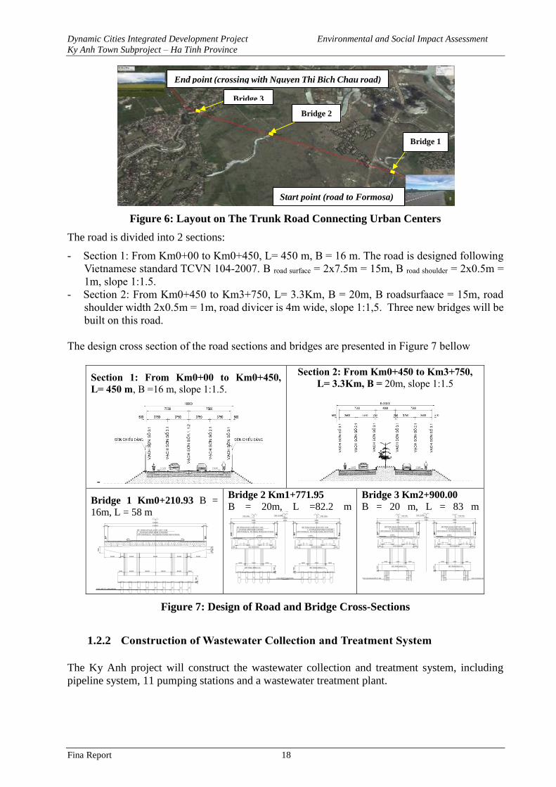
Dynamic Cities Integrated Development Project Environmental and Social Impact Assessment
Ky Anh Town Subproject – Ha Tinh Province
Fina Report 18
Figure 6: Layout on The Trunk Road Connecting Urban Centers
The road is divided into 2 sections:
- Section 1: From Km0+00 to Km0+450, L= 450 m, B = 16 m. The road is designed following
Vietnamese standard TCVN 104-2007. B road surface = 2x7.5m = 15m, B road shoulder = 2x0.5m =
1m, slope 1:1.5.
- Section 2: From Km0+450 to Km3+750, L= 3.3Km, B = 20m, B roadsurfaace = 15m, road
shoulder width 2x0.5m = 1m, road divicer is 4m wide, slope 1:1,5. Three new bridges will be
built on this road.
The design cross section of the road sections and bridges are presented in Figure 7 bellow
Section 1: From Km0+00 to Km0+450,
L= 450 m, B =16 m, slope 1:1.5.
-
Section 2: From Km0+450 to Km3+750,
L= 3.3Km, B = 20m, slope 1:1.5
Bridge 1 Km0+210.93 B =
16m, L = 58 m
Bridge 2 Km1+771.95
B = 20m, L =82.2 m
Bridge 3 Km2+900.00
B = 20 m, L = 83 m
Figure 7: Design of Road and Bridge Cross-Sections
1.2.2 Construction of Wastewater Collection and Treatment System
The Ky Anh project will construct the wastewater collection and treatment system, including
pipeline system, 11 pumping stations and a wastewater treatment plant.
500 15000 500
16000
2%
Bª t«ng nhùa chÆt dµy 7cm
Tíi nhùa dÝnh b¸m 0.5kg/m2
Líp phßng níc d¹ng dung dÞch phun
2%
900 2500 2500 2500 2500 900
2500 500 2500 5000 2500 500 2500
700
80015
00
cäc btct 45x45cm
100
1500
500 7500 500
8500
2.00%
Bª t«ng nhùa chÆt dµy 7cm
Tíi nhùa dÝnh b¸m 0.5kg/m2
Líp phßng níc d¹ng dung dÞch phun
900 3x2100=6300 900
1600 3300 1600
100
15
00bª t«ng ®Öm c10
tim cÇu
3000
MÆt c¾t ngang t¹i trô(1 : 150)
20000
tim tuyÕn
5007500500
8500
2.00%
Bª t«ng nhùa chÆt dµy 7cm
Tíi nhùa dÝnh b¸m 0.5kg/m2
Líp phßng níc d¹ng dung dÞch phun
9003x2100=6300900
160033001600
100
15
00 bª t«ng ®Öm c10
tim cÇu
cäc btct 45x45cm cäc khoan nhåi D1.0m cäc khoan nhåi D1.0m
3000
20000
tim tuyÕn
5007500500
8500
2.00%
Bª t«ng nhùa chÆt dµy 7cm
Tíi nhùa dÝnh b¸m 0.5kg/m2
Líp phßng níc d¹ng dung dÞch phun
9003x2100=6300900
160033001600
100
15
00 bª t«ng ®Öm c10
tim cÇu
5007500500
8500
2.00%
Bª t«ng nhùa chÆt dµy 7cm
Tíi nhùa dÝnh b¸m 0.5kg/m2
Líp phßng níc d¹ng dung dÞch phun
9003x2100=6300900
160033001600
100
15
00 bª t«ng ®Öm c10
tim cÇu
Bridge 1
Bridge 2
Bridge 3
End point (crossing with Nguyen Thi Bich Chau road)
Start point (road to Formosa)
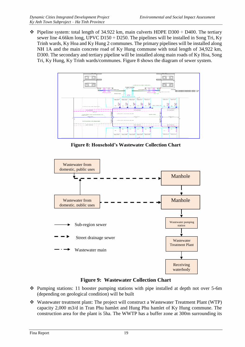
Dynamic Cities Integrated Development Project Environmental and Social Impact Assessment
Ky Anh Town Subproject – Ha Tinh Province
Fina Report 19
❖ Pipeline system: total length of 34.922 km, main culverts HDPE D300 ÷ D400. The tertiary
sewer line 4.66km long, UPVC D150 ÷ D250. The pipelines will be installed in Song Tri, Ky
Trinh wards, Ky Hoa and Ky Hung 2 communes. The primary pipelines will be installed along
NH 1A and the main concrete road of Ky Hung commune with total length of 34,922 km,
D300. The secondary and tertiary pipeline will be installed along main roads of Ky Hoa, Song
Tri, Ky Hung, Ky Trinh wards/communes. Figure 8 shows the diagram of sewer system.
Figure 8: Household’s Wastewater Collection Chart
Figure 9: Wastewater Collection Chart
❖ Pumping stations: 11 booster pumping stations with pipe installed at depth not over 5-6m
(depending on geological condition) will be built
❖ Wastewater treatment plant: The project will construct a Wastewater Treatment Plant (WTP)
capacity 2,000 m3/d in Tran Phu hamlet and Hung Phu hamlet of Ky Hung commune. The
construction area for the plant is 5ha. The WWTP has a buffer zone at 300m surrounding its
Wastewater from
domestic, public uses
Manhole
Wastewater
Treatment Plant
Sub-region sewer
Street drainage sewer
Wastewater main
Wastewater pumping
station
Wastewater from
domestic, public uses Manhole
Receiving
waterbody
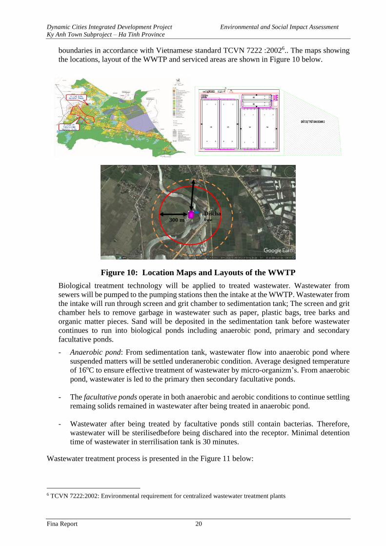
Dynamic Cities Integrated Development Project Environmental and Social Impact Assessment
Ky Anh Town Subproject – Ha Tinh Province
Fina Report 20
boundaries in accordance with Vietnamese standard TCVN 7222 :20026.. The maps showing
the locations, layout of the WWTP and serviced areas are shown in Figure 10 below.
Figure 10: Location Maps and Layouts of the WWTP
Biological treatment technology will be applied to treated wastewater. Wastewater from
sewers will be pumped to the pumping stations then the intake at the WWTP. Wastewater from
the intake will run through screen and grit chamber to sedimentation tank; The screen and grit
chamber hels to remove garbage in wastewater such as paper, plastic bags, tree barks and
organic matter pieces. Sand will be deposited in the sedimentation tank before wastewater
continues to run into biological ponds including anaerobic pond, primary and secondary
facultative ponds.
- Anaerobic pond: From sedimentation tank, wastewater flow into anaerobic pond where
suspended matters will be settled underanerobic condition. Average designed temperature
of 16oC to ensure effective treatment of wastewater by micro-organizm’s. From anaerobic
pond, wastewater is led to the primary then secondary facultative ponds.
- The facultative ponds operate in both anaerobic and aerobic conditions to continue settling
remaing solids remained in wastewater after being treated in anaerobic pond.
- Wastewater after being treated by facultative ponds still contain bacterias. Therefore,
wastewater will be sterilisedbefore being dischared into the receptor. Minimal detention
time of wastewater in sterrilisation tank is 30 minutes.
Wastewater treatment process is presented in the Figure 11 below:
6 TCVN 7222:2002: Environmental requirement for centralized wastewater treatment plants
300 m Discha
rge
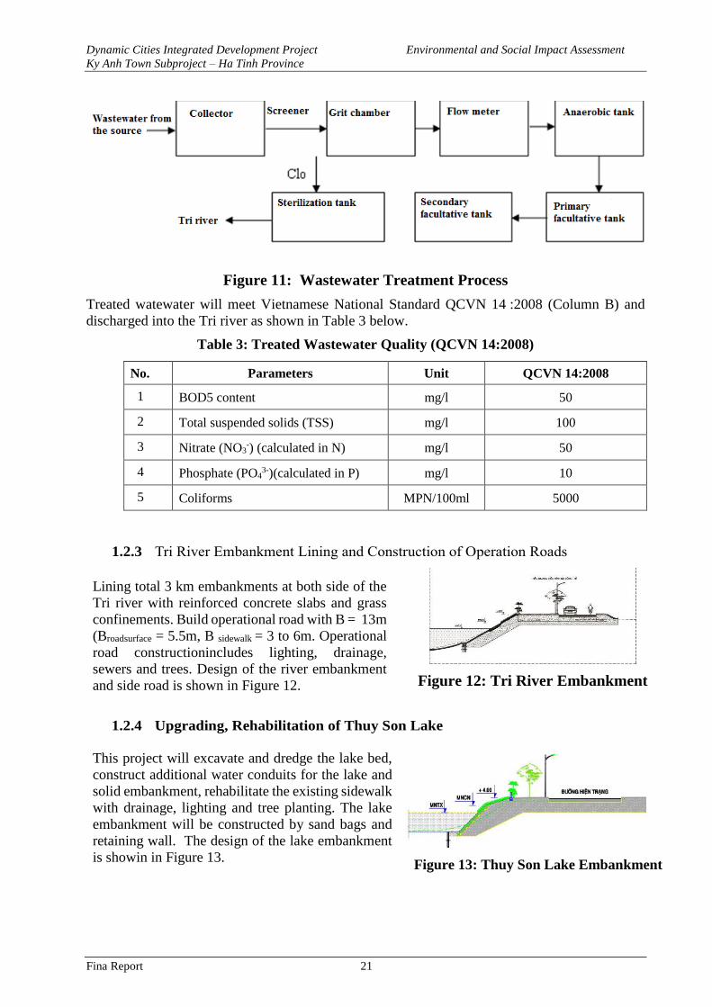
Dynamic Cities Integrated Development Project Environmental and Social Impact Assessment
Ky Anh Town Subproject – Ha Tinh Province
Fina Report 21
Figure 11: Wastewater Treatment Process
Treated watewater will meet Vietnamese National Standard QCVN 14 :2008 (Column B) and
discharged into the Tri river as shown in Table 3 below.
Table 3: Treated Wastewater Quality (QCVN 14:2008)
No. Parameters Unit QCVN 14:2008
1 BOD5 content mg/l 50
2 Total suspended solids (TSS) mg/l 100
3 Nitrate (NO3-) (calculated in N) mg/l 50
4 Phosphate (PO43-)(calculated in P) mg/l 10
5 Coliforms MPN/100ml 5000
1.2.3 Tri River Embankment Lining and Construction of Operation Roads
Lining total 3 km embankments at both side of the
Tri river with reinforced concrete slabs and grass
confinements. Build operational road with B = 13m
(Broadsurface = 5.5m, B sidewalk = 3 to 6m. Operational
road constructionincludes lighting, drainage,
sewers and trees. Design of the river embankment
and side road is shown in Figure 12.
Figure 12: Tri River Embankment
1.2.4 Upgrading, Rehabilitation of Thuy Son Lake
This project will excavate and dredge the lake bed,
construct additional water conduits for the lake and
solid embankment, rehabilitate the existing sidewalk
with drainage, lighting and tree planting. The lake
embankment will be constructed by sand bags and
retaining wall. The design of the lake embankment
is showin in Figure 13.
Figure 13: Thuy Son Lake Embankment
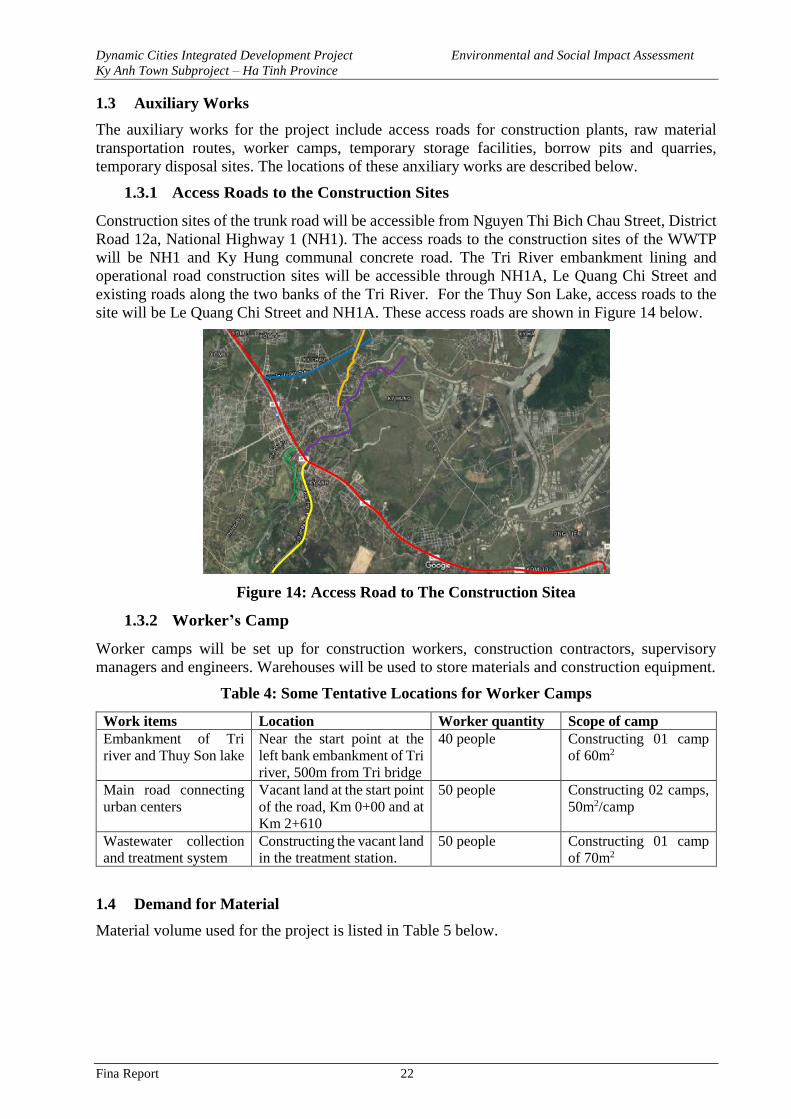
Dynamic Cities Integrated Development Project Environmental and Social Impact Assessment
Ky Anh Town Subproject – Ha Tinh Province
Fina Report 22
1.3 Auxiliary Works
The auxiliary works for the project include access roads for construction plants, raw material
transportation routes, worker camps, temporary storage facilities, borrow pits and quarries,
temporary disposal sites. The locations of these anxiliary works are described below.
1.3.1 Access Roads to the Construction Sites
Construction sites of the trunk road will be accessible from Nguyen Thi Bich Chau Street, District
Road 12a, National Highway 1 (NH1). The access roads to the construction sites of the WWTP
will be NH1 and Ky Hung communal concrete road. The Tri River embankment lining and
operational road construction sites will be accessible through NH1A, Le Quang Chi Street and
existing roads along the two banks of the Tri River. For the Thuy Son Lake, access roads to the
site will be Le Quang Chi Street and NH1A. These access roads are shown in Figure 14 below.
Figure 14: Access Road to The Construction Sitea
1.3.2 Worker’s Camp
Worker camps will be set up for construction workers, construction contractors, supervisory
managers and engineers. Warehouses will be used to store materials and construction equipment.
Table 4: Some Tentative Locations for Worker Camps
Work items Location Worker quantity Scope of camp
Embankment of Tri
river and Thuy Son lake
Near the start point at the
left bank embankment of Tri
river, 500m from Tri bridge
40 people Constructing 01 camp
of 60m2
Main road connecting
urban centers
Vacant land at the start point
of the road, Km 0+00 and at
Km 2+610
50 people Constructing 02 camps,
50m2/camp
Wastewater collection
and treatment system
Constructing the vacant land
in the treatment station.
50 people Constructing 01 camp
of 70m2
1.4 Demand for Material
Material volume used for the project is listed in Table 5 below.
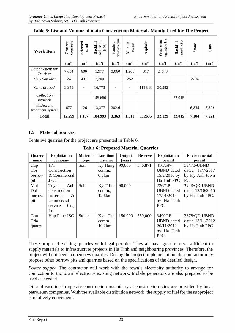
Dynamic Cities Integrated Development Project Environmental and Social Impact Assessment
Ky Anh Town Subproject – Ha Tinh Province
Fina Report 23
Table 5: List and Volume of main Construction Materials Mainly Used for The Project
Work Item
Cem
ent
con
crete
Sel
ecte
d
san
d
Ba
ckfi
ll
soil
K9
5,
K9
8
Stan
dard
crus
hed
sto
ne
Mo
rta
r
sto
ne
Asp
ha
lt
Cru
sh s
ton
e
aggr
egat
e 1,
2
Ba
ckfi
ll
san
d k
95
Sto
ne
Cla
y
(m3) (m3) (m3) (m3) (m3) (m3) (m3) (m3) (m3) (m3)
Embankment for
Tri river 7,654 600 1,977 3,060 1,260 817 2, 848
Thuy Son lake 24 431 7,200 - 252 - - 2704
Central road 3,945 - 16,773 - - 111,818 30,282
Collection
network 145,666 22,015
Wastewater
treatment system 677 126 13,377 302.6 6,835 7,521
Total 12,299 1,157 184,993 3,363 1,512 112635 32,129 22,015 7,104 7,521
1.5 Material Sources
Tentative quarries for the project are presented in Table 6.
Table 6: Proposed Material Quarries
Quarry
name
Exploitation
company
Material
type
Location/
distance
Output
(year)
Reserve Exploitation
permit
Environmental
permit
Cup
Coi
borrow
pit
171
Construction
& Commercial
JSC
Soil Ky Hung
comm.,
6.5km
99,000 346,871 416/GP-
UBND dated
15/2/2016 by
Ha Tinh PPC
39/TB-UBND
dated 13/7/2017
by Ky Anh town
PC
Mui
Doi
borrow
pit
Tuyet Anh
construction
material &
commercial
service Co.,
Ltd
Soil Ky Trinh
comm.,
12.6km
98,000 226/GP-
UBND dated
17/01/2014
by Ha Tinh
PPC
3948/QĐ-UBND
dated 12/10/2015
by Ha Tinh PPC.
Con
Tria
quarry
Hop Phuc JSC Stone Ky Tan
comm.,
10.2km
150,000 750,000 3490GP-
UBND dated
26/11/2012
by Ha Tinh
PPC
3378/QD-UBND
dated 13/11/2012
by Ha Tinh PPC
These proposed existing quarries with legal permits. They all have great reserve sufficient to
supply materials to infrastructure projects in Ha Tinh and neighbouring provinces. Therefore, the
project will not need to open new quarries. During the project implementation, the contractor may
propose other borrow pits and quarries based on the specifications of the detailed design.
Power supply: The contractor will work with the town’s electricity authority to arrange for
connection to the town’ electricity existing network. Mobile generators are also prepared to be
used as needed.
Oil and gasoline to operate construction machinery at construction sites are provided by local
petroleum companies. With the available distribution network, the supply of fuel for the subproject
is relatively convenient.
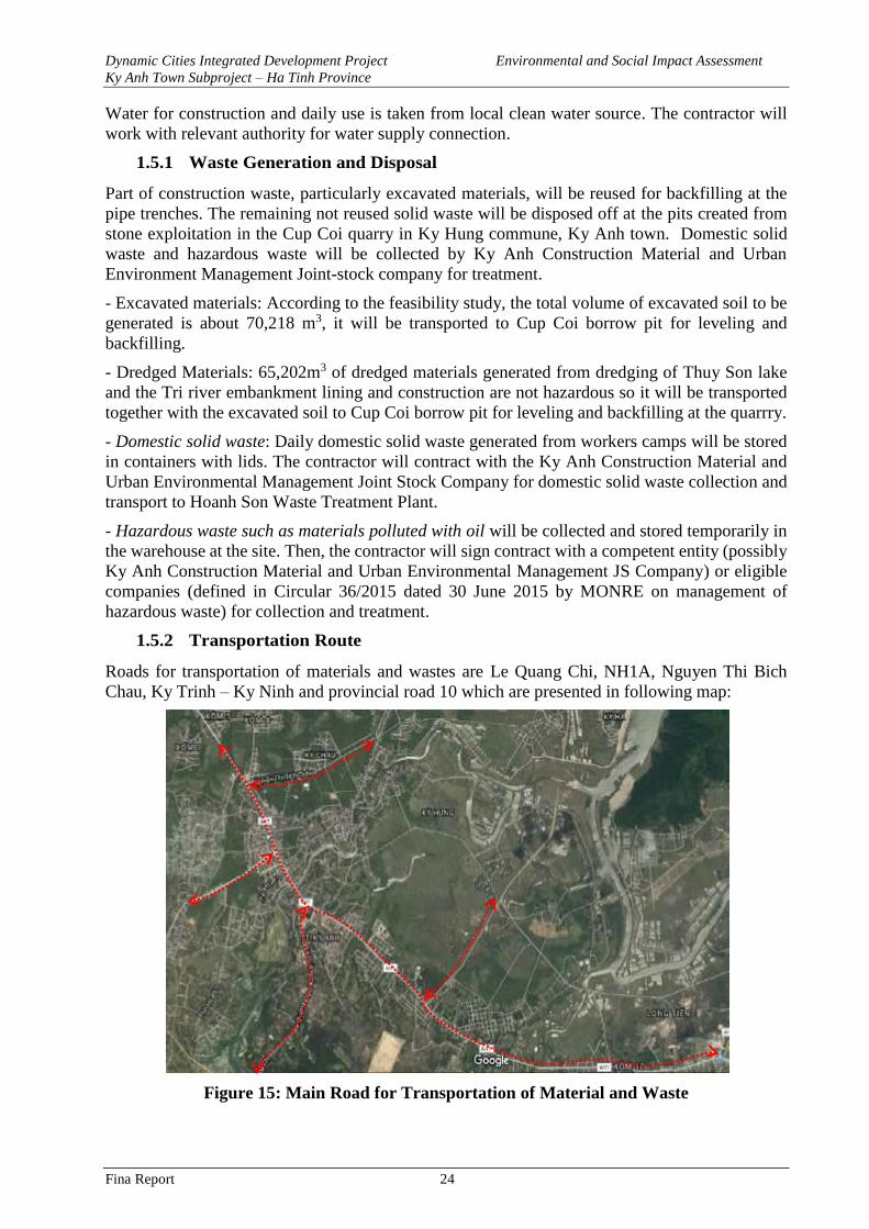
Dynamic Cities Integrated Development Project Environmental and Social Impact Assessment
Ky Anh Town Subproject – Ha Tinh Province
Fina Report 24
Water for construction and daily use is taken from local clean water source. The contractor will
work with relevant authority for water supply connection.
1.5.1 Waste Generation and Disposal
Part of construction waste, particularly excavated materials, will be reused for backfilling at the
pipe trenches. The remaining not reused solid waste will be disposed off at the pits created from
stone exploitation in the Cup Coi quarry in Ky Hung commune, Ky Anh town. Domestic solid
waste and hazardous waste will be collected by Ky Anh Construction Material and Urban
Environment Management Joint-stock company for treatment.
- Excavated materials: According to the feasibility study, the total volume of excavated soil to be
generated is about 70,218 m3, it will be transported to Cup Coi borrow pit for leveling and
backfilling.
- Dredged Materials: 65,202m3 of dredged materials generated from dredging of Thuy Son lake
and the Tri river embankment lining and construction are not hazardous so it will be transported
together with the excavated soil to Cup Coi borrow pit for leveling and backfilling at the quarrry.
- Domestic solid waste: Daily domestic solid waste generated from workers camps will be stored
in containers with lids. The contractor will contract with the Ky Anh Construction Material and
Urban Environmental Management Joint Stock Company for domestic solid waste collection and
transport to Hoanh Son Waste Treatment Plant.
- Hazardous waste such as materials polluted with oil will be collected and stored temporarily in
the warehouse at the site. Then, the contractor will sign contract with a competent entity (possibly
Ky Anh Construction Material and Urban Environmental Management JS Company) or eligible
companies (defined in Circular 36/2015 dated 30 June 2015 by MONRE on management of
hazardous waste) for collection and treatment.
1.5.2 Transportation Route
Roads for transportation of materials and wastes are Le Quang Chi, NH1A, Nguyen Thi Bich
Chau, Ky Trinh – Ky Ninh and provincial road 10 which are presented in following map:
Figure 15: Main Road for Transportation of Material and Waste
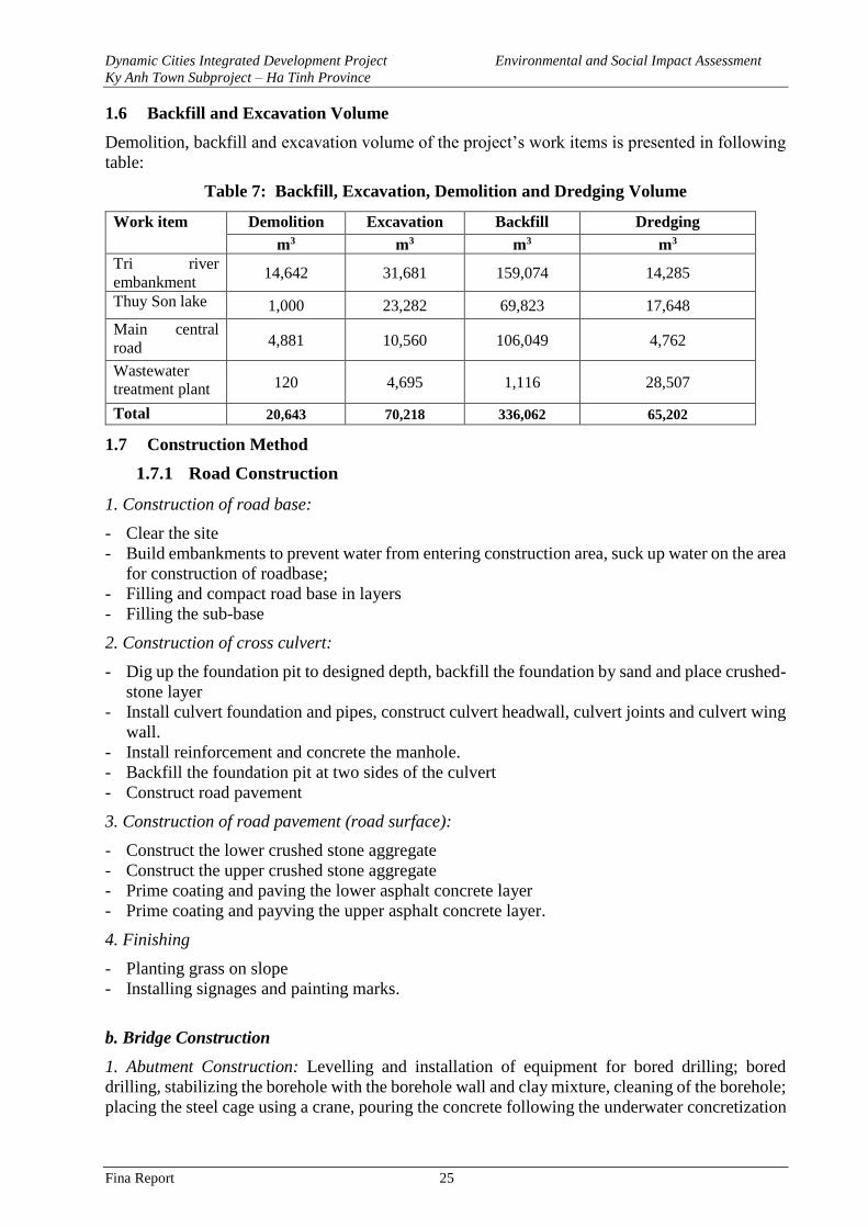
Dynamic Cities Integrated Development Project Environmental and Social Impact Assessment
Ky Anh Town Subproject – Ha Tinh Province
Fina Report 25
1.6 Backfill and Excavation Volume
Demolition, backfill and excavation volume of the project’s work items is presented in following
table:
Table 7: Backfill, Excavation, Demolition and Dredging Volume
Work item Demolition Excavation Backfill Dredging
m3 m3 m3 m3
Tri river
embankment 14,642 31,681 159,074 14,285
Thuy Son lake 1,000 23,282 69,823 17,648
Main central
road 4,881 10,560 106,049 4,762
Wastewater
treatment plant 120 4,695 1,116 28,507
Total 20,643 70,218 336,062 65,202
1.7 Construction Method
1.7.1 Road Construction
1. Construction of road base:
- Clear the site
- Build embankments to prevent water from entering construction area, suck up water on the area
for construction of roadbase;
- Filling and compact road base in layers
- Filling the sub-base
2. Construction of cross culvert:
- Dig up the foundation pit to designed depth, backfill the foundation by sand and place crushed-
stone layer
- Install culvert foundation and pipes, construct culvert headwall, culvert joints and culvert wing
wall.
- Install reinforcement and concrete the manhole.
- Backfill the foundation pit at two sides of the culvert
- Construct road pavement
3. Construction of road pavement (road surface):
- Construct the lower crushed stone aggregate
- Construct the upper crushed stone aggregate
- Prime coating and paving the lower asphalt concrete layer
- Prime coating and payving the upper asphalt concrete layer.
4. Finishing
- Planting grass on slope
- Installing signages and painting marks.
b. Bridge Construction
1. Abutment Construction: Levelling and installation of equipment for bored drilling; bored
drilling, stabilizing the borehole with the borehole wall and clay mixture, cleaning of the borehole;
placing the steel cage using a crane, pouring the concrete following the underwater concretization
Dynamic Cities Integrated Development Project Environmental and Social Impact Assessment
Ky Anh Town Subproject – Ha Tinh Province
Fina Report 26
method. Excavating soils for the abutment foundation to the designed depth, constructing a pile
base, pouring and flatting the concrete base, placing the frame, steel foundation. Install scaffolding
and steel cage for the abutment wall, wingwall, pouring concrete, removing the falsework structure
and completing the abutment.
- Terrestrial abutment: (1) For abutment with foundation on bored piles, the construction
method is: levelling and installation of equipment for bored pile drilling, bored drilling, stabilizing
the borehole with the borehole wall and clay mixture, cleaning the borehole, placing the steel cage
using crane, pouring the concrete following the underwater concretization method. Excavating
soils for the abutment foundation to the designed depth, constructing a pile base, pouring and
flatting the concrete base, placing the frame, reinforcing steel, filling soil material to the top layer
of the pier foundation. Placing falsework, steel structure for the pile’s body and crosshead. Filling
soil materials up to the natural ground level and completing the pile. (2) For the piers that have
foundation reinforced concrete piles: levelling and identifying the center point of the pier and the
pile locations, installing the pile driving machine and driving the piles to the design depth.
Excavating soil for pier foot to the designed depth, concretizing the bottom base, flatting the
concrete base, placing the falsework, steel bars, pouring concrete, filling soils up to the pier’s foot
top. Installing falsework and steel structure for the pier’s body and the pier crosshead. Pouring the
concrete, removing the falsework, filling soils up to the ground level and completing the abutment.
- Underwater abutment: (1) Abutment with foundation on bored piles: installing pile drilling
machine on floating system or temporary platform. Bored drilling, stabilizing the borehole with
the borehole wall and clay mixture, cleaning of the borehole, placing the steel cage using a crane,
pouring the concrete following the underwater concretization method. Installing a cofferdam for
piles, pouring concrete to seal the bottom, pumping water out of the foot hole, treating the pipe
tips, pouring concrete for a platform to place falsework, steel bars and concrete casting. Installing
a falsework, steel bar column, concrete pouring, removing the falsework. Washing out/cleaning
riverbed and completing the abutment. (2) Abutment on reinforced concrete piles, identifying the
center point of the abutment and the pile locations, installing the equipment on a floating system
or a platform, driving the piles to the designed depth. Constructing a coffer dam, excavating soils
within the cofferdam, pouring concrete to seal the bottom, pumping water out, treating the pile
tips, pouring concrete and flatting out the concrete, placing the falsework, steel bars for the
abutment foundation, pouring the concrete. Installing falsework and steel bar columns, pouring
concrete, removing the falsework, cleaning the riverbed and completing abutment.
2. Superstructure construction: Preparing a beam fabrication site, mobilizing materials and
machineries, constructing falsework, installing steel bars for beams and pre-stressed cable and
falsework. Pouring concrete, carrying beams to the construction site, placing them in identified
location by cranes or specialized equipment. Constructing the deck slabs and concrete girders.
Constructing the waterproof layer for the deck, surfacing the asphalt and completing the bridge
construction.
1.7.2 Construction of Tri River Embankment
• Construction method for the concrete pallets and dredging of the riverbed:
Construction the embankment in sections:
- Install sheet piles around the riverbank in sections from 100-150m for construction.
- Suck up the water in the construction section and pump out to outside area.
- Dredge the sludge and mud in the riverbed section and excavate organic soil within the
embanked area.
- Construct the base and embankment structure.
Dynamic Cities Integrated Development Project Environmental and Social Impact Assessment
Ky Anh Town Subproject – Ha Tinh Province
Fina Report 27
- After finishing, remove the sheet piles concurrently with placement of stone cages and
anchoring the embankment foot.
- The river embankment is constructed in sections until finishing the whole embankment line.
• Steps of embankment construction:
- Excavate foundation pite and install the bamboo piles with density of 25 piles/m2.
- Install stone cages as designed, connect edge-to-edge all cages with each other before putting
stones into the cages.
- Construct the embankment foot.
- Construct embankment as designed.
- Construct the graded filter and install drainage pipeline.
1.7.3 Thuy Son Lake
Dredging of Lakebed
- Lake water will be completed sucked up to discharge to the drainage sysem on NH1A. Use
bulldozer and excavator to dredge the lake bed to designed depth.
- Excavated soil and dredged materials will be transported by vehicles which are covered to
prevent materials from scattering and falling on the way to the approved disposal site.
Construction of Lake Embankment
• Steps for embankment construction:
- Use the pump to suck up the foundation pit, ensure foundation pit stabilization and dryness
during the embankment construction.
- Excavate the foundation pit and install sheep piles with density of 25 piles/m2.
- Install stone cages as designed, connect edge-to-edge all cages with each other before putting
stones into the cages.
- Construct the embankment foot.
- Construct embankment stem structure and sidewalk.
- Construct embankment’s crest structure
1.7.4 Wastewater Treatment System
a. Construction of booster pumping station
- Site preparation: Clear the site, positioning the alignment for each designed section, identifying
sewer’s centreline and mark all designed depths.
- Excavation of foundation pit: Use the excavator to excavate foundation pit along the positioned
alignment until nearly achieving designed depth then workers will manually dig up to designed
depth and finish the foundation pit.
- Construction of sand layer and lining concrete: Pour the sand to the foundation pit and flatten
the sand layer in thickness of 20cm, water the sand and compact. Then, pour the concrete for
foundation lining, flatten the concrete and compact.
- Steel reinforcement: Steel reinforcement is installed precisely at designed distance, connect
steel bars with each other. Steel length follows the design.
- Installation of falsework: Use the steel moulds and install the mould as designed. Anchor the
falsework by steel bars and bolts to ensure stabilization during the concrete casting process.
- Concrete casting: Concrete has to meet designed strength and is checked by slump tester. Free
fall height of the concrete mixture is not over 1.5m to avoid segregation. Concrete is poured
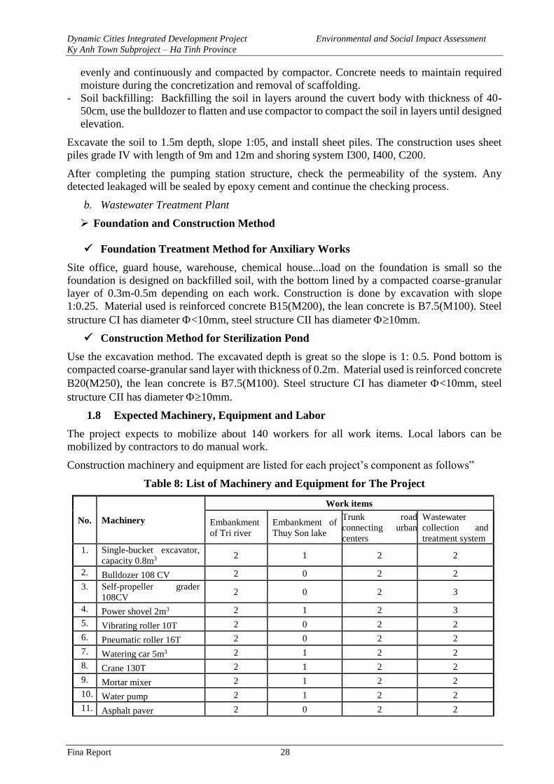
Dynamic Cities Integrated Development Project Environmental and Social Impact Assessment
Ky Anh Town Subproject – Ha Tinh Province
Fina Report 28
evenly and continuously and compacted by compactor. Concrete needs to maintain required
moisture during the concretization and removal of scaffolding.
- Soil backfilling: Backfilling the soil in layers around the cuvert body with thickness of 40-
50cm, use the bulldozer to flatten and use compactor to compact the soil in layers until designed
elevation.
Excavate the soil to 1.5m depth, slope 1:05, and install sheet piles. The construction uses sheet
piles grade IV with length of 9m and 12m and shoring system I300, I400, C200.
After completing the pumping station structure, check the permeability of the system. Any
detected leakaged will be sealed by epoxy cement and continue the checking process.
b. Wastewater Treatment Plant
➢ Foundation and Construction Method
✓ Foundation Treatment Method for Anxiliary Works
Site office, guard house, warehouse, chemical house...load on the foundation is small so the
foundation is designed on backfilled soil, with the bottom lined by a compacted coarse-granular
layer of 0.3m-0.5m depending on each work. Construction is done by excavation with slope
1:0.25. Material used is reinforced concrete B15(M200), the lean concrete is B7.5(M100). Steel
structure CI has diameter <10mm, steel structure CII has diameter 10mm.
✓ Construction Method for Sterilization Pond
Use the excavation method. The excavated depth is great so the slope is 1: 0.5. Pond bottom is
compacted coarse-granular sand layer with thickness of 0.2m. Material used is reinforced concrete
B20(M250), the lean concrete is B7.5(M100). Steel structure CI has diameter <10mm, steel
structure CII has diameter 10mm.
1.8 Expected Machinery, Equipment and Labor
The project expects to mobilize about 140 workers for all work items. Local labors can be
mobilized by contractors to do manual work.
Construction machinery and equipment are listed for each project’s component as follows”
Table 8: List of Machinery and Equipment for The Project
No. Machinery
Work items
Embankment
of Tri river
Embankment of
Thuy Son lake
Trunk road
connecting urban
centers
Wastewater
collection and
treatment system
1. Single-bucket excavator,
capacity 0.8m3 2 1 2 2
2. Bulldozer 108 CV 2 0 2 2
3. Self-propeller grader
108CV 2 0 2 3
4. Power shovel 2m3 2 1 2 3
5. Vibrating roller 10T 2 0 2 2
6. Pneumatic roller 16T 2 0 2 2
7. Watering car 5m3 2 1 2 2
8. Crane 130T 2 1 2 2
9. Mortar mixer 2 1 2 2
10. Water pump 2 1 2 2
11. Asphalt paver 2 0 2 2
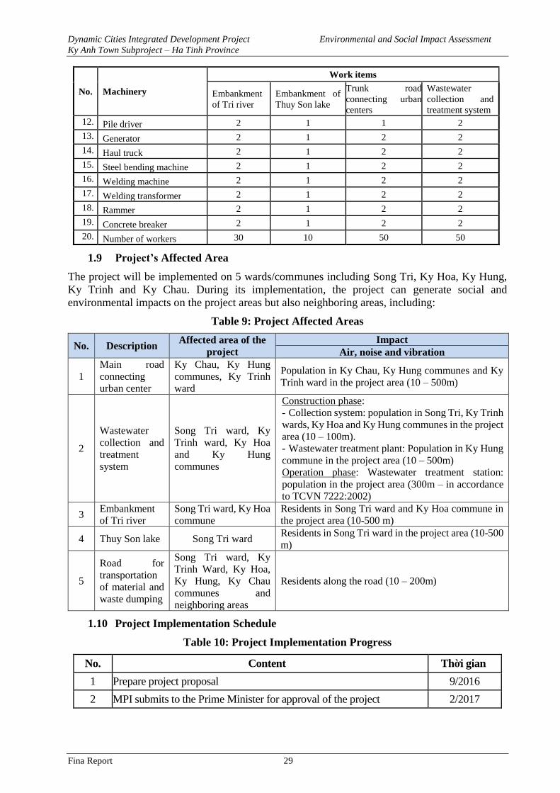
Dynamic Cities Integrated Development Project Environmental and Social Impact Assessment
Ky Anh Town Subproject – Ha Tinh Province
Fina Report 29
No. Machinery
Work items
Embankment
of Tri river
Embankment of
Thuy Son lake
Trunk road
connecting urban
centers
Wastewater
collection and
treatment system
12. Pile driver 2 1 1 2
13. Generator 2 1 2 2
14. Haul truck 2 1 2 2
15. Steel bending machine 2 1 2 2
16. Welding machine 2 1 2 2
17. Welding transformer 2 1 2 2
18. Rammer 2 1 2 2
19. Concrete breaker 2 1 2 2
20. Number of workers 30 10 50 50
1.9 Project’s Affected Area
The project will be implemented on 5 wards/communes including Song Tri, Ky Hoa, Ky Hung,
Ky Trinh and Ky Chau. During its implementation, the project can generate social and
environmental impacts on the project areas but also neighboring areas, including:
Table 9: Project Affected Areas
No. Description Affected area of the
project
Impact
Air, noise and vibration
1
Main road
connecting
urban center
Ky Chau, Ky Hung
communes, Ky Trinh
ward
Population in Ky Chau, Ky Hung communes and Ky
Trinh ward in the project area (10 – 500m)
2
Wastewater
collection and
treatment
system
Song Tri ward, Ky
Trinh ward, Ky Hoa
and Ky Hung
communes
Construction phase:
- Collection system: population in Song Tri, Ky Trinh
wards, Ky Hoa and Ky Hung communes in the project
area (10 – 100m).
- Wastewater treatment plant: Population in Ky Hung
commune in the project area (10 – 500m)
Operation phase: Wastewater treatment station:
population in the project area (300m – in accordance
to TCVN 7222:2002)
3 Embankment
of Tri river
Song Tri ward, Ky Hoa
commune
Residents in Song Tri ward and Ky Hoa commune in
the project area (10-500 m)
4 Thuy Son lake Song Tri ward Residents in Song Tri ward in the project area (10-500
m)
5
Road for
transportation
of material and
waste dumping
Song Tri ward, Ky
Trinh Ward, Ky Hoa,
Ky Hung, Ky Chau
communes and
neighboring areas
Residents along the road (10 – 200m)
1.10 Project Implementation Schedule
Table 10: Project Implementation Progress
No. Content Thời gian
1 Prepare project proposal 9/2016
2 MPI submits to the Prime Minister for approval of the project 2/2017
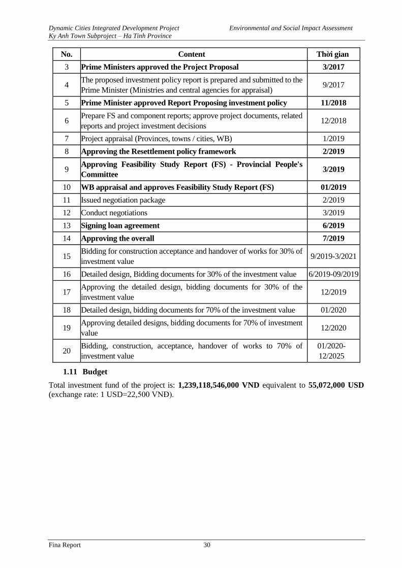
Dynamic Cities Integrated Development Project Environmental and Social Impact Assessment
Ky Anh Town Subproject – Ha Tinh Province
Fina Report 30
No. Content Thời gian
3 Prime Ministers approved the Project Proposal 3/2017
4 The proposed investment policy report is prepared and submitted to the
Prime Minister (Ministries and central agencies for appraisal) 9/2017
5 Prime Minister approved Report Proposing investment policy 11/2018
6 Prepare FS and component reports; approve project documents, related
reports and project investment decisions 12/2018
7 Project appraisal (Provinces, towns / cities, WB) 1/2019
8 Approving the Resettlement policy framework 2/2019
9 Approving Feasibility Study Report (FS) - Provincial People's
Committee 3/2019
10 WB appraisal and approves Feasibility Study Report (FS) 01/2019
11 Issued negotiation package 2/2019
12 Conduct negotiations 3/2019
13 Signing loan agreement 6/2019
14 Approving the overall 7/2019
15 Bidding for construction acceptance and handover of works for 30% of
investment value 9/2019-3/2021
16 Detailed design, Bidding documents for 30% of the investment value 6/2019-09/2019
17 Approving the detailed design, bidding documents for 30% of the
investment value 12/2019
18 Detailed design, bidding documents for 70% of the investment value 01/2020
19 Approving detailed designs, bidding documents for 70% of investment
value 12/2020
20 Bidding, construction, acceptance, handover of works to 70% of
investment value
01/2020-
12/2025
1.11 Budget
Total investment fund of the project is: 1,239,118,546,000 VND equivalent to 55,072,000 USD
(exchange rate: 1 USD=22,500 VNĐ).
Dynamic Cities Integrated Development Project Environmental and Social Impact Assessment
Ky Anh Town Subproject – Ha Tinh Province
Fina Report 31
CHAPTER 2. NATURAL, SOCIAL AND ECONOMIC CONDITIONS
2.1 Physical Condition
2.1.1 Geography
Ha Tinh province is located 340km south of Ha Noi. Ky Anh town is located in the southeast of
Ha Tinh province, at coordinates of 18°07′35″ N, 106°15′27″E. Ky Anh town borders with Ky
Anh district to the northwest and west, with Quang Trach district of Quang Binh province to the
South, with the East Sea to the north, northeast and the east.
Ky Anh town has total land area of 28,222 ha and population of 71,399 people. The town has 12
administrative units, including 6 wards namely Song Tri, Ky Trinh, Ky Thinh, Ky Long, Ky Lien,
Ky Phuong and 6 communes namely Ky Nam, Ky Ninh, Ky Hoa, Ky Ha, Ky Loi, Ky Hung.
2.1.2. Topography
Ky Anh terrain inclines from southwest to northeast, divided into 3 different topological forms:
- High mountain: Abrupt terrain with Hoanh Son mountain from 700m - 900m high, and series
of narrow and fragmented valleys with natural altitude from 65.5m – 235.5m at the mountain
foot.
- Midland area: Belongs to basin of Tri river and Quyen river with sloping terrain from Southwest
to Northeast, separated by rivers, streams and small watersheds with natural altitude from
12.4m – 47.5m. This area is suitable for construction of small reservoirs and structures.
- The coastal plain: with natural elevation from -0.9 to 8.5m. Areas along estuaries of Cua Khau
river, Vinh river and Quyen river are wetland area with elevation from -0.3m to 0.95m. This is
the largest cultivated area of the town, surrounded by system of sea dikes and river dikes of Ky
Trinh, Ky Long, Ky Phuong, Ky Loi and Ky Thinh communes. This area is at high risk of
saline intrusion, frequently lacking fresh water in dry season.
- The coastal dunes: with natural elevation from 2.5 to 10.0m and some high mountains like Do
mountain, Cao Vong mountain, Bo Can mountain and Con Tre mountains be varying from
32.5m to 415.7m high and a long sand dune spreading to the southeast with elevation from
3.5m to 20.2m.
2.1.3 Geology
2.1.3.1 Geotechnology
Surveyed results on geotechnical at Vung Ang seaport near the project area show that the area
includes three main stratums with main material of fine sand, coarse granular sand and dark grey
clay sand. Bearing capacity of the soil R is from less than 1 kg/cm2 to 3.5 kg/cm2.
Geological condition at coastal area, wet-land and low-lying area as follows:
- Rich soil layer: thickness of 0.5-1.0m. Sandy soil with bearing capacity < 1.0kg/cm2
- Clay soil and gravel soil mixed with botanical and animal decomposed matters, bearing
capacity 1 1.5kg/cm2
- Sandy soil and sand layer: load bearing capacity > 1.5kg/cm2. Pond and lake area: with sludge
layer of 0.5 1.0m thick and even > 1.5 m. Low load bearing capacity – When constructing the
structure, it is required to excavate all the sludge layer then commencing the leveling and
backfilling to ensure safety for the structure foundation.
Dynamic Cities Integrated Development Project Environmental and Social Impact Assessment
Ky Anh Town Subproject – Ha Tinh Province
Fina Report 32
2.1.3.2 Hydrogeology
Groundwater table in coastal are is high, at 0.5m 1.0m from ground surface. Groundwater is
saline not suitable for domestic use.
2.1.4 Climate
Ky Anh town is located in the southern region of Ha Tinh province where climate regime is highly
variable with frequent natural hazards such as flood and storms. This narrow plain area has high
rainfall, usually affected by floods and get many difficulties in controlling or minimizing
inundation.
Rainfall: Rainfall increases from plain to mountainous area, making the plain area in the region
suffering various floods from upstream area. Rainy season starts from July to November annually.
Average annual rainfall is 2,513 mm, and the highest annual precipitation is 3,000mm. Average
number of rainy days in a year is 165 days. Maximum average rainfall in a day is 519.1mm.
Storm: On average, each year there is 1-7 hurricanes hitting the coast, storms cause torrential
rains, especially in the upstream of the river causing floods in the eastern coastal and river plains.
The maximum wind speed during storm is V = 48m/s (Once in 50 years). The storms cause many
damages and loss for people and property, washing away crops, houses, especially the storm in
the year 2007 which caused flood and loss for many properties and houses in the region. On 12 –
15/9/2017, the storm No. 10 crashed to Ky Anhtown with 11-level wind causing loss up to
1.197,03 billion dongs and 9 injured people.
Wind: There are two wind regimes in the region typically for the two seasons. In the summer, the
southwesterly and southeasterly wind dominates, and dry and hot “Laos” wind blows in May
(Southwesterly wind) causing high evaporation, lead to drought and shortage of freshwater for
domestic use, agricultural and fishery production. In the Winter, the northeasterly wind dominates.
Average wind speed is 2.3m/s, maximum wind speed is 48m/s.
Temperature: Average temperature 23.8oC. The hottest month is June with average temperature
at 32.9oC.
Moisture: Annual average moisture 86%.
Sunshine: Total sunny hours in a year 1,536 hours.
Evaporation: On average per year 1,034 mm
2.1.5 Hydrology
Hydrology:
Ky Anh town is affected by the hydrological regime of Tri river and Quyen river. Maximum tidal
level at the estuary of Quyen river on average is 1.77m, frequency 10 %= 2.22m, frequency 5 %=
2,416m.
- The Tri river is derived from the mountain in the west of Ky Hoa commune, in the Northwest
of Ky Anh commune and flows from the Northwest - Southeast into the Quyen river at Hai Nam
estuary, with length of 26km, the basin area of 57km2. According to the data of the Irrigation
division - Department of Agriculture and Rural development, the storm No.5 in the year 2007
flooded National Highway 1A in the northern region of Tri river’s bridge from 0.3m 0,6m, the
first time in 30 years.
- The Quyen river is Derived from the hills at 300m elevation in Dinh village, flowing from
southwest to northeast, entering the sea at Vung Ang. Catchment area F = 216Km2, river length
L = 34km, basin slope i = 13.1 %. Density of 1.26 km/km2, meandering coefficient of 3.16. The
river's major tributaries are canals of Lau, Tau Voi, Thau Dau, Luy and Nuoc Man.
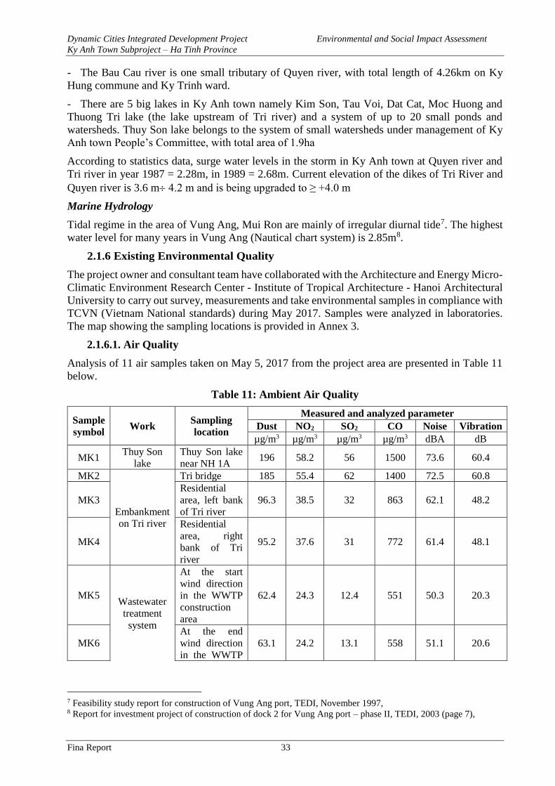
Dynamic Cities Integrated Development Project Environmental and Social Impact Assessment
Ky Anh Town Subproject – Ha Tinh Province
Fina Report 33
- The Bau Cau river is one small tributary of Quyen river, with total length of 4.26km on Ky
Hung commune and Ky Trinh ward.
- There are 5 big lakes in Ky Anh town namely Kim Son, Tau Voi, Dat Cat, Moc Huong and
Thuong Tri lake (the lake upstream of Tri river) and a system of up to 20 small ponds and
watersheds. Thuy Son lake belongs to the system of small watersheds under management of Ky
Anh town People’s Committee, with total area of 1.9ha
According to statistics data, surge water levels in the storm in Ky Anh town at Quyen river and
Tri river in year 1987 = 2.28m, in 1989 = 2.68m. Current elevation of the dikes of Tri River and
Quyen river is 3.6 m 4.2 m and is being upgraded to ≥ +4.0 m
Marine Hydrology
Tidal regime in the area of Vung Ang, Mui Ron are mainly of irregular diurnal tide7. The highest
water level for many years in Vung Ang (Nautical chart system) is 2.85m8.
2.1.6 Existing Environmental Quality
The project owner and consultant team have collaborated with the Architecture and Energy Micro-
Climatic Environment Research Center - Institute of Tropical Architecture - Hanoi Architectural
University to carry out survey, measurements and take environmental samples in compliance with
TCVN (Vietnam National standards) during May 2017. Samples were analyzed in laboratories.
The map showing the sampling locations is provided in Annex 3.
2.1.6.1. Air Quality
Analysis of 11 air samples taken on May 5, 2017 from the project area are presented in Table 11
below.
Table 11: Ambient Air Quality
Sample
symbol Work
Sampling
location
Measured and analyzed parameter
Dust NO2 SO2 CO Noise Vibration
µg/m3 µg/m3 µg/m3 µg/m3 dBA dB
MK1 Thuy Son
lake
Thuy Son lake
near NH 1A 196 58.2 56 1500 73.6 60.4
MK2
Embankment
on Tri river
Tri bridge 185 55.4 62 1400 72.5 60.8
MK3
Residential
area, left bank
of Tri river
96.3 38.5 32 863 62.1 48.2
MK4
Residential
area, right
bank of Tri
river
95.2 37.6 31 772 61.4 48.1
MK5 Wastewater
treatment
system
At the start
wind direction
in the WWTP
construction
area
62.4 24.3 12.4 551 50.3 20.3
MK6
At the end
wind direction
in the WWTP
63.1 24.2 13.1 558 51.1 20.6
7 Feasibility study report for construction of Vung Ang port, TEDI, November 1997, 8 Report for investment project of construction of dock 2 for Vung Ang port – phase II, TEDI, 2003 (page 7),
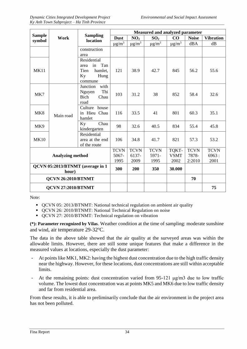
Dynamic Cities Integrated Development Project Environmental and Social Impact Assessment
Ky Anh Town Subproject – Ha Tinh Province
Fina Report 34
Sample
symbol Work
Sampling
location
Measured and analyzed parameter
Dust NO2 SO2 CO Noise Vibration
µg/m3 µg/m3 µg/m3 µg/m3 dBA dB
construction
area
MK11
Residential
area in Tan
Tien hamlet,
Ky Hung
commune
121 38.9 42.7 845 56.2 55.6
MK7
Main road
Junction with
Nguyen Thi
Bich Chau
road
103 31.2 38 852 58.4 32.6
MK8
Culture house
in Hieu Chau
hamlet
116 33.5 41 801 60.3 35.1
MK9 Ky Chau
kindergarten 98 32.6 40.5 834 55.4 45.8
MK10
Residential
area at the end
of the route
106 34.8 41.7 821 57.3 53.2
Analyzing method
TCVN
5067-
1995
TCVN
6137-
2009
TCVN
5971-
1995
TQKT-
VSMT
2002
TCVN
7878-
2:2010
TCVN
6963 :
2001
QCVN 05:2013/BTNMT (average in 1
hour) 300 200 350 30.000
QCVN 26:2010/BTNMT 70
QCVN 27:2010/BTNMT 75
Note:
▪ QCVN 05: 2013/BTNMT: National technical regulation on ambient air quality
▪ QCVN 26: 2010/BTNMT: National Technical Regulation on noise
▪ QCVN 27: 2010/BTNMT: Technical regulation on vibration
(*): Parameter recognized by Vilas. Weather condition at the time of sampling: moderate sunshine
and wind, air temperature 29-32oC.
The data in the above table showed that the air quality at the surveyed areas was within the
allowable limits. However, there are still some unique features that make a difference in the
measured values at locations, especially the dust parameter:
- At points like MK1, MK2: having the highest dust concentration due to the high traffic density
near the highway. However, for these locations, dust concentrations are still within acceptable
limits.
- At the remaining points: dust concentration varied from 95-121 μg/m3 due to low traffic
volume. The lowest dust concentration was at points MK5 and MK6 due to low traffic density
and far from residential area.
From these results, it is able to preliminarily conclude that the air environment in the project area
has not been polluted.
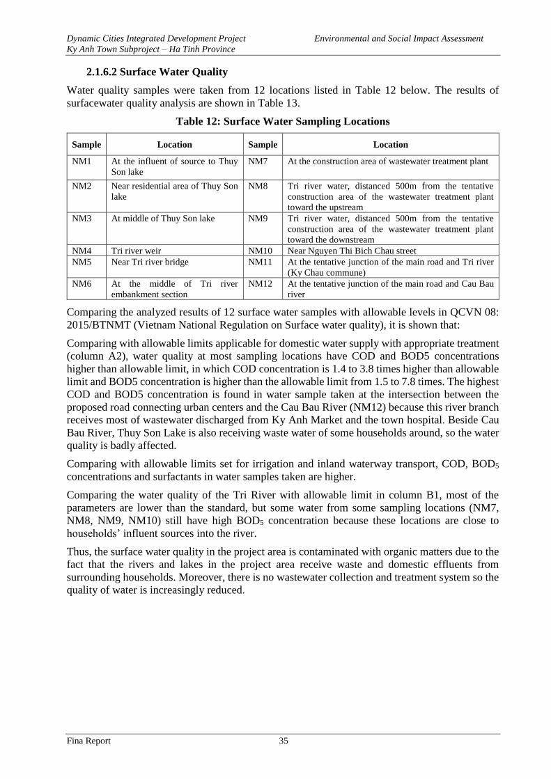
Dynamic Cities Integrated Development Project Environmental and Social Impact Assessment
Ky Anh Town Subproject – Ha Tinh Province
Fina Report 35
2.1.6.2 Surface Water Quality
Water quality samples were taken from 12 locations listed in Table 12 below. The results of
surfacewater quality analysis are shown in Table 13.
Table 12: Surface Water Sampling Locations
Sample Location Sample Location
NM1 At the influent of source to Thuy
Son lake
NM7 At the construction area of wastewater treatment plant
NM2 Near residential area of Thuy Son
lake
NM8 Tri river water, distanced 500m from the tentative
construction area of the wastewater treatment plant
toward the upstream
NM3 At middle of Thuy Son lake NM9 Tri river water, distanced 500m from the tentative
construction area of the wastewater treatment plant
toward the downstream
NM4 Tri river weir NM10 Near Nguyen Thi Bich Chau street
NM5 Near Tri river bridge NM11 At the tentative junction of the main road and Tri river
(Ky Chau commune)
NM6 At the middle of Tri river
embankment section
NM12 At the tentative junction of the main road and Cau Bau
river
Comparing the analyzed results of 12 surface water samples with allowable levels in QCVN 08:
2015/BTNMT (Vietnam National Regulation on Surface water quality), it is shown that:
Comparing with allowable limits applicable for domestic water supply with appropriate treatment
(column A2), water quality at most sampling locations have COD and BOD5 concentrations
higher than allowable limit, in which COD concentration is 1.4 to 3.8 times higher than allowable
limit and BOD5 concentration is higher than the allowable limit from 1.5 to 7.8 times. The highest
COD and BOD5 concentration is found in water sample taken at the intersection between the
proposed road connecting urban centers and the Cau Bau River (NM12) because this river branch
receives most of wastewater discharged from Ky Anh Market and the town hospital. Beside Cau
Bau River, Thuy Son Lake is also receiving waste water of some households around, so the water
quality is badly affected.
Comparing with allowable limits set for irrigation and inland waterway transport, COD, BOD5
concentrations and surfactants in water samples taken are higher.
Comparing the water quality of the Tri River with allowable limit in column B1, most of the
parameters are lower than the standard, but some water from some sampling locations (NM7,
NM8, NM9, NM10) still have high BOD5 concentration because these locations are close to
households’ influent sources into the river.
Thus, the surface water quality in the project area is contaminated with organic matters due to the
fact that the rivers and lakes in the project area receive waste and domestic effluents from
surrounding households. Moreover, there is no wastewater collection and treatment system so the
quality of water is increasingly reduced.
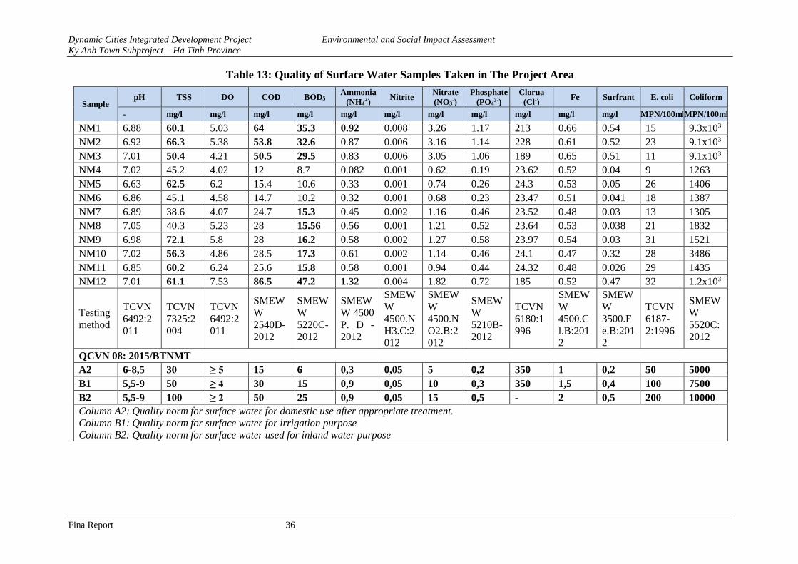
Dynamic Cities Integrated Development Project Environmental and Social Impact Assessment
Ky Anh Town Subproject – Ha Tinh Province
Fina Report 36
Table 13: Quality of Surface Water Samples Taken in The Project Area
Sample pH TSS DO COD BOD5
Ammonia
(NH4+)
Nitrite Nitrate
(NO3-)
Phosphate
(PO43-)
Clorua
(Cl-) Fe Surfrant E. coli Coliform
- mg/l mg/l mg/l mg/l mg/l mg/l mg/l mg/l mg/l mg/l mg/l MPN/100ml MPN/100ml
NM1 6.88 60.1 5.03 64 35.3 0.92 0.008 3.26 1.17 213 0.66 0.54 15 9.3x10³
NM2 6.92 66.3 5.38 53.8 32.6 0.87 0.006 3.16 1.14 228 0.61 0.52 23 9.1x10³
NM3 7.01 50.4 4.21 50.5 29.5 0.83 0.006 3.05 1.06 189 0.65 0.51 11 9.1x10³
NM4 7.02 45.2 4.02 12 8.7 0.082 0.001 0.62 0.19 23.62 0.52 0.04 9 1263
NM5 6.63 62.5 6.2 15.4 10.6 0.33 0.001 0.74 0.26 24.3 0.53 0.05 26 1406
NM6 6.86 45.1 4.58 14.7 10.2 0.32 0.001 0.68 0.23 23.47 0.51 0.041 18 1387
NM7 6.89 38.6 4.07 24.7 15.3 0.45 0.002 1.16 0.46 23.52 0.48 0.03 13 1305
NM8 7.05 40.3 5.23 28 15.56 0.56 0.001 1.21 0.52 23.64 0.53 0.038 21 1832
NM9 6.98 72.1 5.8 28 16.2 0.58 0.002 1.27 0.58 23.97 0.54 0.03 31 1521
NM10 7.02 56.3 4.86 28.5 17.3 0.61 0.002 1.14 0.46 24.1 0.47 0.32 28 3486
NM11 6.85 60.2 6.24 25.6 15.8 0.58 0.001 0.94 0.44 24.32 0.48 0.026 29 1435
NM12 7.01 61.1 7.53 86.5 47.2 1.32 0.004 1.82 0.72 185 0.52 0.47 32 1.2x10³
Testing
method
TCVN
6492:2
011
TCVN
7325:2
004
TCVN
6492:2
011
SMEW
W
2540D-
2012
SMEW
W
5220C-
2012
SMEW
W 4500
P. D -
2012
SMEW
W
4500.N
H3.C:2
012
SMEW
W
4500.N
O2.B:2
012
SMEW
W
5210B-
2012
TCVN
6180:1
996
SMEW
W
4500.C
l.B:201
2
SMEW
W
3500.F
e.B:201
2
TCVN
6187-
2:1996
SMEW
W
5520C:
2012
QCVN 08: 2015/BTNMT
A2 6-8,5 30 ≥ 5 15 6 0,3 0,05 5 0,2 350 1 0,2 50 5000
B1 5,5-9 50 ≥ 4 30 15 0,9 0,05 10 0,3 350 1,5 0,4 100 7500
B2 5,5-9 100 ≥ 2 50 25 0,9 0,05 15 0,5 - 2 0,5 200 10000
Column A2: Quality norm for surface water for domestic use after appropriate treatment.
Column B1: Quality norm for surface water for irrigation purpose
Column B2: Quality norm for surface water used for inland water purpose
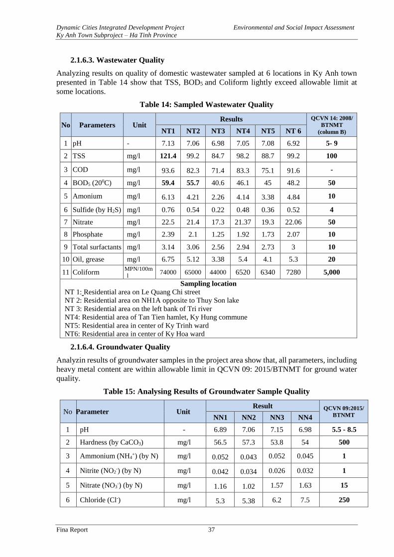
Dynamic Cities Integrated Development Project Environmental and Social Impact Assessment
Ky Anh Town Subproject – Ha Tinh Province
Fina Report 37
2.1.6.3. Wastewater Quality
Analyzing results on quality of domestic wastewater sampled at 6 locations in Ky Anh town
presented in Table 14 show that TSS, BOD5 and Coliform lightly exceed allowable limit at
some locations.
Table 14: Sampled Wastewater Quality
No Parameters Unit Results QCVN 14: 2008/
BTNMT
(column B) NT1 NT2 NT3 NT4 NT5 NT 6
1 pH - 7.13 7.06 6.98 7.05 7.08 6.92 5- 9
2 TSS mg/l 121.4 99.2 84.7 98.2 88.7 99.2 100
3 COD mg/l 93.6 82.3 71.4 83.3 75.1 91.6 -
4 BOD5 (200C) mg/l 59.4 55.7 40.6 46.1 45 48.2 50
5 Amonium mg/l 6.13 4.21 2.26 4.14 3.38 4.84 10
6 Sulfide (by H2S) mg/l 0.76 0.54 0.22 0.48 0.36 0.52 4
7 Nitrate mg/l 22.5 21.4 17.3 21.37 19.3 22.06 50
8 Phosphate mg/l 2.39 2.1 1.25 1.92 1.73 2.07 10
9 Total surfactants mg/l 3.14 3.06 2.56 2.94 2.73 3 10
10 Oil, grease mg/l 6.75 5.12 3.38 5.4 4.1 5.3 20
11 Coliform MPN/100m
l 74000 65000 44000 6520 6340 7280 5,000
Sampling location
NT 1: Residential area on Le Quang Chi street
NT 2: Residential area on NH1A opposite to Thuy Son lake
NT 3: Residential area on the left bank of Tri river
NT4: Residential area of Tan Tien hamlet, Ky Hung commune
NT5: Residential area in center of Ky Trinh ward
NT6: Residential area in center of Ky Hoa ward
2.1.6.4. Groundwater Quality
Analyzin results of groundwater samples in the project area show that, all parameters, including
heavy metal content are within allowable limit in QCVN 09: 2015/BTNMT for ground water
quality.
Table 15: Analysing Results of Groundwater Sample Quality
No Parameter Unit Result QCVN 09:2015/
BTNMT NN1 NN2 NN3 NN4
1 pH - 6.89 7.06 7.15 6.98 5.5 - 8.5
2 Hardness (by CaCO3) mg/l 56.5 57.3 53.8 54 500
3 Ammonium (NH4+) (by N) mg/l 0.052 0.043 0.052 0.045 1
4 Nitrite (NO2-) (by N) mg/l 0.042 0.034 0.026 0.032 1
5 Nitrate (NO3-) (by N) mg/l 1.16 1.02 1.57 1.63 15
6 Chloride (Cl-) mg/l 5.3 5.38 6.2 7.5 250
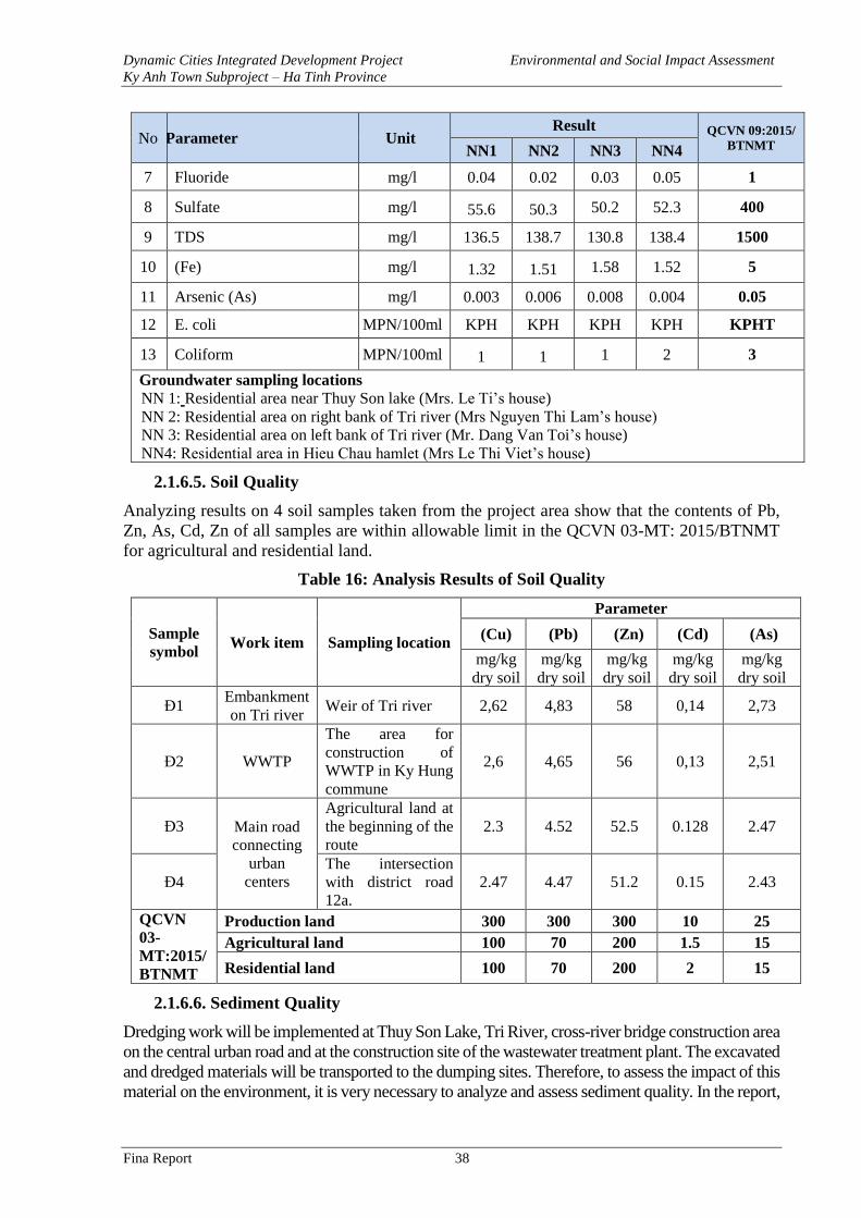
Dynamic Cities Integrated Development Project Environmental and Social Impact Assessment
Ky Anh Town Subproject – Ha Tinh Province
Fina Report 38
No Parameter Unit Result QCVN 09:2015/
BTNMT NN1 NN2 NN3 NN4
7 Fluoride mg/l 0.04 0.02 0.03 0.05 1
8 Sulfate mg/l 55.6 50.3 50.2 52.3 400
9 TDS mg/l 136.5 138.7 130.8 138.4 1500
10 (Fe) mg/l 1.32 1.51 1.58 1.52 5
11 Arsenic (As) mg/l 0.003 0.006 0.008 0.004 0.05
12 E. coli MPN/100ml KPH KPH KPH KPH KPHT
13 Coliform MPN/100ml 1 1 1 2 3
Groundwater sampling locations
NN 1: Residential area near Thuy Son lake (Mrs. Le Ti’s house)
NN 2: Residential area on right bank of Tri river (Mrs Nguyen Thi Lam’s house)
NN 3: Residential area on left bank of Tri river (Mr. Dang Van Toi’s house)
NN4: Residential area in Hieu Chau hamlet (Mrs Le Thi Viet’s house)
2.1.6.5. Soil Quality
Analyzing results on 4 soil samples taken from the project area show that the contents of Pb,
Zn, As, Cd, Zn of all samples are within allowable limit in the QCVN 03-MT: 2015/BTNMT
for agricultural and residential land.
Table 16: Analysis Results of Soil Quality
Sample
symbol Work item Sampling location
Parameter
(Cu) (Pb) (Zn) (Cd) (As)
mg/kg
dry soil
mg/kg
dry soil
mg/kg
dry soil
mg/kg
dry soil
mg/kg
dry soil
Đ1 Embankment
on Tri river Weir of Tri river 2,62 4,83 58 0,14 2,73
Đ2 WWTP
The area for
construction of
WWTP in Ky Hung
commune
2,6 4,65 56 0,13 2,51
Đ3 Main road
connecting
urban
centers
Agricultural land at
the beginning of the
route
2.3 4.52 52.5 0.128 2.47
Đ4
The intersection
with district road
12a.
2.47 4.47 51.2 0.15 2.43
QCVN
03-
MT:2015/
BTNMT
Production land 300 300 300 10 25
Agricultural land 100 70 200 1.5 15
Residential land 100 70 200 2 15
2.1.6.6. Sediment Quality
Dredging work will be implemented at Thuy Son Lake, Tri River, cross-river bridge construction area
on the central urban road and at the construction site of the wastewater treatment plant. The excavated
and dredged materials will be transported to the dumping sites. Therefore, to assess the impact of this
material on the environment, it is very necessary to analyze and assess sediment quality. In the report,
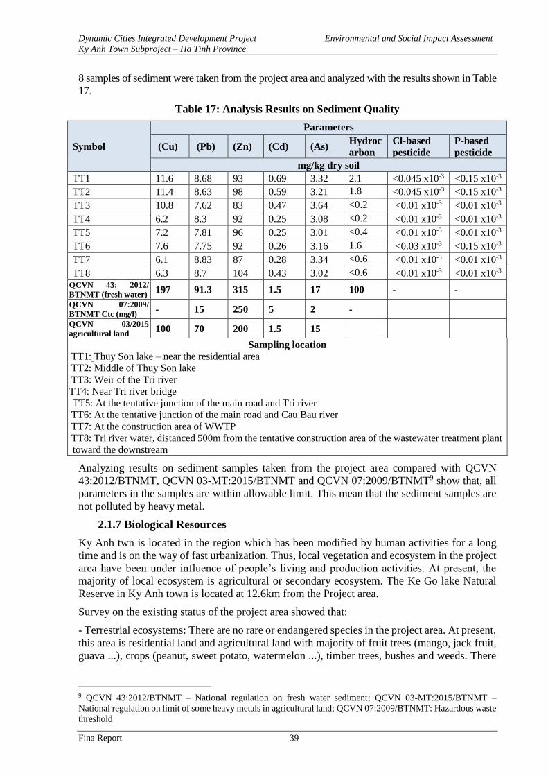
Dynamic Cities Integrated Development Project Environmental and Social Impact Assessment
Ky Anh Town Subproject – Ha Tinh Province
Fina Report 39
8 samples of sediment were taken from the project area and analyzed with the results shown in Table
17.
Table 17: Analysis Results on Sediment Quality
Symbol
Parameters
(Cu) (Pb) (Zn) (Cd) (As) Hydroc
arbon
Cl-based
pesticide
P-based
pesticide
mg/kg dry soil
TT1 11.6 8.68 93 0.69 3.32 2.1 <0.045 x10⁻³ <0.15 x10⁻³
TT2 11.4 8.63 98 0.59 3.21 1.8 <0.045 x10⁻³ <0.15 x10⁻³
TT3 10.8 7.62 83 0.47 3.64 <0.2 <0.01 x10⁻³ <0.01 x10⁻³
TT4 6.2 8.3 92 0.25 3.08 <0.2 <0.01 x10⁻³ <0.01 x10⁻³
TT5 7.2 7.81 96 0.25 3.01 <0.4 <0.01 x10⁻³ <0.01 x10⁻³
TT6 7.6 7.75 92 0.26 3.16 1.6 <0.03 x10⁻³ <0.15 x10⁻³
TT7 6.1 8.83 87 0.28 3.34 <0.6 <0.01 x10⁻³ <0.01 x10⁻³
TT8 6.3 8.7 104 0.43 3.02 <0.6 <0.01 x10⁻³ <0.01 x10⁻³ QCVN 43: 2012/
BTNMT (fresh water) 197 91.3 315 1.5 17 100 - -
QCVN 07:2009/
BTNMT Ctc (mg/l) - 15 250 5 2 -
QCVN 03/2015
agricultural land 100 70 200 1.5 15
Sampling location
TT1: Thuy Son lake – near the residential area
TT2: Middle of Thuy Son lake
TT3: Weir of the Tri river
TT4: Near Tri river bridge
TT5: At the tentative junction of the main road and Tri river
TT6: At the tentative junction of the main road and Cau Bau river
TT7: At the construction area of WWTP
TT8: Tri river water, distanced 500m from the tentative construction area of the wastewater treatment plant
toward the downstream
Analyzing results on sediment samples taken from the project area compared with QCVN
43:2012/BTNMT, QCVN 03-MT:2015/BTNMT and QCVN 07:2009/BTNMT9 show that, all
parameters in the samples are within allowable limit. This mean that the sediment samples are
not polluted by heavy metal.
2.1.7 Biological Resources
Ky Anh twn is located in the region which has been modified by human activities for a long
time and is on the way of fast urbanization. Thus, local vegetation and ecosystem in the project
area have been under influence of people’s living and production activities. At present, the
majority of local ecosystem is agricultural or secondary ecosystem. The Ke Go lake Natural
Reserve in Ky Anh town is located at 12.6km from the Project area.
Survey on the existing status of the project area showed that:
- Terrestrial ecosystems: There are no rare or endangered species in the project area. At present,
this area is residential land and agricultural land with majority of fruit trees (mango, jack fruit,
guava ...), crops (peanut, sweet potato, watermelon ...), timber trees, bushes and weeds. There
9 QCVN 43:2012/BTNMT – National regulation on fresh water sediment; QCVN 03-MT:2015/BTNMT –
National regulation on limit of some heavy metals in agricultural land; QCVN 07:2009/BTNMT: Hazardous waste
threshold
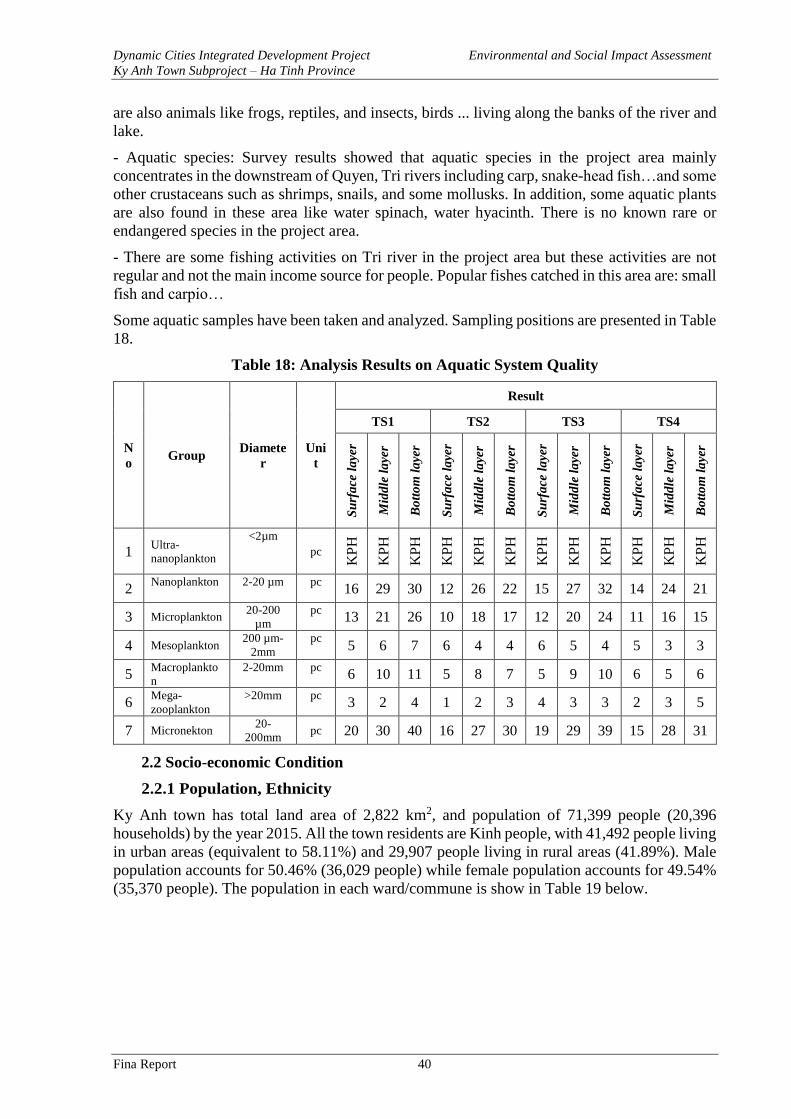
Dynamic Cities Integrated Development Project Environmental and Social Impact Assessment
Ky Anh Town Subproject – Ha Tinh Province
Fina Report 40
are also animals like frogs, reptiles, and insects, birds ... living along the banks of the river and
lake.
- Aquatic species: Survey results showed that aquatic species in the project area mainly
concentrates in the downstream of Quyen, Tri rivers including carp, snake-head fish…and some
other crustaceans such as shrimps, snails, and some mollusks. In addition, some aquatic plants
are also found in these area like water spinach, water hyacinth. There is no known rare or
endangered species in the project area.
- There are some fishing activities on Tri river in the project area but these activities are not
regular and not the main income source for people. Popular fishes catched in this area are: small
fish and carpio…
Some aquatic samples have been taken and analyzed. Sampling positions are presented in Table
18.
Table 18: Analysis Results on Aquatic System Quality
N
o Group
Diamete
r
Uni
t
Result
TS1 TS2 TS3 TS4
Su
rfa
ce l
aye
r
Mid
dle
la
yer
Bo
tto
m l
aye
r
Su
rfa
ce l
aye
r
Mid
dle
la
yer
Bo
tto
m l
aye
r
Su
rfa
ce l
aye
r
Mid
dle
la
yer
Bo
tto
m l
aye
r
Su
rfa
ce l
aye
r
Mid
dle
la
yer
Bo
tto
m l
aye
r
1 Ultra-
nanoplankton
<2µm
pc
KP
H
KP
H
KP
H
KP
H
KP
H
KP
H
KP
H
KP
H
KP
H
KP
H
KP
H
KP
H
2 Nanoplankton
2-20 µm pc 16 29 30 12 26 22 15 27 32 14 24 21
3 Microplankton 20-200
µm
pc 13 21 26 10 18 17 12 20 24 11 16 15
4 Mesoplankton 200 µm-
2mm
pc 5 6 7 6 4 4 6 5 4 5 3 3
5 Macroplankto
n
2-20mm pc 6 10 11 5 8 7 5 9 10 6 5 6
6 Mega-
zooplankton
>20mm pc 3 2 4 1 2 3 4 3 3 2 3 5
7 Micronekton 20-
200mm pc 20 30 40 16 27 30 19 29 39 15 28 31
2.2 Socio-economic Condition
2.2.1 Population, Ethnicity
Ky Anh town has total land area of 2,822 km2, and population of 71,399 people (20,396
households) by the year 2015. All the town residents are Kinh people, with 41,492 people living
in urban areas (equivalent to 58.11%) and 29,907 people living in rural areas (41.89%). Male
population accounts for 50.46% (36,029 people) while female population accounts for 49.54%
(35,370 people). The population in each ward/commune is show in Table 19 below.
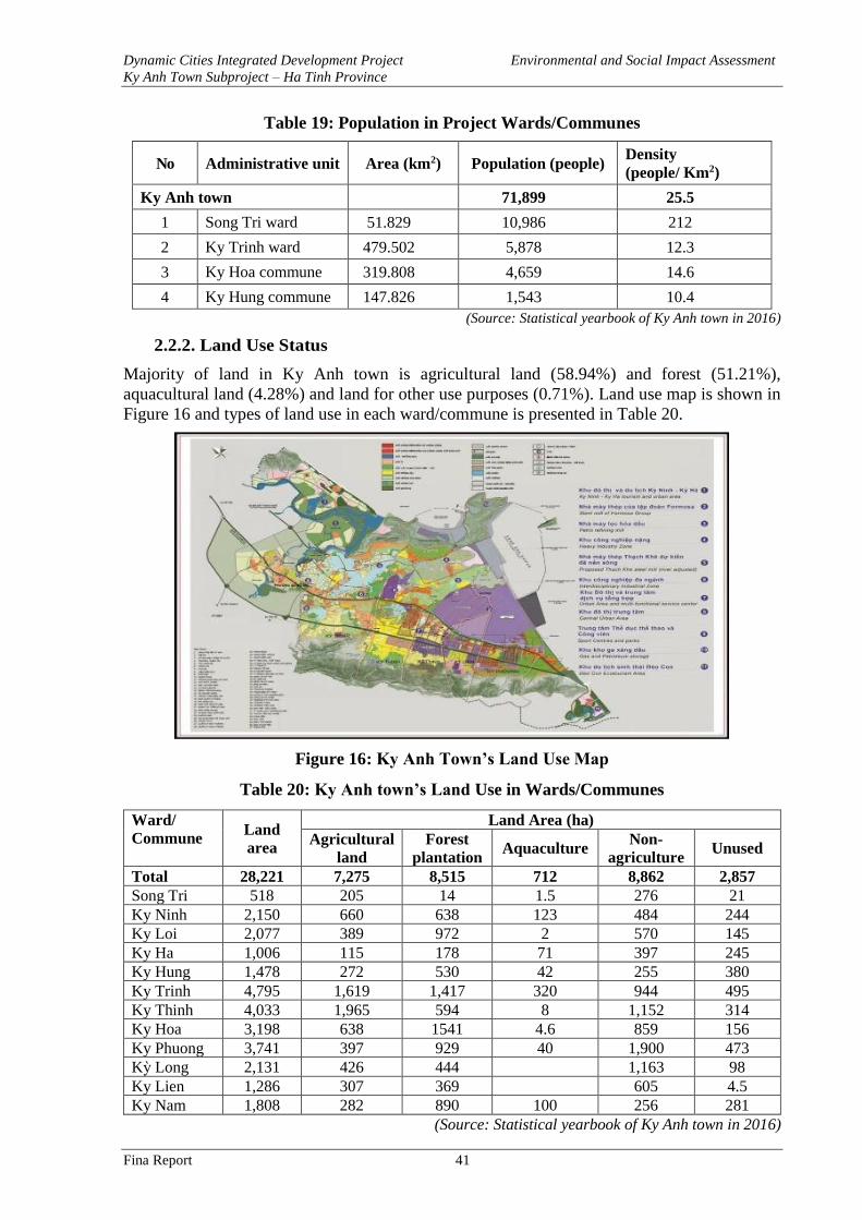
Dynamic Cities Integrated Development Project Environmental and Social Impact Assessment
Ky Anh Town Subproject – Ha Tinh Province
Fina Report 41
Table 19: Population in Project Wards/Communes
No Administrative unit Area (km2) Population (people) Density
(people/ Km2)
Ky Anh town 71,899 25.5
1 Song Tri ward 51.829 10,986 212
2 Ky Trinh ward 479.502 5,878 12.3
3 Ky Hoa commune 319.808 4,659 14.6
4 Ky Hung commune 147.826 1,543 10.4
(Source: Statistical yearbook of Ky Anh town in 2016)
2.2.2. Land Use Status
Majority of land in Ky Anh town is agricultural land (58.94%) and forest (51.21%),
aquacultural land (4.28%) and land for other use purposes (0.71%). Land use map is shown in
Figure 16 and types of land use in each ward/commune is presented in Table 20.
Figure 16: Ky Anh Town’s Land Use Map
Table 20: Ky Anh town’s Land Use in Wards/Communes
Ward/
Commune Land
area
Land Area (ha)
Agricultural
land
Forest
plantation Aquaculture
Non-
agriculture Unused
Total 28,221 7,275 8,515 712 8,862 2,857
Song Tri 518 205 14 1.5 276 21
Ky Ninh 2,150 660 638 123 484 244
Ky Loi 2,077 389 972 2 570 145
Ky Ha 1,006 115 178 71 397 245
Ky Hung 1,478 272 530 42 255 380
Ky Trinh 4,795 1,619 1,417 320 944 495
Ky Thinh 4,033 1,965 594 8 1,152 314
Ky Hoa 3,198 638 1541 4.6 859 156
Ky Phuong 3,741 397 929 40 1,900 473
Kỳ Long 2,131 426 444 1,163 98
Ky Lien 1,286 307 369 605 4.5
Ky Nam 1,808 282 890 100 256 281
(Source: Statistical yearbook of Ky Anh town in 2016)
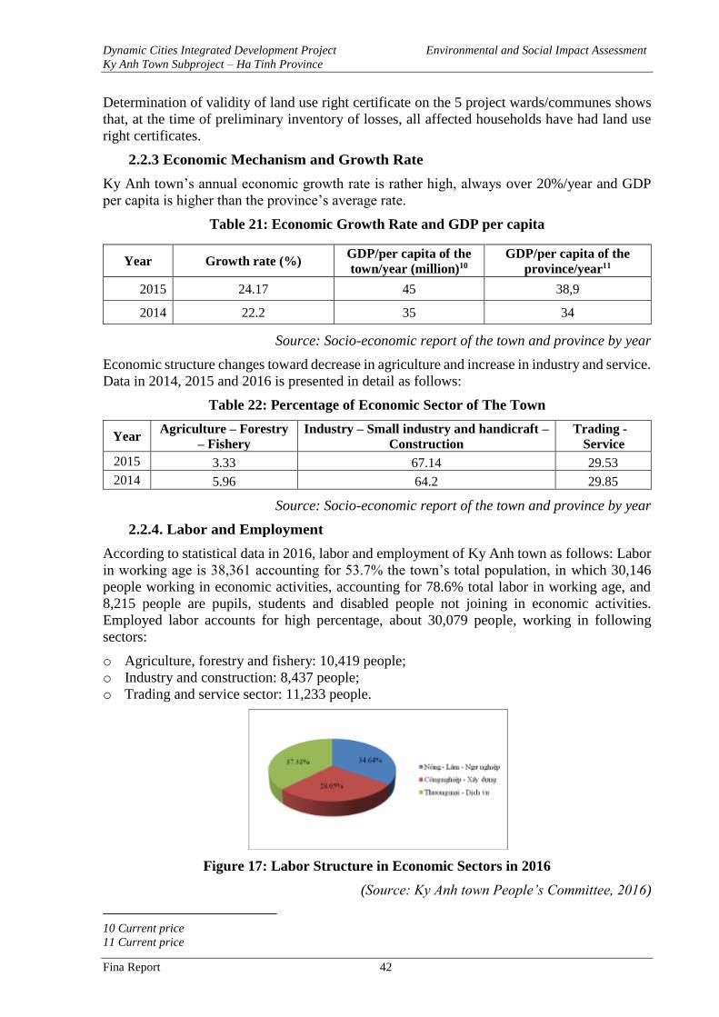
Dynamic Cities Integrated Development Project Environmental and Social Impact Assessment
Ky Anh Town Subproject – Ha Tinh Province
Fina Report 42
Determination of validity of land use right certificate on the 5 project wards/communes shows
that, at the time of preliminary inventory of losses, all affected households have had land use
right certificates.
2.2.3 Economic Mechanism and Growth Rate
Ky Anh town’s annual economic growth rate is rather high, always over 20%/year and GDP
per capita is higher than the province’s average rate.
Table 21: Economic Growth Rate and GDP per capita
Year Growth rate (%) GDP/per capita of the
town/year (million)10
GDP/per capita of the
province/year11
2015 24.17 45 38,9
2014 22.2 35 34
Source: Socio-economic report of the town and province by year
Economic structure changes toward decrease in agriculture and increase in industry and service.
Data in 2014, 2015 and 2016 is presented in detail as follows:
Table 22: Percentage of Economic Sector of The Town
Year Agriculture – Forestry
– Fishery
Industry – Small industry and handicraft –
Construction
Trading -
Service
2015 3.33 67.14 29.53
2014 5.96 64.2 29.85
Source: Socio-economic report of the town and province by year
2.2.4. Labor and Employment
According to statistical data in 2016, labor and employment of Ky Anh town as follows: Labor
in working age is 38,361 accounting for 53.7% the town’s total population, in which 30,146
people working in economic activities, accounting for 78.6% total labor in working age, and
8,215 people are pupils, students and disabled people not joining in economic activities.
Employed labor accounts for high percentage, about 30,079 people, working in following
sectors:
o Agriculture, forestry and fishery: 10,419 people;
o Industry and construction: 8,437 people;
o Trading and service sector: 11,233 people.
Figure 17: Labor Structure in Economic Sectors in 2016
(Source: Ky Anh town People’s Committee, 2016)
10 Current price
11 Current price
Dynamic Cities Integrated Development Project Environmental and Social Impact Assessment
Ky Anh Town Subproject – Ha Tinh Province
Fina Report 43
❖ Occupational Structure of Local People in The Project Area
The surveyed heads of household participate in 4 main sources of incomes: agricultural sector
(82.0%), retirement allowances (6.0%), government employees (4.0%), trade/service (3.3%).
Most of household members earn their living by working in agriculture – forestry – fishery (this
group accounts for 51.5% of total surveyed member). A small percentage is retired people and
government employees with stable monthly income (accounting for 10.4%). Number of
households running businesses/opening shops (mainly at the market or at home) accounts for
1.2%. Students and pupils account for a relatively high percentage of 24.2%. This result shows
that, on average, percentage of dependent people in households is rather high with over 30%
including people with no income (including housewives), the elderly (no pension), small
children and pupil/students...
2.2.5. Income
Ky Anh town people mostly depends on agriculture. Nearly 60% households have main income
source from agricultural production. In addition, 16.7% households have income source from
salary. Average income of affected households in the survey is about 8.1 million dongs/month.
However, popular income is 5 million dongs/month and the highest income is 43 million
dongs/household/month while the lowest income is 1 million dong/household/month.
According to surveyed results in the project area, the highest income of households in the
project area is 43,000,000 VND/HH/month while the lowest income is 1,000,000
VND/HH/month. The monthly average income of households in the project area is presented
in following table:
Table 23: Household’s Monthly Average Income
≤ 3 mil VND Fom 3 – 5
mil VND
From 5 – 9
mil VND
≥ 9 mil VND No answer Total
HH % HH % HH % HH % HH % HH %
14 9.3 18 12 22 14.7 19 12.7 77 51.3 150 100
2.2.6. Education
There are 35 schools from kindergarten to high school in the town, of which 25 schools meet
national standards, serving nearly 20,000 pupils, including 5,487 kindergarten pupils, 6,630
primary school students, 4,678 secondary school pupils and 2,916 high school students. The
universalization of preschool education for 5-year-olds and secondary school is maintained.
Generally, education level of directly affected people is not very high. Percentage of affected
household member being illiterate/not going to school is 10.2%, most of them are the elderly
and pre-school children. 10.6% household members have primary school degree level, most of
family members have secondary school degree (44,2%) and high school degree (24.9%);
college/university (9.3%) and post graduate degree (0.7%).
2.2.7. Medical Service and Healthcare
There are 13 health care facilities in the area including 1 hospital and 12 medical clinics. The
health sector has made great efforts in preventing outbreak of disease and controlling food
hygiene. National health programs and targets are fully implemented, such as
STD diseases prevention program, reproductive health-nutrition program; HIV/AIDS
prevention and control; prevention of malaria; occupational hygiene and other programs are
effectively implemented at the Commune Health Centers. According to MOH, by 20/5/2017,
Ky Anh town found 51 cases of HIV/AIDS (of which 43 cases at AIDS phase) and 17 peopled
died of AIDS.
Dynamic Cities Integrated Development Project Environmental and Social Impact Assessment
Ky Anh Town Subproject – Ha Tinh Province
Fina Report 44
2.2.8. Physical Cultural Resources
Ky Anh town has two nationally-recognized monuments and six provincially-recognized relics:
Le Quang Chi - Le Quang Y Temple: is located in Ky Phuong ward, Ky Anh Town, Ha Tinh
Province. The temple was built for worshipping two valedictorian brothers Le Quang Chi and
Le Quang Y (also known as Holy Temple). The temple was ranked historic-cultural vestige in
1996.
Temple of Holy Mother Nguyen Thi Bich Chau: is located in Ky Ninh Ward, Ky Anh Town, Ha
Tinh Province which was built for worshipping imperial concubine of Kinh Tran Hue Tong.
The temple was ranked as historic-cultural vestige in 1991.
Provincial-level historic-cultural vestiges: Hoanh Son famous landscape (Ky Nam commune),
Lieu Hanh Princess Temple (Ky Nam commune), Pham Tiem Ancestral worshipping house
(Song Tri ward), Nguyen Van Khoa Ancestral worshipping house (Song Tri Ward), Eo Bach
Temple (Ky Loi Commune), local temple (Ky Ninh Commune).
In addition, there are some objects that may be spiritually important to local communities in the
Project area such as ancient water wells. Family worshipping houses are also popular in the
Project area.
2.2.9 Gender Issue
Surveyed result on gender issue in Ky Anh town show that:
- Education: The surveyed results show that, there is no educational restrict for female in the
project area. At present, all children at school age can go to school regardless their gender,
household’s economic condition and religion.
- Property’s ownership: According to the Land law 2013, husband and wife should share the
name in their land use right certificate. However, the surveyed results show that, 31.5% of
surveyed people said their land use right certificates bear only husband’s name while the
percentage for wife holding name in the land use right certificate is 15.3%.
- Labor division:
o 71.2% surveyed people said that women take main responsibility for housework and
taking care of children and the elderly in the family.
o For making living/earning income, in the project area, women usually do farming work
and are also suitable for doing business, small shops (grocery shops, street vendors, hair
cut…) with percentage of 69.7%. Men mainly work as hired labor (construction, porter
or labor export ...). Women contribute about 30% of total household income. These
analysis shows that employment opportunities and adaptability to career change are an
obstacle for local women. In case of resettlement and relocation, women are more
affected than men, especially middle-aged single women (6 households).
- Participation in public meeting:
o Survey on participation in community activities and participation in local organizations
shows that there is not much difference in gender. 69.4% of respondents said that both
women and men participate in community and local meetings.
- Making decision for family issues:
o For family decisions, the results show that in most of surveyed households, both men
and women participate in discussing and making decisions. For purchasing family’s
assets and decision for spouse’s education, the percentages are 46% and 69.3%,
respectively. For decisions in changing careers, borrowing money to do business and
holding name in property ownership, men often play the main role and main decision-
maker in the family
Dynamic Cities Integrated Development Project Environmental and Social Impact Assessment
Ky Anh Town Subproject – Ha Tinh Province
Fina Report 45
2.3 Infrastructure Condition
2.3.1. Transport System
Roadway: There are national highways running through Ky Anh town including NH1A, NH1A
bypass and NH12C. For NH1A: grade III road quality, road base is 12m wide, asphalt concrete
pavement with 11m wide, in good quality. 1A Highway by-pass: in the West of Highway 1A,
with grade III road quality, road base is 12m, asphalt concrete pavement with 11m wide, in
good quality. 12C Highway: from Ky Anh town to Ho Chi Minh highway toward Chalo border
gate.
The road connected between 1A Highway and Vung Ang seaport has been expanded with grade
III road quality, base width is 12m, concrete pavement with 11m wide with good quality. This
road connecting to Vung Ang 1 thermal power plant has a base width of 12m and pavement
width of 7m. The main road system in the economic zone has been developed and will have the
width of 9-16m.
The road system in resettlement areas has been built with good quality (resettlement area in
communes of Ky Thinh, Ky Long, Ky Lien, Ky Phuong and Ky Loi). There is also a system of
collector roads, branch roads and alleys in residential areas in wards and communes. These
roads have been built for a long time with high traffic density and rather small scope (B ≤7.5m)
and lack of technical infrastructure.
The routes serving the project namely NH1A, Nguyen Thi Bich Chau, Le Quang Chi and
NH12C are mainly national highways and provincial roads so they were constructed with rather
good quality.
Ky Anh town has 1 coach-station and 2 car-parking places.
Table 24: List of Roadway Headworks
No Work Location Area
(ha)
Distance to
construction site
I Coach station 0.15
1 Ky Anh coach station KP1 – Ky Anh town – Ky Anh
district 0.15 0.7 – 4 km
II Car parking places 0.35
1 Bich Chau temple car
parking place
Ky Ninh commune- Ky Anh
town 0.15 2 – 6 km
2 Ky Long car parking
place
Long Hai hamlet – Ky Long
commune (opposite to Le
Quang Chi school)
0.20 2 – 6 km
Waterway: Ky Anh town has two important cargo seaports namely Vung Ang port and Son
Duong port. Son Duong port - Vung Ang is a national general port and is the local transportation
hub of Vietnam (type I port), only 9 km from National Highway 1A, 230 km from Vietnam -
Laos border (Mu Gia Pass).
The Vung Ang port has two major wharves that have been put into operation (depths from -
11m to -13m), namely Vung Ang general port and coal transportation port for Vung Ang
thermal power plant.
Son Duong port is being built by Formosa into a modern specialized port with the size of 32
berths (including 2 stages), the total length of berths is over 8.6 km; The depth is from -23m to
-25m. After completion, the port is capable of receiving ships up to 300 thousand DWT.
Dynamic Cities Integrated Development Project Environmental and Social Impact Assessment
Ky Anh Town Subproject – Ha Tinh Province
Fina Report 46
There is almost no waterway transport activities in the Tri river and Quyen river where bridges
will be built under the Project.
2.3.2. Water Supply
At present, in Ky Anh Town there are two water supply systems: industrial water supply system
and domestic water supply system.
Industrial water supply system: There are two water plants supplying water for production and
industrial purposes namely Hoanh Son water plant and water supply plant in Formosa industrial
zone.
At present, Hoanh Son water plant has capacity of 380,000 m3/day supplying water for Vung
Ang I thermal power plant and it is located in Tay Yen district. Raw water is taken from Rao
Tro lake and Tri upstream lake. The location of Hoanh Son water plant is 8km upstream from
the waste water treatment plant. The plant has completed the first phase, capacity Q = 40,000
m3/day.
In addition, FORMOSA has built its own water supply system, with a pipeline of DN =
2,000mm of raw water, and a source of water from the Tri river upstream lake. The water source
is untreated and only serves the purpose of production, not used for living purposes
Domestic water supply system: Ky Anh town is using the water supply network of Vung Ang
1 clean water plant. The raw water source for the plant is taken from the upstream lake of Tri
river. The water supply is concentrated in the wards of Song Tri the center of Ky Anh town
with population of over 12,000 people and the communes of Ky Long, Ky Lien, Ky Trinh, Ky
Phuong, Ky Thinh with 35,000 people and some areas along National Highway 1A. The total
number of people currently supplied with clean water is about 57,700 people, equivalent to 60%
population of the town, with a water supply standard of 150 liters/person/day.
2.3.3. Drainage Sewers
Drainage: Besides some resettlement areas in Dong Yen, Ky Lien, Ky Long, Ky Phuong, Ky
Thinh where new combined drainage systems will be constructed, Ky Anh Town has not yet
invested in a complete and well-equipped drainage system. Most of the existing rain water
drainage and sewers have been constructed at the same time with the construction of traffic
infrastructure on some roads.
At present, rainwater runoff mainly discharges to rivers and streams (Quyen River, Tri River
...) via existing sluices, ponds and lakes. Main drainage direction is based on natural terrain
from southwest to northeast, from high to low, then flow into the local rivers and streams and
then into the sea.
Waste water collection and treatment system: There is no wastewater collection and treatment
system in the town. At present, wastewater is discharged into the combined drainage system or
discharged directly into the ground, local canals, rivers and streams causing environmental
pollution.
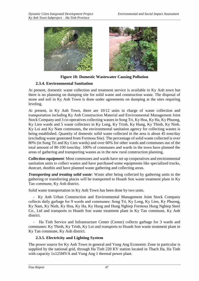
Dynamic Cities Integrated Development Project Environmental and Social Impact Assessment
Ky Anh Town Subproject – Ha Tinh Province
Fina Report 47
Figure 18: Domestic Wastewater Causing Pollution
2.3.4. Environmental Sanitation
At present, domestic waste collection and treatment service is available in Ky Anh town but
there is no planning on dumping site for solid waste and construction waste. The disposal of
stone and soil in Ky Anh Town is done under agreements on dumping at the sites requiring
leveling.
At present, in Ky Anh Town, there are 10/12 units in charge of waste collection and
transportation including Ky Anh Construction Material and Environmental Management Joint
Stock Company and 3 co-operatives collecting wastes in Song Tri, Ky Hoa, Ky Ha, Ky Phuong,
Ky Lien wards and 5 waste collectors in Ky Long, Ky Trinh, Ky Hung, Ky Thinh, Ky Ninh.
Ky Loi and Ky Nam communes, the environmental sanitation agency for collecting wastes is
being established. Quantity of domestic solid waste collected in the area is about 45 tons/day
(excluding waste generated from Formosa Site). The percentage of solid waste collected is over
80% (in Song Tri and Ky Lien wards) and over 60% for other wards and communes out of the
total amount of 80-100 tons/day. 100% of communes and wards in the town have planned the
areas of gathering and transporting wastes as in the new rural construction planning.
Collection equipment: Most communes and wards have set up cooperatives and environmental
sanitation units to collect wastes and have purchased some equipments like specialized trucks,
dustcart, dustbin and have planned waste gathering and collecting areas.
Transporting and treating solid waste: Waste after being collected by gathering units to the
gathering or transferring places will be transported to Hoanh Son waste treatment plant in Ky
Tan commune, Ky Anh district.
Solid waste transportation in Ky Anh Town has been done by two units.
- Ky Anh Urban Construction and Environmental Management Joint Stock Company
collects daily garbage for 9 wards and communes: Song Tri, Ky Long, Ky Lien, Ky Phuong,
Ky Nam, Ky Ninh, Ky Hoa, Ky Ha, Ky Hung and Hung Nghiep Formosa Hung Nghiep Steel
Co., Ltd and transports to Hoanh Son waste treatment plant in Ky Tan commune, Ky Anh
district.
- Ha Tinh Service and Infrastructure Center (Center) collects garbage for 3 wards and
communes: Ky Thinh, Ky Trinh, Ky Loi and transports to Hoanh Son waste treatment plant in
Ky Tan commune, Ky Anh district.
2.3.5. Electricity and Lighting System
The power source for Ky Anh Town in general and Vung Ang Economic Zone in particular is
supplied by the national grid, through Ha Tinh 220 KV station located in Thach Ha, Ha Tinh
with capacity 1x125MVA and Vung Ang 1 thermal power plant.
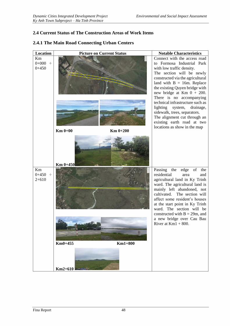
Dynamic Cities Integrated Development Project Environmental and Social Impact Assessment
Ky Anh Town Subproject – Ha Tinh Province
Fina Report 48
2.4 Current Status of The Construction Areas of Work Items
2.4.1 The Main Road Connecting Urban Centers
Location Picture on Current Status Notable Characteristics
Km
0+000 ÷
0+450
Km 0+00 Km 0+200
Km 0+450
Connect with the access road
to Formosa Industrial Park
with low traffic density.
The section will be newly
constructed via the agricultural
land with B = 16m. Replace
the existing Quyen bridge with
new bridge at Km 0 + 200.
There is no accompanying
technical infrastructure such as
lighting system, drainage,
sidewalk, trees, separators.
The alignment cut through an
existing earth road at two
locations as show in the map
Km
0+450 ÷
2+610
Km0+455 Km1+800
Km2+610
Passing the edge of the
residential area and
agricultural land in Ky Trinh
ward. The agricultural land is
mainly left abandoned, not
cultivated. The section will
affect some resident’s houses
at the start point in Ky Trinh
ward. The section will be
constructed with B = 29m, and
a new bridge over Cau Bau
River at Km1 + 800.
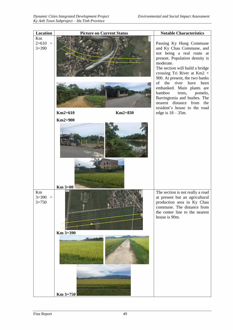
Dynamic Cities Integrated Development Project Environmental and Social Impact Assessment
Ky Anh Town Subproject – Ha Tinh Province
Fina Report 49
Location Picture on Current Status Notable Characteristics
Km
2+610 ÷
3+390
Km2+610 Km2+830
Km2+900
Km 3+00
Passing Ky Hung Commune
and Ky Chau Commune, and
not being a real route at
present. Population density is
moderate.
The section will build a bridge
crossing Tri River at Km2 +
900. At present, the two banks
of the river have been
embanked. Main plants are
bamboo trees, pomelo,
Barringtonia and bushes. The
nearest distance from the
resident’s house to the road
edge is 18 – 35m.
Km
3+390 ÷
3+750
Km 3+390
Km 3+750
The section is not really a road
at present but an agricultural
production area in Ky Chau
commune. The distance from
the center line to the nearest
house is 90m.
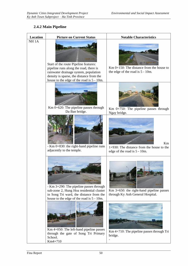
Dynamic Cities Integrated Development Project Environmental and Social Impact Assessment
Ky Anh Town Subproject – Ha Tinh Province
Fina Report 50
2.4.2 Main Pipeline
Location Picture on Current Status Notable Characteristics
NH 1A
Start of the route Pipeline features:
pipeline runs along the road, there is
rainwater drainage system, population
density is sparse, the distance from the
house to the edge of the road is 5 - 10m.
Km 0+150: The distance from the house to
the edge of the road is 5 - 10m.
Km 0+620: The pipeline passes through
Da Ban bridge.
Km 0+750: The pipeline passes through
Ngay bridge.
- Km 0+830: the right-hand pipeline runs
adjacently to the temple.
Km
1+930: The distance from the house to the
edge of the road is 5 - 10m.
- Km 3+290: The pipeline passes through
sub-zone 2, Hung Hoa residential cluster
in Song Tri ward, the distance from the
house to the edge of the road is 5 - 10m.
Km 3+650: the right-hand pipeline passes
through Ky Anh General Hospital.
Km 4+050: The left-hand pipeline passes
through the gate of Song Tri Primary
School.
Km4+710
Km 4+710: The pipeline passes through Tri
bridge.
-
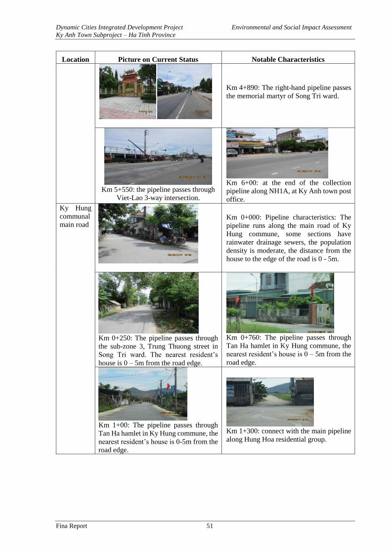
Dynamic Cities Integrated Development Project Environmental and Social Impact Assessment
Ky Anh Town Subproject – Ha Tinh Province
Fina Report 51
Location Picture on Current Status Notable Characteristics
Km 4+890: The right-hand pipeline passes
the memorial martyr of Song Tri ward.
Km 5+550: the pipeline passes through
Viet-Lao 3-way intersection.
Km 6+00: at the end of the collection
pipeline along NH1A, at Ky Anh town post
office.
Ky Hung
communal
main road
Km 0+000: Pipeline characteristics: The
pipeline runs along the main road of Ky
Hung commune, some sections have
rainwater drainage sewers, the population
density is moderate, the distance from the
house to the edge of the road is 0 - 5m.
Km 0+250: The pipeline passes through
the sub-zone 3, Trung Thuong street in
Song Tri ward. The nearest resident’s
house is 0 – 5m from the road edge.
Km 0+760: The pipeline passes through
Tan Ha hamlet in Ky Hung commune, the
nearest resident’s house is 0 – 5m from the
road edge.
Km 1+00: The pipeline passes through
Tan Ha hamlet in Ky Hung commune, the
nearest resident’s house is 0-5m from the
road edge.
Km 1+300: connect with the main pipeline
along Hung Hoa residential group.
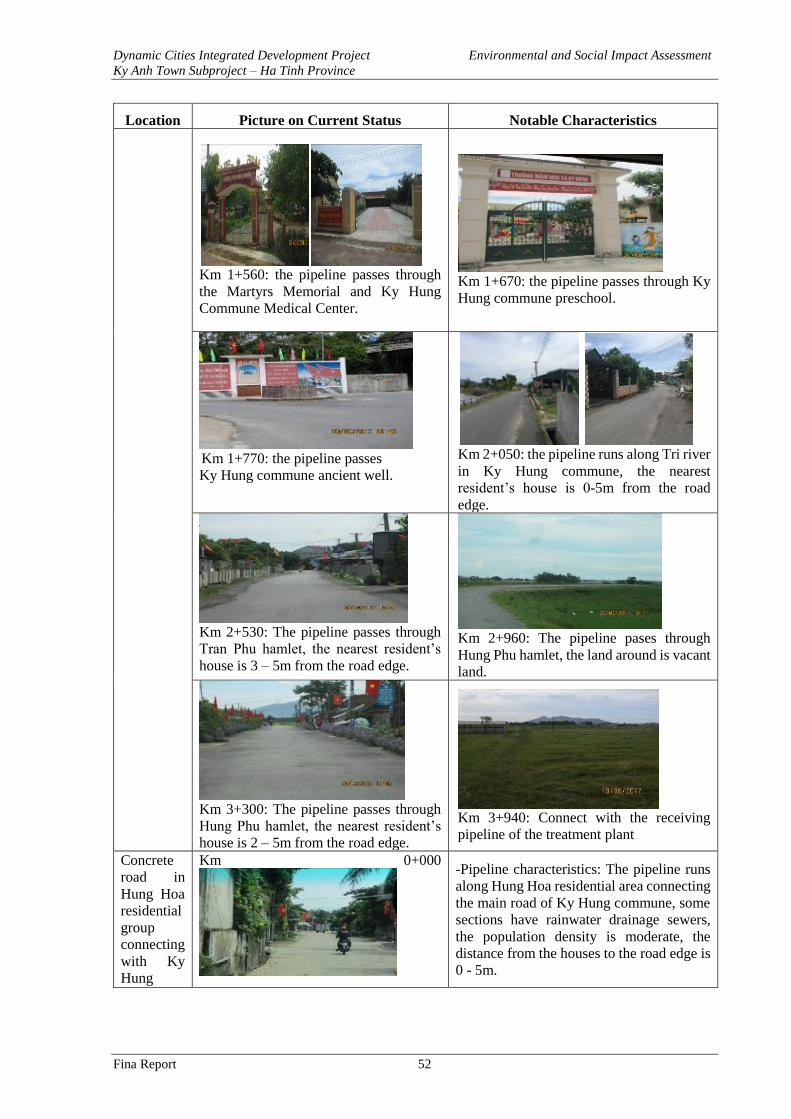
Dynamic Cities Integrated Development Project Environmental and Social Impact Assessment
Ky Anh Town Subproject – Ha Tinh Province
Fina Report 52
Location Picture on Current Status Notable Characteristics
Km 1+560: the pipeline passes through
the Martyrs Memorial and Ky Hung
Commune Medical Center.
Km 1+670: the pipeline passes through Ky
Hung commune preschool.
Km 1+770: the pipeline passes
Ky Hung commune ancient well.
Km 2+050: the pipeline runs along Tri river
in Ky Hung commune, the nearest
resident’s house is 0-5m from the road
edge.
Km 2+530: The pipeline passes through
Tran Phu hamlet, the nearest resident’s
house is 3 – 5m from the road edge.
Km 2+960: The pipeline pases through
Hung Phu hamlet, the land around is vacant
land.
Km 3+300: The pipeline passes through
Hung Phu hamlet, the nearest resident’s
house is 2 – 5m from the road edge.
Km 3+940: Connect with the receiving
pipeline of the treatment plant
Concrete
road in
Hung Hoa
residential
group
connecting
with Ky
Hung
Km 0+000
-Pipeline characteristics: The pipeline runs
along Hung Hoa residential area connecting
the main road of Ky Hung commune, some
sections have rainwater drainage sewers,
the population density is moderate, the
distance from the houses to the road edge is
0 - 5m.
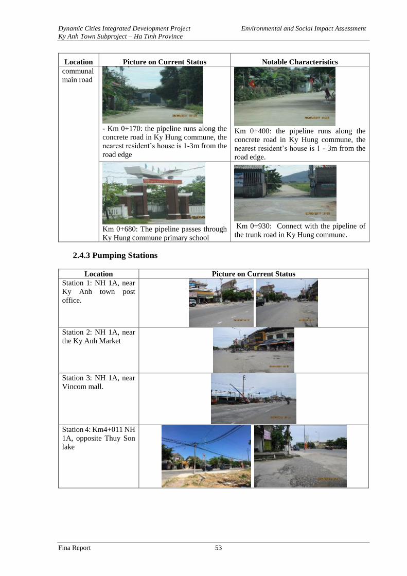
Dynamic Cities Integrated Development Project Environmental and Social Impact Assessment
Ky Anh Town Subproject – Ha Tinh Province
Fina Report 53
Location Picture on Current Status Notable Characteristics
communal
main road
- Km 0+170: the pipeline runs along the
concrete road in Ky Hung commune, the
nearest resident’s house is 1-3m from the
road edge
Km 0+400: the pipeline runs along the
concrete road in Ky Hung commune, the
nearest resident’s house is 1 - 3m from the
road edge.
Km 0+680: The pipeline passes through
Ky Hung commune primary school
Km 0+930: Connect with the pipeline of
the trunk road in Ky Hung commune.
2.4.3 Pumping Stations
Location Picture on Current Status
Station 1: NH 1A, near
Ky Anh town post
office.
Station 2: NH 1A, near
the Ky Anh Market
Station 3: NH 1A, near
Vincom mall.
Station 4: Km4+011 NH
1A, opposite Thuy Son
lake
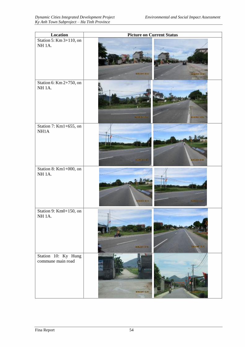
Dynamic Cities Integrated Development Project Environmental and Social Impact Assessment
Ky Anh Town Subproject – Ha Tinh Province
Fina Report 54
Location Picture on Current Status
Station 5: Km 3+110, on
NH 1A.
Station 6: Km 2+750, on
NH 1A.
Station 7: Km1+655, on
NH1A
Station 8: Km1+000, on
NH 1A.
Station 9: Km0+150, on
NH 1A.
Station 10: Ky Hung
commune main road
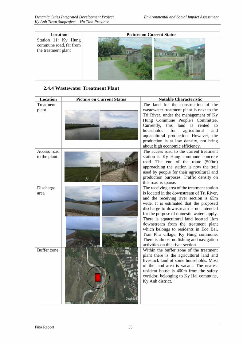
Dynamic Cities Integrated Development Project Environmental and Social Impact Assessment
Ky Anh Town Subproject – Ha Tinh Province
Fina Report 55
Location Picture on Current Status
Station 11: Ky Hung
commune road, far from
the treatment plant
2.4.4 Wastewater Treatment Plant
Location Picture on Current Status Notable Characteristic
Treatment
plant
The land for the construction of the
wastewater treatment plant is next to the
Tri River, under the management of Ky
Hung Commune People's Committee.
Currently, this land is rented to
households for agricultural and
aquacultural production. However, the
production is at low density, not bring
about high economic efficiency.
Access road
to the plant
The access road to the current treatment
station is Ky Hung commune concrete
road. The end of the route (500m)
approaching the station is now the trail
used by people for their agricultural and
production purposes. Traffic density on
this road is sparse.
Discharge
area
The receiving area of the treatment station
is located in the downstream of Tri River,
and the receiving river section is 65m
wide. It is estimated that the proposed
discharge to downstream is not intended
for the purpose of domestic water supply.
There is aquacultural land located 1km
downstream from the treatment plant
which belongs to residents in Eoc Bai,
Tran Phu village, Ky Hung commune.
There is almost no fishing and navigation
activities on this river section
Buffer zone
Within the buffer zone of the treatment
plant there is the agricultural land and
livestock land of some households. Most
of the land area is vacant. The nearest
resident house is 400m from the safety
corridor, belonging to Ky Hai commune,
Ky Anh district.
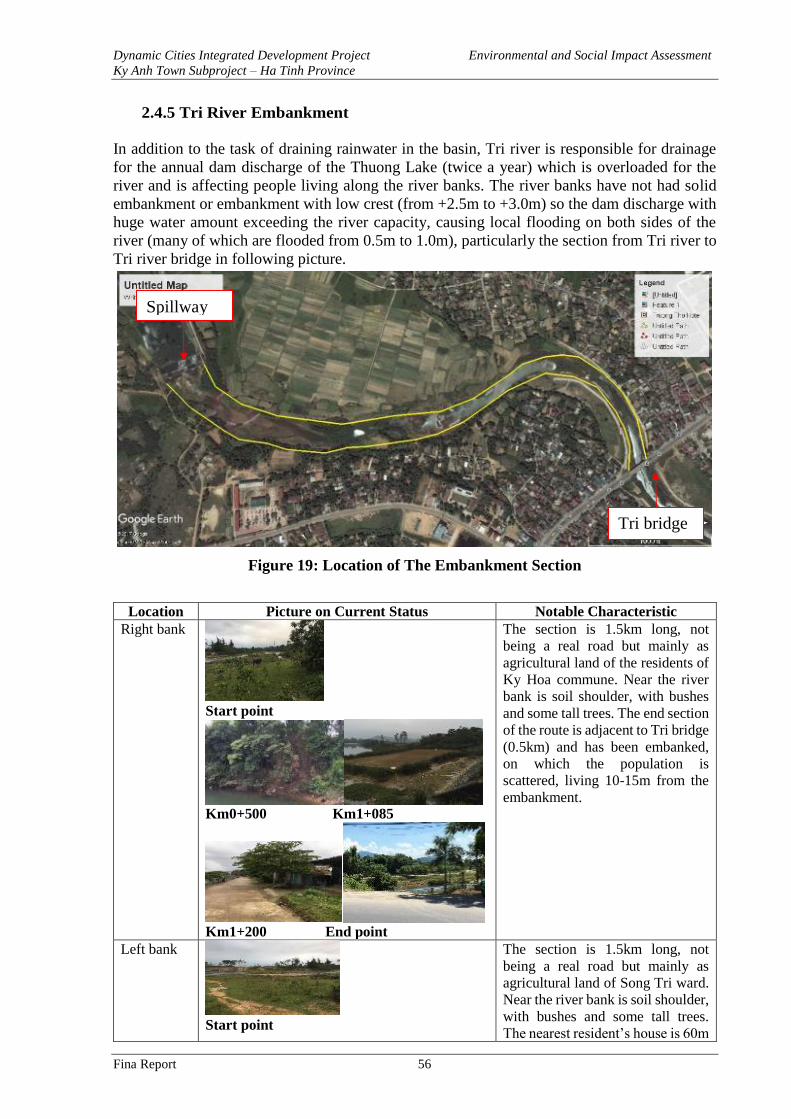
Dynamic Cities Integrated Development Project Environmental and Social Impact Assessment
Ky Anh Town Subproject – Ha Tinh Province
Fina Report 56
2.4.5 Tri River Embankment
In addition to the task of draining rainwater in the basin, Tri river is responsible for drainage
for the annual dam discharge of the Thuong Lake (twice a year) which is overloaded for the
river and is affecting people living along the river banks. The river banks have not had solid
embankment or embankment with low crest (from +2.5m to +3.0m) so the dam discharge with
huge water amount exceeding the river capacity, causing local flooding on both sides of the
river (many of which are flooded from 0.5m to 1.0m), particularly the section from Tri river to
Tri river bridge in following picture.
Figure 19: Location of The Embankment Section
Location Picture on Current Status Notable Characteristic
Right bank
Start point
Km0+500 Km1+085
Km1+200 End point
The section is 1.5km long, not
being a real road but mainly as
agricultural land of the residents of
Ky Hoa commune. Near the river
bank is soil shoulder, with bushes
and some tall trees. The end section
of the route is adjacent to Tri bridge
(0.5km) and has been embanked,
on which the population is
scattered, living 10-15m from the
embankment.
Left bank
Start point
The section is 1.5km long, not
being a real road but mainly as
agricultural land of Song Tri ward.
Near the river bank is soil shoulder,
with bushes and some tall trees.
The nearest resident’s house is 60m
Spillway
Tri bridge
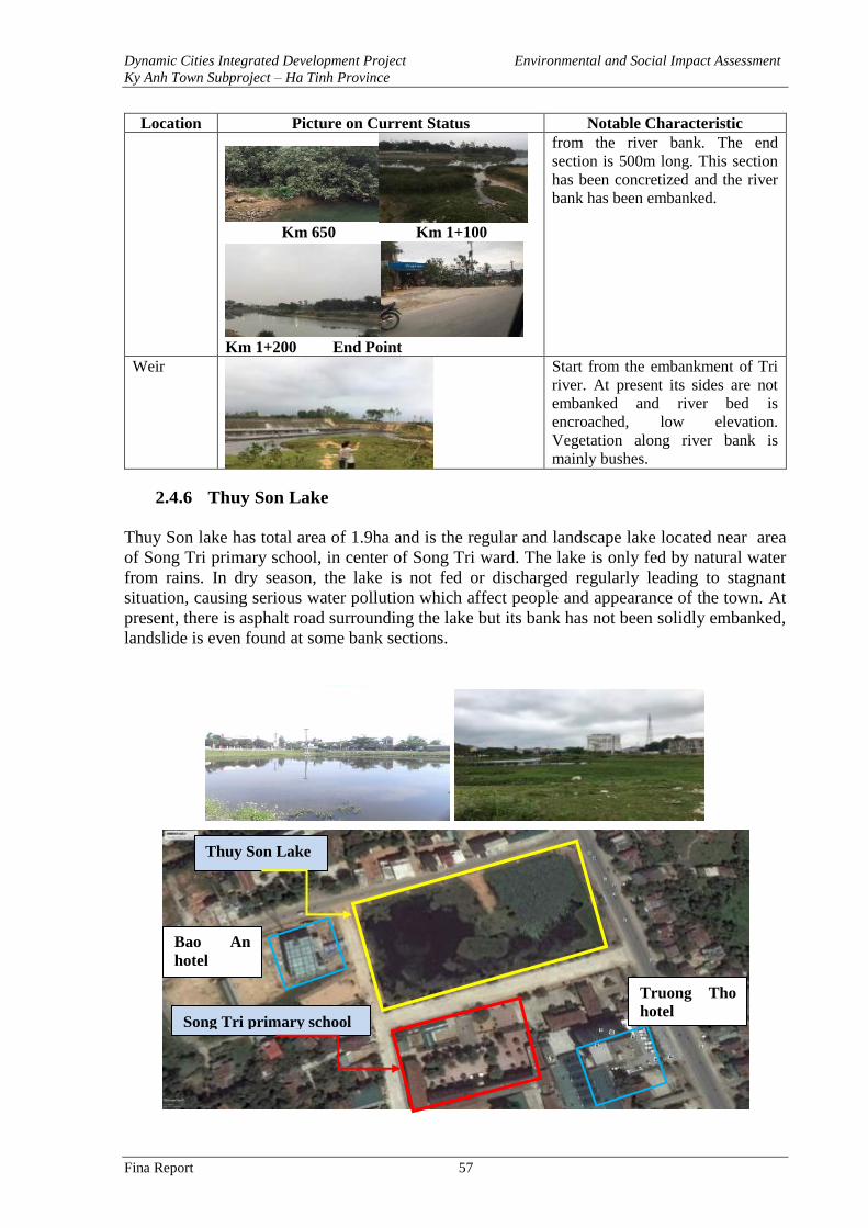
Dynamic Cities Integrated Development Project Environmental and Social Impact Assessment
Ky Anh Town Subproject – Ha Tinh Province
Fina Report 57
Location Picture on Current Status Notable Characteristic
Km 650 Km 1+100
Km 1+200 End Point
from the river bank. The end
section is 500m long. This section
has been concretized and the river
bank has been embanked.
Weir
Start from the embankment of Tri
river. At present its sides are not
embanked and river bed is
encroached, low elevation.
Vegetation along river bank is
mainly bushes.
2.4.6 Thuy Son Lake
Thuy Son lake has total area of 1.9ha and is the regular and landscape lake located near area
of Song Tri primary school, in center of Song Tri ward. The lake is only fed by natural water
from rains. In dry season, the lake is not fed or discharged regularly leading to stagnant
situation, causing serious water pollution which affect people and appearance of the town. At
present, there is asphalt road surrounding the lake but its bank has not been solidly embanked,
landslide is even found at some bank sections.
Song Tri primary school
Thuy Son Lake
Bao An
hotel
Truong Tho
hotel
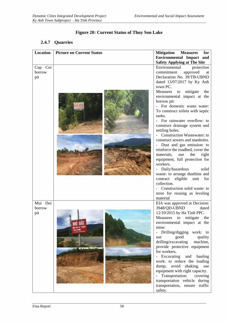
Dynamic Cities Integrated Development Project Environmental and Social Impact Assessment
Ky Anh Town Subproject – Ha Tinh Province
Fina Report 58
Figure 20: Current Status of Thuy Son Lake
2.4.7 Quarries
Location Picture on Current Status Mitigation Measures for
Environmental Impact and
Safety Applying at The Site
Cup Coi
borrow
pit
Environmental protection
commitment approved at
Declaration No. 39/TB-UBND
dated 13/07/2017 by Ky Anh
town PC.
Measures to mitigate the
environmental impact at the
borrow pit:
- For domestic waste water:
To construct toilets with septic
tanks.
- For rainwater overflow: to
construct drainage system and
settling holes.
- Construction Wastewater: to
construct sewers and manholes.
- Dust and gas emission: to
reinforce the roadbed, cover the
materials, use the right
equipment, full protection for
workers.
- Daily/hazardous solid
waste: to arrange dustbins and
contract eligible unit for
collection.
- Construction solid waste: to
store for reusing as leveling
material
Mui Doi
borrow
pit
EIA was approved at Decision:
3948/QD-UBND dated
12/10/2015 by Ha Tinh PPC.
Measures to mitigate the
environmental impact at the
mine:
- Drilling/digging work: to
use good quality
drilling/excavating machine,
provide protective equipment
for workers.
- Excavating and hauling
work: to reduce the loading
dump, avoid shaking, use
equipment with right capacity.
- Transportation: covering
transportation vehicle during
transportation, ensure traffic
safety.
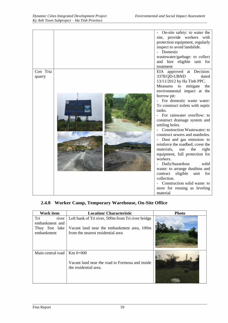
Dynamic Cities Integrated Development Project Environmental and Social Impact Assessment
Ky Anh Town Subproject – Ha Tinh Province
Fina Report 59
- On-site safety: to water the
site, provide workers with
protection equipment, regularly
inspect to avoid landslide.
- Domestic
wastewater/garbage: to collect
and hire eligible unit for
treatment
Con Tria
quarry
EIA approved at Decision:
3378/QD-UBND dated
13/11/2012 by Ha Tinh PPC.
Measures to mitigate the
environmental impact at the
borrow pit:
- For domestic waste water:
To construct toilets with septic
tanks.
- For rainwater overflow: to
construct drainage system and
settling holes.
- Construction Wastewater: to
construct sewers and manholes.
- Dust and gas emission: to
reinforce the roadbed, cover the
materials, use the right
equipment, full protection for
workers.
- Daily/hazardous solid
waste: to arrange dustbins and
contract eligible unit for
collection.
- Construction solid waste: to
store for reusing as leveling
material
2.4.8 Worker Camp, Temporary Warehouse, On-Site Office
Work item Location/ Characteristic Photo
Tri river
embankment and
Thuy Son lake
embankment
Left bank of Tri river, 500m from Tri river bridge
Vacant land near the embankment area, 100m
from the nearest residential area
Main central road Km 0+000
Vacant land near the road to Formosa and inside
the residential area.
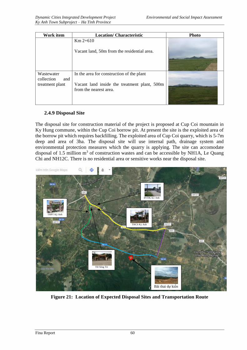
Dynamic Cities Integrated Development Project Environmental and Social Impact Assessment
Ky Anh Town Subproject – Ha Tinh Province
Fina Report 60
Work item Location/ Characteristic Photo
Km 2+610
Vacant land, 50m from the residential area.
Wastewater
collection and
treatment plant
In the area for construction of the plant
Vacant land inside the treatment plant, 500m
from the nearest area.
2.4.9 Disposal Site
The disposal site for construction material of the project is proposed at Cup Coi mountain in
Ky Hung commune, within the Cup Coi borrow pit. At present the site is the exploited area of
the borrow pit which requires backfilling. The exploited area of Cup Coi quarry, which is 5-7m
deep and area of 3ha. The disposal site will use internal path, drainage system and
environmental protection measures which the quarry is applying. The site can accomodate
disposal of 1.5 million m3 of construction wastes and can be accessible by NH1A, Le Quang
Chi and NH12C. There is no residential area or sensitive works near the disposal site.
Figure 21: Location of Expected Disposal Sites and Transportation Route
Bãi thải dự kiến
THPT Kỳ Anh
BVĐK Kỳ Anh
THCS Kỳ Anh
TH Sông Trí
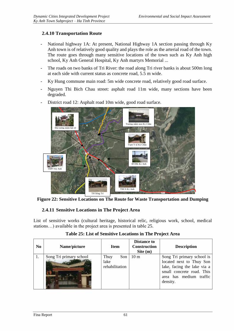
Dynamic Cities Integrated Development Project Environmental and Social Impact Assessment
Ky Anh Town Subproject – Ha Tinh Province
Fina Report 61
2.4.10 Transportation Route
- National highway 1A: At present, National Highway 1A section passing through Ky
Anh town is of relatively good quality and plays the role as the arterial road of the town.
The route goes through many sensitive locations of the town such as Ky Anh high
school, Ky Anh General Hospital, Ky Anh martyrs Memorial ...
- The roads on two banks of Tri River: the road along Tri river banks is about 500m long
at each side with current status as concrete road, 5.5 m wide.
- Ky Hung commune main road: 5m wide concrete road, relatively good road surface.
- Nguyen Thi Bich Chau street: asphalt road 11m wide, many sections have been
degraded.
- District road 12: Asphalt road 10m wide, good road surface.
Figure 22: Sensitive Locations on The Route for Waste Transportation and Dumping
2.4.11 Sensitive Locations in The Project Area
List of sensitive works (cultural heritage, historical relic, religious work, school, medical
stations…) available in the project area is presented in table 25.
Table 25: List of Sensitive Locations in The Project Area
No Name/picture Item
Distance to
Construction
Site (m)
Description
1. Song Tri primary school
Thuy Son
lake
rehabilitation
10 m Song Tri primary school is
located next to Thuy Son
lake, facing the lake via a
small concrete road. This
area has medium traffic
density.
THPT Kỳ Anh
BVĐK Kỳ Anh
THCS Kỳ Anh
Đài tưởng niệm liệt sỹ
Trường mầm non Kỳ Châu
Trạm Y tế Kỳ Châu
TH Sông Trí
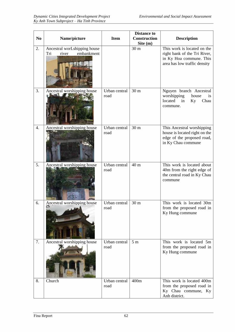
Dynamic Cities Integrated Development Project Environmental and Social Impact Assessment
Ky Anh Town Subproject – Ha Tinh Province
Fina Report 62
No Name/picture Item
Distance to
Construction
Site (m)
Description
2. Ancestral worLshipping house
Tri river embankment
30 m This work is located on the
right bank of the Tri River,
in Ky Hoa commune. This
area has low traffic density
3. Ancestral worshipping house
Urban central
road
30 m Nguyen branch Ancestral
worshipping house is
located in Ky Chau
commune.
4. Ancestral worshipping house
Urban central
road
30 m This Ancestral worshipping
house is located right on the
edge of the proposed road,
in Ky Chau commune
5. Ancestral worshipping house
Urban central
road
40 m This work is located about
40m from the right edge of
the central road in Ky Chau
commune
6. Ancestral worshipping house
Urban central
road
30 m This work is located 30m
from the proposed road in
Ky Hung commune
7. Ancestral worshipping house
Urban central
road
5 m This work is located 5m
from the proposed road in
Ky Hung commune
8. Church Urban central
road
400m This work is located 400m
from the proposed road in
Ky Chau commune, Ky
Anh district.
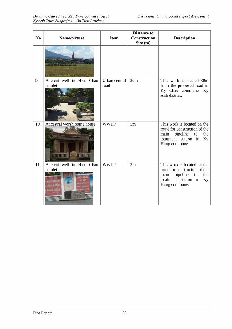
Dynamic Cities Integrated Development Project Environmental and Social Impact Assessment
Ky Anh Town Subproject – Ha Tinh Province
Fina Report 63
No Name/picture Item
Distance to
Construction
Site (m)
Description
9. Ancient well in Hieu Chau
hamlet
Urban central
road
30m This work is located 30m
from the proposed road in
Ky Chau commune, Ky
Anh district.
10. Ancestral worshipping house
WWTP 5m This work is located on the
route for construction of the
main pipeline to the
treatment station in Ky
Hung commune.
11. Ancient well in Hieu Chau
hamlet
WWTP 3m This work is located on the
route for construction of the
main pipeline to the
treatment station in Ky
Hung commune.
Dynamic Cities Integrated Development Project Environmental and Social Impact Assessment
Ky Anh Town Subproject – Ha Tinh Province
Fina Report 64
CHAPTER 3: ENVIRONMENTAL AND SOCIAL IMPACTS
ASSESSMENT
3.1. Positive Impacts
In general, the proposed subproject would bring significant positive impacts for the
environment and the people in Ky Anh Town. The provisions of the new infrastructure would
contribute to socio-economic development in the subproject area, improving urban environment
and landscape, benefiting human health. The construction of the trunk urban road would help
to improve connectivity between Ky Trinh urban center with the neighboring industrial zones
and food supply areas. Local people will be benefited from a healthier and more sustainable
living environment. Public health risks related to water-borne diseases in the subproject areas
would be reduced after untreated wastewater is collected and treated before being discharged
into the environment. Lining the embankment and construction of operational roads along the
Tri river would help to reduce flood and inundation at the riverside area. Urban environment
and landscape would be improved with the rehabilitation of the Thuy Son Lake and the
construction of the wastewater collection and treatment system. The positive impacts of the
subproject are detailed as follows:
- The construction of the trunk road connecting urban centers will create an important
transport axis, improving connections between the Ky Trinh urban centres with the
Formosa Industrial Zone, – the Vung Ang Economic Zone and the southern area of Ky
Anh district which is the supply source of food for urban centers and Vung Ang
economic zone. Therefore, the construction of the new urban road would contribute to
socio-economic development in the subproject area.
- The construction of a wastewater collection and treatment system will help to improve
environmental conditions in the serviced area. Untreated urban domestic wastewater
would no longer be discharged into the environment thus soil and water contamination
are expected to be reduced. Improved sanitation condition would help to reduce health
risks related to water-born diseases.
- Lining the embankment of Tri river will help to reduce erosion and landslide risks,
improve drainage capacity of the river. This will help to reduce flooding risks for
residential areas along the river banks, bring a safer living environment.
- The rehabilitation including embankment lining of Thuy Son lake will not only help to
improve environment conditions but also bring about better local urban landscape,
contributing to promote socio-economic development in the region. Moreover, the
rehabilitation of the lake will contribute to reduce health risk related to water-born
diseases after stagnant water is removed from the lake.
- The technical assistance to the subproject owner, authorities and local organizations will
help bring efficiency to the operation of the sub-project for sustainable development.
The project’s benefits for female beneficiaries:
- The work item of the trunk road connecting urban centres will provide better access to
social service, market and job opportunities for people living along the road. The trunk
road will also reduce travel time and increase the job opportunities and business
activities for women.
- The work item of Tri river embankment and the wastewater collection and treatment
plant will help to improve environmental condition, reduce environmental-borne
diseases (gynaecological disease, venereal disease…), that will help to reduce medical
Dynamic Cities Integrated Development Project Environmental and Social Impact Assessment
Ky Anh Town Subproject – Ha Tinh Province
Fina Report 65
check time and treatment cost. Women will have more time and better financial
condition to improve their capacity
22,774 people will be benefited directly from the subproject. These are the residents of Song
Tri, Ky Trinh, Ky Hoa, Ky Hung wards and communes. The indirect beneficiaries are the people
in Ky Anh Town (71,399 people) and Ha Tinh Province (1,261.285 million people).
The business sector will also benefit greatly through improved infrastructure and landscape that
facilitate trade and attract investment.
3.2.Identification of Potential Negative Impacts and Risks
The implementation of Component 1 comprising of four major work items listed below will
cause number of potential socio-environmental impacts and risks:
- Construction of the Main Road Connecting Urban Centers, L = 3.75 km, B = 16m - 29 m,
designed speed at 60km/h. Road design includes drainage, tree planting, traffic safety measures.
There are three bridges on the route, L = 58 to 82m, B = 16 to 20 m.
- Construction of the Wastewater Collection and Treatment System Including 67.5km
HDPE sewers D315 ÷ D450, 11 wastewater pumping stations, 3 - 14m2/station, and a
wastewater treatment plant capacity 2,000m3/day.
- Embankment Lining and Construction of Riverside Road along the Tri River, including
lining 2x 1.5km embankments at both side of the Tri river with reinforced concrete slabs and
grass confinements. Build operational road with B = 13m and includes lighting, drainage,
sewers and trees.
- Upgrading and Rehabilitating Thuy Son Lake–Including (i) dredging of Thuy Son lake
with area of 1.9 ha, (ii) constructing the conduit for the lake, lining 2km of embankment, (iii)
constructing and rehabilitating the sidewalk, completing technical infrastructure and landscape
such as sewer, drainage, lighting system, tree planting.
The implementation of these activities would cause potential negative socio-environmental
impacts and risks as identified in Table 1. The potential environmental and social negative
impacts are classified as below:
High Impacts (H)
- Impacts on large land areas, important areas, or changes in environmental conditions in
a period of more than 02 years.
- Impacts exceeding permitted standards and regulations. Long-term and large-scaled
impacts;
- Changes in ecological systems, impacts on ecological systems at large areas, or medium
impacts (lasting for more than 02 years) yet required recovery period of the affected
ecological systems are 10 years;
- Impacts on health of the human beings;
- Economic losses and damages to the sub-project nearby people and communities.
- Potential significant social and environmental impacts which can only be controlled and
mitigated if proper mitigation measures are implemented.
Medium Impacts (M)
- Impacts on large areas for a period from 6 months to 2 years
Dynamic Cities Integrated Development Project Environmental and Social Impact Assessment
Ky Anh Town Subproject – Ha Tinh Province
Fina Report 66
- Changes in ecological systems or ecological functions at the localities in a short time
and recovery capacity are good. The impact levels are similar to current changes, yet
such impacts can cause cumulative effect.
- Impacts might (or might not) affect people’s health, causing impacts on several persons
in the surroundings of the sub-project areas.
- Impacts are medium, localized, and temporary and mitigation measures should be
carried out.
Low Impacts (L)
- Social and environmental impacts that cause significant changes yet in less than 6
months or medium changes for a period of less than 2 years.
- Impacts are within permitted standards and regulations, causing minor changes at the
present. Impacts are fully controlled;
- Impacts that might affect daily activities yet not cause any obstruction to communities;
- Insignificant impacts on health and living standards of people;
- Impacts are minor, localized, and can be neglected
No Impacts (N)
- Impacts that are unrecognizable or can be identified yet such impacts can also be caused
by daily activities;
- No social and environmental impacts
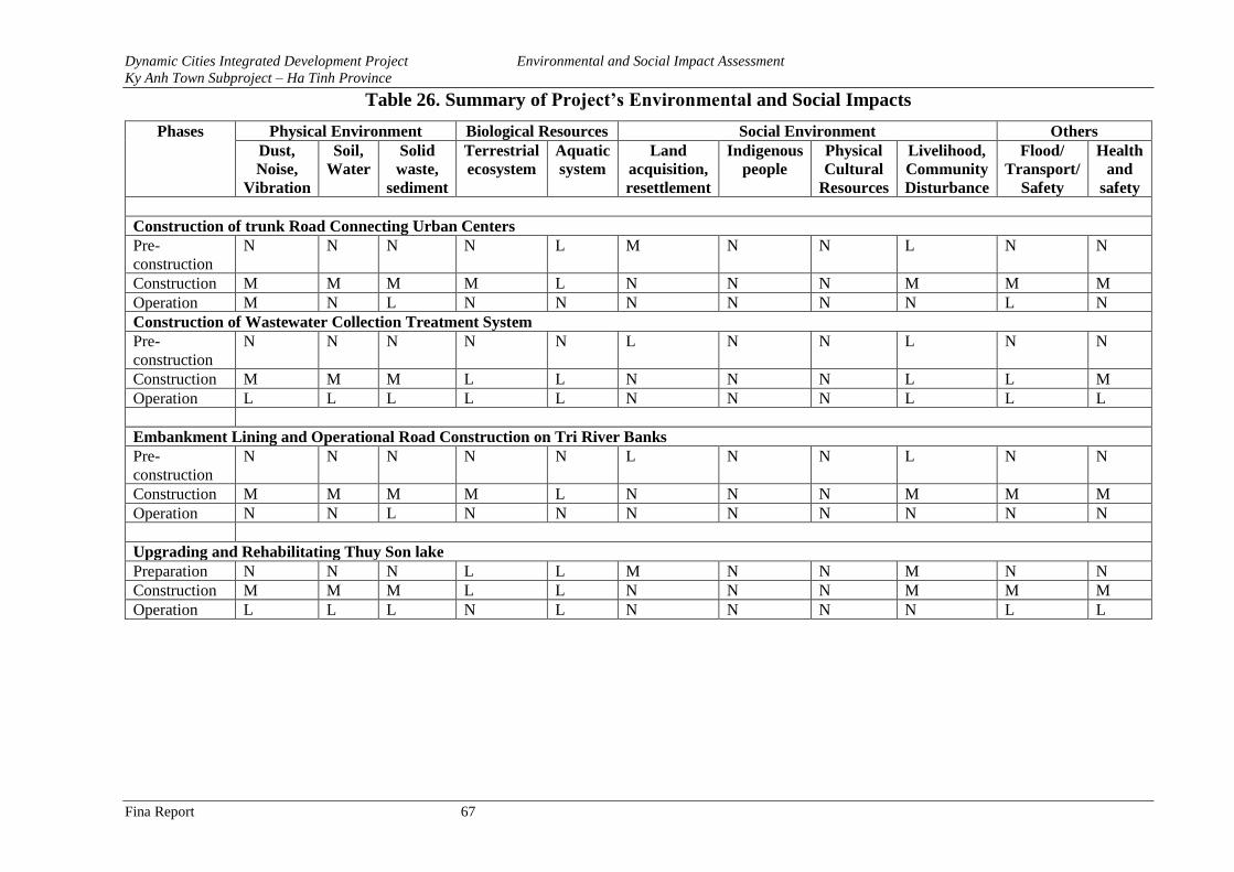
Dynamic Cities Integrated Development Project Environmental and Social Impact Assessment
Ky Anh Town Subproject – Ha Tinh Province
Fina Report 67
Table 26. Summary of Project’s Environmental and Social Impacts
Phases Physical Environment Biological Resources Social Environment Others
Dust,
Noise,
Vibration
Soil,
Water
Solid
waste,
sediment
Terrestrial
ecosystem
Aquatic
system
Land
acquisition,
resettlement
Indigenous
people
Physical
Cultural
Resources
Livelihood,
Community
Disturbance
Flood/
Transport/
Safety
Health
and
safety
Construction of trunk Road Connecting Urban Centers
Pre-
construction
N N N N L M N N L N N
Construction M M M M L N N N M M M
Operation M N L N N N N N N L N
Construction of Wastewater Collection Treatment System
Pre-
construction
N N N N N L N N L N N
Construction M M M L L N N N L L M
Operation L L L L L N N N L L L
Embankment Lining and Operational Road Construction on Tri River Banks
Pre-
construction
N N N N N L N N L N N
Construction M M M M L N N N M M M
Operation N N L N N N N N N N N
Upgrading and Rehabilitating Thuy Son lake
Preparation N N N L L M N N M N N
Construction M M M L L N N N M M M
Operation L L L N L N N N N L L
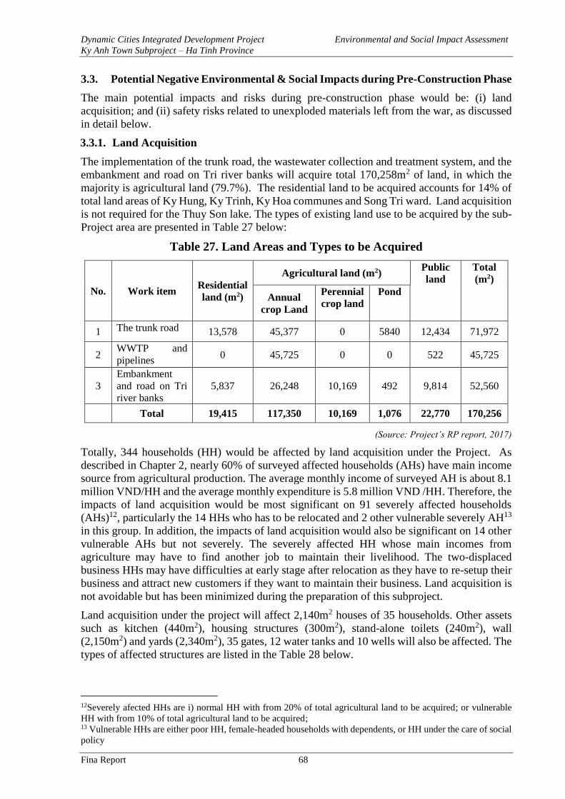
Dynamic Cities Integrated Development Project Environmental and Social Impact Assessment
Ky Anh Town Subproject – Ha Tinh Province
Fina Report 68
3.3. Potential Negative Environmental & Social Impacts during Pre-Construction Phase
The main potential impacts and risks during pre-construction phase would be: (i) land
acquisition; and (ii) safety risks related to unexploded materials left from the war, as discussed
in detail below.
3.3.1. Land Acquisition
The implementation of the trunk road, the wastewater collection and treatment system, and the
embankment and road on Tri river banks will acquire total 170,258m2 of land, in which the
majority is agricultural land (79.7%). The residential land to be acquired accounts for 14% of
total land areas of Ky Hung, Ky Trinh, Ky Hoa communes and Song Tri ward. Land acquisition
is not required for the Thuy Son lake. The types of existing land use to be acquired by the sub-
Project area are presented in Table 27 below:
Table 27. Land Areas and Types to be Acquired
No. Work item Residential
land (m2)
Agricultural land (m2) Public
land
Total
(m2)
Annual
crop Land
Perennial
crop land
Pond
1 The trunk road 13,578 45,377 0 5840 12,434 71,972
2 WWTP and
pipelines 0 45,725 0 0 522 45,725
3
Embankment
and road on Tri
river banks
5,837 26,248 10,169 492 9,814 52,560
Total 19,415 117,350 10,169 1,076 22,770 170,256
(Source: Project’s RP report, 2017)
Totally, 344 households (HH) would be affected by land acquisition under the Project. As
described in Chapter 2, nearly 60% of surveyed affected households (AHs) have main income
source from agricultural production. The average monthly income of surveyed AH is about 8.1
million VND/HH and the average monthly expenditure is 5.8 million VND /HH. Therefore, the
impacts of land acquisition would be most significant on 91 severely affected households
(AHs)12, particularly the 14 HHs who has to be relocated and 2 other vulnerable severely AH13
in this group. In addition, the impacts of land acquisition would also be significant on 14 other
vulnerable AHs but not severely. The severely affected HH whose main incomes from
agriculture may have to find another job to maintain their livelihood. The two-displaced
business HHs may have difficulties at early stage after relocation as they have to re-setup their
business and attract new customers if they want to maintain their business. Land acquisition is
not avoidable but has been minimized during the preparation of this subproject.
Land acquisition under the project will affect 2,140m2 houses of 35 households. Other assets
such as kitchen (440m2), housing structures (300m2), stand-alone toilets (240m2), wall
(2,150m2) and yards (2,340m2), 35 gates, 12 water tanks and 10 wells will also be affected. The
types of affected structures are listed in the Table 28 below.
12Severely afected HHs are i) normal HH with from 20% of total agricultural land to be acquired; or vulnerable
HH with from 10% of total agricultural land to be acquired; 13 Vulnerable HHs are either poor HH, female-headed households with dependents, or HH under the care of social
policy
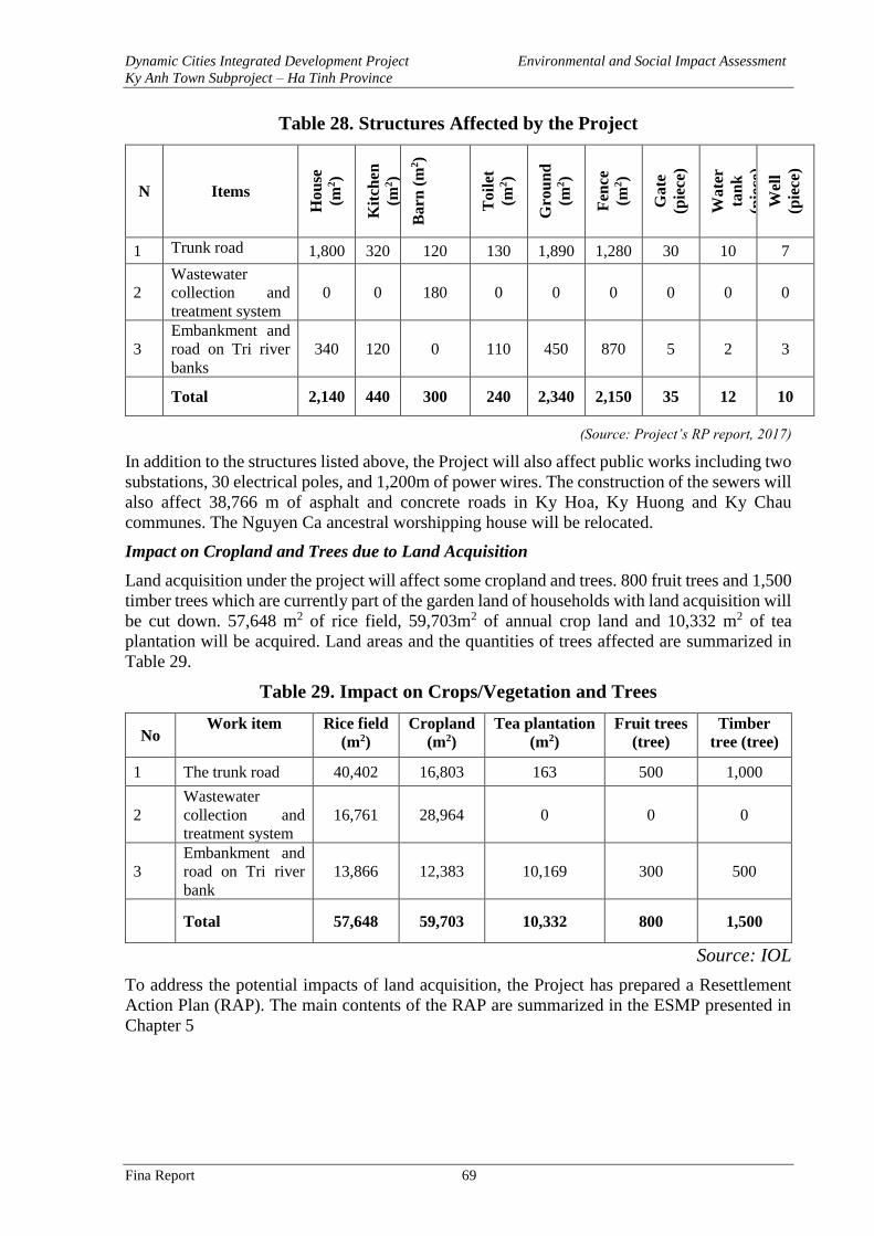
Dynamic Cities Integrated Development Project Environmental and Social Impact Assessment
Ky Anh Town Subproject – Ha Tinh Province
Fina Report 69
Table 28. Structures Affected by the Project
N Items
Ho
use
(m2)
Kit
chen
(m2)
Ba
rn (
m2)
To
ilet
(m2)
Gro
un
d
(m2)
Fen
ce
(m2)
Ga
te
(pie
ce)
Wa
ter
tan
k
(pie
ce)
Wel
l
(pie
ce)
1 Trunk road 1,800 320 120 130 1,890 1,280 30 10 7
2
Wastewater
collection and
treatment system
0 0 180 0 0 0 0 0 0
3
Embankment and
road on Tri river
banks
340 120 0 110 450 870 5 2 3
Total 2,140 440 300 240 2,340 2,150 35 12 10
(Source: Project’s RP report, 2017)
In addition to the structures listed above, the Project will also affect public works including two
substations, 30 electrical poles, and 1,200m of power wires. The construction of the sewers will
also affect 38,766 m of asphalt and concrete roads in Ky Hoa, Ky Huong and Ky Chau
communes. The Nguyen Ca ancestral worshipping house will be relocated.
Impact on Cropland and Trees due to Land Acquisition
Land acquisition under the project will affect some cropland and trees. 800 fruit trees and 1,500
timber trees which are currently part of the garden land of households with land acquisition will
be cut down. 57,648 m2 of rice field, 59,703m2 of annual crop land and 10,332 m2 of tea
plantation will be acquired. Land areas and the quantities of trees affected are summarized in
Table 29.
Table 29. Impact on Crops/Vegetation and Trees
No Work item Rice field
(m2)
Cropland
(m2)
Tea plantation
(m2)
Fruit trees
(tree)
Timber
tree (tree)
1 The trunk road 40,402 16,803 163 500 1,000
2
Wastewater
collection and
treatment system
16,761 28,964 0 0 0
3
Embankment and
road on Tri river
bank
13,866 12,383 10,169 300 500
Total 57,648 59,703 10,332 800 1,500
Source: IOL
To address the potential impacts of land acquisition, the Project has prepared a Resettlement
Action Plan (RAP). The main contents of the RAP are summarized in the ESMP presented in
Chapter 5
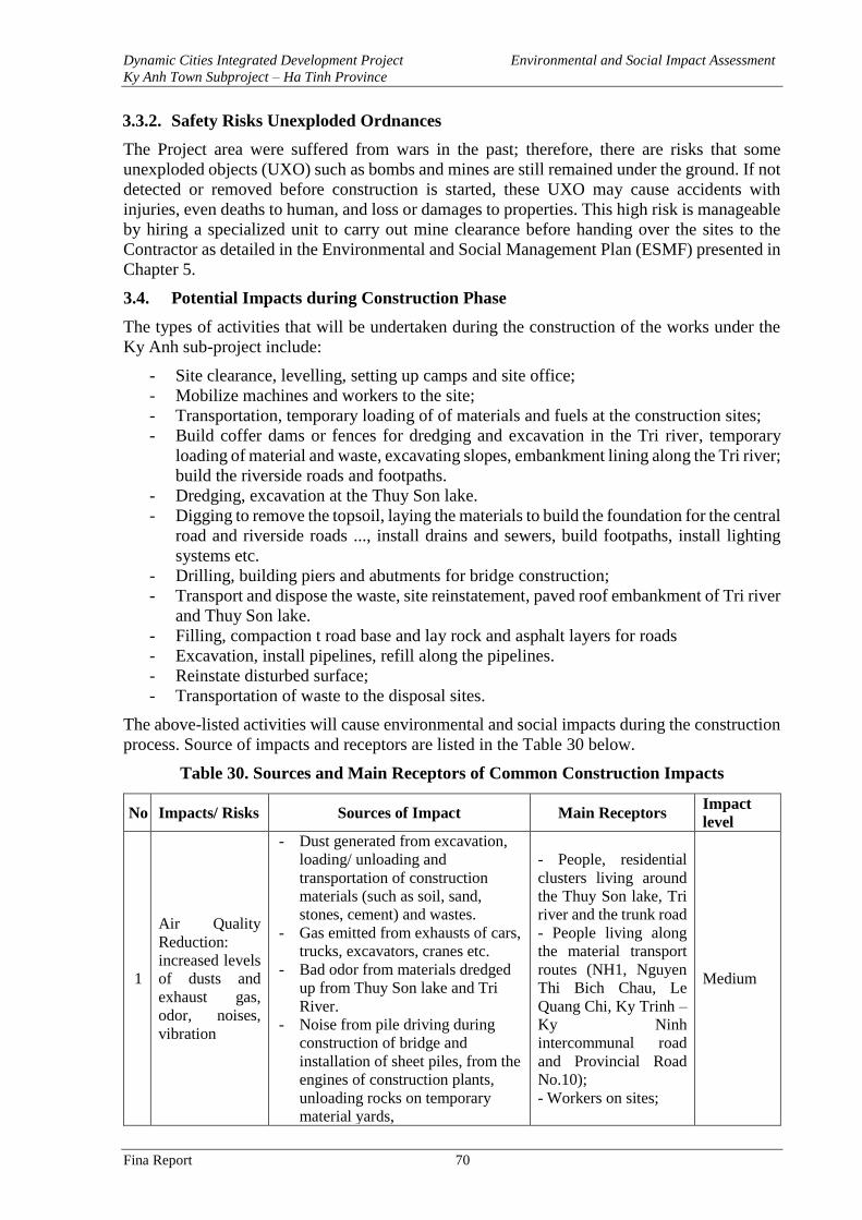
Dynamic Cities Integrated Development Project Environmental and Social Impact Assessment
Ky Anh Town Subproject – Ha Tinh Province
Fina Report 70
3.3.2. Safety Risks Unexploded Ordnances
The Project area were suffered from wars in the past; therefore, there are risks that some
unexploded objects (UXO) such as bombs and mines are still remained under the ground. If not
detected or removed before construction is started, these UXO may cause accidents with
injuries, even deaths to human, and loss or damages to properties. This high risk is manageable
by hiring a specialized unit to carry out mine clearance before handing over the sites to the
Contractor as detailed in the Environmental and Social Management Plan (ESMF) presented in
Chapter 5.
3.4. Potential Impacts during Construction Phase
The types of activities that will be undertaken during the construction of the works under the
Ky Anh sub-project include:
- Site clearance, levelling, setting up camps and site office;
- Mobilize machines and workers to the site;
- Transportation, temporary loading of of materials and fuels at the construction sites;
- Build coffer dams or fences for dredging and excavation in the Tri river, temporary
loading of material and waste, excavating slopes, embankment lining along the Tri river;
build the riverside roads and footpaths.
- Dredging, excavation at the Thuy Son lake.
- Digging to remove the topsoil, laying the materials to build the foundation for the central
road and riverside roads ..., install drains and sewers, build footpaths, install lighting
systems etc.
- Drilling, building piers and abutments for bridge construction;
- Transport and dispose the waste, site reinstatement, paved roof embankment of Tri river
and Thuy Son lake.
- Filling, compaction t road base and lay rock and asphalt layers for roads
- Excavation, install pipelines, refill along the pipelines.
- Reinstate disturbed surface;
- Transportation of waste to the disposal sites.
The above-listed activities will cause environmental and social impacts during the construction
process. Source of impacts and receptors are listed in the Table 30 below.
Table 30. Sources and Main Receptors of Common Construction Impacts
No Impacts/ Risks Sources of Impact Main Receptors Impact
level
1
Air Quality
Reduction:
increased levels
of dusts and
exhaust gas,
odor, noises,
vibration
- Dust generated from excavation,
loading/ unloading and
transportation of construction
materials (such as soil, sand,
stones, cement) and wastes.
- Gas emitted from exhausts of cars,
trucks, excavators, cranes etc.
- Bad odor from materials dredged
up from Thuy Son lake and Tri
River.
- Noise from pile driving during
construction of bridge and
installation of sheet piles, from the
engines of construction plants,
unloading rocks on temporary
material yards,
- People, residential
clusters living around
the Thuy Son lake, Tri
river and the trunk road
- People living along
the material transport
routes (NH1, Nguyen
Thi Bich Chau, Le
Quang Chi, Ky Trinh –
Ky Ninh
intercommunal road
and Provincial Road
No.10);
- Workers on sites;
Medium
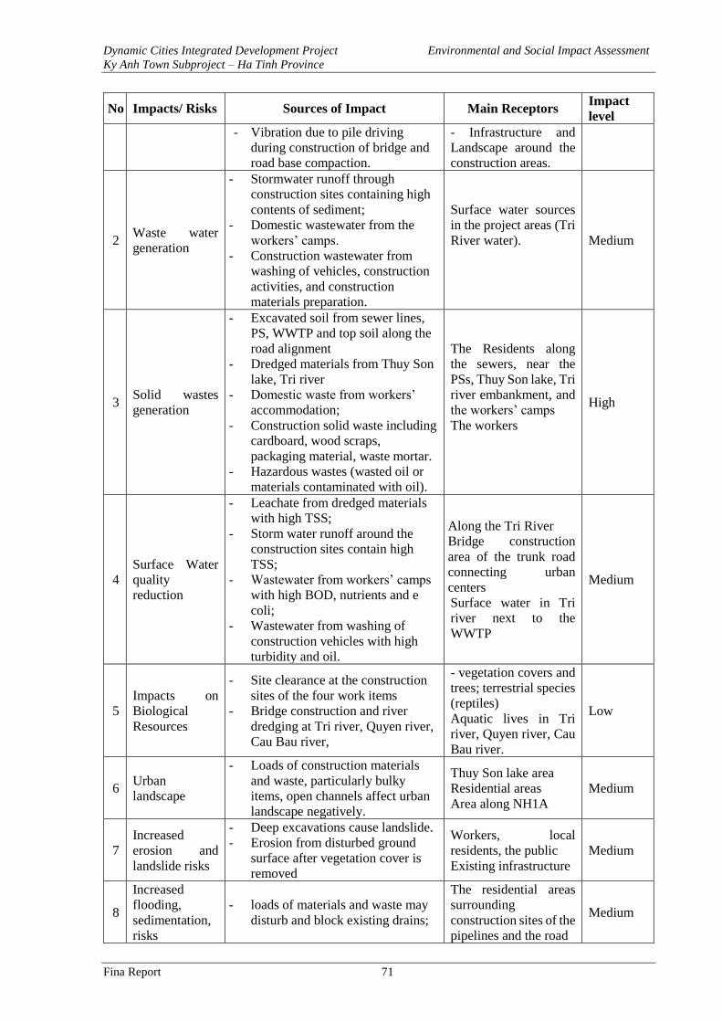
Dynamic Cities Integrated Development Project Environmental and Social Impact Assessment
Ky Anh Town Subproject – Ha Tinh Province
Fina Report 71
No Impacts/ Risks Sources of Impact Main Receptors Impact
level
- Vibration due to pile driving
during construction of bridge and
road base compaction.
- Infrastructure and
Landscape around the
construction areas.
2 Waste water
generation
- Stormwater runoff through
construction sites containing high
contents of sediment;
- Domestic wastewater from the
workers’ camps.
- Construction wastewater from
washing of vehicles, construction
activities, and construction
materials preparation.
Surface water sources
in the project areas (Tri
River water).
Medium
3 Solid wastes
generation
- Excavated soil from sewer lines,
PS, WWTP and top soil along the
road alignment
- Dredged materials from Thuy Son
lake, Tri river
- Domestic waste from workers’
accommodation;
- Construction solid waste including
cardboard, wood scraps,
packaging material, waste mortar.
- Hazardous wastes (wasted oil or
materials contaminated with oil).
The Residents along
the sewers, near the
PSs, Thuy Son lake, Tri
river embankment, and
the workers’ camps
The workers
High
4
Surface Water
quality
reduction
- Leachate from dredged materials
with high TSS;
- Storm water runoff around the
construction sites contain high
TSS;
- Wastewater from workers’ camps
with high BOD, nutrients and e
coli;
- Wastewater from washing of
construction vehicles with high
turbidity and oil.
Along the Tri River
Bridge construction
area of the trunk road
connecting urban
centers
Surface water in Tri
river next to the
WWTP
Medium
5
Impacts on
Biological
Resources
- Site clearance at the construction
sites of the four work items
- Bridge construction and river
dredging at Tri river, Quyen river,
Cau Bau river,
- vegetation covers and
trees; terrestrial species
(reptiles)
Aquatic lives in Tri
river, Quyen river, Cau
Bau river.
Low
6 Urban
landscape
- Loads of construction materials
and waste, particularly bulky
items, open channels affect urban
landscape negatively.
Thuy Son lake area
Residential areas
Area along NH1A
Medium
7
Increased
erosion and
landslide risks
- Deep excavations cause landslide.
- Erosion from disturbed ground
surface after vegetation cover is
removed
Workers, local
residents, the public
Existing infrastructure
Medium
8
Increased
flooding,
sedimentation,
risks
- loads of materials and waste may
disturb and block existing drains;
The residential areas
surrounding
construction sites of the
pipelines and the road
Medium
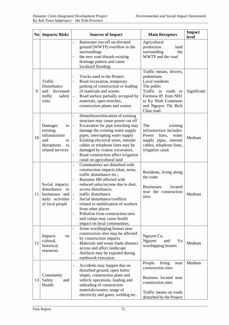
Dynamic Cities Integrated Development Project Environmental and Social Impact Assessment
Ky Anh Town Subproject – Ha Tinh Province
Fina Report 72
No Impacts/ Risks Sources of Impact Main Receptors Impact
level
- Rainwater run-off on elevated
ground (WWTP) overflow to the
surroundings
- the new road disturb existing
drainage pattern and cause
localized flooding
Agricultural
production land
surrounding the
WWTP and the road
9
Traffic
Disturbance
and Increased
traffic safety
risks
- Trucks used in the Project
- Road excavation, temporary
parking of construction or loading
of materials and wastes.
- Road surface partially occupied by
materials, open trenches,
construction plants and wastes
Traffic means, drivers,
pedestrians
Local residents
The public
Traffic in roads to
Formosa IP, from NH1
to Ky Ninh Commune
and Nguyen Thi Bich
Chau road.
Significant
10
Damages to
existing
infrastructure
and or
disruptions to
related services
- Demolition/relocation of existing
structure may cause power cut off
- Excavation for pipe trenching may
damage the existing water supply
pipes, interrupting water supply
- Existing electrical wires, internet
cables or telephone lines may be
damaged by cranes/ excavators.
- Road construction affect irrigation
canal on agricultural land
The existing
infrastructure includes:
Power lines, water
supply pipes, internet
cables, telephone lines,
irrigation canal.
Medium
11
Social impacts:
disturbance to
businesses and
daily activities
of local people
- Communities are disturbed with
construction impacts (dust, noise,
traffic disturbance etc.;
- Business HH affected with
reduced sales/income due to dust,
access disturbance;
- traffic disturbance
- Social disturbance/conflicts
related to mobilization of workers
from other places
- Pollution from construction sites
and camps may cause health
impact on local communities.
Residents, living along
the route
Businesses located
near the construction
sites
Medium
12
Impacts on
cultural,
historical
resources
- Some worshipping houses near
construction sites may be affected
by construction impacts
- Materials and waste loads obstruct
access and affect landscape
- Artifacts may be exposed during
earthwork execution
Nguyen Ca,
Nguyen and Vu
worshipping houses
Medium
13
Community
Safety and
Health
- Accidents may happen due on
disturbed ground, open holes/
slopes, construction plant and
vehicle operations, loading and
unloading of construction
materials/wastes, usage of
electricity and gases, welding etc.
People living near
construction sites
Business located near
construction sites
Traffic means on roads
disturbed by the Project
Medium
Dynamic Cities Integrated Development Project Environmental and Social Impact Assessment
Ky Anh Town Subproject – Ha Tinh Province
Fina Report 73
No Impacts/ Risks Sources of Impact Main Receptors Impact
level
- Increased traffic density cause
traffic safety risks increase at
construction areas and
transportation routes.
- The use, storage and handling of
electricity, gas, oil
- Dust, noise, waste and wastewater
from construction sites and along
the roads may affect public health.
14
Health and
safety of
workers
All construction activities impose
safety risks to the workers,
particularly:
+ falling into deep excavated holes
+ electrical shocks
+ fall into water from bridge
+ bitten by insects
the workers Low
3.4.1. Air Quality Reduction
During construction phase, localised air quality would be reduced with increased level of dust,
exhaust gases and bad odour. The level of air pollution would depend on factors such as the
quality of roads and vehicles, methods of loading, unloading and gathering materials, weather
conditions, terrain, construction method, background conditions of receptors etc. Especially,
dust concentrations will be much higher during dry, sunny and windy days. Dust may be from
materials dropping off during transportation and dispersed by the wind into the air, polluting
areas in the vicinity. In addition, noise level and vibration will also cause some impacts and
risks in the project areas.
a. Dust and Exhaust Gas Emission
Dusts are generated mainly from operations such as excavation, backfilling, temporary loading
and unloading of construction materials, movement of vehicles on transportation routes. Gases
such as NOx, SO2 and CO comes from exhausts of machinery and equipment such as
bulldozers, excavators, generators, rollers, etc.
Dust Generated from Excavation, Backfilling and Ground Leveling
Sutton model can be applied for the calculation and determination of the average concentrations
of dust and hazardous gases along the route of material transportation of the construction items
of the Project.
u
hzhzE
mmgCz
zz
.
2exp
2exp.8,0
)3/(
2
2
2
2
In which:
• C – Concentration of pollutants in the air (mg/m3)
• E – Emission volume from generating sources (mg/ms). E is the calculation results in Table 5 above
• z – Height of design point (m); Given z = 0.5m
• h – Height of road surface in comparison with surrounding ground (m);
• u – Average wind speed in the area (m/s); in Project area in the dry season, u=1.8 m/s, wind mainly
Southwest. in the rainy season, u=3 m/s, wind mainly Northeast
• z – Dispersion coefficient of pollutants in z direction (m).
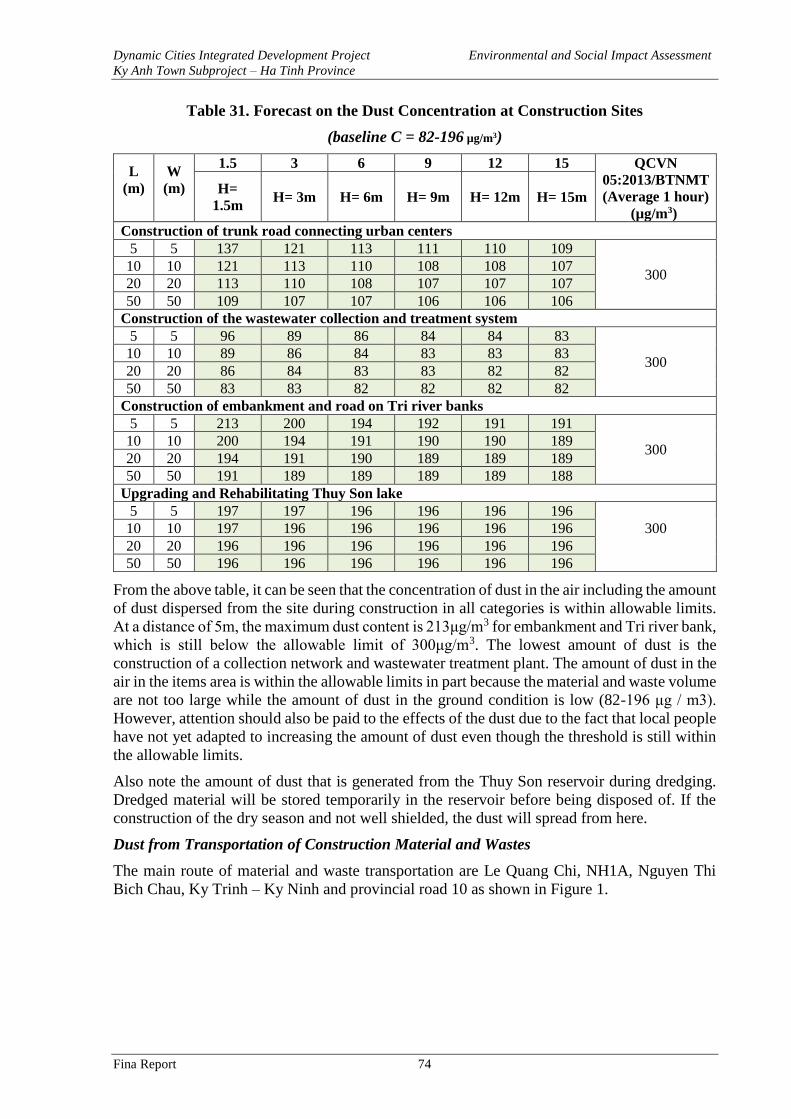
Dynamic Cities Integrated Development Project Environmental and Social Impact Assessment
Ky Anh Town Subproject – Ha Tinh Province
Fina Report 74
Table 31. Forecast on the Dust Concentration at Construction Sites
(baseline C = 82-196 µg/m3)
L
(m)
W
(m)
1.5 3 6 9 12 15 QCVN
05:2013/BTNMT
(Average 1 hour)
(µg/m3)
H=
1.5m H= 3m H= 6m H= 9m H= 12m H= 15m
Construction of trunk road connecting urban centers
5 5 137 121 113 111 110 109
300 10 10 121 113 110 108 108 107
20 20 113 110 108 107 107 107
50 50 109 107 107 106 106 106
Construction of the wastewater collection and treatment system
5 5 96 89 86 84 84 83
300 10 10 89 86 84 83 83 83
20 20 86 84 83 83 82 82
50 50 83 83 82 82 82 82
Construction of embankment and road on Tri river banks
5 5 213 200 194 192 191 191
300 10 10 200 194 191 190 190 189
20 20 194 191 190 189 189 189
50 50 191 189 189 189 189 188
Upgrading and Rehabilitating Thuy Son lake
5 5 197 197 196 196 196 196
300 10 10 197 196 196 196 196 196
20 20 196 196 196 196 196 196
50 50 196 196 196 196 196 196
From the above table, it can be seen that the concentration of dust in the air including the amount
of dust dispersed from the site during construction in all categories is within allowable limits.
At a distance of 5m, the maximum dust content is 213μg/m3 for embankment and Tri river bank,
which is still below the allowable limit of 300μg/m3. The lowest amount of dust is the
construction of a collection network and wastewater treatment plant. The amount of dust in the
air in the items area is within the allowable limits in part because the material and waste volume
are not too large while the amount of dust in the ground condition is low (82-196 μg / m3).
However, attention should also be paid to the effects of the dust due to the fact that local people
have not yet adapted to increasing the amount of dust even though the threshold is still within
the allowable limits.
Also note the amount of dust that is generated from the Thuy Son reservoir during dredging.
Dredged material will be stored temporarily in the reservoir before being disposed of. If the
construction of the dry season and not well shielded, the dust will spread from here.
Dust from Transportation of Construction Material and Wastes
The main route of material and waste transportation are Le Quang Chi, NH1A, Nguyen Thi
Bich Chau, Ky Trinh – Ky Ninh and provincial road 10 as shown in Figure 1.
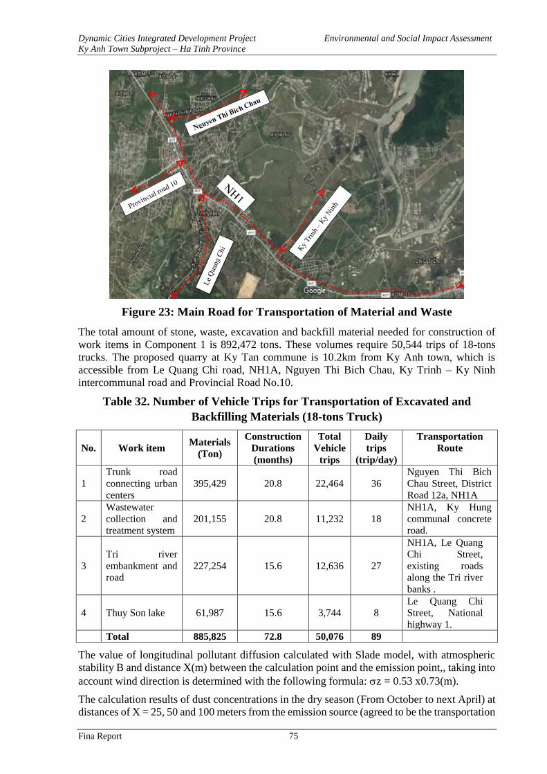
Dynamic Cities Integrated Development Project Environmental and Social Impact Assessment
Ky Anh Town Subproject – Ha Tinh Province
Fina Report 75
Figure 23: Main Road for Transportation of Material and Waste
The total amount of stone, waste, excavation and backfill material needed for construction of
work items in Component 1 is 892,472 tons. These volumes require 50,544 trips of 18-tons
trucks. The proposed quarry at Ky Tan commune is 10.2km from Ky Anh town, which is
accessible from Le Quang Chi road, NH1A, Nguyen Thi Bich Chau, Ky Trinh – Ky Ninh
intercommunal road and Provincial Road No.10.
Table 32. Number of Vehicle Trips for Transportation of Excavated and
Backfilling Materials (18-tons Truck)
No. Work item Materials
(Ton)
Construction
Durations
(months)
Total
Vehicle
trips
Daily
trips
(trip/day)
Transportation
Route
1
Trunk road
connecting urban
centers
395,429 20.8 22,464 36
Nguyen Thi Bich
Chau Street, District
Road 12a, NH1A
2
Wastewater
collection and
treatment system
201,155 20.8 11,232 18
NH1A, Ky Hung
communal concrete
road.
3
Tri river
embankment and
road
227,254 15.6 12,636 27
NH1A, Le Quang
Chi Street,
existing roads
along the Tri river
banks .
4 Thuy Son lake 61,987 15.6 3,744 8
Le Quang Chi
Street, National
highway 1. Total 885,825 72.8 50,076 89
The value of longitudinal pollutant diffusion calculated with Slade model, with atmospheric
stability B and distance X(m) between the calculation point and the emission point,, taking into
account wind direction is determined with the following formula: z = 0.53 x0.73(m).
The calculation results of dust concentrations in the dry season (From October to next April) at
distances of X = 25, 50 and 100 meters from the emission source (agreed to be the transportation
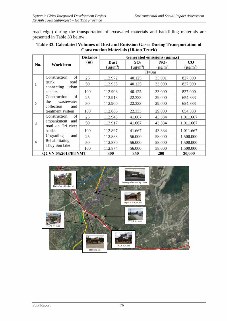
Dynamic Cities Integrated Development Project Environmental and Social Impact Assessment
Ky Anh Town Subproject – Ha Tinh Province
Fina Report 76
road edge) during the transportation of excavated materials and backfilling materials are
presented in Table 33 below.
Table 33. Calculated Volumes of Dust and Emission Gases During Transportation of
Construction Materials (18-ton Truck)
No. Work item
Distance
(m)
Generated emissions (µg/m.s)
Dust
(µg/m3)
SO2
(µg/m3)
NO2
(µg/m3)
CO
(µg/m3)
H=3m
1
Construction of
trunk road
connecting urban
centers
25 112.972 40.125 33.001 827.000
50 112.935 40.125 33.000 827.000
100 112.908 40.125 33.000 827.000
2
Construction of
the wastewater
collection and
treatment system
25 112.918 22.333 29.000 654.333
50 112.900 22.333 29.000 654.333
100 112.886 22.333 29.000 654.333
3
Construction of
embankment and
road on Tri river
banks
25 112.945 41.667 43.334 1,011.667
50 112.917 41.667 43.334 1,011.667
100 112.897 41.667 43.334 1,011.667
4
Upgrading and
Rehabilitating
Thuy Son lake
25 112.888 56.000 58.000 1,500.000
50 112.880 56.000 58.000 1,500.000
100 112.874 56.000 58.000 1,500.000
QCVN 05:2013/BTNMT 300 350 200 30,000
THPT Kỳ Anh
BVĐK Kỳ Anh
THCS Kỳ Anh
Đài tưởng niệm liệt sỹ
Trường mầm non Kỳ Châu
Trạm Y tế Kỳ Châu
TH Sông Trí
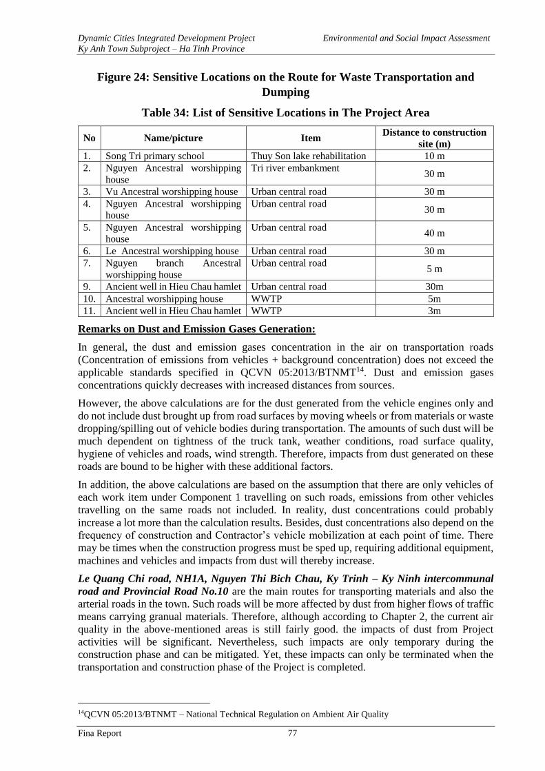
Dynamic Cities Integrated Development Project Environmental and Social Impact Assessment
Ky Anh Town Subproject – Ha Tinh Province
Fina Report 77
Figure 24: Sensitive Locations on the Route for Waste Transportation and
Dumping
Table 34: List of Sensitive Locations in The Project Area
No Name/picture Item Distance to construction
site (m)
1. Song Tri primary school Thuy Son lake rehabilitation 10 m
2. Nguyen Ancestral worshipping
house
Tri river embankment 30 m
3. Vu Ancestral worshipping house Urban central road 30 m
4. Nguyen Ancestral worshipping
house
Urban central road 30 m
5. Nguyen Ancestral worshipping
house
Urban central road 40 m
6. Le Ancestral worshipping house Urban central road 30 m
7. Nguyen branch Ancestral
worshipping house
Urban central road 5 m
9. Ancient well in Hieu Chau hamlet Urban central road 30m
10. Ancestral worshipping house WWTP 5m
11. Ancient well in Hieu Chau hamlet WWTP 3m
Remarks on Dust and Emission Gases Generation:
In general, the dust and emission gases concentration in the air on transportation roads
(Concentration of emissions from vehicles + background concentration) does not exceed the
applicable standards specified in QCVN 05:2013/BTNMT14. Dust and emission gases
concentrations quickly decreases with increased distances from sources.
However, the above calculations are for the dust generated from the vehicle engines only and
do not include dust brought up from road surfaces by moving wheels or from materials or waste
dropping/spilling out of vehicle bodies during transportation. The amounts of such dust will be
much dependent on tightness of the truck tank, weather conditions, road surface quality,
hygiene of vehicles and roads, wind strength. Therefore, impacts from dust generated on these
roads are bound to be higher with these additional factors.
In addition, the above calculations are based on the assumption that there are only vehicles of
each work item under Component 1 travelling on such roads, emissions from other vehicles
travelling on the same roads not included. In reality, dust concentrations could probably
increase a lot more than the calculation results. Besides, dust concentrations also depend on the
frequency of construction and Contractor’s vehicle mobilization at each point of time. There
may be times when the construction progress must be sped up, requiring additional equipment,
machines and vehicles and impacts from dust will thereby increase.
Le Quang Chi road, NH1A, Nguyen Thi Bich Chau, Ky Trinh – Ky Ninh intercommunal
road and Provincial Road No.10 are the main routes for transporting materials and also the
arterial roads in the town. Such roads will be more affected by dust from higher flows of traffic
means carrying granual materials. Therefore, although according to Chapter 2, the current air
quality in the above-mentioned areas is still fairly good. the impacts of dust from Project
activities will be significant. Nevertheless, such impacts are only temporary during the
construction phase and can be mitigated. Yet, these impacts can only be terminated when the
transportation and construction phase of the Project is completed.
14QCVN 05:2013/BTNMT – National Technical Regulation on Ambient Air Quality
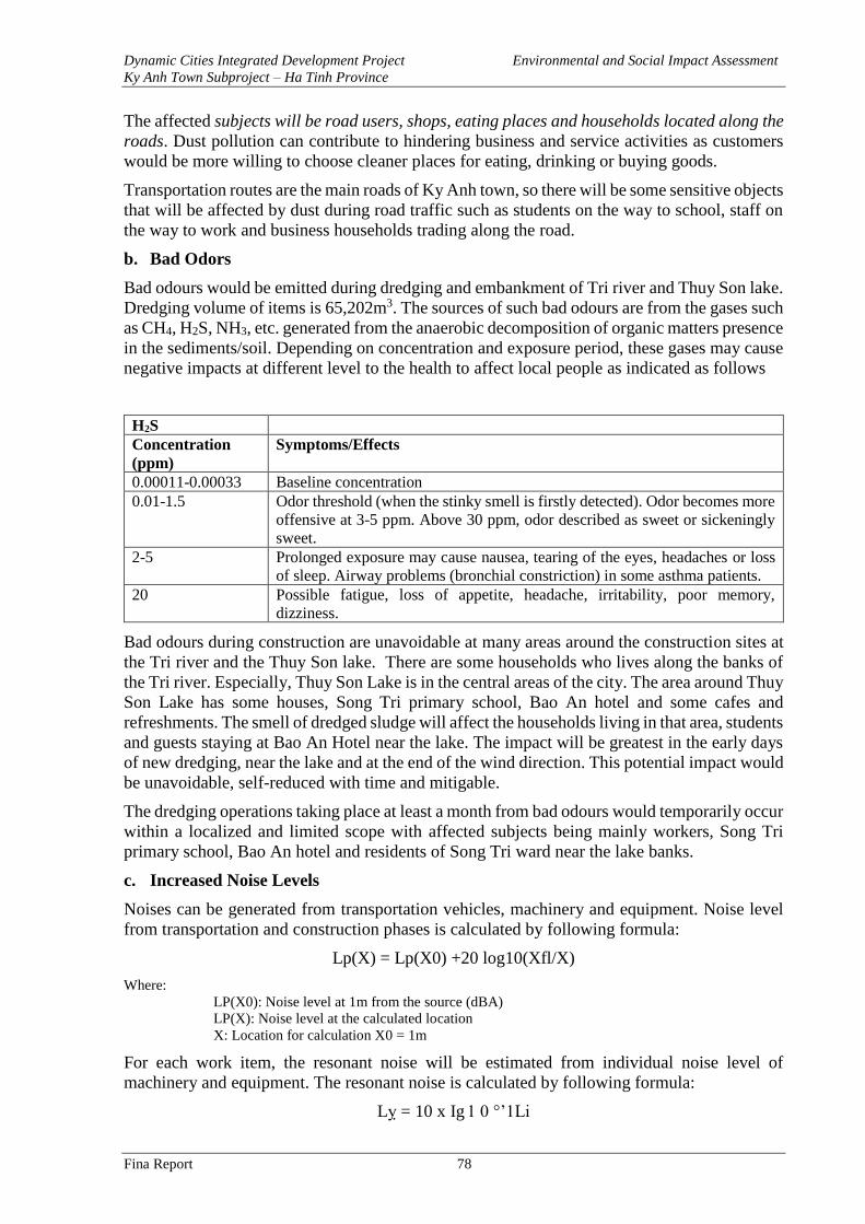
Dynamic Cities Integrated Development Project Environmental and Social Impact Assessment
Ky Anh Town Subproject – Ha Tinh Province
Fina Report 78
The affected subjects will be road users, shops, eating places and households located along the
roads. Dust pollution can contribute to hindering business and service activities as customers
would be more willing to choose cleaner places for eating, drinking or buying goods.
Transportation routes are the main roads of Ky Anh town, so there will be some sensitive objects
that will be affected by dust during road traffic such as students on the way to school, staff on
the way to work and business households trading along the road.
b. Bad Odors
Bad odours would be emitted during dredging and embankment of Tri river and Thuy Son lake.
Dredging volume of items is 65,202m3. The sources of such bad odours are from the gases such
as CH4, H2S, NH3, etc. generated from the anaerobic decomposition of organic matters presence
in the sediments/soil. Depending on concentration and exposure period, these gases may cause
negative impacts at different level to the health to affect local people as indicated as follows
H2S
Concentration
(ppm)
Symptoms/Effects
0.00011-0.00033 Baseline concentration
0.01-1.5 Odor threshold (when the stinky smell is firstly detected). Odor becomes more
offensive at 3-5 ppm. Above 30 ppm, odor described as sweet or sickeningly
sweet.
2-5 Prolonged exposure may cause nausea, tearing of the eyes, headaches or loss
of sleep. Airway problems (bronchial constriction) in some asthma patients.
20 Possible fatigue, loss of appetite, headache, irritability, poor memory,
dizziness.
Bad odours during construction are unavoidable at many areas around the construction sites at
the Tri river and the Thuy Son lake. There are some households who lives along the banks of
the Tri river. Especially, Thuy Son Lake is in the central areas of the city. The area around Thuy
Son Lake has some houses, Song Tri primary school, Bao An hotel and some cafes and
refreshments. The smell of dredged sludge will affect the households living in that area, students
and guests staying at Bao An Hotel near the lake. The impact will be greatest in the early days
of new dredging, near the lake and at the end of the wind direction. This potential impact would
be unavoidable, self-reduced with time and mitigable.
The dredging operations taking place at least a month from bad odours would temporarily occur
within a localized and limited scope with affected subjects being mainly workers, Song Tri
primary school, Bao An hotel and residents of Song Tri ward near the lake banks.
c. Increased Noise Levels
Noises can be generated from transportation vehicles, machinery and equipment. Noise level
from transportation and construction phases is calculated by following formula:
Lp(X) = Lp(X0) +20 log10(Xfl/X)
Where:
LP(X0): Noise level at 1m from the source (dBA)
LP(X): Noise level at the calculated location
X: Location for calculation X0 = 1m
For each work item, the resonant noise will be estimated from individual noise level of
machinery and equipment. The resonant noise is calculated by following formula:
Lỵ = 10 x Ig 1 0 °’1Li
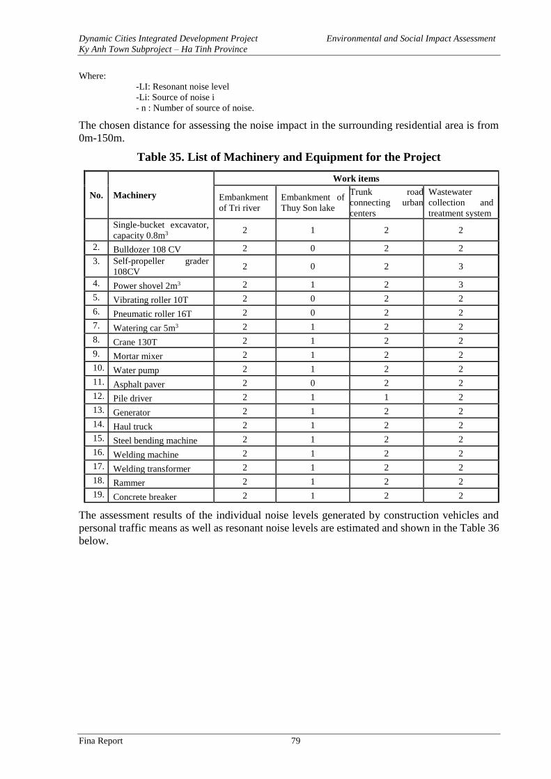
Dynamic Cities Integrated Development Project Environmental and Social Impact Assessment
Ky Anh Town Subproject – Ha Tinh Province
Fina Report 79
Where:
-LI: Resonant noise level
-Li: Source of noise i
- n : Number of source of noise.
The chosen distance for assessing the noise impact in the surrounding residential area is from
0m-150m.
Table 35. List of Machinery and Equipment for the Project
No. Machinery
Work items
Embankment
of Tri river
Embankment of
Thuy Son lake
Trunk road
connecting urban
centers
Wastewater
collection and
treatment system
1. Single-bucket excavator,
capacity 0.8m3 2 1 2 2
2. Bulldozer 108 CV 2 0 2 2
3. Self-propeller grader
108CV 2 0 2 3
4. Power shovel 2m3 2 1 2 3
5. Vibrating roller 10T 2 0 2 2
6. Pneumatic roller 16T 2 0 2 2
7. Watering car 5m3 2 1 2 2
8. Crane 130T 2 1 2 2
9. Mortar mixer 2 1 2 2
10. Water pump 2 1 2 2
11. Asphalt paver 2 0 2 2
12. Pile driver 2 1 1 2
13. Generator 2 1 2 2
14. Haul truck 2 1 2 2
15. Steel bending machine 2 1 2 2
16. Welding machine 2 1 2 2
17. Welding transformer 2 1 2 2
18. Rammer 2 1 2 2
19. Concrete breaker 2 1 2 2
The assessment results of the individual noise levels generated by construction vehicles and
personal traffic means as well as resonant noise levels are estimated and shown in the Table 36
below.
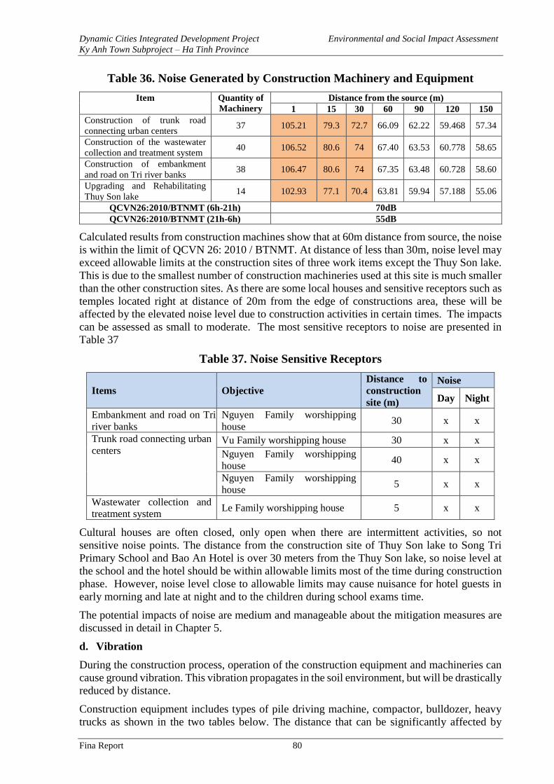
Dynamic Cities Integrated Development Project Environmental and Social Impact Assessment
Ky Anh Town Subproject – Ha Tinh Province
Fina Report 80
Table 36. Noise Generated by Construction Machinery and Equipment
Item Quantity of
Machinery
Distance from the source (m)
1 15 30 60 90 120 150
Construction of trunk road
connecting urban centers 37 105.21 79.3 72.7 66.09 62.22 59.468 57.34
Construction of the wastewater
collection and treatment system 40 106.52 80.6 74 67.40 63.53 60.778 58.65
Construction of embankment
and road on Tri river banks 38 106.47 80.6 74 67.35 63.48 60.728 58.60
Upgrading and Rehabilitating
Thuy Son lake 14 102.93 77.1 70.4 63.81 59.94 57.188 55.06
QCVN26:2010/BTNMT (6h-21h) 70dB
QCVN26:2010/BTNMT (21h-6h) 55dB
Calculated results from construction machines show that at 60m distance from source, the noise
is within the limit of QCVN 26: 2010 / BTNMT. At distance of less than 30m, noise level may
exceed allowable limits at the construction sites of three work items except the Thuy Son lake.
This is due to the smallest number of construction machineries used at this site is much smaller
than the other construction sites. As there are some local houses and sensitive receptors such as
temples located right at distance of 20m from the edge of constructions area, these will be
affected by the elevated noise level due to construction activities in certain times. The impacts
can be assessed as small to moderate. The most sensitive receptors to noise are presented in
Table 37
Table 37. Noise Sensitive Receptors
Items Objective
Distance to
construction
site (m)
Noise
Day Night
Embankment and road on Tri
river banks
Nguyen Family worshipping
house 30 x x
Trunk road connecting urban
centers Vu Family worshipping house 30 x x
Nguyen Family worshipping
house 40 x x
Nguyen Family worshipping
house 5 x x
Wastewater collection and
treatment system Le Family worshipping house 5 x x
Cultural houses are often closed, only open when there are intermittent activities, so not
sensitive noise points. The distance from the construction site of Thuy Son lake to Song Tri
Primary School and Bao An Hotel is over 30 meters from the Thuy Son lake, so noise level at
the school and the hotel should be within allowable limits most of the time during construction
phase. However, noise level close to allowable limits may cause nuisance for hotel guests in
early morning and late at night and to the children during school exams time.
The potential impacts of noise are medium and manageable about the mitigation measures are
discussed in detail in Chapter 5.
d. Vibration
During the construction process, operation of the construction equipment and machineries can
cause ground vibration. This vibration propagates in the soil environment, but will be drastically
reduced by distance.
Construction equipment includes types of pile driving machine, compactor, bulldozer, heavy
trucks as shown in the two tables below. The distance that can be significantly affected by
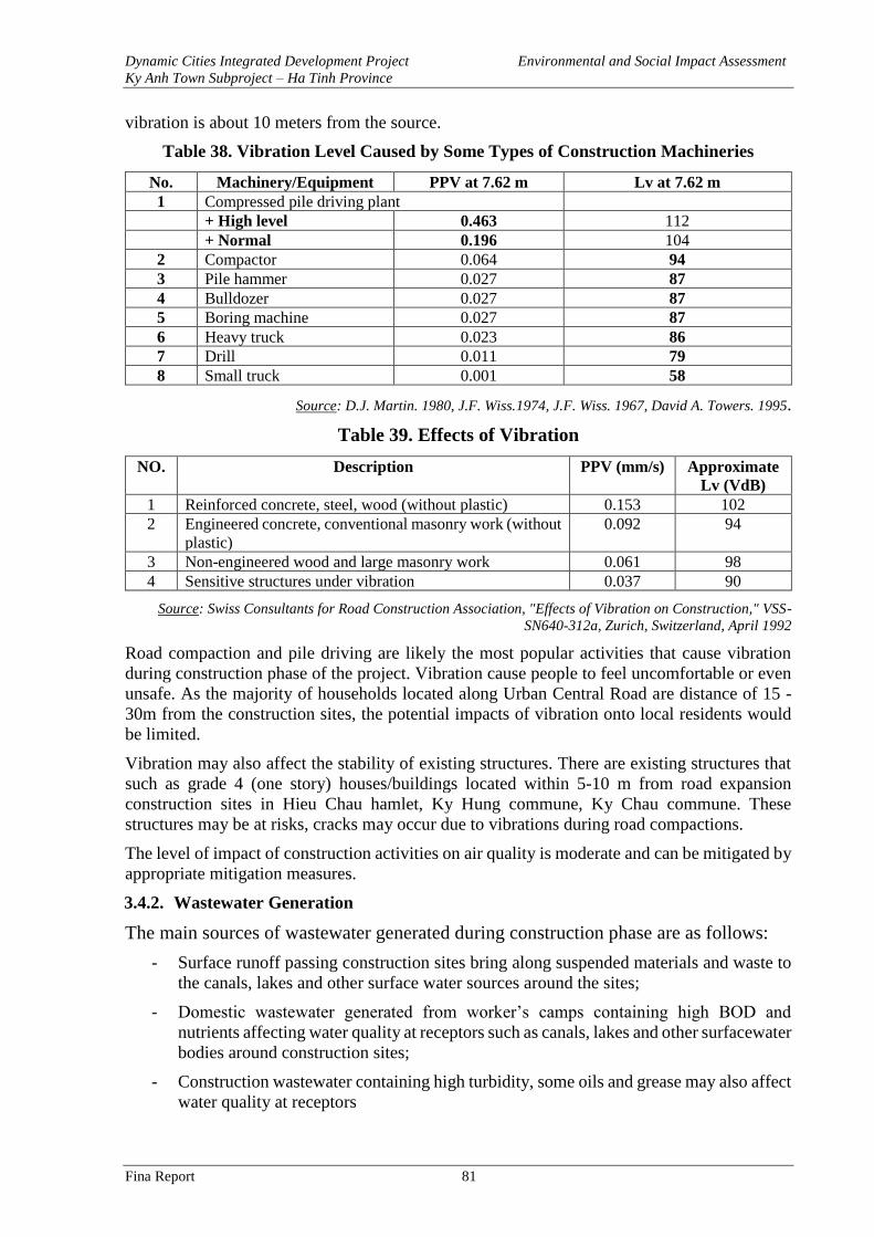
Dynamic Cities Integrated Development Project Environmental and Social Impact Assessment
Ky Anh Town Subproject – Ha Tinh Province
Fina Report 81
vibration is about 10 meters from the source.
Table 38. Vibration Level Caused by Some Types of Construction Machineries
No. Machinery/Equipment PPV at 7.62 m Lv at 7.62 m
1 Compressed pile driving plant
+ High level 0.463 112
+ Normal 0.196 104
2 Compactor 0.064 94
3 Pile hammer 0.027 87
4 Bulldozer 0.027 87
5 Boring machine 0.027 87
6 Heavy truck 0.023 86
7 Drill 0.011 79
8 Small truck 0.001 58
Source: D.J. Martin. 1980, J.F. Wiss.1974, J.F. Wiss. 1967, David A. Towers. 1995.
Table 39. Effects of Vibration
NO.
Description PPV (mm/s) Approximate
Lv (VdB)
1 Reinforced concrete, steel, wood (without plastic) 0.153 102
2 Engineered concrete, conventional masonry work (without
plastic)
0.092 94
3 Non-engineered wood and large masonry work 0.061 98
4 Sensitive structures under vibration 0.037 90
Source: Swiss Consultants for Road Construction Association, "Effects of Vibration on Construction," VSS-
SN640-312a, Zurich, Switzerland, April 1992
Road compaction and pile driving are likely the most popular activities that cause vibration
during construction phase of the project. Vibration cause people to feel uncomfortable or even
unsafe. As the majority of households located along Urban Central Road are distance of 15 -
30m from the construction sites, the potential impacts of vibration onto local residents would
be limited.
Vibration may also affect the stability of existing structures. There are existing structures that
such as grade 4 (one story) houses/buildings located within 5-10 m from road expansion
construction sites in Hieu Chau hamlet, Ky Hung commune, Ky Chau commune. These
structures may be at risks, cracks may occur due to vibrations during road compactions.
The level of impact of construction activities on air quality is moderate and can be mitigated by
appropriate mitigation measures.
3.4.2. Wastewater Generation
The main sources of wastewater generated during construction phase are as follows:
- Surface runoff passing construction sites bring along suspended materials and waste to
the canals, lakes and other surface water sources around the sites;
- Domestic wastewater generated from worker’s camps containing high BOD and
nutrients affecting water quality at receptors such as canals, lakes and other surfacewater
bodies around construction sites;
- Construction wastewater containing high turbidity, some oils and grease may also affect
water quality at receptors
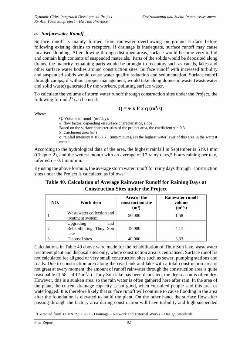
Dynamic Cities Integrated Development Project Environmental and Social Impact Assessment
Ky Anh Town Subproject – Ha Tinh Province
Fina Report 82
a. Surfacewater Runoff
Surface runoff is mainly formed from rainwater overflowing on ground surface before
following existing drains to receptors. If drainage is inadequate, surface runoff may cause
localised flooding. After flowing through disturbed areas, surface would become very turbid
and contain high contents of suspended materials. Parts of the solids would be deposited along
drains, the majority remaining parts would be brought to receptors such as canals, lakes and
other surface water bodies around construction sites. Surface runoff with increased turbidity
and suspended solids would cause water quality reduction and sedimentation. Surface runoff
through camps, if without proper management, would take along domestic waste (wastewater
and solid waste) generated by the workers, polluting surface water.
To calculate the volume of storm water runoff through construction sites under the Project, the
following formula15 can be used:
Q = ᴪ x F x q (m3/s) Where:
Q: Volume of runoff (m3/day);
ᴪ: flow factor, depending on surface characteristics, slope ...
Based on the surface characteristics of the project area, the coefficient ᴪ = 0.3
S: Catchment area (m2)
q: rainfall intensity = 166.7 x i (mm/minute), i is the highest water layer of this area in the wettest
month.
According to the hydrological data of the area, the highest rainfall in September is 519.1 mm
(Chapter 2), and the wettest month with an average of 17 rainy days,5 hours raining per day,
inferred i = 0.1 mm/min.
By using the above formula, the average storm water runoff for rainy days through construction
sites under the Project is calculated as follows:
Table 40. Calculation of Average Rainwater Runoff for Raining Days at
Construction Sites under the Project
NO. Work item
Area of the
construction site
(m2)
Rainwater runoff
volume
(m3/s)
1 Wastewater collection and
treatment system 50,000 1,58
2
Upgrading and
Rehabilitating Thuy Son
lake
19,000 4,17
3 Disposal sites 40,000 3,33
Calculations in Table 40 above were made for the rehabilitation of Thuy Son lake, wastewater
treatment plant and disposal sites only, where construction area is centralised. Surface runoff is
not calculated for aligned or very small construction sites such as sewer, pumping stations and
roads. Due to construction area along the riverbank and lake with a total construction area is
not great at every moment, the amount of runoff rainwater through the construction area is quite
reasonable (1.58 – 4.17 m3/s). Thuy Son lake has been deposited, the dry season is often dry.
However, this is a sunken area, so the rain water is often gathered here after rain. In the area of
the plant, the current drainage capacity is not good, when consulted people said this area or
waterlogged. It is therefore likely that surface runoff will continue to cause flooding in the area
after the foundation is elevated to build the plant. On the other hand, the surface flow after
passing through the factory area during construction will have turbidity and high suspended
15Extracted from TCVN 7957:2008- Drainage – Network and External Works – Design Standards
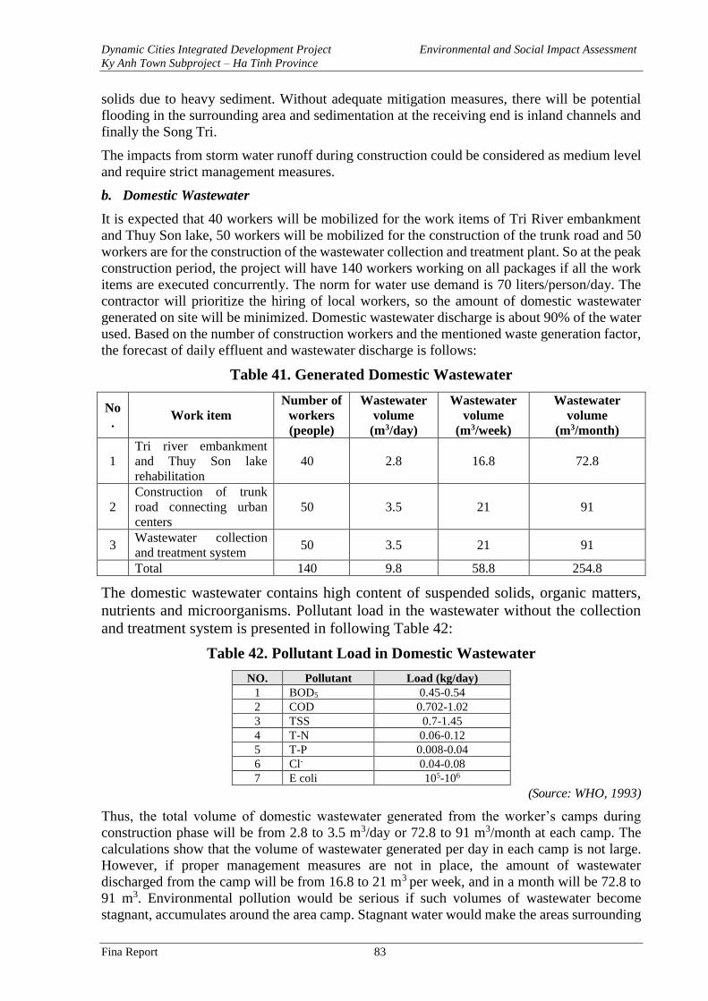
Dynamic Cities Integrated Development Project Environmental and Social Impact Assessment
Ky Anh Town Subproject – Ha Tinh Province
Fina Report 83
solids due to heavy sediment. Without adequate mitigation measures, there will be potential
flooding in the surrounding area and sedimentation at the receiving end is inland channels and
finally the Song Tri.
The impacts from storm water runoff during construction could be considered as medium level
and require strict management measures.
b. Domestic Wastewater
It is expected that 40 workers will be mobilized for the work items of Tri River embankment
and Thuy Son lake, 50 workers will be mobilized for the construction of the trunk road and 50
workers are for the construction of the wastewater collection and treatment plant. So at the peak
construction period, the project will have 140 workers working on all packages if all the work
items are executed concurrently. The norm for water use demand is 70 liters/person/day. The
contractor will prioritize the hiring of local workers, so the amount of domestic wastewater
generated on site will be minimized. Domestic wastewater discharge is about 90% of the water
used. Based on the number of construction workers and the mentioned waste generation factor,
the forecast of daily effluent and wastewater discharge is follows:
Table 41. Generated Domestic Wastewater
No
. Work item
Number of
workers
(people)
Wastewater
volume
(m3/day)
Wastewater
volume
(m3/week)
Wastewater
volume
(m3/month)
1
Tri river embankment
and Thuy Son lake
rehabilitation
40 2.8 16.8 72.8
2
Construction of trunk
road connecting urban
centers
50 3.5 21 91
3 Wastewater collection
and treatment system 50 3.5 21 91
Total 140 9.8 58.8 254.8
The domestic wastewater contains high content of suspended solids, organic matters,
nutrients and microorganisms. Pollutant load in the wastewater without the collection
and treatment system is presented in following Table 42:
Table 42. Pollutant Load in Domestic Wastewater
NO. Pollutant Load (kg/day)
1 BOD5 0.45-0.54
2 COD 0.702-1.02
3 TSS 0.7-1.45
4 T-N 0.06-0.12
5 T-P 0.008-0.04
6 Cl- 0.04-0.08
7 E coli 105-106
(Source: WHO, 1993)
Thus, the total volume of domestic wastewater generated from the worker’s camps during
construction phase will be from 2.8 to 3.5 m3/day or 72.8 to 91 m3/month at each camp. The
calculations show that the volume of wastewater generated per day in each camp is not large.
However, if proper management measures are not in place, the amount of wastewater
discharged from the camp will be from 16.8 to 21 m3 per week, and in a month will be 72.8 to
91 m3. Environmental pollution would be serious if such volumes of wastewater become
stagnant, accumulates around the area camp. Stagnant water would make the areas surrounding
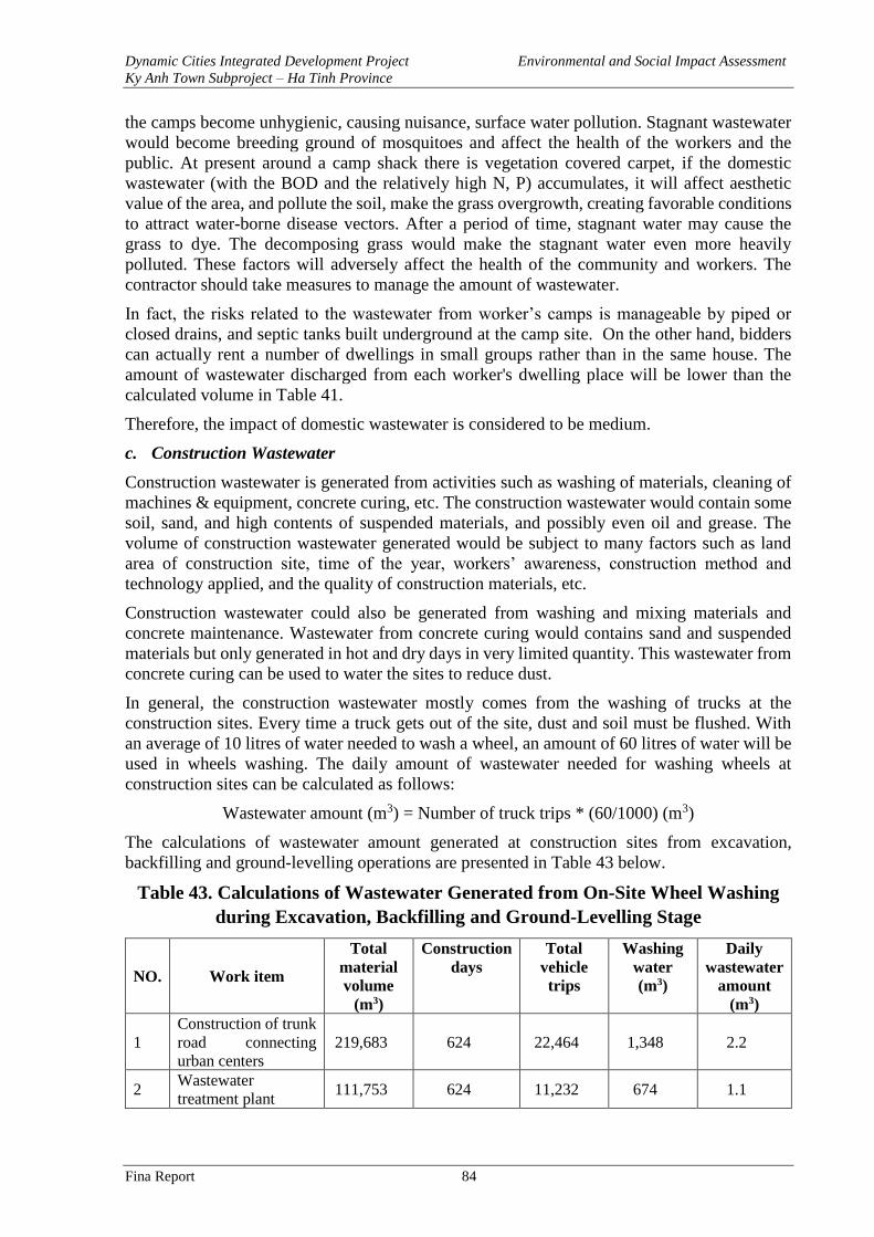
Dynamic Cities Integrated Development Project Environmental and Social Impact Assessment
Ky Anh Town Subproject – Ha Tinh Province
Fina Report 84
the camps become unhygienic, causing nuisance, surface water pollution. Stagnant wastewater
would become breeding ground of mosquitoes and affect the health of the workers and the
public. At present around a camp shack there is vegetation covered carpet, if the domestic
wastewater (with the BOD and the relatively high N, P) accumulates, it will affect aesthetic
value of the area, and pollute the soil, make the grass overgrowth, creating favorable conditions
to attract water-borne disease vectors. After a period of time, stagnant water may cause the
grass to dye. The decomposing grass would make the stagnant water even more heavily
polluted. These factors will adversely affect the health of the community and workers. The
contractor should take measures to manage the amount of wastewater.
In fact, the risks related to the wastewater from worker’s camps is manageable by piped or
closed drains, and septic tanks built underground at the camp site. On the other hand, bidders
can actually rent a number of dwellings in small groups rather than in the same house. The
amount of wastewater discharged from each worker's dwelling place will be lower than the
calculated volume in Table 41.
Therefore, the impact of domestic wastewater is considered to be medium.
c. Construction Wastewater
Construction wastewater is generated from activities such as washing of materials, cleaning of
machines & equipment, concrete curing, etc. The construction wastewater would contain some
soil, sand, and high contents of suspended materials, and possibly even oil and grease. The
volume of construction wastewater generated would be subject to many factors such as land
area of construction site, time of the year, workers’ awareness, construction method and
technology applied, and the quality of construction materials, etc.
Construction wastewater could also be generated from washing and mixing materials and
concrete maintenance. Wastewater from concrete curing would contains sand and suspended
materials but only generated in hot and dry days in very limited quantity. This wastewater from
concrete curing can be used to water the sites to reduce dust.
In general, the construction wastewater mostly comes from the washing of trucks at the
construction sites. Every time a truck gets out of the site, dust and soil must be flushed. With
an average of 10 litres of water needed to wash a wheel, an amount of 60 litres of water will be
used in wheels washing. The daily amount of wastewater needed for washing wheels at
construction sites can be calculated as follows:
Wastewater amount (m3) = Number of truck trips * (60/1000) (m3)
The calculations of wastewater amount generated at construction sites from excavation,
backfilling and ground-levelling operations are presented in Table 43 below.
Table 43. Calculations of Wastewater Generated from On-Site Wheel Washing
during Excavation, Backfilling and Ground-Levelling Stage
NO. Work item
Total
material
volume
(m3)
Construction
days
Total
vehicle
trips
Washing
water
(m3)
Daily
wastewater
amount
(m3)
1
Construction of trunk
road connecting
urban centers
219,683 624 22,464 1,348 2.2
2 Wastewater
treatment plant 111,753 624 11,232 674 1.1
Dynamic Cities Integrated Development Project Environmental and Social Impact Assessment
Ky Anh Town Subproject – Ha Tinh Province
Fina Report 85
NO. Work item
Total
material
volume
(m3)
Construction
days
Total
vehicle
trips
Washing
water
(m3)
Daily
wastewater
amount
(m3)
3
Embankment and
road on Tri river
banks
126,252 468 12,636 758 1.6
4 Thuy Son lake 34,437 468 3,744 225 0.5
5 Total 492,125 2,184 50,076 3,005 5.3
Wastewater from wheel washing often contains soil, sand and suspended materials but no oil
or grease.
The washing of whole trucks is expected to be done every 5 days for each truck, subject to the
weather conditions and how dirty a truck is. Cleaning of whole trucks will be performed at
professional car service stations in the city, not on the construction site. Each cleaning time is
estimated to require about 200 litres of water for each truck. Wastewater from truck washing
would include soil, sand, suspended materials and oil. Therefore, the preliminary treatment of
wastewater from washing trucks, in addition to sedimentation manholes, would also need oil
and grease separating tanks.
The impacts from construction wastewater during construction could be considered at medium
level and require proper management measures.
3.4.3. Solid Waste Generation
a. Excavated and Dredged Materials
It is estimated that ground levelling and excavation for the construction of the items in
Component 1 of the Project would generate a total of 492,125 m3 of excavated materials, in
which 65,202 m3 is top-soil/dredged materials. The quantity of dredged and excavated materials
generated from each item are listed in Table 44 below:
Table 44. Excavated Materials (Unit: m3)
Items Demolition Excavation Levelling Dredge Total
m3 m3 m3 m3 m3
Trunk road connecting
urban centers
14,642
31,681
159,074
14,285
219,683
Wastewater collection
and treatment system
1,000
23,282
69,823
17,648
111,753
Embankment and road
on Tri river banks
4,881
10,560
106,049
4,762
126,252
Thuy Son lake 120 4,695 1,116 28,507 34,437
Total 20,643 70,218 336,062 65,202 492,125
It is noticeable that the construction of Thuy Son lake and Tri river embankment will generate
a volume of dredged materials at 28,507 m3 and 4,762 m3, respectively. Analysis results on the
four soil samples taken in the project area show that, contents of heavy metals (Pb, Zn, As, Cd,
Zn) of all samples are within allowable limit in QCVN 03-MT:2015/BTNMT. Therefore, the
excavated materials are reusable. An estimated 50% (32,601 m3) excavated material will be
reused for backfilling or ground levelling. The excavated/dredging materials if not reused will
be transported to disposal sites. Some environmental concerns would be arisen at temporary
loading of excavation and dredged materials. These include wastewater leaked from wet/damp
dredged materials, odours from muds, dust from dry granual materials. Environmental issues
Dynamic Cities Integrated Development Project Environmental and Social Impact Assessment
Ky Anh Town Subproject – Ha Tinh Province
Fina Report 86
at final disposal sites (at Cup Coi borrow pit) include high erosion potentials, landslide risks,
localised flooding etc. which will be discussed in a separate section in this Chapter.
The impacts of solid waste from dredged materials and excavated soil could be considered at
high level and require strict and suitable management measures.
b. Construction Solid Waste
Solid waste from construction operations includes waste from construction materials such as
packing materials including cement bags, scrap iron and steel, wooden chips, empty boxes, etc.
This waste is composed of inert and non-hazardous substances, with some being able to be
recycled for other purposes.
According to Document No. 1784/BXD-VP dated 16 August 2007 by the Ministry of
Construction, construction solid waste generated from construction of the Project would be
about 8.9 tons (178 tons (materials) * 0.05 % = 8.9 tons of construction waste). These volumes
of construction waste would have to be collected daily on site, collected and handled in
accordance with legal regulations.
The impacts from construction solid waste could be considered as high and require strict
management measures.
c. Domestic Solid Waste
The number of workers living in worker camps will be about 140 people if all work items are
implemented at the same time. Each worker during working hours on site is estimated to
generate about 0.5kg of domestic solid waste a day, i.e. total solid waste generated per day is
70kg. Without proper management, this volume of domestic waste can become a source of
pollution, cause bad ordor and bacteria-borne diseases. Amount of domestic solid wastes
generated from the workers is estimated in Table 45.
Table 45. Generated Domestic Solid Waste
NO. Work item Number of
workers
Domestic solid
waste (kg)/day
Domestic
solid waste
(kg)/week)
Domestic
solid waste
(kg)/month
1 Trunk road connecting
urban centers 50 25
175 650
2 Wastewater collection and
treatment system 50 25
175 650
3
Embankment and road on
Tri river banks and Thuy
Son lake
40 20
140
520
5 Total 140 70 490 1,820
According to the calculations in this table, the volume of domestic solid waste generated daily
at each camp site of the Project would be from 20-25 kg/d, which is manageable. However, in
the absence of proper management and daily collection, With the amount of waste generated
from 140-170 kg / week or 520-650 kg / month in each camp, the environment will be polluted
by odor, gas, leachate generated when garbage decay. Garbage without adequate control will
also cause community discomfort, water pollution, attracting insect and pathogenic organisms
that can lead to health risks for the community. However, pollution from municipal waste from
the camp will be less likely to happen because as discussed in Chapter 2, all the wards in the
project area are currently being Urenco provide collection services and solid waste disposal,
contractors may contract for garbage collection in the camp.
The impacts of domestic wastes could be considered at medium level.
Dynamic Cities Integrated Development Project Environmental and Social Impact Assessment
Ky Anh Town Subproject – Ha Tinh Province
Fina Report 87
d. Hazardous Waste
Hazardous wastes generated under the Project include waste oil, materials contaminated with
oil, oil containers etc. Used oil is classified as hazardous waste according to the regulation on
management of hazardous waste. The amount of discarded oil and grease generated during the
construction process is subject to the following factors:
- Number of means of transport and construction on site;
- Amount of oil and grease discarded from means of transport and construction;
- Frequency of oil replacement and machine &equipment maintenance.
On average, the volume of oil discarded from means for transportation and construction is about
7 litres for each replacement. The frequency for oil replacement and machinery maintenance is
every 3 months. The number of transportation vehicles and construction machines which need
oil replacement mainly utilized at Project sites at a same time is 53 (including 15 trucks and 38
construction equipment). Therefore, the total average volume of discarded oil and grease
generated at construction sites is: (53 vehicles x 7 litres/time)/3 months = 123 litres of discarded
oil /month. In addition, the construction can generate oily cloth and oil containers of about
60kg/month.
If without proper management, this volume of hazardous wastes, especially oily waste would
cause soil and surface water pollutions. In fact, the amount of hazardous waste generated on the
site will be very limited, mainly waste oil from the small construction machinery such as
generators, mops ... due to major repair activities, maintenance Periods will only be conducted
at registered professional workshops and garages, not on site.
The impacts caused by hazardous wastes can be considered as medium level.
3.4.4. Surface Water Quality Reduction
In the project area there are main surface water sources as Tri river, Quyen river, Cau Bau river
and Thuy Son lake. The water quality of these water sources may be reduced by wastewater
and waste from worker camp, by surface flow from the construction site or temporary site for
construction material /waste, or by the use of surface water (tool washing) during construction.
The affected water quality parameters will include TSS, BOD, N, P, oil and grease, coliform
depending on the cause of water quality degradation.
Surface water quality degradation due to sewage and waste from camps. The wastewater from
workers’ camps would mainly contribute additional BOD, nutrients and pathogens to the
receptors which nearby the workers’ camps of the Tri river embankment, bridges on the trunk
road and the WWTP. The water quality in that source may be affected by 2.8 to 3.5 m3 of
domestic wastewater or a 70 kg of household waste generated from the camp every day. When
that source water quality deteriorates, the concentration of SS, BOD, nutrients, oil and grease
etc. in river water there would be increased. Decomposition of organic matters in the water lead
to DO reduction and some toxic gas may be released. This leads to the overgrowth of fungi that
feed on mosquitoes, mosquitoes, insects and the risk of infectious diseases.
Surface water quality deterioration caused by Stormwater runoff: Surface runoff has high
turbidity and suspended solids after running through construction sites. Particularly, the
construction site of the WWTP works on an area of 5 hectares, only 100 meters from the Tri
River. The site will be disturbed a lot in the first phase by removing the soil and fill the ground
to the design altitude, large amount of excavated soil and fill material (110,753 m3) will be
temporarily located here. In case of rain, some materials will be swept along the surface flow
to the Tri River, increasing turbidity, total suspended solids TSS and can cause sedimentation
of river bed.
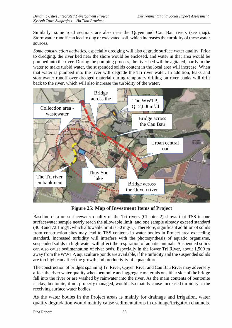
Dynamic Cities Integrated Development Project Environmental and Social Impact Assessment
Ky Anh Town Subproject – Ha Tinh Province
Fina Report 88
Similarly, some road sections are also near the Quyen and Cau Bau rivers (see map).
Stormwater runoff can lead to dug or excavated soil, which increases the turbidity of these water
sources.
Some construction activities, especially dredging will also degrade surface water quality. Prior
to dredging, the river bed near the shore would be enclosed, and water in that area would be
pumped into the river. During the pumping process, the river bed will be agitated, partly in the
water to make turbid water, the suspended solids content in the local area will increase. When
that water is pumped into the river will degrade the Tri river water. In addition, leaks and
stormwater runoff over dredged material during temporary drilling on river banks will drift
back to the river, which will also increase the turbidity of the water.
Figure 25: Map of Investment Items of Project
Baseline data on surfacewater quality of the Tri rivers (Chapter 2) shows that TSS in one
surfacewater sample nearly reach the allowable limit and one sample already exceed standard
(40.3 and 72.1 mg/L which allowable limit is 50 mg/L). Therefore, significant addition of solids
from construction sites may lead to TSS contents in water bodies in Project area exceeding
standard. Increased turbidity will interfere with the photosynthesis of aquatic organisms,
suspended solids in high water will affect the respiration of aquatic animals. Suspended solids
can also cause sedimentation of river beds. Especially in the lower Tri River, about 1,500 m
away from the WWTP, aquaculture ponds are available, if the turbidity and the suspended solids
are too high can affect the growth and productivity of aquaculture.
The construction of bridges spanning Tri River, Quyen River and Cau Bau River may adversely
affect the river water quality when bentonite and aggregate materials on either side of the bridge
fall into the river or are washed by rainwater into the river. As the main contents of bentonite
is clay, bentonite, if not properly managed, would also mainly cause increased turbidity at the
receiving surface water bodies.
As the water bodies in the Project areas is mainly for drainage and irrigation, water
quality degradation would mainly cause sedimentations in drainage/irrigation channels.
Bridge
across the
Tri river
Bridge across
the Cau Bau
river
Bridge across
the Quyen river
Collection area -
wastewater
treatment
The Tri river
embankment
Thuy Son
lake
Urban central
road
The WWTP,
Q=2,000m3/d
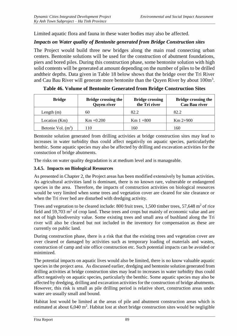
Dynamic Cities Integrated Development Project Environmental and Social Impact Assessment
Ky Anh Town Subproject – Ha Tinh Province
Fina Report 89
Limited aquatic flora and fauna in these water bodies may also be affected.
Impacts on Water quality of Bentonite generated from Bridge Construction sites
The Project would build three new bridges along the main road connecting urban
centers. Bentonite solutions will be used for the construction of abutment foundations,
piers and bored piles. During this construction phase, some bentonite solution with high
solid contents will be generated at amount depending on the number of piles to be drilled
andtheir depths. Data given in Table 18 below shows that the bridge over the Tri River
and Cau Bau River will generate more bentonite than the Quyen River by about 100m3.
Table 46. Volume of Bentonite Generated from Bridge Construction Sites
Bridge Bridge crossing the
Quyen river
Bridge crossing
the Tri river
Bridge crossing the
Cau Bau river
Length (m) 60 82.2 82.2
Location (Km) Km +0.200 Km 1 +800 Km 2+900
Betonie Vol. (m3) 110 160 160
Bentonite solution generated from drilling activities at bridge construction sites may lead to
increases in water turbidity thus could affect negativily on aquatic species, particularlythe
benthic. Some aquatic species may also be affected by drilling and excavation activities for the
constuction of bridge abutments.
The risks on water quality degradation is at medium level and is manageable.
3.4.5. Impacts on Biological Resources
As presented in Chapter 2, the Project areas has been modified extensively by human activities.
As agricultural activities land is dominant, there is no known rare, vulnerable or endangered
species in the area. Therefore, the impacts of construction activities on biological resources
would be very limited when some trees and vegetation cover are cleared for site clearance or
when the Tri river bed are disturbed with dredging activity.
Trees and vegetation to be cleared include: 800 fruit trees, 1,500 timber trees, 57,648 m2 of rice
field and 59,703 m2 of crop land. These trees and crops but mainly of economic value and are
not of high biodiversity value. Some existing trees and small area of bushland along the Tri
river will also be cleared but not included in the inventory for compensation as these are
currently on public land.
During construction phase, there is a risk that that the existing trees and vegetation cover are
over cleared or damaged by activities such as temporary loading of materials and wastes,
construction of camp and site office construction etc. Such potential impacts can be avoided or
minimized.
The potential impacts on aquatic lives would also be limited, there is no know valuable aquatic
species in the project area. As discussed earlier, dredging and bentonite solution generated from
drilling activities at bridge construction sites may lead to increases in water turbidity thus could
affect negatively on aquatic species, particularly the benthic. Some aquatic species may also be
affected by dredging, drilling and excavation activities for the construction of bridge abutments.
However, this risk is small as pile drilling period is relative short, construction areas under
water are usually small and bound.
Habitat lost would be limited at the areas of pile and abutment construction areas which is
estimated at about 6,040 m2. Habitat lost at short bridge construction sites would be negligible
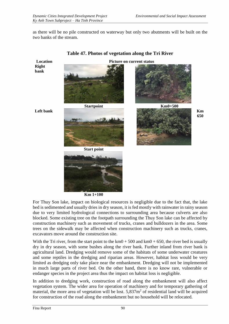
Dynamic Cities Integrated Development Project Environmental and Social Impact Assessment
Ky Anh Town Subproject – Ha Tinh Province
Fina Report 90
as there will be no pile constructed on waterway but only two abutments will be built on the
two banks of the stream.
Table 47. Photos of vegetation along the Tri River
Location Picture on current status
Right
bank
Startpoint Km0+500
Left bank
Start point
Km
650
Km 1+100
For Thuy Son lake, impact on biological resources is negligible due to the fact that, the lake
bed is sedimented and usually dries in dry season, it is fed mostly with rainwater in rainy season
due to very limited hydrological connections to surrounding area because culverts are also
blocked. Some existing tree on the footpath surrounding the Thuy Son lake can be affected by
construction machinery such as movement of trucks, cranes and bulldozers in the area. Some
trees on the sidewalk may be affected when construction machinery such as trucks, cranes,
excavators move around the construction site.
With the Tri river, from the start point to the km0 + 500 and km0 + 650, the river bed is usually
dry in dry season, with some bushes along the river bank. Further inland from river bank is
agricultural land. Dredging would remove some of the habitats of some underwater creatures
and some reptiles in the dredging and riparian areas. However, habitat loss would be very
limited as dredging only take place near the embankment. Dredging will not be implemented
in much large parts of river bed. On the other hand, there is no know rare, vulnerable or
endanger species in the project area thus the impact on habitat loss is negligible.
In addition to dredging work, construction of road along the embankment will also affect
vegetation system. The wider area for operation of machinery and for temporary gathering of
material, the more area of vegetation will be lost. 5,837m2 of residential land will be acquired
for construction of the road along the embankment but no household will be relocated.
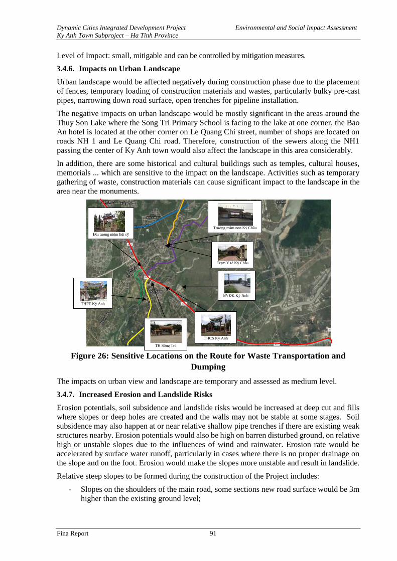
Dynamic Cities Integrated Development Project Environmental and Social Impact Assessment
Ky Anh Town Subproject – Ha Tinh Province
Fina Report 91
Level of Impact: small, mitigable and can be controlled by mitigation measures.
3.4.6. Impacts on Urban Landscape
Urban landscape would be affected negatively during construction phase due to the placement
of fences, temporary loading of construction materials and wastes, particularly bulky pre-cast
pipes, narrowing down road surface, open trenches for pipeline installation.
The negative impacts on urban landscape would be mostly significant in the areas around the
Thuy Son Lake where the Song Tri Primary School is facing to the lake at one corner, the Bao
An hotel is located at the other corner on Le Quang Chi street, number of shops are located on
roads NH 1 and Le Quang Chi road. Therefore, construction of the sewers along the NH1
passing the center of Ky Anh town would also affect the landscape in this area considerably.
In addition, there are some historical and cultural buildings such as temples, cultural houses,
memorials ... which are sensitive to the impact on the landscape. Activities such as temporary
gathering of waste, construction materials can cause significant impact to the landscape in the
area near the monuments.
Figure 26: Sensitive Locations on the Route for Waste Transportation and
Dumping
The impacts on urban view and landscape are temporary and assessed as medium level.
3.4.7. Increased Erosion and Landslide Risks
Erosion potentials, soil subsidence and landslide risks would be increased at deep cut and fills
where slopes or deep holes are created and the walls may not be stable at some stages. Soil
subsidence may also happen at or near relative shallow pipe trenches if there are existing weak
structures nearby. Erosion potentials would also be high on barren disturbed ground, on relative
high or unstable slopes due to the influences of wind and rainwater. Erosion rate would be
accelerated by surface water runoff, particularly in cases where there is no proper drainage on
the slope and on the foot. Erosion would make the slopes more unstable and result in landslide.
Relative steep slopes to be formed during the construction of the Project includes:
- Slopes on the shoulders of the main road, some sections new road surface would be 3m
higher than the existing ground level;
THPT Kỳ Anh
BVĐK Kỳ Anh
THCS Kỳ Anh
Đài tưởng niệm liệt sỹ
Trường mầm non Kỳ Châu
Trạm Y tế Kỳ Châu
TH Sông Trí
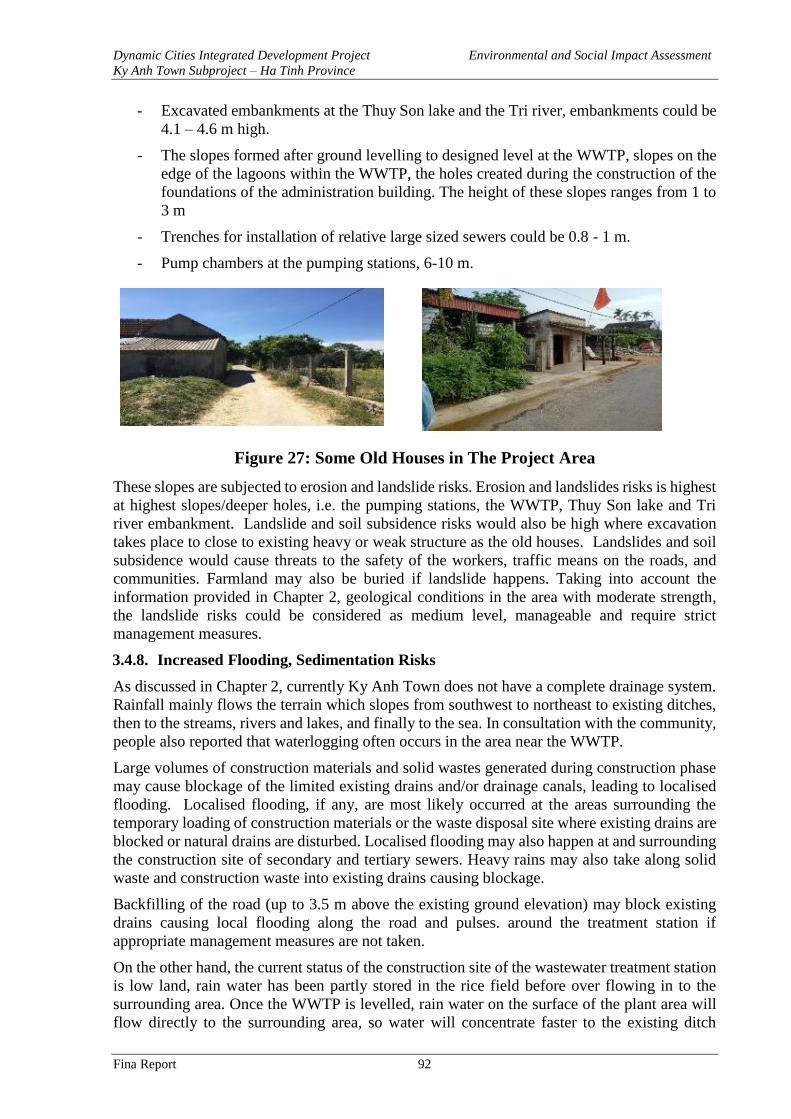
Dynamic Cities Integrated Development Project Environmental and Social Impact Assessment
Ky Anh Town Subproject – Ha Tinh Province
Fina Report 92
- Excavated embankments at the Thuy Son lake and the Tri river, embankments could be
4.1 – 4.6 m high.
- The slopes formed after ground levelling to designed level at the WWTP, slopes on the
edge of the lagoons within the WWTP, the holes created during the construction of the
foundations of the administration building. The height of these slopes ranges from 1 to
3 m
- Trenches for installation of relative large sized sewers could be 0.8 - 1 m.
- Pump chambers at the pumping stations, 6-10 m.
Figure 27: Some Old Houses in The Project Area
These slopes are subjected to erosion and landslide risks. Erosion and landslides risks is highest
at highest slopes/deeper holes, i.e. the pumping stations, the WWTP, Thuy Son lake and Tri
river embankment. Landslide and soil subsidence risks would also be high where excavation
takes place to close to existing heavy or weak structure as the old houses. Landslides and soil
subsidence would cause threats to the safety of the workers, traffic means on the roads, and
communities. Farmland may also be buried if landslide happens. Taking into account the
information provided in Chapter 2, geological conditions in the area with moderate strength,
the landslide risks could be considered as medium level, manageable and require strict
management measures.
3.4.8. Increased Flooding, Sedimentation Risks
As discussed in Chapter 2, currently Ky Anh Town does not have a complete drainage system.
Rainfall mainly flows the terrain which slopes from southwest to northeast to existing ditches,
then to the streams, rivers and lakes, and finally to the sea. In consultation with the community,
people also reported that waterlogging often occurs in the area near the WWTP.
Large volumes of construction materials and solid wastes generated during construction phase
may cause blockage of the limited existing drains and/or drainage canals, leading to localised
flooding. Localised flooding, if any, are most likely occurred at the areas surrounding the
temporary loading of construction materials or the waste disposal site where existing drains are
blocked or natural drains are disturbed. Localised flooding may also happen at and surrounding
the construction site of secondary and tertiary sewers. Heavy rains may also take along solid
waste and construction waste into existing drains causing blockage.
Backfilling of the road (up to 3.5 m above the existing ground elevation) may block existing
drains causing local flooding along the road and pulses. around the treatment station if
appropriate management measures are not taken.
On the other hand, the current status of the construction site of the wastewater treatment station
is low land, rain water has been partly stored in the rice field before over flowing in to the
surrounding area. Once the WWTP is levelled, rain water on the surface of the plant area will
flow directly to the surrounding area, so water will concentrate faster to the existing ditch
Dynamic Cities Integrated Development Project Environmental and Social Impact Assessment
Ky Anh Town Subproject – Ha Tinh Province
Fina Report 93
nearby. This change will increase the risk of local flooding around the plant, the area already
subjected to frequent local flooding may become more vulnerable to inundation.
Sedimentation in to the canals, rivers and lakes will also occur when waste and construction
materials from the temporary storage area that are washed into the ditches, streams and lakes.
In the dry season, the sediments enter rivers and streams mainly due to the influence of the
slope topography and material pile gravity. In the rainy season, when surface runoff occurs,
large amounts of waste and materials can be drained into rivers and streams if they are gathered
near the shore without mitigation or management measures. The Tri river section where
dredging and embankment lining take place, the Quyen and Cau Bau river sections where the
bridges will be constructed are high risk locations for the material to be drifted causing river
sedimentation.
The risks on flooding and sedimentation are assessed as medium and mitigable.
3.4.9. Traffic Disturbance and Increased Traffic Safety Risks
One of the main causes to traffic disturbance and increased traffic safety risks is from increased
traffic density when trucks and other construction plants are mobilised to work in the project
for transportation of construction materials and wastes. According to the estimation based on
volume of materials, waste and truck loads, on average each day there will be 27 trips of 18T
trucks going in and out of construction area at the Tri river canal, 8 trips along Thuy Son lake,
36 trips at the central road, 18 trips at the WWTP. With such number of trips, traffic on many
roads in Ky Anh town will not be disturbed due to the current low traffic density except for
NH1.
On the other hand, traffic disturbance and increased traffic safety risks would also be happened
when the road surfaces are narrowed down during construction due to project vehicles parking
at roadside temporary loading of materials and wastes, particularly bulky items such as sewer
pipes on the road or at roadside, or the fences placed along the roads. Open trenches for pipe
installation, placement of construction equipment, construction materials and wastes surround
the construction sites, movement of trucks in and out of construction sites etc are the other
causes of traffic disturbance and increased traffic safety risks. The current width of the road
from 6-10m, during construction will be occupied about 1-2m. All HDPE pipe lines use rolling
method so the road surface time is narrowed down to just a few days.
The roads affected the most by traffic disturbance and increased traffic safety risks during the
construction phase would be along NH1A where box culverts (size 2m x 2m) would be
constructed (with relatively long construction time). Traffic disturbance and increased traffic
safety risks would also be significant in the area near the pumping stations located at roadside,
the side roads on Tri river, the Ngan Ly road, DT10 road, 3/2 road on transportation route, Le
Quang Chi road and around the Thuy Son lake. The riskiest locations are the intersections, those
near Song Tri primary school’s opposite to Thuy Son lake and the area nearby the Gas station
of Company 474 at km564+900 on NH1 where often have multiple vehicles in and out.
The highest increase in traffic safety was in the morning (from 6.30-8h) and in the afternoon
(from 4.30-6h) at the intersection between the road next to Tri River and NH1, the intersection
between Nguyen Thi Bich Chau and NH1, Le Quang Chi road near Song Tri primary school
and on NH1 where there are many business households and agencies in Ky Anh town center.
Table 48 below presents in detail the roads significantly impacted during the construction phase
of the Project.
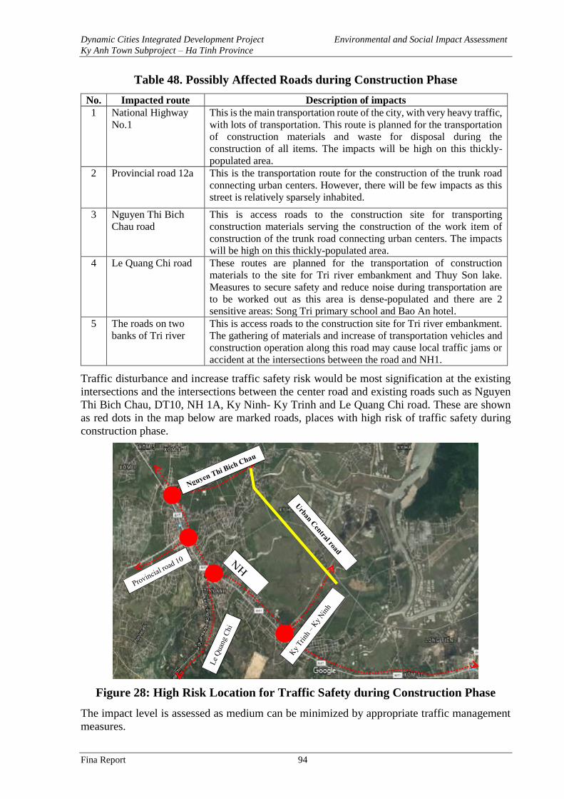
Dynamic Cities Integrated Development Project Environmental and Social Impact Assessment
Ky Anh Town Subproject – Ha Tinh Province
Fina Report 94
Table 48. Possibly Affected Roads during Construction Phase
No. Impacted route Description of impacts
1 National Highway
No.1
This is the main transportation route of the city, with very heavy traffic,
with lots of transportation. This route is planned for the transportation
of construction materials and waste for disposal during the
construction of all items. The impacts will be high on this thickly-
populated area.
2 Provincial road 12a This is the transportation route for the construction of the trunk road
connecting urban centers. However, there will be few impacts as this
street is relatively sparsely inhabited.
3 Nguyen Thi Bich
Chau road
This is access roads to the construction site for transporting
construction materials serving the construction of the work item of
construction of the trunk road connecting urban centers. The impacts
will be high on this thickly-populated area.
4 Le Quang Chi road These routes are planned for the transportation of construction
materials to the site for Tri river embankment and Thuy Son lake.
Measures to secure safety and reduce noise during transportation are
to be worked out as this area is dense-populated and there are 2
sensitive areas: Song Tri primary school and Bao An hotel.
5 The roads on two
banks of Tri river
This is access roads to the construction site for Tri river embankment.
The gathering of materials and increase of transportation vehicles and
construction operation along this road may cause local traffic jams or
accident at the intersections between the road and NH1.
Traffic disturbance and increase traffic safety risk would be most signification at the existing
intersections and the intersections between the center road and existing roads such as Nguyen
Thi Bich Chau, DT10, NH 1A, Ky Ninh- Ky Trinh and Le Quang Chi road. These are shown
as red dots in the map below are marked roads, places with high risk of traffic safety during
construction phase.
Figure 28: High Risk Location for Traffic Safety during Construction Phase
The impact level is assessed as medium can be minimized by appropriate traffic management
measures.
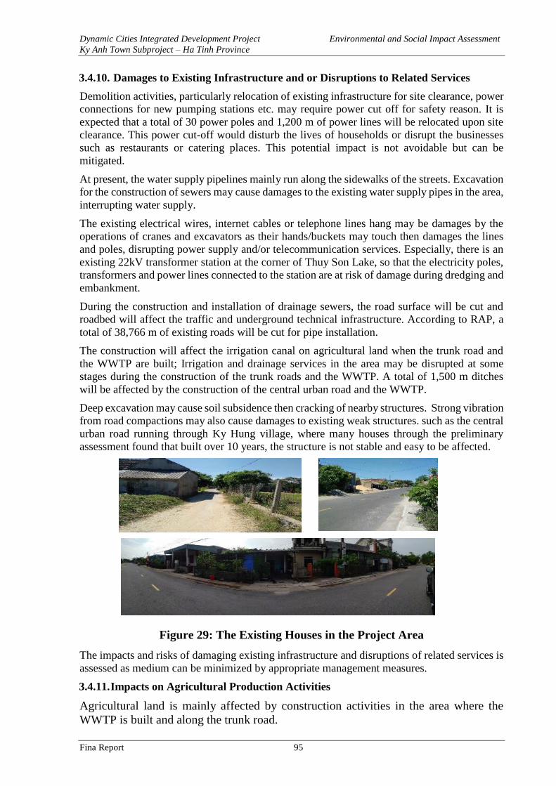
Dynamic Cities Integrated Development Project Environmental and Social Impact Assessment
Ky Anh Town Subproject – Ha Tinh Province
Fina Report 95
3.4.10. Damages to Existing Infrastructure and or Disruptions to Related Services
Demolition activities, particularly relocation of existing infrastructure for site clearance, power
connections for new pumping stations etc. may require power cut off for safety reason. It is
expected that a total of 30 power poles and 1,200 m of power lines will be relocated upon site
clearance. This power cut-off would disturb the lives of households or disrupt the businesses
such as restaurants or catering places. This potential impact is not avoidable but can be
mitigated.
At present, the water supply pipelines mainly run along the sidewalks of the streets. Excavation
for the construction of sewers may cause damages to the existing water supply pipes in the area,
interrupting water supply.
The existing electrical wires, internet cables or telephone lines hang may be damages by the
operations of cranes and excavators as their hands/buckets may touch then damages the lines
and poles, disrupting power supply and/or telecommunication services. Especially, there is an
existing 22kV transformer station at the corner of Thuy Son Lake, so that the electricity poles,
transformers and power lines connected to the station are at risk of damage during dredging and
embankment.
During the construction and installation of drainage sewers, the road surface will be cut and
roadbed will affect the traffic and underground technical infrastructure. According to RAP, a
total of 38,766 m of existing roads will be cut for pipe installation.
The construction will affect the irrigation canal on agricultural land when the trunk road and
the WWTP are built; Irrigation and drainage services in the area may be disrupted at some
stages during the construction of the trunk roads and the WWTP. A total of 1,500 m ditches
will be affected by the construction of the central urban road and the WWTP.
Deep excavation may cause soil subsidence then cracking of nearby structures. Strong vibration
from road compactions may also cause damages to existing weak structures. such as the central
urban road running through Ky Hung village, where many houses through the preliminary
assessment found that built over 10 years, the structure is not stable and easy to be affected.
Figure 29: The Existing Houses in the Project Area
The impacts and risks of damaging existing infrastructure and disruptions of related services is
assessed as medium can be minimized by appropriate management measures.
3.4.11. Impacts on Agricultural Production Activities
Agricultural land is mainly affected by construction activities in the area where the
WWTP is built and along the trunk road.
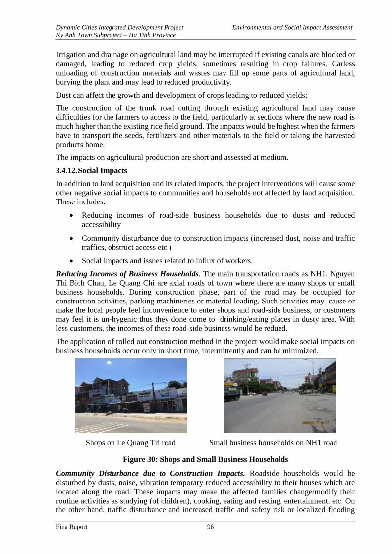
Dynamic Cities Integrated Development Project Environmental and Social Impact Assessment
Ky Anh Town Subproject – Ha Tinh Province
Fina Report 96
Irrigation and drainage on agricultural land may be interrupted if existing canals are blocked or
damaged, leading to reduced crop yields, sometimes resulting in crop failures. Carless
unloading of construction materials and wastes may fill up some parts of agricultural land,
burying the plant and may lead to reduced productivity.
Dust can affect the growth and development of crops leading to reduced yields;
The construction of the trunk road cutting through existing agricultural land may cause
difficulties for the farmers to access to the field, particularly at sections where the new road is
much higher than the existing rice field ground. The impacts would be highest when the farmers
have to transport the seeds, fertilizers and other materials to the field or taking the harvested
products home.
The impacts on agricultural production are short and assessed at medium.
3.4.12. Social Impacts
In addition to land acquisition and its related impacts, the project interventions will cause some
other negative social impacts to communities and households not affected by land acquisition.
These includes:
• Reducing incomes of road-side business households due to dusts and reduced
accessibility
• Community disturbance due to construction impacts (increased dust, noise and traffic
traffics, obstruct access etc.)
• Social impacts and issues related to influx of workers.
Reducing Incomes of Business Households. The main transportation roads as NH1, Nguyen
Thi Bich Chau, Le Quang Chi are axial roads of town where there are many shops or small
business households. During construction phase, part of the road may be occupied for
construction activities, parking machineries or material loading. Such activities may cause or
make the local people feel inconvenience to enter shops and road-side business, or customers
may feel it is un-hygenic thus they done come to drinking/eating places in dusty area. With
less customers, the incomes of these road-side business would be redued.
The application of rolled out construction method in the project would make social impacts on
business households occur only in short time, intermittently and can be minimized.
Shops on Le Quang Tri road Small business households on NH1 road
Figure 30: Shops and Small Business Households
Community Disturbance due to Construction Impacts. Roadside households would be
disturbed by dusts, noise, vibration temporary reduced accessibility to their houses which are
located along the road. These impacts may make the affected families change/modify their
routine activities as studying (of children), cooking, eating and resting, entertainment, etc. On
the other hand, traffic disturbance and increased traffic and safety risk or localized flooding
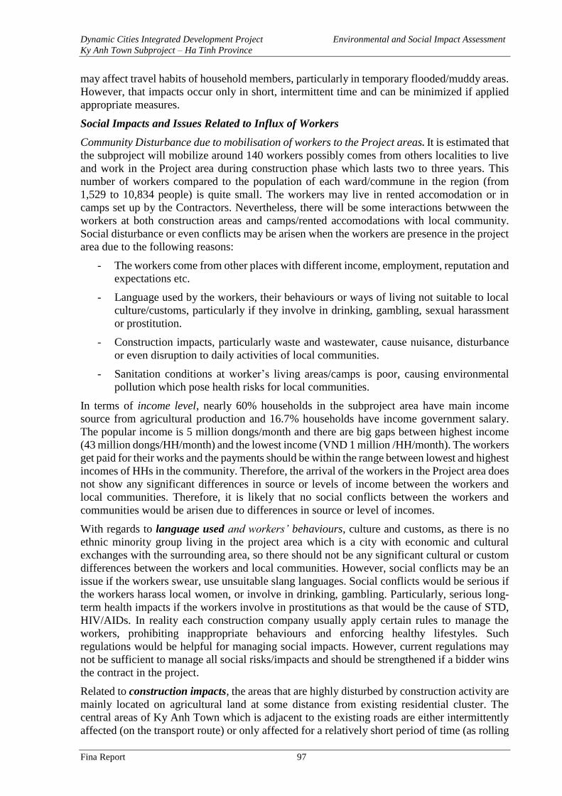
Dynamic Cities Integrated Development Project Environmental and Social Impact Assessment
Ky Anh Town Subproject – Ha Tinh Province
Fina Report 97
may affect travel habits of household members, particularly in temporary flooded/muddy areas.
However, that impacts occur only in short, intermittent time and can be minimized if applied
appropriate measures.
Social Impacts and Issues Related to Influx of Workers
Community Disturbance due to mobilisation of workers to the Project areas. It is estimated that
the subproject will mobilize around 140 workers possibly comes from others localities to live
and work in the Project area during construction phase which lasts two to three years. This
number of workers compared to the population of each ward/commune in the region (from
1,529 to 10,834 people) is quite small. The workers may live in rented accomodation or in
camps set up by the Contractors. Nevertheless, there will be some interactions betwween the
workers at both construction areas and camps/rented accomodations with local community.
Social disturbance or even conflicts may be arisen when the workers are presence in the project
area due to the following reasons:
- The workers come from other places with different income, employment, reputation and
expectations etc.
- Language used by the workers, their behaviours or ways of living not suitable to local
culture/customs, particularly if they involve in drinking, gambling, sexual harassment
or prostitution.
- Construction impacts, particularly waste and wastewater, cause nuisance, disturbance
or even disruption to daily activities of local communities.
- Sanitation conditions at worker’s living areas/camps is poor, causing environmental
pollution which pose health risks for local communities.
In terms of income level, nearly 60% households in the subproject area have main income
source from agricultural production and 16.7% households have income government salary.
The popular income is 5 million dongs/month and there are big gaps between highest income
(43 million dongs/HH/month) and the lowest income (VND 1 million /HH/month). The workers
get paid for their works and the payments should be within the range between lowest and highest
incomes of HHs in the community. Therefore, the arrival of the workers in the Project area does
not show any significant differences in source or levels of income between the workers and
local communities. Therefore, it is likely that no social conflicts between the workers and
communities would be arisen due to differences in source or level of incomes.
With regards to language used and workers’ behaviours, culture and customs, as there is no
ethnic minority group living in the project area which is a city with economic and cultural
exchanges with the surrounding area, so there should not be any significant cultural or custom
differences between the workers and local communities. However, social conflicts may be an
issue if the workers swear, use unsuitable slang languages. Social conflicts would be serious if
the workers harass local women, or involve in drinking, gambling. Particularly, serious long-
term health impacts if the workers involve in prostitutions as that would be the cause of STD,
HIV/AIDs. In reality each construction company usually apply certain rules to manage the
workers, prohibiting inappropriate behaviours and enforcing healthy lifestyles. Such
regulations would be helpful for managing social impacts. However, current regulations may
not be sufficient to manage all social risks/impacts and should be strengthened if a bidder wins
the contract in the project.
Related to construction impacts, the areas that are highly disturbed by construction activity are
mainly located on agricultural land at some distance from existing residential cluster. The
central areas of Ky Anh Town which is adjacent to the existing roads are either intermittently
affected (on the transport route) or only affected for a relatively short period of time (as rolling
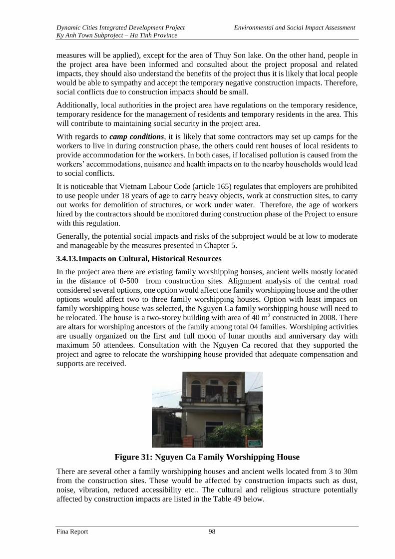
Dynamic Cities Integrated Development Project Environmental and Social Impact Assessment
Ky Anh Town Subproject – Ha Tinh Province
Fina Report 98
measures will be applied), except for the area of Thuy Son lake. On the other hand, people in
the project area have been informed and consulted about the project proposal and related
impacts, they should also understand the benefits of the project thus it is likely that local people
would be able to sympathy and accept the temporary negative construction impacts. Therefore,
social conflicts due to construction impacts should be small.
Additionally, local authorities in the project area have regulations on the temporary residence,
temporary residence for the management of residents and temporary residents in the area. This
will contribute to maintaining social security in the project area.
With regards to camp conditions, it is likely that some contractors may set up camps for the
workers to live in during construction phase, the others could rent houses of local residents to
provide accommodation for the workers. In both cases, if localised pollution is caused from the
workers’ accommodations, nuisance and health impacts on to the nearby households would lead
to social conflicts.
It is noticeable that Vietnam Labour Code (article 165) regulates that employers are prohibited
to use people under 18 years of age to carry heavy objects, work at construction sites, to carry
out works for demolition of structures, or work under water. Therefore, the age of workers
hired by the contractors should be monitored during construction phase of the Project to ensure
with this regulation.
Generally, the potential social impacts and risks of the subproject would be at low to moderate
and manageable by the measures presented in Chapter 5.
3.4.13. Impacts on Cultural, Historical Resources
In the project area there are existing family worshipping houses, ancient wells mostly located
in the distance of 0-500 from construction sites. Alignment analysis of the central road
considered several options, one option would affect one family worshipping house and the other
options would affect two to three family worshipping houses. Option with least impacs on
family worshipping house was selected, the Nguyen Ca family worshipping house will need to
be relocated. The house is a two-storey building with area of 40 m2 constructed in 2008. There
are altars for worshiping ancestors of the family among total 04 families. Worshiping activities
are usually organized on the first and full moon of lunar months and anniversary day with
maximum 50 attendees. Consultation with the Nguyen Ca recored that they supported the
project and agree to relocate the worshipping house provided that adequate compensation and
supports are received.
Figure 31: Nguyen Ca Family Worshipping House
There are several other a family worshipping houses and ancient wells located from 3 to 30m
from the construction sites. These would be affected by construction impacts such as dust,
noise, vibration, reduced accessibility etc.. The cultural and religious structure potentially
affected by construction impacts are listed in the Table 49 below.
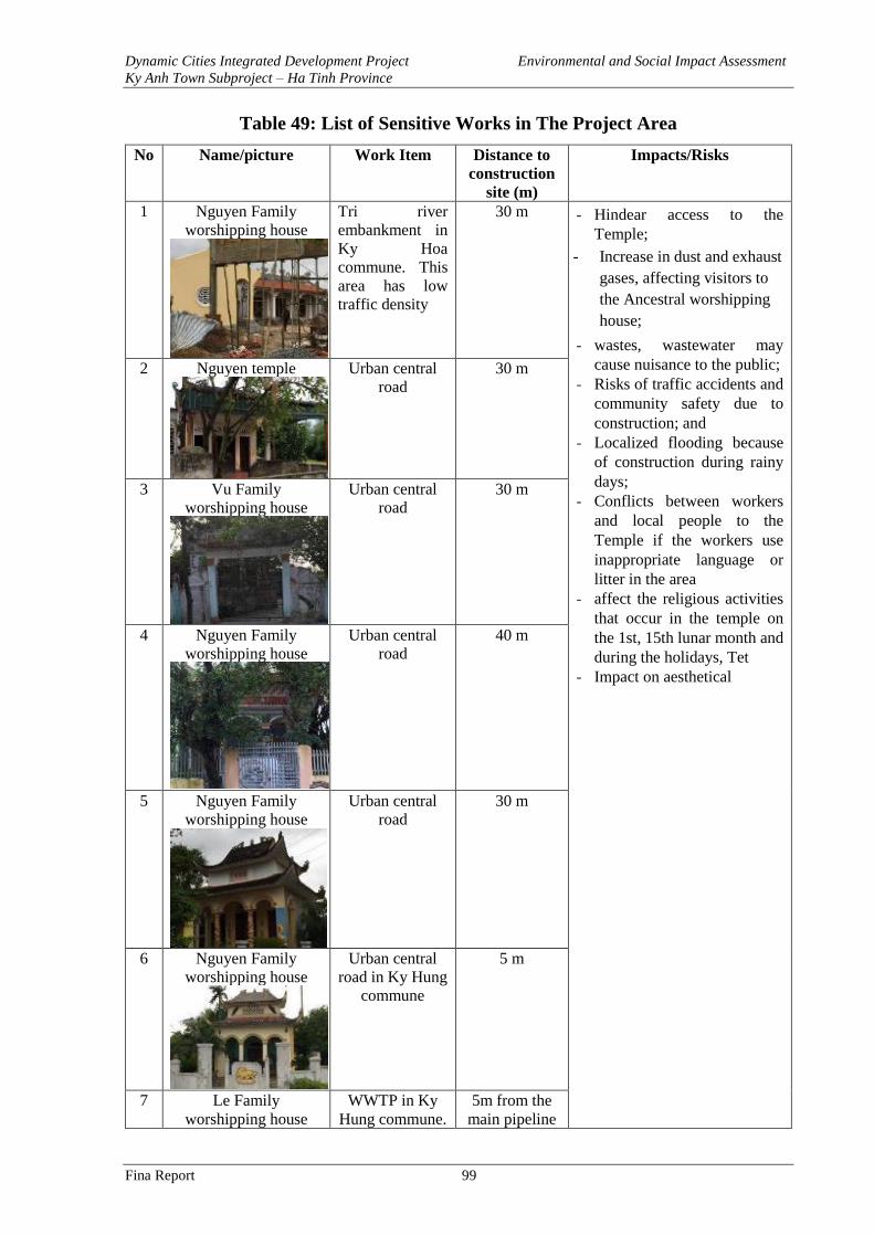
Dynamic Cities Integrated Development Project Environmental and Social Impact Assessment
Ky Anh Town Subproject – Ha Tinh Province
Fina Report 99
Table 49: List of Sensitive Works in The Project Area
No Name/picture Work Item Distance to
construction
site (m)
Impacts/Risks
1 Nguyen Family
worshipping house
Tri river
embankment in
Ky Hoa
commune. This
area has low
traffic density
30 m - Hindear access to the
Temple;
- Increase in dust and exhaust
gases, affecting visitors to
the Ancestral worshipping
house;
- wastes, wastewater may
cause nuisance to the public;
- Risks of traffic accidents and
community safety due to
construction; and
- Localized flooding because
of construction during rainy
days;
- Conflicts between workers
and local people to the
Temple if the workers use
inappropriate language or
litter in the area
- affect the religious activities
that occur in the temple on
the 1st, 15th lunar month and
during the holidays, Tet
- Impact on aesthetical
2 Nguyen temple
Urban central
road
30 m
3 Vu Family
worshipping house
Urban central
road
30 m
4 Nguyen Family
worshipping house
Urban central
road
40 m
5 Nguyen Family
worshipping house
Urban central
road
30 m
6 Nguyen Family
worshipping house
Urban central
road in Ky Hung
commune
5 m
7 Le Family
worshipping house
WWTP in Ky
Hung commune.
5m from the
main pipeline
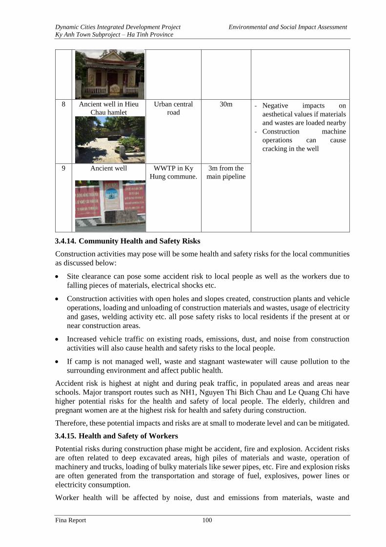
Dynamic Cities Integrated Development Project Environmental and Social Impact Assessment
Ky Anh Town Subproject – Ha Tinh Province
Fina Report 100
8 Ancient well in Hieu
Chau hamlet
Urban central
road
30m - Negative impacts on
aesthetical values if materials
and wastes are loaded nearby
- Construction machine
operations can cause
cracking in the well
9 Ancient well
WWTP in Ky
Hung commune.
3m from the
main pipeline
3.4.14. Community Health and Safety Risks
Construction activities may pose will be some health and safety risks for the local communities
as discussed below:
• Site clearance can pose some accident risk to local people as well as the workers due to
falling pieces of materials, electrical shocks etc.
• Construction activities with open holes and slopes created, construction plants and vehicle
operations, loading and unloading of construction materials and wastes, usage of electricity
and gases, welding activity etc. all pose safety risks to local residents if the present at or
near construction areas.
• Increased vehicle traffic on existing roads, emissions, dust, and noise from construction
activities will also cause health and safety risks to the local people.
• If camp is not managed well, waste and stagnant wastewater will cause pollution to the
surrounding environment and affect public health.
Accident risk is highest at night and during peak traffic, in populated areas and areas near
schools. Major transport routes such as NH1, Nguyen Thi Bich Chau and Le Quang Chi have
higher potential risks for the health and safety of local people. The elderly, children and
pregnant women are at the highest risk for health and safety during construction.
Therefore, these potential impacts and risks are at small to moderate level and can be mitigated.
3.4.15. Health and Safety of Workers
Potential risks during construction phase might be accident, fire and explosion. Accident risks
are often related to deep excavated areas, high piles of materials and waste, operation of
machinery and trucks, loading of bulky materials like sewer pipes, etc. Fire and explosion risks
are often generated from the transportation and storage of fuel, explosives, power lines or
electricity consumption.
Worker health will be affected by noise, dust and emissions from materials, waste and
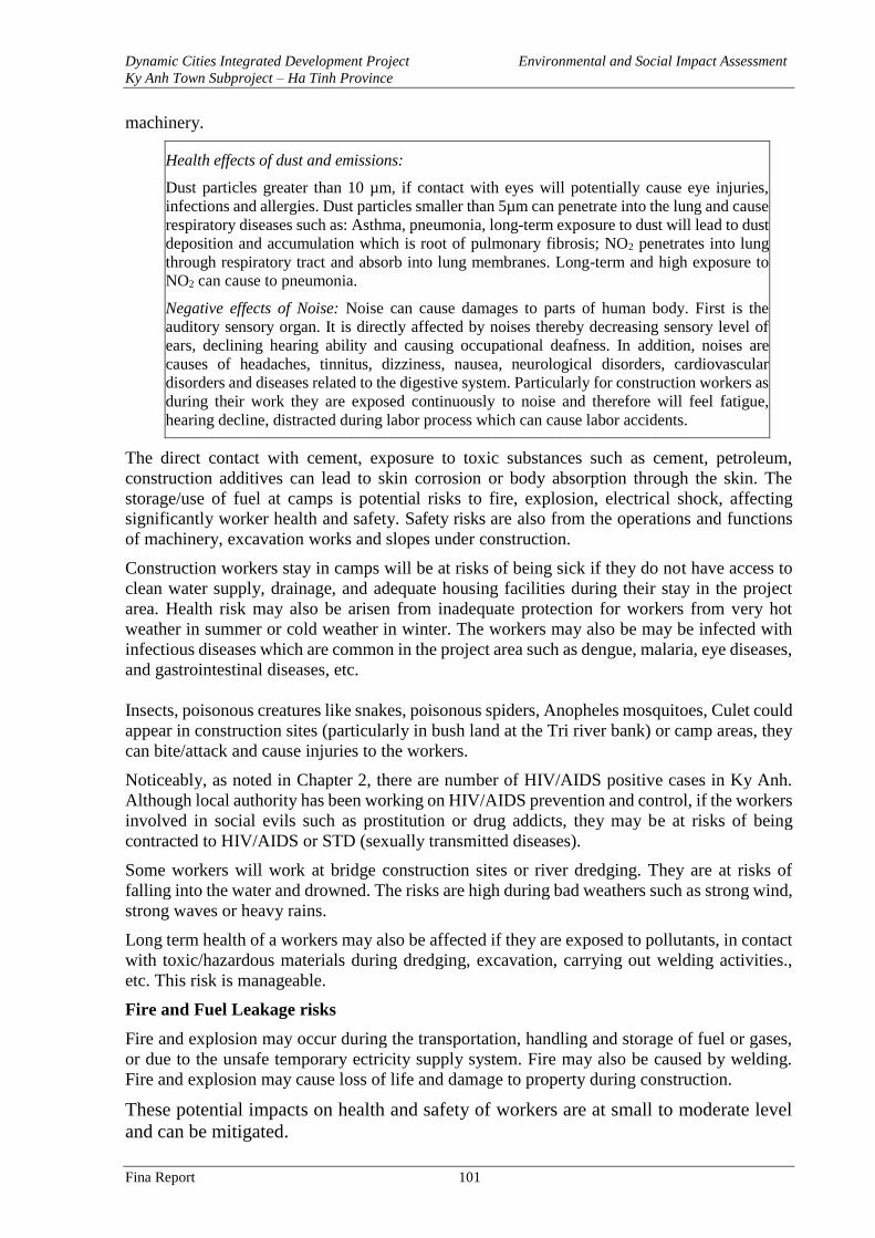
Dynamic Cities Integrated Development Project Environmental and Social Impact Assessment
Ky Anh Town Subproject – Ha Tinh Province
Fina Report 101
machinery.
Health effects of dust and emissions:
Dust particles greater than 10 µm, if contact with eyes will potentially cause eye injuries,
infections and allergies. Dust particles smaller than 5µm can penetrate into the lung and cause
respiratory diseases such as: Asthma, pneumonia, long-term exposure to dust will lead to dust
deposition and accumulation which is root of pulmonary fibrosis; NO2 penetrates into lung
through respiratory tract and absorb into lung membranes. Long-term and high exposure to
NO2 can cause to pneumonia.
Negative effects of Noise: Noise can cause damages to parts of human body. First is the
auditory sensory organ. It is directly affected by noises thereby decreasing sensory level of
ears, declining hearing ability and causing occupational deafness. In addition, noises are
causes of headaches, tinnitus, dizziness, nausea, neurological disorders, cardiovascular
disorders and diseases related to the digestive system. Particularly for construction workers as
during their work they are exposed continuously to noise and therefore will feel fatigue,
hearing decline, distracted during labor process which can cause labor accidents.
The direct contact with cement, exposure to toxic substances such as cement, petroleum,
construction additives can lead to skin corrosion or body absorption through the skin. The
storage/use of fuel at camps is potential risks to fire, explosion, electrical shock, affecting
significantly worker health and safety. Safety risks are also from the operations and functions
of machinery, excavation works and slopes under construction.
Construction workers stay in camps will be at risks of being sick if they do not have access to
clean water supply, drainage, and adequate housing facilities during their stay in the project
area. Health risk may also be arisen from inadequate protection for workers from very hot
weather in summer or cold weather in winter. The workers may also be may be infected with
infectious diseases which are common in the project area such as dengue, malaria, eye diseases,
and gastrointestinal diseases, etc.
Insects, poisonous creatures like snakes, poisonous spiders, Anopheles mosquitoes, Culet could
appear in construction sites (particularly in bush land at the Tri river bank) or camp areas, they
can bite/attack and cause injuries to the workers.
Noticeably, as noted in Chapter 2, there are number of HIV/AIDS positive cases in Ky Anh.
Although local authority has been working on HIV/AIDS prevention and control, if the workers
involved in social evils such as prostitution or drug addicts, they may be at risks of being
contracted to HIV/AIDS or STD (sexually transmitted diseases).
Some workers will work at bridge construction sites or river dredging. They are at risks of
falling into the water and drowned. The risks are high during bad weathers such as strong wind,
strong waves or heavy rains.
Long term health of a workers may also be affected if they are exposed to pollutants, in contact
with toxic/hazardous materials during dredging, excavation, carrying out welding activities.,
etc. This risk is manageable.
Fire and Fuel Leakage risks
Fire and explosion may occur during the transportation, handling and storage of fuel or gases,
or due to the unsafe temporary ectricity supply system. Fire may also be caused by welding.
Fire and explosion may cause loss of life and damage to property during construction.
These potential impacts on health and safety of workers are at small to moderate level
and can be mitigated.
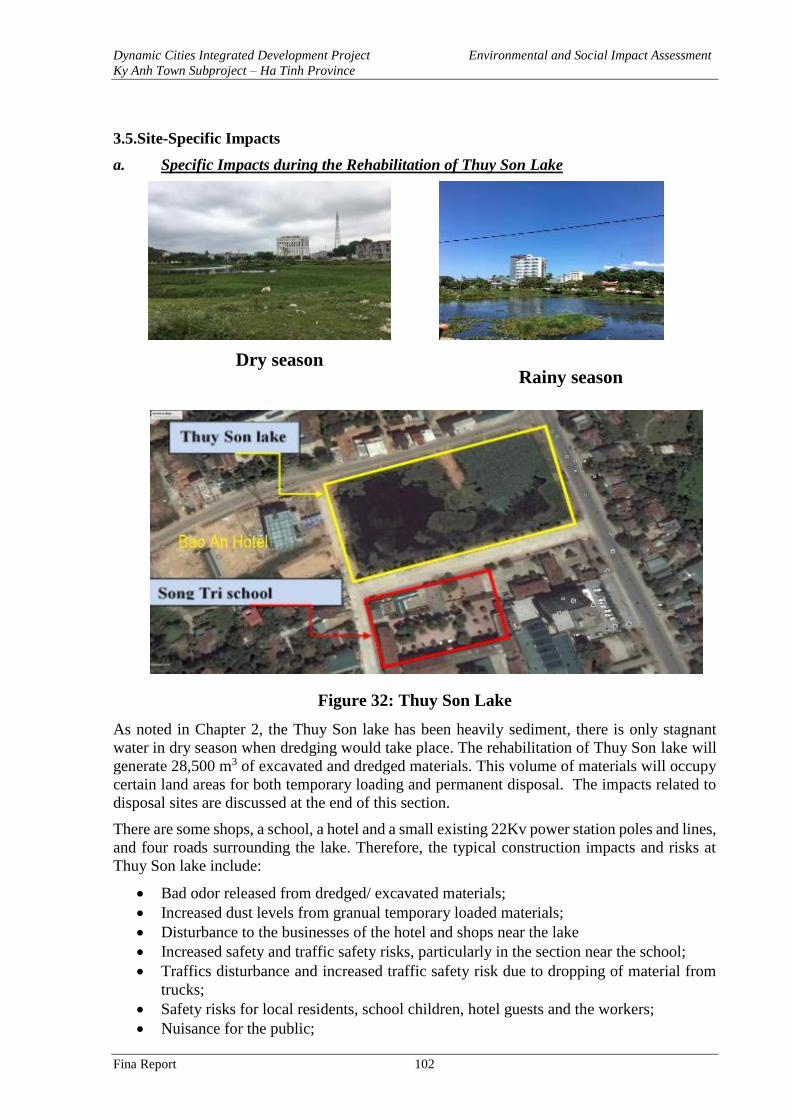
Dynamic Cities Integrated Development Project Environmental and Social Impact Assessment
Ky Anh Town Subproject – Ha Tinh Province
Fina Report 102
3.5.Site-Specific Impacts
a. Specific Impacts during the Rehabilitation of Thuy Son Lake
Dry season
Rainy season
Figure 32: Thuy Son Lake
As noted in Chapter 2, the Thuy Son lake has been heavily sediment, there is only stagnant
water in dry season when dredging would take place. The rehabilitation of Thuy Son lake will
generate 28,500 m3 of excavated and dredged materials. This volume of materials will occupy
certain land areas for both temporary loading and permanent disposal. The impacts related to
disposal sites are discussed at the end of this section.
There are some shops, a school, a hotel and a small existing 22Kv power station poles and lines,
and four roads surrounding the lake. Therefore, the typical construction impacts and risks at
Thuy Son lake include:
• Bad odor released from dredged/ excavated materials;
• Increased dust levels from granual temporary loaded materials;
• Disturbance to the businesses of the hotel and shops near the lake
• Increased safety and traffic safety risks, particularly in the section near the school;
• Traffics disturbance and increased traffic safety risk due to dropping of material from
trucks;
• Safety risks for local residents, school children, hotel guests and the workers;
• Nuisance for the public;
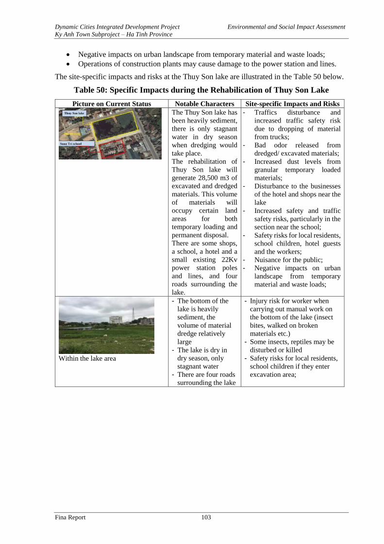
Dynamic Cities Integrated Development Project Environmental and Social Impact Assessment
Ky Anh Town Subproject – Ha Tinh Province
Fina Report 103
• Negative impacts on urban landscape from temporary material and waste loads;
• Operations of construction plants may cause damage to the power station and lines.
The site-specific impacts and risks at the Thuy Son lake are illustrated in the Table 50 below.
Table 50: Specific Impacts during the Rehabilication of Thuy Son Lake
Picture on Current Status Notable Characters Site-specific Impacts and Risks
The Thuy Son lake has
been heavily sediment,
there is only stagnant
water in dry season
when dredging would
take place.
The rehabilitation of
Thuy Son lake will
generate 28,500 m3 of
excavated and dredged
materials. This volume
of materials will
occupy certain land
areas for both
temporary loading and
permanent disposal.
There are some shops,
a school, a hotel and a
small existing 22Kv
power station poles
and lines, and four
roads surrounding the
lake.
- Traffics disturbance and
increased traffic safety risk
due to dropping of material
from trucks;
- Bad odor released from
dredged/ excavated materials;
- Increased dust levels from
granular temporary loaded
materials;
- Disturbance to the businesses
of the hotel and shops near the
lake
- Increased safety and traffic
safety risks, particularly in the
section near the school;
- Safety risks for local residents,
school children, hotel guests
and the workers;
- Nuisance for the public;
- Negative impacts on urban
landscape from temporary
material and waste loads;
Within the lake area
- The bottom of the
lake is heavily
sediment, the
volume of material
dredge relatively
large
- The lake is dry in
dry season, only
stagnant water
- There are four roads
surrounding the lake
- Injury risk for worker when
carrying out manual work on
the bottom of the lake (insect
bites, walked on broken
materials etc.)
- Some insects, reptiles may be
disturbed or killed
- Safety risks for local residents,
school children if they enter
excavation area;
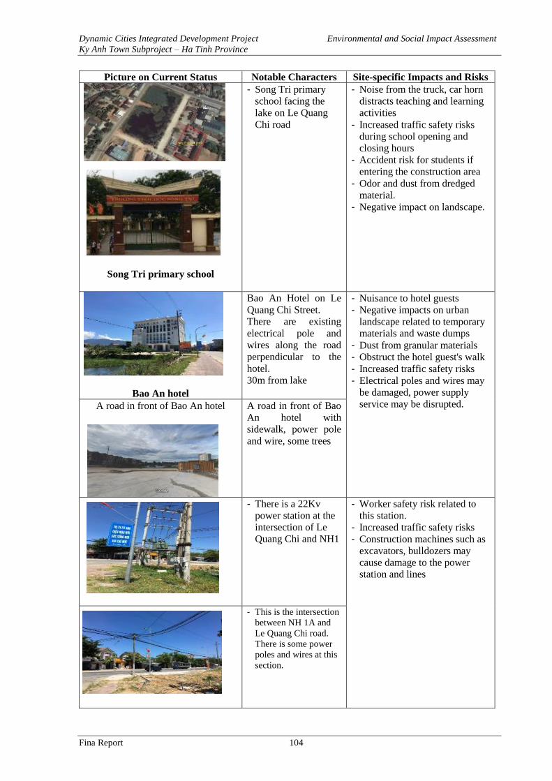
Dynamic Cities Integrated Development Project Environmental and Social Impact Assessment
Ky Anh Town Subproject – Ha Tinh Province
Fina Report 104
Picture on Current Status Notable Characters Site-specific Impacts and Risks
Song Tri primary school
- Song Tri primary
school facing the
lake on Le Quang
Chi road
- Noise from the truck, car horn
distracts teaching and learning
activities
- Increased traffic safety risks
during school opening and
closing hours
- Accident risk for students if
entering the construction area
- Odor and dust from dredged
material.
- Negative impact on landscape.
Bao An hotel
Bao An Hotel on Le
Quang Chi Street.
There are existing
electrical pole and
wires along the road
perpendicular to the
hotel.
30m from lake
- Nuisance to hotel guests
- Negative impacts on urban
landscape related to temporary
materials and waste dumps
- Dust from granular materials
- Obstruct the hotel guest's walk
- Increased traffic safety risks
- Electrical poles and wires may
be damaged, power supply
service may be disrupted. A road in front of Bao An hotel A road in front of Bao
An hotel with
sidewalk, power pole
and wire, some trees
- There is a 22Kv
power station at the
intersection of Le
Quang Chi and NH1
- Worker safety risk related to
this station.
- Increased traffic safety risks
- Construction machines such as
excavators, bulldozers may
cause damage to the power
station and lines
- This is the intersection
between NH 1A and
Le Quang Chi road.
There is some power
poles and wires at this
section.
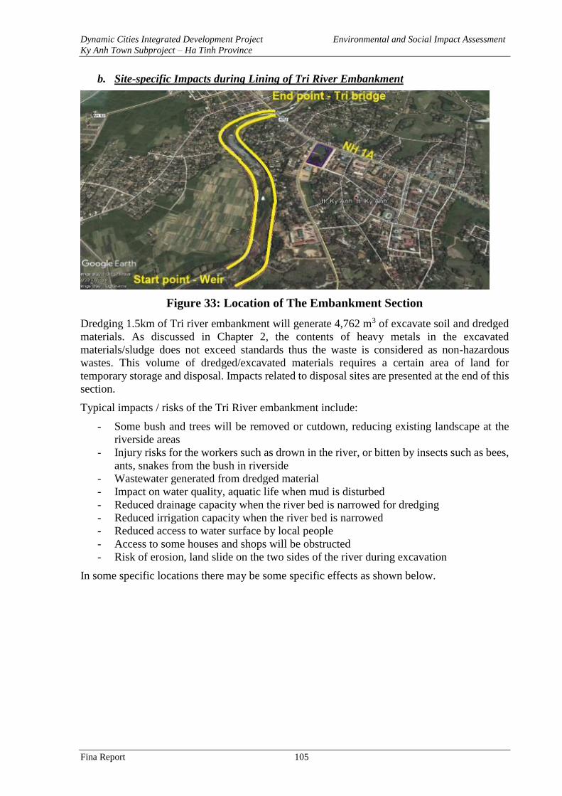
Dynamic Cities Integrated Development Project Environmental and Social Impact Assessment
Ky Anh Town Subproject – Ha Tinh Province
Fina Report 105
b. Site-specific Impacts during Lining of Tri River Embankment
Figure 33: Location of The Embankment Section
Dredging 1.5km of Tri river embankment will generate 4,762 m3 of excavate soil and dredged
materials. As discussed in Chapter 2, the contents of heavy metals in the excavated
materials/sludge does not exceed standards thus the waste is considered as non-hazardous
wastes. This volume of dredged/excavated materials requires a certain area of land for
temporary storage and disposal. Impacts related to disposal sites are presented at the end of this
section.
Typical impacts / risks of the Tri River embankment include:
- Some bush and trees will be removed or cutdown, reducing existing landscape at the
riverside areas
- Injury risks for the workers such as drown in the river, or bitten by insects such as bees,
ants, snakes from the bush in riverside
- Wastewater generated from dredged material
- Impact on water quality, aquatic life when mud is disturbed
- Reduced drainage capacity when the river bed is narrowed for dredging
- Reduced irrigation capacity when the river bed is narrowed
- Reduced access to water surface by local people
- Access to some houses and shops will be obstructed
- Risk of erosion, land slide on the two sides of the river during excavation
In some specific locations there may be some specific effects as shown below.
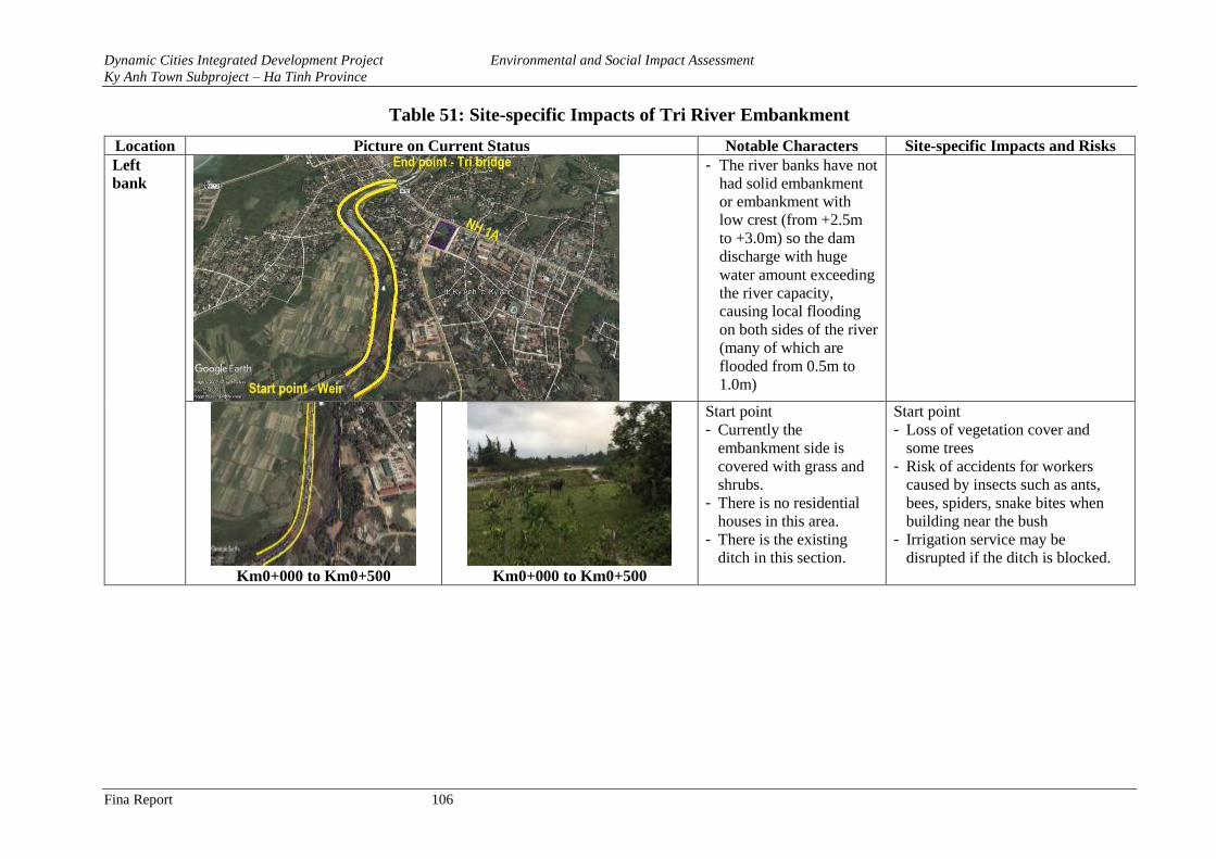
Dynamic Cities Integrated Development Project Environmental and Social Impact Assessment
Ky Anh Town Subproject – Ha Tinh Province
Fina Report 106
Table 51: Site-specific Impacts of Tri River Embankment
Location Picture on Current Status Notable Characters Site-specific Impacts and Risks
Left
bank
- The river banks have not
had solid embankment
or embankment with
low crest (from +2.5m
to +3.0m) so the dam
discharge with huge
water amount exceeding
the river capacity,
causing local flooding
on both sides of the river
(many of which are
flooded from 0.5m to
1.0m)
Km0+000 to Km0+500 Km0+000 to Km0+500
Start point
- Currently the
embankment side is
covered with grass and
shrubs.
- There is no residential
houses in this area.
- There is the existing
ditch in this section.
Start point
- Loss of vegetation cover and
some trees
- Risk of accidents for workers
caused by insects such as ants,
bees, spiders, snake bites when
building near the bush
- Irrigation service may be
disrupted if the ditch is blocked.
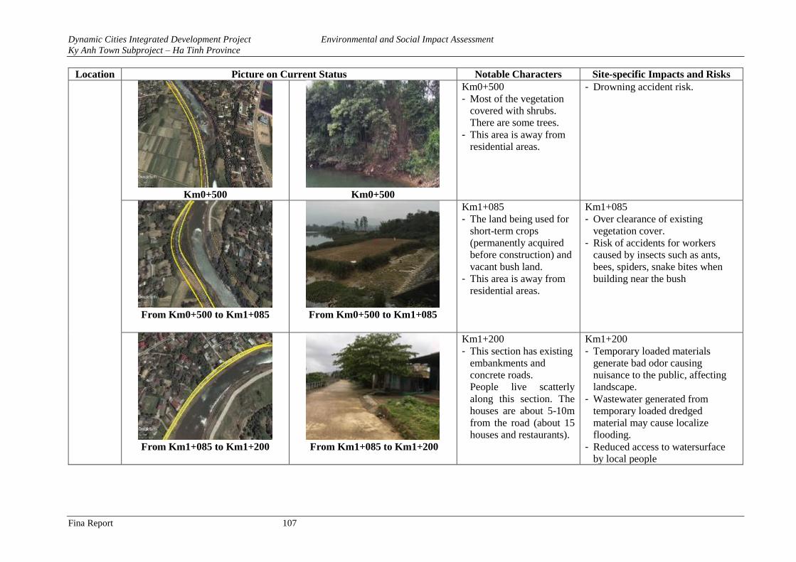
Dynamic Cities Integrated Development Project Environmental and Social Impact Assessment
Ky Anh Town Subproject – Ha Tinh Province
Fina Report 107
Location Picture on Current Status Notable Characters Site-specific Impacts and Risks
Km0+500 Km0+500
Km0+500
- Most of the vegetation
covered with shrubs.
There are some trees.
- This area is away from
residential areas.
- Drowning accident risk.
From Km0+500 to Km1+085
From Km0+500 to Km1+085
Km1+085
- The land being used for
short-term crops
(permanently acquired
before construction) and
vacant bush land.
- This area is away from
residential areas.
Km1+085
- Over clearance of existing
vegetation cover.
- Risk of accidents for workers
caused by insects such as ants,
bees, spiders, snake bites when
building near the bush
From Km1+085 to Km1+200
From Km1+085 to Km1+200
Km1+200
- This section has existing
embankments and
concrete roads.
People live scatterly
along this section. The
houses are about 5-10m
from the road (about 15
houses and restaurants).
Km1+200
- Temporary loaded materials
generate bad odor causing
nuisance to the public, affecting
landscape.
- Wastewater generated from
temporary loaded dredged
material may cause localize
flooding.
- Reduced access to watersurface
by local people
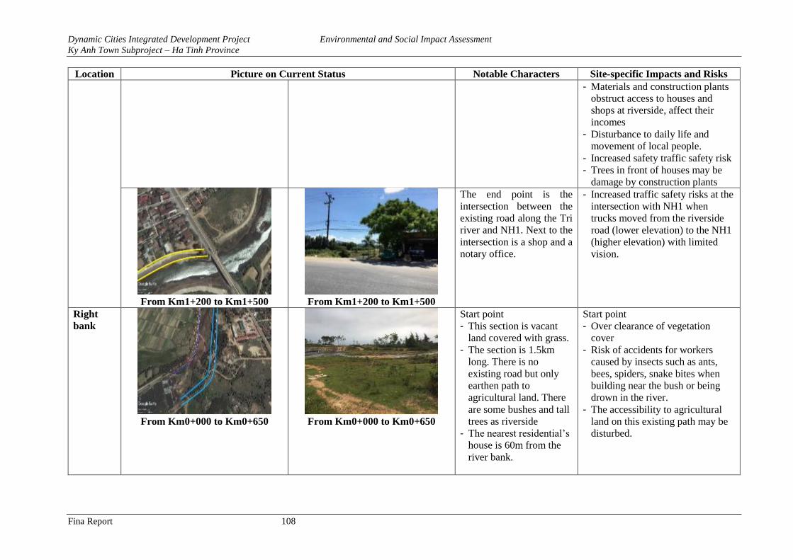
Dynamic Cities Integrated Development Project Environmental and Social Impact Assessment
Ky Anh Town Subproject – Ha Tinh Province
Fina Report 108
Location Picture on Current Status Notable Characters Site-specific Impacts and Risks
- Materials and construction plants
obstruct access to houses and
shops at riverside, affect their
incomes
- Disturbance to daily life and
movement of local people.
- Increased safety traffic safety risk
- Trees in front of houses may be
damage by construction plants
From Km1+200 to Km1+500 From Km1+200 to Km1+500
The end point is the
intersection between the
existing road along the Tri
river and NH1. Next to the
intersection is a shop and a
notary office.
- Increased traffic safety risks at the
intersection with NH1 when
trucks moved from the riverside
road (lower elevation) to the NH1
(higher elevation) with limited
vision.
Right
bank
From Km0+000 to Km0+650 From Km0+000 to Km0+650
Start point
- This section is vacant
land covered with grass.
- The section is 1.5km
long. There is no
existing road but only
earthen path to
agricultural land. There
are some bushes and tall
trees as riverside
- The nearest residential’s
house is 60m from the
river bank.
Start point
- Over clearance of vegetation
cover
- Risk of accidents for workers
caused by insects such as ants,
bees, spiders, snake bites when
building near the bush or being
drown in the river.
- The accessibility to agricultural
land on this existing path may be
disturbed.
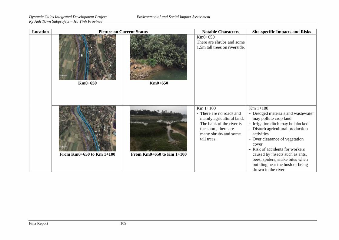
Dynamic Cities Integrated Development Project Environmental and Social Impact Assessment
Ky Anh Town Subproject – Ha Tinh Province
Fina Report 109
Location Picture on Current Status Notable Characters Site-specific Impacts and Risks
Km0+650 Km0+650
Km0+650
There are shrubs and some
1.5m tall trees on riverside.
From Km0+650 to Km 1+100 From Km0+650 to Km 1+100
Km 1+100
- There are no roads and
mainly agricultural land.
The bank of the river is
the shore, there are
many shrubs and some
tall trees.
Km 1+100
- Dredged materials and wastewater
may pollute crop land
- Irrigation ditch may be blocked.
- Disturb agricultural production
activities
- Over clearance of vegetation
cover
- Risk of accidents for workers
caused by insects such as ants,
bees, spiders, snake bites when
building near the bush or being
drown in the river
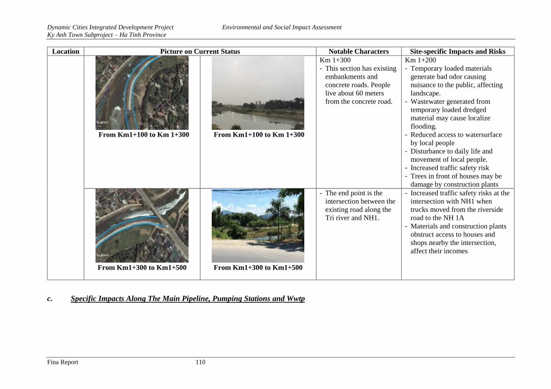
Dynamic Cities Integrated Development Project Environmental and Social Impact Assessment
Ky Anh Town Subproject – Ha Tinh Province
Fina Report 110
Location Picture on Current Status Notable Characters Site-specific Impacts and Risks
From Km1+100 to Km 1+300 From Km1+100 to Km 1+300
Km 1+300
- This section has existing
embankments and
concrete roads. People
live about 60 meters
from the concrete road.
Km 1+200
- Temporary loaded materials
generate bad odor causing
nuisance to the public, affecting
landscape.
- Wastewater generated from
temporary loaded dredged
material may cause localize
flooding.
- Reduced access to watersurface
by local people
- Disturbance to daily life and
movement of local people.
- Increased traffic safety risk
- Trees in front of houses may be
damage by construction plants
From Km1+300 to Km1+500
From Km1+300 to Km1+500
- The end point is the
intersection between the
existing road along the
Tri river and NH1.
- Increased traffic safety risks at the
intersection with NH1 when
trucks moved from the riverside
road to the NH 1A
- Materials and construction plants
obstruct access to houses and
shops nearby the intersection,
affect their incomes
c. Specific Impacts Along The Main Pipeline, Pumping Stations and Wwtp
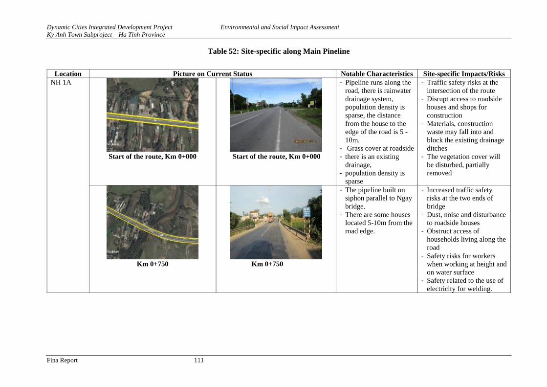
Dynamic Cities Integrated Development Project Environmental and Social Impact Assessment
Ky Anh Town Subproject – Ha Tinh Province
Fina Report 111
Table 52: Site-specific along Main Pineline
Location Picture on Current Status Notable Characteristics Site-specific Impacts/Risks
NH 1A
Start of the route, Km 0+000
Start of the route, Km 0+000
- Pipeline runs along the
road, there is rainwater
drainage system,
population density is
sparse, the distance
from the house to the
edge of the road is 5 -
10m.
- Grass cover at roadside
- there is an existing
drainage,
- population density is
sparse
- Traffic safety risks at the
intersection of the route
- Disrupt access to roadside
houses and shops for
construction
- Materials, construction
waste may fall into and
block the existing drainage
ditches
- The vegetation cover will
be disturbed, partially
removed
Km 0+750
Km 0+750
- The pipeline built on
siphon parallel to Ngay
bridge.
- There are some houses
located 5-10m from the
road edge.
- Increased traffic safety
risks at the two ends of
bridge
- Dust, noise and disturbance
to roadside houses
- Obstruct access of
households living along the
road
- Safety risks for workers
when working at height and
on water surface
- Safety related to the use of
electricity for welding.
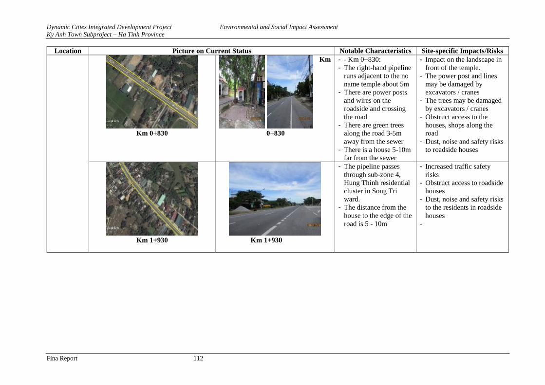
Dynamic Cities Integrated Development Project Environmental and Social Impact Assessment
Ky Anh Town Subproject – Ha Tinh Province
Fina Report 112
Location Picture on Current Status Notable Characteristics Site-specific Impacts/Risks
Km 0+830
Km
0+830
- - Km 0+830:
- The right-hand pipeline
runs adjacent to the no
name temple about 5m
- There are power posts
and wires on the
roadside and crossing
the road
- There are green trees
along the road 3-5m
away from the sewer
- There is a house 5-10m
far from the sewer
- Impact on the landscape in
front of the temple.
- The power post and lines
may be damaged by
excavators / cranes
- The trees may be damaged
by excavators / cranes
- Obstruct access to the
houses, shops along the
road
- Dust, noise and safety risks
to roadside houses
Km 1+930
Km 1+930
- The pipeline passes
through sub-zone 4,
Hung Thinh residential
cluster in Song Tri
ward.
- The distance from the
house to the edge of the
road is 5 - 10m
- Increased traffic safety
risks
- Obstruct access to roadside
houses
- Dust, noise and safety risks
to the residents in roadside
houses
-
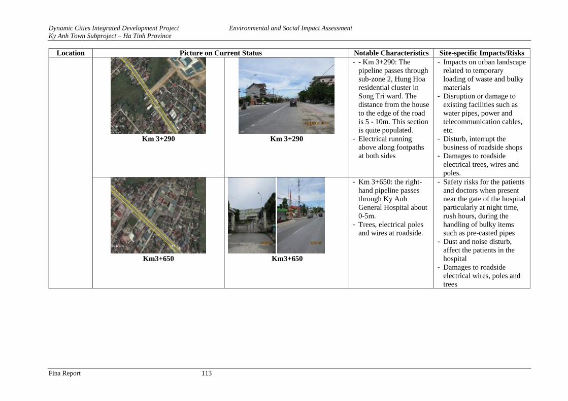
Dynamic Cities Integrated Development Project Environmental and Social Impact Assessment
Ky Anh Town Subproject – Ha Tinh Province
Fina Report 113
Location Picture on Current Status Notable Characteristics Site-specific Impacts/Risks
Km 3+290
Km 3+290
- - Km 3+290: The
pipeline passes through
sub-zone 2, Hung Hoa
residential cluster in
Song Tri ward. The
distance from the house
to the edge of the road
is 5 - 10m. This section
is quite populated.
- Electrical running
above along footpaths
at both sides
- Impacts on urban landscape
related to temporary
loading of waste and bulky
materials
- Disruption or damage to
existing facilities such as
water pipes, power and
telecommunication cables,
etc.
- Disturb, interrupt the
business of roadside shops
- Damages to roadside
electrical trees, wires and
poles.
Km3+650
Km3+650
- Km 3+650: the right-
hand pipeline passes
through Ky Anh
General Hospital about
0-5m.
- Trees, electrical poles
and wires at roadside.
- Safety risks for the patients
and doctors when present
near the gate of the hospital
particularly at night time,
rush hours, during the
handling of bulky items
such as pre-casted pipes
- Dust and noise disturb,
affect the patients in the
hospital
- Damages to roadside
electrical wires, poles and
trees
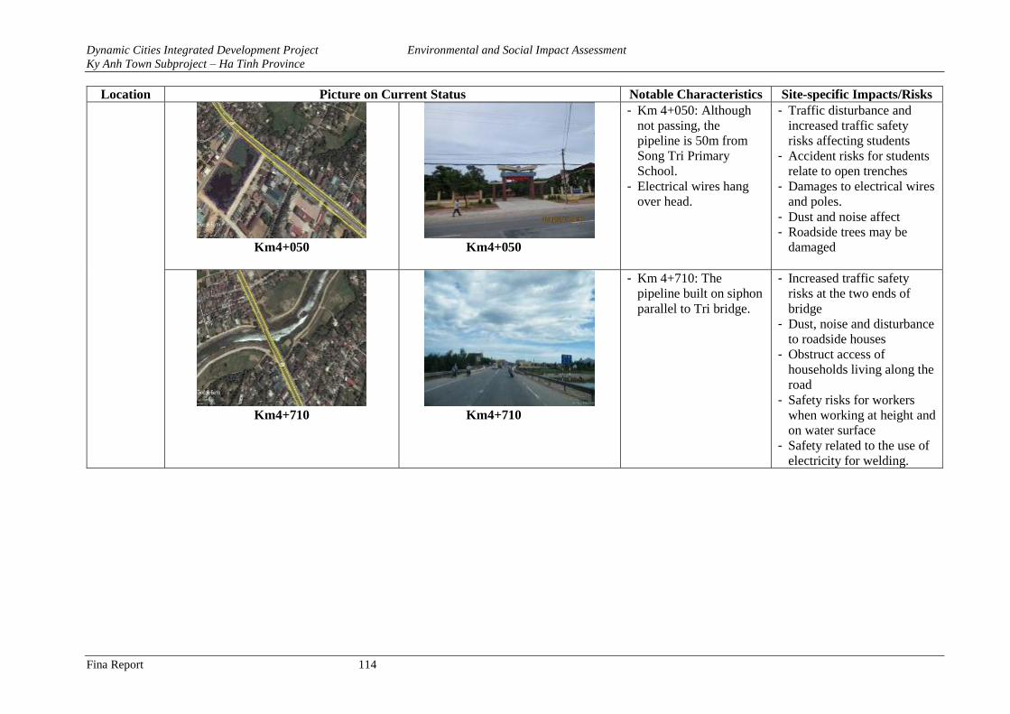
Dynamic Cities Integrated Development Project Environmental and Social Impact Assessment
Ky Anh Town Subproject – Ha Tinh Province
Fina Report 114
Location Picture on Current Status Notable Characteristics Site-specific Impacts/Risks
Km4+050
Km4+050
- Km 4+050: Although
not passing, the
pipeline is 50m from
Song Tri Primary
School.
- Electrical wires hang
over head.
- Traffic disturbance and
increased traffic safety
risks affecting students
- Accident risks for students
relate to open trenches
- Damages to electrical wires
and poles.
- Dust and noise affect
- Roadside trees may be
damaged
Km4+710
Km4+710
- Km 4+710: The
pipeline built on siphon
parallel to Tri bridge.
- Increased traffic safety
risks at the two ends of
bridge
- Dust, noise and disturbance
to roadside houses
- Obstruct access of
households living along the
road
- Safety risks for workers
when working at height and
on water surface
- Safety related to the use of
electricity for welding.
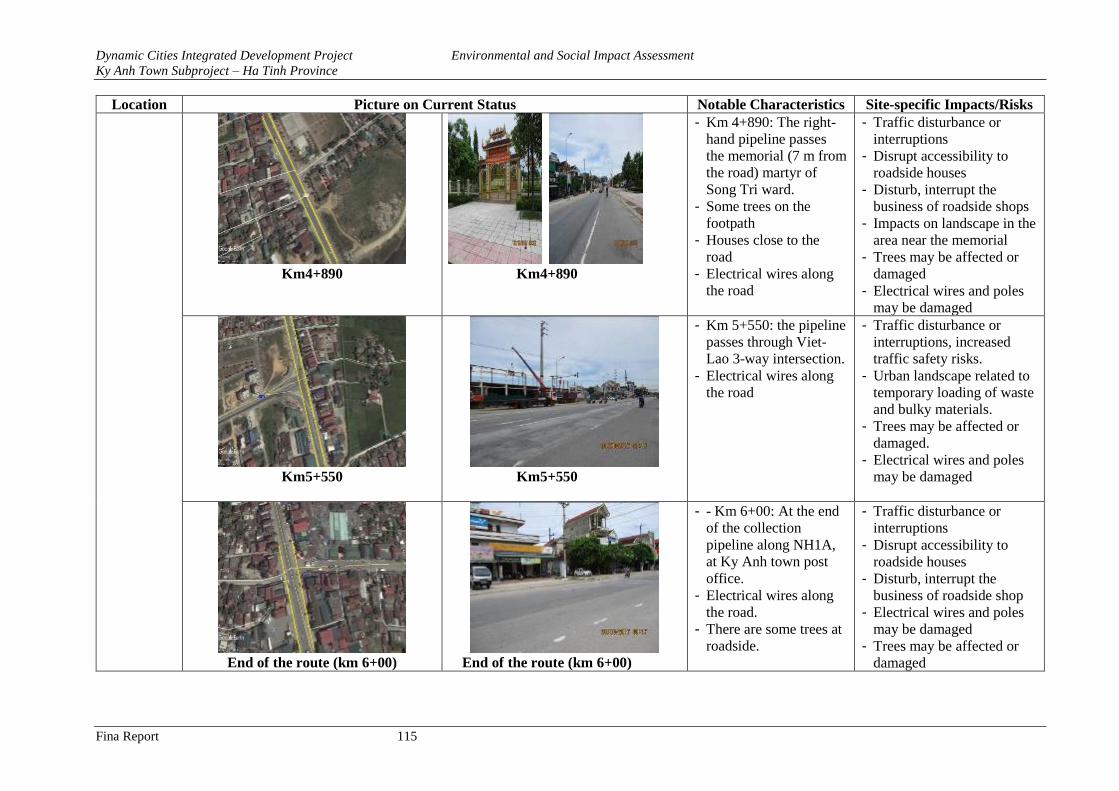
Dynamic Cities Integrated Development Project Environmental and Social Impact Assessment
Ky Anh Town Subproject – Ha Tinh Province
Fina Report 115
Location Picture on Current Status Notable Characteristics Site-specific Impacts/Risks
Km4+890
Km4+890
- Km 4+890: The right-
hand pipeline passes
the memorial (7 m from
the road) martyr of
Song Tri ward.
- Some trees on the
footpath
- Houses close to the
road
- Electrical wires along
the road
- Traffic disturbance or
interruptions
- Disrupt accessibility to
roadside houses
- Disturb, interrupt the
business of roadside shops
- Impacts on landscape in the
area near the memorial
- Trees may be affected or
damaged
- Electrical wires and poles
may be damaged
Km5+550
Km5+550
- Km 5+550: the pipeline
passes through Viet-
Lao 3-way intersection.
- Electrical wires along
the road
- Traffic disturbance or
interruptions, increased
traffic safety risks.
- Urban landscape related to
temporary loading of waste
and bulky materials.
- Trees may be affected or
damaged.
- Electrical wires and poles
may be damaged
End of the route (km 6+00) End of the route (km 6+00)
- - Km 6+00: At the end
of the collection
pipeline along NH1A,
at Ky Anh town post
office.
- Electrical wires along
the road.
- There are some trees at
roadside.
- Traffic disturbance or
interruptions
- Disrupt accessibility to
roadside houses
- Disturb, interrupt the
business of roadside shop
- Electrical wires and poles
may be damaged
- Trees may be affected or
damaged
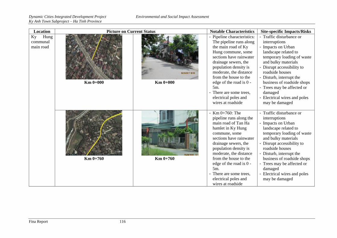
Dynamic Cities Integrated Development Project Environmental and Social Impact Assessment
Ky Anh Town Subproject – Ha Tinh Province
Fina Report 116
Location Picture on Current Status Notable Characteristics Site-specific Impacts/Risks
Ky Hung
communal
main road
Km 0+000
Km 0+000
- Pipeline characteristics:
The pipeline runs along
the main road of Ky
Hung commune, some
sections have rainwater
drainage sewers, the
population density is
moderate, the distance
from the house to the
edge of the road is 0 -
5m.
- There are some trees,
electrical poles and
wires at roadside
- Traffic disturbance or
interruptions
- Impacts on Urban
landscape related to
temporary loading of waste
and bulky materials
- Disrupt accessibility to
roadside houses
- Disturb, interrupt the
business of roadside shops
- Trees may be affected or
damaged
- Electrical wires and poles
may be damaged
Km 0+760 Km 0+760
- Km 0+760: The
pipeline runs along the
main road of Tan Ha
hamlet in Ky Hung
commune, some
sections have rainwater
drainage sewers, the
population density is
moderate, the distance
from the house to the
edge of the road is 0 -
5m.
- There are some trees,
electrical poles and
wires at roadside
- Traffic disturbance or
interruptions
- Impacts on Urban
landscape related to
temporary loading of waste
and bulky materials
- Disrupt accessibility to
roadside houses
- Disturb, interrupt the
business of roadside shops
- Trees may be affected or
damaged
- Electrical wires and poles
may be damaged
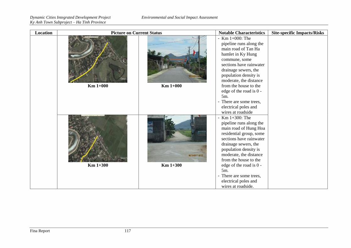
Dynamic Cities Integrated Development Project Environmental and Social Impact Assessment
Ky Anh Town Subproject – Ha Tinh Province
Fina Report 117
Location Picture on Current Status Notable Characteristics Site-specific Impacts/Risks
Km 1+000
Km 1+000
- Km 1+000: The
pipeline runs along the
main road of Tan Ha
hamlet in Ky Hung
commune, some
sections have rainwater
drainage sewers, the
population density is
moderate, the distance
from the house to the
edge of the road is 0 -
5m.
- There are some trees,
electrical poles and
wires at roadside
Km 1+300
Km 1+300
- Km 1+300: The
pipeline runs along the
main road of Hung Hoa
residential group, some
sections have rainwater
drainage sewers, the
population density is
moderate, the distance
from the house to the
edge of the road is 0 -
5m.
- There are some trees,
electrical poles and
wires at roadside.
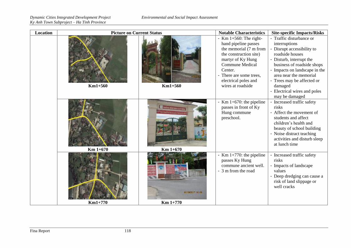
Dynamic Cities Integrated Development Project Environmental and Social Impact Assessment
Ky Anh Town Subproject – Ha Tinh Province
Fina Report 118
Location Picture on Current Status Notable Characteristics Site-specific Impacts/Risks
Km1+560 Km1+560
- Km 1+560: The right-
hand pipeline passes
the memorial (7 m from
the construction site)
martyr of Ky Hung
Commune Medical
Center.
- There are some trees,
electrical poles and
wires at roadside
- Traffic disturbance or
interruptions
- Disrupt accessibility to
roadside houses
- Disturb, interrupt the
business of roadside shops
- Impacts on landscape in the
area near the memorial
- Trees may be affected or
damaged
- Electrical wires and poles
may be damaged
Km 1+670 Km 1+670
- Km 1+670: the pipeline
passes in front of Ky
Hung commune
preschool.
- Increased traffic safety
risks
- Affect the movement of
students and affect
children’s health and
beauty of school building
- Noise distract teaching
activities and disturb sleep
at lunch time
Km1+770 Km 1+770
- Km 1+770: the pipeline
passes Ky Hung
commune ancient well.
- 3 m from the road
- Increased traffic safety
risks
- Impacts of landscape
values
- Deep dredging can cause a
risk of land slippage or
well cracks
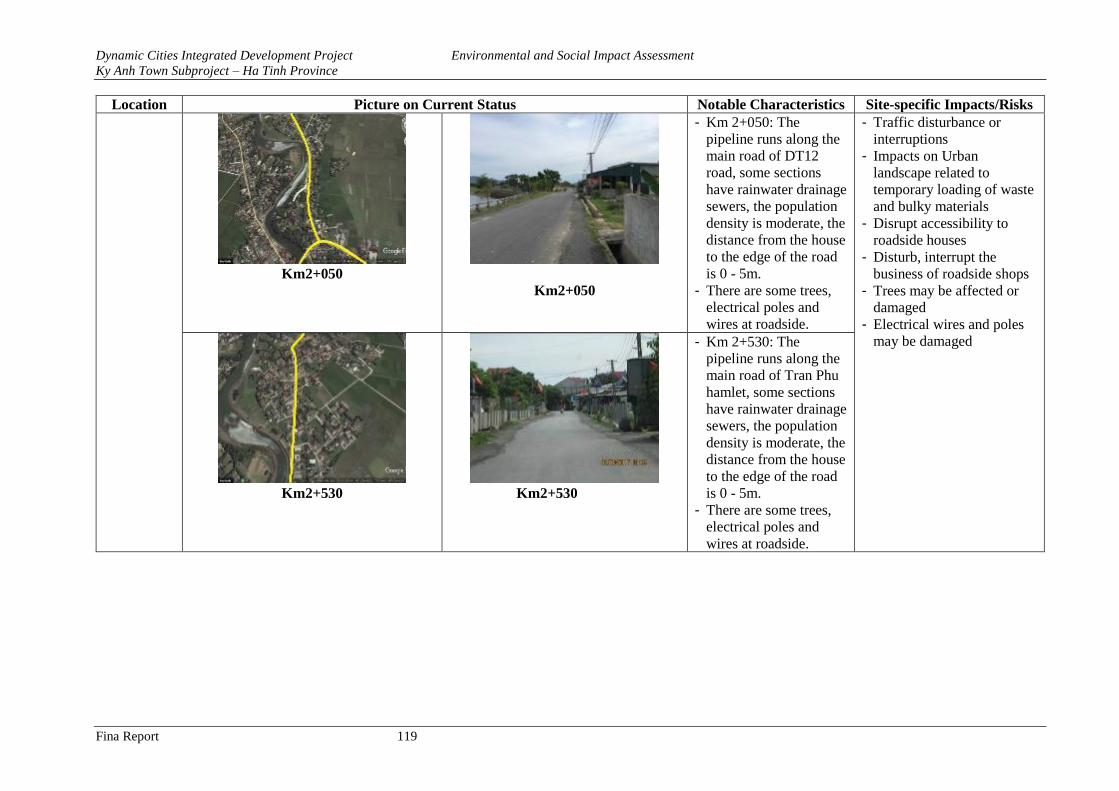
Dynamic Cities Integrated Development Project Environmental and Social Impact Assessment
Ky Anh Town Subproject – Ha Tinh Province
Fina Report 119
Location Picture on Current Status Notable Characteristics Site-specific Impacts/Risks
Km2+050
Km2+050
- Km 2+050: The
pipeline runs along the
main road of DT12
road, some sections
have rainwater drainage
sewers, the population
density is moderate, the
distance from the house
to the edge of the road
is 0 - 5m.
- There are some trees,
electrical poles and
wires at roadside.
- Traffic disturbance or
interruptions
- Impacts on Urban
landscape related to
temporary loading of waste
and bulky materials
- Disrupt accessibility to
roadside houses
- Disturb, interrupt the
business of roadside shops
- Trees may be affected or
damaged
- Electrical wires and poles
may be damaged
Km2+530
Km2+530
- Km 2+530: The
pipeline runs along the
main road of Tran Phu
hamlet, some sections
have rainwater drainage
sewers, the population
density is moderate, the
distance from the house
to the edge of the road
is 0 - 5m.
- There are some trees,
electrical poles and
wires at roadside.
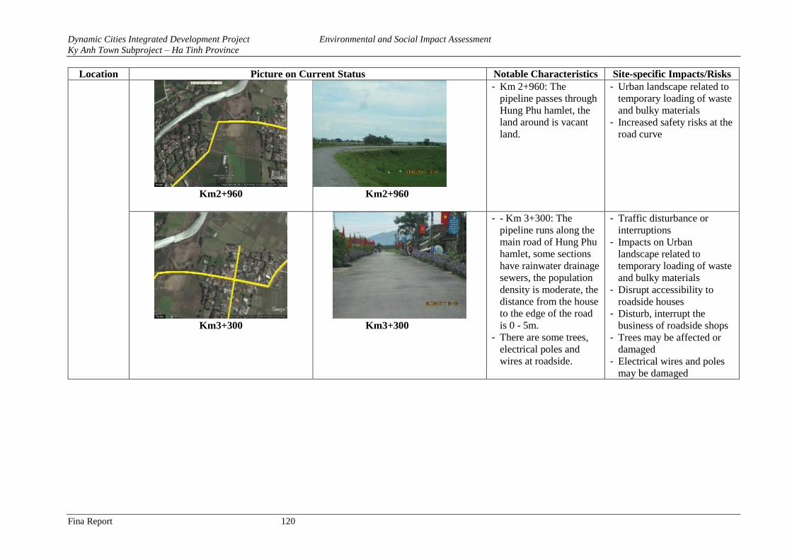
Dynamic Cities Integrated Development Project Environmental and Social Impact Assessment
Ky Anh Town Subproject – Ha Tinh Province
Fina Report 120
Location Picture on Current Status Notable Characteristics Site-specific Impacts/Risks
Km2+960
Km2+960
- Km 2+960: The
pipeline passes through
Hung Phu hamlet, the
land around is vacant
land.
- Urban landscape related to
temporary loading of waste
and bulky materials
- Increased safety risks at the
road curve
Km3+300
Km3+300
- - Km 3+300: The
pipeline runs along the
main road of Hung Phu
hamlet, some sections
have rainwater drainage
sewers, the population
density is moderate, the
distance from the house
to the edge of the road
is 0 - 5m.
- There are some trees,
electrical poles and
wires at roadside.
- Traffic disturbance or
interruptions
- Impacts on Urban
landscape related to
temporary loading of waste
and bulky materials
- Disrupt accessibility to
roadside houses
- Disturb, interrupt the
business of roadside shops
- Trees may be affected or
damaged
- Electrical wires and poles
may be damaged
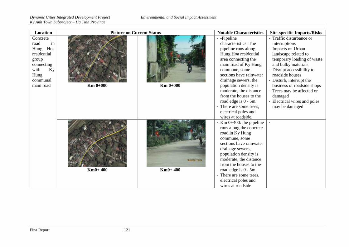
Dynamic Cities Integrated Development Project Environmental and Social Impact Assessment
Ky Anh Town Subproject – Ha Tinh Province
Fina Report 121
Location Picture on Current Status Notable Characteristics Site-specific Impacts/Risks
Concrete
road in
Hung Hoa
residential
group
connecting
with Ky
Hung
communal
main road
Km 0+000
Km 0+000
- -Pipeline
characteristics: The
pipeline runs along
Hung Hoa residential
area connecting the
main road of Ky Hung
commune, some
sections have rainwater
drainage sewers, the
population density is
moderate, the distance
from the houses to the
road edge is 0 - 5m.
- There are some trees,
electrical poles and
wires at roadside.
- Traffic disturbance or
interruptions
- Impacts on Urban
landscape related to
temporary loading of waste
and bulky materials
- Disrupt accessibility to
roadside houses
- Disturb, interrupt the
business of roadside shops
- Trees may be affected or
damaged
- Electrical wires and poles
may be damaged
Km0+ 400 Km0+ 400
- Km 0+400: the pipeline
runs along the concrete
road in Ky Hung
commune, some
sections have rainwater
drainage sewers,
population density is
moderate, the distance
from the houses to the
road edge is 0 - 5m.
- There are some trees,
electrical poles and
wires at roadside
-
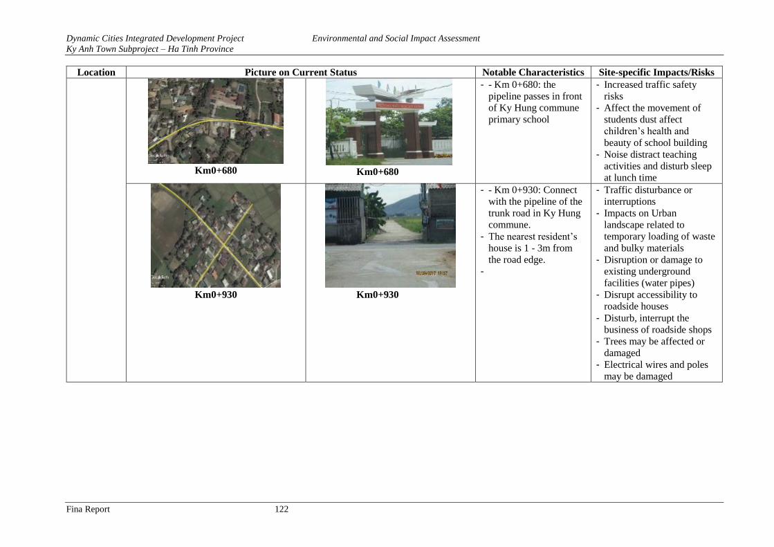
Dynamic Cities Integrated Development Project Environmental and Social Impact Assessment
Ky Anh Town Subproject – Ha Tinh Province
Fina Report 122
Location Picture on Current Status Notable Characteristics Site-specific Impacts/Risks
Km0+680 Km0+680
- - Km 0+680: the
pipeline passes in front
of Ky Hung commune
primary school
- Increased traffic safety
risks
- Affect the movement of
students dust affect
children’s health and
beauty of school building
- Noise distract teaching
activities and disturb sleep
at lunch time
Km0+930
Km0+930
- - Km 0+930: Connect
with the pipeline of the
trunk road in Ky Hung
commune.
- The nearest resident’s
house is 1 - 3m from
the road edge.
-
- Traffic disturbance or
interruptions
- Impacts on Urban
landscape related to
temporary loading of waste
and bulky materials
- Disruption or damage to
existing underground
facilities (water pipes)
- Disrupt accessibility to
roadside houses
- Disturb, interrupt the
business of roadside shops
- Trees may be affected or
damaged
- Electrical wires and poles
may be damaged
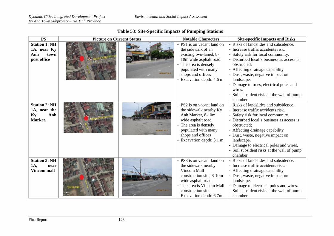
Dynamic Cities Integrated Development Project Environmental and Social Impact Assessment
Ky Anh Town Subproject – Ha Tinh Province
Fina Report 123
Table 53: Site-Specific Impacts of Pumping Stations
PS Picture on Current Status Notable Characters Site-specific Impacts and Risks
Station 1: NH
1A, near Ky
Anh town
post office
- PS1 is on vacant land on
the sidewalk of an
existing two-laned, 8-
10m wide asphalt road.
- The area is densely
populated with many
shops and offices
- Excavation depth: 4.6 m
- Risks of landslides and subsidence.
- Increase traffic accidents risk.
- Safety risk for local community.
- Disturbed local’s business as access is
obstructed;
- Affecting drainage capability
- Dust, waste, negative impact on
landscape.
- Damage to trees, electrical poles and
wires.
- Soil subsident risks at the wall of pump
chamber Station 2: NH
1A, near the
Ky Anh
Market.
- PS2 is on vacant land on
the sidewalk nearby Ky
Anh Market, 8-10m
wide asphalt road.
- The area is densely
populated with many
shops and offices
- Excavation depth: 3.1 m
- Risks of landslides and subsidence.
- Increase traffic accidents risk.
- Safety risk for local community.
- Disturbed local’s business as access is
obstructed;
- Affecting drainage capability
- Dust, waste, negative impact on
landscape.
- Damage to electrical poles and wires.
- Soil subsident risks at the wall of pump
chamber
Station 3: NH
1A, near
Vincom mall
- PS3 is on vacant land on
the sidewalk nearby
Vincom Mall
construction site, 8-10m
wide asphalt road.
- The area is Vincom Mall
construction site
- Excavation depth: 6.7m
- Risks of landslides and subsidence.
- Increase traffic accidents risk.
- Affecting drainage capability
- Dust, waste, negative impact on
landscape.
- Damage to electrical poles and wires.
- Soil subsident risks at the wall of pump
chamber
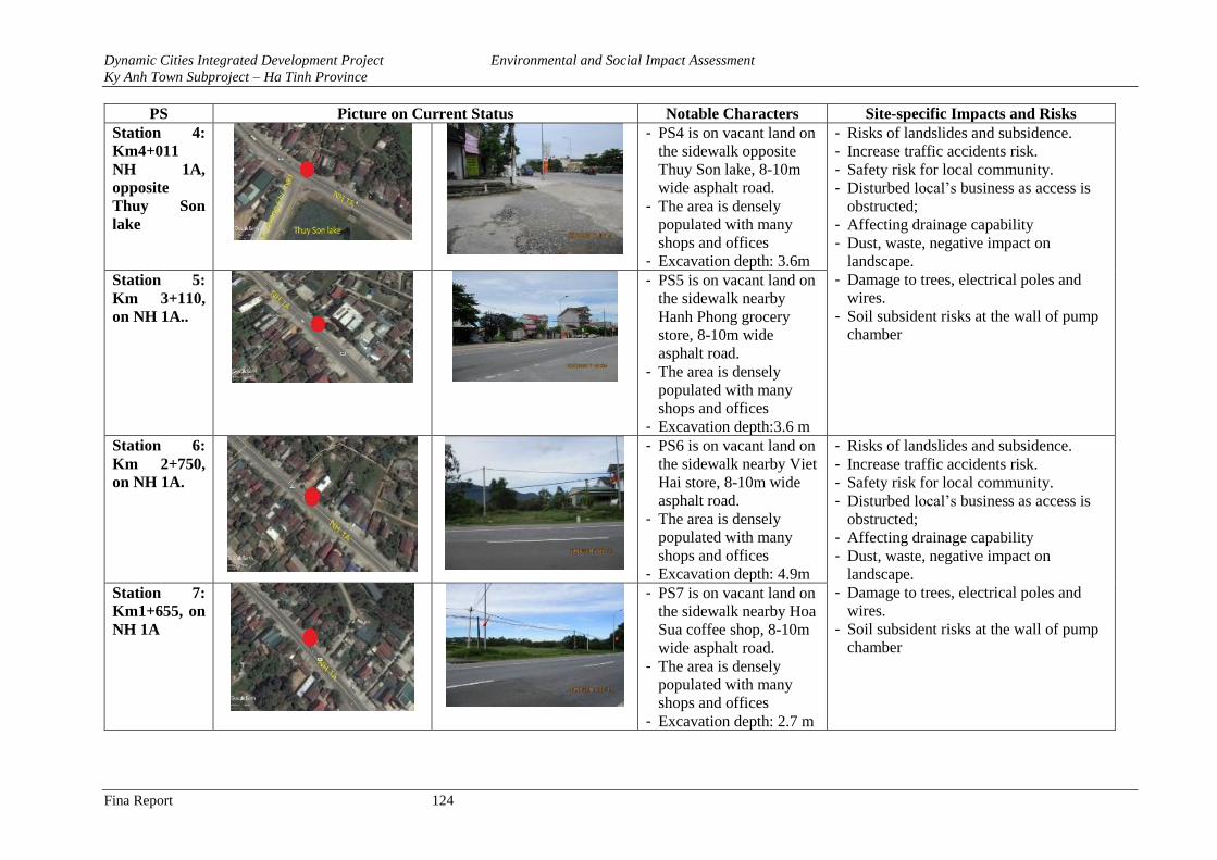
Dynamic Cities Integrated Development Project Environmental and Social Impact Assessment
Ky Anh Town Subproject – Ha Tinh Province
Fina Report 124
PS Picture on Current Status Notable Characters Site-specific Impacts and Risks
Station 4:
Km4+011
NH 1A,
opposite
Thuy Son
lake
- PS4 is on vacant land on
the sidewalk opposite
Thuy Son lake, 8-10m
wide asphalt road.
- The area is densely
populated with many
shops and offices
- Excavation depth: 3.6m
- Risks of landslides and subsidence.
- Increase traffic accidents risk.
- Safety risk for local community.
- Disturbed local’s business as access is
obstructed;
- Affecting drainage capability
- Dust, waste, negative impact on
landscape.
- Damage to trees, electrical poles and
wires.
- Soil subsident risks at the wall of pump
chamber
Station 5:
Km 3+110,
on NH 1A..
- PS5 is on vacant land on
the sidewalk nearby
Hanh Phong grocery
store, 8-10m wide
asphalt road.
- The area is densely
populated with many
shops and offices
- Excavation depth:3.6 m
Station 6:
Km 2+750,
on NH 1A.
- PS6 is on vacant land on
the sidewalk nearby Viet
Hai store, 8-10m wide
asphalt road.
- The area is densely
populated with many
shops and offices
- Excavation depth: 4.9m
- Risks of landslides and subsidence.
- Increase traffic accidents risk.
- Safety risk for local community.
- Disturbed local’s business as access is
obstructed;
- Affecting drainage capability
- Dust, waste, negative impact on
landscape.
- Damage to trees, electrical poles and
wires.
- Soil subsident risks at the wall of pump
chamber
Station 7:
Km1+655, on
NH 1A
- PS7 is on vacant land on
the sidewalk nearby Hoa
Sua coffee shop, 8-10m
wide asphalt road.
- The area is densely
populated with many
shops and offices
- Excavation depth: 2.7 m
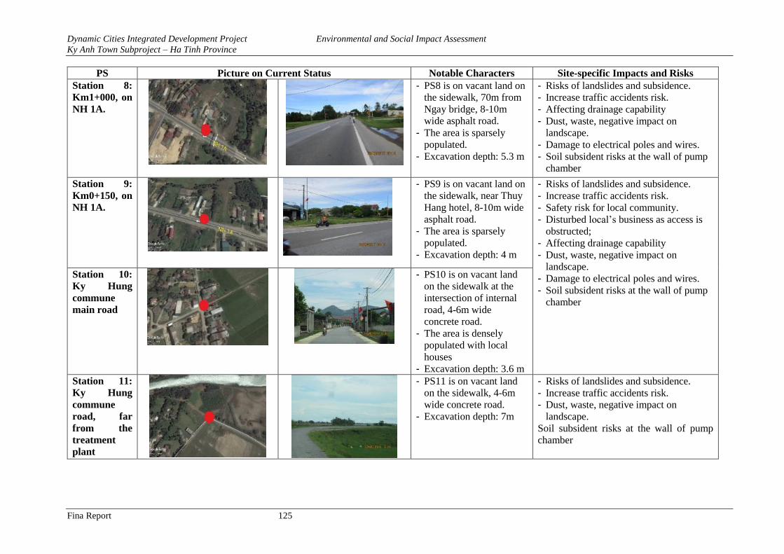
Dynamic Cities Integrated Development Project Environmental and Social Impact Assessment
Ky Anh Town Subproject – Ha Tinh Province
Fina Report 125
PS Picture on Current Status Notable Characters Site-specific Impacts and Risks
Station 8:
Km1+000, on
NH 1A.
- PS8 is on vacant land on
the sidewalk, 70m from
Ngay bridge, 8-10m
wide asphalt road.
- The area is sparsely
populated.
- Excavation depth: 5.3 m
- Risks of landslides and subsidence.
- Increase traffic accidents risk.
- Affecting drainage capability
- Dust, waste, negative impact on
landscape.
- Damage to electrical poles and wires.
- Soil subsident risks at the wall of pump
chamber
Station 9:
Km0+150, on
NH 1A.
- PS9 is on vacant land on
the sidewalk, near Thuy
Hang hotel, 8-10m wide
asphalt road.
- The area is sparsely
populated.
- Excavation depth: 4 m
- Risks of landslides and subsidence.
- Increase traffic accidents risk.
- Safety risk for local community.
- Disturbed local’s business as access is
obstructed;
- Affecting drainage capability
- Dust, waste, negative impact on
landscape.
- Damage to electrical poles and wires.
- Soil subsident risks at the wall of pump
chamber
Station 10:
Ky Hung
commune
main road
- PS10 is on vacant land
on the sidewalk at the
intersection of internal
road, 4-6m wide
concrete road.
- The area is densely
populated with local
houses
- Excavation depth: 3.6 m
Station 11:
Ky Hung
commune
road, far
from the
treatment
plant
- PS11 is on vacant land
on the sidewalk, 4-6m
wide concrete road.
- Excavation depth: 7m
- Risks of landslides and subsidence.
- Increase traffic accidents risk.
- Dust, waste, negative impact on
landscape.
Soil subsident risks at the wall of pump
chamber
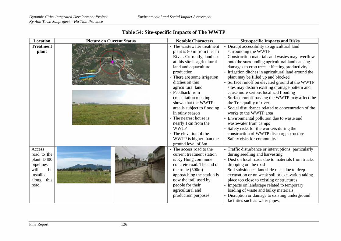
Dynamic Cities Integrated Development Project Environmental and Social Impact Assessment
Ky Anh Town Subproject – Ha Tinh Province
Fina Report 126
Table 54: Site-specific Impacts of The WWTP
Location Picture on Current Status Notable Characters Site-specific Impacts and Risks
Treatment
plant
- The wastewater treatment
plant is 80 m from the Tri
River. Currently, land use
at this site is agricultural
land and aquaculture
production.
- There are some irrigation
ditches on this
agricultural land
- Feedback from
consultation meeting
shows that the WWTP
area is subject to flooding
in rainy season
- The nearest house is
nearly 1km from the
WWTP
- The elevation of the
WWTP is higher than the
ground level of 3m
- Disrupt accessibility to agricultural land
surrounding the WWTP
- Construction materials and wastes may overflow
onto the surrounding agricultural land causing
damages to crop trees, affecting productivity
- Irrigation ditches in agricultural land around the
plant may be filled up and blocked
- Surface runoff on elevated ground at the WWTP
sites may disturb existing drainage pattern and
cause more serious localized flooding
- Surface runoff passing the WWTP may affect the
the Tris quality of river
- Social disturbance related to concentration of the
works to the WWTP area
- Environmental pollution due to waste and
wastewater from camps
- Safety risks for the workers during the
construction of WWTP discharge structure
- Safety risks for community
Access
road to the
plant D400
pipelines
will be
installed
along this
road
- The access road to the
current treatment station
is Ky Hung commune
concrete road. The end of
the route (500m)
approaching the station is
now the trail used by
people for their
agricultural and
production purposes.
- Traffic disturbance or interruptions, particularly
during seedling and harvesting
- Dust on local roads due to materials from trucks
dropping on the road
- Soil subsidence, landslide risks due to deep
excavation or on weak soil or excavation taking
place too close to existing or structures
- Impacts on landscape related to temporary
loading of waste and bulky materials
- Disruption or damage to existing underground
facilities such as water pipes,
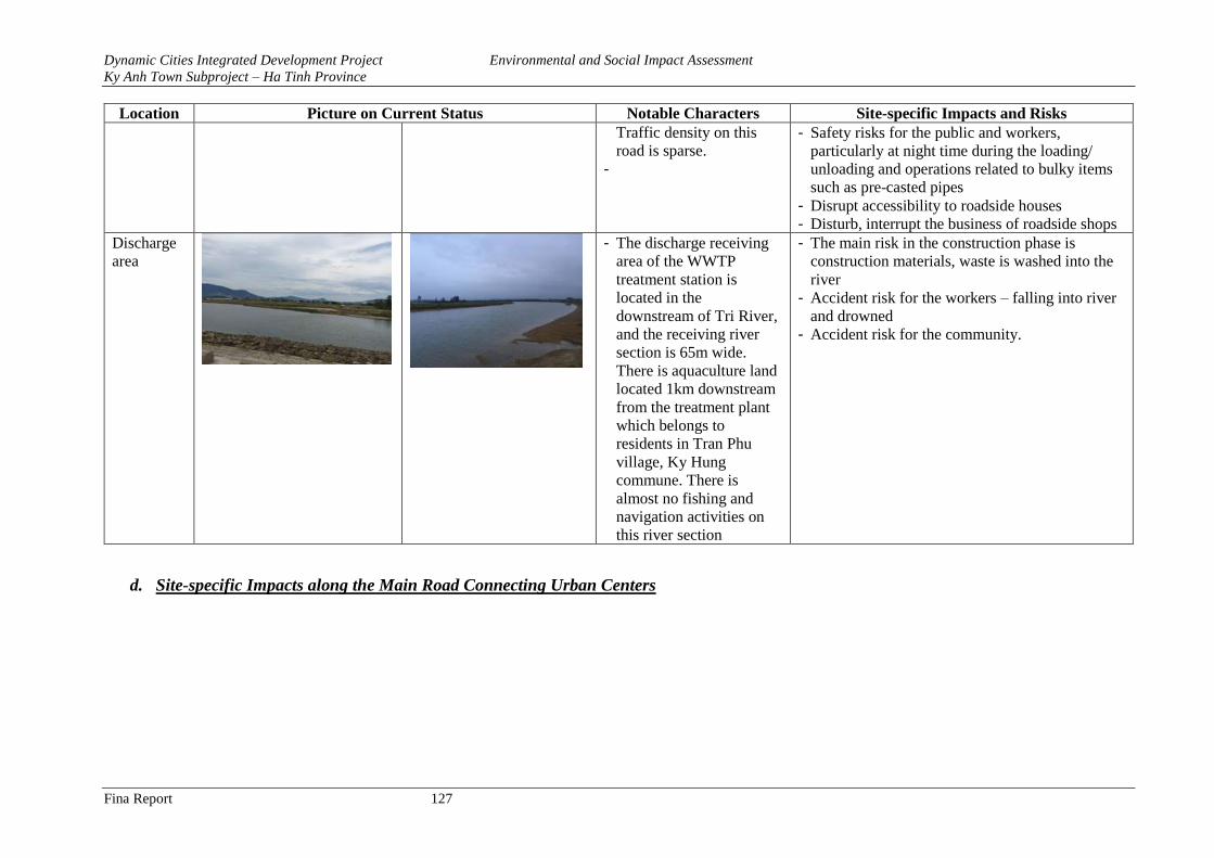
Dynamic Cities Integrated Development Project Environmental and Social Impact Assessment
Ky Anh Town Subproject – Ha Tinh Province
Fina Report 127
Location Picture on Current Status Notable Characters Site-specific Impacts and Risks
Traffic density on this
road is sparse.
-
- Safety risks for the public and workers,
particularly at night time during the loading/
unloading and operations related to bulky items
such as pre-casted pipes
- Disrupt accessibility to roadside houses
- Disturb, interrupt the business of roadside shops
Discharge
area
- The discharge receiving
area of the WWTP
treatment station is
located in the
downstream of Tri River,
and the receiving river
section is 65m wide.
There is aquaculture land
located 1km downstream
from the treatment plant
which belongs to
residents in Tran Phu
village, Ky Hung
commune. There is
almost no fishing and
navigation activities on
this river section
- The main risk in the construction phase is
construction materials, waste is washed into the
river
- Accident risk for the workers – falling into river
and drowned
- Accident risk for the community.
d. Site-specific Impacts along the Main Road Connecting Urban Centers
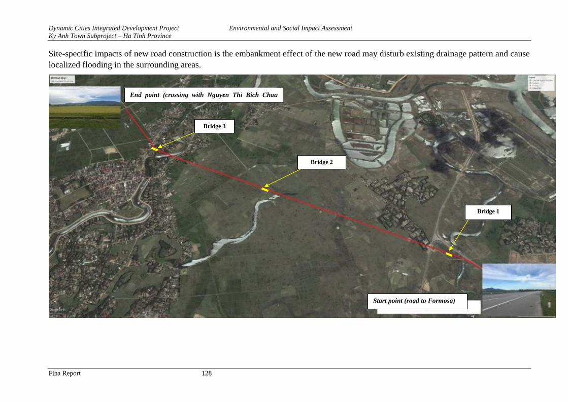
Dynamic Cities Integrated Development Project Environmental and Social Impact Assessment
Ky Anh Town Subproject – Ha Tinh Province
Fina Report 128
Site-specific impacts of new road construction is the embankment effect of the new road may disturb existing drainage pattern and cause
localized flooding in the surrounding areas.
Bridge 1
Bridge 2
Bridge 3
End point (crossing with Nguyen Thi Bich Chau
road)
Start point (road to Formosa)
Dynamic Cities Integrated Development Project Environmental and Social Impact Assessment
Ky Anh Town Subproject – Ha Tinh Province
Fina Report 129
Figure 34: Layout on the Main Road Connecting Urban Centers
Table 55: Site-specific Impacts along The Main Road Connecting Urban Centers
Location Picture of Current Status at noticeable locations Notable Characters Site-specific Impacts and Risks
Km0+000 ÷
0+450
- The beginning point is
connected to the road to
Formosa Industrial Park, the
existing road and a bridge that
the proposed alignment cut
through is no longer in use.
- New bridges will be built at
the site of the old bridge.
- The current land use along the
alignments are agricultural
land.
- Differences between existing
ground elevation and road
surface is from 0 – 1.8m
Elevated ground may disrupt/obstruct
access of local people when moving
from one to the other side of the road
Drainage pattern may be disrupted
Km 0+00 Km 0+450
- Beginning and ending point,
intersects with existing road.
- Increased traffic safety risks at the
intersection with the existing road
- Disrupt the existing irrigation canals
in this area
- Blockage of irrigation canals if soil
is spreading the irrigation canal
Dynamic Cities Integrated Development Project Environmental and Social Impact Assessment
Ky Anh Town Subproject – Ha Tinh Province
Fina Report 130
Location Picture of Current Status at noticeable locations Notable Characters Site-specific Impacts and Risks
Km0+100
- The existing bridge which is
no longer in use will be
demolished, new bridge will
be built at this location
- The nearest house is nearly 1
km from this bridge
- Sedimentation of stream due to
granular materials
- Stream water pollution due to
construction and excavated materials
and bentonite may fall into the water
- Safety and Drowning risks to the
workers particularly when water
level is high
Km
0+450 ÷
2+610
- The beginning point is the
intersection with the existing
road to Ky Ninh beach.
- The elevation of the road
surface is higher than the
ground level of 0.73 to 3.5m
- The beginning and the end of
the section are near the
residential area. There are
some houses scatterly located
in these two areas
- The alignment cut through
agricultural land and some
- Cut through the existing rural power
grid
- Increased traffic safety risk at the
intersections between the proposed
road and other existing roads.
- The section runs through agricultural
land with annual crops. Separate
agricultural land, particularly during
the seedling and harvesting season - The road with elevated ground may
disrupt/ obstruct access of local
people when moving from one to the
other side of the road
- Drainage pattern may be disrupted
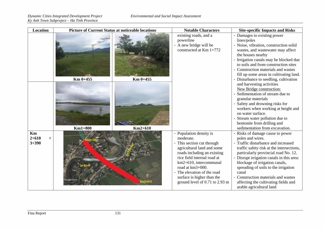
Dynamic Cities Integrated Development Project Environmental and Social Impact Assessment
Ky Anh Town Subproject – Ha Tinh Province
Fina Report 131
Location Picture of Current Status at noticeable locations Notable Characters Site-specific Impacts and Risks
Km 0+455 Km 0+455
existing roads, and a
powerline
- A new bridge will be
constructed at Km 1+772
- Damages to existing power
lines/poles
- Noise, vibration, construction solid
wastes, and wastewater may affect
the houses nearby
- Irrigation canals may be blocked due
to soils and from construction sites
- Construction materials and wastes
fill up some areas in cultivating land.
- Disturbance to seedling, cultivation
and harvesting activities
New Bridge construction:
- Sedimentation of stream due to
granular materials
- Safety and drowning risks for
workers when working at height and
on water surface.
- Stream water pollution due to
bentonite from drilling and
sedimentation from excavation.
Km1+800 Km2+610
Km
2+610 ÷
3+390
- Population density is
moderate.
- This section cut through
agricultural land and some
roads including an existing
rice field internal road at
km2+610, intercommunal
road at km3+000.
- The elevation of the road
surface is higher than the
ground level of 0.71 to 2.93 m
- Risks of damage cause to power
poles and wires.
- Traffic disturbance and increased
traffic safety risk at the intersections,
particularly provincial road No. 12.
- Disrupt irrigation canals in this area:
blockage of irrigation canals,
spreading of soils to the irrigation
canal
- Construction materials and wastes
affecting the cultivating fields and
arable agricultural land
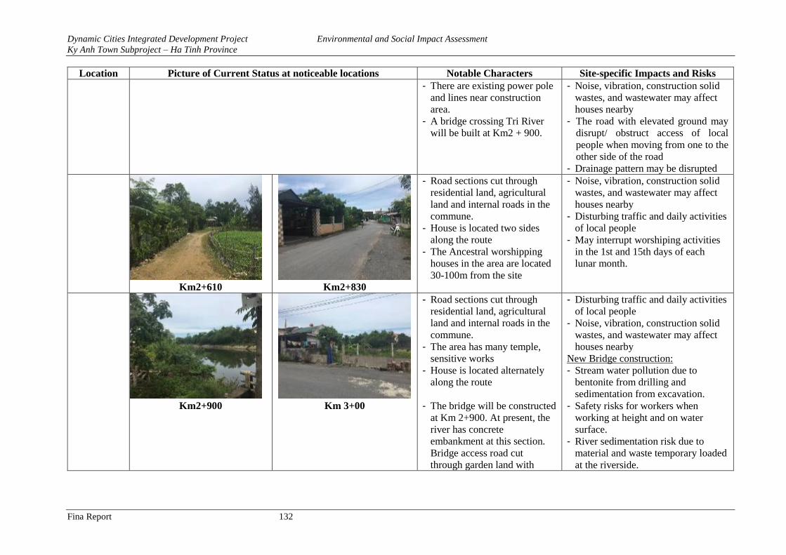
Dynamic Cities Integrated Development Project Environmental and Social Impact Assessment
Ky Anh Town Subproject – Ha Tinh Province
Fina Report 132
Location Picture of Current Status at noticeable locations Notable Characters Site-specific Impacts and Risks
- There are existing power pole
and lines near construction
area.
- A bridge crossing Tri River
will be built at Km2 + 900.
- Noise, vibration, construction solid
wastes, and wastewater may affect
houses nearby
- The road with elevated ground may
disrupt/ obstruct access of local
people when moving from one to the
other side of the road
- Drainage pattern may be disrupted
Km2+610 Km2+830
- Road sections cut through
residential land, agricultural
land and internal roads in the
commune.
- House is located two sides
along the route
- The Ancestral worshipping
houses in the area are located
30-100m from the site
- Noise, vibration, construction solid
wastes, and wastewater may affect
houses nearby
- Disturbing traffic and daily activities
of local people
- May interrupt worshiping activities
in the 1st and 15th days of each
lunar month.
Km2+900
Km 3+00
- Road sections cut through
residential land, agricultural
land and internal roads in the
commune.
- The area has many temple,
sensitive works
- House is located alternately
along the route
- The bridge will be constructed
at Km 2+900. At present, the
river has concrete
embankment at this section.
Bridge access road cut
through garden land with
- Disturbing traffic and daily activities
of local people
- Noise, vibration, construction solid
wastes, and wastewater may affect
houses nearby
New Bridge construction:
- Stream water pollution due to
bentonite from drilling and
sedimentation from excavation.
- Safety risks for workers when
working at height and on water
surface.
- River sedimentation risk due to
material and waste temporary loaded
at the riverside.
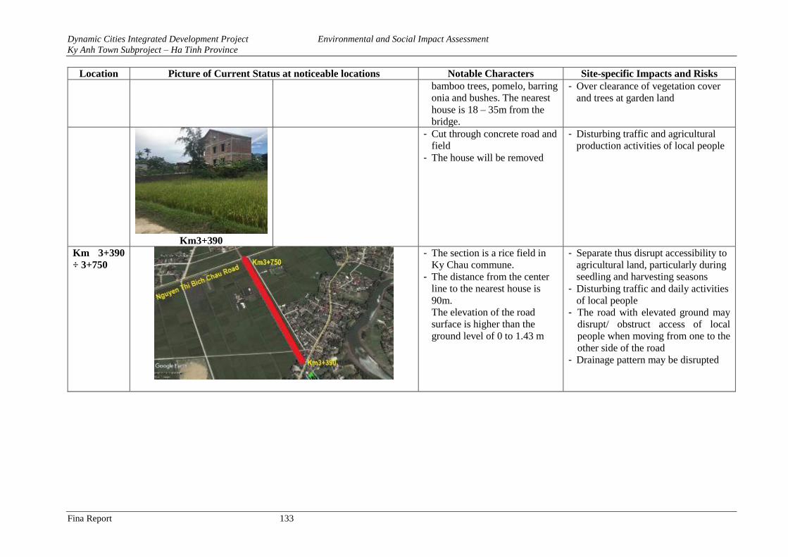
Dynamic Cities Integrated Development Project Environmental and Social Impact Assessment
Ky Anh Town Subproject – Ha Tinh Province
Fina Report 133
Location Picture of Current Status at noticeable locations Notable Characters Site-specific Impacts and Risks
bamboo trees, pomelo, barring
onia and bushes. The nearest
house is 18 – 35m from the
bridge.
- Over clearance of vegetation cover
and trees at garden land
Km3+390
- Cut through concrete road and
field
- The house will be removed
- Disturbing traffic and agricultural
production activities of local people
Km 3+390
÷ 3+750
- The section is a rice field in
Ky Chau commune.
- The distance from the center
line to the nearest house is
90m.
The elevation of the road
surface is higher than the
ground level of 0 to 1.43 m
- Separate thus disrupt accessibility to
agricultural land, particularly during
seedling and harvesting seasons
- Disturbing traffic and daily activities
of local people
- The road with elevated ground may
disrupt/ obstruct access of local
people when moving from one to the
other side of the road
- Drainage pattern may be disrupted
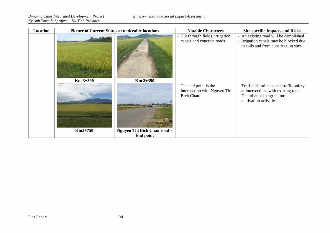
Dynamic Cities Integrated Development Project Environmental and Social Impact Assessment
Ky Anh Town Subproject – Ha Tinh Province
Fina Report 134
Location Picture of Current Status at noticeable locations Notable Characters Site-specific Impacts and Risks
Km 3+390 Km 3+390
- Cut through fields, irrigation
canals and concrete roads
-
- An existing road will be demolished
- Irrigation canals may be blocked due
to soils and from construction sites
Km3+750 Nguyen Thi Bich Chau road –
End point
- The end point is the
intersection with Nguyen Thi
Bich Chau
- Traffic disturbance and traffic safety
at intersections with existing roads
- Disturbance to agricultural
cultivation activities
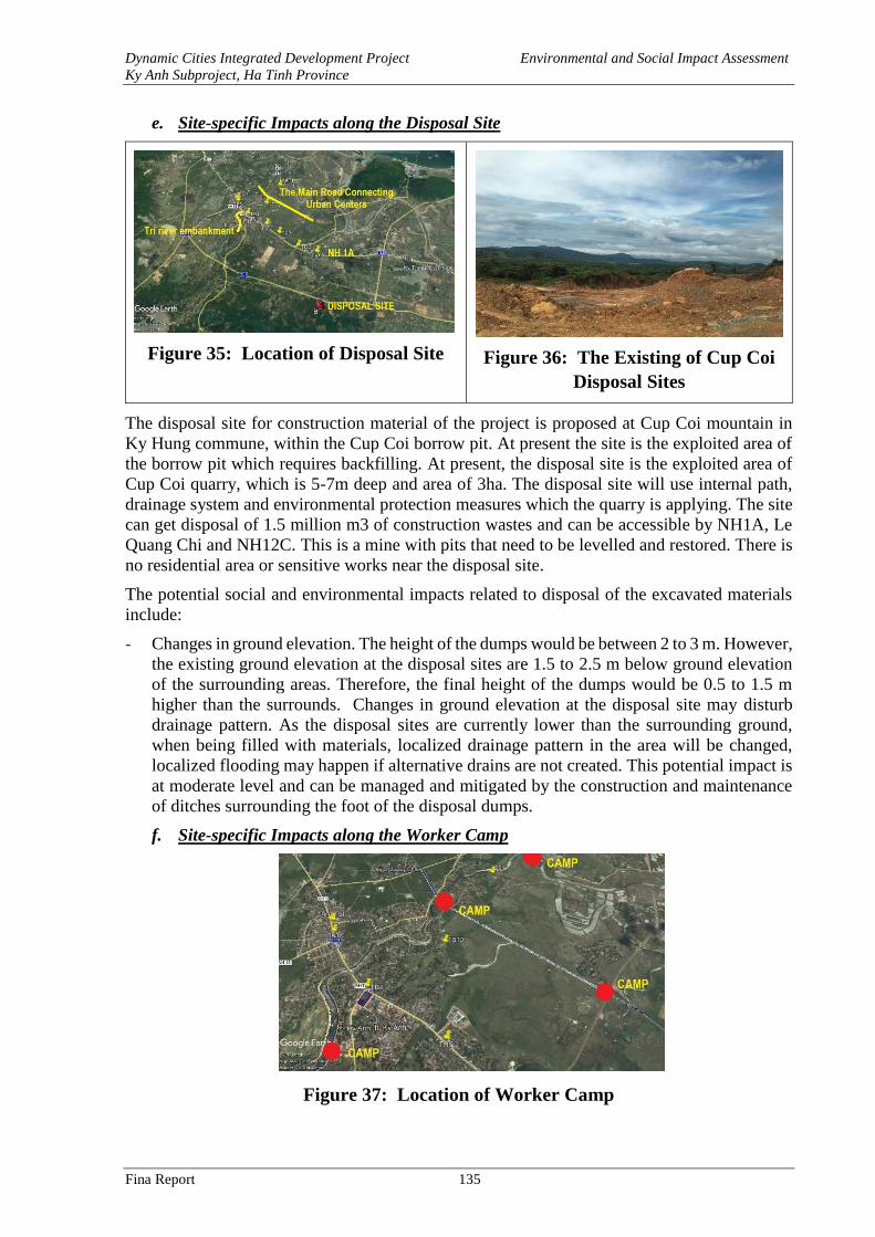
Dynamic Cities Integrated Development Project Environmental and Social Impact Assessment
Ky Anh Subproject, Ha Tinh Province
Fina Report 135
e. Site-specific Impacts along the Disposal Site
Figure 35: Location of Disposal Site
Figure 36: The Existing of Cup Coi
Disposal Sites
The disposal site for construction material of the project is proposed at Cup Coi mountain in
Ky Hung commune, within the Cup Coi borrow pit. At present the site is the exploited area of
the borrow pit which requires backfilling. At present, the disposal site is the exploited area of
Cup Coi quarry, which is 5-7m deep and area of 3ha. The disposal site will use internal path,
drainage system and environmental protection measures which the quarry is applying. The site
can get disposal of 1.5 million m3 of construction wastes and can be accessible by NH1A, Le
Quang Chi and NH12C. This is a mine with pits that need to be levelled and restored. There is
no residential area or sensitive works near the disposal site.
The potential social and environmental impacts related to disposal of the excavated materials
include:
- Changes in ground elevation. The height of the dumps would be between 2 to 3 m. However,
the existing ground elevation at the disposal sites are 1.5 to 2.5 m below ground elevation
of the surrounding areas. Therefore, the final height of the dumps would be 0.5 to 1.5 m
higher than the surrounds. Changes in ground elevation at the disposal site may disturb
drainage pattern. As the disposal sites are currently lower than the surrounding ground,
when being filled with materials, localized drainage pattern in the area will be changed,
localized flooding may happen if alternative drains are not created. This potential impact is
at moderate level and can be managed and mitigated by the construction and maintenance
of ditches surrounding the foot of the disposal dumps.
f. Site-specific Impacts along the Worker Camp
Figure 37: Location of Worker Camp
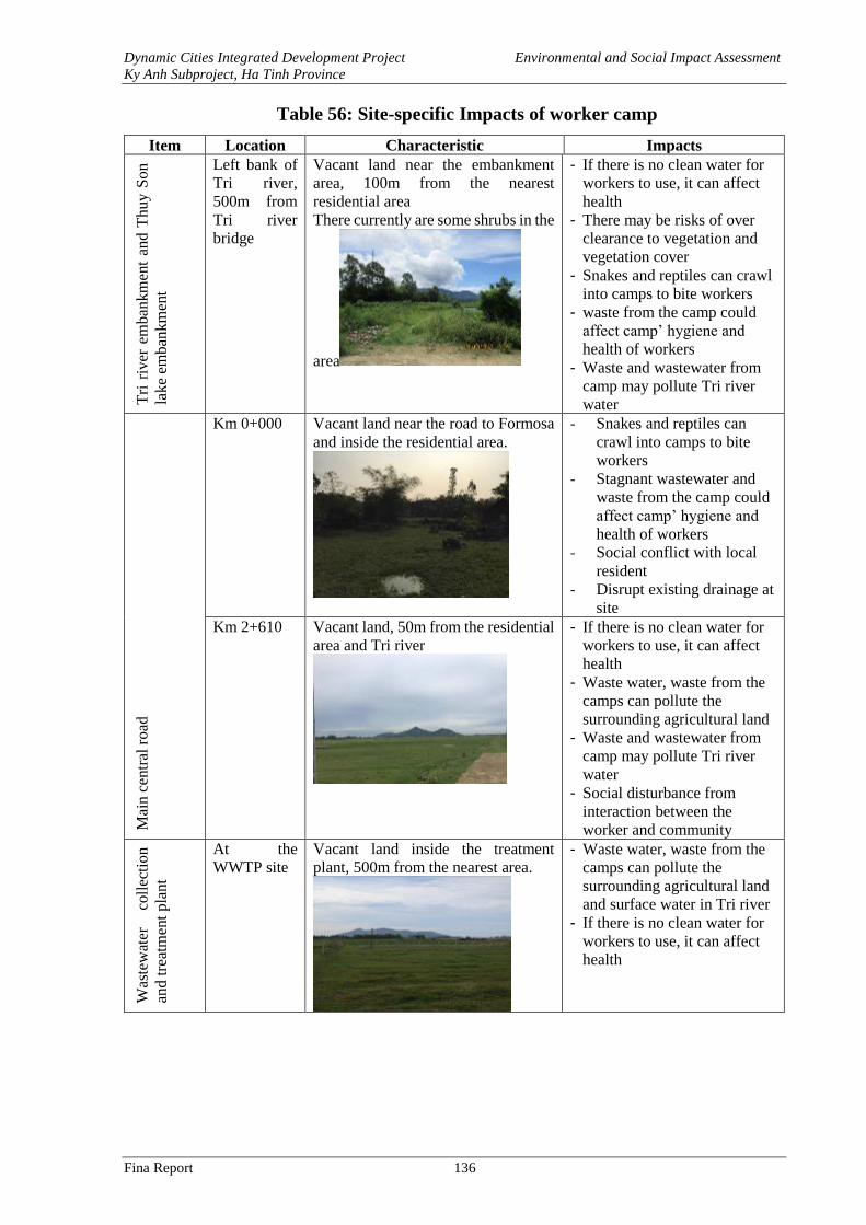
Dynamic Cities Integrated Development Project Environmental and Social Impact Assessment
Ky Anh Subproject, Ha Tinh Province
Fina Report 136
Table 56: Site-specific Impacts of worker camp
Item Location Characteristic Impacts T
ri r
iver
em
ban
km
ent
and
Th
uy
So
n
lak
e em
ban
km
ent
Left bank of
Tri river,
500m from
Tri river
bridge
Vacant land near the embankment
area, 100m from the nearest
residential area
There currently are some shrubs in the
area
- If there is no clean water for
workers to use, it can affect
health
- There may be risks of over
clearance to vegetation and
vegetation cover
- Snakes and reptiles can crawl
into camps to bite workers
- waste from the camp could
affect camp’ hygiene and
health of workers
- Waste and wastewater from
camp may pollute Tri river
water
Mai
n c
entr
al r
oad
Km 0+000 Vacant land near the road to Formosa
and inside the residential area.
- Snakes and reptiles can
crawl into camps to bite
workers
- Stagnant wastewater and
waste from the camp could
affect camp’ hygiene and
health of workers
- Social conflict with local
resident
- Disrupt existing drainage at
site
Km 2+610 Vacant land, 50m from the residential
area and Tri river
- If there is no clean water for
workers to use, it can affect
health
- Waste water, waste from the
camps can pollute the
surrounding agricultural land
- Waste and wastewater from
camp may pollute Tri river
water
- Social disturbance from
interaction between the
worker and community
Was
tew
ater
co
llec
tio
n
and
tre
atm
ent
pla
nt
At the
WWTP site
Vacant land inside the treatment
plant, 500m from the nearest area.
- Waste water, waste from the
camps can pollute the
surrounding agricultural land
and surface water in Tri river
- If there is no clean water for
workers to use, it can affect
health
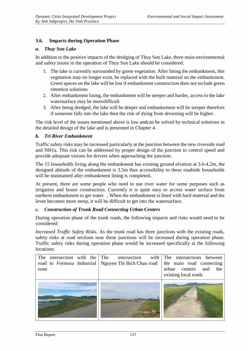
Dynamic Cities Integrated Development Project Environmental and Social Impact Assessment
Ky Anh Subproject, Ha Tinh Province
Fina Report 137
3.6. Impacts during Operation Phase
a. Thuy Son Lake
In addition to the positive impacts of the dredging of Thuy Son Lake, three main environmental
and safety issues in the operation of Thuy Son Lake should be considered.
1. The lake is currently surrounded by green vegetation. After lining the embankment, this
vegetation may no longer exist, be replaced with the built material on the embankment.
Green spaces on the lake will be lost if embankment construction does not include green
retention solutions
2. After embankment lining, the embankment will be steeper and harder, access to the lake
watersurface may be moredifficult
3. After being dredged, the lake will be deeper and embankement will be steeper therefore
if someone falls into the lake then the risk of dying from drowning will be higher.
The risk level of the issues mentioned above is low andcan be solved by technical solutions in
the detailed design of the lake and is presented in Chapter 4.
b. Tri River Embankment
Traffic safety risks may be increased particularly at the junction between the new riverside road
and NH1a. This risk can be addressed by proper design of the junction to control speed and
provide adequate visions for drivers when approaching the junction.
The 15 households living along the embankment has existing ground elvation at 3.6-4.2m, the
designed altitude of the embankment is 3.5m thus accessibility to these roadside households
will be maintained after embankment lining is completed..
At present, there are some people who need to use river water for some purposes such as
irrigation and house construction. Currently it is quite easy to access water surface from
earthern embankment to get water. , When the embankment is lined with hard material and the
levee becomes more steep, it will be difficult to get into the watersurface.
c. Construction of Trunk Road Connecting Urban Centers
During operation phase of the trunk roads, the following impacts and risks would need to be
considered:
Increased Traffic Safety Risks. As the trunk road has three junctions with the existing roads,
safety risks at road sections near these junctions will be increased during operation phase.
Traffic safety risks during operation phase would be increased specifically at the following
locations:
The intersection with the
road to Formosa Industrial
zone
The intersection with
Nguyen Thi Bich Chau road
The intersections between
the main road connecting
urban centers and the
existing local roads
Dynamic Cities Integrated Development Project Environmental and Social Impact Assessment
Ky Anh Subproject, Ha Tinh Province
Fina Report 138
Cause fragmentation of agricultural land. The trunk road passing mostly agricultural land thus
it would cause fragmentation of agricultural land, separating residential areas from agricultural
production areas. As the road surface is 3.5 m higher than existing ground elevation, the
movement of people from houses or agricultural land from one side to the other side of the road
will be difficult. Although it is a town, some households still keep their livestock. The elevation
ground at the new road will also cause difficulties for cattle grazing or transportation of
production materials between the two road sides become more difficult.
Disturb drainage. Main drainage direction is based on natural terrain, currently from southwest
to northeast, from high to low, then flow into the local rivers and streams and then into the sea.
The existing drainage capacity pattern will be altered when the new road also functions as an
embankment crossing the area, local inundation may happen if longitudinal and crossing drains
are not included adequately.
These potential impacts would be at medium to high level, and mitigable through design
solutions and operational control methods.
d. Wastewater Collection and Treatment Plant
Impacts on Flow Rate
The design capacity of the WWTP is 2,000 m3/d or equivalent to 0.02 m3/s. The treated
wastewater will be discharged to Tri river. The average flow rate in the Tri river in dry season
is 7.3 m3/s, it shows that at design capacity of 2,000 m3/d, the proposed WWTP would add 0.3%
into the flow of the Tri river in dry season, the potential impacts of the WWTP on the Tri river
would be very small, negligible, thus will not be discussed further in this ESIA report.
Impacts on Water Quality of Receiving Water Body
The project would bring about the positive effect on the quality of the receiving water body
when untreated wastewater is collected and treated to meet standard before being discharged
into the Tri river. The volume of pollutants in treated wastewater at rate 2,000 m3/day is
indicated in Table below:
Table 57: Pollutants Treated by The Project
Parameter Unit Input Output Treatment % Treatment
BOD5 Ton/day 0.7 0.01 0.7 98
SS Ton/day 0.5 0.2 0.4 68
Total N Ton/day 0.1 0.09 0.03 25
Treated wastewater will meet QCVN 14:2008/BTNMT-Colum B before discharged into the Tri
river.
To assess the impact of the wastewater onto the quality of water in Tri river in project area, IPC
model introduced by the WB and WHO is applied. The WWTP discharge rate 2,000 m3/day,
the flow rate at the Tri river is 7,3 m3/s (in dry season).
In practice, there are some water quality models that can be used such as: IPC, QUAL,
QUAL2EU, QUAL2K, SWAT, BASIN … However, the application of QUAL, QUAL2EU,
QUAL2K, SWAT, BASIN is complicated and requires a lot of input data, resources and time.
Therefore, in the scope of this ESIA report, IPC model was used for rapid assessment based on
dilution model.
C = (Qn * Cn + Qs * Cs) / (Qn + Qs)
In which:
Dynamic Cities Integrated Development Project Environmental and Social Impact Assessment
Ky Anh Subproject, Ha Tinh Province
Fina Report 139
- C is the content of pollutant forecasted.
- Cn is the content of pollutant of the exhausted source.
- Cs is the content of pollutant of the receiving source.
- Qn is the current of the exhausted source.
- Qs is the current of the receiving source.
Table 58: Forecasted Pollutant Concentration in Tri river in Operation Phase
No. Pollution parameter Cs Qs Qn C
Tri river
1 Total nitrogen 0.58
741 0.02
0.58
3 BOD5 16.2 16.2
5 SS 72.1 72.1
The figures in the Table 58 indicated that as the flow rate of the treated effluent from the WWTP
is very small (0.02 m3/s) compared to the designed river flow rate (741 m3/s), the contribution
of pollutants from the treated effluent of the WWTP does not cause any changes to the water
quality of the receiving water quality.
Wastewater Quality at Outlet When System Failed
According to design, the capacity of the WWTP is 2,000 m3/day with the following specific
design parameters of the ponds:
- Anaerobic ponds: 1 anaerobic ponds, with a dimension of 19x46m; talus: 1:1, depth:
4.5 m; volume: 5,680 m3; water retention time: 2.5 days;
- 02 Facultative ponds level 1: 2 facultative ponds, after anaerobic ponds; each with
a dimension of 29x110 m; talus: 1:1, depth: 3.5 m; volume: 14,242 m3; water
retention time: 7.12 days;
- 02 Facultative ponds level 2: after 2 facultative ponds level 1; each with a dimension
of 25x138 m; talus: 1:1, depth: 4 m; volume: 19,312 m3; water retention time: 9.77
days;
- Disinfection tank: 01 disinfection tanks for stabilizing and disinfecting treated
wastewater before discharging into Tri river; with a dimension of 6x6x4.3 m; water
retention time of 0.01 days.
Therefore, the total water retention time after wastewater has passed through all the ponds to
the discharge point of Tri river as calculated for the capacity of 2,000 m3/day is:
Total water retention time (capacity of 2,000 m3/day) = 2.5+7.12+9.77+0.01= 19.4 (days)
The result of the above calculations means that after being built, it still takes 19.4 days for a
wastewater drop to travel from the intake of the WWTP to the outlet. During that travel time,
parts of the contaminants in the wastewater will be decomposed. As the result, even if the
treatment facilities of the WWTP failed, parts of the pollutants in the wastewater are still be
removed before the flow reaches the outlet after up to 19.4 days since entry.
According to Kriton Curi, 1980, normally BOD is divided into 2 stages: (1) carbonaceous stage
with a period of about 12 days; and (2) nitrogenous stage with a period from the 13th day to the
24th day. Therefore, for this WWTP, the decomposition process of carbon compounds has been
basically completed after a retention time of 19.4 days in the system of ponds. The remaining
pollutants in the wastewater for emergency discharge into Tri river only consists of organic
nitrogen compounds.
In normal domestic wastewater, the content of carbonaceous BOD compounds account for
about 70% of the total BOD content of wastewater. Thus, even in case where the WWTP
encounters adverse incidents nearly 70% of the BOD content in wastewater would be removed
Dynamic Cities Integrated Development Project Environmental and Social Impact Assessment
Ky Anh Subproject, Ha Tinh Province
Fina Report 140
before the wastewater reaches the outlet of the WWTP. Meanwhile, the total nitrogen value will
have a self-treatment efficiency of almost zero. According to design parameters of the WWTP,
the BOD content in influent wastewater of the plant is about 350 mg/l O2 (in the worst case)
while the total nitrogen content of the influent wastewater of the plant is about 60 mg/l (in the
worst case). In case the plant fails, these contents would not decrease significantly after a
retention time of 19.4 days at the plant. On the contrary, the BOD content in wastewater is
forecasted to decrease approximately by 70%, i.e. the remainder is about 105 mg/l O2.
Therefore, when system failed, the effluent at the outlet would have BOD concentration at
105 mg/l O2, total nitrogen and other pollutants would be the same as in untreated wastewater.
The following calculations determine the quality of the Tri river after receiving the effluent
from WWTP when treatment system fails.
Flooding risks at the WWTP
This risk has been considered carefully during the feasibility study stage. Hydrological survey
data shows that the highest flood water level in the Tri River at the location of WWTP is 2.68m
in 1993; 3.48m in 2007. The designed ground altitude at the WWTP is Z = 3.5 which is higher
than both the 5% flooding frequency and the measured flood peak 3.48m in 2007. The desig
layout of the WWTP included storm water drainage system, and the designed volume/water
level in the biological pond contain volumes for rainwater falling into the pond from designed
rainfall to prevent overflowing. Therefore, the risk of overflowing biological pond is likely not
occur during operation phase of the WWTP.
Gas Emissions from WWTP
WWTP is source of biological gases that can disperse with the wind about some tens, hundreds
of meters. Sol gas may contain bacteria and fungers that could be the cause of diseases or allergy
through respiration. Such biological gases would affect air quality of surrounding the WWTP.
For the Project’s WWTP, the gases would be mostly generated from the balancing pond.
Table below provide indications of bacteria density near WWTP presented at the 7th
International Conference on Environmental Science and Technology – Ermoupolis. Bioaerosol
formation near sewage treatment facilities.
Table 59: Density of Bacteria in The Air at The WWTP
CFU/m3 = Colony Forming Units/m3
The quantity of bacteria generating from the WWTP would be varied significantly in each
location, highest at the WWTP and lowest in the far distance.
Table 60: The Quantity of Bacterium Dispersing from The Wastewater Treatment Plant
Quantity of bacterium/1 m3 air
Distance 0 m 50 m 100 m >500m
End of windy direction 100 – 650 50 – 200 5 - 10 -
Group of bacteria Value
(CFU/m3)
Average (CFU/m3)
Total bacterium 0 – 1290 168
E. coli 0 – 240 24
Intestine bacterium and other species 0 – 1160 145
Fungus 0 – 60 16
Dynamic Cities Integrated Development Project Environmental and Social Impact Assessment
Ky Anh Subproject, Ha Tinh Province
Fina Report 141
Quantity of bacterium/1 m3 air
Head of windy direction 100 – 650 10 – 20 - -
Source: 7th International Conference on Environmental Science and
Technology – Ermoupolis. Bioaerosol formation near sewage treatment
facilities, 2001
Odor from WWTP and Pumping Station
Odor from WWTP and pumping stations generates mainly from the units where anaerobic
disintegration takes place. Aerobic disintegration also generates odor but at low level. The gas
generated mainly from anaerobic disintegration including H2S, Mercaptan, CO2, CH4 etc in
which, H2S and Mercaptans as the main substances causing the odor, whereas CH4 is the
substance causing fire and explosion if accumulated at a fixed concentration.
Table 61: Odour-causing Compounds Containing Sulphur from Anaerobic
Disintegration
Compounds Formula Specific smell
Finding
threshold
(ppm)
Allyl mercaptan CH2=CH-CH2-SH Garlic, strong coffee smell 0,00005
Amyl mercaptan CH3-(CH2)3-CH2-SH unwell, odor 0,0003
Benzyl mercaptan C6H5CH2-SH Unwell, strong 0,00019
Crotyl mercaptan CH3-CH=CH-CH2-SH Fox smell 0,000029
Dimethyl sulfide CH3-S-CH3 Decomposed plant 0,0001
Ethyl mercaptan CH3CH2-SH Decomposed cabbage 0,00019
Hydrogen sulfide H2S Decomposed egg 0,00047
Methyl mercaptan CH3SH Decomposed cabbage 0,0011
Propyl mercaptan CH3-CH2-CH2-SH Unwell 0,000075
Sulfur dioxide SO2 Pungent, allergy 0,009
Tert-butyl Mercaptan (CH3)3C-SH Fox smell, unwell 0,00008
Thiophenol C6H5SH Odor, garlic smell 0,000062
Source: 7th International Conference on Environmental Science and Technology –
Ermoupolis. Odor emission in a small wastewater treatment plant, 2001
There are basic difference between the compounds containing Sulphur in WWTP various
treatment units. H2S increases from two sources reduction of Sulfide (resistance [1] and [2])
and the DE Sulphur of the organics containing Sulphur (resistance [3]).
SO42- + organic S2- + H2O + CO2 [1]
S2- + 2H+ H2S [2]
SHCH2CH2NH2COOH + H2O CH3COCOOH + NH3 + H2S [3]
H2S is easy to separate:
H2S H+ + HS- H+ + S2- [4]
The separation of H2S:
Bacterium
kỵ khí
pH = 7,04 pH =
12,89
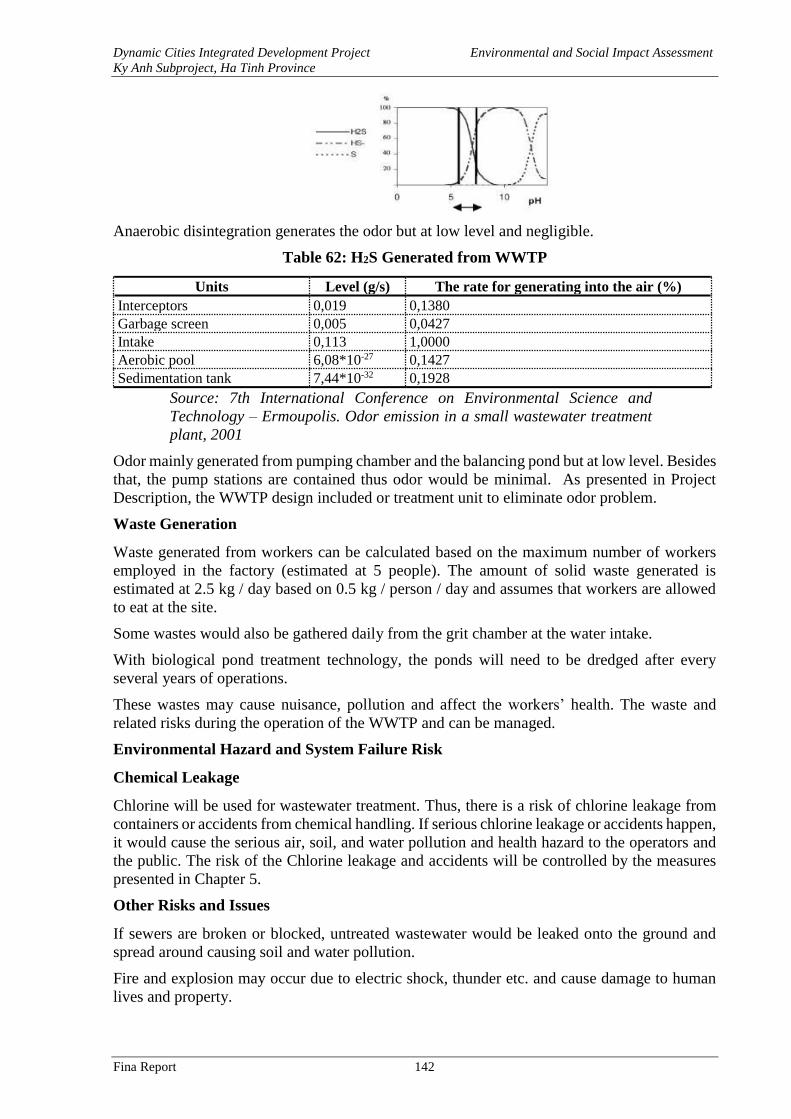
Dynamic Cities Integrated Development Project Environmental and Social Impact Assessment
Ky Anh Subproject, Ha Tinh Province
Fina Report 142
Anaerobic disintegration generates the odor but at low level and negligible.
Table 62: H2S Generated from WWTP
Units Level (g/s) The rate for generating into the air (%)
Interceptors 0,019 0,1380
Garbage screen 0,005 0,0427
Intake 0,113 1,0000
Aerobic pool 6,08*10-27 0,1427
Sedimentation tank 7,44*10-32 0,1928
Source: 7th International Conference on Environmental Science and
Technology – Ermoupolis. Odor emission in a small wastewater treatment
plant, 2001
Odor mainly generated from pumping chamber and the balancing pond but at low level. Besides
that, the pump stations are contained thus odor would be minimal. As presented in Project
Description, the WWTP design included or treatment unit to eliminate odor problem.
Waste Generation
Waste generated from workers can be calculated based on the maximum number of workers
employed in the factory (estimated at 5 people). The amount of solid waste generated is
estimated at 2.5 kg / day based on 0.5 kg / person / day and assumes that workers are allowed
to eat at the site.
Some wastes would also be gathered daily from the grit chamber at the water intake.
With biological pond treatment technology, the ponds will need to be dredged after every
several years of operations.
These wastes may cause nuisance, pollution and affect the workers’ health. The waste and
related risks during the operation of the WWTP and can be managed.
Environmental Hazard and System Failure Risk
Chemical Leakage
Chlorine will be used for wastewater treatment. Thus, there is a risk of chlorine leakage from
containers or accidents from chemical handling. If serious chlorine leakage or accidents happen,
it would cause the serious air, soil, and water pollution and health hazard to the operators and
the public. The risk of the Chlorine leakage and accidents will be controlled by the measures
presented in Chapter 5.
Other Risks and Issues
If sewers are broken or blocked, untreated wastewater would be leaked onto the ground and
spread around causing soil and water pollution.
Fire and explosion may occur due to electric shock, thunder etc. and cause damage to human
lives and property.
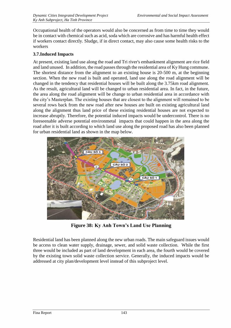
Dynamic Cities Integrated Development Project Environmental and Social Impact Assessment
Ky Anh Subproject, Ha Tinh Province
Fina Report 143
Occupational health of the operators would also be concerned as from time to time they would
be in contact with chemical such as acid, soda which are corrosive and has harmful health effect
if workers contact directly. Sludge, if in direct contact, may also cause some health risks to the
workers
3.7.Induced Impacts
At present, existing land use along the road and Tri river's embankment alignment are rice field
and land unused. In addition, the road passes through the residential area of Ky Hung commune.
The shortest distance from the alignment to an existing house is 20-500 m, at the beginning
section. When the new road is built and operated, land use along the road alignment will be
changed in the tendency that residential houses will be built along the 3.75km road alignment.
As the result, agricultural land will be changed to urban residential area. In fact, in the future,
the area along the road alignment will be change to urban residential area in accordance with
the city’s Masterplan. The existing houses that are closest to the alignment will remained to be
several rows back from the new road after new houses are built on existing agricultural land
along the alignment thus land price of these existing residential houses are not expected to
increase abruptly. Therefore, the potential induced impacts would be undercontrol. There is no
foreseenable adverse potential environmetal impacts that could happen in the area along the
road after it is built according to which land use along the proposed road has also been planned
for urban residential land as shown in the map below.
Figure 38: Ky Anh Town’s Land Use Planning
Residential land has been planned along the new urban roads. The main safeguard issues would
be access to clean water supply, drainage, sewer, and solid waste collection. While the first
three would be included as part of land development in each area, the fourth would be covered
by the existing town solid waste collection service. Generally, the induced impacts would be
addressed at city plan/development level instead of this subproject level.
Dynamic Cities Integrated Development Project Environmental and Social Impact Assessment
Ky Anh Subproject, Ha Tinh Province
Fina Report 144
CHAPTER 4. ANALYSIS OF ALTERNATIVES
The objectives of the analysis for alternative technical designs options of the investment
supported under the project are to compare social and environmental impacts associated with
those design options. The final options are selected based on a thorough consideration of the
technical, economical, effective, environmental and social aspects of the proposed options.
The implementation of the Ky Anh sub-project is in line with the following plans and planning:
(i) Decision No. 1076/QD-TTg dated 20 August 2007 of the Prime Minister approving the
master plan for the construction of Vung Ang Economic Zone, Ha Tinh Province up to 2025;
(ii) Decision No. 445/QD-TTg dated 07/4/2009 of the Prime Minister Approving the
Adjustment of Orientations for Master Plan for Development of Vietnam's Urban System; (iii)
Decision No. 830/QĐ-ttg dated 02/6/2014 by the Prime Minister Approving the Planning
Project for Construction of South Ha Tinh - North Quang Binh Region by 2030; (iv) Decision
No. 3774/QD-UBND dated 29/9/2015 of Ha Tinh People's Committee Approving the Project
on Partial Adjustment of the General Planning on Construction of Vung Ang Economic Zone,
Ha Tinh Province up to 2025, scale 1/10,000; (v) Master Plan for Socio-Economic
Development in the North Central Coast and Central Coast to 2020; (vi) General planning of
Ky Anh town, Ha Tinh province to 2035; (vii) Detailed Planning for Flood Prevention and
Control in Dredged Rivers of Ha Tinh Province in the Period 2015-2020 and Orientation to
2030.
4.1 “With Project” and “Without Project” Scenarios
The existing challenges in the project area is (iii) urban space is limited, not meeting
development needs; (iv) Inadequate transport system; (v) pollution risks due to wastewater has
not been collected for treatment before being discharged into the environment. Therefore, if the
project is not implemented, negative social and environmental issues will have to exist under
current conditions:
- The industrial and urban development of Ky Anh implies the risk of environmental
pollution, especially the problem of waste and wastewater. At present, Ky Anh has
started to appear in many areas contaminated by waste, unmanaged sewage, hygienic
treatment.
- Due to the development of the urban area, the rapidly increasing population will lead to
the rapid increase in the demand for water in each year. As a result, the amount of waste
water will also increase and further pressures on the environment.
- The Ky Anh town is developing along the National Highway 1A, with a density of
population concentrated in the Song Tri, Ky Trinh, Ky Hoa ward... If not building the
trunk center road would not solve the problem of the space it contests, trade in services,
the administrative center and the public space in order to meet the needs and the speed
of urbanization of town;
- Without the construction of a central urban connection road, traffic density and traffic
safety risks on National Highway 1A will increase due to the fact that the traffic volume
has been and will be used as the main traffic route. Meanwhile, the amount of vehicles
is increasing due to urban development.
The comparison between environmental and social issues associated with the With and Without
Project alternative is described in Table 63 below.
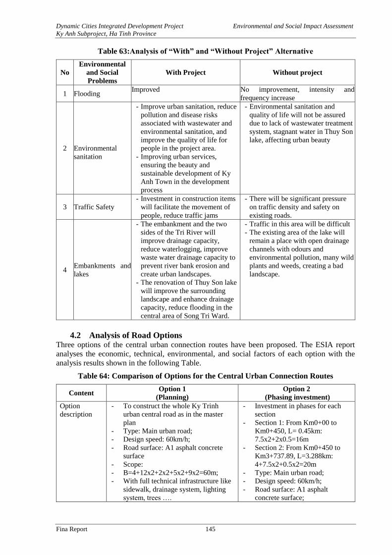
Dynamic Cities Integrated Development Project Environmental and Social Impact Assessment
Ky Anh Subproject, Ha Tinh Province
Fina Report 145
Table 63:Analysis of “With” and “Without Project” Alternative
No
Environmental
and Social
Problems
With Project Without project
1 Flooding Improved No improvement, intensity and
frequency increase
2
Environmental
sanitation
- Improve urban sanitation, reduce
pollution and disease risks
associated with wastewater and
environmental sanitation, and
improve the quality of life for
people in the project area.
- Improving urban services,
ensuring the beauty and
sustainable development of Ky
Anh Town in the development
process
- Environmental sanitation and
quality of life will not be assured
due to lack of wastewater treatment
system, stagnant water in Thuy Son
lake, affecting urban beauty
3 Traffic Safety
- Investment in construction items
will facilitate the movement of
people, reduce traffic jams
- There will be significant pressure
on traffic density and safety on
existing roads.
4 Embankments and
lakes
- The embankment and the two
sides of the Tri River will
improve drainage capacity,
reduce waterlogging, improve
waste water drainage capacity to
prevent river bank erosion and
create urban landscapes.
- The renovation of Thuy Son lake
will improve the surrounding
landscape and enhance drainage
capacity, reduce flooding in the
central area of Song Tri Ward.
- Traffic in this area will be difficult
- The existing area of the lake will
remain a place with open drainage
channels with odours and
environmental pollution, many wild
plants and weeds, creating a bad
landscape.
4.2 Analysis of Road Options Three options of the central urban connection routes have been proposed. The ESIA report
analyses the economic, technical, environmental, and social factors of each option with the
analysis results shown in the following Table.
Table 64: Comparison of Options for the Central Urban Connection Routes
Content Option 1
(Planning)
Option 2
(Phasing investment)
Option
description
- To construct the whole Ky Trinh
urban central road as in the master
plan
- Type: Main urban road;
- Design speed: 60km/h;
- Road surface: A1 asphalt concrete
surface
- Scope:
- B=4+12x2+2x2+5x2+9x2=60m;
- With full technical infrastructure like
sidewalk, drainage system, lighting
system, trees ….
- Investment in phases for each
section
- Section 1: From Km0+00 to
Km0+450, L= 0.45km:
7.5x2+2x0.5=16m
- Section 2: From Km0+450 to
Km3+737.89, L=3.288km:
4+7.5x2+0.5x2=20m
- Type: Main urban road;
- Design speed: 60km/h;
- Road surface: A1 asphalt
concrete surface;
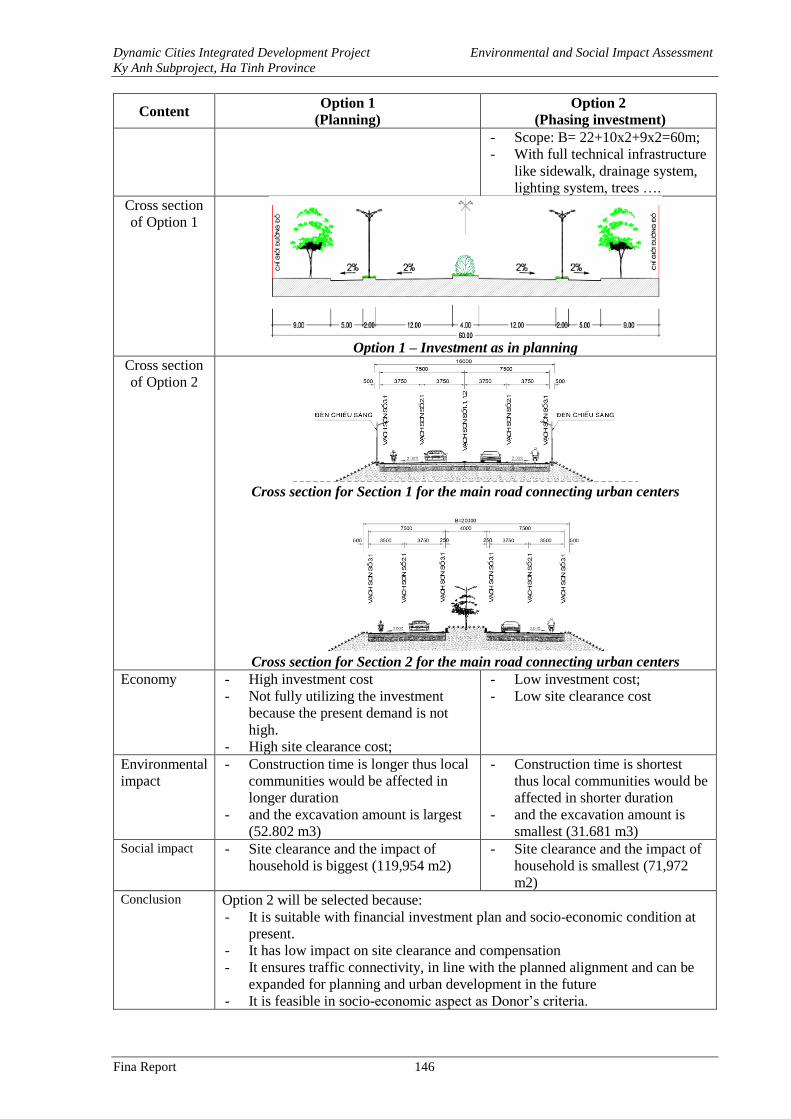
Dynamic Cities Integrated Development Project Environmental and Social Impact Assessment
Ky Anh Subproject, Ha Tinh Province
Fina Report 146
Content Option 1
(Planning)
Option 2
(Phasing investment)
- Scope: B= 22+10x2+9x2=60m;
- With full technical infrastructure
like sidewalk, drainage system,
lighting system, trees ….
Cross section
of Option 1
Option 1 – Investment as in planning
Cross section
of Option 2
Cross section for Section 1 for the main road connecting urban centers
Cross section for Section 2 for the main road connecting urban centers
Economy - High investment cost
- Not fully utilizing the investment
because the present demand is not
high.
- High site clearance cost;
- Low investment cost;
- Low site clearance cost
Environmental
impact
- Construction time is longer thus local
communities would be affected in
longer duration
- and the excavation amount is largest
(52.802 m3)
- Construction time is shortest
thus local communities would be
affected in shorter duration
- and the excavation amount is
smallest (31.681 m3) Social impact - Site clearance and the impact of
household is biggest (119,954 m2)
- Site clearance and the impact of
household is smallest (71,972
m2) Conclusion Option 2 will be selected because:
- It is suitable with financial investment plan and socio-economic condition at
present.
- It has low impact on site clearance and compensation
- It ensures traffic connectivity, in line with the planned alignment and can be
expanded for planning and urban development in the future
- It is feasible in socio-economic aspect as Donor’s criteria.
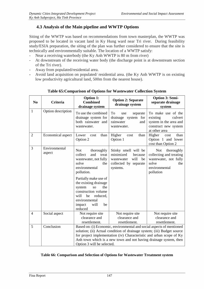
Dynamic Cities Integrated Development Project Environmental and Social Impact Assessment
Ky Anh Subproject, Ha Tinh Province
Fina Report 147
4.3 Analysis of the Main pipeline and WWTP Options
Siting of the WWTP was based on recommendations from town masterplan, the WWTP was
proposed to be located in vacant land in Ky Hung ward near Tri river. During feasibility
study/ESIA preparation, the siting of the plan was further considered to ensure that the site is
technically and environmentally suitable. The location of a WWTP satisfy:
- Near a receiving waterbody (the Ky Anh WWTP is 80 m from river)
- At downstream of the receiving water body (the discharge point is at downstream section
of the Tri river).
- Away from populated/residential area.
- Avoid land acquisition on populated/ residential area. (the Ky Anh WWTP is on existing
low productivity agricultural land, 500m from the nearest house).
Table 65:Comparison of Options for Wastewater Collection System
No Criteria
Option 1:
Combined
drainage system
Option 2: Separate
drainage system
Option 3: Semi-
separate drainage
system
1 Option description To use the combined
drainage system for
both rainwater and
wastewater.
To use separate
drainage system for
rainwater and
wastewater.
To make use of the
existing culvert
system in the area and
construct new system
at other area
2 Economical aspect Lower cost than
Option 2
Higher cost than
Option 1
Higher cost than
Option 1 and lower
cost than Option 2
3 Environmental
aspect Not thoroughly
collect and treat
wastewater, not fully
solve the
environmental
pollution.
Partially make use of
the existing drainage
system so the
construction volume
will be reduced,
environmental
impact will be
reduced
Stinky smell will be
minimized because
wastewater will be
collected by separate
systems.
Not thoroughly
collecting and treating
wastewater, not fully
solve the
environmental
pollution
4 Social aspect Not require site
clearance and
resettlement.
Not require site
clearance and
resettlement.
Not require site
clearance and
resettlement.
5 Conclusion Based on: (i) Economic, environmental and social aspects of mentioned
solution; (ii) Actual condition of drainage system; (iii) Budget source
for project implementation (iv) Characteristic and urban scope of Ky
Anh town which is a new town and not having drainage system, then
Option 3 will be selected.
Table 66: Comparison and Selection of Options for Wastewater Treatment system
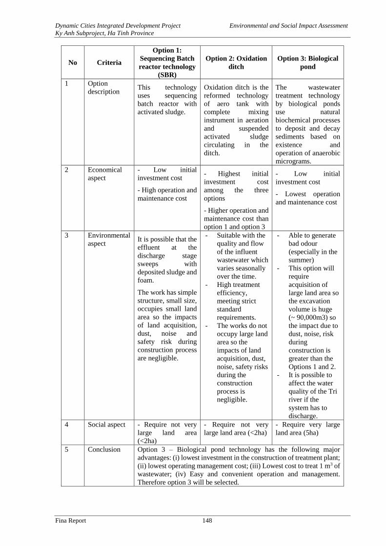
Dynamic Cities Integrated Development Project Environmental and Social Impact Assessment
Ky Anh Subproject, Ha Tinh Province
Fina Report 148
No Criteria
Option 1:
Sequencing Batch
reactor technology
(SBR)
Option 2: Oxidation
ditch
Option 3: Biological
pond
1 Option
description This technology
uses sequencing
batch reactor with
activated sludge.
Oxidation ditch is the
reformed technology
of aero tank with
complete mixing
instrument in aeration
and suspended
activated sludge
circulating in the
ditch.
The wastewater
treatment technology
by biological ponds
use natural
biochemical processes
to deposit and decay
sediments based on
existence and
operation of anaerobic
micrograms.
2 Economical
aspect
- Low initial
investment cost
- High operation and
maintenance cost
- Highest initial
investment cost
among the three
options
- Higher operation and
maintenance cost than
option 1 and option 3
- Low initial
investment cost
- Lowest operation
and maintenance cost
3 Environmental
aspect It is possible that the
effluent at the
discharge stage
sweeps with
deposited sludge and
foam.
The work has simple
structure, small size,
occupies small land
area so the impacts
of land acquisition,
dust, noise and
safety risk during
construction process
are negligible.
- Suitable with the
quality and flow
of the influent
wastewater which
varies seasonally
over the time.
- High treatment
efficiency,
meeting strict
standard
requirements.
- The works do not
occupy large land
area so the
impacts of land
acquisition, dust,
noise, safety risks
during the
construction
process is
negligible.
- Able to generate
bad odour
(especially in the
summer)
- This option will
require
acquisition of
large land area so
the excavation
volume is huge
(~ 90,000m3) so
the impact due to
dust, noise, risk
during
construction is
greater than the
Options 1 and 2.
- It is possible to
affect the water
quality of the Tri
river if the
system has to
discharge.
4 Social aspect - Require not very
large land area
(<2ha)
- Require not very
large land area (<2ha)
- Require very large
land area (5ha)
5 Conclusion Option 3 – Biological pond technology has the following major
advantages: (i) lowest investment in the construction of treatment plant;
(ii) lowest operating management cost; (iii) Lowest cost to treat 1 m3 of
wastewater; (iv) Easy and convenient operation and management.
Therefore option 3 will be selected.
Dynamic Cities Integrated Development Project Environmental and Social Impact Assessment
Ky Anh Subproject, Ha Tinh Province
Fina Report 149
4.4. Construction of Tri River Embankment and Operation Roads on Its Banks
Lining embankment for Tri river aims to protect the river bank, prevent landslide and
sedimentation to protect the river’s flow rate, ensuring drainage capacity.
Table 67: Comparison of Options for Tri river Embankent and Operation Roads On Its
Banks
Criteria Option 1 Option 2 Option 3
Option
description
Slope embankment by
precast concrete slabs.
Construct operation roads
with full technical
infrastructure on the road
including lighting system,
drainage system,
wastewater sewer and
trees.
Embankment lining by
stone.
Construct operation
roads with full technical
infrastructure on the road
including lighting
system, drainage system,
wastewater sewer and
trees.
Embankment lining by
geo-cells for grass
planting;
Construct operation
roads with full
technical infrastructure
on the road including
lighting system,
drainage system,
wastewater sewer and
trees
Embankment
structure – Option
1
Embankment
structure – Option
2
Embankment –
Option 3
Economical
aspect
- High construction cost
- Lowest maintenance cost
- Medium construction
cost
- Medium maintenance
cost.
- Low construction
cost;
- Highest maintainance
cost ;
Environmental
aspect
- Well solve flooding and
sanitation, bring safe
- Well solve flooding
and sanitation, bring
safe living
- Well solve flooding
and sanitation, bring
safe living
Dynamic Cities Integrated Development Project Environmental and Social Impact Assessment
Ky Anh Subproject, Ha Tinh Province
Fina Report 150
Criteria Option 1 Option 2 Option 3
living environment for
local people
- Embankment
concretization will not
create greenery space for
the river
environment for local
people
- Embankment
concretization will not
create greenery space
for the river
- Transport and
temporary gathering of
stone can lead to
higher safety risk
compared with
transport and
temporary gathering of
precast concrete slabs.
environment for
local people
- Create greenery
space and grassland
on the embankment,
help regulate the air
Social aspect Convenient for people’s
movement and access to
the embankment
Convenient for people’s
movement and access to
the embankment
Difficult for rescuing
in case of unexpected
incidents
Conclusion By analyzing and assessing the three mentioned Options, Consultant
recommends Option 1 for the investment in Tri river embankment because it has
good bearing capacity against water pressure, high aesthetics, low maintenance
cost, in harmony with many embankments under construction in local area and
in accordance with planning orientation
4.5. Upgrading, Rehabilitation of Thuy Son Lake
This item is invested to bring a safe living environment for local people and create a
highlighted landscape for uban area as well as to create more space for community’s
activities.
Table 68: Comparison and Selection of Options for the Lake Embankment
Criteria Option 1
(Lining slope
embankment by
concrete slabs)
Option 2
(Lining slope
embankment by stone)
Option 3
(Ecological flexible
embankment)
Option
description:
- Lining the lake
embankment by concrete
slabs and cells for
planting grass with slope
1:1.
- Constructing technical
infrastructure includes:
sidewalk, rainwater
drainage and sewer, and
trees.
- Lining the embankment
by stone and reinforced
concrete cells for planting
grass, slope 1:1.5.
- Constructing technical
infrastructure includes:
sidewalk, rainwater
drainage and sewer, and
trees.
Typical embankment cross
section – Option 2
- Lining the embankment
by sand bags and
retaining wall;
- Constructing technical
infrastructure includes:
sidewalk, rainwater
drainage and sewer, and
trees.
Dynamic Cities Integrated Development Project Environmental and Social Impact Assessment
Ky Anh Subproject, Ha Tinh Province
Fina Report 151
Criteria Option 1
(Lining slope
embankment by
concrete slabs)
Option 2
(Lining slope
embankment by stone)
Option 3
(Ecological flexible
embankment)
Typical embankment
cross section – Option 1
Typical embankment
cross section – Option 3
Economical
aspect
- High construction cost.
- Low maintenance cost.
- High construction cost.
- Low maintenance cost.
- Low construction cost.
- High maintenance cost.
Environmenta
l aspect
- Fully solve
environmental pollution,
create more beautiful
landscape to be a
highlighted spot for the
town, maximize
investment efficiency.
- Concretizing the
embankment, forming
greenery space for the
lake by grass cells
- Fully solve
environmental pollution,
create more beautiful
landscape to be a
highlighted spot for the
town, maximize
investment efficiency.
- Concretizing the
embankment, forming
greenery space for the lake
by grass cells
- Fully solve
environmental pollution,
create more beautiful
landscape to be a
highlighted spot for the
town, maximize
investment efficiency.
- Create greenery space
and grassland on the
embankment, help
regulate the air
Social aspect - Easy for rescuing work
in unexpected incident
- Easy for rescuing work in
unexpected incident
- Difficult for rescuing
work in unexpected
incident
Conclusion After mentioned analysis, Option 1 will be selected for the investment in upgrading
and rehabilitation of Thuy Son lake because it will form highlighted landscape, in
line with the planning orientation. This will be a greenery space in Song Tri ward,
contributing to regulate the air and improve urban aesthetic.
Dynamic Cities Integrated Development Project Environmental and Social Impact Assessment
Ky Anh Subproject, Ha Tinh Province
Fina Report 152
CHAPTER 5. ENVIRONMENTAL & SOCIAL MANAGEMENT PLAN
With the potential impacts and risks identified and assessed in Chapter 3, an Environmental and
Social Management Plan (ESMP) has been prepared in this chapter with the aims of impact
prevention and mitigation. Procedures for implementation, monitoring, supervision and
reporting are also included in this ESMP together with Capacity building program and cost
estimation. This ESMP consists of main contents as follows:
- The measures to minimize the potential environmental impacts from Feasibility Study and
Detailed Design stage to pre-construction, construction and operation phases together with
implementation responsibilities;
- Environmental Monitoring Program;
- The Project Compliance Framework, including environmental and social supervision
arrangements, fines applicable to non-compliance;
- Capacity building programs;
- Cost estimation; and
- Grievance Redress mechanism.
5.1 Mitigation Measures
5.1.1 Measures Incorporated in the Feasibility Study and Detailed Design
The following measures were considered during the preparation of the feasibility study and will
be integrated in the detailed designs to mitigate the potential socio-environmental impacts and
risk. Environmental friendly solutions will also be considered during the FS and detailed design:
Trunk Road:
- Protect slopes with vegetation cover and concrete frames and/or embankments
- Install vertical and longitudinal drains to ensure stability of the roads
- Build the intersections with traffic safety control measures at intervals to maintain access
for local communities to travel from one side of the road to the others.
- Lighting: Using energy saving bulbs and automatic control. Lamp design ensures
aesthetic factor.
- Plant trees to create urban green landscapes in the divider and on the sidewalk.
- Design the intersections between the trunk road and existing road with measures to ensure
traffic safety as warning lights, reflective traffic signs, deceleration ramps, fences,
Figure 40 shows the design of the intesections between the main road connecting urban centers
and the existing road in which traffic and safety control measures included
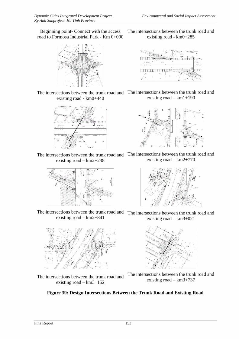
Dynamic Cities Integrated Development Project Environmental and Social Impact Assessment
Ky Anh Subproject, Ha Tinh Province
Fina Report 153
Beginning point- Connect with the access
road to Formosa Industrial Park - Km 0+000
The intersections between the trunk road and
existing road - km0+285
The intersections between the trunk road and
existing road - km0+440
The intersections between the trunk road and
existing road – km1+190
The intersections between the trunk road and
existing road – km2+238
The intersections between the trunk road and
existing road – km2+770
The intersections between the trunk road and
existing road – km2+841
]
The intersections between the trunk road and
existing road – km3+021
The intersections between the trunk road and
existing road – km3+152
The intersections between the trunk road and
existing road – km3+737
Figure 39: Design Intersections Between the Trunk Road and Existing Road
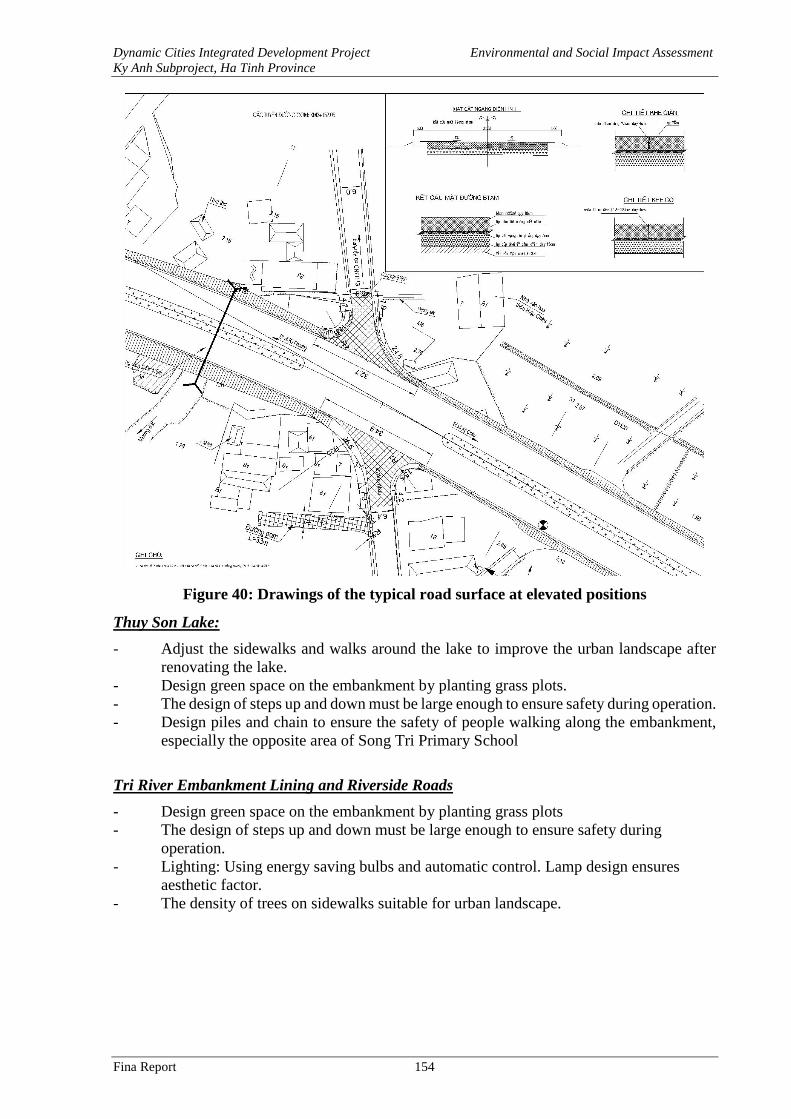
Dynamic Cities Integrated Development Project Environmental and Social Impact Assessment
Ky Anh Subproject, Ha Tinh Province
Fina Report 154
Figure 40: Drawings of the typical road surface at elevated positions
Thuy Son Lake:
- Adjust the sidewalks and walks around the lake to improve the urban landscape after
renovating the lake.
- Design green space on the embankment by planting grass plots.
- The design of steps up and down must be large enough to ensure safety during operation.
- Design piles and chain to ensure the safety of people walking along the embankment,
especially the opposite area of Song Tri Primary School
Tri River Embankment Lining and Riverside Roads
- Design green space on the embankment by planting grass plots
- The design of steps up and down must be large enough to ensure safety during
operation.
- Lighting: Using energy saving bulbs and automatic control. Lamp design ensures
aesthetic factor.
- The density of trees on sidewalks suitable for urban landscape.
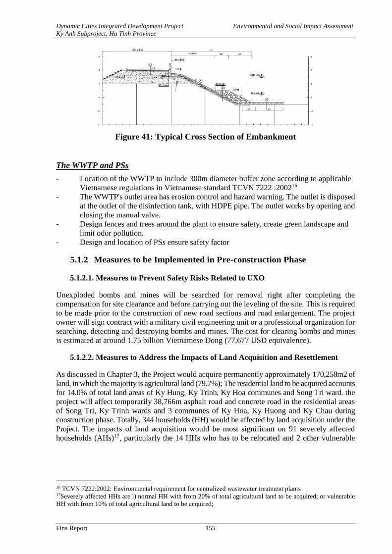
Dynamic Cities Integrated Development Project Environmental and Social Impact Assessment
Ky Anh Subproject, Ha Tinh Province
Fina Report 155
Figure 41: Typical Cross Section of Embankment
The WWTP and PSs
- Location of the WWTP to include 300m diameter buffer zone according to applicable
Vietnamese regulations in Vietnamese standard TCVN 7222 :200216
- The WWTP's outlet area has erosion control and hazard warning. The outlet is disposed
at the outlet of the disinfection tank, with HDPE pipe. The outlet works by opening and
closing the manual valve.
- Design fences and trees around the plant to ensure safety, create green landscape and
limit odor pollution.
- Design and location of PSs ensure safety factor
5.1.2 Measures to be Implemented in Pre-construction Phase
5.1.2.1. Measures to Prevent Safety Risks Related to UXO
Unexploded bombs and mines will be searched for removal right after completing the
compensation for site clearance and before carrying out the leveling of the site. This is required
to be made prior to the construction of new road sections and road enlargement. The project
owner will sign contract with a military civil engineering unit or a professional organization for
searching, detecting and destroying bombs and mines. The cost for clearing bombs and mines
is estimated at around 1.75 billion Vietnamese Dong (77,677 USD equivalence).
5.1.2.2. Measures to Address the Impacts of Land Acquisition and Resettlement
As discussed in Chapter 3, the Project would acquire permanently approximately 170,258m2 of
land, in which the majority is agricultural land (79.7%); The residential land to be acquired accounts
for 14.0% of total land areas of Ky Hung, Ky Trinh, Ky Hoa communes and Song Tri ward. the
project will affect temporarily 38,766m asphalt road and concrete road in the residential areas
of Song Tri, Ky Trinh wards and 3 communes of Ky Hoa, Ky Huong and Ky Chau during
construction phase. Totally, 344 households (HH) would be affected by land acquisition under the
Project. The impacts of land acquisition would be most significant on 91 severely affected
households (AHs)17, particularly the 14 HHs who has to be relocated and 2 other vulnerable
16 TCVN 7222:2002: Environmental requirement for centralized wastewater treatment plants 17Severely affected HHs are i) normal HH with from 20% of total agricultural land to be acquired; or vulnerable
HH with from 10% of total agricultural land to be acquired;
Dynamic Cities Integrated Development Project Environmental and Social Impact Assessment
Ky Anh Subproject, Ha Tinh Province
Fina Report 156
severely AH18 in this group. In addition, the impacts of land acquisition would also be
significant on 14 other vulnerable AHs but not severely.
To mitigate the potential impacts of land acquisition, Resettlement Plans were (RPs) were
prepared for the sub-project with estimated budget of approximately 82.57 billion VND. This
budget will cover the costs of compensation and support, monitoring, management costs and
contingencies. Details about compensations and supports paid to the affected households are
presented below.
Table 69: Compensation and Supports to Affected Households
No. Description Volume Amount
A Land 44,897,686,567
A.1 Residential land 19,416 39,341,603,000
A.2 Agricultural land 128,594.58 5,556,083,567
B House/structure 12,988,870,000
B.1 House (m2) 2,140 10,272,000,000
B.2 Kitchen (m2) 440 660,000,000
B.3 Barn/breeding facilities (m2) 300 375,000,000
B.4 Auxiliary facilities (m2) 240 480,000,000
B.5 Wall (m) 2,150 731,000,000
B.6 Yard (m2) 2,340 421,200,000
B.7 Gate (piece) 35 26,250,000
B.8 Water tank (m3) 12 19,920,000
B.9 Well (piece) 10 3,500,000
C Crop, vegetation 1,335,713,580
C.1 Rice 57,648 288,239,500
C.2 Crops 59,703 358,215,840
C.3 Tea tree 10169 162,701,440
C.4 Wood tree 1500 300,000,000
C.5 Fruit tree 800 190,000,000
C.6 Shrimp farming land 1,075 36,556,800
D Sub-total 1 59,222,270,147
E Assistance 16,526,838,763
E.1 Assistance for transportation, resettlement 14 84,000,000
E.2 Assistance for house renting for displaced HH 14 100,800,000
E.3 Assistance for life stabilization 344 3,219,840,000
E.4 Career change 128,595 12,160,198,763
E.5 Vulnerable household 16 32,000,000
E.6 Business establishment 11 55,000,000
E.7 Self-relocation 14 700,000,000
E.8 Incentive bonus 35 175,000,000
F Sub-total 2 75,749,108,910
G Management cost 6,817,419,802
G.1 Implementation cost 1,514,982,178.20
18 Vulnerable HHs are either poor HH, female-headed households with dependents, or HH under the care of social
policy
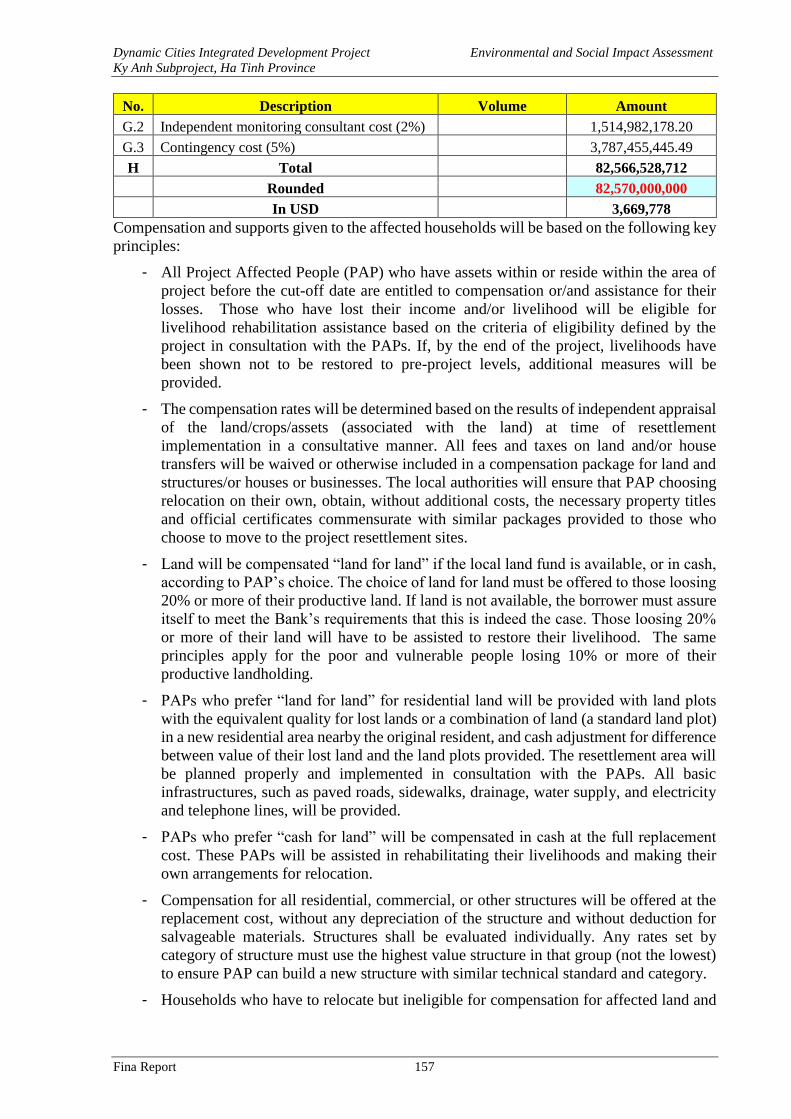
Dynamic Cities Integrated Development Project Environmental and Social Impact Assessment
Ky Anh Subproject, Ha Tinh Province
Fina Report 157
No. Description Volume Amount
G.2 Independent monitoring consultant cost (2%) 1,514,982,178.20
G.3 Contingency cost (5%) 3,787,455,445.49
H Total 82,566,528,712
Rounded 82,570,000,000
In USD 3,669,778
Compensation and supports given to the affected households will be based on the following key
principles:
- All Project Affected People (PAP) who have assets within or reside within the area of
project before the cut-off date are entitled to compensation or/and assistance for their
losses. Those who have lost their income and/or livelihood will be eligible for
livelihood rehabilitation assistance based on the criteria of eligibility defined by the
project in consultation with the PAPs. If, by the end of the project, livelihoods have
been shown not to be restored to pre-project levels, additional measures will be
provided.
- The compensation rates will be determined based on the results of independent appraisal
of the land/crops/assets (associated with the land) at time of resettlement
implementation in a consultative manner. All fees and taxes on land and/or house
transfers will be waived or otherwise included in a compensation package for land and
structures/or houses or businesses. The local authorities will ensure that PAP choosing
relocation on their own, obtain, without additional costs, the necessary property titles
and official certificates commensurate with similar packages provided to those who
choose to move to the project resettlement sites.
- Land will be compensated “land for land” if the local land fund is available, or in cash,
according to PAP’s choice. The choice of land for land must be offered to those loosing
20% or more of their productive land. If land is not available, the borrower must assure
itself to meet the Bank’s requirements that this is indeed the case. Those loosing 20%
or more of their land will have to be assisted to restore their livelihood. The same
principles apply for the poor and vulnerable people losing 10% or more of their
productive landholding.
- PAPs who prefer “land for land” for residential land will be provided with land plots
with the equivalent quality for lost lands or a combination of land (a standard land plot)
in a new residential area nearby the original resident, and cash adjustment for difference
between value of their lost land and the land plots provided. The resettlement area will
be planned properly and implemented in consultation with the PAPs. All basic
infrastructures, such as paved roads, sidewalks, drainage, water supply, and electricity
and telephone lines, will be provided.
- PAPs who prefer “cash for land” will be compensated in cash at the full replacement
cost. These PAPs will be assisted in rehabilitating their livelihoods and making their
own arrangements for relocation.
- Compensation for all residential, commercial, or other structures will be offered at the
replacement cost, without any depreciation of the structure and without deduction for
salvageable materials. Structures shall be evaluated individually. Any rates set by
category of structure must use the highest value structure in that group (not the lowest)
to ensure PAP can build a new structure with similar technical standard and category.
- Households who have to relocate but ineligible for compensation for affected land and
Dynamic Cities Integrated Development Project Environmental and Social Impact Assessment
Ky Anh Subproject, Ha Tinh Province
Fina Report 158
have not any land or house within the project commune/ward will be entitled to buying
a minimum plot or house in resettlement site and resettlement assistance in cash.
- PAPs will be provided with full assistance (including a transportation allowance) for
transportation of personal belongings and assets, in addition to the compensation
at replacement cost of their houses, lands and other properties. Full compensation and
allowance must be provided to affected households prior to the taking of affected land
and assets.
- Additional efforts, such as economic recovery assistance, training and other forms of
assistance, should be provided to PAPs losing income sources, especially to vulnerable
groups, in order to enhance their future prospects toward livelihood restoration and
improvement.
- As RP is one of the project components, the project will not be considered complete
until the RP has been fully implemented and met OP 4.12 policy objective.
Compensation will be made to the affected households for the assets that are lost/affected,
including their loss of income as a result of land acquisition. In addition to compensation,
households who are severely affected will be provided with additional financial support for
resettlement. They are also eligible for participating in the Livelihood Restoration Program that
was designed based on their needs to assist them in promptly restoring their livelihood as a
result of loss of land/business/crops, or as a result of physical relocation. In addition to the
compensation and support, other measures will be taken to mitigate the potential adverse
impact, including early notification of land acquisition (i.e. before 90 days for agricultural land
and 180 days for residential land), resettlement site is constructed close to the existing
households. During resettlement process, consultation will be conducted regularly to ensure
comments and feedback of affected households are considered to avoid/mitigate the
resettlement impact. Temporary impact on existing living and business activities will be
mitigated by allowing the households to continue using their existing houses and running their
current business until their new houses are ready to move in. Contractors will apply all possible
mitigation measures to avoid and/or mitigate negative impacts on local people during
construction with closely monitoring by PMU and local community.
Gender Mainstreaming:
Below are some suggestive actions to promote gender equality through the implementation of
RP for Ky Anh.
Gender Action: As part of RP implementation, the following gender actions will be made.
- Education: The surveyed results show that, there is no educational restrict for female in
the project area. At present, all children at school age can go to school regardless their
gender, household’s economic condition and religion.
- Property’s ownership: According to the Land law 2013, husband and wife should share
the name in their land use right certificate. However, the surveyed results show that,
31.5% of surveyed people said their land use right certificates bear only husband’s name
while the percentage for wife holding name in the land use right certificate is 15.3%.
The project’s benefits for female beneficiaries:
- The work item of the trunk road connecting urban centers will provide better access to
social service, market and job opportunities for people living along the road. The trunk
road will also reduce travel time and increase the job opportunities and business
activities for women.
Dynamic Cities Integrated Development Project Environmental and Social Impact Assessment
Ky Anh Subproject, Ha Tinh Province
Fina Report 159
- The work item of Tri river embankment and the wastewater collection and treatment
plant will help to improve environmental condition, reduce environmental-borne
diseases (gynecological disease, venereal disease…), that will help to reduce medical
check time and treatment cost. Women will have more time and better financial
condition to improve their capacity.
5.1.3 Measures to be Implemented During Construction Phase
As discussed in Chapter 3, the potential impacts and main risks that may occur during the
construction include: (i) Air Quality Reduction: increased levels of dusts and exhaust gas, odor,
noises, vibration; (ii) Wastewater generation; (iii) Solid wastes generation; (iv) Surface Water
quality reduction; (v) Impacts on Biological Resources; (vi) Urban landscape; (vii) Increased
erosion and landslide risks; (viii) Increased flooding, sedimentation, risks; (ix) Traffic
Disturbance and Increased traffic safety risks; (x) Damages to existing infrastructure and or
disruptions to related services; (xi) Social impacts: disturbance to businesses and daily activities
of local people; (xii) Impacts on cultural, historical resources; (xiii) Community Safety and
Health; (xiv) Health and safety of workers. In addition, some special impacts by types of work,
such as destructive explosion, construction of bridge or sensitive locations along the route, have
also been identified.
Below are the mitigation measures to be implemented during the construction phase of the
project and presented by category:
General mitigation measures presented as ECOP (Environmental Codes of Practice). ECOP
will be applied to all bid packages by the contractors and supervised by the construction
supervision consultant (or Engineer).
Mitigation measure applicable to specific types of activities to be carried out; and
Site-specific mitigation measures to address site-specific potential impacts and risks
Bidding documents and construction contracts of each bid package will include the entire ECOP
and specific mitigation measures by type of construction activity and location consistent with
the work content in the bid package.
The contractors will be required to prepare Site-Specific Environmental and Social
Management Plan (SESMP) and submit to the Construction Supervision Consultant and the Ky
Anh Project Management Unit for review and approval at least two weeks prior to construction
commencement. The SESMP will be prepared to meet the mitigation requirements described
in below.
5.1.3.1. Environmental Codes of Practice (ECOP)
The mitigation measures for common negative impacts during the construction phase are
presented in Tables 59 in the form of Environmental Codes of Practices (ECOP). ECOP will be
included in all bidding documents and construction contracts of all bid packages to request the
contractors to implement. ECOP compliance will be supervised by the Construction
Supervision Consultant (CSC) in coordination with PMU.
ECOP, together with relevant type-specific and site-specific mitigation measures will be
included in the construction contract signed between the PMU and the Contractor. In addition,
each contractor will be required to prepare Site-specific Environmental Management Plan
(SEMP) to cover all measures that the contractor will carry out to address potential impacts and
risks associated with the works that they are contracted to implement.
- Impacts on air quality because of dust, exhaust, noise, and vibration
Dynamic Cities Integrated Development Project Environmental and Social Impact Assessment
Ky Anh Subproject, Ha Tinh Province
Fina Report 160
- Wastewater
- Solid waste
- Reduced water quality
- Flooding risks
- Water pollution
- Erosion and Sedimentation
- Traffic Disturbance and Safety Risks
- Impacts on organism, aquatic system
- Impacts on urban landscapes,
- Impacts on Cultural Heritages
- Social Impacts
- Community Health and Safety
- Workers’ Health and Safety
- Hazard Risk
- Chance findings
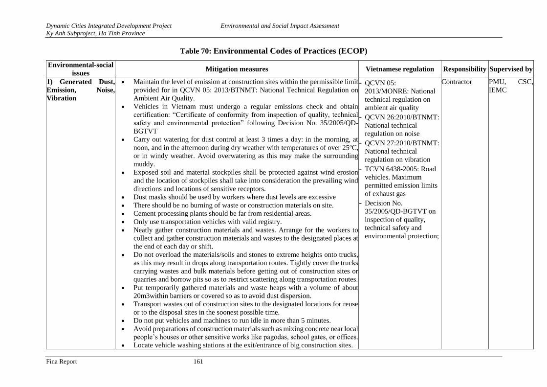
Dynamic Cities Integrated Development Project Environmental and Social Impact Assessment
Ky Anh Subproject, Ha Tinh Province
Fina Report 161
Table 70: Environmental Codes of Practices (ECOP)
Environmental-social
issues Mitigation measures Vietnamese regulation Responsibility Supervised by
1) Generated Dust,
Emission, Noise,
Vibration
• Maintain the level of emission at construction sites within the permissible limit
provided for in QCVN 05: 2013/BTNMT: National Technical Regulation on
Ambient Air Quality.
• Vehicles in Vietnam must undergo a regular emissions check and obtain
certification: “Certificate of conformity from inspection of quality, technical
safety and environmental protection” following Decision No. 35/2005/QD-
BGTVT
• Carry out watering for dust control at least 3 times a day: in the morning, at
noon, and in the afternoon during dry weather with temperatures of over 25oC,
or in windy weather. Avoid overwatering as this may make the surrounding
muddy.
• Exposed soil and material stockpiles shall be protected against wind erosion
and the location of stockpiles shall take into consideration the prevailing wind
directions and locations of sensitive receptors.
• Dust masks should be used by workers where dust levels are excessive
• There should be no burning of waste or construction materials on site.
• Cement processing plants should be far from residential areas.
• Only use transportation vehicles with valid registry.
• Neatly gather construction materials and wastes. Arrange for the workers to
collect and gather construction materials and wastes to the designated places at
the end of each day or shift.
• Do not overload the materials/soils and stones to extreme heights onto trucks,
as this may result in drops along transportation routes. Tightly cover the trucks
carrying wastes and bulk materials before getting out of construction sites or
quarries and borrow pits so as to restrict scattering along transportation routes.
• Put temporarily gathered materials and waste heaps with a volume of about
20m3within barriers or covered so as to avoid dust dispersion.
• Transport wastes out of construction sites to the designated locations for reuse
or to the disposal sites in the soonest possible time.
• Do not put vehicles and machines to run idle in more than 5 minutes.
• Avoid preparations of construction materials such as mixing concrete near local
people’s houses or other sensitive works like pagodas, school gates, or offices.
• Locate vehicle washing stations at the exit/entrance of big construction sites.
- QCVN 05:
2013/MONRE: National
technical regulation on
ambient air quality - QCVN 26:2010/BTNMT:
National technical
regulation on noise - QCVN 27:2010/BTNMT:
National technical
regulation on vibration - TCVN 6438-2005: Road
vehicles. Maximum
permitted emission limits
of exhaust gas - Decision No.
35/2005/QD-BGTVT on
inspection of quality,
technical safety and
environmental protection;
Contractor PMU, CSC,
IEMC
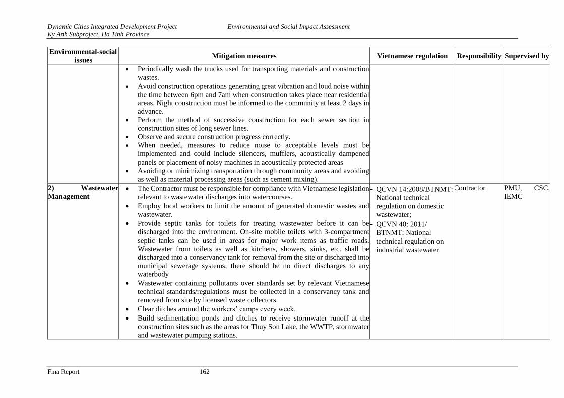
Dynamic Cities Integrated Development Project Environmental and Social Impact Assessment
Ky Anh Subproject, Ha Tinh Province
Fina Report 162
Environmental-social
issues Mitigation measures Vietnamese regulation Responsibility Supervised by
• Periodically wash the trucks used for transporting materials and construction
wastes.
• Avoid construction operations generating great vibration and loud noise within
the time between 6pm and 7am when construction takes place near residential
areas. Night construction must be informed to the community at least 2 days in
advance.
• Perform the method of successive construction for each sewer section in
construction sites of long sewer lines.
• Observe and secure construction progress correctly.
• When needed, measures to reduce noise to acceptable levels must be
implemented and could include silencers, mufflers, acoustically dampened
panels or placement of noisy machines in acoustically protected areas
• Avoiding or minimizing transportation through community areas and avoiding
as well as material processing areas (such as cement mixing).
2) Wastewater
Management • The Contractor must be responsible for compliance with Vietnamese legislation
relevant to wastewater discharges into watercourses.
• Employ local workers to limit the amount of generated domestic wastes and
wastewater.
• Provide septic tanks for toilets for treating wastewater before it can be
discharged into the environment. On-site mobile toilets with 3-compartment
septic tanks can be used in areas for major work items as traffic roads.
Wastewater from toilets as well as kitchens, showers, sinks, etc. shall be
discharged into a conservancy tank for removal from the site or discharged into
municipal sewerage systems; there should be no direct discharges to any
waterbody
• Wastewater containing pollutants over standards set by relevant Vietnamese
technical standards/regulations must be collected in a conservancy tank and
removed from site by licensed waste collectors.
• Clear ditches around the workers’ camps every week.
• Build sedimentation ponds and ditches to receive stormwater runoff at the
construction sites such as the areas for Thuy Son Lake, the WWTP, stormwater
and wastewater pumping stations.
- QCVN 14:2008/BTNMT:
National technical
regulation on domestic
wastewater; - QCVN 40: 2011/
BTNMT: National
technical regulation on
industrial wastewater
Contractor PMU, CSC,
IEMC
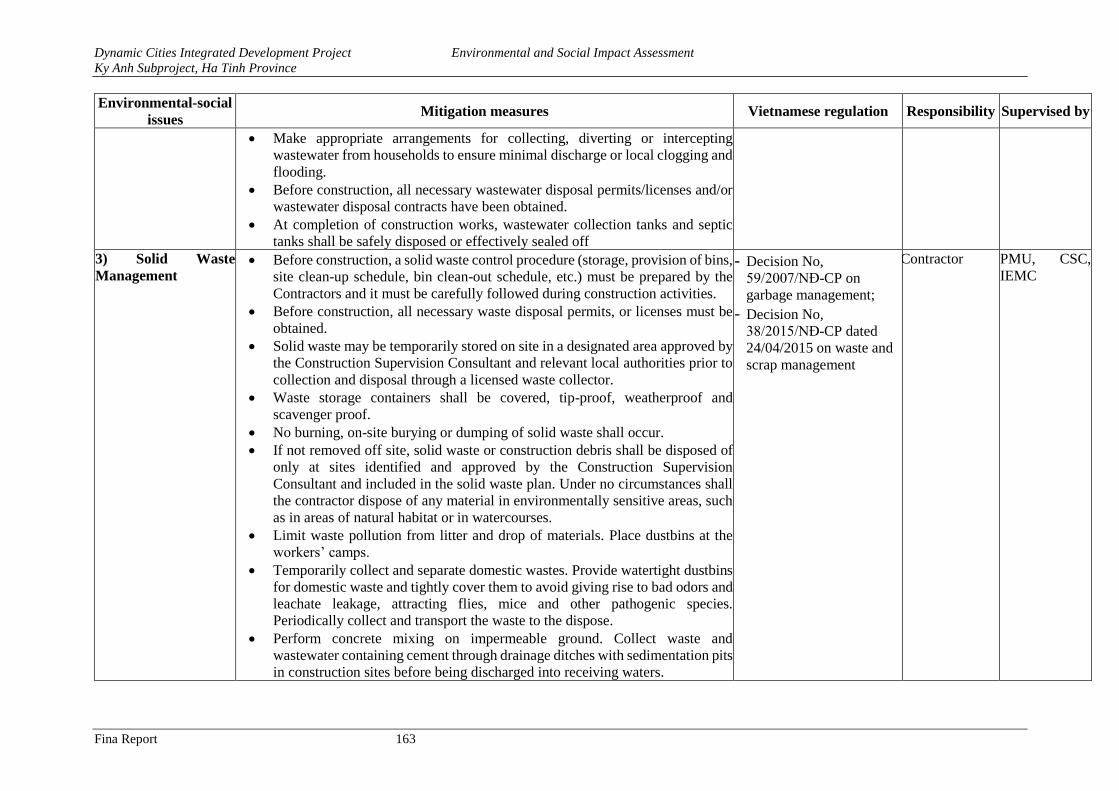
Dynamic Cities Integrated Development Project Environmental and Social Impact Assessment
Ky Anh Subproject, Ha Tinh Province
Fina Report 163
Environmental-social
issues Mitigation measures Vietnamese regulation Responsibility Supervised by
• Make appropriate arrangements for collecting, diverting or intercepting
wastewater from households to ensure minimal discharge or local clogging and
flooding.
• Before construction, all necessary wastewater disposal permits/licenses and/or
wastewater disposal contracts have been obtained.
• At completion of construction works, wastewater collection tanks and septic
tanks shall be safely disposed or effectively sealed off
3) Solid Waste
Management • Before construction, a solid waste control procedure (storage, provision of bins,
site clean-up schedule, bin clean-out schedule, etc.) must be prepared by the
Contractors and it must be carefully followed during construction activities.
• Before construction, all necessary waste disposal permits, or licenses must be
obtained.
• Solid waste may be temporarily stored on site in a designated area approved by
the Construction Supervision Consultant and relevant local authorities prior to
collection and disposal through a licensed waste collector.
• Waste storage containers shall be covered, tip-proof, weatherproof and
scavenger proof.
• No burning, on-site burying or dumping of solid waste shall occur.
• If not removed off site, solid waste or construction debris shall be disposed of
only at sites identified and approved by the Construction Supervision
Consultant and included in the solid waste plan. Under no circumstances shall
the contractor dispose of any material in environmentally sensitive areas, such
as in areas of natural habitat or in watercourses.
• Limit waste pollution from litter and drop of materials. Place dustbins at the
workers’ camps.
• Temporarily collect and separate domestic wastes. Provide watertight dustbins
for domestic waste and tightly cover them to avoid giving rise to bad odors and
leachate leakage, attracting flies, mice and other pathogenic species.
Periodically collect and transport the waste to the dispose.
• Perform concrete mixing on impermeable ground. Collect waste and
wastewater containing cement through drainage ditches with sedimentation pits
in construction sites before being discharged into receiving waters.
- Decision No,
59/2007/NĐ-CP on
garbage management; - Decision No,
38/2015/NĐ-CP dated
24/04/2015 on waste and
scrap management
Contractor PMU, CSC,
IEMC
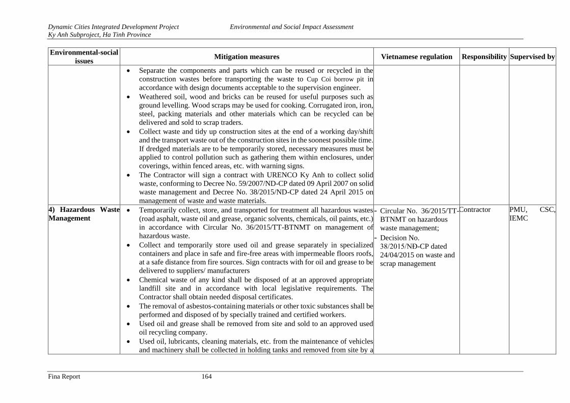
Dynamic Cities Integrated Development Project Environmental and Social Impact Assessment
Ky Anh Subproject, Ha Tinh Province
Fina Report 164
Environmental-social
issues Mitigation measures Vietnamese regulation Responsibility Supervised by
• Separate the components and parts which can be reused or recycled in the
construction wastes before transporting the waste to Cup Coi borrow pit in
accordance with design documents acceptable to the supervision engineer.
• Weathered soil, wood and bricks can be reused for useful purposes such as
ground levelling. Wood scraps may be used for cooking. Corrugated iron, iron,
steel, packing materials and other materials which can be recycled can be
delivered and sold to scrap traders.
• Collect waste and tidy up construction sites at the end of a working day/shift
and the transport waste out of the construction sites in the soonest possible time.
If dredged materials are to be temporarily stored, necessary measures must be
applied to control pollution such as gathering them within enclosures, under
coverings, within fenced areas, etc. with warning signs.
• The Contractor will sign a contract with URENCO Ky Anh to collect solid
waste, conforming to Decree No. 59/2007/ND-CP dated 09 April 2007 on solid
waste management and Decree No. 38/2015/ND-CP dated 24 April 2015 on
management of waste and waste materials.
4) Hazardous Waste
Management • Temporarily collect, store, and transported for treatment all hazardous wastes
(road asphalt, waste oil and grease, organic solvents, chemicals, oil paints, etc.)
in accordance with Circular No. 36/2015/TT-BTNMT on management of
hazardous waste.
• Collect and temporarily store used oil and grease separately in specialized
containers and place in safe and fire-free areas with impermeable floors roofs,
at a safe distance from fire sources. Sign contracts with for oil and grease to be
delivered to suppliers/ manufacturers
• Chemical waste of any kind shall be disposed of at an approved appropriate
landfill site and in accordance with local legislative requirements. The
Contractor shall obtain needed disposal certificates.
• The removal of asbestos-containing materials or other toxic substances shall be
performed and disposed of by specially trained and certified workers.
• Used oil and grease shall be removed from site and sold to an approved used
oil recycling company.
• Used oil, lubricants, cleaning materials, etc. from the maintenance of vehicles
and machinery shall be collected in holding tanks and removed from site by a
- Circular No. 36/2015/TT-
BTNMT on hazardous
waste management; - Decision No.
38/2015/NĐ-CP dated
24/04/2015 on waste and
scrap management
Contractor PMU, CSC,
IEMC
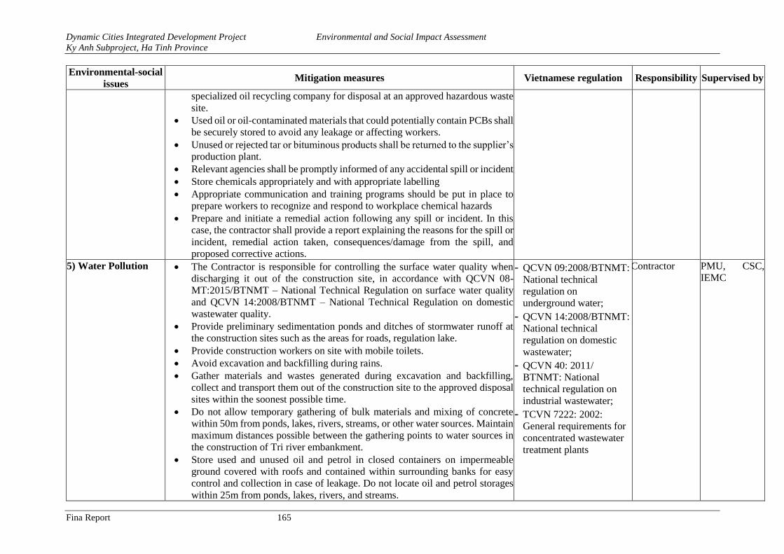
Dynamic Cities Integrated Development Project Environmental and Social Impact Assessment
Ky Anh Subproject, Ha Tinh Province
Fina Report 165
Environmental-social
issues Mitigation measures Vietnamese regulation Responsibility Supervised by
specialized oil recycling company for disposal at an approved hazardous waste
site.
• Used oil or oil-contaminated materials that could potentially contain PCBs shall
be securely stored to avoid any leakage or affecting workers.
• Unused or rejected tar or bituminous products shall be returned to the supplier’s
production plant.
• Relevant agencies shall be promptly informed of any accidental spill or incident
• Store chemicals appropriately and with appropriate labelling
• Appropriate communication and training programs should be put in place to
prepare workers to recognize and respond to workplace chemical hazards
• Prepare and initiate a remedial action following any spill or incident. In this
case, the contractor shall provide a report explaining the reasons for the spill or
incident, remedial action taken, consequences/damage from the spill, and
proposed corrective actions.
5) Water Pollution • The Contractor is responsible for controlling the surface water quality when
discharging it out of the construction site, in accordance with QCVN 08-
MT:2015/BTNMT – National Technical Regulation on surface water quality
and QCVN 14:2008/BTNMT – National Technical Regulation on domestic
wastewater quality.
• Provide preliminary sedimentation ponds and ditches of stormwater runoff at
the construction sites such as the areas for roads, regulation lake.
• Provide construction workers on site with mobile toilets.
• Avoid excavation and backfilling during rains.
• Gather materials and wastes generated during excavation and backfilling,
collect and transport them out of the construction site to the approved disposal
sites within the soonest possible time.
• Do not allow temporary gathering of bulk materials and mixing of concrete
within 50m from ponds, lakes, rivers, streams, or other water sources. Maintain
maximum distances possible between the gathering points to water sources in
the construction of Tri river embankment.
• Store used and unused oil and petrol in closed containers on impermeable
ground covered with roofs and contained within surrounding banks for easy
control and collection in case of leakage. Do not locate oil and petrol storages
within 25m from ponds, lakes, rivers, and streams.
- QCVN 09:2008/BTNMT:
National technical
regulation on
underground water; - QCVN 14:2008/BTNMT:
National technical
regulation on domestic
wastewater; - QCVN 40: 2011/
BTNMT: National
technical regulation on
industrial wastewater; - TCVN 7222: 2002:
General requirements for
concentrated wastewater
treatment plants
Contractor PMU, CSC,
IEMC
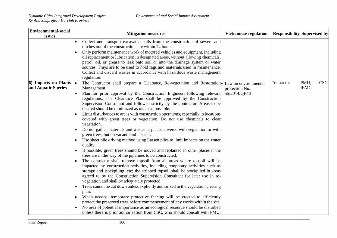
Dynamic Cities Integrated Development Project Environmental and Social Impact Assessment
Ky Anh Subproject, Ha Tinh Province
Fina Report 166
Environmental-social
issues Mitigation measures Vietnamese regulation Responsibility Supervised by
• Collect and transport excavated soils from the construction of sewers and
ditches out of the construction site within 24 hours.
• Only perform maintenance work of motored vehicles and equipment, including
oil replacement or lubrication in designated areas, without allowing chemicals,
petrol, oil, or grease to leak onto soil or into the drainage system or water
sources. Trays are to be used to hold rags and materials used in maintenance.
Collect and discard wastes in accordance with hazardous waste management
regulation.
6) Impacts on Plants
and Aquatic Species • The Contractor shall prepare a Clearance, Re-vegetation and Restoration
Management
• Plan for prior approval by the Construction Engineer, following relevant
regulations. The Clearance Plan shall be approved by the Construction
Supervision Consultant and followed strictly by the contractor. Areas to be
cleared should be minimized as much as possible.
• Limit disturbances to areas with construction operations, especially in locations
covered with green trees or vegetation. Do not use chemicals to clear
vegetation.
• Do not gather materials and wastes at places covered with vegetation or with
green trees, but on vacant land instead.
• Use sheet pile driving method using Larsen piles to limit impacts on the water
quality.
• If possible, green trees should be moved and replanted in other places if the
trees are in the way of the pipelines to be constructed.
• The contractor shall remove topsoil from all areas where topsoil will be
impacted by construction activities, including temporary activities such as
storage and stockpiling, etc; the stripped topsoil shall be stockpiled in areas
agreed to by the Construction Supervision Consultant for later use in re-
vegetation and shall be adequately protected.
• Trees cannot be cut down unless explicitly authorized in the vegetation clearing
plan.
• When needed, temporary protective fencing will be erected to efficiently
protect the preserved trees before commencement of any works within the site.
• No area of potential importance as an ecological resource should be disturbed
unless there is prior authorization from CSC, who should consult with PMU,
- Law on environmental
protection No.
55/2014/QH13
Contractor PMU, CSC,
IEMC
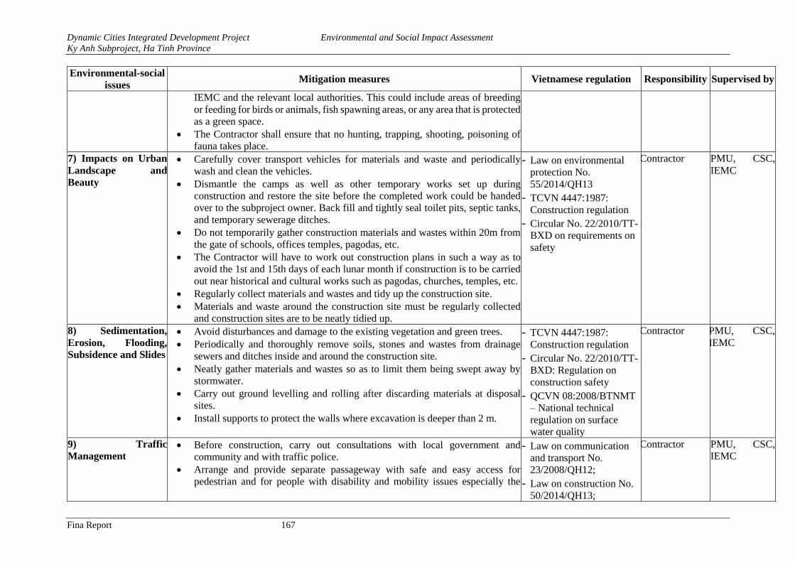
Dynamic Cities Integrated Development Project Environmental and Social Impact Assessment
Ky Anh Subproject, Ha Tinh Province
Fina Report 167
Environmental-social
issues Mitigation measures Vietnamese regulation Responsibility Supervised by
IEMC and the relevant local authorities. This could include areas of breeding
or feeding for birds or animals, fish spawning areas, or any area that is protected
as a green space.
• The Contractor shall ensure that no hunting, trapping, shooting, poisoning of
fauna takes place.
7) Impacts on Urban
Landscape and
Beauty
• Carefully cover transport vehicles for materials and waste and periodically
wash and clean the vehicles.
• Dismantle the camps as well as other temporary works set up during
construction and restore the site before the completed work could be handed
over to the subproject owner. Back fill and tightly seal toilet pits, septic tanks,
and temporary sewerage ditches.
• Do not temporarily gather construction materials and wastes within 20m from
the gate of schools, offices temples, pagodas, etc.
• The Contractor will have to work out construction plans in such a way as to
avoid the 1st and 15th days of each lunar month if construction is to be carried
out near historical and cultural works such as pagodas, churches, temples, etc.
• Regularly collect materials and wastes and tidy up the construction site.
• Materials and waste around the construction site must be regularly collected
and construction sites are to be neatly tidied up.
- Law on environmental
protection No.
55/2014/QH13 - TCVN 4447:1987:
Construction regulation - Circular No. 22/2010/TT-
BXD on requirements on
safety
Contractor PMU, CSC,
IEMC
8) Sedimentation,
Erosion, Flooding,
Subsidence and Slides
• Avoid disturbances and damage to the existing vegetation and green trees.
• Periodically and thoroughly remove soils, stones and wastes from drainage
sewers and ditches inside and around the construction site.
• Neatly gather materials and wastes so as to limit them being swept away by
stormwater.
• Carry out ground levelling and rolling after discarding materials at disposal
sites.
• Install supports to protect the walls where excavation is deeper than 2 m.
- TCVN 4447:1987:
Construction regulation - Circular No. 22/2010/TT-
BXD: Regulation on
construction safety - QCVN 08:2008/BTNMT
– National technical
regulation on surface
water quality
Contractor PMU, CSC,
IEMC
9) Traffic
Management • Before construction, carry out consultations with local government and
community and with traffic police.
• Arrange and provide separate passageway with safe and easy access for
pedestrian and for people with disability and mobility issues especially the
- Law on communication
and transport No.
23/2008/QH12; - Law on construction No.
50/2014/QH13;
Contractor PMU, CSC,
IEMC
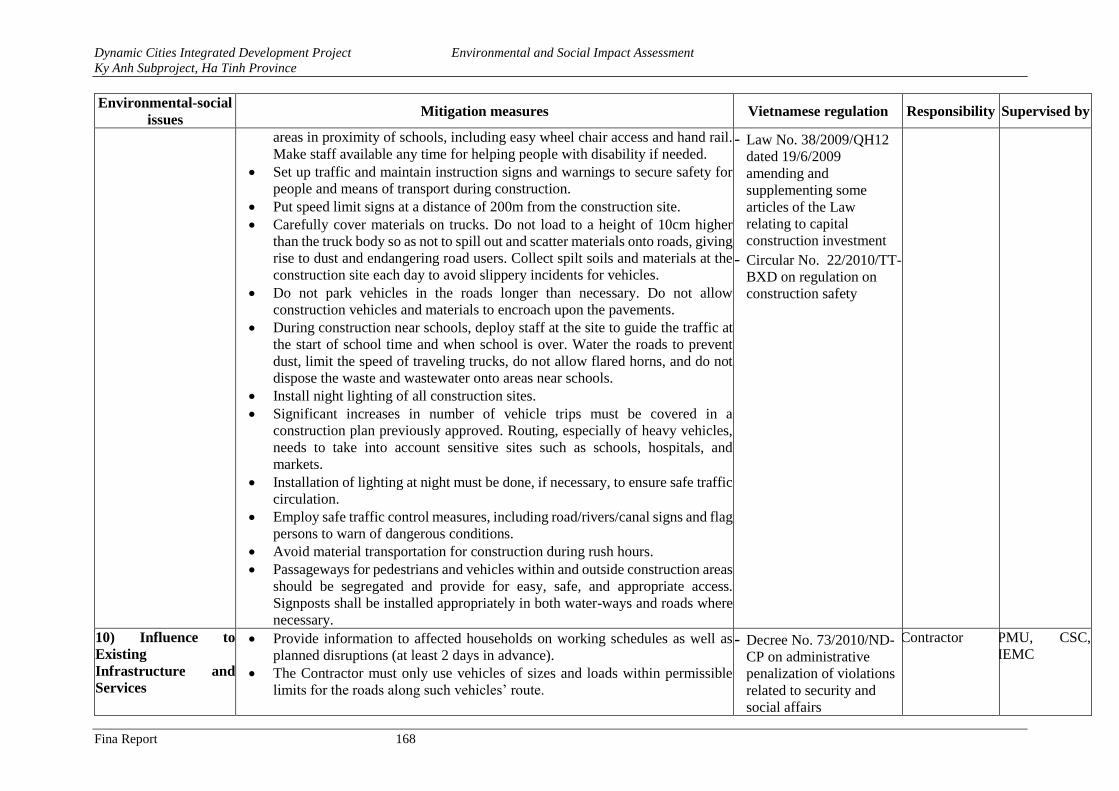
Dynamic Cities Integrated Development Project Environmental and Social Impact Assessment
Ky Anh Subproject, Ha Tinh Province
Fina Report 168
Environmental-social
issues Mitigation measures Vietnamese regulation Responsibility Supervised by
areas in proximity of schools, including easy wheel chair access and hand rail.
Make staff available any time for helping people with disability if needed.
• Set up traffic and maintain instruction signs and warnings to secure safety for
people and means of transport during construction.
• Put speed limit signs at a distance of 200m from the construction site.
• Carefully cover materials on trucks. Do not load to a height of 10cm higher
than the truck body so as not to spill out and scatter materials onto roads, giving
rise to dust and endangering road users. Collect spilt soils and materials at the
construction site each day to avoid slippery incidents for vehicles.
• Do not park vehicles in the roads longer than necessary. Do not allow
construction vehicles and materials to encroach upon the pavements.
• During construction near schools, deploy staff at the site to guide the traffic at
the start of school time and when school is over. Water the roads to prevent
dust, limit the speed of traveling trucks, do not allow flared horns, and do not
dispose the waste and wastewater onto areas near schools.
• Install night lighting of all construction sites.
• Significant increases in number of vehicle trips must be covered in a
construction plan previously approved. Routing, especially of heavy vehicles,
needs to take into account sensitive sites such as schools, hospitals, and
markets.
• Installation of lighting at night must be done, if necessary, to ensure safe traffic
circulation.
• Employ safe traffic control measures, including road/rivers/canal signs and flag
persons to warn of dangerous conditions.
• Avoid material transportation for construction during rush hours.
• Passageways for pedestrians and vehicles within and outside construction areas
should be segregated and provide for easy, safe, and appropriate access.
Signposts shall be installed appropriately in both water-ways and roads where
necessary.
- Law No. 38/2009/QH12
dated 19/6/2009
amending and
supplementing some
articles of the Law
relating to capital
construction investment - Circular No. 22/2010/TT-
BXD on regulation on
construction safety
10) Influence to
Existing
Infrastructure and
Services
• Provide information to affected households on working schedules as well as
planned disruptions (at least 2 days in advance).
• The Contractor must only use vehicles of sizes and loads within permissible
limits for the roads along such vehicles’ route.
- Decree No. 73/2010/ND-
CP on administrative
penalization of violations
related to security and
social affairs
Contractor PMU, CSC,
IEMC
Dynamic Cities Integrated Development Project Environmental and Social Impact Assessment
Ky Anh Subproject, Ha Tinh Province
Fina Report 169
Environmental-social
issues Mitigation measures Vietnamese regulation Responsibility Supervised by
• During the construction under power lines, deploy qualified staff to observe
and give instructions to the drivers of cranes and excavators so as to avoid
causing damages to power lines, telecommunications lines, etc.
• Stop construction when existing works are damaged. Identify causes of related
incidents and work out solutions. In case the damages are due to the
Contractors’ faults, the Contractors have to repair, recover, and compensate for
all damages at their own expenses. The results of handling such damages must
be approved by the Supervisor Engineer.
• Reinstall the road surface and sidewalks at construction sites after the
construction of sewer lines has been completed.
• The contractor should ensure alternative water supply to affected residents in
the event of disruptions lasting more than one day.
• Any damages to existing cable utility systems shall be reported to the
authorities and repaired as soon as possible.
11) Social Mitigation
Measures Through
Worker Management
• Inform the community at least 2 weeks before commencement of the
construction. In case electricity and water supplies are to be disrupted, the PMU
must inform PAHs of the same at least 2 days in advance.
• Employ local laborers for simple tasks. Instruct workers on environmental
issues, safety and health before construction tasks are assigned. It is advisable
to communicate to migrant workers on local customs, practices and habits in
order to avoid conflicts with local people.
• The subproject owner and contractor are to cooperate closely with the local
government in performing effective community sanitation in case of epidemic
symptoms breaking out in the area.
• The subproject owner and contractor are to cooperate with local authorities in
preventing and fighting against social evils. Conduct sensitization campaigns
with both workers and communities on these issues, liaison with local
organizations to ensure monitoring, and a grievance redress system to which
the community can refer to.
• The subproject will cooperate with the local health agency in developing and
implementing plans for control of diseases among workers.
• Workers temporarily residing at the camps and rented houses must be registered
with the local authorities for temporary residence.
- Decree No. 73/2010/ND-
CP on administrative
penalization of violations
against security and social
affairs
Contractor PMU, CSC,
IEMC
Dynamic Cities Integrated Development Project Environmental and Social Impact Assessment
Ky Anh Subproject, Ha Tinh Province
Fina Report 170
Environmental-social
issues Mitigation measures Vietnamese regulation Responsibility Supervised by
• Provide training on issues related to social security, social evils, diseases and
epidemics, prostitution and drug use, environment, safety and health, HIV/
AIDS and infectious diseases for the workers within 2 weeks since mobilization
of the workers in each construction contracts which last at least 6 months. This
training is mandatory.
• The workers are required to comply with Code Conduct specify in construction
contract
• Do not hire people under 18 years of age to carry heavy objects (from 15 kg),
to carry out demolition, work in construction sites, or work underwater.
12) Control of Impacts
on Physical Cultural
Resources
• Do not gather materials and wastes within 20m from cultural, historical, and
religious works such as temples, pagodas, churches, monuments, historic relics,
etc. Water spray the construction sites next to such works.
• Do not use machines generating loud noise and high vibration levels near
cultural, historical, and religious works.
• In case of archaeological objects being unearthed during the implementation of
earthwork, all parties will conform to the following procedures:
+ Suspend construction operations at the place of discovery;
+ Preliminarily describe the area where the archaeological objects are to be
unearthed;
+ Strictly protect the area of the discovery so as not to damage or lose moveable
objects. In case the unearthed objects are moveable or sensitive ruins, provide
night protection until the local authorities, the Department of Culture, Sports
and Tourism or the Institute of Archaeology takes over these unearthed
objects;
+ Inform the Supervision Engineer of the event and who in turn will
immediately inform the subproject owner, the local authorities in charge of
the case and the Institute of Archaeology (within 24 hours or less);
+ Local relevant agencies and the Vietnam National Administration of Tourism
will be responsible for protecting and preserving such archaeological relics
before making decisions on the next suitable formalities. The Institute of
Archaeology may be needed in the preliminarily assessment of the unearthed
objects. The significance and importance of such discovered objects will be
assessed by different criteria related to the nature of cultural heritages; such
- Law on cultural heritage
No. 28/2001/QH10; - Amended and
supplemented Law on
cultural heritage No.
32/2009/QH12; - Amended and
supplemented Decree No.
98/2010/ND-CP
Contractor PMU, CSC,
IEMC
Dynamic Cities Integrated Development Project Environmental and Social Impact Assessment
Ky Anh Subproject, Ha Tinh Province
Fina Report 171
Environmental-social
issues Mitigation measures Vietnamese regulation Responsibility Supervised by
criteria would include aesthetic, historical, scientific, social or economic
values;
+ Decisions on handling such discovered objects will be made by competent
levels. Such decisions can result in changes in site arrangements (e.g. when
the discovered item is a cultural relic which cannot be displaced or is
archaeologically important, it is necessary to preserve, recover and excavate
it);
+ The implementation of such decision by competent agencies related to the
management of discovered objects will be communicated in writing by local
competent agencies; and
+ Only resume construction activities at the site after being permitted by the
local competent agencies and the PMU in relation to safeguarding such relics
13) Community’s
Safety and Health • The Contractor will have to conform to regulations in Circular No. 04/2017/TT-
BXD by the Ministry of Construction on safety in construction.
• The subproject owner and contractor are to cooperate closely with the local
government in performing effective community sanitation in case of epidemic
symptoms breaking out in the area.
• The subproject owner and contractor are to cooperate with local authorities in
preventing and fighting against social evils.
• Fence of excavation pits and open channels and make off with luminous cordon
and warning signs. Provide sufficient lighting when carry out construction at
night.
• Limit the speed of transport means to 20km/h within 200m from the
construction site so as to minimize dust and noise.
• Keep noise-generating machines and vehicles at such suitable distances that
noise transmitted to residential areas will not be higher than 70dBA.
• Use static compacting when the road base is constructed near areas with many
households and weak temporary works to restrict vibration.
• The subproject will cooperate with the local health agency in developing and
implementing plans for control of diseases among workers.
- Circular No. 04/2017/TT-
BXD regulation on
construction safety - TCVN 5308-91:
Technical regulation on
construction safety - Decision No.
96/2008/QD-TTg on
clearance of UXOs
Contractor PMU, CSC,
IEMC
14) Workers’ Health
Safety • Train workers on issues related to environment, safety and health, thus
enhancing their awareness of HIV/AIDS and infectious diseases within 2 weeks
prior to the commencement of packages with construction items lasting at least
6 months.
- Decree No. 04/2017/TT-
BXD on regulation of
construction safety;
Contractor PMU, CSC,
IEMC
Dynamic Cities Integrated Development Project Environmental and Social Impact Assessment
Ky Anh Subproject, Ha Tinh Province
Fina Report 172
Environmental-social
issues Mitigation measures Vietnamese regulation Responsibility Supervised by
• Provide workers with and request them to use adequate safety gear such as
masks, helmets, shoes/boots, goggles, etc. depending on job characteristics.
• Safely install power lines at offices and in construction sites and do not lay
connectors on the ground or water surface. Electric wires must be with plugs.
Place outdoor electric panels in protection cabinets.
• Limit the speeds of vehicles traveling inside construction sites to be 5km/hour.
• Provide fire-extinguishers, first-aid bags, and medical cabinets with sufficient
medicines for treating general diseases in the locality must be provided at
construction sites.
• Safely store fuels and chemicals in areas with impermeable ground with roofs
and surrounding banks, equipped with safety warning signs located at least 20m
from the camps and at the end of prevailing winds.
• In case of chemical and fuel leakage, the following steps will have to be taken:
• Immediate check must be carried out to detect any possible case of injury. In
case of injury, first-aid must be given and the injured person must be rushed to
the nearest medical station for healthcare, and at the same time the case must
be informed to the Supervision Engineer and the PMU;
• Carry assessment to determine the kind of leaking/overflowing fuel/chemical;
• Do not flush overflowing chemicals into drainage systems. Send staff with
suitable safety gear to the site to handle the leakage by scattering sawdust (in
case of small volumes of leaks/overflow) or sand (for high volumes of
leaks/overflow). Use shovels to remove the surface soil layer if the
leakage/overflow takes place on vacant land; and
• Subsequent to the occurrence of such incident or accident, the Contractor will
have to prepare a detailed report describing the incident and performed
activities and submit the same to the Supervision Engineer and the PMU for
consideration and filing. Such report will also be presented to the Department
of Natural Resources and Environment or functional agencies at their request.
• Set up the camps with sufficient supplies of clean water, power, and sanitation
facilities. There must be at least one toilet compartment for every 25 workers,
with separate toilets for males and females. Workers’ beds must be provided
with mosquito nets so as to prevent dengue fever. Temporary tents will be
unacceptable.
- TCVN 5308-91:
Technical regulation on
safety in construction; - Decision No.
96/2008/QD-TTg on
clearance of UXOs.
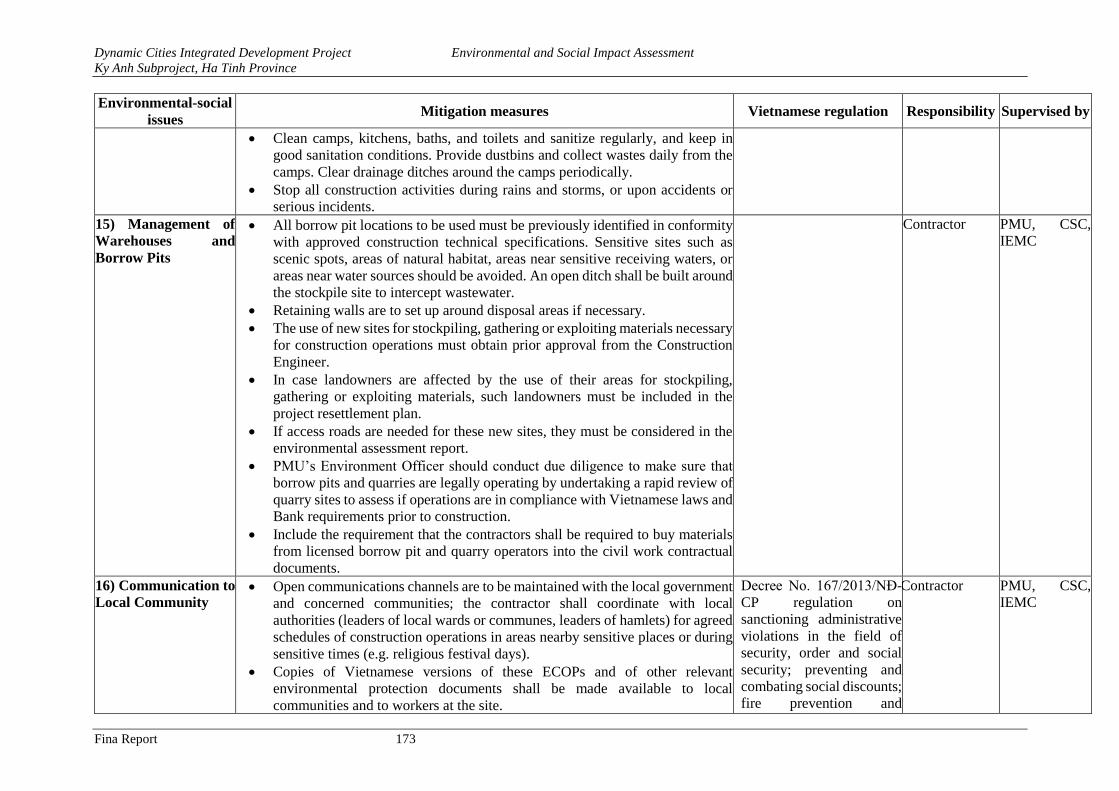
Dynamic Cities Integrated Development Project Environmental and Social Impact Assessment
Ky Anh Subproject, Ha Tinh Province
Fina Report 173
Environmental-social
issues Mitigation measures Vietnamese regulation Responsibility Supervised by
• Clean camps, kitchens, baths, and toilets and sanitize regularly, and keep in
good sanitation conditions. Provide dustbins and collect wastes daily from the
camps. Clear drainage ditches around the camps periodically.
• Stop all construction activities during rains and storms, or upon accidents or
serious incidents.
15) Management of
Warehouses and
Borrow Pits
• All borrow pit locations to be used must be previously identified in conformity
with approved construction technical specifications. Sensitive sites such as
scenic spots, areas of natural habitat, areas near sensitive receiving waters, or
areas near water sources should be avoided. An open ditch shall be built around
the stockpile site to intercept wastewater.
• Retaining walls are to set up around disposal areas if necessary.
• The use of new sites for stockpiling, gathering or exploiting materials necessary
for construction operations must obtain prior approval from the Construction
Engineer.
• In case landowners are affected by the use of their areas for stockpiling,
gathering or exploiting materials, such landowners must be included in the
project resettlement plan.
• If access roads are needed for these new sites, they must be considered in the
environmental assessment report.
• PMU’s Environment Officer should conduct due diligence to make sure that
borrow pits and quarries are legally operating by undertaking a rapid review of
quarry sites to assess if operations are in compliance with Vietnamese laws and
Bank requirements prior to construction.
• Include the requirement that the contractors shall be required to buy materials
from licensed borrow pit and quarry operators into the civil work contractual
documents.
Contractor PMU, CSC,
IEMC
16) Communication to
Local Community • Open communications channels are to be maintained with the local government
and concerned communities; the contractor shall coordinate with local
authorities (leaders of local wards or communes, leaders of hamlets) for agreed
schedules of construction operations in areas nearby sensitive places or during
sensitive times (e.g. religious festival days).
• Copies of Vietnamese versions of these ECOPs and of other relevant
environmental protection documents shall be made available to local
communities and to workers at the site.
Decree No. 167/2013/NĐ-
CP regulation on
sanctioning administrative
violations in the field of
security, order and social
security; preventing and
combating social discounts;
fire prevention and
Contractor PMU, CSC,
IEMC
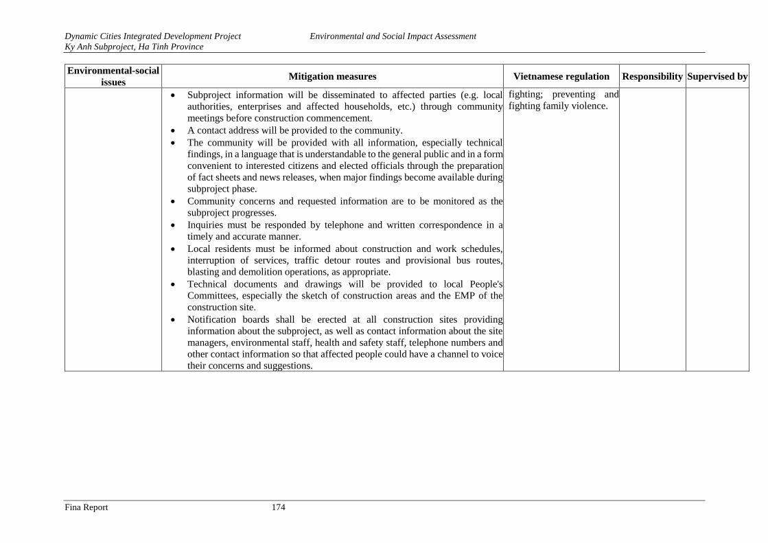
Dynamic Cities Integrated Development Project Environmental and Social Impact Assessment
Ky Anh Subproject, Ha Tinh Province
Fina Report 174
Environmental-social
issues Mitigation measures Vietnamese regulation Responsibility Supervised by
• Subproject information will be disseminated to affected parties (e.g. local
authorities, enterprises and affected households, etc.) through community
meetings before construction commencement.
• A contact address will be provided to the community.
• The community will be provided with all information, especially technical
findings, in a language that is understandable to the general public and in a form
convenient to interested citizens and elected officials through the preparation
of fact sheets and news releases, when major findings become available during
subproject phase.
• Community concerns and requested information are to be monitored as the
subproject progresses.
• Inquiries must be responded by telephone and written correspondence in a
timely and accurate manner.
• Local residents must be informed about construction and work schedules,
interruption of services, traffic detour routes and provisional bus routes,
blasting and demolition operations, as appropriate.
• Technical documents and drawings will be provided to local People's
Committees, especially the sketch of construction areas and the EMP of the
construction site.
• Notification boards shall be erected at all construction sites providing
information about the subproject, as well as contact information about the site
managers, environmental staff, health and safety staff, telephone numbers and
other contact information so that affected people could have a channel to voice
their concerns and suggestions.
fighting; preventing and
fighting family violence.
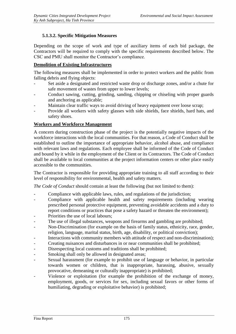
Dynamic Cities Integrated Development Project Environmental and Social Impact Assessment
Ky Anh Subproject, Ha Tinh Province
Fina Report 175
5.1.3.2. Specific Mitigation Measures
Depending on the scope of work and type of auxiliary items of each bid package, the
Contractors will be required to comply with the specific requirements described below. The
CSC and PMU shall monitor the Contractor’s compliance.
Demolition of Existing Infrastructures
The following measures shall be implemented in order to protect workers and the public from
falling debris and flying objects:
- Set aside a designated and restricted waste drop or discharge zones, and/or a chute for
safe movement of wastes from upper to lower levels;
- Conduct sawing, cutting, grinding, sanding, chipping or chiseling with proper guards
and anchoring as applicable;
- Maintain clear traffic ways to avoid driving of heavy equipment over loose scrap;
- Provide all workers with safety glasses with side shields, face shields, hard hats, and
safety shoes.
Workers and Workforce Management
A concern during construction phase of the project is the potentially negative impacts of the
workforce interactions with the local communities. For that reason, a Code of Conduct shall be
established to outline the importance of appropriate behavior, alcohol abuse, and compliance
with relevant laws and regulations. Each employee shall be informed of the Code of Conduct
and bound by it while in the employment of the Client or its Contractors. The Code of Conduct
shall be available to local communities at the project information centers or other place easily
accessible to the communities.
The Contractor is responsible for providing appropriate training to all staff according to their
level of responsibility for environmental, health and safety matters.
The Code of Conduct should contain at least the following (but not limited to them):
- Compliance with applicable laws, rules, and regulations of the jurisdiction;
- Compliance with applicable health and safety requirements (including wearing
prescribed personal protective equipment, preventing avoidable accidents and a duty to
report conditions or practices that pose a safety hazard or threaten the environment);
- Priorities the use of local labours;
- The use of illegal substances, weapons and firearms and gambling are prohibited;
- Non-Discrimination (for example on the basis of family status, ethnicity, race, gender,
religion, language, marital status, birth, age, disability, or political conviction);
- Interactions with community members with attitude of respect and non-discrimination);
- Creating nuisances and disturbances in or near communities shall be prohibited;
- Disrespecting local customs and traditions shall be prohibited;
- Smoking shall only be allowed in designated areas;
- Sexual harassment (for example to prohibit use of language or behavior, in particular
towards women or children, that is inappropriate, harassing, abusive, sexually
provocative, demeaning or culturally inappropriate) is prohibited;
- Violence or exploitation (for example the prohibition of the exchange of money,
employment, goods, or services for sex, including sexual favors or other forms of
humiliating, degrading or exploitative behavior) is prohibited;
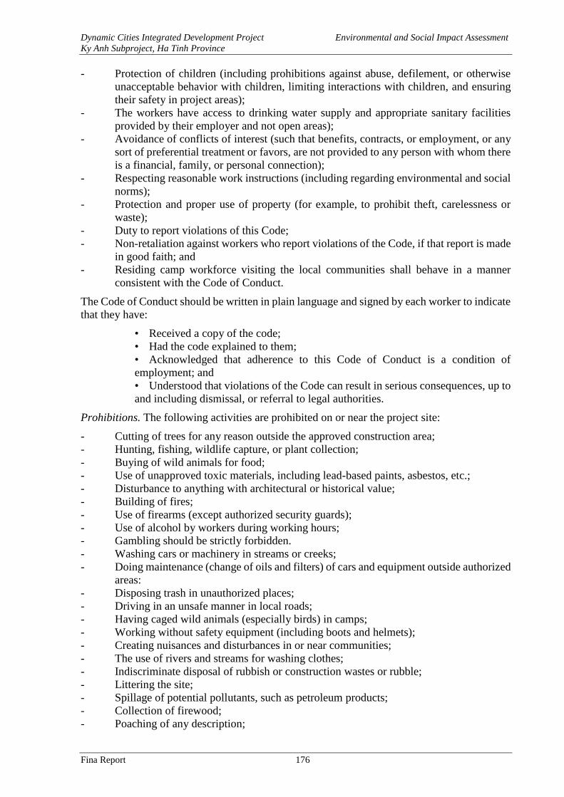
Dynamic Cities Integrated Development Project Environmental and Social Impact Assessment
Ky Anh Subproject, Ha Tinh Province
Fina Report 176
- Protection of children (including prohibitions against abuse, defilement, or otherwise
unacceptable behavior with children, limiting interactions with children, and ensuring
their safety in project areas);
- The workers have access to drinking water supply and appropriate sanitary facilities
provided by their employer and not open areas);
- Avoidance of conflicts of interest (such that benefits, contracts, or employment, or any
sort of preferential treatment or favors, are not provided to any person with whom there
is a financial, family, or personal connection);
- Respecting reasonable work instructions (including regarding environmental and social
norms);
- Protection and proper use of property (for example, to prohibit theft, carelessness or
waste);
- Duty to report violations of this Code;
- Non-retaliation against workers who report violations of the Code, if that report is made
in good faith; and
- Residing camp workforce visiting the local communities shall behave in a manner
consistent with the Code of Conduct.
The Code of Conduct should be written in plain language and signed by each worker to indicate
that they have:
• Received a copy of the code;
• Had the code explained to them;
• Acknowledged that adherence to this Code of Conduct is a condition of
employment; and
• Understood that violations of the Code can result in serious consequences, up to
and including dismissal, or referral to legal authorities.
Prohibitions. The following activities are prohibited on or near the project site:
- Cutting of trees for any reason outside the approved construction area;
- Hunting, fishing, wildlife capture, or plant collection;
- Buying of wild animals for food;
- Use of unapproved toxic materials, including lead-based paints, asbestos, etc.;
- Disturbance to anything with architectural or historical value;
- Building of fires;
- Use of firearms (except authorized security guards);
- Use of alcohol by workers during working hours;
- Gambling should be strictly forbidden.
- Washing cars or machinery in streams or creeks;
- Doing maintenance (change of oils and filters) of cars and equipment outside authorized
areas:
- Disposing trash in unauthorized places;
- Driving in an unsafe manner in local roads;
- Having caged wild animals (especially birds) in camps;
- Working without safety equipment (including boots and helmets);
- Creating nuisances and disturbances in or near communities;
- The use of rivers and streams for washing clothes;
- Indiscriminate disposal of rubbish or construction wastes or rubble;
- Littering the site;
- Spillage of potential pollutants, such as petroleum products;
- Collection of firewood;
- Poaching of any description;
Dynamic Cities Integrated Development Project Environmental and Social Impact Assessment
Ky Anh Subproject, Ha Tinh Province
Fina Report 177
- Explosive and chemical fishing;
- Latrine outside the designated facilities; and
- Burning of wastes and/or cleared vegetation.
Security. Some security measures shall be put into place to ensure the safe and secure running
of the camp and its residents. Some of these security measures include:
- The list of workers must be registered to local authorities in accordance with existing
Vietnamese regulations
- Children under 14 years of age will hot hired under the Project
- Adequate, day-time night-time lighting shall be provided;
- Control of camp access. Access to the camp shall be limited to the residing workforce,
construction camp employees, and those visiting personnel on business purposes;
- Prior approval from the construction camp manager for visitor’s access to the
construction camp;
- A perimeter security fence at least 3m in height constructed from appropriate materials;
- Provision and installation in all buildings of firefighting equipment and portable fires
extinguishers.
Any construction worker, office staff, Contractor’s employees or any other person related to
the project found violating theses prohibitions will be subject to disciplinary actions that can
range from a simple reprimand to termination of his/her employment depending on the
seriousness of the violation.
Workers Camps
Workers’ Camp and Site Installation Requirement. Potential sites of workers’camps were
discussed with and proposed by local communities and authorities during consultations.
Construction camp sites will have to be approved by local authorities and agreed with local
communities prior to their establishment. If additional camps and ancillary construction sites
are selected, for following criteria must be used:
- Construction sites, including asphalt stations as well as construction camps will
minimize the land occupation by setting them at the interchange areas where relatively
large areas of land will be needed eventually.
- Site offices shall be located at least 200 meters from any existing residential settlements.
Camp facilities should not be located in steep slopes;
- Site offices, camps be located at least 100 meters from any watercourses and be operated
so that no pollutants enter watercourses. Camp areas shall be located to allow effective
natural drainage;
- All construction camps shall be zoned according to their use. For example, workers’
camp zone, sanitary facilities, offices, etc.
- The workforce shall be provided with safe, suitable and comfortable accommodations.
They have to be maintained in clean and sanitary conditions;
- In every site adequate and suitable facilities for washing clothes and utensils shall be
provided and maintained for the use of contract labor employed therein;
- Potable water for human consumption shall be provided for at camps, site offices,
medical facilities, and other areas. Potable water shall follow the National Standards for
Drinking Water Quality, and the other municipal water will be in accordance with class
A1 of QCVN 08-2008/BTNMT - National technical regulation on surface water quality.
Dynamic Cities Integrated Development Project Environmental and Social Impact Assessment
Ky Anh Subproject, Ha Tinh Province
Fina Report 178
- The camp can be characterized as a housing estate, and the water quota could refer to
class A1 QCVN 08-2008/BTNMT - National technical regulation on surface water
quality.
- Drainage, wastewater treatment and solid waste disposal of the construction site shall
follow national regulations and the mitigation measures presented in the Contractor’s
Waste Management Plan.
Sanitary Facilities. In every camp site separate and adequate lavatory facilities (toilets and
washing areas) shall be provided for the use of male and female workers. Toilet facilities should
also be provided with adequate supplies running water, soap, and toilet paper. Such facilities
shall be conveniently accessible and shall be kept in clean and hygienic conditions;
- Where workers of both sexes are employed, there shall be displayed outside each block of
latrine and urinal, a notice in the language understood by the majority of the workers “For
Men Only” or “For Women Only” as the case may be;
- Sanitary arrangements, latrines and urinals shall be provided in every work place on the
following scale: Where female workers are employed, there shall be at least one latrine for
every 25 females or part thereof; Where males are employed, there shall be at least one
latrine for every 25 males or part thereof;
- At every construction camp, there must be at least one septic tank. The wastewater from the
tank shall not be discharged into any watercourses. The wastewater shall be periodically
transported away by a water tank to the nearest treatment plant;
- Sewage tanks shall be designed and installed by the Contractor(s) in accordance with the
National Design Code for construction of camps.
Medical Facilities. A medical and first aid kit shall be provided at each camp area. All
consumables in the first aid kit should be checked and recharged regularly.
Earthworks, Cuts and Fill Slopes Management
Earthworks, cuts and fill slopes shall be carefully managed to minimize negative impacts on
the environment
- All earthworks shall be properly controlled, especially during the rainy season.
- The Contractor shall maintain stable cut and fill slopes at all times and cause the least
possible disturbance to areas outside the prescribed limits of the works.
- The Contractor shall complete cut and fill operations to final cross-sections at any one
location as soon as possible and preferably in one continuous operation to avoid partially
completed earthworks, especially during the rainy season.
- In order to protect any cut or fill slopes from erosion, in accordance with the drawings,
cut off drains and toe-drains shall be provided at the top and bottom of slopes and be
planted with grass or other plant cover. Cut off drains should be provided above high
cuts to minimize water runoff and slope erosion.
- The Contractor shall use the excavated material from for filling unless the CSC consider
the material unsuitable for filling;
- Any excavated cut or unsuitable material shall be disposed of in designated disposal
areas as agreed to by the CSC;
Dynamic Cities Integrated Development Project Environmental and Social Impact Assessment
Ky Anh Subproject, Ha Tinh Province
Fina Report 179
5.1.3.2. Site- Specific Mitigation Measures
Stockpiles, Quarries and Borrow Pit
Existing borrow pits or quarries located near the project area will be used. However, in case
that new borrow pits and quarries are needed, the Contractor shall carry out the following
activities:
- Locations of stockpiles, quarries and borrow pits shall be identified and demarcated,
ensuring that they are far away from critical areas such as steep slopes, erosion-prone
soils, cultivated lands, and areas that drain directly into water bodies. Locations of
stockpiles, quarries and borrow pits shall be in non-productive land to the maximum
extent possible and be approved by DONRE, PMUs the ECO;
- Location of stockpiles, quarries, and borrow pits shall avoid sensitive areas such as
nature reserves, scenic spots, forest parks, water source protection areas, etc;
- An open ditch shall be built around the stockpile site to intercept wastewater;
- Limit extraction of material to approved and demarcated quarries and borrow pits;
- Stockpile topsoil when first opening the borrow pit. After all usable borrow has been
removed, the previously stockpiled topsoil should be spread back over the borrow area
and graded to a smooth, uniform surface, sloped to drain. On steep slopes, benches or
terraces may have to be specified to help control erosion;
- Excess overburden should be stabilized and re-vegetated. Where appropriate, organic
debris and overburden should be spread over the disturbed site to promote re-vegetation.
Natural re-vegetation is preferred to the extent practicable;
- Existing drainage channels in areas affected by the operation should be kept free of
overburden;
- Prior to the initiation of construction, the materials stockpiles shall be constructed with
peripheral storm water drains and interception ditches to divert storm water into rivers
downstream, in order to avoid direct erosive impact from storm water. If necessary,
sedimentation ponds will also be constructed to remove sands and other solids in storm
water before it reaches the rivers downstream.
- The design document indicates that the largest percentage of spoils will be rocks and
stones. Thus, in order to reclaim the stockpiles after dumping of spoils is completed, the
top soil shall be removed before the site is cleared. The top soil will be placed on a
corner of the disposal site. The location and pile structure will be taken into
consideration for erosion control. The interception ditches and sedimentation ponds in
the disposal sites will also be used to control loss of top soil due to erosion;
- The Contractor shall ensure that all borrow pits used are left in a trim and tidy condition
with stable side slopes, re-establishment of vegetation, restoration of natural water
courses, avoidance of flooding of the excavated areas wherever possible so no stagnant
water bodies are created which could breed mosquitoes;
- When the borrow pits cannot be refilled or reasonably drained, the Contractor shall
consult with the local community to determine their preference for reuse such as fish
farming or other community purposes;
- No foreign material generated/ deposited during construction shall remain on site;
- Areas affected by stockpiling shall be reinstated to the satisfaction of the CSC.
Dynamic Cities Integrated Development Project Environmental and Social Impact Assessment
Ky Anh Subproject, Ha Tinh Province
Fina Report 180
Spoil Disposal Sites
If the Contractor proposes any new sites as disposal sites during the construction phase, they
have to be approved by PMU and relevant local authorities. The contractor should ensure that
these sites (a) are not located within designated forest or cultivated areas, or any other
properties; (b) do not impact natural drainage courses; and (c) where they can cause future
slides, (d) do not impact endangered/rare flora. Under no circumstances shall the contractor
dispose of any material in environmentally sensitive areas. The final use of the disposal site
shall be approved by the local government.
Besides the requirements for the location of spoil disposal sites, the following actions shall be
put into place:
- Land owners shall be compensated if farmland is occupied for disposal sites;
- Before the commencement of the disposal operation, 30 cm of natural soil from the
surface shall be first removed and stored at the site. This material will be reserved and
used at the end of the disposal operation as cover material for the rehabilitation of the
disposal site.
- If the disposal site would be located near a river or water course, a retaining wall and/or
interception ditch or settling ponds shall be built prior to the initiation of the construction
activities. The surface runoff shall be retained and settled first before allowed discharge
into the receiving water;
- To ensure the stability of the spoil disposal site, the mortar rubble masonry pavement
and grouted rubble toe protection shall be adopted to prevent erosion and maintain
stability.
- A drainage ditch shall be built around the disposal site to control surface runoff;
- The construction of disposal sites and transportation of spoils at night is strictly
prohibited near residential areas. The sites shall be watered for dust suppression during
their operation;
- Disposal sites close to patches of agricultural land will be limited in size to avoid
damages to crops;
Construction of New Bridges
- The bridge works shall be scheduled to avoid the high river flow season;
- Descriptions on measures for spill prevention, and sedimentation control, surface water
flow diversion, reinstatement, etc.
- Local authority and community shall be informed about the construction works the
existing bridge with at least two weeks’ notice.
- Equip life jackets, safety belts, ear plugs to workers when building bridge over a river
or streamline.
- Signboards and fences shall be placed and maintained to safely block off access to the
two ends of the existing bridge. Allocate staff to guard the site 24 hours per day. Ensure
adequate lighting at night time.
- Life vests and protective equipment are provided to the workers and enforce the use
when working in or above water surface, especially during construction of bridge
abutments (2-3m high above the water surface);
Dynamic Cities Integrated Development Project Environmental and Social Impact Assessment
Ky Anh Subproject, Ha Tinh Province
Fina Report 181
- For bridge construction, the waste shall be controlled strictly to restrict discharge or
dumping of any wastewater, slurry, waste, fuels and waste oil into the water. All these
materials must be collected and disposed of on land at the banks. The slurry and
sediment shall also pump to the banks for disposal and shall not be allowed to discharge
to the rivers directly;
- After bridge construction, the works area shall be reinstated.
- Concrete mixing directly on the ground shall not be allowed and shall take place on
impermeable surfaces;
- All runoff from batching areas shall be strictly controlled, and cement-contaminated
water shall be collected, stored and disposed of at the approved site;
- Unused cement bags shall be stored out of the rain where runoff won’t affect it; Used
(empty) cement bags shall be collected and stored in weatherproof containers to prevent
windblown cement dust and water contamination.;
- All excess concrete shall be removed from site on completion of concrete works and
disposed of. Washing of the excess into the ground is not allowed. All excess aggregate
shall also be removed.
- In the course of bore pile driving, the use of bentonite must be conducted inside a
cofferdam made of earth or steel to prevent any spillage from overflowing into the
environment and all the mixture of soil and bentonite and bentonite spilled over must
be collected and the following forms of processing any spillage are recommended
- Construction of bridge pier (abutments) on land: spillage of mixture of soil and
bentonite although liquefied and bentonite will be primarily handled: Waste solution of
bentonite will be collected into a collector drain, sump or cistern to avoid direct
discharge within the construction site, then it will be deposited, preliminary dried and
transported for disposal at a designated location either for recycling or recovering the
bentonite;
- Construction of piers adjacent to the flow: soil mixed with bentonite, even liquefied,
and spilled bentonite will be either moved to storage yards on the shore or placed in
containers for depositing or drying and then transported to indicate waste dumps for
recycling and recovering the bentonite.
- For any in water construction for bridges, there shall be strict waste control plan to
restrict discharge or dumping of any directly discharge of wastewater, slurry, waste,
fuels and waste oil into the water. All these materials must be collected and disposed at
the banks. The slurry and sediment shall also pump to the banks for disposal and shall
not be allowed to discharge to the rivers directly;
- Reinstatement of watercourse crossings shall be carried out, including generic methods
for all watercourse crossings and site-specific methods statements for significant or
sensitive watercourse crossings;
- After bridge construction, the works area, stream diversion, settlement pond areas and
temporary bypasses shall be reinstated to the satisfaction of the ECO and SES.
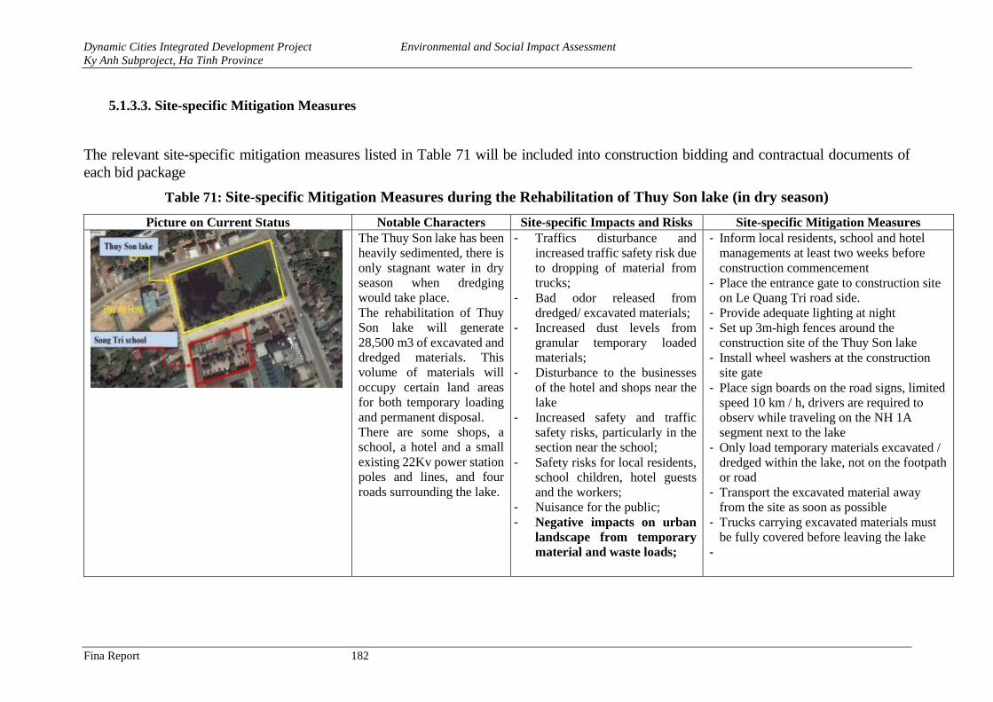
Dynamic Cities Integrated Development Project Environmental and Social Impact Assessment
Ky Anh Subproject, Ha Tinh Province
Fina Report 182
5.1.3.3. Site-specific Mitigation Measures
The relevant site-specific mitigation measures listed in Table 71 will be included into construction bidding and contractual documents of
each bid package
Table 71: Site-specific Mitigation Measures during the Rehabilitation of Thuy Son lake (in dry season)
Picture on Current Status Notable Characters Site-specific Impacts and Risks Site-specific Mitigation Measures
The Thuy Son lake has been
heavily sedimented, there is
only stagnant water in dry
season when dredging
would take place.
The rehabilitation of Thuy
Son lake will generate
28,500 m3 of excavated and
dredged materials. This
volume of materials will
occupy certain land areas
for both temporary loading
and permanent disposal.
There are some shops, a
school, a hotel and a small
existing 22Kv power station
poles and lines, and four
roads surrounding the lake.
- Traffics disturbance and
increased traffic safety risk due
to dropping of material from
trucks;
- Bad odor released from
dredged/ excavated materials;
- Increased dust levels from
granular temporary loaded
materials;
- Disturbance to the businesses
of the hotel and shops near the
lake
- Increased safety and traffic
safety risks, particularly in the
section near the school;
- Safety risks for local residents,
school children, hotel guests
and the workers;
- Nuisance for the public;
- Negative impacts on urban
landscape from temporary
material and waste loads;
- Inform local residents, school and hotel
managements at least two weeks before
construction commencement
- Place the entrance gate to construction site
on Le Quang Tri road side.
- Provide adequate lighting at night
- Set up 3m-high fences around the
construction site of the Thuy Son lake
- Install wheel washers at the construction
site gate
- Place sign boards on the road signs, limited
speed 10 km / h, drivers are required to
observ while traveling on the NH 1A
segment next to the lake
- Only load temporary materials excavated /
dredged within the lake, not on the footpath
or road
- Transport the excavated material away
from the site as soon as possible
- Trucks carrying excavated materials must
be fully covered before leaving the lake
-
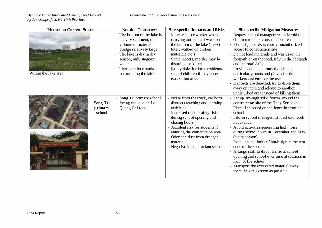
Dynamic Cities Integrated Development Project Environmental and Social Impact Assessment
Ky Anh Subproject, Ha Tinh Province
Fina Report 183
Picture on Current Status Notable Characters Site-specific Impacts and Risks Site-specific Mitigation Measures
Within the lake area
- The bottom of the lake is
heavily sediment, the
volume of material
dredge relatively large
- The lake is dry in dry
season, only stagnant
water
- There are four roads
surrounding the lake
- Injury risk for worker when
carrying out manual work on
the bottom of the lake (insect
bites, walked on broken
materials etc.)
- Some insects, reptiles may be
disturbed or killed
- Safety risks for local residents,
school children if they enter
excavation area;
- Request school management to forbid the
children to enter construction area
- Place signboards to restrict unauthorized
access to construction site
- Do not load materials and wastes on the
footpath or on the road, tidy up the footpath
and the road daily
- Provide adequate protective cloths,
particularly boots and gloves for the
workers and enforce the use.
- If insects are detected, try to drive them
away or catch and release to another
undisturbed area instead of killing them.
Song Tri
primary
school
- Song Tri primary school
facing the lake on Le
Quang Chi road
- Noise from the truck, car horn
distracts teaching and learning
activities
- Increased traffic safety risks
during school opening and
closing hours
- Accident risk for students if
entering the construction area
- Odor and dust from dredged
material.
- Negative impact on landscape.
- Set up 3m-high solid fences around the
construction site of the Thuy Son lake.
Place sign board on the fence in front of
school.
- Inform school managers at least one week
in advance.
- Avoid activities generating high noise
during school hours in December and May
(exam season).
- Install speed limit at 5km/h sign at the two
ends of the section
- Arrange staff to direct traffic at school
opening and school over time at sections in
front of the school
- Transport the excavated material away
from the site as soon as possible
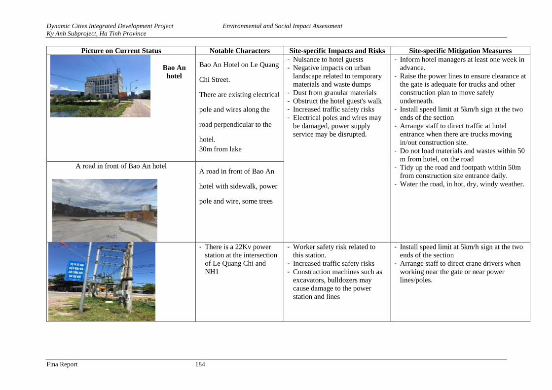
Dynamic Cities Integrated Development Project Environmental and Social Impact Assessment
Ky Anh Subproject, Ha Tinh Province
Fina Report 184
Picture on Current Status Notable Characters Site-specific Impacts and Risks Site-specific Mitigation Measures
Bao An
hotel
Bao An Hotel on Le Quang
Chi Street.
There are existing electrical
pole and wires along the
road perpendicular to the
hotel.
30m from lake
- Nuisance to hotel guests
- Negative impacts on urban
landscape related to temporary
materials and waste dumps
- Dust from granular materials
- Obstruct the hotel guest's walk
- Increased traffic safety risks
- Electrical poles and wires may
be damaged, power supply
service may be disrupted.
- Inform hotel managers at least one week in
advance.
- Raise the power lines to ensure clearance at
the gate is adequate for trucks and other
construction plan to move safely
underneath.
- Install speed limit at 5km/h sign at the two
ends of the section
- Arrange staff to direct traffic at hotel
entrance when there are trucks moving
in/out construction site.
- Do not load materials and wastes within 50
m from hotel, on the road
- Tidy up the road and footpath within 50m
from construction site entrance daily.
- Water the road, in hot, dry, windy weather.
A road in front of Bao An hotel A road in front of Bao An
hotel with sidewalk, power
pole and wire, some trees
- There is a 22Kv power
station at the intersection
of Le Quang Chi and
NH1
- Worker safety risk related to
this station.
- Increased traffic safety risks
- Construction machines such as
excavators, bulldozers may
cause damage to the power
station and lines
- Install speed limit at 5km/h sign at the two
ends of the section
- Arrange staff to direct crane drivers when
working near the gate or near power
lines/poles.
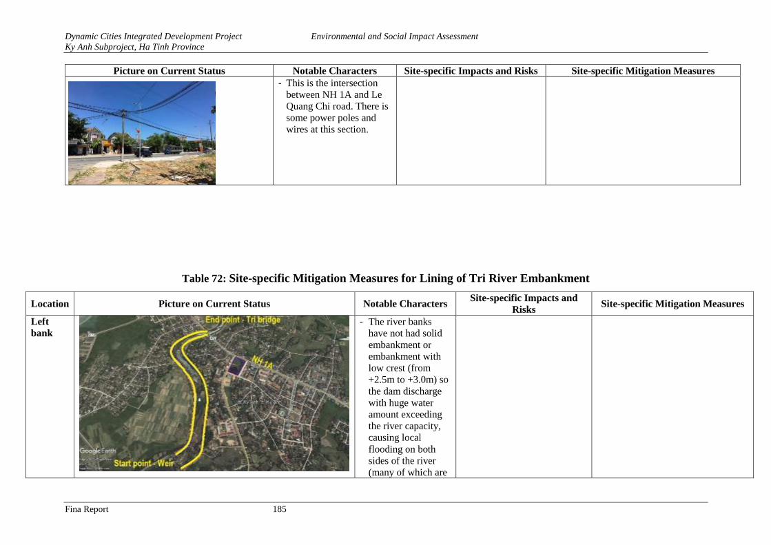
Dynamic Cities Integrated Development Project Environmental and Social Impact Assessment
Ky Anh Subproject, Ha Tinh Province
Fina Report 185
Picture on Current Status Notable Characters Site-specific Impacts and Risks Site-specific Mitigation Measures
- This is the intersection
between NH 1A and Le
Quang Chi road. There is
some power poles and
wires at this section.
Table 72: Site-specific Mitigation Measures for Lining of Tri River Embankment
Location Picture on Current Status Notable Characters Site-specific Impacts and
Risks Site-specific Mitigation Measures
Left
bank
- The river banks
have not had solid
embankment or
embankment with
low crest (from
+2.5m to +3.0m) so
the dam discharge
with huge water
amount exceeding
the river capacity,
causing local
flooding on both
sides of the river
(many of which are
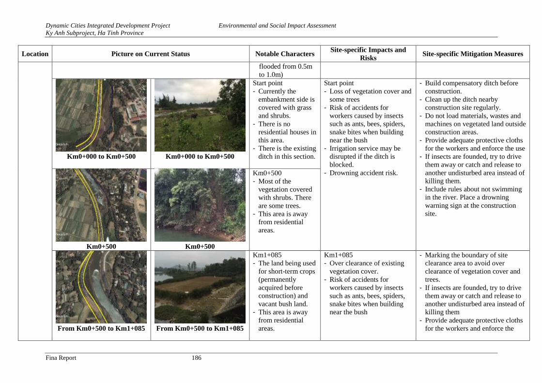
Dynamic Cities Integrated Development Project Environmental and Social Impact Assessment
Ky Anh Subproject, Ha Tinh Province
Fina Report 186
Location Picture on Current Status Notable Characters Site-specific Impacts and
Risks Site-specific Mitigation Measures
flooded from 0.5m
to 1.0m)
Km0+000 to Km0+500 Km0+000 to Km0+500
Start point
- Currently the
embankment side is
covered with grass
and shrubs.
- There is no
residential houses in
this area.
- There is the existing
ditch in this section.
Start point
- Loss of vegetation cover and
some trees
- Risk of accidents for
workers caused by insects
such as ants, bees, spiders,
snake bites when building
near the bush
- Irrigation service may be
disrupted if the ditch is
blocked.
- Drowning accident risk.
- Build compensatory ditch before
construction.
- Clean up the ditch nearby
construction site regularly.
- Do not load materials, wastes and
machines on vegetated land outside
construction areas.
- Provide adequate protective cloths
for the workers and enforce the use
- If insects are founded, try to drive
them away or catch and release to
another undisturbed area instead of
killing them.
- Include rules about not swimming
in the river. Place a drowning
warning sign at the construction
site.
Km0+500 Km0+500
Km0+500
- Most of the
vegetation covered
with shrubs. There
are some trees.
- This area is away
from residential
areas.
From Km0+500 to Km1+085
From Km0+500 to Km1+085
Km1+085
- The land being used
for short-term crops
(permanently
acquired before
construction) and
vacant bush land.
- This area is away
from residential
areas.
Km1+085
- Over clearance of existing
vegetation cover.
- Risk of accidents for
workers caused by insects
such as ants, bees, spiders,
snake bites when building
near the bush
- Marking the boundary of site
clearance area to avoid over
clearance of vegetation cover and
trees.
- If insects are founded, try to drive
them away or catch and release to
another undisturbed area instead of
killing them
- Provide adequate protective cloths
for the workers and enforce the
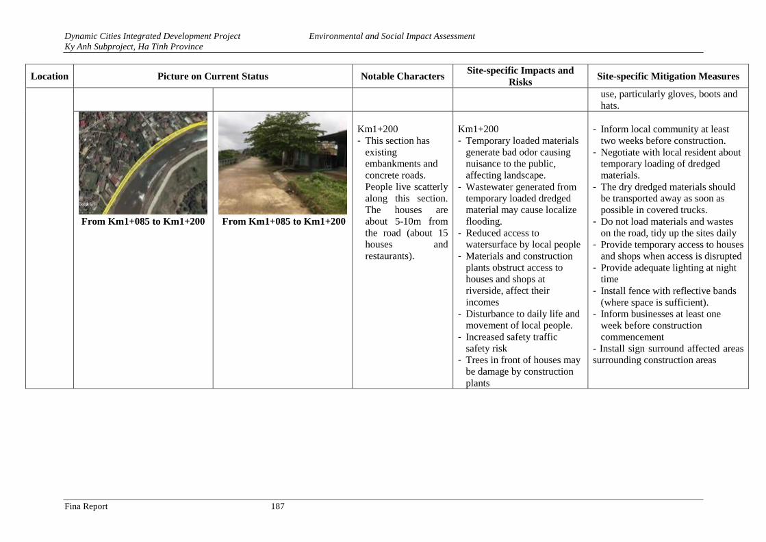
Dynamic Cities Integrated Development Project Environmental and Social Impact Assessment
Ky Anh Subproject, Ha Tinh Province
Fina Report 187
Location Picture on Current Status Notable Characters Site-specific Impacts and
Risks Site-specific Mitigation Measures
use, particularly gloves, boots and
hats.
From Km1+085 to Km1+200
From Km1+085 to Km1+200
Km1+200
- This section has
existing
embankments and
concrete roads.
People live scatterly
along this section.
The houses are
about 5-10m from
the road (about 15
houses and
restaurants).
Km1+200
- Temporary loaded materials
generate bad odor causing
nuisance to the public,
affecting landscape.
- Wastewater generated from
temporary loaded dredged
material may cause localize
flooding.
- Reduced access to
watersurface by local people
- Materials and construction
plants obstruct access to
houses and shops at
riverside, affect their
incomes
- Disturbance to daily life and
movement of local people.
- Increased safety traffic
safety risk
- Trees in front of houses may
be damage by construction
plants
- Inform local community at least
two weeks before construction.
- Negotiate with local resident about
temporary loading of dredged
materials.
- The dry dredged materials should
be transported away as soon as
possible in covered trucks.
- Do not load materials and wastes
on the road, tidy up the sites daily
- Provide temporary access to houses
and shops when access is disrupted
- Provide adequate lighting at night
time
- Install fence with reflective bands
(where space is sufficient).
- Inform businesses at least one
week before construction
commencement
- Install sign surround affected areas
surrounding construction areas
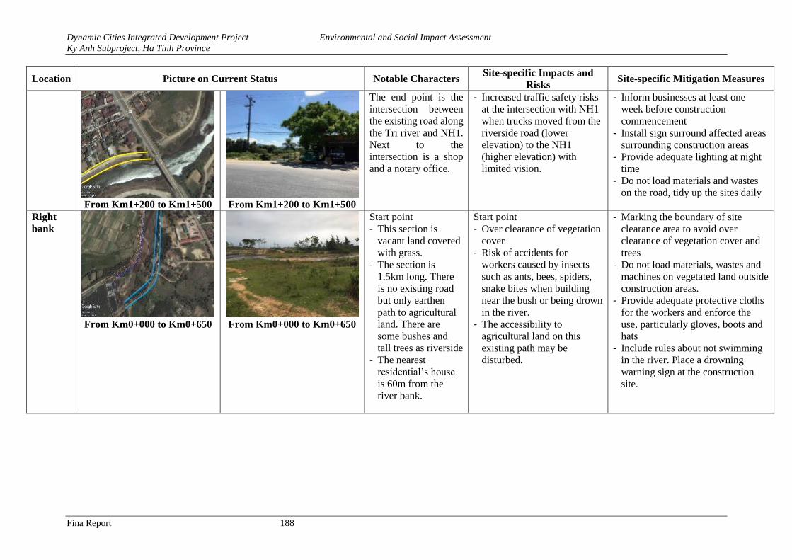
Dynamic Cities Integrated Development Project Environmental and Social Impact Assessment
Ky Anh Subproject, Ha Tinh Province
Fina Report 188
Location Picture on Current Status Notable Characters Site-specific Impacts and
Risks Site-specific Mitigation Measures
From Km1+200 to Km1+500 From Km1+200 to Km1+500
The end point is the
intersection between
the existing road along
the Tri river and NH1.
Next to the
intersection is a shop
and a notary office.
- Increased traffic safety risks
at the intersection with NH1
when trucks moved from the
riverside road (lower
elevation) to the NH1
(higher elevation) with
limited vision.
- Inform businesses at least one
week before construction
commencement
- Install sign surround affected areas
surrounding construction areas
- Provide adequate lighting at night
time
- Do not load materials and wastes
on the road, tidy up the sites daily
Right
bank
From Km0+000 to Km0+650 From Km0+000 to Km0+650
Start point
- This section is
vacant land covered
with grass.
- The section is
1.5km long. There
is no existing road
but only earthen
path to agricultural
land. There are
some bushes and
tall trees as riverside
- The nearest
residential’s house
is 60m from the
river bank.
Start point
- Over clearance of vegetation
cover
- Risk of accidents for
workers caused by insects
such as ants, bees, spiders,
snake bites when building
near the bush or being drown
in the river.
- The accessibility to
agricultural land on this
existing path may be
disturbed.
- Marking the boundary of site
clearance area to avoid over
clearance of vegetation cover and
trees
- Do not load materials, wastes and
machines on vegetated land outside
construction areas.
- Provide adequate protective cloths
for the workers and enforce the
use, particularly gloves, boots and
hats
- Include rules about not swimming
in the river. Place a drowning
warning sign at the construction
site.
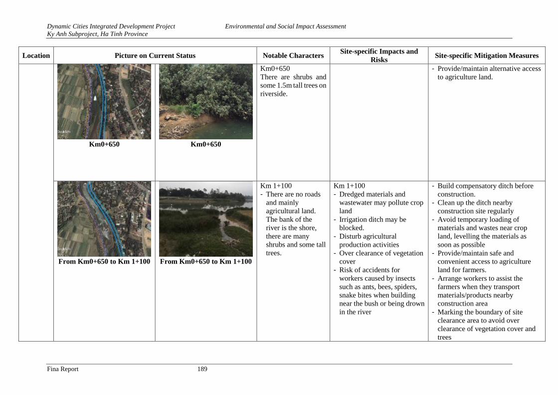
Dynamic Cities Integrated Development Project Environmental and Social Impact Assessment
Ky Anh Subproject, Ha Tinh Province
Fina Report 189
Location Picture on Current Status Notable Characters Site-specific Impacts and
Risks Site-specific Mitigation Measures
Km0+650 Km0+650
Km0+650
There are shrubs and
some 1.5m tall trees on
riverside.
- Provide/maintain alternative access
to agriculture land.
From Km0+650 to Km 1+100 From Km0+650 to Km 1+100
Km 1+100
- There are no roads
and mainly
agricultural land.
The bank of the
river is the shore,
there are many
shrubs and some tall
trees.
Km 1+100
- Dredged materials and
wastewater may pollute crop
land
- Irrigation ditch may be
blocked.
- Disturb agricultural
production activities
- Over clearance of vegetation
cover
- Risk of accidents for
workers caused by insects
such as ants, bees, spiders,
snake bites when building
near the bush or being drown
in the river
- Build compensatory ditch before
construction.
- Clean up the ditch nearby
construction site regularly
- Avoid temporary loading of
materials and wastes near crop
land, levelling the materials as
soon as possible
- Provide/maintain safe and
convenient access to agriculture
land for farmers.
- Arrange workers to assist the
farmers when they transport
materials/products nearby
construction area
- Marking the boundary of site
clearance area to avoid over
clearance of vegetation cover and
trees
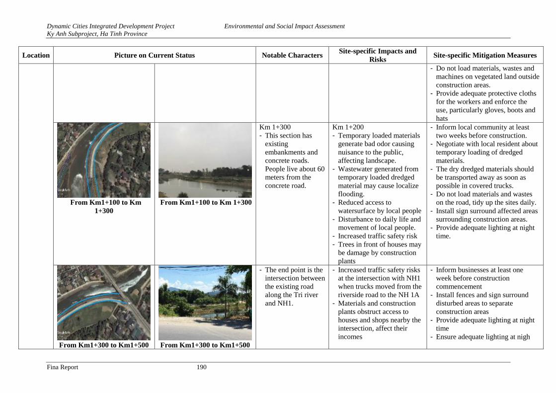
Dynamic Cities Integrated Development Project Environmental and Social Impact Assessment
Ky Anh Subproject, Ha Tinh Province
Fina Report 190
Location Picture on Current Status Notable Characters Site-specific Impacts and
Risks Site-specific Mitigation Measures
- Do not load materials, wastes and
machines on vegetated land outside
construction areas.
- Provide adequate protective cloths
for the workers and enforce the
use, particularly gloves, boots and
hats
From Km1+100 to Km
1+300
From Km1+100 to Km 1+300
Km 1+300
- This section has
existing
embankments and
concrete roads.
People live about 60
meters from the
concrete road.
Km 1+200
- Temporary loaded materials
generate bad odor causing
nuisance to the public,
affecting landscape.
- Wastewater generated from
temporary loaded dredged
material may cause localize
flooding.
- Reduced access to
watersurface by local people
- Disturbance to daily life and
movement of local people.
- Increased traffic safety risk
- Trees in front of houses may
be damage by construction
plants
- Inform local community at least
two weeks before construction.
- Negotiate with local resident about
temporary loading of dredged
materials.
- The dry dredged materials should
be transported away as soon as
possible in covered trucks.
- Do not load materials and wastes
on the road, tidy up the sites daily.
- Install sign surround affected areas
surrounding construction areas.
- Provide adequate lighting at night
time.
From Km1+300 to Km1+500 From Km1+300 to Km1+500
- The end point is the
intersection between
the existing road
along the Tri river
and NH1.
- Increased traffic safety risks
at the intersection with NH1
when trucks moved from the
riverside road to the NH 1A
- Materials and construction
plants obstruct access to
houses and shops nearby the
intersection, affect their
incomes
- Inform businesses at least one
week before construction
commencement
- Install fences and sign surround
disturbed areas to separate
construction areas
- Provide adequate lighting at night
time
- Ensure adequate lighting at nigh
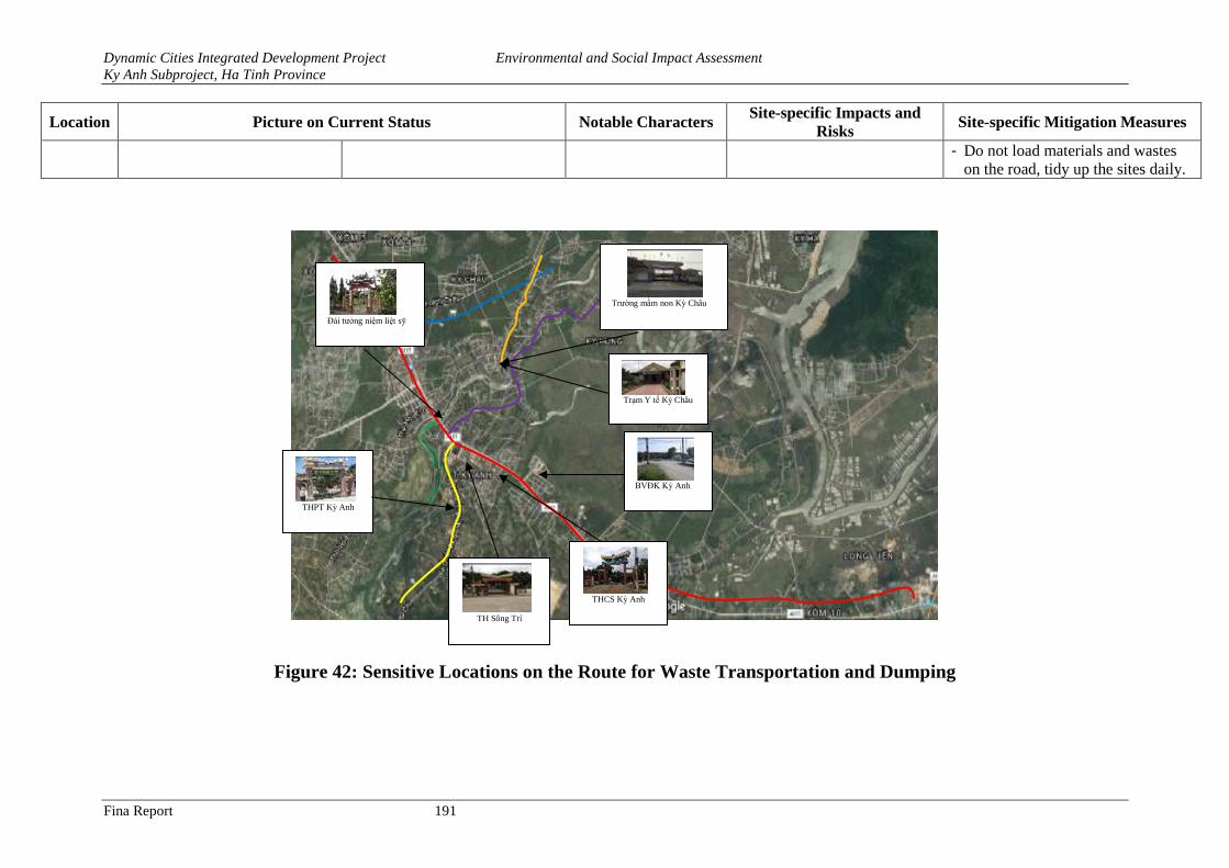
Dynamic Cities Integrated Development Project Environmental and Social Impact Assessment
Ky Anh Subproject, Ha Tinh Province
Fina Report 191
Location Picture on Current Status Notable Characters Site-specific Impacts and
Risks Site-specific Mitigation Measures
- Do not load materials and wastes
on the road, tidy up the sites daily.
Figure 42: Sensitive Locations on the Route for Waste Transportation and Dumping
THPT Kỳ Anh
BVĐK Kỳ Anh
THCS Kỳ Anh
Đài tưởng niệm liệt sỹ
Trường mầm non Kỳ Châu
Trạm Y tế Kỳ Châu
TH Sông Trí
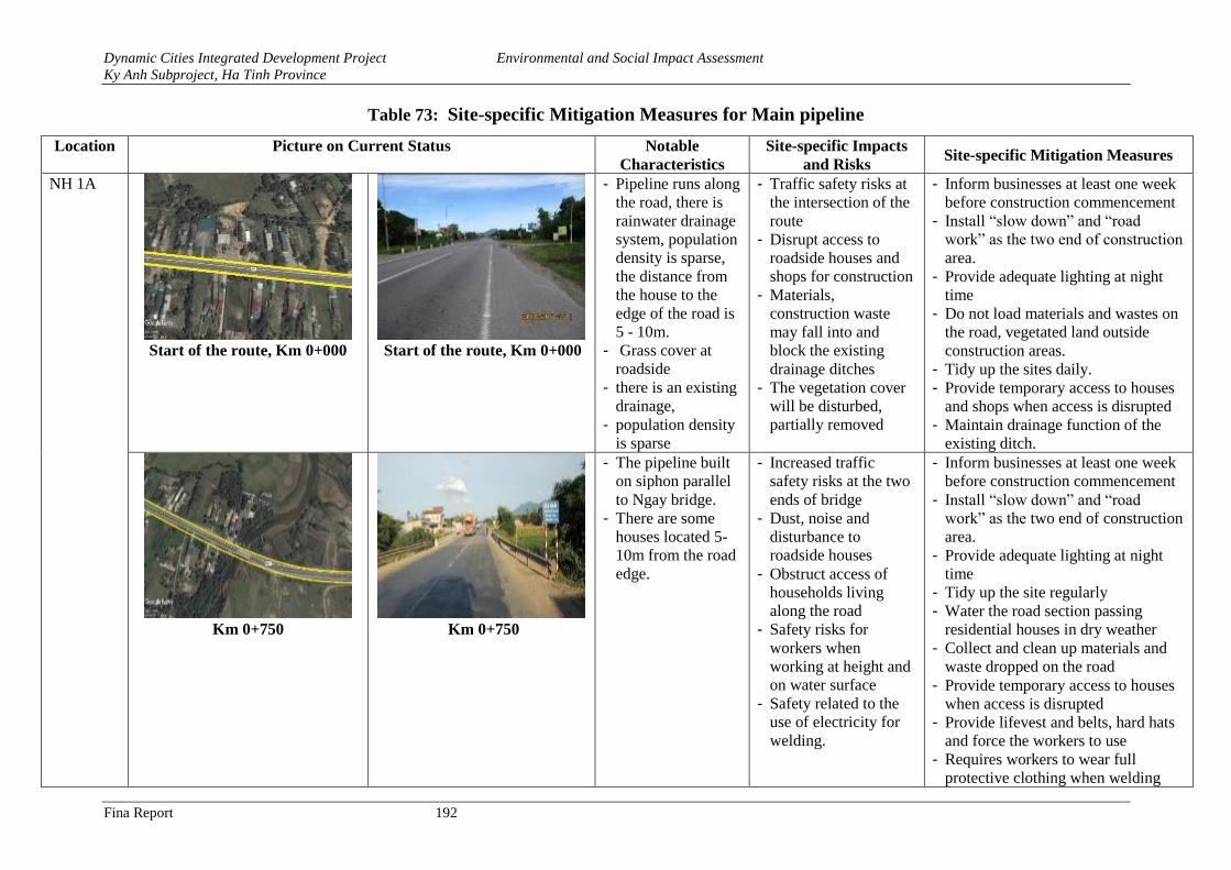
Dynamic Cities Integrated Development Project Environmental and Social Impact Assessment
Ky Anh Subproject, Ha Tinh Province
Fina Report 192
Table 73: Site-specific Mitigation Measures for Main pipeline
Location Picture on Current Status Notable
Characteristics
Site-specific Impacts
and Risks Site-specific Mitigation Measures
NH 1A
Start of the route, Km 0+000
Start of the route, Km 0+000
- Pipeline runs along
the road, there is
rainwater drainage
system, population
density is sparse,
the distance from
the house to the
edge of the road is
5 - 10m.
- Grass cover at
roadside
- there is an existing
drainage,
- population density
is sparse
- Traffic safety risks at
the intersection of the
route
- Disrupt access to
roadside houses and
shops for construction
- Materials,
construction waste
may fall into and
block the existing
drainage ditches
- The vegetation cover
will be disturbed,
partially removed
- Inform businesses at least one week
before construction commencement
- Install “slow down” and “road
work” as the two end of construction
area.
- Provide adequate lighting at night
time
- Do not load materials and wastes on
the road, vegetated land outside
construction areas.
- Tidy up the sites daily.
- Provide temporary access to houses
and shops when access is disrupted
- Maintain drainage function of the
existing ditch.
Km 0+750
Km 0+750
- The pipeline built
on siphon parallel
to Ngay bridge.
- There are some
houses located 5-
10m from the road
edge.
- Increased traffic
safety risks at the two
ends of bridge
- Dust, noise and
disturbance to
roadside houses
- Obstruct access of
households living
along the road
- Safety risks for
workers when
working at height and
on water surface
- Safety related to the
use of electricity for
welding.
- Inform businesses at least one week
before construction commencement
- Install “slow down” and “road
work” as the two end of construction
area.
- Provide adequate lighting at night
time
- Tidy up the site regularly
- Water the road section passing
residential houses in dry weather
- Collect and clean up materials and
waste dropped on the road
- Provide temporary access to houses
when access is disrupted
- Provide lifevest and belts, hard hats
and force the workers to use
- Requires workers to wear full
protective clothing when welding
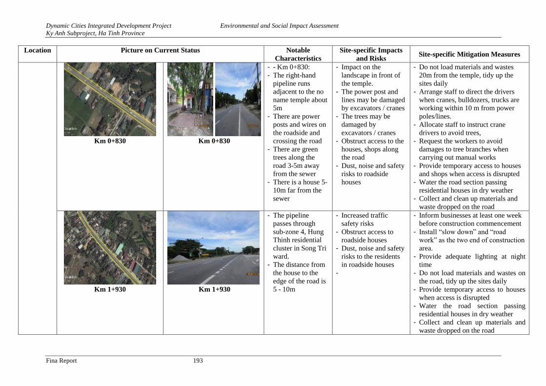
Dynamic Cities Integrated Development Project Environmental and Social Impact Assessment
Ky Anh Subproject, Ha Tinh Province
Fina Report 193
Location Picture on Current Status Notable
Characteristics
Site-specific Impacts
and Risks Site-specific Mitigation Measures
Km 0+830
Km 0+830
- - Km 0+830:
- The right-hand
pipeline runs
adjacent to the no
name temple about
5m
- There are power
posts and wires on
the roadside and
crossing the road
- There are green
trees along the
road 3-5m away
from the sewer
- There is a house 5-
10m far from the
sewer
- Impact on the
landscape in front of
the temple.
- The power post and
lines may be damaged
by excavators / cranes
- The trees may be
damaged by
excavators / cranes
- Obstruct access to the
houses, shops along
the road
- Dust, noise and safety
risks to roadside
houses
- Do not load materials and wastes
20m from the temple, tidy up the
sites daily
- Arrange staff to direct the drivers
when cranes, bulldozers, trucks are
working within 10 m from power
poles/lines.
- Allocate staff to instruct crane
drivers to avoid trees,
- Request the workers to avoid
damages to tree branches when
carrying out manual works
- Provide temporary access to houses
and shops when access is disrupted
- Water the road section passing
residential houses in dry weather
- Collect and clean up materials and
waste dropped on the road
Km 1+930
Km 1+930
- The pipeline
passes through
sub-zone 4, Hung
Thinh residential
cluster in Song Tri
ward.
- The distance from
the house to the
edge of the road is
5 - 10m
- Increased traffic
safety risks
- Obstruct access to
roadside houses
- Dust, noise and safety
risks to the residents
in roadside houses
-
- Inform businesses at least one week
before construction commencement
- Install “slow down” and “road
work” as the two end of construction
area.
- Provide adequate lighting at night
time
- Do not load materials and wastes on
the road, tidy up the sites daily
- Provide temporary access to houses
when access is disrupted
- Water the road section passing
residential houses in dry weather
- Collect and clean up materials and
waste dropped on the road
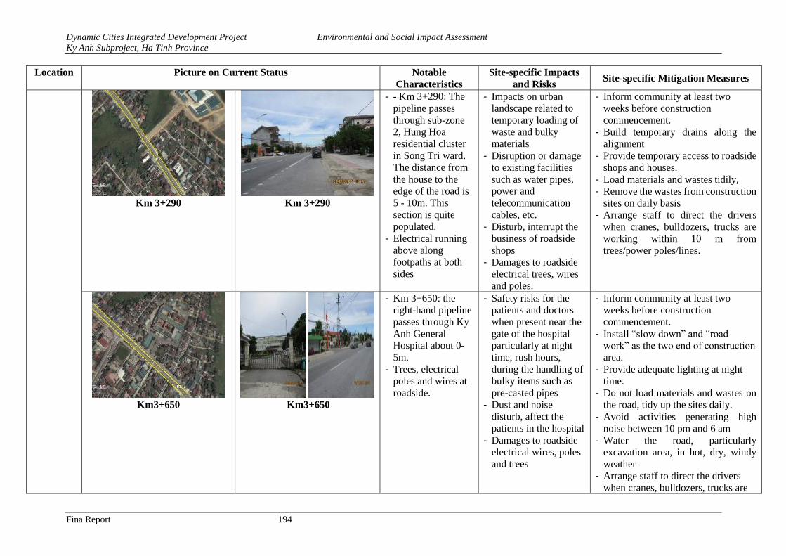
Dynamic Cities Integrated Development Project Environmental and Social Impact Assessment
Ky Anh Subproject, Ha Tinh Province
Fina Report 194
Location Picture on Current Status Notable
Characteristics
Site-specific Impacts
and Risks Site-specific Mitigation Measures
Km 3+290
Km 3+290
- - Km 3+290: The
pipeline passes
through sub-zone
2, Hung Hoa
residential cluster
in Song Tri ward.
The distance from
the house to the
edge of the road is
5 - 10m. This
section is quite
populated.
- Electrical running
above along
footpaths at both
sides
- Impacts on urban
landscape related to
temporary loading of
waste and bulky
materials
- Disruption or damage
to existing facilities
such as water pipes,
power and
telecommunication
cables, etc.
- Disturb, interrupt the
business of roadside
shops
- Damages to roadside
electrical trees, wires
and poles.
- Inform community at least two
weeks before construction
commencement.
- Build temporary drains along the
alignment
- Provide temporary access to roadside
shops and houses.
- Load materials and wastes tidily,
- Remove the wastes from construction
sites on daily basis
- Arrange staff to direct the drivers
when cranes, bulldozers, trucks are
working within 10 m from
trees/power poles/lines.
Km3+650
Km3+650
- Km 3+650: the
right-hand pipeline
passes through Ky
Anh General
Hospital about 0-
5m.
- Trees, electrical
poles and wires at
roadside.
- Safety risks for the
patients and doctors
when present near the
gate of the hospital
particularly at night
time, rush hours,
during the handling of
bulky items such as
pre-casted pipes
- Dust and noise
disturb, affect the
patients in the hospital
- Damages to roadside
electrical wires, poles
and trees
- Inform community at least two
weeks before construction
commencement.
- Install “slow down” and “road
work” as the two end of construction
area.
- Provide adequate lighting at night
time.
- Do not load materials and wastes on
the road, tidy up the sites daily.
- Avoid activities generating high
noise between 10 pm and 6 am
- Water the road, particularly
excavation area, in hot, dry, windy
weather
- Arrange staff to direct the drivers
when cranes, bulldozers, trucks are
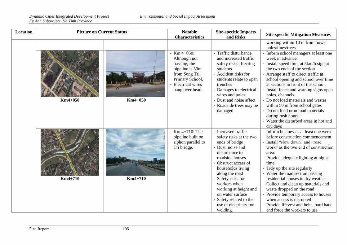
Dynamic Cities Integrated Development Project Environmental and Social Impact Assessment
Ky Anh Subproject, Ha Tinh Province
Fina Report 195
Location Picture on Current Status Notable
Characteristics
Site-specific Impacts
and Risks Site-specific Mitigation Measures
working within 10 m from power
poles/lines/trees
Km4+050
Km4+050
- Km 4+050:
Although not
passing, the
pipeline is 50m
from Song Tri
Primary School.
- Electrical wires
hang over head.
- Traffic disturbance
and increased traffic
safety risks affecting
students
- Accident risks for
students relate to open
trenches
- Damages to electrical
wires and poles.
- Dust and noise affect
- Roadside trees may be
damaged
- Inform school managers at least one
week in advance.
- Install speed limit at 5km/h sign at
the two ends of the section
- Arrange staff to direct traffic at
school opening and school over time
at sections in front of the school.
- Install fence and warning signs open
holes, channels
- Do not load materials and wastes
within 50 m from school gates
- Do not load or unload materials
during rush hours
- Water the disturbed areas in hot and
dry days
Km4+710
Km4+710
- Km 4+710: The
pipeline built on
siphon parallel to
Tri bridge.
- Increased traffic
safety risks at the two
ends of bridge
- Dust, noise and
disturbance to
roadside houses
- Obstruct access of
households living
along the road
- Safety risks for
workers when
working at height and
on water surface
- Safety related to the
use of electricity for
welding.
- Inform businesses at least one week
before construction commencement
- Install “slow down” and “road
work” as the two end of construction
area.
- Provide adequate lighting at night
time
- Tidy up the site regularly
- Water the road section passing
residential houses in dry weather
- Collect and clean up materials and
waste dropped on the road
- Provide temporary access to houses
when access is disrupted
- Provide lifevest and belts, hard hats
and force the workers to use
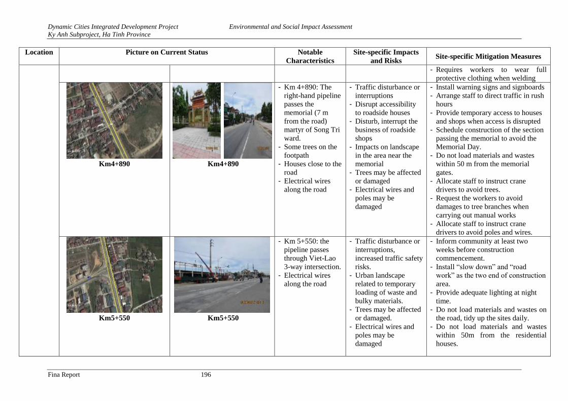
Dynamic Cities Integrated Development Project Environmental and Social Impact Assessment
Ky Anh Subproject, Ha Tinh Province
Fina Report 196
Location Picture on Current Status Notable
Characteristics
Site-specific Impacts
and Risks Site-specific Mitigation Measures
- Requires workers to wear full
protective clothing when welding
Km4+890
Km4+890
- Km 4+890: The
right-hand pipeline
passes the
memorial (7 m
from the road)
martyr of Song Tri
ward.
- Some trees on the
footpath
- Houses close to the
road
- Electrical wires
along the road
- Traffic disturbance or
interruptions
- Disrupt accessibility
to roadside houses
- Disturb, interrupt the
business of roadside
shops
- Impacts on landscape
in the area near the
memorial
- Trees may be affected
or damaged
- Electrical wires and
poles may be
damaged
- Install warning signs and signboards
- Arrange staff to direct traffic in rush
hours
- Provide temporary access to houses
and shops when access is disrupted
- Schedule construction of the section
passing the memorial to avoid the
Memorial Day.
- Do not load materials and wastes
within 50 m from the memorial
gates.
- Allocate staff to instruct crane
drivers to avoid trees.
- Request the workers to avoid
damages to tree branches when
carrying out manual works
- Allocate staff to instruct crane
drivers to avoid poles and wires.
Km5+550
Km5+550
- Km 5+550: the
pipeline passes
through Viet-Lao
3-way intersection.
- Electrical wires
along the road
- Traffic disturbance or
interruptions,
increased traffic safety
risks.
- Urban landscape
related to temporary
loading of waste and
bulky materials.
- Trees may be affected
or damaged.
- Electrical wires and
poles may be
damaged
- Inform community at least two
weeks before construction
commencement.
- Install “slow down” and “road
work” as the two end of construction
area.
- Provide adequate lighting at night
time.
- Do not load materials and wastes on
the road, tidy up the sites daily.
- Do not load materials and wastes
within 50m from the residential
houses.
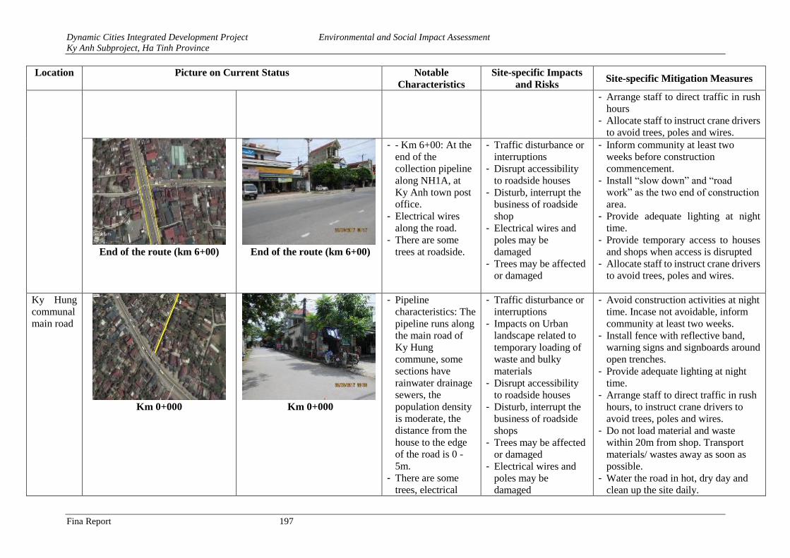
Dynamic Cities Integrated Development Project Environmental and Social Impact Assessment
Ky Anh Subproject, Ha Tinh Province
Fina Report 197
Location Picture on Current Status Notable
Characteristics
Site-specific Impacts
and Risks Site-specific Mitigation Measures
- Arrange staff to direct traffic in rush
hours
- Allocate staff to instruct crane drivers
to avoid trees, poles and wires.
End of the route (km 6+00)
End of the route (km 6+00)
- - Km 6+00: At the
end of the
collection pipeline
along NH1A, at
Ky Anh town post
office.
- Electrical wires
along the road.
- There are some
trees at roadside.
- Traffic disturbance or
interruptions
- Disrupt accessibility
to roadside houses
- Disturb, interrupt the
business of roadside
shop
- Electrical wires and
poles may be
damaged
- Trees may be affected
or damaged
- Inform community at least two
weeks before construction
commencement.
- Install “slow down” and “road
work” as the two end of construction
area.
- Provide adequate lighting at night
time.
- Provide temporary access to houses
and shops when access is disrupted
- Allocate staff to instruct crane drivers
to avoid trees, poles and wires.
Ky Hung
communal
main road
Km 0+000
Km 0+000
- Pipeline
characteristics: The
pipeline runs along
the main road of
Ky Hung
commune, some
sections have
rainwater drainage
sewers, the
population density
is moderate, the
distance from the
house to the edge
of the road is 0 -
5m.
- There are some
trees, electrical
- Traffic disturbance or
interruptions
- Impacts on Urban
landscape related to
temporary loading of
waste and bulky
materials
- Disrupt accessibility
to roadside houses
- Disturb, interrupt the
business of roadside
shops
- Trees may be affected
or damaged
- Electrical wires and
poles may be
damaged
- Avoid construction activities at night
time. Incase not avoidable, inform
community at least two weeks.
- Install fence with reflective band,
warning signs and signboards around
open trenches.
- Provide adequate lighting at night
time.
- Arrange staff to direct traffic in rush
hours, to instruct crane drivers to
avoid trees, poles and wires.
- Do not load material and waste
within 20m from shop. Transport
materials/ wastes away as soon as
possible.
- Water the road in hot, dry day and
clean up the site daily.
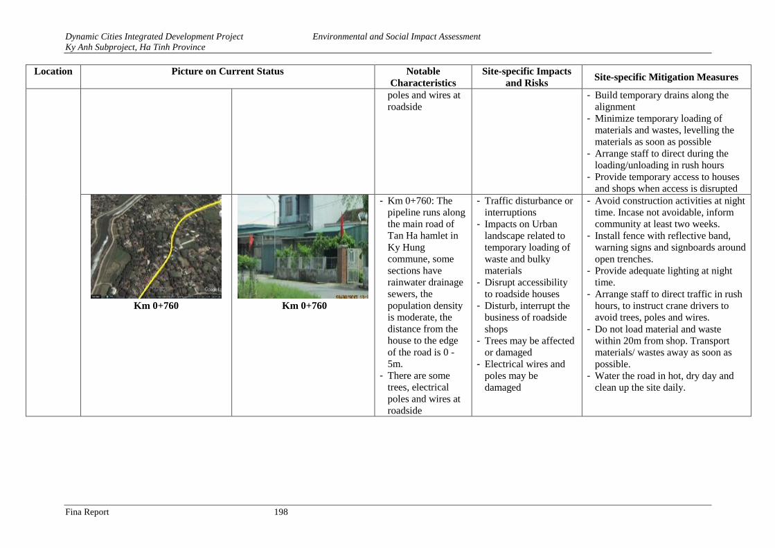
Dynamic Cities Integrated Development Project Environmental and Social Impact Assessment
Ky Anh Subproject, Ha Tinh Province
Fina Report 198
Location Picture on Current Status Notable
Characteristics
Site-specific Impacts
and Risks Site-specific Mitigation Measures
poles and wires at
roadside
- Build temporary drains along the
alignment
- Minimize temporary loading of
materials and wastes, levelling the
materials as soon as possible
- Arrange staff to direct during the
loading/unloading in rush hours
- Provide temporary access to houses
and shops when access is disrupted
Km 0+760 Km 0+760
- Km 0+760: The
pipeline runs along
the main road of
Tan Ha hamlet in
Ky Hung
commune, some
sections have
rainwater drainage
sewers, the
population density
is moderate, the
distance from the
house to the edge
of the road is 0 -
5m.
- There are some
trees, electrical
poles and wires at
roadside
- Traffic disturbance or
interruptions
- Impacts on Urban
landscape related to
temporary loading of
waste and bulky
materials
- Disrupt accessibility
to roadside houses
- Disturb, interrupt the
business of roadside
shops
- Trees may be affected
or damaged
- Electrical wires and
poles may be
damaged
- Avoid construction activities at night
time. Incase not avoidable, inform
community at least two weeks.
- Install fence with reflective band,
warning signs and signboards around
open trenches.
- Provide adequate lighting at night
time.
- Arrange staff to direct traffic in rush
hours, to instruct crane drivers to
avoid trees, poles and wires.
- Do not load material and waste
within 20m from shop. Transport
materials/ wastes away as soon as
possible.
- Water the road in hot, dry day and
clean up the site daily.
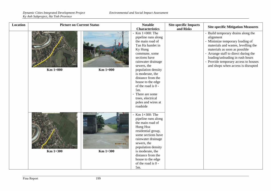
Dynamic Cities Integrated Development Project Environmental and Social Impact Assessment
Ky Anh Subproject, Ha Tinh Province
Fina Report 199
Location Picture on Current Status Notable
Characteristics
Site-specific Impacts
and Risks Site-specific Mitigation Measures
Km 1+000
Km 1+000
- Km 1+000: The
pipeline runs along
the main road of
Tan Ha hamlet in
Ky Hung
commune, some
sections have
rainwater drainage
sewers, the
population density
is moderate, the
distance from the
house to the edge
of the road is 0 -
5m.
- There are some
trees, electrical
poles and wires at
roadside
- Build temporary drains along the
alignment
- Minimize temporary loading of
materials and wastes, levelling the
materials as soon as possible
- Arrange staff to direct during the
loading/unloading in rush hours
- Provide temporary access to houses
and shops when access is disrupted
Km 1+300
Km 1+300
- Km 1+300: The
pipeline runs along
the main road of
Hung Hoa
residential group,
some sections have
rainwater drainage
sewers, the
population density
is moderate, the
distance from the
house to the edge
of the road is 0 -
5m.
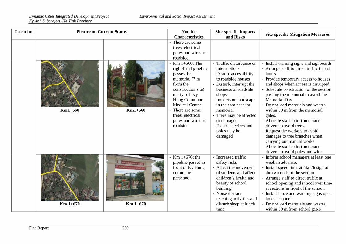
Dynamic Cities Integrated Development Project Environmental and Social Impact Assessment
Ky Anh Subproject, Ha Tinh Province
Fina Report 200
Location Picture on Current Status Notable
Characteristics
Site-specific Impacts
and Risks Site-specific Mitigation Measures
- There are some
trees, electrical
poles and wires at
roadside.
Km1+560 Km1+560
- Km 1+560: The
right-hand pipeline
passes the
memorial (7 m
from the
construction site)
martyr of Ky
Hung Commune
Medical Center.
- There are some
trees, electrical
poles and wires at
roadside
- Traffic disturbance or
interruptions
- Disrupt accessibility
to roadside houses
- Disturb, interrupt the
business of roadside
shops
- Impacts on landscape
in the area near the
memorial
- Trees may be affected
or damaged
- Electrical wires and
poles may be
damaged
- Install warning signs and signboards
- Arrange staff to direct traffic in rush
hours
- Provide temporary access to houses
and shops when access is disrupted
- Schedule construction of the section
passing the memorial to avoid the
Memorial Day.
- Do not load materials and wastes
within 50 m from the memorial
gates.
- Allocate staff to instruct crane
drivers to avoid trees.
- Request the workers to avoid
damages to tree branches when
carrying out manual works
- Allocate staff to instruct crane
drivers to avoid poles and wires.
Km 1+670
Km 1+670
- Km 1+670: the
pipeline passes in
front of Ky Hung
commune
preschool.
- Increased traffic
safety risks
- Affect the movement
of students and affect
children’s health and
beauty of school
building
- Noise distract
teaching activities and
disturb sleep at lunch
time
- Inform school managers at least one
week in advance.
- Install speed limit at 5km/h sign at
the two ends of the section
- Arrange staff to direct traffic at
school opening and school over time
at sections in front of the school.
- Install fence and warning signs open
holes, channels
- Do not load materials and wastes
within 50 m from school gates
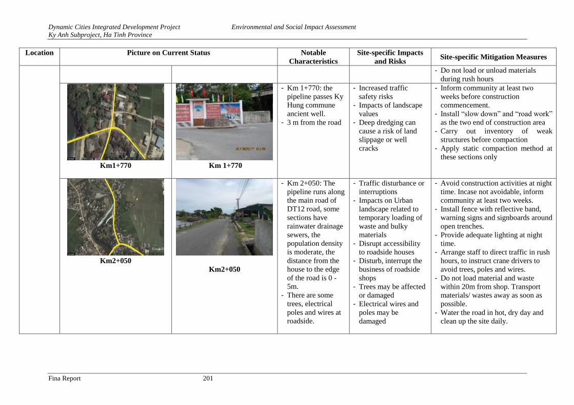
Dynamic Cities Integrated Development Project Environmental and Social Impact Assessment
Ky Anh Subproject, Ha Tinh Province
Fina Report 201
Location Picture on Current Status Notable
Characteristics
Site-specific Impacts
and Risks Site-specific Mitigation Measures
- Do not load or unload materials
during rush hours
Km1+770
Km 1+770
- Km 1+770: the
pipeline passes Ky
Hung commune
ancient well.
- 3 m from the road
- Increased traffic
safety risks
- Impacts of landscape
values
- Deep dredging can
cause a risk of land
slippage or well
cracks
- Inform community at least two
weeks before construction
commencement.
- Install “slow down” and “road work”
as the two end of construction area
- Carry out inventory of weak
structures before compaction
- Apply static compaction method at
these sections only
Km2+050
Km2+050
- Km 2+050: The
pipeline runs along
the main road of
DT12 road, some
sections have
rainwater drainage
sewers, the
population density
is moderate, the
distance from the
house to the edge
of the road is 0 -
5m.
- There are some
trees, electrical
poles and wires at
roadside.
- Traffic disturbance or
interruptions
- Impacts on Urban
landscape related to
temporary loading of
waste and bulky
materials
- Disrupt accessibility
to roadside houses
- Disturb, interrupt the
business of roadside
shops
- Trees may be affected
or damaged
- Electrical wires and
poles may be
damaged
- Avoid construction activities at night
time. Incase not avoidable, inform
community at least two weeks.
- Install fence with reflective band,
warning signs and signboards around
open trenches.
- Provide adequate lighting at night
time.
- Arrange staff to direct traffic in rush
hours, to instruct crane drivers to
avoid trees, poles and wires.
- Do not load material and waste
within 20m from shop. Transport
materials/ wastes away as soon as
possible.
- Water the road in hot, dry day and
clean up the site daily.
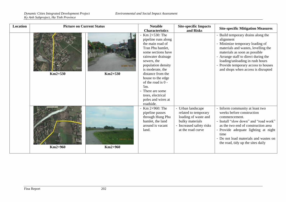
Dynamic Cities Integrated Development Project Environmental and Social Impact Assessment
Ky Anh Subproject, Ha Tinh Province
Fina Report 202
Location Picture on Current Status Notable
Characteristics
Site-specific Impacts
and Risks Site-specific Mitigation Measures
Km2+530
Km2+530
- Km 2+530: The
pipeline runs along
the main road of
Tran Phu hamlet,
some sections have
rainwater drainage
sewers, the
population density
is moderate, the
distance from the
house to the edge
of the road is 0 -
5m.
- There are some
trees, electrical
poles and wires at
roadside.
- Build temporary drains along the
alignment
- Minimize temporary loading of
materials and wastes, levelling the
materials as soon as possible
- Arrange staff to direct during the
loading/unloading in rush hours
- Provide temporary access to houses
and shops when access is disrupted
Km2+960
Km2+960
- Km 2+960: The
pipeline passes
through Hung Phu
hamlet, the land
around is vacant
land.
- Urban landscape
related to temporary
loading of waste and
bulky materials
- Increased safety risks
at the road curve
- Inform community at least two
weeks before construction
commencement.
- Install “slow down” and “road work”
as the two end of construction area
- Provide adequate lighting at night
time
- Do not load materials and wastes on
the road, tidy up the sites daily
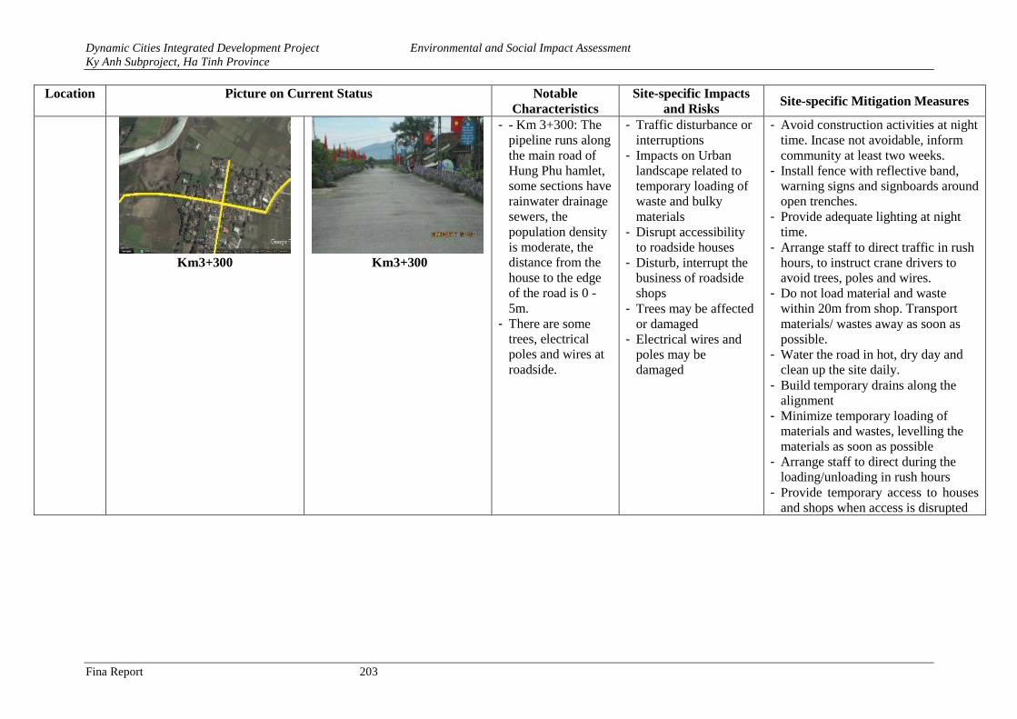
Dynamic Cities Integrated Development Project Environmental and Social Impact Assessment
Ky Anh Subproject, Ha Tinh Province
Fina Report 203
Location Picture on Current Status Notable
Characteristics
Site-specific Impacts
and Risks Site-specific Mitigation Measures
Km3+300
Km3+300
- - Km 3+300: The
pipeline runs along
the main road of
Hung Phu hamlet,
some sections have
rainwater drainage
sewers, the
population density
is moderate, the
distance from the
house to the edge
of the road is 0 -
5m.
- There are some
trees, electrical
poles and wires at
roadside.
- Traffic disturbance or
interruptions
- Impacts on Urban
landscape related to
temporary loading of
waste and bulky
materials
- Disrupt accessibility
to roadside houses
- Disturb, interrupt the
business of roadside
shops
- Trees may be affected
or damaged
- Electrical wires and
poles may be
damaged
- Avoid construction activities at night
time. Incase not avoidable, inform
community at least two weeks.
- Install fence with reflective band,
warning signs and signboards around
open trenches.
- Provide adequate lighting at night
time.
- Arrange staff to direct traffic in rush
hours, to instruct crane drivers to
avoid trees, poles and wires.
- Do not load material and waste
within 20m from shop. Transport
materials/ wastes away as soon as
possible.
- Water the road in hot, dry day and
clean up the site daily.
- Build temporary drains along the
alignment
- Minimize temporary loading of
materials and wastes, levelling the
materials as soon as possible
- Arrange staff to direct during the
loading/unloading in rush hours
- Provide temporary access to houses
and shops when access is disrupted
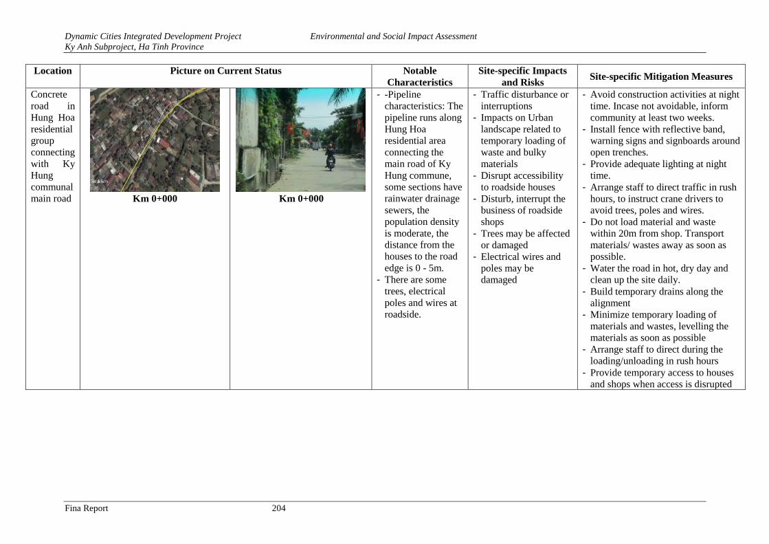
Dynamic Cities Integrated Development Project Environmental and Social Impact Assessment
Ky Anh Subproject, Ha Tinh Province
Fina Report 204
Location Picture on Current Status Notable
Characteristics
Site-specific Impacts
and Risks Site-specific Mitigation Measures
Concrete
road in
Hung Hoa
residential
group
connecting
with Ky
Hung
communal
main road
Km 0+000
Km 0+000
- -Pipeline
characteristics: The
pipeline runs along
Hung Hoa
residential area
connecting the
main road of Ky
Hung commune,
some sections have
rainwater drainage
sewers, the
population density
is moderate, the
distance from the
houses to the road
edge is 0 - 5m.
- There are some
trees, electrical
poles and wires at
roadside.
- Traffic disturbance or
interruptions
- Impacts on Urban
landscape related to
temporary loading of
waste and bulky
materials
- Disrupt accessibility
to roadside houses
- Disturb, interrupt the
business of roadside
shops
- Trees may be affected
or damaged
- Electrical wires and
poles may be
damaged
- Avoid construction activities at night
time. Incase not avoidable, inform
community at least two weeks.
- Install fence with reflective band,
warning signs and signboards around
open trenches.
- Provide adequate lighting at night
time.
- Arrange staff to direct traffic in rush
hours, to instruct crane drivers to
avoid trees, poles and wires.
- Do not load material and waste
within 20m from shop. Transport
materials/ wastes away as soon as
possible.
- Water the road in hot, dry day and
clean up the site daily.
- Build temporary drains along the
alignment
- Minimize temporary loading of
materials and wastes, levelling the
materials as soon as possible
- Arrange staff to direct during the
loading/unloading in rush hours
- Provide temporary access to houses
and shops when access is disrupted
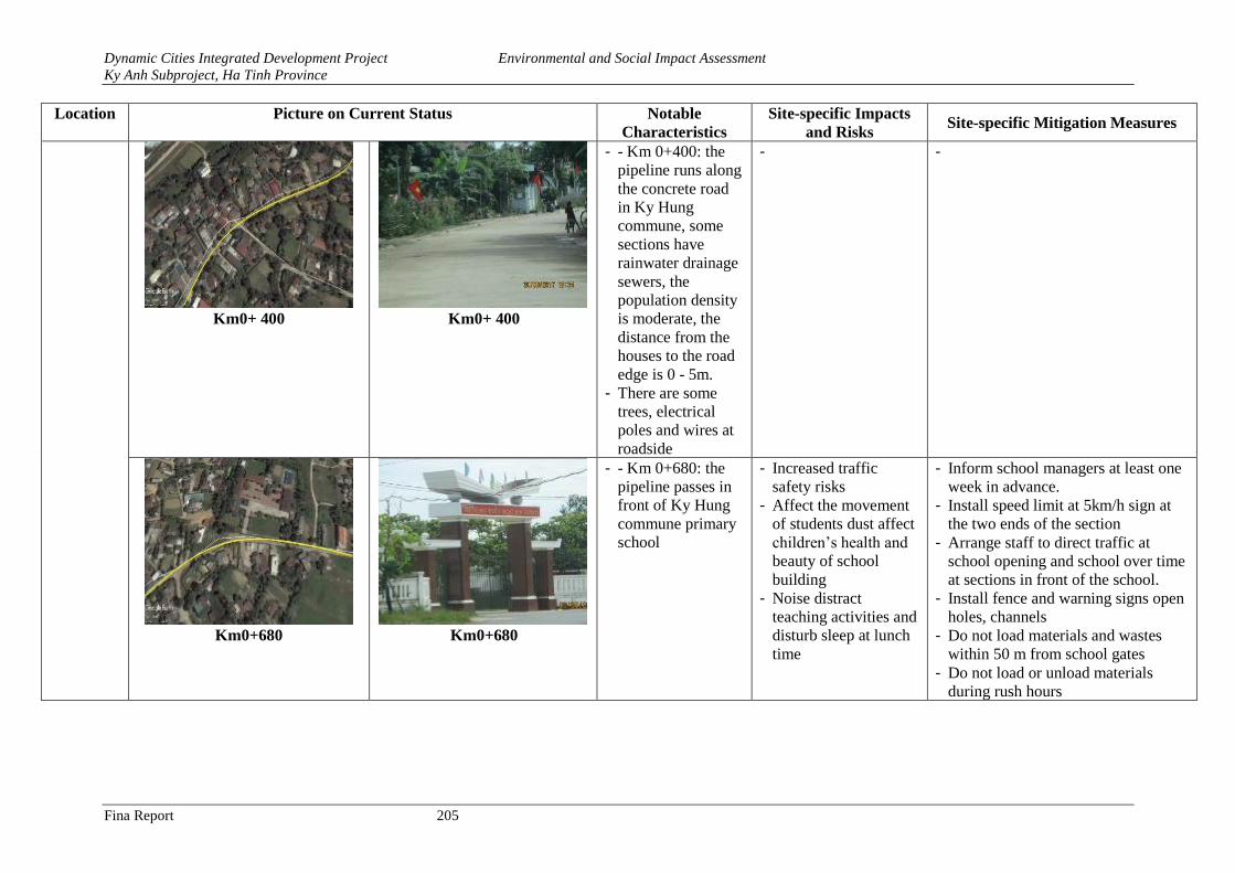
Dynamic Cities Integrated Development Project Environmental and Social Impact Assessment
Ky Anh Subproject, Ha Tinh Province
Fina Report 205
Location Picture on Current Status Notable
Characteristics
Site-specific Impacts
and Risks Site-specific Mitigation Measures
Km0+ 400 Km0+ 400
- - Km 0+400: the
pipeline runs along
the concrete road
in Ky Hung
commune, some
sections have
rainwater drainage
sewers, the
population density
is moderate, the
distance from the
houses to the road
edge is 0 - 5m.
- There are some
trees, electrical
poles and wires at
roadside
- -
Km0+680 Km0+680
- - Km 0+680: the
pipeline passes in
front of Ky Hung
commune primary
school
- Increased traffic
safety risks
- Affect the movement
of students dust affect
children’s health and
beauty of school
building
- Noise distract
teaching activities and
disturb sleep at lunch
time
- Inform school managers at least one
week in advance.
- Install speed limit at 5km/h sign at
the two ends of the section
- Arrange staff to direct traffic at
school opening and school over time
at sections in front of the school.
- Install fence and warning signs open
holes, channels
- Do not load materials and wastes
within 50 m from school gates
- Do not load or unload materials
during rush hours
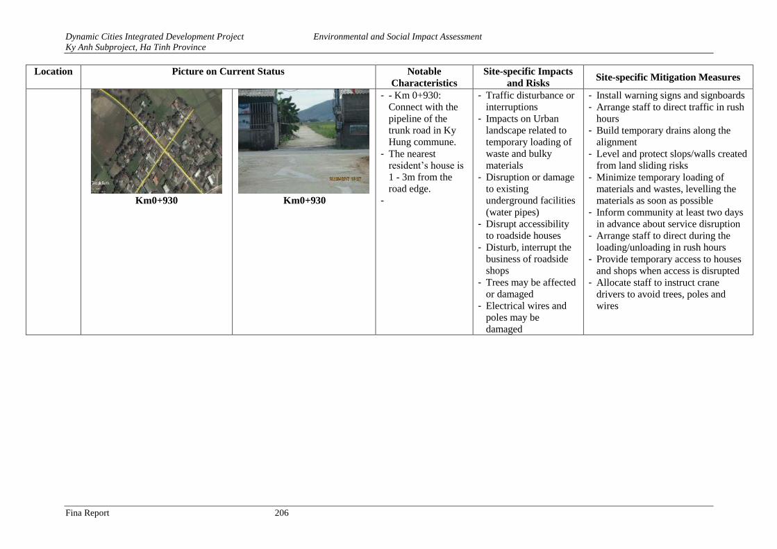
Dynamic Cities Integrated Development Project Environmental and Social Impact Assessment
Ky Anh Subproject, Ha Tinh Province
Fina Report 206
Location Picture on Current Status Notable
Characteristics
Site-specific Impacts
and Risks Site-specific Mitigation Measures
Km0+930
Km0+930
- - Km 0+930:
Connect with the
pipeline of the
trunk road in Ky
Hung commune.
- The nearest
resident’s house is
1 - 3m from the
road edge.
-
- Traffic disturbance or
interruptions
- Impacts on Urban
landscape related to
temporary loading of
waste and bulky
materials
- Disruption or damage
to existing
underground facilities
(water pipes)
- Disrupt accessibility
to roadside houses
- Disturb, interrupt the
business of roadside
shops
- Trees may be affected
or damaged
- Electrical wires and
poles may be
damaged
- Install warning signs and signboards
- Arrange staff to direct traffic in rush
hours
- Build temporary drains along the
alignment
- Level and protect slops/walls created
from land sliding risks
- Minimize temporary loading of
materials and wastes, levelling the
materials as soon as possible
- Inform community at least two days
in advance about service disruption
- Arrange staff to direct during the
loading/unloading in rush hours
- Provide temporary access to houses
and shops when access is disrupted
- Allocate staff to instruct crane
drivers to avoid trees, poles and
wires
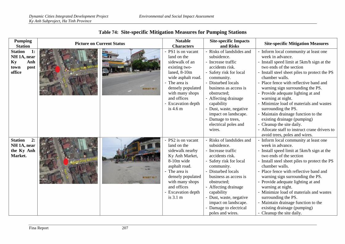
Dynamic Cities Integrated Development Project Environmental and Social Impact Assessment
Ky Anh Subproject, Ha Tinh Province
Fina Report 207
Table 74: Site-specific Mitigation Measures for Pumping Stations
Pumping
Station Picture on Current Status
Notable
Characters
Site-specific Impacts
and Risks Site-specific Mitigation Measures
Station 1:
NH 1A, near
Ky Anh
town post
office
- PS1 is on vacant
land on the
sidewalk of an
existing two-
laned, 8-10m
wide asphalt road.
- The area is
densely populated
with many shops
and offices
- Excavation depth
is 4.6 m
- Risks of landslides and
subsidence.
- Increase traffic
accidents risk.
- Safety risk for local
community.
- Disturbed locals
business as access is
obstructed;
- Affecting drainage
capability
- Dust, waste, negative
impact on landscape.
- Damage to trees,
electrical poles and
wires.
- Inform local community at least one
week in advance.
- Install speed limit at 5km/h sign at the
two ends of the section
- Install steel sheet piles to protect the PS
chamber walls.
- Place fence with reflective band and
warning sign surrounding the PS.
- Provide adequate lighting at and
warning at night.
- Minimize load of materials and wastes
surrounding the PS.
- Maintain drainage function to the
existing drainage (pumping)
- Cleanup the site daily.
- Allocate staff to instruct crane drivers to
avoid trees, poles and wires.
Station 2:
NH 1A, near
the Ky Anh
Market.
- PS2 is on vacant
land on the
sidewalk nearby
Ky Anh Market,
8-10m wide
asphalt road.
- The area is
densely populated
with many shops
and offices
- Excavation depth
is 3.1 m
- Risks of landslides and
subsidence.
- Increase traffic
accidents risk.
- Safety risk for local
community.
- Disturbed locals
business as access is
obstructed;
- Affecting drainage
capability
- Dust, waste, negative
impact on landscape.
- Damage to electrical
poles and wires.
- Inform local community at least one
week in advance.
- Install speed limit at 5km/h sign at the
two ends of the section
- Install steel sheet piles to protect the PS
chamber walls.
- Place fence with reflective band and
warning sign surrounding the PS.
- Provide adequate lighting at and
warning at night.
- Minimize load of materials and wastes
surrounding the PS.
- Maintain drainage function to the
existing drainage (pumping)
- Cleanup the site daily.
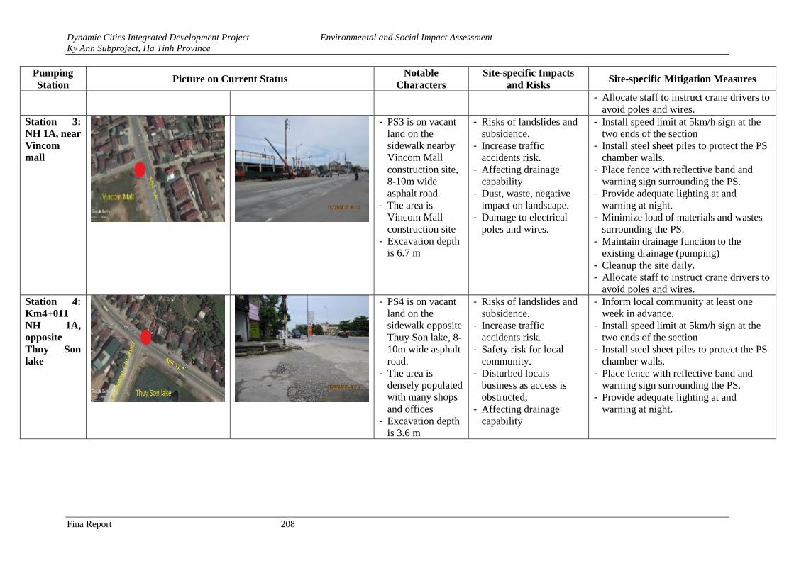
Dynamic Cities Integrated Development Project Environmental and Social Impact Assessment
Ky Anh Subproject, Ha Tinh Province
Fina Report 208
Pumping
Station Picture on Current Status
Notable
Characters
Site-specific Impacts
and Risks Site-specific Mitigation Measures
- Allocate staff to instruct crane drivers to
avoid poles and wires.
Station 3:
NH 1A, near
Vincom
mall
- PS3 is on vacant
land on the
sidewalk nearby
Vincom Mall
construction site,
8-10m wide
asphalt road.
- The area is
Vincom Mall
construction site
- Excavation depth
is 6.7 m
- Risks of landslides and
subsidence.
- Increase traffic
accidents risk.
- Affecting drainage
capability
- Dust, waste, negative
impact on landscape.
- Damage to electrical
poles and wires.
- Install speed limit at 5km/h sign at the
two ends of the section
- Install steel sheet piles to protect the PS
chamber walls.
- Place fence with reflective band and
warning sign surrounding the PS.
- Provide adequate lighting at and
warning at night.
- Minimize load of materials and wastes
surrounding the PS.
- Maintain drainage function to the
existing drainage (pumping)
- Cleanup the site daily.
- Allocate staff to instruct crane drivers to
avoid poles and wires.
Station 4:
Km4+011
NH 1A,
opposite
Thuy Son
lake
- PS4 is on vacant
land on the
sidewalk opposite
Thuy Son lake, 8-
10m wide asphalt
road.
- The area is
densely populated
with many shops
and offices
- Excavation depth
is 3.6 m
- Risks of landslides and
subsidence.
- Increase traffic
accidents risk.
- Safety risk for local
community.
- Disturbed locals
business as access is
obstructed;
- Affecting drainage
capability
- Inform local community at least one
week in advance.
- Install speed limit at 5km/h sign at the
two ends of the section
- Install steel sheet piles to protect the PS
chamber walls.
- Place fence with reflective band and
warning sign surrounding the PS.
- Provide adequate lighting at and
warning at night.
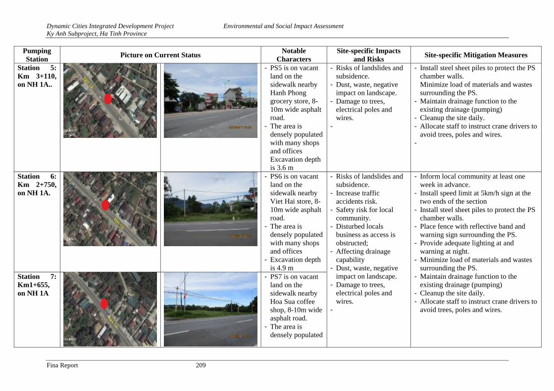
Dynamic Cities Integrated Development Project Environmental and Social Impact Assessment
Ky Anh Subproject, Ha Tinh Province
Fina Report 209
Pumping
Station Picture on Current Status
Notable
Characters
Site-specific Impacts
and Risks Site-specific Mitigation Measures
Station 5:
Km 3+110,
on NH 1A..
- PS5 is on vacant
land on the
sidewalk nearby
Hanh Phong
grocery store, 8-
10m wide asphalt
road.
- The area is
densely populated
with many shops
and offices
Excavation depth
is 3.6 m
- Risks of landslides and
subsidence.
- Dust, waste, negative
impact on landscape.
- Damage to trees,
electrical poles and
wires.
-
- Install steel sheet piles to protect the PS
chamber walls.
Minimize load of materials and wastes
surrounding the PS.
- Maintain drainage function to the
existing drainage (pumping)
- Cleanup the site daily.
- Allocate staff to instruct crane drivers to
avoid trees, poles and wires.
-
Station 6:
Km 2+750,
on NH 1A.
- PS6 is on vacant
land on the
sidewalk nearby
Viet Hai store, 8-
10m wide asphalt
road.
- The area is
densely populated
with many shops
and offices
- Excavation depth
is 4.9 m
- Risks of landslides and
subsidence.
- Increase traffic
accidents risk.
- Safety risk for local
community.
- Disturbed locals
business as access is
obstructed;
- Affecting drainage
capability
- Dust, waste, negative
impact on landscape.
- Damage to trees,
electrical poles and
wires.
-
- Inform local community at least one
week in advance.
- Install speed limit at 5km/h sign at the
two ends of the section
- Install steel sheet piles to protect the PS
chamber walls.
- Place fence with reflective band and
warning sign surrounding the PS.
- Provide adequate lighting at and
warning at night.
- Minimize load of materials and wastes
surrounding the PS.
- Maintain drainage function to the
existing drainage (pumping)
- Cleanup the site daily.
- Allocate staff to instruct crane drivers to
avoid trees, poles and wires.
Station 7:
Km1+655,
on NH 1A
- PS7 is on vacant
land on the
sidewalk nearby
Hoa Sua coffee
shop, 8-10m wide
asphalt road.
- The area is
densely populated
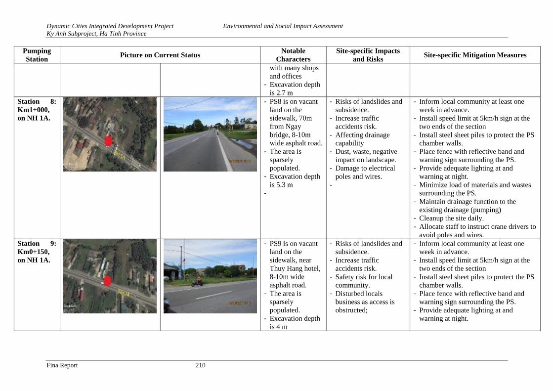
Dynamic Cities Integrated Development Project Environmental and Social Impact Assessment
Ky Anh Subproject, Ha Tinh Province
Fina Report 210
Pumping
Station Picture on Current Status
Notable
Characters
Site-specific Impacts
and Risks Site-specific Mitigation Measures
with many shops
and offices
- Excavation depth
is 2.7 m
Station 8:
Km1+000,
on NH 1A.
- PS8 is on vacant
land on the
sidewalk, 70m
from Ngay
bridge, 8-10m
wide asphalt road.
- The area is
sparsely
populated.
- Excavation depth
is 5.3 m
-
- Risks of landslides and
subsidence.
- Increase traffic
accidents risk.
- Affecting drainage
capability
- Dust, waste, negative
impact on landscape.
- Damage to electrical
poles and wires.
-
- Inform local community at least one
week in advance.
- Install speed limit at 5km/h sign at the
two ends of the section
- Install steel sheet piles to protect the PS
chamber walls.
- Place fence with reflective band and
warning sign surrounding the PS.
- Provide adequate lighting at and
warning at night.
- Minimize load of materials and wastes
surrounding the PS.
- Maintain drainage function to the
existing drainage (pumping)
- Cleanup the site daily.
- Allocate staff to instruct crane drivers to
avoid poles and wires.
Station 9:
Km0+150,
on NH 1A.
- PS9 is on vacant
land on the
sidewalk, near
Thuy Hang hotel,
8-10m wide
asphalt road.
- The area is
sparsely
populated.
- Excavation depth
is 4 m
- Risks of landslides and
subsidence.
- Increase traffic
accidents risk.
- Safety risk for local
community.
- Disturbed locals
business as access is
obstructed;
- Inform local community at least one
week in advance.
- Install speed limit at 5km/h sign at the
two ends of the section
- Install steel sheet piles to protect the PS
chamber walls.
- Place fence with reflective band and
warning sign surrounding the PS.
- Provide adequate lighting at and
warning at night.
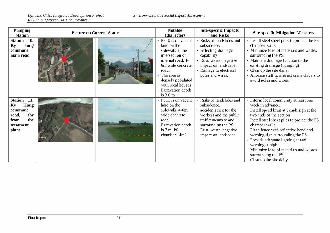
Dynamic Cities Integrated Development Project Environmental and Social Impact Assessment
Ky Anh Subproject, Ha Tinh Province
Fina Report 211
Pumping
Station Picture on Current Status
Notable
Characters
Site-specific Impacts
and Risks Site-specific Mitigation Measures
Station 10:
Ky Hung
commune
main road
- PS10 is on vacant
land on the
sidewalk at the
intersection of
internal road, 4-
6m wide concrete
road.
- The area is
densely populated
with local houses
- Excavation depth
is 3.6 m
- Risks of landslides and
subsidence.
- Affecting drainage
capability
- Dust, waste, negative
impact on landscape.
- Damage to electrical
poles and wires.
- Install steel sheet piles to protect the PS
chamber walls.
- Minimize load of materials and wastes
surrounding the PS.
- Maintain drainage function to the
existing drainage (pumping)
- Cleanup the site daily.
- Allocate staff to instruct crane drivers to
avoid poles and wires.
Station 11:
Ky Hung
commune
road, far
from the
treatment
plant
- PS11 is on vacant
land on the
sidewalk, 4-6m
wide concrete
road.
- Excavation depth
is 7 m, PS
chamber 14m2
- Risks of landslides and
subsidence.
- accidents risk for the
workers and the public,
traffic means at and
surrounding the PS.
- Dust, waste, negative
impact on landscape.
- Inform local community at least one
week in advance.
- Install speed limit at 5km/h sign at the
two ends of the section
- Install steel sheet piles to protect the PS
chamber walls.
- Place fence with reflective band and
warning sign surrounding the PS.
- Provide adequate lighting at and
warning at night.
- Minimize load of materials and wastes
surrounding the PS.
- Cleanup the site daily
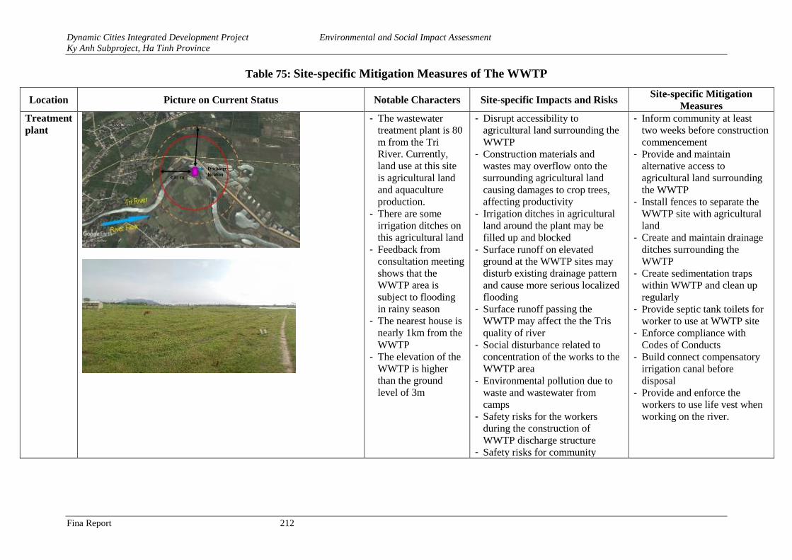
Dynamic Cities Integrated Development Project Environmental and Social Impact Assessment
Ky Anh Subproject, Ha Tinh Province
Fina Report 212
Table 75: Site-specific Mitigation Measures of The WWTP
Location Picture on Current Status Notable Characters Site-specific Impacts and Risks Site-specific Mitigation
Measures
Treatment
plant
- The wastewater
treatment plant is 80
m from the Tri
River. Currently,
land use at this site
is agricultural land
and aquaculture
production.
- There are some
irrigation ditches on
this agricultural land
- Feedback from
consultation meeting
shows that the
WWTP area is
subject to flooding
in rainy season
- The nearest house is
nearly 1km from the
WWTP
- The elevation of the
WWTP is higher
than the ground
level of 3m
- Disrupt accessibility to
agricultural land surrounding the
WWTP
- Construction materials and
wastes may overflow onto the
surrounding agricultural land
causing damages to crop trees,
affecting productivity
- Irrigation ditches in agricultural
land around the plant may be
filled up and blocked
- Surface runoff on elevated
ground at the WWTP sites may
disturb existing drainage pattern
and cause more serious localized
flooding
- Surface runoff passing the
WWTP may affect the the Tris
quality of river
- Social disturbance related to
concentration of the works to the
WWTP area
- Environmental pollution due to
waste and wastewater from
camps
- Safety risks for the workers
during the construction of
WWTP discharge structure
- Safety risks for community
- Inform community at least
two weeks before construction
commencement
- Provide and maintain
alternative access to
agricultural land surrounding
the WWTP
- Install fences to separate the
WWTP site with agricultural
land
- Create and maintain drainage
ditches surrounding the
WWTP
- Create sedimentation traps
within WWTP and clean up
regularly
- Provide septic tank toilets for
worker to use at WWTP site
- Enforce compliance with
Codes of Conducts
- Build connect compensatory
irrigation canal before
disposal
- Provide and enforce the
workers to use life vest when
working on the river.
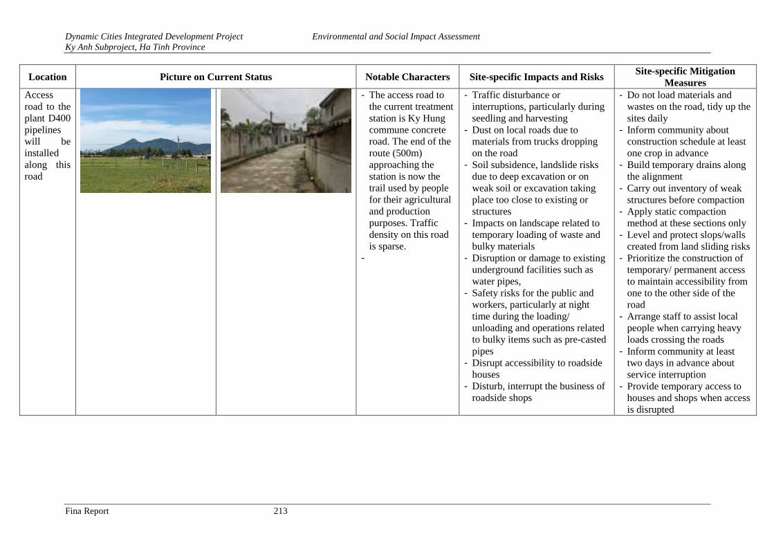
Dynamic Cities Integrated Development Project Environmental and Social Impact Assessment
Ky Anh Subproject, Ha Tinh Province
Fina Report 213
Location Picture on Current Status Notable Characters Site-specific Impacts and Risks Site-specific Mitigation
Measures
Access
road to the
plant D400
pipelines
will be
installed
along this
road
- The access road to
the current treatment
station is Ky Hung
commune concrete
road. The end of the
route (500m)
approaching the
station is now the
trail used by people
for their agricultural
and production
purposes. Traffic
density on this road
is sparse.
-
- Traffic disturbance or
interruptions, particularly during
seedling and harvesting
- Dust on local roads due to
materials from trucks dropping
on the road
- Soil subsidence, landslide risks
due to deep excavation or on
weak soil or excavation taking
place too close to existing or
structures
- Impacts on landscape related to
temporary loading of waste and
bulky materials
- Disruption or damage to existing
underground facilities such as
water pipes,
- Safety risks for the public and
workers, particularly at night
time during the loading/
unloading and operations related
to bulky items such as pre-casted
pipes
- Disrupt accessibility to roadside
houses
- Disturb, interrupt the business of
roadside shops
- Do not load materials and
wastes on the road, tidy up the
sites daily
- Inform community about
construction schedule at least
one crop in advance
- Build temporary drains along
the alignment
- Carry out inventory of weak
structures before compaction
- Apply static compaction
method at these sections only
- Level and protect slops/walls
created from land sliding risks
- Prioritize the construction of
temporary/ permanent access
to maintain accessibility from
one to the other side of the
road
- Arrange staff to assist local
people when carrying heavy
loads crossing the roads
- Inform community at least
two days in advance about
service interruption
- Provide temporary access to
houses and shops when access
is disrupted
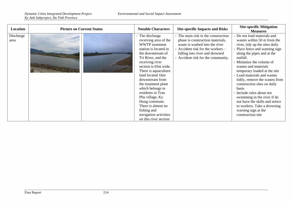
Dynamic Cities Integrated Development Project Environmental and Social Impact Assessment
Ky Anh Subproject, Ha Tinh Province
Fina Report 214
Location Picture on Current Status Notable Characters Site-specific Impacts and Risks Site-specific Mitigation
Measures
Discharge
area
- The discharge
receiving area of the
WWTP treatment
station is located in
the downstream of
Tri River, and the
receiving river
section is 65m wide.
There is aquaculture
land located 1km
downstream from
the treatment plant
which belongs to
residents in Tran
Phu village, Ky
Hung commune.
There is almost no
fishing and
navigation activities
on this river section
- The main risk in the construction
phase is construction materials,
waste is washed into the river
- Accident risk for the workers –
falling into river and drowned
- Accident risk for the community.
- Do not load materials and
wastes within 50 m from the
river, tidy up the sites daily
- Place fence and warning sign
along the pipes and at the
outfall.
- Minimize the volume of
wastes and materials
temporary loaded at the site
- Load materials and wastes
tidily, remove the wastes from
construction sites on daily
basis
- Include rules about not
swimming in the river if do
not have the skills and notice
to workers. Take a drowning
warning sign at the
construction site
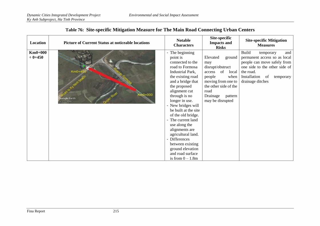
Dynamic Cities Integrated Development Project Environmental and Social Impact Assessment
Ky Anh Subproject, Ha Tinh Province
Fina Report 215
Table 76: Site-specific Mitigation Measure for The Main Road Connecting Urban Centers
Location Picture of Current Status at noticeable locations Notable
Characters
Site-specific
Impacts and
Risks
Site-specific Mitigation
Measures
Km0+000
÷ 0+450
- The beginning
point is
connected to the
road to Formosa
Industrial Park,
the existing road
and a bridge that
the proposed
alignment cut
through is no
longer in use.
- New bridges will
be built at the site
of the old bridge.
- The current land
use along the
alignments are
agricultural land.
- Differences
between existing
ground elevation
and road surface
is from 0 – 1.8m
Elevated ground
may
disrupt/obstruct
access of local
people when
moving from one to
the other side of the
road
Drainage pattern
may be disrupted
Build temporary and
permanent access so as local
people can move safely from
one side to the other side of
the road.
Installation of temporary
drainage ditches
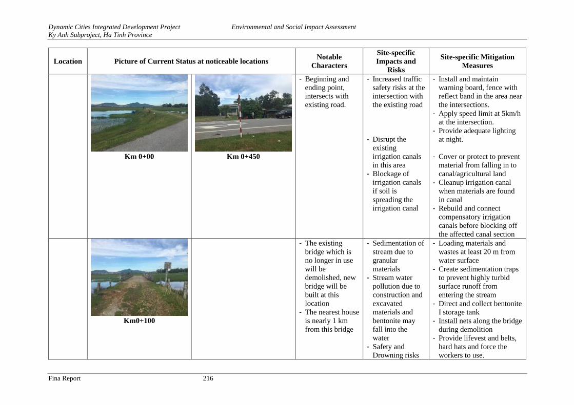
Dynamic Cities Integrated Development Project Environmental and Social Impact Assessment
Ky Anh Subproject, Ha Tinh Province
Fina Report 216
Location Picture of Current Status at noticeable locations Notable
Characters
Site-specific
Impacts and
Risks
Site-specific Mitigation
Measures
Km 0+00 Km 0+450
- Beginning and
ending point,
intersects with
existing road.
- Increased traffic
safety risks at the
intersection with
the existing road
- Disrupt the
existing
irrigation canals
in this area
- Blockage of
irrigation canals
if soil is
spreading the
irrigation canal
- Install and maintain
warning board, fence with
reflect band in the area near
the intersections.
- Apply speed limit at 5km/h
at the intersection.
- Provide adequate lighting
at night.
- Cover or protect to prevent
material from falling in to
canal/agricultural land
- Cleanup irrigation canal
when materials are found
in canal
- Rebuild and connect
compensatory irrigation
canals before blocking off
the affected canal section
Km0+100
- The existing
bridge which is
no longer in use
will be
demolished, new
bridge will be
built at this
location
- The nearest house
is nearly 1 km
from this bridge
- Sedimentation of
stream due to
granular
materials
- Stream water
pollution due to
construction and
excavated
materials and
bentonite may
fall into the
water
- Safety and
Drowning risks
- Loading materials and
wastes at least 20 m from
water surface
- Create sedimentation traps
to prevent highly turbid
surface runoff from
entering the stream
- Direct and collect bentonite
I storage tank
- Install nets along the bridge
during demolition
- Provide lifevest and belts,
hard hats and force the
workers to use.
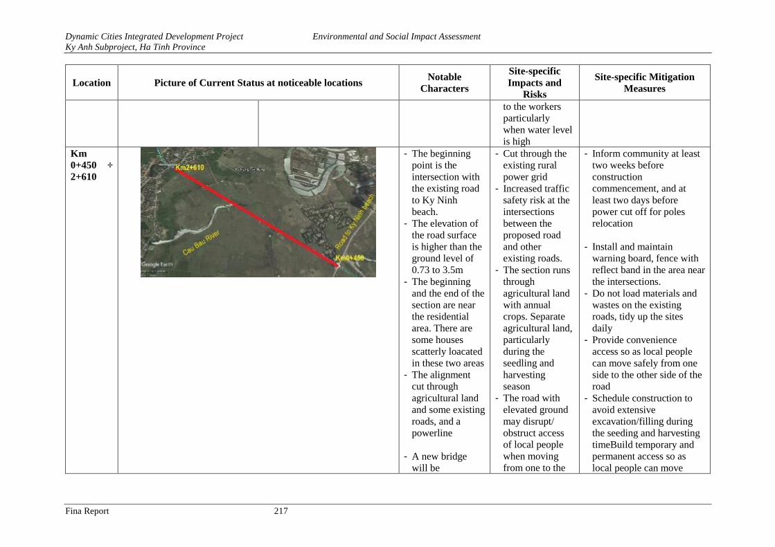
Dynamic Cities Integrated Development Project Environmental and Social Impact Assessment
Ky Anh Subproject, Ha Tinh Province
Fina Report 217
Location Picture of Current Status at noticeable locations Notable
Characters
Site-specific
Impacts and
Risks
Site-specific Mitigation
Measures
to the workers
particularly
when water level
is high
Km
0+450 ÷
2+610
- The beginning
point is the
intersection with
the existing road
to Ky Ninh
beach.
- The elevation of
the road surface
is higher than the
ground level of
0.73 to 3.5m
- The beginning
and the end of the
section are near
the residential
area. There are
some houses
scatterly loacated
in these two areas
- The alignment
cut through
agricultural land
and some existing
roads, and a
powerline
- A new bridge
will be
- Cut through the
existing rural
power grid
- Increased traffic
safety risk at the
intersections
between the
proposed road
and other
existing roads.
- The section runs
through
agricultural land
with annual
crops. Separate
agricultural land,
particularly
during the
seedling and
harvesting
season
- The road with
elevated ground
may disrupt/
obstruct access
of local people
when moving
from one to the
- Inform community at least
two weeks before
construction
commencement, and at
least two days before
power cut off for poles
relocation
- Install and maintain
warning board, fence with
reflect band in the area near
the intersections.
- Do not load materials and
wastes on the existing
roads, tidy up the sites
daily
- Provide convenience
access so as local people
can move safely from one
side to the other side of the
road
- Schedule construction to
avoid extensive
excavation/filling during
the seeding and harvesting
timeBuild temporary and
permanent access so as
local people can move
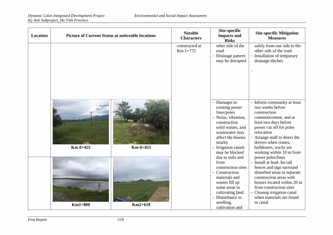
Dynamic Cities Integrated Development Project Environmental and Social Impact Assessment
Ky Anh Subproject, Ha Tinh Province
Fina Report 218
Location Picture of Current Status at noticeable locations Notable
Characters
Site-specific
Impacts and
Risks
Site-specific Mitigation
Measures
constructed at
Km 1+772
other side of the
road
- Drainage pattern
may be disrupted
safely from one side to the
other side of the road.
- Installation of temporary
drainage ditches
-
Km 0+455 Km 0+455
- Damages to
existing power
lines/poles
- Noise, vibration,
construction
solid wastes, and
wastewater may
affect the houses
nearby
- Irrigation canals
may be blocked
due to soils and
from
construction sites
- Construction
materials and
wastes fill up
some areas in
cultivating land.
- Disturbance to
seedling,
cultivation and
- Inform community at least
two weeks before
construction
commencement, and at
least two days before
power cut off for poles
relocation
- Arrange staff to direct the
drivers when cranes,
bulldozers, trucks are
working within 10 m from
power poles/lines
- Install at least 3m tall
fences and sign surround
disturbed areas to separate
construction areas with
houses located within 20 m
from construction sites
- Cleanup irrigation canal
when materials are found
in canal
Km1+800 Km2+610
Dynamic Cities Integrated Development Project Environmental and Social Impact Assessment
Ky Anh Subproject, Ha Tinh Province
Fina Report 219
Location Picture of Current Status at noticeable locations Notable
Characters
Site-specific
Impacts and
Risks
Site-specific Mitigation
Measures
harvesting
activities
New Bridge
construction:
- Sedimentation of
stream due to
granular
materials
- Safety and
drowning risks
for workers
when working at
height and on
water surface.
- Stream water
pollution due to
bentonite from
drilling and
sedimentation
from excavation.
- Rebuild and connect
compensatory canals
before blocking off the
affected canal section
- Provide convenience
access so as local people
can move safely from one
side to the other side of the
road
- Schedule construction to
avoid extensive
excavation/filling during
the seeding and harvesting
time
New Bridge construction:
- Loading materials and
wastes at least 20 m from
water surface
- Provide lifevest and belts,
hard hats and force the
workers to use.
- Install nets along the bridge
during demolition
- Direct and collect bentonite
storage tank
- Create sedimentation traps
to prevent highly turbid
surface runoff from
entering the stream
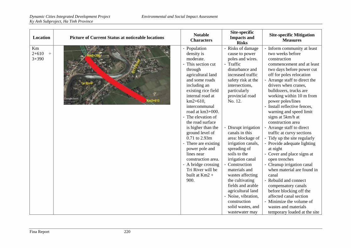
Dynamic Cities Integrated Development Project Environmental and Social Impact Assessment
Ky Anh Subproject, Ha Tinh Province
Fina Report 220
Location Picture of Current Status at noticeable locations Notable
Characters
Site-specific
Impacts and
Risks
Site-specific Mitigation
Measures
Km
2+610 ÷
3+390
- Population
density is
moderate.
- This section cut
through
agricultural land
and some roads
including an
existing rice field
internal road at
km2+610,
intercommunal
road at km3+000.
- The elevation of
the road surface
is higher than the
ground level of
0.71 to 2.93m
- There are existing
power pole and
lines near
construction area.
- A bridge crossing
Tri River will be
built at Km2 +
900.
- Risks of damage
cause to power
poles and wires.
- Traffic
disturbance and
increased traffic
safety risk at the
intersections,
particularly
provincial road
No. 12.
- Disrupt irrigation
canals in this
area: blockage of
irrigation canals,
spreading of
soils to the
irrigation canal
- Construction
materials and
wastes affecting
the cultivating
fields and arable
agricultural land
- Noise, vibration,
construction
solid wastes, and
wastewater may
- Inform community at least
two weeks before
construction
commencement and at least
two days before power cut
off for poles relocation
- Arrange staff to direct the
drivers when cranes,
bulldozers, trucks are
working within 10 m from
power poles/lines
- Install reflective fences,
warning and speed limit
signs at 5km/h at
construction area
- Arrange staff to direct
traffic at curvy sections
- Tidy up the site regularly
- Provide adequate lighting
at night
- Cover and place signs at
open trenches
- Cleanup irrigation canal
when material are found in
canal
- Rebuild and connect
compensatory canals
before blocking off the
affected canal section
- Minimize the volume of
wastes and materials
temporary loaded at the site
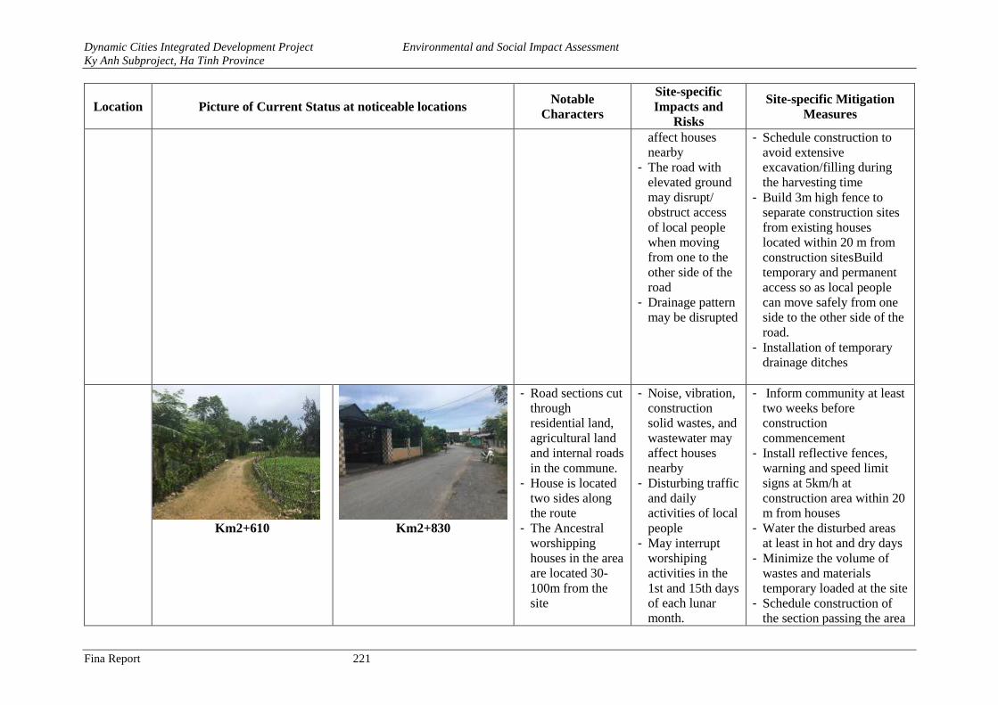
Dynamic Cities Integrated Development Project Environmental and Social Impact Assessment
Ky Anh Subproject, Ha Tinh Province
Fina Report 221
Location Picture of Current Status at noticeable locations Notable
Characters
Site-specific
Impacts and
Risks
Site-specific Mitigation
Measures
affect houses
nearby
- The road with
elevated ground
may disrupt/
obstruct access
of local people
when moving
from one to the
other side of the
road
- Drainage pattern
may be disrupted
- Schedule construction to
avoid extensive
excavation/filling during
the harvesting time
- Build 3m high fence to
separate construction sites
from existing houses
located within 20 m from
construction sitesBuild
temporary and permanent
access so as local people
can move safely from one
side to the other side of the
road.
- Installation of temporary
drainage ditches
Km2+610 Km2+830
- Road sections cut
through
residential land,
agricultural land
and internal roads
in the commune.
- House is located
two sides along
the route
- The Ancestral
worshipping
houses in the area
are located 30-
100m from the
site
- Noise, vibration,
construction
solid wastes, and
wastewater may
affect houses
nearby
- Disturbing traffic
and daily
activities of local
people
- May interrupt
worshiping
activities in the
1st and 15th days
of each lunar
month.
- Inform community at least
two weeks before
construction
commencement
- Install reflective fences,
warning and speed limit
signs at 5km/h at
construction area within 20
m from houses
- Water the disturbed areas
at least in hot and dry days
- Minimize the volume of
wastes and materials
temporary loaded at the site
- Schedule construction of
the section passing the area
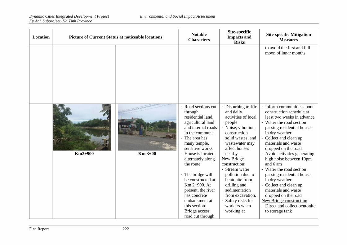
Dynamic Cities Integrated Development Project Environmental and Social Impact Assessment
Ky Anh Subproject, Ha Tinh Province
Fina Report 222
Location Picture of Current Status at noticeable locations Notable
Characters
Site-specific
Impacts and
Risks
Site-specific Mitigation
Measures
to avoid the first and full
moon of lunar months
Km2+900
Km 3+00
- Road sections cut
through
residential land,
agricultural land
and internal roads
in the commune.
- The area has
many temple,
sensitive works
- House is located
alternately along
the route
- The bridge will
be constructed at
Km 2+900. At
present, the river
has concrete
embankment at
this section.
Bridge access
road cut through
- Disturbing traffic
and daily
activities of local
people
- Noise, vibration,
construction
solid wastes, and
wastewater may
affect houses
nearby
New Bridge
construction:
- Stream water
pollution due to
bentonite from
drilling and
sedimentation
from excavation.
- Safety risks for
workers when
working at
- Inform communities about
construction schedule at
least two weeks in advance
- Water the road section
passing residential houses
in dry weather
- Collect and clean up
materials and waste
dropped on the road
- Avoid activities generating
high noise between 10pm
and 6 am
- Water the road section
passing residential houses
in dry weather
- Collect and clean up
materials and waste
dropped on the road
New Bridge construction:
- Direct and collect bentonite
to storage tank
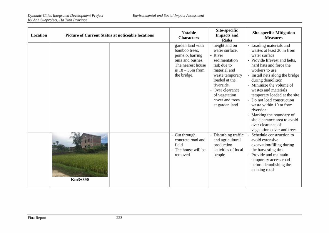
Dynamic Cities Integrated Development Project Environmental and Social Impact Assessment
Ky Anh Subproject, Ha Tinh Province
Fina Report 223
Location Picture of Current Status at noticeable locations Notable
Characters
Site-specific
Impacts and
Risks
Site-specific Mitigation
Measures
garden land with
bamboo trees,
pomelo, barring
onia and bushes.
The nearest house
is 18 – 35m from
the bridge.
height and on
water surface.
- River
sedimentation
risk due to
material and
waste temporary
loaded at the
riverside.
- Over clearance
of vegetation
cover and trees
at garden land
- Loading materials and
wastes at least 20 m from
water surface
- Provide lifevest and belts,
hard hats and force the
workers to use
- Install nets along the bridge
during demolition
- Minimize the volume of
wastes and materials
temporary loaded at the site
- Do not load construction
waste within 10 m from
riverside
- Marking the boundary of
site clearance area to avoid
over clearance of
vegetation cover and trees
Km3+390
- Cut through
concrete road and
field
- The house will be
removed
- Disturbing traffic
and agricultural
production
activities of local
people
- Schedule construction to
avoid extensive
excavation/filling during
the harvesting time
- Provide and maintain
temporary access road
before demolishing the
existing road
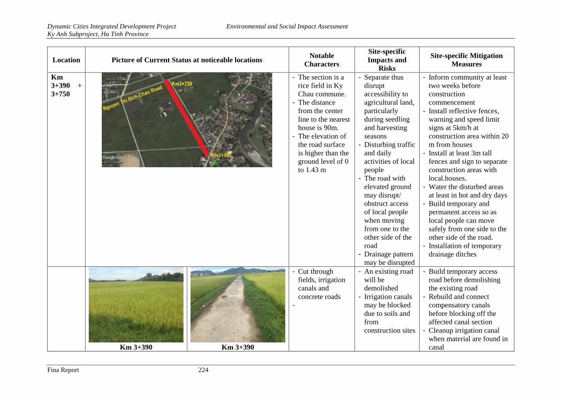
Dynamic Cities Integrated Development Project Environmental and Social Impact Assessment
Ky Anh Subproject, Ha Tinh Province
Fina Report 224
Location Picture of Current Status at noticeable locations Notable
Characters
Site-specific
Impacts and
Risks
Site-specific Mitigation
Measures
Km
3+390 ÷
3+750
- The section is a
rice field in Ky
Chau commune.
- The distance
from the center
line to the nearest
house is 90m.
- The elevation of
the road surface
is higher than the
ground level of 0
to 1.43 m
- Separate thus
disrupt
accessibility to
agricultural land,
particularly
during seedling
and harvesting
seasons
- Disturbing traffic
and daily
activities of local
people
- The road with
elevated ground
may disrupt/
obstruct access
of local people
when moving
from one to the
other side of the
road
- Drainage pattern
may be disrupted
- Inform community at least
two weeks before
construction
commencement
- Install reflective fences,
warning and speed limit
signs at 5km/h at
construction area within 20
m from houses
- Install at least 3m tall
fences and sign to separate
construction areas with
local.houses.
- Water the disturbed areas
at least in hot and dry days
- Build temporary and
permanent access so as
local people can move
safely from one side to the
other side of the road.
- Installation of temporary
drainage ditches
Km 3+390 Km 3+390
- Cut through
fields, irrigation
canals and
concrete roads
-
- An existing road
will be
demolished
- Irrigation canals
may be blocked
due to soils and
from
construction sites
- Build temporary access
road before demolishing
the existing road
- Rebuild and connect
compensatory canals
before blocking off the
affected canal section
- Cleanup irrigation canal
when material are found in
canal
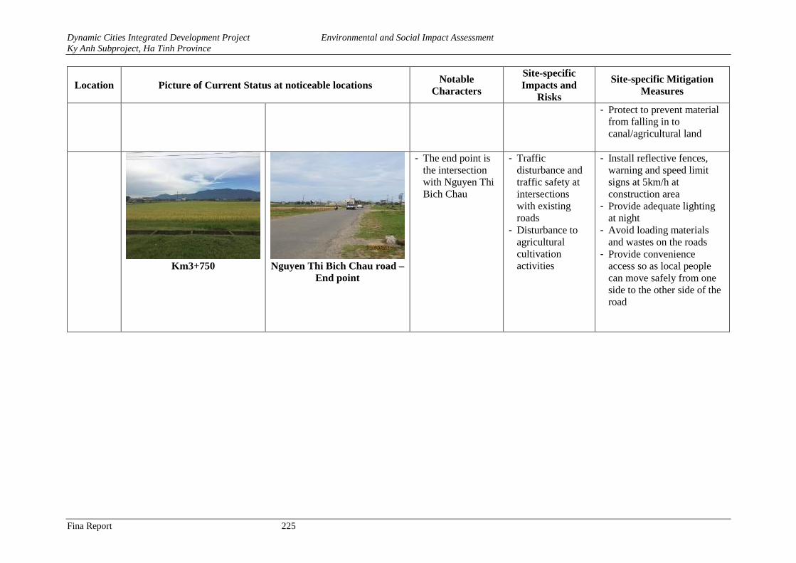
Dynamic Cities Integrated Development Project Environmental and Social Impact Assessment
Ky Anh Subproject, Ha Tinh Province
Fina Report 225
Location Picture of Current Status at noticeable locations Notable
Characters
Site-specific
Impacts and
Risks
Site-specific Mitigation
Measures
- Protect to prevent material
from falling in to
canal/agricultural land
Km3+750 Nguyen Thi Bich Chau road –
End point
- The end point is
the intersection
with Nguyen Thi
Bich Chau
- Traffic
disturbance and
traffic safety at
intersections
with existing
roads
- Disturbance to
agricultural
cultivation
activities
- Install reflective fences,
warning and speed limit
signs at 5km/h at
construction area
- Provide adequate lighting
at night
- Avoid loading materials
and wastes on the roads
- Provide convenience
access so as local people
can move safely from one
side to the other side of the
road
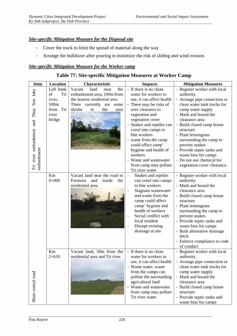
Dynamic Cities Integrated Development Project Environmental and Social Impact Assessment
Ky Anh Subproject, Ha Tinh Province
Fina Report 226
Site-specific Mitigation Measure for the Disposal site
- Cover the truck to limit the spread of material along the way
- Arrange the bulldozer after pouring to minimize the risk of sliding and wind erosion.
Site-specific Mitigation Measure for the Worker camp
Table 77: Site-specific Mitigation Measures at Worker Camp
Item Location Characteristic Impacts Mitigation Measures
Tri
ri
ver
em
ban
km
ent
and
T
hu
y
So
n
lak
e
emban
km
ent
Left bank
of Tri
river,
500m
from Tri
river
bridge
Vacant land near the
embankment area, 100m from
the nearest residential area
There currently are some
shrubs in the area
- If there is no clean
water for workers to
use, it can affect health
- There may be risks of
over clearance to
vegetation and
vegetation cover
- Snakes and reptiles can
crawl into camps to
bite workers
- waste from the camp
could affect camp’
hygiene and health of
workers
- Waste and wastewater
from camp may pollute
Tri river water
- Register worker with local
authority.
- Arrange pipe connection or
clean water tank trucks for
camp water supply
- Mark and bound the
clearance area
- Build closed camp house
structure
- Plant lemongrass
surrounding the camp to
prevent snakes
- Provide septic tanks and
waste bins for camps
- Do not use chemical for
vegetation cover clearance.
Mai
n c
entr
al r
oad
Km
0+000
Vacant land near the road to
Formosa and inside the
residential area.
- Snakes and reptiles
can crawl into camps
to bite workers
- Stagnant wastewater
and waste from the
camp could affect
camp’ hygiene and
health of workers
- Social conflict with
local resident
- Disrupt existing
drainage at site
- Register worker with local
authority.
- Mark and bound the
clearance area
- Build closed camp house
structure
- Plant lemongrass
surrounding the camp to
prevent snakes
- Provide septic tanks and
waste bins for camps
- Built alternative drainage
ditch.
- Enforce compliance to code
of conduct
Km
2+610
Vacant land, 50m from the
residential area and Tri river
- If there is no clean
water for workers to
use, it can affect health
- Waste water, waste
from the camps can
pollute the surrounding
agricultural land
- Waste and wastewater
from camp may pollute
Tri river water
- Register worker with local
authority.
- Arrange pipe connection or
clean water tank trucks for
camp water supply
- Mark and bound the
clearance area
- Build closed camp house
structure
- Provide septic tanks and
waste bins for camps
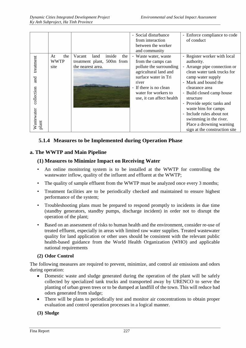
Dynamic Cities Integrated Development Project Environmental and Social Impact Assessment
Ky Anh Subproject, Ha Tinh Province
Fina Report 227
- Social disturbance
from interaction
between the worker
and community
- Enforce compliance to code
of conduct
Was
tew
ater
co
llec
tion
an
d
trea
tmen
t
pla
nt
At the
WWTP
site
Vacant land inside the
treatment plant, 500m from
the nearest area.
- Waste water, waste
from the camps can
pollute the surrounding
agricultural land and
surface water in Tri
river
- If there is no clean
water for workers to
use, it can affect health
- Register worker with local
authority.
- Arrange pipe connection or
clean water tank trucks for
camp water supply
- Mark and bound the
clearance area
- Build closed camp house
structure
- Provide septic tanks and
waste bins for camps
- Include rules about not
swimming in the river.
Place a drowning warning
sign at the construction site
5.1.4 Measures to be Implemented during Operation Phase
a. The WWTP and Main Pipeline
(1) Measures to Minimize Impact on Receiving Water
• An online monitoring system is to be installed at the WWTP for controlling the
wastewater inflow, quality of the influent and effluent at the WWTP;
• The quality of sample effluent from the WWTP must be analyzed once every 3 months;
• Treatment facilities are to be periodically checked and maintained to ensure highest
performance of the system;
• Troubleshooting plans must be prepared to respond promptly to incidents in due time
(standby generators, standby pumps, discharge incident) in order not to disrupt the
operation of the plant;
• Based on an assessment of risks to human health and the environment, consider re-use of
treated effluent, especially in areas with limited raw water supplies. Treated wastewater
quality for land application or other uses should be consistent with the relevant public
health-based guidance from the World Health Organization (WHO) and applicable
national requirements
(2) Odor Control
The following measures are required to prevent, minimize, and control air emissions and odors
during operation:
• Domestic waste and sludge generated during the operation of the plant will be safely
collected by specialized tank trucks and transported away by URENCO to serve the
planting of urban green trees or to be dumped at landfill of the town. This will reduce bad
odors generated from sludge;
• There will be plans to periodically test and monitor air concentrations to obtain proper
evaluation and control operation processes in a logical manner.
(3) Sludge
Dynamic Cities Integrated Development Project Environmental and Social Impact Assessment
Ky Anh Subproject, Ha Tinh Province
Fina Report 228
• Land application or other beneficial re-use of the WWTP residuals should be considered
but only based on an assessment of risks to human health and the environment. Quality
of residuals for land application should be consistent with the relevant public health-
based guidance from the World Health Organization (WHO)19 and applicable national
requirements;
• Processing, disposal and re-use of wastewater treatment plant residuals should be
consistent with applicable national requirements;
• URENCO will be employed to periodically dredge sludge from sewer systems and
transport this sludge for disposal at landfill. Transportation will be carried out by
specialized tank trucks to avoid odor emission and sludge spillage along the route.
(4) Domestic Wastewater
Domestic wastewater from the WWTP will be pretreated through 3 compartments of septic tanks
before being discharged into combined sewers and will be directed to the treatment area.
(5) Hazardous Waste
• The subproject owner will register as the owner of hazardous waste according to Circular
No. 36/2015/TT-BTNMT dated 30 June 2015 on hazardous waste management;
• Containers of hazardous waste are to be placed on flat floors without tilting, tumbling,
and must be free from stormwater infiltration. Collected hazardous waste will be stored
in containers/houses and labeled as currently stipulated. Packaging materials for
chemicals will be returned to the suppliers;
• Once every 2-3 months, the WWTP will have to employ a local contractor tasked with
handing hazardous waste to collect, transport and handle such waste;
• Empty chlorine containers are to be returned to manufacturers
5.2 Implementation Arrangements, Roles and Responsibilities
5.2.1 Institutional Arrangements
The key stake holders in environmental management of the Project include the Project
Management Unit, the Construction Supervision Consultant, the Contractor, Ministry of Natural
Resources and Environment, Ky Anh Provincial Department of Natural Resources and
Environment, People’s Committees at town/districts and communes levels. The relationships and
contacts between the key stakeholders in the environmental management of the project are shown
in Figure 43.
19 WHO Guidelines for the Safe Use of Wastewater, Excreta and Greywater (2006).
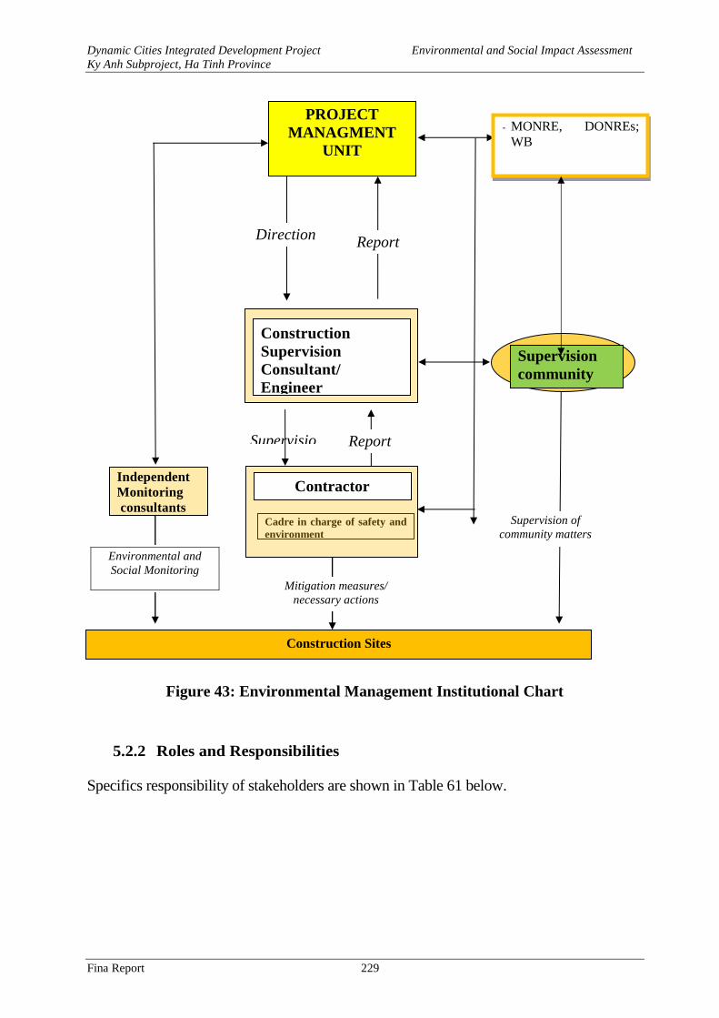
Dynamic Cities Integrated Development Project Environmental and Social Impact Assessment
Ky Anh Subproject, Ha Tinh Province
Fina Report 229
Figure 43: Environmental Management Institutional Chart
5.2.2 Roles and Responsibilities
Specifics responsibility of stakeholders are shown in Table 61 below.
Construction Sites
PROJECT
MANAGMENT
UNIT
Supervisio
n Report
Cadre in charge of safety and
environment
Supervision
community
Environmental and
Social Monitoring
Mitigation measures/
necessary actions
Supervision of
community matters
Construction
Supervision
Consultant/
Engineer
- MONRE, DONREs;
WB
Direction Report
Contractor Independent
Monitoring
consultants
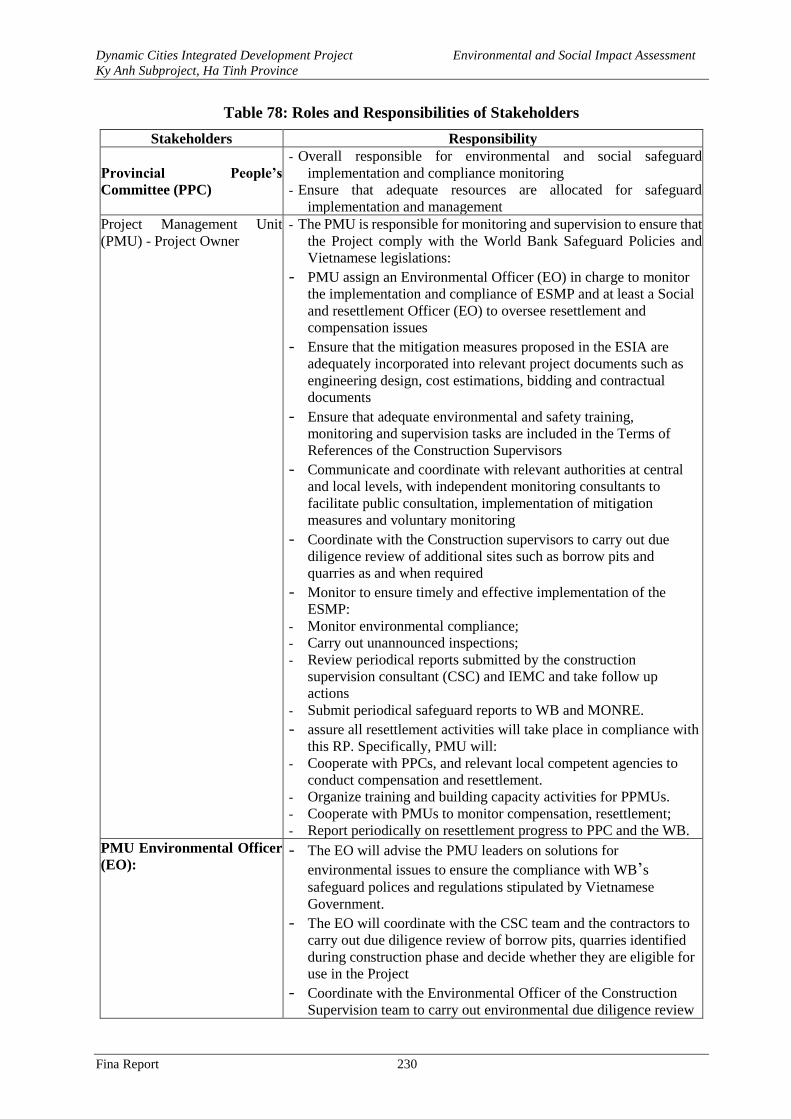
Dynamic Cities Integrated Development Project Environmental and Social Impact Assessment
Ky Anh Subproject, Ha Tinh Province
Fina Report 230
Table 78: Roles and Responsibilities of Stakeholders
Stakeholders Responsibility
Provincial People’s
Committee (PPC)
- Overall responsible for environmental and social safeguard
implementation and compliance monitoring
- Ensure that adequate resources are allocated for safeguard
implementation and management
Project Management Unit
(PMU) - Project Owner
- The PMU is responsible for monitoring and supervision to ensure that
the Project comply with the World Bank Safeguard Policies and
Vietnamese legislations:
- PMU assign an Environmental Officer (EO) in charge to monitor
the implementation and compliance of ESMP and at least a Social
and resettlement Officer (EO) to oversee resettlement and
compensation issues - Ensure that the mitigation measures proposed in the ESIA are
adequately incorporated into relevant project documents such as
engineering design, cost estimations, bidding and contractual
documents - Ensure that adequate environmental and safety training,
monitoring and supervision tasks are included in the Terms of
References of the Construction Supervisors - Communicate and coordinate with relevant authorities at central
and local levels, with independent monitoring consultants to
facilitate public consultation, implementation of mitigation
measures and voluntary monitoring - Coordinate with the Construction supervisors to carry out due
diligence review of additional sites such as borrow pits and
quarries as and when required - Monitor to ensure timely and effective implementation of the
ESMP: - Monitor environmental compliance;
- Carry out unannounced inspections;
- Review periodical reports submitted by the construction
supervision consultant (CSC) and IEMC and take follow up
actions
- Submit periodical safeguard reports to WB and MONRE.
- assure all resettlement activities will take place in compliance with
this RP. Specifically, PMU will: - Cooperate with PPCs, and relevant local competent agencies to
conduct compensation and resettlement.
- Organize training and building capacity activities for PPMUs.
- Cooperate with PMUs to monitor compensation, resettlement;
- Report periodically on resettlement progress to PPC and the WB.
PMU Environmental Officer
(EO): - The EO will advise the PMU leaders on solutions for
environmental issues to ensure the compliance with WB’s
safeguard polices and regulations stipulated by Vietnamese
Government. - The EO will coordinate with the CSC team and the contractors to
carry out due diligence review of borrow pits, quarries identified
during construction phase and decide whether they are eligible for
use in the Project - Coordinate with the Environmental Officer of the Construction
Supervision team to carry out environmental due diligence review
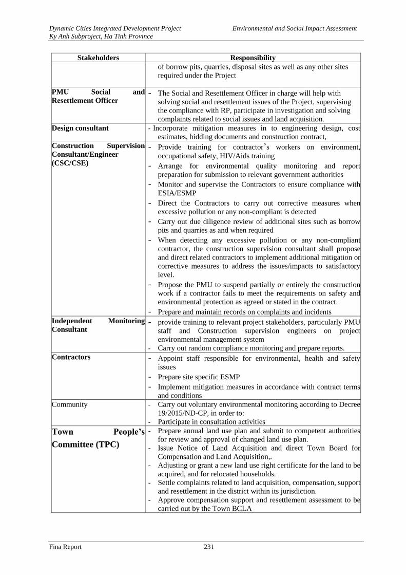
Dynamic Cities Integrated Development Project Environmental and Social Impact Assessment
Ky Anh Subproject, Ha Tinh Province
Fina Report 231
Stakeholders Responsibility of borrow pits, quarries, disposal sites as well as any other sites
required under the Project
PMU Social and
Resettlement Officer - The Social and Resettlement Officer in charge will help with
solving social and resettlement issues of the Project, supervising
the compliance with RP, participate in investigation and solving
complaints related to social issues and land acquisition. Design consultant - Incorporate mitigation measures in to engineering design, cost
estimates, bidding documents and construction contract,
Construction Supervision
Consultant/Engineer
(CSC/CSE)
- Provide training for contractor’s workers on environment,
occupational safety, HIV/Aids training - Arrange for environmental quality monitoring and report
preparation for submission to relevant government authorities - Monitor and supervise the Contractors to ensure compliance with
ESIA/ESMP - Direct the Contractors to carry out corrective measures when
excessive pollution or any non-compliant is detected - Carry out due diligence review of additional sites such as borrow
pits and quarries as and when required - When detecting any excessive pollution or any non-compliant
contractor, the construction supervision consultant shall propose
and direct related contractors to implement additional mitigation or
corrective measures to address the issues/impacts to satisfactory
level. - Propose the PMU to suspend partially or entirely the construction
work if a contractor fails to meet the requirements on safety and
environmental protection as agreed or stated in the contract. - Prepare and maintain records on complaints and incidents
Independent Monitoring
Consultant - provide training to relevant project stakeholders, particularly PMU
staff and Construction supervision engineers on project
environmental management system - Carry out random compliance monitoring and prepare reports.
Contractors - Appoint staff responsible for environmental, health and safety
issues - Prepare site specific ESMP - Implement mitigation measures in accordance with contract terms
and conditions Community - Carry out voluntary environmental monitoring according to Decree
19/2015/ND-CP, in order to:
- Participate in consultation activities
Town People’s
Committee (TPC)
- Prepare annual land use plan and submit to competent authorities
for review and approval of changed land use plan.
- Issue Notice of Land Acquisition and direct Town Board for
Compensation and Land Acquisition,.
- Adjusting or grant a new land use right certificate for the land to be
acquired, and for relocated households.
- Settle complaints related to land acquisition, compensation, support
and resettlement in the district within its jurisdiction.
- Approve compensation support and resettlement assessment to be
carried out by the Town BCLA
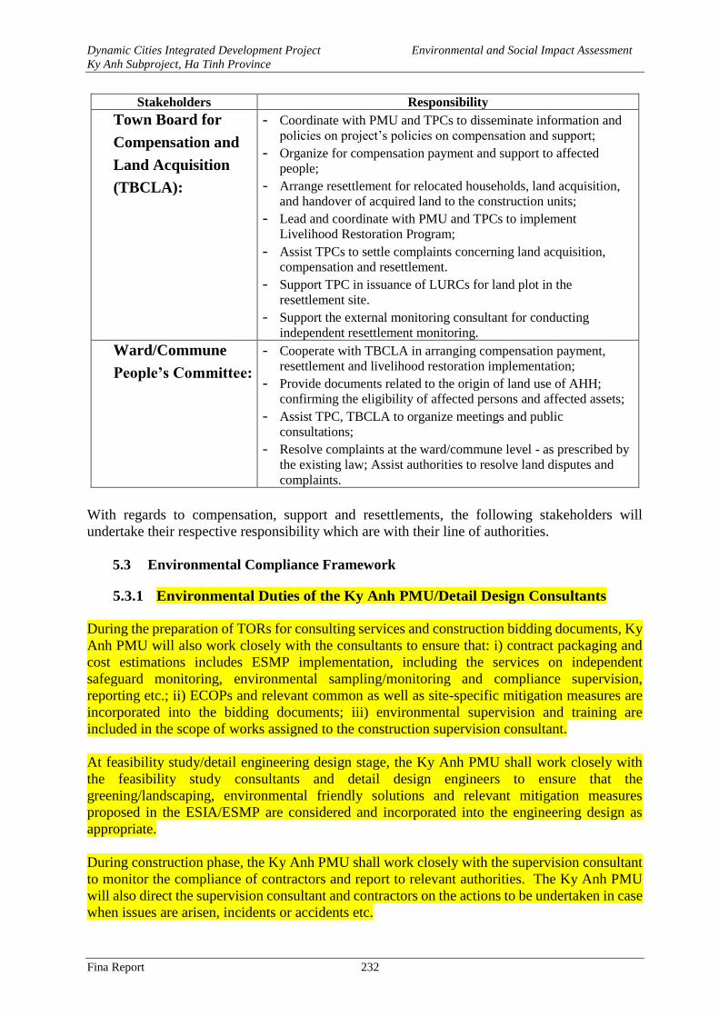
Dynamic Cities Integrated Development Project Environmental and Social Impact Assessment
Ky Anh Subproject, Ha Tinh Province
Fina Report 232
Stakeholders Responsibility
- Town Board for
Compensation and
Land Acquisition
(TBCLA):
- Coordinate with PMU and TPCs to disseminate information and
policies on project’s policies on compensation and support; - Organize for compensation payment and support to affected
people; - Arrange resettlement for relocated households, land acquisition,
and handover of acquired land to the construction units; - Lead and coordinate with PMU and TPCs to implement
Livelihood Restoration Program; - Assist TPCs to settle complaints concerning land acquisition,
compensation and resettlement. - Support TPC in issuance of LURCs for land plot in the
resettlement site. - Support the external monitoring consultant for conducting
independent resettlement monitoring.
- Ward/Commune
People’s Committee:
- Cooperate with TBCLA in arranging compensation payment,
resettlement and livelihood restoration implementation; - Provide documents related to the origin of land use of AHH;
confirming the eligibility of affected persons and affected assets; - Assist TPC, TBCLA to organize meetings and public
consultations; - Resolve complaints at the ward/commune level - as prescribed by
the existing law; Assist authorities to resolve land disputes and
complaints.
With regards to compensation, support and resettlements, the following stakeholders will
undertake their respective responsibility which are with their line of authorities.
5.3 Environmental Compliance Framework
5.3.1 Environmental Duties of the Ky Anh PMU/Detail Design Consultants
During the preparation of TORs for consulting services and construction bidding documents, Ky
Anh PMU will also work closely with the consultants to ensure that: i) contract packaging and
cost estimations includes ESMP implementation, including the services on independent
safeguard monitoring, environmental sampling/monitoring and compliance supervision,
reporting etc.; ii) ECOPs and relevant common as well as site-specific mitigation measures are
incorporated into the bidding documents; iii) environmental supervision and training are
included in the scope of works assigned to the construction supervision consultant.
At feasibility study/detail engineering design stage, the Ky Anh PMU shall work closely with
the feasibility study consultants and detail design engineers to ensure that the
greening/landscaping, environmental friendly solutions and relevant mitigation measures
proposed in the ESIA/ESMP are considered and incorporated into the engineering design as
appropriate.
During construction phase, the Ky Anh PMU shall work closely with the supervision consultant
to monitor the compliance of contractors and report to relevant authorities. The Ky Anh PMU
will also direct the supervision consultant and contractors on the actions to be undertaken in case
when issues are arisen, incidents or accidents etc.
Dynamic Cities Integrated Development Project Environmental and Social Impact Assessment
Ky Anh Subproject, Ha Tinh Province
Fina Report 233
The Ky Anh PMU will assign at least one staff with suitable qualifications to be Environmental
Officer (EO) throughout project implementation. The EO will oversee environmental issues and
monitor safeguard compliance of the subproject. The EO will be supported by the Independent
Monitorign Consultant, the Environmetnal Officers of the construction supervision team as well
as the contractors.
5.3.2 Environmental Duties of the Contractors
The contractors firstly shall adhere to minimize impacts that may result from the project
construction activities and secondly, apply the mitigation measures stated in the ESMP to prevent
harm and nuisances on local communities and the environment caused the construction and
operation phases.
Remedial actions that cannot be effectively carried out during construction should be
implemented upon completion of the works (and before issuance of the Works Acceptance
Certificates).
The Contractors’ duties include but not limit to:
- Comply with relevant legislative requirements governing the environment, public health and
safety;
- Work within the scope of contractual requirements and other tender conditions;
- Organize representatives of the construction team to participate in the joint site inspections
undertaken by the Environmental Supervisors (ES) of the CSC;
- Carry out any corrective actions instructed by the Environmental Officer (EO) of the PMU
and the ES;
- In case of non-compliances/ discrepancies, carry out investigation and submit proposals on
mitigation measures, and implement remedial measures to reduce environmental impacts;
- Stop construction activities, which generate adverse impacts, upon receiving instructions from
the EO and the ES. Propose and implement corrective actions and carry out alternative
construction methods, if required, to minimize the environmental impacts; Non-compliance
by the Contractor will be cause for suspension of works and other penalties until the non-
compliance has been resolved to the satisfaction of the EO and the ES.
- In case the contractor proposes to use source of raw materials that have not been covered in
subproject ESIA, the contractor will report to the CSCs and PMUs and coordinate with them
in carrying out due –diligence environmental review of these materials sources to assess their
compliance to national environmental requirements. Only complied sources can be used
under DCIDP.
- The contractor shall be responsible for implementation of corrective measures at his costs.
The contractor shall also be responsible for paying the costs of damages caused by non-
compliance to ESMO and/or applicable environmental regulations.
5.3.3 Contractor’s Environmental and Social Management Plan (CESMP)
After contract signing, based on the approved ESIA and contractual conditions, the contractors
will prepare a Contractor’s Site-specific Environmental Management Plan (CESMP) for each
contract packages and submit to the CSC and PMU for review and clearance.
Dynamic Cities Integrated Development Project Environmental and Social Impact Assessment
Ky Anh Subproject, Ha Tinh Province
Fina Report 234
The objective of the Contractor Environmental and Social Management Plan (CESMP) is to
provide information for environmental management during the proposed works/activities on site
of Ky Anh subproject. This is to ensure that the Contractor (and any subcontractors) have
minimal impact on the environment. The CESMP will detail how the contractor will mitigate
construction impacts and documents the contractor’s response to inspecting, monitoring,
verifying, internal auditing and correcting or improving environmental performance. The
CESMP must be site-specific and should include details of control measures that will be
implemented on site to minimize any potential environmental impacts from the proposed
works/activities. If the proposed works/activities contained within the CESMP are altered during
the Contract, the CESMP will be required to be modified by the Contractor to reflect these
changes or modifications. The contents of the CESMP should include the followings:
(i) A statement of policy, providing a definition of the Contractor’s environmental policy
and an indication of commitment to the execution of its Site Environmental
Management Plan.
(ii) A brief document description; Date of issue; Revision status; Distribution list; and
preparation personnel details and signoff.
(iii) Applicable laws and regulations associated with the requirements in the subproject
ESMP.
(iv) Identification of the contractor licenses, permits and approval associated with the
CESMP.
(v) Details on how the environmental impacts identified in the subproject ESIA will be
managed on site, including: 1) the site-specific measures to mitigate impacts during
construction; 2) ECOPs; 3) the Contractor ESMP to be developed after the contractor
is selected and before construction starts; and 4) the Contractor’s Dredging
Management Plan that the contractor is required to develop.
(vi) Contractor’s plan to carry out self-monitoring of implementation of the CESMP.
(vii) Detailed environmental training that all site contractor personnel (including
subcontractors) are required to undertake. As a minimum all contractor personnel
working at the subproject sites must: i) be familiar and understand the CESMP for
the works; ii) be aware of their environmental responsibilities and legal obligations
on site; and iii) undertake health and safety and emergency response training.
(viii) Specific capabilities, support mechanisms and resources necessary to satisfactorily
implement the CESMP. Detailed environmental responsibilities of all contractor
personnel including subcontractors working on site with appropriate knowledge,
skills and training for specific tasks shall be identified.
(ix) The contractor shall be responsible for preparing monthly environmental reports, as
a section within the Progress report required in the bidding document, including
accidental report if any, for submitting to the subproject owner. The contents of these
reports may include following details:
- Implementation of the Contractor’s CESMP complying with the agreed program;
- Any difficulties encountered in the implementation of the CESMP and
recommendations for remedying them for the future;
- The number and type of non-compliances and proposed corrective actions;
Dynamic Cities Integrated Development Project Environmental and Social Impact Assessment
Ky Anh Subproject, Ha Tinh Province
Fina Report 235
- Reports from the Subcontractors involved in the implementation of the CESMP,
including minutes of meetings and discussions held by the Contractor;
- Minutes of meeting from discussions held with the subproject owner regarding
implementation of the CESMP.
5.3.4 Contractor’s Site Environment Officer (SEO)
The Contractor shall be required to appoint a competent individual as the Contractor’s Site
Environmental Officer (SEO). The SEO must be appropriately trained in environmental
management and possess necessary skills to transfer environmental management knowledge to
all personnel involved in the contract. The SEO will be responsible for monitoring the
contractor‘s compliance with the ESMP requirements and the environmental specifications. The
duties of the SEO shall include but not limit to the following:
- Carry out environmental site inspections to assess and audit the contractors' site practice,
equipment and work methods with respect to pollution control and adequacy of
environmental mitigation measures implemented;
- Monitor compliance with environmental protection measures, pollution prevention and
control measures and contractual requirements;
- Monitor the implementation of environmental mitigation measures;
- Prepare audit reports for the environmental monitoring data and site environmental
conditions;
- Investigate complaints and recommend any required corrective measures;
- Advise the contractor on environment improvement, awareness and proactive pollution
prevention measures;
- Recommend suitable mitigation measures to the contractor in the case of non-compliance.
Carry out additional monitoring of noncompliance instructed by the EO/ES;
- Inform the contractor and ECO/ES of environmental issues, submit contractor’s ESMP
Implementation Plan to the ECO/ES, and relevant authorities, if required;
- Keep detailed records of all site activities that may relate to the environment.
5.3.5 Independent Environmental Monitoring Consultant (IEMC)
The Independent Environmental Monitoring Consultant (IEMC) contracted by PMU shall carry
out the monitoring.
- Provide training for PMU and the CSC, and the representatives of the Contractors on socio-
environmental, health and safety issues related to construction;
- Evaluate environmental quality at the areas affected by the construction activities (including
site observations, reviewing environmental monitoring reports provided by the CSC);
- Review contractor’s environmental compliance including the implementation of mitigation
measures and documentation;
- Review PMU and CSC compliance to ESMP.
- The IEMC will also provide technical advice and assistance to the PMU and the EO in
environmental matters.
Dynamic Cities Integrated Development Project Environmental and Social Impact Assessment
Ky Anh Subproject, Ha Tinh Province
Fina Report 236
5.3.6 Environmental Supervision during Construction
During th e construction phase, a team of qualified Environmental Supervisors (ES) as part of
the Construction Supervision Consultant (CSC) shall carry out environmental supervision as part
of construction supervision. Both the CSC and ES will be mobilized before the commencement
of any construction activities. The CSC and ES are responsible for inspecting and supervising
all construction activities to ensure that mitigation measures adopted in the ESMP are properly
implemented, and that the negative environmental impacts of the Project are minimized.
Specifically, the ES will:
- Review and assess on behalf of the PMU whether the construction design meets the
requirements of the mitigation and management measures of the ESMP;
- Review and clear contractor’s SEMP;
- Coordinate with PMU Environmental Officer (EO) in reviewing environmental compliance
at newly proposed borrow pits and quarries and advise PMU on whether these are eligible
for use by the Project;
- Verify and confirm with PMU environmental supervision procedures; parameters,
monitoring locations, equipment and results;
- Supervise contractor’s implementation of its CESMP including their performance,
experience and handling of site environmental issues, and provide corrective instructions if
needed;
- Provide training about HIV /Aids awareness for the contractor’s workers, CSC team and
PMU officers;
- Implement the environmental quality sampling and prepare periodical environmental
monitoring reports, including reports on ESMP implementation status to the PPMU and
prepare environmental supervision statement during the construction phase; and
- Review payment requests related to environmental mitigation costs if applicable
Noting that the involvement of the community in the process of implementing the ESMP is an
activity entirely voluntary in nature, for the benefit of the community and his family. Therefore,
the involvement of communities in monitoring the ESMP will not be receiving salaries.
5.3.7 Compliance with Legal and Contractual Requirements
The constructions activities shall comply not only with the general contractual condition on
environmental protection and pollution control requirements in the bidding document, the
subproject ESMP, and the CESMP, but also with environmental protection and pollution control
laws of the Socialist Republic of Vietnam.
All the works method statements submitted by the Contractors to the ES for approval shall also
be sent to the EO to review whether sufficient environmental protection and pollution control
measures have been included.
The ES shall also review the progress and program of the works to ensure that relevant
environmental laws have not been violated, and that any potential for violating the laws can be
prevented.
The Contractors shall copy relevant documents to the EO and the ES. The documents shall at
least include updated work progress reports, updated work measures, and application letters for
different license/ permits under the environmental protection laws, and all valid license/ permits.
Dynamic Cities Integrated Development Project Environmental and Social Impact Assessment
Ky Anh Subproject, Ha Tinh Province
Fina Report 237
The EO and the ES shall also have access, upon request, to the Site Log-Books.
After reviewing the documents, the EO or the ES shall advise and the Contractors of any non-
compliance with the contractual and legislative requirements on environmental protection and
pollution control for them to take follow-up actions. If the EO or the ES concludes that the status
on license/ permit application and any environmental protection and pollution control
preparation works may not comply with the work measures or may result in potential violation
of environmental protection and pollution control requirements, they shall advise the Contractor
accordingly.
5.3.8 Penalty System
In the compliance framework, if non-compliance with the Contractor’s ESMP and environmental
regulations is discovered by the CSC/PMU during site supervision, 2% of interim payment value
of the contractors of the month will be held back. The Contractors will be given a grace period
(determined by the CSC/PMU) to repair violation. If the Contractors satisfactorily perform the
repairs within the grace period (confirmed by the CSC/PMU), no penalty is incurred and the
upholding money will be paid to the contractor. However, if the Contractors fail to successfully
make necessary repairs within the grace period, the Contractors will pay a third party to repair
the damages (deduction from the retained amount).
In case that the CSC/ES do not detect non-compliance with environmental regulations of the
Contractors, they will be responsible for payment to repair the violation.
5.3.9 RP and Gender Monitoring
The Project Management Unit (PMU) is responsible for conducting internal monitoring the
implementation of the RP. In addition, the PMU will hire an external monitoring agency (EMA)
to undertake independent monitoring of the process of RP implementation and to assess living
standard of the affected people during and after the completion of the resettlement.
Both internal and external (independent) monitoring will regularly (on a monthly basis for internal and
biannual basis for independent monitoring). An end-of-project evaluation on the implementation of
resettlement is required and report will be prepared to confirm whether the objectives of OP 4.12 were
achieved.
5.4 Environmental and Social Monitoring Program
The monitoring of environmental quality will be done during the construction and operation
phase according to Table 79 with costs estimated in Table 80. Monitoring locations is presented
in Annex 3.
Table 79: Environmental Quality Monitoring Program
Parameter and frequency Location
Construction Phase
Air quality
Applicble Regulation: QCVN 26:2010/BTNMT, QCVN 27:2010/BTNMT, QCVN 05:2013/BTNMT
Noise, vibration TSP dust,
CO, SO2 and NO2
Monitoring frequency once
every quarter
MK1- Thuy Son lake near NH1A; Coordinates: 18o4’7”N – 106o17’42”
E.
MK2- Tri bridge; Coordinates: 18o4’18”N – 106o17’30” E.
MK3- Residential area on the left bank of Tri river; Coordinates:
18o4’14”N – 106o17’25” E.
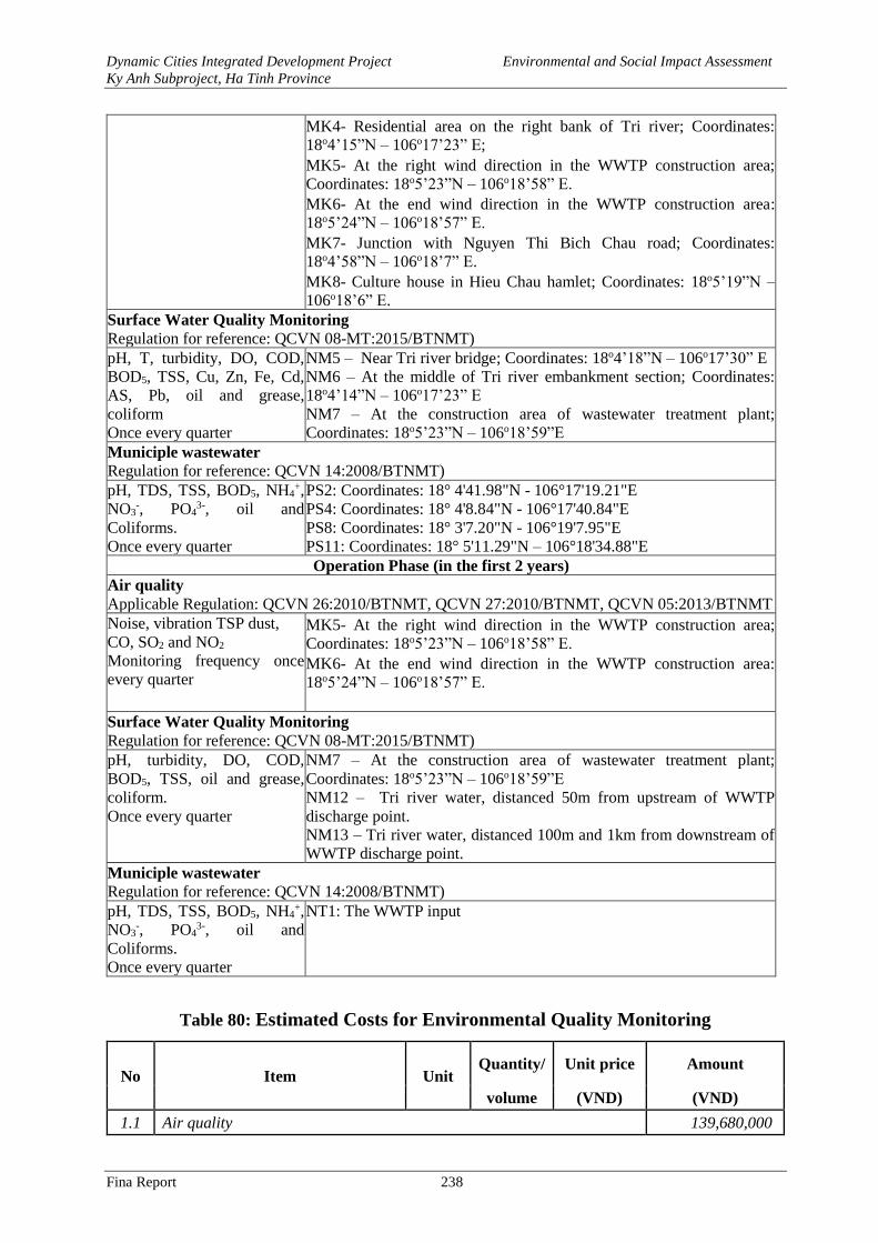
Dynamic Cities Integrated Development Project Environmental and Social Impact Assessment
Ky Anh Subproject, Ha Tinh Province
Fina Report 238
MK4- Residential area on the right bank of Tri river; Coordinates:
18o4’15”N – 106o17’23” E;
MK5- At the right wind direction in the WWTP construction area;
Coordinates: 18o5’23”N – 106o18’58” E.
MK6- At the end wind direction in the WWTP construction area:
18o5’24”N – 106o18’57” E.
MK7- Junction with Nguyen Thi Bich Chau road; Coordinates:
18o4’58”N – 106o18’7” E.
MK8- Culture house in Hieu Chau hamlet; Coordinates: 18o5’19”N –
106o18’6” E.
Surface Water Quality Monitoring
Regulation for reference: QCVN 08-MT:2015/BTNMT)
pH, T, turbidity, DO, COD,
BOD5, TSS, Cu, Zn, Fe, Cd,
AS, Pb, oil and grease,
coliform
Once every quarter
NM5 – Near Tri river bridge; Coordinates: 18o4’18”N – 106o17’30” E
NM6 – At the middle of Tri river embankment section; Coordinates:
18o4’14”N – 106o17’23” E
NM7 – At the construction area of wastewater treatment plant;
Coordinates: 18o5’23”N – 106o18’59”E
Municiple wastewater
Regulation for reference: QCVN 14:2008/BTNMT)
pH, TDS, TSS, BOD5, NH4+,
NO3-, PO4
3-, oil and
Coliforms.
Once every quarter
PS2: Coordinates: 18° 4'41.98"N - 106°17'19.21"E
PS4: Coordinates: 18° 4'8.84"N - 106°17'40.84"E
PS8: Coordinates: 18° 3'7.20"N - 106°19'7.95"E
PS11: Coordinates: 18° 5'11.29"N – 106°18'34.88"E
Operation Phase (in the first 2 years)
Air quality
Applicable Regulation: QCVN 26:2010/BTNMT, QCVN 27:2010/BTNMT, QCVN 05:2013/BTNMT
Noise, vibration TSP dust,
CO, SO2 and NO2
Monitoring frequency once
every quarter
MK5- At the right wind direction in the WWTP construction area;
Coordinates: 18o5’23”N – 106o18’58” E.
MK6- At the end wind direction in the WWTP construction area:
18o5’24”N – 106o18’57” E.
Surface Water Quality Monitoring
Regulation for reference: QCVN 08-MT:2015/BTNMT)
pH, turbidity, DO, COD,
BOD5, TSS, oil and grease,
coliform.
Once every quarter
NM7 – At the construction area of wastewater treatment plant;
Coordinates: 18o5’23”N – 106o18’59”E
NM12 – Tri river water, distanced 50m from upstream of WWTP
discharge point.
NM13 – Tri river water, distanced 100m and 1km from downstream of
WWTP discharge point.
Municiple wastewater
Regulation for reference: QCVN 14:2008/BTNMT)
pH, TDS, TSS, BOD5, NH4+,
NO3-, PO4
3-, oil and
Coliforms.
Once every quarter
NT1: The WWTP input
Table 80: Estimated Costs for Environmental Quality Monitoring
No Item Unit Quantity/ Unit price Amount
volume (VND) (VND)
1.1 Air quality 139,680,000
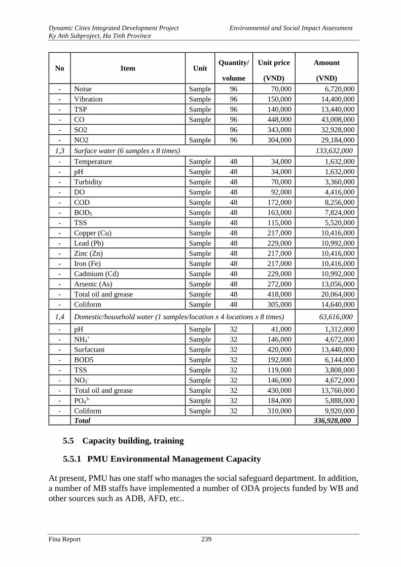
Dynamic Cities Integrated Development Project Environmental and Social Impact Assessment
Ky Anh Subproject, Ha Tinh Province
Fina Report 239
No Item Unit Quantity/ Unit price Amount
volume (VND) (VND)
- Noise Sample 96 70,000 6,720,000
- Vibration Sample 96 150,000 14,400,000
- TSP Sample 96 140,000 13,440,000
- CO Sample 96 448,000 43,008,000
- SO2 96 343,000 32,928,000
- NO2 Sample 96 304,000 29,184,000
1,3 Surface water (6 samples x 8 times) 133,632,000
- Temperature Sample 48 34,000 1,632,000
- pH Sample 48 34,000 1,632,000
- Turbidity Sample 48 70,000 3,360,000
- DO Sample 48 92,000 4,416,000
- COD Sample 48 172,000 8,256,000
- BOD5 Sample 48 163,000 7,824,000
- TSS Sample 48 115,000 5,520,000
- Copper (Cu) Sample 48 217,000 10,416,000
- Lead (Pb) Sample 48 229,000 10,992,000
- Zinc (Zn) Sample 48 217,000 10,416,000
- Iron (Fe) Sample 48 217,000 10,416,000
- Cadmium (Cd) Sample 48 229,000 10,992,000
- Arsenic (As) Sample 48 272,000 13,056,000
- Total oil and grease Sample 48 418,000 20,064,000
- Coliform Sample 48 305,000 14,640,000
1,4 Domestic/household water (1 samples/location x 4 locations x 8 times) 63,616,000
- pH Sample 32 41,000 1,312,000
- NH4+ Sample 32 146,000 4,672,000
- Surfactant Sample 32 420,000 13,440,000
- BOD5 Sample 32 192,000 6,144,000
- TSS Sample 32 119,000 3,808,000
- NO3- Sample 32 146,000 4,672,000
- Total oil and grease Sample 32 430,000 13,760,000
- PO43- Sample 32 184,000 5,888,000
- Coliform Sample 32 310,000 9,920,000
Total 336,928,000
5.5 Capacity building, training
5.5.1 PMU Environmental Management Capacity
At present, PMU has one staff who manages the social safeguard department. In addition,
a number of MB staffs have implemented a number of ODA projects funded by WB and
other sources such as ADB, AFD, etc..
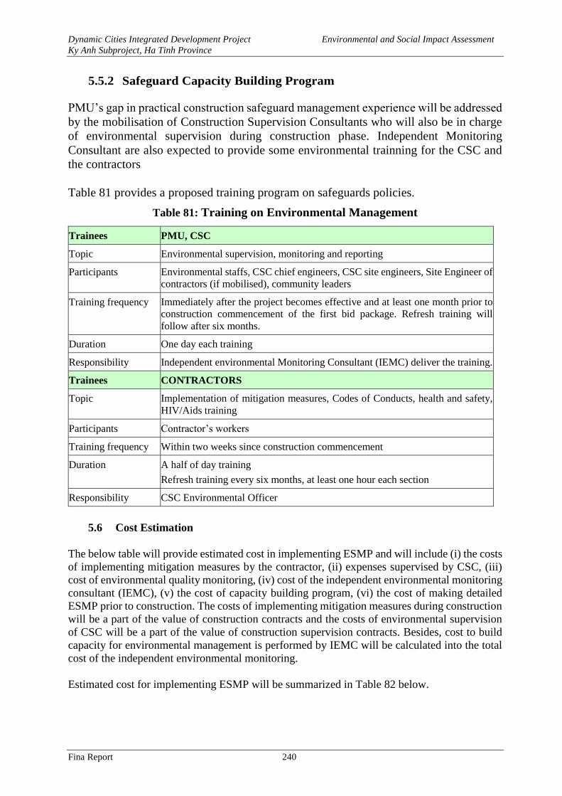
Dynamic Cities Integrated Development Project Environmental and Social Impact Assessment
Ky Anh Subproject, Ha Tinh Province
Fina Report 240
5.5.2 Safeguard Capacity Building Program
PMU’s gap in practical construction safeguard management experience will be addressed
by the mobilisation of Construction Supervision Consultants who will also be in charge
of environmental supervision during construction phase. Independent Monitoring
Consultant are also expected to provide some environmental trainning for the CSC and
the contractors
Table 81 provides a proposed training program on safeguards policies.
Table 81: Training on Environmental Management
Trainees PMU, CSC
Topic Environmental supervision, monitoring and reporting
Participants Environmental staffs, CSC chief engineers, CSC site engineers, Site Engineer of
contractors (if mobilised), community leaders
Training frequency Immediately after the project becomes effective and at least one month prior to
construction commencement of the first bid package. Refresh training will
follow after six months.
Duration One day each training
Responsibility Independent environmental Monitoring Consultant (IEMC) deliver the training.
Trainees CONTRACTORS
Topic Implementation of mitigation measures, Codes of Conducts, health and safety,
HIV/Aids training
Participants Contractor’s workers
Training frequency Within two weeks since construction commencement
Duration A half of day training
Refresh training every six months, at least one hour each section
Responsibility CSC Environmental Officer
5.6 Cost Estimation
The below table will provide estimated cost in implementing ESMP and will include (i) the costs
of implementing mitigation measures by the contractor, (ii) expenses supervised by CSC, (iii)
cost of environmental quality monitoring, (iv) cost of the independent environmental monitoring
consultant (IEMC), (v) the cost of capacity building program, (vi) the cost of making detailed
ESMP prior to construction. The costs of implementing mitigation measures during construction
will be a part of the value of construction contracts and the costs of environmental supervision
of CSC will be a part of the value of construction supervision contracts. Besides, cost to build
capacity for environmental management is performed by IEMC will be calculated into the total
cost of the independent environmental monitoring.
Estimated cost for implementing ESMP will be summarized in Table 82 below.
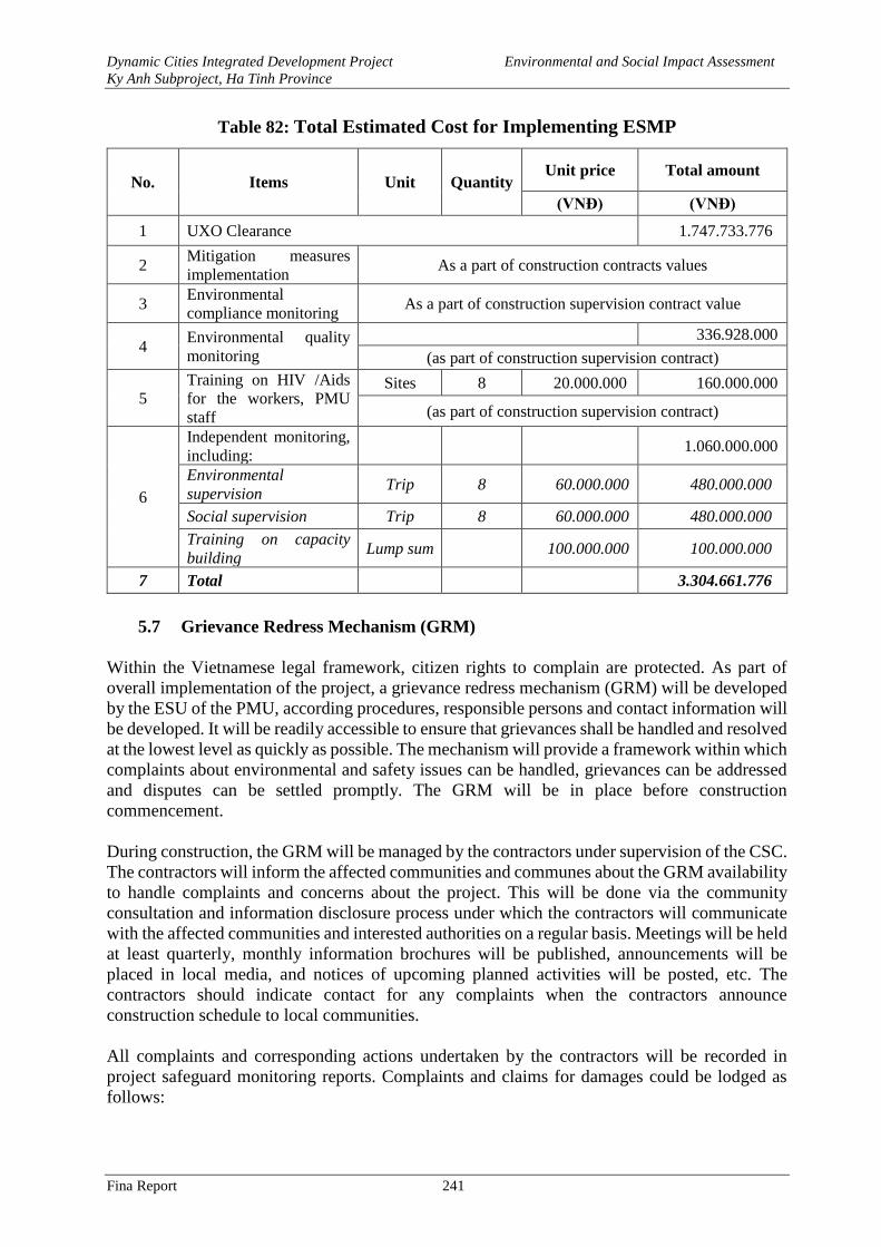
Dynamic Cities Integrated Development Project Environmental and Social Impact Assessment
Ky Anh Subproject, Ha Tinh Province
Fina Report 241
Table 82: Total Estimated Cost for Implementing ESMP
No. Items Unit Quantity Unit price Total amount
(VNĐ) (VNĐ)
1 UXO Clearance 1.747.733.776
2 Mitigation measures
implementation As a part of construction contracts values
3 Environmental
compliance monitoring As a part of construction supervision contract value
4 Environmental quality
monitoring
336.928.000
(as part of construction supervision contract)
5
Training on HIV /Aids
for the workers, PMU
staff
Sites 8 20.000.000 160.000.000
(as part of construction supervision contract)
6
Independent monitoring,
including: 1.060.000.000
Environmental
supervision Trip 8 60.000.000 480.000.000
Social supervision Trip 8 60.000.000 480.000.000
Training on capacity
building Lump sum 100.000.000 100.000.000
7 Total 3.304.661.776
5.7 Grievance Redress Mechanism (GRM)
Within the Vietnamese legal framework, citizen rights to complain are protected. As part of
overall implementation of the project, a grievance redress mechanism (GRM) will be developed
by the ESU of the PMU, according procedures, responsible persons and contact information will
be developed. It will be readily accessible to ensure that grievances shall be handled and resolved
at the lowest level as quickly as possible. The mechanism will provide a framework within which
complaints about environmental and safety issues can be handled, grievances can be addressed
and disputes can be settled promptly. The GRM will be in place before construction
commencement.
During construction, the GRM will be managed by the contractors under supervision of the CSC.
The contractors will inform the affected communities and communes about the GRM availability
to handle complaints and concerns about the project. This will be done via the community
consultation and information disclosure process under which the contractors will communicate
with the affected communities and interested authorities on a regular basis. Meetings will be held
at least quarterly, monthly information brochures will be published, announcements will be
placed in local media, and notices of upcoming planned activities will be posted, etc. The
contractors should indicate contact for any complaints when the contractors announce
construction schedule to local communities.
All complaints and corresponding actions undertaken by the contractors will be recorded in
project safeguard monitoring reports. Complaints and claims for damages could be lodged as
follows:
Dynamic Cities Integrated Development Project Environmental and Social Impact Assessment
Ky Anh Subproject, Ha Tinh Province
Fina Report 242
- Verbally: direct to the CSC and/ or the contractors’ safeguard staff or representatives at the
site offices.
- In writing: by hand-delivering or posting a written complaint to specified addresses.
- By telephone, fax, e-mails: to the CSC, the contractors’ safeguard staff or representatives.
Upon receipt of a complaint, the CSC, the contractors’ safeguard staff or representatives will
register the complaint in a complaint file and maintain a log of events pertaining to it thereafter,
until it is resolved. Immediately after receipt, four copies of the complaint will be prepared. The
original will be kept in the file, one copy will be used by the contractor’s safeguard staff, one
copy will be forwarded to the CSC, and the fourth copy to the PMU within 24 hours since receipt
of the complaint.
Information to be recorded in the complaint log will consist of:
- The date and time of the complaint.
- The name, address and contact details of the complainant.
- A short description of the complaint.
- Actions taken to address the complaint, including contact persons and findings at each step in
the complaint redress process.
- The dates and times when the complainant is contacted during the redress process.
- The final resolution of the complaint.
- The date, time and manner in which the complainant was informed thereof.
- The complainant’s signature when resolution has been obtained.
Minor complaints will be dealt with within one week. Within two weeks (and weekly thereafter),
a written reply will be delivered to the complainant (by hand, post, fax, e-mails) indicating the
procedures taken and progress to date.
The main objective will be to resolve an issue as quickly as possible by the simplest means,
involving as few people as possible, and at the lowest possible level. Only when an issue cannot
be resolved at the simplest level and/ or within 15 days, will other authorities be involved. Such
a situation may arise, for example, when damages are claimed, the to-be-paid amount cannot be
resolved, or damage causes are determined.
Grievance Redress Mechanism for affected person who lose means of income/livelihoods, are
Summarized in the Table 83 below.
Table 83: Grievance Redress Mechanism
First Stage –
Ward/Commnune
People’s Committee
(WPC):
PAP may submit their complaint – either in written or verbal, to the office of
the Ward/Commune People’s Committee. W/C PC will receive the
complaints and will notify the W/C PC leaders of the complaint. The
Chairman of the W/C PC will meet the complainant in person and will solve
it within 15 days following the receipt of the complaint.
Second Stage – Town
People’s Committee
(TPC):
After 15 days since the submission of the complaints, if the aggrieved person
does not have any response from the W/C PC, or if the aggrieved person is
not satisfied with the decision taken on his/her complaint, the PAP may take
the case, either in written or verbal, to the Reception Unit of Town People’s
Committee. The Town People’s Committee will have 30 days since the date
Dynamic Cities Integrated Development Project Environmental and Social Impact Assessment
Ky Anh Subproject, Ha Tinh Province
Fina Report 243
of receipt of the complaint to resolve the case. The Town People’s
Committee will register all the complaints submitted and will inform the
Town Board for Compensation and Land Acquisition of the Town PC’s
resolution/assessment results. Aggrieved person may elevate the case to the
Courts of Law if they wish.
Third Stage – Provincial
People’s Committee):
After 30 days, if the aggrieved PAP does not hear from the Town PC, or if
the PAP is not satisfied with the decision taken on his/her complaint, the PAP
may escalate the case, either in writing or verbal, Provincial People’s
Committee, or lodge an administrative case with the Town People’s Court
for resolution. The provincial PC will have 45 days to resolve the complaint
to the satisfaction of all the concerned. The provincial PC secretariat is also
responsible for registering all complaints that are submitted. Aggrieved
person may elevate the case to the Courts of Law if they wish
Final Stage - Courts of
Law:
After 45 days following the submission of the complaint at provincial PC, if
the aggrieved PAP does not hear from the provincial PC, or if PAP is not
satisfied with the decision taken on his/her complaint, PAP may take the case
to a Courts of Law for adjudication. Decision by the court will be the final
decision.
Decision on solving the complaints must be sent to the aggrieved PAPs and
concerned parties, and must be posted at the office of the People’s Committee
where the complaint is solved. After 3 days, the decision/result on resolution
must be made available at ward level and after 7 days at the district level.
The World Bank’s Grievance Redress Mechanism: Communities and individuals who believe
that they are adversely affected by a WB-financed project may submit complaints to the available
project-level grievance redress mechanism or the WB’s Grievance Redress Service (GRS). The
GRS will ensure that complaints received are promptly reviewed to address project-related
concerns. The affected communities and individuals of the project may submit their complaints
to the WB’s independent Inspection Panel that will determine whether harms occurred, or can
occur, as a result of WB non-compliance with its policies and procedures. Complaints may be
submitted at any time after concerns have been brought directly to the WB’s attention, and the
Bank Management has been given an opportunity to respond. For information on how to submit
complaints to the World Bank’s corporate Grievance Redress Service (GRS), please visit
www.worldbank.org/grs. For information on how to submit complaints to the World Bank
Inspection Panel, please visit www.inspectionpanel.org.
Dynamic Cities Integrated Development Project Environmental and Social Impact Assessment
Ky Anh Subproject, Ha Tinh Province
Fina Report 244
CHAPTER 6. PUBLIC CONSULTATION AND INFORMATION
DISCLOSURE
6.1. Summary on Consultation Process
The World Bank’s Environmental Assessment Policy (OP/BP4.01) and the Involutionary
Resettlement Policy (OP/BP 4/12) require to conduct public consultation and information
disclosure to the affected peoled and local authorities on the environmental and social issues
during the project preparation. The public consultation during the preparation of the project’s
ESIA also complies with the requirement in the Government’s Decree No. 18/2015/ND-CP dated
14 February 2015 and the Circular No. 27/2015/TT-BTNMT dated 29 May 2015 by the Ministry
of Natural Resources and Environment on environmental assessment and environmental
safeguard plan.
The public consultation is conducted with the objectives: (i) to share all information related to
the project’s investments and expected activities to the local community and stakeholders; and
(ii) to gather opinions/comments and concerns from local authorities and the communities. On
such basis, the concerns of the local communities are addressed appropriately in the ESIA and
the project design options.
6.2. Results of Public Consultation
6.2.1. Consultation with Authorities of Affected Ward/Communes
Consultations with authorities of the affected ward/communes were conducted from 10th to 14th
July, 2017, with the following main contents:
- Intrduction on the project, identifying the residential area under the project.
- Introduction on World Bank safeguards on environment and resettlement.
- Existing status of environmental sanitation of works in wards' areas and outstanding
issues.
- Solutions contributed by the community to mitigate the environmental impacts and
organizations in the project implementation.
- Comments for the construction works.
Public consultations were conducted in 5 wards/communes in Ky Anh town. The content, time
and venue of consultations are shown in the table below:
Table 84: Result of the consultation with local authorities
Date Venue
Nos. of
particip
ants
Nos. of
female
participant
Comments of Authorities Response of
Project’s owner
10/07
/2017
Ky Trinh
ward People’s
Committee
19 1
- Existing status of local water
supply system: The ward already
has a main water supply pipeline
but has not yet provided services to
people. Rate of households using
clean water <10%.
- Existing status of waste water
collection and treatment in the
ward: There is no waste water
Project’s owner
recognizes the
comments and
will assess the
actual situation in
the local area to
have appropriate
and effective
design,
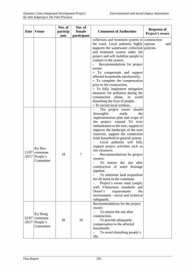
Dynamic Cities Integrated Development Project Environmental and Social Impact Assessment
Ky Anh Subproject, Ha Tinh Province
Fina Report 245
Date Venue
Nos. of
particip
ants
Nos. of
female
participant
Comments of Authorities Response of
Project’s owner
collection and treatment system in
the ward. Local authority highly
supports the wastewater collection
and treatment system under the
project and will mobilize people to
connect to the system.
- Recommendations for project
owner:
+ To compensate and support
affected households satisfactorily.
+ To complete the compensation
prior to the construction.
+ To fully implement mitigation
measures for pollution during the
construction phase, to avoid
disturbing the lives of people.
+ To recruit local workers.
construction
options and
policies.
11/07
/2017
Ky Hoa
commune
People’s
Committee
19 7
- The project owner should
thoroughly study the
implementation plan and scope of
the project: expand Tri river
embankment to the weir, support to
improve the landscape of the weir
reservoir, support the connection
from household to general system.
- Local authority will fully
support project activities such as
site clearance.
- Recommendations for project
owners:
- To restore the site after
construction of water drainage
pipeline.
- To minimize land acquisition
for all items in the commune.
- Project’s owner must comply
with Vietnamese standards and
Donor’s requirements the
environment - social and technical
safeguards.
12/07
/2017
Ky Hung
commune
People’s
Committee
30 10
Recommendations for the project
owner:
- To restore the site after
construction.
- To provide adequately
compensation to the affected
households.
- To avoid disturbing people’s
life.
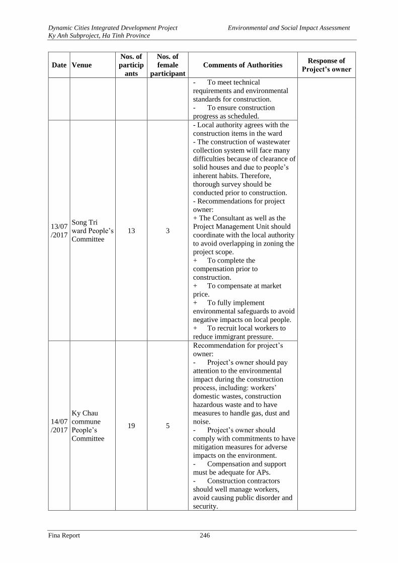
Dynamic Cities Integrated Development Project Environmental and Social Impact Assessment
Ky Anh Subproject, Ha Tinh Province
Fina Report 246
Date Venue
Nos. of
particip
ants
Nos. of
female
participant
Comments of Authorities Response of
Project’s owner
- To meet technical
requirements and environmental
standards for construction.
- To ensure construction
progress as scheduled.
13/07
/2017
Song Tri
ward People’s
Committee
13 3
- Local authority agrees with the
construction items in the ward
- The construction of wastewater
collection system will face many
difficulties because of clearance of
solid houses and due to people’s
inherent habits. Therefore,
thorough survey should be
conducted prior to construction.
- Recommendations for project
owner:
+ The Consultant as well as the
Project Management Unit should
coordinate with the local authority
to avoid overlapping in zoning the
project scope.
+ To complete the
compensation prior to
construction.
+ To compensate at market
price.
+ To fully implement
environmental safeguards to avoid
negative impacts on local people.
+ To recruit local workers to
reduce immigrant pressure.
14/07
/2017
Ky Chau
commune
People’s
Committee
19 5
Recommendation for project’s
owner:
- Project’s owner should pay
attention to the environmental
impact during the construction
process, including: workers’
domestic wastes, construction
hazardous waste and to have
measures to handle gas, dust and
noise.
- Project’s owner should
comply with commitments to have
mitigation measures for adverse
impacts on the environment.
- Compensation and support
must be adequate for APs.
- Construction contractors
should well manage workers,
avoid causing public disorder and
security.
Dynamic Cities Integrated Development Project Environmental and Social Impact Assessment
Ky Anh Subproject, Ha Tinh Province
Fina Report 247
Date Venue
Nos. of
particip
ants
Nos. of
female
participant
Comments of Authorities Response of
Project’s owner
In general, comments from consultation with local authorities are summarized as follows:
- Authorities of the wards/communes support the implementation of the project. When
being completed, the project will bring great benefits to local people in terms of environmental
sanitation, reduction in disease risk, convenient transportation and facilitatation of local
economic development.
- Local authorities will create the most favorable conditions and support for the project,
especially with regard to land acquisition through site clerance and construction. In addition, the
stakeholders should pay appropriate attention and have timely coordination to the site clearance
in order to create the best conditions for the people.
- Project’s owner is required to seriously implement the approved environmental
monitoring program for the project and comply with the standards of the Government of Vietnam
and the Donor.
- Recruitment of local labor is recommended for the project implementation to create jobs
for local people and reduce the pressure from immigration.
- To make compensation and conduct site clearance before the construction of the project.
- To make compensation at market prices.
- To minimize the effects on physical assets and avoid disturbing the lives of people.
6.2.2. Direct Consultation with Local Affected Communities
Through consultations with local ward/commune authorities, ESIA consultant has reported
potential negative impacts during the project implementation and proposed mitigation measures.
The Consultant and the Project Management Unit have recognized the comments from local
communities for project implementation. The main content of the second consultation is shown
in the following table:
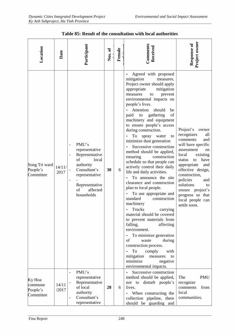
Dynamic Cities Integrated Development Project Environmental and Social Impact Assessment
Ky Anh Subproject, Ha Tinh Province
Fina Report 248
Table 85: Result of the consultation with local authorities
Lo
cati
on
Da
te
Pa
rtic
ipan
t
No
s. o
f
pa
rtic
ipa
nts
F
emale
pa
rtic
ipa
nt
Co
mm
ents
Rec
eived
Res
po
nse
of
Pro
ject
ow
ner
Song Tri ward
People’s
Committee
14/11/
2017
- PMU’s
representative
- Representative
of local
authority
- Consultant’s
representative
- -
Representative
of affected
households
30 6
- Agreed with proposed
mitigation measures.
Project owner should apply
appropriate mitigation
measures to prevent
environmental impacts on
people’s lives. - Attention should be
paid to gathering of
machinery and equipment
to ensure people’s access
during construction. - To spray water to
minimize dust generation
- Successive construction
method should be applied,
ensuring construction
schedule so that people can
actively control their daily
life and daily activities. - To announce the site
clearance and construction
plan to local people. - To use appropriate and
standard construction
machinery - Trucks carrying
material should be covered
to prevent materials from
falling, affecting
environment. - To minimize generation
of waste during
construction process. - To comply with
mitigation measures to
minimize negative
environmental impacts.
Project’s owner
recognizes all
comments and
will have specific
assessment on
local existing
status to have
appropriate and
effective design,
construction,
policies and
solutions to
ensure project’s
progress so that
local people can
settle soon.
Ky Hoa
commune
People’s
Committee
14/11
/2017
- PMU’s
representative
- Representative
of local
authority
- Consultant’s
representative
28 6
- Successive construction
method should be applied,
not to disturb people’s
lives. - When constructing the
collection pipeline, there
should be guarding and
The PMU
recognize
comments from
local
communities.
Dynamic Cities Integrated Development Project Environmental and Social Impact Assessment
Ky Anh Subproject, Ha Tinh Province
Fina Report 249
Lo
cati
on
Da
te
Pa
rtic
ipan
t
No
s. o
f
pa
rtic
ipa
nts
F
emale
pa
rtic
ipa
nt
Co
mm
ents
Rec
eived
Res
po
nse
of
Pro
ject
ow
ner
- -
Representative
of affected
households
warning measures to ensure
safety for people at nights. - Agreed with proposed
mitigation measures.
Project owner should
control contractor’s
implementation of the
proposed mitigation
measures and construction
method.
- Impacts and
mitigation
measures have
been included in
the EIA - During
construction,
PMU will work
with stakeholders
to monitor the
construction
contractor’s
implementation
of environmental
migitation
measures.
Ky Trinh ward
People’s
Committee
14/11
/2017
- - PMU’s
representative
- Representative
of local
authority
- Consultant’s
representative
- -
Representative
of affected
households
40 13
- Agreed with proposed
mitigation measures.
Construction of the
wastewater collection
should be soon commenced
to improve people’s living
condition - Trucks and construction
machinery moving in the
residential area should not
exceed allowable speed to
ensure traffic safety. - To spray water to
minimize dust generation
- To use appropriate
machinery to minimize
noise and vibration. - Trucks should be
covered - During construction,
contractor should control
the gathering of material,
not occupying road bed
affecting people’s
movement. - Reflecting traffic
signboards should be
installed for safety warning
The PMU
recognize
comments from
local
communities. - Impacts and
mitigation
measures have
been included in
the EIA - During
construction,
PMU will work
with stakeholders
to monitor the
construction
contractor’s
implementation
of environmental
migitation
measures
Ky Hung
commune
15/11
/2017
- PMU’s
representative 40 11
- Agreed with the project
impact and the proposed
mitigation measures.
Project’s owner
recognizes all
comments of
Dynamic Cities Integrated Development Project Environmental and Social Impact Assessment
Ky Anh Subproject, Ha Tinh Province
Fina Report 250
Lo
cati
on
Da
te
Pa
rtic
ipan
t
No
s. o
f
pa
rtic
ipa
nts
F
emale
pa
rtic
ipa
nt
Co
mm
ents
Rec
eived
Res
po
nse
of
Pro
ject
ow
ner
People’s
Committee
- Representative
of local
authority
- Consultant’s
representative
- Representative
of affected
households
- During construction,
project owner and
contractor should apply
mitigation measures to
minimize dust, noise
impacts on people’s lives in
surrounding area.
- Trucks carrying
material should be covered - To spray water to
minimize dust generation
- To use appropriate
means and machinery. - To focus on
construction, avoid
prolonged construction - Project owner should
implement the proposed
mitigation measures and
construction method
local community
and will
mainstream these
recommendations
in Environmental
Impact
Assessment,
Resettlement
Plan and will
propse
appropriate
mitigation
measures.
Ky Chau
ward People’s
Committee
15/11
/2017
- PMU’s
representative
- Representative
of local
authority
- Consultant’s
representative
- Representative
of affected
households
35 9
- Agreed with the
proposed mitigation
measures. Project owner
should implement the
proposed mitigation
measures and construction
method. - To announce the site
clearance and construction
plan to local people.
- To spray water to
minimize dust generation
- To collect and treat
domestic waste and
material waste on the
construction site, protect
environment and people’s
life. - There should be support
policy and information
disclosure to affected
household if the
construction is prolonged.
Payment of compensation,
support and resettlement
should be completed prior
Project’s owner
recognizes all
comments and
will have specific
assessment on
local existing
status to have
appropriate and
effective design,
construction,
policies and
solutions to
minimize adverse
impacts on
project people.
Project will be
implemented as
scheduled in
compliance with
the legal
regulation.
Dynamic Cities Integrated Development Project Environmental and Social Impact Assessment
Ky Anh Subproject, Ha Tinh Province
Fina Report 251
Lo
cati
on
Da
te
Pa
rtic
ipan
t
No
s. o
f
pa
rtic
ipa
nts
F
emale
pa
rtic
ipa
nt
Co
mm
ents
Rec
eived
Res
po
nse
of
Pro
ject
ow
ner
to commencement of
construction. - Construction material
and waste should be
gathered properly under
agreement of local
authority, not to occupy
roadbed and sidewalk to
affect people and vehicle
movement. - There should be control
speed for trucks carrying
materials in residential area
Nguyen Ca
ancestral
temple
15/11
/2017
- PMU’s
representative
- Representative
of local
authority
- Consultant’s
representative
- -
Representative
of affected
household
- Nguyen Ca ancestral
temple was constructed in
2008 including one 2-floor
building, of which each
floor is 40m2 on the land of
the family’s head Nguyen
Tien Hong.
- The ancestral temple is
for worshiping 4
generations of the family
and worshiping activities
are organized on the first
day and 15th day of lunar
month and in Tet holiday.
- The family agreed to be
displaced together with
other surrounding
displaced households and
there should be reasonable
compensation.
- The family wished to be
relocated on the road side to
get benefits from the
project.
PMU recognized all
households’
comments and
committed to
implement policies
in accordance with
the provisions of the
Law and the Donor.
Song Tri
primary
school
15/11
/2017
- PMU’s
representative
- Consultant’s
representative
- Representative
of Song Tri
primary
school
- The school serves a
rather large number of
pupils. At school time,
many pupils and parents
gather at the school gate.
Picking up of pupils is
mostly by car so the traffic
condition in front of the
school should be ensured.
- During construction,
- PMU
recognizes
comments and
recommendations
from Song Tri
primary school.
Dynamic Cities Integrated Development Project Environmental and Social Impact Assessment
Ky Anh Subproject, Ha Tinh Province
Fina Report 252
Lo
cati
on
Da
te
Pa
rtic
ipan
t
No
s. o
f
pa
rtic
ipa
nts
F
emale
pa
rtic
ipa
nt
Co
mm
ents
Rec
eived
Res
po
nse
of
Pro
ject
ow
ner
attention should be paid to
gathering location of
material, avoid to hinder
access to the school
- Construction and
transportation should be
conducted at different time
from the peak hours which
are school time.
- To arrange warning
signboards and instructor
for parents and pupils at
peak hour.
- Trucks carrying
material should not be
overloaded and should run
at allowable speed
- School authority agreed
with the proposed impacts
and mitigation measures.
Project owner should
implement these impacts to
ensure a safety for pupils,
teachers and parents
-Impacts and
mitigation
measures have
been added in the
EIA.
- During
construction,
PMU will work
with the
stakeholders to
monitor
environmental
mitigation
measures
provided by
contractors.
In general, the local communities have made positive comments on the project. They are aware
of the positive and negative impacts that the project brings and expects the project to be
implemented soon. However, people also wish that, during the project implementation,
especially during the construction period, project’s owner and contractors should pay attention
to the following issues:
- To disseminate information on construction progress to local people so they can
organize their work and daily life to minimize inconvenience during construction.
Strengthening construction method should be introduced to avoid widespread
construction on the entire area and to narrow the scale of influence.
- To provide necessary assistance to business households who are directly or
indirectly affected by the construction process.
- To minimize any delays in construction progress to avoid direct impacts on
household income and daily life.
- To minimize dust and noise when transporting materials which are collected from
the construction site
- To restore the road surface at least to its original state and to minimize the
repetition of soil excavation and backfilling on the same route.
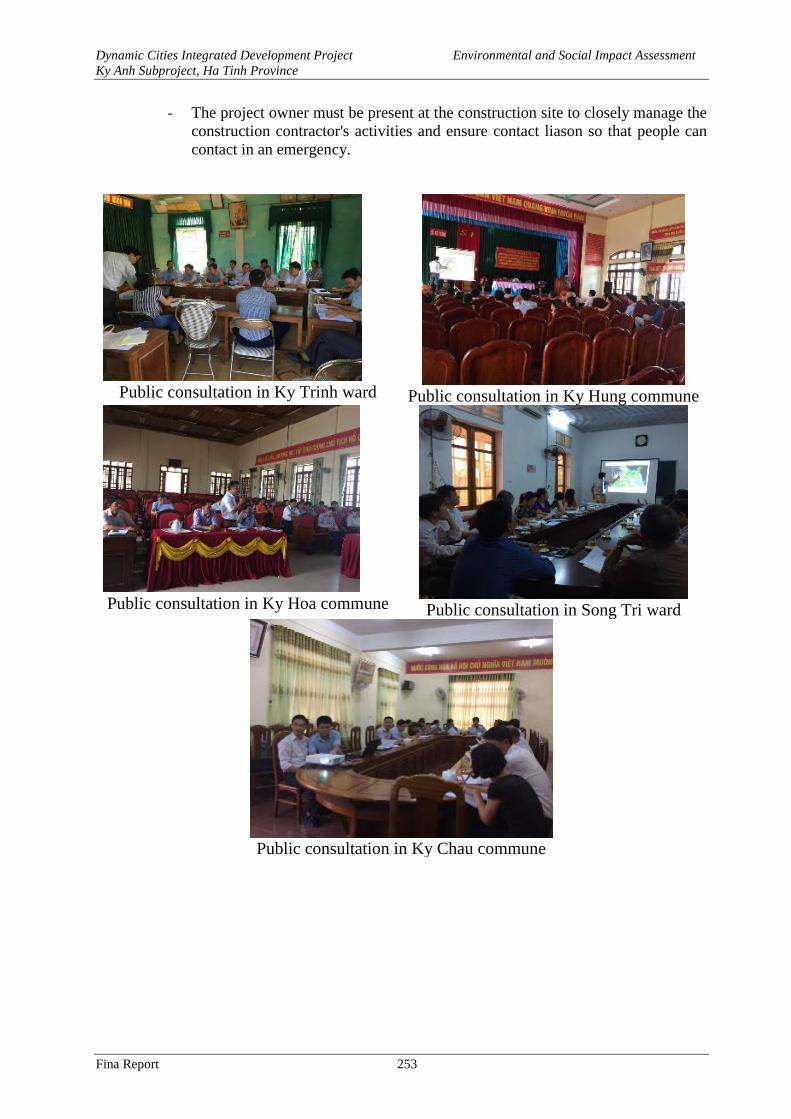
Dynamic Cities Integrated Development Project Environmental and Social Impact Assessment
Ky Anh Subproject, Ha Tinh Province
Fina Report 253
- The project owner must be present at the construction site to closely manage the
construction contractor's activities and ensure contact liason so that people can
contact in an emergency.
Public consultation in Ky Trinh ward
Public consultation in Ky Hung commune
Public consultation in Ky Hoa commune
Public consultation in Song Tri ward
Public consultation in Ky Chau commune
Dynamic Cities Integrated Development Project Environmental and Social Impact Assessment
Ky Anh Subproject, Ha Tinh Province
Fina Report 254
CONCLUSIONS, RECOMMENDATIONS AND
COMMITTMENTS
Conclusions and Recommendations.
The "Dynamic Cities Integrated Development Project – the Ky Anh subproject, Ha Tinh
province" is a subproject to support cities and urban areas which have significant role and
potentiality to become an economic development center in the region to improve urban
infrastructure, landscape, connectivity, environmental sanitation and contribute to the town's
development.
The ESIA report was prepared in compliance with WB safeguard policies and applicable
Vietnamese regulations. The report will be one of the key documents to be submitted to the
World Bank and releant Vientamese Environmental authorities for appraisal and approval before
Project negotiation.
The environmental impacts were theoretically and empirically assessed with support from the
baseline and statistical data as well as experiences from similar WB projects. The impacts are
relatively quantified as best as they can be for all three stages of project’s pre-construction,
construction and operation.
The subproject is expected to bring about significant positive impacts, particularly improvement
of urban connectivity by constructing the main road connecting urban centers, improving
environmental sanitation by construction of wastewater collection and treatment system. Tri
river dredging and embankment lining will help to reduce flooding risk for residential areas along
the river and improve drainage capacity for the river basin. Thuy Son lake embankment lining
and dredging will contribute to improve environmental condition and landcape of the town's
central area, improving local drainage capacity. Beside the positive impacts, there would be also
some potential negative impacts and risks during the pre-construction, construction and
operation of the facilities provided under the Subproject. Most of these potential impacts and
risks has been predicted to be at low to moderate levels, localised as these would be taking place
in areas around construction sites and/or on transport routes and at disposal sites. These impacts
and risks can be managed by the implementation of the Environmental and Social Management
Plan, taking into account the feedback received during public consultation on ESIA/ESMP.
This subporoject would bring about significant positive environmental benefits, contributing to
the sustainable growth of Ky Anh town and in particularly helping the town to achieve several
key targets for becoming the class III urban by 2020. Therefore, the subproject should be
implemented
Dynamic Cities Integrated Development Project Environmental and Social Impact Assessment
Ky Anh Subproject, Ha Tinh Province
Fina Report 255
REFERRENCES
1. Feasibility Study Report and Basic Design Report of Dynamic Cities Integrated
Development Project - Ky Anh Subproject, Ha Tinh province.
2. Planning of the project proposed alignments.
3. Cao Trong Hien et al., 2007. Traffic Environments. Transport Publishing House, Hanoi
4. Ky Anh Statistical Office, 2016. Statistical Yearbook 2016 of Ky Anh Town.
5. Hoang Hue, 2010. Wastewater treatment, Hanoi University of Architecture, Hanoi.
6. Lam Minh Triet, Nguyen Thanh Hung, Nguyen Phuoc Dan, 2002. Urban and Industrial
Wastewater Treatment, Publishing House of Ho Chi Minh City National University.
7. Nguyen Quoc Binh, 2005. Air pollution treatment curriculum, Publishing House of
National University.
8. Pham Ngoc Dang, 1997. Treatment of Air Pollution and Noise, Publishing House of
Science and Technology, Hanoi.
9. Tran Ngoc Chan, 2002. Air and Emissions Treatment, Publishing House of Science and
Technology, Hanoi.
10. Tran Hieu Nhue, Tran Duc Ha, Do Hai, 2007. Water supply and drainage, Publishing
House of Scientific and Technical, Hanoi.
11. Trịnh Xuân Lai, 2000. Design of wastewater treatment plants, Construction Publishing
House, Hanoi.
12. Tran Van Nhan, Ngo Thi Nga, 1999. Curriculum for wastewater treatment technology,
Publishing House of Science and Technology, Hanoi.
13. Department of Science, Technology and Environment, Ho Chi Minh City, 1999.
Regulations on management of hazardous waste.
14. Vu Tam Hue - Nguyen Phuong Tung, 2000. Guidance on the use of fuel - oil and grease.
Publishing scientific and technical.
15. Vietnamese standards and standards on environment.
16. Federal Transit Administration, 2006. Transit Noise And Vibration Impact Assessment,
USA.
17. U.S Environmental Protection Angence (USEPA), 1971. Noise from construction
equipment and operation, building equipment, and home appliances, USA.
18. U.S Environmental Protection Angence (USEPA), 1991. Environmetal Assessment
Sourcebook, Volume II, Sectoral Guidelines, USA.
19. U.S Environmental Protection Angence (USEPA), 1995. AP 42, Fifth Edition,
Compilation of Air Pollutant Emission Factors, Volume 1: Stationary Point and Area
Sources.
20. World health organization, 1993. Assessment of Sources of Air, Water and Land
Pollution.
21. Clark và đồng nghiệp,2000. Đặc tính hoá học của lớp đất bẩn trên mặt đường. Tạp chí
CIWEM.
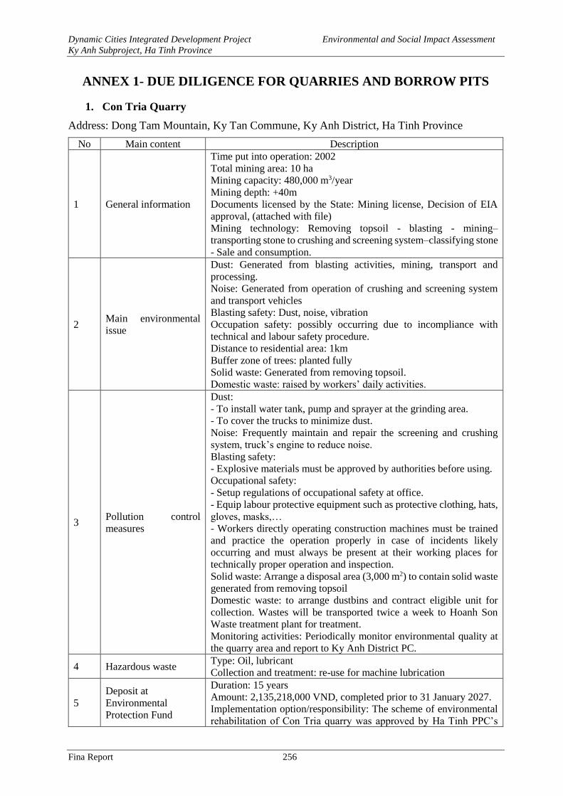
Dynamic Cities Integrated Development Project Environmental and Social Impact Assessment
Ky Anh Subproject, Ha Tinh Province
Fina Report 256
ANNEX 1- DUE DILIGENCE FOR QUARRIES AND BORROW PITS
1. Con Tria Quarry
Address: Dong Tam Mountain, Ky Tan Commune, Ky Anh District, Ha Tinh Province
No Main content Description
1 General information
Time put into operation: 2002
Total mining area: 10 ha
Mining capacity: 480,000 m3/year
Mining depth: +40m
Documents licensed by the State: Mining license, Decision of EIA
approval, (attached with file)
Mining technology: Removing topsoil - blasting - mining–
transporting stone to crushing and screening system–classifying stone
- Sale and consumption.
2 Main environmental
issue
Dust: Generated from blasting activities, mining, transport and
processing.
Noise: Generated from operation of crushing and screening system
and transport vehicles
Blasting safety: Dust, noise, vibration
Occupation safety: possibly occurring due to incompliance with
technical and labour safety procedure.
Distance to residential area: 1km
Buffer zone of trees: planted fully
Solid waste: Generated from removing topsoil.
Domestic waste: raised by workers’ daily activities.
3 Pollution control
measures
Dust:
- To install water tank, pump and sprayer at the grinding area.
- To cover the trucks to minimize dust.
Noise: Frequently maintain and repair the screening and crushing
system, truck’s engine to reduce noise.
Blasting safety:
- Explosive materials must be approved by authorities before using.
Occupational safety:
- Setup regulations of occupational safety at office.
- Equip labour protective equipment such as protective clothing, hats,
gloves, masks,…
- Workers directly operating construction machines must be trained
and practice the operation properly in case of incidents likely
occurring and must always be present at their working places for
technically proper operation and inspection.
Solid waste: Arrange a disposal area (3,000 m2) to contain solid waste
generated from removing topsoil
Domestic waste: to arrange dustbins and contract eligible unit for
collection. Wastes will be transported twice a week to Hoanh Son
Waste treatment plant for treatment.
Monitoring activities: Periodically monitor environmental quality at
the quarry area and report to Ky Anh District PC.
4 Hazardous waste Type: Oil, lubricant Collection and treatment: re-use for machine lubrication
5
Deposit at
Environmental
Protection Fund
Duration: 15 years
Amount: 2,135,218,000 VND, completed prior to 31 January 2027.
Implementation option/responsibility: The scheme of environmental
rehabilitation of Con Tria quarry was approved by Ha Tinh PPC’s
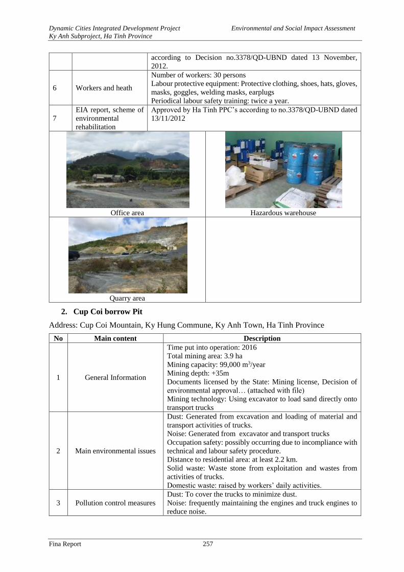
Dynamic Cities Integrated Development Project Environmental and Social Impact Assessment
Ky Anh Subproject, Ha Tinh Province
Fina Report 257
according to Decision no.3378/QD-UBND dated 13 November,
2012.
6 Workers and heath
Number of workers: 30 persons Labour protective equipment: Protective clothing, shoes, hats, gloves,
masks, goggles, welding masks, earplugs
Periodical labour safety training: twice a year.
7
EIA report, scheme of
environmental
rehabilitation
Approved by Ha Tinh PPC’s according to no.3378/QD-UBND dated
13/11/2012
Office area
Hazardous warehouse
Quarry area
2. Cup Coi borrow Pit
Address: Cup Coi Mountain, Ky Hung Commune, Ky Anh Town, Ha Tinh Province
No Main content Description
1 General Information
Time put into operation: 2016
Total mining area: 3.9 ha
Mining capacity: 99,000 m3/year
Mining depth: +35m
Documents licensed by the State: Mining license, Decision of
environmental approval… (attached with file)
Mining technology: Using excavator to load sand directly onto
transport trucks
2 Main environmental issues
Dust: Generated from excavation and loading of material and
transport activities of trucks.
Noise: Generated from excavator and transport trucks
Occupation safety: possibly occurring due to incompliance with
technical and labour safety procedure.
Distance to residential area: at least 2.2 km.
Solid waste: Waste stone from exploitation and wastes from
activities of trucks.
Domestic waste: raised by workers’ daily activities.
3 Pollution control measures
Dust: To cover the trucks to minimize dust.
Noise: frequently maintaining the engines and truck engines to
reduce noise.
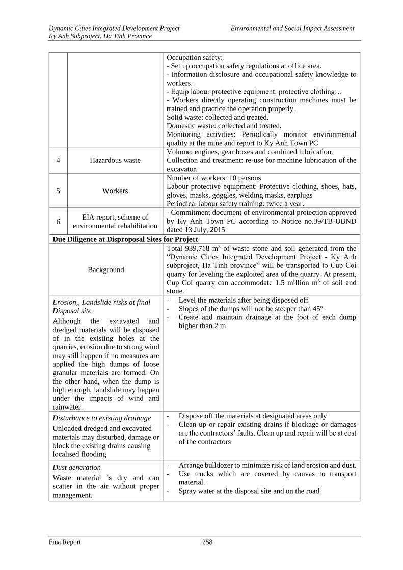
Dynamic Cities Integrated Development Project Environmental and Social Impact Assessment
Ky Anh Subproject, Ha Tinh Province
Fina Report 258
Occupation safety:
- Set up occupation safety regulations at office area.
- Information disclosure and occupational safety knowledge to
workers.
- Equip labour protective equipment: protective clothing…
- Workers directly operating construction machines must be
trained and practice the operation properly.
Solid waste: collected and treated.
Domestic waste: collected and treated.
Monitoring activities: Periodically monitor environmental
quality at the mine and report to Ky Anh Town PC
4 Hazardous waste
Volume: engines, gear boxes and combined lubrication.
Collection and treatment: re-use for machine lubrication of the
excavator.
5 Workers
Number of workers: 10 persons
Labour protective equipment: Protective clothing, shoes, hats,
gloves, masks, goggles, welding masks, earplugs
Periodical labour safety training: twice a year.
6 EIA report, scheme of
environmental rehabilitation
- Commitment document of environmental protection approved
by Ky Anh Town PC according to Notice no.39/TB-UBND
dated 13 July, 2015
Due Diligence at Disproposal Sites for Project
Background
Total 939,718 m3 of waste stone and soil generated from the
“Dynamic Cities Integrated Development Project - Ky Anh
subproject, Ha Tinh province” will be transported to Cup Coi
quarry for leveling the exploited area of the quarry. At present,
Cup Coi quarry can accommodate 1.5 million m3 of soil and
stone.
Erosion,, Landslide risks at final
Disposal site
Although the excavated and
dredged materials will be disposed
of in the existing holes at the
quarries, erosion due to strong wind
may still happen if no measures are
applied the high dumps of loose
granular materials are formed. On
the other hand, when the dump is
high enough, landslide may happen
under the impacts of wind and
rainwater.
- Level the materials after being disposed off
- Slopes of the dumps will not be steeper than 45o
- Create and maintain drainage at the foot of each dump
higher than 2 m
Disturbance to existing drainage
Unloaded dredged and excavated
materials may disturbed, damage or
block the existing drains causing
localised flooding
- Dispose off the materials at designated areas only
- Clean up or repair existing drains if blockage or damages
are the contractors’ faults. Clean up and repair will be at cost
of the contractors
Dust generation
Waste material is dry and can
scatter in the air without proper
management.
- Arrange bulldozer to minimize risk of land erosion and dust.
- Use trucks which are covered by canvas to transport
material.
- Spray water at the disposal site and on the road.
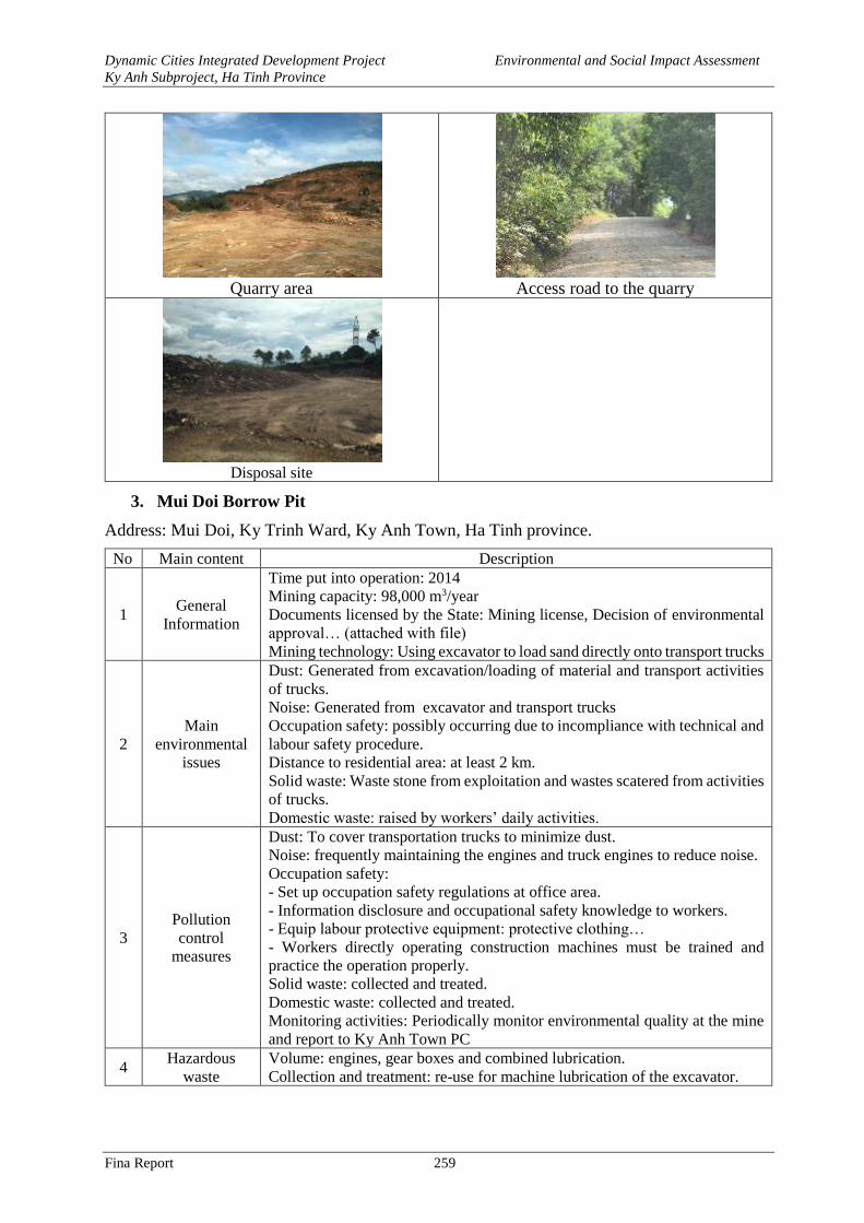
Dynamic Cities Integrated Development Project Environmental and Social Impact Assessment
Ky Anh Subproject, Ha Tinh Province
Fina Report 259
Quarry area
Access road to the quarry
Disposal site
3. Mui Doi Borrow Pit
Address: Mui Doi, Ky Trinh Ward, Ky Anh Town, Ha Tinh province.
No Main content Description
1 General
Information
Time put into operation: 2014
Mining capacity: 98,000 m3/year
Documents licensed by the State: Mining license, Decision of environmental
approval… (attached with file)
Mining technology: Using excavator to load sand directly onto transport trucks
2
Main
environmental
issues
Dust: Generated from excavation/loading of material and transport activities
of trucks.
Noise: Generated from excavator and transport trucks
Occupation safety: possibly occurring due to incompliance with technical and
labour safety procedure.
Distance to residential area: at least 2 km.
Solid waste: Waste stone from exploitation and wastes scatered from activities
of trucks.
Domestic waste: raised by workers’ daily activities.
3
Pollution
control
measures
Dust: To cover transportation trucks to minimize dust.
Noise: frequently maintaining the engines and truck engines to reduce noise.
Occupation safety:
- Set up occupation safety regulations at office area.
- Information disclosure and occupational safety knowledge to workers.
- Equip labour protective equipment: protective clothing…
- Workers directly operating construction machines must be trained and
practice the operation properly.
Solid waste: collected and treated.
Domestic waste: collected and treated.
Monitoring activities: Periodically monitor environmental quality at the mine
and report to Ky Anh Town PC
4 Hazardous
waste
Volume: engines, gear boxes and combined lubrication.
Collection and treatment: re-use for machine lubrication of the excavator.
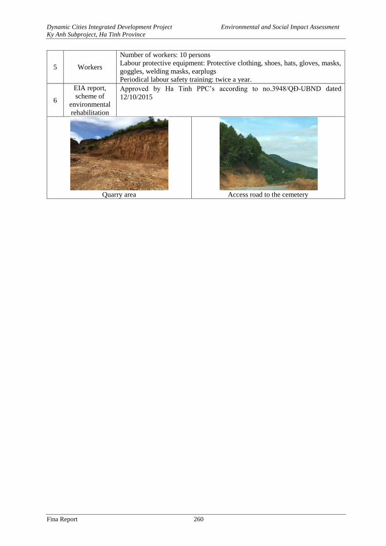
Dynamic Cities Integrated Development Project Environmental and Social Impact Assessment
Ky Anh Subproject, Ha Tinh Province
Fina Report 260
5 Workers
Number of workers: 10 persons Labour protective equipment: Protective clothing, shoes, hats, gloves, masks,
goggles, welding masks, earplugs
Periodical labour safety training: twice a year.
6
EIA report,
scheme of
environmental
rehabilitation
Approved by Ha Tinh PPC’s according to no.3948/QĐ-UBND dated
12/10/2015
Quarry area
Access road to the cemetery
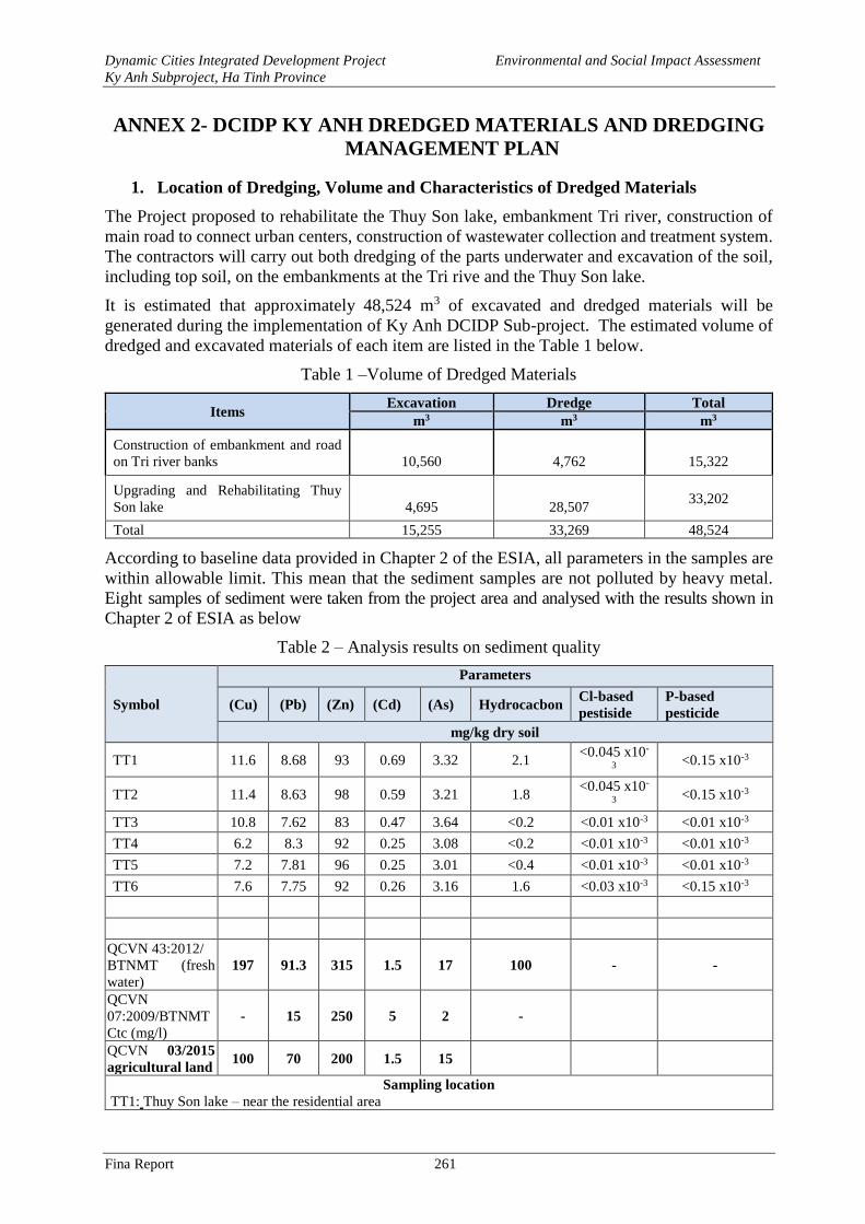
Dynamic Cities Integrated Development Project Environmental and Social Impact Assessment
Ky Anh Subproject, Ha Tinh Province
Fina Report 261
ANNEX 2- DCIDP KY ANH DREDGED MATERIALS AND DREDGING
MANAGEMENT PLAN
1. Location of Dredging, Volume and Characteristics of Dredged Materials
The Project proposed to rehabilitate the Thuy Son lake, embankment Tri river, construction of
main road to connect urban centers, construction of wastewater collection and treatment system.
The contractors will carry out both dredging of the parts underwater and excavation of the soil,
including top soil, on the embankments at the Tri rive and the Thuy Son lake.
It is estimated that approximately 48,524 m3 of excavated and dredged materials will be
generated during the implementation of Ky Anh DCIDP Sub-project. The estimated volume of
dredged and excavated materials of each item are listed in the Table 1 below.
Table 1 –Volume of Dredged Materials
Items Excavation Dredge Total
m3 m3 m3
Construction of embankment and road
on Tri river banks
10,560
4,762
15,322
Upgrading and Rehabilitating Thuy
Son lake
4,695
28,507 33,202
Total 15,255 33,269 48,524
According to baseline data provided in Chapter 2 of the ESIA, all parameters in the samples are
within allowable limit. This mean that the sediment samples are not polluted by heavy metal.
Eight samples of sediment were taken from the project area and analysed with the results shown in
Chapter 2 of ESIA as below
Table 2 – Analysis results on sediment quality
Symbol
Parameters
(Cu) (Pb) (Zn) (Cd) (As) Hydrocacbon Cl-based
pestiside
P-based
pesticide
mg/kg dry soil
TT1 11.6 8.68 93 0.69 3.32 2.1 <0.045 x10-
3 <0.15 x10⁻³
TT2 11.4 8.63 98 0.59 3.21 1.8 <0.045 x10-
3 <0.15 x10⁻³
TT3 10.8 7.62 83 0.47 3.64 <0.2 <0.01 x10⁻³ <0.01 x10⁻³
TT4 6.2 8.3 92 0.25 3.08 <0.2 <0.01 x10⁻³ <0.01 x10⁻³
TT5 7.2 7.81 96 0.25 3.01 <0.4 <0.01 x10⁻³ <0.01 x10⁻³
TT6 7.6 7.75 92 0.26 3.16 1.6 <0.03 x10⁻³ <0.15 x10⁻³
QCVN 43:2012/
BTNMT (fresh
water)
197 91.3 315 1.5 17 100 - -
QCVN
07:2009/BTNMT
Ctc (mg/l)
- 15 250 5 2 -
QCVN 03/2015
agricultural land 100 70 200 1.5 15
Sampling location
TT1: Thuy Son lake – near the residential area
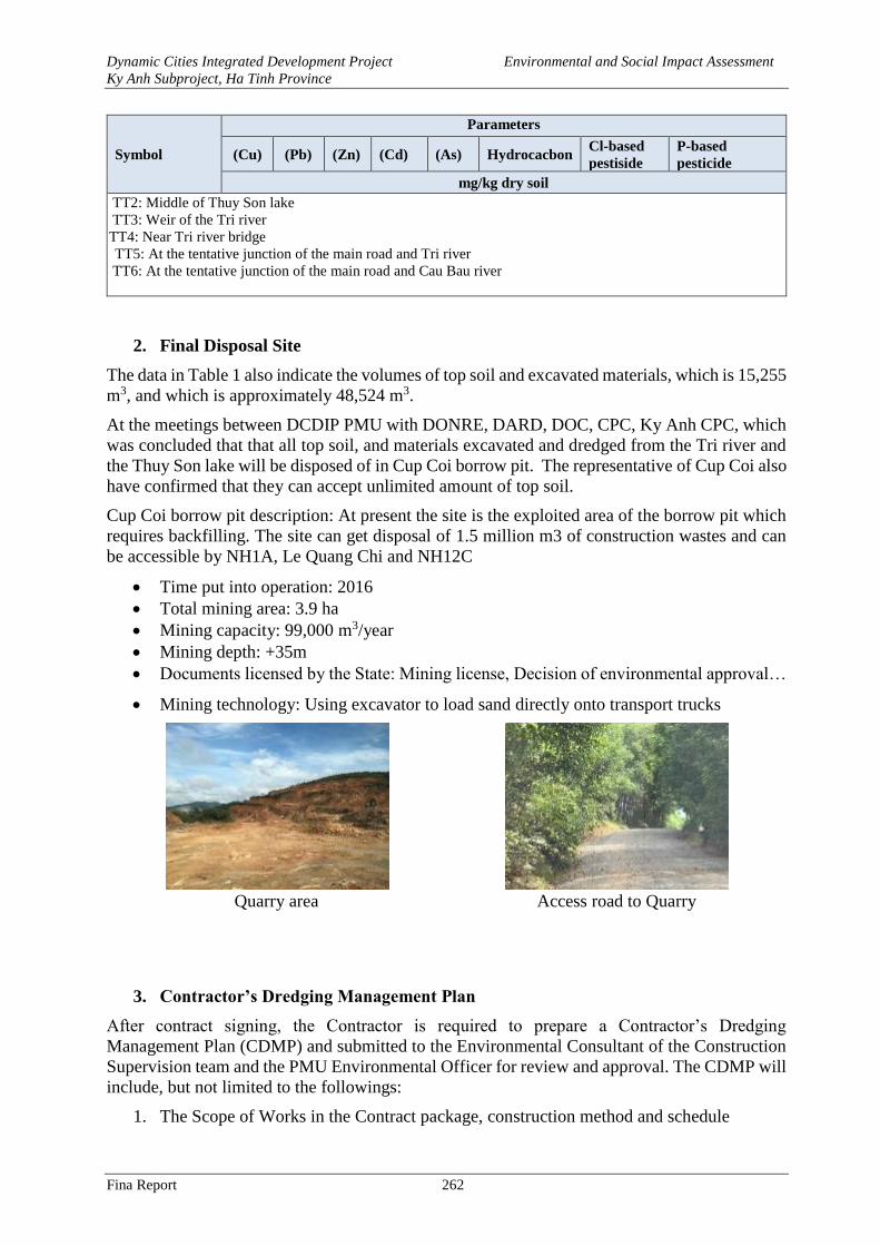
Dynamic Cities Integrated Development Project Environmental and Social Impact Assessment
Ky Anh Subproject, Ha Tinh Province
Fina Report 262
Symbol
Parameters
(Cu) (Pb) (Zn) (Cd) (As) Hydrocacbon Cl-based
pestiside
P-based
pesticide
mg/kg dry soil
TT2: Middle of Thuy Son lake
TT3: Weir of the Tri river
TT4: Near Tri river bridge
TT5: At the tentative junction of the main road and Tri river
TT6: At the tentative junction of the main road and Cau Bau river
2. Final Disposal Site
The data in Table 1 also indicate the volumes of top soil and excavated materials, which is 15,255
m3, and which is approximately 48,524 m3.
At the meetings between DCDIP PMU with DONRE, DARD, DOC, CPC, Ky Anh CPC, which
was concluded that that all top soil, and materials excavated and dredged from the Tri river and
the Thuy Son lake will be disposed of in Cup Coi borrow pit. The representative of Cup Coi also
have confirmed that they can accept unlimited amount of top soil.
Cup Coi borrow pit description: At present the site is the exploited area of the borrow pit which
requires backfilling. The site can get disposal of 1.5 million m3 of construction wastes and can
be accessible by NH1A, Le Quang Chi and NH12C
• Time put into operation: 2016
• Total mining area: 3.9 ha
• Mining capacity: 99,000 m3/year
• Mining depth: +35m
• Documents licensed by the State: Mining license, Decision of environmental approval…
• Mining technology: Using excavator to load sand directly onto transport trucks
Quarry area
Access road to Quarry
3. Contractor’s Dredging Management Plan
After contract signing, the Contractor is required to prepare a Contractor’s Dredging
Management Plan (CDMP) and submitted to the Environmental Consultant of the Construction
Supervision team and the PMU Environmental Officer for review and approval. The CDMP will
include, but not limited to the followings:
1. The Scope of Works in the Contract package, construction method and schedule
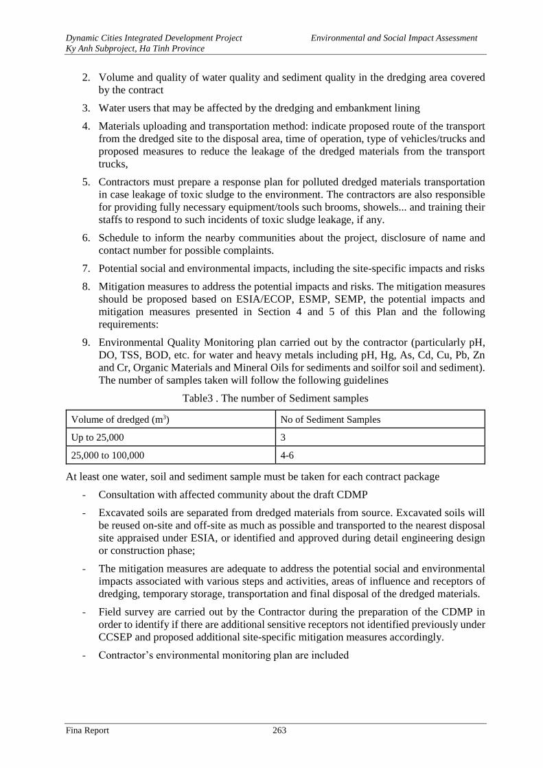
Dynamic Cities Integrated Development Project Environmental and Social Impact Assessment
Ky Anh Subproject, Ha Tinh Province
Fina Report 263
2. Volume and quality of water quality and sediment quality in the dredging area covered
by the contract
3. Water users that may be affected by the dredging and embankment lining
4. Materials uploading and transportation method: indicate proposed route of the transport
from the dredged site to the disposal area, time of operation, type of vehicles/trucks and
proposed measures to reduce the leakage of the dredged materials from the transport
trucks,
5. Contractors must prepare a response plan for polluted dredged materials transportation
in case leakage of toxic sludge to the environment. The contractors are also responsible
for providing fully necessary equipment/tools such brooms, showels... and training their
staffs to respond to such incidents of toxic sludge leakage, if any.
6. Schedule to inform the nearby communities about the project, disclosure of name and
contact number for possible complaints.
7. Potential social and environmental impacts, including the site-specific impacts and risks
8. Mitigation measures to address the potential impacts and risks. The mitigation measures
should be proposed based on ESIA/ECOP, ESMP, SEMP, the potential impacts and
mitigation measures presented in Section 4 and 5 of this Plan and the following
requirements:
9. Environmental Quality Monitoring plan carried out by the contractor (particularly pH,
DO, TSS, BOD, etc. for water and heavy metals including pH, Hg, As, Cd, Cu, Pb, Zn
and Cr, Organic Materials and Mineral Oils for sediments and soilfor soil and sediment).
The number of samples taken will follow the following guidelines
Table3 . The number of Sediment samples
Volume of dredged (m3) No of Sediment Samples
Up to 25,000 3
25,000 to 100,000 4-6
At least one water, soil and sediment sample must be taken for each contract package
- Consultation with affected community about the draft CDMP
- Excavated soils are separated from dredged materials from source. Excavated soils will
be reused on-site and off-site as much as possible and transported to the nearest disposal
site appraised under ESIA, or identified and approved during detail engineering design
or construction phase;
- The mitigation measures are adequate to address the potential social and environmental
impacts associated with various steps and activities, areas of influence and receptors of
dredging, temporary storage, transportation and final disposal of the dredged materials.
- Field survey are carried out by the Contractor during the preparation of the CDMP in
order to identify if there are additional sensitive receptors not identified previously under
CCSEP and proposed additional site-specific mitigation measures accordingly.
- Contractor’s environmental monitoring plan are included
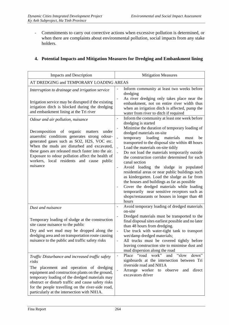
Dynamic Cities Integrated Development Project Environmental and Social Impact Assessment
Ky Anh Subproject, Ha Tinh Province
Fina Report 264
- Commitments to carry out corrective actions when excessive pollution is determined, or
when there are complaints about environmental pollution, social impacts from any stake
holders.
4. Potential Impacts and Mitigation Measures for Dredging and Embankment lining
Impacts and Description Mitigation Measures
AT DREDGING and TEMPORARY LOADING AREAS
Interruption to drainage and irrigation service
Irrigation service may be disrupted if the existing
irrigation ditch is blocked during the dredging
and embankment lining at the Tri river
- Inform community at least two weeks before
dredging
- As river dredging only takes place near the
embankment, not on entire river width thus
when an irrigation ditch is affected, pump the
water from river to ditch if required
Odour and air pollution, nuisance
Decomposition of organic matters under
anaerobic conditions generates strong odour-
generated gases such as SO2, H2S, VOC etc.
When the muds are disturbed and excavated,
these gases are released much faster into the air.
Exposure to odour pollution affect the health of
workers, local residents and cause public
nuisance
- Inform the community at least one week before
dredging is started
- Minimise the duration of temporary loading of
dredged materials on-site
- temporary loading materials must be
transported to the disposal site within 48 hours
- Load the materials on-site tidily
- Do not load the materials temporarily outside
the construction corridor determined for each
canal section
- Avoid loading the sludge in populated
residential areas or near public buildings such
as kindergarten. Load the sludge as far from
the houses and buildings as far as possible
- Cover the dredged materials while loading
temporarily near sensitive receptors such as
shops/restaurants or houses in longer than 48
hours
Dust and nuisance
Temporary loading of sludge at the construction
site cause nuisance to the public
Dry and wet mud may be dropped along the
dredging area and on transportation route causing
nuisance to the public and traffic safety risks
- Avoid temporary loading of dredged materials
on-site
- Dredged materials must be transported to the
final disposal sites earliest possible and no later
than 48 hours from dredging.
- Use truck with water-tight tank to transport
wet/damp dredged materials;
- All trucks must be covered tightly before
leaving construction site to minimise dust and
mud dispersion along the road
Traffic Disturbance and increased traffic safety
risks
The placement and operation of dredging
equipment and construction plants on the ground,
temporary loading of the dredged materials may
obstruct or disturb traffic and cause safety risks
for the people travelling on the river-side road,
particularly at the intersection with NH1A.
- Place “road work” and “slow down”
signboards at the intersection between Tri
riverside road and NH1A
- Arrange worker to observe and direct
excavators driver
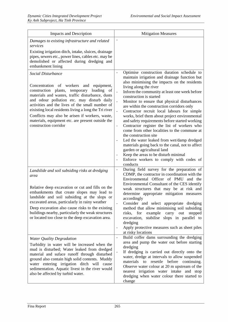
Dynamic Cities Integrated Development Project Environmental and Social Impact Assessment
Ky Anh Subproject, Ha Tinh Province
Fina Report 265
Impacts and Description Mitigation Measures
Damages to existing infrastructure and related
services
Existing irrigation ditch, intake, sluices, drainage
pipes, sewers etc., power lines, cables etc. may be
demolished or affected during dredging and
embankment lining
-
Social Disturbance
Concentration of workers and equipment,
construction plants, temporary loading of
materials and wastes, traffic disturbance, dusts
and odour pollution etc. may disturb daily
activities and the lives of the small number of
eixisting local residents living a long the Tri river
Conflicts may also be arisen if workers, waste,
materials, equipment etc. are present outside the
construction corridor
- Optimise construction duration schedule to
maintain irrigation and drainage function but
also minimising the impacts on the residents
living along the river
- Inform the community at least one week before
construction is started
- Monitor to ensure that physical disturbances
are within the construction corridors only
- Contractor recruit local labours for simple
works, brief them about project environmental
and safety requirements before started working
- Contractor register the list of workers who
come from other localities to the commune at
the construction site
- Led the water leaked from wet/damp dredged
materials going back to the canal, not to affect
garden or agricultural land
- Keep the areas to be disturb minimal
- Enforce workers to comply with codes of
conducts
Landslide and soil subsiding risks at dredging
area
Relative deep excavation or cut and fills on the
embankments that create slopes may lead to
landslide and soil subsiding at the slops or
excavated areas, particularly in rainy weather
Deep excavation also cause risks to the existing
buildings nearby, particularly the weak structures
or located too close to the deep excavation area.
- During field survey for the preparation of
CDMP, the contractor in coordination with the
Environmental Officer of PMU and the
Environmental Consultant of the CES identify
weak structures that may be at risk and
determine appropriate mitigation measures
accordingly
- Consider and select appropriate dredging
method that allow minimising soil subsiding
risks, for example carry out stepped
excavation, stabilise slops in parallel to
dredging
- Apply protective measures such as sheet piles
at risky locations
Water Quality Degradation
Turbidity in water will be increased when the
mud is disturbed; Water leaked from dredged
material and suface runoff through disturbed
ground also contain high solid contents. Muddy
water entering irrigation ditch will cause
sedimentation. Aquatic livest in the river would
also be affected by turbid water.
- Build coffer dams surrounding the dredging
area and pump the water out before starting
dredging
- If dredging is carried out directly onto the
water, dredge at intervals to allow suspended
materials to resettle before continuing.
Observe water colour at 20 m upstream of the
nearest irrigation water intake and stop
dredging when water colour there started to
change
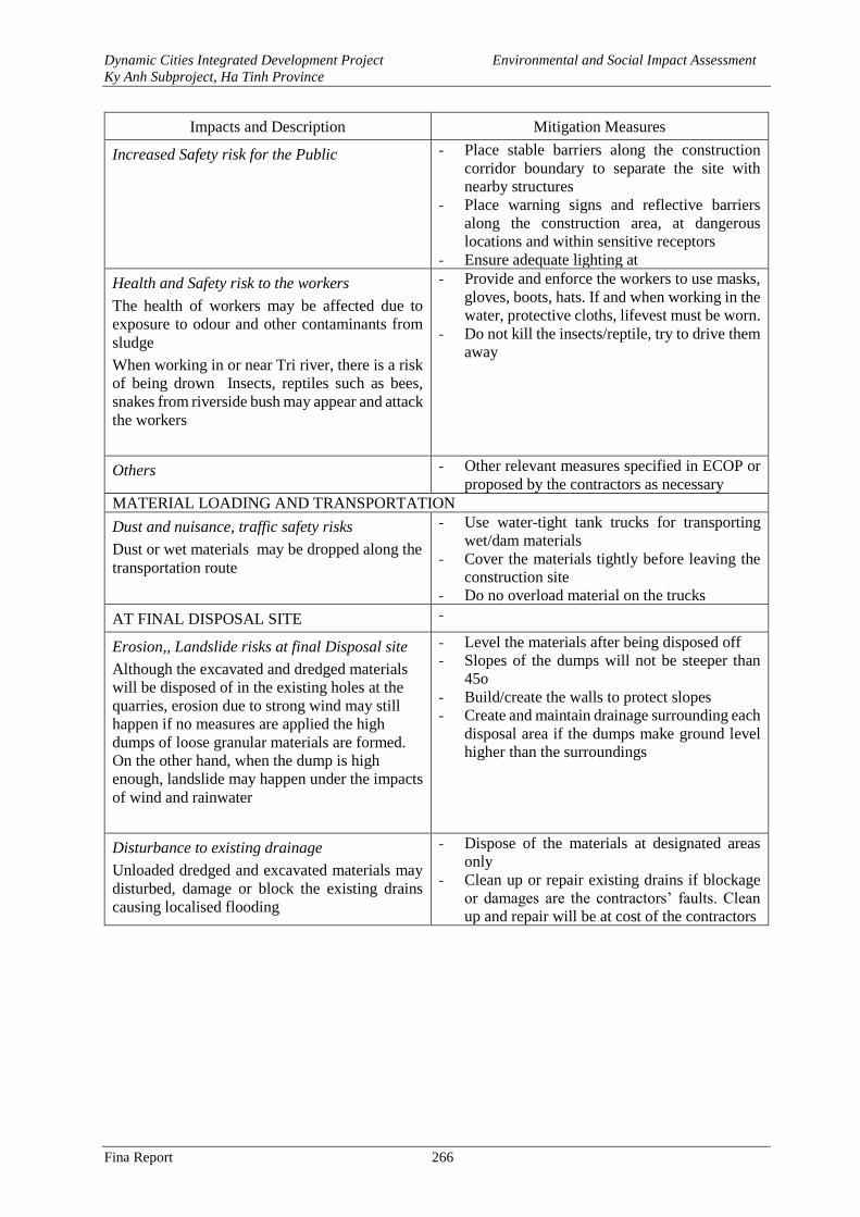
Dynamic Cities Integrated Development Project Environmental and Social Impact Assessment
Ky Anh Subproject, Ha Tinh Province
Fina Report 266
Impacts and Description Mitigation Measures
Increased Safety risk for the Public - Place stable barriers along the construction
corridor boundary to separate the site with
nearby structures
- Place warning signs and reflective barriers
along the construction area, at dangerous
locations and within sensitive receptors
- Ensure adequate lighting at
Health and Safety risk to the workers
The health of workers may be affected due to
exposure to odour and other contaminants from
sludge
When working in or near Tri river, there is a risk
of being drown Insects, reptiles such as bees,
snakes from riverside bush may appear and attack
the workers
- Provide and enforce the workers to use masks,
gloves, boots, hats. If and when working in the
water, protective cloths, lifevest must be worn.
- Do not kill the insects/reptile, try to drive them
away
Others - Other relevant measures specified in ECOP or
proposed by the contractors as necessary
MATERIAL LOADING AND TRANSPORTATION
Dust and nuisance, traffic safety risks
Dust or wet materials may be dropped along the
transportation route
- Use water-tight tank trucks for transporting
wet/dam materials
- Cover the materials tightly before leaving the
construction site
- Do no overload material on the trucks
AT FINAL DISPOSAL SITE -
Erosion,, Landslide risks at final Disposal site
Although the excavated and dredged materials
will be disposed of in the existing holes at the
quarries, erosion due to strong wind may still
happen if no measures are applied the high
dumps of loose granular materials are formed.
On the other hand, when the dump is high
enough, landslide may happen under the impacts
of wind and rainwater
- Level the materials after being disposed off
- Slopes of the dumps will not be steeper than
45o
- Build/create the walls to protect slopes
- Create and maintain drainage surrounding each
disposal area if the dumps make ground level
higher than the surroundings
Disturbance to existing drainage
Unloaded dredged and excavated materials may
disturbed, damage or block the existing drains
causing localised flooding
- Dispose of the materials at designated areas
only
- Clean up or repair existing drains if blockage
or damages are the contractors’ faults. Clean
up and repair will be at cost of the contractors
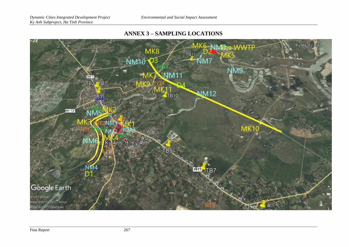
Dynamic Cities Integrated Development Project Environmental and Social Impact Assessment
Ky Anh Subproject, Ha Tinh Province
Fina Report 267
ANNEX 3 – SAMPLING LOCATIONS
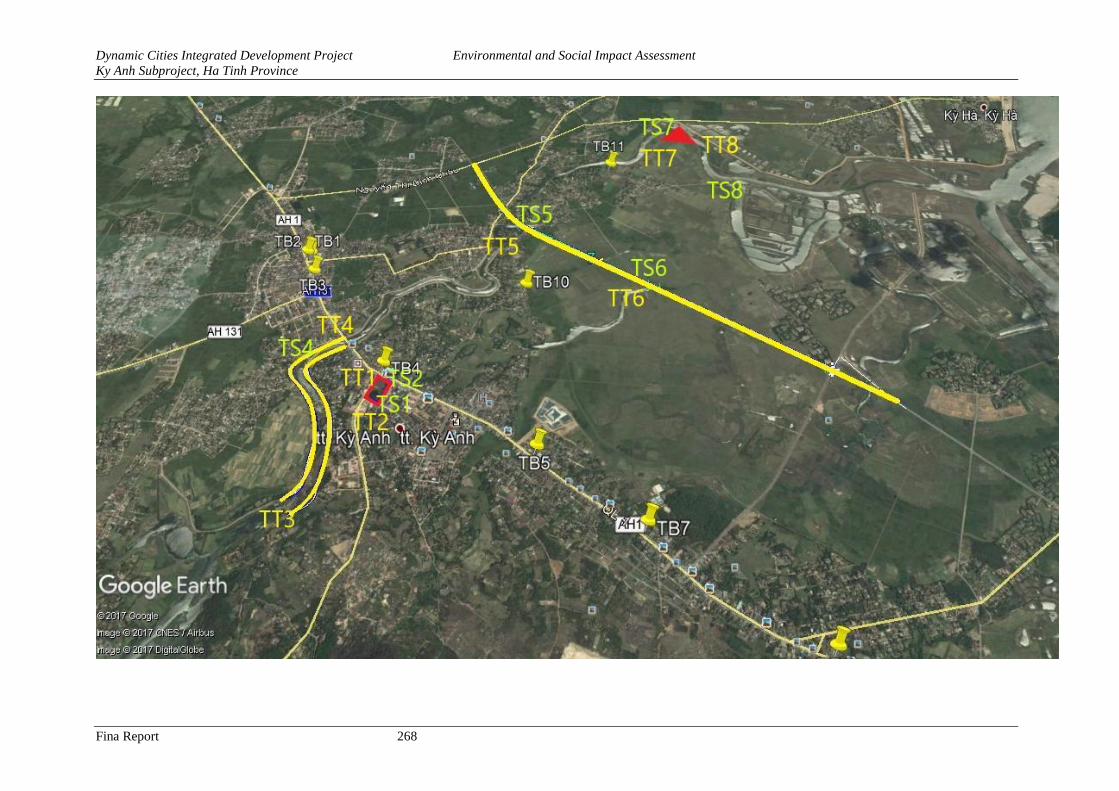
Dynamic Cities Integrated Development Project Environmental and Social Impact Assessment
Ky Anh Subproject, Ha Tinh Province
Fina Report 268
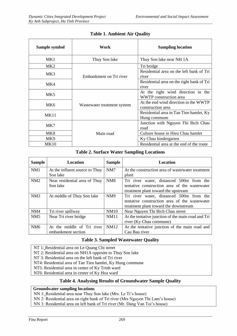
Dynamic Cities Integrated Development Project Environmental and Social Impact Assessment
Ky Anh Subproject, Ha Tinh Province
Fina Report 269
Table 1. Ambient Air Quality
Sample symbol Work Sampling location
MK1 Thuy Son lake Thuy Son lake near NH 1A
MK2
Embankment on Tri river
Tri bridge
MK3 Residential area on the left bank of Tri
river
MK4 Residential area on the right bank of Tri
river
MK5
Wastewater treatment system
At the right wind direction in the
WWTP construction area
MK6 At the end wind direction in the WWTP
construction area
MK11 Residential area in Tan Tien hamlet, Ky
Hung commune
MK7
Main road
Junction with Nguyen Thi Bich Chau
road
MK8 Culture house in Hieu Chau hamlet
MK9 Ky Chau kindergarten
MK10 Residential area at the end of the route
Table 2. Surface Water Sampling Locations
Sample Location Sample Location
NM1 At the influent source to Thuy
Son lake
NM7 At the construction area of wastewater treatment
plant
NM2 Near residential area of Thuy
Son lake
NM8 Tri river water, distanced 500m from the
tentative construction area of the wastewater
treatment plant toward the upstream
NM3 At middle of Thuy Son lake NM9 Tri river water, distanced 500m from the
tentative construction area of the wastewater
treatment plant toward the downstream
NM4 Tri river spillway NM10 Near Nguyen Thi Bich Chau street
NM5 Near Tri river bridge NM11 At the tentative junction of the main road and Tri
river (Ky Chau commune)
NM6 At the middle of Tri river
embankment section
NM12 At the tentative junction of the main road and
Cau Bau river
Table 3. Sampled Wastewater Quality
NT 1: Residential area on Le Quang Chi street
NT 2: Residential area on NH1A opposite to Thuy Son lake
NT 3: Residential area on the left bank of Tri river
NT4: Residential area of Tan Tien hamlet, Ky Hung commune
NT5: Residential area in center of Ky Trinh ward
NT6: Residential area in center of Ky Hoa ward
Table 4. Analysing Results of Groundwater Sample Quality
Groundwater sampling locations
NN 1: Residential area near Thuy Son lake (Mrs. Le Ti’s house)
NN 2: Residential area on right bank of Tri river (Mrs Nguyen Thi Lam’s house)
NN 3: Residential area on left bank of Tri river (Mr. Dang Van Toi’s house)
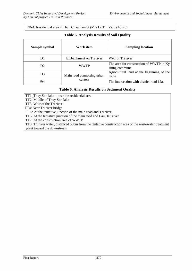
Dynamic Cities Integrated Development Project Environmental and Social Impact Assessment
Ky Anh Subproject, Ha Tinh Province
Fina Report 270
NN4: Residential area in Hieu Chau hamlet (Mrs Le Thi Viet’s house)
Table 5. Analysis Results of Soil Quality
Sample symbol Work item Sampling location
Đ1 Embankment on Tri river Weir of Tri river
Đ2 WWTP The area for construction of WWTP in Ky
Hung commune
Đ3 Main road connecting urban
centers
Agricultural land at the beginning of the
route
Đ4 The intersection with district road 12a.
Table 6. Analysis Results on Sediment Quality
TT1: Thuy Son lake – near the residential area
TT2: Middle of Thuy Son lake
TT3: Weir of the Tri river
TT4: Near Tri river bridge
TT5: At the tentative junction of the main road and Tri river
TT6: At the tentative junction of the main road and Cau Bau river
TT7: At the construction area of WWTP
TT8: Tri river water, distanced 500m from the tentative construction area of the wastewater treatment
plant toward the downstream

![ky;] fcykliqj ¼NRrhlx](https://img.pdfslide.net/doc/110x75/631fc4e68827171f090784dc/ky-fcykliqj-nrrhlx.jpg)


