Embed Size (px)
Citation preview
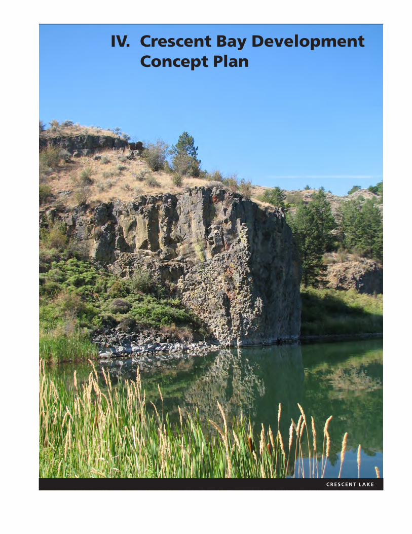
c r e s c e n t l a K e
IV. Crescent Bay Development Concept Plan
Crescent Bay is a large inlet immediately upstream of Grand Coulee Dam on Lake Roosevelt. NPS lands at Crescent Bay include the bay, the hills to the east, Crescent Lake and its shoreline. Because it comprises a relatively large land area, unlike other parts of the narrow public shoreline of Lake Roosevelt, the Lake Roosevelt National Recreation Area General Management Plan (GMP) calls for development of a full service marina and other facilities in this location.
This chapter of the Lake Roosevelt Shoreline Management Plan comprises the Crescent Bay Development Concept Plan, an implementation plan of the GMP, which includes a site analysis, development program, alternatives, and an implementation discussion. Proposed development of the Crescent Bay area, such as building a marina and larger launch could reduce crowding in other facilities in the southern lake area, while increasing the variety of recreational experiences available.
Purpose
This Development Concept Plan proposes a full-service marina and supporting recreational facilities. The plan drawings for the marina and other concession facilities are conceptual to allow flexibility for partnering with private concession operators. Future studies or plans for Crescent Bay may include a concessions plan and prospectus, detailed NPS-facility design plans for the interpretive facilities, and detailed design plans submitted by the concessionaire for the full-service marina.
Background
Planning for Crescent Bay facilities actually began in 1942. Initial development plans included a marina development site on the bay but these plans stalled when the Bureau of Reclamation and NPS could not agree on the future development of the site. Following a land ownership transfer to the NPS in 1968 and the closing of the sawmill in the mid-1970s, the NPS released the 1978 Crescent Bay Development Concept Plan (NPS 1978), which included a visitor information center, day use area, launch ramps, courtesy docks and encouragement of a full-service marina to be built and run by a concessionaire. Due to lack of federal or private funding and environmental issues raised by the Confederated Tribes of the Colville Reservation, the development of a full-service marina (and by this time a hotel and restaurant complex) did not occur in the 1980s, when it was likely most feasible. A more complete discussion of the history of Crescent Bay development can be found in Chapter 7 of the Lake Roosevelt National Recreation Area Administrative History (NPS 2003).
In 2000, the General Management Plan (NPS 2000) also addressed the Crescent Bay site. Visitors to the recreation area indicated a strong, continued interest in the eventual development of a marina at Crescent Bay (pg. 12). In response to growing concern about crowding on the lake, especially along the Spokane Arm,
Lake Roosevelt National Recreation Area Shoreline Management Plan
111IV. Crescent Bay Development Concept Plan
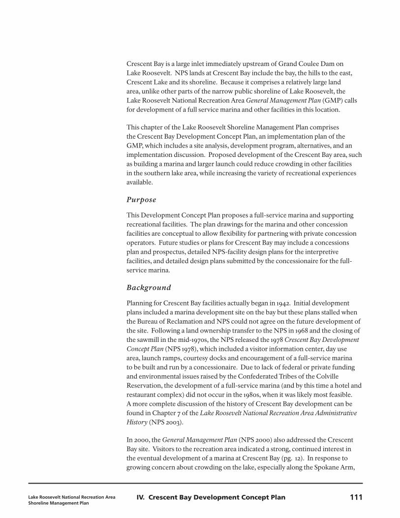
View of pre-dam Rattlesnake Canyon, 1935
Grand Coulee Crescent Lake
Crescent Bay boat launch Grand Coulee
Damnon-motorized
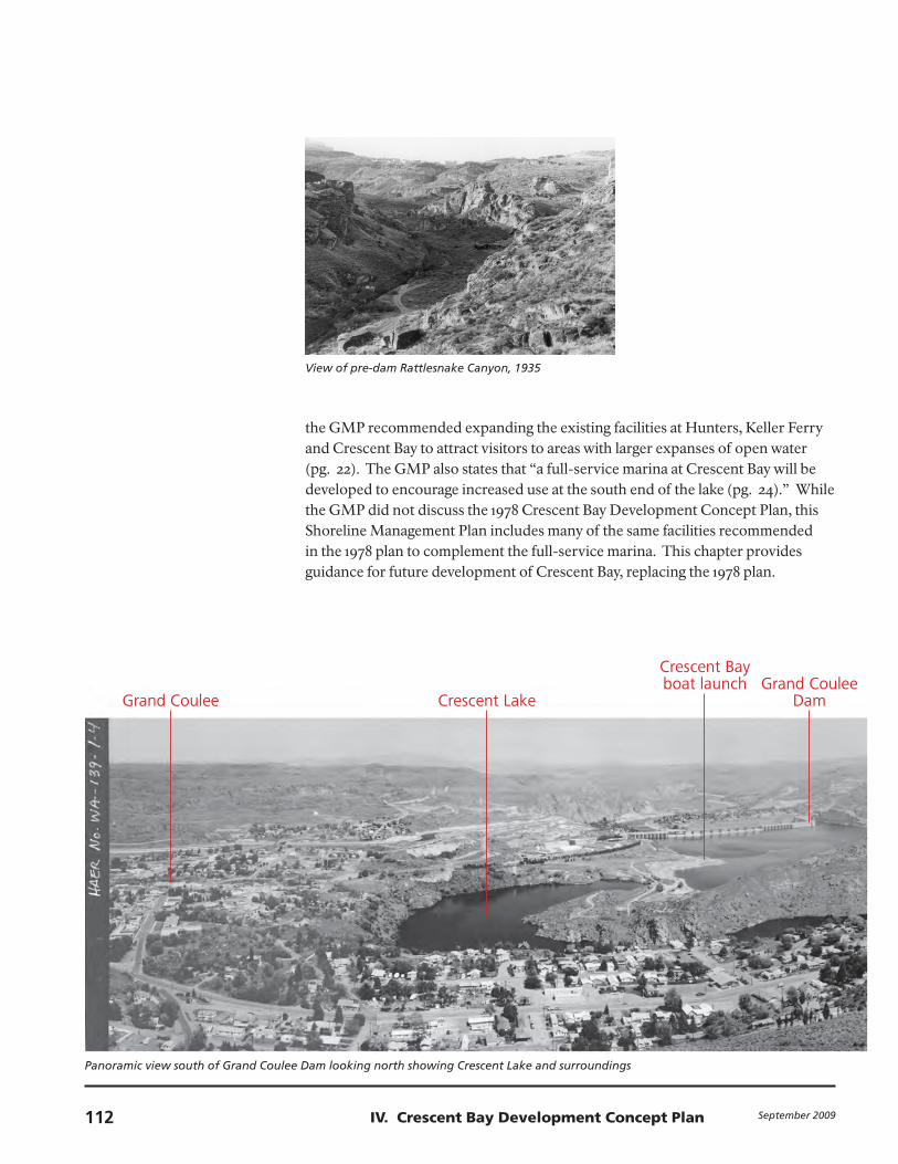
boat launch Eden HarborSpring Canyon
Panoramic view south of Grand Coulee Dam looking north showing Crescent Lake and surroundings
the GMP recommended expanding the existing facilities at Hunters, Keller Ferry and Crescent Bay to attract visitors to areas with larger expanses of open water (pg. 22). The GMP also states that “a full-service marina at Crescent Bay will be developed to encourage increased use at the south end of the lake (pg. 24).” While the GMP did not discuss the 1978 Crescent Bay Development Concept Plan, this Shoreline Management Plan includes many of the same facilities recommended in the 1978 plan to complement the full-service marina. This chapter provides guidance for future development of Crescent Bay, replacing the 1978 plan.
September 2009112 IV. Crescent Bay Development Concept Plan
Grand Coulee Crescent Lake
Crescent Bay boat launch Grand Coulee
Damnon-motorized
boat launch Eden HarborSpring Canyon
(documentation compiled after 1968, Historic American Engineering Record, Library of Congress).
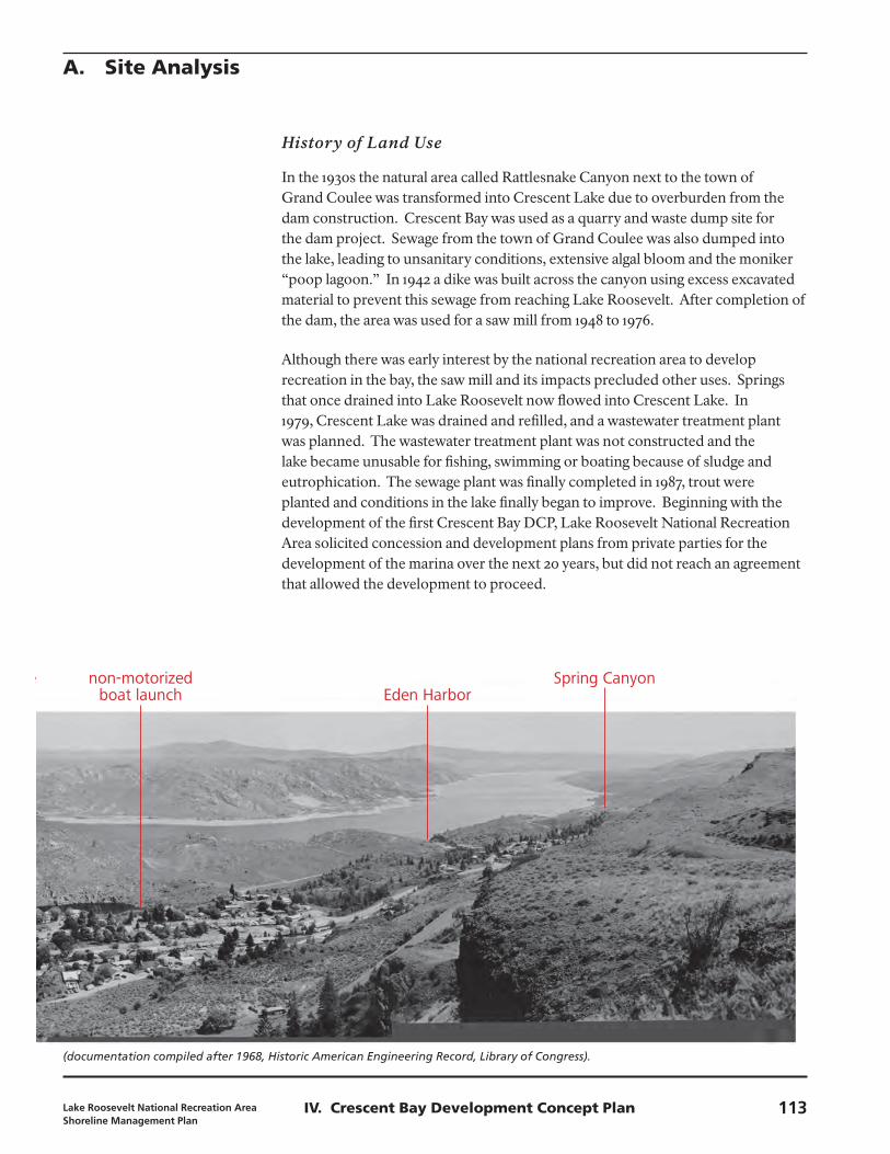
History of Land Use
In the 1930s the natural area called Rattlesnake Canyon next to the town of Grand Coulee was transformed into Crescent Lake due to overburden from the dam construction. Crescent Bay was used as a quarry and waste dump site for the dam project. Sewage from the town of Grand Coulee was also dumped into the lake, leading to unsanitary conditions, extensive algal bloom and the moniker “poop lagoon.” In 1942 a dike was built across the canyon using excess excavated material to prevent this sewage from reaching Lake Roosevelt. After completion of the dam, the area was used for a saw mill from 1948 to 1976.
Although there was early interest by the national recreation area to develop recreation in the bay, the saw mill and its impacts precluded other uses. Springs that once drained into Lake Roosevelt now flowed into Crescent Lake. In 1979, Crescent Lake was drained and refilled, and a wastewater treatment plant was planned. The wastewater treatment plant was not constructed and the lake became unusable for fishing, swimming or boating because of sludge and eutrophication. The sewage plant was finally completed in 1987, trout were planted and conditions in the lake finally began to improve. Beginning with the development of the first Crescent Bay DCP, Lake Roosevelt National Recreation Area solicited concession and development plans from private parties for the development of the marina over the next 20 years, but did not reach an agreement that allowed the development to proceed.
A. Site Analysis
Lake Roosevelt National Recreation Area Shoreline Management Plan
113IV. Crescent Bay Development Concept Plan
Native sagebrush community found
throughout Crescent Bay site
Steep banks surrounding
Crescent Bay
Existing Conditions
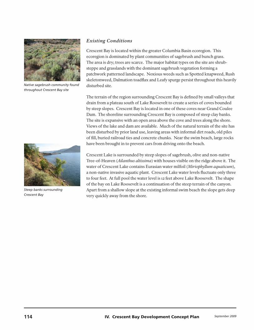
Crescent Bay is located within the greater Columbia Basin ecoregion. This ecoregion is dominated by plant communities of sagebrush and bunch grass. The area is dry; trees are scarce. The major habitat types on the site are shrub-steppe and grasslands with the dominant sagebrush vegetation forming a patchwork patterned landscape. Noxious weeds such as Spotted knapweed, Rush skeletonweed, Dalmation toadflax and Leafy spurge persist throughout this heavily disturbed site.
The terrain of the region surrounding Crescent Bay is defined by small valleys that drain from a plateau south of Lake Roosevelt to create a series of coves bounded by steep slopes. Crescent Bay is located in one of these coves near Grand Coulee Dam. The shoreline surrounding Crescent Bay is composed of steep clay banks. The site is expansive with an open area above the cove and trees along the shore. Views of the lake and dam are available. Much of the natural terrain of the site has been disturbed by prior land use, leaving areas with informal dirt roads, old piles of fill, buried railroad ties and concrete chunks. Near the swim beach, large rocks have been brought in to prevent cars from driving onto the beach.
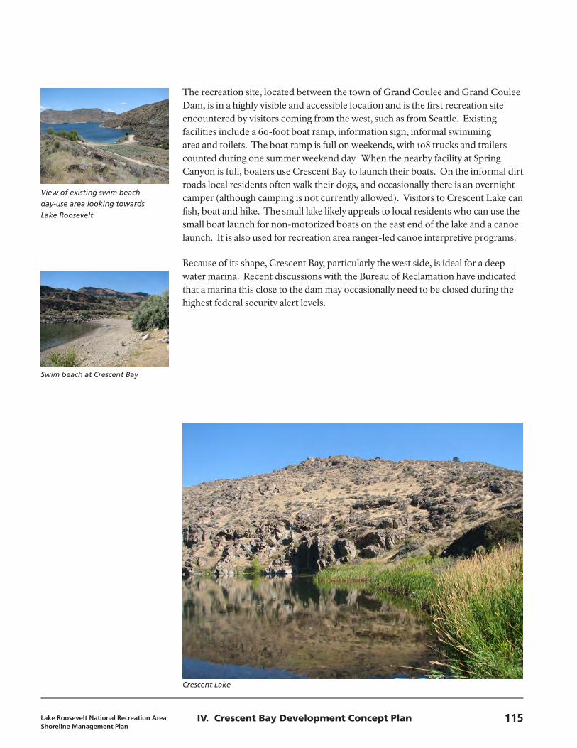
Crescent Lake is surrounded by steep slopes of sagebrush, olive and non-native Tree-of-Heaven (Ailanthus altissima) with houses visible on the ridge above it. The water of Crescent Lake contains Eurasian water milfoil (Miriophyllum aquaticum), a non-native invasive aquatic plant. Crescent Lake water levels fluctuate only three to four feet. At full pool the water level is 12 feet above Lake Roosevelt. The shape of the bay on Lake Roosevelt is a continuation of the steep terrain of the canyon. Apart from a shallow slope at the existing informal swim beach the slope gets deep very quickly away from the shore.
September 2009114 IV. Crescent Bay Development Concept Plan
View of existing swim beach
day-use area looking towards
Lake Roosevelt
Swim beach at Crescent Bay
Crescent Lake
The recreation site, located between the town of Grand Coulee and Grand Coulee Dam, is in a highly visible and accessible location and is the first recreation site encountered by visitors coming from the west, such as from Seattle. Existing facilities include a 60-foot boat ramp, information sign, informal swimming area and toilets. The boat ramp is full on weekends, with 108 trucks and trailers counted during one summer weekend day. When the nearby facility at Spring Canyon is full, boaters use Crescent Bay to launch their boats. On the informal dirt roads local residents often walk their dogs, and occasionally there is an overnight camper (although camping is not currently allowed). Visitors to Crescent Lake can fish, boat and hike. The small lake likely appeals to local residents who can use the small boat launch for non-motorized boats on the east end of the lake and a canoe launch. It is also used for recreation area ranger-led canoe interpretive programs.
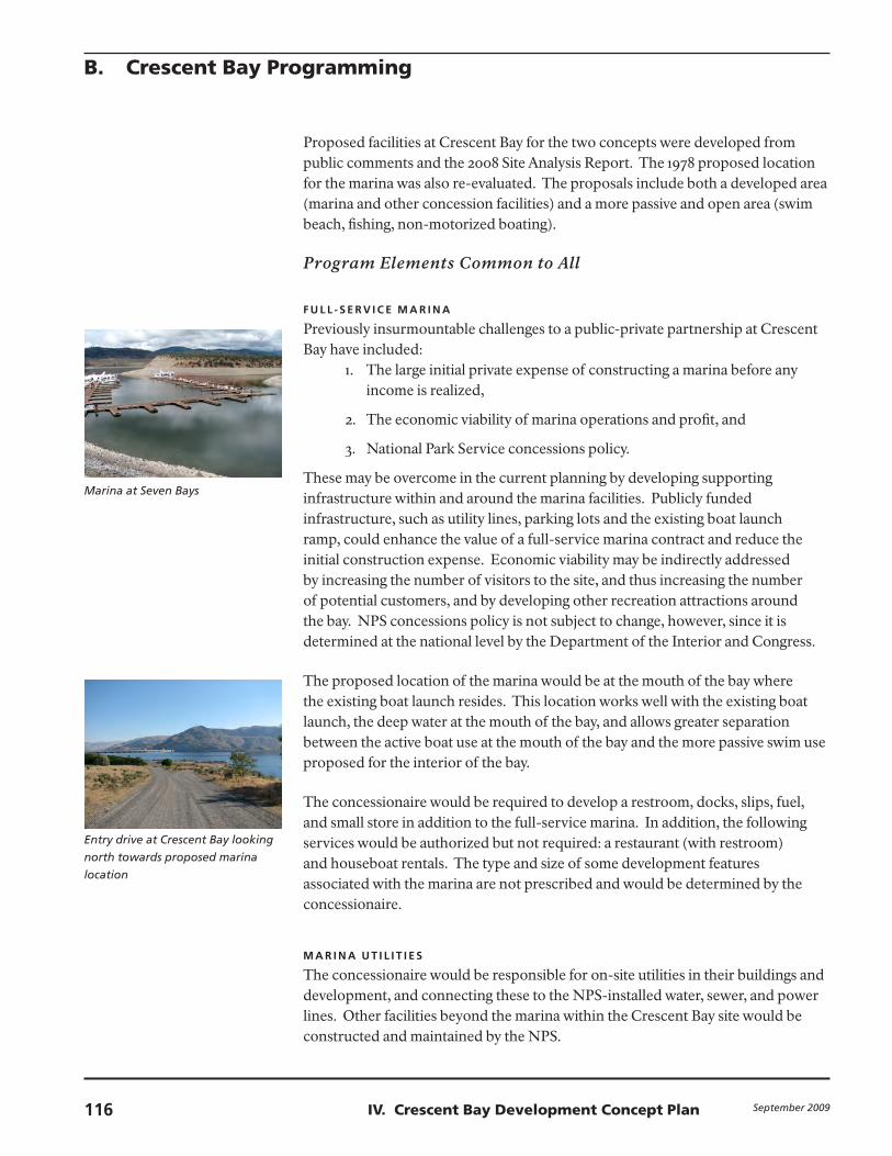
Because of its shape, Crescent Bay, particularly the west side, is ideal for a deep water marina. Recent discussions with the Bureau of Reclamation have indicated that a marina this close to the dam may occasionally need to be closed during the highest federal security alert levels.
Lake Roosevelt National Recreation Area Shoreline Management Plan
115IV. Crescent Bay Development Concept Plan
Marina at Seven Bays
Entry drive at Crescent Bay looking
north towards proposed marina
location
Proposed facilities at Crescent Bay for the two concepts were developed from public comments and the 2008 Site Analysis Report. The 1978 proposed location for the marina was also re-evaluated. The proposals include both a developed area (marina and other concession facilities) and a more passive and open area (swim beach, fishing, non-motorized boating).
Program Elements Common to All
f U L L - S E R v I C E M A R I N A
Previously insurmountable challenges to a public-private partnership at Crescent Bay have included:
1. The large initial private expense of constructing a marina before any income is realized,
2. The economic viability of marina operations and profit, and
3. National Park Service concessions policy.
These may be overcome in the current planning by developing supporting infrastructure within and around the marina facilities. Publicly funded infrastructure, such as utility lines, parking lots and the existing boat launch ramp, could enhance the value of a full-service marina contract and reduce the initial construction expense. Economic viability may be indirectly addressed by increasing the number of visitors to the site, and thus increasing the number of potential customers, and by developing other recreation attractions around the bay. NPS concessions policy is not subject to change, however, since it is determined at the national level by the Department of the Interior and Congress.
The proposed location of the marina would be at the mouth of the bay where the existing boat launch resides. This location works well with the existing boat launch, the deep water at the mouth of the bay, and allows greater separation between the active boat use at the mouth of the bay and the more passive swim use proposed for the interior of the bay.
The concessionaire would be required to develop a restroom, docks, slips, fuel, and small store in addition to the full-service marina. In addition, the following services would be authorized but not required: a restaurant (with restroom) and houseboat rentals. The type and size of some development features associated with the marina are not prescribed and would be determined by the concessionaire.
M A R I N A U T I L I T I E S
The concessionaire would be responsible for on-site utilities in their buildings and development, and connecting these to the NPS-installed water, sewer, and power lines. Other facilities beyond the marina within the Crescent Bay site would be constructed and maintained by the NPS.
B. Crescent Bay Programming
September 2009116 IV. Crescent Bay Development Concept Plan
Picnic shelter at Evans Campground
Existing boat launch and dock
during draw down
Existing gravel entry road to
Crescent Bay facility
NPS Program Elements
I N T E R P R E T I v E / E D U C AT I o N C E N T E R
The following types of interpretive elements have been considered: an outdoor interpretive exhibit, an indoor education center, and a visitor contact station. The elements range from a grouping of signs to a building housing a visitor contact station, a classroom and restrooms. The interpretive facilities would expound on the recreation area’s four interpretive themes: geology, natural history, cultural history, and recreation (GMP 2000, pg. 9).
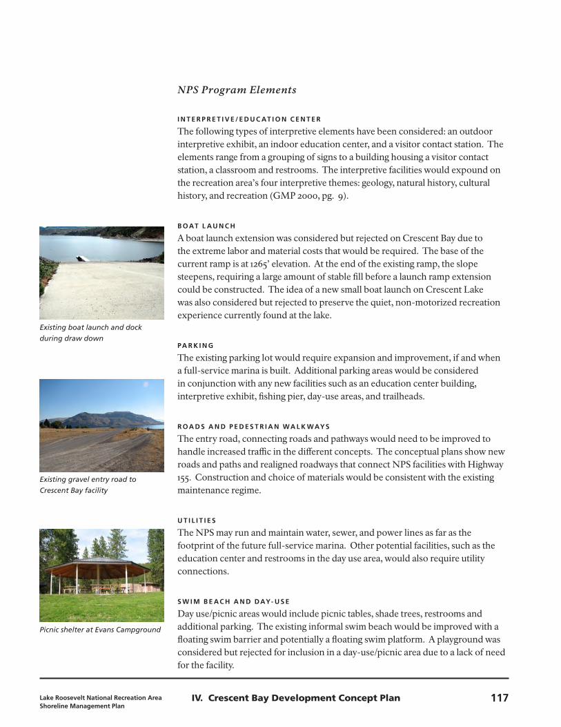
b oAT L AU N C h
A boat launch extension was considered but rejected on Crescent Bay due to the extreme labor and material costs that would be required. The base of the current ramp is at 1265’ elevation. At the end of the existing ramp, the slope steepens, requiring a large amount of stable fill before a launch ramp extension could be constructed. The idea of a new small boat launch on Crescent Lake was also considered but rejected to preserve the quiet, non-motorized recreation experience currently found at the lake.
PA R k I N g
The existing parking lot would require expansion and improvement, if and when a full-service marina is built. Additional parking areas would be considered in conjunction with any new facilities such as an education center building, interpretive exhibit, fishing pier, day-use areas, and trailheads.
R oA D S A N D P E D E S T R I A N WA L k WAyS
The entry road, connecting roads and pathways would need to be improved to handle increased traffic in the different concepts. The conceptual plans show new roads and paths and realigned roadways that connect NPS facilities with Highway 155. Construction and choice of materials would be consistent with the existing maintenance regime.
U T I L I T I E S
The NPS may run and maintain water, sewer, and power lines as far as the footprint of the future full-service marina. Other potential facilities, such as the education center and restrooms in the day use area, would also require utility connections.
S W I M b E AC h A N D DAy- U S E
Day use/picnic areas would include picnic tables, shade trees, restrooms and additional parking. The existing informal swim beach would be improved with a floating swim barrier and potentially a floating swim platform. A playground was considered but rejected for inclusion in a day-use/picnic area due to a lack of need for the facility.
Lake Roosevelt National Recreation Area Shoreline Management Plan
117IV. Crescent Bay Development Concept Plan
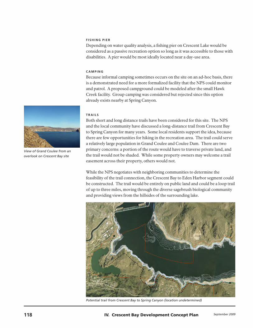
View of Grand Coulee from an
overlook on Crescent Bay site
Potential trail from Crescent Bay to Spring Canyon (location undetermined)
f I S h I N g P I E R
Depending on water quality analysis, a fishing pier on Crescent Lake would be considered as a passive recreation option so long as it was accessible to those with disabilities. A pier would be most ideally located near a day-use area.
C A M P I N g
Because informal camping sometimes occurs on the site on an ad-hoc basis, there is a demonstrated need for a more formalized facility that the NPS could monitor and patrol. A proposed campground could be modeled after the small Hawk Creek facility. Group camping was considered but rejected since this option already exists nearby at Spring Canyon.
T R A I L S
Both short and long distance trails have been considered for this site. The NPS and the local community have discussed a long-distance trail from Crescent Bay to Spring Canyon for many years. Some local residents support the idea, because there are few opportunities for hiking in the recreation area. The trail could serve a relatively large population in Grand Coulee and Coulee Dam. There are two primary concerns: a portion of the route would have to traverse private land, and the trail would not be shaded. While some property owners may welcome a trail easement across their property, others would not.
While the NPS negotiates with neighboring communities to determine the feasibility of the trail connection, the Crescent Bay to Eden Harbor segment could be constructed. The trail would be entirely on public land and could be a loop trail of up to three miles, moving through the diverse sagebrush biological community and providing views from the hillsides of the surrounding lake.
September 2009118 IV. Crescent Bay Development Concept Plan
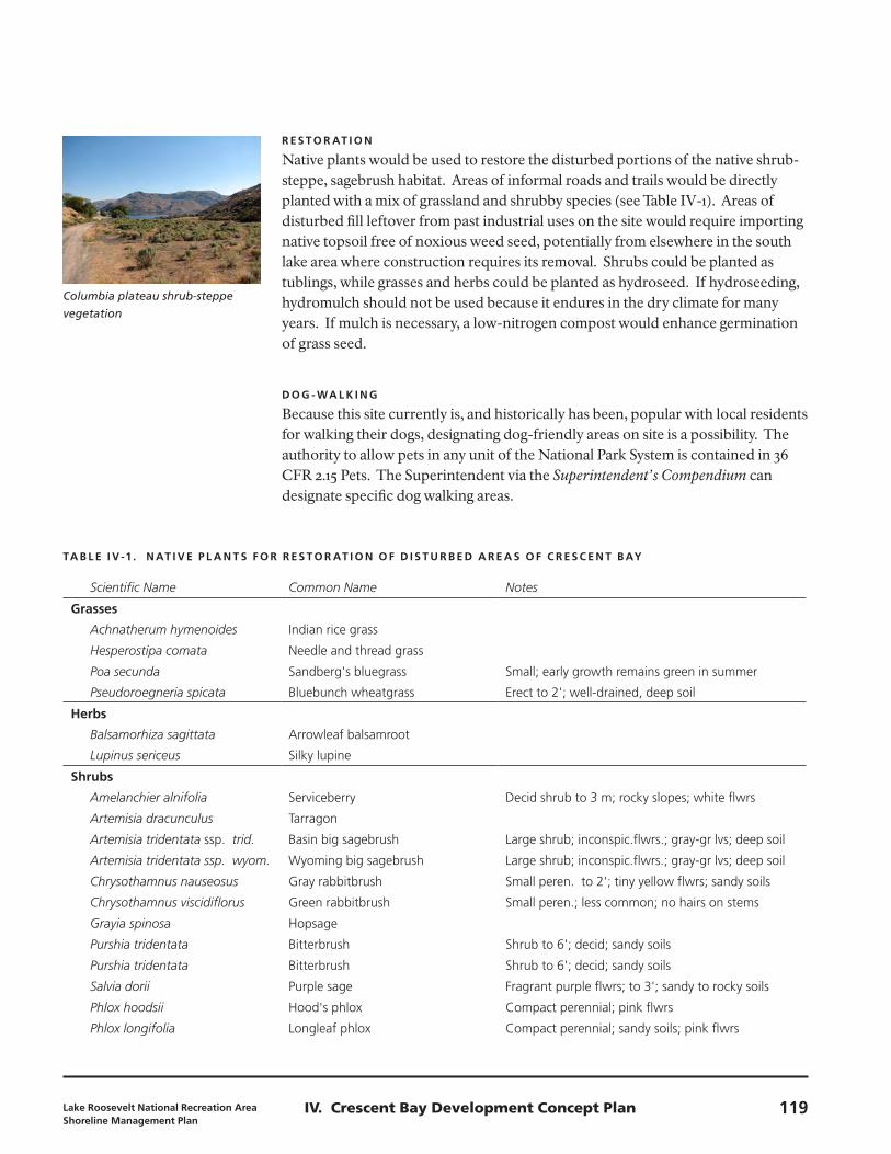
Columbia plateau shrub-steppe
vegetation
R E S T o R AT I o N
Native plants would be used to restore the disturbed portions of the native shrub-steppe, sagebrush habitat. Areas of informal roads and trails would be directly planted with a mix of grassland and shrubby species (see Table IV-1). Areas of disturbed fill leftover from past industrial uses on the site would require importing native topsoil free of noxious weed seed, potentially from elsewhere in the south lake area where construction requires its removal. Shrubs could be planted as tublings, while grasses and herbs could be planted as hydroseed. If hydroseeding, hydromulch should not be used because it endures in the dry climate for many years. If mulch is necessary, a low-nitrogen compost would enhance germination of grass seed.
D o g - WA L k I N g
Because this site currently is, and historically has been, popular with local residents for walking their dogs, designating dog-friendly areas on site is a possibility. The authority to allow pets in any unit of the National Park System is contained in 36 CFR 2.15 Pets. The Superintendent via the Superintendent’s Compendium can designate specific dog walking areas.
TA b L E I v -1 . N AT I v E P L A N T S f o R R E S T o R AT I o N o f D I S T U R b E D A R E A S o f C R E S C E N T b Ay
Scientific Name Common Name Notes
grasses
Achnatherum hymenoides Indian rice grass
Hesperostipa comata Needle and thread grass
Poa secunda Sandberg's bluegrass Small; early growth remains green in summer
Pseudoroegneria spicata Bluebunch wheatgrass Erect to 2'; well-drained, deep soil
herbs
Balsamorhiza sagittata Arrowleaf balsamroot
Lupinus sericeus Silky lupine
shrubs
Amelanchier alnifolia Serviceberry Decid shrub to 3 m; rocky slopes; white flwrs
Artemisia dracunculus Tarragon
Artemisia tridentata ssp. trid. Basin big sagebrush Large shrub; inconspic.flwrs.; gray-gr lvs; deep soil
Artemisia tridentata ssp. wyom. Wyoming big sagebrush Large shrub; inconspic.flwrs.; gray-gr lvs; deep soil
Chrysothamnus nauseosus Gray rabbitbrush Small peren. to 2'; tiny yellow flwrs; sandy soils
Chrysothamnus viscidiflorus Green rabbitbrush Small peren.; less common; no hairs on stems
Grayia spinosa Hopsage
Purshia tridentata Bitterbrush Shrub to 6'; decid; sandy soils
Purshia tridentata Bitterbrush Shrub to 6'; decid; sandy soils
Salvia dorii Purple sage Fragrant purple flwrs; to 3'; sandy to rocky soils
Phlox hoodsii Hood's phlox Compact perennial; pink flwrs
Phlox longifolia Longleaf phlox Compact perennial; sandy soils; pink flwrs
Lake Roosevelt National Recreation Area Shoreline Management Plan
119IV. Crescent Bay Development Concept Plan
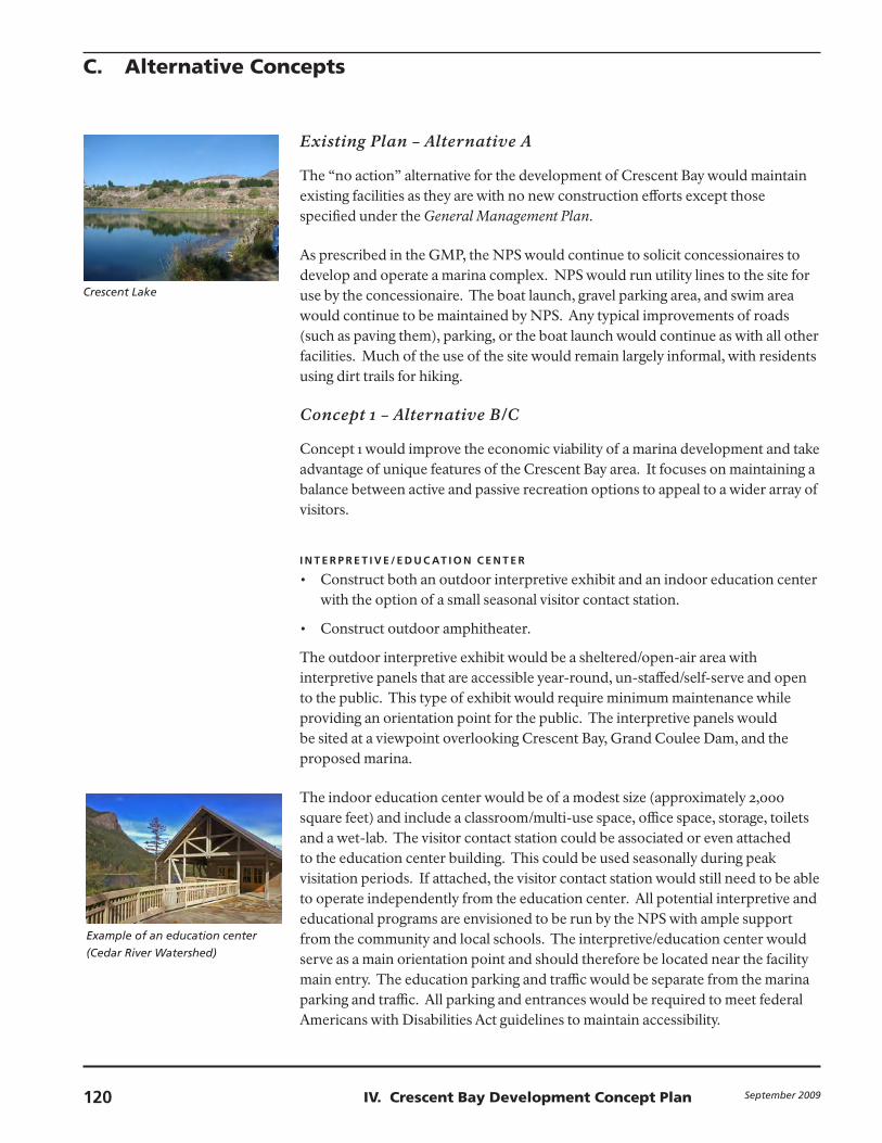
Example of an education center
(Cedar River Watershed)
Crescent Lake
Existing Plan – Alternative A
The “no action” alternative for the development of Crescent Bay would maintain existing facilities as they are with no new construction efforts except those specified under the General Management Plan.
As prescribed in the GMP, the NPS would continue to solicit concessionaires to develop and operate a marina complex. NPS would run utility lines to the site for use by the concessionaire. The boat launch, gravel parking area, and swim area would continue to be maintained by NPS. Any typical improvements of roads (such as paving them), parking, or the boat launch would continue as with all other facilities. Much of the use of the site would remain largely informal, with residents using dirt trails for hiking.
Concept 1 – Alternative B/C
Concept 1 would improve the economic viability of a marina development and take advantage of unique features of the Crescent Bay area. It focuses on maintaining a balance between active and passive recreation options to appeal to a wider array of visitors.
I N T E R P R E T I v E / E D U C AT I o N C E N T E R
Construct both an outdoor interpretive exhibit and an indoor education center •with the option of a small seasonal visitor contact station.
Construct outdoor amphitheater.•
The outdoor interpretive exhibit would be a sheltered/open-air area with interpretive panels that are accessible year-round, un-staffed/self-serve and open to the public. This type of exhibit would require minimum maintenance while providing an orientation point for the public. The interpretive panels would be sited at a viewpoint overlooking Crescent Bay, Grand Coulee Dam, and the proposed marina.
The indoor education center would be of a modest size (approximately 2,000 square feet) and include a classroom/multi-use space, office space, storage, toilets and a wet-lab. The visitor contact station could be associated or even attached to the education center building. This could be used seasonally during peak visitation periods. If attached, the visitor contact station would still need to be able to operate independently from the education center. All potential interpretive and educational programs are envisioned to be run by the NPS with ample support from the community and local schools. The interpretive/education center would serve as a main orientation point and should therefore be located near the facility main entry. The education parking and traffic would be separate from the marina parking and traffic. All parking and entrances would be required to meet federal Americans with Disabilities Act guidelines to maintain accessibility.
C. Alternative Concepts
September 2009120 IV. Crescent Bay Development Concept Plan
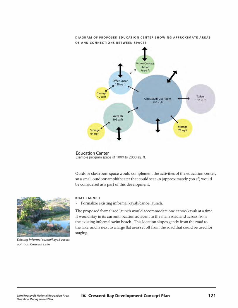
D I Ag R A M o f P R o P o S E D E D U C AT I o N C E N T E R S h o W I N g A P P R oX I M AT E A R E A S
o f A N D C o N N E C T I o N S b E T W E E N S PAC E S
Existing informal canoe/kayak access
point on Crescent Lake
Outdoor classroom space would complement the activities of the education center, so a small outdoor amphitheater that could seat 40 (approximately 700 sf) would be considered as a part of this development.
b oAT L AU N C h
Formalize existing informal kayak/canoe launch.•
The proposed formalized launch would accommodate one canoe/kayak at a time. It would stay in its current location adjacent to the main road and across from the existing informal swim beach. This location slopes gently from the road to the lake, and is next to a large flat area set off from the road that could be used for staging.
Example program space of 1000 to 2000 sq. ft.
Lake Roosevelt National Recreation Area Shoreline Management Plan
121IV. Crescent Bay Development Concept Plan
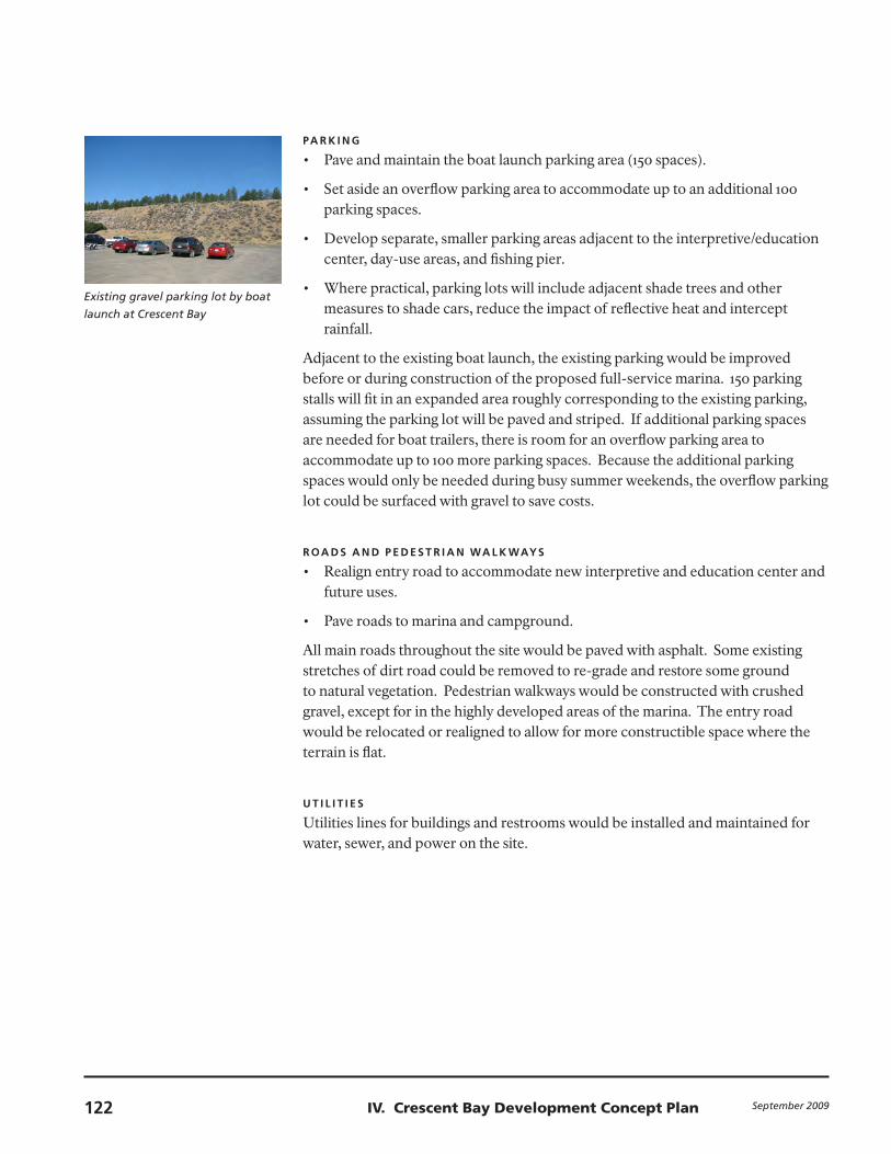
Existing gravel parking lot by boat
launch at Crescent Bay
PA R k I N g
Pave and maintain the boat launch parking area (150 spaces).•
Set aside an overflow parking area to accommodate up to an additional 100 •parking spaces.
Develop separate, smaller parking areas adjacent to the interpretive/education •center, day-use areas, and fishing pier.
Where practical, parking lots will include adjacent shade trees and other •measures to shade cars, reduce the impact of reflective heat and intercept rainfall.
Adjacent to the existing boat launch, the existing parking would be improved before or during construction of the proposed full-service marina. 150 parking stalls will fit in an expanded area roughly corresponding to the existing parking, assuming the parking lot will be paved and striped. If additional parking spaces are needed for boat trailers, there is room for an overflow parking area to accommodate up to 100 more parking spaces. Because the additional parking spaces would only be needed during busy summer weekends, the overflow parking lot could be surfaced with gravel to save costs.
R oA D S A N D P E D E S T R I A N WA L k WAyS
Realign entry road to accommodate new interpretive and education center and •future uses.
Pave roads to marina and campground.•
All main roads throughout the site would be paved with asphalt. Some existing stretches of dirt road could be removed to re-grade and restore some ground to natural vegetation. Pedestrian walkways would be constructed with crushed gravel, except for in the highly developed areas of the marina. The entry road would be relocated or realigned to allow for more constructible space where the terrain is flat.
U T I L I T I E S
Utilities lines for buildings and restrooms would be installed and maintained for water, sewer, and power on the site.
September 2009122 IV. Crescent Bay Development Concept Plan
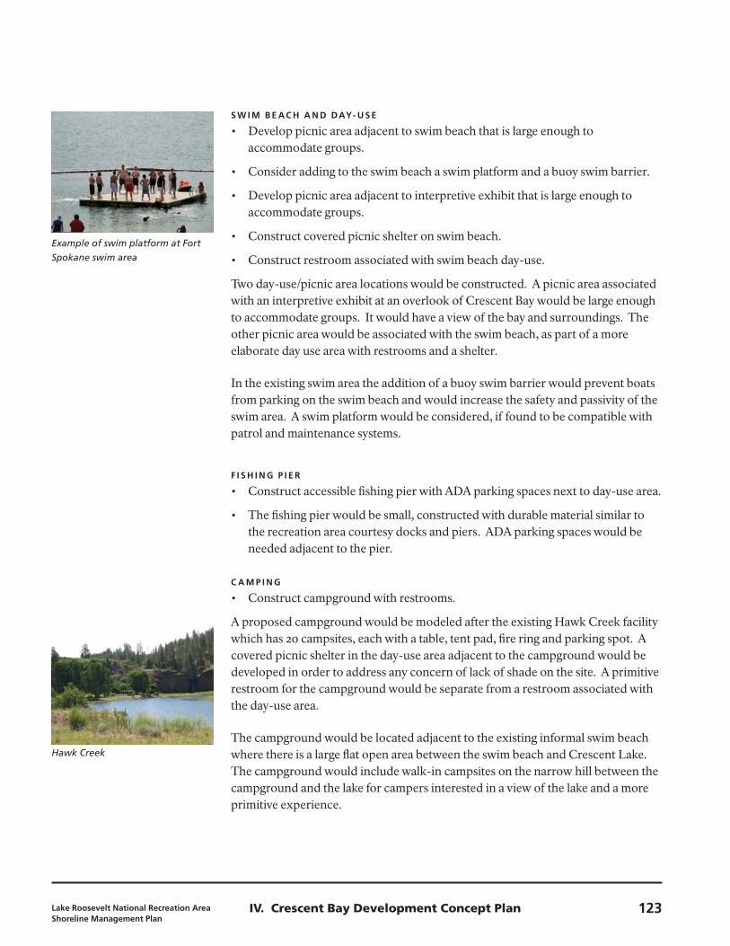
Example of swim platform at Fort
Spokane swim area
Hawk Creek
S W I M b E AC h A N D DAy- U S E
Develop picnic area adjacent to swim beach that is large enough to •accommodate groups.
Consider adding to the swim beach a swim platform and a buoy swim barrier.•
Develop picnic area adjacent to interpretive exhibit that is large enough to •accommodate groups.
Construct covered picnic shelter on swim beach.•
Construct restroom associated with swim beach day-use.•
Two day-use/picnic area locations would be constructed. A picnic area associated with an interpretive exhibit at an overlook of Crescent Bay would be large enough to accommodate groups. It would have a view of the bay and surroundings. The other picnic area would be associated with the swim beach, as part of a more elaborate day use area with restrooms and a shelter.
In the existing swim area the addition of a buoy swim barrier would prevent boats from parking on the swim beach and would increase the safety and passivity of the swim area. A swim platform would be considered, if found to be compatible with patrol and maintenance systems.
f I S h I N g P I E R
Construct accessible fishing pier with ADA parking spaces next to day-use area.•
The fishing pier would be small, constructed with durable material similar to •the recreation area courtesy docks and piers. ADA parking spaces would be needed adjacent to the pier.
C A M P I N g
Construct campground with restrooms.•
A proposed campground would be modeled after the existing Hawk Creek facility which has 20 campsites, each with a table, tent pad, fire ring and parking spot. A covered picnic shelter in the day-use area adjacent to the campground would be developed in order to address any concern of lack of shade on the site. A primitive restroom for the campground would be separate from a restroom associated with the day-use area.
The campground would be located adjacent to the existing informal swim beach where there is a large flat open area between the swim beach and Crescent Lake. The campground would include walk-in campsites on the narrow hill between the campground and the lake for campers interested in a view of the lake and a more primitive experience.
Lake Roosevelt National Recreation Area Shoreline Management Plan
123IV. Crescent Bay Development Concept Plan
T R A I L S
Construct interpretive loop trail with overlooks that interpret the ice-age flood.•
Locate trailhead near the swim beach day-use area.•
Designate the overlooks as the “Eden Overlook” and the “Crescent Bay •Overlook.”
Construct a portion of the pilot shoreline trail between Crescent Bay and •Spring Canyon.
Construct trail connecting the entry day-use area to the town of Grand Coulee.•
An interpretive walk with overlooks showing views of Lake Roosevelt and Crescent Lake could tell the story of the ice-age floods. Short trails would connect the various park facilities in the immediate surroundings of Crescent Bay. A longer loop trail could be considered that covers a larger area of the recreation area near Crescent Bay moving over the hills east of the bay. The important overlooks and viewpoints would have small interpretive elements constructed where most appropriate. The trailhead would be located near the swim beach day-use area. Parking would be shared with the day use facilities.
A longer distance trail from Crescent Bay to Spring Canyon would continue to be explored. The trail would start at the Crescent Bay day use area, wind up among the hills to the east, pass through the Eden Harbor area, and find a way through two housing developments located on bluffs above Lake Roosevelt before ending up at Spring Canyon. The first half of the trail (1.5 miles) would be through NPS land. The second half of the trail (approximately 3 miles depending on route) would be located on public (NPS) and private land. The Crescent Bay to Eden Harbor segment would be constructed in the first phase. The trail would be on public land and could be a loop trail of up to three miles, moving through the diverse sagebrush biological community and providing views from the hillsides of the surrounding lake.
September 2009124 IV. Crescent Bay Development Concept Plan
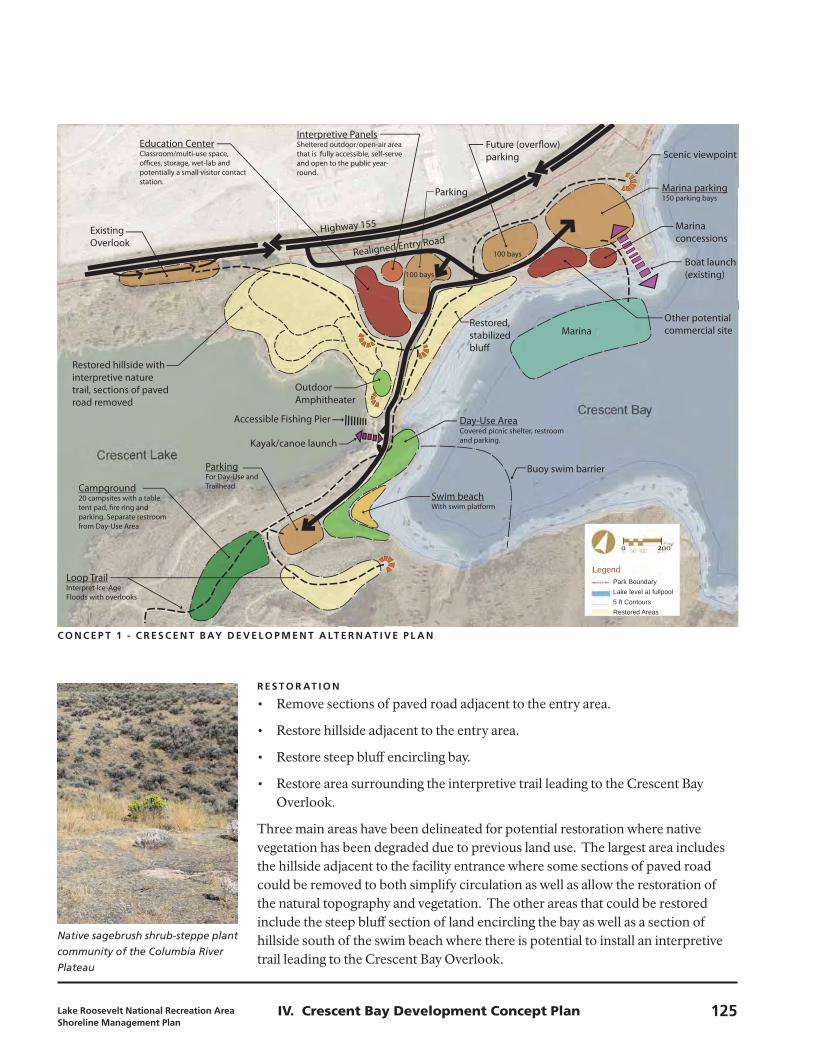
Concept 1Preferred Alternative
Crescent BayLake Roosevelt Shoreline Management Plan
January 2009
LegendPark BoundaryLake level at fullpool5 ft ContoursRestored Areas
Campground20 campsites with a table, tent pad, � re ring and parking. Separate restroom from Day-Use Area
Day-Use AreaCovered picnic shelter, restroom and parking.
ParkingFor Day-Use and Trailhead
Swim beachWith swim platform
Marina
Marina parking150 parking bays
Future (over� ow) parking
Highway 155Existing Overlook
Outdoor Amphitheater
Kayak/canoe launch
Parking
Education CenterClassroom/multi-use space, o� ces, storage, wet-lab and potentially a small visitor contact station.
Interpretive PanelsSheltered outdoor/open-air area that is fully accessible, self-serve and open to the public year-round.
Realigned Entry Road
Other potential commercial site
Marina concessions
Scenic viewpoint
Boat launch (existing)
Restored, stabilized blu�
Restored hillside with interpretive nature trail, sections of paved road removed
Loop TrailInterpret Ice-Age Floods with overlooks
Accessible Fishing Pier
Buoy swim barrier
100 bays
100 bays
Native sagebrush shrub-steppe plant
community of the Columbia River
Plateau
C o N C E P T 1 - C R E S C E N T b Ay D E v E L o P M E N T A LT E R N AT I v E P L A N
Concept 1Preferred Alternative
Crescent BayLake Roosevelt Shoreline Management Plan
January 2009
LegendPark BoundaryLake level at fullpool5 ft ContoursRestored Areas
Campground20 campsites with a table, tent pad, � re ring and parking. Separate restroom from Day-Use Area
Day-Use AreaCovered picnic shelter, restroom and parking.
ParkingFor Day-Use and Trailhead
Swim beachWith swim platform
Marina
Marina parking150 parking bays
Future (over� ow) parking
Highway 155Existing Overlook
Outdoor Amphitheater
Kayak/canoe launch
Parking
Education CenterClassroom/multi-use space, o� ces, storage, wet-lab and potentially a small visitor contact station.
Interpretive PanelsSheltered outdoor/open-air area that is fully accessible, self-serve and open to the public year-round.
Realigned Entry Road
Other potential commercial site
Marina concessions
Scenic viewpoint
Boat launch (existing)
Restored, stabilized blu�
Restored hillside with interpretive nature trail, sections of paved road removed
Loop TrailInterpret Ice-Age Floods with overlooks
Accessible Fishing Pier
Buoy swim barrier
100 bays
100 bays
0 200’
R E S T o R AT I o N
Remove sections of paved road adjacent to the entry area.•
Restore hillside adjacent to the entry area.•
Restore steep bluff encircling bay.•
Restore area surrounding the interpretive trail leading to the Crescent Bay •Overlook.
Three main areas have been delineated for potential restoration where native vegetation has been degraded due to previous land use. The largest area includes the hillside adjacent to the facility entrance where some sections of paved road could be removed to both simplify circulation as well as allow the restoration of the natural topography and vegetation. The other areas that could be restored include the steep bluff section of land encircling the bay as well as a section of hillside south of the swim beach where there is potential to install an interpretive trail leading to the Crescent Bay Overlook.
Lake Roosevelt National Recreation Area Shoreline Management Plan
125IV. Crescent Bay Development Concept Plan


