Embed Size (px)
Citation preview
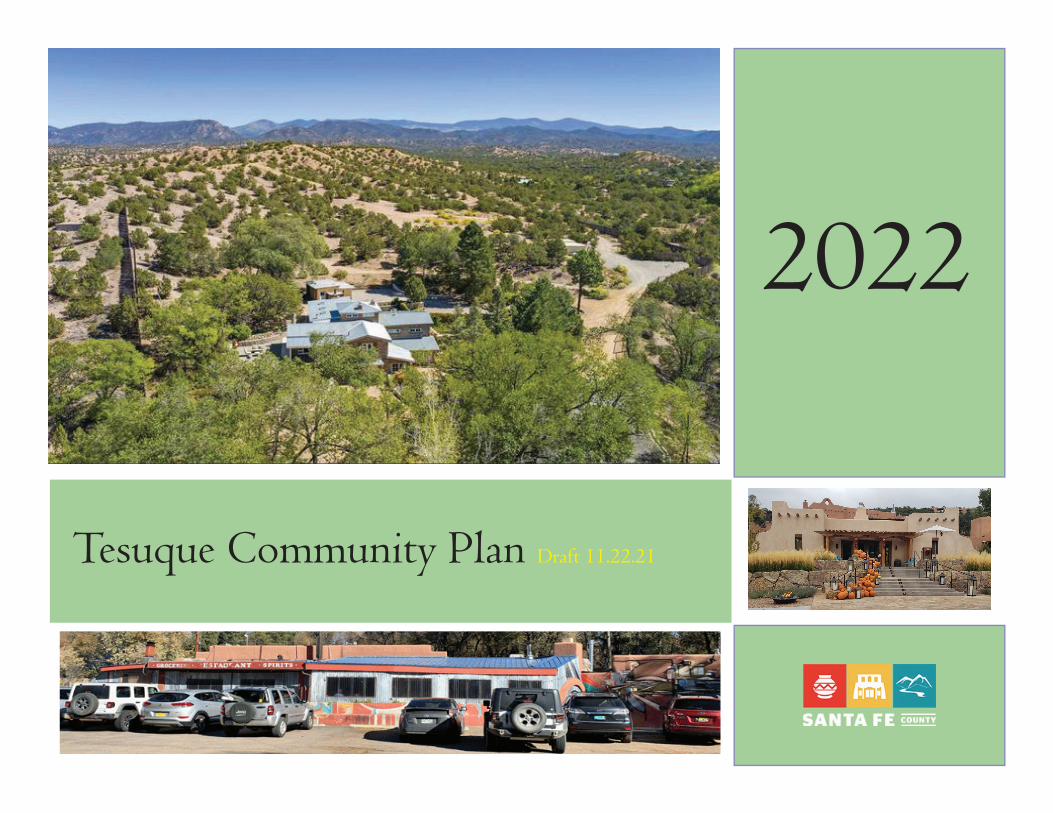
Tesuque Community Plan Draft 11.22.21
2022
AcknowledgementsCommunity Members
Special thanks to the numerous community members who con-tributed valuable time, information and insight into the planning eff ort. Th is Plan is the product of everyone who participated.
Planning Committee Members
Th e Tesuque Valley Community Association submitted a Letter of Intent to request authorization to establish the Tesuque Planning Committee and to request authorization to initiate a community planning process to update the 2013 Tesuque Community Plan and address specifi c condtions for consistency between the plan and the Tesuque Community District Overlay in the Sustainable Land Development Code (SLDC). Th e Santa Fe Board of County Commissioners established the Tesuque Planning Committee and authorized the initiation of a community planning process for the Tesuque Planning via Resolution 2019-47. Th e Tesuque Planning Committee is coordinated through the County Planning Division in accordance with the SLDC which includes notifi cation to prop-erty owners and participation on the planning committee is open to all community members throughout the process.
County Offi cials
Henry Roybal, Commission District 1Anna Hansen, Commission District 2 Rudy Garcia, Commission District 3 Anna Hamilton, Commission District 4Hank Hughes, Commission District 5
County ManagerKatherine Miller
Growth Management Department & Planning Division
Penny Ellis-Green, Growth Management DirectorRobert Griego, Planning ManagerLucy Gent Foma, Senior PlannerAlex Painter, Community PlannerTim Cannon, Senior PlannerGary Brett Clavio, Transportation Planner
ContentsContentsSection I: Plan Context Purpose and Intent........................................................................................................................................6 Tesuque District Description ......................................................................................................................7 Challenges and Opportunities.....................................................................................................................7 Planning History and Community Outreach............................................................................................8 Related Plans, Policies and Programs...........................................................................................................9 Community Vision.....................................................................................................................................12 Tesuque Existing Land Use Map...............................................................................................................13 Community Context..................................................................................................................................14 A Brief History of Tesuque .......................................................................................................................14 Tesuque Demographics..............................................................................................................................15 Section II: Plan Elements Bishops Lodge Corridor and Roads..........................................................................................................20 Agriculture, Acequias and Riparian Areas...............................................................................................26 Social Trails..................................................................................................................................................28 Public Access to Forest Land and Trails...................................................................................................29 Fire Safety and Prevention ........................................................................................................................30 Community Facilities..................................................................................................................................32 Water Supply and Wastewater Treatment.................................................................................................34
Section III: Land Use Plan Land Uses, Densities and Development Patterns...................................................................................40 Land Use Plan and Map.............................................................................................................................43 Land Use Categories...................................................................................................................................44 Implementation Strategy............................................................................................................................48 Appendices...................................................................................................................................................53
4
Section 1
SECTION I: PLAN CONTEXT

Section 1
5
6
Section 1
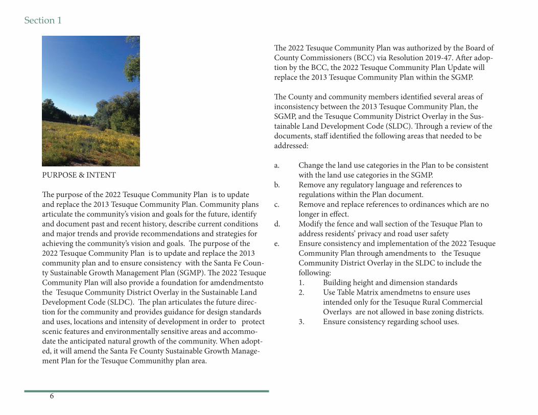
PURPOSE & INTENT
Th e purpose of the 2022 Tesuque Community Plan is to update and replace the 2013 Tesuque Community Plan. Community plans articulate the community’s vision and goals for the future, identify and document past and recent history, describe current conditions and major trends and provide recommendations and strategies for achieving the community’s vision and goals. Th e purpose of the 2022 Tesuque Community Plan is to update and replace the 2013 community plan and to ensure consistency with the Santa Fe Coun-ty Sustainable Growth Management Plan (SGMP). Th e 2022 Tesuque Community Plan will also provide a foundation for amdendmentsto the Tesuque Community District Overlay in the Sustainable Land Development Code (SLDC). Th e plan articulates the future direc-tion for the community and provides guidance for design standards and uses, locations and intensity of development in order to protect scenic features and environmentally sensitive areas and accommo-date the anticipated natural growth of the community. When adopt-ed, it will amend the Santa Fe County Sustainable Growth Manage-ment Plan for the Tesuque Communithy plan area.
Th e 2022 Tesuque Community Plan was authorized by the Board of County Commissioners (BCC) via Resolution 2019-47. Aft er adop-tion by the BCC, the 2022 Tesuque Community Plan Update will replace the 2013 Tesuque Community Plan within the SGMP.
Th e County and community members identifi ed several areas of inconsistency between the 2013 Tesuque Community Plan, the SGMP, and the Tesuque Community District Overlay in the Sus-tainable Land Development Code (SLDC). Th rough a review of the documents, staff identifi ed the following areas that needed to be addressed:
a. Change the land use categories in the Plan to be consistent with the land use categories in the SGMP.b. Remove any regulatory language and references to regulations within the Plan document.c. Remove and replace references to ordinances which are no longer in eff ect.d. Modify the fence and wall section of the Tesuque Plan to address residents’ privacy and road user safetye. Ensure consistency and implementation of the 2022 Tesuque Community Plan through amendments to the Tesuque Community District Overlay in the SLDC to include the following: 1. Building height and dimension standards 2. Use Table Matrix amendmetns to ensure uses intended only for the Tesuque Rural Commercial Overlays are not allowed in base zoning districts. 3. Ensure consistency regarding school uses.
Section 1
7
TESUQUE DISTRICT DESCRIPTION
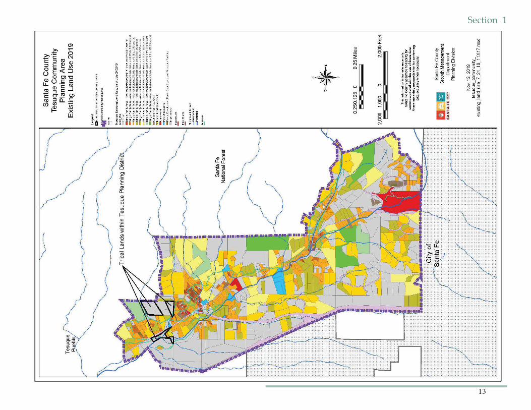
Th e Tesuque Community Plan covers the Traditional Historic Communi-ty of Tesuque which is identifi ed as the Tesuque Community District and is located just north of the City of Santa Fe in the unincorporated area of central Santa Fe County. Th e Tesuque Community District is an area that lies between the City of Santa Fe to the south, the Santa Fe National For-est to the east, the Pueblo of Tesuque to the north and US Highway 285 to the west. Th e area includes approximately 2,950 acres encompassing the Rio Tesuque and surrounding foothills. Th is river valley, at the base of the foothills of the Sangre de Cristo Mountains, is home to 1,094 residents (2020 Census).
CHALLENGES AND OPPORTUNITIES
Th e plan addresses new and changing conditions within the Tesuque community. Among the conditions addressed are responding to drought, fl ooding, fi re risks, water rights and conservation concerns, implementa-tion of the applicable terms of the Aamodt settlement agreement, chang-ing land use patterns such as increasing proportion of second homes in the plan area and population changes, and concerns regarding enforce-ment of applicable land-use and fi re safety codes.
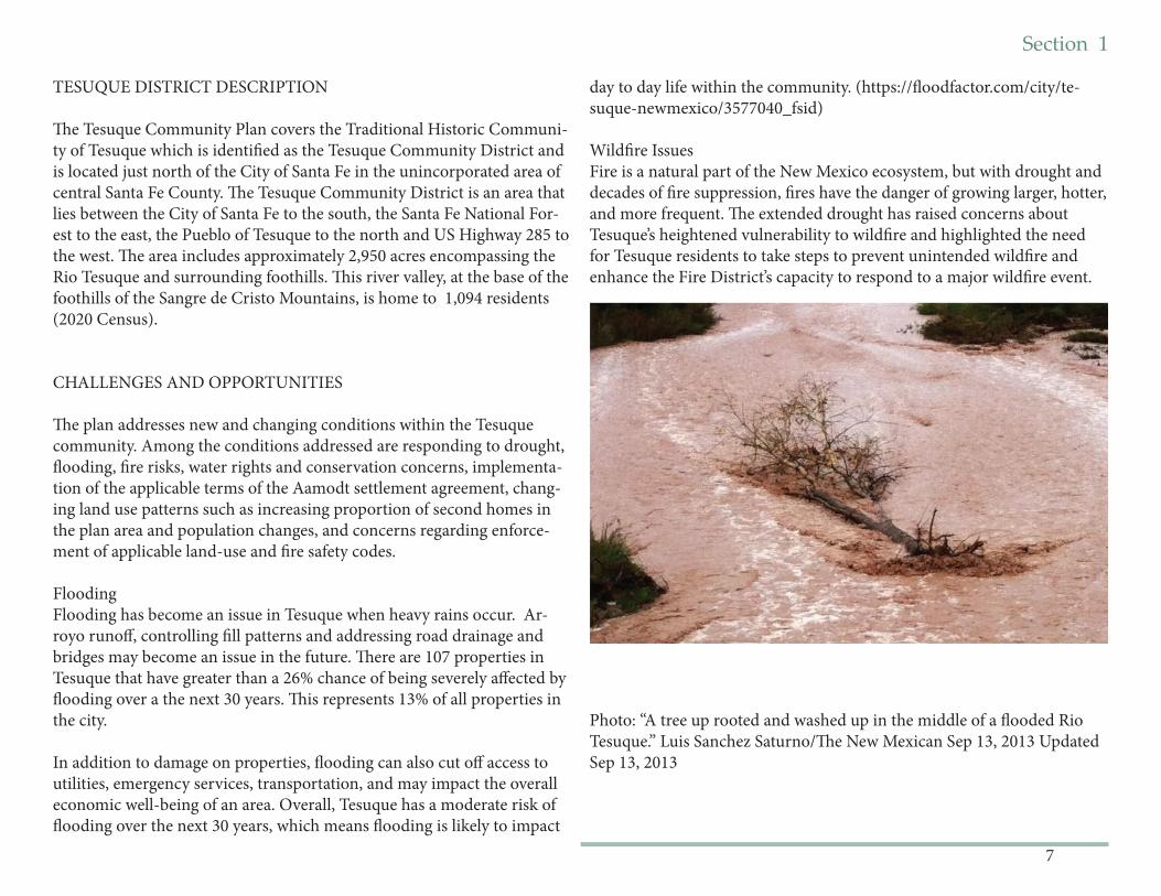
FloodingFlooding has become an issue in Tesuque when heavy rains occur. Ar-royo runoff , controlling fi ll patterns and addressing road drainage and bridges may become an issue in the future. Th ere are 107 properties in Tesuque that have greater than a 26% chance of being severely aff ected by fl ooding over a the next 30 years. Th is represents 13% of all properties in the city.
In addition to damage on properties, fl ooding can also cut off access to utilities, emergency services, transportation, and may impact the overall economic well-being of an area. Overall, Tesuque has a moderate risk of fl ooding over the next 30 years, which means fl ooding is likely to impact
day to day life within the community. (https://fl oodfactor.com/city/te-suque-newmexico/3577040_fsid)
Wildfi re IssuesFire is a natural part of the New Mexico ecosystem, but with drought and decades of fi re suppression, fi res have the danger of growing larger, hotter, and more frequent. Th e extended drought has raised concerns about Tesuque’s heightened vulnerability to wildfi re and highlighted the need for Tesuque residents to take steps to prevent unintended wildfi re and enhance the Fire District’s capacity to respond to a major wildfi re event.
Photo: “A tree up rooted and washed up in the middle of a fl ooded Rio Tesuque.” Luis Sanchez Saturno/Th e New Mexican Sep 13, 2013 Updated Sep 13, 2013
8
Section 1
Aamodt SettlementImplementation of the settlement will involve extending water infrastruc-ture to serve Pueblo and County residents, including Tesuque residents.
EnforcementCurrent issues needing enforcement include traffi c, abandoned homes, and fencing regulations.
Road Safety StudyBishop’s Lodge Road and Tesuque Village Roads form a historic and sce-nic corridor and due to Tesuque’s proximity to Santa Fe and the Santa Fe National Forest has resulted in signifi cant volumes of traffi c from mo-torists, bikers, bicyclists and hikers seeking to access this area to include public lands and other amenities. Th ere is a need to address issues on thee roads for pedestrian and bicyclist safety. Safe transit stops and poten-tial trailheads are some options that have been suggested by the Tesuque community. Santa Fe County is currently in the process of undertaking a road safety study along Bishop’s Lodge Road, Tesuque Village Road to identify existing safety issues for road users. Th e results of the road safety study will be integrated into road safety planning.
Tesuque Open Space Management Plan and Tesuque Trail StudySanta Fe County has draft ed a Little Tesuque Creek Open Space Manage-ment Plan and is in the process of developing a Trail Study to improve the sustainability of the trail, improve water quality in the creek, reduce erosion and improve wildlife habitat Th e results of the trails study will be integrated into the Little Tesuque Creek Management Plan.
PLANNING HISTORY & COMMUNITY OUTREACH
Background: Residents of Tesuque have been involved in planning eff orts for many years starting with the Las Tres Villas planning eff ort of 1974-1978. Th eir dedication has resulted in both the designation of the area as a Traditional Historic Community in 1998 through Santa Fe County Ordi-nance 1998-6. In 2000, the adoption of the Rio Tesuque Community Land Use Plan, (via Resolution 2000-165) which amended the County’s 1999 General Plan. Th e County adopted Ordinance 2000-13 to implement the plan the the 1996 Land Development Code. Santa Fe County replanced the 1999 General plan with the Sustainable Growth Management Plan. In 2010, Tesuque residents recognized the need to revisit and update their community plan in light of new challenges brought on by extended drought, the Aamodt settlement, the recession, and by the County’s adop-tion in SGMP and the the County development of the SLDC which was adopted in 2015 and replaced the 1996 Land Development Code.
2013 Tesuque Community Plan : Santa Fe County’s Board of County Commissioners authorized a planning process to update and amend Tesuque’s community plan through Resolution 2011-134. On December 10, 2013, the Board of County Commissioners adopted the 2013 Tesuque Community Plan via Resolution 2013-139 as amendment to the SGMP. 2021 Plan Process- TBD
2022 Tesuque Community Plan: Th e 2022 Tesuque Community Plan was initiated when the Tesuque Valley Community Association submitted a Letter of Intent to request authorization to establish the Tesuque Plan-ning Committee and to request authorization to initiate a community planning process to update the 2013 Tesuque Community Plan and ad-dress specifi c condtions for consistency between the plan and the Tesuque Community District Overlay in the Sustainable Land Development Code (SLDC). Th e Santa Fe Board of County Commissioners established the Tesuque Planning Committee and authorized the initiation of a commu-nity planning process for the Tesuque Planning via Resolution 2019-47. Th e Tesuque Planning Committee is coordinated through the County Planning Division in accordance with the SLDC which includes notifi -
Section 1
9
cation to property owners and participation on the planning committee is open to all community members throughout the process. Th e 2022 Tesuque Planning Committee met monthly in-person before March 2020, when COVID stopped all County public meetings for six months. When the Committee resumed for virtual meetings in August 2020, the Com-mittee decided to form a subcommittee to work on creating a Consensus Process by which to complete the Plan. Aft er another Planning Commit-tee hiatus while the Subcommittee convened, the entire Planning Com-mittee resumed work together with County Staff and a hired facilitator in April 2021. Th e 2022 Tesuque Community Plan replacs the 2013 Tesuque Community Plan as an amendment to the County’s comprehensive plan, the Sustainable Growth Management Plan.
Next Steps:
Th e Tesuque Community Plan will be implemented on an on-going basis through a variety of mechanisms including amendments to the SLDC, capital improvement projects, community projects and programs as identifi ed throughout this document. Santa Fe County and other govern-mental agencies will have an important role as collaborators in implemen-tation as well as supporting plan goals and objectives.
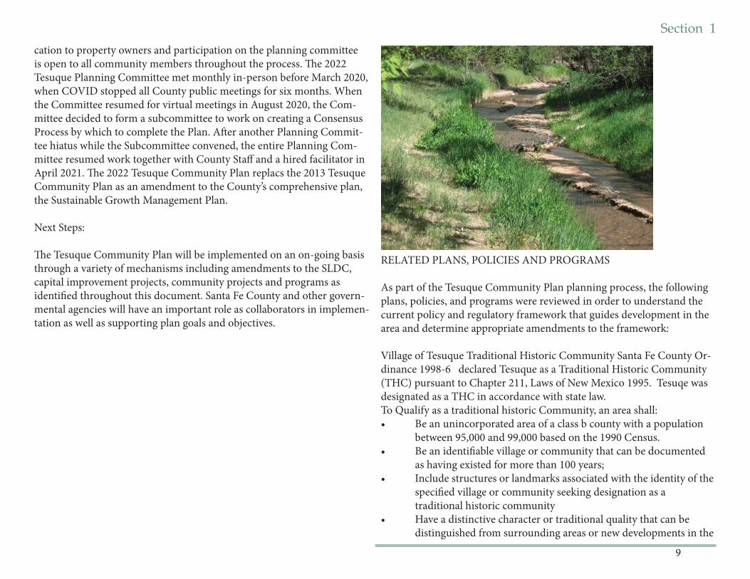
RELATED PLANS, POLICIES AND PROGRAMS
As part of the Tesuque Community Plan planning process, the following plans, policies, and programs were reviewed in order to understand the current policy and regulatory framework that guides development in the area and determine appropriate amendments to the framework:
Village of Tesuque Traditional Historic Community Santa Fe County Or-dinance 1998-6 declared Tesuque as a Traditional Historic Community (THC) pursuant to Chapter 211, Laws of New Mexico 1995. Tesuqe was designated as a THC in accordance with state law. To Qualify as a traditional historic Community, an area shall:• Be an unincorporated area of a class b county with a population between 95,000 and 99,000 based on the 1990 Census.• Be an identifi able village or community that can be documented as having existed for more than 100 years;• Include structures or landmarks associated with the identity of the specifi ed village or community seeking designation as a traditional historic community• Have a distinctive character or traditional quality that can be distinguished from surrounding areas or new developments in the
10
Section 1
vicinity; and• Be declared as a traditional historic community by an ordinance by the BCC.
2015 Santa Fe County Sustainable Growth Management Plan (SGMP) Th e Santa Fe County Sustainable Growth Management Plan provides policy direction for managing future growth across the County, including direction on creating, adopting, and implementing community plans. Sustainable Land Development Code (SLDC)
• 2016 Santa Fe County Sustainable Land Development Code (SLDC) Provides zoning regulations and standards for new devel opment. Th e SLDC implements the County’s and includes the Tesuque Community District Overlay. • Santa Fe County Open Space Program: Th e Santa Fe County Open Space Program currently manages about 6,600 acres, including161 acres of open space southeast of the planning boundary along Little Tesuque Creek. Th e area includes the La Piedra trail which provides a connection to the Dale Bale trail system. • Santa Fe County Capital Improvement Plan (CIP): Guides public investment in projects to serve existing and future development. • Santa Fe County Infrastrucure Capital Improvement Plan (ICIP): Comprised of projects generated by the County and project requests from the community that are submitted to state legislature for capital outlay funding. • Santa Fe County Community Wildfi re Protection Plan: Identifi es areas at high-risk of wildfi re including Tesuque; identifi es fi re mitigation programs and policies.
Regional Authorities:• Metropolitan Planning Organization (MPO)- A federally funded transportation policy-making organization responsible for programing federal transportation dollars and for transportation planning. Th e MPO planning area includes the community planning area.
Recognized Tesuque Acequia Associations:• Acequia Madre de Tesuque• Acequia del Cajon Grande • Acequia Chiquita• Cy Moore Ditch• Acequia Del Medio• McCune Ditch (historic)• Beaty Ditch (historic)• Carsuelo Ditch (historic)• Tesuque Pueblo Ditch (historic)
State and Federal Agencies:• Offi ce of the State Engineer and Interstate Stream Commission- Responsible for administering the state’s water resources. Th e agency has had a major role in contributing to the following: o Jemez y Sangre Regional Water Plan- Th e Jemez y Sangre Regional Water Plan projects future water usage and identifi es strategies to provide adequate water supply across Los Alamos County and portions of Santa Fe, Sandoval, and Rio Arriba County.o Santa Fe County, the Pueblos of Nambe, Pojoaque, San Ildefon so and Tesuque, the State of New Mexico, the United States, and the City of Santa Fe (“Settling Parties”) entered into a Settlement Agreement, which was approved and adopted by the Federal Court in 2016. Th e fi nal judgment and decree was fi led on July 14, 2017. Th e Agreement primarily concerns the water rights of the four Pueblos in the Aamodt adjudication within the Nambé-Pojoa que-Tesuque basin, but it also makes certain benefi cial concessions regarding non-Pueblo water rights. Th e goal of the Settlement Agreement is to resolve the Pueblos’ water rights claims while preserving existing non-Pueblo water uses. Th is goal is achieved, in part, by bringing more water into the Pojoaque Basin through the construction of a regional water system for both Pueblo and non-Pueblo water users.
Section 1
11
• NM Environment Department- Administers programs and regulations to promote a healthy, high functioning environment. Th e agency’s responsibilities include the administration of the Liquid Waste Program and Drinking Water Program. • NM Department of Transportation- Responsible for planning a safe, integrated, and multi-modal transportation system. Th e agency’s responsibilities include managing construction activities on state roads and highways. • US Forest Service: Manages the Santa Fe National Forest.• Bureau of Reclamation: Lead federal agency for managing and implementing the Aamodt Settlement.• Offi ce of the State Engineer: Approves well permits
Tesuque Pueblo:• Tesuque Pueblo is located north of the planning boundary. Tesuque Pueblo’s casino, commercial, and residential development have been signifi cant sources of economic development in the region.
12
Section 1
Community Vision - Placeholder
Section 1
13
14
Section 1COMMUNITY CONTEXT
Th is section assembles economic, demographic, land use, regulations, and historic information to provide an understanding of the community context today and how it evolved.
A BRIEF HISTORY OF TESUQUE
Th e name ''Tesuque'' is a Spanish version of the Tewa Indian '~at' unge' onwi" which means, "cottonwood place.” Tesuque Village was historically part of Tesuque Pueblo which dates back at least to 900 AD. Historically, Tesuque Pueblo is noted for its exceptional pottery and for launching the initial off ensive against the Spanish Colonists in 1680, which temporarily expelled the Spanish Conquistadores from the region.
Th e fi rst of Hispanic settlement in the Rio Tesuque area occurred in 1732 aft er the De Vargas 'Reconquest' of 1692. In 1732, Antonia Montoya sold Juan de Benavides a piece of land containing much of what is now Tesuque. EI Rancho Benavides extended from what is now the southem boundary of Tesuque Pueblo to the junction of the Big and Little Tesuque rivers between the mountain ridges on the East and West of the river. El Rancho Benavides became known as San Ysidro (the patron saint of farmers and the name still used for the local church) and later Tesuque Village. In 1752, Juan de Gabaldon obtained much of the Rio Tesuque re-gion in a land grant from the Spanish Territorial Governor. In 1776, Fray Francisco Dominguez visited Rio de Tesuque village and documented that it contained 17 families with 94 people.
Th e acequias were, and are, much more than merely a means of fairly distributing crop irrigation water. In fact, the acequias are an important cultural heritage linking the whole community. In addition to providing irrigation water, acequias also supplied the community's drinking water, served as routes connecting individual habitations and through the "may-ordomos" control of water rights, provided an eff ective political system that structured the entire village society. Land transaction and acequia records through the Spanish and Mexican periods show continued use of
the valley and its water for agricultural purposes. A number of those same acequias irrigate the valley today, with over 150 registered water users belonging to the fi ve acequia associations of the valley. Th e patterns and confi gurations of land division and land use in Tesuque today refl ect this historic acequia network and the associated agricultural uses of the past.
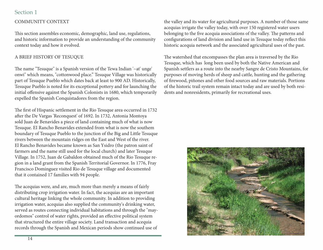
Th e watershed that encompasses the plan area is traversed by the Rio Tesuque, which has long been used by both the Native American and Spanish settlers as a route into the nearby Sangre de Cristo Mountains, for purposes of moving herds of sheep and cattle, hunting and the gathering of fi rewood, piñones and other food sources and raw materials. Portions of the historic trail system remain intact today and are used by both resi-dents and nonresidents, primarily for recreational uses.
Section 1
15
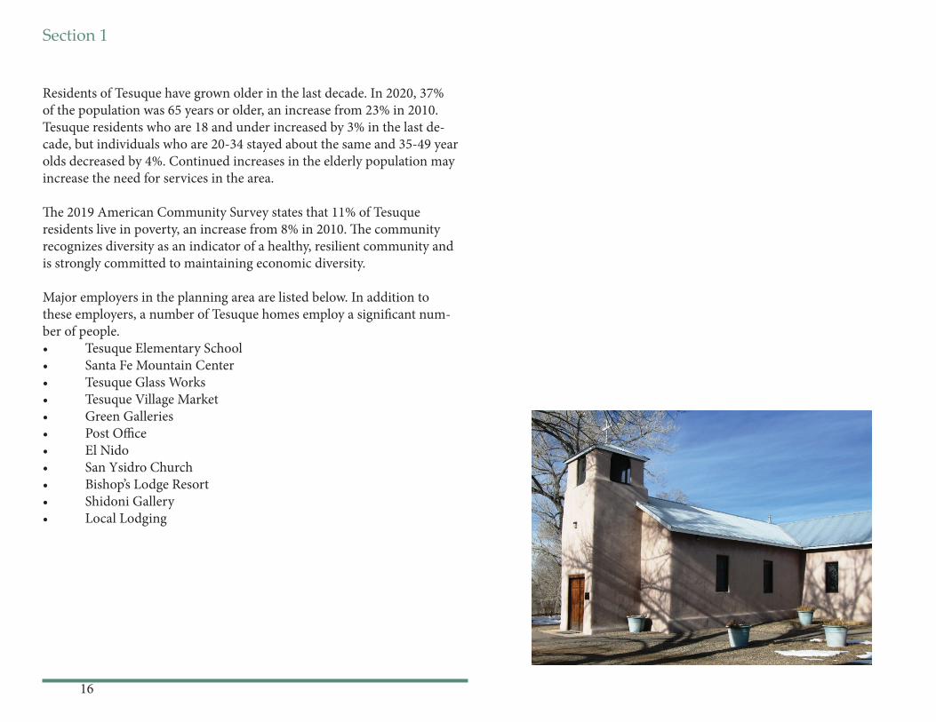
Numerous houses and buildings used for business and residential purpos-es undoubtedly date back to the mid-1800s. Archdiocese records date the current San Ysidro de Tesuque sanctuary at 1886. Th e Tesuque Elemen-tary School began serving this community and neighboring communities in 1930 and is one of the oldest schools in the Santa Fe Public School sys-tem. In 2005, a new school was built on the site incorporating most of the old building. Bishop's Lodge Resort and Spa, was initially purchased and developed as a personal retreat by Archbishop Lamy in the mid-1800s and many of the historic buildings, have been preserved; most notably the Archbishop Lamy Chapel which is recognized on the National Register of Historic Places.
In the 1950’s, 60’s and 70’s the community continued to fl ourish as a dis-tinct rural community with a rich mix of agriculturally based uses which included:• A tree nursery• Apple orchards• Custom butcher shop• Iris farmers• Williams Chicken Ranch• Harvey family egg and dairy production for La Fonda• Trout ponds for fi sh raised and delivered to Lamy to be served on the Santa Fe Super Chief• Mushroom growers• Vegetable gardens• Irrigated pastures for livestock
Although there are fewer small farms and agricultural uses have down-sized, the lives of the current area residents are still intermeshed through many of these environmental, economic, cultural and historical common-alties. Numerous rural endeavors are seen in the community today:• beekeepers• Apple and mixed fruit orchards• Peacock and chicken owners• Aspiring and existing vintners and distillers• Vegetable gardens• Irrigated pastures for horses and other livestock
Th e late 1970s through the present brought a wave of newcomers seeking a rural lifestyle close to amenities that the City of Santa Fe off ered. Con-temporary subdivision began to develop on the hills that encompass the valley and new home sites were developed on the valley fl oor.
DEMOGRAPHICS, HOUSING AND EMPLOYMENT
One of the main goals of this community plan is to ensure that Tesuque maintains its rural and agricultural character as a distinct, viable village. Tesuque residents do not want Tesuque to become a bedroom community for Santa Fe.
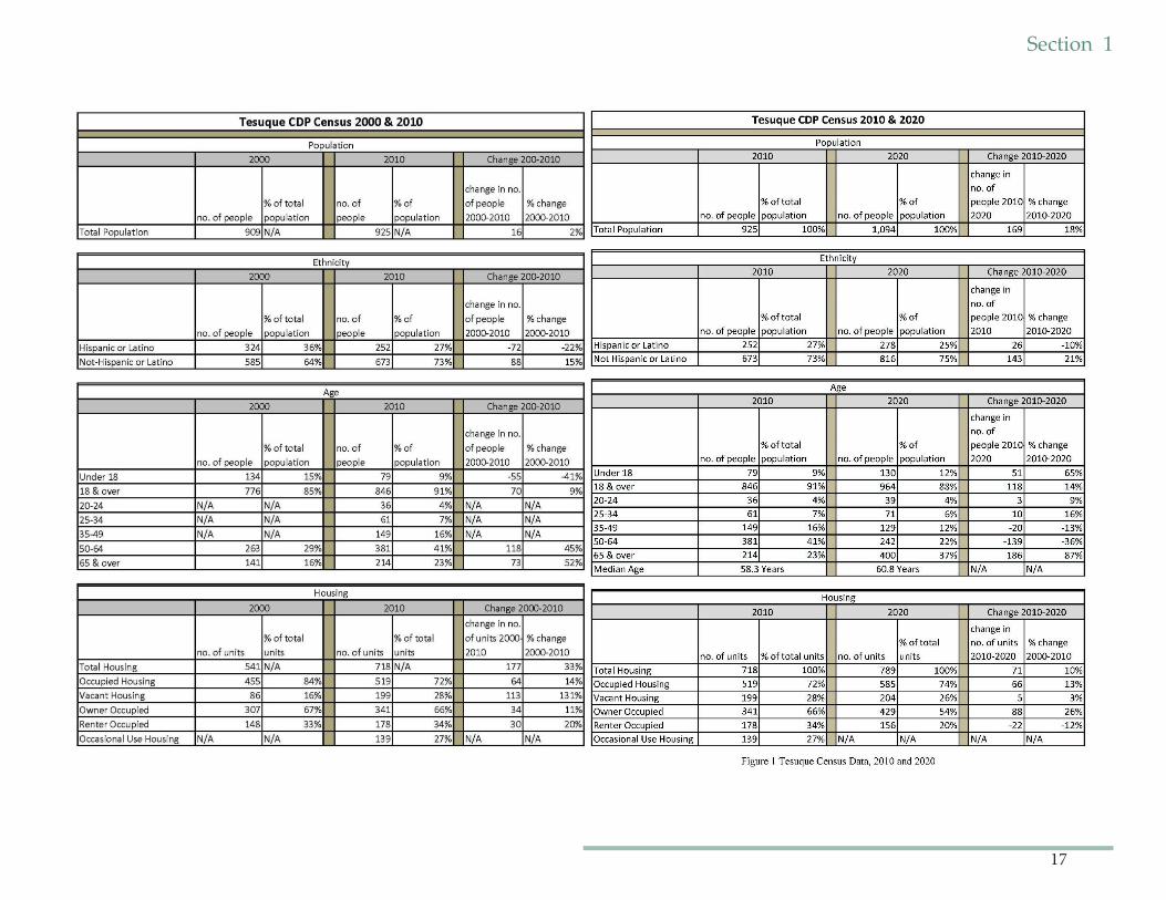
Tesuque has struggled to maintain its rural quality, as Santa Fe, a city of around 85,000 residents (https://www.census.gov/quickfacts/fact/table/santafecitynewmexico/PST045219) within a metro area of about 150,000 people (https://statisticalatlas.com/metro-area/New-Mexico/Santa-Fe/Population)continues to grow around it. Th rough this community plan and past community eff orts and partnerships, Tesuque continues to rein-force its historic development patterns and maintain a healthy ecosystem, enabling a sustainable future as a small distinctive rural community.
Th e growth in the number of Tesuque housing units is extremely high for the County. According to the census data, the numbers of residential units increased by 33% from 2000 to 2010 while the number of vacant housing units increased by 131%. From 2010 to 2017, the number of residential units increased 6.8% (49 units), however the number of fami-lies decreased from 221 in 2010 to 193 in 2017 (13% decrease). Th is most likely represents a substantial increase in vacation and or second homes. According to 2020 census data, total population growth for the Tesuque Census Designated Place, (CDP) which is congruent with the planning area, has been relatively low or negative as compared to the County. Be-tween 2010 and 2020 the population increased from 925 to 1094 people representing a 18% increase over the decade. However,
16
Section 1
Residents of Tesuque have grown older in the last decade. In 2020, 37% of the population was 65 years or older, an increase from 23% in 2010. Tesuque residents who are 18 and under increased by 3% in the last de-cade, but individuals who are 20-34 stayed about the same and 35-49 year olds decreased by 4%. Continued increases in the elderly population may increase the need for services in the area.
Th e 2019 American Community Survey states that 11% of Tesuque residents live in poverty, an increase from 8% in 2010. Th e community recognizes diversity as an indicator of a healthy, resilient community and is strongly committed to maintaining economic diversity.
Major employers in the planning area are listed below. In addition to these employers, a number of Tesuque homes employ a signifi cant num-ber of people. • Tesuque Elementary School• Santa Fe Mountain Center• Tesuque Glass Works• Tesuque Village Market• Green Galleries• Post Offi ce• El Nido • San Ysidro Church• Bishop’s Lodge Resort• Shidoni Gallery• Local Lodging
Section 1
17
Section 2
18
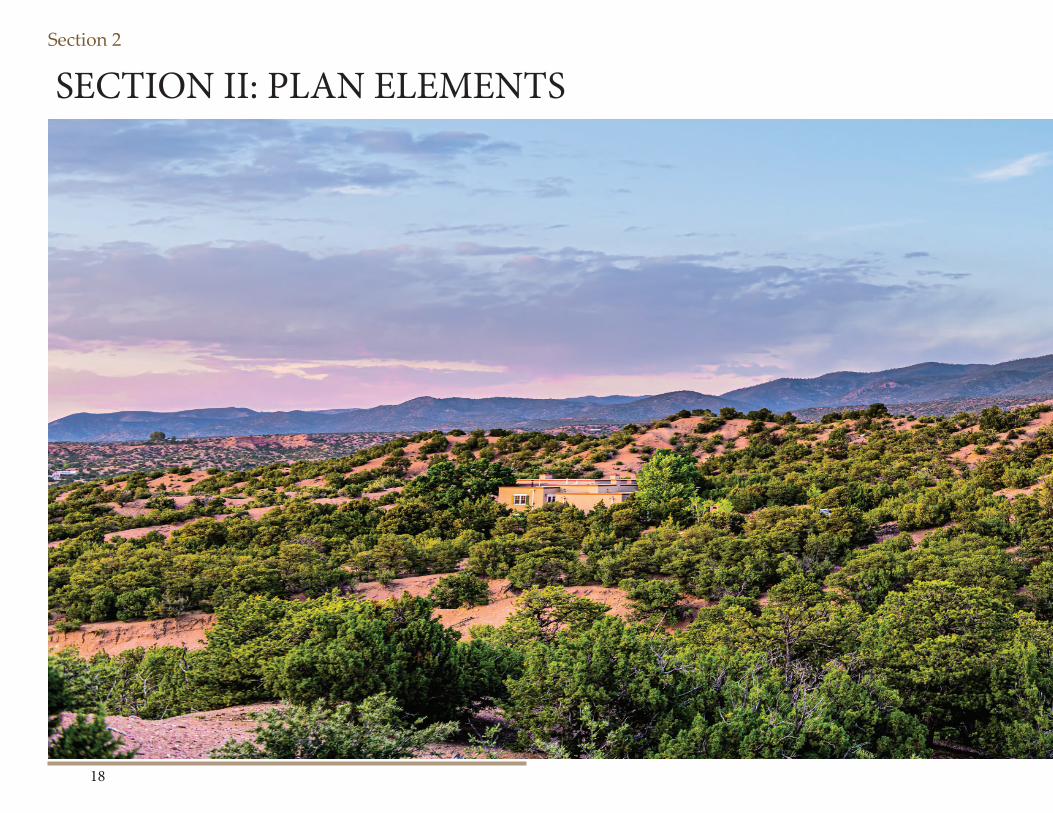
SECTION II: PLAN ELEMENTS
Section 2
19
Section 2
20
Bishops Lodge Corridor & RoadsBishops Lodge Road and Tesuque Village RoadCenturies ago, Bishops Lodge Road was a segment of an old Native American trail network which connected the place now known as Santa Fe with Pueblos to the north. Once the Spanish began settling in New Mexico, this trail use expanded, connecting to a larger, nationally signifi cant transportation corridor known as the Old Spanish Trail.
Th e Old Spanish trail was a trade route linking Santa Fe with Los Ange-les. From 1829 to 1848, the Old Spanish Trail was the principal overland route in Northern Mexico between the provinces of New Mexico and Alta California.
In 2002, Congress and the President enacted legislation creating the Old Spanish National Historic Trail. Historically, there were two main trails leading north from Santa Fe through Tesuque Village: a seasonal high road (roughly aligning with the Old Taos Highway) and a seasonal low road (roughly aligning with the Bishops Lodge Road). Bishops Lodge Road was given Old Spanish National Historic Trail signage as the road closely parallels the historical alignment. From Bishops Lodge Road in Tesuque Village, the trail continued on to Tesuque Pueblo, Pojoa-que Pueblo and then branched at Santa Cruz Plaza either northwest to Abiquiu or northeast to Taos. From there, the various overland routes of the trail continued and rejoined again in southwest Utah on the way to Mission San Gabriel and the Pueblo of Los Angeles.
Bishops Lodge Road and north Tesuque Village Road, provide a unique corridor through the community that connects us to our history and to each other. Fencing in this area has historically been short, open fencing for farming and grazing management, which created the sense of a small rural agricultural community. Preserving this corridor, as well as our
network of traditional narrow roads supports our rural lifestyle and the historic character of the valley.
As with many roads that weave through traditional communities in northern New Mexico, Bishops Lodge Road has all the characteristics of a winding, historic country road that could be found in many tradi-tional communities and older villages here or even in Europe. Tesuque residents are committed to maintaining this aesthetic, complete with its over-arching tree canopy, narrow and curving road surface, and lack of paved shoulders.
Residents and visitors cherish the winding, historic entrance to the Village of Tesuque. Bishops Lodge Road and the northern section of Tesuque Village Road form the spine of Tesuque and connect the long narrow valley that follows the contours of the Tesuque River. Portions of these roads have been designated as sections of the historic Old Spanish Trail. Low speeds are appropriate and necessary given the number of curves in the road and limited sight distance in many areas.
Equestrians, pedestrians, vehicles, and cyclists use these roads to enjoy the view and connect with neighbors, the post offi ce, the market, the ele-mentary school, the forest and the City of Santa Fe. Wildlife travel along the waterway of the Rio Tesuque and cross the roads in many places. Rights-of-way for acequias and the natural channels of streams, creeks and arroyos that adjoin or cross the road must also be maintained and respected.
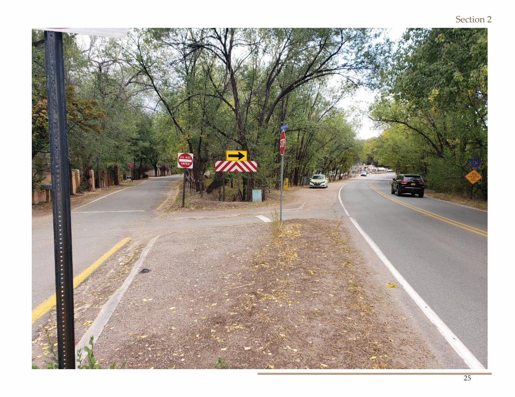
Road user safety due to high traffi c volume and excessive speed is a major concern, particularly along Bishops Lodge Road and Tesuque Village Road. Th e road safety need for all users of these roads requires low im-pact intervention in specifi c places while preserving the rural character. Limited sight distance and safety concerns as well as the desire to main-tain a visual connection to the area to include the pastures, orchards and natural features of the landscape justify establishing standards for fences and walls in these areas subject to identifi ed boundaries and exclusions.
Section 2
21
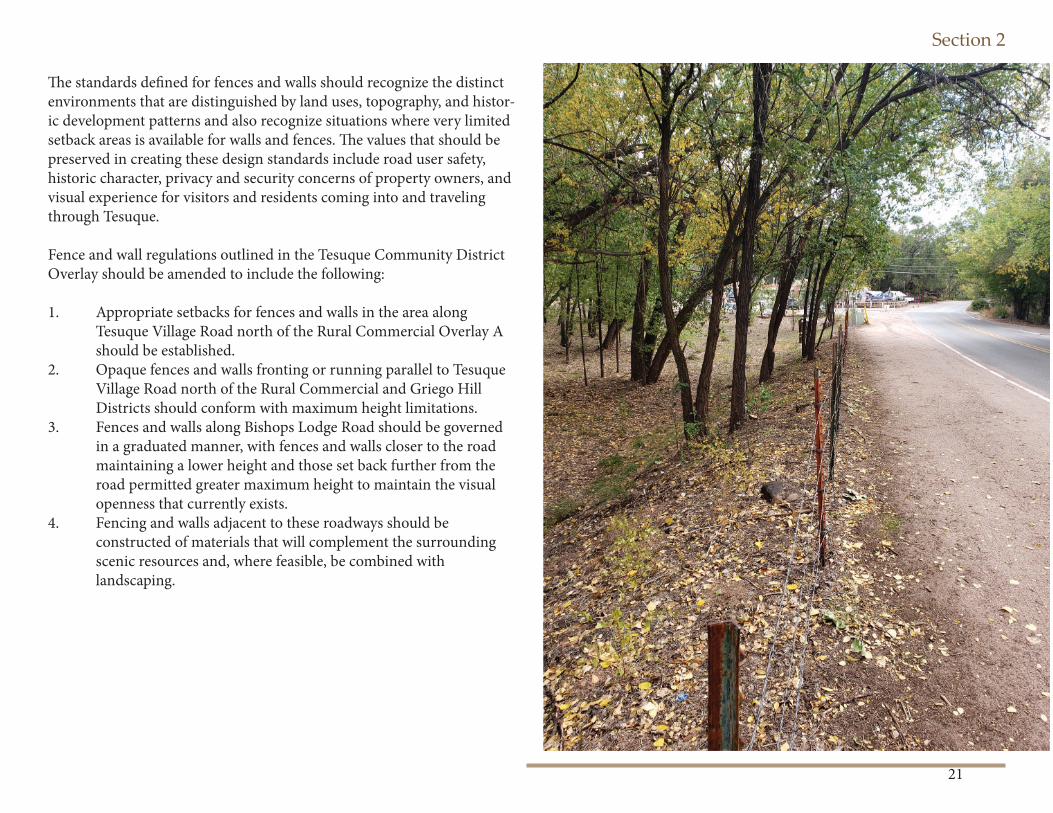
Th e standards defi ned for fences and walls should recognize the distinct environments that are distinguished by land uses, topography, and histor-ic development patterns and also recognize situations where very limited setback areas is available for walls and fences. Th e values that should be preserved in creating these design standards include road user safety, historic character, privacy and security concerns of property owners, and visual experience for visitors and residents coming into and traveling through Tesuque.
Fence and wall regulations outlined in the Tesuque Community District Overlay should be amended to include the following:
1. Appropriate setbacks for fences and walls in the area along Tesuque Village Road north of the Rural Commercial Overlay A should be established.2. Opaque fences and walls fronting or running parallel to Tesuque Village Road north of the Rural Commercial and Griego Hill Districts should conform with maximum height limitations. 3. Fences and walls along Bishops Lodge Road should be governed in a graduated manner, with fences and walls closer to the road maintaining a lower height and those set back further from the road permitted greater maximum height to maintain the visual openness that currently exists. 4. Fencing and walls adjacent to these roadways should be constructed of materials that will complement the surrounding scenic resources and, where feasible, be combined with landscaping.
Section 2
22
CARS, BICYCLES, PEOPLE AND WILDLIFE
Establish historic marker for Tesuque Historic Village
Other communities in Santa Fe County have built historic markers to designate their vil-lages. Th e public and residents may appreciate small signs or construction built to mark the entry of an historic village.
Pedestrian Circulation in the Village CoreTh e village core is centered at the intersection of Bishop’s Lodge Road and Tesuque Village Road and includes small-scaled commercial and community development. Th e lack of safe pedestrian connections limits community members from walking to, from and in-be-tween the post offi ce, the school and the village market. Currently most people walk along the very narrow shoulders of the road way and fi nd portions of the walk particularly diffi cult due to the guard rails. Within the village core area, the existing road right-of-way associated with Tesuque Village Road varies from approxi-mately 130’ at its widest to approximately 65’ at its narrowest. Th e right-of-way associated with Bishop’s Lodge Road varies between approx-imately 25 feet and 40 feet. With appropriate design both rights-of -ways may accommodate safe pedestrian paths.
Th ere is a need to improve signage and parking controls, particularly on the short section of Griego Road where it intersects with Tesuque Village Road that serves this area as a major thorough fare, yet also serves essentially as a parking lot of the Tesuque Village Market. Parking should be designed to control pedes-trian circulation and vehicle intrusion into a road that is critical for fi re access, school bus travel, and residential travel to and from Santa Fe. To this important safety end, fi re lanes and cross walks should be identifi ed in this import-ant village core.
Section 2
23
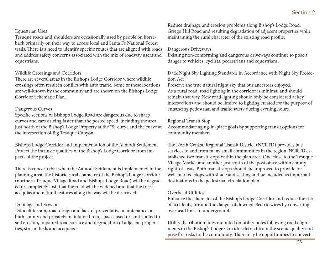
Equestrian UsesTesuque roads and shoulders are occasionally used by people on horse-back primarily on their way to access local and Santa Fe National Forest trails. Th ere is a need to identify specifi c routes that are aligned with roads and address safety concerns associated with the mix of roadway users and equestrians.
Wildlife Crossings and CorridorsTh ere are several areas in the Bishops Lodge Corridor where wildlife crossings oft en result in confl ict with auto traffi c. Some of these locations are well-known by the community and are shown on the Bishops Lodge Corridor Schematic Plan.
Dangerous CurvesSpecifi c sections of Bishop’s Lodge Road are dangerous due to sharp curves and cars driving faster than the posted speed, including the area just north of the Bishop’s Lodge Property at the “S” curve and the curve at the intersection of Big Tesuque Canyon.
Bishops Lodge Corridor and Implementation of the Aamodt SettlementProtect the intrinsic qualities of the Bishop’s Lodge Corridor from im-pacts of the project.
Th ere is concern that when the Aamodt Settlement is implemented in the planning area, the historic rural character of the Bishop’s Lodge Corridor (northern Tesuque Village Road and Bishops Lodge Road) will be degrad-ed or completely lost, that the road will be widened and that the trees, acequias and natural features along the way will be destroyed.
Drainage and ErosionDiffi cult terrain, road design and lack of preventative maintenance on both county and privately maintained roads has caused or contributed to soil erosion, impaired road surface and degradation of adjacent proper-ties, stream beds and acequias.
Reduce drainage and erosion problems along Bishop’s Lodge Road, Griego Hill Road and resulting degradation of adjacent properties while maintaining the rural character of the existing road profi le.
Dangerous DrivewaysExisting non-conforming and dangerous driveways continue to pose a danger to vehicles, cyclists, pedestrians and equestrians.
Dark Night Sky Lighting Standards in Accordance with Night Sky Protec-tion ActPreserve the true natural night sky that our ancestors enjoyed.As a rural road, road lighting in the corridor is minimal and should remain that way. New road lighting should only be considered at key intersections and should be limited to lighting created for the purpose of enhancing pedestrian and traffi c safety during evening hours.
Regional Transit StopAccommodate aging-in-place goals by supporting transit options for community members.
Th e North Central Regional Transit District (NCRTD) provides bus services to and from many small communities in the region. NCRTD es-tablished two transit stops within the plan area: One close to the Tesuque Village Market and another just south of the post offi ce within county right-of –way. Both transit stops should be improved to provide for well-marked stops with shade and seating and be included as important destinations in the pedestrian circulation plan.
Overhead UtilitiesEnhance the character of the Bishop’s Lodge Corridor and reduce the risk of accidents, fi re and the danger of downed electric wires by converting overhead lines to underground.
Utility distribution lines mounted on utility poles following road align-ments in the Bishop’s Lodge Corridor detract from the scenic quality and pose fi re risks to the community. Th ere may be opportunities to convert
Section 2
24
overhead utilities in the Bishop’s Lodge Corridor to underground utilities as part of the Aamodt Settlement implementation or future road and utility improvement and maintenance projects.
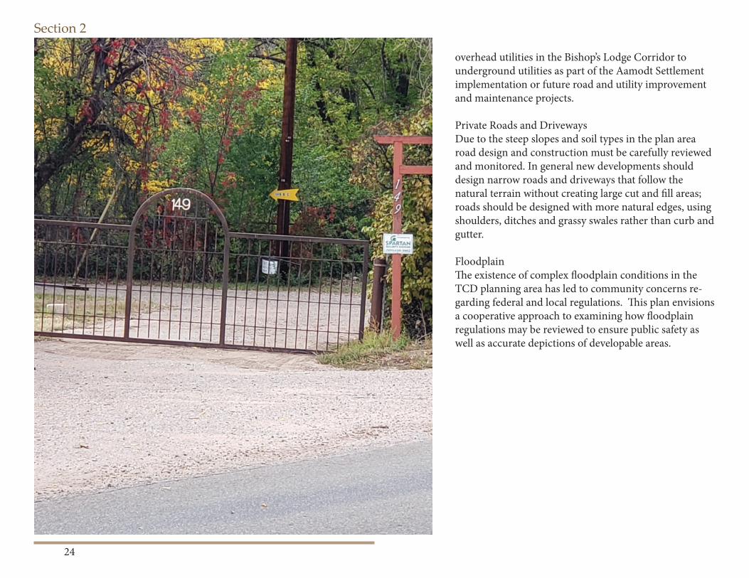
Private Roads and DrivewaysDue to the steep slopes and soil types in the plan area road design and construction must be carefully reviewed and monitored. In general new developments should design narrow roads and driveways that follow the natural terrain without creating large cut and fi ll areas; roads should be designed with more natural edges, using shoulders, ditches and grassy swales rather than curb and gutter.
FloodplainTh e existence of complex fl oodplain conditions in the TCD planning area has led to community concerns re-garding federal and local regulations. Th is plan envisions a cooperative approach to examining how fl oodplain regulations may be reviewed to ensure public safety as well as accurate depictions of developable areas.
Section 2
25
Section 2
26
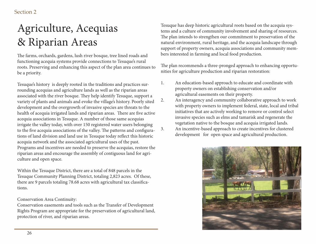
Agriculture, Acequias & Riparian AreasTh e farms, orchards, gardens, lush river bosque, tree lined roads and functioning acequia systems provide connections to Tesuque’s rural roots. Preserving and enhancing this aspect of the plan area continues to be a priority.
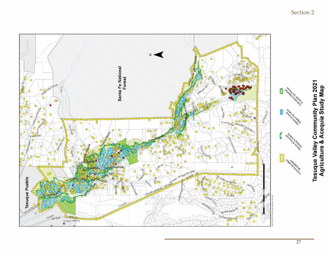
Tesuque’s history is deeply rooted in the traditions and practices sur-rounding acequias and agriculture lands as well as the riparian areas associated with the river bosque. Th ey help identify Tesuque, support a variety of plants and animals and evoke the village’s history. Poorly sited development and the overgrowth of invasive species are threats to the health of acequia irrigated lands and riparian areas. Th ere are fi ve active acequia associations in Tesuque. A number of those same acequias irrigate the valley today, with over 150 registered water users belonging to the fi ve acequia associations of the valley. Th e patterns and confi gura-tions of land division and land use in Tesuque today refl ect this historic acequia network and the associated agricultural uses of the past. Programs and incentives are needed to preserve the acequias, restore the riparian areas and encourage the assembly of contiguous land for agri-culture and open space.
Within the Tesuque District, there are a total of 848 parcels in the Tesuque Community Planning District, totaling 2,823 acres. Of these, there are 9 parcels totaling 78.68 acres with agricultural tax classifi ca-tions.
Conservation Area Continuity:Conservation easements and tools such as the Transfer of Development Rights Program are appropriate for the preservation of agricultural land, protection of river, and riparian areas.
Tesuque has deep historic agricultural roots based on the acequia sys-tems and a culture of community involvement and sharing of resources. Th e plan intends to strengthen our commitment to preservation of the natural environment, rural heritage, and the acequia landscape through support of property owners, acequia associations and community mem-bers interested in farming and local food production. Th e plan recommends a three-pronged approach to enhancing opportu-nities for agriculture production and riparian restoration:
1. An education-based approach to educate and coordinate with property owners on establishing conservation and/or agricultural easements on their property.2. An interagency and community collaborative approach to work with property owners to implement federal, state, local and tribal initiatives that are actively working to remove or control select invasive species such as elms and tamarisk and regenerate the vegetation native to the bosque and acequia irrigated lands. 3. An incentive-based approach to create incentives for clustered development for open space and agricultural production.
Section 2
27
Section 2
28
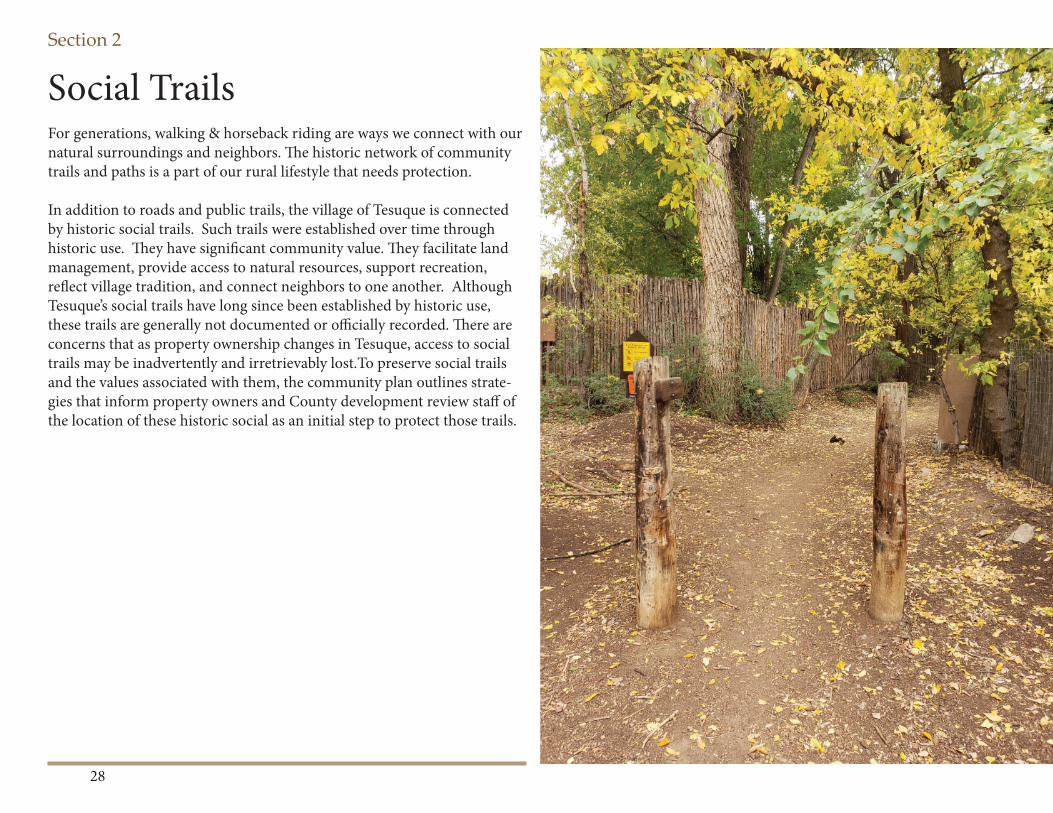
Social Trails For generations, walking & horseback riding are ways we connect with our natural surroundings and neighbors. Th e historic network of community trails and paths is a part of our rural lifestyle that needs protection.
In addition to roads and public trails, the village of Tesuque is connected by historic social trails. Such trails were established over time through historic use. Th ey have signifi cant community value. Th ey facilitate land management, provide access to natural resources, support recreation, refl ect village tradition, and connect neighbors to one another. Although Tesuque’s social trails have long since been established by historic use, these trails are generally not documented or offi cially recorded. Th ere are concerns that as property ownership changes in Tesuque, access to social trails may be inadvertently and irretrievably lost.To preserve social trails and the values associated with them, the community plan outlines strate-gies that inform property owners and County development review staff of the location of these historic social as an initial step to protect those trails.
Section 2
29
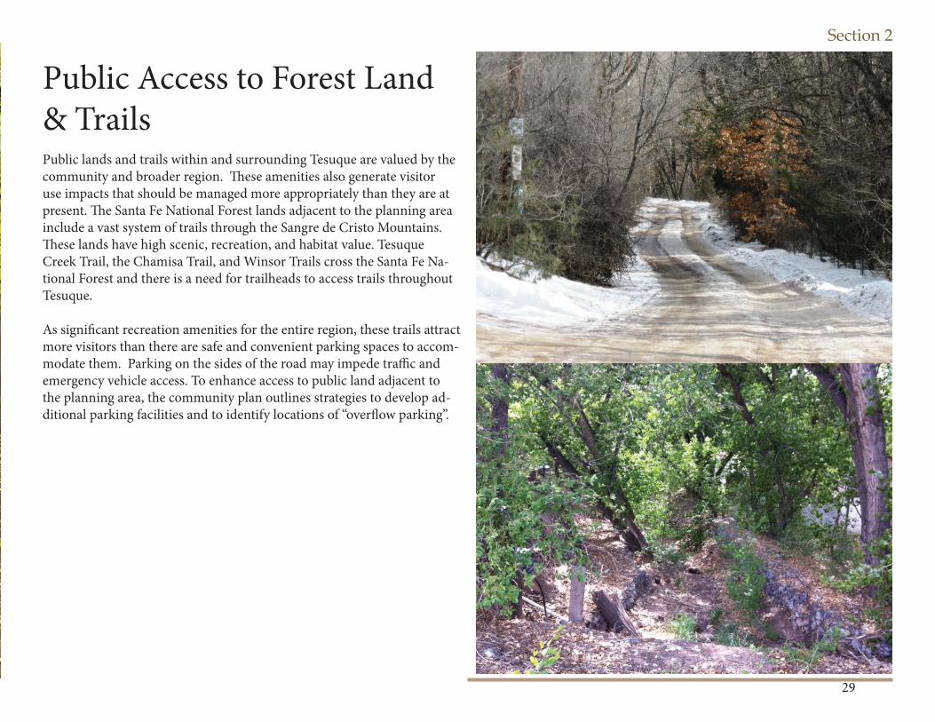
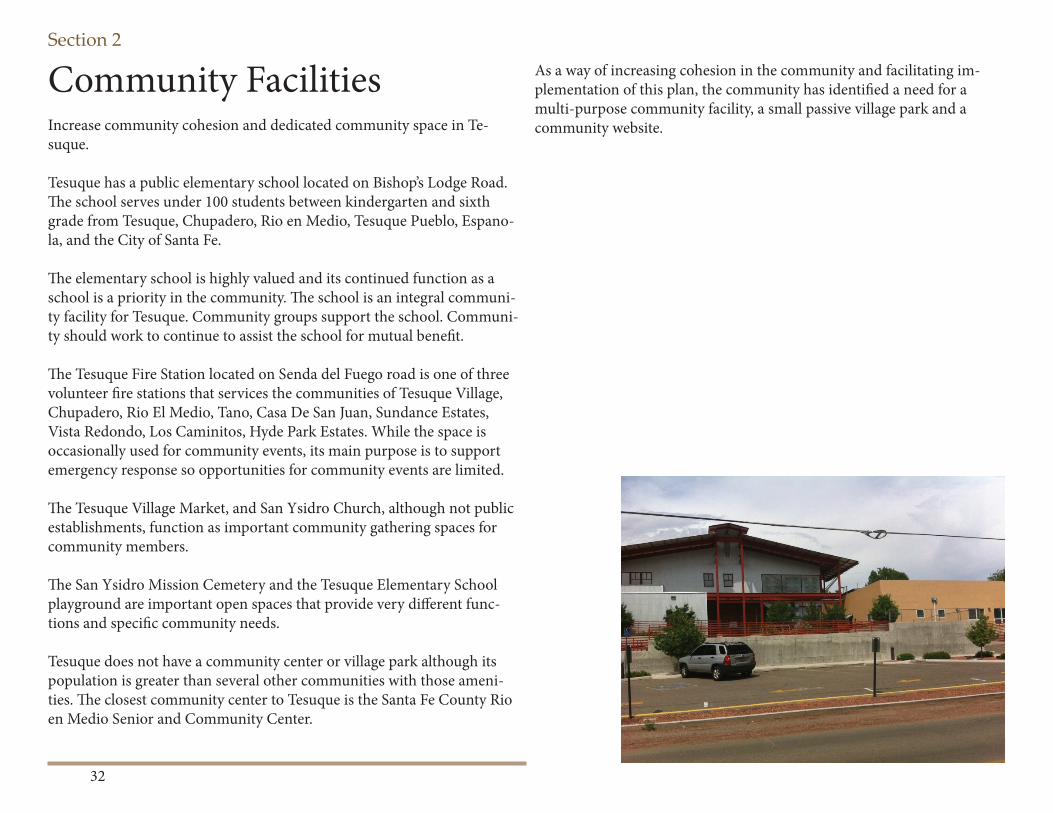
Public Access to Forest Land & TrailsPublic lands and trails within and surrounding Tesuque are valued by the community and broader region. Th ese amenities also generate visitor use impacts that should be managed more appropriately than they are at present. Th e Santa Fe National Forest lands adjacent to the planning area include a vast system of trails through the Sangre de Cristo Mountains. Th ese lands have high scenic, recreation, and habitat value. Tesuque Creek Trail, the Chamisa Trail, and Winsor Trails cross the Santa Fe Na-tional Forest and there is a need for trailheads to access trails throughout Tesuque.
As signifi cant recreation amenities for the entire region, these trails attract more visitors than there are safe and convenient parking spaces to accom-modate them. Parking on the sides of the road may impede traffi c and emergency vehicle access. To enhance access to public land adjacent to the planning area, the community plan outlines strategies to develop ad-ditional parking facilities and to identify locations of “overfl ow parking”.
Section 2
30
Fire Safety & PreventionFire will continue threaten the plan area. Having a proactive approach through prevention as well as being prepared for both are priorities of the community.
Tesuque is highly vulnerable to wildfi re. Most of the Tesuque Planning area is located in the County’s Urban Wildlife Interface Area—a geogra-phy that encompasses areas of the County that are at the highest risk of experiencing wildfi re.
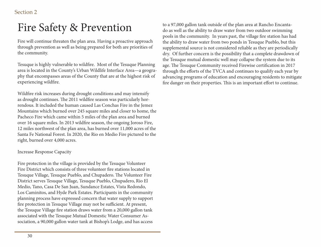
Wildfi re risk increases during drought conditions and may intensify as drought continues. Th e 2011 wildfi re season was particularly hor-rendous. It included the human caused Las Conchas Fire in the Jemez Mountains which burned over 245 square miles and closer to home, the Pacheco Fire which came within 5 miles of the plan area and burned over 16 square miles. In 2013 wildfi re season, the ongoing Joroso Fire, 12 miles northwest of the plan area, has burned over 11,000 acres of the Santa Fe National Forest. In 2020, the Rio en Medio Fire pictured to the right, burned over 4,000 acres.
Increase Response Capacity
Fire protection in the village is provided by the Tesuque Volunteer Fire District which consists of three volunteer fi re stations located in Tesuque Village, Tesuque Pueblo, and Chupadero. Th e Volunteer Fire District serves Tesuque Village, Tesuque Pueblo, Chupadero, Rio El Medio, Tano, Casa De San Juan, Sundance Estates, Vista Redondo, Los Caminitos, and Hyde Park Estates. Participants in the community planning process have expressed concern that water supply to support fi re protection in Tesuque Village may not be suffi cient. At present, the Tesuque Village fi re station draws water from a 20,000 gallon tank associated with the Tesuque Mutual Domestic Water Consumer As-sociation, a 90,000 gallon water tank at Bishop’s Lodge, and has access
to a 97,000 gallon tank outside of the plan area at Rancho Encanta-do as well as the ability to draw water from two outdoor swimming pools in the community. In years past, the village fi re station has had the ability to draw water from two ponds in Tesuque Pueblo, but this supplemental source is not considered reliable as they are periodically dry. Of further concern is the possibility that a complete drawdown of the Tesuque mutual domestic well may collapse the system due to its age. Th e Tesuque Community received Firewise certifi cation in 2017 through the eff orts of the TVCA and continues to qualify each year by advancing programs of education and encouraging residents to mitigate fi re danger on their properties. Th is is an important eff ort to continue.
Section 2
31
Section 2
32
Community Facilities Increase community cohesion and dedicated community space in Te-suque.
Tesuque has a public elementary school located on Bishop’s Lodge Road. Th e school serves under 100 students between kindergarten and sixth grade from Tesuque, Chupadero, Rio en Medio, Tesuque Pueblo, Espano-la, and the City of Santa Fe.
Th e elementary school is highly valued and its continued function as a school is a priority in the community. Th e school is an integral communi-ty facility for Tesuque. Community groups support the school. Communi-ty should work to continue to assist the school for mutual benefi t.
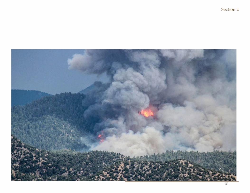
Th e Tesuque Fire Station located on Senda del Fuego road is one of three volunteer fi re stations that services the communities of Tesuque Village, Chupadero, Rio El Medio, Tano, Casa De San Juan, Sundance Estates, Vista Redondo, Los Caminitos, Hyde Park Estates. While the space is occasionally used for community events, its main purpose is to support emergency response so opportunities for community events are limited.
Th e Tesuque Village Market, and San Ysidro Church, although not public establishments, function as important community gathering spaces for community members.
Th e San Ysidro Mission Cemetery and the Tesuque Elementary School playground are important open spaces that provide very diff erent func-tions and specifi c community needs.
Tesuque does not have a community center or village park although its population is greater than several other communities with those ameni-ties. Th e closest community center to Tesuque is the Santa Fe County Rio en Medio Senior and Community Center.
As a way of increasing cohesion in the community and facilitating im-plementation of this plan, the community has identifi ed a need for a multi-purpose community facility, a small passive village park and a community website.
Section 2
33
Section 2
34
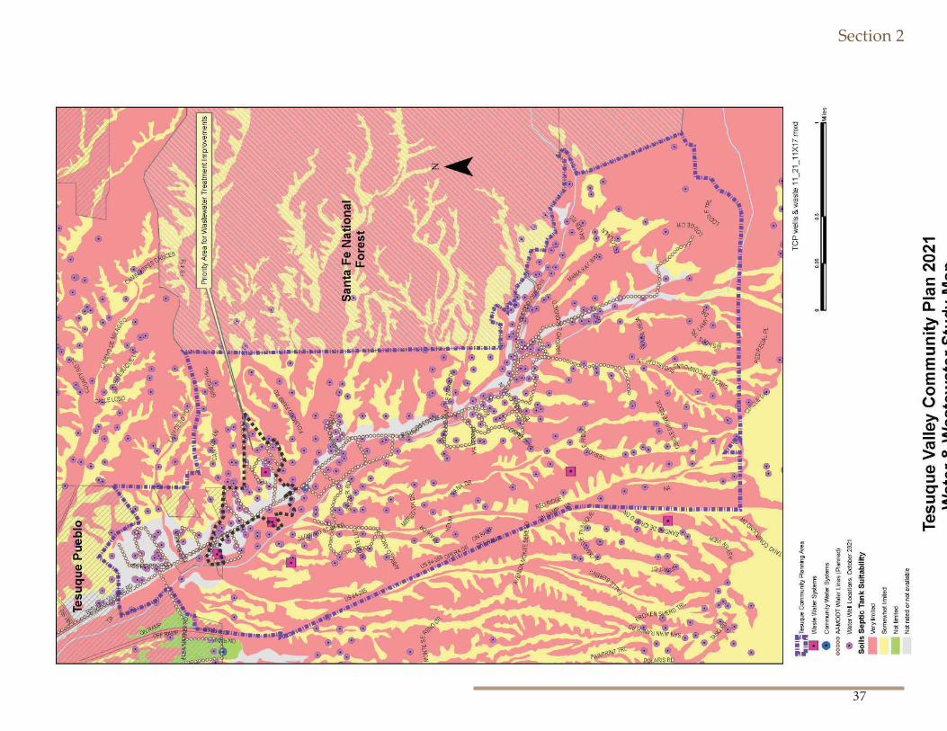
Water Supply and Wastewater TreatmentTesuque’s quality of life depends on adequate water quality and water quantity.
All residents and businesses in the plan area currently use ground water either drawn from private wells or community wells for their domestic water supply and to certain extent fi re suppression. Th eir direct experi-ence with wells and irrigation fl ows have led to the general agreement that ground and surface water in the plan area “is not a constant, abundant, unchanging source.” AAMODT SETTLEMENT AND IMPLEMENTATION THROUGH TESUQUE
Water Supply and Wastewater Treatment- Tesuque’s quality of life de-pends on adequate water quality and water quantity. All residents and businesses in the plan area currently use ground water either drawn from private wells or community wells for their domestic water supply and to certain extent fi re suppression. Th eir direct experience with wells and irrigation fl ows have led to the general agreement that ground and surface water in the plan area “is not a constant, abundant, unchanging source”.
Th e Aamodt Settlement will assist Tesuque residents and businesses in securing a more consistent water supply. As a result of the Aamodt Set-tlement, the Pojoaque Basin Regional Water System will be built to divert water from the Rio Grande at San Ildefonso Pueblo and pipe treated drinking water via a transmission line through the Pojoaque valley and down to Tesuque via Tesuque Village Road and Bishops Lodge Road. County residents and businesses in the Aamodt settlement area can opt into the system, ideally before the transmission and distribution lines are built, by formally making a well election through the U.S District Court. Phase II of the Pojoaque Basin Regional Water System which goes
through Tesuque is currently at 60% design. Th e Bureau of Reclamation is responsible for the design and construction of the system, but there will be another opportunity for Santa Fe County to give input at the 90% design phase. Th e Bureau of Reclamation has identifi ed 2026 as the goal to reaching 100% design. Substantial Completion will occur by 2028, at which point the transmission lines through Tesuque should be complete. Th e County will likely continue building the distribution lines out beyond 2028.
Well Election- A communication was sent out to all County properties within 200 ft of the planned water line in 2018, gauging interest in con-necting and accessing a fund to cover connection costs.
It is important to note that residents have expressed concern that the implementation of the Aamodt settlement has the potential to signifi cant-ly alter the community. Th is plan addresses concerns that the proposed alignment of the pipes which are congruent with the Bishop’s Lodge Corridor may cause the roads to be widened and detract from the scenic quality and unique character. Th is plan does not address the terms of the settlement parties’ water entitlement and use which were established un-der state and Federal law through the Settlement Agreement.
Key Facts: Domestic Wells- According to the 2021 well data from the Offi ce of the State Engineer, and there are 566 wells in the Tesuque Planning Area – up from 517 in the year 2018.
Maintaining water quality in domestic wells should be a high priority. Th e CDC recommends separating wells from livestock locations by at least 100 feet. Th e County should increase its oversight to ensure that all standards governing separation of septic, livestock, and other sources of contamination are well-regulated and controlled
Community Water - Th e Tesuque Mutual Domestic Water Consumers Association provides water services to 107 service connections or a pop-
Section 2
35
ulation of about 370. Bishop’s Lodge currently has their own water sys-tem but they will be required to connect with the Regional Water System when it becomes available. Shidoni has their own water system.
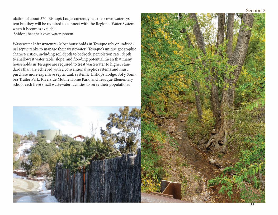
Wastewater Infrastructure- Most households in Tesuque rely on individ-ual septic tanks to manage their wastewater. Tesuque’s unique geographic characteristics, including soil depth to bedrock, percolation rate, depth to shallowest water table, slope, and fl ooding potential mean that many households in Tesuque are required to treat wastewater to higher stan-dards than are achieved with a conventional septic systems and must purchase more expensive septic tank systems. Bishop’s Lodge, Sol y Som-bra Trailer Park, Riverside Mobile Home Park, and Tesuque Elementary school each have small wastewater facilities to serve their populations.
Section 2
36
Section 2
37
Section 3
38
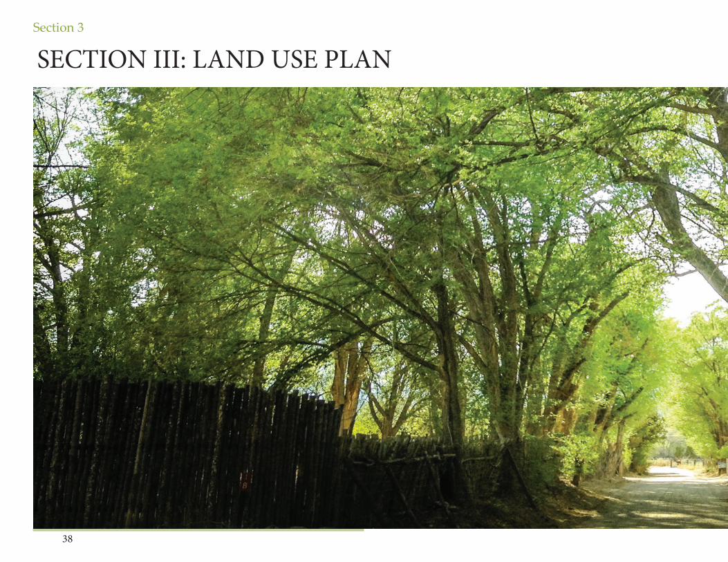
SECTION III: LAND USE PLAN
Section 3
39
Section 3
40
Land Uses, Densities & Development Patterns
Land Use in Tesuque is based on the acequia systems, small farms, rural roads, the natural terrain, and small scale buildings. New development and land uses should refl ect the existing unique character of Tesuque and support aging in place, rural lifestyles and the ability to enjoy the quiet tranquility of this place.
INTRODUCTION
Th is section identifi es issues, objectives and strategies pertaining to land uses, densities, development patterns, and code enforcement.
It provides land use designations and map, and corresponding general provisions to address the following issues:
• Community has identifi ed concerns regarding enforcement of nuisance issues which are being addressed through regular coor dination with County staff . Enforcement needs include compli ance with zoning regulations, particularly density or number of dwelling units.• Th ere is an opportunity to encourage and incentivize the preserva tion and assembly of agricultural and open space lands.
Fire and the Santa Fe County CodeIn addition to the SGMP and the SLDC the community is subject to the provisions of the County’s Urban Wildland Interface code (as amended), and many regions are considered subject to ‘high-hazard” requirements governing the placement of structures, building materials, and fi re hazard mitigation requirements. Th us, fi re safety considerations must be factored into the Community Plan.
Th e current SLDC currently requires the Th e Santa Fe County Fire Code, as adopted by County Ordinance No. 2018-8, which adopts, with amend-ments, the International Fire Code, 2015 edition, and International Wild-land Urban Interface Code. 2015 edition. Th e Tesuque Community Plan recommends that the community should continue to require the most
Section 3
41
current Fire codes, as updated, in accordance with the SLDC.
Emergency Evacuation PlanningTh ere are three points of egress out of Tesuque, via Bishops Lodge Road, and North and South Tesuque Village Road. Community members should be personally aware of their best evacuation route in case of fi re, fl ood, or other emergency scenario.
Lot CoverageLot coverages for residential uses in the plan area vary quite a bit. In general the smaller the lots size the higher the lot coverage. To support the traditional development pattern, rural character and a healthy water-shed, regulations for lot coverage should vary with lot size and pertain to permeable surfaces.
Modify density bonus incentives in Tesuque’s Community District Over-lay Residential Community zoning to clarify that base density is 1.5 dwelling unit per acre, with a bonus option of 1 dwelling unit per acre if 75% of the property is set aside permanently for open space.
Natural LandscapingTh is plan envisions the use of native and drought friendly vegetation and natural landscaping to the extent practicable. Native vegetation should be preserved on development sites and locally adapted (though not invasive)plants used for landscape buff ers and screening, as appropriate.
EnforcementTh is plan recommends a proactive approach to address code enforcement issues.
Section 3
42
Section 3
43
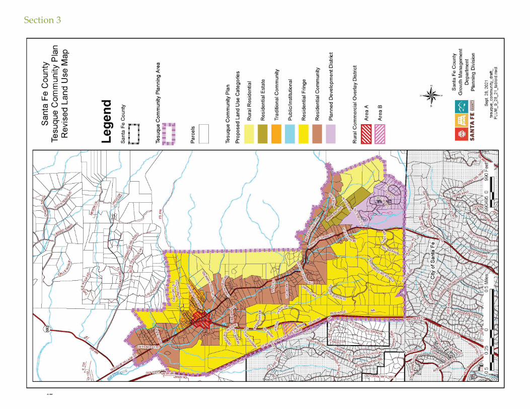
LAND USE PLAN AND MAP
Th e land use designations identifi ed through the Sustainable Growth Management Plan and the 2021 Tesuque Community Plan are identifi ed on the land use map and provide a general framework and guidance for future land use decisions.Th e map delineates areas based on topography, compatible land uses, and appropriate locations for commercial and mixed-use development. Gen-eral uses, densities, and development standards are described..
Th e planning area consists of primarily single family residential uses on rural lots ranging from less than a 1/2 acre to 40 acres. Most residences rely on septic systems and use domestic wells or community wells draw-ing on ground water. Residential development on the valley fl oor and on Griego Hill have remained consistent with the historic acequia develop-ment pattern that accommodates houses while preserving land for small scale farming and gardening sited for irrigation by the acequias. Lots associated with the western foothills refl ect contemporary subdivisions patterns and range in size from 2.5 acres to 12.5 acres. Th e eastern foot-hills, adjacent to the Santa Fe National Forest, host several large lot estates and horse properties. Th ere are also a limited number of condominiums scattered throughout the planning area and two trailer parks located off of Tesuque Village Road which house 20 - 24 units.
Commercial development is limited to Bishop’s Lodge Resort and Spa in the southern portion of the plan area and a few small establishments located at or near the intersection of Bishops Lodge Road and Tesuque Village Road: • Green Galleries- gallery which includes an outdoor sculpture collection and art consultant service. • Tesuque Village Market- Includes a full-service restaurant and small grocery store. • El Nido Restaurant
Th ere are numerous businesses and home occupations throughout the plan area. Th e following commercial businesses are notable:• Shidoni Gallery- Gallery which includes an outdoor sculpture collection. • Tesuque Glassworks- Gallery and studio with an apprentice pro gram for emerging glass artists and daily glass blowing demonstrations. • Santa Fe Mountain Center- Administers a program to provide experiential learning opportunities for at risk and marginalized youth, a harm reduction, needle exchange program, STD and HIV prevention programs, and training and youth organizing for native communities.
Community facilities and services include the Tesuque Volunteer Fire Department, the U.S. Post Offi ce, Tesuque Elementary School, San Ysidro Church and Cemetery, and the various acequia associations.
Development Approval ProcessTh e Sustainable Land Development Code (SLDC) has three diff erent cat-egories of permitting: Permitted Use (administrative approval of a permit application), a Conditional Use (a public hearing process with possible review by BCC), or a Prohibited Use (no option for approval).
Section 3
44
LAND USE CATEGORIES Th e Tesuque District Land Use Categories were developed through the 2015 SLDC process in accordance with the Sustainable Growth Manage-ment Plan (SGMP) Use Categories. Th e Tesuque District Land Use Plan includes six Land Use Categories: Rural Residential, Residential Fringe, Residential Estate, Residential Community Traditional Community, and Public/Institutional.
Traditional Community District
Traditional Community. Th e purpose of the TCD TC district is to con-tinue to refl ect the unique historic development patterns of the old village with a mixed pattern of lot sizes and shapes and housing types. Th is district is primarily single-family residential district consistent with historic options for compact residential development including clustered housing, family compounds, and secondary dwelling units. Community facilities, institutional uses, agricultural uses, and home occupations that are residential in scale are appropriate in the district. Th e TCD Tradition-al Community district accommodates traditional community patterns, preserves historic and cultural landscapes, and protects agricultural uses, including agricultural found in traditional communities with acequia systems, from encroachment by development. Th e base density in the Traditional Community zoning district is 1 dwelling unit per 0.75 acres.
Residential Community District
Residential Community. Th e purpose of this district is to recognize the area along both the Big and Little Tesuque Rivers as the green heart of the plan area and the feature that diff erentiates Tesuque from oth-er areas. It encompasses more than 850 acres and represents much of Tesuque’s historic and agricultural past, as well as the community’s desire
for continued agricultural use in the future. Preservation of this area as rural is tied to the need to keep the lands available and suitable for pastures, orchards and other agricultural uses; and for the preservation of the acequias. Uses are limited to single-family residential development, agricultural related uses, home occupations, and small scale commercial uses centrally located near the intersection of Bishop’s Lodge Road and Tesuque Village Road. (See Tesuque Rural Commercial Overlay). Th e base density in the Residential Community zoning district is 1 dwell-ing unit per 1.5 acres. Properties in this zoning district may apply for a density bonus of 1 dwelling unit per 1 acre if 75% of the gross area of the lot is put into a conservation easement (or identifi ed on the plat) as open space.
Residential Estate District
Residential Estate. Th e purpose of this district is to designate properties that are situated on a fl at ridge above the valley fl oor adjacent to Bishop’s Lodge Hills Subdivision and accessed by either Mama Kay Way or Eccola Lane or Bauer Road. Th is area should continue to evolve as a primarily low-density single-family residential district with appropriate infrastruc-ture and options for clustering in conjunction with contiguous common areas or conservation easements.
New development on slopes less than 15% should allow additional height for fl exibility of fl oor plan design and architecture while maintaining integrity of scale and height for consideration of overall impact on views-hed and following County height regulations. New development on slopes greater than 15% should be consistent with County Terrain Management standards. Th e base density in the Residen-tial Estate zoning district is 1 dwelling unit per 2.5 acres. Residential Fringe
Residential Fringe. Th e purpose of this district is to designate areas as-sociated primarily with contemporary residential subdivisions that were
Section 3
45
established off the valley fl oor in the surrounding piñon/juniper covered hills. Th e East Ridge District encompasses approximately 185 acres in the northeast portion of the plan area and abutting the Santa Fe National For-est. Th e West Ridge District encompasses approximately 1025 acres along the western boundary of the plan area abutting highway US 285. Uses are limited to single-family residential development, agricultural related uses and home occupations that are residential in scale. Th e base density in the Residential Fringe zoning district is 1 dwelling unit per 5 acres. Rural Residential
Rural Residential. Th e purpose of this district is to provide for the devel-opment of single family homes on large lots, either individually or as part of rural subdivisions; to preserve the scenic and rural character of the County; to provide consolidated open space and agricultural lands; and to recognize the desirability of carrying on compatible agricultural oper-ations and home development in areas near the fringes of urban devel-opment while avoiding unreasonable restrictions on farming or ranching operations. Th is designation applies to two areas encompassing approx-imately 420 acres that cover large residential lots located in the foothills which border Santa Fe National Forest. Th is zoning district is character-ized by less level, buildable area and more sloping terrain. Most of the area has good tree cover, with piñon and juniper trees predominant in the landscape. Many of the residential lots that are less than 10 acres are asso-ciated with land set aside as conservation easements or permanent open space. Uses limited to single-family residential development, agricultural related uses and home occupations that are residential in scale. Th e base density in the Rural Residential zoning district is 1 dwelling unit per 10 acres.
Rural Commercial Overlay
Th e Rural Commercial Overlay is intended to support the needs of the community and to retain the predominantly residential character of the Village. Commercial uses that are small in scale are appropriate within
this overlay zone in order to support the development of the village as a mix of residential and commercial. Commercial development should sup-port local employment and provide local services which do not disrupt the quiet of the Village and promote self-suffi ciency for the community.
Th is category is designated for two diff erent areas:
Area A- Village Center:Area A is centrally located within the village core and covers lots or portions of lots with established historic commercial land uses. Area A Subdistrict has frontage on Bishop’s Lodge Road and/or Tesuque Vil-lage Road. Th e area is envisioned to continue as mixed-use village area supporting neighborhood scale retail and commercial uses, community facilities and open space. Th e base density in Area A is the same as in the Traditional Community zoning district, which is 1 dwelling unit per 0.75 acres.
Area B- Tesuque Village Road Off -Ramp:Approx. 9 acres
Area B is located along Tesuque Village Road just east of the interchange with US 285 on approximately 9 acres of vacant land that abuts pub-lic right-of-way on three sides; Tesuque Village Road on the south and east and Highway US 285 on the west. Area B Subdistrict functions as a gateway to Tesuque. Th e area is envisioned to be appropriate for neigh-borhood-scaled and neighborhood-oriented mixed uses, including commercial offi ces, live work units, studios, restaurants, retail of primarily locally produced goods, community services, recreation amenities. Area B Subdistrict is not appropriate for travel services, highway oriented devel-opment or retail where the majority of goods are not produced locally. Th e base density in Area B is the same as in the Traditional Community zoning district, which is 1 dwelling unit per 0.75 acres.
Public Institutional
Public Institutional. Th e purpose of the TCD PI district is to accommo-
Section 3
46
date governmental, educational, and non-profi t or institutional uses, including public or community parks and recreation facilities, and public, non-profi t, and institutional residential uses, but excluding any such uses of an extensive heavy industrial character. Th e base density in the Public Institutional zoning district is 1 dwelling unit per 0.75 acres.
Bishop’s Lodge Resort PD
Bishop’s Lodge Resort is zoned as Planned Development (PD ) in accor-dance with Section 8.10 of the SLDC. Th is designation allows the proper-ty owner to develop the property in accordance with the approved Master Plan for the property. Th is designation applies to the master planned development district of Bishop’s Lodge Resort and Spa and associated residential development of Bishop’s Lodge Hills Subdivision and the Villas at Bishop’s Lodge Condominiums in the southern portion of the plan area abutting the City of Santa Fe boundary. Bishop’s Lodge Ranch, Resort, Hotel and Spa have served as a resort and lodge since 1918. Th is area has been planned, developed and operated in accordance with a master plan that was fi rst approved by Santa Fe County in 1984 and amended in December of 2002. Th e master plan, as amended and recorded, provides for the development and operation of resort facilities on approximately 93 acres, including lodging facilities, a restaurant, a spa and pool, equestrian facilities and other recreational and resort amenities, as well as approxi-mately 225 acres of open space owned by the resort and used for hiking, mountain biking, horseback riding and similar outdoor recreational activities.
Th is property has a long and stable history of use as a resort, and it has the entitlements that refl ect that history and its intended continuation. Th e entire area should continue to evolve as a planned development district as a resort and future subdivision should be limited and in accor-dance with the approved master plan. Approved but yet to be construct-ed development should continue in accordance with the approved master plan as amended and fi nal development plans.
Th e community would like to see Bishop’s Lodge Resort & Spa fi rst and foremost continue as a rural resort. However, over the course of the next
25 years external forces such as market preferences may require new uses be considered in order for establishment to remain viable. New uses, (that are not identifi ed on the approved master plan) should be compatible with the rural character of Tesuque and be planned and approved holisti-cally as a planned development district.
Historic, Cultural and Natural Resources
Th e site also hosts important historic, cultural and natural resources that should continue to be preserved and maintained:• Archbishop Lamy Chapel which is recognized on the National Register of Historic Places.• Portions of the site associated with the historic acequia irrigated lands and are currently used as gardens and orchards. • Freshwater marshes along the Little Tesuque which are home to an abundance of vegetation, including highly valued historic cotton trees.
Water & Wastewater
Th e resort and the residential development are both served by central water and waste water facilities. Th e resort has an on-property water rec-lamation system fi lter and recycles all of their water.
Sustainable Management Practices
Th is plan supports and encourages the resort’s sustainable management practices particularly as they are related to water conservation.
HOME OCCUPATIONSHome occupations in Tesuque contribute to making Tesuque a self-suf-fi cient and lively community. Existing home occupations include but are not limited to:• Bookkeeping services• Counseling• Construction company home offi ce• Consulting businesses
Section 3
47
• Photographers studios• Artists’ studios• Craft production• Architects offi ces• Septic services home offi ce• Horse boarding services• Distillers and vintners
Most home occupations in Tesuque are residential in scale and have little impact on their neighbors. Increased traffi c from home occupations that have daily deliveries or patron visits is inappropriate due to the narrow roads and the primarily residential and/or agricultural character of the plan area.
Goal: Maintain compatibility between home occupations and neighbor-ing residential uses.
No-impact and low-impact home occupations should be allowed throughout the planning area.
Section 3
48
Implementation StrategyCARS, BICYCLES, PEOPLE AND WILDLIFE
Goal: Establish historic marker for Tesuque Historic Village
Action- Work with appropriate entities to secure funding for design, fabrication and installation of a set of historic markers for Tesuque.
Goal: Increase safety for all users while preserving the rural character of the Bishop’s Lodge Corridor with low impact focused intervention in specifi c locations.
Transition Zones – Slowing Traffi c Down
Goal: Slow down traffi c entering Tesuque from the north and west on Tesuque Village Road and from the south on Bishop’s Lodge Road
Action: Analyze and implement appropriate traffi c calming measures, integrating fi ndins from Road Safety Study which may include actions such as additional signage, striping, edge treatments, at-grade refl ectors and sharrows for transition zones between the higher speed areas, 50 MPH - 35MPH, associated with traffi c coming into the valley on Bishops Lodge Road and Tesuque Village Road and the slower speed areas, 25 MPH, associated with the traditional historic community.
Action: Identify and implement appropriate traffi c calming measures, such as a three-way stop or lowering the speed limit, to increase safe-ty for pedestrians and cyclists at the intersection of Bishops Lodge Road and Big Tesuque Canyon (CR 72A).
Bike Routes and On-Road Bike Lanes
Goal: Improve bicyclist safety on roads.Action: Connect cyclists to the City of Santa Fe and surrounding areas through a formalized bike route to follow Tesuque Village Road to US 285 west frontage to connect with Tano Road and Camino Encantado, both of which are designated bike routes.
Action: Develop plan for implementation in County CIP and Trans-poration Plan to be establish an on-road bike lane on Tesuque Village Road by “retrofi t through widening” on the northern section. Keep speed limits low on Bishop’s Lodge Road to accommodate an in-traf-fi c bicycle route from its intersection with Tesuque Village Road to the intersection with the south entrance of Bishop’s Lodge Resort.
Action: Support an on-road bike lane for a limited section of road on Bishop’s Lodge Road to provide the ability for southbound vehicles to pass cyclists biking up the steep climb from approximately the entrance of Bishop’s Lodge Resort to the top of the hill.
Action: Develop plan for implementation in County CIP and Trans-poration Plan to “retrofi t through striping” on the southern section.
Pedestrian Circulation in the Village Core
Goal: Improve signage and parking controls, particularly on the short section of Griego Road where it intersects with Tesuque Village Road.
Action: Develop a pedestrian circulation plan that establishes safe pe-destrian connections and crossings between the elementary school, the Village Market, the RTD Blue Route Transit stops and the post offi ce and which includes appropriate traffi c calming measures.
Action: Analyze and implement traffi c calming measures to slow down traffi c as it approaches the Tesuque Elementary school from the south on Bishop’s Lodge Road.
Section 3
49
Equestrian UsesAction: Specifi c routes that are aligned with roads and address safety concerns associated with the mix of roadway users and equestrians.
Wildlife Crossings and Corridors
Goal: Minimize confl ict between traffi c and wildlife.
Action: Coordinate with wildlife conservation organizations, state and federal agencies to determine high frequency wildlife crossing areas within the plan area and adopt Best Management Practices plan for wildlife control and crossing.
Strategy: Road drainage design and improvements should consider conjunctive use by wildlife.
Dangerous Curves
Action: Analyze a variety of approaches to increase safety along dan-gerous curves in Bishops Lodge Road Corridor.
Bishops Lodge Corridor and the Aamodt Settlement
Goal: Protect the intrinsic qualities of the Bishop’s Lodge Corridor from impacts of the project.
Drainage and Erosion
Goal: Reduce drainage and erosion problems along Bishop’s Lodge Road, Griego Hill Road and resulting degradation of adjacent properties while maintaining the rural character of the existing road profi le.
Action: Recommend development of a comprehensive storm water management plan for the village core area
Action: Recommend Low Impact Development (LID) best practic-es and preventative maintenance practices on all future county road
improvement and maintenance projects in the plan area.
Action: Support bar ditches in lieu of curb and gutter.
Dangerous Driveways
Goal: Reduce danger to vehicles, cyclists, pedestrians and equestrians from dangerous driveways.
Action: Recommend all future county road improvement and mainte-nance projects to inventory all driveways within the project area and include improvements to mitigate existing non-conforming or dan-gerous driveways.
DARK NIGHT SKY LIGHTING STANDARDS IN ACCORDANCE WITH NIGH SKY PROTECTION ACT
Goal: Preserve the true natural night sky that our ancestors enjoyed.
Strategy: As a rural road, road lighting in the corridor is minimal and should remain that way.
Strategy: New road lighting should only be considered at key inter-sections and should be limited to lighting created for the purpose of enhancing pedestrian and traffi c safety during evening hours.
Strategy: All new road improvement or maintenance projects (private and public) in the plan area should be designed in accordance with the SLDC in order to protect the dark night skies.
Strategy: Rural roadway lighting standards should conserve energy and protect the night sky.
Strategy: LEDs should be preferred or recommended over other lamp types.
Strategy: All lighting should be shielded.
Section 3
50
Regional Transit Stop
Goal: Accommodate aging-in-place goals by supporting transit options for community members.
Strategy: Both transit stops in Tesuque should be improved to provide for well-marked stops with shade and seating and be included as import-ant destinations in the pedestrian circulation plan.
Overhead Utilities
Goal: Enhance the character of the Bishops Lodge Corridor and reduce the risk of accidents, fi re and the danger of downed electric wires by con-verting overhead lines to underground.
Bishops Lodge Corridor:Fence and wall regulations outlined in the Tesuque Community District Overlay should be amended to include the following: 1. Appropriate setbacks for fences and walls in the area along Te-suque Village Road north of the Rural Commercial Overlay A should be established.2. Opaque fences and walls fronting or running parallel to Tesuque Village Road north of the Rural Commercial and Griego Hill Districts should conform with maximum height limitations. 3. Fences and walls along Bishops Lodge Road should be governed in a graduated manner, with fences and walls closer to the road main-taining a lower height and those set back further from the road permitted greater maximum height to maintain the visual openness that currently exists. 4. Fencing and walls adjacent to these roadways should be con-structed of materials that will complement the surrounding scenic re-sources and, where feasible, be combined with landscaping.
Lot Coverage:Action: Modify density bonus incentives in Tesuque’s Community Dis-trict Overlay Residential Community zoning to clarify that base density
is 1.5 dwelling unit per acre, with a bonus option of 1 dwelling unit per acre if 75% of the property is set aside permanently for open space.
Code Enforcement
Action: Community members will continue to schedule meetings with Santa Fe County staff to proactively address code enforcement concerns and proactive engagement on these issues.
Agriculture, Acequias and Riparian Areas
An education-based approach: Action: Th e Community could form a Stewardship Committee to edu-cate and work with property owners on establishing conservation and/or agricultural easements on their property.
An interagency and community collaborative approach:
Action: Stewardship Committee will work with property owners to im-plement federal, state, local and tribal initiatives that are actively working to remove or control select invasive species such as elms and tamarisk and regenerate the vegetation native to the bosque and acequia irrigated lands.
Goal: Establish more conservation and agricultural easements in Te-suque.
Action: Create an education-based approach to educate and coordinate with property owners on establishing conservation and/or agricultural easements on their property.
Action: Create an interagency and community collaborative approach to work with property owners to implement federal, state, local and tribal initiatives that are actively working to remove or control select invasive species such as elms and tamarisk and regenerate the
Section 3
51
vegetation native to the bosque and acequia irrigated lands.
Action: work with County staff to create an incentive-based approach to create incentives for clustered development for open space and agricul-tural production. Social Trails:Goal: Preserve Tesuque’s historic social trails. Strategy: Th e Community could work with property owners to record easements for the social trails with the County Clerk so that easements, points of access, and allowable uses are on record for title searches and are disclosed to new property owners.
FOREST ROAD 415
Goal: Connect Tesuque to Santa Fe National Forest via Forest Road 415
ParkingStrategy: Trail parking continues as a problem. Th e community should work with property owners to fi nd more parking for trails.
Action: Replace damaged, aging, or antiquated signage along Big Tesuque Canyon.
Public Access to Forest Lands and Trails:Action: Th e Community could work with Bishop’s Lodge and Santa Fe County Public Works to explore the possibility of creating parking spaces and trailhead signage on the public right of way north of the entrance to Bishop’s Lodge and/or within the Bishop’s Lodge facility, as appropriate, in order to provide additional parking for cyclists using the Windsor trail and alleviate parking congestion at existing trailheads, (see Forest Trails and Access Study Map page).
Action: Th e Community could work with Bishop’s Lodge to explore the possibility of providing public access to the Windsor Trail using existing resort trails and road network.
Action: Currently County Road 72A provides a trailhead with limited
parking for the Tesuque Creek Trail and Windsor Trail. Th e Communi-ty could work with Santa Fe County Public Works to develop signage at the trailhead that alerts hikers of trailheads off of Hyde Parke Road that provide access to the Windsor trail and Tesuque Creek Trail with more plentiful parking, (see Forest Trails and Access Study Map page 57).
Action: Th e Community could work with Santa Fe County Public Works and the Tesuque Volunteer Fire District to provide signage at the County Road 72A trailhead.
Fire Safety and Prevention:Action: Purchase and locate supplemental water tanks on suitable sites that support the volunteer fi re district’s operational readiness and that minimizes visual/aesthetic impact. Locations that have been discussed with the community and the fi re district include: elevated land just west of Tesuque Village Road across from the existing fi re station, and a suit-able site between Tesuque Elementary School and Bishop’s Lodge Resort.
Strategy: Th e community plan encourages residents to take advantage of the County’s free service to assess household wildfi re vulnerability. Th is service provides information to fi re districts regarding how to eff ectively fi ght fi res that may aff ect households and educates households as to steps they can take to mitigate their wildfi re vulnerability.
Community Facilities:Action: Create a community website that has an interactive community announcement page as well as an information kiosk at the post offi ce.
Action: Th e TVCA should develop and maintain a community website or a bulletin board.
Goal: Develop a multi-purpose community center.
Action: In collaboration with the county, the community will identify de-veloped and undeveloped properties in the Village core area that should be considered as potential sites for conversion as a community center
Section 2
52
Action: Th e community in collaboration with the County will conduct a needs assessment and develop a preliminary program to use as a basis for siting and design of a community center.
Action: Tesuque will work with State Representatives of House District 46 and Senate District 25 to secure a state appropriation or other means of funding to support the siting and development of a community center.
Goal: Increase community outdoor space in the heart of the village.
Action: Tesuque will work with the County to evaluate a variety of sites within the village core area and explore the possibility of establishing and maintaining a small passive village park in conjunction with proposed pedestrian paths.
Water and Wastewater:Goal: Develop more centralized approaches to managing wastewater.
Strategy: Santa Fe County and the Community could explorethe feasibil-ity of developing central community waste water facility for the Village Core area and Griego Hill to include the Tesuque Elementary School, commercial uses, the mobile home parks and homes. Th e Community could request help from the County and other government agencies, for example by requesting funding through the Capital Improvement Plan (See Water & Wastewater Study Map).
Goal: Increase County oversight of liquid waste disposal systems, includ-ing septic tanks to reduce ground water and surface water pollution due to failing systems.
Strategy: County should determine the effi cacy of liquid waste disposal systems by requiring inspection and implementation of improvements as needed as part of development permit application for new development, change in use or increase in the intensity of activity.
Strategy: County should determine the effi cacy of liquid waste disposal systems by requiring inspection and implementation of improvements as needed as part of business license and/or home occupation permit appli-cation.
Goal: Increase awareness of Tesuque water quality and means of enhanc-ing water quality.
Strategy: Th e Community could reach out to a technical assistance or-ganization such as Amigos Bravos to explore ways for Tesuque residents to monitor the presence of contaminants that aren’t already regulated by the New Mexico Environment Department and if appropriate, develop a strategy to address water contaminants.
Strategy: Th e Community could form a subcommittee to develop educa-tional materials documenting how individual households can minimize their impact on water resources.
Home Occupation:Goal: Maintain compatibility between home occupations and neighbor-ing residential uses.
Section 3
53
Appendices
Appendix 1: Consensus Decision Making Subcommittee Report: Recommendations to the Tesuque Planning Committee March 12, 2021
Appendix 2: A Resolution to Approve the Settlement Agreement with Santa Fe County for a Right-of-Way for Santa Fe County for County Main-tained Road 72-I
Section 3
54
Appendix 1: Consensus Decision Making Subcommittee Report: Recommendations to the Tesuque Planning Committee March 12, 2021
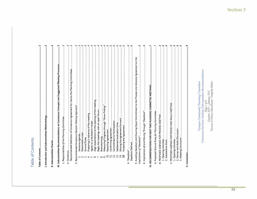
Section 3
55
Section 3
56
Section 3
57
Section 3
58
Section 3
59
Section 3
60
Section 3
61
Section 3
62
Section 3
63
Section 3
64
Appendix 2: A Resolution to Approve the Settlement Agreement with Santa Fe County for a Right-of-Way for Santa Fe County for County Maintained Road 72-I
Santa Fe County Tracking No. 2018-0267-PW
SETTLEMENT AGREEMENT
Th is Settlement Agreement (“Agreement”) is entered into as of this _ day of January, 2018, by and between the Pueblo of Tesuque (“Pueblo”), Santa Fe County (“County”), and the United States Department of the Interior (“Department”). Th e Pueblo, the County, and the Department are sometimes each referred to as a “Party” and together as the “Parties.”
RECITALS
WHEREAS, County-Maintained Road (“CMR”) 72-I, as defi ned in this Agreement, is located within the exterior boundaries of the Pueblo, segments of which traverse Pueblo Land and segments of which traverse Private Land; and
WHEREAS, the Department and the Pueblo claim that the segments of CMR 72-I that traverse Pueblo Land are in trespass; and
WHEREAS, the County disputes that CMR 72-I is in trespass on Pueblo Land; and
WHEREAS, judicial resolution of this disagreement regarding CMR 72-I would be time consuming, expensive, and divisive, and would adversely aff ect the Parties’ eff orts to work collaboratively on other issues of critical concern; and
WHEREAS, conclusively resolving longstanding issues that have the potential to divide the community is of paramount importance to the Parties; and
WHEREAS, for purposes of amicably resolving their dispute, this Agreement sets out the tenns and conditions under which: (a) the County will apply to the Bureau of Indian Aff airs (“BIA”) pursuant to 25 C.F.R. Part 169 for a right-of-way (“ROW”) for CMR 72-I located on Pueblo Land; (b) the Pueblo will consent to the Secretary’s grant of ROW for CMR 72-I, which ROW shall have an initial term of ninety-nine (99) years and an automatic renewal tenn of an additional ninety-nine (99) years; (c) the County will compensate the Pueblo for the ROW granted by the Secretary; (d) the Parties will grant certain mutual releases of liability; and (e) the Parties will perform such other tasks as described below.
AGREEMENT
NOW, THEREFORE, in consideration of the mutual covenants and obligations set forth herein, and other good and valuable consideration, the receipt and suffi ciency of which is hereby acknowledged, the County will submit, with the Pueblo’s consent, the documentation necessary for the Secretary to grant a ROW for CMR 72-I, according to the process defi ned herein:
Section 3
65
Section 1. Defi nitions. Capitalized terms are defi ned either in the text of this Agreement or in this Section. In addition, the defi nitions found at 25 C.F.R. Part 169 apply to this Agreement.
A. “Construction” means any road work activities that are not considered Maintenance as defi ned below.
B. “Contributed Funds Agreement” or “CFA” means the funding agreement to be entered into between the Secreta1y and the County pursuant to the Aamodt Litigation Settlement Act, Pub. L. No. 111-291, § 61l(d)(l)(B) (2010). Th e CFA will provide for the County’s contribution of the non-Fed-eral share of the costs of constructing the Regional Water System in accordance with Section 3.1.3 of the August 27, 2009 Cost Sharing and System Integration Agreement.
C. “County-Maintained Road” or “CMR” means CMR 72-1 within the exterior boundaries of the Pueblo and, as depicted on the map attached hereto as Exhibit A, which is incorporated into and made part of this Agreement by this reference.
D. “Escrow Agent” means the company selected by the Parties pursuant to Section 2(B).
E. “Gap” means a gap of Pueblo Land located directly between Private Land and a Public Road that prevents lawful ingress and egress from the Private Land to the Public Road.
F. “Maintenance” means the preservation of the entire road, including surface, shoulders, roadsides, strnctures, and such traffi c-control devices as are necessa1y for safe and effi cient utilization of the road. 23 U.S.C. § 101 (a)(l3).
G. “Private Land” means the land located within the exterior boundaiies of the Pueblo that the United States patented to private claimants or to which Indian Title has otherwise been duly extinguished.
H. “Public Road” is a road open to public travel, and not subject to any type of tolls or fees.
I. “Pueblo Land” or “Pueblo Lands” means real prope1ty owned by the Pueblo of Tesuque in fee simple subject to Federal restrictions against alienation, or lands owned by the United States in trnst for the benefi t of the Pueblo.
J. “Regional Water System” or “RWS” means the Pojoaque Basin Regional Water System to be constrncted by the United States Bureau of Recla-mation pursuant to the Aamodt Litigation Settlement Act, Pub. L. No. 111-291.
K. “ROW” means a right-of-way.
L. “Secreta1y” means the Secreta1y of the Interior or an authorized representative of the Secreta1y.
Section 3
66
M. “Trespass Damages” means all damages suff ered by the Pueblo because of the CMR presence, maintenance, and use from the beginning of time to the date of the approval of the ROW for the CMR; provided, however, that Trespass Damages does not include damages, if any, relating to the release of regulated hazardous substances or other dangers on or below the surface of the earth, known or unknown.
Section 2. Settlement Amount and Escrow.
A. Th e County agrees to pay the Pueblo a one-time, lump sum of one hundred eighty fi ve thousand dollars ($185,000.00) (“Settlement Amount”), if and when the Secretary grants the ROW identifi ed herein. Th e pmpose of the Settlement Amount is to: (1) provide compensation to the Pueblo for the ROW described in Section 3 that is fair and reasonable under the circumstances; (2) fi nally settle and resolve all Trespass Damages related to CMR 72-I; and (3) contribute to costs to survey County Roads 73 and 74, both of which have perfected ROWs, for the purpose of identifying specifi c pa-rameters of suchROWs.
B. Within thi.J.ty (30) days aft er the Paities execute this Agreement, they shall select a mutually acceptable Escrow Agent. Within sixty (60) days aft er selection of the Escrow Agent, the County shall deposit the Settlement Amount with the Escrow Agent. Th e Escrow Agent shall hold the Settle-ment Amount until it receives notice from the Depa1tment that the Secretary will grant the ROW pursuant to Section 3(C)(iii), or until the Escrow Agent receives notice of termination of this Agreement from either the County or the Pueblo pursuant to Section 4(B)(ii) or Section 4(C)(ii).
1. In the event that the Department gives the Escrow Agent notice pursuant to Section 3(C)(iii) that it will be granting the ROW, the Escrow Agent shall, upon receipt of a copy of the executed ROW, transfer the Settlement Amount dfrectly to the Pueblo according to instructions provided by the Governor of the Pueblo of Tesuque.
11. In the event that the Escrow Agent receives notice of tennination of this Agreement, the Escrow Agent shall transfer the Settlement Amount to the County according to the instrnctions to be provided by the County Manager.
C. As set fmth by Tribal Resolution attached hereto as Exhibit B, the Pueblo:
1. Agrees that the Settlement Amount is satisfactory to the Pueblo as compensation for the ROW and any Trespass Damages relating to past use of that ROW;
u. Waives valuation of the ROW;
v. Represents that it has determined that accepting such agreed-upon compensation and waiving valuation is in its best interest; and
IV. Provides a limited waiver of the Pueblo’s sovereign immunity as further described in Section 1O(E).
Section 3. Obligations of the Parties.
Section 3
67
A. County Obligations:
1. Within one (1) year following the execution of this Agreement or the Contributed Funds Agreement, whichever comes last, the County shall at its expense submit to the BIA a ROW application for CMR 72-1. Th e ROW application shall comply with the requirements of 25 C.F.R. Pai1 169, includ-ing but not limited to, identifying the Pueblo Lands aff ected by the ROW, maps of defi nite location for the ROW, and the ownership of any permanent improvements associated with the ROW. Th e County agrees to prepare, execute, and submit to the BIA such fu11her documents as may be required by the BIA under 25 C.F.R. Part 169. Th e Pueblo and the County may agree in writing to extend the County’s one (1) year deadline for submitting the ROW application to the BIA.
11. Th e County’s ROW application shall incorporate the following specifi c te1ms:
1. Th e proposed te1m of the ROW shall be for a term of ninety-nine (99) years, with an automatic renewal te1m of ninety-nine (99) years.
2. Th e width of the ROW shall be the existing driving surface of the CMR on Pueblo Land as of the date of this Agreement, plus fom (4) feet on each side of the existing driving surface (“Standard ROW Width”); provided, however, that where the Standard ROW Width would encroach on Pri-vate Land, the actual ROW width shall extend to the boundary of the Private Land.
3. Th e prima1y purpose of the ROW shall be operating and maintaining a Public Road, which shall include the right to access to manage vegeta-tion, inspect, maintain and repair equipment, and to conduct such other activities as may be necessaiy or appropriate to operate and maintain a Public Road. Constrnction shall be identifi ed as a seconda1y purpose of the ROW, subject to the provisions of Section 3(D)(vi), below.
111. Th e County shall at its expense survey the CMR and develop an accurate legal description to include in its ROW application to BIA. In addition, the County
shall place survey caps at agreed-upon locations every fi ve hundred (500) feet along both sides of the CMR.
1v. Th e County agrees to maintain throughout the term of the ROW general liability insurance or, at its option, suffi cient self-insurance for the Main-tenance of the CMR.
B. Pueblo Obligations:
1. Th e Pueblo shall consent to the County’s submission of the ROW application and the Secretaiy’s grant of the ROW for CMR 72-I.
11. Th e Pueblo shall cooperate and reasonably assist the County in fi ling the County ROW application. Th e Pueblo agrees to prepare, execute, and submit to the BIA such f1.111her documents as may be required by the BIA in support of the County’s application.
Section 3
68
u1. For instances where a Gap exists between CMR 72-1 and Private Land, the County shall survey the Gaps when it surveys CMR 72-1, and shall include such surveys in the ROW applications described herein.
1v. Th e Pueblo shall request and the BIA shall agree to a waiver of the requirement that a bond, insurance, or alternative f01m of security be submit-ted with the ROW application.
C. Depa11ment Obligations:
1. Nothing in this Agreement shall be construed to restrict the authority of the United States, the Secretaiy, or the Pueblo under applicable laws or regulations, including, but not limited to, laws and regulations applicable to the review and grant of ROW by the Secretmy.
11. Th e Secretmy shall accept the Pueblo’s determinations as refl ected in this Agreement and the Tribal Resolution attached as Exhibit B, including: (1) that the Settlement Amount is satisfactory, (2) that valuation is waived, and (3) that accepting such agreed-upon compensation and waiving valua-tion is in the Pueblo’s best interest.
111. In the event that the Secretary, aft er review of the documentation submitted by the County, with the suppo11 and consent of the Pueblo, and under his authority and any applicable laws or regulations, decides to grant the ROW, the Depa11ment will notify the Parties and the Escrow Agent at least ten (10) days before the Secretmy will grant the ROW. iv. Th e Department shall not require the County to indemnify the Pueblo or the United States for the grant of any ROW pursuant to 25 C.F.R. § 169.125 (c)(6), because the County is prohibited from doing so under Atiicle IX, Section 10 of the New Mexico Constitution.
D. ROW and Other Requirements:
1. Th e Pueblo and the County agree that Federal law, including 25 U.S.C. §§ 323- 328 and 25 C.F.R. Part 169, controls the application, granting and administration ofROWs on Pueblo Lands.
11. In order to expedite the ROW development, submission and review process, the Pueblo and County have agreed to use the ROW template to be provided by BIA. Th e BIA has been and will continue providing technical assistance to the Pueblo and the County with respect to developing the ROW documents. Th e Pueblo and the County acknowledge, however, that such technical assistance shall not constitute a grant of, or promise to grant, any ROW.
n1. Th e Depaiiment shall cause the granted ROW to be recorded with the BIA’s Land, Title and Records Offi ce as expeditiously as possible.
iv. For any Maintenance carried out on the ROW by the County’s contractors, the County shall require that its contractors provide perfo1mance bonds and have insurance cove1ing all aspects of the Constrnction or Maintenance activities to ensure that projects, including any remediation work,
Section 3
69
are completed and any damage to land within the exterior boundaries of the Pueblo, or real or personal prope1iy is remedied.
v. Th e County shall not assign the ROW to the State of New Mexico or any other pa1iy without the consent of the Pueblo and approval by the Secretary, both as required by Federal law and regulations. Any proposed assignment to the State of New Mexico shall not require additional compen-sation to the Pueblo, but the County or the State shall bear all costs involving preparation and submission of the ROW assignment application.
v1. Th e County does not cmTently have plans to cany out Constrnction within the ROW. Th e County will not engage in any Constrnction, including but not limited to replacing an ea1ihen-driving surface with an asphalt surface, within the ROW except pursuant to a written agreement among the County, the Pueblo, and the BIA.
vn. Th e Patties acknowledge that the ROW grant for a public road shall not include authority for any utilities or any other uses.
viii. Th e Pueblo shall not tax any cutTent or future improvements within the ROW; provided, however, that the Pueblo reserves the right to levy gross receipts taxes in accordance with applicable law on any contractors or subcontractors conducting Maintenance or Construction activities. In addition, nothing herein shall aff ect the applicability of the Pueblo’s business license requirement to all contractors and subcontractors perfo1ming Maintenance or Construction activities within the ROW, nor shall this Agreement aff ect the application of any other Pueblo laws and ordinances within the ROW; provided, however, that no such law or ordinance shall operate to terminate or change the te1ms of any ROW granted to the County.
Section 4. Contingencies.
A. No ROW applications shall be submitted for review by the Secretary until the Contributed Funds Agreement for construction of the RWS is executed by the County and the Bureau of Reclamation. Th e Contributed Funds Agreement shall identify a funding source for the County’s contribu-tion.
B. In the event that the County and the Bureau of Reclamation do not timely enter into a Contributed Funds Agreement by April 2, 2018, the following provisions shall apply:
1. Th e County shall notify the Pueblo that the County and the Bureau of Reclamation have not entered into a Contributed Funds Agreement, which notice shall be given in accordance with Section 11; provided, however, that the County shall have no obligation to provide such notice if the County has executed the Contributed Funds Agreement and it is merely awaiting due execution by the Bureau of Reclamation.
11. Th e Pueblo shall have sixty (60) from the date of such notice to te1minate this Agreement by giving the County and the Escrow Agent notice of such tennination, which notice shall be given in accordance with Section 11. Should the Pueblo not timely terminate this Agreement, all other provi-sions of this Agreement shall continue to be valid and binding.
m. Notwithstanding Section 4(B)(ii), the Pueblo shall not give the Escrow Agent notice of termination, and this Agreement shall not terminate, if
Section 3
70
the Bureau of Reclamation provides written notice to the Escrow Agent, with copies to the County and the Pueblo, that the Bureau of Reclamation and the County require additional time to fi nalize and execute the Contributed Funds Agreement and that
the delay in executing that Contributed Funds Agreement will not delay the date that the RWS is substantially complete.
C. Should the Secretary deny the grant of the ROW, the following provisions shall apply:
1. If the Secretary denies the grant of the ROW pursuant to 25 C.F.R. § 169.24, the Pueblo and the County agree to discuss whether to appeal the deci-sion or modify this Agreement. If they choose to appeal and the appeal is unsuccessful, the Parties shall promptly meet to renegotiate this Agreement. If the Parties are unable to agree on amendments to this Agreement or on some other mutually agreeable outcome, any Party shall have the option to terminate this Agreement within thi1ty (30) days from receiving notice from the Depa1tment that the ROW was denied. Th e Patty choosing to ten-ninate this Agreement will give Notice to the Escrow Agent and to the Parties in accordance with Section 11.
11. If the Secreta1y denies the grant of the ROW because the Secretary requires any modifi cations to the application or any measures needed to meet applicable law in order to grant the ROW application, the Parties shall promptly meet to discuss and revise this Agreement or applications, or both, as appropriate, unless the Patties agree otherwise. If the Patties are unable to agree on amendments to this Agreement, applications, or on some other mutually agreeable outcome, any Patty shall have the option to terminate this Agreement within thitty (30) days from receiving notice from the BIA that the ROW application required modifi cation. Th e Patty choosing to terminate this Agreement will give Notice to the Escrow Agent and to the Pat-ties in accordance with Section 11.Section 5. Release of Claims.
A. Release of Claims Against the County. If the Secretaty grants the ROW, then on the day that the ROW is granted and upon the Escrow Agent’s transfer of the Settlement Funds to the Pueblo in accordance with Section 2(B)(i), the Department and the Pueblo shall iJTevocably and forever release and discharge the County, fotmer and cutTent County employees, and fonner and current County elected offi cials from any and all claims of Trespass Damages. Th is release does not include any and all potential claims pursuant to Federal environmental law, including but not limited to liability for hazardous substances disposed on the land, or any other applicable law.
B. Release of Claims Against the Department and the United States. If the Secretaty grants the ROW, then on the day the Secretaty grants the ROW and upon the Escrow Agent’s transfer of the Settlement Funds to the Pueblo in accordance with Section 2(B)(i), the Pueblo and the County agree to irrevocably and forever release and discharge the United States, the Depattment, and fo1mer and cmTent Depattment employees from any and all surface trespass claims, known or unknown, at law or in equity related to the CMR from the beginning of time to the date of the approval of the ROW for the CMR. Th e Pueblo also hereby waives, releases, and covenants not to sue the United States in any administrative or judicial forum for any alleged haims or violations, including any breach of the tiust responsibility of the United States to the Pueblo, related to surface trespass claims for the CMR, negotiation and entry by the Department into this Agreement, from the beginning of time to the date of the grant of the ROW for the CMR.
C. Release of Claims Against the Pueblo. If the Secretary grants the ROW, then on the day that the Secreta1y grants the ROW and upon the Es-

Section 3
71
crow Agent’s transfer of the Settlement Funds to the Pueblo in accordance with Section 2(B)(i), the County agrees to inevocably and forever release and discharge the Pueblo, former and cunent Pueblo employees, and fo1mer and cmTent Pueblo elected offi cials from any and all claims, known or unknown, at law or in equity related to the CMR from the beginning of time to the date of the approval of the ROW for the CMR.Section 6. Reservation of Rights, Compromise Discussions, No Admission of Liability.
A. In the event a Paity tenninates this Agreement pursuant to Section 4, the Pa11ies expressly reserve all rights and claims.
B. In the event a Paity terminates this Agreement pursuant to Section 4 and there is subsequent litigation concerning the CMR, this Agreement shall be regarded as inadmissible compromise negotiations under Rule 11-408 NMRA and Federal Rule of Evidence Rule 408; provided, however, that this Agreement may be admitted for the sole purpose of enforcing the te1ms of the Agreement, including to challenge any claims by any Party that a claim asse11ed against it is barred or waived.
C. Th is Agreement shall not constitute or be construed as an admission of liability by any Patty or as an admission of violation of any law, rule, regulation or policy by any Patty. Th is Agreement also shall not constitute or be construed as an admission or denial by any Pat1y with respect to any factual or legal allegation or issue with respect to the CMR.Section 7. Governing Law.
Th is Agreement shall be governed by the laws of the United States.
Section 8. Merger, Amendments, Rules of Construction, Successors and Assigns.
Th is Agreement: (a) fully states the agreement between the Pai1ies; (b) may be amended only by written amendment signed by all Patties; (c) shall not be construed against any Patty as the draft er of the Agreement; and (d) shall be binding on and inure to the benefi t of the Pai1ies’ successors and assigns.
Section 9. Representations.
Th e undersigned represent and watnnt that they are fully authorized to execute this Agreement on behalf of the persons and entities indicated below.
Section 10. Dispute Resolution.
A. If any of the Pmties disagree concerning the interpretation or implementation of any provision of this Agreement, or if any dispute arises out of or relates to this Agreement, or the breach thereof, the disputing Patties shall commence direct good faith negotiations within thirty (30) calendar days concerning the dispute aft er one (1) Pmty notifi es the other of the dispute in writing.
B. If the Pmties are unable to resolve a disagreement within sixty (60) calendar days of their fi rst meeting on the subject, the Patties shall promptly
Section 3
72
refer the disagreement to a single mediator upon whom the Pmties can agree. Th e Pueblo, the Depattment and the County shall share the costs of the mediator equally. If the Pmties are unable to agree upon a mediator, or if they are unable to resolve the disagreement within sixty (60) calendar days of its refe1Tal to the mediator, or within any other time interval on which the Patties unanimously agree, the Pueblo and County may have recourse to any legal or equitable remedies available to them in Federal comt.
C. Th e Pueblo and the County acknowledge that while the Department may participate as a Pmty in the mediation process described above, nei-ther such patticipation in mediation nor anything else in this Agreement waives, or shall be constrned as any waiver of, the sovereign immunity of the United States. Except as provided in Section 5, nothing in this Agreement shall limit any remedies available to the Pueblo or the County pursuant to 25C.F.R. Part 2, 25 C.F.R. Pait 169, the Administrative Procedure Act, or any other applicable Federal law.
D. If aft er the Pueblo and the County fail to resolve the dispute by mediation, there is still an umesolved controversy, claim, or dispute arising from or relating to this Agreement, or breach thereof, the Pueblo and the County agree that such dispute shall be brought before a comt of competent jurisdiction. In the absence of the United States, the Pueblo and the County each agree not to raise F.R.C.P. Rule 19 as a defense to any such lawsuit.
E. Th e Pueblo waives its sovereign immunity only as to suits limited to interpretation or enforcement of this Agreement brought in a court of competent jurisdiction. Attached hereto as Exhibit B is a Resolution of the Pueblo approving this Agreement, including the limited waiver of sovereign immunity provided herein. Th e County’s sovereign immunity is waived as to actions to interpret or enforce this Agreement in accordance with NMSA 1978, Section 37-1-23.
F. Th e Pueblo and the County acknowledge that nothing in this Agreement confers jurisdiction on any non-Federal court to interpret Federal Law regarding health, safety, or the environment, or to othe1wise determine the duties of the United States or other parties pursuant to such Federal law, or to conduct judicial review of any Federal agency action.Section 11. Notices.
A. Any notice, demand, request, or info1mation authorized or related to this Agreement shall be deemed to have been given if mailed by certifi ed or registered mail, return receipt requested, hand delivered, or faxed as follows:
To Th e County:County Manager Santa Fe CountyP.O. Box 276Santa Fe, New Mexico 87504 Fax: 505.995.2740
With a Copy To:County Attorney Santa Fe CountyP.O. Box 276Santa Fe, New Mexico 87504 Fax: 505.986.6362
Section 3
73
To the Pueblo of Tesuque: Rt. 42, Box 360-TSanta Fe, New Mexico 87506
To the Department of the Interior:Regional Director, Southwest Region 1001 Indian School Road NW Albuquerque, NM 87104Fax: 505.563.3101
With A Copy To:Offi ce of the Solicitor, Southwest Region 505 Marquette Ave NWSuite 1800Albuquerque, NM 87102Fax: 505.248.5623
Notice shall be deemed to have been given based upon the method of delivery, as follows: notices sent by facsimile or hand delivered shall be deemed given on the date of delivery, as evidenced, with respect to facsimile delivery, by a printout showing successful transmission of all pages included in the notice; notices sent by mail shall be deemed given three (3) business days aft er the notice is mailed with postage prepaid.
B. A Patty may change the persons to whom or addresses at which notice shall be given by giving all other Patties notice of the change in accor-dance with this Section.
Section 12. No Th ird Party Benefi ciary Rights.
Th is Agreement is not intended to and shall not be consh1.1ed to give any Th ird Patty any interest or rights (including, without limitation, any Th ird Party benefi ciary rights) with respect to or in connection with any agreement or provision contained herein or contemplated hereby.
Section 13. Private Claims Unaff ected.
Th e Parties acknowledge and agree that this Agreement and the subsequent grant of the ROW do not waive, satisfy, or discharge claims (if any) at law or in equity that Th ird-patties may have against the County, the Pueblo, or the United States related to the CMR or access to Private Land.
Section 14. Contingency of Federal Appropriations.
Th e expenditure or advance of any money or the performance of any obligation of the United States under this Agreement shall be contingent upon appropriation or allotment of funds. No liability shall accrne to the United States in case funds are not appropriated or allotted.
[THE REMAINDER OF THIS PAGE LEFT INTENTIONALLY BLANK]


