Embed Size (px)
Citation preview
The Story of
The Bronx1639-1912
Stephen Jenkins
LIBRARYTHE NEW YORK BOTANl
BRONX, NEW YORK


By STEPHEN JENKINS
The Greatest Street in the World—Broadway
The Story of The Bronx

The Story
of
The BronxFrom the Purchase Made by the Dutch from the
Indians in 1639 to the Present Day
By
Stephen JenkinsMember of Westchester County Historical Society
Author of " The Greatest Street in the World—Broadway "
With 9IO Illustrations and Maps
G. P. Putnam's SonsNew York and LondonGbe "Knickerbocker press
1912
T 1 29.62
SST45
Copyright, igi2
BY
STEPHEN JENKINS
Zbe ttnfcfeerbocfeer pre«. Wew tforfc
This Book is Dedicated
to THE
NORTH SIDE BOARD OF TRADE OF
THE BOROUGH OF THE BRONX
*HOSE EFFORTS—NOT FOR THE ADVANCEMENT OR BENEFIT OF INDIVIDUALS,
BUT FOR THE GENERAL WELFARE OF THE COMMUNITY—HAVE
ADDED SO MUCH IN RECENT YEARS TO THE PROGRESS
AND PROSPERITY OF THE BOROUGH

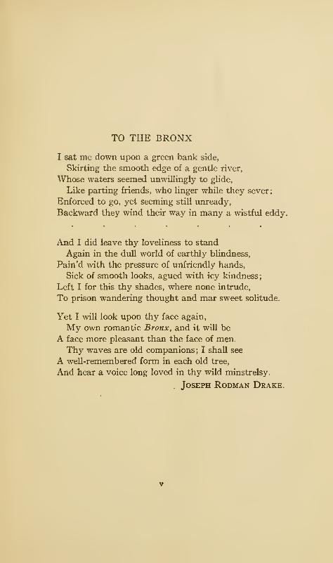
TO THE BRONX
I sat me down upon a green bank side,
Skirting the smooth edge of a gentle river,
Whose waters seemed unwillingly to glide,
Like parting friends, who linger while they sever;
Enforced to go, yet seeming still unready,
Backward they wind their way in many a wistful eddy.
And I did leave thy loveliness to stand
Again in the dull world of earthly blindness,
Pain'd with the pressure of unfriendly hands,
Sick of smooth looks, agued with icy kindness;
Left I for this thy shades, where none intrude,
To prison wandering thought and mar sweet solitude.
Yet I will look upon thy face again,
My own romantic Bronx, and it will be
A face more pleasant than the face of men.
Thy waves are old companions ; I shall see
A well-remembered form in each old tree,
And hear a voice long loved in thy wild minstrelsy.
Joseph Rodman Drake.

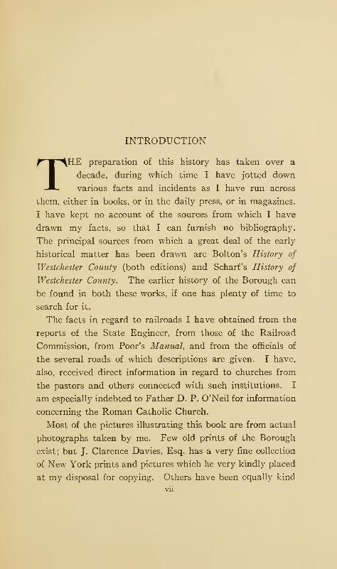
INTRODUCTION
THE preparation of this history has taken over a
decade, during which time I have jotted down
various facts and incidents as I have run across
them, either in books, or in the daily press, or in magazines.
I have kept no account of the sources from which I have
drawn my facts, so that I can furnish no bibliography.
The principal sources from which a great deal of the early
historical matter has been drawn are Bolton's History of
Westchester County (both editions) and Scharf's History of
Westchester County. The earlier history of the Borough can
be found in both these works, if one has plenty of time to
search for it.
The facts in regard to railroads I have obtained from the
reports of the State Engineer, from those of the Railroad
Commission, from Poor's Manual, and from the officials of
the several roads of which descriptions are given. I have,
also, received direct information in regard to churches from
the pastors and others connected with such institutions. I
am especially indebted to Father D. P. O'Neil for information
concerning the Roman Catholic Church.
Most of the pictures illustrating this book are from actual
photographs taken by me. Few old prints of the Borough
exist; but J. Clarence Davies, Esq. has a very fine collection
of New York prints and pictures which he very kindly placed
at my disposal for copying. Others have been equally kind
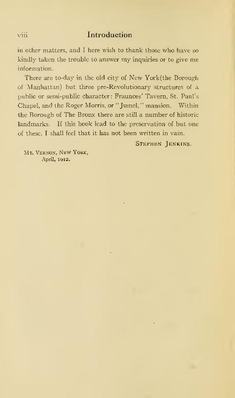
viii Introduction
in other matters, and I here wish to thank those who have so
kindly taken the trouble to answer my inquiries or to give meinformation.
There are to-day in the old city of New York(the Borough
of Manhattan) but three pre-Revolutionary structures of a
public or semi-public character: Fraunces* Tavern, St. Paul's
Chapel, and the Roger Morris, or " Jumel, " mansion. Within
the Borough of The Bronx there are still a number of historic
landmarks. If this book lead to the preservation of but one
of these, I shall feel that it has not been written in vain.
Stephen Jenkins.
Mt. Vernon, New York,
April, igi2.
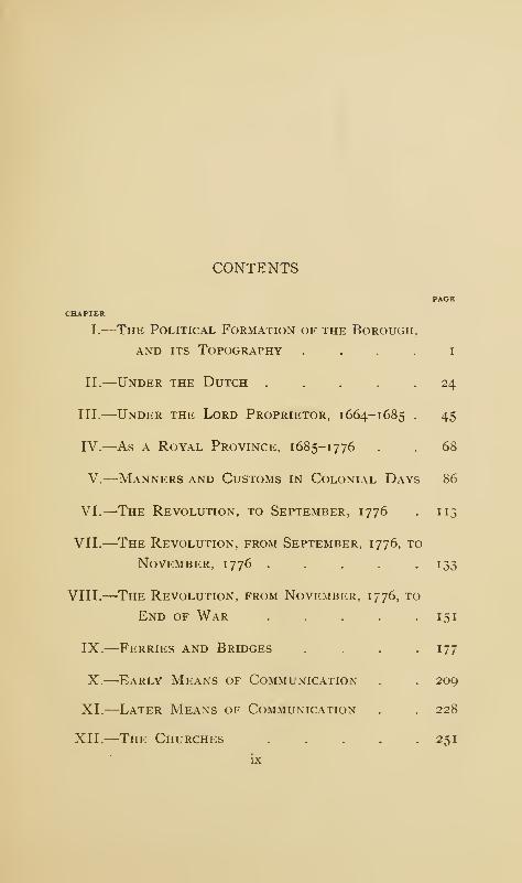
CONTENTS
PAGE
CHAPTER
I.
—
The Political Formation of the Borough,
and its Topography i
II.
—
Under the Dutch ..... 24
III.
—
Under the Lord Proprietor, 1664-1685 . 45
IV.—As a Royal Province, 1685-1776 . . 68
V.
—
Manners and Customs in Colonial Days 86
VI.
—
The Revolution, to September, 1776 . 113
VII.
—
The Revolution, from September, 1776, to
November, 1776 ..... 133
VIII.
—
The Revolution, from November, 1776, to
End of War ..... 151
IX.
—
Ferries and Bridges .... 177
X.
—
Early Means of Communication . . 209
XI.
—
Later Means of Communication . . 228
XII.
—
The Churches ..... 251
ix
Contents
CHAPTER
XIII.
—
The Parks and Cemeteries
XIV.—KlNGSBRIDGE
XV.
—
Fordham Manor
XVI. MORRISANIA
XVII.—West Farms .
XVIII.
—
Westchester .
XIX.
—
Eastchester and Pelham
Index ....
. 289
• 325
• 342
. 358
. 380
• 396
. 421
. 433
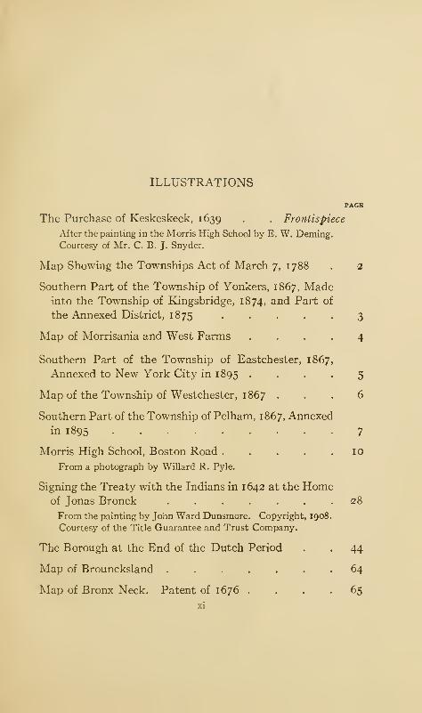
ILLUSTRATIONS
PAGB
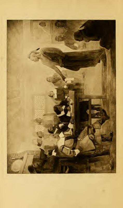
The Purchase of Keskeskeck, 1639 . . Frontispiece
After the painting in the Morris High School by E. W. Deming.
Courtesy of Mr. C. B. J. Snyder.
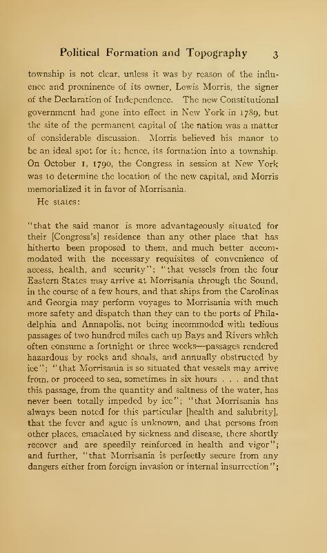
Map Showing the Townships Act of March 7, 1788 . 2
Southern Part of the Township of Yonkers, 1867, Madeinto the Township of Kingsbridge, 1874, and Part of
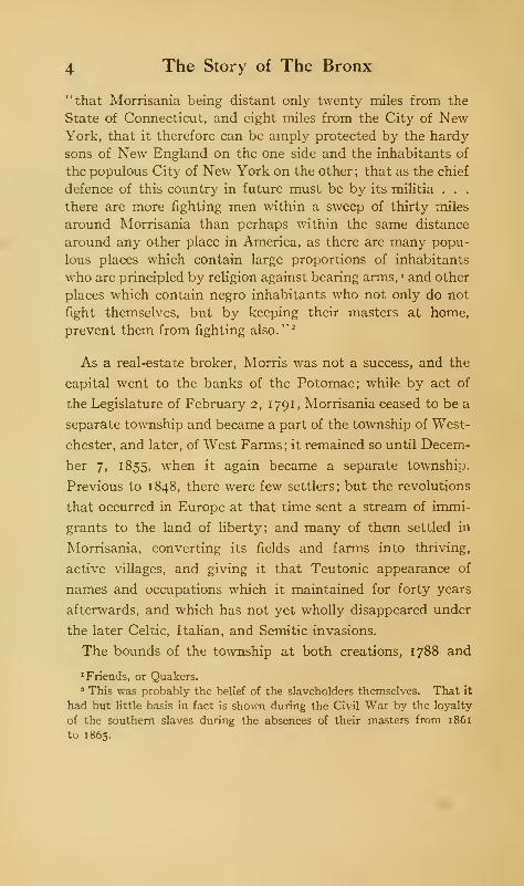
the Annexed District, 1875 ....Map of Morrisania and West Farms
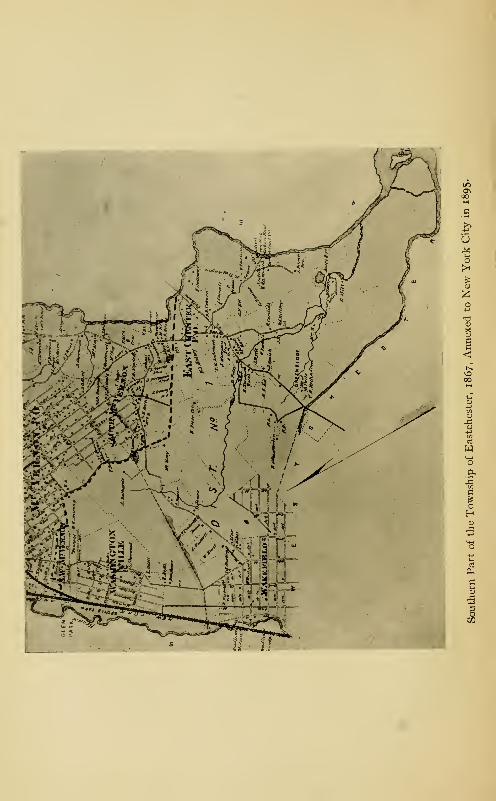
Southern Part of the Township of Eastchester, 1867
Annexed to New York City in 1 895 .
Map of the Township of Westchester, 1867 .
Southern Part of the Township of Pelham, 1867, Annexed
in 1895
Morris High School, Boston Road....From a photograph by Willard R. Pyle.
Signing the Treaty with the Indians in 1642 at the Homeof Jonas Bronck ......From the painting by John Ward Dunsmore. Copyright, 1908
Courtesy of the Title Guarantee and Trust Company.
The Borough at the End of the Dutch Period
Map of Brouncksland
Map of Bronx Neck. Patent of 1676 .
3
4
5
6
7
10
28
44
64
65
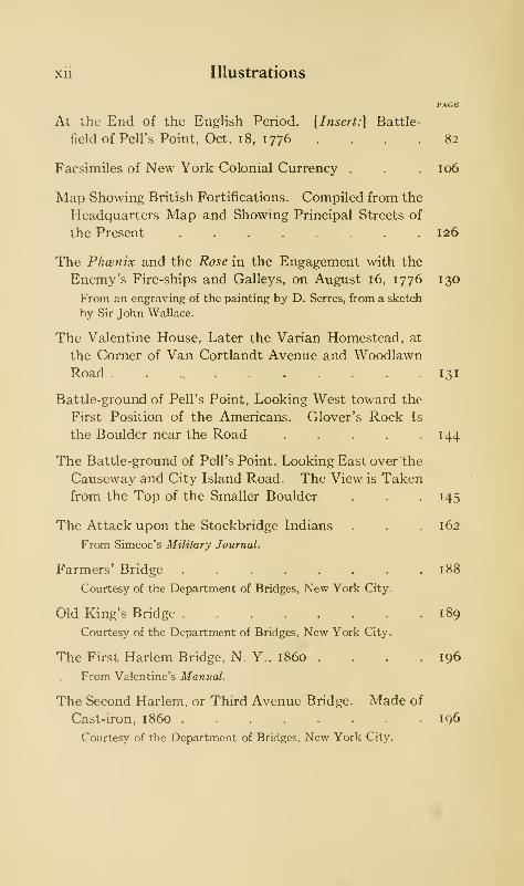
xii Illustrations
At the End of the English Period. [Insert:] Battle-
field of Pell's Point, Oct. 1 8, 1776 .... 82
Facsimiles of New York Colonial Currency . . . 106
Map Showing British Fortifications. Compiled from the
Headquarters Map and Showing Principal Streets of
the Present ........ 126
The Phcenix and the Rose in the Engagement with the
Enemy's Fire-ships and Galleys, on August 16, 1776 130
From an engraving of the painting by D. Serres, from a sketch
by Sir John Wallace.
The Valentine House, Later the Varian Homestead, at
the Corner of Van Cortlandt Avenue and WoodlawnRoad 131
Battle-ground of Pell's Point, Looking West toward the
First Position of the Americans. Glover's Rock Is
the Boulder near the Road . . . . 144
The Battle-ground of Pell's Point, Looking East over the
Causeway and City Island Road . The View is Takenfrom the Top of the Smaller Boulder . . . 145
The Attack upon the Stockbridge Indians . . .162From Simcoe's Military Journal.
Farmers' Bridge 188
Courtesy of the Department of Bridges, New York City.
Old King's Bridge 189
Courtesy of the Department of Bridges, New York City.
The First Harlem Bridge, N. Y., i860 . . .196From Valentine's Manual.
The Second Harlem, or Third Avenue Bridge. Made of
Cast-iron, i860 196
Courtesy of the Department of Bridges, New York City.
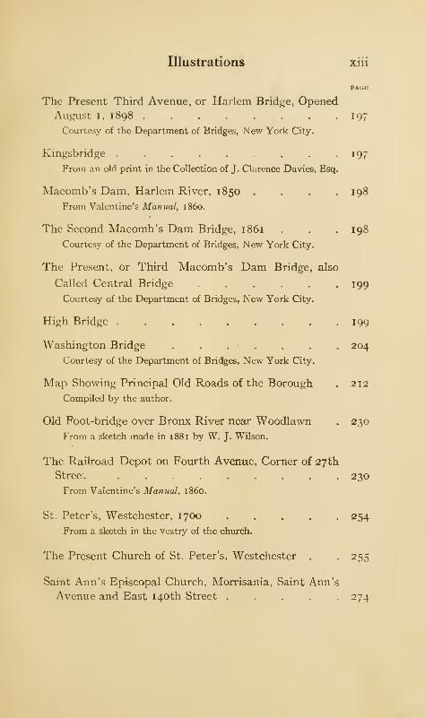
Illustrations xiii
The Present Third Avenue, or Harlem Bridge, OpenedAugust i, 1898 197
Courtesy of the Department of Bridges, New York City.
Kingsbridge 197
From an old print in the Collection of J. Clarence Davies, Esq.
Macomb's Dam, Harlem River, 1850 .... 198
From Valentine's Manual, i860.
The Second Macomb's Dam Bridge, 1861 . . . 198
Courtesy of the Department of Bridges, New York City.
The Present, or Third Macomb's Dam Bridge, also
Called Central Bridge . . . . . .199Courtesy of the Department of Bridges, New York City.
High Bridge . . . . . . . . .199
Washington Bridge . . . . . . . 204
Courtesy of the Department of Bridges, New York City.
Map Showing Principal Old Roads of the Borough . 212
Compiled by the author.
Old Foot-bridge over Bronx River near Woodlawn . 230
From a sketch made in 1881 by W. J. Wilson.
The Railroad Depot on Fourth Avenue, Corner of 27th
Street ......... 230
From Valentine's Manual, i860.
St. Peter's, Westchester, 1700 254From a sketch in the vestry of the church.
The Present Church of St. Peter's, Westchester . . 255
Saint Ann's Episcopal Church, Morrisania, Saint Ann's
Avenue and East 140th Street . . . . -274
xiv Illustrations
PAGE
The Reformed Dutch Church on the Kingsbridge Road,Fordham 274
The Presbyterian Church, East 180th Street, West Farms 280
The Roman Catholic Church of Saint Raymond,Westchester . . . . . . . .281
Van Cortlandt Park, the Dam and Mill . . . 294
The Van Cortlandt Mansion in Van Cortlandt Park . 294
Curling on the Lake in Van Cortlandt Park . . . 300
Vault Hill, the Ancient Burial-place of the Van Cortlandt
Family, Van Cortlandt Park ..... 300
Devoe's Lane, Leading to Yonkers and Tuckahoe (1907).
Indian Field to the Left of the Road.... 301
The Monument on Indian Field, Van Cortlandt Park . 301
The Bridge, Bronx Park . . .
The Lorillard Mansion in Bronx Park .
The Old Lorillard Snuff-mill, Bronx Park .
The Falls in Bronx Park ....The Lower Dam, and the Site of De Lancey's
Bronx Park ......The Botanical Museum, Bronx Park
The Rocking-stone, Bronx Park .
Mills,
304
304
305
305
306
306
307
Bowne House Erected 1730 on Site of Pell's Manor-
house; near here the British Landed on October 18,
1776—Pelham Bay Park 3 10
Illustrations xv
PAGE
Memorial Tablet on Glover's Rock, Pelham Bay Park . 310
The " Split Rock" Boulder on the Prospect Hill Road,
Pelham Bay Park 311
The Tree under which Pell Made his Treaty with the
Indians and Purchased their Lands (now destroyed)
—Pelham Bay Park 311
Camping out on Hunter's Island, Pelham Bay Park . 316
The Indian Rock Called "Mishow," Hunter's Island,
Pelham Bay Park 316
Pelham Bridge in 1865 318
From a sketch by W. J. Wilson.
Pelham Bridge, over Eastchester Creek, Pelham Bay Park 319
The New Pelham Bridge 319
The Zbrowski Mansion, Claremont Park . . . 320
Poe's Cottage, Fordham 320
From a photo by A. A. Stoughton, 1885.
The Farragut Monument in Woodlawn Cemetery . 321
Mount Saint Vincent de Paul, Font Hill, or "Forrest's
Castle" 326
Looking from Spuyten Duyvil Neck toward the Hudson 326
The Berrien Homestead on Spuyten Duyvil Neck . 327
Spuyten Duyvil Neck from near the Station . . 327
Henry Hudson Monument, Spuyten Duyvil Neck. Mr.
Muschenheim's residence is on the left, and under the
xvi Illustrations
PAl.K
first second-story window on the porch side is the
bronze tablet marking the site of Fort Number One 332
Courtesy of William C. Muschenheim, Esq.
Statue of Henry Hudson by Karl Bitter . . . 333
A View of the King's Bridge - Spuyten Duyvil Neck in
the Background ....... 336
The Godwin, formerly the Macomb House, Kingsbridge 336
The Montgomery House on Fort Independence Street.
Home of Captain Richard Montgomery, later, Major-
General in the Continental Army.—Kingsbridge . 340
The Former Residence of the Late William Ogden Giles.
The Terraces Are the Ramparts of Fort Independence,
Kingsbridge ........ 340
Webb's Shipbuilding Academy and Home, FordhamHeights 344
The Burial Ground of the Old Dutch Church, formerly
at Sedgwick Avenue and Fordham Road . . . 344
The Library and Hall of Fame, New York University . 346
Boulder Marking the Site of Fort Number Eight on
the Property of the New York University, FordhamHeights 346
The Archer House, or De Lancey Headquarters, which
formerly Stood near the Junction of Sedgwick and
Burnside Avenues ....... 347
Fordham University ....... 347
Gouverneur Morris before the Constitutional Conven-
tion at Philadelphia, 1787 360
After the painting by E. W. Deming, in the Morris High School.
Courtesy of Mr. C. B. J. Snyder.

Illustrations xvii
The Gouverneur Morris Mansion. View from the Bronx
Kills Side 364
Buildings on Randall's Island 364
Morrisania, about 1861, 160th Street at the Junction of
Brook and Third Avenues 365
From an old print in the Collection of J. Clarence Davies, Esq.
The Mott Haven Canal 365
The Lorelei Fountain, or Heinrich Heine Monument,Mott Avenue and East 161 st Street, at the Beginning
of the Concourse 372
The Cromwell House, near Jerome Avenue, above
Central Bridge ........ 372
Bronx Borough Hall Decorated for the Hudson-Fulton
Celebration, 1909 376Photograph by Joseph F. Hefele.
De Lancey Mills and Mansion, Westchester . . 377
Redrawn by W. J. Wilson from Bolton's History of Westchester
County.
The Grave of Joseph Rodman Drake, Hunt's Point . 382
The Hunt House (1688), or the "Grange," the Resi-
dence of Joseph Rodman Drake, Hunt's Point . 382
The De Lancey Pine .....The Soldiers' Monument at West Farms
The Causeway and Bridge. Westchester
Looking across the Creek (1903). Westchester
The Sydney Bowne Store (1903), Westchester
392
392
398
398
399
The Westchester Methodist Episcopal Church, Walker
Avenue ......... 399

xviii Illustrations
PAGE
"The Black Rock" on Cornell's Neck . . . .402
Near the Mouth of Pugsley's Creek .... 402
The Wilkins Mansion from Clason's Point . . . 408
Ferris Grange (1687) on Ferris Avenue, or Old Ferry
Lane, 1903—Throgg's Neck 408
The "Spy Oak " on the Pelham Road, Throgg's Neck . 412
Fort Schuyler, from the Wharf . . . . .412
Cedar of Lebanon, Huntington Estate, Throgg's Neck 416
John Williams's House, Williamsbridge, Built about
1755. Removed in 1903 417
The Husted House, 221st Street near White Plains Road.
Rear View.—Williamsbridge . . . . . 417
The Home of the Pattis in Wakefield .... 420
Sketch by W. J. Wilson, 1885.
The Entrance to the Penfield Estate on the WhitePlains Road ........ 420
Sketch by W. J. Wilson, 1885.
Seton's Falls, Eastchester 421
On the Boston Road, Eastchester, "15 Miles to NewYork" 421
Reid's Mill, Eastchester 424
From a water-color by Mrs. Lascelles.
The Old House near Reid's Mill, about 1665-1670,
Eastchester . 424
The Gate at the Entrance to the Vincent-Halsey Place,
Eastchester 425
Illustrations xix
PAGE
The Vincent-Halsey House, for Several Months the
Executive Mansion of President John Adams, East-
chester 425
The Marshall House on Rodman's Neck, the type of
Mansion Erected in this Section before 1850 . . 426
E. C. Cooper's Plan of Salt Works at City Island (1835) 426
From an old print in the New York Historical Society.
The Old City Island Bridge 427
Courtesy of the Department of Bridges, New York City.
The New City Island Bridge 427
Courtesy of the Department of Bridges, New York City.
The " Macedonian Hotel," City Island . . . 430
Map of Bronx Borough At End

The Story of the
Borough of The Bronx
CHAPTER I
THE POLITICAL FORMATION OF THE BOROUGH, AND ITS
TOPOGRAPHY
THE city of New York is divided for administrative
purposes into five boroughs : Manhattan, the original
city of New York upon the island of Manhattan;
Brooklyn, the old city of that name in the county of Kings;
Queens, in the county of the same name, adjoining Brooklyn;
Richmond, or Staten Island; The Bronx, the Borough lying
north of the Harlem River.
November i, 1683, the county of Westchester was formed.
Its western boundary was the Hudson River; its northern,
Dutchess (now Putnam) County ; its eastern, the Connecticut
Colony and Long Island Sound; its southern, the East and
Harlem rivers and Spuyten Duyvil Creek. The Borough
of The Bronx was included within the county of Westchester
until 1874 f°r the western part of the Borough, and until
1 895 for the eastern part. Its history is until these dates that
2 The Story of The Bronx
of the county. The county also included the islands contigu-
ous to its shores.
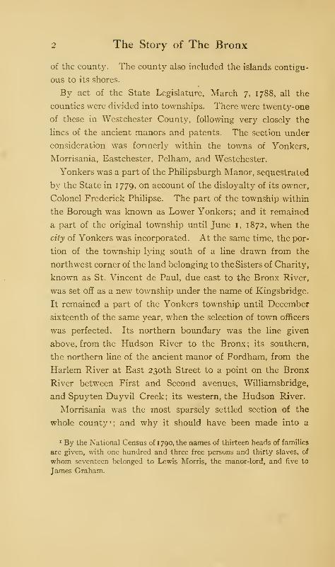
By act of the State Legislature, March 7, 1788, all the
counties were divided into townships. There were twenty-one
of these in Westchester County, following very closely the
lines of the ancient manors and patents. The section under
consideration was formerly within the towns of Yonkers,
Morrisania, Eastchester, Pelham, and Westchester.
Yonkers was a part of the Philipsburgh Manor, sequestrated
by the State in 1779, on account of the disloyalty of its owner,
Colonel Frederick Philipse. The part of the township within
the Borough was known as Lower Yonkers ; and it remained
a part of the original township until June 1, 1872, when the
city of Yonkers was incorporated. At the same time, the por-
tion of the township lying south of a line drawn from the
northwest corner of the land belonging to the Sisters of Charity,
known as St. Vincent de Paul, due east to the Bronx River,
was set off as a new township under the name of Kingsbridge.
It remained a part of the Yonkers township until December
sixteenth of the same year, when the selection of town officers
was perfected. Its northern boundary was the line given
above, from the Hudson River to the Bronx; its southern,
the northern line of the ancient manor of Fordham, from the
Harlem River at East 230th Street to a point on the Bronx
River between First and Second avenues, Williamsbridge,
and Spuyten Duyvil Creek; its western, the Hudson River.
Morrisania was the most sparsely settled section of the
whole county 1; and why it should have been made into a
1 By the National Census of 1 790, the names of thirteen heads of families
are given, with one hundred and three free persons and thirty slaves, of
whom seventeen belonged to Lewis Morris, the manor-lord, and five to
James Graham.
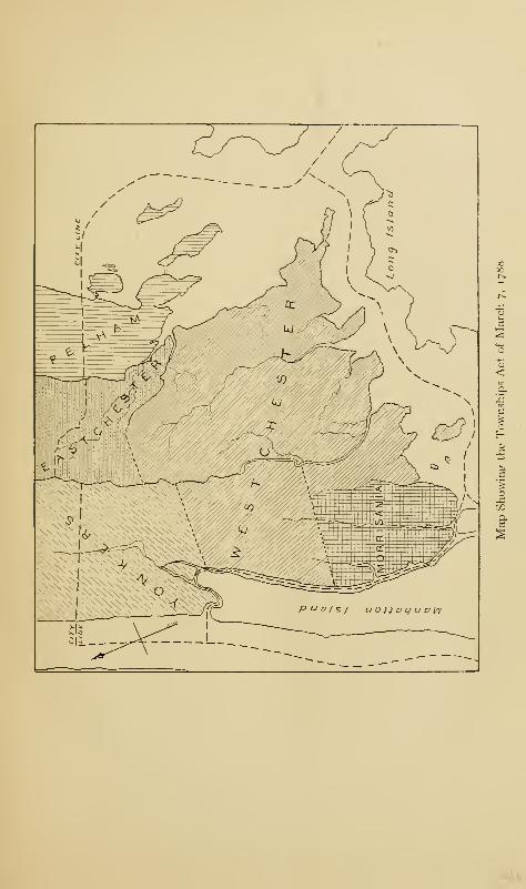
Southern Part of the Township of Yonkers, 1867, Made into the Township of Kingsbridge, 1874,
and Part of the Annexed District, 1875.
Political Formation and Topography 3
township is not clear, unless it was by reason of the influ-
ence and prominence of its owner, Lewis Morris, the signer
of the Declaration of Independence. The new Constitutional
government had gone into effect in New York in 1789, but
the site of the permanent capital of the nation was a matter
of considerable discussion. Morris believed his manor to
be an ideal spot for it; hence, its formation into a township.
On October 1, 1790, the Congress in session at New York
was to determine the location of the new capital, and Morris
memorialized it in favor of Morrisania.
He states:
"that the said manor is more advantageously situated for
their [Congress's] residence than any other place that has
hitherto been proposed to them, and much better accom-
modated with the necessary requisites of convenience of
access, health, and security"; "that vessels from the four
Eastern States may arrive at Morrisania through the Sound,
in the course of a few hours, and that ships from the Carolinas
and Georgia may perform voyages to Morrisania with muchmore safety and dispatch than they can to the ports of Phila-
delphia and Annapolis, not being incommoded with tedious
passages of two hundred miles each up Bays and Rivers which
often consume a fortnight or three weeks—passages rendered
hazardous by rocks and shoals, and annually obstructed by
ice"; "that Morrisania is so situated that vessels may arrive
from, or proceed to sea, sometimes in six hours . . . and that
this passage, from the quantity and saltness of the water, has
never been totally impeded by ice"; "that Morrisania has
always been noted for this particular [health and salubrity],
that the fever and ague is unknown, and that persons from
other places, emaciated by sickness and disease, there shortly
recover and are speedily reinforced in health and vigor";
and further, "that Morrisania is perfectly secure from any
dangers either from foreign invasion or internal insurrection";
4 The Story of The Bronx
"that Morrisania being distant only twenty miles from the
State of Connecticut, and eight miles from the City of NewYork, that it therefore can be amply protected by the hardy
sons of New England on the one side and the inhabitants of
the populous City of New York on the other ; that as the chief
defence of this country in future must be by its militia . . .
there are more fighting men within a sweep of thirty miles
around Morrisania than perhaps within the same distance
around any other place in America, as there are many popu-
lous places which contain large proportions of inhabitants
who are principled by religion against bearing arms, « and other
places which contain negro inhabitants who not only do not
fight themselves, but by keeping their masters at home,
prevent them from fighting also." 2
As a real-estate broker, Morris was not a success, and the
capital went to the banks of the Potomac; while by act of
the Legislature of February 2, 1791 , Morrisania ceased to be a
separate township and became a part of the township of West-
chester, and later, of West Farms; it remained so until Decem-
ber 7, 1855, when it again became a separate township.
Previous to 1848, there were few settlers; but the revolutions
that occurred in Europe at that time sent a stream of immi-
grants to the land of liberty; and many of them settled in
Morrisania, converting its fields and farms into thriving,
active villages, and giving it that Teutonic appearance of
names and occupations which it maintained for forty years
afterwards, and which has not yet wholly disappeared under
the later Celtic, Italian, and Semitic invasions.
The bounds of the township at both creations, 1788 and
•Friends, or Quakers.2 This was probably the belief of the slaveholders themselves. That it
had but little basis in fact is shown during the Civil War by the loyalty
of the southern slaves during the absences of their masters from 1861
to 1865.
Map of Morrisania and West Farms.
uMUO
Political Formation and Topography 5
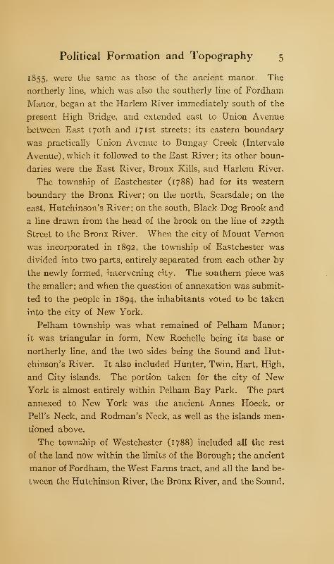
1855, were the same as those of the ancient manor. The
northerly line, which was also the southerly line of Fordham
Manor, began at the Harlem River immediately south of the
present High Bridge, and extended east to Union Avenue
between East 170th and 171st streets; its eastern boundary
was practically Union Avenue to Bungay Creek (Intervale
Avenue), which it followed to the East River; its other boun-
daries were the East River, Bronx Kills, and Harlem River.
The township of Eastchester (1788) had for its western
boundary the Bronx River; on the north, Scarsdale; on the
east, Hutchinson's River; on the south, Black Dog Brook and
a line drawn from the head of the brook on the line of 229th
Street to the Bronx River. When the city of Mount Vernon
was incorporated in 1892, the township of Eastchester was
divided into two parts, entirely separated from each other by
the newly formed, intervening city. The southern piece was
the smaller ; and when the question of annexation was submit-
ted to the people in 1894, the inhabitants voted to be taken
into the city of New York.
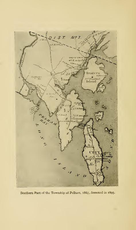
Pelham township was what remained of Pelham Manor;
it was triangular in form, New Rochelle being its base or
northerly line, and the two sides being the Sound and Hut-
chinson's River. It also included Hunter, Twin, Hart, High,
and City islands. The portion taken for the city of NewYork is almost entirely within Pelham Bay Park. The part
annexed to New York was the ancient Annes Hoeck, or
Pell's Neck, and Rodman's Neck, as well as the islands men-
tioned above.
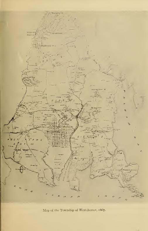
The township of Westchester (1788) included all the rest
of the land now within the limits of the Borough; the ancient
manor of Fordham, the West Farms tract, and all the land be-
tween the Hutchinson River, the Bronx River, and the Sound,
6 The Story of The Bronx
with a northerly boundary at the Eastchester line from Black
Dog Brook to the Bronx River. This included about one
half the Borough. The town was further increased by the
accession of Morrisania, February 22, 1791. It remained
intact until May 13, 1846, when the township of West Farms
was formed out of its territory.
West Farms (1846) comprised all the land west of the Bronx
River as far as the Harlem River, lying south of Yonkers,
until December 7, 1855, when the township of Morrisania was
once more formed from its territory. It thus included the
manors of Morrisania and Fordham and the West Farms
patent of 1663.
The annexation of a part of Westchester County to the city
of New York was a question that arose long before any formal
action was taken by the authorities. As early as 1864, it
was proposed to unite the townships of Morrisania and West
Farms under a special city charter; but the objections of the
inhabitants of West Farms defeated the project. In 1869,
one of the Tweed members of the Legislature from Mount
Vernon proposed the annexation of a large portion of the
county to the city; but as the action was taken without any
reference to the wishes of the inhabitants or their immediate
representative, Senator Cauldwell, he arose in his place and
announced that, in a few days, he would introduce a bill
"to annex the city of New York to Morrisania," a piece of
sarcasm which defeated the movement at that time. Yet
Senator Cauldwell was, later, one of the foremost in advocating
annexation and in bringing it about.
In the autumn of 1872, the people of West Farms and Mor-
risania came together ; and the following year, the bill referring
the question of annexation to the people was enacted. Owing
to disputes among the officials, the bill provided that the
Kiijj kJC.,,, \\n i>
, s ' •
saW
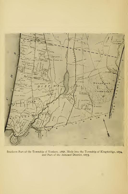
Map of the Township of Westchester, 1867.
Southern Part of the Township of Pelham, 1867, Annexed in 1895.
Political Formation and Topography 7
streets should be placed under the Park Department, a scheme
that worked more harm than good to the newly annexed
district until the streets were put under a special Department
of Street Improvements of the Twenty-third and Twenty
-
fourth wards, January 1, 1891.
On January 1, 1874, by act °f tne Legislature mentioned
above, the townships of Kingsbridge, West Farms, and Mor-
risania became a part of the (old) city of New York, and were
formed into the Twenty-third and Twenty-fourth wards.
The new wards were also spoken of as the Annexed District
;
they constitute that part of the Borough lying west of the
Bronx River and comprise 12,317 acres.
At the election of November 6, 1894, the question of the
Greater New York was submitted to the inhabitants of the
localities affected, including Westchester, Eastchester, Pel-
ham, and the city of Mount Vernon. The result of the referen-
dum showed good majorities for annexation in Eastchester
and Pelham, while Mount Vernon and Westchester voted
against, the former by a large majority, and the latter by a
majority of one. The adverse majority in Westchester was
so small that it was ignored by the annexationists; and July
I, 1895, the whole section east of the Bronx River became a
part of the city of New York, forming part of the Twenty-
fourth Ward. It comprises nearly 14,000 acres, making the
total area taken from Westchester County by the two annexa-
tions 26,017 acres, or about 39! square miles.
January 1, 1898, the charter of the Greater New York went
into effect, and the whole annexed section north of the Harlem
River became officially known as the Borough of The Bronx, x
'The question is often asked: "Why the Borough of The Bronx?"For the same reason that we speak of the Army of the Potomac, the valley
of the Hudson, etc.—all taking their names from rivers, to which it is
customary to prefix the article.
8 The Story of The Bronx
though united in educational and some other official matters
with the Borough of Manhattan.
January i, 1902, the revised charter of the Greater NewYork went into effect. It gives a certain amount of autonomy
to the different boroughs, especially in the matter of local
improvements, though many acts of the local boards are
subject to the Board of Aldermen or Board of Estimate and
Apportionment, or both, when the outlay authorized by the
local board exceeds two thousand dollars. The local boards
of The Bronx are composed of the Borough president and
the aldermen of the local improvement districts. There
are four such districts in the Borough; the Twenty-
second, or Morrisania; the Twenty-third, or Chester; the
Twenty-fourth, or Crotona; and the Twenty-fifth, or Van
Courtlandt.
When the two annexations took place, the sections ceased
to be parts of Westchester County and became parts of NewYork County. In the matter of congressional, senate, as-
sembly, and judicial representation, however, portions of the
Borough were at first attached to Westchester County;
though there is now separation. The Borough constitutes
the eighteenth congressional district; but on the basis of popu-
lation as shown by the last Federal Census, it is entitled to
two congressmen. There are eight aldermanic districts,
and four local school districts, each having its own board.
The Borough is allowed two municipal courts where civil
cases may be tried in which the value in controversy does not
exceed two hundred and fifty dollars. There are also two
police magistrate's courts for the settlement of minor cases of
crimes and misdemeanors and for preliminary hearings in
cases of felony. For police protection, the Borough is divided
into nine precincts with 756 men. For protection from fire,
Political Formation and Topography 9
there are twenty engines and nine hook and ladder trucks,
while in the Harlem River is stationed a fire tug. There are
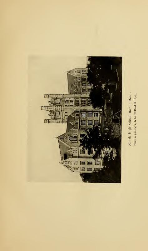
fifty public elementary schools and the Gouverneur Morris
High School on the Boston Road, while, owing to the rapidly
increasing population, new sites are being selected and build-
ings erected, though not half fast enough to keep up with the
growth of school population. Most of these school buildings
are modern in every respect; and while built for utilitarian
purposes, the aesthetic side has not been neglected; and, as
the sites are often on high ground, these fine examples of
school architecture tower above their neighbors and attract
the attention of the wayfarer.
Many of the natural features of the Borough are rapidly
disappearing before the march of modern improvements;
and the authorities are filling in creeks, swamps, and lowlands,
laying out and grading streets, and establishing water mains
and sewers for the immense population of the future. In the
spring of 1903, a plan of opening and grading 420 miles of
streets in the district east of the Bronx River was submitted
to the Board of Estimate and approved by them on May 29,
1903. In this plan, ample provision is made for several small
parks and for a larger one at Seton's Falls; but little or no
attention is paid to the preservation of old landmarks, except
in the way of some of the more prominent of the ancient
highways.
By the Federal Census of 1900, the Borough had a popula-
tion of 200,507; and by the Census of 19 10, a population of
430,980, an increase of nearly 115 per cent., more than that
of any other borough of the city. The great increase in
population and the consequent erection of buildings to accom-
modate the inhabitants, with the transfers of property and
other matters of record in relation to real estate, became so

io The Story of The Bronx
great in volume that, on April 28, 1903, a committee was
appointed by the North Side Board of Trade to bring before
the State Legislature the formation of a new county to be called
Bronx County. In January following, a bill to form such a
county was introduced, but it failed to pass. It was intro-
duced in every subsequent Legislature, but it was defeated, so
ii is stated, because, if such a county were created, Tammanyand the other political machines would lose their power in
the Borough. Extraordinary meetings and agitations took
place in the autumn of 191 1, with the result that an act passed
by the Legislature of 191 2 authorizes the formation of Bronx
County, the matter to be decided by a referendum to the voters
of the Borough at the election of November, 1912.'
The construction and opening of the subway in 1904 caused
a great boom in real estate; and the operations have run into
many millions of dollars, as many farm lands and estates have
been brought into the market and have found ready purchasers
for actual building.
On January 16, 1904, the Bronx Free Library, which had
been in existence for several years, surrendered its separate
existence to the New York Library, and thus brought itself
within the scope of the Carnegie Library Fund; and, in conse-
quence, the corner-stone of a new building was laid on January
21, 1904, at Washington Avenue and East 176th Street.
Other branches of the New York Public Library are located
in Morrisania, Mott Haven, Highbridgeville, and Kingsbridge.
1 The author is not a believer in the idea that you can make people rich
by taking money away from them ; and he thinks that, if the new county
be formed, it will be due to local pride, and to the active efforts of an
energetic minority of contractors and politicians, whose eyes are fastened
upon the annual expenditure of several millions (to be taken from the
taxpayers) for the salaries of county officials and the erection of county
buildings.
a ^£ —V. s
S 2

Political Formation and Topography 1
1
The only regular military organization in the Borough is
the Second Battery of the State National Guard, which
prides itself on being the pioneer company of the Borough.
It was organized February 4, 1833, in the city of New York
and moved to temporary quarters on Bathgate Avenue near
East 177th Street on October 25, 1902. It occupied its new
armory on Franklin Avenue and East 166th Street on June I,
1910. The ground and building cost #57,200. The battery,
which is now officially Battery A, First Battalion, Field
Artillery, N. G., N. Y., consists of six officers and one hundred
and eleven men. The battery is equipped with four three-
inch breech-loading field guns, four Colt rapid-firing guns, and
four Gatling guns. In addition, there are forty-four horses,
the property of the battery, and the necessary equipment
of harness, small arms, caissons, etc.
One of the most important factors in the development of
the Borough on its commercial and sociological sides has been
the North Side Board of Trade. This is composed of the
leading business and professional men of the Borough, and
those having business or other interests there. The society
was organized March 6, 1894; and since that time it has been
untiring in its efforts to arouse a proper public spirit and pride
in the Borough and in disseminating information about it,
so as to attract manufacturing and other enterprises and a
superior class of residents. That this has been successfully
done is shown in the large number of commercial enter-
prises, the increase in traffic facilities, and the doubling
of the population within the last decade. On Saturday,
October 28, 191 1, the corner-stone of the new North Side
Board of Trade building was laid by Mayor Gaynor with
appropriate ceremonies. The building is located at Third
and Lincoln avenues and East 137th Street. When fin-
12 The Story of The Bronx
ished, it will be one of the most beautiful buildings in the
Borough.
Two other organizations, the Bronx Society of Arts and
Sciences, founded in 1904, and the Bronx Beautiful Society,
founded in January, 19 12, have been established for the
development of the Borough on its intellectual and aesthetic
sides.
Besides the Seton Hospital and the Home for Incurables,
mentioned elsewhere, there are six great hospitals within
the Borough. Fordham Hospital, under the Department of
Charities, was established in 1882 at Valentine Avenue and
1 88th Street, whence it removed to the old Eden mansion at
Aqueduct Avenue and 190th Street. Since May 1, 1907, it
has occupied the new building at Crotona Avenue and South-
ern Boulevard, not far from the Bronx "Zoo," a location
which will always be of the best, as it is surrounded by open,
public park spaces, and it will never have its air and light cut
off, nor fail to receive a supply of clear, pure air. Another
city hospital is Riverside, situated on North Brother Island,
where contagious and infectious diseases are taken care of.
There are accommodations for five hundred patients.
Lincoln Hospital is situated at East 141st Street and
Southern Boulevard. It was originally incorporated in 1845
under the name of the Colored Home, and was located at
65th Street and First Avenue, Manhattan, until September 7,
1898, when it was moved to its present site into the new
buildings especially erected. The name was changed to
Lincoln Hospital and Home in i860. No color line is drawn
in the hospital service, but the training school for nurses
attached to the institution is restricted to colored women.
The institution is maintained principally by subscriptions
and donations, though it also receives aid from the city.
Political Formation and Topography 13
Lebanon Hospital, located at Cauldwell and Westchester
avenues, upon the site formerly occupied by the Ursuline
Convent, was incorporated by a number of Jewish citizens in
1890. The present building was occupied in 1892; and there
are two hundred and fifty beds, four ambulances, and a full
complement of surgeons and nurses. From its central location
in a thickly settled neighborhood, it is probably the busiest
of the Bronx hospitals, as it makes no distinction as to religion
in its services. Its name is almost invariably mispronounced,
and it is called Le-ban-on by the people of the vicinity. It
is supported by subscriptions and donations, and also by help
from the city.
St. Francis's Hospital is in charge of the Sisters of the Poor
of St. Francis, and is situated between Brook and St. Ann's
avenues and I42d and 143d streets. It has been located
here since 1906, and is a splendid up-to-date institution with
over four hundred beds. It treats patients of every and all
creeds, colors, and nationalities; and for its treatment of non-
paying poor, it receives pay from the city.
St. Joseph's Hospital, under Sisters of the same order, is
situated on the block above St. Francis's; but its doors, while
open to all creeds and nationalities, are closed to all cases
except those of consumption, all stages of which are taken care
of. There are five hundred beds, over four hundred of which
are free to the poor, of whom there were 21 11 treated from
October 1, 1910 to September 30, 191 1. The hospital was
opened here on January 1, 1889; and it is maintained by
private subscriptions and donations, though the city helps
for the care of poor patients.
Union Hospital was started in the spring of 191 1 for the
treatment of all ailments, and for general hospital work. It
occupies the Eden mansion, the former home of Fordham
14 The Story of The Bronx
Hospital. It is backed by the Episcopal Church and by a
number of the leading physicians of the Borough.
The surface of the Borough is such as to present all varieties
of scenery; and in its wild state it must have shown scenes of
surpassing rural and sylvan beauty. In fact, even to-day,
one is pleased with the vistas of hills and streams in the more
sparsely settled parts.
The elevated portions of the Borough are continuations of
the ranges of hills of Westchester County and, speaking gener-
ally, run north and south, parallel to the Hudson. The val-
leys between are occupied by streams flowing to the southward
and are comparatively level, so that they became the way of
the earlier roads, and later, of the railroads. These elevations
rise to a height of two hundred feet in many places, and do
not fall below a hundred, except in the slopes to the valleys.
The westernmost ridge extends from Yonkers to Spuyten
Duyvil Creek through Mount St. Vincent, Riverdale, and
Hudson Park. In Riverdale is the highest elevation in the
Borough, 282 feet. This ridge has a sharp descent to the
Hudson, and presents a bold frontage when viewed from that
stream. The streams emptying into the Hudson are few and
short; the longest being Dogwood Brook near West 247th
Street. On the east, the slope is almost equally abrupt to
the valley of Tippett's Brook. The lower part of this valley
is flat, meadow land, reaching, in places, over half a mile in
width. At its southern end is a rocky islet in this sea of
meadow, upon which the principal part of the former village
of Kingsbridge is situated ; in ancient times, it was the core of
the island of Paparinemo, or Paparinemin.
The second ridge extends from the Yonkers line to Central
Bridge, and is the dividing line between Tippett's Brook and
Political Formation and Topography 15
the Harlem River on the west and the Bronx River, Cromwell's
Creek, and Mill Brook on the east. It presents a bold front
to the Harlem River all the way from Kingsbridge to Central
Bridge. Its southern terminus is known as Devoe's Point,
after one of the earlier proprietors, a descendant of the original
patentee, Daniel Turneur. This ridge is known as the Ford-
ham Ridge; its northern portion is called Woodlawn Heights.
Several brooks find their way down the easterly slope into the
Bronx River. The valley between Fordham Ridge and the
ridge on the easterly side of the Bronx valley is wide at its
southern part, allowing of several minor ridges forming the
valley of Mill Brook.
The ridge forming the eastern side of the Bronx valley has
a considerable elevation at Wakefield and Williamsbridge, but
it falls away gradually toward the shores of the East River
and the Sound, so that they present in general the appearance
of low, salt meadows, which, at unusual high tides, are awash.
Castle Hill Neck below Unionport is an elevation of sixty feet,
separating Pugsley's and Westchester creeks. To the east-
ward of Westchester Creek is Throgg's Neck, which does not
rise higher than fifty feet. Before the Westchester meadows
were filled in, Eastchester Bay, the Sound, and Westchester
Creek virtually used to make an island of Throgg's Neck at
high tides.
Tippett's Brook has its rise near Valentine's Hill in Yonkers
and empties into Spuyten Duyvil Creek, almost equally
dividing the former township of Kingsbridge. Its Indian
name was Mosholu. Just below High Bridge, there was
formerly a small stream emptying into the Harlem River,
which constituted the northern boundary of Turneur's patent
;
it has disappeared under modern improvements. A consider-
able extent of wet meadow lines the shore of the Harlem River

1
6
The Story of The Bronx
below the Fordham Ridge. Below High Bridge, this meadow
formerly constituted Crab, or "Crabbe, " Island of the ancient
records. Cromwell's Creek had its origin about East 178th
Street and Jerome Avenue and emptied into the Harlem River
south of Central Bridge, but the stream has been filled in.
Jerome Avenue follows the valley of the old stream for a
considerable distance.
Mill Brook was an important watercourse in former days,
and it about equally divided the ancient manor of Morrisania.
It had its rise near East 170th Street, between Claremont and
Crotona parks, and emptied into the East River near the
manor-house. In the improvements in the decade before
1900, the stream disappeared within a great sewer under
Brook Avenue, which follows approximately the bed of the
old stream.
Bungay Creek was composed of two branches rising in
Crotona Park and uniting at East 170th Street, whence it
flowed into the East River above Port Morris. Intervale
Avenue follows very closely the course of the old stream.
From its crossing at Westchester Avenue to the river, it formed
the boundary between the manor of Morrisania and the West
Farms patent of Richardson and Jessup.
The next stream to the eastward is the longest and most
important of all—the Bronx,—which has given its name to
the Borough. It has its origin in the distant hills of North
Castle and flows into the East River after a course of more
than thirty miles. Its Indian name was Aquahung, "a high
bluff or bank"; but it derives its present name from the first
white owner of the soil, Jonas Bronk. It is navigable for
small vessels for about three miles from its mouth. It was a
very important stream during the Revolution as, during the
Westchester campaign of 1776, it constituted a barrier between
Political Formation and Topography 17
the armies of Washington and Howe. There is a tradition
that Admiral Lord Howe impressed some Americans familiar
with the locality to pilot his ships up the Bronx in order to
bombard Washington out of his entrenched camps on the west
of the stream. We can imagine a 74-gun ship-of-the-line
attempting to sail up the beautiful, romantic, but shallow
stream
!
In the year 1798, a scourge of yellow fever visited the city
of New York, and, after its subsidence, the question was
agitated of furnishing the inhabitants with an abundant supply
of pure, fresh water. The Bronx seemed to the authorities
to have been provided by nature for the purpose, and an
engineer was sent to survey it and plan for its use; but upon
his report that the project would cost the city $1,000,000,
the corporation withdrew on account of the expense. Aaron
Burr, who was at this time, 1799, forming his Manhattan
Company, also probably helped them to an adverse decision
by holding out the hope of supplying the city with water
under the charter of his company. Until the Croton River
was selected as the source of New York's water supply, the
Bronx was the favorite with the authorities and engineers,
commending itself on account of the purity of its waters, its
nearness to the city, the feasibility of damming its waters
at Williamsbridge, and, especially, on the score of economy.
Its waters were impounded for the use of the Annexed District
in 1888 by building a dam at Kensico, above White Plains.
The Bronx of to-day still retains many of the beauties that
inspired the pen of Drake; but, alas! its waters are no longer
pure and crystalline. What is to be done with it is a question
that has been discussed between the engineers of New York
and those of Westchester County; but when we see the river
converted into a lake after a spring thaw or a heavy rain, we
1
8
The Story of The Bronx
can believe the engineers have a problem to solve much more
difficult than that of the Mill Brook and other smaller streams.
The Legislature of 1907 directed the Governor to appoint a
commission to lay out a parkway along the entire length of
the river from Kensico to West Farms and to condemn land
for the same. The commission was appointed in July, 1907.
If the proposed plans are* carried out, about 125 acres will be
taken in the Borough and about 900 in Westchester County,
and a reservation will be formed varying from 300 to 1000
feet on both sides of the stream. This will be made into a
public park and drive. The primary object of the park is
to prevent further pollution of the river. A series of dams
will also be constructed, with the purpose of making the stream
navigable for small boats of all kinds throughout its whole
length.
The land near the mouth of the Bronx and beyond is low,
salt meadow, interspersed by small tidal streams. The most
important of these is Wilkins's, or Pugsley's, Creek, which
forms the landward boundary of Cornell's Neck. Between
this creek and Westchester Creek is Castle Hill Neck, so called
because the Weckquaesgeek Indians had a large castle, or
stockade, on the high land between the creeks. On the south
side of Throgg's Neck is Baxter's Creek, and on the north
side, Weir Creek. Throgg's Neck on the Borough side, and
Willett's Point on the Long Island, or Queen's Borough,
side are the separating points between the East River and
the Sound.
Eastchester Bay is an estuary between Throgg's Neck on
the south and City Island and Rodman's Neck on the north.
At its head, Eastchester Creek, or Hutchinson's River,
empties after its course of eight miles from Scarsdale. The
Indian name of the stream was Aqueannoncke, or Aque-
Political Formation and Topography 19
anounckc, a variant of Aquahung. Its lower portion is a
tidal stream, whose depth and course have been changed by
the Federal Government, so that it is navigable to the city
line. Black Dog Brook, the former Eastchester boundary
line, flows into Eastchester Creek at Baychester, while a short
distance above is Rattlesnake Brook, whose mouth is called
Mill Creek, from the old tide miH'(Reid's) which was located
there. Between Rodman's Neck and Hunter Island is
Pelham Bay.
The islands in the Borough included Paparinemo and
Crab, both of which have disappeared. Lying in the East
River, a short distance above Port Morris, are North and
South Brother islands, called by the Dutch Gesellen. The
former has a light-house on it and is used by the city govern-
ment for hospital cases of infectious and contagious diseases.
Riker's Island is much larger and lies toward the mouth of
Flushing Bay, Long Island. This island, as well as several
of the others, was used during the Civil War for the encamp-
ment and drilling of recruits, and also for hospital purposes.
It was bought by the city in 1884, and for some time was
used as a dumping ground for the refuse of the city, much to
the disgust of the inhabitants of the Borough who found it
almost impossible to breathe when the wind blew from the
water. The Board of Health finally stopped the nuisance,
which was endangering the health of the people. The island
is still used for city refuse, but incineration plants have been
installed and no odor is perceptible except when close to the
island. Riker's Island originally contained eighty-seven
acres, but extensive crib work has been constructed and the
work of filling in continued, so that when completed the
island will contain four hundred acres to be used for municipal
purposes. The work has been done by the prisoners from
20 The Story of The Bronx
Blackwell's Island; and the first batch of prisoners, 150 in
number, was transferred to the island June 21, 1903. All
the work-house prisoners have since been transferred. A light-
house on Riker's Island helps to mark the navigation of the
East River.
Between Throgg's Neck and Long Island are several rocky
islets visible at low tide, which are called the "Stepping-
stones"; on one of them is a light-house.
City Island, comprising 230 acres, lies off Rodman's Neck
on the northerly side of Eastchester Bay, and is a long, narrow
strip only a few feet above the waters of the Sound. Hart
Island, of eighty-five acres, lies to the eastward of City Island.
In 1774, Oliver De Lancey of West Farms came into posses-
sion of it. It was then called "Spectacle" Island, or "Little
Minnefords. " Later, it passed into the possession of the
Haights and Rodmans, then into the hands of John Hunter,
and finally into the hands of the city of New York, which
maintains there a potter's field, a hospital for convalescents,
and a work-house under the Department of Charities. High
Island lies north of City Island, and in the vicinity of these
larger islands are several rocky islets called Rat Island, the
Chimney Sweeps, and the Blauzes. Bolton says that this
section was formerly the resort of immense numbers of wild
ducks, as many as one thousand being shot in six hours.
To-day, when there is bad weather in the Sound, many vessels
of all kinds seek refuge under the lee of the islands until the
weather improves and they can resume their interrupted
voyages. Goose Island is a small island lying in the mouth
of Eastchester Creek. Hunter and Twin islands will be con-
sidered under the chapter on Parks.
The southern extremity of the Riverdale Ridge is called
Spuyten Duyvil Neck. The fourth proprietor was George
Political Formation and Topography 21
Tibbett, or Tippett, whose house was near the end of the point
;
in consequence, the neck was known in ancient times as Tip-
pett's Neck, or Tibbett's Hill. The neck passed into the
hands of the Berriens by the marriage of one of them with
Dorcas, the great-great-granddaughter of the original Tip-
pett; and after the Revolution and until the present, the pro-
montory has been known as Berrien's Neck. The Manhattan
tribe of Indians had an important village and castle called
Nipnichsen, "a small pond or watering-place," upon the
point, to which, and to the section adjoining, they applied
the name of Shorackkappock, or Shorakapkock, which means
"as far as the sitting-down place," a reference, perhaps, to
the fact that the traveller had to sit down and wait for the
tide to fall at the wading-place across the creek.
Port Morris is situated upon a neck of land jutting into the
East River. It was originally called Stony Point, or, since
it was low land sometimes surrounded by water at high tide,
Stony Island. This section has been filled in by the city,
sewers built, and streets laid out; and several large factories
have been erected by private parties. It was formerly a
part of the manor of Morrisania; and the Morrises counted
on making it a rival to New York on account of the depth of
water and the convenience of access for large vessels, the
Great Eastern having actually anchored off the point. In
fact, Port Morris was for several years a regular port of entry
with its own custom-house.
The idea of making it an important port has not been
abandoned, and numerous plans have been advanced from
time to time. One of these is the subject of a pamphlet
entitled The World's Great Highway. The scheme will be
understood from the following, taken from the inside
cover
:
22 The Story of The Bronx
"The World's Great Continental Route!
IN THIRTEEN DAYS EASILY,
From Europe—by Port Morris—to San Francisco.
Time and Money saved ! Comfort increased
!
From San Francisco—by Port Morris—to Europe,
EASILY IN THIRTEEN DAYS,
And can be done in twelve and a half Days.
Two hours at Port Morris.
"
This plan is fathered by Charles Stoughton under date of
November 4, 1877.
Adjoining Port Morris on the east, is Oak Point, formerly
called Leggett's Point, from a family of the name who owned
it from pre-Revolutionary days. Gabriel Leggett, the founder
of the family, married into the Richardson family and thus
came into possession of this part of the West Farms tract.
The neck to the west of the Bronx River is called Hunt's
Point, after the proprietor of 1688. It really consists of two
points, the more westerly one being called Barretto's Point,
after Francis Barretto, a wealthy New York merchant who
settled here about 1840. The Indian name of Hunt's Point
was Quinnahung, which means "a long, high place."
The neck between the Bronx River and Wilkins's Creek is
known as Cornell's Neck, after the proprietor of 1646. Its
extremity is called Clason's Point, after a later owner. Its
Indian name was Snakapins, probably a personal name, or,
perhaps, a corruption of Sagapin, a ground nut, or of Chinca-
pin, the dwarf chestnut. Castle Hill Neck is the next point
to the eastward. On the eastern side of Westchester Creek
is Ferris Neck, so called after the family who owned it; its
extremity is called "Old Ferry Point," from the ferry that
Political Formation and Topography 23
connected it with Whitestone, Long Island, from ancient
times. Throgg's Neck is the long, narrow point upon which
Fort Schuyler is situated. It gets its name from the original
proprietor of 1643, John Throgmorton, or Throckmorton.
Upon its northerly side is Locust Point, or Island.
Between the Sound on the north and Eastchester Bay on
the south is the largest of all the necks in the Borough. From
its first white inhabitant, the famous Anne Hutchinson,
it was called by the Dutch Annes Hoeck (i.e., Ann's Neck).
Later, when Thomas Pell became proprietor of this whole
section, the neck was called Pell's Neck, or Point; and after
the formation of the manor, Pelham Neck. A later manor-
lord sold to Samuel Rodman the end of the neck opposite
City Island, and hence we have the name by which it is
known to-day, Rodman's Neck.
CHAPTER II
UNDER THE DUTCH
INthe years 1497 and 1498, the two Venetians, John and
Sebastian Cabot, father and son, visited the shores of
North America by authority of the King of England,
Henry VII. It was during the voyage of Sebastian in 1498,
that the explorations were carried as far south as the Capes
of the Chesapeake. It is almost certain that he entered the
lower bay of New York harbor. In the year 1524, Verrazano,
a Florentine under the French flag, explored the coast of North
America between thirty and fifty degrees north latitude and
took possession of it in the name of the French king. He un-
doubtedly entered the bay of New York. In the following
year, 1525, Estevan Gomez, a Portuguese navigator under
the Spanish flag, also entered the estuary of the Hudson, which
he named Rio San Antonio.
In 1609, Henry Hudson sailed from Holland under the
auspices of the United Netherlands Trading Company; and
on the third of September entered the harbor of New York.
He reached the site of Albany, as far as the river was navigable,
and then began his return voyage down the river, leaving it
forever on the third of October. In his report to the Company
from Dartmouth, England, where he wintered on his return
to Europe, he named the river Mauritius, in honor of Prince
Maurice of Orange.
24
Under the Dutch 25
The Dutch soon took advantage of Hudson's discovery;
and for nearly fifteen years a succession of Dutch vessels
under skillful and active masters like Block, May, Christiansen,
and De Witt visited the river and traded with the Indians,
returning to Holland with furs and peltry. Trading-posts
were established at Castle Island below Albany and on Man-
hattan Island ; the former was the more important, being near
the heart of the fur country and among friendly Indians.
But the traders did not stay; having laden their ships, they
returned to Holland.
The first lot of agricultural colonists settled at Fort Orange,
later Albany, in the first half of May, 1624, The settlement
of Manhattan Island did not take place until the spring of
1626; though for many years before that date the island had
been occupied, as indicated, as a trading-post by the Dutch,
and probably by the French. In the year 1628, according
to Wassenaer, the total white population of New Amsterdam
numbered two hundred and seventy souls.
The land north of the Harlem River was occupied near the
Hudson by the Manhattans and by the Weckquaesgeeks
;
eastward of them were the Siwanoys as far as Stamford in
Connecticut—all branches of the Mohegans. This territory
was usually spoken of as the mainland.
On August 3, 1639, there was conveyed by the Indian
sachems, Tequeemet, Rechgawac, and Pachimiens, to the
West India Company, through Secretary Cornelis Van Tien-
hoven, a tract of land, "called Keskeskeck, stretching length-
wise along the Kil which runs behind the island of Manhattan,
mostly east and west, and beginning at the head of said Kil
and running to opposite of the high hill by the flat, namely
by the Great Kil, with all right, titles, etc., etc." The "Kil
behind the island of Manhattan" is the Harlem River; the
26 The Story of The Bronx
"Great Kil" is the Hudson; and "the high hill by the flat"
is, probably, the hill at the north end of the island; the "flat"
refers to the plains of Harlem. The boundaries of this tract,
especially to the northward, are rather indefinite; but the
tract later became the lower portion of Westchester County,
and later still, the Borough. The transfer was made "in
consideration of a certain lot of merchandise," which the
sachems acknowledged to have received.
The prevailing idea is that the European colonists, with the
exception of Penn, simply took the lands from the Indians and
occupied them. On the contrary, the general custom was to
purchase the land from the Indians ; and this was the invariable
rule in Dutch New Netherland and English New York. In
searching titles to-day in the older States, the basis will
always be found in the Indian title. To our modern notions,
the recompense to the Indians seems inadequate; but to a
people whose idea of value was based upon belts of wampummade of shells, the iron pots, blankets, trinkets, and what
not, were probably of inestimable value. At the same time,
Dutch thrift is proverbial; and they made good bargains.
The flats of Haerlem had already been occupied as bou-
weries, or farms, by the Dutch settlers, and it is probable that
some of the boers, or farmers, crossed the river and occupied
the new land "upon the Maine." In the year 1640, a second
purchase was made of the lands to the eastward of Keskes-
keck; and in 1641, Jonas Bronk, or Brunk, made a purchase
of five hundred acres of land between the Harlem and Aqua-
hung rivers. The latter soon lost its Indian name and became
known after the proprietor as Bronk's River; to-day, the
Bronx, a natural derivative from "Bronk's," which has
given its name to the Borough.
Bronk, Bronck, or Brunk was a Dane, or Swede, who had
Under the Dutch 2j
taken up his residence in Amsterdam, Holland, where he
married Antonia Slagboom. Hearing of the fertility of the
soil of Nieuw Nederlandt, and filled with the spirit of adven-
ture which permeated all classes during that age, he embarked
with his family, servants, cattle, and other property and ar-
rived in New Amsterdam in July, 1639. That the Company
had in view the Keskeskeck purchase of August 3, 1639, and
that Bronk had determined to avail himself of the newly to
be acquired land are shown by records in Albany among the
ancient archives of the State, One of them is a lease made on
July 21, 1639, by Jonas Bronck to Peter Andriessen and Lourent
Dayts, by which the former agrees to "show" to the lessees a
certain lot,
"in which lot aforesaid they may cultivate tobacco and
maize, upon the express condition that they shall clear and
cultivate every two years a fresh spot for the raising their
tobacco and maize, and then the spot which they cultivated
before shall return again to Mr. Bronck aforesaid, to dispose
of according to pleasure."
They had the use of each field they cleared for three
years, but at the end of that time it became once more
at the disposal of the proprietor. The lease was made
by Secretary Van Tienhoven. It was a case of what we
should call to-day "working on shares," by which the
owner of the land gradually got it cleared without expense
to himself, while the lessees were entitled to the usufruct.
On the fifteenth of August of the same year, Bronk also leased
land on similar terms to Cornelius Jacobsen Stoll and John
Jacobsen. Bronk bought his land from two Indian sachems,
Ranaque and Tackamuck. He erected a stone house covered
with tiles, barns, barracks, and a tobacco house; and, being
of a religious nature, named his house Emmans. His house
28 The Story of The Bronx
was situated not far from the present Harlem River station
of the New York, New Haven, and Hartford Railroad, at
Lincoln Avenue and East I32d Street.
He had hardly established himself at Emmaus before an
Indian war broke out, which lasted with intervals for three
years, during which the Weckquaesgeeks destroyed all the
farms and bouweries in that section. The war was brought
about by Governor Kieft, who demanded from his tribe the
surrender of an Indian murderer who had killed at Harlem a
harmless Dutchman named Smits. Notwithstanding the ad-
verse opinions of his twelve councillors, William the Testy forced
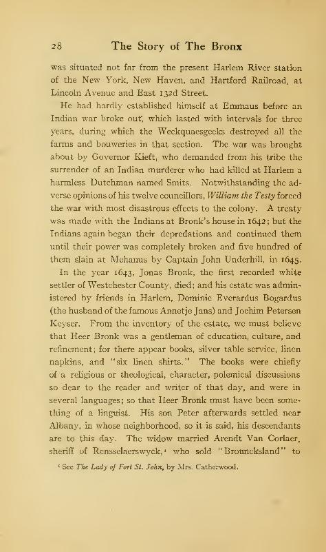
the war with most disastrous effects to the colony. A treaty
was made with the Indians at Bronk's house in 1642; but the
Indians again began their depredations and continued them
until their power was completely broken and five hundred of
them slain at Mehanus by Captain John Underhill, in 1645.
In the year 1643, Jonas Bronk, the first recorded white
settler of Westchester County, died ; and his estate was admin-
istered by friends in Harlem, Dominie Everardus Bogardus
(the husband of the famous Annetje Jans) and Jochim Petersen
Keyser. From the inventory of the estate, we must believe
that Heer Bronk was a gentleman of education, culture, and
refinement; for there appear books, silver table service, linen
napkins, and "six linen shirts." The books were chiefly
of a religious or theological, character, polemical discussions
so dear to the reader and writer of that day, and were in
several languages; so that Heer Bronk must have been some-
thing of a linguist. His son Peter afterwards settled near
Albany, in whose neighborhood, so it is said, his descendants
are to this day. The widow married Arendt Van Corlaer,
sheriff of Rensselaerswyck, « who sold " Brouncksland " to
1 See The Lady of Fort St. John, by Mrs. Catherwood.

Under the Dutch 29
Jacob Jans Stoll. After passing through various hands, it
came into possession of Samuel Edsall about 1668- 1670, who
sold it in 1670 to Richard and Lewis Morris, merchants of
Barbados. Captain Richard Morris was already located in
New York and bought the land and took possession of it in
behalf of his brother, Colonel Lewis Morris, as well as for
himself.
The bounds of "Brouncksland" 1 are hard to determine.
The northern line probably did not extend beyond 150th
Street. To the east, the land extended to Bungay Creek;
and to the south, to the Harlem River and Bronx Kills. The
site of Bronk's house became that of Colonel Lewis Morris,
and later, of the manor-house.
The next settler within the Borough was Mrs. Anne Hutchin-
son, who had come from England to Boston in 1634. Here
her peculiar religious notions and outspoken criticisms ren-
dered her obnoxious to the theocratic authorities of that colony
so that she was banished from it shortly after Roger Williams
had suffered a like fate from Salem. She went to Williams's
new settlement at Rhode Island and founded Portsmouth and
Newport ; but not finding Rhode Island to her liking, she again
migrated with her husband, family, and belongings to the
Dutch colony of New Netherland, and settled, in 1643, in
what is known as Pelham Neck. The Dutch called the neck
after her, "Annes Hoeck, " or Ann's Neck; the stream near
which her house stood was called Hutchinson's River, a name
that it still bears. In the Indian war which broke out again
after the signing of the treaty at Bronk's house, the savages
made a descent upon her farm and wiped it out of existence,
at the same time killing her and all her family and servants
1 Also spelled Broncksland, Brunksland, Bronksland, Bruksland, and
several other ways in ancient records and histories.
30 The Story of The Bronx
except a granddaughter, who was carried into captivity, but
who was afterwards restored ; her two years' captivity among
the savages had converted her into one.
In September, 1642, John Throckmorton, or Throgmorton,
with thirty-five families applied to the Dutch authorities
for permission to occupy the Vriedelandt, or "land of peace,"
as it was called by the Dutch, on the shore of the Sound.
This permission having been granted, October, 1642, the
colonists settled on the long neck lying south of Eastchester
Bay, which, after the leader of the colonists, was called Throg-
morton's Neck, contracted into Throgg's Neck, and sometimes
Frog's Neck. Governor Kieft gave them a patent, or grond
brief, for the land in July, 1643. The colony was composed
of Quakers and other malcontents from the New England
colonies, who found the religious intolerance of those colonies
unbearable, and so sought freedom among the Dutch. Roger
Williams, the founder of Rhode Island, was a personal friend
of Throckmorton ; and it is known he was in New Amsterdam
in the winter of 1642- 1643, sailing from New Amsterdam for
Europe, whence he returned later with the famous charter
for his colonies in Rhode Island. It is more than likely that
he visited Throgg's Neck, as he was deeply interested in the
success of his friend Throckmorton and his colony in the
Vriedelandt. The colony thrived ; but the Indian raiders who
had destroyed the Hutchinson family attacked the Vriedelandt
colony and destroyed it. Eighteen persons were massacred;
but a passing boat fortunately landed at the neck at the time
of the attack, and the remainder of the settlers escaped in it.
Before the war ended, the whole section north of the Harlem
River, as well as Long Island, became a wilderness; as those
who escaped the tomahawk of the savage sought safety in the
fort at New Amsterdam.
Under the Dutch 31
One of Throckmorton's companions at the Vriedelandt
colony was Thomas Cornell, a native of Essex in England, who
escaped at the time of the Indian massacre. On July 26,
1646, he was granted by the Dutch authorities a patent to
the land lying between "Brunk's Kill" and the creek, now
called Pugsley's, which enters the mouth of Westchester
Creek. The Indian name of the neck was Snakapins; but
when Cornell settled on the land it took his name. He erected
buildings and cultivated the land until again forced to vacate
by Indian aggressions. After his two experiences, Cornell
seems to have given up hope of establishing himself in NewNetherland and returned to Portsmouth, Rhode Island,
where he is recorded as being on a coroner's jury in 1653,
and as a commissioner of the town in 1654. His daughter,
who married Thomas Willett, September 1, 1643, inherited
the neck, and it remained with her descendants for over a
century and a half.
Throckmorton did not return to his colony after the catas-
trophe which had overtaken it, but settled in New Jersey.
On April 29, 1652, he petitioned Governor Stuyvesant for
permission to dispose of the land ; and in the following October
he sold it to Augustine Hermans. Shortly afterwards,
Hermans sold fifty morgens 1 of the land to Thomas Hunt,
who, after the English occupation, received from Governor
Nicolls a confirmatory grant, or patent, under date of Decem-
ber 4, 1667.
In order to encourage the settlement of New Netherland,
the West India Company offered in 1629 great tracts of land
to any one who would establish a colony of fifty persons above
the age of fifteen years. If on a river, the domain was to
extend sixteen miles on one bank, or eight miles on each bank,
1 A Dutch morgen, or acre, approximates two English acres.
2,2 The Story of The Bronx
and to run back as far "as the situation of the occupiers will
admit." The owner of the land was styled "patroon," and
he was almost absolute ruler of whatever colony he might
plant. He bound himself, however: (i) to transplant the
fifty settlers to New Amsterdam at his own expense; (2) to
provide each of them with a farm stocked with horses, cattle,
and farming tools, and charge a low rent; (3) to employ a
schoolmaster and minister of the Gospel. In return, the
colonist bound himself: (1) to stay and cultivate the patroon's
land for ten years; (2) to bring his grain to the patroon's
mill and pay for grinding; (3) to use no cloth not made in
Holland; (4) to sell no grain or produce till the patroon had a
chance to buy it.
This generous offer of the Company found many takers,
and during the Dutch period, over six hundred patents were
granted. The greatest of all the patroons was Kilian Van
Rensselaer, a diamond polisher and director of the Company,
who took up over seven hundred thousand acres of land in
the valleys of the Hudson and the Mohawk. He selected as
sheriff of his patroonship, de Jonkheer Adrien Van der Donck,
who came to Rensselaerswyck in 1641. Van der Donck was
a native of Breda, a graduate of the University of Leyden, and
a lawyer by profession, the first to come to New Netherland.
He served for five years with Van Rensselaer, with whom he
had many differences, and who accused him of dishonorable
dealings.
On October 22, 1645, Van der Donck married Mary, the
daughter of the Reverend Francis Doughty of Long Island;
and soon afterwards, disgusted with his experience with Van
Rensselaer, he withdrew from Beverwyck and settled in NewAmsterdam. He desired to become a patroon himself; and
being a man of culture and education, as well as of means,
Under the Dutch 33
he had little trouble in coming to terms with the Company,
especially as they were under obligations to him for services
rendered, as well as for money loaned. He was bound, however,
to obtain deeds from the Indians for any lands taken from them
which had not already been purchased by the Company.
The tract selected by Van der Donck extended north about
eight miles from the mouth of Spuyten Duyvil Creek along the
east bank of the Hudson, thence easterly to the Bronx River,
which was the eastern boundary; the southern boundary ran
from the eastern entrance of Spuyten Duyvil Creek east to
the Bronx River; the southern boundary was Spuyten Duyvil
Creek. The boundaries were about the same as those of the
township of Yonkers as formed by the Legislature of 1788.
The tract was called "Nepperhaem" in the deed; but was
known popularly as "Colen Donck" (Donck's Colony),
and sometimes as "De Jonkheer's, " which latter by natural
corruption became Yonkers, the "J" in Dutch being pro-
nounced "Y."
Van der Donck was attracted to this section by the fertility
of the soil, its nearness to the fort at New Amsterdam and by
the fact that there was a good running stream, the Nepperhan,
which could be easily dammed so as to furnish power for the
mills to be erected along its banks. As a result of these mills,
the stream was called De Zaag Kill or "Saw Creek," or, as
known in Yonkers to-day, the Sawmill River. The dams
remained until 1892, when they were removed for sanitary
reasons.
The almost absolute powers given to the patroons brought
them to believe they were equal to, or independent of, the
Company's representatives. Hence, constant disputes arose
between them and the governor, he trying to curtail the
powers of these landed gentry, and they defying his authority
34 The Story of The Bronx
to interfere with their property and business. The despotic
Stuyvesant finally gave way and a Council of Nine was formed
in 1649, of which Van der Donck was a member. He returned
to Holland as the agent of those opposed to the governor;
and the fact that he had been imprisoned by Stuyvesant for
contumacious conduct gave additional weight to his feeling
against the governor. Stuyvesant's friends in Holland were
too strong for Van der Donck, however, and he became an
object of suspicion to the authorities, who kept him under
surveillance. Upon his attempting to return to the colony he
was stopped, even after his family and property were aboard
the vessel. His detention lasted until 1653. He wrote a his-
tory of New Netherland, but the part relating to the govern-
ment was suppressed. In 1652, the University of Leyden
conferred upon him the degree of " Doctor of Civil and Canon
Law"; and the same year he received his patent for his pa-
troonship from the States-General itself, the highest authority
in Holland ; the grant had been made in 1646. The delay of six
years may have been caused either by his strenuous remon-
strances against the governor, by which Van der Donck be-
came persona non grata, or by some difficulty in obtaining
deeds from the Weckquaesgeeks and Manhattans, who had
several villages on his tract.
Van der Donck came back to New Amsterdam in 1653,
having first requested permission from the Company to
practise his profession as a lawyer; but so distrustful were they
of his ability to make trouble that they refused, except that
"he might give his opinion if asked." He once more returned
to Holland, and then came back to New Amsterdam, where he
died in 1655.
He probably never lived upon his land; though that he
intended to do so is shown by his purchase from the Indians
Under the Dutch 35
of a tract of flat land for that indispensable adjunct to every
Dutchman's comfort and peace of mind, a garden. The
tract, called "Van der Donck's Planting Ground," lies in the
parade ground in Van Cortlandt Park, west of Tippett's
Brook and the lake. This was also the site probably selected
for his house. In accordance with the provisions of his
grant, he established colonists upon his land, who, in view of
the Indian war of Kieft's administration, cultivated friendly
relations with the red men, who still maintained their villages
at Spuyten Duyvil and at the mouth of the Sawmill River,
at both of which places many Indian relics have been found.
He also established a saw-mill on the Nepperhan in 1649;
but his death in 1655 frustrated any plans he had made for the
development of his land.
As to his family, we have nothing trustworthy. His wife,
Mary Doughty, may have built upon and cultivated the land
and received some income from it. If he had children, their
records have disappeared, though it is said there were Van
der Doncks on Long Island, but whether direct or collateral
descendants is not known. His widow married Hugh O'Neale
of Patuxent, Maryland, before 1666, and she went there to
live in 167 1. We shall come across her again when we take
up the English period.
In 1654-55, some New Englanders, probably carrying out
the claim of Connecticut to the south, settled in the Vriede-
landt near Westchester Creek without permission of Governor
Stuyvesant. Such an act would be sure to arouse Peter the
Headstrong, and we find that on April 19, 1655, a writ of eject-
ment was issued against " Thomas Pel and other trespassers.
"
On the twenty-second, Claes Van Elslant, the messenger of
the Dutch court, accompanied by Albert the Trumpeter,
served the writ. Notwithstanding that he was threatened
36 The Story of The Bronx
by armed men, Van Elslant jumped bravely ashore, and though
at once made prisoner, did his duty and read the protest,
afterwards handing it to the leader of the trespassers, who
said:
'
' I cannot understand Dutch ; why did not the Fiscal send
it in English? If you send it in English, then I shall send
an answer in writing. But it 's no matter; we expect the
ships from Holland and England which are to bring the
settlement of the boundary. . . . Whether we are to dwell
here under the States or Parliament time wall tell; furthermore,
we abide here under the States of England. ... If we had a
sup of wine we should offer you some; but we have not any.
"
Then they all fired their guns into the air by way of a salute.
Van Elslant tried to see all he could of their houses, but they
kept both the Dutchmen closely guarded and finally per-
mitted them to return to New Amsterdam.
Then, indeed, were Stuyvesant and his council wrathy at
the treatment meted out to their messengers; though it was
not until the sixth of the following March that everything
was ready for the expedition. Captain de Connick and
Captain-lieutenant Nuton represented the military arm, and
Fiscal Van Tienhoven, the civil arm of the government.
They started with a body of men for Westchester, or Oostdorp,
as it was called by the Dutch, with orders to fall upon it by
night, force the trespassers to withdraw with their cattle and
property and to destroy the houses.
The expedition reached Oostdorp on the fourteenth of March
and found the settlers under arms ready to receive it. The
leader of the trespassers was named WTheeler; and the whole
colony, if we are to believe the worthy Secretary Van Tien-
hoven, was composed of fugitives, vagabonds, and thieves,
who had been driven out of New England on account of their
Under the Dutch 37
misdoings. They refused to leave, saying the land belonged
to them. They were then disarmed, and twenty-three of
them were taken prisoners to New Amsterdam in a vessel
called de Waagh (the Scales). Only a few men, with the
women and children, were left to take care of the goods.
The pleadings of the wives of the prisoners were effective with
the governor and council, and so the prisoners were released,
after being required to pay the expenses of the expedition
(thrifty Dutch!) and promising under oath to vacate the
colony within six weeks and not to return without consent of
the Dutch authorities.
The Englishmen then drew up a very humble petition to the
Dutch authorities, praying that they might be permitted to
remain at Westchester; and since the Dutch claimed juris-
diction over the land, they stated they were willing to acknow-
ledge that authority and give true and humble allegiance to
the same so long as they remained, provided they be permitted
to choose their own officers for the management of their town
affairs. The governor and council, having thus established
the claim of the West India Company to the Vriedelandt,
graciously granted the petition the day it was made, March
sixteenth. They then returned to Westchester and organized
their town government, electing Lieutenant Thomas Wheeler
as their magistrate, whose election was confirmed by the gover-
nor; but several of the worst characters were required to give
bail for their good conduct or leave the colony. This was
the pledge that was signed later by the usurping English:
"This first Jannaury A. 1657; in east towne
in the N. Netherlands.
Wee whose hands are vnder writen do promes to oune the
38 The Story of The Bronx
gouernor of the manatas as our gouernor and obay all his
magastrates and laws that ar mad acordin to god so long as we
hue in his Juridiction.
"
One of the primary causes of Stuyvesant's action against
the Oostdorp colonists lay in the fact that, in 1655, an Indian
war broke out, and that the New Engianders were suspected
of being the instigators, or, at least, in a conspiracy with the
Indians to injure the Dutch and to deprive them of their land.
In addition, they were in communication with the Connecticut
colony and gave Stuyvesant so much trouble that the Directors
ordered their removal. Later, in 1664, Van Couwenhoven re-
ported that an Indian sachem came to his house and stated
that theOostdorp settlers had promised to assist the Esopus and
Wappinger Indians in an insurrection against the Dutch. The
English were to drive the Dutch out of Long Island and NewAmsterdam and wanted the Indians to assist. The latter were
willing and promised the English land at Esopus, if success-
ful ; but, upon visiting Westchester for final arrangements, their
sachems were told that the English sachem (probably Wheeler)
had entered into an arrangement with Stuyvesant for a year,
and that no war could be started at present. The Indians
went away disgusted, saying: " It is better to be at peace with
the Dutch; the English are only fooling us."
The insubordinate settlers sent a complaint and petition to
the New England authorities in August, 1664, in which they
recited their tribulations of 1656. They recounted the hard-
ships they had endured in the hold of a vessel and in the
dungeons of the Manhattoes, and all because they had resisted
the Dutch claim to their land. They also stated that, upon
their release, some of their number had been driven away and
the rest enslaved. But before that petition could be acted
Under the Dutch 39
upon, Stuyvesant was rid of his unruly settlers and they of
him; for the following month, Colonel Nicolls appeared off
New Amsterdam and the whole colony became the property
of James, Duke of York and Albany.
In Chapter VII. of Irving's Knickerbocker s History of New
York is an interesting and amusing account of the habits and
customs of the "Yanokies, " who trespassed over the border
of the Dutch colony and occupied, or squatted upon, the Dutch
land.
One of these "moss-troopers, " as Irving elsewhere calls the
New England land-grabbers, was Thomas Pell of Onckway,
or Fairfield, in Connecticut. He had taken part in the Civil
War in England on the side of the Parliament, but, before the
Restoration, moved to France and then to America. Accord-
ing to his own statement, he purchased in 1654 from the
Indians, "for a valuable consideration," title to the lands
lying eastward of the Aqueanouncke, or Hutchinson's River;
though we shall see later that he claimed to the Bronx and
East rivers. This purchase, according to Bolton, was within
the bounds of the Dutch purchase of 1640, to the eastward of
Keskeskeck. The purchase included Minneford's Island,
Hunter's Island, and Hart Island. This purchase afterwards
became the Manor of Pelham (see Chapter III.). The south-
ern portion, including the islands, is now a part of the Borough.
Pell's purchase gave great uneasiness to the Dutch.
There were constant and continuous bickerings between the
New Englanders and the Dutch concerning the boundary line
between their respective colonies. Adrien Block had explored
the shores as far eastward as the island which bears his name
(1614). If exploration and discovery give claim, the Dutch
certainly had priority; for though the English navigators,
Cabot, John Smith, and others, are supposed to have sailed
40 The Story of The Bronx
along the coast, their data are too indefinite to give a valid
claim. The first Englishman whose reports are reliable is
Captain Thomas Dermer, who sailed under instructions from
Sir Ferdinando Gorges, afterwards one of the proprietors of
New Hampshire, in 1619. One object of his voyage was to
return to the island of Monhegan, near the mouth of the
Kennebec, an Indian named Squanto, who had been kid-
napped with twenty-six companions by Hunt in 1614, and sold
as slaves in Malaga, Spain, whence they were released by some
benevolent Spanish monks, whose efforts eventually returned
most of them to their native land.
The account of Dermer's voyage in his pinnace along the
coast to Virginia is very interesting. He visited Patuxent,
on the shore of Massachusetts Bay, where, a year and a half
later, December, 1621, the Pilgrims were to land and establish
their colony of Plymouth, voyaged along the shores of Cape
Cod, Martha's Vineyard, and Long Island Sound, where, he
says: "I fear I had been embayed." At what was later
Throgg's Neck, "a great multitude of Indians let fly at us
from the bank ; but it pleased God to make us victors. Near
unto this we found a most dangerous cataract amongst
small, rocky islands, occasioned by two unequal tides, the one
ebbing and flowing two hours before the other"; a very good
description of that terror of ancient navigators, Hell Gate.
He then visited Manhattan Island and "met with certain
Hollanders who had a trade in Hudson's River some years
before that time (1619), with whom I had a conference about
the state of that coast, and their proceedings with those
people, whose answer gave me good content." Dermer was,
therefore, the first Englishman to visit the shores of the
Borough.
As early as 1632, the Dutch bought from the Indians the
Under the Dutch 41
lands in the fertile valley of the Connecticut on both sides of
the river, and Commissary Van Curler established a fort at
the junction of a small stream (now the Park River) with
the "Fresh" River, as the Connecticut was then called. The
fort was near the site of the present city of Hartford, and was
called "Fort Good Hope." The arms of the States-General
were also nailed to a tree at Kievet's Hoeck (Saybrook Point)
on the west bank of the mouth of the river. An Englishman
named Holmes visited the river on behalf of the Massachu-
setts Colony, and, though threatened by the commandant at
Fort Good Hope, sailed his sloop past the fort and inspected
the land beyond. His report was so favorable that a colony
was established at Hartford, within a mile of the Dutch fort,
whose garrison the English treated with derision. One of the
Dutch complaints reads:
"Those of Hartford have not only usurped and taken the
lands of Connecticut, but have also beaten the servants of
their high mightinesses, the honored Company, with sticks
and plow staves, laming them."—1640.
For a humorous account of this whole transaction, one
should read the history by " Diedrich Knickerbocker.
"
Remonstrances from the Dutch followed continuously until
1663, when, for the purpose of adjusting the conflicting claims,
Governor Stuyvesant went in person to Boston, where he
stated before the New England commissioners who had been
appointed to meet him, that "he wished a friendly and
neighborly settlement of differences concerning Eastdorp, by
the English called Westchester, and all other disputes, that
the parties may live in peace in the wilderness where many
barbarous Indians dwell." His negotiations were fruitless,
as the New England commissioners demanded more than his
duty to his superiors would permit him to grant. The loss
42 The Story of The Bronx
of New Netherland by the Dutch transferred the controversy
about the boundary to their successors, and the final settlement
of the boundary line was not attained between New York and
Connecticut until the Congress of 1880-81.
This boundary dispute was of so much importance that, in
the report submitted to the States-General and the Company
by Stuyvesant after the surrender to Nicolls, he says that the
unwillingness of the Dutch to defend the city was caused
"by the attempts and encroachments at the hands of the
English in the preceding year, 1663.
"First, through Captain John Talcot's reducing East-
dorp, situate on the Main, not two leagues from NewNetherland, by order and commission of the government at
Hartford."
On March 12, 1663, Edward Jessup and John Richardson
of Westchester bought from nine Indians a tract of land
west of the Bronx River, extending south to the East River,
and northerly to about the middle of the present lower lake
in Bronx Park; the western boundary was a small stream
called Bungay Creek by the English, or " Sackwrahung " by
the Indians ; the eastern boundary was the middle of the Bronx
River. The tract was subdivided into twelve farms, and was
therefore called the "Twelve Farms, " or since these lay to the
west of Westchester, more commonly, the "West Farms."
By confirmatory patent of Governor Nicolls, dated April 25,
1666, the tract was divided into two equal portions between
the two original patentees. Jessup 's daughter Elizabeth
married Thomas Hunt of the "Grove Farm" on Throgg's
Neck; they came into possession of the neck extending into
the East River, which thus became known as Hunt's Point.
This was by purchase from "Robert Beachem and Elizabeth,
formerly the wife of Edward Jessup, " of "all those hoeing lands
Under the Dutch 43
and accommodations that were formerly Edward Jessup's.
"
The deed is dated June 20, 1668.
In the southwest corner of the West Farms strip, was a
small tract whose ownership was in dispute between the heirs
of the patentees and the Morrises from 1666 to 1740, when
the manor-lord or Morrisania obtained possession. As there
were a number of streams in that locality, the question arose
as to which was the Sackwrahung. The West Farms people
claimed that it was Bungay Creek, or Brook ; Colonel Morris,
that it was the stream to the eastward, called Wigwam Brook,
and later, Leggett's Creek and Bound Brook. The disputed
strip was long known as the "debatable land."
From the preceding accounts of the grants during Dutch
possession, it will be seen that comparatively little was done
in the way of development. A settlement grew at Harlem
on Manhattan Island, and it is not unlikely that some of the
farmers occupied land on the mainland. Thus we have the
court records of a dispute in 1683, with the Jansen brothers
and Daniel Turneur as plaintiffs against Colonel Lewis Morris,
for four lots of meadow land at Stony Island, now Port Morris,
wrhich they had cultivated under previous owners of Broncks-
land. The plaintiffs were inhabitants of Harlem. They
lost their first suit, when the Jansens withdrew. Turneur
then entered suit alone against Colonel Morris, and was
finally successful in proving ownership to the disputed land.
The oppressive rule of the Dutch irritated their Indian
neighbors to such a pitch that the desire of retaliation over-
came their fear of the Five Nations, the friends and allies of
the Dutch, and thrice within twenty years, in 1655, 1658, and
1663, the Weckquaesgeeks, the Siwanoys, and the Manhattans
went on the warpath with their kindred Mohegans in New
Jersey and Long Island. The massacres and outrages per-
44 The Story of The Bronx
petrated on both sides were horrible; if anything, the Dutch
were the more savage of the two. In vain did Stuyvesant,
after the Indian troubles of 1655, order the settlers to form
towns after the English fashion, an order not carried out for
years, except in the case of Esopus. These repeated Indian
wars no doubt retarded settlement to some extent, though
English from both Virginia and New England came into the
colony, as well as the Walloons from Europe.
The conditions during Dutch rule are well summed up by
the historian Eliot, who says:
"Had the wars never occurred, the colony would have
made no rapid progress. In itself it was divided by what
may be called castes. The patroons, for instance, were an
order by themselves, not necessarily hostile to the au-
thorities nor unfriendly to the colonists, yet often prov-
ing to be one or both. Then the colony lay at the mercy
of the company and its director, whose supremacy was
shared by none but a few officials and councillors. Theattempts at representation on the part of the more substantial
colonists were of no avail. The colony was still a colony of
traders. No generous views, no manly energies, were as yet
excited among its inhabitants or its rulers. From the slave
to the colonist, from the colonist to the patroon, from the
patroon to the director, and even from the director to the
company, there was little besides struggling for pecuniary
advantage. It was esteemed a great era in the colony when,
after various dissensions, in 1638, its trade was nominally
thrown open. But the percentages to the company were
such as to prevent any really free trade."
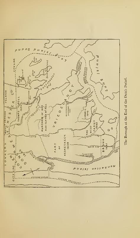
p u n os p u
Ph
pq
CHAPTER III
UNDER THE LORD PROPRIETOR, 1664-1685
INthe last chapter, there have been stated the causes of
the dissensions which arose between the English and
the Dutch : first, the explorations of the earlier naviga-
tors of both nations; secondly, the active spirit of settlement
of the English and their encroachments upon the territory of
the Dutch. At no time did the population of New Netherland
exceed ten thousand souls; and a feeble and scattered colony
of traders was bound to go to the wall in a conflict with its
energetic and pushing neighbors, not only on the east but to
the south. The influx of English on Long Island and other
parts of the colony, even in New Amsterdam itself, had, by
1664, raised the ratio of foreigners to Dutch as six to one.
Long and bitter as were the disputes between New Netherland
and her neighbors, and voluminous as were the reports and
complaints to their high mightinesses, the States-General and
the Company, the mother countries were not embroiled in
the contentions of their offspring; while a war of two years,
1652-1654, between the Commonwealth and the Netherlands,
did not involve their American settlements.
In 1660, came the Restoration, and Charles II. ascended
the English throne. A war with Holland was decided upon,
partly for commercial and partly for political reasons, the
45
46 The Story of The Bronx
chief of the latter being the intimate relations which existed
between the French and the Dutch. Before the war had begun,
on March 23, 1664, Charles, by royal patent, vested in his
brother, the Duke of York and Albany, the Dutch province
of New Netherland. The grant made the Duke proprietor of
the province, "to be holden of the crown in free and common
socage, as of the manor of East Greenwich in the County of
Kent, " and not in feudal, or knight service. It took the new
proprietor but a short time to buy out the other English
claimants and to collect commissioners and troops to take
possession of his new property. The expedition consisted of
four ships of war and four hundred and fifty land troops,
the whole under command of Colonel Richard Nicolls, who
was accompanied by Governor John Winthrop of Connecti-
cut. The expedition was not a national one in any sense, but
was entirely individual and personal to the Duke of York.
In fact, it was at first disavowed by the English Government
;
but by the Treaty of Breda, in 1667, Holland was obliged to
submit to the loss of her province.
The fleet appeared off New Amsterdam on September 6,
1664, and demanded the surrender of the province. Governor
Stuyvesant wished to resist the English demand, but his
councillors, perhaps seeing an end to the oppressive rule of the
Company and its representative, pointed out to him the lack
of forts, guns, troops, and other necessaries of war, the superi-
ority of the English, and the futility of attempting to stay
the inevitable; so that the doughty and fiery old soldier was
compelled to accept Nicolls's terms of surrender. These
were exceedingly generous; the Dutch were promised the free
exercise of their own religion, their laws of inheritance, and
their trade and intercourse with Holland; in fact, the former
state of affairs was interfered with as little as possible, except
Under the Lord Proprietor, 1664-1685 47
that the inhabitants were obliged to swear allegiance to the
lord proprietor.
With the full extent of the domain of the Duke we have
nothing to do. By commissioners appointed by Nicolls to
meet those of Connecticut, it was decided that the boundary
between the two colonies on the mainland should start from
a point on Long Island Sound twenty miles from Hudson's
River, and run northwest till it met the Massachusetts line.
By misrepresentations on the part of the Connecticut commis-
sioners, Colonel Nicolls was led to accept the Mamaroneck
River as the starting-point, only ten miles east of the Hud-
son. But the original agreement of twenty miles furnished
the basis of the future claims of the lord proprietor and his
successors.
Immediately after proclaiming the Duke of York and
Albany, Governor Nicolls changed the name of the province
to New York and the name of the fort on Manhattan to Fort
James in his honor. To the section in the vicinity of Manhat-
tan Island, he gave the name of Yorkshire; and in accordance
with the local nomenclature of that county in England,
divided it into ridings; the east, the west, and the north.
That portion of the mainland east of the Bronx River was
within the North Riding, which also included a part of the
present county of Queens on Long Island. The other part
of the present Borough, west of the Bronx River, was within
the government of the city of New York and Harlem. This
connection between Long Island and Westchester County
lasted for many years, as the earlier Constitutions of the
State apportioned one senator to this district. As a judicial
district of the supreme court of the State, it lasted until
1906, when, by Constitutional amendment, the Westchester
portion of the ancient riding was joined with Putnam,
48 The Story of The Bronx
Dutchess, and Rockland counties to form a new supreme
court district.
Let us take a brief glance at the land on the main at the
time of the English occupation. On the west, lying between
the Hudson and the Bronx rivers, was Colen Donck; next
came " Brouncksland, " between the Harlem and the Bronx;
next to the eastward came the West Farms ; east of this tract
was Cornell's Neck; adjoining it on the north was Oostdorp,
or Westchester; beyond, on the Sound, was Throgg's Neck;
and north of Westchester was Pell's purchase of 1654. Aportion of the Keskeskeck purchase of 1639 does not seem to
have been taken up. A conveyance of Pell, June 24, 1664,
though made during the Dutch regime, will be taken up
later.
The only settlement, or town, in the whole district was
Westchester; and the settlers here had an agreement with
Pell, who claimed to the East River, by which they were to pay
him a certain annual quit-rent. This they failed to do; and
in acknowledgment of his right, on June 14, 1664, they surren-
dered into his hands all right, title, and interest in the lands.
This was altogether an odd transaction; as at the time of it
they were sworn to allegiance to the Dutch, whose juris-
diction they acknowledged. But being Connecticut men,
they were probably inclined to further the claim of their
mother colony to the Atlantic Ocean, which they could do
better by admitting Pell's supremacy than by upholding
the claim of the Dutch.
Colonel Nicolls was an excellent governor, fair, just, and
tactful, who not only looked after the interests of the proprie-
tor, but also protected and advanced the interests of the inhabi-
tants of the colony. One of his earliest acts was to call an
assembly of delegates from the several towns, which met at
Under the Lord Proprietor, 1664-1685 49
Hempstead, Long Island, during the summer of 1665 and
enacted the celebrated code known as the "Duke's Laws."
The principal thing to be done was to secure to the land-
owners indisputable possession of their holdings, which might
be placed in doubt in the change in ownership from the
Company to the proprietor, and the consequent change of
allegiance. All holders of land grants, farms, patents, or
houses were required to bring to the Governor their deeds
from the Dutch Company, and new ones were issued in the
name of the Duke of York. A charge of two shillings and
sixpence was made for every hundred acres of land. The
Dutch readily acquiesced in the new regulations, but the Long
Islanders, who claimed to hold from Connecticut, showed
themselves unwilling to acknowledge the Duke's authority
over them.
We have already referred to Thomas Pell's purchase of
1654, and to his claim of ownership of Westchester, which
was admitted by the settlers there. He now advanced the
claim to all the land eastward of the Bronx River, as far as
Richbell's purchase at Mamaroneck, and southward to the
East River, by virtue of the Indian cession to him and the
confirmation of his purchase by the Connecticut authorities.
He even tried to oust Mrs. Bridges, daughter of Thomas
Cornell, from her property at Cornell's Neck, which she had
inherited from her father. She and her husband enjoined Pell
from interfering with them or their property, and the case
was tried before a jury, September 29, 1665. Pell set up the
defence that the Dutch had no right to the land in question,
that it belonged to Connecticut, and therefore the Dutch
could not give away what they did not own, and that the
grond brief of 1646 to Cornell was invalid. In reply, the
plaintiffs quoted the terms of surrender as agreed to by Colonel
50 The Story of The Bronx
Nicolls, and the further instructions of the king confirming
any grant or conveyance made by the Dutch. The jury
found for the plaintiffs, giving sixpence damages. The sheriff
of the "North Riding of Long Island" was ordered by the
court to put the plaintiffs in possession of their land and to
restrain any one from interfering with "their peaceable or
quiet enjoyment thereof." The case was a very important
one, not on account of the damages sustained or awarded,
but for the principle involved. It validated under English
law every land grant, conveyance, deed, or patent given by
the Company or its officers, and secured to every holder of
land under such circumstances the peaceful, absolute, and
indisputable possession of his lot, farm, or tract.
On June 24, 1664, three months before the surrender, Pell
granted to James Eustis, Philip Pinckney, John Tompkins,
Moses Hoit, Samuel Drake, Andrew Ward, Walter Lancaster,
Nathaniel Tompkins, and Samuel Ward, "to the number of
ten families, to settle down at Hutchinsons, that is where the
house stood at the meadows and uplands, to Hutchinson's
River, they paying according to ye proportion of the charges
which was disburst for the purchase, and other necessary
charges, etc." They were all Connecticut men from Fair-
field; and, in 1665, drew up a covenant for their guidance,
for the establishment of neighborly feeling among themselves
and for the prevention of disputes. It consisted of twenty-
six articles: "Imprimis, that we by the grace of God, sitt
down on the track of land lieing betwixt Huthesson's broock,
whear the house was, untell it com unto the river, that runeth
in at the head of the meados. " The tenor of the rest of the
articles might furnish a basis for a communal society, so excel-
lent are they as to church, education, division of the land,
arbitration of disputes, and public improvements.
Under the Lord Proprietor, 1664-1685 51
The settlement became known as the "Ten Farms, "and
later, as Eastchester, because it lay to the eastward of West-
chester. In 1666, the settlers bought more land from the
Indians, who confirmed, at the same time, the previous sale
of 1654 to Pell. The Mohegan sachems who signed the deed
were Gramatan, Woariatapus, Annhooke (alias Wampage),
and Porrige. The sachem Wampage, or Annhooke, was
probably the slayer of Mrs. Hutchinson, as it was not
unusual among the aborigines to assume the name of the
slain, due probably, to a superstitious belief that by so
doing the dead would be propitiated or that the good
qualities of the slain, especially courage, would enter into the
slayer.
In 1667, the settlers, for the further insurance of their title,
procured from Governor Nicolls a patent confirming them
in their possessions. It reads:
"Whereas, there is a certain plantation upon ye main,
lying within ye limits and bounds of Westchester, belong-
ing to ye north riding of Yorkshire, upon Long Island, sit-
uate and being in ye north part of ye limits of ye said
town, which plantation is commonly known and called byye name of The Ten Farms, or Eastchester, and is nowin the tenure and occupation of several free-holders and
inhabitants, . . . know yee, by virtue of ye commission
and authority unto me given by his royal highness, I have
ratified, confirmed, and granted . . . unto Philip Pinckney,
James Eustis, and William Hayden, ... all ye said plan-
tation . . .viz: that is to say, bounded to the east and ye
northeast by a certain river, commonly called Hutchinson's
River, which runs in at ye head of ye meadow, and is ye
west bounds of Mr. Pell's patent, to ye south-east to a
certain creek the mouth whereof openeth to ye south-east,
then including ye meadows heretofore called Hutchinson's
Meadows, and ye upland, to ye now knowne and common
52 The Story of The Bronx
pathway coming up from Westchester, to take in also of
ye uplands betweene Hutchinson's and Rattlesnake Brooke,
from the said path to ye extent of half a mile north-west
for them to plant, or otherwise to manure, as they shall see
cause; ye remainder to lye in common between them and
ye inhabitants of Westchester, at ye end of which half-
mile to be bounded by Rattlesnake Brooke, tell ye cometo ye head thereof; from thence striking a northeast line
to Hutchinson's River afore-mentioned . . . and ye said
patentees and their associates . . . shall likewise have free
commonage and liberty for range of feed for cattle, from
ye head of Hutchinson's Brook aforesaid, for about eight
English miles; to run northwest into ye woods as far as
Bronck's River . . . likewise they shall have ye privilege
of electing out of their owne number some discreet per-
son, who shall be elected yearly to the office of a deputy
constable, to keep his majesties peace, and to compose, if
possible, all private differences by arbitration amongst them-
selves, but that in all other matters they have relation to
ye towne and court of Westchester. ..." The patent
is dated: "ye ninth day of March ... in ye year of our
Lord God, 1667."
The author gives the patent to show the phraseology in
which all of them are couched, and especially to show the
indefmiteness of the metes and bounds of the land granted.
It is almost impossible to locate with accuracy any of the
early grants, as the landmarks in many cases have disappeared
entirely, or else have lost their identity with the passing of
many generations—what is known by all of one generation
may be known by none of the next.
In a case arising in 1909, wherein the Mount Vernon Sub-
urban Land Company petitioned the Commissioners of the
Sinking Fund of New York City for a release of the land
under water in Eastchester Creek, this Nicolls patent and a
Under the Lord Proprietor, 1664-1685 53
confirmatory patent, given by Governor Lord Cornbury in
1708, were filed with the controller of the city.
From a number of items in the town records, it seems that
there were numbers of rattlesnakes, and that, occasionally,
the settlers took a day off to go out and kill them. Wolves
were so numerous that wolf pits were constructed, and it was
enacted "that ye inhabitants do see to fill them up." In
1679, it was decided by vote that the inhabitants pay ten
shillings for every wolf that is killed within the limits of
Eastchester. Later, by act of the Provincial Assembly, the
reward for killing a full-grown wolf was thirty shillings to a
Christian, and ten shillings to an Indian, and half as much
for a whelp. Deer and bear were plentiful, and hunts in the
Long Reach patent—"ye eight English miles to run north-
west into ye woods as far as Bronck's River"—sometimes
lasted for a month at a time. The indefiniteness of boundary
lines led, at a later date, to disputes with both Westchester
and Pell.
On October 6, 1666, a large part of Pell's purchase of 1654
was confirmed to him by Governor Nicolls by patent:
"and that the said tract of land and premises shall be forever
hereafter held, deemed, reputed, taken and be an enfranchised
township, manor, and place itself . . . as if he had held the
same immediately from his majesty the King of England,
etc., etc., etc., his successors, as of the manor of East Green-
wich, in the county of Kent, in free and common socage and
by fealty only, yielding, rendering, and paying, yearly and
every year . . . one lamb upon the first of May, if the sameshall be demanded."
As this was the first of the manors which played so import-
ant a part in the history of the State, a brief explanation of a
manor may not be amiss. Under the feudal system, which
54 The Story of The Bronx
was introduced into England later and was eradicated from
there earlier than on the continent of Europe, lands were
granted to knights as payment for military services and on
condition that such military service should be forthcoming
upon the demand of the sovereign or over-lord from whom such
lands were held. From a variety of sources, including the
multiplication of such fiefs, their subdivision, their inheritance
by females incapable of military service, and what not, there
was enacted a law in 1290, during the reign of Edward I.,
which put an end to the formation of new military manors
forever. In the old Saxon kingdom of Kent, which became
the county of Kent under the Normans, there was the manor
of East Greenwich, which was held of the crown in free and
common socage. By "free and common socage" is meant
fealty to the king, or over-lord, and the payment at fixed
intervals or upon fixed occasions of a certain service, as op-
posed to uncertain, or military, service. This certain service
might take the form of a yearly payment of money, of some
article, of a fixed quantity of grain or other produce, of pelts,
of ploughing so many acres or for so many days, and so on.
At the time of the coronation of an English king, we find many
claims advanced by English gentlemen—one furnishes so
many napkins for the royal table; another holds the basin
for the king to wash his hands ; another, the towel to dry them
;
another provides a pigeon pie or venison pasty for the banquet
;
another holds the king's stirrup when he mounts his horse to
ride to Westminster to be crowned; another, when he returns.
All of these, and many more, are really the services to be
rendered for the possession of the manors in England ; and the
question might legally arise whether the manor-lords have not
forfeited their rights to their manors by a failure to perform
such service, unless the king, by his failure to accept such
Under the Lord Proprietor, 1664-1685 55
service, abrogates his right to it and withdraws the necessity.
Thus, in Pell's patent, it states that he has to pay a lamb
every year, "if the same shall be demanded."
The Duke of York himself held his proprietary "in free and
common socage as of our manor of East Greenwich in our
county of Kent " ; and in his case the yearly quit-rent consisted
of "forty beaver skins when they shall be demanded, or in
ninety days after."
The manor-lord, or lord of the manor, as he was variously
called, was subject to the general laws and to the proprietor
and his representative, the governor; but otherwise he was
fairly absolute within his manor, though he did not have the
power of life and death, as is sometimes popularly supposed;
nor was he entitled to the address of "lord"; though it has
often been improperly bestowed, and we read of "Lord"
Pell, "Lord" Morris, or "Lord" Philipse. The manor-lord,
or his steward, had the power to hold a baron's court and a
leet court to settle the differences arising within his manor;
and his tenants were bound to appear before these courts.
They were, however, exempt from jury duty with the other
inhabitants outside of the manors ; but they came under the
militia laws and formed their own companies within the bounds
of the manors.
The manor-lord could do what he pleased with his lands;
rent them, sell them, mortgage them, give them away, and
leave them as he pleased at his death. He controlled the
hunting, hawking, fishing, lumbering, milling, mining, etc.,
except of precious metals, within his domain; and, in several
cases, he had the appointment of ministers of the gospel,
the right of advowson, or, as it is popularly termed in England,
the living.
The bounds of the manor of Pelham are fairly well defined.
56 The Story of The Bronx
It comprised 9166 acres, of which 6100 acres were bought
by Governor Leisler in 1688 for the Huguenot settlement of
New Rochelle, now the city of that name in Westchester
County. The middle portion of the manor is now the town-
ship of Pelham in the same county. The southern portion,
including City, Hunter, and Hart islands, is now a part of the
Borough; and nearly all of it, except City and Hart islands,
is within the limits of Pelham Bay Park.
Thomas Pell died at Fairfield, Connecticut, in September,
1669, and by will devised "his lands and houses in any part
of New England, or in ye territoryes of ye Duke of York,"
to his nephew, John Pell of Old England, the only son of his
only brother, John Pell, D.D. The second lord of the manor,
the John Pell of Old England, is said to have been drowned off
City Island by the upsetting of his boat in a squall.
Of the earliest settlement at Westchester mention has al-
ready been made. The English name is derived from the
town of Chester, the site of an ancient Roman camp. As one
ancient writer remarks: "The name of Westchester is well
chosen, as it is the westernmost of the Connecticut settle-
ments. " The Dutch named it Oostdorp, or East-town, because
it was the easternmost of the Dutch settlements ; so the reader
may take his choice.
Pell's possession of Westchester by the surrender to him of
their rights by the inhabitants, June 16, 1664, did not last
long, for on February 15, 1667, Governor Nicolls granted to
John Ferris, John Quimby, and others, the land bounded on
the west by Bronk's land, on the south by the Sound and
East River; on the east "by a certain neck of land, commonly
called Ann Hook's Neck or Mr. Pell's purchase"; and north-
erly "into the woods without limitation for range of cattle
or other improvements." Further, there were ratified, granted,
Under the Lord Proprietor, 1664-1685 57
and confirmed unto the said patentees, "all ye rights and
privileges belonging to a town within this government." Wethus see that this grant contained originally what has already
been described as Eastchester; but the latter was separated
from Westchester by the patent, already given on page 51
of the date of March 9, 1667, one month later. During the
whole of the Colonial period there was the closest connection
between the two places in many matters.
The expression,'
' Ann Hook's, " or " Ann-hooke's, " or " Annes
hooke's Neck," which continually appears in these patents
and land grants, is peculiar in its form. Mrs. Hutchinson's
first name was Ann, or Anne ; hence the Dutch called the neck
of land upon which she resided, Annes Hoeck, i. e., Ann's
Neck. Why the English should make any such combination
as Ann Hook's Neck in their legal papers it is hard to say,
unless the authorities were confused by the popular and vulgar
nomenclature.
In 1673, the Dutch once more obtained possession of NewYork, and we find the inhabitants of Westchester and of the
adjacent hamlet of Eastchester offering to submit themselves
to their high mightinesses, the States-General and the Prince
of Orange. Their submission was accepted by Governor
Colve, and they were authorized to elect three magistrates,
two for Westchester and one for Eastchester, "who in his
village may decide all differences to the value of thirty shil-
ling; those of higher value shall be determined by the whole
college in the village of Westchester aforesaid."
April 15, 1667, Governor Nicolls confirmed to William
Willett, a grandson of Thomas Cornell and son of Sarah
Cornell by her first husband, the original tract known as Cor-
nell's Neck, or Black Rock.
In 1662, Governor Stuyvesant had granted to the English
58 The Story of The Bronx
towns of Long Island and Westchester the right to nominate
their own magistrates and to hold their own courts; "but
in dark and dubious matters, especially in witchcraft, the party
aggrieved might appeal to the Governor and council." That
the inhabitants of Westchester were as firm believers in the
practice of the black art as their fellow-Englishmen in NewEngland is shown by the case of Katherine Harryson, an
Englishwoman who had lived in Wethersfield for nineteen
years when she was accused of witchcraft, "found guilty by the
jury but acquitted by the bench," with the proviso that she
remove from the town. In 1670, she came to Westchester.
Thomas Hunt and Edward Waters, on behalf of the town,
appeared against her in court, praying that she be removed
from the town. The case was heard on the fourth of August,
the woman being released on bail for her good behavior.
In October, the court decided
:
"It is ordered, that in regard there is nothing appears
against her deserving the continuance of that obligation [i.e.,
bail for good behavior], she is to be released from it, and
hath liberty to remove from the town of Westchester where
she now resides, or anywhere else in the Government during
her pleasure."
Notwithstanding the humane efforts of the court to pro-
tect the poor widow, an order was issued soon after for
Katherine Harryson, charged with witchcraft, to leave West-
chester, "as the inhabitants are uneasy at her residing there
and she is ordered to go off." She was therefore returned
to Wethersfield, as Westchester did not propose to support
the paupers of other places. In the town records is her re-
ceipt to Joseph Palmer for thirteen pounds in money for her
expenses.
Under the Lord Proprietor, 1664-1685 59
We return now to Colen Donck. Some time before 1666,
the widow of Adrien Van der Donck married Hugh O'Neale
of Patuxent, Maryland, and went there to live. On Septem-
ber 21, 1666,
"came Hugh O'Neale and Mary his wife (who in right of
her former husband laid claime to a certn parcele of land
upon the Maine not farre from Westchester, commonly called
the Younckers land), who bro't severall Indyans before
the gov r
to acknowledge the purchase of said lands by van
der Donck commonly called ye Youncker. . . . Tackarack,
. . . Claes, . . . received satisfact" of Van Der Donck. All
the rest of the Indyans present being seven or eight acknow-
ledged to have recdfull satisfaction.
"
The proof of possession by Indian title being thus before
Governor Nicolls, he issued to Mary and Hugh O'Neale as
joint patentees, under date of October 8, 1666, a confirmatory
grant of Nepperhaem. As the descriptions of the bounds of
the grant are the same in the Indians' acknowledgment, in
the confirmatory patent and in the original Dutch grant of
1646, we must conclude that the property was intact as Van
der Donck bought it and as he left it at his death. On October
thirtieth, of the same year, the two patentees transferred
their right, title, and interest in the grant to Elias Doughty
of Long Island, a brother of Mrs. O'Neale, and then returned
to Maryland.
Doughty began to sell the land in parcels to different pur-
chasers in fee. The first sale was made March 1, 1667, to
Jan Arcer, or John Archer, of eighty acres of upland and thirty
acres of meadow, "betwixt Broncx river & ye watering place
at ye end of ye Island of Manhattans. " June 7, 1668, Doughty
sold 320 acres to John Heddy, or Hadden,—this is now a part
of Van Cortlandt Park. On July 6, 1668, Doughty sold to
60 The Story of The Bronx
George Tippett [also spelt Tippit and Tibbett] and William
Betts,
"a parcell of land & meadow . . . formerly owned by old
Youncker [sic] van der Donck, which runs west to Hudson's
river & east to Broncks River, with all the upland from
Broncks River south to Westchester Path, & so runs due east,
and north beginning at the boggy swamp with" the liberty
of the said Patent, & the southernmost bound to run by the
path that runneth and lyeth by the north end of the aforesaid
swamp, & so run due east to Broncks River, & due west to
the meadow which cometh to the wading place.
"
On December I, 1670, a third parcel of Colen Donck was sold
to Francis French and Ebenezer Jones of Ann Hook's Neck and
John Westcott ofJamaica, Long Island—this is the tract known
as the Mile Square in the city of Yonkers, famous in Revolu-
tionary annals. Later, Doughty sold the northern portions
of the patent to Dame Margaret Philipse and Dirk Smith.
Finally, September 29,1672, he sold the remainder of the tract
consisting of 7708 acres, to Frederick Philipse, Thomas
Delavall, and Thomas Lewis.
Jan Arcer, the first purchaser from Doughty, was probably
an inhabitant of Westchester, as the name appears in the
records of that town. He was probably of Dutch extraction,
though Bolton gives an elaborate genealogy of him from
Fulbert L'Archer, one of the companions of William the
Conqueror. Having married an English wife, Arcer 's name
was anglicized into Archer. In addition to the Doughty
tract, he acquired other lands from the Indians to the westward
of the Bronx ; and was such a land-grabber that the Dutch
nicknamed him Koopall, or "Buy all." On the question of
land, he might be appropriately termed the Astor of the seven-
teenth century. He established a dorp, or village, in the
Under the Lord Proprietor, 1664-1685 61
northwest corner of his land, opposite the eastern entrance of
Spuyten Duyvil Creek, about where the Kingsbridge station
of the Putnam Railroad is now located. It consisted of one
street running north and south on the line of the present
Kingsbridge road leading to Fordham Heights.
As on May 3, 1669, Governor Lovelace gave Archer leave
to settle sixteen families on the mainland, "near the wading
place," it must have become a village of several houses, though
not a vestige of them remains upon the site. The lessees of
the farms were principally from Harlem; and it seems from
the ancient court records of that place that Archer was almost
continually in trouble with his tenants and neighbors ; for on
one date, September 8, 1671, no less than four cases were
brought against him : for mowing grass on another man's mea-
dow, for breaking down another's fences, for throwing the
furniture of a third out-of-doors, and the fourth, on general prin-
ciples of trespass and interference. Some of these would indi-
cate that there was some Irish blood in his veins. The Harlem
records also show that he gave three mortgages to Cornelius
Steenwyck, who appears from the records ofWestchester Coun-
ty to have advanced money to other landowners of the county.
Finally, to escape the interference of the Harlem magis-
trates and the better to secure his purchases from Doughty
and the Indians, he procured from Governor Lovelace a manor
grant under date of November 13, 1671. The manor was to
be held upon the payment of an annual quit-rent of "twenty
bushels of good peas, upon the first day of March, when
it shall be demanded." The name given to the manor was
Fordham; that is, ham (Saxon), a house, and Ford, from the
wading place at "ye passage commonly called Spiting Devil.
"
The name may be construed as the houses (village) at the
ford. The manor contained 1250 acres."
62 The Story of The Bronx
Archer was unable to repay his various loans from Steen-
wyck, though he had until November 24, 1683, to do it in;
and the manor thus fell to the mortgagee by foreclosure.
By the will of Cornelius Steenwyck and Margaretta, his
wife, dated November 20, 1684, in which the former manor-
lord is spoken of as "the late John Archer," the whole manor of
Fordham is left to the Nether Reformed Dutch Congregation
within the city of New York. The manor was preserved
intact until 1755, when, by act of the Provincial Assembly,
the congregation and minister of the church were permitted
to sell the lands. It is stated that through the liberality of
Mrs. Steenwyck, who later married Dominie Henricus Sel-
wyns, three hundred acres were reserved from the manor
and continued in the possession of the Archers. However
that may be, the descendants of John Archer lived upon the
land for several generations, and one of them, Benjamin
Archer, before 1780, had succeeded in recovering a large
portion of the original manor, which he held in fee.
As already stated, the estate of Jonas Bronk came into the
possession of Captain Richard Morris in 1670. The Morrises
were of Welsh extraction and descended, according to Bolton,
from Rys, a companion of Strongbow in his expedition against
Ireland, where he performed such prodigies of valor that he
was called Maur Rys, or Rys the Great. The Morrises of
this period of our history took part in the Civil War in England
on the side of the Parliament. The family consisted at the
time of the Commonwealth of three brothers: Lewis, a
colonel in the army of the Parliament; Richard, a captain
in his brother's regiment; and William, who was in the naval
service of the Parliament and who was lost at sea. The last's
son John received a commission in the navy of the Common-
wealth, and was lost at sea off Dover Castle.
Under the Lord Proprietor, 1664-1685 63
The oldest brother, Lewis, lost his ancestral estates under
confiscation by Charles I., but the loss was afterwards made
good by Cromwell. After the establishment of the Common-
wealth, Lewis went to the West Indies, where he became a
member of the council of Barbados and the owner of a large
estate. In the expedition against the Spanish in Jamaica in
1656, he served under a colonel's commission sent to him by
the Lord Protector. Later, he openly professed the tenets
of the Society of Friends, or Quakers, and entertained George
Fox, the founder of the sect, upon his visit to Barbados in
1 67 1. After the Restoration, the second brother, Richard,
joined Colonel Lewis at Barbados, where he married a lady
of fortune named Sarah Pole and became a wealthy sugar
planter. Colonel Morris's religious convictions got him into
trouble with the Barbados authorities, as he was heavily
fined for his failure to pay tithes and to contribute to the sup-
port of the militia. Probably this had something to do with
the change of residence which the two brothers planned.
Their attention was drawn to New York as a place of good
investment; and about 1668, Richard, with wife and posses-
sions, came to New York for the purpose of buying a large
estate. Before leaving Barbados, the brothers entered into
an agreement, providing "that if either of them should die
without issue, the survivor, or issue of the survivor, if any,
should take the estate.
"
By an instrument dated August 10, 1670, Samuel Edsall
conveyed Broncksland to Richard Morris, a merchant of
New York, and to Lewis Morris, a merchant of Barbados.
Richard and his wife took up their residence upon the estate,
but did not enjoy it long; for they both died in 1672, leaving
an infant son, Lewis, named after his uncle. Colonel Morris
received news of his brother's death and came from Barbados
64 The Story of The Bronx
in 1673 to settle up the estate. He found that the Dutch were
once more in possession of New York; but upon applying to
Governor Colve, permission was given to him "to pass and
repass into this government, on condition that he attempt
nothing to its prejudice during his sojourn." Upon his
applying for the guardianship of the person and estate of his
nephew, the Governor discovered that he was an inhabitant
of Barbados, and therefore not entitled to the same rights as
had been guaranteed to the colonists of Virginia and New Eng-
land by the terms of surrender of New York to the Dutch;
and that, as his interest in the estate amounted to two thirds,
his portion should be confiscated to the government. Negoti-
ations proceeded, commissioners were appointed, lost articles
were traced and recovered, and finally, the Colonel succeeded
in satisfying the Governor, and his claims were allowed. He
then returned to Barbados, disposed of his property there,
and returned to New York in 1675, finding it once more
under English control.
In 1676, Colonel Morris received from Governor Andros
a patent confirming his title to the land, and, in addition, to
all the lands lying adjacent to Broncksland, "not included in
any grants or patents, which land the said Colonel Morris
doth desire for further improvement." This additional
land was, by survey, fourteen hundred acres, which, with
the addition of Broncksland, made the whole estate 1920
acres. The quit-rent was a yearly payment of "five bushels
of winter wheat." The bounds on the north were the lands
of Daniel Turneur and John Archer; on the east, the land of
John Richardson and Thomas Hunt; on the southeast, the
Sound, or East River; on the west, the Harlem River.
Daniel Turncur's land was a strip of about eighty acres
below Fordham Manor, purchased by him from the Indians
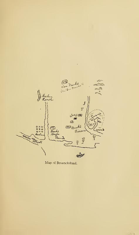
Map of Brouncksland.
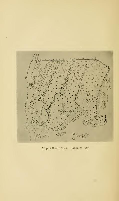
Map of Bronx Neck. Patent of 1676.
Under the Lord Proprietor, 1664-1685 65
in 167 1, and confirmed by a later Indian deed of May 10, 1676,
to "Jackeline Turnier, widow, and Daniel Turnier, the sonne
of Daniel Turnier, late of New Harlem, deceased," and by
patent of Governor Nicolls of the date of June 15, 1668.
The land lay between the Maenippis Kill, or Cromwell's
Creek, and the Harlem River, and comprised the high land
which is known as Devoe's Point, named after the Devoes,
who were descendants of Turneur's daughter. Its lower end
is at Central Bridge. The Indians called the land Nuasin
and the stream, Mentipathe. In an Indian deed to Colonel
Lewis Morris under date of February 7, 1684/5, there occur
these words: "Nuasin where formerly lived a Frenchman
named Marcus Dissisway." The name Dissisway occurs
also in the annals of Harlem. "Crabbe Island" is men-
tioned in both the Turneur and Morris grants as the starting-
point of their bounds.
In addition to this estate on the mainland of Westchester
County, Colonel Lewis Morris bought thirty-five hundred
acres in East Jersey, which he named Tintern and Monmouth,
the first from his ancestral estate in Wales, the latter from the
county in which it was situated. Morristown in New Jersey
was named after the Morris family.
On August 9, 1673, England and Holland then being at
war, New York was surrendered to a Dutch squadron which
had appeared off New York on the twenty-ninth of July.
The Dutch renamed the city New Orange and vigorously
asserted their claim to the entire province. They held posses-
sion till February 9, 1674, when, by the Treaty of London, it
was returned to the English ; though the actual surrender of
the province did not take place until the following November.
The Crown thus became possessed of the province, and the
Crown lawyers maintained that the Duke of York had, in
66 The Story of The Bronx
consequence, lost his title to it. A new patent was therefore
issued to the Duke, and Major Edmund Andros was appointed
Governor.
During the Dutch occupancy (1673- 1674), affairs were
but slightly interfered with, the towns and inhabitants, how-
ever, being obliged to take the oath of allegiance to the Dutch.
Governor Colve probably made a good thing out of his short
term of power, if we judge him by his composition with Colonel
Morris, and his appropriation of the fat poultry, oxen, and
swine of the estate of Captain Richard Morris. In the public
documents before, during, and after the Dutch interregnum,
we find the same names of public officers, Van Cortlandt,
Philipse, Beekman, Bayard, and others.
In 1683, Colonel Thomas Dongan became Governor. Acting
under instructions from the proprietor, directly upon his
arrival, the new Governor issued a call for a representative
Assembly, which was presided over by himself, and which con-
vened in the city of New York, October 17, 1683. The first
act of this body was to frame a charter of liberties, vesting
the law-making power in the governor, council, and people,
in General Assembly, conferring the right of suffrage upon
the freeholders without restraint, and establishing trial by
jury.
"The imposition of any tax without the consent of the
Assembly, the quartering of soldiers and seamen against their
will, the declaration of martial law, or the questioning of any
person professing faith in God, by Jesus Christ, for any differ-
ences in religious matters, were prohibited. Assemblies were
directed to be convened at least triennially, and the delegates
were apportioned according to population, for which purpose
the province was divided into twelve counties, with twenty-
one representatives, which number was afterwards increased
to twenty-seven.
"
Under the Lord Proprietor, 1664-1685 67
This division into counties was made November 1, 1683.
Westchester County was one of them ; and it has already been
shown that the Borough was a part of that county until 1874
for the western part, and until 1895 for the eastern part.
CHAPTER IV
AS A ROYAL PROVINCE. I685-I776
FEBRUARY 9, 1685, the "Merry Monarch," King
Charles II., expired in London; and the same day
his brother James, Duke of York and Albany, be-
came King James II. of England. New York ceased to be
a part of the private domain of James and became a royal
province; though Dongan continued to be Governor-General.
The Provincial Assembly was suspended by the King, as he did
not consider it expedient that the people should take part in
the government, and the Governor and his council became
once more supreme. Now that New York and New England
were on the same basis as royal provinces, Governor Dongan
proposed to the King that they, with New Jersey, should be
united under one royal governor, and that there should be
uniformity of laws, especially those relating to the customs.
This suggestion of Dongan's was carried out in 1688; and
Sir Edmund Andros was appointed Royal Governor, with
headquarters in Boston, while Colonel Francis Nicholson
was sent as Lieutenant-Governor for New York.
In 1686, Dongan granted to the city of New York a new
charter under the title: "The Mayor, Aldermen, and Com-
monalty of the City of New York. " The precincts of the
city included all of Manhattan Island ; and the Dongan charter
68
As a Royal Province. 1685-1776 69
was the basis of all amendments and changes in the city
government from that time until the Greater New York was
formed. When the western part of the Borough became a
part of the city in 1874, it became subject to the Dongan char-
ter as then existing ; the same is true of the eastern part of the
Borough annexed in 1895, though the greater city with its
new charter was even then in view.
Dongan was a Roman Catholic, but refused to carry out
the instructions of the King to introduce French priests as
missionaries among the Five Nations, on the ground that the
measure was dangerous to the English power in America.
This rendered him obnoxious to the King, and he forestalled
his supersession as Governor by resigning.
Nicholson was Lieutenant-Governor but a short time; but
during this time he rendered himself so unpopular with the
great mass of the people that, when the news of the accession
of William and Mary reached the Province in June, 1689,
the people rose against him and, backed by the militia, com-
pelled his return to England. The Province was thus left
without a head. Jacob Leisler, a wealthy German merchant
and leading train-band captain, was elected to the military
command of the Province by the Committee of Public Safety,
and Stephanus Van Cortlandt to the mayoralty of the city.
Finally, at the request of the committee, Leisler assumed the
position of lieutenant-governor until such time as a regularly
appointed one should arrive from England. The movement
was entirely a popular one, and thus antagonized the wealthy
landowners and merchants who formed the aristocracy of the
province. Even the council was against Leisler; and Bayard
and Livingston pursued him with so much rancor that it
finally led to his unjust execution for high treason.
In 1690, Colonel Henry Sloughter was appointed Governor by
70 The Story of The Bronx
William, and Mary, with Major Richard Ingoldsby as deputy
for New York. Ingoldsby arrived first; but as he was unable
to show proper credentials, Leisler refused to turn over to him
the fort and government. Sloughter arrived in March, 1691,
and Leisler immediately submitted ; but he was at once arres-
ted, tried, and convicted of treason and condemned to death.
He and his son-in-law, Jacob Milbourne, were both hanged.
The attainder of treason against the two unfortunate victims
of political jealousy was afterwards removed by the home
government and their innocence declared. There are two
acts of Leisler's which stand out pre-eminently: first, the
reconvening of the Provincial Assembly; and second, the
purchase of a part of the manor of Pelham for the Huguenots,
a transaction out of which he came with clean hands, not a
penny going to his profit.
The first Assembly under Sloughter met upon April 9, 1691
;
and, as the acts of the Assembly of 1683 had never been
approved, either by the king or by the proprietor, they were
all re-enacted and sent to England for approval. On July
26th, Governor Sloughter died in a fit of drunkenness, having
been in the Province a little over four months.
His successor was Colonel Benjamin Fletcher, who did not
arrive in New York till August, 1692, thirteen months after
Sloughter's death. Fletcher was an arrogant man like Andros,
but not possessing his abilities, of aristocratic tendencies
and opposed to popular concessions. He was an intolerant
member of the Church of England, and through an intentional
misconstruction of an act of Assembly, he made it the Estab-
lished Church of the Province. He also fought for the intro-
duction of the English tongue; for, strange as it may seem, the
majority of the inhabitants spoke Dutch.
In 1683, when the counties were formed, the town of West-
As a Royal Province. 1685-1776 71
Chester was appointed the shire town, or county seat. By
the act of May II, 1693, it was ordered that "a public and
open market" should be held every Wednesday in the same
town, and further, that there should be a fair held in the said
town yearly upon the second Tuesday in May and to last
four days, or to end on the Friday following; "to which it
shall be lawful for every person to go and frequent."
But the most important act in the history of the town of
Westchester was its formation into a borough-town by royal
charter bearing date of April 16, 1696, and signed by Governor
Fletcher. The government of the town was organized by
Colonel Caleb Heathcote on the sixth of the following June.
The charter carefully denned the limits of the township and
prescribed that there should be a mayor, six aldermen, and
six assistants, or common council. They should "elect and
nominate one discreet and sufficient person, learned in ye law,
to be recorder and town clerk for ye sd borough and town of
W. Chester." A mayor's court was instituted which could
hear cases where the value in controversy did not exceed thirty
pounds. The mayor and aldermen were named in the charter,
but after the first year the positions were to be filled by a
majority vote of the electors. The electors should also send a
discreet person to represent them in the Assembly of the
Province. The "bod}: politick" in the said corporate town
should be styled "The Mayor, Aldermen, and Commonalty of
the Borough and Town of Westchester." Twelve trustees
were appointed to dispose of the undivided lands of the town.
The quit-rent was an annual payment of thirty shillings cur-
rent money of New York. The county fairs to be held in the
town were to be increased to two, one in May, the other in
October.
Colonel Caleb Heathcote, the first Mayor, through whose
72 The Story of The Bronx
instrumentality Westchester was made into a borough-town,
was a native of Derbyshire in England. His ancestral home
was in the Hundred of Scarsdale, where is laid the earlier part
of Scott's Peveril of the Peak. There is a story that a young
lady to whom Caleb was engaged jilted him and married his
elder brother, afterwards member of Parliament, governor of
the Bank of England, and Lord Mayor of London at the same
time that Caleb was Mayor, of New York. The Colonel came
to this country in 1692, and being possessed of great wealth
which he had acquired as a merchant, he took a leading part
from the start in all affairs, civil, political, mercantile, religious,
and military. He bought land in Westchester and in other
parts of the county beyond New Rochelle and in the interior,
which was afterwards formed into the manor of Scarsdale.
At the time of his death in 1720-21, he had filled many of the
high offices of the colony, having been surveyor-general of
customs for the Eastern District of North America, judge of
the Court of Admiralty for the Provinces of New York, New
Jersey, and Connecticut, one of His Majesty's council for the
Province of New York, mayor of the city of New York (171 1-
17 14), and colonel of the militia of Westchester County. It is
to this last position that he owes his usual title of "Colonel"
Caleb Heathcote. His manorial residence was on Heathcote
Hill overlooking the harbor of Mamaroneck.
The borough-town of Westchester remained such until
the formation of the townships in 1788. Its representatives
in the Provincial Assembly were Josiah Hunt, Lewis Morris,
Sr., Gilbert Willett, Lewis Morris, Jr., Peter De Lancey,
Lewis Morris, Third, John De Lancey, and Isaac Wilkins.
They were all men of wealth, education, and influence, and
extensive landowners. Their names are familiar to-day in
many of the names of local features: Willett's Point, Hunt's
As a Royal Province. 1685-1776 73
Point, De Lancey's Neck, Wilkins's Creek, Morrisania, and
Port Morris.
Colonel Lewis Morris died in 1691. His will, dated Feb-
ruary 7, 1690, begins:
"Whereas I formerly intended to have made my nephew,
Lewis Morris, son of my deceased brother, Richard Morris,
my sole executor; his many and great miscarryages and
disobedience toward me and my* wife, and his causeless ab-
senting himself from my house, and adhering and advizeing
with those of bad life and conversation, contrary to mydirections and example unto him, and for other reasons
best knowne to myselfe, I do make and ordaine my dearly
beloved wife, Mary Morris, sole executrix of this my last
will and testament.
"
Colonel Morris left no children, and Mary Morris died before
her husband. His will was not admitted to probate or exe-
cuted on account of its vagueness, so that the nephew Lewis
was appointed administrator, cum testamento annexe Lewis
succeeded to the estates in accordance with the agreement
made between his father and uncle at Barbados in 1670,
whereby the children of the one should succeed to the estate
in case the other should die without issue.
That the Colonel remained a Quaker until his death is
evident from the fact that there were several bequests to
Quaker societies and of his negro man Yaff to his honored
friend William Penn, provided the said Penn should come to
reside in America. It is probable that Perm received Yaff,
for he says in a letter to a friend: "I have resolved after
four years of faithful service he shall be free.
"
Young Lewis Morris was of a lively and adventurous
disposition, and probably found the restraints of his Quaker
uncle's household rather irksome; so much so that, according
74 The Story of The Bronx
to one of his biographers, he "strolled away to Virginia and
thence to Jamaica in the West Indies, where, to support him-
self, he set up for a scrivener." One of his early pranks, so
it is reported, was played upon his preceptor, a zealous and
pious Friend. The worthy man was wandering in the woods
engaged in silent meditation, when he heard a voice from
heaven, as he supposed, telling him to go and preach the gospel
to the Indians. The voice w.as that of young Lewis, who was
hidden in a tree in the vicinity. The good Friend, believing
the command to be a divine one, actually made preparations
for his mission among the Indians; but just on the eve of his
departure he was informed of the truth.
It is likely that his uncle presaged all sorts of futures for
such an unruly lad; but, instead of going to the dogs, as one
might suppose from such a beginning, he settled down, married
Isabella Graham, the daughter of the attorney-general of the
Province, took up his residence in New Jersey, whose first
governor he became when it ceased to be proprietary. Later
he removed to New York and became chief justice of the
Province and a member of the Assembly. He resisted the
tyranny of the English Governor, Cosby, stood by Zenger in
defending the liberty of the press, and became the champion
of the people against De Lancey, Philipse, and other supporters
of royal prerogatives as exemplified by the royal governors;
which last aroused such a spirit of mutual antagonism that
the feeling remained with their descendants until the time of
the Revolution. In fact, his whole life was spent in public
office and in serving the Province.
On May 8, 1697,
"Benjamin Fletcher, captain-general and governor-in-chief
of the province of New York and the territories and tracts
of land dependent thereon in America, and vice-admiral
As a Royal Province. 1685-1776 /o
of the same, and lieutenant commander-in-chief of the mili-
tia and all the forces by sea and land within the colony
of Connecticut and of all the forts and places of strength
within the same, in council at the fort at New York,"
issued to Lewis Morris a patent for the manor of Morrisania.
The quit-rent was "six shillings, yearly and every year, on the
feast day of the Annunciation of our Blessed Virgin, payable
at the city of New York.
"
It was a royal patent, issued in the name of William the
Third, and it confirmed all the previous patents and grants
from the original one to Jonas Bronk to that present time.
The bounds of the manor are the same as the bounds of the
patent granted to Colonel Lewis Morris in 1676, and the
acreage is given as 1920, more or less; so that it does not
seem that Colonel Morris added anything from "the adjacent
lands not already granted or patented." The point of begin-
ning in both patents is "the proprietor's house situated in
Bronck's land over against Harlem." The manor-lord was
also given the right of advowson, or patronage to all churches
within the manor.
In 1733, occurred the difference between Judge Morris and
Governor Cosby. The Governor saw fit to find fault with a
decision of a court given against him in the matter of his
suit for salary from the time of his appointment to the time that
he actually arrived in America and assumed the duties of his
office, a period of several months, during which the lieutenant-
governor, Rip Van Dam, conducted the government and was
paid for so doing. Cosby was so imprudent as to state con-
cerning Chief Justice Morris that,
"I can neither rely upon his integrity nor depend upon his
judgment ; he is a person not at all fitted to be trusted with
any concerns relating to the King. Ever since coming to this
7<> The Story of The Bronx
government, he has treated me, both as to my own person
and as the King's representative, with slight, rudeness, and
impertinence."
In the reply of the Chief Justice, he states:
"I am heartily sorry, sir, . . . that the King's representative
should be moved to so great a degree of warmth, which I think
would proceed from no other reason but by giving my opinion,
in a Court of which I was Judge, upon a point of law that
came before me, and in which I might be innocently mistaken
;
(though I think I am not) ; for judges are no more infallible
than their superiors are impeccable. But if judges are to be
intimidated so as not to dare to give any opinion but what is
pleasing to a governor, and agreeable to his private views, the
people of this province—who are very much concerned both
with respect to their lives and fortunes in the freedom and
independency of those who are to judge them—may possibly
not think themselves so secure in either of them as the laws
and his Majesty intend they should be, ... I might possibly
have been impertinent, for old men are too often so; but as to
treating you with rudeness and disrespect, either in your
public or private capacity, it is what I cannot accuse myself
of doing or intending to do, at any one of the times I was with
you. ... As to my integrity, I have given you no occasion
to call it in question. I have been in this office about twenty
years. My hands were never soiled by a bribe; nor am I
conscious to myself, that power or poverty hath been able to
induce me to be partial in the favor of either of them ; and as I
have no reason to expect any favor of you, so I am neither
afraid nor ashamed to stand the test of the strictest inquiry
you can make concerning my conduct. I have served the
public faithfully, according to the best of my knowledge;
and I dare, and do, appeal to it for my justification."
A contemporary comment is made in a news-letter to a
West Indian publication. Indus writes:
"Sir: You will perceive, by the enclosed copy of a letter,
As a Royal Province. 1685-1776 77
that the Original was addressed to the present Governor of
New York, on occasion of a dispute that arose between his
Excellency and the Chief Judge of the province concerning
vhe establishment of a new Court of Equity. . . . Thegovernor, however, was offended at what was spoken, and
demanded a cop}', which the judge sent to him, in print,
with the letter now mentioned.
"I confess I had some curiosity to know the particular
character of this extraordinary personage, who would seem to
act and speak like an inhabitant from some other world.
They tell me he is nothing but a man, and a plain one, too;
exactly like one of us—eats beef and mutton, drinks Madeira
wine, and sometimes rum punch, as we do. His education
was narrow, nor does he pretend to inspiration nor super-
natural aid. His knowledge is derived merely from reading
and observation, and his fortitude grounded on the Christian
religion and the laws of his country, which he fancies are com-
monly on the side of honesty and a good conscience. ..."
Judge Morris was summarily removed from his position,
and James De Lancey, the second judge, was appointed to his
place. Morris immediately carried out his "dare" in the last
sentence of his letter to Cosby, by appealing to the people
for his vindication, and offered himself as a candidate for the
Assembly from the county of Westchester, the incumbent of
the office, William Willett, a close friend and fellow-townsman,
resigning from the position in order to leave a vacancy.
A full account of the election, which took place upon the
green at Eastchester, is given by John Peter Zenger in the
first number of the New York Weekly Journal, under date of
October 29, 1733. The opponent of Judge Morris was William
Forster, the schoolmaster at Westchester, who was defeated,
notwithstanding that he had the support of Governor Cosby,
James De Lancey, Colonel Frederick Philipse, and other lead-
ing supporters of the Governor. Political methods were used
78 The Story of The Bronx
from which our modern leaders might get pointers—the worst
being the disfranchisement of the Quakers, who, of course,
would not swear they were freeholders and entitled to vote;
and the sheriff would not accept their affirmations. Not-
withstanding the loss of the Quaker vote—amounting to
thirty-eight—Judge Morris had a majority of eighty, his
election being a victory of the people over the aristocracy.
Later, the newly elected representative visited the city of
New York and was received with high honors, all the mer-
chant ships in the harbor firing salutes, and the people hail-
ing him with loud acclamations when he walked the streets.
Zenger, whose account of the election is full of naive in-
sinuations and innuendoes, was later informed against for
criminal libel on account of his attacks upon the government
in the Journal. He was arrested and thrown into jail, where
he remained for several months. His counsel at his trial were
led by the venerable and distinguished Andrew Hamilton of
Philadelphia, the ablest lawyer in the colonies. Though
Chief Justice De Lancey, who presided at Zenger 's trial,
charged the jury that they could be judges of fact only, and
not of law, and the fact of the scurrilous articles was admitted
by the defence, the jury brought in a verdict of "not guilty,
"
a verdict which established the right of the press to criticise
the public acts of government—a right which, with freedom
of speech and of conscience, lies at the foundation of free and
popular government.
It will be remembered that Elias Doughty sold to Philipse,
Delaval, and Lewis 7708 acres of Colen Donck. By June 12,
1686, the whole tract had come into possession of Frederick
Philipse by purchase from the heirs of the other two pro-
prietors. In the meanwhile, Philipse had been buying land
from the Indians and from Christian proprietors and patentees,
As a Royal Province. 1685-1776 79
until, in 1693, he owned an enormous tract of land extending
virtually from Spuyten Duyvil Creek and Harlem River on
the south to the Croton River on the north, and between The
Bronx and Hudson rivers on the east and west. This tract
did not include the Mile Square, nor the tracts sold to Hadden
or to Betts and Tippett.
On June 12, 1693, by royal charter signed by Benjamin
Fletcher, "captain-general and governor-in-chief of our
province of New York aforesaid," all of Philipse's purchases
were formed into the lordship and manor of Philipseborough,
or Philipseburgh, with the regular rights of court-baron and
court-leet, "together with the advowson and right of patron-
age of all and every the church or churches erected or to be
erected or established or hereafter to be erected or established
within the said manor of Philipseborough." The quit-rent
was an annual payment of four pounds current money of the
Province upon the feast day of the Annunciation of the Blessed
Virgin Mary, payable "at our fort at New York." Included
in this grant was the island Paparinemo, with the right of
building a bridge across the Muscoota, or Spuyten Duyvil
Creek, which will be more fully taken up in Chapter VIII.
Frederick Philipse (the name is also spelt Flypse, Flypsen,
Vlypse, and Vlypsen
—
i.e., the son of Philip) was a native of
Friesland in Holland, who came to New Amsterdam before
1653, when he was about twenty-one years of age. He worked
at his trade of carpenter, but gradually engaged in mercantile
pursuits until he became the richest man in the Province and
was known in the English days as the "Dutch Millionaire."
He made two advantageous marriages, his first wife being
Margaret Hardenbroeck, widow of Pietrus Rudolphus De
Vries, a wealthy merchant of New Amsterdam, whose business
the new Mrs. Philipse continued in her own right with extra-
8o The Story of The Bronx
ordinary shrewdness and foresight. This was in 1662; she
died about 1690 or '91. The second Mrs. Philipse was Cather-
ine Van Cortlandt, the sister of Stephanus Van Cortlandt and
widow of John Dervall.
Philipse was named in the order for Dongan's council and
was a councillor for upwards of twenty years. His business
ventures were in both the East and the West Indies and with
the Five Nations of the Mohawk Valley. He was accused of
having direct dealings with the island of Madagascar off the
African coast, then the most notorious resort of pirates on the
face of the earth. His ships supplied the pirates with rum,
gun-powder, flour, and other necessities at exorbitant prices,
and received in payment merchandise captured from innocent
merchantmen. This illicit trade seems to have been consid-
ered more or less honorable, or at least not dishonorable, in
those days, as we find Livingston and other wealthy manor-
lords and high officials engaged in it, until it became so scan-
dalous that the authorities determined to put a stop to it.
New York had become the resort for vessels which, under the
guise of privateering, indulged in piratical exploits and sold
their spoils in New York.
The person selected to stop this nefarious custom was
Captain William Kidd, who was recommended to the Governor
by Philipse, Livingston, and others; but who, finding his crew
willing, hoisted the black flag and began the career that has
sent his name down the centuries. He was finally captured,
tried, convicted, and hanged; but was reticent to the last and
would not expose his backers. A large portion of his spoils
could not be accounted for, which has led to the tradition that
he buried them along the American shores, an especially
favorite location being Gardiner's Island and other places
in Long Island Sound. Probably, the Governor, Lord Bello-
As a Royal Province. 1685-1776 81
mont, knew whereof he spoke when he said that "Kidd's
missing treasure could be readily found if the coffers of
Frederick Philipse were searched."
The connection of Philipse with the illegal traffic at last
became so notorious that a petition, supported by depositions,
asking for his removal from the council was presented to the
home government; and, anticipating his removal, Philipse
resigned his membership in the council, 1698, retired to his
manor and bent his energies to its development.
Margaret Hardenbroeck had a daughter, Eva, by her first
husband, De Vries, whom Philipse legally adopted as his own.
She married Jacobus Van Cortlandt, brother of Stephanus
and of Catherine, Philipse's second wife. Philipse sold to
him fifty acres on George's Point—a bend in Tippett's Brook
—
with one and one half acres of meadow and twenty-five acres
of upland on October 10, 1699. This property had been
bought from Doughty by Hadden, who, on February 22, 1670,
sold George's Point to Mathias Buckhout, who, subsequently,
January 22, 1694, conveyed it to Frederick Philipse. On
August 13, 1 701, Clause Dewilt, Karacapacomont, and Neme-
ran, native Indians and former proprietors, "remised, released,
and quit-claimed unto the said Jacobus Van Cortlandt, and
to the heirs of the Betts and Tippetts, and to their heirs and
assigns forever, all our right, title, and interest which we ever
had, now have, or hereafter may have or claim to the said
tract of land called the old Younckers. " The property above
described became the nucleus of the Van Cortlandt estate,
now included within the park of that name.
The purchasers of the other sections of Colen Donck did
not become prominent as great landholders ; they were, speak-
ing generally, quiet farmer folk, who gradually disposed of
their holdings to other people like themselves or to their
82 The Story of The Bronx
wealthier and more aristocratic neighbors, Philipse or Van
Cortlandt; in fact, the Van Cortlandt estate was made up of
the Hadden tract and a large part of the Betts and Tippett
tract. Hadden, having lost his two sons-in-law, returned to
Westchester. Descendants of Betts and Tippett held portions
of the ancestral domain until the beginning of the last century.
The neck upon which the village of Spuyten Duyvil is situated
was called Tippett's Neck, and the ridge up which the present
Riverdale Avenue goes is called Tippett's Hill ; but that by
which the name of the former proprietor is best preserved is
Tippett's Brook, the Mosholu of the Indians. Jacobus Van
Cortlandt dammed this brook about 1700, forming the lake
above, and erected a mill; below the dam it is a tidal stream.
The name De Lancey has already appeared in the report of
the case of Chief Justice Lewis Morris, his subsequent election
to the Assembly, and at the Zenger trial. The first De Lancey
came to America in 1686; this was Etienne, or Stephen, De
Lancey, a French Huguenot, who fled from France after the
Revocation of the Edict of Nantes by Louis XIV. in 1685.
He became a successful and wealthy merchant, and married
Ann, the second daughter of Stephanus Van Cortlandt.
Their eldest son was James De Lancey, who was sent to
Cambridge, England, to be educated. In 1729, when only
twenty-six years of age, he became a member of the Governor's
council, and two years later an associate justice of the Supreme
Court of the Province, becoming chief justice in 1733, upon the
removal of Judge Morris. His actions during this period
rendered him unpopular, as he upheld the royal prerogatives
as exemplified in the actions of the royal governors. Later,
he severed his adherence to the party of the Governor, and
in revenge Governor Clinton withheld his appointment as
Lieutenant-Governor for six years, or until his own departure
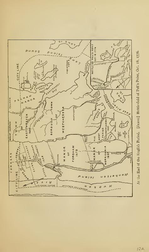
pq
SI *

As a Royal Province. 1685-1776 83
for England in October, 1753. Clinton's successor, Sir
Danvers Osborn, met with opposition from the Assembly
almost from the moment of his arrival, and in a fit of dejection
he hanged himself. He had already shown a tendency to
mental aberration, due to family loss.
The governorship therefore fell upon Lieutenant-Governor
De Lancey, and so acceptably did he fill the office that the
home government made no appointment as Governor until
after De Lancey 's death in 1760. He married Ann Heathcote
who, with her sister Martha (Johnson), inherited the manor of
Scarsdale from their father, Colonel Caleb Heathcote; and
De Lancey thus became a great landholder in the county of
Westchester. His three sons were all Tories in the subsequent
dissensions. The youngest, John Peter, served as a major
on the British side, but afterwards established himself at
Mamaroneck, where he built a mansion on the site formerly
occupied by the manor-house of his grandfather, which had
been accidentally burned previous to the Revolution. John
Peter's daughter, Susan Augusta, married James Fenimore
Cooper, the famous novelist; another daughter married
Macadam, the famous road builder.
A younger brother of the Lieutenant - Governor was
Peter De Lancey, who settled himself at West Farms and
operated the old Richardson and Byvanck mills. In con-
sequence, he was generally known as "Peter of the Mills."
He represented the borough-town in the Assembly from
1750 to 1768. Of his three sons, John reached high politi-
cal office, James was high sheriff of the county from 1770
to 1777, but is better known as the famous commander of
the regiment of loyalists called the Westchester Light Horse,
'
1 For a fuller account of this famous corps of Tories, the reader is referred
to the author's novel, A Princess and Another.
84 The Story of The Bronx
and Oliver, an officer in the British navy, who resigned his
commission rather than fight against his native country.
Of the Willetts, who, through Susan, the daughter of Thomas
Cornell, inherited Cornell's Neck, we have already spoken.
The manor of Pelham fell to John Pell, nephew of the first
owner, who alienated two thirds of it to Leisler for the Hugue-
not settlement of New Rochelle. The remainder came into
the hands of successive manor-lords until the Revolution.
The family, though an eminently respectable one, was not so
prominent in public affairs as those that have been mentioned.
There were, however, many intermarriages with the other
leading families.
The first of the Leggett family was Gabriel, who came
from Essex, England, in 1661. Through his wife, Elizabeth
Richardson, daughter and co-heiress of John Richardson, who,
with Edward Jessup, was the original patentee of West Farms,
a large part of that patent came into his possession and has
remained in that of his descendants to this day.
Chief Justice Lewis Morris, usually called Senior, died at
an advanced age in 1746. His successor in the lordship of the
manor of Morrisania was his second son Lewis, usually called
Junior, who was a judge in several courts and assemblyman
for the county, spending his whole life in public affairs. Upon
his death in 1762, the manor devolved upon his son, Lewis
Morris, Third, representative in the Continental Congress
and one of the signers of the Declaration of Independence.
Before serving his country in a civil capacity, he had been a
brigadier-general in the army of the Congress. He was born
in 1726 and died in 1798. His half-brother, Gouverneur
Morris, was United States Minister to France at the time of
the Directory, and was otherwise famous in United States
history. The Morris family has numerous branches, and many
As a Royal Province. 1685-1776 85
of its members have borne distinguished parts in the making
of the State and of the city and the nation ; in the army and
in the navy, at the bar or on the bench, in the pulpit or in
medicine, or engaged in other professions or in mercantile
pursuits.
CHAPTER V
MANNERS AND CUSTOMS IN COLONIAL DAYS
AS has already been stated, the earliest Dutchmen who
came to New Netherland were traders and not set-
tlers. If they found their way into the wilds north
of the Harlem River, as from time to time they did, it was to
barter with the Indians for pelts, or to hunt and trap the wild
animals which everywhere abounded. Their stay was only
temporary; a rude hut, a cover of boughs, or the canopy of
heaven itself, furnished them with sufficient covering in the
way of habitation. The few settlers who did come in before
1645 were driven out by the Indian wars of Keift's adminis-
tration, and the country returned to its natural condition of
a wilderness. In the decade before the English occupation,
as we have seen, permanent settlers began to come in ; and
from this time forward there was a slow but steady improve-
ment in the land and an increase in the population.
Man's first necessity is food; his second is protection from
the weather and a place to sleep; and his third, clothing to
cover and protect his body. To acquire these three things,
a civilized man entering a wilderness would naturally become
a farmer; and this we find to be so of the early settlers. In
fact, it was not until well into the nineteenth century that
Westchester County, and especially that portion of it within
the Borough, ceased to be an exclusively agricultural section
and became at all a manufacturing one.
86
Manners and Customs in Colonial Days 87
The country possessed a fairly fertile soil, with heavy wood-
lands covering the rolling hills and valleys, while springs,
brooks, and streams abounded. The settler, having chosen
his holding with reference to abundant water, began his clear-
ing and planted his wheat, maize, rye, and other cereals, and
his peach, apple, and cherry trees; while nature supplied him
with many varieties of berries. The trees which he had cut
down were, by means of the axe and the adze, cut into proper
lengths, notched and trimmed, and the log-house of the Ameri-
can pioneer became his habitation. Sometimes it had only a
single story, sometimes a story and a half; in the latter case,
access was had to the upper part by a rude flight of steps on the
outside, or by a perpendicular ladder within. Two rooms
constituted the bedroom and kitchen, the latter being the gen-
eral living room in which the family gathered, not only at meal
times, but at all other times when their occupations did not
call them out of doors. The roofs were high gables, covered
with split shingles; and when the cabin possessed the dignity
of an upper story, the roof was pierced with one or more dormer
windows. When settlers of a higher class or possessed of more
means came into the country, the sides of the houses were cov-
ered with shingles as well as the roofs, which latter became of
that double slant called gambril.
Westchester County was not so distinctively Dutch as
Rockland and other up-river counties, nor was the Dutch
tongue spoken for so long a time. The Dutch settler usually
built his house of stone with a large door, the lower half and
the upper half being swung separately, so that the upper half
could be opened for light and ventilation, while the lower half
remained shut, to prevent the egress of the small children and
the ingress of poultry, pigs, or other domestic animals. The
windows were made of small panes of glass and were protected
88 The Story of The Bronx
by strong shutters hung on heavy wrought-iron hinges, and
kept open by a large catch shaped like the letter " S." A porch,
or stoep, extended, if not across the front of the house, at least
in front of the doorway. In the kitchen was a huge fire-place
which might consume a cord of wood a day, and within whose
generous dimensions, in the winter time, the whole family,
including the cat and the dog, could find accommodation. The
beds were great four-posters, the bottom of sacking, through
which stout ropes were drawn and fastened to pegs on the
frame, while upon this was piled the mattress or feather beds.
In poorer houses, clean straw or hay thrown upon the floor,
or in shelves or bunks built for the purpose, answered all the
purposes of beds.
The houses of the manor-lords and the wealthy English
and Dutch gentlemen and merchants were substantially built
of stone, or of black, yellow, and red bricks especially imported
from Holland or England. They usually consisted of two
stories and an attic, the latter for the use of the servants. The
houses were large, comfortable, and roomy; the last often a
necessity in the case of the Dutch, whose families showed they
came of a prolific race. Not only the necessities of life aboun-
ded, but also many of the luxuries. The furniture was of
mahogany, the rooms wainscotted, the fire-places of tiles bear-
ing extracts from the Scriptures or pictures illustrating Bibli-
cal scenes, while silver and pewter utensils and fine Delft or
other china were in constant use. In later times, fine pictures
by Allston, Sully, Peale, and other artists hung upon the walls,
and some of the best European artists were represented there.
The manor-house of the Philipses at Yonkers is a remaining
example of many of these homes of the wealthy gentry. The
carved oak and ornamental ceilings, doors, and walls, done
by workmen imported for the purpose, still show the taste and
Manners and Customs in Colonial Days 89
wealth of the owners. It must not be thought that these gentry
belonged to the idle class; on the contrary, they were practical
farmers, merchants, or professional men ; for idleness was one of
the deadly sins, and several European visitors, as well as the offi-
cers of the French army under Rochambeau, have left their tes-
timony to the activity of the gentry of the American colonies.
The pasturage was excellent, and cattle, sheep, and swine
had free range of the woods. The Labadist missionaries who
visited New York in 1679 expressed surprise at the number,
size, and lusciousness of the peaches, and noted the fact that,
while many of them lay upon the ground, the hogs paid little
attention to them, as the hogs were apparently already gorged.
The cattle not only furnished milk and meat, but their hides
supplied the foot-wear of the family, being made into shoes by
the itinerant shoemaker on his yearly or half-yearly visits.
From the sheep was obtained wool, and flax was early planted
and cultivated; the hand loom stood in every household and
converted them into woollen cloth and into linen thread and
sheeting. The thread was of extraordinary strength and the
linen of a satiny texture. His homespun not only clothed the
farmer and his family, but he was able to send his surplus to
New York, whence it was sent to other parts of the coast and
to Europe. Tobacco was also added to the planting field, as
everybody smoked; and the Dutch were, beyond all others,
consumers of the fragrant weed. Added to these, the woods
abounded in wild birds and game, and deer were plentiful.
The waters of the Sound, the Harlem, and the Hudson, and of
the innumerable brooks and streams supplied the settlers
with fish ; so that of food there was a plenty, even upon the
tables of the poorest, while upon the tables of the well-to-do
there was such variety and profusion as to arouse the com-
ment of such Europeans as visited the colony.
90 The Story of The Bronx
The dress of the yeoman class was in keeping with their cir-
cumstances. The women dressed plainly in serviceable and
durable homespun. For Sundays and "frolics," a ribbon or
other gewgaw could be purchased from the Yankee peddler
who began to make his stated rounds with his pack. The
ordinary dress of the yeoman himself was homespun in sum-
mer ; while in winter it consisted of leather breeches and apron,
as cloth was too expensive—about a guinea a yard—for his
purse. The stockings were made of wool raised on his own
farm and knitted by his women folks. The Dutch adhered to
their distinctive dress of voluminous petticoats and breeches,
so humorously described by Irving ; but as time passed inter-
marriages occurred between the two races, racial characteris-
tics disappeared, and the population became homogeneous.
The wealthy classes dressed as luxuriously as they lived.
They followed the fashions of Europe, though from one to two
years late. Silks, satins, broadcloth, taffetas, velvets, bro-
cades, lutestrings, moire antique, chintzes, constantly appear
in the inventories of the period. The gentlemen wore their
silk stockings and shoes with silver buckles, while their
coats and vests were ornamented with silver buttons usually
made of coins; while the ladies were as anxious to show their
fine silk clocked stockings and high-heeled kid slippers as they
are to-day. The head-gear of the men was a three-cornered
hat surmounted with lace or cockade as their means allowed
or the occasion required. Their hair was covered by a wig
finely dressed and powdered. In time, the matter of wigs
became so extravagant that the law attempted to regulate it
by placing a tax of "three shillings on every inhabitant, resi-
dent, or sojourner, young or old, within the colony, that wears
a wig or peruke made of human or horse hair mixed, by what-
ever denomination the same may be distinguished." The
Manners and Customs in Colonial Days 91
craze for wigs extended even to the lowest classes, and the
sailors and the rustics imitated their betters by permitting
their hair to grow long and weaving in with it horse hair in
order to give it length and quantity, the whole being protected
by an eelskin. By the time of the Revolution, people began
once more to wear their own hair, dressed into a queue and
plentifully sprinkled wdth powder, which, however, became so
scarce during the war that flour was substituted.
The women followed the whole range of fashions in the
matter of head-dress, even to the towering mountain of hair
which stood above the head higher than the length of the face
below it. The French Revolution effected a change in this
respect, and the ancient republics of Greece not only furnished
democratic ideals of government for the French party, but
fashions as well for their imitators in America. The head cov-
ering varied from a simple hood of linen for the women of the
lower classes, to the immense beaver with feathers, buckles,
and lace worn by their wealthier sisters. Cloth was so expen-
sive that it was no infrequent thing for a man in moderate
circumstances to have a suit turned inside out when it began
to show wear, in order to make it last longer and to save
expense. The shoemaker, as mentioned above, not only trav-
elled from place to place, but the tailor and mantua-maker, or
dressmaker, as well; they were, in fact, journeymen.
There was a great distinction between the various classes
of society. It was to be expected in an English colony—and
New York was probably the most aristocratic of them all—that the social distinctions of Old England should be trans-
planted to the new field. There were, then, three classes in'
the social scale: the gentry, the tradesmen, and the yeomanry,
of whom the last were, of course, the most numerous. The
line between the gentry, those of landed estates or descended
92 The Story of The Bronx
from those who were gentlemen at home, as they usually called
England, and the other elasses was strongly marked. While,
perhaps, the upper classes were not supercilious nor the lower
obsequious, there was condescension on the one hand and
deference on the other. The influx of New Englanders, whose
democratic ideas rendered them obnoxious to the phlegmatic
Dutch as well as to the English New Yorker, tended to break
down this barrier, and the Revolution and the Constitution
together swept it away at the end of the eighteenth century.
Some historians, so far as New York is concerned, ascribe the
revolt against the mother country to the higher classes, whose
interests or ambitions led them into it. That they did not
voice the great mass of the population, nor carry it with them,
is shown very strikingly in Westchester County, which became
Tory, or at least remained neutral—or as neutral as the con-
tending parties allowed it to be—during the struggle. The
mass of the inhabitants considered the strife as one in which
their betters had a greater stake then they themselves.
The principal cause of the difference in caste was due to the
land tenure. Many of the farmers were tenants of the landed
gentry, occupying their lands on long and liberal leases, which
did not, at first, begin to pay the landlords for their expense
in obtaining settlers, but which, as time passed, became
valuable. The New Englanders frequently preferred the
leasehold property to holding property in fee. In the former
case, they could, if seized by that desire for improvement of
which Irving speaks, quit at the expiration of the lease or even
before, by disposing of their betterments to a new-comer and
migrating to "green fields and pastures new." If they were
owners in fee, they were, to a certain extent, bound to the land
which they owned. There thus existed between landlord and
tenant that relation which has prevailed in England since
Manners and Customs in Colonial Days 93
Saxon days, and which, in our own, sets off by themselves a
class of gentlemen who are known distinctively as landed
gentry.
It will be remembered that slavery was introduced into the
mainland of America by the Dutch, when a vessel of that
nationality sold to the planters at Jamestown, Virginia, a num-
ber of negro slaves in 16 19. One of the earliest promises held
out to prospective settlers in New Amsterdam by the Com-
pany was that a sufficient number of negro slaves would be
furnished to the settlers. The institution of slavery existed
all through Dutch and English days, and even after New York
became a State. « Slaves, however, were not held in large
numbers as in the southern colonies, nor were they usually
provided with separate quarters. They ordinarily slept in
the attics or upper stories of the houses of their masters, and
ate their meals in the kitchens after their master and his family
had finished. They were members of the family, and the
farmer who owned one or two worked in the fields alongside
of them, the same as the small farmer does to-day with his
hired men. Their owners treated them kindly, and did not
have unlimited power over them in the way of punishment.
Flogging was not alone for blacks, but for whites also. The
Dutch, in particular, treated their black dependents with
much kindness and humanity. During the seventeenth cen-
tury, the value of a negro was about one hundred dollars in
our money, of a negress, two hundred dollars. The traffic
began to decline in 1718; and in 1755, there were but seventy-
three African slaves in the whole county of Westchester.
1 When it was a pretty certai i fact that slavery was to be abolished in
the State, many of those who owned slaves sent them into the Southern
States for sale, so that there would be no loss of property or money. Theplan of freeing the slaves was one of gradual manumission, and the last
slave held in New York State was one belonging to the Morris family (1827).
94 The Story of The Bronx
Indians were also reduced to a condition of slavery in the early
days of the colony, but the Indian has never shown himself to
be capable of hard manual labor—that he has left to his squaw.
Captain Graydon of the American army, while a prisoner at
Flatbush during the Revolution, wrote: "Their blacks, when
they had them, were very free and familiar; sometimes saun-
tering among the whites at meal time, with hat on head, and
freely joining occasionally in conversation, as if they were one
and all of the same family." Notwithstanding this familiarity,
there was no "amalgamation" between the two races until the
coming of the British army; and the first appearance of a
mulatto child "produced emotions of surprise and dislike."
At the session of the State Legislature of 1817, Governor
Tompkins recommended the passage of an act abolishing
slavery in the State from and after July 4, 1827. By a previous
act of the Legislature under date of March 29, 1799: "Every
child born within this State after the 4th day of April, 1799,
shall be free, but shall remain the servant of his or her mother
until the age of twenty-eight years, if a boy, and twenty-five
years if a girl." This was supplemented by another act of
April 8, 1 80 1 ; and the Legislature of 18 17 unanimously adopted
the recommendation of the Governor, abolishing slavery com-
pletely in 1827.
Another kind of enforced labor was also employed in the
colony, that of the indentured, or bond servant. This was a
man or woman who, desirous of coming to the New World,
received a passage from the ship-master, with the agreement
that upon arrival his or her services were to be sold for a
certain period, usually five years, to the highest bidder; the
ship-master pocketed the sum paid and was thus reimbursed
for his trouble and expense. Sometimes persons were tre-
panned in England and disposed of in this way by persons
Manners and Customs in Colonial Days 95
whose interests would be favorably affected by the disappear-
ance of the seized person. The person whose services were
disposed of became legally bound to the buyer, who thus
became the owner, or master, of the bond-servant until the
expiration of the term of service, when the servant became
free. The same laws and penalties, practically, applied to a
runaway bond-servant as to a runaway slave.
The class of indentured servants was not composed of the
vicious and the wicked. Most of them were poor and unfor-
tunate and thought they could do better in a new land than
in the thickly settled countries of Europe; sometimes pique
drove them to the step, sometimes disappointed love, or dis-
sipation, or disappointment. But there was another class of
servants composed of criminals and malefactors who were sold
into the plantations for life or for a certain period of time
as determined by the judges who sentenced them. Their
services were sold to the highest bidder as in the case of the in-
dentured servant. When we recall the number of crimes that
were capital in England, even up to the nineteenth century, we
may believe that those who escaped the hangman were not
usually guilty of what we should consider in these days very
heinous crimes. Of these transported men and women, com-
paratively few reached New York; there w~as a greater demand
for them in the southern colonies and in the West Indies.
In regard to crimes and misdemeanors, the English laws
prevailed, with such additions and modifications as the con-
ditions of a new country would require. There was the same
long, ghastly list of capital crimes; and the stocks, the pillory,
and the whipping-post stood always ready for the minor
offenders. In the court records of the borough-town of West-
1 The uncle of David Balfour, in Stevenson's story, Kidnapped, at-
tempted to get rid of his nephew in this way.
96 The Story of The Bronx
Chester is the case of one offender, convicted of " hogg stealing,"
who was sentenced to pay eleven pounds for the stolen ani-
mals, or to receive forty lashes upon the back. There is
another record of one member of a jury "hanging" the jury
and being fined by the court therefor. The case of Judge
Morris shows that there were honorable, upright men upon
the bench, and this, too, at a time when the English judiciary
had not lost its subserviency to the crown, nor completely
departed from the harsh and brutal manners instituted by the
infamous Jeffreys.
Education among the rural Dutch was a much neglected
quantity. There were schools in New Amsterdam and in
Beverwyck (later, Albany) ; but in the country districts the
mother was the teacher, and the Bible and the Catechism the
only text-books; so that the Dutchman, while not illiterate,
was certainly uneducated. The children of the better classes
had more advantages and were sometimes sent to the great
University of Leyden, especially if the young man intended to
become a dominie. The daughters were trained to be house-
wives and mothers; to cook and to clean with that thorough-
ness which has become proverbial of the Dutch, to sew and to
knit, to spin and to weave, and to take care of the poultry and
the household generally.
It was not until the days of the English that anything in the
way of schools was established, and these were far from our
modern idea of a rural school. In the more eastern portions
of the county, adjacent to Connecticut and settled by the
people of that colony, the school-house was earlier established,
the Yankee necessity of a school having been recognized by the
General Court, or Legislature, of Massachusetts as early as
1645-47, and carried by Winthrop, Davenport, and others into
the colony of Connecticut from the mother colony. The
Manners and Customs in Colonial Days 97
Connecticut settlers of the "Ten Farms" at Eastchester early
set aside a piece of land for school purposes and erected a
school-house in 1683. The same site was occupied for school
purposes for a period of about two hundred years. The
English settlers of Westchester, early established a school.
The school and schoolmaster there were maintained by the
Propagation Society, the latter being assigned from London
and paid an allowance by the society. The inhabitants also
contributed toward the support of both, and the school-
master assisted the rector by instructing his pupils in the
Catechism. The first recorded schoolmaster in Westchester
was Edward Fitzgerald, in 1709.
October 30, 1709, the Reverend John Bartow writes:
"We want very much a fixed school at Westchester; if Mr.
Daniel Clark, my neighbor, now in England, should wait upon
you, desirous of that employment, I recommend him as a
person worthy of it; being of good report, a constant com-
municant, and, being a clergyman's son, has had a pious and
learned education." The recommendation was apparently
effective, as Mr. Daniel Clark was schoolmaster from 17 10 to
I7I3-
In this latter year, according to the reports of the society:
" Mr. Charles Glover is appointed schoolmaster at Westchester
with a salary of £18 per annum, as he is recommended under
the character of a person, sober and diligent, well affected to
the Church of England, and competently skilled in reading,
writing, arithmetic, psalmody, and the Latin tongue, provided
he comply with the Society's rules in sending certificates of
the number of his scholars." He held the position until 17 19.
The society's abstracts for that year say: "To Mr. William
Forster, schoolmaster at Westchester, who has been recom-
mended as a person very well qualified to instruct the youth
98 The Story of The Bronx
in the principles of religion and virtue, ten pounds per annum
is allowed; and a gratuity of £10 has been given him, in con-
sideration of his past services and his present circumstances."
In an abstract of the same year, Mr. Forster reports: "I
have at present thirty-five scholars, whom I catechise every
Saturday, and also every Sunday that Mr. Bartow goes to
another part of the parish." Also, from an extract of 1720:
"from Mr. Forster, schoolmaster at Westchester in the Prov-
ince of New York, that he takes all the care he can of the
children which are sent to him, and has upwards of thirty
scholars, which he instructs in the Church Catechism."
In 1722, Mr. Bartow reports "that they are repairing the
church there [Westchester] with the voluntary contributions
of the people, procured chiefly by the zeal and care of Mr.
Forster, the schoolmaster there."
In 1724, in answer to questions from the society, Mr. Bartow
gives an exact account of his cure. He writes:
"Question—Have you in your parish any public school for
the instruction of youth ; if you have, is it endowed, and who is
the master?
"Answer—We have a public school at Westchester, of which
Mr. Forster is the society's schoolmaster, and we have private
schools in other places; no endowment; some families of the
Town of Pelham that are adjacent come to Eastchester
church."
In November, 1729, the Reverend Mr. Standard answers
the same questions as follows:
"I say there are three schools and three schoolmasters.
The first school is at Westchester, William Forrester, master,
who has a salary from the Venerable Society, whom wehave the honor to serve. The second is at Eastchester, one
Delpech, master, who is very well adapted and fitted for that
Manners and Customs in Colonial Days <;9
business and is well spoken of as being diligent in it: the
third is at New Rochelle, where both French and English are
taught. The two last have no other encouragement than
what the parents of the children taught, do give."
Mr. Forster remained as schoolmaster until 1743. That
he became a person of considerable consequence is shown by the
fact that in 1733 he was put up by the strong De Lancey
party as the opponent of Judge Lewis Morris in the election of
that year for representative in the Assembly.
In 1744, Mr. Basil Bartow was appointed schoolmaster at the
request of the church authorities. The King's commissary
reported as follows:
"He is the son of the Rev. John Bartow, late the Society's
worthy missionary there. He is a person of good temper,
sober, and pious, and well affected to the present govern-
ment; conformable to the doctrine and discipline of the
Church, and exceedingly well qualified for the instruction of
children."
Mr. Bartow remained as schoolmaster for nearly twenty
years, or until 1762, when we learn from the report of Rector
Milner: "that the school is still vacant, and deprived of
a teacher, but I petition the Society to continue their bounty
to some worthy person who shall be chosen schoolmaster; as
the school is a nursery for the Church and of great service in
these parts."
In 1763, he writes again:
"I express my own and my people's sense of the favour
done us, in giving us leave to choose a schoolmaster for
this place, tho' we have not yet been able to find a person
properly qualified for the office." In 1764, he writes: "I
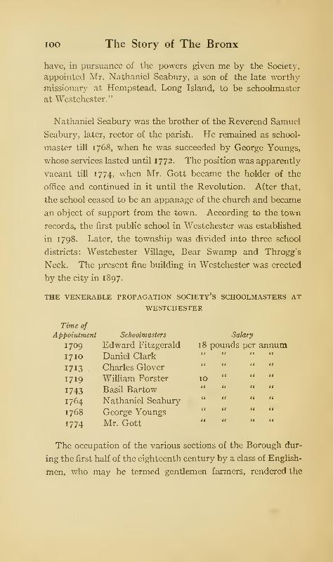
ioo The Story of The Bronx
have, in pursuance of the powers given me by the Society,
appointed Air. Nathaniel Seabury, a son of the late worthy
missionary at Hempstead, Long Island, to be schoolmaster
at Westchester."
Nathaniel Seabury was the brother of the Reverend Samuel
Seabury, later, rector of the parish. He remained as school-
master till 1768, when he was succeeded by George Youngs,
whose services lasted until 1772. The position was apparently
vacant till 1774, when Mr. Gott became the holder of the
office and continued in it until the Revolution. After that,
the school ceased to be an appanage of the church and became
an object of support from the town. According to the town
records, the first public school in Westchester was established
in 1798. Later, the township was divided into three school
districts: Westchester Village, Bear Swamp and Throgg's
Neck. The present fine building in Westchester was erected
by the city in 1897.
THE VENERABLE PROPAGATION SOCIETY'S SCHOOLMASTERS AT
WESTCHESTER
Time of
Appointment Schoolmasters Salary
1709 Edward Fitzgerald 18 pounds per annumI7IO Daniel Clark
it a a
1713 Charles Glover11 II a
1719 William Forster 1011 a
1743 Basil Bartow a it a
1764 Nathaniel Seaburya it a
1768 George Youngs a it it
1774 Mr. Gotta 11 it
The occupation of the various sections of the Borough dur-
ing the first half of the eighteenth century by a class of English-
men, who may be termed gentlemen farmers, rendered the
Manners and Customs in Colonial Days 101
matter of education for their children a very important one;
and it was met by the employment of a schoolmaster by
families living within a convenient distance of the schoolhouse,
or of the residence of one of the inhabitants used for the
purpose, each family paying in proportion to the number of
children sent. The schoolmaster was frequently the minister,
who added to his small stipend by giving instruction in the
three "R's" and in the rudiments of the humanities.
The Reverend John Peter Tetard, commonly known as
"Dominie Tetard," was born in Switzerland and graduated
from the University of Lausanne. He preached to French
congregations at Charleston, S. C. and in the city of New York,
and, after his removal to Kingsbridge, at Fordham church.
In 1772, he opened a French boarding-school at Kingsbridge,
on the height overlooking the present railroad station, which is
called after him, Tetard 's Hill. Here he taught not only the
French language, but "the most useful sciences, such as
geography, the doctrine of the spheres, ancient and modern
history, etc."
In Rivington's Gazette of February 23, 1775, there appears
the following advertisement
:
"To the Public, Samuel Seabury, M.A., Rector of the Parish
of Westchester, hath opened a School in that Town, and
offers his Services to prepare young Gentlemen for the
College, the Compting-House, or any genteel Business for
which Parents or Guardians may design them. . . . Board
(Washing included) may be had in unexceptionable Families,
at about twenty Pounds per Ann. and the Tuition will be at
six Pounds, New York Currency, and eight Shillings for
Fire-wood."
In fact, the home churches that sent ministers to the colony
intended that they should not only preach the gospel, but
102 The Story of The Bronx
also educate the youth of both sexes. Sometimes, a Yankee
pedagogue 1—a graduate of Yale, perhaps—would occupy the
position, which then, more than now, was a position of honor;
as the " scholemaster " was, in addition to his position in the
school, clerk, chorister, and visitor to the sick, or almoner,
and often a member of the corporation.
After obtaining all the education it was possible for the local
schoolmaster to impart, and having reached the mature age
of twelve or thirteen, the pupil was ready for Yale College or
Nassau Hall at Princeton, the latter being generally preferred.
The sons of the wealthiest merchants were sometimes educated
in the English colleges; and when King's College (now Colum-
bia University) was founded, it received its share of the co-
lonial youth. At the age of eighteen or twenty, the young man
took his degree, and was then an educated gentleman ; but the
education imparted at the best of the colleges did not surpass
that of our best high schools of the present day. Yet an edu-
cation that could produce such graduates as Jefferson, Morris,
Izard, Adams, and many others of like fame and character,
must have been very thorough. It was not until long after
the establishment of the new government that the matter of
education became one of general importance and one of which
the State took cognizance and control.
No newspapers were published in Westchester County until
long after the Revolution, but it is stated that the colonial
newsletters and journals were eagerly read and discussed by
the inhabitants, many of whom were subscribers. 2
* Ichabod Crane, in Irving's Legend of Sleepy Hollow, and Jason New-come, in Cooper's tale of Satanstoe, will be recalled.
3 The first newspaper published in the Borough was the Westchester
Patriot, which was issued by a Mr. Lopez at West Farms for a short time
in 1812. The Westchester Gazette was commenced in Morrisania in 1849.
Stephen Angell was editor for some time, but the paper was discontinued
Manners and Customs in Colonial Days 103
As already stated, the occupation of the inhabitants was
farming. Several travellers through the county in later co-
lonial days have left their impressions of what they observed,
and state that even in the large villages each resident had
his farm of several acres, so that neighbors were not very
close ones. Nor was it necessary that they should be; for the
Indian had been brought into subjection, and had, by 1750,
retired to the wilder regions of the Highlands, where, at Lake
Osceola, he had his last village before dying away forever as
a race. Single families or members of the aboriginal owners
of the soil might be found occasionally scattered through the
county, supporting themselves by hunting and fishing, or
by making brooms and baskets. Even the mechanics, the
carpenters, the masons, the painters, the blacksmiths, were
farmers in a small way in addition to their trades. The
tavern-keeper and the store-keeper also had their farms ad-
joining their tavern or store.
There was no manufacturing worthy of the name ; some hats
were made of the skin of the beaver, which could be found
in nearly all the streams. Manufacturing did not begin until
the days immediately preceding the Revolution, when the
about 1856. The Westchester Co. Gazette, an organ for the Old and NewVillages [of Morrisania], was first published at West Farms in 1849 by
John T. Cogswell, but was removed to Mott Haven on August 5, 1850.
A Democratic paper, the Westchester Co. Journal, was issued by JamesStillman in 1853; and the Westchester Times was published by Dubois B.
Frisbee in 1864. There are now published in the Borough two daily
papers, the Bronx Borough Record and Times, Republican, and the North
Side News, Democratic. The weekly edition of the first began in 1864
and the daily in March, 1902; the latter was first published as a weekly
in 1897, and as a daily in October, 1901. The following weekly papers
are also published: the Union at Melrose (Democratic, 1869); the Globe
(Republican), the Sentinel (Independent), the Independent (Democratic),
all in Westchester Village; the Bulletin (Independent) in the Twenty-third Ward; the German-American (Democratic) at Wakefield, and the
Bronx Home News, (Independent, January, 1907.)
104 The Story of The Bronx
Non-Importation agreement forced the colonists to make many
goods which they had previously bought in England. Besides,
the English laws forbade manufacturing in the colonies, in
order to give the British manufacturer a monopoly, which was
further secured to him by the obnoxious Navigation laws.
During the war, the American was thrown on his own resources
for many articles which he could not smuggle in from the
Dutch ports in the West Indies, and was forced into making
many articles of necessity.
Grist-mills and saw-mills were located wherever there was
sufficient water power, as on Tippett's Brook, which was
dammed for the purpose, or on Eastchester Creek, where the
rise and fall of the tide gave power to turn the undershot wheel
of Reid's mill. It is probable that Jonas Bronk built a mill
about three miles from the mouth of the river which bears his
name.
On August 1 6, 1680, the town of Westchester gave to Rich-
ardson and Jessup, the owners of the West Farms, the privi-
lege of locating a saw-mill and a grist-mill upon the Bronx
River. On April 2, 171 1, this privilege, together with one
saw-mill and three grist-mills, was conveyed by Tryntje
Byvanck, widow of Evert Byvanck, to William Provost, from
whom it passed to the original Etienne, or Stephen, De Lancey,
who, by will dated March 4, 1735, devised "unto my son Peter
and to his heirs, all my mills, mill-house, mill-boat, farm and
land, and all and every the appurtenances thereunto belonging,
situate and being in the county of Westchester, upon Bronck s
river, lately known as the mills of William Richardson." In
consequence of this inheritance, the heir became known as
"Peter of the Mills," and the locality as De Lancey's Mills, as
well as West Farms.
Mill Brook, which divided the manor of Morrisania into
Manners and Customs in Colonial Days 105
two nearly equal parts, derived its name from the presence
of mills upon its banks. The date of their erection is uncer-
tain; but in the will of Colonel Lewis Morris, first of the name,
of the date of February 7, 1690, he bequeaths to his wife,
Mary Morris, "the lands thereof cont'g about 2000 acres best
m or 1, tog'r with all houses, barns, mills, etc."
In 1666, Governor Nicolls granted "certain saw-mills to
Thomas Delaval, John Verveelen, and Daniel Turner, &c,
lying over against Vercher's or Hogg Island, in the Sound,
where a passage hath been made to ford over from this island
to the maine." These mills must have been on the Bronx
Kills and operated by the tide. A mill was also erected on
Cromwell's Creek in 1760, by General Lewis Morris, the Signer,
on the western limits of his land. All of these mills were
sources of considerable income to their owners, as timber was
plentiful, and the grain crops of the farmers had to be ground.
The general population has been described as poor. Of
money, there was little; what business was transacted was by
means of barter, until later days. During the Dutch days,
sewant, or wampum, adopted from the Indians, was the usual
currency. This was made from the shell of the periwinkle,
which abounded in great quantities on the shores of Long
Island ; this made the white sewant. A more valuable sewant,
called black, was made from the quahaug, or hard clam. In
either case, the shells were broken or ground away until they
became small beads; four of them made a stuyver, or two,
a cent. When strung, a fathom of them was worth four
guilders, or $1.66. The wampum was usually measured in
spans; and when the Indians sold their pelts, they selected for
their traders those who could stretch farthest from little
finger to thumb. This currency was capable of being easily
counterfeited, and strings of it were manufactured in Holland
io6 The Story of The Bronx
of porcelain beads, which, however, did not deceive the
Indians. This sort of currency soon depreciated; and, though
the authorities enacted laws fixing its value from time to time,
it soon became worthless—the fate of all fiat money. Beaver
skins had an intrinsic value, and they became the basis of all
the larger transactions, being rated in 1658 as high as sixteen
guilders.
With the advent of the English, a change came in the cur-
rency, and more silver was introduced, though not necessarily
of British mintage. Until long after the Revolution, all sorts
of gold and silver coins were in circulation: English, Spanish,
French, Dutch, Portuguese; joes, half-joes, pieces of eight,
pistoles, guilders, shillings, guineas, pistareens, milled dollars,
and many others. During the colonial period, in all the colo-
nies, various makeshifts were resorted to in order to provide
a currency: in Newfoundland, dried codfish was used for the
purpose. All the colonies issued paper currency, and NewYork was no exception. We often come across in colonial
papers and documents the expression, "New York currency,"
or "current funds of New York" (see Rev. Samuel Seabury's
advertisement on page 101). This paper, issued by the au-
thority of the provincial assemblies had no intrinsic value, and
was always depreciated. Its value fluctuated so that it is
impossible to give its relative worth with good money. The
Reverend John Bartow, writing on July 13, 1724, in answer
to the question of the Bishop of London in regard to his salary
says: "The value of my living is £50, sterling, of New York
money; which is about £32, 10 sterling, paid not without much
difficulty and loss." There were no banks, and people kept
their money in their houses. In the houses of the rich, large
sums, sometimes running into thousands of pounds sterling,
were kept in the great, heavy oak chests whose great strips
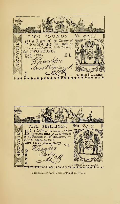
TWO POUNDS.pra 31 atr» of the Colony of"° New-York, tf)& Bill fljoU t)f
received in all Payments in the Treafury,
for TWO POUNDS.NEW-YORK, ILL,February, 161 17:
'Tis Death to counterfeit.
*#***##*.##*#************ * * *
FIVE SHILLINGS. &0. 2
BY a IA Wo/ the Colony ofNew-York, this BTLL Jhallbe received
in all Payments in the TREASURY, forFIVE SHILLINGS.New-York, February,l6, 177
1
VS.
'Tis Death to couivtcrfeit.
Facsimiles of New York Colonial Currency,

Manners and Customs in Colonial Days 107
of iron and heavy locks were sufficient protection against the
robber of that day, and which, for further security, were kept
in the bedroom of the proprietor. A mattress, a stocking, or
a cuddy-hole was equally safe for the small possessions of the
poor.
When the Revolution occurred, the Congress was hard
pushed to provide funds, and so quantities of Continental
currency were issued. The more of it that was issued, the less
did its value become, as there was nothing back of it to give
it value. After the French alliance of 1780, hard money
became less scarce; though in 1782, the Continental currency
was so depreciated that it took five hundred dollars of it to pay
for one dollar's worth of merchandise or labor. Acts of the
legislatures, and even of Congress itself, could not make the
Colonial and Continental currency pass at its face value, even
when penalties were attached for failure to accept it. The
same conditions prevailed after the Peace of 1783; and the
experiences of the period from 1783 to 1789, which Professor
John Fiske calls the "Critical Period of American History,"
resulted in the safeguarding of the money question in the
Constitution by giving the Federal Government absolute
power over the issue of coin and currency.
During the Revolution, the British paid in good money for
what they bought, so that it is not to be wondered at that the
farmers of a section so close to the British base of supplies at
New York as was the Borough, were more inclined to be loyal-
ists or neutrals than to be ardent patriots. After all, a man's
politics are usually in his pocket; and when we take into
account the material inducements to enlist, we can see why
the Tory regiments of Rogers and De Lancey were recruited
principally from the sections adjacent to New York.
So far in this chapter we have treated of the practical side
108 The Story of The Bronx
of colonial life ; a few words will suffice for the lighter side, the
frolics, the amusements, the weddings, and the funerals.
The Dutch were great for frolics, as they were termed, and
the English readily took up the customs of their neighbors.
The negro is an inborn musician and he always served as the
fiddler upon these occasions, which generally took place in the
winter time, when the snow upon the ground made travel
quick and pleasant. Gathering at the home of some farmer
or at a convenient tavern, the frolickers indulged in dancing,
card playing, and drinking until daylight made its appearance.
Wrestling was also a favorite amusement with the English, as
well as horse-racing and hunting, the latter in the winter time
when their Dutch neighbors were skating on the frozen ponds
or coasting down the snow-covered hills. The Maypole was
erected on May-day, and everybody celebrated it as a holiday
in the manner of Merry England. The bands of children who
throng the New York parks during the month of May keep
alive this particular abomination of the Puritan. The Fifth
of November was also celebrated with bonfires and the burn-
ing of effigies, in memory of Guy Fawkes and the failure of the
Gunpowder Plot; this, too, is strangely kept alive to-day in
New York by the bonfires which illumine the city streets on
Election night, which usually comes within a day or so of
November fifth, or Guy Fawkes Day.
New Year's Day was the greatest holiday of all with the
Dutch, when the burgher or the boer put aside his work, decked
himself in his best clothes, and went around to the houses of
his friends to wish them happiness during the coming year, to
the accompaniment of numerous pipes and glasses of schnapps.
The good old Dutch custom prevailed with us until the
drunkenness and debauchery which the abuse of the custom
produced, led to its stoppage a few years back. Pfingster, or
Manners and Customs in Colonial Days 109
Whitsuntide, was also a period of jollification with the Dutch
who, at this time, let their slaves have free play. • Practical
jokes were always in order, and their success was the occasion
of ready and boisterous laughter from the bystanders. In all,
their amusements were the rude and simple pleasures of a
primitive people.
With the better classes, the same holidays were observed
in a quieter manner and without horse-play. Tea parties
and dinners were the more dignified means of entertainment.
At the latter, wine of a quality not always to be found in Eu-
rope was served to the guests ; and it was customary for each
of the guests in turn to toast some admired friend. The ladies
toasted a gentleman, and the gentlemen toasted a lady. In
this way, the health of some beautiful and gracious belle was
drunk so often, and her popularity became so pronounced
among her admirers, that she would become the "toast" of the
season. An unbounded hospitality prevailed, and any one
who ranked as a gentleman had little hesitancy in calling upon
an acquaintance, or even upon a stranger, when travelling,
for a meal or lodging. Intermarriages occurred between the
families of the gentry, so that in time they were nearly all
interrelated or connected. Many of the American heiresses,
both of Dutch and English extraction, became the wives of
English officers stationed in New York, a custom which the
present generation still maintains with our trans-Atlantic
cousins. Frequently, the foreigner, delighted with the man-
ner of American life, took up his home here and became a citi-
zen of the colony, and later of the State. Many of them, of
whom Montgomery, Paul Jones, Gates, and Charles Lee were
notable examples, fought with the colonists in their revolt
against the mother country.
1 See Cooper's novel of Satanstoe.
no The Story of The Bronx
In this new country, women were in the minority, and con-
sequently were in great demand. She must indeed be with-
out personal or mental qualities who reached the age of twenty
without being married, unless she were vowed to spinsterhood.
It is amusing to read of the quickness with which widows
remarried; there seems to have been no allotted period of
mourning for them—a few weeks or months sufficed; and
many of them changed their names three or four times as their
helpmates departed to the other and better world. Sarah
Willett, daughter of Thomas Cornell, must have been an
attractive widow; for she was so pestered and annoyed by
suitors, both Dutch and English, that she was obliged to appeal
to the court for protection from their ardent advances. She
finally married Thomas Bridges, an Englishman, and thus
disposed of her other admirers.
Weddings were occasions of great jollification with both
Dutch and English, and the festivities were generally kept up
for several days; while rough jokes and rude jests were in-
dulged in to an extent that would shock our modern ideas of
propriety. Woe betide the unfortunate bridegroom who was
niggardly in inviting his friends to his wedding or who failed
to provide generously for them in food and drink, the latter
in especial! When it came to house-raising, corn-husking,
quilting, and similar affairs where numbers were required, a
whole neighborhood would join in and help, and the affair
would become a frolic, the host being careful to provide ample
quantities of cider, beer, and rum.
Funerals were not the solemn occasions that they are with
us to-day, but in colonial days actually became festive affairs.
The friends and acquaintances gathered at the home of the
deceased, and were received with all honor—and a bowl of
punch. The services for the dead having been solemnized
Manners and Customs in Colonial Days mby the dominie, the body was carried to the grave—usually
only a few rods away—and interred. No female ever went to
the grave. A volley was customarily fired over the grave,
even if the body were that of a woman. After these solemn
services were performed, the mourners returned to the house,
where they were refreshed after their fatigue with a lavish
collation and unlimited quantities of drinkables. While im-
bibing these latter and burning the incense of tobacco to the
memory of the departed, they recounted his life and recalled
his manifold virtues, until they became so overcome by them
—
or by the drink—that they became speechless. It was a mat-
ter of honor with the bereaved family to see that there was no
cessation in the supply of solid and liquid refreshments ; and so
these funeral ceremonies sometimes lasted for several days.
The author cannot refrain from repeating the story of a Scotch
mourner, who after two days of mourning, solemnly arose,
glass in hand, and proposed the health of the bride and groom.
Upon being admonished by a neighbor that the affair was
not a wedding but a funeral, he remarked: "Weel! I dinna
care what 't is; 't is a grand success anyhow."
Funerals conducted in this style were often so expensive as
to impoverish a family that would otherwise have been com-
fortably off. Besides the refreshments, mourning gloves and
bands were furnished the minister and the mourners, while
mourning rings and pins were provided for the relatives and
close friends. It is stated that ministers who conducted many
funerals had a considerable source of income from the sale of
the mourning gloves with which they were presented at each
ceremony. If only a short distance from the grave, the body
was carried on a bier by underbearers. The author remembers
seeing, when a boy, between the years 1865 and 1870, a mem-
ber of the Schermerhorn familv buried from the old mansion
112 The Story of The Bronx
in Fourteenth Street near Sixth Avenue (afterwards occupied
by the Metropolitan Museum of Art) , and that the coffin was
carried by underbearers.
In 1760, the funeral expenses of Mrs. Alexander, mother of
General Lord Stirling of the American army, amounted to
£21, 85. and 6d. for the undertaker alone; to this must be
added the cost of food, drink, bands, gloves, rings, and pins
mentioned above. The scarcity of money at the time of the
Revolution had more effect in causing economy in the matter
of funerals than had the legislation passed by the Provincial
Assembly in attempts to stop the wasteful extravagance.
The funerals of the poorer members of the community were as
extravagant as those of their betters, if not more so, in propor-
tion. 1 Perhaps these funeral ceremonies were an inheritance
from the old Saxon days, as the reader will remember the obse-
quies of Athelstane in Scott's romance of Ivanhoe, and the
interrupted festivities upon that occasion.
1 See Customs in Old New England, by Alice Morse Earle.
CHAPTER VI
THE REVOLUTION TO SEPTEMBER, 1 776
FROM what has already been written, it will be seen
that the population of the Borough was a farming
one, being either gentlemen farmers, occupiers of
leaseholds as tenants of the wealthy landowners, or as owners
of small farms of their own. The franchise was limited to
those who possessed unencumbered property to the value of
forty pounds, a considerable sum in those days; and these
were the freeholders of the county. It was not until the
adoption of the second Constitution of the State in 1821 that
the suffrage was made universal. Farmers, as a class, are
conservative; and when to this conservatism is added the fact
that many of them in colonial days did not have the right
to vote, we may surmise that so long as they found a ready
market for their produce they did not bother their heads
very much about political matters, but left such affairs to
their betters. The differences between the Morris and De
Lancey families might, and did, arouse a feeling of parti-
sanship; but, in general, they were satisfied to return to
the Provincial Assembly some prominent gentleman of the
neighborhood for whom they felt it an honor to vote, or of
whom they might be tenants. This feeling of political neu-
trality, or apathy, was particularly marked in the aristocratic
Province of New York, which not only furnished its quota of
8 113

ii4 The Story of The Bronx
troops to the Continental army, but also furnished more
loyalists, or Tories, both active and passive, than any other
province or state.
The general mass of the population, though steady, intelli-
gent, industrious, and not illiterate, did not concern themselves
greatly with the political affairs of the decade between 1764
and 1774, in which New England took so prominent a part.
They looked upon their eastern neighbors as wild stirrers-up
of strife, whose ability and progressiveness they were ready
and willing to acknowledge, but for whom they felt and
expressed a certain sneering and loft}- contempt, and often dis-
like. r The fact that a man was a Yankee was sufficient to
excuse his vagaries of dress, action, or speech. We do not
find, therefore, that any Committee of Correspondence or
society of the Sons of Liberty existed within the county. This
feeling of apathy was more pronounced in the southern
part of the county, that is, within the Borough, than in the
more northerly sections, as White Plains, Bedford, Rye, and
Mamaroneck, whose original settlers were nearly all from
Connecticut.
The most thickly settled portion of the Borough was the
section lying contiguous to the Sound: Westchester, West
Farms, Throgg's Neck, and Eastchester. Here the prepon-
derating influence was that of the De Lancey family; and as
they were, almost to a man, loyalists, this portion of the
1 " It is my will and desire that my son Gouverneur Morris may have the
best education that is to be had in England or America. But my express
will and directions are, that he be never sent for that purpose to the Colony
of Connecticut, lest he should imbibe in his youth that low craft and
cunning, so incident to the people of that Country, which is so inter-
woven with their constitution that all their art cannot disguise it from the
world, though many of them, under the sanctified garb of religion, have
endeavored to impose themselves upon the world as honest men."—From
the will of Lewis Morris, Junior, of Morrisania, November 19, 1760.
April, 1775 to September, 1776 115
Borough became a hotbed of Toryism. Another element
which added to the loyalty of the inhabitants to the crown was
the influence of the clergy of the Church of England ; and from
the pulpits of St. Peter's at Westchester, St. Paul's atEast-
chester, and St. John's at Yonkers, the doctrine of passive
obedience was preached by Rectors Seabury and Babcock
with no less fervor than in the days of Laud and the Star
Chamber.
On August 20, 1774, a meeting was called at the borough -
town of Westchester for the purpose of electing delegates to
a county convention to be held at White Plains on the twenty-
second of the same month, for the purpose of selecting a rep-
resentative to the general Congress to meet in Philadelphia on
September first. Henry B. Dawson says 1 that this meeting
was controlled by a single master-spirit, Colonel Lewis Morris,
who, instead of convening the meeting for an honest expression
of opinion from the freeholders and inhabitants, many of whomwere his own tenants, or for the honest promotion of the best
interests of the colony, used it "as a preparation for the return
of the Morris family to place, authority, and influence in the
political affairs of the Colony, from which, through the con-
trolling influence of the De Lanceys, it had been, for many
years, entirely excluded." The meeting adopted a set of
resolutions which, after proclaiming allegiance to the King,
proceeded to criticise the unconstitutional acts of his Majesty's
government in taxing the colonies without their consent, to
sympathize with the distressed people of Boston on account
of the closure of their port, to call upon the colonies to stand
together for unanimous action, and to advise the action of a
general congress to take steps for a redress of their grievances.
1 "The American Revolution," in Scharf's History of Westchester County,
vol. i.
n6 The Story of The Bronx
The delegates chosen for the convention at White Plains
were James Ferris, Colonel Lewis Morris, and Thomas
Hunt.
The convention met at White Plains under the chairman-
ship of Colonel Frederick Philipse, a member of the Provincial
Assembly, and selected as representatives of the county of
Westchester, Isaac Low, Philip Livingston, James Duane,
John Alsop, and John Jay, all of whom had already been
chosen by the city and county of New York to represent it
in the Continental Congress. So that officially, at least,
Westchester County was marching side by side with the
other sections of the country in their condemnation of the
unconstitutional acts of the Parliament and in a desire for a
redress of grievances. But the great majority of the inhabi-
tants was either indifferent, or openly hostile, to the patriotic
action of the leaders. The loyalist papers teemed with pro-
tests from inhabitants of the county, and broadsides of like
tenor were issued.
On April 13, 1775, a very respectable number of freeholders
and inhabitants of the county again assembled at White
Plains, "for the purpose of choosing delegates to represent
this colony in the next Continental Congress." The delegates
were duly chosen by a minority of the convention, the ma-
jority refusing to take part in the proceedings, and drawing up
a protest, of which the following is an extract, which was
signed by over three hundred persons, among whom we find
many inhabitants of the Borough
:
"We, the subscribers, freeholders and inhabitants of the
county of Westchester, having assembled at the White Plains,
in consequence of certain advertisements, do now declare,
that we met here to express our honest abhorrence of all unlaw-
ful congresses and committees and that we are determined, at
April, 1775, to September, 1776 117
the hazard of our lives and properties, to support the King
and Constitution, and that we acknowledge no represen-
tatives but the General Assembly, to whose wisdom and
integrity we submit the guardianship of our rights and
privileges."
The protest was published in Rivington's Gazetteer, the lead-
ing loyalist organ, which commented as follows:
"The Committee that was chosen, may, with some kind of
propriety, be said to represent those particular persons whochose them. But how can they be denominated representa-
tives of the County of Westchester, who, in general, abhor
Committees and Committeemen, and are determined to take
no steps that may have the least tendency to lead them into
Rebellion, we cannot conceive. . . . And we doubt not but
the impartial public will consider the matter in this light, and
not esteem the act of a few individuals, unlawfully assembled,
as the act (which it most assuredly is not) of the very respec-
table, populous, and loyal county of Westchester."
The author of the protest, and the one who communicated
it and the report of the proceedings to the Gazetteer was Isaac
Wilkins, brother-in-law of Colonel Lewis Morris, who was also
reputed to be the author of loyalist articles signed A. W. F.
(A Westchester Farmer). The news of Concord and Lexing-
ton came a few days after the publication of the protest;
and Mr. Wilkins, in view of the excitement of the populace
over the news and their indignation at his blatant Toryism,
believed that his life was in danger, and so fled the country
to England; he was probably the first of the expatriated
Tories, who, before the war was over, numbered tens of
thousands.
The news from Lexington greatly strengthened the patriot
party. On the eighth of May, a Committee for Westchester
n8 The Story of The Bronx
County was formed, with Gilbert Drake as chairman. On the
twenty-third of the same month, a Provincial Congress was
organized in New York City by delegates from all the counties
in the colony, and Philip Van Brugh Livingston was elected
its president.
The importance of fortifying the pass at Kingsbridge was
recognized at an early period ; and immediately after the arrival
of the news of the Concord fight, without any formal order
from the Committee of One Hundred, numbers of men were
employed in transporting cannon from the city to that point.
Though the Provincial Congress appointed a committee to
report upon a plan of entrenchments, nothing further was done.
On May twenty-fifth, however, the Continental Congress
resolved
:
"First, that a Post be immediately taken and fortified at or
near King's Bridge, in the Colony of New York, and that the
ground be chosen with a particular view to prevent com-
munication between the City of New York and the country
from being interrupted by land; Secondly, that the Militia
of New York be armed and trained, and in constant readiness
to act at a moment's warning ; and that a number of men be
immediately embodied ... to prevent any attempts that
may be made to gain possession of the City, and to interrupt
its intercourse with the country."
These resolutions, with instructions to keep them as secret as
possible, reached the Provincial Congress at New York on the
twenty-ninth of May; and a committee was accordingly
appointed, consisting of Captain Richard Montgomery of
Kingsbridge, Henry Glenn, Robert Yates, and Colonels James
Van Cortlandt and James Holmes, the last two of Westchester
County, both of whom later became loyalists. This committee
was instructed "to view the ground at or near King's Bridge,
April, 1775, to September, 1776 119
and report to this Congress whether the ground near King's
Bridge will admit of making a fortification there that will be
tenable."
In June, the Continental Congress took steps to form a
Continental arm}-, and appointed George Washington com-
mander-in-chief. New York was to furnish three thousand
troops, to be divided into four regiments, which later became
the New York Line, commanded by McDougal, Ritzema, 1
James Clinton, and Wynkoop. Some of the Westchester
County men enrolled in the Fourth Regiment of militia, com-
manded at first by Colonel James Holmes of Bedford,
who later turned loyalist and became lieutenant-colonel of a
battalion of Westchester County refugees in the British army.
On August twenty-second, a militia bill was passed in accord-
ance with the recommendations of the Continental Congress;
and the county was divided into precincts, or beats, each fur-
nishing a company, which companies were formed into three
battalions; each company was to elect its own officers. The
first company to perfect its organization was that from the
borough-town of Westchester, August twenty-fourth. Later,
West Farms and Fordham withdrew from the Westchester
beat and formed their own company. Eastchester formed
another beat and raised its own company; New Rochelle
and Pelham Manor formed another beat ; and the manor of
Philipseburgh was divided into six beats, of which the
Yonkers beat was within the Borough. These companies
above mentioned formed the South Battalion of Westchester
County. Its officers were Joseph Drake, colonel; James
Hammond, lieutenant-colonel ; Moses Drake, first major;
1 Ritzema commanded the Third Regiment of the New York Line at
the Battle of Chatterton's Hill, or White Plains, and did his duty; but a
short time after the battle he left the patriots and joined the royalist army.
120 The Story of The Bronx
Jonathan G. Graham, second major; Abraham Emmons, ad-
jutant; and Theophilus Bartow, quarter-master. Among the
company officers will be found some of the best-known
names of the ancient Borough.
Every man between the ages of fifteen and fifty was obliged
to provide himself with a good musket and bayonet, a sword
or tomahawk, a cartridge box and belts, twenty-three rounds
of cartridges, twelve flints and a knapsack, and to keep himself
provided with a pound of gunpowder and three pounds of
bullets in reserve; he was also required to parade for drill on
the first Monday of each month. All these things he must do
at his own expense, under penalty of fine and imprisonment.
This, of course, bore very heavily upon the poorer classes,
who had much difficulty in feeding and clothing their families.
It is not to be wondered at that when De Lancey and others
came recruiting and offering bounties, clothes, accoutrements,
and good pay in current money, and not in depreciated Con-
tinental bills, that these men, with the fear of fine and im-
prisonment before their eyes for recalcitrancy in obeying the
orders of the Provincial Congress, readily and willingly joined
the standards of the loyalist battalions.
One of these corps was that of the Queen's Rangers, organ-
ized by Colonel Robert Rogers of New Hampshire in 1776
from the loyalists of Connecticut and Westchester County
to the number of four hundred. They afterwards became
reduced in numbers; and in the autumn of 1777, after the
Battle of the Brandywine, Major Simcoe of the British army,
at his own urgent request, was appointed to command them
with the rank of lieutenant-colonel. He soon made them
models of order, discipline, and valor. The following adver-
tisement from Rivin "ton's Royal Gazetteer will give some idea
of the inducements offered to the loyalists:
April, 1775, to September, 1776 121
"all aspiring heroes
have now an opportunity of distinguishing themselves by
joining
THE QUEEN'S RANGERS HUSSARS
commanded by
Lieutenant-Colonel Simcoe.
"Any spirited young man will receive every encouragement,
be immediately mounted on an elegant horse, and furnished
with clothing, and accoutrements, &c, to the amount of
forty guineas, by applying to Cornet Spencer, at his
Quarters, No. 133 Water Street, or his rendezvous, Hewett's
Tavern, near the Coffee-house and the Defeat of Brandywine
on Golden Hill.
"Whoever brings a recruit shall instantly receive twoguineas.
"vivant rex et regina."
Two other acts of the Provincial authorities also bore very
heavily upon the inhabitants and tended to increase their dis-
content. One was an order from the Provincial Congress to all
civil and military officers to arrest and confine all persons who
did not sign the association of the colonies, or who denied
the rights and orders of the Provincial or Continental con-
gresses, or who expressed sympathy with the royal cause, or
who furnished supplies of any kind to the fleet or army of
the King. The other act by the Committee of Safety author-
ized the seizure of guns, powder, bullets, and other munitions
of war from any one who had not signed the association,
for the use of the poorly-equipped and ill-supplied troops which
the Colony was putting in the field for the expedition against
Canada. The first act prevented freedom of speech, and
deprived the inhabitants of their ordinary markets, while
placing them at the mercy of every enemy they may have
122 The Story of The Bronx
made and who was willing to give information or to throw sus-
picion upon them ; the second deprived them of their personal
property without compensation or due process of law.
As an instance to show the diversity of opinion which ani-
mated the Provincial Congress itself, and their attempt to
show allegiance to both King and Continental Congress, we
may mention the rather ludicrous dilemma in which they found
themselves at the end of June, 1775. Governor Tryon had
returned from England and had notified the Provincial Con-
gress that he would land and consult with them on the state
of the Colony, on the twenty-fifth of June. Notice was also
received that General Washington would arrive in New York
the same day as the Governor, on his way to take command of
the American army around Boston. The Congress wished to
do equal honor to both, but were divided in opinion as to who
should be first received by the troops. It was at last decided
to divide the troops for the reception of the distinguished
visitors; but Washington fortunately arrived several hours
before the royal Governor and thus relieved them of their
embarrassment.
Enough has been stated to explain the loyalty of the in-
habitants of the Borough in Revolutionary times. From the
autumn of 1776 to that of 1783, Westchester County was har-
ried more than any other section of the country; and the
losses and sufferings of the inhabitants more than repaid them
for their lack of patriotism for their distressed and struggling
country. While no great battle took place within the Bor-
ough, the operations were constant, and hardly a week passed
without some military foray or encounter.
One of the earliest military acts was an expedition from
Connecticut under Captain Isaac Sears ("King" Sears), in
November, 1775, for the purpose of regulating Westchester
April, 1775, to September, 1776 123
County, disarming the loyalists, and seizing the persons of
several of the most prominent Tories. The expedition started
with sixteen men, but gradually increased to over eighty.
On the twenty-second of November, an advanced guard
entered the borough-town of Westchester and seized Mayor
Underhill and Rector Samuel Seabury. The rector had ren-
dered himself obnoxious to the patriots by his written articles
against the colonists, by his fulminations from the pulpit, and
by his having signed the White Plains Protest. Captain
Lathrop, with his two prisoners, then started over the road
to Kingsbridge, but met the main body under Sears coming
over the Boston Road. They all returned to Eastchester,
where the main body of the raiders had already seized Jona-
than Fowler, Judge of the Superior Court of Common Pleas.
The three prisoners were sent under escort to Horseneck
(Greenwich) in Connecticut, while the main body of about
seventy-five horsemen resumed their march over the Boston
Road into the city of New York, where, at noon on the twenty-
third, they destroyed the printing establishment of James
Rivington, the royalist printer and publisher of the obnoxious
Gazetteer. The expedition then returned to Connecticut, carry-
ing with them most of the printing type, which was afterwards
melted up into bullets. The prisoners were not released until
the following January; and when the reverend doctor returned
to Westchester he found his school dispersed and his affairs
in confusion. Like his friend Wilkins, he left the town, going
first to Long Island, and later to New York City, where he
remained as chaplain in the British army until the end of the
war.
Mention has already been made of the cannon taken to
Kingsbridge upon the news of Lexington. These cannon,
numbering probably two hundred and fifty all told, were of all
124 The Story of The Bronx
sizes, shapes, qualities, and materials; brass, bronze, and iron;
good, bad, and indifferent. They were stored at several
places, fifty or more at John Williams's (Williamsbridge)
,
probably one hundred at Valentine's Hill, others at the north-
ern end of Manhattan. They were not protected or guarded
in any way, so that any one who wished to injure them could
do so with impunity. On January 17, 1776, most of them
were found spiked, while others s re choked up with stones,
and all of them were in an unserviceable condition. Suspicion
fell upon the loyalists of Westchester, Eastchester, West
Farms, and Yonkers; but an inquiry placed the deed upon
John Fowler and William Lounsberry of Mamaroneck, both
of whom were imprisoned. The purchase of a quantity of
rat-tail files led to their conviction. Jacamiah Allen was
employed to unspike the guns at a cost of twenty shillings a
gun. This he succeeded in doing, and they were later moun-
ted upon the fortifications built by the Americans.
The committee of which Captain Richard Montgomery was
the head reported June 3, 1775, as to the fortifications at
Kingsbridge. They recommended that a post of three hun-
dred men be established on Marble Hill, near Hyatt's Tavern,
Manhattan, and selected sites on Tetard's Hill to the east, and
on Tippett's Hill to the west of the bridge for the placing of
redoubts when the troops had been properly organized, so that
the work could be done by them. Under the command of
Major-General Charles Lee, who was ordered from Boston to
the command of New York and its environs, work was begun
upon the suggested redoubts; but it was not until after the
evacuation of Boston by the British on March 17, 1776, and
the assumption of the command in New York by Washington
in person, that any great progress was made upon the forti-
fications. Early in the month of June, he visited the neigh-
April, 1775, to September, 1776 125
borhood of Kingsbridge and inspected the ground. Realizing
the importance of the place, he selected seven sites for redoubts,
two of which—the Cock Hill fort overlooking the mouth of
Spuyten Duyvil Creek, and a fort on Marble Hill, afterwards
called by the British, Fort Prince Charles— were on the island
of Manhattan; the remaining five were in the Borough. He
immediately set two Pennsylvania regiments to work on the
forts, and also various bodies of militia as they reported for
duty; for by this time General Howe had arrived off NewYork and was threatening the city, so that reinforcements for
the Americans were coming in from all directions. In orders
of July second, Washington placed General Mifflin in direct
command of the Kingsbridge neighborhood with instructions
to complete the works as rapidly as possible, so that work was
carried on night and day.
Admiral Lord Howe arrived off New York in command of
the fleet on the twelfth of July and anchored in the Lower
Bay. The point of debarkation of the British forces was, of
course, a matter of conjecture on the part of the Americans;
but Mifflin believed they would land near Yonkers and throw
a line of strong entrenchments from the Hudson River to the
Harlem, thus shutting the Americans up in New York and
preventing their escape by way of Kingsbridge. Therefore,
while the Howes were attempting to negotiate with Washing-
ton for a cessation of hostilities under the instructions of King
George, which empowered them to act as commissioners for
the purpose, the work of fortifying Kingsbridge went rapidly
forward.
These posts, which fell into the hands of the British in Octo-
ber and were further strengthened by them, were located as
follows:
Numbers One, Two, and Three (we use the British nomen-

126 The Story of The Bronx
clature) were situated on Spuyten Duyvil Neck, on what is
said to have been the site of the Indian village of Nipnichsen.
Number One was a square, stone redoubt overlooking the
Hudson River and the mouth of the creek. It forms the foun-
dation of what is known in the vicinity as the Strang house,
originally built by a Mr. Cameron, and now occupied by
William C. Muschenheim of the Hotel Astor. When the house
was built, both Indian and Revolutionary relics were
unearthed, some of which are still preserved in the house.
Number Two was a small circular fort on the crown of
Tippett's Hill, and was called "Fort Swartwout" by the
Americans, in honor of Colonel Abraham Swartwout, whose
regiment built it, as well as a small battery at the mouth of
the creek near the site of the Spuyten Duyvil station of the
New York Central and Hudson River Railroad. This battery,
with the Cock Hill fort on Manhattan, was to prevent the
enemy from entering the creek in boats. Upon the British
map made for General Howe by his engineer, Joseph Claude
Sauthier, and also upon the map made for Washington by S.
Lewis, Fort Number Two is called "Fort Independence, " and
the elevation, Tetard's Hill, the land to the northward toward
Seton Hospital being called the Heights of Fordham. This is
an error that still continues to mislead historians of the Revo-
lution when describing the events in this vicinity.
Number Three was a small stone redoubt on the easterly
side of Tippett's Hill, which commanded the junction of the
Spuyten Duyvil road and the present Riverdale Avenue, as
well as the extreme northerly end of Manhattan Island oppo-
site the fort on Marble Hill, called Fort Prince Charles.
Between One and Two were two ravelins, and between Twoand Three, a curtain which joined the two redoubts.
All three of these redoubts were hastily constructed by the
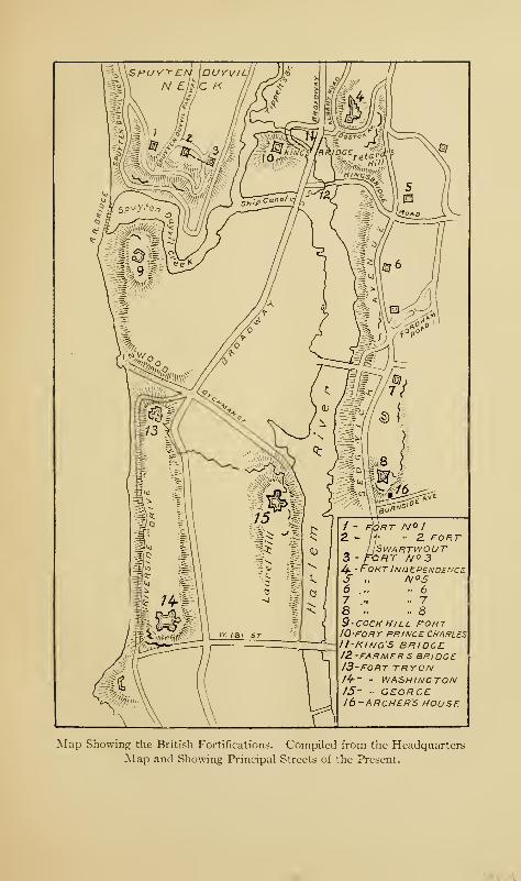
Map Showing the British Fortifications. Compiled from the Headquarters
Map and Showing Principal Streets of the Present.

April, 1775, to September, 1776 127
Americans and abandoned by them when they evacuated this
section before the Westchester campaign; the British seized
and strengthened them before the attack on Fort Washington
in the early part of November, 1776. In November, 1778,
they had a garrison of one hundred and ten officers and men.
They were finally abandoned by the British in the fall of 1779.
Number Four was on the eastern side of the valley, between
the Boston and Albany roads, both of which it commanded.
It was the largest of all the fortifications in this neighborhood,
and was a bastioned earthwork, with ravelins to the east and
southeast, and was built by the Pennsylvania Line, assisted
by the militia, under the direction of Colonel Rufus Putnam,
the engineer of Fort Washington. Upon the approach of
the Hessians under Knyphausen from New Rochelle, Colonel
Lasher, the American commander, destroyed the barracks,
October twenty-eighth, and went to reinforce Colonel Magaw
at Fort Washington. He left in such haste that he was
obliged to leave the cannon and three hundred stand of arms
behind him. General Knyphausen took possession the next
day, and the British held it for three years. On August 16,
1779, they removed the guns; on the seventeenth, they
demolished the magazine, and on the twelfth of September
they abandoned the fort altogether. The house formerly
belonging to the late William O. Giles, Esq., is built within the
ancient fort; and it is stated that when the cellar was dug
eleven cannon and several cannon-balls, calthorns, and other
military relics were found. Number Four was the largest
redoubt in this vicinity and was the true Fort Independence of
the Americans. The fort was built upon the farm of Captain
(later, Major-General) Richard Montgomery, who probably
selected the site when examining this section with the com-
mittee appointed by the Provincial Congress of 1775.
128 The Story of The Bronx
A new street, a continuation of the ancient Boston Post-
road of 1673, passes down the hill from Sedgwick Avenue,
connecting the Boston with the Albany Post-road, and en-
croaches slightly upon the ramparts of the old fort. Another
street, a little west of the one just mentioned, also leads down
the hill past the old Montgomery house and is called Fort
Independence Street.
The British Headquarters map of 1782 (or 1783) shows seven
other redoubts lying south of Number Four along the Ford-
ham ridge, making eleven in all from the Hudson to the shore
of the Harlem abreast of Fort George on Manhattan. In
addition, there are shown entrenchments across the Boston
Road to the east of Number Four and a small redoubt, called
the Negro Fort, about half-way between Fort Independence
and Williamsbridge. It was so called because, so it is stated,
it was garrisoned by negroes from Virginia; it was situated just
south of the old Boston Road—this part of it now called Van
Cortlandt Avenue,—about where the new Concourse joins
Mosholu Parkway. A semicircular redoubt was also erected
by the orders of General Heath about one thousand feet west
of the bridge across the Bronx River, to command the passage
of that stream and the Boston Road to Williams's bridge. It
was located on the Bussing farm, and its site is now within
the limits of Woodlawn Cemetery, close to the point of inter-
section of the ancient Boston and Gun Hill roads.
Number Five was a square redoubt of about seventy feet,
situated on the old Tetard farm, due south of Fort Indepen-
dence, and commanding the Farmers' Bridge. It can still be
distinguished at the southwest corner of the Jerome Park
reservoir, a few rods east of Sedgwick Avenue, adjoining the
Ames property. It was occupied by the British in 1777, and
abandoned September 18, 1779. In the summer of 1910,
April, 1775, to September, 1776 129
Messrs. Reginald P. Bolton, Edward Hagaman Hall, and W. L.
Calver carefully excavated the ground within the old redoubt
and were rewarded by finding remains of brick fireplaces and
other military relics, including regimental buttons of privates
of the 13th Pennsylvania Regiment and the following British
infantry regiments: 4th, 10th, 17th, 26th, 28th, 44th, 52d,
54th, 57th, 64th, and 71st Highlanders, and also an officer's
button of the 17th British.
Though there were eleven of these redoubts, the British
numbers ran only to eight, as several of them had special
names, or were of such small size as not to merit special men-
tion as they were attached to the larger fortifications near
them.
Numbers Six, Seven, and Eight were small redoubts com-
manding the Harlem River from Fordham Heights, and strung
along to the southward as far as the present Burnside Avenue.
Of these, Number Eight was the most famous, as Colonel De
Lancey's cantonment was under its guns for protection from
the American attacks; it also protected the pontoon bridge
which connected the mainland with Manhattan near Fort
George, over which the British cowboys drove their cattle,
wood, forage, and other products of their raids. The daring
American partisans were not deterred by the proximity of the
fort, however, but made affairs in this vicinity hot on numer-
ous occasions, as we shall see later.
Lossing says: 1 "Before leaving these heights [Fort Washing-
ton], consecrated by valor and patriotism, let us turn toward
the distant hills of West Chester, where almost every rood of
earth is scarred by the intrencher's mattock, or made memo-
rable by deeds of daring and of suffering."
The reference here is chiefly to the "distant hills" of North
1 Page 623, Pictorial Field Book of the Revolution.
130 The Story of The Bronx
Castle, White Plains, and Peekskill; but the Borough section
of the county, so long occupied by the British forces, must have
had numerous fortifications, which the local historian has
failed to record, and which modern improvements have
obliterated. Kingsbridge has been more fortunate in both
respects; it is still a rural community, and the local historian,
the late Mr. Thomas Henry Edsall, has determined the sites
of the ancient redoubts before the knowledge of their position
has passed away with the older inhabitants. The Head-
quarters map, published in 1900, also gives us these redoubts
with a fair amount of accuracy.
As if to confirm Mifflin's idea of the landing place of the
British, on the twelfth of July, the Rose and the Phoenix,
British vessels of war, with several tenders, sailed up the
Hudson and, being unaware of the American fortifications,
anchored off the entrance to Spuyten Duyvil Creek. Their
ignorance was soon dissipated, for the batteries opened fire on
them and did great execution. The vessels then proceeded
up the Hudson as far as Fort Montgomery in the Highlands.
Their object was, probably, to communicate with the loyalists
along the banks of the river and to provide them with arms;
but their presence called for more troops, and reinforcements
were hurried to the neighborhood of Kingsbridge.
On August thirteenth, General Heath, to whose Memoirs
we owe so much for our knowledge of Revolutionary affairs in
Westchester County, was appointed to the command of the
district of the Highlands, extending south to the Harlem
River. On the seventeenth, the vessels were anchored off
Mount Saint Vincent (then called the Yonkers), and an
attempt was made to destroy them with fire-ships. One of
the tenders was consumed, and the next morning the remain-
der of the vessels dropped down stream, easily passing through
w 3 Q
oto —
.
* 5
t: E:
•n-*-J
o0)
£o a
W7t
c naEd o
oa)
> £o T3
C•4J sl-l <uD d
>
qJ <t/3
-r
K d
April, 1775, to September, 1776 131
the obstructions in the river between Forts Washington and
Lee, much to the chagrin of Washington and his engineers.
Generals Heath and George Clinton witnessed from Tippett's
Hill the daring attempt of the fire-ships to destroy the vessels.
A few days later, a French engineer, Monsieur Martin, was
assigned by Washington to complete the works, and Clinton's
brigade was ordered into camp. The regiment of Colonel
Thomas took camp south of Fort Independence, that of Colo-
nel Graham about half a mile south, and those of Colonels
Paulding and Nicholas, at Fordham and the base of Tetard's
Hill, while Colonel Swartwout occupied Tippett's Hill and
threw up the redoubts already described. r
On the twenty-seventh of August, the Battle of Long Island
occurred; and the Provincial Congress, then sitting at Harlem,
became alarmed for the safety of the city of New York and
ordered its records removed to the camp at Kingsbridge,
whence they were later taken to White Plains and elsewhere as
the seat of the provincial government shifted from place to
place during the ensuing six years. Heath gathered all the
boats he could find along the two rivers for the transportation
of Washington's army across the East River from its dangerous
position at Brooklyn.
Early in the morning of the twenty-seventh, while the battle
was raging on Long Island, two ships and a brig came to
anchor a little above Frog Point [Throgg's Neck]. Colonel
Graham's regiment was ordered immediately to the spot by
General Heath, to prevent the British from landing to plunder
and burn. Before the regiment arrived, several barges from
the ships, full of armed men, landed on City Island and killed
The reader must not confuse the Fordham of to-day, a station on the
Harlem Railroad, with the Fordham of colonial times, which, as has
already been explained in Chapter III., was established by John Archer,
in 1668, at a site near the "wading place."
132 The Story of The Bronx
a number of cattle. Two companies of the Americans were
ferried over to the island and compelled the enemy to withdraw.
The British took one prisoner and fourteen head of cattle, but
the rest of the cattle was secured. On the twenty-ninth, the
ships fell down to Hunt's Point.
CHAPTER VII
THE REVOLUTION, FROM SEPTEMBER, 1 776, TO NOVEMBER, 1 776.
ON the thirteenth of September, the city of New York
was evacuated by the Americans, and the march
was taken up for Harlem Heights and Kingsbridge.
The Howes thought this a propitious moment to renew their
overtures for peace, and sent the captured General Sullivan
on parole to carry their message to Congress at Philadel-
phia, a "decoy duck," as he was called by John Adams, who
was one of the commissioners sent to confer with the Howes
—the others were Benjamin Franklin and John Rutledge. As
the Howes refused to treat with the Americans other than
as private citizens, and as the three commissioners stood out
for a recognition of our independence, the negotiations of
September eleventh fell through, as the Howes were not
authorized to negotiate on any such basis.
Five thousand troops were left to garrison Fort Washington,
while the remainder, about nine thousand in number, went
into quarters on the Borough side of the Harlem, extending
from Kingsbridge, through Fordham, Morrisania, West
Farms, and Westchester to Throgg's Neck and Eastchester.
A floating, or pontoon, bridge was thrown across Spuyten
Duyvil Creek to afford easy communication between the two
divisions of the army. A similar bridge was constructed by
the British after their occupation of the same neighborhood
;
133
134 The Story of The Bronx
it crossed the creek about midway between the King's bridge
and the Hudson, connecting Tippett's Neck and Cox's (or
Cock's) Hill. On the Headquarters map, already referred to,
it appears very curiously as the " King's bridge." The Ameri-
cans at once erected barracks, and brick and stone ovens were
built by the masons in the army.
The different methods of working in the two armies are
shown by the fact that redoubts, barracks, ovens, etc. required
by the Americans were built by the soldiers themselves, with
slight additional expense to the government; while during the
British occupation of New York and its environs, under the
several British commanders, 750,000 pounds sterling were
spent for the same purposes. So tremendous was this expense
that its honesty was questioned by the government in England,
and it is supposed that Carleton had the Headquarters map
made in order to show where and how this large sum had been
expended. The American army was composed of farmers,
mechanics, and artisans of all kinds; the British, of soldiers,
whose duty it was to fight.
The farmers in the neighborhood of the army at Kingsbridge
suffered from the depredations of the troops; and fences,
poultry, cattle, and crops disappeared for the use of the quarter-
master's department and for the commissariat. In fact, the
thieving propensities of the patriots were a source of continual
distress to the Commander-in-chief, whose orders against such
acts were "more honored in the breach than in the observ-
ance." 1 In a prosperous farming section such as this, there
should have been plenty of horses and oxen; yet, when the
1 In the Journal of Lieut. -Col. Kemble, Sir William Howe's adjutant-
general during the Westchester campaign, we find that the British Com-mander-in-chief had even greater trouble in dealing with the marauders
of his army, and especially with the licentious and thieving Germanmercenaries.
From September to November, 1776 135
retreat began to the upper county, so many draught animals
had been stolen by individuals, both officers and men, that
enough animals could not be found to drag the stores and artil-
lery; and the guns and wagons had to be hauled in relays and,
very frequently, by hand. The terms of enlistment of thou-
sands of men expired during the months of September and
October, and every one that could do so helped himself to a
horse or anything else that took his fancy, and which he could
take back to New England with him. It was providential
that the Americans were opposed by a commander that took
things in a leisurely and dilatory way; otherwise, they would
have lost everything; as it was, the army lost little or nothing.
For several weeks the two opposing armies were apparently
inactive; though, as a matter of fact, the Americans were
busily engaged in strengthening the defences of Fort Washing-
ton, the posts at Kingsbridge, at "White Plains, and the various
outposts already mentioned; while the British were erecting
a strong line of defences to prevent attack from the north,
extending along the heights commanding the Plains of Harlem
;
that is, the present Morningside Heights, the north end of
Central Park and McGowan's Pass; in addition, they occupied
the islands in the East River and thus controlled the Sound.
The most strongly garrisoned of these islands was Montres-
sor's (now Randall's), which was separated from the mainland
by the narrow and shallow strait called Bronx Kills. At the
manor-house of Morrisania, opposite the island, was a strong
outpost of Americans; and the pickets frequently exchanged
shots, until the two commanders of the posts mutually agreed
to refrain from firing on each other's pickets. This pleased
the men, who even exchanged articles by throwing them
across the narrow strip of water. A raw picket on the British
side, who did not know of the agreement, began to fire on the
136 The Story of The Bronx
sentinel opposite, who was taking no precautions to conceal
himself; and, in consequence, a lively fusillade ensued. The
officers soon stopped the firing, the American captain indig-
nantly remonstrated, the British captain apologized, relieved
the offending sentry and punished him, and the condition of
neutrality was resumed.
On September twenty-fourth, an attempt was made by the
Americans, under Colonel Jackson and Major Henly, to sur-
prise the British garrison on the island. The latter officer
was on General Heath's staff, and was so importunate in his
requests to be allowed to accompany the party that the Gen-
eral rather unwillingly consented, as the expedition gave every
promise of success without serious danger. The American
sentries had been cautioned to pay no attention to the passage
of the boats down the stream ; but one fool thought he knew
better than his officers and insisted on challenging the boats,
and finally fired on them, thus, no doubt, awakening the vigi-
lance of the British sentries. The boats came abreast of the
island in silence and arranged themselves in the order pre-
viously agreed upon for the attack. There was a whispered
word of command, and Colonel Jackson's boat led the way in
the darkness. As it approached the shore the pickets fired
on it, but it kept on until its keel grated on the shore. Officers
and men jumped ashore and attempted to rush the camp; but
the force in their front was too strong for them, and they were
obliged to fall back, as they were not supported. As they did
so, Major Henly fell mortally wounded. The well-planned
attack had failed, and all because of the cowardice of the
officers in the other boats, not one of whom followed the boat
of his commander and supported it. They were afterwards
court-martialled and cashiered for cowardice. The loss of
the Americans was twenty-two, including Major Henly, who
From September to November, 1776 137
died a few days later, much regretted by all who knew him,
as he was a young officer of great ability and promise. The
young Virginian was buried in the present Trinity Cemetery,
by the side of the brave Colonel Knowlton, the hero of the
Battle of Harlem Heights.
Washington's headquarters during this time were in the
Roger Morris house at Edgecombe Avenue and 160th Street,
Manhattan, the colonial mansion which later became the
residence of the famous Madame Jumel, later the wife of
Aaron Burr. This occupies a commanding position overlook-
ing the Harlem River, the view to the southward extending to
the East River, and to the northward to Kingsbridge, so that
the movements of the British vessels or boats could be readily
seen. These were times of great stress of mind and body for
Washington; for he had on his hands a meddling Congress,
several scheming and ambitious officers, a cowardly and thiev-
ing militia, and a rapidly disintegrating army. In fact, he
felt so despairing that he said privately: "Such is my situation,
that if I were to wish the bitterest curse to an enemy on this
side of the grave, I should put him in my stead with my feel-
ings." He was strongly imbued with the idea that Howe
intended to land at Morrisania and attack him in his position
in Westchester County. No exertion was spared, therefore,
to make his position as strong as possible, and he was passing
continually from his headquarters to Kingsbridge, to Valen-
tine's Hill, to Yonkers, to Morrisania, and to Westchester,
personally superintending the disposition of his troops and
acquainting himself with the topography of the surrounding
country.
A brief glance at the numbers and conditions of the two
armies on the eve of the Westchester campaign may not be
amiss. The British, including the Hessians who had already
138 The Story of The Bronx
arrived and taken part in the Battle of Long Island, and those
under Knyphausen whose arrival was expected daily, were not
less than forty thousand men, and to these must be added the
marines of the fleet, several thousand more, who were avail-
able for land duty. The regiments were the flower of the
British army. Supporting them were the two fleets of Admi-
ral Lord Howe and Commodore Hotham. On the face of the
returns of September 21, 1776, the Americans had in the neigh-
borhood of thirty-two thousand men ; but if we exclude the sick
and furloughed, and those at Paulus Hook (Jersey City) and
other small and distant posts, the number of effectives was not
more than sixteen thousand. By the fifth of October, the
number had dwindled considerably. Thirteen regiments of
these troops were composed of militia, serving for the time in
the Continental service, and absolutely unreliable for any pur-
pose except building forts, plundering, and an almost positive
certainty of running at the first fire, as Washington had learned
to his sorrow at Kip's Bay. Further, the Commander-in-chief
was handicapped by many political military officers, not the
least of whom was Major-General Charles Lee, that conceited
and egotistical braggart, so prolific of plans, schemes, and
criticisms, and so barren of results.
Dr. Galloway of the British army contrasts the two armies
as follows:
"The British army was commanded by able and experi-
enced Officers; the rebel, by men destitute of military skill
or experience and for the most part taken from the me-chanic arts or the plough. The first were possessed of the
best appointments, and of more than they could use ; and the
other, of the worst, and of less than they wanted. The one
were attended by the ablest Surgeons and Physicians, healthy
and high-spirited; the other were neglected in their health,
From September to November, 1776 139
clothing, and pay, were sickly, and constantly murmuring
and dissatisfied. And the one were veteran troops, carrying
victory and conquest wheresoever they were led; the other
were new-raised and undisciplined, a panic-struck and de-
feated enemy, whenever attacked—such is the true compara-
tive difference between the force sent to suppress, and that
which supported, the Rebellion."
The period of inactivity was broken on the twelfth of
October. Leaving Earl Percy in command of the defences at
New York, Sir William Howe embarked the first detachment
of his army of thirty thousand men on flat-boats, and, sup-
ported by several ships of war to cover his landing, proceeded
through Hell Gate and the East River, and about nine o'clock
in the morning landed at Throgg's Neck. The morning was
foggy, so that his movement could not be seen from head-
quarters, and Washington was unaware of it until that after-
noon, when he received an express from Heath, whose outpost
at Westchester town apprised him of the accomplishment of
the landing. During the afternoon of the same day, the
second detachment of Howe's army, in forty-two vessels,
supported by nine vessels of war, successfully followed their
comrades in arms.
The left flank of the American army was threatened and
Washington was in despair. His actions and orders of that
day show that the calm and equable temper of the great man
gave way; and, believing that all was lost, he surrendered to
the despondency which possessed him. He virtually turned
everything over to Heath, an able and active subordinate,
authorizing him to make such dispositions of the troops as he
thought proper, "begging and trusting that every opposition
would be given to the enemy," and concluding with, "God
bless and lead you on to victory!" The next day, Sunday, he
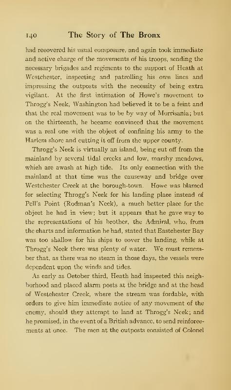
140 The Story of The Bronx
had recovered his usual composure, and again took immediate
and active charge of the movements of his troops, sending the
necessary brigades and regiments to the support of Heath at
Westchester, inspecting and patrolling his own lines and
impressing the outposts with the necessity of being extra
vigilant. At the first intimation of Howe's movement to
Throgg's Neck, Washington had believed it to be a feint and
that the real movement was to be by way of Morrisania; but
on the thirteenth, he became convinced that the movement
was a real one with the object of confining his army to the
Harlem shore and cutting it off from the upper county.
Throgg's Neck is virtually an island, being cut off from the
mainland by several tidal creeks and low, marshy meadows,
which are awash at high tide. Its only connection with the
mainland at that time was the causeway and bridge over
Westchester Creek at the borough-town. Howe was blamed
for selecting Throgg's Neck for his landing place instead of
Pell's Point (Rodman's Neck), a much better place for the
object he had in view; but it appears that he gave way to
the representations of his brother, the Admiral, who, from
the charts and information he had, stated that Eastchester Bay
was too shallow for his ships to cover the landing, while at
Throgg's Neck there was plenty of water. We must remem-
ber that, as there was no steam in those days, the vessels were
dependent upon the winds and tides.
As early as October third, Heath had inspected this neigh-
borhood and placed alarm posts at the bridge and at the head
of Westchester Creek, where the stream was fordable, with
orders to give him immediate notice of any movement of the
enemy, should they attempt to land at Throgg's Neck; and
he promised, in the event of a British advance, to send reinforce-
ments at once. The men at the outposts consisted of Colonel
From September to November, 1776 141
Hand's First Regiment of Continental Foot, usually known
as Hand's Riflemen.
Upon the approach of the advance guard of the enemy
toward the causeway on the morning of the twelfth, after
they had accomplished their landing, the Americans removed
the planks from the bridge in accordance with instructions and
gathered on the west bank of the creek under the protection of
an ancient tidal mill ; from which point they poured in a heavy
rifle fire upon the advancing enemy, who fell back. Anattempt to cross the creek at the ford was also repulsed by the
riflemen there. The British contented themselves with these
tentative efforts; and, finding the Americans in sufficient
force to check their advance, threw up a semicircular intrench-
ment to prevent the Americans, in their turn, from attempting
to advance across the creek. Heath, having received notifica-
tion of the landing and of the advance, dispatched the regiment
of Colonel Prescott, the hero of Bunker Hill, the regiment of
Colonel Graham of the New York Line, and two pieces of
artillery; later, reinforcing with McDougal's brigade of NewYork troops. The Americans intrenched on the west side of
the creek, and a desultory and ineffective fire was exchanged
between the hostile outposts during the remainder of the day.
In the movements of troops since October twelfth, many of
them had been withdrawn from Manhattan Island to reinforce
Heath, to watch the ships off Tarrytown, to the encampment
on Valentine's Hill in the Mile Square, and to White Plains
to protect the stores being moved to that place. A series of
fortified camps had also been established on the west side of
the Bronx River, extending from the Mile Square to White
Plains.
On the fourteenth, a council of war was called to meet at
or near Kingsbridge, the place to be designated by General
142 The Story of The Bronx
Heath, "as we are strangers to a suitable place." On the
same day, General Charles Lee arrived from the south; and
being the senior major-general and next in rank to Washington,
was entitled to the command of all the troops in the county;
but, though placed in command, he was requested not to exer-
cise it until he had acquainted himself with the number and
disposition of the troops and with the topography of the
country; so that Heath remained the responsible commander.
Considering the character of Lee, it is remarkable that he
acceded to this request ; for, if we are to judge him by his own
estimate of himself, all this knowledge and information should
have been his intuitively from his very presence on the ground.
On the evening of the same day, all possible information
being in possession of the officers, the council of war reassem-
bled at the quarters of General Lee at Kingsbridge. There
were present, besides the Commander-in-chief, Major-Generals
Lee, Putnam, Heath, Spencer, and Sullivan, and Brigadier-
Generals Lord Stirling, Mifflin, McDougal, Parsons, Nixon,
Wadsworth, Scott, Fellows, Clinton, and Lincoln, and Colonel
Knox, commanding the artillery. With only one dissentient
voice, that of General George Clinton, it was decided that it
was not possible in their present positions to prevent the
American army from being cut off from the upper county,
and that a retirement was not only expedient but necessary to
prevent the surrender of the army as prisoners of war. In
deference to the ill-advised wishes of the Continental Congress,
it was decided to maintain Fort Washington as long as possible.
On the fifteenth, the movement of troops to the relief of
Heath continued; on the sixteenth, Washington finished his
survey of the threatened points by visiting Pell's Point and
directing the establishment of an outpost at the entrance to
the Neck. How important that act was we shall see later.
From September to November, 1776 143
During the six days after his landing at Throgg's Neck,
Howe was establishing a base there and receiving numerous
reinforcements. At last, word came of the arrival of seventy-
two ships with the German mercenaries under Knyphausen.
On the morning of the eighteenth, Howe embarked his army in
over two hundred boats, protected by the smaller war vessels,
and passed from the northern side of Throgg's Neck across
Eastchester Bay, and landed at the end of Pell's Point, oppo-
site City Island. The post at Westchester saw the movements
in its front and immediately notified Heath, who came up with
numerous reinforcements, which, upon the receipt of an
express from the alarm post at the ford stating that the enemy
were attempting a crossing there, were diverted to its support.
No advance was made by the enemy at either point; and
Washington, who was personally on the ground, believed that
the enemy's movement was a feint and that his real point of
attack would be at Morrisania; he therefore ordered Heath
and his troops to that position to watch the enemy. Howe's
landing was successfully made at Pell's Point; and nothing
prevented the capture or destruction of the widely scattered
American army but the outpost at the entrance of the neck,
which has been mentioned above.
This outpost had been strengthened by the brigade of Gen-
eral James Clinton, who, however, was not personally on the
ground. It consisted of the regiments of Colonels Glover,
Shepard, Read, and Baldwin, in all about seven hundred and
fifty men with three field-pieces, all under command of Colonel
Glover, whose regiment was composed of Marbleheaders,
sturdy fishermen and sailors of Massachusetts. Their amphibi-
ous qualities had been utilized by Washington in the with-
drawal of the army from Brooklyn after the defeat of Long
Island, Glover being in charge of the embarkation of the troops
144 The Story of The Bronx
into the boats manned by his fishermen-soldiers, whose
muffled oars made no sound to betray the retreat to the enemy
on that foggy August morning; and later, when Trenton was
the object of that sad but glorious Christmas march, it was
these same Marbleheaders who took the army across the
Delaware through the drifting masses of ice.
This brigade was encamped in the neighborhood of the
Boston Post-road, somewhere in the town of Eastchester.
The British movement was concealed from the outpost near
the shore by the darkness of the early morning; and the land-
ing had actually been made before it was discovered by Glover
himself, who instantly sent an express to Lee at Valentine's
Hill, over three miles distant. It does not appear that Lee
gave any orders, or sent any troops to Glover's support, but
spent the day inactively, so that the glory of the day belongs
to Glover and the brave men under his command. Upon dis-
covering the landing, Glover at once ordered the brigade under
arms and advanced them toward the point, leaving his own
regiment with the field-pieces as a reserve under command of
Captain Curtis; so that the number of men actually engaged
in the fight which followed did not exceed four hundred.
Glover advanced a guard of forty men in command of a
captain by way of the road toward City Island ; while he placed
the regiment of Colonel Read behind a stone wall on the north
side of the road, the regiment of Colonel Shepard farther to
the rear on the south side of the road, behind a fine double
stone wall, and the regiment of Colonel Baldwin still farther
to the rear behind the regiment of Colonel Read on the north
side of the road. These positions probably extended on to the
Prospect Hill, or "Split Rock," road. Having completed
his arrangements for the ambuscade, he rode forward to his
advanced guard.
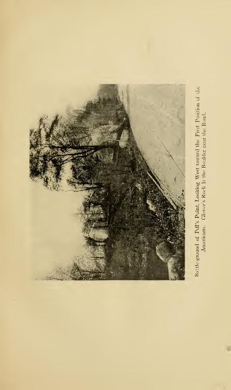
Oh o
PQ
.5 ^° ^/O K
c >'5 sPL,
'J
.m
in
C*-H
cd
oO u
O*a E
5 <
pq
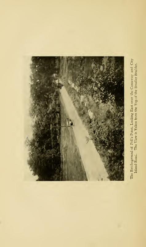
u
>,m
u OT
> 9.
w
c H
._ jgH
IDa2 •a
suW) gip a
anj _rt
PQ"t—i
xiH
From September to November, 1776 145
Rodman's Neck is almost an island, the tide ebbing and
flowing over the salt meadows which separate it from the
mainland. The City Island road passes over the meadows
on a causeway, both ends of which were heavily wooded; the
meadows, about two hundred and fifty yards across, are clear.
To the south, at the west end of the causeway, are two great
boulders marking the first position of the patriots, and where
the fight began. From the causeway to the British landing-
place near the Bowne house is about a mile and a half. The
view looking east was taken from the top of the smaller boulder
and shows the road leading from Pell's Point, over which the
enemy advanced.
As Glover's advanced guard of forty men approached the
causeway, a similar advanced guard of the enemy debouched
unexpectedly from the woods across the meadows. Glover
ordered his men to advance toward the approaching foe, and
when about fifty yards apart, the British poured in a heavy
but ineffective fire; the return fire of the Americans "fell four
of them," as Glover quaintly remarks. A spirited fire was
maintained for a few minutes, during which two Americans
were killed and several wounded ; but the enemy, now heavily
reinforced, compelled the guard to retreat. The British, sup-
posing the victory to be theirs, pursued the fleeing Americans
;
when suddenly, within thirty yards of them, arose a long line
of men from behind a stone wall, who poured in a murderous
volley, compelling the British in their turn to flee without
returning the fire. Five volleys were fired by Read's regiment
upon the mass of chasseurs, grenadiers, and light infantry
crowded upon the narrow road.
For an hour and a half, so it is stated, no further attack was
made. Then a heavy body of the enemy, supported by seven
pieces of artillery, and comprising about four thousand men,
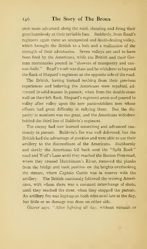
146 The Story of The Bronx
once more advanced along the road, shouting and firing their
guns harmlessly at their invisible foes. Suddenly, from Read's
regiment again came an unexpected and death-dealing volley,
which brought the British to a halt and a realization of the
strength of their adversaries. Seven volleys are said to have
been fired by the Americans, while the British and their Ger-
man mercenaries poured in "showers of musquetry and can-
non-balls." Read's work was done and he withdrew to beyond
the flank of Shepard's regiment on the opposite side of the road.
The British, having learned nothing from their previous
experiences and believing the Americans were repulsed, ad-
vanced in solid masses in pursuit ; when from the double stone
wall on their left flank, Shepard's regiment arose and poured in
volley after volley upon the now panic-stricken men whose
officers had great difficulty in rallying them. But the dis-
parity in numbers was too great, and the Americans withdrew
behind the third line of Baldwin's regiment.
The enemy had now learned something and advanced cau-
tiously in pursuit. Baldwin's fire was well delivered, but the
British had the advantage of position and were able to use their
artillery to the discomfiture of the Americans. Stubbornly
and slowly the Americans fell back over the "Split Rock"
road and Wolf's Lane until the}- reached the Boston Post-road,
where they crossed Hutchinson's River, removed the planks
from the bridge and took position on the heights overlooking
the stream, where Captain Curtis was in reserve with the
artillery. The British cautiously followed the retiring Ameri-
cans, with whom there was a constant interchange of shots,
until they reached the river, when they stopped the pursuit.
An artillery fire was kept up on both sides until late in the day,
but little or no damage was done on either side.
Glover says: "After fighting all day, without victuals or
From September to November, 1776 147
drink, ' lay as a picquet all night, the heavens over us and the
earth under us, which was all we had, having left all our
baggage at the old encampment we left in the morning." The
next day, Saturday the eighteenth, the brigade withdrew to
the Mile Square, three miles distant, to the westward of the
Bronx River.
This engagement has been called the Battle of Pell's Point,
and it is the most important, both from its effects and from the
number of men engaged, that took place within the Borough,
though part of the line of retreat is in the present village of
Pelham Manor, and the final position of the Americans is in
the present city of Mount Vernon; the beginning and main
part of the battle were within the present Pelham Bay Park.
The American loss was six men killed, and Colonel Shepard
and twelve men wounded. At this time, no report of the
losses of the German mercenaries was made, except to their
respective sovereigns; but from the statements of deserters
who came into the American lines from different regiments and
at different places during the following week, and from both
official and unofficial sources, the British loss can be reliably
placed at between eight hundred and one thousand in killed,
wounded and missing. General Gage reported the entire loss
in killed and wounded at Bunker Hill as one thousand and
fifty-four; so that this battle, which many histories ignore,
was almost equally disastrous to the British arms. 2
Further, it saved the American army ; for Howe had received
such a check as to convince him that he could not advance
into the county with impunity. He delayed his movements
1 There was plenty of drinkable water along the way; but by "drink"Glover evidently means rum, the almost indispensable beverage of the
yeoman class of which his command was composed.2 Dawson, in Scharf 's History of Westchester County ; William Abbatt
in the Battle of Pell's Point, and Avery's History of the United States.
148 The Story of The Bronx
until the twentieth, when he advanced to the heights above
New Rochelle, where, two days later, he was joined by the
second division of the Germans, consisting of eight thousand
men under General Knyphausen, who had landed at NewYork on the eighteenth and been transported in boats to
Davenport's Neck in New Rochelle.
Washington in general orders, dated Headquarters, Harlem
Heights, Oct. 21, 1776, complimented Colonel Glover and his
command.
"At the same time, he hopes that every part of the Armywill do their duty with equal duty [sic] and zeal when-
ever called upon; and that neither dangers, difficulties, nor
hardships will discourage soldiers engaged in the cause of
Liberty, and contending for all that freemen hold dear and
valuable."
On October twentieth, Washington learned through the
investigations of an engineer officer, Colonel Rufus Putnam, of
the presence of the British at New Rochelle and of the danger
to the stores at White Plains. He personally visited the
latter place on the twenty-first, inspected the ground, selected
the new positions of the troops, and returned to the neighbor-
hood of Kingsbridge, where the movements preparatory to
retreat were already in progress. The retreat began the same
day by way of Valentine's Hill and the roads to the westward
of the Bronx River, the main route being over what is now
called the "pipe line," via Tuckahoe. With the progress of
this masterly withdrawal of the whole army in the face of a
superior enemy, without loss to the retiring army in either
men or stores, it is without our province to speak. It showed
the military genius of the Commander-in-chief to be of the
first class. The Battle of White Plains occurred on the
From September to November, 1776 149
twenty-eighth; and on the fourth of November, General Howe
withdrew from the front of the Americans, his Westchester
campaign a complete failure.
Upon the withdrawal of the American troops from their
positions at Fordham and Kingsbridge, the barracks and store-
houses were destroyed and the redoubts dismantled, the guns
being rendered useless or being taken with the retiring army.
Trees were felled across the roads both on Manhattan and in
the Borough to render them as impassable to the enemy as
possible; and both bridges, the King's and the Farmers', were
dismantled. The troops who remained were gathered within
the defences of Fort Washington, while Nathanael Greene,
with a small force, occupied Fort Lee on the New Jersey shore,
in general command of both forts.
When Howe left New Rochelle on the twenty-second for
his advance against White Plains, he left the newly arrived
Germans behind him. On the twenty-eighth, Knyphausen
took up his march to Kingsbridge, via the old Boston Road
over the Bronx River at Williamsbridge. Upon arriving at
Kingsbridge, he repaired the bridges and took possession of
the abandoned works of the Americans. Here he was joined
by the other divisions of the army after their withdrawal from
White Plains, some by way of Dobbs Ferry and Yonkers,
others by way of New Rochelle; and preparations were made
for the reduction of Fort Washington. Lord Cornwallis, with
his troops on a flotilla of boats, came up the river from Harlem
and passed through Spuyten Duyvil Creek to the Hudson for
an attack upon the fort from the river side. Two redoubts,
Seven and Eight, were thrown up on Fordham Heights, just
north of Burnside Avenue, and on the sixteenth of November
they began to fire on the American outworks, to cover the attack
by the Germans. Later in the day, the fort was carried by
150 The Story of The Bronx
assault, and Magaw, Cadwalladcr, and their brave troops,
picked men of the American army, to the number of over three
thousand, became prisoners of war; many of them to die in the
prisons of the British, victims of the brutality of Cunningham
and Loring.
The American works were repaired and strengthened and
renamed Fort Knyphausen. Strong detachments occupied
the two redoubts on Manhattan, the Cock Hill fort and Fort
Prince Charles, while posts were established at the two bridges
for their protection. From the British orders of November
22, 1776, certain troops are notified: "Four Days' Provisions,
from the 23d to the 26th, inclusive, will be issued to-morrow
at Dyckman's Bridge." In the same orders: "Lieut-Gen.
Knyphausen will command upon the Heights of Fordham,"
and "A weekly Guard, of an Officer and twenty Dragoons,
from New York to King's Bridge."
General Knyphausen took up his quarters in the Roger
Morris house, so recently occupied by Washington for the
same purpose. This house he was to occupy, off and on, for
seven years, or until the British evacuated the city.
CHAPTER VIII
THE REVOLUTION FROM NOVEMBER, 1 776, TO END OF WAR
THUS far during the Revolution, the contest within the
Borough had been sustained by two large armies
carrying on a regular and systematic plan of cam-
paign. From the fall of Fort Washington in November, 1776,
until its reoccupation by the Americans in November, 1783,
a period of seven years, the contest was carried on by smaller
bodies of troops and bands of marauders engaged in partisan
warfare, with all the bitterness and distress that the name
implies. Not a week passed without some raid or outrage
perpetrated upon the inhabitants, and skirmishes were con-
stant between both the regular and the irregular troops of
both sides.
In 1776, after the Battle of Long Island, Oliver De Lancey
was authorized to raise three battalions of loyalists from the
Tories of Long Island, New Jersey, and New York, and was
appointed brigadier-general in command of the district of
Long Island. Two of these battalions saw service in the South
;
the third, known as the Westchester Light Horse, was re-
cruited principally from the inhabitants of the Borough, of
other parts of Westchester County and of Connecticut. It was
commanded by Lieutenant-Colonel James De Lancey of West
Farms, a son of " Peter of the Mills," and nephew of Brigadier
151
152 The Story of The Bronx
Oliver. The Queen's Rangers, organized by the renegade
Rogers, and, after the Battle of the Brandywine, commanded
by Lieutenant-Colonel John G. Simcoe, was another loyalist
battalion recruited from the neighborhood of New York. In
addition to these two regiments, there were the Chasseurs of
Lieutenant-Colonel Emmerick, partly German and partly
loyalist, and a loyalist battalion commanded by Major
Baremore.
After the loss of Fort Washington, the Americans withdrew
to the Jerseys, and the brilliant successes of Trenton and
Princeton followed. General Lee was left in Westchester
County, but Heath was assigned to the command of the High-
lands and below, with headquarters at Peekskill. Lee finally
departed, and Heath was left without a superior in the district.
He established a line of posts from the mouth of the Croton
River to the Sound at Portchester, then called the "Sawpits."
In the spring of 1777, the British reoccupied the abandoned
fortifications of the Americans on the mainland, restored and
strengthened them, and built several new ones. Their line
of outposts extended from Philipse's Manor (Yonkers) through
Mile Square, Williamsbridge, and Eastchester, with an interior
line of posts at Kingsbridge, Fordham Heights, Morrisania,
West Farms, and Westchester, while the various necks and
points of land extending into the East River were not neg-
lected. There was thus left between the two opposing
armies a wide space of the county, which was subject to the
forays and marauds of both sides;—this constituted the
famous Neutral Ground.
Both sides were equally active in these expeditions; but as
the Borough was British ground, it is with the American raids
into it that we shall principally deal. On account of the suc-
cess that De Lanccy's Horse met with in supplying the British
November, 1776, to September, 1783 153
army with beef, his troops eame to be known as the Cowboys,
a nickname that soon spread to all the British troops and
loyalists engaged in the Neutral Ground, but more especially to
the Tories. The American marauders, in their turn, were
called Skinners, and they were even more blood-thirsty, thiev-
ing, and treacherous than the British; in fact, they robbed
entirely for their own benefit, using patriotism as a cloak to
cover their infamous deeds. If the irregulars of either side
were captured, the nearest tree usually sealed their fate. The
author has run across several "Cowboy trees" within the
Borough; but as they were within the British lines, he is
inclined to believe the fruit they once bore was Skinner and
not Cowboy.
«
In addition to the battalions already mentioned, there was
stationed, until Lord Cornwallis began his southern campaign,
a body of dragoons or light horse under command of Lieu-
tenant-Colonel Banastre Tarleton, a name well hated even by
the average school child of to-day, on account of his sobriquet
of "Bloody" Tarleton. The other commands were usually
composed of German mercenaries, whose willingness to come
to America had been increased by the promise held out to them
by the British authorities that they could add to their pay by
plundering the inhabitants; which they proceeded to do with
strict impartiality to loyalist and patriot alike. The popular
notion is that they could do nothing else but plunder ; but one
has only to visit Chatterton's Hill at White Plains, where they
led the "forlorn hope," or the steep sides of Fort Tryon at
Inwood, to learn the fact that they could fight as well as plun-
der. The German yagers, whom Lossing calls "hired assas-
sins," were notorious for their plundering. The remainder
1 The Spy, by J. Fenimore Cooper, gives the best account of the Skinners
and the Neutral Ground that can be found anywhere.
154 The Story of The Bronx
of the forces occupying the Borough were British light infantry
or squadrons of light horse, and small bands or companies
of loyalist refugees, whose commanders were too obscure to
merit record.
The earliest reoccupation of the Borough by British troops
was on November 3, 1776, when the British General Grant
occupied De Lancey's Mills at West Farms, and the regiment
of Waldeckers took possession of the vicinity of Williams-
bridge. Howe's headquarters were at De Lancey's Mills
during the preparations for the attack on Fort Washington.
The posts already mentioned were extended well into the
country during the summer, but were withdrawn to the Har-
lem River and the Sound during the winter, when the soldiers
occupied barracks and huts erected for quarters. For fire-
wood they used the fences, barns, and houses of the neighbor-
ing farmers and denuded their land of its standing timber to
supply the garrison and people of the city. The farmers, thus
deprived of house and home, took refuge within the lines of
either side, and, taking up the sword, took a merciless revenge
when opportunity offered. The section between the lines
became a desolate wilderness with abandoned farms, grass-
grown roads, and broken-down bridges. John Archer's village
of Fordham between the two bridges at Kingsbridge disap-
peared as firewood for the chasseurs of Emmerick, whose camp
was located at that spot.
At "Upper Cortlandt's," on the bluff to the west of Van
Cortlandt Park and overlooking the Albany Road, was an out-
post of light troops, usually composed of both mounted and
foot yagers, and of detachments of all the German regiments
in New York. In 1778, it consisted of five companies of foot
and one of mounted yagers under Lieutenant-Colonel van
Wurmb ; and in the following year, of yagers and the corps of
November, 1776, to September, 1783 155
Lord Rawdon, afterwards famous in the southern eampaign
for his defeat of Gates at Camden. From this outpost, fre-
quent patrols were made to the vicinity of Yonkers and beyond
and towards the Mile Square and Valentine's Hill. At the
Mile Square, De Lancey kept a recruiting officer at all times.
Upon one occasion in 1777, a band of Americans came near
falling into an ambuscade near Williamsbridge ; but a young
girl saw the movements of both sides and cautioned the Ameri-
cans by waving to them from an upper window of her house.
On these excursions, the yagers generally took along a couple
of light three-pounder field-pieces called amusettes.
These patrolling parties, gathering up recruits, cattle, hay,
and what not, as well as looking out for the enemy, did not
always come and go unmolested; for Sheldon's dragoons,
Major Harry Lee, or the fiery and impetuous Frenchman,
De Armond, with his corps of compatriots, were often lying in
wait for the British; and as the Valentines, Corsas, Hadleys,
and other families of the neighborhood were patriots, timely
notice of the British movements was sent to the American
commanders on the lines, while the informants, acting as
guides, led them to convenient spots where the marauders could
be intercepted. Andrew Corsa and the Dyckmans became
famous as Westchester guides; nor must we forget Enoch
Crosby (the Harvey Birch of Cooper's The Spy), whose fav-
orite route between the lines was by way of the Mill Brook
valley at Morrisania.
In the summer of 1777, Lord Cathcart commanded in the
neighborhood of Kingsbridge, with Emmerick's Chasseurs,
the Queen's Rangers, and the partisan bands of Hovenden,
James, and Sandford. De Lancey 's headquarters were at the
manor-house at Morrisania. He was a special object of in-
terest to the Americans, and many attempts were made by
156 The Story of The Bronx
them to capture him ; but he was always too wary or too for-
tunate for his enemies, and he always escaped them. Upon
one occasion in 1777, he rode to West Farms to visit his aged
mother. His thoroughbred stallion True Briton was tied to
a fence, where it was seen by some American scouts, who
recognized its value and stole it. The horse was taken to
White Plains and sold to an enterprising Yankee from Con-
necticut, who used him for breeding purposes and thus began
the famous line of Morgan horses.
On January 25, 1777, some Americans attacked the block-
house erected by De Lancey at West Farms; but the attempt
was unsuccessful; for, though some of the loyalists were
wounded, none was killed or captured.
On January 5, 1777, Washington, believing the post at NewYork to be weak on account of the main British army being
in New Jersey and many detached for duty in Rhode Island,
directed Heath to approach Kingsbridge, and, if circumstances
promised success, to attack the fortifications there. It was
hoped that, even if the forts could not be taken, the movement
would oblige the British to detach large bodies of men from
New Jersey or Rhode Island for the reinforcement of NewYork, thus threatened by attack. In accordance with these
instructions, on the seventeenth, Heath began a concerted
movement in force against Fort Independence.
General Lincoln advanced by the Albany Post-road to the
heights above Van Cortlandt Park; General Scott came from
Scarsdale to the vicinity of the Valentine house on the Boston
Road, between Williamsbridge and Kingsbridge, and Generals
Wooster and Parsons marched from New Rochelle over the
Boston Road to the same neighborhood. On the morning of
the eighteenth, the three divisions arrived at the enemy's out-
posts just before sunrise. Lincoln captured the outpost in his
November, 1776, to September, 1783 157
front at " Upper Cortlandt's." Heath ordered the cannonade
of the Valentine house, if the guard there resisted, and sent
two hundred and fifty men into the valley between the house
and the fort to cut off the guard in case they tried to retreat
to the fort. Two mounted British pickets came unexpectedly
upon the head of Wooster's column at the Gun Hill Road near
Williamsbridge, and fled to give the alarm. One was dis-
mounted by a shot from a field-piece and captured; but the
other escaped, shouting: "The rebels! the rebels!" and alarm-
ing all the British outposts and pickets, who at once dropped
everything and ran for the fort. The garrisons of Valentine's
and the Negro Fort fled toward Fort Independence and were
fired upon by the pursuing Americans, and one of them was
taken prisoner.
Heath then advanced upon the fort and demanded its sur-
render, which was refused. The garrison consisted of a body
of Hessians and the Queen's Rangers. Two field-pieces were
then sent to a hill south of the fort not far from Farmers'
Bridge and they began a cannonade upon a battalion of Hes-
sians on the other side of the Harlem, near Hyatt's tavern. In
order to get a better shot at the Hessians, one of the pieces was
lowered down the side of the hill to the water's edge; when, to
the surprise of the Americans, the redoubt near the bridge
opened fire on them from cannon which they did not suspect
were there; and they were compelled to scramble up the hill,
dragging their gun behind them, to a lively accompaniment of
cannon-balls from the British redoubt. Heath says
:
"This success at the outposts flew through the country and
was soon magnified into a reduction of the fort, and capture
of the garrison." Washington so reported it to Congress
before receiving the official report, and great disappointment
followed subsequently when the final results were known.
158 The Story of The Bronx
From the nineteenth to the twenty-fourth, there was con-
stant cannonading from both sides and occasional skirmishing
in which both combatants lost several men in killed and
wounded. An attempt was planned on the nineteenth to cross
the ice early on the following morning and cut off the detach-
ment of Hessians at Kingsbridge, and one thousand men were
detailed for the purpose ; but the weather grew warmer during
the night, and the ice became unsafe, so the attempt was
abandoned. On the twenty-first, a field-piece was hauled up
Tippett's Hill, and opened fire on the outposts on Manhattan,
throwing them into confusion and compelling them to seek
refuge within the redoubts and in the cellars. On the twenty-
fourth, the weather moderated and a heavy rain set in, so that
the Americans withdrew from the vicinity of the fort. Manycartridges were ruined by the wet, as the cartridge boxes were
so poorly made. The Bronx River rose so high that the water
flowed over the bridge at Williams's and impeded the with-
drawal of the divisions of Wooster and Scott to New Rochelle.
On the twenty-fifth, early in the morning, the enemv made a
sally upon the regiment stationed as an outpost at De Lancey's
Mills and surprised and routed it and compelled it to with-
draw. Several were wounded, but none was killed or taken
prisoner. Flushed with this success, the enemy then followed
the retiring Americans towards Williamsbridge, driving in the
pickets and outposts, who took refuge in the redoubt situated
to the west of the bridge, while the British took position
behind a stone wall and sent in a hot fire. Some of the troops
had already crossed the Bronx River, but Heath ordered Cap-
tain Bryant of the artillery to ford the bridge and the troops to
follow and support him. When Bryant had almost reached
the top of the hill, where the reservoir now is, he unlimbered his
horses to prevent them from being shot, and the gun was
November, 1776, to September, 1783 159
drawn up by hand almost within pistol shot of the enemy, as
the hill was so steep that the gun could not be depressed enough
to do execution without getting close. Two shots were fired
which opened breaches in the wall, whereupon the British
fled precipitately toward Kingsbridge. Two Americans were
killed and several were wounded. This skirmish has given
the name "Gun Hill" to the hill and road to the westward of
the Williamsbridge railroad station.
While it was not the ultimate intention to besiege Fort
Independence, everything was done by the Americans to make
the enemy believe that the attack was a serious one, with the
hope of drawing him out of his strongholds. A detachment
was sent down to Morrisania to light a large number of fires,
and a number of flat boats was sent to the same place, with
the intention of making him believe that a strong force was
gathering for a descent upon York Island. This so alarmed
the guard at Montressor's (Randall's) Island, that they fired
the buildings and fled to New York; and, it is stated that a
brigade was sent to reinforce Fort Washington, and orders
sent to Rhode Island for a detachment from that place.
On the twenty-ninth, there was every appearance of a heavy
snow-storm, and the generals having unanimously agreed that
it was impracticable to assault the fort with militia, the troops
were ordered to withdraw, and this time, in earnest. A good
deal of forage was carried off, and the divisions returned in a
heavy fall of snow to their former positions at Dobbs Ferry,
New Rochelle, and White Plains. The whole force, with the
exception of a few artillerymen, consisted of militia. It was
one of the few times during the war when they showed them-
selves capable and reliable ; and this too for ten days and in the
midst of winter.
On the thirtieth, the storm cleared up, and a fleet of twenty
160 The Story of The Bronx
vessels from the eastward came to anchor between Hart and
City islands, probably with British troops on board from
Rhode Island. On the thirty-first, the Americans established
a cordon of troops from Dobbs Ferry to Mamaroneck on the
Sound to prevent raids from below; and on the sixth of Feb-
ruary an ineffective raid was made by Colonel Enos with a
strong detachment against Fort Independence with the hope
of surprising the enemy's outposts, but the enemy was too
watchful. Two days later, the inhabitants of the Borough
were subjected to a grand forage on the part of the patriots.
Early in the spring of 1777, the British established the posts
already mentioned and engaged in raids upon the upper county.
The year was a momentous one; and the attention of the
Americans was too busily engaged with Burgoyne, with
Clinton's attempts to get control of the Hudson, and with
Howe's advance on Philadelphia to pay much heed to the pre-
datory warfare in which they were later forced to engage in
the Neutral Ground by the similar actions of the British. Dur-
ing the whole of the years 1777 and 1778, the British were
active, and had large bodies of troops at Verplanck's Point and
in the vicinity of the Highlands; but by August first of this
latter year they had retired below Kingsbridge, leaving only
Emmerick's and Baremore's battalions above the Harlem
River.
During the greater part of the war, the British kept a num-
ber of vessels stationed in the Sound as guard- and patrol-ships.
The inhabitants themselves had a number of whale-boats in
which they made raids across the Sound upon the Tories of
Long Island, in retaliation for the grievances they suffered
from the crews of these ships. In 1777, the guard-vessel
stationed off the mouth of Eastchester Creek was theSchuldam.
A whale-boat party from Darien, Connecticut, carried their
November, 1776, to September, 1783 161
boat across Rodman's Neck one night and took possession of
the market-sloop which plied regularly between Eastchester
and New York, carrying vegetables and other supplies. From
her captain, they learned that he was in the habit of supplying
the Schuldam with chickens, eggs, vegetables, and other farm
products ; so they concealed themselves in the hold of the sloop
and compelled her master to lay her alongside of the guard-
ship. As they approached the Schuldam, her watch called
out: "What sloop is that?" The captain of the whale-boat
party answered: "The Little Stanton.'1 "Take care! take
care! you will be afoul of us!" shouted the watch. "Never
fear!" they yelled back; then added: "The whale-boats are
out on the Sound to-night, and we wish to get under your lee."
In another minute, the sloop had been run alongside the Schul-
dam, and the crew of twelve men clambered aboard and cap-
tured her before her crew could be aroused from sleep. The
watch was driven below, but the noise of the affray aroused the
British on City Island, and they began to fire upon the Ameri-
cans. As the Schuldam was a much larger vessel than they
were accustomed to handle, her captors obliged two of the
prisoners, whom they afterwards set at liberty, to navigate her
into port. Before reaching Stamford, they took six other ves-
sels bound for New York with cargoes of wood.
A short time afterward, another party of whale-boatmen
captured the island, but immediately paroled the inhabitants.
At a later period, it seems there was a tacit understanding
between the British and the Americans, by which the former
had possession of the island by day, and the latter at night.
On August 5, 1778, immediately after the retirement of the
British to the shore of the Harlem River, the Americans took
the offensive and a body of one hundred horse, selected from
the squadrons of Sheldon, Moylan, and the militia, with about
1 62 The Story of The Bronx
forty infantry from Glover's regiment, made a raid by way of
De Lancey's Mills to Morrisania, where they came in contact
with the enemy, who were posted at the manor-house. Asharp skirmish followed, with a loss to the Americans of two
killed and two wounded ; the British loss was greater, and the
Americans returned with a dozen prisoners, as well as stock
and other plunder. On the fifteenth, the enemy tried to
return the compliment; but one of their number deserted and
gave information to Lieutenant-Colonel White of the intent
to surprise him, so that the scheme fell through.
On the twentieth of August, while patrolling out the Mile
Square Road, Emmerick and his chasseurs were attacked and
compelled to return to their camp at Fordham. The Ameri-
can force consisted of a body of light troops and a body of
Stockbridge Indians, all under command of Colonel Gist. The
troops of Gist were posted on each side of the road above the
present Woodlawn Heights in two detachments, north of a
brook which still finds its way through the woods from the hill
above into the Bronx River, while a third party was posted
about three hundred yards west of the road ; the Indians were
between the last party and the road. The positions occupied
by these last two were in the northeast corner of the present
Van Cortlandt Park, between Mt. Vernon Avenue, the eastern
boundary of the park, and Jerome Avenue, which runs through
it. To the north of Vault Hill in the park, was a belt of woods
in which the troops were concealed; the heights on which
the main party was posted were also wooded and are in the
city of Yonkers.
Simcoe learned by means of his spies that the Indians were
much elated by the victory over Emmerick and supposed that
they had driven in his whole force. He took measures to
increase this belief still further; and, sending for De Lancey's
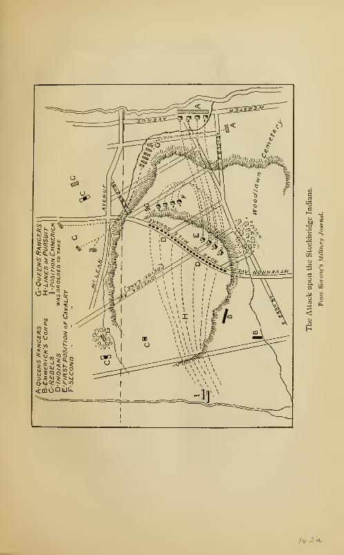

November, 1776, to September, 1783 163
battalion and the Legion Dragoons of Tarleton, prepared a
plan for the ambush and capture of the whole party of Ameri-
cans and Indians. This was a combination of the ablest and
most dashing partisans of the British army—Simcoe, Tarleton,
Emmerick, and De Lancey.
On the morning of August thirty-first, the attacking force
advanced out the Mile Square Road and reached Woodlawn
Heights about ten o'clock . The rangers and dragoons took
post on the right of the road; while Emmerick was ordered
forward to take post in Van Cortlandt's woods at the house
of Frederick Devoe, about half a mile up a lane leading to the
westward. By mistake, he took post near the house of Daniel
Devoe near the entrance to the lane and road, and sent a patrol
up the road. The intention was for Emmerick to draw the
attack of the Americans and Indians and then retreat. The
pursuing Americans would thus be led into the ambush of
rangers and dragoons and the whole party would be captured
or cut off.
Before Simcoe, who was half-way up a tree reconnoitring,
could stop the movement, he saw a flanking party of Ameri-
cans approaching, while the Indians who lined the fence on
Emmerick's left began a smart fire upon the chasseurs. He
therefore pushed up the brook towards Husted's Heights,
where Colonels Gist and Stewart were in position, Tarleton
meanwhile advancing up the road to Emmerick's assistance.
The stone fence bordering the road prevented Tarleton 's
dragoons from passing, and he was obliged to make a circuit
to the right in order to regain the road. Simcoe, learning of
Tarleton's difficulty, left his rangers with Major Ross, and,
taking his company of grenadiers, pushed down the hill from
Husted's into Van Cortlandt's woods and reached the left of
the Indians without being seen by them, as they were so busily
164 The Story of The Bronx
engaged in firing upon Emmerick and Tarleton. With a yell,
the Indians discovered their new assailants and fired upon
them, wounding Simcoe and four of his grenadiers. Being
out-flanked and out-numbered the Indians were driven into
the open fields south of the lane, where Tarleton and Emmerick
gi >t among them with their cavalry. The Indians fought gal-
lantly, pulling some of the dragoons from their horses; but the
contest was too unequal, and they were forced to flee. The
horsemen pursued them over the fields, through the woods,
over Tippett's Brook to the heights to the westward of the
Albany Road, where the survivors hid themselves behind rocks
and in other places of safety and thus escaped. About forty
of the Indians were killed and badly wounded, among the
former being their old chief Nimham and his son. The chief
called to his people to fly, saying: " I am old and can die here."
He wounded Simcoe and was killed by Simcoe's orderly.
Tarleton led the pursuit, and, while striking a fleeing Indian,
lost his balance and fell from his horse. Fortunately for him,
but unfortunately for the patriots of the Carolinas, the Indian
had no bayonet and his gun was discharged, so that Tarleton
escaped. During the pursuit, Simcoe and his rangers seized
the heights at Husted's and captured an American captain and
several of his men ; but the main body under Gist and Stewart
escaped. The bodies of the dead Indians were buried in the
clearing in Van Cortlandt's woods where they fell; and the
place has since been known as "Indian Field."
On October third, Lieutenant Gill of Moylan's dragoons
was patrolling in Eastchester, when he discovered a body of
cavalry in his rear; he either had to surrender or cut his way
through. He chose the latter alternative and forced his way
through, when he found a body of infantry behind the horse;
these he also charged ; but his horse was wounded in the melee
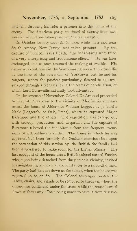
November, 1776, to September, 1783 165
and fell, throwing his rider a prisoner into the hands of the
enemy. The American party consisted of twenty-four; two
were killed and one taken prisoner; the rest escaped.
On October twenty-seventh, Simcoe, while on a raid near
South Amboy, New Jersey, was taken prisoner. "By the
capture of Simcoe," says Heath, "the inhabitants were freed
of a very enterprising and troublesome officer." He was later
exchanged, and at once resumed the making of trouble. His
career was continued in the South and he was with Cornwallis
at the time of the surrender of Yorktown; but he and his
rangers, whom the patriots particularly desired to capture,
escaped through a technicality in the terms of capitulation, of
which Lord Cornwallis naturally took advantage.
On the seventh of November, Colonel De Armond proceeded
by way of Tarrytown to the vicinity of Morrisania and sur-
prised the house of Alderman William Leggett at Jeffeard's
Neck (Leggett's, or Oak, Point), where he captured Major
Baremore and five others. The expedition was carried out
with secrecy, precaution, and despatch, and the capture of
Baremore relieved the inhabitants from the frequent excur-
sions of a troublesome raider. The house in which he was
captured had been formerly the Graham mansion; but upon
the occupation of this section by the British the family had
been dispossessed to make room for the British officers. The
last occupant of the house was a British colonel named Fowler,
who, upon being detached from duty in this vicinity, invited
his neighboring friends and acquaintances to a farewell dinner.
The party had just sat down at the tables, when the house was
reported to be on fire. The Colonel thereupon ordered the
tables, chairs, and viands to be removed to the lawn, where the
dinner was continued under the trees, while the house burned
down without any efforts being made to save it from destruc-
1 66 The Story of The Bronx
tion. That same night, the Colonel led a marauding expedi-
tion towards Eastchester, where a skirmish occurred with the
Americans and he was mortally wounded.
On November thirteenth, Lieutenant Oakley took five
prisoners near Morrisania and came near capturing Colonel
De Lancey, the active leader of the Westchester Light Horse,
who occupied the Archer house lying under the guns of Fort
Number Eight.
On December second, De Armond made another raid toward
Morrisania and captured Captain Cruger of Baremore's corps
and two other prisoners. Cruger was exchanged later and
became lieutenant-colonel of De Lancey's First Battalion of
Loyalists, and as such, with a corps of New York loyalists,
successfully held the redoubt at Ninety-Six, South Carolina,
for twenty-seven days against the attack of Greene and
Kosciuszko.
The winter of 1 778-1 779 was an exceedingly cold one, and
people passed from Long Island to New York on the ice. On
February 7, 1779, a party of three hundred horse and a regi-
ment of infantry crossed from Long Island to Westchester
town. Notwithstanding, predatory operations continued.
About January 19, 1779, a body of volunteers from the
militia regiments at Greenwich, Connecticut, to the number of
eighty, under command of Captains Keeler and Lockwood,
marched to the house of Colonel Hatfield at Morrisania, near
the site of High Bridge, and attacked it about one o'clock in
the morning. They first surprised the pickets, killing three
and driving the rest into the house, where the whole of the
attacked party took to the upper floor and fired from the win-
dows and down the stairs upon those who entered the house.
The possibility of capturing the enemy under such circum-
stances being remote, the house was fired by placing some burn-
November, 1776, to September, 1783 167
ing straw in one of the closets in the lower room. This com-
pelled the defenders to jump from the windows to escape the
flames, and the whole party, consisting of Colonel Hatfield,
one captain, one lieutenant, one quartermaster, and eleven
privates, was taken prisoner. On the return, a number of the
soldiers, tired out by their night's work and believing there
was no danger, straggled behind their companions and were
overtaken by a body of horse sent in pursuit, so that several
of them were killed or taken prisoners.
The same winter of 1 778-1 779, Colonel Aaron Burr made
an attack upon the block-house at West Farms in an attempt
to destroy it. Provided with hand grenades, combustibles, and
short ladders, about forty volunteers approached cautiously
at two o'clock in the morning and cast their missiles into the
fort through the port-holes. Soon the block-house was on
fire, and the little garrison surrendered without firing a shot;
a few escaped. The block-house commanded the crossing of
the Bronx River at De Lancey's Mills. Its site was after-
wards occupied by Mapes's Temperance Hotel at the north-
east corner of East 179th Street and the Boston Road.
In the autumn of 1779, the British began an active cam-
paign in the South, and troops were withdrawn from New York
and its vicinity. In order to contend with the American part-
isans,— Marion, Pickens, Sumter, Lee, and others—similar
corps were needed by the British, and so the light horse of
Simcoe, Tarleton, and Emmerick, so long the scourges of the
Neutral Ground, were withdrawn from the Borough and sent
to Georgia and the Carolinas, where we find them doing active
service against Morgan, Greene, and other patriot leaders. In
consequence of these withdrawals, about the middle of Sep-
tember, all of the redoubts at Spuyten Duyvil and Fordham
Heights, including Number Four (Fort Independence), were
168 The Story of The Bronx
dismantled and as thoroughly demolished as could be and their
stores and garrisons removed to Manhattan Island, where the
fortifications were still further increased in strength. The only
exception was Fort Number Eight, which was maintained till
the end of the war as a base for the operations of De Lancey's
corps and to guard the pontoon bridge over the Harlem River,
as well as to serve as an alarm post to the garrisons at the
northern end of Manhattan Island. The floating bridge over
Spuyten Duyvil Creek was also removed. These posts were
not occupied again by either party during the war, except
during the grand reconnaissance of August, 1781, when Lincoln
and De Chastellux took possession of Fort Independence with-
out restoring or rearming it.
In May, 1780, Captain Cushing of the Massachusetts Line,
guided by Michael Dyckman, the famous Westchester guide,
surprised De Lancey's battalion near Fort Number Eight and
took over forty of them prisoners. On his retreat, Cushing was
followed by a large force of yagers and others. This was
another occasion when the commanding officer of the West-
chester Light Horse was lucky enough to be absent from his
command.
In a letter of Washington's, dated July 31, 1780, we learn
that it is his intention to move rapidly in force upon Kings-
bridge with the object of compelling Sir Henry Clinton to aban-
don his projected attack upon the newly arrived French at
Rhode Island, or of striking him in this quarter if his troops
had been decreased by eight thousand, the number he was
reported to have sent for the attack on Rochambeau. The
army was moved across from the west side of the Hudson to
Peekskill and the march toward New York taken up ; but Clin-
ton, whose departure from Throgg's Neck had been delayed by
the non-arrival of sufficient transports for his troops, received
November, 1776, to September, 1783 169
intelligence of Washington's movement and so gave up the
Rhode Island expedition and returned to New York. This,
in turn, obliged Washington to abandon his plan, and the troops
were again returned to their cantonments on the west shore of
the Hudson. On the twenty-first of September, the British
force from Harlem to Kingsbridge was reported at fifteen
hundred.
During December of this year, rumors reached the Ameri-
cans that De Lancey was planning a raid into North Castle,
above White Plains, and the lines were disposed so as to meet
him. The expedition was made on the twenty-ninth, and De
Lancey's party of one hundred infantry and fifty horse was
turned back and most of their plunder retaken.
On January 18 and 19, 1781, troops were ordered down for
an expedition under Lieutenant-Colonel William Hull (the
commander of Detroit, War of 1812) for an attempt against
De Lancey's post at Morrisania. Hull's force consisted of
about three hundred men. He surrounded the loyalists, forced
a passage to their camp, destroyed the pontoon bridge, took
fifty prisoners, burned the huts and forage, and took a large
number of cattle which he drove up to the American lines. He
was closely pursued, but his covering party under Lieutenant-
Colonel Hazen attacked the pursuers and killed and captured
thirty-five more. Hull's loss was twenty-six men in killed,
wounded, and missing. The enemy retaliated on the seven-
teenth of February by raiding Bedford, where they burned
five houses, plundered and stripped the inhabitants, and re-
turned with eight prisoners, three of whom were lieutenants in
the army. On the twentieth, six of our guides reconnoitring
towards Kingsbridge, fell in with a similar party of De Lan-
cey's and took five of them prisoners, all wounded. Number
Eight continued to be a favorite point of attack, for, on the
1 70 The Story of The Bronx
fifth of March, three more prisoners were taken near it. Per-
haps, the hope of taking De Lancey himself, whose quarters
had been removed from the manor-house of Morrisania to the
protection of Number Eight on account of the frequency of
attacks at the former place, may have served to guide the
Americans to his neighborhood.
In March and April, the traitor Arnold was engaged in
gathering a large number of flatboats in Spuyten Duy vil Creek
for some projected expedition on the part of the British; on
the eighth of April, these were removed down the East River.
On July 21, 1 78 1, Washington advanced in force to the
neighborhood of Kingsbridge with the intention of cutting off
the various light corps of the British and loyalists who had
been harassing the Americans. General Lincoln and the Mar-
quis de Chastellux threw their troops into Fort Independence,
and the British on Manhattan fired on them. Several of our
troops were killed and wounded by the long shots of the yagers,
who kept up a popping fire whenever they could reach the
Americans. The advance was unsuccessful for the object it
had in view ; but the British were obliged to withdraw from
the mainland. De Lauzun, who commanded the left wing of
the French army at Eastchester, with Sheldon's dragoons
and the Connecticut militia, was to scour the country toward
Throgg's Neck, Westchester, and Dc Lancey's Mills with the
hope of destroying or capturing the loyalist bands in that vicin-
ity. He heard the firing toward Kingsbridge and pushed
rapidly to the assistance of Lincoln and De Chastellux.
After this attempt, the combined armies fell back and took
positions well down in the Neutral Ground. On the sixth of
August, General Washington and the Count de Rochambeau
with their staffs and a strong detachment of cavalry and infan-
try as a covering party, made a grand reconnaissance and
November, 1776, to September, 1783 171
inspection of the fortifications on Manhattan. The whole
combined army was advanced for the purpose, and the two com-
manders rode from Kingsbridge to Morrisania, to the heights
of what is now Franz Sigel Park, making a careful inspection
through their glasses of the enemy's positions, while their
engineers made notes of the redoubts and of the topography.
The British opened fire upon the distinguished group and sent
shot and shell hurtling among them, which rather upset the
equanimity of the guide, Andrew Corsa, who took refuge
behind rocks and trees. When he saw, however, that the com-
manders continued the inspection as coolly and calmly as if no
such cannonade was in progress, his courage returned. The
conclusion arrived at by the generals was that the enemy was
too strongly entrenched for successful attack ; while to encom-
pass the British posts on Long Island, Staten Island, and New
Jersey and reduce them would take a very much larger force
than was at their command. The armies were, therefore,
withdrawn to a position in rear of the former one, with the right
at Dobbs Ferry and the French left at White Plains, while an
advanced post was held at Philipse's under Colonel Scammel,
another at Valentine's Hill, and a third at Eastchester. It was
whispered that the Count de Grasse with a French fleet was to
arrive off the capes of the Chesapeake; and the news from
Lafayette, in regard to the movements of Cornwallis into York-
town, indicated where the blow should fall. On August nine-
teenth, the march for Yorktown began ; and in order to deceive
the enemy and to make him believe the army was still present
in force, extensive camp-fires were kept burning for several
nights on Vault Hill in the present Van Cortlandt Park.
Notwithstanding the presence of the American army in
force, De Lancey's command ventured as far from Kingsbridge
as Yonkers on the fourth of August. On the twenty-sixth,
172 The Story of The Bronx
theymade another raid, and three of them were taken prisoners
while driving off some thirty sheep, which were recovered.
Washington, upon his departure for the South, left Heath in
command and advised him to continue the petit guerre with
Sheldon's dragoons, the New York militia, and other light
troops, and to hold the marauders in check. On the nine-
teenth of September, it was reported "that De Lancey's corps
at Morrisania is afflicted with a mortal sickness, and are much
reduced in numbers."
Upon December twenty-third, Captain Williams of the
New York levies, stationed on the lines, made an excursion to
Morrisania with twenty-five volunteers, and was so successful
as to return with one captain, one lieutenant, and seven pri-
vates of De Lancey's command, and without losing a man.
Captain Pritchard moved down with a detachment of Con-
tinental troops to cover the retreat of the horse, but the enemy
did not come out.
On January II, 1782, Captain Honeywell (also spelt Hunne-
well and Hunnywell) of the First Westchester Militia, with a
number of volunteer horse, made an excursion to Morrisania
and brought off as prisoners Captain Totten and three privates
of De Lancey's command. A party of the enemy's horse pur-
sued the retiring Americans, but were checked by Major
Trescott with his covering body of Continental troops, and
no injury was sustained. The special object of the raid was
to capture De Lancey, but he was again absent from his
quarters.
On the twenty-sixth of February, Abraham Dyckman, the
Westchester guide, with thirteen volunteer horsemen, made
another raid upon the Westchester Light Horse at Morrisania
and took five prisoners and five horses. The pursuing party
came too near, so the brave volunteers charged them, took one
November, 1776, to September, 1783 173
man with his horse prisoner, and put the rest to flight. The
enemy collected again and followed the Americans for some
time, but did not have the temerity to come again within
striking distance.
On March fourth, Captain Honeywell, with a party of
volunteer horse, supported by some light infantry under Major
Woodbridge, made a raid to Morrisania, probably from infor-
mation obtained from two prisoners of De Lancey's force
taken the preceding day. The horse proceeded down between
Number Eight and the cantonments of the Westchester Light
Horse, and, having turned the latter between daybreak and
sunrise, entered pell-mell. The enemy were completely sur-
prised and fled in every direction ; some were cut down, others
were so badly wounded that they could not be removed as
prisoners. Several escaped and ran to positions where the
horse could not follow them and began to fire upon the attack-
ing party; this occasioned the firing of alarm guns by the fort.
The horse then withdrew, having nearly accomplished their
object, the capture of De Lancey, and carrying with them as
prisoners one subaltern, twenty privates, and the same number
of horses. The retirement was by way of the Eastchester
road, upon which Major Woodbridge had prepared an ambus-
cade. The enemy quickly gathered a party of horse and light
infantry and started in pursuit, but fell into the ambuscade,
which fired one or two volleys into them, when they broke and
retired, but soon reformed and returned to the charge. The
skirmishing continued for a considerable distance through
Eastchester. The Americans lost two privates killed and three
slightly wounded; the guide, Lieutenant Dyckman, was also
wounded mortally. The State of New York has honored his
memory, as well as that of Lieutenant-Colonel Christopher
Greene and Major Nathan Flagg of the Rhode Island Regi-
174 The Story of The Bronx
ment, by the erection of a handsome granite monument at
Yorktown (the ancient Crompond), about seven miles east of
Peekskill.
On March fourteenth, Lieutenant Harris obtained intelli-
gence of a party of De Lancey's men being at a house near the
Mile Square; and with a party of six surprised the enemy, con-
sisting of twelve men, and killed one and took four prisoners.
On the nineteenth of May, the First Massachusetts Brigade
was ordered down to Kingsbridge to take possession of the
German huts and encamp there. On June twenty-seventh,
there were several British war vessels anchored off the mouth of
Spuyten Duyvil Creek.
It will be noticed in most of the raids that the attacking
force was usually composed of militia and that the supporting,
or covering, party was composed of regulars. This was proba-
bly in pursuance of a plan to inure the militia to danger and
to give them confidence so that they would be rendered less
unreliable. Their plundering proclivities were also given full
play when they got inside the British cantonments.
On September 16, 1782, the enemy made a grand forage near
Valentine's Hill under the personal supervision of the Com-
mander-in-chief, Sir Guy Carlcton. He was attended by the
young prince, William Henry, afterwards King William Fourth
,
and a large detachment of troops, stated to have been between
five and six thousand, as a covering party. The enemy fore-
stalled the Americans, who were sadly in want of forage them-
selves, owing to the dryness of the season. On October
twentieth, the British demolished their works at Number
Eight. A few days later, the American army withdrew to
cantonments in the Highlands.
Both sides were awaiting the news of the signing of a defini-
tive treaty of peace, and active operations ceased in the early
November, 1776, to September, 1783 175
part of 1783. The district so frequently raided by the light
troops of both sides, thus deprived of all military control, or
semblance of it, was given over to irresponsible bands of
thieves and plunderers, who took from the few remaining
inhabitants what little they had left. Until the civil authority
of the State was once more established, the Borough was
the scene of murder, robbery, and burnings, which were
without any cloak of military authority, except in so far as
they were revengeful attacks upon the few hated loyalists who
remained, or who had not fled to New York upon the with-
drawal of the British outposts. Even as it was, these ma-
rauders did not waste much time, if there wa» anything to be
stolen, in asking or inquiring into the political opinions of their
victims.
On August 7, 1783, Sir Guy Carleton received orders from his
government to evacuate the city of New York ; but the move-
ment was delayed for several months owing to the great num-
ber of loyalists who were in the city. Rigorous measures of
punishment and confiscation had been enacted in all the States
against these unhappy adherents of the crown, and as no
assurances of protection could be given by the military authori-
ties in view of the prospective resumption of power by the
civil authorities, they nearly all desired expatriation rather
than submit themselves to the doubtful mercies of their former
neighbors and countrymen. It is to the credit of the British
Government that it did not forsake these unfortunates entirely
in their hour of need ; and especially is credit due to the kind-
hearted Carleton, whom Heath considered as the ablest and
best of all the British generals who served in America. Trans-
portation to Nova Scotia, New Brunswick, Upper Canada, and
England was therefore furnished; but several months were
consumed before the city was cleared of the loyalists and the
176 The Story of The Bronx
troops ready to depart. The day was finally set for the
twenty-fifth of November.
In view of the departure of the British troops, Governor
George Clinton, on November fifteenth, issued a proclamation
calling the civil officers of the State government to meet him in
council at Eastchester, and steps were taken by both sides to
prevent any disorderly demonstrations upon the occasion of
the reoccupation of the city by the Americans.
A few days before the twenty-fifth, the remaining American
troops, little more then a grand guard of honor to General
Washington and Governor Clinton, under command of General
Knox, began th«r march from Dobbs Ferry over the Albany
Road to Kingsbridge, crossing on the twenty-fourth and reoc-
cupying the upper portion of Manhattan. On the following
morning, the march was continued over the connecting roads
and down the Bowery Lane; and, as the Americans entered
the upper end of the city, the British departed from the Bat-
tery, after seven years and two months of possession.
CHAPTER IX
FERRIES AND BRIDGES
THE Borough of The Bronx is separated from the
Boroughs of Manhattan, Brooklyn, and Queens by
Long Island Sound, the East River, the Harlem
River, and Spuyten Duyvil Creek. The origin of the name
of the "Sound," as it is distinctively known to all the in-
habitants of the southeastern part of New York State, is
apparent from the geographical definition of the term. The
East River was so called from its lying east of the island
of Manhattan. In the Keskeskeck deed of 1639, we read
of "the Kil which runs behind the Island of Manhattan,
mostly east and west." This kill, which was called by
the Indians Muscoota, soon received a more distinctive
name; for the Dutch settlers had already begun to occupy
the flats at the northern end of the island, and with char-
acteristic Dutch patriotism, called their little settlement
Nieuw Haarlem, after the town of Harlem in Holland.
The kill thus became known as the Haarlem, or Harlem,
River. It does not run "mostly east and west," but
rather, north and south. It is not a true river; but with
Spuyten Duyvil Creek it constitutes a strait connecting the
Hudson with the Harlem, which latter is itself a strait con-
necting the Sound with New York Bay.
« 177

178 The Story of The Bronx
Spuyten Duyvil Creek appears on ancient maps and docu-
ments as "Spouting Devil," "Spiking Devil," "Spikendevil,"
"Spitting Devil," and several other variants, as well as under
its Indian name of Muscoota. The origin of the name is
problematical. One reason given for it is that near the eastern
entrance of the creek, the inflowing tides from the Hudson and
Harlem rivers met and caused such a commotion in the water
as to make it difficult and dangerous to pass; the waves, or
tide rips, throwing the water into the air, or spouting. The
second part of the name expresses plainly, but profanely, the
feelings of those attempting to use the passage. Another the-
ory given by Riker is that the Indians gave it the name of
" Spouting Devil" in memory of the attack made upon them by
the Half-Moon on her return down the river, when she spouted
fire at them from her falcons. This would suppose on the part
of the Indians a knowledge of English which they could not
have had until nearly sixty years after the event. Still another
theory ascribes the name to the spouting spring at the foot of
Cock Hill, Manhattan; and Riker quotes from an old record
of 1672, which calls it expressly, Spuyten Duyvil, alias the
Fresh Spring. He also states that, in consequence, this
section was known for many years as the Spring. John Adams,
in his diary, calls it the Uncas River, possibly meaning Yonkers
River, one of the names by which Tippett's Brook was some-
times known.
The most popular origin of the name is that given by
Washington Irving, whose descriptions have such verisimili-
tude that they have almost passed into authentic history.
In describing the capture of New Amsterdam by the English,
in 1664, Diedrich Knickerbocker says that when the British
appeared off the city in September, 1664, Stuyvesant sent
his trumpeter, Anthony Van Corlaer, to arouse the surround-
Ferries and Bridges 179
ing country to come to the assistance of his beloved city.
When the trumpeter reached the creek separating Manhattan
Island from the mainland, it was dark and stormy, and Van
Corlaer could get no one to ferry him across. He fumed and
spluttered for a while; then, realizing the importance of his
errand, took a swig of his black bottle, and plunged into the
stream, exclaiming at the same time in Dutch: " I will cross,
en spijt den Dnyvil (in spite of the Devil)." When the luck-
less trumpeter was half-way across, he was seen to struggle
violently as if battling with his Satanic majesty. At the same
time an enormous moss-bunker—a fish very common in
these waters—was seen to rise from the water and grab the
struggling trumpeter; an instant later, and both disappeared
beneath the waves forever. Such, in brief, is the origin of
the name, according to Irving.
The western boundary of the Borough is the lordly Hudson,
called by all the inhabitants of this part of the State the
river. No bridges or ferries connect the Borough with the
opposite shore of New Jersey.
There was, doubtless, some communication between the
mainland and New Harlem in canoes and dug-outs, and
the fertile woods of the former furnished a range for cattle. In
October, 1667, Colonel Nicolls granted four lots near Spuyten
Duyvil to the inhabitants of Harlem for that purpose. It
was not until the mainland became more settled, and com-
munication with the eastern colonies more desirable, that
ferries were established or bridges built.
As early as 1658, the director-general of New Netherland
authorized the maintenance of a ferry with a suitable scow
between Harlem and Brouncksland. Nothing was done,
however, until 1666, when Governor Nicolls granted a
charter to the Harlemites, in which, among other things, he
180 The Story of The Bronx
allowed them "a ferry to and from the main which mayredound to their particular benefit," and to construct one or
more suitable boats or scows for the transportation of men,
horses, and cattle at reasonable charges. In January of the
following year (1667), the authorities of Harlem, in carrying
out the provisions of their charter, determined to establish
a good ferry, and that a suitable ordinary, or tavern, should
be built for the accommodation of those who used the ferry.
Mayor Delaval promised to furnish the nails for the making
of a scow, provided their value should be paid to him by the
ferryman.
Johannes Verveelen agreed to take the ferry and maintain
the tavern for six years; and he was duly sworn to provide
lodging, food, and drink to travellers, and to ferry them over
the river at their convenience ; but no liquor was to be sold to
Indians. The ferry and inn were located about three
hundred feet west of the present First Avenue, at East 123d
Street. The site on the Borough side is unknown, but it
was probably within the limits of the yards of the New York,
New Haven and Hartford Railroad. The filling in and ex-
tension of water-front property have changed very materially
ancient sites and locations ; places which were upon the shore
in olden days are now very often several blocks inland.
Verveelen did not always strictly observe the excise laws,
and this brought him into conflict with the authorities; but
his contention that he was a public benefactor and should,
on account of expenses, be exempt from excise fees, seems to
have prevailed; for on July 3, 1667, a new arrangement was
made with him by which he was to maintain the tavern and
ferry for five years without the payment of rent therefor. In
addition, he received an acre of land on the Bronx side of the
river, and a place to build a house, which should be bought
Ferries and Bridges 181
from him at an appraised value in the event of the ferry being
leased to another ferryman. The rates of ferriages were as
follows:
For every passenger, two pence silver or sixpence wampum
;
for every ox or cow that shall be brought into the boat, eight
pence or twenty-four stivers; cattle under one year old, six-
pence, or eighteen stivers wampum ; all cattle that swam over
paid half price. At the tavern the charges were: meals, eight
pence; lodging, two pence; for keep of horse, four pence, or
twelve stivers wampum, provided the grass be in fence.
Government messages were to be carried free; and in consid-
eration of his maintaining houses on both sides of the river,
he was exempt from paying taxes on'
' what wine or beer he may
retail in his house " for one year from the date of the agreement.
The "wading place" has already been mentioned several
times. It was a natural ford through Spuyten Duyvil Creek
about where the bridge carries Broadway across the stream.
In ancient days, there was a tidal stream from Tippett's
Brook, about three quarters of a mile from its mouth, con-
necting with the Harlem River about where the Kingsbridge
station of the railroad is now located. This made, in con-
nection with Tippett's Brook and Spuyten Duyvil Creek, an
island, principally of low, marshy land with a rocky core,
which was known as Paparinaman, or Paparinemo. This
connecting creek has long since filled up by alluvial deposits
;
in fact, the whole stretch of land from the creek to the Van
Cortlandt mansion, and between Tetard's Hill on the east
and Tippett's Hill on the west, with the exception of the rocky
bluff over which Church Street runs, is also of alluvial deposit.
During the three years from 1901 to 1904, contractors were
engaged in laying a great trunk sewer on the line of Broadway,
and the deep excavations laid bare the several strata of this
1 82 The Story of The Bronx
deposit, the lowest being of rich, black vegetation in that
condition of decay, or preservation, known as peat. The
grasses of the ancient meadows were plainly perceptible,
though they had been covered for centuries by the deposits
of sand, clay, or gravel at the bottom of what must have been
in earlier times a very considerable bay, within the boundaries
just given. The whole is now a vast meadow, through which
flows Tippett's Brook, rising and falling with the tide.
Nature had placed in the middle of Spuyten Duyvil Creek
a reef which was bare at low tide, and which had been from
time immemorial a ford, or wading place, to and from the
mainland. The new ferry at Harlem could not divert travel
from this ford; and, as Verveelen lost his fees by its use, he
was directed by the Harlem authorities to fence off the ap-
proach to the ford. The fence he erected was torn down by
travellers, who continued to use the ford so as to save tolls.
John Barker, of Westchester, passed over it with a number of
cattle, and Verveelen claimed that he had been defrauded of
his ferriages. A suit brought by him in the Mayor's court at
Harlem was decided in his favor, and Barker was obliged to
pay the tolls; but Verveelen was directed to repair the fences
with the money. Again and again the fences were torn down
and travellers used the ford; until, finally, the Harlemites
recognized the futility of attempting to divert traffic from
this natural highway and proposed abandoning the Harlem
ferry. Governor Lovelace, to whom Verveelen appealed,
claiming that he would lose heavily by this- abandonment,
communicated with the Harlem authorities, February 27, 1669,
and suggested the removal of the ferry to the more convenient
"wading place." In this the authorities concurred on the
second of March; and the same day, Verveelen was granted
the ferry for three years by Governor Lovelace, to be main-
Ferries and Bridges 183
taincd "at the place commonly called Spuyten Duyvel, between
Manhattan Island and the new village called Fordham."
In obedience to the orders of the governor, the approaches
on both sides were fenced off so as to prevent the use of the
ford. Verveelen received a grant of the island, or neck, called
Paparinemo, where he was to erect a good house, furnished
with three or four good beds for the entertainment of travellers,
and to keep at all seasons a proper supply of food for them,
their horses, and their cattle, as well as stabling. In addition,
he was to have a "sufficient and able boat" for the transporta-
tion of travellers and their horses and cattle; and to be in
attendance himself, or by deputy, at all seasonable hours to
transport the same across the ferry ; also to preserve and keep
in order a fence furnished with a gate which should keep out
all persons from the wading place without his permission.
The ferry franchise and Paparinemo were granted to him, his
heirs and assigns for eleven years from November 1, 1669, with
the right of preference in the letting of the ferry at the ex-
piration of that period. The quit-rent was ten shillings yearly
to the Duke of York. Persons on government business, and
those summoned under arms in an emergency were to pass
free, as well as droves of horses and cattle the day before a
fair, the day of it, and the day after it. All persons, under
prescribed penalties, for the infliction of which Verveelen was
made a constable, were to pay toll as follows:
"For lodging any person, eight pence per night, in case they
had a bed with sheets; and without sheets, two pence in silver;
"For transportation of any person, one pence in silver;
"For transportation of a man and horse, seven pence in
silver
;
"For a single horse, six pence;
"For a turn with his boat, for two horses, ten pence; and
184 The Story of The Bronx
for any more, four pence apiece; and if they be driven over,
half as much;
"For single cattle, as much as a horse;
"For a boat-loading of cattle, as much as he hath for horses;
"For droves of cattle to be driven over and opening ye
gates, two pence per piece;
"For feeding of cattle, three pence in silver;
"For feeding a horse one day or night with hay or grass,
six pence."
The expression "to be driven over" refers to the use of the
ford instead of the boat. It must be remembered that the
distance across was greater then than it is now, as the sides
of the creek have been filled in. If any reader has ever seen
the tide race through the creek before the cutting of the ship
canal, he can easily believe that the working of the boat from
shore to shore was no easy task.
The approach to the upper side of the ferry was over the
meadow, or marsh, already described as the island of Paparin-
emo, and Verveelen was obliged to stand one third of the
expense of building a bridge or causeway to the village of
Fordham. His neighbors, Betts, Tippett, and Hadden (or
Haddy), whose purchases of land from Elias Doughty have
already been noted, were more anxious to have a bridge over
the Bronx River, so as to get to Eastchester, which was more
convenient to their land. The interested parties, as well as
the inhabitants of Fordham, were summoned to a hearing
before the governor at the Fort; and after hearing all sides,
he decided that the causeway, being the bigger undertaking,
should be finished first, and then all hands should turn to and
help Betts, Tippett, and Hadden to build the bridge to East-
chester (probably the beginning of Williams's bridge), which
should have a fence or gate on the eastern side to keep the
Ferries and Bridges 185
"Hoggs" from roaming across. The freedom of the ferry
was granted to the three proprietors, and also to the inhabit-
ants of Fordham for their assistance in building the " causey,"
as long as the ferry was run by Verveelen and his assigns.
This causeway, in all likelihood, was on the same line as the
street connecting Broadway with the Albany Post-road, of
which it was a part, and which was named locally Macomb
Street. The building of the causeway was an opportunity
for John Archer to get into a row with his neighbors, Betts,
Tippetts, Hadden, and Verveelen—a chance which, if we are
to believe the records of him, he would not, and did not, let
pass. Verveelen was ferryman for many years, and was
succeeded by his son Daniel, who was ferryman until the
building of the King's bridge, in 1693.
There was established, in 1743, a ferry from the mouth of
Westchester Creek to Powell's Point at Whitestone, Long
Island. Ferris Avenue leads down from the Throgg's Neck
road to "Old Ferry Point" on the eastern side of the creek.
In 1755, a ferry was in operation between Ann Hook's Neck,
or Rodman's Neck, and Hempstead Bay on Long Island,
Samuel Rodman and John Wooley being the patentees. On
an ancient map of Eastchester, there is marked a side road
"leading to the Whitestone Ferry"; which establishes the
fact of a ferry from some point on Eastchester Creek to the
opposite side of the Sound. These ferries were probably
maintained in a rude boat, a large dug-out, called a periauger,
capable of carrying passengers, but not horses or cattle. The
Harlem ferryboat was a large scow built for the purpose of
carrying heavy animals and wagons, as we can see by the
rates of toll. The East River, or Sound, was narrow at the
points of passage, so that communication was easy; for
animals and wagons, sloops were used. Long Island, in com-
1 86 The Story of The Bronx
parison with Westchester County, was thickly settled, so
that a ready and easy means of communication was not only
convenient but necessary. The Long Island settlements
were nearer to the county than New York City; and a trip
to the city by land was long and tedious, as the traveller had
to go by way of Spuyten Duyvil Creek; while by water, the
voyager had to encounter all the dangers and terrors of
Hell Gate, a mighty bugbear in the early days before Fulton
planned his "folly" and introduced steam navigation.
As time passed, the travel between York Island and the
mainland increased to such an extent that it was deemed ad-
visable to substitute a bridge for the ferry. Accordingly,
in 1680, the Governor's Council ordered a survey to be made
at the "Spiting Devil" with that end in view, and a bill was
introduced in the Provincial Assembly in 1690, authorizing
its construction. In the following year, Governor Fletcher
recommended it to the city authorities, but they were deterred
from building it by "the great expense." In January, 1693,
Frederick Philipse offered to build it at his own expense, pro-
vided he were assured of reasonable tolls to cover his outlay
and expense. His manor grant of June 12, 1693, reads in
part:
"And whereas our loving subject the said Frederick Philipse
. . . prayed . . . that we would further grant unto our said
loving subject a certain neck or island of land called Paparin-
emo . . . with the salt meadows thereunto belonging,
together with power and authority to erect a bridge over the
water or river commonly called Spiten devil ferry or Papa-
rinemo, and so receive toll from all passengers and droves of
cattle that shall pass thereon, according to rates hereinafter
mentioned . . . and that he is likewise willing at his ownproper cost and charge to build a bridge at the ferry aforesaid
Ferries and Bridges 187
for the benefit and accommodation of travellers . . . Knowye, that of our special grace, certain knowledge, and meremotion we have given, granted, etc. . . . unto said Frederick
Philipse . . . the aforesaid neck or island of land called
Paparinemo, and the meadow thereunto belonging, with
power, authority, and privilege to erect and build a dam bridge
upon the aforesaid ferry at Spitendevil or Paparinemo and
to receive rates and tolls of all passengers and for droves of
cattle according to the rates hereafter mentioned (that is to
say), three pence current money of New York for each manor horse that shall pass the said bridge in the day time, andthree pence current money aforesaid for each head of neat
cattle that shall pass the same, and twelve pence current
money aforesaid for each score of hogs, calves, or sheep that
shall pass the same, and nine pence current money aforesaid
for every boat, vessel, or canoe that shall pass the said bridge
and cause the same to be drawn up, and for each coach, cart,
or sledge, or waggon that shall pass the same the sum of nine
pence current money aforesaid [Here follow advanced rates
for passage after sunset—Author.] . . . and it is our royal
will and pleasure . . . the aforesaid bridge to be from hence-
forth called Kingsbridge in the manor of Philipseborough
aforesaid . . . reserving unto us, our heirs and successors,
free egress and ingress of all and their forces, horse or foot,
of our and their coaches, waggons, stores of war, ammunition,
and expresses that shall from time to time pass the bridge
for our or their service."
The bridge was constructed the same year about where
the present Broadway bridge crosses the creek. It was
twenty-four feet wide, with a gate at one end to prevent the
passage of travellers or cattle without the payment of "toles."
It was also fitted with a draw to allow of the passage of boats.
Upon petition of Frederick Philipse, Second (through his
guardians), in 1713, the Assembly authorized the removal
of the bridge to the present site, because at high tides the
1 88 The Story of The Bronx
causeway leading to the bridge from the Manhattan side,
and sometimes the bridge itself, were overflowed by the waters
of the creek, thus rendering the passage over the bridge
dangerous and often impossible. It remained in the pos-
session of and under the control of the manor-lords until the
sequestration of the manor by the State Assembly, in 1779,
on account of the alleged treason and disloyalty of Colonel
Frederick Philipse, the third and last lord of the manor.
After the forfeiture of the manor, the bridge became free, as
it virtually had been since 1759.
Until the year 1900, a considerable detour was necessary
to approach the bridge from either side of the creek. In
order to remedy this, the city authorities constructed a modern
steel bridge over the ancient "wading place," which cannot
be many feet away from the site of the ferry and the bridge
of 1693. This bridge is officially known as the Spuyten Duyvil
Creek bridge. It makes direct communication from the
Kingsbridge Road, Manhattan, to Broadway, or the Albany
Post-road, on the Borough side. The contract price for the
bridge was $53,607, but the actual cost was in the neighbor-
hood of seventy-five thousand dollars, including approaches.
It was opened to the public, May 16, 1900. During the
building of the elevated portion of the "Subway" in the year
1904, it was found necessary to remove the bridge, as the
piers were of insufficient size and strength to support the heavy
superstructure of the railway tracks. The steel bridge of
1900 has, therefore, been replaced by the present structure.
Since the opening of the ship canal in 1895, there has been
little or no traffic through the stream ; and the creek has been
filled in from the mouth of Tippett's Brook to the abutments
on the west side of the bridge with the materials removed
from the excavation at the Grand Central Station. It is
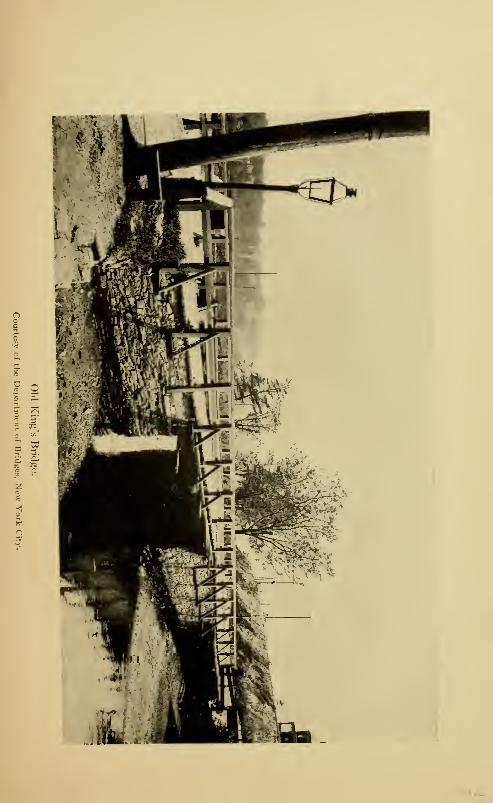
n "— -r*
a na
z
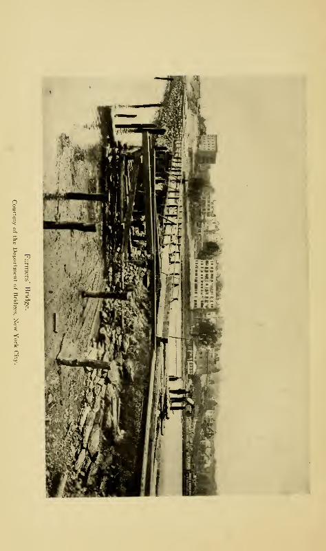
a a »
3. M '
Ferries and Bridges 189
also proposed to fill in the eastern side and make a ball field
of it—if this is done, the creek will be a name only. With
these changes going on, the author fears that the doom of the
ancient bridge is sealed; and in a few years, its very site will
be a matter of conjecture. This will be a great pity, as there
is hardly any spot within the city of such historic interest.
Over it passed Washington and his beaten army, in 1776;
over it they passed again in 1783, this time with their faces
southward; and in colonial times it is constantly referred to
as the main passage from New York City to the mainland.
The author has suggested that the bridge be removed, abut-
ments and all, to Van Cortlandt Park, and there erected over
Tippett's Brook, or upon the land; in either case, it can be
properly cared for. Where it once stood, there should be
placed an appropriate monument with an historic legend,
stating briefly the history of the bridge that once occupied
the site. Unless something is done very soon, the whole
bridge will have disappeared and it will be too late ; and there
will be no excuse for the loss of this historic relic, as the city
owns it and its site.
Near the northern approach to the bridge, the manor-lord
maintained a tavern for the accommodation of travellers.
In his novel of Satanstoe, Cooper makes the hero, Corney
Littlepage, and his friend, Dirck Follock, stop at the tavern
for meals on several occasions when they passed between
Westchester and the city, about 1 755-1 760; Cooper calls the
landlady, Mrs. Lighte. From the bridge, the whole section
took the name of Kingsbridge from early times, a name which
it retains to-day, and one which, it is hoped, it will long
retain to keep alive the ancient associations of the locality.
It can be readily believed that the King's bridge with its
exaction of tolls was not a popular institution with those that
190 The Story of The Bronx
were obliged to use it; especially with the farmers of the
neighborhood, who found the growing city a good market
for their wood, vegetables, poultry, and other farm products,
or with the belated traveller who was compelled to arouse the
drowsy keeper of the toll-gate. The agitation against the
bridge culminated in 1756. The French and Indian War was
then in progress, and large bodies of British troops were con-
stantly in the city of New York on their way to and from the
scenes of war. Their commissariat had to be supplied, and
grain and forage for the horses; and the Westchester farmers
had a share of this profitable trade, as well as the farmers of
Long Island and New Jersey. The tolls at the bridge became
a heavy burden to them, and must have been a source of con-
siderable revenue to Colonel Philipse.
Benjamin Palmer of City Island headed the movement for
the construction of a free bridge, and in 1756, a popular
subscription was started. Enough having been subscribed,
Palmer began the construction of his bridge at the site of the
original bridge, removed in 17 13, as stated above. As the
northern end of the bridge would thus have been on the island
of Paparinemo, its owner, Colonel Philipse, naturally objected,
and Palmer was obliged to seek a site farther down stream.
This he found on the land of Thomas Vermilye on the Fordham
side and of Jacob Dyckman on the Manhattan side, both of
whom interested themselves with Palmer in building the
bridge. Colonel Philipse, of course, resented this attempt
to deprive him of his tolls, and twice caused Palmer to be
impressed as a soldier for service in Canada; an action which
put Palmer to considerable expense in furnishing a substitute
on both occasions, besides delaying the completion of the
bridge. The movement, however, was a popular one; and
despite delays and opposition, the bridge was ready for use
Ferries and Bridges 191
at the end of 1758. On New Year's Day, 1759, hundreds of
people from the surrounding country and from Manhattan
Island attended a great barbecue to celebrate the opening of
the "Free Bridge," which was accomplished amid great re-
joicings. The toll bridge fell into disuse, the gatekeeper gave
up his position, and Colonel Philipse had to advertise for a
new lease ; from this time forth, it was virtually a free bridge
also.
Dyckman erected a tavern on the Manhattan side of the
bridge, but failed soon afterward, the tavern passing into
the hands of the Hyatts, father and son, and becoming famous
in Revolutionary annals, where it is frequently mentioned.
Dyckman asked relief from the Legislature for the expense
and disbursements he had been under in the construction of
the bridge, but was not successful. Palmer, at the end of the
century, also made unsuccessful appeals to the Legislature for
his outlay. The press took up his cause and stated that he
had struck the first blow for American freedom in this State,
"for it was almost as difficult for Mr. Palmer to get a free
bridge in those days as it was for America to get her freedom."
Aaron Burr and others finally subscribed a purse of £30 to
relieve the necessities of the old man.
A road was built from the Westchester end of the bridge,
connecting with the Albany and Boston post-roads. The
bridge was equally known as "Dyckman's Bridge," the "Free
Bridge," and the "Farmers' Bridge." It is known to-day
in the vicinity as "Hadley's Bridge," probably from the fact
that this portion of the ancient manor of Philipsburgh was
bought from the Commissioners of Forfeiture in 1785 by
George Hadley, and occupied by him. The site of the present
Farmers' Bridge is identical with that of the original bridge,
which appears on one military map of the Revolution under
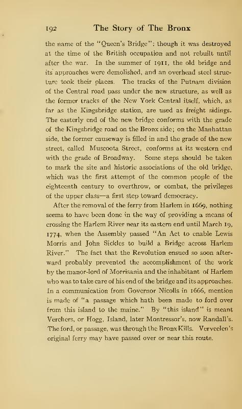
192 The Story of The Bronx
the name of the "Queen's Bridge"; though it was destroyed
at the time of the British occupation and not rebuilt until
after the war. In the summer of 191 1, the old bridge and
its approaches were demolished, and an overhead steel struc-
ture took their places. The tracks of the Putnam division
of the Central road pass under the new structure, as well as
the former tracks of the New York Central itself, which, as
far as the Kingsbridge station, are used as freight sidings.
The easterly end of the new bridge conforms with the grade
of the Kingsbridge road on the Bronx side; on the Manhattan
side, the former causeway is filled in and the grade of the new
street, called Muscoota Street, conforms at its western end
with the grade of Broadway. Some steps should be taken
to mark the site and historic associations of the old bridge,
which was the first attempt of the common people of the
eighteenth century to overthrow, or combat, the privileges
of the upper class—a first step toward democracy.
After the removal of the ferry from Harlem in 1669, nothing
seems to have been done in the way of providing a means of
crossing the Harlem River near its eastern end until March 19,
1774, when the Assembly passed "An Act to enable Lewis
Morris and John Sickles to build a Bridge across Harlem
River." The fact that the Revolution ensued so soon after-
ward probably prevented the accomplishment of the work
by the manor-lord of Morrisania and the inhabitant of Harlem
who was to take care of his end of the bridge and its approaches.
In a communication from Governor Nicolls in 1666, mention
is made of "a passage which hath been made to ford over
from this island to the maine." By "this island" is meant
Verchers, or Hogg, Island, later Montressor's, now Randall's.
The ford, or passage, was through the Bronx Kills. Verveelen's
original ferry may have passed over or near this route.
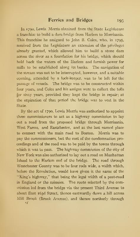
Ferries and Bridges 193
In 1790, Lewis Morris obtained from the State Legislature
a franchise to build a dam bridge from Harlem to Morrisania.
This franchise he assigned to John B. Coles, who, in 1795,
received from the Legislature an extension of the privileges
already granted, which allowed him to build a stone dam
across the river as a foundation for his bridge, which should
hold back the waters of the Harlem and furnish power for
mills to be established along its banks. The navigation of
the stream was not to be interrupted, however, and a suitable
opening, attended by a lock-keeper, was to be left for the
passage of vessels. The bridge was to be constructed within
four years, and Coles and his assigns were to collect the tolls
£or sixty years, provided they kept the bridge in repair; at
the expiration of that period the bridge was to vest in the
State.
By the act of 1790, Lewis Morris was authorized to appoint
three commissioners to act as a highway commission to lay
out a road from the proposed bridge through Morrisania,
West Farms, and Eastchester, and at the last named place
to connect with the main road to Boston. Morris was to
pay the commissioners, but the cost of the condemnation pro-
ceedings and of the road was to be paid by the towns through
which it was to pass. The highway commission of the city of
New York was also authorized to lay out a road on Manhattan
Island to the Harlem end of the bridge. The road through
Westchester County was to be four rods wide, a width which,
before the Revolution, would have given it the name of the
"King's highway," that being the legal width of a post-road
in England or the colonies. The route selected by the com-
mission led from the bridge via the present Third Avenue to
about East 163d Street, thence eastwardly down a hill across
Mill Brook (Brook Avenue), and thence northerly through13"
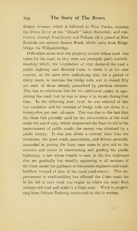
194 The Story of The Bronx
Boston Avenue, which it followed to "West Farms, crossing
the Bronx River at the "Bleach" below Bronxdale, and con-
tinuing through Eastchester and Pelham till it joined at NewRochelle the ancient Boston Road, which came from Kings-
bridge via Williamsbridge.
Difficulties arose with the property owners whose land was
taken for the road, as they were not promptly paid; notwith-
standing which, the Legislature of 1797 declared the road a
public highway and directed Coles to finish it at his own
expense, at the same time authorizing him, for a period of
thirty years, to increase the bridge tolls, not to exceed fifty
per cent, of those already prescribed by previous statutes.
This was to reimburse him for his additional outlay in com-
pleting the road ; but he was to keep it in repair during that
time. In the following year, 1798, he was relieved of this
last condition and his increase of bridge tolls cut down to a
twenty-five per cent, advance. This was due to the fact that
the State had partially paid for the construction of the road
under the act of 1797, which empowered the State to aid in the
improvement of public roads; the money was obtained by a
public lottery. It was just about a century later that the
wheelmen, the good roads associations, and drivers generally
succeeded in getting the State once more to give aid to the
counties and towns in constructing and grading the public
highways; a law whose benefit is seen in the fine highways
that are gradually but steadily appearing in all sections of
the State under the guidance of competent engineers and road-
builders, instead of that of the rural road-master. This im-
provement in road-building has affected the Coles road; for
in the fall of 191 1 work was begun to widen the more than
century-old road and make it a State road. Work is progres-
sing from Pelham Parkway northward as this is written.
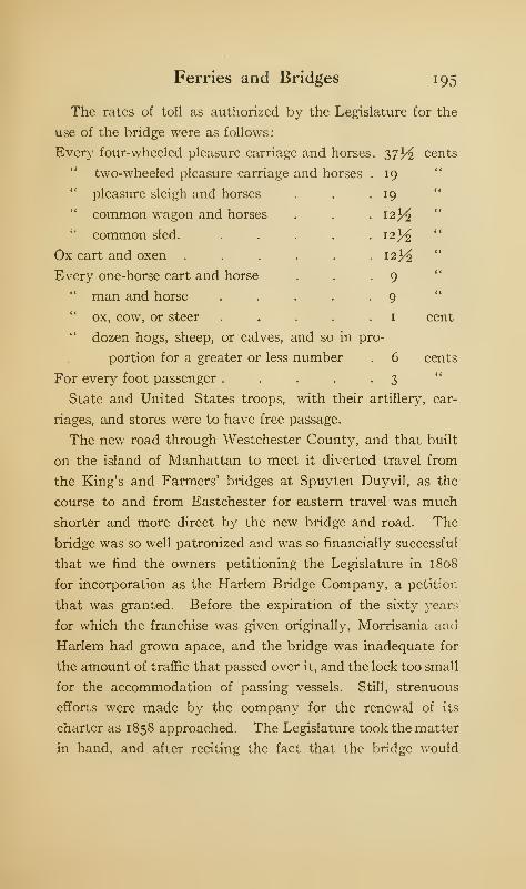
Ferries and Bridges 195
The rates of toll as authorized by the Legislature for the
use of the bridge were as follows:
Every four-wheeled pleasure carriage and horses. 37^ cents
19
19
12^
cent
cents
two-wheeled pleasure carriage and horses
" pleasure sleigh and horses
" common wagon and horses
" common sled.
Ox cart and oxen
Every one-horse cart and horse
" man and horse
" ox, cow, or steer
" dozen hogs, sheep, or calves, and so in pro-
portion for a greater or less number . 6
For every foot passenger . . . . .3State and United States troops, with their artillery, car-
riages, and stores were to have free passage.
The new road through Westchester County, and that built
on the island of Manhattan to meet it diverted travel from
the King's and Farmers' bridges at Spuyten Duyvil, as the
course to and from Eastchester for eastern travel was much
shorter and more direct by the new bridge and road. The
bridge was so well patronized and was so financially successful
that we find the owners petitioning the Legislature in 1808
for incorporation as the Harlem Bridge Company, a petition
that was granted. Before the expiration of the sixty years
for which the franchise was given originally, Morrisania and
Harlem had grown apace, and the bridge was inadequate for
the amount of traffic that passed over it, and the lock too small
for the accommodation of passing vessels. Still, strenuous
efforts were made by the company for the renewal of its
charter as 1858 approached. The Legislature took the matter
in hand, and after reciting the fact that the bridge would

196 The Story of The Bronx
become free on April 1, 1858, empowered the counties of NewYork and Westchester to provide for its maintenance or to
build a new bridge. In June, i860, W. H. McAlpine was
appointed engineer, and plans were devised for building a
new bridge with an iron draw and stone piers at a cost of
three hundred thousand dollars, while better facilities were
planned for the convenience of passing vessels.
This second Third Avenue, or Harlem, Bridge, as it was
commonly called, was built of cast iron. The piers, instead of
being of stone as originally planned, were iron cylinders which
were sunk to their proper places and filled with ballast. The
whole structure, especially the piers, was considered at that
time a most remarkable piece of engineering, and as a great
and ingenious advance in bridge-building. The wooden draw
of the old Coles bridge was towed to City Island, where it
did duty as the draw of the old wooden bridge there until
its demolition in 1902.
Many New Yorkers can remember how wholly inadequate
this second Harlem Bridge became when the trolley lines
began crossing it to their terminus at 128th Street and Third
Avenue. To meet the new requirements, the city authorities,
on July 14, 1886, contracted with a bridge-building firm of
Wilmington, Delaware, for the construction of the present
steel and iron structure, with its enormous draw of three
hundred feet, at a cost of two million two hundred thousand
dollars. The opening of the Harlem ship canal, and the in-
crease in building in the Annexed District, due to the elevated
railroad, necessitating an increase in docking facilities to
handle building materials, were also potent factors in deter-
mining the erection of the new bridge.
Work was not begun, however, until November 14, 1893.
The bridge was opened to the public on August 1, 1898, and
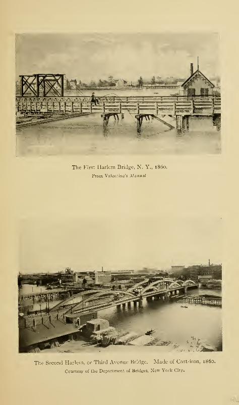
The First Harlem Bridge, N. Y., i860.
From Valentine's Manual
The Second Harlem, or Third Avenue Bridge. Made of Cast-iron, i860.
Courtesy of the Department of Bridges, New York City.
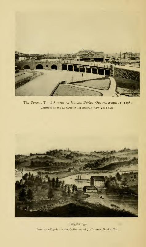
The Present Third Avenue, or Harlem Bridge, Opened August I, il
Courtesy of the Department of Bridges, New York City.
Kingsbridge
From an old print in the Collection of J. Clarence Davies, Esq.
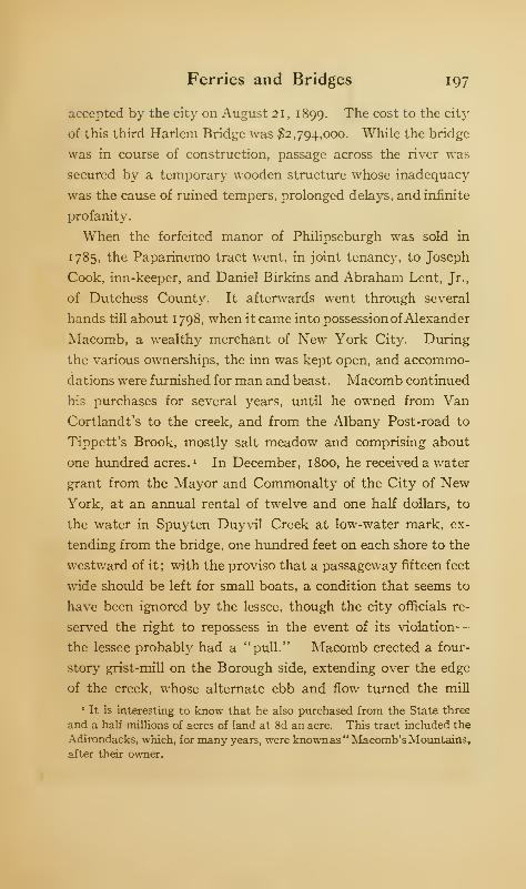
Ferries and Bridges 197
accepted by the city on August 21 , 1899. The cost to the city
of this third Harlem Bridge was #2,794,000. While the bridge
was in course of construction, passage across the river was
secured by a temporary wooden structure whose inadequacy
was the cause of ruined tempers, prolonged delays, and infinite
profanity.
When the forfeited manor of Philipseburgh was sold in
1785, the Paparinemo tract went, in joint tenancy, to Joseph
Cook, inn-keeper, and Daniel Birkins and Abraham Lent, Jr.,
of Dutchess County. It afterwards went through several
hands till about 1798, when it came into possession ofAlexander
Macomb, a wealthy merchant of New York City. During
the various ownerships, the inn was kept open, and accommo-
dations were furnished for man and beast. Macomb continued
his purchases for several years, until he owned from Van
Cortlandt's to the creek, and from the Albany Post-road to
Tippett's Brook, mostly salt meadow and comprising about
one hundred acres. 1 In December, 1800, he received a water
grant from the Mayor and Commonalty of the City of NewYork, at an annual rental of twelve and one half dollars, to
the water in Spuyten Duyvil Creek at low-water mark, ex-
tending from the bridge, one hundred feet on each shore to the
westward of it ; with the proviso that a passageway fifteen feet
wide should be left for small boats, a condition that seems to
have been ignored by the lessee, though the city officials re-
served the right to repossess in the event of its violation
—
the lessee probably had a "pull." Macomb erected a four-
story grist-mill on the Borough side, extending over the edge
of the creek, whose alternate ebb and flow turned the mill
It is interesting to know that he also purchased from the State three
and a half millions of acres of land at 8d an acre. This tract included the
Adirondacks, which, for many years, were knownas" Macomb's Mountains,after their owner.
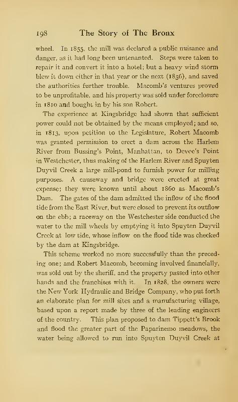
198 The Story of The Bronx
wheel. In 1855, the mill was declared a public nuisance and
danger, as it had long been untenanted. Steps were taken to
repair it and convert it into a hotel; but a heavy wind storm
blew it down either in that year or the next (1856), and saved
the authorities further trouble. Macomb's ventures proved
to be unprofitable, and his property was sold under foreclosure
in 1 8 10 and bought in by his son Robert.
The experience at Kingsbridge had shown that sufficient
power could not be obtained by the means employed; and so,
in 1813, upon petition to the Legislature, Robert Macomb
was granted permission to erect a dam across the Harlem
River from Bussing's Point, Manhattan, to Devoe's Point
in Westchester, thus making of the Harlem River and Spuyten
Duyvil Creek a large mill-pond to furnish power for milling
purposes. A causeway and bridge were erected at great
expense; they were known until about i860 as Macomb's
Dam. The gates of the dam admitted the inflow of the flood
tide from the East River, but were closed to prevent its outflow
on the ebb ; a raceway on the Westchester side conducted the
water to the mill wheels by emptying it into Spuyten Duyvil
Creek at low tide, whose inflow on the flood tide was checked
by the dam at Kingsbridge.
This scheme worked no more successfully than the preced-
ing one; and Robert Macomb, becoming involved financially,
was sold out by the sheriff, and the property passed into other
hands and the franchises with it. In 1828, the owners were
the New York Hydraulic and Bridge Company, who put forth
an elaborate plan for mill sites and a manufacturing village,
based upon a report made by three of the leading engineers
of the country. This plan proposed to dam Tippett's Brook
and flood the greater part of the Paparinemo meadows, the
water being allowed to run into Spuyten Duyvil Creek at
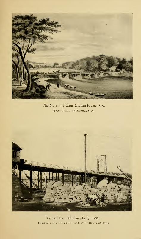
"ll ll Wfct ^f
The Macomb's Dam, Harlem River, 1850.
From Valentine's Manual, i860.
Second Macomb's Dam Bridge, 1861.
Courtesy of the Department of Bridges, New York City.
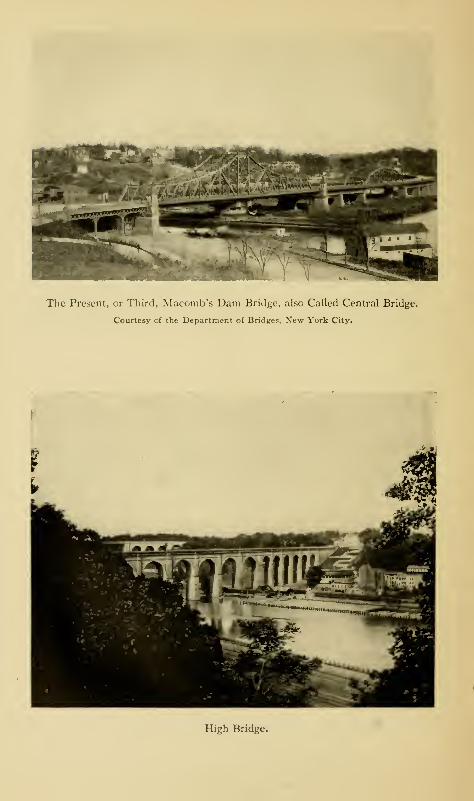
The Present, or Third, Macomb's Dam Bridge, also Called Central Bridge.
Courtesy of the Department of Bridges, New York City.
High Bridge.
Ferries and Bridges 199
low tide through raceways which would lead to the various
mills. "Fourteen mill sites," said the prospectus, "each fifty
by one hundred feet, were mapped out along the raceways,
and at least two hundred and thirty-four horse power were
assured to them." But this plan was no more successful than
the previous ones.
In the grant made to Robert Macomb, in 1813, it was
stipulated that he was to have a lock, apron, or other opening
in his dam to permit of the passage of small craft or boats, and
to have a lock-keeper in attendance to open the lock and assist
the boats through. He also received from the city the tri-
angular piece of land between Seventh Avenue and the ap-
proach to Central Bridge, now a small, public park; on the
Borough side, he also received valuable concessions. The
annual quit-rent to be paid to the city was the same as for
the Kingsbridge grant, twelve and one half dollars yearly.
The line of Jerome Avenue near the river is due to the road
laid out by the bridge owners as an approach to the northerly
end of their bridge.
The collection of tolls upon the bridge was unauthorized by
any act of the Legislature or of the city government ; and this,
with the obstruction to the navigation of the river due to the
failure to keep a sufficient passageway through the dam,
aroused the ire of the inhabitants of Kingsbridge, Morrisanie,
Fordham, and Westchester, as well as those of the Manhattan
side of the river. The leading citizens, after several years of
that quiet and patient submission to impositions so distinc-
tively one of our American traits, determined that at least the
construction of the dam should be changed so as to allow a
free and unobstructed navigation of the river. Meetings were
held, legal advisers engaged, and money subscribed.
The agitation came to a head in 1838; and Lewis G. Morris,
200 The Story of The Bronx
then a young man, was chosen as the leader of the enterprise.
The intention was to bring the matter into the United States
courts and to show that neither the State nor the city had any
power to grant the privileges secured by Macomb and his
successors in the obstruction of a navigable stream, a power
vested in the United States alone; and there was sufficient
evidence to prove that the Harlem River had been a navigable
stream from time immemorial.
In furtherance of the plan, Morris Dock was built about a
mile above the site of the present High Bridge, and a periauger,
named the Nonpareil, was chartered to take a cargo of coal for
delivery at the dock. On the evening of September fourteenth,
Mr. Morris arrived with his cargo of coal at the dam at full
tide and demanded a passage up stream. The bridge-
keeper could not comply with the demand to open the lock,
as none was provided. A party of nearly a hundred men
accompanied the periauger on flatboats ; and upon the refusal
of the bridge-tender to let the boat pass, they forcibly removed
a sufficient length of the dam to allow the Nonpareil to float
across. From that time forth a draw was always kept in the
bridge and an opening in the dam ; but the latter was so insuf-
ficient that the tides swept through with such fearful rapidity
as to make it impossible for boats to pass through except at
slack water.
The owners of the bridge and dam at this time were the
Renwicks, and they at first attempted to have Morris indicted
as a disturber of the public peace ; but the recorder and district
attorney both said that Morris had a right to demand passage
for his vessel, and refused to allow the grand jury to consider
the matter. Suit for damages was then brought against
Morris in the Superior Court, but the judge charged the jury
that the dam as constructed was a public nuisance, and that
Ferries and Bridges 201
any one had a right to abate it. An appeal to the Supreme
Court was decided likewise, and, finally, the Court of Errors,
on an appeal to them, affirmed the decisions of the lower courts.
Chancellor Walworth, who wrote the opinion, said, among
other things:
"The Harlem River is an arm of the sea and a public
navigable river; it was a public nuisance to obstruct the
navigation thereof without authority of law. The act of
the Legislature did not authorize the obstruction of the navi-
gation of the river in the manner in which it was done by the
dam in question."
The Renwicks were obliged to be satisfied with this decision
of the highest court of the State and did not carry the matter
to the Federal courts.
April 16, 1858, the Legislature directed the city of New York
and the county of Westchester to erect and maintain a free
bridge across the Harlem River from a point near the end of
Eighth Avenue, Manhattan, to a point at or near the terminus
of the Macomb's Dam road in the county of Westchester.
The commission appointed to carry out the provisions of
the above act were also directed to remove the dam and ob-
structions in the river, and to make it navigable to its natural
capacity. They paid to the Campbell estate, then the owner
of the dam and bridge, the sum of $18,000 for all property
and rights, including the approaches to the bridge on both
sides of the river, and the privilege of using the waters of the
Harlem. In 1861, the wooden bridge was completed and
thrown open to the public. The expense to the city and
county, though in the original bill limited to ten thousand
dollars each, finally amounted to over ninety thousand dollars.
«
1 How strange it is that public work can never be done for the estimated
cost, or for the contract price, or within the prescribed time! It is not
202 The Story of The Bronx
In the course of a quarter of a century, this second bridge
outlived its usefulness, and steps were taken to replace it.
The present magnificent structure is the result, at a cost of
$1,360,000. It was opened to the public in 1896. It occupies
the sites of the two former bridges and has been a favorite
route with wheelmen and drivers seeking the country above
the Harlem, and automobiles are now taking their turn in
using the bridge. The Speedway has diverted the drivers of
horses from the bridge, and the traffic of trolley cars upon the
bridge, which was clear of them until October 1, 1904, has
made its passage more hazardous. The present name of Cen-
tral Bridge, which is its official title, will, no doubt, soon
drive that of "Macomb's Dam Bridge" into the legendary
past.
The obstruction to the navigation of the Harlem River
had come to be considered as a matter of course, with the
precedents of the Coles and Macomb dams and bridges, so
that when the various plans were advanced at different times,
for supplying the city of New York with water, the engineers
ignored the free and open passage of that stream. The
earliest of these plans proposed taking the water from the
Bronx River by damming it near Williamsbridge and conduct-
ing the water by a cast-iron cylinder two feet in diameter
under the Harlem River, but lying on its bed. Later, 1834-
35, when the Croton River had been selected as the source of
the city's water supply, it was proposed to siphon the water
across the Harlem on a low bridge without regard to its navi-
gation. One plan in connection with the supply from the
Bronx River proposed using the tidal power of the Harlem
so with private work. If the employees of a private individual were as lax
in looking after his interests as public officials are in looking after those
of the community, they would not hold their positions a day.
Ferries and Bridges 203
by locating a pumping station above Macomb's dam in order
to give the water a sufficient head to carry it into the homes
of the city.
But the action of Lewis G. Morris and his associates with
regard to Macomb's dam, as described above, put an entirely
new idea of the navigable character of the river, not only into
the heads of the engineers and the authorities, but into those
of the general public as well. The decision of the highest
court in the State put a legal barrier to the stream's obstruction
that no one could surmount. Accordingly, when the Croton
aqueduct was under way, the Legislature, on May 3, 1839,
enacted that: "The water commissioners shall construct an
aqueduct over the Harlem River with arches and piers;
the arches in the channel of said river shall be at least eighty
feet span, and not less than one hundred feet from the usual
high-water mark of the river to the under side of the arches of
the crown; or they can carry the water across the river by a
tunnel under the channel of the river, the top of which shall
not be above the present bed of the said river."
This at once changed the idea of a low siphon bridge,
"built over an embankment of stone, filling up the whole of
the natural channel, and with only one archway on the NewYork side eighty feet high," to the plan of a high bridge,
crossing the stream; as the engineers and commissioners
preferred the bridge to the other alternative presented by the
Legislature, that of the tunnel. The bridge was contracted
for the following August, and was sufficiently completed in
time for the admission of the Croton water into the city on
July 27, 1842, though not completed in accordance with the
original plan until 1848.
High Bridge is 1450 feet long and twenty-five feet wide,
connecting West 175th Street and Tenth Avenue, Manhattan,
204 The Story of The Bronx
with Aqueduct Avenue near East 170th Street in the Borough.
The top of the bridge forms a way for foot passengers, but no
provision has ever been made for vehicular traffic. The bridge
crosses the Harlem on fifteen semicircular arches, eight of
which in the river are, in accordance with the law, eighty
feet span—the remaining seven are fifty feet span. The
water was originally carried across in two cast-iron pipes, each
three feet in diameter; but these were found to be inadequate,
so between i860 and 1864, the side walls of the bridge were
raised and a wrought-iron pipe, seven feet, six inches in di-
ameter, was laid over the other two, all three being incased in
brick masonry. The total cost to the city was $963,428.
When the present aqueduct was built, the engineers preferred
the alternative plan of 1839, and so carried the water through a
tunnel just north of High Bridge and well under the bed of
the river. The same plan is to be followed with the aqueduct
now building, which is to bring water from the Catskills.
The first of the really modern passenger bridges to be con-
structed was that at Madison Avenue, connecting that high-
way of Manhattan with East 138th Street in the Borough.
The first bridge was completed and opened to the public in
1884, at a cost of $404,000. In its construction, a new plan
was employed of elevating it well above the river, so that it
was not necessary to open the draw for every passing vessel;
and this plan has been carried out with all the later bridges,
which allow a still greater clearance above water. The
tugs plying upon the river are fitted with short smoke pipes;
in consequence, traffic is not delayed and blocked so frequently,
as it is necessary to open the draws only for masted vessels.
In addition, the draws are opened only between nine o'clock
in the morning and five o'clock in the afternoon, in order to
prevent delay to the thousands of passengers, on their way

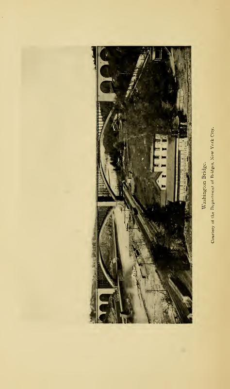
CQ «
.9 E
Ferries and Bridges 205
to and from their day's work, in the trains over the Park
Avenue railroad and other bridges.
Before the bridge was twenty years old, it was found to be
entirely inadequate for the trolley and vehicular traffic which
used it, the trolley cars of the Madison Avenue line having
begun to use it in 1899, replacing the horse cars which had
used the bridge since 1886. Then came the cars of the Union
Railway Company; and as the roadway was only twenty-one
feet four inches wide, there were great congestion and delay.
Plans for a new bridge were made in 1906, and the contract
was signed on October 8, 1907, the price being $1,155,987.
A temporary pier was built in the river and the bridge was
raised on scows at high water and floated to the new location
where it was lowered into place with the fall of the tide. Work
was then begun upon the new bridge and its approaches,
which were completed and opened with speeches and salutes
on July 18, 1910.
The next bridge to be constructed wa*s the Washington
Bridge, which may be considered the glory of the Harlem
River. It connects West 181st Street, Manhattan, with
Aqueduct Avenue near East 1 7 1st Street in the Borough. The
bridge was authorized by the Legislature of 1885, and work
was begun the following year. The original engineer was
W. H. McAlpine, who had supervised the building of the Third
Avenue Bridge in the sixties. In August, 1886, William R.
Hutton became engineer and remained in charge until the
completion of the bridge in February, 1889. Though com-
pleted at that time, the ends of the bridge were barricaded
until December of the same year, when the public took matters
into their own hands, tore down the barricades, and began
using the bridge. Consequently, there was no formal opening
of the structure; in fact, for a long time after it was used,
206 The Story of The Bronx
signs were displayed, notifying all persons who used the bridge
that they did so at their own risk, and that the city would not
be liable for damages for any accident that might occur.
The bridge is of steel and masonry and is 2375 feet long.
Its termini are on the heights commanding the river, that
on the Borough side being on the Fordham ridge. It crosses
the river in two mighty steel arches, each 510 feet long, the
crowns being 133 3^ feet above mean high water, so that they
are about eighteen feet above the arches of High Bridge.
The width is eighty feet, distributed in two foot-pathways
and a fine asphalted roadway, upon which no cars were run
until May 31, 1906. When wheeling was popular, it was a
favorite ride for wheelmen, and thousands passed over the
bridge daily. The view from the top is magnificent, taking
in, as it does, almost the whole length of the river, both north
and south ; the bridge itself being placed at the most beautiful
and picturesque part of the stream. The entire cost of the
bridge to the city was #2,851,684.55.
The Willis Avenue Bridge connects East 125th Street at
First Avenue, Manhattan, with East 134th Street and Willis
Avenue, The Bronx. The contract price was #1,373,000 for
the bridge, not including approaches. Work was begun
December 4, 1897, and the bridge was opened to the public
on August 22, 1901. This is the most easterly of all the
bridges crossing the Harlem River.
Work on the Lenox Avenue Bridge, connecting West 145th
Street and Lenox Avenue, Manhattan, and East 149th Street,
Bronx, was begun in 1898, and the bridge was completed and
thrown open to the public on August 24, 1905. The contract
price for the bridge alone was #1,002,000.
The last of the city bridges to be constructed is the one
crossing the Harlem from West 207th Street and Tenth Avenue,
Ferries and Bridges 207
Manhattan, to the low ground at the junction of Sedgwick
Avenue and Fordham Road. Preliminary surveys were made
as early as 1902, plans were drawn by the Department of
Bridges, and the contracts were let for the superstructure
April 27, 1905. The bridge cost #821,000, and was opened to
the public on January 8, 1908. It is called the University
Heights Bridge.
This bridge is almost on the site of a foot-bridge erected
about 1850, connecting Dyckman's meadows and Fordham
Landing. This was built on piles driven into the bed of the
river, which was not more than nine feet deep at this point.
It was a public bridge, fitted with a draw to allow of the
passage of boats, of which the Harlem River steamboats Tiger
Lily, Trumpeter, and Osseo became the most frequent passers-
by after the line was established about 1855, for the purpose
of keeping open the navigation of the river, as well as for the
conveyance of passengers and freight. Their landing-place
was at an ancient stone house, called the "Century House,"
a few rods above on the Manhattan side—this was the old
Jan Nagel house of colonial days. In later days, the foot-
bridge gave access to the railroad station at Fordham Landing.
The deepening of the channel of the river and the opening of
the ship canal caused the removal of the old bridge, though a
few of the piles which supported it, were standing on the Man-
hattan side less than ten years ago.
The other bridges spanning the Harlem River and connect-
ing the boroughs of Manhattan and The Bronx are private
property belonging to the railroads. They are the Second
Avenue, or Suburban Rapid Transit, bridge; the Harlem, or
New York Central, Railroad bridge at Park Avenue; the
Putnam Railroad bridge at Eighth Avenue; and the NewYork Central Railroad bridge at the mouth of Spuyten Duyvil
208 The Story of The Bronx
Creek at its junction with the Hudson River. Upon the
Second Avenue and the Putnam bridges are free public foot-
ways, but no roadways for vehicles.
For several years, the only public ferry connecting the
Borough with any of the other boroughs was the one running
from Port Morris, at East 138th Street, to North Beach and
College Point in the borough of Queens. This was formerly
known as Bowery Bay Beach, and it is a great place of resort
for people who like the entertainments that are provided in a
place of the kind. The ferry was established in September,
1903. A ferry, known as the Twin City Ferry, was established
between Clason's Point and College Point, in April, 1912.
CHAPTER X
EARLY MEANS OF COMMUNICATION
SLOOPS, periaugers, batteaux, and canoes constituted
the vehicles of communication in the early days. As
in all new countries, water was the natural highway;
and the waters of the Sound, the Hudson, and the Harlem, all
adjacent to the shores of the Borough, gave easy and con-
venient access to Manhattan Island and to the settlers near the
shores. Westchester Creek was navigable for sloops, and when
Captain de Connick and Fiscal Van Tienhoven went to eject
the English settlers at Oostdorp, they ascended the river and
creek in vessels of that class. The Bronx and the Hutchinson
rivers were both navigable for several miles in batteaux
and canoes, the former to West Farms and the latter to East-
chester. In recent years, the Federal Government has deep-
ened the channel of the latter so that heavily laden coal
vessels and small steamers are able to ascend at high tide as
far as the City Dock at Mount Vernon, contiguous to old
St. Paul's Church, and just over the boundary line of the
Boroughs
From time immemorial, and even up to the present gener-
ation, a regular sloop trade was carried on from Westchester
borough-town to New York City. In the advertisement of
the Reverend Samuel Seabury, mentioned in another chapter,
there is a paragraph which says: "Westchester is about
14 209
210 The Story of The Bronx
nineteen miles from New York, by Land, and about fifteen
by Water; and a Water-passage may be had almost every
Day, when the Weather will permit, in good safe Boats."
There was a regular sloop trade also to Eastchester, even
during the Revolution ; and it was by first capturing the market
sloop engaged in this trade with New York that the Darien
whale-boatmen were able to effect the capture of the Schuldam,
the British guard-ship.
The building of these vessels began very early. Shonnard,
in his History of Westchester County, on the authority of the
Reverend Theodore A. Leggett, a descendant of one of the
patentees of the West Farms, states that John Leggett, a
ship-builder, executed, November 30, 1676, a bill of sale as
follows
:
"John Leggett of Westchester, within the Province of
N. Y., ship-wright, to Jacob Leysler of N. Y. City, merchant,
a good Puick, or ship, 'Susannah' of New York now laying
[sic] in this harbour, and by the said Leggett built in Bronck's
river near Westchester, together with masts, Lay boat, and
other materials."
The ship-building industry, thus begun in 1676, or earlier,
has continued to the present day; but it is now princi-
pally carried on in the ancient manor of Pelham at City
Island, where yachts and pleasure craft are built, repaired,
and laid up out of season.
There was also boat communication by way of the Harlem
River and Spuyten Duyvil Creek; for in November, 1776,
Lord Cornwallis carried his troops in a flotilla of boats through
the river and creek to the Hudson for the attack on Fort
Washington from the Hudson River side. That these streams
had always been navigable was one of the principal arguments
Early Means of Communication 211
used by Lewis G . Morris and his supporters in their opposition
to Macomb's dam.
In their communications inland, the settlers at first used
the old Indian trails. The principal village and fort of the
Siwanoys was on a hill to the south of the present Unionport,
overlooking Westchester Creek. From the strong stockade,
palisaded in the Indian fashion, the hill came to be known as
" Castle Hill," a name by which it is known to-day. A village
of the Manhattans was located at Spuyten Duyvil Neck, and
another at Nepperhaem, the present Yonkers; while above
the latter were the villages of the Weckquaesgeeks, all members
of the Mohican tribe. In their communications with each
other and with their neighbors on Manhattan Island by way
of the "wading place," there was formed in time a plainly
marked trail extending from Paparinemo to Castle Hill,
called in Doughty 's patent to Archer the "Westchester Path."
From Westchester another plainly marked trail led by way of
Eastchester across Hutchinson's River and contiguous to the
Sound, through the Rye woods to "the great stone at the
wading place" at the Byram River, the eastern boundary of
the colony and of the State. It extended still farther into
Connecticut, also occupied by the Siwanoys, as far as the
villages of the Pequots, a kindred tribe of Mohicans. It was
by this path that many of the Connecticut settlers found their
way into the Dutch colony of New Netherland and gave
Stuyvesant so much trouble. This was pre-eminently the
"Westchester Path."
It was natural that the earliest whites should follow these
long established and plainly marked trails. As time passed,
these trails became wider as the travellers cut down the trees
for the convenient passage of their horses or wagons. Wefind, therefore, in these trails the beginnings of the roads
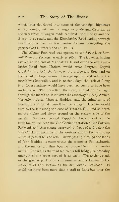
212 The Story of The Bronx
which later developed into some of the principal highways
of the county, with such changes in grade and direction as
the necessities of wagon roads required—the Albany and the
Boston post-roads, and the Kingsbridge Road leading through
Fordham, as well as Eastchester Avenue connecting the
parishes of St. Peter's and St. Paul's.
The Albany Post-road was opened to the Sawkill, or Saw-
mill River, in Yonkers, as early as 1669. The traveller, having
arrived at the end of Manhattan Island over the old Kings-
bridge Road from Harlem, would cross Spuyten Duyvil
Creek by the ford, the ferry, or the bridge and thus land on
the island of Paparinemo. Passage up the west side of the
marsh was impossible, and in ancient days the task of rilling
it in for a roadway would have been too costly to have been
undertaken. The traveller, therefore, turned to his right
through the marsh or, later, over the causeway built by Archer,
Verveelen, Betts, Tippett, Hadden, and the inhabitants of
Fordham, and found himself in that village. Here he would
turn to the left along the base of Tetard's Hill, and so north
on the higher and dryer ground on the eastern side of the
marsh. The road crossed Tippett's Brook about a mile
from the bridge, near the Van Cortlandt station of the Putnam
Railroad, and then swung westward in front of and below the
Van Cortlandt mansion to the western side of the valley, up
which it passed to Yonkers. After passing through the lands
of John Hadden, it came within the manor of Philipseburgh,
and the manor-lord thus became responsible for its mainte-
nance. In fact, as the road led to his toll bridge, he probably
maintained the lower part of it as well. The ancient road,
or the greater part of it, still remains and is known to the
residents of this section as the old Albany Post-road. It
could not have been more than a trail at first; but later the
Early Means of Communication 213
postman travelled on horseback and travellers accompanied
him on the way; a woman passenger sometimes rode on a
pillion behind the postman. It was not until after the Revo-
lution, in 1785, that stages began running over the post-road
to Albany. It was not until about 1808 that the present
Broadway was filled in on the western side of the marsh. This
was done by the Highland Turnpike Company, who hung
gates and charged toll. The causeway called Depot Street,
connecting Broadway with the railroad station at Kingsbridge,
was constructed about 1855 by the late Joseph Godwin, Esq.,
as a short cut to the road leading to Highbridge, Morrisania,
West Farms, and Westchester.
If the traveller had turned to his right through the village
of Fordham at the foot of Tetard's Hill, he would have passed
over the ancient Westchester Path up over the hill (Highbridge
Road) into the present Kingsbridge Road. His course would
have been then relatively past the Dutch church at Fordham,
the southern end of Jerome Park reservoir, Poe Park, across
the tracks of the Harlem Railroad at the station opposite St.
John's College, Fordham (though the ancient road used to
go through the College grounds), over Pelham Avenue to
Bronxdale, whence he could continue over the Bear Swamp
Road to Westchester, or turn to his right over the Unionport
Road to Castle Hill. The improvements in this section within
recent years have obliterated most of the old roads, so that
only the general direction can be given by present thorough-
fares. The Highbridge and Kingsbridge roads are ancient
highways; east of the Bronx River, the rural conditions still
prevail to some extent; but the progress of development is
so rapid that in a few years they will have departed also,
especially since the completion of the subway has rendered
these rural communities more accessible. The Bear Swamp
214 The Story of The Bronx
Road still exists and leads to Westchester. Its name was
derived from a swamp to the east of Bronxdale, where the
Siwanoys had an important village near the site of Morris
Park race-track.
Another road starting from a point on Tetard's Hill beyond
the one just described led to De Lancey's Mills at West Farms.
This road has long been closed. It branched off from the
Westchester and Kingsbridge road near the present Fordham
railroad station, and continued in a southerly direction till
it met the line of East i82d Street, over which it passed ap-
proximately to the bridge at East 181st Street, below the lower
dam in Bronx Park at West Farms, where it was known, and
still is to the older inhabitants, as the "Kingsbridge Road."
Its continuation connected the mills with the borough-town
of Westchester. The portion of the road lying within the
park east of the bridge has been macadamized; but between
Morris Park Avenue and the bridge over the tracks of the
Suburban branch of the New York, New Haven, and Hartford
Railroad, there still remains enough of the ancient highway
to convince us that preceding generations might have travelled
in style, but they did not do so in comfort.
The principal road that the traveller could take after cross-
ing the causeway to the village of Fordham was the Boston
Road, which dates from 1673. This swung in a curve around
the base of Tetard's Hill and up to its top, paralleling the
Albany Road for about a third of a mile, then turning sharply
to the eastward toward Williamsbridge. Here it crossed
the Bronx River and turned north as far as the head of
Rattlesnake Brook, when it again turned sharp east to East-
chester. Here the Hutchinson River was crossed, and the
road continued through Pelham Manor to New Rochelle. Afew miles of the old road still remain and can be traced. The
Early Means of Communication 215
first portion is that leading up to Sedgwick Avenue, where
Jerome Park and, later, the reservoir have obliterated a section
of it. From Jerome Avenue to the Williamsbridge reservoir,
the part remaining is called Van Cortlandt Avenue, and from
the reservoir to the bridge over the Bronx River and to the
White Plains road, the section is called improperly, the Gun
Hill Road. The White Plains and the Boston roads are the
same thing from Williamsbridge northward to where the latter
turns off toward Eastchester. This last portion of the road is
called Bussing Avenue, which begins at East 231st Street, one
block east of White Plains Avenue, and continues on to the
city line. As soon as it enters the city of Mt. Vernon, its name
becomes what it has been for over two centuries, the Kings-
bridge Road. With all due respect to the Bussings, who were
extensive landowners in this vicinity, the ancient road should
not have been called anything else than the Kingsbridge,
or Boston, road. In fact, a few of the old signs bearing both
titles are still to be found along the Bussing Avenue part of the
roadway; and, in the opinion of the writer, it is not too late to
restore the old names and thus preserve an ancient landmark.
At Eastchester, the ancient road is connected with Coles's
Boston Road by a short street called Fisher's Lane; but the
two roads do not become one until near New Rochelle. The
laying out of the Coles road diverted travel from the way of
Spuyten Duyvil Creek, as the distance was considerably
shortened by way of the new road and the Harlem Bridge.
If the traveller in going over the Albany Post-road had
turned to the eastward at the bridge over Tippett's Brook near
Van Cortlandt station, he would have continued on a road lead-
ing to the Mile Square, as the purchase of French and others
from Doughty was called. This road was parallel to Van
Cortlandt Lake for over a mile before it turned to the east-
216 The Story of The Bronx
ward and then northeast to the Mile Square. To-day, it is
the road that bounds the seventh to the eighteenth holes of
the golf course at Van Cortlandt Park. It probably had its
origin in the travel of the farmers of the Mile Square to the
mill at Van Cortlandt 's to have their grain ground. The road
can still be followed up the steep hill in Van Cortlandt Park,
then it turns east into East 233d Street, the northern boundary
of Woodlawn Cemetery. Beyond this, the ancient highway
existed until the early part of 1912 as a rural lane, winding
along as the northeastern boundary of the park and called
Mount Vernon Avenue. After it crosses McLean Avenue,
the city line, it is continued in Yonkers over a fine macadam
street, called Kimball Avenue.
About one thousand feet from the bridge over Tippett's
Brook, on the Mile Square Road, a road branched off to the
southeast and connected with the Boston Road to the west of
the bridge at Williams's, about East 210th Street. This was
the Gun Hill Road, so called from Revolutionary days. It
still exists, and has within the past few years been widened,
graded, and macadamized. The name is given to the road
both east and west of the Bronx River, though the greater
part of it to White Plains Avenue is really the Boston Road.
A few yards of both of these ancient roads may be found on
either side of the reservoir-keeper's house at Williamsbridge
;
their ancient junction is now within the walls of the reservoir.
About three hundred yards from where the Gun Hill Road
joined the Boston Road, another road led directly to Yonkers at
Valentine's Hill; this is to-day, substantially, Jerome Avenue,
crossing the Gun Hill Road between East 210th and East 21 ith
streets. Its extension to the southward to the Macomb's
Dam Road and its conversion into a driveway was one of the
acts of the Tweed regime in New York, 1870-72. For a
Early Means of Communication 217
couple of years, the road has been almost impassable, owing
to regrading, sewering, etc. ; and it will probably be in like
condition for two or three years more while the extension of
the subway is building up that avenue.
If the traveller were coming south over the Albany Road
from Yonkers, instead of turning east at Van Cortlandt's,
he might have continued on a road to the west of Tippett's
Brook which led along the base of Tippett's Hill to the junc-
tion of Spuyten Duyvil Creek and the Hudson River. This
road still exists as the Spuyten Duyvil Road, known locally
as Dash's Lane, after a gentleman of that name who used to
live here, one of the older generation and a friend of "Felix
Oldboy."
Southward of Kingsbridge lay Fordham Manor. The
street now called the Highbridge Road, leading from the Bronx
side of Farmers' Bridge, was laid out June 6, 1730, though the
bridge was not built until 1759 . A week later, in June, 1730,
the road leading to the Fordham meeting-house was ordered.
This was the old Dutch church which formerly stood near
the junction of the Fordham Landing (Berrien's Landing)
and the Macomb's Dam roads, or on the grounds of Webb's
Academy near the present Sedgwick Avenue. A road also
extended before the Revolution from this section to Morris-
ania opposite Harlem. It was approximately on the line of
the present Aqueduct Avenue, and crossed Cromwell's Creek
about East 169th Street, or not far from "Judge Smith's"
on Jerome Avenue, thence following the lines of Walton and
Mott avenues to Morrisania, but probably through farms and
private property. The lower part of Jerome Avenue was
built by Robert Macomb as a leader to his bridge from the
road just described; both being known as the Macomb's DamRoad. A considerable portion of this road from Featherbed
2i
8
The Story of The Bronx
Lane is still called Macomb's Road; it connected Fordham
with Devoe's Point.
Featherbed Lane is a road connecting Aqueduct Avenue
from near the Borough end of the Washington Bridge with
Jerome Avenue, down a steep and winding way. The author
has heard three different stories as to the origin of this peculiar
name. One is that during the Revolution, the inhabitants
living along the road contributed their feather beds for the
use of the patriots. A second, which he thinks the most
likely of all, is that the road was of so spongy a material that
to walk on it was like walking on a feather bed. A third is
that the road was so exceedingly rough that to secure any
degree of comfort in driving over it, it was necessary to have
a feather bed in the wagon for a seat—but this would answer
almost equally well for all the colonial roads.
The Fordham Landing Road came under the care of the
commissioners in May, 1768, as on the third of that month
there is an entry in the ancient records to the effect that
"Commissioners, at request of freeholders and inhabitants of
that part of the Manor of Fordham lying upon Harlem River
to the south of the old Dutch church, viewed the road (laid
out to the river by said church), beginning a little to the east-
ward of said Dutch church, and thence running southerly as
the said road runs to the landing at the back of the house
now occupied by Charles Doughty on the patent to Turneur;
and have at their request now laid out the same road as and
for a publick highway, to be two rods wide, with privilege to
hang gates on the same, provided they are kept in repair so
as to swing with conveniencey and not otherways."
In early days another road led from the manor-house at
Morrisania to the borough-town of Westchester. This proba-
bly followed the line of the present Lafayette Avenue (so
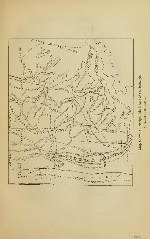
ea
oPi
T) x.
cat aft
cj a6
CO
^/Va_

Early Means of Communication 219
called from the fact that the distinguished Frenchman passed
over the lane to Boston after his visit at Morrisania in 1824).
This lane must have joined the present Westchester Avenue
near Fox's Corners, as the swamp and meadow land of the
Bronx River would have prevented its continuance in a direct
line. Westchester Avenue follows the line of the ancient road
;
this was laid out by the Westchester Turnpike Company
after 1800. In 1729, the town authorities of Westchester
ordered that a road should be laid out from the King's Road
leading from Morrisania to "the landing-place below John
Hunt's house." This probably refers to the Hunt's Point
road leading from Fox's Corners.
On account of the close connection between Westchester
and Eastchester, there was very early a road connecting the
two places—one following the old Indian trail. In the patent
of Colonel Nicolls to the grantees of the "Ten Farms," the
Westchester Path is specifically mentioned. This is still called
the Eastchester Road ; it passes up the west side of Westchester
Creek and joins the Boston Road of 1798 near where Corsa
Lane comes from Williamsbridge.
From the road connecting Westchester with Williamsbridge,
a short distance from the crossing of the Boston, or Coles,
road, there is a road called the Saw-mill Lane leading to Givan's
Creek, which enters the Hutchinson River near its mouth.
It crosses the Eastchester Road north of the Pelham and Bronx
Parkway; and, from its name, one must conclude that it led
to a saw-mill. In the will of the Reverend John Bartow,
under date of January 24, 1725, we find him devising land in
this neighborhood and describing it as "bounded on the north
by the road leading to Thomas Haddon's saw-mill." The
old lane is to be wiped out when the proposed plan of streets
is carried out.
220 The Story of The Bronx
From very early times, a causeway and bridge stood across
Westchester Creek, connecting the village with Throgg's
Neck. In the town records of Westchester, we find under
date of July 9, 1678: "It is ordered that ye bridge betwixt
Frogges Necke and ye Towne be maintained and upheld by a
rate to be levied and assessed upon all persons and estates
that are putt in the county rate belonging to the Township
of Westchester, East Chester excepted." As there was a
number of farms on Throgg's Neck, there must have been a
road leading to Westchester, where were the church, the court-
house, and such shops as then existed.
Another important road through the middle of the Borough
was that leading to White Plains, the county-seat after 1759.
It is still in existence, north from Bronxdale, passing through
Olinville, Wakefield, Mount Vernon, and beyond. From
Williamsbridge northward, this highway and the Boston Road
were one, until the latter swung off toward Eastchester at
the head of Black Dog Brook. The present White Plains
Avenue was laid out about 1863, a little to the west of the old
road in general, though passing over parts of it. The work of
widening White Plains Avenue to a boulevard one hundred
feet in width was begun in the autumn of 1902, after several
years of consideration ; it was finished in January, 1908. From
below Laconia Park at the southern end of Williamsbridge,
another old road leads to Westchester, passing to the eastward
of the former Morris Park race-track.
As settlers took up farms along the shore of the Sound
beyond Westchester, a road was laid out connecting with
Pelham Manor. Eastchester Creek was crossed either by a
ford or a ferry, probably the latter, as the tide runs too strongly
at Pelham Bridge to make fording safe, except at slack water.
The wooden bridge was not constructed until 18 12. This
Early Means of Communication 221
road appears on the military map of the British operations in
Westchester County in 1776, as do most of the others, but all
with considerable inaccuracy. This highway, called Pelham
Road, joins the Eastern Boulevard, or Shore Road, below
Pelham Bridge, on the boundary line of Pelham Bay Park.
From near the Bartow station of the Suburban branch of the
New York, New Haven, and Hartford Railroad, a road leads
down to Pell's Point (Rodman's Neck) and City Island, as
it did in ancient days. The most northerly of the roads in
this section is the "Split Rock," or Prospect Hill, road, con-
necting the Shore Road with the old Boston Road by means
of Wolf's Lane in the town of Pelham. It was the route of
the retiring Americans during the battle of Pell's Point.
The principal roads of the Borough, which existed a century
or more ago, have thus been sketched. We may say, generally,
that in the earlier days the roads radiated from two points:
the ancient wading place, ferry, or bridge at Fordham, or
Kingsbridge, and from the borough-town of Westchester.
All travellers from Manhattan Island to the mainland had to
cross Spuyten Duyvil Creek, from which the roads radiated
like the ribs of an open fan—to Yonkers or Albany, to the
Mile Square, to Boston or nearer eastern points, to West
Farms, or to Westchester. The borough-town of Westchester
was also the county-seat until 1759; and, in consequence,
roads from all sections of the county led to it. By the above
date, the upper county had become so settled as to make it a
hardship for the freeholders to go to the southern extremity
at Westchester. The Provincial Assembly, therefore, trans-
ferred the county-seat to White Plains, a point nearer the
centre of population as well as of area. Through the different
generations, the names of the same roads have changed quite
frequently, so that it is sometimes quite difficult to trace some
222 The Story of The Bronx
of them under their various aliases. The Highbridge Road,
for instance, could not have been called such until after the
construction of High Bridge (1839-42), yet it existed in very
early times. After 18 13, a part of it was called Macomb's
Dam Road, and so spoken of in deeds and records. The map
of the roads accompanying this chapter, though not absolutely
exact as to scale, is near enough to give an idea of the general
direction of the principal highways.
It is a cardinal principle of the common law that every
landholder is entitled to get to and from his land. In this
way, as more farms were occupied, there grew up a multitude
of private lanes and roads, of which many in time became
public highways, maintained at the public expense, or by tolls,
if maintained by the owners of abutting property or by other
persons. This permission'
' to hang gates'
' appears in a number
of cases in the records of the highway commissions.
Most of the roads of the Borough began first as private
roads to get to property. After 1850, when the newly-built
railroads had brought in such a population as to admit of the
incorporation of villages, the laying out of highways became
more systematic in each locality. That there was no general
system can be understood readily by a glance at the map of
the Borough as it is to-day, with its intricacies of winding
streets and avenues going apparently in all directions. Of
course, the topography of the Borough has affected the course
of the streets to a very large degree. One of the greatest
problems that confronted the Commissioner of Highways of
The Bronx, or of Street Improvements, as he was officially
known, was to whip the chaos of roads into some sort of
systematic arrangement. This is being done gradually in
accordance with a plan which has been developing since
January 1. 1893, and which has been completed only since
Early Means of Communication 223
1903. In accordance with this plan, during the last decade,
blasting, grading, cutting down of hills, and filling in low places
and quagmires have been going on in all portions of the
Borough. Should a person familiar with a locality where
such changes are going on visit it a year or two later, he would
find it developed into wide, well-paved streets, lined with
solid blocks of residences, factories, or stores.
A most notable street improvement of recent years is the
Grand Boulevard and Concourse, which is a great highway
extending from Gerard Avenue and East 161st Street to the
Gun Hill Road, a distance of nearly four miles. The road is
182 feet wide, and is to serve as a link between Manhattan
and the park system of the Borough, though no arrangements
have yet been completed for connecting the lower end of the
Concourse with Manhattan. The idea of the road originated
with Louis J. Heintz, the first Commissioner of Street Im-
provements, as far back as 1890; but the preliminaries were
not completed and ground broken until October 1, 1902, and
the Concourse was not officially opened until November 24,
1909. If the expectations of its promoters be realized, it
should be the most magnificent boulevard in the world.
In colonial days, everybody rode horseback, and this was
the usual method of getting from place to place. The women
rode on a pillion behind a man, the pillion being a pad, or ad-
ditional saddle, behind the regular saddle, upon which the
woman sat comfortably and safely, as she could hold on to
the rider in front, as well as having a stirrup by which to
steady herself. Many of the horses were of fine breed, and
the wealthy gentlemen kept horses for hunting and racing
in the English fashion. Some of the gentry had a coach and
four with liveried footmen and outriders, and so travelled in
great style, even if not in much comfort on account of the
224 The Story of The Bronx
badness of the roads. In his tale of Satanstoe, Cooper describes
the arrival in New York of Patroon Van Rensselaer of Albany,
and how the whole younger population, and a good many of
their elders, went out to the Bowery Lane to see the great
landowner come into town in his big travelling coach. A two-
wheeled, springless gig, or carriage, was the usual vehicle of
the farmer when not riding horseback. The country doctor
made his rounds on horseback, carrying his instruments and
drugs in saddle-bags. The first physician of whom we have
mention in the Borough is Dr. Pell, in 1683.
In 1796, an enumeration was made of all the vehicles in
the State; and there appear coaches, chariots, post-chaises,
phaetons, and other four-wheeled carriages; while of two-
wheeled vehicles, there were curricles, chaises, top-chairs,
steel-spring chairs, sulkies, and wooden-spring chairs. The
chaise was a sort of two-wheeled gig with a top and was
drawn by either one or two horses; the sulky had a seat for
only one person. These two-wheeled carriages were best
suited to the difficult roads. The American woman had
already begun to show her native independence and ability
to take care of herself by driving about alone in an open chair,
much to the amazement of European visitors.
There were no regular mails before 1673, though letters
were carried by travellers or by special messengers. In that
year, Governor Francis Lovelace authorized the establishment
of a monthly post between New York and Boston in order
to increase the intercourse between the two colonies. The
postman was a sworn messenger, and was required to direct
travellers who might choose to accompany him to the best
roads and the most commodious stopping-places; he also
was to select the most convenient places for leaving letters
and packets and for gathering up the same. He was obliged
Early Means of Communication 225
to make the round trip within a month. This scheme of
Governor Lovelace did not succeed, and so the first mail route
was abandoned after a short trial. It was revived by Governor
Dongan in 1685, and a charge of three pence was fixed for
carrying a letter one hundred miles or less, and for a greater
distance proportionately. In 1698, there was a regular,
weekly post to and from Boston. In 1704, Mrs. Sarah Knight
made the journey, and she has left lively impressions of her
experiences and the difficulties and dangers that beset her. In
1708, Lord Cornbury states: "From Boston there is a Post
by which we can hear once a week in summer, and once a
fortnight in winter." In 1754, Benjamin Franklin was made
Postmaster-General of the Colonies, and the post was estab-
lished weekly, both winter and summer, and letters which
left Philadelphia on Monday morning reached Boston on
Saturday night. The post-riders were reliable men, as they
often carried large sums of money.
In the early days, the mails were carried on horseback, and
travellers followed the same method of travel, or used a private
carriage; but in July, 1772, Jonathan and Nicholas Brown,
of New York, established a stage-coach between New York
and Boston. The trip at first was made every fortnight, but
the enterprise met with so much encouragement that before
long two and three trips were made a week. The fare was
4d New York, or 3d lawful, money per mile, and baggage was
carried at a reasonable rate. A stage was also established to
Rye in Westchester County and trips were made three times
a week. The stages were of that heavy, lumbering, canvas-
topped variety, known as the Conestoga wagon, which later
became so famous on the western plains with its motto of
"Pike's Peak, or Bust." The route from New York was by
way of the Bowery Lane, McGowan's Pass, the Kingsbridge
is
226 The Story of The Bronx
Road to Spuyten Duyvil Creek, thence by way of Williams-
bridge to Eastchester, and thence by way of New Rochelle,
Stamford, and other towns along the Sound to New Haven.
The Connecticut River constituted a barrier between Say-
brooke and Old Lyme, so that the stages were obliged to go
by way of Hartford and Springfield. Of the first stages over
the Albany Road, mention has already been made.
MacAdam had not yet revolutionized road-making, and
so even the best of these old roads were quagmires in wet
weather, and fetlock deep with dust in dry. Many of the
streams had to be forded or crossed by ferries, bridges coming
later with increase of travel. Notwithstanding the establish-
ment of the post-roads, and the later introduction of stage-
coaches, the favorite manner of travelling long distances was
either by horse or sloop, the latter especially suiting the leis-
urely traveller of that day. In the trip between New York
and Albany, the sloops came to anchor every night, and the
journey frequently lasted a week. The same is also true of
the trip to the east, the inlets and harbors on both sides
of the Sound furnishing safe and comfortable anchorages at
night; but it must be remembered that there were no light-
houses along these thoroughfares to guide the mariner at night.
Stages were also run from the outlying villages to Morrisania
and Harlem; and later, in the nineteenth century, when the
steamboats began to run, these stages connected with the
boats plying to the city. A hand-bill of 1830 reads as follows:
"New York, West Farms, and West Chester Stage.
Stephen Valentine Respectfully informs the inhabitants of
West Chester and West Farms that he has commenced run-
ning a line of post coaches to the above places, and hopes by
strict attention, together with good horses and safe Carriages,
to meet with a liberal support.
Early Means of Communication 227
"Leave West Chester every day at a.m., and No. 18
Bowery, New York, at half past p.m.
"Fare to West Farms, 50 Cts. 1 ,„. A ^ ,,
tit i. ™. c 1 • n^ \ Winter Arrangement.West Chester, 62^ Cts. \
b
These prices certainly seem very moderate when we take
into consideration the distance.
Before the days of the elevated railroads, a favorite route
of travel was by means of the fast boats running on the East
River to Peck Slip, Manhattan, from Harlem Bridge. When
the author has seen the Sylvan Lake, the Sylvan Dell, or the
Sylvan Stream, or the rival boats, Harlem and Morrisania,
upon the waters of the St. Lawrence, the St. John's River in
Florida, or Chesapeake Bay, he has recalled the pleasant sail
through the East River, with the beautiful estates lining its
banks, not then outlined against the sky with towering sky-
scrapers and tenements. Smaller boats used to ply upon the
Harlem River as far as Kingsbridge, and this, too, within the
last decade of the nineteenth century. After the railroad was
built through the Borough, the stages used to carry passengers
from outlying sections to the stations along the railroad, a
great convenience, as about 1840 to 1850 many wealthy NewYork merchants began to buy estates in the Borough and to
erect fine residences ; and the railroad and the stages combined
made them easily accessible.
CHAPTER XI
LATER MEANS OF COMMUNICATION
THE successful establishment of a railroad between
Baltimore and Ellicott's Mills in Maryland, and
of the Mohawk Valley Railroad, the ancestor of the
New York Central, turned the attention of both civil and
mechanical engineers and of capitalists to the possibilities
of the new method of travel; and a craze for railroad build-
ing began, which, with the United States Bank troubles and
some others, helped to bring on the financial panic of 1837.
One of the earliest of these railroads to be incorporated was
the New York and Harlem, April 25, 1831, with a capital of
$350,000, increased the following year to $500,000, with the
stipulation that the road should be completed to the Harlem
River by 1835. This company was authorized to build a
railroad upon the island of Manhattan only, by way of the
Bowery and Fourth Avenue. The engineering difficulties
to be overcome were too much for the engineers of that day,
and, notwithstanding the stipulation as to the completion of
the road by 1835, it was little more than started at that date.
On April 17, 1832, the New York and Albany Railroad was in-
corporated for the purpose of building a road from the end of
Fourth Avenue, Manhattan, to Albany. This company met
with no success in raising money for its construction; and, on228
Later Means of Communication 229
the principle of two people who have nothing getting married
to share their united poverty, the later company surrendered
its Westchester County rights to the earlier company, and the
two combined in 1838 as the New York and Harlem Railroad
Company. The Legislature of 1840 affirmed the contract
between the two companies, and further authorized the
construction of a bridge over the Harlem River, and the exten-
sion of the road to Putnam County. By this last date, the
country had begun to recover from the panic of 1837, s0 that
by the time the extension was begun through Westchester
County more funds were forthcoming, and the capital was
increased to $1,950,000, and $1,000,000 more were needed to
carry the road to the county line.
The first portion of the road above the Harlem River was
to extend to White Plains. The easiest route was found to
be by way of the valley of the Mill Brook to Williamsbridge,
whence the valley of the Bronx River was followed to White
Plains, a distance of twenty miles. By this route not much
grading was necessary, nor was there required much blasting
through rock. Several bridges were needed, which, however,
did not give the engineers much trouble, as the spans were
short ; this was not the case, however, with the bridge over the
Harlem River, which, for a long time, was a hard nut for the
engineers to crack.
The road was a single-track one, and was finished to Ford-
ham by October, 1841, to Williamsbridge by 1842, and to
White Plains by the end of 1844. It thus passed through the
towns of Morrisania, West Farms (Fordham), Yonkers, and
Eastchester within the Borough. "The first running of the
trains through the country was a matter of great curiosity
and crowds of people surveyed them from the surrounding
hills," said an old employee of the company. Celebrations
230 The Story of The Bronx
were held to commemorate the completion of the road ; and at
one of them, the following toast was offered: "The Locomo-
tive, the only good motive for riding a man upon a rail."
The completion of the railroad gave an impetus to the section
through which it passed, and the growth of the Borough
may be dated from 1842, the lower portions building up first
as being nearer the great city.
The Harlem Railroad and the New York and New Haven,
the latter being the lessee, were supposed to have equal rights
in the freight station which both occupied at Centre, White,
Franklin, and Elm streets, upon the site now occupied by the
Criminal Courts Building, north of the Tombs prison. The
New Haven road had a regular passenger station at Broadway
and Canal Street, at that time (1840- 1850) near the heart of
the city; while the Harlem road transported its passengers
in its own street cars to Twenty-seventh Street and Fourth
Avenue, where the locomotives of both roads were attached,
the heavy coaches of the New Haven road being hauled from
Canal Street by teams of four or six horses.
About July, 1857, the block bounded by Fourth and Madi-
son avenues and by Twenty-sixth and Twenty-seventh streets
became the joint passenger station of the two railroads, and
continued so until the erection of the Grand Central Station at
Forty-second Street. For a number of years previous to the re-
moval, the use of steam locomotives was forbidden below Forty-
second Street, and both roads were obliged to haul their
coaches by four- and six-horse teams up Fourth Avenue,
through the Park Avenue tunnel to its upper end, where the
trains were made up and the locomotives attached.
The Legislature of 1869-70 authorized the erection of the
Grand Central Station and the tunnel work on Park Avenue
above. In the summer of 1870, the Harlem and the Hudson
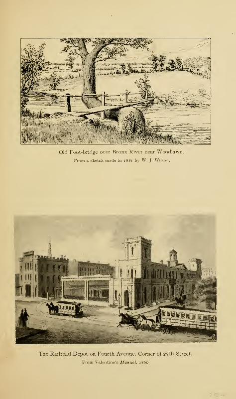
Old Foot-bridge over Bronx River near Woodlawn.
From a sketch made in 1881 by W. J. Wilson.
The Railroad Depot on Fourth Avenue, Corner of 27th Street.
From Valentine's Manual, i860

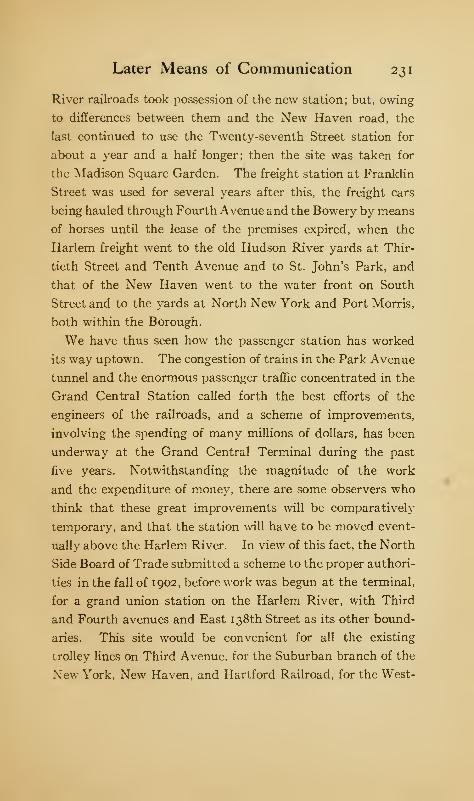
Later Means of Communication 231
River railroads took possession of the new station; but, owing
to differences between them and the New Haven road, the
last continued to use the Twenty-seventh Street station for
about a year and a half longer; then the site was taken for
the Madison Square Garden. The freight station at Franklin
Street was used for several years after this, the freight cars
being hauled through Fourth Avenue and the Bowery by means
of horses until the lease of the premises expired, when the
Harlem freight went to the old Hudson River yards at Thir-
tieth Street and Tenth Avenue and to St. John's Park, and
that of the New Haven went to the water front on South
Street and to the yards at North New York and Port Morris,
both within the Borough.
We have thus seen how the passenger station has worked
its way uptown. The congestion of trains in the Park Avenue
tunnel and the enormous passenger traffic concentrated in the
Grand Central Station called forth the best efforts of the
engineers of the railroads, and a scheme of improvements,
involving the spending of many millions of dollars, has been
underway at the Grand Central Terminal during the past
five years. Notwithstanding the magnitude of the work
and the expenditure of money, there are some observers who
think that these great improvements will be comparatively
temporary, and that the station will have to be moved event-
ually above the Harlem River. In view of this fact, the North
Side Board of Trade submitted a scheme to the proper authori-
ties in the fall of 1902, before work was begun at the terminal,
for a grand union station on the Harlem River, with Third
and Fourth avenues and East 138th Street as its other bound-
aries. This site would be convenient for all the existing
trolley lines on Third Avenue, for the Suburban branch of the
New York, New Haven, and Hartford Railroad, for the West-
232 The Story of The Bronx
Chester and Boston electric road, and for the completed and
proposed subways, while connections could be made with the
Second and Third Avenue elevated roads at a comparatively
small expense.
The Harlem Railroad was a single-track road originally,
but its business increased to so great an extent that, in 1852,
it was double-tracked for the first seventeen miles of its length.
The enormously increasing business of both the Harlem and
the New Haven roads below Woodlawn, compelled the Harlem
road to quadruple its tracks from that station to the Harlem
River. This was accomplished in the fall of 1891 by the
widening of the road-bed, the sinking of the tracks, and the
building of retaining walls at an expense of about $2,000,000.
The Port Morris branch was practically completed at the same
time, though there had been a single track for upwards of
forty years. The great steel bridge over the Harlem River,
carrying four tracks, the first ever so constructed, was erected
at the same time at a cost of $951,398.17. The length of the
bridge is 706 feet ; its width is fifty-six feet, and the draw has a
length of 389 feet.
In addition to its more than one hundred miles of track
within the Borough, the Central road has a great yard at
Melrose, containing fifty-five acres, for the storage of extra
cars and motors, as well as a freight yard for Bronx freight.
The maximum passenger rate under the general railroad laws
of 1848 and 1850 was three cents a mile; the average rate is
now about two and one half cents, and for commuters consid-
erably less.
On May 12, 1846, the Hudson River Railroad was chartered
by the State ; but work did not begin until the following year.
The plan was for the road to follow very closely the east bank
of the Hudson River from the station at Thirtieth Street and
Later Means of Communication 233
Tenth Avenue, Manhattan, to the towns of Greenbush and
East Albany, opposite the capital city. By November,
1847, the contractors had begun work on the various sections
of the road-bed; but the difficulties of waves and tides from
the river and the hard cutting through the rocky promon-
tories on the line of the road caused numerous delays. The
work was pushed with energy, but the contractors could not
get their men to work at night; and the enjoyment of the
laborers themselves was frequently enhanced by the scrim-
mages which occurred between the "Corkonians and the
Far-Downs," the Irishmen who constituted the gangs of
workmen having transplanted sectional animosities from the
"Old Sod," as well as themselves and their material belong-
ings. These kept the surgeons busy, but did not increase the
joy of the contractors. The directors were, however, generous
with the contractors on account of unforeseen delays. As
planned and built, the road was double-tracked as far as
Poughkeepsie. Travel began to Peekskill September 29,
1849, and to East Albany, October 13, 1851.
The New York Central Railroad was authorized April 2,
1 85 1, and its organization perfected August 1, 1853. Its
charter was issued for the purpose of consolidating all the
roads between Albany and Buffalo and Suspension Bridge.
Among these minor roads was the Mohawk and Hudson, the
oldest railroad in the State, chartered in 1826 and opened on
September 12, 183 1. On November 1, 1869, the Hudson River
and the New York Central railroads were consolidated under
the name and title of the New York Central and Hudson
River Railroad Company.
April 24, 1867, the Spuyten Duyvil and Port Morris Rail-
road was chartered. Its length is 6.04 miles, and it connects
the Harlem Railroad at the Melrose yards with the Hudson
234 The Story of The Bronx
River Railroad at Spuyten Duyvil. Its cost was $989,000;
and it was leased by the Central road on November 1, 1871,
until December 31, 1970, at an annual rental of eight per cent,
on its cost. It was necessary for the lessee to have control of
this road in order to get to the Grand Central Station in 1870.
It was about the same time that the Central secured control
of the Harlem Railroad. For many years, the passage of the
railroad through Kingsbridge on the surface made several of
the most dangerous road and street crossings in the State.
The course of the road-bed was very tortuous and twisting. In
order to overcome this, the route was changed in February,
1906, so that the road-bed now crosses Spuyten Duyvil
Creek on a causeway and then follows the ship-canal to the
Hudson River, its bed being on a shelf blasted out of the north-
ern side of the canal. It is proposed to fill in the bed of the
stream from the causeway up to the ancient bridge over the
creek.
Beginning in 1905, work was begun to change the motive
power of the Harlem road from steam to electricity. The
first train propelled by the new power ran fron New York to
Wakefield on January 28, 1907. The third-rail system is
used. On the sixteenth of February of the same year, the
White Plains and Brewsters express, while rounding the curve
at 206th Street, below Williamsbridge, at a speed of over fifty
miles an hour, suddenly left the tracks, owing, so it is sup-
posed, to the spreading of the rails, and twenty-three people
were killed and over seventy badly injured.
The construction of these roads, while giving access to the
western part of the Borough, has had no such effect in increas-
ing population as had the building of the Harlem road
through the middle of the Borough. Private estates and
domains of considerable size prevail to-day in Riverdale,
Later Means of Communication 235
Spuyten Duyvil, and Kingsbridge, which still keep their rural
character, though the march of improvements and the real-
estate operator will soon divest them of this characteristic.
The next railroad to be constructed within the Borough
was the New York and New Haven Railroad, which was
chartered in Connecticut. Work was begun at this end of
the road in 1847; and on December 25, 1848, the first train,
filled with directors and their guests, passed over the road
between its termini. The road comes from New Haven and
joins the Harlem road at Wakefield, and continues over the
Harlem tracks to the station in New York City. Its only
station within the Borough is Woodlawn, so that it has not
done much in developing this portion of the Borough. It was
consolidated with the New Haven and Hartford Railroad in
1872, under the name of the New York, New Haven, and Hart-
ford Railroad. It is a curious fact that when this railroad
first began to run its trains, the passengers were booked as in
the days of the stage-coaches, and the conductors were obliged
to report the names of the passengers to the company.
In 1872, the Harlem River and Port Chester Railroad was
incorporated, with a right of way from the Harlem River to
Port Chester, the last village in the county of Westchester on
the Sound. It was immediately leased by the New York and
New Haven road, and its construction begun. It is usually
spoken of as the Suburban, or Harlem, division of the NewYork, New Haven, and Hartford. Speaking generally, its
route follows the shore of the Sound to New Rochelle on the
main line. Its station and yards at the Harlem River occupy
the site of the house, barns, and home farm of Jonas Bronk,
and the manor-house of the Morrises; and on the East River
they occupy Oak Point, known in earlier days as Leggett's
Point. Access is had to Manhattan by means of the elevated
236 The Story of The Bronx
railroad. The length of the road is eleven and one half miles,
but with sidings and other tracks the entire trackage runs
well over one hundred miles. The possession of this branch
gives the New York, New Haven, and Hartford an outlet for
its freight business, as the length of water front controlled
by it on the East River gives ample space for its car floats
and freight yards. In addition, several through passenger trains
are run on board large steam ferry-boats and transported to
the connecting roads in New Jersey without putting travellers
to the inconvenience of transfers through the city of New York.
The road is to be connected in the near future with the Long
Island Railroad, and will thus have access to the Pennsylvania
Station; this will be done by means of a bridge across the
East River to Queens Borough by way of Randall's and Ward's
islands. The corporation constructing the bridge and road is
known as the New York Connecting Railway. About $20,-
000,000 are to be expended; and the American Bridge Com-
pany, the contractor, began work in the fall of 191 1.
While the construction of the Hudson River Railroad
required a good deal of blasting and cutting down, that of the
Suburban branch required the reverse; as owing to the low
lands and meadows abounding on the eastern side of the
Borough a great deal of the Suburban road-bed had to be
filled in. Its construction has been one of the factors in the
development of the eastern part of the Borough. Beginning
in 1903, work was begun to increase the road to six tracks and
to install electric traction. This has entailed an enormous
amount of work and the construction of numerous heavy
steel bridges to carry the streets across the tracks, and the
work is not yet finished (April, 1912).
The mutations of the Putnam division of the New York
Central and Hudson River Railroad have been numerous.
Later Means of Communication 237
July 3, 1877, the New York, Westchester, and Putnam Rail-
road Company was organized as a successor in part of the NewYork, Boston, and Montreal Railway, organized in 1871.
February 18, 1878, the New York City and Northern was
organized, and acquired under lease the property of the above
mentioned road. July 21, 1879, the West Side and Yonkers
Railway was organized. July 8, 1880, the Yonkers Rapid
Transit Railway Company was organized. June 4, 1881,
the Yonkers Rapid Transit Company, New York division,
was organized. October n, 1887, the New York and North-
ern Railway was organized after the sale under foreclosure
of the New York City and Northern Railway Company, and
by consolidation with the above two last-mentioned roads,
May 1, 1890, it also acquired under lease the West Side and
Yonkers Railway.
Under judgment of foreclosure against the New York and
Northern Railway Company, its property and franchises
were sold December 28, 1893, and conveyed January 12, 1894,
to J. Pierpont Morgan, J. Hood Wright, and Charles H.
Coster as joint tenants. The same day, they organized the
New York and Putnam Railroad, under two acts of the Legis-
lature of June 7, 1890, and May 12, 1892, and conveyed all
property and franchises to the new company. On January 30,
1894, the New York and Putnam Railroad was leased by the
New York Central and Hudson River Railroad at an annual
rental of four per cent, on first mortgage consolidated gold
bonds to the sum of $5,000,000 of principal, and upon $1,200,-
000 to be issued to retire the five per cent, bonds of the NewYork and Northern Railway Company. After all these vicis-
situdes, the road has become the Putnam division of the leas-
ing company.
The intent of the original projectors of the road was to
238 The Story of The Bronx
connect at Brewster's in Putnam County with roads for Boston
and Montreal. Its southern terminus was at High Bridge;
but the West Side and Yonkers Railroad was organized to
build an extension of one and one sixteenth miles to the Harlem
River to connect with the elevated railroads by means of a
bridge at 155th Street. As early as 1871, a considerable
portion of the right of way was purchased, and some grading
done, but owing to financial difficulties and reorganizations
the road was not opened to traffic until the spring of 1881.
A branch from Van Cortlandt Park connects with Yonkers by
means of half-hourly rapid transit trains. The Putnam road
has opened up High Bridge, Morris Dock, Morris Heights,
University Heights, Kingsbridge, and Van Cortlandt Park.
Though run at a loss during its earlier years, it is now paying
more than its expenses under its present lessee. The motive
power is still the steam locomotive, though suggestions have
been made to introduce electricity. The cost of the road has
been $1 1,700,000, an average of nearly $206,000 for every one
of its 58.88 miles to Brewster's, and it is single track at that.
Under the State Railroad Act of 1850, a number of street-
car lines was formed and articles of association filed, but
nothing seems to have been done until later. Among these
later ones were the New York and Westchester Railroad
Company, September 24, 1859; New York and Yonkers
Railroad Company, October 17, 1859; Union Railroad Com-
pany of Westchester, December 15, 1859; Port Morris and
Westchester Railroad Company, April 2, 1861; and the
Third Avenue and Fordham Railroad Company, on the same
date. The president of all these companies was David
Milliken, and the leading name of each of the boards of
directors was Gouverneur Morris.
The last of these companies was incorporated under Chapter
Later Means of Communication 239
[43 of the laws of i860, to authorize the construction of rail-
way and tracks in West Fanus, Westchester, Eastchester,
New Rochelle, Yonkers, and Morrisania. The road was to
extend from Harlem Bridge to Fordham, via Third Avenue,
but as the road was not completed by December 11, 1862,
its charter became extinct. The rest of the companies held
on to their charters, and were built, more or less, subsequently.
The Third Avenue and Fordham Railroad had a natural
successor in the Harlem Bridge, Morrisania, and Fordham
Railroad Company, incorporated in 1863, with a route from
the bridge to Fordham via Third Avenue; this was the first
street railway in the Borough. According to the report filed
at the end of 1864 by its president, John B. Haskins, five miles
of road had been built at a cost of $158,749.22 and 571,450
passengers had been carried. The road was capitalized at
$300,000, of which $72,000 was paid up; the outstanding in-
debtedness of $88,000 bore interest at seven per cent. It
owned seventeen first-class and two second-class cars, which
travelled by horse power at the rate of six and one half miles
an hour, including stops, or seven miles an hour while in
motion. The rates of fare were as follows:
Harlem Bridge to Morrisania 5 cents" Tremont 8 "
" Fordham 10 "
In 1865, the fare to Morrisania was increased to six cents, and
the average rate of speed (?) decreased to six miles an hour.
This is the rate of progress according to the report. As a
matter of fact, on very stormy nights the cars did not run
at all, or at such infrequent intervals as to be useless as a
means of transportation. The road-bed was so poor that very
often, when the driver attempted to put on a spurt of speed,
240 The Story of The Bronx
there would be a sudden jar and stoppage; and then the con-
ductor would stick his head into the car and inquire plain-
tively: "Will th' gintilmin plaze get aff th' car an' help lift
it back on th' track; an' will th' ladies plaze git aff th' car till
th' gintilmin git troo?" There was all the excitement of the
hold-up of a western stage-coach; and the "gintilmin" oblig-
ingly alighted and lifted the car back, whereupon the inter-
rupted journey would be resumed. So frequent were the
mishaps and delays, that a writer in the New York Herald
in 1864 spoke about getting off the cars at such times to pick
huckleberries. Here was a convenient and handy nick-name;
and the Huckleberry Road it became at once; a name which
was applied to the whole system of street cars in the Borough,
and which became notorious under the wide powers granted
to the "Huckleberry System" by the act of the Legislature of
1892, authorizing the incorporation of the Union Railway
Company.
The first extension of the horse-car service was in 1870,
when two cars were run between Third Avenue and West
Farms by way of the Boston Road. Since then many exten-
sions have been made, both in the days of the horse and in
the days of the trolley, until the Borough is fairly gridironed
with street-car surface lines, most of which give and take
transfers to and from other connecting or crossing lines.
The trolley, or electric, motive power was first introduced
in October, 1 892 ; the overhead system is the only one used in
the Borough. The street-car service extends from the Harlem
River northward from three points, Harlem Bridge, Central
Bridge, and Kingsbridge, though cars cross the Madison Ave-
nue, the Lenox Avenue, and the Washington bridges. The
most important of these radiating points is Harlem Bridge,
over which many lines pass from their terminus at 128th Street
Later Means of Communication 241
and Third Avenue, Manhattan. These lines go over a part
of Third Avenue for a greater or less distance before diverging
to their special destination. Until the spring of 1908, an
additional fare of three cents would secure a transfer to or from
the elevated.
The entire system within the Borough was under the Union
Railway Company, or "Huckleberry Road," until January,
1898, when the Third Avenue Company secured control.
The Third Avenue and leased lines were, in their turn, leased
to the Metropolitan Street Railway Company on April 13,
1900, for nine hundred and ninety-nine years. On November
25, 1901, the Interurban Railway Company secured control.
The development of the system is, however, mainly due to
the Union Railway Company. In January, 1904, the Inter-
urban Company petitioned the county court of Westchester
County to change its name to the New York Railway Com-
pany.
During the decade from 1898 to 1908, all the railways of
Manhattan and The Bronx were being manipulated by the
late William C. Whitney and others, with the result that they
came virtually under one management. The stock was
enormously increased beyond any reasonable relation to the
actual value of the road-beds, rolling stock, barns, power-
houses, franchises, and earning capacity, so that in June,
1908, they went into the hands of receivers; and the transfers
to and from the elevated and the Westchester Traction Com-
pany were abolished by the United States courts, though
those with the Westchester Company have been resumed in
some cases.
The successful operation upon Manhattan Island of the
elevated railroads after 1870 turned the attention of engineers
and capitalists to the possibilities of similar structures in the
242 The Story of The Bronx
newly annexed district. Accordingly, April 5, 1880, articles
of association were filed by the Harlem River and Port Chester
Rapid Transit Company, under the general railroad laws
of 1850, for the construction of a steam railway from East
129th Street and Second Avenue, Manhattan, to a point on
Westchester Avenue near the Bronx River, there dividing
into two branches, one of which was to go to Hunt's Point.
October 19, 1880, the Suburban Rapid Transit Company
was chartered under the Rapid Transit Act of 1875, relating
to elevated railroads. November 30, 1883, the New York,
Fordham, and Bronx Railway Company filed articles of incor-
poration under the same act for the purpose of constructing
a railroad in the Annexed District, to connect with the elevated
railroads then running on Manhattan Island, and to extend to
Bronxdale and Williamsbridge in two branches from Fordham.
March 17, 1886, the Suburban Rapid Transit Company ac-
quired all the rights, franchises, etc., of the last-named company
and began the construction of an elevated road from East
129th Street and Third Avenue, south of the Harlem River,
to 143d Street, between Willis and Alexander avenues in
the Borough. The bridge over the Harlem River, generally
known as the "Second Avenue Bridge," was opened to the
public May 17, 1886.
In 1887, the line was continued to 161st Street, a distance
of 2.16 miles from the Manhattan end. To 145th Street, the
road uses its own property, none of the streets being used
except to cross over, and the tracks are constructed in the
middle of the blocks between Willis and Alexander avenues.
From 145th Street, the elevated structure follows the line
of Third Avenue. The next extension was made to Tremont,
177th Street, in July, 1891. Another extension was made to
Pelham Avenue. Fordham, in 1900; and the last extension was
Later Means of Communication 243
made to Bronx Park through the grounds of Fordham Univer-
sity in 1902, thus making the total length of the line about five
miles. Until August, 1891, to get from any place in the
Annexed District to any place in Manhattan by elevated
required the payment of two fares, or ten cents ; but upon this
date the Manhattan Company acquired the Suburban, and
since that time the fare from the upper terminus of the road
to the South Ferry has been five cents. The future will
undoubtedly see the farther extension of the elevated road to
the city line, and ultimately, to within the cities of Mt. Vernon
and Yonkers.
As early as the middle of the last century, the subject of
underground railways was discussed for the old city of NewYork. In 1868, the New York Central Underground Railway
was chartered; in 1872, the New York Rapid Transit Com-
pany, in which Cornelius Vanderbilt was interested, was
chartered, and among other schemes was the Beach Pneumatic
Railway Company, which actually built a section underground,
still existing abreast of City Hall Park. « All these companies,
though granted full powers and excellent routes, failed to
attract the necessary capital for their construction; and the
building of the elevated roads sidetracked the idea of under-
ground railways for several years, or until 1884, when the
discussion was resumed.
In his message to the Common Council in January, 1888,
Mayor Hewitt called their attention to the subject of under-
' On February 8, 1912, preparatory to beginning work on the newBroadway-Lexington Avenue subway, a party of engineers and contractors
visited the old tunnel. They found the tube in an excellent state of pre-
servation, but the rails had almost entirely rusted away, and the one car
of the Beach Railway, which had been immured for forty years, was in a
state of absolute decay. The brick-work of the tube was in such good
c 1 lition that the contractors feared it would take as much work to de-
molish it as to build the new tube.
244 The Story of The Bronx
ground railways by stating that the existing railways of the
city would soon be inadequate for the increasing traffic, and
that the construction of an underground railway was desirable
and would be soon absolutely necessary. In view of these
facts, he suggested that some scheme should be devised to
advance the credit of the city for building such roads, as a
large amount of capital would be required ; but nothing came
of the Mayor's suggestion.
In 1 890, the Legislature enacted a rapid-transit bill affecting
cities of over one million inhabitants. Under the provisions
of this act, Mayor Grant appointed the first Rapid Transit
Commission, which made a report, June 16, 1890, in favor of
an underground railway. Routes were selected, soundings
made, consents of property owners obtained, other property
selected for condemnation by the Supreme Court, and, finally,
the franchises were offered for sale, but no responsible bidder
appeared; the plan, which had cost the city over $130,000, was
dropped.
In 1893, a responsible banking house offered to construct
the road if the city would loan its credit to an amount not to
exceed thirty millions of dollars; but ex-Mayor Hewitt pointed
out that the city was forbidden by the Constitution of the
State to loan its credit for private enterprises, and that the
city must own anything for which its credit was advanced.
A bill embodying the ideas of Mr. Hewitt was passed by the
Legislature and signed by Governor Flower May 22, 1894.
A new Commission was appointed by the Mayor, of which
Alexander E. Orr was president, and William Barclay Parsons
was chief engineer, both of whom held the same positions when
the road was completed. The act authorized the use of the
referendum at the election of November 6, 1894, to see whether
the people were willing to increase the city's indebtedness by
Later Means of Communication 245
the issue of bonds for the construction of the road, which
was to be the property of the city. The vote showed 132,000
in favor of, and 43,000 opposed to, the plan. It was not until
January 14, 1897, that the routes were finally decided upon and
published; and it was not until January 15, 1900, that, all
legal difficulties having been overcome, the Commission was
able to open bids for the construction of the underground
railway.
There were two bidders; and the contract was awarded to
John B. McDonald, who offered to construct the underground
railway for $30,000,000. The contracts were signed February
1 , 1900, and the work was formally begun on the twenty-fourth
of March by Mayor Van Wyck, who began the excavation in
front of the City Hall. The road was divided into divisions
and these into sections let to sub-contractors. No time was
lost in getting to work upon all sections of the road.
The underground rapid-transit railway, or "subway,"
as it is called popularly, enters the Borough at two points,
Morrisania and Kingsbridge. At Kingsbridge the road is
elevated, crossing the bridge over Spuyten Duyvil Creek.
The terminus of the Broadway branch of the subway is at
242d Street and Van Cortlandt Park.
The West Farms division crosses under the Harlem River
in tubes at West 145th Street, Manhattan, the tracks emerging
from the subway east of Third Avenue at 149th Street. From
there to its terminus at West Farms and Boston Road it is
an elevated structure, following Westchester Avenue and the
Southern Boulevard. Work was started in the Borough in
the spring of 1901, and the road was formally opened for
passenger traffic from City Hall to 145th Street, Manhattan,
on October 27, 1904, and to the West Farms terminus on July
10, 1905.
246 The Story of The Bronx
April i, 1903, the Interborough Rapid Transit Company
was formed by the interests engaged in building the subway
for the purpose of controlling both the subway and the ele-
vated railway. As their interests have thus become identical,
the two roads issue transfers to each other at their crossing
at Third Avenue and 149th Street. The contracting company
had until September, 1904, to complete the construction of
the road, after which it leases the road from the city for a
period of fifty years at a fixed annual rental. At the expira-
tion of the lease, the road with its entire equipment of power-
houses, rolling stock, etc., becomes the property of the city
absolutely. What an opportunity that will be for the authori-
ties of the city to place their political henchmen!
The subway, during its seven years of existence, has been
the most important factor in causing the enormous increase
in the population of the Borough. That it is totally inade-
quate for the demands made upon it is shown daily in the
overcrowded condition of its trains, producing scenes of
brutal indecency that I do not believe would be submitted to
by any other people in the world. The demand has been
unanimous for some years upon the city officials to extend
and enlarge the routes of underground travel ; but the rivalries
of the Interborough and the Brooklyn Rapid Transit Com-
panies, the danger of going beyond the debt limit, and the
apparent impossibility of the Mayor, the Board of Estimate
and Apportionment, the Board of Aldermen, and the Public
Service Commission getting to a common basis of agreement
tied the matter up for years. At last, in the fall of 191 1,
contracts were let for the building of some of the proposed
lines.
That in which the Borough is interested is the new route
up the east side of Manhattan, thus saving the time necessary
Later Means of Communication 247
for the present detour to the west side. This is called the
Broadway-Lexington Avenue route, because it starts in lower
Broadway, but swings over to Lexington Avenue, which it
follows to the Harlem River, under which it crosses in tubes.
At East 138th Street and Park Avenue, the subway will divide
into two branches of three tracks each: the Jerome Avenue
branch, and the Southern Boulevard branch.
The first named remains underground to River Avenue and
East 157th Street, where it emerges from the ground and
becomes elevated above Jerome Avenue, which it follows to
Woodlawn, a distance of 6.1 miles.
The other route will turn east under 138th Street as far as
the Southern Boulevard, which it will follow underground as
far as Hunt's Point, where it will swing under Whitlock Avenue
which it will follow to a point south of Westchester Avenue.
Here it emerges from the ground and becomes elevated over
Westchester Avenue, which it will follow to Pelham Bay Park,
a distance of 7.2 miles.
Work was begun upon the different sections of the road in
Manhattan in November, 191 1, and the first work was started
in The Bronx with appropriate ceremonies at Mott Avenue,
just north of 138th Street on the morning of December 4, 191 1
.
It is expected that the road will be running at the expiration
of two years from the beginning of work. Another extension
of the rapid-transit system will be started probably within a
few months, when the Interborough agrees upon terms with
the city for an extension from its present terminus at West
Farms by way of White Plains Avenue to, or near, the city
line.
In 1898, Mr. W. C. Gotshall, an electrical engineer, con-
ceived the idea of an electric railway to run to Port Chester.
It was organized under the laws of the State on April 5, 1901,
248 The Story of The Bronx
and application was made to the railroad commissioners for
a franchise. At the first public hearing, strong opposition
was manifested by the New York, New Haven, and Hartford
Railroad, the New York Central, the Union Railway Com-
pany, and the New York and Stamford, the last still to be
constructed. Mr. Gotshall stated what his company intended
to do; and these statements he supported with the strongest
kind of evidence, so that the citizens of the Borough and of
Westchester County were almost unanimously in his favor.
After the first hearing, the opposing roads, with the exception
of the New Haven, withdrew their opposition. Then followed
a fight for several years. The New York, Westchester, and
Boston Railroad then entered the field; but great doubt
existed as to the value of its charter, which had expired, so it
was alleged, because nothing had been done in the way of con-
struction within the time specified by law.
The application of the Port Chester road to the Board of
Aldermen of the city for permission to cross the streets of the
Borough on its own right of way was held up for over a year,
while the application of the Boston and Westchester was
granted almost at once. The reason given by one of the
aldermen on the Committee on Railroads was "that the Port
Chester Company had not convinced him of its financial
responsibility, while the Westchester people came and showed
they had the money." Whereupon General Daniel Sickles,
then a member of the Board of Aldermen, who had asked the
question, simply said: "Oh!"
To the author, who followed the various applications and
proceedings for several years, it seemed that the Port Chester
people, backed by the entire populations of the sections through
which the road would pass, tried to get its franchise without
"buying" it from the authorities, while the Westchester road
Later Means of Communication 249
"showed" its money (to use an aldermanic term), to the
authorities and convinced them of its financial ability. How-
ever that may be, the Port Chester people offered so much to
the city in the way of payment of its franchise that the
court of appeals at last ordered that it should be granted, in
accordance with the unanimous vote of the State Railroad
Commissioners
.
Work was begun upon the road-bed on June 21, 1906, and
large sums of money were spent, both in the Borough and in
Westchester County; then, after months of work, everything
suddenly stopped and remained so for over a year. Then the
public was informed through the press that both the contend-
ing roads had sold their franchises to the New York, NewHaven, and Hartford Railroad; and assurances came from
President Mellen of that railroad in the latter part of January,
1909, that work would be resumed upon the construction of
the electric elevated lines of the two roads, combined into one,
at as early a date as convenient.
The convenient day came sooner than most people expected,
for work was resumed shortly after. In the fall of 191 1, the
railroad officials announced that the road would be running
early in February; but, owing to the delay in receiving equip-
ment, the first passenger trains were not run until May 29,
191 2. At West Farms there is a great union station with the
subway, but the Port Chester road continues south over Walker
Avenue and comes down to the level of the tracks of the
Suburban branch of the New York, New Haven, and Hartford,
which it uses to the terminus of the Suburban branch. North-
ward from the union station at Adams Street and Morris Park
Avenue, the Port Chester road parallels the latter for some
distance, then crosses the old Morris Park race track and
continues straightway to the city line near old St. Paul's,
250 The Story of The Bronx
Eastchester. The route is owned by the railroad company,
and public streets are not used, though several have been
closed at Van Nest, where the union station is located. There
are no grade crossings on the road from beginning to end.
CHAPTER XII
THE CHURCHES
THE earliest settlers in the Borough, Throgmorton's
colony of 1642 and those who settled at Westchester
in 1653, were refugees from the New England col-
onies who sought the Dutch colony of New Netherland for a
freer exercise of their religion; the policy of the Dutch in
regard to religious matters being much more liberal than that
pursued in Plymouth, Massachusetts Bay, Salem, or the Con-
necticut colonies. Most of these settlers were Independents,
the rest were Quakers.
In 1646, Father Jogue, a Jesuit missionary, visited NewAmsterdam and wrote: "No religion is publicly exercised but
the Calvinist, and orders are to admit none but Calvinists,
but this is not observed; and there are in the Colony besides
the Calvinists, Catholics, English Puritans, Lutherans, Ana-
baptists, here called Mnistres, &c, &c.
"
Sir Edmund Andros, the Governor, in an account of
New York in 1678, says:
"There are Religions of all sorts, one Church of England,
severall Presbiterians & Independents, Quakers & Anabaptists,
of severall sects, some Jews, but presbiterians & Indipendts
most numerous & substantial!. . . . And all places oblidged
to build churches and provide for a minister, in wch most very
wanting, but presbiterians & Independents desirous to haue251
252 The Story of The Bronx
[have] & maintaine them if to be had. There are abt 20
churches or Meeting places of wch aboue [above] halfe
vacant."
While the earlier account is before the occupation of the
mainland to any extent, except at Throgg's Neck, they both
describe conditions which prevailed during the earlier days of
the colony.
The Westchester colony had no minister until 1665, and then
only for a short time, when the Reverend Mr. Brewster seems
to have officiated ; but that they had religious services of some
kind is shown by an extract from the journal of the Dutch
commissioners who visited Oostdorp in 1656:
"31 Dec. after dinner, Cornelius van Ruyven went to the
house where they held their Sunday meeting, to see their modeof worship; as they had, as yet, no preacher. There I found
a gathering of about fifteen men, and ten or twelve women.Mr. Baly said the prayer, after which, one Robert Basset
read from a printed book a sermon, composed by an Eng-lish clergyman in England; after the reading, Mr. Baly gave
out another prayer and sung a psalm, and they all sepa-
rated."
Dominie Megapolensis bears similar testimony in a letter
to Holland in 1657. Like their New England brethren, they
combined town matters with religious ones; and the town
records contain references to both equally, the inhabitants
constituting the congregation, and vice versa. In the records,
under date of July 29, 1674, appears the name of the Reverend
Ezekiel Fogge, probably the first Independent, or Congre-
gational, minister to officiate at Westchester. In 1680, the
name of Morgan Jones appears as performing the rites of
baptism and marriage.
The Churches 253
At the town-meeting at Westchester, January 2, 1692, it
was agreed:
"that there shall be an orthodox minister in the town
aforesaid, as soon as possible may be; and to allow him forty
or fifty pounds per annum, equivalent to money, for his
maintenance. It is also voted and agreed upon, that a manshall go to the Honorable Colonel Heathcote, and see if he can
prevail with him for to procure us a minister, in his travels
in New England, otherwise, that Captain William Barnes shall
go and procure us a minister."
September 21, 1693, the Provincial Assembly passed an act
for settling a ministry; and the county of Westchester was
divided into two parishes, Westchester and Rye. The former
included the towns and precincts of Westchester, Eastchester,
Yonkers, and Pelham Manor, and was required to raise fifty
pounds per annum for the support of a minister. There was
also to be "called, inducted and established, a good, sufficient
Protestant minister"; but so few persons at that time were
qualified to accept the call of the vestry that it was not until
May, 1695, that steps were taken to call the Reverend Warham
Mather, a graduate of Harvard and a member of the famous
family which gave so many divines to New England.
That there was a church building at Westchester is evident
from the description of the town given by the Reverend John
Miller in 1695. "There is a meeting-house at Westchester,
and a young man coming to settle there without orders
[i.e., not a clergyman of the Church of England]. There are
two or three hundred English and Dissenters, a few Dutch."
When this meeting-house was built is problematical ; but as on
May 5, 1696, it had so fallen into decay that the town voted
to repair it, we may surmise that it might have been perhaps
twenty years old. On May 3, 1697, " It was voted and agreed
254 The Story of The Bronx
upon, that there should be a Town House built, to keep courts
in, and for the publick worship of God."
In 1699, an act of the Provincial Assembly authorized
the towns of the Province to build and repair meeting-houses,
and to lay taxes for the same. In view of this act, the idea
of building a town-house was abandoned, and a new parish
church was erected in 1700, the expense of building the same
being laid upon all the inhabitants, irrespective of religious
belief or faith. It was twenty-eight feet square, with a "ter-
ret " on top for a bell tower, capping a pyramidal roof, and was
built of wood by Richard Ward at a cost of forty pounds. It
occupied the site of the present Episcopal Church of St.
Peter's, on the Town Green, adjoining the court-house and
jail. It was used as a church until 1788, when it was in such
bad order after the Revolution that it was sold to Mrs. Sarah
Ferris and removed.
The Reverend Warham Mather served as minister until
1 70 1, but was never inducted into the living, owing to the
adverse efforts of Colonel Heathcote, who had been elected a
church-warden of the parish and who, stout churchman as he
was, opposed the installation of a dissenting clergyman. In
his letter of April 10, 1704, to the secretary of the Propagation
Society, Colonel Heathcote says:
"Sir, being favor'd with this opportunity, I cannot omitt
giving you the state of this county in relation to the church,
and shall begin the history thereof from the time I first cameamongst them, which was about twelve years ago, when I
found it the most rude and heathenish country I ever saw in
my whole life, which called themselves Christians—there
being not so much as the least marks or footsteps of religion
of any sort. Sundays being the only time sett apart by them
for all manner of vain sports and lewd diversions, and they were
grown to such a degree of rudeness, that it was intolerable;
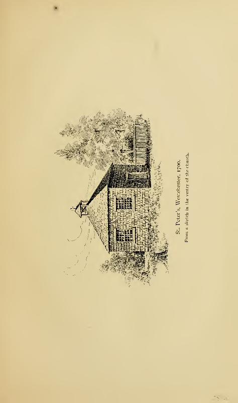
.
v,v,. , J
;^t*£
;xv.
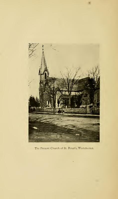
The Present Church of St. Peter's, Westchester.
The Churches 255
and having then the command of the militia, I sent an order
to all captains, requiring them to call their men under arms
and to acquaint them that in case they would not, in every
town, agree amongst themselves to appoint readers and pass
the Sabbath in the best manner they could, till such times as
they could be better provided ; that they should every Sunday
call their companies under arms, and spend the day in exercise,
whereupon it was unanimously agreed on thro' the county,
to make choice of readers; which they accordingly did, and
continued in those efforts some time. After which the people
of Westchester, Eastchester, and a place called Lower Yonkers,
agreed with one Warren Mather, and the people of Rye with
one Mr. Woodbridge, both of New England, there being at
that time scarce six in the whole county who so much as in-
clined to ye church. After Mr. Mather had been with them
for some time, Westchester Parish made choice of me for one
of their church-wardens, in hopes of using my interest with
Colonel Fletcher to have Mather inducted to ye living. I
told them it was altogether impossible for me to comply
with their desire, it being wholly repugnant to the laws of
England to compell the subject to pay for the maintenance of
any minister who was not of the national church, and that it
lay not in any governor's power to help them."
It will be remembered that Governor Benjamin Fletcher
had intentionally misconstrued an act of the Assembly and
had declared the Church of England to be the Established
Church of the Province. Colonel Heathcote tried to have
called to the living a French Protestant living in Boston, the
Reverend Mr. Bondett, who had taken holy orders; but though
the vestry at first agreed, they afterwards refused to allow of
his induction. Appeal was then made to London, to the
Venerable Society for the Propagation of the Faith in Foreign
Parts, whose province it was to furnish clergymen to the
colonies of England.
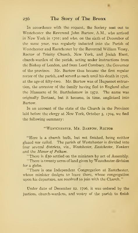
256 The Story of The Bronx
In accordance with the request, the Society sent out to
Westchester the Reverend John Bartow, A.M., who arrived
in New York in 1 702 ; and who, on the sixth of December of
the same year, was regularly inducted into the Parish of
Westchester and Eastchester by the Reverend William Vesey,
Rector of Trinity Church, New York, and Josiah Hunt,
church-warden of the parish, acting under instructions from
the Bishop of London, and from Lord Cornbury, the Governor
of the province. Mr. Bartow thus became the first regular
rector of the parish, and served as such until his death in 1726,
at the age of fifty-two. Mr. Bartow was of Huguenot extrac-
tion, the ancestor of the family having fled to England after
the Massacre of St. Bartholomew in 1572. The name was
originally Bertaut, but it became, in time, anglicized into
Bartow.
In an account of the state of the Church in the Province
laid before the clergy at New York, October 5, 1704, we find
the following summary:
"Westchester, Mr. Bartow, Rector
"Here is a church built, but not finished, being neither
glazed nor ceiled. The parish of Westchester is divided into
four several districts, viz., Westchester, Eastchester, Yonkers
and the Manor of Pelham.
"There is £50 settled on the ministers by act of Assembly.
"There is twenty acres of land given by Westchester division
for a glebe.
"There is one Independent Congregation at Eastchester,
whose minister designs to leave there, whose congregation
upon his departure, are resolved to join with the Church.
"
Under date of December 12, 1706, it was ordered by the
justices, church-wardens, and vestry of the parish to finish
The Churches 257
the church at a cost of £17, "in good and current money of
New York . . . the justices and vestry to find boards, and
nails and hinges." During the ministry of Mr. Bartow, he
acquired considerable land in Westchester, and also several
thousand acres in East New Jersey, in the counties of Mon-
mouth and Middlesex, which he devised by will to his widow
and six sons. The careers of the sons and their descendants
show that the rector was the ancestor of a line of clergymen
of the Church of England and of the Episcopal Church of
today.
Mr. Bartow was succeeded in 1727 by the Reverend Thomas
Standard, A.M., M.D., a native of Taunton, England. The
Society had appointed him their missionary at Brookhaven,
Long Island, in 1725, and assigned him to Westchester at his
own request, backed by that of those in authority. He was
rector of the parish over thirty-four years, dying at an advanced
age in 1760. In 1735, he had a difference with Mr. Forster,
the schoolmaster, and charges were preferred against him
by some of his parishioners. The Reverend Mr. Vesey in-
vestigated the difficulty and reported to the Society; but the
affair seems to have adjusted itself, for Mr. Standard remained
as rector. During his incumbency, the church building was
made more comfortable by putting backs to the pews, and
£70 were raised for the repair of the church. In the rector's
report of 1728 to the Society, he states: "I preach one
Sunday at Eastchester and another at Westchester, twice a
day, for the summer half year."
The Reverend John Milner, a native of New York, was
installed as "Rector of the Parish Church at Westchester,
commonly called St. Peter's Church, including the several
districts of Westchester, Eastchester, Yonkers, and the Manor
of Pelham, " under orders from Lieutenant-Governor Cadwal-
258 The Story of The Bronx
lader Colden, dated June 30, 1761. In his report to the
Society on October 3, 1761, he says:
"My mission is of large extent; and I am obliged to attend
three churches, and till Mr. Houdin came to New Rochelle,
officiated there once a month. One of my churches is a
new edifice, raised by the generosity of Colonel Phillips. I
have baptized forty-three white infants and four adults,
twelve black children and three adults. My communicants
are sixteen."
Later, June 29, 1762, he reports:
"I constantly attend three churches, in three different town-
ships, preaching to crowded audiences of devout, well-behaved
people. They have no dissenters among them except a few
Quakers. The number of my communicants is increased to
fifty-three."
The "new edifice, raised by the generosity of Colonel
Phillips" was St. John's Church in Yonkers. It was erected
into a separate cure in 1765, when the Reverend Harry Munro
was appointed rector; he was succeeded by the Reverend
Luke Babcock, one of the signers of the White Plains Protest,
whose death in 1777 was accelerated, so it is said, by the
ill-treatment and confinement he had undergone at the hands
of the patriots.
By royal charter of December 2, 1762, St. Peter's at West-
chester was incorporated under the title of "The Rector and
inhabitants of the Borough Town of Westchester, in Com-
munion of the Church of England, as by law established.
"
This gave them the right to sue and be sued, to acquire prop-
erty, and to lease or otherwise dispose of it, as well as power
to build and repair, and to conduct their affairs as a body
The Churches 259
corporate and politic without regard to the authorities and
inhabitants of the town. The names of the incorporators were
Rector John Milner, John Bartow, Isaac Willett, Lewis
Morris, Jr., Peter De Lancey, Nathaniel Underhill, James
Graham, and James Van Cortlandt, a list which includes the
most prominent names of the Borough of colonial times.
Mr. Milner went to considerable expense in 1 764 to repair the
parsonage house and to erect new barns and outhouses upon
the glebe lands. In addition, the church-wardens notified
the Society that
"-ve have purchased a glebe of thirty acres with a house,
which, when we have repaid Mr. Milner the expense
he has been at, will cost us, in the whole, near seven
hundred pounds, which we spend with cheerfulness, as our
minister's behaviour has very much endeared him to the
people ; and his diligence has been attended with such success,
that whole families of Quakers—the only dissenters in this
parish—have conformed to the Church.
"
In the fall of 1765, Mr. Milner severed his connection with
the parish, for what reason does not clearly appear, though
it was probably due to a difference in money matters between
him and the vestry, who were slow in paying him the money he
had expended. In fact, the vestry must have refused to pay
him at all ; for in his letter to the secretary of the Society from
his new cure in Virginia, under date of February 3, 1768, he
says:
"I am very sorry to inform you that the people of West-
chester pay very little regard, either to their promises, or
the Society's expectations; for I am informed by my lawyer
that they absolutely refuse to refund me one penny of all
the money I have expended on their glebe, which, without
the repairs and buildings I made, would have been entirely
useless."
260 The Story of The Bronx
The Reverend Samuel Seabury succeeded to the rectorship
near the end of 1766, after a vacancy of nearly a year. He was
a native of Groton, Connecticut, a graduate of Yale with the
degree of A.M., 1748, as well as an A.M. of King's College,
1 76 1. He was for some time a catechist of the Society,
and upon being recommended to the cure of New Brunswick
in East New Jersey, he went to London for holy orders. He
served at New Brunswick from 1754 to 1757, when he was
promoted to the living at Jamaica, Long Island. He became
rector of Westchester, December 3, 1766. He is spoken of
"as a youth of good genius, unblemished morals, sound prin-
ciples of religion and one that hath made as good proficiency
in literature, while in America, as the present state of learning
there would admit of ; and he has gone for his improvement to
the University of Edinburgh.
"
In a letter to the secretary, dated June 25, 1767, he writes:
"With regard to the income of this parish, the salary, by an
act of Assembly is £50 currency. The exchange from N. Y.
to London being generally from £70 to £80 for £100 sterling.
Burial fees here, there are none; but the more wealthy families
sometimes give the minister a scarf, on these occasions. Mar-
riage fees from one to four Spanish dollars; but far the greater
number go to an Independent teacher in the Parish of Rye,
because the ceremony is short, and they have nothing to say.
Possibly these fees may amount to £5 or £6 a year. ... Butthere are many families, especially among the lower classes,
who do not pretend to be of any religion at all."
Of his school, of his participation in the discussions pre-
ceding the Revolution, and of his capture by Sears, accounts
will be found elsewhere in this volume. Upon his return from
his captivity in Connecticut, he took up his residence at the
The Churches 261
parsonage in fear and trembling, as he was closely watched by
the authorities. Upon the Declaration of Independence, he
shut up his church. Upon September i, 1776, after lying
hidden for some time in the AVilkins house with Dr. Chandler
of Elizabeth, New Jersey, and Dr. Myles Cooper, President
of King's College, he, with his companions, took advantage of
the neck being unguarded and escaped at night to Long Island.
"Upon finding they had missed him, the rebels vented their
rage on his church and his property, converting the former
into an hospital, tearing off the covering and burning the pews;
and damaging the latter to the value of three hundred pounds
currency."
In his letter of November 12, 1777, he writes: "That
about a month before, I had visited "Westchester, and thought
of staying the winter there, but was obliged to drop such
intentions on General Burgoyne's defeat; as the Rebels upon
that event came to that town by night and carried off forty-
two of the inhabitants." He removed from Long Island to
Staten Island; but finding it "impracticable to return to
Westchester, or reside on Staten Island," he took up his
residence in New York in 1778, and lived there until the end
of the war, acting as chaplain of Colonel Fanning's King's
American Regiment of Loyalists.
In 1784, he went to England for consecration as bishop;
but the English bishops discovered that they could not legally
consecrate any one for a foreign country who would not take
the oath of allegiance to the King, which Dr. Seabury, being
now an American citizen, would not do. The laws of Scotland
did not contain any such provision, so Dr. Seabury went there
and was consecrated bishop at Aberdeen. In the summer of
1785, he returned to America as Bishop of Connecticut and
Rhode Island, and took up his abode in New London, where he
262 The Story of The Bronx
died February 25, 1796, at the advanced age of eighty-six,
having been the first Bishop of the Church in America, con-
secrated for the purpose.
During the Revolution, St. Peter's was closed so far as
religious services were concerned; though like St. Paul's at
Eastchester and the Dutch Church at Fordham, it was used
either as a hospital or a stable by the British, perhaps both.
No services were held for thirteen years, and the church edifice
was so dilapidated as to be irreparable.
On April 6, 1784, the State Legislature passed "An act
to enable all religious denominations 1 this State to appoint
trustees, who should be a body corpo u^ for the purpose of
taking care of the temporalities of their respective congrega-
tions, and for other purposes therein mentioned." Under
the provisions of this act, St. Peter's was incorporated April
19, 1788, with the following persons as trustees: Lewis Graham,
Josiah Browne, Thomas Hunt, Israel Underhill, John Bartow,
Philip I. Livingston, and Samuel Bayard.
The first record of their meeting is that of May 12, 1788,
when "it was resolved that the old church be sold to Mrs.
Sarah Ferris for the sum of ten pounds." A subscription
paper for funds to build a new church was circulated among
the people, and an appeal was made to the Propagation Society.
By 1789, enough funds were in hand or in sight to warrant the
making of a contract, January 26th, with John Odell, carpen-
ter, of New York for the erection of a church edifice for the
sum of £336. The new edifice was built on the site of the old
one removed by Mrs. Ferris, and was ready for use at the end
of the year.
The trustees called the Reverend Theodosius Bartow, a
grandson of the first rector, for two years from January 2,
1792. He was to preach every other Sunday; and his services
The Churches 263
during the short time of his engagement were very acceptable.
He was succeeded by the Reverend John Ireland, August 20,
1794-
On January 20, 1795, the trustees of the town of West-
chester released, for the sum of twenty shillings, unto the
trustees of the Church of St. Peter's
"all that certain lot, piece and parcel of ground on which the
Episcopal Church of St. Peter's is erected, and also the Bury-
ing Ground adjoining the said church, as it is now enclosed
and fenced, and which has heretofore been used for a Burial
Place by the inhabitants of said Township, containing about
one acre, be the same more or less.
"
August 2, 1795, the church was again incorporated under
the provisions of the act of the Legislature of March 7, 1795,
for the relief of the Protestant Episcopal Church throughout
the State. The church-wardens were Isaac Underhill and
Philip I. Livingston, and the vestrymen, John Bartow, Jr.,
Thomas Bartow, Oliver De Lancey, Warren De Lancey,
Joseph Brown, Jonathan Fowler, Robert Heaton, and Nicholas
Bayard. Under this act, the vestry, or a majority of them,
had full power to call and induct a minister; therefore, at the
meeting in August, 1795, the Reverend John Ireland was
inducted into full rectorship by confirming to him the tem-
poralities of his position.
Mr. Ireland continued as a successful minister until 1797,
during which time the church edifice was consecrated, Decem-
ber 9, 1795, by the Right Reverend Samuel Provoost, D.D.,
the first Bishop of the Diocese of New York. Mr. Ireland was
called to St. Ann's Church, Brooklyn, in 1798; and on the
seventh of June of the same year, the two congregations of
St. Peter's, Westchester, and St. Paul's, Eastchester, resolved
264 The Story of The Bronx
to unite for the purpose of calling a clergyman. Accordingly,
on March 9, 1799, the Reverend Isaac Wilkins was elected
minister of the two congregations.
Mr. Wilkins was born in Jamaica in the West Indies in
1 741. He came to New York and entered King's College
(now Columbia University) in 1756, and was graduated A.B.
in 1760, receiving his A.M. degree in 1763. He prepared
himself for holy orders, but did not take them until 1798. He
married Isabella Morris, the half-sister of Lewis, the manor-
lord of Morrisania, and settled on Castle Hill Neck^where his
house still stands. Mr. Wilkins's family and education gave
him a considerable position in the town of Westchester, which
he represented in the Provincial Assembly from 1772 to 1775,
in the exciting days before the Revolution. As such, he was
the leader of his party in opposition to the Whigs, and was the
author of the White Plains Protest. In addition, he is sup-
posed to have written the loyalist tracts over the signature
of A. W. F. (A Westchester Farmer), which were ably answered
by Alexander Hamilton, himself a West Indian and still in
the early days of his youth. In 1775, Wilkins fled to England
;
but returned to Long Island, that nursery of loyalists, in
1776, and resided there until the Peace of 1783, when, with
many other loyalists, he went to Nova Scotia. During his
exile there, in 1798, he was ordained deacon, and the following
year was called to the church at Westchester. Having taken
priest's orders, the vestry called him to the full rectorship of
the parish on July 22, 1801, a position he filled until his death,
February 5, 1830, at the age of eighty-nine.
On account of his great age, during the last year of his
ministry, the vestry called to his assistance the Reverend
William Powell, B.A., who succeeded him as rector, and who
held the position until his death at the age of sixty, April
The Churches 265
29, 1849. Mr. Powell was the fourth minister to die as rector?
and the third to be buried in the churchyard.
The vacancy caused by the death of Mr. Powell was filled
by the election of the Reverend Charles D. Jackson, A.M.,
who had been assistant to the late rector. He became rectoi
June 28, 1849. Shortly afterwards, a new parsonage, costing
six thousand dollars, was erected upon the glebe in place of
the old one. The wooden church of 1790 was destroyed by
fire in 1854, and in the following year, a stone edifice costing
sixty thousand dollars was erected in its place. The old bell
presented by Lewis Morris in 1706, which bore upon its lip,
"LEWIS MORRIS 1677," was destroyed at the same fire.
Mr. Jackson served until 1871, when he was succeeded by the
Reverend Christopher Wyatt, D.D., who served until his death
in 1879. In February of that year, the church edifice was
destroyed by fire, caused by the candles about the altar ignit-
ing some of the dry evergreens which still remained from
the Christmas decorations. The church was rebuilt the same
year upon the old foundations, but was somewhat increased
in size, thus becoming the fourth church.
Dr. Wyatt 's successor was the Reverend Joseph H. John-
ston, A.M., who became rector in 1881, the position having
been vacant for over a year after Dr. Wyatt's death. Mr.
Johnston served until 1886, when he resigned to become
Bishop of Los Angeles, California. He is thus the second
rector of St. Peter's to have become a Bishop, the first having
been Rector Seabury.
In 1887, the present incumbent, the Reverend Frank M.
Clendenin, D.D., became rector. In 1894, a slight fire oc-
curred in the church from the furnace; and on August 16,
1899, fire once more destroyed the church edifice, the cause
being presumably accidental. The present church, the fifth
266 The Story of The Bronx
on the same site, was constructed almost immediately on
the old foundations, but became a more imposing structure
by the addition of a clerestory.
All five of the church edifices have occupied approximately
the same site, which was originally the Town Green. The
cemetery adjoining the church has been used as a burying-
ground from the time that the town was under the Dutch
jurisdiction as Oostdorp. Here, not only do
"The rude forefathers of the hamlet sleep,"
but also several of the rectors, and many of those whose names
were famous in early days, members of the families of Ferris,
Pell, Wilkins, Honeywell, De Lancey, Bayard, Bowne, Living-
ston, Ludlow, Morris, Hunt, and others.
The communion service, consisting of a silver chalice and
paten, was presented to the church by Queen Anne in 1706,
during the rectorship of Mr. Bartow. In addition, the Queen
presented a Church Bible, a Book of Homilies, a cloth for the
pulpit, and a communion table. The communion service
and several manuscript and printed sermons of the early
rectors are preserved in the church, probably saved from
destruction through the exertions of Dr. Seabury at the time
church services were suspended during the Revolution.
About a stone's throw to the south of the church edifice is a
handsome stone building used as a chapel and Sunday-school,
which was erected about 1880, at a cost of $18,000. It
occupies the site, very nearly, of the ancient court-house and
jail, which were destroyed by fire in 1758
A quarter of a mile south of the church, on Westchester
Avenue, is the parsonage, or rectory, which was built about
1850, not far from the site of the old one of 1763. It was
extensively repaired and enlarged in 1891 at an outlay of
The Churches 267
over nine thousand dollars. It occupies a portion of the
ancient glebe, several acres of which surround it.
Until 1840, Morrisania was attached to St. Peter's in the
support of a minister. In that year, Gouverneur Morris,
Esq., of Morrisania founded St. Ann's; and on July 17, 1841,
he made a deed of gift of the church and the plot surrounding
it to the rector, wardens, and vestrymen of the new Parish of
St. Ann's, Morrisania. The church was incorporated, July
20, 1 84 1, with Robert and Lewis Morris, wardens, and Jacob
Buckhout, Daniel Deveau, Benjamin Rogers, Benjamin M.
Brown, Edward Leggett, Lewis G. Morris, and Henry W.
Morris, vestrymen. The church is at St. Ann's Avenue and
East 140th Street. Bolton says (1848):
"The church of St. Ann's is situated in a picturesque posi-
tion, near Old Morrisania, on rising ground, overlooking a
clear and rapid little stream [Mill Brook], hastening to join
the more expanded waters of the East River. It is a pleas-
ing gothic structure of marble, and comprises a nave with
two aisles, small recess chancel, and a spire over the southern
end. It was erected by the present Gouverneur Morris, Esq.,
in a field on his own estate, which for some time had been
hallowed as containing the sepulchre of his parents. A vault
was constructed to receive his remains. A tablet in the chan-
cel contains the following inscription:
"the relics of the
honorable gouverneur morris,
A name illustrious in his country's annals, were laid by his
faithful widow.
"In the year of our Lord 1837, she joined him with the
dead; and over her remains has arisen this beautiful Sanctuary,
which in remembrance of her, and with respectful regard to
two other valued relations of the name, was called St. Ann's
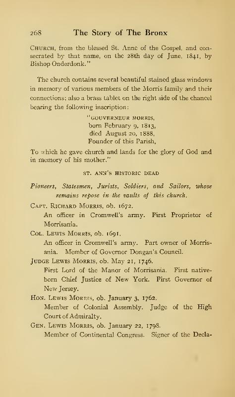
268 The Story of The Bronx
Church, from the blessed St. Anne of the Gospel, and con-
secrated by that name, on the 28th day of June, 1841, byBishop Onderdonk.
"
The church contains several beautiful stained glass windows
in memory of various members of the Morris family and their
connections; also a brass tablet on the right side of the chancel
bearing the following inscription:
"gouverneur morris,
born February 9, 18 13,
died August 20, 1888,
Founder of this Parish,
To which he gave church and lands for the glory of God and
in memory of his mother."
st. ann's historic dead
Pioneers, Statesmen, Jurists, Soldiers, and Sailors, whose
remains repose in the vaults of this church.
Capt. Richard Morris, ob. 1672.
An officer in Cromwell's army. First Proprietor of
Morrisania.
Col. Lewis Morris, ob. 1691.
An officer in Cromwell's army. Part owner of Morris-
ania. Member of Governor Dongan's Council.
Judge Lewis Morris, ob. May 21, 1746.
First Lord of the Manor of Morrisania. First native-
born Chief Justice of New York. First Governor of
New Jersey.
Hon. Lewis Morris, ob. January 3, 1762.
Member of Colonial Assembly. Judge of the High
Court of Admiralty.
Gen. Lewis Morris, ob. January 22, 1798.
Member of Continental Congress. Signer of the Decla-
The Churches 269
ration of Independence. Commander of Westchester
Militia, Continental Army.
Hon. Gouverneur Morris, ob. November 6, 1816.
Member of Provincial and Continental Congresses. One
of the framers of Federal and New York Constitutions.
Author of clause in New York Constitution providing
religious freedom. Washington's Minister Plenipoten-
tiary to France. Senator of the United States. Pro-
jector of the Erie Canal.
Judge Richard Morris, ob. April 11, 1810.
Chief Justice of the Supreme Court, State of New York.
Member of both houses of the Legislature. Champion
of the adoption of the Federal Constitution.
Capt. William Walton Morris, ob. April 5, 1832.
Aide-de-camp to General Anthony Wayne. Thanked
by Congress for gallantry on the battlefield.
Commodore R. Valentine Morris, U. S. N., ob. May 13,
1815.
Veteran of the War of 18 12. Commander of Mediter-
ranean Squadron, U. S. Navy.
Lieut.-Col. Lewis Morris, ob. November 24, 1824.
Aide-de-camp to General Nathanael Greene.
Judge Robert Hunter Morris, ob. October 23, 1855.
Member of both branches of New York Legislature.
Recorder New York City. Postmaster of New York
City. Justice of the Supreme Court. Mayor of the
City of New York for three terms. Delegate to Constitu-
tional Convention of 1846.
Major Gouverneur Morris, U. S. A., ob. October 18, 1868.
Veteran of the War with Mexico; promoted for gallant
and meritorious services at Palo Alto and at Resaca de
la Palma.
270 The Story of The Bronx
Major-Gen. William Walton Morris, U. S. A., ob. Decem-
ber 11, 1865.
Veteran of Florida, Mexican, and Civil Wars; promoted
for gallant and meritorious services at Palo Alto and
Resaca de la Palma, and in the Civil War.
Lewis Morris, ob. Sept. 30, 1863.
One of the incorporators and Warden of St. Ann's Church.
GOUVERNEUR MORRIS, ESQ., ob. August 28, l888.
Pioneer in railroad building. Founder of St. Ann's
Church in 1841 in memory of his mother, Ann Carey
Randolph of Roanoke, Va. First Supervisor of the
Town of Morrisania.
Col. Lewis G. Morris, ob. September 19, 1900.
Member of the War Committee, Westchester Co.
1 86 1-5 . Instrumental in organizing 6th New York Heavy
Artillery. President of New York State Agricultural
Society. Member of the first vestry of St. Ann's
Church.
Col. Richard M. Hoe, ob. June 7, 1886.
Inventor of the Web Perfecting Printing Press. Vestry-
man of St. Ann's Church.
Commander Francis Morris, U. S. N., ob. February 12, 1883.
Veteran of the Civil War, engaged in both attacks on
Fort Fisher. Executive Officer of the Tennessee.
Capt. John Pyne Morris, ob. June 18, 1868.
Veteran of the Civil War. 165th N. Y. V., a hero of
Port Hudson.
Lieut. Gouverneur Morris, ob. February 16, 1897.
Veteran of the Civil War, officer of Co. H, 6th N. Y. H. A.
"How sleep the brave who sink to rest
By all their country's wishes blest.
"
Collins.
The Churches 271
In earlier days, the burial-place of the family was near the
manor-house, but the remains were all removed to the church,
February 15, 1866. In the graveyard attached to the church
are several gravestones, which have been injured and defaced
by the romping children of this thickly settled neighborhood,
who made a playground of the church property. There are
also several vaults, in one of which, that nearest the church on
the east, lie the remains of the famous Gouverneur Morris
and those of a number of the family. The Honorable Gouver-
neur Morris died November 6, 18 16; and by his direction was
buried in a field on his estate overlooking the Mill Brook, the
site of St. Ann's and its graveyard.
St. Paul's, in Washington Avenue near 170th Street, was
formerly included within St. Ann's parish, and was begun as a
chapel July 8, 1849. May 31, 1853, it severed its connection
with the mother church and was organized as a separate parish
under the title of St. Paul's, Morrisania Village.
Grace Church, West Farms, was incorporated December
13, 1844. The credit of first attempting to establish an
Episcopal church in the village was due to Miss Margaret
Hunt, daughter of Thomas Hunt, fourth in descent from
Edward Jessup, one of the original patentees of West Farms.
The corner-stone of the church was laid November io, 1846,
and the edifice was consecrated by Bishop De Lancey of
Western New York, June 28, 1847.
The earlier influx of settlers, both to Throgmorton's colony
and to Westchester, included a great many members of the
Society of Friends, or Quakers. There were also several
settlements of Friends on Long Island, and many of them came
into the county and founded settlements, as in Harrison's
Purchase, or became inhabitants of those already started. In
the records of the borough-town of Westchester, and in the
272 The Story of The Bronx
reports of the rectors of St. Peter's to the Society for the Pro-
pagation of the Faith in Foreign Parts, we find constant
allusions to them. In the account of the election of 1733,
we have read of the attempt to deprive them of their votes.
It is stated that the first meeting in America of the Society
of Friend- was held at Westchester. There is also a tradition
that George Fox, the founder of the sect, preached here as
early as 1672.
In the records of Westchester County, at White Plains,
we find the following:
"Court of Sessions. June 6 & 7, 1704. Order of Court"Present: Col. Heathcot, President of said Ct.,
Joseph Thealle )
John Hunt > Justices.
Thomas Pickney )
" Petition & Order.
"Petition by Josiah Hunt and John Harriss, and Hors-
man Mullenox in behalf of People called Quakers Showsthat in obedience to an Act of Parliament made in the
first year of King William & Queen Mary, requiring that
places of meetings of all Protestant Dissenters for their wor-
ship of God should be certified by the People to the Generalor Quarter Sessions for the aforesaid County [Westchester]
and prays that in obedience to said Act in Westchester at
John Harriss, Jr., and in Mamaroneck at Samuel Palmer's,
to be recorded for places of their meetings for worship of God.
"Order that petition be recorded and that the meetings of
the Dissenters Protestants, called Quakers shall be held at
John Harriss' in Westchester and at Samuel Palmer's
in Mamaroneck."
The headquarters of the Friends, or the place of their Yearly
and Quarterly Meetings, was at Flushing, Long Island, in
the early colonial days. The Quarterly meeting of March
The Churches 273
20, 1684, recognizes the fact that there had been meetings for
the worship of God before that year, and decided that " ffriends
at Yorke Gravesend and fflushing & Westchester, ye Kills
& Newtown doe all belonge unto one Monthly meeting"
(which was that of Flushing).
In the year 1 707, the Yearly Meeting appointed a committee
to purchase a house of Richard Ward in Westchester; and
they reported at the Quarterly Meeting on June 30, 1 707
,
that the same had been bought for a meeting-house. In
November, 1716, a Preparative Meeting was established in
Westchester County for Friends in Rye and Mamaroneck;
and the borough-town remained a part of this meeting until
February 14, 1787, when it was set off by itself; it became a
part of the New York Monthly Meeting August 7, 1836,
and was laid down, February 29, i860. The Flushing Yearly
Meeting appointed Monthly Meeting to be held in Westchester
on the ninth day of the fourth month (April), 1725 ; and in
the town records of 1723, mention is made of the "Quaker
meeting-house."
In his letter of April 14, 1714, Mr. Bartow speaks of the
father of a child dying of measles as a "half Quaker." The
Reverend Mr. Standard, under date of November 5, 1729,
says: "The church at Westchester was built by the Quakers
(who were the first settlers in this place, and are still the
most numerous party in and about it; and indeed the whole
parish as to their manners, are somewhat Quakerish) and by
them given to Colonel Heathcote, for the use and service of
the Church of England." He continues:
"As to their religion, those who settled in Westchester,
some were Quakers, those in Eastchester were New England
Independents. ... In my parish are two meeting-houses,
one of which is of Quakers, built within a stone's throw of18
274 The Story of The Bronx
the church, and indeed is a better building than that. . . .
To the third head of enquiry, I say there are three meeting-
houses in my parish—one of the Quakers at Westchester, one
of the Dutch, from it three miles west [Fordham], and one
of the French at New Rochelle. . . . The Quakers preach
against hireling priests, and pretend to give nothing to their
teachers."
In Mr. Seabury's letter of June 25, 1767, he says: "The
professed dissenters in this parish are not numerous; some
Calvinists or Presbyterian French at New Rochelle; a few
Presbyterians at Eastchester, and some Quakers ; at West-
chester, a good many Quakers." So that it does not seem
that, as time passed, there was much decrease in the number
of Friends. The Revolution played havoc with them, though
probably not to so great an extent as with other denominations,
owing to their tenet of non-resistance. That a Quaker can
break away from his doctrines and take up the sword is
shown in the case of one of our great Revolutionary generals,
Nathanael Greene of Rhode Island;
and it is likely that many
of the Westchester Quakers took up arms for King George or
for the Congress.
The old Quaker meeting-house formerly stood immediately
south of the ancient burying-ground. It was probably erected
before 1700, and was at first used by the Orthodox Friends,
but later by the Hicksite party. About 1828, the Orthodox
Friends erected another meeting-house on the opposite side
of Westchester Avenue. Nothing remains of either except
the foundations of the older one, they both having been
destroyed by incendiary fires on the same night in the spring
of 1893. For several years before their destruction, they had
been unused ; but the inhabitants of Westchester felt consider-
able pride in the ancient landmarks.
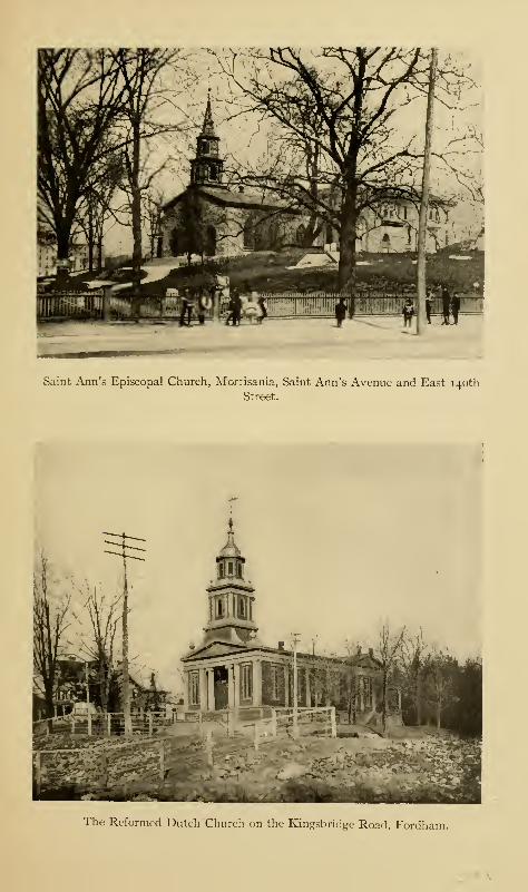
Saint Ann's Episcopal Church, Monisania, Saint Ann's Avenue and East 140th
Street.
The Reformed Dutch "Church on the Kingsbridge Road, Fordham.

The Churches 275
Shortly before annexation, a series of incendiary fires oc-
curred in the town; and barns, stables, and outhouses began
to burn up with alarming frequency. The incendiaries had a
regular organization, with president, secretary, etc., and stated
meetings at which the places to be fired were selected and lots
drawn as to who should light them. The incendiaries were
recruited from the tough element of the town, who set the
fires for the sake of the excitement, and, incidentally, to
pillage. Among the buildings so fired were the two Quaker
meeting-houses. A more flagrant and wanton piece of van-
dalism it is hard to imagine. An attempt was also made to
fire the Sunday-school building of St. Peter's, and it was
suspected that the church itself might be a probable subject.
The gang of firebugs was finally broken up. Whether some of
them belonged to the volunteer fire company or not, is still
a question with the respectable inhabitants.
The Dutch were members of the Established Reformed
Church. We therefore look to the manor of Fordham,
principally settled by Dutch from Harlem, for the beginnings
of the Reformed Dutch Church.
"Little is known concerning the early history of religion
in the manor, except that in 1671, 'the inhabitants residing
between the two Kills of Harlem and the Broncks, ' were
obliged to contribute towards the support of a minister whenone should be settled or called to the manor of Fordham"(Bolton).
In 1673, the Dutch recaptured New York, and the inhabi-
tants of John Archer's village of Fordham immediately pe-
titioned Governor Colve and his council for relief from the
exactions of their "land-heer, " or manor-lord. The following
was granted
:
276 The Story of The Bronx
"The inhabitants of the village of Fordham are, by a
majority of votes, to choose a number of six persons of the
best qualified inhabitants, and only those of the Reformed
Christian religion, as magistrates of the aforesaid village,
and to present the aforesaid nominations, by the first oppor-
tunity, to the Governor-General, from which he shall make the
election. They are recommended to take care that at least
half of the nominated are of the Dutch nation. Done in this
village of New Harlem, 4th of October, 1673.
Johannes Verveelen, as Schepen and Secretary." 1
It will be remembered that after Archer's death, his manor
became the property of Cornelius Steenwyck, the mortgagee,
who left it to the Lower Dutch Church of the city of NewYork. This church was formed within the fort at NewAmsterdam in 1628; its successor is the present Collegiate
Reformed Church of New York. The Collegiate Church
organized a society on its property at Fordham in May, 1696,
and the Reverend John Montaigne was installed as pastor,
with Henricus Selyns, William Beekman, Johannes Kerbyle,
Johannes Depeyster, Jacobus Kipp, Isaac de Forrest, and
Isaac de Reyners as elders and deacons.
The first church edifice was built in 1706 through the
liberality of Margaretta Steenwyck, William Dyckman, and
others; the building stood on the farm of James Valentine,
later the property of Moses Devoe, at what is now Fordham
Road and Sedgwick Avenue. At the southeast corner of the
crossing of these two roads formerly stood the ancient Dutch
burying-ground ; an ancient willow tree, whose girth was over
twenty feet, stood at the corner of the lot, with the unmark-
ed, broken, and sunken tombstones behind it. The church
stood on the opposite side of the Fordham Road, on what
1 Johannes Verveelen, schepen or constable, was the ferryman at the
Spuyten Duyvil ferry.
The Churches 277
is now the property of Webb's Shipbuilding Academy and
Home.
The first pastor resigned his charge, and was succeeded by
the Reverend Henricus Beyse, who, about 1709, also resigned
his position and became a minister of the Church of England.
Judge Lewis Morris, writing to the Propagation Society in
that year, says:
" I have used some endeavours to persuade the Dutch in myneighborhood into a good opinion of the Church of England;
and have had that success, that they would, I believe, join a
great part of them in the sacraments and worship—had they
Dutch Common Prayer books and a minister who understood
their language. I have taken some pains with one of their
ministers, one Henricus Beyse, and have prevailed on him
to accept of Episcopal ordination."
It seems that the Reverend Mr. Beyse did not have an
altogether happy time of it after he had changed his mode of
worship; for, in 17 12, Governor Hunter was petitioned by the
clergy of the Established Church to do something for the
relief of the unfortunate gentleman, who not only "suffers
hardships, having no salary from the people of New Harlem,
where he officiates," but also is financially neglected by the
Propagation Society "through some aspersions thrown upon
him by his adversaries."
The congregation, no doubt, had considerable difficulty in
maintaining a pastor during colonial times, as there is no re-
cord of a fixed pastor between 1 709 and 1 766 ; though Dominies
Dubois, Boel, Ritzema, and De Ronde visited and supplied
the church. Dominie John Peter Tetard bought his farm at
Kingsbridge in 1763, and came to live there in 1766, and from
this time until the Revolution, he occupied the pulpit. At
278 The Story of The Bronx
the beginning of the struggle, he joined his former neigh-
bor Montgomery in the expedition to Canada, serving as a
chaplain.
During the war, the church edifice suffered the usual disas-
ters ; and being close to the camp of Emmerick and his chas-
seurs, probably served as a hospital and stable, like all the
other churches. At a classis of the Reformed Church held in
Flatbush on September 2, 1800, it was resolved,
"that the church in the manor of Fordham, being reduced dur-
ing the war, and a prospect now opening of its being restored,
that the Classis encourage and countenance them, by assisting
and supplying them. Resolved further, that Dr. Livingston
visit and preach to them as soon as convenient."
A new church edifice was erected in 1801 near the site of
the present church on the Kingsbridge Road. In 1802, Dr.
Livingston reported that he had fulfilled his appointment
and reorganized the church, and the classis sent the Reverend
John Jackson to take charge. He was regularly called to the
church and installed as pastor, and the congregation grew
apace. His term of service ended in 1835, since which time
there have been ten pastors, including the present incumbent,
the Reverend Joseph Merlin Hodson, who has served since
1894.
The land upon which the church edifice of 1801 was erected
was a gift from Dennis Valentine, Senior. In 1848, the
present church, the third edifice, was erected immediately
adjoining the second church, on land given by Dennis Valen-
tine, Junior. In 1878, Horace B. Claflin, Esq., whose property
lay just north of the church, gave the funds for the enlargement
of the building. The records of the church and of the con-
gregation were unfortunately destroyed several years ago by a
The Churches 279
fire in the home of one of the members of the congregation,
in whose custody they were.
The earliest settlers within the Borough, those coming from
Connecticut, were variously called Presbyterians, Congrega-
tionalists, and Independents; they may, for the purposes of
this article, be grouped under the first name.
In 1692, at Eastchester, Samuel Casting was chosen "to
read the bibell and other good sermon-books, and so carion
[carry on] the sabath days Exercises as according to our
Honorable Col. Heathcuts order unto us"; for which he was
to receive a certain compensation to be contributed by the peo-
ple. The ministers, or readers, who officiated at Westchester
—Mr. Baly, Mr. Morgan, and Mr. Fogg—were also Dissent-
ers ; and we have already read how Colonel Heathcote prevented
the induction of Warham Mather, also a Presbyterian.
The act of 1693 "to establish a good, sufficient minister"
in each parish was construed by Governor Fletcher to mean
a minister of the Church of England, which thus became the
Established Church of the Province. The ministers at both
Westchester and Eastchester were turned out, and the churches
became Episcopalian with the Reverend Mr. Bartow as rector.
He complained to Lord Cornbury, the Governor, that he had
some difficulty at Eastchester in superseding the Reverend
Joseph Morgan in 1702. Mr. Morgan removed from East-
chester in 1708.
William Tennant, a Presbyterian clergyman, between the
years 1718 and 1721, attempted to evangelize this section,
and spent several months at Eastchester. In the letters of
the Westchester rectors to the Propagation Society, there are
also references to the preaching of Presbyterian and Indepen-
dent ministers within their cure; and also to the activity of
some Dissenting preachers, who are called "new lights."
28o The Story of The Bronx
Though in other parts of the Province strenuous objections
were made by the inhabitants to both the Governor and the
Assembly about being turned out of their churches, the inhabi-
tants of the two places within the Borough acquiesced silently
in the change,—except for slight trouble with Mr. Morgan at
Eastchester—owing to the influence of Colonel Heathcote and
the moderation of Mr. Bartow;' and the edifices became
Episcopalian and are so to this day.
That the Established Church was not popular, even at a
later day, is shown by the proceedings of the Assembly of
1769; in which Colonel Lewis Morris, representative from the
borough-town of Westchester, introduced a bill to exempt
Protestants of all denominations from the support of the
Episcopal Church ; John Thomas, of the county of Westchester,
a bill to exempt Protestants from compulsory taxation for the
support of churches, and Charles De Witt, of Ulster County,
a bill to exempt the inhabitants of the counties of Westchester
New York, Queens, and Richmond from the payment of taxes
for the support of churches to which they did not belong.
All of these bills passed the Legislature, but failed to become
laws on account of their rejection by the Governor and his
council. The Governor further refused to allow the incor-
poration of Presbyterian churches, even in the city of NewYork, which put the several existing congregations to much
inconvenience.
During the colonial period, some of the churches in the
northern part of the county were comprised within the pres-
byteries of Connecticut or of Dutchess (Putnam) County; but
even thirty years after the Revolution, little or nothing was
done in the lower part of the county, and it was considered a
good field for missionary work by the New York Presbytery.
In 1 8 14, the Reverend Isaac Lewis divided his time between
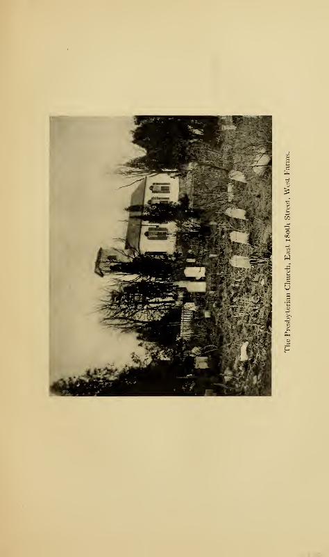
w
-
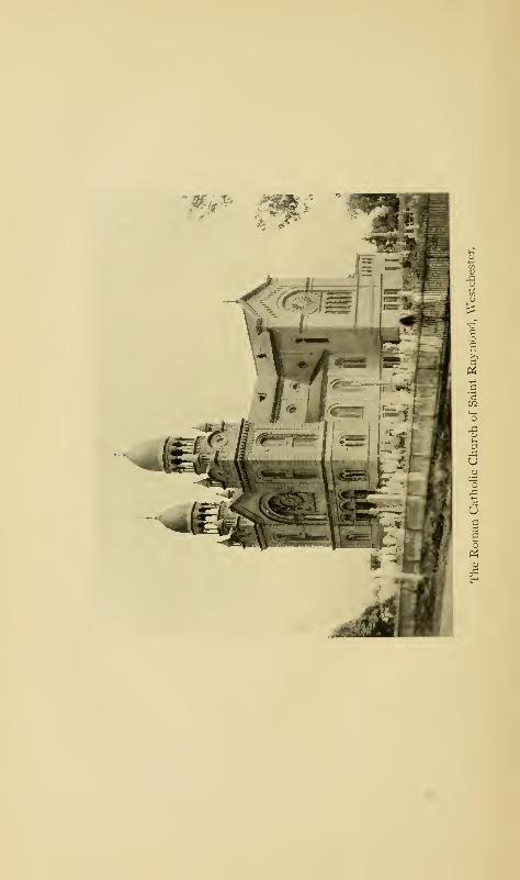
P4
g
cju3
o
U
5
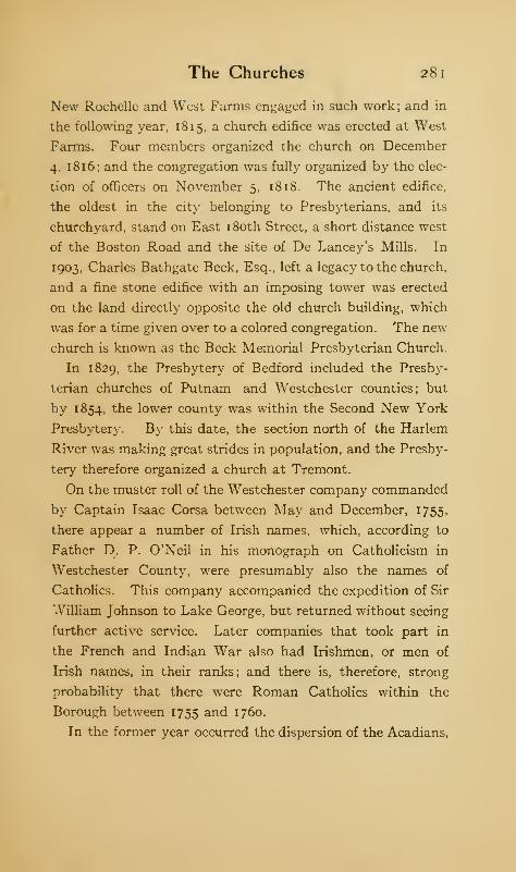
The Churches 281
New Rochelle and West Farms engaged in such work; and in
the following year, 18 15, a church edifice was erected at West
Farms. Four members organized the church on December
4. 1 816; and the congregation was fully organized by the elec-
tion of officers on November 5, 18 18. The ancient edifice,
the oldest in the city belonging to Presbyterians, and its
churchyard, stand on East 180th Street, a short distance west
of the Boston Road and the site of De Lancey's Mills. In
1903, Charles Bathgate Beck, Esq., left a legacy to the church,
and a fine stone edifice with an imposing tower was erected
on the land directly opposite the old church building, which
was for a time given over to a colored congregation. The new
church is known as the Beck Memorial Presbyterian Church.
In 1829, the Presbytery of Bedford included the Presby-
terian churches of Putnam and Westchester counties; but
by 1854, the lower county was within the Second New York
Presbytery. By this date, the section north of the Harlem
River was making great strides in population, and the Presby-
tery therefore organized a church at Tremont.
On the muster roll of the Westchester company commanded
by Captain Isaac Corsa between May and December, 1755,
there appear a number of Irish names, which, according to
Father D. P. O'Neil in his monograph on Catholicism in
Westchester County, were presumably also the names of
Catholics. This company accompanied the expedition of Sir
William Johnson to Lake George, but returned without seeing
further active service. Later companies that took part in
the French and Indian War also had Irishmen, or men of
Irish names, in their ranks; and there is, therefore, strong
probability that there were Roman Catholics within the
Borough between 1755 and 1760.
In the former year occurred the dispersion of the Acadians,
282 The Story of The Bronx
so feelingly described in Longfellow's poem of Evangeline.
These poor unfortunates seem to have been treated with
the utmost rigor and unkindness in every colony into which
their wanderings took them; and New York was no different
from the others. They were called by the colonists "French
Neutrals." Between May and August, 1756, there is a rec-
ord of sixteen of them being sent to Eastchester, and of nine
of them being in the Westchester jail, where they had been
placed by the authorities for no other crime than that of being
Acadians. The women and children of the party were thus
thrown on their own resources and became a burden to the
town, so that the latter were separated from their parents
and bound out to service. As the French war was in
progress at the time, there might have been some excuse
for their harsh treatment for fear of their giving assistance to
their countrymen in Canada; and there is no doubt that, in
the popular mind, these simple peasants were imbued with
the intent as well as the desire to injure their oppressors. It
is hard to account for popular delusions, as the Salem witch-
craft and the vogue of Titus Oates show. The New York
Mercury of July 11, 1757, contains the following item: "Wehear that a party of French Neutrals, who had been for some
time past at or near Westchester, made their escape from that
place, and were taken up at or near Fort Edward on their
way to Crown Point."
These poor wanderers were, of course, Catholics; and it is
stated that Father Farmer, an alias for Father Steinmeyer,
passed through Westchester in disguise and visited them in
their captivity and gave to them the consolations of their
religion. ' He was a Jesuit priest attached to the Pennsylvania
and New Jersey missions; and, as the laws were very strict
1 See the author's novel, A Princess and Another.
The Churches 283
against these priests and the penalties very severe, he was
obliged to go in disguise and exercise great caution in minis-
tering to the people of his faith in and about the city of NewYork before the Revolution. It was not until the year 1784
that the authorities permitted the unconcealed performance of
the rites of the Catholic Church.
On July 1, 1 78 1, the French army arrived at Bedford from
Newport. There were several chaplains with it, the best
known being the Abbe" Robin, who has left some interesting
records of his impressions of the people and of the country in
letters sent to France and afterwards published there. On
July 3, 1 78 1, the French took part in the attack upon Kings-
bridge, and between that date and August twenty-fifth, the
Abbe" Robin and the other chaplains officiated at services at
several places within the county, and, perhaps, within the
Borough ; if so, these would have been the first open exercises
of the Catholic religion.
As regards the subsequent history of Catholicism in the
county, up to the year 1840, the matter is almost entirely
traditional ; and Father D. P. O'Neil, who has made a thorough
study of the whole matter, and to whom the author is under
obligations for the greater part of this subject, could find very
few facts to go on previous to the above date. The Reverend
Mr. Bolton, who disliked the Catholic Church and its minis-
ters, took very few pains to inquire about its history, or else
antagonized its priests into not giving historic information
within their knowledge, owing to his antipathetic attitude, at
the time he was making researches for his comprehensive
History of Westchester County. As already stated above, the
laws against the Catholics were very rigorous in the later
colonial days, and in addition, there was also a strong pre-
judice, or dislike, on the part of the general population—this
284 The Story of The Bronx
has already been suggested in describing the treatment of the
Acadians. The only Catholics likely to come to the colony
would be the English-speaking Irish; and they seem to have
been employed only by the Quakers, whose doctrines taught
more liberality of thought than did those of the Established
Church. It is also stated that some of the wealthier inhabi-
tants had for household servants slaves brought from Louis-
iana, and, perhaps, from Martinique. This was for the
purpose of having their children learn the French language,
as after our own Revolution and the growth of free ideas
in France, there grew up an admiration of everything
French.
In 1784, the first Roman Catholic Church in New York,
St. Peter's in Barclay Street, was established, and, later, in
1 81 7, St. Patrick's in Mulberry Street. It is known that the
Catholics living at the upper end of Manhattan made trips,
frequently on foot, to attend services at one of these churches
;
and it is more than likely that the few and scattered Catholics
living within what is now the Borough did likewise, as late as
1833. In 1834, tne church of St. Paul was established in
Harlem, and the Catholics of the vicinity looked upon it as a
great convenience and blessing, as saving a long journey to get
the comforts of their religion. In 1839, the priests of St.
Paul's were making monthly trips to the section above the
Harlem River, which was considered as an out-mission of
their church.
As mentioned elsewhere, the first authenticated performance
of the services of the Church was at Clason's Point, where the
last rites were administered to Dominick Lynch by Bishop
Connolly in 1825. In many cases, the desire of a Catholic
to lie in consecrated ground has led to the establishment of
graveyards, in which, or near which, a church would afterwards
The Churches 285
be established. This may have been the case with some of
the churches in Westchester County.
In 1840, St. John's College was established at Fordham,
and, though the chapel there was for the use of the priests and
students, worship was permitted to the Catholics of the vi-
cinity as a chapel of convenience. In 1843, the college came
under control of the Society of Jesus, whose priests engaged
in missionary work throughout the county. The same year
the first church within the Borough, that of St. Raymond, was
established at Westchester by an Italian priest named Father
Villanis. The first burial in the adjoining graveyard had
taken place the year previous. The fine church edifice on the
site of the original one was dedicated on October 23, 1898.
In 1844, the first mass was celebrated at Kingsbridge by Father
O'Reilly; and in 1848 Father McGuire officiated there.
There is an interesting fact in regard to early worship at PCings-
bridge, and that is that owing to the lack of proper rooms for
the use of the different denominations, the services were all
held in the schoolhouse. Mass would be celebrated in the
morning, and the Catholic altar would be removed; in the
afternoon, the Episcopalians would hold their services, and
in the evening, the Methodists.
Until about 1840, Catholic communicants had been few
in number, 1 but about 1837 there began the construction of
the great public works—the Harlem Railroad, the Hudson
River Railroad, and the Croton Aqueduct. This brought
in great numbers of Irish, most of whom were Catholics; and
so the Catholic population increased very rapidly in the decade
1 A good Catholic desires to be buried in consecrated ground, and we mayuse the number of burials recorded in the Catholic cemetery in New Yorkas a criterion to judge of the number of Catholics. Of the number re-
corded from beyond the Harlem between the years 1813 and 1833, the
average is just one a year.
286 The Story of The Bronx
between 1838 and 1848. In this latter year occurred the
revolutions in the German states of Europe, followed by the
immigration of thousands of Germans, who generally settled
as farmers. Many of these were Catholics; and in 1852, the
Church of the Immaculate Conception was established at
Melrose Avenue and East 150th Street with a German
pastor.
Although George Whitefield, the famous preacher and
evangelist, preached to the assembled tenants of the Van
Cortlandts at the manor-house on the Croton River before
the Revolution, and though the manor-house often entertained
the eminent preachers of the Methodist faith, such as Asbury
and Garretson, it does not appear that the new doctrines made
progress in that part of the county now included within the
Borough. It is more than likely, however, that the itin-
erant preachers of the Methodist persuasion, the "circuit-
riders" of a later day, visited and preached within the
Borough.
Mention has already been made of several acts of the
Legislature of the State in regard to the incorporation of
churches. Under the act of March 27, 1801, the Methodists
of Westchester organized a church on March 8, 1808, under
the name of Zion Methodist Episcopal Church of the town of
Westchester. There had been, however, a congregation for
some short time before. The church edifice was erected about
181 8. The church was re-incorporated on October 26, 1826;
but it does not seem to have flourished, as the church
corporation was dissolved by reason of non-user. A second re-
incorporation was effected on February 7, 1833, when the con-
gregation assembled in the edifice used by them for divine
worship and resolved that the society in future should be
called the Methodist Episcopal Church of Zion, in the town of
The Churches 287
Westchester. The church edifice is situated on the road leading
to West Farms (Walker Avenue), and, like so many of the
older churches, has a small graveyard adjoining.
As early as 1826, there was a small congregation of Methodists
in Kingsbridge who met in a small schoolhouse on the westerly
side of the Albany Post-road (Broadway) at Mosholu, which
lies west of the parade-ground at Van Cortlandt Park. On
February 14, 1835, the society was incorporated as the
Methodist Episcopal Church Bethel, of the town of Yonkers.
The same year the congregation erected a church edifice, the
first to be built within what subsequently became the township
of Kingsbridge. Since 1875, the congregation has worshipped
at St. Stephen's Church on the Kingsbridge Road, Manhattan.
Other Methodist societies were formed at City Island in 1848;
at Morrisania in 1850; at Tremont in 1853; a German congre-
gation at Morrisania in the same year ; and at West Farms in
1858.
The first Baptist Church to be organized within the Borough
was the First Church of Morrisania, 1850. Previous to 1858,
the Pilgrim Baptist Church of New York opened a mission in
what was called West Farms Hall, where services were held
on Sundays by the Reverend Theodore Gessler and by a
business man by the name of Halsey Knapp. Success crowned
their efforts, and a number of converts was made, who were
baptized in the Bronx River. In January, 1858, the Baptists
of West Farms, to the number of twenty-one, formed themselves
into a distinct church and adopted the name of the Pilgrim
Baptist Church of West Farms. In November of the same
year, a lot was purchased on the Boston Road at Bryant Street,
and the erection of a small church edifice was begun shortly
afterward; a later edifice still occupies the same site, though
long unused, having been vacated on account of the noise of

288 The Story of The Bronx
passing trolleys and elevated trains. In June, 1859, Mr.
Halsey Knapp was ordained as pastor of the church.
This concludes the list of what may be termed the "his-
toric" churches—those that existed in colonial times or which
were established in the first half-century after we became a
nation. So much space is given to the Episcopal Church
because it was the Established Church of the Province, and
its records are the fullest of all.
There are, in round numbers, one hundred and fifty churches
of various denominations in the Borough. The following
are some of the pioneer churches of the different sects; the
Forest Avenue Congregational Church was established in 1851
at East 1 66th Street; the Second Church of the Disciples of
Christ was started about 1867 in East 169th Street near
Franklin Avenue; the Jewish congregation of B'nai David, at
Third Avenue and 175th Street, was established in 1898; the
Second Moravian Church was organized in Manhattan in
1852, but moved to its present location at Wilkins Avenue and
Jennings Street in October, 1906. With such a large influx
of Germans, as stated elsewhere, there was early established
a Lutheran as well as a Roman Catholic Church. These
Germans made efforts as early as 1852 to found a German
Lutheran Church; but, though church services were held in a
hall at 161st Street, the congregation separated after a year,
as no agreement could be reached as to whether the church
should be situated in Melrose or Morrisania. As a result, two
churches were established, the earlier one, St. Matthew's Ger-
man Lutheran Church in East 156th Street, Melrose, and St.
John's in East 169th Street between Fordham (Third) and Ful-
ton avenues, Morrisania The first of these was incorporated
in 1862, and the latter in 1865 ; though both had been organized
and services held probably five years earlier than these dates.
CHAPTER XIV
THE PARKS AND CEMETERIES
NO history of the Borough would be complete with-
out an account of the magnificent system of parks
and parkways which occupy almost one sixth of
the total area of the Borough.
The first record we have of anything in the way of a park
tells of the race-course established in the Mill Brook valley
by General Staats Long Morris about 1750. Horse-racing
was a favorite pastime with the provincial gentry, and General
Morris was one of the first to import blooded horses and to
breed them.
South of the ridge upon which Claremont Park is situated
is a comparatively level stretch of low land through which a
small brook formerly found its way into Mill Brook. It is
stated that part of this tract was General Morris's track of
the eighteenth century. In 1870, Dater Brothers leased this
track from the Morris estate for twenty years and made a one
mile race-track on the property. The first race meeting was
held on June 8, 1871. Through the failure of the lessees, the
property and buildings reverted to the Morris estate in 1880.
It was then leased to the Gentlemen's Driving Association,
who held possession until the last race meeting on October 8,
1897. The park was closed on January 1, 1898, on account of
19 289
290 The Story of The Bronx
the city authorities cutting streets through it. During its
existence as a race-track, the property was known as Fleet-
wood Park, Morrisania. It lay between Webster and Sher-
man avenues on the east and west, and extended from East
165th Street to East 167th Street. Fleetwood was devoted
to the distinctively American sport of trotting. Mr. Robert
Bonner had his stables not far from the track, and the famous
"cracks" of a generation ago, Dexter and Maud S. and many
others did their turns about the Fleetwood track. The old
park has been cut up into streets and building lots to supply
the demands of an ever increasing population.
Soon after the close of the Civil War, in 1866, the Bathgate
farm was acquired by the Jerome Park Villa Site Improve-
ment Company, but the American Jockey Club soon became
the lessee and laid out a track for racing purposes. The prop-
erty lay in the town of West Farms, in the ancient manor of
Fordham; and the site is now occupied by the Jerome Park
distributing reservoir. The track was started by Leonard W.
Jerome, William R. Travers, S. L. M. Barlow, and others
for the purpose of lifting American racing from the disrepute
into which it had fallen on account of the trickery and rowdy-
ism which had hitherto accompanied it. In this attempt at
reform, the Jockey Club was eminently successful, as the
respectability of American racing since that time proves.
Morris Park race-track was the last one within the Borough.
On May 19, 1888, Eliza Macomb conveyed 152 acres, between
Bronxdale and Westchester, to John A. Morris. The northern
end of the property included a portion of the Bear Swamp,
whose outlet, Downing's Brook, finds its way into the Bronx
River. The Bear Swamp Road and the Westchester and
Williamsbridge Road constitute the principal boundaries of
the track. The Westchester Racing Association graded the
The Parks and Cemeteries 291
property, built stables and stands, and laid out an oval track
one and a quarter miles long, with a straightaway track cross-
ing it, three quarters of a mile long. These are said by experts
to have been the finest in the country. All the decorations
of the stands and buildings were in the Pompeiian villa style,
in carved relief and set off in varied colors. There were stable
accommodations for more than seven hundred horses. The
first race meet took place in 1890, and the park was in constant
use until 1904, when it was closed to racing and divided up into
lots. In 1908 and 1909, the track was used on several occa-
sions for exhibitions and tests of aeroplanes and balloons. As
a race-track it was a great favorite with the betting and racing
population. The Morrises who were interested in the park
are not of the old Morrisania family.
Up to the year 1883, the (old) city of New York ranked
sixth in the country in the matter of area of land for public
parks; but in that year a number of public-spirited men,
with an insight into the future, petitioned the State Legis-
lature for a commission to select sites for new parks. In
accordance with the act passed in answer to the petition, a
committee of seven citizens was appointed by Mayor
Franklin Edson, which worked so expeditiously that
their report was ready for the Legislature of 1884, which
authorized the purchase of the various sites selected. These
commissioners served without pay, and entirely from public
spirit. The "New" parks, as they were called, comprised
3757 acres, now included in Van Cortlandt, Bronx, Pelham
Bay, Crotona, St. Mary's, and Claremont parks. The con-
demnation proceedings took some time, so that title did not
vest in the city until December 12, 1888. Cedar Park, of
17.47 acres, had been purchased by the city June 4, 1885,
before the New Parks Act became operative by the completion
292 The Story of The Bronx
of the condemnation proceedings. Pelham Bay Park, which
lies in the Chester district of the Borough, was thus secured
to the city seven years before the section in which it lies
became a part of the city of New York. Since that time, many
more acres have been added to The Bronx parks for parkways
and small parks, so that the total number of acres is now
4142 with an assessed valuation of $56,627,600, divided among
forty-eight large and small parks and four parkways, the actual
cost to the city being $14,982,581.
Franz Sigel, or Cedar Park, as it was originally called,
though not fully vested in the city until June 4, 1885, was a
public park in 1880, as the author visited it several times in
that year, or earlier. It lies between East 153d and 158th
streets, and between Walton and Mott avenues, overlooking
the Harlem River and the great freight yards at Melrose.
Its original name was derived from the number of cedar trees
which occupy the ridge between the valleys of Cromwell's
Creek and Mill Brook, upon which the park is located. When
Washington and Rochambeau made their grand reconnaissance
in August, 1 78 1, it is stated that they came as far south as the
commanding outlook of Cedar Park, from which they could
readily examine through their glasses the town of Harlem
on the other bank of the river and the British fortifications
there. The park comprises 17.5 acres. General Franz Sigel,
a conspicuous leader in the political disturbances in Germany
in 1848, came to this country in consequence of the failure of
the movement for popular rights and settled in the West.
During the Civil War, he did good service for the Union.
During the latter part of his life, he lived in the Borough, not
far from Cedar Park. He died in 1902; and, in order to pre-
serve his memory, the Board of Aldermen, in December, 1902,
changed the name of the park from Cedar to Franz Sigel.
The Parks and Cemeteries 293
Of all the Bronx parks, Van Cortlandt, the second in size,
is the most interesting historically. It comprises 1132.35
acres, and extends from the city line on the north to West
240th Street—Van Cortlandt Park South—on the south.
Its western boundary is Broadway, and its eastern Jerome
and Mt. Vernon avenues. Both the old and the new Croton
aqueducts traverse it from north to south ; and it is crossed by
the main line and the Yonkers branch of the Putnam Railroad.
The aqueduct now building to bring water from the Catskills
also traverses the park. Jerome Avenue cuts through its
northeastern part, and Mosholu Avenue and Gun Hill Road
cross it from east to west, while Grand Avenue crosses on the
eastern side as far as the lake. The park lies in the valley
of Tippett's Brook, which cuts it approximately in half from
north to south, between the Fordham ridge on the east and
the Spuyten Duyvil ridge on the west. The greater part of
the park is still in a state of nature, with swamps, woods, and
rocky precipitous ridges, or cleared spaces only where former
occupants cultivated their land.
The park occupies a portion of the Betts and Tippett tract
of 1668, almost all of the John Hadden, or Heddy, tract of
the same date, and portions of the farms acquired from the
Commissioners of Forfeiture of the Philipseburgh Manor in
J 785 by John Warner and George Hadley.
In 1699, Jacobus Van Cortlandt, who had married Eva,
the adopted daughter of Frederick Philipse, bought from
his father-in-law fifty acres of land on George's Point, and
added to it about one hundred acres more that he pur-
chased from the neighboring landowners. These constituted
the nucleus of the Van Cortlandt estate. Later proprie-
tors added more land, until the estate became almost
manorial in size. The property was entailed until 1825,
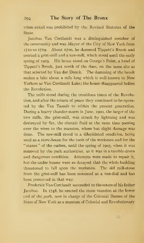
294 The Story of The Bronx
when entail was prohibited by the Revised Statutes of the
State.
Jacobus Van Cortlandt was a distinguished member of
the community and was Mayor of the City of New York from
i7ioto 1719. About 1700, he dammed Tippett's Brook and
erected a grist-mill and a saw-mill, which stood until the early
spring of 1903. His house stood on George's Point, a bend of
Tippett's Brook, just north of the dam, on the same site as
that selected by Van der Donck. The damming of the brook
makes a lake about a mile long which is well-known to NewYorkers as Van Cortlandt Lake ; the house disappeared before
the Revolution.
The mills stood during the troublous times of the Revolu-
tion, and after the return of peace they continued to be opera-
ted by the Van Tassels to within the present generation.
During a heavy thunder-storm in June, 1900, the larger of the
two mills, the grist-mill, was struck by lightning and was
destroyed by fire, the electric fluid at the same time passing
over the wires to the mansion, where but slight damage was
done. The saw-mill stood in a dilapidated condition, being
used as a store-house for the tools of the workmen and for the
"stanes" of the curlers, until the spring of 1903, when it was
removed by the park authorities, as it was in a tumble-down
and dangerous condition. Attempts were made to repair it,
but the under beams were so decayed that the whole building
threatened to fall upon the workmen. The old mill-stone
from the grist-mill has been mounted as a sun-dial and has
been preserved in that way.
Frederick Van Cortlandt succeeded to the estate of his father
Jacobus. In 1748, he erected the stone mansion at the lower
end of the park, now in charge of the Colonial Dames of the
State of New York as a museum of Colonial and Revolutionary
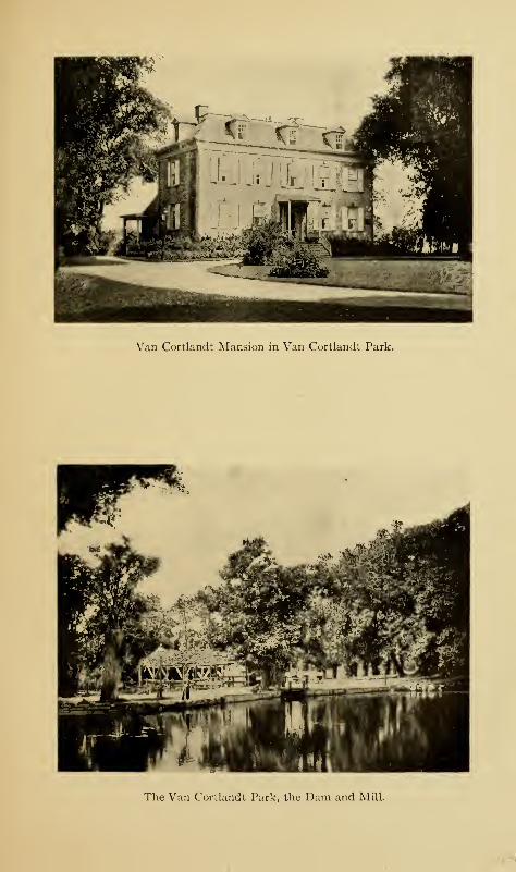
Van Cortlandt Mansion in Van Cortlandt Park.
The Van Cortlandt Park, the Dam and Mill.

The Parks and Cemeteries 295
relics. These ladies have gathered together a most interest-
ing collection of Dutch and Colonial household furniture and
utensils, as well as of ancient arms and documents. An old
four-post bedstead with steps to reach the lofty mattress is
authenticated as having been slept in by Washington. The
mansion is very frequently and wrongly referred to as the
manor-house; but this is a great mistake, as the only Van
Cortlandt manor-house is that near the mouth of the Croton
River.
To the east of the mansion is a barred window with its
stone framing, taken from the Cuyler-Rhinelander sugar-
house, which formerly stood at the corner of Rose and Duane
streets, in which, so it is alleged, so many of the imprisoned
Americans met sickness and death during the Revolution.
The window was dedicated with appropriate ceremonies on
May 26, 1903. On each side of the entrance to the mansion
lies an old gun in the grass; these were among those dug up
at the site of Fort Independence when Mr. Giles built his
house there; they were probably used by both Americans
and English.
Frederick Van Cortlandt died in 1749 and was succeeded
by his son Jacobus, or, as he is better known, Colonel James
Van Cortlandt. Like so many of the colonists, he was with
the movement for redress of grievances from King and Parlia-
ment; but when it came to the question of independence, his
loyalty to the crown prevented him from going further with
the patriots, though he does not appear to have been a very
active loyalist. He was a man of kindly heart and was well
esteemed by his neighbors. It was no unusual thing for him
to mount his horse and take the long ride into the city to
intercede with the British authorities for some unfortunate
neighbor whose property had fallen into their hands, or to
296 The Story of The Bronx
attempt to better the condition of those who were so unhappy
as to be held prisoners. During his occupancy, the mansion
was known as "Lower Cortlandt's" to distinguish it from the
farm of Frederick Van Cortland t at Mosholu, west of Broad-
way, which was called "Upper Cortlandt's," and, sometimes,
"Cortlandt's white house."
Colonel James Van Cortlandt died childless in 1781, and the
property passed to his brother Augustus, who died in 1823
without male issue. The estate then went into the female line,
and the name of Van Cortlandt was legally assumed by their
descendants.
Over the windows of the old mansion are inserted in the
way of keystones, or corbels, carved faces, some of which are
childish, but many of which are fiendish in their grinning and
grimacing ugliness. They have seen many and curious
sights. Over the Albany Post-road, directly in front of the
house, has passed the great manor-lord or gentleman of
estate with his out-riders and his grand coach and four, on
his way, perchance, to visit the great Colonel Philipse at his
manor-house at Yonkers, or to take part in the deliberations
of the Provincial Assembly, and stopping here for a bed and a
sup. They have seen the Westchester farmers driving their
cattle to market in New York, and have heard them grumbling
at the payment of tolls at the King's bridge to swell the already
bursting coffers of Colonel Philipse; or later, have heard the
glee and satisfaction of the same farmers at the completion of
the free bridge.
Here comes a gay and gallant company of ladies and gentle-
men, decked out in their fine clothes, the former wearing masks
to protect their delicate complexions from the rude air, and
the latter tapping their snuff-boxes as they utter some bon-
mot or exaggerated piece of gallantry to their fair compan-
The Parks and Cemeteries 297
ions. What care they if the roads be rough and the coaches
jolting, or that the ladies are riding on pillions? Are they not
on their way to the wedding of lovely Mary Philipse and
Colonel Roger Morris?
Along the road comes the Yankee peddler with his pack, not
only of notions, but of news ; and he looks about him curiously
as he asks some negro slave or redemptioner his way to the
back door. And the faces look at him with equal curiosity
—
he is so different from the stolid Dutch farmer or sturdy Eng-
lish yeoman they are accustomed to see. And then the
travellers increase in numbers; they seem to be in some sort
of order, though they are clothed in homespun and no two are
armed alike. Across the meadows to the distant ridges the
heads stretch their ears to catch the sound of the spade and
the mattock. Then, most woeful sight, they see the ranks of
tattered, shoeless, and dispirited men as they march sullenly
by from Long Island, Harlem Heights, and the forts below
on their way to Philipseburgh or White Plains. And during
these months, they have seen the noblest figure that has ever
passed before them, the great American leader, with Heath
and Lincoln and the rest of the gallant leaders of that dis-
heartened host. And then comes Charles Lee—is it any
wonder that some of the faces have assumed a sardonic expres-
sion that all the pleasant sights of more than a century have
been unable to change?
Beneath the trees which they have seen grow from saplings,
gathers another multitude of men, with the red coat of the
British soldier, the tartan of the Scot, the green coat of the
German yager, the chasseurs of Emmerick, or the rangers of
Simcoe; and as Sunday comes around, they have heard the
British chaplain—our old friend Samuel Seabury, perhaps—ask divine grace upon all in authority, "and especially upon thy
298 The Story of The Bronx
servant, George the Third, King of Great Britain, Ireland, and
France, and Defender of the Faith. " On some dark night, when
their eves could scarcely pierce the gloom, their ears have been
saluted by the sounds of passing horsemen ; and as they caught
the low-spoken words, they knew that De Armond and his
gallant Frenchmen were on an errand to the British camp;
later, they hear the clash of steel, the scattering shots of the
musketry, and the thunder of the horses' hoofs upon the dam,
and know that the Frenchman has drawn the enemy from his
camp.
For five long years they looked for that noble figure, which,
once seen, could never be forgotten; and then he came, and
by his side the noble Rochambeau. Before their eyes passed
the veteran troops of Lincoln and the soldiers of France with
the standard of the lilies unfurling its silken folds to the soft,
caressing, American air. They saw the grand reconnaissance
;
and at its end they saw the great commander, surrounded by
his tried companions-in-arms and by the best and noblest sons
of France, pass within the door.
Their eyes were tired with watching the turmoil of war,
their ears with hearing its din. Before them passed the gal-
lant prince who later was to be Britain's "Sailor King,"
and with him the humane Carleton. For two years more
they watched for the return of the Chief, and turned their
sight and hearing toward the post-road. At last, their vigil
was ended; for in the distance came the roll of drums, the
shriek of fifes, and the steady tramp of armed men; and their
eyes gazed restfully upon the men in blue and buff, at their
head the immortal Washington, with Henry Knox and George
Clinton on either side. Once more they saw a distinguished
group pass through the door; and could their hearing have
pierced the walls of stone, they would have heard the great
The Parks and Cemeteries 299
man drinking the health of the ladies of the mansion. The
march is resumed; and from the joyous remarks of the soldiers,
the heads learn that no more will they see the British red coat
or the Highland plaid, or hear the guttural accents of the
German—for peace has come.
For two years they rested; then their wondering eyes
opened to see the first lumbering coach go by on its way to
Albany. A score of years later, they fell asleep; for men
had changed the way of the ancient road and came no more in
front of the old mansion. Again they heard the martial
sounds of war as men marched by for the defence of New York
from 1812 to 1815; but this time their eyes are spared the
sight of carnage—that is on the sea.
Once more the long "piping times of peace." The old
mansion has new owners; the great city needed a pleasure
ground for its people; and the heads gaze upon crowds and
crowds of people gathered here each week to listen to the
strains of music wafted through the shady trees. Their
eyes had seen the heavy, lumbering, swaying coaches of by-
gone days; no wonder their mouths spread wider when they
gazed upon the light, silent steeds of the wheelmen who come
in thousands, or upon four-in-hand coaches with their tooting
horns and exquisite drivers, many of whose ancestors they
had seen in cocked hats, knee-breeches, and silver buckles.
Now their mouths are frozen wide; they have no more mind
for wonder; for they have seen the rushing, crushing, noisy,
rattling automobile with its load of passengers more masked
and disguised than were the highwaymen of Hampstead
Heath.
A fairer sight now meets their eyes, a sight with which, it
is said, they were once familiar—a veritable Dutch garden,
which the park gardener laid out during 1902 and 1903 below
300 The Story of The Bronx
the bluff on which the house stands, and which was opened to
the public on Memorial Day of the latter year. It has Dutch
trees, and Dutch walks, and Dutch flowers, and, above all,
Dutch canals, which are supplied by the water from Tippett's
Brook. Let us leave the heads to their remembrances and go
where they cannot see or hear.
The shady lane of locust trees leads to the station of the
Putnam Railroad. Just north of the station is Van Cortlandt
Lake and the dam and site of the ancient mills. In the winter
time, this end of the lake near the dam is given over to the
famous Scotch sport of curling, the rest of the lake being re-
served for skaters. To the east of the station and the lake is
an eighteen-hole golf course free to the public. A commodi-
ous shelter-house has been erected for the use of the golfers
and skaters, and in the summer time boats may be procured
for use on the lake. There are also several tennis courts to
the west of the mansion, and the parade ground is "common"
at all times to those who play base-ball.
Directly back of the mansion is the statue of General Josiah
Porter, for many years adjutant-general of the State. The
statue was unveiled with appropriate ceremonies in September,
1902. It faces the great level plain of the parade ground, the
largest drill ground in the State, comprising one hundred and
fifty acres, a part of which was Van der Donck's "planting
field. " The park authorities did not have much filling in or
grading to do in getting it ready for drill purposes. Upon
several occasions, two brigades have held sham battles and
reviews, and it has been used frequently for camping out by
the city batteries and mounted troops. There are also three
polo fields, opened since 1901, which have become immensely
popular, thousands of visitors witnessing the games between
the various contestants. There is also a practice ground for
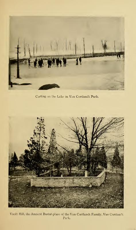
Curling on the Lake in Van Cortlandt Park.
Vault Hill, the Ancient Burial-place of the Van Cortlandt Family, Van Cortlandt
Park.
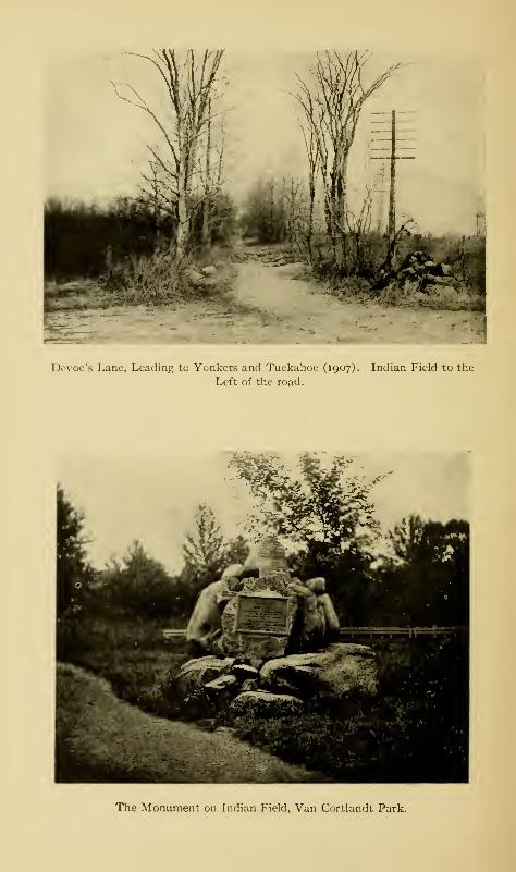
Devoe's Lane, Leading to Yonkcrs and Tuckahoe (1907). Indian Field to the
Left of the road.
W' 1 /• \
^5hB^^ml. :
The Monument on Indian Field, Van Cortlandt Park.
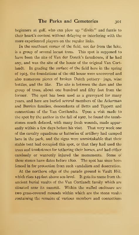
The Parks and Cemeteries 301
beginners at golf, who can plow up "divits" and fuzzle to
their heart's content without delaying or interfering with the
more experienced players on the regular links.
In the southeast corner of the field, not far from the lake,
is a group of several locust trees. This spot is supposed to
have been the site of Van der Donck's farmhouse, if he had
any, and was the site of the house of the original Van Cort-
landt. In grading the surface of the field here in the spring
of 1903, the foundations of the old house were uncovered and
also numerous pieces of broken Dutch pottery—jugs, wine
bottles, and the like. The site is between the dam and the
group of trees, about one hundred and fifty feet from the
former. The spot has been used as a graveyard for many
years, and here are buried several members of the Ackerman
and Berrien families, descendants of Betts and Tippett and
connections of the Van Cortlandts. Upon a visit made to
the spot by the author in the fall of 1902, he found the tomb-
stones much defaced, with many fresh wounds, made appar-
ently within a few days before his visit. That very week one
of the cavalry squadrons or batteries of artillery had camped
here in the park, and the signs were unmistakable that their
stable tent had occupied this spot, or that they had used the
trees and tombstones for tethering their horses, and had either
carelessly or wantonly injured the monuments. Some of
these stones have dates before 1800. The spot has since been
fenced in for protection from such vandalism and desecration.
At the northern edge of the parade ground is Vault Hill,
which rises 149 feet above sea-level. It gets its name from the
ancient burial vaults of the Van Cortlandt family which are
situated near its summit. Within the walled enclosure arc-
two grass-covered mounds within which are the stone vaults
containing the remains of various members and connections
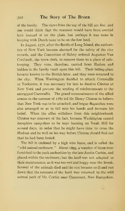
302 The Story of The Bronx
of the family. The views from the top of the hill are fine, and
one would think that the mansion would have been erected
here instead of on the plain, but perhaps it was more in
keeping with Dutch taste to be on the low land.
In August, 1776, after the Battle of Long Island, the authori-
ties of New York became alarmed for the safety of the city
records, and the Committee of Safety ordered Augustus Van
Cortlandt, the town clerk, to remove them to a place of safe-
keeping. They were, therefore, carried from Harlem and
hidden in the family vault upon this hill. Their hiding-place
became known to the British later, and they were returned to
the city. When Washington decided to attack Cornwallis
at Yorktown, it was necessary for him to deceive Clinton at
New York and prevent the sending of reinforcements to the
entrapped Cornwallis. The grand reconnaissance of the allied
armies in the summer of 1781 led Sir Henry Clinton to believe
that New York was to be attacked ; and bogus dispatches were
also arranged so as to fall into his hands and increase his
belief. When the allies withdrew from this neighborhood,
Clinton was unaware of the fact, because Washington caused
deceptive camp-fires to be kept burning on Vault Hill for
several days, in order that he might have time to cross the
Hudson and be well on his way before Clinton should find out
that he had been fooled.
The hill is enclosed by a high wire fence, and is called the
"wild animal enclosure. " About 1 895, a number of bison were
furnished to the park authorities by the late Austin Corbin, and
placed within the enclosure ; but the land was not adapted to
their maintenance, as it was too wet and boggy near the brook.
Several of the animals died and the rest became so ill and run
down that the remnant of the herd was returned to the wild
animal park of Mr. Corbin near Claremont, New Hampshire.

The Parks and Cemeteries 303
The park roads from the Fordham ridge are very steep.
There are several natural springs along the ridge and guide-
posts direct to them. The woods in the upper part of the park
are open to all visitors, and parties of botanists and children
come here for wild flowers, which, if care is not taken, will,
in a few years, be "conspicuous by their absence"; as the
careless and wanton picking of flowers will prevent them from
going to seed and thus reproducing the species.
In the northeastern part of the park is "Indian Field,"
where Simcoe defeated the Stockbridge Indians, and where
eighteen of them are buried, almost where they fell. At the
suggestion of the writer, a cairn of rough boulders, somewhat
similar to that at Stockbridge, Massachusetts, was erected
in 1906, through the courtesy and co-operation of George W.
Walgrove, at that time Commissioner of Parks for The Bronx.
It bears the following inscription on a bronze tablet
:
"AUGUST 31, 1778.
UPON THIS FIELDCHIEF NIMHAM
AND SEVENTEEN STOCKBRIDGE INDIANS,AS ALLIES OF THE PATRIOTS,
GAVE THEIR LIVES FOR LIBERTY.
ERECTED BY BRONX CHAPTER,DAUGHTERS OF THE AMERICAN REVOLUTION
MOUNT VERNON, NEW YORK.JUNE 14, 1906."
June 14 is "Flag Day," and the monument was dedicated
with appropriate ceremonies. Since then, a flag-pole has
been erected, the rough ground cleared up, and many park
benches placed by the park authorities; and the spot has
become a popular meeting-place for the people of the neigh-
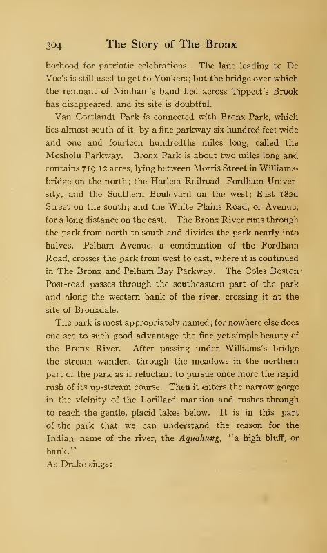
304 The Story of The Bronx
borhood for patriotic celebrations. The lane leading to De
Voe's is still used to get to Yonkers; but the bridge over which
the remnant of Nimham's band fled across Tippett's Brook
has disappeared, and its site is doubtful.
Van Cortlandt Park is connected with Bronx Park, which
lies almost south of it, by a fine parkway six hundred feet wide
and one and fourteen hundredths miles long, called the
Mosholu Parkway. Bronx Park is about two miles long and
contains 719.12 acres, lying between Morris Street in Williams-
bridge on the north; the Harlem Railroad, Fordham Univer-
sity, and the Southern Boulevard on the west; East i82d
Street on the south; and the White Plains Road, or Avenue,
for a long distance on the east. The Bronx River runs through
the park from north to south and divides the park nearly into
halves. Pelham Avenue, a continuation of the Fordham
Road, crosses the park from west to east, where it is continued
in The Bronx and Pelham Bay Parkway. The Coles Boston
Post-road passes through the southeastern part of the park
and along the western bank of the river, crossing it at the
site of Bronxdale.
The park is most appropriately named ; for nowhere else does
one see to such good advantage the fine yet simple beauty of
the Bronx River. After passing under Williams's bridge
the stream wanders through the meadows in the northern
part of the park as if reluctant to pursue once more the rapid
rush of its up-stream course. Then it enters the narrow gorge
in the vicinity of the Lorillard mansion and rushes through
to reach the gentle, placid lakes below. It is in this part
of the park that we can understand the reason for the
Indian name of the river, the Aguahung, "a high bluff, or
bank."
As Drake sings:
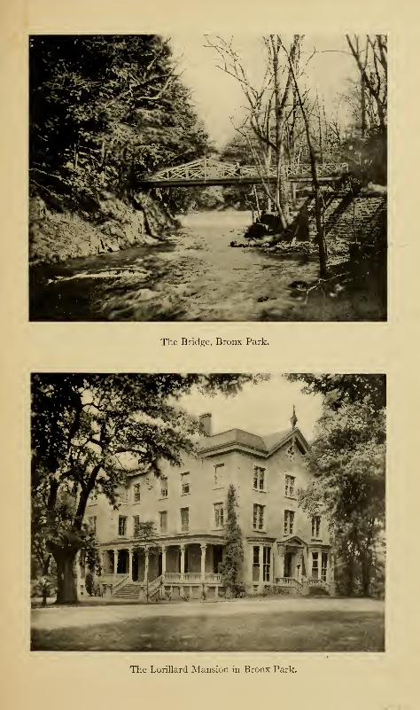
The Bridge, Bronx Park.
The Lorillard Mansion in Bronx Park.
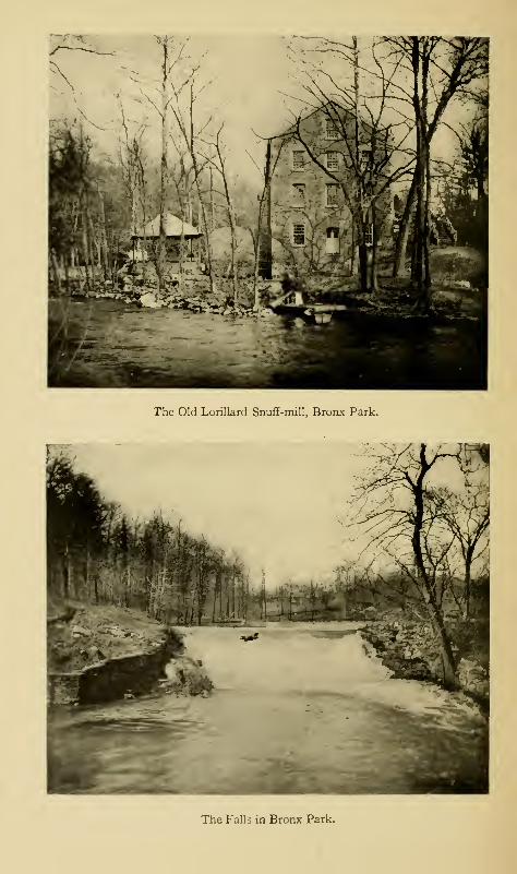
The Old Lorillard Snuff-mill, Bronx Park.
The Falls in Bronx Park.
The Parks and Cemeteries 305
"There were the dark cedars, with loose mossy tresses,
White-powder'd dog trees, and stiff hollies flaunting,
Gaudy as rustics in their May-day dresses,
Blue pellorets from purple leaves upslanting
A modest gaze, like eyes of a young maiden
Shining beneath dropped lids the evening of her wedding.
"
Nature has furnished an ideal beauty spot; may man's
improving hand long be kept from interference ! Well might
Drake exclaim
:
" O ! 't was a ravishing spot, form'd for a poet's dwelling.
"
The lower portion of the stream spreads out into two lakes
formed by dams, the post-road crossing between them where
Bolton's bleacheries formerly stood at Bronxdale. About
the middle of the lower lake is where the patent and manor
lines of Fordham, West Farms, and Westchester formed a
corner. Through the heavy masses of woods the patriots
hid, or found their way for their stealthy attacks upon De
Lancey's Mills, just below, with the hope of capturing the arch
loyalist and troublesome raider, James De Lancey, in his
visits to his aged mother, who was brave enough to occupy
the mansion in the Neutral Ground during the troublous
times of the Revolution.
The De Lancey mansion stood on the east bank of the stream
on a small plateau, which seems to have been partially arti-
ficial. It overlooked the stream and the mills on the opposite
bank; just south of the house was the Kingsbridge Road
continued east to Westchester, crossing the stream by a ford,
and in later times by a bridge; above is the mill-dam, whose
falling water gives out a gentle murmur which must have
served as a lullaby to the occupants of the mansion. Between
the site of the house and the stream stands an immense pine
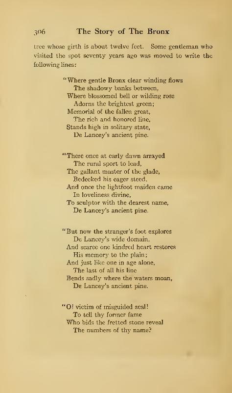
306 The Story of The Bronx
tree whose girth is about twelve feet. Some gentleman who
visited the spot seventy years ago was moved to write the
following lines
:
"Where gentle Bronx clear winding flows
The shadowy banks between,
Where blossomed bell or wilding rose
Adorns the brightest green;
Memorial of the fallen great,
The rich and honored line,
Stands high in solitary state,
De Lancey's ancient pine.
"There once at early dawn arrayed
The rural sport to lead,
The gallant master of the glade,
Bedecked his eager steed.
And once the lightfoot maiden cameIn loveliness divine,
To sculptor with the dearest name,
De Lancey's ancient pine.
"But now the stranger's foot explores
De Lancey's wide domain,
And scarce one kindred heart restores
His memory to the plain;
And just like one in age alone,
The last of all his line
Bends sadly where the waters moan,
De Lancey's ancient pine.
"O ! victim of misguided zeal
!
To tell thy former fame
Who bids the fretted stone reveal
The numbers of thy name?
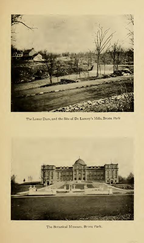
The Lower Dam, and the Site of De Lancey's Mills, Bronx Park.
The Botanical Museum, Bronx Park.
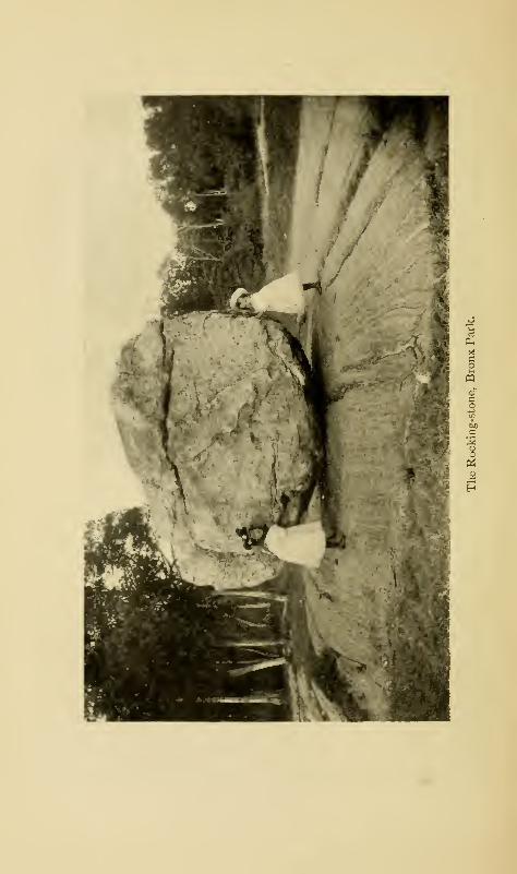
ri
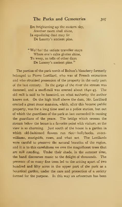
The Parks and Cemeteries 307
Ere brightening up the eastern sky,
Another morn shall shine,
In equalizing dust may lie
De Lancey's ancient pine.
"Wo! ho! the satiate traveller stays
Where eve's calm glories shine,
To weep, as tells of other days
De Lancey's ancient pine."
The portion of the park north of Bolton's bleachery formerly
belonged to Pierre Lorillard, who was of French extraction
and who obtained possession of the property in the early part
of the last century. In the gorge of the river the stream was
dammed, and a snuff-mill was erected about 1840-45. The
old mill is said to be haunted, on what authority the author
knows not. On the high bluff above the dam, Mr. Lorillard
erected a great stone mansion, which, after this became public
property, was for a long time used as a police station, but out
of which the guardians of the park at last succeeded in ousting
the guardians of the peace. The bridge which crosses the
stream below the house is a favorite point with visitors, as the
view is so charming. Just south of the house is a garden in
which old-fashioned flowers run riot—hollyhocks, sweet-
williams, marigolds, roses, and what not. The Lorillards
were careful to preserve the natural beauties of the region,
and it is to this carefulness we owe the magnificent trees that
are still standing. Under their shade, in the summer time,
the band discourses music to the delight of thousands. The
presence of so many fine trees led to the setting apart of two
hundred and fifty acres in the upper part of the park as a
botanical garden, under the care and protection of a society
formed for the purpose. In this way an arboretum has been
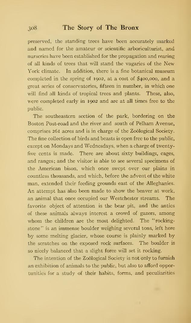
308 The Story of The Bronx
preserved, the standing trees have been accurately marked
and named for the amateur or scientific arboriculturist, and
nurseries have been established for the propagation and rearing
of all kinds of trees that will stand the vagaries of the NewYork climate. In addition, there is a fine botanical museum
completed in the spring of 1902, at a cost of $400,000, and a
great series of conservatories, fifteen in number, in which one
will find all kinds of tropical trees and plants. These, also,
were completed early in 1902 and are at all times free to the
public.
The southeastern section of the park, bordering on the
Boston Post-road and the river and south of Pelham Avenue,
comprises 261 acres and is in charge of the Zoological Society.
The fine collection of birds and beasts is open free to the public,
except on Mondays and Wednesdays, when a charge of twenty-
five cents is made. There are about sixty buildings, cages,
and ranges; and the visitor is able to see several specimens of
the American bison, which once swept over our plains in
countless thousands, and which, before the advent of the white
man, extended their feeding grounds east of the Alleghanies.
An attempt has also been made to show the beaver at work,
an animal that once occupied our Westchester streams. The
favorite object of attention is the bear pit, and the antics
of these animals always interest a crowd of gazers, among
whom the children are the most delighted. The "rocking-
stone" is an immense boulder weighing several tons, left here
by some melting glacier, whose course is plainly marked by
the scratches on the exposed rock surfaces. The boulder is
so nicely balanced that a slight force will set it rocking.
The intention of the Zoological Society is not only to furnish
an exhibition of animals to the public, but also to afford oppor-
tunities for a study of their habits, forms, and peculiarities
The Parks and Cemeteries 309
to those interested in nature study. It is their intention to
erect at some time in the future a building especially designed
for the use of artists and sculptors where studies can be made
from the live model. The cage will be thoroughly and prop-
erly lighted, and platforms arranged for the accommodation
of twenty artists. It is hoped that with such facilities there
will develop a school of American animal painters and sculp-
tors second to none in the world.
Pelham Avenue develops into the Bronx and Pelham Bay
Parkway, a fine thoroughfare four hundred feet wide and two
and a quarter miles long, connecting Bronx Park with Pelham
Bay Park. For almost its whole length it is paralleled by an
asphalt brick roadway, opened in 191 1 and restricted to
automobiles.
Pelham Bay Park is the largest park in the city, including
within its boundaries 1756 acres, over twice as many as
Central Park. It has over seven miles of water front on the
Sound and Pelham Bay, from which latter it takes its name.
It was acquired by the (old) city of New York in 1888, seven
years before the annexation of Westchester and Pelham, in
which former ancient townships it lies ; it also includes Hunter
Island and the Twin islands adjoining.
The Hutchinson River and Eastchester Bay divide the
park into two parts, the more northerly, Pelham Neck (the
ancient Annes Hoeck) and Rodman's Neck being very much
the larger. The northern boundary of this part is the city
line ; the eastern, the Sound ; the western, the Hutchinson River.
The smaller section south of Pelham Bridge is rather irregular
in shape, lying between Furmen's Lane and the three hamlets
of Baychester, Stinardtown, and Middletown.
The Eastern Boulevard passes through the park from south
to north, changing its name to the Pelham Bridge, or more
310 The Story of The Bronx
popularly, the Shore Road, after it crosses the bridge near the
mouth of Hutchinson's River. The Suburban branch of the
New York, New Haven, and Hartford Railroad traverses
the park from north to south, having stations at Baychester,
on the edge of the park, and at Bartow, within it. From this
latter, the City Island Road leads east to the end of Rodman's
Neck and over the bridge to City Island. Connecting Bartow
with the village of Pelham Manor, at the northwest corner
of the park, is the Prospect Hill Road, better known as the
"Split Rock" Road.
This whole section consisted of farms and estates bordering
on the Sound and belonging to the old families and their
descendants—Drake, Pell, Furmen, Morris, Bartow, Hunter,
Schuyler, Spencer, Rodman, Marshall, are among the names
we find as owners; and a good deal of the property had been
in the families since colonial days. Many of the old mansions
erected subsequent to 1 840 still remain and are rented by the
Park Department; several are used as restuarants and road-
houses, and several of them as tenements for laborers and
employees of the park. The occupants of these mansions in
the days that are past formed a true country aristocracy, not
only of birth and wealth, but of education, culture, and refine-
ment. Some of the oldest houses were removed in 1902 and
the park commissioner utilized the materials in the erection
of forty-two free bath-houses along the shore south of the
bridge. These were so well patronized that the department
has constructed more. In February, 1903, a number of the
older remaining houses were sold at auction with the proviso
that they should be removed within thirty days.
When Howe occupied Throgg's Neck in October, 1776, he
attempted to cross Westchester Creek both at Westchester
town and at the head of the creek, about where the Bronx
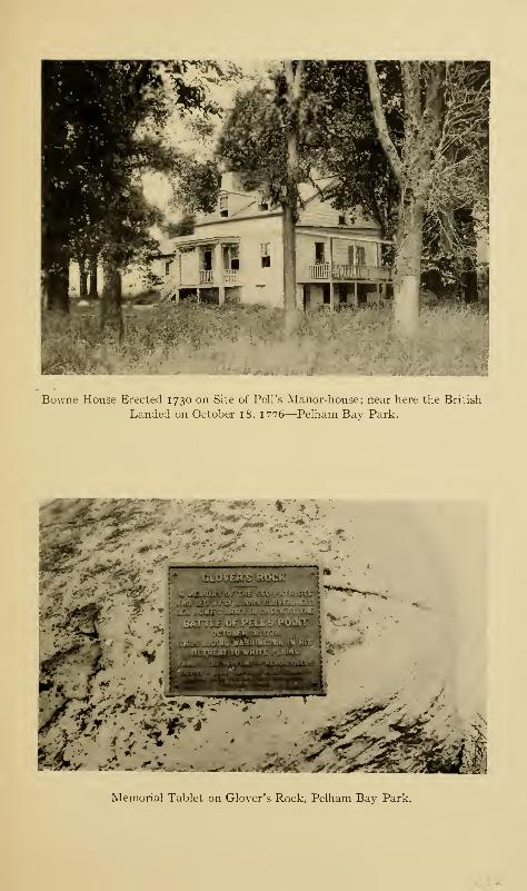
Bowne House Erected 1730 on Site of Pell's Manor-house; near here the British
Landed on October 18, 1776—Pelham Bay Park.
- i Or
Memorial Tablet on Glover's Rock, Pelham Bay Park.
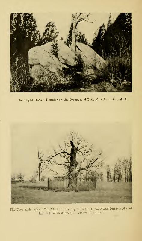
The " Split Rock " Boulder on the Prospect Hill Road, Pelham Bay Park.
The Tree under which Pell Made his Treaty with the Indians and Purchased their
Lands (now destroyed)—Pelham Bay Park.
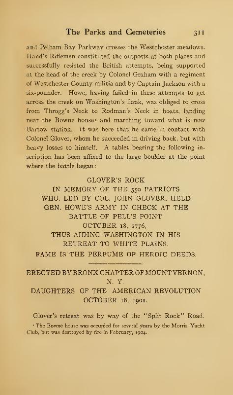
The Parks and Cemeteries 311
and Pelham Bay Parkway crosses the Westchester meadows.
Hand's Riflemen constituted the outposts at both places and
successfully resisted the British attempts, being supported
at the head of the creek by Colonel Graham with a regiment
of Westchester County militia and by Captain Jackson with a
six-pounder. Howe, having failed in these attempts to get
across the creek on Washington's flank, was obliged to cross
from Throgg's Neck to Rodman's Neck in boats, landing
near the Bowne house 1 and marching toward what is now
Bartow station. It was here that he came in contact with
Colonel Glover, whom he succeeded in driving back, but with
heavy losses to himself. A tablet bearing the following in-
scription has been affixed to the large boulder at the point
where the battle began:
GLOVER'S ROCKIN MEMORY OF THE 550 PATRIOTS
WHO, LED BY COL. JOHN GLOVER, HELDGEN. HOWE'S ARMY IN CHECK AT THE
BATTLE OF PELL'S POINTOCTOBER 18, 1776,
THUS AIDING WASHINGTON IN HIS
RETREAT TO WHITE PLAINS.
FAME IS THE PERFUME OF HEROIC DEEDS.
ERECTED BY BRONX CHAPTER OFMOUNTVERNON,N. Y.
DAUGHTERS OF THE AMERICAN REVOLUTIONOCTOBER 18, 1901.
Glover's retreat was by way of the "Split Rock" Road.
The Bowne house was occupied for several years by the Morris Yacht
Club, but was destroyed by fire in February, 1904.
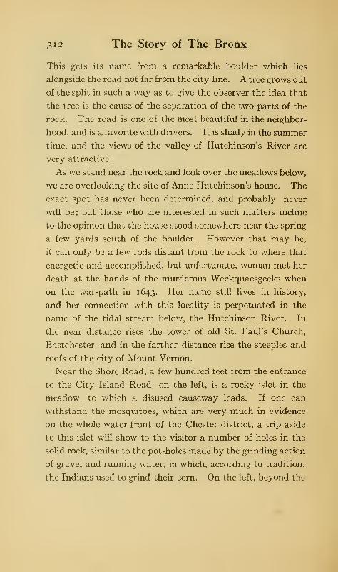
312 The Story of The Bronx
This gets its name from a remarkable boulder which lies
alongside the road not far from the city line. A tree grows out
of the split in such a way as to give the observer the idea that
the tree is the cause of the separation of the two parts of the
rock. The road is one of the most beautiful in the neighbor-
hood, and is a favorite with drivers. It is shady in the summer
time, and the views of the valley of Hutchinson's River are
very attractive.
As we stand near the rock and look over the meadows below,
we are overlooking the site of Anne Hutchinson's house. The
exact spot has never been determined, and probably never
will be; but those who are interested in such matters incline
to the opinion that the house stood somewhere near the spring
a few yards south of the boulder. However that may be,
it can only be a few rods distant from the rock to where that
energetic and accomplished, but unfortunate, woman met her
death at the hands of the murderous Weckquaesgeeks when
on the war-path in 1643. Her name still lives in history,
and her connection with this locality is perpetuated in the
name of the tidal stream below, the Hutchinson River. In
the near distance rises the tower of old St. Paul's Church,
Eastchester, and in the farther distance rise the steeples and
roofs of the city of Mount Vernon.
Near the Shore Road, a few hundred feet from the entrance
to the City Island Road, on the left, is a rocky islet in the
meadow, to which a disused causeway leads. If one can
withstand the mosquitoes, which are very much in evidence
on the whole water front of the Chester district, a trip aside
to this islet will show to the visitor a number of holes in the
solid rock, similar to the pot-holes made by the grinding action
of gravel and running water, in which, according to tradition,
the Indians used to grind their corn. On the left, beyond the
The Parks and Cemeteries 313
causeway where the battle began, there is an ancient Indian
burial ground from which a number of skeletons and other
remains have been unearthed by curious seekers. Nearby is
the boulder called "Jack's Rock."
Directly opposite the point where the Split Rock Road
enters the Shore Road, a lane leads down to the water's edge
through the Bartow place and to the ancient burial-place of
the Pell family, in which several of the manor-lords are buried.
The plot is surrounded by a fence with square granite posts at
each corner, upon each one of which there is carved a pelican,
the crest of the Pells. They also bear the following inscriptions
:
(North) (West)
INDIAN GRANT ROYAL PATENTOF OCT. 6, 1666.
PELHAM MANOR DUKE OF YORKTO TO
THOMAS PELL THOMAS PELLNOV. 14, 1654. 1ST LORD OF THE MANOR.
(South) (East)
ROYAL PATENT PELHAM BAY PARKOCT. 25, 1687 1884
JAMES II. ERECTED 1891
TO BY DESCENDANTS OFJOHN PELL BENJAMIN PELL
2ND LORD OF THE MANOR. GRANDSON OFFIRST JUDGE, 1688 THOMAS PELL
AND FIRST MEMBER LORD OF THE MANOR.PROVINCIAL ASSEMBLY
1691
OF WESTCHESTER COUNTY.
[LAWS OF N. Y. CHAP. 474, 1890.]
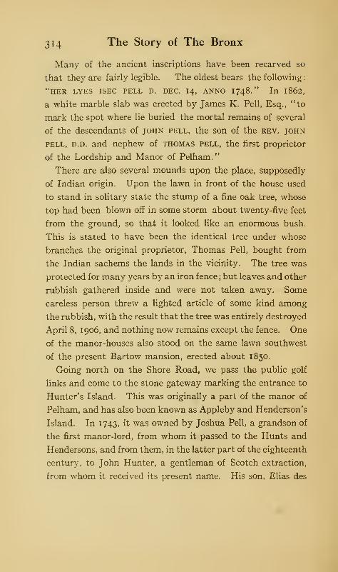
314 The Story of The Bronx
Many of the ancient inscriptions have been recarved so
that they are fairly legible. The oldest bears the following
:
"HER LYES ISEC PELL D. DEC. 14, ANNO I748." In 1862,
a white marble slab was erected by James K. Pell, Esq., "to
mark the spot where lie buried the mortal remains of several
of the descendants of john pell, the son of the rev. john
pell, d.d. and nephew of thomas pell, the first proprietor
of the Lordship and Manor of Pelham."
There are also several mounds upon the place, supposedly
of Indian origin. Upon the lawn in front of the house used
to stand in solitary state the stump of a fine oak tree, whose
top had been blown off in some storm about twenty-five feet
from the ground, so that it looked like an enormous bush.
This is stated to have been the identical tree under whose
branches the original proprietor, Thomas Pell, bought from
the Indian sachems the lands in the vicinity. The tree was
protected for many years by an iron fence ; but leaves and other
rubbish gathered inside and were not taken away. Some
careless person threw a lighted article of some kind among
the rubbish, with the result that the tree was entirely destroyed
April 8, 1906, and nothing now remains except the fence. One
of the manor-houses also stood on the same lawn southwest
of the present Bartow mansion, erected about 1850.
Going north on the Shore Road, we pass the public golf
links and come to the stone gateway marking the entrance to
Hunter's Island. This was originally a part of the manor of
Pelham, and has also been known as Appleby and Henderson's
Island. In 1743, it was owned by Joshua Pell, a grandson of
the first manor-lord, from whom it passed to the Hunts and
Hendersons, and from them, in the latter part of the eighteenth
century, to John Hunter, a gentleman of Scotch extraction,
from whom it received its present name. His son, Elias des
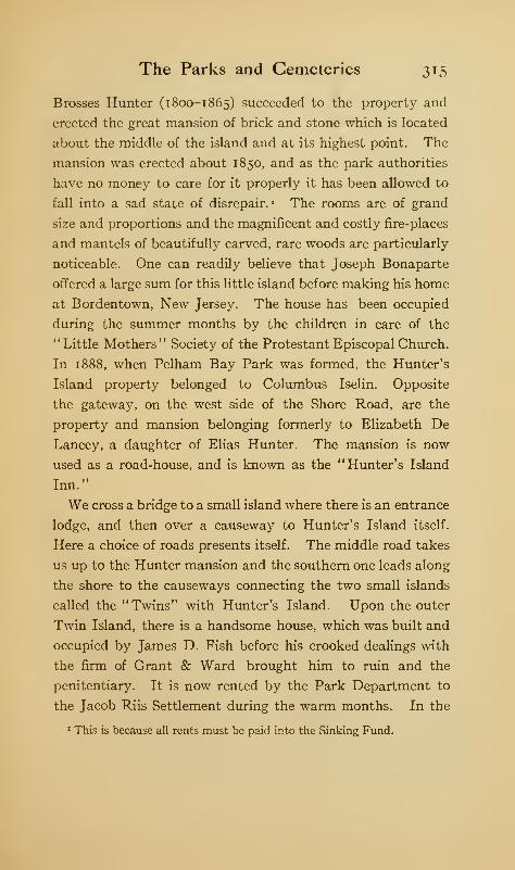
The Parks and Cemeteries 315
Brosses Hunter (1 800-1 865) succeeded to the property and
erected the great mansion of brick and stone which is located
about the middle of the island and at its highest point. The
mansion was erected about 1850, and as the park authorities
have no money to care for it properly it has been allowed to
fall into a sad state of disrepair. « The rooms are of grand
size and proportions and the magnificent and costly fire-places
and mantels of beautifully carved, rare woods are particularly
noticeable. One can readily believe that Joseph Bonaparte
offered a large sum for this little island before making his home
at Bordentown, New Jersey. The house has been occupied
during the summer months by the children in care of the
" Little Mothers" Society of the Protestant Episcopal Church.
In 1888, when Pelham Bay Park was formed, the Hunter's
Island property belonged to Columbus Iselin. Opposite
the gateway, on the west side of the Shore Road, are the
property and mansion belonging formerly to Elizabeth De
Lancey, a daughter of Elias Hunter. The mansion is now
used as a road-house, and is known as the "Hunter's Island
Inn."
We cross a bridge to a small island where there is an entrance
lodge, and then over a causeway to Hunter's Island itself.
Here a choice of roads presents itself. The middle road takes
us up to the Hunter mansion and the southern one leads along
the shore to the causeways connecting the two small islands
called the "Twins" with Hunter's Island. Upon the outer
Twin Island, there is a handsome house, which was built and
occupied by James D. Fish before his crooked dealings with
the firm of Grant & Ward brought him to ruin and the
penitentiary. It is now rented by the Park Department to
the Jacob Riis Settlement during the warm months. In the
1 This is because all rents must be paid into the Sinking Fund.
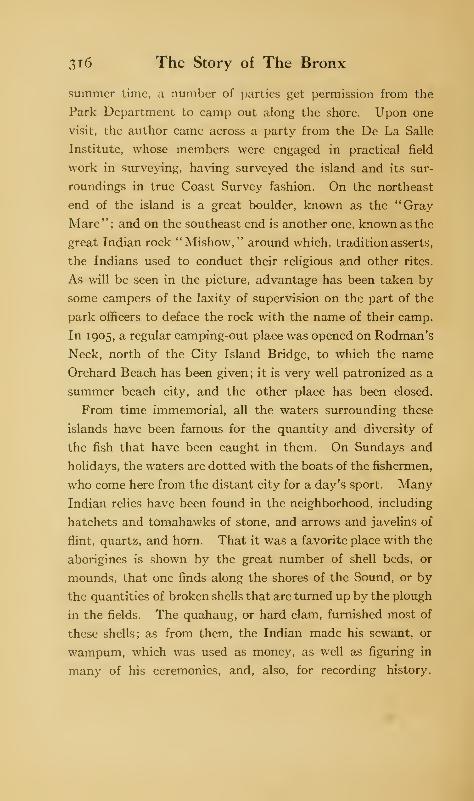
316 The Story of The Bronx
summer time, a number of parties get permission from the
Park Department to camp out along the shore. Upon one
visit, the author came across a party from the De La Salle
Institute, whose members were engaged in practical field
work in surveying, having surveyed the island and its sur-
roundings in true Coast Survey fashion. On the northeast
end of the island is a great boulder, known as the "Gray
Mare"; and on the southeast end is another one, known as the
great Indian rock "Mishow, " around which, tradition asserts,
the Indians used to conduct their religious and other rites.
As will be seen in the picture, advantage has been taken by
some campers of the laxity of supervision on the part of the
park officers to deface the rock with the name of their camp.
In 1905, a regular camping-out place was opened on Rodman's
Neck, north of the City Island Bridge, to which the name
Orchard Beach has been given; it is very well patronized as a
summer beach city, and the other place has been closed.
From time immemorial, all the waters surrounding these
islands have been famous for the quantity and diversity of
the fish that have been caught in them. On Sundays and
holidays, the waters are dotted with the boats of the fishermen,
who come here from the distant city for a day's sport. Many
Indian relics have been found in the neighborhood, including
hatchets and tomahawks of stone, and arrows and javelins of
flint, quartz, and horn. That it was a favorite place with the
aborigines is shown by the great number of shell beds, or
mounds, that one finds along the shores of the Sound, or by
the quantities of broken shells that are turned up by the plough
in the fields. The quahaug, or hard clam, furnished most of
these shells; as from them, the Indian made his sewant, or
wampum, which was used as money, as well as figuring in
many of his ceremonies, and, also, for recording history.
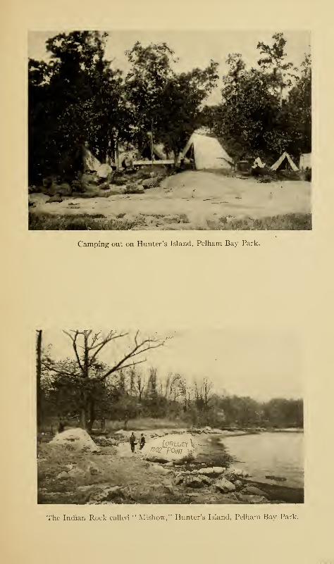
Camping out on Hunter's Island, Pelham Bay Park.
The Indian Rock called " Mishow," Hunter's Island, Pelham Bay Park.

The Parks and Cemeteries 317
In consequence, the whole country around about—what was
virtually Pell's purchase—was called by the Indians Laap-
hawachking, or the "place of stringing beads."
The smaller section of the park south of Hutchinson's
River is at the northern end of Throgg's Neck, and was
called in colonial times "Dorman's Island," and later "Tay-
lor's Island." That there was some kind of a road leading
to it from the borough-town of Westchester, the map of
Sauthier, inaccurate as it is, plainly shows. Where this
Road comes into the Shore Road there are an athletic field for
outdoor sports, and a parade ground of one hundred andtwenty
acres, opened September 10, 1904.
In March, 1812, the Legislature incorporated the East-
Chester Bridge Company, and the bridge over the Hutchinson
River near its mouth was built soon after. In 1817, the
Westchester and Pelham Turnpike Company was incorporated
for the purpose of building a turnpike from the causeway at
Westchester to the above mentioned bridge, following prob-
ably the lane of Sauthier 's map. The first bridge was
destroyed by a storm, and the company was authorized by
the Legislature of 1816 to sell its property and franchises for
a period of forty-five years. The second bridge was built
in 1834 by George Rapelje, with the right to charge tolls for
a period of thirty years; but the supervisors of Westchester
County purchased the bridge in i860 and made it free. The
former iron bridge was constructed in 1869-70; but it proved
insufficient for the traffic after the automobile arrived, and it
was replaced by the present larger bridge, openedby the Depart-
ment of Bridges on October 15, 1908, at a cost of $517,000.
The bridge has always been famous for the good fishing
to be obtained from it, and the author remembers having
made several trips to it when a very small boy, walking from
318 The Story of The Bronx
Mt. Vernon and back with his companions by way of East-
chester and the Split Rock Road. Bolton gives records of a
striped bass weighing sixty-three pounds, being caught on
June 3, 1844, of another of fifty pounds, caught by E. des
Brosses Hunter, and of others of twenty and forty-three
pounds at various times. "There were giants in those days!"
Flounders, tom-cod, eels, and fish of all kinds, including an
occasional sheepshead, are also mentioned by the same author.
The best time for fishing is in the months of September and
October. The stream was formerly clear, but for many years
it has been polluted by the sewage of Mt. Vernon and the
outpourings of the gas-works at Eastchester, and the fish
are not so plentiful as formerly.
Crotona Park lies between Third and Arthur avenues on
the west and east, and Fulton and Tremont avenues on the
south and north. ' It originally contained 141 acres, but
thirteen more have been added. Bungay Creek, the boundary
between the manor of Morrisania and the West Farms patent,
had its origin within the park. It is also famous for its trees,
which one writer states are not surpassed by anything this
side of the Adirondacks. The property formerly belonged
to the Bathgate family, whose ancestor, Alexander, came from
Scotland early in the nineteenth century and became foreman
for the first Gouverneur Morris, and bought the farm from the
second. Alexander's brother James was also a farmer at Ford-
ham ; his farm was taken by the Jerome Park Racing Associ-
ation. In the northwest corner of the park, facing Third
Avenue, is the Borough Hall, containing the offices of the
Borough departments, except that of parks. It is a fine build-
ing, erected in 1897, and stands on an elevation which is
approached by an imposing flight of steps in terraces. In the
rear of the building there is a field for base-ball, and about the
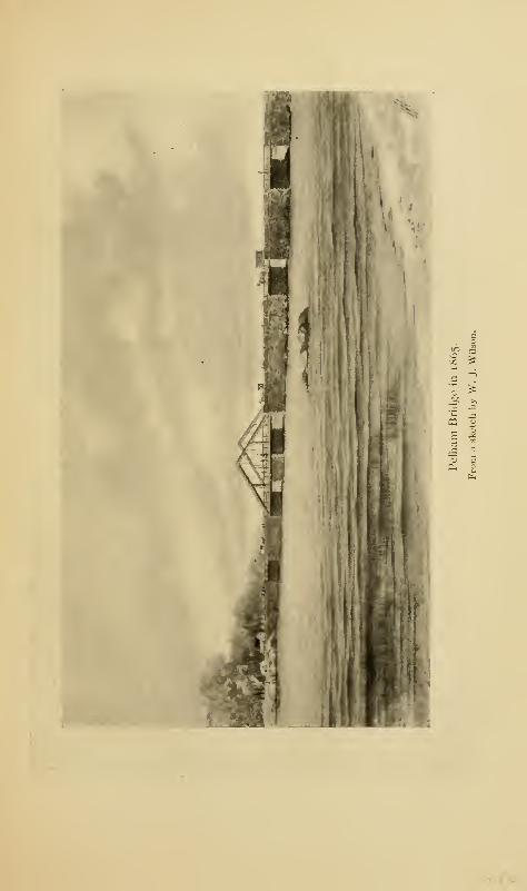
•
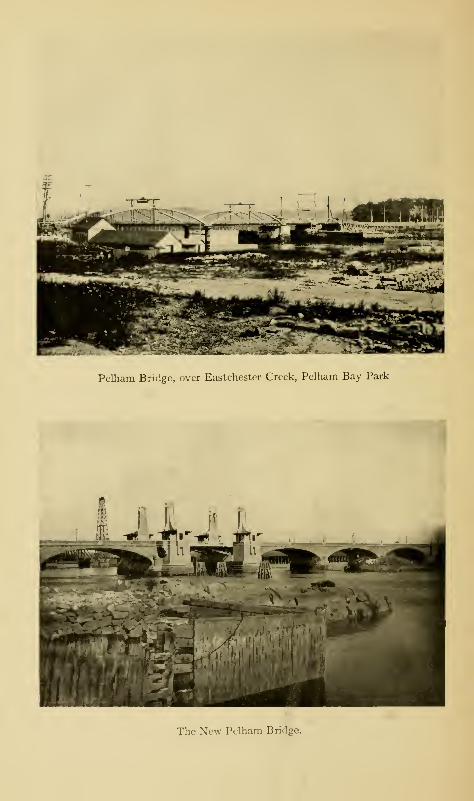
Pclham Bridge, over Eastchestcr Creek, Pelham Bay Park
The New Pelham Bridge.
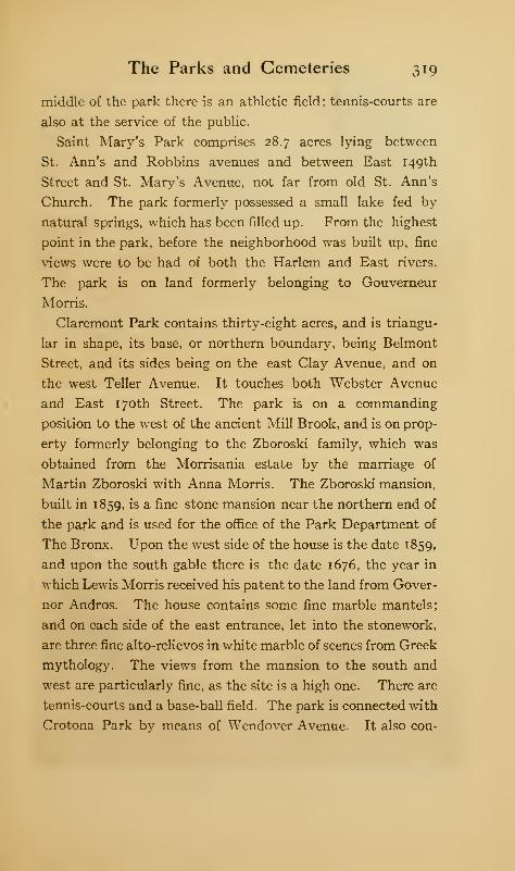
The Parks and Cemeteries 319
middle of the park there is an athletic field ; tennis-courts are
also at the service of the public.
Saint Mary's Park comprises 28.7 acres lying between
St. Ann's and Robbins avenues and between East 149th
Street and St. Mary's Avenue, not far from old St. Ann's
Church. The park formerly possessed a small lake fed by
natural springs, which has been filled up. From the highest
point in the park, before the neighborhood was built up, fine
views were to be had of both the Harlem and East rivers.
The park is on land formerly belonging to Gouverneur
Morris.
Claremont Park contains thirty-eight acres, and is triangu-
lar in shape, its base, or northern boundary, being Belmont
Street, and its sides being on the east Clay Avenue, and on
the west Teller Avenue. It touches both Webster Avenue
and East 170th Street. The park is on a commanding
position to the west of the ancient Mill Brook, and is on prop-
erty formerly belonging to the Zboroski family, which was
obtained from the Morrisania estate by the marriage of
Martin Zboroski with Anna Morris. The Zboroski mansion,
built in 1859, is a fine stone mansion near the northern end of
the park and is used for the office of the Park Department of
The Bronx. Upon the west side of the house is the date 1859,
and upon the south gable there is the date 1676, the year in
which Lewis Morris received his patent to the land from Gover-
nor Andros. The house contains some fine marble mantels;
and on each side of the east entrance, let into the stonework,
are three fine alto-relievos in white marble of scenes from Greek
mythology. The views from the mansion to the south and
west are particularly fine, as the site is a high one. There are
tennis-courts and a base-ball field. The park is connected with
Crotona Park bv means of Wendover Avenue. It also con-
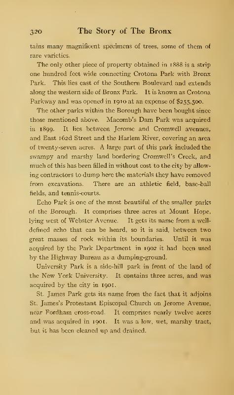
320 The Story of The Bronx
tains many magnificent specimens of trees, some of them of
rare varieties.
The only other piece of property obtained in 1 888 is a strip
one hundred feet wide connecting Crotona Park with Bronx
Park. This lies east of the Southern Boulevard and extends
along the western side of Bronx Park. It is known as Crotona
Parkway and was opened in 1910 at an expense of $255,500.
The other parks within the Borough have been bought since
those mentioned above. Macomb's Dam Park was acquired
in 1899. It lies between Jerome and Cromwell avenues,
and East i62d Street and the Harlem River, covering an area
of twenty-seven acres. A large part of this park included the
swampy and marshy land bordering Cromwell's Creek, and
much of this has been filled in without cost to the city by allow-
ing contractors to dump here the materials they have removed
from excavations. There are an athletic field, base-ball
fields, and tennis-courts.
Echo Park is one of the most beautiful of the smaller parks
of the Borough. It comprises three acres at Mount Hope,
lying west of Webster Avenue. It gets its name from a well-
defined echo that can be heard, so it is said, between two
great masses of rock within its boundaries. Until it was
acquired by the Park Department in 1902 it had been used
by the Highway Bureau as a dumping-ground.
University Park is a side-hill park in front of the land of
the New York University. It contains three acres, and was
acquired by the city in 1901.
St. James Park gets its name from the fact that it adjoins
St. James's Protestant Episcopal Church on Jerome Avenue,
near Fordham cross-road. It comprises nearly twelve acres
and was acquired in 1901. It was a low, wet, marshy tract,
but it has been cleaned up and drained.
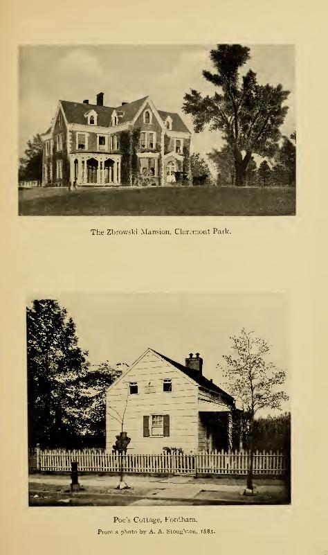
The Zbrowski Mansion, Claremont Park.
Poe's Cottage, Fordham.
From a photo by A. A. Stoughton, 1885.
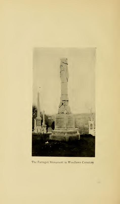
a' .
SL
'•*'
The Farragut Monument in Woodlawn Cemetery
The Parks and Cemeteries 321
Poe Park contains two acres obtained in 1902. It lies on
the Kingsbridge Road west of the Harlem Railroad and east of
Jerome Avenue, distant about half a mile from each. It gets
its name from the Poe cottage directly opposite the park.
Washington Bridge Park, containing nine acres, was ob-
tained in 1899. It lies at the northerly end of Washington
Bridge and has been fully developed.
Melrose Park of one acre was obtained in August, 1902.
De Voe Park is a small park of about six acres on Fordham
Road, near Sedgwick Avenue; it was bought in 1907, and
opened in 1910; it adjoins Webb's Academy. Joseph Rodman
Drake Park is situated on Hunt's Point and contains two and
a half acres. It contains the old Hunt burial-ground and the
grave of the poet Drake; it was opened in 1910. It was
planned to have a park at the extremity of Hunt's Point,
containing something less than ten acres; but owing to the
scandal attached to the acquisition of the property it has been
turned back into the Sinking Fund. In addition, there is
the proposed park at Seton's Falls, upon the northern bound-
ary of the city. There are other plans of improvement in
view, but their execution depends upon what the Board of
Estimate and Apportionment will allow from year to year.
Besides the parks named above, there are 22.6 acres of im-
proved, unnamed parks.
Cemeteries: While there are several small cemeteries,
usually attached to some of the older churches, there are only
two of any considerable size, Woodlawn and Saint Raymond's.
Woodlawn Cemetery was organized December 29, 1863,
and the first interment was made January 14, 1865; the total
number of interments to January 1, 1912, is 81,796. At the
time of the purchase of the land for the cemetery this section
was wholly rural, and there was no prospect that the land

322 The Story of The Bronx
would ever be within the corporate limits of New York City.
The cemetery comprises four hundred acres on the westerly
side of the Bronx River in the former township of Kingsbridge,
with Webster Avenue for its eastern, and Woodlawn Road
and Jerome Avenue for its western boundaries. On the north
it extends to East 233d Street and on the south almost to the
Gun Hill Road. The ground is high and is on the northerly
end of the Fordham ridge, which separates the Harlem and
Bronx valleys. In colonial days it was heavily wooded, and
it was within the sheltering shadows of its trees that Colonel
Simcoe placed his own rangers and the dragoons of Tarleton
upon August 31, 1778, when he planned the ambush for the
force of Colonel Gist and his Indian allies.
In 1900, the city took a strip from the eastern side of the
cemetery for the extension of Webster Avenue. This de-
stroyed the beautiful pond and the parterres of flowers which
were so conspicuous for many years to the passengers on the
Harlem and New Haven railroads. A fine granite bulkhead
with iron-railed top now constitutes the eastern side of the
cemetery. The southerly boundary is a fence which cuts off
the approach to the old Revolutionary redoubt constructed
by the orders of General Heath to command the Boston
Road and the bridge over the Bronx River. The old fort is
only a few feet within the fence.
The cemetery has two main carriage entrances, one at the
northeast corner, close to the Harlem Railroad station, and
the other at Jerome Avenue at its junction with Woodlawn
Road. Near both are situated monument makers, gardeners,
florists, and "hotels. " Why is it that near cemetery entrances
there are always located so many "hotels," whose chief func-
tion seems to be to dispense liquid refreshments? Are mourn-
ers and drivers of hearses and coaches such a thirsty lot?
The Parks and Cemeteries 323
Or do visitors go to a cemetery as they would to a park or
museum, and make a picnic of their visit?
The grounds of the cemetery are kept in beautiful condition,
and many fine pieces of sculpture, mausoleums, and other
mortuary emblems ornament the grounds. Among the names
on these we find many that are famous in New York's mercan-
tile, commercial, or historic life, and one whose fame extends
beyond the confines of city or nation, that of our great,
first admiral, who was buried here in 1870, David Glasgow
Farragut.
The monument is of white marble and represents a broken
mast with a row of belaying pins near its base. At the foot
of the mast are coils of rope, a sword, and various other
nautical paraphernalia, as well as symbolic shields. On the
western side is inscribed:
ERECTED
BY HIS WIFE AND SON
TO THE MEMORY OF
DAVID GLASGOW FARRAGUT,FIRST ADMIRAL OF THE UNITED STATES NAVY.
BORN JULY 5, 1 80 1,
DIED AUGUST 14, 187O.
Upon the south side is the inscription:
VIRGINIA D. FARRAGUT,
WIFE OF
DAVID GLASGOW FARRAGUT.
BORN NOVEMBER 24, 1 824,
DIED OCTOBER 31, 1 884.
On the east face is an inscription to the wife of Loyall
Farragut, the son of the Admiral.
324 The Story of The Bronx
St. Raymond's Cemetery is a Roman Catholic burying-
ground, incorporated in 1878, and situated on the Fort Schuyler
Road on Throgg's Neck, near the Eastern Boulevard. It
at first comprised thirty-six acres, but has since been increased
by fifty more. The number of burials to January 1, 1912, is
53,000, nearly all of inhabitants of the Borough. The prop-
erty was formerly a part of the Ferris estate, though the
cemetery company bought from a Mrs. Underhill. In opening
some of the graves in the eastern part of the grounds great
quantities of shells have been thrown out, showing that this
was formerly a feasting place of the Indians.
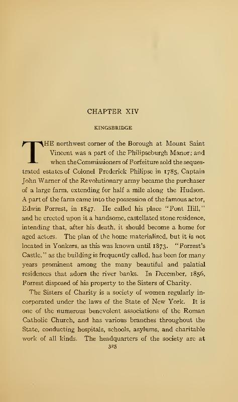
CHAPTER XIV
KINGSBRIDGE
THE northwest corner of the Borough at Mount Saint
Vincent was a part of the Philipseburgh Manor; and
when theCommissioners of Forfeiture sold the seques-
trated estates of Colonel Frederick Philipse in 1785, Captain
John Warner of the Revolutionary army became the purchaser
of a large farm, extending for half a mile along the Hudson.
A part of the farm came into the possession of the famous actor,
Edwin Forrest, in 1847. He called his place "Font Hill,"
and he erected upon it a handsome, castellated stone residence,
intending that, after his death, it should become a home for
aged actors. The plan of the home materialized, but it is not
located in Yonkers, as this was known until 1873. "Forrest's
Castle, " as the building is frequently called, has been for many
years prominent among the many beautiful and palatial
residences that adorn the river banks. In December, 1856,
Forrest disposed of his property to the Sisters of Charity.
The Sisters of Charity is a society of women regularly in-
corporated under the laws of the State of New York. It is
one of the numerous benevolent associations of the Roman
Catholic Church, and has various branches throughout the
State, conducting hospitals, schools, asylums, and charitable
work of all kinds. The headquarters of the society are at
325
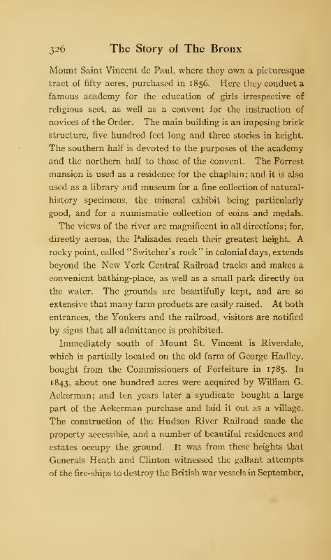
326 The Story of The Bronx
Mount Saint Vincent de Paul, where they own a picturesque
tract of fifty acres, purchased in 1856. Here they conduct a
famous academy for the education of girls irrespective of
religious sect, as well as a convent for the instruction of
novices of the Order. The main building is an imposing brick
structure, five hundred feet long and three stories in height.
The southern half is devoted to the purposes of the academy
and the northern half to those of the convent. The Forrest
mansion is used as a residence for the chaplain ; and it is also
used as a library and museum for a fine collection of natural-
history specimens, the mineral exhibit being particularly
good, and for a numismatic collection of coins and medals.
The views of the river are magnificent in all directions; for,
directly across, the Palisades reach their greatest height. Arocky point, called "Switcher's rock" in colonial days, extends
beyond the New York Central Railroad tracks and makes a
convenient bathing-place, as well as a small park directly on
the water. The grounds are beautifully kept, and are so
extensive that many farm products are easily raised. At both
entrances, the Yonkers and the railroad, visitors are notified
by signs that all admittance is prohibited.
Immediately south of Mount St. Vincent is Riverdale,
which is partially located on the old farm of George Hadley,
bought from the Commissioners of Forfeiture in 1785. In
1843, about one hundred acres were acquired by William G.
Ackerman; and ten years later a syndicate bought a large
part of the Ackerman purchase and laid it out as a village.
The construction of the Hudson River Railroad made the
property accessible, and a number of beautiful residences and
estates occupy the ground. It was from these heights that
Generals Heath and Clinton witnessed the gallant attempts
of the fire-ships to destroy the British war vessels in September,
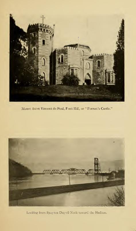
Mount Saint Vincent de Paul, Font Hill, or " Forrest's Castle."
Looking from Spuyten Duyvil Neck toward the Hudson.
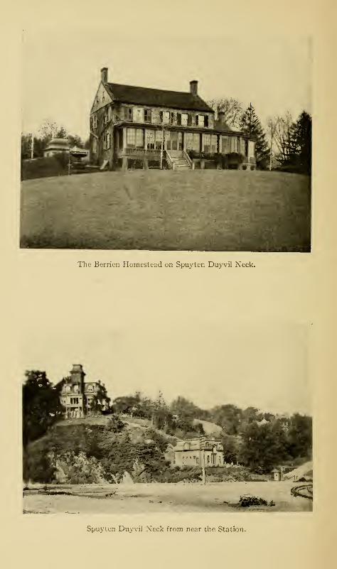
The Berrien Homestead on Spuyten Duyvil Neck.
Spuyten Duyvil Neck from near the Station.
Kingsbridge 327
1776. The highest point of land in the Borough, 282 feet,
is in Riverdale. There are no stores in Riverdale, and no
village in the ordinary sense of the word. The genial humorist,
Mark Twain, lived here in 1901 ; and among the landowners
and residents have been many whose names have been famous
in the political and mercantile history of the city.
South of Riverdale was the farm of William Hadley, extend-
ing from the Hudson River to the Albany Post-road. Hadley
acquired it in two parcels : one from Colonel Jacobus, or James,
Van Cortlandt, grandson of the first of the name, in 1761,
and the other from the Commissioners of Forfeiture in 1786.
The two parcels, comprising 257 acres, were bought from
Hadley's executors in 1829 by Joseph Delafield, and the
property remains with his descendants to this day.
In 1853, Hudson Park was laid out by a land company in
the northwest corner of the Betts and Tippett tract of 1668,
on a farm formerly belonging to Samuel Thomson. It lies
south of the Delafield property mentioned above.
South of Hudson Park lies the bold promontory between
the Hudson River and Spuyten Duyvil Creek, which has been
known under the several names of Shorrack-kappock, Tippett's
Neck, Berrien's Neck, and Spuyten Duyvil Neck, the first
being its Indian title and the last its present one. It was
formerly known as the village and post-office of Spuyten
Duyvil, and that is the name of the station of the Central
Railroad to-day. The more northerly portion comprised a
tract of 356 acres and was purchased by Frederick Van Cort-
landt, brother of Colonel James, between 1768 and 1788 from
several owners who had acquired the Betts and Tippett tract
by purchase or inheritance. Upon the eastern side of the
property, overlooking the Albany Post-road, Van Cortlandt
erected a mansion which, during the Revolution, was known as
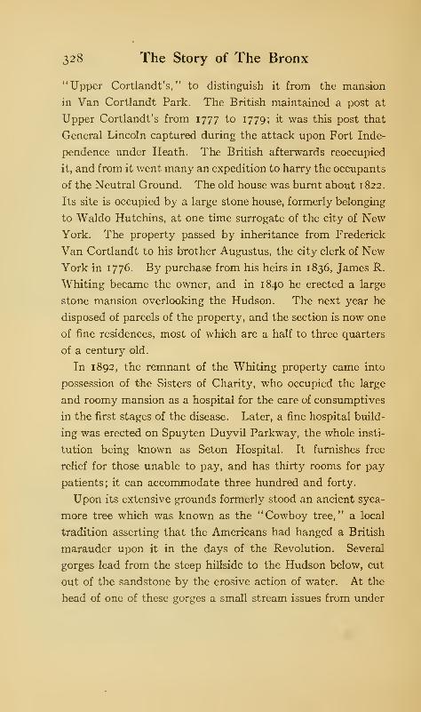
2,28 The Story of The Bronx
"Upper Cortlandt's, " to distinguish it from the mansion
in Van Cortlandt Park. The British maintained a post at
Upper Cortlandt's from 1777 to 1779; it was this post that
General Lincoln captured during the attack upon Fort Inde-
pendence under Heath. The British afterwards reoccupied
it, and from it went many an expedition to harry the occupants
of the Neutral Ground. The old house was burnt about 1822.
Its site is occupied by a large stone house, formerly belonging
to Waldo Hutchins, at one time surrogate of the city of NewYork. The property passed by inheritance from Frederick
Van Cortlandt to his brother Augustus, the city clerk of NewYork in 1776. By purchase from his heirs in 1836, James R.
Whiting became the owner, and in 1840 he erected a large
stone mansion overlooking the Hudson. The next year he
disposed of parcels of the property, and the section is now one
of fine residences, most of which are a half to three quarters
of a century old.
In 1892, the remnant of the Whiting property came into
possession of the Sisters of Charity, who occupied the large
and roomy mansion as a hospital for the care of consumptives
in the first stages of the disease. Later, a fine hospital build-
ing was erected on Spuyten Duyvil Parkway, the whole insti-
tution being known as Seton Hospital. It furnishes free
relief for those unable to pay, and has thirty rooms for pay
patients; it can accommodate three hundred and forty.
Upon its extensive grounds formerly stood an ancient syca-
more tree which was known as the "Cowboy tree," a local
tradition asserting that the Americans had hanged a British
marauder upon it in the days of the Revolution. Several
gorges lead from the steep hillside to the Hudson below, cut
out of the sandstone by the erosive action of water. At the
head of one of these gorges a small stream issues from under
Kingsbridge 329
some overhanging rocks which form a natural cave, known
locally as " Indian cave, " from the tradition that two of Nim-
ham's band of Stockbridge Indians hid here from the pursuing
troopers of Tarleton after their defeat by Simcoe near Wood-
lawn Heights.
The southern end of the neck was formerly the home tract
of George Tippett and his descendants, the Berriens. The
old Berrien homestead, though modernized, still stands near
the end of the neck, commanding a magnificent view of the
Hudson and the northern end of Manhattan. About a quarter
of a mile north of it is the Strang house, built originally by a
Mr. Cameron within the ramparts of Fort Number One.
The house is now occupied by William C. Muschenheim, the
proprietor of the Hotel Astor, who, on November 5, 1910,
caused a suitable bronze tablet to be unveiled in order to
properly mark so historic a spot. Some distance east of
Number One is a circular tumulus, the remains of Number
Two, the "Fort Swartwout" of the Americans, and the Fort
Independence of Sauthier's map. A few yards east of it is
the house known as the Warren Sage house, which occupies
the site of Number Three, which commanded the King's
Bridge, and from which there is a fine view across the valley
to the site of the true Fort Independence of the Americans on
Fordham ridge.
The Indian village of Nipnichsen stood on the neck, and
very extensive shell mounds still exist below the bluff, show-
ing that this was a favorite place of resort of the natives. In
1655, while Governor Stuyvesant was absent with the military
forces of the colony on his expedition against the Swedish
Fort Christina on the Delaware, a band of nine hundred
savages crossed over from the Jersey shore and occupied the
neck as a post of observation, while two thousand of their
330 The Story of The Bronx
companions entered the city of New Amsterdam itself, causing
great uneasiness to the inhabitants; they were, however,
prevailed upon to withdraw to Nutten (now Governor's) Island.
The old Tippett house stood on the eastern side of the neck
in a grove of locust trees. During the Revolution, the Tip-
petts were loyalists, and, in consequence, lost their property
by confiscation. It was sold to Samuel Berrien, who had
married Dorcas, a daughter of George Tippett; another
daughter was the wife of the celebrated James De Lancey,
sheriff of the county and leader of the Westchester Light
Horse. Though the Berriens were good Whigs, their house,
as well as that of Tippett, was a resort for the loyalists, owing
to the protection offered by the forts above, whose officers
could not have found duty upon the neck so very irksome with
several pleasant houses in the neighborhood to visit.
In 1852, the old Berrien tract was composed of three farms.
These were sold to three gentlemen of Troy, New York, who
had the property surveyed and laid out as a village. It was
at first called Fort Independence, under the impression that
that fort had been located on the crest of the hill; but later,
the name was changed to Spuyten Duyvil, after the creek.
A foundry was established at the base of the bluff, which has
expanded as the years have gone by into an extensive plant
which has for a number of years supplied a large number of
modern and improved projectiles for the guns of the United
States Navy. There has thus grown up near the foundry a
small village to accommodate the hands who work in the
Johnson mill, and it is here that the stores and post-office are
located. From the point upon which the mill stands, to the
opposite shore of the creek on Manhattan, there stood, in
Revolutionary days, a pontoon bridge connecting the posts
and fortifications of the two sides of the creek. It was also
Kingsbridge 331
upon the Cock Hill on Manhattan that there was to be found
the spouting spring which is supposed to have given its name
to the locality.
Upon the higher part of the neck, the section is entirely
residential, and there are many beautiful houses and pieces
of property. The ridge ends in a bold, rocky bluff, from which
is obtained a beautiful and picturesque view. At our feet
is the winding creek entering the broad and majestic Hudson,
which here, by contrast, appears as a lake; across the river
towers the perpendicular frontage of the Palisades; while
across the creek is the gently rising and heavily wooded dome
of Cox's Hill on Manhattan, still so unimproved by man as to
convince us of the surpassing beauty of this locality when
Hudson and his crew first viewed its shores. Even as a boy,
when I passed the entrance of the creek on Hudson River
steamers, I used to look into this entrance and think it looked
like the entrance to Paradise. To the southward and east-
ward, Marble Hill rises with its residences, and at its foot is
the western entrance to the Ship Canal; while still farther
away our view extends to the heights of Fordham with the
great buildings of the Roman Catholic Orphan Asylum and of
the New York University outlined against the sky ; still farther
away are those engineering triumphs, High Bridge and Wash-
ington Bridge. When moonlight spreads its glamor over the
scene, even the ugly railroad bridge at the mouth of the
creek appears beautiful.
On the morning of October 22, 1609, the Half-Moon left
her anchorage at Teller's Point near the mouth of the Croton
River and made twenty-one miles to the southward during
the day; but, encountering head winds and tides, she was
obliged to anchor in the afternoon off the mouth of Spuyten
Duvvil Creek.
S32 The Story of The Bronx
"The two captive Indians who had escaped at West Point
had, it appears," says Irving, "made their way to the east
side of the river, rousing on their return the spirits of Sleepy
Hollow, or the more ferocious Manhatta, and here, in the in-
let of Haarlem River, they had concentrated a force that
impatiently awaited the arrival of the rich booty, which they
flattered themselves they should obtain. They had not
waited long before the Half-Moon appeared, and immedi-
ately hove to, near their place of ambush. One of the In-
dians who had escaped from Hudson's vessel now came out
with many others armed with bows and arrows, expecting to
betray them."
As to the issue of the attack, we have the account of Juet,
the mate of the Half-Moon. He says:
"We perceived their intent, and suffered none of them to
enter our ship, whereupon two canoes full of men with bowsand arrows shot at us after our stern, in recompense whereof
we discharged six muskets and killed two or three of them;
then above one hundred of them came to a point of land to
shoot at us, then I shot a falcon at them and killed two of
them; whereupon the rest fled into the woods. Yet they
manned off another canoe with nine or ten men, which came to
meet us; so I shot at it a falcon, and shot it through and killed
one of them, then our men with muskets killed three or four
more of them, so they went their way.
"
Yes, and so the Half-Moon went her way, too; but left
behind her a legacy of hate, suspicion, and revenge which
boded ill for those who came later. It is strange that these
civilized Europeans—whether English, Dutch, French, or
Spanish—who first came to our shores should have so univer-
sally aroused the baser passions of these simple children of
nature, when it would have been just as easy to have aroused
Henry Hudson Monument, Spuyten Duyvil Neck.
Mr. Muschenheim's residence is on the left, and under the first second-story window
on the porch side is the bronze tablet marking the site of Fort Number One.
Courtesy of William C. Muschenheim, Esq.
Statue of Henry Hudson by Karl Bitter.
Kingsbridge 333
their friendship, as Penn did, by fair and honest dealings and
by considerate treatment.
In 1909 occurred the three hundredth anniversary of
Hudson's explorations, and the city celebrated with numerous
civic and military displays. It occurred to Mr. Muschenheim
that a statue to Hudson on the point opposite the scene of
the anchorage of the Half-Moon would be an appropriate
memorial, and he succeeded in interesting four other gentle-
men to go in with him as a committee, and lists for subscrip-
tions were opened with such success that nearly $100,000
were pledged. The monument is in the form of a hollow shaft
one hundred feet in height, to be surmounted by a sixteen-
foot statue of the explorer. Mr. Walter Cook is the designer
of the monument, which has already been erected, and Karl
Bitter is the sculptor of the statue. The point of the neck
upon which the monument stands is two hundred feet above
the river, so that the gallery at the top of the shaft will
be three hundred feet high. A superb view will be obtained
from this point, access to which will be obtained by a wind-
ing flight of stairs within the shaft. Four tablets will be
placed upon the pedestal, though these have not yet been
designed.
In connection with the ter-centenary of Hudson's discovery,
it was planned to have a memorial bridge span the waters of
Spuyten Duyvil Creek, connecting Cock Hill with Spuyten
Duyvil Neck, at a sufficient height to be clear of interference
with navigation, and to connect the Boulevard Lafayette
—
to be extended for the purpose—with the Spuyten Duyvil
Parkway. Though plans were made in sufficient time to
allow of the construction of the bridge by 1909, they did not
meet with the approval of the Municipal Art Commission and
other bodies, and the bridge is still unbuilt. When it is
334 The Story of The Bronx
constructed, the Hudson monument will stand in its axis at
the northern end.
Continuing our way east from the Spuyten Duyvil station
of the railroad, we formerly crossed the New York Central
tracks three times, once on a bridge over a deep cut in the
solid rock, and twice within a few yards at grade, these last
having been very dangerous crossings. It is near these
crossings that there occurred on January 13, 1881, a dreadful
railroad accident in which thirteen persons were killed ; among
them being Senator Wagner, the inventor of the sleeping-
coach and parlor-car which bear his name. There were thir-
teen coaches on the wrecked train, and this combination of
"thirteen" confirmed the credulous in their belief in the old
superstition. It was to get rid of this dangerous passage
through Kingsbridge that the railroad changed its route to
the Ship Canal in February, 1906. The Hudson, off the
mouth of the creek, was the scene of an earlier accident on
July 28, 1852, when the river boat Henry Clay was burned,
and seventy persons, mostly women and children, lost their
lives either by fire or drowning.
We may continue up Riverdale Avenue, a fine road leading
to the top of the hill to the ground we have just passed over,
or we may take the ancient road, called Dash's Lane, along
the base of the hill on a level with Tippett's Brook, till it
joins the ancient post-road at Mosholu, west of Van Cortlandt
Park. A third choice is open to us, that of keeping east over
Tippett's Brook and so through the village of Kingsbridge.
From the mouth of the brook eastward to the ancient bridge,
Spuyten Duyvil Creek has been filled in.
Kingsbridge is a straggling village, and the road was formerly
lined with boat-houses, feed stores, etc. On October 26, 1903,
a disastrous fire destroyed many of these buildings. The fire
Kingsbridge 335
was started, presumably, by the rockets set off during a po-
litical torch-light procession previous to the election of that
year. Church Street passes north over the rocky core of the
former island of Paparinemo and joins Broadway nearly a
mile above. We take a look at the ancient bridge which
gives its name to this locality, now much neglected, and due,
in a short time, to disappear altogether; after passing it,
wc are on the Boston Road of 1673, though this has been
recently graded from its former level.
We pass a large stone mansion which attracts our attention.
This was the home for many years of the late Mr. Joseph
Godwin. Previous to his occupancy of it, it had been the
home of Mrs. Mary C. P. Macomb, the wife of Robert Macomb,
whose ventures were no more successful than those of his
father. Mrs. Macomb acquired the Paparinemo tract about
1830. It is believed that there is incorporated within the
present mansion the ancient stone tavern which was main-
tained by both Verveelen and the Philipses in accordance with
their grants. If so, it is one of the oldest relics we have, as
it would date from 1669. Mrs. Macomb enlarged and modern-
ized the old tavern, which became noted for its hospitality as
her private home. Edgar Allan Poe, that unfortunate genius,
was a frequent visitor, as his home in Fordham was little more
than a mile away.
In 1847, Mrs. Macomb had her property surveyed and cut
up into building lots; and the village of Kingsbridge had its
beginning. Under the present Broadway Bridge, is the
" wading-place " of the olden time. The bar in the middle of
the stream was visible at low tide, and it was built up by Mr.
Godwin, who erected a summer house upon it; it was known
for many years, in consequence, as "Godwin's Island."
Passing up Broadway, we soon come to the flat meadow land
336 The Story of The Bronx
through which Tippctt's Brook finds its tortuous way. Over-
head the elevated portion of the subway thunders on to its
terminus at West 2^26. Street abreast of Van Cortlandt
Park. On the right of the station are the Van Cortlandt
mansion and the lake. Just south of the mansion, a road
connects the opposite sides of the valley ; this is the old Albany
Post-road. On our right, as we go farther up Broadway, is
Van Cortlandt Park ; and on our left, are the hamlet of Mosholu
and the heights of Riverdale, a rough, broken country, full
of short, knobby hills, separated by deep ravines and gullies.
A part of the old Albany Road lies to the west of Broadway,
a continuation of Dash's Lane. This present line of Broad-
way was filled in about 1808 by the Highland Turnpike
Company, which hung gates and charged toll, having control
of the road all the way to Albany. Upon the rocky heights
to the west, the remnant of the band of Stockbridge Indians
found hiding-places from their pursuers.
Instead of going up Broadway, we may cross to the eastern
side of the valley by the ancient causeway (Macomb Street)
over whose construction Verveelen and Archer had a row;
or we may cross to the station of the Putnam Railroad over
Depot Street, and follow the Albany Road to the park, or
the Boston Road to the top of the hill to Sedgwick Avenue
and the new Jerome Park reservoir.
The reservoir lies in the former townships of Kingsbridge
and West Farms (Fordham), and occupies the site of the
Jerome Park race-track. Work upon the reservoir was begun
in August, 1895, and the contract called for its completion in
August, 1902. The reservoir was to consist of two basins
capable of holding two billions of gallons and covering with
water 212 acres out of the 309 bought by the city, thus making
it the largest distributing reservoir in the world. The western
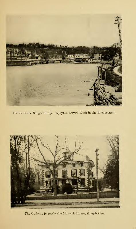
A View of the King's Bridge—Spuyten Duyvil Neck in the Background.
The Godwin, formerly the Macomb House, Kingsbridge.

Kingsbridge 337
basin, holding 773,000,000 gallons, was finished in October,
1905; but at this writing the eastern and larger basin is still
unfinished, and it does not look as if it ever would be finished.
The contractor, however, so it is stated, has received the
price for both basins ; and the city is in possession of an enor-
mous hole in the ground which it will either have to complete
on a new contract or leave as it is. The Catskill addition to
the water supply of the city, now in course of construction,
has done away with the necessity of this great reservoir unless
the city should determine to install a filtration plant at an
estimated expense of $1 1 ,000,000 in addition tothe$io,ooo,ooo,
or more, that have been paid for the land and the work so far
accomplished. The pumping station has a stand pipe three
hundred feet high, so that sufficient head is assured for the
tallest buildings in the city. The millions of cubic yards of
materials removed by excavation have been used in filling in
the valley of Cromwell's Creek and the meadows at Westches-
ter, the refuse having been carried by rail across Bronx Park
to the neighborhood of Westchester Creek and the Bronx
and Pelham Bay Parkway. The Legislature of the State at its
191 1 session authorized the use of the eastern uncompleted
portion for armory purposes for the State National Guard;
and in December, 191 1, it was proposed to use a part of it in
the southeast corner for the construction of store-houses,
shops, etc., for the Eighth Artillery District of theUnited States
Army. On January 23, 1912, plans were filed for the erection
upon this site of a million-dollar armory for the Eighth Regi-
ment of the State Militia.
The reservoir is almost within a stone's throw of Fort
Independence and Fort Number Five; so that when the exca-
vations began, the workmen turned up with their tools several
cannon-balls, bayonets, swords, buttons, and other military
338 The Story of The Bronx
relics, one man throwing out a shovelful of earth which gave
up an English sovereign. All through this section, from time
to time, similar relics have been unearthed, including several
skeletons, one of which, by means of the regimental buttons
and shreds of uniform that remained, was identified as that
of a British officer.
In 1772, Captain Richard Montgomery purchased a farm
of seventy-five acres lying north of the Boston Road. Hehad been an officer in the British army, but, despairing of
advancement, resigned his commission and came to America,
"where my pride and my poverty would be much more at
their ease, " as he himself declared, and where he could follow
the pursuit of farming. In 1773, he married Janet Livingston,
the daughter of the great and wealthy lord of Livingston Manor
and sister of the later celebrated Chancellor Livingston. The
young Irishman threw in his lot with the patriots; and as a
member of the Provincial Congress was selected with others
to examine the Kingsbridge neighborhood with a view to
its defensibility. Fort Independence was afterwards located
on his farm by Colonel Rufus Putnam, the American engineer
officer who first planned the defences of Fort Washington and
its vicinity. Montgomery was appointed a brigadier-general
by the Continental Congress, and a major-general after his
capture of Montreal. Had all the appointments of former
British officers been as wise as that of Montgomery, we should
not have had the record of the combined arrogance and in-
efficiency of Lee, Gates, Conway, and others of like stamp.
Montgomery had been with Wolfe in his memorable attack
on Quebec, and it was probably on account of his knowledge
of its approaches and defences that he was selected under
Schuyler to command the American expedition against it.
When he kissed his young wife good-bye at the home of General
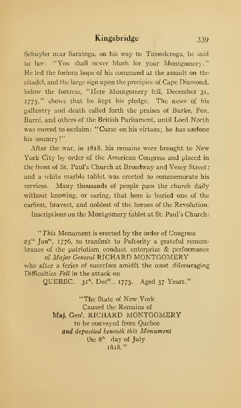
Kingsbridge 339
Schuyler near Saratoga, on his way to Ticonderoga, he said
to her: "You shall never blush for your Montgomery."
He led the forlorn hope of his command at the assault on the
citadel, and the large sign upon the precipice of Cape Diamond,
below the fortress, "Here Montgomery fell, December 31,
1775," shows that he kept his pledge. The news of his
gallantry and death called forth the praises of Burke, Fox,
Barre, and others of the British Parliament, until Lord North
was moved to exclaim: "Curse on his virtues; he has undone
his country!"
After the war, in 181 8, his remains were brought to NewYork City by order of the American Congress and placed in
the front of St. Paul's Church at Broadway and Vesey Street;
and a white marble tablet was erected to commemorate his
services. Many thousands of people pass the church daily
without knowing, or caring, that here is buried one of the
earliest, bravest, and noblest of the heroes of the Revolution.
Inscriptions on the Montgomery tablet at St. Paul's Church
:
" This Monument is erected by the order of Congress
25th
Jan'1', 1776, to tranfmit to Pofterity a grateful remem-
brance of the patriotism conduct enterprize & performance
of Major General RICHARD MONTGOMERYwho after a feries of succefses amidft the most difcouraging
Difficulties Fell in the attack on
QUEBEC. 31". Decbr., 1775. Aged 37 Years."
"The State of New YorkCaused the Remains of
Maj. Gen'. RICHARD MONTGOMERYto be conveyed from Quebec
and deposited beneath this Monumentthe 8
th day of July
1818."
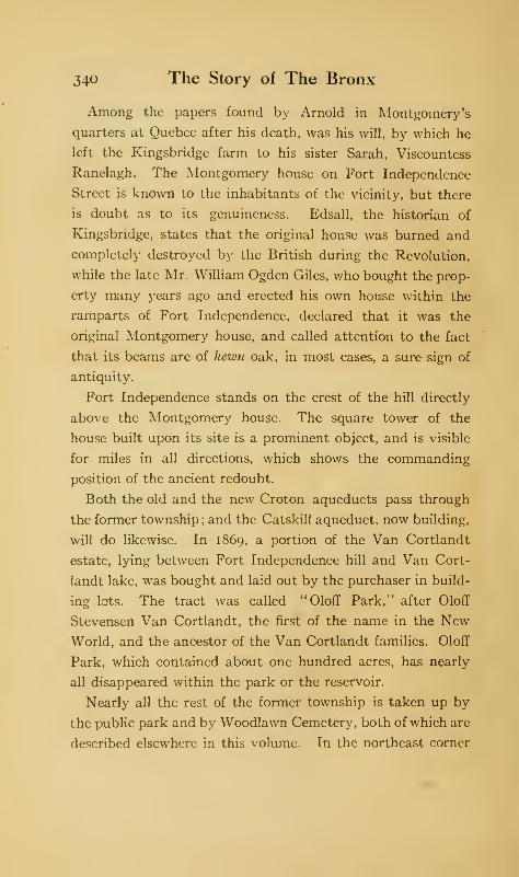
340 The Story of The Bronx
Among the papers found by Arnold in Montgomery's
quarters at Quebec after his death, was his will, by which he
left the Kingsbridge farm to his sister Sarah, Viscountess
Ranelagh. The Montgomery house on Fort Independence
Street is known to the inhabitants of the vicinity, but there
is doubt as to its genuineness. Edsall, the historian of
Kingsbridge, states that the original house was burned and
completely destroyed by the British during the Revolution,
while the late Mr. William Ogden Giles, who bought the prop-
erty many years ago and erected his own house within the
ramparts of Fort Independence, declared that it was the
original Montgomery house, and called attention to the fact
that its beams are of hewn oak, in most cases, a sure sign of
antiquity.
Fort Independence stands on the crest of the hill directly
above the Montgomery house. The square tower of the
house built upon its site is a prominent object, and is visible
for miles in all directions, which shows the commanding
position of the ancient redoubt.
Both the old and the new Croton aqueducts pass through
the former township ; and the Catskill aqueduct, now building,
will do likewise. In 1869, a portion of the Van Cortlandt
estate, lying between Fort Independence hill and Van Cort-
landt lake, was bought and laid out by the purchaser in build-
ing lots. The tract was called "Oloff Park," after Oloff
Stevensen Van Cortlandt, the first of the name in the NewWorld, and the ancestor of the Van Cortlandt families. Oloff
Park, which contained about one hundred acres, has nearly
all disappeared within the park or the reservoir.
Nearly all the rest of the former township is taken up by
the public park and by Woodlawn Cemetery, both of which are
described elsewhere in this volume. In the northeast corner
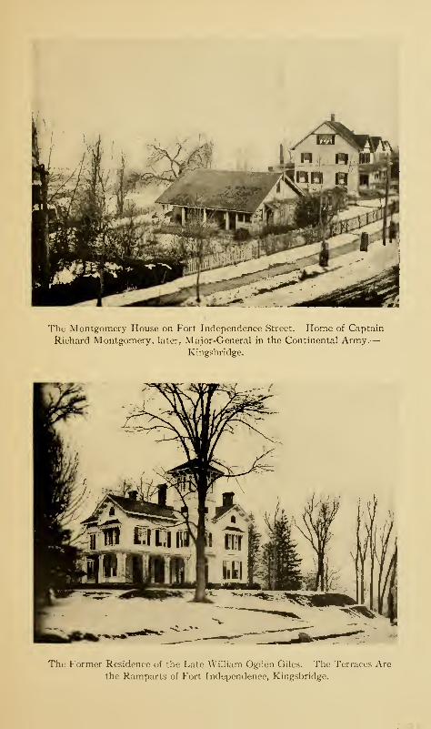
The Montgomery House on Fort Independence Street. Home of Captain
Richard Montgomery, later, Major-General in the Continental Army.
—
Kingsbridge.
The Former Residence of the Late William Ogden Giles. The Terraces Are
the Ramparts of Fort Independence, Kingsbridge.

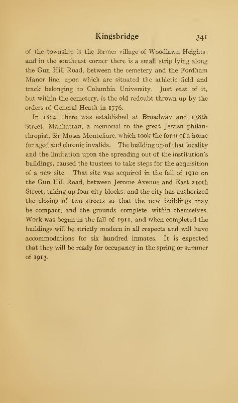
Kingsbridge 341
of the township is the former village of Woodlawn Heights;
and in the southeast corner there is a small strip lying along
the Gun Hill Road, between the cemetery and the Fordham
Manor line, upon which are situated the athletic field and
track belonging to Columbia University. Just east of it,
but within the cemetery, is the old redoubt thrown up by the
orders of General Heath in 1776.
In 1884, there was established at Broadway and 138th
Street, Manhattan, a memorial to the great Jewish philan-
thropist, Sir Moses Montefiore, which took the form of a home
for aged and chronic invalids. The building up of that locality
and the limitation upon the spreading out of the institution's
buildings, caused the trustees to take steps for the acquisition
of a new site. That site was acquired in the fall of 1910 on
the Gun Hill Road, between Jerome Avenue and East 210th
Street, taking up four city blocks ; and the city has authorized
the closing of two streets so that the new buildings may
be compact, and the grounds complete within themselves.
Work was begun in the fall of 191 1, and when completed the
buildings will be strictly modern in all respects and will have
accommodations for six hundred inmates. It is expected
that they will be ready for occupancy in the spring or summer
of 1913.
CHAPTER XV
FORDHAM MANOR
THE manor of Fordham never constituted a township
by itself, having first been incorporated in the town-
ship of Westchester by the Act of 1788, and later,
within the township of West Farms when it was formed in 1846.
Still, for purposes of exploration, we may consider it as a sep-
arate entity ; though, as it lies so close to Kingsbridge, it is some-
times difficult to differentiate in describing the two. On the
Harlem River, Fordham extends as far south as Highbridge,
and on the Bronx, it lies between West Farms and Williams-
bridge. Within this area, there grew up a number of villages,
Fordham, South Fordham, Tremont, East Trcmont, Belmont,
South Belmont, Mount Hope, Mount Eden, Monterey, Ford-
ham Heights, Jerome Park, and Williamsbridge. The Harlem
Railroad traverses it to its northeast corner, and the Central
Railroad passes along its western boundary, the Harlem River.
Several trolley lines radiate from its different bridges. From
Kingsbridge, we may gain the top of the Fordham ridge by
means of the Boston Road, which passed through the manor
for the greater part of its length to Williamsbridge, or we may
take Bailey Avenue, running parallel to the railroad tracks,
and ascend to Sedgwick Avenue by means of the Highbridge
Road, or by means of Bailey Avenue itself to Fordham Cross-
road.
342
Fordham Manor 343
Immediately south of Fort Independence is Tetard's Hill,
which gets its name from Dominie Tetard, who bought a farm
of sixty acres lying south of the Boston Road from Peter
Vermilye, in 1763, and who came to live here about three
years later. In 1772, he opened a French boarding-school,
probably the first in New York. As related elsewhere, he
served during the Revolution ; after its conclusion, he became
professor of French in the reorganized King's College, which
became Columbia in 1784. He held this position until his
death, in 1 787, at the age of sixty-five. All traces of the Domi-
nie have disappeared, except the name of the hill; though,
until the cutting through of some new streets within a few
years, there stood an old stone archway, whose real purpose
was unknown but which was called "Dominie Tetard's Wine
Cellar." Under the edge of the hill, probably on the line of
Bailey Avenue, is the site of the ancient village of Fordham.
Just half a mile south of Fort Independence are the remains
of Fort Number Five, a few rods east of Sedgwick Avenue at
the southwest corner of the reservoir ; it can be easily found by
the relic hunter. Its position was well selected, as it is within
plain view of Number Four, besides commanding the Farmers'
Bridge.
Continuing our way along the ridge, we cross theKingsbridge
Road, leading to Westchester by way of Bronxdale and the
Bear Swamp. A short distance east of Sedgwick Avenue,
and between it and Jerome Avenue, is the old Dutch Church
of Fordham. The southern end of the reservoir lies on the
north side of the Kingsbridge Road, so that the reservoir is
within both the ancient manor and the town of Kingsbridge.
Adjoining the Kingsbridge Road on the south, with Sedg-
wick Avenue as their western boundary, are the grounds of
the Roman Catholic Orphan Asylum. A society for the care
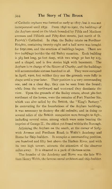
344 The Story of The Bronx
of Catholic orphans was formed as early as 1817 ; but it was not
incorporated until 1852. From 1848 to 1902, the buildings of
the Asylum stood on the block bounded by Fifth and Madison
avenues and Fiftieth and Fifty-first streets, just north of St.
Patrick's Cathedral. In 1899, the Bailey estate on Fordharr
Heights, containing twenty-eight and a half acres was bought
for $290,000, and the erection of buildings begun. There are
two buildings besides the old Bailey mansion. Each building
is 385 feet long, 50 feet deep, with two wings 50 feet by 125,
and a chapel, and is five stories high with basement. The
Asylum is in charge of the Sisters of Charity, and the buildings
will accommodate sixteen hundred in all. They were occupied
in April, 1902, but neither they nor the grounds were fully in
shape until a year later. Their position is a very commanding
one, and on a clear day, they can be seen from the Sound;
while from the northward and westward they dominate the
view. Upon the grounds of the Bailey estate, about 380 feet
northeast of the house, were the remains of Fort Number Six,
which was also called by the British, the "King's Battery."
In excavating for the foundations of the Asylum buildings,
it was necessary to destroy the old redoubt; and in doing so
several relics of the British occupation were brought to light,
including several coins, among which were some bearing the
imprint of George II., the oldest yet found within the Borough.
Adjoining the Asylum on the south, at the corner of Sedg-
wick Avenue and Fordham Road, is Webb's Academy and
Home for Ship-builders. It occupies a commanding position,
one hundred and fifty feet above the Harlem River, and with
its two high towers, attracts the attention of the observer
miles away. It is situated in a park of thirteen acres.
The founder of the Academy and Home was the late Wil-
liam Henry Webb, the famous naval architect and ship-builder.
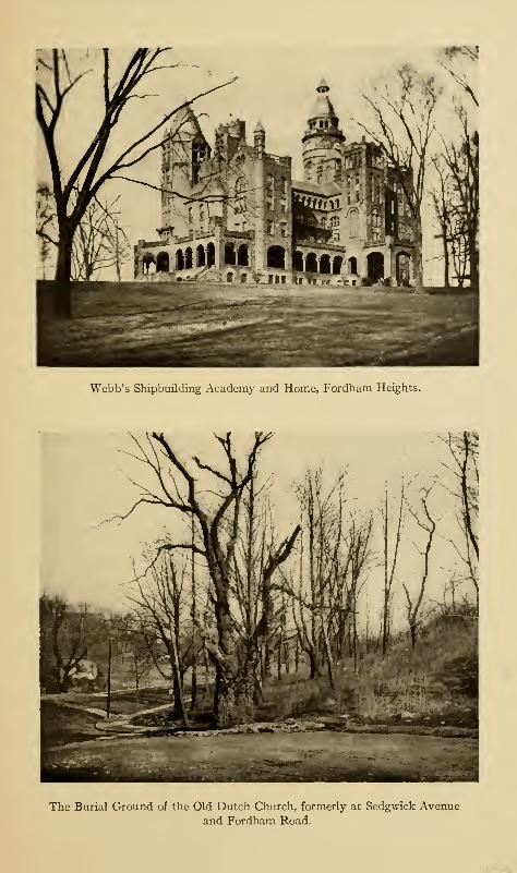
Webb's Shipbuilding Academy and Home, Fordham Heights.
The Burial Ground of the Old Dutch Church, formerly at Sedgwick Avenue
and Fordham Road.

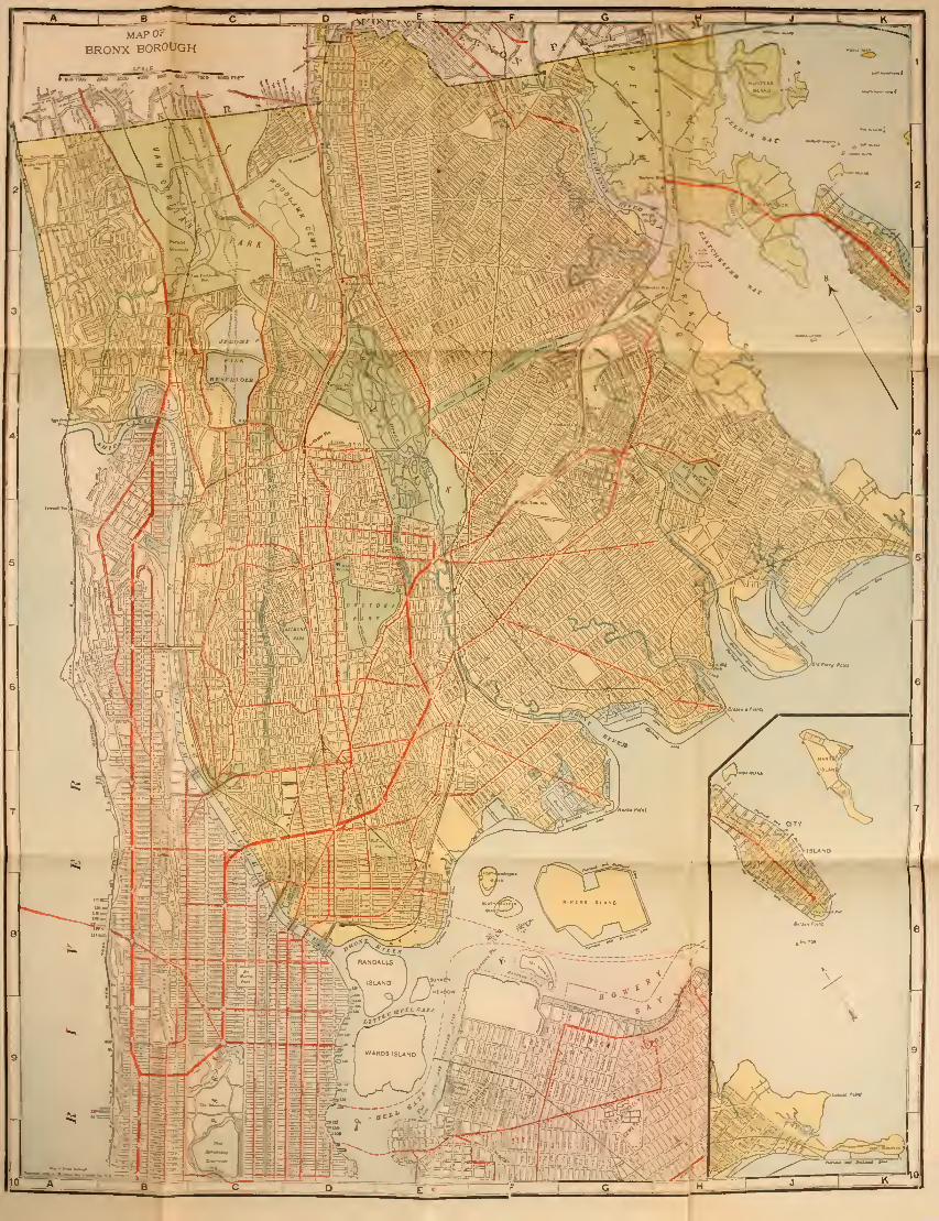

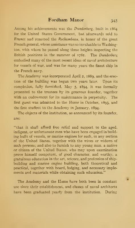
Fordham Manor 345
Among his achievements was the Dunderberg, built in 1864
for the United States Government, but afterwards sold to
France and renamed the Rochambeau, in honor of the great
French general, whose assistance was so invaluable to Washing-
ton, with whom he passed along these heights inspecting the
British positions in the summer of 1781. The Dunderberg
embodied many of the most recent ideas of naval architecture
for vessels of war, and was for many years the finest ship in
the French navy.
The Academy was incorporated April 2, 1889, and the erec-
tion of the building was begun two years later. Upon its
completion, fully furnished, May 5, 1894, it was formally
presented to the trustees by its generous founder, together
with an endowment for its maintenance in perpetuity. The
first guest was admitted to the Home in October, 1893, and
the first student to the Academy in January, 1894.
The objects of the institution, as announced by its founder,
are:
"that it shall afford free relief and support to the aged,
indigent, or unfortunate men who have been engaged in build-
ing hulls of vessels, or marine engines for such, in any section
of the United States, together with the wives or widows of
such persons; and also to furnish to any young man, a native
or citizen of the United States, who may upon examination
prove himself competent, of good character, and worthy, a
gratuitous education in the art, science, and profession of ship-
building and marine engine building, both theoretical and
practical, together with board, lodging, and necessary imple-
ments and materials while obtaining such education."
The Academy and the Home have both been in constant
use since their establishment, and classes of naval architects
have been graduated yearly from the institution. During
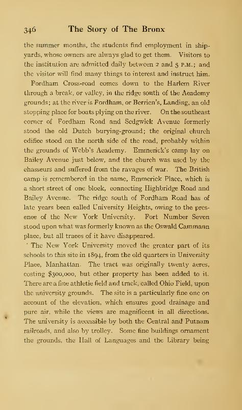
346 The Story of The Bronx
the summer months, the students find employment in ship-
yards, whose owners are always glad to get them. Visitors to
the institution are admitted daily between 2 and 5 p.m. ; and
the visitor will find many things to interest and instruct him.
Fordham Cross-road comes down to the Harlem River
through a break, or valley, in the ridge south of the Academy
grounds; at the river is Fordham, or Berrien's, Landing, an old
stopping place for boats plying on the river. On the southeast
corner of Fordham Road and Sedgwick Avenue formerly
stood the old Dutch burying-ground ; the original church
edifice stood on the north side of the road, probably within
the grounds of Webb's Academy. Emmerick's camp lay on
Bailey Avenue just below, and the church was used by the
chasseurs and suffered from the ravages of war. The British
camp is remembered in the name, Emmerick Place, which is
a short street of one block, connecting Highbridge Road and
Bailey Avenue. The ridge south of Fordham Road has of
late years been called University Heights, owing to the pres-
ence of the New York University. Fort Number Seven
stood upon what was formerly known as the Oswald Cammannplace, but all traces of it have disappeared.
The New York University moved the greater part of its
schools to this site in 1894, from the old quarters in University
Place, Manhattan. The tract was originally twenty acres,
costing $300,000, but other property has been added to it.
There are a fine athletic field and track, called Ohio Field, upon
the university grounds. The site is a particularly fine one on
account of the elevation, which ensures good drainage and
pure air, while the views are magnificent in all directions.
The university is accessible by both the Central and Putnam
railroads, and also by trolley. Some fine buildings ornament
the grounds, the Hall of Languages and the Library being
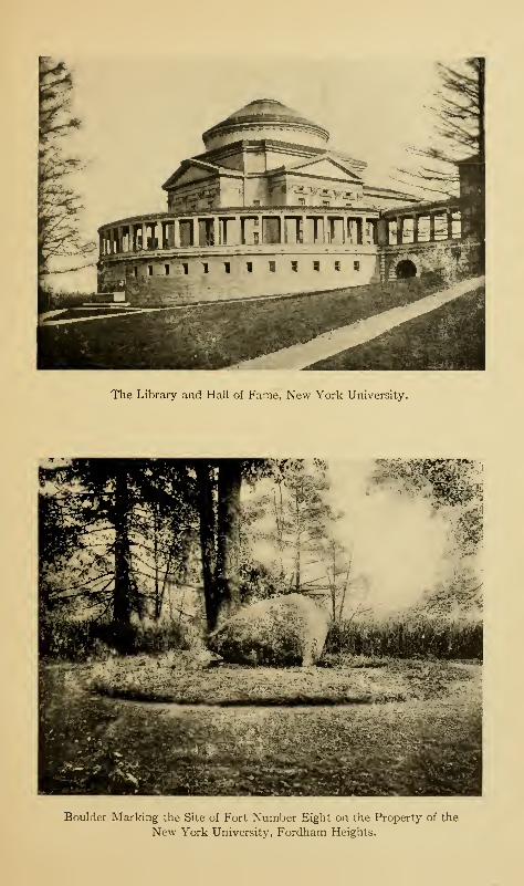
The Library and Hall of Fame, New York University.
Boulder Marking the Site of Fort Number Eight on the Property of the
New York University, Fordham Heights.

The Archer House, or De Lanccy Headquarters, which formerly Stood near the
Junction of Sedgwick and Burnside Avenues.
Mr
ft Sffff^^jffijjs
J.iit-4r , « '•'
»
Fordham University.
Fordham Manor 347
most conspicuous. Attached to the Library building is an
arcade, or cloistered way, of white marble, overlooking Sedg-
wick Avenue, to which the title, "Hall of Fame," has been
given. Here are inscribed on bronze tablets the names and
records of those Americans who have been chiefly instrumental
in making our country famous by their services as states-
men, jurists, philanthropists, soldiers, scientists, teachers, or
authors. That sectional lines have been altogether ignored,
as they should be, is shown in the tablet to that great soldier,
Robert E. Lee. The names to be inscribed were selected by
a committee of eminent men. after there had been considerable
newspaper discussion; but the list as finally made up caused
a good deal of controversy, so many pet heroes of the objectors
having been ignored. Other names are added periodically
to those already there,—names, which, to the author, seem
eminently entitled to the posthumous honor done them.
At the southern end of the University grounds another
valley breaks through to the river; this is called Burnside
Avenue. The section south of it is called Morris Heights.
Several fine detached residences overlook the Harlem as well
as Burnside Avenue, though in former days there were many
more. One of these was the Schwab residence, which was built
in 1857, on the site of Fort Number Eight, but which was
acquired in 1907 by the University. The mound covering
the old fortification is marked by a boulder inscribed:
THE SITE
OF
FORT NUMBER EIGHT
I776-1783
When the late Justus H. Schwab built his residence here in
1857, the old fort was dug up and many relics were brought
348 The Story of The Bronx
to light which were carefully preserved. These consisted of
cannon-balls, grape-shot, English coins, uniform buttons,
bridle ornaments, pike tips, broken camp kettles, and other
military paraphernalia. The buttons show that the fort was
occupied at various times by the following British regiments, or
detachments of them: 8th, 17th, 33d (Lord Cornwallis), 37th
(English Musketeers), 38th, 45th, 74th, and 76th (Scotch).
It will be remembered that the manor of Fordham was left
by the Steenwycks to the Nether Dutch Church, and that
the church was authorized by the Provincial Assembly of
1755, to dispose of its property to purchasers in fee. The
tract upon which Number Eight stood was bought by Daniel
Seacord of Yonkers, who sold it, October 14, 1766, to Benjamin
Archer, for £630. Archer built a house, part stone and part
wood, at a point about three hundred feet east and seventy-
five feet north of the junction of the present Sedgwick and
Burnside avenues. It consisted of two rooms; and during the
Revolution, it was the quarters of Colonel De Lancey of the
Westchester Light Horse, and the object of frequent attacks
by the Americans. The cantonment of De Lancey 's troopers
was probably on the meadow at, or near, Burnside Avenue and
Macomb's Dam Road, formerly occupied by the Berkeley
Oval athletic field.
When the British determined on the capture of Fort Wash-
ington, the height above Archer's house commended itself
to the engineers as a position which commanded the Harlem
River, the American outwork on Laurel Hill (Fort George),
the Kingsbridge Road from Harlem, and the northern outworks
of Fort Washington at Inwood, afterwards called Fort
Tryon. Upon the arrival of the Hessians in the neighbor-
hood in the first days of November, 1776, work was begun
upon the redoubt; and by the fifteenth of the month, it was
Fordham Manor 349
ready for use. The heavy guns which were mounted upon it
were brought up from New York. On November sixteenth,
the attack upon Fort Washington was begun by Number
Eight, which protected the landing of the British troops upon
the Dyckman meadows and made the post at Laurel Hill
untenable by the Americans. The fort had been hastily
constructed, but after the fall of Fort Washington it was
strengthened and maintained as an alarm post throughout
the war. Heath says in his Memoirs: "The Enemy had a
redoubt on the east side of Harlem creek, nearly opposite the
fort on Laurel Hill, and under the fire of its cannon for the
security of their advanced troops on the Morrisania side."
Later he writes: "On the 20th of October, 1782, the enemy
were demolishing their works at Number 8, Morrisania." It
will thus be seen that the British maintained a garrison at
Number Eight for about three years longer than they did at
the other posts in the neighborhood.
The Archer house was in the possession of Samuel Archer,
a descendant of Benjamin, thirty-five years ago. He then
sold it and the adjacent tract; and for many years, the
house was unused except as a tool-house. It finally fell
to pieces about 1890. The picture shown was taken in
1889, and the author is indebted for it, as well as for the ac-
count of its position and later history, to the late G. L. Dash-
wood, Esq., of Morris Heights. It is probable that the
pontoon bridge maintained by the British throughout the war
for communication with Manhattan, and which was destroyed
in one of Hull's raids, was located here, connecting the shore
under Number Eight with that part of the meadows under
Laurel Hill which is locally known as Huckleberry Island.
Burnside Avenue winds its way down the steep hill towards
the Harlem into Cedar Avenue, a continuation of Sedgwick
35Q The Story of The Bronx
Avenue on the lower level. Here is the Morris Heights
station of the Central and Putnam railroads; and on the river
bank, an extensive plant for the building of naphtha yachts
and launches. Several of the fast torpedo boats of the
United States Navy have also been built here, and a naval
officer to superintend government work is usually stationed
at the works.
From this point southward to Washington Bridge, the ridge
was formerly occupied by a succession of fine residences and
estates, many of which have already found their way into
the hands of the real estate broker. These residences were
built between 1840 and i860, and like those on the eastern
side of the Borough, were the homes of people of wealth,
culture, and refinement. There were no railroads in those
days, but access was had to this vicinity by private conveyance
and by the boats that used to ply the Harlem River and con-
nect at Harlem Bridge with the fast boats running to Peck
Slip by way of the East River. The widening and improve-
ment of Aqueduct Avenue furnish a magnificent driveway
and boulevard from Washington Bridge. Just south of High-
bridge is the southern line of the ancient manor, a line running
east to the Bronx River at West Farms.
The neighborhood of Highbridge is called Highbridgevillc,
though it extends along Devoe's Neck as far as Central Bridge.
In the days of the river steamers, Highbridge was a favorite
resort, and hotels and restaurants did well. The view from
the bridge on a moonlight night was a beautiful one—to see
the river stretching away in both directions and glittering
in the moonlight, while the streets and avenues of northern
Manhattan were marked out by the rows of glimmering gas
lamps, reaching away for miles, to the upper end of Central
Park at 1 10th Street, with few houses to break their continuity.
Fordham Manor 351
Scattered through the manor are several public parks, St.
James, Washington Bridge, Fordham, University, Poe, Echo,
and the larger part of Bronx Park, including the Zoological
and the Botanical gardens. The new Grand Concourse and
Boulevard passes through the manor from south to north
from its starting-point at East 161 st Street.
Poe Park lies on the Kingsbridge Road west of the Fordham
station of the Harlem Railroad. Its name is derived from the
poet, Edgar Allan Poe, who resided in Fordham from 1845
to 1849. The cottage in which he lived and in which his wife
died is not within the limits of the park; nor is it on the same
site as when Poe occupied it. The cottage is almost obscured
by a row of wooden flats, which shine in borrowed glory under
the name of "Poe Villas." Since the city has gone to the
expense of the park, the proper thing to do, probably, would
be to buy the cottage also. The author has been informed
that the city attempted to do this, but that the price demanded
is excessive. The cottage is a story and a half in height, with
the gable end toward the street. On the gable is a picture of
a raven and the legend "Poe Cottage"; from which one might
be led to believe that the famous poem had been written in the
building. As a matter of fact, the Raven was written in an
old house in West Eighty-fourth Street near Broadway, which
was standing as late as 1890.
The story of Poe's short and erratic life is a sad one. His
father came from an excellent Maryland family; but, while a
law student, he married a beautiful actress, Elizabeth Arnold,
and went on the stage. The two parents died in Richmond,
Virginia, within a few weeks of each other, leaving three
destitute children, Henry, Edgar, and Rosalie. A wealthy
gentleman, Mr. Allan, from whom Poe received his middle
name, took charge of young Edgar and sent him to the Uni-
352 The Story of The Bronx
versity of Virginia after his having spent several years in an
English school. His fast life at the University led to his ex-
pulsion; and, having quarrelled with Mr. Allan, Poe went to
Europe for the purpose of joining the Greeks in their fight for
independence from Turkey. He wandered over Europe for
a year, when he returned to the United States and went to
West Point, from which he was expelled within ten months
for his irregular conduct. He was taken into favor again by
Mr. Allan; but another rupture followed on account of Poc's
incivility to his benefactor's second wife, so it is said. The
death of Mr. Allan threw Poe upon his own resources, and he
took to literature, writing for the magazines and newspapers
and winning several money prizes for his work, though
the pay he received was meagre if measured by present
standards.
In 1835, at tne age °f twenty-four, he married his cousin,
Virginia Clemm, a professional singer; and in 1837, he removed
from Richmond to New York; but not meeting with much
success in New York, the young couple removed to Philadel-
phia in 1838. Here Fortune was no more favorable than
before; and after six years they returned to New York, in
1844. The following year, the Poes removed to Fordham on
account of the failing health of Mrs. Poe, to whom her husband
was devotedly attached, in order that she might get the benefit
of the pure country air. Here they lived in poverty, the wife
gradually fading away until January, 1847, when she died.
Poe's mother-in-law, Mrs. Clemm, lived with them and re-
mained at the Fordham cottage with Poe until June, 1849,
when he went to Richmond for a few months. While on his
way back to New York, he died in Baltimore at the age of
thirty-eight. The body of his wife was buried in the cemetery
of the old Dutch Church at Fordham; but, in 1878, it was
Fordham Manor 353
removed and taken to Baltimore, where it was reinterred
beside that of her devoted husband.
During Poe's residence at Fordham, he was a constant
visitor at the Macomb house at Kingsbridge and also at St.
John's College, where he made many friends among the priests
stationed there. Another house that he visited was that be-
longing to Mr. Lorillard, now used by the Home for Incurables;
and there were two others, Duffy's saloon, now gone, and Elm
Cottage, at the corner of Fordham Road and Webster Avenue.
These two catered to the appetite for drink which was his
undoing. Though worried about his wife's health, as well as
about his financial condition, Poe seems to have presented a
bold front to the world, as those who remembered him during
this period spoke of him as being bright and pleasant. The
depression under which he really labored found vent in Eureka,
Ulalume, For Annie, and, after his wife's death, in Annabel
Lee, three of which were written here, in Fordham.
The centenary of Poe's birth occurred on January 10, 1909.
It was celebrated at New York University, where his name had
not yet been added to the " Hall of Fame," and also at the cot-
tage where his wife had died. A bust of the poet was unveiled
with appropriate honors in the park named in his honor, op-
posite the cottage; and in October, 19 10, he was elected to
the "Hall of Fame."
Just north of the Fordham station of the Harlem Railroad
are the extensive grounds and buildings of Fordham University.
During Colonial and Revolutionary days, the property was
owned by a member of the Corsa family, from whose hands it
passed into the possession of the Watts family, and later into
the possession of the Brevoorts. The last owner before it
passed into the hands of the Catholic Church for educational
purposes was John Mowatt, Esq., a wealth}'- gentleman of
354 The Story of The Bronx
New York, who erected a fine stone mansion which is still
used as one of the College buildings. Under the last owner
the estate which contained about two hundred acres, was
known as Rose Hill. The old homestead of the Corsas stood
until 1897, upon the north side of the college campus, but was
destroyed in that year to make way for the Auditorium,
erected for the use of the students. During the Revolution,
the Corsa house is said to have been frequently visited by
Washington and other distinguished leaders; but the same
thing is said of every house that has the least claim to antiquity,
even though the "Father of his Country" is known to have
never visited the neighborhood. It is stated on credible
grounds, however, that the gallant and dashing partisan
leader De Armond used the house on several occasions as his
quarters when engaged in some of his raids into the British
lines. The ancient road, connecting Kingsbridge and the
borough-town of Westchester formerly passed through the
college grounds.
The Rose Hill property was acquired in 1839 by Bishop
John Hughes of the Roman Catholic diocese of New York for
the sum of $30,000; it comprised ninety-seven acres at that
time. At this writing, it contains less than seventy, as por-
tions were taken by the city for Bronx Park, and two other
strips have been taken for railroad purposes, the last in 1899
for an extension of the elevated railroad to Bronx Park from
its former terminus at Pelham Avenue. St. John's College
was formally opened on June 24, 1841, under the administra-
tion of secular priests. It was incorporated as a university
April 10, 1846; and the same year, the property was purchased
by the Jesuit Fathers for $40,500; it has since remained in
their possession and under their control. The Rose Hill
mansion, erected in 1838, is used for office and reception pur-
Fordham Manor 355
poses, while the two wings attached to it contain a college hall,
and an armory, music-room, wardrobe, and sixteen rooms
for the infirmary. Two five-story stone buildings furnish
accommodations in the way of dormitories, recitation rooms,
etc., for the older students, while St. John's Hall furnishes
similar accommodations for the younger. In addition, there
are St. John's Chapel, Science Hall, and the Faculty building,
besides libraries for both instructors and students and a chapel
for the latter. All the students are obliged to take courses
in military instruction, both theoretical and practical, under
the guidance of an officer of the United States Army detailed
for the purpose.
South of the grounds of the university was formerly situated
the farm of the Reverend William Powell, Rector of St.
Peter's, Westchester, from 1830 to 1849. He obtained the
property by marriage with the widow of one of the Bayard
family, in whose possession the farm had been formerly. Dr.
Powell conducted here a noted boarding-school for boys, as
well as attending to his duties as rector. South of the Powell
farm, upon land formerly belonging to Jacob Lorillard, is
situated what was known before annexation as the village of
Belmont; it took its name from that of the estate.
Lying between Third Avenue, which is here a part of the
ancient Kingsbridge Road, and the Quarry Road, and from
East 1 8 1st to East 184th Street, is the property of the Homefor Incurables. This institution was incorporated in 1866,
and is under the control of the Protestant Episcopal Church;
but in admitting patients, the matter of religious belief is
ignored. The object of the institution is to furnish a home
for those suffering from incurable diseases and make as happy
and comfortable as possible the last days of those who can
never again be well. The home originally occupied the old
356 The Story of The Bronx
Jacob Lorillard mansion, but many additions have been made
to keep pace with the growing needs of the institution. One
third of the patients are treated without charge.
To the east of Belmont were the Lorillard and Lydig estates,
both of which were taken by the city for Bronx Park. The
former contained the snuff mills of the Lorillards, and the
latter, the dams and mill-ponds of the ancient De Lancey
mills, as well as the mills themselves.
To the north of Fordham University, but on the west side
of the tracks of the Harlem Railroad, is located the residential
section, called Bedford Park. It lies opposite Bronx Park;
and to avoid confusion, the railroad company calls its station
Bronx Park Botanical Gardens, instead of Bedford Park, as
formerly. The station is on city property and is within the
control of the park commissioner. The Ursuline Academy,
founded in 1893, occupies a commanding position at Bedford
Park. Upwards of two hundred students are accommodated
in a building that is modern in all respects.
In the northeast corner of the manor is the former village
of Williamsbridge, though the name is more generally applied
to the former village of Olinville on the east of the Bronx.
There was a bridge here over the Bronx in very early times,
probably in 1670, when Governor Lovelace directed that Betts
and Tippett should first assist in building the "causey" at
Fordham before being assisted in their turn by Verveelen and
Archer in building a bridge across the Bronx River. After
the establishment of the post to Boston before 1680, the
maintenance of the bridge over the stream became necessary.
In pre-Revolutionary days, the farm adjacent to the bridge was
owned by John Williams, and so the bridge became popularly
known by his name. The present inadequate iron structure
occupies approximately the same site as former bridges. Gun
Fordham Manor 357
Hill is an eminence to the west of the river now occupied by a
distributing reservoir. In 1888, the waters of the Bronx
River were impounded at North Castle in Westchester County
by the construction of the Kensico dam, at the same time that
a reservoir was building on Gun Hill. Water was admitted
into the reservoir on December 4, 1888, and the distribution
of the water to the Annexed District was begun. The reser-
voir has a capacity of 150,000,000 gallons when it is filled to
a depth of forty feet ; and though it has been found necessary
to tap the Croton Aqueduct, the Gun Hill reservoir still sup-
plies a large part of the Borough.
To the west of the reservoir, at Van Cortlandt Street and
Woodlawn Road, still stands the old Valentine house of
Heath's attack, which was for many years the homestead of
the Varian family. The old farm was cut up into building
lots in April, 1905.
CHAPTER XVI
MORRISANIA
THE first lord of the manor of Morrisania, the Honor-
able Lewis Morris, second of the name, died in the
spring of 1746, aged seventy-three. By his will, he
directed that he should be buried at Morrisania, and that his
funeral should be conducted in a manner that was Quakerish
in its simplicity. He prohibited "any mourning dress to be
worn on his account, as he should die when divine Providence
should call him away, and was unwilling that his friends should
be at the unnecessary expense, which was owing only to the
common folly of mankind." Which is equally true to-day,
when, to the high cost of living, is added the high cost of
dying. To his son Lewis, he left all that part of the manor
lying east of the Mill Brook; to his wife, Isabella Graham,
the remainder of the estate, lying westward of the Mill
Brook, called "Old Morrisania"; and to his second son, Rob-
ert Hunter Morris, he bequeathed his New Jersey estates.
Upon the death of his mother, Lewis Morris, third of the
name, and second manor-lord, usually called "Junior," be-
came possessed of the whole manor. He was married twice,
his first wife being Elizabeth Staats, by whom he had three
sons; Lewis, the Signer of the Declaration of Independence,
Staats Long, a general in the British army, who married
Catherine, Duchess of Gordon, whose son was the instigator
358
Morrisania 359
of the "Gordon riots" described in Dickens's Barnaby Rudge,
and the Honorable Richard Morris, who married into the
Ludlow family, and who was a judge of the Court of Admiralty
at the outbreak of the war. The second wife of Lewis Mor-
ris, Junior, was Sarah Gouverneur, by whom he had one son,
the Honorable Gouverneur Morris, and four daughters, one
of whom, Isabella, became the wife of the Reverend Isaac
Wilkins.
Lewis Morris, Junior, died in 1762, at the age of sixty-four.
By his will, dated November 19, 1760, he bequeathed to his
eldest son Lewis "all that part of Morrisania west of the Mill
Brook"; to his wife, "the land upon which my house stands
west of the Mill Brook"; and to his other sons, the remaining
part of the manor. He also directed that his son Gouverneur
was to have the best education "that was to be had in England
or America." The legacy of the land to the west of the Mill
Brook carried with it the right to the use of the stream for
milling and other purposes, so that the east bank really became
the boundary. It is a curious fact that to-day, in consequence,
the purchaser of a lot which lies on both sides of the bed
of the former stream, that is, which would be crossed by the
stream if it existed, is obliged to get a quit-claim, or release,
of the brook from the descendants of the original legatee, in
order that the title shall be clear and above reproach.
Lewis became the manor-lord and continued so until after
the Revolution. Upon the breaking out of hostilities, he be-
came a brigadier-general in the American army, but, early
in the war, he resigned his position to become a member of
the Continental Congress ; and, as such, his name is affixed as a
signer of the Declaration, as a delegate from New York.
His brother, Staats Long, refused to perform service in
America against his countrymen and remained in England
360 The Story of The Bronx
during the whole war, notwithstanding which he rose to
high rank in the British service before his death.
The manor-house of Lewis Morris, west of the Mill Brook,
stood until about 1891, when it was demolished by the NewYork, New Haven, and Hartford Railroad in making improve-
ments for the Suburban branch along the Harlem River and
Bronx Kills. It stood west of Brook Avenue, and was known
as "Christ's Hotel."
The most famous of the Morris family was Gouverneur
Morris, who was born at Morrisania, January 31, 1752. As
a boy, he went for instruction to Dominie Tetard, from whomhe acquired a thorough knowledge and control of the French
language, as well as of other matters. In accordance with
his father's directions, he received the best education to be
obtained in America, and was graduated from King's College
in 1768, at the age of sixteen. Subsequently, he studied law,
and became one of the ablest and most brilliant lawyers in
America. Upon the approach of hostilities, he became a
member of the Provincial Congress, and, July 8, 1775, a
member of the Committee of Safety of Westchester County.
During the whole of the struggle with the mother country,
he was in the active service of his country, serving it in a
political capacity. He was a close friend and confidant of
Washington; and between him and Hamilton, there existed
the most intimate relations until the death of the latter as
a result of his duel with Burr. The oration over the body of
Hamilton, an oration famous for its power and pathos, was
pronounced by his friend, Gouverneur Morris.
Morris was a member of Congress during the war, and he
was also a member of the Constitutional Convention of 1787.
As a member of the latter body, he framed the final draft of
the Constitution as submitted to the States for ratification
;
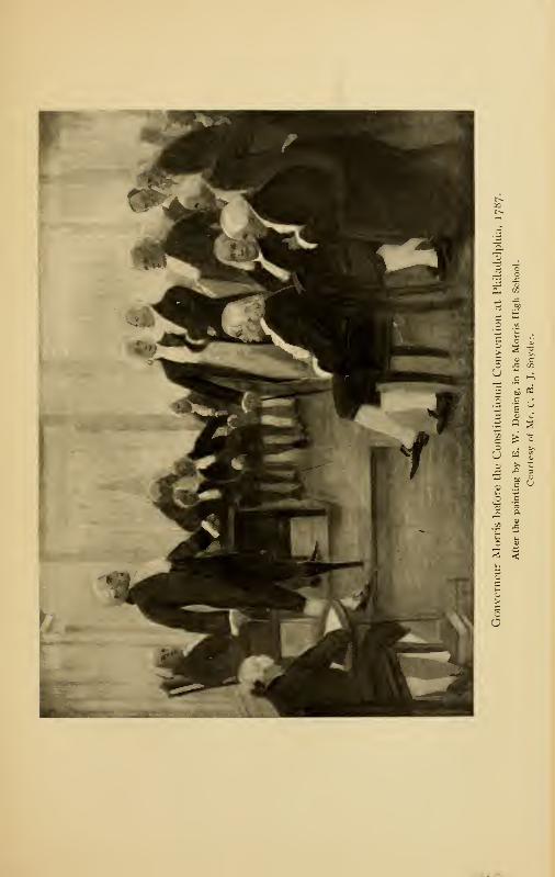
e as
5 5 s> % "2.Hoc
| Q S
'J w S1) >• ~
C '-1
2 <
O

Morrisania 361
and the beautiful, clear, and forceful English of that instru-
ment is almost entirely his work. 1 He was a Federalist in
politics, and assisted Jay and Hamilton with tongue and pen,
until his departure for Europe, in striving for the ratification
of the Constitution by the several States. As a statesman,
according to Theodore Roosevelt, Morris ranked with these
two famous Federalists; as a financier, he ranked after the
financier of the Revolution, Robert Morris, whose assistant
he had been, and after Alexander Hamilton, our great first
Secretary of the Treasury.
Morris was a man of brilliant parts, with a rough, caustic
tongue and pen which made him many enemies. He was an
aristocrat born and bred, with a brusque and supercilious
way that did not lend itself well to diplomacy. Washington
esteemed his patriotism highly and admired his directness
and good judgment, but declined to appoint him on some
diplomatic mission for fear his manner would defeat the object
of the mission by arousing the ire of those whom he would
meet and whom it would be his duty to conciliate. He be-
lieved in "calling a spade a spade." Even in that time of easy
morals, Morris was conspicuous for his disregard of the opinions
of the respectable portion of the community, and liked to shock
people with his vagaries.
One of his fads was to drive a pair of spirited horses without
reins. Though repeatedly warned by his friends of the danger
of doing so, he continued to laugh at their misgivings until
one day in May, 1780, when his team ran away with him in
the streets of Philadelphia, and one leg was crushed so badly
that the surgeons thought it necessary to amputate it; in con-
sequence, for the rest of his life, Morris was obliged to hobble
1 Many people confuse the United States Constitution with the United
States Frigate Constitution, and ascribe the latter to Morris.
362 The Story of The Bronx
around on a wooden leg. A religious friend called upon him
one day to sympathize with him on the loss of his leg, and to
toll him it was all for the best, as it was an act of Divine wis-
dom; to whom Morris replied: "My good sir, you argue the
matter so handsomely, and point out so clearly the advantages
of being without legs, that I am almost tempted to part with
the other."
During the war, his mother remained a loyalist and occupied
the manor-house at Morrisania, or a house in New York. He
did not see her for seven years ; but during that time, both he
and his half-brother, Lewis, corresponded with her whenever
opportunity offered, an act which called forth the denuncia-
tions of their enemies, who even impugned their loyalty to
the cause for which they were both doing so much.
In 1788, Morris left for an extended tour in Europe, and
was in Paris during the distressing events preceding the French
Revolution. His advice was sought by Louis XVI. and his
ministers, and he drew up for his Majesty an address from the
throne. Had his judgment in other matters been followed,
the Terror might have been averted and Louis allowed to die a
natural death, or, at least, to have abdicated peacefully.
Morris was at last made minister to the Court of Versailles,
and he remained in Paris during the whole of the Reign of
Terror, being the only foreign representative that did so. His
experiences read with all the interest and excitement of a
romance; and many times his life was in danger from the
blood-thirsty mob and its leaders, whom he treated with the
aristocratic contempt and brusqueness so peculiar to him,
whose effect was often more irritating than soothing; yet he
came safely through. After his supersession as minister by
Monroe, in August, 1794, at the request of the Directory as
a set-off to Genet's recall, Morris made an extended tour of
Morrisania 363
Europe, and was received everywhere with honor and consider-
ation. In Austria, he tried to secure the release of Lafay-
ette; but though unsuccessful, he procured for the Marquis
many privileges that tended to mitigate the tedium of his
confinement.
In 1786, he bought from his half-brother Staats, the British
general, the property Staats had inherited from their common
father; and this, with the property inherited from his mother
at her death, made a large estate at Morrisania. Morris
returned to the United States in October, 1798, and soon after-
ward erected the mansion which stood below East 133d Street,
abreast of Cypress Avenue. In 1809, at the age of fifty-eight,
he married Anne Cary Randolph, a sister of John Randolph
of Roanoke, and a lineal descendant of the Indian Princess
Pocahontas. He settled down at last to a life of middle-aged
marital happiness. His family consisted of one son, Gouvern-
eur, and several daughters.
He once more interested himself in politics, and was United
States Senator from the State of New York from 1799 to
1 803 ; but upon the defeat of the Federalists by the Democratic-
Republicans under Jefferson, he withdrew from politics, taking
an exceedingly pessimistic view of the future of the country,
which he considered had been turned over to the mercies of
an ignorant mob. With his aristocratic birth and training, he
could not take the same view of "the common people" that
distinguished Lincoln and McKinley, themselves sprung
from that source. Morris was probably the first one to ad-
vance the idea of connecting the harbor of New York with
the great inland seas by means of an artificial waterway, and
he foresaw the immense trade that would accrue to the city
as a result. He was opposed to Governor George Clinton
politically, but the governor appointed Morris one of the
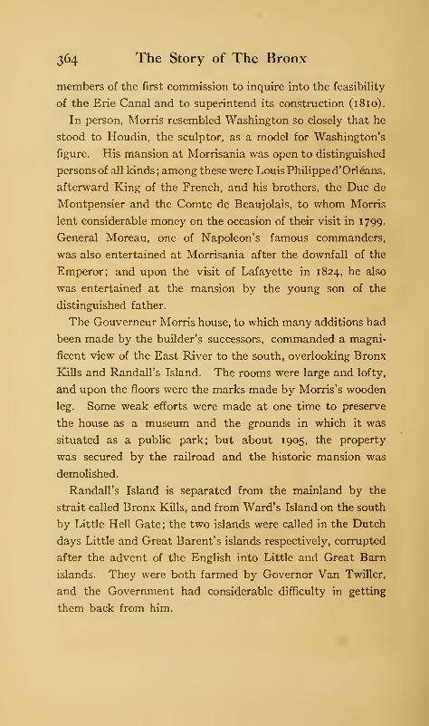
364 The Story of The Bronx
members of the first commission to inquire into the feasibility
of the Erie Canal and to superintend its construction (18 10).
In person, Morris resembled Washington so closely that he
stood to Houdin, the sculptor, as a model for Washington's
figure. His mansion at Morrisania was open to distinguished
persons of all kinds; among these were Louis Philippe d'Orleans,
afterward King of the French, and his brothers, the Due de
Montpensier and the Comte de Beaujolais, to whom Morris
lent considerable money on the occasion of their visit in 1799.
General Moreau, one of Napoleon's famous commanders,
was also entertained at Morrisania after the downfall of the
Emperor; and upon the visit of Lafayette in 1824, he also
was entertained at the mansion by the young son of the
distinguished father.
The Gouverneur Morris house, to which many additions had
been made by the builder's successors, commanded a magni-
ficent view of the East River to the south, overlooking Bronx
Kills and Randall's Island. The rooms were large and lofty,
and upon the floors were the marks made by Morris's wooden
leg. Some weak efforts were made at one time to preserve
the house as a museum and the grounds in which it was
situated as a public park; but about 1905, the property
was secured by the railroad and the historic mansion was
demolished.
Randall's Island is separated from the mainland by the
strait called Bronx Kills, and from Ward's Island on the south
by Little Hell Gate; the two islands were called in the Dutch
days Little and Great Barent's islands respectively, corrupted
after the advent of the English into Little and Great Barn
islands. They were both farmed by Governor Van Twiller,
and the Government had considerable difficulty in getting
them back from him.
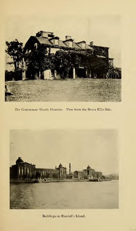
The Gouverneur Morris Mansion. View from the Bronx Kills Side.
Buildings on Randall's Island.
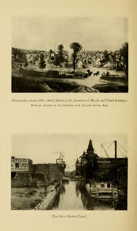
Morrisania, about 1861, 160th Street at the Junction of Brook and Third Avenues.
From an old print in the Collection of J. Clarence Davies, Esq.
The Mott Haven Canal.
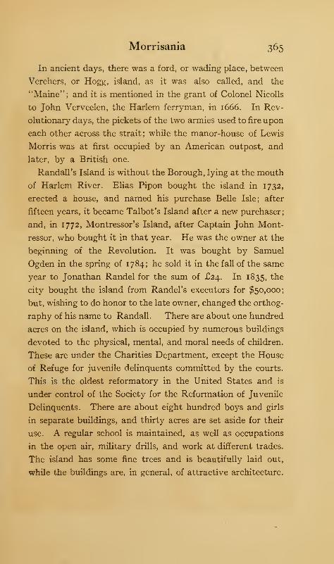
Morrisania 365
In ancient days, there was a ford, or wading place, between
Verchers, or Hogg, island, as it was also called, and the
"Maine"; and it is mentioned in the grant of Colonel Nicolls
to John Verveelen, the Harlem ferryman, in 1666. In Rev-
olutionary days, the pickets of the two armies used to fire upon
each other across the strait; while the manor-house of Lewis
Morris was at first occupied by an American outpost, and
later, by a British one.
Randall's Island is without the Borough, lying at the mouth
of Harlem River. Elias Pipon bought the island in 1732,
erected a house, and named his purchase Belle Isle; after
fifteen years, it became Talbot's Island after a new purchaser;
and, in 1772, Montressor's Island, after Captain John Mont-
ressor, who bought it in that year. He was the owner at the
beginning of the Revolution. It was bought by Samuel
Ogden in the spring of 1784; he sold it in the fall of the same
year to Jonathan Randel for the sum of £24. In 1835, the
city bought the island from Randel's executors for $50,000;
but, wishing to do honor to the late owner, changed the orthog-
raphy of his name to Randall. There are about one hundred
acres on the island, which is occupied by numerous buildings
devoted to the physical, mental, and moral needs of children.
These are under the Charities Department, except the House
of Refuge for juvenile delinquents committed by the courts.
This is the oldest reformatory in the United States and is
under control of the Society for the Reformation of Juvenile
Delinquents. There are about eight hundred boys and girls
in separate buildings, and thirty acres are set aside for their
use. A regular school is maintained, as well as occupations
in the open air, military drills, and work at different trades.
The island has some fine trees and is beautifully laid out,
while the buildings are, in general, of attractive architecture.
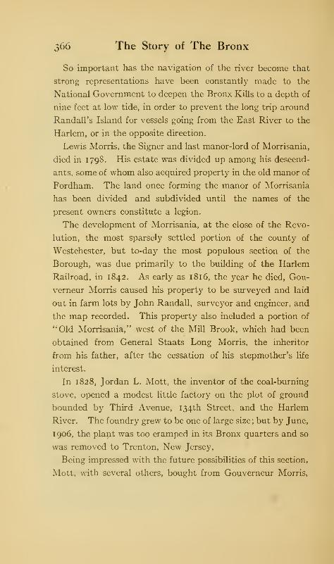
366 The Story of The Bronx
So important has the navigation of the river become that
strong representations have been constantly made to the
National Government to deepen the Bronx Kills to a depth of
nine feet at low tide, in order to prevent the long trip around
Randall's Island for vessels going from the East River to the
Harlem, or in the opposite direction.
Lewis Morris, the Signer and last manor-lord of Morrisania,
died in 1798. His estate was divided up among his descend-
ants, some of whom also acquired property in the old manor of
Fordham. The land once forming the manor of Morrisania
has been divided and subdivided until the names of the
present owners constitute a legion.
The development of Morrisania, at the close of the Revo-
lution, the most sparsely settled portion of the county of
Westchester, but to-day the most populous section of the
Borough, was due primarily to the building of the Harlem
Railroad, in 1842. As early as 1816, the year he died, Gou-
verneur Morris caused his property to be surveyed and laid
out in farm lots by John Randall, surveyor and engineer, and
the map recorded. This property also included a portion of
"Old Morrisania," west of the Mill Brook, which had been
obtained from General Staats Long Morris, the inheritor
from his father, after the cessation of his stepmother's life
interest.
In 1828, Jordan L. Mott, the inventor of the coal-burning
stove, opened a modest little factory on the plot of ground
bounded by Third Avenue, 134th Street, and the Harlem
River. The foundry grew to be one of large size ; but by June,
1906, the plant was too cramped in its Bronx quarters and so
was removed to Trenton, New Jersey,
Being impressed with the future possibilities of this section,
Mott, with several others, bought from Gouverneur Morris,
Morrisania 367
Second, two hundred acres of land at $175 an acre—these
were sections 16 to 23 on the Randall map of 18 16. There is
a story to the effect that the price was determined as follows
:
Mott, who was tax assessor, placed so high a valuation on the
property as to call forth remonstrances from Morris, who ex-
claimed that he would be glad to get a purchaser at the as-
sessed value; whereupon Mott replied: "I '11 take it"; and
so the sale was effected.
The second Gouverneur Morris inherited the bluntness and
disregard of public opinion of his distinguished father. Upon
being asked by an employee of Jordan L. Mott if he had any
objection to the newly-purchased section being called Mott
Haven, he replied: " I don't care what he calls it; while he is
about it, he might as well change the name of the Harlem and
call it the Jordan." A friend of the author's attended St.
Ann's Church when a boy and remembers seeing the old
gentleman guided into church every Sunday morning by his
women folks, his hair and cravat awry, and possessed of a
great bandanna handkerchief, with which, from time to time,
he blew sonorous blasts through his nose that set the young
folks off into convulsive giggles. At heart, he was a good,
charitable man and exceedingly democratic; and was more
often seen dressed like a farmer than like the fine gentleman
he really was. It was no unusual sight to see him drive down-
to the steamer which carried the business men to the city
beside one of his men on the seat of a dump-cart, while his
neighbors drove in elegant equipages with their coachmen
in livery.
The Mott Haven canal lies between Third and Park avenues
and it allows canal-boats to pass from the Harlem River as far
as 138th Street. The lower part of the canal was laid out by
Jordan L. Mott, about 1850. It followed the course of a
368 The Story of The Bronx
small stream which drained the ground on either side as far
as 144th Street, then called Main Street on the map of Mott
Haven, the water of which passed through a sluiceway at Van
Stoll Street, the former name of 138th Street, which was a
solid street across the brook. By deed of November 1, 1864,
Mott conveyed the property contiguous to the stream to a
man named Bryant, who, in 1868, began the extension of the
canal to Main Street, having an understanding with the Mor-
risania town authorities that there was to be a bridge over
Van Stoll Street.
In 1869, the property passed into the hands of Rider and
Conkling, the owners of about six hundred lots in Mott Haven,
who proposed to complete the canal to Main Street; but they
at once met with opposition from the residents and landowners
of the vicinity, on the ground of the liability of the canal's
becoming a source of malaria and a nuisance. To meet these
objections, Rider and Conkling made proposals to the village
of Morrisania, and were permitted to construct the canal under
an agreement by which they were to maintain a turn-table
bridge at Van Stoll Street, to dredge out the canal and bulk-
head it, to build and keep in repair other bridges crossing
the canal, and to fill in the canal at their own expense on the
town's order, should it become a public nuisance. They
further agreed to permit the town to empty its sewage into
the canal; and the town and its successor, the city of New
York, so disposed of the sewage until the construction of
the Rider Avenue sewer gave them another outlet to the
river.
The owners failed to bulkhead the canal as agreed, and the
mud banks frequently caved in. Locks were constructed,
which prevented the rise and fall of the tide ; so that the canal
became an actual cesspool in which the bodies of dead animals
Morrisania 369
and other refuse floated for days. The canal was declared a
public nuisance by the boards of health of both Morrisania
and New York; and, after annexation, by the Park Depart-
ment, by the Department of Street Improvements, by the
Board of Estimate, and by other public bodies. A street was
officially laid out to take the place of the canal; and upon the
opening and grading of 138th Street by the city of New York,
the Legislature of 1896 authorized the construction of a bridge
on that street over the canal. The street soon became one
of the most important thoroughfares in the Borough, as it
was the principal outlet for the coal, lumber, and building ma-
terial yards in this locality, as well as the approach to the Mott
Haven station of the railroad, and to the Madison Avenue
Bridge. When the trolley lines were added to the usual traffic,
the old, narrow, wooden bridge over the canal became wholly
inadequate, and the street became badly congested at that
point.
The fight against the canal lasted for over a quarter of a
century; and still it existed, the authorities failing either to
close the canal and abate the nuisance, or to build the bridge
authorized by law. This was due to two causes: first, the
claim of the owners that their vested rights could not be in-
terfered with, and second, the enormous political power wielded
by the North River Electric Light and Power Company, which
used the canal for business purposes. The claims of the owners
as to vested rights were disposed of by the courts ; and with the
change in administration in New York, the electric company
lost its pull, and the work of filling in the canal from 144th
Street down was begun in June, 1901. In February, 1903,
the Dock Department built a bulkhead at 138th Street; and
the work of grading and curbing Canal Place, as the new street
is called, was completed in August, 1903. The materials
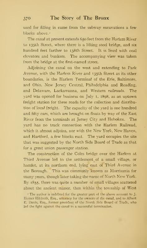
370 The Story of The Bronx
used for filling in came from the subway excavations a few
blocks above.*
The canal at present extends 650 feet from the Harlem River
to 135th Street, where there is a lifting steel bridge, and six
hundred feet farther to 138th Street. It is lined with coal
elevators and bunkers. The accompanying view was taken
from the bridge at the first-named street.
Adjoining the canal on the west and extending to Park
Avenue, with the Harlem River and 135th Street as its other
boundaries, is the Harlem Terminal of the Erie, Baltimore,
and Ohio, New Jersey Central, Philadelphia and Reading,
and Delaware, Lackawanna, and Western railroads. The
yard was opened for business on July 1, 1898, as an uptown
freight station for these roads for the collection and distribu-
tion of local freight. The capacity of the yard is one hundred
and fifty cars, which are brought on floats by way of the East
Rjver from the terminals at Jersey City and Hoboken. The
yard has no track connection with the Harlem Railroad,
which it almost adjoins, nor with the New York, New Haven,
and Hartford, a few blocks east. The yard occupies the site
that was suggested by the North Side Board of Trade as that
for a great union passenger station.
The construction of the Coles bridge over the Harlem at
Third Avenue led to the settlement of a small village, or
hamlet, at its northern end, lying east of Third Avenue in
the Borough. This was commonly known as Morrisania for
many years, though later taking the name of North New York.
By 1855, there was quite a number of small villages scattered
about the ancient manor, then within the township of West
• The author is indebted for the greater part of the above account to J.
Homer Hildreth, Esq., attorney for the owners of the canal, and to Albert
E. Davis, Esq., former president of the North Side Board of Trade, who
led the fight against the canal to a successful termination.
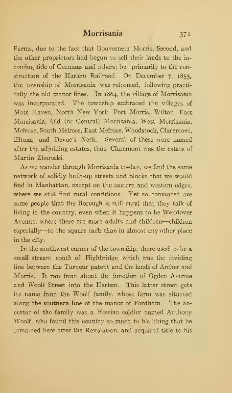
Morrisania 371
Farms, due to the fact that Gouverneur Morris, Second, and
the other proprietors had begun to sell their lands to the in-
coming tide of Germans and others; but primarily to the con-
struction of the Harlem Railroad. On December 7, 1855,
the township of Morrisania was reformed, following practi-
cally the old manor lines. In 1864, the village of Morrisania
was incorporated. The township embraced the villages of
Mott Haven, North New York, Port Morris, Wilton, East
Morrisania, Old (or Central) Morrisania, West Morrisania,
Melrose, South Melrose, East Melrose, Woodstock, Claremont,
Eltona, and Devoe's Neck. Several of these were named
after the adjoining estates, thus, Claremont was the estate of
Martin Zboroski.
As we wander through Morrisania to-day, we find the same
network of solidly built-up streets and blocks that we would
find in Manhattan, except on the eastern and western edges,
where we still find rural conditions. Yet so convinced are
some people that the Borough is still rural that they talk of
living in the country, even when it happens to be Wendover
Avenue, where there are more adults and children—children
especially—to the square inch than in almost any other place
in the city.
In the northwest corner of the township, there used to be a
small stream south of Highbridge which was the dividing
line between the Turneur patent and the lands of Archer and
Morris. It ran from about the junction of Ogden Avenue
and Woolf Street into the Harlem. This latter street gets
its name from the Woolf family, whose farm was situated
along the southern line of the manor of Fordham. The an-
cestor of the family was a Hessian soldier named Anthony
Woolf, who found this country so much to his liking that he
remained here after the Revolution, and acquired title to his
372 The Story of The Bronx
farm by his industry and frugality. The stream has long since
disappeared within a sewer. In the river near where the
stream emptied was Crab, or "Crabbe," island of the ancient
deeds and patents. Turneur's land lay between the Harlem
and Cromwell's Creek, and was called Nuasin by the Indians,
though better known as Devoe's Point, or Neck. The Devoes
were of Huguenot extraction, and one of them still lives in
Highbridgeville in an old homestead built about 1804; others
of the name settled in both Yonkers and New Rochelle.
Ogden, Woody Crest, and Sedgwick avenues lead south over
the neck to the junction with Jerome Avenue, which was
formerly called Central Avenue.
Opposite Macomb's Dam Park, on Jerome and Woody
Crest avenues, is the fine edifice of the American Female
Guardian Society, the Home for the Friendless, with a bronze
tablet bearing the dates of 1 834-1 901. This is a charitable
organization which cares for children committed by the courts
;
for boys under ten, and girls under fourteen years of age. It
also provides homes for its charges and adopts them into
private families, besides conducting industrial schools in
different parts of the city.
Along the river front, between Central Bridge and the
elevated railroad bridge at Eighth Avenue, are located the
boat club-houses of the rowing associations that formerly
lined the Harlem shore between the Third and Fourth Avenue
bridges, but which were obliged to move to this location on
account of the river bulkheads in their former position. Going
north over Jerome Avenue, this part being a portion of the
Macomb's Dam Road, we come to several avenues leading
to the top of the neck. East 161st Street is the principal
thoroughfare leading to the east and south ; and by means of
its trolley line, we may reach Franz Sigel Park, the entrance to

Lorelei Fountain, or Heinrich Heine Monument, Mott Avenue and East 161st
Street, at the Beginning of the Concourse.
I^BBMM HiHBCiHHna^M
The Cromwell House, near Jerome Avenue, above Central Bridge.

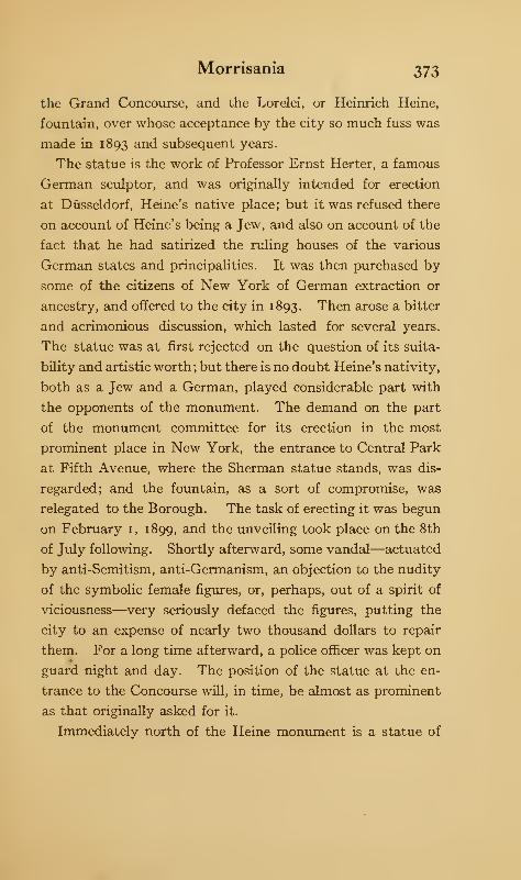
Morrisania 373
the Grand Concourse, and the Lorelei, or Heinrich Heine,
fountain, over whose acceptance by the city so much fuss was
made in 1893 and subsequent years.
The statue is the work of Professor Ernst Herter, a famous
German sculptor, and was originally intended for erection
at Dusseldorf, Heine's native place; but it was refused there
on account of Heine's being a Jew, and also on account of the
fact that he had satirized the ruling houses of the various
German states and principalities. It was then purchased by
some of the citizens of New York of German extraction or
ancestry, and offered to the city in 1893. Then arose a bitter
and acrimonious discussion, which lasted for several years.
The statue was at first rejected on the question of its suita-
bility and artistic worth ; but there is no doubt Heine's nativity,
both as a Jew and a German, played considerable part with
the opponents of the monument. The demand on the part
of the monument committee for its erection in the most
prominent place in New York, the entrance to Central Park
at Fifth Avenue, where the Sherman statue stands, was dis-
regarded; and the fountain, as a sort of compromise, was
relegated to the Borough. The task of erecting it was begun
on February 1, 1899, and the unveiling took place on the 8th
of July following. Shortly afterward, some vandal—actuated
by anti-Semitism, anti-Germanism, an objection to the nudity
of the symbolic female figures, or, perhaps, out of a spirit of
viciousness—very seriously defaced the figures, putting the
city to an expense of nearly two thousand dollars to repair
them. For a long time afterward, a police officer was kept on
guard night and day. The position of the statue at the en-
trance to the Concourse will, in time, be almost as prominent
as that originally asked for it.
Immediately north of the Heine monument is a statue of
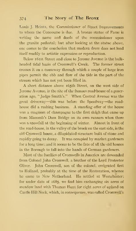
374 The Story of The Bronx
Louis J. Hcintz, the Commissioner of Street Improvements
to whom the Concourse is due. A bronze statue of Fame is
writing the name and deeds of the commissioner upon
the granite pedestal; but after looking at the statue above,
one comes to the conclusion that modern dress does not lend
itself readily to artistic expression or reproduction.
Below 161st Street and close to Jerome Avenue is the bulk-
headed tidal basin of Cromwell's Creek. The former street
crosses it on a causeway through which a couple of large iron
pipes permit the ebb and flow of the tide in the part of the
stream which has not yet been filled in.
A short distance above 165th Street, on the west side of
Jerome Avenue, is the site of the famous road-house of a gener-
ation ago, "Judge Smith's." When Central Avenue was the
great driveway—this was before the Speedway—the road-
house did a rushing business. A standing offer of the house
was a magnum of champagne to the first sleigh that came up
from Macomb's Dam Bridge on its own runners when there
was a snowfall at the beginning of winter. Almost in front of
the road-house, in the valley of the brook on the east side, is the
old Cromwell house, a dilapidated structure built of stone and
rapidly going to decay. It was occupied by market gardeners
for a long time; and it seems to be the fate of all the old houses
in the Borough to fall into the hands of German gardeners.
Most of the families of Cromwells in America are descended
from Colonel John Cromwell, a brother of the Lord Protector
Oliver. John Cromwell, son of the colonel, emigrated first
to Holland, probably at the time of the Restoration, whence
he came to New Netherland. He settled at Westchester;
for under date of 1685, we find him exchanging six acres of
meadow land with Thomas Hunt for eight acres of upland on
Castle Hill Neck, which, in consequence, was called Cromwell's
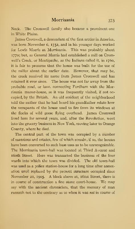
Morrisania 375
Neck. The Cromwell family also became a prominent one
in White Plains.
James Cromwell, a descendant of the first settler in America,
was born November 6, 1752, and in his younger days worked
for Lewis Morris at Morrisania. This was probably about
1770; but, as General Morris had established a mill on Crom-
well's Creek, or Mentipathe, as the Indians called it, in 1760,
it is fair to presume that the house was built for the use of
the miller about the earlier date. However, that may be,
the creek received its name from James Cromwell and has
retained it ever since. The house was not far away from the
probable road, or lane, connecting Fordham with the Mor-
risania manor-house, so it was frequently visited, if not oc-
cupied, by the British. An old resident of the neighborhood
told the author that he had heard his grandfather relate how
the occupants of the house used to fire from its windows at
the flocks of wild geese flying overhead. James Cromwell
lived here for several years, and, after the Revolution, went
into the grocery business in New York, moving later to Orange
County, where he died.
The central part of the town was occupied by a number
of mansions and estates, few of which remain; if so, the houses
have been converted to such base uses as to be unrecognizable.
The Morrisania town-hall was located at Third Avenue and
1 60th Street. Here was transacted the business of the four
wards into which the town was divided. The old town-hall
was used as a police station-house for a long time after annex-
ation until replaced by the present structure occupied since
November 21, 1905. A block above at, 161st Street, there is
in course of construction a fine stone court-house. We may
say with the ancient chroniclers, that the memory of man
runneth not to the contrary as to when it was not in course of
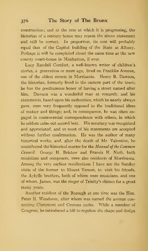
376 The Story of The Bronx
construction; and at the rate at which it is progressing, the
historian of a century hence may repeat the above statement
and still be correct. In proportion, its cost will probably
equal that of the Capitol building of the State at Albany.
Perhaps it will be completed about the same time as the new
county court-house in Manhattan, if ever.
Lucy Randall Comfort, a well-known writer of children's
stories, a generation or more ago, lived on Franklin Avenue,
one of the oldest streets in Morrisania. Henry B. Dawson,
the historian, formerly lived in the eastern part of the town;
he has the posthumous honor of having a street named after
him. Dawson was a wonderful man at research; and his
statements, based upon his authorities, which he nearly always
gave, were very frequently opposed to the traditional ideas
of matter and things; and, in consequence, he was often en-
gaged in controversial correspondence with others, in which
he seldom came out second best. His accuracy was recognized
and appreciated, and so most of his statements are accepted
without further confirmation. He was the author of many
historical works; and, after the death of Mr. Valentine, he
contributed the historical matter for the Manual of the Common
Council. George H. Bristow and Francis H. Nash, both
musicians and composers, were also residents of Morrisania.
Among the very earliest recollections I have are the Sunday
visits of the former to Mount Vernon, to visit his friends,
the Aylyffe brothers, both of whom were musicians, and one
of whom, James, was the ringer of Trinity's chimes for a great
many years.
Another resident of the Borough at one time was the Hon.
Peter H. Wendover, after whom was named the avenue con-
necting Clarcmont and Crotona parks. While a member of
Congress, he introduced a bill to regulate the shape and design
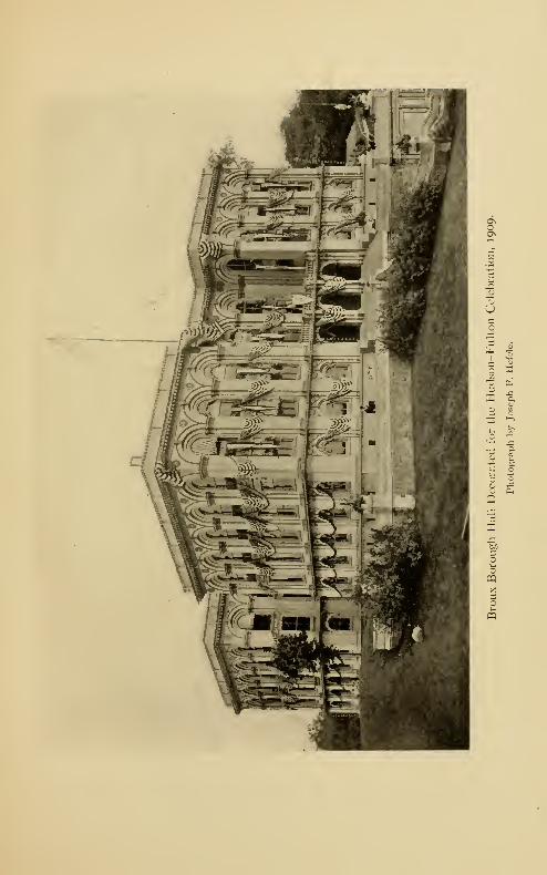
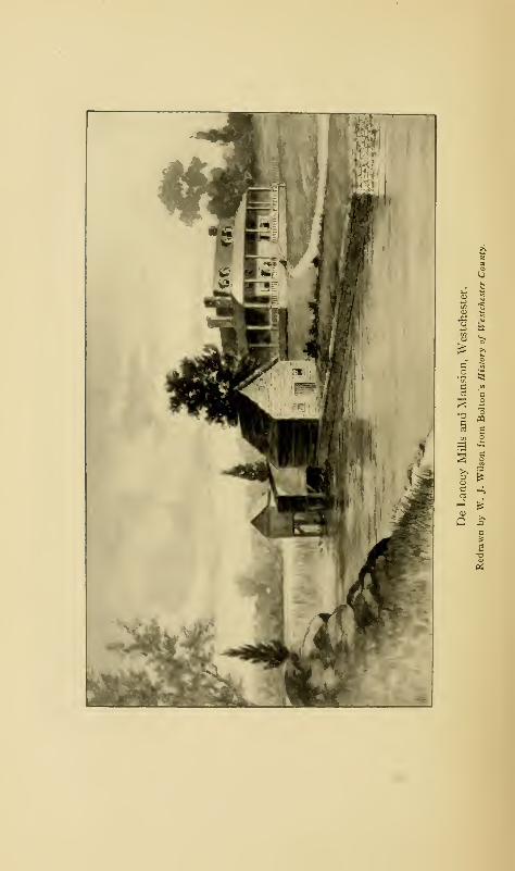
Morrisania 377
of the national flag, which, under the old additions of a star
and a stripe for each new State, was becoming of very awkward
shape. The law stated that, after July 4, 18 18, the flag
should contain twenty stars for the number of States then form-
ing the Union and thirteen stripes, alternate white and red,
and that, upon the admission of a new State, the constellation
should be increased by one star on July Fourth following
such admission, so that the stripes would show the original
thirteen States and the number of stars the number of States
then in the Union. Congressman Wendover, then, may be
said to be the father of the present flag.
Crotona Park, containing the Borough Hall for the offices of
the Borough government, lies near the upper end of the town-
ship ; the park was takenfrom both Morrisania andWest Farms.
Just beyond, in Tremont, the unfortunate Charlotte Temple
is said to have lived ; but she seems to have had as many stop-
ping places as Washington or a modern flat dweller, as the
chroniclers of Manhattan give quite a list of her various homes.
It was the original intention of the "New" Parks Com-
mission of 1883-84 to have named the park Bathgate Park
after the family from whom the property was obtained. It
seems that the Bathgates had some dispute with the Com-
mission's engineer, and he determined not to perpetuate the
name of the family in the new park; he therefore manufac-
tured the name of Crotona from Croton. The ancient and
classical Crotona—the home of the philosopher Pythagoras
—
was a Greek colony located in Southern Italy, whose athletes
were famous throughout the Grecian world, and who were
many times victors at the Olympic Games. In view of the
amount of space in the park given up to tennis-courts, base-
ball, and athletic fields, the name of Crotona appears to be
particularly applicable.
378 The Story of the Bronx
The Southern Boulevard, laid out during the Tweed regime,
extends from Port Morris to Bronx Park at 181st Street.
It was lined with trees at first, but these have been sadly
neglected, so that most of them have died. The lower part is
given over to factories, the middle part, as far as Westchester
Avenue, still has more vacant lots than occupied ones; but
the section above Westchester Avenue is building up very
rapidly. This is due to the elevated portion of the subway,
which passes through the Boulevard.
Port Morris was practically an island at high tide in the
olden days. Gouverneur Morris, Second, built a causeway
across the meadows, about on the line of 138th Street, so that
people and horses could pass over dryshod. This was in the
fifties of the last century; and it is said he did this principally
to give employment to some of the poor and distressed people
of the neighborhood, so that it was a case of practical charity.
During the Revolution, the British frigate Hussar went
down off Port Morris, then called Stony Island. She was
laden with American prisoners and treasure, the latter, so
tradition says, the pay of the British army in New York.
Many companies have been formed to get the sunken treasure,
but more money has been sunk in these enterprises than has
been, or ever will be, recovered. Divers have brought to the
surface bits of the old hull, which are easily gotten, as the
iron work has all rusted away, a few coins, and various inter-
esting relics in the way of chain-shot, bullets, pieces of copper,
etc. ; but the treasure, if there be any, has thus far escaped
them.
Lincoln Hospital lies near the Southern Boulevard at 141st
Street. Wilton was a small village to the west of this section
and was, in the sixties, a favorite place of residence for actors,
of whom there was quite a settlement.
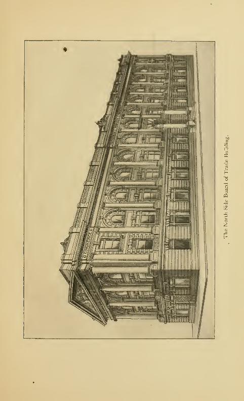

Morrisania 379
On June 15, 1904, the excursion steamer, General Slocitm,
took on board about two thousand passengers from the German
Lutheran churches of the east side of Manhattan for a trip
up the Sound to a picnic ground on Long Island. While
passing through Hell Gate in the East River, the steamer took
fire; but her captain, instead of attempting to land at once,
headed her up the river and beached her on North Brother
Island, off Port Morris. The vessel was inadequately pro-
vided with life preservers, so that many of those who sprang
into the water to escape the flames were drowned. Notwith-
standing the heroic effort of many people who at once went
to the rescue, at least one thousand of the passengers, con-
sisting of men, women, and children, were either drowned or
burnt to death. The exact number has never been definitely
fixed ; but the disaster occasioned a greater loss of life than any
other accident that has occurred during the whole history of
the city.
CHAPTER XVII
WEST FARMS
THE original patent of West Farms comprised the terri-
tory between the Fordham line on the north, the
Bronx River on the east, the Sound on the south,
and Bungay Creek and Morrisania on the west. Its earlier
history is given elsewhere. In 1846, it was made into a
township, being formed from Westchester and including
Morrisania and Fordham. Morrisania was taken from West
Farms in 1856 and formed into a separate township.
The intersection of Westchester Avenue and the Southern
Boulevard was called Fox's Corners, and it is still locally
known as such. It received its name from William Fox, a
wealthy Quaker merchant of New York, who married into the
Leggett family and thus became possessed of the property,
some of which is still owned by his descendants, the Tiffany
family. To the east of the Corners, the late Colonel Richard
M. Hoe, the inventor of the rotary printing-press, had a
magnificent- country place, which he called Brightside. The
locality is at present in a transition state; for, though there
are a great many apartments and flats, there are still more
vacant lots. The old estates have been cut up, and very few
of the elegant mansions of the middle of the last century re-
main to show us how the well-to-do merchants of that epoch
used to live.
South of the Corners, the Hunt's Point road leads down to
the East River. The point was a part of the West Farms
patent of 1668, and received its name from Thomas Hunt,
380
West Farms 381
a son-in-law of Edward Jessup. The Indian name of the neck
was Quinnahung; and it is also spoken of in the early deeds and
grants as the " Great planting field, or neck." It lies between
the Bronx River and the Sackwrahung Creek, which Lewis
Morris says in a deed of 1740 to his father-in-law, James
Graham, is falsely so called but which should be called Wig-
wam Brook. But we should bear in mind that there was a
strip of land here, called the "debatable land," in dispute
between Morris and the heirs of the West Farms patentees,
and that Morris would naturally not admit the slightest thing
that would be of advantage to his adversaries. The more
westerly portion of the " Planting neck " came into possession
of Gabriel Leggett in 1679, through his wife Elizabeth, a
daughter of John Richardson, one of the original patentees;
this is the part now known as Barretto's Point. Thomas
Hunt and John Richardson both had houses on the point;
for in a contract between them of August 12, 1669, for the
division of the come field neck, the houses are mentioned.
A trolley line, inaugurated in the spring of 191 1, now runs
down Hunt's Point Avenue, almost to the end of the neck,
which it will reach in time. As late as 1906, the point retained
its rural character, with several houses of two generations ago
still standing. The most prominent was the Spofford place
with its beautifully kept grounds ; but most of these old man-
sions have disappeared or are poorly kept up. The part of the
neck near the Southern Boulevard is fairly well built up; and
further operations will be started when necessary. The city
has a site for a school-house to accommodate the children of
the point ; it is now occupied by a portable building, but a fine
edifice will be erected in the near future. Beyond Lafayette
Avenue, the neck still remains a meadow land, though some
of the streets are laid out and are being graded.
3cS2 The Story of The Bronx
Not far from the end of the neck, we see a heavily wooded
knoll with several white monuments gleaming through the
foliage. This is the ancient burial place of the Hunt, Leggett,
and Willett families, now preserved as a public park under the
name of Rodman Drake Park. It is stated that George
Tippett, or Tibbett, the purchaser, with William Betts, of the
Betts and Tippett tract of the old patroonship of Adrien Van
der Donck, is also buried here.
While we may be interested in deciphering some of the more
ancient and crumbling tombstones, our particular interest
lies in the white marble monument nearest the roadway,
under which are the mortal remains of the poet of The Bronx
and of The American Flag,—Joseph Rodman Drake. An
iron fence is supposed to keep off vandals, but the chipped
condition of the stone shows that the iconoclast has not been
deterred from following his favorite pursuit, a pursuit that
should shame a savage. The monument bears the following
inscription:
"sacred
to the Memory
of
JOSEPH R. DRAKE, M.D.
who died Sept. 21st
1820
Aged 25 Years
None knew him but to love him,
Nor named him but to praise.
RENOVATED BY THE
BROWNSON LITERARY UNION
July 25, 1891."'
The Brownson Literary Union was organized as a debating society in
1888; it resolved itself into the Brownson Catholic Club in 1894.
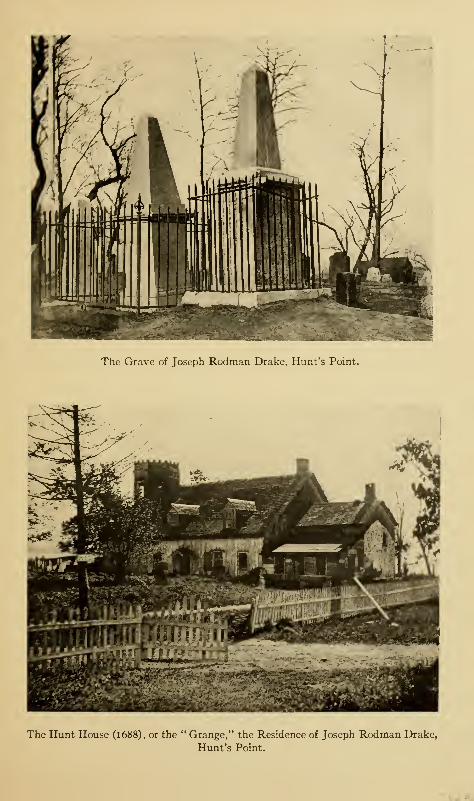
The Grave of Joseph Rodman Drake, Hunt's Point.
The Hunt House (1688), or the " Grange," the Residence of Joseph Rodman Drake,
Hunt's Point.

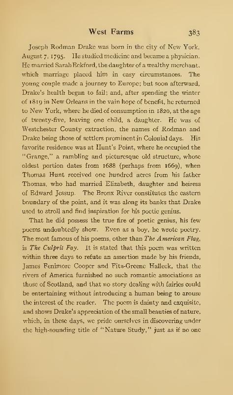
West Farms 383
Joseph Rodman Drake was born in the city of New York,
August 7, 1 795. He studied medicine and became a physician.
He married Sarah Eckford, the daughter of a wealthy merchant,
which marriage placed him in easy circumstances. The
young couple made a journey to Europe; but soon afterward,
Drake's health began to fail; and, after spending the winter
of 18 19 in New Orleans in the vain hope of benefit, he returned
to New York, where he died of consumption in 1820, at the age
of twenty-five, leaving one child, a daughter. He was of
Westchester County extraction, the names of Rodman and
Drake being those of settlers prominent in Colonial days. His
favorite residence was at Hunt's Point, where he occupied the
"Grange," a rambling and picturesque old structure, whose
oldest portion dates from 1688 (perhaps from 1669), when
Thomas Hunt received one hundred acres from his father
Thomas, who had married Elizabeth, daughter and heiress
of Edward Jessup. The Bronx River constitutes the eastern
boundary of the point, and it was along its banks that Drake
used to stroll and find inspiration for his poetic genius.
That he did possess the true fire of poetic genius, his few
poems undoubtedly show. Even as a boy, he wrote poetry.
The most famous of his poems, other than The American Flag,
is The Culprit Fay. It is stated that this poem was written
within three days to refute an assertion made by his friends,
James Fenimore Cooper and Fitz-Greene Halleck, that the
rivers of America furnished no such romantic associations as
those of Scotland, and that no story dealing with fairies could
be entertaining without introducing a human being to arouse
the interest of the reader. The poem is dainty and exquisite,
and shows Drake's appreciation of the small beauties of nature,
which, in these days, we pride ourselves in discovering under
the high-sounding title of "Nature Study," just as if no one
384 The Story of The Bronx
had ever done anything of the kind before. Though the
scene of the poem is laid in the Highlands of the Hudson,
its chief associations are with the salt water, "the poet drawing
his inspiration from his familiar haunt on the Sound, at Hunt's
Point."
The best known of his poems is The American Flag; and
this alone would have made him famous. The verses are
magnificent in their glowing patriotism and glory in the flag.
Drake's most intimate friend was Fitz-Greene Halleck,
whose whole life was affected by the early death of his gifted
friend. The first stanza of Halleck's poem on the death of
Drake is exquisite, and from it are taken the two lines placed
upon the tomb, though thee is changed to him.
" Green be the turf above thee,
Friend of my better days
;
None knew thee but to love thee,
Nor named thee but to praise."
Many years after Drake's death, Halleck visited the grave
of his colleague in the Croaker Papers with General James
Grant Wilson; to whom he remarked that his dearest wish
was to be laid by the side of his friend when it came his turn
to die, and that if it ever became necessary to remove Drake's
body, it should be laid beside his. Halleck died in 1867 and
was buried at Guilford, Connecticut. The plan of street
improvements of 1903 took no cognizance of the ancient
cemetery and proposed to cut two streets through it. In
view of this fact, in September of that year, a number of gentle-
men proposed to exhume the body of Drake and reinter it by
the side of Halleck in accordance with the expressed wish of
the latter. The scheme met with strong opposition from the
North Side Board of Trade and the literary societies of the
West Farms 385
Borough; and their exertions resulted in the alteration in the
lines of the proposed streets near the grave, and the formation
there of a public park. This is eminently proper; as Drake
was born in New York and lived and died here, and his body
should continue to lie near the Bronx, which he so dearly loved.
At the end of the point, there is under construction some
fourteen hundred feet of docks. Near the south end of the
point, we come across an old, weather-beaten and dilapidated
building, the Hunt mansion, or "Grange," in which Drake
used to live. At the end of the building is an octagonal tower
which serves as a beacon to the pilots on the East River and
has thus gained for the old mansion the name of the "Pilot
House." The old homestead and farm have been occupied
for many years by German market gardeners who rented them
from a land company that owned this portion of the neck.
The original part of the house was of stone with a great stone
chimney and Dutch doors. The havoc of the winter snows
and summer rains has wrecked the old place and brought it
in these last years to a melancholy state of dilapidation.
Before us is the mouth of the Bronx River, with the low shores
of Cornell's Neck on the opposite side, and beyond that over
the East River, the high hills of Long Island ; to the southward
lie Leggett's Point, Port Morris, the Brother Islands and
Riker's Island. The waters of the river and the passing vessels
constitute an enchanting picture which fully accounts for
Drake's fondness for the place as a residence.
Retracing our steps to beyond the ancient cemetery, we take
a road to the left and visit Barretto's Point. This received
its name from Francis Barretto, a merchant of New York,
who settled here many years ago, and who represented West-
chester County in the Assembly for several terms. The point
was called Waddington's Point at the time of Mr. Barretto's
25
386 The Story of The Bronx
purchase. The large stone mansion and the estate of Mr. Bar-
retto were called'
' Blythe Place'
' ; the mansion wasburneddown
years ago, and the remains of the house have been removed
until the top of the foundations is even with the ground. Amansion belonging to another member of the family still stands
and is occupied by a German truck farmer. On the neck there
is located the old burying-ground of the slaves belonging to
the Hunt and Leggett families, and also an old oak upon
which, according to tradition, the British used to hang the
Whig fonagers and spies who were so unfortunate as to fall
into their hands. Lafayette Avenue leads toward the south-
west to Morrisania, and commemorates the fact, so it is said,
that General Lafayette passed over the lane on his way to
Boston when he visited the United States in 1824. In a deed
of May 3, 1804, mention is made of "Bocket's cot, or landing
place," on Barretto's Point, and it is also mentioned in later
deeds. It is supposed the term "cot" used here means cove.
In December, 1908, the American Bank Note Company
obtained a block at the entrance of Barretto's Point for the
purpose of erecting their shops and factories; these were com-
pleted in 191 1, and give employment to over two thousand
persons. For several years before this date, the most promin-
ent building in the locality was the Monastery of Corpus
Christi, established in 1889, and maintained principally by
John D. Crimmins, Esq., as a memorial to his wife.
Between Barretto's Point and Port Morris is Oak Point,
until 1905 a pleasure resort for the residents of the Borough
who liked the kind of pleasure to be obtained here. It is now
used by the New York, New Haven, and Hartford Railroad
for freight purposes. It was formerly known as Leggett's
Point, it being within the debatable land already referred to.
The old tree-lined lane which used to lead to the point has
West Farms 387
disappeared, and its place has been taken by Leggett Avenue,
a very important thoroughfare for trucking purposes.
In colonial days, the point was called Jeafferd's Neck; and
it was in the house of Alderman Leggett on this neck that
Major Baremore was captured by De Armond. Later, the
house was occupied by Colonel Fowler, and it was destroyed
by fire upon the occasion of a dinner-party given by the British
officer to the loyalists of the vicinity. Leggett's house occu-
pied the site of the Graham house. The property between
Bound and Wigwam brooks was granted by Judge Morris to
his father-in-law, James Graham, Attorney-General of the
Province, on April 2, 1740; Mr. Graham died here in his house
on Jeafferd's Neck, in 1767. By his will, dated March 13,
1767, the property was left to his wife during the term of her
natural life, after which it was to be sold by his executors for
the benefit of his children. It was so sold later, and it has
passed through the hands of many owners from that time to
the present, being divided up among several owners. Thus,
Joshua Waddington owned part of it from 1808 to 1828; and
the same land constituted a trust for many years for Anna
Maria Julia Coster, the wife of Francis Barretto; another
part, including the point, came back into the possession of
William H. Leggett under deeds of February 8, 1830, and April
1, 1 83 1. The Leggett family retained possession of the prop-
erty, which was called "Rose Bank," until near the middle
of the last century, when it was bought by Benjamin Whitlock,
a wealthy grocer of New York, who was also interested in the
cotton business. The old Leggett mansion was completely
renovated, a prominent feature being the subterranean vaults
and cellars for the storage of wine. It is said that the house
was almost rebuilt of stone imported from Caen, France. In
the days before the Civil War, the mansion was the scene of a
388 The Story of The Bronx
lavish hospitality; and the generation of bon vivants just
passed away were frequent guests at its generous board. With
the Civil War and the downfall of slavery, cotton ceased to
be king, and the place was closed by its impoverished owner,
and given over to nature. The dilapidated appearance of
the house, and the tangled masses of weeds in the extensive
grounds which had been planted with fine trees and plants of
all kinds and lavishly cared for, gained for it the name of
"Whitlock's Folly."
After the death of Mr. Whitlock, it was transferred by deed
from his widow to Innocencio Casanova, a Cuban patriot,
under date of November I, 1867, for a consideration of
$150,000. The first struggle for Cuban independence was
then in progress, and the house became a rendezvous for the
supporters of "Cuba Libre." It is stated that its great cel-
lars became storehouses for powder, rifles, and other munitions
of war, which were smuggled aboard the vessels which stole
in and out of the creeks contiguous to the house, and which
sailed away on secret, filibustering expeditions to the "Ever
Faithful Isle." It is also said that the ill-fated Virginius
took on board her unfortunate crew here. With the downfall
of the rebellion, the visits of the dark-skinned, mysterious-
looking men ceased, and the house was deserted ; while whispers
of murdered Spanish spies and of ghosts and strange and un-
accountable noises in the vacant house filled the neighborhood.
On October 2, 1885, the property came into the hands of a
Mr. Cheseborough, and three years later, into those of Fred-
erick Beck, the consideration being $200,000. It then went
into the hands of an agent of the East Bay Land and Improve-
ment Company, May 10, 1890. The same company acquired
in that year 314 acres of land, including Hunt's and Barretto's
points and other land in the vicinity. It is interesting to
West Farms 389
know that in a suit brought by the city of New York for the
water rights of all this property, the company won its case
upon the old Indian deeds and the ancient patents and grants
of the early colonial days to the original white owners. The
Whitlock, or Casanova, house was, in 1904, an enormous
square, barn-like building, visible from all directions, as it
stood upon an elevation and no trees obstructed the view.
So many weird tales were told about the old mansion that its
demolition was watched with intense interest. Its site is now
occupied by a large piano factory, and part of the grounds
has become the property of the railroad. The name of Casa-
nova is perpetuated in the near-by station of the Suburban
branch of the New York, New Haven, and Hartford Railroad.
The former village of West Farms is situated about three
miles from the mouth of the Bronx River, to which point the
tide rises and falls. It is believed that Jonas Bronk established
mills here, and it is known that the patentees of the West
Farms did have mills here, for they are mentioned in ancient
documents. As stated in a former chapter, the property came
into the possession of the De Lancey family, and, in conse-
quence, was known as De Lancey's Mills for many generations.
The site of the ancient mills is now within the limits of Bronx
Park, at the old Kingsbridge Road. About 1825, the property
was bought by Mr. David Lydig for a summer residence and
he occupied the De Lancey house on the east side of the stream.
The house was afterward burned. Mr. Lydig was a practical
miller from the valley of the Genesee, and he continued to
operate the mills and greatly enlarged them. There is nothing
left of them now except the dam and the foundations of the
mills. Several coloring mills line the stream between the
bridge at East 180th Street and that at 177th Street, or Walker
Avenue. Below the latter bridge are the extensive buildings
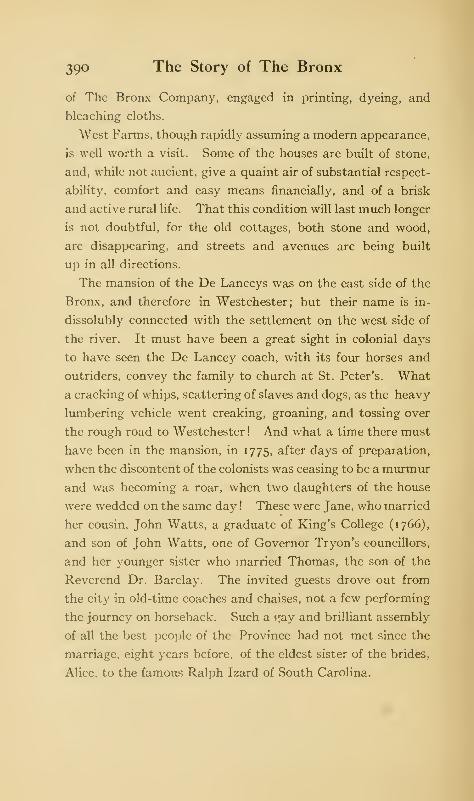
39° The Story of The Bronx
of The Bronx Company, engaged in printing, dyeing, and
bleaching cloths.
West Farms, though rapidly assuming a modern appearance,
is well worth a visit. Some of the houses are built of stone,
and, while not ancient, give a quaint air of substantial respect-
ability, comfort and easy means financially, and of a brisk
and active rural life. That this condition will last much longer
is not doubtful, for the old cottages, both stone and wood,
are disappearing, and streets and avenues are being built
Up in all directions.
The mansion of the De Lanceys was on the east side of the
Bronx, and therefore in Westchester; but their name is in-
dissolubly connected with the settlement on the west side of
the river. It must have been a great sight in colonial days
to have seen the De Lancey coach, with its four horses and
outriders, convey the family to church at St. Peter's. What
a cracking of whips, scattering of slaves and dogs, as the heavy
lumbering vehicle went creaking, groaning, and tossing over
the rough road to Westchester! And what a time there must
have been in the mansion, in 1775, after days of preparation,
when the discontent of the colonists was ceasing to be a murmur
and was becoming a roar, when two daughters of the house
were wedded on the same day ! These were Jane, who married
her cousin, John Watts, a graduate of King's College (1766),
and son of John Watts, one of Governor Tryon's councillors,
and her younger sister who married Thomas, the son of the
Reverend Dr. Barclay. The invited guests drove out from
the city in old-time coaches and chaises, not a few performing
the journey on horseback. Such a ray and brilliant assembly
of all the best people of the Province had not met since the
marriage, eight years before, of the eldest sister of the brides,
Alice, to the famous Ralph Izard of South Carolina.
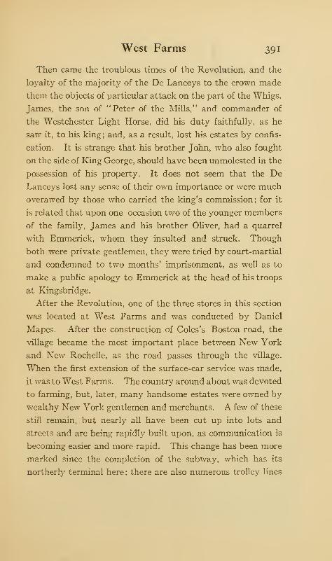
West Farms 391
Then came the troublous times of the Revolution, and the
loyalty of the majority of the De Lanceys to the crown made
them the objects of particular attack on the part of the Whigs.
James, the son of "Peter of the Mills," and commander of
the Westchester Light Horse, did his duty faithfully, as he
saw it, to his king; and, as a result, lost his estates by confis-
cation. It is strange that his brother John, who also fought
on the side of King George, should have been unmolested in the
possession of his property. It does not seem that the De
Lanceys lost any sense of their own importance or were much
overawed by those who carried the king's commission; for it
is related that upon one occasion two of the younger members
of the family, James and his brother Oliver, had a quarrel
with Emmerick, whom they insulted and struck. Though
both were private gentlemen, they were tried by court-martial
and condemned to two months' imprisonment, as well as to
make a public apology to Emmerick at the head of his troops
at Kingsbridge.
After the Revolution, one of the three stores in this section
was located at West Farms and was conducted by Daniel
Mapes. After the construction of Coles's Boston road, the
village became the most important place between New York
and New Rochelle, as the road passes through the village.
When the first extension of the surface-car service was made,
it was to West Farms. The country around about was devoted
to farming, but, later, many handsome estates were owned by
wealthy New York gentlemen and merchants. A few of these
still remain, but nearly all have been cut up into lots and
streets and are being rapidly built upon, as communication is
becoming easier and more rapid. This change has been more
marked since the completion of the subway, which has its
northerly terminal here; there are also numerous trolley lines
392 The Story of The Bronx
going to all parts of the Borough and to Mt. Vernon and NewRochelle. It is amusing to see the crowds alight from the
trolley cars and rush for the subway as if their very lives de-
ponded on their not missing a second. In the cars, they
usually begin to get up from their seats and crowd the aisles
a half mile from the terminal. What is the cause of this?
Is it a national characteristic of wanting to get ahead of
somebody else, or is it a childish trait showing fear of not
getting to a place on time?
The West Farms Soldiers' Monument, the only one in the
Borough, was erected, by the subscriptions of a few patriotic
citizens, in the West Farms Cemetery, adjoining the graveyard
of the old Presbyterian Church. A Mrs. Cunningham, the
widow of a soldier, was the first to draw attention to the neg-
lected and desecrated graves of a number of soldiers who
were buried here. She was passing the graveyard when the
street was being widened and saw a number of bones thrown
into a cart by the laborers. An examination of one of the grass-
covered and decrepit tombstones showed that it was over the
grave of "William J. Rasberry, Captain Co. C, 6th Heavy
Artillery, killed Oct. 19, 1864, at Cedar Creek, while leading
his men up the hill." Other graves were found, and the
matter of erecting a suitable monument was taken up by a
committee of which Captain Charles Baxter was chairman.
The monument was erected in the fall of 1909, and was
dedicated with appropriate ceremonies May 29, 19 10. The
remains of eleven soldiers, two of them of the War of 18 12,
are within the plot near the monument. Three brass howit-
zers are used for ornamental purposes, and a flag is kept
flying from the staff erected for the purpose.
During the Civil War, the same diversity of opinion pre-
vailed throughout the Borough as in all sections of the country,
The De Lancev Pine.
The Soldiers' Monument at West Farms.

West Farms 393
and especially in the city of New York. Some volunteered
for the defence of the Union, some remained passive, and
others were " Copperheads" of the usual kind. While a great
many individual soldiers enlisted from all parts of the Borough,
the following companies were recruited almost wholly in the
places given; 6th Artillery, Company C, wholly, and Com-
pany K, partially, at West Farms, Company H in Morrisania;
5th Infantry (Duryea's Zouaves), Company F, partially, in
Fordham; 17th Infantry, Company C, Morrisania; 176th
Infantry (Ironsides), Company G, in Pelham. When the
draft was inaugurated, in 1863, the lawless classes took ad-
vantage of the absence of the troops in Pennsylvania and the
weakness of the civil power to resent the draft by forcible
means and mob violence; though they did not go so far as
their rebellious neighbors on Manhattan Island.
The disturbances in connection with the draft in New York
began on July 13, 1863, when the vicious and ignorant who
composed the mobs, burned the offices of the provost-marshal,
destroyed the lists of those subject to the draft, attacked and
killed individual soldiers found in the streets, resisted the
police to the point of murder, tore up railroad tracks, cut
telegraph wires, hung negroes wherever found, burned and
sacked several houses belonging to eminent supporters of the
government, and burned the Colored Orphan Asylum.
The reports of all these lawless doings did not have their
effect upon the inhabitants north of the Harlem River until
the next day, Tuesday, the fourteenth, when their passions
were aroused by reading the newspaper accounts of the pro-
ceedings of the previous day. Mobs visited the draft offices
at Morrisania and West Farms and destroyed the lists, in their
ignorance believing that the names could not be replaced.
The telegraph offices in Melrose and Williamsbridge were
394 The Story of The Bronx
destroyed and some rails on the Harlem and New Haven rail-
roads were torn up, while arrangements were made for the
further destruction of the tracks by placing pickets as far as
Mt. Vernon to give notice when it would be safe to begin the
work of destruction. The railroads were obstructed with
the intention of preventing the arrival of troops or assistance
from out of town. The mobs at West Farms and Morrisania
were quieted by the appeals of Supervisor Cauldwell and Mr.
Pierre C. Talman.
On the evening of Wednesday, the fifteenth, a meeting was
held in the town-hall at Tremont. There was a large crowd
present, which was addressed by John B. Haskin and Pierre
C. Talman, who managed the mass of excited and ignorant
men with considerable diplomacy, first flattering them with
the statement that they were right in their resistance to the
draft and the Government all wrong in enforcing it, and then
appealing to their sense of self-respect and order. The ground
of the argument used was that the draft was unconstitutional,
and that the Federal Government had no right to invade the
municipal rights of a sovereign State until the courts of that
State had decided whether a Federal act were constitutional
or not; in fact, the old idea of nullification. The meeting ad-
journed after the appointment of a committee of seven citizens
" to wait on Moses G. Sheard, Esq., Federal provost-marshal of
the district, to insist that the draft be stopped till the State
court could decide whether it was constitutional." The reign
of terror which had existed for two days was at an end, as
the appointment of the committee seemed to satisfy the ring-
leaders of the crowd. It is questionable whether it would have
done so if news had not come the next day that the troops
were returning from Gettysburg, and that those who had
already arrived in New York had come in contact with the
West Farms 395
mob, very much to the discomfiture of the latter. Under the
circumstances, the mob leaders very wisely came to the con-
clusion that peaceable means would serve their cause better
than violence, and quiet and order were once more restored.
In June, 1903, there were sold at the County Court-house,
Manhattan, twenty-five lots situated in various parts of the
Borough under foreclosure proceedings brought by "the Com-
missioners for Loaning Certain Moneys of the United States
of the County of New York." This may be called an echo of
the War of 18 12. The different States contributed money to
pay the expenses of that war, which money was afterward
paid back by the Federal Government, New York being repaid
in 1837. The State devoted the money so received to mak-
ing advances to small owners of lands, or to enable would-be
owners to purchase property. The advances in every case
were limited to $5000; and the interest, which was fixed by
statute at five per cent., was used to defray the expenses of
schools. All the lots, except three, were bought in by the
State at the above sale. I wonder whether the Commission
was in existence from 1837 to 1903 and received pay for its
services.
CHAPTER XVIII
WESTCHESTER
SHORTLY after the Revolution, April 18, 1785, the State
Legislature enacted that "the district formerly called
and known by the style of the Borough and Town of
Westchester, shall henceforth be known by the name of the
Town of Westchester." This, of course, deprived the town of
its mayor and aldermen and of its right to have a representa-
tive in the Assembly ; but the new township was authorized to
elect by the votes of the inhabitants six freeholders to act as
trustees of the township. By Act of the Legislature of 1813,
the trustees, or a majority of them, were empowered to sell the
undivided lands of the township and to continue to lease the
ferry to Flushing, Long Island.
There are not so many notable objects in the town as one
might expect from its antiquity. St. Peter's and its graveyard
are of interest, and the visitor may spend some time in de-
ciphering the older tombstones to be found in the latter. The
Sunday-school building occupies the site of the ancient court-
house and jail. The records of the judicial proceedings have
been kept since the Dutch days, though not now at the ancient
town. In the records from 1657 to 1662, we may find a num-
ber of names which are mentioned in other parts of this volume
:
John Archer, a born litigant, later of Fordham; William Betts,
396
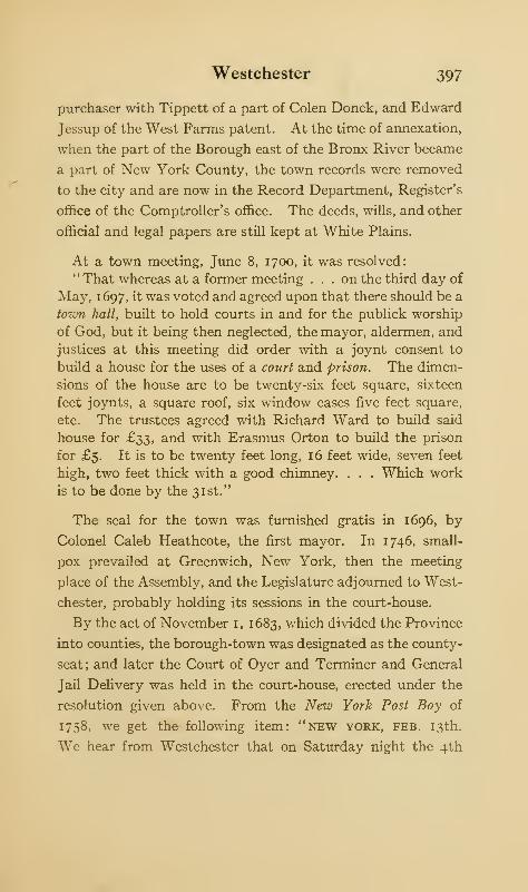
Westchester 397
purchaser with Tippett of a part of Colen Donck, and Edward
Jessup of the West Farms patent. At the time of annexation,
when the part of the Borough east of the Bronx River became
a part of New York County, the town records were removed
to the city and are now in the Record Department, Register's
office of the Comptroller's office. The deeds, wills, and other
official and legal papers are still kept at White Plains.
At a town meeting, June 8, 1700, it was resolved:
" That whereas at a former meeting . . . on the third day of
May, 1697, it was voted and agreed upon that there should be a
town hall, built to hold courts in and for the publick worship
of God, but it being then neglected, the mayor, aldermen, and
justices at this meeting did order with a joynt consent to
build a house for the uses of a court and prison. The dimen-
sions of the house are to be twenty-six feet square, sixteen
feet joynts, a square roof, six window cases five feet square,
etc. The trustees agreed with Richard Ward to build said
house for £33, and with Erasmus Orton to build the prison
for £5. It is to be twenty feet long, 16 feet wide, seven feet
high, two feet thick with a good chimney. . . . Which work
is to be done by the 31st."
The seal for the town was furnished gratis in 1696, by
Colonel Caleb Heathcote, the first mayor. In 1746, small-
pox prevailed at Greenwich, New York, then the meeting
place of the Assembly, and the Legislature adjourned to West-
chester, probably holding its sessions in the court-house.
By the act of November 1, 1683, which divided the Province
into counties, the borough-town was designated as the county-
seat; and later the Court of Oyer and Terminer and General
Jail Delivery was held in the court-house, erected under the
resolution given above. From the New York Post Boy of
1758, we get the following item: "new YORK, FEB. 13th.
We hear from Westchester that on Saturday night the 4th
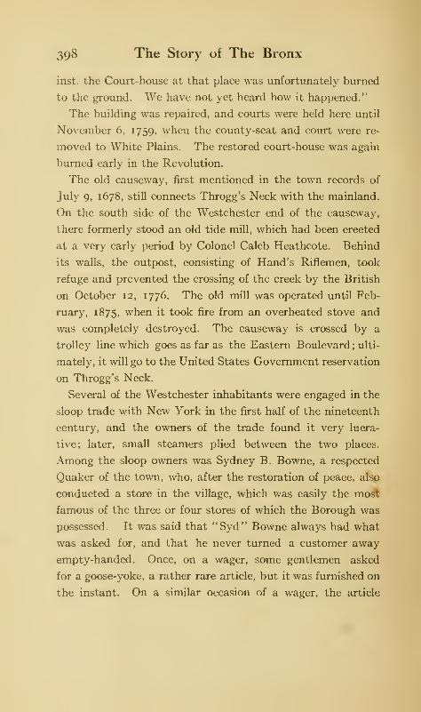
398 The Story of The Bronx
inst. the Court-house at that place was unfortunately burned
to the ground. We have not yet heard how it happened."
The building was repaired, and courts were held here until
November 6, 1759, when the county-seat and court were re-
moved to White Plains. The restored court-house was again
burned early in the Revolution.
The old causeway, first mentioned in the town records of
July 9, 1678, still connects Throgg's Neck with the mainland.
On the south side of the Westchester end of the causeway,
there formerly stood an old tide mill, which had been erected
at a very early period by Colonel Caleb Heathcote. Behind
its walls, the outpost, consisting of Hand's Riflemen, took
refuge and prevented the crossing of the creek by the British
on October 12, 1776. The old mill was operated until Feb-
ruary, 1875, when it took fire from an overheated stove and
was completely destroyed. The causeway is crossed by a
trolley line which goes as far as the Eastern Boulevard ; ulti-
mately, it will go to the United States Government reservation
on Throgg's Neck.
Several of the Westchester inhabitants were engaged in the
sloop trade with New York in the first half of the nineteenth
century, and the owners of the trade found it very lucra-
tive; later, small steamers plied between the two places.
Among the sloop owners was Sydney B. Bowne, a respected
Quaker of the town, who, after the restoration of peace, also
conducted a store in the village, which was easily the most
famous of the three or four stores of which the Borough was
possessed. It was said that "Syd" Bowne always had what
was asked for, and that he never turned a customer away
empty-handed. Once, on a wager, some gentlemen asked
for a goose-yoke, a rather rare article, but it was furnished on
the instant. On a similar occasion of a wager, the article
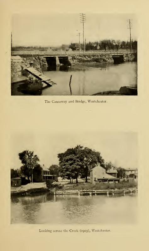
The Causeway and Bridge, Westchester.
Looking across the Creek (1903), Westchester.
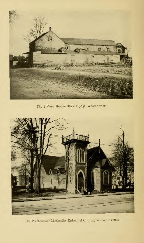
•Imf-Mfrnrtii-'fc
The Sydney Bowne Store ''1903) Westchester.
The Westchester Methodist Episcopal Church, Walker Avenue.
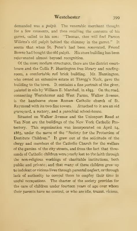
Westchester 399
demanded was a pulpit. The venerable merchant thought
for a few moments, and then recalling the contents of his
garret, called to his son: "Thomas, thee will find Parson
Wilkins's old pulpit behind the chimney in the garret." It
seems that when St. Peter's had been renovated, Friend
Bowne had bought the old pulpit. His store building has been
rejuvenated almost beyond recognition.
Of the more modern structures, there are the district court-
house and the Collis P. Huntington free library and reading-
room, a comfortable red brick building. Mr. Huntington,
who owned an extensive estate at Throgg's Neck, gave the
building to the town. It contains a fine portrait of the giver,
painted in oils by William E. Marshall, in 1893. On the road,
connecting Westchester and West Farms, Walker Avenue,
is the handsome stone Roman Catholic church of St.
Raymond with its two fine towers. Attached to it are an old
graveyard, a rectory, and a parochial school-house.
Situated on Walker Avenue and the Unionport Road at
Van Nest are the buildings of the New York Catholic Pro-
tectory. This organization was incorporated on April 14,
1863, under the name of the "Society for the Protection of
Destitute Children." It grew out of the solicitude of rhe
clergy and members of the Catholic Church for the welfare
of the gamins of the city streets, and from the fact that thou-
sands of Catholic children were yearly lost to the faith through
the non-religious workings of charitable institutions, both
public and private; and that many of these children grew up
to indolent or vicious lives through parental neglect, or through
lack of authority to compel them to employ cheir time in
useful occupations. The charter of the society provides for
the care of children under fourteen years of age over whomtheir parents have no control, or who are idle, truant, vicious,
4-00 The Story of The Bronx
or homeless, and are committed by a magistrate, or by the
commissioners of charity.
[experience has taught that to conquer the class of children
described above, it is necessary for them to have constant and
useful occupation, with a proper amount of play and out-door
work. The Protectory has been under the Christian Brothers
of the Catholic Church from its inception to the present.
They are not priests, but are expected to engage in no business
but that of teaching, and they are vowed to go and teach
wherever they are sent by their superiors. The Brothers
are with the boys at all times, whether it be in the workshop,
the playground, or the dormitory.
The institution occupied two sites in Manhattan before
coming to Van Nest. The site here, consisting of a farm of
1 14 acres, was bought in June, 1865, for $40,000. The erection
of the necessary buildings was begun at once, both for the boys
and the girls, the latter being separated from the former and
being nearer Unionport. A great fair was held in 1867 to
raise funds for the erection of a building for girls, who are in
charge of the Sisters of the Society of St. Vincent de Paul.
This building was completed in 1869, but was completely
destroyed by fire on the night of July 25, 1872; and the dis-
cipline and courage displayed by the older girls were remark-
able. One of the Sisters said: " Let no big girl pass this way
without a baby in her arms"; and without hesitancy "the
big girls" returned to the burning building and smoking dor-
mitories and issued from them with the babes in their arms,
many of them still asleep. Not a life was lost. Fire also
destroyed the tower of the Boys' building on August 22, 1902.
The daily routine is varied, so that the children are not apt
to become tired with either too much mental or too much
physical labor. There is class-room work, shop-work, and work
Westchester 401
out of doors, as well as periods in the playgrounds. Notwith-
standing the liberty given the inmates, there have been few
runaways. The institution is supported by voluntary sub-
scriptions, by contributions from the State, and by payments
from the city for those committed by magistrates or other
authority. Some income is also derived from the Protectory
band, which is a familiar sight in most of the parades that take
place in New York.
The Suburban station for Westchester is Van Nest, which
gets its name from an estate formerly lying east of West
Farms. The Morris Park race-track was reached by means
of the same station ; and on racing days, the usual population
of the section used to be increased by the thousands of visitors
who came from all quarters. A large part of the De Lancey
estate, later belonging to the Lydigs, is now within the bounds
of Bronx Park; the same is true of the Lorillard estates.
There are several necks in the town of Westchester, which
jut out into the waters of the East River or of the Sound.
The most westerly one is that originally called Cornell's Neck,
which, since the summer of 1909, can be reached by the trolley
line running down Clason Point Avenue from Westchester
Avenue, a distance of about two miles. There is only one
avenue, so the course cannot be mistaken. This road has been
built by the city within the last five years, and it goes straight-
away to the end of the neck, replacing the former winding
roadway, which was bordered in many places by trees, many
of which were magnificent in size; and among which could
have been found black walnuts and other trees which are not
natives of this latitude but which were planted by former
owners of the neck.
The neck was first occupied by Thomas Cornell, one of
Throckmorton's colonists, in 1643 ; but he was driven away by26
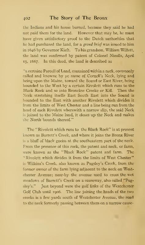
402 The Story of The Bronx
the Indians and his house burned, because they said he had
not paid them for the land. However that may be, he must
have given satisfactory proof to the Dutch authorities that
he had purchased the land, for a grond brief was issued to him
in 1646 by Governor Kieft. To his grandson, William Willett,
the land was confirmed by patent of Colonel Nicolls, April
15, 1667. In this deed, the land is described as
"a certaine Parcell of Land, contained within a neck, commonlycalled and knowne by ye name of Cornell's Neck, lying and
being upon the Maine, toward the Sound or East River, being
bounded to the West by a certain Rivolett which runs to the
Black Rock and so into Bronckse Creeke or Kill. Then the
Neck stretching itselfe East South East into the Sound is
bounded to the East with another Rivolett which divides it
from the limits of West Chester and a line being run from the
head of each Rivolett wherewith a narrow slip, the said Neckis joined to the Maine land, it closes up the Neck and makes
ihe North bounds thereof."
The " Rivolett which runs to the Black Rock" is at present
known as Barrett's Creek, and where it joins the Bronx River
is a bluff of black gneiss at the southeastern part of the neck.
From the presence of this rock, the patent and neck, or farm,
were known as the "Black Rock" patent and farm. The
"Rivolett which divides it from the limits of West Chester"
is Wilkins's Creek, also known as Pugsley's Creek, from the
former owner of the farm lying adjacent to the neck on West-
chester Avenue; near-by the avenue used to cross the wet
meadows of Barrett's Creek on a causeway, also called "Pug-
sley's." Just beyond were the golf links of the Westchester
Golf Club until 1906. The line joining the heads of the two
creeks is a few yards south of Westchester Avenue, the road
to the neck formerly passing between them on a narrow cause-
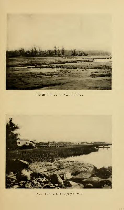
The Black Rock" on Cornell's Xeck.
Near the Mouth of Pugsley's Creek.

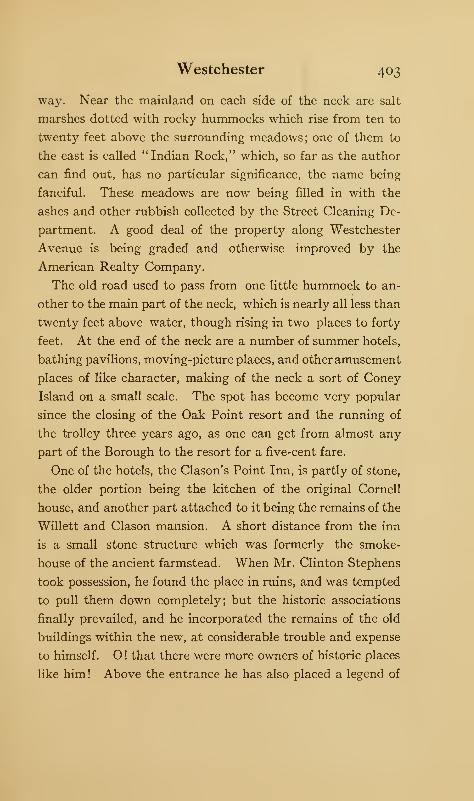
Westchester 403
way. Near the mainland on each side of the neck are salt
marshes dotted with rocky hummocks which rise from ten to
twenty feet above the surrounding meadows; one of them to
the east is called "Indian Rock," which, so far as the author
can find out, has no particular significance, the name being
fanciful. These meadows are now being filled in with the
ashes and other rubbish collected by the Street Cleaning De-
partment. A good deal of the property along Westchester
Avenue is being graded and otherwise improved by the
American Realty Company.
The old road used to pass from one little hummock to an-
other to the main part of the neck, which is nearly all less than
twenty feet above water, though rising in two places to forty
feet. At the end of the neck are a number of summer hotels,
bathing pavilions, moving-picture places, and otheramusement
places of like character, making of the neck a sort of Coney
Island on a small scale. The spot has become very popular
since the closing of the Oak Point resort and the running of
the trolley three years ago, as one can get from almost any
part of the Borough to the resort for a five-cent fare.
One of the hotels, the Clason's Point Inn, is partly of stone,
the older portion being the kitchen of the original Cornell
house, and another part attached to it being the remains of the
Willett and Clason mansion. A short distance from the inn
is a small stone structure which was formerly the smoke-
house of the ancient farmstead. When Mr. Clinton Stephens
took possession, he found the place in ruins, and was tempted
to pull them down completely; but the historic associations
finally prevailed, and he incorporated the remains of the old
buildings within the new, at considerable trouble and expense
to himself. O ! that there were more owners of historic places
like him! Above the entrance he has also placed a legend of
404 The Story of The Bronx
the original occupancy of the neck by Cornell and a brief
statement of its subsequent history.
The neck remained in possession of the Willetts until 1793,
when the west half of it was conveyed to Dominick Lynch,
an Irish gentleman, of whom another son of Erin remarked:
" Mr. Lynch is the only Irishman I ever heard of that brought
money to America." About the same time, the eastern portion
of the neck was sold to Isaac Clason. ' This part of the neck
includes the point, which, from its new owner of 1793, took the
name of Clason's Point, which it still retains. A ferry to con-
nect it with Long Island was established in the spring of 1912.
Mr. Lynch built a large and handsome stone mansion on a
high point of his land which gives a fine view of the neck and
river. In the large entrance hall is a fireplace and mantel of
Carrara marble beautifully carved, with supporting caryatids,
which does not show a scratch or blemish on the white grained
stone after a usage of more than a century. Mr. Lynch was
a devout Catholic; and it is stated that the first services of
the Church ever celebrated in Westchester County were held
in this mansion. In 1830, his executors sold the west half
of the neck to the Ludlow family; later it came into the pos-
session of the Schieffelins, who disposed of it in 1870 to the
Christian Brothers of the Catholic faith, who used it until
1883 as a training school for the neophytes of the society.
In this latter year, it was changed into the Sacred Heart
Academy, for the education of boys, and it is now known as
the Clason's Point Military Academy. Several buildings,
including a chapel, have been added, and there is an athletic
field, while the water contiguous to the property allows of
aquatic sports and pastimes.
1 The name is also spelled Clauson and Classon; but Clason is the gen-
erally accepted spelling.
Westchester 405
The rest of the neck is under cultivation, more or less, and
one's attention is attracted by the great number of broken
shells which are turned up by the plough. Other owners of
property on the neck were the Ludlow family, the first of
whom came to this country in 1694. Ludlow Street, Man-
hattan, was named after a member of this family. The name
of the first Ludlow was Gabriel, which became a family name,
which constantly appears in the family pedigree. One of
the name was a colonel in De Lancey's brigade of loyal-
ists during the Revolution; his half-sister was the wife of
Francis Lewis, a signer of the Declaration of Independ-
ence; which shows how members of the same family dif-
fered in their political views during Revolutionary times.
Perhaps it was a good thing for some of the loyalists that
this was so; for undoubtedly many a handsome estate was
saved from confiscation through the prominence of some
patriotic member of a family who was in the line of
inheritance.
Westchester Avenue, east of the Southern Boulevard, is
still very little built upon, though a large tract of land is being
developed by the American Realty Company beyond the
Bronx River. The thoroughfare was, until 1904, little dif-
ferent from a country road, lined by magnificent trees, which
have disappeared since the widening and grading of the street
in the year mentioned. At the same time, a turn-table bridge
was erected over the Bronx River and the tracks of the Sub-
urban branch of the New York, New Haven, and Hartford
Railroad. Before this, the crossing had been at grade, and it
was a dangerous place.
To the eastward of Cornell's Neck is Castle Hill Neck,
upon which Unionport is situated. To reach the end of the
neck, we go out Avenue C, past the public-school building.
406 The Story of The Bronx
Unionport occupies the head of the neck lying between West-
chester and Pugsley creeks.
In the town records of Westchester, we find under date of
May 6, 1729, regulations for the government of the "sheep
pasture" which had been granted to the town by the charter
of February 28, 1721. The freeholders of the town were
entitled to free pasturage for twenty-five sheep for each in-
dividual; "a cow in lieu of five sheep, a horse, mare, or an ox;
in lieu of a sheep, a calf; in lieu of two sheep, a yearling"
—
all of which is reminiscent of the problems we used to solve in
our childhood's days, which we used to think rather "crazy"
and made up for the special purpose of further addling our
poor understandings. In respect, then, to a common pastur-
age, the settlers of Westchester were not behind their NewEngland relatives; nor had they departed from the ways of
their Anglo-Saxon forbears in old England. The "sheep
pasture," or "Commons," as it was later called, embraced
about four hundred acres on the west side of Westchester
Creek, together with a fenced-in piece of an acre and a half
on vStony Brook, where the owners were in the habit of folding
and washing their sheep.
In 1825, the trustees of the town sold the Commons, as
undivided lands belonging to the town, to Martin Wilkins, Esq.
They then passed through several hands, including those of
his grandson, Gouverneur Morris Wilkins, who paid $300,000
for them. He sold them, in 1851, to a building association,
that established here the village of Unionport; which, in the
earlier days of the electric cars, was a favorite resort on Sun-
days and holidays. The Industrial Home Association Number
Two filed its map of Unionport at White Plains August 23,
1854. Included in this plot was also the Lowerre farm, which
Wilkins had bought for $25,000. He resold it in September,
Westchester 407
1851, at a contract price of $200 an acre, to Henry Palmer,
trustee of the building association. This will give an idea of
the value of land in this vicinity as long ago as the middle of
the last century.
Passing out Avenue C, we go through a stone gateway and
over a shady country road and reach the neck itself. The
surrounding fields are well-cultivated, the old estates being in
possession of German market gardeners. We get fine views
from the top of the ridge along which we pass to the outer
end of the neck. The road ends at a fence about an estate
which gives evidences of having once been a gentleman's
country-place. It formerly belonged to the late Gouverneur
Morris Wilkins, and later to his son-in-law, John Screven,
from whom the neck is known locally as "Screven's Point."
The mansion stands on a bluff near the end of the neck over-
looking a stretch of meadow. The view is a fine one, with the
mouth of Westchester Creek and Old Ferry Point to the east-
ward and the East River to the south with the hills of Long
Island beyond.
If, when we come to the end of the Castle Hill Road, we
turn to the right, we can follow a lane which passes close to
the fence and which brings us into the farmyard of the ancient
home of the Reverend Isaac Wilkins, built, supposedly, about
1765. It is likely that the house is even older than this, as it
may have been erected by the Underhills, or even by the
Cromwells, previous owners of the neck; and the curious
hiding-place which the house contains may have been con-
structed for protection from the Indians; or, more likely,
as a place for the storage of smuggled goods. The lonely
position of the house and the convenience to the creek at
its very door lend likelihood to the latter supposition, as
we know that the gentlemen of colonial days were exten-

408 The Story of The Bronx
sively engaged with, or at least interested in, the contraband
trade.
The house consists of two parts, the living part of two stories
and a single storied part which constitutes the kitchen, where
the great brick fireplace with its Dutch ovens still remains.
Back of the low-ceiled dining-room is a large room partly
underground, which is the cellar for the storage of vegetables
and food, probably the milk room of the ancient farmstead.
The chief interest in the house, however, lies in the second
story, where, back of the immense chimney, a hole in the floor
gives access to a subterranean vault, or room, of which ab-
solutely no indication is given on the lower floor. The flooring
is very wide, not less than twelve inches; and upon the visit
of the author, the occupant of the house obligingly removed
the trap-door in order that he might see into the dark depths
below. Local tradition says there is a passage under the
creek towards Cornell's Neck; but such an engineering
feat as this would have been almost impossible in colonial
days.
It was within this vault in 1776, before the British obtained
possession of this section of Westchester County, that the
three loyalist clergymen, Dr. Myles Cooper, President of
King's College, Dr. Chandler of Elizabeth, New Jersey, and
Dr. Samuel Seabury, Rector of Westchester, hid themselves
for some time while awaiting an opportunity to escape to Long
Island. Notwithstanding the fact that this whole section
was patrolled by the troops of Heath's command, and that the
house was frequently searched for fleeing loyalists, so in-
geniously contrived is the hiding-place that the reverend
gentlemen escaped detection and were able finally to get away
safely to the other side of the Sound. It is not unlikely that
the house harbored less distinguished visitors than the three
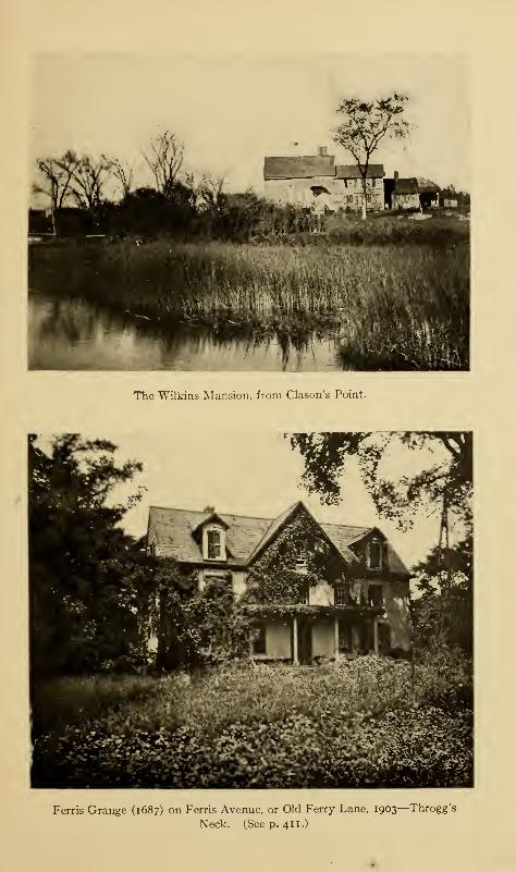
The Wilkins Mansion, from Clason's Point.
Ferris Grange (1687) on Ferris Avenue, or Old Ferry Lane, 1903—Throgg's
Neck. (Seep. 411.)

Westchester 409
mentioned above, as Westchester was a loyalist stronghold,
and the patriots were hot after their recalcitrant fellow-
countrymen, who would be likely to take advantage of such a
secure and secret hiding-place. Upon the near-by creek, boats
and fishing tackle are furnished to those who wish to pursue
the "gentle art."
The earliest record we have of the property is of the date of
1685, when "John Cromwell and Elizabeth Cromwell, his
wife, exchanged six acres of meadow with Thomas Hunt, for
eight acres of upland, situated upon Castle Neck." John
Cromwell is said to have been a nephew of the great Lord
Protector Oliver. In consequence of his occupancy of the
neck, it was known for some time as "Cromwell's Neck."
From the Cromwells, the property passed to a younger branch
of the Underhills, descendants of the redoubtable Captain
John Underhill, whose surprise and massacre of the Indians at
Mianus broke up the Indian war of Kieft's administration.
Isaac Wilkins was the next owner, and he disposed of it in
1784, to Gilbert Pell for £2500; after which it passed through
several hands until it came into those of Martin Wilkins, a
descendant of the Reverend Isaac. Why the property es-
caped confiscation to the State under the laws of 1779, se-
questrating the property of loyalists, is a question. Political
and family influences, especially the latter, were more potent
in those days than these; and it should be remembered that
Wilkins's wife was a half-sister of Lewis, and a full-sister of
Gouverneur Morris, two famous Whigs.
The name of Throgg's Neck is given to all that portion of
the former town of Westchester lying between Westchester
Creek, the East River, the Sound, and Eastchester Bay. As
early as 1704, the northern portion, now within Pelham Bay
Park, was called "Dorman's Island." Of its earliest settle-
410 The Story of The Bronx
ment by Throgmorton, Cornell, and their companions, an
account has already been given in Chapter II.
After the Indian war of Kieft's administration, such part of
the land as had not been occupied by the colonists came into
the possession of Augustine Hermans. It is probable that
those colonists who escaped the Indian massacre returned to
the neck after that unhappy affair and once more occupied and
cultivated their lands. Two of these were named Spicer and
Brockett, who gave their names to two necks on the south side
of the peninsula. On the southwest side of Spicer's Neck,
the Siwanoy Indians had one of their most important places
of sepulture, and hence the neck was frequently called "Burial
Point." On January 7, 1667, Colonel Nicolls granted to
Roger Townsend "a certain parcel of land ... at ye south-
east end of Throgmorton's neck, commonly called New Found
Passage, containing fifteen acres, as also a small neck thereto
adjoining commonly called Horseneck, being about the same
quantity of land, which is not in occupation."
On January 12, 1686, Spicer's and Brockett's necks were
patented to Thomas Hunt of Westchester by Governor Don-
gan under the title of Grove Farm. The yearly quit-rent was
a bushel of good winter wheat, to be paid "on or before the
five and twentieth day of March, at the city of New York."
That Hunt had received a previous confirmation is evident
from his will of 1694, in which he "bequeathes to mygrandson Josiah Hunt, eldest son of my son Josiah Hunt,
the Grove Farm, to him and to his heirs male, which was
patented to me by Governor Nicolls 4th December, 1667, and
further entails the same to the said Josiah and his heirs male
lawfully begotten from generation to generation." It may be
mentioned, in passing, that all entails in the State of NewYork were broken by an Act of the Legislature of 1825.
Westchester 411
This was the same Thomas Hunt, who married a daughter
of Edward Jessup, one of the patentees of the West Farms,
and thus came into possession of the Planting Neck, afterward
called Hunt's Point. The Grove Farm was sold at public
vendue on May 6, 1760, to Josiah Cousten for £3400; so that
we must conclude either that the male line of the Hunts had
run out, or that the entail had been broken. Cousten sold
the same property in October, 1775, to John Ferris, a descend-
ant of John Ferris, one of the original patentees of Westchester,
who had married Myanna Hunt. In consequence of this
purchase, Spicer's Neck became known as Ferris's Point. From
Brockett's Neck, just beyond, the ferry connected with
Whitestone, Long Island, and the neck thus became known
as Old Ferry Point. It is to-day owned by members of the
Lorillard and De Zerega families.
Ferris Avenue, or Ferry Lane, is a beautiful, shady road,
leading down to both necks from the Eastern Boulevard. On
the right is the property of the Roman Catholic Deaf and
Dumb Asylum; and beyond that is the old Ferris house,
which, though modernized, dates from the days of the Hunts.
It was rented to a market gardener at the time of the author's
visit and presented the worst degree of dilapidation of any of
the old houses that he has seen. The house is close to West-
chester Creek, of which it commands a fine view. In October,
1776, the owner was James Ferris, who, with his family, was
at breakfast on the morning of the twelfth, when a gun from
the direction of the water apprised him of the landing of Sir
William Howe and his army. Ferris was later captured by
the Queen's Rangers and imprisoned in the "Provost" prison
in the city of New York.
About the middle of the eighteenth century, the celebrated
loyalist printer of New York, James Rivington, became the
4I-? The Story of The Bronx
owner of considerable property on Throgg's Neck. He after-
ward disposed of it to Colonel Samuel Vetch Bayard, also a
loyalist during the Revolution; and it later came into posses-
sion of his brother, William Bayard. The Bayards were of
French Huguenot extraction, and their ancestors played
prominent parts in the political affairs of the Province as
members of the governor's council, members of the Provincial
Assembly, and in other positions.
As we cross over the causeway from Westchester, we are
confronted by the Presbyterian Church on a spot on the op-
posite hill, upon which the British erected a semicircular
breastwork in October, 1 776, as a protection from the American
riflemen and artillery at the Westchester end of the causeway,
during the five days that Sir William Howe held the neck
before his advance toward New Rochelle. The road leads
straightaway to the end of the neck, where Fort Schuyler is
situated. The road is a fine one and has been a favorite with
wheelemen and drivers, and is now with motorists. On both
sides one can still see magnificent country estates belonging to
people whose names are famous in our commercial, military,
and political annals, or well-known simply on account of their
wealth. A number of these estates have been developed
under the name of Throgg's Neck Gardens within the last
year or two; and the probable extension of the subway will
make them accessible and desirable.
On the north side of the road, beyond the Eastern Boulevard,
are the grounds of the Westchester Polo Club. The trolley
line goes as far as the Eastern Boulevard, and will, in time,
extend to the end of the neck; but there is at present a long,
but pleasant, walk, if one is on foot. The Eastern Boulevard
extends now from Pelham Bridge to Unionport; but, when
completed in accordance with the original plan and survey,
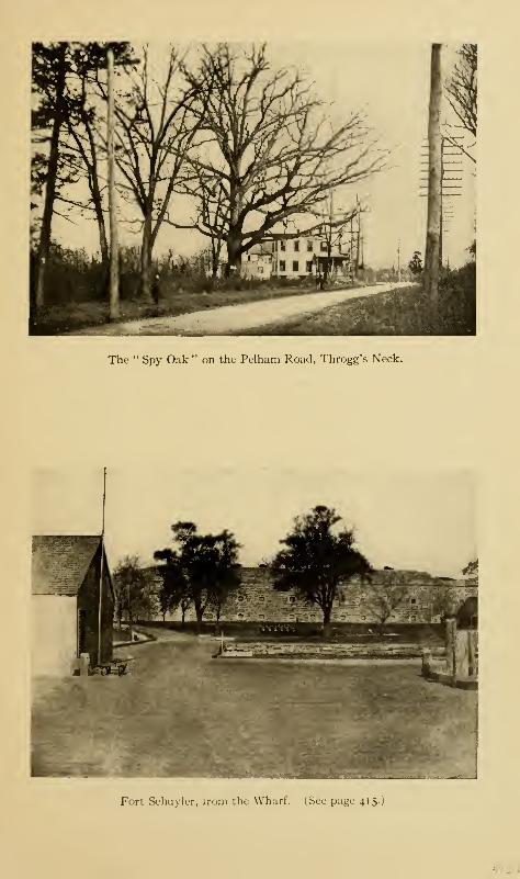
The " Spy Oak " on the Pelham Road, Throgg's Neck.
Fort Schuyler, irom the Wharf. (See page 41 5. )

Westchester 413
it will cross Castle Hill Neck, and Clason's Point and end at
Port Morris; but to do this will require a great amount of
filling in, as a number of wide stretches of meadow land are
to be crossed.
On the north side of Throgg's Neck are Locust Point, or
island, and Weir Creek, as well as a small settlement called
Pennyfield. If we turn to the north over the Eastern Boule-
vard, we shall pass the grounds of the Westchester Country-
Club; and, continuing on our way, shall come to Pelham
Bridge.
The ancient road connecting Westchester causeway with
Pelham Bridge passes one of the famous trees of the Borough.
This is the "Spy," or "Haunted," Oak. Its age must run
into centuries ; as three feet from the ground its girth is twenty
feet, and at the ground the spreading roots must increase
this measurement by at least ten more. It gets its name from
the tradition that a British spy, caught prowling near the
American line, was hanged from one of its branches. For
years, the spot has been considered to be haunted by the spirit
of the unfortunate victim; and he is, indeed, brave who will
go by the spot after nightfall. An old gentleman from Chicago
whom the author met at the tree and who was visiting the
scenes of his childhood and youth, told the writer that in his
boyhood's days there were two brothers living in the neighbor-
hood who were famous, or otherwise, for their boyish pranks.
These youngsters would frequently hide behind the stone wall
bordering the road near the tree, and, as dusk settled down,
keep a bright lookout for any traveller upon the road. Upon
the approach of such a person—if a child, so much the better
—
they would at once set up a series of the most heartrending
moans and shrieks until the scared passer-by would take to
his heels with added evidence of the place being haunted.
414 The Story of The Bronx
Lying northeast of Throgg's Neck, and between it and City
Island, are several small rocky islands whose tops are bare at
low tide, and upon one of which the Federal Government
maintains a light-house. These islets are called the "Step-
ping-stones"; and the origin of the name is due to the
following Indian legend:
The evil spirit set up a claim to the shores of Connecticut,
then in possession of the Indians, who determined to hold
their land, on the principle that "possession is nine points of
the law." But before doing so they laid the whole matter
before their squaws, as most wise men do in cases of great im-
portance, anticipating the dictum of the famous Captain
John Underhill, who says: "Let no man despise the advice and
counsel of his wife, though she be a woman.'" After fully con-
sidering the matter, the squaws advised their lords to compro-
mise the matter with his satanic majesty by vacating the
disputed premises upon receiving remuneration for their
betterments, a New England term that signifies, houses, cul-
tivated or cleared land, or land which has been prepared for
cultivation in the Indian fashion by girdling the trees. As a
matter of course, no answer was vouchsafed to this demand
of the Indians, and the two parties prepared for the final
arbitrament of war.
The Indians knew they were no match for the arch-fiend,
but they thought that, by having a constant and fresh supply
of reinforcements, they would be able to keep up the contest
night and day, and thus tire him out. At his first advance,
the enemy swept everything before him, but the Indians
carried out their plan so successfully and harassed him so con-
tinually that he was finally baffled by their vigilance and per-
severance and was compelled to fall back. As he retreated
along the shore, always presenting a bold front to the advan-
Westchester 415
cing hosts and keeping the Sound on his right flank, he came
to the narrow part of it at Throgg's Neck ; and, the tide being
out and the rocky islets bare, he stepped upon their tops, and
quickly and safely reached the shore of Long Island. At a
point on Throgg's Neck where he stood before jumping to the
first islet, he left the print of his great toe, and thus gave to
the point and the surrounding property the name of "Satans-
toe," whose owners, according to Cooper in his novel of the
name, were, in colonial times, the family of Littlepage.
Now comes in a part of the legend which tallies, to some
extent, with the location of the terminal moraines of the glacial
period on the shores of Connecticut.
Satan retired to the interior of Long Island in a highly en-
raged state, and recovered from his fatigues. Still incensed
at the indignities that had been heaped upon him, he gathered
together a great quantity of stones and boulders at Cold
Spring on the shore and hurled them across the Sound upon
the shores of Connecticut as we see them to this day ; before
that time, the fields of Connecticut had been free of rocks and
boulders and easily tillable.
At the end of Throgg's Neck is Fort Schuyler, which, with
Fort Totten on Willett's Point, Whitestone, Long Island,
commands the eastern entrance to the East River, which is
here very narrow. To the eastward of the two points is the
Sound. Fort Schuyler was named in honor of General Philip
Schuyler, who commanded the Northern Army in 1777, and
whose conduct of the campaign made possible the defeat and
capture of Burgoyne by the succeeding American commander,
Horatio Gates.
The Government reservation consists of fifty-two acres,
purchased in 1 826. The fort was begun in 1 833 and completed
in 1856. It is built of granite brought from Greenwich, Con-
4 1
6
The Story of The Bronx
nccticut, and was built to mount 318 guns and to accommodate
a garrison of 1250 men. The old stone fort has quite outlived
its usefulness; and, though it still stands as a picturesque
object, with its frowning and half-empty casemates, when
viewed from the Sound, and is an object of interest to the
landward visitor, the reliance for attack and defence must be
in the more modern fortifications and armaments which sur-
round it. The development of the defences at the eastern
entrance to the Sound at Fisher's Island has rendered Fort
Schuyler almost useless, and in the summer of 191 1 the
garrison was withdrawn and the fort put in charge of a ser-
geant and a small body of picked men to act as caretakers.
On the south side of Throgg's Neck, west of Fort Schuyler,
are estates belonging to T. C. Havemeyer, Mrs. Collis P.
Huntington, Alfred Hennen Morris, and others, which are
superb in extent and situation and in the care lavished upon
them. Upon a part of the Huntington estate, known at
various times as the Mitchell, the Ashe, and the Livingston
estate, is the finest cedar of Lebanon to be found in the United
States. It was planted by Philip Livingston about 1790 and
has thriven in a remarkable degree for this latitude. Its
height is over forty feet, and its girth about thirteen, while
the spread of its branches is over fifty. Mr. Livingston also
planted many other trees and plants, one of which, a copper
beech, said to have been the finest in the United States, was
blown down about twenty years ago. Most of the gentlemen
of several generations ago of this section were deeply inter-
ested in horticulture and arboriculture, and the Ferris nurs-
eries were particularly famous. We are reaping the benefit
to-day; for the most striking feature of Pelham Bay Park is
the magnificence of its trees, though most of the fine chest-
nuts have been killed by the blight that has been affecting
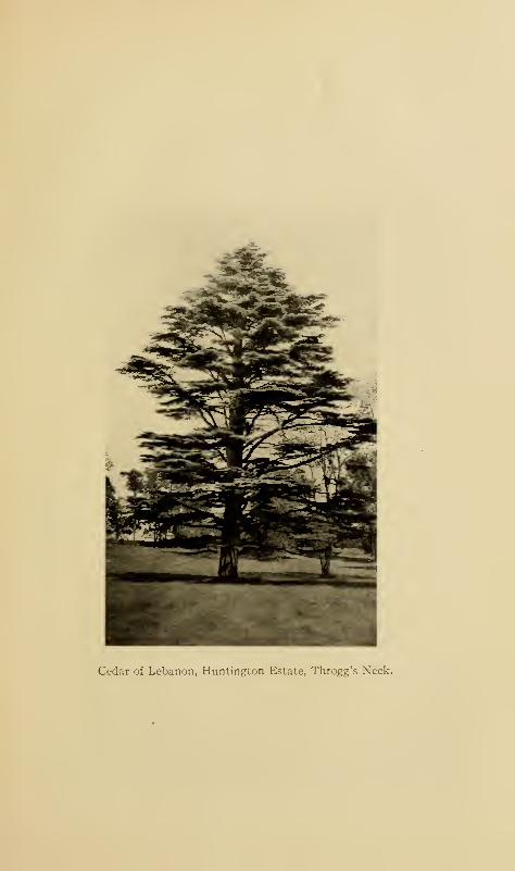
Cedar of Lebanon, Huntington Estate, Throgg's Xeck.
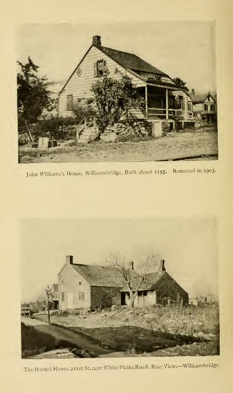
John Williams's House, Williamsbridge, Built about i 7 55- Removed in 1903.
The Husted House, 22 1 st St. near White Plains Road. Rear View.-Williamsbridge.
Westchester 417
all trees of that variety in this vicinity within the last ten
years.
On the west side of Westchester Creek, the principal road-
way, leading from the borough-town through the middle of
the township is the Eastchester Road, which is mentioned in
NicolTs grant of the Ten Farms as the "Westchester path."
Before the days of the Oostdorp settlers, it was a trail, or path,
used by the Siwanoys. It passes along the meadows of the
creek to the higher ground along their edge and crosses the
Boston Road at Corsa Lane (Eleventh Avenue), Williams-
bridge. From this point, the Coles Road followed the East-
chester Road. It crosses the Bronx and Pelham Parkway;
and it was not far from this spot that the Americans had an
outpost to prevent the enemy from crossing at the head of the
creek in October, 1776. A great deal of the material taken
from the Jerome Park reservoir was used for filling in the
meadows in this vicinity. Beyond the Eastchester Road is
the Williamsbridge Road, passing to the north of the Morris
Park race-track ; on the south of the track is the Bear SwampRoad leading to Bronxdale.
Bronxdale was like West Farms on a small scale; as, having
been a milling village strung along the Boston Road in the
early part of the last century, the substantial stone cottages
and houses stood until 191 1, when they were all removed out
of Bronx Park, being either demolished or taken to other
sites. Robert Bolton established a bleachery near where the
Boston Road crosses the Bronx River about 1820, and for
many years a successful business was conducted here. The
little village was about a mile above West Farms, but the com-
munity of interests made them virtually one settlement.
Bronxdale is connected with Williamsbridge by the White
Plains Road ; but this section is so sparsely settled and devel-
27
4i
8
The Story of The Bronx
oped that the traveller finds it hard to believe that he is within
the limits of the second largest city in the world. With so
many hundreds of acres of unimproved land, it seems a pity
that it cannot be used for the erection of individual houses for
the working classes, as in all the other great cities of the world.
But the New York owners and builders are so wedded to the
idea of flats, or tenements, that it is not likely they would
embark in any single-house proposition at low rentals; nor is
it likely that probably ninety per cent, of the inhabitants of
the city would find themselves comfortable, or at home, in
anything else but a flat.
In the northeast portion of the old township is Williams-
bridge, which gets its name from a farmer of pre-Revolutionary
days whose farm was on the east side of the Bronx River near
the bridge. John Williams's house, about one hundred and
fifty years old, was still standing in 1903, on First Street, a
little east of the White Plains Road, within the new park
that has resulted from the widening of the street. The writer
tried to insure the preservation of the old house by calling
attention to it through one of our public societies, but without
success; as the building was removed by one of the Italians,
of whom there are so many in this locality, to whom the old
house had been sold for firewood.
The Bronx River presents some beautiful views below the
bridge. Its banks are lined with residences whose backyards
are prevented by substantial stone walls from being swept
away by the winding stream when in flood or freshet. A few
steps lead down to the stream, where a flat-bottomed boat is
tied, and overhead there is an archway of trees—the whole
making a scene of great beauty. Many of the occupants of
the houses are French and their grounds and houses are orna-
mented with statues and flowers, so that one is reminded of
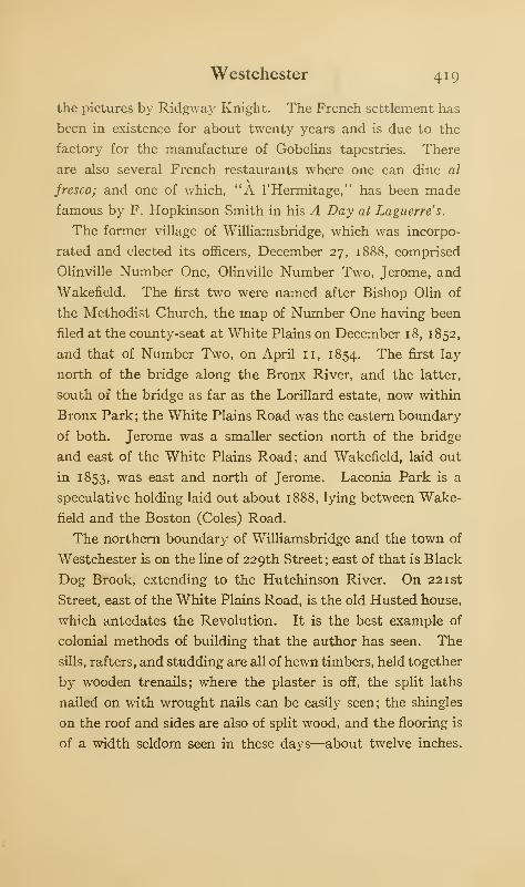
Westchester 419
the pictures by Ridgway Knight. The French settlement has
been in existence for about twenty years and is due to the
factory for the manufacture of Gobelins tapestries. There
are also several French restaurants where one can dine al
fresco; and one of which, "A l'Hermitage," has been made
famous by F. Hopkinson Smith in his A Day at Laguerre's.
The former village of Williamsbridge, which was incorpo-
rated and elected its officers, December 27, 1888, comprised
Olinville Number One, Olinviile Number Two, Jerome, and
Wakefield. The first two were named after Bishop Olin of
the Methodist Church, the map of Number One having been
filed at the county-seat at White Plains on December 18, 1852,
and that of Number Two, on April 11, 1854. The first lay
north of the bridge along the Bronx River, and the latter,
south of the bridge as far as the Lorillard estate, now within
Bronx Park; the White Plains Road was the eastern boundary
of both. Jerome was a smaller section north of the bridge
and east of the White Plains Road; and Wakefield, laid out
in 1853, was east and north of Jerome. Laconia Park is a
speculative holding laid out about 1888, lying between Wake-
field and the Boston (Coles) Road.
The northern boundary of Williamsbridge and the town of
Westchester is on the line of 229th Street ; east of that is Black
Dog Brook, extending to the Hutchinson River. On 221st
Street, east of the White Plains Road, is the old Husted house,
which antedates the Revolution. It is the best example of
colonial methods of building that the author has seen. The
sills, rafters, and studding are all of hewn timbers, held together
by wooden trenails; where the plaster is off, the split laths
nailed on with wrought nails can be easily seen; the shingles
on the roof and sides are also of split wood, and the flooring is
of a width seldom seen in these days—about twelve inches.
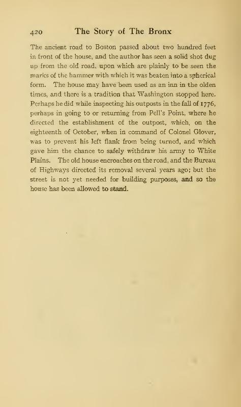
420 The Story of The Bronx
The ancient road to Boston passed about two hundred feet
in front of the house, and the author has seen a solid shot dug
up from the old road, upon which are plainly to be seen the
marks of the hammer with which it was beaten into a spherical
form. The house may have been used as an inn in the olden
times, and there is a tradition that Washington stopped here.
Perhaps he did while inspecting his outposts in the fall of 1776,
perhaps in going to or returning from Pell's Point, where he
directed the establishment of the outpost, which, on the
eighteenth of October, when in command of Colonel Glover,
was to prevent his left flank from being turned, and which
gave him the chance to safely withdraw his army to White
Plains. The old house encroaches on the road, and the Bureau
of Highways directed its removal several years ago; but the
street is not yet needed for building purposes, and so the
house has been allowed to stand.
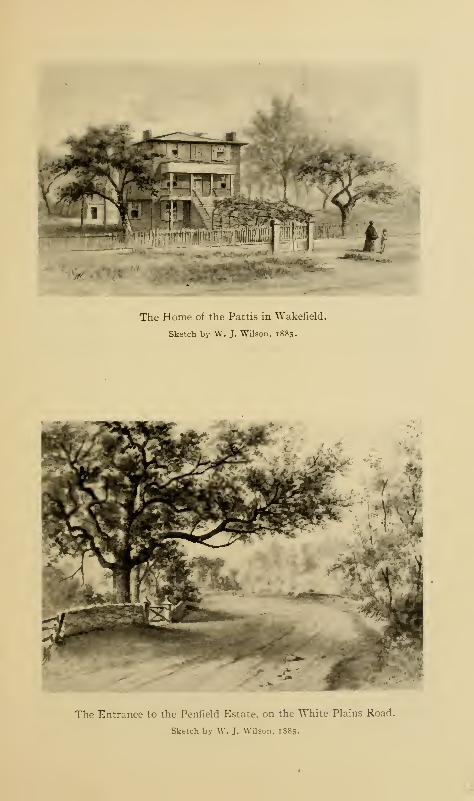
The Home of the Pattis in Wakefield.
Sketch by W. J. TVilson, 1885.
The Entrance to the Penfield Estate, on the White Plains Road.
Sketch by W. J. Wilson, 1885.
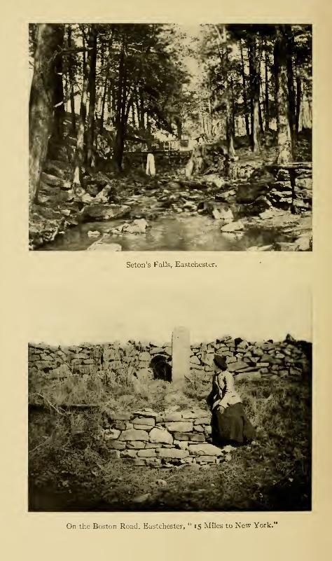
Seton's Falls, Eastchester.
On the Boston Road, Eastchester, " 15 Miles to New York.*
CHAPTER XIX
EASTCHESTER AND PELHAM
OF the town of Eastchester, comparatively little was
added to the Borough. The name of Washington-
ville was that originally applied to the station on
the Harlem Railroad where the New Haven Railroad leaves
the Harlem tracks and swings to the eastward; but a few
years ago the name was changed to Wakefield, which has
thus become the upper end of the city. A small settlement
close to Wakefield was called Jacksonville. The section on
the east of the Bronx River abreast of Woodlawn Cemetery
still awaits development, though the proposed park reserva-
tion along the river will probably take considerable of the
land.
About the year 1854, there settled on Matilda Street in
Washingtonville an Italian family, in whom the neighbors
took great interest; for at all times of the day there issued
from the house the sounds of either vocal or instrumental
music. In fact, except when the children were attending the
union free school in Mt. Vernon, musical practice seemed to
be continuous. These Italians were the Pattis, and two of
the daughters became famous ; Carlotta, as both a pianist and
a singer, and Adelina as the owner of the most beautiful voice
and as the most finished singer of the nineteenth century.
421
422 The Story of The Bronx
Right on the boundary line of the city, on the White Plains
Road, is situated what is left of the old Penfield estate. The
large, comfortable-looking old mansion was an object of in-
terest to all the passengers to the terminal of the Union Rail-
way Company at 242d Street ; and the mansion possessed an
air of dignity that age only can produce. Unfortunately, the
house was almost destroyed by fire on the morning of May 13,
1 91 2. In view of the building of the subway extension to this
point from West Farms, and the growth to be expected from
this section in consequence, the early demolition of the house
to make way for "flats" was to have been expected.
The height of the hills above the river valley is well shown
at East 233d Street, the northern boundary of the cemetery.
There was formerly a very dangerous crossing of the Harlem
tracks at the Woodlawn station on this street, but in January,
1905, the bridge over the tracks was completed and opened.
Mundy's Lane is a part of the boundary line between the
Borough and Mount Vernon; it is an ancient road leading from
Hunt's Bridge in the Mile Square to the Kingsbridge (Boston)
Road, leading to Eastchester. The Kingsbridge Road, an
ancient highway dating back to 1673, takes us through Eden-
wald to near old St. Paul's, Eastchester, though over the city
line. Here is the old Seton estate, through which runs Rattle-
snake Brook, upon which there was formerly a mill. The
site of the old mill is in a narrow and picturesque gorge where
the water has a descent of about thirty feet in two falls, to
which the name of Seton's Falls has been given. It has been
for several generations a favorite place for a stroll, or for pic-
nics by the inhabitants of the neighborhood. In the spring,
the dogwood blossoms whiten the woods, and through the
whole year the ground is carpeted with all kinds of wild flowers
in their turn, as nature here has full sway and has been but
Eastchester and Pelham 423
little interfered with by man. After a heavy rain, a consider-
able body of water comes over the falls, which add to the
beauty and wildness of the scene. In the plan of streets
adopted in 1903, provision was made for a public park at this
place, but the Park Department of the Borough apparently
knows of no steps taken to secure the property.
Rattlesnake Brook crosses the Boston (Coles) Road; to the
east of the road, the stream is dammed, forming Holler's
Pond, from which the ice supply of the neighborhood is cut
and upon whose frozen surface the people of the vicinity
enjoy the sport of skating. There is also a factory for the
making of artificial ice. Near this pond is located a small
settlement, which is the part of the ancient village of East-
chester within the Borough. A lane leads down the neck to
Reid's mill, about a mile from the Boston Road. This lane
used to be a very beautiful one; but in 1904 and 1905 most of
the trees were cut down for firewood and the beauty of the
landscape has been much decreased in consequence. There
are several magnificent old trees on the Boston Road near the
entrance to the lane, but these may suffer from the grading
of the post-road, now being made into a State road. At the
end of the lane, we come to the vast salt meadows of East-
chester Creek, which stretch away for several miles, and over
which there is no way of passing on foot, unless we go to
Pelham Bridge on the south or to the Prospect Hill Road on
the north. These meadows are not without their pictur-
esqueness, and Edward Gay, N.A., has depicted them in a
number of his pictures.
In the olden times, the end of the lane at Eastchester Creek
was called Sander's Landing. In 1739, there was erected here
a tidal mill by Thomas Shute and Joseph Stanton. The mill
passed through several hands until 1766, when it was bought by
424 The Story of The Bronx
John Bartow, who, in 1790, sold it to John Reid, a Scotchman,
whose son Robert was the last miller. The mill has thus been
known as "Bartow's," but more commonly as "Reid's mill."
It was for many years the town mill, and as such passed into
the possession of the city of New York at the time of annex-
ation. It was a great barn-like structure of wood and was
blown down in a storm about 1900, so that nothing now re-
mains of it except the foundation stones. Near-by is a pictur-
esque old structure, probably the home of the miller, the oldest
part of which, so it is said, dates from 1668.
The first settlement of Eastchester was made by the ten
families from Fairfield, Connecticut, in 1664. The neck upon
which the mill is situated formed a part of the "planting neck."
As stated elsewhere, the two settlements of Westchester and
Eastchester were closely allied. When they were separated in
1667, difficulties arose in regard to the undivided lands and
their ownership.
The importance of having mills and craftsmen of various
kinds, especially smiths and carpenters, was early recognized,
and inducements in the way of land and money or produce
were held out to settlers who were mechanics. As early as
1670, there is a record of John Jackson building a mill for the
settlers on Rattlesnake Brook, probably to the east of the
Westchester path, about where Holler's pond is located. In
1676, permission was also given to erect mills at Silleck's
Landing, not far from the present bridge over Hutchin-
son's River, at the Boston Road. No mills were built
here till 1826, when a mill was erected nearer the bridge;
but it only stood for ten years, when it was destroyed by
fire. Silleck's Landing was the town landing at which the
sloops trading by way of Eastchester Creek with the outside
world tied up; it is now, approximately, the Mt. Vernon
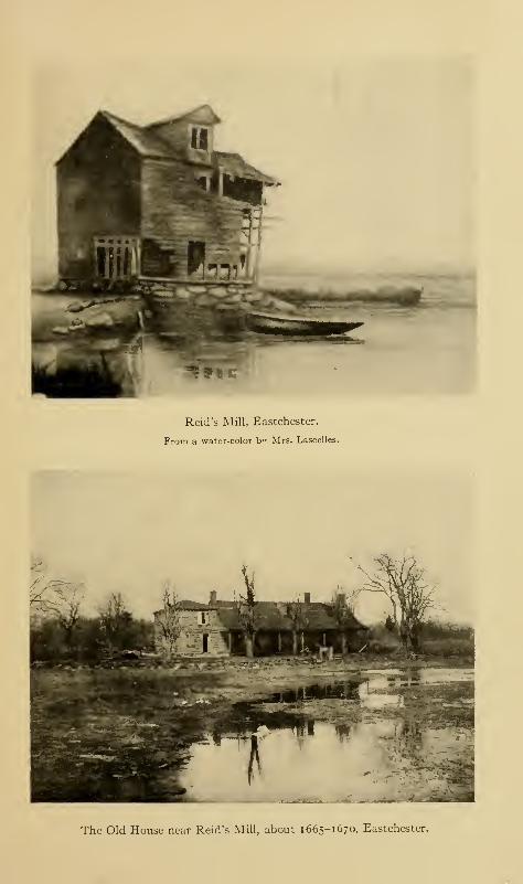
it%H'
Reid's Mill, Eastchester.
From a water-color b" Mrs. Lascelles.
The Old House near Reid's Mill, about 1665- 1670, Eastchester.
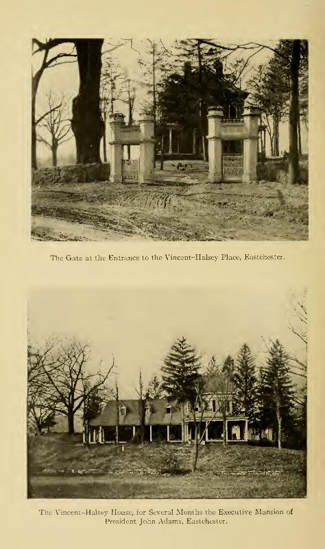
» J
Uft lil -i^Ht
•
•
The Gate at the Entrance to the Vincant-Halsey Place, Eastchestcr.
The Vincent—Halsey House, for Several Months the Executive Mansion of
President John Adams, Eastchester.
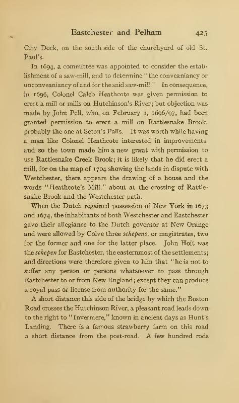
Eastchester and Pelham 425
City Dock, on the south side of the churchyard of old St.
Paul's.
In 1694, a committee was appointed to consider the estab-
lishment of a saw-mill, and to determine "the conveaniancy or
unconveaniancy of and for the said saw-mill.
" In consequence
,
in 1696, Colonel Caleb Heathcote was given permission to
erect a mill or mills on Hutchinson's River; but objection was
made by John Pell, who, on February I, 1696/97, had been
granted permission to erect a mill on Rattlesnake Brook,
probably the one at Seton's Falls. It was worth while having
a man like Colonel Heathcote interested in improvements,
and so the town made him a new grant with permission to
use Rattlesnake Creek Brook; it is likely that he did erect a
mill, for on the map of 1704 showing the lands in dispute with
Westchester, there appears the drawing of a house and the
words "Heathcote's Mill," about at the crossing of Rattle-
snake Brook and the Westchester path.
When the Dutch regained possession of New York in 1673
and 1674, tne inhabitants of both Westchester and Eastchester
gave their allegiance to the Dutch governor at New Orange
and were allowed by Colve three schepens, or magistrates, two
for the former and one for the latter place. John Hoit was
the schepen for Eastchester, the easternmost of the settlements
;
and directions were therefore given to him that "he is not to
suffer any person or persons whatsoever to pass through
Eastchester to or from New England ; except they can produce
a royal pass or license from authority for the same."
A short distance this side of the bridge by which the Boston
Road crosses the Hutchinson River, a pleasant road leads down
to the right to " Invermere," known in ancient days as Hunt's
Landing. There is a famous strawberry farm on this road
a short distance from the post-road. A few hundred rods
426 The Story of The Bronx
above Rattlesnake Brook, the White Plains Road, now called
Columbus Avenue, branches off to the left and passes by the
ancient green in front of old St. Paul's, its route being over
the old Boston Road of 1673 for some distance. As it sweeps
down the hill, it passes a gateway guarded by quaint and im-
posing white posts. This is the entrance to the Halsey place,
which was the executive mansion of President John Adams
in October and November, 1797, several of his letters being
dated from Eastchester. During that year, Philadelphia, the
Federal capital, was visited by yellow fever, and Adams took
up his residence in the Halsey house, then occupied by his
daughter Abigail, and her husband, Colonel William Smith.
During the Revolution, the communion service, the Bible,
and other valuables presented to St. Paul's Church by Queen
Anne, were buried upon this property and dug up after the
war; this was to prevent them from being looted by the British,
who used the church about half a mile above for a hospital,
and who frequently occupied this section in force, so that it
thus became the scene of many a raid and warlike encounter.
At the time of the Revolution, this house was occupied by
the Vincents, the smiths of the village of Eastchester. Upon
one occasion, upon a Sunday, a French officer with the Ameri-
cans insisted upon having his horse shod; and upon the
refusal of Gilbert Vincent to do the work on Sunday, the
officer struck him to the ground, killing him. Elijah Vincent,
then took a commission from the British and became the terror
of the American and French officers who had occasion to
operate in the vicinity of Eastchester. According to authentic
tradition, Elijah Vincent fully revenged his brother's violent
death.
The references to wolf pits and bounties offered for the ex-
termination of the wolves show that there were many of these
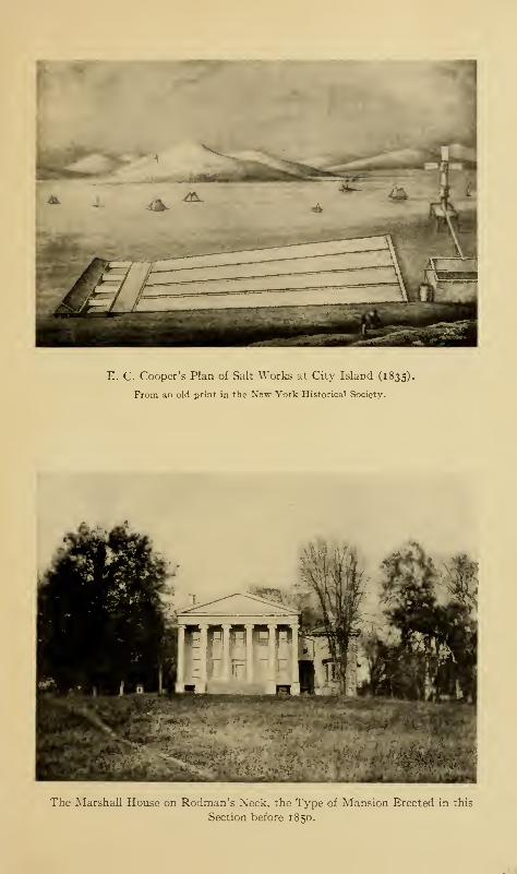
E. C. Cooper's Plan of Salt Works at City Island (1835).
From an old print in the New York Historical Society.
The Marshall House on Rodman's Xeck, the Type of Mansion Erected in this
Section before 1850.

The Old City Island Bridge.
Courtesy of the Department of Bridges, New York City.
The New City Island Bridge.
Courtesy of the Department of Bridges, New York City.
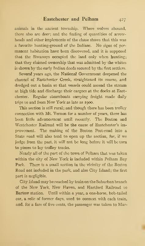
Eastchester and Pelham 427
animals in the ancient township. Where wolves abound,
there also are deer; and the finding of quantities of arrow-
heads and other implements of the chase shows that this was
a favorite hunting-ground of the Indians. No signs of per-
manent habitation have been discovered, and it is supposed
that the Siwanoys occupied the land only when hunting;
that they claimed ownership that was admitted by the whites
is shown by the early Indian deeds secured by the first settlers.
Several years ago, the National Government deepened the
channel of Eastchester Creek, straightened its course, and
dredged out a basin so that vessels could ascend the stream
at high tide and discharge their cargoes at the docks at East-
chester. Regular steamboats carrying freight made daily
trips to and from New York as late as 1900.
This section is still rural ; and though there has been trolley
connection with Mt. Vernon for a number of years, there has
been little advancement until recently. The Boston and
Westchester Railroad will be the cause of Eastchester's im-
provement. The making of the Boston Post-road into a
State road will also tend to open up the section, for, if we
judge from the past, it will' not be long before it will be torn
to pieces to lay trolley tracks.
Nearly all of the part of the town of Pelham that was taken
within the city of New York is included within Pelham Bay
Park. There is a small section in the vicinity of the Boston
Road not included in the park, and also City Island ; the first
part is negligible.
City Island may be reached by train on the Suburban branch
of the New York, New Haven, and Hartford Railroad to
Bartow station. Until within a year, a one-horse, bob-tailed
car, a relic of former days, used to connect with each train,
and, for a fare of five cents, the passenger was taken to Mar-
428 The Story of The Bronx
shall's Corners at the end of Rodman's Neck ; for an additional
fare, he was carried to the end of the island. In 1910, a mono-
rail electric line was inaugurated ; but its first day of business
was an unfortunate one, for the car met with an accident and
several people were killed. The road has been run since with
more or less success; but at this writing, the rolling stock has
decreased to one car; and that is uncertain in its operation
when the weather is bad, or windy—the very time when one
most wants to use the line.
City Island was originally called Minnewits, or Great Min-
nefords, Island. The origin of the name is doubtful, it being
ascribed to Peter Minuits, the Dutch Governor and purchaser
of the island of Manhattan, and also to Minnefords, Minifers,
or Minnewies, the original Indian proprietors. It was within
Thomas Pell's purchase of 1654, and also within his manor-
grant of Pelham. It received its name of City Island from a
scheme of the inhabitants of 1761-62 to establish upon the
island a city that was to outrival New York. General Heath
uses the name "New City Island" in his Memoirs, so that the
name must have been well established in Revolutionary days.
On May 10, 1763, a ferry was ' established "acroost from
Mr. Samuel Rodman's Neck to said Island." The same year
a ferry was established from the north end of the island and
leased to Mrs. Deborah Hicks, "the best and fairest [sic]
bidder." On May 13, 1766, a ferry was established between
the south end of the island across the Sound to Long Island;
it was leased to John Barnes for five years.
The first purchaser from Thomas Pell, the manor-lord, was
John Smith, of the town of Bruckland [Brooklyn]. The
island, on June 19, 1761, came into possession of Benjamin
Palmer, the builder of the free bridge at Spuyten Duyvil, for
£2730. He appears to have suffered considerable loss during
Eastchester and Pelham 429
the war; for, in 1788, he sent a petition to "His Excellency,
George Clinton, Esq., Governor in and over the State of New-
York, and Vice-Admiral of the Navy of the same," for relief.
This failing, he again petitioned for redress of grievances in
1789, this time to "His Excellency, George Washington,
President of the United States." His distress was mitigated
by a subscription, as told elsewhere.
The Revolution prevented the accomplishment of the plan
of building a city upon the island, though it was revived in
1 790. The island was cut up into 4500 lots, each twenty-five
feet front and one hundred feet in depth, besides two squares,
of thirty lots each, reserved for churches, meeting-houses,
schools, etc. Ten pounds was the stated price of the lots,
and many were bought and sold at that price. In 1818,
Nicholas Haight and Joshua Husted owned nearly all of the
island, as well as Rodman's Neck and what became later
the Marshall estate. In the year following, forty-two acres
passed into the possession of George W. Horton.
In 1804, the State Legislature passed an act allowing the
construction of a bridge between the island and the mainland
and subscriptions were started for its erection ; but the attempt
failed for want of support. On December 1, 1873, a toll
bridge, erected by a stock company, was thrown open to the
public. It occupied the site of the bridge laid down on the
map of 1 76 1. It was one thousand feet long with a draw of
one hundred and twenty feet; the draw being that of the
original Coles, or Harlem Bridge, at Third Avenue. A large
part of the materials used in its construction came from the
old United States frigate North Carolina, which had been
condemned and sold by the National Government. This
bridge was made a free bridge in 1895, at the time of annex-
ation, and was replaced by the present fine steel structure,
430 The Story of The Bronx
constructed at a cost of $200,000, not including approaches,
which was opened for public use on July 4, 1901. Work had
been begun upon it in December, 1898.
Notwithstanding the ferry and the bridge, City Island had
been more or less isolated before the opening of Pelham Bay
Park, in 1888, and the advent of the bicycle. The inhabitants
were engaged chiefly in fishing, piloting, and oyster culture.
The fishing was formerly very fine, and upon a Sunday or
other holiday the old bridge was lined with ardent anglers.
The demolition of the old wooden bridge has driven many of
the anglers to the wharf at the south end of the island, at the
end of the island's one long thoroughfare. In 1762, the
owners of the island petitioned for four hundred feet under
water, and the land was granted to them by Lieutenant-
Governor Cadwallader Colden, May 27, 1763. When the
new wharf was built at the lower end of the island in 1901,
we find Mrs. De Lancey asserting her claims to the land under
water as an inheritrix of the ancient grant, but the case was
decided against her. The nearest railroad station is at Bartow,
about two miles distant from the business activities of the
island, so the people have had to depend to a great extent
upon water communication.
There are several yacht clubs located here, and the activities
connected with the water constitute the principal business
of the island. Several shipyards build and repair pleasure
vessels, and in the winter season many of the crack yachts
are laid up and housed here. Upon several occasions the
defenders of the America's Cup have been so laid up. The
yachting industry is principally with sailing vessels ; in stormy
weather, many sailing vessels from the Sound find safe anchor-
age near the island until the weather moderates.
There are numerous bathing pavilions, and the bathing is
u

Eastchester and Pelham 431
considered healthful, as the island extends so far into the
Sound, and the great water-front of Pelham Bay Park with its
lack of villages and towns prevents the contamination of the
water by sewage. Row-boats, sail-boats, and small launches
are plentiful ; and there are dozens of places at which they can
be hired for sailing and fishing, while several of the hotels and
restaurants have more than a local fame. The fishing has
always been famous, though fallen off within the past quarter
of a century, according to the local anglers. Bolton gives
some marvellous stories of successful catches, both as to in-
dividual sizes of fish and to quantity, and as he was a clergy-
man we are, perforce, obliged to believe him.
So self-contained and isolated were the population that when,
after annexation, so the story goes, one of the assistant super-
intendents of schools of the city visited the local school for
purposes of inspection, the population waited upon him en
masse and notified him that they had been able to get along
for over a century without supervision, and that they did not
propose to have their teachers and children bothered by super-
intendents from the city. They have, however, conformed to
the inevitable, and now have a fine, modern building, in which
the city provides not only instruction for the children, but
once a week, from October to May, also furnishes a free lecture
in the evening. The colonial entrance to the school building
seems peculiarly fitting to the locality.
Probably, the greatest object of interest on the island is the
"Macedonian Hotel." It bears the following legend:
This House is thz remains of the English Frigate "Macedo-
nian," captured on Sunday, October 25th, 1812, by the United
States Frigate "United States/' commanded by Capt. Stephen
Decatur, U. S. N. The action was fought in Lat. 24° N., Long.
2Q°jo' W., that is about 600 miles N. W. of the Cape De Verde
432 The Story of The Bronx
Islands off the W. coast of Africa and towed to Cowbay in
1874.
All of which is true, if we omit the first words of the state-
ment: "This House is the Remains of"; though I do not
accuse the owner of the hotel of intentionally misleading the
public. Besides, the house is the remains of the Macedonian,
but not of the one captured in Decatur's gallant action. The
original British Macedonian was a new ship at the time of her
capture, and was afterward repaired and taken into the United
States Navy. She was blockaded in the Thames River,
Connecticut, until the close of the War of 1812, and then
served as a cruiser until 1828, after which she did nothing.
In 1835, she was broken up at the Norfolk, Virginia, navy
yard. Meanwhile, Congress appropriated funds to build a
new ship of the same name, which was commenced in 1832
and launched at Gosport, Virginia, in 1836. She was rebuilt
at Brooklyn in 1852, and broken up in 1874 at Cow Bay, Long
Island, that graveyard of condemned and obsolete vessels.
For a time, this second, American-built Macedonian was used
as a practice ship at the United States Naval Academy at
Annapolis, where the figure-head of the original British frigate
is still preserved as a relic of the heroic days of our infant navy.
1 From The United States Naval Academy, by Park Benjamin; with
some slight changes and additions by the author.
INDEX
Acadians, 281, 282, 284Accidents, railroad, 234, 334, 428Accidents, steamboat, 334, 378Ackerman, William G., 326Adams, President John, 133, 178,
426Adirondacks, foot-note, 197Advowson, 55, 75Agriculture, 86, 87, 89, 103, 391Agreement (or Association), Non-
importation, 104, 121
Albany, 24, 25Albany Post-road, 127, 128, 154,
156, 164, 176, 185, 188, 197, 212,
215,217, 296,327,336Albert the Trumpeter, 35Aldermen, 8, 246, 248, 292Allan, Mr., 351, 352Allen, Jacamiah, 124Alliance, French, 107Alsop, John, 1 16American Army, 114, 119, 137, 138,
142, 143, 147, 150, 171, 174, 297American Bank Note Company, 386American Bridge Company, 236American Jockey Club, 290American Realty Company, 403,
405Amusements, colonial, 108, 109Andriessen, Peter, 27Andros, Governor Edmund, 64, 65,
68, 70, 251, 319Animals, domestic, 89Animals, wild, 86, 89, 302, 309Annes Hoeck, 5, 23, 29, 56, 57,
185, 309Annexation, 5, 6, 7, 8Annexed District, 7, 17, 196, 242,
243. 357Annhooke tWampage), 51Aquahung, 16, 26, 304Aqueannmicke, 17Aqueduct*Avenue, 217, 350
Aqueduct, Catskill, 204, 337, 340Aqueduct, Croton, 203, 204, 285,
293. 340, 357Arboriculture, 416Archer, Benjamin, 62, 348Archer, John, 59, 60, 62, 64, 185,211,275,276,356,396
Archer, Samuel, 349Archer house, 166, 348, 349Area of Borough, 7Armories, 1 1, 337Arms, military, 120, 121, 127Arnold, General Benedict, 170, 340Artillery, 11, 144, 146, 148, 337Asylum, R. C. Deaf and Dumb, 411Athletic fields, 317, 318, 320, 341,
346, 348Aylyffe Brothers, 376
Babcock, Rev. Luke, 115, 258Baldwin, Colonel, 143, 144, 146Bailey Avenue, 342, 343, 346Bailey estate, 343Balloons, 291Baly, Rev. Mr., 252, 279Baptists, 287Baremore, Major, 152, 160, 165,
166, 387Barlow, S. L. M., 290Barnes, Capt. William, 253Barrett's Creek, 402Barretto, Francis, 22, 385, 386, 387Barretto's Point, 22, 381, 385, 386,388
Bartow mansion, 314Bartow station, 310, 311, 427, 430Bartow, Basil, 99, 100Bartow, John, 262, 424Bartow, Rev. John, 97, 98, 99, 106,
219, 256, 257, 273, 279, 280Bartow, Rev. Theodosius, 262Bartow, Theophilus, 119Bassett, Robert, 252
433
434 Index
Bathgate, Alexander, 318Bathgate, Janus, 290, 318Bath-houses, 310, 430Battery, Second, V G., S. N.Y.,11Bayard, Nicholas, 69Bayard, Samuel, 262Bayard, Col. Samuel Vetch, 412Bayard, William, 412Baychester, 19, 309, 310Baxter, Capt. Charles, 392Baxter's Creek, 18Beach Pneumatic Railway Com-
pany, 243Bear Swamp, 100, 213, 290, 343,
417Beck, Charles Bathgate, 281Bedford, 114, 169Bedford Park, 356Bellomont, Governor Lord, 80Belmont, 342, 355, 356Berkeley Oval, 348Berrien family, 329Berrien mansion, 329Berrien, Samuel, 330Berrien's Landing, 217, 346Berrien's Neck, 21, 327Bethel M. E. Church, 287Betts, William, 60, 79, 81, 82, 184,
293Beyse, Rev. Henricus, 277Birkins, Daniel, 197Bison, 302, 308Bitter, Karl, 333Black Dog Brook, 5, 6, 19, 220, 419Black Rock farm, 57, 402Blauzes, the, 20Bleach, Bolton's, 194, 305, 307, 417Block, Adrien, 39"Blythe Place" estate, 386B'nai David congregation, 288Board of Trade, North Side, 10, 11,
231,370,384Bockett's cot, 386Bogardus, Dominie Everardus, 28Bolton, Reginald Pelham, 129Bolton, Robert, 417Bolton, Rev. Robert, 20, 39, 60, 62,
267, 275, 283, 318, 431Bonaparte, Joseph, 315Bonner, Robert, 290Borough Hall, 318, 377Boston Post-road, 123, 127, 128,
144, 146, 149, 156, 167, 212, 214,
215, 216, 240, 245, 280, 304, 308,
322, 335. 336, 342, 39i. 417. 419,
422, 423, 426, 427
Botanical Society and Gardens, 307,351,356
Boundary disputes, 36, 37, 39, 41,
42i 43, 47Bound Brook, 43Bowne house, 145, 311Bowne, Sydney B., 398Breda, Treaty of, 46Brewster, Rev. Mr., 252Bridges, 179, 184, 190, 204, 206,
214, 226, 236, 307, 331, 405, 424Central (Macomb's Dam), 14, 15,
16, 65, 198, 201, 202, 240, 350City Island, 310, 316, 429Farmers' (Free, Dyckman, or
Hadley's), 128, 190, 191, 192,
195, 196, 217,343Harlem (Third Avenue), 192, 193,
195, 196, 215, 240, 370, 429High, 5, 15, 16, 166, 203, 222,
228, 331, 350Hudson Memorial, 333King's, 149, 150, 185, 187, 188,
189, 195,212,296,329,335Lenox Avenue, 206, 240Madison Avenue, 204, 205, 240,
369Park Avenue railroad, 205, 207,
229, 232Pelham, 220, 221, 309, 317Pontoon, 129, 133, 168, 169, 330,
349Putnam railroad, 207, 238Second Avenue railroad, 207, 242Spuyten Duyvil railroad, 207University Heights, 207Washington, 205, 206, 240, 331,350
Williams's, 128, 158, 184, 215,216, 304, 322, 356
Willis Avenue, 206Bridges, Thomas, noBridges, Mrs. Thomas (see Sarah
Cornell)"Brightside" estate, 380Bristow, George H., 376British army, 94, 119, 125, 137, 138,
156, 160, 176, 297British evacuation, 150, 175Broadway, 181, 185, 187, 188, 192,
296, 335, 336Broadway-Lexington Avenue route,
243, 247Brockett's Neck, 410Bronk, Antonia (Slagboom), 27,
28
Index 435
Bronk, Jonas, 16, 26, 27, 28, 62, 75,104, 389
Bronk, Peter, 28Bronx Beautiful Society, 12
Bronx, Borough of The, 1, 6, 7, 8,
10, 11, 12, 14, 18, 26, 39, 40, 47,56, 69, 86, 107, 1 14, 1 19, 122, 133,
147. 151, 175. 177, 179. 247, 248,
249Bronx Chapter, D. A. R., 303, 311Bronx County, 10Bronxdale, 194, 213, 304, 343, 417Bronx Kills, 5,29, 105, 135, 192,360,
364. 366Bronx Park, 42, 243, 291, 304, 309,
351, 354, 356, 389, 401. 417Bronx River, 2, 5, 7, 9, 16, 17, 18,
26, 39, 42, 47. 49. 60, 79, 128, 141,
147, 148, 149, 158, 167, 184, 194,202, 209, 214, 229, 304, 356, 357,385,418
Bronx Society of Arts and Sciences,
12
Brook Avenue, 16, 193Brooklyn, Borough of, I, 131, 177Brouncksland, 28, 29, 43, 48, 56, 63,
64. 75. 179Browne, Josiah, 262Brownson Literary Society, foot-
note, 382Bryant, Captain, 158Buckhout, Mathias, 81
Bungay Creek, 5, 16, 29, 42, 318,381
Bunker Hill, loss at, 147Burgoyne, Lieut.-Gen. John, 160,
261, 415Burial Point, 410Burnside Avenue, 129, 149,347,349Burr, Colonel Aaron, 17, 137, 167,
191, 360Burying-grounds, 263, 266, 271, 274,
276, 281, 284, 287, 301, 313, 320,
346, 382, 386, 392Bussing Avenue, 215Bussing's Point, 198Byram River, 21
1
Byvanck, Tryntje, 83, 104
Cabots, John and Sebastian, 24, 39Cadwallader, Col. Lambert, 150Calver, W. L., 129Campbell estate, 201Camping out, 316Canal, Erie, 364Mott Haven, 367-370
Ship, 188, 196, 207, 331Cannon, 118, 123, 124, 127Carleton, Sir Guy, 174, 175, 298Casanova, Innocencia, 388Casting, Samuel, 279Castle Hill Neck, 15, 18, 22, 211,
213,374,405,409,413Cathcart, Lord, 155Catholics, Roman, 69, 251, 281,
282, 283, 284, 285, 324, 325Cauldwell, State Senator, 6, 394Causeways, 140, 141, 184, 185, 188,
212, 220, 234, 312, 315, 317, 336,356, 377, 398, 402, 412, 413
Cedar of Lebanon, 416Cedar Park, 291, 292Cemeteries, 321, 392Census, 2, 8, 9Central Bridge (see Bridges)Century House, 207Chandler, Rev. Dr., 261, 408Charles I., 63Charles II., 45, 68Charities Department, 20, 365Charter, New York City, 7, 8, 68Chastellux, Marquis de, 168, 170Chester Improvement District, 8,
292, 312Chimney Sweeps, the, 20Christian Brothers, 400, 404"Christ's Hotel," 360Church of England (see Established
Church)Churches, Baptist, 287
Congregational, 288Episcopalian, 254, 257, 261, 262,
263, 267, 271, 272, 280, 285,
312,355Established, 70, 97, 98, 100, 115,
255, 257, 258, 273, 277, 279,280, 284
Lutheran, 288Methodist, 285, 286, 287, 419Moravian, 288Presbyterian, 280, 281, 392, 412Reformed Dutch, 62, 101, 213,
275, 276, 278Roman Catholic, 283, 284, 285,
325City Island, 5, 18, 20, 23, 56, 131,
143, 144, 160, 161, 196, 210, 287,310, 427, 428, 429, 430
City Island Bridge (see Bridges)City Island Road, 145,221,310,312Civil War, the, 19, 292, 392, 393Claflin, Horace B., 278
43t> Index
Claremont, 371Claremont Park, 16, 289, 291, 319Clark, Daniel, 97, 100Clason, Isaac, 404Clason's Point, 22, 208, 284, 403,
413Clason's Point Military Academy,
4*>4
Clemm, Mrs., 352Clcmm, Virginia (Mrs. Edgar Allan
Poo), 352, 353C kiulcnnin, Rev. Frank M., 265Clergymen, 251, 263, 277, 279, 286Clinton, Governor (Royal) George,
82Clinton, Gen. and Gov. George, 131,
142, 176,298,326, 363,429Clinton, Gen. Sir Henry, 160, 168,
302Clinton, Col. James, 119, 143Club-houses, rowing, 372Cock Hill, 125, 126, 134, 150, 178,
330, 333C olden, Lieut.-Gov. Cadwallader,
257. 430Colen Donck, 48, 59, 60, 78, 81
Coles, John B., 193, 194, 202, 215,
304, 370, 391College Point, 204Collegiate Reformed Dutch Church,
276Colonial Dames, Society of, 294Columbia University, 341Colve, Governor, 57, 64, 66, 275, 425Comfort, Lucy Randall, 376Commissioners of Forfeiture, 191,
325> 326, 327Committee of Safety, 121, 302, 360Concourse, the (see Grand Boule-
vard).Congregationalists, 279, 288Congress, Continental, 84, 107, 115,
116, 118, 119, 133, 137, 142, 157,
274. 338, 359- 360Congress, Federal, 3Congressmen, 8
Connecticut, 1, 35, 38, 42, 47, 49, 56,114, 120, 123, 151, 211,280, 414
Constitution, the Federal, 107, 360,36i
Convent, 326Convention, Constitutional, 360Convention, County, 115, 116Conway, Genera] Thomas, 338Cook, Joseph, 197Cook, Walter, 333
Cooper, James Fenimore, 83, 189,
383,415Cooper, Rev. Dr. Myles, 261, 408Corbin, Austin, 302Cornbury, Gov. Lord, 53, 225, 279Cornell, Sarah, 31, 57, 84, noCornell, Thomas, 31, 49, 57, 84, 401Cornell's Neck, 18, 22, 48, 57, 385,
401Cornwallis, Lord, 149, 153, 165, 171,
210, 302Corpus Christi monastery, 386Corsa, Andrew, 155, 171Corsa, Capt. Isaac, 281Cosby, Gov. William, 74, 75, 77Coster, Charles H., 237Council of Nine, 34Counties, 1, 2, 67, 70, 397County-seat, 220, 221, 397, 398Court-house, 220, 254, 396, 397, 398Court-house, new, 375Courts, 8, 55, 57, 58, 61Cowboy tree, 328Cowboys, 129, 153Crab Island, 16, 19, 65, 372Crimes, 95, 96Crimmins, John D., 386Croaker Papers, 384Cromwell families, 374, 407Cromwell house, 374Cromwell's Creek, 15, 16, 65, 105,
217, 292,320,374Cromwell's Neck (see Castle Hill
Neck).Cromwell, James, 375Cromwell, Col. John, 374Cromwell, John and Elizabeth, 407,409
Cromwell, Oliver, 63, 374, 409Crosby, Enoch (Harvey Birch), 155Crossings, railroad, 334, 405, 422Croton River, 17, 79, 202Crotona Improvement District, 8CrotonaPark, 16,291,318,319,377Crotona Parkway, 320Cruger, Captain, 166Cunningham, Capt. William, 150Curling, 300Curtis, Captain, 144, 146Cushing, Captain, 168
Dams, 187, 193, 195, 198, 199, 200,202, 294, 300, 305, 356
Dash's Lane, 217, 334Dashwood, G. L., 349Dater Brothers, 289
Index 437
Davis, Albert E., foot-note, 370Dawson, Henry B., 115, 376Dayts, Louren t, 27Dead, list of historic, 268, 269, 270De Armond, Colonel, 155, 165, 166,
298, 354. 387Debatable land, 43, 381, 386Decatur, Commodore Stephen, 431Declaration of Independence, 84,
261,358,359De Conninck, Captain, 36, 209Deer, 53, 86, 89, 427Delafield, Joseph, 327De Lancey family, 113, 114, 115,
389De Lancey mansion, 89, 305, 390De Lancey, Etienne (or Stephen),
82, 104De Lancey, Judge James, 74, 77, 78,
82, 83De Lancey, Lieut. -Col. James, 83,
107, 129, 151, 155, 162, 163, 166,
168, 169, 171, 172, 173, 305, 330,348, 39i
De Lancey, John, 72, 83De Lancey, John Peter, 83De Lancey, Oliver, 20, 84, 15
1
De Lancey, Peter, 72De Lancey, Peter (of the Mills), 83,
104, 151,259De Lancey, Susan Augusta (Mrs.
J. Fenimore Cooper), 83De Lancey's Mills, 104, 154, 158,
162, 167, 170, 214, 281, 305, 356,389
De Lancey's pine, 305, 306Delaval, Mayor, 180Delavall, Thomas, 60, 78, 105Delpech, schoolmaster, 98Depredations by troops, 134, 135,
154,175,261,346Dermer, Capt. Thomas, 40Dervall, John, 80De Voe Park, 32Devoe'sNeck (or Point), 15,65, 198,
218, 350, 371, 372De Vries, Pietrus Rudolphus, 79, 81Dewilt, Clause, 81
De Witt, Charles, 280Dexter, 290Disciples of Christ, 2d Church of the,288
Dissenters, 253, 254, 258, 259, 274,279
Dissisway, Marcus, 65Districts, Local Improvement, 8
Dobbs Ferry, 149, 159, 160, 171,176
Dogwood Brook, 14Dongan, Gov. Thomas, 66, 68, 80,
225, 410"Dorman's Island," 317, 409Doughty, Elias, 59, 60, 61, 78, 81,
184, 211Doughty, Mary, 32, 35, 59Draft riots, 393Dragoons, Legion (Tarleton's), 163,
322Moylan's, 161, 164Sheldon's, 155, 161, 170, 172
Drake, Gilbert, 118Drake, Col. Joseph, 119Drake, Joseph Rodman, 17, 394,305,382,383,384,385
Drake, Major Moses, 1 19Dress, Colonial, 90, 91Drill grounds, 300, 317Duane, James, 116Duke of York and Albany (James
H.), 39, 46, 47, 49, 55. 65, 68,
Dunderberg, the, 345Dutch, 48, 57, 65, 66, 70, 86, 93, 96,
253, 275, 276, 277, 425Dutch garden, 299Dutchess County, 48, 280Dyckman family, 155Dyckman, Abraham, 172, 173Dyckman, Jacob, 190Dyckman, Michael, 168Dyckman's Bridge {see Farmers'
Bridge)
East Albany, 233East Bay Land and ImprovementCompany, 388
Eastchester, 2, 5, 6, 7, 19, 50, 51, 53,
57, 77, 97, in, 119, 123, 133, 144,152, 164, 166, 170, 171, 173, 176,
184, 193, 194, 195, 209, 211, 214,
229,253,279,421,423,424Eastchester Bay, 15, 18, 20, 23, 30,
140, 143, 309Eastchester Bridge Company, 317Eastchester Church, {see St. Paul's,
Eastchester)Eastchester Creek, 18, 19, 20, 52,
104, 160, 185, 220, 423, 427Eastchester Parish, 256, 257Eastchester Road, 219, 417East Melrose, 371East Morrisania, 371
438 Index
East River, i, 5, 15, 16, 18, 21, 39,42, 49, 56, 64, 131, 135, 139, 170,
177. 1*5East Tremont, 342Echo Park, 320, 351Bdenwald, 4:? 2
Edict of Nantes, 82Edsall, Samuel, 29, 63Edsall, Thomas Henry, 130, 340Edson, Mayor Franklin, 291Education, 96, 97, 98, 99, 100, 101,
102, 1 14Eighth Regiment, N. G., S. N. Y.,
337Electric Traction, 234, 236,238,240,
428Eliot Samuel (quoted), 44Elm Cottage, 353Eltona, 371Emmaus, 27, 28Emmerick, Lieut.-Col., 152, 154,
155, 160, 162, 163, 167, 278, 297,
346, 39iEmmons, Adjutant Abraham, 120Enos, Colonel, 160Entail, 293, 410Estimate and Apportionment,Board of, 8, 9
Evacuation, British, of New York,150, 176
Farm, the Grove, 42, 410, 411Farmer, Father (see Steinmeyer)Farmers' Bridge (see Bridges)Farragut, Admiral David G., 323Farragut, Loyall, 323Farragut, Virginia D., 323Fay, Tlie Culprit, 383Featherbed Lane, 217, 218Federalists, 361, 363Fellows, General, 142Ferries, 22, 179, 182, 183, 185, 186,
192, 208, 226, 396, 404, 411, 428Ferris Avenue, 411Ferris, James, 116Ferris, John, 56, 411Ferris Neck, 22, 411Fever, yellow, 17, 426Fights, 136, 141, 144, 156, 157. 158,
162, 163, 164, 166, 167, 169, 170,
.172, 173. 174Fire-bugs, 275Fire Department, 8, 9Fire-ships, 130, 131, 326Fish and Fishing, 89, 316, 317, 318,
409, 430, 43i
Fish, James D., 315Fiske, Prof. John (quoted), 107Fitzgerald, Edward, 97, 100Five Nations, the, 69, 80Flag, The American, 383, 384Flag, the National, 377Flagg, Major Nathan, 173Fleetwood Park, 290Fletcher, Governor Benjamin, 70,
71, 79, 186,255, 279Flower, Gov. Roswell P., 244Fogge, Rev. Ezekiel, 252, 279"Font Hill," 325Food, 86, 89Forage, 159, 160, 174Fordham, 2, 5, 6, 6o, 61, 119, 131,
133. 149, 1 54, 183, 184, 212, 213,221, 242, 275, 276, 305, 343, 351,352, 356
Fordham Church, 101, 213, 217,262, 274, 275, 343, 346, 352
Fordham Heights, 126, 129, 149,150, 152, 167,322,342
Fordham Hospital, 12, 13Fordham Landing, 217, 346Fordham Manor, 61, 62, 64, 217,
275, 278, 290, 342, 348, 366Fordham Ridge, 15, 16, 303, 322,350
Fordham Road, 218, 276, 304, 346Fordham University, 213, 243, 285,
353. 354. 356Forest Avenue Congregational
Church, 288Forrest, Edwin, 325"Forrest's Castle," 325, 326Forster, William, 77, 97, 98, 99, 100,
257Fort Prince Charles, 125, 126, 150Fort Christina, 329Fort, Cock Hill, 125, 126, 150Fort George, 128, 129, 348Fort Good Hope, 41Fort Independence Street, 128, 340Fort Knyphausen, 150Fort Lee, 131, 149Fort Montgomery, 130Fort Number One, 125, 126, 329Fort Number Two (Fort Swart-
wout), 125, 126, 329Fort Number Three, 125, 126, 329Fort Number Four (Fort Inde-
pendence), 126, 127, 128, 131,
r 56 . 157, 159, 160, 167, 168, 170,
295. 328, 329, 330, 337, 338, 340,
342
Index 439
Fort Number Five, 128, 337, 343Fort Number Six, 129, 344Fort Number Seven, 129, 149, 346Fort Number Eight, 129, 149, 166,
168, 169, . 73, 174, 347, 348, 349Fort Schuyler, 23, 412, 415Fort Washington, 127, 131, 133, 135
142, 149, 151, 152, 154, 159, 210,
348, 349Fortifications, Ii8, 119, 124, 125,
126, 127, 128, 129, 130, 134, 135,141, 149, 152, 156, 158, 167, 330,349. 412
Fowler, Colonel, 165, 166, 387Fowler, John, 124Fowler, Judge Jonathan, 123Fox, George, 63, 272Fox's Corners, 219, 380Franklin, Benjamin, 133, 225Franz Sigel Park, 292, 372Freeholders, 113, 116Freight station and yards, 229, 230,
292, 386French, Francis, 60"French Neutrals," 282French settlement at Williams-
bridge, 418French troops, 168, 283, 298Funerals, no, in, 112Furniture, colonial, 88
Gage, General, 147Galloway, Dr. (quoted), 138Gardeners, market, 374, 385, 386,
407Gates, Gen. Horatio, 109, 155, 238,
415Gaynor, Mayor William J., 1
1
Gazette, Rivington's, 101Gazetteer, Rivington's Royal, 117,
120, 123General Slocum disaster, 378Genet, Citizen, 362Gentlemen's Driving Association,
289George III., 125, 274, 298, 391George's Point, 81, 293, 294Germans, 286, 288, 371, 374, 385,
386, 407Gesellen islands, 19Giles, William Ogden, 127, 295, 340Gill, Lieutenant, 164Gist, Colonel, 162, 322Givan's Creek, 219Glenn, Henry, 118Glover, Charles, 97, 100
Glover, Colonel John, 143, 144, 146,
311, 420Glover's Rock, 311Godwin, Joseph, 213, 335"Godwin's Island," 335Golf, 216, 300, 314Gomez, Estevan, 24Goose Island, 20"Gordon riots," 359Gotshall, W. C, 247, 248Gott, Mr., 100Gouverneur, Sarah (Mrs. Lewis
Morris), 359Grace P. E. Church, 271Graham, Isabella, 74, 358Graham, James, 2, 259, 381, 387Graham, Col. Jonathan G.
f120,
131, 141,311Graham, Lewis, 262Graham mansion, 165Gramatan, 51Grand Avenue, 293Grand Central Station, 188, 230,
231, 234Grand Central Terminal, 231"Grange," the Hunt, 383, 385Grant, General, 154Grasse, Comte de, 171Graydon, Captain (quoted), 94"Gray Mare" boulder, the, 316Great Eastern, the, 21Greenbush, 233Greene, Lieut.-Col. Christopher,
173Greene, Maj.-Gen. Nathanael, 149,
166, 167, 274Guides, 155, 168, 171, 172, 173Gun Hill, 357Gun Hill Road, 128, 157, 159, 215,
216, 293,322, 341Guy Fawkes Day, 108
Hadden (or Heddy), John, 59, 79,81, 82, 184, 212, 293
Hadley, George, 191, 293, 326Hadley, William, 327Half-Moon, the, 331, 332, 333Hall, Edward Hagaman, 129"Hall of Fame," 347, 353Halleck, Fitz-Greene, 383, 384Hamilton, Alexander, 264, 360, 361Hamilton, Andrew, 78Hammond, Lieut.-Col. James, 119Hand, Col. Edward, 141Hand's Riflemen, 141, 311, 398
440 Index
Hardenbroeck, Margaret (Mrs.Frederick Philipse), 79, 81
Harlem, 26, 28, 43, 47, 61, 131, 177,179.193.195,275.276
Harlem Bridge { sec Bridges)Harlem Bridge Company, 195Harlem Bridge, Morrisania, andFordham Railroad Company, 239
Harlem Freight Terminal, 370Harlem Heights, 148Harlem, Plains of, 26Harlem River, 1, 2, 5, 6, 9, 14, 15,
16, 25, 26, 29, 48, 64, 86, 89, 125,
130, 149, 154, 160, 168, 177, 179,192, 193, 198, 199, 201, 202, 210,
360, 367Harris, Lieutenant, 1 74Harryson, Katherine, 58Hart Island, 5, 20, 39, 56, 160Hartford, 41Haskins, John B., 239, 394Hatfield, Colonel, 166Hazen, Lieut.-Col., 169Headquarters map, 128, 130, 134Heath, Maj.-Gen. William, 128, 130,
131, 136, 139, 140, 141, 142, 143.152, 156, 158, 164, 172, 175, 297,322, 326, 328, 341, 348, 357, 408,428
Heatheote, Ann (Mrs. James DeLancey), 83
Heatheote, CoL Caleb, 71, 83, 253,
254, 272, 273, 279, 280, 397, 398,425
Heatheote, Martha (Mrs. Johnson),
83Heine statue, 373Heintz, Louis J., 223, 373Hell Gate, 40, 186Henly, Major, 136Henry Clay disaster, the, 334Henry VII., 24Hermans, Augustine, 31, 410Herter, Professor Ernst, 373Hessians, 127, 134, 137, 143, 157,
158, 348Hewitt, Mayor Abram S., 243, 244High Bridge {see Bridges)Highbridge Road, 213, 217, 222, 342Highbridgeville, 10, 350High Island, 5, 20Highlands, Hudson, 130, 152, 160,
174Highland Turnpike Company, 212,
336High School, Gouverneur Morris, 9
Highways, Commissioner of, 222Hildreth, J. Homer, foot-note, 370Hodson, Rev. John Merlin, 278Hoe, Col. Richard M., 270, 380Hogg Island, 105, 365Hoit, John, 425Holler's Pond, 423, 424Holmes, Col. James, 118, 119Home for the Friendless, 372Home for Incurables, 12, 353, 355Honeywell, Captain, 172, 173Horses, 223, 226, 240, 289, 291Horses, Morgan, 156Hospitals, 12, 13, 126Hotham, Commodore, 138Houdin, 364House of Refuge, 365Houses, colonial, 87, 88Howe, Admiral Lord, 17, 125, 133,
140Howe, Gen. Sir William, 17, 125,
126, 133, 134, 137, 139, 140,
143, 147, 149, 160,310, 311, 411,412
Huckleberry Island, 349v Huckleberry" road, 240, 241Hudson, Henry, 24, 332, 333Hudson Memorial bridge, 333Hudson monument, 333, 334Hudson Park, 14, 327Hudson River, 1, 2, 26, 33, 40, 47,
79,89, 125,177,326,327,331Hudson ter-centenary, 333Huguenots, 56, 70, 84, 412Hughes, Bishop John, 354Hull, Lieut.-Col. William, 169, 349Hunt burial-ground, 321Hunt, Josiah, 72, 410Hunt, Margaret, 271Hunt, Thomas, 1st, 31, 42, 58, 64,
374,380,409, 410,411Hunt, Thomas, 2d, 383Hunt, Thomas, 3d, 116, 262Hunt's Point, 22, 42, 72, 132, 219,
247. 321,380,383, 388,411Hunter, Elias des Brosses, 314, 318Hunter, Governor, 277Hunter Island, 5, 19, 20, 39, 56,
309, 314Hunter, John, 20, 314Hunter mansion, 314Hunter's Island Inn, 315Huntington, Collis P., 399, 416Hussar, British frigate, 378Husted house-, 419Hutehins, Waldo, 328
Index 441
Hutchinson, Anne, 23, 29, 51, 57,
Hutchinson s River, 5, 18, 29, 39,50, 146, 209, 211, 214, 309, 312,
Hutton, William R., 205
Immaculate Conception, R. C.Church of the, 286
Immigration, 4, 286, 288Incendiaries, 274Independents, 251, 252, 256, 273,279
Indian cave, 329Indian field, 164, 303"Indian Rock," 403Indian shell mounds, 314, 316, 324,329
Indian wars, 28, 29, 30, 35, 38, 43,44,86,409,410
Indians, 18, 21, 28, 29, 30, 35, 38,40 43, 49. 51. 59. 61, 64 69, 81,
94, 103, 105, 162, 163, 2ii, 312,322, 329, 389, 402, 414
Indus (quoted), 76, 77Ingoldsby, Major Richard, 70Interborough Rapid Transit Com-
pany, 246, 247Interurban Railway Company, 241Intervale Avenue, 16Invermere, 425Ireland, Rev. John, 263Irish, 233, 281, 284Irving, Washington, 92, 178, 332Iselin Columbus, 315
"Jack's Rock," 313Jackson, Captain, 311Jackson, Rev. Charles D., 265Jackson, Colonel, 136Jackson, Rev. John, 278Jacksonville, 421Jacobsen, John, 27James II. (see Duke of York and
Albany)Jansen Brothers, 43Jay, John, 116, 361Jeffeard's Neck, 165, 387Jerome Avenue, 16, 162, 199, 215,
216,217,247,293,372Jerome, Leonard W., 290Jerome Park, 213, 214, 290, 318,
336, 342Jerome Park reservoir (see Reser-
voirs)
Jerome, village of, 419
Jessup, Edward, 16, 42, 84, 104,
271, 381,411Jessup, Elizabeth, 42Jesuits, 251, 282,285,354Jogue, Father, 251Johnston, Rev. Joseph H., 265Jones, Ebenezer, 60Jones, John Paul, 109Jones, Rev. Morgan, 252, 279Joseph Rodman Drake Park, 32 1,
382"Judge" Smith's road-house, 217Juet, 332Jumel, Madame, 137Jumel mansion, 137
Karacapacomont, 81
Keeler, Captain, 166Kemble, Lieut.-Col., foot-note, 134Kensico, 17, 18Keskeskeck, 25, 27, 39, 48, 177Keyser, Jochim Petersen, 28Kidd, Captain William, 80. 81Kieft, Gov. Wilhelm, 28, 30, 35, 86,
402, 409, 410King's Battery (see Fort No. 6)Kingsbridge, 2, 7, 10, 14, 15, IOI,
118, 119, 123, 124, 125, 130, 131,
133. 134. 135, Hi, 148, 149. 152,
155. 156, 158, 160, 168, 171, 176,
187, 189, 198, 234, 235, 240, 245,285, 325, 334, 335
Kingsbridge Road, Bronx, 192, 212,
213, 214, 215, 305, 343, 422Kingsbridge Road, Manhattan, 188,
212King's Bridge (see Bridges)King's College, 102, 343, 360Kings County, 1
Knapp, Rev. Halsey, 287Knight, Mrs. Sarah, 225Knowlton, Lieut.-Col., 137Knox, Colonel Henry, 142, 176, 298Knyphausen, Lieut.-Gen., 127, 138,
143, 148, 149, 150Kosciusko, 166
Laaphawachking, 317Labadists, the (quoted), 89Laconia Park, 220, 419Lafayette Avenue, 219, 386Lafayette, Marquis de, 171, 219,
362, 364, 381, 386Land grants, 26, 29, 30, 31, 34, 42,
43, 46, 49, 50, 56, 57, 59, 64, 65,200, 219
442 Index
Land tenure, 92, 113Lasher, Colonel, 127Laurel Hill, 348, 349Lauzun, Due de, 170Laws against Catholics, 283Laws, the Duke's, 49Lebanon Hospital, 13
Lee, Maj.-Gen. Charles, 109, 124,
138, 142, 144, 152, 297, 338Lee, Major Harry, 155, 167Lee, Gen. Robert E., 347Leggett, Gabriel, 22, 84, 381Leggett, John, 210Leggett, William, 165, 387Leggett's Brook, 43Leggett's Point, 42, 235, 385, 386Legislature, State, 2, 4, 7, 10, 18, 33,
94, 188, 191, 193, 194, 195, 198,
201, 229, 230, 244, 262, 263, 286,
291. 317, 337. 396, 410, 429Leisler, Jacob, 56, 69, 70, 84, 210Lent, Abraham, Jr., 197Lewis, Rev. Isaac, 280Lewis, S., 126Lewis, Thomas, 60, 78Lexington, battle of, 117Libraries, 10, 399Light-houses, 19, 20, 414Lincoln, Gen. Benjamin, 142, 156,
168, 170, 297, 298, 328Lincoln Hospital, 12, 378Little Minneford's Island (see City
Island)
Little Mothers, society of, 315Little Stanton, the, 161Livingston, Janet (Mrs. Richard
Montgomery), 338Livingston, Philip, 1 16, 416Livingston, Philip I., 262, 263Livingston, Philip van Brugh, 118Livingston, Rev. Dr., 278Livingston, Chancellor Robert, 338Livingston, Robert, 69, 80Lockwood, Captain, 166Locust Point, or Island, 23London, Treaty of, 65Long Island, 18, 20, 58, 151, 166,
185, 385, 428Long Island, battle of, 131, 138, 143,
151. 302Long Island Sound, 1, 5, 15, 18, 20,
23, 40, 47, 56, 80, 89, 135, 154,177, 185, 220, 235, 309, 415
Long Reach patent, 53Lorelei fountain, 373Loring, Commissary, 150
Lorillard, Jacob, 353, 355Lorillard mansions, 304, 307Lorillard, Pierre, 307, 356, 419Lossing, Benson J., 129, 153Lottery, 194Louis Philippe d 'Orleans, 364Louis XVI., 362Lounsberry, William, 124Lovelace, Gov. Francis, 61, 182,
224, 356Low, Isaac, 116"Lower Cortlandt's," 296Lower Yonkcrs, 2Loyalists (see Tories)Ludlow, Gabriel, 405Lutheran churches, 288Lydig, David, 356, 389Lynch, Dominick, 284, 404
Macadam, John Loudon, 83, 225Macedonia, the frigate, 431, 432Macedonian Hotel, 431, 432Macomb, Alexander, 197Macomb, Eliza, 290Macomb house, 335, 353Macomb, Mrs. Mary C. P., 335Macomb, Robert, 198, 199, 200,217,
335Macomb's Dam and Bridge (see
Bridges)Macomb's Dam Park, 320, 372Macomb's Dam Road, 201, 216,
217, 222, 372Macomb Street, 336Madison Square Garden, 231Magaw, Col. Robert, 127, 150Mails, 224, 225, 356Malefactors, 95Mamaroneck, 49, 72, 83, 114, 160,
273Manhattan, Borough of, 1, 7, 124,
125, 177. 235Manhattan Company, 17Manhattan Indians, 21, 25, 34, 43,211
Manhattan Island, 25, 40, 43, 47,68, 126, 141, 149, 158, 159, 176,
177. l83. lg6, 195, 211, 221, 241Manhattan Railway Company, 243Manor-houses: Morrisania, 16, 29,
135, 155, 162, 170, 218, 235,
271, 360, 362, 365Pelham, 314Scarsdale, 83Van Cortlandt, 286, 295Yonkers, 88, 296
Index 443
Manor-lords, 55Manors, 2, 53, 54, 61, 75Manufacturing, 86, 103, 1 04, 366,
377Mapes, Daniel, 391Mapes's Temperance Hotel, 167Maps, 126, 128, 130, 134, 221, 222,
317. 329. 366, 367, 406, 419, 425Marbleheaders, 143, 144Marble Hill, 124, 125Marion, Col. Francis, 167Markets, 71Martin, Monsieur, 131Mather, Rev. Warham, 253, 254,
255. 279Maud S., 290May-day, 108McAlpine, W. H., 196, 205McDonald, John B., 245McDougal, Gen. Alexander, 119,
141, 142Mechanics, 424Meeting-houses, 252, 253, 254, 272,
273, 274, 275Megapolensis, Dominie, 252Mellen, President, 249Melrose, 232, 233, 288, 292, 371Melrose Park, 321Mentipathe, 65Mercenaries, German, 127, 134, 137,
143.147,148,149.153,154Methodists, 285, 286Metropolitan Street Railway Com-
pany, 241Middletown, 309Mifflin, Gen. Thomas, 125, 130, 142Milbourne, Jacob, 70Mile Square, the, 60, 79, 141, 147,
152, 155,162, 174,215,422Military companies, 393Militia, 55, 118, 119, 120, 125, 127,
137, 138, 159, 161, 166, 170, 172,
174, 255Mill Brook, 15, 16, 18, 104, 155,
193, 229, 267, 271, 289, 292, 319,358, 359
Mill Creek, 19Miller, Rev. John, 253Milliken, David, 238Mills, 82, 83, 104, 105, 141, 193,
197, 198, 199, 216, 294, 305, 307,
356, 398, 422, 423, 424, 425Milner, Rev. John, 99, 257, 258Ministers {see Clergymen)Minneford's Island, 39, 428Minuits, Gov. Peter, 428
"Mishow Rock," 316Mohegan Indians, 25, 43, 211Money, 101, 105, 106, 107, 260Monroe, James, 362Montaigne, Rev. John, 276Montefiore Home, 341Monterey, 342Montgomery, Gen. Richard, 109,
118, 124, 127, 128, 278, 338, 339,340
Monument at Yorktown, N. Y., 173Monuments, i73.3°o,303.3 I i. 323,
333. 353. 373, 374. 382, 392Moravian Church, 288Moreau, General, 364Morgan, Gen. Daniel, 167Morgan, J. Pierpont, 237Morgan, Rev. Joseph, 279, 280Morrisania, 2, 3, 4, 6, 7, IO, 16, 21,
73, 133, 137, HO, 143, 152, 159,162, 166, 168, 172, 193, 195, 217,229, 245, 267, 271, 287, 288, 358,
371T w .
Morrisania Improvement District, 8
Morrisania Manor, 75, 84, 104, 318,
358, 359, 366, 370Morrisania, Old, or Central, 358,
366, 371Morris Dock, 200Morris family, 21, 62, 84, 113, 115,
360Morris, Gouverneur, First, 84, 267,
271, 3i8, 359. 36o, 36i, 363, 366,
409Morris, Gouverneur, Second, 238,
267, 268, 318, 319, 363, 366, 367,
371,377Morris, Gouverneur, house, 364Morris, Mrs. Gouverneur (AnneCary Randolph), 267, 363
Morris, Roger, house, 137, 150Morris Heights, 347, 349Morris, John, 62Morris, John A., 290Morris, Colonel Lewis (First), 29,
43,62, 63,65, 73, 75, 105,319Morris, Judge Lewis (Second, called
Senior), 63, 72, 73, 74, 75, 76, 77,
78, 82, 84, 96, 99, 277, 358, 381,
387Morris, Lewis (Third, called Jun-
ior), 2, 3, 72, 84, 114, 259, 280,
358, 359Morris, Gen. Lewis (Fourth, the
Signer), 84, 105, 115, 116, 117,
192, 193, 358, 362, 366, 375, 409
444 Index
Morris, Lewis G., 199, 200, 203, 21 1,
267Morris, Mary, 73, 105Morris Park race-track, 2 14,
249, 290, 291, 401, 417Morris, Capt. Richard, 29, 62, 63,
66, 73Munis, Hon. Richard, 359Morris, Robert, 361Morris, Robert Hunter, 358Morris, Col. Roger, 296Morris, Gen. Staats Long, 289, 358,
359, 363, 366Morristown, X. J., 65Morris, William, 62Mosholu, 15, 82, 128, 287, 296, 334,336
Mosholu Avenue, 293Mosholu Parkway, 304Molt Avenue, 247Mott Haven, 10, 367, 371Mott, Jordan L., 366, 367Mount Eden, 342Mount Hope, 320, 342Mount St. Vincent de Paul, 14, 130,
325, 326Mount Vernon, 5, 6, 7, 147, 209,
215,312,424Mount Vernon Avenue (MileSquare Road), 162, 163, 216, 293
Mundy's Lane, 422Munro, Rev. Harry, 258Musehenheim, William C, 126, 329,
333Muscoota, 79, 177Museums, 294, 308, 326
Nash, Francis H., 376Nassau Hall (Princeton College),
102National Guard, II, 337Negro Fort, 128, 157Nemeran, 81
Nepperhaem (see Yonkers)Nether Dutch Church, 62, 348Neutral Ground, 152, 153, 160, 167,
170, 305, 327New Amsterdam, 25, 30, 32, 34, 37,
45.46,79.93,96, 178,329New Englanders, 92, 114New Jersey, 68, 74"New Lights," 279New Netherland, 26, 29, 34, 42, 46,
211, 251' 'range, 65
"New" Parks, 291, 377
New Rochelle, 5. 56, 72, 99, 119, 127,148, 149, 156, 159, 194, 214, 235,258, 274, 280
Newspapers, 77, 102, 103, 116Xew Year's 1 >ay, 108New York Hay, 177New York City, I, 5, 6, 7, 17, 19, 20,
47, 57, 68, 69, 78, 80, 107, 116,
123, 133, 139, 166, 186, 188, 193,201, 291, 294, 298
New York Connecting Railway, 236New York County, 8, 196New York Hydraulic and BridgeCompany, 198
New York Line regiments, 119,
141Xew York Province, 26, 47, 70, 74,
98, 113, 119New York State, 42, 68, 93, 173,
363New York University, 331, 346, 353Nicholas, Colonel, 131Nicholson, Col. Francis, 68, 69Nicolls, Col. Richard, 31, 39, 42, 46,
47, 48, 49, 52, 56, 57, 59, 65, 105,
179, 192, 219, 365, 402, 410Nimham, 164, 303, 329Ninety- Six, S. C., 166Nonpareil, the, 200North Beach, ferry to, 208North Brother Island, 12, 19, 378North Carolina, U. S. frigate, 429North New York, 231 , 370, 371North Riding, 47, 50Nuasin, 65, 372Nuton, Captain-lieutenant, 36
Oak Point, 22, 235, 386Oakley, Lieutenant, 166Officers, American, 137, 138Officers, French, 89, 426Ohio Athletic Field, 346Old Ferry Point, 22, 407, 411Olin, Bishop, 419Olinville, 356, 419Oloff Park, 340O'Neale, Hugh, 35, 59O'Neil, Rev. D. P., 281, 283Oostdorp (see Westchester)Orange, Prince of, 57Orchard Beach, 316Orphan Asylum, Roman Catholic,
331,343,344Orr, Alexander E., 244Osborn, Gov. Sir Danvers, 83Outposts, 135, 139, 140, 142, 143,
Index 445
Ou tposts—
(
Continued)
152, 154, 155, 156, 157, 158, 160,
175.311,328,365,417,420
Palisades, the, 326, 331Palmer, Benjamin, 190, 428Palmer, Joseph, 58Paparinemo, 14, 19, 79, 181, 183,
184, 190, 197, 211, 212,335Park Avenue, 230Park Department, 7, 316, 319, 320,
423Parks, 9, 16, 192, 289, 293, 321, 350Parkways, 18, 128, 194, 289, 292,
304,421Parsons, Brig.-Gen., 142, 156Parsons, William Barclay, 244Partisans, 151, 155, 163, 167Patents, land, 15, 16, 49, 51, 52, 53,
66, 74, 75, 79, 2li, 389, 402, 410,
413Patroonships, 31, 32Patti family, the, 421Paulding, Colonel, 131Peace, 174, 299Peace conference, 133Peddlers, 90, 297Peekskill, 130Pelham Avenue, 304, 308, 309Pelham Bay, 19, 309Pelham Bay Park, 5, 56, 147, 221,
247, 291, 292, 309, 315, 409, 416,
427, 430, 431Pelham Bridge, 220, 221, 309, 317,412,413,423
Pelham Manor, 5, 39, 53, 55, ^o,
84, 98, 119, 147, 214, 220, 253,310,428
Pelham Neck, 309Pelham Parkway, 194, 219, 304,
309, 310, 417Pelham Road, 221Pelham, township of, 2, 5, 7, 56, 194,
421, 427Pell, Dr., 224Pell, John, 56, 84, 313, 314, 425Pell, John, D. D., 56Pell, Joshua, 314Pell's Neck, or Point, 5, 23, 140, 142,
143, 420Pell's Point, battle of , 144, 145, 146,
147, 221, 311, 313Pell, Thomas, 23, 35, 39, 48, 49, 50,
Si. 53, 56, 313. 3H, 428Penfield estate, 422
Penn, William, 26, 73, 333Pennsylvania Line regiments, 125,
127, 129Pennyfield,4i3Pequot Indians, 211Percy, Earl, 139Pfingster, 108Philipse, Frederick, (First), 60, 78,
79, 80, 81, 82, 186, 293Philipse, Frederick (Second), 187Philipse, Col. Frederick, (Third), 2,
74, 77, 116, 188, 190, 191, 258,296, 325
Philipse, Margaret, 60Philipse, Mary, 296Philipseburgh, Manor of , 2, 79, 119,
186, 191, 197, 212, 293, 325Philipse's (see Yonkers)Phcenix, the, 130Pickens, Colonel, 167Pilgrim Baptist Church, 287Pirates, 80Plymouth, 40Poe Cottage, 321, 3 51, 352Poe, Edgar Allan, 335, 351, 352Poe Park, 213, 321, 351Pole, Sarah, 63Police, 8Polo, 300, 412Population, 9, 246Port Chester, 152, 235, 247, 248Porter, Gen. Josiah, 300Port Morris, 16, 21, 22, 43, 73, 208,
231,371,377,385,386,413Postman, 213, 224, 225Posts (see Mails)Powell, Rev. William, 264, 355Presbyterians, 251, 280Presbyteries, 280, 281Prescott, Col. William, 141Princeton College, 102Prisons, British, 150, 295Pritchard, Captain, 172Prospect Hill Road, 144, 221, 310,
423Protectory, Roman Catholic, 399Protest, White Plains, the, 116, 117,
123, 258, 264Provincial Assembly, 53, 62, 66, 68,
70, 77, 82, 83, 112, 113, 117, 186,
187, 192, 221, 253, 254, 255, 264,280, 296, 348, 397
Provincial Congress, 118, 120, 121,
122, 127, 131, 360Provoost, Bishop Samuel, 263Provost, William, 104
446 Index
Pugsley's Creek, 15, 18, 22, 73, 402,
406Purchases, land, 25, 26, 27, 29, 33,
39, 40, 42, 48, 50, 51, 78, 184, 314,428
Putnam County, 1, 47, 238, 280, 281Putnam, Maj.-Gcn. Israel, 142Putnam, Col. Rufus, 127, 148,338
Quakers, 4, 30, 63, 78, 251, 258, 259,
271,272, 27;,, 274, 284Quebec, 338Queen Anne, 266, 426Queens Borough, 1,18, 177, 236 ,
Queens County, 1, 47Queen's Rangers, 120, 121, 152, 155,
157. 4iiQuimby, John, 56Quinnahung, 22, 381Quit-rent, 53, 54, 55, 71, 75, 79, 183,
197. 199, 4io
Race-courses, 289, 290, 291Racing, 108, 289Raids, 122, 131, 151, 152, 155, 160,
162, 165, 166, 167, 168, 169, 172,
173, 174, 298Railroad commissioners, 248, 249Railroads: Elevated, 196, 227, 232,
235, 238, 241, 242, 245, 249, 354Harlem, 207, 213, 228, 229, 230,
232, 233, 234, 285, 342, 356,366, 371
Long Island, 236New York Central & Hudson
River, 126, 192, 207, 228, 232,
234, 236, 237, 247, 285, 326, 334,342
New York, New Haven & Hart-ford, 28, 180, 230, 231, 232,
235, 236, 247, 249, 386N. Y., N. H. & H., Suburbanbranch (Harlem River & PortChester), 214, 235, 236, 249,
310,360,389,405,427New York & Port Chester, 247,
248, 249New York, Westchester & Bos-
ton, 231, 247, 427Port Morris branch, 232Putnam, 192, 207, 236, 237, 300,
336Spuyten Duyvil & Port Morris,
233West Side & Yonkers, 238
Randall, John, surveyor, 366
Randall's Island, 135, 159, 192,364,365. 366
Randolph, Anne Cary (Mrs. Gou-verncur Morris), 267, 363
Rapelje, George, 317Rapid Transit Commission, 244, 245Rat Island, 20Rates, railroad, 232, 243Rattlesnake Brook, 19, 214, 422, 424Rattlesnakes, 53Raven, the, 351Rawdon, Lord, 155Read, Colonel, 143, 144, 145, 146Reconnaissance, 168, 170, 292, 302Records, city and town, 131, 302,
396, 398, 406Referendum, 10, 244Refugees, 119, 154Regiment, First Continental Foot,
141Regiment, Glover's, 143, 144, 162Regiments, American, 131Regiments, British, 129, 343, 348Regiments, Massachusetts, 168, 174Regiments, New York, 119, 172Regiments, Pennsylvania, 125, 127,
129Regiments, Rhode Island, 173Reid's Mill, 19, 104, 423, 424Reign of Terror, 362Relics, military, 337, 343, 347Religion, 251Rensellaerswyck, 28, 32Renwicks, 200, 201Reserviors: Jerome Park, 128, 213,
215,290,336,343,417Williamsbridge, 158, 216, 357
Retreat, American, 148Rhode Island, 156, 159, 160, 168Richardson, Elizabeth (Mrs. Leg-
gett), 84Richardson, John, 16, 42, 64, 83, 84,
104, 381Richbefi's purchase, 49Richmond Borough, I
Rider & Conkling, 368Riis, Jacob, settlement, 315Riker's Island, 19, 20, 385Ritzema, Colonel, 119Riverdale, 14, 20, 234, 326, 327, 336Riverside Hospital, 12
Rivington, James, 101, 117, 120, 123,
411Roads, 191, 193, 194, 201, 212, 213,
214, 215, 216, 217, 218, 219, 220,
221, 222, 226, 317, 390
Index 447
Robin, Abbe\ 283Rochambeau, Comte de, 89, 168,
170, 292, 298, 345Rochambeau, the, 345Rocking stone, 308Rockland County, 48Rodman, Samuel, 23, 185Rodman's Neck, 5, 18, 19, 20, 23,
140, 145, 161, 185, 309, 310, 311,428
Rogers, Col. Robert, 107, 120, 152Roosevelt, Theodore, quoted, 361"Rose Bank" estate, 387"Rose Hill" estate, 354Rose, the, 130Rutledge, John, 133Rye, 114, 253, 260, 273
Sackwrahung (see Bungay Creek)San Antonio, Rio, 24Sander's Landing, 423Satanstoe, 189, 224, 415Sauthier, Joseph Claude, 126, 317,
329Sawmill Lane, 219Sawmill River, 33, 35, 212Scammel, Colonel, 171Scarsdale Manor, 5, 18, 72Schools, 8, 96, 97, 98, 99, 100, 123,
325, 326, 343. 431Schuldam, the, 160, 161, 210Schuyler, Gen. Philip, 338, 415Schwab, Justus H., 347Scott, General, 142, 156, 158Screven's Point, 407Seabury, Nathaniel, 100Seabury, Rev. Samuel, 100, 101,
106, 115, 123, 209, 260, 261, 265,266, 274, 297, 408
Sears, Captain Isaac ("King"), 122
Sedgwick Avenue, 128, 215, 217,
276, 336, 342. 343, 349Selwyns, Dominie Henricus, 62Servants, bond, or indentured, 94Seton Hospital, 12, 126, 328Seton's Falls, 9, 321, 422, 425Settlers, 25, 26, 28, 29, 30, 35, 39, 44,
45, 48, 50, 61, 86, 87, 97, 114, 177,220, 251, 271, 424
Sheep pasture, Westchester, 406Sheldon, Colonel, 155, 161, 170,
172Shell mounds, Indian, 314, 316, 324,
329Shepard, Colonel, 143, 144, 146, 147Ship-building, 210, 350, 430
Shonnard's History of WestchesterCounty, 406
Shorackkappock, 21, 327Shore Road (Eastern Boulevard),221,310,312,313
Sickles, Gen. Daniel, 428Sickles, John, 192Sigel, Gen. Franz, 292Silleck's Landing, 424Simcoe, Lieut.-Col. John G., 120,
121, 152, 162, 163, 164, 167, 297,303, 322, 329
Sisters of Charity, 2, 325, 328, 344,400
Sisters of the Poor of St. Francis,
13Siwanoy Indians, 25, 43, 211, 214,
410, 417, 427Skating, 300Skinners, 153Slaves, 2, 4, 93, 95Sloop trade, 1 61, 209, 398,424Sloughter, Gov. Henry, 69, 70Smith, Dirck, 60Smith, Captain John, 39Smith's road-house, "Judge," 217,
374Smuggling, 104, 407Snakapins, 22, 31Snuff-mill, 307, 356Society, classes of colonial, 91, 92Society for the Propagation of the
Faith, 97, 98, 99, 254, 255, 257,258, 259, 262, 272, 277, 279
Soldiers' monument, West Farms,
392Sons of Liberty, 114South Belmont, 342South Brother Island, 19South Fordham, 342South Melrose, 371Southern Boulevard, 245, 247, 377,
381Spectacle Island (see City Island)
Spencer, Maj.-Gen., 142Spicer's Neck, 410, 411"Split Rock" Road, 144, 146, 221,
310,311,313Spouting spring, 178, 330Spuyten Duyvil, 35, 82, 126, 167,
179, 327, 330Spuyten Duyvil Creek, 1, 2, 14, 15,
33, 61, 79. 130, 133, 149, 168, 170,
174, 177, 178, 179, 181, 182, 197,
207, 210, 212, 215, 221, 235, 245,33i
. 334
448 Index
Spuyten Duyvil Neck, 20, 82, 126,
2ii, 293, 327, 333"Spy " oak, the, 413Staats, Elizabeth (Mrs. Lewis
Morris), 358Stages, 213, 225, 226, 299Standard, Rev. Thomas, 98, 257,
2 73Staten Island, I
States-General, 34, 41, 42, 45, 57Station, Pennsylvania Railroad, 236Station, Union, 231Steamboats, 207, 226, 227, 350, 398,
4-'
7
Steenwyck, Cornelius, 61, 62, 276,
348'
Steenwyck, Margaretta, 62, 276,
348Steinmeyer, Father, 282Stephens, Clinton, 404Stepping Stones islands, 20, 414Stinardtown, 309Stirling, Gen. Lord, 112, 142Stockbridge Indians, 162, 303, 329,
336Stoll, Cornelius Jacobsen, 27Stoll, Jacob Jans, 29Stony Point, or Island (see Port
Morris)Stoughton, Charles, 22Street Improvements, Department
of, 7Street railways, 238, 239, 240, 391Streets, 9, 290, 381, 384, 423Stuyvesant, Gov. Peter, 31, 34, 35,
36, 37. 38. 41. 44, 46, 57. 178, 211,
329St. Anne's P. E. Church, Morri-
sania, 267, 271, 319, 367St. Francis's Hospital, 13St. James Park, 320, 351St. James's P. E. Church, 320St. John's College (Fordham Uni-
versity), 285St. John's Park, 231St. John's P. E. Church, Yonkers,
115. 258St. Joseph's Hospital, 13St. Mary's Park, 291, 319St. Paul's P. E. Church, East-
chester, 115, 209, 212, 249, 262,
263, 312, 422, 425, 426St. Paul's P. E. Church, Morri-
sania, 271St. Paul's R. C. Church, Harlem,
284
St. Peter's P. E. Church, West-chester, 115, 212, 220, 254, 257,258, 261, 262, 263, 265, 275, 390,396, 399
St. Raymond's R. C. Cemetery, 32 1,
322St. Raymond's R. C. Church, 285,
399St. Stephen's M. E. Church, Man-
hattan, 287St. Vincent de Paul, Mount, 2Suburban Rapid Transit Company,
242Subways, 10, 188, 217, 232, 243, 244,
245, 246, 247, 249, 336, 377, 391,412, 422
Suffrage, right of, 66Sullivan, Major-General, 133, 142Sumter, Colonel, 167Supreme court, 48, 244Surrender, Dutch to English, 49, 64,
65Surrender, English to Dutch, 57, 64,
65Swartwout, Col. Abraham, 126, 131"Switcher's Rock," 326
Talman, Pierre C, 394Tapestries, Gobelins, 419Tarleton, Lieut.-Col. Banastre, 153,
163, 167, 322, 329Taverns, 124, 180, 183, 189, 191,
I97.3i5.335"Taylor's Island, 317Temple, Charlotte, 377Ten Farms, the, 51,97,219Tennant, Rev. William, 279Tetard, Dominie John Peter, 1 01,
277. 343. 36oTetard 's Hill, 101, 124, 126, 131,
181, 212,343Third Avenue, 193, 240, 241, 242Thomas, Colonel, 131Thomas, John, 280Throgg's Neck, 15, 18, 20, 23, 30,
40, 42, 48, 100, 114, 131, 133, 139,140, 143, 168, 170, 185, 220, 252,
310,311,317,398,409Throgg's Neck Gardens, 412Throgmorton (or Throckmorton),
John, 23, 30, 31, 251, 271, 401Tippett (or Tibbett), George, 21, 6o,
79, 81, 82, 184, 293, 329, 382Tippett house, 330Tippett's Brook, 14, 15, 35, 81, 82,
104, 164, 178, 181, 182, 188, 197,
Index 449
Tippett's Brook
—
(Continued)
198, 212, 215, 293, 294, 299,
336Tippett's Hill, 82, 124, 126, 131, 158Tippett's Neck, 21, 82, 134, 327Tolls, 181, 183, 186, 189, 190, 194,
195. x 99, 213, 222, 317, 336Tompkins, Gov. Daniel D., 94Topography, Borough, 14Tories, 83, 107, 114, 115, 117, 1 18,
120, 123, 124, 130, 151, 156, 160,
166, 169, 170, 175, 261, 264, 330,405, 408
Totten, Captain, 172Town-hall, Morrisania, 375Townships, 2Trade, colonial, 80Trade, illegal, 80, 81Traders, Dutch, 25Trails, Indian, 211, 219, 417Travers, William R., 290Trees, 153, 297, 300, 301, 305, 306,
312, 314, 318, 319, 328, 365, 377,386, 401, 405, 413, 416, 423
Tremont, 242, 281, 287, 342, 377Trespassers, 35, 39Trescott, Major, 172Troops, Continental (regulars), 172,
174True Briton, stallion, 156Tryon, Governor, 122Turneur, Daniel, 15, 43, 64, 65, 105,
371, 372Turnier, Jacqueline, 65Turnpikes, 213, 219Tweed regime, 216, 377Twelve Farms, the, 42Twin City Ferry, 208, 404Twin Islands, 5, 20, 309, 315
Uncas River, 178Underground railways (see Sub-
ways)Underhill family, 407, 409Underhill, Isaac, 263Underhill, Israel, 262Underhill, Capt. John, 28, 409Underhill, Mayor Nathaniel, 123,
259Union Hospital, 13Unionport, 15, 212, 405, 412Union Railway Company, 240, 241,
247United Netherlands Trading Com-
pany, 94United States Bank, 228
United States, frigate, 431University Heights, 346University Park, 320, 351"Upper Cortlandt's," 154, 157, 296,
327Ursuline Academy, 356
Valentine, Dennis (Senior and Jun-ior), 278
Valentine house, 156, 157,357Valentine's Hill, 15, 124, 137. 141,
144, 148, 155- 171,216Valentine, Stephen, 226Van Corlaer, Arendt, 28Van Cortlandt, Ann (Mrs. De
Lancey), 82Van Cortlandt, Augustus, 296, 328Van Cortlandt Avenue, 128, 215Van Cortlandt, Catherine, 80, 81
Van Cortlandt, Frederick (First),
294, 295Van Cortlandt, Frederick (Second),
296, 327, 328Van Cortlandt, Jacobus, 81, 82, 293,
294, 301Van Cortlandt, Col. James, 118,
259. 295. 327Van Cortlandt Lake, 215, 294, 300,
336Van Cortlandt mansion, 181, 197,
212, 294, 295, 296, 298, 300, 327,
336Van Cortlandt, Oloff Stevenson, 340Van Cortlandt Park, 35, 59, 154,
156, 162, 171, 215, 245, 287, 291,
293. 304. 336Van Cortlandt, Stephanus, 69, 80,
81, 82Van Courtlandt Improvement Dis-
trict, 8Van Curler, Commissary, 41Van Dam, Rip, 75Van der Donck, Adrien, 32, 33, 34,
35. 59. 294, 300, 301Van Elslant, Claes, 35, 36Van Nest, 250, 401Van Rensselaer, Kilian, 32, 224Van Ruyven, Cornelius, 252Van Tienhoven, Cornells, 25, 27, 36,
209Van Twiller, Gov. Wouter, 364Van Wurmb, Lieut.-Col., 154Van Wyck, Mayor, 245Vault Hill, 162, 171, 301, 302Vehicles, 223, 224, 299Vercher's Island, 105, 365
\
450 Index
Vermflye, Peter, 343Vermilye, Thomas, 190Verrazano, -4Verveelen, Johannes, 105, 180, 182,
183, 184, 185, 192, 276, 335, 356,365
Vesey, Rev. William, 256, 257Villanis, Father, 285Vincent -Halsey house, 426Vincents, 426Vriedelandt, the, 30, 31, 35, 37
Waagh, de, 37W'aildington's Point, 385Wading-places, 60, 61, 181, 182,
184, 188, 192, 211,335Wadsworth, Brig. -Gen., 142Wagner, Senator, 334Wakefield, 15, 235, 419, 421Waldeckers, 154Walgrove, George W., 303Walworth, Chancellor, 201Wampum, 26, 105, 316War, Council of, 141, 142Ward's Island, 364Warner, Capt. John, 293, 325War, French and Indian, 190, 281,282
War of 1 8 12, 299, 395Wars, Dutch and English, 45, 57Wars, Indian, 28, 29, 30, 35Washington Bridge {see Bridges)
Washington Bridge Park, 321, 351Washington, George, 17, 119, 122,
124, 125, 126, 131, 137, 138, 139,
141, 142, 143, 148, 150, 156, 157,
168, 170, 172, 176, 189, 292, 295,
297. 298, 302, 311, 345. 354. 360,
361,363,420,429Washington ville, 421Water supply, 17, 202, 203, 204, 216,
357Waters, Edward, 58Webb, William Henry, 344Webb's Academy and Home, 217,
277, 320, 344, 345. 346Weckquaesgeek Indians, 18, 25, 2 ,
34,43,211,312Weddings, colonial, no, 260, 390Weir Creek, 18, 42Wendover Avenue, 319, 371Wendover, Peter H., 376, 377We tchester, 36, 37, 38, 41, 42, 4s,
49. 5i. 53. 56, 57. 58, 60, 70, 7 1 , 72
.
83. 95. 97, 98, 100, 104, 1 14, 115,
119, 123, 133, 137, 139, 140, 143,
152, 166, 170, 189, 209, 218, 220,221, 251, 252, 253, 261, 263, 271,
279, 282, 310, 343, 374, 395Westchester Avenue, 16, 219, 245,
247, 266, 402, 405Westchester burying-ground, 263,
266Westchester campaign, 127, 137, 149Westchester causeway, 140, 141,
317Westchester Creek, 15, 18, 22, 31,
35, I40, 141, I85, 209, 211, 220,3IO, 406, 407
Westchester County, 1, 2, 6, 7, 8, 14,
16, 17,26,28, 47, 56, 61, 65, 67, 72,
77, 83, 86, 87, 92, 116, 117, 118,
119, 120, 122, 130, 137, 147, 151,
186, 193, 195, 196, 201, 221, 229,
248,249, 272, 281Westchester Country Club, 413Westchester Light Horse, 83, 151,
152,163, 172, 173, 174,330,348Westchester Parish, 253, 254, 256,
257Westchester Path, 60, 211, 213, 219,
417,424,425Westchester-PelhamTurnpike Com-
pany, 317Westchester Polo Club, 412Westchester Racing Association,
290Westchester, township of, 2, 4, 5, 7,
305. 342, 395. 419Westchester Traction Company,
241Westchester Turnpike Company,
219Westcott, John, 60West Farms, 4, 5, 6, 7, 16, 18, 22, 42,
48, 83, 84, 104, 114, 119, 133, 152,
156, 167, 193, 194, 209, 210, 229,
240, 245, 249, 271, 280, 287, 290,
305. 3i8, 342, 371. 380, 389, 390,
392West India Company, 25,27,31,33,34,37,42,45.46,49.93
West Morrisania, 371Whale-boatmen, 160, 161
Wheeler, Lieut. Thomas, 36, 37, 38Whigs, 330, 391Whitefield, George, 286White Plains, 114, 115, 116, 119,130,
131, 135. I4L 148, 149, 153, 159,171, 221, 229, 397, 398,420
White Plains Road, 215, 220, 247,
417,419, 426
Index 45i
Whitestonc, Long Island, 22, 185Whiting, James R., 312.8
Whitlock, Benjamin, 387, 388"Whitlock's Folly," 388Wigs, 90Wigwam Brook, 43, 381Wilkins, Gouverneur Morris, 407,
409Wilkins, Isaac, 72, 117, 264, 359,
399, 407, 409\\ ilkins Creek (see Pugsley's Creek)Wilkins house, the, 261, 407, 408Willett, Gilbert, 72Willett, Isaac, 259Willett, Thomas, 31Willett, William, 57, 77, 402Willett's Point, 18, 72William and Mary, 69, 70William Henry, Prince (William IV),
174, 298William III., 75Williams, Captain, 172Williams, John, 124, 356, 418Williams, Roger, 29, 30Williams's Bridge (see Bridges)Williamsbridge, 2, 15, 17, 124, 128,
149, 152, 155. 158, 214, 215, 342,
356, 418, 419Williamsbridge Road, 417Wilson, Gen. James Grant, 384Wilton, 371, 378Winter of 1778-79, 166Winthrop, Gov. John, 46Witchcraft, 57, 58Woariatapus, 51
Wolf's Lane, 146Wolves, 53, 426Woodbridge, Major, 173Woodlawn, 232, 235, 422Woodlawn Cemetery, 128, 216, 321,
340,421, 422Woodlawn Heights, 15, 162, 163,
329, 341Woodstock, 371Wooley, John, 185Woolf, Anthony, 371Wooster, General, 156, 157, 158Wright, J. Hood, 237Wyatt, Rev. Christopher, 265Wynkoop, Colonel, 119
Yachts, 430Yaff, 73Yagers, 153, 154, 155, 170Yale College, 102Yards, railroad, 231, 232, 233, 235Yates, Robert, 118Yonkers, 2, 6, 14, 15, 33, 59, 60, 81,
119, 125, 137, 149, 152, 155, 162,
171, 211, 212, 229, 253Yorkshire, ridings, 47Yorktown, Virginia, 165, 171Youngs, George, 100
Zboroski, Martin, 319, 371Zenger, John Peter, 74, 77, 78, 82Zion M. E. Church, Westchester,
286, 287Zoological Society and Gardens, 308
,
351
£
" Jl book every one should read."—M. Y. Sun
The Greatest Street
in the WorldThe Story of Broadway, Old and New, from
Bowling Green to Albany
$y Stephen JenkinsMember Westchester County Historical Society
160 Illustrations and six maps. 500 pages.
$3.50 net. ($3.75 by mail)
Mr. Jenkins has presented the whole
history of Broadway, old and new, through
all the miles of its long course from the
Bowling Green to Albany ; its historic
associations from pre-Revolutionary times
to the present, its theatres and actors that
made them famous, its literary incidents
and personalities, the busy hum of city
life that rises heavenward between its
towering buildings, and all the abundant
energy that flows through it ceaselessly.
Send for Illustrated Circular
G. P. Putnam's SonsNew York London
Where GhostsWalkTwoSeries
The Haunts of Familiar Characters in History
and Literature
By Marion HarlandAuthor of " Colonial Homesteads and Their Stories," etc.
Two volumes. dvo. With Photogravure and Other llluso
trations. Sold separately, each, S2.50 net
Contents of First Series
Two Little Rooms" Only a But an' a Ben "
u Her Gloomy Honeymoon "
"An Eating-House for
Goodly Fare "
No. 24 Cheyne RowDante's Every-Day Wife
The Prophet of San Marco
A Fourteenth-Century NewWoman
The Ginevra Table
John Keats in RomeTold on the Lagoon
In Ravenna
H Magnifico
As in David's DayIn Villette
Contents of Second Series
Little Boy Blue
The Ladies of Llangollen
Charles I. in Westminster
Hall
Sir Philip Sidney at Pens-
hurst
Among Historic Chateaux
Joan of Arc at Chinon
Josephine at MalmaisonAmy Robsart at Cumnor
Place
Salisbury Plain and Stone-
henge
Gentle George Herbert at
Bemerton
Marie Stuart at Amboise
" In these volumes fascinating pictures are thrown upon the screen so
rapidly that we have not time to have done with our admiration for one
before the next one is encountered. . . . Long-forgotten heroes live once
more ; we recall the honored dead to life again, and the imagination runs
riot. Travel of this kind does not weary, it fascinates."—iV. Y. Times,
G. P. Putnam's SonsNew York London
Literary New YorkIts Landmarks and Associations
By Charles Hemstreet
8vo. With 65 Illustrations, $1.75 net
(£y mail, $1.95)
The subject of Historic New York is a fas-
cinating one, and this book, written by a well-
known authority, and embellished with manynew and artistic illustrations, will appeal to awide circle of readers. Mr. Hemstreet's de-scriptions and traditions cluster around the great
literary figures who have been associated withold New York. The book contains much thatis valuable, and in its charming form is well
suited for presentation, and also deserves a placein every library.
Chronicles of Tarrytownand Sleepy HollowBy Edgar Mayhew Bacon
Author of " The Hudson River," " Narragansett
Bay," etc.
16mo. Revised Edition, gilt top. With 19 Illustra-
tions and a Map, $1 .25 net. (By mail $1 35)
" The author has well performed an agree-
able task, for the material is abundant and thecharm of it wonderfully appealing to men of
imagination and historical interest. The illus-
trations bring out the spirit of the locality."
The Outlook.
New York G. P. Plltnam'S SonS London
J
Historic New YorkPictures of Social and Political Life in
New Amsterdam and Early
New York
Edited by Maud Wilder Goodwin, Alice
Carrington Royce, Ruth Putnam,Eva Palmer Brownell
8°. With 62 Illustrations, including Charts
and Diagrams. $3.50 net. By mail, $3.75.
This volume does not attempt to give any
connected history of the city, but to present
authentic accounts of localities of special inter-
est, and to describe the features peculiar to the
life of the olden time in New Amsterdam andearly New York. It offers, in convenient form
for ready reference, carefully gleaned informa-
tion, enlivened by hints of legend and tradition
which have cast their glamor over Manhattan
Island ; and it has been the aim of the editors
to make the volume of value to the general
reader as well as to the students of history.
The editors have studied not only the standard
authorities, but have consulted the Dutch
Archives and have made researches in the
records of the Historical Societies of the vari-
ous cities of the State, and have spared no
labor in their efforts to make their accounts
thoroughly trustworthy.
New York G. P. Putnam's Sons ' London
s
I
#
o
if
*<\»
4
mmt*

rW
^"*


