Embed Size (px)
Citation preview

© Boardworks Ltd 20061 of 22
These icons indicate that teacher’s notes or useful web addresses are available in the Notes Page.
This icon indicates the slide contains activities created in Flash. These activities are not editable.
For more detailed instructions, see the Getting Started presentation.
1 of 22 © Boardworks Ltd 2006
Introduction to Maps

© Boardworks Ltd 20062 of 22
Lea
rnin
g o
bje
ctiv
es
What are maps?
What are map projections?
Where is the EU?
Do you know the British Isles?
Exploring the UK

© Boardworks Ltd 20063 of 22
A map is a 2 dimensional drawing or picture of an area.
Maps can vary from a simple sketch to a complex Ordnance Survey map.
What are maps?

© Boardworks Ltd 20064 of 22
Maps can help you plan your route. You are more likely to arrive at your destination quickly and safely if you use a map.
They can also help you visualize what a place looks like and so you will know what to expect when you get there.
Why are maps useful?

© Boardworks Ltd 20065 of 22
Title
Scale
Compass Point
Key
A map always needs a:
What is missing from this map?
Map rules

© Boardworks Ltd 20066 of 22
Lea
rnin
g o
bje
ctiv
es
What are maps?
What are map projections?
Where is the EU?
Do you know the British Isles?
Exploring the UK

© Boardworks Ltd 20067 of 22
The Earth is round and three-dimensional.
As we flatten the globe onto a piece of paper (a projection) we slightly change the shape of the countries and/or the size of the countries.
Map projections

© Boardworks Ltd 20068 of 22
Lea
rnin
g o
bje
ctiv
es
What are maps?
What are map projections?
Where is the EU?
Do you know the British Isles?
Exploring the UK

© Boardworks Ltd 20069 of 22
Continents
© Boardworks Ltd 200610 of 22
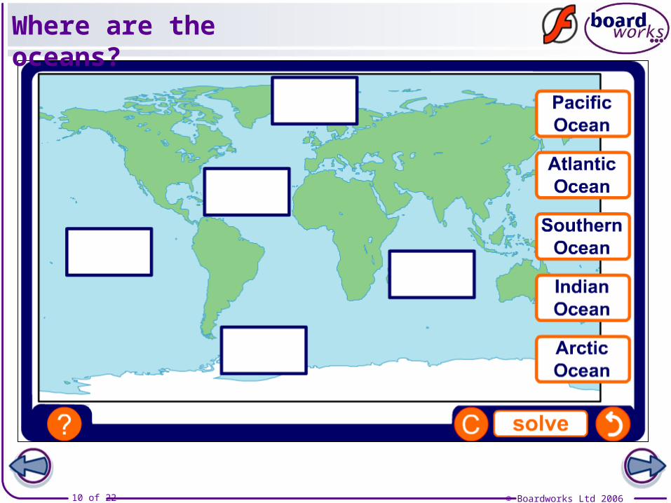
Where are the oceans?

© Boardworks Ltd 200611 of 22
Which of these countries are not members of the EU?
European countries and flags

© Boardworks Ltd 200612 of 22
EU countries

© Boardworks Ltd 200613 of 22
Name that country

© Boardworks Ltd 200614 of 22
Lea
rnin
g o
bje
ctiv
es
What are maps?
What are map projections?
Where is the EU?
Do you know the British Isles?
Exploring the UK

© Boardworks Ltd 200615 of 22
British Isles

© Boardworks Ltd 200616 of 22
Mountains
© Boardworks Ltd 200617 of 22
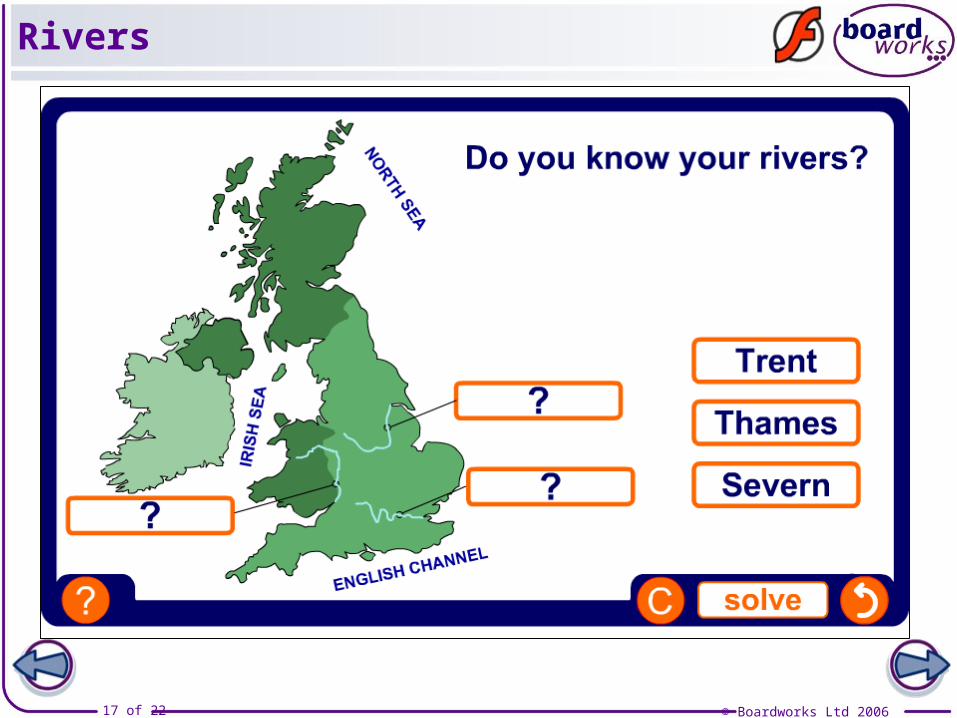
Rivers

© Boardworks Ltd 200618 of 22
Cities

© Boardworks Ltd 200619 of 22
Lea
rnin
g o
bje
ctiv
es
What are maps?
What are map projections?
Where is the EU?
Do you know the British Isles?
Exploring the UK

© Boardworks Ltd 200620 of 22
The United Kingdom is made upof Great Britain and Northern Ireland.
It is important to know some of the main human and physical features of the country. This will help put some of your later geography into context.
The next activities will test yourknowledge of the human and physicalgeography of the United Kingdom.
Exploring the UK

© Boardworks Ltd 200621 of 22
Countries and capitals
© Boardworks Ltd 200622 of 22
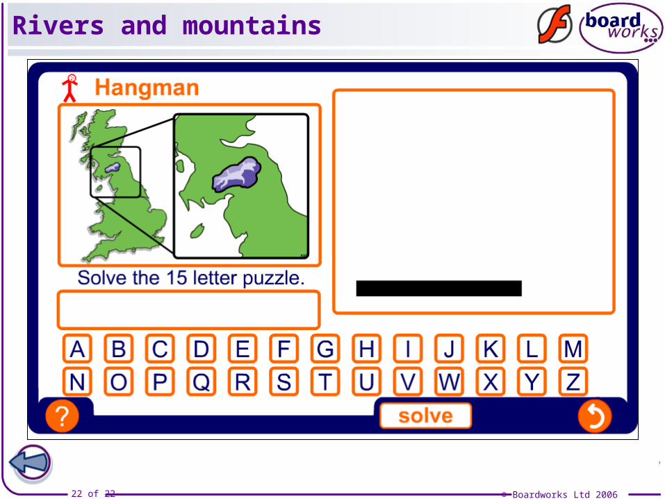
Rivers and mountains