Embed Size (px)
Citation preview
+
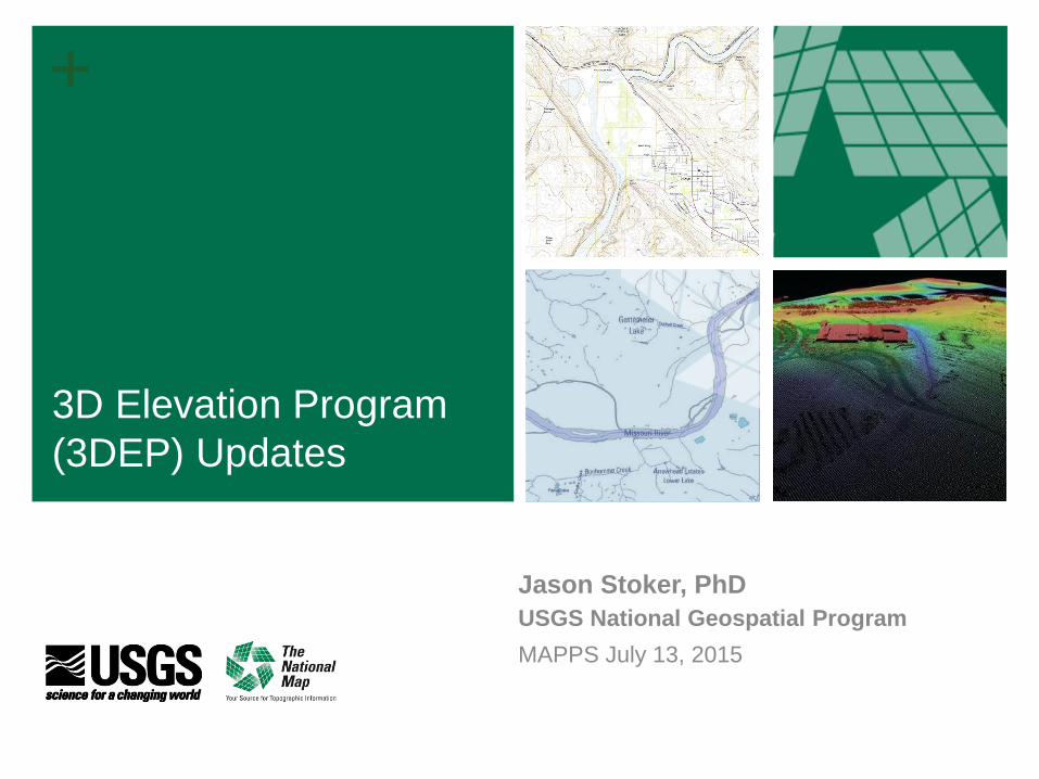
Jason Stoker, PhD
USGS National Geospatial Program
MAPPS July 13, 2015
3D Elevation Program
(3DEP) Updates
+ 2+ 2
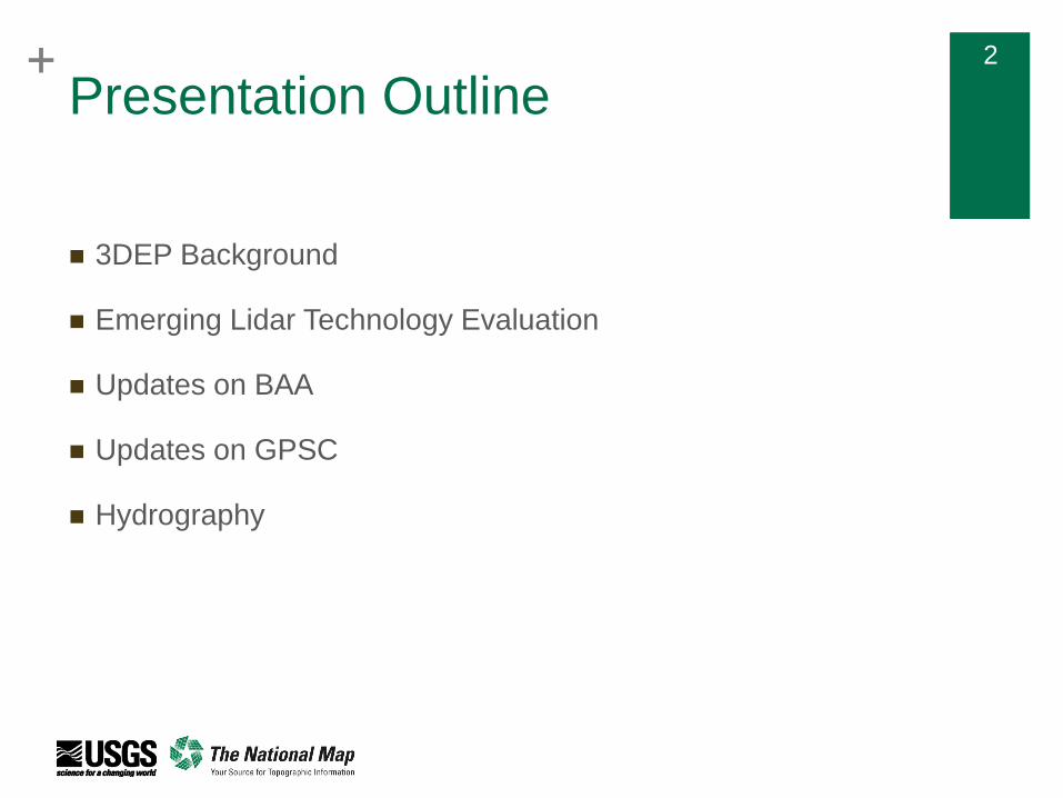
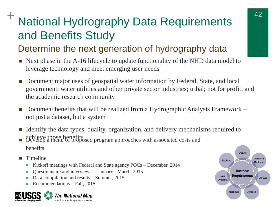
Presentation Outline
3DEP Background
Emerging Lidar Technology Evaluation
Updates on BAA
Updates on GPSC
Hydrography
++ 3
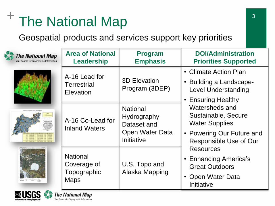
The National MapGeospatial products and services support key priorities
Area of National
Leadership
Program
Emphasis
DOI/Administration
Priorities Supported
A-16 Lead for
Terrestrial
Elevation
3D Elevation
Program (3DEP)
• Climate Action Plan
• Building a Landscape-
Level Understanding
• Ensuring Healthy
Watersheds and
Sustainable, Secure
Water Supplies
• Powering Our Future and
Responsible Use of Our
Resources
• Enhancing America’s
Great Outdoors
• Open Water Data
Initiative
A-16 Co-Lead for
Inland Waters
National
Hydrography
Dataset and
Open Water Data
Initiative
National
Coverage of
Topographic
Maps
U.S. Topo and
Alaska Mapping
++ 4
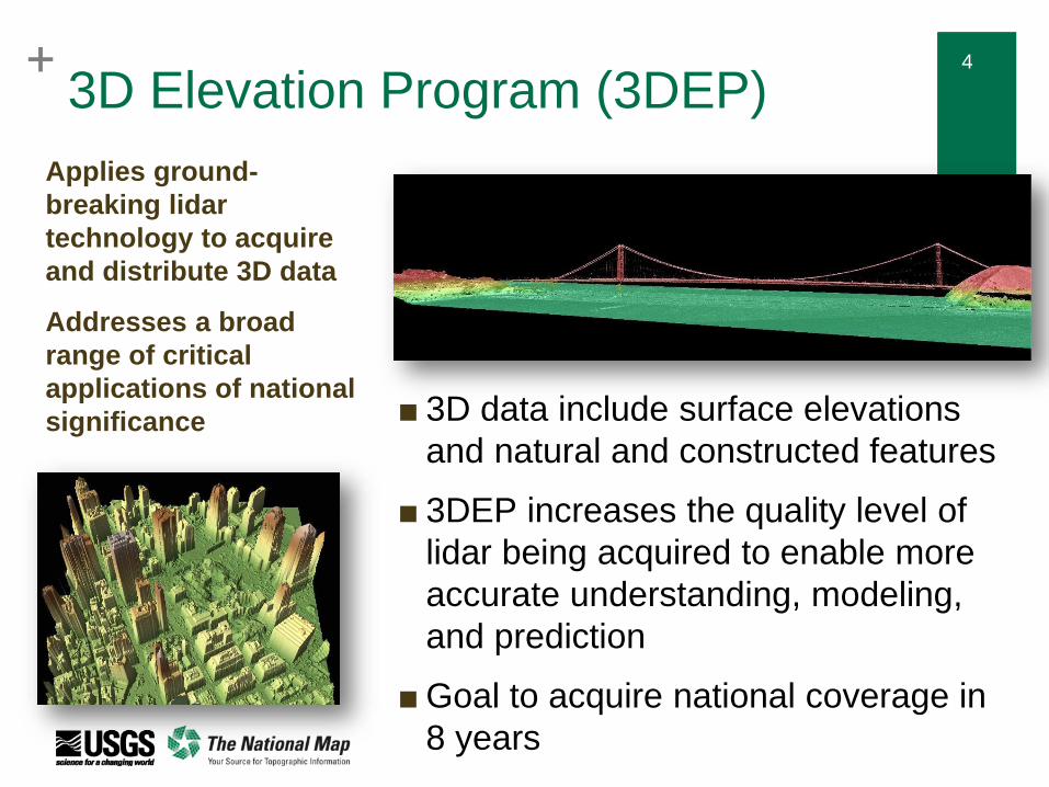
■ 3D data include surface elevations
and natural and constructed features
■ 3DEP increases the quality level of
lidar being acquired to enable more
accurate understanding, modeling,
and prediction
■ Goal to acquire national coverage in
8 years
Applies ground-
breaking lidar
technology to acquire
and distribute 3D data
Addresses a broad
range of critical
applications of national
significance
3D Elevation Program (3DEP)
++ 5
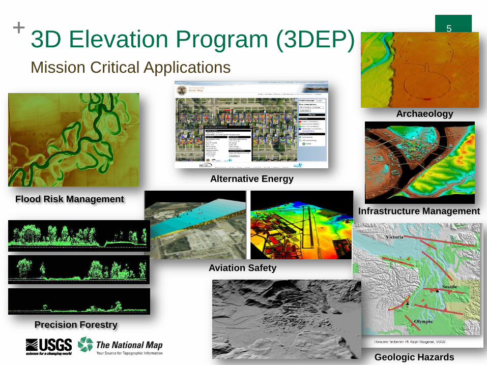
3D Elevation Program (3DEP)Mission Critical Applications
Infrastructure Management
Geologic Hazards
Archaeology
Precision Forestry
Aviation Safety
Flood Risk Management
Alternative Energy
++ 6
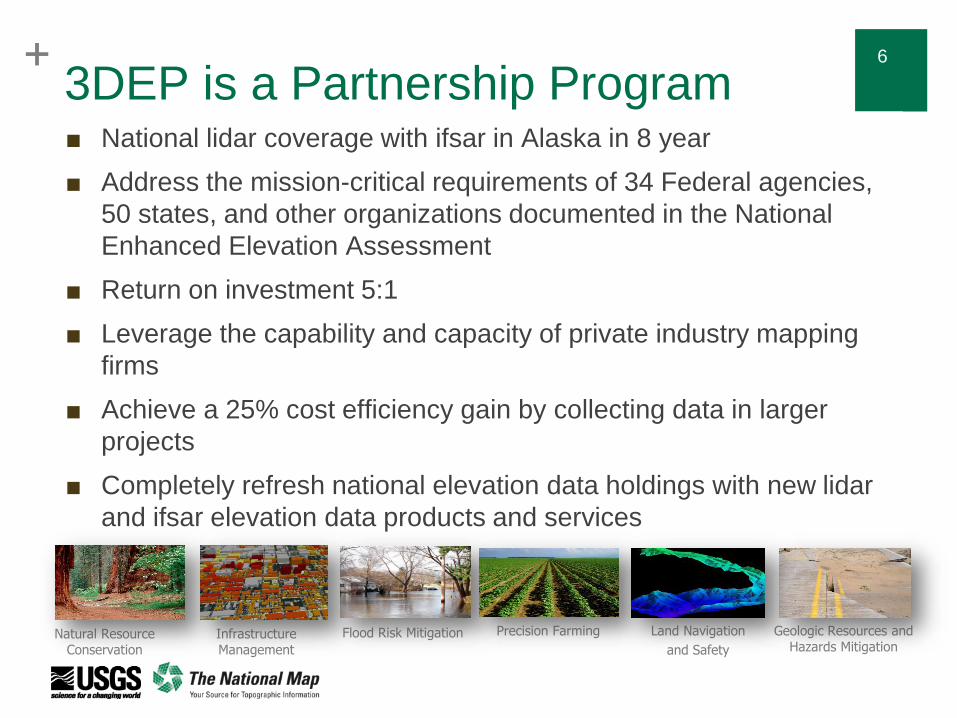
3DEP is a Partnership Program■ National lidar coverage with ifsar in Alaska in 8 year
■ Address the mission-critical requirements of 34 Federal agencies,
50 states, and other organizations documented in the National
Enhanced Elevation Assessment
■ Return on investment 5:1
■ Leverage the capability and capacity of private industry mapping
firms
■ Achieve a 25% cost efficiency gain by collecting data in larger
projects
■ Completely refresh national elevation data holdings with new lidar
and ifsar elevation data products and services
Natural Resource Conservation
Infrastructure Management
Flood Risk Mitigation Precision Farming Land Navigation
and Safety
Geologic Resources and Hazards Mitigation
++ 7
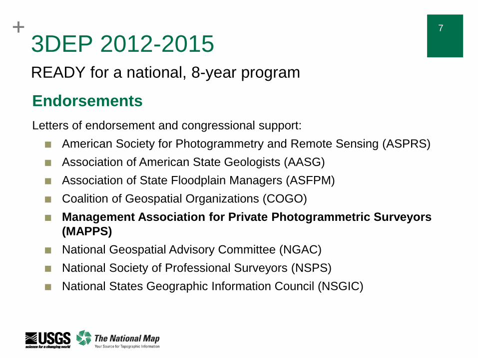
3DEP 2012-2015READY for a national, 8-year program
Endorsements
Letters of endorsement and congressional support:
■ American Society for Photogrammetry and Remote Sensing (ASPRS)
■ Association of American State Geologists (AASG)
■ Association of State Floodplain Managers (ASFPM)
■ Coalition of Geospatial Organizations (COGO)
■ Management Association for Private Photogrammetric Surveyors
(MAPPS)
■ National Geospatial Advisory Committee (NGAC)
■ National Society of Professional Surveyors (NSPS)
■ National States Geographic Information Council (NSGIC)
++ 8
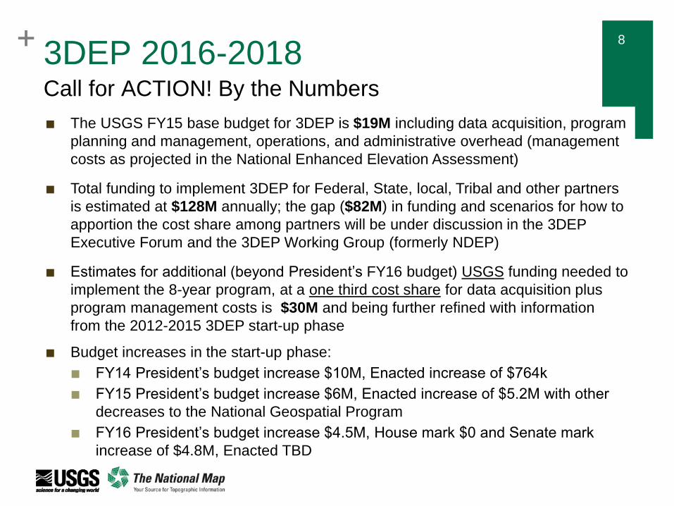
3DEP 2016-2018Call for ACTION! By the Numbers
■ The USGS FY15 base budget for 3DEP is $19M including data acquisition, program
planning and management, operations, and administrative overhead (management
costs as projected in the National Enhanced Elevation Assessment)
■ Total funding to implement 3DEP for Federal, State, local, Tribal and other partners
is estimated at $128M annually; the gap ($82M) in funding and scenarios for how to
apportion the cost share among partners will be under discussion in the 3DEP
Executive Forum and the 3DEP Working Group (formerly NDEP)
■ Estimates for additional (beyond President’s FY16 budget) USGS funding needed to
implement the 8-year program, at a one third cost share for data acquisition plus
program management costs is $30M and being further refined with information
from the 2012-2015 3DEP start-up phase
■ Budget increases in the start-up phase:
■ FY14 President’s budget increase $10M, Enacted increase of $764k
■ FY15 President’s budget increase $6M, Enacted increase of $5.2M with other
decreases to the National Geospatial Program
■ FY16 President’s budget increase $4.5M, House mark $0 and Senate mark
increase of $4.8M, Enacted TBD
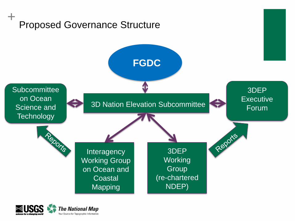
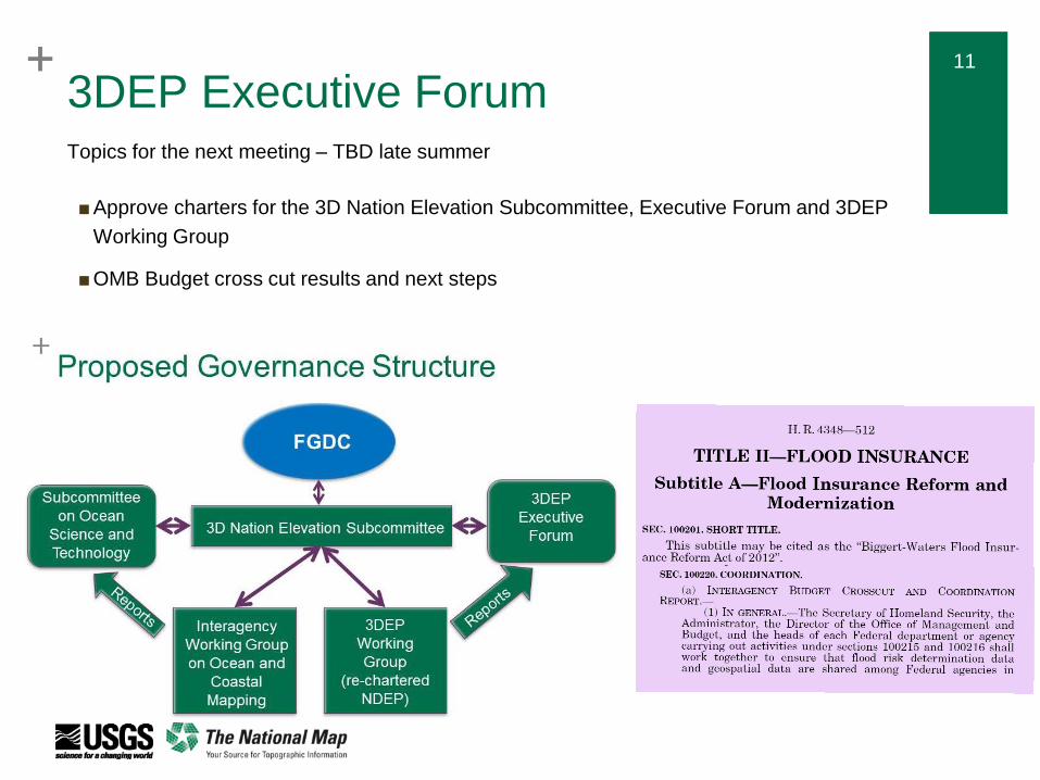
+Proposed Governance Structure
FGDC
3D Nation Elevation Subcommittee
Interagency
Working Group
on Ocean and
Coastal
Mapping
3DEP
Working
Group
(re-chartered
NDEP)
Subcommittee
on Ocean
Science and
Technology
3DEP
Executive
Forum
++ 10
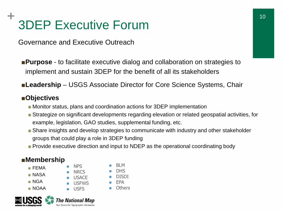
3DEP Executive Forum
■Purpose - to facilitate executive dialog and collaboration on strategies to
implement and sustain 3DEP for the benefit of all its stakeholders
■Leadership – USGS Associate Director for Core Science Systems, Chair
■Objectives
■ Monitor status, plans and coordination actions for 3DEP implementation
■ Strategize on significant developments regarding elevation or related geospatial activities, for
example, legislation, GAO studies, supplemental funding, etc.
■ Share insights and develop strategies to communicate with industry and other stakeholder
groups that could play a role in 3DEP funding
■ Provide executive direction and input to NDEP as the operational coordinating body
■Membership ■ FEMA
■ NASA
■ NGA
■ NOAA
Governance and Executive Outreach
BLM DHS DISDI EPA Others
NPS NRCS USACE USFWS USFS
++ 11
3DEP Executive Forum
■Approve charters for the 3D Nation Elevation Subcommittee, Executive Forum and 3DEP
Working Group
■OMB Budget cross cut results and next steps
Topics for the next meeting – TBD late summer
++ 12
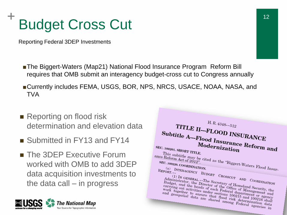
Budget Cross Cut
■The Biggert-Waters (Map21) National Flood Insurance Program Reform Bill
requires that OMB submit an interagency budget-cross cut to Congress annually
■Currently includes FEMA, USGS, BOR, NPS, NRCS, USACE, NOAA, NASA, and
TVA
Reporting Federal 3DEP Investments
Reporting on flood risk
determination and elevation data
Submitted in FY13 and FY14
The 3DEP Executive Forum
worked with OMB to add 3DEP
data acquisition investments to
the data call – in progress
+3DEP Stakeholder Meeting
■ Purpose - to provide a status report to our primary Stakeholders and
discuss strategies, challenges and opportunities to fully implement
3DEP in collaboration
■ Participation – representatives from all 8 endorsing organizations plus
3DEP Executive Forum representatives
■ Actions
■MAPPS proposed to form a 3DEP coalition and invite the broader, non-Federal
community to join the effort. A follow on meeting will be organized and some of
the suggestions for materials will be taken up in that group
■The USGS will continue outreach to other Federal agencies and will consider
the suggestions for tools and materials that will support general 3DEP
communication – IN PROGRESS
■North Carolina will share additional information about its real estate transaction
fee and funding for their lidar program – IN PROGRESS
■The USGS will publish notes for this meeting - DONE
April 15, 1-5 at The National Surveying, Mapping and Geospatial Conference
Thank you MAPPS for your strong support for 3DEP!

+
Emerging Lidar
Technology Evaluation
+ 15+ 15
Emerging Lidar Technologies
■ The 3DEP is an operational program with:
■ Well-defined requirements and a documented cost/benefit
model
■ An established methodology for acquiring and QA/QCing data
■ The support of the private sector mapping firms with capacity
and expertise to meet 3DEP requirements
■ Technology that meets our requirements
■ There are many emerging technologies that may be useful to
integrate into 3DEP in the future
■ These instruments may or may not meet our needs
■ Need a pathway forward to test the data from these
instruments
Fostering research to operations
+ 16+ 16
Emerging Lidar Technologies
■ Questions - Can these systems:
■ Meet 3DEP requirements?
■ Produce bathymetric lidar?
■ Provide cost effective data acquisition?
■ Be commercialized?
■ Goals
■ Increased awareness of Federal status and plans
■ Consensus on initial steps to advance commercialization of emerging
technology for future use in 3DEP and civilian applications
■ Improved coordination and ongoing dialog, potentially including others
beyond the Federal family
■ Establish a working group to continue the dialog
Federal Roundtable – September 16, 2014
+ 17+ 17
Emerging Lidar Technology
E3D-WG was established under the 3DEP (re-chartered NDEP) as an
unclassified forum for building collaboration between Federal Civilian and
Defense agencies to explore the utility of emerging 3D technologies for
future use in 3DEP
Objectives:
Provide an unclassified forum for Defense and Civilian communities to learn
from each other others’ activities
Assist Federal Civilian agencies in obtaining and testing data.
Define and agree to a process and/or maturity level scale that will help
determine when the data are useable in 3DEP
Publish a report documenting the E3D-WG analysis of and additional steps
required to incorporate appropriate emerging technologies into 3DEP
Collaborate and coordinate with industry groups such as ASPRS and MAPPS to
leverage their capabilities, networks and goals for advancing lidar technology
Emerging 3D Technologies Working Group (E3D-WG)
+ 18+ 18
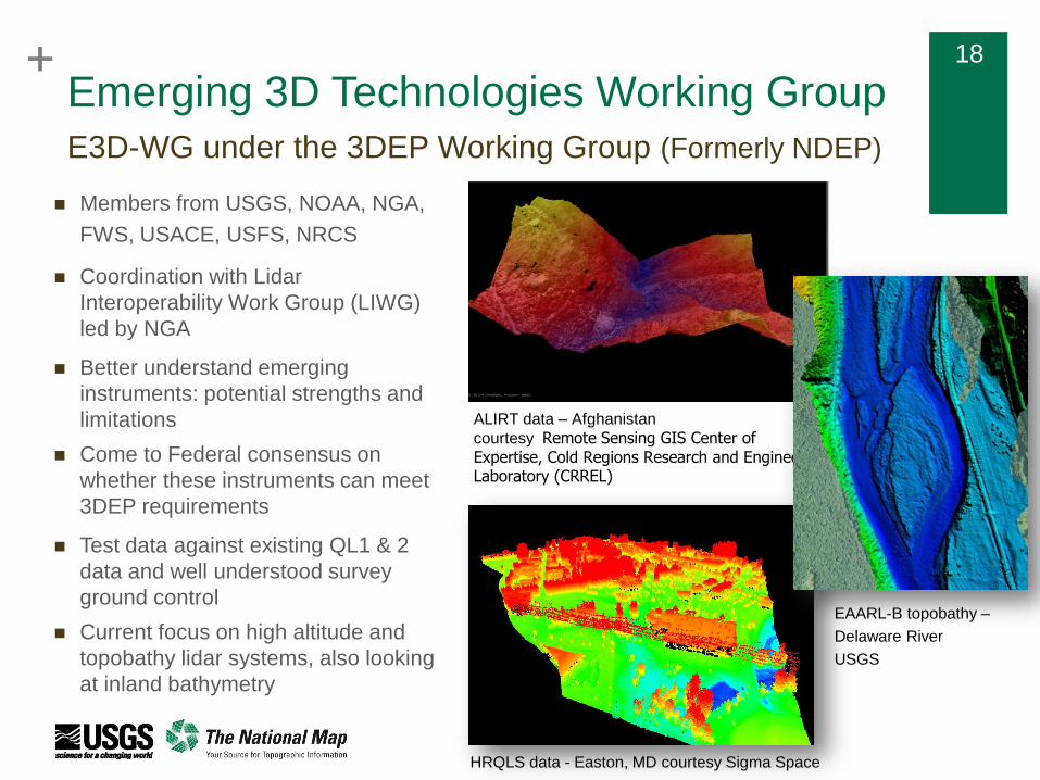
Emerging 3D Technologies Working Group
Members from USGS, NOAA, NGA,
FWS, USACE, USFS, NRCS
Coordination with Lidar
Interoperability Work Group (LIWG)
led by NGA
Better understand emerging
instruments: potential strengths and
limitations
Come to Federal consensus on
whether these instruments can meet
3DEP requirements
Test data against existing QL1 & 2
data and well understood survey
ground control
Current focus on high altitude and
topobathy lidar systems, also looking
at inland bathymetry
E3D-WG under the 3DEP Working Group (Formerly NDEP)
HRQLS data - Easton, MD courtesy Sigma Space
ALIRT data – Afghanistan
courtesy Remote Sensing GIS Center of Expertise, Cold Regions Research and Engineering Laboratory (CRREL)
EAARL-B topobathy –
Delaware River
USGS
+ 19
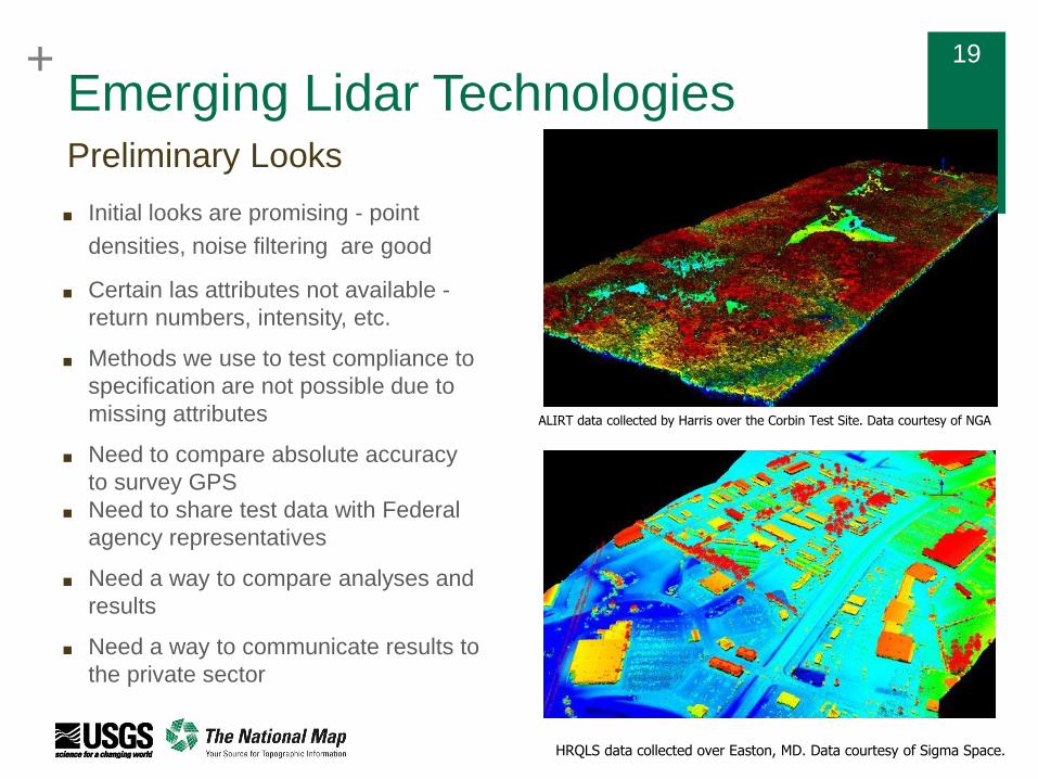
Emerging Lidar Technologies
■ Initial looks are promising - point
densities, noise filtering are good
■ Certain las attributes not available -
return numbers, intensity, etc.
■ Methods we use to test compliance to
specification are not possible due to
missing attributes
■ Need to compare absolute accuracy
to survey GPS
■ Need to share test data with Federal
agency representatives
■ Need a way to compare analyses and
results
■ Need a way to communicate results to
the private sector
Preliminary Looks
ALIRT data collected by Harris over the Corbin Test Site. Data courtesy of NGA
HRQLS data collected over Easton, MD. Data courtesy of Sigma Space.
+ 20+ 20
Emerging Lidar Technologies
E3D-WG wanted more definitive understanding if can these data meet 3DEP specs
USGS/FEMA/NRCS via GPSC selected Dewberry and Woolpert to provide independent evaluations of
demonstration data by Emerging Lidar Tech firms wanting to show capability. Members of E3D-WG will
perform the third
Perform a thorough evaluation of these new systems:
Absolute horizontal and vertical accuracy of the products derived from the Single Photon Counting
Lidar and Geiger Mode Lidar as tested according to the methodology outlined in the new ASPRS
Positional Accuracy Standards for Digital Geospatial Data of 2014.
Relative accuracy within a swath or from swath to swath;
Data smoothness and surface repeatability as per the USGS Lidar Base Specifications v 1.2 and
the new ASPRS Positional Accuracy Standards for Digital Geospatial Data of 2014.
The effect of the solar noise when such Lidar system is flown during a sunny day.
Compare data to existing QL2 or better data that has been recently collected
Do this at the altitudes that are being touted for significant cost savings
Kick-off meeting with Dewberry and Woolpert, July 15th- hoping for evaluations and recommendations to be completed
in late Fall.
Evaluations and recommendations
+
BAA Update
+ 22+ 22
Broad Agency Announcement (BAA)
As follow-up to the President’s announcement, the USGS issued a BAA via
FedBizOps that provides information on how to partner with the USGS and other
Federal agencies to acquire 3D elevation data
Designed to provide increased visibility and opportunity to the broadest
stakeholder community possible - Federal agencies, state and local governments,
tribes, academic institutions and the private sector are eligible to submit proposals
Establish a standard, fair and equitable competitive process that can easily be
expanded to account for future growth in the 3D Elevation Program
To ensure data quality and efficient development of standard products and
services, the USGS prefers that partners use the GPSC when possible and
practical; proposals may use GPSC or partner contracts; in both cases 3DEP
makes use of the commercial sector to do the acquisition
A means to recognize, aggregate and inspire collaborative funding partnerships
in support of multi-agency lidar data acquisition requirements
Background
+ 23+ 233DEP Program Goals
QL2 data that are 8 years old or newer across the conterminous US
QL5 data in Alaska
Specifications
Must at a minimum adhere to the latest USGS Lidar Base Specification
Higher quality lidar may be acquired through partner buy ups.
Reduce acquisition costs by increasing project area
Specific evaluation criteria will be in the BAA announcement and presented during the second set of public webinars which will be held directly after the release of the BAA
Questions should be directed to [email protected]
From 3DEP – A Call for Action (USGS Circular 1399)
+ 24+ 24What is the 3DEP Broad Agency
Announcement (BAA) The Broad Agency Announcement (BAA) is the competitive
solicitation mechanism which the USGS NGP is using to select
and partially fund lidar acquisition projects in support of the 3DEP
program.
The opportunity will be advertised in Federal Business
Opportunities (FedBizOpps) http://www.fbo.gov and in Grants.gov
http://www.grants.gov
Proposals may contribute funds toward lidar data acquisition via
the USGS Geospatial Products and Services Contract (GPSC) or
they may request 3DEP funds toward lidar data acquisition where
the requesting partner contracts for the data acquisition
Federal agencies, state and local governments, tribes, academic
institutions and the private sector are eligible to submit proposals
+ 25
Broad Agency Announcement (BAA)
Competitive grant structure resulted in changes to the liaison
role in developing partnerships and forming projects
Strategy for future rounds is to make all information publicly
accessible and facilitate open dialogs about forming projects
Enhance Federal input of requirements and areas of interest,
and provide a process for other stakeholders to share theirs
Formalize structure and roles of NDEP with regard to the BAA
Build on NDEP/IWG-OCM (SeaSketch) tracker as tool for
sharing potential projects
Leverage Geospatial Platform as “homebase” for data
acquisition
Strategies
+ 26+ 26
3DEP BAA Benefits
Larger area projects are more cost efficient
More cooperators lower costs for each partner in the
FY14 BAA that led to the FY15 Awards:
The average 3DEP cost share was 36%
Proposers are covering an average of 64% of the
total cost
Many proposals had multiple funding partners
Eliminates duplicative data collection and provides
better value for tax payers
Benefit of coordinated projects
+ 27+ 27
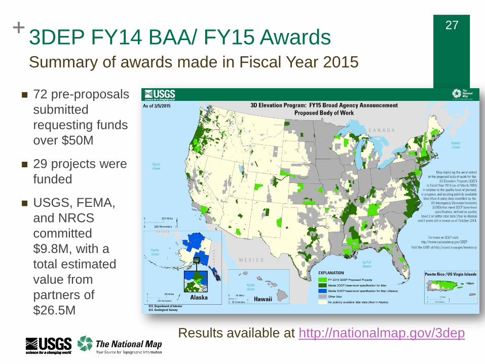
Summary of awards made in Fiscal Year 2015
Results available at http://nationalmap.gov/3dep
72 pre-proposals
submitted
requesting funds
over $50M
29 projects were
funded
USGS, FEMA,
and NRCS
committed
$9.8M, with a
total estimated
value from
partners of
$26.5M
3DEP FY14 BAA/ FY15 Awards
+ 28+ 28
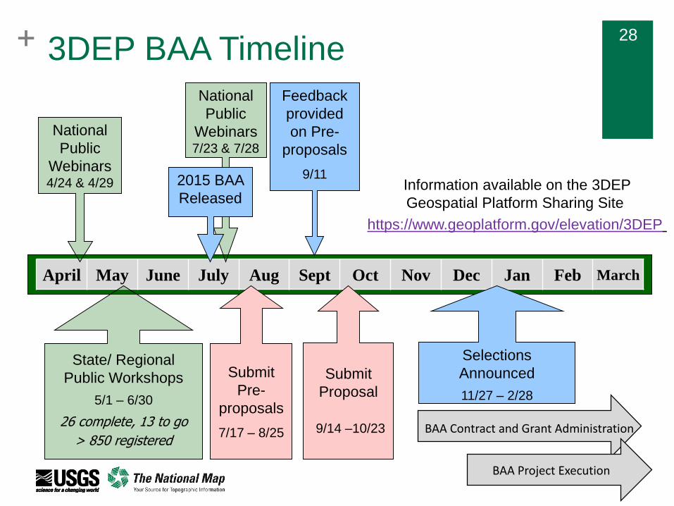
April May June July Aug Sept Oct Nov Dec Jan Feb March
Submit
Proposal
9/14 –10/23
Submit
Pre-
proposals
7/17 – 8/25
Selections
Announced
11/27 – 2/28
National
Public
Webinars7/23 & 7/28
2015 BAA
Released
Feedback
provided
on Pre-
proposals
9/11
BAA Contract and Grant Administration
BAA Project Execution
3DEP BAA Timeline
National
Public
Webinars4/24 & 4/29
State/ Regional
Public Workshops
5/1 – 6/30
26 complete, 13 to go
> 850 registered
Information available on the 3DEP
Geospatial Platform Sharing Site
https://www.geoplatform.gov/elevation/3DEP
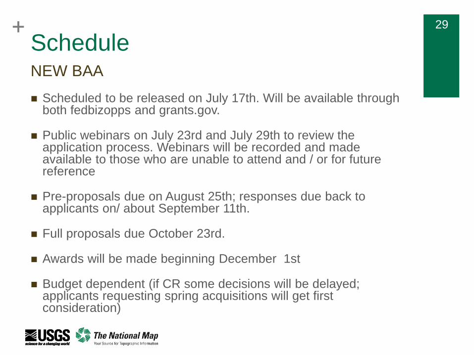
+ 29+ 29
Schedule
Scheduled to be released on July 17th. Will be available through both fedbizopps and grants.gov.
Public webinars on July 23rd and July 29th to review the application process. Webinars will be recorded and made available to those who are unable to attend and / or for future reference
Pre-proposals due on August 25th; responses due back to applicants on/ about September 11th.
Full proposals due October 23rd.
Awards will be made beginning December 1st
Budget dependent (if CR some decisions will be delayed; applicants requesting spring acquisitions will get first consideration)
NEW BAA
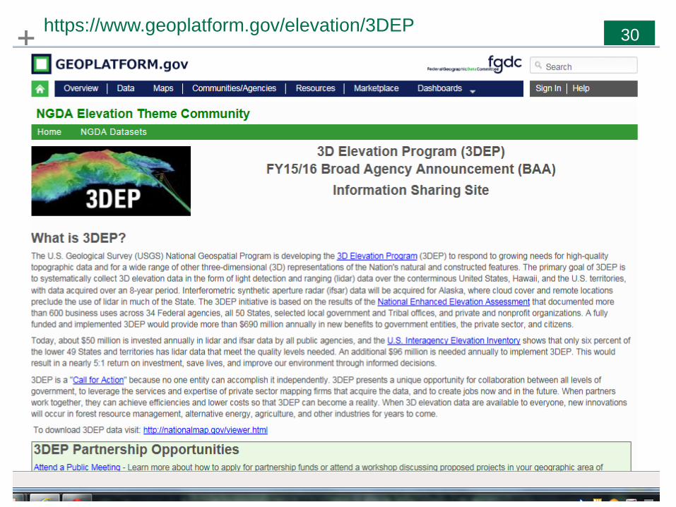
+ 30+ 30https://www.geoplatform.gov/elevation/3DEP
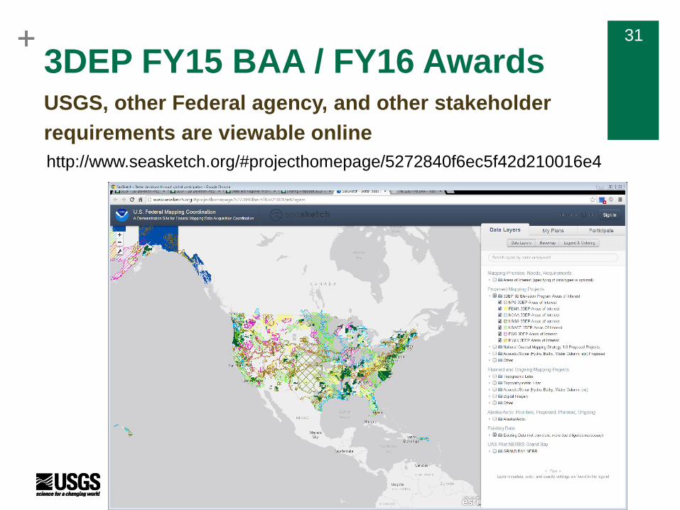
+ 31+ 31
3DEP FY15 BAA / FY16 AwardsUSGS, other Federal agency, and other stakeholder
requirements are viewable online
http://www.seasketch.org/#projecthomepage/5272840f6ec5f42d210016e4
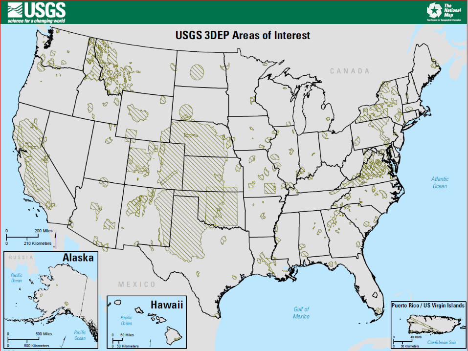
+ 32+ 32
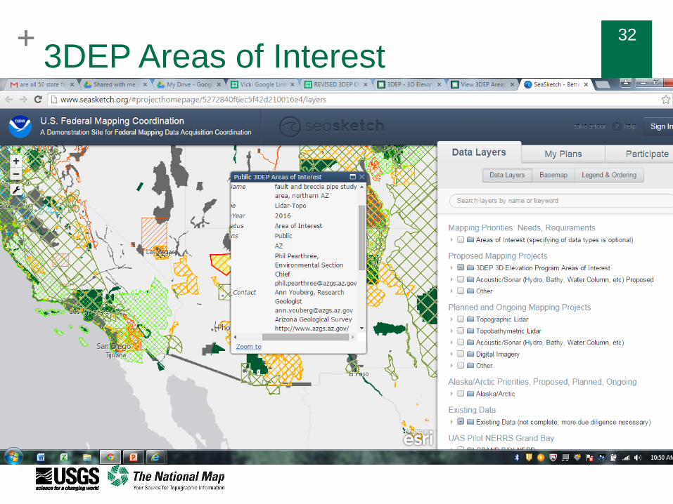
3DEP Areas of Interest
+ 33+ 333DEP BAAUSGS requirements were submitted through the
3DEP USGS Lidar Priorities Collector Tool – DONE
+ 34+ 34
General
3DEP prefers that applicants make use of the GPSC
Anticipate 80% of funding will be used to support awards making use of the GPSC; 20% of funding will be used to support cooperative agreements (FY14 split was ~ 72% GPSC / 28% cooperative agreements)
Anticipate minimum of same level of funding as was available in FY15; FY16 budget has not yet been defined
FEMA and NRCS area once again providing direct funding to support BAA awards
QL2 data, QL1 upgrade option at the expense of the applicants
BAA will accept proposals for lidar in 49 states and territories and selected areas in Alaska (specific areas defined in BAA)
BAA

+
GPSC 3 Update
+ 36+ 36
Geospatial Products and Services Contract
A suite of Indefinite Delivery Indefinite Quantity (IDIQ) contracts that provide
a mechanism to obtain geospatial data services throughout the United States
The contracts support The National Map, but may be used by other Federal,
State, and local agencies
Broad scope: photogrammetric mapping and aerotriangulation;
orthophotography; thematic mapping; digital imagery applications; ifsar and
lidar acquisition; GIS development; surveying and control acquisition,
including ground-based and airborne GPS; and much more
To ensure data quality and efficient development of standard products and
services, the USGS prefers that partners use the GPSC when possible and
practical for 3DEP data acquisition
Past Delegated Procurement Authority was $250M over 5 years –
GPSC3 will increase it to $750M to accommodate increased production
for 3DEP
Background
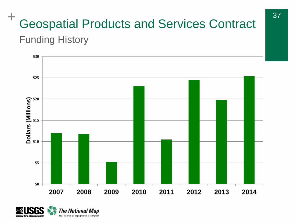
+ 37+ 37
Geospatial Products and Services Contract
$0
$5
$10
$15
$20
$25
$30
2007 2008 2009 2010 2011 2012 2013 2014
Do
lla
rs (
Mil
lio
ns
)
Funding History
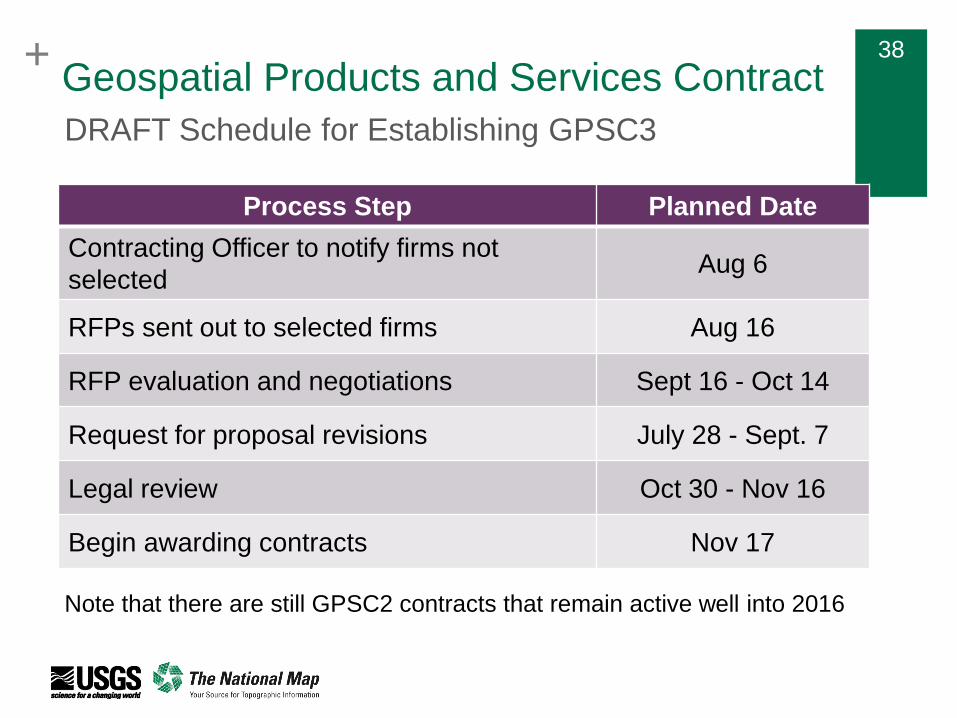
+ 38
Process Step Planned Date
Contracting Officer to notify firms not
selectedAug 6
RFPs sent out to selected firms Aug 16
RFP evaluation and negotiations Sept 16 - Oct 14
Request for proposal revisions July 28 - Sept. 7
Legal review Oct 30 - Nov 16
Begin awarding contracts Nov 17
DRAFT Schedule for Establishing GPSC3
Note that there are still GPSC2 contracts that remain active well into 2016
Geospatial Products and Services Contract
+ 39
Thank you!

+
Hydrography Update
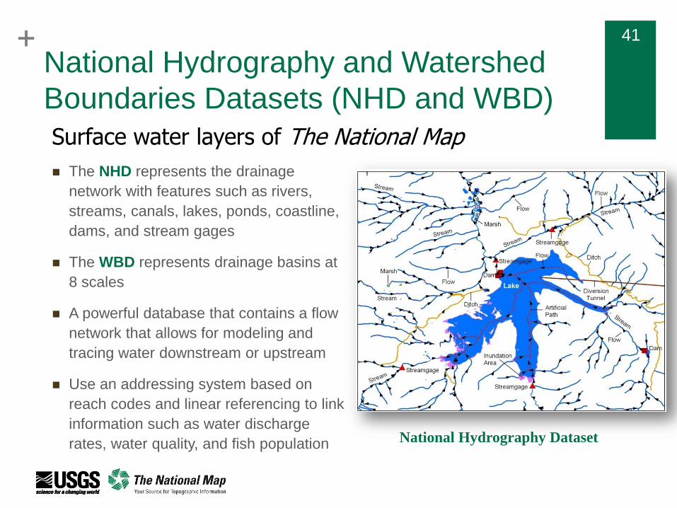
+ 41+ 41
The NHD represents the drainage
network with features such as rivers,
streams, canals, lakes, ponds, coastline,
dams, and stream gages
The WBD represents drainage basins at
8 scales
A powerful database that contains a flow
network that allows for modeling and
tracing water downstream or upstream
Use an addressing system based on
reach codes and linear referencing to link
information such as water discharge
rates, water quality, and fish population
National Hydrography and Watershed
Boundaries Datasets (NHD and WBD)
National Hydrography Dataset
Surface water layers of The National Map
+ 42+ 42
National Hydrography Data Requirements
and Benefits Study
Next phase in the A-16 lifecycle to update functionality of the NHD data model to
leverage technology and meet emerging user needs
Document major uses of geospatial water information by Federal, State, and local
government; water utilities and other private sector industries; tribal; not for profit; and
the academic research community
Document benefits that will be realized from a Hydrographic Analysis Framework –
not just a dataset, but a system
Identify the data types, quality, organization, and delivery mechanisms required to
achieve those benefits
Determine the next generation of hydrography data
Develop a menu of proposed program approaches with associated costs and
benefits
Timeline
Kickoff meetings with Federal and State agency POCs – December, 2014
Questionnaire and interviews – January - March, 2015
Data compilation and results – Summer, 2015
Recommendations – Fall, 2015
+ 43+ 43
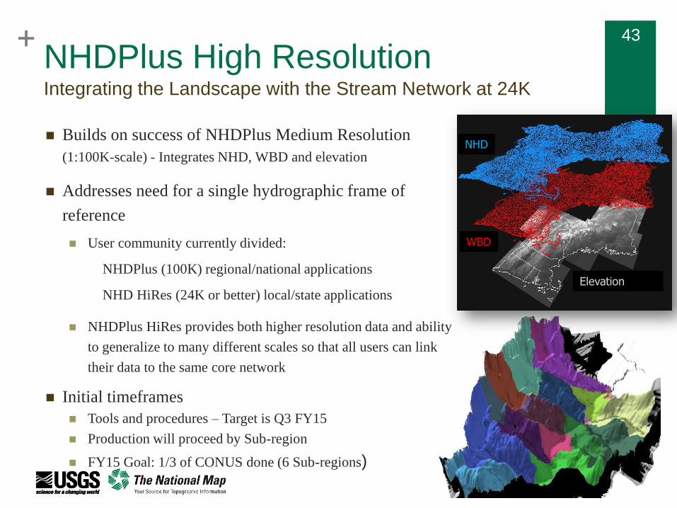
NHDPlus High Resolution
Builds on success of NHDPlus Medium Resolution
(1:100K-scale) - Integrates NHD, WBD and elevation
Addresses need for a single hydrographic frame of
reference
User community currently divided:
NHDPlus (100K) regional/national applications
NHD HiRes (24K or better) local/state applications
NHDPlus HiRes provides both higher resolution data and ability
to generalize to many different scales so that all users can link
their data to the same core network
Initial timeframes
Tools and procedures – Target is Q3 FY15
Production will proceed by Sub-region
FY15 Goal: 1/3 of CONUS done (6 Sub-regions)
Integrating the Landscape with the Stream Network at 24K
NHD
WBD
Elevation
+ 44+ 44
"Foundational to [meeting the global water challenge] is the need to
improve access to and exchange of water data and information,
including better modeling of the hydrologic cycle, to include the impact of
human-use decisions” – John Holdren
Focus on development of data standards, services, and accessibility
Joint FGDC/ACWI Subcommittee on Spatial Water Data to scope the
requirement for, and design of, a national open water data infrastructure
that supports a variety of needs across the water sector (Chair, USGS and
Co-Chair, NWS)
SSWD has defined use cases to identify and prioritize efforts The National Flood Interoperability Experiment (NFIE)
A regional water supply decision support system to support longer-term water
management decisions in a major river basin
An emergency spill response use case
Open Water Data Initiative (OWDI)Ensure Access and Interoperability to Water Data