Embed Size (px)
Citation preview
U.S. Department of the InteriorU.S. Geological Survey
Fact Sheet 2012–3089September 2012
The 3D Elevation Program—Summary of Program Direction
IntroductionThe 3D Elevation Program (3DEP)
initiative responds to a growing need for high-quality topographic data and a wide range of other three-dimensional representations of the Nation’s natural and constructed features. The National Enhanced Elevation Assessment (NEEA), which was completed in 2011, clearly documented this need within government and industry sectors. The results of the NEEA indicated that enhanced elevation data have the potential to generate $13 billion in new benefits annually. The benefits apply to flood risk management, agriculture, water supply, homeland security, renewable energy, aviation safety, and other areas. The 3DEP initiative was recommended by the National Digital Elevation Program and its 12 Federal member agencies and was endorsed by the National States Geographic Informa-tion Council (NSGIC) and the National Geospatial Advisory Committee (NGAC).
Goals and Benefits The primary goal of 3DEP is to
systematically collect enhanced elevation data in the form of high-quality light detection and ranging (lidar) data over the conterminous United States, Hawaii, and the territories on an 8-year schedule. Interferometric synthetic aperture radar (ifsar) data will be collected over Alaska, where both the cloud cover and the remote location preclude the use of lidar over much of the State. It is expected that private-sector data-acquisition companies will mobilize to respond to these lidar and ifsar data needs and that the products and services will be accessible to all levels of government and the public. 3DEP will provide easy access to these authoritative data and derived products by using a cloud-based infrastructure. 3DEP products and services will be provided nationally at significantly higher resolution and accuracy than are available today.
The enhanced elevation data support flood-risk management, natural resources conservation, infrastructure management, agriculture and precision farming, aviation safety, renewable energy development, and many other identified business applications. The potential benefits to precision agriculture and intelligent vehicle navigation alone are estimated at over $9 billion annually (Dewberry, 2011). It is expected that new, unimagined information services will be created, thus spawning job growth and transformation in the geospatial community. The follow-ing examples demonstrate the value of enhanced elevation data to both Federal and State programs. These examples are among the 602 applications documented in the NEEA report (Dewberry, 2011):1. The Federal Emergency Management
Agency (FEMA) expects that a national enhanced elevation program could reduce the amount of time needed to update its flood maps. These data could provide significant benefits to the communities and citizens that are customers of the National Flood Insurance Program by providing updated information to affected communities and homeowners more quickly. In addition, the national avail-ability of enhanced elevation data (not just for areas where FEMA identifies a need) could lead to innovative tools that build on FEMA’s flood-risk data and make them more powerful, effective, and easier to use; for example, users may be able to easily visualize a variety of flood levels in three dimensions.
2. Using lidar data, U.S. Geological Survey (USGS) scientists discovered a surface rupture along the Tacoma fault in the State of Washington. This discovery led to a redesign of the structural elements of a $735-million suspension bridge across the Tacoma Narrows. When lidar data enable the identification of active faults near
Enha
nced
ele
vatio
n da
ta s
uppo
rt cr
itica
l app
licat
ions
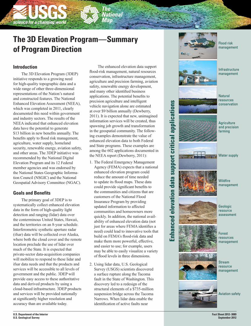
Flood risk management
Infrastructure management
Natural resources conservation
Agriculture and precision farming
Stream resource
management
Water supply
Wildfire management
Aviation safety
Geologic resource assessment
Forest resources management
planned nuclear-waste-treatment facilities or a major suspension bridge, proactive mitigation steps may be taken to avoid potential catastrophes in the future.
3. The U.S. Environmental Protection Agency’s (EPA’s) environmental impact assessments (EIAs) depend upon accurate elevation data for vulnerability mapping and for estimating the threat of sea-level rise to human populations, infrastructure, the fish and shellfish industries, and the coastal environment. Credible EIAs cannot be performed without accurate lidar data. The EPA estimates that billions of dollars would be saved by States, local communities, and citizens because they may have accurate elevation data on which to base their sea-level-rise mitigation activities.
4. The Centers for Disease Control indicate that lidar data provide signifi-cant benefits for occupational safety and health by enabling many tasks to be performed in an office environment that were previously performed in the field under dangerous or unhealthful conditions. For example, conducting land surveys during highway construc-tion results in traffic deaths among surveyors each year. This hazard may be largely eliminated by the use of lidar-based surveys.
5. In the State of Alaska, poor-quality elevation data pose an ongoing threat to aviation safety. Improved elevation data for cockpit navigation and flight simulators may save a significant number of lives each year by reducing the number of accidents that result from the inability to safely fly over obstacles in the air space. The elevation data in
Alaska have large demonstrated errors and are not reliable for safe navigation. Poor weather conditions, extremes in terrain, and reliance on air travel underscore Alaska’s requirement for improved elevation data for aviation safety.
6. Enhanced elevation data for the State of Illinois would dramatically improve precision farming. A more accurate depiction of variations in local relief helps determine a more accurate rate for applying agricultural chemicals, thereby yielding a significant cost savings and reducing agricultural pollution. Approximately two-thirds of the land area of Illinois is devoted to agricultural uses.
Governance
3DEP will be a cooperatively funded national elevation program led by the USGS, which is the Federal Geographic Data Committee’s designated lead Federal agency for the collection and management of terrestrial elevation data. A governance model is being developed to solidify 3DEP partner agency roles and data acquisition strategies, program expectations, and constraints. The program will be designed to meet the mission-critical data needs of the 3DEP partners and other communities of use. The Federal agencies poised to realize the highest benefits to their mission from enhanced elevation data include the Natural Resources Conservation Service, the U.S. Army Corps of Engineers, the Defense Installation Spatial Data Infrastructure, the USGS, the National Oceanic and Atmospheric Administration, the Federal Emergency Management Agency, the EPA, the U.S. Forest Service, the Federal Aviation Administration,
and the National Geospatial-Intelligence Agency. States and other partners will be able to participate in 3DEP and could fund higher quality data where needed. Efforts to reach out to current and future partners are underway.
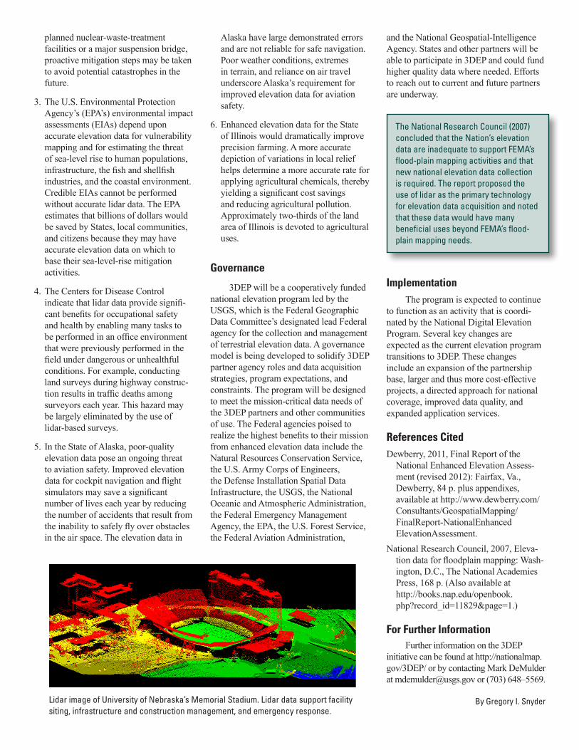
Lidar image of University of Nebraska’s Memorial Stadium. Lidar data support facility siting, infrastructure and construction management, and emergency response.
The National Research Council (2007) concluded that the Nation’s elevation data are inadequate to support FEMA’s flood-plain mapping activities and that new national elevation data collection is required. The report proposed the use of lidar as the primary technology for elevation data acquisition and noted that these data would have many beneficial uses beyond FEMA’s flood-plain mapping needs.
ImplementationThe program is expected to continue
to function as an activity that is coordi-nated by the National Digital Elevation Program. Several key changes are expected as the current elevation program transitions to 3DEP. These changes include an expansion of the partnership base, larger and thus more cost-effective projects, a directed approach for national coverage, improved data quality, and expanded application services.
References CitedDewberry, 2011, Final Report of the
National Enhanced Elevation Assess-ment (revised 2012): Fairfax, Va., Dewberry, 84 p. plus appendixes, available at http://www.dewberry.com/Consultants/GeospatialMapping/ FinalReport-NationalEnhanced ElevationAssessment.
National Research Council, 2007, Eleva-tion data for floodplain mapping: Wash-ington, D.C., The National Academies Press, 168 p. (Also available at http://books.nap.edu/openbook.php?record_id=11829&page=1.)
For Further InformationFurther information on the 3DEP
initiative can be found at http://nationalmap.gov/3DEP/ or by contacting Mark DeMulder at [email protected] or (703) 648–5569.
By Gregory I. Snyder