Embed Size (px)
Citation preview
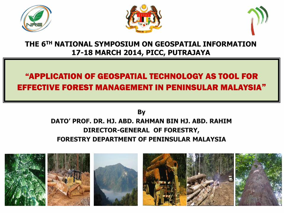
“APPLICATION OF GEOSPATIAL TECHNOLOGY AS TOOL FOR
EFFECTIVE FOREST MANAGEMENT IN PENINSULAR MALAYSIA”
THE 6TH NATIONAL SYMPOSIUM ON GEOSPATIAL INFORMATION 17-18 MARCH 2014, PICC, PUTRAJAYA
By
DATO’ PROF. DR. HJ. ABD. RAHMAN BIN HJ. ABD. RAHIM
DIRECTOR-GENERAL OF FORESTRY,
FORESTRY DEPARTMENT OF PENINSULAR MALAYSIA
1
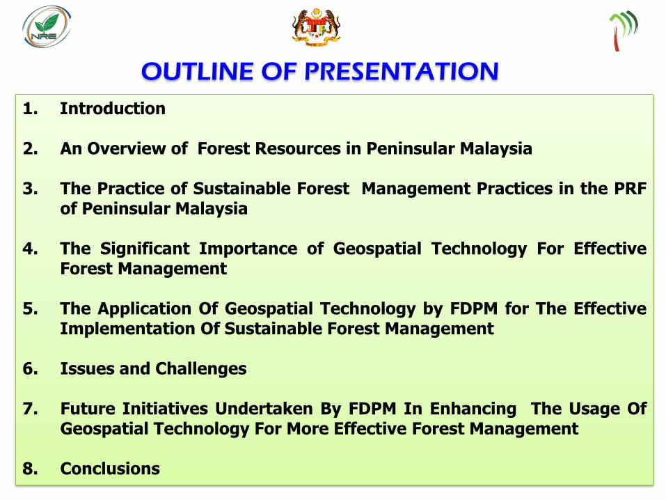
1. Introduction 2. An Overview of Forest Resources in Peninsular Malaysia
3. The Practice of Sustainable Forest Management Practices in the PRF
of Peninsular Malaysia 4. The Significant Importance of Geospatial Technology For Effective
Forest Management
5. The Application Of Geospatial Technology by FDPM for The Effective Implementation Of Sustainable Forest Management
6. Issues and Challenges 7. Future Initiatives Undertaken By FDPM In Enhancing The Usage Of
Geospatial Technology For More Effective Forest Management 8. Conclusions
OUTLINE OF PRESENTATION
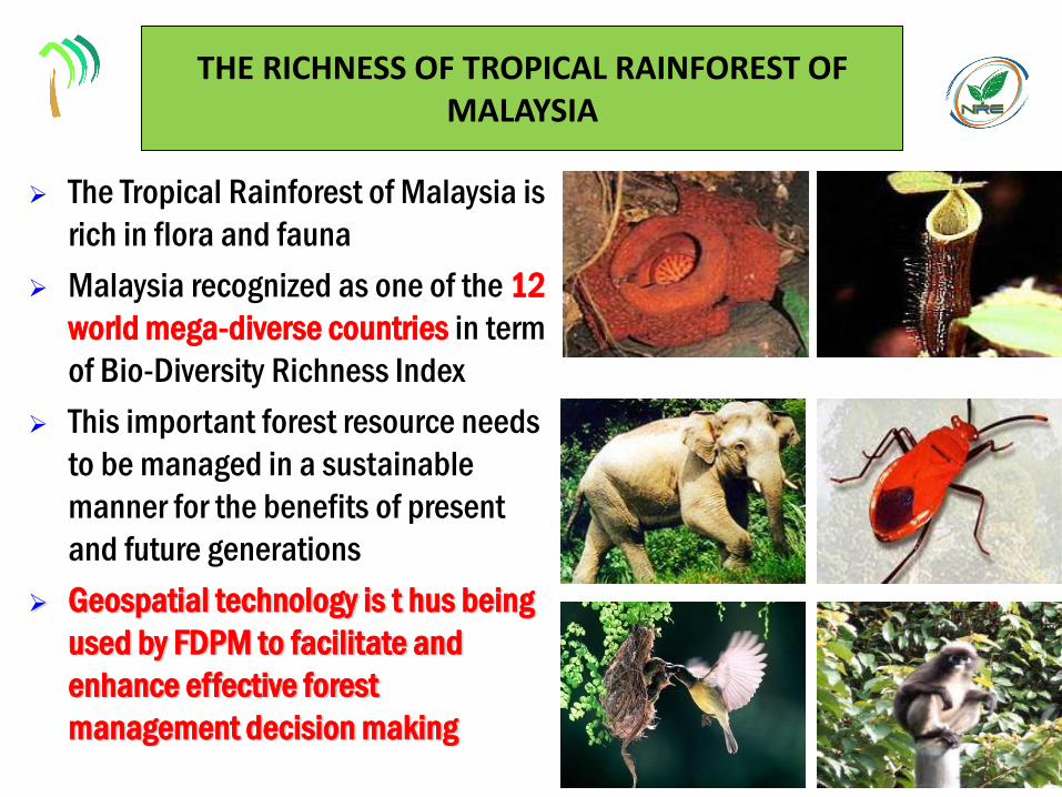
THE RICHNESS OF TROPICAL RAINFOREST OF MALAYSIA
The Tropical Rainforest of Malaysia is
rich in flora and fauna
Malaysia recognized as one of the 12
world mega-diverse countries in term
of Bio-Diversity Richness Index
This important forest resource needs
to be managed in a sustainable
manner for the benefits of present
and future generations
Geospatial technology is t hus being
used by FDPM to facilitate and
enhance effective forest
management decision making
3
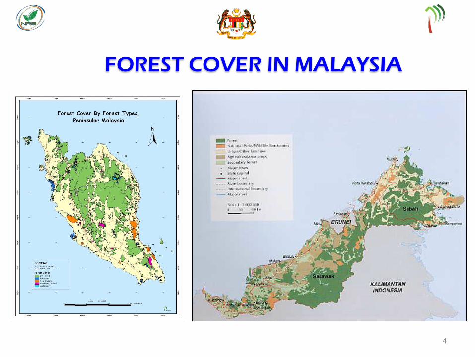
FOREST COVER IN MALAYSIA
4
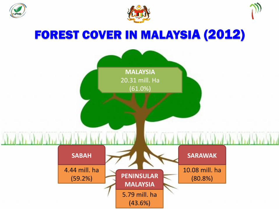
FOREST COVER IN MALAYSIA (2012)
MALAYSIA 18.49 mill. ha
(56.4%)
MALAYSIA 20.31 mill. Ha
(61.0%)
5.79 mill. ha (43.6%)
PENINSULAR MALAYSIA
4.44 mill. ha (59.2%)
SABAH
10.08 mill. ha (80.8%)
SARAWAK
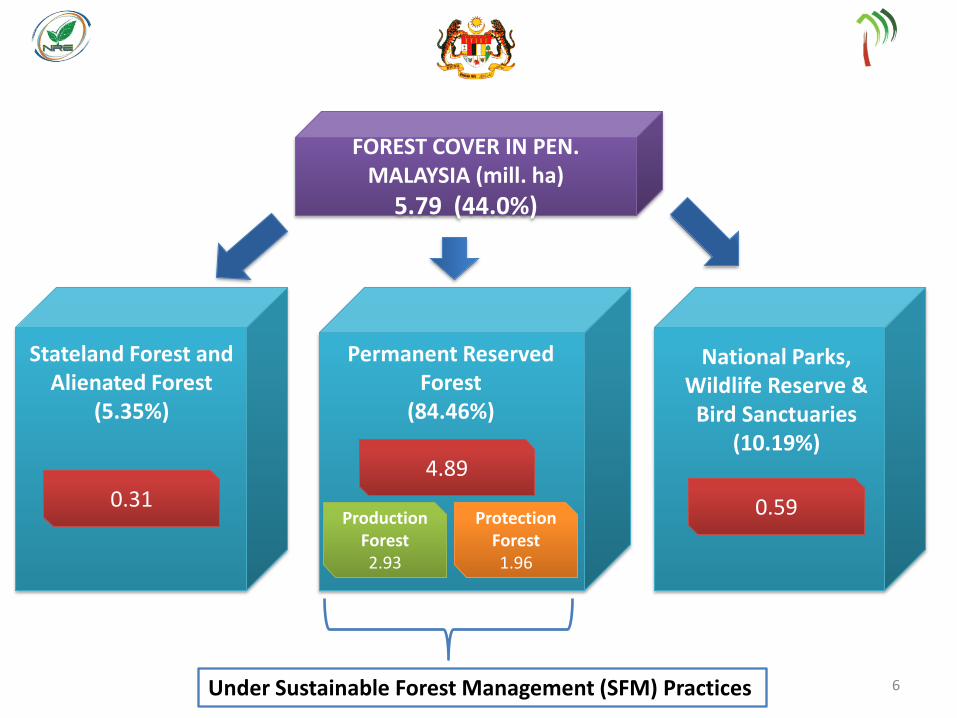
FOREST COVER IN PEN. MALAYSIA (mill. ha)
5.79 (44.0%)
Stateland Forest and Alienated Forest
(5.35%)
Permanent Reserved Forest
(84.46%)
National Parks, Wildlife Reserve &
Bird Sanctuaries (10.19%)
0.31 Production
Forest 2.93
Protection Forest 1.96
4.89
0.59
Under Sustainable Forest Management (SFM) Practices 6
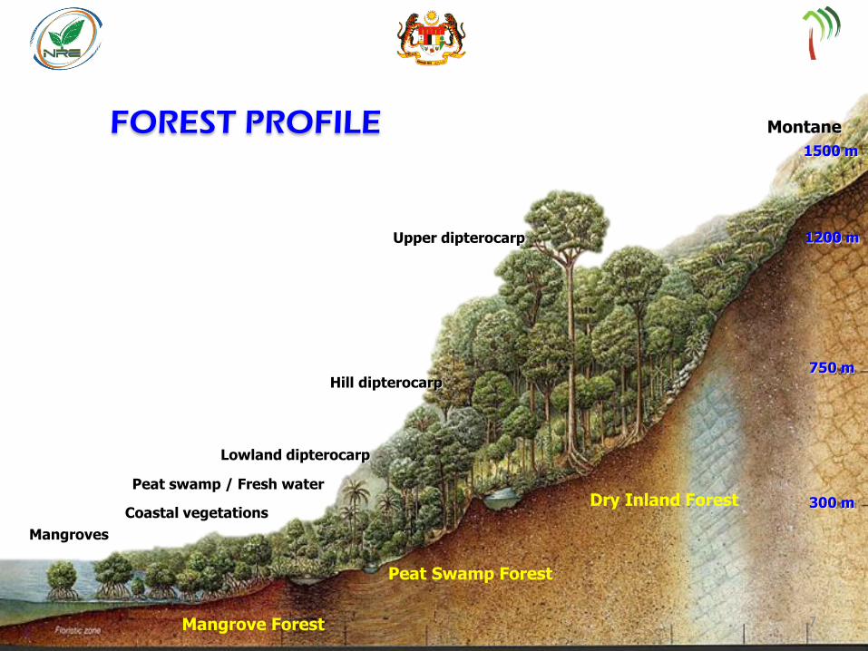
Montane
Upper dipterocarp
Hill dipterocarp
Lowland dipterocarp
Peat swamp / Fresh water
Coastal vegetations
Mangroves
Dry Inland Forest
Peat Swamp Forest
Mangrove Forest
300 m
750 m
1500 m
1200 m
FOREST PROFILE
7
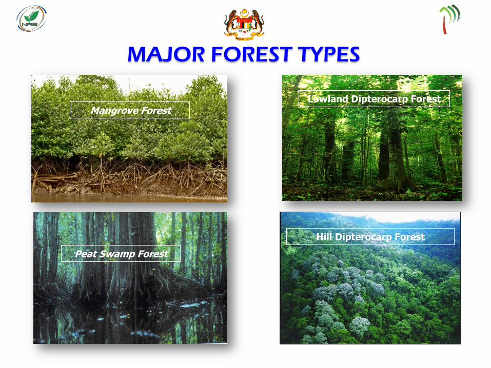
MAJOR FOREST TYPES
Hill Dipterocarp Forest
Peat Swamp Forest
Mangrove Forest Lowland Dipterocarp Forest
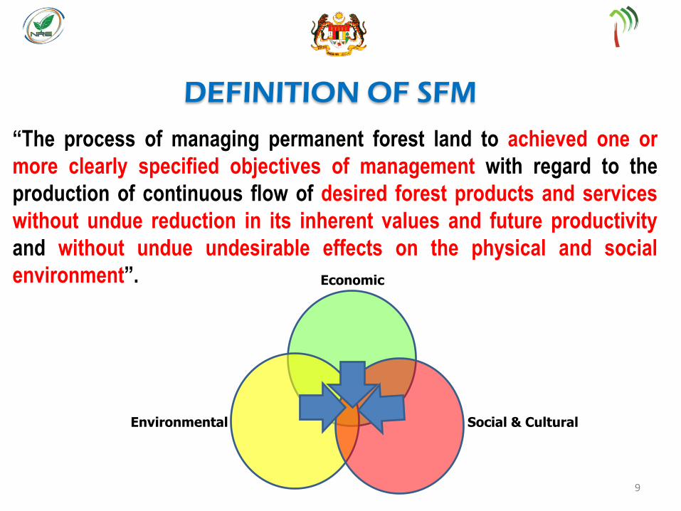
“The process of managing permanent forest land to achieved one or
more clearly specified objectives of management with regard to the
production of continuous flow of desired forest products and services
without undue reduction in its inherent values and future productivity
and without undue undesirable effects on the physical and social
environment”.
Social & Cultural Environmental
Economic
DEFINITION OF SFM
9
10
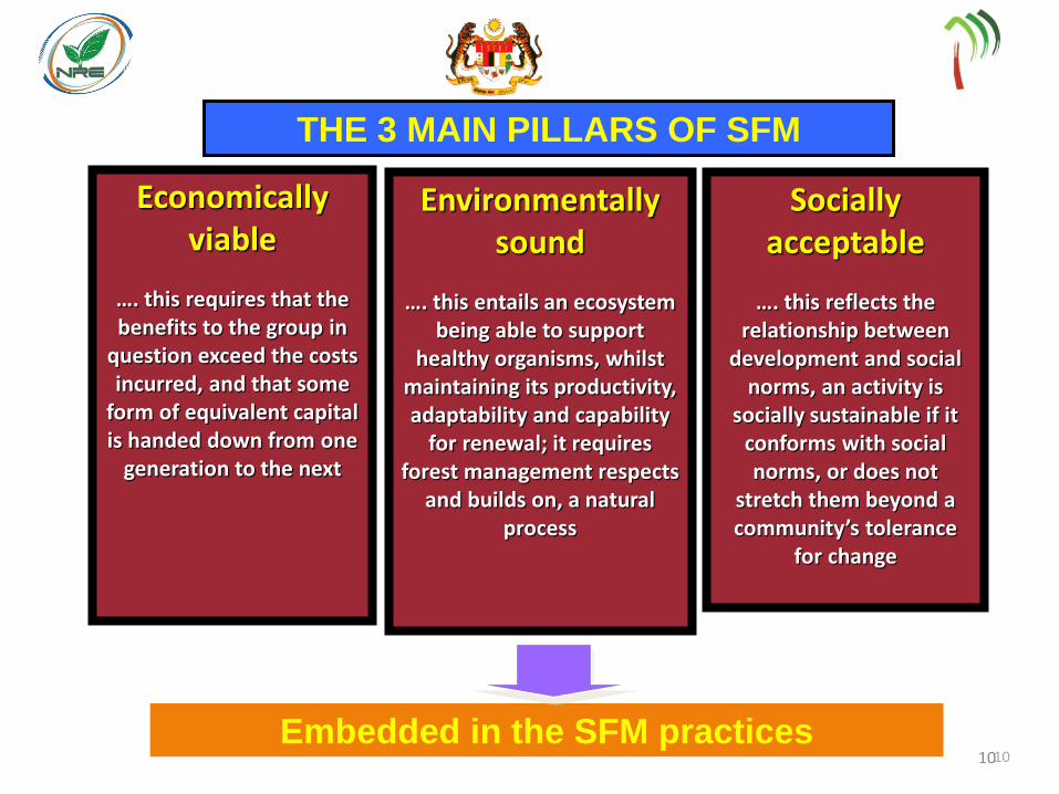
Economically viable
…. this requires that the benefits to the group in
question exceed the costs incurred, and that some
form of equivalent capital is handed down from one
generation to the next
THE 3 MAIN PILLARS OF SFM
Embedded in the SFM practices
Environmentally sound
…. this entails an ecosystem being able to support
healthy organisms, whilst maintaining its productivity, adaptability and capability
for renewal; it requires forest management respects
and builds on, a natural process
Socially acceptable
…. this reflects the relationship between
development and social norms, an activity is
socially sustainable if it conforms with social norms, or does not
stretch them beyond a community’s tolerance
for change
10
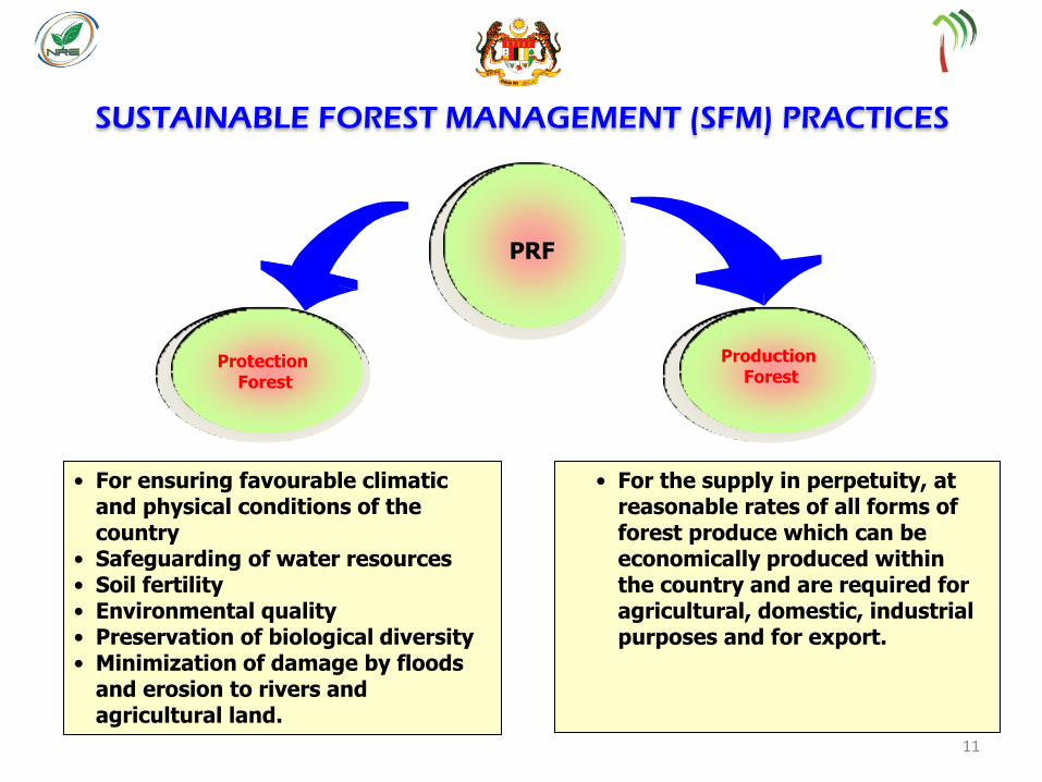
SUSTAINABLE FOREST MANAGEMENT (SFM) PRACTICES
Protection Forest
Production Forest
• For the supply in perpetuity, at reasonable rates of all forms of forest produce which can be economically produced within the country and are required for agricultural, domestic, industrial purposes and for export.
• For ensuring favourable climatic and physical conditions of the country
• Safeguarding of water resources • Soil fertility • Environmental quality • Preservation of biological diversity • Minimization of damage by floods
and erosion to rivers and agricultural land.
PRF
11
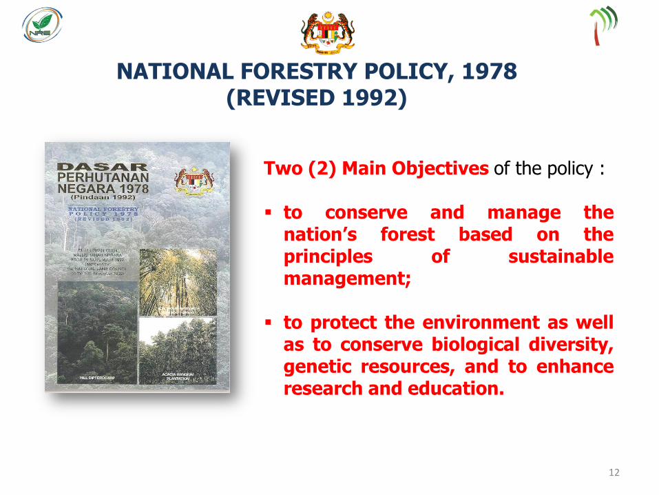
Two (2) Main Objectives of the policy : to conserve and manage the
nation’s forest based on the principles of sustainable management;
to protect the environment as well as to conserve biological diversity, genetic resources, and to enhance research and education.
NATIONAL FORESTRY POLICY, 1978 (REVISED 1992)
12
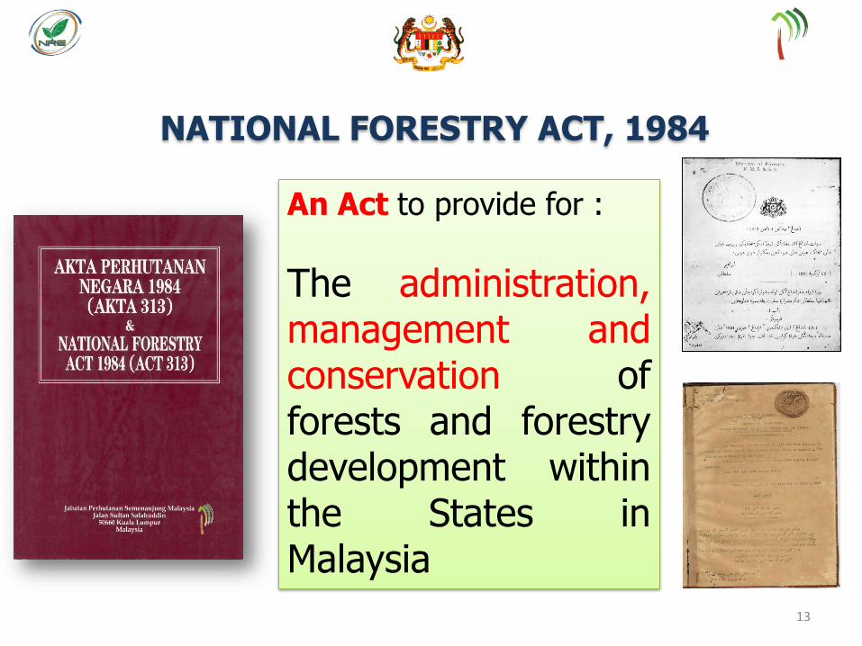
NATIONAL FORESTRY ACT, 1984
An Act to provide for :
The administration, management and conservation of forests and forestry development within the States in Malaysia
13

FOREST MANAGEMENT CERTIFICATION AS A TOOL
TO ASSESS ATTAINMENT OF SFM
Forest Management Certification is a process of third party audit of the forest management practices of natural forest in a Forest Management Unit (FMU) to assess compliance with the requirements of a prescribed standard leading to an award of a Certificate for Forest Management.
The MC & I (2002) has been the standard used for the forest management certification of natural forest in Malaysia under the Malaysian Timber Certification Scheme (MTCS) since October 2005. This MC & I was formulated based on the 1998 ITTO Criteria and Indicators for Sustainable Management of Natural Tropical Forests.
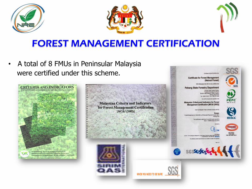
FOREST MANAGEMENT CERTIFICATION
• A total of 8 FMUs in Peninsular Malaysia
were certified under this scheme.
GEOSPATIAL TECHNOLOGY AS TOOL FOR EFFECTIVE
FOREST MANAGEMENT
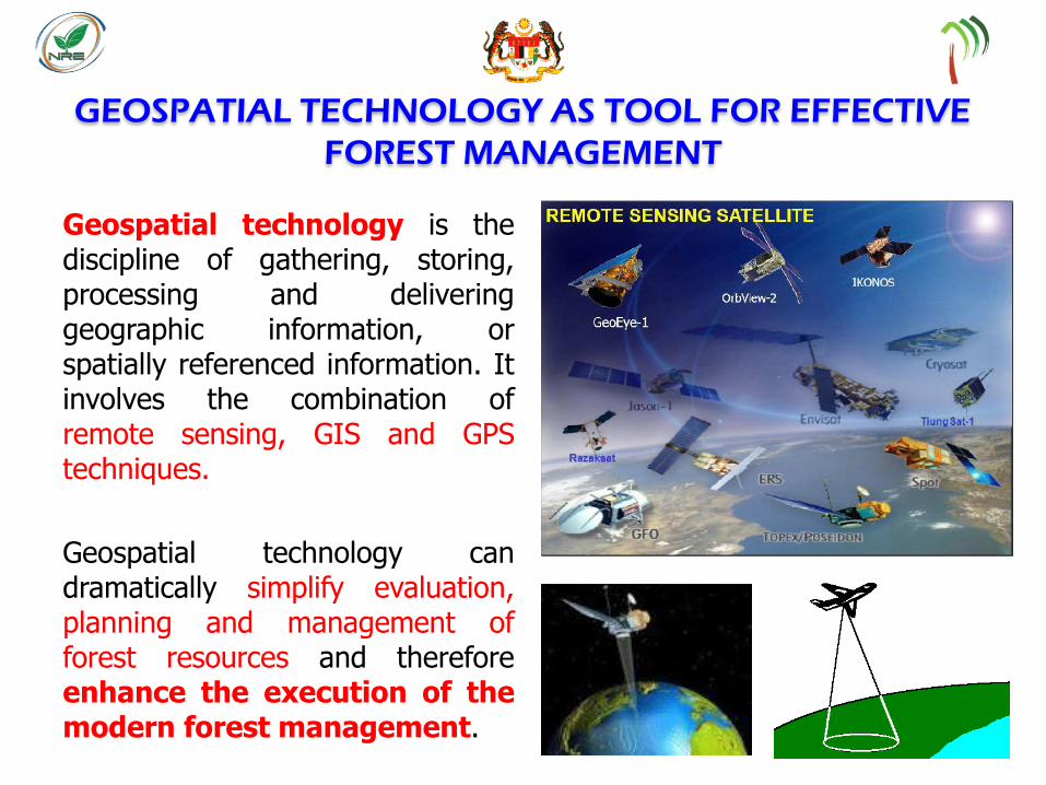
Geospatial technology is the discipline of gathering, storing, processing and delivering geographic information, or spatially referenced information. It involves the combination of remote sensing, GIS and GPS techniques.
Geospatial technology can dramatically simplify evaluation, planning and management of forest resources and therefore enhance the execution of the modern forest management.
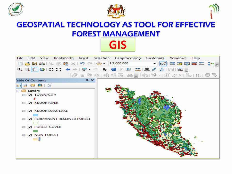
GEOSPATIAL TECHNOLOGY AS TOOL FOR EFFECTIVE
FOREST MANAGEMENT
GIS
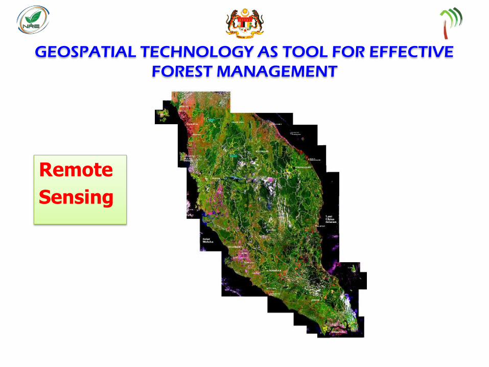
GEOSPATIAL TECHNOLOGY AS TOOL FOR EFFECTIVE
FOREST MANAGEMENT
Remote
Sensing
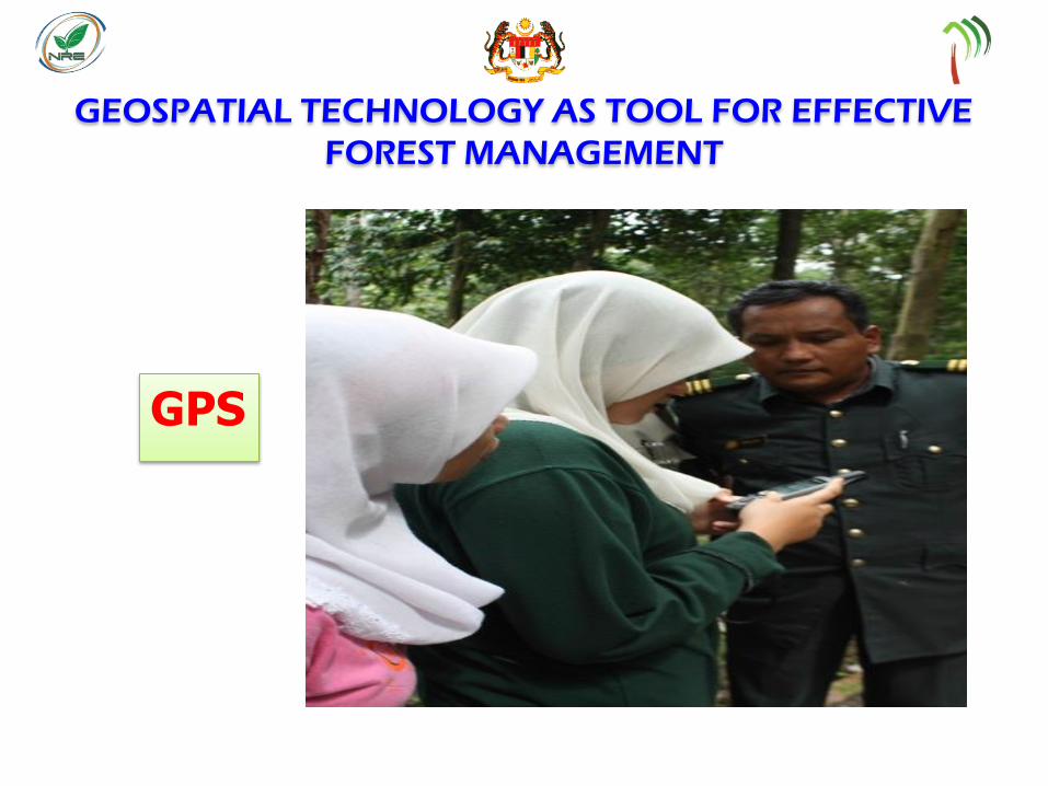
GEOSPATIAL TECHNOLOGY AS TOOL FOR EFFECTIVE
FOREST MANAGEMENT
GPS
APPLICATION OF GEOSPATIAL TECHNOLOGY BY FDPM
FOR EFFECTIVE IMPLEMENTATION OF SFM
Forest Planning
(i) Digitized National Forest Inventory Map
for NFI 3 (1991 – 1993 ), NFI 4 (2002 – 2004) and NFI 5 (2011 – 2012) – stratifying the forest of PM into several main strata.
(ii) Integrated Remote Sensing and GIS PRF Map
An integrated Remote Sensing and GIS map.
- a pilot project with technical assistance from AIFM in 1994-1997.
- a joint project with technical assistance from the EU in 1997-1999.
- to automate routine cartographic procedures besides
handling of various layers pf the geospatial database.
Layers include boundaries of PRFs, compartments,
forest functional classes, topographic features such as rivers,
contours, roads, and Landsat Satelite Imageries.
APPLICATION OF GEOSPATIAL TECHNOLOGY BY FDPM
FOR EFFECTIVE IMPLEMENTATION OF SFM
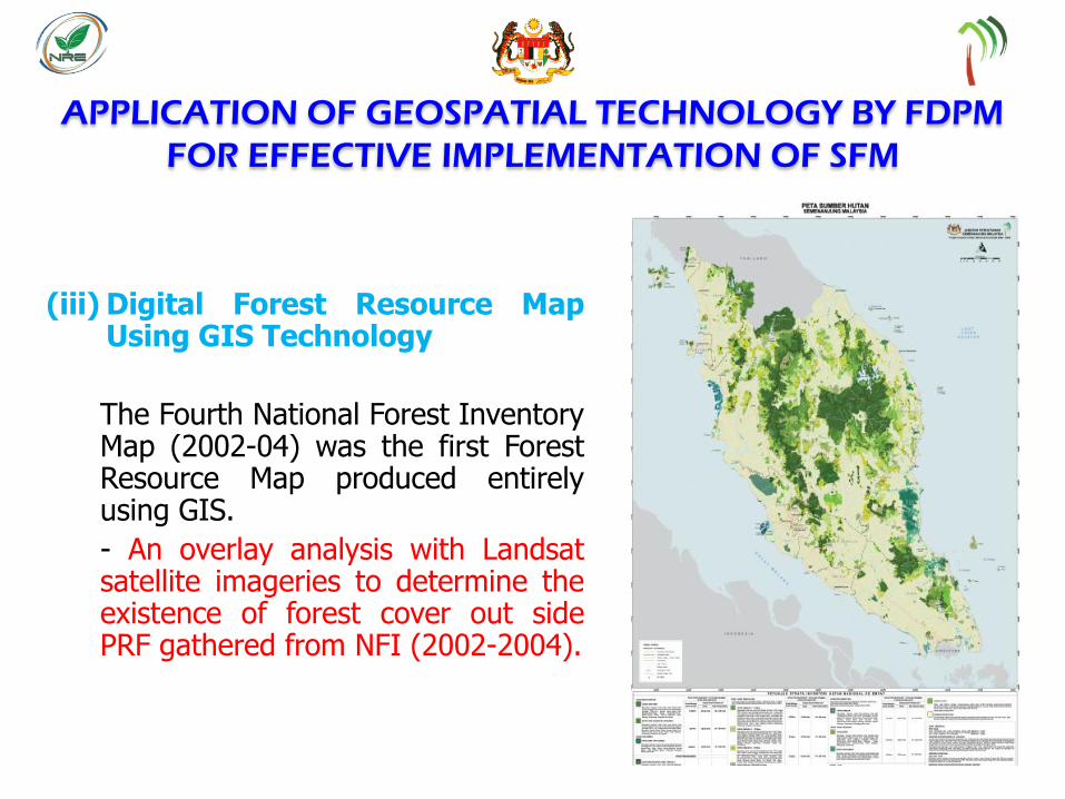
(iii) Digital Forest Resource Map Using GIS Technology
The Fourth National Forest Inventory Map (2002-04) was the first Forest Resource Map produced entirely using GIS.
- An overlay analysis with Landsat satellite imageries to determine the existence of forest cover out side PRF gathered from NFI (2002-2004).
APPLICATION OF GEOSPATIAL TECHNOLOGY BY FDPM
FOR EFFECTIVE IMPLEMENTATION OF SFM
Forest Operation
(i) Digital Forest Operation Maps
The Forestry GIS was upgraded under the Sustainable Forest Management and Conservation Project with the German Technical Cooperation(GTZ) in 2002-05.
- upgraded Forestry GIS system facilitated multifunctional forest
mapping, working area demarcation, the licensing process,
Pre-F and Post-F calculations, individual tree mapping and
cutting threshold calculations based on inventory results.
It also supported the re-surveying of the compartments
within a PRF.
- the complete forest operation processes from demarcation of a
working area to Post-F inventory and enrichment planting can be
handled using the Digital Forest Operation Map

APPLICATION OF GEOSPATIAL TECHNOLOGY BY FDPM
FOR EFFECTIVE IMPLEMENTATION OF SFM
(ii) Digitized Forest License Map
A stand-alone application, the ‘License Module’ was developed by the Mapping and GIS Section in 2001-2002 and is still in use today by the SFD - the production of operational maps, namely Digitized Forest Licence Map, replacing the conventional manual method.
Pre-F or Post F Plots Tree mapping based on species
APPLICATION OF GEOSPATIAL TECHNOLOGY BY FDPM
FOR EFFECTIVE IMPLEMENTATION OF SFM
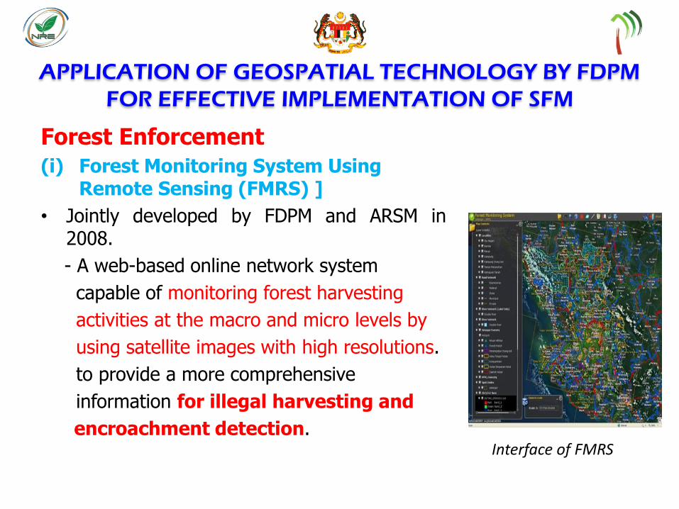
Forest Enforcement
(i) Forest Monitoring System Using Remote Sensing (FMRS) ]
• Jointly developed by FDPM and ARSM in 2008.
- A web-based online network system
capable of monitoring forest harvesting
activities at the macro and micro levels by
using satellite images with high resolutions.
to provide a more comprehensive
information for illegal harvesting and
encroachment detection. Interface of FMRS
APPLICATION OF GEOSPATIAL TECHNOLOGY BY FDPM
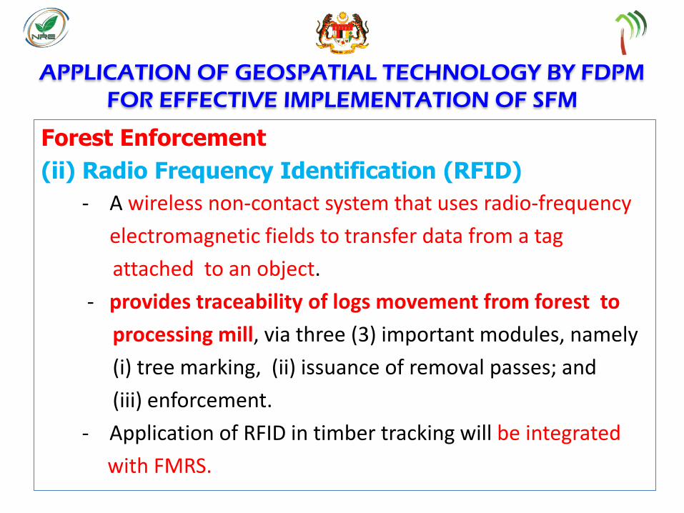
FOR EFFECTIVE IMPLEMENTATION OF SFM
Forest Enforcement
(ii) Radio Frequency Identification (RFID)
- A wireless non-contact system that uses radio-frequency
electromagnetic fields to transfer data from a tag
attached to an object.
- provides traceability of logs movement from forest to
processing mill, via three (3) important modules, namely
(i) tree marking, (ii) issuance of removal passes; and
(iii) enforcement.
- Application of RFID in timber tracking will be integrated
with FMRS.

RFID Technology
Handheld Tag RFID
AAB 0162
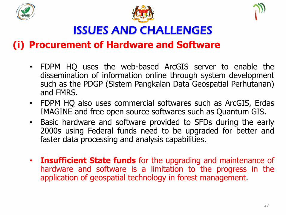
ISSUES AND CHALLENGES
(i) Procurement of Hardware and Software
• FDPM HQ uses the web-based ArcGIS server to enable the dissemination of information online through system development such as the PDGP (Sistem Pangkalan Data Geospatial Perhutanan) and FMRS.
• FDPM HQ also uses commercial softwares such as ArcGIS, Erdas IMAGINE and free open source softwares such as Quantum GIS.
• Basic hardware and software provided to SFDs during the early 2000s using Federal funds need to be upgraded for better and faster data processing and analysis capabilities.
• Insufficient State funds for the upgrading and maintenance of hardware and software is a limitation to the progress in the application of geospatial technology in forest management.
27

ISSUES AND CHALLENGES
(ii) Peopleware
• Lack of well trained and competent forestry personnel to handle works using up-to-date geospatial technology
• Lack of awareness and understanding among forest managers in realising that forestry is spatial-based and needs to be geospatially-managed for better efficiency
• Continuously Training Modules in tandem with the advancement of geospatial technology is crucial.
28
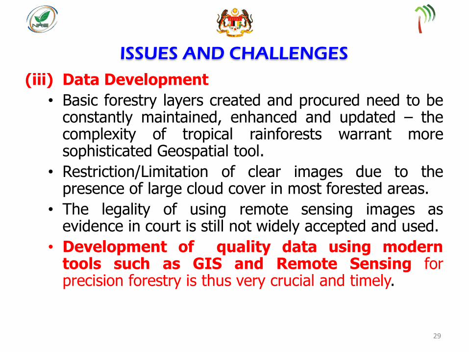
ISSUES AND CHALLENGES
(iii) Data Development
• Basic forestry layers created and procured need to be constantly maintained, enhanced and updated – the complexity of tropical rainforests warrant more sophisticated Geospatial tool.
• Restriction/Limitation of clear images due to the presence of large cloud cover in most forested areas.
• The legality of using remote sensing images as evidence in court is still not widely accepted and used.
• Development of quality data using modern tools such as GIS and Remote Sensing for precision forestry is thus very crucial and timely.
29
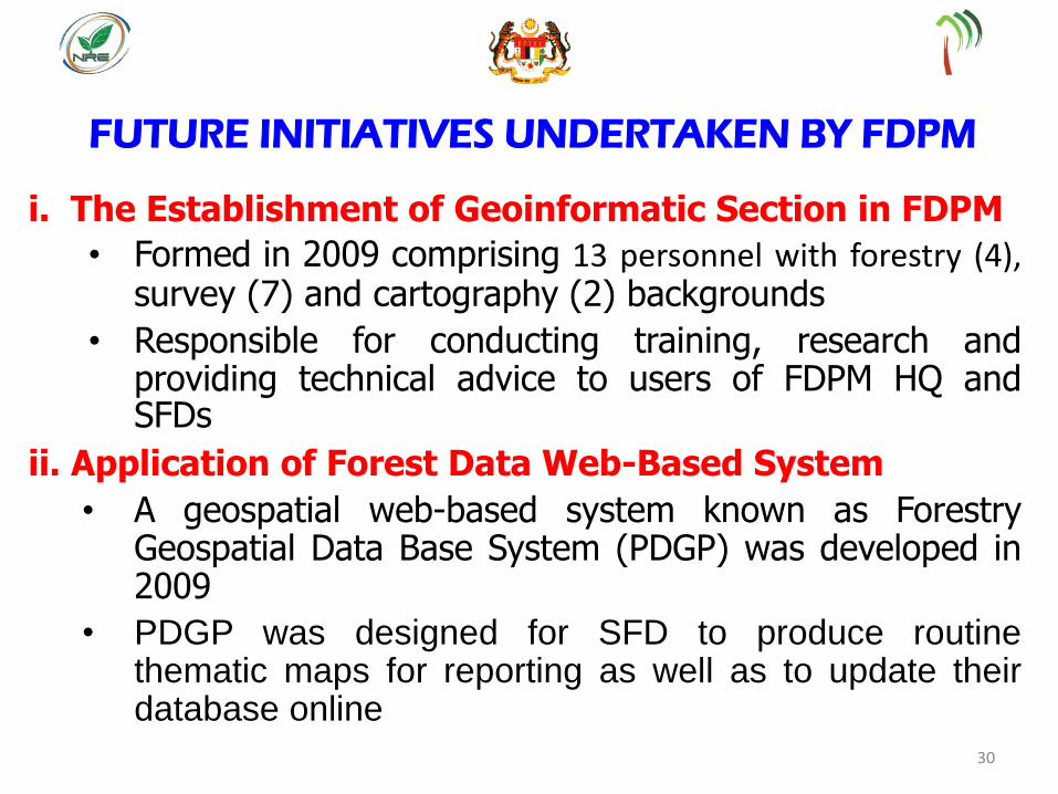
i. The Establishment of Geoinformatic Section in FDPM
• Formed in 2009 comprising 13 personnel with forestry (4), survey (7) and cartography (2) backgrounds
• Responsible for conducting training, research and providing technical advice to users of FDPM HQ and SFDs
ii. Application of Forest Data Web-Based System
• A geospatial web-based system known as Forestry Geospatial Data Base System (PDGP) was developed in 2009
• PDGP was designed for SFD to produce routine thematic maps for reporting as well as to update their database online
30
FUTURE INITIATIVES UNDERTAKEN BY FDPM
iii. Application of Geospatial Technology-Based Forestry Related Reports
• GIS information used in the preparation of country reports at regional and international levels
• FDPM embarked on the production of Forest Cover Mapping for the year 2009-2010 using SPOT 5 satellite imageries and GIS, and continues to update the map bi-annually
• Geospatial efforts are also being undertaken by FDPM to replace conventional statistical reporting involving size or area measurements of PRFs, Forest Functional Classes and other forestry spatial based information
31
FUTURE INITIATIVES UNDERTAKEN BY FDPM
(cont..)

32

iv. Undertaking Studies on the Potential Use of Hyperspectral Technology for Forest Tree Species Identification and Forest Monitoring
• Several airborne hyperspectral remote sensing studies on forest tree species identification were conducted in 2004-2008 in collaboration with UPM
• The use of hyperspectral remote sensing shows potential for forest tree species discrimination and identification besides determining the health condition of the trees
• FDPM is considering the potential application of
hyperspectral technology in the monitoring and detection
of illegal forest harvesting and forest encroachment
33
FUTURE INITIATIVES UNDERTAKEN BY FDPM
(cont..)
v. Undertaking Smart Partnership With ARSM
• A Note of Cooperation between FDPM and ARSM was signed aimed to develop and operationalize forestry-related geospatial technologies through expertise sharing.
• Several key projects were implemented, namely Forest Cover Mapping, Forest Monitoring Using Remote Sensing (FMRS), Forest Road Planning and Management System, National Coastal Areas Management System, Mapping of Degraded Forests and Forest Resource Inventory.
• The note of cooperation is targeted to end in 2020.
34
FUTURE INITIATIVES UNDERTAKEN BY FDPM
(cont..)
vi. The Establishment of Central Forest Spine Data
Base System • A geospatial-based online system is being considered to centralize
and share all related CFS project information for analysis, mapping and reporting purposes by the respective stakeholder agencies
• Geospatial Land Cover maps have been prepared for all the identified 37 ecological linkages
• Geospatial layer of all wildlife ‘salt licks’ locations within the CFS is being developed
• The use of UAV or drone is being planned for aerial surveillance and remote sensing data updating of the ecological linkages
• Pilot study using hyperspectral remote sensing technology for forest tree species identification will be conducted in the Gerik-Jeli ecological linkage, Perak with assistance of expertise from the Sarawak Forestry Department.
35
FUTURE INITIATIVES UNDERTAKEN BY FDPM
(Cont..)
CONCLUSIONS
• The Tropical Rainforest of Peninsular Malaysia is a complex ecosystem rich in flora and fauna. Enormous amount of spatially based data and information concerning this complex forest resource need to be captured and recorded in a systematic manner to facilitate more accurate forest management decision making. Adoption of geospatial technology as an effective tool for gathering, storing, processing, and delivery of geographic information, or spatially referenced information is very crucial and timely.
36

CONCLUSIONS
• Concerted efforts are being undertaken by FDPM to enhance the usage of geospatial technology for more effective forest management. However, in the process of achieving this, there are limitations and challenges which need to be overcome.
• It is envisaged that all future planning, management and monitoring of forest resources particularly within the PRFs can be effectively done using accurate and up-to-date geospatial data to ensure the full attainment of SFM compliancy.
37
THANK
YOU http ://www.forestry.gov.my