Embed Size (px)
Citation preview
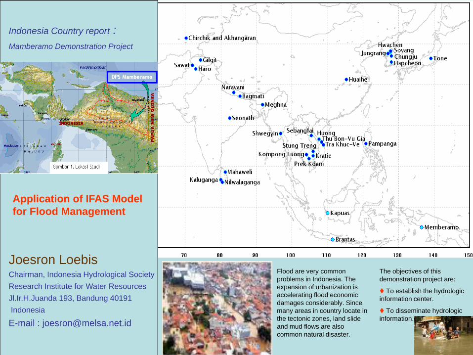
Indonesia Country report :Mamberamo Demonstration Project
Application of IFAS Model for Flood Management
Joesron LoebisChairman, Indonesia Hydrological SocietyResearch Institute for Water ResourcesJl.Ir.H.Juanda 193, Bandung 40191Indonesia
E-mail : [email protected]
Flood are very common problems in Indonesia. The expansion of urbanization is accelerating flood economic damages considerably. Since many areas in country locate in the tectonic zones, land slide and mud flows are also common natural disaster.
The objectives of this demonstration project are:
To establish the hydrologic information center.
To disseminate hydrologic information.
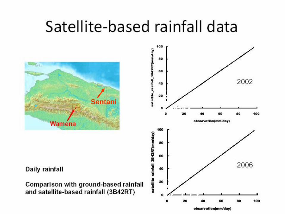
Sentani
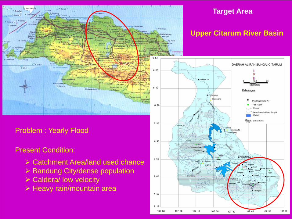
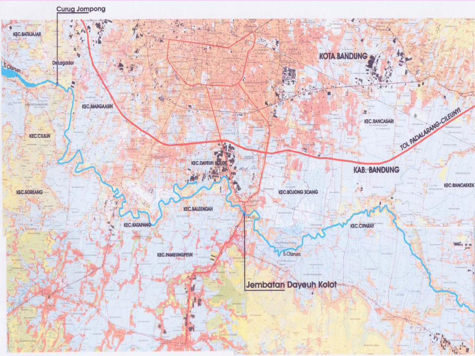
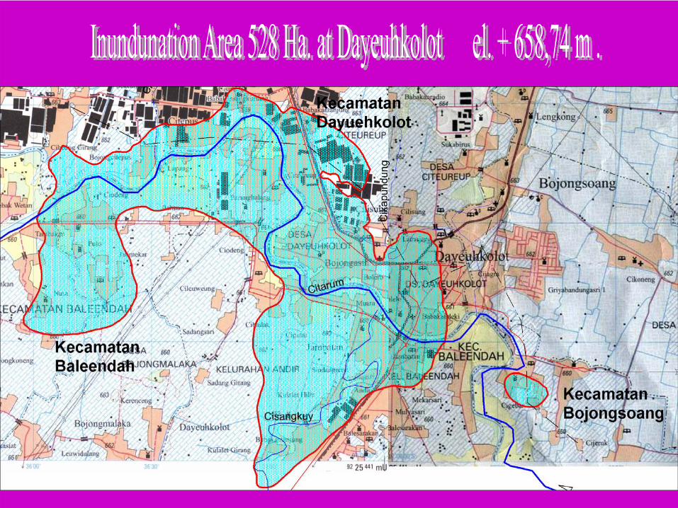
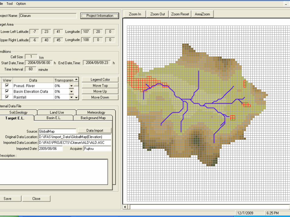
Upper Citarum River Basin
Target Area
Problem : Yearly Flood
Present Condition:
Catchment Area/land used chanceBandung City/dense populationCaldera/ low velocityHeavy rain/mountain area
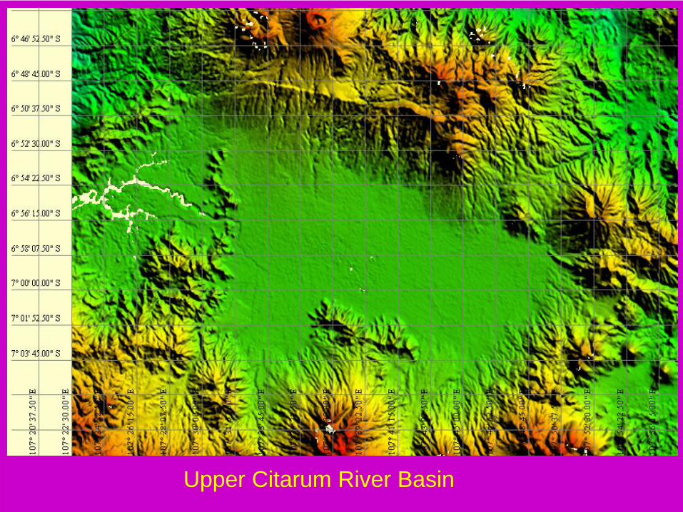
Upper Citarum River Basin
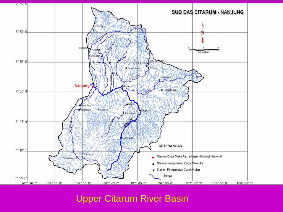
Upper Citarum River Basin
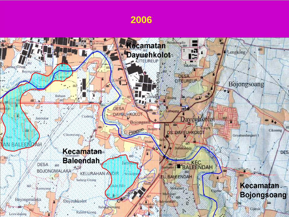
2006
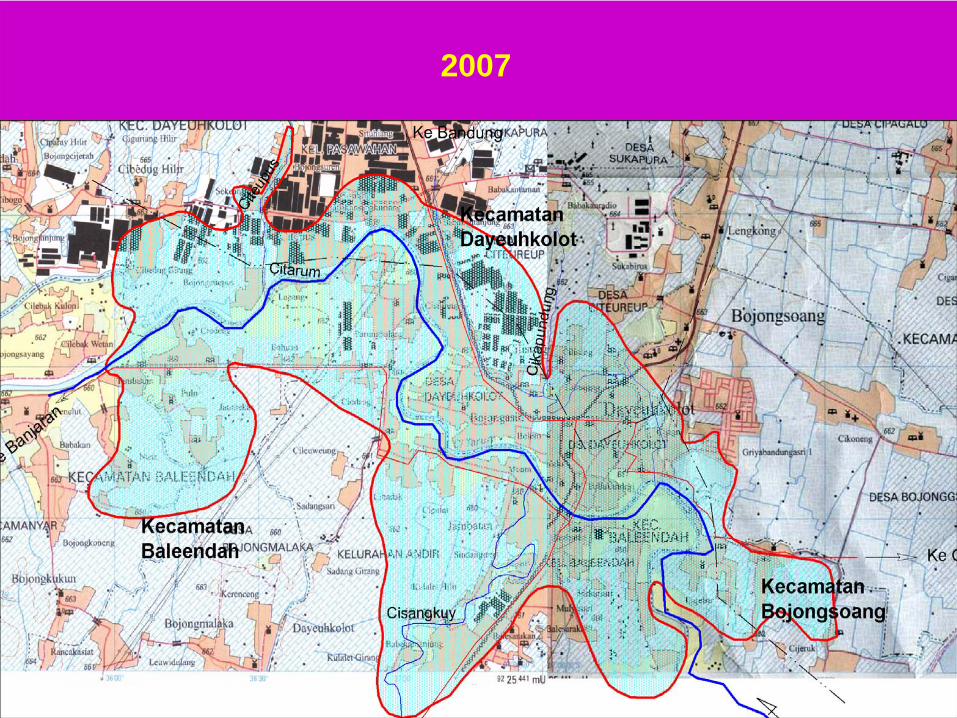
2007
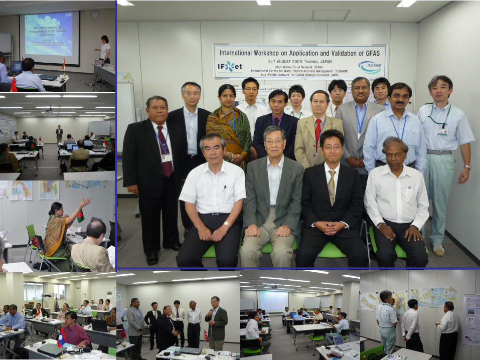
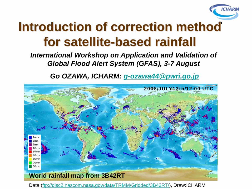
International Workshop on Application and Validation of Global Flood Alert System (GFAS), 3-7 August
Go OZAWA, ICHARM: [email protected]
World rainfall map from 3B42RTData:(ftp://disc2.nascom.nasa.gov/data/TRMM/Gridded/3B42RT/), Draw:ICHARM
2008/JULY13th/12:00 UTC
Introduction of correction method for satellite-based rainfall