Embed Size (px)
Citation preview
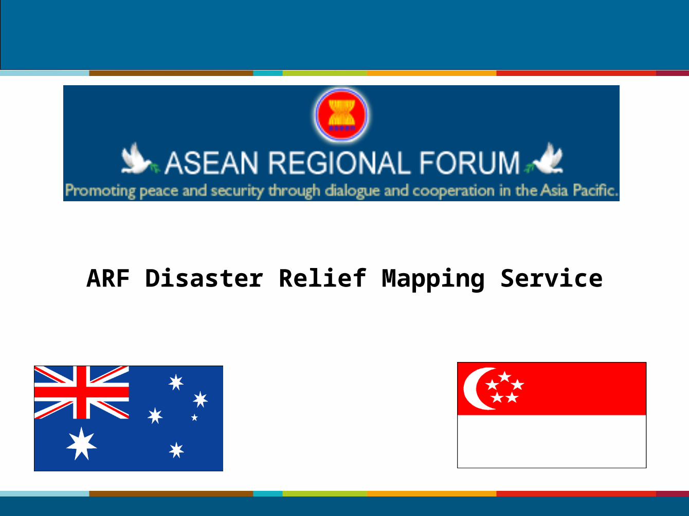
ARF Disaster Relief Mapping Service
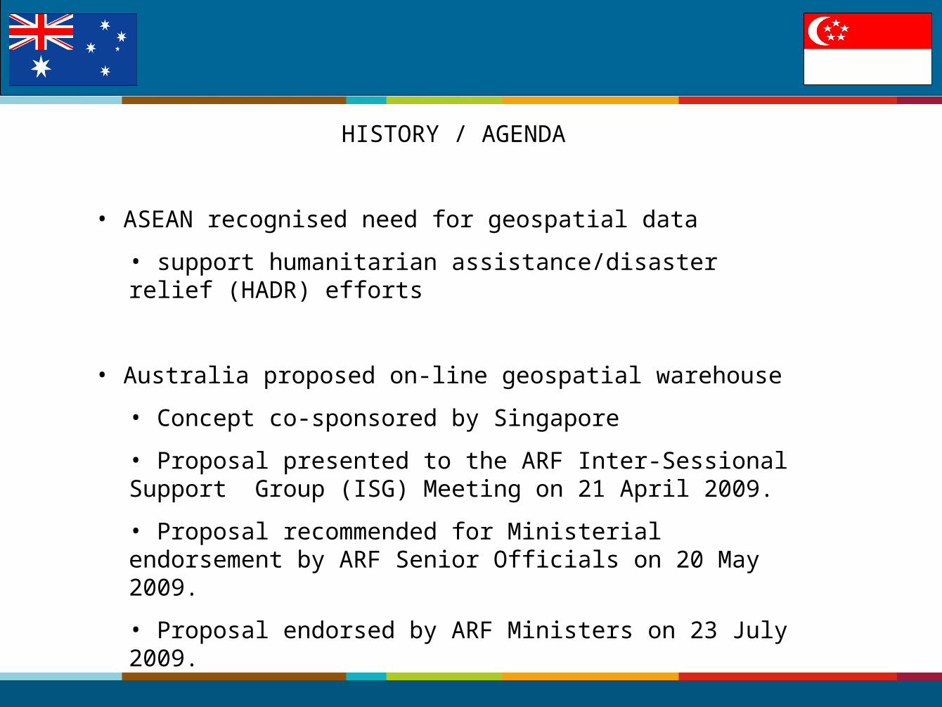
HISTORY / AGENDA
• ASEAN recognised need for geospatial data
• support humanitarian assistance/disaster relief (HADR) efforts
• Australia proposed on-line geospatial warehouse
• Concept co-sponsored by Singapore
• Proposal presented to the ARF Inter-Sessional Support Group (ISG) Meeting on 21 April 2009.
• Proposal recommended for Ministerial endorsement by ARF Senior Officials on 20 May 2009.
• Proposal endorsed by ARF Ministers on 23 July 2009.
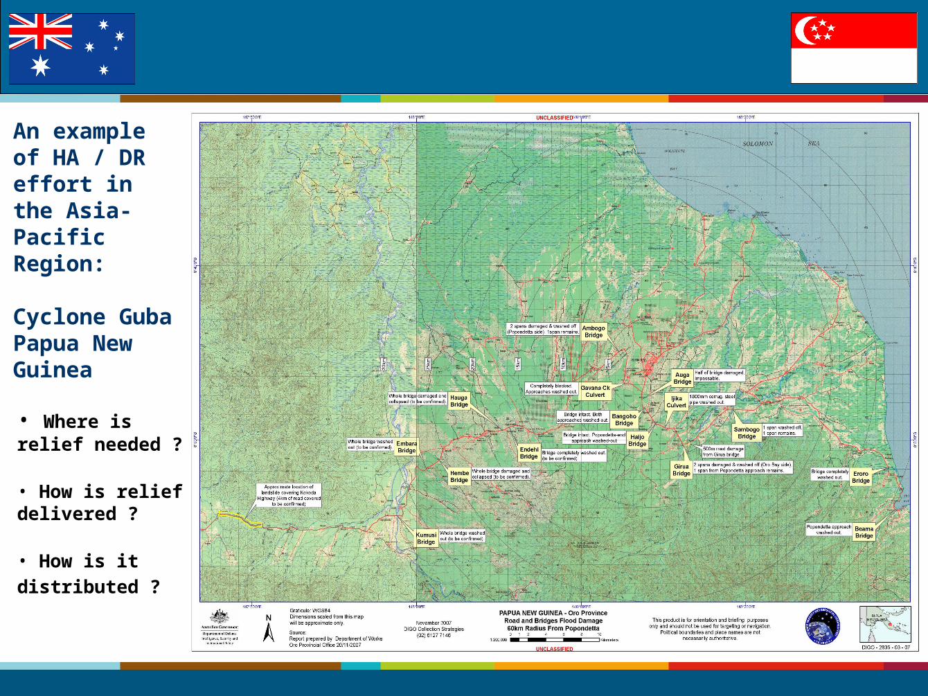
An example of HA / DR effort in the Asia-Pacific Region:
Cyclone Guba Papua New Guinea
• Where is relief needed ?
• How is relief delivered ?
• How is it
distributed ?
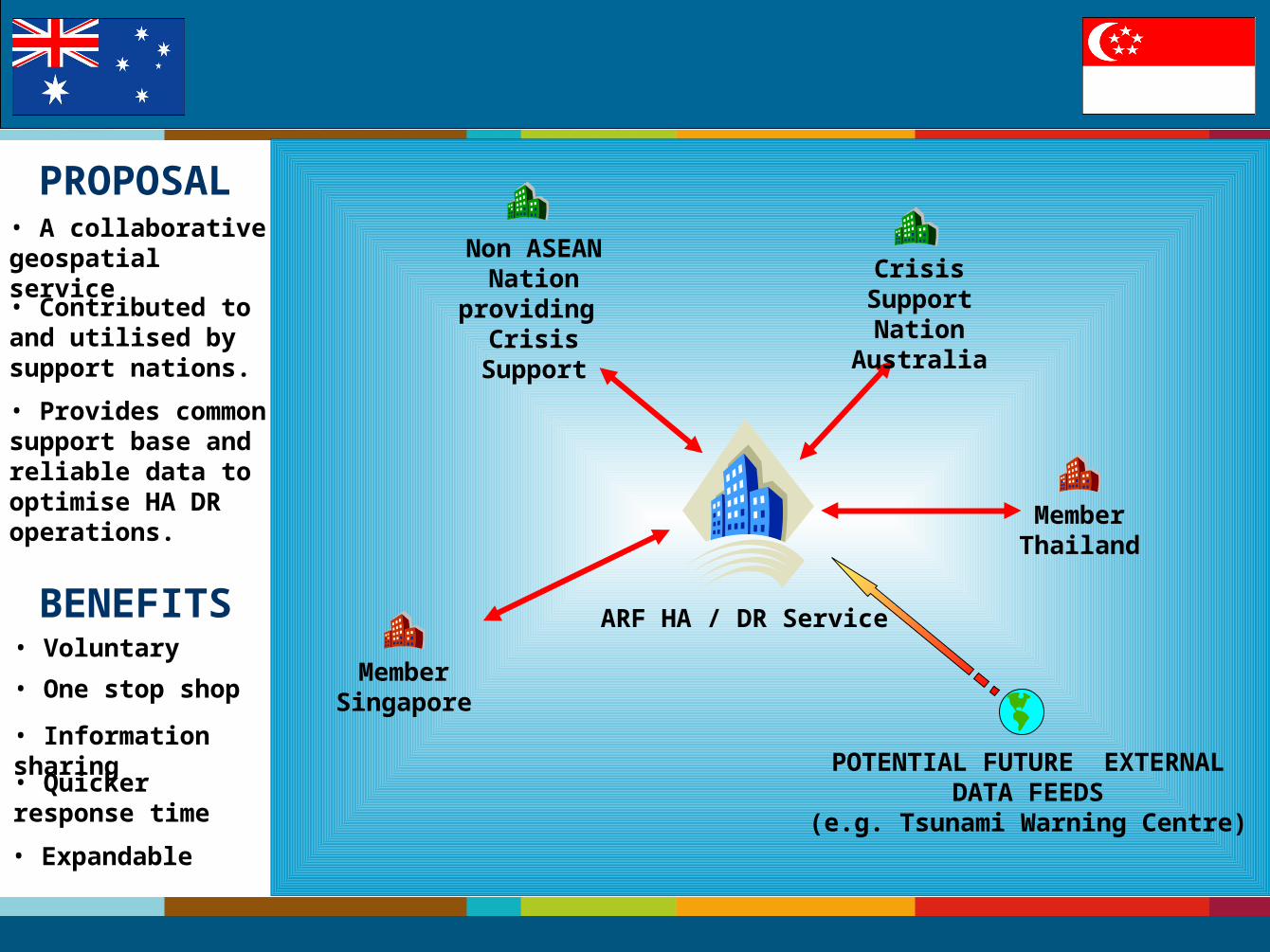
Crisis Support Nation
Australia
ARF HA / DR Service
Member Singapore
Non ASEAN Nation
providing Crisis Support
POTENTIAL FUTURE EXTERNALDATA FEEDS
(e.g. Tsunami Warning Centre)
Member Thailand
• A collaborative geospatial service
PROPOSAL
• Provides common support base and reliable data to optimise HA DR operations.
• Contributed to and utilised by support nations.
BENEFITS
• One stop shop
• Quicker response time
• Information sharing
• Expandable
• Voluntary
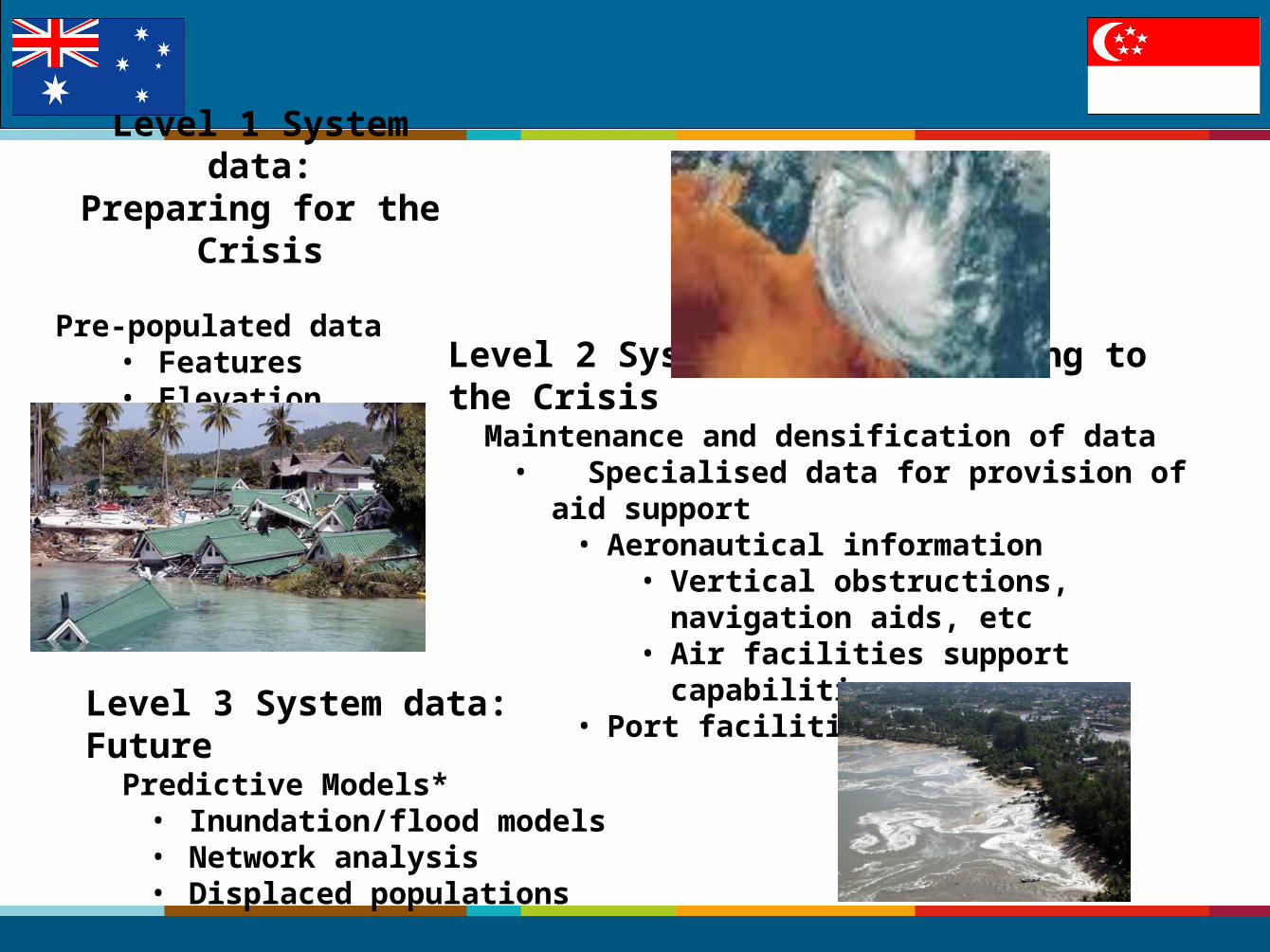
Level 1 System data:Preparing for the Crisis
Pre-populated data
• Features• Elevation
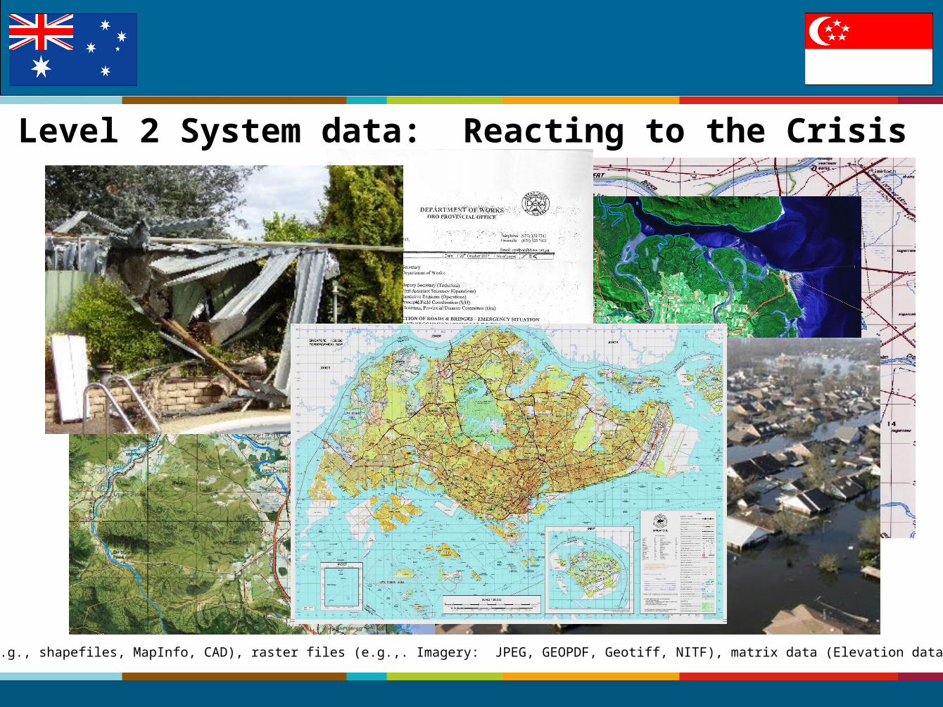
Level 2 System data: Reacting to the Crisis Maintenance and densification of data
• Specialised data for provision of aid support• Aeronautical information
• Vertical obstructions, navigation aids, etc
• Air facilities support capabilities• Port facilities
Level 3 System data: Future Predictive Models*
• Inundation/flood models• Network analysis• Displaced populations
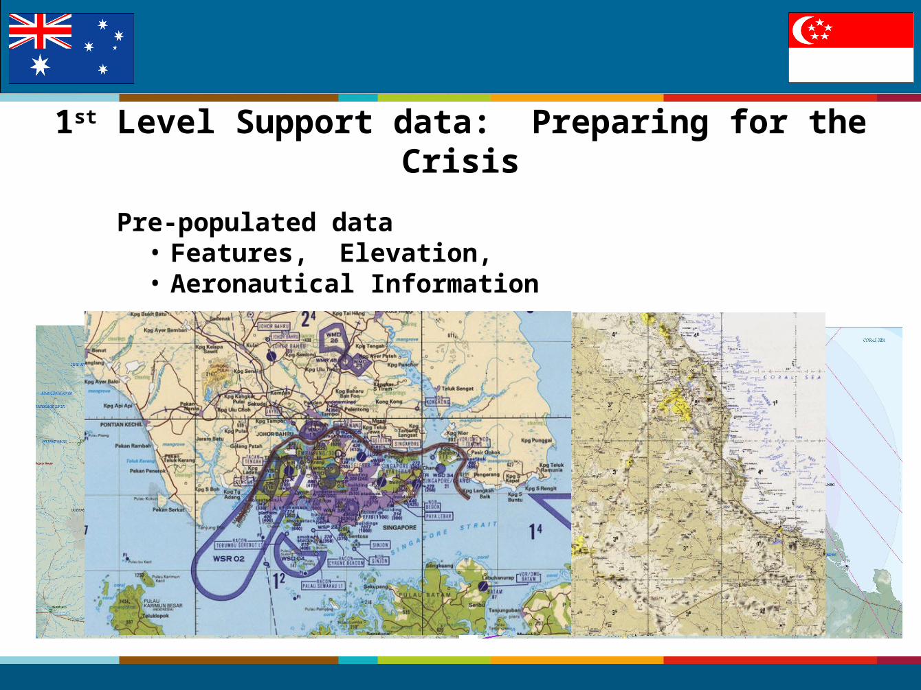
1st Level Support data: Preparing for the Crisis
Pre-populated data• Features, Elevation, • Aeronautical Information
Level 2 System data: Reacting to the Crisis
* vector files (e.g., shapefiles, MapInfo, CAD), raster files (e.g.,. Imagery: JPEG, GEOPDF, Geotiff, NITF), matrix data (Elevation data: DEM/Grid, TIN)
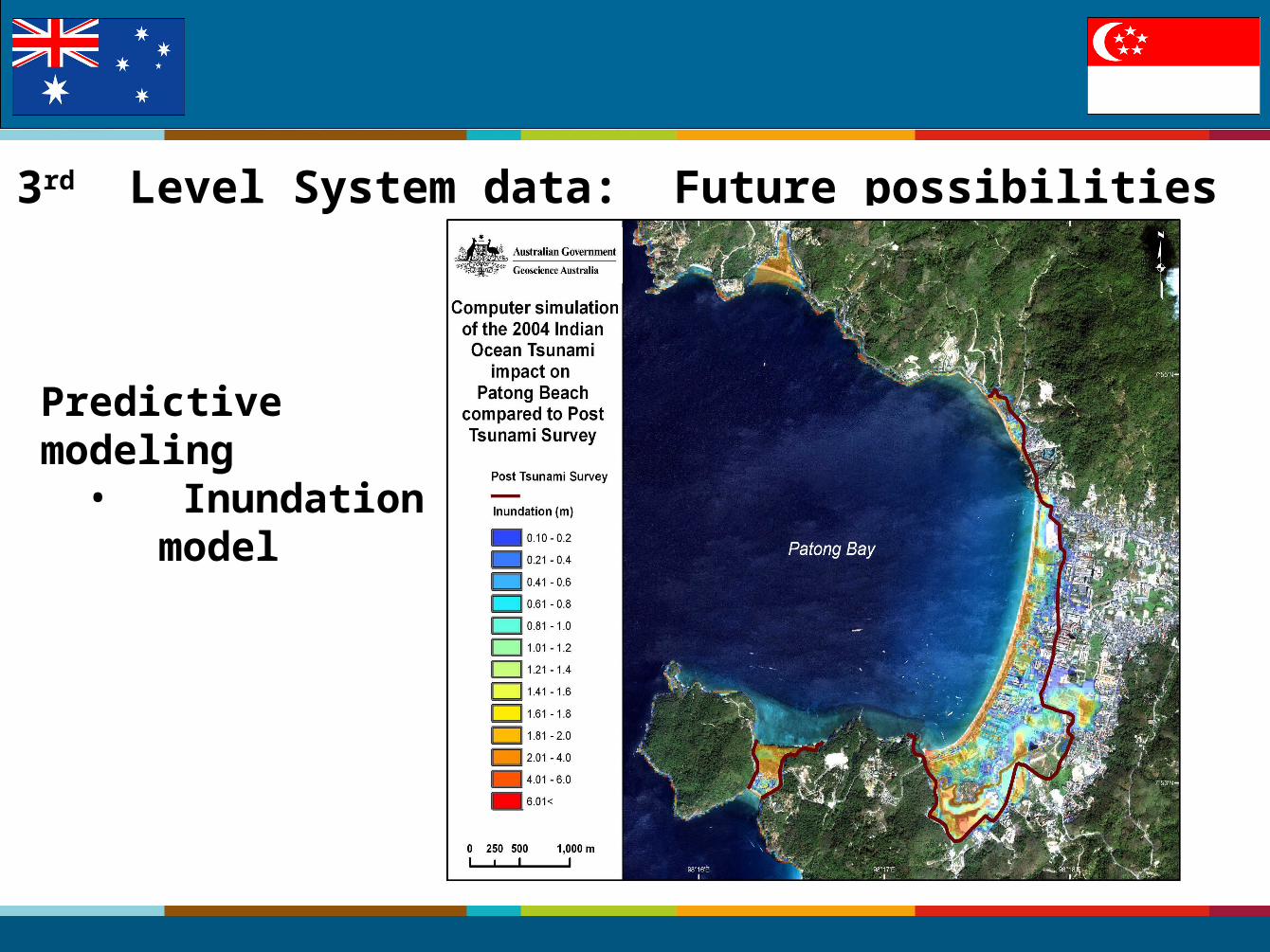
3rd Level System data: Future possibilities
Predictive modeling• Inundation model
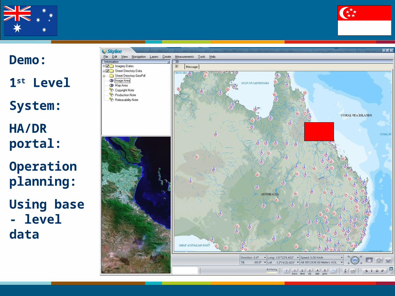
Demo:
1st Level
System:
HA/DR portal:
Operation planning:
Using base - level data
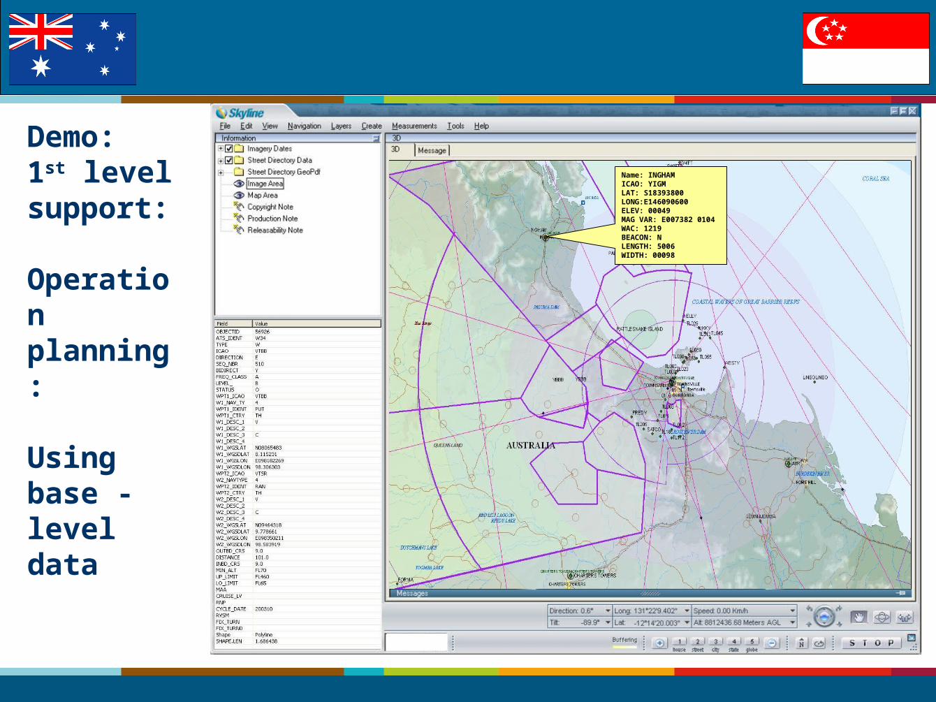
Demo:1st level support:
Operation planning:
Using base - level data
Name: INGHAMICAO: YIGMLAT: S18393800LONG:E146090600ELEV: 00049MAG VAR: E007382 0104WAC: 1219BEACON: NLENGTH: 5006WIDTH: 00098
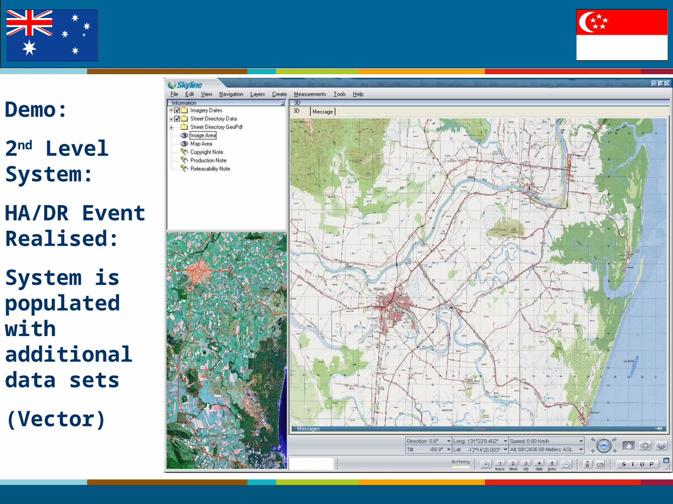
Demo:
2nd Level System:
HA/DR Event Realised:
System is populated with additional data sets
(Vector)
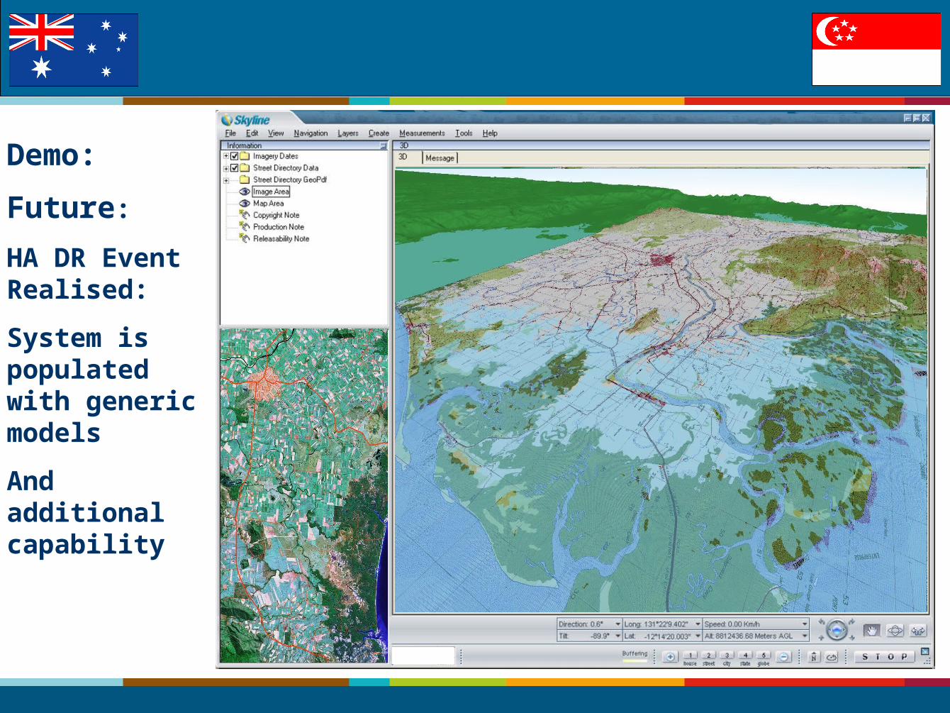
Demo:
Future:
HA DR Event Realised:
System is populated with generic models
And additional capability
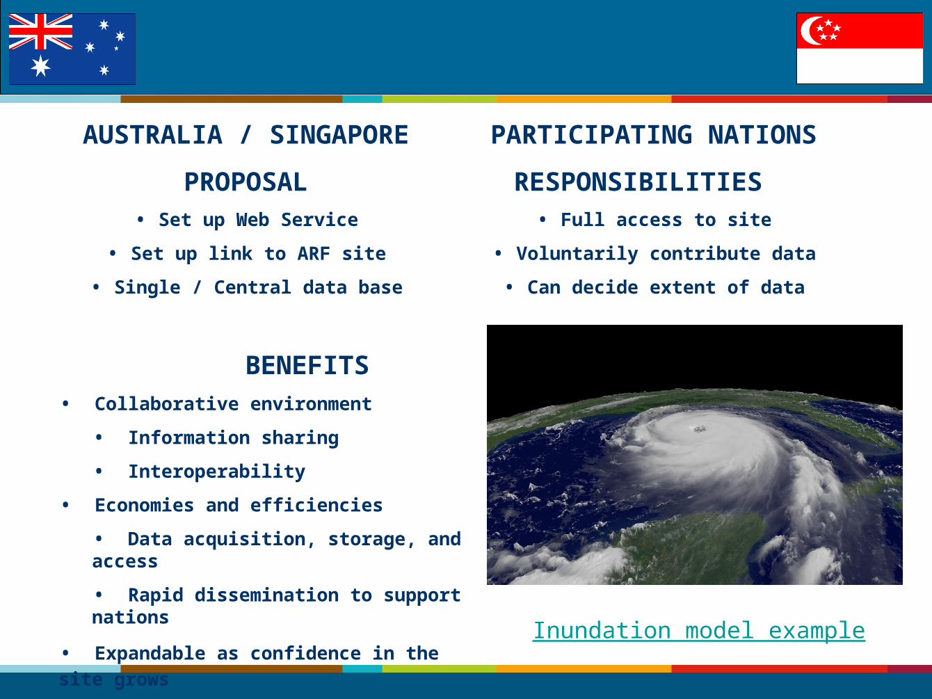
AUSTRALIA / SINGAPORE
PROPOSAL• Set up Web Service
• Set up link to ARF site
• Single / Central data base
BENEFITS • Collaborative environment
• Information sharing
• Interoperability
• Economies and efficiencies
• Data acquisition, storage, and access
• Rapid dissemination to support nations
• Expandable as confidence in the site grows
PARTICIPATING NATIONS
RESPONSIBILITIES • Full access to site
• Voluntarily contribute data
• Can decide extent of data
Inundation model example
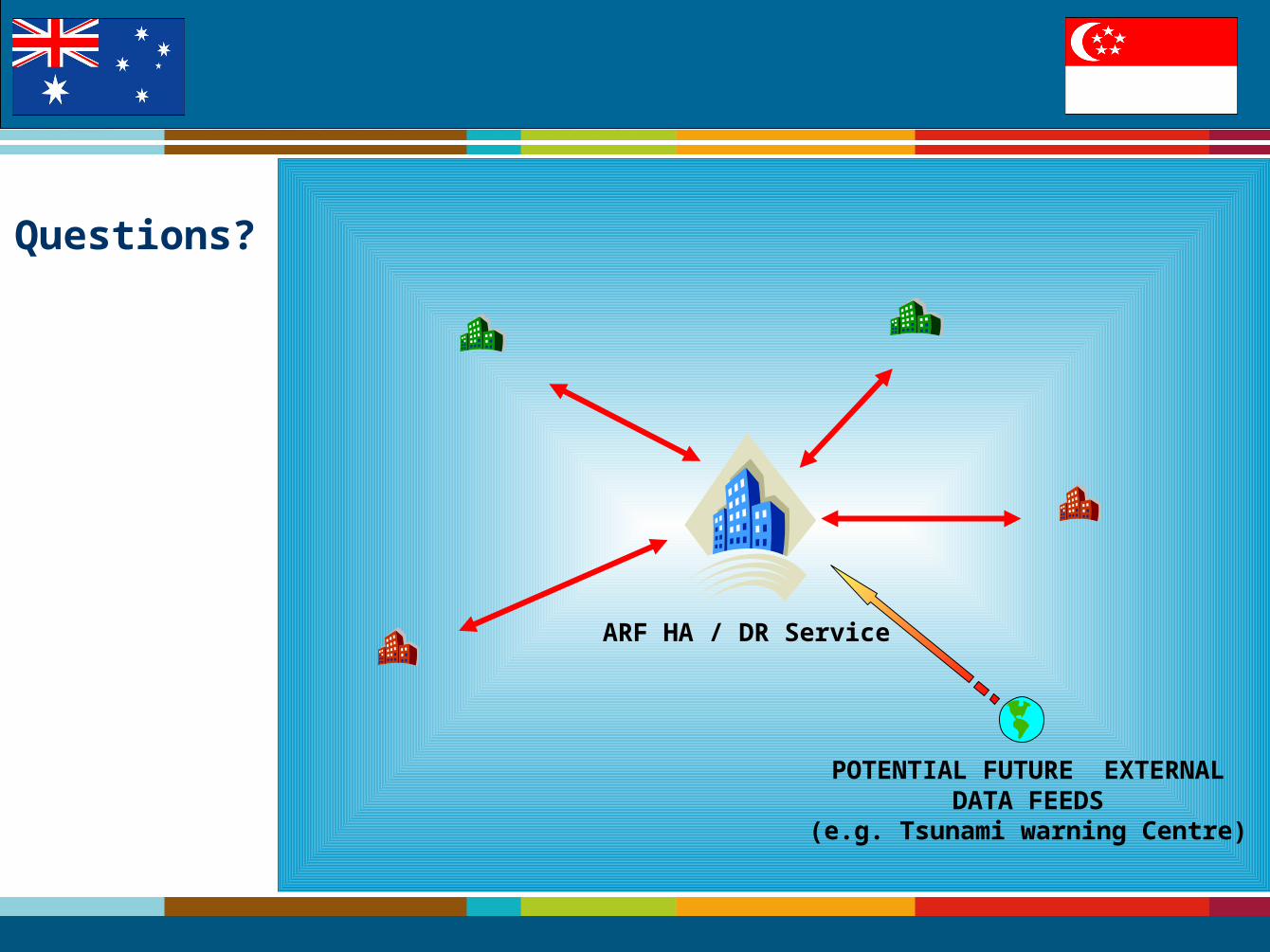
ARF HA / DR Service
POTENTIAL FUTURE EXTERNALDATA FEEDS
(e.g. Tsunami warning Centre)
Questions?


![Disaster Relief Project[3]](https://img.pdfslide.net/doc/110x75/55d4d7e4bb61eb74748b45ba/disaster-relief-project3.jpg)