Embed Size (px)
Citation preview
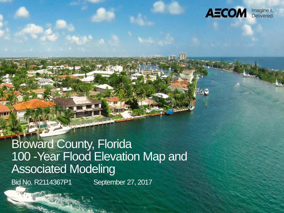
Broward County, Florida100 -Year Flood Elevation Map and Associated ModelingBid No. R2114367P1 September 27, 2017

Meet the AECOM Team
2
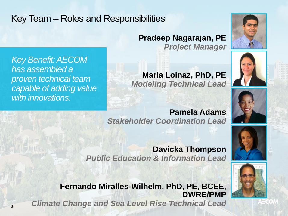
Key Team – Roles and Responsibilities
3
Key Benefit: AECOM has assembled a proven technical team capable of adding value with innovations.
Pradeep Nagarajan, PE Project Manager
Maria Loinaz, PhD, PE Modeling Technical Lead
Pamela AdamsStakeholder Coordination Lead
Davicka Thompson Public Education & Information Lead
Fernando Miralles-Wilhelm, PhD, PE, BCEE, DWRE/PMP
Climate Change and Sea Level Rise Technical Lead
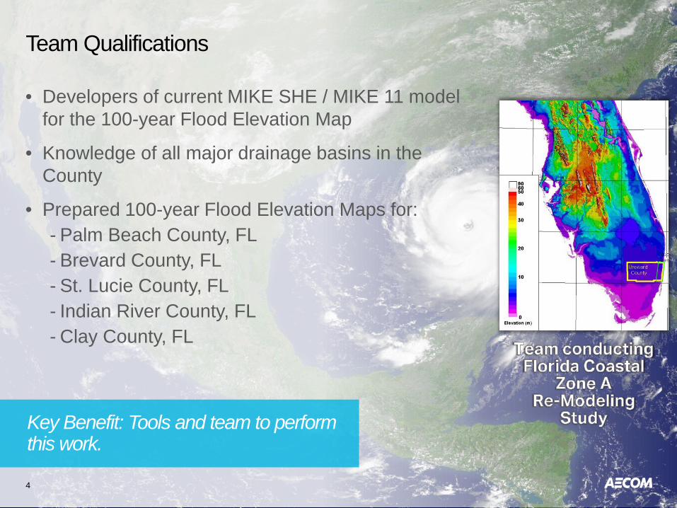
Team Qualifications
4
• Developers of current MIKE SHE / MIKE 11 model for the 100-year Flood Elevation Map
• Knowledge of all major drainage basins in the County
• Prepared 100-year Flood Elevation Maps for:- Palm Beach County, FL- Brevard County, FL- St. Lucie County, FL- Indian River County, FL- Clay County, FL
Key Benefit: Tools and team to perform this work.
AECOM Relevant Projects
5
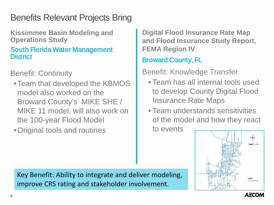
Digital Flood Insurance Rate Map and Flood Insurance Study Report, FEMA Region IV Broward County, FL
Benefit: Knowledge Transfer• Team has all internal tools used to develop County Digital Flood Insurance Rate Maps
• Team understands sensitivities of the model and how they react to events
6
Benefits Relevant Projects BringKissimmee Basin Modeling and Operations StudySouth Florida Water Management District
Benefit: Continuity•Team that developed the KBMOS model also worked on the Broward County’s MIKE SHE / MIKE 11 model, will also work on the 100-year Flood Model
•Original tools and routines
Key Benefit: Ability to integrate and deliver modeling, improve CRS rating and stakeholder involvement.
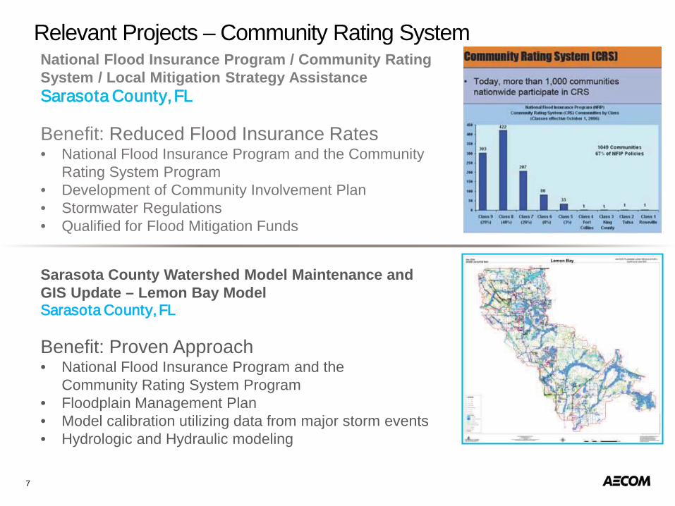
Relevant Projects – Community Rating System
Sarasota County Watershed Model Maintenance and GIS Update – Lemon Bay ModelSarasota County, FL
Benefit: Proven Approach• National Flood Insurance Program and the
Community Rating System Program• Floodplain Management Plan• Model calibration utilizing data from major storm events• Hydrologic and Hydraulic modeling
National Flood Insurance Program / Community Rating System / Local Mitigation Strategy AssistanceSarasota County, FL
Benefit: Reduced Flood Insurance Rates• National Flood Insurance Program and the Community
Rating System Program• Development of Community Involvement Plan• Stormwater Regulations• Qualified for Flood Mitigation Funds
7
Project Understanding and Approach
8

Project Understanding
9
• Consistency performed in 2014 model update and precursor models(NADA, SADA, CADA)
• Thorough understanding of the MIKE SHE/MIKE 11 model (complexities; constraints; and performance)
• Knowledge and lessons learned during the previous updates
Update Broward County 100-year Flood Elevation Map through: • Refinement of the latest County-
wide integrated MIKE SHE/MIKE 11 H&H Model that includes:
- Future climatic conditions- Sea Level Rise
The Main Objective The Team Brings
Key Benefit: Each update is unique and adaptive.
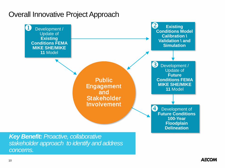
Overall Innovative Project Approach
10
Public Engagement
and Stakeholder Involvement
Key Benefit: Proactive, collaborative stakeholder approach to identify and address concerns.
Development / Update ofExisting
Conditions FEMA MIKE SHE/MIKE
11 Model
Existing Conditions Model
Calibration \Validation \ and
Simulation
Development / Update of
Future Conditions FEMA MIKE SHE/MIKE
11 Model
Development ofFuture Conditions
100-Year Floodplain Delineation
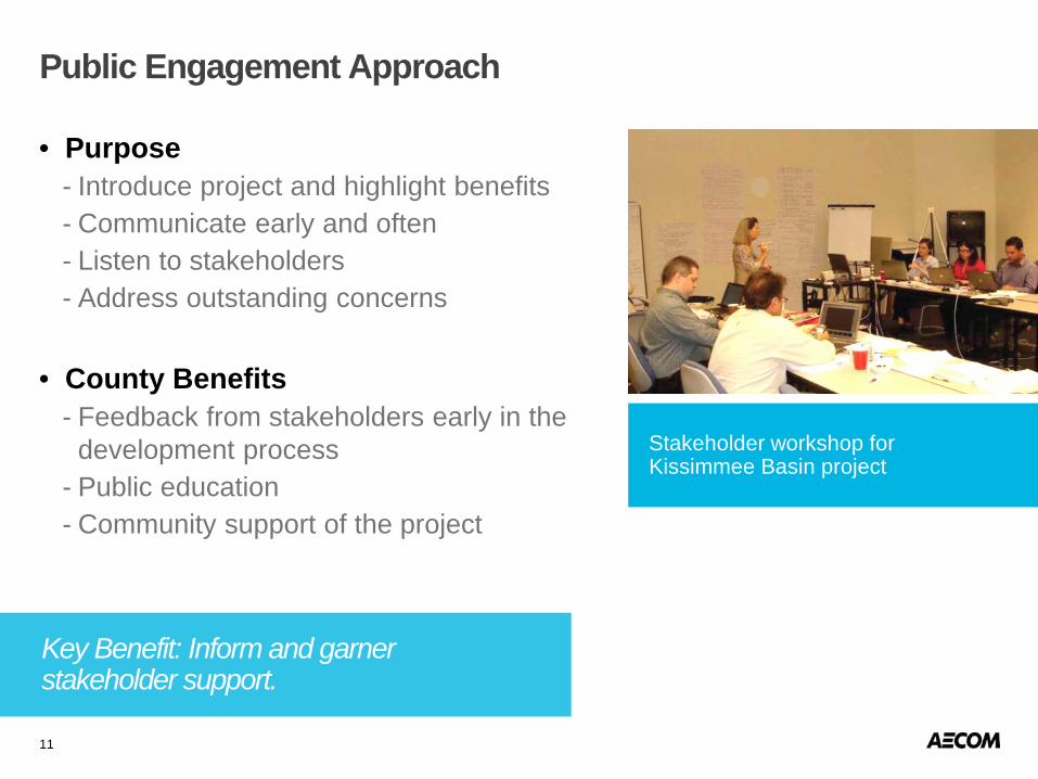
Public Engagement Approach
11
• Purpose- Introduce project and highlight benefits- Communicate early and often- Listen to stakeholders - Address outstanding concerns
• County Benefits- Feedback from stakeholders early in the
development process- Public education- Community support of the project
Stakeholder workshop for Kissimmee Basin project
Key Benefit: Inform and garner stakeholder support.
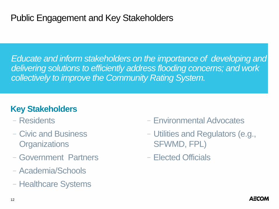
–Residents–Civic and Business
Organizations –Government Partners –Academia/Schools–Healthcare Systems
–Environmental Advocates–Utilities and Regulators (e.g.,
SFWMD, FPL)–Elected Officials
12
Public Engagement and Key Stakeholders
Key Stakeholders
Educate and inform stakeholders on the importance of developing and delivering solutions to efficiently address flooding concerns; and work collectively to improve the Community Rating System.

• Stakeholder meetings• Traditional media outreach• Social media• Interactive webpage• Short educational video• Mobile applications• Brochures / newsletters / infographics• Utility bill inserts• Planning model simulations
13
Engagement Tools and Activities
Key Benefit: Utilize as many platforms as are available and appropriate to convey messages efficiently.
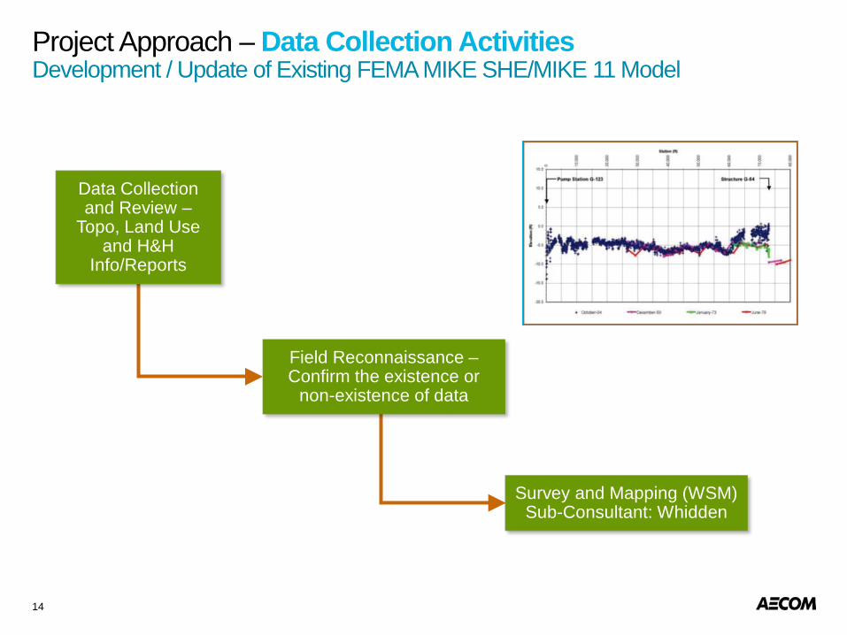
Project Approach – Data Collection ActivitiesDevelopment / Update of Existing FEMA MIKE SHE/MIKE 11 Model
14
Data Collection and Review –
Topo, Land Use and H&H
Info/Reports
Field Reconnaissance –Confirm the existence or
non-existence of data
Survey and Mapping (WSM)Sub-Consultant: Whidden
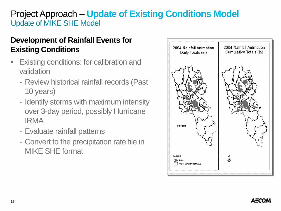
Project Approach – Update of Existing Conditions ModelUpdate of MIKE SHE Model
15
Development of Rainfall Events for Existing Conditions• Existing conditions: for calibration and
validation- Review historical rainfall records (Past
10 years)- Identify storms with maximum intensity
over 3-day period, possibly Hurricane IRMA
- Evaluate rainfall patterns- Convert to the precipitation rate file in
MIKE SHE format

Project Approach – Update of Existing Conditions Model
16
• Update Model Software Version to 2017 - Check against old results- Possibly re-conceptualize representation of rainfall-
runoff processes based on new options in the code.• Update Time Varying Data to Simulation Period
(based on the Selected Calibrated Event)- Rainfall- Reference evapotranspiration - Measured stages and flow (calibration and boundary
conditions)- Structure operations
• Update Input Data with the Latest Available Information- Topography with Latest LiDAR- Survey Information: canal cross-sections and
structures- Land use (if applicable)
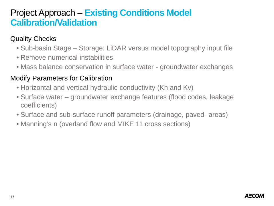
Project Approach – Existing Conditions Model Calibration/Validation
17
Quality Checks• Sub-basin Stage – Storage: LiDAR versus model topography input file• Remove numerical instabilities• Mass balance conservation in surface water - groundwater exchanges
Modify Parameters for Calibration• Horizontal and vertical hydraulic conductivity (Kh and Kv)• Surface water – groundwater exchange features (flood codes, leakage
coefficients)• Surface and sub-surface runoff parameters (drainage, paved- areas)• Manning’s n (overland flow and MIKE 11 cross sections)
Key Benefit: County gains future conditions model with climate change and sea level rise factors.
Project Approach – Future Conditions Model DevelopmentModel Development for Future Conditions (2060 and 2100)
18
• Updated and approved 10-yr, 25-yr, 50-yr, 100-yr and 500-yr design storm events for Future Conditions (2060 and 2100)
- Inclusion of sea level rise from Compact 2015
- Climate change adaptation
• Key challenges:
- Tidal and groundwater boundary – Inclusion of sea level rise
- Non-Stationarity of IDF Curves – Future Climate Conditions
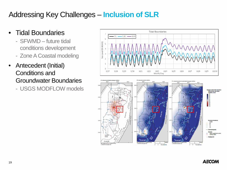
Addressing Key Challenges – Inclusion of SLR
19
• Tidal Boundaries- SFWMD – future tidal
conditions development- Zone A Coastal modeling
• Antecedent (Initial) Conditions and Groundwater Boundaries- USGS MODFLOW models
Addressing Key Challenges – Future Climate Conditions
20
Acknowledging Non-Stationarity–Current IDF curves assumes stationarity and statistics are constant
(independent of time) – Increasing/decreasing trends already observed due to lower frequency
climate variability (e.g., El Nino Southern Oscillation or Atlantic Multi-decadal Oscillation)
–Stationary assumptions potentially result in lower IDF curves (USACE 2016)
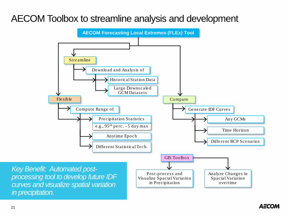
Key Benefit: Automated post-processing tool to develop future IDF curves and visualize spatial variation in precipitation.
AECOM Toolbox to streamline analysis and development
21
AECOM Forecasting Local Extremes (FLEx) Tool
Streamline
Download and Analys is of
His torical Station Data
Large Downscaled GCM Datase ts
Flexible
Compute Range of
Anytime Epoch
Diffe rent Statis tical Tech.
e .g., 95th pe rc . – 5 day maxPrecipita tion Statis tics
Compute
Generate IDF Curves
Time Horizon
Diffe rent RCP Scenarios
Any GCMs
GIS Toolbox
Analyze Changes in Spacial Variation
ove rtime
Pos t-proces s and Visualize Spacial Variation
in Precipita tion
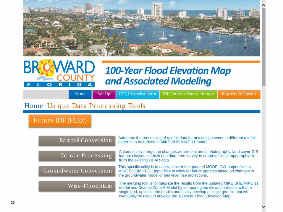
Unique Data Processing Tools
22
23
100-Year Flood Elevation Map and Associated Modeling
IDF, His torical data IDF, Unde r climate change Reports & OutputSe t UpHome
Home
Future IDF (FLEx)
Rainfall Conve rs ion
Te rrain Proce s s ing
Groundwate r Conve rs ion
Wis e -Floodpla in
Automate the processing of rainfall data for any design event to different rainfall patterns to be utilized in MIKE SHE/MIKE 11 model
Automatically merge the changes with recent aerial photography, land cover GIS feature classes, as-built and data from survey to create a single topography file from the existing LiDAR data
This specific utility is to easily convert the updated MODFLOW output files to MIKE SHE/MIKE 11 input files to allow for future updates based on changes to the groundwater model or sea level rise projections.
The merging tool is to integrate the results from the updated MIKE SHE/MIKE 11 model and Coastal Zone A Model by comparing the elevation results within a single grid, optimize the results and finally develop a single grid file that will eventually be used to develop the 100-year Flood Elevation Map
Unique Data Proce s s ing Tools

Community Rating System (CRS)
24
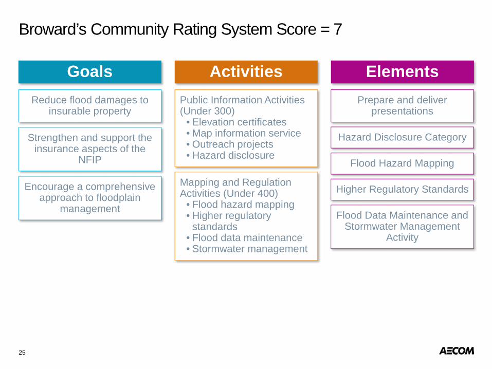
Broward’s Community Rating System Score = 7
25
Goals ElementsActivitiesReduce flood damages to
insurable property
Strengthen and support the insurance aspects of the
NFIP
Encourage a comprehensive approach to floodplain
management
Public Information Activities (Under 300)
• Elevation certificates• Map information service• Outreach projects• Hazard disclosure
Mapping and Regulation Activities (Under 400)
• Flood hazard mapping• Higher regulatory
standards• Flood data maintenance• Stormwater management
Prepare and deliver presentations
Hazard Disclosure Category
Flood Hazard Mapping
Higher Regulatory Standards
Flood Data Maintenance and Stormwater Management
Activity
26
When the County partners with Our Team, you will:
• Access to modeling resources
• Proven QA/QC program
- ISO 9001 certification for more than 10 years
• Improve your Community Rating System
• Major benefit:
- Future Planning
- Infrastructure Investments
- Development Requirements