Embed Size (px)
Citation preview
1
Collaboration to Implement ATFM Capabilities in the Region with
Multiple ANSPs Prepared by: M. Tanino, ATO-International NextGen Lead For: EIWAC 2017 Date: Nov 16, 2017
2
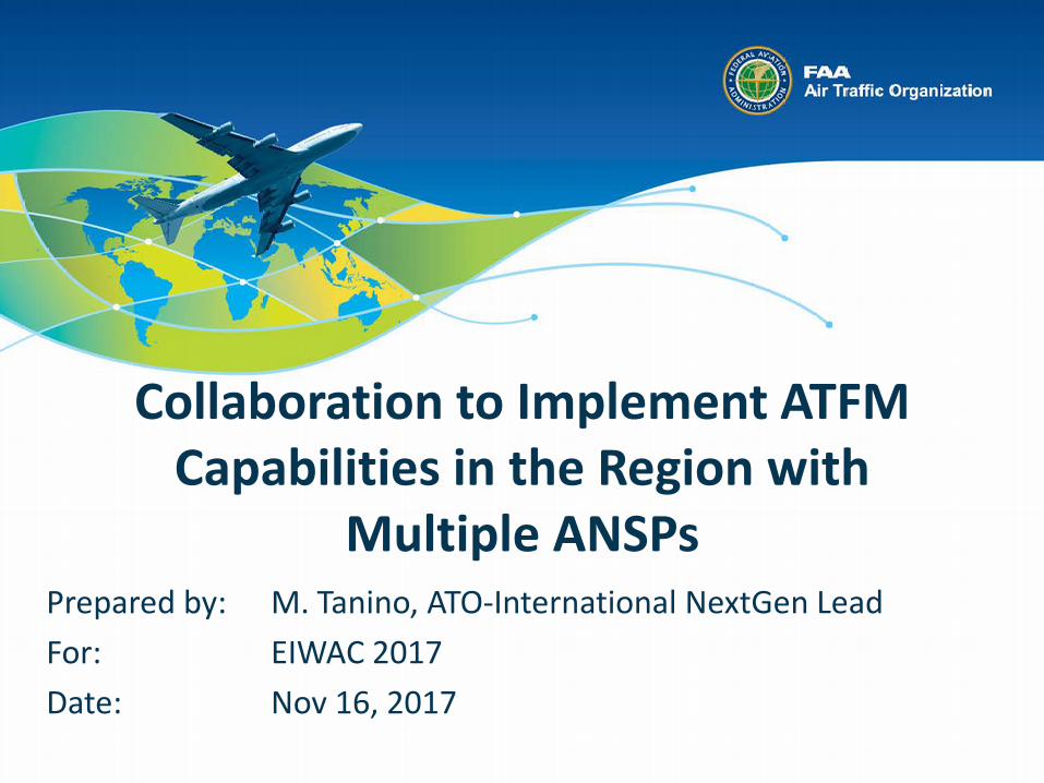
ATFM
Demand CapaCity

3
Traffic Demand and Patterns
Regional crossroads

4
Storm Patterns
Nexus of Disruptive Weather

5
U.S. Outbound Air Traffic • Destinations in the Western
Hemisphere accounted for 75% of U.S. outbound international travel in 2014
• Passenger travel to Caribbean destinations was in excess of 9 million in 2013, and represented 23% of all international flights in the Western Hemisphere
• Flights to Central and South America frequently over-fly Caribbean airspace, adding traffic volume and complexity to flights to and from the dozens of regional airports
Canada, 29.9%
Mexico, 16.6%
Caribbean, 16.6%
Europe-Russia, 16.4%
Asia Pacific, 10.3%
South America, 6.3%
Central America,
5.3%
Middle East, 1.2% Africa, 0.4%
Mexico + Caribbean + S. America + C. America = 44.8%
6
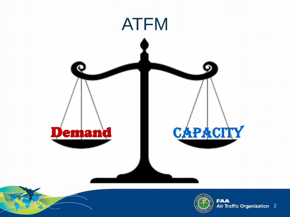
Key Regional Stakeholders Key Partners include global organizations such as CANSO and IATA as well as the ICAO regional office and the CANSO member Caribbean service providers:
• PIARCO (Trinidad & Tobago) • Santo Domingo (Dominican Republic) • Port Au Prince (Haiti) • Havana (Cuba) • Kingston (Jamaica) • Curacao (Curacao) • Central America (COCESNA) • Mexico (SENEAM)
14 CAR FIRs

7
ICAO GANP/ASBU
• ATFM (NOPS) is one of the threads
● PBN ● AIM ● ATFM ● AMHS ● AIDC ● ADS-B ● ASBU
NAM/CAR ANI/WG TF
Port of Spain Declaration
Regional Air Navigation Targets 1. Approach – PBN 2. ATFM 3. AIM 4. G/G Digital
Coordination/Transfer 5. Environmental Benefits
8
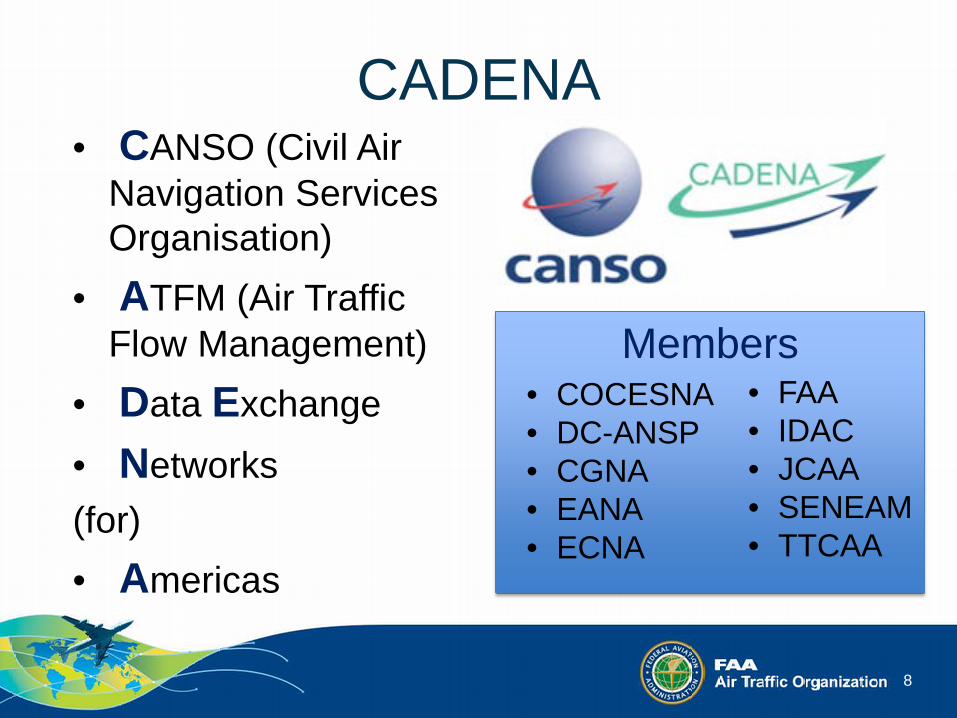
CADENA • CANSO (Civil Air
Navigation Services Organisation)
• ATFM (Air Traffic Flow Management)
• Data Exchange • Networks (for) • Americas
Members • COCESNA • DC-ANSP • CGNA • EANA • ECNA
• FAA • IDAC • JCAA • SENEAM • TTCAA

9
Approaches
• Setting the stage • Near-Term: Operational Improvements • Mid-Term: Traffic Flow Management Data
Exchange • Long-Term: Traffic Management Measures
Assisted by Decision Support Tools

10
CADENA History • Established - Jun 2016 • CADENA RIG Meetings
– 1st at Cuba; 2nd at Argentina; 3rd at Curacao; 4th at Kingston; 5th at Brazil
• Weekly Regional TFM CDM Operational Planning Web Conference est. Dec 2016
• CADENA Operational Information System (OIS) – Aug 2017
• FAA/T&T TFM Data Exchange Agreement – Sep 2017 and Operation – Oct 2017

11
Weekly Regional TFM CDM Operational Planning Web Conference
• Weekly Web Conference on Fridays • Ad-hoc Web Conference as needed • CADENA ANSPs share the responsibility
of hosting the Web Conferences • Regional aviation stakeholders participate • Information shared, discussed, and plan
established collaboratively • Simple and EFFECTIVE!

12
CADENA Operational Information System (OIS)
13
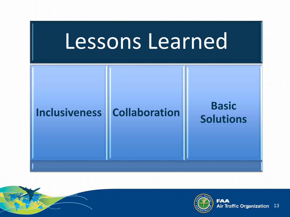
Lessons Learned
Inclusiveness Collaboration Basic Solutions

14
ATFM
Demand CapaCity
15
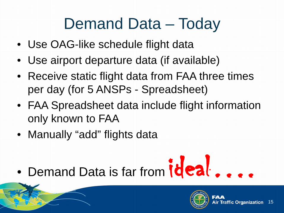
Demand Data – Today • Use OAG-like schedule flight data • Use airport departure data (if available) • Receive static flight data from FAA three times
per day (for 5 ANSPs - Spreadsheet) • FAA Spreadsheet data include flight information
only known to FAA • Manually “add” flights data
• Demand Data is far from ideal….

16
FAA’s TFM Data

17
Added T&T IDP Data (Oct 2017)
18
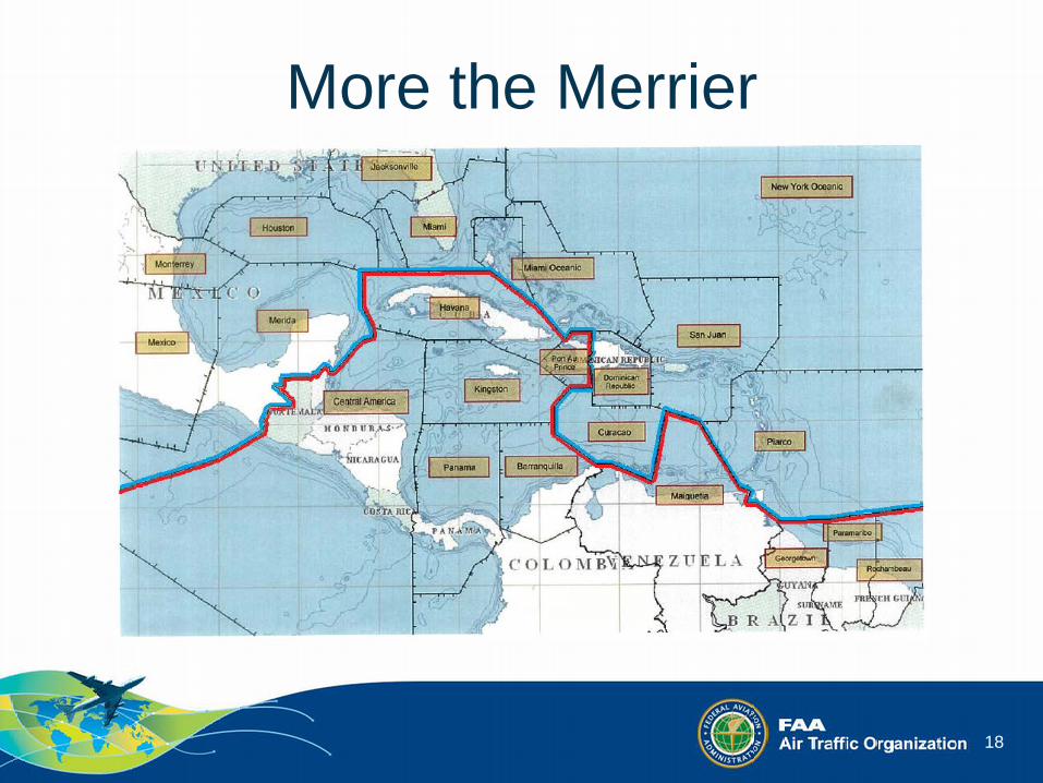
More the Merrier

19
More the Merrier

20
Ideal Situation

21
Improve Flight Data • Take advantage of FAA’s System Wide
Information Management System (SWIM) • Take advantage of FAA’s Traffic Flow
Management System (TFMS)

22
SWIM from Wikipedia • SWIM is a FAA advanced technology program
designed to facilitate greater sharing of ATM system information.
• Eurocontrol initially presented the SWIM System concept to the FAA in 1997.
• In 2005, the ICAO Global ATM Operational Concept adopted the SWIM concept to promote information-based ATM integration.
• SWIM is now part of development projects in the US (NextGen), the Middle East (GCAA SWIM Gateway), and the EU (SESAR).

23
Euro
cont
rol
/SES
AR
SWIM: Before and After
Nex
tGen
Before SWIM After SWIM

24
NESG – Security Gateway
External Producers/Consumers
FAA NAS Producers
Airports, FAA Facilities, & FAA Programs
Producers /Consumers

25
Current SWIM Product Portfolio (1 of 2) Flight and Flow Data
Traffic Flow Management System (TFMS): Provides flight data and flow information Flow Constrained Area (FCA) / Flow
Evaluation Area (FEA) Ground Stops (GS)
Airspace Flow Program (AFP) Reroutes Aircraft Situation Display to Industry
(ASDI) Advisories
Ground Delay Program (GDP) / Unified Delay Program (UDP)
Collaborative Trajectory Options Program (CTOP)
SWIM Terminal Data Distribution Systems (STDDS): Collects and publishes data from 150+ airports Surface Movement Event Service Spot-In / Spot-Out Times Wheels-Up / Wheels-Down Times Aircraft ID / Type / Wake Class Position / Heading / Speed /
Altitude Mode S / Mode 3A Departure or Arrival Runway Departure Fix for Departures Departure Airport for Arrivals Coasted / Suspended Track No. Fused Track Acceleration ADS-B Information Source Information
Terminal Automation Info. Service Flight Plan (FP) Aircraft ID / Type Flight Rules in FP Record FP Status (pending, active, etc.) Flight Type (arr. / dep. / enroute) RNAV Indicator Assigned Runway Entry / Exit Fix Track Track Status (active / coast / drop) Position / Velocity Beacon Code / Mode C
Airport Data Service Runway Visual Range (100s of
feet) Visibility Trend (steady / incr. /
decr.) Runway Edge / Center Lighting
Tower Departure Event Service Aircraft Parking Gate Pre-Departure Clearance Time Taxi-Start / Takeoff Times
SWIM Flight Data Publication Service (SFDPS): Provides flight data and updates to clients for filed and active flight plans
Flight Plan & Update Information Tentative Aircraft Identification
Amendment Information Flight Amendment Information Tentative Flight Plan Removal
Converted Route Information Tentative Flight Plan Amendment
Information Cancellation Information Track / Drop Track Information Departure Information Interim Altitude Information
Aircraft ID Amendment ARTS Flow Control Track/Full
Data Block Information Hold Information Beacon Code Reassignment Progress Report Information Beacon Code Restricted Expected Departure Time
Information Flight Plan Data Bank (FDB)
Fourth Line Information Position Update Information Point Out / Inbound Point Out Info Tentative Flight Plan Information Handoff Status
Airspace Data Publication Service: Published by SFDPS Sector Assignment Status Special Activities Airspace (SAA) Route Status Altimeter Setting
Operational Data Publication Service: Published by SFDPS Instrument Approach / Traffic
Count Adjustment Beacon Code Utilization
Sign In Sign Out Geographic Beacon Code
Utilization General Information Message Publication Service: Published by
SFDPS
General Information
Time Based Flow Management (TBFM): Provides metering information Scheduled Time of Arrival (STAs) Airport Configuration Information Estimated Time of Arrival (ETAs) Satellite Airport Configuration Meter Reference Elements (MREs)
Assignments
26
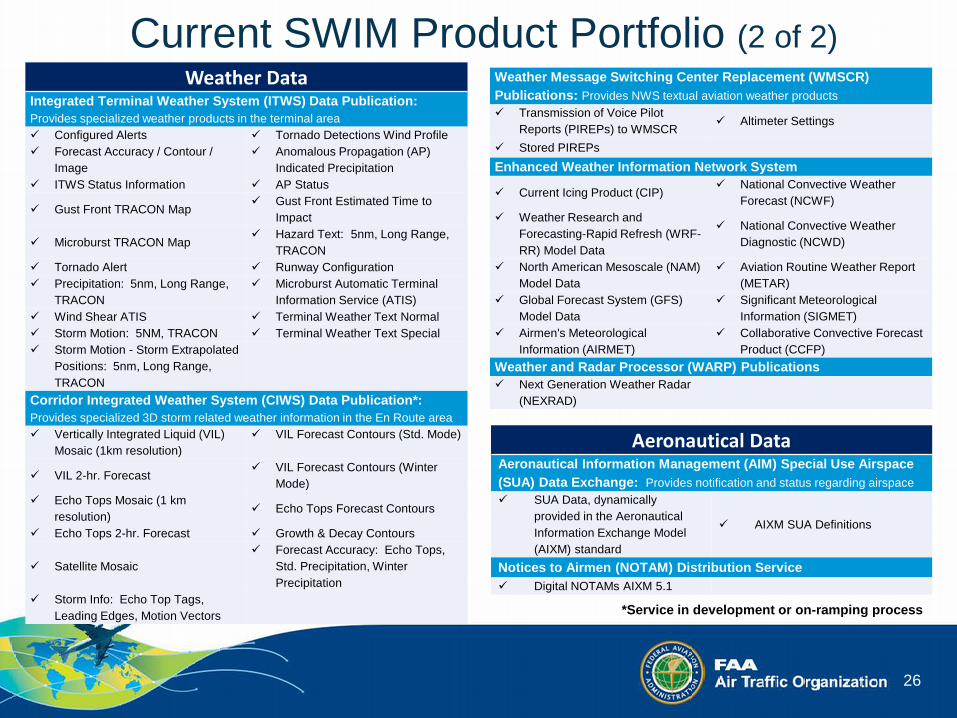
Current SWIM Product Portfolio (2 of 2)
*Service in development or on-ramping process
Weather Data Integrated Terminal Weather System (ITWS) Data Publication: Provides specialized weather products in the terminal area Configured Alerts Tornado Detections Wind Profile Forecast Accuracy / Contour /
Image Anomalous Propagation (AP)
Indicated Precipitation ITWS Status Information AP Status
Gust Front TRACON Map Gust Front Estimated Time to
Impact
Microburst TRACON Map Hazard Text: 5nm, Long Range,
TRACON Tornado Alert Runway Configuration Precipitation: 5nm, Long Range,
TRACON Microburst Automatic Terminal
Information Service (ATIS) Wind Shear ATIS Terminal Weather Text Normal Storm Motion: 5NM, TRACON Terminal Weather Text Special Storm Motion - Storm Extrapolated
Positions: 5nm, Long Range, TRACON
Corridor Integrated Weather System (CIWS) Data Publication*: Provides specialized 3D storm related weather information in the En Route area Vertically Integrated Liquid (VIL)
Mosaic (1km resolution) VIL Forecast Contours (Std. Mode)
VIL 2-hr. Forecast VIL Forecast Contours (Winter
Mode) Echo Tops Mosaic (1 km
resolution) Echo Tops Forecast Contours
Echo Tops 2-hr. Forecast Growth & Decay Contours
Satellite Mosaic Forecast Accuracy: Echo Tops,
Std. Precipitation, Winter Precipitation
Storm Info: Echo Top Tags, Leading Edges, Motion Vectors
Aeronautical Data Aeronautical Information Management (AIM) Special Use Airspace (SUA) Data Exchange: Provides notification and status regarding airspace SUA Data, dynamically
provided in the Aeronautical Information Exchange Model (AIXM) standard
AIXM SUA Definitions
Notices to Airmen (NOTAM) Distribution Service Digital NOTAMs AIXM 5.1
Weather Message Switching Center Replacement (WMSCR) Publications: Provides NWS textual aviation weather products Transmission of Voice Pilot
Reports (PIREPs) to WMSCR Altimeter Settings
Stored PIREPs
Enhanced Weather Information Network System
Current Icing Product (CIP) National Convective Weather
Forecast (NCWF) Weather Research and
Forecasting-Rapid Refresh (WRF-RR) Model Data
National Convective Weather Diagnostic (NCWD)
North American Mesoscale (NAM) Model Data
Aviation Routine Weather Report (METAR)
Global Forecast System (GFS) Model Data
Significant Meteorological Information (SIGMET)
Airmen's Meteorological Information (AIRMET)
Collaborative Convective Forecast Product (CCFP)
Weather and Radar Processor (WARP) Publications Next Generation Weather Radar
(NEXRAD)

27
Who is using SWIM today? Q:
Industry (84)
Non-FAA Government Entities (9)
Academia & Research (2)
Airlines (7)
Airports, FAA Facilities,
& FAA Programs (17)
*Updated as of January 24, 2017

28
1. FPL
2. CHG
3. ARR
4. DEP
5. CNL
6. DLA
7. TIZ
8. TIO
9. CLS
IDP Data Types
Flight Data Exchange
• TFMS Flight Data Consumer
• IDP Data Producer – Identify local data
that are equivalent

29
ICAO Doc 10039 Manual on System Wide Information
Management (SWIM) Concept • Advanced edition • Sep 19, 2017 draft – Vol. I only • Purpose: Explain the vision
for interoperable global information management by providing a clear picture of what SWIM is and how it can be implemented.

30
ICAO Doc 10039: Manual on SWIM Concept
Volume I: SWIM Concept • Service Oriented
Architecture (SOA) A general concept or paradigm for “organizing and utilizing distributed capabilities that may be under the control of different owners”.
• The Components

31
What does “SWIM Implementation” mean to
CADENA members?

32
Who vs. Who
vs. FAA IDAC
TTCAA
DC-ANSP
JCAA
EANA
ECNA SENEAM
CGNA
COCESNA
34
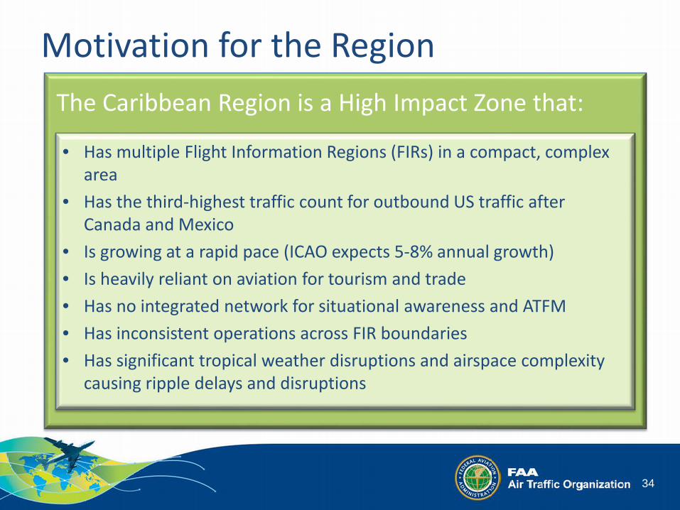
Motivation for the Region The Caribbean Region is a High Impact Zone that:
• Has multiple Flight Information Regions (FIRs) in a compact, complex area
• Has the third-highest traffic count for outbound US traffic after Canada and Mexico
• Is growing at a rapid pace (ICAO expects 5-8% annual growth) • Is heavily reliant on aviation for tourism and trade • Has no integrated network for situational awareness and ATFM • Has inconsistent operations across FIR boundaries • Has significant tropical weather disruptions and airspace complexity
causing ripple delays and disruptions

35
CADENA Letter of Agreement CADENA member ANSP ATM and CDM
“This LoA promotes communication, collaboration and coordination between the Members regarding ATFM and CDM measures.”
On December 6, 2016, CADENA LoA was signed by (1) CANSO LAC/3; (2) FAA; (3) SENEAM; (4) EANA; (5) COSESNA; (6) TTCAA; and (7) IDAC.