Embed Size (px)
Citation preview


1
Community
Parks Guide
Third Edition
Revised and Expanded 2014

2
©Pender Islands Parks and Recreation Commission
PO Box 86, Pender Island, V0N 2M2
Copyright/Disclaimer All rights reserved. Although we strive to
make the information helpful and accurate, the PIPRC does not
make any guarantee, expressed or implied, regarding the accuracy
of information or fitness for a particular purpose, and does not
assume liability or responsibility for the accuracy, completeness or
usefulness of any information. The PIPRC disclaims all liability of
any kind whatsoever arising out of the use of, or inability to use,
this information.
Third Edition, 2014 Created for the PIPRC by Rowena Symons
©Photos by Rowena Symons
Cover design by Ben Symons Proceeds, if any, from the sale of this publication will
be used to further the objectives of the Pender
Islands Parks and Recreation Commission.
For more information visit the PIPRC website at
www.crd.bc.ca/penderparks , or find more
information and pictures at
https://www.facebook.com/FriendsOfPenderIslands
ParksAndRecreationCommission
Printed In Canada by Friesens

3
Table Of Contents
Introduction……………………………….…………….4
North Pender Island Trails…………………………7
Magic Lake Trails…………..……………..…………45
South Pender Island Trails……………..……….76
Parks of Other Agencies…..…………………..106
Works Cited …………………………………….……108
Alphabetical Index……………..………..…….…109
Numerical Index……………………………….…..113
Map..……………….in pocket inside back cover

4
Introduction
The Pender Islands Parks and Recreation
Commission (PIPRC) invites you to explore the
community parks, trails and ocean accesses it
manages. These trails on North and South
Pender Islands were delegated to the PIPRC by
the Capital Regional District (CRD). This guide is
designed to provide information that will
facilitate your enjoyment of these parks and
trails.
Please note that some parks on the Pender
Islands are administered by other agencies. A
listing of these trails, their affiliated agencies,
and their access points is available for your
convenience on page 99. Contact these agencies
for further information about their parks.
This guide is organized by the three major areas:
North Pender, Magic Lake area (on North
Pender) and South Pender. You may want to
plan a visit to parks and trails found within one

5
area, and perhaps plan out a longer walk using
loop and connector trails. Most trails with
available connectors or loops have that option
listed within the trail descriptions, but you can
use the map in the back of the book to plan out
your own adventures! Please be sure to keep
the tides in mind if you are walking along the
shore from one access point to another.
Respect private landowners; take no shortcuts
to the road from beach areas.
The PIPRC parks display the diverse ecosystems
of the Southern Gulf Islands. Some trails have
informative signs telling about the local flora
and fauna, while some parks and trails celebrate
the contribution of humans in the history of the
islands. Other parks offer picnicking, baseball,
disc golf, swings, swimming and small boat
launching.
Many trails are unimproved with exposed rocks
and roots, reflecting the PIPRC’s low
environmental impact policy, so watch your

6
footing. Parking spots are provided at some
trails, but most parking is on the side of the
road, and can be minimal or difficult. A few
trails are only accessible by foot.
The trails are rated easy, moderate or hard. Easy
trails can sometimes have steps or a slightly
steep section, but are reasonably smooth to
walk on. They are usually short. Moderate trails
are often steep and include steps and staircases,
and generally have rougher terrain. Hard trails
are usually very steep, rough and long.
Please respect the natural environment within
the parks. If a trail is closed for restoration,
kindly take the marked detour. Take no
souvenirs and pack out your trash. Dogs must
be kept under control and picked up after. We
ask that you respect the privacy and boundaries
of adjacent property owners. Mountain bikes
are not permitted on any parks or trails. We
thank you for your cooperation! Enjoy!

7
North Pender Island
Grover Sargent Memorial Cairn Trail
#12
Clam Bay Road, North Pender Island
Difficulty: Easy
Distance: 90 Metres
Parking: On road at trailhead
Amenities: Boardwalks to Cairn
Beach Access: None
Grover Sargent Memorial Cairn
8
This short trail mainly consists of boardwalks
over a wetland leading to the cairn. The cairn is
a memorial for Pilot Officer Grover Stewart
Sargent of the Canadian Air Force. On February
4, 1943, Sargent died at age 21 when his
Hawker Hurricane MK XII crashed on this spot
during a night time test flight.
Magic Lake Swimming Hole Park #13
Pirates Road, North Pender
Difficulty: Easy
Parking: Large gravelled parking lot
Amenities: Outhouse, Dock, Swimming Float
Beach Access: No, but Lake Access
The swimming hole is a great spot for lounging
in the sun and going for a swim.
The gravelled lot provides plenty of parking, and
there is an outhouse.

9
Magic Lake Swimming Hole
Access to the swim dock and float is down a few
steps from the dam that retains the water in
Magic Lake. There is a sturdy ladder attached to
the dock, so getting out of the water after you
swim is nice and easy. Please clean up after
your dog as this is a water source for the
community!

10
Mount Menzies Park #15
Hooson Road, North Pender Island
Difficulty: Hard
Distance: About 2 Km, 80 Metre climb.
Parking: Plenty of roadside spots in cul-de-sac
Amenities: Bench, loop trail
Beach Access: No
Close to the trail head there is a map that shows
a looping trail, with an extension at the top
leading to a bench, but not much of a view. The
bench at the top marks the end of the PIPRC
land, so please don’t follow any unmarked trails
into private property. Most people like to hike
up one leg of the loop, and use the other side to
come down again to the parking area. The trail
is steep and slippery in places, leading through a
dense forest canopy, and passing along the edge
of a wetland.

11
George Hill #16
Ogden Road, or Upper Terrace Road, North
Pender Island
Difficulty: Hard
Distance: About 2 Km each way, 130 Metre
climb
Parking: Easy roadside spots on Upper Terrace,
difficult roadside parking on Ogden Rd.
Amenities: 2 Benches
Beach Access: No
This steep, long and rewarding trail boasts a
180-degree view at the top, one of the best
views the parks have to offer! It will take about
30 minutes in each direction. If you start the
trail from Ogden Road you will have a shady and
challenging climb through dense forest, using
steps and ramps to help you up. The Upper
Terrace leg is shorter and more open, but is still
a steep trail. Half way up there is a bench with a
view. At this point the trail opens up and takes
you across a steep rock face, up more stairs to
the top. The expansive view is well worth the
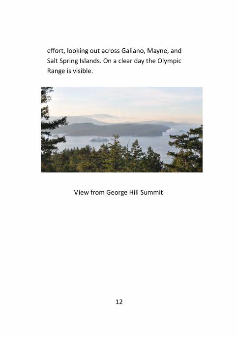
12
effort, looking out across Galiano, Mayne, and
Salt Spring Islands. On a clear day the Olympic
Range is visible.
View from George Hill Summit

13
Mount Elizabeth Park #17
Clam Bay Road, North Pender Island
Difficulty: Moderate
Distance: 0.64 km start to finish using loop
Parking: One spot on road to the left of
trailhead
Amenities: Interpretive signs, bench
Beach Access: None
Although not terribly steep, this mossy trail
climbs steadily through a forest of Douglas Fir
and Western Red Cedar, and loops back down.
The trail is a bit rough in places with rocks and
roots. Pick up a nature guide at the beginning of
the trail and look for the corresponding
numbers throughout your hike to learn about
local flora and fauna. Make sure you return the
guide on your way out.
14
Peter Cove (North) Ocean Access #18
Trincoma Place, North Pender Island
Difficulty: Easy
Distance: 10 Metres
Parking: On road
Amenities: None
Beach Access: Yes
A short flight of stairs leads down to a sand and
gravel beach. The view looks out to sea toward
Tilly Point on South Pender Island.
15
Skeeles Road Viewpoint #19 Razor Point Road, North Pender Island
Difficulty: Easy
Distance: 90 Metres
Parking: Side of Road
Amenities: Bench
Ocean Access: No
This is a short trail, steep in places, that leads to
a bench with a view overlooking Browning
Harbour and across to Mortimer Spit on South
Pender Island.
Oaks Bluff Viewpoint #20
Pirates Road, North Pender Island
Difficulty: Hard
Distance: 0.46 Km, 66 Metre Climb
Parking: Dirt parking lot with 4 spots
Amenities: 3 benches, bike rack
Ocean Access: No
This steep hike climbs up switchbacks and stairs
through a dense tree canopy to the top of the

16
bluffs. 2 viewpoints and 3 benches allow you to
fully appreciate the scenery from 100 metres
above sea level. The first view shows Bedwell
Harbour Marina and South Pender, while the
second looks toward Swanson Channel and
Vancouver Island in the distance. The Olympic
Mountains can be seen on a clear day, and the
lucky visitor may see orcas passing below. This
trail can be hazardous in wet or windy
conditions, and caution is required at the top
where there is a sheer cliff down to the water.
View from Oaks Bluff

17
Gardom Pond Trail #21
Harbour Hill Road, North Pender Island
Difficulty: Moderate
Distance: 0.45 km
Parking: On the main road below the private
road
Amenities: Bench
Beach Access: No
Gardom Pond

18
This 10 minute walk takes you along a
moderately easy trail through a shady forest.
A small bridge and boardwalk take you over a
waterway, and on to the lake. The 3 acre
Gardom Pond is covered in lily pads during the
summer, and is frequented by ducks and
herons. You can enjoy the view from above the
pond while sitting on the bench, but there is no
access to the lake shore. Please stay on the trail
and respect the surrounding private properties.
Bricky Bay Ocean Access #22
Armadale Road, North Pender Island
Difficulty: Easy
Distance: 40 Metres
Parking: Side of road
Amenities: None
Beach Access: Yes

19
Bricky Bay
Follow the staircase down to the sandy beach
and enjoy the view of Navy Channel and Mayne
Island. There was once a brick factory here and
the beach is littered with the remains of old red
bricks – hence its name.

20
Bridges Road Ocean Access #23
Bridges Road, North Pender Island Difficulty: Easy Distance: 30 Metres Parking: 2 gravelled spots at trailhead, tight turn around. Amenities: none Beach Access: yes
This sandy crescent shaped beach is ideal for
Bridges Road Beach Access

21
playing children, picnics, and watching the
sunset. Wide stairs with a handrail lead down
to the beach, but at high tide the water can
touch the bottom steps. At low tide there are
small tide pools to be enjoyed, and the Orcas
sometimes pass through the view.
MacKinnon Road Ocean Access #24
MacKinnon Road, North Pender Island
Difficulty: Easy
Distance: 30 Metres
Parking: One small roadside spot at trailhead
Amenities: None
Beach Access: Yes
Beach at MacKinnon Road Ocean Access
22
The stairs from MacKinnon Road lead directly to a little sandy beach. At low tide you can find tide pools at the end of the beach where a wealth of inter-tidal life can be observed. Against a back drop of Vancouver Island, the
ferries, boat traffic and occasional Orcas
traveling up Swanson Channel provide a grand
view.
Starvation Bay Ocean Access #27
Bedwell Drive, North Pender
Difficulty: Easy
Distance: 20 Metres
Parking: No close parking. Road side spots at
the end of the road.
Amenities: None
Beach Access: Yes
Take the stairs to the sandy beach on the south
side of Bedwell Harbour. A view of South Pender
Island lets you observe the constant boat traffic,
sea planes, marina and customs dock in front of
Poet’s Cove.

23
This beach also boasts a plethora of sea life and
tide pools in the rocky outcropping at the far
side.
Peter Cove (South) Ocean Access #28
Plumper Way, North Pender Island
Difficulty: Easy
Distance: 50 Metres
Parking: One marked spot at trailhead
Amenities: None
Beach Access: Yes
A short, wide path leads down to the crescent
shaped sandy beach. The view looks across the
entrance to Bedwell Harbour and on to South
Pender. Small boats, kayaks and canoes can
easily be carried down and launched from the
beach. Please stay in the tidal zone and off of
the surrounding private properties.

24
Peter Cove South
Irene Bay Ocean Access #30
Irene Bay Road, North Pender Island
Difficulty: Easy
Distance: 20 metres
Parking: 2 gravelled spots at trailhead
Amenities: None
Beach Access: Yes

25
Irene Bay
A short but steep gravelled path leads down to
this appealing little beach. This is an ideal spot
for launching kayaks and canoes, and otters can
often be observed here.
Percival Cove Ocean Access #31
Otter Bay Road, North Pender Island
Difficulty: Easy
Distance: 220 Metres
Parking: Side of road at trailhead
Amenities: None
Beach Access: Yes
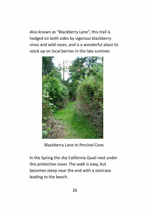
26
Also known as “Blackberry Lane”, this trail is
hedged on both sides by vigorous blackberry
vines and wild roses, and is a wonderful place to
stock up on local berries in the late summer.
Blackberry Lane to Percival Cove
In the Spring the shy California Quail nest under
this protective cover. The walk is easy, but
becomes steep near the end with a staircase
leading to the beach.

27
Grimmer Bay Ocean Access #32
Otter Bay Road, North Pender Island
Difficulty: Moderate
Distance: 40 Metres
Parking: Side of road
Amenities: None
Beach Access: Yes
This trail is short and very steep, with stairs
leading down to the water. Beach access is
available at moderate to low tide, at which time
a wide mud flat with great tide pools will
appear. You can look across to the tiny islet with
a Garry Oak meadow. This is a very sunny and
protected bay.

28
Wilson Road Viewpoint #33
Hooson Road, North Pender Island
Difficulty: Easy
Distance: 150 Metres
Parking: Side of road
Amenities: Bench
Beach Access: No
Park on Hooson Road and walk down Wilson
road to the trailhead. There is a lovely view of
Plumper Sound, Mayne and Saturna Islands.
Please respect the privacy of the neighbours.
Wilson Road

29
Niagara Road Ocean Access #34
Otter Bay Road, North Pender Island
Difficulty: Moderate
Distance: 230 Metres
Parking: 2 gravelled spots at trailhead
Amenities: None
Beach Access: Yes
Be careful not to block or park on the adjacent
private driveways.
The trail begins in an open grassy field alongside
a seasonal stream, and slopes downward,
leading you under Big Leaf Maples. The path
becomes steep, and a few sets of stairs take you
down to the wide sandy beach. This is one of
the sandiest beaches on North Pender, great for
kids, picnics, or just admiring the view of Salt
Spring and Prevost Islands.

30
Walden Road Ocean Access #35
Stanley Point Drive, North Pender Island
Difficulty: Moderate
Distance: 160 Metres
Parking: Side of road
Amenities: None
Beach Access: Yes
This shady trail is a bit steep, taking you under
Western Red Cedar trees and through Sword
Ferns, Salal and Oregon Grapes. Some steps
help you down to a small pebble beach, looking
towards Prevost Island.
Found Road Ocean Access #50
Clam Bay Road, North Pender Island
Difficulty: Hard
Distance: 1.5 Kilometres each way. A total climb
of about 70 Metres.
Parking: Side of road
Amenities: Interpretive signs, Benches
Beach Access: Yes
31
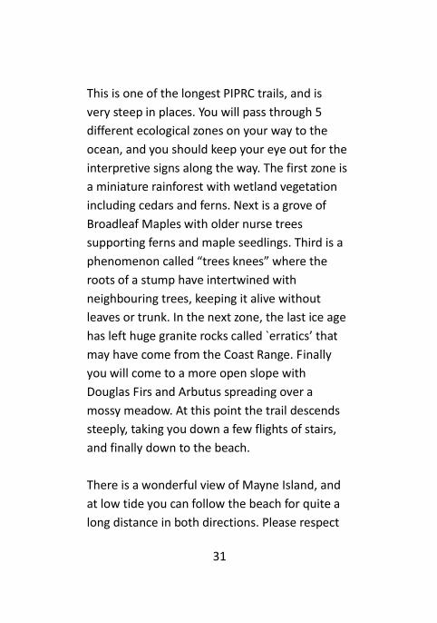
This is one of the longest PIPRC trails, and is
very steep in places. You will pass through 5
different ecological zones on your way to the
ocean, and you should keep your eye out for the
interpretive signs along the way. The first zone is
a miniature rainforest with wetland vegetation
including cedars and ferns. Next is a grove of
Broadleaf Maples with older nurse trees
supporting ferns and maple seedlings. Third is a
phenomenon called “trees knees” where the
roots of a stump have intertwined with
neighbouring trees, keeping it alive without
leaves or trunk. In the next zone, the last ice age
has left huge granite rocks called `erratics’ that
may have come from the Coast Range. Finally
you will come to a more open slope with
Douglas Firs and Arbutus spreading over a
mossy meadow. At this point the trail descends
steeply, taking you down a few flights of stairs,
and finally down to the beach.
There is a wonderful view of Mayne Island, and
at low tide you can follow the beach for quite a
long distance in both directions. Please respect

32
the surrounding private properties, and don’t
step on the numerous banana slugs!
Found Road Ocean Access Driftwood
Seawest Viewpoint #51
Hooson Road, North Pender Island
Difficulty: Moderate
Distance: 190 Metres
Parking: Side of road
Amenities: Bench
Beach Access: No

33
Although not too long, this trail has narrow
parts, roots and rocks, so make sure you watch
your footing. Part way in an access road bisects
the trail, just look for the “trail” sign slightly
down the road to your right. At the viewpoint
bench you are looking directly across Plumper
Sound to Samuel Island between Mayne and
Saturna.
Wallace Road Ocean Access #54
Wallace Road, North Pender Island
Difficulty: Moderate
Distance: 100 Metres
Parking: One spot at trailhead on side of road
Amenities: None
Beach Access: Yes
This beach access trail is steep, wet and rough in
places, so watch your step. Stairs and a ramp
lead down to the rocky shore, and at low tide
you can walk around to Medicine Beach.

34
Tracy Road Ocean Access #55
Armadale Road, North Pender Island
Difficulty: Moderate
Distance: 260 Metres
Parking: one spot at trailhead
Amenities: None
Beach Access: Yes
Although this is a short trail, the stairs are quite
steep, hence the moderate difficulty rating. The
path leads to stairs down to the beach. At low
tide you can walk north to Found Road. Going
south, it is difficult to get to Bricky Bay even at
low tide.

35
Tracy Road Stairs to Beach
Welcome Bay Ocean Access #56
Clam Bay Road, North Pender Island
Difficulty: Easy
Distance: 280 Metres
Parking: Side of road at trailhead
Amenities: None
Beach Access: Yes
The trail to Welcome Bay is well groomed and
only slightly undulating. There is a self-guided
nature trail guide for your enjoyment.
Boardwalks help you across the wet beginning,

36
and a short flight of steps takes you down to the
crescent shaped pebble beach. The view
includes Saturna and Mayne Islands, with a
distant view of Mt. Baker on a clear day.
Welcome Bay Beach
Plumper Way Viewpoint #59
Plumper Way, North Pender Island
Difficulty: Easy
Distance: 50 Metres
Parking: One marked spot at trailhead
Amenities: Bench
Beach Access: No
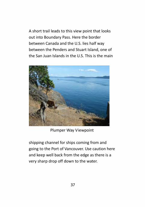
37
A short trail leads to this view point that looks
out into Boundary Pass. Here the border
between Canada and the U.S. lies half way
between the Penders and Stuart Island, one of
the San Juan Islands in the U.S. This is the main
Plumper Way Viewpoint
shipping channel for ships coming from and
going to the Port of Vancouver. Use caution here
and keep well back from the edge as there is a
very sharp drop off down to the water.

38
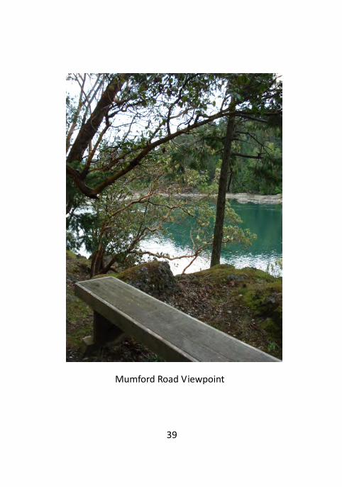
Mumford Road Viewpoint #62
Canal Road, North Pender Island
Difficulty: Moderate
Distance: 260 Metres
Parking: No spots available. Can park at the
school and walk
Amenities: Bench
Beach Access: No
This attractive trail starts off with a couple of
switchbacks taking you through a forested area,
crosses a private driveway, and continues on to
a loop trail with a bench and a beautiful view.
Mortimer Spit can be seen clearly right across
the water, as can the bridge connecting North
and South Pender. This is a wonderful place to
watch otters and boats.
39
Mumford Road Viewpoint

40
Von Road Viewpoint #68
MacKinnon Road, North Pender Island
Difficulty: Moderate
Distance: 130 Metres
Parking: 2+ side of road spots
Amenities: Picnic table
Beach Access: No
A short trail, Von Road, takes you to a viewpoint
with a picnic table looking towards Otter Bay
Marina. There is lots of boat traffic to watch,
and the table is in a nice sunny spot. This trail is
walking distance from the ferry.

41
Shorecliff Viewpoint #70
MacKinnon Road, North Pender Island
Difficulty: Moderate
Distance: 170 Metres
Parking: One spot at trailhead
Amenities: Bench
Beach Access: Yes
A five minute walk leads you between private
properties down to a rocky shore with a bench.
Here you can enjoy sea life, boats, and the
Olympic Mountains in the distance.
Shorecliff Viewpoint

42
Ogden Road Viewpoint #71
Ogden Road, North Pender Island
Difficulty: Easy
Distance: 140 Metres
Parking: Side of road
Amenities: Bench
Beach Access: No
This five minute walk takes you to a set of stairs
leading down to a bench. The viewpoint
overlooks the South end of Navy Channel, with
Galiano Island to the west.
Ogden Road Viewpoint

43
Lock Road Viewpoint #72
Sunset Drive, North Pender Island
Difficulty: Easy
Distance: 70 Metres
Parking: Side of road at trailhead, limited
Amenities: Bench
Beach Access: No
Just a little path to a bench. This view looks
toward Mayne and Saturna Islands.
Pecos Road Ocean Access #73
Pecos Road, North Pender Island
Difficulty: Moderate
Distance: 60 Metres
Parking: One spot at trailhead
Amenities: None
Beach Access: Yes

44
Pecos Road is a small dirt road off of Razor Point
Road. There is parking at the trailhead, and a
couple of steep sets of stairs take you down to
the rocky shore. There is a direct view of
Browning Marina.
Bedwell Drive Ocean Access #74
Bedwell Drive, North Pender Island
Difficulty: Moderate
Distance: 30 Metres
Parking: Side of road
Amenities: None
Beach Access: Yes
Bedwell Drive is near the most southern end of
North Pender Island. Park on the side of the
road and head down the 2 sets of stairs to the
rocks by the water. Your view here is across
Bedwell Harbour to the Marina at Poet’s Cove.

45
Magic Lake Area,
North Pender Island
Shingle Bay Park #1
Galleon Way, North Pender Island
Difficulty: Easy
Parking: Plenty of roadside spots at all
entrances
Amenities: Swings, Small boat launch, 2 Picnic
Tables, Outhouse, Bench, Large Grass Field
Beach Access: Yes
With its large grassy field, picnic tables and
great view this is a popular park for holding
events. Looking seaward from the park, Prevost
Island can be seen across Swanson Channel. At
the end of Galleon Way is one of the entry
points to the Gulf Islands National Park Reserve
with a trail leading to Roe Lake. The Yardarm /
Shingle Bay Trail #60, and the Masthead
Crescent / Shingle Bay Trail #61 both connect to

46
this park, with the entrances just across the
street.
Shingle Bay Community Park

47
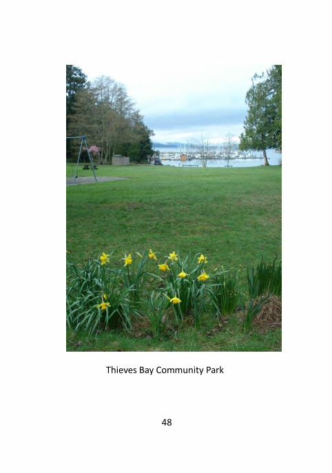
Thieves Bay Park #2
Anchor Way, Magic Lake area, North Pender
Island
Difficulty: Easy
Parking: A large gravelled parking lot is
provided, large enough for boat trailer parking.
Amenities: Picnic tables, Bench, outhouse,
swing set, boat ramp, turnaround near the boat
ramp.
Beach Access: Yes
This well used park provides a space for large
gatherings as well as space for children to play
on the swings, grassy field, and sandy beach. It
has a large parking lot with enough room for
short term trailer parking, and a cement boat
ramp with a large turnaround beside the access
to the marina. There is an outhouse for your
convenience. The grassy area can be very wet
during the rainy season.
48
Thieves Bay Community Park

49
Capstan Lane / Rope Road Trail #3
Magic Lake Area, North Pender Island
Difficulty: Easy
Distance: 0.63 Km
Parking: Side of road
Amenities: None
Beach Access: No
This is a connector trail between Capstan Lane
and Rope Road. You also have the option of
using the Capstan Lane Park trail #29, which T’s
in to the middle of this trail, to do a loop walk.
The upper part of this trail is seasonally wet and
muddy from December to May, and is a little
steep at either end. The trail and boardwalks
follow a wooded ravine and small seasonal
creek through a wetland. In the Spring the
wetland is filled with Skunk Cabbage, also
known as Swamp Lanterns. Some of the Firs
here are hundreds of years old, including a

50
significant stand of Grand Fir. You can go left on
Privateers Road to take the Privateers /
Schooner Trail #69.
Capstan Lane/Rope Road Trail

51
J.M. Abbott Park #4
Spyglass Road, North Pender Island
Difficulty: Hard
Distance: 340 Metres
Parking: Side of road at either entrance
Amenities: Benches, Picnic Table
Beach Access: No
This park is named for the surveyor, Mel Abbott,
who bought and developed Magic Lake Estates
in the 1960’s. It is quite steep and rough, has a
bench with an ocean view, a picnic table
overlooking Buck Lake, and Arbutus trees
covering the hill top. There is a loop option, or
you can enter from Spyglass Road and exit again
farther along the same road.

52
Danny Martin Park #5
Schooner Way, North Pender Island
Difficulty: Easy
Parking: Plenty of parking in a dirt lot, and
roadside spots available
Amenities: Picnic Tables, Locked Outhouse,
Baseball Diamond, Bleachers
Beach Access: No
Part of this park contains a well maintained
baseball diamond with bleachers. The parking
lot entrance is on Buccaneer Road. The toilets
are only open during scheduled games. There is
also a large grassy area outside of the baseball
diamond with a small seasonal stream that
drains into Magic Lake.
The Ball Park is operated by The Pender Island
Youth Sports Association under licence from
PIPRC.

53
Disc Park #6
Galleon Way, North Pender Island
Difficulty: Hard
Parking: 2 large parking lots
Amenities: Picnic tables, Benches, Outhouse,
Clubhouse, Drinking Fountain, Bike Rack
Beach Access: No
One part of the park is devoted to Disc Golf,
offering 3 different courses and a total of 27
“holes”. Islanders and visitors test their skills in a
challenging, rocky, steep and heavily wooded
terrain. During the summer weekends the park
is often full. There are plenty of places to rest
along the course, and an inviting club house
with picnic tables, garbage and recycling cans, a
drinking fountain and an outhouse. The rest of
the park has a number of interconnecting trails
(#11, #49, #67) that wind through a variety of
areas from a rainforest with huge trees to
delicate wetlands.

54
The Disc Park is operated by The Pender Island
Youth Sports Association under licence from
PIPRC.
Disc Park

55
Lively Peak Park #7
Ketch Road, North Pender Island
Difficulty: Hard
Distance: 250 Metres, 43 Metre Climb
Parking: Side of road
Amenities: 3 Benches
Beach Access: No
Lively Peak Park starts on Ketch Road, near
Sailor Road. To reach the trailhead you have to
walk up a portion of gravelled access road.
This rough trail climbs steeply through a shady
and heavily forested area, using steps to help
you up to the summit. Near the top the canopy
opens up and includes many Arbutus trees.
There are 2 benches at the top, the first
showing you Port Browning and Saturna Island,
and the second sporting a view of the San Juan
Islands with Vancouver Island in the distance. A
short trail to the west takes you across the skid
road again, and out to a third bench with
another spectacular ocean view.

56
Lively Peak

57
Compass Crescent / Starboard
Crescent Trail #8
Magic Lake Area, North Pender Island
Difficulty: Moderate
Distance: 70 Metres
Parking: Side of Road
Amenities: None
Beach Access: No
This is a very short and steep path leading
directly from Compass Crescent to Starboard
Crescent. It directly connects to trail #66, and
allows a loop walk if you take Galleon Way.

58
Heart Trail / Prior Park #9
Ketch Road, North Pender Island
Difficulty: Moderate
Distance: 230 Metres
Parking: Side of road
Amenities: None
Beach Access: No
Offering a nice long walk through a forested
area, the Heart Trail can also be used as a short
cut to Canal Road. It starts at Ketch Road, and
connects with Prior Park camp ground in the
Gulf Islands National Park Reserve. Some areas
are rough and steep. The Heart Trail was
constructed with the assistance of the First
Open Heart Society of B.C. in appreciation for
continued community support. On the other
side of Ketch Road there is an extension of the
Heart Trail, #49, which will take you to the Disc
Park.

59
Schooner Way / Chart Drive Trail #10
Magic Lake Area, North Pender Island
Difficulty: Moderate
Distance: 110 Metres
Parking: Side of road
Amenities: Bench
Beach Access: No
Connecting Schooner Way and Chart Drive, this
short and slightly steep trail offers the option of
walking a loop by taking trail #79.
Bosun Way / Galleon Way Trail #11
Magic Lake Area, North Pender Island
Difficulty: Moderate
Distance: 0.89 Km
Parking: Side of road
Amenities: None
Beach Access: No

60
Entering from Bosun Way you will descend
through a canopy of Western Red Cedar, Red
Alder and Big Leaf Maple trees down into a rich
wetland. Once the trail levels out it is an easy
walk. This area can be quite muddy in the rainy
season. Part of this trail edges the disc park, and
you will exit into the Disc Park parking lot on
Galleon Way. There is a junction along the trail
at the edge of the disc park where you can
choose to take trail #49 to Ketch Road, or #67 to
Schooner Way instead.
Magic Lake Picnic Site Park #14
Schooner Way, North Pender Island
Difficulty: Easy
Parking: Lots of easy roadside spots
Amenities: 2 Picnic Tables, Small Boat Launch
and Storage, Bike Rack, Dog Clean Up Station
Beach Access: Lake Access

61
Magic Lake Picnic Site
This well used parkland is a favourite place for
lakeside picnics and for launching kayaks and
canoes.
Please store your small boat only in the
designated area. The reeds at the water’s edge
provide one of the few Red Winged Blackbird
nesting sites on the Penders. Dog walkers are
asked to keep their dogs under control and to
pick up after them, as the lake is a source of
drinking water.

62
Harpoon Road / Panda Bay Ocean
Access #25
Harpoon Road, North Pender Island
Difficulty: Easy
Distance: 60 Metres
Parking: Side of road at trailhead
Amenities: None
Beach Access: Yes
This ocean access trail leads to stairs down to a
small pebble beach with views across Swanson
channel to Prevost Island.
Boat Nook Ocean Access #26
Schooner Way, Magic Lake area, North Pender
Island
Difficulty: Easy
Distance: 10 Metres
Parking: 1 spot at trailhead
Amenities: Bench with an ocean view
Beach Access: Stairs with a handrail leading to
rocks at the water. No beach.

63
Boat Nook
In the early 1970’s prospective purchasers of
Magic Lake Estate lots were flown into a dock at
Boat Nook. A group of large rocks directly in the
ocean view is often a resting place for seals,
river otters and cormorants. To the right of the
rocks is a significant kelp bed. This is more of a
viewpoint than an ocean access, so use extreme
caution at the foot of the stairs as the rocks can
be slippery.

64
Capstan Lane Park #29
Capstan Lane, North Pender Island
Difficulty: Easy
Distance: 110 Metres
Parking: Side of Road
Amenities: None
Beach Access: No
This short trail links lower Capstan Lane with the
Capstan/Rope Trail #3. It is a bit steep in places,
and takes you through a high canopy forest
down to boardwalks through a wetland. Swamp
lanterns abound here in Spring.
65
Heart Trail
Extension/Ketch/Disc Park #49
Ketch Road, North Pender Island
Difficulty: Moderate Distance: 420 Metres Parking: Side of road across the street Amenities: None Beach Access: No This trail starts across from the Heart Trail on
Ketch Road, and can be steep in places. Stairs
and boardwalks help you over a sunny slope
and down into a small valley that drains into
Magic Lake. You will enter the Disc Park #6 at
the junction where trails #67 and #11 also meet
up, and you can choose any of these as your exit
point.

66
Sandy Sievert Park #52
Spyglass Road / Gunwhale Road, North
Pender Island
Difficulty: Easy Distance: 175 Metres Parking: Side of road at either end Amenities: Bench Beach Access: No This shady, forested trail meanders through a
wetland with Salal and Sword ferns all around.
Boardwalks help you over the wet areas, and
the Spyglass Road end of the trail has a very
steep staircase.

67
Sandy Sievert Park
Yardarm Road / Shingle Bay
#60
Galleon Way / Yardarm Road, North
Pender Island
Difficulty: Hard Distance: 230 Metres, 54 Metre Climb Parking: Roadside spots available at Shingle Bay, No parking on Yardarm Amenities: None Beach Access: No

68
This is a very steep, rough trail heading uphill
from Shingle Bay to Yardarm Road. Being heavily
forested, this is a shady and sometimes slick
trail. A loop can be made starting and ending at
Shingle Bay by using this trail with the Masthead
Crescent Trail #61. Leave yourself an hour to do
the whole loop.
Masthead Crescent / Shingle
Bay Trail #61
Galleon Way / Masthead Crescent,
North Pender Island
Difficulty: Moderate Distance: 0.62 Km, 58 Metre Climb Parking: Roadside spots at Shingle Bay, no parking on Masthead Amenities: None Beach Access: No

69
A high canopy of Maple trees shades this steep
and wide trail, taking you from Shingle Bay up to
Masthead Crescent. You can walk a loop, taking
about an hour, by linking this trail with the
Yardarm/Shingle Bay trail #60.
Buck Lake Trail #63
Spyglass Road / Privateers Road, North
Pender Island
Difficulty: Moderate Distance: 320 Metres Parking: Side of road Amenities: None Beach Access: No This trail links Privateers Road with Spyglass
Road, and lets you out directly in front of Buck
Lake. There are roots and rocks in the trail as
you walk along the stream, and a couple flights
of stairs. At the right time of year there are two
little waterfalls.

70
Schooner At Reef Park #65
Schooner Way, North Pender Island
Difficulty: Easy Distance: 20 Metres Parking: Side of road Amenities: One Bench Beach Access: None This extremely short trail simply provides a
bench with a view for people walking in the
area. It is just off the road where Schooner and
Reef meet.

71
Compass Crescent / Tiller
Crescent Trail #66
Compass Crescent / Tiller Crescent,
North Pender Island
Difficulty: Moderate Distance: 150 Metres Parking: Side of road Amenities: None Beach Access: No Although it is short, this trail is steep in places. It
will take you from Compass Crescent down to
Buck Lake where the trail follows along the
water for a short while before sloping up to
Tiller Crescent. Trail #8, Compass/Starboard ,
links up easily with this one as its trailhead is
just across Compass Crescent.

72
Fire Hall / Disc Park Trail #67
Schooner Way/Galleon Way, North
Pender Island
Difficulty: Moderate Distance: 210 Metres Parking: Side of road on Schooner, or in Disc Park lot on Galleon Amenities: None Beach Access: No This trail runs from Schooner Way across a small
bridge and along the side of the Fire Hall
property into a forested area. It is seasonally
quite wet. Eventually you will arrive at a
junction point where you can branch off to the
Disc Park #6, take #11 to Bosun Way, or #49 to
Ketch Road.

73
Schooner / Privateers Trail #69
Schooner Way / Privateers Road, North Pender
Island
Difficulty: Easy Distance: 220 Metres Parking: Side of road at either end Amenities: Bench Beach Access: No Following a creek that runs from Buck Lake to
the ocean, this trail links Schooner Way and
Privateers Road. At the Schooner end there is a
small wetland, and some rock steps leading up
into a forested area. A bench is provided for you
to enjoy the creek and waterfall before you
climb back up to Privateers Road. This trail links
easily with #26 Boat Nook Ocean Access, #29
Capstan Lane Park, and #3 Capstan/Rope Trail.

74
Schooner/Privateers Trail

75
Ursula Poepel Park #79
Schooner Way / Chart Drive, North Pender
Island
Difficulty: Moderate Distance: 130 Metres Parking: Side of road at either end Amenities: Bench Beach Access: No This trail leads uphill from Chart Dr. to Schooner
Way, taking you through a heavily forested area,
and up a few sets of steps. There is a bench
overlooking Shingle Bay to your left before you
take the trail to the right and on up to Schooner.
A loop can easily be walked using #10
Schooner/Chart Trail.

76
South Pender Island
Fawn Creek

77
Fawn Creek Park #36
Ainslie Point Road, South Pender Island
Difficulty: Moderate Distance: 430 Metres Parking: Side of Road Amenities: Bench Beach Access: Yes This trail is a large loop, taking about 10
Minutes. If you take the right hand path you will
descend through a forest of mature Cedar and
Fir trees, cross a small creek, and find yourself
at a bench with a view of Bedwell Harbour. Here
you can step down to the small muddy beach.
As you walk back towards the road you are led
through a wetland and across the creek again. A
long set of stairs leads back up to your starting
point.

78
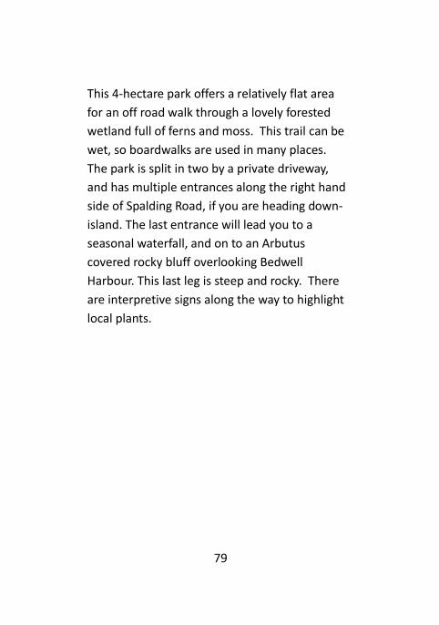
Enchanted Forest Park #37
Spalding Road, South Pender Island
Difficulty: Easy to Moderate Distance: 2.5 Kilometres Parking: Side of Road Amenities: 3 Benches, Bike Rack, Interpretive Signs Beach Access: No
The Enchanted Forest
79
This 4-hectare park offers a relatively flat area
for an off road walk through a lovely forested
wetland full of ferns and moss. This trail can be
wet, so boardwalks are used in many places.
The park is split in two by a private driveway,
and has multiple entrances along the right hand
side of Spalding Road, if you are heading down-
island. The last entrance will lead you to a
seasonal waterfall, and on to an Arbutus
covered rocky bluff overlooking Bedwell
Harbour. This last leg is steep and rocky. There
are interpretive signs along the way to highlight
local plants.
80
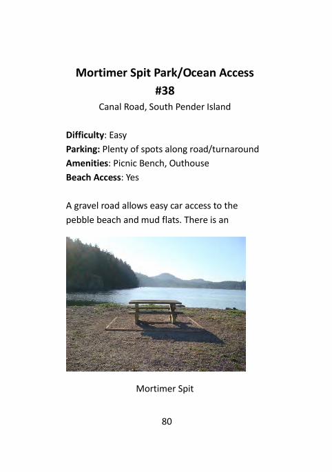
Mortimer Spit Park/Ocean Access
#38
Canal Road, South Pender Island
Difficulty: Easy
Parking: Plenty of spots along road/turnaround
Amenities: Picnic Bench, Outhouse
Beach Access: Yes
A gravel road allows easy car access to the
pebble beach and mud flats. There is an
Mortimer Spit

81
outhouse and a stone picnic bench, and you can
easily hand-launch kayaks and small boats. From
the spit you can look back to Shark Cove and the
bridge between North and South Pender, or
across to Browning Harbour and North Pender.
Please be careful of weather and tides, as the
access road is at sea level and can become
flooded.
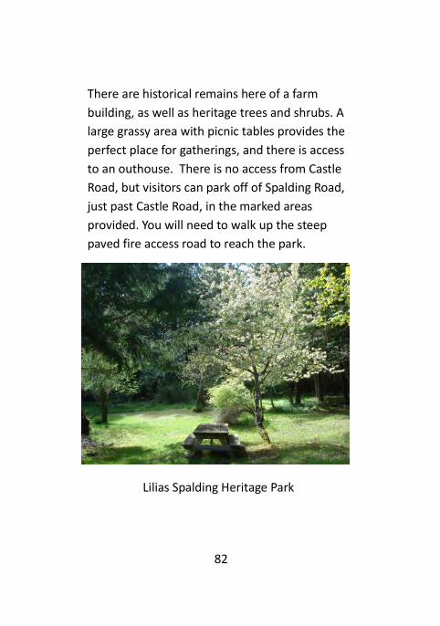
Lilias Spalding Heritage Park #39
Castle Road, South Pender Island
Difficulty: Easy
Distance to Park: 90 metres up hill
Parking: 2 paved spots on Spalding Road, past
Castle Road if you are coming down-island.
Amenities: 2 Picnic Tables, Bench, Outhouse,
Historical Sign/Remains
Beach Access: No
This 4 hectare park is situated on the original
homestead of Arthur and Lilias Spalding who
came to South Pender as pioneers in 1889.
82
There are historical remains here of a farm
building, as well as heritage trees and shrubs. A
large grassy area with picnic tables provides the
perfect place for gatherings, and there is access
to an outhouse. There is no access from Castle
Road, but visitors can park off of Spalding Road,
just past Castle Road, in the marked areas
provided. You will need to walk up the steep
paved fire access road to reach the park.
Lilias Spalding Heritage Park

83
Castle Road Trail #40
Castle Road, South Pender Island
Difficulty: Hard
Distance: 0.82 Km, 90 Metre Climb
Parking: Side of Road on Spalding Road
Amenities: None
Beach Access: No
This trail is steep, rough and full of switch backs.
It ends before the summit of the hill, so please
respect private property and do not go beyond
the park boundary. There are expansive views of
South Pender along the hike, with glimpses of
Mayne and Saturna Islands. Beautiful rock faces
are home to Sedum plants, and Arbutus and
Douglas Fir populate the hillside. Allow about
30 minutes each way. Castle Road is private, so
visitors must park on Spalding Road and walk up
to the trailhead.

84
Bridge Park Viewpoint #41
Ainslie Point Road, South Pender Island
Difficulty: Easy
Distance: 90 Metres
Parking: Marginal Side of Road Spots
Amenities: Bench, Picnic Table
Beach Access: No
Bridge Park, South Pender Island
This short trail follows the canal between North
and South Pender, and provides a great view of

85
the bridge. A shady bench at the end provides a
nice viewpoint or you can watch the boats go by
from the picnic table near the beginning of the
trail. Please stay away from the edge of the trail,
as erosion is undercutting the bank.
William Walker Trail #42
Canal Road, South Pender Island
Difficulty: Hard
Distance: 1.2 Km, 92 Metre Climb
Parking: Opposite side of road
Amenities: Bench
Beach Access: No
This long trail climbs steeply through dense
forest, with rocks and roots acting as steps to
help you up.
This is an active logging area, and you will cross
skid roads along the way. Just follow the trail
signs to keep on track. As the canopy opens up,
the Salal becomes quite dense, while in the
shady areas the moss has taken over to create a

86
soft green covering for rocks and fallen trees.
About half way up there is a huge old growth Fir
tree, which can be admired from a little bench.
Eventually the trail descends and connects with
the Mount Norman Trail in the National Park
Reserve. If you don’t mind walking on the road
you can create a loop hike by continuing back to
the William Walker trailhead.
William Walker Trail

87
William Walker Road Ocean Access
#43
Canal Road, South Pender Island
Difficulty: Moderate
Distance: 90 Metres
Parking: Side of Road
Amenities: None
Beach Access: Yes
William Walker Ocean Access trail has two short
sections of steps ending with a short staircase to
the beach on Plumper Sound. At low tide a 700
metre walk on the beach to the left towards
Browning Harbour will connect to the staircase
of the Canal Road Ocean Access trail #48.
88
Boundary Pass Drive Ocean Access
#44
Boundary Pass Drive, South Pender Island
Difficulty: Moderate
Distance: 90 Metres
Parking: Side of Road
Amenities: Bench
Beach Access: Yes
This is a short trail between two private
properties that leads to a bench, and a staircase
down to the beach. At low tide it is possible to
walk out to a small rocky islet with tide pools.
Saturna Island is just across the water, and Mt.
Baker can be seen in the distance on a clear day.

89
Boundary Pass Ocean Access
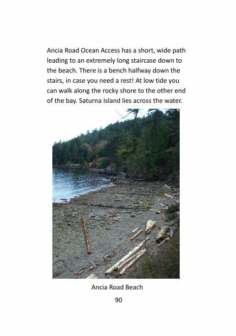
Ancia Road Ocean Access #45
Conery Crescent, South Pender Island
Difficulty: Moderate
Distance: 110 Metres
Parking: Side of Road
Amenities: Bench
Beach Access: Yes
90
Ancia Road Ocean Access has a short, wide path
leading to an extremely long staircase down to
the beach. There is a bench halfway down the
stairs, in case you need a rest! At low tide you
can walk along the rocky shore to the other end
of the bay. Saturna Island lies across the water.
Ancia Road Beach

91
Gowlland Point Ocean Access #46
Gowlland Point Road, South Pender Island
Difficulty: Easy
Distance: 50 Metres
Parking: Lots of easy spots at trailhead
Amenities: Bench
Beach Access: Yes
A platform with a bench directly next to the
parking area provides a beautiful view of the
San Juan Islands in the USA, and on a clear day,
of Mt. Baker. A steep set of stairs leads down to
a beautiful sand and pebble beach. If you walk
to the right, towards the point of land with a
navigation light, you soon will be able to access
the CRD Brooks Point Regional Park by means of
a staircase (in planning stages at time of
writing).

92
Craddock Drive Ocean Access #47
Craddock Drive, South Pender Island
Difficulty: Easy
Distance: 30 Metres
Parking: Lots of spots at trailhead, side of road
Amenities: None
Beach Access: Yes
Craddock Drive Ocean Access begins with a long
set of low rise steps that are often wet in the
rainy season. You are let out on a large pebble
beach with lots of driftwood. As you explore the
shoreline you can admire Boundary Pass, and
the US San Juan Islands and the many freight
ships passing.

93
Craddock Road Beach
94
Canal Road Ocean Access #48
Canal Road, South Pender Island
Difficulty: Moderate
Distance: 100 Metres
Parking: Side of Road
Amenities: None
Beach Access: Yes
The trail starts with a walk through the woods,
ending in a steep staircase to the beach on
Plumper Sound overlooking Saturna Island. At
low tide an approximately 700 metre walk on
the beach to the right will connect you with the
William Walker Ocean Access Trail #43 to Canal
Road.

95
Stuart/Moresby View Trail #53
Gowlland Point Road, South Pender Island
Difficulty: Moderate
Distance: 330 Metres, 27 Metre Climb
Parking: 2 Gravelled spots at trailhead
Amenities: Bench
Beach Access: No
This trail meanders through a high canopy forest
of Arbutus and Fir trees, eventually sloping
down through dense Salal to an expansive view.
Please respect the private lands on each side of
the trail right-of-way.
A bench allows you to relax as you look
Southwest over Swanson Channel towards
Stuart and Moresby Islands. Some areas of the
trail are steep, and there are some steps. See if
you can spot the uncommon Yew trees as you
make your way through the forest.

96
Stuart/Moresby Viewpoint
Bidgood Road Ocean Access #57
Gowlland Point Road, South Pender Island
Difficulty: Hard
Distance: 100 Metres, 50 Metre Climb
Parking: Side of road at either end of the
roadside cement barriers
Amenities: Bench
Beach Access: Yes

97
This trail is very steep, and takes you from the
road down through a forested area with lots of
steps. You will come out at a viewpoint with a
bench, and can descend, with the help of the
provided rope hand rail, to a beautiful little
pebble beach. The parking is very minimal with
only room for one car on the side of the road
after the cement barrier.
Bidgood Beach
98
Craddock Drive/Gowlland Point Road
Trail #58
Craddock Drive/Gowlland Point Road, South
Pender Island
Difficulty: Easy
Distance: 0.56 Km
Parking: Side of road
Amenities: None
Beach Access: No
At the Gowlland Point end the trail runs through
a forest and thick Salal, with a great view of the
ocean to the south. You will wind through more
forest and emerge in a large field before exiting
the trail onto Craddock Drive. Please respect the
surrounding private properties. This trail makes
a loop between the two roads, and is easy
walking distance to the Craddock Drive Ocean
Access #47.

99
Drummond Bay Ocean Access #64
Higgs Road, South Pender Island
Difficulty: Easy
Distance: 30 Metres
Parking: Multiple spots at entrance
Amenities: Viewing platform, Benches
Beach Access: Yes
Drummond Bay offers a large crescent shaped
pebble beach with a huge collection of
driftwood. The viewing platform at the entrance
offers 2 benches, and is a beautiful place to
enjoy the scenery.
Drummond Bay Beach

100
Ainslie Point Viewpoint #75
Ainslie Point Road, South Pender Island
Difficulty: Moderate
Distance: 120 Metres start to finish using loop
Parking: Side of road
Amenities: Bench
Beach Access: No
This loop trail is steep in places, and leads you
through a forested area to a bench with a
beautiful view of North Pender Island and
Bedwell Harbour. Parking is on Ainslie Point
Road in the large turnaround. Please do not
park on or block private driveways.

101
Ainslie Point Viewpoint
102
Saturna View Trail #76
Canal Road, South Pender Island
Difficulty: Moderate
Distance: 180 Metres start to finish using loop
Parking: Side of road
Amenities: Bench
Beach Access: No
This densely forested loop trail descends from
the road to a bench with a wonderful view of
Plumper Sound. Razor point on North Pender
Island is visible, as are Mayne and Saturna
Islands.

103
Ellena Road Trail #77
Canal Road, South Pender Island
Difficulty: Moderate
Distance: 210 Metres using loop
Parking: Side of Road
Amenities: Bench
Beach Access: No
This loop trail is rough with roots and rocks in
places, and takes you on a shady walk through
the forest. A bench with a view of Plumper
Sound and Saturna Island is at the halfway
point.
Mirada Road Ocean Access #78
Boundary Pass Drive, South Pender Island
Difficulty: Easy
Distance: 80 Metres
Parking: Side of Road
Amenities: Bench
Beach Access: Yes

104
This trail descends through a shady area filled
with ferns, and then splits at the end. You can
go right to steps leading to the rocky shore, or
left to a bench with a view of Plumper Sound.
This trail can be slippery and muddy in the wet
season, so tread carefully.
Mirada Road Ocean Access

105
Conery Crescent Trail/Viewpoint #80
Conery Crescent/Boundary Pass Drive, South
Pender Island
Difficulty: Easy
Distance: 300 Metres
Parking: Multiple spots at trailhead
Amenities: Bench
Beach Access: No
The trailhead begins at the end of Conery
Crescent where there is easy parking. A short
distance down the trail you have the option of
going left or right. To the right is a viewpoint
with a bench overlooking Plumper Sound. To
the left is a shady trail that will take you to
Boundary Pass Drive, which allows you to walk a
nice loop back on the road.

106
Parks Administered By Other
Agencies
Beaumont Marine Park
Gulf Islands National Park Reserve
Access by water or Mt. Norman Trail
Brooks Point Regional Park
CRD Nature Reserve
Access from Gowlland Point Road
Greenburn Lake
Gulf Islands National Park Reserve
Access from Gowlland Point Road
Loretta’s Wood
Gulf Islands National Park Reserve
Access from Hooson Road
Medicine Beach
Islands Trust Fund Reserve
Access from Wallace Road

107
Mt. Norman
Gulf Islands National Park Reserve
Access from Ainslie Point Rd, Canal Rd (S)
Mt. Menzies Bluff
Gulf Islands National Park Reserve
Access from Hooson Road
Prior Park (camping)
Gulf Islands National Park Reserve
Access from Canal Road (N)
Roe Lake
Gulf Islands National Park Reserve
Access from South Otter Bay Road or Galleon
Way (end of road)
Roesland
Gulf Islands National Park Reserve
Access from South Otter Bay Road

108
Works Cited
Dun, Trallee. Community Parks Guide II.
Pender Island Parks and Recreation
Commission, 2006.
Kahn, Charles. Hiking the Gulf Islands of
British Columbia. Madeira Park: Harbour
Publishing, 2011.

109
Pender Parks and Trails
Alphabetical Index
North Pender Alphabetical Listing Parks & Trails
# Name page
04 Abbott Hill Park…………..……………… 51
74 Bedwell Drive Ocean Access ………. 44
26 Boat Nook Ocean Access……………… 62
11 Bosun/Galleon Trail……………………… 59
63 Buck Lake Trail ……………………………. 69
22 Bricky Bay Ocean Access ……………. 18
23 Bridges Road Ocean Access ………… 20
29 Capstan Lane Park ……………………… 64
03 Capstan/Rope Trail ……………………… 49
08 Compass/Starboard Trail ……………. 57
66 Compass/Tiller Trail ……………………. 71
05 Danny Martin Park ……………………… 52
06 Disc Park ……………………………………. 53
67 Fire Hall/Disc Park ………………………. 72
50 Found Road Ocean Access …………. 30
21 Gardom Pond Park ……………………… 17
32 Grimmer Bay Ocean Access ………… 27
16 George Hill Park …………………………. 11

110
Alphabetical Listing Parks & Trails
# Name page
12 Grover Sargent Cairn Trail ………….. 07
09 Heart Trail ……………………………….…. 58
49 Heart Trail Extension …………………… 65
25 Harpoon Road/Panda Bay O- 62
30 Irene Bay Park ……………………………. 24
07 Lively Peak Park ............................. 55
72 Lock Road Viewpoint …………………. 43
24 MacKinnon Road Ocean Access …. 21
14 Magic Lake Picnic Site ………………… 60
13 Magic Lake Swimming Hole ………… 08
61 Masthead/Shingle Trail ………………. 68
17 Mount Elizabeth Park …………………. 13
15 Mount Menzies Park …………………… 10
62 Mumford Road Viewpoint ………….. 38
34 Niagara Road Ocean Access ………… 29
20 Oaks Bluff Viewpoint ………………… 15
71 Ogden Road Viewpoint ……………… 42
73 Pecos Road Ocean Access …………… 43
31 Percival Cove/Zolob Rd O-Access… 25
18 Peter Cove North Ocean Access … 14
28 Peter Cove South Ocean Access … 23
59 Plumper Way Viewpoint …………… 36
69 Privateers/Schooner Linker Trail …. 73
52 Sandy Sievert Park ……………..……… 66
111
Alphabetical Listing Parks & Trails
# Name page
10 Schooner/Chart Trail ………………… 59
65 Schooner at Reef Park ………………… 70
51 Seawest Viewpoint …………………… 32
70 Shorecliff Viewpoint …………………… 41
01 Shingle Bay Park …………………………. 45
19 Skeeles Road Viewpoint ……………… 15
27 Starvation Bay Ocean Access ………. 22
02 Thieves Bay Park …………………………. 47
55 Tracy Road Viewpoint ………………… 34
79 Ursula Poepel Park ……………………… 75
68 Von Road Viewpoint …………………… 40
35 Walden Road Ocean Access ………… 30
54 Wallace Road Ocean Access ………… 33
56 Welcome Bay Ocean Access ……… 35
33 Wilson Road Ocean Access …………. 28
60 Yardarm/Shingle Trail …………………. 67
South Pender Alphabetical Listing Parks & Trails
# Name page
75 Ainslie Point Viewpoint ………………. 100
45 Ancia Road Ocean Access ……………. 89
57 Bidgood Road Ocean Access ……….. 96

112
Alphabetical Listing Parks & Trails
# Name page
41 Bridge Park …………………………………. 84
44 Boundary Pass Drive Ocean Access 88
48 Canal Road Ocean Access ……………. 94
40 Castle Road Trail …………………………. 83
80 Conery Crescent Trail/Viewpoint … 105
58 Craddock/Gowlland Loop Trail ……. 98
47 Craddock Drive Ocean Access ……… 92
64 Drummond Bay Ocean Access …….. 99
77 Ellena Road Trail …………………………. 103
37 Enchanted Forest Park…………..……. 78
36 Fawn Creek Park ………………………… 77
46 Gowlland Point Ocean Access …… 91
39 Lilias Spalding Heritage Park ……… 81
78 Mirada Road Ocean Access ………… 103
38 Mortimer Spit Ocean Access ……… 80
76 Saturna View Trail ………………..…… 102
53 Stuart/Moresby Trail …………………… 95
43 William Walker Road Ocean Access 87
42 William Walker Trail ………..………… 85

113
Pender Parks and Trails
Numerical Index
Numerical Listing Parks & Trails Map # Name page
1 Shingle Bay Park………………………… 45
2 Thieves Bay Park……………….………. 47
3 Capstan Lane/Rope Rd. Trail……… 49
4 Abbot Hill Park………………………….. 51
5 Danny Martin Park…………….……… 52
6 Disc Park………..…………………………. 53
7 Lively Peak Park……….………………… 55
8 Compass Cres./Starboard Cres
Trail……………………………………………. 57
9 Heart Trail/Ketch/Prior Park………. 58
10 Schooner Way/Chart Dr. Trail……… 59
11 Bosun Way/Galleon Way Park and
Trail……………………………………………. 59
12 Grover Sargent Memorial Cairn
Trail……………………………………………. 7
13 Magic Lake Swim Hole Park………… 8
14 Magic Lake Picnic Site Park……….. 60
15 Mount Menzies Park…………………. 10
16 George Hill Park……………………..…. 11
17 Mount Elizabeth Park…………..……. 13

114
Numerical Listing Parks & Trails Map # Name page
18 Peter Cove (North) Ocean Access. 14
19 Skeeles Road Viewpoint……………. 15
20 Oaks Bluff Viewpoint…………………. 15
21 Gardom Pond Trail……….…………… 17
22 Bricky Bay Ocean Access……………. 18
23 Bridges Road Ocean Access………… 20
24 Mackinnon Road Ocean Access… 21
25 Harpoon Rd/Panda Bay Ocean
Access………………………………………… 62
26 Boat Nook Ocean Access……………. 62
27 Starvation Bay Ocean Access……… 22
28 Peter Cove (South) Ocean Access. 23
29 Capstan Lane Park……………………… 64
30 Irene Bay Ocean Access……………… 24
31 Percival Cove Ocean Access……..… 25
32 Grimmer Bay Ocean Access……..… 27
33 Wilson Road Ocean Access………… 28
34 Niagara Road Ocean Access………… 29
35 Walden Road Ocean Access………… 30
36 Fawn Creek Park/Ocean Access… 77
37 Enchanted Forest Park……………… 78
38 Mortimer Spit Park/Ocean Access 80
39 Lilias Spalding Heritage Park…..… 81
40 Castle Road Trail………………………… 83

115
Numerical Listing Parks & Trails Map # Name page
41 Bridge Park Viewpoint………………. 84
42 William Walker Trail………………….. 85
43 William Walker Ocean Access….… 87
44 Boundary Pass Dr. Ocean Access… 88
45 Ancia Road Ocean Access……….…. 89
46 Gowlland Point Ocean Access……. 91
47 Craddock Drive Ocean Access…….. 92
48 Canal Road Ocean Access…………… 94
49 Heart Trail Extension/Ketch/Disc
Park……………………………………………. 65
50 Found Road Ocean Access………….. 30
51 Seawest Viewpoint……………………. 32
52 Sandy Sievert Park……………………… 66
53 Stuart/Moresby View Trail………… 95
54 Wallace Road Ocean Access….…… 33
55 Tracy Road Ocean Access…………… 34
56 Welcome Bay Ocean Access………. 35
57 Bidgood Ocean Access………………. 96
58 Craddock/Gowlland Loop Trail…… 98
59 Plumper Way Viewpoint……………. 36
60 Yardarm Road/Shingle Bay Trail…. 67
61 Masthead Cr./Shingle Bay Trail…… 68
62 Mumford Road Viewpoint…………. 38
63 Buck Lake Trail……………….…………… 69
116
Numerical Listing Parks & Trails Map # Name page
64 Drummond Bay Ocean Access……. 99
65 Schooner at Reef Park…………..…… 70
66 Compass Cr./Tiller Cr. Trail……..….. 71
67 Firehall/Disc Park Trail…………..…… 72
68 Von Road Viewpoint…………………… 40
69 Schooner/Privateers Trail……….…. 73
70 Shorecliff Viewpoint…………………. 41
71 Ogden Road Viewpoint…………..… 42
72 Lock Road Viewpoint………………… 43
73 Pecos Road Ocean Access……….… 43
74 Bedwell Drive Ocean Access……… 44
75 Ainslie Point Viewpoint…..………… 100
76 Saturna View Loop Trail…………….. 102
77 Ellena Road Loop Trail…………….…. 103
78 Mirada Road Ocean Access………… 103
79 Ursula Poepel Park……………………… 75
80 Conery Crescent Trail Viewpoint… 105