Embed Size (px)
Citation preview
Conservation of Freshwater Ecosystem Values
Inventory of available data:
Summary and Metadata information
‘A strategic framework for statewide management and conservation of Tasmania’s freshwater
ecosystem values’
Report to the Conservation of Freshwater Ecosystems Values Project
Water Development Branch
Water Resources Division
Department of Primary Industries, Water and Environment
November 2002

© Department of Primary Industries, Water and Environment
Author:
Helen Dunn, Landmark Consulting
Published by:
Water Resources Division
Department of Primary Industries, Water and Environment
GPO Box 44
Hobart Tas 7001
Telephone: (03) 6233 6328
Facsimile: (03) 6233 8749
Email: [email protected]
Website: www.dpiwe.tas.gov.au
Citation: Dunn, H. (2002). Conservation of Freshwater Ecosystem Values. Inventory of
available data: Summary and Metadata information. Report to the Conservation
of Freshwater Ecosystems Values Project, Department of Primary Industries,
Water and Environment, Hobart, Tasmania.
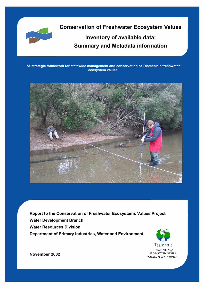
Cover photograph: Collecting data (river flow gauging) on the Ringarooma River. Photo taken
by Danielle Hardie
Copyright
All material published in the report by the Department of Primary Industries, Water and
Environment, as an agent of the Crown, is protected by the provisions of the Copyright Act 1968
(Cth). Other than in accordance with the provisions of the Act, or as otherwise expressly
provided, a person must not reproduce, store in a retrieval system, or transmit any such material
without first obtaining the written permission of the Department of Primary Industries, Water and
Environment.
Disclaimer
Whilst the Department of Primary Industries, Water and Environment makes every attempt to
ensure the accuracy and reliability of information published in this report, it should not be relied
upon as a substitute for formal advice from the originating bodies or Departments. DPIWE, its
employees and other agents of the Crown will not be responsible for any loss, however arising,
from the use of, or reliance on this information.
Conservation of Freshwater Ecosystem Values. Inventory of available data
1
1. Generic information available through the PWS GIS section, RPDC and Land Information
System of Tasmania (LIST).
The PWS section (Dave Peters) indicates that they have all necessary ‘base’ layers, including
topographic features, land tenure, IBRA regionalisations, vegetation mapping.
The Resource Planning and Development Commission (State of Environment section) is
custodian of satellite imagery of land use classifications and other images.
LIST layers: Tasmania’s Land systems data is available on the website: www.thelist.tas.gov.au The
following data layers have been identified.
watercourses
water bodies
area of broken, fast-flowing water
flat land where periodic flooding is causing salinity
estuary
dams, classified by dam type
artificial watercourses
geomorphic conservation features
wetlands
river catchments
estuary catchments
seagrass beds
2. SPECIALIST DATABASES
A number of agencies and individuals have information which may be of value for the project.
Details of the ownership, scope, currency, reliability, format and any conditions of access and use
are noted on separate data sheet records. In addition, comments have been noted which may
facilitate evaluation and application of these data.
The summary tables which follow indicate, for each of three major ecosystem types and aspects
of waterway management, the range of environmental and biological data available. A code
system has been used to summarize geographic scope, type of data and a crude estimate of
reliability.
Scope: Statewide (S), Regional (R) Patchy (P)
Currency: Current (C), Uncertain/Variable (U), Timeseries (T)
Reliability: Verified (V), Unverified (N)

TABLE 1: RIVERS
Agency Title Description Scope Currency Reliability
DPIWE/GIS Wild Rivers Index GIS-based assessment of flow and catchment disturbance combined
to give index of river disturbance. Maps and site data available
S 1996? V/U
DPIWE/NCB Geomorphic River
Regionalization.
Uses GIS layers and PCA analysis to map
regionalisations/characterisation
S C V
DPIWE/NCB Geomorphic River
Characterization
Based on field assessment of catchments for Rivercare plans and
other sites of interest. May be used to validate GIS maps
P C V/N
DPIWE/PWS GT Spot Consolidated data base of distribution of flora and fauna, R&T
species noted. Includes FW and karst fauna
S C V
DPIWE:
Hydrology
Hydrological
classification
Using extant flow data and cluster analysis to identify and map 3
hydrological groups for the State.
S U N
DPIWE Water
assessment
AUSRIVAS Family level macroinvertebrate data for some 600 river sites. Possibly
does not include ephemeral rivers
S C V
UTAS/ED Riparian
vegetation
communities
Classification and distribution of native riparian vegetation mapped
for some 460 sites by 10 km grid
S/P C V
UTAS/ED Riparian
vegetation
species,
Floristics, structure, site variables 460 sites for 10km grid sqs across
Tasmania, also further 60 sites where no data, including 45 where rip
veg absent
S/P C V
IFS Astacopsis gouldii Occurrence of Astacopsis gouldii EPBC listed species R/P C V
IFS Fish database Distribution data for all freshwater fish species, native and introduced S/P C V
IFS Trout-free waters Trout-free waters, limited to prospective sites for threatened species P U N
Herbarium Tasmanian
Herbarium
Flora records by species – riverine species can be extracted. Not
including bryophytes
S C V

DPIWE/NCB Wetlands Audit New nomination proposals from the Dec 2001 LWA Audit exercise.
Sites which meet DIWA criteria in all classes of wetlands, including
rivers
S/P C V/N
UTAS Parastacoides Occurrence and distribution of entire genus S C V
QVMAG QVMAG
collections
Records of material in QVMAG collections. Varies in scope, coverage,
currency and reliability
S/P C/U V/U
TABLE 2: LAKES AND LENTIC WETLANDS
Agency Title Description Scope Currency Reliability
LIST LIST Wetlands GIS layer depicts vegetated area that is flooded or saturated by water
using topographic analysis and vegetation mapping. Not classified by
lentic wetland type or ground-truthed. Identifies permanent and
intermittent swamps. Estimated 9000 places
S C N
DPIWE/NCB Wetlands of
Tasmania
Lists some 800 sites derived from Kirkpatrick & Harwood with later
editions. Mostly based on flora, important sites noted.
S/P U N
DPIWE/PWS GT Spot Data base of distribution of flora and fauna, R&T species noted
Should consolidate records from other sources
S C V
DPIWE/NCB DIWA Inventory All Ramsar and DIWA listed wetlands, some 90 sites. Current listings
but not systematic or comprehensive
P U V
DPIWE/NCB Wetlands Audit New nomination proposals from the Dec 2001 LWA Audit exercise.
Sites which meet DIWA criteria in all classes of wetlands
S/P C V/N
Herbarium Tasmanian
Herbarium
Flora records by species. Could extract wetlands taxa S C V
UTAS/AMMR Parastacoides Occurrence and distribution of entire genus S C V
UTAS/JBK Saltmarsh
communities
Statewide mapping Kirkpatrick and Glasby. S U V

Agency Title Description Scope Currency Reliability
Deakin
Uni/PTyler
Diatoms Diatoms and other lower plants. Not in database P C V
QVMAG QVMAG
collections
Records of material in QVMAG collections. Varies in scope, coverage,
currency and reliability
S/P C/U V/U
UTAS/AMMR Saltmarsh fauna Molluscs and Crustacea of Tasmanian saltmarshes, statewide survey S U N
WWF/GT Spot Frogs Data from community-based frogwatch projects S C V
TABLE 3: ESTUARIES
Agency Title Description Scope Currency Reliability
HYDRO/LIST Estuary catchment
boundaries
Mapping of catchment boundaries using GIS data S C V
TAFI Estuary
classification
Characterization and evaluation of all Tasmanian estuaries using
environmental parameters and assessment of conservation value
S C V/U
TAFI Estuary biota Biological data (invertebrate) from 48 estuaries collated for
assessment project
S/P C V
LIST Seagrass Mapping of seagrass distribution by analysis of air photos and some
ground truthing
S U N
QVMAG Fauna databases Records of material in QVMAG collections. Varies in scope, coverage,
currency and reliability
S/P C/U V/U
Herbarium Tasmanian
Herbarium
Flora records by species. Could extract saltmarsh taxa S C V
UTAS/AMMR Saltmarsh fauna Molluscs and Crustacea of Tasmanian saltmarshes, statewide survey S C N

TABLE 4: MANAGEMENT DATA
Agency Title Description Scope Currency Reliability
DPIWE
Hydrology
Water quality and
hydrology
monitoring
Timeseries data on water quality and hydrology from numerous non-
Hydro sites Integrated with Hydro data
S/P T V
Hydro Hydro flow data Timeseries flow data for Hydro catchments P T V
Hydro Dams database Catchment boundaries for all Hydro storages S C V/U
Hydro Waterway health Waterway Health data for Hydro waterways: 60% for lake systems.
Includes CH, algae, nutrients
P C V
DPIWE Water
Management
Branch
Water Information
Management
System
Maps all water licences and registered dams. Numerous non-
registered and illegal dams not mapped.
S C V
DPIWE: Water
assessment
Index of Stream
condition
Data from approx. 12 catchments using Victorian Index of Stream
Condition for protocol
P C V
DPIWE: water
assessment
Environmental
Flows
Environmental Flows estimates for approx. 35 river systems using
PEV’s and habitat requirements
P C V
IFS Lake
Sorell/Crescent
Rehabilitation Project provides data on water quality, levels, aq veg,
fish biology
S U N
DPIWE/LIST Marine farms Mapping of marine farms, leases and licences S C? V
TAFI Estuarine health Status and indicators of water quality from 22 estuaries typical of
Tasmania
S C? V
DPIWE Environmental
monitoring of
marine farms
Benthic sampling and video of seabed P u V

Conservation of Freshwater Ecosystem Values. Inventory of available data
6
Evaluation of available data: a brief summary
1. Introduction
Evaluation of available data has been made with particular reference to the key elements of
the identification of freshwater ecosystem values, namely ‘features’ (aspects of the systems
such as geomorphology and biota), and ‘criteria’ (what makes this important). ‘Criteria’ have
been broadly defined as
Naturalness
Representativeness
Distinctiveness
Distinctiveness may include: rarity; diversity; specialized habitats; places important for life
history stages – nursery areas, migration stop-overs; importance for understanding of
evolutionary history. This element of the framework has yet to be confirmed.
The databases available have been very generally assessed according to:
Coverage – is there a statewide context?
How reliable and current is the information?
Is there a clear scientific basis for the evidence?
2. Rivers
There are several databases which may be used directly to assess some features and elements
of all three criteria The GIS layer River Disturbance Index gives some objective indication of
naturalness and its components may be selected for particular aspects of disturbance. A
regionalization/classification of rivers is emerging from GIS analysis of riverine environments
to which other classifications (riparian vegetation communities, macroinvertebrate
communities) may be integrated or added sequentially. High quality data at statewide level is
available for some of these data sets.
Other ecological values that may confer importance to a river on the grounds of
distinctiveness may be drawn from comprehensive data sets such as distribution of native fish
and endangered fauna, fauna of high biogeographic significance, and targeted searches of
databases such as Herbarium. For example, rivers with important in-stream macrophyte beds
might be located and set in a statewide context by a locality search of selected Herbarium
records.
Karst components of the river analysis are at a more general level. Karstic regions will be
identified through the river regionalization project but there is not a detailed database of
karst features (only in text format). Karst faunal values are available on GT-Spot.
Data are available to commence analysis of candidate rivers or river sections which meet the
criteria of being representative of river types, least disturbed within a given hydrological and
geographic context and/or distinctive in some special way. It is important to note that
information on instream flora and fauna is patchy and that much of the statewide data on
macroinvertebrate fauna is only available at family level which has limited value for
assessment on several criteria.
3. Lakes and lentic wetlands.
There are no consolidated databases dedicated to Tasmania’s natural lake systems. Almost all
larger lake systems are Hydro impoundments, including some natural system which have been
modified by Hydro actions (Lake St Clair, Great Lake) or agricultural practices (Lakes Sorell,

Conservation of Freshwater Ecosystem Values. Inventory of available data
7
Crescent, Lake Dulverton). Many glacial lake systems are captured within the Central Plateau
Protection Area or other areas of the World Heritage Area, though some lie outside (Tyndall
Range) and there is no detailed analysis or mapping of geomorphic forms or values, nor of
biota. Some lakes are known to have important values and are already listed on the DIWA list
(Lake Lea, Lake Tiberias), but do not necessarily receive appropriate conservation measures.
Lakes or larger open standing water bodies will need to be assessed on a case-by-case basis,
using topographic data and other GIS layers for some state-wide contexts.
The group ‘wetlands’ includes a range of types of ecosystem feature. The level of classification
of lentic wetlands used in the Ramsar typology is probably appropriate for analysis of
Tasmania’s wetlands. Some wetland types have been subject to classification and conservation
assessment based on floristics. These data and assessment need to be placed within a
statewide analysis, and with additional information such as geomorphic and faunal values.
LIST layers showing ‘wetlands’ based upon topography and vegetation may provide a crude
statewide mapping of distribution of different wetland types if subjected to further analysis
using, for example, ‘geomorphological controls’ GIS layers, expert knowledge and associated
ground-truthing. Assessment of naturalness will require a similar analysis. This task needs to
be addressed for each of the agreed lentic wetland types.
Numerous lentic wetlands of conservation significance were identified by expert panels in the
December 2001 LWA Wetlands Audit process. Criteria for significance included
representativeness and aspects of distinctiveness while condition was assessed by descriptive
category on a five-point scale. In addition to single wetlands, suites of wetlands were
identified where these were hydrological linked and hence had added ecological value over
and above selection of individual wetlands. These data provide a good starting point for
identification of sites of particular importance.
There are data and written materials available which could be used to validate existing
assessments, map regional representation and identify candidate sites for conservation.
Coverage by wetland type should be noted.
4. Estuaries
A body of information on estuaries, their values and condition has been collated and
integrated by TAFI research staff and DPIWE marine branch. Assessment of
condition/naturalness was undertaken using GIS mapping of disturbance factors. This could
be further refined using flow data and Wild Rivers assessments. A classification of estuary
types using both geomorphic form and biota has been described and representative examples
nominated, together with other values which would fall within the scope of ‘distinctiveness’.
Further important data on potential values are available but some is not in database format,
notably data on fish.
Existing data and documentation provide a sound framework to progress identification of
estuaries which are in good condition, representative of estuary type and bioregion, and at
least some distinct values. Additional data may be incorporated as appropriate. Existing
conservation assessment should be screened to ensure compatibility with the final assessment
framework for the Freshwater Ecosystem Values project.
5. Management information
A number of sources of management data have been identified. These include time series
data on flows and water quality not amenable to integration with GIS layers. The hydrological
regionalization is too coarse for application to particular systems and considerable work is
required to develop models from the time series data. Other environmental data for rivers
(environmental flows, Index of Stream Condition assessments) are very patchy and of local

Conservation of Freshwater Ecosystem Values. Inventory of available data
8
value only. The database on dams only records legal dams and off-takes: illegal dams are
believed to have considerable impacts on flows and water management of some systems but
again a major task would be involved in extrapolating such information from orthophoto
mapping.
Databases are available for other aspects of waterways relevant to the selection and
integrated management phases of the Freshwater Ecosystem Values project. These include:
mapping of high risk values such as seagrass beds, fish nursery sites or sensitive rare species
and other uses such as marine farm locations.
Consideration needs to be given to what data may contribute to more effective and
ecologically sustainable use of water resources to ensure that identified freshwater ecosystem
values can be protected.

Conservation of Freshwater Ecosystem Values. Inventory of available data
9
INVENTORY DATA SHEETS
Conservation of Freshwater Ecosystem Values. Inventory of available data
10
1 Name
River Disturbance Index
2 Location/authority
GIS section DPIWE
3 Contact person
Dave Peters
4 Description
GIS based analysis of river disturbance compiled for AHC Wild Rivers project, later used
in RFA. Uses numerous elements to develop 2 indices: River disturbance (flow) RDI and
catchment disturbance CDI which are equally weighted in the final River Wildness Index.
Mapped in classes. Indices of river disturbance for the study sites were drawn from the
Wild Rivers Project database (Stein et al n.d.). These data present a summary of river
naturalness as defined by the Wild River project parameters (Stein et al n.d.). An attempt
will be made to establish any correlation of faunal data with the Wild River indices to
explore the issues of potential surrogacy. Three measures were selected to depict the
status of the rivers and streams sampled: the Land Use Factor (LUF), Catchment
Disturbance Index (CDI) and River Disturbance Index (RDI). Flow Disturbance Regime
Index (FRDI) was not used since all sites sampled scored ‘0’, that is no rivers were subject
to any impoundment or abstraction. The Land Use Factor incorporates seven classes of
diffuse (area-based) impacts based on level of land clearance. The Catchment
Disturbance Index is computed from contributing sub-catchment disturbance indices so
that upstream effects of all forms of disturbance are captured. The River Disturbance
Index is a sum of the CDI and Flow Disturbance Regime Index FRDI to provide an overall
estimate of river disturbance. Results are reported in a range 0.0 to 1.0, with least
disturbed sites having lower scores (Stein et al n.d.).
5 File format
6 Coverage – spatial and temporal extent
Statewide
7 Date or currency
1996?
8 Data quality / reliability / lineage
Draws on data layers current at time.
9 Any conditions for access
10 Any other information
Stein J.L., Stein J.A. & Nix H.A. (n.d.) The identification of wild rivers: methodology and
database development. Environment Australia, Canberra.

Conservation of Freshwater Ecosystem Values. Inventory of available data
11
1 Name
Geomorphic River Regionalization
2 Location/authority
NCB DPIWE
3 Contact person
Kathryn Jerie
4 Description
Displays in multi-dimensional space areas where river controls are similar. Data layers
were used to generate a matrix then analysed using Principal Components Analysis to
display in N-dimensional space. As of Nov 02 await agglomeration of ‘seed’ domains and
expect to identify about 12 different ‘regions’ and a number of sub-regions. Potential as
frame for ‘river types’. Yet to map on river features.
5 File format
ArcView
6 Coverage – spatial and temporal extent
Statewide
7 Date or currency
2002
8 Data quality / reliability / lineage
Used all existing data sets
9 Any conditions for access
No
10 Any other information
List of data elements and controls provided.

Conservation of Freshwater Ecosystem Values. Inventory of available data
12
1 Name
Geomorphic River Characterization
2 Location/authority
NCB
3 Contact person
Kath Jerie ext 6132 [email protected]
4 Description
Portrays field analysis of catchment geomorphology and may be compared with the
outputs of the statewide regionalization to mutually test or validate model.
5 File format
ArcView/Access
6 Coverage – spatial and temporal extent
The coverage is patchy since it was based on using data where these had been prepared
for other purposes, primarily Rivercare Plans. These tend to be rivers which are developed
or under pressure. In addition, geomorphic types that might be considered interesting or
have special or distinctive features were surveyed. These include sites on King Island,
Upper Macquarie river and the Central Plateau
7 Date or currency
2000-2002
8 Data quality / reliability / lineage
The work was undertaken by different specialist geomorphologists but generally using
the River Styles ™ approach. This ensures standard names for different river styles or
characters but some individual interpretation. The River Styles approach yields some 40
different river characters, some embedded in at hierarchical scale
9 Any conditions for access
No
10 Any other information

Conservation of Freshwater Ecosystem Values. Inventory of available data
13
1 Name
GT Spot
2 Location/authority
NCB/DPIWE
3 Contact person
Ruiping Gao/Dave Peters Ext 6054
Niall Doran NCB
4 Description
Location records for all Tasmanian Rare and Threatened species
5 File format
6 Coverage – spatial and temporal extent
Statewide
7 Date or currency
Current and ongoing.
8 Data quality / reliability / lineage
Fauna records have been recently (2002) reviewed, assessed and information checked.
Freshwater fauna should be up-to-date. Data depends on work of collectors and
specialists and may be limited in geographic and taxonomic range. Also opportunistic
collection.
Each record is tagged with collector name and accuracy and reliability can be verified.
9 Any conditions for access
Some elements are restricted – eg private collector may chose not to have open access.
Also restricted for some species or sensitive sites such as karst.
10 Any other information

Conservation of Freshwater Ecosystem Values. Inventory of available data
14
1 Name
Hydrological classification of Tasmania
2 Location/authority
DPIWE – Water resources
3 Contact person
Donald Hine [email protected]
4 Description
Hydro-regionalisation of Tasmanian rivers - yields 3 site groupings, generally a westerly
group and other two groups dispersed in north/east and south.
5 File format
Mapinfo Database
6 Coverage – spatial and temporal extent
Statewide
7 Date or currency
Compiled 2001 but used prior data (Hughes) and not covering same time intervals or
periods
8 Data quality / reliability / lineage
Built from data from 70 gauged catchments, model then tested with physical parameters
9 Any conditions for access
No
10 Any other information
Map of sites classifications provided.
Report prepared by D Hine outlining procedure - not available for quoting

Conservation of Freshwater Ecosystem Values. Inventory of available data
15
1 Name
AUSRIVAS
2 Location/authority
DPIWE - Water assessment and planning
3 Contact person
Martin Read
4 Description
Family level macroinvertebrate data for reference and monitoring sites, includes physical
habitat data, water quality data and stream order
5 File format
Access
6 Coverage – spatial and temporal extent
State-wide except for WHA, approx 600 sites
7 Date or currency
1994 - 2002
8 Data quality / reliability / lineage
Some sites have been sampled through out the program, most only 1 or 2 times.
Standard protocol
9 Any conditions for access
No
10 Any other information
• Possible that ephemeral rivers have been overlooked because not amenable to
sampling at appropriate time.
• Material from some taxon groups have been sent on request to various taxonomists
in development of species level keys, as follows:
Baetidae and Caenidae – Dr Phil Suter
Trichoptera and Ephemeroptera – John Dean
Elmidae – Alena Glaister
Odontoceridae and Leptoceridae – Ros St Clair
Pyralidae – John Hawking.

Conservation of Freshwater Ecosystem Values. Inventory of available data
16
1 Name
Riparian Vegetation Communities
2 Location/authority
University of Tasmania
3 Contact person
Elizabeth Daley, Geography and Environmental Studies
4 Description
Mapping of 21 riparian communities based on presence/absence floristic data from 460
sites,1 per 10k grid square .
5 File format
Excel
6 Coverage – spatial and temporal extent
Most of state, limited sampling in southwest.
7 Date or currency
2000-2002
8 Data quality / reliability / lineage
Original research data, standard protocol and analysis
9 Any conditions for access
No
10 Any other information
PhD Thesis in preparation (Dec 02)

Conservation of Freshwater Ecosystem Values. Inventory of available data
17
1 Name
Riparian Vegetation Species
2 Location/authority
University of Tasmania
3 Contact person
Elizabeth Daley, School of Geography and Environmental Studies
4 Description
Species lists, structural elements and bioclim data (~80 variables) for riparian vegetation.
Master data linked to sites, species by site distributions.
5 File format
Excel
6 Coverage – spatial and temporal extent
Most of state except limited coverage in southwest. 460 sites, at 10 km grid square
intervals.
7 Date or currency
2000-2002
8 Data quality / reliability / lineage
Research project with standard protocol
9 Any conditions for access
No
10 Any other information
Proforma data sheet provided showing all variables collected at each site
Note that an additional 60 sites (ie 10 km grid squares) are noted elsewhere. Of these, 45
have no sites with native/intact riparian vegetation. A further 15 sites possibly have rip
veg sites in the headwaters but were inaccessible.

Conservation of Freshwater Ecosystem Values. Inventory of available data
18
1 Name
Astocopsis gouldii data
2 Location/authority
IFS
3 Contact person
Stuart Chilcott
4 Description
Site locations for Astacopsis gouldii (EPBC listed species) including size ranges.
5 File format
Excel spreadsheet
6 Coverage – spatial and temporal extent
Most in north-west set up as monitoring sites, some north-east. Not necessarily all
potential habitat records. Also includes some habitat variables
7 Date or currency
Current and ongoing
8 Data quality / reliability / lineage
Current monitoring program
9 Any conditions for access
NHT-funded project, DPIWE owns the data but may be restrictions on some elements of
information.
10 Any other information

Conservation of Freshwater Ecosystem Values. Inventory of available data
19
1 Name
Fish distribution
2 Location/authority
IFS
3 Contact person
Jean Jackson
4 Description
Spot records for freshwater fish species, native and exotic. All agencies (Hydro, DPIWE,
Consultants etc) contribute data
5 File format
Excel spreadsheet
6 Coverage – spatial and temporal extent
Statewide records but not systematic sampling
7 Date or currency
Post 1970 onwards, continual update
8 Data quality / reliability / lineage
Only based on existing records, no quality control or verification in place
9 Any conditions for access
No
10 Any other information
Explanatory data may also be included. Has the most up-to-date information on R&T
species.

Conservation of Freshwater Ecosystem Values. Inventory of available data
20
1 Name
Trout free waters
2 Location/authority
IFS
3 Contact person
Jean Jackson
4 Description
Provides some information on known trout-free waters with particular reference to
habitat for threatened species.
5 File format
Word Tables
6 Coverage – spatial and temporal extent
Patchy – only related to Threatened fish habitat
7 Date or currency
Approx 2000
8 Data quality / reliability / lineage
Not much certainty since based on occasional electro-fishing and presence of sensitive
species.
9 Any conditions for access
None known
10 Any other information

Conservation of Freshwater Ecosystem Values. Inventory of available data
21
1 Name
Tasmanian Herbarium
2 Location/authority
Tasmanian Herbarium
3 Contact person
Alex Buchanan (6226 1729/Lyn Cave (62262635)
4 Description
Records of all specimens in the Tasmanian Herbarium collection. Some records include
information on habitat and associated species
5 File format
Filemaker Pro
6 Coverage – spatial and temporal extent
Dates from earliest collections to present time. Not all archived material has yet been
entered: some, including bryophytes, could take a further several years to enter.
7 Date or currency
Varies, as above
8 Data quality / reliability / lineage
Early records may have insufficient site data: in many cases locality records have been
converted to likely grid references or lat/longs. Recent records have good quality
information. The database has a code defining precision of data quality.
9 Any conditions for access
No
10 Any other information
Search parameters are not useful for selecting freshwater ecosystem taxa. This would be
best achieved by identifying candidate species, for example obligate aquatics. This could
be undertaken.

Conservation of Freshwater Ecosystem Values. Inventory of available data
22
1 Name
Parastacoides database
2 Location/authority
University of Tasmania: Zoology
3 Contact person
Alastair Richardson (ext 2593)
4 Description
All records of the crayfish genus Parastcoides
5 File format
Mapinfo/Excel
6 Coverage – spatial and temporal extent
Statewide
7 Date or currency
Current
8 Data quality / reliability / lineage
Primary data of principal researcher/res ass. Identifications have all recently been
checked by Brita Hansen. Taxonomy in press.
9 Any conditions for access
No (acknowledgement would be nice!)
10 Any other information
Once the taxonomic work is published, 3 new species will be nominated for listing under
TSP Act. The database could be searched for localities for current and proposed listed
species. On advice of researchers, sites of particular significance for taxonomic
diversity/biogeographic importance could be identified.

Conservation of Freshwater Ecosystem Values. Inventory of available data
23
1 Name
Queen Victoria Museum and Art Gallery (QVMAG) collection databases
2 Location/authority
QVMAG, Launceston/QVMAG
3 Contact person
Dr Brian Smith (63233775; [email protected])
4 Description
A large number of records of freshwater animals, each record corresponding to an
identified specimen or specimens in the QVMAG collection. Records include spatial,
temporal and other information. Organised taxonomically but searchable on a wide
range of data fields.
5 File format
TEXPRESS database (UNIX-based)
6 COVERAGE – SPATIAL AND TEMPORAL EXTENT
All of Tasmania, ca. 1930s to present
7 Date or currency
Continually updated
8 Data quality/reliability/lineage
Taxonomic: generally reliable to databased level (typically species, sometimes genus or
higher).
Spatial: reliable but variable in quality. Some verbal locations could be upgraded to more
precise numerical locations if required (e.g. “Coquet Creek bridge” to a grid reference +/-
100m).
9 ANY CONDITIONS FOR ACCESS
Records are only accessible as exported files prepared by QVMAG staff, for use as
specified in a data use agreement.
10 ANY OTHER INFORMATION
QVMAG is the principal Tasmanian repository for specimens of freshwater invertebrates.
The Museum also holds numerous specimens of frogs, fish and freshwater plants. A
substantial proportion of this freshwater collection, mainly Inland Fisheries and MRHI
material, is not yet databased, but is in “cleaned/sorted/unidentified” condition and is (in
part) organised geographically. If specimen information from particular areas is required,
if external funding is made available and if the request is not urgent, QVMAG can add
non-databased material from particular areas to the collection databases.

Conservation of Freshwater Ecosystem Values. Inventory of available data
24
1 Name
Wetlands (LIST layer)
2 Location/authority
LIST
3 Contact person
Nick Bryce/Stuart Fletcher
4 Description
ILS 1: 25 000 data set. Lentic wetlands were mapped using topographic layers
(depressions) and TasVeg layers. Adjacent pixels combined to yield approx 9000 wetland
units.
5 File format
ArcInfo
6 Coverage – spatial and temporal extent
Statewide
7 Date or currency
2001
8 Data quality / reliability / lineage
Based on GIS analysis- not validated or ground-truthed. Requires some interpretation
with reference to wetland types
9 Any conditions for access
Via custodians - ILS
10 Any other information
Algorithm developed and implemented by Richard Mount, now at UTAS, Geography and
Environmental Studies.
Full details available on LIST reference: ANZTA0005000045

Conservation of Freshwater Ecosystem Values. Inventory of available data
25
1 Name
Wetlands of Tasmania
2 Location/authority
NCB (also used by RPDC)
3 Contact person
Stewart Blackall
4 Description
Listing of some 800 wetlands, largely lentic. Based on original data of Kirkpatrick and
Harwood (1981) but sites added from other sources. Largely driven by floristics and flora
values. K & H recommended some 42 sites for conservation. Many of these would now
be listed on the DIWA list.
5 File format
ArcView
6 Coverage – spatial and temporal extent
All listed wetlands
7 Date or currency
2001
8 Data quality / reliability / lineage
Some data dates from 20+ years ago. Not systematic or consistent assessment. Wetland
classes may not accord with geomorphic classification.
9 Any conditions for access
No – but see below
10 Any other information
Map of Kirkpatrick and Harwood sample sites provided.
JBK (School of Geography and Environmental Studies University of Tasmania) has also a
copy of his wetlands data base in DECODA which he claims may be more amenable to
incorporating with other data. If this is to be used, there is likely to be a fee for access.
Kirkpatrick J B & Harwood C E (1981) Conservation of Tasmanian wetlands macrophytic
species and communities. Report to the Australian Heritage Commission form the
Tasmanian Conservation Trust.
Kirkpatick J B & Glasby J (1921) Saltmarches in Tasmania: distribution, community
composition and conservation. Department of Geography, University of Tasmania,
Occasional Paper 8.

Conservation of Freshwater Ecosystem Values. Inventory of available data
26
1 Name
DIWA Inventory for Tasmania
2 Location/authority
NCB DPIWE
3 Contact person
Stewart Blackall
4 Description
Details of all Ramsar, DIWA and sub-regional sites including locations, class, values,
species lists
5 File format
Access
6 Coverage – spatial and temporal extent
Statewide but not based on systematic assessment for all values or all wetland types
7 Date or currency
Updated 2001
8 Data quality / reliability / lineage
Considered to be out-of–date, limited in scope and largely based on flora (macrophytes)
only.
9 Any conditions for access
No
10 Any other information

Conservation of Freshwater Ecosystem Values. Inventory of available data
27
1 Name
Wetlands Audit
2 Location/authority
NCB, DPIWE
3 Contact person
Louise Gilfeddder/Jonah Gouldthorpe
4 Description
Sites proposed for new listing under DIWA resulting from LWA Biodiversity Audit Dec
2001. List generated by expert panels according to Ramsar wetland classification and
DIWA criteria. Approx. 300 potential new wetland listings noted. Data includes site
names, locations, bioregion, class and summary value data
5 File format
Excel and Access
6 Coverage – spatial and temporal extent
Statewide – priority given to non-reserved areas and poorly reserved wetland types.
7 Date or currency
2001
8 Data quality / reliability / lineage
Largely based on expert knowledge
9 Any conditions for access
No
10 Any other information
Dunn H (2002) Assessing the condition and status of Tasmanian’s wetlands and riparian
vegetation. Nature Conservation Branch Technical Report 02/09 DPIWE.
Conservation of Freshwater Ecosystem Values. Inventory of available data
28
1 Name
Frogs
2 Location/authority
WWF/TCT/Gt Spot
3 Contact person
Karyl Michaels TCT
4 Description
Consolidated past and continuing frog records from WWF project. Community based
input after training to recognize frog calls. In progress, will be incorporated into GT Spot
5 File format
Excel
6 Coverage – spatial and temporal extent
Current and ongoing records form local records. Statewide but opportunistic.
7 Date or currency
Current
8 Data quality / reliability / lineage
Records by trained community personnel
9 Any conditions for access
None known.
10 Any other information (references, reports etc)

Conservation of Freshwater Ecosystem Values. Inventory of available data
29
1 Name
Estuary catchment mapping LIST: ANZTA0018000002
2 Location/authority
Hydro
3 Contact person
Dave Graddon [email protected] 6230 5532
4 Description
Catchments mapped for 111 Tasmanian estuaries and lagoons
5 File format
ArcInfo
6 Coverage – spatial and temporal extent
All state and islands
7 Date or currency
Compiled 1996 - 98
8 Data quality / reliability/lineage
See LIST specifications
9 Any conditions for access
Available
10 Any other information
See also report on estuary classification

Conservation of Freshwater Ecosystem Values. Inventory of available data
30
1 Name
Estuary classification
2 Location/authority
TAFI
3 Contact person
Neville Barrett/Graeme Edgar 6227 7210 Taroona Laboratories
4 Description
The classification builds on the estuary mapping, adding in elements of hydrology,
sediment behaviour and invertebrate fauna in a regional analysis. The conservation
assessment identifies the best examples of each class and other special values.
5 File format
Excel
6 Coverage – spatial and temporal extent
Statewide, including islands
7 Date or currency
1998-9
8 Data quality / reliability/lineage
Standard protocols building upon GIS_based analysis.
9 Any conditions for access
Discuss with Neville Barrett/Graeme Edgar
10 Any other information
Edgar G.J., Barrett N.S. & Graddon D.J. (1999) Classification of Tasmanian estuaries and
assessment of the conservation significance using ecological and physical attributes,
population and land use. TAFI Technical Report Series No 2. (downloadable from TAFI
website :
http://www.utas.edu.au/docs/tafi/TAFI_Download.htm#TAFI%20Technical%20Reports)

Conservation of Freshwater Ecosystem Values. Inventory of available data
31
1 Name
SEAMAP Tasmania
2 Location/authority
Tasmanian Aquaculture and Fisheries Institute
3 Contact person
Dr. Alan Jordan
4 Description
Habitat mapping of Tasmanian bioregions and inshore estuarine areas
5 File format
ArcView GIS database
6 Coverage – spatial and temporal extent
Patchy – in progress 1:10 000 to 1:25 000 habitat maps of Bruny bioregion, Little
Swanport, Cloudy Lagoon, Georges Bay, Upper Pittwater, Kent Group of islands, Bathurst
Channel, Mercury Passage and Maria Island and much of Great Oyster Bay.
7 Date or currency
1999 to current
8 Data quality / reliability / lineage
Excellent
9 Any conditions for access
Habitat maps available on TAFI website (SEAMAP Tasmania)
10 Any other information (references, reports etc)
Barrett, Sanderson, Lawler, Halley & Jordan (2001). Mapping of inshore marine habitats in
south-eastern Tasmania for marine protected area planning and marine management.
TAFI

Conservation of Freshwater Ecosystem Values. Inventory of available data
32
1 Name
Saltmarsh fauna
2 Location/authority
UTAS: Zoology
3 Contact person
Alastair Richardson
4 Description
Statewide study of saltmarshes, single samples. Details all saltmarsh fauna, classification
of flora and communities
5 File format
Excel
6 Coverage – spatial and temporal extent
1-off survey in 1993, statewide but patchy, total of 52 saltmarshes
7 Date or currency
1993
8 Data quality / reliability / lineage
Primary data for research study, taxonomy reliable.
9 Any conditions for access
No
10 Any other information
Sites nominated for significance based on Register of the National Estate criteria.
Wong, V., Richardson A.M.M., Swain, R. (1993) The crustaceans and molluscs of
Tasmanian saltmarshes. Zoology Department, University of Tasmania
Conservation of Freshwater Ecosystem Values. Inventory of available data
33
1 Name
Fish of Tasmanian estuaries
2 Location/authority
CSIRO Fisheries
3 Contact person
Peter Last CSIRO Fisheries 62323536/62325222
4 Description
Fish species and assemblages of Tasmanian estuaries. Records from a survey of
Tasmanian estuaries and some river systems undertaken as a PhD project, University of
Tasmania
5 File format
Not databased. Only available on tape/card
6 Coverage – spatial and temporal extent
Most of state
7 Date or currency
1980’s
8 Data quality / reliability/lineage
Standard survey and reliable taxonomic ID
9 Any conditions for access
Discuss with P Last
10 Any other information
Could be translated into database format – approximately 1 month task.
Last P R (1983) Aspects of the ecology and zoogeography of fishes from soft-bottom
habitats of the Tasmanian shore zone. PhD Thesis, Zoology Department, University of
Tasmania

Conservation of Freshwater Ecosystem Values. Inventory of available data
34
1 Name
Tasmanian catchment mapping
2 Location/authority
PWS/DPIWE
3 Contact person
Dave Peters
4 Description
Maps boundaries of catchments of all rivers and grouped into regions. Regions are based
on local government boundaries so the data layer is essentially devised for management
planning.
5 File format
MapInfo
6 Coverage – spatial and temporal extent
State
7 Date or currency
2002
8 Data quality / reliability / lineage
9 Any conditions for access
10 Any other information

Conservation of Freshwater Ecosystem Values. Inventory of available data
35
1 Name
Water quality and hydrology monitoring
2 Location/authority
DPIWE Hydrology
3 Contact person
Celia Mackie, data manager. Mic Yemm Hydrologist, Kate Berry water quality
4 Description
Water Assessment hydrological and water quality data. Relational database of continuous
recording of flows, river levels at large number of river recording stations. Water quality
data sourced by sampling includes Turbidity, DO, conductivity, pH but varies by site.
Integrated with Hydro data
5 File format
TimeStudio
6 Coverage – spatial and temporal extent
Statewide but variable in coverage.
7 Date or currency
Continuous and historic
8 Data quality / reliability / lineage
Quality codes describe data quality. Standard monitoring measurements. Not known to
have ASZLIC standards for this type of data (esp for time series data)
Some data conversions are empirical and change from site to site and vary over time. The
conversions are based on curves stored in Timestudio. River level is converted by
Timestudio to River Flow using rating curves stored in the database for that site
9 Any conditions for access
Data is copyright and can only be used for agreed purposes. Normal costs are$50 hour
+GST for extraction. However some groups where data sharing agreements have been
made. Some data is not owned by the section and cannot be provided (eg Hydro)
Do not want individual site data to be identified for security reasons.
10 Any other information
Hydrologist Sunil Dayaratne (ext 8455) would like to see an analysis of time series data to
provide a detailed hydrological map of Tasmania – estimates 2 person/years.
Some data available on http://wired.dpiwe.tas.gov.au/hoo/Water Management
Can access Water Quality data using Splash back software. In order to access and process
Timestudio data may need this software
Conservation of Freshwater Ecosystem Values. Inventory of available data
36
1 Name
Dams database
2 Location/authority
Hydro
3 Contact person
Dave Graddon –Environment section 62305532
4 Description
Boundaries of catchments of all Hydro storage dams
5 File format
ArcView Shape
6 Coverage – spatial and temporal extent
Statewide for Hydro catchments
7 Date or currency
1997 (probably current at 2002)
8 Data quality / reliability / lineage
9 Any conditions for access
No
10 Any other information

Conservation of Freshwater Ecosystem Values. Inventory of available data
37
1 Name
Waterway Health
2 Location/authority
Hydro
3 Contact person
Chris Bobbi 6230 5254
4 Description
Continuous monitoring program for Hydro assets – approx. 60% of data refers to lake
systems (hydro impoundments) rest is Hydro regulated rivers. Data includes chlorophyll,
algae, nutrient concentrations, trophic systems.
5 File format
Timestudio
6 Coverage – spatial and temporal extent
All large Hydro lakes, River monitoring on regulated rivers
7 Date or currency
Continuous – includes historic andcurrent
8 Data quality / reliability / lineage
Standard protocols.
9 Any conditions for access
May be control on information related to discharges from power stations
10 Any other information
Note that now include some macroinvertebrate data

Conservation of Freshwater Ecosystem Values. Inventory of available data
38
1 Name
Water Information Management System
2 Location/authority
DPIWE Water Management Branch
3 Contact person
Henry Maxwell 6233 2518
4 Description
Provides map locations for all water licenses and registered dams under Water Act. Thus
dams of less than 1MgL or not on a watercourse are not in the data base. Eastings and
northings are recorded for all sites and take-off points, together with quantity and timing
of off-takes.
5 File format
ORACLE v8 forms
6 Coverage – spatial and temporal extent
Statewide
7 Date or currency
2002 – live
8 Data quality / reliability / lineage
Data quality reliable for those dams which are recorded. However, there are many illegal
dams, no data available.
9 Any conditions for access
No charge within agency
10 Any other information
Consideration is being given to getting the data onto the GIS systems, either on LIST or
separate layer in PWS system. The Branch will require some functionality, for example to
search to capture data from points upstream of intake points. There is a further issue is
what constitutes a ‘watercourse’ under the Act since if not, does not need a permit. If
intermittent stream, no permit is required

Conservation of Freshwater Ecosystem Values. Inventory of available data
39
1 Name
Hydro Flow data
2 Location/authority
Hydro
3 Contact person
Chris Bobbi – Wayne Soutter (Data Manager)
4 Description
Monitoring of flow from numerous gauging stations. Also provides data summaries and
averages
5 File format
Time-Studio
6 Coverage – spatial and temporal extent
In rivers/catchments for Hydro generation, mainly in west and central plateau
7 Date or currency
Ongoing
8 Data quality / reliability / lineage
Standard gauging
9 Any conditions for access
May be fee for extraction of data
10 Any other information
Conservation of Freshwater Ecosystem Values. Inventory of available data
40
1 Name
Index of Stream Condition
2 Location/authority
DPIWE – Water Planning
3 Contact person
Martin Read [email protected]
4 Description
Assessment of 12 catchments undertaken thru NHT project using Vic ISC framework.
Selected ‘stressed rivers’ and linked to water planning activities.
5 File format
Excel
6 Coverage – spatial and temporal extent
Limited to selected catchments. Will be reviewed every five years for the statutory review
of water management plan.
7 Date or currency
2000
8 Data quality / reliability/lineage
Standard protocol.
9 Any conditions for access
None
10 Any other information
Conservation of Freshwater Ecosystem Values. Inventory of available data
41
1 Name
Environmental Flows
2 Location/authority
DPIWE Water Planning
3 Contact person
Martin Read [email protected]
4 Description
Habitat requirements for species based on samples from sites.
5 File format
Excel spreadsheet for each site, not centralized
6 Coverage – spatial and temporal extent
Patchy – done for 35 river systems using 1-2 reaches each. Priority on more stressed
rivers. Mostly in north of state, few on south and east.
7 Date or currency
1999-2002
8 Data quality / reliability/lineage
Standard protocol
9 Any conditions for access
No
10 Any other information
For each catchment water quantity values-setting process with community applying
environmental flows.
Conservation of Freshwater Ecosystem Values. Inventory of available data
42
1 Name
Lake Sorell/Crescent rehabilitation project
2 Location/authority
IFS
3 Contact person
John Diggle
4 Description
Data on Galaxias biology, aquatic vegetation, water quality water levels.
5 File format
Various
6 Coverage – spatial and temporal extent
Limited to these sites
7 Date or currency
Current and ongoing project
8 Data quality / reliability / lineage
Current project, consistent protocols
9 Any conditions for access
None known
10 Any other information

Conservation of Freshwater Ecosystem Values. Inventory of available data
43
1 Name
Environmental monitoring of marine farms
2 Location/authority
DPIWE, Marine farming branch
3 Contact person
Dr Gwen Fenton / Colin Shepherd
4 Description
Benthic sampling and video of seabed characteristics at marine farms. Parameters
measured include particle size, redox, organic content, stable isotopes, and macrobenthic
invertebrates. Bathymetry and current flow measurement included.
5 File format
Excel spreadsheets, MapInfo database.
6 Coverage – spatial and temporal extent
Huon and D’Entrecasteaux, Tasman Peninsula, Tamar River and Macquarie Harbour. 6
monthly video surveys and bi-annual benthic sampling.
Pittwater, Port Sorell, Great Swanport, Mercury Passage and Georges Bay. Single
sampling event
7 Date or currency
1997 to current
8 Data quality / reliability / lineage
Good
9 Any conditions for access
Information confidential (contact DPIWE)
10 Any other information (references, reports etc)
Draft Environmental Monitoring Report on Marine Farms in Tasmania, Report of the
Marine Farming Branch, DPIWE.
Conservation of Freshwater Ecosystem Values. Inventory of available data
44
1 Name
Estuarine health – status and indicators : water quality
2 Location/authority
Tasmanian Aquaculture and Fisheries Institute
3 Contact person
Dr. Christine Crawford
4 Description
Salinity, temperature, dissolved oxygen, PO4, NOx, SiO4, turbidity, chlorophyll a and
suspended solid data from 22 Tasmanian estuaries.
5 File format
Data currently on Excel file (contact Ray Murphy, DPIWE)
6 Coverage – spatial and temporal extent
22 estuaries of different conservation significance and estuarine type, from all bioregions,
between Pieman River clockwise around State to Cockle Creek. 6 bi-monthly sampling
events between July 1999 and June 2000. 4 to 6 fixed sampling sites in each estuary.
Sampling depth stratified for salinity, temp. and DO. Surface water samples for other
parameters
7 Date or currency
July 1999 to June 2000
8 Data quality / reliability / lineage
Good
9 Any conditions for access
Summarised data in TAFI final report (see reference below)
Summarised turbidity, chlorophyll and NOx on draft SoE website.
Contact Ray Murphy, DPIWE for raw data (generally made freely available)
10 Any other information (references, reports etc)
Murphy, R, Crawford, C. & Barmuta, L (2002) Estuarine Health in Tasmania - status and
indicators: water quality. Tasmanian Aquaculture and Fisheries Institute Technical Report