Embed Size (px)
Citation preview
By
Mr.ANAN PETCHNOO
& Mr.BURUSRAT NAWIK
Department of Water Resources THAILAND
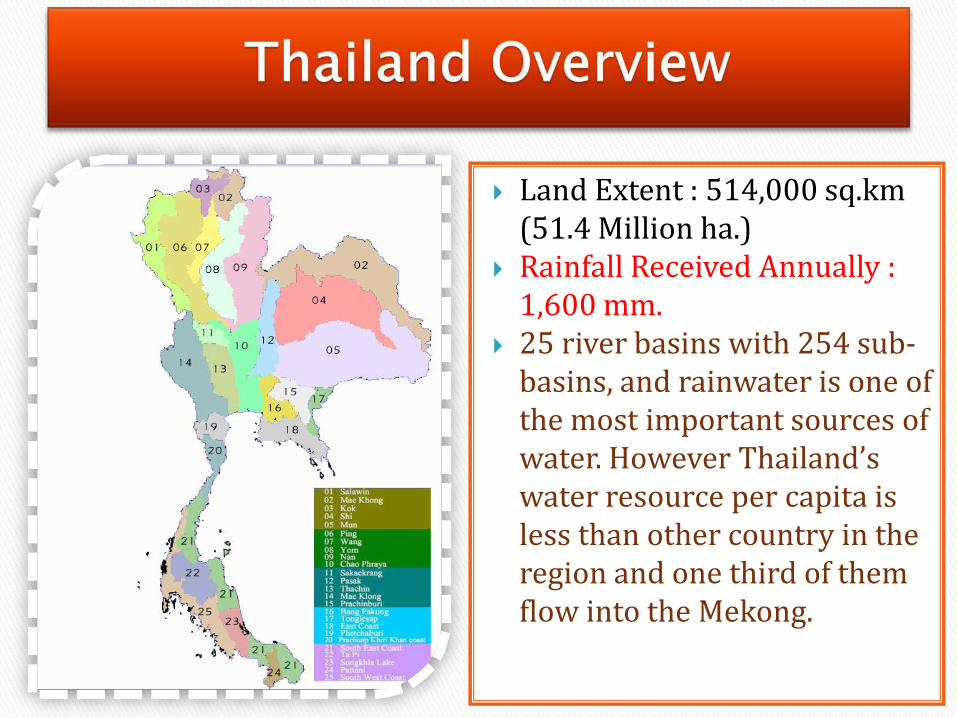
Land Extent : 514,000 sq.km (51.4 Million ha.)
Rainfall Received Annually : 1,600 mm.
25 river basins with 254 sub-basins, and rainwater is one of the most important sources of water. However Thailand’s water resource per capita is less than other country in the region and one third of them flow into the Mekong.

The water resources development with universal and systematic formats was in the reign of King Rama V . His Majesty graciously established the "Canals Department" in 1902, having the responsibility for canals maintenance to prevent the shallowness and canals excavation in the suitable area for transportation and storage for agriculture.
In the reign of King Rama VI, His Majesty graciously gathered the activities of the Canals Department and established Krom Thod Nam or the Barrages Department instead in 1914. At that time, the Barrages Department has begun the development of irrigation works to be in conformity with the technical principle for cultivation purpose and implemented the South Pasak Irrigation Project by constructing a large scale barrage across the Pasak River, the first barrage of Thailand constructed in accordance with modern civil engineering principles and named it Rama VI dam

Pasak River Basin has an area of about 16,300 sq.km. Accounted for 18.3 percent of the country's area.
Pasak River Basin

The shape of the basin narrow elongated along the north - south approximately 45 km. wide and 350 km. long
The average annual water runoff average 2,957 mcm.

1. Upper part of Pasak River 2. Huai Nam Phung 3. Second part of Pasak
River 4. Third part of Pasak River 5. Lam Sonthi 6. Huai Ko Kaeo 7. Lower part of Pasak River 8. Huai Muak Lek
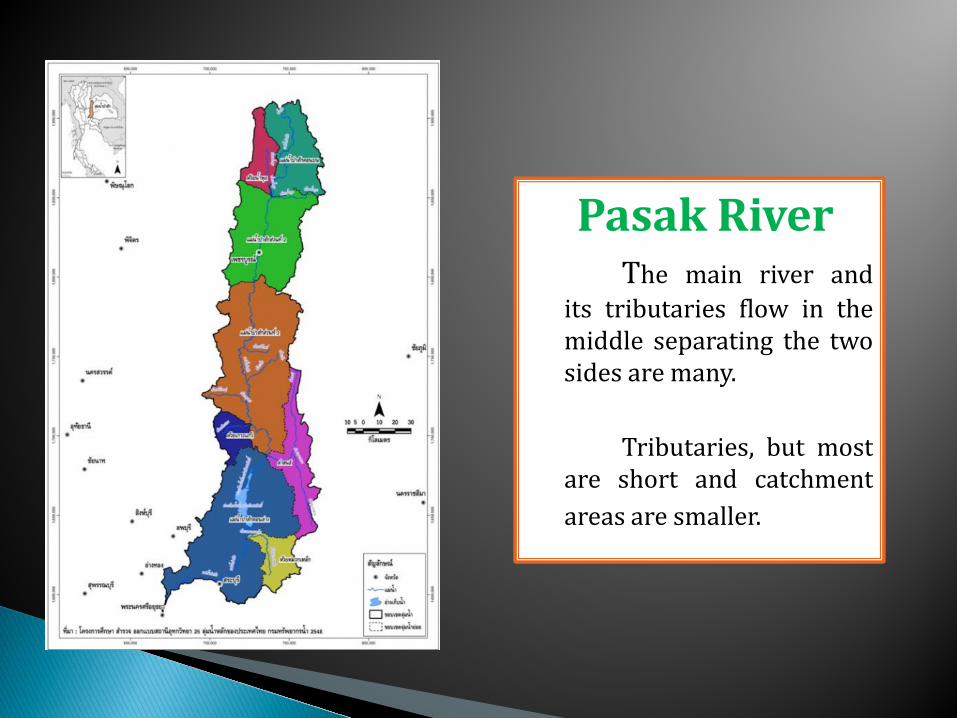
Pasak River The main river and
its tributaries flow in the middle separating the two sides are many.
Tributaries, but most
are short and catchment areas are smaller.
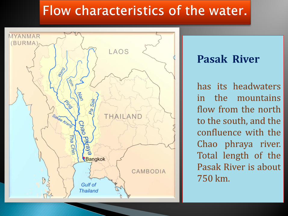
Pasak River has its headwaters
in the mountains flow from the north to the south, and the confluence with the Chao phraya river. Total length of the Pasak River is about 750 km.
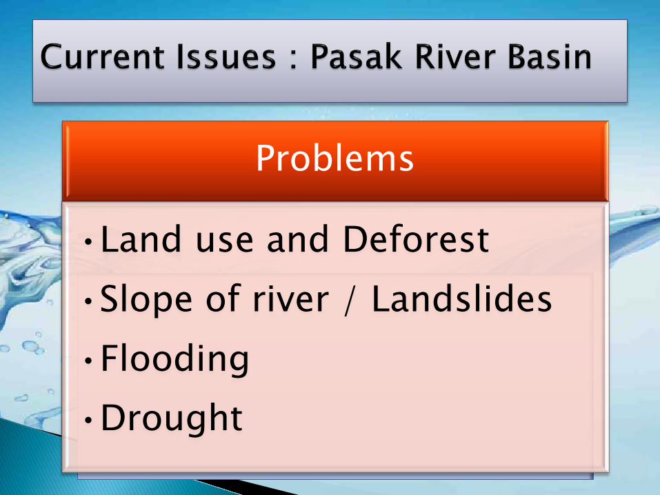
Problems
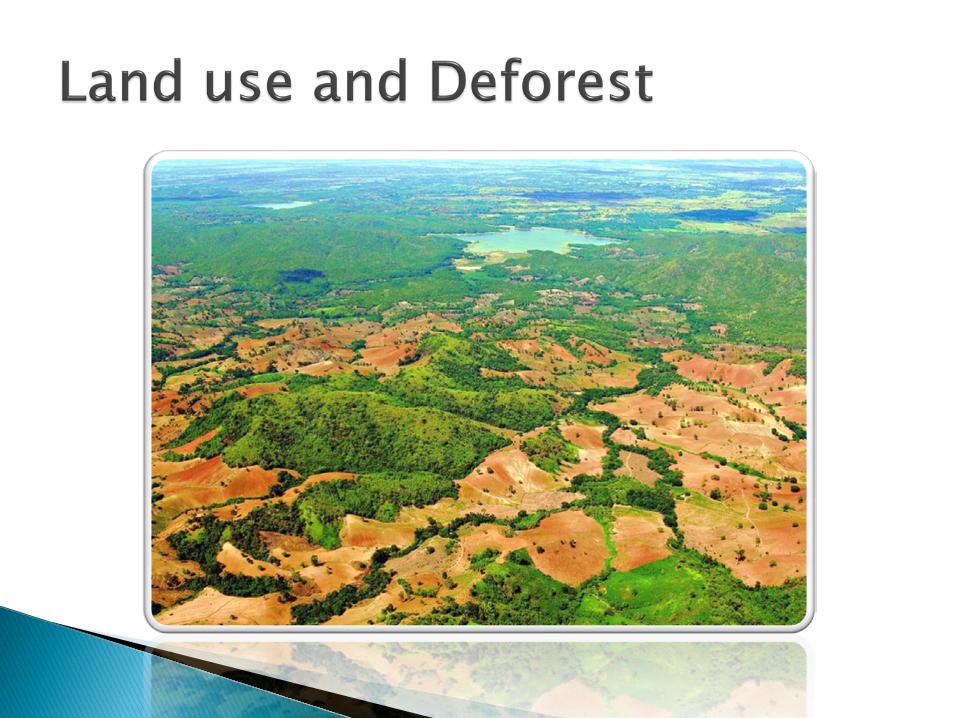
•Land use and Deforest
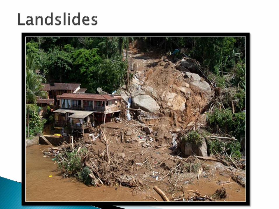
•Slope of river / Landslides
•Flooding
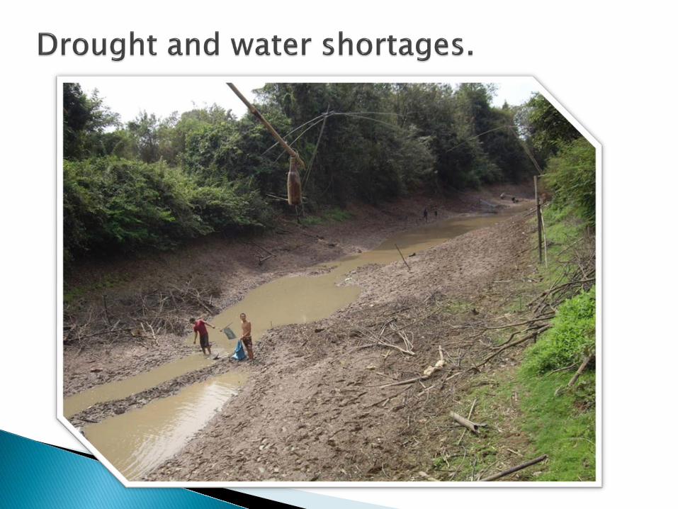
•Drought


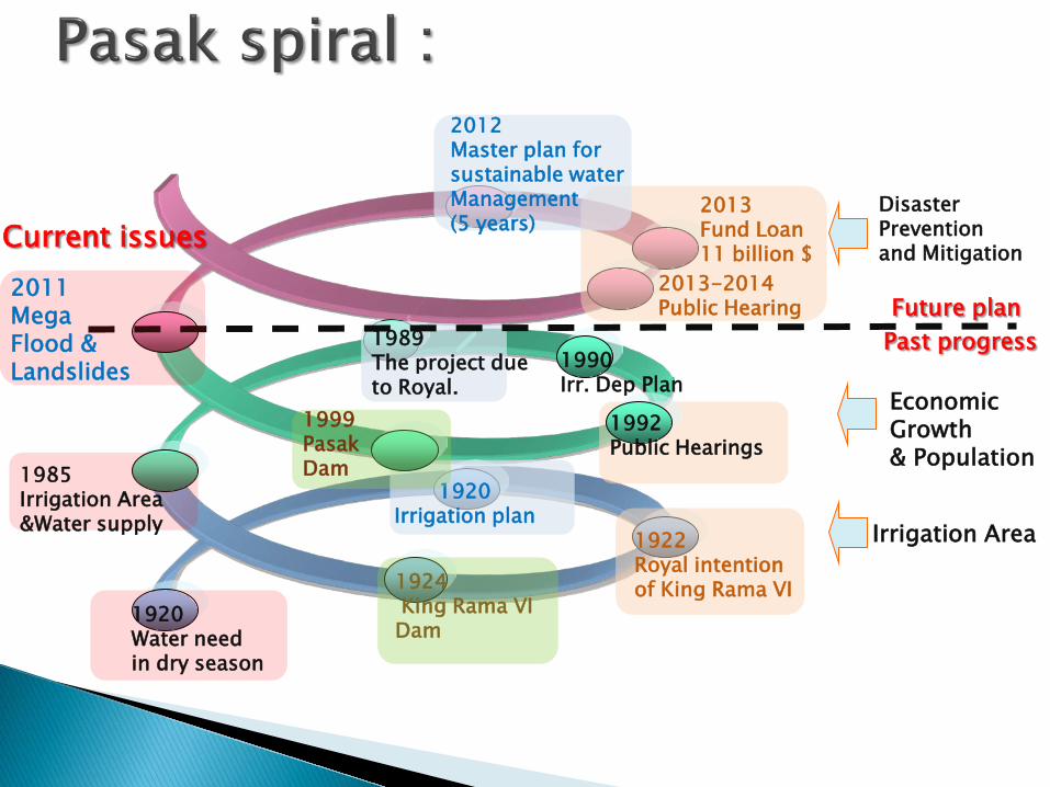
Irrigation Area
1920 Water need in dry season
Economic Growth & Population
1985 Irrigation Area &Water supply
1920 Irrigation plan
1922 Royal intention of King Rama VI 1924
King Rama VI Dam
1989 The project due to Royal.
1990 Irr. Dep Plan
1992 Public Hearings
1999 Pasak Dam
Past progress Future plan
Disaster Prevention and Mitigation
2011 Mega Flood & Landslides
Current issues 2013 Fund Loan 11 billion $
2013-2014 Public Hearing
2012 Master plan for sustainable water Management (5 years)