Embed Size (px)
Citation preview
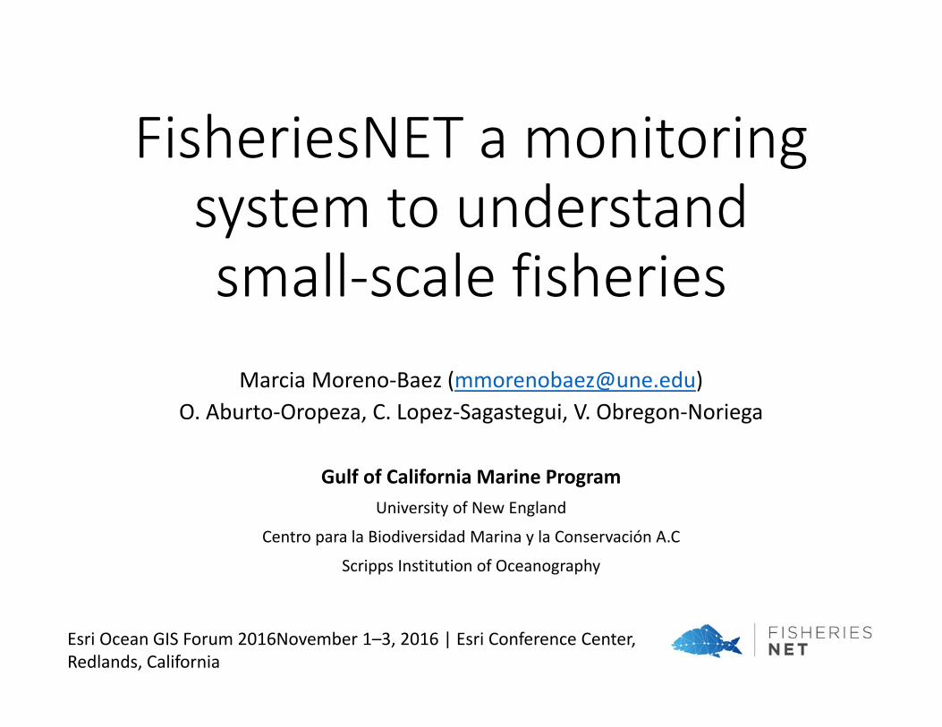
FisheriesNET a monitoring system to understand small-scale fisheries
Marcia Moreno‐Baez ([email protected])O. Aburto‐Oropeza, C. Lopez‐Sagastegui, V. Obregon‐Noriega
Gulf of California Marine ProgramUniversity of New England
Centro para la Biodiversidad Marina y la Conservación A.C
Scripps Institution of Oceanography
Esri Ocean GIS Forum 2016November 1–3, 2016 | Esri Conference Center, Redlands, California
Marcia Moreno‐Baez
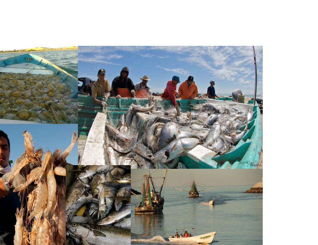
of Small‐scale Fisheries in the Northern Gulf of California, Mexico.
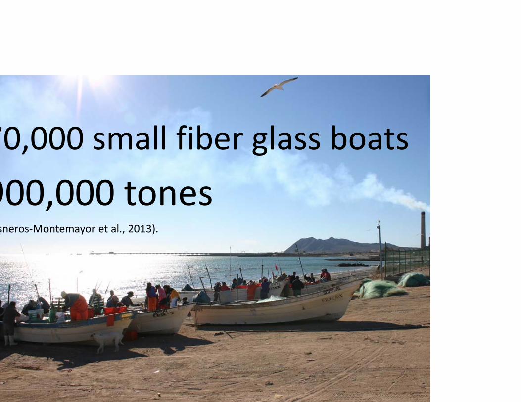
70,000 small fiber glass boats
900,000 tonessneros‐Montemayor et al., 2013).
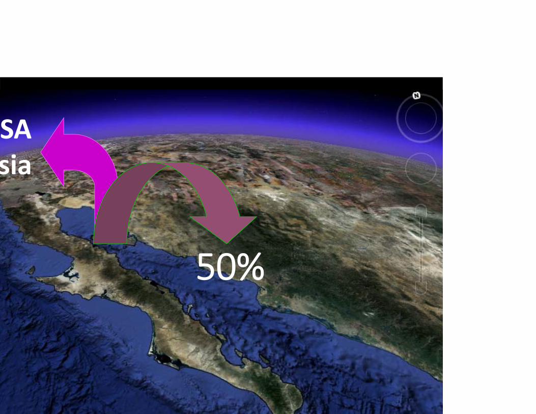
50%
SAsia
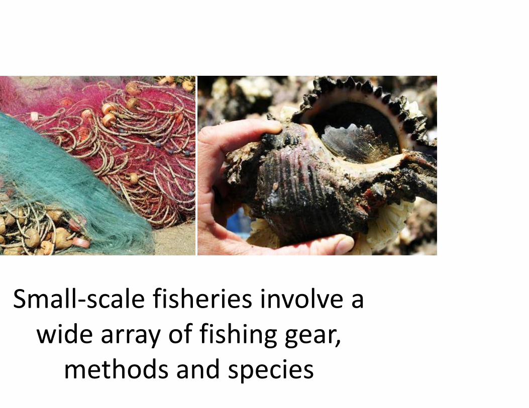
Small‐scale fisheries involve a wide array of fishing gear, methods and species
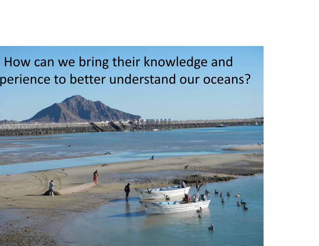
How can we bring their knowledge and perience to better understand our oceans?
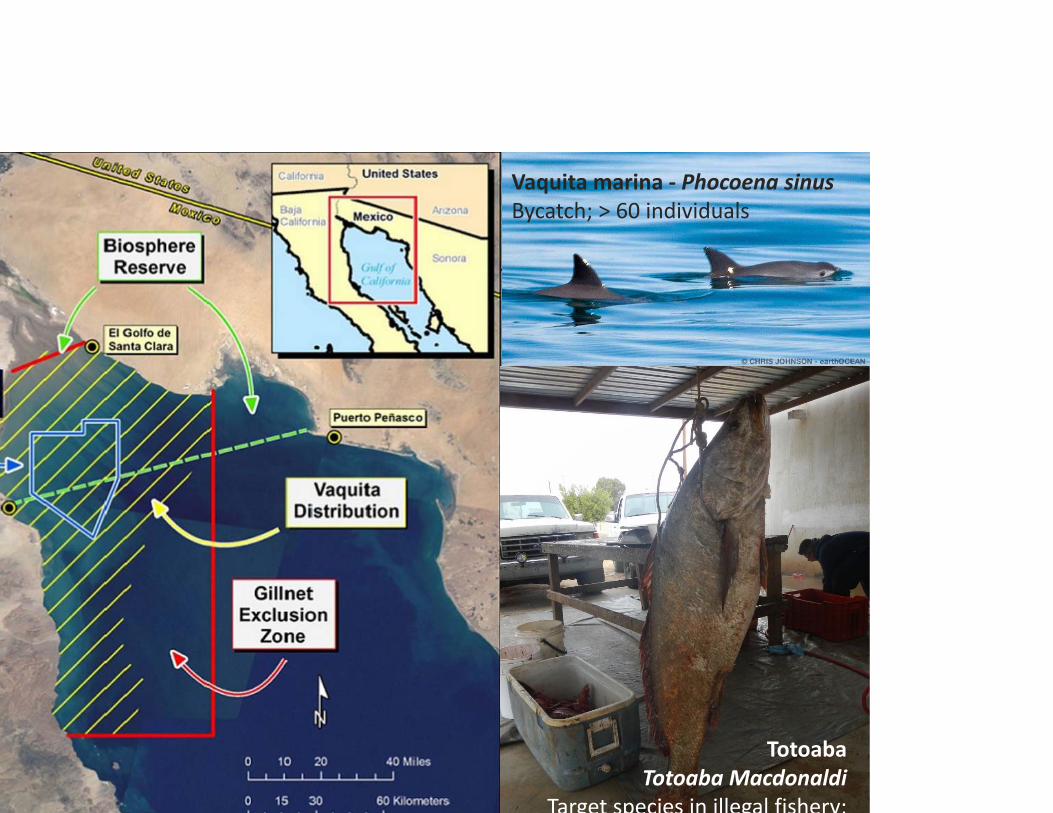
Vaquita marina ‐ Phocoena sinusBycatch; > 60 individuals
TotoabaTotoaba Macdonaldi
Target species in illegal fishery;
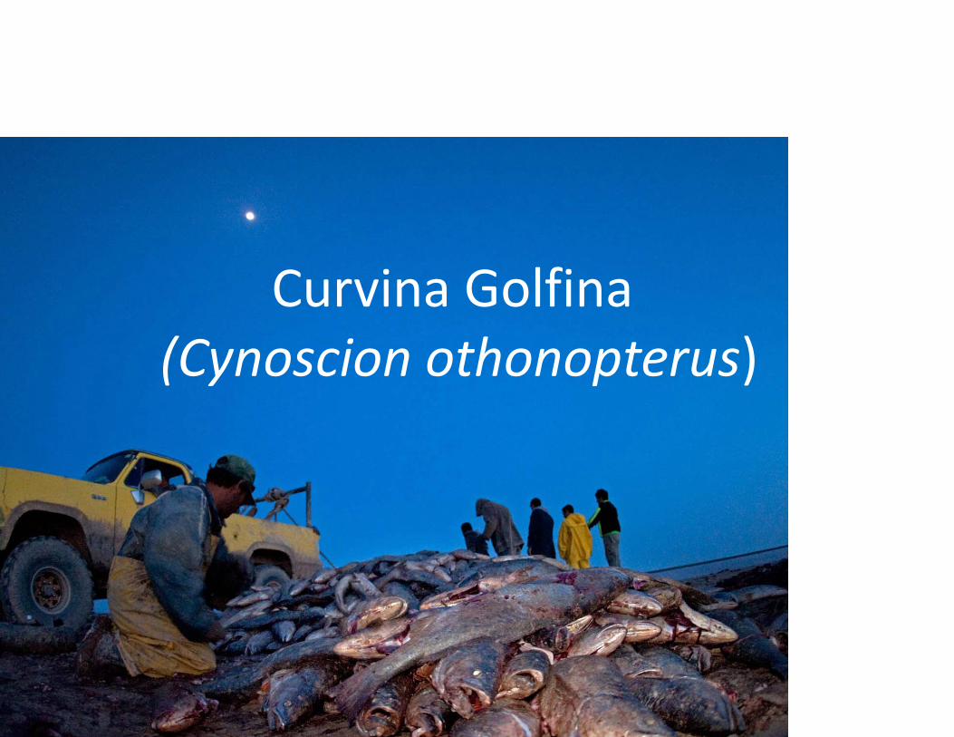
Curvina Golfina (Cynoscion othonopterus)
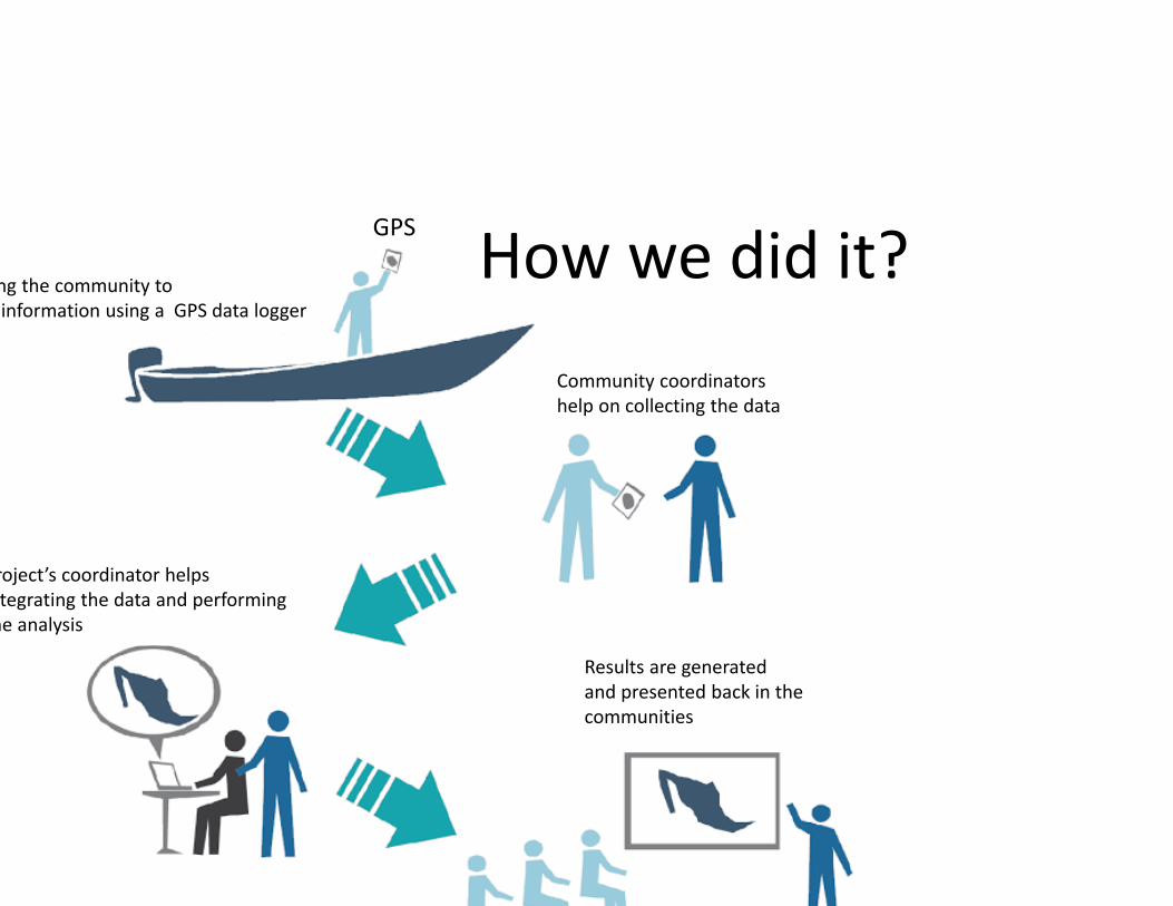
How we did it?ng the community to information using a GPS data logger
Community coordinatorshelp on collecting the data
roject’s coordinator helpstegrating the data and performinghe analysis
Results are generatedand presented back in the communities
GPS

Spatial data and analysis

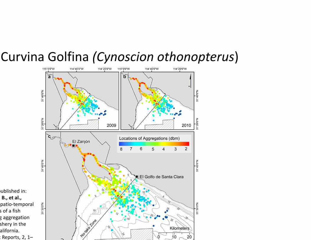
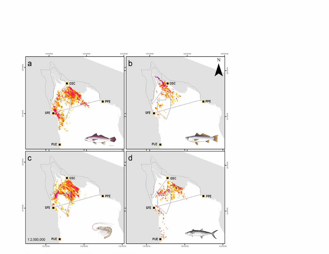
Curvina Golfina (Cynoscion othonopterus)
published in: , B., et al., Spatio‐temporal s of a fish g aggregation shery in the alifornia. c Reports, 2, 1–

Curvina Golfina (Cynoscion othonopterus)
published in: , B., et al., Spatio‐temporal s of a fish g aggregation shery in the alifornia. c Reports, 2, 1–
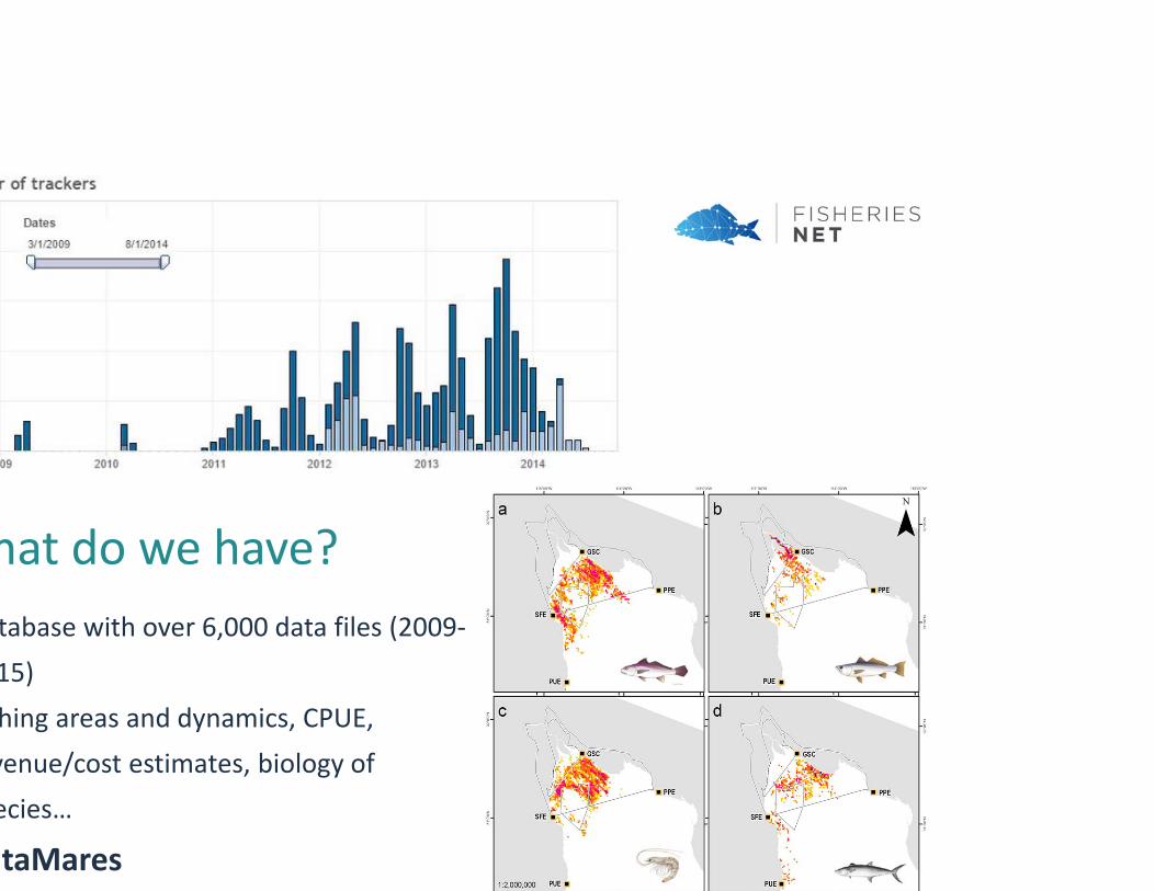
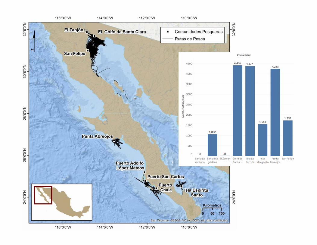
tabase with over 6,000 data files (2009‐15)hing areas and dynamics, CPUE, venue/cost estimates, biology of ecies…
taMares
hat do we have?
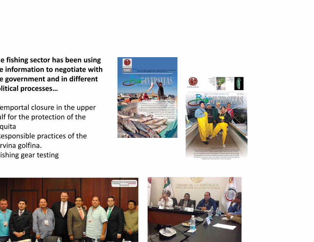
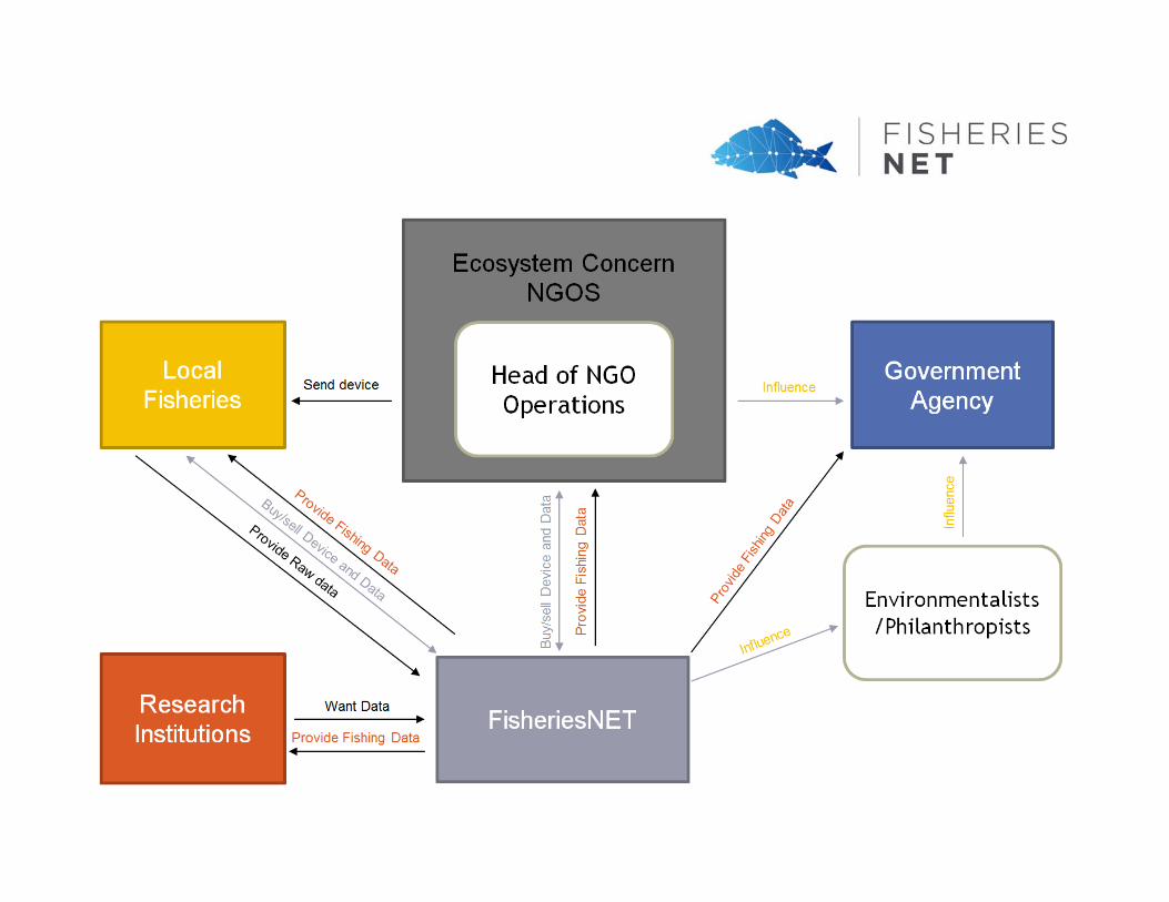
he fishing sector has been using e information to negotiate with e government and in different olitical processes…
Temportal closure in the upper ulf for the protection of the quitaResponsible practices of the rvina golfina.ishing gear testing

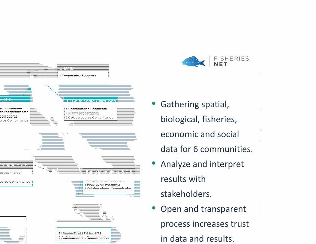
• Gathering spatial, biological, fisheries, economic and social data for 6 communities.
• Analyze and interpret results with stakeholders.
• Open and transparentprocess increases trust in data and results.

Where we are now in terms of data…

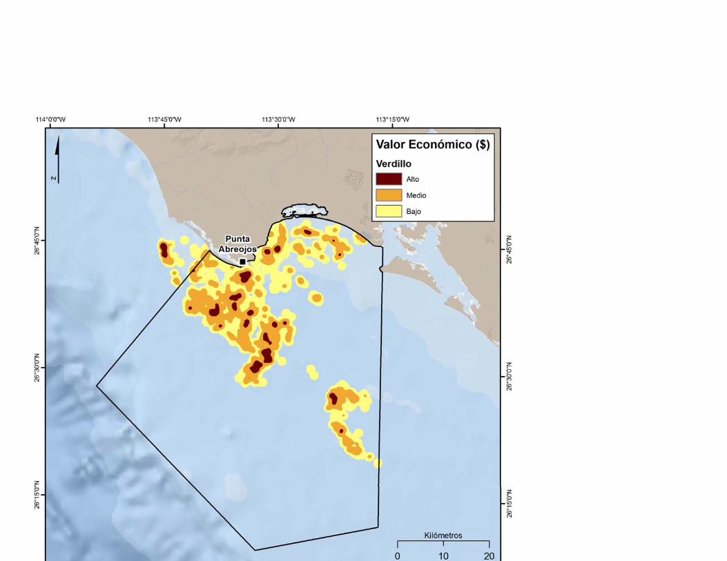
Distribution and economic value of
fisheries for different communities
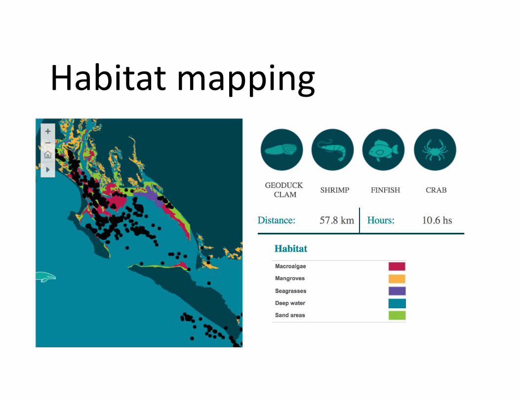
Habitat mapping
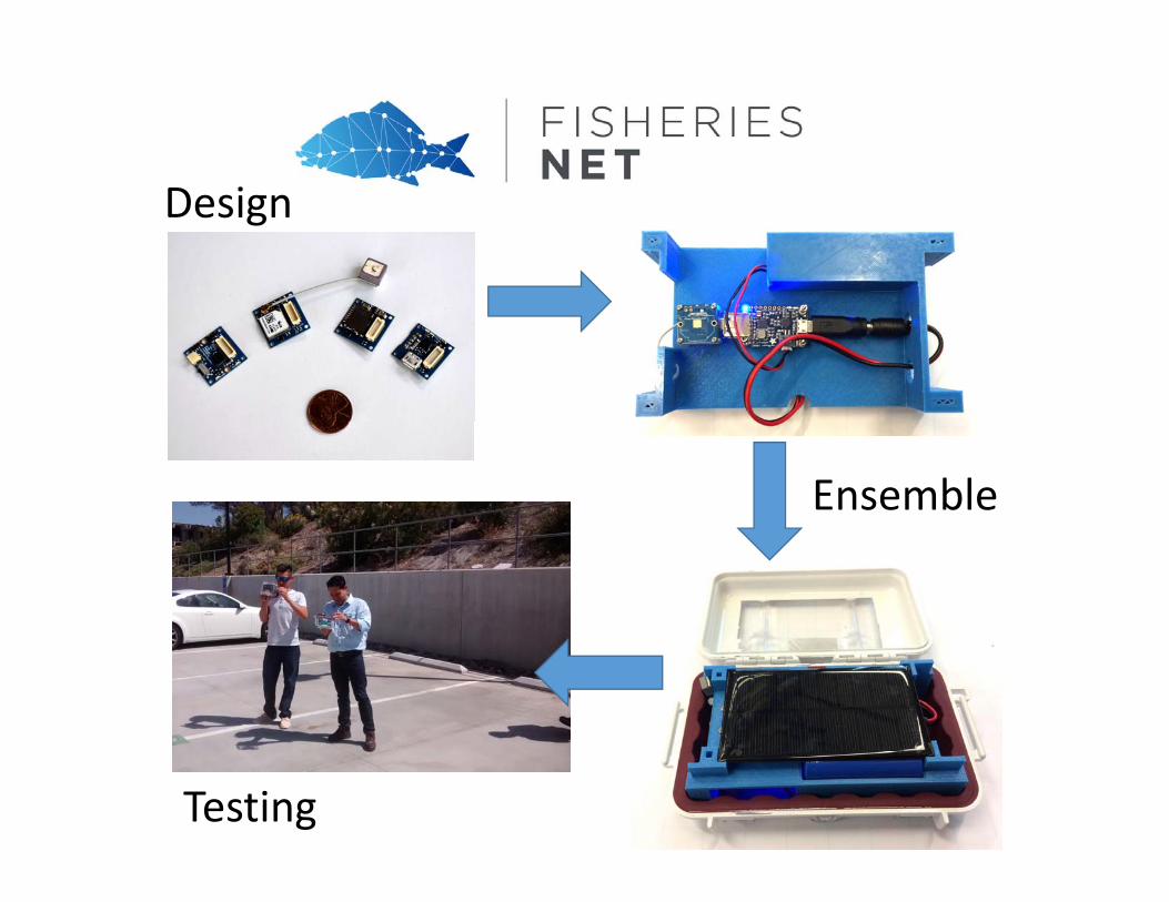
Design
Ensemble
Testing
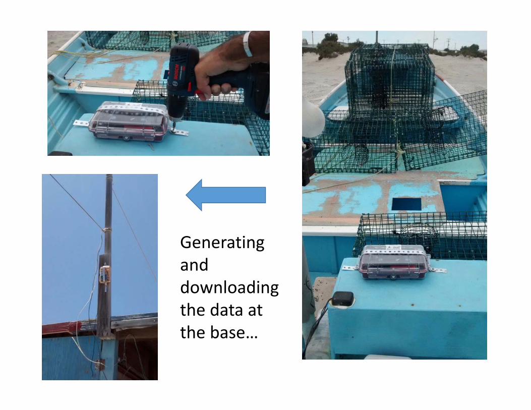
Generating and downloading the data at the base…
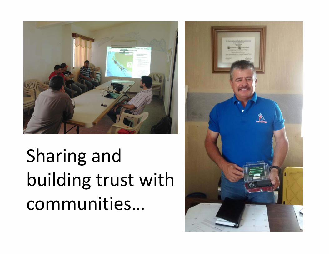
Sharing and building trust with communities…

• These data can be used to promote policy, management, and sustained support decision‐making processes of Small Scale Fisheries.
• Integrate a strong big‐data / online spatial system for the program and communities!
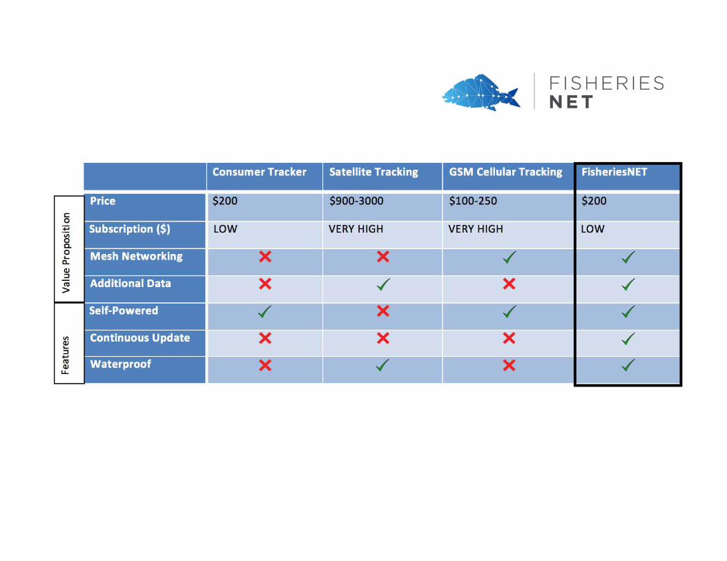
• FisheriesNET offers an opportunity to effectively and efficiently collect fishing data through affordable Solar Powered GPS tracking devices.
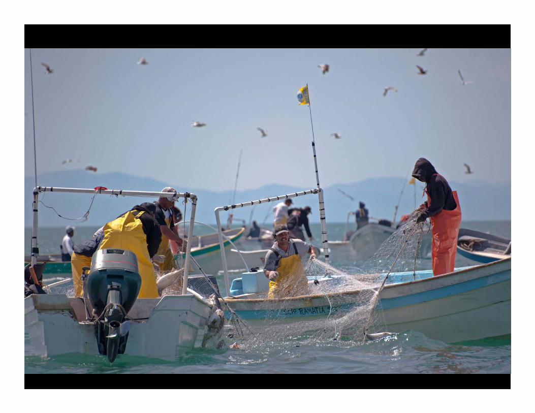
Photo Credit:
Acknowledgements:
Fishing communities of San Felipe and Golfo de Santa ClaraGCMP members Josué Montañez and Anabel Espinoza
Thanks to Walton Family Foundation, David and Lucile Packard Foundation, World Wildlife Fund‐Gulf of California, EDF‐Mexico for their continuous support.
http://gocmarineprogram.org/@GCMarineProgram
http://datamares.org@dataMares