Embed Size (px)
Citation preview
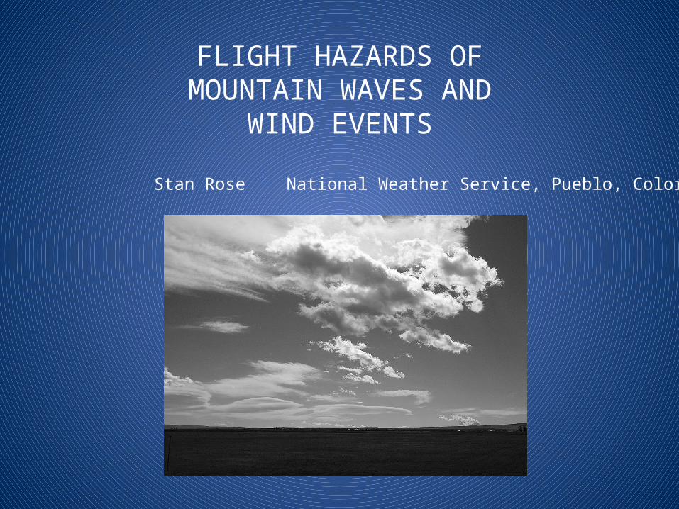
FLIGHT HAZARDS OFMOUNTAIN WAVES AND
WIND EVENTS
Stan Rose National Weather Service, Pueblo, Colorado
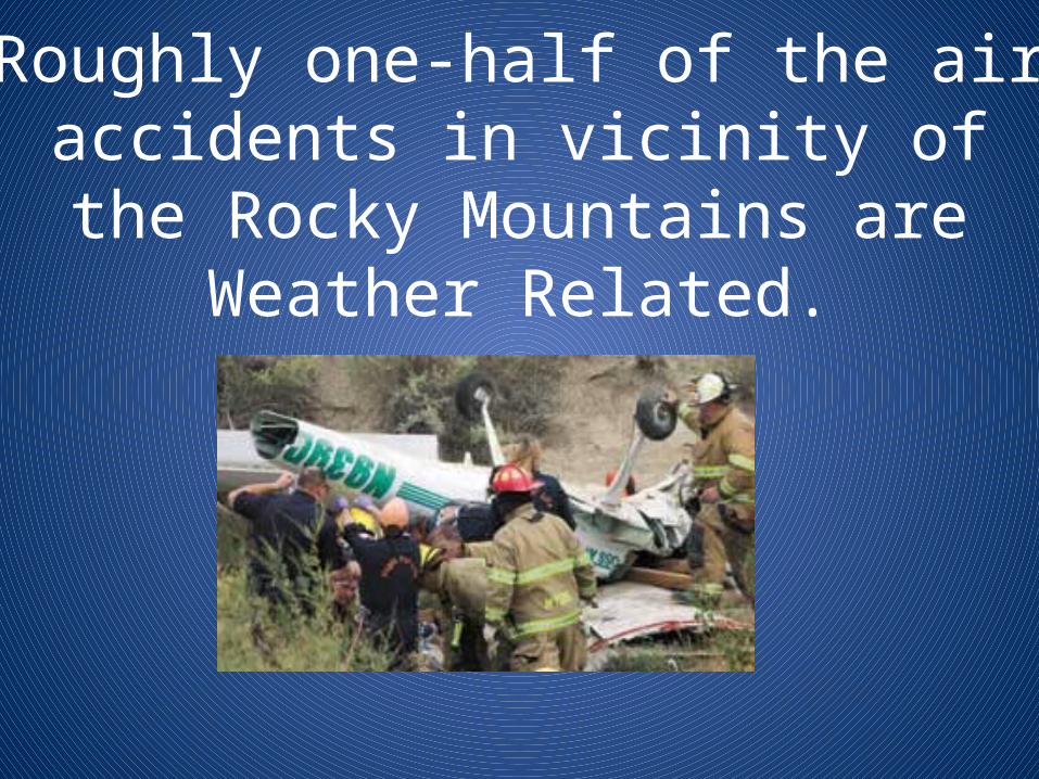
Roughly one-half of the airaccidents in vicinity of the Rocky Mountains are Weather Related.
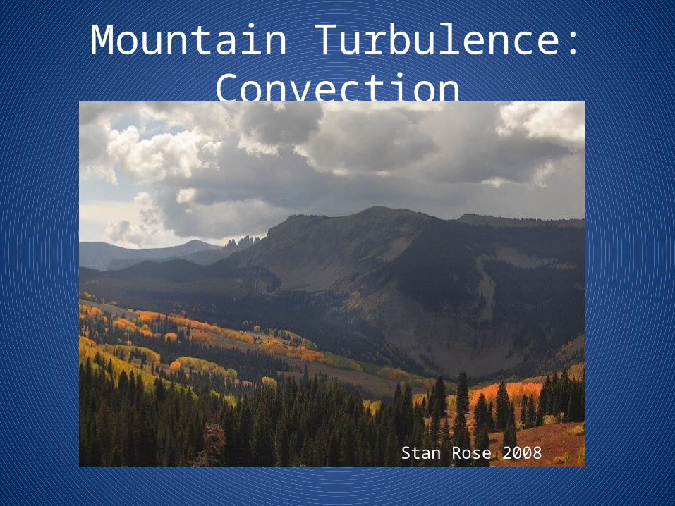
Mountain Turbulence: Convection
Stan Rose 2008
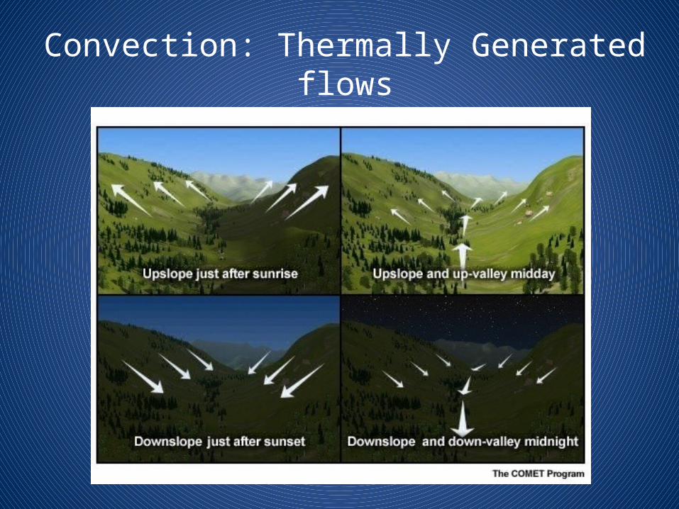
Convection: Thermally Generated flows
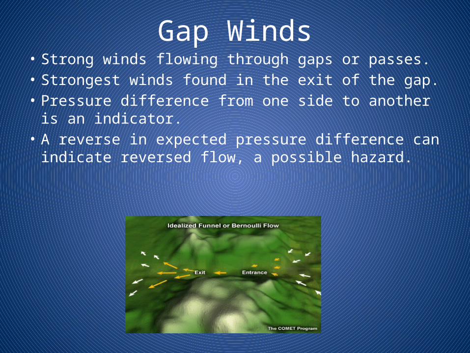
Gap Winds• Strong winds flowing through gaps or passes.• Strongest winds found in the exit of the gap.• Pressure difference from one side to another is
an indicator.• A reverse in expected pressure difference can
indicate reversed flow, a possible hazard.
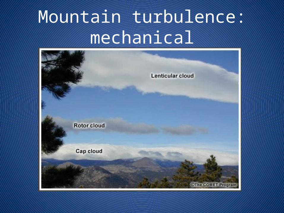
Mountain turbulence: mechanical
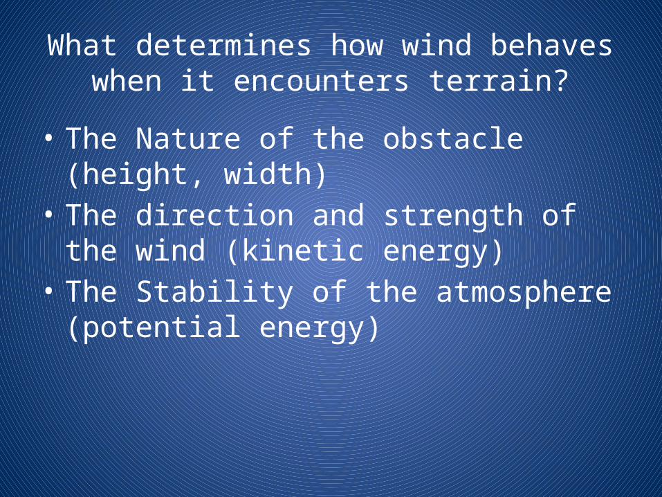
What determines how wind behaves when it encounters terrain?
• The Nature of the obstacle (height, width)• The direction and strength of the wind (kinetic
energy)• The Stability of the atmosphere (potential
energy)
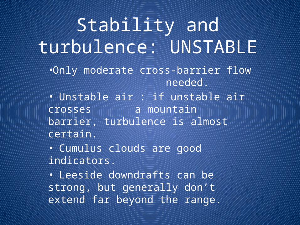
Stability and turbulence: UNSTABLE
•Only moderate cross-barrier flow needed.• Unstable air : if unstable air crosses a mountain barrier, turbulence is almost certain.• Cumulus clouds are good indicators.• Leeside downdrafts can be strong, but generally don’t extend far beyond the range.
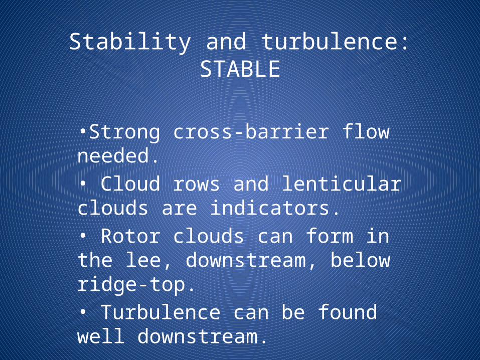
Stability and turbulence: STABLE
•Strong cross-barrier flow needed.• Cloud rows and lenticular clouds are indicators.• Rotor clouds can form in the lee, downstream, below ridge-top.• Turbulence can be found well downstream.
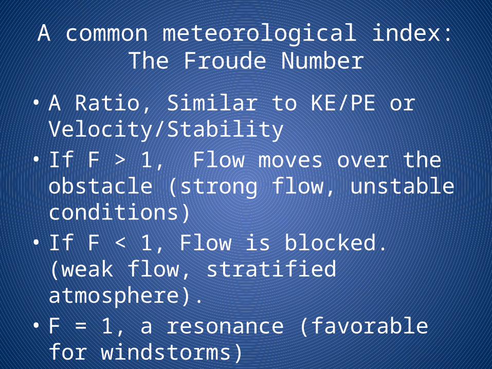
A common meteorological index:The Froude Number
• A Ratio, Similar to KE/PE or Velocity/Stability• If F > 1, Flow moves over the obstacle (strong
flow, unstable conditions)• If F < 1, Flow is blocked. (weak flow, stratified
atmosphere).• F = 1, a resonance (favorable for windstorms)
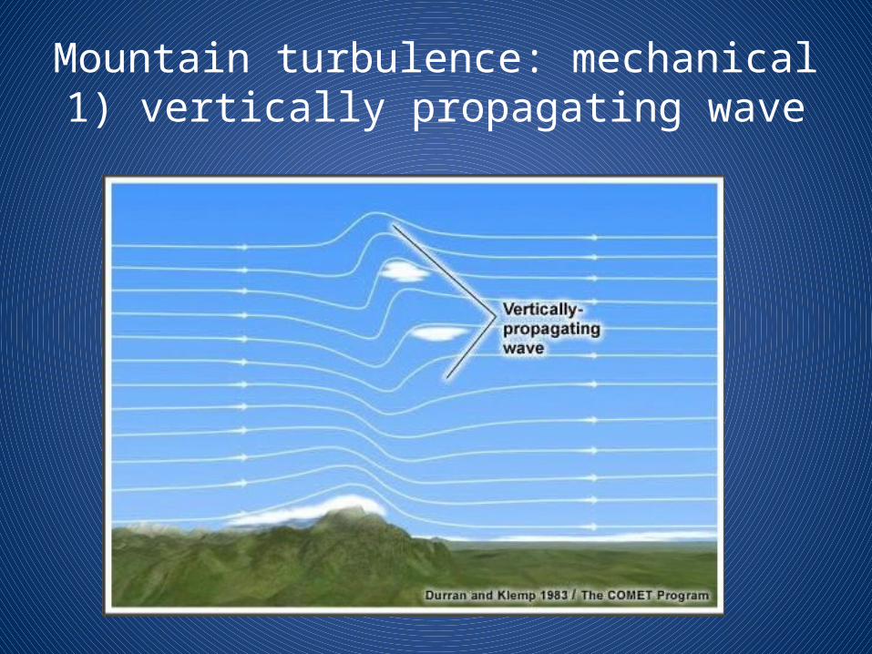
Mountain turbulence: mechanical1) vertically propagating wave
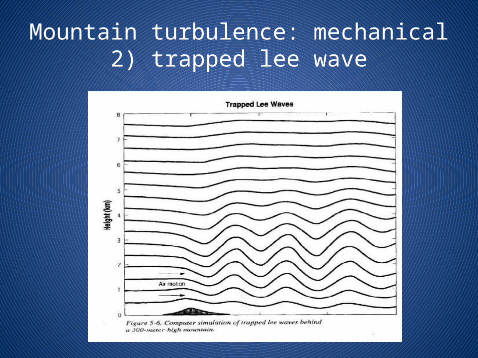
Mountain turbulence: mechanical2) trapped lee wave
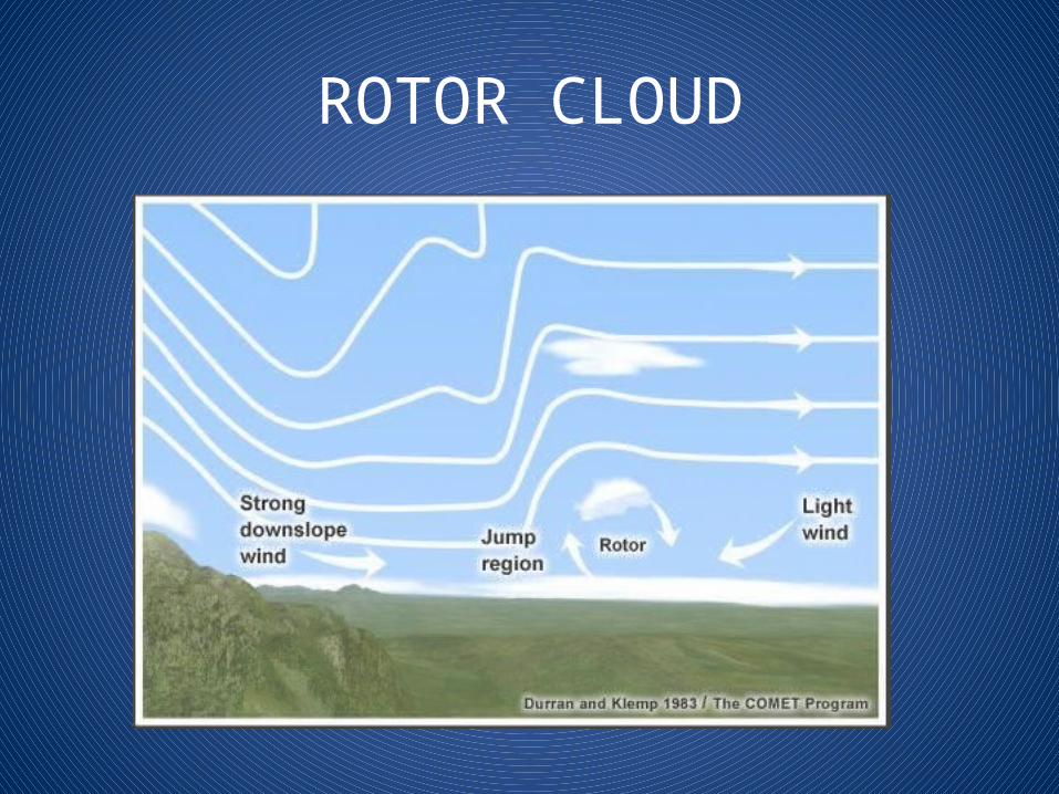
ROTOR CLOUD
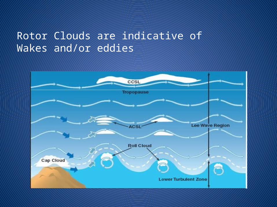
Rotor Clouds are indicative of Wakes and/or eddies
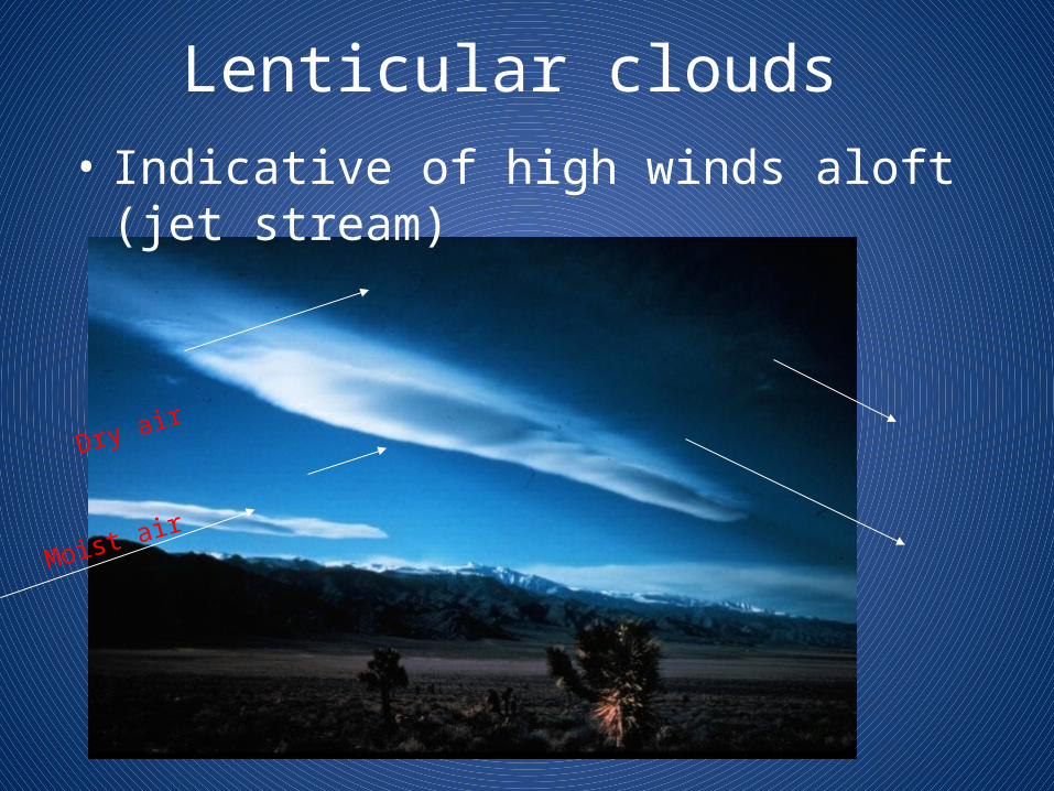
Lenticular clouds• Indicative of high winds aloft (jet stream)
Moist air
Dry air
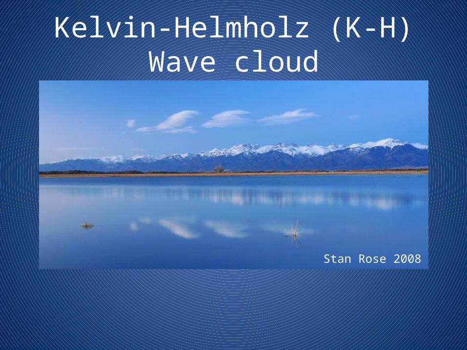
Kelvin-Helmholz (K-H) Wave cloud
Stan Rose 2008
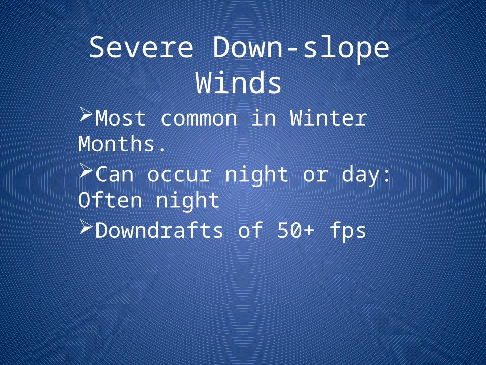
Severe Down-slope Winds
Most common in Winter Months.Can occur night or day: Often nightDowndrafts of 50+ fps
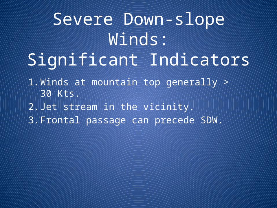
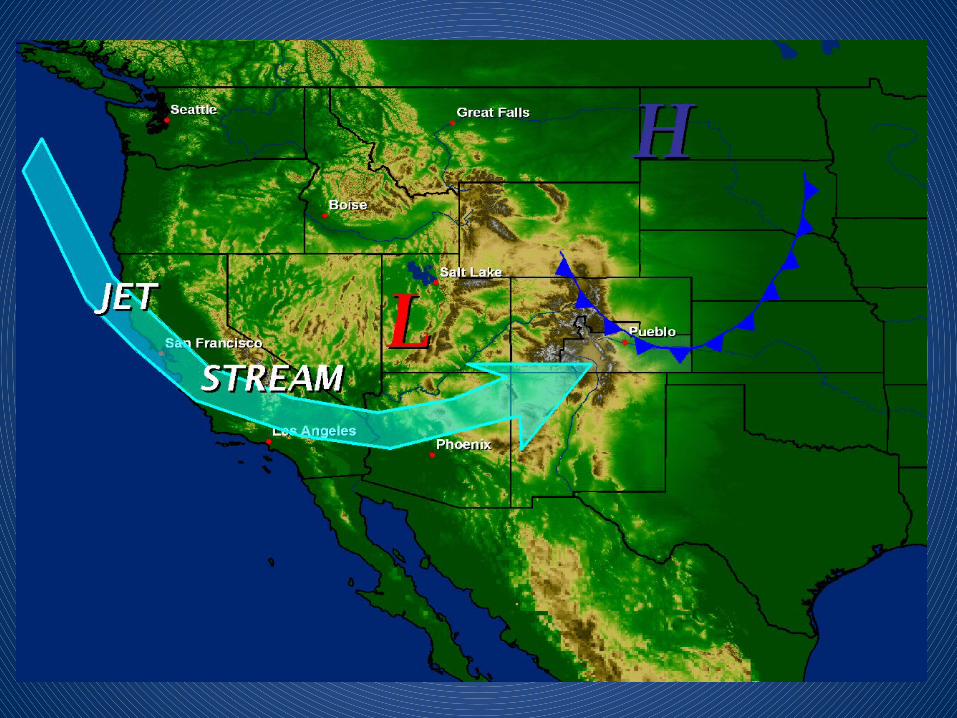
Severe Down-slope Winds:Significant Indicators
1. Winds at mountain top generally > 30 Kts.2. Jet stream in the vicinity.3. Frontal passage can precede SDW.
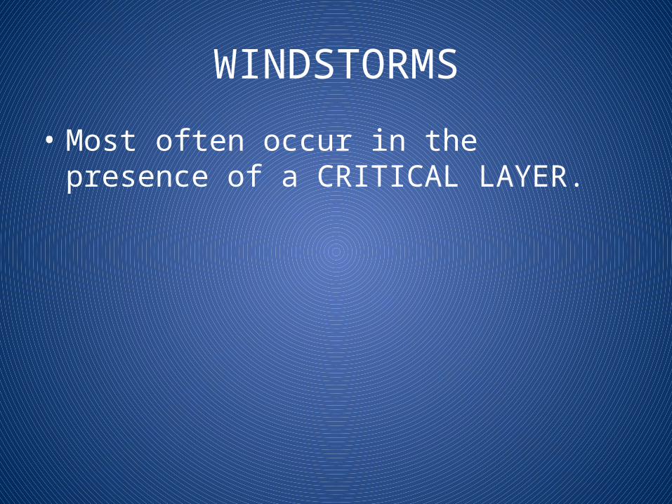
WINDSTORMS
• Most often occur in the presence of a CRITICAL LAYER.
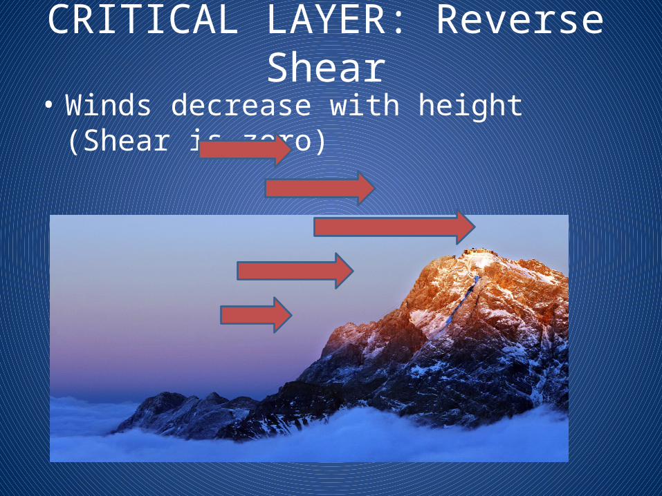
CRITICAL LAYER: Reverse Shear• Winds decrease with height (Shear is zero)

CRITICAL LAYER: Change in Stability
• A Mountain top Stable Layer.• Decreasing stability with height.
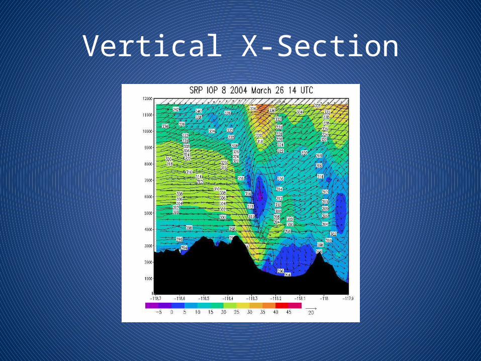
Vertical X-Section
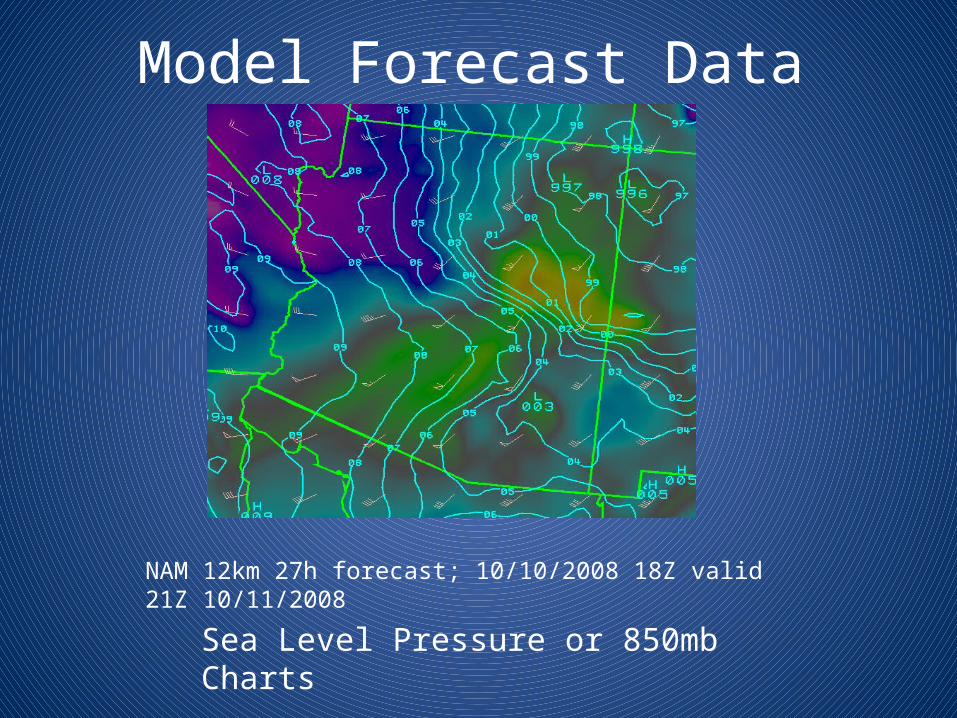
Model Forecast Data
Sea Level Pressure or 850mb Charts
NAM 12km 27h forecast; 10/10/2008 18Z valid 21Z 10/11/2008
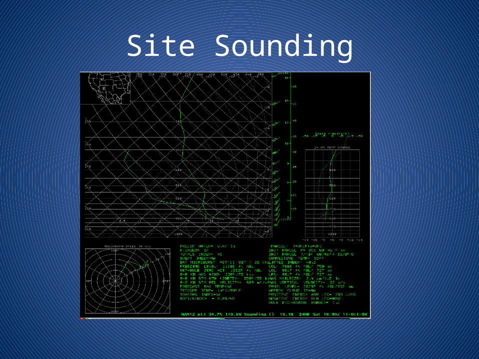
Site Sounding
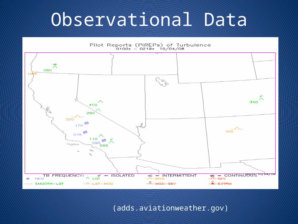
Observational Data
(adds.aviationweather.gov)
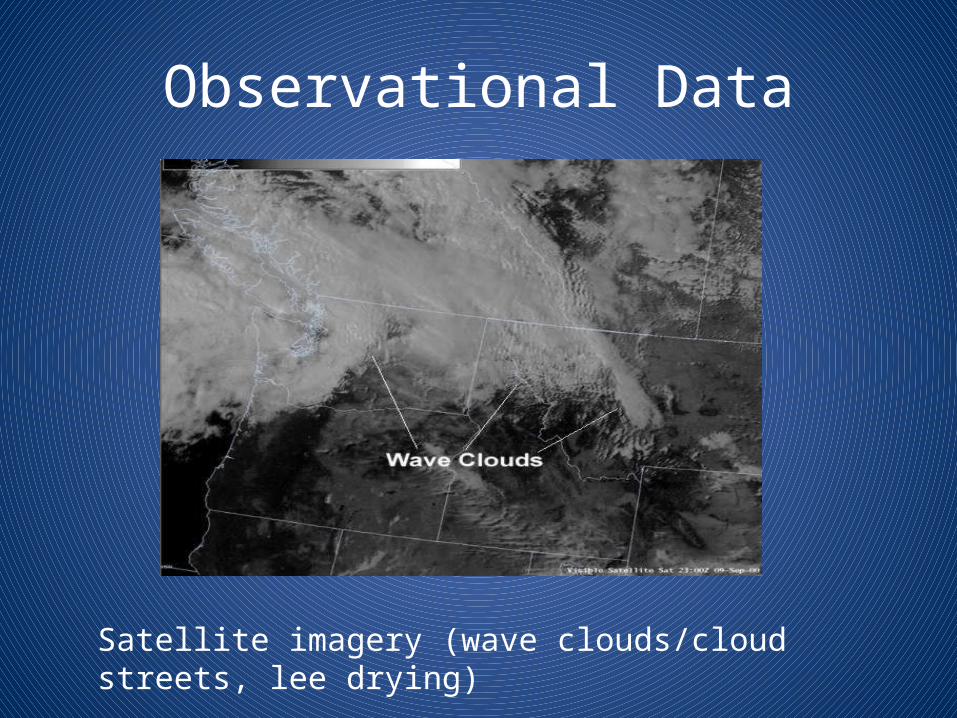
Observational Data
Satellite imagery (wave clouds/cloud streets, lee drying)
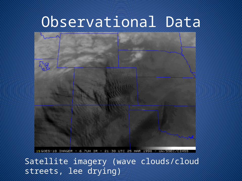
Observational Data
Satellite imagery (wave clouds/cloud streets, lee drying)
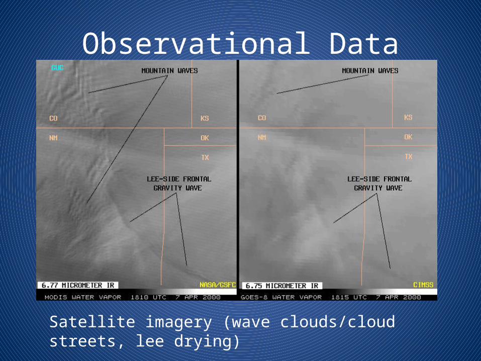
Observational Data
Satellite imagery (wave clouds/cloud streets, lee drying)
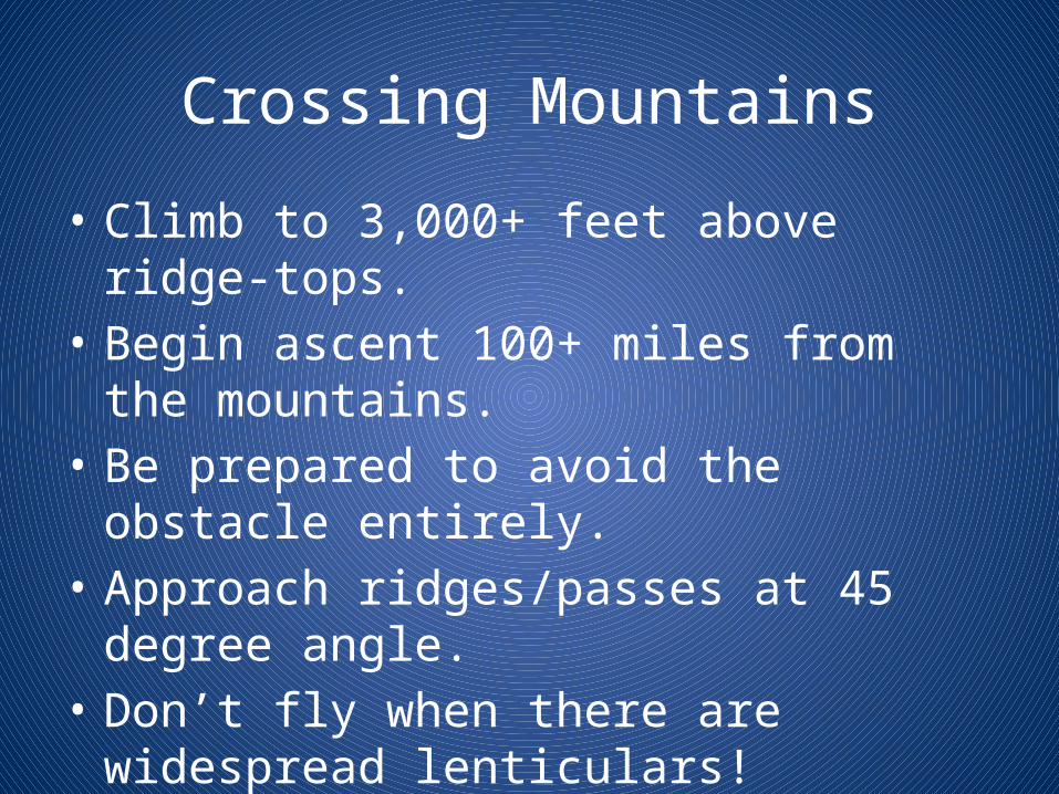
Crossing Mountains
• Climb to 3,000+ feet above ridge-tops.• Begin ascent 100+ miles from the mountains.• Be prepared to avoid the obstacle entirely.• Approach ridges/passes at 45 degree angle.• Don’t fly when there are widespread
lenticulars!

THE END