Embed Size (px)
Citation preview
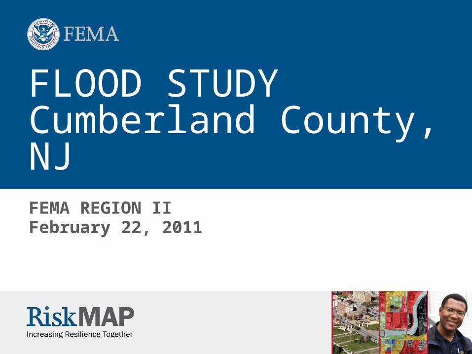
FLOOD STUDYCumberland County, NJFEMA REGION IIFebruary 22, 2011
2
Agenda
Introductions and Roll Call
Objectives
Risk Mapping, Assessment, and Planning (Risk MAP) Program Overview
Current status of Cumberland County flood study
Milestones
Questions
3
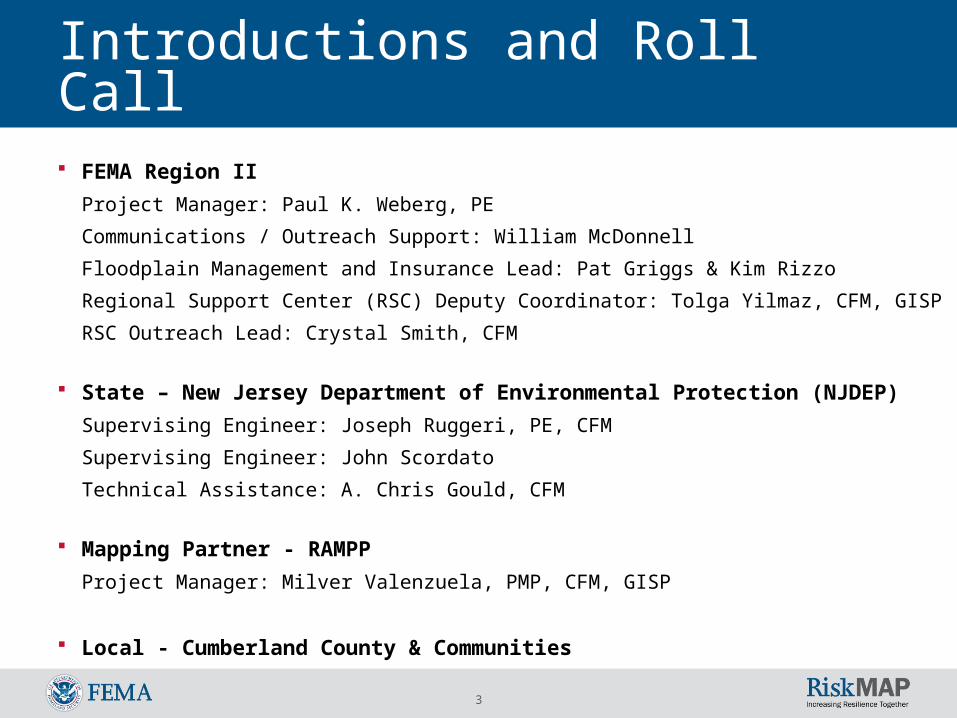
Introductions and Roll Call FEMA Region II
Project Manager: Paul K. Weberg, PE
Communications / Outreach Support: William McDonnell
Floodplain Management and Insurance Lead: Pat Griggs & Kim Rizzo
Regional Support Center (RSC) Deputy Coordinator: Tolga Yilmaz, CFM, GISP
RSC Outreach Lead: Crystal Smith, CFM
State – New Jersey Department of Environmental Protection (NJDEP)
Supervising Engineer: Joseph Ruggeri, PE, CFM
Supervising Engineer: John Scordato
Technical Assistance: A. Chris Gould, CFM
Mapping Partner - RAMPP
Project Manager: Milver Valenzuela, PMP, CFM, GISP
Local - Cumberland County & Communities
4
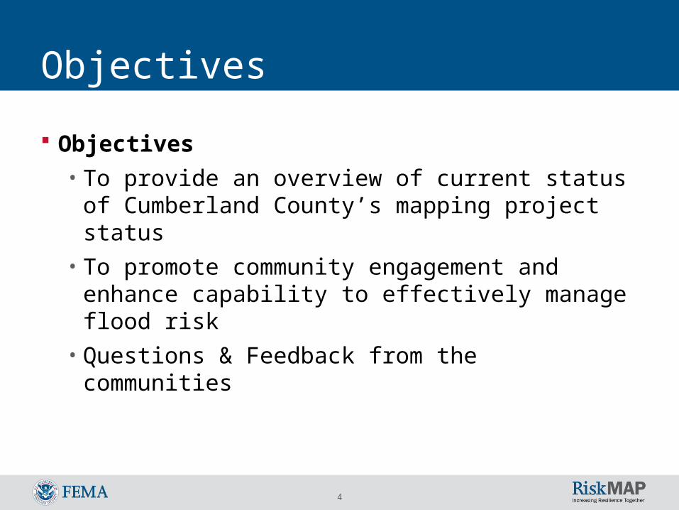
Objectives
Objectives
• To provide an overview of current status of Cumberland County’s mapping project status
• To promote community engagement and enhance capability to effectively manage flood risk
• Questions & Feedback from the communities
5
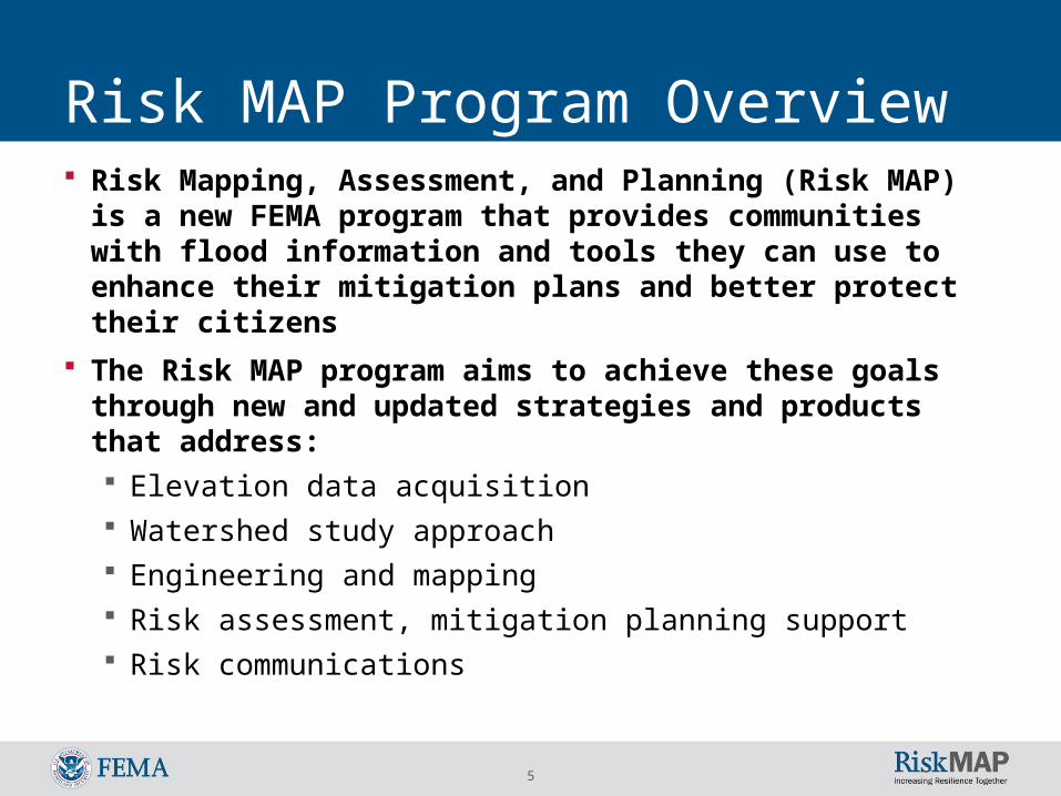
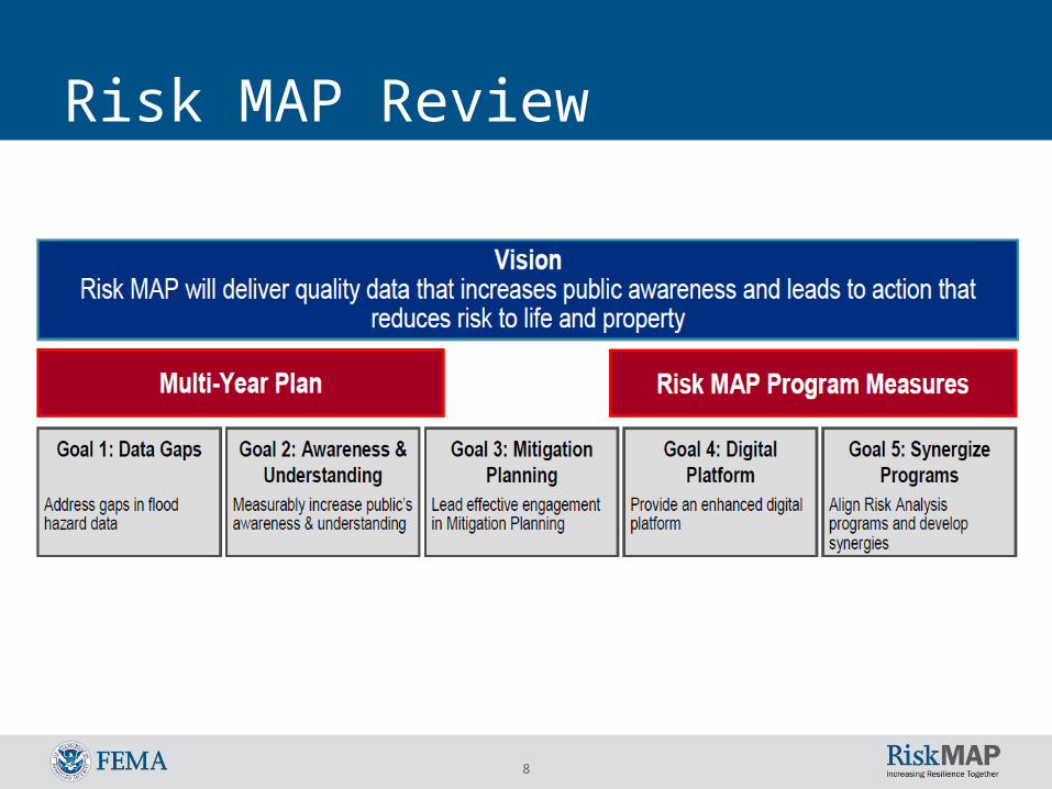
Risk MAP Program Overview Risk Mapping, Assessment, and Planning (Risk MAP) is a new
FEMA program that provides communities with flood information and tools they can use to enhance their mitigation plans and better protect their citizens
The Risk MAP program aims to achieve these goals through new and updated strategies and products that address: Elevation data acquisition Watershed study approach Engineering and mapping Risk assessment, mitigation planning support Risk communications

6
Risk MAP
7
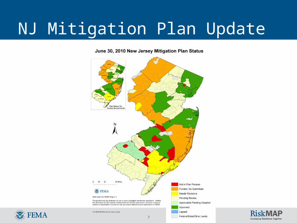
NJ Mitigation Plan Update
8
Risk MAP Review
9
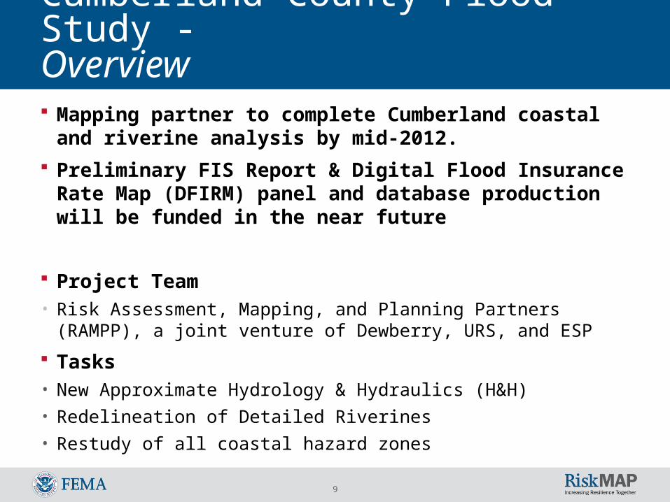
Mapping partner to complete Cumberland coastal and riverine analysis by mid-2012.
Preliminary FIS Report & Digital Flood Insurance Rate Map (DFIRM) panel and database production will be funded in the near future
Project Team• Risk Assessment, Mapping, and Planning Partners (RAMPP), a joint
venture of Dewberry, URS, and ESP
Tasks• New Approximate Hydrology & Hydraulics (H&H)
• Redelineation of Detailed Riverines
• Restudy of all coastal hazard zones
Cumberland County Flood Study -Overview
10
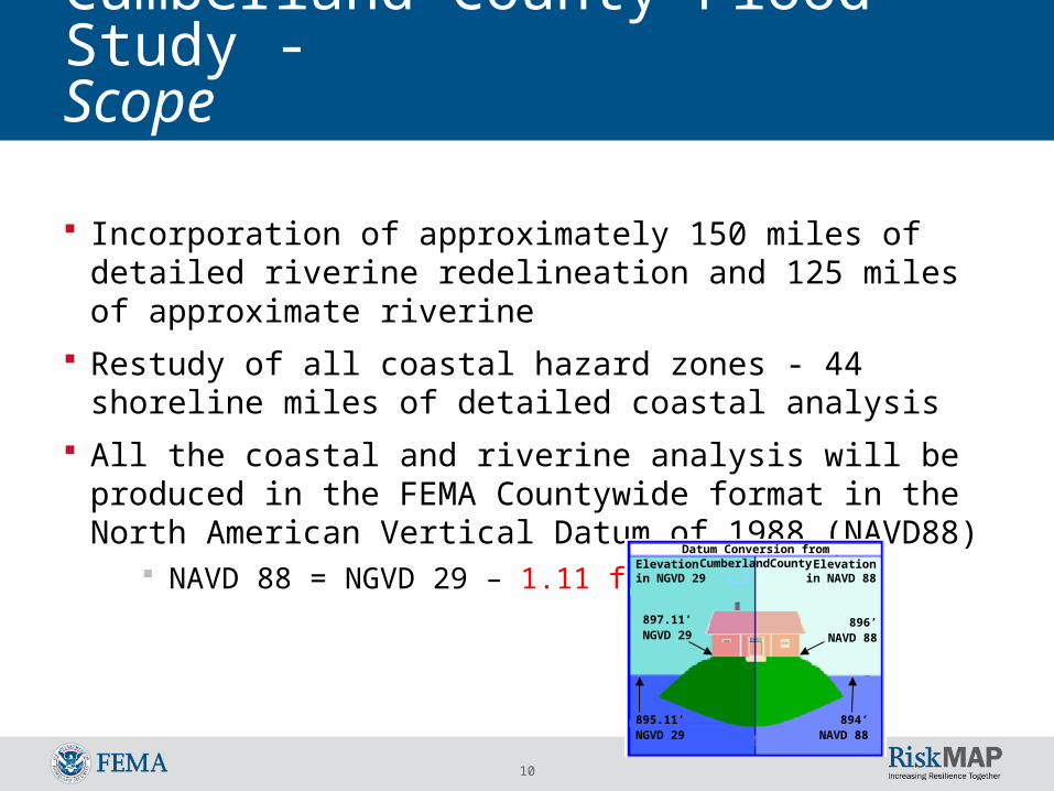
Cumberland County Flood Study - Scope
Incorporation of approximately 150 miles of detailed riverine redelineation and 125 miles of approximate riverine
Restudy of all coastal hazard zones - 44 shoreline miles of detailed coastal analysis
All the coastal and riverine analysis will be produced in the FEMA Countywide format in the North American Vertical Datum of 1988 (NAVD88)
NAVD 88 = NGVD 29 – 1.11 feet
894’NAVD 88
895.11’NGVD 29
Elevation in NGVD 29
Elevation in NAVD 88
896’NAVD 88
897.11’NGVD 29
Datum Conversion from CumberlandCounty
11
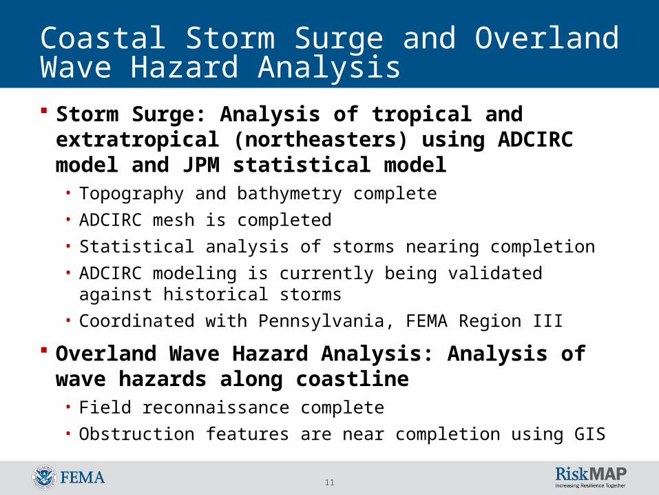
Coastal Storm Surge and Overland Wave Hazard Analysis Storm Surge: Analysis of tropical and extratropical
(northeasters) using ADCIRC model and JPM statistical model• Topography and bathymetry complete
• ADCIRC mesh is completed
• Statistical analysis of storms nearing completion
• ADCIRC modeling is currently being validated against historical storms
• Coordinated with Pennsylvania, FEMA Region III
Overland Wave Hazard Analysis: Analysis of wave hazards along coastline• Field reconnaissance complete
• Obstruction features are near completion using GIS
12
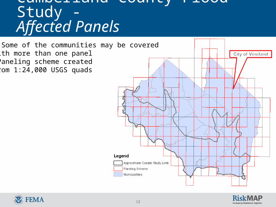
Cumberland County Flood Study - Affected Panels
• Some of the communities may be covered with more than one panel•Paneling scheme createdfrom 1:24,000 USGS quads
13
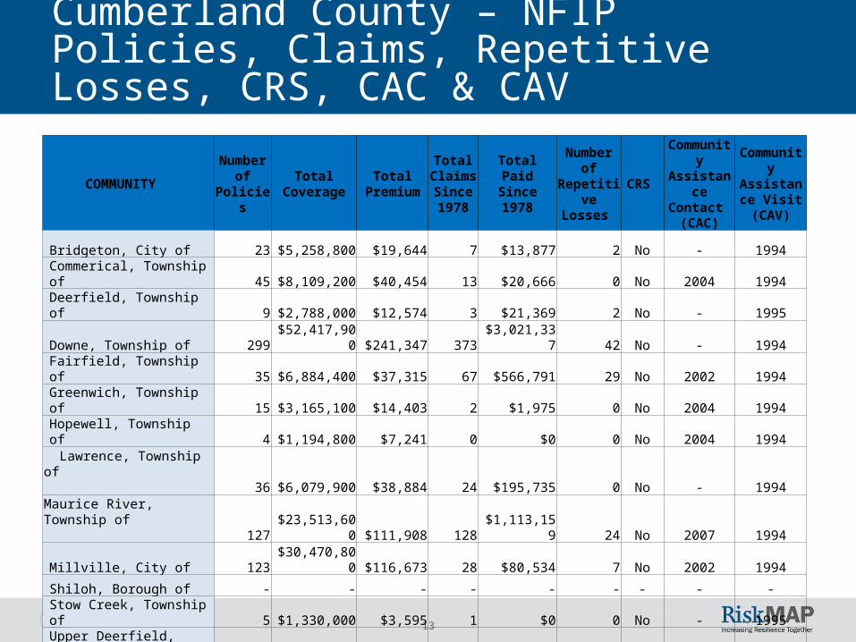
COMMUNITY Number of Policies Total Coverage Total
Premium
Total Claims Since 1978
Total Paid Since 1978
Number of Repetitive
Losses CRS
Community Assistance
Contact (CAC)
Community Assistance
Visit (CAV)
Bridgeton, City of 23 $5,258,800 $19,644 7 $13,877 2 No - 1994
Commerical, Township of 45 $8,109,200 $40,454 13 $20,666 0 No 2004 1994
Deerfield, Township of 9 $2,788,000 $12,574 3 $21,369 2 No - 1995Downe, Township of 299 $52,417,900 $241,347 373 $3,021,337 42 No - 1994
Fairfield, Township of 35 $6,884,400 $37,315 67 $566,791 29 No 2002 1994Greenwich, Township of 15 $3,165,100 $14,403 2 $1,975 0 No 2004 1994
Hopewell, Township of 4 $1,194,800 $7,241 0 $0 0 No 2004 1994 Lawrence, Township of
36 $6,079,900 $38,884 24 $195,735 0 No - 1994Maurice River, Township of
127 $23,513,600 $111,908 128 $1,113,159 24 No 2007 1994
Millville, City of 123 $30,470,800 $116,673 28 $80,534 7 No 2002 1994
Shiloh, Borough of - - - - - - - - -
Stow Creek, Township of 5 $1,330,000 $3,595 1 $0 0 No - 1995
Upper Deerfield, Township of 8 $2,374,800 $3,898 1 $679 0 No - 1994
Vineland, City of 88 $22,560,700 $67,560 26 $123,894 6 No 2004 1995
Cumberland County – NFIP Policies, Claims, Repetitive Losses, CRS, CAC & CAV
14
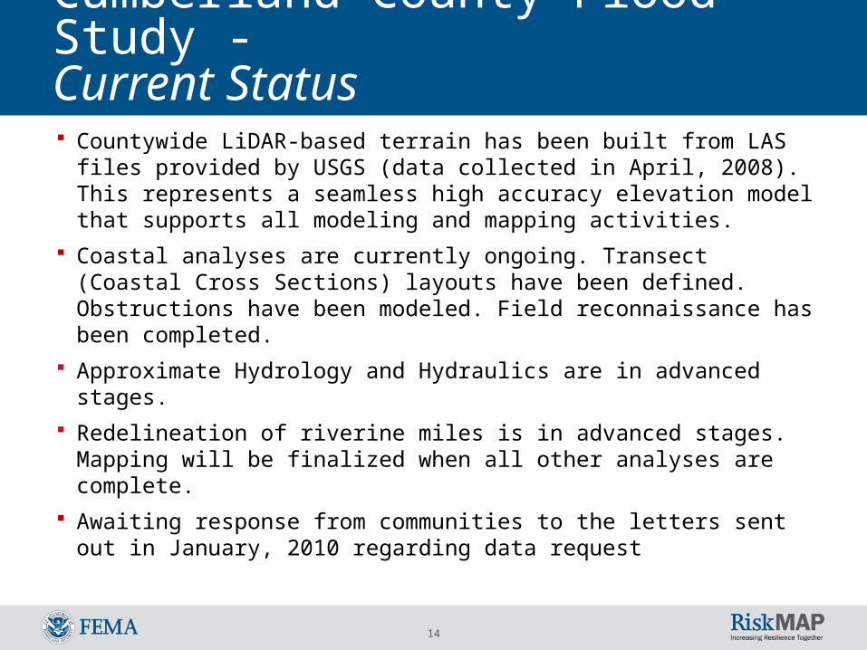
Countywide LiDAR-based terrain has been built from LAS files provided by USGS (data collected in April, 2008). This represents a seamless high accuracy elevation model that supports all modeling and mapping activities.
Coastal analyses are currently ongoing. Transect (Coastal Cross Sections) layouts have been defined. Obstructions have been modeled. Field reconnaissance has been completed.
Approximate Hydrology and Hydraulics are in advanced stages.
Redelineation of riverine miles is in advanced stages. Mapping will be finalized when all other analyses are complete.
Awaiting response from communities to the letters sent out in January, 2010 regarding data request
Cumberland County Flood Study -Current Status

15
Contacted each community letting them know about coastal field reconnaissance and field survey taking place in their communities in August 18, 2010, and data request in January 6, 2010
Have not received any responses Responses are required for your input to be considered
Roles & Responsibilities of Local Communities:Roles & Responsibilities of Local Communities: Response to the letters sent out in January, 2010 Flood Risk communications with residents
Local Communities
16
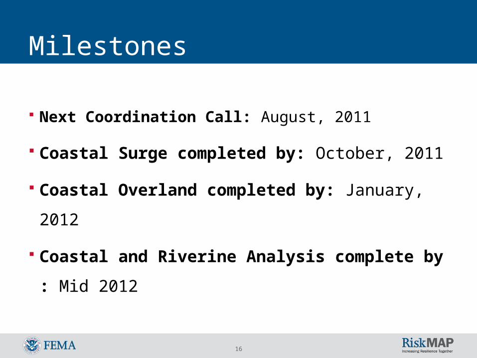
Milestones
Next Coordination Call: August, 2011
Coastal Surge completed by: October, 2011
Coastal Overland completed by: January, 2012
Coastal and Riverine Analysis complete by :
Mid 2012
17
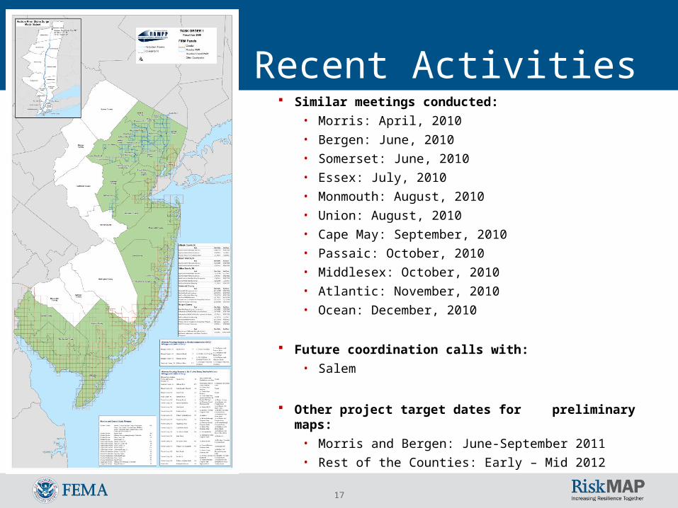
Recent Activities Similar meetings conducted:
• Morris: April, 2010
• Bergen: June, 2010
• Somerset: June, 2010
• Essex: July, 2010
• Monmouth: August, 2010
• Union: August, 2010
• Cape May: September, 2010
• Passaic: October, 2010
• Middlesex: October, 2010
• Atlantic: November, 2010
• Ocean: December, 2010
Future coordination calls with:
• Salem
Other project target dates for preliminary maps:
• Morris and Bergen: June-September 2011
• Rest of the Counties: Early – Mid 2012
18
Resources
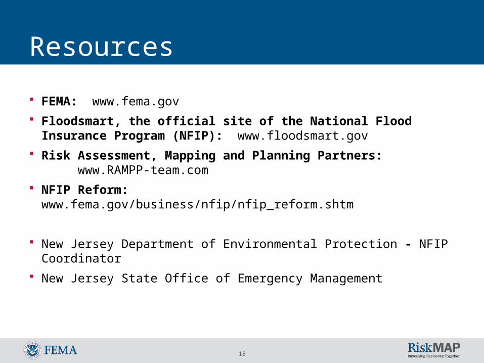
FEMA: www.fema.gov
Floodsmart, the official site of the National Flood Insurance Program (NFIP): www.floodsmart.gov
Risk Assessment, Mapping and Planning Partners: www.RAMPP-team.com
NFIP Reform: www.fema.gov/business/nfip/nfip_reform.shtm
New Jersey Department of Environmental Protection - NFIP Coordinator
New Jersey State Office of Emergency Management

19
Questions & Feedback www.RAMPP-TEAM.com: PowerPoint Presentation & additional information will be posted
Next coordination meeting: August, 2011
Contact Information FEMA Region II FEMA Regional Support Center (RSC)
Paul Weberg, Pat Griggs, Tolga Yilmaz,
212-680-3638 212-680-8523 646-216-3679
[email protected] [email protected] [email protected]
NJDEP
John Scordato / Joseph Ruggeri / Chris Gould
NJDEP, Bureau of Dam Safety & Flood Control
Phone: 609-292-2296 Fax: 609-984-1908
Visit NJDEP website: www.nj.gov/dep/floodcontrol
Download Model Ordinances: http://www.nj.gov/dep/floodcontrol/modelord.htm
RAMPP – Mapping Partner
Milver Valenzuela,
703.849.0463