Embed Size (px)
Citation preview

LOT 9 (#353) CANNING
HIGHWAY, COMO
GEOTECHNICAL INVESTIGATION
REPORT
CLIENT:
Department of Housing
PROJECT:
Lot 9 (#353) Canning Hwy,
Como
DATE:
7 October 2013
WA GEOTECHNICS REF: WA045-doh-002 (r001-a)

PO Box 564 NORTH PERTH WA 6906 Tel: +61 8 9328 7518 Fax: +61 8 9328 7590 Email: [email protected]
Date: 7 October 2013 Department of Housing Level 1/ 99 Plain Street EAST PERTH WA 6004 Attention: Mr Danny Majoski Dear Sir, RE: LOT 9 (#353) CANNING HWY, COMO GEOTECHNICAL INVESTIGATION REPORT WA Geotechnics Pty Ltd is pleased to provide this report on a geotechnical investigation
carried out at the above site.
If you have any questions related to the report or we can be of further assistance, please do
not hesitate to contact the undersigned.
For and on behalf of
WA GEOTECHNICS PTY LTD
SIMON CIGULEV
TABLE OF CONTENTS WA GEOTECHNICS
Tel: +61 8 9328 7518 Email: [email protected]
Lot 9 (#353) Canning Hwy, Como r001 i
SECTION 1.0 - INTRODUCTION.............................................................................. 1
SECTION 2.0 - FIELDWORK ................................................................................... 2
SECTION 3.0 - SUBSURFACE CONDITIONS/PROFILE ........................................ 3
3.1 Perth Sand Penetrometer Testing .................................................................. 3
3.2 Groundwater .................................................................................................. 3
3.3 Acid Sulphate Soils ........................................................................................ 3
SECTION 4.0 - DISCUSSION ................................................................................... 4
4.1 Site Classification ........................................................................................... 4
4.2 Earthworks ..................................................................................................... 4
4.3 Excavations ................................................................................................... 5
4.4 Drainage and Stormwater Runoff ................................................................... 5
SECTION 5.0 - STANDARDS AND REFERENCES ................................................ 7
SECTION 6.0 - INFORMATION ABOUT YOUR REPORT ....................................... 8
LIST OF FIGURES
1 Site Description Sheet
LIST OF APPENDICES
A Hand Auger Hole Logs
B Perth Sand Penetrometer (PSP) Test Results

WA045-doh-002 DEPARTMENT OF HOUSING r001-a LOT 9 (#353) CANNING HWY, COMO 7 October 2013 GEOTECHNICAL INVESTIGATION REPORT
Lot 9 (#353) Canning Hwy, Como r001 1
SECTION 1.0 - INTRODUCTION
WA Geotechnics Pty Ltd was commissioned by Danny Majoski on behalf of the Department
of Housing (the client) in an email on 2 October 2013 to perform a geotechnical investigation
at Lot 9 (#353) Canning Hwy, Como and to classify the residential site in accordance with
the definitions provided in Australian Standard AS2870.
The proposed residential development is only applicable to one or two storey residential
buildings on the site.

WA045-doh-002 DEPARTMENT OF HOUSING r001-a LOT 9 (#353) CANNING HWY, COMO 7 October 2013 GEOTECHNICAL INVESTIGATION REPORT
Lot 9 (#353) Canning Hwy, Como r001 2
SECTION 2.0 - FIELDWORK
Fieldwork for the geotechnical site investigation was carried out on 5 October 2013 and
consisted:
• Walkover and description of the site.
• Excavation of two test holes using a 75mm diameter hand auger at selected
locations on the site to a maximum excavated depth of 2.5 m.
• Perth Sand Penetrometer (PSP) testing from the surface level to a depth of 1.05 m
alongside each test hole location. Blow counts were recorded every 150 mm test
depth interval.
The fieldwork was carried out by a geotechnical engineer from WA Geotechnics Pty Ltd.
The test holes were backfilled with the excavated spoil.
Test locations have been located by topographical features and from the existing lot
boundary and recorded on a site plan. The Site Description Sheet with test locations is
presented in Figure 1.
Hand Auger logs, together with explanation sheets defining terms and symbols used in their
preparation are presented in Appendix A.

WA045-doh-002 DEPARTMENT OF HOUSING r001-a LOT 9 (#353) CANNING HWY, COMO 7 October 2013 GEOTECHNICAL INVESTIGATION REPORT
Lot 9 (#353) Canning Hwy, Como r001 3
SECTION 3.0 - SUBSURFACE CONDITIONS/PROFILE
The 2004 Perth Groundwater Atlas published by Water and Rivers Commission (Reference
[v]) indicates the site is situated in an area that comprises Tamala Sand overlying Tamala
Limestone. The soil profile encountered within the test holes was fairly consistent,
comprising the following profile:
FILL SAND/ TOPSOIL SAND Fine to medium grained, grey in colour with trace to some organics. The sand was generally loose to medium dense. This layer ranged from the surface to 0.2 m depth below ground level; and overlaid
FILL SAND Fine to medium grained, pale grey/yellow in colour with trace of organics. The sand was typically loose to medium dense, becoming medium dense with depth. This layer ranged from 0.2 m to 1.0 m depth below ground level; and overlaid
TAMALA SAND Fine to medium grained, pale grey/white becoming pale yellow then orange with depth. The sand was typically medium dense. This layer ranged from 0.2 m to the maximum excavated depth of 2.5 m below ground level.
The test holes excavated on the site achieved the target depth of 2.5 m.
3.1 PERTH SAND PENETROMETER TESTING
PSP tests performed alongside each hand auger hole indicated generally medium dense
sand conditions (see Appendix B) within the site. Loose sand conditions were encountered
at hand auger HA1 from the surface to 0.6 m depth. Assessment of relative sand density of
the subsurface profile was performed and recorded on each hand auger log.
3.2 GROUNDWATER
Groundwater was not encountered (at the time of fieldwork) at the hand auger holes
excavated on the site. The 2004 Perth Groundwater Atlas published by Water and Rivers
Commission (used in conjunction with the latest information on their website (Reference [v &
vi]) indicates the latest maximum probable groundwater elevation at the lowest area in the
site is 1.6 m AHD (Australian Height Datum) or approximately 18.9 m depth below the
natural surface. The natural ground level at the lowest area within the site is reported to be
20.5 m AHD. This indicates the groundwater elevation in the site is below the published
maximum probable groundwater elevation for the site. It must be noted that groundwater
levels are subject to variations due to the effects of rainfall, temperature and local drainage.
3.3 ACID SULPHATE SOILS
The 2004 Perth Groundwater Atlas published by Water and Rivers Commission (used in
conjunction with the latest information on their website) (Reference [v]) indicates moderate to
low risk of ASS (acid sulphate soil) or PASS (potential acid sulphate soil) occurring greater
than 3.0 m from the soil surface that could be disturbed by land development activities in the
site.
WA045-doh-002 DEPARTMENT OF HOUSING r001-a LOT 9 (#353) CANNING HWY, COMO 7 October 2013 GEOTECHNICAL INVESTIGATION REPORT
Lot 9 (#353) Canning Hwy, Como r001 4
SECTION 4.0 - DISCUSSION
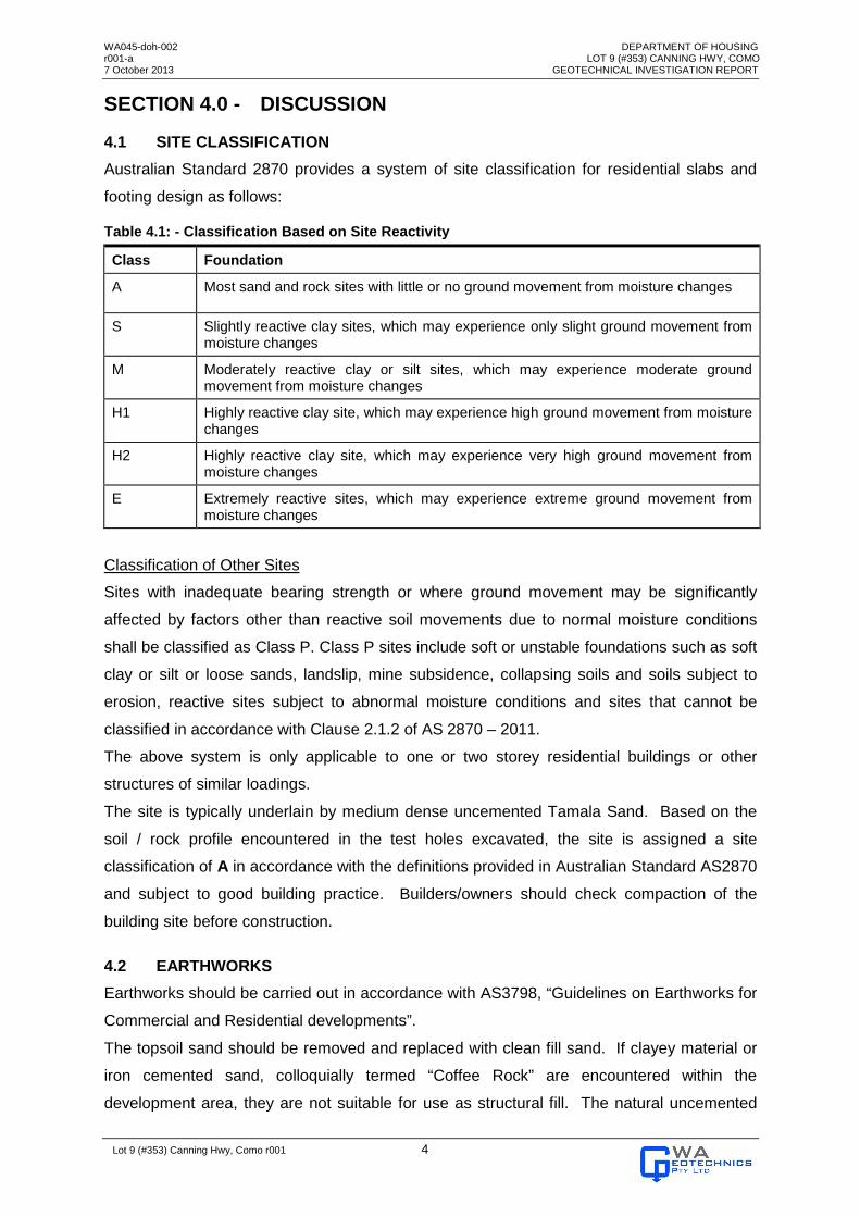
4.1 SITE CLASSIFICATION
Australian Standard 2870 provides a system of site classification for residential slabs and
footing design as follows:
Table 4.1: - Classification Based on Site Reactivity
Class Foundation
A Most sand and rock sites with little or no ground movement from moisture changes
S Slightly reactive clay sites, which may experience only slight ground movement from moisture changes
M Moderately reactive clay or silt sites, which may experience moderate ground movement from moisture changes
H1 Highly reactive clay site, which may experience high ground movement from moisture changes
H2 Highly reactive clay site, which may experience very high ground movement from moisture changes
E Extremely reactive sites, which may experience extreme ground movement from moisture changes
Classification of Other Sites
Sites with inadequate bearing strength or where ground movement may be significantly
affected by factors other than reactive soil movements due to normal moisture conditions
shall be classified as Class P. Class P sites include soft or unstable foundations such as soft
clay or silt or loose sands, landslip, mine subsidence, collapsing soils and soils subject to
erosion, reactive sites subject to abnormal moisture conditions and sites that cannot be
classified in accordance with Clause 2.1.2 of AS 2870 – 2011.
The above system is only applicable to one or two storey residential buildings or other
structures of similar loadings.
The site is typically underlain by medium dense uncemented Tamala Sand. Based on the
soil / rock profile encountered in the test holes excavated, the site is assigned a site
classification of A in accordance with the definitions provided in Australian Standard AS2870
and subject to good building practice. Builders/owners should check compaction of the
building site before construction.
4.2 EARTHWORKS
Earthworks should be carried out in accordance with AS3798, “Guidelines on Earthworks for
Commercial and Residential developments”.
The topsoil sand should be removed and replaced with clean fill sand. If clayey material or
iron cemented sand, colloquially termed “Coffee Rock” are encountered within the
development area, they are not suitable for use as structural fill. The natural uncemented

WA045-doh-002 DEPARTMENT OF HOUSING r001-a LOT 9 (#353) CANNING HWY, COMO 7 October 2013 GEOTECHNICAL INVESTIGATION REPORT
Lot 9 (#353) Canning Hwy, Como r001 5
sand and fill sand intersected on this site, except topsoil sand, is suitable for use as
structural fill. Imported fill, if used, should comprise free draining sand with no more than 5%
passing a 75µm sieve, and free of organic matter and other deleterious materials.
The natural sand and/or clean fill sand on the base of footings and within the development
site should be compacted to achieve a minimum density index of 70% (96% of maximum dry
density of modified compaction) for the upper, near surface metre. The level of compaction
should be achieved to a depth of at least 0.9 m below underside of footings and at least
extended 2.0 m past the building envelope. Typically for Perth sands a minimum of 8 blows
for the test depth interval 150 mm to 450 mm is required to achieve the minimum relative
compaction of 96% of maximum dry density (modified compaction). To allow for depth
effects, this implies that PSP blow counts should not be less than 10 blows for the test
interval 450 mm to 750 mm, and not less than 13 blows for the test interval 750 mm to 1050
mm. Actual PSP values required as an indication of adequate compaction should be
assessed by means of establishing an on-site correlation between PSP value and relative
density for each sand type i.e. fill sand, natural sand.
Care should be taken when compacting in the vicinity of existing buildings or structures.
4.3 EXCAVATIONS
Excavations across site should be achieved using standard earthmoving equipment.
Excavations for construction of shallow footings on the site are expected to be less than 0.7
m deep other than where deep cut or fill is being removed (e.g. service trenches). Short
term unsupported slopes should be constructed no steeper than 2H:1V for sand provided no
vehicle, equipment or stockpiled material encroaches any closer than 1.0m to the crest of
the slope and provided the slope is above the water table. Such slopes may be unstable in
the long term if the soil profile is dry.
During winter months, slopes may become unstable due to the saturation of soils. Support
for excavations in excess of 1.2 m vertical height will be required.
Should dewatering be required, the effect of dewatering on nearby structures should be
considered.
4.4 DRAINAGE AND STORMWATER RUNOFF
It is recommended that the footing base should be at least 1.2 m above the annual average
maximum groundwater level (AAMGL).
The non-cohesive natural and fill sand encountered on this site is free draining and suitable
for onsite disposal of water.
Storm water runoff from buildings should be disposed of via local authority drainage system
if possible. If the use of soakwells is unavoidable, then they should be located at least 2.0 m
away from buildings. Consideration could be given to a “mixed” system in some areas

WA045-doh-002 DEPARTMENT OF HOUSING r001-a LOT 9 (#353) CANNING HWY, COMO 7 October 2013 GEOTECHNICAL INVESTIGATION REPORT
Lot 9 (#353) Canning Hwy, Como r001 6
whereby the runoff from short/high intensity rainfall events is accommodated via soakwells
and an overflow to the Council drainage system is provided for longer duration events.
For and on behalf of
WA GEOTECHNICS PTY LTD
SIMON CIGULEV MIEAust, Member No. 2727537
WA045-doh-002 DEPARTMENT OF HOUSING r001-a LOT 9 (#353) CANNING HWY, COMO 7 October 2013 GEOTECHNICAL INVESTIGATION REPORT
Lot 9 (#353) Canning Hwy, Como r001 7
SECTION 5.0 - STANDARDS AND REFERENCES
(i) AS 1726, Geotechnical Site Investigations
(ii) AS 2870, Australian Standard for residential slabs and footings
(iii) AS 3798, Australian Standard for Earthworks for Residential and Commercial
Developments
(iv) AS 1289, Methods of Testing Soils for Engineering Purposes
(v) Perth Groundwater Atlas (2nd edition, 2004), by Department of Environment,
Government of Western Australia
(vi) www.wrc.wa.gov.au/infocentre/atlas, Website, Department of Environment,
Government of Western Australia
WA045-doh-002 DEPARTMENT OF HOUSING r001-a LOT 9 (#353) CANNING HWY, COMO 7 October 2013 GEOTECHNICAL INVESTIGATION REPORT
Lot 9 (#353) Canning Hwy, Como r001 8
SECTION 6.0 - INFORMATION ABOUT YOUR REPORT
This report presents the results of a geotechnical investigation prepared for the purpose of
this commission. The data and advice provided herein relate only to the project and
structures described herein and must be reviewed by a competent geotechnical engineer
before being used for any other purpose. WA Geotechnics accepts no responsibility for
other use of the data.
Where drill hole or test pit logs, cone tests, laboratory tests, geophysical tests and similar
work have been performed and recorded by others the data is included and used in the form
provided by others. The responsibility for the accuracy of such data remains with the issuing
authority, not with WA Geotechnics.
The advice tendered in this report is based on information obtained from the investigation
location’s test points and sample points and is not warranted in respect to the conditions that
may be encountered across the site at other than these locations. It is emphasised that the
actual characteristics of the subsurface materials may vary significantly between adjacent
test points and sample intervals and at all locations other than where observations,
explorations and investigations have been made. Subsurface conditions, including
groundwater levels and contaminant concentrations can change in a limited time. This
should be borne in mind when assessing the data.
It should be noted that because of the inherent uncertainties in subsurface evaluations,
changed or unanticipated subsurface conditions may occur that could affect total project cost
and / or execution. WA Geotechnics does not accept responsibility for the consequences of
significant variances in the conditions and the requirements for execution of the work.
The subsurface and surface earthworks, excavations and foundations should be examined
by a suitably qualified and experienced Engineer who shall judge whether the revealed
conditions accord with both the assumptions in this report and / or the design of the works. If
they do not accord, the Engineer shall modify advice in this report and / or design of the
works to accord with the circumstances that are revealed.
An understanding of the geotechnical site conditions depends on the integration of many
pieces of information, some regional, some site specific, some structure specific and some
experienced based. Hence this report should not be altered, amended or abbreviated,
issued in part and issued incomplete in any way without prior checking and approval by WA
Geotechnics. WA Geotechnics accepts no responsibility for any circumstances, which arise
from the issue of the report, which has been modified in any way as outlined above.
WA045-doh-002 DEPARTMENT OF HOUSING r001-a LOT 9 (#353) CANNING HWY, COMO 7 October 2013 GEOTECHNICAL INVESTIGATION REPORT
Lot 9 (#353) Canning Hwy, Como r001
FIGURE 1

WA045-doh-002 DEPARTMENT OF HOUSING r001-a LOT 9 (#353) CANNING HWY, COMO 7 October 2013 GEOTECHNICAL INVESTIGATION REPORT
Lot 9 (#353) Canning Hwy, Como r001

WA045-doh-002 DEPARTMENT OF HOUSING r001-a LOT 9 (#353) CANNING HWY, COMO 7 October 2013 GEOTECHNICAL INVESTIGATION REPORT
Lot 9 (#353) Canning Hwy, Como r001
APPENDIX A
HAND AUGER LOGS

WA045-doh-002 DEPARTMENT OF HOUSING r001-a LOT 9 (#353) CANNING HWY, COMO 7 October 2013 GEOTECHNICAL INVESTIGATION REPORT
Lot 9 (#353) Canning Hwy, Como r001

WA045-doh-002 DEPARTMENT OF HOUSING r001-a LOT 9 (#353) CANNING HWY, COMO 7 October 2013 GEOTECHNICAL INVESTIGATION REPORT
Lot 9 (#353) Canning Hwy, Como r001
WA045-doh-002 DEPARTMENT OF HOUSING r001-a LOT 9 (#353) CANNING HWY, COMO 7 October 2013 GEOTECHNICAL INVESTIGATION REPORT
Lot 9 (#353) Canning Hwy, Como r001

WA045-doh-002 DEPARTMENT OF HOUSING r001-a LOT 9 (#353) CANNING HWY, COMO 7 October 2013 GEOTECHNICAL INVESTIGATION REPORT
Lot 9 (#353) Canning Hwy, Como r001

WA045-doh-002 DEPARTMENT OF HOUSING r001-a LOT 9 (#353) CANNING HWY, COMO 7 October 2013 GEOTECHNICAL INVESTIGATION REPORT
Lot 9 (#353) Canning Hwy, Como r001

WA045-doh-002 DEPARTMENT OF HOUSING r001-a LOT 9 (#353) CANNING HWY, COMO 7 October 2013 GEOTECHNICAL INVESTIGATION REPORT
Lot 9 (#353) Canning Hwy, Como r001
APPENDIX B
PSP TEST RESULTS

WA045-doh-002 DEPARTMENT OF HOUSING r001-a LOT 9 (#353) CANNING HWY, COMO 7 October 2013 GEOTECHNICAL INVESTIGATION REPORT
Lot 9 (#353) Canning Hwy, Como r001