Embed Size (px)
Citation preview
1
GIS AND REMOTE SENSING FOR OPEN SPACE PROTECTION
ENVIRONMENTAL MANAGEMENT DEPARTMENT
22nd May 2009
2
Introduction
It is said that more than 80% of the City’s activities throughout the world are spatially related.
GEOGRAPHIC“Conservation is about places” - Andy Rowan, Ph.D.
“Almost everything that happens, happens somewhere.” – Paul A. Longley
INFORMATION SYSTEMThe new source of power is not money in the hands of a few but information in the
hands of many.” – John Naisbitt, Megatrends
“A decision is a good as the Information that goes into it.” – John F. Boorout, Jr.
3
GIS Analysis
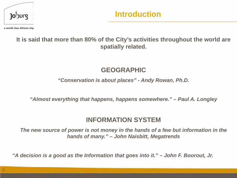
GIS Process
Data ManagementAnd
Verification
Build OS Database
Decision
Output
Define problem
Define GIS criteria
Contents to be covered in the presentation
4
Define GIS Problem
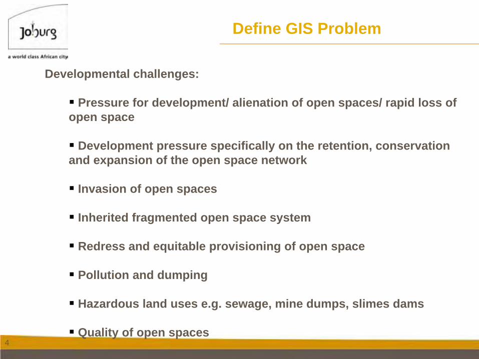
Developmental challenges:
Pressure for development/ alienation of open spaces/ rapid loss of open space
Development pressure specifically on the retention, conservation and expansion of the open space network
Invasion of open spaces
Inherited fragmented open space system
Redress and equitable provisioning of open space
Pollution and dumping
Hazardous land uses e.g. sewage, mine dumps, slimes dams
Quality of open spaces
5
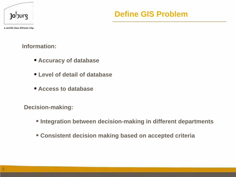
Decision-making:
Integration between decision-making in different departments
Consistent decision making based on accepted criteria
Information:
Accuracy of database
Level of detail of database
Access to database
Define GIS Problem
6
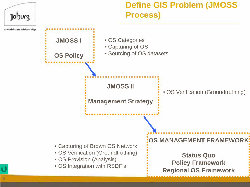
Define GIS Problem (JMOSS Process)
OS MANAGEMENT FRAMEWORK
Status QuoPolicy Framework
Regional OS Framework
JMOSS I
OS Policy
JMOSS II
Management Strategy
• OS Categories• Capturing of OS• Sourcing of OS datasets
• OS Verification (Groundtruthing)
• Capturing of Brown OS Network• OS Verification (Groundtruthing)• OS Provision (Analysis)• OS Integration with RSDF’s
7
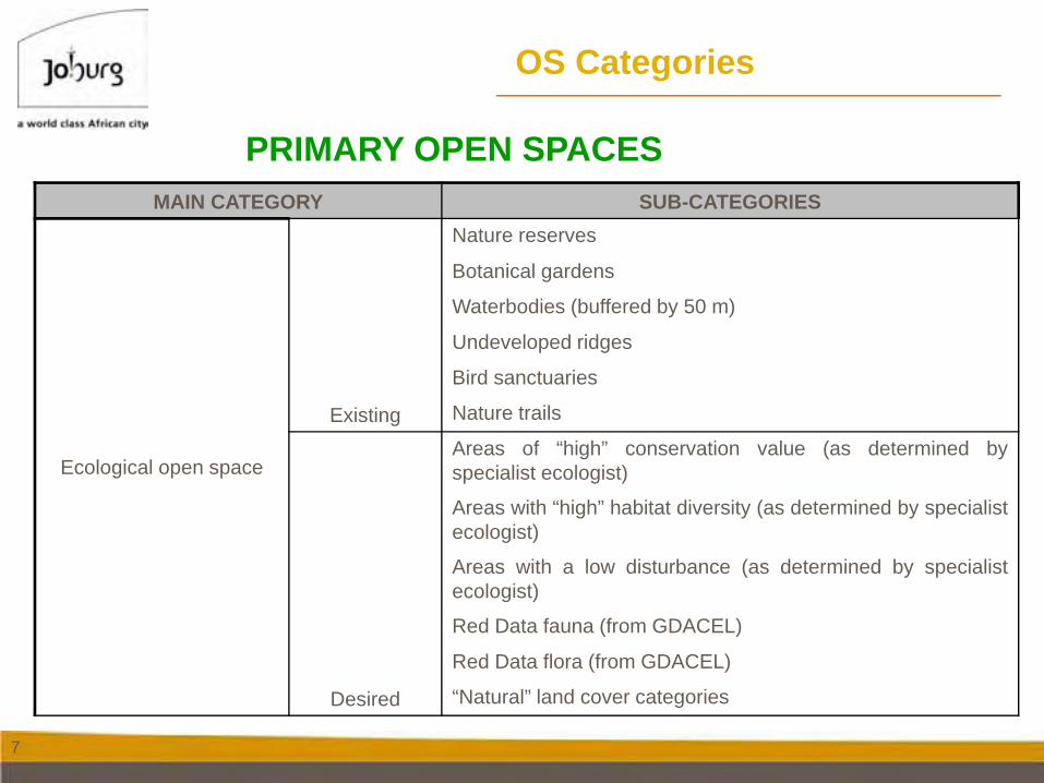
OS Categories
MAIN CATEGORY SUB-CATEGORIES
Ecological open space
Existing
Nature reserves
Botanical gardens
Waterbodies (buffered by 50 m)
Undeveloped ridges
Bird sanctuaries
Nature trails
Desired
Areas of “high” conservation value (as determined byspecialist ecologist)
Areas with “high” habitat diversity (as determined by specialistecologist)
Areas with a low disturbance (as determined by specialistecologist)
Red Data fauna (from GDACEL)
Red Data flora (from GDACEL)
“Natural” land cover categories
PRIMARY OPEN SPACES
8
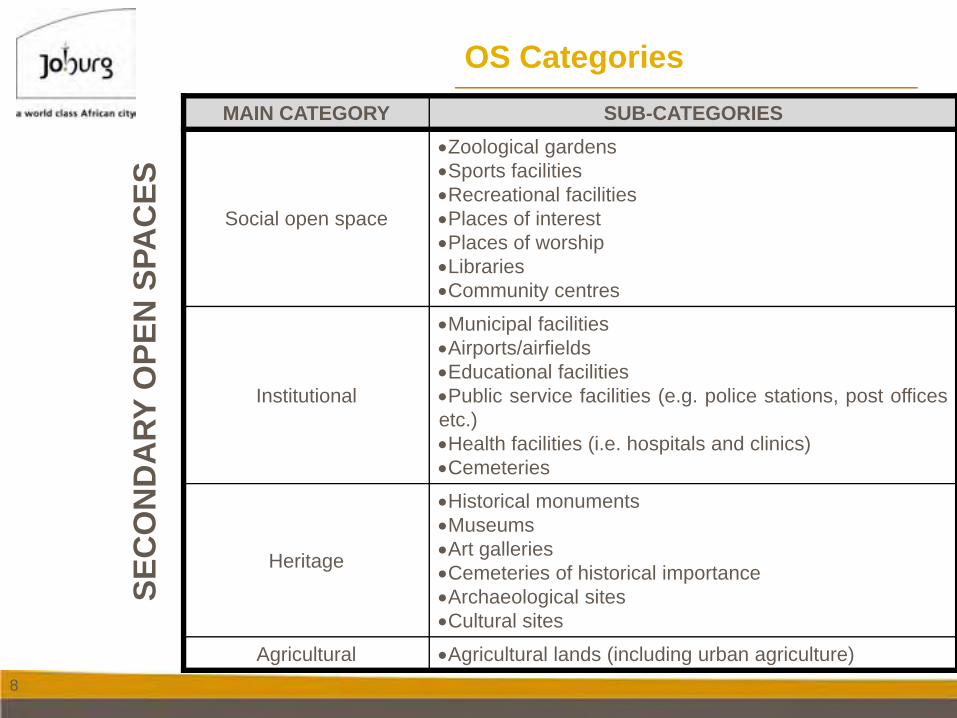
OS CategoriesMAIN CATEGORY SUB-CATEGORIES
Social open space
•Zoological gardens•Sports facilities•Recreational facilities•Places of interest•Places of worship•Libraries•Community centres
Institutional
•Municipal facilities•Airports/airfields•Educational facilities•Public service facilities (e.g. police stations, post officesetc.)•Health facilities (i.e. hospitals and clinics)•Cemeteries
Heritage
•Historical monuments•Museums•Art galleries•Cemeteries of historical importance•Archaeological sites•Cultural sites
Agricultural •Agricultural lands (including urban agriculture)
SEC
ON
DA
RY O
PEN
SPA
CES
9
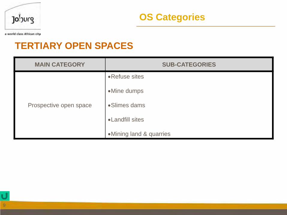
OS Categories
MAIN CATEGORY SUB-CATEGORIES
Prospective open space
•Refuse sites
•Mine dumps
•Slimes dams
•Landfill sites
•Mining land & quarries
TERTIARY OPEN SPACES
10
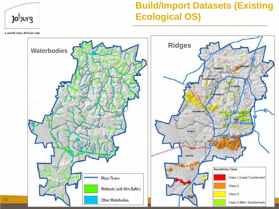
Build/Import Datasets (Existing Ecological OS)
WaterbodiesRidges
11
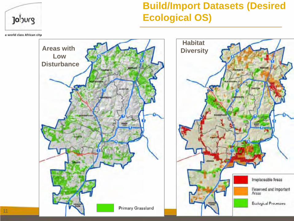
Build/Import Datasets (Desired Ecological OS)
Habitat DiversityAreas with
LowDisturbance
12
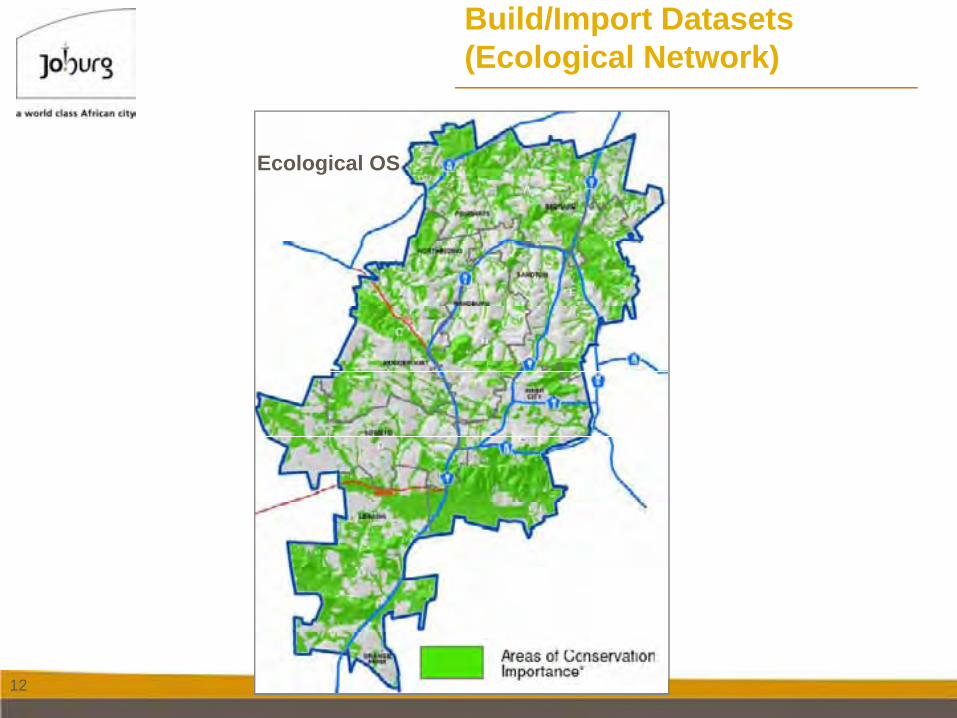
Build/Import Datasets (Ecological Network)
Ecological OS
13
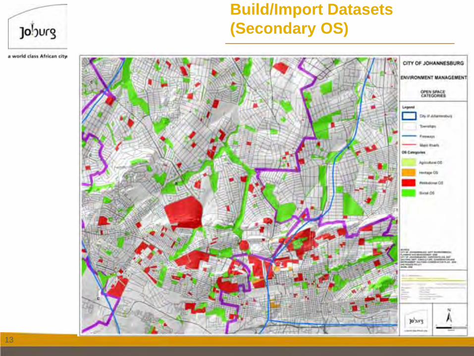
Build/Import Datasets (Secondary OS)
14
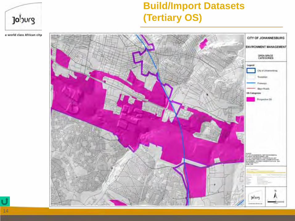
Build/Import Datasets (Tertiary OS)
15
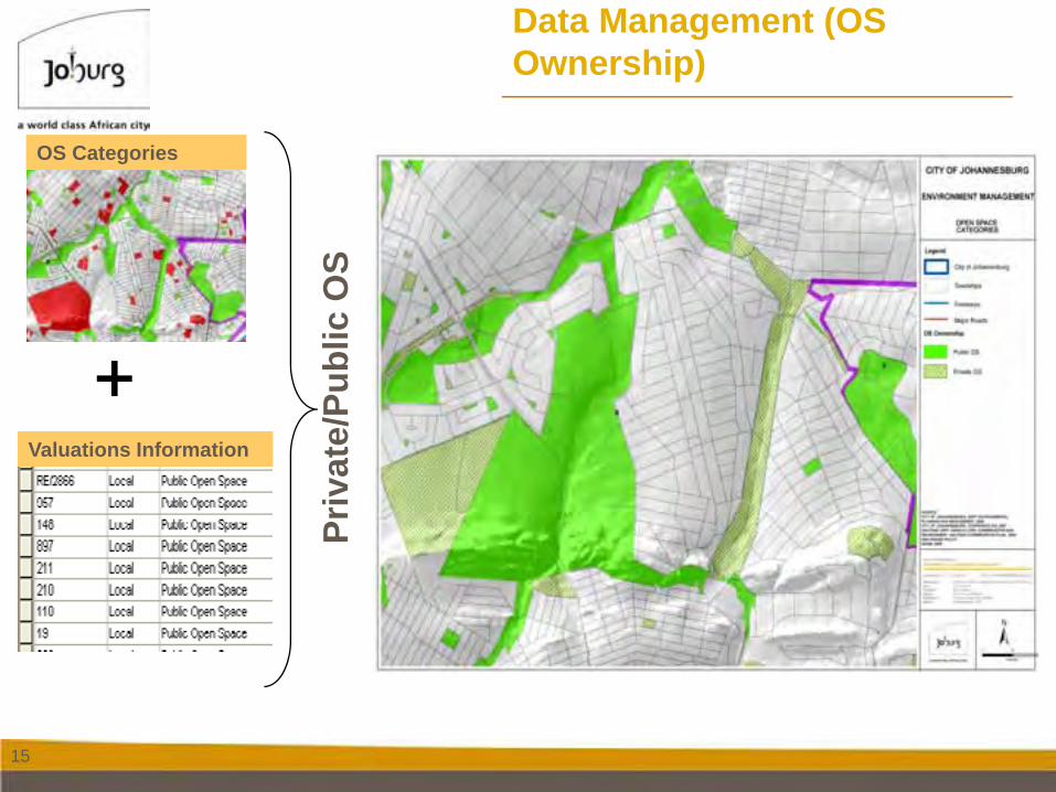
Data Management (OS Ownership)
OS Categories
Priv
ate/
Publ
ic O
S
Valuations Information
16
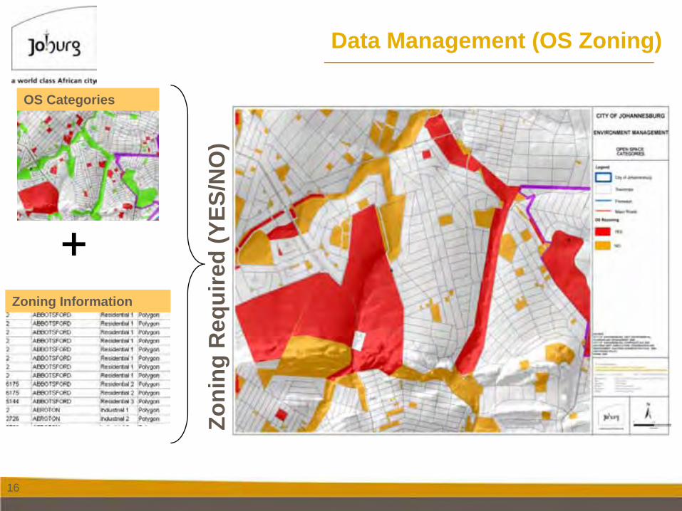
Data Management (OS Zoning)
OS Categories
Zoning Information
Zoni
ng R
equi
red
(YES
/NO
)
17
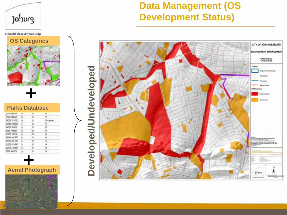
Data Management (OS Development Status)
OS Categories
Dev
elop
ed/U
ndev
elop
edParks Database
Aerial Photograph
18
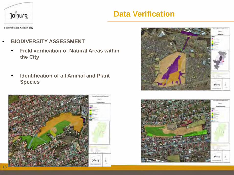
Data Verification
• BIODIVERSITY ASSESSMENT
• Field verification of Natural Areas within the City
• Identification of all Animal and Plant Species
19
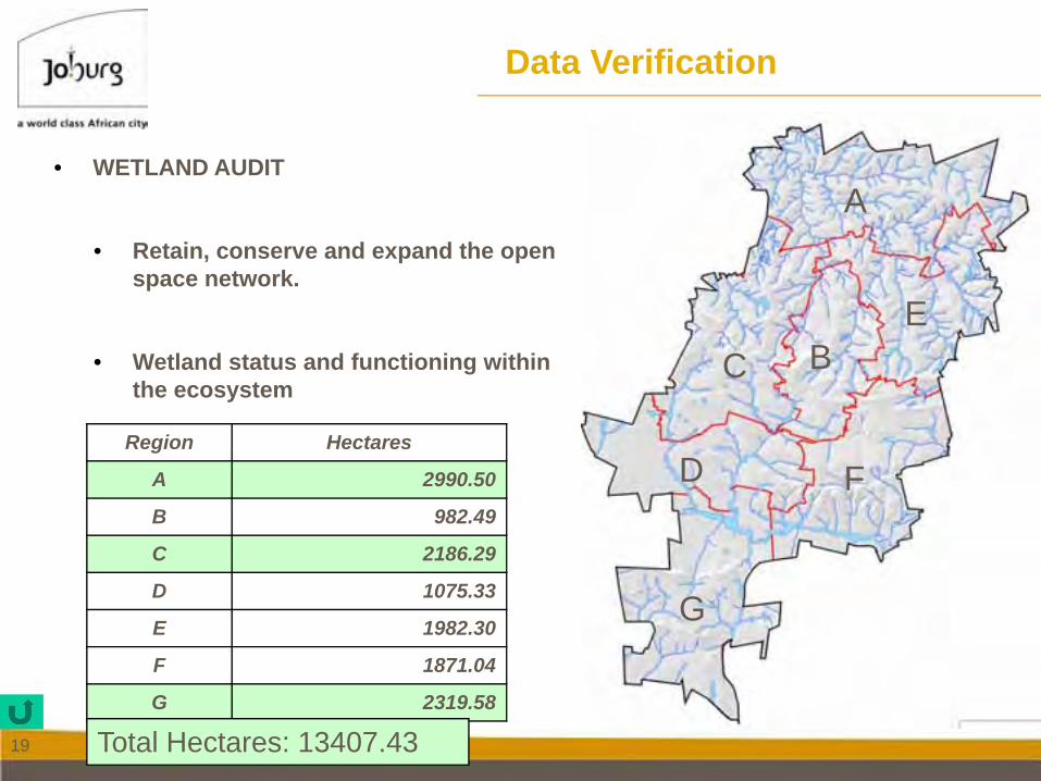
• WETLAND AUDIT
• Retain, conserve and expand the open space network.
• Wetland status and functioning within the ecosystem
Data Verification
Region Hectares
A 2990.50
B 982.49
C 2186.29
D 1075.33
E 1982.30
F 1871.04
G 2319.58
F
G
BC
D
A
E
Total Hectares: 13407.43
20
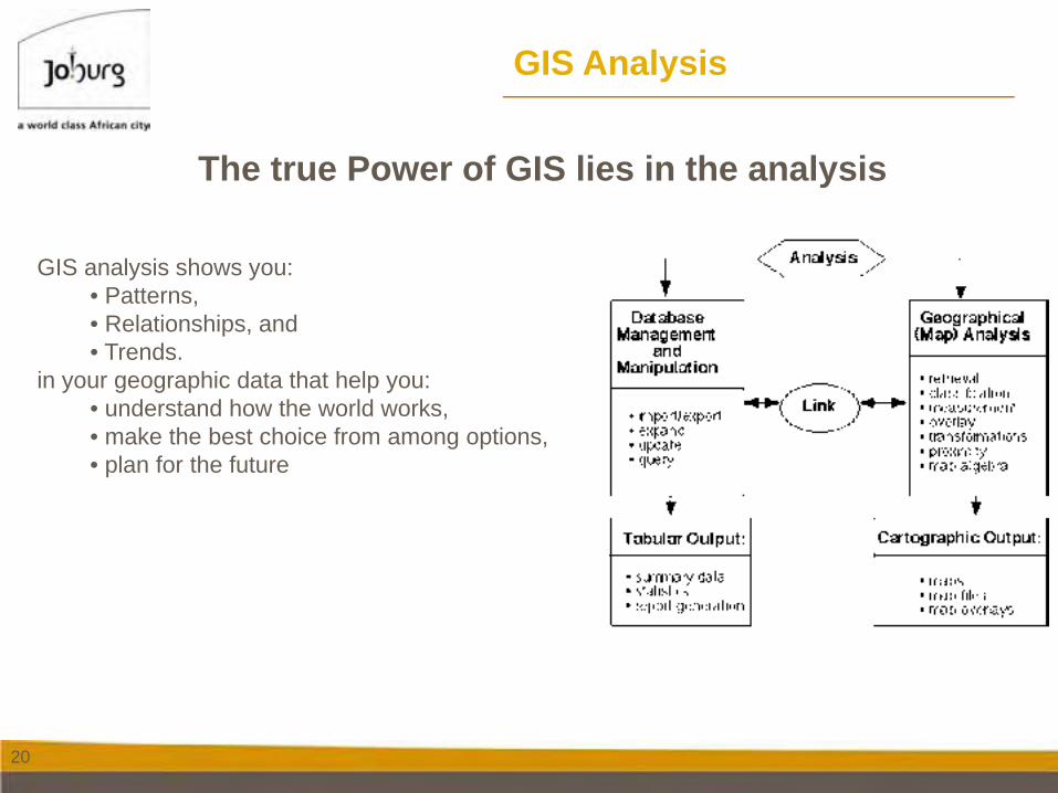
GIS Analysis
The true Power of GIS lies in the analysis
GIS analysis shows you:• Patterns, • Relationships, and• Trends.
in your geographic data that help you:• understand how the world works, • make the best choice from among options, • plan for the future
21
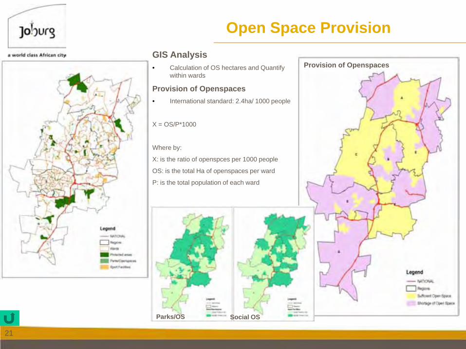
GIS Analysis• Calculation of OS hectares and Quantify
within wards
Provision of Openspaces• International standard: 2.4ha/ 1000 people
X = OS/P*1000
Where by:
X: is the ratio of openspces per 1000 people
OS: is the total Ha of openspaces per ward
P: is the total population of each ward
Open Space Provision
Provision of Openspaces
Parks/OS Social OS
22
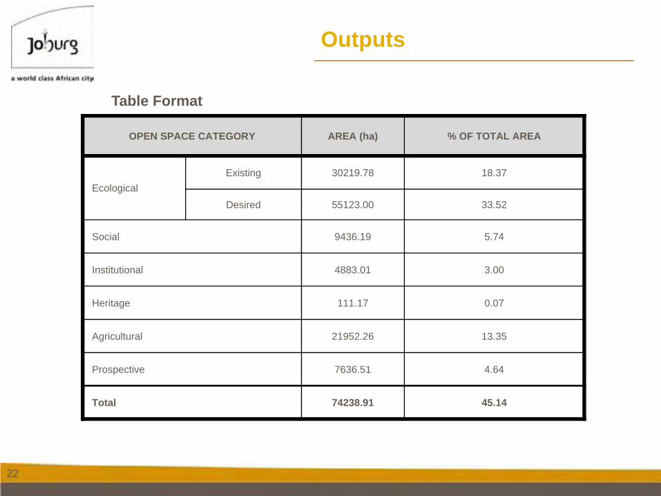
Outputs
OPEN SPACE CATEGORY AREA (ha) % OF TOTAL AREA
EcologicalExisting 30219.78 18.37
Desired 55123.00 33.52
Social 9436.19 5.74
Institutional 4883.01 3.00
Heritage 111.17 0.07
Agricultural 21952.26 13.35
Prospective 7636.51 4.64
Total 74238.91 45.14
Table Format
23
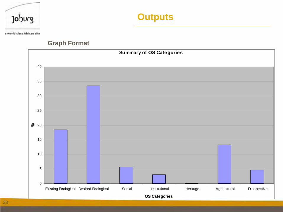
Outputs
Summary of OS Categories
0
5
10
15
20
25
30
35
40
Existing Ecological Desired Ecological Social Institutional Heritage Agricultural Prospective
OS Categories
%
Graph Format
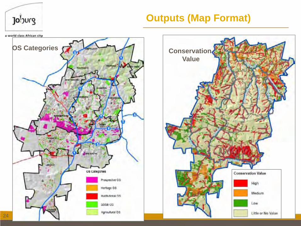
24
Outputs (Map Format)
Conservation Value
OS Categories
25
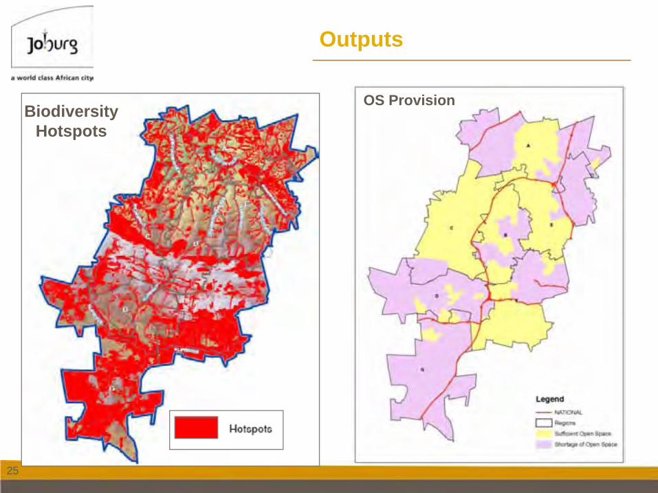
Outputs
OS ProvisionBiodiversity
Hotspots
26
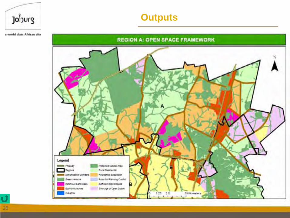
Outputs
27
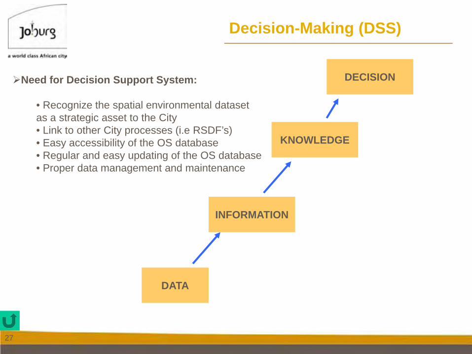
Decision-Making (DSS)
DATA
INFORMATION
DECISION
KNOWLEDGE
Need for Decision Support System:
• Recognize the spatial environmental dataset as a strategic asset to the City• Link to other City processes (i.e RSDF’s)• Easy accessibility of the OS database• Regular and easy updating of the OS database• Proper data management and maintenance
28
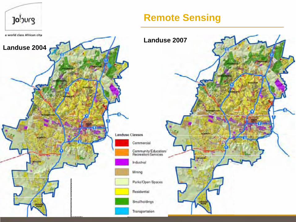
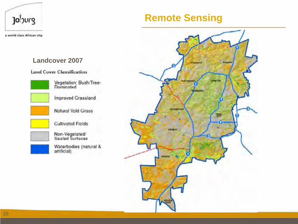
Remote Sensing
Landuse 2007Landuse 2004
29
Remote Sensing
Landcover 2007

30
DISCUSSIONS /
THANK YOU
Makau Alfred Malatji
0114076754