Embed Size (px)
Citation preview
AgendaAgenda
•• What is GIS?What is GIS?•• GIS and SAPGIS and SAP•• Real Examples Real Examples
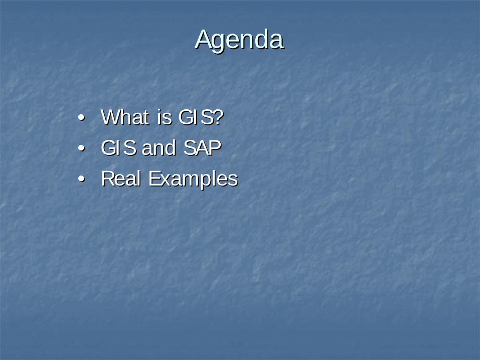
Life Without GISLife Without GIS
My Stuff My Paper Maps
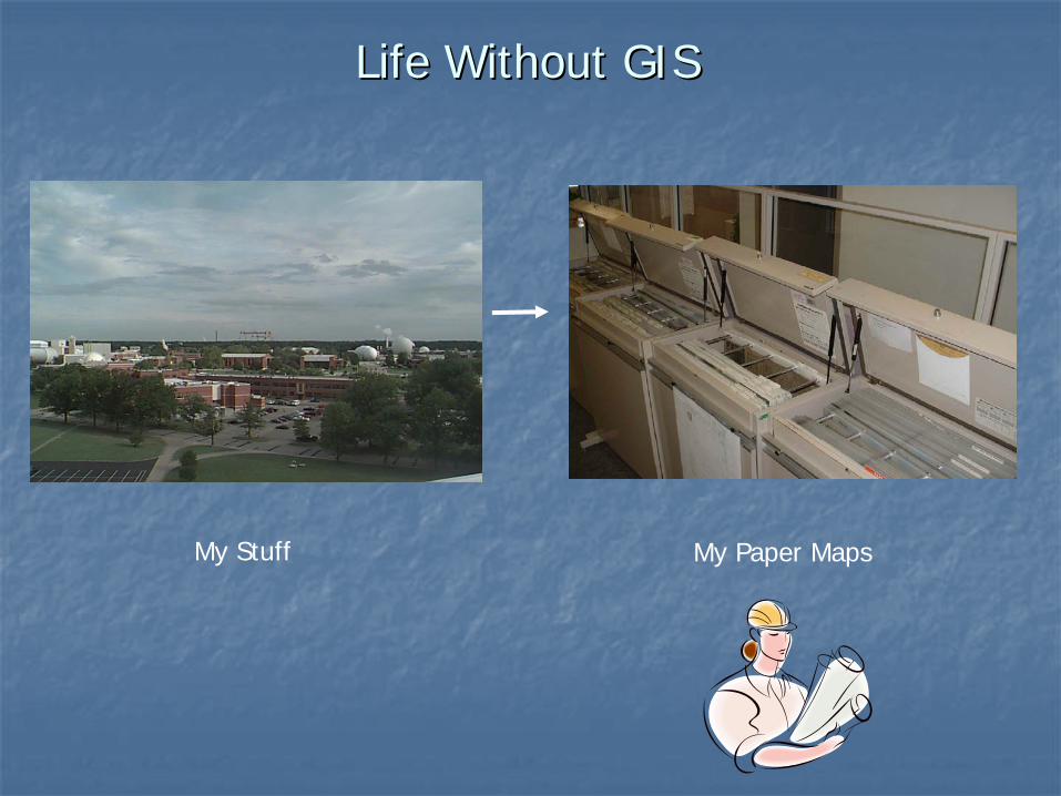
Features Attributes
BehaviorDisplay
Query
Analysis
Unimproved lots are displayed in blue
What parcels adjacent to Main St. are also zoned mixed use?
What parcels are adjacent to Main Street?
Three Elements of a GISThree Elements of a GIS
Building typeAppraised ValueParcel owner
Feature Characteristics
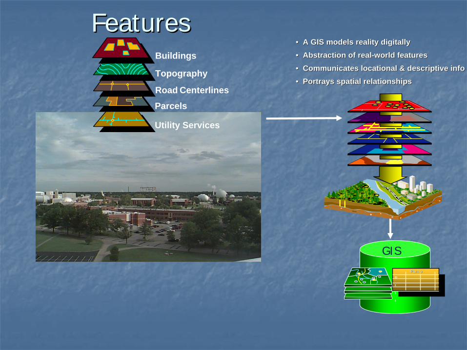
Buildings
Topography
Road Centerlines
Parcels
Utility Services
•• A GIS models reality digitallyA GIS models reality digitally•• Abstraction of realAbstraction of real--world featuresworld features•• Communicates locational & descriptive infoCommunicates locational & descriptive info•• Portrays spatial relationshipsPortrays spatial relationships
FeaturesFeatures
ID
1
2
3
PumpPump
GIS
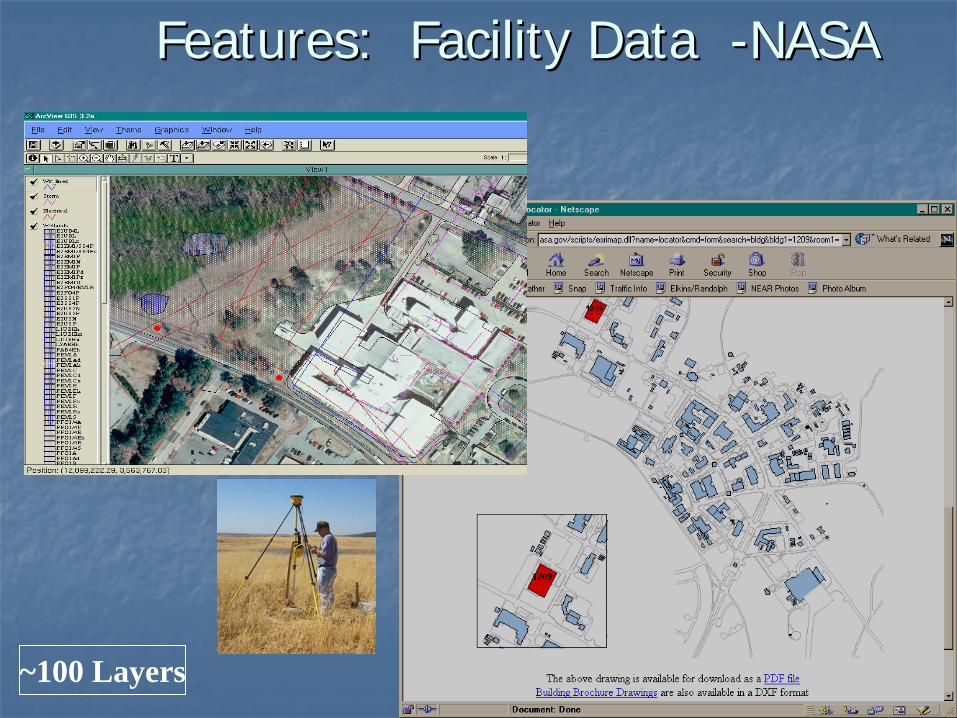
Features: Facility Data Features: Facility Data --NASANASA
~100 Layers
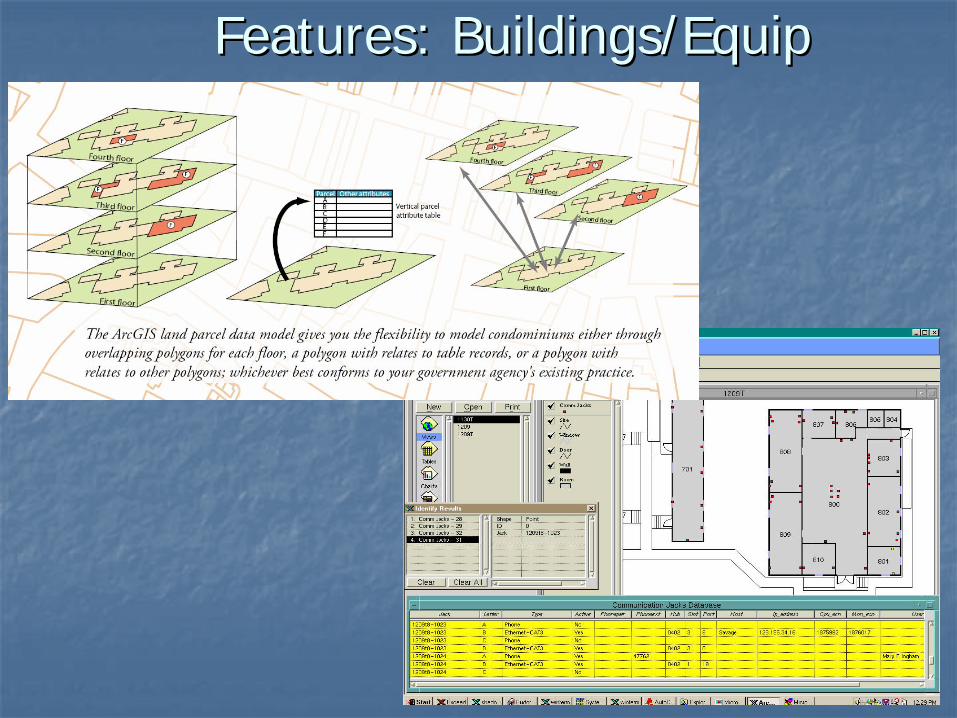
Features: Buildings/EquipFeatures: Buildings/Equip
Display and LabelDisplay and LabelCharacteristicsCharacteristics
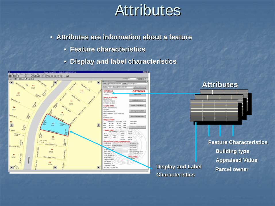
AttributesAttributes
Building typeBuilding typeAppraised ValueAppraised Value
Parcel ownerParcel owner
Feature CharacteristicsFeature Characteristics
•• Attributes are information about a featureAttributes are information about a feature
•• Feature characteristicsFeature characteristics
•• Display and label characteristicsDisplay and label characteristics
AttributesAttributes

AttributesAttributes
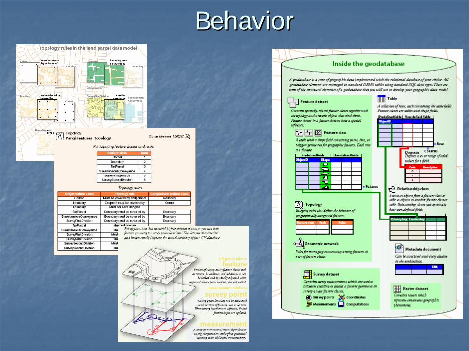
BehaviorBehavior
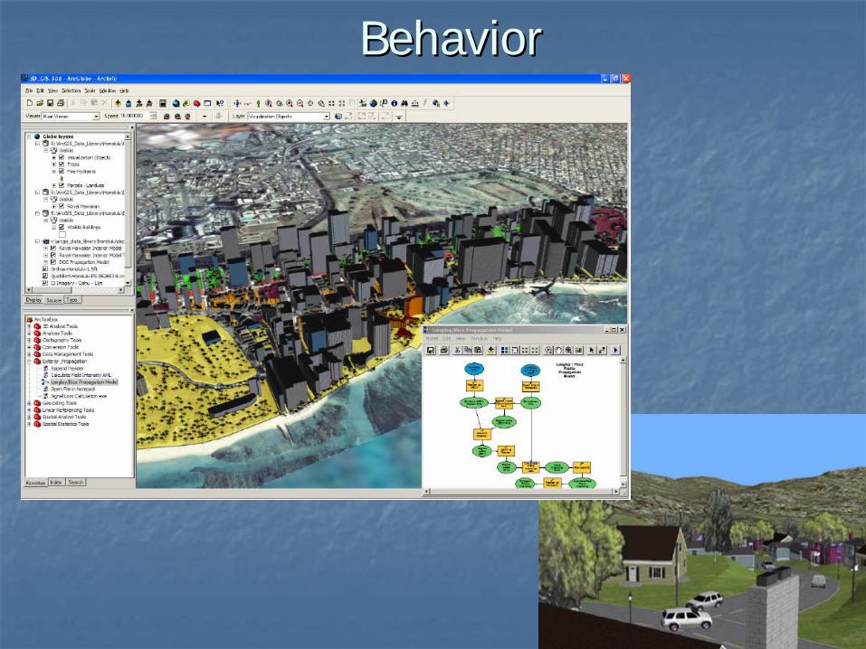
BehaviorBehavior
DimensionsDimensions
NetworksNetworks
CadastralCadastral
SurveysSurveysAddressesAddresses
AnnotationAnnotationVectorsVectors
3D 3D ObjectsObjects
TopologyTopology
CADCAD
ImagesImages
TerrainTerrain
AttributeAttribute
CartographyCartography
Spatial Data ManagementSpatial Data Management•• Organization and management Organization and management
of spatial informationof spatial information•• Accommodate all spatial data Accommodate all spatial data
typestypes•• Integrate all spatial data typesIntegrate all spatial data types•• Manage all spatial data typesManage all spatial data types
•• Data CreationData Creation•• Rules and BehaviorRules and Behavior•• MetadataMetadata
•• Data MaintenanceData Maintenance•• Editing toolsEditing tools
•• GISGIS•• CADCAD•• Etc ..Etc ..
•• Editing workflowsEditing workflows•• Model BuilderModel Builder•• PLTSPLTS
•• Data sharing and distributionData sharing and distribution•• Spatial data repositoriesSpatial data repositories•• Replication, Versioning, Replication, Versioning,
Check in/outCheck in/out
•• Persist all spatial typesPersist all spatial types•• Oracle, SQL Server, DB2, Oracle, SQL Server, DB2,
Access, FilesAccess, Files
Geodatabase: ObjectGeodatabase: Object--relational relational information model responsible for information model responsible for
managing all geographic data types and managing all geographic data types and their associative rules and behaviors.their associative rules and behaviors.
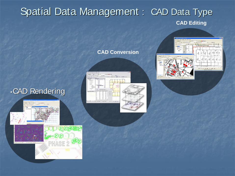
CAD Editing
••CAD RenderingCAD Rendering
CAD Conversion
Spatial Data ManagementSpatial Data Management : CAD Data Type: CAD Data Type
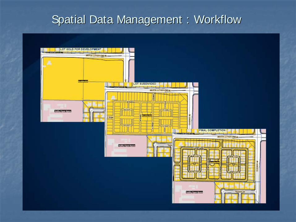
Spatial Data Management : Workflow Spatial Data Management : Workflow
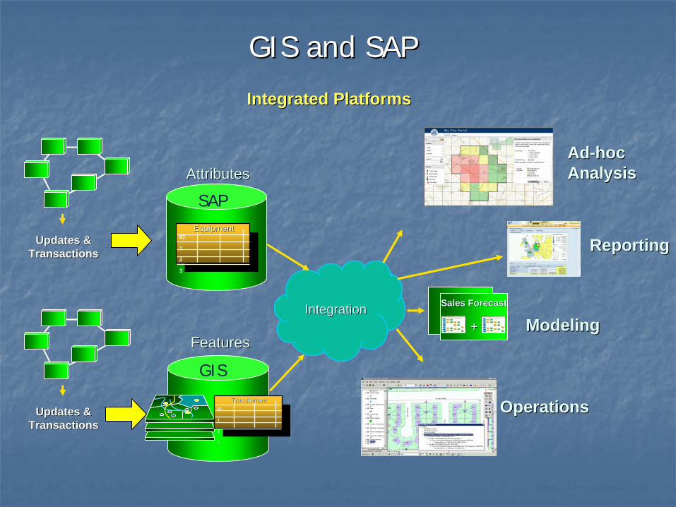
IntegrationIntegration
Integrated PlatformsIntegrated Platforms
AdAd--hoc hoc AnalysisAnalysis
ModelingModeling
OperationsOperations
Sales ForecastSales Forecast
ReportingReporting
GIS and SAPGIS and SAP
Updates &Updates & TransactionsTransactions
Updates &Updates & TransactionsTransactions
ID
1
2
3
EquipmentEquipment
AttributesAttributes
FeaturesFeatures++
ID
1
2
3
TransformerTransformer
GIS
SAP
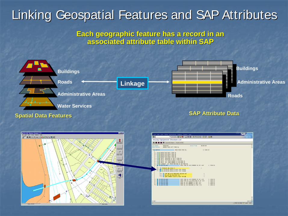
Linking Geospatial Features and SAP AttributesLinking Geospatial Features and SAP Attributes
SAP Attribute DataSAP Attribute DataSpatial Data FeaturesSpatial Data Features
Each geographic feature has a record in an Each geographic feature has a record in an associated attribute table within SAPassociated attribute table within SAP
Buildings
Roads
Administrative Areas
Water Services
Buildings
Roads
Administrative AreasLinkage
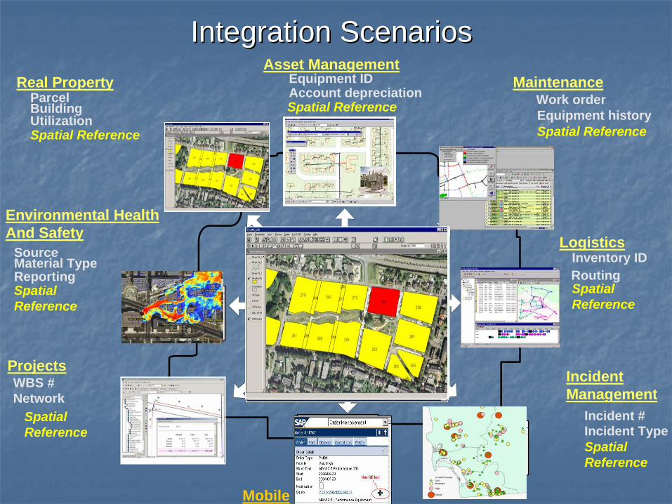
Asset ManagementEquipment IDAccount depreciation
Real PropertyParcelBuildingUtilization
LogisticsInventory IDRouting
MaintenanceWork orderEquipment history
Environmental HealthAnd Safety
SourceMaterial TypeReporting
Incident Management
Incident #Incident Type
ProjectsWBS #Network
Tabular Information
Spatial Reference
Spatial Reference
Spatial Reference
Spatial Reference
Spatial Reference
SpatialReference
Spatial Reference
Mobile
Integration ScenariosIntegration Scenarios

SAP NetWeaver Integration PointsSAP NetWeaver Integration Points
SAP NetWeaver™
Com
posi
te A
pplic
atio
n Fr
amew
ork
INTEGRATION OF PEOPLE
Multichannel access
Portal Collaboration
INTEGRATION OF INFORMATION
Bus. Intelligence
Master Data Management
Knowledge Mgmt
INTEGRATION OF PROCESSES
Integration Broker
Business Process Mgmt
APPLICATION PLATFORM
J2EEABAP
Life Cycle M
anagement
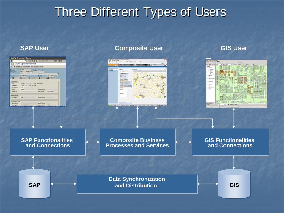
Three Different Types of UsersThree Different Types of Users
SAP User Composite User GIS User
SAPSAP GISGISData Synchronization
and DistributionData Synchronization
and Distribution
SAP Functionalities and Connections
SAP Functionalities and Connections
GIS Functionalities and Connections
GIS Functionalities and Connections
Composite BusinessProcesses and Services
Composite BusinessProcesses and Services
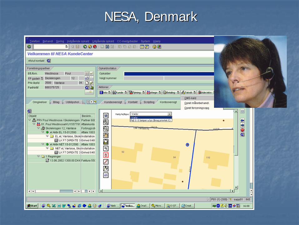
NESA, DenmarkNESA, Denmark

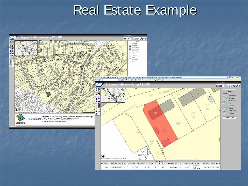
RealReal EstateEstate ExampleExample

PSE&G
Related Data From SAPRelated Data From SAP
Selected Circuit From GISIn Blue
Selected Circuit From GISIn Blue
Selected TransformerSelected Transformer
RealReal EstateEstate ExampleExample
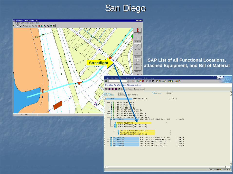
San DiegoSan Diego
StreetlightStreetlight SAP List of all Functional Locations, attached Equipment, and Bill of Material
Drainage Inlet
Drainage Inlet
Drainage Inlet
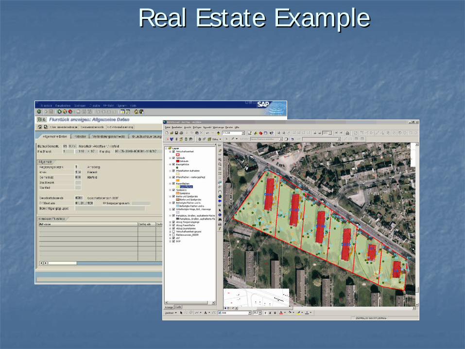
RealReal EstateEstate ExampleExample
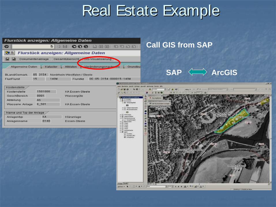
Call GIS from SAP
SAP ArcGIS
RealReal EstateEstate ExampleExample
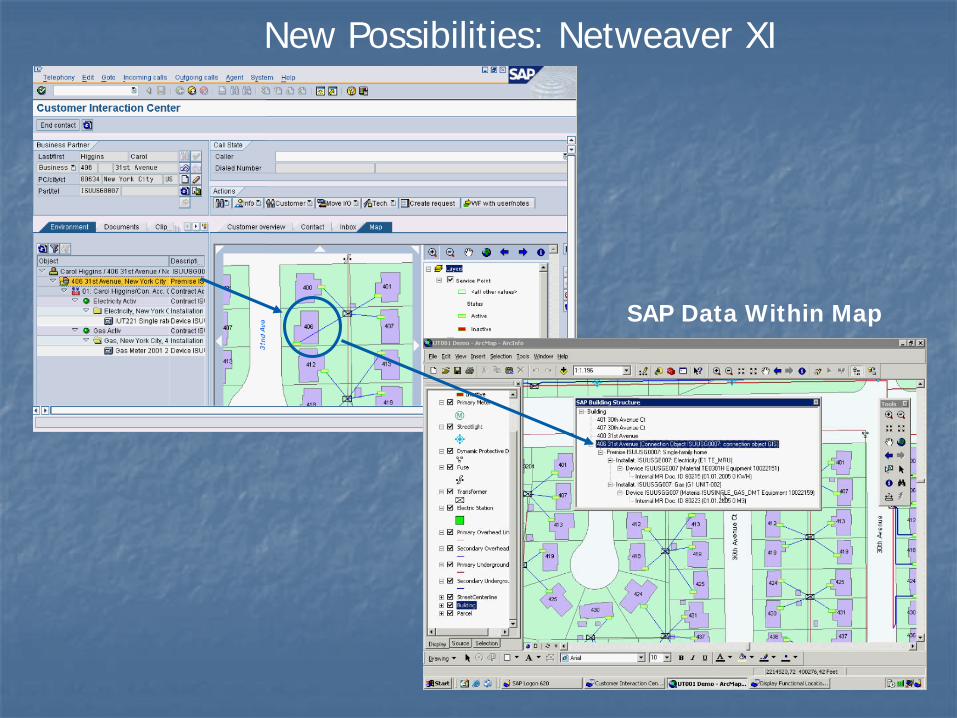
SAP Data Within Map
New Possibilities: Netweaver XI
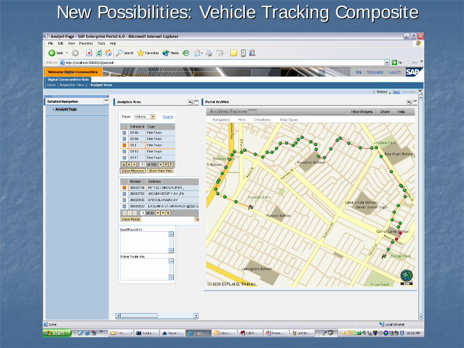
New Possibilities: Vehicle Tracking CompositeNew Possibilities: Vehicle Tracking Composite
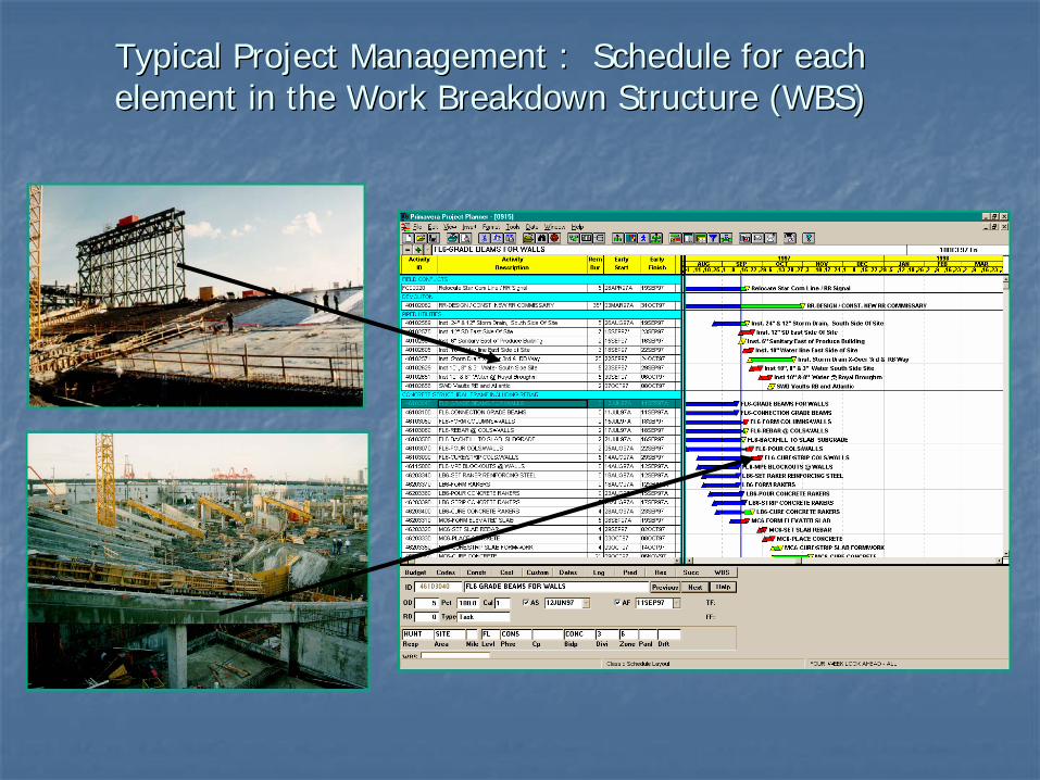
Typical Project Management : Schedule for each Typical Project Management : Schedule for each element in the Work Breakdown Structure (WBS)element in the Work Breakdown Structure (WBS)
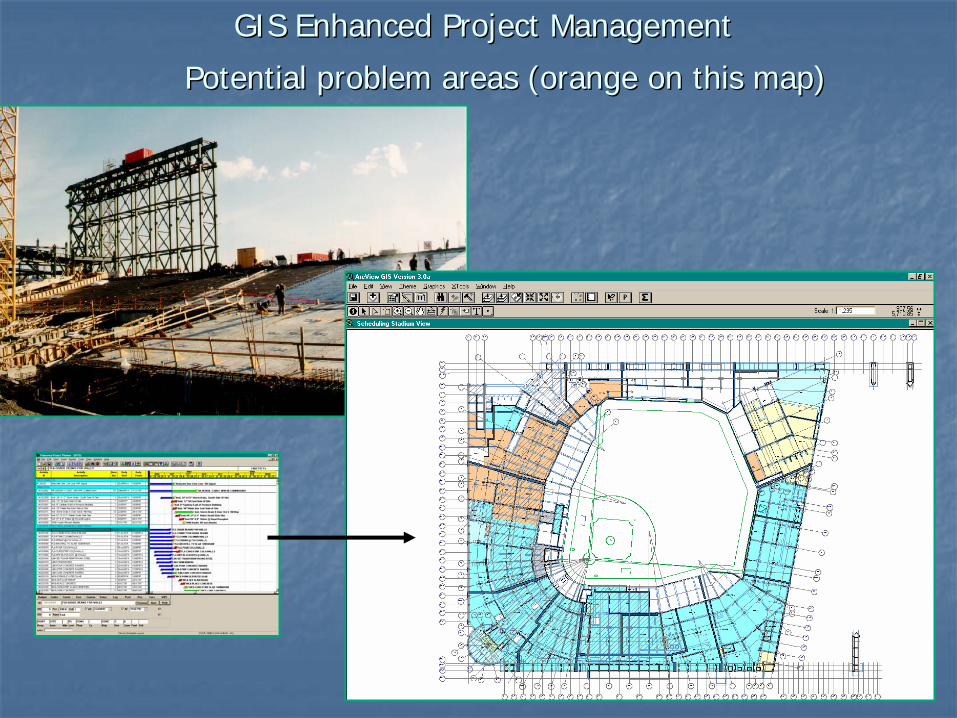
Potential problem areas (orange on this map)Potential problem areas (orange on this map)
GIS Enhanced Project ManagementGIS Enhanced Project Management
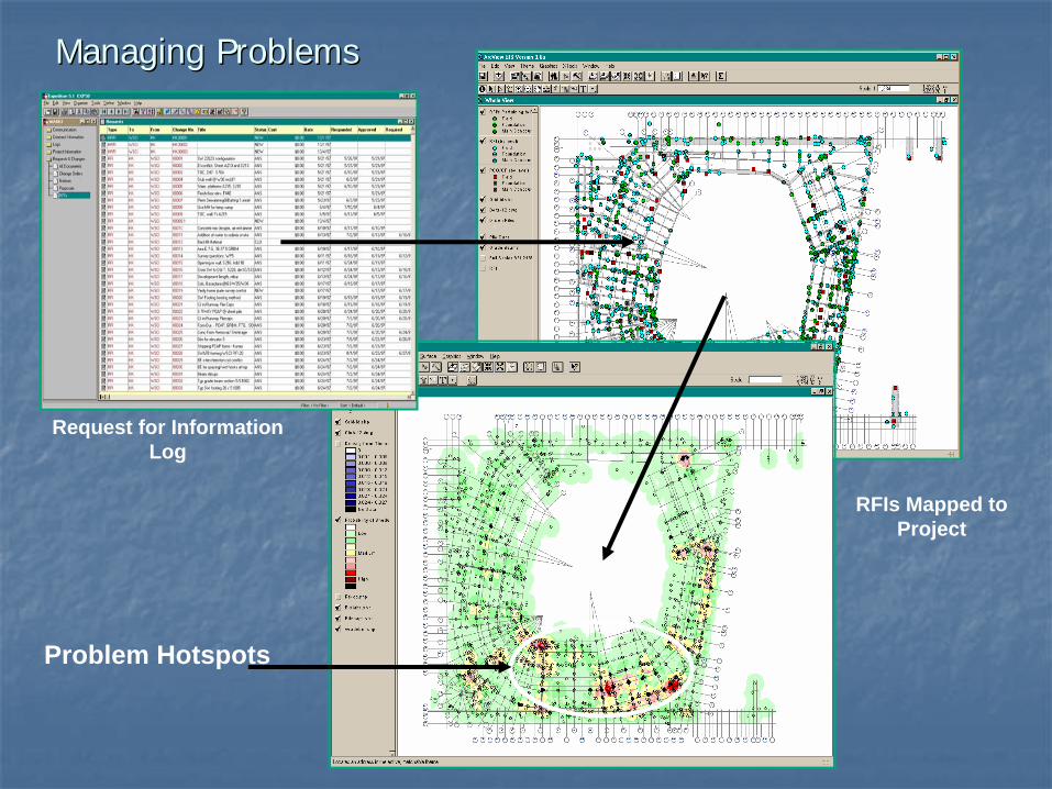
Managing ProblemsManaging Problems
Request for Information Log
RFIs Mapped to Project
Problem Hotspots

An Improved Way to Visualize ProjectsAn Improved Way to Visualize Projects