Embed Size (px)
Citation preview

General Management Plan1 I'
I I
Environmental Impact Statement
NATIONAL PARK OF AMERICAN SAMOA
October 1997 1
I
United States Department of the InteriorINational Park Service Return to park web page, Park Planning

"The young Samoan man carrying the au fa'i (banana bunch) on his shoulder is reflective of the Samoan way of life. Just as Samoans through the years have tended their bananas, I, too, have grown up on my grandfather's plantation where I help plant, cut and carry the au fa'i. So this picture that I painted represents not only Samoans generally but myself personally. "
Brandon Avegalio Senior, Leone High School
American Samoa
General Management Plan1 Environmental Impact Statement
National Park of American Samoa Territory of American Samoa
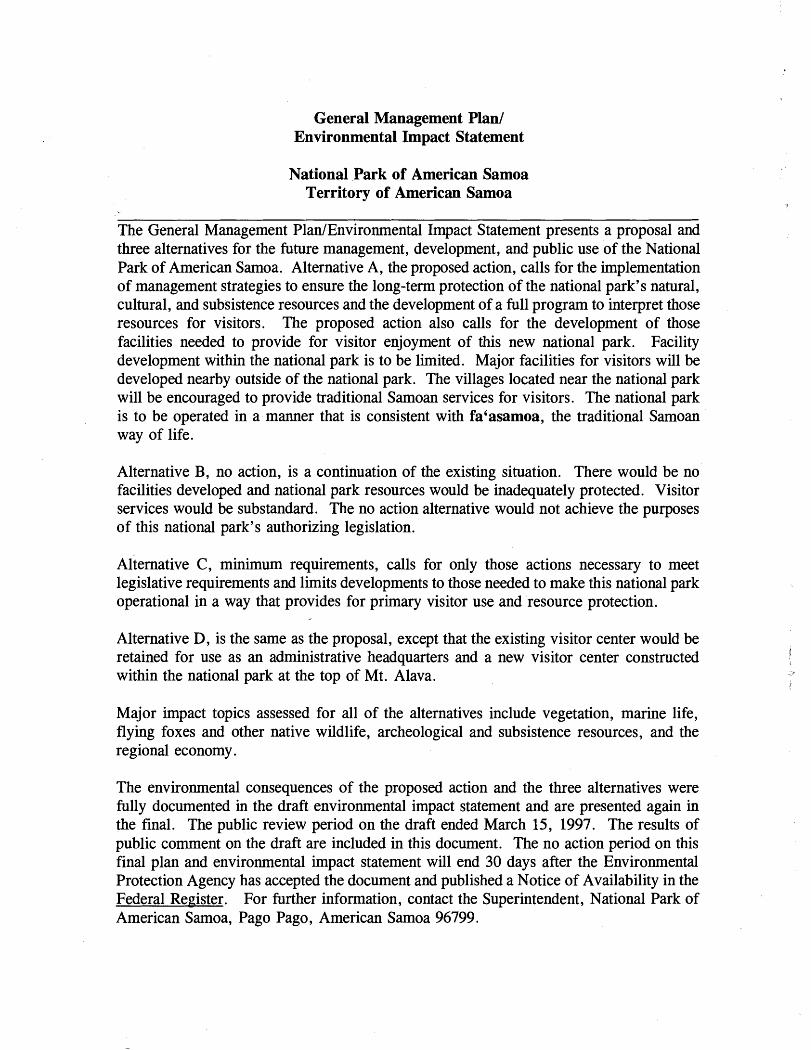
The General Management PlanIEnvironmental Impact Statement presents a proposal and three alternatives for the future management, development, and public use of the National Park of American Samoa. Alternative A, the proposed action, calls for the implementation of management strategies to ensure the long-term protection of the national park's natural, cultural, and subsistence resources and the development of a full program to interpret those resources for visitors. The proposed action also calls for the development of those facilities needed to provide for visitor enjoyment of this new national park. Facility development within the national park is to be limited. Major facilities for visitors will be developed nearby outside of the national park. The villages located near the national park will be encouraged to provide traditional Samoan services for visitors. The national park is to be operated in a manner that is consistent with fa'asamoa, the traditional Samoan way of life.
Alternative B, no action, is a continuation of the existing situation. There would be no facilities developed and national park resources would be inadequately protected. Visitor services would be substandard. The no action alternative would not achieve the purposes of this national park's authorizing legislation.
~lternative C, minimum requirements, calls for only those actions necessary to meet legislative requirements and limits developments to those needed to make this national park operational in a way that provides for primary visitor use and 'resource protection.
Alternative D, is the same as the proposal, except that the existing visitor center would be retained for use as an administrative headquarters and a new visitor center constructed within the national park at the top of Mt. Alava.
Major impact topics assessed for all of the alternatives include vegetation, marine life, flying foxes and other native wildlife, archeological and subsistence resources, and the regional economy.
The environmental consequences of the proposed action and the three alternatives were fully documented in the draft environmental impact statement and are presented again in the final. The public review period on the draft ended March 15, 1997. The results of public comment on the draft are included in this document. The no action period on this final plan and environmental impact statement will end 30 days after the Environmental Protection Agency has accepted the document and published a Notice of Availability in the Federal Register. For further information, contact the Superintendent, National Park of American Samoa, Pago Pago, American Samoa 96799.

SUMMARY This document consists of a general management plan and an environmental impact statement. Four alternatives have been identified and evaluated. These alternatives include the proposed action and a no action.
The purpose of this general management plan is to guide the development and use of the National Park of American Samoa for the next 10 to 15 years. The plan's particular concerns are caring for natural and cultural resources of this national park, guiding visitor use, and ensuring that the traditions and customs of the Samoan culture are maintained within the national park.
The environmental impact statement analyzes the environmental consequences of the four alternatives for managing the development and use of the National Park of American Samoa. The statement provides a discussion of the significant environmental impacts connected with the alternatives and identifies mitigating measures to reduce any adverse effects.
The following alternatives take into account the significant and unique natural, cultural, and subsistence resources of this national park and the comments and concerns raised during the public review period on the draft general management planlenvironmental impact statement.
Alternative A
This alternative, the proposed action, is the National Park Service's (NPS) General Management Plan for the National Park of American Samoa. The plan contains proposals for the development of major facilities and access so that visitors to this new and, as yet, undeveloped national park may fully appreciate its significant attributes. A visitor centerlpark headquarters is proposed for construction in the Pago Pago Harbor area, and the nearby aerial tramway is to be replaced with a new system capable of bringing visitors into the Tutuila unit of the national park. These facilities are proposed on lands owned by the American Samoa Government (ASG) located outside of the national park. Modest facilities are proposed for the Ta'u and Ofu

trails. No roads will be built within the national park. The villages located near the national park will be encouraged to provide national park visitors with food, beverage, and guide services and with traditional overnight accommodations.
Under the proposed action, management strategies will be implemented by NPS to preserve and protect the nationally significant natural and cultural resources of this national park. These resource management strategies are to be based on scientific data gathered through active research programs and on NPS consultation with subsistence users of national park lands and waters. Traditional subsistence agriculture, gathering, and fishing uses within the national park are to be maintained.
The proposed action calls for the development of a full interpretive program. The interpretive program is to focus on the traditional Samoan culture and on the tropical forest, flying fox, and coral reef resources of this national park.
Construction costs connected with fully implementing the proposed action are estimated at about $13 million, and an additional $426,000 will be needed to rehabilitate and convert existing facilities for visitor use. An additional $780,000 will need to be added to the park's annual base funding to fully carry out operations. The proposed action provides for optional ASG funding for the construction of the proposed visitor centerlpark headquarters. Under this option, construction costs would be reduced by about $4.8 million. NPS would then lease the building from ASG. Lease costs are estimated to be about $15,0001month.
The proposed action calls for NPS to operate this national park in a manner that is consistent with fa'asamoa, the traditional Samoan way of life. Within the national park, traditional customs and traditional subsistence uses of park lands and waters are to be maintained, so long as such uses are not inconsistent with the purposes for which the park was established.
Impacts. No significant adverse environmental impacts are connected with the implementation of the proposed d o n ; Overall, impacts under the proposed action will be beneficial. The access and facility developments proposed within the national park will have minimal and short-term adverse effects on the national park's natural and cultural resources. The beneficial effects of the proposed action on the park's resources will be long-term, brought

about .largely by the implementation of resource management strategies and also by the development of an interpretive program to inform and educate visitors. Existing subsistence resources will be only minimally affected by the proposed action. Any adverse effects on subsistence resources will be mitigated.
The proposed action will have a beneficial effect on the regional economy. These effects will be both long-term and short-term. Long-term benefits will come principally through new jobs and payroll generated in the Pago Pago area and in the villages adjacent to the national park. Most of the new jobs will be private sector, service related - transportation, overnight accommodations, food and beverage, and the sale of Samoan handicrafts. Short-term benefits to the region will come through jobs and payroll generated by the construction of the proposed visitor centerlheadquarters, the new aerial tramway, and other facilities connected with the development of the national park.
There will be some short-term, adverse effects produced by the proposed action. These effects will be localized, confined to the Pago Pago area, and primarily in the form of increased traffic and noise occurring in the vicinity of major construction sites such as the visitor centerlheadquarters and the aerial tramway. There will also be some potential for the disruption of traditional village activities due national park visitors staying overnight. All of these adverse effects could be mitigated.
Alternative B
This is the no . action alternative, required by National Environmental Policy Act regulations to provide a baseline against which the other alternatives can be compared. The no action alternative is a continuation of the existing conditions.
Under this alternative, no major rehabilitation of the existing means of access to the national park would be possible and there would be no development of any new facilities for visitor services or park administration.
Staffing would remain at about the same level. At that level, there would be no cultural resources, interpretive or park maintenance staff. There would be only a very limited capability to care for the park's resources, both natural and cultural. No new research
iii

projects could be undertaken and the park's capability to monitor the condition of its resources would be extremely limited.
The national park's base operating budget would stay at about the same level. There would be no costs connected with the development of new facilities. The no action alternative would not meet legislative requirements.
Impacts. The long-term beneficial effects and short-term adverse effects on the natural resources of the national park from the development or rehabilitation of facilities and access connected with the national park would be absent. There would be no potential to damage or destroy archeological sites and features due to the construction of new developments. Also, there would be no localized, short-term, disruption or increase in traffic and noise during construction activities. However, the short-term, economic benefits on the regional economy from construction jobs connected with park developments would be absent.
Under this alternative, with park staff being limited to the existing positions, the capability to conduct additional scientific research, monitor the condition of resources, or implement resource management strategies would be extremely low. Similarly, without a park interpretive staff, there would be little or no opportunity to develop an effective interpretive program to inform and educate visitors. These conditions would ultimately result in the degradation of national park resources and in substandard visitor services - both major, long-term, adverse effects.
Alternative C
This is the minimum requirements alternative. This alternative calls for taking specific courses of action to address park issues and is not merely a continuation of the present course of park operations. However, this alternative proposes the implementation of only those courses of actions necessary to meet legislative requirements. Access and facilities would be developed, but at a lower level than under the proposed action. No new major visitor center is proposed. The present leased commercial office space would continue to be used for visitor contact. The aerial tramway would not be replaced. The existing tramway is unsafe and could not be used to bring visitors into the national park.

Resource management strategies would be implemented and an interpretive program would be developed, but both would be constrained by the smaller staff increases proposed under this alternative. This alternative would allow the national park to become operational, but to the extent that it would provide for only primary visitor use, park management, and resource protection.
Approximately $1 million in construction costs for facility development and approximately $350,000 in rehabilitation costs would be needed to implement this alternative. An additional $320,000 would need to be added to the park base to fund operations at a minimal level.
Impacts. The adverse impacts on natural and cultural resources c o ~ e c t e d with the development of access and facilities would be less than under the proposed action. However, due to the fewer numbers of national park staff under this alternative, the long- term, beneficial effects on resources derived from the implementation of resource management strategies and from the development of an interpretive program to inform and educate visitors would be less. Also, the short-term beneficial effects on the regional economy would be less under the minimum requirements alternative because of the lower level of facility development proposed. Without access to the national park via an aerial tramway, which is seen in American Samoa as a major visitor attraction, the long-term beneficial effects generated by new service-related jobs would be less under this alternative. The short-term, adverse effects from increased traffic and noise in the vicinity of the construction sites for the visitor center and aerial tramway would be absent under this alternative.
This alternative calls for the construction of a visitor center facility atop Mt. Alava, the terminus of the aerial tramway, and the retention of the leased office space in the Pago Pago area as a park administrative headquarters. The visitor center would be smaller than that called for under the proposed action. Under this alternative, no major visitor centerlpark headquarters facility would be constructed in the Pago Pago Harbor area. All other developments called for under this alternative would be the same as the proposed action. The resource management and interpretive

programs under this alternative would be the same as the proposed action.
Construction costs would total, about $10.1 million, rehabilitation costs about $425,000, and $835,000 would need to be added to the park base to fund operations.
Impacts. Impacts would be about the same as the proposed action, except for the increased localized, adverse effects on vegetation, soils, and coastal water quality connected with the construction of a visitor center on Mt. Alava, a remote location. The short-term, adverse effects from the construction of a visitor centerlheadquarters in the Pago Pago Harbor area would be absent under this alternative.

Comparison of Effects
ALTERNATIVE A PROPOSED
ACTION
IMPACT TOPIC
Vegetation and Soils
Wildlife
Mariie Resources
Limited and localized adverse e f fec t s f r o m faci l i ty development and trail construction; major, long-term benefits from increased capability to implement resources management strategies for control of aggressive alien plants and feral pigs.
Little or no effect on native wildlife, including flying f o x e s , f r o m f a c i l i t y development and rehabilitation; major long-term benefits on na t ive wi ld l i f e f rom implementation of resource management strategies.
Long-term beneficial effect on coral reef resources from implementation of resource
managementstrategies.
ALTERNATIVE B NO ACTION
No vegetation or soils would be disturbed by either the rehabilitation of existing facilities or the construction of new ones. Long-term adverse effect from uncontrolled spread of aggressive alien plants and feral pigs.
Potential for native wildlife to be adversely affected due to limited capability to implement r e s o u r c e m a n a g e m e n t strategies.
Potential for coral reef and other marine resources to be adversely affected due to limited capability to implement r e s o u r c e m a n a g e m e n t strategies.
ALTERNATIVE C MINIMUM
REQUIREMENTS
Long-term adverse effect on native vegetation from con t inu ing sp read o f aggressive alien plants and feral pigs. No vegetation or soils would be disturbed by construction of a visitor center, tramway, or new hiking trails.
Some potential for native wildlife to be adversely affected due to reduced capability to implement resources management strategies.
ALTERNATIVE D VISITOR CENTER, MT. ALAVA
Same as Alternative A, except for additional short-term, localized, adverse effect on native vegetation and soils due to use of heavy construction equipment on Mt. Alava to construct visitor center.
Same as proposed action.
Increased potential for coral Same as proposed action. reef and other marine resources to be adversely affected due to feduced capability to implement r e s o u r c e m a n a g e m e n t strategies.
ALTERNATIVE A PROPOSED
ACTION
ALTERNATIVE B NO ACTION
ALTERNATIVE C MINIMUM
REQUIREMENTS
ALTERNATIVE D VISITOR CENTER,
MT. ALAVA
Same as proposed action. Long-term effect same as proposed action. Localized short-term adverse effect on Tutuila unit's coastal water quality from construction on Mt. Alava.
Water Quality Long- te rm, loca l i zed , beneficial effect on Tutuila unit coastal water quality due to decrease in sediments from rehabilitation of Mt. Alava trail.
Localized, long-term, adverse effect on Tutuila unit's coastal water quality from sediments originating on Mt. Alava road to continue.
Air Quality Short-term and localized adverse effects during construction of major facilities from vehicle emissions and fugitive dust.
No effect. No effect. Same as proposed action, except no adverse effect due to visitor center construction in the Pago Pago area.
Subsiience Use Activities
No major effect. Potential for long-term adverse Minimal effect. Smaller staff effect on subsistence fishing. would have reduced capability Small staff would have only to monitor existing subsistence minimal capability to monitor uses. existing subsistence uqes. Major, long-term adverse Increased potential for long- effect due to unstructured term adverse effect on cultural visitor use and lack of an resources. interpretive program.
Same as proposed action.
Archeological and Cultural Resources
Major, long-term beneficial effect through structuring visitor access and development of a park-wide interpretive program.
Same as proposed action.
Visitor Services_ Major, long-term beneficial effect from development of access and major visitor center.
Little or no opportunity for visitors to receive a basic understanding and appreciation of national park resources.
Less opportunity for visitors to receive a basic understanding and appreciation of national park resources.
Same as proposed action, except visitors would not receive a basic orientation until after tramway ride.
No short-term 'benefits from new jobs and payroll for construction of facilities. Minimal long-term, beneficial effects from service-related jobs created by national park visitors.
Regional Economy Short-term beneficial effects due to new jobs and payroll to construct major facilities; long- term beneficial effects due to service-related jobs created by visitors to the national park.
Some short-term and long-term benefits, but less than proposed action.
Same as proposed action.

Local Residents
ALTERNATIVE A PROPOSED
ACTION
ALTERNATIVE B NO ACTION
Short-term, localized, adverse No effect. effect from traffic congestion, noise, and construction vehicles in the vicinity of work sites in the Pago Pago area. Localized, long-term, adverse effect from traffic increases on Solo Hill road.
ALTERNATIVE C MINIMUM
REQUIREMENTS
No effect.
ALTERNATIVE D VISITOR CENTER,
MI'. ALAVA
Some short-term, localized, adverse effect from traffic congestion, noise, and construction vehicles in connection with tramway construction. Localized, long- term, adverse effect from traffic increases on Solo Hill road.
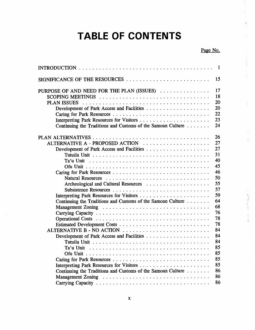
TABLE OF CONTENTS Page No .
. . . . . . . . . . . . . . . . . . . . . . . . . . . . . . . . . . . . . . . . INTRODUCTION 1
. . . . . . . . . . . . . . . . . . . . . . . . . SIGNIFICANCE OF THE RESOURCES 15
. . . . . . . . . . . . . . . PURPOSE OF AND NEED FOR THE PLAN (ISSUES) 17 . . . . . . . . . . . . . . . . . . . . . . . . . . . . . . . . . SCOPING MEETINGS 18
PLANISSUES . . . . . . . . . . . . . . . . . . . . . . . . . . . . . . . . . . . . . . 20 . . . . . . . . . . . . . . . . . . . Development of Park Access and Facilities 20
. . . . . . . . . . . . . . . . . . . . . . . . . . . . . Caring for Park Resources 22 . . . . . . . . . . . . . . . . . . . . . Interpreting Park Resources for Visitors 23
Continuing the Traditions and Customs of the Samoan Culture . . . . . . . 24
. . . . . . . . . . . . . . . . . . . . . . . . . . . . . . . . . . . PLAN ALTERNATIVES 26 . . . . . . . . . . . . . . . . . . . . ALTERNATIVE A . PROPOSED ACTION 27 . . . . . . . . . . . . . . . . . . . Development of Park Access and Facilities 27
. . . . . . . . . . . . . . . . . . . . . . . . . . . . . . . . . . . Tutuila Unit 31 Ta'uUnit . . . . . . . . . . . . . . . . . . . . . . . . . . . . . . . . . . . . 40
. . . . . . . . . . . . . . . . . . . . . . . . . . . . . . . . . . . . . ofuuni t 45 . . . . . . . . . . . . . . . . . . . . . . . . . . . . . Caring for Park Resources 46
. . . . . . . . . . . . . . . . . . . . . . . . . . . . . . . Natural Resources 50 Archeological and Cultural Resources . . . . . . . . . . . . . . . . . . . 55
. . . . . . . . . . . . . . . . . . . . . . . . . . . . . Subsistence Resources 57 . . . . . . . . . . . . . . . . . . . . . Interpreting Park Resources for Visitors 59
Continuing the Traditions and Customs of the Samoan Culture . . . . . . . 64 . . . . . . . . . . . . . . . . . . . . . . . . . . . . . . . . Management Zoning 68
. . . . . . . . . . . . . . . . . . . . . . . . . . . . . . . . . . Carrying Capacity 76
. . . . . . . . . . . . . . . . . . . . . . . . . . . . . . . . . . Operational Costs 78 . . . . . . . . . . . . . . . . . . . . . . . . . . . Estimated Development Costs 78 . . . . . . . . . . . . . . . . . . . . . . . . . . ALTERNATIVE B . NO ACTION 84
Development of Park Access and Facilities . . . . . . . . . . . . . . . . . . . 84 . . . . . . . . . . . . . . . . . . . . . . . . . . . . . . . . . . . Tutuila Unit 84
Ta'uUnit . . . . . . . . . . . . . . . . . . . . . . . . . . . . . . . . . . . . 85 OfuUnit . . . . . . . . . . . . . . . . . . . . . . . . . . . . . . . . . . . . . 85
. . . . . . . . . . . . . . . . . . . . . . . . . . . . . Caring for Park Resources 85 . . . . . . . . . . . . . . . . . . . . . Interpreting Park Resources for Visitors 85
. . . . . . . Continuing the Traditions and Customs of the Samoan Culture 86 . . . . . . . . . . . . . . . . . . . . . . . . . . . . . . . . Management Zoning 86
. . . . . . . . . . . . . . . . . . . . . . . . . . . . . . . . . . Carrying Capacity 86

Operational Costs . . . . . . . . . . . . . . . . . . . . . . . . . . . . . . . . . . 86 Estimated Development Costs . . . . . . . . . . . . . . . . . . . . . . . . . . . 87
ALTERNATIVE C . MINIMUM REQUIREMENTS . . . . . . . . . . . . . . . 87 Development of Park Access and Facilities . . . . . . . . . . . . . . . . . . . 87
Tutuila Unit . . . . . . . . . . . . . . . . . . . . . . . . . . . . . . . . . . . . 88 Ta'uUnit . . . . . . . . . . . . . . . . . . . . . . . . . . . . . . . . . . . . 89 OfuUnit . . . . . . . . . . . . . . . . . . . . . . . . . . . . . . . . . . . . . 90
Caring for Park Resources . . . . . . . . . . . . . . . . . . . . . . . . . . . . . 90 Interpreting Park Resources for Visitors . . . . . . . . . . . . . . . . . . . . . 92
. . . . . . . Continuing the Traditions and customs of the Samoan Culture 93 . . . . . . . . . . . . . . . . . . . . . . . . . . . . . . . . Management Zoning 93
. . . . . . . . . . . . . . . . . . . . . . . . . . . . . . . . . . . Carrying Capacity 94
. . . . . . . . . . . . . . . . . . . . . . . . . . . . . . . . . . Operational Costs 94 . . . . . . . . . . . . . . . . . . . . . . . . . . Estimated Development Costs ; 94
ALTERNATIVE D . CONSTRUCT VISITOR CENTER ON MT . ALAVA . 96 Development of Park Access and Facilities . . . . . . . . . . . . . . . . . . . 96 Caring for Park Resources . . . . . . . . . . . . . . . . . . . . . . . . . . . . . . 98 Interpreting Park Resources for Visitors . . . . . . . . . . . . . . . . . . . . . 98
. . . . . . . Continuing the Traditions and Customs of the Samoan Culture 98 Management Zoning . . . . . . . . . . . . . . . . . . . . . . . . . . . . . . . . 98 Carrying Capacity . . . . . . . . . . . . . . . . . . . . . . . . . . . . . . . . . . 98
. . . . . . . . . . . . . . . . . . . . . . . . . . . . . . . . . . Operational Costs 99 . . . . . . . . . . . . . . . . . . . . . . . . . . . Estimated Development Costs 99
AFFECTED ENVIRONMENT . . . . . . . . . . . . . . . . . . . . . . . . . . . . . . . 102 NATURAL RESOURCES . . . . . . . . . . . . . . . . . . . . . . . . . . . . . . . 102
Climate . . . . . . . . . . . . . . . . . . . . . . . . . . . . . . . . . . . . . . . . . 102 Geomorphology and Soils . . . . . . . . . . . . . . . . . . . . . . . . . . . . . . 103
Tutuila Island . . . . . . . . . . . . . . . . . . . . . . . . . . . . . . . . . . 103 Ta'u Island . . . . . . . . . . . . . . . . . . . . . . . . . . . . . . . . . . . . 105 Ofu Island . . . . . . . . . . . . . . . . . . . . . . . . . . . . . . . . . . . . . 107
Vegetation . . . . . . . . . . . . . . . . . . . . . . . . . . . . . . . . . . . . . . 108 Tutuila Unit . . . . . . . . . . . . . . . . . . . . . . . . . . . . . . . . . . . 110 Ta'u Unit . . . . . . . . . . . . . . . . . . . . . . . . . . . . . . . . . . . . 117 OfuUnit . . . . . . . . . . . . . . . . . . . . . . . . . . . . . . . . . . . . . 121
Flying Foxes . . . . . . . . . . . . . . . . . . . . . . . . . . . . . . . . . . . . . 123 Other Native Wildlife . . . . . . . . . . . . . . . . . . . . . . . . . . . . . . . . 129 Marine Resources . . . . . . . . . . . . . . . . . . . . . . . . . . . . . . . . . . 133 Alien Species . . . . . . . . . . . . . . . . . . . . . . . . . . . . . . . . . . . . . 137 Threatened and Endangered Species . . . . . . . . . . . . . . . . . . . . . . . 138 Air Quality . . . . . . . . . . . . . . . . . . . . . . . . . . . . . . . . . . . . . . 139 Coastal Zone Management . . . . . . . . . . . . . . . . . . . . . . . . . . . . . . . . 141
Page No .
. . . . . . . . . . . . . . ARCHEOLOGICAL AND CULTURAL RESOURCES 143 . . . . . . . . . . . . . . . . . . . . . . . . . . . . . SUBSISTENCE RESOURCES 145
. . . . . . . . . . . . . . . . . . . . . . . . . . . . . . . . . REGIONAL SETTING 148 . . . . . . . . . . . . . . . . . . . . . . . . . . . . . . . . . . VISITOR USE DATA 150
. . . . . . . . . . . . . . . . . . . . . . . . . ENVIRONMENTAL CONSEQUENCES 155 . . . . . . . . . . . . . . . . . . . . . ALTERNATIVE A PROPOSED ACTION 155
. . . . . . . . . . . . . . . . . . . . . . . . . . . Impacts on Natural Resources 155 . . . . . . . . . . . . . . . . . . . Proposed Developments . Tutuila Unit 156
. . . . . . . . . . . . . . . . . . . . Proposed Developments . Ta'u Unit 161 . . . . . . . . . . . . . . . . . . . . . Proposed Developments . Ofu Unit 163
. . . . . . . . . . . . . . . . . . . . . . Resource Management Strategies 163 . . . . . . . . . . . . . . . . . . . . . . . . . . . . . Subsistence Activities 165
. . . . . . . . . . . . . . . Impacts on Archeological and Cultural Resources 165 . . . . . . . . . . . . . . . . . . . . . . . . . . . Impacts on Subsistence Uses 171
. . . . . . . . . . . . . . . . . . . . . . . . . . . . . . Socio-economic Impacts 173 . . . . . . . . . . . . . . . . . . . . . . . . . . . . . . . . . . . . . . Conclusion 177
. . . . . . . . . . . . . . . . . . . . . . . . . . . . . . . . . Cumulative Effects 179 . . . . . . . . . . . . . . . . . . Short-term Uses and Long-term Productivity 179
. . . . . . . . . . Irreversible and Irretrievable Commitments of ~ e s o u r c k 180 . . . . . . . . . . . . . . . . . . . . . . . . . . . ALTERNATIVE B NO ACTION 181
. . . . . . . . . . . . . . . . . . . . . . . . . . . Impacts on Natural Resources 181 . . . . . . . . . . . . . . . . . . . . . . . . . . . . . . . . . . . Tutuila Unit 181
. . . . . . . . . . . . . . . . . . . . . . . . . . . . . . . . . . . . Ta'uUnit 182 . . . . . . . . . . . . . . . . . . . . . . . . . . . . . . . . . . . . . Ofu Unit 182
. . . . . . . . . . . . . . . . . . . . . . Resource Management Strategies 182 . . . . . . . . . . . . . . . . . . . . . . . . . . . . . Subsistence Activities 185
. . . . . . . . . . . . . . . Impacts on Archeological and Cultural Resources 183 . . . . . . . . . . . . . . . . . . . . . . . . . . . Impacts on Subsistence Uses 184
. . . . . . . . . . . . . . . . . . . . . . . . . . . . . . Socio-economic Impacts 184 . . . . . . . . . . . . . . . . . . . . . . . . . . . . . . . . . Cumulative Effects 185
. . . . . . . . . . . . . . . . . . Short-term Uses and Long-term Productivity 185 . . . . . . . . . . Irreversible and Irretrievable Commitments of Resources 185
. . . . . . . . . . . . . . . . . ALTERNATIVE C MINIMUM REQUIREMENTS 185 . . . . . . . . . . . . . . . . . . . . . . . . . . . Impacts on Natural Resources 186
. . . . . . . . . . . . . . . . . . . Proposed Developments . Tutuila Unit 186 . . . . . . . . . . . . . . . . . . . . Proposed Developments . Ta'u Unit 187
. . . . . . . . . . . . . . . . . . . . . Proposed Developments . Ofu Unit 187 . . . . . . . . . . . . . . . . . . . . . . Resource Management Strategies 187
. . . . . . . . . . . . . . . . . . . . . . . . . . . . . . Interpretive Program 188 . . . . . . . . . . . . . . . . . . . . . . . . . . . . . Subsistence Activities 188
xii

Page No .
. . . . . . . . . . . . . . . Impacts on Archeological and Cultural Resources 189 . . . . . . . . . . . . . . . . . . . . . . . . Impacts on Subsistence Resources 189
. . . . . . . . . . . . . . . . . . . . . . . . . . Socio-economic Impacts . . . : 189 . . . . . . . . . . . . . . . . . . . . . . . . . . . . . . . . . . . . . . Conclusion 190
. . . . . . . . . . . . . . . . . . . . . . . . . . . . . . . . . Cumulative Effects 190 . . . . . . . . . . . . . . . . . . Short-term Uses and Long-term Productivity 191
Irreversible and Irretrievable Commitments of Resources . . . . . . . . . . 191 ALTERNATIVE D . CONSTRUCT VISITOR CENTER ON MT . ALAVA . 192
. . . . . . . . . . . . . . . . . . . . . . . . . . . Impacts on Natural Resources 192 . . . . . . . . . . . . . . . Impacts on Archeological and Cultural Resources 193
. . . . . . . . . . . . . . . . . . . . . . . . Impacts on Subsistence Resources 193 . . . . . . . . . . . . . . . . . . . . . . . . . . . . . . Socio-economic Impacts 193
. . . . . . . . . . . . . . . . . . . . . . . . . . . . . . . . . . . . . . Conclusion 193 . . . . . . . . . . . . . . . . . . . . . . . . . . . . . . . . . Cumulative Effects 194
. . . . . . . . . . . . . . . . . . Short-term Uses and Long-term Productivity 194 Irreversible and Irretrievable Commitments of Resources . . . . . . . . . . 194
. . . . . . . . . . . . . . . . . . . . . . . CONSULTATION AND COORDINATION 195 CONSULTATION AND COORDINATION DURING THE DEVELOPMENT
OF THE'PROPOSED ACTION AND THE PREPARATION OF THE . . . . . . . . . . . . DRAFT ENVIRONMENTAL IMPACT STATEMENT 195
CIRCULATION OF THE DRAFT GENERAL MANAGEMENT PLANIENVIRONMENTAL IMPACT STATEMENT . . . . . . . . . . . . . 198
COMMENTS ON THE DRAFT GENERAL MANAGEMENT . . . . . . . . . . . . . PLANIENVIRONMENTAL IMPACT STATEMENT 201
. . . . . . . . . . . . . . . . . . . . . . . . . . . . . . . . . . SELECTED REFERENCES 251
. . . . . . . . . . . . . . . . . . . . . . . . . . . . . . . . . . . . . . . . . . APPENDIXES 257 . . . . . . . . . . . . . . . . . . . . . . . . . . . APPENDIX A - LEGISLATION 257
. . . . . . . . . . . . . . . . . . . . . . . . APPENDIX B LEASE AGREEMENT 263 APPENDIX C . PROJECTS REQUIRING FURTHER SECTION 106
CONSULTATION PRIOR TO IMPLEMENTATION . . . . . . . 286 APPENDIX D . VILLAGE COUNCIL MEETING ATTENDEES . . . . . . . 287
. . . . . . . . . . . . . . . . . . . . . . . . . . PREPARERS AND CONTRIBUTORS 298
INDEX . . . . . . . . . . . . . . . . . . . . . . . . . . . . . . . . . . . . . . . . . . . . . 299
xiii

Page No .
MAPS
. . . . . . . . . . . . . . . . . . . . . . . . . . . . Figure 1 Location. The Pacific Ocean 3 Figure 2 . Major Islands of American Samoa and Park Units of the
. . . . . . . . . . . . . . . . . . . . . . National Park of American Samoa 4 . . . . . . . . . . . . . . . . . . . . . . . . . . . . . . . Figure 3 Boundary. Tutuila Unit 7 . Figure 4 Boundary. Tabu Unit . . . . . . . . . . . . . . . . . . . . . . . . . . . . . . . 9 . Figure 5 Boundary. Ofu Unit . . . . . . . : . . . . . . . . . . . . . . . . . . . . . . . 11 . Figure 6 Proposed Action. Tutuila Unit . . . . . . . . . . . . . . . . . . . . . . . . . 29 . Figure 7 Proposed Action. Tabu Unit . . . . . . . . . . . . . . . . . . . . . . . . . . 43 . Figure 8 Proposed Action. Ofu Unit . . . . . . . . . . . . . . . . . . . . . . . . . . 47 . Figure 9 Management Zoning. Tutuila Unit . . . . . . . . . . . . . . . . . . . . . . 69 . Figure 10 Management Zoning. Tabu Unit . . . . . . . . . . . . . . . . . . . . . . . . 71 . Figure 11 Management Zoning. Ofu Unit . . . . . . . . . . . . . . . . . . . . . . . . 73 . Figure 12 Vegetation. Tutuila Unit . . . . . . . . . . . . . . . . . . . . . . . . . . . . 114 . Figure 13 Vegetation. Tabu Unit . . . . . . . . . . . . . . . . . . . . . . . . . . . . . . 119 . Figure 14 Vegetation. Ofu Unit . . . . . . . . . . . . . . . . . . . . . . . . . . . . . . 122
TABLES
. Table 1 Tourists in American Samoa . . . . . . . . . . . . . . . . . . . . . . . . . 154
xiv
INTRODUCTION The National Park of American Samoa was authorized in 1988 by Public Law 100-571. The purpose of this national park, the fiftieth to be so designated by Congress, is to "preserve and protect the tropical forest and archeological and cultural resources of American Samoa, and of associated reefs, to maintain the habitat of flying foxes, preserve the ecological balance of the Samoan tropical forest, and, consistent with the preservation of these resources, to provide for the enjoyment of the unique resources of the Samoan tropical forest by visitors from around the world. "
The following requirements by Congress1 give additional direction to the National Park Service with regard to the management and use of the National Park of American Samoa:
Traditional Samoan customs are . to be maintained within the national park. Subsistence uses of park lands and waters are provided for. Agriculture, gathering, or fishing uses within the park are to be confined to native American Samoans and will be very limited in scope and location. he^ are to be carried out with traditional tools and methods. The National Park Service is expected to work with village leaders to clarify and reach agreement as to the rules which are to be imposed regarding these uses.
The National Park Service is required to administer the park in accordance with the 1916 Act to establish the national park system and such other authorities the Service has to protect the natural and cultural resources of the park.
House Report No. 100-916, September 13, 1988.
1

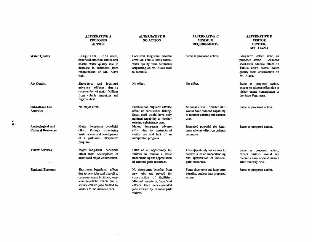
The National Park of American Samoa is comprised of three widely separated units on the islands of Tutuila, Ta'u, and Ofu in the Territory of ~merican Samoa. Tutuila, the largest island and American Samoa's commercial and governmental center, is separated from the islands of Ta'u and Ofu by approximately 60 miles of open ocean.
Five of the seven islands comprising American Samoa are the eastern portion of a 300-mile long chain of volcanic islands stretching across the South Pacific Ocean in a west-northwest direction between 168 and 173 degrees west longitude and a latitude between about 13 and 15 degrees south. From west to east, these islands are Tutuila, its smaller neighbor Aunu'u, and the three islands of the Manu'a Group, Ofu, Olosega, and Ta'u. The two remaining islands of American Samoa are Rose and Swains, both of which are coral atolls. Rose Atoll is about 100 miles east of Olosega and Swains Island is about 200 miles north- northwest of Tutuila. The independent country of Western Samoa, comprised principally of the larger islands of Savai'i and Upolu, constitutes the western portion of the Samoan archipelago.
The Tutuila unit of the National Park of American Samoa comprises approximately 2,500 acres of land and approximately 1,200 acres of offshore waters. This unit of the national park is located on the north-central part of Tutuila between the villages of Fagasa on the west and Afono on the east. The national park boundary goes around the upland edges of Vatia village and extends approximately one-quarter mile offshore from Tutuila's northern coast. The southern boundary follows along the crest of the Mt. Alava-Maugaloa ridge line above Pago Pago Harbor from Fagasa Pass to Afono Pass.
The island of Ta'u, located about 60 miles east of the island of Tutuila, contains the Ta'u unit of the national park comprising approximately 5,400 acres of land and approximately 1,000 acres of offshore waters. The national park on Ta'u comprises the southeastern half of that island, with its northern boundary high in the summit area of the cloud forest. On Ta'u, the national park boundary also extends into the Pacific Ocean about one-quarter mile along that island's eastern and southern coasts. The Ta'u unit's western boundary includes the volcanic craters of Olomatimu and Olomanu and runs along the crest of Mataalaosagamai Ridge down to Siufaalele Point and into the ocean.


1
LEGEND I
TUTULA
ISLAND
........................................... ............................................ ........................................... ............................................ AMERICAN SAMOA Tutuila and Aunu'u Islands 0 ' 1 2 3 4
I LEGEND
OFU ISLAND
UNIT ISLAND
b$f$$ NATIONAL PARK AREA
TAW ISLAND
AMERICAN SAMOA Manu'a Islands
0 1 I a : : @ MILES
flgure 2. Major islands of American Samoa and park units of the National Park of American Samoa.
4

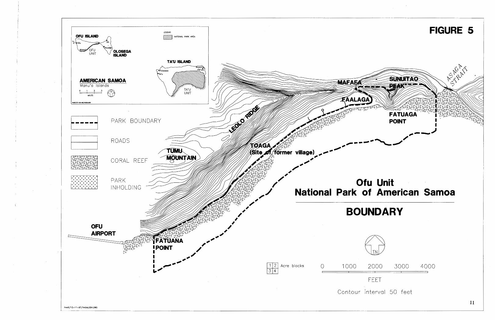
On Ofu island, about 10 miles northwest of Ta'u, is the Ofu unit of the national park. This is the smallest unit with about 70 acres of land and approximately 350 acres of offshore waters. The national park boundary follows along the southern shoreline of Ofu from Fatuana Point west to Asaga Strait, including in the white sand beach south of the road and extending approximately one- quarter mile offshore together with all of the fringing reef there. The national park on Ofu also includes the southern slopes of Sunuitao Peak.
The Ofu unit of the national park encompasses a beautiful, two-mile long, white sand beach and one of the most intact coral reef ecosystems in all of the Samoan archipelago.
In September 1993, a 50-year lease agreement was signed between the Governor of American Samoa, acting on behalf of village landowners, and the National Park Service (NPS). In accordance with Section 2.(a) of Public Law 100-571, the National Park of American Samoa becomes legally established with the lease signing, thereby providing NPS with the authority to begin managing lands and waters within the leased premises for national park purposes. The leased premises consist of lands belonging to the villages of Afono, Fagasa, Pago Pago, and Vatia on the island of Tutuila; Faleasao and Fitiuta on the island of Ta'u; and Ofu and Olosega on the island of Ofu. Lands within the authorized boundaries of the national park belonging to Ta'u village on the island of Ta'u are not yet part of the leased premises and therefore are not managed by NPS as a part of the national park at this time.
The leased premises also include lands and waters owned by the American Samoa Government (ASG). The ASG lands consist of 21 acres within the Tutuila unit located at the summit of Mt. Alava. Included within the leased premises on the top of Mt. Alava is the upper terminal of the aerial tramway which crosses above Pago Pago Harbor. The nearby electrical power poles and transformers, TV transmitter towers and the equipment building are not included within the leased premises. The leased waters consist of approximately 2,550 acres comprising the offshore portions of the three units of the national park.
The lease agreement authorizes NPS to manage and use the leased premises in accordance with the purpose of the park as stated in Section l.(b) of Public Law 100-571. The lease agreement also gives NPS, its duly authorized agents, and the general public the rights of access to the leased premises.
Following the signing of the lease agreement, minor modifications were made to the boundary of the Tabu unit. These modification to the park boundary consisted of removing certain lands from the Tabu unit located on the periphery of Fitiuta south of the village proper. These lands were excluded from the national park when it was learned that major portions were being used to grow commercial crops; also, the park superintendent wanted the boundary to follow a recognizable natural feature (a stream bed) as much as possible.
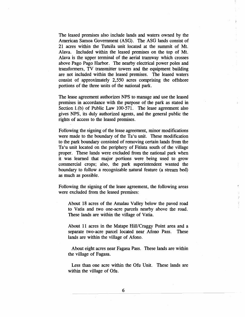
Following the signing of the lease agreement, the following areas were excluded from the leased premises:
About 18 acres of the Amalau Valley below the paved road to Vatia and two one-acre parcels nearby above the road. These lands are within the village of Vatia.
About 11 acres in the Matape HilllCraggy Point area and a separate two-acre parcel located near Afono Pass. These lands are within the village of Afono.
About eight acres near Fagasa Pass. These lands are within the village of Fagasa.
Less than one acre within the Ofu Unit. These lands are within the village of Ofu.

AMERCAN SAMOA Tutuila and Aunu'u Islands

I TAU UIO
W A N . SAMOA Manu'a Islands -
'm2 ' 63
Ta'u Unit Natlonal Park of Amerlcan Samoa
PARK BOUNDARY
0 1000 2000 3000 4000
FEET
Contour interval 50 fee t
Acre b locks
t,,,,{ PARK BOUNDARY
1 UNIMPROVED ROADS
UNIMPROVED TRAIL (Beyond Laufut i t h e t ra i l becomes intermittent)
VILLAGE LOCATIONS
CORAL REEF
TA'U VILLAGE LANDS ARE NOT INCLUDED WITHIN LEASE PREMISES
9
UNIT OLOSEQ A ISLAND
AMERICAN SAMOA Manu'a Islands
LEGEND
NATIONAL PARK AREA
FIGURE 5
Ofu Unit National Park of American Samoa
KI Acre blacks
BOUNDARY
FEET
Contour interval 50 feet
The above land parcels were excluded from the leased premises at the request of the landowner. These lands remain within the national park, but are not part of the leased premises at this time. They are regarded as inholdings within the national park.
Section 2.(d)(2) of Public Law 100-571 gives the High Court of American Samoa "exclusive jurisdiction" to determine the amount of compensation to be disbursed to those villages, families, and individuals with lands located within the boundaries of the national park. In order to carry out its responsibilities under Section 2. (d)(2), the High Court directed NPS to conduct an appraisal of lands within the authorized .boundaries. Based on the signing of the lease agreement, the High Court established assessment proceedings consisting of court hearings to certify payees. The hearings were followed by court orders issued to direct payment of rental compensation. Based on provisions contained in the lease agreement and in accordance with the court orders, the Governor of American Samoa then disbursed payments to the village payees.
Lease payments have been disbursed by the Governor to the certified payees within the villages of Afono, Fagasa, Pago Pago, Vatia, Fitiuta, Faleasao, Ofu and Olosega.
Section 3(e) of Public Law 100-571 calls for NPS to "establish a program to train native American Samoa personnel to function as professional park service employees,. . " The park superintendent is to give high priority to identifying and nurturing native American Samoans who have demonstrated an interest in acquiring the academic background, skills, and experience needed to operate and manage national parks. This goal is to be achieved in two basic ways: (1) by hiring qualified native American Samoans with background, education, and experience in national park-related fields to fill professional positions at the National Park of American Samoa; and (2) hiring and training native American Samoan students to pursue and complete professional degrees in national park-related fields.
The hiring and training of American Samoan students is to be carried out under the Federal Cooperative Education Program. The purpose of this program is to provide the selected students with part-time employment at the national park. When students have successfully completed their degree requirements, they can be converted to permanent full-time NPS employees in professional

positions at the National Park of American Samoa. These individuals will have advancement potential throughout the national park system.
SlGNlFlCAN'CE OF THE RESOURCES Geographically and biologically, American Samoa is at the end of an extension of islands and archipelagos beginning in New Guinea and extending through the Solomons, Fiji, Tonga, and Western Samoa, a distance of approximately 3,500 miles. Beyond American Samoa, many terrestrial and marine species disappear. In this context the National park of American Samoa is not only significant, but also unique in the U.S. national park system because of its paleotropical (old world) ecosystem. It is also important regionally (the South Pacific) as an end point in the process of ecological filtering that begins in Southeast Asia.
The primary significance of the National Park of American Samoa is that it contains the only mixed ' species paleotropical rainforest under the jurisdiction of the United States' National Park Service. This national park is also only one of three national parks with rainforest.
The rainforests within the National Park of American Samoa are diverse and remain largely intact, and they extend uninterrupted from sea level up to cloud forests on mountain summits. All are ecosystems with forest trees pollinated and dispersed by two species of native flying foxes.
The National Park of American Samoa has miles of pristine and scenic coastline, a stretch of lovely white sand beach rimmed with coconut palms and, within its offshore waters, coral reefs containing a multitude of marine resources.
The cultural resources of the National Park of American Samoa are of major significance. These cultural resources have their origin in the continued existence and vitality of the ancient Polynesian culture that has characterized the Samoa islands for nearly 3,000 years. The values and traditions of this culture are intertwined with the natural resources of the national park. Even today, Samoans retain close ties to the rainforest, as evidenced by communal ownership of forested lands, the status which ownership

gives to the family and the village, and the desire of Samoans to protect the integrity of the forest.
The National Park of American Samoa is the fiftieth such place in our nation to be so designated by the United States Congress. For more than three millennia, the people of these Polynesian lslands have esteemd.and cared for their lands. This esteem and care stem from the name they long ago gave to these islands ... SAMOA; The word means "sacred earth." According to one ancient Samoan legend, sacred earth originated from the genesis of the earth and the human race. For Samoans, the creator of heaven and earth was Tagaloa, and the god of the earth was Salevao. Tagaloa oldest son was Moa, who was born from the center of the earth. Just before Moa's birth, Salevao saw movement from the center'(moa) of the earth, so Tagaloa gave the name Moa to the newborn baby. Following Moa's birth, Salevao made sacred (sa), the water, the earth, and everything that grew .upon the earth. Hence, the name. The National Park Service will ensure that this sacred earth, the national park, is to be cared for in a manner which is consistent with fa'asamoa, the '%moan way.
'

PURPOSE OF AND NEED FOR THE PLAN (ISSUES) This is the first general management plan to be prepared for the National Park of American Samoa. The purpose of the plan is to guide the future operation, development, visitor use, and natural and cultural resource management of this national park. The National Park of American Samoa is a new park. No facilities have yet been developed by NPS to provide access for visitors to this national park's natural and cultural attributes. Baseline data are being accumulated on the park's tropical forest, flying foxes, coral reefs, and on its archeological and ethnographic resources, but actual resource management is just now getting underway. There are minimal visitor use facilities and an interpretive program has yet to be fully developed. Staffing is incomplete - presently, a superintendent, chief ranger, wildlife biologist, an archeologist hired under the Cooperative Education Program, and several volunteers make up the entire staff. Additional personnel are needed to operate this national park and carry out resource management, administrative, interpretive, and maintenance activities.
The preparation of a general management plan for the National Park of American Samoa is mandated by Section 3(f) of Public Law 100-571, the park's authorizing legislation. Section 3(f) states that the general management plan is to be developed in cooperation with the Governor of American Samoa and "shall contain specific measures for the protection and preservation of tropical forest resources, and archaeological and cultural resources of the park, including but not limited to, protection of flying foxes and measures to enhance visitation to the park from throughout the world, to the extent consistent with the protection and preservation of such resources. "
As noted, the National Park of American Samoa was legally established in September 1993 when the Governor of American Samoa, acting on behalf of village landowners, and NPS signed a 50-year lease agreement. Upon the completion of the High Court's assessment proceedings and landowners being duly compensated, NPS assumed management authority over national park lands and waters within the leased premises. The
development of a general management plan allows the National Park of American Samoa to begin the next phase of its development.
The general management plan is .accompanied by an environmental impact statement. Required by National Environmental Policy Act regulations and NPS policy, this document's purpose is to identify and analyze the environmental consequences of reasonable alternatives for the future use, development, and management of the National Park of American Samoa.
SCOPING MEETINGS
In October 1994, the NPS planning team held scoping meetings in American Samoa for the purpose of receiving input from key ASG officials and the councils of the villages with lands in the national park on the issues they believed should be addressed in the general management plan. The initial meeting was held with the Governor of American Samoa. The Governor gave his full support to the devel~pment of the National Park of American Samoa. The planning team then met with the High Court of American Samoa to discuss undertaking the preparation of the general management plan. Following these meetings, the planning team met separately with the councils in each of the eight villages with lands presently included within the leased premises. NPS team members stressed at each of the meetings that the general management plan for the National Park of American Samoa was to be prepared in an open manner and that throughout its development the views and advice of the village councils would be sought.
During the scoping meetings, village council members raised several concerns and asked questions related to the plan's development. These tended to be specific in nature and, in summary, consist of the following:
- the need to locate and clearly identify and mark national park boundaries;
- asking whether national park lands could be used for subsistence purposes and whether certain plants within the park could still be grown for medicinal purposes;
- what happens when lands in the national park are cleared by village members "unnecessarily " ;

- what kinds of economic opportunities will the national park offer to the villages;
- the remains of ancient villages are located within what is now the national park and there are still graves in these abandoned villages - these are' regarded as special
- places;
- what "nuisances" related to village lands within the park should be handled by NPS and what "nuisances" should be handled by the village councils;
- entrance fees, and who would be able to charge them;
- being able to select individuals from the villages to assist NPS in trail construction;
- bringing in exotic animal species to the national park; and
- asking NPS to consider paying the villages from five to 25 years in advance for the leasing of their lands.
The last four issues were judged to be unrelated to the preparation of a general management plan. These were either answered at the scoping meetings or were subsequently addressed separately by the park superintendent.
At the village scoping meetings, there was general agreement by all the councils that NPS should proceed with the preparation of a general management plan for the National Park of American Samoa. Further, it was agreed at each village meeting that the council would appoint a committee of two to three individuals to represent them at future meetings to discuss village matters related to the general management plan and the National Park of American Samoa. Committee members would report back to the council and then pass on to NPS the thoughts, opinions, or- blessings of their respective council on national park related matters.
In March 1995, additional scoping meetings were held in American Samoa on the preparation of the general management plan. These meetings were held with appropriate agencies of the ASG and the local representatives of U . S . government agencies to solicit their views on what issues needed to be addressed during

the development of a general management plan. Concerns raised at these meetings included the following:
- the recent increase in the feral pig population in the uplands of Tutuila and Ta'u and the damage being caused by these pigs to the native forest and subsistence agriculture.
- the absence of any drinking water standards in the villages adjacent to the national park.
- the opportunities for undertaking cooperative research projects with NPS on native forest birds, inshore fisheries, native snails, and flying foxes.
- the possible use of ASG hunting and fishing regulations within the national park.
- the importance of the National Park of American Samoa in the implementation of the Tourism Task Force's 5- Year Tourism Action Plan.
- the need to remove the unsightly trash 'dump chute within the national park on the outskirts of Vatia village.
- the mutual benefits produced by the national park interacting with the American Samoa Community College.
PLAN ISSUES
.Broadly, issues that are to be addressed in the preparation of this -generatmanagement-plan are : (1)- development of park access and facilities, (2) caring for park resources, (3) interpreting park resources for visitors, and (4) ensuring the continuation of the traditions and customs of the Samoan culture within the park.
Development of Park Access and Facilities
The issue here is the location, type, and extent of the access and facility development to be proposed for the national park. Access must be provided that is safe for visitors and appropriate in that it does not adversely affect park resources. Similarly, any facilities that are developed within the national park should not adversely
affect park resources. Also, facilities should not interfere with traditional village subsistence activities and therefore should be kept to a minimum and carefully sited.
As this is a new national park, no facilities, including access, have yet been developed by NPS. In order to become fully operational, facilities are needed for visitor services and safety, resource management, and park maintenance and administration.
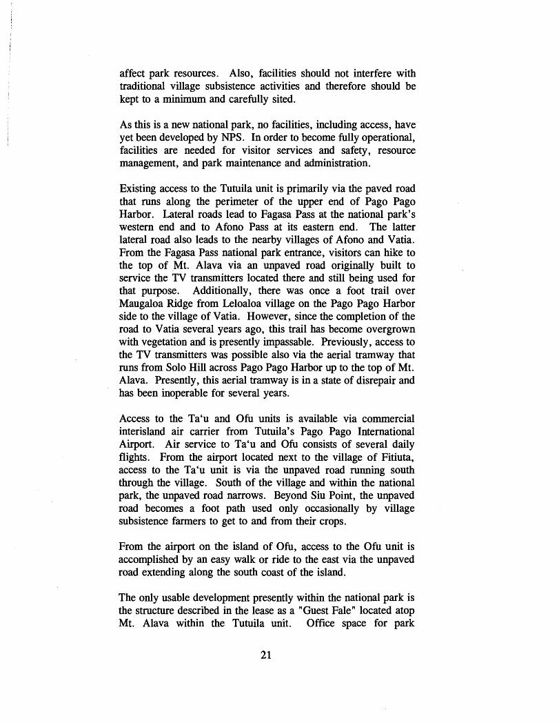
Existing access to the Tutuila unit is primarily via the paved road that runs along the perimeter of the upper end of Pago Pago Harbor. Lateral roads lead to Fagasa Pass at the national park's western end and to Afono Pass at its eastern end. The latter lateral road also leads to the nearby villages of Afono and Vatia. From the Fagasa Pass national park entrance, visitors can hike to the top of Mt. Alava via an unpaved road originally built to service the TV transmitters located there and still being used for that purpose. Additionally, there was once a foot trail over Maugaloa Ridge from Leloaloa village on the Pago Pago Harbor side to the village of Vatia. However, since the completion of the road to Vatia several years ago, this trail has become overgrown with vegetation and is presently impassable. Previously, access to the TV transmitters was possible also via the aerial tramway that runs from Solo Hill across Pago Pago Harbor up to the top of Mt. Alava. Presently, this aerial tramway is in a state of disrepair and has been inoperable for several years.
Access to the Ta'u and Ofu units is available via commercial interisland air carrier from Tutuila's Pago Pago International Airport. Air service to Ta'u and Ofu consists of several daily flights. From the airport located next to the village of Fitiuta, access to the Ta'u unit is via the unpaved road running south through the village. South of the village and within the national park, the unpaved road narrows. Beyond Siu Point, the unpaved road becomes a foot path used only occasionally by village subsistence farmers to get to and from their crops.
From the airport on the island of Ofu, access to the Ofu unit is accomplished by an easy walk or ride to the east via the unpaved road extending along the south coast of the island.
The only usable development presently within the national park is the structure described in the lease as a "Guest Fale" located atop Mt. Alava within the Tutuila unit. Office space for park

headquarters is presently being leased through the General Services Administration. The present park headquarters office, located in the village of Pago Pago outside of the national park, is regarded to be a temporary location for visitor contact until a suitable and permanent facility can be found.
Caring for Park Resources
The issue that needs to be addressed here is how to carry out the legislative purpose of the national park to "preserve and protect the tropical forest and archaeological and cultural resources.. . and of associated reefs, to maintain the habitat of flying foxes," and "preserve the ecological balance of the Samoan tropical forest.. . " The legislative requirement that traditional subsistence agriculture, cultural, gathering, and fishing uses are to be permitted in the park also needs to be addressed in the context of overall NPS resource management.
Through the Cooperative Park Studies Unit (CPSU) at the University of Hawaii, Manoa, studies of the park's botany, flying foxes, archeology, ethnography, and marine and coral reef resources have been undertaken. Most of these studies are now complete. Base maps of the national park have been prepared and recorded on computer aided design and drafting (CADD) and geographic information systems (GIs). These maps contain information on topography, vegetation, and land use for the entire park and the Ofu reef has been mapped on large-scale GIs. Detailed infra-red aerial photo coverage of the Tutuila, Tabu, and Ofu unit was obtained in October 1994. There is also available aerial photo coverage of the park taken in 1984 and 1990. These photos are to be analyzed and used in managing the park resources, particularly subsistence uses of park lands and waters. Studies prepared by the U.S. Fish and Wildlife Service and ASG's Department of Marine and Wildlife Resources are available and contain useful information related to the natural resources of the national park. All of the above provide NPS with sufficient baseline information needed to begin the preparation of a general management plan for the preservation and protection of the park's natural and cultural resources.
As part of the ethnographic overview and assessement prepared for the national park, knowledgeable local individuals were interviewed so that NPS may learn more about the kinds of traditional uses that once existed within the national park, as well

as those which presently exist. At this time NPS does not have sufficient know ledge and understanding of the extent and nature of subsistence uses now occurring within the national park to determine the impact, if any, on the park's native ecosystem.
Many contemporary Samoans possess an impressive knowledge about the natural world. This knowledge has been acquired by direct observation and folk wisdom passed on from generation to generation. In managing the resources of the national park in accordance with legislative requirements, NPS will gain important insights into the workings of the native ecosystem by seeking out and listening to Samoans with this kind of expertise.
A resource management plan, the first, has been prepared for the national park. It contains detailed project statements proposing specific actions for dealing with what are presently thought to be the park's most pressing natural and cultural resource issues.
Within the National Park of American Samoa, natural and cultural resource values are intertwined and cannot be separated into two distinct categories. The tropical forest, which once covered practically all of the land surface of the islands of the archipelago, is part of and woven into the Samoan culture. Within the national park, natural resources and processes are to be protected and preserved. Similarly, cultural and archeological resources and their settings are to be preserved and protected. Because of this complex interrelationship of natural and cultural values, resource management at the National Park of American Samoa will be both challenging and unique.
Interpreting Park Resources for Visitors
The issue to be addressed is the carrying out of the legislative requirement that says.. . "consistent with the preservation of these resources, to provide for the enjoyment of the unique resources of the Samoan tropical forest by visitors from around the world." Since this is a newly established national park located a great distance from the U.S mainland and other major points of origin, visitation is still very low. The number of tourists presently visiting American Samoa has averaged a little over 8,000lyear over the past five years. However, this will undoubtedly change as the National Park of American Samoa becomes better known.
As a new national park not yet fully operational with limited facilities for providing visitor services, the general management plan needs to identify the park's broad interpretive themes, propose locations for informational and interpretive facilities, identify a range of visitor needs, and establish direction for an interpretive program, including the kinds of interpretive services that will need to be provided. The identification of vi'sitor services will be based on assumptions regarding the kinds and numbers of visitors the National Park of American Samoa is likely to receive in the coming decades. Visitation to this national park will be international, U. S . , and local. In the foreseeable future, visitation is expected to remain comparatively low, but the number of visitors is expected to increase at a slow but steady rate as this. national park becomes better known and as visitor use facilities are developed.
The purpose of interpretation at the National Park of American Samoa is to instill in the visitor an understanding and an appreciation for the park' s significant and unique resources, including the Samoan culture, and to provide necessary information and orientation to ensure that all visitors will have a safe and enjoyable experience. At this national park, interpretation needs to provide local users, including school groups, with educational information to permit a better understanding of the park's resources and the national park system as a whole.
In addition, since the intent of Congress is "to provide for the enjoyment of the unique resources of the Samoan tropical forest by
visiters- from around the world", it i s incumbent upon pafk management to devise and develop interpretive media and devote appropriate financial resources to help achieve this global objective. Park staff must interface not only with the tourism community of American Samoa, but also with the tourism communities of the United States, nearby South Pacific island nations and other countries of the world (notably Australia, New Zealand, Japan, Canada, the United Kingdom, Germany, and France).
Continuing the Traditions and Customs of the Samoan Culture
The concern to be addressed here is that during the development of this general management plan and beyond, NPS needs to be mindful not only of providing for the continuation of subsistence
uses within the park by native American Samoans, but also that we are the caretakers of someone else's lands. The purpose of the Act of 1916 to "conserve the scenery and the natural and historic objects and the wildlife therein" is consistent with the traditional Samoan way of caring for forest lands and marine resources.
The national park idea and the desire of Samoans to protect the integrity of their rainforest and their traditional way of life, called fa'asamoa, are compatible and, in fact, reinforce each other. This has been evidenced several times. At one of the village scoping meetings, a high talking chief stated that, in his view, the assessment proceedings leading to NPS's assuming management authority over park lands had served to strengthen the traditional and customary authority of the village council over undeveloped and forested village lands, adding that he was glad that the national park would be helping to preserve fa'asamoa. In a letter to NPS, the Governor of American Samoa noted that one of the many benefits of the National Park of American Samoa has been the strengthening of the authority of the village councils. The governor called this an unexpected benefit and one that reinforces Samoan customs.
PLAN ALTERNATIVES As required by Federal regulations to implement the National Environmental Policy Act of 1969 (NEPA), alternatives have been developed for the future operation, management, and development of the National Park of American Samoa. The action alternatives present a reasonable range of management options. All of the action alternatives fulfill the purpose of this national park and address in varying ways the concerns and issues raised during scoping meetings and during the public review period on the draft. The action alternatives differ somewhat in their approach to overall management, the level of protection provided to park resources, the extent of facility development and visitor programs.
NEPA regulations, Department of the Interior and NPS procedures and guidelines regarding environmental compliance all require that among the alternatives identified one must be the action or alternative proposed by the agency and another be a no action alternative. The no action alternative, for national park planning and management purposes, does not involve dropping any ongoing activities. Rather it assumes that NPS will respond to future needs without major actions or changes in course. The purpose of the no action alternative is to provide a basis for comparison with the other "action" alternatives.
The action alternatives presented here reflect the mission of NPS to protect the resources of this national park so that they will be unimpaired for future generations and to provide for the public's enjoyment of those resources by making available appropriate visitor services and the basic infrastructure needed to support them. These alternatives must be consistent with the specific purposes for which Congress established the National Park of American Samoa and they should provide the means to carry out the management objectives contained in the park's October 1994 Statement for Management.
ALTERNATIVE A - PROPOSED ACTION
This alternative, the . proposed action, constitutes the general management plan for the National Park of American Samoa.
Development of Park Access and Facilities
The proposed action calls for the development of those facilities needed to operate the National Park of American Samoa. Facility development proposed within the national park is to be limited. Whenever and wherever possible, NPS will attempt to utilize existing facilities located outside park boundaries. These facilities will be leased for a reasonable period of time in order to achieve park objectives.
Visitor access to the national park's natural and cultural attributes is to be developed in ways that do not adversely affect park resources or unduly interfere with existing village activities, including traditional subsistence uses. In providing for visitor access to the national park, every attempt will be made to take advantage of existing facilities.
In conjunction with developing access, NPS will clearly identify and mark with road signs all major entrances to the three units of the national park at those locations where access already exists or is to be developed. Also, at certain locations the boundaries of the national park will be marked with sign posts.
NPS proposes that the development of facilities within the park be limited only to those necessary to care for the park's resources, to permit visitor enjoyment of those resources, and to carry out required park maintenance activities. It is proposed that no new roads be built in the park. For the foreseeable future, the existing road within the national park from Afono to Vatia is to be maintained by ASG. There is to be no widening of the pavement or other additions within this road corridor. Only those improvements that are connected with safety are to be made.
Within the national park, visitor access is to be primarily via a system of hiking trails. In addition to hiking trails, proposed access to the Tutuila unit will be via an aerial tramway to the top of Mt. Alava. In some cases, existing trails will be used and upgraded to NPS standards. In other cases, where needed, new trails will be built. With the exception of small, lightweight,

narrow-axle utility vehicles to be used by NPS for resource management, patrol, emergency, or maintenance purposes, no motorized vehicles, including those with 4-wheel drive, will be allowed on trails within the national park. The only exceptions to this policy will be (1) the subsistence farmers from the villages of Pago Pago or Fagasa who are presently using the existing dirt road along the Mt. Alava ridge, or those farmers from Fitiuta village who are using the existing dirt road within the Ta'u unit to carry out traditional subsistence agricultural activities, and (2) the use of ASG vehicles on the dirt road to Mt. Alava to be limited to those carrying out needed maintenance and repair work on the TV transmitters that cannot be done using the aerial tramway. Any work on the Mt. Alava road must first be approved by the national park superintendent.
No overnight lodging facilities are proposed for construction within the national park. Instead, NPS proposes that visitors - those from the U.S. and internationally - look to the villages located near to the national park to provide food and lodging as a part of their "national park" experience. It is believed that visitors to the national park will appreciate and enjoy being able to spend some time in a village to learn firsthand about the Samoan culture in a traditional setting.
Consequently, it is proposed that some of the visitor services usually provided in national parks by NPS through concession operators be furnished instead by the villages - that these villages, if they so choose, act as "gateways" to the national park. Such services might consist of making guest fale (traditional Samoan structures) within the villages available to visitors as overnight accommodations - perhaps even offering "bed and breakfast" services. Other services might include offering traditional Samoan food and beverage service, the sale of Samoan handicrafts, and the provision of NPS-trained village guides to lead visitors to nearby places of interest within the national park. This service could be in the form of walking tours or boat tours.
Those visitor services provided by village people will be a source of economic benefit to that village. NPS will work with ASG and the village councils to help establish fair and reasonable rates for those visitor services to be provided by the villages.
5 g$p AMERICAN SAMOA Tutuila and Aunu'u Islands
PARK BOUNDARY
ROADS
UNPAVED ROAD
PARK INHOLDINGS
HIKING TRAIL
VILLAGE LOCATIONS
CORAL REEF
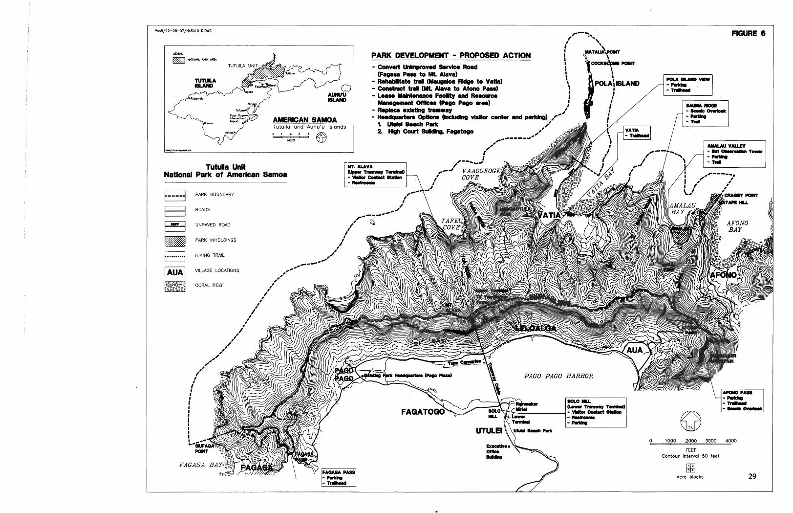
\ PARK DEVELOPMENT - PROPOSED ACTION i y"" 1
I - Convut CkrLngr0v.d SUVICO Road (Fageaa Pa88 to Mt Alava) I
\ - R-to trd (- Wdg. to V a b ) 8 1 - construct tral (Mt Alava to Afono Pa881 - Learn Mahtenance Faaty and Ro#nr- 1
mnagumnt Omcoo (Pogo Pam arm) r' - Replace oxkthg tramway #'

The picturesque village of Vatia is nestled on three sides by the Tutuila unit of the national park. Vatia and other villages located near the park would have the opportunity to provide different kinds of services to national park .visitors - overnight accommodations, the sale of traditional handicrafts, and guided tours.
The provision of any of these services would, of course, be up to each of the villages. In keeping with having these services be a part of the visitor's national park experience, NPS will train village guides to become familiar with applicable Service policies and regulations. Tours will be kept low-key - walking tours will be in small groups and boat tours along the north shore of Tutuila or along the southern coast of Ta'u will be in small craft with properly licensed operators.
Tutuila Unit
Road signs clearly marking entrance points to the Tutuila unit are proposed near the existing trailhead at Fagasa Pass and also at Afono Pass. Park road signs marking entrance points will also be placed along the AfonoIVatia road near Craggy PointlMatape Hill and on that same road above Vatia Bay. Sign posts to mark the national park boundary will be erected at regularly spaced intervals above Vatia village and along the base of Polauta Ridge. Sign posts will also be erected along the national park side of Fagasa Bay to mark the national park boundary from the ridge top down to Siufaga Point. The park boundary next to Afono village will be marked in the vicinity of Afono Pass and above the village's western side. All existing inholdings will be clearly marked with sign posts.

On Tutuila, ASG will maintain the existing paved road from Afono to Vatia within the park. This road is to be held to its present width for motor vehicles and maintained to NPS standards. A scenic overlook is proposed along this road on the ocean side of Sauma Ridge to provide visitors with views and interpretation of Pola Island and its seabirds. The overlook will consist of a covered, railed platform containing wayside exhibits. Visitors will access the overlook via a short foot path. Parking will be developed adjacent to the road.
At Amalau Valley, a covered observation platform is proposed a short distance from the road. The raised, railed platform will allow visitors to view the flying foxes who frequent this area. The observation platform will be sited so as to not disturb the feeding habits of the flying foxes. Parking will be developed adjacent to the road.
The existing coastal forest trail leading to close-up views of Pola Island will be upgraded and maintained to NPS standards. In consultation with the Vatia village council and with their approval, a trailhead with parking and a vehicle turn-around will be developed at the end of the unimproved road.
The existing unpaved, service road leading up to the TV transmitters atop Mt. Alava will be narrowed, reconditioned, and rehabilitated into a hiking trail. Portions may be rerouted in order to take advantage of scenic views or to avoid environmentally fragile or unsafe areas. At appropriate locations scenic overlooks will be installed along the trail to provide views of the rugged, pristine north shore and of Pago Pago Harbor to the south. Rehabilitation measures will include allowing the native vegetation along the route of the road to grow thereby narrowing the present tread and corridor width, and improving the drainage and reducing erosion by installing water bars and other appropriate corrective measures. This trail will be used primarily by visitors to hike up to the top of Mt. Alava, and also by village subsistence farmers and gatherers and NPS resource management and maintenance personnel. Except for NPS-operated utility vehicles, ASG vehicles doing required maintenance or repair work on the TV transmitters, and vehicles used by subsistence farmers to tend their existing agricultural plots, no motor vehicles will be allowed on the Mt. Alava trail.
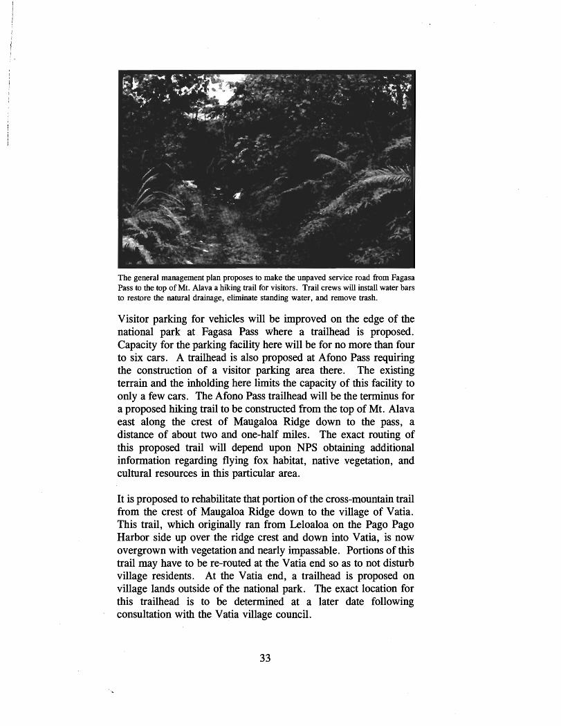
The general management plan proposes to make the unpaved service road from Fagasa Pass to the top of Mt. Alava a hiking trail for visitors. Trail crews will install water bars to restore the natural drainage, eliminate standing water, and remove trash.
Visitor parking for vehicles will be improved on the edge of the national park at Fagasa Pass where a trailhead is proposed. Capacity for the parking facility here will be for no more than four to six cars. A trailhead is also proposed at Afono Pass requiring the construction of a visitor parking area there. The existing terrain and the inholding here limits the capacity of this facility to only a few cars. The Afono Pass trailhead will be the terminus for a proposed hiking trail to be constructed from the top of Mt. Alava east along the crest of Maugaloa Ridge down to the pass, a distance of about two and one-half miles. The exact routing of this proposed trail will depend upon NPS obtaining additional information regarding flying fox habitat, native vegetation, and cultural resources in this particular area.
It is proposed to rehabilitate that portion of the cross-mountain trail from the crest of Maugaloa Ridge down to the village of Vatia. This trail, which originally ran from Leloaloa on the Pago Pago Harbor side up over the ridge crest and down into Vatia, is now overgrown with vegetation and nearly impassable. Portions of this trail may have to be re-routed at the Vatia end so as to not disturb village residents. At the Vatia end, a trailhead is proposed on village lands outside of the national park. The exact location for this trailhead is to be determined at a later date following consultation with the Vatia village council.

The aerial tramway that now crosses above Pago Pago Harbor to the top of Mt. Alava is to be replaced with a new system to be used to bring national park visitors into the Tutuila unit. Use of the tramway is part of NPS's and the public's access rights under the lease agreement. NPS believes the tramway provides an ideal way to bring large numbers of visitors into the Tutuila unit without adversely affecting park resources - that is, no new roads will need to be built within the national park to access prime scenic views a@ park resources. The operation of the tramway also permits the closing off of the unpaved road to the top of Mt. Alava to most of the ASG 4-wheel drive vehicles who now must use it to maintain and service the TV transmitters located there (ASG vehicles will be allowed on the rehabilitated hiking trail only to do work on the TV transmitter that cannot be performed by using the tramway or during emergency conditions when the tramway is not in operation).
The tramway would also enhance the visitor experience by providing them with a spectacular view of the entire Pago Pago Harbor and the Mt. Alava-Maugaloa Ridge summit area of the national park. Instead of returning via the tramway, visitors could choose to hike down on trails leading to Fagasa Pass, Afono Pass, or Vatia village, with the option of either returning to their hotel in Pago Pago on an aiga bus (small, individually-owned, multi- passenger vehicles modified for public transport) or staying overnight in one of the villages and returning to Pago Pago the next day.
The tramway, now administered by the ASG's Office of Public Information, has not been in operation for some time. It is presently in a serious state of disrepair and has been judged to be unsafe for public use. In July 1995, under interagency agreement, the condition of the existing aerial tramway was assessed on-site by a U.S. Forest Service tramway engineer to determine the nature and extent of the work needed to bring the tramway system up to federal safety standards for public use. As a result of the on-site inspection, the tramway engineer concluded that the condition of the tramway had deteriorated to the extent that it needed to be replaced by a completely new system. Consequently, it .is proposed that the existing aerial tramway be removed and a new system installed.
The removal of the existing aerial tramway and the installation of a new system should be funded by ASG or their cooperators. NPS

will contribute to the funding for the design engineering of a new tramway system.
ASG believes restoring the operation of the tramway is of vital importance to the future of tourism in American Samoa and the governor has included a funding request for the upgrading of the tramway in ASG's capital improvement program. Should the existing aerial tramway be replaced, it is anticipated that, at least in the initial phases of its operation, the new tramway would continue to be operated and maintained by ASG. In order for national park visitors to use the tramway, it will need to be operated and maintained to federal safety standards. ASG should charge a reasonable fee for the ride and provide measures required by NPS for ensuring passenger safety and the 24-hour security of the tramway infrastructure.
In conjunction with the construction of a new aerial tramway system by ASG, it is proposed that NPS provide improved accesslparking and new restroom facilities at Solo Hill (the lower terminus of the tramway) for national park visitors. Further, it is proposed that the existing pavilion structure located at the top of Solo Hill be tom down and, using the existing concrete base, a new one constructed. This new facility will provide scenic views of the Pago Pago Harbor and the national park. Interpretive exhibits will be installed within the reconstructed pavilion. New restrooms will be constructed nearby. The existing access road to the lower tramway terminal will need to be improved to allow the local aiga buses easy access to the proposed parkingltum-around area. The land on which the above improvements are proposed is owned by ASG, but outside of national park boundaries.
It is proposed that NPS enter into a long-term cooperative agreement with ASG prior to the expenditure of funds to develop any of the above facilities. Water and electricity are available on- site and a newly-installed sewer line runs nearly all the way up the Solo Hill access road. Following construction, pedestrian walkways will be installed and the area landscaped.
The existing pavilion ("guest fale") located a short distance from the tramway's upper terminus on Mt. Alava is proposed for upgrading for visitor interpretation. Upgrading will consist of raising the roof-line to improve views of the national park and the harbor area below plus the installation of interpretive exhibits inside. No potable water is presently available at the summit area.
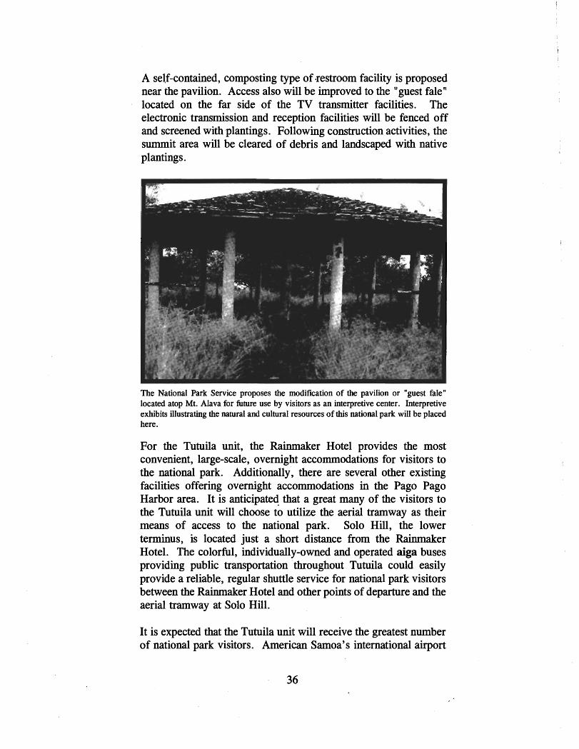
A self-contained, composting type of restroom facility is proposed near the pavilion. Access also will be improved to the "guest fale" located on the far side of the TV transmitter facilities. The electronic transmission and reception facilities will be fenced off and screened with plantings. Following construction activities, the summit area will be cleared of debris and landscaped with native plantings.
The National Park Service proposes the modification of the pavilion or "guest fale" located atop Mt. Alava for future use by visitors as an interpretive center. Interpretive exhibits illustrating the natural and cultural resources of this national park will be placed here.
For the Tutuila unit, the Rainmaker Hotel provides the most convenient, large-scale, overnight accommodations for visitors to the national park. Additionally, there are several other existing facilities offering overnight accommodations in the Pago Pago Harbor area. It is anticipated that a great many of the visitors to the Tutuila unit will choose to utilize the aerial tramway as their means of access to the national park. Solo Hill, the lower terminus, is located just a short distance from the Rainmaker Hotel. The colorful, individually-owned and operated aiga buses providing public transportation throughout Tutuila could easily provide a reliable, regular shuttle service for national park visitors between the Rainmaker Hotel and other points of departure and the aerial tramway at Solo Hill.
It is expected that the Tutuila unit will receive the greatest number of national park visitors. American Samoa's international airport

is located on Tutuila, as are most of the commercial establishments related to tourism such as hotels, restaurants, and car rentals.
A central visitor center is needed on Tutuila to provide basic information and orientation services for all visitors to the National Park of American Samoa. The proposed visitor center will also provide information to visitors about other tourist attractions located throughout American Samoa and in Western Samoa as well. This facility needs to be located in close proximity to the national park in a central location with convenient, easy access for visitors.
A visitor centerlheadquarters structure needs to be large enough to provide basic information, orientation, and interpretive services to park visitors and house park management and administrative staff. An entrance lobby area containing an information counter large enough for the display and sale of educational publications and materials is needed. Space is also needed at the visitor center for the display of museum objects and exhibits related to the national park and the Samoan culture.
It is anticipated that eventually the visitor center might logically serve as a repository for Samoan archeological and ethnographic collections. This function would require additional space. At the proposed visitor center, offices and work spaces will be needed for the superintendent, chief ranger, administrative staff, interpreters, a park curator of museum collections, and cooperating association personnel. Space also will be needed to store publications, supplies, and equipment. Visitor restrooms are needed, and the building must be made accessible to disabled and elderly visitors. Adjoining the structure or nearby, additional space will be needed
. for visitor parking. A minimum of 20 spaces for cars and 4 spaces for buses will be needed and a loadingloffloading area for visitors.
Presently, NPS is leasing commercial office space in Pago Pago. Although adequate as a park headquarters to house the existing limited staff, this facility will not meet future space or location needs for a national park visitor center. During the development of this general management plan, several existing buildings and unimproved sites in the Fagatogo and Utulei areas were inspected in terms of their suitability as a visitor center.

Existing buildings looked at as possible national park visitor centers included the Rainmaker Hotel's guest fales, the Territorial Registrar's Office, the Jean P. Hayden Museum, the Courthouse building, the Pago Pago Yacht Club, and the building housing the ASG Tourism Office which, at that time, was also the headquarters of the South Pacific Mini-Games. All of these buildings are outside of national park boundaries, owned by ASG, and all but the Rainmaker Hotel fales are historic properties on the National Register of Historic Places located within the U. S. Naval Station Tutuila Historic District.
None of the existing structures examined appeared to be both suitable and feasible to meet future visitor center needs. Inadequate visitor parking was a major concern at the Rainmaker Hotel, the Registrar's Office, and the Hayden Museum; the Registrar's Office also did not meet the space requirements for a visitor center. The Yacht Club was not available and the TourismIMini-Games building appeared to be structurally unsound and no longer in a condition where rehabilitation and modification for future use as a visitor center was judged to be feasible. The latter two buildings are located along the Utulei shoreline within the beach park.
The Courthouse appeared to be feasible--adequate parking was available nearby and the building was spacious enough for use as a visitor center and an administrative headquarters--but at the time of the inspection there was no. indication that the building would be vacated by the courts and thus available to NPS in the foreseeable future. In the future, if the Courthouse becomes available, NPS could enter into a long-term lease with ASG. The building could then be renovated to meet the needs for a visitor center and administrative offices for the national park. Any modifications would be undertaken in a manner so that the architectural integrity of the historic building was not degraded.
Unoccupied spaces along the Utulei beach park shoreline were also inspected as potential sites for the construction of a visitor center. The Utulei beach site has several advantages: excellent location - it is next to the Rainmaker Hotel where many national park visitors would stay and near Solo Hill where visitors could take the aerial tramway up to the top of Mt. Alava; there is easy access from the main road; the site affords spectacular views of Pago Pago Harbor, the Mt. Alava-Maugaloa ridge, and Mt. Pioa (Rainmaker Mountain) beyond; utilities (water, sewer, and

electrical) are all available nearby; the land is owned by ASG; and many local people use the park.
There are several concerns connected with the Utulei beach site which need to be addressed before a visitor center could be constructed there. Utulei Beach Park is one of the few parks in Tutuila available for public use. The beach park was built by the U. S. Navy in the 1940's by filling in a marshy area along the Pago Pago Harbor shoreline. The park now consists of an open, grassy area planted with scattered trees, picnic sites, parking, and restrooms. Two historic buildings remain in the park (the U.S. Navy originally built four structures here in the 1940's). The Pago Pago Yacht Club occupies the southermost building and the ASG Tourism Office the northernmost. The canoe club has built a canoe shed next to their building and this portion of the beach is utilized as a landing and storage area for Samoan racing canoes. A paved parking lot is located next to the yaclit club building.
The beach park is used for recreational activities such as picnicking and volleyball and as a gathering place for social activities and events. The waters fronting the beach are used for canoe racing, wind surfing, and kayaking. Proposed future uses of the beach park include constructing a permanent stage for cultural events. The two remaining historic buildings are proposed for refurbishing.
During the past 10 to 15 years, it is estimated that as much as 20 feet of beach front has eroded away despite additional sand being brought in several times to stabilize the shoreline. Beach erosion continues at the rate of approximately one foot per year.. The shoreline instability is apparently due to the modifications made to the shoreline and the offshore reef flat, causing an alteration of the natural sediment equilibrium. Studies have been conducted on different ways to stabilize the beach at Utulei. Recommendations include supplying sand nourishment to the beach on a periodic basis and structural improvements. The construction of a visitor center along Utulei beach would be conditioned upon the prior stabilization of the adjacent shoreline.
Utulei beach is located within the Pago Pago Harbor Special Management Area. This designation limits developments to those which are water-dependent, water-related, or are for recreational activities or a public use. Consequently, before a national park visitor center could be built here, the proposed structure would

have to be evaluated to determine its compatibility with the Coastal Management Program for American Samoa (See section on Coastal Zone Management).
If the Utulei beach site proves to be feasible, NPS could enter into a long-term lease agreement with ASG to utilize lands here to build a visitor center structure, parking, and an entrance road. Less than one acre of land would be needed. Another option would be for ASG to build the structure on the condition that NPS agree to enter into a long-term lease arrangement with ASG, thereby guaranteeing a return on their investment. Regardless of whether the proposed visitor center is built by NPS or ASG, the structure would be designed and constructed according to NPS standards.
A park maintenance facility and resource management offices and working labs are also needed in order to carry out those aspects of national park operations for the Tutuila unit. These both need to be located as close as possible to the park's resources, but should be in a different location than the visitor center. The Tutuila unit's resource management and maintenance operations could be co-located. Sufficient space is needed for offices and for the storage of material, equipment, and supplies. These spaces should be secure and suitable for the storage of hazardous materials such as paint, solvents, and petroleum products. Additional space will be needed to permit the secure parking of the park's maintenance and resource management vehicles and for outdoor storage of larger material and equipment.
Ta'u Unit
An entrance sign for the Ta'u unit will be placed along the dirt road at the park boundary line where it extends down to the ocean just to the north of Saua. Boundary marker sign posts will be placed at spaced intervals along the 50-foot contour line above and parallel to the park entrance road.
Within the Ta'u unit, visitor access is to be via hiking trail. No vehicles, except those now being used for subsistence agriculture purposes, are to be permitted within the national park. The existing unpaved road to Saua and beyond is to be maintained to its existing condition. At Siu Point, a vehicle turn-around is proposed. Beyond Siu Point, along the south coast, the dirt road becomes a walking trail. This entire route is to be maintained and,
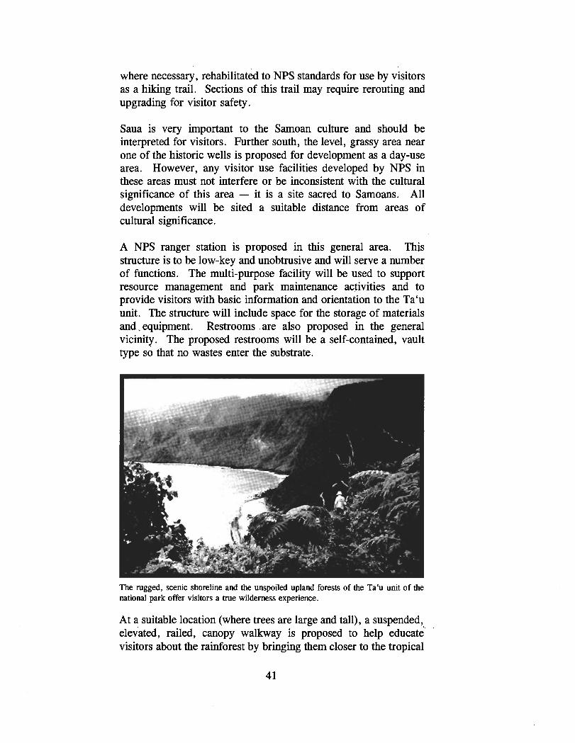
where necessary, rehabilitated to NPS standards for use by visitors as a hiking trail. Sections of this trail may require rerouting and upgrading for visitor safety.
Saua is very important to the Samoan culture and should be interpreted for visitors. Further south, the level, grassy area near one of the historic wells is proposed for development as a day-use area. However, any visitor use facilities developed by NPS in these areas must not interfere or be inconsistent with the cultural significance of this area - it is a site sacred to Samoans. All developments will be sited a suitable distance from areas of cultural significance.
A NPS ranger station is proposed in this general area. This structure is to be low-key and unobtrusive and will serve a number of functions. The multi-purpose facility will be used to support resource management and park maintenance activities and to provide visitors with basic information and orientation to the Ta'u unit. The structure will include space for the storage of materials and.equipment. Restrooms .are also proposed in the general vicinity. The proposed restrooms will be a self-contained, vault type so that no wastes enter the substrate.
The rugged, scenic shoreline and the unspoiled upland forests of the Ta'u unit of the national park offer visitors a true wilderness experience.
At a suitable location (where trees are large and tall), a suspended, elevated, railed, canopy walkway is proposed to help educate visitors about the rainforest by bringing them closer to the tropical

forest canopy. The proposed elevated walkway will allow visitors to experience the different and diverse species - epiphytes, birds, insects - of this national park. Benches and wayside exhibits will be placed along the walkway.
In order to provide visitors with opportunities to gain access up into the cloud forest environment, a new hiking trail is proposed leading up the slopes of Lata Mountain. Additional trails are proposed in this general area to give visitors access to places like Judds Crater and other significant geologic features found in this rugged upland area. The exact routes of these proposed trails are to be determined at a later time when additional information becomes available about the nature, extent, and fragility of the natural and cultural resources found in these areas. No trails are to be constructed in places where they will adversely affect the natural and cultural resources of the national park. No trails are to be constructed in these upland areas until visitation levels have increased enough warrant their development.
Within the Tabu unit, limited overnight camping opportunities will be provided for visitors. Appropriate sites will be identified for primitive campsites, pending the securing of additional information on national park natural and cultural resources. These proposed campsites will not be located in areas where important national park resources such as flying fox habitat and archeological features are found. Access to these campsites will be only via hiking trails. Visitors will be expected to carry in all necessary equipment and supplies, including drinking water; no open fires will be permitted. Other than pit toilets, no facilities will be provided by NPS at these sites and maximum occupancy at each site will be six people. Visitors to the upland portions of the national park on Tabu will be encouraged to use NPS-trained village guides.
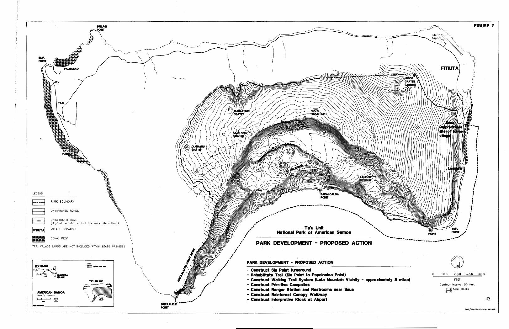
LEGFND
C,,,,{ PARK BOUNDARY
1 UNIMPROVED ROADS
UNIMPROVED TRAIL (Beyond Laututi the trail becomes intermittent)
w.1 VILLAGE LOCATIONS \ CORAL REEF
TA'U VILLAGE LANOS ARE NOT INCLUDED WITHIN LEASE PREMISES 1
- Rehabllltate TraU (Sk Pdnt to Pclpcrloalm Pdnt) 0 1000 2000 3000 4000
- Construct Waklng Tral System (Lata Mountain VIclnIty - approximately 8 mks) FEET
- C O ~ S ~ N C ~ Prhnltlvo Campdtes Contour interval 5 0 feet
- construct Ranger Statlon and Restrooms now %ua Acre blocks
- Construct Ralntarest Canopy Walkway - Construct Interpretive Kiosk at Alrpwt
AMEmcAN SAMOA Manu'o Islands
As noted, lands within the national park belonging to the village of Tabu are not part of the leased premises at this time. Consequently, NPS does not possess any leased rights of access to lands belonging to the village of Tabu. Until the Tabu village council agrees to lease their lands for national park purposes, NPS will not develop access or facilities on these lands. National park visitors should seek permission from Tabu village before accessing these lands.
Ofu Unit
Road signs marking the entrance to the Ofu unit will be placed at both the airport and Olosega ends of the national park. The existing boundary of the Ofu unit runs from the ocean side of the coastal road from the top of the beach ridge crest down the beach slope and out beyond the seaward edge of the reef flat. Lying between the beach slope and the sandy road is a narrow band of vegetation. Boundary marker sign posts will be placed at intervals along the ocean side of the existing unpaved road that runs along the south coast of Ofu island.
A modest visitor contact station and restroom facilities are proposed on the inland side of the coastal road. The visitor contact station will provide visitors with information about the coral reef, including potential safety hazards associated with snorkeling and the fragile nature of the marine resources. The proximity of these fragile marine resources preclude visitor use facilties from being developed within national park boundaries. Therefore, these facilities will be located outside of the existing national park boundary on lands owned by families of the village of Ofu. Agreements will need to be worked out with the owners to allow the construction of the proposed visitor contact station and restrooms on their lands. An unused structure exists nearby and may be suitable, with modification, for the storage of resource management and park maintenance materials and equipment. This structure would be leased from the owners.
Restroom facilities need to be sited and designed so as to minimize any detrimental effects to marine resources resulting from the presence of waste material, especially during periods of extreme weather. A self-contained, vault system is to be utilized for the disposal of wastes. Since wastes are contained, none would reach the ocean and damage the adjacent coral reef habitat.

No visitor parking facilities are proposed for the Ofu unit. Visitors will likely be coming either directly from the airport or from the Vaoto Lodge or other nearby places offering overnight accommodations. The airport and the Vaoto Lodge are both located within easy walking distance of the Ofu unit. The operators of other overnight accommodations located in the villages of Ofu or Olosega could provide transportation for their guests to the national park.
Caring for Park Resources
Taking care of the natural and cultural resources of the National Park of American Samoa is to be based on the following direction provided by Congress to NPS in Public Law 100-571:
"preserve and protect the tropical forest and archeological and cultural resources.. . , and of associated reefs, to maintain the habitat of flying foxes, preserve the ecological balance of the Samoan tropical forest.. . "
" (a)gricultural, cultural, and gathering uses shall be permitted in the park for subsistence purposes if such uses are generally prior existing uses conducted in areas used for such purposes as of the date of enactment of this Act and if such uses are conducted in the traditional manner and by traditional methods. No such uses shall be permitted in the park other than for subsistence purposes. "
"(s)ubsistence uses of marine areas of the park shall also be permitted. "
At the National Park of American Samoa, implementation of resource management strategies, both natural and cultural, is to be based on scientific data gathered through active research programs. That is, a natural and social science research program is to be established to provide a scientific basis for resource management decisions. Through scientific research, NPS will continue to accumulate data on the natural and cultural resources of this national park and will regularly monitor those resources in order to detect or predict any changes in their condition.

UNIT OLOSEGA ISLAND
AMERICAN SAMOA Manu'a Islands
LEGENO
NATIOML PARK AREA
TA'U ISLAND
-4 PARK - ROADS
OFU AIRPORT
PARK DEVELOPMENT - PROPOSED ACTION - Visitor contact station and restrooms - Interpretive kiosk at airport
FIGURE 8
1 1 / 21 Acre blocks 0 1000 2000 2looo 4000
FEET
Contour interval 50 feet

As noted, studies are underway or have already been completed to accumulate baseline information and data on the park's botany, flying foxes, archeology, ethnography, and coral reefs. The ASG Department of Marine and Wildlife Resources, in the form of study reports, has accumulated considerable scientific knowledge and baseline information on the terrestrial and marine resources of American Samoa. As NPS continues to undertake studies and research to acquire needed additional baseline information on national park resources, 'coordination and consultation with this and other ASG agencies will take place. In those instances where there is a recognized shared benefit, NPS will undertake cooperative research and resource management activities with the Department of Marine and Wildlife Resources and other agencies.
In all resource management matters involving endangered or threatened species, NPS will follow policies and procedures covering Endangered Species Act Section 7 consultation with the U. S. Fish and Wildlife Service and the National Marine Fisheries Service. Section 7 consultation will include any actions proposed under this plan that may affect a listed species, a species considered to be a candidate for listing, or a species of concern.
With regard to cultural resource management strategies identified in this general management plan, NPS, pursuant to Section 106 of the Historic Preservation Act, will coordinate and consult with the local historic preservation officer and the Advisory Council on Historic Preservation. For those actions proposed in this plan involving surface or subsurface disturbance with potential to affect historic properties, NPS will consult with the historic preservation officer prior to any construction activities taking place. Further consultation with the historic preservation officer will take place at the appropriate time on those proposed actions which would require additional site planning and design work.
Although there are presently no listed National Register sites located within the national park, NPS, at the appropriate time and working with the historic preservation office and the affected landowner, will take steps to identify and evaluate historic properties for possible future listing.
At the National Park of American Samoa, natural and cultural resource management issues and the strategies leading to their resolution are often interrelated. In caring for the park's resources, NPS is to be mindful of Samoan cultural traditions such
as communal land ownership, the continuance of oral traditions, the integrity of the land, and the status which land
provides to a family and village. The degree of success in preserving and protecting the resources of this national park depends greatly on the park superintendent keeping village councils, through their representatives, Nly informed in all resource-related matters.
Natural Resources
Major long-term objectives for taking care of the natural resources of the National Park of American Samoa consist of:
Managing native terrestrial and marine ecosystems with the long-term goal of re-establishing those general conditions found within the national park prior to European contact.
Maintaining, monitoring, and preserving the native tropical forest ecosystem, with emphasis on the populations and habitat of native flying foxes and other rare or sensitive native wildlife.
Controlling recently introduced alien species (species introduced since and as a consequence of European contact) found to threaten native terrestrial and marine ecosystems.
Maintaining species diversity and the existing population structure of the national park's marine and coral reef ecosystems.
Listed below are natural resource management issues that have been identified thus far and the strategies proposed to deal with them.
Issue. Native species of flying foxes or fruit bats, whose populations have declined from historic levels, play an important role in the park's ecosystem. Also, preliminary findings suggest that native species of partulid snails are rapidly disappearing due primarily to the onslaught of a predator snail brought into Samoa to control the African tree snail. The four native species of pigeons and fruit doves found within the national park are of particular concern as they are becoming increasingly rare, but are still being hunted for recreational purposes. The Pacific boa, found only

within the Ta'u unit, is rarely seen and its population as well as nomenclature status is unknown. Seabird colonies have declined throughout much of the Pacific Islands. Colonies within the national park may represent a significant contribution to their conservation in the region, but at present little is known about them. Also, there is evidence the park's marine resources on Tutuila and Ofu are being over used and that sea turtles utilize portions of these shorelines for nesting.
Strategy. Establish baseline inventories and determine population status for native animals which are dependent on the national park's habitats. Give emphasis to flying foxes, tree snails and other native invertebrates such as butterflies, rare native birds such as pigeons and fruit doves, sea turtles, and the Pacific boa. Based on identifying the location of sea turtle nesting sites within the national park, consider closure during the season to protect nests.
Issue. The two species of native Samoan and Tongan flying foxes found in the national park act as pollinators and seed dispersers for many of the native plant species and are therefore important to maintaining the health of the tropical forest. Without them, the character and biodiversity of the tropical forest would be seriously impaired. According to the ASG Department of Marine and Wildlife Resources, there are approximately 1000 of the Samoan flying fox remaining in American Samoa. While it presently has no formal status under the federal Endangered Species Act, it is likely to be proposed for listing in the near future.
Strategy. Monitor flying fox populations, their distribution, and threats to their habitat. Since hunting is not a subsistence activity permitted within the national park, the ASG regulation against the hunting of bats is to be extended permanently within the national park.
Strategy. Conduct scientific research to better determine the biological and physical attributes of prime roosting and feeding habitat, to better understand patterns of daily and annual movement of individuals, to better understand the patterns and cause of roost shifting, and to develop more accurate and sensitive methods for population monitoring.

Issue. The Ofu unit of the national park is composed of one the best examples of a healthy, intact coral reef in all of the Samoa archipelago and is a unique resource within the U.S. national park system. Though relatively small in size, it is estimated to contain about 150 species of coral, three times the number found in the Caribbean. It is suspected that subsistence overuse may be degrading this resource, and that in the future increased visitor pressure may also contribute to its degradation.
Strategy. Refine baseline data and develop monitoring protocols to identify threats, including terrestrial, to the Ofu reef.
Issue. Little is known about the coral reefs within the Tutuila and Ta'u units. Surveys of the Tutuila unit's coral reefs is presently taking place. No quantitative data are presently available for either of these areas. The coral reefs within the Tutuila unit may be being impacted by overfishing and sedimentation.
Strategy. Continue underwater surveys of the Tutuila unit and begin surveys of the Ta'u national park coastlines to determine the extent, nature, and condition of the coral reefs found there: Begin the compilation of quantitative data.
Issue. Laufuti stream, on Ta'u, may be the only perennial stream within the national park. It is known to contain fish and eel species. These may prove to be endemics due to the stream's isolated location in the Samoan archipelago.
Strategy. Survey freshwater habitats within the national park, with emphasis on ;the Laufuti stream, to determine species composition and their vulnerability.
Issue. There is considerable evidence that a feral pig problem exists in certain parts of the national park. The rooting activities of this animal are damaging both the native forest and subsistence agriculture plots within the national park.
Strategy. Utilizing available expertise, survey pig infested areas to determine the nature and extent of the damage.
Strategy. Where needed, and in conjunction with the village councils or their representatives, develop appropriate measures to control feral pigs within the national park.
Issue. Aggressive alien plant species have begun to make serious inroads into parts of the national park. Two species, the mile-a-minute vine and Koster's curse, are particularly common within the park. The former is one of the few introduced species that occurs in undisturbed native forest and also threatens crops in disturbed areas. The latter also occurs in low density throughout the native forest, is a dominant species in sunny places in montane forest, and has become a very serious problem in the cloud forest on Lata Mountain. Preservation of the rainforest requires early diagnosis of alien plant invaders, prompt control measures, and continuous monitoring of the tropical forest.
Strategy. Develop biological measures, including the use of tested biocontrol agents, to control the spread of common, aggressive, and harmful alien plant species such as mile-a- minute vine and Koster's curse.
Strategy. Develop a long-term alien plant control program to detect the initial entry of identified problem species, to direct control measuress where relevant, to monitor the rainforest for signs of any reinvasion of the controlled alien plants, and to map the distribution of these plants in the native forest as a basis for the sustained control of the most aggressive species. Prior to the implementation of any direct control programs, consult with the appropriate village councils.
Issue. There is presently a general lack of information on invertebrates within the national park. Preliminary findings suggest that the native partulid snails are rapidly disappearing due mainly to the onslaught of a predator snail brought into Samoa to control the alien African tree snail. This alien predatory species is leading to the demise of native tree snails. On Tutuila, native species are essentially absent except on some isolated islets. The predatory snail was inadvertently introduced on Ta'u with construction material after Hurricane Tusi in 1987 and has since become a serious problem.

Strategy. Develop measures to control the introduced predatory snail.
Issue. Population explosions of the crown-of-thorns starfish, occurring more than two decades ago, have destroyed coral reefs over much of the Samoa archipelago. It will be many years before these reefs fully recover. At this time, science is not able to definitively say what precipitates these explosions. The Ofu reef was not hit by the infestation. Presently found at the Ofu reef only in small numbers, the population of this native species has the potential to explode very quickly and could very easily decimate this reef, one of the most pristine in all of Samoa.
Strategy. Develop, for immediate implementation, a monitoring protocol and an action plan with environmental compliance should any major outbreak of the crown-of-thorns starfish take place on the Ofu reef.
Issue. The Tutuila unit of the national park contains about eight miles of shoreline, the Ta'u unit about six and one-half miles, and the Ofu unit about two and one-quarter miles. Portions of the Tutuila shoreline and benthic resources are receiving heavy subsistence use and the seabirds of Pola Island, the most significant nesting area for seabirds in American Samoa, have been traditionally harvested for generations. There is evidence that non-traditional fish harvesting methods also are taking place along both the Tutuila and Ofu shorelines of the national park. The impacts of these consumptive and destructive uses on fish and other marine organisms along all three shorelines of the national park are unknown.
Strategy. Conduct population surveys of seabirds nesting within the park and monitor populations to determine the effect of subsistence harvest over time. Conduct an overall assessment of the condition of the benthic habitat and harvested species for the Tutuila, Ta'u, and Ofu shorelines with the goal of establishing limits to maintain healthy sustainable populations. Give priority to the Ofu shoreline. Prior to the setting of any bag limits, consult with the appropriate village councils or their representatives.

Issue. Recent introductions of alien animal species - cats, black and Norway rats, house mice, jungle and common mynas, bulbuls, African snails, marine toads - have all been observed within the national park. It is important to determine the impacts these species are having on the national park's native species.
Strategy. Determine the incidence of feral and pest species within the national park, assess the impact caused by these species, and, based on the damage assessment, determine control measures and priorities.
Issue. NPS has the authority under the lease agreement to care for only a small part of the natural resources of American Samoa. The national park does not contain sufficient habitat for wide-ranging species such as flying foxes or fruit doves, both of which are presumed to be strong interactors in the ecosystem. Park management must therefore place a high priority on cooperating with ASG agencies, the village councils, and others to assure the long- term viability of these and other native species.
Strategy. Working with ASG agencies such as the Departments of Marine and Wildlife Resources, Samoan Affairs, Public Safety, and Public Works, the Department of Commerce, and others, as well as the village councils or their representatives, establish formal review procedures whereby NPS is to be consulted in any matter related to proposed changes or modifications in land uses within or adjacent to the national park. This review will be carried out under the American Samoa Coastal Zone Management Program.
Archeological and Cultural Resources
The broad, long-term objectives for cultural resource management at the National Park of American Samoa are:
Identification, evaluation, protection, management, and interpretation of archeological and cultural sites and features.
Carrying out the protection, management, and interpretation of cultural resources in accordance with the wishes of the village councils.

The following are the cultural resource management issues that have been identified at this time, along with the strategies proposed for dealing with them.
Issue. At this time, NPS knowledge of the nature, extent, significance, and location of cultural resources within the national park is very limited and largely unrecorded. No cultural resource inventories or archeological surveys have yet been conducted by NPS. Based on the limited existing knowledge, we speculate that the national park is very rich in cultural resources, including significant archeological sites and features. Before NPS can make any informed decisions with regard to caring for these resources, additional information is needed about what they are, where they are, and their significance.
Strategy. The first step towards acquiring the needed information is the completion of an archeological overview and assessment. The purpose of this study is to compile all existing studies, reports, and archeological surveys done on lands within the national park as well as relevant data from elsewhere in Samoa, to assess the potential for additional sites to exist within the park, and make recommendations for further studies.
Strategy. Based on the findings and recommendations contained in the archeological overview and assessment, design field surveys to investigate those areas of the national park judged to have the greatest potential to add to the cultural resource information base. Such surveys will include both systematic and areal studies, and sample transects. Prior to undertaking any on-site surface archeological surveys of national park lands, the park superintendent will consult with the appropriate village councils and landowners.
Strategy. Based on the completion of archeological surveys, determine if detailed subsurface surveys (excavations) are needed as well as the appropriate treatment (preservation, stabilization, or restoration) for the archeological and historical sites and features identified within the national park. Archeological resources of the national park are to be either left undisturbed or preserved on-site in a stable condition to prevent degradation. No treatment (stabilization or restoration) will be given to these resources without the prior

approval of the appropriate village council. No ancient burials identified within the national park will be disturbed or archeologically investigated without the prior approval of the village council and the descendants of the interred.
Strategy. Although the basic management strategy will be to care for cultural resources in situ - that is, leave them undisturbed - NPS will seek to collect and care for those Samoan archeological and historical objects that contribute directly to the understanding and interpretation of the park's themes for display as museum exhibits. These objects will generally come from existing collections. The purpose of the display is to aid in the understanding of and appreciation for the traditional Samoan culture among park visitors. These objects will either be acquired by NPS or placed on loan to the Service by the owners.
Subsistence Resources
Major long-term objectives associated with maintaining subsistence resources within the national park consist of the following:
Managing existing traditional subsistence agricultural, cultural, gathering and fishing uses within the national park in their present locations with the long-term goal of neither degrading park resources nor diminishing the existing traditional subsistence uses.
Clarifying and reaching agreement with village councils as to the rules or procedures which are to be followed regarding the continuation of the above subsistence uses.
In maintaining subsistence resources, research will be conducted to determine historic and contemporary subsistence uses of park terrestrial and marine resources. The resulting data will be used to develop long-range, sustainable use strategies so that these national park resources will not be adversely affected.
Issues and strategies related to maintaining traditional subsistence resource uses within the national park consist of:
Issue. At present, NPS has only very limited knowledge of the nature and significance of the traditional subsistence uses that are either going on now or have historically occurred in

the national park. Knowledge of the nature and extent of non-traditional uses and activities within the national park is also very limited. The relationship of subsistence users to the land base and the resources of the national park have not yet been identified or documented. NPS has not inventoried existing subsistence uses within the park, knows very little about the attitudes and practices of present users, and has no way to monitor future subsistence uses or develop mutually acceptable rules regarding these uses. Any potential conflicts between present and past subsistence uses and the preservation and protection of the tropical forest, archeological and cultural resources, and marine resources of the national park need to be identified and addressed.
Strategy. As a first step towards the resolution of any potential conflicts, prepare an ethnographic overview and assessment to document through oral histories and other means the relationship of subsistence users with the lands and waters of the national park, both present and past, to determine the extent, nature, and significance of historic and contemporary traditional subsistence agriculture, cultural, gathering, and fishing uses occurring within the national park.
Strategy. Based on the findings and recommendations of the ethnographic overview and assessment, undertake site specific ethnographic studies to document 'who is using the park's lands and waters for subsistence uses, meir attitudes toward subsistence uses, and the extent of their harvest. Determine those places where the gathering of medicinal plants occurs and what plants have medicinal value. Oral histories, life histories, folk wisdom, legends, and myths will be the principal information sources. Park managers will use the information to manage the national park resources, while taking into account the concerns and sensitivities of the Samoan culture.
Strategy. Through professional analysis of aerial photos and discussions with users, determine the scope and extent of the lands within the national park being presently used or used in the recent past for traditional subsistence agriculture. Place this information on computer generated park maps and, through consultations with village councils or their representatives, determine a locational baseline for these subsistence agricultural areas within the national park.
Strategy. Based on the above information, meet with village councils or their representatives to formulate, clarify, and establish mutually agreed upon rules or procedures that are to be utilized regarding the maintaining of traditional subsistence uses within the national park. Although there will be a set of general procedures regarding subsistence uses applicable to all villages, it is likely that some rules or procedures will apply only to specific villages in order to fit the particular conditions or circumstances existing there.
Strategy. Manage the scope of subsistence agriculture uses so that there would be no loss within the national park of primary or mature secondary forest and no adverse effect on the two species of native flying foxes or other native wildlife.
Interpreting Park Resources for Visitors
The Samoan culture is to be a major focus of visitor interpretation at the National Park of American Samoa. The other major focus for interpretation is to be the significant natural resource values of the park - its tropical forests, flying foxes, and coral reefs. The national park's interpretive program will be developed primarily around these two broad themes. Since most visitors will be local residents or international, interpretation will also focus on providing information on the national park system as a whole.
There are two components of the Samoan culture that are to be interpreted: (1) the tangible - that is, the archeological and historical sites and features of the national park and the places where traditional subsistence uses are taking place; and (2) the intangible - that is, the oral history of the Samoan culture, including its myths and legends. Prior to any interpretation for visitors of either component of the Samoan culture, the appropriate village councils will be consulted.
The following broad interpretive themes represent the most important ideas for visitors to understand about the National Park of American Samoa:
The mixed species paleotropical rainforest the national park protects and preserves is of great importance to the United States and other countries since tropical forests are declining worldwide and due to the immense biological, scientific, and medicinal value of plants found within these forests.

Two species of native flying foxes play an important role in pollinating certain plants found within the Samoan rainforest.
Fa'asamoa, simply defined as the traditional Samoan way of life, epitomizes the culture of Samoa, is intricately interwoven with the natural environment, and is largely responsible for the relatively unspoiled condition of the tropical rainforest.
The cultural landscape of the national park - the maintaining of traditional subsistence and gathering uses, and identifying and protecting Samoan archeological and historical resources.
Samoa's communal land ownership and the matai system have shaped this society for some three thousand years, and now will help shape its relationship with the national park.
The coral reef at Ofu represents one of the best examples of an intact and healthy coral reef ecosystem in all of Samoa.
The geographic location of the Samoan islands at the far end of a great chain of archipelagos has greatly influenced the evolution of the ecosystem of these islands.
As the fiftieth designated national park, the National Park of American Samoa is now an important part of the national park system dedicated to the preservation and visitor enjoyment of the significant natural and cultural resources values of our Nation.
A basic goal of interpretation at the National Park of American Samoa is to give each visitor the opportunity to come away with a basic understanding of the traditional Samoan culture and how, for some three thousand years, it has successfully interacted with the native forest and the offshore waters so that these resources have become woven into the very fabric of the traditional Samoan culture.
NPS will cooperate and consult with the ASG's Office of Tourism, the Hayden Museum, the Department of Marine and Wildlife Resources, and others, including tourism officials and national park service counterparts in Western Samoa, in developing its interpretive program for the National Park of American Samoa.

The visitor center proposed in the Pago Pago Harbor area on Tutuila is to be the primary contact point for visitors to the national park. Here visitors will receive their basic introduction to the national park and its many significant and unique natural and cultural resources. At the proposed visitor center, activities will include viewing museum objects and exhibits, purchasing cooperating association publications, and viewing audio-visual interpretive programs. NPS interpreters will be on duty at the visitor center to provide personal services to visitors. Visitors will also be able to receive information about the Ta'u and Ofu units of the national park here, as well as information on tourist attractions throughout American Samoa and in Western Samoa. Interpretive opportunities are also to be scheduled regularly at the visitor center for local school groups. Information on interpretive walking tours of the Tutuila, Ta'u and Ofu units of the national park will be obtained at the visitor center.
At the Pago Pago International Airport on Tutuila, a bulletin case will be installed to provide arriving visitors with introductory information about the national park. Within the Tutuila unit, interpretive services will be provided at the rebuilt pavilion located on Solo Hill near the lower terminus of the aerial tramway. Similarly, interpretation will take place atop Mt. Alava at the rehabilitated pavilion ("guest fale") located near the tramway's upper terminal.
I
At the Fitiuta airport on the island of Ta'u, a display is proposed to provide arriving visitors with basic information - directions and orientation to this unit of the national park, transportation and food service options, information on overnight accommodations in Fitiuta, guide services, etc. Interpretive services will be provided within the national park at the proposed ranger station in the vicinity of historic Saua. These will include personal services such as guided walking tours to the natural and cultural attributes of the Ta'u unit by NPS interpreters. Wayside exhibits are proposed to interpret the historic well located at Saua, as well as other significant cultural or natural attributes.
There will be like visitor services provided at the Ofu unit. An information exhibit is proposed at the Ofu airport and a small visitor contact station is proposed next to the national park. NPS interpreters will be stationed at the Ofu unit to provide visitors with information about the coral reef and other attractions found here, including informing visitors about the presence of the ava,
or channel, located at the outer edge of the reef and its potential danger (the presence of rip currents) to visitors.
The visitation at the National Park of American Samoa will fall into two main categories: international visitors, many of whom will be eco-tourists, and local visitors. In the foreseeable future visitor numbers will likely remain relatively low. However, as has historically been the case throughout the United States, the presence of a national park will very likely attract more visitors to American Samoa. In the coming years, as access and facilities are developed for the national park, it is likely that visitors will be coming to American Samoa as part of commercial tour packages.
As noted, it is proposed that the National Park of American Samoa be developed primarily as a day-use park. Overnight camping will be allowed within the national park only at designated sites within the Ta'u unit. NPS will provide pit toilets at these sites. No other amenities are to be provided. There is to be no overnight camping within the Tutuila and Ofu units.
Visitors are to be provided access to the park's natural and cultural attributes primarily through a system of walking trails. The purpose of this trail system is to provide the visitor with safe and relatively easy access to the park's attributes without adversely affecting its resources. In the upland areas of the national park, visitors will be required to stay on established trails. Cross- country hiking and bushwhacking will not be allowed without permission of the park superintendent and only for approved scientific purposes. All visitor trails will be constructed to NPS standards and appropriately marked with directional signing.
The development of a trail system for visitors will be closely coordinated with the village councils or their representatives. In some instances there may be a need to structure visitor circulation patterns so as to not interfere with traditional subsistence activities going on within the national park. Culturally sensitive or sacred places that villages or families may want to keep private will be avoided and there may be a need to keep visitors away from environmentally sensitive areas such as flying fox roosts or native bird nesting areas.
The flying foxes of the national park and their interrelationship with the plants of the tropical forest will receive special emphasis in the interpretive program. It is proposed that observation
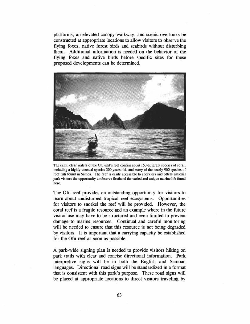
platforms, an elevated canopy walkway, and scenic overlooks be constructed at appropriate locations to allow visitors to observe the flying foxes, native forest birds and seabirds without disturbing them. Additional information is needed on the behavior of the flying foxes and .native birds before specific .sites for these proposed developments can be determined.
The calm, clear waters of the Ofu unit's reef contain about 150 different species of coral, including a highly unusual species 300 years old, and many of the nearly 900 species of reef fish found in Samoa. The reef is easily accessible to snorklers and offers national park visitors the opportunity to observe firsthand the varied and unique marine life found here.
The Ofu reef provides an outstanding opportunity for visitors to learn about undisturbed tropical reef ecosystems. Opportunities for visitors to snorkel the reef will be provided. However, the coral reef is a fragile resource and an example where in the future visitor use may have to be structured and even limited to prevent damage to marine resources. Continual and careful monitoring will be needed to ensure that this resource is not being degraded by visitors. It is important that a carrying capacity be established for the Ofu reef as soon as possible.
A park-wide signing plan is needed to provide visitors hiking on park trails with clear and concise directional information. Park interpretive signs will be in both the English and Samoan languages. Directional road signs will be standardized in a format that is consistent with this park's purpose. These road signs will be placed at appropriate locations to direct visitors traveling by
motor vehicle. A wayside exhibit plan will be needed to identify the specific locations, interpretive messages, and materials to be used for waysides.
Visitors will be advised that at the present time NPS does not have access rights to any of the Ta'u village lands within the national park. No visitor interpretation of the natural or cultural resources of the Ta'u village lands is to be carried out by NPS until such time as the village landowners formally lease their lands for national park purposes.
Continuing the Traditions and Customs of the Samoan Culture
Congress, in authorizing the establishment of the National Park of American Samoa, provided special and unusual direction to NPS because of the presence of communal land ownership in American Samoa and the Samoan culture, both of which are unique and not to be found in any other unit of the national park system.
I
First, the national park was to be established based on a lease agreement with village landowners; second, within this national park Samoan customs are to be maintained; and third, provisions are to be provided for traditional subsistence uses of national park lands and waters.
In authorizing this national park, Congress also required that it be administered by NPS in accordance with the 1916 Act which established the national park system and the other legal authorities the Service has to protect the natural and cultural resources of national parks.
The 1916 Act, NPS's Organic Act, directs the Service to "promote and regulate the use of.. .national parks. . . by such means and measures as conform to the fundamental purpose of the said parks.. . which purpose is to conserve the scenery and the natural
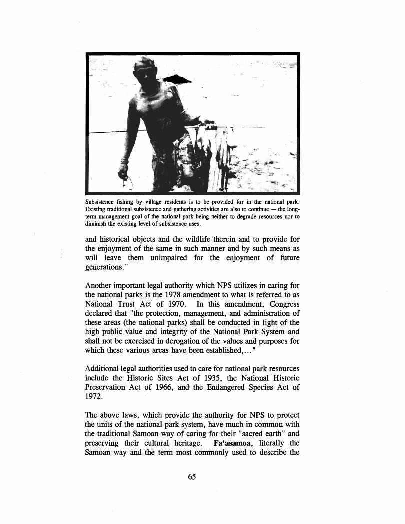
Subsistence fishing by village residents is to be provided for in the national park. Existing traditional subsistence and gathering activities are also to continue - the long- term management goal of the national park being neither to degrade resources nor to diminish the existing level of subsistence uses.
and historical objects and the wildlife therein and to provide for the enjoyment of the same in such manner and by such means as will leave them unimpaired for the enjoyment of future generations. "
Another important legal authority which NPS utilizes in caring for the national parks is the 1978 amendment to what is referred to as National Trust Act of 1970. In this amendment, Congress declared that "the protection, management, and administration of these areas (the national parks) shall be conducted in light of the high public value and integrity of the National Park System and shall not be exercised in derogation of the values and purposes for which these various areas have been established,. . . "
Additional legal authorities used to care for national park resources include the Historic Sites Act of 1935, the National 'Historic Preservation Act of 1966, and the Endangered Species Act of 1972.
The above laws, which provide the authority for NPS to protect the units of the national park system, have much in common with the traditional Samoan way of caring 'for their "sacred earthn and preserving their cultural heritage. Fa'asamoa, literally the Samoan way and the term most commonly used to describe the
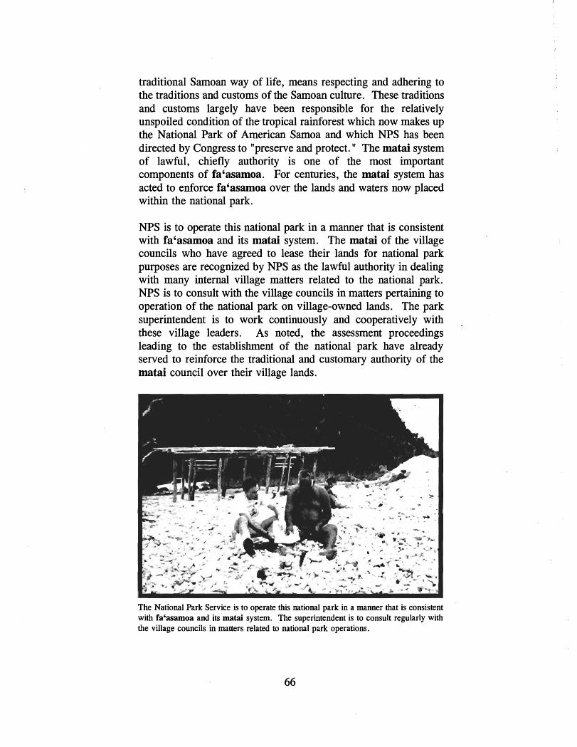
traditional Samoan way of life, means respecting and adhering to the traditions and customs of the Samoan culture. These traditions and customs largely have been responsible for the relatively unspoiled condition of the tropical rainforest which now makes up the National Park of American Samoa and which NPS has been directed by Congress to "preserve and protect. " The matai system of lawful, chiefly authority is one of the most important components of fa'asamoa. For centuries, the matai system has acted to enforce fa'asamoa over the lands and waters now placed within the national park.
NPS is to operate this national park in a manner that is consistent with fa'asamoa and its matai system. The matai of the village councils who have agreed to lease their lands for national park purposes are recognized by NPS as the lawful authority in dealing with many internal village matters related to the national park. NPS is to consult with the village councils in matters pertaining to operation of the national park on village-owned lands. The park superintendent is to work continuously and cooperatively with these village leaders. As noted, the assessment proceedings leading to the establishment of the national park have already served to reinforce the traditional and customary authority of the matai council over their village lands.
The National Park Service is to operate this national park in a manner that is consistent with fa'asamoa and its matai system. The superintendent is to consult regularly with the village councils in matters related to national park operations.

During the scoping meetings held in the eight villages with leased lands within the national park, each of the councils agreed that in order to facilitate this continuous and ongoing communication and consultation with NPS, a committee will be set up to act as the liaison between each of the village councils and the National Park of American Samoa. The park superintendent, in operating this national park, will make effective use of these committees to ensure that there is continuous communication and consultation with each of the councils in carrying out the direction of Congress.
Concurrent with the preparation of this general management plan, the park superintendent is to work with each of the eight village councils through their designated representatives to accomplish the following specific tasks:
Clarify and reach agreement as to the rules or procedures which are to be imposed regarding the maintaining of the Samoan culture and the permitting of traditional subsistence agricultural, fishing, cultural, and gathering uses within the national park.
Clarify and reach agreement on establishing procedures for the elimination of non-traditional practices which are judged to be harmful to national park resources and in conflict with fa'asamoa - for example, the use of dynamite or bleach to kill reef fish and other marine life, sand mining, hunting with firearms, building permanent structures for personal use on village lands, cutting old growth forest trees, using non- traditional tools, etc.
Clarify and reach agreement regarding appropriate actions to take when lands in the national park are cleared "unnecessarily. " Also, determine whether "nuisances " related to village lands ought to be handled by NPS or handled by the village councils, or whether these "nuisances" ought to be handled jointly. These concerns were raised by a village council at the scoping meetings and therefore need to be addressed. The "nuisances" referred to by the council included some of the examples listed above.
Based on the above, a set of common "ground rules" will be worked out by NPS and the village councils that would apply to all eight villages. There could also be a separate set of rules worked out by the park superintendent with each village

council to deal with the special conditions or circumstances which exist there. The park superintendent will deal with each village as a separate entity.
Section 3. (g) of Public Law 100-571 calls for the establishment of an Advisory Board to provide advice to the park superintendent regarding the management of the park. The Advisory Board will deal with those national park issues that are broad in scope - that is, those which cross village boundaries or are external to national park boundaries. Now that the National Park of American Samoa is formally established, the park superintendent is to take all appropriate actions required of NPS leading to the establishment of this Advisory Board by the Secretary of the Interior. Accordingly, the park superintendent has forwarded to the Secretary of the Interior the names of the five Advisory Board nominees, including the three submitted by the Governor of American Samoa, as called for by Section 3 .(g).
Management Zoning
In the development of general management plans for units of the national park system, NPS uses four zones to indicate management emphasis: natural, historic, park development, and special use. Subzones also may be established when necessary to show areas bhere there is to be specific types of intended use or development.
There exists on lands within the National Park'of American Samoa an intermixing of both natural and cultural resource values. The tropical rainforest is considered part of and woven into the Samoan culture. The Management Zoning on the lands within this national park needs then to reflect both natural and cultural resource values. Consequently, the management zoning for lands within the National Park of American Samoa is to be an overlay of both the Natural and Cultural zones.
The significance of the national park's tropical forest as the United States' only mixed species paleotropical forest is known, as is the importance of the flying foxes in maintaining the integrity of that forest. However; in these early stages of the assessment of the park's resources, the extent and nature of its cultural and archeological attributes remain to be identified and studied by NPS. What is known so far is that significant aspects of the Samoan and pre-Samoan culture, both the tangible and the
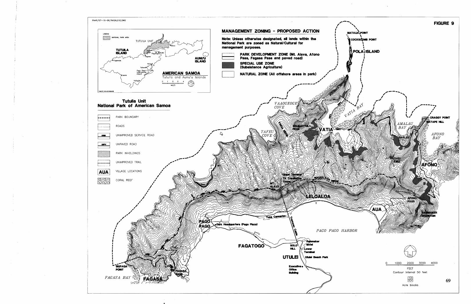
TUTULA ISLAND
Fogornolo ISLAND
Tutuila and Aunu'u Islands
Tutuila Unit National Park of American Samoa
PARK BOUNDARY
ROADS
MANAGEMENT ZONING - PROPOSED ACTION I -\ i MATALlApow
9 Note: Unless otbrwlse dedgnated, all lands wlthln the I
I
Natlonal Park are zoned as Natural/Cultural for I I
management purposes. I 1
PARK DEVELOPMENT ZONE (Mt. Alava, Afono , ) POLA; ISLAND F-( Pass, Fagasa Pass and paved road) i
SPECIAL USE ZONE 1 (Subsistence AgrIcuItureI
FIGURE 9
I i 1 NATURAL ZONE (All offshore areas In park) . !

0 1000 2000 3000 4000
FEET
Contour interval 50 feet
Acre blocks
TAU lUllD
AMERICAN SAWA Manu'a Islands -
'I-* @
MANAGEMENT ZONING
MANAGEMENT ZONING - PROPOSED ACTION
I I NATURAL ZO)(E UI ottrhore areas h park)
LEGEND
C,,,,j PARK BOUNDARY
UNIMPROVED ROADS
UNIMPROVED TRAIL (Beyond Loufuti t h e t ro i l becomes intermittent)
VILLAGE LOCATIONS
CORAL REEF
TA'U VILLAGE LANDS ARE NOT INCLUDED WITHIN LEASE PREMISES

OFU ISLAND
UNIT OLOSEGA ISLAND
LEGEND
NATIONAL PARK AREA
TAU ISLAND
AMERICAN SAMOA Manu'a Islands
0 1 2 3 @ T=T.-
MILES
FIGURE 11

intangible, are undoubtedly present in the national park and are of major significance. These must be cared for in a manner that is consistent with the traditional Samoan culture in its historic context and as it exists today. The national park's resources must also be cared for in a manner that is acceptable to the respective village councils.
Within the NaturalICultural Zone, the different kinds of natural resources - the tropical forest, flying foxes and other native wildlife - and processes found within the national park are to be protected and preserved, and non-traditional (nodpark) uses that are found to adversely affect them will not be accommodated. Within this zone, traditional gathering of plants for medicinal purposes or other cultural requirements are to be accommodated. These activities are to be carried out in the same manner and by the same methods traditionally used by native Samoans. As additional knowledge of the national park's natural resources is gained and planning for its management and development progresses, certain areas within this zone may be set aside for strict protection as Protected Natural Areas because of their unusual fragility, scarcity, or ecological significance. These areas will be a subzone within the NaturallCultural Zone.
The cultural, archeological, and historical resources and their settings within the NaturalICultural Zone are to be preserved, protected, and, with the concurrence of village councils, interpreted for visitors. In the future, there may also be areas within this zone where particularly fragile andlor sensitive cultural or archeological resources are found. These areas will be zoned as Protected Cultural Areas and set aside for strict protection. The wishes of the village council will be fully considered before NPS provides any type of treatment to these kinds of cultural resources.
The marine areas of the national park's offshore waters are to be zoned Natural. Within the Natural Zone, there are to be provisions for the maintaining of traditional Samoan subsistence reef fishing and gathering by the adjacent villages so long as no net losses occur in marine and benthic resources and, based on sound scientific research, the overall health of the coral reef habitat is not degraded. The ecological carrying capacity of the reef will be the prime determiner used to determine acceptable levels of subsistence uses of the park's offshore waters. There will be consultation with the village councils during the development of these provisions.

Those specific areas within the national park that are either now being used for traditional subsistence farming activities or were used for these activities in the recent past are to be zoned Special Use. NPS will work with the village councils to clarify and reach agreement as to the areal extent of these areas and the rules which are to be imposed therein with regard to maintaining these uses.
On Tutuila, the existing paved road leading to the village of Vatia and the top of Mt. Alava encompassing the upper aerial tramway tower and the visitor use facilities proposed here are to be zoned Park Development. The proposed visitor parkingltrailhead facilities at Fagasa and Afono passes are also to be zoned Park Development.
The ranger station and visitor use facilities proposed near Saua for the Ta'u unit and those for the Ofu unit are to be low-key, dispersed, and will have little effect on natural processes and cultural resources. These facilities would all be within the NaturallCultural Zone.
MANAGEMENT ZONING
Tutuila unit
Ta'u unit
Ofu unit
Total Acres
Natural1 Cultural Natural
Zone Zone
2,403 acres 1,200 acres
5,184 acres 1,000 acres
73 acres 350 acres
7,660 acres 2,550 acres
Carrying Capacity
Park Special Development Use
Zone Zone
6 acres 144 acres
0 acres 213 acres
0 acres 13 acres
6 acres 370 acres
A widely accepted definition of carrying capacity "is the character of use that can be supported over a specific time by an area developed at a certain level without causing excessive damage to either the physical environment or the experience for the visitor. "
Thus, there are two principle components related to determining the carrying capacity for the national park: (1) the ecological or

physical capability of its natural and cultural resources to sustain certain levels of visitor use without damage and (2) the sociological carrying capacity related to the ability of visitors to enjoy and appreciate these resources without interference by other visitors.
A third component is the objectives of park management. Broadly, the carrying capacity can be addressed through the establishment of management zones within the national park. Management further structures and regulates the physical and sociological carrying capacity of a national park through the development of facilities such as trails, roads, restrooms, parking, and overlooks in specific locations, as well as through the provision of visitor services. Providing interpretive services is an effective way to instill in the visitor an understanding and an appreciation for the resources of the national park and thus aid in implementing a carrying capacity for a particular area.
To ensure that the physical and sociological carrying capacity of this national park is not exceeded, the general management plan proposes the implementation of certain actions. Essentially, these actions call for the implementation of resource management strategies to ensure the protection of national park resources, the limited development of facilities, and the provision of interpretive services to provide for a quality visitor experience.
At this time, the carrying capacity of the National Park of American Samoa must be considered low. With the very limited staff (no interpretive staff and inadequate orientation and information services presently available), the resources of the national park are subject to unintentional damage from visitors. Also, due to limited access, the variety of park experiences available to the visitor remains fairly limited. However, since the number of tourists presently visiting American Samoa is still low at about 5,000 annually, the setting of carrying capacities, either physical or sociological, for the national park is not of immediate concern.
At the present time, it is anticipated that only one area of the national park, the Ofu reef, could be receiving levels of use, from both visitors and local subsistence users, which could lead to the degrading of the marine resources there. The ecological carrying capacity of this area needs to be determined - to protect the

fragile and unique resources and to ensure the long-term continuation of local subsistence fishing and gathering activities.
It is anticipated that visitation levels to the national park will grow at a slow but steady rate. In the foreseeable future, given the actions proposed under the general management plan, park management will be able to keep pace with the anticipated growth in visitation. Nonetheless, those actions proposed for structuring and regulating visitor use will be periodically reviewed and evaluated for effectiveness. In the coming years, it is proposed that visitor satisfaction surveys be carried out to ensure that the quality of the visitor experience is maintained at NPS' standards.
Operational Costs
In order to fully implement the proposed action, 23 additional full- time equivalents or FTEs (each FTE equates to one personlyear of 2087 hours) will be needed and approximately $780,00O/year added to the national park's base current operating funds to cover the salaries of these employees. These employees will carry out needed functions in the fields of resource management, interpretation, maintenance, and administration.
Estimated Development Costs
Listed on the following pages are the estirnated costs to construct the access and facility developments called for under the proposed action. Included also are the estimated costs to lease facilities needed to operate this national park under the proposed action.
Construction Costs
The costs of constructing the proposed developments are conceptual estimates only. Called Class " C " , these cost estimates are based on square foot construction costs of similar types of facilities and past experience derived from previous NPS contract data. The estimates also include indirect costs added to cover such things as design services, contract supervision, and other necessities. The cost estimates shown below are intended to be valid for American Samoa as they have been adjusted to take into account factors such as the remoteness of job location, material suppliers, labor availability and wage rates, season of construction, and difficulty of terrain. Since government estimates usually require cost projections in advance of available funding, the costs

listed below also include an adjustment for future years of cost increases. The cost figures shown below are valid through fiscal year 1998.
It cannot be predicted when funds required for the implementation of the proposed action will be available. The National Park of American Samoa will have to compete for funding with the more than 370 other units of the national park system.
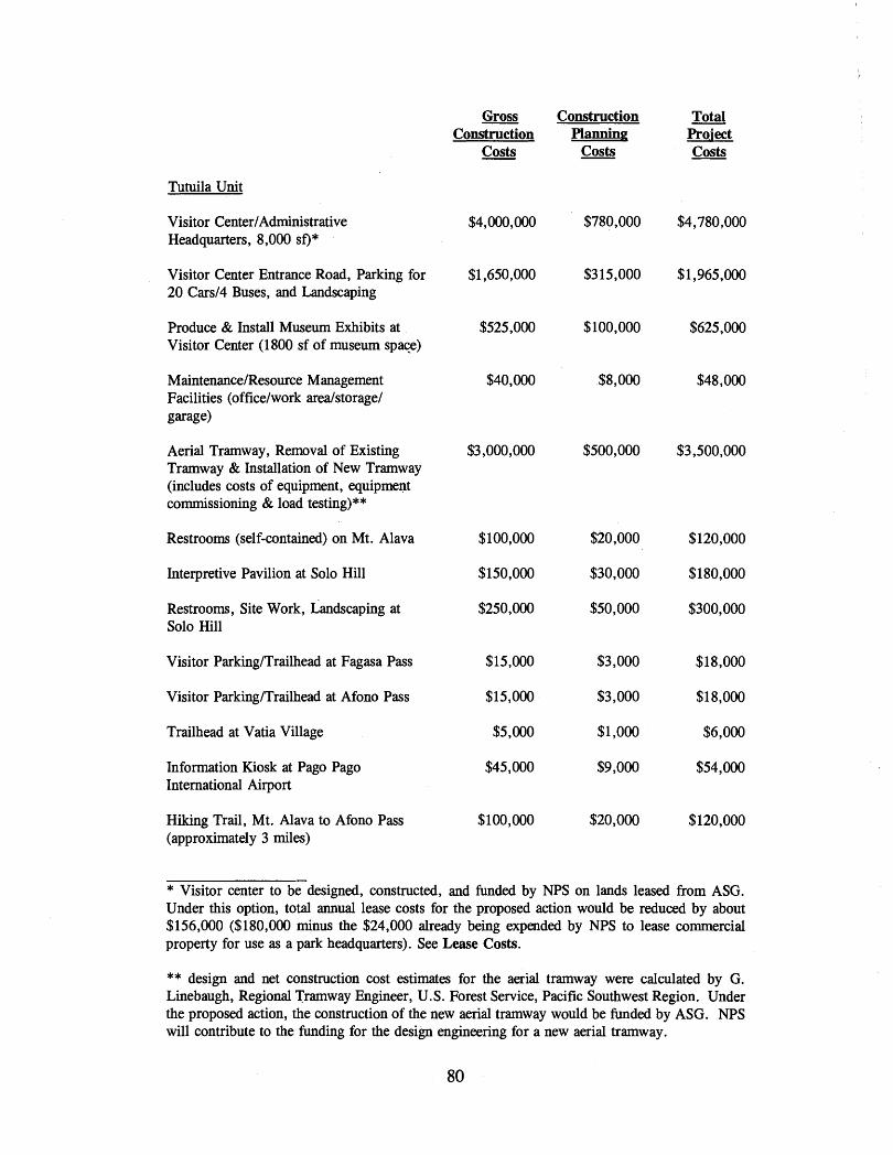
Tutuila Unit
Visitor CenterIAdministrative Headquarters, 8,000 sf) *
Visitor Center Entrance Road, Parking for 20 Cars14 Buses, and Landscaping
Produce & Install Museum Exhibits at Visitor Center (1800 sf of museum spaqe)
MaintenanceIResource Management Facilities (officelwork arealstoragel garage)
Aerial Tramway, Removal of Existing Tramway & Installation of New Tramway (includes costs of equipment, equipment commissioning & load testing)**
Restrooms (self-contained) on Mt . Alava
Interpretive Pavilion at Solo Hill
Restrooms, Site Work, Landscaping at Solo Hill
Visitor ParkingITrailhead at Fagasa Pass
Visitor ParkingITrailhead at Afono Pass
Trailhead at Vatia Village
Information Kiosk at Pago Pago International Airport
Hiking Trail, Mt. Alava to Afono Pass (approximately 3 miles)
Gross Construction Total Construction Planning Project
Costs Costs Costs
* Visitor center to be designed, constructed, and funded by NPS on lands leased from ASG. Under this option, total annual lease costs for the proposed action would be reduced by about $156,000 ($180,000 minus the $24,000 already being expended by NPS to lease commercial property for use as a park headquarters). See Lease Costs.
** design and net construction cost estimates for the aerial tramway were calculated by G. Linebaugh, Regional Tramway Engineer, U. S. Forest Service, Pacific Southwest Region. Under the proposed action, the construction of the new aerial tramway would be funded by ASG. NPS will contribute to the funding for the design engineering for a new aerial tramway.

Observation Platform, Scenic Overlook and Paiking, Vatia Road
Ta'u Unit
Ranger Station, Restrooms (self- contained), & MaintenanceIResource Management Facilities
New Hiking Trails in Uplands (approximately 8 miles)
Elevated Walkway (100 yards)
Information Display at Fitiuta Airport
Primitive CampsiteslPit Toilets
Ofu Unit
Visitor Contact Station, Restrooms (self- contained), and MaintenanceIResource Management Facilties
Information Display at Ofu Airport
All Units
National Park Entrance Signs & Boundary Posts (mark approximately 6 miles of national park boundary)
Wayside Exhibits (approximately 20)
Total Estimated Construction Costs, Alternative A, Proposed Action
Gross Construction
Costs
$25,000
$240,000
$265,OOO
$100,000
$45,000
$10,000
$120,000
$45,000
$48,000
$135,000
$1 1,018,000
Construction Planning
Costs
$5,000
$46,000
$53,000
$20,000
$9,000
$3,000
$23,000
$9,000
$9,000
$27,000
$2,064,000
Total Prsi ect Costs
$30,000

Gross Construction Total Construction Planning Pro-i ect
Costs Costs Costs
Rehabilitation Costs
Tutuila Unit
ModifyIRenovate Existing Historic U. S. Navy Building for use as a Visitor Center1 Administrative Headquarters***
Light Grading, Erosion Control, Approximately 4 Miles of Unpaved Road (Fagasa Pass to Mt. Alava)
Built-up Area Atop Mt. Alava (remove unneeded structures and debris; landscape with native plants)
Mt. Alava Pavilion (modify for visitor interpretation)
Approximately 2 miles of Hiking Trail, Maugaloa Ridge to Vatia Village
Ta'u Unit
Light Grading1 Revegetation of Approximately 4 Miles of Dirt Road and Walking Trail (to Papaloaloa Pt.)
Total Estimated Rehabilitation Costs, Alternative A, Proposed Action
*** NPS to lease historic building from ASG instead of constructing a new visitor centerladministrative headquarters. Under this option, the total estimated gross construction costs would be reduced by $4,780,000.

The above proposed developments would be constructed in the following phased sequence (unless otherwise noted, developments
proposed for the Tutuila unit):
entrance signs and boundary sign posts (parkwide) hiking trail, Fagasa Pass to Mt. Alava parkingltrailhead at Fagasa and Afono passes information kiosk at Pago Pago Airport information kiosk at Fitiuta Airport, Ta'u unit information kiosk at Ofu Airport, Ofu unit ranger station and restrooms, Ta'u unit visitor contact station and restrooms, Ofu unit elevated canopy walkway, Ta'u unit visitor center entrance road and parking visitor centerlpark headquarters aerial tramway site work, restrooms, interpretive facilities at Solo Hill restrooms on Mt. Alava interpretive facilities, Mt . Alava site work, debris removal, and landscaping at Mt. Alava hiking trail, Mt. Alava to Afono Pass hiking trail to Papaloloa Pt., Ta'u unit hiking trail, Maugaloa Ridge to Vatia village trailhead at Vatia village museum exhibits at visitor center wayside exhibits (parkwide) hiking trails in uplands, Ta'u unit primitive campsites, Ta'u unit
Lease Costs
Tutuila Unit
Visitor CenterlAdministrative Headquarters (building approximately 8,000 sf, plus entrance road, parking area for 20 cars14 buses)**** $15,0001month
Total Estimated Lease Costs, Alternative A, Proposed Action $15,00Olmonth
**** visitor centerlheadquarters complex to be funded and constructed by ASG and then leased to NPS (building to be designed by NPS). Under this option, the total estimated gross construction costs would be reduced by $4,780,000.

ALTERNATIVE B - NO ACTION
A no action alternative is presented here as a requirement under NEPA regulations. The purpose of the no action alternative is to provide a baseline against which the other "action" alternatives can be compared. This alternative essentially is a continuation of the existing situation. The no action alternative would not achieve the purposes of the national park's authorizing legislation.
At the National Park of American Samoa, under this alternative, there would be only three full-time, permanent NPS employees for the foreseeable future - the superintendent, chief ranger, and wildlife biologist. NPS would continue to rely on volunteers to provide most of the very limited visitor services. The current operation of the existing visitor center at Pago Plaza would continue.
Development of Park Access and Facilities
There would be no facility development proposed, including access.
Tutuila Unit
No additional park signing would be proposed under this alternative and there would be no marking of Moldings. ASG would continue to be responsible for maintaining the existing paved road within the national park from Afono to Vatia. No development of scenic overlooks or vehicle parking would be proposed along this road.
The existing unpaved service road from Fagasa Pass to the top of Mt. Alava would remain largely in its present condition. No major rehabilitation work would be proposed to restore the natural drainage patterns along this route or to modify the dirt road into a hiking trail. There would be no modification proposed for the existing pavilion ("guest fale") located on the top of Mt. Alava for visitor interpretation, although within existing capabilities efforts would be made to use the facility for interpretive purposes.
There would be no additional access improvements at Fagasa Pass. There would be no new trail proposed to run along the ridge from Mt. Alava to Afono Pass. No access improvements would be proposed at Afono Pass.
There would be no proposal to replace the aerial tramway to the top of Mt. Alava with a new facility in order to bring visitors into the national park. Moreover, there would be no interpretive facilities, visitor parking, or restrooms proposed for development in connection with the operation of the tramway.
NPS would continue to utilize the leased commercial office space in Pago Pago for visitor contact and as an administrative headquarters. No additional facilities would be proposed for lease in connection with the unit's resource management and maintenance operations.
Ta'u Unit
There would be no ranger station or restrooms proposed for development. No new trails and no camping sites would be proposed for the Ta'u unit.
Ofu Unit
Under the no action alternative, no visitor contact station and no restroom facilities would be proposed for the Ofu unit.
Caring for Park Resources
Under this alternative, only those resource studies now completed or already underway would be utilized to guide future resource management in the national park. Resource management in the national park would be guided by the scientific data now available. With only a single resource management position, there would be no capability to conduct additional scientific research on the nature and condition of national park resources. NPS would have to rely on existing studies and on other agencies and organizations for information and data on the resources found within the national park.
NPS would have very limited capability to monitor resources. With only the one wildlife biologist position, monitoring could not be carried out at regular intervals. In the foreseeable future, the national park would have no professional staff capability to identify, evaluate, or protect archeological sites and features within the national park in a systematic manner.
Interpreting Park Resources for Visitors
85

Interpretation would continue to take place in the existing visitor center at Pago Plaza. Existing NPS staff, augmented by volunteers, would provide all visitor services. Since interpretation would be a collateral duty for the present NPS employees, and volunteers would have little or no NPS interpretive experience, there would be only a very limited capability to interpret the natural and cultural attributes of this national park. All visitor services would be offered at the visitor center. No interpreters would be duty-stationed on-site within the national park.
Continuing the Traditions and Customs of the Samoan Culture
NPS would still attempt to operate the national park in manner consistent with fa6asamoa and its rnatai system. The park superintendent and the chief ranger would spend as much time as their work schedules allow working with the eight villages to clarify and reach agreement on rules and procedures for the maintaining of traditional subsistence uses in the national park and for the elimination of those non-traditional practices found to be harmful to resources. Under the no action alternative, the development of an agreed set of rules and procedures would take much longer.
Management Zoning
Management zoning would be the same as that described in the Statement for Management (October 1994).
Carrying Capacity
There would be no staff available to regularly monitor either the quality of the visitor experience or how visitors and subsistence users are affecting park resources. NPS would likely not become aware of any resource damage from over-use until after it has occurred.
Operational Costs
Under the no action alternative, no additional FTEs would be added and the national park's base operating funding would stay at the same level in the foreseeable future.
Estimated Development Costs
There would be no costs associated with access or facility development.
ALTERNATIVE C - MINIMUM REQUIREMENTS
This alternative calls for only those changes in the operation and management of the national park necessary to meet the mandates of NPS programs. Under the minimum requirements alternative, changes would take place in the development of the national park as a result of ongoing and future efforts to operate the park, including caring for its resources and providing for visitor services. This alternative identifies the minimum actions and developments needed to make this national park operational in a way that provides for primary visitor use, park management, and resource protection.
Development of Park Access and Facilities
This alternative would keep facility development to a minimum. To carry out needed administrative and interpretive services, NPS would continue to utilize existing facilities located outside park boundaries. However, even to minimally care for park resources and maintain even a low level of development, additional facilities would be needed. Only those facilities required to provide essential care for park resources and to permit visitor enjoyment and safety would be developed within the national park. As much as possible, NPS would look to the nearby villages to provide visitor services.
Under this alternative, the NPS would clearly identify and mark with road signs the entrances to the national park at those locations where a means of visitor access already exists and mark national park boundaries with sign posts at those locations recommended by village councils.
The minimum requirements alternative proposes that no new roads or trails be built within the national park. Visitor access to the national park is to be solely via the roads and trails that already exist within the national park. Existing roads would be maintained in their present condition. Where needed, existing trails would be upgraded or rehabilitated to NPS standards, but no new trails would be constructed.

Except for the few vehicles now being used to carry out traditional subsistence agriculture activities within the Tutuila and Ta'u units and those official vehicles used to periodically service and maintain the TV transmitters atop Mt. Alava, no motor vehicles, including 4-wheel drive vehicles, would be allowed on trails within the national park. In order to carry out needed resource management, patrol, emergency, or maintenance activities within the national park, the NPS would continue to use only small, light-weight, narrow-axle utility vehicles on park trails.
No primitive campsites would be built within the national park under this alternative. No overnight camping would be allowed. As with the proposed action, NPS would rely on villages located next to the national park to offer visitor services usually provided by concession operators in national parks. In addition to overnight accommodations, services offered by the villages could include food and beverage, the sale of Samoan handicrafts, and NPS- trained village guides to take visitors to places of interest within the national park.
Tutuila Unit
This alternative calls for the placing of road signs at the existing major entrance points to the national park near Fagasa and Afono passes and along the AfonoIVatia road. In addition, sign posts would be placed at regular intervals to mark the national park boundary above Vatia village, along the base of Polauta Ridge, above Fagasa Bay, and next to Afono village lands. All inholdings would be clearly marked.
ASG would maintain the existing paved road within the national park from Afono to Vatia for motor vehicles. The road would be maintained to NPS standards. A scenic overlook is proposed along this road to provide visitors with views and interpretation of Pola Island and its seabirds. In cooperation with Vatia village, parking would be developed near the Pola. Access to other portions of the Tutuila unit would be only on existing hiking trails.
The existing unpaved, service road leading to the TV transmitters atop Mt. Alava would be rehabilitated to improve the drainage and control erosion by installing water bars and carrying out other necessary corrective measures. Except for NPS-operated utility vehicles and those 4-wheel drive vehicles used by officials to carry out the required servicing of the TV transmitters, no motor

vehicles would be permitted on the rehabilitated Mt. Alava trail. It would be used primarily by visitors to hike up to the top of Mt. Alava, and also by village subsistence farmers and gatherers and NPS personnel to carry out resource management, maintenance, or interpretive activities. The existing pavilion ("guest fale ") located on the top of Mt. Alava would be rehabilitated and used for visitor interpretation and the surrounding built-up area cleared and landscaped with native plants. The TV transmitter tower and building would be fenced and screened.
The existing vehicle parking near Fagasa Pass would be improved and trailhead signing installed. This facility would provide convenient parking for visitors wishing to hike up the Mt. Alava trail. Under this alternative, there would be no new hiking trail constructed to run from the top of Mt. Alava east along the Maugaloa Ridge down to Afono Pass. Consequently, no trailhead and parking would be developed at Afono Pass. Also, there would no rehabilitation of the now overgrown cross-mountain trail leading down to Vatia village.
Under the minimum requirements alternative, visitors would not be able to access the national park via the aerial tramway. The existing tramway to the top of Mt. Alava would not be replaced. The existing tramway cannot be used to bring visitors into the national park since it does not meet established federal safety standards for passenger tramways. No interpretive, visitor parking, or restroom facilities would be developed at Solo Hill by NPS. The existing pavilion structure located near Solo Hill would not be rehabilitated for use as an interpretive facility.
Rather than building a new visitor center structure outside of national park boundaries, NPS would continue to utilize the leased commercial office space in Pago Pago for visitor contact and as an administrative headquarters. Building space would be needed elsewhere in the Pago Pago area to house the national park's resource management and maintenance operations for the Tutuila unit.
Ta'u Unit National park entrance signs and boundary marker posts would be placed at the same locations described in the proposed action. The existing unimproved road to Saua and the trail beyond would be maintained to their existing condition.

As with the proposed action, the level, grassy area to the south of Saua is proposed for day-use activities. A ranger station is proposed in the vicinity and the cultural significance of the Saua area would be interpreted for visitors. Self-contained, vault type restrooms would be built here. Any visitor use facilities developed in the vicinity of Saua, an area Samoans consider sacred, would be carefully sited to avoid impacting cultural resources. No facilities would be built in this area without the prior approved of the Fitiuta village council.
No new trails would be built to provide visitors with opportunities to hike up into the cloud forest and to nearby areas of geologic significance. Also, no primitive camping sites would be developed for visitors in the uplands.
Ofu Unit
Park access and facilities for the Ofu unit would be developed at the same level as under the proposed action. National park entrance signs would be placed at the Ofu airport and Olosega ends of the Ofu unit and boundary marker posts at spaced intervals along the ocean side of the unpaved road. There would be no widening of this road on its ocean side. A visitor contact station, including a kiosk andlor bulletin case, and restrooms are proposed just outside of the national park. The restroom facility would be self-contained.
Caring for Park Resources
Caring for the natural and cultural resources of the National Park of American Samoa under this alternative would follow the direction provided by Congress when it authorized this national park. As with the proposed action, the implementation of resources management strategies would be based on scientific data gathered through active research programs. Those studies that have been completed or are now underway to learn more about the natural and cultural resources of the national park would serve as baseline information to guide existing and future resource management strategies.
Under this alternative, NPS would carry out formal consultation procedures with the U.S. Fish and Wildlife Service and the National Marine Fisheries Service in those matters involving endangered species, as required by Section 7 of the Endangered

Species Act. Similarly, coordination and consultation with the historic preservation office would take place pursuant to Section 106 of the Historic Preservation Act.
NPS would manage natural and cultural resources within the national park in a manner consistent with aspects of the traditional Samoan culture such as the communal ownership of land, the maintaining of oral traditions, protecting the integrity of the land, and the status which land provides to a family and village.
This alternative calls for a smaller staff than the proposed action, therefore the capability to undertake future scientific research to accumulate additional data would be more limited, as would the capability to implement the identified resource management strategies. NPS would rely to some extent on existing studies and on other agencies and organizations for information on the terrestrial and marine resources of American Samoa.
The national park's capability to monitor resources at regular intervals and to conduct additional research would be limited under this alternative. Natural resource management would consist primarily of trying to protect the native plants and animals. Resource management would be based largely on the existing level of scientific knowledge. Under this alternative, there would be only limited efforts undertaken to identify, evaluate, and protect archeological sites and features within the national park.
Major long-term objectives for natural and cultural resource management would be the same as those listed under the proposed action. The strategies identified to deal with natural and cultural resource management issues are the same as those described in the proposed action. However, under this alternative, the capability to implement these strategies would be constrained by a more limited resource management staff.
Under the minimum requirements alternative, the national park would eventually acquire additional staff with experience and expertise in resource management. However, it would take considerably longer to acquire staff under this alternative than under the proposed action. Resource management would be limited primarily to trying to protect native plants and wildlife based largely on the existing level of knowledge. Active resource management would be more limited than under the proposed action. There would also be more limited monitoring of the
condition of national park resources and more limited additional research.
Interpreting Park Resources for Visitors
As with the proposed action, the Samoan culture and the biotic resources of the national park are to be the major focuses for visitor interpretation. NPS would inform visitors about this national park using the interpretive themes described in the proposed action.
Under this alternative, there would be no new visitor center built for the national park. NPS would continue to lease commercial space in the Pago Pago area to serve as an administrative headquarters and to provide for basic visitor contact. There would be only very limited opportunities for visitors to view museum artifacts related to the national park and view and hear audio-visual programs and interpretive talks in a visitor center setting.
Interpretive programs, including guided walks for local school groups, could not be scheduled on the same regular basis as the proppsed action because of the smaller staff. It would be more difficult for NPS interpreters to provide visitors with a basic understanding of the traditional Samoan culture without a visitor center.
NPS, under this alternative, would rely a great deal on the Hayden Museum, the Office of Tourism, and others to provide alternative interpretive services and programs to national park visitors.
As with the proposed action, a small information kiosk or bulletin case would be installed at the Pago Pago, Fitiuta, and Ofu airports to provide visitors with basic orientation information about the national park.
The national park's trail system under this alternative would be more limited than that called for by the proposed action and, consequently, visitors would not have access to as many of the natural and cultural attributes of the park. The uplands of the Ta'u unit would not be accessible by trail. Without well-maintained trails, other important areas would be more difficult for visitors to reach.

As with the proposed action, a park-wide signing plan to provide clear and concise directional information for visitors and a wayside exhibit plan identifying locations, interpretive messages, and locations would be prepared.
Continuing the Traditions and Customs of the Samoan Culture
NPS would operate the national park in a manner that is consistent with fa6asamoa and its matai system. The matai af the village councils who have agreed to lease their lands for national park purposes are recognized by NPS as the lawful authority on traditional Samoan matters within each of the eight villages comprising the lease premises. NPS would deal with each of the village councils, either directly or through their appointed representatives, on national park related matters pertaining to that particular village.
The park superintendent would work with each of the eight village councils or through their designated representatives to clarify and reach agreement on the following:
rules or procedures for maintaining the Samoan culture and permitting traditional subsistence agricultural, fishing, cultural, and gathering uses within the national park;
rules or procedures for the elimination of non-traditional practices found to be harmful to national park resources and in conflict with fa6asamoa; and
whether "nuisances" related to village lands are to be handled by the council, NPS, or jointly.
The park superintendent would take all appropriate actions required of NPS leading to the establishment of the Advisory Board for the National Park of American Samoa by the Secretary of the Interior, in accordance with Section 3.(g) of Public Law 100-57 1.
Management Zoning
Management zoning under this alternative would be the same as the proposed action, except there would be no Park Development

Zone located at Afono Pass thereby reducing this zone by one-half acre and increasing the NaturallCultural Zone by the same amount.
Carrying Capacity
Actions proposed for the development of facilities and the expansion of park staffing are at the minimum level under this alternative. However, it is anticipated that visitation to the national park would be at about the same level as under the proposed action for the foreseeable future. Consequently, with staffing at the minimum level, it would be more difficult to monitor the condition of park resources and more difficult for management to establish ecological and sociological carrying capacities for certain areas within the national park. Similarly, it would be more difficult to structure and regulate uses within the national park.
Operational Costs
In order to implement the min@um requirements alternative, an additional 10 full-time equivalents (FTE) would be needed and approximately $320,00Olyear added to the current base operating funds of the national park to cover salaries.
Estimated Development Costs
Listed below are the estimated costs to construct the access and facility development called for under the minimum requirements alternative. Included also are the estimated costs to lease the facilities called for under the minimum requirements alternative.
Construction Costs
The construction costs shown below are again based on Class "C" estimates.
Gross Construction Total Construction Planning Pmi ect
Costs Costs Costs Tutuila Unit
Restrooms (self-contained) on Mt. Alava
Visitor ParkingITrailhead at Fagasa Pass
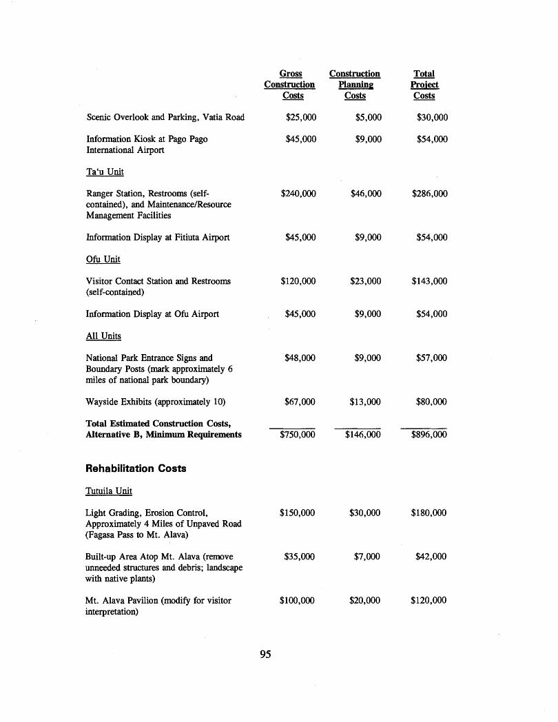
Gross - Construction Total Construction Planning Pro-i ect
Costs Costs Costs
Scenic Overlook and Parking, Vatia Road $25,000 $5,000 $30,000
Information Kiosk at Pago Pago International Airport
Ta'u Unit
Ranger Station, Restrooms (self- contained), and MaintenanceIResource Management Facilities
Information Display at Fitiuta Airport
O h Unit
Visitor Contact Station and Restrooms (self-contained)
Information Display at O h Airport
All Units
National Park Entrance Signs and Boundary Posts (mark approximately 6 miles of national park boundary)
Wayside Exhibits (approximately 10) $67,000 $13,000 $80,000
Total Estimated Construction Costs, Alternative B, Minimum Requirements $750,000 $146,000 $896,000
Rehabilitation Costs
Tutuila Unit
Light Grading, Erosion Control, $150,000 Approximately 4 Miles of Unpaved Road (Fagasa Pass to Mt. Alava)
Built-up Area Atop Mt. Alava (remove $35,000 unneeded structures and debris; landscape with native plants)
Mt. Alava Pavilion (modify for visitor $100,000 interpretation)
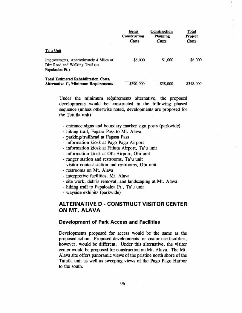
Gross Construction Construction Planning
Costs - Costs
Ta'u Unit
Improvements, Approximately 4 Miles of Dirt Road and Walking Trail (to Papaloaloa Pt .)
Total Proi ect Costs
Total Estimated Rehabilitation Costs, Alternative C, Minimum Requirements $290,000 $58,000 $348,000
Under the minimum requirements alternative, the proposed developments would be .constructed in the following phased sequence (unless otherwise noted, developments are proposed for the Tutuila unit):
- entrance signs and boundary marker sign posts (parkwide) - hiking trail, Fagasa Pass to Mt. Alava - parkingltrailhead at Fagasa Pass - information kiosk at Pago Pago Airport - information kiosk at Fitiuta Airport, Ta'u unit - information kiosk at Ofu Airport, Ofu unit - ranger station and restrooms, Ta'u unit - visitor contact station and restrooms, Ofu unit - restrooms on Mt. Alava - interpretive facilities, Mt. Alava - site work, debris removal, and landscaping at Mt. Alava - hiking trail to Papaloaloa Pt., Ta'u unit - wayside exhibits (parkwide)
ALTERNATIVE D - CONSTRUCT VISITOR CENTER ON MT. ALAVA
Development of Park Access and Facilities
Developments proposed for access would be the same as the proposed action. Proposed developments for visitor use facilities, however, would be different. Under this alternative, the visitor center would be proposed for construction on Mt. Alava. The Mt. Alava site offers panoramic views of the pristine north shore of the Tutuila unit as well as sweeping views of the Pago Pago Harbor to the south.

The site proposed for the visitor center would be just below the existing metal stairs leading up to the summit. Visitors would take the aerial tramway up to the top of Mt. Alava and then walk the short distance down to the proposed visitor center site. The "guest fale" or pavilion on the far side of the TV transmitter tower would be rehabilitated as called for under the proposed action.
The landscaping and screening of the summit area described in the proposed action would also be carried out under this alternative.
The land for the proposed visitor center is within authorized national park boundaries, on land owned by ASG, and is part of the leased premises.
The proposed visitor center at the Mt. Alava site would be smaller in size and have more limited functions than the visitor center described in the proposed action, and would be of different design - more open to take advantage of the scenic views available here. The facility on Mt. Alava would be primarily for visitor interpretation. It would contain an information counter to display cooperating association publications and materials, a small museum to display objects and artifacts, a separate room for audio-visual presentations, offices for interpreters, storage space, and restrooms. Interpretive talks would be presented outdoors in an adjoining covered area and in the nearby rehabilitated pavilion. The outside covered area would be sited to provide views of both the north shore and the Pago Pago Harbor area. No NPS administrative offices would be located here.
NPS would continue to lease commercial space in the Pago PagolFagatogo area to serve as an administrative park headquarters. There would be only minimal provisions made for visitor contact at park headquarters. This facility would primarily house office spaces for the park superintendent, chief ranger, and park administrative staff. There would also be space here to store Samoan archeologic and ethnographic collections and office and lab spaces for a park curator.
At the proposed Mt. Alava visitor center site, electricity is available nearby (a line comes up from the Pago Pago Harbor area for the TV transmitter), but there is no water. In designing the visitor center building, options for a roof water-catchment system would need to be explored. This catchment water would have to undergo treatment in order to meet federal safe drinking water

standards. The restrooms would be a self-contained system, utilizing composting as the means to dispose of waste materials.
As noted, the remainder of the development proposed for access and facilities would be the same as the proposed action.
Caring for Park Resources
The same as under the proposed action.
Interpreting Park Resources for Visitors
The interpretive program proposed for the National Park of American Samoa would be the same as the proposed action. The only difference would be that the primary contact point for visitors to the national park would be the visitor center proposed at Mt. Alava. Visitors would receive their basic introduction to the national park at the Mt. Alava visitor center park and interpretive services would be provided here.
With the visitor center being located on Mt. Alava, national park visitors would be taking the aerial tramway ride before arriving at the visitor center and would not yet have received their basic introduction and orientation to the many significant and unique natural and cultural resources of the National Park of American Samoa. Moreover, those visitors who might choose not to take the aerial tramway ride to the top of Mt. Alava would not receive the basic introduction and orientation to the national park.
Continuing the Traditions and Customs of the Samoan Culture
The same as the proposed action.
Management Zoning
The same as under the proposed action, except that an additional one-half acre would be added to the Park Development Zone at the summit area of Mt. Alava to accommodate the proposed visitor center. The one-half acre would be deleted from the NaturalICultural Zone.
Carrying Capacity

Same as the proposed action.
Operational Costs
In order to fully implement this alternative, 25 additional full-time equivalents (FTE) would be needed and approximately $835,000 added to the national park's annual base operating funds to cover the salaries of these employees.
Estimated Development Costs
Listed on the following pages are the estimated costs to construct the access and facility development called for under this alternative.
Construction Costs
As with the other alternatives, the construction costs shown below are based on Class "C" estimates. Additional adjustments have been made to the estimated costs for the construction of a visitor center on Mt. Alava to take into account the remoteness of the job site and the extreme difficulties involved with access and terrain. The estimated costs of installing museum exhibits at that location also would be considerably higher.
Gross Construction
Costs
Tutuila Unit
Visitor Center at Mt. Alava (4200 sf) $3,000,000
Produce and Install Museum Exhibits at $540,000 Visitor Center (1200 sf of museum space)
Aerial Tramway, Removal of Existing $3,000,000 Tramway and Installation of New Tramway (includes costs of equipment, equipment commissioning and load testing)*
Restrooms (self-contained) on Mt . Alava $100,000
Construction Planning
Costs
Total P d ect Costs
$3,600,000
$640,000
$3,500,000
$120,000

Interpretive Pavilion at Solo Hill
Restrooms, Site Work, Landscaping at Solo Hill
Visitor ParkingITrailhead at Fagasa Pass
Visitor ParkingITrailhead at Afono Pass
Trailhead at Vatia Village
Information Kiosk at Pago Pago International Airport
Hiking Trail, Mt. Alava to Afono Pass (approximately 3 miles)
Ta'u Unit
Ranger Station, Restrooms (self- contained), and Maintenance1 Resource Management Facilities
New Hiking Trails in Uplands (approximately 8 miles)
Information Kiosk at Fitiuta Airport
Primitive CampsitesIPit Toilets
Ofu Unit
Visitor Contact Station and Restrooms (self-contained)
Information Exhibit at Ofu Airport
Gross Construction Construction Planning
Costs - Costs
Total Project Costs
$180,000
$300,000
* design and net construction cost estimates for the aerial tramway were calculated by G. Linebaugh, Regional Tramway Engineer, U . S Forest Service, Pacific Southwest Region. Under this alternative, construction of the new aerial tramway would be funded by ASG. NPS would contribute to the funding for the design engineering for the new aerial tramway.
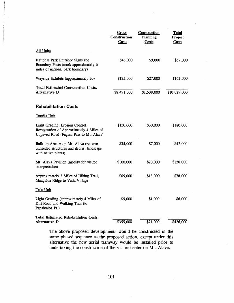
All Units
National Park Entrance Signs and Boundary Posts (mark approximately 6 miles of national park boundary)
Wayside Exhibits (approximately 20)
Total Estimated Construction Costs, Alternative D
Rehabilitation Costs
Tutuila Unit
Light Grading, Erosion Control, Revegetation of Approximately 4 Miles of Unpaved Road (Fagasa Pass to Mt. Alava)
Built-up Area Atop Mt. Alava (remove unneeded structures and debris; landscape with native plants)
Mt. Alava Pavilion (modify for visitor interpretation)
Approximately 2 Miles of Hiking Trail, Maugaloa Ridge to Vatia Village
Ta'u Unit
Light Grading (approximately 4 Miles of Dirt Road and Walking Trail (to Papaloaloa Pt.)
Total Estimated Rehabilitation Costs, Alternative D
Gross Construction Total Construction Planning Pro-i ect
Costs Costs Costs
The above proposed developments would be constructed in the same phased sequence as the proposed action, except under this alternative the new aerial tramway would be installed prior to undertaking the construction of the visitor center on Mt. Alava.

AFFECTED ENVIRONMENT NATURAL RESOURCES
Climate
American Samoa has a tropical climate - humid, with abundant and well distributed rainfall. The tropical climate is tempered somewhat by the prevailing southeast tradewinds and the moderating influence of the surrounding ocean. Moreover, there is a significant seasonality, measured by the patterns of the rainfall and wind direction. There is a distinctly drier season from about June through September (winter) which corresponds approximately to the period of prevailing tradewinds (from about April through September). December through March (summer) are the wettest months, with monthly averages of from 11 to 14 inches.
During October to March winds are more variable and westerly reversals occur.
The average annual temperature at the Pago Pago International Airport, the only permanent weather station in American Samoa, is about 80 degrees F with an average relative humidity of nearly 80 percent. The diurnal temperature range is about 15 degrees F, cooling to about 75 degrees F from about 88 degrees F in the afternoon. The coolest months are generally June through September and January through March are the warmest. A temperature range of about three degrees F separates the average monthly temperatures of the warmest and coolest months.
The total average rainfall measured at the airport is about 125 inches. September is the driest month averaging 6.5 inches and December the wettest month with an average of 15 inches. Most rain falls as showers, although torrential and long-lasting rainstorms can occur during the summer when the tradewinds weaken.
About 25 to 30 thunderstorms occur each year, mostly duringthe summer when unstable equatorial air overlies American Samoa. Summer is also the season for tropical storms and hurricanes.
Since 1987, three major hurricanes - Tusi, Ofa, and Val - have struck American Samoa. Tusi, in 1987, did extensive damage to property, vegetation, and wildlife on Ta'u. Val caused widespread property damage throughout Tutuila.
Areas of high relief such as the national park receive greater amounts of rainfall. The mean annual rainfall for the Tutuila unit of the national park ranges from 150 to 250 inches. The mean annual temperature is about 79 degrees F. The mean annual rainfall for the upland portions of Ta'u unit ranges from 200 to 300 inches. The range of the mean annual rainfall for the O h unit is about 150 to 250 inches and the mean annual temperature is about 79 degrees F.
Geomorphology and Soils
The Samoan archipelago is an example of linear, "hot-spot" progressive volcanism on the Pacific plate. Recent dating of rocks from the various Samoan islands has shown an east to west age progression, with Savai'i (Western Samoa) being the oldest island at an age of over two million years. Tutuila has been dated at 1.26 million years; O h and Olosega at 0.3 million years; and Ta'u at 0.1 million years. Formed in isolation, the archipelago has never had any connection to any other land area. The most recent volcanic activity in American Samoa was a submarine eruption between the islands of Ta'u and Olosega in 1866.
Tutuila Island
The island of Tutuila was created in a series of volcanic eruptions occurring in an east-west direction. This volcanic activity was followed by a period of stream erosion and subsidence resulting in the rugged terrain and deeply embayed coastline which characterize the island today. The geomorphology of much of this island is characterized by the steep slopes of mountain ridges. Tutuila's most prominent geomorphic feature, the sheltered harbor of Pago Pago, was created when the remains of an ancient volcano's caldera was filled by a combination of subsidence and a rising sea level.
The crest of the still exposed north wall of the collapsed caldera forms the southern boundary of the Tutuila unit of the national park. Along the crest, Mt. Alava, at about 1600 feet in elevation, is the highest point within the national park on Tutuila.

The geomorphology of the national park on Tutuila is composed of a series of steep-sided ridges and stream valleys radiating out from the caldera's north wall between the villages of Afono and Fagasa. These ridges extend northward down to the rugged north coast of the island. Polauta Ridge, on the west side of Vatia village, is the most spectacular of these ridges, extending out into the ocean in the form of a knife-like peninsula and culminating in Pola Island and Cockscomb Point. Nearly all of the national park's north coast shoreline has a solid rock substrate in the form of sea cliffs and headlands. Coral rubble beaches are found at Amalau Bay, along the east side of Polauta Ridge, at Tuafanua (west of Vatia village), and at Tafeu Cove. Talus slopes are found on both sides of Polauta Ridge.
Most of the stream valleys are narrow and steep-sided, except for Amalau which is a short, amphitheater valley with scenic cliffs and waterfalls. There are also falls and pools at Tafeu Cove. Drainage is provided by the principal stream valleys radiating out from along the summits of Mt. Alava and Maugaloa Ridge in a northerly direction. The watersheds are small, less than one square mile in area. The streams are less than one mile in length.
The national park contains a single trachyte plug, Mt. Maugaotula, located behind the village of Vatia. These "plugs" are the erosion resistant remains of ancient volcanic cores and are characterized by a unique white clay-like soil deficient in calcium, magnesium, and phosphates.
The soils of the Tutuila unit of the national park all have the same origin - the ancient Pago Pago volcano. Major differences in soil types occur between the hillside soils and the alluvial soils of some of the valleys. Hillside soils generally are drier since the steep slopes increase the rate of run-off. The soils of the alluvial valleys are moist because of slower run-off and additional water coming down slopes in streams and rivulets.
The soils of the ridges, mountainsides, and upper valleys covering nearly all of the national park on Tutuila have been classified by the U.S. Soil Conservation Service (now the Natural Resources Conservation Service) as "the Fagasa family-Lithic Hapludolls Rock outcrop association." These soils are found on ridges and mountainsides. They have their origin in volcanic (igneous) rock and both are well drained. The Fagasa family were formed in volcanic ash and unconsolidated, weathered mineral material and

are moderately deep to deep soils. The Lithic Hapludolls, also formed by mineral material, have been moved by creep, slide, or local wash and deposited at the base of steep slopes. These are shallow soils.
Polauta Ridge, Vaiava Strait, and Pola Island - places where erosion has sculptured precipitous and scenically spectacular cliffs -are all surface remnants of a huge volcanic plug that extends further out into the sea. These highly significant geologic features together have been designated a national natural landmark.
The only other significant soil type present in the Tutuila unit of the national park, "Aua very stony silty clay loams," is confined to the lower slopes and lowlands around the village of Vatia, above Va'aogeoge Cove west of Vatia, and in the Amalau Valley. These are very deep and well drained soils on talus slopes. They too originated from volcanic rocks.
Ta'u Island
Ta'u Island was formed primarily by the flows of a single shield volcano. The subsequent collapse of the volcano's summit formed a caldera that eventually became partially filled with ponded lavas and pyroclastic deposits. A series of later collapses formed the scenic escarpments, sea cliffs, and terraces that today comprise the south coast of the island. The largest and most accessible of the terraces begins at the southeast comer of the island and gently slopes up to the west along the base of the imposing inland cliffs that lead up to the summit of Lata Mountain, American Samoa's highest elevation at nearly 3200 feet. A spectacular, short, steep-

sided canyon, cut by the Laufuti stream, contains a series of waterfalls at its head. A second terrace, the Li'u Bench, is located just below the head of the stream.
From the summit area of the caldera, two rift zones radiate to the northeast and the northwest. A series of volcanic cones and pit craters has formed along the rift zones. The most prominent of these is Judd's (or Luatele) Crater in the northeast corner of the national park on Ta'u. In the northwestern section of the national park, there are a series of volcanic craters and cones consisting of Lepu'e, 'Olomatirnu, Olotamia, and 'Olomanu. Several smaller craters are located on Li'u Bench and there are a series of volcanic cones near the summit of Lata Mountain.
The flat and narrow coral rubble terrace that extends the length of the east coast of the national park was formed by deposition and erosion. At the southwest tip, the national park's rocky shores are comprised of flat coastal lava flows. Along much of the south coast, the rocky shore is in the form of sheer cliffs formed by marine erosion. These cliffs may be directly on the seashore or separated from it by a narrow bouldery or sandy beach. Sandy beaches are found in scattered localities within the national park, mostly along the south coast.
The interior of the national park on Ta'u is relatively flat, with gullies and stream beds located on the fringes. On the more recent lava flows, these streams are intermittent and flow only during heavy -infall. _The rest of the_time,the streambeds, calledalia in - Samoan, are dry. Laufuti stream is the only perennial within the national park.
The Natural Resources Conservation Service has placed the soils of the Ta'u unit into the following classifications: "the Otania family, the Rock outcrop-Hydrandepts-Dystrandepts association, the Sogi Variant-Pavaiai association, the Pavaiai stony clay loam, and the Ngedebus Variant extremely cobbly sand."
The Otania family soils are broadly defined and no single profile is typical. They cover all of the northern and eastern slopes of Lata Mountain and the Li'u Bench area. The soils here formed in volcanic ash and cinders under high rainfall. They are well drained.
The Rock Outcrop-Hydrandepts-Dystrandepts association is found on very steep mountainsides and cliffs. These soils occur along most of the south coast of the national park on Ta'u from along the crest of Mataalaosagamai Ridge down to the shoreline and also extend in a band along the upper southern slopes of Lata Mountain. A narrow band of this soil type runs along the east side of the national park at elevations ranging from about 200 up to about 400 feet. Hydrandepts formed in volcanic ash under high rainfall. These soils are well drained and are mostly shallow or moderately deep to bedrock. They commonly are silty clay loam. Dystrandepts also formed in volcanic ash, but received less rainfall than the Hydrandepts. They also are well drained and are mostly shallow or moderately deep to bedrock. They commonly are clay loam or silty clay loam and have a stony surface layer.
The Pavaiai stony clay loam is a moderately deep, well drained soil found on the uplands above Aufotu Cove, extending to the upper reaches of Laufuti stream. It is also found along the east side of the national park in a band between 400 and 600 feet, extending up to above 800 feet near Saua stream.
The Sogi Variant-Pavaiai association is found along the east side of the national park in a band from 600 to 1000 feet in elevation generally upslope of the Pavaiai soil. This soil formed in volcanic ash and is well drained and moderately deep to bedrock.
The Ngedebus Variant extremely cobbly sand is confined to a narrow strip of coastal plain along the east coast of the national p a r k . The-sojl forged in - - - - rubble and sand derived from coral and
- - - - - - - - - - - - - -
sea shells. It is deep and excessively drained.
Ofu Island
The island of O h represents part of a complex of several volcanic cones some of which developed as shields and later coalesced
1 burying older volcanic material. Ofu is very precipitous and
geologically very youthful. There has been relatively little stream erosion on Ofu. The island is tectonically unstable and undergoing subsidence. The rocks of the island consist primarily of olivine basalt and other materials extruded as both pahoehoe and a'a lava flows, interbedded with various pyroclastic tuffs and brecchias. A collection of near vertical dikes runs through the central spine of the island. The impressive 750-foot spire of Sunuitao Peak at the eastern end of the Ofu unit of the national park is the exposed top
107

of a trachyte plug. The high sea cliffs behind. and above the national park have their origin in faulting and/or landslides and have been extended and modified by marine erosion. Landslides continue to be active erosional forces along these cliffs. Below the cliffs is a narrow coastal plain and terrace formed of unconsolidated sediments making this area a highly dynamic geologic environment. The fringing coral reef flat that forms the majority of the Ofu unit of the national park is set upon the narrow band of calcereous material deposited along the island's southern shoreline.
The soils of the Ofu unit on the southern slopes of Sunuitao Peak are comprised of "the Fagasa family-Lithic Hapludolls-Rock outcrop association," except along the coast where "the Aua very stony silty clay loam" is found.
Vegetation
The islands of the Samoa archipelago have been inhabited for more than 3,000 years. Consequently, the flora of these islands has been extensively modified by human activity. Over these millennia, it is estimated that probably more than half of the vegetation of the archipelago has been severely altered by human activity and natural catastrophes, usually in the form of hurricanes. Nevertheless, compared to Western Samoa and other parts of ~ o i ~ n e s i a , including the Hawaiian Islands, the islands of American Samoa still have a relatively large proportion of native forest left, now found mostly on the rugged ridges of Tutuila and the interiors of the Manu'a Islands.
Prior to the arrival of the first Polynesians, most of the surface area of American Samoa was likely covered with native rainforest vegetation. The only areas which could not be classified as rainforest were littoral communities, summit vegetation, disturbed vegetation, and recent lava flows and ash deposits. Prior to human settlement, all the disturbed vegetation was natural, caused mostly by hurricanes and landslips, and possibly by occasional forest fires.
Today, the native flora found on the island of Tutuila is estimated to consist of approximately 417 native species of vascular plants. This total is comprised of about 301 flowering plants, 109 ferns, and 7 fern allies. An additional 179 species of vascular plants, all of which are angiosperms, have been introduced and naturalized,

most of them as weeds. Some of these were brought in by the Polynesians prior to European contact, but most were introduced after about 1800. The level of endemism (endemics are those species of plants found nowhere else) for Tutuila is only about one percent.
The National Park of American Samoa protects what is called a mixed species paleotropical (old world) rainforest, the only one of its kind within the U. S. national park system.
The island of Tabu has about 329 native plant species, comprising 222 angiosperms, 104 ferns, and 7 fern allies. An additional 121 species of vascular plants, all angiosperms, have been introduced and naturalized, most of them as weeds. Forty three are Polynesian introductions.
The plant communities found on the island of Ofu are the same ones found on Tutuila, but, because it is a very small island, the flora here is less diverse than on Tutuila or nearby Tabu.
The following description of the vegetation found within the National Park of American Samoa is based primarily on technical reports (1992, 1994) prepared by Dr. W. Arthur Whistler for the National Park Service through the Cooperative Park Studies Unit (CPSU), Hawaii. Whistler has divided the vegetation of the National Park of American Samoa into two main categories, primary vegetation and secondary vegetation.

Primary vegetation consists of those plant communities that are in a relatively stable condition. Nearly all of the plant species found in the primary vegetation category are native (indigenous or endemic). In American Samoa, the secondary forests also consist of native species so there is often no sharp distinction between primary and secondary forests. Also, being labeled primary does not mean that the vegetation has never been disturbed (naturally or by man), only that it is composed of a combination of tree species that remains fairly constant until the next disturbance. Primary vegetation can thus be regarded as climax. Whistler has divided the primary vegetation into two categories: rainforest and littoral vegetation.
Secondary vegetation has been defined by Whistler as all those plant communities that are in a state of relatively rapid change in structure and species composition brought on by some kind of disturbance. The disturbance can be natural, as from hurricanes or landslides, or man-caused, such as the clearing of forest for the development of villages or for subsistence agriculture.
In the southeast comer of the national park near Tufu Point, wetland vegetation is present. Lying in a shallow depression at the base of a steep talus slope, this wetland area, known locally as Lesi'u, covers an area of about eight and one-half acres. Most of the wetland is freshwater swamp. The freshwater swamp is dominated by hisbiscus and scattered herbaceous plants. A small cleared portion in the center has been cultivated with wetland taro. The rest of the cleared area is dominated by swamp fern. Since active agriculture in the vicinity of the Lesi'u appears to be declining, this wetland can be described as a disturbed wetland in the process of returning to a natural state.
On Tutuila, there is a marsh adjacent to Vatia village that remains relatively undisturbed, but it is located outside of the present national park boundary. The Vaoto Marsh on Ofu, also outside of national park boundaries, has been partially covered by the concrete runway of that island's airport. About six acres of this freshwater marsh remain. Prior to the 1991 hurricane, the wetland area was under cultivation.
Tutuila Unit
Rainforest is the natural forest vegetation that covers all of the Tutuila unit of the national park, except for the coastal portions

and those areas that are either now being used or recently have been used to grow subsistence crops. The rainforest here is high forest composed mostly of native trees adapted to moist forest conditions. The plant communities within the tropical forest category are all classified as climax. The undisturbed portions of the rainforest have a fairly open floor dominated by shade-tolerant herbs, mostly ferns.
Grasses, sedges, and shrubby species are relatively rare in the undisturbed rainforest. Climbers, including lianas (woody climbers) and epiphytes (plants that grow on trees) are also significant lifeforms present in the rainforest. The most significant climbers in the national park on Tutuila are Freycinetia reineckei and Freycinetia storkii. Both are called 'ie'ie in Samoan.
The rainforest within the Tutuila unit is not uniform. Several different plant communities can be recognized on the basis of their composition. Four major factors cause these differences: soil, topography, elevation, and disturbance. The communities within the national park are determined mostly by elevation.
Based primarily on differences in elevation and species composition, the rainforest found in the national park on Tutuila can be separated into two communities, lowland forest and montane forest. However; because rainforest communities contain several dominant species, boundaries between the two are indistinct and difficult to define. This is particularly true within the Tutuila unit where the rainforest is found on ridges that extend from the sea to high elevations. A third community, summit vegetation, is restricted to only a very small area within the Tutuila unit, the top of Maugaotula.
The lowland forest community is the tropical rainforest that covered most of the Tutuila portion of the national park prior to the arrival of the first Polynesian settlers in Samoa. It currently covers the ridges and valleys on the north coast up to nearly the highest elevations where it is replaced by montane forest. Some of these ridges, particularly the upper portions between Fagasa and the -TV tower atop Mt. Alava, have recently been disturbed by subsistence agriculture plots. Much of the area was also extensively damaged by recent hurricanes. However, most of lowland areas east of Toa Ridge east of the TV tower and west of Afono are covered with native lowland forest that is relatively undamaged. Three types of lowland forest are distinguished within
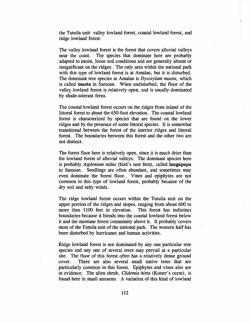
the Tutuila unit: valley lowland forest, coastal lowland forest, and ridge lowland forest.
The valley lowland forest is the forest that covers alluvial valleys near the coast. The species that dominate here are probably adapted to moist, loose soil conditions and are generally absent or insignificant on the ridges. The only area within the national park with this type of lowland forest is at Amalau, but it is disturbed. The dominant tree species at Amalau is Dysoxylum maota, which is called maota in Samoan. When undisturbed, the floor of the valley lowland forest is relatively open, and is usually dominated by shade-tolerant ferns.
The coastal lowland forest occurs on the ridges from inland of the littoral forest to about the 650-foot elevation. The coastal lowland forest is characterized by species that are found on the lower ridges and by the presence of some littoral species. It is somewhat transitional between the forest of the interior ridges and littoral forest. The boundaries between this forest and the other two are not distinct.
The forest floor here is relatively open, since it is much drier than the lowland forest of alluvial valleys. The dominant species here is probably Asplenium nidus (bird's nest fern), called laugapapa in Samoan. Seedlings are often abundant, and sometimes may even dominate the forest floor. Vines and epiphytes are not common in this type of lowland forest, probably because of the dry soil and salty winds.
The ridge lowland forest occurs within the Tutuila unit on the upper portion of the ridges and slopes, ranging from about 600 to more than 1100 feet in elevation. This forest has indistinct boundaries because it blends into the coastal lowland forest below it and the montane forest community above it. It probably covers most of the Tutuila unit of the national park. The western half has been disturbed by hurricanes and human activities.
Ridge lowland forest is not dominated by any one particular tree species and any one of several trees may prevail at a pwicular site. The floor of this forest often has a relatively dense ground cover. There are also several small native trees that are particularly common in this forest. Epiphytes and vines also are in evidence. The alien shrub, Clidemia hirta (~o'ster 's curse), is found here in small amounts. A variation of this kind of lowland
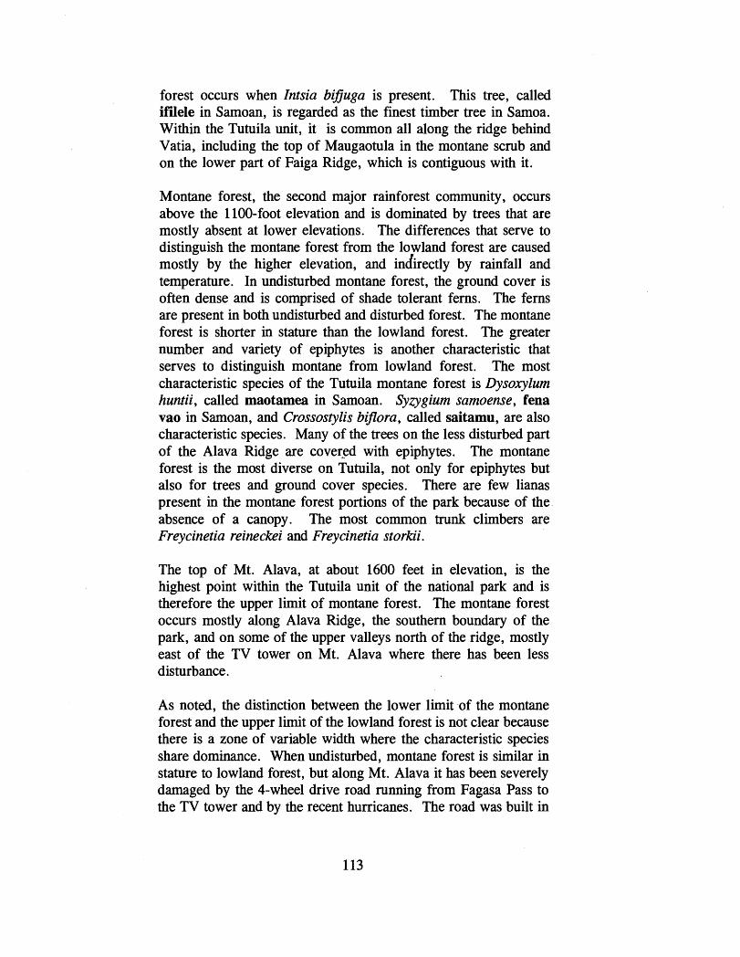
forest occurs when Intsia bifiuga is present. This tree, called ifilele in Samoan, is regarded as the finest timber tree in Samoa. Within the Tutuila unit, it is common all along the ridge behind Vatia, including the top of Maugaotula in the montane scrub and on the lower part of Faiga Ridge, which is contiguous with it.
Montane forest, the second major rainforest community, occurs above the 1100-foot elevation and is dominated by trees that are mostly absent at lower elevations. The differences that serve to distinguish the montane forest from the lowland forest are caused mostly by the higher elevation, and indirectly by rainfall and temperature. In undisturbed montane forest, the ground cover is often dense and is comprised of shade tolerant ferns. The ferns are present in both undisturbed and disturbed forest. The montane forest is shorter in stature than the lowland forest. The greater number and variety of epiphytes is another characteristic that serves to distinguish montane from lowland forest. The most characteristic species of the Tutuila montane forest is Dysoxylum huntii, called maotamea in Samoan. Syzygium samoense, fena vao in Samoan, and Crossostylis bijlora, called saitamu, are also characteristic species. Many of the trees on the less disturbed part of the Alava Ridge are covered with epiphytes. The montane forest is the most diverse on Tutuila, not only for epiphytes but also for trees and ground cover species. There are few lianas present in the montane forest portions of the park because of the absence of a canopy. The most common trunk climbers are Freycinetia reineckei and Freycinetia storkii.
The top of Mt. Alava, at about 1600 feet in elevation, is the highest point within the Tutuila unit of the national park and is therefore the upper limit of montane forest. The montane forest occurs mostly along Alava Ridge, the southern boundary of the park, and on some of the upper valleys north of the ridge, mostly east of the TV tower on Mt. Alava where there has been less disturbance.
As noted, the distinction between the lower limit of the montane forest and the upper limit of the lowland forest is not clear because there is a zone of variable width where the characteristic species share dominance. When undisturbed, montane forest is similar in stature to lowland forest, but along Mt. Alava it has been severely damaged by the Cwheel drive road running from Fagasa Pass to the TV tower and by the recent hurricanes. The road was built in


the TV tower and by the recent hurricanes. The road was built in 1977 and has opened up this area to erosion and subsistence agriculture.
Within the national park on Tutuila, the summit vegetation category comprises a single plant community, montane scrub. This is the scrubby vegetation in which trees are dwarfed and are secondary in importance to the dense tangle of ground cover, made up mostly of ferns and climbers. On Tutuila, this community is found on the slopes of an ancient trachyte plug - Maugaotula Peak. Located behind the village of Vatia, the vegetation in this very small area is a mixture of lowland ridge forest species and montane scrub species. Although Maugaotula lacks some of the characteristic montane scrub species of other trachyte plugs, it still can be classified as montane scrub because af the dominance of tree and ground cover species found here.
The second category of primary vegetation, littoral vegetation, covers the coastal portion of the national park on Tutuila. Littoral vegetation is restricted seaward by the hightide mark and inland by lowland forest. Environmental conditions found in areas of littoral vegetation are harsher than in any other plant community. The salty sea air, brackish groundwater, and occasional high waves make this habitat inhospitable to most other species.
Based on distinct differences present in structure and flora, three zones or plant communities have been recognized by Whistler within the littoral category of vegetation: (1) herbaceous strand, composed of herbaceous species that cover the foreshore; (2) littoral shrubland, a community of shrubby vegetation often found just inland; and (3) littoral forest, the community present farther inland. Most of the shoreline within the national park on Tutuila is composed of sea cliffs and windswept headlands. On the headlands, herbaceous strand is the most common community. Littoral shrubland within the Tutuila unit is found on the precipitous slopes of Polauta Ridge, the northern end of Vatia beach, and on Pola Island. In the Amalau Valley, before it was disturbed, the littoral forest extended much farther inland. Now, the disturbed littoral forest zone has been replaced inland by secondary forest and farther inland by lowland forest. Barringtonia asiatica (fish-poison tree), futu in Samoan, is the dominant forest tree along the national park coast, including areas of steep slopes.

The other main category of vegetation identified by Whistler, secondary or disturbed vegetation, has been divided into managed land vegetation, secondary shrub, and secondary forest. The three are successional. The plant species dominating disturbed vegetation have the following characteristics: fast growth, readily dispersed seeds, and intolerance of shade. Managed land comprises those areas that are being actively managed by man. The vegetation here is dominated by crops plants, weeds, and ornamentals. Most of the weeds are alien species. Secondary shrub is disturbed vegetation dominated by shrubs and small trees that take over as soon as the land is not actively managed. Secondary forest is dominated by species that have easily dispersed seeds and are also characterized by their transitory dominance - that is, they do not perpetuate themselves in areas lacking disturbance.
Areas of managed lands within the Tutuila unit are found primarily in the uplands around the village of Vatia, in Amalau Valley, next to the village of Afono, and in the vicinity of Afono Pass. There are also small, scattered agriculture plots found along the 4-wheel drive road to Mt. Alava. Mikania micrantha (mile-a-minute vine), called fue saina in Samoan, is one of the dominant weedy species found on managed lands. An alien plant, Mikania, unlike the other three most abundant weed species, is a vine that can smother other herbaceous or shrubby vegetation and may inhibit timely regeneration of forest from disturbed land.
Areas of secondary shrub are generally located on the periphery of the managed lands described above and are mostly abandoned agricultural plots that are now overgrown with shrubby vegetation. As with the rainforest, the vegetation categories here are not distinct. Areas of secondary shrub are often a mixture of scrub and scattered lowland forest trees that have survived recent hurricanes.
The most significant secondary forest found within the Tutuila unit of the national park is on the slopes above Fagasa Bay. Another area of secondary forest is found on the slope below the road just to the west of the Amalau Valley. There are also ridge lowland forest and valley lowland forest species found in this area. There is also extensive secondary forest on the slopes below the Alava Ridge road, but this is outside national park boundaries.

Ta'u Unit
Like the Tutuila unit, rainforest is the natural forest vegetation covering most of the Ta'u unit of the national park. The rainforest on Ta'u is similar in structure and form to the rainforest on Tutuila. The undisturbed portions have a fairly open floor dominated by shade-tolerant herbs; climbers and epiphytes are both significant lifeforms, while grasses, sedges, and shrubby species are relatively rare. Here again, several plant communities can be recognized based on differences in soil, topography, elevation, and disturbance. Elevation plays the dominant role in determining the differences and, along with differences in species composition, permits the rainforest on Ta'u to be divided into lowland forest and montane forest.
The lowland forest community on Ta'u is divided into what Whistler calls a Dysoxylum lowland forest and mixed lowland forest. The Dysoxylum lowland forest occurs in the lowlands, mostly below 650 feet. The best remaining example of this type of lowland forest in American Samoa is found within the national park on the coral-rubble terrace along the east coast of the island south of Fitiuta village and seaward of the talus slopes and cliffs. In both instances, Dysoxylum samoensis, called maota on Ta'u, is the dominant tree and forms the canopy. Along the coral-rubble terrace, this forest has a subcanopy comprising species that never reach the height of the Dysoxylum canopy. On the talus slopes and cliffs, the most common species are Dysoxylum samoense and Hibiscus tiliaceus (beach hibiscus), called fau in Samoan.
During a 1994 visit to the lowland forest on the east side of Ta'u, Whistler saw considerable evidence of subsistence agriculture plots in the old-growth Dysoxylum samoense forest. This lowland forest within the national park is regarded as the best example of its type in all of Samoa. It is dominated by huge Dysoxylum trees, many of which are over a meter in diameter. Whistler believes that once that forest is cut down, it will probably never come back.
Areas where there have been recent landslips or along sheer rock faces are often dominated by weedy species such as Mikania micrantha. On the inland slope above Laufuti, Dysoxylum is again one of the dominant species. Within Laufuti Canyon, one of the dominant species is Cyrtandra samoensis, referred to in Samoan as momolea. There are also many species of ferns, herbs, and small secondary forest trees present here.
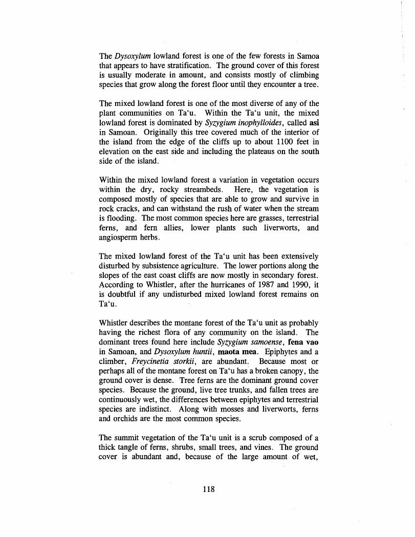
The Dysoxylum lowland forest is one of the few forests in Samoa that appears to have stratification. The ground cover of this forest is usually moderate in amount, and consists mostly of climbing species that grow along the forest floor until they encounter a tree.
The mixed lowland forest is one of the most diverse of any of the plant communities on Ta'u. Within the Ta'u unit, the mixed lowland forest is dominated by Syzygium inophylloides, called asi in Samoan. Originally this tree covered much of the interior of the island from the edge of the cliffs up to about 1100 feet in elevation on the east side and including the plateaus on the south side of the island.
Within the mixed lowland forest a variation in vegetation occurs within the dry, rocky streambeds. Here, the vegetation is composed mostly of species that are able to grow and survive in rock cracks, and can withstand the rush of water when the stream is flooding. The most common species here are grasses, terrestrial ferns, and fern allies, lower plants such liverworts, and angiosperm herbs.
The mixed lowland forest of the Ta'u unit has been extensively disturbed by subsistence agriculture. The lower portions along the slopes of the east coast cliffs are now mostly in secondary forest. According to Whistler, after the hurricanes of 1987 and 1990, it is doubtful if any undisturbed mixed lowland forest remains on Ta'u.
Whistler describes the montane forest of the Ta'u unit as probably having the richest flora of any community on the island. The dominant trees found here include Syzygium samoense, fena vao in Samoan, and Dysoxylum huntii, maota mea. Epiphytes and a climber, Freycinetia storkii, are abundant. Because most or perhaps all of the montane forest on Ta'u has a broken canopy, the ground cover is dense. Tree ferns are the dominant ground cover species. Because the ground, live tree trunks, and fallen trees are continuously wet, the differences between epiphytes and terrestrial species are indistinct. Along with mosses and liverworts, ferns and orchids are the most common species.
The summit vegetation of the Ta'u unit is a scrub composed of a thick tangle of ferns, shrubs, small trees, and vines. The ground cover is abundant and, because of the large amount of wet,

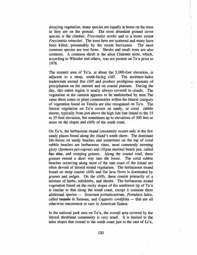
decaying vegetation, many species are equally at home on the trees as they are on the ground. The most abundant ground cover species is the climber, Freycinetia storkii and to a lesser extent Freycinetia reineckei. The trees here are scattered and many have been killed, presumably by the recent hurricanes. The most common species are tree ferns. Shrubs and small trees are also common. A common shrub is the alien Clidemia hirta, which, according to Whistler and others, was not present on Ta'u prior to 1976.
The summit area of Ta'u, at about the 3,000-foot elevation, is adjacent to a steep, south-facing cliff. The moisture-laden tradewinds ascend this cliff and produce prodigious amounts of precipitation on the summit and on coastal plateaus. During the day, this entire region is nearly always covered in clouds. The vegetation at the summit appears to be undisturbed by man.The same three zones or plant communities within the littoral category of vegetation found on Tutuila are also recognized on Ta'u. The littoral vegetation on Ta'u occurs on sandy, or coral rubble shores, typically from just above the high tide line inland to the 15 to 35-foot elevation, but sometimes up to elevations of 300 feet or more on the slopes and cliffs of the south coast.
On Ta'u, the herbaceous strand community occurs only in the few sandy places found along the island's south shore. The dominant life-forms on sandy beaches and sometimes on the top of coral rubble beaches are herbaceous vines, most commonly morning glory (Ipomoea pes-caprae) and (Vigna marina) beach pea, called fue sina, and creeping grasses. Along the coastal road, these grasses extend a short way into the forest. The coral rubble beaches occurring along most of the east coast of the island are often devoid of littoral strand vegetation. The herbaceous strand found on steep coastal cliffs and flat lava flows is dominated by grasses and sedges. On the cliffs, these consist primarily of a mixture of herbs, subshrubs, and shrubs. The herbaceous strand vegetation found on the rocky slopes of the southwest tip of Ta'u is similar to that along the south coast, except it contains three additional species - Sesuvium portulacastnun, Portulaca lutea , called tamole in Samoan, and Capparis cordifolia - that are all otherwise uncommon or rare in American Samoa.
In the national park area on Ta'u, the overall qea covered by the littoral shrubland community is very small. It is limited to the talus slopes that extend to the south coast just to the east of Li'u,
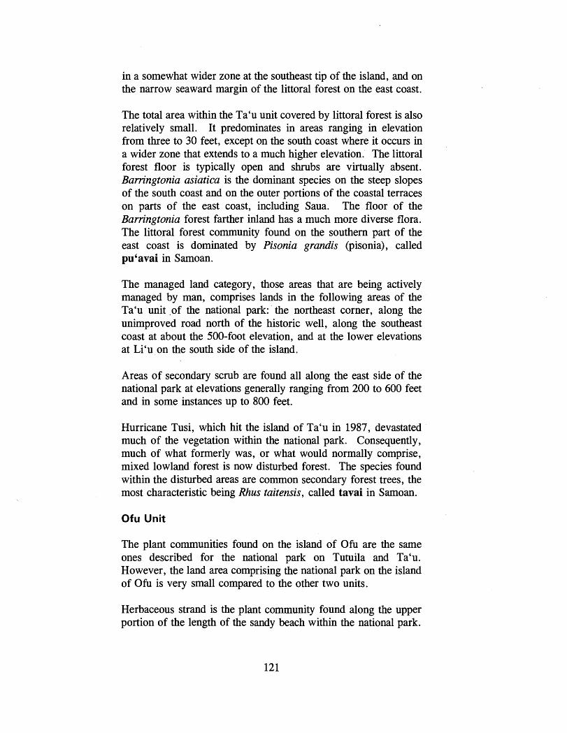
in a somewhat wider zone at the southeast tip of the island, and on the narrow seaward margin of the littoral forest on the east coast.
The total area within the Ta'u unit covered by littoral forest is also relatively small. It predominates in areas ranging in elevation from three to 30 feet, except on the south coast where it occurs in a wider zone that extends to a much higher elevation. The littoral forest floor is typically open and shrubs are virtually absent. Barringtonia asiatica is the dominant species on the steep slopes of the south coast and on the outer portions of the coastal terraces on parts of the east coast, including Saua. The floor of the Barringtonia forest farther inland has a much more diverse flora. The littoral forest community found on the southern part of the east coast is dominated by Pisonia grandis (pisonia), called pu'avai in Samoan.
The managed land category, those areas that are being actively managed by man, comprises lands in the following areas of the Ta'u unit o f the national park: the northeast corner, along the unimproved road north of the historic well, along the southeast coast at about the 500-foot elevation, and at the lower elevations at Li'u on the south side of the island.
Areas of secondary scrub are found all along the east side of the national park at elevations generally ranging from 200 to 600 feet and in some instances up to 800 feet.
Hurricane Tusi, which hit the island of Ta'u in 1987, devastated much of the vegetation within the national park. Consequently, much of what formerly was, or what would normally comprise, mixed lowland forest is now disturbed forest. The species found within the disturbed areas are common secondary forest trees, the most characteristic being Rhus taitensis, called tavai in Samoan.
Ofu Unit
The plant communities found on the island of O h are the same ones described for the national park on Tutuila and Ta'u. However, the land area comprising the national park on the island of O h is very small compared to the other two units.
Herbaceous strand is the plant community found along the upper portion of the length of the sandy beach within the national park.

AMRIlCAN SAMOA Manu'a Islands
P '-= ' @
Ofu Unit National Park of American Samoa
VEGETATION
FIGURE 14
LITTORAL VEGETATION . .
SECONDARY OR MANAGED VEGETATION
1000 2000 3000 4000 I
FEET Contour interval 50 feet 122

This community is very narrow and, because of its extensively damaged condition, not distinct from the littoral shrubland and littoral forest which it alternates with along the coast. Zpomoea pes-caprae, the beach morning-glory vine, called fue sina, is the dominant plant along the sandy beach. The dominant herbaceous plants found on Sunuitao Peak are Phymatosorus scolopendria on rocky places and Lepturus repens on the gravel of talus slopes.
Along the sandy beach, the most common shrub mixed in with the other littoral plants is the beach sunflower, Wollastonia biflora , called ateate. The littoral shrubland on the steep slopes of Sunuitao is dominated by Dendrolobium umbellatum, lala in Samoan, Clerodendrum inerme, called aloalo, Hibiscus tiliaceus, fau , and Pisonia grandis, pu ' avai .
The littoral forest found along the upper portions of the sandy beach has been highly disturbed in most places and is dominated by coconuts. The littoral forest on the southern slopes of Sunuitao also has been disturbed - much of the forest here has been cut down and replaced with bananas and coconuts. On the southwest side, the steeper slopes and cliffs on Sunuitao are dominated by the following trees: Hemandia nymphaeifolia (Chinese lantern-tree), called pu'a, Erythrina variegata (coral tree), gatae, and Pisonia grandis.
On Sunuitao, the lowland forest within the national park has been disturbed - on the gentler slopes by past and present agriculture, and on the steeper slopes by landslips. Whistler has classified this as a disclimax lowland forest.
Flying Foxes
Two species of flying foxes or fruit bats are found in American Samoa, Fteropus tonganus, called pe'a fanua in Samoan, and Fteropw samoensis, called pe'a vao. The former translates as "fruit bat of settled lands" in Samoan and the latter as "fruit bat of the forest." The authorizing legislation for the National Park of American Samoa notes the importance of flying foxes in maintaining the biodiversity of the national park's tropical forests.
Flying foxes play an important role as pollinators and seed dispersers of a significant portion of the tropical forest plants. Their presence helps to maintain the ecological balance and community structure of the forest. Therefore, maintaining the

presence of flying foxes in the tropical forest outside of the national park is as important as it is within.
Flying foxes are also an important part of Samoa's culture and are the source of many traditional stories, myths, and legends. In Samoan legends flying foxes are regarded as guardians of the forest and rescuers of people in distress. Flying foxes have long been a source of food in Samoa and are still occasionally hunted for consumption in American Samoa. Flying foxes are no longer hunted in American Samoa for export to other Pacific islands such as the Mariana Islands.
P. tonganus, also known as the white-necked flying fox, has a much broader distribution than the Samoan flying fox. It is found throughout the South Pacific, with three subspecies ranging from the Cook Islands west to Karker Island off the northeast coast of New Guinea. P. samoensis, however, is found only in the Samoan and Fijian islands where it is divided into two subspecies. The two species, P. tonganus and P. samoensis, have somewhat different behavior patterns.
P. tonganus is largely nocturnal, foraging more at night and roosting by day in large colonies in trees located in remote or protected areas. P. tonganus forms harems, a single male defending one or more females and has the potential to breed year- round under favorable environmental conditions. It forages heavily in primary forest, but also in secondary forest and disturbed areas where subsistence agriculture activities are taking place. The Tongan flying fox is most easily observed at dusk when it leaves its roost to search for food.
P. samoensis is also active at night, but individuals are also active in early morning and late afternoon, and some activity extends throughout the day. For both species of flying fox, the period of daily activity varies seasonally and also depends on the size of the population relative to food availability. When the population is high, more time is spent in search of food, and daytime activity increases. The Samoan flying fox roosts singly or in family groups during the mating season. Reproduction peaks in June, but newborn young have been found from March through October. Although sometimes found in secondary forest and in agricultural areas, P.' samoensis is more dependent on primary forest for both roosting trees and foraging habitat than P. tonganus. Moreover,

P. samoensis is territorial at food sources and actively defends its food tree.
When seen in flight, P. samoensis has broader, less scalloped wings and slower wingbeats than P. tonganus. The Samoan flying fox is the species usually seen during daylight soaring on thermals of rising air over the forest.
Adult members of both species have a wingspan of about three feet and weigh about one pound. Both are long-lived animals with slow reproductive rates (probably one younglfemalelyear). P. tonganus has a blackish or seal-brown body color and the mantle varies from a buff to a very pale cream color. The body color of. P. samoensis is brown, sometimes with a rusty tinge, sprinkled with grayish-white. At close range, the Samoan flying fox because of its longer fur takes on a shaggy appearance. Neither bat has a tail, but in flight with its feet extended behind it P. tonganus gives the appearance of having one.
Based on the preliminary findings of studies being done for NPS under CPSU contract, within the Tutuila unit of the national park, flying foxes have been found to visit 50 percent of the forest canopy species in addition to many subcanopy trees and vines. During these visits, the flying foxes perform two important functions: (1) they carry pollen from flower to flower promoting fruit production and spreading genetic material within plant populations; and (2) they act as agents of seed dispersal carrying seeds away from the parent tree to more favorable growing environments. For large seeded fruits, the seeds are carried in their mouths; for small seeded fruits, they are carried in and passed through their digestive system. Within the national park and throughout Samoa, there are no other potential seed dispersers for large seeded fruits and there are few other pollinators.
In 1986, a team of U.S. Fish and Wildlife Service biologists collected extensive field data on P. samoensis in American Samoa (Tutuila, Ta'u, Ofu, Olosega, and Aunu'u) and Western Samoa ('Upolu and Savai'i). Based partly on the results of the field data, P. samoensis was proposed for classification as a candidate endangered species in 1988. Presently, P. samoensis is regarded as a species of concern by the Fish and Wildlife Service. In 1989 and again in 1993, the Fish and Wildlife Service conducted additional surveys of P. sarnoensis at the same sites surveyed in

I
The Samoan flying fox can be seen during daylight hours soaring over the forest on thermals of rising air.
The native flying foxes, P. samoensis and P. tonganus, roost in forest trees of the national park. The Samoan flying fox roosts singly or in family groups, while the Tongan variety roosts in large colonies. Both species of fruit bats play an .important role as pollinatom and seed dispersers of a significant portion of the forest plants found in the national park.

1986. These studies concluded that formal listing was not warranted. Presently, P. samoensis is not listed nor is it a candidate species, though in the near future it will likely be proposed for listing. During the latter surveys, incidental information was also gathered on P. tonganus.
The flying foxes of American Samoa are vulnerable to a variety of natural and human disturbances. Hunting, the cutting of the tropical forest, and physical disturbance at roost sites are serious threats to the long-term survival of these two species. An NPS- funded survey carried out in the wake of hurricanes Ofa and Val (which had devastating effects on the flora and fauna of Samoa) estimated that habitat damage and loss of fruit on trees from these hurricanes, combined with the post-storm subsistence hunting and predation by domestic animals, reduced the population size of P. tonganus by 80 to 90 percent and P. samoensis by about 50 percent. Much of the loss to P. tonganus occurred when they were forced by hunger to h i t s on the ground and in villages, thereby becoming more vulnerable to hunting and predation. P. samoensis, on the other hand, was able to shift its diet to include leaves. Since storm damaged trees quickly re-sprouted leaves, P. samoensis was not driven by hunger into behaviors that left them as vulnerable as P. tonganus. In spite of the lesser degree of loss, P. samoensis is at greater risk due to its smaller population. P. samoensis is also more susceptible to loss of foraging habitat, since it is more dependent on the primary forest for food resources than P. tonganus. However, P. tonganus is also vulnerable because it also feeds in primary forest and depends on undisturbed sites in the primary forest for roosting, and it frequently shifts both roost and foraging sites.
There are no reliable data on the past status of the populations of either P. samoensis or P. tonganus in American Samoa. Apparently, this stems partly from the fact that past surveys did not differentiate between the two species. More recent surveys using different methods to determine density show that earlier population estimates were much too high.
Because of the devastating effects of the recent hurricanes on both species, a three-year hunting ban on bats was put into effect by executive order of the governor in July 1992. According to biologists at the ASG's Department of Marine and Wildlife Resources, the ban on hunting, plus the natural recovery of the tropical forest, has allowed the populations of both species of

flying foxes to recover somewhat. However, they remain extremely vulnerable and another hurricane could put both populations in jeopardy. The hunting ban has been replaced by a law prohibiting the hunting of either species, but enforcement remains a challenge.
In the aftermath of the last hurricane in 1992, biologists at the department began conducting regular counts of P. samoensis and P. tonganus on the island of Tutuila. To estimate the population of the diurnal P. samoensis, biologists took dawn counts at six sites on Tutuila each month. These surveys indicate that the population of P. sarnoensis is recovering from its post-hurricane low. In 1996, biologists at the department estimated that there were about 1000 P. samoensis on Tutuila.
For the nocturnal P. tonganus, department biologists took counts four timeslyear at thirty-eight roost sites on Tutuila known to have been used at one time or another during the past five years. Based on these counts, the biologists estimate that there were nearly 6,000 P. tonganus on Tutuila in 1996. Prior to the hurricanes, they estimate there were approximately 12,000 P. tonganus on Tutuila.
Based on the count statistics from its recent surveys, the U.S. Fish and Wildlife Service found that there has been a serious decline in the populations of P. samoensis. The Fish and Wildlife Service attributed this decline to recent hurricanes plus the impact of human-caused habitat destruction. Despite the remaining low numbers of P. samoensis found on the islands of Tutuila and Ta'u, Fish and Wildlife Service biologists felt that the population of P. samoensis will recover barring additional impacts. The significant amount of inaccessible forest found on these two islands, including the national park areas, contributes greatly to the ability of P. samoensis to successfully recover.
Further research is needed to better understand the minimum viable population size necessary to ensure the long-term survival of both species of flying foxes, not only within the national park but throughout Samoa. The field work that has been carried out for the Tutuila unit needs to be duplicated for lands within the Ta'u unit. Based on existing research, however, it is already clear that P. samoensis is totally dependent on the primary forest for its long-term survival. Large expanses of primary forest representing all habitat types are needed if populations of both P.

samoensis and P. tonganus are to be maintained at an ecologically important level.
Other Native Wildlife
For such small, isolated islands, American Samoa has a diverse avifauna. More species of birds are found than all reptiles, amphibians, and mammals combined. Fifty nine species of birds have been recorded in American Samoa. Of these, 44 are considered resident species (breeders or potential breeders) and 15 are migratory or vagrant. Of the 44 resident species, 19 are land or waterbirds, 20 are seabirds and the remaining 5 species are introduced. Of the land and waterbirds, at least one, the mao (Gymnomyza samoensis), called mdoma'o in Samoan, is now believed to be extirpated. Despite intensive searching on Tutuila during a 1975 to 1976 survey of the terrestrial wildlife of American Samoa, this bird was neither observed nor heard. There is a population of about 50 gray ducks (Anas superciliosa), called toloa, on Aunu'u Island. Pairs have been sited in Leone, Futiga (Olavalu crater), Nu'uuli, and Alao, although these may be from the Aunu'a population.
Many areas within the National Park of American Samoa provide important habitat for native forest birds and seabirds. Within the Tutuila unit, the stands of native broadleaf forest located within the national park on the north slope between Fagasa and Afono villages provide habitat for many species of native birds. The steep and rugged Pola Island and Pola'uta Ridge are the most important nesting and roosting areas for several species of seabirds in all of American Samoa. These include the red-footed (Sula sula) and brown (Sula leucogaster) boobies, Greater (Fregata minor) and lesser (Fregata ariel) frigatebirds, brown (Anous stolidus), black (Anous minutus) and blue-gray (Drocelstema cerulea) noddies, the gray-backed Tern (Stema lunata), and possibly others. The Samoan word for boobies is fua'o, atafa for frigatebird, and gogo is the usual term used to identify terns.
Within the Ta'u unit, most of the undisturbed and inaccessible native forest of the Li'u Bench provides excellent habitat for native birds. The cloud forest and montane scrub portions of the national park on Ta'u are of special importance because they are used by several ground-nesting seabirds, including the Audubon's shearwater, (Puffinus lhenninien) , called ta'i'o in Samoan, at least two petrels, and possibly several other seabirds. The southern

coast of Ta'u, from Lavania Cove to Ulufala Point, and the bench below and south of Lata Mountain, all within the national park, represent some of the best forest bird habitat in all of American Samoa. Based on studies done in 1986 by the U.S. Fish and Wildlife Service, the highest densities for several forest birds, including the Fiji shrikebill (Clytorhynchus vitiensis), called segasegamau'u, were found in this area. The largest colony of black noddies on the main islands of American Samoa nests along this coast. White terns (Gygis alba), gogo sina in Samoan, Brown Noddies, and white-tailed tropicbirds (Phaethon leptum), called tava'e, also use this area for nesting and roosting. Tahiti petrels (Pterodroma rostrata), ta'i'o, and Audubon's shearwaters use the upper cliff ridge around Lata Mountain.
The sheer cliffs of Polauta Ridge and Pola Island provide important nesting and roosting habitat for many species of native seabirds, including terns, frigatebirds, boobies, tropicbirds, noddies, petrels, and shearwaters.
Forest bird surveys by the U.S. Fish and Wildlife Service in 1986 found that most forest birds of American Samoa are able to thrive in a variety of forest types and are relatively common. Some species in American Samoa, however, are restricted in their habitat requirements or are limited by other factors. These include the friendly ground dove (Gallicolumba stairi), tu'aimeo, the many- colored fruit-dove (Ptilinopus perousii), manuma, the Fiji shrikebill, and the spotless crake (Porzana tabuensis).
The friendly ground dove, the many-colored fruit dove, and the spotless crake are considered candidates for listing under the
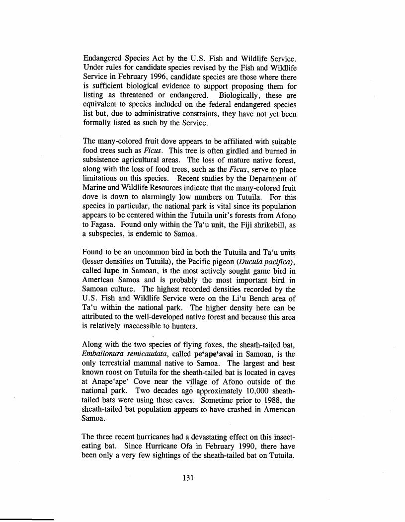
Endangered Species Act by the U.S. Fish and Wildlife Service. Under rules for candidate species revised by the Fish and Wildlife Service in February 1996, candidate species are those where there is sufficient biological evidence to support proposing them for listing as threatened or endangered. Biologically, these are equivalent to species included on the federal endangered species list but, due to administrative constraints, they have not yet been formally listed as such by the Service.
The many-colored fruit dove appears to be affiliated with suitable food trees such as Ficus. This tree is often girdled and burned in subsistence agricultural areas. The loss of mature native forest, along with the loss of food trees, such as the Ficus, serve to place limitations on this species. Recent studies by the Department of Marine and Wildlife Resources indicate that the many-colored fruit dove is down to alarmingly low numbers on Tutuila. For this species in particular, the national park is vital since its population appears to be centered within the Tutuila unit's forests from Afono to Fagasa. Found only within the Ta'u unit, the Fiji shrikebill, as a subspecies, is endemic to Samoa.
Found to be an uncommon bird in both the Tutuila and Ta'u units (lesser densities on Tutuila), the Pacific pigeon (Ducula pac@ca), called lupe in Samoan, is the most actively sought game bird in American Samoa and is probably the most important bird in Samoan culture. The highest recorded densities recorded by the U.S. Fish and Wildlife Service were on the Li'u Bench area of Ta'u within the national park. The higher density here can be attributed to the well-developed native forest and because this area is relatively inaccessible to hunters.
Along with the two species of flying foxes, the sheath-tailed bat, Emballonura semicaudata , called pe6ape6avai in Samoan, is the only terrestrial mammal native to Samoa. The largest and best known roost on Tutuila for the sheath-tailed bat is located in caves at Anape'ape' Cove near the village of Afono outside of the national park. Two decades ago approximately 10,000 sheath- tailed bats were using these caves. Sometime prior to 1988, the sheath-tailed bat population appears to have crashed in American Samoa.
The three recent hurricanes had a devastating effect on this insect- eating bat. Since Hurricane Ofa in February 1990, there have been only a very few sightings of the sheath-tailed bat on Tutuila.

Evidence was found that the walls of the caves at Anape'ape'a had been washed clean by the storm surge generated by Ofa. Also, it is possible that the bats may have starved during the hurricanes since insectivorous bats do not feed during heavy winds or rainfall. There is reason to believe that in the near future they may be extirpated from American Samoa. The sheath-tailed bat is considered to be a candidate species for listing by the U.S. Fish and Wildlife Service under the Endangered Species Act.
Thirteen species of amphibians and reptiles are thought to exist within the Tutuila and Ta'u units of the national park. Two of these, the marine toad and the house gecko, are introduced species. The ten species of geckos and skinks make up most of the readily visible herpetological fauna within the national park. Pili mo'o, is the most commonly used term for several or all of the gecko species, while pili is the term commonly used for skinks .
The Pacific Boa, Candoia bibroni, is present in American Samoa only on Ta'u Island and in very small numbers. The boa may be taxonomically distinct. It is found primarily within the littoral forest of the national park along the south shore. Called gata in Samoan, it is very infrequently sited having been seen in 1976, 1977, 199 1, and most recently in 1997. At the 1976 siting near Lavania Cove, two boas were found. Very little is known about this species population size or ecology.
There is still a lack of information on invertebrates within the national park. Twenty species of land snails are known from American Samoa and all are considered to be native. Seven of these species are endemic to the Samoa Islands and four - Eua zebrina , Ostodes strigatus, Samoana abbreviata , and S. thurstoni - are endemic to American Samoa. During U.S. Fish and Wildlife Service surveys on Tutuila conducted in 1993, only the shells of dead S. abbreviata were found, evidence that this species may have recently become extinct there.
Preliminary findings suggest that the native partulid snails are rapidly disappearing in American Samoa due to the presence of a predatory snail, Euglandina rosea, brought into Samoa to control the alien African tree snail. The predator snail is a particularly serious threat to native snail species within the Tutuila unit. Except for some isolated islets outside of the national park, the native partulid snail is essentially absent on the island of Tutuila.

On Ta'u the predatory snail was inadvertently introduced. with construction material after Hurricane Tusi in 1987 and has since become a serious problem. Sisi is the generic term for snail in the Samoan language.
The Tutuila tree snails, Eua zebrina and Ostodes strigatus (no common name) were classified as candidate species by the U.S. Fish and Wildlife Service in February 1996. The Mt. Matafao different snail, Diastole matafaoi and Diastole schmeltziana (no common name), the short Samoan tree snail, Samoana abbreviata, the Tutuila tree snail, Eua zebrina, Ostodes strigatus (no common name), the Samoan tree snail, Samoana conica, the O h tree snail, Samoana thurstoni and Trochomorpha apia (no common name), were removed from any formal Fish and Wildlife Service list of threatened and endangered species in February 1996. The Mt. Matafao different snail was formerly a candidate species for listing and the rest were all formerly species of concern. With the exception of the Mt. Matafao different snail and the O h tree snail, all of the above species .of land snails occur within or in the vicinity of the national park.
The Bishop Museum of Honolulu, Hawaii has received a National Science Foundation grant to conduct research on Samoan land snails. The three-year long project will include a comprehensive review of the available data on Samoan land snails followed by on- site field work. The field work will take place in 1998. Based on the research, additional information on the diversity, distribution and population status of non-marine snail fauna in American Samoa will be available.
Marine Resources
Approximately one-quarter of the total area of the National Park of American Samoa is comprised of offshore waters. Consequently, marine resources are an important component of this national park. The national park comprises nearly 15 percent of the shoreline of American Samoa. Most of this shoreline is in remote locations and provides nesting habitat for sea turtles in Samoa.
Two species of sea turtles (called laumei in Samoan), the hawksbill, Eretmochelys imbricata, and the green, Chelonia mydas, are present in American Samoa. The hawksbill may be a resident here. According to the U.S. Fish and Wildlife Service, the

leatherback, Dermochelys coriacea , the loggerhead, Caretta caretta , and the olive ridley , Lepidochelys olivacea are all possible visitors to American Samoa, but the frequency of their visits is unknown at this time.
Recent estimates place the number of hawksbill and green turtles known to nest in American Samoa at from 100 to 200. While most of the hawksbill sea turtle nesting occurs on Tutuila and the Manu'a Islands, the majority of the reproduction by the green occurs at Rose Atoll. The hawksbill and leatherback are listed as endangered and the green, loggerhead, and olive ridley as threatened under the Endangered Species Act. Sea turtles have been observed nesting in small numbers on beaches within the Ofu and Tutuila units. In February 1997, the park superintendent observed a hawksbill just outside the reef at Ofu. There is anecdotal information that sea turtles use beaches within the Ta'u unit of the national park.
A fringing coral reef comprises nearly 85 percent of the Ofu unit of the national park. Extending along the entire length of the Ofu unit, this reef is its most significant resource. Coral reefs are found along portions of the Tutuila unit's coastline, including along both sides of the Polauta Ridge shoreline. Within the Ta'u unit, coral reefs are found along the eastern shoreline only. Tau's reefs are very often exposed to strong wave action.
The fringing reefs of the offshore portion's of the national park are inhabited by a diverse array of fish and shellfish species. Most of these species are harvested by local residents on almost a daily basis throughout the year. Nearly all of this fishing is done by individuals who fish in waters adjacent to their own village. The fishing is done by rod and reel, handline, free diving, gill netting, gleaning, or throw netting. Gleaning is the collecting of fish and invertebrates at low tide by hand, stick, or steel rod. All fish and invertebrate species are caught for subsistence use or sale. Atule or big-eye scad (Selar cnunenophthalmus), jacks (Carangidae), surgeonfish (Acanthuridae) , mullet (Mugilidae) , and octopus (Octopus sp.) make up the majority of reef species taken.
In general, shoreline subsistence fishing appears to be declining, not only along the shorelines opposite the national park but throughout American Samoa. However, shoreline subsistence fishing still accounts for the major share of the total local catch in American Samoa.

To date, NPS has accumulated data on marine resources for the Tutuila and Ofu units of the national park. The coral reef comprising most of the national park area on Ofu is one the few reefs in all of the Samoan islands to remain undisturbed by crown-of-thorns infestation. It is a resource unique to NPS- managed areas. Though relatively small in size, this reef is believed to contain about 150 species of coral. This is three times the number of species found in the Caribbean national parks such as the Virgin Islands. To date, some 64 coral species have been recorded here, 13 of which represent their easternmost distribution in the Pacific. During recent surveys, 288 fish species from 47 families have been identified, along with comprehensive lists of macro invertebrates and seaweeds. Within the reef at Ofu, the population density of the giant clam, trydacna maxima, is one of the highest in the Samoan archipelago.
The portion of this fringing coral reef within the national park is a little more than two miles in length and about from 150 to 500 feet in width. The reef crest is high and wide and appears to be composed of rubble and coral blocks piled up by waves from past hurricanes. The prevailing swells come from east to south year round. At half to high tide, the southerly swells break well onto the reef top and lagoon, while at low tide wave overtopping continues to bring fresh, well-oxygenated ocean waters onto the inner reef. Currents are moderate to strong at all tides, draining at low tide through an ava, the Samoan word for a break or pass in the reef.
Within the lagoon, the coral community is very well developed with a moderate to high species diversity, dominated by up to 300- year old Porites massives and the stinging hydrocoral Millepora. The rare "blue" coral, Heliopora coerulea, a soft or alcyonarian coral with a hard blue skeleton, is present in low abundance. The Ofu reef is thought to be the most extreme southeast extension of this unusual living fossil in the Pacific. The reef is also considered to be the eastern boundary of many of the Acropora and other coral species. The accumulating reef crest has effectively "moated" the lagoon and, coupled with the constant supply of ocean water, allowed the massive Porites heads and microatolls to grow higher than the mean ocean low water level, thereby creating spectacular and unusual coral tower formations. In addition to the unique coral resources, the underwater visibility is very high and marine life abundant.
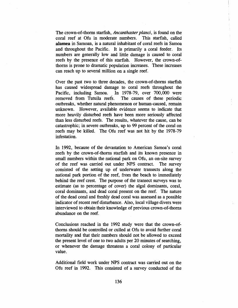
The crown-of-thorns starfish, Ancanthaster pland, is found on the coral reef at Ofb in moderate numbers. This starfish, called alamea in Samoan, is a natural inhabitant of coral reefs in Samoa and throughout the Pacific. It is primarily a coral feeder. Its numbers are generally low and little damage is caused to coral reefs by the presence -of this starfish. However, the crown-of- thorns is prone to dramatic population increases. These increases can reach up to several million on a single reef.
Over the past two to three decades, the crown-of-thorns starfish has caused widespread damage to coral reefs throughout the Pacific, including Samoa. In 1978-79, over 700,000 were removed from Tutuila reefs. The causes of these periodic outbreaks, whether natural phenomenon or human-caused, remain unknown. However, available evidence seems to indicate that more heavily disturbed reefs have been more seriously affected than less disturbed reefs. The results, whatever the cause, can be catastrophic; in severe outbreaks, up to 99 percent of the coral on reefs may be killed. The Ofb reef was not hit by the 1978-79 infestation.
In 1992, because of the devastation to American Samoa's coral reefs by the crown-of-thorns starfish and its known presence in small numbers within the national park on Ofu, an on-site survey of the reef was carried out under NPS contract. The survey consisted of the setting up of underwater transects along the national park portion of the reef, from the beach to immediately behind the reef crest. The purpose of the transect surveys was to estimate (as to percentage of cover) the algal, dominants, coral, coral dominants, and dead coral present on the reef. The nature of the dead coral and freshly dead coral was assessed as a possible indicator of recent reef disturbance. Also, local village divers were interviewed to obtain their knowledge of 'previous crown-of-thorns abundance on the reef.
Conclusions reached in the 1992 study were that the crown-of- thorns should be controlled or culled at Ofb to avoid further coral mortality and that their numbers should not be allowed to exceed the present level of one to two adults per 20 minutes of searching, or whenever the damage threatens a coral colony of particular value.
Additional field work under NPS contract was carried out on the Ofb reef in 1992. This consisted of a survey conducted of the

near-shore reef primarily to collect baseline data on the current status of the reef and reef resources and to establish long-term monitoring stations to document the health of reef communities. Survey conclusions included the following: reef communities (coral, macrointervebrates, algae, and reef fishes) appeared to be exceptionally healthy; coral cover and diversity were moderate to high; and proximity to shore and ease of access make these communities particularly vulnerable to nearby land use activities, subsistence shoreline fishing, and future use by national park visitors.
In 1995, under NPS contract, field work for additional reef monitoring and mapping of the Ofu reef was carried out. Utilizing existing large-scale digital base maps of the reef prepared from 1990 aerial photos , digital geographic map enhancements and accompanying attribute data gathered during the field work were overlaid on the base maps. Additionally, base points and baseline data were established for future monitoring of the beach profile. In 1995, a report that includes maps, database information, data entry procedures, data management procedures, mapping procedures, scientific methodology and findings, and color transparencies was submitted to NPS .
The 1995 report recommended that the beach sites established during the study be monitored at six month intervals. In the event of a natural catastrophe such as a hurricane, monitoring should be carried out as soon as possible in addition to the regular surveys. The field survey carried out in March 1995 revealed that the flat features of the Ofu reef changed considerably over the five years since the 1990 aerial survey (upon which the field maps were based), and coral cover is now much lower. Acropora thickets are especially diminished. A mass coral bleaching episode in March 1994 caused by high water temperatures is believed to be the likely cause of these changes to the reef. Tropical storms or large waves also may have been contributing factors.
Alien Species
Introduced or alien species represent one of the most serious threats to the native wildlife of the national park. These alien species may compete with or prey upon the native wildlife, may bring in diseases harmful to native species, or otherwise upset the ecological balance.
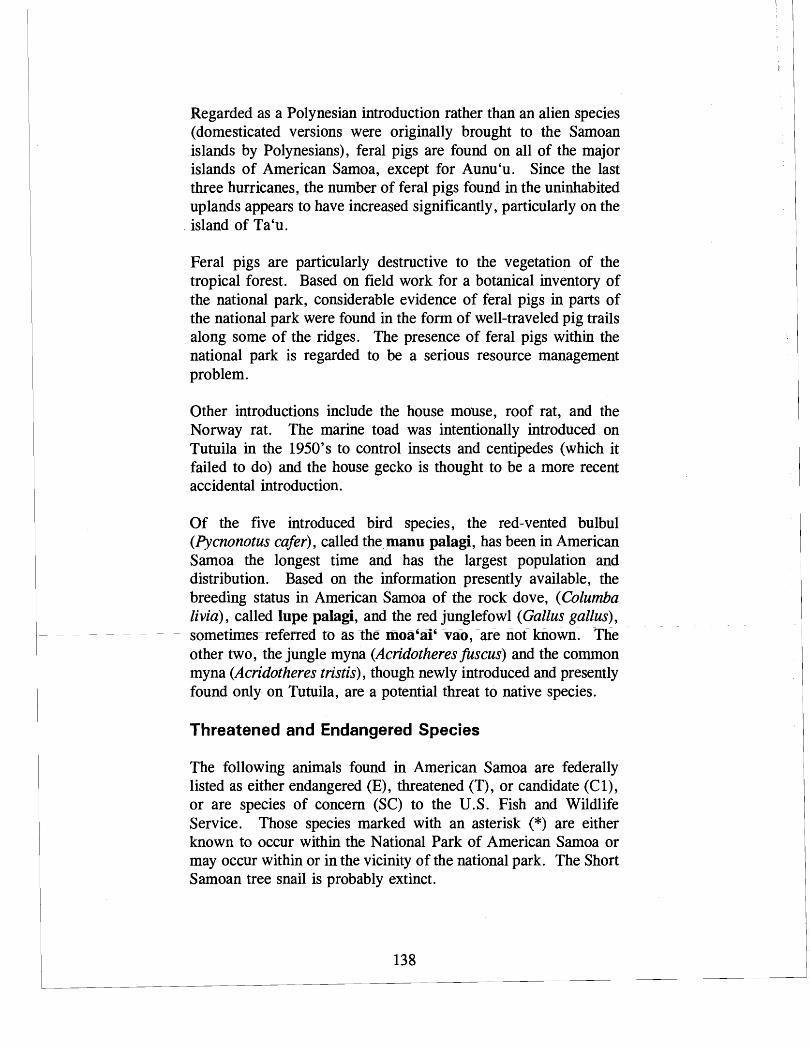
Regarded as a Polynesian introduction rather than an alien species (domesticated versions were originally brought to the Samoan islands by Polynesians), feral pigs are found on all of the major islands of American Samoa, except for Aunu'u. Since the last three hurricanes, the number of feral pigs found in the uninhabited up lands appears to have increased significantly, particularly on the island of Ta'u.
Feral pigs are particularly destructive to the vegetation of the tropical forest. Based on field work for a botanical inventory of the national park, considerable evidence of feral pigs in parts of the national park were found in the form of well-traveled pig trails along some of the ridges. The presence of feral pigs within the national park is regarded to be a serious resource management problem.
Other introductions include the house mouse, roof rat, and the Norway rat. The marine toad was intentionally introduced on Tutuila in the 1950's to control insects and centipedes (which it failed to do) and the house gecko is thought to be a more recent accidental introduction.
Of the five introduced bird species, the red-vented bulbul (Pycnonotus cafer), called the manu palagi, has been in American Samoa the longest time and has the largest population and distribution. Based on the information presently available, the breeding status in American Samoa of the rock dove, (Columba livia), called lupe palagi, and the red junglefowl (Gallus gallus), sometimcsreferred to as the moa'ai' vao, %re not known. The other two, the jungle myna (Acridotheresfuscus) and the common myna (Acridotheres tristis) , though newly introduced and presently found only on Tutuila, are a potential threat to native species.
Threatened and Endangered Species
The following animals found in American Samoa are federally listed as either endangered (E) , threatened (T) , or candidate (C I), or are species of concern (SC) to the U.S. Fish and Wildlife Service. Those species marked with an asterisk (*) are either known to occur within the National Park of American Samoa or may occur within or in the vicinity of the national park. The Short Samoan tree snail is probably extinct.

Sheath-tailed bat; Pe'ape'avai; Ernballonura semicaudata - C 1 * Samoan h i t bat; Pe'a vao; Pteropus samoensis samoensis - SC* Friendly ground dove; Tu'aimeo (female) or Tutauifa (male);
Gallicolumba stairi - Cl* Spotless crake; (no Samoan name); Ponana tabuensis Cl* Many-colored fruit dove; Manu ma; Ptilinopus perousii; C1 * Green sea turtle; Laumei; Chelonia mydas - T* Hawksbill turtle; Laumei; Eretmochelys imbricata - E* Mt. .Matafao different snail; Sisi; Diastole natafaoi - SC No common name; 'Sisi; Diastole schmeltziana - SC Tutuila tree snail; Sisi vao; Eua zebrina - Cl* No common name; Sisi; Ostodes strigatus; C1 Short Samoan tree snail; Sisi vao; Samoana abbreviata; SC Samoan tree snail; Sisi vao; Samoana conica; SC* Ofu tree snail; Sisi vao; Samoana thurstoni - SC No common name; Sisi; Trochomorpha apia - SC*
Category 1 (Cl) : Taxa for which the Fish and Wildlife Service has sufficient biological information to support a proposal to list as endangered or threatened.
Species of Concern (SC): Taxa which existing information indicates may warrant listing, but for which substantial biological information to support a proposed ruling is lacking.
Air Quality
In 197 1, American Samoa adopted the U. S. National Ambient Air Quality Standards and promulgated an American Samoa Territorial Implementation Plan pursuant to the Clean Air Act. Because of its insular setting, a small industrial base, and prevailing winds which send ambient emissions out to sea, the quality of American Samoa's air remains high. The heavily developed Pago Pago Harbor area and the industrial park area in Tafuna are considered two locales in American Samoa where air pollutants are most concentrated. Even so, motor vehicle emissions in the Pago Pago urbanized area are below the levels of concern identified by the American Samoa and national ambient air quality standards.
The Administrative Rules for the American Samoa Coastal Zone Management Program contain objectives and policies pertaining to air quality standards that must be met for approval of a Land Use Permit by the Project Notification and Review System Board. The objective is to maintain the high standards of air quality. The

policy is: Territory air quality standards shall be the standards of the Territory in the coastal zone and a Land Use Permit Application shall adhere to those standards.
At present, there is a single air monitoring station in American Samoa operated by the National Oceanic and Atmospheric Administration. The station is located on the eastern end of the island of Tutuila in the village of Tula. Since the National Park of American Samoa is relatively new and not yet fully staffed, no visibility, ambient air quality, or meteorological monitoring are currently taking place within the national park. Air quality in the Tutuila unit of the national park is considered to be excellent. The existing air pollution in the national park comes primarily from the unpleasant odors emanating from the operation of the tuna canneries in the Pago Pago Harbor. When wind conditions are right, this odor is present along the Mt. Alava trail. Some air pollution is also caused by the smoke from the burning back of vegetation to clear plots for subsistence agriculture. This air pollution is occasional and localized. Except for the times when burning takes place in connection with subsistence agriculture activities, the air quality of the Ta'u and Ofu units is considered to be outstanding.
The high air quality of the National Park of American Samoa is recognized as an important park resource. Clear, long-distance views such as those from the Mt. Alava ridge, from the Ofu shoreline, and along the southern coast of Ta'u are considered to be primary visitor attractions.
The Clean Air Act, as amended, requires federal land managers to protect the air quality related values of national parks from adverse impacts. Section 118 of the act requires that federal facilities comply with existing federal, state, and local air pollution control laws and regulations. The superintendent of the National Park of American Samoa must ensure that all in-park activities meet existing laws and regulations of the Territory of American Samoa, and that external sources of air pollution are controlled to the extent possible to protect the air quality and resource values of the national park. Air quality related values include visibility, plants, animals, and archeological and cultural resources, and other resources that could be degraded by air pollution.
As part of this protection effort, the Clean Air Act creates three classifications of varying degrees on restriction of allowable air

quality deterioration. Under terms of this classification, the National Park of American Samoa has been designated Class 11. Under this designation, the maximum allowable increase of particulate matter and sulfur dioxide and nitrogen dioxide have been established as follows:
Maximum Allowable Increase (micrograms per cubic meter)
Particulate matter (fine particulate matter PM- 10) :
Annual arithmetic mean . . . . . . . . . . . . 17 Twenty-four hour maximum . . . . . . . . . 30
Sulfur dioxide:
Annual arithmetic mean . . . . . . . . . . . . 20 Twenty-four hour maximum . . . . . . . . . 91 Three-hour maximum . . . . . . . . . . . . . 5 12
Nitrogen dioxide:
Annual arithmetic mean . . . . . . . . . . . . 25
Coastal Zone Manabement
The entire Territory of American Samoa, including its coastal waters and submerged lands up to three nautical miles seaward, lies within the boundaries of American Samoa's Coastal Management Area, and is under the jurisdiction of the Coastal Zone Management Program. Originally established by executive order of the governor, the program was legally established by the American Samoa Coastal Management Act of 1990. The purpose of the program is to provide effective resource management by protecting, maintaining, restoring, and enhancing the resources of the coastal zone.
The Coastal Zone Management Program was founded upon a series of objectives and policies. The following policies are relevant to facilities being proposed by NPS in the general management plan for the National Park of -~meric& Samoa.
Shoreline development. The program prefers that projects be developed in a .way "less dangerous to coastal resources."
Development projects which are within 200 feet inland from the mean high tide would require review to determine if they:
- are susceptible to damage from shoreline erosion or other identified hazards;
- diminish visual andlor physical access to the shoreline; and - may result in degradation of coastal resources.
Projects that fall into one of the above categories would be discouraged unless they:
- serve a needed public purpose, including recreation; and - are water-dependent or water-related; and - are compatible with adjacent land uses or traditional Samoan
uses; and - have no feasible environmentally preferable alternative sites.
RecreationlShorefront Access. The program's objective is to "improve and increase recreation opportunities and shorefront access for both residents and visitors, " and improve and increase public access to and along the ocean.
Archeological, Cultural, Historic Resources. These kinds of resources should be protected and preserved to the extent possible.
Special Management Areas. The program established Pago Pago Harbor, Leone Pala Lagoon, and Nu'uuli Pala Lagoon as Special Management Areas (SMA). This designation has been confirmed in a law passed by the Fono. As a SMA, Pago Pago Harbor is subject to the following priorities: 1) water-dependent uses and activities shall have the highest priority; 2) water- related uses and activities shall have second priority; 3) uses and activities which are neither water-dependent nor water-related, but which are compatible with water-dependent and water-related uses and activities or are for 2ecreational activities or a public use, shall receive third priority.
In 1994, rules governing the administration of the American Samoa Coastal Zone Management Program were adopted by ASG's Economic Development and Planning Office (now the Department of Commerce). These rules established a consolidated land use permitting process, called the Project Notification and Review System (PNRS). A land use permit is necessary for all

uses, developments, or activities which impact the coastal zone. The PNRS is administered by a Board and is a "one-stop1' regulatory review process setting development standards, procedures for the designation, planning, and management of SMAs, procedures for environmental assessments, and procedures for determination of federal consistency.
Under the provisions of the Federal Coastal Zone Management Act, all federal government activities in American Samoa must be reviewed and approved by the Coastal Zone Management Program, which performs a PNRS review of federal projects. Before they are initiated, all development proposals identified in the general management plan for the national park will be submitted for PNRS Board review and approval.
ARCHEOLOGICAL AND CULTURAL RESOURCES
The five major islands of American Samoa, first settled by Polynesian ancestors about three thousand years ago, have a rich archeological record. Over past decades, several major archeological research projects have been completed in American Samoa. The first modern archeological survey work was carried out in 1961 and 1962 on the islands of Tutuila, Aunu'u, and the Manu'a Group. Although minor test excavations were conducted on Ta'u, this survey essentially was an overview of surface sites rather than an intensive and systematic survey.
During the 1970's, seven sites in different locations on Tutuila were excavated. Also during this period, several small-scale resource management surveys were conducted under contract to NPS and the U. S. Army Corps of Engineers. In 1980, based on field checks, a summary of recorded archeological sites was compiled for the American Samoa Historic Preservation Commission.
Several archeological field projects were undertaken in the 1980's under the direction of the ASG's Historic Preservation Office. These projects were carried out on Tutuila in the following locations: a detailed field study of the Tataga-matau adze quarry complex located on a ridge above the village of Leone; work at Maloata on the northwest coast; excavations at Tulauta at the eastern end of the island; a field survey, coring, and test excavations in the Aoa Valley; and studies concerning the

distribution and possible function of the star mounds found in the Eastern and Western districts and near the village of Tafuna.
The first systematic survey of the Manu'a Islands began in 1986. Based on the results of this survey and test excavations on Ta'u and Ofu, the prehistory of these islands was extended back to the First Millennium A. D . In 1987, surveys and extensive excavations were carried out at the Toaga site on Ofu. The Toaga site yielded an unprecedented array of artifacts, ranging from the earliest times of Samoan prehistory to modern times.
Much of the archeological work carried out to date has focused on recording surface features such as house platforms, walled terrace complexes, and stone monuments. Historical and ethnographic documents were utilized to help in determining how these ancient archeological sites may have been used. Archeologists seem to agree that much of the cultural remains of American Samoa are yet to be discovered.
Within the national park, no intensive or systematic archeological surveys have been carried out. There are, however, several known significant archeological sites located within the national park. One such site is the remains of an old upland village located behind the village of Vatia within the Tutuila unit. Also within the Tutuila unit are portions of a fortified village located along the Mt. Alava ridge. Radiocarbon tests of remains date the village from the Tongan wars and the Samoan civil wars. Another significant site is the remains of an old village at Amalau. Two known significant sites within the Ta'u unit are the remains of Saua village and what is traditionally regarded to be the site of the first kava ceremony. In addition, there are many grave sites located between Saua and Siu Point.
Based on the recent archeological survey work carried out in the Manu'a Islands, archeologists have concluded that virtually all coastal flatlands and broad upland slopes are intensively covered in archeological sites and features. All three of the islands contain a variety of domestic complexes and some specialized sites. The evidence from these surveys makes it clear that settlement and intensive use of the coastal terraces of these islands has been of primary importance throughout the prehistory of Samoa.
Findings from previous studies support the hypothesis that site locations tend to occur where environmental conditions are most
favorable - that is, in areas of high soil fertility and on gently sloping terrain. Nevertheless, there is some variation in settlement patterns in American Samoa. Results from the 'Aoa Valley survey on Tutuila show a continuous distribution of sites from intermediate slopes, terraces, up to prominent ridge locations with few coastal domestic sites.
Given the active subsidence taking place on the islands of the Samoa archipelago, there is great potential to discover archeological sites underwater. Moreover, nativnal park areas on Tutuila and Ta'u may have additional, deeply buried, early archeological deposits.
In American Samoa, archeological surveys conducted to date have only scratched the surface. National park lands have seen only two reconnaissance level surveys. Inventory level surveys and eventually more detailed site recordings are first steps in protection and future research and interpretation.
Important Samoan legendary sites within the national park include the Tu'ulaumea Tupua near the Amalau Valley in the Tutuila unit; the earthly home of the creator god, Tagaloa, near Fitiuta, and Luama'a Tupua, his birthplace, south of Saua; the Fale'ula, the royal house of Tui Manu'a involving several locations within the Ta'u unit; and Saua, the place where Tagaloa created the first humans and sent them out to settle Polynesia and where he crowned the first Tui Manu'a. The Toaga site, next to the national park on Ofu, has legendary and spiritual significance.
SUBSISTENCE RESOURCES
Subsistence agriculture resources within the national park include the following tree crops : bananas, breadfruit, coconut, and papaya. Field crops include dry taro, kava, vegetables, and yams. For centuries, these crops have been grown on hillside plots now located within the national park.
Lands within the Tutuila unit of the national park presently under cultivation for subsistence agriculture are confined primarily to those located above the villages of Vatia and Afono. Within the Ta'u unit, portions of the eastern upland and coastal lands of Fitiuta village are still under traditional cultivation.

In certain locations within the national park, subsistence agricultural activities, such as the planting of taro, are taking place. Congress, in establishing this national park, called for these kinds of traditional land uses to be maintained.
The traditional method of clearing the land to be cultivated consists of cutting back and burning the vegetation. Following the clearing, crops are planted, grown, and harvested - but on a temporary basis. The basic reason for moving the agricultural plots is the soils found in American Samoa, as in most tropical climates, are easily exhausted. Thus, the location of planting areas for crops must be moved continuously to allow soils sufficient time to recover their fertility. This method is also called shifting agriculture because of the impermanence of the plot.
Lands within the national park presently being used or used in the recent past for subsistence agriculture have been computer mapped from aerial photos. The areal extent of subsistence agriculture use within the national park will likely be refined in the future as NPS collects more data from users and through consultation with the village councils.
Many native plants and certain trees found in the national park are also used for traditional subsistence purposes. For example, the leaves of the pandanus tree, called laufala, were traditionally used for weaving floor and fine mats. Also, the wood from the ironwood tree, ifilele, was used to build the traditional fale and is still used to make the traditional bowl used in the kava ceremony. The fiber of the coconut husk is still used to make sennit twine.
Other subsistence uses include the gathering of native plants for medicinal purposes. The list of plants found within the national park used for medicinal purposes is a long one. Traditional healers use a variety of plant parts -- leaves, roots, rhizomes, stems, inner and outer bark scrappings, young shoots and fruit. Samoan medicine as practiced by traditional healers continues to be important in the treating of many illnesses. The collecting of plants for medicinal purposes still takes place on park lands on Ta'u (Fitiuta village) and Ofu. In fact, the narrow strip of land that comprises the Ofu unit has been found to be an extremely important source of medicinal plants for the villages of Ofu and Olosega.
The marine resources found within the offshore portions of the national park are being used for subsistence purposes. During times of calm seas (usually from October to March), the offshore waters next to Saua are used by Fitiuta residents for fishing and reef foraging. The fringing reef that comprises nearly all of the Ofu unit of the national park is heavily used for marine gathering and fishing. Edible marine species are varied and abundant here.
The palolo swarm in the Ofu reef in October and November. This edible worm is considered a delicacy by Samoans. It emerges once a year to release reproductive segments into nearshore waters. At that time, members of the village, as with other Samoan villages, go out to the reef to scoop the worms out of the water with home-made strainers. The process of straining is called ka .
Traditional fishing methods include using poles, diving with a sling spear, walking the reef with a stick or a three-pointed spear, called a tao, throwing nets, and using the 'enu, the traditional fish basket, to catch small school fish. The basket is made from sennit and 'ie'ie, a woody vine.
The taking of boobies from their roosts on Pola Island is regarded by Samoans as a traditional subsistence hunting activity. A traditional method of hunting the fua'o, the Samoan word for booby, was to climb up the steep cliffs and snare the birds nesting and sleeping there with thin loops made from the midrib of the coconut frond attached to a fishing pole. For swimming birds, another method was to use a "hitting stick" to strike the birds from boats. The residents of the village of Vatia have traditionally hunted and eaten the fua'o. They consider the bird to be sacred

and its feathers were used to decorate fine mats, titi skirts, and ceremonial headdresses.
REGIONAL SETTING
The Territory of American Samoa represents the regional setting for the National Park of American Samoa. The five volcanic islands of Tutuila, Aunu'u, Ta'u, Ofu, and Olosega altogether comprise a land area of about 76 square miles (approximately 48,500 acres). Of this total area, the island of Tutuila comprises about 54 square miles (approximately 35,000 acres). The island of Ta'u (approximately 1 1,000 acres) comprises about three- quarters of the remaining 22 square miles of area.
Nearly all of American Samoa's commercial and residential development lies around the perimeter of Pago Pago Harbor and on the Tafuna plain in the central part of the island of Tutuila. The mostly rugged, mountainous terrain and a scarcity of flat or gently sloping land have served to limit the spread of development on Tutuila. Most of the villages - whose developments consist of housing, a few small retail outlets, a church, and a school - are in scattered locations along the southern coast of the island. Most of the north coast remains undeveloped. The interiors of the Manu'a Islands of Ta'u, Ofu, and Olosega remain unused and undeveloped. Aunu'u Island, located off the southeast corner of Tutuila, contains a single village. The rest of the island is used mostly to grow subsistence crops, however, there is a large wetland area within the volcanic crater at its eastern end.
Approximately 95 percent of American Samoa's population of about 60,000 lives on the island of Tutuila. Most of this population is clustered on lands around the Pago Pago Harbor and on the Tafuna plain. In addition to the residential areas, nearly all of American Samoa's economic and service activities consisting of government offices, tuna canneries, port facilities, hospital, international airport, community college, power plant, golf course, industrial park, and retail outlets are located in this area. The Tafuna plain is the largest area of flat land in American Samoa. Commercial and industrial land uses are increasing here. There is very little flat or gently sloping land left on Tutuila to accommodate additional large-scale development.
Except for residents of Aunu'u Island, the remaining five percent of American Samoa's population lives on the Manu'a Islands. The
populations of these islands, in marked contrast to Tutuila's, have been declining over the past several decades. Of the total resident population of these islands, about two-thirds live on Ta'u, about 20 percent on Ofu, and the remaining 15 percent on Olosega.
American Samoa's population on the island of Tutuila is growing rapidly, having doubled in just 19 years. Population figures released in 1994 by the ASG's Economic Development and Planning Office show an annual growth rate of 3.5 percent, one of the highest in the world. Most of this growth is taking place around Pago Pago Harbor and on the Tafuna Plain.
The private sector of American Samoa's economy is dominated by the two large tuna canneries located in the Pago Pago Harbor area. The canneries account for nearly all of the industrial output of American Samoa, together exporting well in excess of $200 million of canned tuna to the U.S. each year. The canneries directly employ about 4,000 workers, about one-third of the territory's total work force. The canneries also indirectly benefit the local economy. Each year, the tuna fleet operating out of Pago Pago Harbor, contributes more than $50 million to the local economy.
Several secondary industries - consisting primarily of the wholesale and retail trade, transportation, services, and construction - make up another one-third of the work force in American Samoa and also make a substantial contribution to the local economy. Tourism, though currently not a major contributor, is looked upon as having considerable potential for expanding and diversifying American Samoa's economy.
With more than 4,000 employees, the American Samoa Government is the largest direct employer in American Samoa and its payroll contributes significantly to the economy. Federal grants and locally generated revenues also make a substantial contribution to American Samoa's economy. Over the last decade, real revenues from the federal government have remained static or in some cases have declined, except for post hurricane periods in which federal recovery funds increased the total substantially.
The three hurricanes that have hit American Samoa since 1987 (Hurricane Tusi in January 1987, Hurricane Ofa in February 1990, and Hurricane Val in December 1991) caused widespread damage and disruption to economic developments efforts. Tusi did most

of its damage on the Manu'a Islands, primarily Ta'u, while Tutuila was hit harder by Ofa and Val.
Nearly all of the government jobs are located on the island of Tutuila and centered .in the Pago Pago area. In American Samoa, there are no municipal or county levels of government and no special districts for education, water supply or other public purposes. Local government functions are carried out by employees of the territorial government through the Office of Samoan Affairs, also known as the Office of Local Government.
A large proportion of people in American Samoa still receive substantial support from subsistence activities. This is particularly true for the Manu'a Islands. However, on the island of Ta'u, the amount of land in use for subsistence agriculture has been steadily decreasing over the past decades. The ASG is the largest single employer in the Manu'a Islands. These government jobs are primarily in the areas of public works, power production, education, health, and agriculture. On the Manu'a Islands, non- government work is generally performed not for wages, but carried out on a subsistence basis or in a family-run business.
Government-owned power plants provide electricity to the villages located on the periphery of the national park on the islands of Tutuila, Ta'u, and Ofu. Power generation and distribution is handled by the American Samoa Power Authority, which also operates the plants. Each village has its own water system. Until recently, these systems relied mostly on surface runoff and wells or springs. Increasingly, pump facilities are being installed to tap available underground water sources. Solid waste disposal is handled by the Department of Public Works, in cooperation with the villages. Septic tanks serve the homes and facilities in the villages.
VISITOR USE DATA
As a newly authorized park with only very limited visitor use facilities, receiving relatively little visitation, and with a small staff, no formal visitor use statistics are being kept for the National Park of American Samoa at this time. However, the park does ask visitors to sign a register at the temporary visitor center in,jhe Pago Plaza. Park visitors make inquiries about the national park either by phone or by stopping by the headquarters office located in the Pago Pago area. They are provided with information

regarding access to the three units of the national park as it presently exists and the nature and extent of the resources and the facilities and services now available. The national park relies on volunteers to provide most of the visitor services.
Presently, visitor use is very limited and .consists primarily of scenic drives through the park along the paved road leading to Vatia, observing flying foxes and seabirds, hiking up to the top of Mt. Alava, walking along the Ofu beach, and snorkeling in the adjacent coral reef.
When the sea is calm, these small, inflatable-type boats are an ideal way for national park visitors to see the scenic north coast of the Tutuila unit.
Travellers to American Samoa come principally by commercial wide-body aircraft. Presently, up to three flights per week arrive in Pago Pago from Hawaii. These flights are normally filled to capacity (300 passengers). Two commercial carriers provide air passenger service several times daily to and from Western Samoa. These interisland carriers utilize aircraft with seating capacities ranging from 9 to 18 passengers. In addition, there are flights to and from Tonga. Most people come to American Samoa to visit relatives or on business. Tourists have accounted for only about one-fifth of the total number of visitors to American Samoa over the past several years.
The Rainmaker Hotel, located in the Pago Pago area, provides most of the overnight accommodations for business travelers or tourists coming to American Samoa. The hotel presently has 137

rooms available. There are other facilities in the Pago Pago area offering overnight accommodations to visitors; these range in size from 10 to 27 rooms. In Manu'a, there are presently only limited facilities offering overnight accommodations to visitors. The capacity of the two aircraft used for service to the Manu'a Islands is 18 passengers each. Daily (two flights average) commercial air service is available from Pago Pago to all of the Manu'a islands. Commercial car rentals, taxis, and buses are available only on Tutuila.
The most current and best source of visitor use data for American Samoa is contained in the October 1994 Report to the Governor and 5-Year Tourism Action Plan prepared by the Governor's Tourism Task Force. This report was prepared for the government and private sector to assist them in their efforts to revive the tourism industry in American Samoa, as well as to increase its contribution to the local economy.
In 1993, less than 5,000 tourists came to American Samoa, not counting an estimated 5,000 cruise ship passengers whose stay rarely exceeds eight hours. These numbers are considerably lower than those of twenty years ago. In 1974, the peak year, more than 35,000 tourists came to American Samoa. Since then, there has been an almost steady decline in the number of tourists. According to the 1994 report, reasons for the decline include: a decline in air service, deterioration of the Rainmaker Hotel, competition in the region, population explosion and environmental degradation, and inadequate tourism management and lack of funding.
The average length of stay for a tourist in American Samoa is about four days. According to the report, this statistic has not changed much since the early 1970's and reflects the fact that American Samoa has been and remains primarily a transit location.
The 1994 report cites the development of the National Park of American Samoa as the "greatest opportunity" for achieving an increase in tourism in American Samoa. The report also notes that the national park "will serve as a draw for the eco-tourist and mainstream tourist alike " adding that " (v)illages and landowners bordering the park should have many opportunities to exploit their proximity to the park by providing lodging, food, entertainment, products, and services to park visitors. "

Since the National Park of American Samoa is a new park lacking any statistical use history, realistic projections for possible future visitor use are extremely difficult to make. Its remote location, newness, and the small number of tourists presently visiting American Samoa would seem to foretell that this national park's visitation will increase gradually and that overall numbers will remain relatively low compared with U . S . mainland national parks.
Throughout the South Pacific region, however, tourism is presently the industry with the fastest growth rate. The two major destinations in the region are Tahiti and Fiji, but the Cook Islands, Vanuatu, Papua New Guinea, and Western Samoa are also experiencing growth in tourism. There is great potential for tourism to increase in American Samoa, particularly now that there is a national park located here.
The nature and condition of the resources within and adjacent to this national park provide a particular attraction for the eco-tourist, both United States and international. Unlike many other rainforests of the world, this one is not only accessible, it is a gentle, friendly place. The coral reef at Ofu, easily accessible, already draws visitors. Though not easily accessible at the present time, the scenic and pristine coasts of the national park on Tutuila and Ta'u as well as the national park's rugged uplands eventually will be opened up to visitors through the implementation of the proposals in the general management plan. The cultural resources associated with this national park - unique in the national park system - will also be particularly appealing to the eco-tourist.
As shown on the bar graph, the United States has been the country of origin for the largest number of tourists coming to American Samoa. New Zealand is next in supplying tourists to American Samoa over the past several years, followed by Australia and Western Europe, each of these two locations supplying approximately the same number of tourists. Germany and the United Kingdom account for more than one-half of the total number of European tourists.
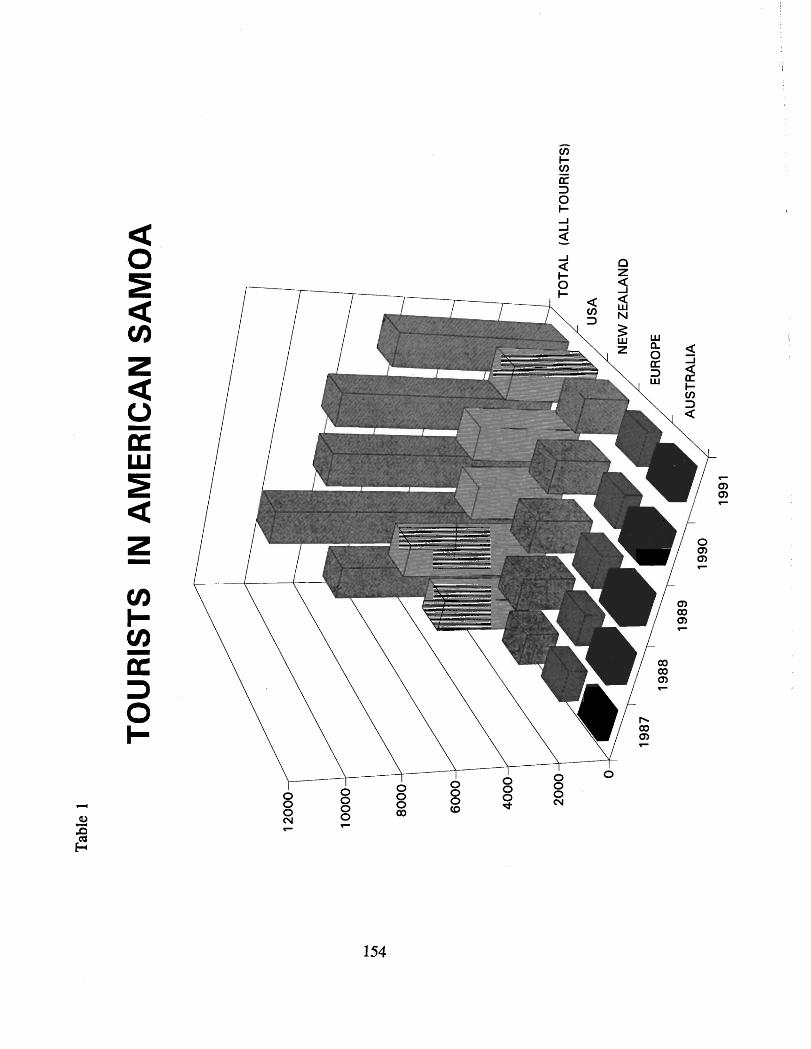

ENVIRONMENTAL CONSEQUENCES Major impact topics were selected based on the types of resources - natural, cultural, and subsistence - found within this national park. The following sections discuss how these national park resources and the region, American Samoa, would be affected by the implementation of the proposed action or by implementation of the other alternatives.
Environmental consequences or impacts associated with the implementation of the proposed action or the alternatives can be either beneficial or adverse, long-term or short-term. Some are direct while others are indirect - indirect being those impacts caused by an action occurring in the future or at another location. Where possible, measures to mitigate adverse environmental consequences have been identified. Cumulative effects are those of the proposed action or the alternatives added to the effects of other past, present, and reasonably foreseeable plans, projects , and activities within the national park and the region.
ALTERNATIVE A - PROPOSED ACTION
The proposed action addresses the major issues identified during the preparation of this general management plan: the development of suitable access and facilities for the national park, the caring for and interpretation of its resources, and ensuring that Samoan traditions and customs are maintained within the park. The impacts of the proposed action on the natural, cultural, and subsistence resources of the national park are discussed in the following sections. Also discussed are the socio-economic impacts that the proposed action will have on the nearby villages and the region.
Impacts on Natural Resources
The development of access and facilities as called for by the proposed action will have only limited effects on the vegetation, soils and coastal water quality of the national park. These effects will be both beneficial and adverse. The adverse effects will be
minimal. The proposed action will have little or no effect on the native wildlife of the national park, including the two species of flying foxes, or its marine resources. The air quality of the national park will only be minimally affected by the proposed action.
The beneficial effects will be long-term, while the adverse effects will be localized and short-term. Effects on the vegetation, native wildlife, soils, and coastal water quality of the national park from the development of access and facilities are discussed below in more detail by individual national park unit.
Proposed Developments - Tutuila Unit
The proposed reconditioning and rehabilitation of the existing unpaved service road from Fagasa Pass to the top of Mt. Alava will have a long-term, beneficial effect on the native plants found along that corridor. Alien plants will be removed and natives planted wherever possible. Alien plants will be removed by hand or with herbicides. Any use of herbicides will be limited and carried out in accordance with the NPS integrated pest management policy. Soils along the-corridor will be stabilized by the revegetation.
Mitigation measures will consist of using hand tools as much as possible and putting only light-weight utility vehicles on the service road to bring in the needed supplies and equipment. Disturbance of flying foxes and native forest birds in the area will be minimal.
Rehabilitation efforts along the existing service road will include work to improve drainage and control soil erosion. The ruts and ditches along the road that hold pools of standing water will be eliminated. This will be a beneficial effect. Natural drainage patterns will be restored. The siltation occurring in the coastal waters below from road runoff during the periods of heavy rainfall 'will be greatly reduced. These beneficial effects will all be long- term.
Construction of the proposed parking areas at Fagasa and Afono passes will have little effect on natural resources. Altogether, construction of these facilities will disturb less than one acre of surface soil material. Both of these areas have already been disturbed and heavily modified by the construction of the nearby paved roads and the vegetation found here consists. primarily of

shrubs. and weedy species. It is unlikely that any species of native wildlife will be affected by these developments. Only minimal site grading will be required at the Fagasa Pass site. Site preparation at Afono Pass will require some excavation of soil material. This will be an adverse effect.
There will be some noise and dust particles generated by the use of equipment during construction of the proposed parking areas. These adverse effects will be short-term and localized. The number of vehicles passing through these two areas is very small and the proposed construction will have only a very minimal impact on traffic flow.
The construction of the new hiking trail proposed from the top of Mt. Alava down to Afono Pass will disturb the native tropical forest vegetation occurring along a narrow corridor about three miles long. This will be a long-term adverse effect. These adverse effects on the native forest will be at their greatest during construction of the trail.
The proposed trail is to generally follow along the crest of Maugaloa Ridge to maximize scenic views; however, the exact route is to be determined at a later time following on-the-ground surveys by professional biologists to identify any flying fox or native forest bird habitat, rare native plants, and old-growth native trees located along the trail corridor. If any of the above were to be found, the trail will be routed so as to avoid these environmentally sensitive areas. The route of the proposed trail will follow along natural contours to minimize surface disturbance and avoid erosion. Trail work will be carried out primarily on foot with hand tools'. Only light-weight, utility vehicles will be used to bring in material and equipment.
The proposed rehabilitation of a portion of the cross-mountain trail to Vatia village will not take place until on-site surveys are carried out to determine if any flying fox or native forest bird habitat will be adversely affected by the trail work. Trail rehabilitation activities will be carried out only with the use of hand tools so as to minimize any damage to the native vegetation.
Eventual use of the proposed hiking trails in the national park by visitors and local residents has the potential to spread alien plant species deeper into the native forests. This would be a long-term adverse effect. Mitigation measures will include continual and

active monitoring of trail corridors by NPS resource management personnel to control the spread of alien plants along the proposed trail system within the Tutuila unit.
The development of new hiking trails into the forest also has the potential to further increase the spread of feral pigs into areas dominated by native vegetation - a long-term adverse effect. Mitigation measures will include monitoring park trails by national park resource management staff for signs of pig activity. If any of these trails are shown to be associated with pig movement and activity, appropriate pig control measures will be carried out.
The construction of a scenic overlook next to the road at Sauma Ridge will not affect any natural resources. The vegetation here has already been disturbed by the road construction and is dominated by shrubs and weedy species. No native wildlife will be affected.
The raised platform proposed in the Amalau Valley to allow visitors to observe the flying foxes who frequent this area will disturb a small amount of the native vegetation at the site. The proposed short access trail to the platform will also disturb native vegetation. In the past, subsistence agricultural uses have taken place in this area. The native vegetation above the road at Amalau has been disturbed and is now mostly secondary forest. Prior to any construction taking place, the area will be monitored by a professional biologist to determine if the introduction of visitors in close proximity to flying foxes can be accomplished without unduly disturbing their normal behavior habits. If construction of the raised platform is judged to be feasible, hand tools will be used as much as possible for this low-key development to minimize the adverse impact on native vegetation and native wildlife.
The proposed action calls for the removal of the existing aerial tramway and the installation of a new system, as well as facility developments nearby for national park visitors. The tramway removal and installation activities will cause major disturbance to vegetation and soils at the sites of the lower and upper tramway terminals. Transportation of materials and supplies for the construction of the new tramway and the removal of the old tramway infrastructure will have some adverse effects on the existing access road to the lower terminal and the Cwheel drive service road to the upper terminal. No natural resources will be affected by the transporting of materials and supplies or the
removal of the old tramway infrastructure on the access road to the lower terminal.
The ground surface at both the lower and upper terminals has been disturbed and modified by developments. The vegetation here is composed of shrubs and weedy species, along with planted ornamentals at the lower terminal. No species of native wildlife are known to inhabit these areas. Consequently, there will be no adverse effect on native plants and wildlife in these areas. During construction, there will be some adverse effect on the air quality at both sites due to fugitive dust from heavy equipment and emissions from construction vehicles.
Under the proposed action, the existing tramway infrastructure will be removed and replaced with a new system. These construction activities will involve the use of heavy equipment. The existing unpaved service road is presently the only feasible means available to bring structural parts for the new tramway and installation equipment to the upper terminal site. The use of Cwheel drive vehicles laden with the new tramway material on this road will have a short-term adverse effect on soil and vegetation, and indirectly on the coastal water quality since the presence of these vehicles will increase the potential for erosion on the road and thus for the silting of the coastal waters in the vicinity from road runoff.
Mitigation efforts will consist of prohibiting the use of Cwheel drive vehicles on this road during periods of heavy rainfall. These vehicles will be used to bring out the old, discarded parts of the present tramway as well as other debris, trash, and litter left up at the upper tramway terminal, thereby minimizing the number of vehicles and vehicle trips on the road. Additional mitigation will include working with the local U.S. Army Reserve unit in securing the temporary services of a military helicopter suitable to haul in supplies and equipment to the construction site.
Following the removal of the old aerial tramway and the installation of the new one, the area around the upper terminal will be rehabilitated and modified for interpretive purposes. The area in the vicinity of the upper terminal will also be cleared of any unused structures and debris connected with the TV transmitter towers. The summit area will then be revegetated and landscaped. Native species will be utilized as much as possible. The TV transmitter towers and associated structures and the tramway

superstructure will be screened by plantings. The revegetation and landscaping will have a localized, long-term, beneficial effect on the scenic and visual resources and will not adversely affect natural resources in the area.
The area in the vicinity of the lower tramway is also to be modified for visitor use, interpretive purposes, and landscaped following the installation of the new tramway. This entire area has been heavily modified by excavation and grading for the road and parking and by structural developments. Native plants and animals will not be affected by the proposed construction activities. The landscaping of this area will have a beneficial effect on scenic and visual resources in this area.
The Utulei beach park, considered a possible location for the construction of a visitor centerlpark headquarters, is outside of national park boundaries in an urbanized area. The beach park has been developed on fill material and planted with grasses and scattered trees and coconut palms. Consequently, no natural resources would be affected by construction activities here.
Construction of a visitor center\administrative headquarters has the potential to contribute further to the erosion of the beach front now taking place along the shoreline. This would be an adverse effect. Corrective measures to control the erosion consisting of structural improvements such as revetments and/or supplying additional sand to the beach on a periodic basis would be employed prior to undertaking any construction.
Under the ASG's Coastal Zone Management Program, any visitor center building constructed here would be considered a "shoreline development" since it is to be located within the Pago Pago Harbor Special Management Area. Consequently, if a visitor center were to be built here, NPS would submit a detailed description of the proposed action, including corrective measures to stabilize the adjacent shoreline, to the Project Notification and Review System Board for their review and approval prior to undertaking any construction. During construction, appropriate measures would be taken so that the nearby waters of the Pago Pago Harbor are not adversely affected by any sediments which may be produced by this activity.
Any impacts on scenic views of Pago Pago Harbor, open space, and shoreline recreational activities caused by the construction of

a visitor center at Utulei beach would be mitigated by siting it near the highway and away from the shoreline, and designing the building to harmonize with the existing historic buildings nearby.
Proposed Developments - Ta'u Unit
The proposed rehabilitation of the unimproved dirt road down to Siu Point and the upgrading of the existing intermittent trail and path along the south coast will only minimally affect the native vegetation in this area. The effect on native wildlife will also be minimal. Air and water quality will not be affected. Mitigation measures will consist of using hand tools as much as possible in doing the rehabilitation work along the corridor and using only light-weight, utility vehicles to carry in equipment, material, and supplies.
The level area near the historic well at Tufu Point is proposed for low-key developments consisting of a ranger station and restrooms, and a modest resource managementlmaintenance structure. The presence of grasses in this area indicates that it has been modified and has been maintained in that condition for some time to retain its open character. Thus, the proposed developments in this area will little affect the native vegetation. It is proposed that the area continue to be maintained to retain its open character, so there will be no net increase in the native forest here. Native forest birds, seabirds, and flying foxes will not be affected by the proposed developments.
In the future, as visitation levels increase, new trail construction is proposed in the upland areas of the Ta'u unit. These will be backcountry type trails. The tropical forest here is composed primarily of native species and shows few signs of disturbance by the activities of man. The total combined length of these new trails is approximately eight miles. Trail construction will disturb the native forest in a narrow corridor along this entire length. In some instances, where there is no feasible alternative, the cutting down of native trees may be required to construct these trails.
The exact routes of these proposed trails have not yet been determined. Prior to any trail construction work taking place, the proposed routes will be surveyed by professional biologists to ensure that any areas providing habitat for flying foxes, rare native forest birds, the Pacific boa, or other native wildlife are not affected. These proposed trails will be routed to avoid any
environmentally sensitive areas. Also, these trails will be routed to avoid the cutting down of any large, old-growth native trees. All trail construction will be carried out to NPS standards using hand tools to minimize any disturbance of native vegetation, soils, and natural drainage patterns.
The construction of the elevated canopy walkway to provide visitors with close-up views of the tropical forest will cause some localized, short-term disturbance to the native vegetation. Mitigation measures will include using hand tools to construct the walkway to minimize disturbance to vegetation. Following construction, the presence of visitors on the walkway has the potential to cause minor, but long-term disturbance to native wildlife. Increasing the visitor understanding and appreciation of the tropical forest and native wildlife of this national park will be considered secondary to any disturbance to native wildlife. If major disturbance to native wildlife occurs due to the presence of visitors, the number of visitors allowed on the walkway at one time will be reduced.
The development of primitive campsites in the uplands of the national park on Ta'u will disturb and destroy some of the native vegetation. The adverse effect will be very localized - less than one-quarter acre of ground surface will be disturbed by these cleared sites - but long-term. These proposed primitive campsites, consisting of a cleared area to pitch a tent and nearby pit toilets, will be located to avoid native wildlife habitat, particularly for the flying foxes, rare native birds, and the Pacific boa. The construction of pit toilets will destroy small amounts of vegetation, surface and subsurface soil material.
The proposed opening up of the upland portions of the Ta'u unit to visitors through the development of a system of hiking trails carries with it the potential to spread alien plants and animals deeper into the forest. Alien plants could also be spread by feral pigs since trails often provide avenues for their movement. Any spread of alien plants into native forest area by visitors and feral pigs would be a long-term adverse effect.
Mitigation measures include the active monitoring of trail corridors by park resource management staff b control the spread of alien plants and animals along the trail system, the implementation of proposed resource management strategies to control the spread of
feral pigs, and NPS interpreters informing visitors about the effect of alien plants and animals on the native forest.
While no known sea turtle nesting sites are located within the Ta'u unit, this rugged, pristine, and isolated shoreline provides suitable habitat for sea turtle nesting. Should it be learned in the future that some of the beach areas within the national park are being used for sea turtle nesting, public use of these areas will be restricted. This includes closure of certain areas prior to and during nesting season or the routing of trails away from areas that may be used by sea turtles.
Proposed Developments - Ofu Unit
The small visitor contact station and restrooms proposed inland of the national park on Ofu will not adversely affect any native vegetation since this entire level area has already been disturbed in the past by the planting of agricultural crops, mostly coconuts. There is little potential for native wildlife to be adversely affected by the construction.
Mitigation measures in connection with the proposed restroom will consist of installing a self-contained, vault system to dispose of wastes and prevent any discharge of waste materials into the nearby reef and constructing the buildings to a high enough standard to be able to withstand climatic events such as hurricanes.
Resource Management Strategies
The proposed action calls for the implementation of long-term management strategies to protect and preserve the national park's natural resources. These strategies are to be based on scientific data collected through programs of active research. Baseline inventorying of natural resources and monitoring programs are included in these management strategies. Specific management strategies have been identified to protect natural resources; these strategies include the control of feral pig populations, aggressive alien plant species, alien predatory snails, and other pest species.
Preliminary surveys within the Tutuila and Ta'u units of the national park indicate large populations of feral pigs are present and are damaging the vegetation of the forest floor. These populations are expanding. Consequently, the implementation of a feral pig control program within the national park is urgent.

Under this alternative, through the implementation of a long-range resource management strategy, feral pig populations in the national park will, over time, be controlled. As a result, the threats to the tropical forest, native wildlife, and indirectly to coral reefs from feral pigs will be significantly reduced, if not eliminated. The potential threat to human health and subsistence agriculture from feral pigs will also be greatly reduced or even eliminated. These are all long-term, beneficial effects
There will be minor, adverse effects connected with the implemtation of some resource management strategies. For example, the feral pig management program will likely cause some disturbance of vegetation in connection with the construction and maintenance of pig fences in the national park. Similarly, small plots of vegetation may be disturbed by the monitoring, hunting, trapping, or snaring activities associated with feral pig control. These activities will create short-term adverse effects on a small portion of the vegetation and have the potential to temporarily disturb native wildlife.
Overall and in the long-term, the implementation of natural resource management strategies will result in major, beneficial effects on the national park's tropical forest, its flying foxes, forest birds, seabirds, tree snails, and other native invertebrates, as well as on the park's marine resources, coral reefs, and freshwater stream habitats. Implementation of inventory and monitoring programs will identify flying fox roosts, seabird colonies, rare plant locations, and other important or sensitive areas of the national park, as well as determine the status and health of the plant or animal populations involved. Obtaining this information from field surveys has the potential to cause some very minor, short-term disturbance to the park's native vegetation and wildlife.
Interpretive Program
The proposed action calls for the development of an interpretive program designed to instill in visitors a basic understanding of and an appreciation for the significant natural resource values of this national park. The development of a new, major, visitor center will serve to introduce all visitors - United States, international, and local - to the natural resources of this national park. The ranger station proposed near Saua on Ta'u and the small visitor contact station proposed next to the road on Ofu will provide visitors with more detailed information on the natural resources

found in those particular areas. Visitor understanding and appreciation for the national park's resources will be further enhanced by personal services, including walking tours of the national park, to be provided by NPS rangerlinterpreters and NPS- trained village guides. These actions will all have long-term, beneficial effects on the resources of the national park.
The construction of a new aerial tramway, the development of a system of hiking trails, and the installation of wayside exhibits will provide visitors with new opportunities for relatively easy access to and additional opportunities for learning about the natural resources of this national park. These are all considered to be long-term, beneficial effects.
In sum, the implementation of the interpretive program and the development of access and facilities, as called for by the proposed action, will increase the visitor's knowledge and appreciation of the national park's natural resources - all indirect, long-term, beneficial effects.
Subsistence Activities
The continuation of subsistence agricultural activities within the national park will have some minor adverse effect on the native vegetation of the national park. Small portions of the national park's native tropical forest vegetation will continue to be taken up by plots cleared to grow subsistence crops. These adverse effects on the tropical forest will continue, but can be mitigated by encouraging village farmers to move their future agricultural plots to places that will not adversely affect native old-growth trees or native wildlife, particularly the flying foxes. No clearing of any new plots will be allowed until farmers agree to let their existing plots return to native vegetation.
Impacts on Archeological and Cultural Resources
The National Historic Preservation Act of 1966, as amended, regulates a great many of the activities related to cultural resources. Section 106 of the Act requires NPS to consider the impact of any proposed action or undertaking on properties that are listed or are eligible for listing on the National Register of Historic Places and to offer the Advisory Council on Historic Preservation and the Historic Preservation Officer an opportunity to comment on the proposed actions or undertakings. Further, Section 110 of
the National Historic Preservation Act specifies that archeological resources must be taken into consideration before any federal action can be implemented.
The usual methodology for assessing effects or impacts on cultural resources involves several steps: (1) identifying the location of proposed actions, (2) comparing that location with the locations of cultural resources listed on or eligible for listing on the National Register of Historic Places, (3) identifying the extent and nature of impacts of the proposed actions on natibnal register listed or eligible properties, and (4) assessing those effects according to procedures established in 36 CFR Part 800, "Protection of Historic Properties. "
A proposed undertaking is considered to have an "effect" on a historic property if it may in any way change the characteristics that qualify that property for inclusion on the National Register of Historic Places. If an undertaking would diminish the integrity of the property, it b considered to have an "adverse effect". Historic properties for the purpose of the regulations are those prehistoric or historic districts, sites, buildings, structures, or objects included on, or eligible for inclusion on the national register.
The Programmatic Agreement between NPS, the Advisory Council on Historic Preservation, and the National Conference of State Historic Preservation Officers calls for general management plans to include a listing of those proposed actions that would be subject to further consultation, the stage of planning at which consultation is most likely to be completed, and any additional cultural resources information, plans, or studies required before undertakings could be carried out. The appendix (Appendix C) contains the list of those projects judged at this time to need further consultation.
Presently, NPS has only limited knowledge of the archeological and cultural resources located within the national park. No historic properties - that is, properties listed or eligible for listing on the National Register of Historic Places- are known to occur either within the existing boundaries of the national park or at those sites proposed for construction outside of the national park. However, it is highly likely that numerous and significant surface and subsurface archeological sites and features are present in all three units of the national park. The new construction called for

under the proposed action, though limited, has the potential to adversely affect some of these archeological resources.
Prior to any construction taking place, NPS will consult with the historic preservation office before conducting any project-specific surveys to ensure that the location, nature, extent, and significance of the resources are thoroughly understood. Site significance will be evaluated and a determination of eligibility for the national register made through consultation with the historic preservation officer.
The development of a park-wide system of walking trails to provide access to certain archeological sites and features of the national park will have an .indirect, beneficial effect on these resources as it would make possible the structuring of visitor use to avoid culturally sensitive areas. By constructing trails only in certain areas, visitors will be directed away from fragile or culturally sensitive archeological sites or features.
Within the Tutuila unit, the locations proposed for development consist of two sites near Fagasa and Afono passes for the construction of visitor parking, the site near the top of Mt. Alava for the construction of a rest room, and a route along Maugaloa Ridge from Mt. Alava to Afono Pass for the construction of a walking trail. The Fagasa Pass site has already been modified for vehicle parking. The minor improvements proposed for visitor parking will not involve disturbing the subsurface. The surface at this site has already been modified. No archeological resources were identified. The proposed visitor parking at Afono Pass may involve somedisturbmee ef &e subsurfase .-Prior to constmction, NPS will carry out consultation before undertaking any subsurface testing for the presence of buried deposits.
The rest room on Mt. Alava is proposed near the existing covered pavilion. This facility is to be a self-contained, vault-type system; consequently, there will be some ground disturbance during installation. No surface archeological sites or features are known to exist here. Prior to construction, NPS will carry out consultation before undertaking subsurface testing. Subsurface testing for the presence of buried deposits - either coring or test excavations - will be carried out by a professional archeologist. If any subsurface archeological resources were uncovered during construction of the restroom, all activities will be halted and a professional archeologist consulted.

NPS will carry out consultation during the selection of an appropriate route for the trail proposed along Maugaloa Ridge. Once an appropriate route has been selected to construct the new trail, the trail corridor will be surveyed by a qualified archeologist prior to construction. During construction, the route would be monitored by a professional archeologist. If any archeological resources were encountered along the new trail during construction, the trail will be rerouted to avoid disturbing or damaging these resources. Rerouting will be the preferred mitigation measure. However, this may not always be the case - for example, when trails are purposely routed to give visitors access to cultural sites or features for interpretive purposes.
The Utulei beach park discussed as a possible location for the construction of a visitor center, parking lot, and entrance road is within the U. S. Naval Station Tutuila Historic District, a national register property. There are two remaining U.S. Naval Station buildings within the beach park and a World War I1 pillbox is nearby. The public beach park is next to the main road in the Utulei area. Outside national park boundaries, this area has already been heavily modified by urban developments. The beach park was built on top of fill material. No surface archeological sites or features are known to exist here. If constructed here, the new visitor center would entail some subsurface disturbance. Prior to any construction, NPS, in consultation with the historic preservation office, would determine if any such undertaking would effect the historic properties in the vicinity.
If any archeological resources were uncovered during construction, all activities would be halted and consultation will take place. Mitigation measures could include avoiding cultural resources or excavation with data recovery and the recording of any discovered sites or features.
The present-day Courthouse building, also a national register property within the U.S. Naval Station Tutuila Historic District, is regarded to be feasible for future use as a visitor centerladministrative headquarters. Originally designed and constructed by the U. S . Navy as their administrative building, the interior of the building was modified several decades ago to house the judiciary in American Samoa. If the Courthouse building becomes available to NPS for future use as a visitor centerladministrative headquarters, alterations would need to be made to the present interior spaces to accomodate and make

feasible its proposed use by NPS. Rehabilitation is judged to be the appropriate level of treatment. Rehabilitation is defined as the conversion of a building to a state that "makes possible an efficient contemporary use while preserving those features that are significant. " Appropriate repairs and alterations would be made, but the historical character of the building would be retained and preserved as much as possible. No additions to the existing building would be necessary. The standards for rehabilitation contained in the Secretary of the Interior Standards for the Treatment of Historic Pro~erties would be the minimum standards for the changes to be made by NPS. Prior to undertaking any rehabilitation treatment on this historic property, NPS would consult with the historic preservation office.
On Ta'u, new construction consists of a ranger station and restrooms near the historic well and walking trails and primitive campsites in the uplands of the national park. Nearby Saua is an area of great cultural significance to Samoans. Remains of a large prehistoric village extend along portions of the east coast of the national park. Saua is particularly significant as it is reputed to be the place where the first kava ceremony took place. Consequently, consultation with the the ASG's historic preservation office and the village council will be carried out. Any sites proposed for development will be surveyed by a professional archeologist prior to any construction taking place. The proposed ranger station, rest room, or any other ground-disturbing developments will be located so as to not adversely affect archeological features, legendary sites, or other culturally important resources.
Prior to the development of primitive campsites, pit toilets, and new hiking trails in the uplands of the Ta'u unit, a qualified archeologist will survey the selected sites to attempt to identify the presence of archeological features at the selected sites. If any archeological features were identified, the locations of these minor developments will be changed to avoid them. . ' d ' ; c
.t (1:2?1 $$.,.
For the Ofu unit, proposed new construction consiWEi"f Ytsmall visitor contact station and rest rooms. These facilities are to be located just outside of the present national park boundary. Much of the area above the coastal road adjacent to the national park recently has been subject to intensive and systematic surveys by archeologists. As a result of these surveys, more than two dozen surface archeological features have been identified and mapped. These features span some three thousand years. Based on the rich
archeological resources already known to exist in this area, the proposed visitor contact station and restrooms will be carefully sited to avoid any archeological remains.
During site selection for the proposed facilities on Ofu, consultation is to take place with the village council and landowners. Following site selection, consultation will again take place before undertaking any subsurface testing for the presence of buried deposits. Prior to construction, through coring or test excavation, attempts will be made to identify the possible presence of subsurface archeological features at the selected site. If found, another site will be selected. If, during construction activities connected with the visitor contact station, any subsurface archeological sites or features were found, work will be halted and a professional archeologist consulted. Mitigation measures could include the recording of excavated sites.
The surface and subsurface of the area around the lower and upper aerial tramway terminals will be disturbed by the activities connected with the removal and installation of an aerial tramway system. No archeological sites or features are known to exist at either the lower or upper terminal sites and all activities connected with the removal and construction of tramway infrastructure will take place in areas already disturbed by development. A qualified archeologist will be on site to monitor all activities connected with the removal and installation of the tramway.
The ground disturbance connected with the removal and installation work for the lower tramway terminal is located outside of national park boundaries. The historic preservation office will be consulted in connection with any removal or installation activities in connection with the lower terminal.
Nearly all of the construction activities connected with the proposed action will take place on lands where the surface has already been modified and where there are no known archeological sites or features. None of the construction activities connected with the proposed action will involve any major subsurface disturbance.
Prior to construction of rest rooms near the tramway, consultation will take place with the historic preservation office. If any previously unknown archeological sites or features are discovered

or uncovered during construction activities, work will be stopped in the discovery area.
Implementation of the cultural resource management strategies called for by the proposed action will have a long-term, beneficial effect on the archeological resources of the national park. As with the natural resources, these strategies are to be based on the accumulation of scientific data through research projects. Cultural resource management strategies broadly consist of the identification and evaluation of archeological and cultural sites so that they can be cared for and, in some instances, interpreted for national park visitors. The implementation of these strategies will have a long- term beneficial effect on cultural resources.
Implementation of the interpretive program called for by the proposed action will indirectly have a long-term, beneficial effect on archeological resources. By means of exhibits, interpretive talks, display of museum objects, publications, and audio-visual programs, visitors will come away with a better understanding of the traditional Samoan culture. As a consequence, damage to archeological resources due to the inadvertent actions of uninformed visitors or visitors straying off marked trails will be minimized.
The construction of a park-wide trail system makes possible the structuring of visitor use to protect certain fragile or sensitive cultural resources. This is considered to be a beneficial, long-term effect.
Subsistence agriculture activities which will continue within the national park under the proposed action will have little effect on cultural resources. If, in certain areas, these subsistence activities are found to be causing damage to any archeological resources, measures will be undertaken through the appropriate village council to either mitigate the damage or move the subsistence activity to another location where cultural resources will not be adversely affected.
Impacts on Subsistence Uses
The proposed action will have only minimal effects on the subsistence resources of the national park. These resources consist mainly of traditional agricultural crops such as taro (dry land), bananas, breadfruit, papaya and yams; other subsistence resources

are those native plants traditionally gathered for medicinal or other cultural purposes such as the weaving of fine mats, certain species of reef fish (mainly surgeonfish, mackerel, and jacks) as well as other marine life (mainly octopus, snails, and clams) and occasionally pigeons and doves.
As part of the High Court of American Samoa's assessment proceedings, lands within the national park used for subsistence agriculture were identified, primarily through interpretation of aerial photographs, and then mapped. Included within this inventory were those lands now being used to grow subsistence crops and those lands which were used to grow crops in the recent past. The proposed action calls for the continuation of these uses within the identified areas (these areas have been zoned Special Use), but, consistent with the intent of Congress, there is to be no expansion and no net increase in the amount of land now under cultivation. Thus, subsistence resources within the national park will be only minimally affected by the proposed action.
Through the CPSU, research is underway to document the relationship of subsistence users with the lands and waters of the national park to determine the extent, nature and significance of traditional agricultural, gathering, and fishing uses. The study results will be used to help establish a baseline for the subsistence uses now occurring within the national park. This baseline will be used to assess any future impacts on subsistence resources, both beneficial and adverse.
If in certain areas the results of research and monitoring called for by the proposed action clearly show that national park resources are being adversely affected by subsistence use activities, then, through the village council and with their approval, these activities will be either temporarily halted and mitigation measures employed or the subsistence activity moved to another nearby mutually agreed upon area.
Curtailing or moving of these uses will have an adverse effect on subsistence resources and activities in that area, but the effect would be temporary as there is to be no net loss in subsistence use activities within the national park.
Any adverse effects on subsistence resources will be mitigated. All mitigation measures will be in keeping with the traditional practice of shifting agriculture and matai imposed restrictions on

the type and intensity of consumptive uses of forest and marine resources. Mitigation measures will also be consistent with rules and procedures for maintaining traditional subsistence uses within the national park. These rules are to be jointly developed and approved by NPS and by each of the village councils.
The development of access to the national park as called for by the proposed action will have little effect on subsistence agricultural resources within the Ta'u unit. Subsistence farmers will continue to have access to their plots. Within the Tutuila unit, those subsistence farmers presently tending plots along the unimproved road to Mt. Alava will be able to continue to use vehicles to get to their crops. Access to subsistence plots on Mt. Alava by foot, the traditional way, will be encouraged. The development of facilities under the proposed action will not affect any subsistence resources within the national park.
The implementation of natural resource management strategies for the control of feral pigs, aggressive alien plant species, and alien animal pests will also have a beneficial effect on subsistence agricultural resources, as well those native forest plants used for medicinal and gathering purposes.
Implementation of the interpretive program called for by the proposed action will only minimally effect the subsistence resources of the national park. Park visitors will not be encouraged to visit areas within the national park where subsistence use activities are occurring, unless the affected villages and farmers wished them to. Park visitors viewing subsistence activities in the national park will come away with a better understanding and appreciation for these kinds of Samoan cultural resources and practices, a beneficial effect.
Within the national park, the overall effect of the proposed action on subsistence resources and the activities connected with these resources is judged to be minimal. Traditional uses will continue, subject to minor modification.
Socio-economic Impacts
The proposed action will have beneficial effects on the regional economy. These beneficial effects will be generated mostly through new jobs and payroll created in the Pago PagolFagatogo area by the development of the national park. Jobs will be
primarily service related - working in restaurants and hotels, operating car rentals and taxis, making and selling Samoan handicrafts, and as park guides. Jobs and payroll will also be created from major construction activities connected with the proposed action.
The proposed action will also provide economic benefits to the villages located adjacent to the national park. New jobs will be generated in the villages for guide service, retail food and beverage service, overnight accommodations, and the making and selling of Samoan handicrafts. These benefits will be long-term. The villages will also benefit economically from the jobs and payroll generated by assisting NPS in the marking of park boundaries and in the rehabilitation of existing trails and the construction of new hiking trails in the national park.
The presence of overnight visitors in the villages, even in small numbers, has the potential to disrupt certain traditional village activities. If this were to happen, it would be an adverse effect. Mitigation measures would include informing visitors about these traditional activities beforehand - for example, the sa (the traditional village evening prayer time) - and informing them about the appropriate way to behave during these times.
The overall beneficial effects on the regional economy due to the development of the national park will not be on a large scale and will not be immediate, but they will be steady and long-term. Moreover, the payroll generated by the jobs created by the national park will likely be spent within the region - that is, in American Samoa.
A few of these new jobs and payroll will be generated at the national park itself, as NPS begins to implement the proposed action and hires additional operational staff. In addition, expenditures connected with operating the national park - utilities, business services, equipment, and supplies - will also provide some beneficial effects to the regional economy.
Beneficial effects on the regional economy will also be generated through new construction jobs and payroll for projects such as the visitor center and the installation of a new aerial tramway. These beneficial effects will be major and short-term.

The implementation of the proposed action will have little effect on services now provided by ASG such as police, fire, emergency medical, water, and wastewater treatment in the vicinity of the national park. Very little additional demand will be put on ASG to provide these services from the implementation of the proposed action.
The activities connected with the removal of the existing dilapidated aerial tramway and the construction of a new one will have short-term, adverse effects on the residents living along the access road to Solo Hill. These short-term adverse effects will be in the form of increased traffic and noise from construction vehicles hauling material and equipment up and down this narrow, winding road. The presence of these vehicles will also increase the safety hazard to pedestrians using this road. During the removal and construction activities, the amount of fugitive dust and mobile source emissions from construction vehicles will lower the air quality somewhat in the immediate area. The presence of construction vehicles on the road will increase the surface wear. These will all be a long-term adverse effects.
Mitigation measures will include minimizing unnecessary vehicular and machinery activities, scheduling activities so as to minimize the disruption to nearby residents, having traffic controllers on the road, and requiring all construction equipment to have mufflers in good working order.
If the visitor centerladministrative headquarters were to be constructed at the Utulei beach park, there would be some short- term adverse effects on traffic and noise in the area. These effects would occur primarily in the Utulei area and be in the form of traffic slowdowns and increased noise from construction equipment on site. Existing traffic here is mostly an aggregate of road traffic and traffic entering and exiting the nearby ASG executive office building parking lot. During construction, some congestion and slowdowns would occur in the vicinity of the construction site, causing motorists to experience delays.
Mitigation measures would include scheduling construction activities to avoid periods of peak traffic and the use of appropriate signs, barricades, cones, or traffic controllers to ensure ease and safety of the affected motorists.

If the national park visitor center were to be built at the Utulei beach park, there would be some increase in traffic, mostly aiga buses, in the Utulei area from park visitors going from their hotels to the visitor center and from the visitor center to the aerial tramway. This will be a minor adverse effect.
Similarly, if the present-day Courthouse were to be rehabilitated for use as a visitor centerlpark headquarters, there would be additional traffic in the Fagatogo area from park visitors. As a mitigation measure, visitors will be encouraged to us5 aiga buses as much as possible.
With a new aerial tramway system in operation, there will be an increase in traffic, primarily from aiga buses, on the existing road leading up to Solo Hill. This road is narrow and winding and goes through a quiet residential area. The increase in traffic will introduce additional noise and cause some loss of privacy to residents. There will be a greater potential for litter along the road from the increased use. There will also be an increase in safety hazards to pedestrians along the road. All these will be localized, long-term, adverse effects and will occur primarily during daylight hours from late morning to early afternoon.
There will also be short-term adverse effects in the form of traffic slow-downs connected with the construction of the parking and trailhead facilities at Afono pass. These adverse effects will be minimal since traffic is very light on these roads. There will also be some temporary increases in noise and a lowering of air quality in the vicinity of the construction sites. These adverse effects will be minor.
The proposed action will have only minimal effect on land use. If the visitor centerladminsitrative headquarters were to be built at Utulei beach, the building, visitor parking, and the entrance road would take up a small (about one-half acre) portion of the existing open space along Utylei beach park shoreline thus changing the land use here to development. Mitigation would include designing and locating the new visitor center so that it blends in with the surroundings - low building profile, harmonizing colors, screening with plantings - and does not interfer with pedestrian access to or along the shoreline.
It is estimated that the construction of a new aerial tramway and a national park visitor centerlheadquarters will generate more than
$8 million in total construction costs. If ASG chose to construct the visitor centerlheadquarters and lease the building to NPS, an estimated $180,000 in lease monies will accrue to ASG each year. The remainder of the proposed construction - visitor parkingltrailheads, scenic viewpoints, the restrooms, parking, and the rehabilitation of the pavilion at the lower tramway terminal, the ranger station for the Ta'u unit and the small visitor contact station for the O h unit, and new trail construction - will altogether generate an additional estimated $1.7 million in construction costs. These construction activities will all be short-term benefits to the regional economy. The leasing of the visitor centerlheadquarters to NPS will be a long-term, economic benefit to ASG.
The magnitude of the beneficial effect on the regional economy from this construction will depend on how many projects are awarded to local contractors, the proportion of needed construction supplies and materials purchased locally, and the proportion of the construction-related jobs tied to the region. All of the economic benefits from construction-related jobs will be short-term.
Because the National Park of American Samoa is a new and, as yet, undeveloped park, it is difficult to estimate with any accuracy how much additional revenue will be generated to the regional economy from visitor expenditures, but over time it is expected that the increased level of tourism to American Samoa generated by the national park will help to expand and diversify the economy. This expansion and diversification is considered to be a long-term, beneficial effect.
Conclusion
Overall, the proposed action will have beneficial effects on the natural and cultural resources of the national park. Subsistence resources will be maintained at their existing levels. The region (American Samoa) and the villages located adjacent to the national park will derive economic benefits from the implementation of the proposed action. Implementation of the proposed action will also have a beneficial effect on fa'asamoa, the traditional Samoan way of life, through its reinforcing of the traditional communal ownership of land and the authority of the village matai.
All major construction - the installation of a new tramway, the new visitor centerlheadquarters, plus rest rooms and interpretive facilities - will take place on lands already disturbed and
containing no natural resource values. No surface archeological features are known to exist at these construction sites. The adverse impact on air quality from construction will be minor and short-term, occurring mainly in the form of increased particulates from grading and site work.
The implementation of resource management strategies within the national park to control alien plants and animals will have a major beneficial effect on the native plants of the tropical forest and the flying foxes, birds and other native wildlife. Threats to native species from alien species will gradually decrease as these strategies are implemented. Rare native wildlife such as flying foxes, pigeons, doves, partulid snails, and the Pacific boa will all benefit in the long-term from the inventorying and monitoring strategies called for in the proposed action.
There will also be a long-range, indirect benefit to local educational institutions and government agencies from the scientific research carried out as a result of implementing the proposed action, particularly from the implementation of natural resource management strategies. This benefit will be in the form of better decision-making and improvements in long-range planning resulting from the expansion of the scientific data base.
The implementation of the proposed action's resource management strategies to preserve and protect the national park's cultural resources, both the tangible and the intangible, will be a beneficial effect. Caring for cultural resources on-site and the collecting, caring and displaying of cultural resources at the visitor center, as well as telling visitors .about Samoan myths and legends - all these will serve to increase the level of knowledge and understanding of the Samoan culture. Any adverse impacts on cultural resources will be site specific and minor.
There will be some new jobs created, primarily in the service sector, and modest increases in the total earnings for the region due to the implementation of the proposed action. However, there will be minor increases in traffic volume in the Utulei-Fagatogo area resulting from the construction of the new aerial tramway and a new visitor center - if the Utulei beach site is chosen. The proposed action will not impose any significant land use changes in any of the adjacent villages or the region. The interpretive program called for by the proposed action will increase

opportunities for learning about the natural and cultural resource values of the national park for visitors and residents.
Cumulative Effects
On the island of Tutuila in the Pago Pago-Tafuna area, native plant communities and wildlife habitats are being lost to commercial, residential, and light-industrial development. The proposed action's resource management strategies to preserve and protect native plants and animals within the national park will have a beneficial cumulative effect on native flora and fauna at a regional level since large-scale development within the national park is to be excluded and only low-key, traditional developments will be encouraged on adjacent lands.
As commercial development in the Pago Pago Harbor and residential and light-industrial development in the Tafuna plain continue, a net loss in cultural resources will inevitably occur - primarily in the destruction of archeological sites and features. The implementation of strategies contained in the proposed action to preserve and protect cultural resources within the national park will have a positive cumulative effect on region-wide efforts to preserve such resources and their settings.
Implementation of the proposed action will have a positive cumulative effect on employment and income in the villages adjacent to the national park and to some extent region-wide. Visitor expenditures in connection with the national park will contribute to the regional economy. The increases in traffic from the construction and use of the new aerial tramway and the new visitor center will have a minor adverse cumulative effect on regional traffic and congestion.
Implementation of the interpretive program called for by the proposed action will contribute positively to the existing regional efforts in American Samoa as well as the efforts in Western Samoa to provide educational and informational opportunities about the Samoan culture and native plants and animals.
Short-term Uses and Long-term Productivity
The long-term productivity of the tropical forest, the native wildlife, and the marine resources will be enhanced by the

implementation of the resource management strategies called for under the proposed action.
The long-term productivity of subsistence agriculture activities within the national park will not be diminished by the proposed action. The proposed action calls for maintaining the existing level of subsistence use activities within the national park. Only a small percentage of the lands within the national park are now being used for subsistence agriculture. Over the past decades, this use appears to be declining, particularly within the Ta'u unit.
There is preliminary evidence that subsistence marine resources. within the national park are being over-utilized by subsistence fishing and gathering activities. The implementation of resource management strategies called for by the proposed action may result in a lowering of the "take" in certain offshore areas withip the national park. If this were to occur it will mean that the short- term uses of these resources would be decreased in order to enhance the long-term productivity of these marine resources.
Irreversible and Irretrievable Commitments of Resources
With only few and minor exceptions, implementing the proposed action will not require any irreversible or irretrievable commitment of resources. Under the proposed action, access and facility developments will avoid archeological sites and features where possible. Where not possible, disturbance will be mitigated through recovery of cultural information and artifacts. However, there may be some very minor losses of archeological resources from construction activities which are unavoidable. If this occurred, these losses would be irreversible.
Except for the construction of a visitor center outside of national park boundaries, no major changes in land use are proposed. The construction of new facilities such as the aerial tramway and the visitor center will require a substantial one-time expenditure of government funds that will not be fully retrievable. The charging of a reasonable fee to national park visitors by ASG to ride the tramway will in the long-term help to offset some of the construction expenditures, but most of these revenues will likely be used for operation and maintenance. The commitment of these funds by ASG will be beneficial in the long-term, however, because of the economic benefits accruing to American Samoa
from additional expenditures by increasing numbers of visitors (tourists) brought to the territory by the presence of the national park. Since the national park is assumed to be a permanent presence in American Samoa, these economic benefits are anticipated to eventually outweigh the expenditure of government funds.
ALTERNATIVE B - NO ACTION
The environmental consequences connected with the implementation of this alternative are the result of a continuation of existing conditions - that is, making no changes in the present level of operation and management of this national park.
Impacts on Natural Resources
The long-term beneficial and short-term, minor adverse effects on natural resources of the national park connected with the development of access and facilities would be absent under this alternative since no development is proposed. However, the lack of on-site NPS staff such as resource managers, rangers, interpreters, and trail crews in all three units of the national park would greatly increase the potential for visitors unintentionally damaging natural resources such as the tropical forest, native wildlife, and marine life. These adverse effects would be long- term and largely the result of non-implementation of resource management strategies and uninformed and unstructured visitors.
Tutuila Unit
The condition of the unimproved service road to Mt. Alava would remain largely unchanged. Most of the ruts, gullies, and pools of stagnant water would remain. Natural drainage patterns would continue to be disrupted along the road corridor. After prolonged periods of heavy rainfall, there would continue to be siltation from runoff of the offshore waters in the vicinity of Fagasa Bay. Damage to marine resources in this coastal area would occur. This damage would be considered a localized, long-term adverse effect on the offshore waters of the national park.
Existing conditions at Afono Pass would be unchanged. No excavation or disturbance of soil material or grading would take place to construct visitor parking and a trailhead. Also, no native vegetation would be destroyed and no native wildlife, including

possible flying fox habitat, would be disturbed by the construction of a hiking trail from the top of Mt. Alava down to Afono Pass. These would all be beneficial effects.
Under this alternative, there is to be no replacement of the tramway. Consequently, there would be no adverse effects on soils and vegetation along the Mt. Alava trail corridor and possible localized sedimentation of the adjacent coastal waters connected with bringing heavy equipment and vehicles up the corridor for demolition and construction activities.
No construction of a visitor center building, parking, or entrance road in the Pago Pago area is to take place under this alternative. Therefore, there would be no potential for the shoreline or waters of Pago Pago Harbor to be adversely affected by any activities connected with this construction - a beneficial effect.
Ta'u Unit
There is to be no development of park facilities in the Ta'u unit. Consequently, there would be no localized disturbance of native forest and wildlife from the construction of a ranger station, trails, or primitive campsites in the uplands. This would be a localized, beneficial effect on these natural resources.
The lack of trails in the uplands and the absence of NPS rangers in the Ta'u unit, however, would likely mean that some visitors would attempt to bushwack on their own into these .undisturbed upland areas. This unstructured use by visitors has the potential to disturb native vegetation and wildlife, including flying foxes, and would be an adverse effect.
Ofu Unit
There would be no visitor use facilities developed on-site and no NPS personnel duty stationed at the Ofu unit. Consequently, visitor use would be unstructured and there would be potential for uninformed visitors damaging the fragile and unique marine resources of the Ofu reef - an adverse effect.
Resource Management Strategies
The implementation of resource management strategies to protect natural resources would be severely constrained by a very limited

national park staff and the absence of an active research program to collect and analyze needed additional scientific data. Under this alternative, the long-term, beneficial effects on the national park's tropical forest, flying foxes, forest birds, seabirds, and marine resources from the implementation of these strategies would be absent.
Only a very limited implementation of the feral pig control program would be possible under this alternative. As a result, over time, feral pig populations within the Tutuila and Ta'u units would increase. Their rooting and foraging activities, which destroy the forest floor vegetation and contribute to increased sediment loading in portions of the national park's offshore waters, would expand. Moreover, feces from feral pigs may contain leptospirosis, a bacteria extremely dangerous to humans, as well as other bacteria that can contaminate village water supplies. Not implementing an adequate feral pig control program would have major long-term, adverse effects on the native forest and wildlife of the Tutuila and Ta'u units.
Interpretive Program
Under this alternative, there would be no NPS interpretive staff. Consequently, the development of an interpretive program by the existing staff to instill in visitors a basic understanding of and an appreciation for the natural resources of this national park would be very difficult, if not impossible. There would be no ranger station in the Ta'u unit and no visitor contact station in the Ofu unit. Visitor contact for the Tutuila unit would be limited to the existing visitor center. There would be no interpretive facilities developed at either the upper or lower tramway terminals. The indirect, long-term, beneficial effects accruing to natural resources from the visitor's increased knowledge and appreciation of this national park would be very limited under this alternative.
Subsistence Activities
The existing subsistence agricultural and fishing activities in the national park would continue under this alternative. Because of the very small staff, there would be only limited opportunities to work cooperatively with village farmers to encourage them to avoid placing their plots in places that would not adversely affect old-growth trees or native wildlife. Similarly, there would be no regular monitoring of marine resources under this alternative, so

there would be potential for fragile coral resources to be damaged through over-use by visitors and by non-traditional activities by local residents.
lmpacts on Archeological and Cultural Resources
There would be no adverse effect on national park archeological sites or features from construction activities associated with any proposed developments, including access. There would only very limited opportunities to implement any of the resource management strategies connected with the identification, evaluation, protection, management, and interpretation of the cultural resources of the national park. Since there is to be no interpretive staff and visitor use largely unstructured, the potential would exist for archeological resources to be damaged by the inadvertent actions of uninformed visitors.
lmpacts on Subsistence Uses
There would be a continuation of existing subsistence uses in the national park. However, because of the lack of staff, there would be a much more limited capability to conduct new research and monitoring to document the relationship of subsistence users with the land and waters of the national park. Also, under this alternative, those resource management strategies connected with the control of feral pigs in the national park would not be implemented. Consequently, agricultural plots within the national park would continue to be damaged by the activities of feral pigs. Left unchecked, the damage caused by feral pigs would increase over time.
Socio-economic lmpacts
The beneficial effects on the regional economy generated by the jobs created to construct access and facilities to the national park would be absent under this alternative. There would, however, still be some long-term, economic benefits to the villages located near the national park from the provision of overnight accommodations, guide service, food and beverage service, and the sale of Samoan handicrafts.
There would be no localized and short-term disruption of traffic and no noise generated by the construction of a visitor center in the Pago Pago area under this alternative. There would be no

long-term increases in traffic due to the presence of the visitor center. There would also be no increase in traffic on the existing road leading up to Solo Hill from national park visitors desiring to utilize the operating tramway. These would all be beneficial effects.
Cumulative Effects
There would be no beneficial cumulative effects on natural and archeological resources at the regional level from the implementation of resource management strategies within the national park. Also absent would be the positive cumulative effect on regional employment and income from jobs created from the construction of new facilities and access for the national park.
Short-term Uses and Long-term Productivity
The long-term productivity of subsistence resources would be adversely affected by the presence of feral pigs and possible over- use or non-traditional use of marine resources by local residents. The long-term viability of the national park's tropical forest and native wildlife would likely decrease over time due to inadequate or outdated scientific data, a limited monitoring capability, and non-implementation of resource management strategies.
Irreversible and Irretrievable Commitments of Resources
There would be no unavoidable losses of archeological resources due to the construction of national park visitor use facilities. There would not be any irretrievable, one-time expenditure of government funds for the construction of these new facilities.
ALTERNATIVE C - MINIMUM REQUIREMENTS
The minimum requirements alternative addresses general management plan issues in a more limited way than the proposed action. Essentially, environmental consequences under this alternative are connected with carrying out the minimum actions to achieve the intended purpose of the national park.

Impacts on Natural Resources
The more limited developments proposed for access and facilities under the minimum requirements alternative would have less of an adverse, short-term effect on the national park's natural resources than the proposed action. The adverse, short-term effects on the vegetation, soils, native wildlife, and air quality from construction activities for the new aerial tramway and the visitor center would be absent under this alternative. On the other hand, the long-term, beneficial effects on the national park's vegetation, native wildlife, and marine resources from the implementation of resource management strategies would be more limited under this alternative.
Proposed Developments - Tutuila Unit
The beneficial effects connected with the rehabilitation of the unpaved service road into a hiking trail from Fagasa Pass to the top of Mt. Alava would be the same as those discussed in the proposed action. Effects on native vegetation along the road corridor would be beneficial and long-term. Alien plants would be removed and natives planted along the corridor.' Soil erosion would be reduced and natural drainage patterns restored. Siltation of the coastal waters would be reduced.
The effects connected with the improvements of the trailhead and parking at Fagasa pass would be the same as those discussed under the proposed action. Under this alternative, however, no trail is to be constructed along the ridge from the top of Mt. Alava down to Afono Pass. Consequently, there would be no short-term adverse effect on the native tropical forest from the construction of that trail or from the construction of a trailhead and parking at Afono Pass. Similarly, native wildlife such as flying foxes or forest birds would not be adversely affected by any construction activities along the trail route.
There would be no rehabilitation of that portion of the old cross- mountain trail leading down to Vatia; therefore, no native vegetation would be disturbed by the activities connected with that rehabilitation work and there would be no potential to adversely affect flying foxes or native forest birds due to the construction of that trail.
The limited adverse effects on natural resources in connection with the removal and installation of the aerial tramway would be absent under this alternative. No construction vehicles, supplies, or equipment would need to be brought up to the top of Mt. Alava on the existing unpaved service road. The resultant adverse effects - disturbing native vegetation and soil erosion along the corridor, and the silting of the coastal waters below - would not take place, a beneficial effect. The effects on natural resources in connection with the rehabilitation and landscaping of the Mt. Alava summit area would be the same as the proposed action.
Proposed Developments - Ta'u Unit
The adverse effect on natural resources such as the native vegetation and wildlife from trail construction would be less than under the proposed action. The effects connected with the rehabilitation of the dirt roadlwalking trail from the park boundary, around Siu Point, and along the south coast would be the same as the proposed action. However, the minimum requirements alternative proposes no new trail construction in the upland areas of the Ta'u unit. The adverse effects on vegetation, soils, and native wildlife from that construction would not be present under this alternative. Also, since there is to be no development of primitive campsites under this alternative, there would be no localized, adverse effect on the native vegetation and soil material from that construction activity.
The developments proposed for visitor use under this alternative are the same as the proposed action. Consequently, the limited effects on natural resources would be the same as those discussed under the proposed action.
Proposed Developments - Ofu Unit
The proposed developments for access and facilities are the same as those called for by the proposed action. Consequently, the environmental consequences on the natural resources of the Ofu unit would be the same as those described for the proposed action.
Resource Management Strategies
The limited number of natural resource management staff available under this alternative would mean a reduced capability to implement management strategies to preserve and protect the
natural resources of the national park. Consequently, there would be greater potential for long-term adverse effects on the tropical forest, flying foxes, other native wildlife, and marine resources than under the proposed action.
Interpretive Program
Many of the indirect, long-term, beneficial effects on the natural resources of the national park associated with the development of an interpretive program and interpretive facilities would not be realized under this alternative. Due primarily to the more limited staff, the opportunities for visitors to receive a basic understanding of and an appreciation for the significant resources of this national park would be less under this alternative. Less informed visitors would increase the potential for national park resources to be adversely affected.
Subsistence Activities
Under this alternative, there would be a minimal adverse effect on the native vegetation of the national park due to subsistence agriculture and fishing activities. Due to the more limited staff, there would be less opportunity to assist village farmers in locating their future agricultural plots to places where native old-growth trees or wildlife would not be adversely affected.
Impacts on Archeological and Cultural Resources
Even though ground-disturbing activities would be less under this alternative (no visitor center or aerial tramway construction, no restroom constructed atop Mt . Alava), its implementation would have more of a long-term, adverse effect on the archeological resources of the national park than the proposed action. Not developing a park-wide system of walking trails would make it more difficult to structure visitor use to avoid certain culturally sensitive resources. Further, the implementation of cultural resource management strategies to identify and evaluate archeological sites and features would be constrained by the limited number of staff. Similarly, the indirect, long-term benefits on cultural resources derived from the implementation of the national park's interpretive program would be less under this alternative because of the smaller staff.
lmpacts on Subsistence Resources
The effect of the minimum requirements alternative on the subsistence resources of the national park would not differ substantially from the proposed action. However, because of the smaller staff, research and monitoring activities to determine the extent and nature of existing subsistence uses within the national park would be more limited. This would be considered a long- term, adverse effect.
Socio-economic lmpacts
The implementation of the minimum requirements alternative would have some beneficial effects on the regional economy, but these effects would be less than under the proposed action. Economic benefits would come from new jobs and payroll created in connection with the development of the national park. Some new jobs would be created, primarily in the service sector. These new jobs would tend to be smaller in number due primarily to the absence of an operating aerial tramway. The aerial tramway is considered to be a visitor draw and vital to tourism in American Samoa. Without the tramway, visitation to the Tutuila unit of the national park would likely be less.
The economic benefits to the villages adjacent to the national park would be approximately the same as those under the proposed action. National park related jobs created in the villages would be for guide service, providing overnight accommodations, food and beverage service, and the sale of traditional Samoan handicrafts. The potential for these kinds of jobs would be about the same as under the proposed action.
Those short-term, economic benefits connected with the removal and installation of the new aerial tramway and the construction of the visitor center would be absent under this alternative. The few new jobs and payroll generated by the national park itself would be even less under this alternative, as would the economic benefits from national park operating expenditures.
Those short-term, adverse effects on traffic and noise in the vicinity of the construction sites for the aerial tramway and the visitor center would be absent under this alternative. The long- term, minor adverse effect from increased traffic caused by visitors going from their hotels to the visitor center and to the aerial

tramway would also be absent under this alternative, as would the increased traffic and safety hazards to pedestrians on the access road to the lower aerial tramway terminal at Solo Hill.
Conclusion
Under this alternative, a more limited level of development is proposed for national park access and facilities. Access to the national park is to be via existing roads and trails, and existing facilities would be utilized as much as possible for future national park operations. The ground-disturbing activities connected with aerial tramway and visitor center construction activities would be absent under this alternative. Consequently, the minimum requirements alternative would have less short-term, adverse effects on the natural and cultural resources of the national park than the proposed action.
Under the minimum requirements alternative, the implementation of resource management strategies to preserve and protect the tropical forest, native wildlife, archeological resources, and coral reefs would be constrained by a smaller staff of resource management specialists. Likewise, fewer interpreters would make implementing the interpretive program more difficult. So, the long-term beneficial effects on national park natural and cultural resources from implementing these strategies would be less under this alternative.
The regional economy and the adjacent villages would gain some long-term economic benefits from the implementation of this alternative. These benefits would be more limited than those under the proposed action due to the absence of an operating aerial tramway and national park visitor center, both of which are regarded to be visitor draws.
Cumulative Effects
Under the minimum requirements alternative, because of the smaller staff, there would be a reduced capability to implement natural resource management strategies designed to preserve and protect native plants and animals of the national park. Therefore, on a regional scale, the beneficial cumulative effect on these native resources would be less than under the proposed action. Implementing resource management strategies to protect archeological sites would be similarly constrained by limited staff.
The positive cumulative effect on regional efforts to protect cultural resources and their settings would therefore be less than under the proposed action.
There would be a positive cumulative effect on the region's employment and income from the implementation of the minimum requirements alternative. Expenditures by visitors to the national park would have a positive cumulative effect on the regional economy. The positive cumulative effect from the above, however, would be less than under the proposed action.
Short-term Uses and Long-term Productivity
The long-term productivity of the tropical forest, native wildlife, and marine resources of the national park would be enhanced by the implementation of the minimum requirements alternative. The more limited staff, however, would constrain the implementation of natural resource management strategies designed to maintain long-term productivity. The long-term productivity of the existing subsistence agricultural activities within the national park would not be affected by the minimum requirements alternative. The short-term uses of subsistence marine resources would be little affected by the implementation of this alternative; however, long- term productivity may be adversely affected by the reduced capability under this alternative to implement resource management strategies designed to determine the extent of existing subsistence fishing uses of the national park's offshore waters.
Irreversible and Irretrievable Commitments of Resources
Implementing the minimum requirements alternative would not demand any commitment of resources that could be regarded as either irreversible or irretrievable. No construction is being proposed with the potential to disturb or destroy archeological sites. Under this alternative there would be no irretrievable one- time expenditures for the construction of the aerial tramway or the visitor center.
ALTERNATIVE D - CONSTRUCT VISITOR CENTER ON MT. ALAVA
Impacts on Natural Resources
Impacts on natural resources would be the same as those described for the proposed action with some differences. The proposed visitor center construction site is the graded, disturbed area located just below the metal stairs leading up to the summit of Mt. Alava. The ground at the site has been disturbed - the vegetation, including a few native trees, has been removed and grading with heavy equipment has taken place. The ground is presently covered with low shrubs and weedy species. Consequently, there would be no natural resources adversely affected in the area from the construction of a visitor center.
The installation of a new aerial tramway would be completed prior to undertaking the construction of the visitor center on Mt. Alava. Consequently, some of the material and equipment needed to construct the proposed visitor center could be brought on site via the tramway. However, heavy construction equipment and the larger materials and supplies would have to be brought to the construction site on the existing unpaved service road. This would mean large transport vehicles would have to use the road and major grading and road work would have to be done to widen the road. The removal of vegetation, including some native species, the increase in bare road surface from grading activities, and the presence of large transport vehicles on the road would substantially increase erosion and surface runoff. Silting of nearby coastal waters would take place during the regular periods of rainfall. These would all adversely affect natural resources.
The placing of a visitor center on Mt. Alava would likely mean that less numbers of national park visitors would be receiving the full interpretive program and some visitors would not receive the program at all. Under this alternative, visitors would be taking the aerial tramway ride to 'the top of Mt. Alava prior to going to the visitor center and, consequently, would not yet have received their basic introduction and orientation to the national park's significant natural resources. Moreover, there may be visitors who might choose not to take the aerial tramway ride and therefore would not receive the basic introduction and orientation provided at the visitor center before setting out to explore the national park.

Under this alternative, visitors to the national park would tend to be less informed about its natural resources. This could have a long-term, indirect, and adverse effect on these resources.
lmpacts on Archeological and Cultural Resources
The same as the proposed action, except that an additional one-half acre of ground surface would be disturbed at Mt. Alava to construct the proposed visitor center. No surface archeological sites or features are known to exist here. There would be potential here for disturbing any subsurface archeological sites uncovered during construction of the visitor center. Prior to construction, in consultation with the historic preservation office, subsurface testing would be carried out at the site to determine the existence of any buried deposits. If any subsurface archeological features were uncovered during construction of the proposed visitor center, all activities would be halted and a qualified archeologist consulted.
The archeological resources of the national park could also be indirectly and adversely affected by fewer numbers of visitors receiving the full interpretive program and consequently being less informed about the sensitive nature of certain cultural resources.
lmpacts on Subsistence Resources
The same as the proposed action.
Socio-economic lmpacts
The beneficial effects on the regional economy would be the same as the proposed action. The short-term adverse effects from traffic and noise connected with the construction of the proposed visitor centerlheadquarters in the Pago Pago area would be absent under this alternative. There would, however, be increased short-term adverse effects from increased traffic and noise connected with the visitor center construction vehicles in the vicinity of Fagasa Pass.
Conclusion
The same as the proposed action. However, the terrain, remote location, lack of available water sources and feasible sources of energy are all factors that must be considered in connection with constructing a visitor center on Mt. Alava. These would all play

a role in the costs of contractor mobilization, materials, labor, and equipment for construction.
Cumulative Effects
Somewhat less than the proposed action because the adverse cumulative effects on traffic would occur in the vicinity of Fagasa Pass, an area less frequented by cars than the Pago Pago area.
Short-term Uses and Long-term Productivity
The same as the proposed action.
Irreversible and Irretrievable Commitments of Resources
The same as the proposed action.
CONSULTATION AND COORDINATION CONSULTATION AND COORDINATION DURING THE DEVELOPMENT OF THE PROPOSED ACTION AND THE PREPARATION OF THE DRAFT ENVIRONMENTAL IMPACT STATEMENT
On September 19, 1994 a Notice of Intent appeared in the Federal Register to announce the preparation of an environmental impact statementlgeneral management plan for the National Park of American Samoa and to initiate the scoping process for this document. The Notice invited those wishing to provide scoping comments on the document or those needing additional information or with questions to contact the park superintendent in Pago Pago, American Samoa or the park planner in the NPS Pacific Area Office in Honolulu, Hawaii.
In October 1994, the NPS planning team met in Pago Pago, American Samoa with the governor and other government officials to discuss undertaking the preparation of the general management planlenvironmental impact statement for the National Park of American Samoa. Several general managemetlt plan issues were discussed with the governor, including providing access to the national park on Tutuila via the aerial tramway. The governor emphasized the tramway's importance to the future of tourism in American Samoa and gave his endorsement and support to undertaking efforts needed to bring that facility up to federal safety standards so that it could be used to bring visitors into the national park. Further, he stated he was very pleased with the progress thus far on the national park and encouraged the preparation of a general management plan to guide the park's future development and use as soon as possible. The planning team also met with the Associate Justice of the High Court of American Samoa to discuss the preparation of the general management plan and to clarify the authority of the park superintendent to manage lands within the leased premises.
Following these meetings and accompanied by representatives from the Office of the Governor, the Office of Samoan Affairs, and the
Department of Marine and Wildlife Resources, the planning team held scoping meetings with the council members of the villages of Pago Pago, Fagasa, Afono and Vatia on the island of Tutuila; with the village councils of Fitiuta and Faleasao on the island of Ta'u; and with the village councils of Ofu and Olosega on those two islands (residents of Olosega island are the owners of land located within the national park on the island of Ofu). Lands belonging to the village of Ta'u on the island of Ta'u are within the authorized boundaries of the national park, however, these lands are not presently not being leased for national p,ark purposes. Consequently, no scoping meeting was scheduled for that village as NPS has no authority at this time to manage lands within the national park belonging to the village of Ta'u.
The village scoping meetings were all conducted in the traditional Samoan manner - that is, with the welcoming kava ceremony, sua (formal presentation of specially prepared food to show respect to honored guests), fa6alupega (ceremonial style of address which references important chiefly titles associated with a particular village), and in the Samoan language, with translations into English by the Deputy Director of the Office of Samoan Affairs, who acted as the high talking chief for -the planning team.
At these meetings, the planning team members summarized the progress made to date in the development of the national park - the appraisal of lands within park boundaries, the signing of the lease agreement, the High Court's assessment proceedings, and the compensation paid to owners for allowing their lands to be used for national park purposes - adding that the next step was to begin the preparation of a general management plan to guide the future use and development of the national park. After identifying some broad issues to be covered in the plan, the planning team asked the council members of each if they had any concerns which the plan needed to address. The planning team emphasized that throughout the preparation of the plan, the village councils would be consulted by NPS on a regular basis.
At these meetings, it was suggested by the planning team, that each council establish a committee made up of individuals in the village to deal exclusively with national park matters. This was seen as an effective and appropriate way for NPS to keep each of the village councils fully informed. Moreover, such an arrangement would be in accord with Samoan custom as it would give each of the councils sufficient time to deliberate on their own,

to reach consensus on concerns and issues related to the general management plan and the national park, and then, through the committee, pass their views and recommendations on to the superintendent. The village councils each agreed to set up such a committee, adding they wanted to get the national park developed as soon as possible and urged NPS to proceed.
In March 1995, additional scoping meetings were held on the general management plan. These meetings were held with the following ASG agencies: the director and staff biologists of the Department of Marine and Wildlife Resources, the director of the American Samoa Power Authority, staff of the Economic Development and Planning Office, the president of the American .
Samoa Community College, the director of the Office of Samoan Affairs, staff of the Environmental Protection Agency, staff of the Office of Tourism, the Office of Public Information, and staff of the Historic Preservation Office. The planning team also met with the local representative of the U.S. Department of Agriculture's Natural Resources Conservation Service. At these meetings, the planning team asked for input regarding issues or concerns that these agencies believed needed to be addressed during the development of a general management plan for the National Park of American Samoa.
Section 106 of the National Historic Preservation Act of 1966, as amended, regulates cultural resource related activities within national parks and requires NPS to consider the impact of any undertaking on properties that are listed or eligible for listing on the National Register of Historic Places. This provision also requires NPS to provide the Advisory Council on Historic Preservation and the State Historic Preservation Officer an opportunity to comment on such undertakings.
Section 106 consultation during the NPS planning process is provided for under a Programmatic Agreement between NPS , the Advisory Council on Historic Preservation, and the National Conference of State Historic Preservation Officers. Consultation was initiated by NPS in November 1995 by providing a copy of the preliminary Draft General Management PlanIEnvironmental Impact Statement to the Advisory Council and to the Historic Preservation Officer in American Samoa asking for their review and comment prior to the initiation of public review.

The Historic Preservation Officer responded by letter in January 1996 stating that the draft in its current form would lead to actions that would not be in compliance with Section 106 and 36 CFR 800 and followed with a listing of specific concerns. Broadly, compliance concerns centered on the absence of explicit recommendations stating that NPS would attempt to identify subsurface archeological properties prior to construction or to consult with the historic preservation officer prior to construction on each of the construction projects identified in the proposed action and the action alternatives. These concerns have been addressed in the appropriate sections of this document.
Section 7 of the Endangered Species Act, as amended, requires NPS to consult with the U.S. Fish and Wildlife Service to ensure that actions proposed in this plan do not jeopardize the continued existence of listed species or critical habitat. Section 7 consultation was initiated in November 1995 when NPS contacted the U.S. Fish and Wildlife Service in Honolulu, Hawaii to request review and comment on the preliminary review Draft General Management PlanIEnvironmental Impact Statement.
In January 1996, the U.S. Fish and Wildlife Service provided written comments regarding effects that the proposed action or alternative actions may have on federally listed endangered and threatened species and a list of American Samoan species that the Service has listed as endangered or threatened, or that the Service considers to be candidates for listing or species of concern. Comments included requesting that additional issues related to endangered and threatened species be incorporated into the plan and environmental impact statement. These additional issues have been addressed in the appropriate sections of this document.
CIRCULATION OF THE DRAFT GENERAL MANAGEMENT PLANIENVIRONMENTAL IMPACT STATEMENT
Listed below are the public officials, village council representatives, government agencies, private organizations, and individuals to whom copies of the Draft General Management PlanIEnvironmental Impact Statement were sent for review and comment. The eight villages whose lands comprise the leased premises and most of the public officials and government agencies listed below participated in the scoping process for the preparation of the general management plan.
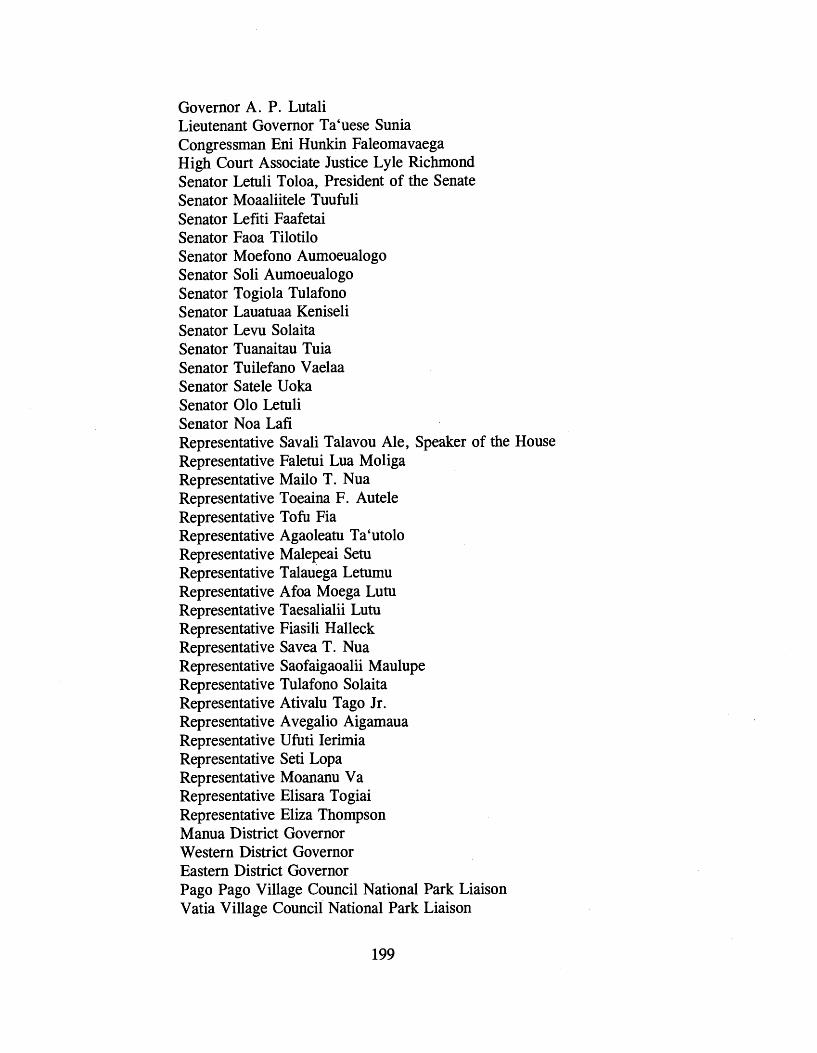
Governor A. P. Lutali Lieutenant Governor Ta'uese Sunia Congressman Eni Hunkin Faleomavaega High Coua Associate Justice Lyle Richmond Senator Senator Senator Senator Senator Senator Senator Senator Senator Senator Senator Senator Senator Senator
Letuli Toloa, President of the Senate Moaaliitele Tuufuli Lefiti Faafetai Faoa Tilotilo Moefono Aumoeualogo Soli Aumoeualogo Togiola Tulafono Lauatuaa Keniseli Levu Solaita Tuanaitau Tuia Tuilefano Vaelaa Satele Uoka 010 Letuli Noa Lafi
Representative Savali Talavou Ale, Speaker of the House Representative Faletui Lua Moliga Representative Mailo T. Nua Representative Toeaina F . Autele Representative Tofu Fia Representative Agaoleatu Ta'utolo Representative Malepeai Setu Representative Talauega Letumu Representative Afoa Moega Lutu Representative Taesalialii Lutu Representative Fiasili Halleck Representative Savea T. Nua Representative Saofaig aoalii Maulupe Representative Tulafono Solaita Representative Ativalu Tago Jr . Representative Avegalio Aigamaua Representative Ufuti Ierirnia Representative Seti Lopa Representative Moananu Va Representative Elisara Togiai Representative Eliza Thompson Manua District Governor Western District Governor Eastern District Governor Pago Pago Village Council National Park Liaison Vatia Village Council National Park Liaison

Fagasa Village Council National Park Liaison Ofu Village Council National Park Liaison Afono Village Council National Park Liaison Olosega Village Council National Park Liaison Faleasao Village Council National Park Liaison Ta'u Village Council Department of Legal Affairs Development Planning Office Office of Tourism Department of Parks. and Recreation Historic Preservation Officer Office of Samoan Affairs Office of Environmental Protection L . B . J. Medical Center Department of Public Works American Samoa Community College Department of Treasury Department of Education Department of Agriculture Department of Administrative Services Office of Communications Office of Human Resources Department of Marine and Wildlife Resources Department of Health Department of Port Administration Office of Procurement Office of Public Information Department of Public Safety Office of Program Planning and Budget Office of Protection and Advocacy for the Disabled Department of Public Safety Office of Food and Nutritional Services Territorial Energy Office Development Bank of American Samoa Hayden Museum Energy Office Chief Election Officer Chairman, Tramway Task Force Chairman, Tourism Task Force. U.S. Fish and Wildlife Service, Honolulu U.S. Army Corps of Engineers, Pacific Ocean Division U. S . National Marine Fisheries Service, Honolulu U. S . Natural Resources Conservation Service, Honolulu Advisory Council on Historic Preservation

Le Vaomatua Pacific Basin Development Council, Honolulu Tolani Teleso Reverend Faavae Faataitai Dale Crane Paul Cox James Maragos Rex G. Maughan Verne R. Read Douglas Cuillard
COMMENTS ON THE DRAFT GENERAL MANAGEMENT PLANIENVIRONMENTAL IMPACT STATEMENT
On Monday, December 30, 1996 a Notice of Availability for the Draft Environmental Impact StatementIGeneral Management Plan, National Park of American Samoa appeared in the Federal Register. In January 1997, copies of the draft were distributed to the Governor's Office, American Samoa's Delegate to Congress, to council members of the nine villages with lands in the national park, members of the Fono, the two district governors, ASG agencies, U. S . government agencies, the Advisory Council on Historic Preservation, and private organizations and individuals. The draft general management plan was also printed in the Samoan language and copies were distributed to the village councils and ASG government officials. The open public review period on the draft ran from December 30, 1996 to March 15, 1997, a period of 75 days.
From February 5 to February 13, 1997, meetings were held in American Samoa with the councils in each of the nine villages with lands in the national park to hear comments on the draft plan. Public meetings on the draft were held during the evenings of February 12 and 13. On February 14, the planning team met with the Lieutenant Governor and with the High Court of American Samoa regarding the draft plan.
Representatives from the Governor's Office and American Samoa's Delegate to Congress accompanied the NPS planning team to all village and public meetings. Meetings were held in the villages of Pago Pago, Afono, Fagasa, and Vatia on the island of Tutuila. On the island of Ta'u, meetings were held in the villages of Fitiuta and Faleasao. A meeting was held in the village of Ofu on that
island and on the island of Olosega in Olosega village. A meeting was held on Tutuila with members of the Ta'u village council. All village meetings were conducted in the traditional Samoan manner. The Governor's representative acted as the high talking chief for the planning team at all village meetings. The locations for the public meetings were the Fono House in Fagatogo and the American Samoa Community College in Mapusaga. The names of the council members attending the village meetings and the names of those attending the public meetings appear in Appendix D.
At the village meetings, the councils all gave their endorsement to the proposed action. Once again, several council members requested that NPS mark those segments of the national park boundary next to the villages. They wanted subsistence farmers and others to be aware of national park boundaries in those locations nearest to the villages. Other questions and concerns brought up at the village meetings included wanting to know when NPS would be hiring village men to do work in the national park, asking if there could be plantations in the national park, and whethet the boundary could be changed to include additional lands. The village of Vatia asked NPS to consider removing the existing overhead power line across the mountain to Pago Pago and replacing it with a line along the Afono-Vatia road. Repairs to the cross-mountain line take a long time due to the difficulties of access, leaving Vatia without power for extended periods of time.
Comments at the public meetings were few. Clarification was requested regarding the seaward extent of the national park boundary on Ofu. Also, NPS was asked to consider building a headquarters at Utulei and another smaller one on Mt. Alava. One individual suggested that NPS rent a cottage up on the mountain and use it as a visitor center. Although there was no opposition to the proposed action, one individual expressed opposition to locating the proposed visitor center at the Utulei beach park. He felt that with the limited amount of public beachfront recreation land available, none of this area shbuld be taken up by a national park visitor center. Instead, he recommended the visitor center be built in the village of Fagasa or on the top of Rainmaker Mountain.
At the meeting in the Governor's Office, the Lieutenant Governor commended the planning team on the draft plan and expressed appreciation for NPS efforts to maintain the Samoan culture in the

national park. The Governor's Office gave full support to the proposed action.
A total of 19 letters with comments either on the draft plan or the environmental impact statement were received. All of the letters and oral statements received have been carefully reviewed and the comments they contain related to the general management plan/environrnental impact statement have all been considered during the preparation of the final document.
Letters of comment requiring a clarification, correction, or modification to the draft plan or environmental impact statement are reprinted on the following pages:
OFFICE OF THE GOVERNOR American Samoa Government
Pago Pago, American Samoa 96799 TAUESE P.F. SUNIA,
Governor
TOGKIIA TA. NIAFONO, Lf. Governor
A May 27, 1997
d * r.
Mr. Stanley Regional
Telephone: (684) 633-4 1 16 Fax: (684) 633-2269
Seria l : 861
~aEific West Field Area National Park Service 600 Harrison St., Suite 600 San Francisco, California 94107-1372
Dear Mr. Albright:
I want to commend you for a well written and professional draft of the General Management Plan for the future management, development, and public use of the National Park of American Samoa.
I read with interest the various alternatives the plan provides, and I am in favor of Alternative A, which calls for the develop- ment of those facilities needed to provide for visitors enjoyment, and the implementation of management strategies to ensure the protection of the natural, and cultural resources.
Your effort to comply with the Samoan culture, by meeting with all the village councils, and ensuring my office's involvement in formulating and finalizing the Plan is appreciated. I hope you will incorporate the advice from the various village chiefs councils that you met.
I am looking forward to reading the final version of the General Management Plan, and to continue our support for the National Park of American Samoa.
TAUE~E P.F. SUNIA Governor

COMMIHEE ON RESOURCES EN1 F.H. FALEOMAVAEOA RANICING DEMOCRATIC MEMBER, 4 A h I E f l W &uor
SUBCOMMITTEE ON NATIONAL PARKS .-a*
AND PUBLIC LANDS WUW- mm
TEE ON FORESTS AND FOREST HEALTH 242? RAYBURN HOUSE OFFICE BUILDING
I WASHINGTON, D.C. 2061b6aDl fzmJ ZhE'l
COMMITTEE ON INTERNATIONAL (=I 2258E7 IFAXJ
RELATIONS OISTITIIKT OFFICE: SUBCOMMITTEE ON ASIA-PACIFIC AFFAIRS P.O. DRAWER.X
SUBCOMMITTEE ON PAGO PAGO. AMERICAN SAMOA @799 INTERNATIONAL OPERATlONSlHUMAN RIGHTS f(M) a-1372
NATIONAL GUARD AND of @ Hn&b &&B 0 1 632-2880 IFUO
RESERVE COMPONENTS CAUCUS VICE-CHAIR of &!#Wesltdtdb~~
October 1, 1997
Mr. John Revno kk Regional ~ i k e c National Park Pacific West Regional Office 600 Harrison Street, Suite 600 San Francisco, California 94107-1372
Dear Mr. Reynolds:
Thank you for providingme the opportunityto review the Draft General Management Plan and Environmental Impact Statement for the National Park of American Samoa. This plan complies with Section 3f of Public Law 100-571that directs the Secretary of the Interior to work in cooperation with the American Samoa Government in the development of a management plan for the park.
I support.the National Park Service's Proposed Action (~lternative A) . This alternative makes the best use of the Park1 s resources, and provides accessible visitor facilities for all residents and visitors to American Samoa. The facilities proposed, like the Rainforest Canopy Walkway on Talu, the Bat Observation Tower on Tutuila, and the re-built Tramway over Pago Harbor, would be unique to United States nationalparks. As Congress directedin the Park's authorizinglegislation, I believe these visitor amenities will increase tourism to the beautiful Samoa Islands and help diversify economic development opportunitiesthrough environmental- friendly tourism.
AlterpativeA also clearly represents the best preservation plan for the national park by providing enough staff -on the park1 s three islands to conduct research and assist visitors.
As the Ranking Minority Member on the House Subcommittee on Parks, Forests, and Public Lands, I want you to know that you have my full support to implement the National Park of American Samoa's General Management Plan, including the funding necessary to implement Alternative A.
I believe that .for the national park to really begin to make an impact on the Territory, we must build some of the proposed visitor facilities in the near future. Currently, the National Park of American Samoa has only a leased off ice space in the village of Pago
email: [email protected] home page: h t tp : l lv l~m.ho~.gwl fe lmmega/

Mr. John Reynolds October 1, 1997 Page 2
Pago. Clearly, to bring our magnificent park up to the standards of the United States National Park System, we must act promptly in the development of visitor facilities. I ask you that you take into considerationmy request in your future planning efforts.
Thank you, once again, for developing a great general management plan for the National Park of American Samoa.
With kindest regards,
Sincerely, r7
EFHF : dl
CC: Governor Lieutenant Governor President of the Senate and Senators Speaker of the House and Representatives

AMERICAN SAMOA GOVERNMENT PAGO PAGO, AMERICAN SAMOA 96799 In reply refer to:
ECD: Serial: 0315
Economic Development & Planning Office
March 12,1997
Mr. Christopher Stein Superintendent, National Park Service of American Samoa Pago Pago, American Samoa 96799
Re: Comments on the National Park Draft General Management Man/EIS
Dear Chris,
Thank you for the opportunity to review the draft General Management Plan/Environmental Impact Statement for the National Park of American Samoa. We applaud your agency for producing such a thorough and well written report. It is a very comprehensive, informative and detailed document. We are very supportive of the National Park Service's efforts to preserve and manage the Territories limited resources.
The following are some comments that we hope will be reflected in the final draft;
1. The proposed alternative discusses locating the headquarters/visitor center at Utulei Beach park. For your information, we commissioned two studies on the shoreline erosion problems in the area. The location of the headquarter/visitor center is of concern in exacerbating future erosional problems in the area. I would recommend a review by NPS of the following reports so that this concern is appropriately addressed in the final report.
Economic Dmelopment 6 Planning Office 'Shoreline Erosion Study of Utulei Beach, Pago Pago, American Samoa', April 1994 (GMP Associates Inc.)
Economic Development 6 Planning Ofice 'Shoreline Erosion Study of Utulei Beach, Mitigation Alternatives - Pago Pago, American Samoa', December 1995 (oceanit Lab. Inc.)
-
207
PACIFIC ISLANDS SSO

2. The itemized budget (pg 78-79) of the proposed alternative fails to mention maintenance and labor costs after the completion of this option.
3. Mention is made on Page 80 of a phased sequence of activities, however, a break down of the various phases of development is absent from this report. I would recommend inclusion of how the NPS intends to phase the construction of the proposed alternative.
4. Typing error on Page 85 ...... Cos tss
In closing, I look forward to receiving the final draft for our records and library. Should you have any questions regrading this reply, please do not hesitate to contact my staff, Gene Brighouse-Failauga at 633-5155.
cc. Lelei Peau Gene Brighouse-Failauga

RESPONSE TO ECONOMIC DEVELOPMENT AND PLANNING OFFICE (JOHN FUAMUINA JR., ACTING DIRECTOR)
1. We have obtained copies of the referenced reports dealing with shoreline erosion problem at Utulei beach. They were reviewed based upon your concern regarding possible effects the construction of a visitor centerlheadquarters would have on shoreline erosion. Based on that review and additional on-site inspections of the area, it appears that there are feasible structural and non-structural methods which could be used to control the erosion problem at Utulei beach. However, the National Park Service would not consider construction of a visitor centerlheadquarters at Utulei beach without first achieving the long-term stability of the shoreline. We would also seek PNRS review and approval for any such construction project.
2. The annual operation and maintenance costs for the proposed action appear on page 76 of the draft (page 77 of the final) under the heading, Operational Costs. These costs total approximately $780,000. This is the amount that would need to be added to the National Park of American Samoa's current annual operating base in order to fully implement the general management plan.
3. The list of proposed general management plan developments shown on page 80 of the draft (page 82 of the final) shows our intended construction phasing.
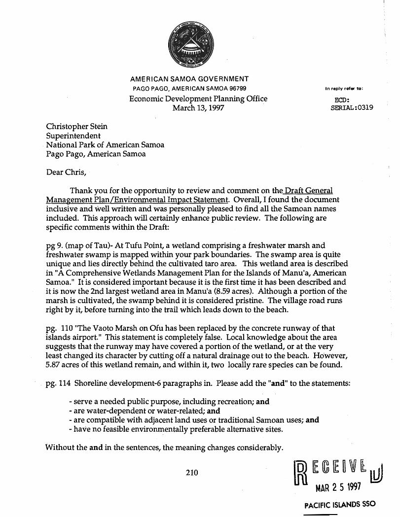
AMERICAN SAMOA GOVERNMENT PAGO PAGO, AMERICAN SAMOA 96799
Economic Development Planning Office March 13,1997
Christopher Stein Superintendent National Park of American Samoa Pago Pago, American Samoa
Dear Chris,
In reply refer to:
ECD: SERIAL : 0319 '
Thank you for the opportunity to review and comment on the Draft General Management Plan/Environmental Impact Statement. Overall, I found the document inclusive and well written and was personally pleased to find all the Samoan names included. This approach will certainly enhance public review. The following are specific comments within the Draft:
pg 9. (map of Tau)- At Tufu Point, a wetland comprising a freshwater marsh and freshwater swamp is mapped within your park boundaries. The swamp area is quite unique and lies directly behind the cultivated taro area. This wetland area is described in "A Comprehensive Wetlands Management Plan for the Islands of Manu'a, American Samoa." It is considered important because it is the first time it has been described and it is now the 2nd largest wetland area in Manu'a (8.59 acres). Although a portion of the marsh is cultivated, the swamp behind it is considered pristine. The village road runs right by it, before turning into the trail which leads down to the beach.
pg. 110 ''The Vaoto Marsh on Ofu has been replaced by the concrete runway of that islands airport." This statement is completely false. Local knowledge about the area suggests that the runway may have covered a portion of the wetland, or at the very least changed its character by cutting off a natural drainage out to the beach. However, 5.87 acres of this wetland remain, and within it, two locally rare species can be found.
pg. 114 Shoreline development-6 paragraphs in. Please add the "and" to the statements:
- serve a needed public purpose, including recreation; and - are water-dependent or water-related; and - are compatible with adjacent land uses or traditional Samoan uses; and - have no feasible environmentally preferable alternative sites.
Without the and in the sentences, the meaning changes considerably.
EeFovkd MAR 2 5 1997
PACIFIC ISLANDS SSO

pg. 114 Special Management Areas. Add the s. Leone and Nu'uuli wetland are also Special Management Areas. Their description can be found in our Administrative Rules at the same location.
pg. 151 4th paragraph- Unlike many other rainforests .... Add the s.
I hope my comments serve to assist you. Feel free to contact me should you require further information regarding Leone and Nu'uuli SMA'a or the wetland on Ta'u.
karla ~ l u ~ d ASCMP
RESPONSE TO ECONOMIC DEVELOPMENT AND PLANNING OFFICE (KARLA KLUGE, ASCMP)
Figure 13, Vegetation, Ta'u Unit, has been revised to show the presence of the wetland area at Tufu Point. A description of this wetland has been added to the final in the section on vegetation.
Your comments on text material appearing on pages 110, 140, and 151 of the draft have been noted and the text of the final reflects the information contained in those comments.
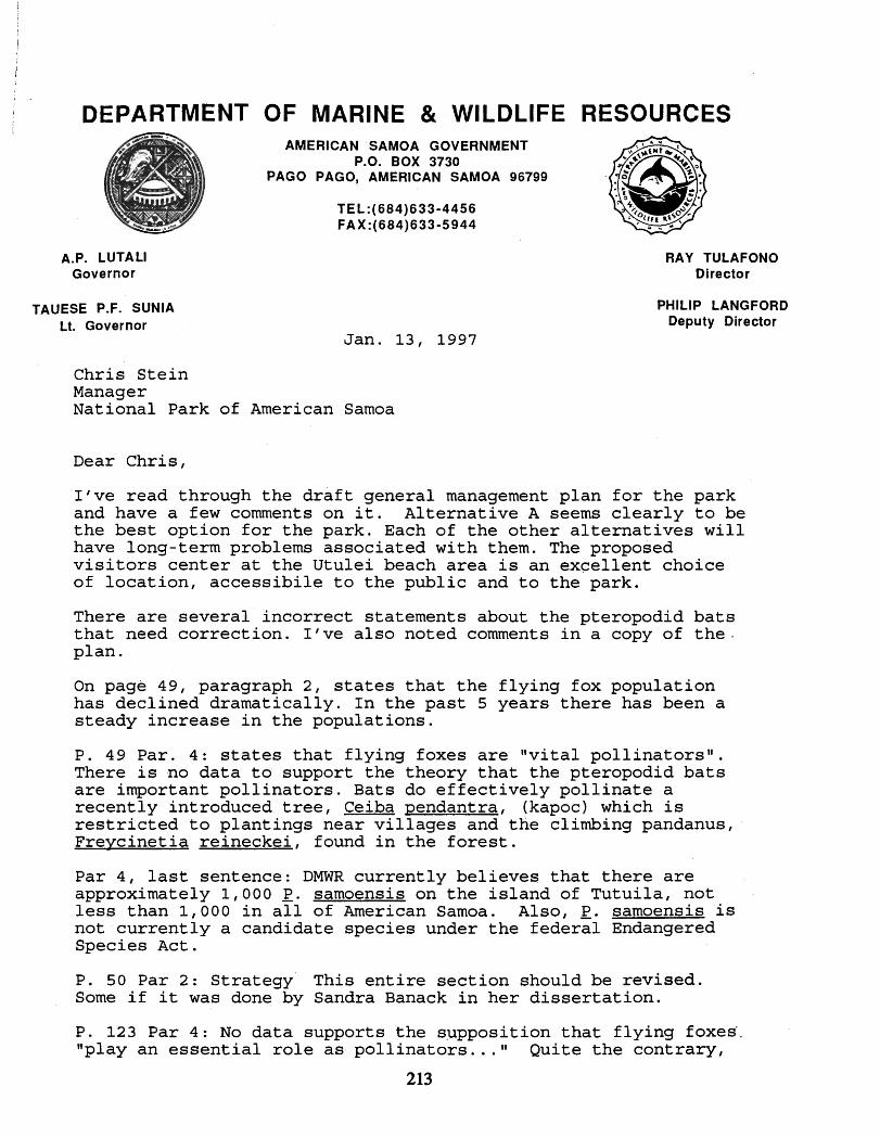
DEPARTMENT MARINE WILDLIFE RESOURCES I
AMERICAN SAMOA GOVERNMENT P.O. BOX 3730
PAGO PAGO, AMERICAN SAMOA 96799
TEL:(684)633-4456 FAX:(684)633-5944
A.P. LUTALI Governor
TAUESE P.F. SUNlA Lt. Governor
RAY TULAFONO Director
PHILIP LANGFORD Deputy Director
Jan. 13, 1997
Chris Stein Manager National Park of American Samoa
Dear Chris,
I've read through the draft general management plan for the park and have a few comments on it. Alternative A seems clearly to be the best option for the park. Each of the other alternatives will have long-term problems associated with them. The proposed visitors center at the Utulei beach area is an excellent choice of location, accessibile to the public and to the park.
There are several incorrect statements about the pteropodid bats that need correction. I've also noted comments in a copy of the. plan.
On page 49, paragraph 2, states that the flying fox population has declined dramatically. In the past 5 years there has been a steady increase in the populations.
P. 49 Par. 4: states that flying foxes are Wital pollinatorsn. There is no data to support the theory that the pteropodid bats are important pollinators. Bats do effectively pollinate a recently introduced tree, Ceiba pendantra, (kapoc) which is restricted to plantings near villages and the climbing pandanus, Frevcinetia reineckei, found in the forest.
Par 4, last sentence: DMWR currently believes that there are approximately 1,000 E. samoensis on the island of Tutuila, not less than 1,000 in all of American Samoa. Also, E. samoensis is not currently a candidate species under the federal Endangered Species Act.
P. 50 Par 2: Strategy This entire section should be revised. Some if it was done by Sandra Banack in her dissertation.
P. 123 Par 4: No data supports the supposition that flying foxes'. "play an essential role as pollinators ..." Quite the contrary,

the flying foxes appear to have a negligable role in pollination with the two exceptions mentioned above.
P. 123 Par 5: Flying foxes are regularly hunted in small but significant numbers.
P. 124 Par 3: This entire paragraph is incorrect and should be rewritten. P . samoensis is most active at night, not during the day although they do fly diurnally. The peak-of activity varies seasonally and cannot be categorized as Vwo feeding peaksu. Bats roost in family groups only during mating season, females and pups remain together or roost close to each other for at least 6 months. g. samoensis is territorial only at food sources, bats are not territorial of roosting sites.
P. 124 Par 4: P . samoensis can easily be seen in the Amalau valley early in the morning or in the late afternoon year round. At some times of the year, bats can be seen throughout the day.
Par 5: There is no evidence that any species of pteropodid bat produce young more than once a year.
P. 126 Par 1- The statement that "1) they carry pollen from flower to flower promoting fruit production and spreading genetic material within plant population^^^ is true only for Ceiba and Freycenitia.
Par 1: final sentence: "there are few other pollinator^^^. This is part of the pollination myth and is incorrect.
Par 3: '...reduced the population of . . . - P. samoensis by 50 percent". There was no estimate of population numbers prior to the storms so you cant draw this conclusion.
P. 127 Par 3: The hunting ban has been replaced by a law that specifies no hunting of either species of bat although it isnt enforced.
Par 4: DMWR biologists currently survey 6 sites for g. samoensis populations.
Par 5: There are more than 60 known P . tonqanus roost sites on Tutuila. The current population estimate for g. tonqanus is 6,000. Prior to the hurricanes, the estimated population was greater than 12,000 (there were approximately 10,000 bats at one roost alone). The best estimate for g. tonqanus in 1987 before the hurricanes is 20,000-30,000.
P. 128 Par 3: There is a population of at least 50 gray ducks on Aunu'u island. Pairs have been sited in Leone, Futinga (Olavalu'. crater), Nutuuli and Alao although these animals may be from the Aunu'u population.
P. 131 Par 3 and P. 137 Par 2: I believe that the sheat-tailed

bat was listed as an endangered species in January 1996. The rating system was changed last year so this section may need revision.
I hope this is information is useful.
Yours,
$1, hne Brooke, b% h.D. Wildlife Biologist
RESPONSE TO DEPARTMENT OF MARINE AND WILDLIFE RESOURCES
The statements in the draft concerning pteropodid bats and the gray duck which you regard to be incorrect have been carefully reviewed by the national park's wildlife biologist and the text of the final has been appropriately modified based on those comments.

AMERICAN SAMOA GOVERNMENT PAGO PAGO, AMERICAN SAMOA 96799
DEPARTMENT OF PARKS AND RECREATION
In reply refer to:
Serial:022-97
February 12, 1997
Christopher Stein Superintendent National Park of American Samoa Pago Pago, American Samoa 96799
Re: Comments on Draft General Management Plan/EIS
Dear Mr. Stein:
I have received a copy of your draft management plan and I am still in the process of reviewing it. However, I have.noticed one thing that calls for my immediate attention. In your preferred alternative 'A', you propose to build a visitor's center at Utulei Beach Park. This is the first I have seen or heard of this proposal and I want to take this opportunity to inform you of the plan that this department has adopted for Utulei Beach Park.
As you know, space is limited on this island and waterfront space is even more limited. Our desire is to keep waterfront areas devoted to water related uses. Thus, in our plan, most of the area is set aside for open space recreationai use. Our plan contains no provision for the establishment of a NPS Visitor's Center. To accomplish your preferred alternative would require a revision to our plan for Utulei Beach Park. In addition, your preferred alternative would diminish access to beaehfront parks in one of the few public access areas in the harbor area. We ask 'that you carefully examine this aspect of your plan to see if another site might not be preferable where it would not interfere with the public's access to recreational activities.
Should you choose to pursue locating the visitor's center at Utulei Beach Park, you will have to provide this office with a detailed proposal and we would probably convene a public hearing to discuss the proposal.

I wish you luck i n your desire t o receive comments from the public on your d ra f t plan. I f you have any questions or, i f I can be of any fur ther assistance, please do not hes i ta te t o contact me.
Sincerely,
Director.
xc: Hon. Togiola T. A. Tulafono (Acting Governor) Gus Viena (Chairman, Parks and Recreation Commission)
RESPONSE TO DEPARTMENT OF PARKS AND RECREATION
We believe that the construction of a visitor center, parking lot, and entrance road would improve public access to Utulei Beach Park by providing easier and safer entry for visitors and additional parking for vehicles. If the national park visitor center were to be built at Utulei beach, its development would take up only a small portion of the existing open space (less than one-half acre) and would interfer only minimally with some recreational activities. We believe that overall the presence of the national park visitor center would add to the park and recreation values of this public area.
At this time, the Utulei beach site is one of two options discussed in the final as a proposed location for a national park visitor center. We expect it will be many years before funding becomes available for this kind of development. In the interim, we would be willing to consider other sites which may prove to be more feasible for the development of a national park visitor center. If the Utulei beach site proves to be the most feasible option for a visitor center, the National Park Service would prepare a comprehensive design package in draft form and then hold public meetings to hear comments on the proposed location and building design. Comments and concerns heard during the meetings would be considered in selecting a final location and during the preparation of the final design package.
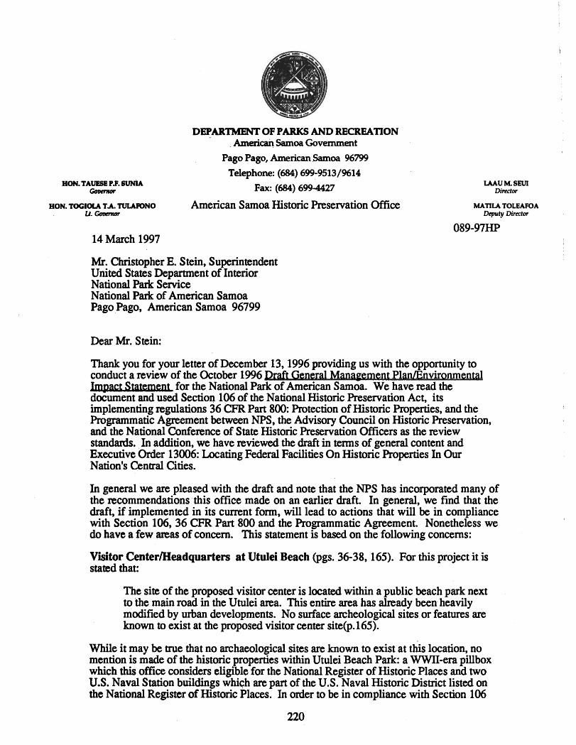
DEPARTMENT 01: PARKS AND RECREATION American Samoa Government
Pago Pago, American Samoa 96799
Telephone: (684) 699-9513/%14
Fax: (684) 699-4427
HON. TOC~OLA T.A. 'IULARINO American Samoa Historic Preservation Office u. Coarnar
14 March 1997
Mr. Christopher E. Stein, Superintendent United States Department of Interior National Park Service National Park of American Samoa Pago Pago, American Samoa 96799
Dear Mr. Stein:
Thank you for your letter of December 13,1996 providing us with the opportunity to conduct a review of the October 1996 D r a f t m t P l a n / E n v i r o n m e n t a l b m for the National Park of American Samoa. We have read the document and used Section 106 of the National Historic Preservation Act, its implementing regulations 36 CFR Part 800: Protection of Historic Properties, and the hgrammatic Agreement between NPS, the Advisory Council on Historic Preservation, and the National Conference of State Historic Preservation Officers as the review standards. In addition, we have reviewed the draft in terms of general content and Executive Order 13006: Locating Federal Facilities On Historic Properties In Our Nation's Central Cities.
In general we are pleased with the draft and note that the NPS has incorporated many of the recommendations this office made on an earlier draft. In general, we find that the draft, if implemented in its current form, will lead to actions that will be in compliance with Section 106,36 CFR Part 800 and the Programmatic Agreement. Nonetheless we do have a few m a s of concern. This statement is based on the following concerns:
V'itor Centerrneadquarters at Utulei Beach (pgs. 36-38, 165). For this project it is stated that:
The site of the proposed visitor center is located within a public beach park next to the main road in the Utulei a m . This entire area has already been heavily modified by urban developments. No surface archeological sites or features are known to exist at the proposed visitor center site(p.165).
While it may be true that no archaeological sites are known to exist at this location, no mention is made of the historic properties within Utulei Beach Park: a WWII-era pillbox which this office considers eligible for the National Register of Historic Places and two U.S. Naval Station buildings which are part of the U.S. Naval Historic District listed on the National Register of Historic Places. In order to be in compliance with Section 106

36 CFR PART 800 we recommend that the plan note that the NPS must determine, in consultation with our office, whether or not the undertaking will have an adverse effect on these properties. If the undertaking will have an adverse effect a Memorandum of Agreement with our office and the Advisory Council on Historic Preservation needs to be written stipulating appropriate mitigation measures.
Secondly, there is no evidence in the plan that the President's Executive Order 13006 was taken into account when the proposed visitor centerheadquarters site was selected, nor is it mentioned as a consideration in the siting of other proposed facilites. That order reads in part that,
"when locating Federal facilities, Federal agencies shall give first consideration to historic properties within historic districts. If no such property is suitable, then Federal agencies shall consider either developed or undeveloped sites within historic districts. Federal agencies shall then consider historic properties outside of historic districts, if no suitable site within a district exists. Any rehabilitation or construction that is undertaken pursuant to this order must be architecturally compatible with the character of the surrounding historic district or properties."
In order to take into account the Executive Order we recommend that the plan explicitly give consideration to locating NPS facilities in historic properties within and, as the case may be, outside of historic districts. We further recommend that the NPS consider rehabilitating the current historic property located at Utulei Beach Park for the visitor center. If that structure does not have enough space we recommend rehabilitating it and reconstructing a similar historic building that had been located next to it. If this is not feasible we recommend considering historic buildings in the downtown Fagatogo historic district such as the old FitaFita Barracks or the old High Court Building for the location of the various proposed facilities. (The full text of the Executive Order is enclosed.)
ArchaeoloPical Resources Protection Act of 199.
The plan refers to the provisions of the Archeological Resources Protection Act of 1979 (ARPA). Please note that ARPA does not apply to American Samoa.
Archeolo&al and Cultural Resource Section.
- On page 142 in reference to archaeological surveys carried out in the 1980s the plan states,
"None of these projects involved lands now within the boundaries of the National Park of American Samoa."
And on page 143 it is stated that,
"National park lands have seen only reconnaissance level surveys, and then only in the park area on Ta'u."
The above statements are incorrect. A 1986 survey camied out by Dr. Jeffrey T. Clark and David J. Herdrich (Clark and Herdrich 1988) included a reconnaissance survey of a ridge behind Vatia village on Tutuila island in an area that is now within the national park boundaries. During that reconnaissance they confirmed the existence of an old upland village (AS-24-2) first reported by Kikuchi (1963:43) and later by Clark (198057).

Please also note that the Clark and Herdrich 1988 reference is in the plan's selected bibliography, but that Herdrich's name is misspelled as Hertrich. We would appreciate it if this could be corrected.
We hope you fiid these comments useful and constructive.
Thank you for your time and attention.
If you have any questions concerning this letter please contact David J. He~drich our Deputy Historic Preservation Officer and Territorial Archaeologist, at (684) 633-2384.
ohn Enright @& Historic fieservation Officer
enclosure: Executive Order 13006
RESPONSE TO DEPARTMENT OF PARKS AND RECREATION, HISTORIC PRESERVATION OFFICE
The final plan notes the presence of the historic properties located within Utulei Beach Park and includes documentation of the planning team's consideration of existing historic properties in the FagatogolUtulei area in terms of their feasibility and suitability to serve as a national park visitor center. References to the Archeological Resources Protection Act of 1979 have been omitted in the final and corrections have been made in the Archeological and Cultural Resources section of the final as appropriate.
Land P.O. Box 531 9 9 Pago Pago, AS 96799 Ph. (684) 699-1 394. Fax: (684) 699-501 1
January 30, 1997
Mr. Christopher E. Stein, Superintendent National Park of American Samoa Pago Pago, AS 96799
Dear Chris,
Thank you for a copy of your Draft General Management Plan, D7615, for the National Park of American Samoa. I read the four plans carefully and agree that the proposed action, Alternative A, is the best course to follow.
The "no action" alternative, B, is untenable. The Park would only deteriorate if nothing more is done. The minimum requirements alternative, C, is not much better. Only a hardy few visitors would benefit in having a Park. Alternative D, which calls for a visitor center atop Mt. Alava, is certainly appealing. The view from this site is fantastic. But having visited the Park dozens of times, by foot and by aerial tramway, before and after it attained National Park status, I realize this alternative is unrealistic. Providing for water availability and sewage disposal alone would be costly and an unending cause for concern. For these reasons I lend my full support behind Alternative A.
Thank you again for the well-done and'informative publication, and for soliciting my opinion.
Don Vargo, ph.Q) Associate Director, Research and Avid Backpacker 224

Tauese P. Sunia Governor
Togiola Tulafono Lt. Governor
AMERICAN SAMOA GOVERNMENT THE OFFICE OF PUBLIC INFORMATION
** KVZK-TV ** Pago Pago, American Samoa 96799 USA
Tel.ephone 01 1 (684) 633-4191 Administrative Fax 01 1 (684) 633-1044
Chief Engineer Fax 01 1 (684) 633-2727 Chief Engineer Cellular 01 1 (684) 733-1408
February 11, 1997
PBS and CNN for
American Samoa
Vaoita Savali Acting Director
Tom Norman Chief Engineer
National Park Service Pago Pago, American Samoa 96799
Greetings:
Thank you for invitipg comment to your draft plan for the National Park. This letter is a preliminary response to that invitation.
First, all of the options you have outlined for Park Improvements and Operations look very fworab!e to me, except for your plans for the Alava Ridge Road, and the comment in the draft plan for the stair access to the summit from the end of the road. Please allow me to elaborate:
The Road: There will never be a time when travel via four wheel drive vehicles is not necessary over the Alava Ridge Road. Assuming that the aerial tramway becomes dperational again, and assuming that KVZK-TV requires little if any use of the road, there will still be a requirement for roadway access to the summit. There are three reasons for this.
First, normal tramway maintenance will require fairly regular access by road. There will be times when the tram is deemed unsafe for operation until an inspection is made of the summit facilities. This inspection must be accomplished by road, and may, in some cases, require hauling heavy or bulky items to the summit by road.
Second, the Mt. Alava transmitter site is an established radiocommunication site. As such, any .
necessary further development of radiocommunications requiring a mountaintop overlook of the harbor will almost certainly be zoned to that site. Transportation needs associated with this fact cannot be anticipated. KVZK-TV can, in all likelihood, operate without requiring access by road for considerable periods of time if the tram is operational, but this also cannot be guaranteed. When access is needed, it must be available, whether it is by road or by tram. For example, when the towers were rebuilt, the contractor had to pull a heavy air compressor to the site by road, since the compressor was physically too large and too heavy to transport by

any other means. The next time the towers need repainting, this should be expected again, as a normal part of site maintenance.
Third, and most importantly, access is required to assure compliance with the standards that govern aerial tramway operations. Any rescue of persons from a disabled or stalled tramway will be accomplished by lowering a rescue cart from the summit, then hauling it and its passenger(s) to the summit. Such a rescue cannot be considered complete until the persons so rescued are returned to paved roadways, or in some cases, to patient care facilities. ANSI standard B77.1-1992, which deals with standards for aerial tramways, deals with means to rescue people from a stranded tram. Among the requirements are "an estimate of the time necessary for the total evacuation of each aerial tramway" (2.3.2.5.7 (d)) and "a description of unusual terrain conditions and how each of these conditions will be dealt with during an evacuation" (2.3.2.5.7 (e)). For the purposes of the Park's planning, one must consider evacuation from Mt. Alava, which must be done by road, and must consider how an aged, frail, sickly, or handicapped person would be evacuated, the time such a rescue would take, and how the road's conditions will impact it.
By the foregoing, I hope to point out that continued access to the summit, by road, for a variety of vehicles, continues to be necessary, and must be incorporated into the Park's planning. The road cannot be narrowed without adversely impacting the necessary access. Attempts to maintain the road as a trail without considering its use as a roadway will adversely impact necessary vehicular access.
It should go without saying that KVZK-TV will have an ongoing interest in daily vehicular access until such time as the tram may become operational again. As such, KVZK-TV crews will continue to fill potholes, alter drainage, and do other things whose purpose is to preserve the existing road bed.
All this having been said, I applaud the efforts of the park service to restrict access to all but properly equipped four wheel drive vehicles. By itself, this enhances the security of the transmitter site at Mt. Alava and keeps the roadway from being excessively eroded (thus keeping it passable), and these are good things.
Other: The plan suggests that it would be desirable to replace the stair access from the end of the road to the summit. I assume that the plan was to replace the old staircase, as I can see no purpose to replacing the present staircase.
Another part of the plan is to fence the transmitter facilities at the summit of Mt. Alava. KVZK-TV welcomes this plan, and hopes to cooperate with the Park Service in the details. The Park Service recommendation for enclosing the transmitter facilities behind a wall of vegetation needs to be examined carefully, as there may be security, maintenance, or technical issues of which the Park planning process may be unaware.
Another part of the Park plan involves water. In installing new air conditioning eciuipment at Mt. Alava, we have discovered that the large air handler at the site produces a surprisingly
226

heavy flow of relatively clean condensate water. Our plan is to store condensate water, and no longer rely entirely on rainfall for water at the transmitter site. The air conditioner produces a steady stream of water, which we anticipate is far in excess of our needs, and far in excess of our storage capacity. We suggest that a shared catchment may be of significant mutual benefit, or at least that our overflow may be a partial solution to the Park's water concerns.
Last, KVZK-TV is anxious to work with the Park Service to enhance the Park experience. We hope to be helpful in every possible way. We entreat the Park to keep KVZK-TV's needs in mind in their planning process, and we ask to be included, at least informally, in future planning efforts.
Best Regards,
Tom Norman, CPBE Chief Engineer
cc: John Faumuina, Acting Director, EDPO Vaoita Savali, Director, KVZK-TV Hon. Tauese Sunia, Governor
RESPONSE TO OFFICE OF PUBLIC INFORMATION
The final contains clarification that American Samoa Government vehicles doing required maintenance or repair work in connection with the operation of the TV transmitters will have access to the unpaved service road to Mt. Alava. Similarly, emergency vehicles involved in rescuing or evacuating injured or disabled persons will also have access to the service road.
Any future work or repairs to the existing road bed by the Office of Public Information must first be reviewed and approved bf the park superintendent.
References to the removal of the old metal stairs have been omitted from the final. The superintendent will consult and coordinate with the Office of Public Information prior to undertaking any enclosing or screening of the transmitter facilities on Mt. Alava. We agree that a shared water catchment facility on Mt. Alava may be of mutual benefit.

United States Department of the Interior
FISH AND WILDLIFE SERVICE PACIFIC ISLANDS ECOREGION
300 ALA MOANA BOULEVARD, ROOM 3 108 BOX 50088
HONOLULU, HAWAII 96850 PHONE: (808) 541-3441 FAX: (808) 54 1-3470
In Reply Refer To : SEM, ASNP
Mr. Christopher E. Stein Pacific Islands System Support Office National Park Service 300 Ala Moana Blvd. Honolulu, :Hawaii 96850
Re: Draft General Management PlanlEnvironmental Impact Statement for the National Park of American Samoa
Dear Mr. Stein:
The U.S. Fish and Wildlife Service (Service) has received your letter dated December 13, 1996, requesting a review of the Draft General Management Plan/Environmental Impact Statement for the National Park of American Samoa (Draft Plan/EIS), dated October 1996. The following response has been prepared under the authority of and in accordance with provisions of the National Environmental Policy Act of 1969 [42 U.S.C. 432 1 et seq.; 83 Stat. 8521, as amended, the Fish and Wildlife Coordination Act of 1934 [16 U.S.C. 661 et seq.; 48 Stat. 4011, as amended, the Endangered Species Act of 1973 [16 U.S.C. 153 1 et seq.; 87 Stat. 8841, as amended, and other authorities mandating Service concern for environmental values. Based on these authorities, the Service offers the following comments for your consideration.
The Draft Plan/EIS states that the National Park will help to maintain and enhance the natural biological resources within its boundaries. The Service supports these efforts and notes that our earlier comments (letter dated January 16, 1996) have been fully addressed in the Draft PlanEIS. The Service believes that the actions described in the Draft Plan/EIS will not adversely affect Federal trust resources, including listed or candidate species or species of concern.
Thank you for allowing us to comment on your Draft PlanIEIS. We look forward to working with you and your staff in your efforts to establish the National Park of American Samoa. Should you have any questions about these comments, please feel free to contact Dr. Stephen E. Miller at 54 1-344 1.
Sincerely ,
Brooks Harper Field Supervisor Ecological Services MAR 2 5 1997
PACIFIC ISLANDS SSO
Economic Development Planning Office American Samoa Government
Fagatele Bay National Marine Sanctuary P.O. Box 431 8 Pago Pago, American Samoa 96799 Phone: 684-633-7354 Fax: 684-633-7355 email: ndaschbach Q ocean.nos.noaa.gov
March 17,1997
To: Christopher Stein Superintendent, NPAS .- '
From: Nancy jh RE:
/ National Park Management Plan-Comments
I would like to submit a few comments to your agency regarding the Draft General Management Plan/Environmental Impact Statement for the National Park of American Samoa.
In general, I thought that the plan was well presented and that the preferred alternative would allow the best management of the park in the interest of the local people and the American public. I have a few comments on the draft.
Page 49,58,123-128: The issue regarding the flying foxes has probably been overstated. Although flying foxes contribute to the pollination and dispersing of many forest tree and plant species, there are probably only a few that rely solely on the flying fox. Birds and insects are just as likely to pollinate many of the same plants, and trees and birds are equally good as seed dispersers. It has not been adequately demonstrated that the "character and biodiversity of the tropical forest would be seriously impaired" if flying fox numbers drastically decreased (so they may not be keystone species). There are other arguments for the protection of flying foxes; but this may not be a major one. An equally strong argument could be made for similar studies of the forest birds and insects, and, in fact, consideration for these types of studies should be added.
Page 52,134: It is not clear here, or in other sections that mention crown-( f--thorns starfish, that Ofu reef was not hit by the 1978-79 infestation. Perhaps that point shc 11d be made. If
I!i! EGEivEp MAR 2 5 1997

thing, it adds to the importance of the Manufa reefs to the archipelago. Also, management or crown-of-thorns outbreaks has never been successful. In addition, crown-of-thorns probably have always had outbreaks (althoug1-1 there is evidence that outbi-eaks were n ~ t as frequent), not just in the past few decades (which is about how long western scientists have been watching.. .).
Page 103: Hurricane Val caused widespread damage througl~out Tutuila, ~t just Tafuna. Also vegetation and wildlife populations were severely damaged, as werc najor portions of coral reef.
Page 132: Hawksbill turtles are probably not "rare", and may be resident h 2.
Page 133: Most of the reefs in Samoa are "healthy and intacl". Altl-~ough ley have been damaged by storms, crown-of-tl-~orns and coral bleaching events, these pe ! urbations are a natural part of the tropical ecosystem and the reefs are adapted to this cycle of natural damage and regrowth. There are areas in Samoa where antl~ropogenic causes have wrecked additional (and more serious in terms of the prospects of short-term recovery) damage. However, just because a reef is in a "recovery" phase from some natural perturbation does not mean it is unhealthy. Additionally, there are few or none that have not had some anthropogenic disturbances, including (as noted in the text) Ofu reefs. It might be more accurate to describe the reefs in Ofu as undisturbed by some of the more recent natural nerturbations (i.e. hurricanes Ofa and Val, and crown-of-tl-~orns). (Ofu reef probably was
naged by the 1994 coral bleaching event, another consideration.)
Page 134: Heliopora is not a "unique" coral, only at the limits of its range. It is not known from other Samoan reefs, but is common in other parts of the western Pacific.
Page 138: There is an air monitoring station in AS. NOAA operates a clean air station that is located in the village of Tula.
Page 161: Sea turtles probably do nest in the Ofu unit (l~awksbill turtles most certainly do). Will there be closures during the season? Any attempts to identify and protect nests?
Thanks for the opportunity to comment!

RESPONSE TO FAGATELE BAY NATIONAL MARINE SANCTUARY
Comments made in connection with the level of contributions flying foxes make to the well-being of the tropical forest, crown- of-thorns starfish outbreaks, Hurricane Val, hawksbill turtles, the relative health of the Ofu coral reef, and the uniqueness of heliopora coral have all been carefully considered and, wherever appropriate, incorporated into the final. The existence of an air monitoring station in American Samoa is noted in the final.

UNITED STATES ENVIRONMENTAL PROTECTION AGENCY REGION IX
75 Hawthorne Street San Francisco, CA 94105
February 18, 1997
Christopher E. Stein, Superintendent National Park of American Samoa Pago Pago, American Samoa 96799
Dear Mr. Stein:
The Environmental Protection Agency (EPA) has reviewed the Draft Ewironolentd Impzxt Statement (DEIS) for the project eztitkd Natbnd Park of American Samoa. Our review is pursuant to the National Environmental Policy Act (NEPA), Council on Environmental Quality (CEQ) regulations (40 CFR Parts 1500- 1508), and Section 309 of the Clean Air Act.
In the DEIS, the National Park Service identifies four alternatives: a proposed alternative for the development of visitor and access facilities, a no action alternative, a minimum requiiements alternative, and an alternate visitor center location alternative. The proposed alternative includes plans to construct a park headquarterslvisitor center in Pago Pago, replace the aerial tramway, construct hiking trails, develop an interprative program, and preserve subsistence agriculture, gathering, and fishing uses within park boundaries.
EPA commends the National Park Service on its plans for this newest addition to the National Park system. The preferred alternative is designed to enhance the management of the park's natural resources in a way that is sensitive to the culture of American Samoa. Minimal disruption to existing natural resources is expected to occur. Accordingly, EPA has rated this DEIS LO (Lack of Objections).
Although we concur with the Nati~nd PC:!: Service's andysis d the Lnpscts of the four alternatives, we would suggest that the National Park Service expand its analysis of the population issues identified in the DEIS on page 147. EPA is concerned that the increase in native population, combined with the. additional resource demands from additional park visitation, could have detrimental impacts on park resources. It would be helpful to provide additional detail on strategies the Park Service has developed to minimize such impacts, particularly those related to subsistence uses within park boundaries.
Issues which merit additional detail in the Final Environmental Impact Statement (FEIS) are the known occurence of unsafe fishing practices, including the use of dynamite and poison, in coral reefs; the anticipated increase in feral pig activity due to trail construction; and concerns regarding the spread of alien plant species. EPA suggests that the park's natural resource management issues be prioritized in the FEIS,

and that these issues be listed as top concerns. The FEIS should specify management practices to eradicate unsafe fishing practices, control feral pig activity, and minimize the spread of alien plant species within park boundaries.
We appreciate the opportunity to review this DEIS. If you have questions, please call me at (415) 744-1584, or invite your staff to call Leonidas Payne of my staff at (415) 744-1571, or Pat Young, American Samoa Program Manager, Pacific Insular Areas Program, at (415) 744-1594.
Sincerely,
David J. Fanel, Chief Federal Activities Office
Filename: samoa.dei MI002802
SUMMARY OF RATING DEFINITIONS AND FOLLOW-UP ACTION
0
LO-Lack of Objections
The EPA review has not identified any potential environmental impacts requiring substantive changes to the proposal. The review may have disclosed opportunities for application of mitigation measures that could be accomplished with no more than minor changes to the proposal.
EC-Environmental Concerns
The EPA review has identified environmental impacts that should be avoided in order to fully protect the environment. Corrective measures may require changes to the preferred alternative or application of mitigation measures that can reduce the environmental impact. EPA would like to work with the lead agency to reduce these impacts.
EO-Environmental Obiections
The EPA review has identified significant environmental impacts that must be avoided in order to provide adequate protection for the environment. Corrective measures may require substantial changes to the preferred alternative or consideration of some other project alternative (including the no action alternative or a new alternative). EPA intends to work with the lead agency to reduce these impacts.
EU-Environmentallv Unsatisfactorv
The EPA reviewbas identified adverse environmental impacts that are of sufficient magnitude that they are unsatisfactory from the standpoint of environmental quality, public health or welfare. EPA intends to work with the lead agency to reduce these impacts. If the potential unsatisfactory impacts are not corrected at the final EIS stage, this proposal will be recommend for referral to the Council on Environmental Quality (CEQ).
Adeauacv of the Impact Statement
Category 1 -Adequate
EPA believes the draft EIS adequately sets forth the environmental impact(s) of the preferred alternative and those of the alternatives reasonably available to the project or action. No further analysis or data collection is necessary, but the reviewer may suggest the addition of clarifying language or information.
Catenorv ZInsufficient Information
The draft EIS does not contain sufficient information for EPA to fully assess environmental impacts that should be avoided in order to fully protect the environment, or the EPA reviewer has identified new reasonably available alternatives that are within the spectrum of alternatives analyzed in the draft EIS, which could reduce the environmental impacts of the action. The identified additional information, data, analyses, or discussion should be included in the final EIS.
Catenorv 3-Inadeauate
EPA does not believe that the draft EIS adequately assesses potentially significant environmental impacts of the action, or the EPA reviewer has identified new, reasonably available alternatives that are outside of the spectrum of alternatives analyzed in the draft EIS, which should be analyzed in order to reduce the potentially significant environmental impacts. EPA believp that the identified additional information, data, analyses, or discussions are of such a magnitude that they should have full public review at a draft stage. EPA does not believe that the draft EIS is adequate for the purposes of the NEPA and/or Section 309 review, and thus should be formally revised and made available for public comment in a supplemental or revised draft EIS. On the basis of the potential significant impacts involved, this proposal could be a candidate for referral to the CEQ.
*From: EPA Manual 1640, "Policy and Procedures for the Review of Federal Actions Impacting the Environment."

RESPONSE TO U. S. ENVIRONMENTAL PROTECTION AGENCY
The final document contains a more detailed narrative regarding the implementation of resource management strategies leading to the elimination of feral pig impacts on the native forest of the national park. This issue has been given a high priority and the National Park of American Samoa has requested special funding to begin work on feral pig control in certain areas within the national park. The detrimental effects which illegal fishing practices and future increased visitation levels couldr have on national park resources such as the Ofu coral reef are also noted in the final.
DEPARTMENT OF THE ARMY PACIFIC OCEAN DIVISION, CORPS OF ENGINEERS
FORT SHAFTER. HAWAII 968585440
January 10, 1997
Planning and Operations Division
Mr. Christopher E. Stein Superintendent U.S. Department of the Interior National Park Service National Park of American Samoa Pago Pago, American Samoa 96799
Dear Mr. Stein:
Thank you for the opportunity'to review and comment on the Draft General Management Plan and Draft Environmental Impact Statement (DEIS) for the National Park of American Samoa. The following comments are provided pursuant to Corps of Engineers authorities to disseminate flood hazard information under the Flood ' Control Act of 1960 and to issue ~epartment of the Army (DA) permits under the Clean wateF Act; the Rivers and Harbors Act of 1899; and the Marine Protection, Research and Sanctuaries Act.
a. None of the actions specifically identified in the DEiS would require a DiZ permit. Howeyer, a STl permit will be required if the National Park Service plans to undertake any work in waters of the U.S. (discharge of dredged or fill material into the water). This would also include wetlands (bank stabilization along existing and/or improved roadways; and, in-water structures such as piers). Please contact Ms. Kathy Dadey at 438-9258 (extension 15) for further information and refer to file number 970000059. .
b. Any work performed within the 100-year floodplain will have to adhere to the requirements of the Federal Emergency Management Agency.
Sincerely,
Paul Mizue, P.E. Acting Chief, P1,anning
and Operations Division

National Parks and Conservation Association
PACIFIC REGIONAL OFFICE 8 April 1997
Superintendent Christopher Stein National Park of American Samoa Pago Pago, American Samoa 96799
RE: NATIONAL PARK OF AMERICAN SAMOA DGMPIEIS
Dear Superintendent Stein:
The National Parks and Conservation Association (NPCA) is America's only private nonprofit citizen's
organization dedicated solely to protecting, preserving and enhancing the U. S . National Park System
I (NPS). NPCA was founded in 19 19 and currently has over 500,000 members. Thank you for the
opportunity to submit comments with respect to the Draft General Management Plan/Environmental Impact
Statement for the National Park of American Samoa. It is clear that much thought and discussion has gone
into the development of this draft plan and it is an excellent starting point for charting the course of the
park over the next 10 to 15 years. We are pleased to see the park planners' efforts to emphasize protection
and interpretation of the park's natural and cultural values. We also support the placement of facilities
outside the park whenever possible, as it will strengthen resource protection within the park and foster
stronger ties with the community and develop tourism outside the park. Overall, we support the proposed
alternative A.
As addressed in the GMP, it will be important for the park to complete surveys and studes on current
natural, cultural and archeological resources. Ths will provide a strong basis for priorities and
management decisions. As non-native species are a sigruficant issue for the park and the island ecosystem
of American Samoa, resource studies will need to be accompanied by a Species Evaluation as outlined in
NPS-77's Exotic Species Management. According to these guidelines, after listing and mapping exotic
species distribution, species are categorized according to their capacity for dsruption and actions are
Pacific Regional Office 239 National Office PO. Box 1289, Oakland, CA 94604-1289 1776 Mass. Ave., N.W., Washington, D.C. 20036
Tel: (510) 839-9922 . Fax: (510) 835-4441 ca Tel: (202) 223-6722 . Fax: (202) 659-0650 P R I N T E D O Y R E C I C L E D P A P t R

prioritized accordmgly. Furthermore, ?s the park will foster growth in visitation and international travel,
NPS should work with the airport and surrounding areas to prevent additional non-native introductions.
Also, while restricting access will enhance overall resource protection, it will also concentrate visitor
impact in the more accessible areas. Visitor impact and projection studies should include anticipated
patterns of visitor distribution and circulation.
The park has a unique management challenge in blending NPS resource protection policies with the
accomodation of subsistence activities that have taken place for thousands of year? To meet this challenge,
we suggest that NPS also prioritize the studies which will provide "sufficient knowledge and understanding
of the extent and nature of subsistence uses now occurring in the national park to determine the impact, if
any, on the park's native ecosystem." Consultation with the village councils to establish rules to guide the
co-existence of subsistence uses with the long-term protection of park resources will be a fundamental basis
for the park's larger planning strategy. On a similar note, the General Management Plan describes that
there should be a process by which "nuisances" are determined to be handled by the NPS and whch should
be handled by village councils. To strengthen the partnership between the NPS and village councils, we
would rather see NPS and the village councils to work together to address nuisances. In this manner, each
side can better shape mutually satisfactory goals and strategies.
In general, in deciding what projects to advance, especially if resources for implementation are stretched,
we suggest that NPS set up a development schedule that is based on actual rather than anticipated visitation
trends. Additionally, the aerial tramway appears to be an innovative mode of visitor access, but we are not
certain whether it is to be built as a means to attract visitation or to be phased in as visitation increases.
Again, NPCA thanks you for the opportunity to play a role in the development of the General Management
Plan for the National Park of American Samoa. We look forward to continuing our involvement as plans
for the park unfold. Please keep us apprised of future developments. If there is any way in which we may
be of assistance, please do not hesitate to contact us.
Sincerely ,
Brian Huse Director, Pacific Region
RESPONSE TO NATIONAL PARKS AND CONSERVATION ASSOCIATION
We agree that any "nuisances" which have been identified by the members of a village council or by the National Park Service need to be dealt with jointly and not separately in order better foster a partnership relationship. Narrative supporting this comment has been included in the final document.
It is likely that actual rather than anticipated visitation will play a key role in obtaining funding for many of the developments being proposed in the plan. Future funding for the development of a new aerial tramway by the American Samoa Government would also likely depend on actual visitation.

Christophcr E. Stein, Supcrintcndent National Park of American Samoa Pago Pago. Anmican Samoa 96799
Refer to D 18(NPSA)
Dear Superintendent Stein,
I extend my congratulations fbr the successhl results of the serious efforts taken to develop a document worthy of the National Park of American Samoa. 1 commend the drafters of this document for the [oresight to recomnend a management plan which embraces the Samoan culturc and thc Samoan way of life. The uniqueness of t h s park, it's setting and ownership demand a son~ewhat Merent stewardship. The Superintendent and staff will be constantly challengcd to follow the covenants of this document.
I appreciate the chance to review the Draft General Management Plan/Enviro~unental 1 mpact Statement. I only regret that FHWA, which has proven to bc a partner and supporter of the National Park of American Samoa (NPAS), was not gven the opportunity to comment.
My co~mncnts andlor concerns are brief and likely reflect a dfferent. possibly somewhat biased, approach to t he o\crall managelnent concepts for the WAS. In general. I support t he preferred alternative and can only hope that the United States Department of Interior can find a way to adcquatcly fimd this chosen alternative. Given the status of available h n d n g coupled with the recent designation of 3'addtional places for status as a National Park (NP), National Recreational Area (NRA) or National Monument (NM) begs whcthcr operation and maintenance h n d n g currently available is anywhere near adequate to providc for the stewardstup of our National Resources. I believe it folly to continue to add lands to the National Park Service without the commitment of financial resources necessary to sce to their protection and care.
I will reference my conunents to page and paragraph or Figure No.. hereaf'ter.
Figure 3 (pg. 7) et. al. - Docs the park boundary reflect the 60' depth contour? I believe it is most desirable to show as weli as possible the legtinlate outline of the park's boundary. If the NPS expects to generate respect for the NPAS. they must also establish trust in t he parks boundaries and in their opcn stewardship of it's rcsourm. L Pg. 32, co~npletion of initial paragraph - It would sccm only fair that subsistence farnws would be allowed access comparable the that which the Park Service enjoys. Some provisions slrould be made to
burden of harvesting and transporting subsistence crops to their point of consumpt ion.
Pg. 34. 3" paragraph - The Observation Fale has been designated for repair under a current Dcsign/Build Request for Proposals (RFP) which anticipates reconstruction of portions of Route I . This RFP, prepared and advertised by CiviUHighways Division while it operatcd under the umbrella of American Samoa Power Authority (ASPA), may be in jeopardy due to a recent drsorganized relocation of CivilMghways Division back to the Department of Public Works (DPW). The timing of the relocation has interrupted the RFP and Proposal preparation process and may likely result in thc termination of this project.
242

Coni~iicnts o1'H.E. Tinglcy to Drali Gcncral Managcmcnt Plan ct al NPAS Pa& 2
Howcvcr. it is thc continuing dcsirc ol'tlic highway program to rcpair thc hurr~canc Val damagcd Falc to rts orig~~ial statc.
Pg. 37. 2'"' pangraph - I trust that "NPS sta~idards" would rcflcct tlic uniquc nccds of ibis Polynesian and thc dcsircs of thc Anlcrican Sanioan community.
, Pg. 37. 4'" paragraph - I trust that coordmation with thc Amcrican Samoa Archivcs as wcll as thc Histor~cal Prcscrvation W ~ c c will rcmain foremost.
I Figurc 8 (pg. 45) - Is thc Asaga Stmt that body ol'watcr bctwccn thc Islands ol'Olu and Oloscga or that scparating Ofu/Olosega from Ta'u? It is currcntly shown both ways.
Pg. 47, last paragraph - I would cncouragc thc Park Supcr~ntcndcnt to not only kccp villagc councils. through their representatives, fdly informed but, to make them activc participants (buy-in) to lnanagcnlcnt strategics.
Pg. 48, Natural Resources - I rccommcnd that onc ad&tional objcctivc bc addcd. that of workmg with ASG-EPA and others to develop and implement an Island widc Stoml Water Management Plan. Thc crosion and pollution resulting from suddcn and sc\.erc downpours dcmand somc kmd of'a strateB to hclp allcvia te thesc associated problems.
Pg. 49. co~nplction of initial paragraph - I bclievc that the strea~lilining/do\vns~zing of the governnient has sc\.crcly restricted thc opportunities tbr permanent full-timc positions. (Query - How many FTP's docs the NPS have available?) It is bcttcr to bc up front and realistic with thcsc issues than to unncccssarily raise cspcctations.
Pg. 64. 4" paragraph - This paragraph is niost important. 1 sinccrcly hopc that thc Supcrintendcnt and staff will niakc thc strongest efforts to deal with villagc councils and matal's first rather than running to rhe Go\.crnor or sonleone else of powcr and try to usc political inHucncc to tcnipcr a dccision which is in their own personal bcst interest. 1 bclievc the fa'asamoa is thc only way to continue to develop propcr nlanagcnlcnt philosophies and nlethods for t hc operation of t hc NPAS.
Pg. 76. Operational Costs - I would like to see a breakdown of job rcsponsibilitics/services and the mix bctwccn palag and Samoan s t a I notc the Preferred Alternative suggests a $33.9 13 per annuni wage averagc compared to $24,6 15 for Alternative C and $33.400 for Alternative D. What is the rationale lor this &sparityo!
Pg. 82. Allcrnative B - I suggest that this altcrnativc is being somewhat underplayed. For instance villagcs are avcn no consickration for dcvelopment of park access and facilities when in fact they currently provide so~ile visitor scrviccs which could certa~nly bc cspanded. Thcrc is food and beveragc scrviccs ava.11able by nca* villages and snlall water craft tours. I trust t h w will maintain. Further, sccnic o\.crlook/parlung facilitics have bcen constructed or arc proposed in thc highway program. Thcse improvements are schodulcd regardless of the alternative chosen. As noted the Observation Falc on Solo Hill is also schcdulcd fbr replacement. The Samoans have done a remarkable job of maintaining that which is now designated NPAS. I would expect them to continue with their respect and appreciation of thesc rcsourccs.
Pg. 87. paragraph 3 - 1 am under the impression that a group on Tutuila is currently trying to reestablish the orijqal cross-mountain trail to Vatia village. I would encourage the NPS to work with these comlnunity outreach cf'f'orts and utilize this assistance to the maxin~uni. Too often attitucks interfere with common sense. The public is denied the opportunity to enjoy land rcsourccs due to bureaucratic bungling.
243

Conr~ncnts of H.E. Tingley to Draft General Managenrent Plan ct al NPAS page 3
Pg. 89. paragraph I - Hurricane Val caused significant damage to the coast road from Fitiuta to Ta'u. The original Damaged Site Report (DSR) called for a hardening ol'tlrc ocean side of the road with sea wail protcction. Here is another example where the Highways program with input from HPO, was able to promote a lesser levci of' improvement in order to prevent further reel7shoreline damage. The road reconstruction is to be completed at existing gra& and alignment to best satisfy the needs of traffic whilc pronroting natural resource protection. Again, a continuing NPS coordination and coopcration with othcr Fcdcral and Samoan agencies lays the way for a greater appreciation of Samoa's natural resources.
Pg. 147, paragraph 3 - ASPA provided reliable power to the rest of Tutuila long before they began providmg power to the canneries. The canneries, until the last 2 years. generated their own power. 1 believe a conference wth ASPA would provide better data on rate structure and the reasons for and benefits of providmg power to the canneries.
10 Pg. 148. 4h paragraph - ASPA both generates and handles distribution of power on the Manua Islands.
Pg. 158. 2"' paragraph - The beach at Utulei is a most favorite spot of many Samoans. They use the beach 11 and park area for many gatherings and social events. W a t impact will there be on t h s tradtional use of
the Utulci Beach and it's environs with the construction of a visitor center'? t Thus concludes my comments on the National Park of American Samoa Draft General Management Plan/ Environmental Impact Statement. Thank you for the opportunity to comment. I wish you the best of luck in organizing, adopting and implementing an acceptable plan.
Best Regards I
RESPONSE TO HOWARD E. TINGLEY
The National Park Service regards the marking of national park boundaries as a high priority. During the public review period on the draft, several village councils requested that the national park mark those boundaries nearest to the village as soon as possible. Funding has been made available to delineate the boundary in certain locations near the outskirts of the village of Vatia. As additional funding becomes available, the boundaries of the national park will be delineated next to other villages.
The final contains clarification regarding the access rights which 2 subsistence farmers in the national park have to their existing
plots.
Yes. Prior to the future construction of a new visitor center, the 3 superintendent would consult with the American Samoa community
regarding building design.
4 Graphics in the final show the correct location for Asaga Strait.
Within the constraints of available staff, the National Park of American Samoa would be willing to participate in the development of an American Samoa Government-EPA Storm Water Management Plan.
Both the draft and the final state that, at the present time, the 6 National Park of American Samoa has only three permanent, full-
time positions.
7 We agree.
General management plans for national parks normally do not go into that level of detail. The differences are caused by the differing staff levels and differing types of positions called for under each of the alternatives.
The no action alternative is a requirement when preparing environmental compliance documents. The intent of this alternative is to describe the future of the national park if no increases took place in basic operations and no developments were put in place by the National Park Service. There was no wish to underplay the contributions to access which American Samoa Government has made to the national park. Throughout the

general management plan, the role of the villages in providing visitor services is emphasized. The good condition of the resources found within this national park can be attributed to the care and respect they have been given by the Samoans for centuries.
The final document reflects your comments regarding the services lo being provided by ASPA.
We believe the impact of a visitor center on the present recreational uses of Utulei beach would be minimal. In our view, access would be improved by the construction of a new entrance
11 road and the number of public parking spaces would be increased. The amount of recreational open space would be reduced by less than one-half acre. Moreover, developments would be kept away from the shoreline so as not to impede access to- this important outdoor recreation resource.

C1121 From: SIDNEY OZER [email protected] a t NP-- INTERNET 3/7/97 9:3 3AH (600 bytes: 1 4 In)
To: NASA A d m i n i s t r a t i o n a t NP-PAAR
S u b j e c t : CONCUR .WITH MASTER PLAN ---------------_---__________________________________________________________________________________________________________________________________________________________________________________________------ M e s s a g e C o n t e n t s -------.-----------------.----- I HAVE REVIEWED THE MASTER PLAN FOR
THE NATIONAL PARK OF AMERICAN SAMOA
AND CONCUR WITH THE APPROACH TO
REESTABLISH THE TRAM WHILE PRESERVING
A NATURALLY WILD AND CULTURALLY
SIGNIF ICANT LEASED PARK ON THREE
ISLANDS.
THE PARK I S AND I T S NEIGHBORING
VILLAGES ARE TREASURES TO B E ENJOYED.
SIDNEY OZER
6 0 4 9 D A N I E L ST
PHILADELPHIA PA 1 9 1 4 4 - 3 7 0 3
Gary Barbano, Park Planner National Park Service Pacific Island Office 300 Ala Moana Blvd. Box 50165 Honolulu, Hawaii 96850
Dear Gary :
February 19, 1997
Enclosed are a few comments on the 'Draft General Management Plan/EIS for American Samoa. I've looked at the biology material which I am familiar with - - I served as Chief Biologist at the Department of Marine & Wildlife Resources in American Samoa from 1989 to 1995.
Paaes viii-ig. Summaries for Alternative Action B (No Action) exaggerate negative impacts to wildlife, marine resources, water quality and subsistence activities. As it is written, one wonders how the Samoan environment survived before the Park's plan was conceived.
Paue 134. There are more recent sightings. In February 1991, I inspected and photographed a live Pacific boa from Talu.
Baae 132. The paragraph on turtles needs fine tuning. First, I would say that greens and hawksbills are ''not abundantu or l'uncommon~ rather than "rarev, given the numbers encountered in American Samoa (Tuato'o-Bartley et al. 1993; see also the latest publication in Pacific Science about Samoa's sea turtles by Grant et al, 1997). Second, I suggest deleting the second sentence ("The black sea turtle...") because it serves no purpose. With minor exceptions, no species other than greens and hawksbills have been found in American Samoa. Black turtles do not occur in this part of the Pacific (earlier references to black turtles were probably greens); the single loggerhead found was probably imported on a foreign fishing boat; and, a single juvenile leatherback was caught far out at sea (half way between Tutuila and Swains islands).
paae 133. The virtual absence of information about coral reef fishes is surprising, given that fish are a major biotic component of the Park and fish are a high-profile reason why many visitors will come to the park. National Parks seem to be fairly myopic about this. While fish data within the Park are limited, I would think that brief summaries of both the fish and the subsistence fishery would be directly relevant to the Park's draft management

plan. One background reference might be:
Craig, P., B. Ponwith, F. Aitaoto, and D. Hamm. 1993. The commercial, subsistence and recreational fisheries of American Samoa. Marine Fisheries Review 55:109-116.
Further, a mention of the considerable fish work being done by DMWR seems warranted.
Pacre 136. Top paragraph, last line. A more likely cause of the decline in coral cover was a mass coral bleaching episode (caused by high water temperatures) that occurred in March 1994 and extended from Tahiti to American Samoa. Extensive bleaching was documented around Tutuila Island. I did not look at the corals in Ofu Park until Nov. 1994, but my field notes at that time mention extensive coral mortality in the Park compared to a healthy coral environment that I had observed there about one year earlier.
&ae 199. I suggest that one reference be deleted (Craig and Syron 1991) and another be added:
Craig, P., P. Trail and T. Morrell. 1994. The decline of fruit bats in American Samoa due to hurricanes and overhunting. Biological Conservation 69:261-266.
The 1991 report is superseded by the 1994 publication. Information from the latter is used in the EIS, but the report is not cited. Additionally, this reference is a comprehensive summary of pteropid bats in American Samoa and it is the only published account in the peer-reviewed scientific literature (the rest are agency reports). It further documents the considerable bat work DMWR since 1987.
Regards,
Peter Craig Box 532 Klamath, CA
has conducted
95548
cc. Chris Stein, Park Superintendent Ray Tulafono, DMWR 249
RESPONSE TO PETER CRAIG
Your comments on statements made in the draft on pages viii to ix, 130, 132, and 136 have been noted and are reflected in the final. We have obtained and read through a copy of the Marine Fisheries Review article, "The Commercial, Subsistence and Recreational Fisheries of American Samoa. " Based on the article, information on coral reef fishes has been added to the final document. The report, "The Decline of Fruit Bats in American Samoa Due to Hurricanes and Overhunting , " has been added to the list of references. The 1991 report has been deleted from the list of references.
SELECTED REFERENCES "A Comprehensive Wetlands Management Plan for the Islands of
Manu'a. " September 1993. BioSystems Analysis, Inc.
"Administrative Rules, American Samoa Coastal Management Program. l1 1994. Economic Planning and Development Office, American Samoa Government, American Samoa.
Amerson, A. Binion, Jr., W. Arthur Whistler, and Terry D. Schwaner. 1982a. Wildlife and Wildlife Habitat in American Samoa. I. Environment and Ecology. U.S. Fish and Wildlife Service, Washington, D . C .
Amerson, A. Binion, Jr., W. Arthur Whistler, and Terry D. Schwaner . l982b. Wildlife and Wildlife Habitat in American Samoa. 11. Accounts of Flora and Fauna. U.S. Fish and Wildlife Service, Washington, D. C.
Banack, Sandra Anne. 1996. Flying Foxes. genus Pteropus. in the Samoan Islands: Interactions With Forest Communities. Unpublished Ph. D Dissertation in Integrative Biology, University of California, Berkeley.
Clark, Jeffrey T., and David J. Herdrich. 1988. The Eastern Tutuila Archaeological Project, 1986. American Samoa Government, Office of Historic Preservation, Pago Pago, American Samoa.
Coastal Zone Management Atlas of American Samoa. 1981. Development Planning Office, American Samoa Government, American Samoa and University of Hawaii, Department of Geography, Honolulu, Hawaii.
Cole, Thomas G. 1987. Vegetation Maps of Tutuila. Ofu, Olosega. and Ta'u. Institute of Pacific Islands Forestry. U.S. Forest Service, Honolulu, Hawaii.
Cole, Tlqnas G., Craig D. Whitesell, W .. Arthur Whistler, Neil McKay, and Alan H. Ambacher. 1988. Vegetation Survey and Forest Inventow. American, Samoa. Resource Bulletin PS W-25, U.S. Forest Service Pacific Southwest Forest and Range Experiment Station, Berkeley, California.
Cox, Paul A. 1983. "Natural History Observation on Samoan Bats. " Mamrnalia 47: 5 19-523.
Cox, Paul A., T. Elmqvist, E.D. Pierson, and E.D. Rainey. 199 1. "Flying Foxes as Strong Interactors in South Pacific Island Ecosystems : A Conservation Hypothesis. " Conservation Biology 5: 448-454.
Craig, Peter. 199 1. Daytime Activitv Patterns of Individual Fruit Bats. American Samoa. Department of Marine and Wildlife Resources Biological Report Series, American Samoa Government, American Samoa.
Craig, Peter, B. Ponwith, F. Aitaoto, and D. Hamm. 1993. "The Commercial, Subsistence, and Recreational Fisheries of American Samoa. " Marine Fisheries Review 55(2) : 10% 1 16. National Marine Fisheries Service, National Oceanic and Atmospheric Administration, Washington, D . C .
Craig, Peter R., T. Morrell and K. So'oto. 1994. "Subsistence Harvest of Birds, Fruit Bats, and Other Game in American Samoa, 1990- 199 1. " Pacific Science 48(4) : 344-352.
Craig, Peter R., P. Trail and T. Morrell. 1994. "The Decline of Fruit Bats in American Samoa Due to Hurricanes and Overhunting . " Biological Conservation 69: 26 1-266.
Enbring, John. 1986. Observations of Fruit Bats in Samoa. With Emphasis on the Status of the Samoan Fruit Bat (Ptero~us samoensis) . U. S . Fish and Wildlife Service, Honolulu, Hawaii.
Enbring, John and Fred Ramsey. 1989. A 1986 Survey of the Forest Birds of American Samoa. U.S. Fish and Wildlife Service, Honolulu, Hawaii.

Eyre, Paul E. 1994. Ground-Water Oualitv Reconnaissance, Tutuila. American Samoa, 1989. U . S . Geological Survey, Water Resources Investigation Report 94-4142, Honolulu, Hawaii.
Frost, Janet 0. 1978. Archeological Investigations on Tutuila Island. American Samoa. Unpublished Dissertation, University of Oregon.
GMP Associates, Inc. June 1994. Shoreline Erosion Study for Utulei Beach, Pago - Pago, American Samoa. Economic Development and Planning Office, American Samoa Government.
Grant, Gilbert S., Sandra Anne Banack, and Pepper Trail. 1994. "Decline of the Sheath-tailed Bat Emballonura semicaudata (Chiroptera: Emballonuridae) on American Samoa. " Micronesica 27(1/2): 133-137.
Green, Alison. July 1996. Status of the Coral Reefs of the Samoan Archipelago. - Department of Marine and Wildlife Resources, American Samoa Government.
Hunt, Terry L. and Ken Stark. 1992. An Archeological Overview of Samoa (Draft). Cooperative National Park Resources Studies Unit, University of Hawaii, Honolulu, Hawaii.
Hunter, Cynthia L. , et al. 1993. O h Reef Survey, Baseline Assessment and Recommendations for Long-term Monitoring of the Proposed National Park, O h , American Samoa. Sea Grant Extension Service, University of Hawaii, Honolulu, Hawaii.
Kirch, P.V. and T.L. Hunt (Editors). The Toaga Site. Three Millennia of Polynesian Occupation in the Manu'a Islands, American Samoa. Number 51, Contributors of the University of California Archeological Research Facility, Berkeley, California.
Linebaugh, Gordon R. 19%. "Pago Pago Harbor ~ e r i a l Tramway Assessement . " U. S . Forest Service, Pacific Southwest Region.
Linnekin, Jocelyn, T. L. Hunt, L. Lang, and T. McCormick. 1995. Ethnographic Assessment and overview. The National Park of American Samoa (Draft). Cooperative National Park Resources Studies Unit, University of Hawaii, Honolulu.

McDougall,. Ian. 1985. "Age and Evolution of the Volcanoes of Tutuila, American Samoa. " Pacific Science 39: 3 1 1-320.
Maragos, James E. , Karin Z. Meier , and Cynthia L. Hunter. 1995. Reef Mapping and Beach Monitoring - Project. National Park of American Samoa and Adjacent Territorial Reef Park at Ofu Island. CORIAL, Honolulu, Hawaii.
Miller, S . 1993. Final Report on Surveys of the Arboreal and Terrestrial Snail Fauna of American Samoa. U.S. Fish and Wildlife Service, Pacific Islands Office, Honolulu, Hawaii.
Milner, George B. 1966. Samoan Dictionarv: Samoan-English, English-Samoan. Oxford University Press, London.
Nakamura, Sakuichi. 1984. Soil Survey of American Samoa. U. S . Soil Conservation Service, Washington, D . C .
National Park Service and American Samoa Government. 1988. National Park Feasibility Study. American Samoa (Draft). Pacific Area Office, Honolulu, Hawaii.
National Park Service. 1994. Resource Management Plan, National Park of American Samoa. Pacific Area Office, Honolulu, Hawaii.
National Park Service. 1992. Secretary of the Interior Standards for the Treatment of Historic Properties. Washington, D. C .
National Park Service. 1994. Statement for Management, National Park of American Samoa. Pacific Area Office, Honolulu, Hawaii.
Oceanit Laboratories, Inc . 19%. Shoreline Erosion Study. Utulei Beach. Papo Pago, American Samoa. Economic Development and Planning Office, American Samoa Government.
Pierson, Elizabeth D. April 1993. Post-cyclone Behavior of Flying Foxes in American Samoa: Im~lications for Their Management in the National Park of ~merican Samoa. Draft manuscript, 2 6 ~ ~ .
Seui, La'au, Jr., D. Jackson. September 1994. Utulei Park Tutuila Island. American Samoa. A Plan for Renovation. Department of Parks and Recreation, American Samoa Government.
Stems, H. T., 1944. "Geology of the Samoan Islands. " Bulletin of the Geological Society of America 56: 1,279- 1,332.
Stice, G. and F. McCoy. 1968. "The Geology of the Manua Islands, Samoa. " Pacific Science 22: 427-457
Tuatoo-Wely , N. T. Morrell, and P. Craig. 1993. "Status of Sea Turtles in American Samoa. " Pacific Science 47: 2 15-22 1.
Templet Resources, Inc. 1986. Manu'a Economic Development and Environmental Development Plan. Office of Economic Development and Planning, American Samoa Government, American Samoa.
Tourism Task Force. 1994. Report to the Governor and 5-Year Tourism Action Plan. American Samoa Government, American Samoa.
Whistler, W. Arthur. 1992. Botanical Inventory of the Prowsed Ta'u Unit of the National Park of American Samoa. Technical Report 83, Cooperative National Park Resources Study Unit, University of Hawaii, Honolulu, Hawaii.
Whistler, W. Arthur. 1994. Botanical Inventory of the Proposed Tutuila and Ofu Units of the National Park of American Samoa. Technical Report 87, Cooperative National Park Resources Study Unit, University of Hawaii, Honolulu, Hawaii.
Whistler, W. Arthur. 19%. Permanent Forest Plot Data From the National Park of American Samoa. Technical Report 98, Cooperative National Park Resources Study Unit, University of Hawaii, Honolulu, Hawaii.
White, Donald F. and Charles E. Stems. 1990; Landslide Hazard Mitigation Study. Tutuila Island, American Samoa. U . S . Soil Conservation Service, Pago Pago, American Samoa and Portland, Oregon.

Wilson, Don E. and John Engbring. 1993. Status of the Fruit Bat, Pteropus samoensis , in Samoa. Smithsonian Institution, National Museum of Natural History, Washington, D.C. and U. S . Fish and Wildlife Service, Olympia, Washington.
Wass, Richard C. 1984. An Annotated Checklist of the Fishes of Samoa. NOAA Technical Report SSRF-78 1, National Marine Fisheries Service.
Zann, Leon P. 1992. Crown-of-Thorns Starfish, Acanthaster planci. in the Proposed Ofu Marine Park, American Samoa (Draft). Cooperative National Park Resources Studies Unit, University of Hawaii, Honolulu, Hawaii.
APPENDIXES APPENDIX A - LEGISLATION
PUBLIC LAW 100-571 -- OCT. 31, 1988
Public Law 100-571 100th Congress
An Act
To establish the National Park of Amencan Samoa.
Be it enacted by the. Senate and House of Representatives of the United States of America in Congress assembled,
SECTION 1. FINDINGS AND PURPOSES.
(a) Findings.--The Congress fmds that: (1) Tropical forests are declining worldwide. (2) Tropical forests contain 50 percent of the world's plant
and animal species, contribute significantly to the advancement of science, medicine, and agriculture and produce much of the earth's oxygen. The loss of these forests leads to the extinction of species, lessening the world's biological diversity, reduces the potential for new medicines and crops and increases carbon dioxide levels in the atmosphere contributing to the greenhouse effect that is altering the global climate.
(3) The tropical forest of American Samoa is one of the last remaining undisturbed paleotropical forests.
(4) The tropical forest in American Samoa is the largest such forest under direct control of the United States.
(5) The tropical forest of American Samoa contains the habitat of one of the last remaining populations of Pacific flying foxes.
(6) The flying foxes of American Samoa are responsible for a large part of the pollination which maintains a significant portion of the species which inhabit the Samoan tropical forest.
Oct. 31. 1988 [H.R. 48181
Conservation. Environmental protection. Forests and forest products. Historic preservation. Wildlife. 16 USC 410qq.

PUBLIC LAW 100-571 -- OCT. 31, 1988
(7) Information presently available indicates the existence of extensive archaeological evidence related to the development of the Samoan culture which needs to be examined and protected.
(8) The people of American Samoa have expressed a desire to have a portion of the tropical forest protected as a unit of the National Park System.
(b) Purpose.--The purpose of this Act is to preserve and protect the tropical forest and archeological and cultural resources of American Samoa, and of associated reefs, to maintain the habitat of flying foxes, preserve the ecological balance of the Samoan tropical forest, and, consistent with the preservation of these resources, to provide for the enjoyment of the unique resources of the Samoan tropical forest by visitors fiom around the world.
16 USC 41Oqq-I. SEC . 2. ESTABLISHMENT.
Contracts.
(a) In General.--In order to carry out the purposes expressed in section l(b), the Secretary of the Interior (hereinafter in this Act referred to as the "Secretary") shall establish the National Park of American Samoa (hereinafter in this Act referred to as the "park") The Secretary shall establish the park only when the Governor of American Samoa has entered into a lease with the Secretary under which the Secretary will lease for a period of 50 years the lands and waters generally referred to in subsection (b) for use solely for purposes of the park. Immediately after enactment of the Act, the Secretary shall commence negotiations with the Governor of American Samoa respecting such a lease agreement. On or before the expiration of the lease agreement as set forth in this subsection, the Governor of American Samoa is encouraged to extend the lease to maintain the area as a unit of the National Park System. At such time as the lease may terminate the Government of American Samoa is urged to provide assurances to the Secretary that the lands and waters generally referred to in subsection (b) will be protected and preserved to the same standards as are applicable to national parks.
@) Area Included.--The park shall consist of three units as generally depicted on the following maps entitled "Boundary Map, National Park of American Samoa": (1) map number NP-AS 8O,OOOA, dated August 1988, (23 map number NP-AS 8O,OOOB, dated August 1988, and (3) map number NP-AS 80,00OC, dated

PUBLIC LAW 100-571 -- OCT. 31, 1988
August 1988. Before publication of the maps, the Secretary, after consultation with the Governor of American Samoa and otherappropriate leaders, may adjust the boundaries of the park to correspond with the appropriate village boundaries and modify the Public
maps accordingly. The maps shall be on file and available for public information-
inspection in the offices of the National Park Service, Department of the Interior. The Secretary may at any time make revisions of the boundary of the park in accordance with section 7(c) of the Land and Water Conservation Fund Act of 1965 (16 U.S.C. 4601-4 and following), pursuant to agreement with the Governor of American Samoa, and contingent upon the lease to the Secretary of lands within the new boundaries.
(c) Management by American Samoa. --Notwithstanding section Contracts 3(a), after 50 years after the enactment of this Act, the Secretary shall, if requested by the Governor of American Samoa, enter into an extension of the lease referred to in subsection (a). If the Governor does not request such an extension the Secretary shall transfer to the Governor the sole authority to administer the park. Whenever the Secretary makes such a transfer he shall also transfer any improvements constructed by the Secretary in the park to the Governor without compensation.
(d) Compensation under Lease Agreement. --(1) Notwithstanding any other provision of law, the Secretary is authorized and directed to negotiate with the Governor of American Samoa the amount of the payments to be made by the United States under the 50-year lease referred to in subsection (a). The Secretary shall make such payments as may be mutually agreed to by the Secretary and the Governor pursuant to such negotiations.
(2) The Secretary shall place all lease payments made by the United States under the lease in an interest bearing escrow account in American Samoa. Funds in such account may be disbursed only by the Governor, in amounts determined by the High Court of American Samoa, to those villages and families located within the boundaries of the park. The High Court of American Samoa shall have exclusive jurisdiction to determine the amount to be disbursed under this section to any person.
(3) If the amount of the lease payments to be made under the lease is not agreed upon within 1 year after the enactment of this Act, the Secretary shall establish the escrow account referred to in paragraph (2) within 30 days after the expiration of such 1-year
PUBLIC LAW 100-571 -- OCT. 31, 1988
period and shall make monthly payments of $25,000 per month into the account until such time as the fidl value of the lease payments is agreed to and deposited. Such deposits, together with the interest thereon, may be used only to cover the amounts of the lease payments due and payable pursuant to an agreement under this subsection. If the amounts deposited in such account, together with interest thereon, exceeds the amount of the lease payments due and payable at the time the agreement is entered into, notwithstanding any other provision of law, the excess shall be transferred to the accounts provided to the Secretary for operation and maintenance and for development of the park.
16 USC 41Oqq-2. SEC. 3. ADMINISTRATION.
(a) In General.--The Secretary shall administer the park in accordance with this Act and with the provisions of law generally applicable to units of the National Park System, including the Act entitled "An Act to establish a National Park Service, and for other purposes", approved August 25, 1916 (39 Stat. 535; 16 U.S.C. 1-4). In the administration of the park, the Secretary may utilize such statutory authority available to him for the conservation of wildlife and natural and cultural resources as he deems necessary to carry out the purposes of this Act, except that he may not acquire any lands or waters or interests therein for purposes of the park other than by lease.
(b) Traditional Subsistence Uses. --(1 ) Agricultural, cultural, and Fish and fishing. gathering uses shall be permitted in the park for subsistence purposes
if such uses are generally prior existing uses conducted in areas used for such purposes as of the date of enactment of this Act and if such uses are conducted in the traditional manner and by traditional methods. No such uses shall be permitted in the park for other than subsistence purposes.
(2) Subsistence uses of the marine areas of the park shall also be permitted in accordance with paragraph (I), and no fishing or gathering shall be permitted in such marine areas for other than subsistence purposes.
(c) Interpretive Facilities, etc . --Interpretative activities and interpretative facilities for the park (including maps) shall be in at least the following languages: English and Samoan.

PUBLIC LAW 100-571 -- OCT. 31, 1988
(d) Employees and Contracts. --In addition to the Secretary's authority to employ persons to carry out provisions of this Act in accordance with the civil service laws, and notwithstanding any other provision of law, the Secretary is authorized to --
(1) hire employees for such purposes who shall not be subject to the civil service laws, including quotas, and
(2) enter into contracts with individuals for purposes of exercising any authority of the Secretary within the park. (e) Native American Samoan Personnel. --The Secretary shall
establish a program to train native American Samoan personnel to function as professional park service employees, to provide services to visitors (including the interpretation of park resources), and operate and maintain park facilities. Notwithstanding any other provision of law, and to the extent practicable the Secretary shall extend a preference for the hiring of native American Samoans to carry out the Secretary's authorities under this Act (including both employees and persons operating under contract).
(f) Management Plan.--The Secretary, in cooperation with the Governor of American Samoa, shall prepare a general management plan for the park. The plan shall comply with section 12(b) of the Act of August 18, 1970 (16 U.S.C. la-1 through la-7) and shall contain specific measures for the protection and preservation of tropical forest resource, and archaeological and cultural resources the park, including, but not limited to, protection of flying foxes and measures, to enhance visitation to the park from throughout the world, to the extent consistent with the protection and preservation of such resources.
(g) Advisory Board.--(l) The Secretary shall establish an Advisory Board to provide advice to the Secretary regarding the management of the park. The Advisory Board shall be comprised of 5 members, 3 of whom shall be nominated by the Governor of American Samoa. The Advisory Board shall designate one of its members as Chairman.
(2) The Advisory Board shall meet on a regular basis. Notice of meetings and agenda shall be announced in advance and meetings shall be held at locations and in such a manner as to insure adequate public involvement.
(3) Members of the Advisory Board shall serve without compensation as such, but the Secretary may pay expenses
PUBLIC LAW 100-571 -- OCT. 31, 1988
reasonably incurred in carrying out their responsibilities under the Act on vouchers signed by the Chairman.(4) The provisions of section 14(b) of the Federal Advisory Committee Act (Act of October 6, 1972; 86 Stat. 776), are hereby waived with respect to this Advisory Board.
(h) Review.--At least every 10 years, the Secretary and the Governor, or their designees, shall review the operation and management of the park. Such review shall include, but need not be, limited to, consideration of how the objectives of the park can better be achieved, the need for additional technical or other assistance, cooperative arrangements between the Government of American Samoa and the National Park Service in the interpretation and management of the park, and the desirability of extension of the lease arrangement.
(i) Technical Assistance. --The Secretary, in providing technical or other assistance to the Government of American Samoa may use any authority otherwise provided to him, including requesting assistance from other Federal agencies.
16 USC 41Oqq-3. SEC 4. DEFINITION.
For purposes of this Act the term "native American Samoan" means a person who is a citizen or national of the United States and who is a lineal descendant of an inhabitant of the Samoan Islands on April 18, 1900. For purposes of this Act, Swains Island shall be considered part of the Samoan Islands.
16 USC 41Oqq-4. SEC. 5. FUNDING.
There are authorized to be appropriated such sums as may be necessary to carry out this Act.
Approved October 3 1, 1988.
LEGISLATIVE HISTORY--H.R. 48 18:
HOUSE REPORTS: No. 100-916 (Comrn. on Interior and Insular Affairs). CONGRESSIONAL RECORD, Vol. 134 (1988):
Sept. 13, considered and passed House. Oct. 12, considered and passed Senate.
APPENDIX B - LEASE AGREEMENT
LEASE AGREEMENT
This Lease is made and entered into on this 9th day of
September 1993, by and between landowners of American Samoa and the
American Samoa Government, acting by and through the GOVERNOR OF
AMERICAN SAMOA, hereinafter referred to as llLESSOR1t, and the UNITED
STATES OF AMERICA, acting by and through the Secretary of the
Department of the Interior, hereinafter referred to as "LESSEEu.
WITNESSETH:
WHEREAS, the Government and the people of American Samoa and
the Government of the United States of America wish to establish a
National Park in American Samoa for the purpose of preserving and
protecting the tropical forest and archaeological and cultural
resources of American Samoa, and of associated reefs, to maintain
the habitat of flying foxes, preserve the ecological balance of the
Samoan tropical forest, and, consistent with the preservation of
these resources, to provide for the enjoyment of the unique
resources of the Samoan tropical forest by visitors from around the
world; and
ASGINational Park of American Samoa PAGE 1

WHEREAS, Public Law 100-571 authorizes the establishment of
the National Park of American Samoa and directs the Secretary of
the Interior through the National Park Service to negotiate a lease
agreement with the Governor of American Samoa to permit the
management and use of village, individual and family lands in the
boundaries of the park by the National Park'Service; and
WHEREAS, the lands to be leased are owned by the Government of
American Samoa, individuals and families in the villages of Afono,
Vatia, Pago Pago, and Fagasa on the island of Tutuila; Fitiuta,
Ta'u and Faleasao on the island of Talu, Ofu and Olosega on the
island of Ofu; and
WHEREAS, the landowners have authorized the Governor to act on
their behalf in negotiating this lease; and
WHEREAS, the landowners have agreed to participate in this
lease permitting the National Park Service to operate the National
Park on their land; and
WHEREAS, the landowners have further agreed to participate in
an assessment process which will allow the High Court of American
Samoa to conduct proceedings for the monetary compensation of
landowners within the National Park; and
WHEREAS, the landowners have signed a document authorizing the
Governor of American Samoa to act as their agent in negotiating
this lease agreement, covering an area of village, family and
individually owned land situated within the authorized boundaries
of the National Park of American Samoa, as determined by the
assessment proceedings to be held by the High Court of American
ASGINational Park of American Samoa PAGE 2

Samoa; and
WHEREAS, the American Samoa Government is an owner of
approximately 21 acres of land located within the boundaries of the
National Park of American Samoa, and has also agreed to participate
in the assessment process, and the Governor of American Samoa has
the authority to lease land on behalf of the American Samoa
Government; and
WHEREAS, the American Samoa Government is the owner of
land/water from the high water mark to the three mile limit, and
has also agreed to participate in the assessment process, and the
Governor of American Samoa has the authority to lease this
land/water on behalf of the American Samoa Government; and
WHEREAS, the landowners own certain parcels of land, herein
after called the Illeased premisesI1, comprising approximately eight
thousand and three (8,003) acres, more or less, situated on and
adjacent to the Islands of Tutuila, Ofu, and Talu, in the Territory
of American Samoa, generally depicted on the three maps marked
Exhibits I1Al1, I1Bl1, and I1Cl1, attached hereto and made a part hereof;
and
WHEREAS, LESSEE desires to lease certain parcels of land,
premises, facilities and privileges relating to the proposed
National Park, and LESSOR is authorized to lease the same to LESSEE
upon the terms and conditions set forth herein;
NOW, THEREFORE, for and in consideration of the premises and
of the mutual covenants and agreements herein contained and other
valuable consideration, the parties hereby agree as follows:
ASGINational Park of American Samoa PAGE 3
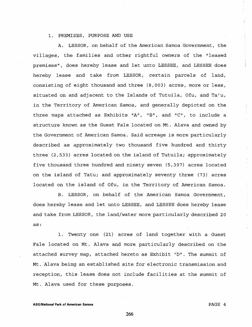
1. PREMISES, PURPOSE AND USE
A. LESSOR, on behalf of the American Samoa Government, the
villages, the families and other rightful owners of the "leased
premises", does hereby lease and let unto LESSEE, and LESSEE does
hereby lease and take from LESSOR, certain parcels of land,
consisting of eight thousand and three (8,003) acres, more or less,
situated on and adjacent to the Islands of Tutuila, Ofu, and Ta'u,
in the Territory of American Samoa, and generally depicted on the
three maps attached as Exhibits "An, "Bl1, and llC1l, to include a
structure known as the Guest Fale located on Mt . Alava and owned by the Government of American Samoa. Said acreage is more particularly
described as approximately two thousand five hundred and thirty
three (2,533) acres located on the island of Tutuila; approximately
five thousand three hundred and ninety seven (5,397) acres located
on the island of Tatu; and approximately seventy three (73) acres
located on the island of Ofu, in the Territory of American Samoa.
B. LESSOR, on behalf of the American Samoa Government,
does hereby lease and let unto LESSEE, and LESSEE does hereby lease
and take from LESSOR, the land/water more particularly described 2 0
as:
1. Twenty one (21) acres of land together with a Guest
Fale located on Mt. Alava and more particularly described on the
attached survey map, attached hereto as Exhibit l1Dl1. The summit of
Mt. Alava being an established site for electronic transmission and
reception, this lease does not include facilities at the summit of
Mt. Alava used for these purposes.
ASGINational Park of American Samoa PAGE 4
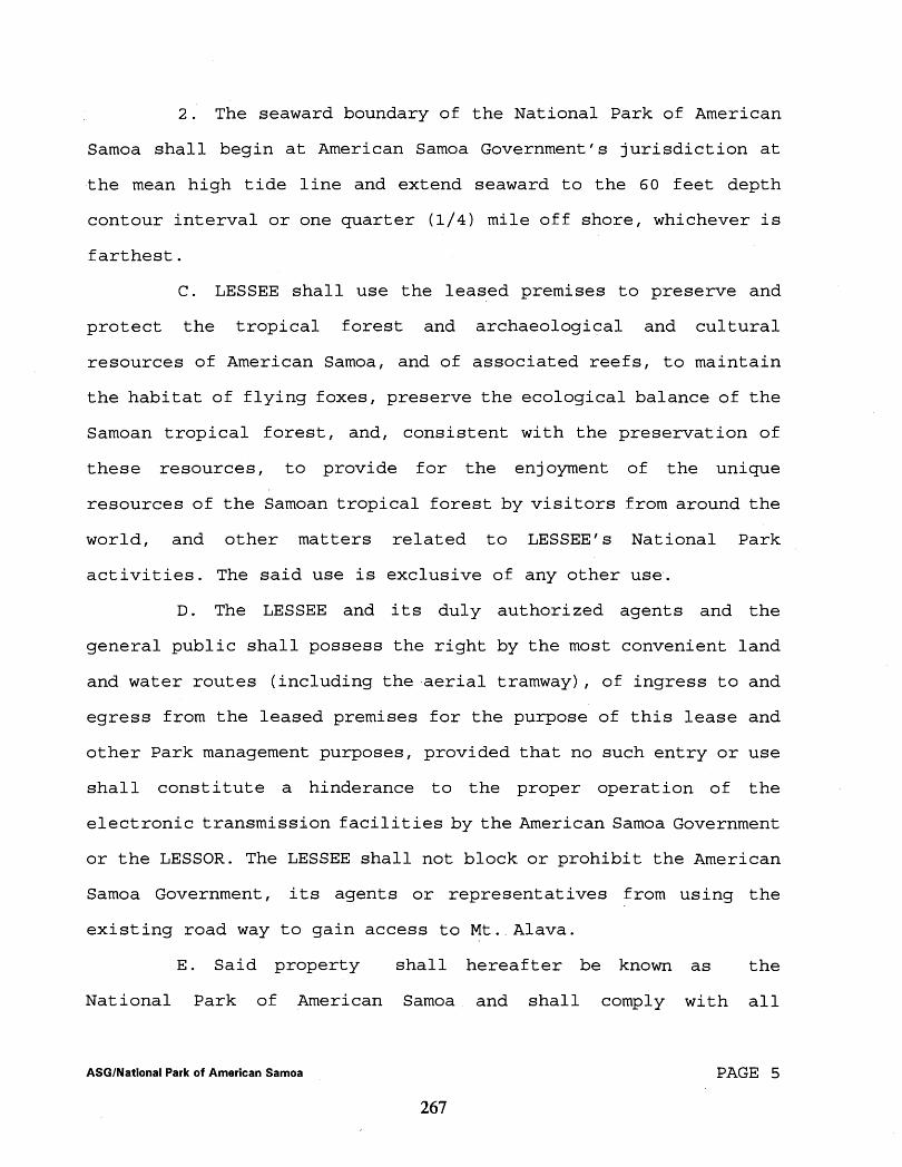
2. The seaward boundary of the National Park of American
Samoa shall begin at American Samoa Government's jurisdiction at
the mean high tide line and extend seaward to the 60 feet depth
contour interval or one quarter (1/4) mile off shore, whichever is
farthest.
C. LESSEE shall use the leased premises to preserve and
protect the tropical forest and archaeological and cultural
resources of American Samoa, and of associated reefs, to maintain
the habitat of flying foxes, preserve the ecological balance of the
Samoan tropical forest, and, consistent with the preservation of
these resources, to provide for the enjoyment of the unique
resources of the Samoan tropical forest by visitors from around the
world, and other matters related to LESSEE'S National Park
activities. The said use is exclusive of any other use.
D. The LESSEE and its duly authorized agents and the
general public shall possess the right by the most convenient land
and water routes (including the-aerial tramway), of ingress to and
egress from the leased premises for the purpose of this lease and
other Park management purposes, provided that no such entry or use
shall constitute a hinderance to the proper operation of the
electronic transmission facilities by the American Samoa Government
or the LESSOR. The LESSEE shall not block or prohibit the American
Samoa Government, its agents or representatives from using the
existing road way to gain access to Mt. Alava.
E. Said property shall hereafter be known as the
National Park of American Samoa and shall comply with all
ASGINational Park of American Samoa PAGE 5

provisions of Public Law 100-571, approved October 31, 1988 (16 USC
410 qq-410qq-4) (102 STAT., 2879) .
F. This lease agreement shall not be rendered void or
voidable by the inability of LESSOR to deliver possession of the
entire premises to LESSEE at the beginning of the lease term, nor
shall any inability to deliver possession render LESSOR liable to
LESSEE for damage suffered thereby. LESSEE agrees to accept
possession of each portion of the demised premises at such time as
LESSOR is able to tender it.
G. The LESSEE, after consultation with the Governor of
American Samoa, the High Court of American Samoa and other
appropriate agencies and leaders, may at any time make revisions to
the boundary of the Park in accordance with Section 2 (b) of Public
Law 100-571.
H. The LESSOR, its agents or representatives, and the
American Samoa Government shall have the right to enter upon and
cross over any portion of said demised premises for the purpose of
performing public and/or official duties, including but not limited
to the continued operation and maintenance of its aerial tramway
and electronic transmission facilities; provided, however, that in
exercise of such rights, the LESSOR shall not unreasonably
interfere with the LESSEE and/or the LESSEE'S appropriate uses and
enjoyment of the premises.
2. RESERVATION OF RIGHTS TO WATER
LESSOR reserves the right to all surface and ground
waters appurtenant to the premises, and the right to explore for,
ASGINational Park of American Samoa PAGE 6

lrill for, pump, capture or divert said waters; provided that
LESSOR may not exercise this right to the detriment of LESSEE if
the exercise of the right will interfere with LESSEE'S reasonable
use of the land.
3. TERM OF LEASE; OPTION TO NEGOTIATE A NEW LEASE
A. Subject to earlier termination as hereinafter
provided, the term of this lease shall be for a period of fifty
( 5 0 ) years, commencing on the date of the first Notice to the
LESSEE from the High Court of American Samoa continuing until fifty
(50 ) years from the date of said Notice, unless otherwise altered
by the terms hereof.
B. LESSEE shall have the option to enter into a new lease
upon the same terms and conditions set forth herein for another
period of fifty (50 ) years; provided LESSOR consents to the new
lease in writing.
C. On or before the expiration of the fifty (50 ) year term
of this lease agreement, the LESSOR may request that a new lease be
executed to maintain the area as a unit of the National Park
System. If so requested, the LESSEE shall enter into a new lease
agreement, with- the same terms and conditions as are contained in
this lease.
D. If a new fifty (50) year lease is not so executed, the
LESSEE shall transfer to the American Samoa Government, for the
benefit of the landowners, the sole authority to administer the
Park, together with any and all improvements constructed and
erected upon the leased premises by the LESSEE, all at no cost to
ASGINational Park of American Samoa PAGE 7

the LESSOR or the American Samoa Government. The American Samoa
Government with the consent of the landowners may continue the
Park.
E. If the Park is not continued or leased as a National
Park then the land shall revert to the landowners and the American
Samoa Government.
F . The failure of LESSEE to surrender the demised premises
upon expiration of this lease and the subsequent holding over by
LESSEE, with or without the consent of the LESSOR shall result in
the creation of a tenancy from year-to-year, at a yearly rental of
not less than the fair market annual rental value of the land,
payable on the anniversary date of each year during the year--
to-year tenancy. The fair market annual rental value shall be based
on an appraisal that is not more than five (5) years old. This
holding over shall not result in a renewal or extension of this
lease, and the year-to-year tenancy may be terminated at any time
by LESSOR or by LESSEE with sixty (60) days written notice of the
intention to terminate the tenancy. All other terms and conditions
of this lease agreement shall remain in force during any
year-to-year tenancy under this provision. Upon termination of the
tenancy, any improvements placed on the property shall become the
property of the LESSOR.
4. RENT
A. LESSEE agrees to pay to LESSOR, for the use of the
premises, facilities and privileges granted herein, a sum not to
exceed Three Hundred Seventy Seven Thousand Dollars ($377,000.00)
ASGINational Park of American Samoa PAGE 8
per annum for the first five years of the lease. Thereafter, the
LESSEE agrees to pay to LESSOR, for the use of the premises,
facilities and privileges granted herein, a sum determined pursuant
to paragraph 4. F. of this lease. During the first five year
period, said rental sum shall be paid in equal installments of a
sum not to exceed Three Hundred Seventy Seven Thousand Dollars
($377,000.00). Thereafter, the rental sum shall be paid in equal
installment of a sum determined pursuant to paragraph 4. F of this
lease. The rental payments are to be made to the Governor, as
LESSOR, on the first day of the month following the Notice from the
High Court bf American Samoa to the LESSEE, and continuing on the
anniversary date each year thereafter during the term of the lease,
provided appropriations are available from year to year for the
payments of such rentals. If adequate congressional appropriations
are not available then the LESSOR shall have the option to
terminate the lease or accept delayed rental payments.
B. All rent shall be payable in .lawful currency of the
United States, to the Governor of American Samoa, at the Office of
the Governor, American Samoa Government, ~tulei , American Samoa,
for deposit in a trust account ak a bank in American Samoa, or
other depository as the Governor of American Samoa shall designate.
The Governor shall disburse said funds to the appropriate
landowners in accordance with the terms of Public Law 100-571(102)
Stat .2879, and the Notice received from the High Court. Any
interest earned on the trust account shall be used by the Governor
to pay costs incurred by the Governor in administering the funds,
ASGINational Park of American Samoa PAGE 9
including but not limited to, check charges, postage, copying,
secretarial, appraisal fees, accounting and attorney fees. A
statement of the administrative expenses, together with the
canceled checks, shall be filed with the High Court of American
Samoa on an annual basis, but not later than sixty (60) days after
the, annual rental has been received.
C. As provided in Section 2(d) (2) of Public Law 100-571,
funds may be disbursed only by the Governor of American Samoa, in
amounts determined by the High Court of American Samoa, to those
individuals, villages, families and the American Samoa Government
whose lands are located within the boundaries of the Park, and for
administrative expenses as indicated above. The High Court of
American Samoa shall have exclusive jurisdiction to determine the
amount to be disbursed under this section to any persons or entity.
As the authorized agent of the landowners, the Governor, shall
provide to the National Park Service copies of all certifications
issued by the High Court of individuals, families, or other payees
entitled to receive rental payments. Such certifications by the
High Court shall be considered evidence of ownership for purposes
of this lease and for the purpose of satisfying the title 21
requirements of 40 USC 255.
D. The overall annual lease rental for all of the lands
within the park for the first five (5) years shall be a sum not to
exceed Three Hundred Seventy Seven Thousand Dollars ($377,000.00)
per annum. Payment of rent from the trust account shall be made
only to those landowners who:
ASGINational Park of American Samoa PAGE 10

a. reach agreement (solely for purposes of the National Park) with neighboring landowners as to the boundaries of their land within the park; and
b. concur with the High Court of American Samoa in the rental amount for their portion of the land within the Park;
E. The initial year's rent received by each landowner
shall be calculated from the date of the Notice to the LESSEE from
the-High Court of American Samoa that there is agreement as to the
area to be leased and rent to be paid therefor. The annual rent
received by each landowner thereafter shall be their proportionate
share (as allocated by the High Court of American Samoa) of Three
Hundred Seventy Seven Thousand Dollars ($377,000.00) per year for
the first five (5) year period of the overall lease. For every five
(5) year period thereafter, the rent received by each landowner
shall be their proportionate share (as allocated by the High Court
of American Samoa) of the redetermined, reappraised and adjusted
rent.
F . The parties shall reappraise, redetermine and adjust
the rent as determined by appraisal at the end of every fifth (5th)
year, and every fifth (5th) year thereafter, during the fifty (50)
year lease term.
G. LESSEE may with the consent of the LESSOR, if
appropriated funds are available, make
that has been appropriately discounted
one (1) year. The discounted amount
a lump sum rental payment
for a period of
must be agreed
more than
on by the
PAGE 11 ASGINational Park of American Samoa

LESSOR in writing.
H. The LESSEE shall advise the Governor of the appraised
fair market rental value sixty (60) days prior to the beginning of
each five (5) year period during the fifty (50) year lease term. At
least nine (9) months prior to the beginning of each five (5) year
period, an appraiser's services shall be contracted for and paid
for by the LESSEE to determine said annual rental value. If the
LESSOR disagrees with the appraisal obtained by the LESSEE, the
LESSOR may obtain, at his sole cost, his own appraisal. If
disagreement still exists with respect to the fair market rental
value of the land, then the parties agree to submit the matter for
arbitration as. provided herein. The parties agree to be bound by
the decision of 'the arbitration panel.
5. MAINTENANCE AND OPERATION
A. Except as hereinafter provided, LESSEE, at the expense
of LESSEE, shall maintain the demised premises and appurtenances to
the demised premises in a clean and sanitary condition and shall
not strip, commit, suffer, or permit to: be committed any waste,
nuisance, improper or offensive use of the demised premises.
B. LESSEE shall pay separately and promptly for separately
metered governmental services and utilities, including but not
limited to water, light, power, telephone service and all other
services coupled to the said premises. All such services will be
billed at the regularly established rates.
ASGINational Park of American Samoa PAGE 12
I C. LESSEE shall not commit or suffer to be committed, any
waste upon the said premises, or any nuisance, or other act or
thing which may disturb the quiet enjoyment of any other landowner
in the area in which the premises is located. It shall keep the
premises in good order and neat at all times.
D . LESSEE shall during the term of the lease keep, repair,
maintain upon the leased premises all buildings and improvements
constructed or installed thereon in good order, condition and
repair, reasonable wear and tear excepted.
E. LESSEE shall, at its sole cost and expense, comply with
all of the requirements of all territorial and federal authorities,
now or which may hereafter be in force pertaining to the LESSEE'S
use and occupancy of the premises. In complying with 48 U.S.C.
§I661 (b) , the existing laws of the United States relative to public
lands shall not apply to such lands in American Samoa, except as
provided by the laws of American Samoa.
6. ASSIGNMENT AND SUBLETTING
A. LESSEE shall not at any time assign this lease or any
part thereof, nor sublet the premises or any part thereof, without
written consent of LESSOR. If LESSEE sublets or attempts to sublet
the demised premises without written consent, LESSOR may terminate
the lease and retain all rents previously paid.
B. In case of subletting or attempted subletting without
consent, LE,SSOR may, after reasonable notice, prevent the ingress
of persons to the premises claiming under the sublease and may, for
the purpose of such prevention, use, without liability, all
ASGINational Park of American Samoa PAGE 13

necessary force. I
C. LESSOR'S denial of a sublease shall not under any
cir.cumstances be considered unreasonable. Any assignment or i
sublease by LESSEE without said consent in writing shall be null \
and void.
7. SUCCESSORS AND ASSIGNS
A. All the covenants,
BOUND BY COVENANTS
stipulations and agreements in this
lease shall extend to and bind the successors in interest and i
assigns of the respective parties hereto. I
B. LESSEE assumes responsibility for all acts or omissions
of its agents, employees and officers.
8. ALTERATIONS AND IMPROVEMENTS BY LESSEE
A. LESSEE accepts the leased premises in its current
condition. No alteration or improvements shall be made to the
leased premises without the prior written approval of LESSOR.
B. Any construction, alteration, or improvements to the
leased premises by LESSEE shall conform to the approval given by
LESSOR, and shall become the property of the LESSOR upon expiration
of this lease. LESSEE shall be responsible to obtain the required
permits, approvals, and otherwise comply with the laws and
regulations of the American Samoa Government for any construction
work, alteration or improvement.
C. Any alteration of the leased premises without LESSOR'S
written approval shall be grounds for cancellation of this lease by
LESSOR.
ASGINational Park of American Samoa PAGE 14
9. DAMAGE OR DESTRUCTION OF PREMISES
A. In the event of a partial destruction or total
destruction of improvements placed on the premises during the term
of this lease, LESSEE shall, forthwith repair the same, but any
partial destruction or total destruction of the leased premises
shall not annul or void this lease, and LESSEE shall not be
entitled to a proportionate reduction of rent.
10. INSPECTION BY LESSOR
LESSOR, or its authorized agents, may enter upon the leased
premises in the presence of LESSEE or its authorized agents at any
reasonable time during the term of this lease, or any renewal
thereof, for the purpose of inspection in order to determine
whether the terms hereof are being complied with by the LESSEE or
for any purpose, necessary, incidental to or connected with the
performance of LESSOR'S obligations hereunder, or in the exercise
of its governmental functions.
11. LIABILITY AND INDEMNITY
A. LESSEE agrees that it shall be liable under the Federal
Tort Claims Act and laws of American Samoa for death or injuries to
persons or damage to property arising from the negligence of
LESSEE, its officers, agents or employees in connection with its
occupancy or use of the demised premises.
B. Pursuant to the Federal Tort Claims Act, as amended (28
U.S.C. 2671, et seq.), the LESSEE will diligently process all
claims for compensatory money damages for damage to, or loss of
property or personal injury or death occurring on the leased
ASGINational Park of American Samoa PAGE 15
premises under this agreement caused by the negligent or wrongful
act or omission of an employee of the LESSEE while acting within
the scope of his or her off ice or employment under circumstances
where the LESSEE, if a private person, would be liable in
accordance with the laws of American Samoa. The LESSEE will be
responsible for damage to, or loss of, property, or personal injury
or death occurring on the leased premises under this agreement
which was caused by the negligent or wrongful act or omission of
any employee of the LESSEE while acting within the scope of his
office or employment under circumstances where the LESSEE, if a
private person, would be liable in accordance with the laws of
American Samoa, as provided in the Federal Tort Claims Act.
Further, the LESSEE agrees that the use of the leased premises by
the employees and volunteer workers in the Park shall be carried
out with all reasonable diligence and precaution so as to avoid
damage to the land, property, or personnel of the LESSOR (see 28
12. CANCELLATION BY LESSOR
A. LESSOR may unilaterally, and without litigation, cancel
this lease, in whole or in part., by written notice upon or after
the happening of any one ormore of the following events:
(1) The declaration of a state of emergency which requires the use of the property;
(2) Violation of any terms of this lease which remain uncured for ninety (90) days, following written notice of the violation:
(3) Non-payment of rent or other charges beyond ninety (90) days of due date;
ASGINational Park of American Samoa PAGE 16
(4) The default by LESSEE in the performance of any material covenant or material agreement herein required to be performed by LESSEE and the failure of LESSEE to remedy such default for a period of ninety (90) days after receipt of written notice of such default , provided, however, that no notice of cancellat ion as above provided, shall be of any force or effect if LESSEE shall have remedied the default prjor to receipt of LESSOR'S notice of cancellation.
B . No waiver of default by LESSOR of any of the terms,
covenants and conditions hereof to be performed by LESSEE shall
constitute a waiver of any subsequent default of any or more of the
terms, covenants and conditions herein contained to be performed,
kept or observed by LESSEE, and shall not be deemed a waiver of any
right on the part of LESSOR to cancel this lease for failure by
LESSEE to'so perform, keep or observe any of the terms, covenants
or conditions of this lease.
C. The LESSOR may, at any time and without cause,
terminate this lease or wlthdraw any portion of the leased premises
from the effect hereof, by giving one year's advanced written
notice of the LESSOR'S intent to do so, provided however, that any
landowners may not withdraw from the terms of this lease without
prior written notice to the Governor. The effective date of any
termination shall be computed commencing with the day after the
date of the mailing of the notice.. Upon termination of the lease in
whole or in part, the LESSOR shall be liable to the LESSEE in an
amount equal to the sum of (a) the unexpired or unused portion of
any prepaid rental payment (in whole or in part as applicable) and
(b) the fair market value of capital improvements made to and/or
constructed, erected or placed upon the leased premises, or
ASGINational Park of American Samoa PAGE 1 7

applicable portion thereof, by the LESSEE . The fair market value
of the improvements shall be determined as of the effective date of
termination or withdrawal. In the alternative and at the LESSEE'S
election, in lieu of receiving compensation for the improvements,
the LESSEE shall be vested with ownership of the improvements and
the LESSEE may timely remove them.
13. CANCELLATION BY LESSEE
LESSEE may, at any time and without cause, unilaterally and
without litigation terminate this lease agreement in whole or in
part, by giving to the LESSOR at least one year's advance written
notice of LESSEE' s intent to do so, provided however, that the
LESSEE shall continue to pay proportional annual rental until such
time as the LESSEE removes all the LESSEE owned capital
improvements or is otherwise compensated for them as provided in
item 12 above. The effective date of any termination shall be
computed commencing with the day after the date of the mailing of
the notice.
14. LESSOR COVENANTS
A. The LESSOR warrants that he has taken actions necessary
to obtain the authority to enter into this lease on behalf of the
American Samoa Government, villages, individuals and families
located within the boundaries of the leased premises and other
rightful owners of any and all interest in and all lands covered by
this lease agreement.
B. The LESSOR agrees that he will not make any
conveyances, issue any leases, rights-of-way, permits or licenses
ASGINational Park of American Samoa PAGE 1 8

to any persons, corporations, or any other legal entity in
derogation of the rights granted and demised to the LESSEE under
this lease agreement, and that no other conveyance, lease, right
of-way, permit, or license will be issued to any person,
corporation, or other legal entity without the review and
concurrence of the LESSEE.
C. The LESSOR consents to the LESSEE1 s enforcement of all
applicable Federal laws and regulations, (including National Park
Service regulations, and the imposition of the respective penalties
for violations thereof) as long as the enforcement of the Federal
laws and regulations does not interfere with the American Samoa
Laws and regulations and the cultural independence of the people of
American Samoa over all the leased premises, pursuant to the
provisions of Section 3 of Public Law 100-571, which provisions are
made a part hereof by reference.
15. ABANDONMENT
LESSOR, or LESSOR'S attorney, heirs, representatives, and
assigns, may reenter and repossess the demised premises, and
declare the term of this lease agreement forfeited if the demised
premises shall be deserted, unoccupied or vacated by LESSEE for
thirty (30) days or more. LESSOR may pursue all remedies available
under the lease agreement, or at law, for a forfeiture by LESSEE
under this lease agreement. LESSEE hereby waives notice of
forfeiture under this provision. The failure of LESSOR at any time
to exercise any of LESSOR'S options to forfeit and terminate this
lease agreement in case of a default on the part of LESSEE shall
ASGlNational Park of American Samoa PAGE 1 9
not waive the right of forfeiture or termination of this lease
agreement as provided.
16. ARBITRATION
A. A controversy or claim arising out of this lease
with respect to rent, which shall not have been settled by
agreement between the parties hereto within thirty (30) days after
notice of such controversy or claim has been served by one party
upon the other party, may be settled by arbitration if mutually
agreed upon in writing by the parties; otherwise, the controversy
or claim shall be settled by filing for appropriate relief in the
High Court of American Samoa or a Federal District Court with
jurisdiction.
B. In the event the parties. mutually agree in writing to
arbitration, within ten (10) days thereof, the party initially
serving notice of the claim or controversy shall notify the other
party of the name of the person whom he has appointed as
arbitrator. The other party shall, within ten, (10) days of receipt
of the notice of appointment, appoint an arbitrator to represent
him and notify the first party of the name of the arbitrator. The
two arbitrators shall within thirty (30) days of the appointment of
the second arbitrator appoint the third arbitrator, who shall be a
resident of American Samoa and shall serve as the Chairman. Upon
appointment of the third arbitrator, the arbitrators shall have
thirty (30) days in which to reach a decision which shall be
binding upon the parties. If either party fails to appoint its
arbitrator or the parties cannot agree on a third arbitrator within
ASGINational Park of American Samoa PAGE 20

thirty ( 3 0 ) days, then the controversy or claim shall be settled by
arbitration in accordance with the rules then in effect of the
American Arbitration Association.
C. The parties shall be responsible for having their
arbitrators present in American Samoa to perform their duties. Each
party shall bear the costs of the arbitrator it appoints plus
one-half the costs of the chairman.
1 7 . MODIFICATION
This lease may be amended, changed or modified only upon
mutual agreement of the parties in writing, properly executed by
the parties to this lease.
1 8 . NOTICES
Notices to LESSOR provided for herein shall be sufficient
if sent by registered mail, postage prepaid, addressed to, or
personally delivered to the following officials:
Office of the Governor American Samoa Government Pago Pago, American Samoa 96799;
With copy to:
Attorney General American Samoa Government P.O. Box 7 Pago Pago, American Samoa 96799;
and notices to LESSEE, if sent by registered mail, postage prepaid,
addressed to:
Chief, Division of Land Resources National Park Service Western Regional Office 600 Harrison Street, Suite 600 San Francisco, CA 94107-1372
with copy to LESSEE'S principal place of business in American
Samoa.
ASGINational Park of American Samoa PAGE 2 1
19. QUIET ENJOYMENT OF PROPERTY
The LESSOR hereby covenants and agrees with the LESSEE that
upon payment of said rentals at the times and in the manner
aforesaid and the observance and performance of the other
covenants, terms, and conditions hereof to be observed and
performed on the part of the LESSEE, the LESSEE shall have, hold,
possess, and enjoy the demised premises for the term hereby
demised, without hindrance or interruption by the LESSOR or any
other person or persons claiming interest (s) in or ownership (s) or
any portion(s) of the leased premises.
20. CIVIL RIGHTS ASSURANCE
A.. The LESSEE hereby covenants and agrees to furnish
National Park related services on a fair, equal and not unjustly
discriminatory basis to all users thereof. LESSEE further covenants
and agrees to charge fair, reasonable and not unjustly
discriminatory prices for each unit or service; provided that
LESSEE may be allowed to make reasonable and non-discriminatory
discounts, rebates, or other similar types of price reductions to
volume purchasers.
B. The LESSEE for itself, its successors in interest, and
assigns, as a part of the consideration hereof, does hereby
covenant and agree that in the event facilities are constructed,
maintained, or otherwise operated on the said property described in
this lease, for a purpose for which the Department of Interior
program or activity is extended or for another purpose involving
the provision of similar services or benefits, the LESSEE shall
ASGINational Park of American Samoa PAGE 22

maintain and operate such facilities and services in compliance
with all other requirements imposed pursuant to Section 3 of Public
Law 100-517 which provisions are incorporated herein by reference,
C. The LESSEE, for itself, its successors in interest, and
assigns, as a part of the consideration herein, does covenant and
agree as follows: (1) that no person shall be excluded from
participation in, denied the benefits of, or be otherwise subjected
to discrimination in the use of said leased premises on the ground
of race, color, or national origin; (2) that in the construction of
any improvements on, over or under such land and the furnishing of
services thereon, no person shall be excluded from participation
in, denied the benefits of, or otherwise be subjected to
discrimination on the ground of race, color, or national origin;
(3) that the LESSEE shall use the premises in compliance with all
other requirements imposed by or pursuant to federal law.
D. That in the 'event of breach of any of the above non-
discrimination covenants, LESSOR shall have the right to terminate
the lease, and hold the premises the same .as if said lease had
never been made or issued.
21. APPLICABLE LAW, JURISDICTION
This lease shall be construed according to the laws of the
Territory of American Samoa and any federal statute that may be
applicable. All judicial proceedings shall be in the High Court of
American Samoa or such other jurisdiction as may be appropriate.
ASGlNational Park of American Samoa PAGE 23
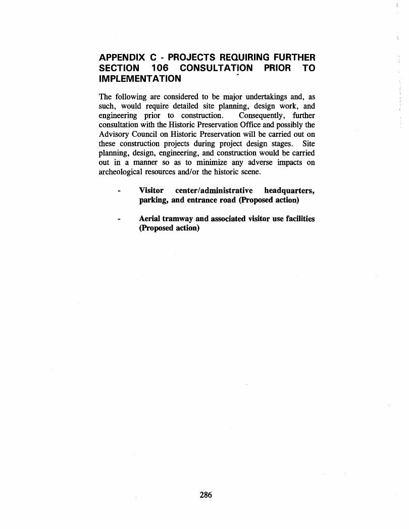
APPENDIX C - PROJECTS REQUIRING FURTHER SECTION 106 CONSULTATION PRIOR TO IMPLEMENTATION
L
The following are considered to be major undertakings and, as such, would require detailed site planning, design work, and engineering prior to construction. Consequently, further consultation with the Historic Preservation Office and possibly the Advisory Council on Historic Preservation will be carried out on these construction projects during project design stages. Site planning, design, engineering, and construction would be carried out in a manner so as to minimize any adverse impacts on archeological resources andlor the historic scene.
- Visitor centerladministrative headquarters, parking, and entrance road (Proposed action)
- Aerial tramway and associated visitor use facilities (Proposed action)
APPENDIX D - VILLAGE COUNCIL MEETING ATTENDEES
NATIONAL PARK OF AMERICAN SAMOA
DRAFT GENERAL MANAGEMENT PLAN/ENVIRONMENTAL IMPACT STATEMENT
Village Meeting
February f; , 1997
Name (please print)

NATIONAL PARK OF AMERICAN SAMOA
DRAFT GENERAL MANAGEMENT PLAN/ENVIR~NMENTAL IMPACT STATEMENT
~ V i l l a g e Meeting
February r . 1997 Name (please print)

NATIONAL PARK OF AMERICAN SAMOA
DRAFT GENERAL MANAGEMENT PLAN/ENVIRONMENTAL IMPACT STATEMENT 4--
-@P=- Village Meeting
February 6 , 1997
Name (please print)

NATIONAL PARK OF AMERICAN SAMOA
DRAFT GENERAL MANAGEMENT PLAN/ENVIRONMENTAL IMPACT STATEMENT
Village Meeting
February 1 , 1997
Name (please print)
NATIONAL PARK OF AMERICAN SAMOA
DRAFT GENERAL MANAGEMENT PLAN/E'NVIRONMENTAL IMPACT STATEMENT
- W=U Village Meeting
February - 1 0, 1997
Name (please print)

NATIONAL PARK OF AMERICAN SAMOA
DRAFT GENERAL MANAGEMENT PLAN/ENVIRONMENTAL IMPACT STATEMENT
Village Meeting
February - \ \ , 1997
~ a m e (please print)

NATIONAL PARK OF AMERICAN SAMOA
DRAFT GENERAL MANAGEMENT PLAN/ENVIRONMENTAL IMPACT STATEMENT
- \ / X ( A Village Meeting
February ( , 1997
Name (please print)

NATIONAL PARK OF AMERICAN SAMOA
DRAFT GENERAL MANAGEMENT PLAN/ENVIRONMENTAL IMPACT STATEMENT cl n ~ r k Village Meeting
February 12, 1997
Name (please print)
NATIONAL PARK OF AMERICAN SAMOA
DRAFT GENERAL MANAGEMENT PLAN/ENVIRONMENTAL IMPACT STATEMENT
Public Meeting
February ]a , 1997 Name (please print) Address Phone

NATIONAL PARK OF AMERICAN SAMOA
DRAFT GENERAL MANAGEMENT PLAN/ENVIRONMENT~ & IMPACT ! iTATEMENT
O\Q Village Meeting
February \x , 1997
~ a m e (please print)
PREPARERS AND CONTRIBUTORS Leota Vaea Ainu'u, Chief Ranger, National Park of American
Samoa
Gary Barbano, Park Planner, Pacific Islands Support Office
Bob Cook, Wildlife Biologist, National Park of American Samoa
Tom Fake, Landscape Architect, Pacific Islands Support Office
Melia Lane-Kamahele, Cartographer, Pacific Islands Support Office
Jaynee Nakamura, Secretary, Pacific Islands Support Office
L y ~ e Nakata, Interpretive Specialist, Pacific-Great Basin Support Office
Chris Stein, Superintendent, National Park of American Samoa
INDEX Access i, ii, iii, iv, v, viii, 6, 17, 20, 21, 27, 32, 34-38, 40-42,
45,62, 64,77, 78, 84, 87-90, 92,94, 96, 98, 99, 138, 143, 152, 156, 157, 159, 160, 164, 166, 168, 169, 174, 176, 177, 182, 183, 186, 187, 189, 191, 192, 197, 204, 215, 224, 24 1, 242
Administrative facilities 5, v, 38, 80, 82, 83, 85, 89, 92,97, 161, 169, 176, 282
Adverse effects i, ii, iii, iv, v, vi, vii, viii, ix, 20, 27, 34, 41, 57, 59, 62, 75, 156-161, 163-168, 170, 172, 173-177, 179, 183-195
Advisory Board 68, 93, 257, 258 Advisory Council on Historic Preservation 49, 166, 167, 199,
203, 282 Afono village 2, 5, 6, 13, 21, 26, 27, 31, 32, 84, 88, 104, 111,
117, 130, 132, 146, 198 African tree snails 50, 53, 55, 133 Aiga buses 34-36, 177 Air quality viii, 188 Airport 21, 36, 45, 46, 61, 80, 81, 90, 92, 95, 100, 102, 110,
149 Alien species vii, 50, 53, 55, 117, 138, 139, 157, 158, 163, 164,
174, 179, 188 American Samoa Government (ASG) i, ii, 6, 18-20, 22, 26, 27,
28, 32, 34, 35, 38-40, 49, 51, 55, 60, 80, 82-84, 88, 97, 100, 128, 143, 144, 150, 151, 161, 170, 176, 178, 182, 199, 203
Archeological sites and features iv, 42, 55, 56, 59, 85, 91, 144, 145, 146, 167-172, 179, 181, 182, 186, 190, 192, 193, 195
Aunu'u island 2, 126, 139, 149 Beneficial effects ii, iii, iv, v, vii, viii, 156, 157, 161, 165, 166,
168, 172-175, 178, 179, 181, 183, 184, 185-192, 195 Boundary markers 40, 45, 89, 90, 95, 96, 101 Campsites 42, 81, 83, 88, 100, 163, 170, 184, 189 Carrying capacity 63, 75-77, 86 Climate 102, 147, 253 Coastal Zone Management Program 55, 140, 142-144, 161 Composting toilets 36, 41, 90, 98, 168 Cooperative Park Studies Unit (CPSU) 22, 109, 126, 128, 173
Coral reefs ii, vii, 5, 15, 17, 22, 45, 49, 50, 52, 54, 59, 60, 61, 63, 75, 108, 135-137, 152, 154, 164, 165, 192, 228, 232, 246
Crown-of-thorns starfish 54, 136, 137 Cultural resources 5, i, ii, iii, v, viii, 1, 15, 17, 22, 23, 33, 36,
41, 42, 46, 49, 50, 55-58, 60, 61, 64, 68, 75-77, 90, 91, 98, 141, 144, 154, 166, 167, 169, 172, 174, 178-181, 186, 190, 192, 194, 195, 199
Cumulative effects 156, 181, 187, 192, 193, 195 Department of Marine and Wildlife Resources 22, 49, 5 1, 55, 60,
128, 132, 198, 199 Economic Development Administration (EDA) 34 Employment 13, 150, 151, 181, 187, 193 Endangered Species Act 49, 51, 65, 90, 13 1, 133-135, 200
Section 7 consultation 49, 90, 200 Ethnographic resources 17, 22, 37, 49, 58, 97, 145 Fa'asamoa 5, ii, 16, 25, 60, 65-67, 86, 93, 178 Fagasa village 2, 5, 6, 13, 26, 28, 104, 11 1, 130, 132, 198, 204 Faleasao village 5, 13, 26, 198 Federal Cooperative Education Program 13 Feral pigs vii, 20, 52, 53, 139; 159, 163, 164, 174, 186, 187 Fitiuta village 5, 6, 13, 21, 26, 40, 61, 90, 118, 146, 148, 198 Flying foxes 5, ii, vii, 1, 15, 17, 20, 22, 32, 33, 42, 46, 49, 50,
51, 55, 59, 60, 62, 63, 68, 75, 124, 125, 126-129, 132, 152, 157-159, 162, 163, 165, 166, 179, 183, 184, 188, 189
P. samoensis 124-129 P. tonganus 124-129
Forest birds 20, 130, 131, 157, 162, 165, 184, 188 Geomorphology 103, 104 Herbicides 157 High Court of American Samoa 13, 17, 18, 173, 197, 198 Historic Preservation Act 49, 65, 91, 166, 167, 199
Section 106 49, 91, 166, 199, 200, 282 Section 110 166
Historic Preservation Office 49, 9 1, 144, 166-169, 17 1, 199, 200, 282
Hurricanes 53, 102, 103, 108, 110-113, 117, 119, 122, 128, 129, 132, 133, 136, 138, 139, 150, 164
Inholdings 13, 31, 33, 84, 88 Interpretation 24, 32, 35, 60, 64, 86, 92, 97, 101 Interpretive themes 24, 59, 92 Koster's curse 53, 112 Lata Mountain 41, 53, 105-107, 130, 131 Laufuti stream 52, 92, 106, 107, 118 Lease agreement 5, 6, 13, 17, 34, 40, 55, 64, 198
Local economy 150, 153 Maintenance facilities 40 Marine resources vii, 15, 22, 25, 45, 49, 51, 57, 58, 75, 77, 91,
134, 136, 148, 157, 165, 174, 181-185, 187-189, 193 Mile-a-minute vine 53, 1 17 Mitigation measures iii, 157-160, 162-164, 166, 169, 171, 172,
173-177 Monitoring iv, 46, 50, 51, 53, 54, 85, 91, 138, 141, 159, 163,
164, 169, 171, 173, 179, 186, 187, 190 Mt. Alava 5, v, vi, vii, viii, ix, 2, 6, 21, 27, 32-36, 38, 76, 80,
82-85, 88, 89, 94-101, 103, 104, 111, 113, 117, 141, 145, 152, 157, 158, 168, 174, 183, 184, 188-190, 194
National Environmental Policy Act (NEPA) iii, 18, 26, 84 National natural landmarks 105 National Park of American Samoa 5, i, 1, 2, 5, 13-15, 17, 18,
19, 20, 23, 24, 26, 27, 37, 46, 49, 50, 55, 59, 60, 62, 64, 66-68, 77, 79, 84, 90, 93, 98, 109, 124, 134, 139, 141, 142, 145, 151, 154, 178, 197, 199
land and size 2, 5 purpose 1, 22
National P& Service Organic Act 64 National Register of Historic Places 166; 167, 199 Ofu village 5, 13, 26, 46, 148, 198 Olosega village 5, 13, 26, 46, 148, 198 Overnight accommodations ii, iii, 28, 31, 36, 46, 61, 88, 152,
153, 175, 186, 191 Pacific boa 50, 51, 133, 162, 163, 179 Pago Pago Harbor 2, 6, 21, 32-35, 38, 96, 97, 140, 141, 143,
149, 150, 161, 181, 184 Pago Pago village 5, 13, 22, 26, 28, 198 Parking 32, 33, 37, 40, 80, 81, 83, 88, 89, 94-96, 100, 168, 177,
183 Population 149, 150 Rainmaker Hotel 36, 38, 152, 153 Regional economy 5, iii, iv, v, 174, 175, 178, 181, 186, 191,
192, 193 Research ii, iii, iv, 20, 46, 49, 51, 57, 75, 85, 90, 91, 164, 172,
173, 179, 184, 186, 190 Resource management facilities 40, 85 Resource management plan 23 Rest rooms 80, 81, 85, 94-96, 99, 100, 168, 170 Saua 40, 41, 61, 76, 89, 90, 107, 122, 145, 146, 148, 165, 170 Scoping meetings i, 18, 19, 25, 26, 67, 198, 199 Sea turtles 51, 134, 135, 140, 164 Seabirds 32, 54, 63, 88, 130, 131, 152, 162, 165, 184

Sheath-tailed bats 132, 133, 140 Signs 27, 31,40, 45, 63, 81, 83, 84, 87-90, 93, 95, 96, 101, 176 Soils vi, vii, 104-108, 112, 157, 158, 163, 183, 184, 188, 189 Solo Hill ix, 21, 35, 36, 38, 61, 80, 83, 89, 100, 176, 177, 186,
191 Staffing iii, iv, v, viii, 17, 37, 77, 86, 91, 185, 186, 189, 190,
192 Statement for Management 26, 86 Subsistence uses ii, viii, 1, 22-24, 27, 52, 57-60, 64, 65, 67, 75,
78,86, 89,93, 138, 147, 148, 151, 159, 172-174, 182, 186: 190, 191
agriculture ii, 1, 20, 22, 40, 46, 52, 57-59, 67, 88, 93, 110, 111, 141, 146, 159, 166, 172-174, 182, 185, 190, 193
fishing ii, 1, 22, 57, 58, 65, 67, 75, 78, 93, 138, 148, 173, 185, 190, 193
gathering ii, 1, 22,46, 57, 58,60,67, 75, 89,93, 148, 173 Ta'u village 5, 45, .I98 Tafuna 145, 149, 181 Tourism 20, 23, 24, 35, 60, 150, 153, 154, 178, 197 Traffic iii, iv, v, ix, 176, 177, 179, 181, 186, 191, 195 Trails ii, vii, viii, 27, 28, 32, 33, 40, 41, 62, 80-84, 87, 88, 89,
90, 92, 96, 100, 101, 158, 162, 163, 168, 170; 178, 184, 188-190
Tramway i, iii, iv, v, vii, viii, ix, 6, 21, 27, 28, 34-36, 38, 61, 76, 80, 83, 85, 89, 97-101, 159-161, 166, 171, 175-179, 181, 182, 184, 185, 187, 188, 190-194, 197, 282
TV transmitters 6, 21, 28, 32, 34, 36, 88, 89, 97, 160 U. S. Fish and Wildlife Service 22, 49, 90, 126, 129, 13 1, 132,
133, 134, 139, 200 U . S. Soil Conservation Service (Natural Resources Conservation
Service) 104 Utility vehicles 28, 32, 88, 157, 158, 162 Utulei vi, 80, 161, 169, 176, 177, 179 Vatia village 2, 5, 6, 13, 20, 21, 26, 27, 31-34, 76, 80, 82, 83,
84, 88, 89, 100, 101, 104, 105, 110, 113, 116, 117, 145, 146, 148, 152, 158, 188, 198
Village councils 18, 19, 25, 26, 28, 32, 33, 45, 50, 53-59, 62, 66, 67, 75, 76, 87, 90, 93, 147, 172, 173, 174, 198, 199
Visitation 62, 78, 151, 154, 191 Visitor center 5, i, ii, iii, iv, v, vi, vii, viii, 37, 40, 61, 80, 83,
86, 89, 92, 96-99, 101, 161, 165, 169, 176, 177-179, 181, 182, 184, 186, 188, 190, 191, 192-195
Visitor contact station i, 41, 61, 81, 85, 90, 95, 100, 164, 165, 170, 171, 178, 185
Visitor use facilities 17, 96, 151
Wayside exhibits 32, 41, 61, 64, 81, 83, 93, 95, 96, 101, 166 Western Samoa 2, 15, 37, 61, 103, 108, 126, 152, 154, 181 Whistler, W. Arthur 109, 110, 116, 118, 119, 121, 124
Return to park web page, Park Planning | Go to top of page