Embed Size (px)
Citation preview
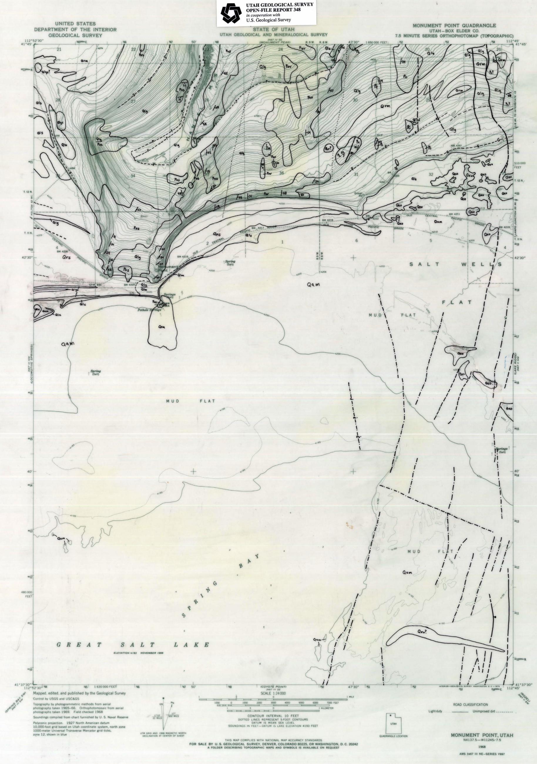
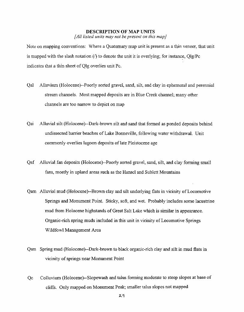
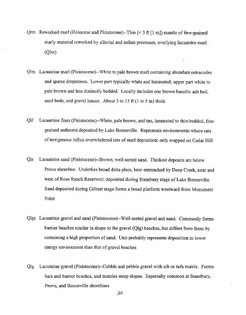
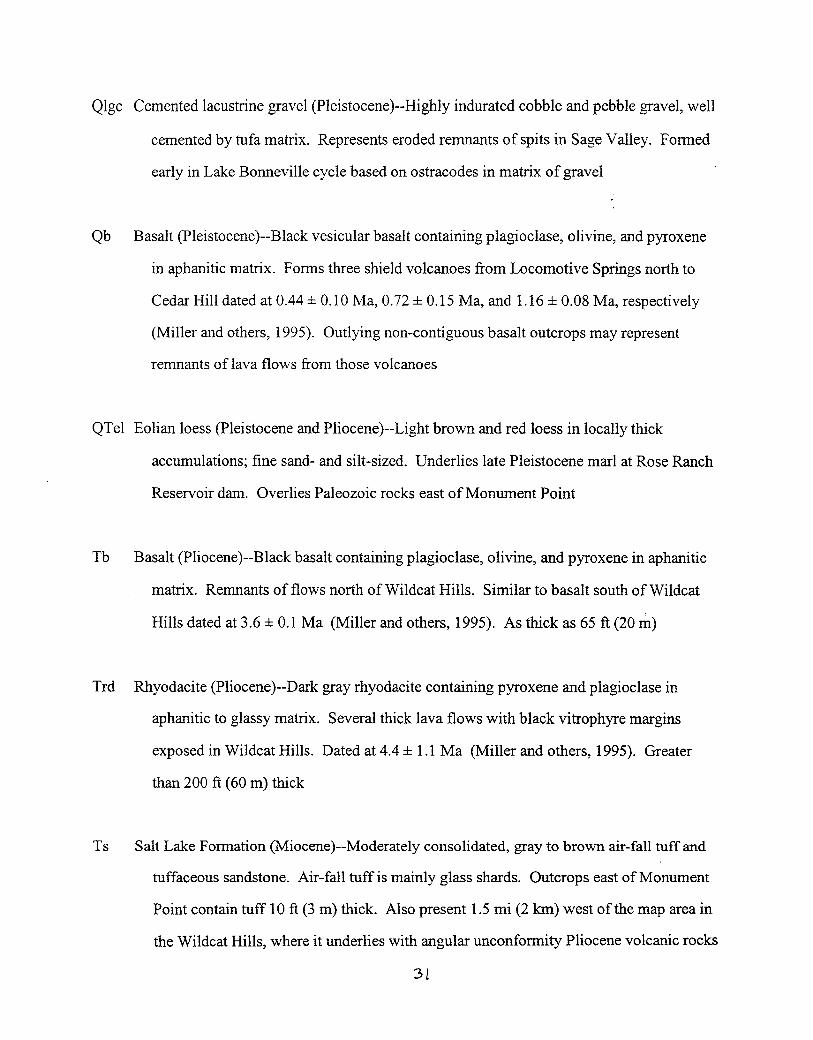
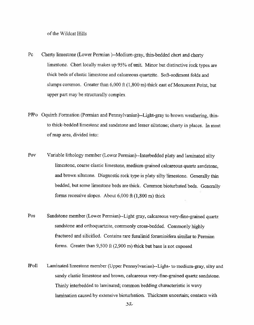
INTERIM GEOLOGIC MAP OF THE
MONUMENT POINT QUADRANGLE,
BOX ELDER COUNTY, UTAH
With a booklet on the geology of eastern Curlew Valley,Box Elder County, Utah
by
David M. Miller and Holly LangrockU.S. Geological Survey
OPEN-FILE REPORT 348 April 1997 UTAH GEOLOGICAL SURVEY a division of UTAH DEPARTMENT OF NATURAL RESOURCES
This Open-File Report represents material that may not have undergone policy, technical, or editorial review
required for other UGS publications. It provides information that, in part, may be interpretive or incomplete and
readers are to exercise some degree of caution in the use of the data. Although this product represents the work of
professional scientists, the Utah Department of Natural Resources, Utah Geological Survey, makes no warranty,
stated or implied, regarding its suitability for a particular use. The Utah Department of Natural Resources, Utah
Geological Survey, shall not be liable under any circumstances for any direct, indirect, special, incidental, or
consequential damages with respect to claims by users of this product.