Embed Size (px)
Citation preview
AAIINN SSHHAAMMSS UUNNIIVVEERRSSIITTYY FFAACCUULLTTYY OOFF EENNGGIINNEEEERRIINNGG UURRBBAANN PPLLAANNNNIINNGG && DDEESSIIGGNN DDEEPPAARRTTMMEENNTT
IINNTTEERRRREELLAATTIIOONNSS BBEETTWWEEEENN PPRREESSEERRVVEEDD NNAATTUURRAALL AARREEAASS && UURRBBAANN EENNVVIIRROONNMMEENNTT
AA TThheessiiss SSuubbmmiitttteedd iinn PPaarrttiiaall FFuullffiillllmmeenntt ooff tthhee RReeqquuiirreemmeennttss ffoorr tthhee MMaasstteerr DDeeggrreeee iinn UUrrbbaann PPllaannnniinngg
By SSAAMMAAHH MMOOHHAAMMMMEEDD EELL SSAAYYEEDD EELL KKHHAATTEEEEBB
((DDeemmoonnssttrraattoorr aatt DDeeppaarrttmmeenntt ooff UUrrbbaann PPllaannnniinngg && DDeessiiggnn,, AAiinn SShhaammss UUnniivveerrssiittyy))
UUnnddeerr tthhee ssuuppeerrvviissiioonn ooff::
AAssssoocciiaattee PPrrooff.. DDrr.. MMoohhaammmmeedd TTaammeerr EEll-- KKhhoorraazzaattii DDeeppaarrttmmeenntt ooff UUrrbbaann PPllaannnniinngg && DDeessiiggnn
FFaaccuullttyy ooff EEnnggiinneeeerriinngg –– AAiinn SShhaammss UUnniivveerrssiittyy
AAssssoocciiaattee PPrrooff.. DDrr.. Ghada Farouk Hassan DDeeppaarrttmmeenntt ooff UUrrbbaann PPllaannnniinngg && DDeessiiggnn
FFaaccuullttyy ooff EEnnggiinneeeerriinngg –– AAiinn SShhaammss UUnniivveerrssiittyy
2006
I
DDEEDDEECCAATTIIOONN
To my supportive parents
To my beloved husband Amr and son Ali
Acknowledgements
FFiirrsstt aanndd FFoorreemmoosstt TThhaannkkss ttoo GGoodd I would like to express my deepest thanks to Professor Dr. Mohamed
Tamer El-Korathaty, Associate Professor in urban design department,
Ain Shams University, Faculty of Engineering, for his perpetual help,
close supervision and keen encouragement. I wish also to express my
sincerest thankfulness to Dr. Ghada Farouk, Associate Professor in urban
design department, Faculty of Engineering, Ain Shams University, for
her continuous support and advice through the performance of every part
in this work.
Also, I would like to express my deepest thanks to E/ Safa Mohammed
El Helaly my colleague for her help from the first day of this research.
I wish also to thank E. / Ahmed Samy, E. / Marwa Abd El Lattif and E.
Abeer El Shater for there help in this research.
Finally, I am expressing my gratefulness, heartfelt respect and renewed
thanks to all my Professors, Family who helped me during the
accomplishment of this work especially my Parents, Husband (Amr),
Sister (Sara). Thank you all.
Table of Contents
CCoonntteennttss DDeeddiiccaattiioonn II
TTaabbllee ooff ccoonntteennttss IIII
LLiisstt ooff FFiigguurreess
LLiisstt ooff PPhhoottooss
LLiisstt ooff TTaabblleess
LLiisstt ooff CChhaarrttss
IInnttrroodduuccttiioonn 11
CChhaapptteerr OOnnee 1100
1-1 Definitions of Environment and Related Terminology 10
1-1-1 Environment 10
1-1-2Natural Environment: 12
1-1-2-1 Biological Diversity 12
1-1-2-2 Species 13
1-1-2-3Habitat 13
1-1-3 Built Environment: 13
1-1-4 Urban Environment: 14
1-1-5 Ecosystems: 14
1-1-5-1Characteristics of Ecosystems: 15
1-1-6 Biotic: 15
1-1-7 A- biotic: 16
1-1-8 Ecosystems and Human Systems: 16
1-1-9The Concept of 'Natural': 17
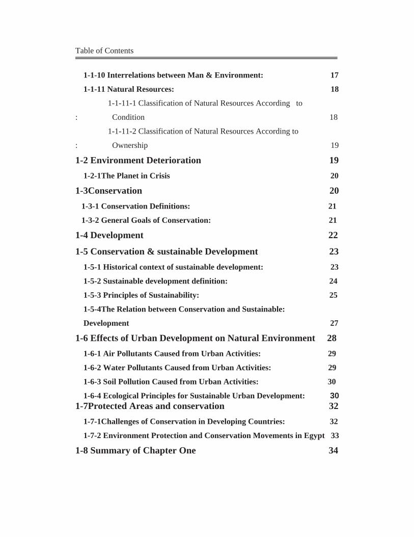
Table of Contents
1-1-10 Interrelations between Man & Environment: 17
1-1-11 Natural Resources: 18
1-1-11-1 Classification of Natural Resources According to
: Condition 18
1-1-11-2 Classification of Natural Resources According to
: Ownership 19
1-2 Environment Deterioration 19 1-2-1The Planet in Crisis 20
1-3Conservation 20 1-3-1 Conservation Definitions: 21
1-3-2 General Goals of Conservation: 21
1-4 Development 22
1-5 Conservation & sustainable Development 23 1-5-1 Historical context of sustainable development: 23
1-5-2 Sustainable development definition: 24
1-5-3 Principles of Sustainability: 25
1-5-4The Relation between Conservation and Sustainable:
Development 27
1-6 Effects of Urban Development on Natural Environment 28 1-6-1 Air Pollutants Caused from Urban Activities: 29 1-6-2 Water Pollutants Caused from Urban Activities: 29
1-6-3 Soil Pollution Caused from Urban Activities: 30
1-6-4 Ecological Principles for Sustainable Urban Development: 30 1-7Protected Areas and conservation 32 1-7-1Challenges of Conservation in Developing Countries: 32
1-7-2 Environment Protection and Conservation Movements in Egypt 33
1-8 Summary of Chapter One 34
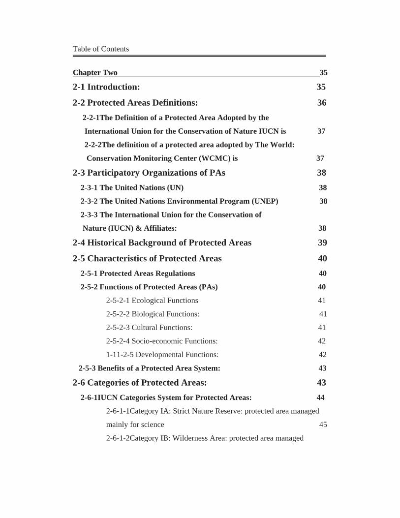
Table of Contents
CChhaapptteerr TTwwoo 3355
2-1 Introduction: 35
2-2 Protected Areas Definitions: 36 2-2-1The Definition of a Protected Area Adopted by the
International Union for the Conservation of Nature IUCN is 37
2-2-2The definition of a protected area adopted by The World:
Conservation Monitoring Center (WCMC) is 37
2-3 Participatory Organizations of PAs 38 2-3-1 The United Nations (UN) 38
2-3-2 The United Nations Environmental Program (UNEP) 38
2-3-3 The International Union for the Conservation of
Nature (IUCN) & Affiliates: 38
2-4 Historical Background of Protected Areas 39
2-5 Characteristics of Protected Areas 40 2-5-1 Protected Areas Regulations 40
2-5-2 Functions of Protected Areas (PAs) 40
2-5-2-1 Ecological Functions 41
2-5-2-2 Biological Functions: 41
2-5-2-3 Cultural Functions: 41
2-5-2-4 Socio-economic Functions: 42
1-11-2-5 Developmental Functions: 42
2-5-3 Benefits of a Protected Area System: 43
2-6 Categories of Protected Areas: 43 2-6-1IUCN Categories System for Protected Areas: 44
2-6-1-1Category IA: Strict Nature Reserve: protected area managed
mainly for science 45
2-6-1-2Category IB: Wilderness Area: protected area managed
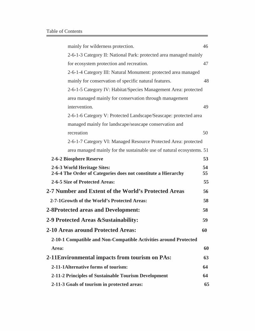
Table of Contents
mainly for wilderness protection. 46
2-6-1-3 Category II: National Park: protected area managed mainly
for ecosystem protection and recreation. 47
2-6-1-4 Category III: Natural Monument: protected area managed
mainly for conservation of specific natural features. 48
2-6-1-5 Category IV: Habitat/Species Management Area: protected
area managed mainly for conservation through management
intervention. 49
2-6-1-6 Category V: Protected Landscape/Seascape: protected area
managed mainly for landscape/seascape conservation and
recreation 50
2-6-1-7 Category VI: Managed Resource Protected Area: protected
area managed mainly for the sustainable use of natural ecosystems. 51
2-6-2 Biosphere Reserve 53
2-6-3 World Heritage Sites: 54 2-6-4 The Order of Categories does not constitute a Hierarchy 55
2-6-5 Size of Protected Areas: 55
2-7 Number and Extent of the World’s Protected Areas 56 2-7-1Growth of the World’s Protected Areas: 58
2-8Protected areas and Development: 58
2-9 Protected Areas &Sustainability: 59
2-10 Areas around Protected Areas: 60 2-10-1 Compatible and Non-Compatible Activities around Protected
Area: 60
2-11Environmental impacts from tourism on PAs: 63
2-11-1Alternative forms of tourism: 64
2-11-2 Principles of Sustainable Tourism Development 64
2-11-3 Goals of tourism in protected areas: 65
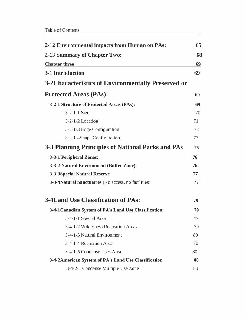
Table of Contents
2-12 Environmental impacts from Human on PAs: 65
2-13 Summary of Chapter Two: 68 CChhaapptteerr tthhrreeee 6699
3-1 Introduction 69
3-2Characteristics of Environmentally Preserved or
Protected Areas (PAs): 69 3-2-1 Structure of Protected Areas (PAs): 69
3-2-1-1 Size 70
3-2-1-2 Location 71
3-2-1-3 Edge Configuration 72
3-2-1-4Shape Configuration 73
3-3 Planning Principles of National Parks and PAs 75
3-3-1 Peripheral Zones: 76
3-3-2 Natural Environment (Buffer Zone): 76
3-3-3Special Natural Reserve 77
3-3-4Natural Sanctuaries (No access, no facilities) 77
3-4Land Use Classification of PAs: 79
3-4-1Canadian System of PA's Land Use Classification: 79
3-4-1-1 Special Area 79
3-4-1-2 Wilderness Recreation Areas 79
3-4-1-3 Natural Environment 80
3-4-1-4 Recreation Area 80
3-4-1-5 Condense Uses Area 80
3-4-2American System of PA's Land Use Classification 80
3-4-2-1 Condense Multiple Use Zone 80
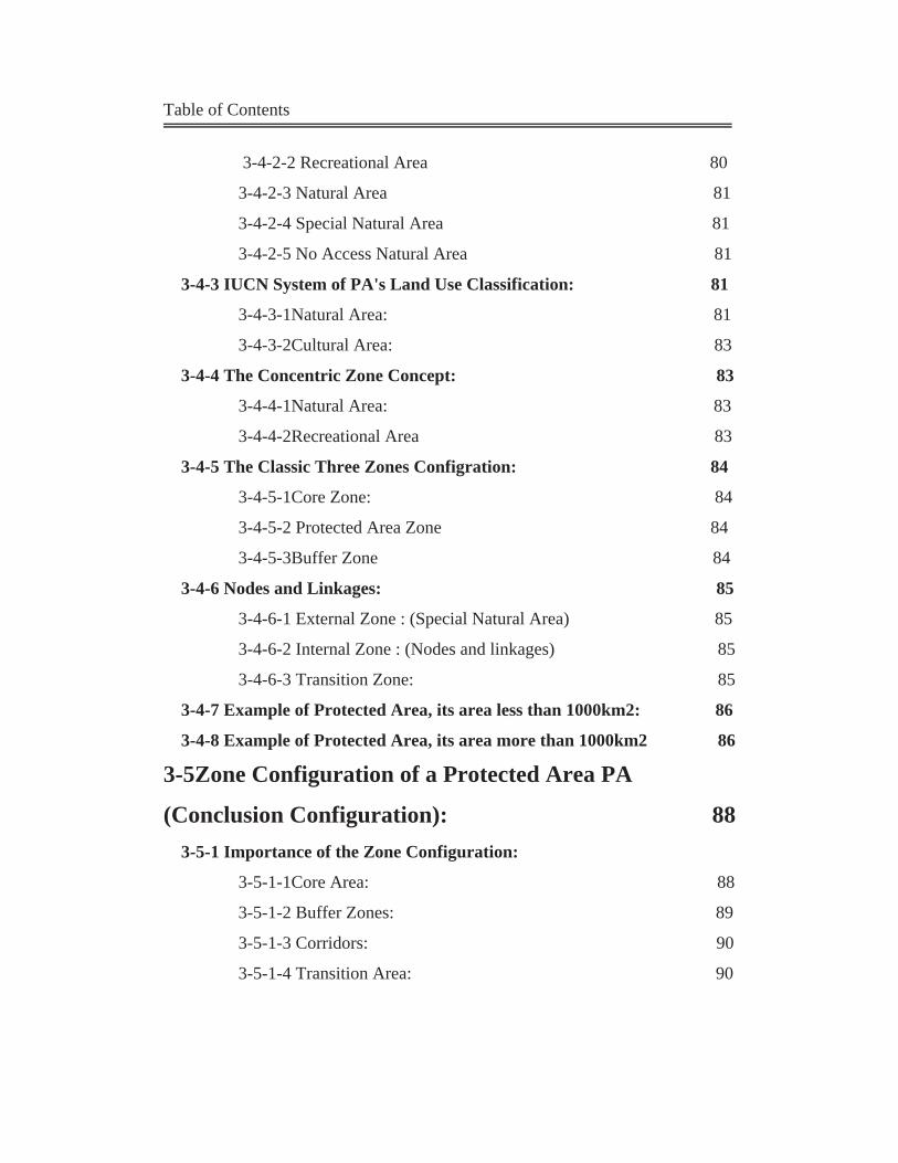
Table of Contents
3-4-2-2 Recreational Area 80
3-4-2-3 Natural Area 81
3-4-2-4 Special Natural Area 81
3-4-2-5 No Access Natural Area 81
3-4-3 IUCN System of PA's Land Use Classification: 81
3-4-3-1Natural Area: 81
3-4-3-2Cultural Area: 83
3-4-4 The Concentric Zone Concept: 83
3-4-4-1Natural Area: 83
3-4-4-2Recreational Area 83
3-4-5 The Classic Three Zones Configration: 84
3-4-5-1Core Zone: 84
3-4-5-2 Protected Area Zone 84
3-4-5-3Buffer Zone 84
3-4-6 Nodes and Linkages: 85
3-4-6-1 External Zone : (Special Natural Area) 85
3-4-6-2 Internal Zone : (Nodes and linkages) 85
3-4-6-3 Transition Zone: 85
3-4-7 Example of Protected Area, its area less than 1000km2: 86
3-4-8 Example of Protected Area, its area more than 1000km2 86
3-5Zone Configuration of a Protected Area PA
(Conclusion Configuration): 88 3-5-1 Importance of the Zone Configuration:
3-5-1-1Core Area: 88
3-5-1-2 Buffer Zones: 89
3-5-1-3 Corridors: 90
3-5-1-4 Transition Area: 90
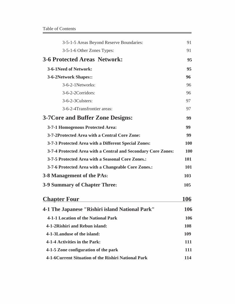
Table of Contents
3-5-1-5 Areas Beyond Reserve Boundaries: 91
3-5-1-6 Other Zones Types: 91
3-6 Protected Areas Network: 95
3-6-1Need of Network: 95
3-6-2Network Shapes:: 96
3-6-2-1Networks: 96
3-6-2-2Corridors: 96
3-6-2-3Culsters: 97
3-6-2-4Transfrontier areas: 97
3-7Core and Buffer Zone Designs: 99 3-7-1 Homogenous Protected Area: 99
3-7-2Protected Area with a Central Core Zone: 99
3-7-3 Protected Area with a Different Special Zones: 100
3-7-4 Protected Area with a Central and Secondary Core Zones: 100
3-7-5 Protected Area with a Seasonal Core Zones.: 101
3-7-6 Protected Area with a Changeable Core Zones.: 101
3-8 Management of the PAs: 103
3-9 Summary of Chapter Three: 105
Chapter Four 106 4-1 The Japanese "Rishiri island National Park" 106 4-1-1 Location of the National Park 106
4-1-2Rishiri and Rebun island: 108
4-1-3Landuse of the island: 109
4-1-4 Activities in the Park: 111
4-1-5 Zone configuration of the park 111
4-1-6Current Situation of the Rishiri National Park 114
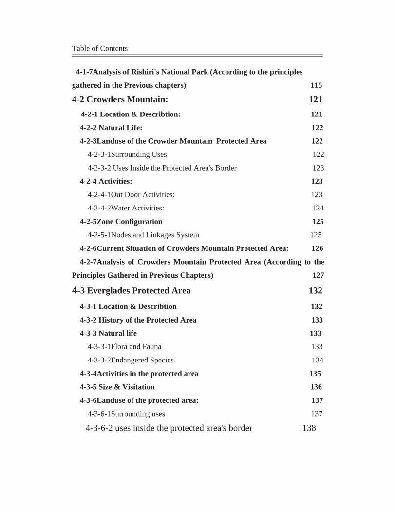
Table of Contents
4-1-7Analysis of Rishiri's National Park (According to the principles
gathered in the Previous chapters) 115
4-2 Crowders Mountain: 121 4-2-1 Location & Describtion: 121
4-2-2 Natural Life: 122
4-2-3Landuse of the Crowder Mountain Protected Area 122
4-2-3-1Surrounding Uses 122
4-2-3-2 Uses Inside the Protected Area's Border 123
4-2-4 Activities: 123
4-2-4-1Out Door Activities: 123
4-2-4-2Water Activities: 124
4-2-5Zone Configuration 125
4-2-5-1Nodes and Linkages System 125
4-2-6Current Situation of Crowders Mountain Protected Area: 126 4-2-7Analysis of Crowders Mountain Protected Area (According to the
Principles Gathered in Previous Chapters) 127
4-3 Everglades Protected Area 132 4-3-1 Location & Describtion 132
4-3-2 History of the Protected Area 133
4-3-3 Natural life 133
4-3-3-1Flora and Fauna 133
4-3-3-2Endangered Species 134 4-3-4Activities in the protected area 135
4-3-5 Size & Visitation 136
4-3-6Landuse of the protected area: 137
4-3-6-1Surrounding uses 137
4-3-6-2 uses inside the protected area's border 138
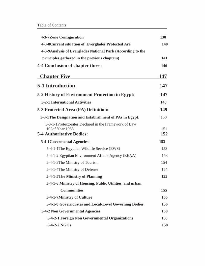
Table of Contents
4-3-7Zone Configuration 138
4-3-8Current situation of Everglades Protected Are 140
4-3-9Analysis of Everglades National Park (According to the
principles gathered in the previous chapters) 141 4-4 Conclusion of chapter three: 146
Chapter Five 147
5-1 Introduction 147 5-2 History of Environment Protection in Egypt: 147 5-2-1 International Activities 148
5-3 Protected Area (PA) Definition: 149 5-3-1The Designation and Establishment of PAs in Egypt: 150
5-3-1-1Protectorates Declared in the Framework of Law 102of Year 1983 151 5-4 Authoritative Bodies: 152 5-4-1Govermental Agencies: 153
5-4-1-1The Egyptian Wildlife Service (EWS) 153 5-4-1-2 Egyptian Environment Affairs Agency (EEAA): 153
5-4-1-3The Ministry of Tourism 154
5-4-1-4The Ministry of Defense 154
5-4-1-5The Ministry of Planning 155
5-4-1-6 Ministry of Housing, Public Utilities, and urban
Communities 155
5-4-1-7Ministry of Culture 155
5-4-1-8 Governorates and Local-Level Governing Bodies 156
5-4-2 Non Governmental Agencies 158
5-4-2-1 Foreign Non Governmental Organizations 158
5-4-2-2 NGOs 158
Table of Contents
5-4-2-3International NGOs 159
5-5 Legislative Decrees and Conventions: 159 5-5-1National Legislative Protection 159
5-5-2International Activities, Conventions and Agreements 161
5-6Egyptian Protectorates Classification: 162 5-6-1Classification According to Location (EEAA classification): 163
5-6-1-1 Central Area Protectorates: 165
5-6-1-2 Northern Area Protectorates: 166
5-6-1-3 Sinai Protectorates: 167
5-6-1-4 Southern Area Protectorates: 168
5-6-2Classification According to the Natural Feature 169
5-6-2-1 The Wet Land Protectorates: 171
5-6-2-2 The Desert Protectorates: 171
5-6-2-3 The Geological Protectorates: 171
5-6-3Classification According to the Major Geographical Regions
(Researcher's Classification): 171
5-6-3-1Eastern desert 173
5-6 3-2 The North West (Mediterranean) Coast: 174
5-6-3-3 Western Desert: 174
5-6-3-4 The Nile Valley and Upper Egypt: 174
5-6-3-5 Central Cairo Protectorates: 174
5-6-3-6 Sinai & Red Sea Protectorates: 175 5-6-4Classification according to IUCN Categories System: 176
5-7Egyptian Protectorates Analysis 177
5-8 Biodiversity in Egypt 178
5-9Egyptian Law for Protectorates: 180 5-9-1Law No 102 of 1983 for Nature Protectorates Article (1) 180
Table of Contents
5-10 Environmental Impacts Assessment (EIA) 182 5-10-1Relation between EIA and protectorates: 182
5-11Dangers that Face Environment Protection in Egypt 183 5-11-1Conflicts in the PAs Management: 183
5-11-2 Conflicts in the PAs Definitions and Classifications: 184
5-11-3 Conflict in Aims 185
5-11-4 Shortage in the Publication of the PAs: 185
5-11-5 Shortage in the Financial Support of PAs: 186
5-12Some examples of Egyptian protectorates problems 186 5-12-1 Wadi Degla: 186
5-12-2 Ras Mohammed and the Gulf of Aqaba: 187
5-12-3 El Burullos and El Bardaouil Wetlands: 190
5-12-4 The Western Desert Oases: 192
5-12-5 Wadi El Rayan and Lake Qarun: 192
5-12-6 The Petrified Forest: 193
5-13 Summary of Chapter Five 194
Chapter Six 195 6-1 Introduction: 195
6-2 Define Egyptian Problem: 195
6-3 Focus of the Study: 196
6-4 The Petrified Forest Protected Area in Maadi – Cairo 197
66--44--AA TThhee EExxiissttiinngg SSiittuuaattiioonn ooff TThhee PPAA:: ((SSttuuddyy PPhhaassee)) 119977
66--44--11 DDeessccrriippttiioonn aanndd CCoonntteennttss 119977
6-4-1-1 Location of the Petrified Forest: 197
6-4-1-2 Announcement of the Petrified Forest: 199
Table of Contents
6-4-1-3 Importance of the Petrified Forest, Cairo governorate: 200
6-4-1-4Origin of the Petrified Forest: 200
6-4-1-5 Contents of the Petrified Forest Area: 201
6-4-1-6 Ecosystem in the Petrified Forest: 202
6-4-1-7 Financial value of the Protected Area: 202
66--44--22UUrrbbaann SSttuuddyy:: 220033
6-4-2-1The Petrified Forest and the Urban Growth: 203
6-4-2-2 Master Plan of New Cairo City and the Location of
the Petrified Forest in it 204
6-4-2-3 Planned Land Use around the Petrified Forest Area: 207
6-4-2-4 Present Land Use around The Petrified Forest Area: 208
6-4-2-5 Urban Development of the Surrounding Areas
to the PA: 209
66--44--BB AAnnaallyyssiiss ooff tthhee PPeettrriiffiieedd FFoorreesstt CCoonnddiittiioonn:: ((SSeeccoonndd pphhaassee)) 221100
6-4-3 Protected Area's Classification: 210
6-4-4 Management Plan of the Petrified Forest: 210
6-4-5: Analysis of the Surrounding Uses: 211
6-4-6Factors that Affect the Petrified Forest PA: 213
6-4-7Urban Growth on the Petrified Forest Land: 214
6-4-8 Problems that Face the Petrified Forest Protectorates: 215
6-4-8-1 Conflicts in the Situation 216
6-4-8-2 Conflict in Aim 217
6-4-8-3 Conflict in Uses and Activities: 217
6-4-8-4 Conflict in planning concepts: 218
6-4-9 The Main Participants in the Petrified Forest PA: 219
6-4-10 Zone Configuration Analysis: 220
66--44--CC CCoonncclluussiioonn:: 222211
Table of Contents
6-5 Wadi Degla Protected Area in Cairo Governorate 225
66--55--AA TThhee EExxiissttiinngg SSiittuuaattiioonn ooff TThhee PPAA:: ((PPhhaassee 11)) 225
66--55--11 DDeessccrriippttiioonn aanndd ccoonntteennttss 222266
6-5-1-1 Location of Wadi Degla: 226
6-5-1-2History of the Wadi: 226
6-5-1-3Description of the Valley: 227
6-5-2Natural Resources in the Valley: 227
6-5-2-1 Wildlife: 228
6-5-2-2 Plantation: 229
6-5-3Activities in the Wadi: 229
66--55--44UUrrbbaann SSttuuddyy:: 223311
6-5-4-1 Wadi Degla and the Urban Growth: 231
6-5-4-2 Present Land Use around Wadi Degla PA: 231
66--55--BB AAnnaallyyssiiss ooff WWaaddii DDeeggllaa CCuurrrreenntt CCoonnddiittiioonn:: 235
6-5-5 Protected Area's Classification: 235
6-5-6 Management Plan of Wadi Degla: 235
6-5-7: Analysis of the Surrounding Uses: 236
6-5-8 the Main Participants in Wadi Degla PA: 238
6-5-9Wadi degla Problems: 239
6-5-9-1The Recycling Factory in the East: 239
6-5-9-2 New El Kattamia Al Ain Al Sokhna Road: 240
6-5-9-3Residential Area in the North – West Zone: 241
6-5-9-4Tourism and Recreational Problems: 241
6-5-9-5 Shak El Teaban Area: 242
6-5-10 Zone Configuration Analysis: 242
6-5-11 Efforts of Cleaning the Wadi: 242
6-5-11-1 Governmental Efforts: 242
6-5-11-2 NGO'S Efforts: 243
Table of Contents
6-5-12 Wadi Degla Sporting Club (One of the most compatible use): 245
66--55--CC CCoonncclluussiioonn:: 224477
6-6Relation between the Petrified Forest & Wadi Degla: 251
6-7 Summary of Chapter six: 252
Table of Contents
FFiigguurreess Figure (1): Compounds of Urban Environment 11
Figure (2): Interrelations between organisms in the ecosystem 15
Figure (3): Characteristics of Ecosystems 16
Figure (4): The perfect relationship between man and environment. 18
Figure (5): The three concepts of sustainable development 25
Figure (6): The conceptual framework for sustainable development. 26
Figure (7): The three Pillars of sustainable development 27
Figure (8): Protected Area Extent by IUCN, WCPA Region 36
Figure (9): Functions of Protected Areas. 41
Figure (10): Categories of Protected Areas 44
Figure (11): Island of Barro Colorado 45
Figure (12): Middle Santaim Wilderness, USA 46
Figure (13): Booderee National Park, 47
Figure (14): Absecon Wildlife Management Area, USA 49
Figure (15): San Dieguito Lagoon, USA 50
Figure (16): Abu Galum Managed 51
Figure (17): A Turkish biosphere reserve 53
Figure (18): The zonation of biosphere reserve 53
Figure (19): Structural parameters of Pas 69 Figure (20): The principle of concentring zoning 75
Figure (21): Zoning of the Canadian system land use classification. 79
Figure (22): Zoning of the American system land use classification 81
Figure (23): The concentric zone concept. 83
Figure (24 The classic three zones configuration. 84
Figure (25): Nodes and Linkages 85
Figure (26): Booderee national park 86
Figure (27): Teranova national park in 86
Table of Contents
Figure (28): Zoning of the American system land use classification 121
Figure (29): Zoning of the American system land use classification 123
Figure (30): The classic three zones configuration. 124
Figure (31): Nodes and Linkages. 125
Figure (32): Booderee national park 126
Figure (33): Teranova national park in Kanda. 126
Figure (34): Planning Principles of National Park 128
Figure (35): Buffer Zone Situations 134
Figure(36): Core Areas connected by corridors 134
Figure (37): Buffer Zone Situations 135
Figure(38): Core Areas connected by corridors 135
Figure (39): The network Shape 140
Figure (40): Corridor Shape 140
Figure (41): Cluster Shap 141
Figure (42):Trans frontier Shape 141
Figure (43): Homogenous protected area 143
Figure (44): Protected Area with a central core zone 143
Figure (45): Protected area with a different special zones 144
Figure (46): Protected area with a different special zones 144
Figure (47): Protected area with a seasonal core zones 145
Figure (48): Protected area with a changeable core zones 145
Figure (49): Idealized representation between IUCN management
category and the degree of human intervention 148
Figure (50): Rishiri National Park 149
figure (51): Zones classification of Rishiri park 150
Figure (52): Map of Rishiri National Park, and analysis of its zone
configuration. 150
figure (53): Crowders mountain state park. 152

Table of Contents
figure (54): Location of the park in Florida coast 154
Figure (55): Everglades protected area. 155
Fgure (56): Everglades protected area. 157
Table of Contents
PPhhoottooss Photo (1): An example for a natural environment 12
Photo (2): An example for a built environment 13
Photo (3): An example for Urban environment 14 Photo (4): Yellow Stone the first national park in the world 39 Photo (5): The Petrified Forest 48
Photo (6): ): Activities that damage coral reef area can be avoided if park
regulations are followed. 66
Photo (7): ): Fishing of juveniles reduces fish stocks, affecting both the reef and
the livelihoods of fishermen 67
Photo (8): Wadi degla 80
Photo (9): Water falls in Wadi El Rayan 81
Photo (10): Nile river Islands protected area 82
Photo (11): El Omayed Protectorate 82
Photo (12): Ashtoom El Gamil 83
Photo (13): El-Brolus Protectorate (EEAA, 2003) 83
Photo (14): Siwa Protectorates 84
Photo (15): Zaraniq protectorates (EEAA, 2003 86
Photo (16): Ahrash Protectorate (EEAA, 2003) 86
Photo (17): Saint Catherine Protectorate (EEAA, 2003) 87
Photo (18): Nabaq Protectorate 87
Photo (19): Abu Gallum protected area 88
Photo (20): Taba Protectorate 88
Photo (21): Wadi El Gemal - Hamata Protectorate 89
Photo (22): Elba Protectorate 89
Photo (23): Saloga & Ghazal Protectorate 90
Photo (24): White Desert Protectorate 90
Photo (25): Wadi El- Alaqi 91

Table of Contents
Photo (26): Wadi Al- Asioutty Protectorate 91
Photo (27): Everglades marine live and tourist activities. 156
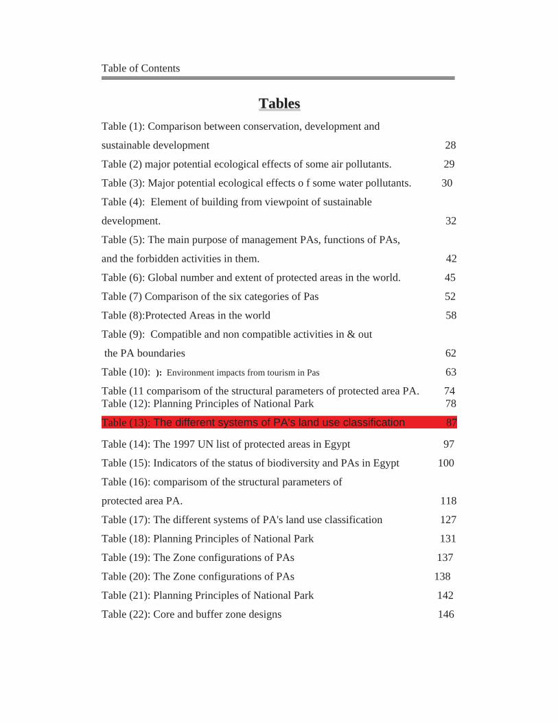
Table of Contents
TTaabblleess Table (1): Comparison between conservation, development and
sustainable development 28
Table (2) major potential ecological effects of some air pollutants. 29
Table (3): Major potential ecological effects o f some water pollutants. 30
Table (4): Element of building from viewpoint of sustainable
development. 32
Table (5): The main purpose of management PAs, functions of PAs,
and the forbidden activities in them. 42
Table (6): Global number and extent of protected areas in the world. 45
Table (7) Comparison of the six categories of Pas 52
Table (8):Protected Areas in the world 58
Table (9): Compatible and non compatible activities in & out
the PA boundaries 62
Table (10): ): Environment impacts from tourism in Pas 63
Table (11 comparisom of the structural parameters of protected area PA. 74 Table (12): Planning Principles of National Park 78
Table (13): The different systems of PA's land use classification 87
Table (14): The 1997 UN list of protected areas in Egypt 97
Table (15): Indicators of the status of biodiversity and PAs in Egypt 100
Table (16): comparisom of the structural parameters of
protected area PA. 118
Table (17): The different systems of PA's land use classification 127
Table (18): Planning Principles of National Park 131
Table (19): The Zone configurations of PAs 137
Table (20): The Zone configurations of PAs 138
Table (21): Planning Principles of National Park 142
Table (22): Core and buffer zone designs 146

Table of Contents
Table (23): Matrix of management objectives and IUCN categories. 148
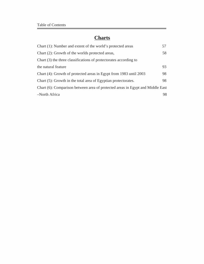
Table of Contents
CChhaarrttss Chart (1): Number and extent of the world’s protected areas 57
Chart (2): Growth of the worlds protected areas, 58
Chart (3) the three classifications of protectorates according to
the natural feature 93
Chart (4): Growth of protected areas in Egypt from 1983 until 2003 98
Chart (5): Growth in the total area of Egyptian protectorates. 98
Chart (6): Comparison between area of protected areas in Egypt and Middle East
–North Africa 98
Introduction
1
Introduction:
Natural environment is everything that surrounds man such as
atmosphere, land, water, biological life including man, flora, and fauna.
There are many interrelations between man and environment, as man
affects the environment and vise versa.
As a result of man's industrial, social and entertaining activities, the
environment had reached a point of deterioration, which aroused voices of
many people calling for the protection of natural & environmental
resources as well as maintaining the environmental balance and hindering
its deterioration.
Eventually these people have developed a healthy proposal that is
sensible and respectful towards the environment as a reaction to the rapid
deterioration of the environment caused by misusage of its natural
resources; this proposal concerns preserving these natural areas which is
the subject of this research.
The United States was the first country that announced a national park in
1890 (The Yellow Stone Park) as a preserved natural park, which receives
not less than 3 million visitors annually.
The Egyptian government has started to recognize this issue recently, as
on July 31st 1983 the government endorsed law number 102/1983, which
defined a natural reserved area as'' An area of land, or a coast or a lake
containing flora, fauna and natural features that could be of cultural or
scientific or touristic value''. These areas are designated and declared as
preserved areas by the Prime Minister upon the recommendation of the
Egyptian Environment Affairs Agency (E.E.A.A).
Egypt has 24 protectorates, they comprise about 8% from its total area,
and their number is expected to reach 48 protectorates by 2017
comprising about 17% from the total area of Egypt
Introduction
2
Preserving natural areas is an application for the concept of sustainability
that appeared during the last few years, as sustainable development is
concerned about keeping natural resources which is the aim of protected
areas.
Protected areas are not only fixed boundaries that contain unique
resources from fauna or flora, but it is also an item that must play an
active role in the urban planning process as there is a mutual effect
between them.
The Research Problem:
Natural environment in Egypt has become subject to many shapes of
deteriorations caused by man, as preserved areas suffer from many
phenomena that threaten its safety, such as the presence of preserved
natural area within the urban context, this was a result of the unplanned
urban activities and its close adherence to these preserved areas, this
hazardous situation may threat the safety of preserved areas, which could
lead to the loss of an environmental and geological heritage.
In addition, those preserved areas have been neglected in the planning
process, as urban planning in Egypt usually neglects the influence of
those areas on the main development plan of any city.
Thus encouraging some urban expansions to grow around some protected
areas such as The Petrified Forest and Burllus protectorate.
Also some of our protected areas suffer from conflict in responsibilities
between relevant agencies, naturally causing deterioration of some of
those areas (Wadi-Degla).
Research objectives:
To discuss the problems of the protection process in Egypt.
Introduction
3
To study the unique Egyptian phenomenon; adherence of urban
development to Protected Areas.
To make some solutions and recommendations to the current
protection problem that has appeared in some Egyptian
protectorates.
To Change the perception that preserved areas are obstacles that
face development processes, and to emphasize its potentiality
within the sustainable development.
The Research Hypothesis:
The research assumes the occurrence of negative effects on preserved
areas, due to the neglection of its role in the development process, as well
as urban expansions that crawls around it affecting it negatively. Ignoring
natural preserves in development plans helped in the growth of many
violations on its territory. As protection and development are an opposite
face to the same coin; if external forces (urban influences) acting on the
area are greater than internal forces (conservation management), the
protected area will suffer from violations and neglection.
Scope of research
The research is concerned in studying definitions and principles of
protected areas used in foreign experiences to get guidelines to apply on
an Egyptian case study contemporary.
The Research Methodology:
It depends on testing the research hypothesis in three main
directions:
First: A generic study of protected areas including factors that negatively
affects it.
Introduction
4
Second: Studying the protected areas principles and guide line to
enhance an analytical tool.
Third: study of the protected areas in Egypt including its locations,
categories and current problems.
Third: Analyzing the interrelations between preserved areas and urban
environment by examining and studying the case study; '' the Petrified
Forest and Wadi Degla'' applying the results concluded from previous
chapters.
Introduction
5
The Researcher:
Name: Samah Mohammed El Sayed El Khateeb
Department: Department of Urban Planning and Design
Faculty: Faculty of Engineering
University: Ain Shamas University
Occupation: Demonstrator in Faculty of Engineering, Ain Shams
University.
Abstract:
Protected areas in Egypt suffer from many violations and neglecting, this
came as a result of many problems and challenges that face the protection
process. This protected areas supposed to be source of great importance
on both of national and local levels. Its importance not due to its natural
and heritage values, but it can be an economic base, as many activities
can be established around to it. But, on fact conservation strategies face
different conflicts, especially conflicts between aims of protection and
aims of conservation. This obviously appears in the Petrified Forest &
Wadi Degla Protected Areas. This protectorate suffers from the
neglecting of national plans to its presence in one hand. In another hand,
its presence within urban context might have impacts on it.
Keywords:
Conservation
Protected Areas
Protection
Development
Protectorates
Introduction
6
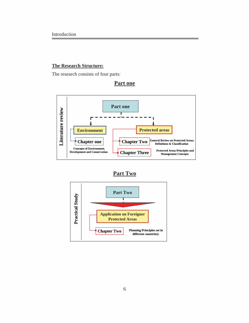
The Research Structure:
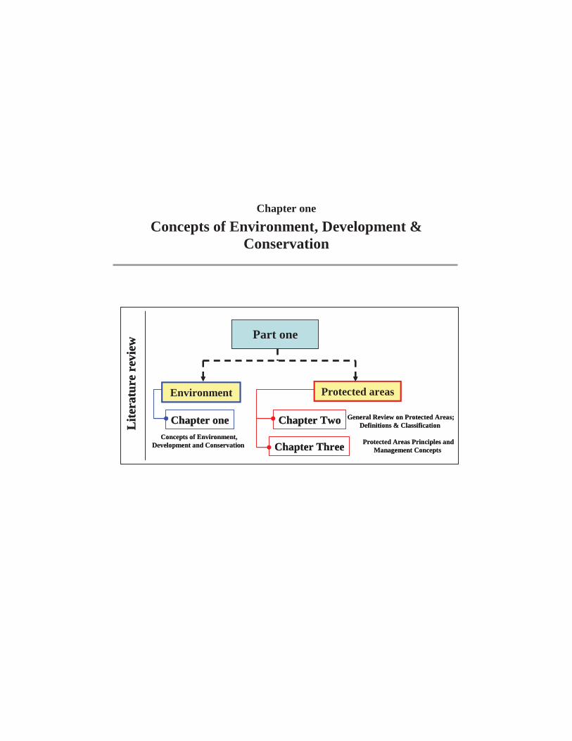
The research consists of four parts:
Part one
Part Two
Part one
Environment Protected areas
Lite
ratu
re r
evie
w
Chapter one
Chapter Three
Chapter Two General Review on Protected Areas; Definitions & Classification
Protected Areas Principles and Management Concepts
Concepts of Environment, Development and Conservation
Part one
Environment Protected areas
Lite
ratu
re r
evie
w
Chapter one
Chapter Three
Chapter Two General Review on Protected Areas; Definitions & Classification
Protected Areas Principles and Management Concepts
Concepts of Environment, Development and Conservation
Part Two
Application on Foreigner Protected Areas
Prac
tical
Stu
dy
Planning Principles set in different countries):
Chapter Two
Part Two
Application on Foreigner Protected Areas
Prac
tical
Stu
dy
Planning Principles set in different countries):
Chapter Two
Introduction
7
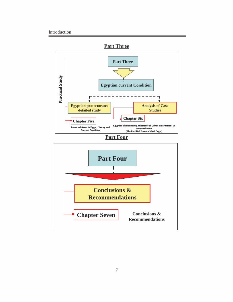
hreePart T
FourPart
Part Three
Egyptian current Condition
Prac
tical
Stu
dy
Egyptian protectorates detailed study
Analysis of Case Studies
Chapter SixChapter Five
Protected Areas in Egypt, History and Current Condition
Egyptian Phenomenon; Adherence of Urban Environment to Protected Areas
(The Petrified Forest – Wadi Degla)
Part Four
Conclusions & Recommendations
Conclusions & Recommendations
Chapter Seven
Introduction
8
Part one:
Chapter One: (Concepts of Environment, Development and
Conservation):
This chapter makes an overall study on Environment, its related
terminology, Concept of; conservation, Development and Sustainable
development. Additionally it discusses the impacts of urban activities on
natural environment.
Chapter two (General Review on Protected Areas; Definitions &
Classification):
This chapter deals with the definitions and classification of natural
reserves and the compatible activities around them.
Chapter three (Protected Areas Principles and Management Concepts
This chapter deals with the rules and principles of protected areas in terms
of management, distribution of uses and land use configuration systems.
Part Two: Chapter Four: Planning Principles Set in Different countries.
This chapter deals with some foreigner examples of natural reserves and
studies it with the methodology that has been divided in the previous
chapters.
Introduction
9
Part three: Chapter Five: Protected Areas in Egypt, History and Current Condition This chapter deals with the nature reserves in Egypt in terms of its history
and present situation and problems facing environmental protection in
Egypt.
Chapter Six:'' Egyptian Phenomenon; Adherence of Urban Environment to Protected Areas (The Petrified Forest – Wadi Degla)'' This chapter deals with the study of Egyptian protected areas which
situated within urban context; The Petrified Forest and Wadi Degla
Protectorates. It uses the rules and principles that have been experienced
in the previous chapters in Analyzing case study.
:FourPart
Chapter Seven: Conclusions and Recommendations
This chapter contains conclusions and further research and manifests the
validity of the hypothesis all through the research.
Chapter one
Concepts of Environment, Development & Conservation


Part I
Literature Review (Theoretical Study)
Part
One
:
The
oret
ical
stud
y
Core and buffer zone designs
Concepts of Environment , Development and
Conservation
Definitions of Environment and Related Terminology
Environment Deterioration
Conservation
Development
Conservation & sustainable development Effects of Urban
Development on Natural Environment
Effects of Urban Development on Natural
Environment
PAsDefinitions
Participatory organizations of PAs
Historical Background of PAs
Characteristics of Protected Areas
Categories of PAs
Number and Extent of the World’s PAs
Compatible and Incompatible
Activities around PAs
Characteristics of Protected Areas (PAs)
Land Use Classification of PAs
Zone configuration of a PA (conclusion configuration)
Management of the PAs
Protected Areas Network
Planning principles of National parks
and PAs
Protected Areas Principles & Zone Configuration
Guidelines
General Review on Protected Areas;
Definitions & Classification
Chapter one
Concepts of Environment, Development & Conservation
Part one
Environment Protected areas
Lite
ratu
re r
evie
w
Chapter one
Chapter Three
Chapter Two General Review on Protected Areas; Definitions & Classification
Protected Areas Principles and Management Concepts
Concepts of Environment, Development and Conservation
Part one
Environment Protected areas
Lite
ratu
re r
evie
w
Chapter one
Chapter Three
Chapter Two General Review on Protected Areas; Definitions & Classification
Protected Areas Principles and Management Concepts
Concepts of Environment, Development and Conservation
Chapter one Environment, Development & Conservation
- 10 -
Introduction:
In the last century environment has faced a lot of dangers that caused a
lot of environment problems; environment deterioration, loss of
biological diversity and climate change. According the general media
expressed to save this planet and rescue our environment. Conserving the
environment is the necessary attitude toward these dangers. This chapter
will present a general review on environment definitions, ecology,
development, and conservation.
1-1 Definitions of Environment and Related
Terminology:
Throughout the world, man-made communities have been replacing the
communities of nature. However, the principles that govern life in natural
communities must be observed if their man-made counterparts are to
thrive. These principles include various term such as; environment,
ecosystem and biodiversity. The following are definitions of some of the
most important environmental terms.
1-1-1 Environment:
Environment is everything that surrounds man such as atmosphere, land,
water, biological life including man, flora, and fauna; there are many
interrelations between man and environment, as man affects the
environment and vise versa.
Environment is the sum of all external conditions affecting the life,
development and survival of an organism.
This means that environment is the space where man live in, this space
Chapter one Environment, Development & Conservation
- 11 -
can be so huge contain many elements and organisms, or it can be so
small contain specific species and elements. By another word,
environment is the sky above us, and the land under our feet, it is the sum
of all organisms; flora, fauna, and graphical features.
Environment is "The surrounding in which an organism lives" (Gupta
and Asher, 1998).
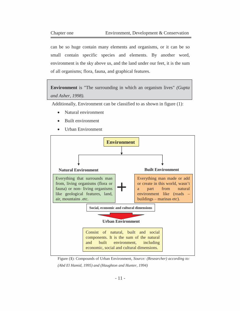
Additionally, Environment can be classified to as shown in figure (1):
Natural environment
Built environment
Urban Environment
Figure (1): Compounds of Urban Environment, Source: (Researcher) according to:
(Abd El Hamid, 1995) and (Haughton and Hunter, 1994)
Environment
Natural Environment Built Environment
Everything that surrounds man from, living organisms (flora or fauna) or non- living organisms like geological features, land, air, mountains .etc.
Everything man made or add or create in this world, wasn’t a part from natural environment like (roads –buildings – marinas etc).
Urban Environment
Consist of natural, built and social components. It is the sum of the natural and built environment, including economic, social and cultural dimensions.
Social, economic and cultural dimensions
Chapter one Environment, Development & Conservation
- 12 -
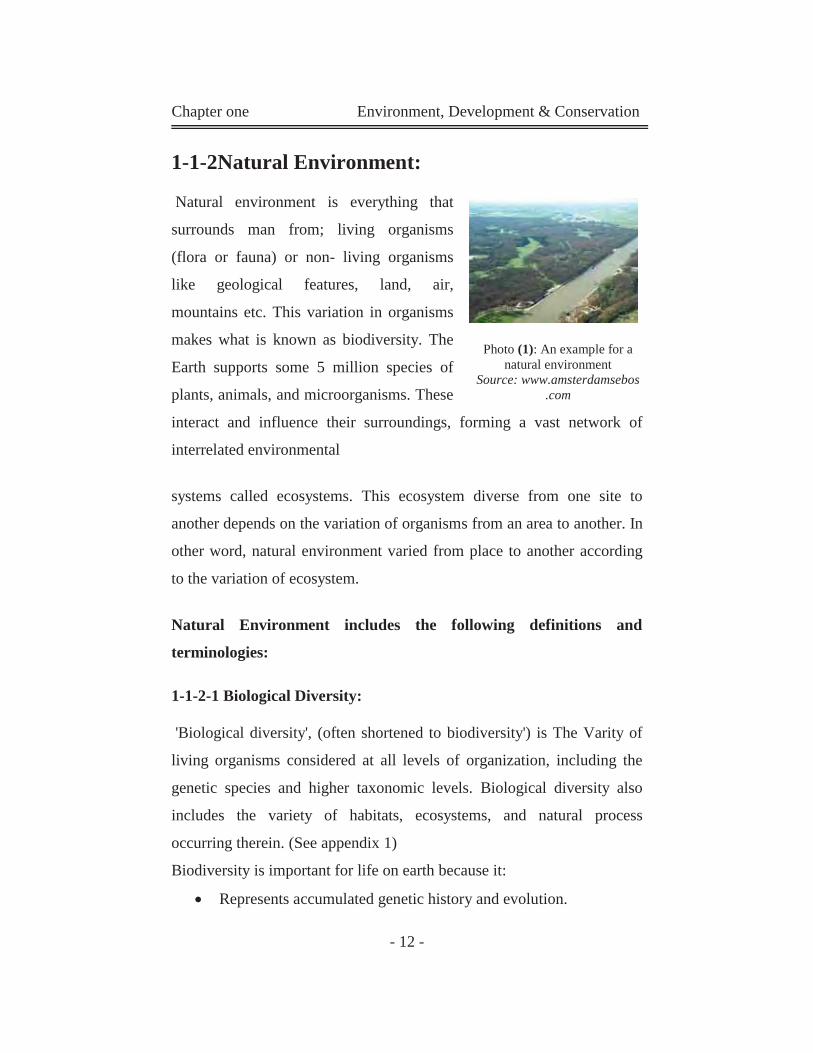
1-1-2Natural Environment:
Natural environment is everything that
surrounds man from; living organisms
(flora or fauna) or non- living organisms
like geological features, land, air,
mountains etc. This variation in organisms
makes what is known as biodiversity. The
Earth supports some 5 million species of
plants, animals, and microorganisms. These
interact and influence their surroundings, forming a vast network of
interrelated environmental
systems called ecosystems. This ecosystem diverse from one site to
another depends on the variation of organisms from an area to another. In
other word, natural environment varied from place to another according
to the variation of ecosystem.
Natural Environment includes the following definitions and
terminologies:
1-1-2-1 Biological Diversity:
'Biological diversity', (often shortened to biodiversity') is The Varity of
living organisms considered at all levels of organization, including the
genetic species and higher taxonomic levels. Biological diversity also
includes the variety of habitats, ecosystems, and natural process
occurring therein. (See appendix 1)
Biodiversity is important for life on earth because it:
Represents accumulated genetic history and evolution.
Photo (1): An example for a
natural environment Source: www.amsterdamsebos
.com
Chapter one Environment, Development & Conservation
- 13 -
Contributes to the resilience of ecosystems.
Supports cultural and technical advances derived from nature.
Contributes to human inspiration and peace. (Lucas, 1992)
1-1-2-2 Species:
Group of organisms formally recognized as distinct from other groups.
Species richness is the absolute number of species in a given area. (Abd
El Hamid, 1995)
1-1-2-3 Habitat:
Habitat is the locality, site and particular type of local environment
occupied by an organism. Habitat fragmentation is the process of
dividing a continuous habitat into non-continuous and smaller sub-units
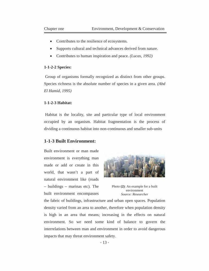
1-1-3 Built Environment:
Built environment or man made
environment is everything man
made or add or create in this
world, that wasn’t a part of
natural environment like (roads
– buildings – marinas etc). The
built environment encompasses
the fabric of buildings, infrastructure and urban open spaces. Population
density varied from an area to another, therefore when population density
is high in an area that means; increasing in the effects on natural
environment. So we need some kind of balance to govern the
interrelations between man and environment in order to avoid dangerous
impacts that may threat environment safety.
Photo (2): An example for a built
environment Source: Researcher
Chapter one Environment, Development & Conservation
- 14 -
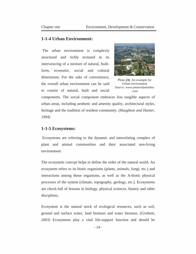
1-1-4 Urban Environment:
The urban environment is complexly
structured and richly textured in its
interweaving of a mixture of natural, built-
form, economic, social and cultural
dimensions. For the sake of convenience,
the overall urban environment can be said
to consist of natural, built and social
components. The social component embraces less tangible aspects of
urban areas, including aesthetic and amenity quality, architectural styles,
heritage and the tradition of resident community. (Haughton and Hunter,
1994)
1-1-5 Ecosystems:
Ecosystems are referring to the dynamic and interrelating complex of
plant and animal communities and their associated non-living
environment.
The ecosystem concept helps to define the order of the natural world. An
ecosystem refers to its biotic organisms (plants, animals, fungi, etc.) and
interactions among those organisms, as well as the A-biotic physical
processes of the system (climate, topography, geology, etc.). Ecosystems
are chock-full of lessons in biology, physical sciences, history and other
disciplines.
Ecosystem is the natural stock of ecological resources, such as soil,
ground and surface water, land biomass and water biomass. (Graham,
2003) Ecosystems play a vital life-support function and should be
Photo (3): An example for
Urban environment Source: www.amsterdamsebos
.com
Chapter one Environment, Development & Conservation
- 15 -
protected.
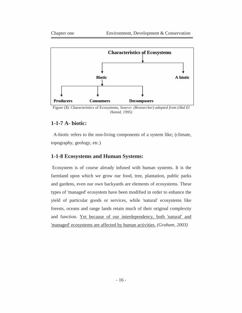
1-1-5-1Characteristics of Ecosystems:
In ecology there have been two competing views on the characteristics
of ecosystems. One view assumes nature is constant and that ecosystems
always develop toward a diverse stable equilibrium state.
The other holds that while ecosystems develop diversity, they can do this
along many pathways and therefore move between multiple equilibrium
states. In recent times the steady state perspective has been shown to be
incomplete and the view of ecosystems as dynamic is more widely
accepted. According to this view ecosystems are said to have a number of
important qualities. Typical qualities of ecosystems include diversity and
resilience, positive and negative feedback, emergence, self organization,
unpredictability and hierarchy. (Graham, 2003)
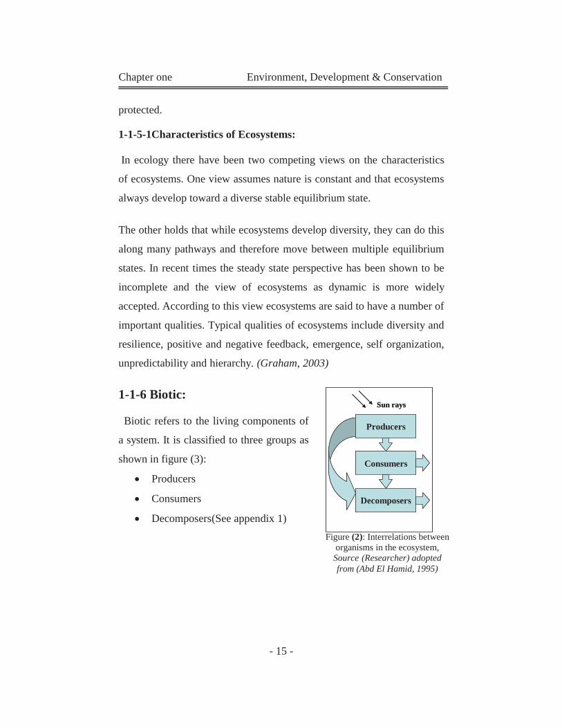
1-1-6 Biotic:
Biotic refers to the living components of
a system. It is classified to three groups as
shown in figure (3):
Producers
Consumers
Decomposers(See appendix 1)
Producers
Consumers
Decomposers
Sun rays
Producers
Consumers
Decomposers
Sun rays
Figure (2): Interrelations between organisms in the ecosystem,
Source (Researcher) adopted from (Abd El Hamid, 1995)
Chapter one Environment, Development & Conservation
- 16 -
Figure (3): Characteristics of Ecosystems, Source: (Researcher) adopted from (Abd El Hamid, 1995)
1-1-7 A- biotic:
A-biotic refers to the non-living components of a system like; (climate,
topography, geology, etc.)
1-1-8 Ecosystems and Human Systems:
Ecosystem is of course already infused with human systems. It is the
farmland upon which we grow our food, tree, plantation, public parks
and gardens, even our own backyards are elements of ecosystems. These
types of 'managed' ecosystem have been modified in order to enhance the
yield of particular goods or services, while 'natural' ecosystems like
forests, oceans and range lands retain much of their original complexity
and function. Yet because of our interdependency, both 'natural' and
'managed' ecosystems are affected by human activities. (Graham, 2003)
Characteristics of Ecosystems
Biotic A biotic
Producers Consumers Decomposers
Characteristics of Ecosystems
Biotic A biotic
Producers Consumers Decomposers
Chapter one Environment, Development & Conservation
- 17 -
1-1-9The Concept of 'Natural':
The dictionary define natural as: of concerning or being what exists or
happens ordinarily in the world, not caused, made, or controlled by
people. (Longman, 1983)
The IUCN guidelines refer to natural areas or areas with natural features.
The term 'natural' is defined as:
''Ecosystems where since the industrial revolution (1750) human impact:
(a) has been no greater than that of any other native species, and (b) has
not affected the ecosystem's structure. Climate change is excluded from
this definition.'' (Chape et al, 2003)
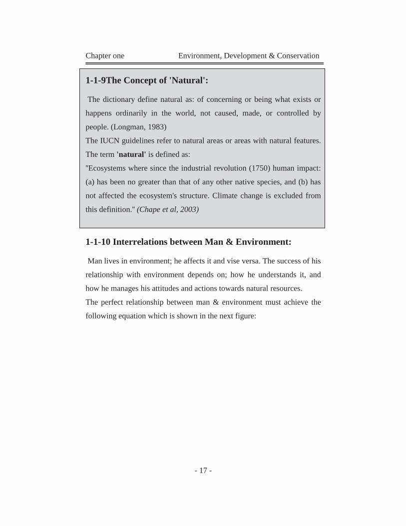
1-1-10 Interrelations between Man & Environment:
Man lives in environment; he affects it and vise versa. The success of his
relationship with environment depends on; how he understands it, and
how he manages his attitudes and actions towards natural resources.
The perfect relationship between man & environment must achieve the
following equation which is shown in the next figure:
Chapter one Environment, Development & Conservation
- 18 -
This relationship between man and environment is known in another word "Development".
1-1-11 Natural Resources:
Natural resources are the natural compounds of environment from air,
water, plants, etc. It is classified according to condition, and ownership.
1-1-11-1 Classification of Natural Resources According to Condition:
This type classifies natural resources into two groups:
Renewable resources.
Non-Renewable resources.
a- Renewable Resources: Resources such as trees, fish, oxygen, and fresh water are generally
considered to be renewable resources. (See appendix 1)
b- Non Renewable Resources:
Such things as fossil fuels (oil, coal, gas) and minerals that cannot be
reproduced and therefore can be vanish. These are called non-renewable
resources. (See appendix 1)
Well use of Natural Resources
Without
Threaten the safety Of Environment,
and natural resources.
Interrelations between man and environment
Figure (4): The perfect relationship between man and environment Source: (Researcher) adopted from (Tolba, 2003).
Chapter one Environment, Development & Conservation
- 19 -
1-1-11-2 Classification of Natural Resources According to Ownership:
This kind classifies natural resources into two groups:
Moving or un-owned resources.
Owned resources.
a- Moving or Un-Owned Resources:
Resources are not lying under ownership of any government or any
specific region. It is too hard to govern it under a physical border like;
fishing outside regional water.
b- Owned Resources:
Resources are lying under the authority of a government or a specific
region.
1-2 Environment Deterioration:
Every environmental system has a carrying capacity for an optimum, or
most desirable, population of any particular species within it. Sudden
changes in the relative population of a particular species can begin a kind
of chain reaction among other elements of the ecosystem. For example,
eliminating a species of insect by using massive quantities of a chemical
pesticide also may eliminate a bird species that depends upon the insect
as a source of food. Such human activities have caused the extinction of a
number of plant and animal species and cause environment deterioration.
Reasons of environment deterioration:
Ill-usage of environment resources.
Absence of laws that govern the relation between environment, and
man activities throughout many years.
Chapter one Environment, Development & Conservation
- 20 -
Pollution and its impacts on natural environment.
Urbanization &urban expansions that grow on natural environment
and change its natural features.
Besides some other natural factors like; climate change, earthquakes
and loss of biological diversity. (Tolba, 2003)
1-2-1The Planet in Crisis:
It is commonly accepted that the planet faces an environmental crisis
precipitated by anthropocentric activity that is resulting in the earth's
productive capacity from which serious consequential social and
environmental effects are starting to follow. Human economic activity is
the principle cause of environmental crisis through exploitation and
pollution, and yet such activity relies on a healthy environment for its
continuance and productivity. There are many key issues endangering
earth as global warming, waste, pollution, overpopulation, lose of
biological diversity, and extinction of species. (Langston and Ding,
2001)
1-3Conservation:
The earth faces many dangers like extinction of species, environment
deterioration, and leakage in the natural resources. Because of that many
voices appear for the protection of natural & environmental resources as
well as maintaining the environmental balance and hindering its
deterioration. Eventually these people have developed a healthy proposal
that is sensible and respectful towards the environment as a reaction to
the rapid deterioration of the environment caused by misusage of its
natural resources. This proposal is the conservation of environment and
natural resources.
Chapter one Environment, Development & Conservation
- 21 -
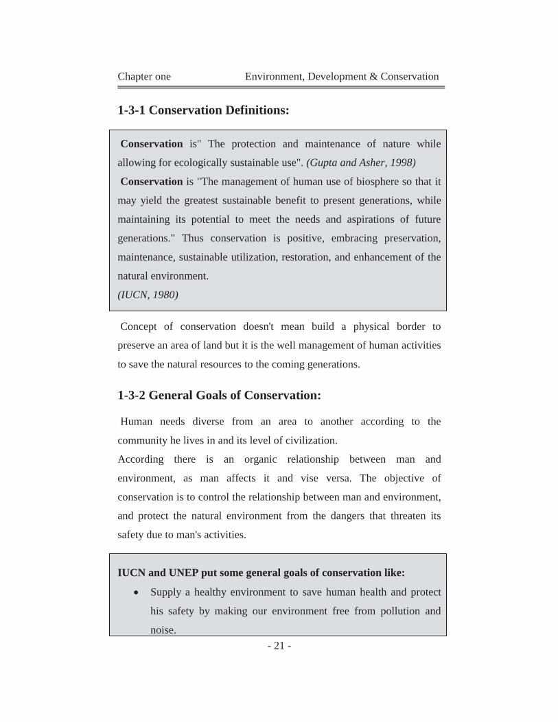
1-3-1 Conservation Definitions:
Conservation is" The protection and maintenance of nature while
allowing for ecologically sustainable use". (Gupta and Asher, 1998)
Conservation is "The management of human use of biosphere so that it
may yield the greatest sustainable benefit to present generations, while
maintaining its potential to meet the needs and aspirations of future
generations." Thus conservation is positive, embracing preservation,
maintenance, sustainable utilization, restoration, and enhancement of the
natural environment.
(IUCN, 1980)
Concept of conservation doesn't mean build a physical border to
preserve an area of land but it is the well management of human activities
to save the natural resources to the coming generations.
1-3-2 General Goals of Conservation:
Human needs diverse from an area to another according to the
community he lives in and its level of civilization.
According there is an organic relationship between man and
environment, as man affects it and vise versa. The objective of
conservation is to control the relationship between man and environment,
and protect the natural environment from the dangers that threaten its
safety due to man's activities.
IUCN and UNEP put some general goals of conservation like:
Supply a healthy environment to save human health and protect
his safety by making our environment free from pollution and
noise.
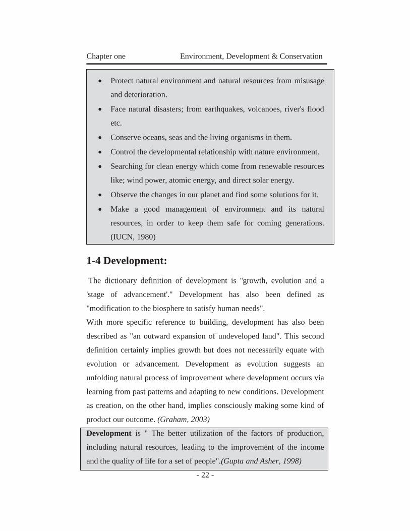
Chapter one Environment, Development & Conservation
- 22 -
Protect natural environment and natural resources from misusage
and deterioration.
Face natural disasters; from earthquakes, volcanoes, river's flood
etc.
Conserve oceans, seas and the living organisms in them.
Control the developmental relationship with nature environment.
Searching for clean energy which come from renewable resources
like; wind power, atomic energy, and direct solar energy.
Observe the changes in our planet and find some solutions for it.
Make a good management of environment and its natural
resources, in order to keep them safe for coming generations.
(IUCN, 1980)
1-4 Development:
The dictionary definition of development is ''growth, evolution and a
'stage of advancement'." Development has also been defined as
"modification to the biosphere to satisfy human needs".
With more specific reference to building, development has also been
described as "an outward expansion of undeveloped land". This second
definition certainly implies growth but does not necessarily equate with
evolution or advancement. Development as evolution suggests an
unfolding natural process of improvement where development occurs via
learning from past patterns and adapting to new conditions. Development
as creation, on the other hand, implies consciously making some kind of
product our outcome. (Graham, 2003)
Development is " The better utilization of the factors of production,
including natural resources, leading to the improvement of the income
and the quality of life for a set of people".(Gupta and Asher, 1998)

Chapter one Environment, Development & Conservation
- 23 -
1-5 Conservation & Sustainable Development:
The term "sustainable development" was introduced in 1980 to describe
development efforts which sought to address social needs while taking
care to minimize potential negative environmental impacts." This
concept recognized the need to maintain the natural environment in a
state that still allowed humanity to fulfill its needs. The concept did,
however, stress that achieving economic and social goals was dependent
on, and connected with, achieving environmental goals. The two words
that make up the name of this concept need to be explored. While
sustainable development might be easy to say, debates about what should
be sustained and what constitutes appropriate forms of development are
hotly contested. (Graham, 2003)
The introduction of the concept of sustainable development in 1980 led
to the economic view; that environmental conservation and human
development were opposite site of the same coin. Conservation and
development were essential to one another if life was to be sustained in
such a way to provide equitable access to socio-economic and
environmental opportunities. (IUCN/UNEP, 1980)
1-5-1 Historical Context of Sustainable Development:
The concept of sustainable development gained momentum in the 1980
when scientific evidence about depletion of the environment became
obvious. It is now widely recognized that environment quality and the
conservation of natural resources are important for the well-being of
humankind today and for the coming generations.
This recognition was first discussed in the 1973 United Nations
conference on the human environment in Stockholm. Furthermore, the
Chapter one Environment, Development & Conservation
- 24 -
ideas of sustainable development have been discussed in the 1980 world
conservation strategy (WCS), produced by the international union for
conservation of nature and natural resources(IUCN) in collaboration with
the united nations environment program (UNEP) and the world wildlife
fund (WWF). According to the world conservation strategy the national
conservation strategies for sustainable development were prepared and
adopted by the government of fifty countries.
By the end of 1988 our common future had received public backing from
the leaders of the world. The earth summit was held in Rio de Janeiro in
1992 by the United Nations Conference on Environment and
Development (UNCED) to follow up the recommendations and strategies
previously identified in the last conferences. This conference, also known
as the Rio conference, was the first to discuss the planet's future and was
attended by world leaders. The earth summit reached a number of
important conclusions, and it was agreed to sitting out 27 general
principles for achieving sustainable development.
In December 1997 the Kyoto Climate summit was held to set targets for
green-house gas emissions. The conclusions were that the industrialized
countries, known as Annex1, were to reduce their emission at least 5%
below by 2008-2012. That target was important to avoid the risk of
dangerous climate change. (Langston and Ding, 2001)
1-5-2 Sustainable Development Definition:
There are more than 70 definitions of sustainable development; they
have been made by different groups to suite their own goals.
The most popular definition is the one given in the Brundtland report:
Chapter one Environment, Development & Conservation
- 25 -
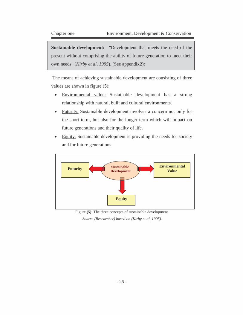
Sustainable development: "Development that meets the need of the
present without comprising the ability of future generation to meet their
own needs" (Kirby et al, 1995). (See appendix2):
The means of achieving sustainable development are consisting of three
values are shown in figure (5):
Environmental value: Sustainable development has a strong
relationship with natural, built and cultural environments.
Futurity: Sustainable development involves a concern not only for
the short term, but also for the longer term which will impact on
future generations and their quality of life.
Equity: Sustainable development is providing the needs for society
and for future generations.
Figure (5): The three concepts of sustainable development
Source (Researcher) based on (Kirby et al, 1995).
Environmental Value
Sustainable Development Futurity
Equity
Chapter one Environment, Development & Conservation
- 26 -
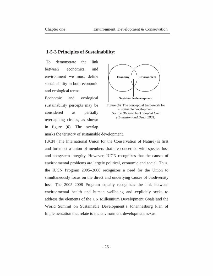
1-5-3 Principles of Sustainability:
To demonstrate the link
between economics and
environment we must define
sustainability in both economic
and ecological terms.
Economic and ecological
sustainability percepts may be
considered as partially
overlapping circles, as shown
in figure (6). The overlap
marks the territory of sustainable development.
IUCN (The International Union for the Conservation of Nature) is first
and foremost a union of members that are concerned with species loss
and ecosystem integrity. However, IUCN recognizes that the causes of
environmental problems are largely political, economic and social. Thus,
the IUCN Program 2005–2008 recognizes a need for the Union to
simultaneously focus on the direct and underlying causes of biodiversity
loss. The 2005–2008 Program equally recognizes the link between
environmental health and human wellbeing and explicitly seeks to
address the elements of the UN Millennium Development Goals and the
World Summit on Sustainable Development’s Johannesburg Plan of
Implementation that relate to the environment-development nexus.
Economy Environment
Sustainable development
Figure (6): The conceptual framework for sustainable development.
Source (Researcher) adopted from ((Langston and Ding, 2001)
Chapter one Environment, Development & Conservation
- 27 -
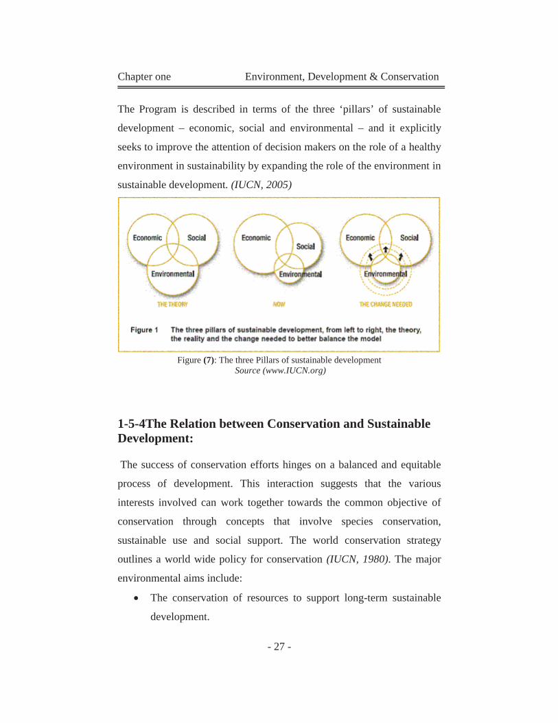
The Program is described in terms of the three ‘pillars’ of sustainable
development – economic, social and environmental – and it explicitly
seeks to improve the attention of decision makers on the role of a healthy
environment in sustainability by expanding the role of the environment in
sustainable development. (IUCN, 2005)
Figure (7): The three Pillars of sustainable development Source (www.IUCN.org)
1-5-4The Relation between Conservation and Sustainable Development:
The success of conservation efforts hinges on a balanced and equitable
process of development. This interaction suggests that the various
interests involved can work together towards the common objective of
conservation through concepts that involve species conservation,
sustainable use and social support. The world conservation strategy
outlines a world wide policy for conservation (IUCN, 1980). The major
environmental aims include:
The conservation of resources to support long-term sustainable
development.
Chapter one Environment, Development & Conservation
- 28 -
The maintenance of essential ecological processes and life-
support systems.
The preservation of genetic diversity.
The sustainable utilization of species and ecosystems.
These aims clearly promote development through the management of
human use of the environment in such a manner that it may yield the
greatest sustainable benefit to current generations while maintaining its
potential to meet the needs and aspirations of the future. Thus,
conservation is positive, embracing preservation, maintenance
development, sustainable utilization, restoration, and enhancement of
nature.
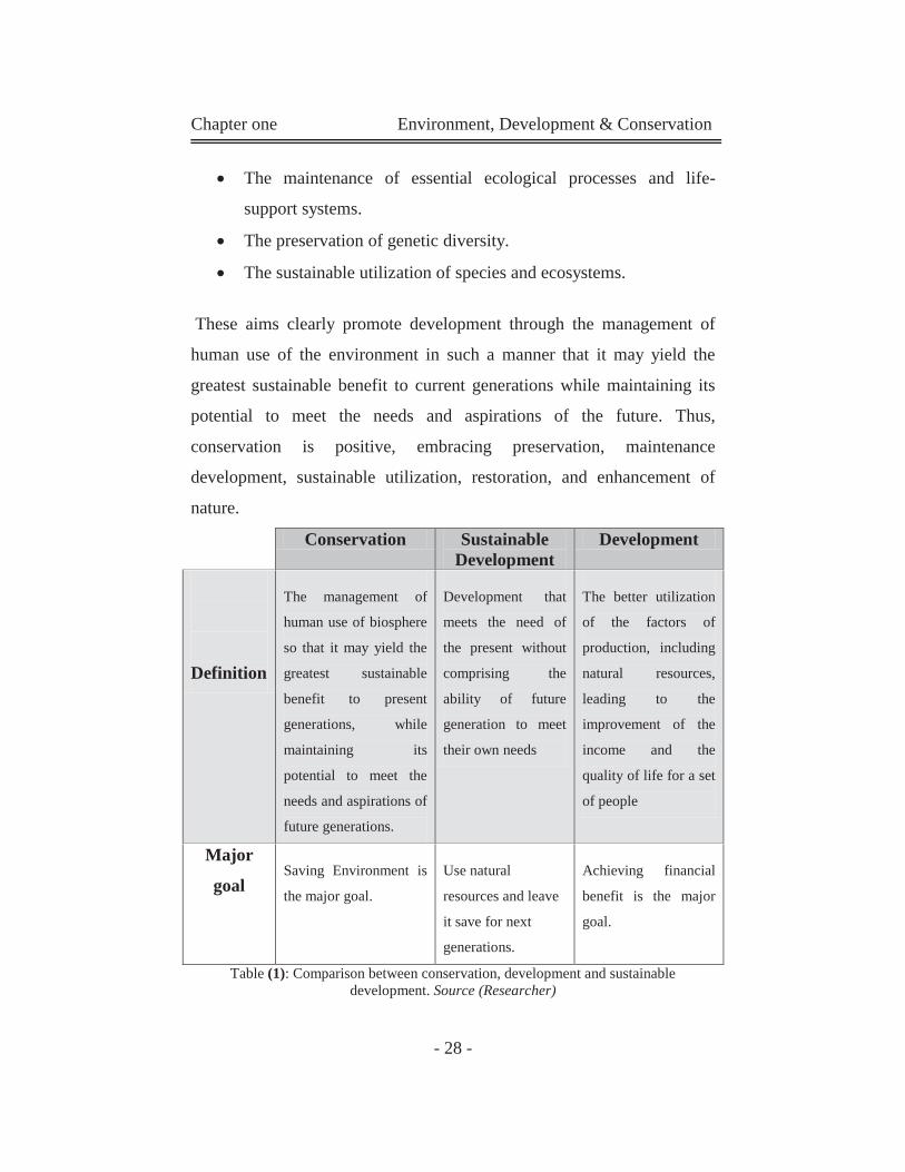
Conservation Sustainable Development
Development
Definition
The management of
human use of biosphere
so that it may yield the
greatest sustainable
benefit to present
generations, while
maintaining its
potential to meet the
needs and aspirations of
future generations.
Development that
meets the need of
the present without
comprising the
ability of future
generation to meet
their own needs
The better utilization
of the factors of
production, including
natural resources,
leading to the
improvement of the
income and the
quality of life for a set
of people
Major
goal Saving Environment is
the major goal.
Use natural
resources and leave
it save for next
generations.
Achieving financial
benefit is the major
goal.
Table (1): Comparison between conservation, development and sustainable development. Source (Researcher)
Chapter one Environment, Development & Conservation
- 29 -
1-6 Effects of Urban Development on Natural Environment:
Urban areas are the major areal sources for many forms of pollution,
being centers of industrial activity, energy production and use, and
vehicular traffic. The impacts of general air pollution are most frequently
couched in national or international terms, with only very limited
information available for individual urban areas. We can say that pollution is largely a problem generated by urban
activities. A lot of the pollutants come from urban activities. Many
industrial activities emit many pollutants which harm natural
environment. The next table shows major potential ecological effects of
some air pollutants.
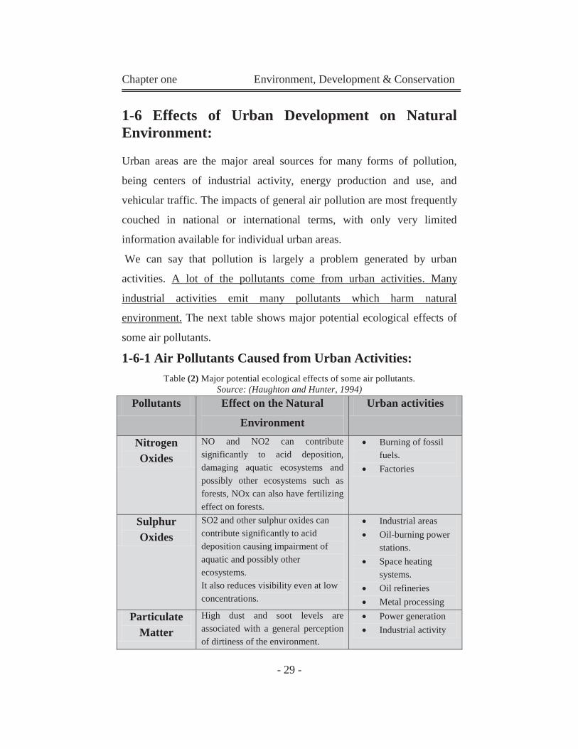
1-6-1 Air Pollutants Caused from Urban Activities:
Table (2) Major potential ecological effects of some air pollutants. Source: (Haughton and Hunter, 1994)
Pollutants Effect on the Natural
Environment
Urban activities
Nitrogen Oxides
NO and NO2 can contribute significantly to acid deposition, damaging aquatic ecosystems and possibly other ecosystems such as forests, NOx can also have fertilizing effect on forests.
Burning of fossil fuels.
Factories
Sulphur Oxides
SO2 and other sulphur oxides can contribute significantly to acid deposition causing impairment of aquatic and possibly other ecosystems. It also reduces visibility even at low concentrations.
Industrial areas Oil-burning power
stations. Space heating
systems. Oil refineries Metal processing
Particulate Matter
High dust and soot levels are associated with a general perception of dirtiness of the environment.
Power generation Industrial activity
Chapter one Environment, Development & Conservation
- 30 -
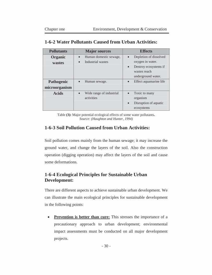
1-6-2 Water Pollutants Caused from Urban Activities:
Table (3): Major potential ecological effects of some water pollutants. Source: (Haughton and Hunter, 1994)
1-6-3 Soil Pollution Caused from Urban Activities:
Soil pollution comes mainly from the human sewage; it may increase the
ground water, and change the layers of the soil. Also the construction
operation (digging operation) may affect the layers of the soil and cause
some deformations.
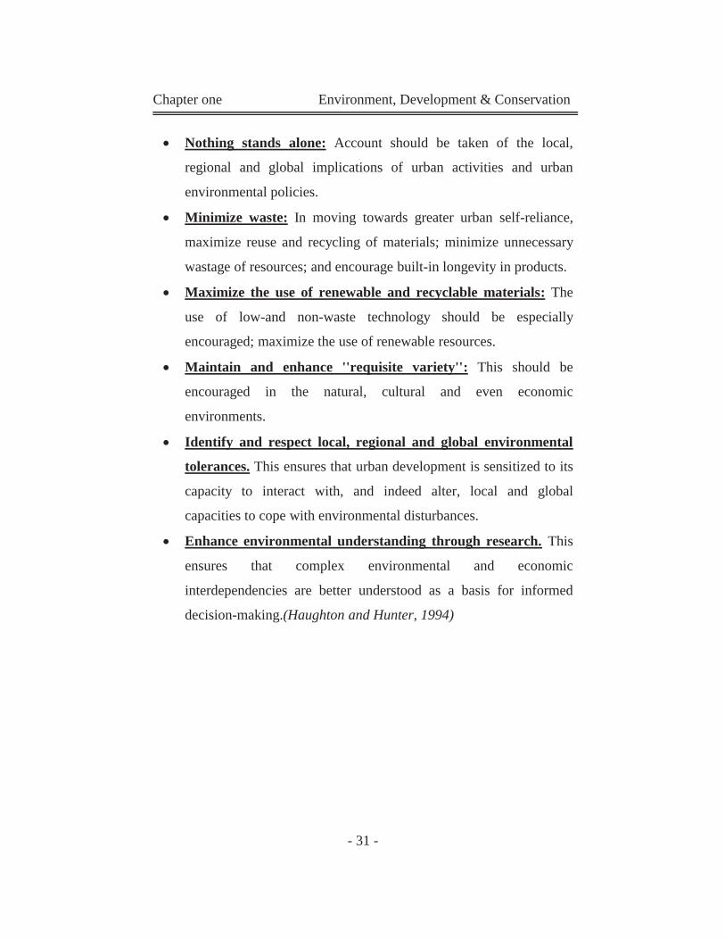
1-6-4 Ecological Principles for Sustainable Urban Development:
There are different aspects to achieve sustainable urban development. We
can illustrate the main ecological principles for sustainable development
in the following points:
Prevention is better than cure: This stresses the importance of a
precautionary approach to urban development; environmental
impact assessments must be conducted on all major development
projects.
Pollutants Major sources Effects Organic wastes
Human domestic sewage, Industrial wastes
Depletion of dissolved oxygen in water.
Destroy ecosystems if wastes reach underground water.
Pathogenic microorganism
Human sewage. Effect aquamarine life
Acids Wide range of industrial activities
Toxic to many organism
Disruption of aquatic ecosystems
Chapter one Environment, Development & Conservation
- 31 -
Nothing stands alone: Account should be taken of the local,
regional and global implications of urban activities and urban
environmental policies.
Minimize waste: In moving towards greater urban self-reliance,
maximize reuse and recycling of materials; minimize unnecessary
wastage of resources; and encourage built-in longevity in products.
Maximize the use of renewable and recyclable materials: The
use of low-and non-waste technology should be especially
encouraged; maximize the use of renewable resources.
Maintain and enhance ''requisite variety'': This should be
encouraged in the natural, cultural and even economic
environments.
Identify and respect local, regional and global environmental
tolerances. This ensures that urban development is sensitized to its
capacity to interact with, and indeed alter, local and global
capacities to cope with environmental disturbances.
Enhance environmental understanding through research. This
ensures that complex environmental and economic
interdependencies are better understood as a basis for informed
decision-making.(Haughton and Hunter, 1994)
Chapter one Environment, Development & Conservation
- 32 -
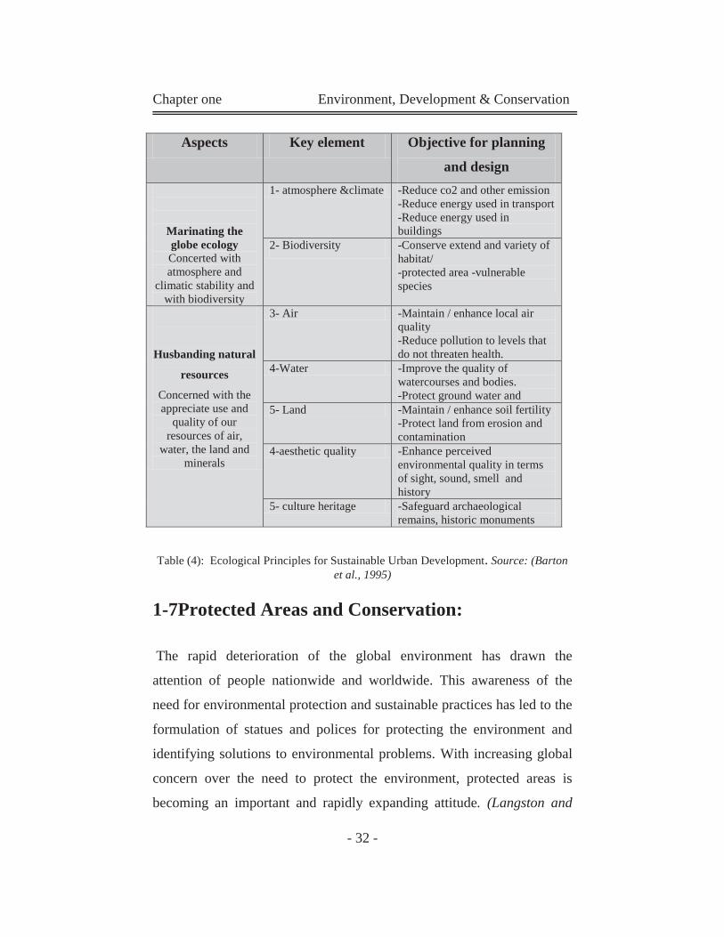
Table (4): Ecological Principles for Sustainable Urban Development. Source: (Barton et al., 1995)
1-7Protected Areas and Conservation:
The rapid deterioration of the global environment has drawn the
attention of people nationwide and worldwide. This awareness of the
need for environmental protection and sustainable practices has led to the
formulation of statues and polices for protecting the environment and
identifying solutions to environmental problems. With increasing global
concern over the need to protect the environment, protected areas is
becoming an important and rapidly expanding attitude. (Langston and
Aspects Key element Objective for planning
and design
Marinating the globe ecology Concerted with atmosphere and
climatic stability and with biodiversity
1- atmosphere &climate -Reduce co2 and other emission -Reduce energy used in transport -Reduce energy used in buildings
2- Biodiversity -Conserve extend and variety of habitat/ -protected area -vulnerable species
Husbanding natural
resources
Concerned with the appreciate use and
quality of our resources of air,
water, the land and minerals
3- Air -Maintain / enhance local air quality -Reduce pollution to levels that do not threaten health.
4-Water -Improve the quality of watercourses and bodies. -Protect ground water and
5- Land -Maintain / enhance soil fertility -Protect land from erosion and contamination
4-aesthetic quality -Enhance perceived environmental quality in terms of sight, sound, smell and history
5- culture heritage -Safeguard archaeological remains, historic monuments
Chapter one Environment, Development & Conservation
- 33 -
Ding, 2001)
1-7-1Challenges of Conservation in Developing Countries:
One of the most significant challenges facing the world today is the
tension between human development and natural resources management.
Also, existing land use practices lead to pollution, deforestation, habitat
loss and reduction in biodiversity. Land tenure, management policy,
legislation, and economic incentives are often at odd with the sustainable
use of natural resources. In addition population growth, human
migration, and local strife tend to augment trends that threaten the
environment conditions for human survival and progress.
Developing countries are considered most affected by the previous
factors since most have neither the tools nor the knowledge to combat the
ill effects of the much needed developmental process on the environment.
In the preparations for the United Nations conference on environment
and development - the Earth Summit- held in Rio de Janeiro in 1992, a
number of priority environmental problems were identified for
industrialized countries and other more specific problems for developing
countries, at different levels of intensity. (UNESCO, 1992).
In developing countries environmental issues generally involve the loss
of natural areas and the exploitation of their resources. There are
attributed to various factors that along several sectors including the
government, the population and the economy.
Environmental problems are particularly serious in developing countries
where their primary concern centers on economic growth, prevention of
starvation and disease control.
Chapter one Environment, Development & Conservation
- 34 -
1-7-2 Environment Protection and Conservation Movements in Egypt:
The environment has long been a subject of interest in Egyptian culture;
ancient inscriptions such as those depicting the journeys of Queen
Hatshepsut (1450BC) illustrate the wildlife expedition to the land of
Punt. These, among others suggest that a form of nature protection exist
in a very early stage in Egyptian history and include basic management
principles which were followed through by succeeding civilizations: the
ancient Greeks, Romans and Ottomans.
Traditional forms of community protection also developed through the
ages and still exist. A number of areas were regarded as sacred under the
traditional law of the local Bedouin tribes, with the "lineage preserves".
The official onset of environment protection in its modern form
originated in 1990 and was the basis for most of the long reigning
conservation policies.
Egypt has been active in the conservation of wildlife, natural resources
and natural habitats. This is clearly manifested in the involvement of
international organizations such as the UNEP and declaration of
protected areas, which cover about 7.5% of the total area of the country
by Prime Ministerial Decrees since 1983. (Raslan, 2003)
1-8 Summary of Chapter One: (Concepts of
Environment, Development and Conservation):
Environment is everything that surrounds man; there is a
relationship between man and environment this relationship is
called in another way ''development".
Chapter one Environment, Development & Conservation
- 35 -
Because of all human activities and development; the earth faces
many dangers like; extinction of species, environment deterioration
that threat the safety of the earth, and cause shortage in the natural
resources. That's why the protection of natural & environmental
resources becomes an essential demand.
The ideal relation between man & environment is called sustainable
development: "Development that meets the need of the present
without comprising the ability of future generation to meet
their own needs". This means that there is a strong relation
between conservation and sustainable development.
Urban environment consists of natural, built and social components.
Environmental conservation and human development are opposite
site of the same coin.
Urban areas are the major areal sources for many forms of
pollution, being centers of industrial activity, energy production and
use, and vehicular traffic.
A lot of the pollutants come from urban activities. Many industrial
activities emit many pollutants which harm natural environment.

Chapter Two
General Review on Protected Areas; Definitions & Classification
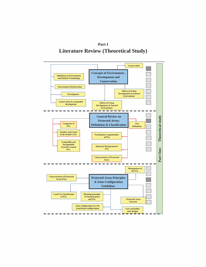
Part I
Literature Review (Theoretical Study)
Part
One
:
The
oret
ical
stud
y
Core and buffer zone designs
Concepts of Environment , Development and
Conservation
Definitions of Environment and Related Terminology
Environment Deterioration
Conservation
Development
Conservation & sustainable development Effects of Urban
Development on Natural Environment
Effects of Urban Development on Natural
Environment
PAsDefinitions
Participatory organizations of PAs
Historical Background of PAs
Characteristics of Protected Areas
Categories of PAs
Number and Extent of the World’s PAs
Compatible and Incompatible
Activities around PAs
Characteristics of Protected Areas (PAs)
Land Use Classification of PAs
Zone configuration of a PA (conclusion configuration)
Management of the PAs
Protected Areas Network
Planning principles of National parks
and PAs
Protected Areas Principles & Zone Configuration
Guidelines
General Review on Protected Areas;
Definitions & Classification
Part
One
:
The
oret
ical
stud
y
Core and buffer zone designs
Concepts of Environment , Development and
Conservation
Definitions of Environment and Related Terminology
Environment Deterioration
Conservation
Development
Conservation & sustainable development Effects of Urban
Development on Natural Environment
Effects of Urban Development on Natural
Environment
PAsDefinitions
Participatory organizations of PAs
Historical Background of PAs
Characteristics of Protected Areas
Categories of PAs
Number and Extent of the World’s PAs
Compatible and Incompatible
Activities around PAs
Characteristics of Protected Areas (PAs)
Land Use Classification of PAs
Zone configuration of a PA (conclusion configuration)
Management of the PAs
Protected Areas Network
Planning principles of National parks
and PAs
Protected Areas Principles & Zone Configuration
Guidelines
General Review on Protected Areas;
Definitions & Classification
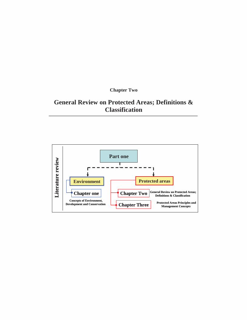
Chapter Two
General Review on Protected Areas; Definitions & Classification
Part one
Environment Protected areas
Lite
ratu
re r
evie
w
Chapter one
Chapter Three
Chapter Two General Review on Protected Areas; Definitions & Classification
Protected Areas Principles and Management Concepts
Concepts of Environment, Development and Conservation
Part one
Environment Protected areas
Lite
ratu
re r
evie
w
Chapter one
Chapter Three
Chapter Two General Review on Protected Areas; Definitions & Classification
Protected Areas Principles and Management Concepts
Concepts of Environment, Development and Conservation
Chapter two General Review on Protected Areas
- 35 -
2-1 Introduction
By 2000, the world's 30,000 protected areas covered over 13, 250, 000
km2 of the land surface of the world. A much smaller proportion of the
world's seas (barely 1%) are protected. This represents a tremendous
investment by the countries of the world to protect their biological
diversity for future generations.
Protected areas perform many functions. They are essential for
conserving biodiversity, and for delivering vital ecosystem services, such
as protecting watersheds and soils and shielding human communities
from natural disasters. Many protected areas are important to local
communities, especially indigenous peoples who depend for their
survival on a sustainable supply of resources from them. They are places
for people to get a sense of peace in a busy world, places that invigorate
human spirits and challenge their senses. Protected landscapes embody
important cultural values; some of them reflect sustainable land use
practices. They are important also for research and education, and
contribute significantly to local and regional economies, most obviously
for tourism. (Chape et al, 2003)
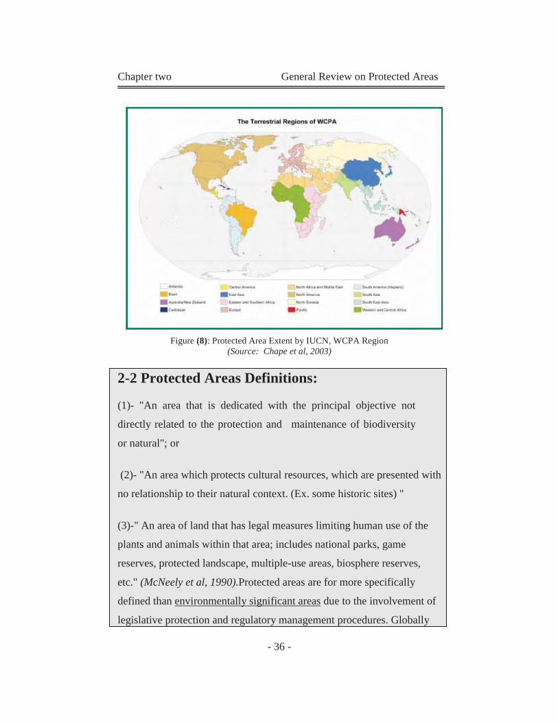
Chapter two General Review on Protected Areas
- 36 -
Figure (8): Protected Area Extent by IUCN, WCPA Region (Source: Chape et al, 2003)
2-2 Protected Areas Definitions:
(1)- "An area that is dedicated with the principal objective not
directly related to the protection and maintenance of biodiversity
or natural"; or
(2)- "An area which protects cultural resources, which are presented with
no relationship to their natural context. (Ex. some historic sites) "
(3)-" An area of land that has legal measures limiting human use of the
plants and animals within that area; includes national parks, game
reserves, protected landscape, multiple-use areas, biosphere reserves,
etc." (McNeely et al, 1990).Protected areas are for more specifically
defined than environmentally significant areas due to the involvement of
legislative protection and regulatory management procedures. Globally
Chapter two General Review on Protected Areas
- 37 -
recognized definitions have been issued by international organizations
concerned with environmental affairs and have become binding to the
nations that participate.
2-2-1The Definition of a Protected Area Adopted by the International Union for the Conservation of Nature IUCN is:
"An area of land and/or sea especially dedicated to the protection and
maintenance of biological diversity, and of natural and associated
cultural resources, and managed through legal or other effective means."
(IUCN, 1990)
This definition therefore provides two major tests for determining
whether an area is eligible for classification as a protected area. These
are:
Is the area particularly or chiefly dedicated to protection
and maintenance of biological diversity, and of natural
and associated cultural resources? and
Is the area managed through legal or other effective
means?
2-2-2The definition of a protected area adopted by The World Conservation Monitoring Center (WCMC) is:
"Legally established sites managed for conservation objectives-are an
essential means for saving Biodiversity. These areas are managed for
objectives ranging from strict nature preservation to controlled resource
harvesting." (WCMC, 1995)
Chapter two General Review on Protected Areas
- 38 -
2-3 Participatory Organizations of PAs:
A hierarchical structure is emerging for planning and overseeing environmental issues and associating them with development strategies at a global level. This operates through organizations such as:
2-3-1 The United Nations (UN):
Through its divisions, the UN is the leader organization that heads
environmental conservation efforts as: "a responsibility shared by the
international community".
2-3-2 The United Nations Environmental Program (UNEP):
The UNEP consists of several integrated and specialized divisions most
notably, the UNEP-WCMC which locates and compiles information on
protected areas.
2-3-3 The International Union for the Conservation of Nature (IUCN) & Affiliates:
The IUCN, established in 1960 (also identified as the World
Conservation Union, formerly as commission on National Parks and
Protected Areas), has provided classification guidance and include the
largest network of management specialists. It is affiliate, the World
Commission on Protected Areas (WCPA), is a leading scientific and
technical body concerned with selection, establishment and management
of protected areas. (UN, 19992)
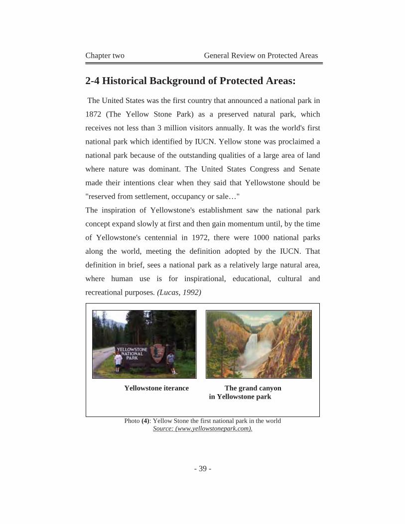
Chapter two General Review on Protected Areas
- 39 -
2-4 Historical Background of Protected Areas:
The United States was the first country that announced a national park in
1872 (The Yellow Stone Park) as a preserved natural park, which
receives not less than 3 million visitors annually. It was the world's first
national park which identified by IUCN. Yellow stone was proclaimed a
national park because of the outstanding qualities of a large area of land
where nature was dominant. The United States Congress and Senate
made their intentions clear when they said that Yellowstone should be
"reserved from settlement, occupancy or sale…"
The inspiration of Yellowstone's establishment saw the national park
concept expand slowly at first and then gain momentum until, by the time
of Yellowstone's centennial in 1972, there were 1000 national parks
along the world, meeting the definition adopted by the IUCN. That
definition in brief, sees a national park as a relatively large natural area,
where human use is for inspirational, educational, cultural and
recreational purposes. (Lucas, 1992)
Photo (4): Yellow Stone the first national park in the world Source: (www.yellowstonepark.com).
Yellowstone iterance The grand canyon in Yellowstone park
Chapter two General Review on Protected Areas
- 40 -
2-5 Characteristics of Protected Areas:
2-5-1 Protected Areas Regulations:
It is forbidden to commit actions or carry out activities, which would
lead to destruction, damage, removal of plants, spoiling or destroying the
geological structures and other features from the natural reserves.
Although all protected areas meet the general purposes contained in this
definition, in practice the precise purposes for which protected areas are
managed differ greatly. The following are the main purposes of
management:
Scientific research.
Wilderness protection.
Preservation of species and genetic diversity.
Maintenance of environmental services.
Protection of specific natural and cultural features.
Tourism and recreation.
Education.
Sustainable use of resources from natural ecosystems.
Maintenance of cultural and traditional attributes. (www.unep-wcmc.org /protected_areas/pavl/define.htm)
2-5-2 Functions of Protected Areas (PAs):
Beyond their traditionally accepted inherent environmental merits, PAs
possess the capacity to perform functions which can be incorporated into
various fields of development. Many of these are only recently being
recognized. The following lists functions, which can be interpreted as
uses and values of PAs:
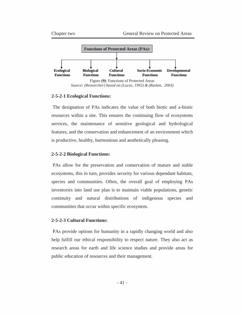
Chapter two General Review on Protected Areas
- 41 -
Functions of Protected Areas (PAs):
EcologicalFunctions
BiologicalFunctions
CulturalFunctions
Socio-EconomicFunctions
DevelopmentalFunctions
Functions of Protected Areas (PAs):Functions of Protected Areas (PAs):
EcologicalFunctions
BiologicalFunctions
CulturalFunctions
Socio-EconomicFunctions
DevelopmentalFunctions
Figure (9): Functions of Protected Areas Source: (Researcher) based on (Lucas, 1992) & (Raslan, 2003)
2-5-2-1 Ecological Functions:
The designation of PAs indicates the value of both biotic and a-biotic
resources within a site. This ensures the continuing flow of ecosystems
services, the maintenance of sensitive geological and hydrological
features, and the conservation and enhancement of an environment which
is productive, healthy, harmonious and aesthetically pleasing.
2-5-2-2 Biological Functions:
PAs allow for the preservation and conservation of mature and stable
ecosystems, this in turn, provides security for various dependant habitats,
species and communities. Often, the overall goal of employing PAs
inventories into land use plan is to maintain viable populations, genetic
continuity and natural distributions of indigenous species and
communities that occur within specific ecosystem.
2-5-2-3 Cultural Functions:
PAs provide options for humanity in a rapidly changing world and also
help fulfill our ethical responsibility to respect nature. They also act as
research areas for earth and life science studies and provide areas for
public education of resources and their management.
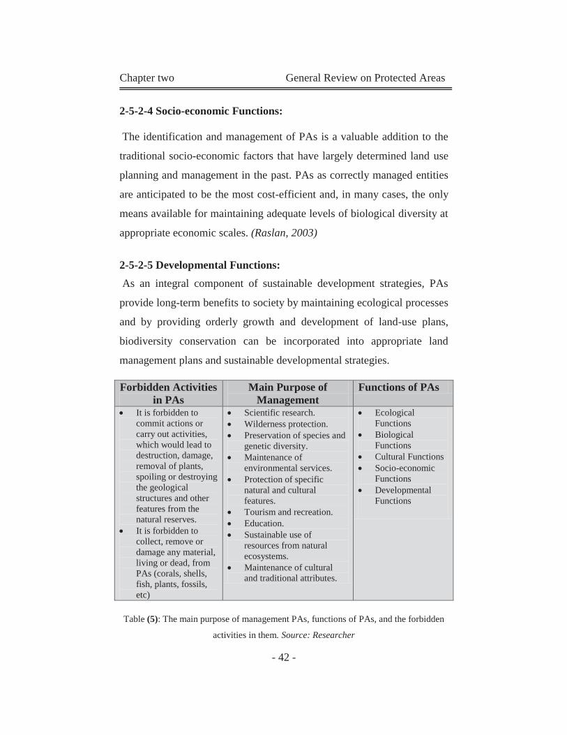
Chapter two General Review on Protected Areas
- 42 -
2-5-2-4 Socio-economic Functions:
The identification and management of PAs is a valuable addition to the
traditional socio-economic factors that have largely determined land use
planning and management in the past. PAs as correctly managed entities
are anticipated to be the most cost-efficient and, in many cases, the only
means available for maintaining adequate levels of biological diversity at
appropriate economic scales. (Raslan, 2003)
2-5-2-5 Developmental Functions: As an integral component of sustainable development strategies, PAs
provide long-term benefits to society by maintaining ecological processes
and by providing orderly growth and development of land-use plans,
biodiversity conservation can be incorporated into appropriate land
management plans and sustainable developmental strategies.
Table (5): The main purpose of management PAs, functions of PAs, and the forbidden
activities in them. Source: Researcher
Forbidden Activities in PAs
Main Purpose of Management
Functions of PAs
It is forbidden to commit actions or carry out activities, which would lead to destruction, damage, removal of plants, spoiling or destroying the geological structures and other features from the natural reserves.
It is forbidden to collect, remove or damage any material, living or dead, from PAs (corals, shells, fish, plants, fossils, etc)
Scientific research. Wilderness protection. Preservation of species and
genetic diversity. Maintenance of
environmental services. Protection of specific
natural and cultural features.
Tourism and recreation. Education. Sustainable use of
resources from natural ecosystems.
Maintenance of cultural and traditional attributes.
Ecological Functions
Biological Functions
Cultural Functions Socio-economic
Functions Developmental
Functions
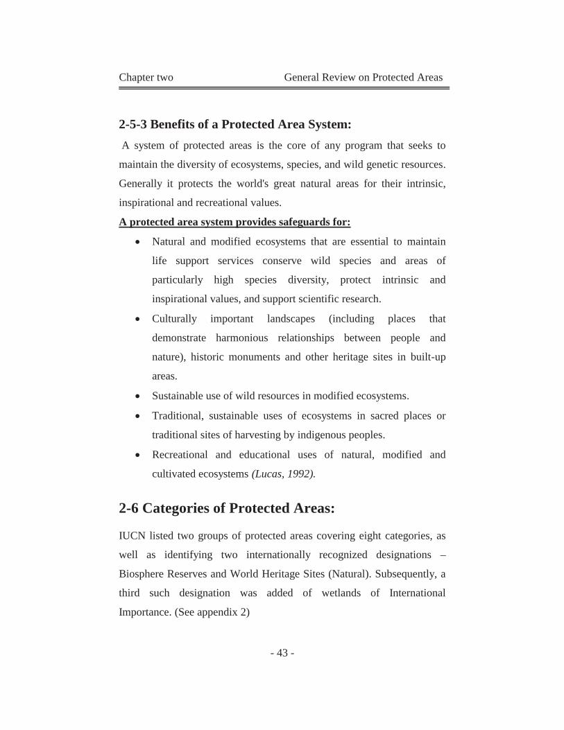
Chapter two General Review on Protected Areas
- 43 -
2-5-3 Benefits of a Protected Area System:
A system of protected areas is the core of any program that seeks to
maintain the diversity of ecosystems, species, and wild genetic resources.
Generally it protects the world's great natural areas for their intrinsic,
inspirational and recreational values.
A protected area system provides safeguards for:
Natural and modified ecosystems that are essential to maintain
life support services conserve wild species and areas of
particularly high species diversity, protect intrinsic and
inspirational values, and support scientific research.
Culturally important landscapes (including places that
demonstrate harmonious relationships between people and
nature), historic monuments and other heritage sites in built-up
areas.
Sustainable use of wild resources in modified ecosystems.
Traditional, sustainable uses of ecosystems in sacred places or
traditional sites of harvesting by indigenous peoples.
Recreational and educational uses of natural, modified and
cultivated ecosystems (Lucas, 1992).
2-6 Categories of Protected Areas:
IUCN listed two groups of protected areas covering eight categories, as
well as identifying two internationally recognized designations –
Biosphere Reserves and World Heritage Sites (Natural). Subsequently, a
third such designation was added of wetlands of International
Importance. (See appendix 2)
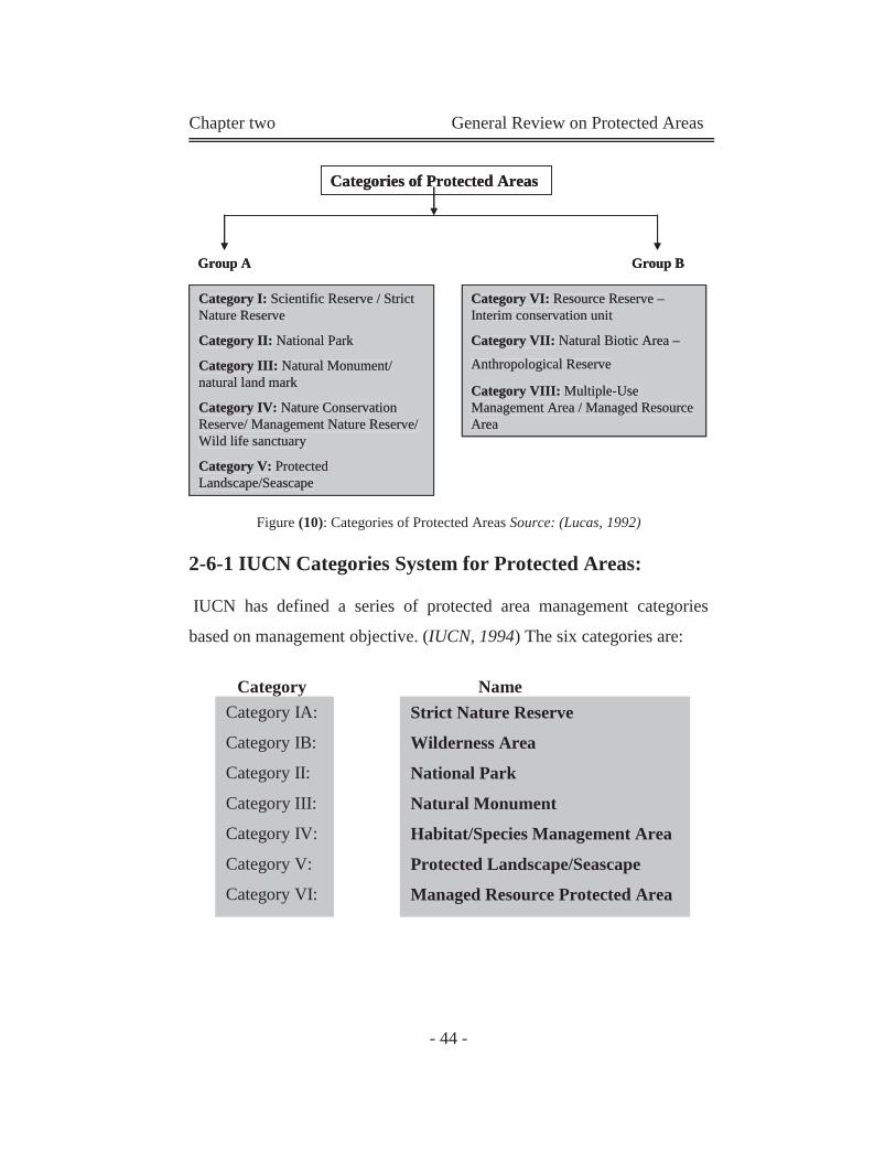
Chapter two General Review on Protected Areas
- 44 -
Figure (10): Categories of Protected Areas Source: (Lucas, 1992)
2-6-1 IUCN Categories System for Protected Areas:
IUCN has defined a series of protected area management categories
based on management objective. (IUCN, 1994) The six categories are:
Category Name
Category IA:
Category IB:
Category II:
Category III:
Category IV:
Category V:
Category VI:
Strict Nature Reserve
Wilderness Area
National Park
Natural Monument
Habitat/Species Management Area
Protected Landscape/Seascape
Managed Resource Protected Area
Categories of Protected Areas
Group A Group B
Category I: Scientific Reserve / Strict Nature Reserve
Category II: National Park
Category III: Natural Monument/ natural land mark
Category IV: Nature Conservation Reserve/ Management Nature Reserve/ Wild life sanctuary
Category V: Protected Landscape/Seascape
Category VI: Resource Reserve –Interim conservation unit
Category VII: Natural Biotic Area –
Anthropological Reserve
Category VIII: Multiple-Use Management Area / Managed Resource Area
Categories of Protected Areas
Group A Group B
Category I: Scientific Reserve / Strict Nature Reserve
Category II: National Park
Category III: Natural Monument/ natural land mark
Category IV: Nature ConservationReserve/ Management Nature Reserve/ Wild life sanctuary
Category V: Protected Landscape/Seascape
Category I: Scientific Reserve / Strict Nature Reserve
Category II: National Park
Category III: Natural Monument/ natural land mark
Category IV: Nature Conservation Reserve/ Management Nature Reserve/ Wild life sanctuary
Category V: Protected Landscape/Seascape
Category VI: Resource Reserve –Interim conservation unit
Category VII: Natural Biotic Area –
Anthropological Reserve
Category VIII: Multiple-UseManagement Area / Managed ResourceArea
Category VI: Resource Reserve –Interim conservation unit
Category VII: Natural Biotic Area –
Anthropological Reserve
Category VIII: Multiple-Use Management Area / Managed Resource Area
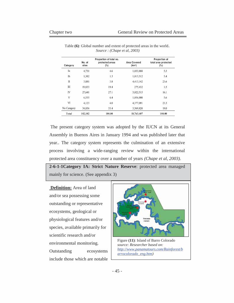
Chapter two General Review on Protected Areas
- 45 -
Table (6): Global number and extent of protected areas in the world. Source : (Chape et al, 2003)
The present category system was adopted by the IUCN at its General
Assembly in Buenos Aires in January 1994 and was published later that
year.. The category system represents the culmination of an extensive
process involving a wide-ranging review within the international
protected area constituency over a number of years (Chape et al, 2003).
2-6-1-1Category IA: Strict Nature Reserve: protected area managed
mainly for science. (See appendix 3)
Definition: Area of land
and/or sea possessing some
outstanding or representative
ecosystems, geological or
physiological features and/or
species, available primarily for
scientific research and/or
environmental monitoring.
Outstanding ecosystems
include those which are notable
Figure (11): Island of Barro Colorado source: Researcher based on: http://www.panamatours.com/Rainforest/barrocolorado_eng.htm)
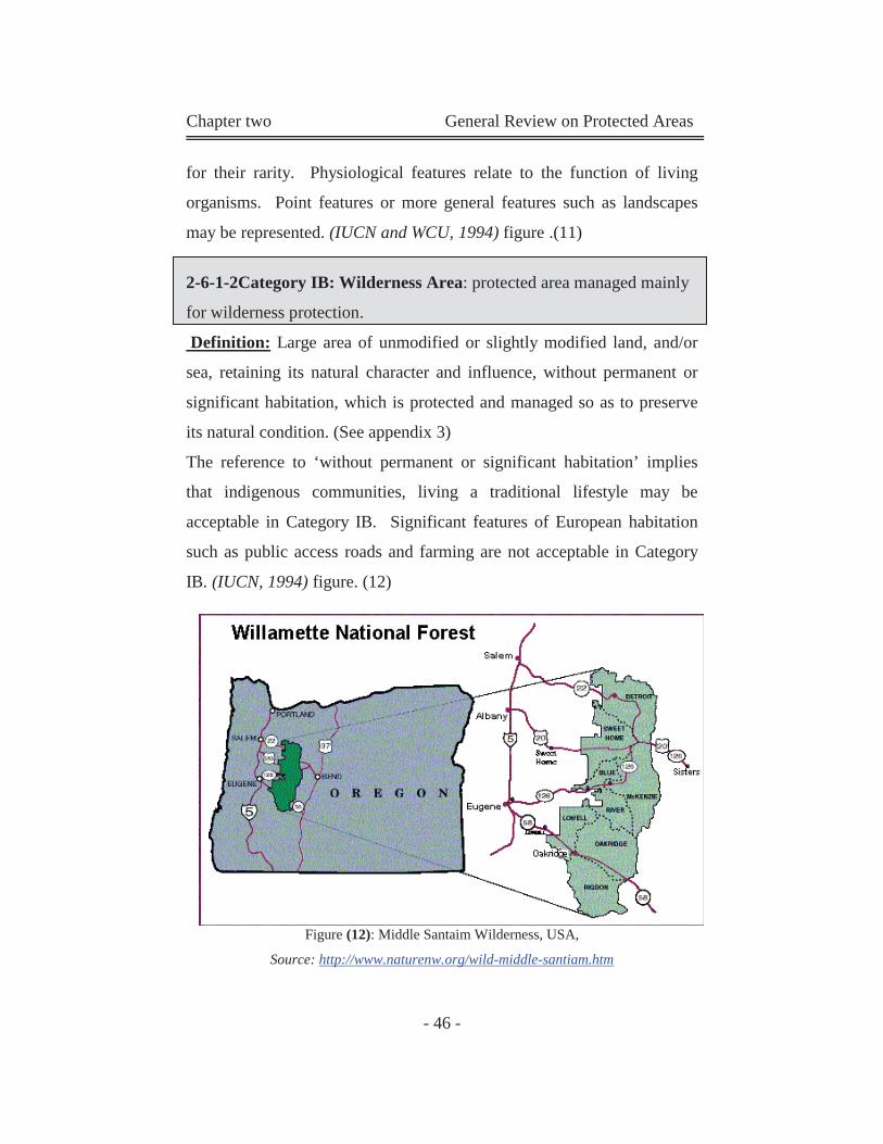
Chapter two General Review on Protected Areas
- 46 -
for their rarity. Physiological features relate to the function of living
organisms. Point features or more general features such as landscapes
may be represented. (IUCN and WCU, 1994) figure .(11)
2-6-1-2Category IB: Wilderness Area: protected area managed mainly
for wilderness protection.
Definition: Large area of unmodified or slightly modified land, and/or
sea, retaining its natural character and influence, without permanent or
significant habitation, which is protected and managed so as to preserve
its natural condition. (See appendix 3)
The reference to ‘without permanent or significant habitation’ implies
that indigenous communities, living a traditional lifestyle may be
acceptable in Category IB. Significant features of European habitation
such as public access roads and farming are not acceptable in Category
IB. (IUCN, 1994) figure. (12)
Figure (12): Middle Santaim Wilderness, USA,
Source: http://www.naturenw.org/wild-middle-santiam.htm
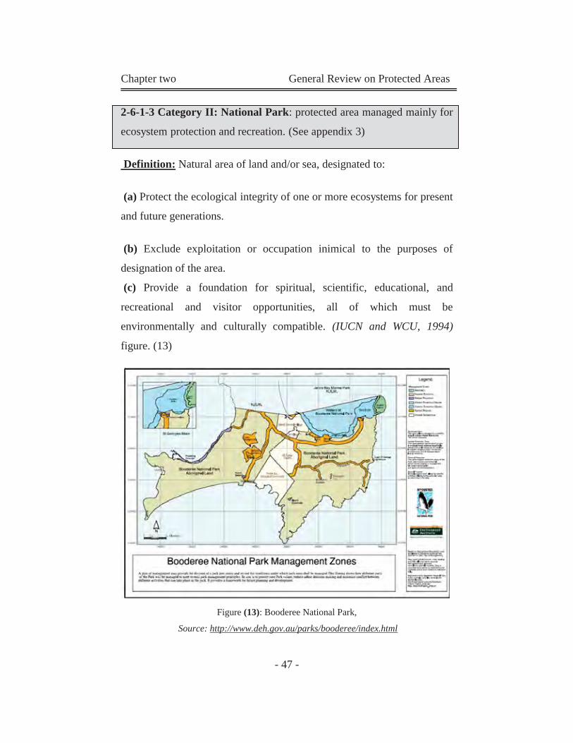
Chapter two General Review on Protected Areas
- 47 -
2-6-1-3 Category II: National Park: protected area managed mainly for
ecosystem protection and recreation. (See appendix 3)
Definition: Natural area of land and/or sea, designated to:
(a) Protect the ecological integrity of one or more ecosystems for present
and future generations.
(b) Exclude exploitation or occupation inimical to the purposes of
designation of the area.
(c) Provide a foundation for spiritual, scientific, educational, and
recreational and visitor opportunities, all of which must be
environmentally and culturally compatible. (IUCN and WCU, 1994)
figure. (13)
Figure (13): Booderee National Park,
Source: http://www.deh.gov.au/parks/booderee/index.html
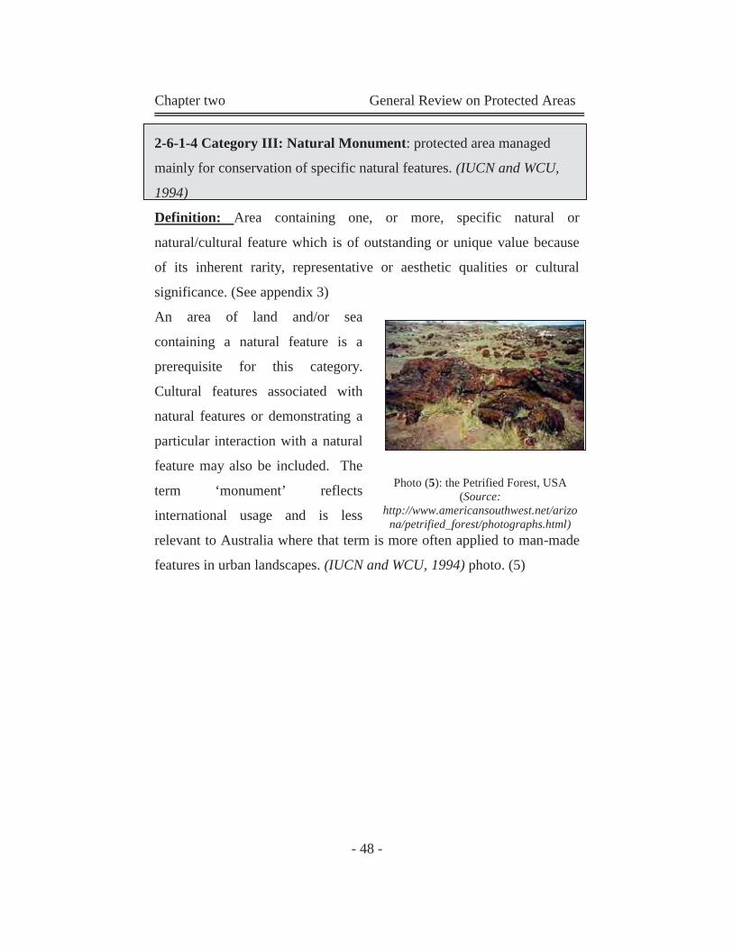
Chapter two General Review on Protected Areas
- 48 -
2-6-1-4 Category III: Natural Monument: protected area managed
mainly for conservation of specific natural features. (IUCN and WCU,
1994)
Definition: Area containing one, or more, specific natural or
natural/cultural feature which is of outstanding or unique value because
of its inherent rarity, representative or aesthetic qualities or cultural
significance. (See appendix 3)
An area of land and/or sea
containing a natural feature is a
prerequisite for this category.
Cultural features associated with
natural features or demonstrating a
particular interaction with a natural
feature may also be included. The
term ‘monument’ reflects
international usage and is less
relevant to Australia where that term is more often applied to man-made
features in urban landscapes. (IUCN and WCU, 1994) photo. (5)
Photo (5): the Petrified Forest, USA
(Source: http://www.americansouthwest.net/arizo
na/petrified_forest/photographs.html)
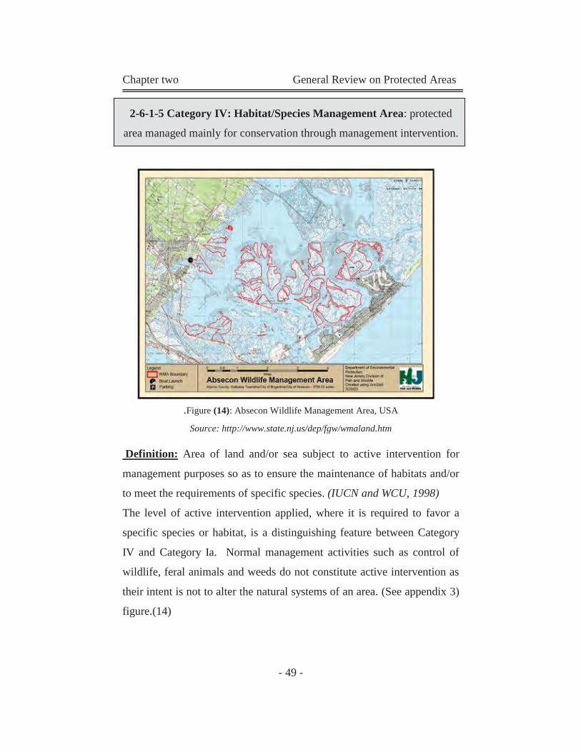
Chapter two General Review on Protected Areas
- 49 -
2-6-1-5 Category IV: Habitat/Species Management Area: protected
area managed mainly for conservation through management intervention.
.Figure (14): Absecon Wildlife Management Area, USA Source: http://www.state.nj.us/dep/fgw/wmaland.htm
Definition: Area of land and/or sea subject to active intervention for
management purposes so as to ensure the maintenance of habitats and/or
to meet the requirements of specific species. (IUCN and WCU, 1998)
The level of active intervention applied, where it is required to favor a
specific species or habitat, is a distinguishing feature between Category
IV and Category Ia. Normal management activities such as control of
wildlife, feral animals and weeds do not constitute active intervention as
their intent is not to alter the natural systems of an area. (See appendix 3)
figure.(14)
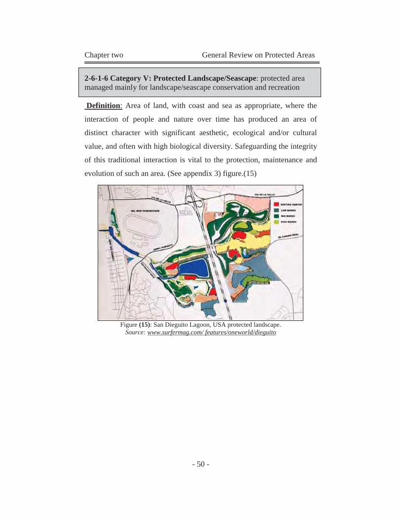
Chapter two General Review on Protected Areas
- 50 -
2-6-1-6 Category V: Protected Landscape/Seascape: protected area managed mainly for landscape/seascape conservation and recreation
Definition: Area of land, with coast and sea as appropriate, where the
interaction of people and nature over time has produced an area of
distinct character with significant aesthetic, ecological and/or cultural
value, and often with high biological diversity. Safeguarding the integrity
of this traditional interaction is vital to the protection, maintenance and
evolution of such an area. (See appendix 3) figure.(15)
Figure (15): San Dieguito Lagoon, USA protected landscape. Source: www.surfermag.com/ features/oneworld/dieguito
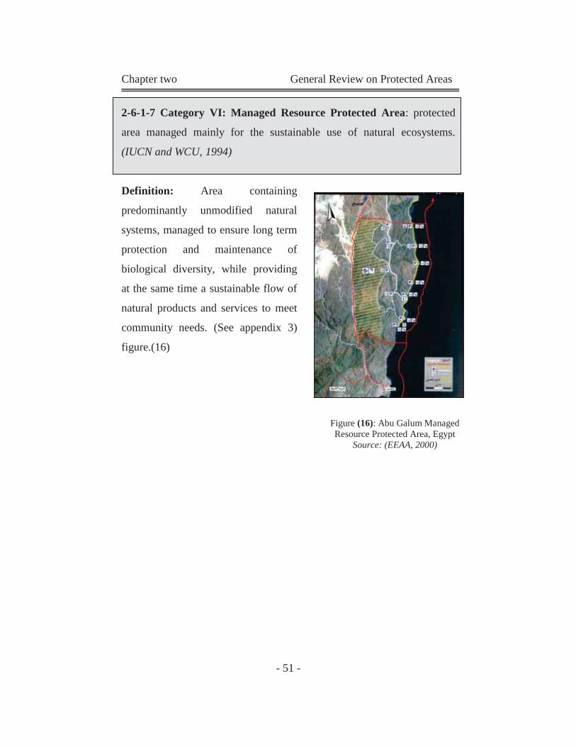
Chapter two General Review on Protected Areas
- 51 -
2-6-1-7 Category VI: Managed Resource Protected Area: protected
area managed mainly for the sustainable use of natural ecosystems.
(IUCN and WCU, 1994)
Definition: Area containing
predominantly unmodified natural
systems, managed to ensure long term
protection and maintenance of
biological diversity, while providing
at the same time a sustainable flow of
natural products and services to meet
community needs. (See appendix 3)
figure.(16)
Figure (16): Abu Galum Managed Resource Protected Area, Egypt
Source: (EEAA, 2000)
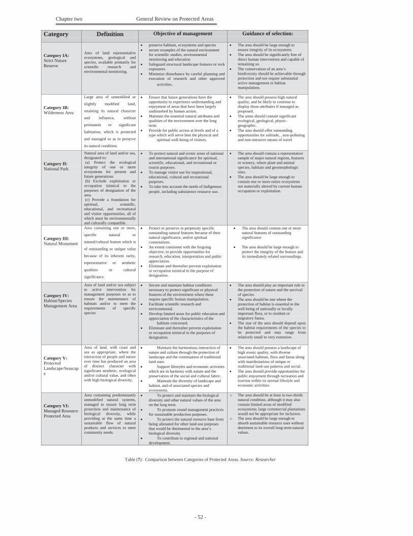
Chapter two General Review on Protected Areas
- 52 -
Table (7): Comparison between Categories of Protected Areas. Source: Researcher
Guidance of selection: Objective of management Definition Category The area should be large enough to
ensure integrity of its ecosystems The area should be significantly free of
direct human intervention and capable of remaining so.
The conservation of an area’s biodiversity should be achievable through protection and not require substantial active management or habitat manipulation.
preserve habitats, ecosystems and species secure examples of the natural environment
for scientific studies, environmental monitoring and education
Safeguard structural landscape features or rock exposures.
Minimize disturbance by careful planning and execution of research and other approved activities.
Area of land representative ecosystems, geological and species, available primarily for scientific research and environmental monitoring.
Category IA: Strict Nature Reserve
The area should possess high natural quality, and be likely to continue to display those attributes if managed as proposed.
The areas should contain significant ecological, geological, physic-geographic.
The area should offer outstanding opportunities for solitude, , non-polluting and non-intrusive means of travel
Ensure that future generations have the opportunity to experience understanding and enjoyment of areas that have been largely undisturbed by human action.
Maintain the essential natural attributes and qualities of the environment over the long term.
Provide for public access at levels and of a type which will serve best the physical and spiritual well-being of visitors.
Large area of unmodified or
slightly modified land,
retaining its natural character
and influence, without
permanent or significant
habitation, which is protected
and managed so as to preserve
its natural condition.
Category IB: Wilderness Area
The area should contain a representative sample of major natural regions, features or scenery, where plant and animal species, habitats and geomorphologic sites.
The area should be large enough to contain one or more entire ecosystems not materially altered by current human occupation or exploitation.
To protect natural and scenic areas of national and international significance for spiritual, scientific, educational, and recreational or tourist purposes.
To manage visitor use for inspirational, educational, cultural and recreational purposes.
To take into account the needs of Indigenous people, including subsistence resource use.
Natural area of land and/or sea, designated to: (a) Protect the ecological integrity of one or more ecosystems for present and future generations (b) Exclude exploitation or occupation inimical to the purposes of designation of the area. (c) Provide a foundation for spiritual, scientific, educational, and recreational and visitor opportunities, all of which must be environmentally and culturally compatible.
Category II: National Park
The area should contain one or more natural features of outstanding significance
The area should be large enough to
protect the integrity of the feature and its immediately related surroundings.
Protect or preserve in perpetuity specific outstanding natural features because of their natural significance, and/or spiritual connotations.
An extent consistent with the forgoing objective, to provide opportunities for research, education, interpretation and public appreciation.
Eliminate and thereafter prevent exploitation or occupation inimical to the purpose of designation.
Area containing one or more,
specific natural or
natural/cultural feature which is
of outstanding or unique value
because of its inherent rarity,
representative or aesthetic
qualities or cultural
significance.
Category III: Natural Monument
The area should play an important role in the protection of nature and the survival of species.
The area should be one where the protection of habitat is essential to the well being of nationally or locally important flora, or to resident or migratory fauna.
The size of the area should depend upon the habitat requirements of the species to be protected and may range from relatively small to very extensive.
Secure and maintain habitat conditions necessary to protect significant or physical features of the environment where these require specific human manipulation.
Facilitate scientific research and environmental.
Develop limited areas for public education and appreciation of the characteristics of the habitats concerned.
Eliminate and thereafter prevent exploitation or occupation inimical to the purposes of designation.
Area of land and/or sea subject to active intervention for management purposes so as to ensure the maintenance of habitats and/or to meet the requirements of specific species
Category IV: Habitat/Species Management Area
The area should possess a landscape of high scenic quality, with diverse associated habitats, flora and fauna along with manifestations of unique or traditional land-use patterns and social.
The area should provide opportunities for public enjoyment through recreation and tourism within its normal lifestyle and economic activities.
Maintain the harmonious interaction of nature and culture through the protection of landscape and the continuation of traditional land uses.
Support lifestyles and economic activities which are in harmony with nature and the preservation of the social and cultural fabric.
Maintain the diversity of landscape and habitat, and of associated species and ecosystems.
Area of land, with coast and sea as appropriate, where the interaction of people and nature over time has produced an area of distinct character with significant aesthetic, ecological and/or cultural value, and often with high biological diversity.
Category V: Protected Landscape/Seascape
o The area should be at least in two-thirds natural condition, although it may also contain limited areas of modified ecosystems; large commercial plantations would not be appropriate for inclusion.
o The area should be large enough to absorb sustainable resource uses without detriment to its overall long-term natural values.
To protect and maintain the biological diversity and other natural values of the area on the long term.
To promote sound management practices for sustainable production purposes.
To protect the natural resource base from being alienated for other land-use purposes that would be detrimental to the area’s biological diversity.
To contribute to regional and national development.
Area containing predominantly unmodified natural systems, managed to ensure long term protection and maintenance of biological diversity, while providing at the same time a sustainable flow of natural products and services to meet community needs.
Category VI: Managed Resource Protected Area
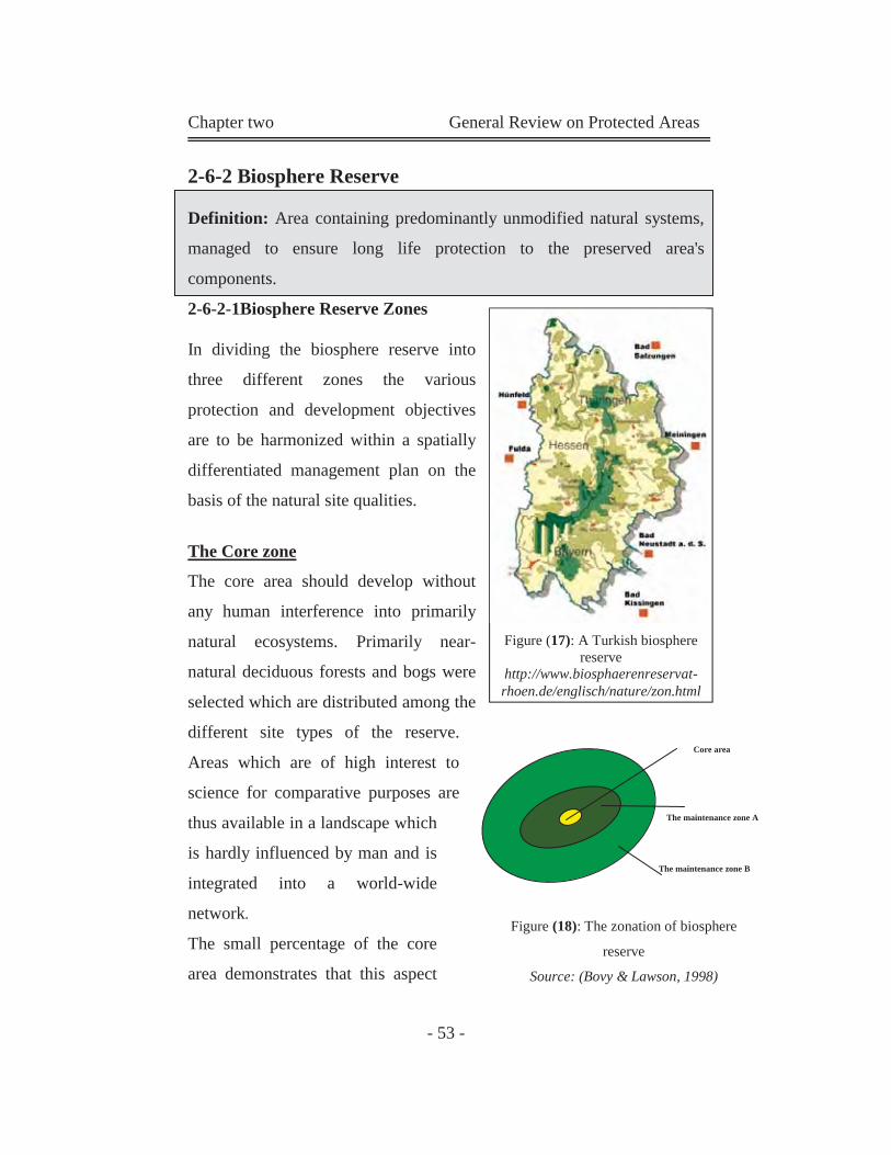
Chapter two General Review on Protected Areas
- 53 -
2-6-2 Biosphere Reserve
Definition: Area containing predominantly unmodified natural systems,
managed to ensure long life protection to the preserved area's
components.
2-6-2-1Biosphere Reserve Zones
In dividing the biosphere reserve into
three different zones the various
protection and development objectives
are to be harmonized within a spatially
differentiated management plan on the
basis of the natural site qualities.
The Core zone
The core area should develop without
any human interference into primarily
natural ecosystems. Primarily near-
natural deciduous forests and bogs were
selected which are distributed among the
different site types of the reserve.
Areas which are of high interest to
science for comparative purposes are
thus available in a landscape which
is hardly influenced by man and is
integrated into a world-wide
network.
The small percentage of the core
area demonstrates that this aspect
Figure (17): A Turkish biosphere reserve
http://www.biosphaerenreservat-rhoen.de/englisch/nature/zon.html
Core area
The maintenance zone A
The maintenance zone B
Figure (18): The zonation of biosphere
reserve
Source: (Bovy & Lawson, 1998)
Chapter two General Review on Protected Areas
- 54 -
does not play a central role in the management plan defining the
objectives.
The centre of the framework management plan is rather the issue of
further conservation and maintenance of valuable open landscapes.
The maintenance zone A: comprises those areas which are of particular
importance to the character and peculiarity of the reserve landscape.
These are large coherent near-natural areas with an agricultural
landscape, rich in species and structures together with near-natural
forests. The continuation of traditional land use is thus of highest
importance in this area.
Maintenance zone B includes the remaining and specially characterizing
cultivated areas typical for the natural and living area which supplements
and connects the conservation area with maintenance Zone A. Larger
landscape complexes were delimited as far as possible. Maintenance
zone B should contribute to the alleviation of the burden for maintenance
zone A and measures implemented there should focus on recreational use
compatible with the landscape and the environment. No settlements or
commercial activities should be developed in this area. Source: http://www.biosphaerenreservat-rhoen.de/englisch/nature/zon.html
2-6-3 World Heritage Sites:
The World Heritage Convention (the convention concerning the
protection of the World Cultural and Natural Heritage) became
operational in 1978 and has over 110 countries which are States parties to
it. It aims to identify, list and protect natural and cultural properties of
outstanding universal value for the benefit of all people. (Lucas, 1992)
Chapter two General Review on Protected Areas
- 55 -
2-6-4 The Order of Categories does not constitute a Hierarchy
The order of categories does not constitute a hierarchy but reflects, in
ascending order, the degree of human use acceptable in each case.
Consequently, Category I, the scientific or strict nature reserve, has the
specific purpose of protecting nature and natural processes as undisturbed
as possible. This contrasts with the protected area categories at the
human use end of the spectrum.
Because the protected area is generally extensive in area it may
incorporate, within its overall boundaries, other categories such as
scientific or strict nature reserves (Category 1), natural monuments or
landmarks (Category1II) and managed nature reserves or wildlife
sanctuaries (Category IV). It may even have a core national park
(Category 11) or serve as a buffer to an adjoining national park,
reflecting the balance of people and nature in the protected landscape and
the dominance of nature in the adjoining national park.
The range of categories reflects too, the varied ways of maintaining the
world's living resources for their intrinsic value, for their biological
diversity, and as the basis for sustainable management to meet human
needs (IUCN, 2002).
2-6-5 Size of Protected Areas:
The size of an area should reflect the extent of land or water needed to
achieve the purposes of management. For example, for a Category I area,
the size should be that needed to ensure the integrity of the area to
achieve the management objective of strict protection, either as a baseline
area or research site, or for wilderness protection. For a Category II area,
the boundaries should be drawn sufficiently widely that they contain one,
Chapter two General Review on Protected Areas
- 56 -
or more, entire ecosystems which are not subject to material modification
by human exploitation or occupation (www.unep-wcmc.org
/protected_areas/pavl/define.htm).
2-7 Number and Extent of the World’s Protected
Areas
The 2003 UN List contains 102,102 protected areas covering more than
18.8 million km2. This figure is equivalent to 12.65% of the Earth’s land
surface, or an area greater than the combined land area of China, South
Asia and Southeast Asia. If marine protected areas are excluded from
these calculations the terrestrial extent of protected areas is some 17.1
million km2 (11.5% of the land surface). This is almost the same area as
the entire continent of South America. The total number and extent of
protected areas presents the current global overview of the status of
protection. However, it is the classification of protected areas into IUCN
Management Categories that enables a distinction to be made on the basis
of management objectives that countries are applying to their
conservation estate, ranging from sites that are strictly protected through
to those under sustainable use. The overview of global statistics indicates
that 67% of the world’s protected areas have been assigned an IUCN
management category, covering 81% of the total area protected. Among
the categorized sites, the largest number lies within Category IV
(Habitat/Species Management Area) and Category III (Natural
Monument). Together they comprise almost 47% of all protected areas.
This is not surprising, since protected areas assigned to these categories
often cover small geographic areas; especially in the case of Category III.
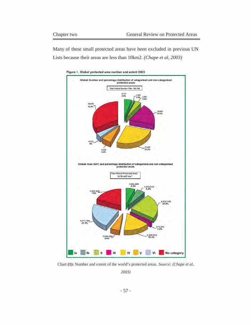
Chapter two General Review on Protected Areas
- 57 -
Many of these small protected areas have been excluded in previous UN
Lists because their areas are less than 10km2. (Chape et al, 2003)
Chart (1): Number and extent of the world’s protected areas. Source: (Chape et al,
2003)
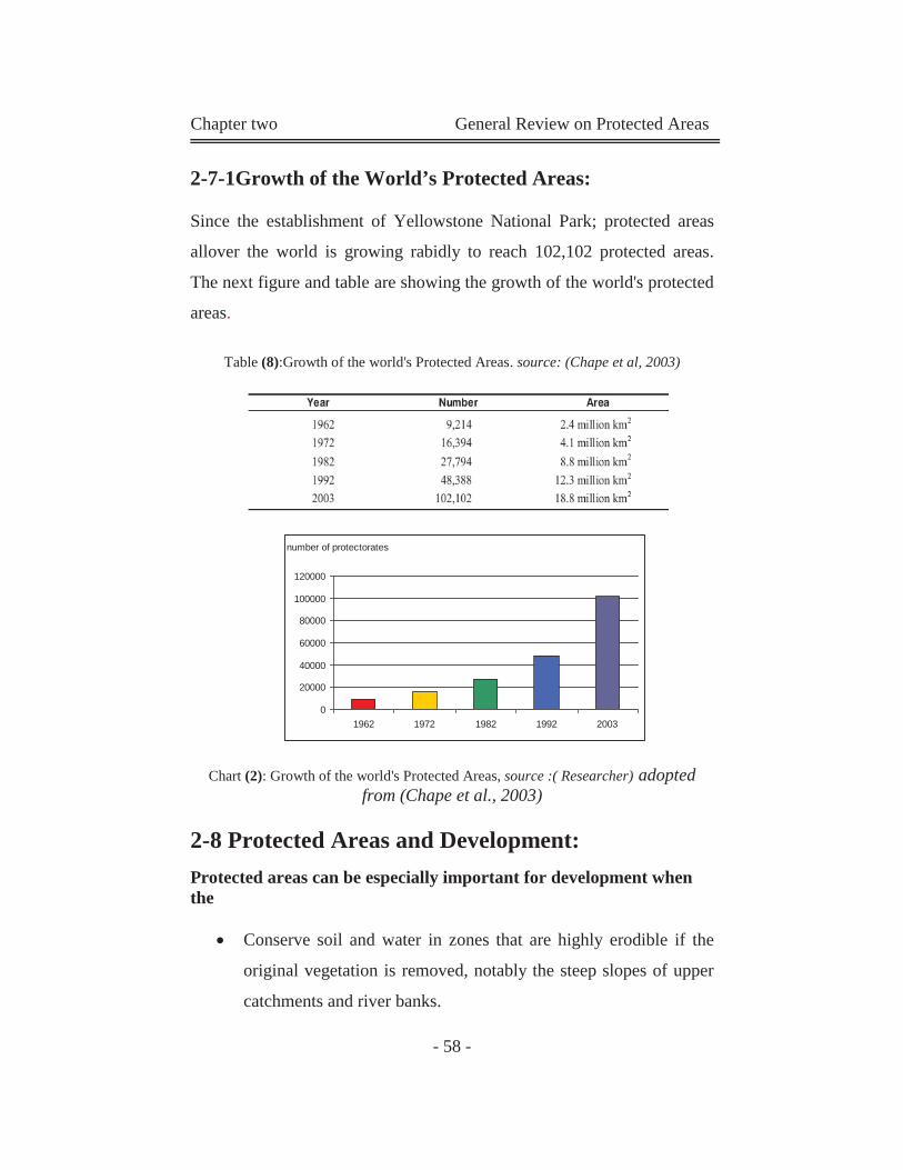
Chapter two General Review on Protected Areas
- 58 -
2-7-1Growth of the World’s Protected Areas:
Since the establishment of Yellowstone National Park; protected areas
allover the world is growing rabidly to reach 102,102 protected areas.
The next figure and table are showing the growth of the world's protected
areas.
Table (8):Growth of the world's Protected Areas. source: (Chape et al, 2003)
Chart (2): Growth of the world's Protected Areas, source :( Researcher) adopted from (Chape et al., 2003)
2-8 Protected Areas and Development: Protected areas can be especially important for development when the
Conserve soil and water in zones that are highly erodible if the
original vegetation is removed, notably the steep slopes of upper
catchments and river banks.
number of protectorates
0
20000
40000
60000
80000
100000
120000
1962 1972 1982 1992 2003
Chapter two General Review on Protected Areas
- 59 -
Regulate and purify water flow, notably by protecting wetlands
and forests.
Shield people from natural disasters, such as floods and storm
surges, notably by protecting watershed forests, reverie wetlands,
coral reefs, and mangroves Maintain important natural vegetation
on soils of inherently low productivity that would, if transformed,
yield little of value to human communities.
Maintain wild genetic resources or species important in
medicine.
Protect species and populations that are highly sensitive to human
disturbance.
Provide habitat that is critical to harvested, migratory or
threatened species for breeding, feeding, or resting.
Provide income and employment, notably from tourism.
(IUCN et al, 1991)
2-9 Protected Areas &Sustainability:
The world conservation strategy, prepared in 1990 under this title jointly
by IUCN, United Nations Environment Program (UNEP) and the world
wide fund for nature (WWF) reinforces the role of protected areas in the
context of sustainability.
One of its nine principles for sustainable living is to "conserve the Earth's
vitality and diversity" which requires a commitment to:
Conserve life-support systems: These are the ecological
processes that keep the planet fit for life. They shape climate,
cleanse air and water, regulate water flow, recycle essential
elements, create and regenerate soil, and enable ecosystem to
renew themselves.
Chapter two General Review on Protected Areas
- 60 -
Conserve biodiversity: This includes not only all species of
plants, animals and other organisms, but also the range of genetic
stocks within each species and the variety of ecosystems.
Ensure that uses of renewable resources are sustainable:
Renewable resources include soil, wild and domesticated
organisms, forests and the marine and freshwater ecosystems.
2-10 Areas around Protected Areas:
Protected areas are not isolated units. Ecologically, economically,
politically and culturally, they are linked to the areas around them. For
that reason, the planning and management of protected areas must be
incorporated within regional planning, and supported by the policies
adopted for wider areas. For the purposes of the application of the
categories system, however, where one area is used to 'buffer' or
surround another, both their categories should be separately identified
and recorded.
2-10-1 Compatible and Incompatible Activities around
Protected Area:
As PAs is a practical application of sustainability, any building around it
must achieve the goals of sustainability. Generally it must respect the
following factors:
Maximize use of renewable resources (in both of building and
maintenance processes).
Minimize waste (recycle is a basic demand her).
Respect the environment (Natural or urban environment).

Chapter two General Review on Protected Areas
- 61 -
Prevent any water, air or any other pollution.
It is too hard to measure wither the surrounding activities of the PA's
land are compatible or not. As some activities are compatible to PA's
type and can be incompatible to another PA's type. The research suppose
that the most incompatible activity around PA's land is industrial activity
(As it causes air and water pollution). According to that, we can measure
all other urban activities.
But we must mention some important points:
Residential areas are differ in densities, luxury residential areas
are supposed to be compatible to PAs, and the low-income
residential areas are supposed to be incompatible and the
moderate – high residential areas are in between. (Sometimes the
residential use doesn't affect the protectorate components, but it
has a damage impacts in geological protectorates as sewage can
affect the soil layers).
Commercial, administrational, and recreational areas need big
parking plots. Those areas may have some impacts on protected
areas.
Educational areas are suitable for the strict nature reserve, and
protected area managed mainly for science and research.
(geological protected areas)
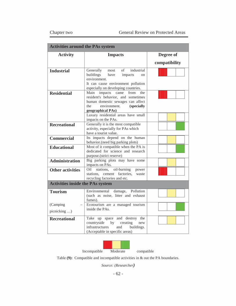
Chapter two General Review on Protected Areas
- 62 -
Activities around the PAs system
Activity Impacts Degree of
compatibility
Industrial Generally most of industrial buildings have impacts on environment. It can cause environment pollution especially on developing countries.
Residential Main impacts came from the resident's behavior, and sometimes human domestic sewages can affect the environment. (specially geographical PAs)
Luxury residential areas have small impacts on the PAs.
Recreational Generally it is the most compatible activity, especially for PAs which have a tourist value.
Commercial Its impacts depend on the human behavior.(need big parking plots)
Educational Most of it compatible when the PA is dedicated for science and research purpose.(strict reserve)
Administration Big parking plots may have some impacts on PAs.
Other activities Oil stations, oil-burning power stations, cement factories, waste recycling factories and etc.
Activities inside the PAs system
Tourism
(Camping –
picnicking …)
Environmental damage, Pollution (such as noise, litter and exhaust fumes).
Ecotourism are a managed tourism inside the PAs.
Recreational Take up space and destroy the countryside by creating new infrastructures and buildings. (Acceptable in specific areas)
Incompatible Moderate compatible
Table (9): Compatible and incompatible activities in & out the PA boundaries.
Source: (Researcher)
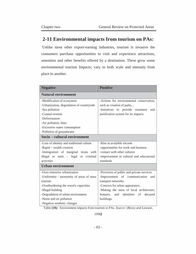
Chapter two General Review on Protected Areas
- 63 -
2-11 Environmental impacts from tourism on PAs: Unlike most other export-earning industries, tourism is invasive the
consumers purchase opportunities to visit and experience attractions,
amenities and other benefits offered by a destination. These grow some
environmental tourism Impacts; vary in both scale and intensity from
place to another.
Table (10): Environment impacts from tourism in PAs. Source: (Bovey and Lawson,
1998)
Negative Positive
Natural environment -Modification of ecosystem -Urbanization, degradation of countryside -Sea pollution -Coastal erosion -Deforestation -Air pollution, litter -Excessive water consumption -Pollution of groundwater
-Actions for environmental conservation, such as creation of parks... -Initiatives to provide treatment and purification system for its impacts.
Socio – cultural environment -Loss of identity and traditional culture -Rapid – wealth creation -Immigration of marginal strata with illegal or semi – legal or criminal activities
-Rise in available income -opportunities for work and business -contact with other cultures -improvement in cultural and educational standards
Urban environment -Over-intensive urbanization -Uniformity / anonymity of areas of mass tourism -Overburdening the resort's capacities -Illegal building -Degradation of urban environment -Noise and air pollution -Negative aesthetic changes
-Provision of public and private services. -Improvement of communication and transport networks. -Concern for urban appearance. -Making the most of local architecture, features, and identities of decayed buildings.
Chapter two General Review on Protected Areas
- 64 -
2-11-1Alternative forms of tourism:
Definitions of sustainable tourism are many and varied; this overall
definition is consisting of more specific definitions:
Green tourism: is an attitude or philosophy of a kind of tourism
which is sustainable and which has regard for and respects the
landscape, the wildlife, the existing infrastructure and cultural
heritage of tourism destinations.
Alternative tourism: has been described as approaches which
promote a just form of travel between members of different
communities.
Ecotourism: generally refers to travel to relatively undisturbed
or uncontaminated natural areas with the specific objective of
studying and enjoying the scenery. (Bovey and Lawson, 1998)
Table (10)
1-11-2 Principles of Sustainable Tourism Development
Uphold reasonable ethical standards of operation and
minimize adverse social impacts.
Enhance social equity.
Operate in an environmentally and culturally sensitive
manner, aimed at promoting conservation of the site and area.
Seek to minimize the use of non-renewable resources.
Recognize the capacities of its environment, utilize that
environment sensitively, and monitor it effectively 6. Directly
and indirectly change the attitudes of individuals and other
businesses toward planning and management of its
environment. (Eagles et al, 2001)
Chapter two General Review on Protected Areas
- 65 -
2-11-3 Goals of tourism in protected areas:
Effective tourism management will enable protected areas and
surrounding communities to attain positive impacts and reduce negative
impacts of tourism.
The goals of sustainable tourism in protected areas are:
To provide people with the ability to learn, experience and
appreciate the natural and cultural heritage of the site.
To ensure that the natural and cultural heritage of the site is
managed appropriately and effectively over the long term.
To manage tourism in parks for minimum negative social,
cultural, economic and ecological impact (Eagles et al, 2001).
2-12 Environmental impacts from Human on PAs:
Through time humanity has used natural resource, both animate and
inanimate, for its survival, consumption and enjoyment. Only recently
has there been a reversal of traditional destructive consumption that
natural resources are essential to the survival of humanity and that these
should be cared for and protected in their own right.
The presence of humans in protected areas impacts on its compounds,
tourism and other activities may in fact be the most damaging factors.
Damages to these natural treasures are due to actions that may appear to
be perfectly normal, but in fact can have serious consequences.
(EEAA, 2000)
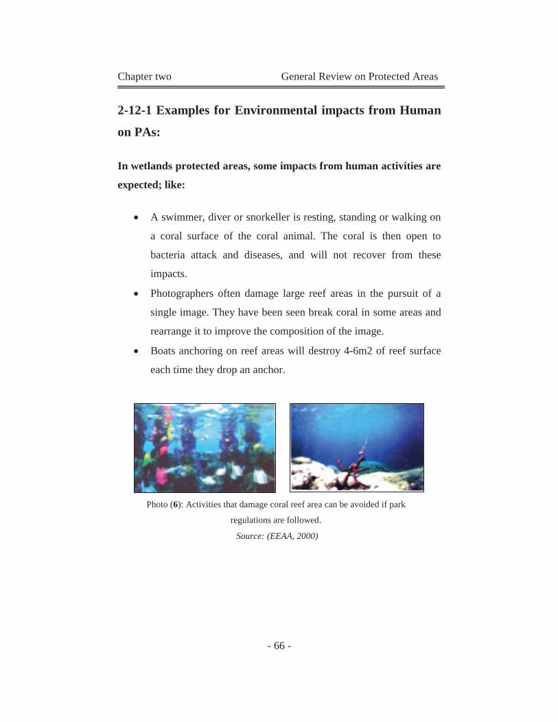
Chapter two General Review on Protected Areas
- 66 -
2-12-1 Examples for Environmental impacts from Human
on PAs:
In wetlands protected areas, some impacts from human activities are
expected; like:
A swimmer, diver or snorkeller is resting, standing or walking on
a coral surface of the coral animal. The coral is then open to
bacteria attack and diseases, and will not recover from these
impacts.
Photographers often damage large reef areas in the pursuit of a
single image. They have been seen break coral in some areas and
rearrange it to improve the composition of the image.
Boats anchoring on reef areas will destroy 4-6m2 of reef surface
each time they drop an anchor.
Photo (6): Activities that damage coral reef area can be avoided if park
regulations are followed.
Source: (EEAA, 2000)
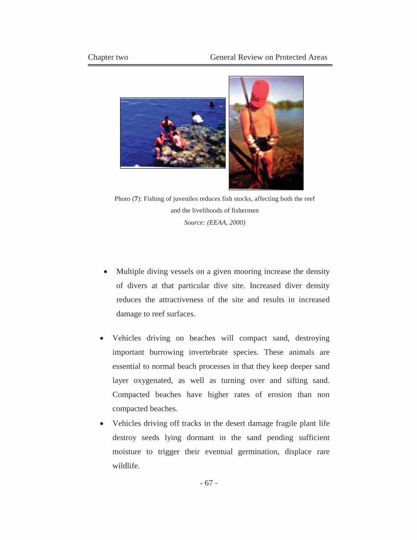
Chapter two General Review on Protected Areas
- 67 -
Multiple diving vessels on a given mooring increase the density
of divers at that particular dive site. Increased diver density
reduces the attractiveness of the site and results in increased
damage to reef surfaces.
Vehicles driving on beaches will compact sand, destroying
important burrowing invertebrate species. These animals are
essential to normal beach processes in that they keep deeper sand
layer oxygenated, as well as turning over and sifting sand.
Compacted beaches have higher rates of erosion than non
compacted beaches.
Vehicles driving off tracks in the desert damage fragile plant life
destroy seeds lying dormant in the sand pending sufficient
moisture to trigger their eventual germination, displace rare
wildlife.
Photo (7): Fishing of juveniles reduces fish stocks, affecting both the reef
and the livelihoods of fishermen
Source: (EEAA, 2000)
Chapter two General Review on Protected Areas
- 68 -
Off track driving also destroys sand dunes and increases wind and
water erosion of desert surfaces.
2-13 Summary of Chapter two (General Review on Protected Areas; Definitions & Classification):
As a result of the rapid deterioration of the global environment,
protected areas are becoming an important and rapidly expanding
attitude.
Protected Areas: "An area of land and/or sea especially
dedicated to the protection and maintenance of biological
diversity, and of natural and associated cultural resources, and
managed through legal or other effective means."
The United States was the first country that announced a national
park in 1872 (The Yellow Stone Park) as a preserved natural park.
Any protected areas must have a classification according to IUCN
categories system for protected areas.
Now the world is growing rabidly to reach 102,102 protected areas.
Protected areas are not isolated units. Ecologically, economically,
politically and culturally, they are linked to the areas around them.
For that reason, the surrounding areas must be compatible to the
presence of protected area.
Generally we can say that the surrounding urban uses must achieve
the goals of sustainability. But actually there is no accurate major
tool to judge this relationship, so we will take the industrial use as a
guide for the urban use. The industrial use is the most pollutant
urban use.

Chapter three Protected Areas Principles & Management
Concepts
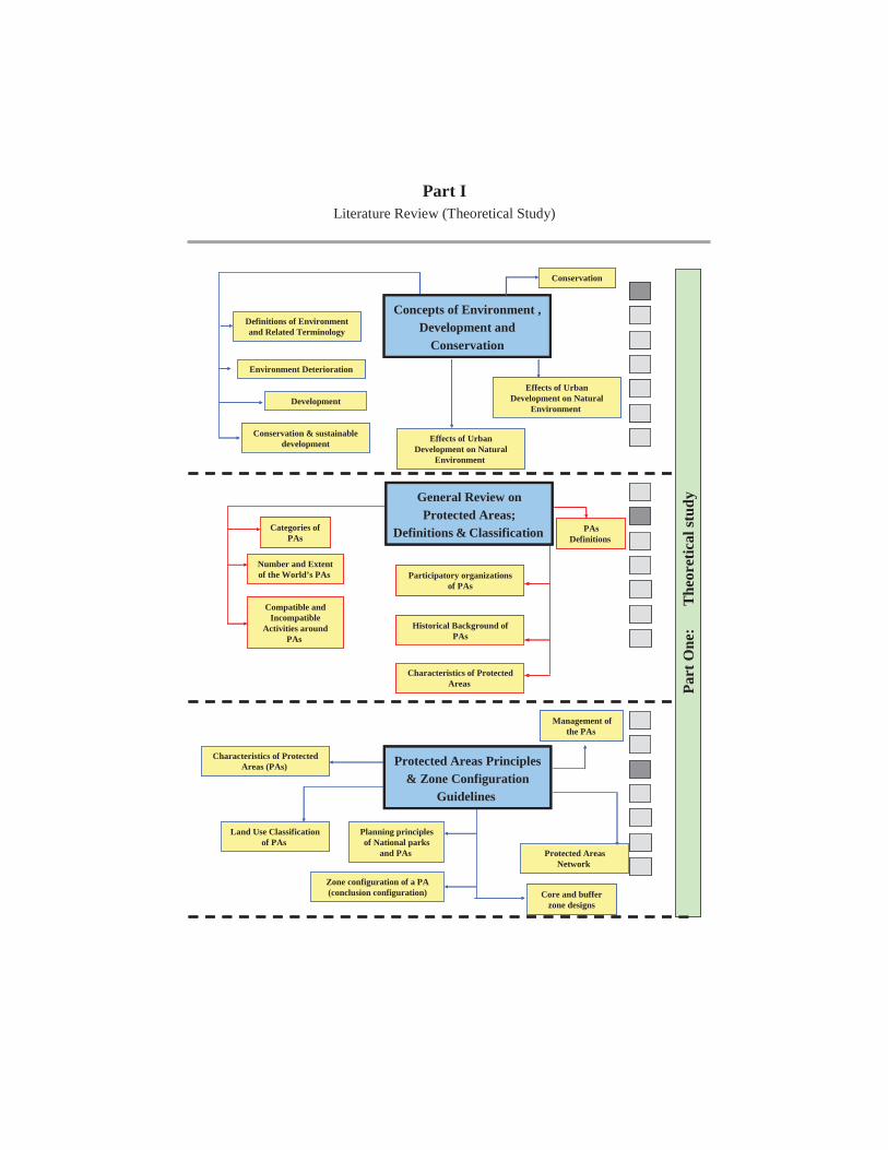
Part I Literature Review (Theoretical Study)
Part
One
:
The
oret
ical
stud
y
Core and buffer zone designs
Concepts of Environment , Development and
Conservation
Definitions of Environment and Related Terminology
Environment Deterioration
Conservation
Development
Conservation & sustainable development Effects of Urban
Development on Natural Environment
Effects of Urban Development on Natural
Environment
PAsDefinitions
Participatory organizations of PAs
Historical Background of PAs
Characteristics of Protected Areas
Categories of PAs
Number and Extent of the World’s PAs
Compatible and Incompatible
Activities around PAs
Characteristics of Protected Areas (PAs)
Land Use Classification of PAs
Zone configuration of a PA (conclusion configuration)
Management of the PAs
Protected Areas Network
Planning principles of National parks
and PAs
Protected Areas Principles & Zone Configuration
Guidelines
General Review on Protected Areas;
Definitions & Classification
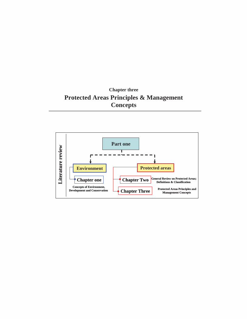
Chapter three
Protected Areas Principles & Management Concepts
Part one
Environment Protected areas
Lite
ratu
re r
evie
w
Chapter one
Chapter Three
Chapter Two General Review on Protected Areas; Definitions & Classification
Protected Areas Principles and Management Concepts
Concepts of Environment, Development and Conservation
Part one
Environment Protected areas
Lite
ratu
re r
evie
w
Chapter one
Chapter Three
Chapter Two General Review on Protected Areas; Definitions & Classification
Protected Areas Principles and Management Concepts
Concepts of Environment, Development and Conservation

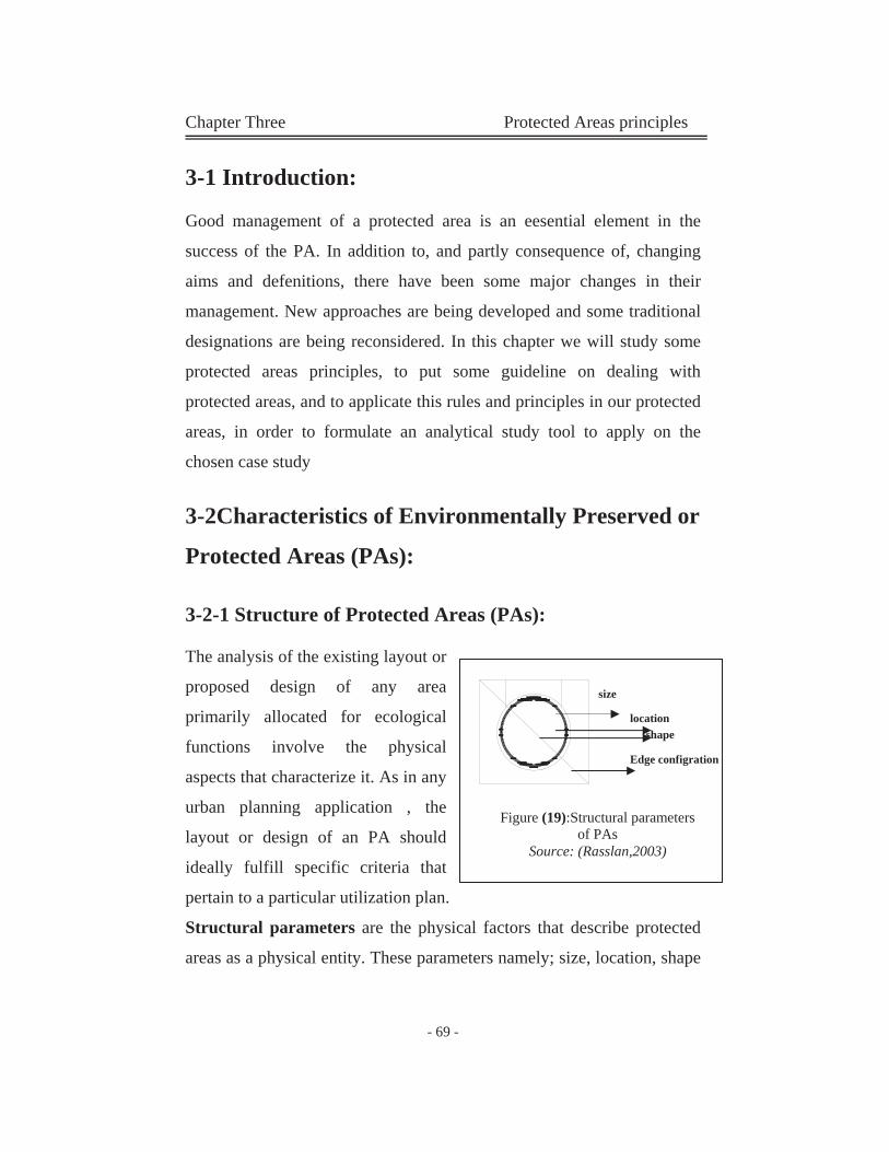
Chapter Three Protected Areas principles
- 69 -
3-1 Introduction:
Good management of a protected area is an eesential element in the
success of the PA. In addition to, and partly consequence of, changing
aims and defenitions, there have been some major changes in their
management. New approaches are being developed and some traditional
designations are being reconsidered. In this chapter we will study some
protected areas principles, to put some guideline on dealing with
protected areas, and to applicate this rules and principles in our protected
areas, in order to formulate an analytical study tool to apply on the
chosen case study
3-2Characteristics of Environmentally Preserved or
Protected Areas (PAs):
3-2-1 Structure of Protected Areas (PAs):
The analysis of the existing layout or
proposed design of any area
primarily allocated for ecological
functions involve the physical
aspects that characterize it. As in any
urban planning application , the
layout or design of an PA should
ideally fulfill specific criteria that
pertain to a particular utilization plan.
Structural parameters are the physical factors that describe protected
areas as a physical entity. These parameters namely; size, location, shape
size
location
Edge configration
shape
Figure (19):Structural parameters of PAs
Source: (Rasslan,2003)
Chapter Three Protected Areas principles
- 70 -
and edge configuration and their relationship to an area are displayed in
the opposite figure.
3-2-1-1 Size
Size is a parameter that refer to physical extents and is one generally
determined and affected by natural factors .When human intervention is
sought in establishment, designation or even territorial determination,
basic rules and criteria derived from experience and employed.
a-Nature of Surrounding Landscape
The size of the landscape, which contains PAs is a major factor in size
determination. Apart from framing area and form, both should exhibit a
symbiotic relationship, where the sustainability of each relies on the
other. This ideally reflects as a proportionate ratio between the size of the
PAs and that of the landscape that contains and supports its vital
functions.
b-Volume of Protected Species
Sufficiency of spatial extent has been found to be essential in supporting
viability of environmental processes and/or species, populations and
communities of an area. Size should directly correlate to this major
conservation objective.
c-Size/species indicators formulated to equate the previous
relationship include:
- Minimum reserve area (MRA): this is the size of an area "above
which species richness is not distinguishable from that in non-
fragmented habitat of the same size". (less than 500 km2)
Chapter Three Protected Areas principles
- 71 -
- Focal Species, minimum Viable Population and Minimum
Critical Area: (more than 500 km2)
Umbrella: Species that cover large, diverse areas.
Protection of their habitat maintains a viable population
that provides resources to other species more restricted in
range.
Key stone: Species that enrich ecosystem function
through their activities.
Habitat Quality Indicators: Species that require habitats
of high ecological integrity and provide an early warning
system due to their sensitivity to changes.
Wilderness quality indicators: Species that are sensitive
or vulnerable to human disturbance and the required
remote, wilderness habitat. (Raslan, 2003)
3-2-1-2 Location
Location is largely determined by natural factors, however, when
designating a new area or assessing the potentials of one that exists,
location is vital in maintaining the viability of an PAs. Location
extensively affects other parameters by the determination of the physical
surroundings of an area. Occasionally, location is dictated by factors that
have little to do with protection, hence a mismatch between allocation
and utilization occurs.
The following factors are to be taken into account in assessment:
-The occurrence, extent of species concentration and extent of diversity
of habitat types.
Chapter Three Protected Areas principles
- 72 -
-The existence of rare habitat types or species within the proximity of a
site.(location within natural areas)
-The proximity of human settlements, activity zones and environmentally
hazardous activities. (location within urban context)
-The proximity of protected areas and network layout.
3-2-1-3 Edge Configuration
Edge is a concept that pertains to the outer boundary. It can define as
either the conspicuous boundaries between the natural habitats (interior
edges) or the defining boundary between the natural area and all that lays
beyond (exterior edges).
Theoretically there are two types of edges:
- Inherent /Natural: the extent area determined by natural feature
lends to be stable, relatively permanents, soft and inhabited by
species.
- Induced/ Generated: the tangible boundary that reflects results
from natural or human disturbances tend to be abrupt and ''high
contrast''. If external forces (urban influences) acting on the area
are greater than internal forces (conservation management), the
generated edge may move into the area.
When either edge is exaggerated adverse effects, referred to as edge
effects, may arise; interior habitat area is reduced by fragmentation, the
process whereby large, continuous areas of habitat are both reduced in
area and divided into fragments forming gaps. The less ''thick'' or more
irregular a patch of conserved land is, the more ''edge'' habitat is created,
and the less balanced an ecosystem becomes. Consequently, reduction of
edge provides a more balanced unit by increasing the biodiversity of an
Chapter Three Protected Areas principles
- 73 -
area, increasing the chances that the unit will persist. Additionally, the
more regular and greater area of the ''core'' of undistributed land, the
better it will function as a habitat to a wide diversity of species.
(Raslan,2003)
3-2-1-4Shape Configuration
Shape is the physical parameter that defines the form an area adopts.
Biogeographical considerations are only some of the factors needed to
determine the appropriate shape of protected areas.
The following conclusions are derived from existing cases:
- The boundaries of areas are of higher efficiency when they follow
natural divisions, such as watershed boundaries and integrate this
feature within them.
- The boundries follow urban divisions, Generally, rounded shapes
minimize edge effects by allowing for the center to be located
farther from the edge than other shapes, thus providing greater
degree of protection. Long linear shaps have the most edge and
straight lines generally do a poor job of capturing full ecosystem.
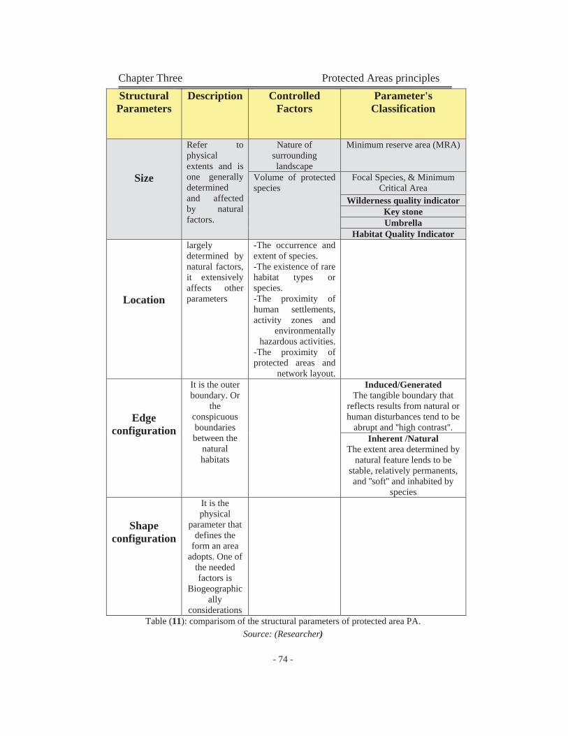
Chapter Three Protected Areas principles
- 74 -
Table (11): comparisom of the structural parameters of protected area PA. Source: (Researcher)
Parameter's Classification
ControlledFactors
Description StructuralParameters
Minimum reserve area (MRA) Nature of surrounding landscape
Refer to physical extents and is one generally determined and affected by natural factors.
Size Focal Species, & Minimum Critical Area
Volume of protected species
Wilderness quality indicator Key stone Umbrella
Habitat Quality Indicator -The occurrence and extent of species. -The existence of rare habitat types or species.-The proximity of human settlements, activity zones and
environmentally hazardous activities.
-The proximity of protected areas and
network layout.
largely determined by natural factors, it extensively affects other parameters Location
Induced/Generated The tangible boundary that
reflects results from natural or human disturbances tend to be
abrupt and ''high contrast''.
It is the outer boundary. Or
the conspicuous boundaries between the
natural habitats
Edgeconfiguration
Inherent /NaturalThe extent area determined by
natural feature lends to be stable, relatively permanents, and ''soft'' and inhabited by
speciesIt is the physical
parameter that defines the
form an area adopts. One of
the needed factors is
Biogeographically
considerations
Shapeconfiguration
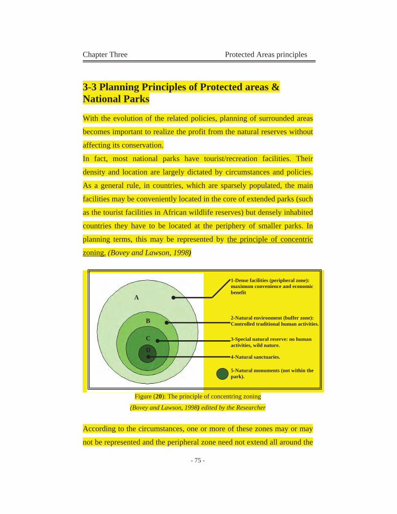
Chapter Three Protected Areas principles
- 75 -
3-3 Planning Principles of Protected areas & National Parks
With the evolution of the related policies, planning of surrounded areas
becomes important to realize the profit from the natural reserves without
affecting its conservation.
In fact, most national parks have tourist/recreation facilities. Their
density and location are largely dictated by circumstances and policies.
As a general rule, in countries, which are sparsely populated, the main
facilities may be conveniently located in the core of extended parks (such
as the tourist facilities in African wildlife reserves) but densely inhabited
countries they have to be located at the periphery of smaller parks. In
planning terms, this may be represented by the principle of concentric
zoning. (Bovey and Lawson, 1998)
Figure (20): The principle of concentring zoning
(Bovey and Lawson, 1998) edited by the Researcher
According to the circumstances, one or more of these zones may or may
not be represented and the peripheral zone need not extend all around the
1-Dense facilities (peripheral zone): maximum convenience and economic benefit
2-Natural environment (buffer zone): Controlled traditional human activities.
3-Special natural reserve: no human activities, wild nature.
4-Natural sanctuaries.
5-Natural monuments (not within the park).
D
A
C
B
Chapter Three Protected Areas principles
- 76 -
park boundaries. A methodological approach for planning national and
regional parks is provided.
The four zones of national park land use are:
3-3-1 Peripheral Zones (Dense Facilities):
Facilities for tourism and recreation (accommodation, catering, sport,
picnicking) including associated buildings (with strict control over sitting
and quality). Preferably grouped together near access routes and existing
settlements.
3-3-2 Natural Environment (Buffer Zone):
Buffer zone located around the natural reserved area. Those areas are
defined by severe controlled traditional human activities.
Facilities may include catering and light sports facilities (for swimming,
sailing, boating, fishing, skiing etc), accommodation of a temporary
nature; camping and caravan camps or eco-lodges, or nature based
lodges. Eco-lodges or natural based lodges are; (Tourist lodges that meet
the philosophy and principles of ecotourism carefully integrated into their
environment, offer an educational and participatory experience through
nature interpretation, trail hiking, wild life tours, bird watching, and river
trips. Of limited capacity, usually 25 to 80 beds with catering and bar,
they are built with natural materials reflecting local traditions and
building methods and operated in an environmentally sensitive manner).
(Bovey and Lawson, 1998)
Museums of natural history, park information centre should be provided
at the entrance to the zone, giving a complete briefing on the park's
significance and information about the natural reserved area. They may
Chapter Three Protected Areas principles
- 77 -
serve as an excursion base where individual cars are parked and visitors
transfer to Public Park transport (buses, tramways, cable lifts).
3-3-3Special Natural Reserve No roads, other than essential ones restricted to public transport,
organized circuits for nature interpretation, and trails for bicycling
walking, horse riding, and limited activities. There are no facilities other
than rudimentary camping sites and shelters for mountaineering.
3-3-4Natural Sanctuaries (No access, no facilities)
National parks necessitate public ownership (or at least public control
through lease, purchase or other form of acquisition). They may represent
appreciable of foreign exchange and important assets in tourism
promotion and attraction.
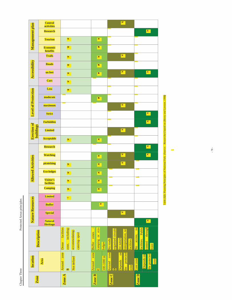
Cha
pter
Thr
ee
P
rote
cted
Are
as p
rinci
ples
- 78
-
Tabl
e (1
2): P
lann
ing
Prin
cipl
es o
f Nat
iona
l Par
k (S
ourc
e:
Rese
arch
er) b
ased
on
(Bov
ey a
nd L
awso
n, 1
998)
.
Zon
elo
catio
nD
escr
iptio
nN
atur
e R
esou
rces
A
llow
ed A
ctiv
ities
E
rect
ion
of
build
ings
Lev
el o
f Pro
tect
ion
Acc
essi
bilit
yM
anag
emen
t pla
n
Are
a
NaturalHeritage
Special
Buffer
Limited
Camping
Visitor'sfacilities
Eco-lodges
picnicking
Watching
Research
Acceptable
Limited
Forbidden
Strict
maximum
moderate
Less
Cars
on feet
Roads
Trails
Economic benefits
Tourism
Research
Controlactivities
Zon
e A
A
roun
d zo
ne
B
Den
se
faci
litie
s
zone
, in
clud
ing:
acco
mm
odat
ing-
cate
ring-
spor
tN
ot d
efin
ed
Zon
e B
A
roun
d zo
ne
C
Buf
fer
zone
s –
cam
ping
or
ec
o-
lodg
es10
0-10
00 m
Zon
e C
A
roun
d zo
ne
D
No
road
s,
orga
nise
d ci
rcui
ts
for n
atur
e
inte
rpre
tatio
n, n
o
faci
litie
s.
Dep
ends
on
the
prot
ecte
d
zone
Zon
e D
C
ore
zone
N
o ac
cess
, no
faci
litie
s. Pu
blic
cont
rol
thro
ugh
leas
e.
Dep
ends
on
the
prot
ecte
d
zone
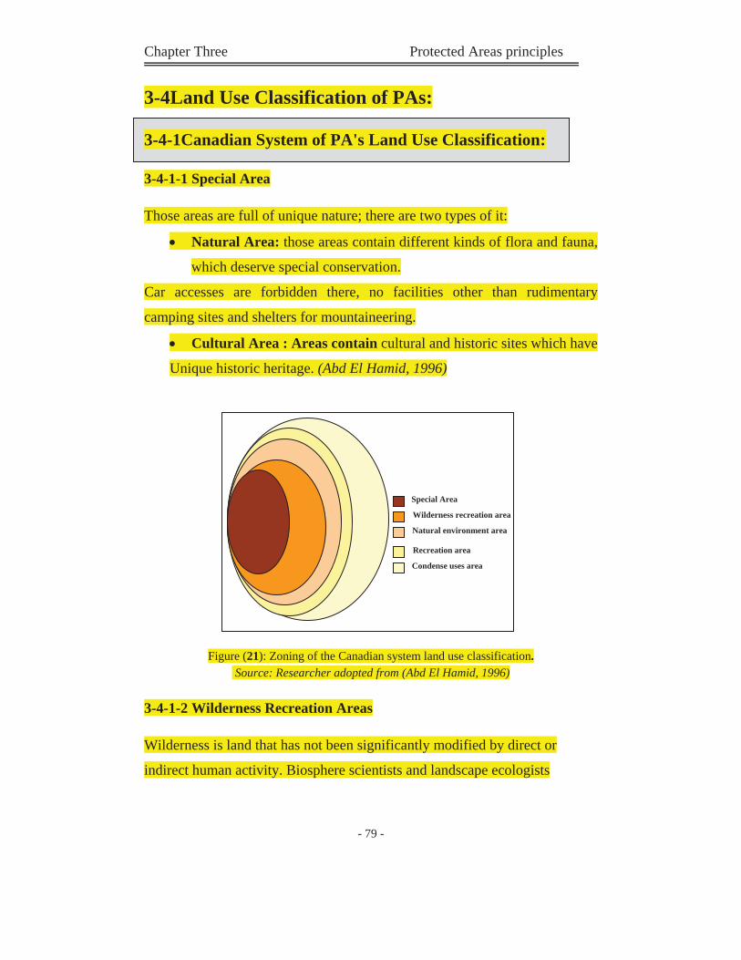
Chapter Three Protected Areas principles
- 79 -
3-4Land Use Classification of PAs:
3-4-1Canadian System of PA's Land Use Classification:
3-4-1-1 Special Area
Those areas are full of unique nature; there are two types of it:
Natural Area: those areas contain different kinds of flora and fauna,
which deserve special conservation.
Car accesses are forbidden there, no facilities other than rudimentary
camping sites and shelters for mountaineering.
Cultural Area : Areas contain cultural and historic sites which have
Unique historic heritage. (Abd El Hamid, 1996)
Figure (21): Zoning of the Canadian system land use classification. Source: Researcher adopted from (Abd El Hamid, 1996)
3-4-1-2 Wilderness Recreation Areas
Wilderness is land that has not been significantly modified by direct or
indirect human activity. Biosphere scientists and landscape ecologists
Special Area
Wilderness recreation area
Natural environment area
Recreation area
Condense uses area
Chapter Three Protected Areas principles
- 80 -
consider wilderness areas to be an integral part of the self-sustaining natural
system of the Earth.
3-4-1-3 Natural Environment
It is act as an edge between natural area and areas support recreational
faciitities. It is too hard to define this areas; as some consider it as a strict
protected area because it located close to the special protected zone, other
add it to the first and second area.
3-4-1-4 Recreation Area
It includes visitors facilities; catering, light sport facilities, camping, eco-
lodges, trail hiking, park information center and parking zones.
3-4-1-5 Condense Uses Area
This area located in large protected areas, it contains some visitor facilities (
information center – museum of natural history). (Tolba, 2003)
3-4-2American System of PA's Land Use Classification:
3-4-2-1 Condense Multiple Use Zone:
Area contains visitors facilities and services, it has a direct access to all part
of the protected area. Erection of buildigs are accepted in this zone.
3-4-2-2 Recreational Area
It is located arround the main paths of the protected area, part of it inside the
protected area and the rest part may be in or out the protected area. It contains
some visitors facilities; like camping, visitors center.
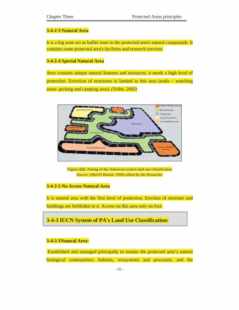
Chapter Three Protected Areas principles
- 81 -
3-4-2-3 Natural Area
It is a big zone act as buffer zone to the protected area's natural compounds. It contains some protected area's facilities and research services.
3-4-2-4 Special Natural Area
Area contains unique natural features and resources, it needs a high level of
protection. Errection of structures is limited in this area (trails – watching
areas- picknig and camping area). (Tolba, 2003)
Figure (22): Zoning of the American system land use classification Source: (Abd El Hamid, 1998) edited by the Reseacher
3-4-2-5 No Access Natural Area
It is natural area with the first level of protection. Erection of structure and
buildings are forbbiden in it. Access on this area only on foot.
3-4-3 IUCN System of PA's Land Use Classification:
3-4-3-1Natural Area:
Established and managed principally to sustain the protected area’s natural
biological communities, habitats, ecosystems and processes, and the
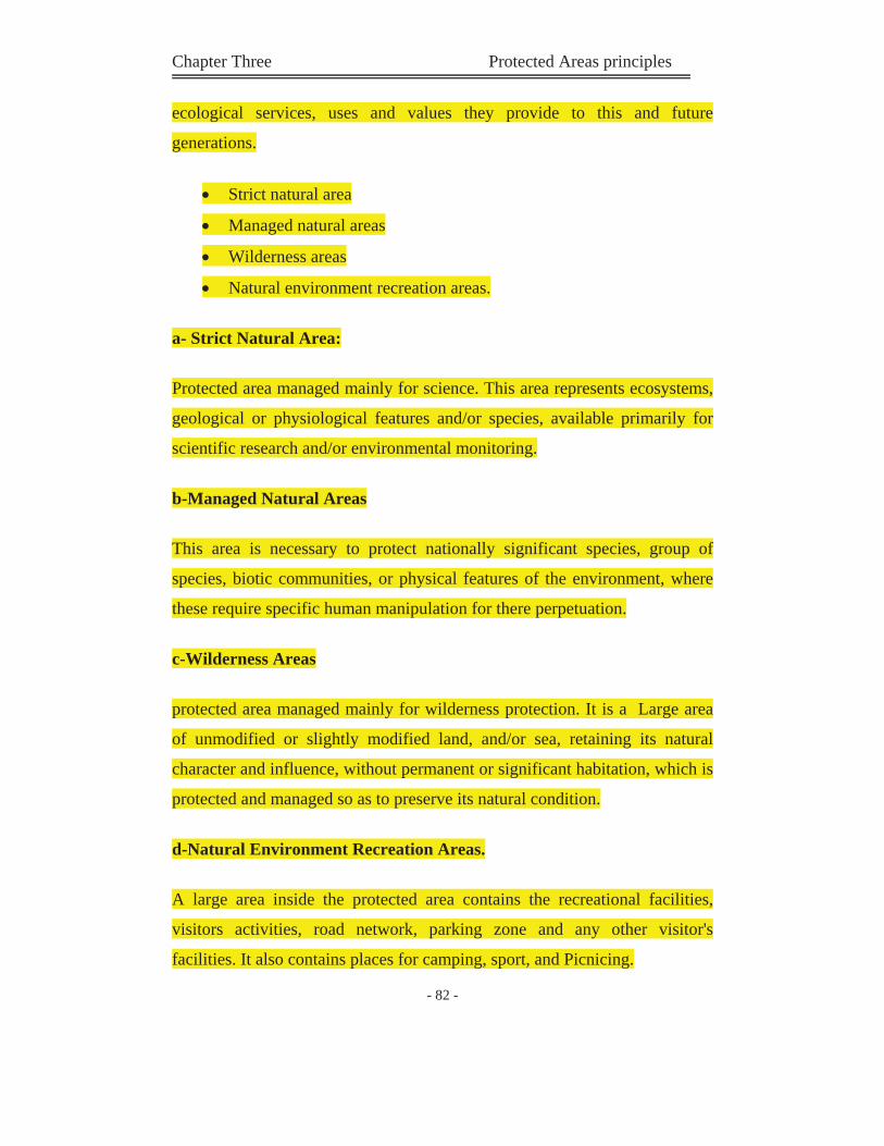
Chapter Three Protected Areas principles
- 82 -
ecological services, uses and values they provide to this and future
generations.
Strict natural area
Managed natural areas
Wilderness areas
Natural environment recreation areas.
a- Strict Natural Area:
Protected area managed mainly for science. This area represents ecosystems,
geological or physiological features and/or species, available primarily for
scientific research and/or environmental monitoring.
b-Managed Natural Areas
This area is necessary to protect nationally significant species, group of
species, biotic communities, or physical features of the environment, where
these require specific human manipulation for there perpetuation.
c-Wilderness Areas
protected area managed mainly for wilderness protection. It is a Large area
of unmodified or slightly modified land, and/or sea, retaining its natural
character and influence, without permanent or significant habitation, which is
protected and managed so as to preserve its natural condition.
d-Natural Environment Recreation Areas.
A large area inside the protected area contains the recreational facilities,
visitors activities, road network, parking zone and any other visitor's
facilities. It also contains places for camping, sport, and Picnicing.
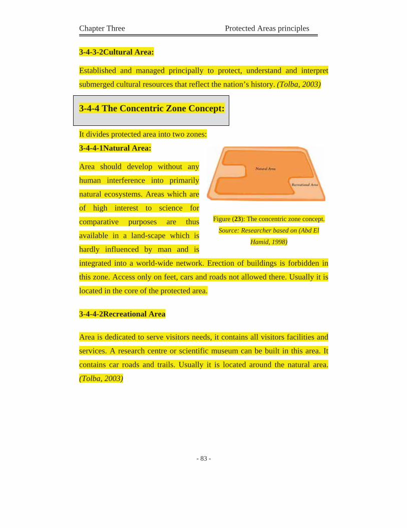
Chapter Three Protected Areas principles
- 83 -
3-4-3-2Cultural Area:
Established and managed principally to protect, understand and interpret
submerged cultural resources that reflect the nation’s history. (Tolba, 2003)
3-4-4 The Concentric Zone Concept:
It divides protected area into two zones:
3-4-4-1Natural Area:
Area should develop without any
human interference into primarily
natural ecosystems. Areas which are
of high interest to science for
comparative purposes are thus
available in a land-scape which is
hardly influenced by man and is
integrated into a world-wide network. Erection of buildings is forbidden in
this zone. Access only on feet, cars and roads not allowed there. Usually it is
located in the core of the protected area.
3-4-4-2Recreational Area
Area is dedicated to serve visitors needs, it contains all visitors facilities and
services. A research centre or scientific museum can be built in this area. It
contains car roads and trails. Usually it is located around the natural area.
(Tolba, 2003)
Figure (23): The concentric zone concept.
Source: Researcher based on (Abd El
Hamid, 1998)
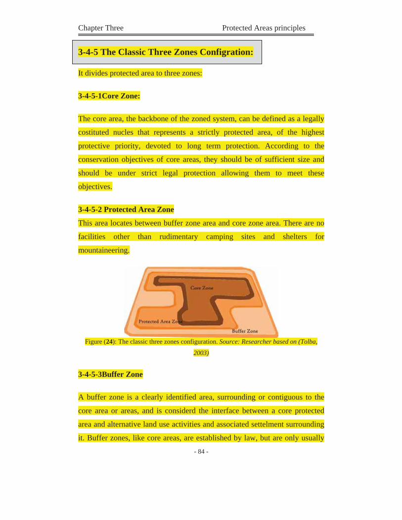
Chapter Three Protected Areas principles
- 84 -
3-4-5 The Classic Three Zones Configration:
It divides protected area to three zones:
3-4-5-1Core Zone:
The core area, the backbone of the zoned system, can be defined as a legally
costituted nucles that represents a strictly protected area, of the highest
protective priority, devoted to long term protection. According to the
conservation objectives of core areas, they should be of sufficient size and
should be under strict legal protection allowing them to meet these
objectives.
3-4-5-2 Protected Area Zone
This area locates between buffer zone area and core zone area. There are no
facilities other than rudimentary camping sites and shelters for
mountaineering.
Figure (24): The classic three zones configuration. Source: Researcher based on (Tolba,
2003)
3-4-5-3Buffer Zone
A buffer zone is a clearly identified area, surrounding or contiguous to the
core area or areas, and is considerd the interface between a core protected
area and alternative land use activities and associated settelment surrounding
it. Buffer zones, like core areas, are established by law, but are only usually
Chapter Three Protected Areas principles
- 85 -
under partial protection that is mainly aimed to serve as protection for areas
covered by the core zone, limiting threates caused by human activities.
(Tolba, 2003)
3-4-6 Nodes and Linkages:
This system applied in protected areas
with area more than 100 km2, in it all
visitors facilities is located inside the
protected area. All services and
facilaties are collected in nodes, this
nodes are connected by paths
(linkages), these linkages is located
out side the special natural area zone
(most protective zone). This system devide the protected area into:
3-4-6-1 External Zone : (Special Natural Area)
Any type of development are not accepted in this zone. It contains all natural
features and beauty.
3-4-6-2 Internal Zone : (Nodes and linkages)
This area contain nodes (visitor's facilities & services), and linkeages (paths
that connect this nodes to each other).
3-4-6-3 Transition Zone:
This area act as a buffer zone between internal and external zone. It contains some visitor's services (camping zone).
Figure (25): Nodes and Linkages.
Source: Researcher adopted from (Abd El
Hamid, 1998)
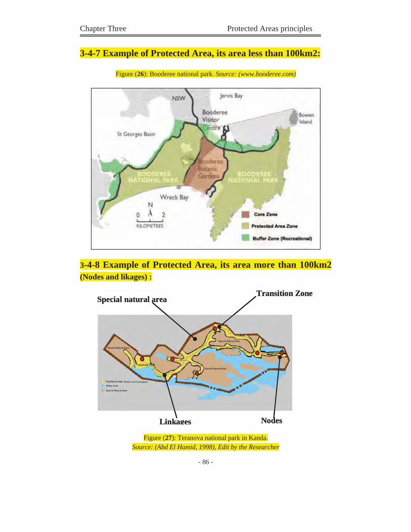
Chapter Three Protected Areas principles
- 86 -
3-4-7 Example of Protected Area, its area less than 100km2:
Figure (26): Booderee national park. Source: (www.booderee.com)
3-4-8 Example of Protected Area, its area more than 100km2(Nodes and likages) :
Figure (27): Teranova national park in Kanda. Source: (Abd El Hamid, 1998), Edit by the Researcher
Transition ZoneSpecial natural area
NodesLinkages
Transition ZoneSpecial natural area
NodesLinkages
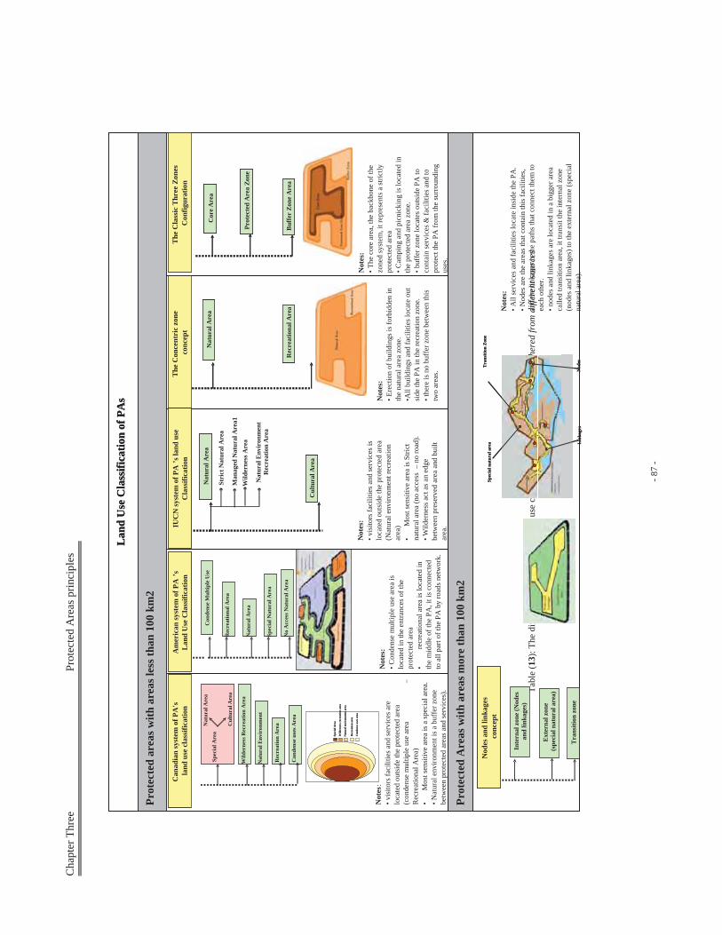
Cha
pter
Thr
ee
P
rote
cted
Are
as p
rinci
ples
- 87
-
Tabl
e (1
3): T
he d
iffer
ent s
yste
ms o
f PA
's la
nd u
se c
lass
ifica
tion.
Sour
ce: (
Rese
arch
er)g
athe
red
from
diff
eren
t sou
rces
Nat
ural
Env
iron
men
t
Prot
ecte
d A
reas
with
are
as m
ore
than
100
km
2
Lan
d U
se C
lass
ifica
tion
ofPA
s
Prot
ecte
d ar
eas w
ith a
reas
less
than
100
km
2
Prot
ecte
d A
reas
with
are
as m
ore
than
100
km
2
Lan
d U
se C
lass
ifica
tion
ofPA
s
Prot
ecte
d ar
eas w
ith a
reas
less
than
100
km
2
Spec
ial A
rea
Wild
erne
ss R
ecre
atio
n A
rea
Con
dens
e us
es A
rea
Rec
reat
ion
Are
aNat
ural
Are
a
Cul
tura
l Are
a
Spec
ial A
rea
Wild
erne
ss r
ecre
atio
n ar
ea
Nat
ural
env
iron
men
t are
a
Rec
reat
ion
area
Con
dens
e us
es a
rea
Spec
ial A
rea
Wild
erne
ss r
ecre
atio
n ar
ea
Nat
ural
env
iron
men
t are
a
Rec
reat
ion
area
Con
dens
e us
es a
rea
Am
eric
an sy
stem
of P
A’s
Lan
d U
se C
lass
ifica
tion
Con
dens
e M
ultip
le U
se
Rec
reat
iona
l Are
a
Nat
ural
Are
a
No
Acc
ess N
atur
al A
rea
Spec
ial N
atur
al A
rea
IUC
N sy
stem
of P
A’s
land
use
C
lass
ifica
tion
Nat
ural
Are
a
Cul
tura
l Are
a
Nat
ural
Are
a
Cul
tura
l Are
a
Stri
ct N
atur
al A
rea
Man
aged
Nat
ural
Are
a1W
ilder
ness
Are
a
Nat
ural
Env
iron
men
t R
ecre
atio
n A
rea
The
Con
cent
ric
zone
co
ncep
t
Nat
ural
Are
a
Rec
reat
iona
l Are
a
Nat
ural
Are
a
Rec
reat
iona
l Are
a
The
Cla
ssic
Thr
ee Z
ones
C
onfig
urat
ion
Cor
e A
rea
Buf
fer
Zone
Are
a
Prot
ecte
d A
rea
Zone
Cor
e A
rea
Buf
fer
Zone
Are
a
Prot
ecte
d A
rea
Zone
Nod
es a
nd li
nkag
esco
ncep
t
Inte
rnal
zon
e (N
odes
an
d lin
kage
s)
Tra
nsiti
on z
one
Ext
erna
l zon
e(s
peci
al n
atur
al a
rea)
Can
adia
n sy
stem
of P
A's
land
use
cla
ssifi
catio
n
Not
es:
•vis
itors
faci
litie
s and
serv
ices
are
lo
cate
d ou
tsid
e th
e pr
otec
ted
area
(c
onde
nse
mul
tiple
use
are
a –
Rec
reat
iona
l Are
a)•
Mos
t sen
sitiv
e ar
ea is
a sp
ecia
l are
a.• N
atur
al e
nviro
nmen
t is a
buf
fer z
one
betw
een
prot
ecte
d ar
eas a
nd se
rvic
es).
Not
es:
•Con
dens
e m
ultip
le u
se a
rea
is
loca
ted
in th
e en
tranc
es o
f the
pr
otec
ted
area
•re
crea
tiona
l are
a is
loca
ted
in
the
mid
dle
of th
e PA
, it i
s con
nect
ed
to a
ll pa
rt of
the
PA b
y ro
ads n
etw
ork.
Not
es:
•vis
itors
faci
litie
s and
serv
ices
is
loca
ted
outs
ide
the
prot
ecte
d ar
ea
(Nat
ural
env
ironm
ent r
ecre
atio
n ar
ea)
•M
ost s
ensi
tive
area
is S
trict
na
tura
l are
a (n
o ac
cess
–no
road
).•W
ilder
ness
act
as a
n ed
ge
betw
een
pres
erve
d ar
ea a
nd b
uilt
area
.
Not
es:
•Ere
ctio
n of
bui
ldin
gs is
forb
idde
n in
th
e na
tura
l are
a zo
ne.
•All
build
ings
and
faci
litie
s loc
ate
out
side
the
PA in
the
recr
eatio
n zo
ne.
•the
re is
no
buff
er z
one
betw
een
this
tw
o ar
eas.
Not
es:
•The
cor
e ar
ea, t
he b
ackb
one
of th
e zo
ned
syst
em, i
t rep
rese
nts a
stric
tly
prot
ecte
d ar
ea•C
ampi
ng a
nd p
icni
ckin
g is
loca
ted
in
the
prot
ecte
d ar
ea z
one.
•buf
fer z
one
loca
tes o
utsi
de P
A to
co
ntai
n se
rvic
es &
faci
litie
s and
to
prot
ect t
he P
A fr
om th
e su
rrou
ndin
g us
es.
Not
es:
•All
serv
ices
and
faci
litie
s loc
ate
insi
de th
e PA
.•N
odes
are
the
area
s tha
t con
tain
this
faci
litie
s, an
d th
e lin
kage
s is t
he p
aths
that
con
nect
them
to
each
oth
er.
•nod
es a
nd li
nkag
es a
re lo
cate
d in
a b
igge
r are
a ca
lled
trans
ition
are
a, it
tran
sit t
he in
tern
al z
one
(nod
es a
nd li
nkag
es) t
o th
e ex
tern
al z
one
(spe
cial
na
tura
l are
a).
Tra
nsiti
on Z
one
Spec
ial n
atur
al a
rea
Nod
esL
inka
ges
Tra
nsiti
on Z
one
Spec
ial n
atur
al a
rea
Nod
esL
inka
ges
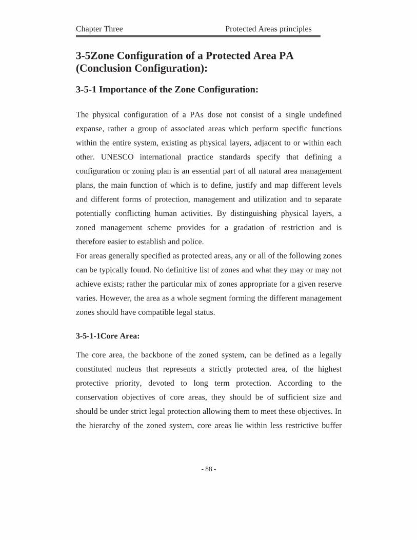
Chapter Three Protected Areas principles
- 88 -
3-5Zone Configuration of a Protected Area PA (Conclusion Configuration):
3-5-1 Importance of the Zone Configuration:
The physical configuration of a PAs dose not consist of a single undefined
expanse, rather a group of associated areas which perform specific functions
within the entire system, existing as physical layers, adjacent to or within each
other. UNESCO international practice standards specify that defining a
configuration or zoning plan is an essential part of all natural area management
plans, the main function of which is to define, justify and map different levels
and different forms of protection, management and utilization and to separate
potentially conflicting human activities. By distinguishing physical layers, a
zoned management scheme provides for a gradation of restriction and is
therefore easier to establish and police.
For areas generally specified as protected areas, any or all of the following zones
can be typically found. No definitive list of zones and what they may or may not
achieve exists; rather the particular mix of zones appropriate for a given reserve
varies. However, the area as a whole segment forming the different management
zones should have compatible legal status.
3-5-1-1Core Area:
The core area, the backbone of the zoned system, can be defined as a legally
constituted nucleus that represents a strictly protected area, of the highest
protective priority, devoted to long term protection. According to the
conservation objectives of core areas, they should be of sufficient size and
should be under strict legal protection allowing them to meet these objectives. In
the hierarchy of the zoned system, core areas lie within less restrictive buffer
Chapter Three Protected Areas principles
- 89 -
zones in which they may exist alone or may be linked with corridors to other
core areas. These perform such functions as:
Sanctuary / preservation: protecting ecosystems, species, and genetic
diversity.
Research / Education: permitting ecologically sound research and
education activities.
Cultural: where cultural activities or monuments are preserved.
3-5-1-2 Buffer Zones:
A buffer zone is a clearly identified area, surrounding or contiguous to the core
area or areas, and is considered the interface between a core protected area and
alternative land use activities and associated settlement surrounding it. Buffer
zones, like core areas, are established by law, but are only usually under partial
protection that is mainly aimed to serve as protection for areas covered by the
core zone, limiting threates caused by human activities. Temporary restriction
can be applied within buffer zones with the intent to provide protection beyond
general laws of aapplication and as a complement to full restrictions found in
core areas.
Buffer zones achieve conservation objectives by providing complementary but
less restrictive land management measures to areas surrounding core
representative areas and should be treated as integral part of management
planning by acting effectively as multiple-use zones, providing a social fence to
prevent encroachment into the core area by outsiders. Management measures
should focus on activities associated with a reduction in pressure in core area.
The identification of buffer zones is not only critical to the survival of those
areas but also serves to define rights of access for people who live in the area
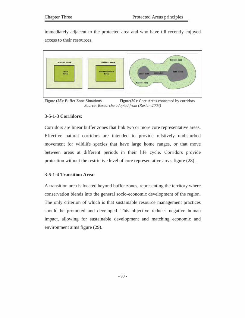
Chapter Three Protected Areas principles
- 90 -
immediately adjacent to the protected area and who have till recently enjoyed
access to their resources.
Figure (28): Buffer Zone Situations Figure(39): Core Areas connected by corridors Source: Researche adopted from (Raslan,2003)
3-5-1-3 Corridors:
Corridors are linear buffer zones that link two or more core representative areas.
Effective natural corridors are intended to provide relstively undisturbed
movement for wildlife species that have large home ranges, or that move
between areas at different periods in their life cycle. Corridors provide
protection without the restrictive level of core representative areas figure (28) .
3-5-1-4 Transition Area:
A transition area is located beyond buffer zones, representing the territory where
conservation blends into the general socio-economic development of the region.
The only criterion of which is that sustainable resource management practices
should be promoted and developed. This objective reduces negative human
impact, allowing for sustainable development and matching economic and
environment aims figure (29).
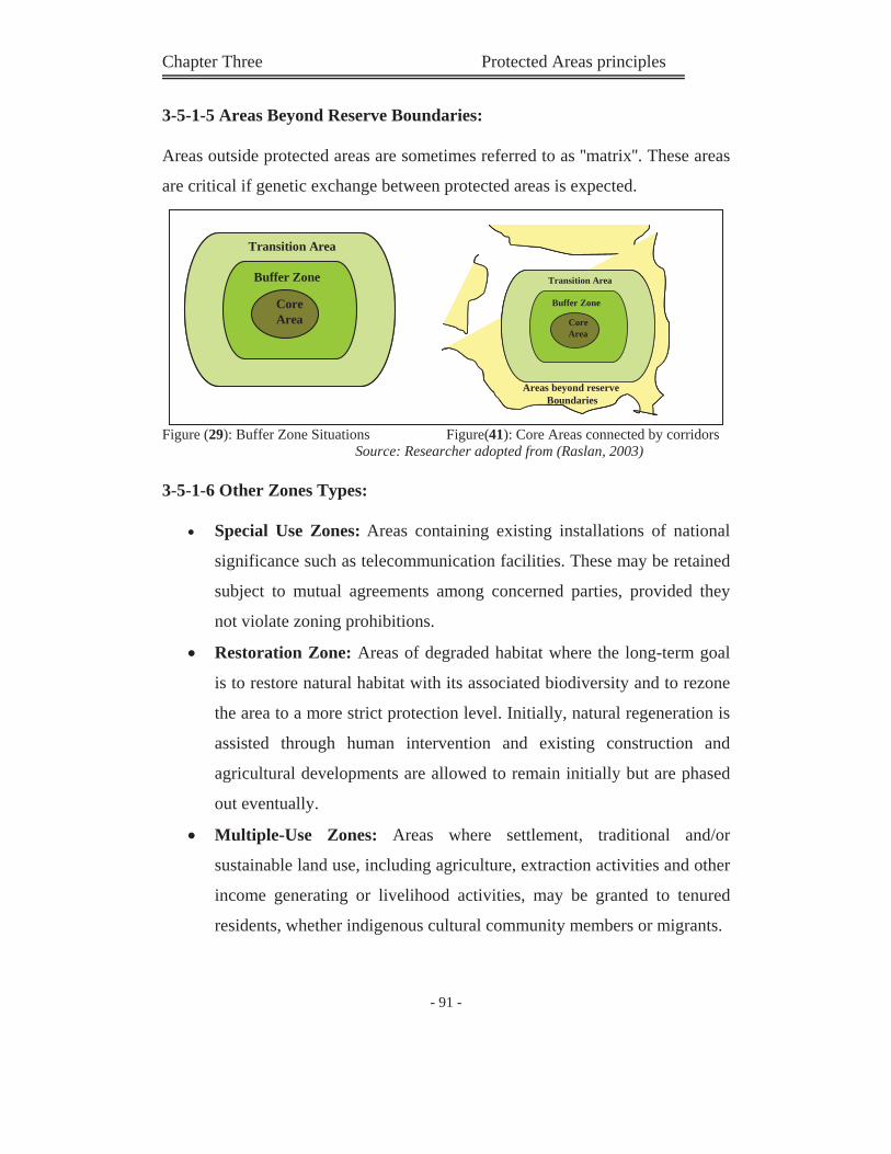
Chapter Three Protected Areas principles
- 91 -
3-5-1-5 Areas Beyond Reserve Boundaries:
Areas outside protected areas are sometimes referred to as ''matrix''. These areas
are critical if genetic exchange between protected areas is expected.
Figure (29): Buffer Zone Situations Figure(41): Core Areas connected by corridors Source: Researcher adopted from (Raslan, 2003)
3-5-1-6 Other Zones Types:
Special Use Zones: Areas containing existing installations of national
significance such as telecommunication facilities. These may be retained
subject to mutual agreements among concerned parties, provided they
not violate zoning prohibitions.
Restoration Zone: Areas of degraded habitat where the long-term goal
is to restore natural habitat with its associated biodiversity and to rezone
the area to a more strict protection level. Initially, natural regeneration is
assisted through human intervention and existing construction and
agricultural developments are allowed to remain initially but are phased
out eventually.
Multiple-Use Zones: Areas where settlement, traditional and/or
sustainable land use, including agriculture, extraction activities and other
income generating or livelihood activities, may be granted to tenured
residents, whether indigenous cultural community members or migrants.
Transition Area
Buffer Zone
CoreArea
Areas beyond reserveBoundaries
Transition Area
Buffer Zone
CoreArea
Transition Area
Buffer Zone
CoreArea
Areas beyond reserveBoundaries
Transition Area
Buffer Zone
CoreArea
Transition Area
Buffer Zone
CoreArea
Chapter Three Protected Areas principles
- 92 -
It is viable to envisage a relationship between the previous zones where the
gradient represents one of increasing management intensity away from the core.
The extent of represents one of increasing management intensity away from the
core. The extent of the gradient is ultimately determined by the ensuing degree
of protection.
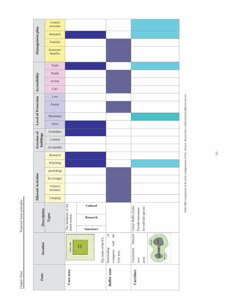
Cha
pter
Thr
ee
P
rote
cted
Are
as p
rinci
ples
- 93
-
Tabl
e (1
4): C
ompa
rison
of t
he Z
one
conf
igur
atio
ns o
f PA
s (S
ourc
e: R
esea
rche
r). G
athe
red
from
diff
eren
t sou
rces
Zon
elo
catio
nD
escr
iptio
nA
llow
ed A
ctiv
ities
E
rect
ion
of
build
ings
Lev
el o
f Pro
tect
ion
Acc
essi
bilit
yM
anag
emen
t pla
n
Typ
es
Camping
Visitor's facilities
Eco-lodges
picnicking
Watching
Research
Acceptable
Limited
Forbidden
Strict
Maximum
Partial
Less
Cars
on feet
Roads
Trails
Economicbenefits
Tourism
Research
Controlactivities
Cor
e ar
ea
The
cent
re o
f the
PA
The
bac
kbon
e of
the
zone
d sy
stem
.
Sanctuary
Research
Cultural
Buf
fer
zone
Su
rrou
ndin
g or
cont
iguo
us
with
th
e
Cor
e ar
ea.
Cor
rido
rs
.Con
nect
ion
betw
een
core
area
s
Line
ar B
uffe
r Zon
es.
Prov
ide
mov
emen
t
for w
ild li
fe sp
ecie
s
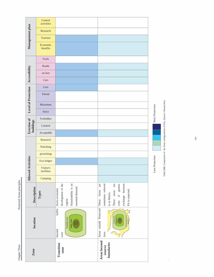
Cha
pter
Thr
ee
P
rote
cted
Are
as p
rinci
ples
- 94
-
Tabl
e (1
4): C
ompa
rison
of
the
Zone
con
figur
atio
ns o
f PA
s (S
ourc
e: R
esea
rche
r)
. Z
one
lo
catio
nD
escr
iptio
nA
llow
ed A
ctiv
ities
E
rect
ion
of
build
ings
Lev
el o
f Pro
tect
ion
Acc
essi
bilit
yM
anag
emen
t pla
n
Typ
es
Camping
Visitor's facilities
Eco-lodges
picnicking
Watching
Research
Acceptable
Limited
Forbidden
Strict
Maximum
Partial
Less
Cars
on feet
Roads
Trails
Economicbenefits
Tourism
Research
Controlactivities
Tra
nsiti
onzo
ne
beyo
nd
buff
er
zone
Tra
nsiti
on A
rea
Buf
fer
Zone
Cor
eA
rea
Tra
nsiti
on A
rea
Buf
fer
Zone
Cor
eA
rea
Soci
o-ec
onom
ic
deve
lopm
ent
of t
he
regi
on.
Sust
aina
bilit
y is
an
esse
ntia
l dem
and.
Are
as b
eyon
d re
serv
ebo
unda
ries
Are
as o
utsi
de P
rote
cted
Are
a.
Tra
nsiti
on A
rea
Buf
fer
Zon
e
Cor
eA
rea
Are
as b
eyon
d re
serv
eB
ound
arie
s
Tra
nsiti
on A
rea
Buf
fer
Zon
e
Cor
eA
rea
Tra
nsiti
on A
rea
Buf
fer
Zon
e
Cor
eA
rea
Are
as b
eyon
d re
serv
eB
ound
arie
s
Thes
e A
reas
ar
e
som
etim
es r
efer
red
to a
s Mat
rix.
Thes
e ar
eas
are
criti
c if
gene
tic
exch
ange
be
twee
n
PA is
exp
ecte
d.
Less
Pro
tect
ion
Stric
t Pro
tect
ion
Chapter Three Protected Areas principles
- 95 -
3-6 Protected Areas Network:
PAs are considered a key part of conservation under the convention on
Biological Diversity. Under a bioregional approach to conservation, PAs are
planned and managed as part of a mosaic of land uses that together seeks to
satisfy environmental and social needs. The design of an area system
therefore has to take account of a range of interrelated social and biophysical
factors, both inside and outside the areas themselves.
3-6-1Need of Network:
Protected areas should be designated within the framework of a larger
protected areas system or network. Networks provide the possibility of a
more dynamic management, including the potential for evolution and the
movement of ecosystems and their components. Networks have particular
importance during periods of climate change.
Possible component factors in the design of a reserves network include,
for example:
Corridors connecting protected areas, allowing migration of wild
plant and animal species.
Protection of transit sites for migratory birds.
Establishment of a network of old-growth forest in fire refuge
(stream sides, ridges and marshy areas) in commercially managed
boreal forests; etc.
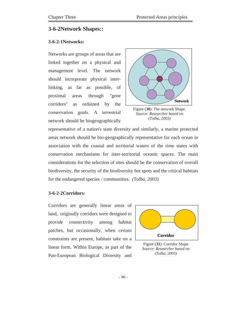
Chapter Three Protected Areas principles
- 96 -
3-6-2Network Shapes::
3-6-2-1Networks:
Networks are groups of areas that are
linked together on a physical and
management level. The network
should incorporate physical inter-
linking, as far as possible, of
proximal areas through ''gene
corridors'' as ordained by the
conservation goals. A terrestrial
network should be biogeographically
representative of a nation's state diversity and similarly, a marine protected
areas network should be bio-geographically representative for each ocean in
association with the coastal and territorial waters of the rime states with
conservation mechanisms for inter-territorial oceanic spaces. The main
considerations for the selection of sites should be the conservation of overall
biodiversity, the security of the biodiversity hot spots and the critical habitats
for the endangered species / communities. (Tolba, 2003)
3-6-2-2Corridors:
Corridors are generally linear areas of
land, originally corridors were designed to
provide connectivity among habitat
patches, but occasionally, when certain
constraints are present, habitats take on a
linear form. Within Europe, as part of the
Pan-European Biological Diversity and
NetworkNetwork
Figure (30): The network Shape. Source: Researcher based on
(Tolba, 2003)
CorridorCorridor
Figure (31): Corridor Shape Source: Researcher based on
(Tolba, 2003)
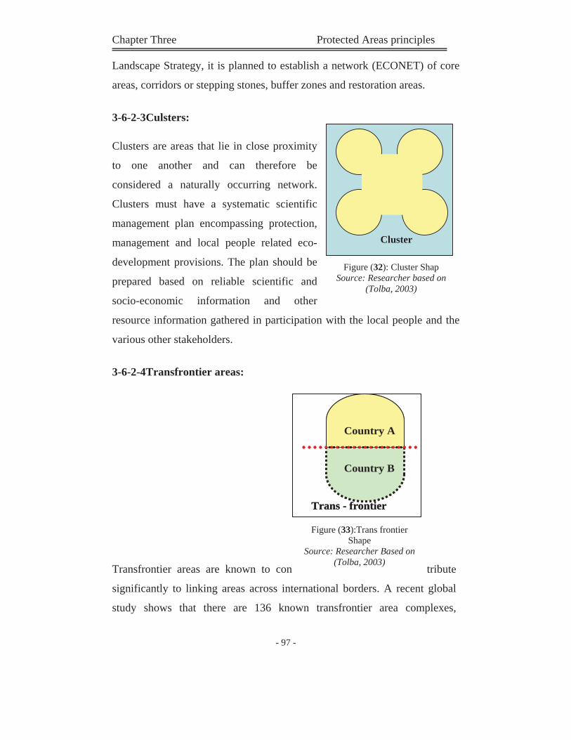
Chapter Three Protected Areas principles
- 97 -
Landscape Strategy, it is planned to establish a network (ECONET) of core
areas, corridors or stepping stones, buffer zones and restoration areas.
3-6-2-3Culsters:
Clusters are areas that lie in close proximity
to one another and can therefore be
considered a naturally occurring network.
Clusters must have a systematic scientific
management plan encompassing protection,
management and local people related eco-
development provisions. The plan should be
prepared based on reliable scientific and
socio-economic information and other
resource information gathered in participation with the local people and the
various other stakeholders.
3-6-2-4Transfrontier areas:
Transfrontier areas are known to con tribute
significantly to linking areas across international borders. A recent global
study shows that there are 136 known transfrontier area complexes,
Trans - frontier
Country A
Country B
Trans - frontier
Country A
Country B
Figure (33):Trans frontier Shape
Source: Researcher Based on (Tolba, 2003)
ClusterCluster
Figure (32): Cluster Shap Source: Researcher based on
(Tolba, 2003)
Chapter Three Protected Areas principles
- 98 -
comprising a total of 406 adjacent PAs. While collaborative management
has yet to be established in most of these complexes, the physical link
between areas either side of borders represents a vitally important
contribution to global networking.
PA 's Network Shapes
Description Figure
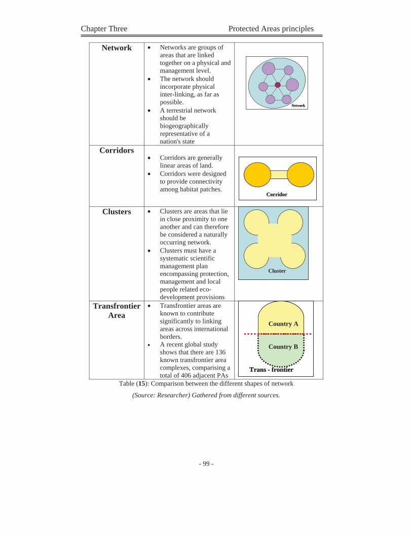
Chapter Three Protected Areas principles
- 99 -
Table (15): Comparison between the different shapes of network
(Source: Researcher) Gathered from different sources.
Network Networks are groups of areas that are linked together on a physical and management level. The network should incorporate physical inter-linking, as far as possible. A terrestrial network should be biogeographically representative of a nation's state
Corridors Corridors are generally linear areas of land. Corridors were designed to provide connectivity among habitat patches.
Clusters Clusters are areas that lie in close proximity to one another and can therefore be considered a naturally occurring network. Clusters must have a systematic scientific management plan encompassing protection, management and local people related eco-development provisions
ClusterCluster
TransfrontierArea
Transfrontier areas are known to contribute significantly to linking areas across international borders. A recent global study shows that there are 136 known transfrontier area complexes, comparising a total of 406 adjacent PAs
Trans - frontier
Country A
Country B
Trans - frontier
Country A
Country B
NetworkNetwork
CorridorCorridor
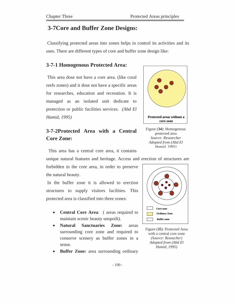
Chapter Three Protected Areas principles
- 100 -
3-7Core and Buffer Zone Designs:
Classifying protected areas into zones helps in control its activities and its
uses. There are different types of core and buffer zone design like:
3-7-1 Homogenous Protected Area:
This area dose not have a core area. (like coral
reefs zones) and it dose not have a specific areas
for researches, education and recreation. It is
managed as an isolated unit dedicate to
protection or public facilities services. (Abd El
Hamid, 1995)
3-7-2Protected Area with a Central Core Zone:
This area has a central core area, it contains
unique natural features and heritage. Access and erection of structures are
forbidden in the core area, in order to preserve
the natural beauty.
In the buffer zone it is allowed to erection
structures to supply visitors facilities. This
protected area is classified into three zones:
Central Core Area: ( areas required to maintain scenic beauty unspoilt). Natural Sanctuaries Zone: areassurrounding core zone and required to conserve scenery as buffer zones in a sense.Buffer Zone: area surrounding ordinary
Protected areas without a core zone
Protected areas without a core zone
Figure (34): Homogenous protected area
Source: Researcher Adopted from (Abd El
Hamid, 1995)
Buffer zone
Ordinary Zone
Core zone
Buffer zone
Ordinary Zone
Core zone
Figure (35): Protected Area with a central core zone
(Source: Reseacher) Adopted from (Abd El
Hamid, 1995)
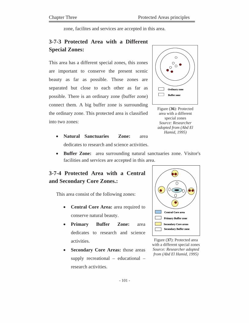
Chapter Three Protected Areas principles
- 101 -
zone, facilites and services are accepted in this area.
3-7-3 Protected Area with a Different Special Zones:
This area has a different special zones, this zones
are important to conserve the present scenic
beauty as far as possible. Those zones are
separated but close to each other as far as
possible. There is an ordinary zone (buffer zone)
connect them. A big buffer zone is surrounding
the ordinary zone. This protected area is classified
into two zones:
Natural Sanctuaries Zone: area
dedicates to research and science activities.
Buffer Zone: area surrounding natural sanctuaries zone. Visitor's facilities and services are accepted in this area.
3-7-4 Protected Area with a Central and Secondary Core Zones.:
This area consist of the following zones:
Central Core Area: area required to
conserve natural beauty.
Primary Buffer Zone: area
dedicates to research and science
activities.
Secondary Core Areas: those areas
supply recreational – educational –
research activities.
Buffer zone
Ordinary zone
Buffer zone
Ordinary zone
Figure (36): Protected area with a different
special zones Source: Researcher
adopted from (Abd El Hamid, 1995)
Primary Buffer zone
Central Core area
Secondary Buffer zone
Secondary Core areas
Primary Buffer zone
Central Core area
Secondary Buffer zone
Secondary Core areas
Figure (37): Protected area with a different special zones Source: Researcher adopted from (Abd El Hamid, 1995)
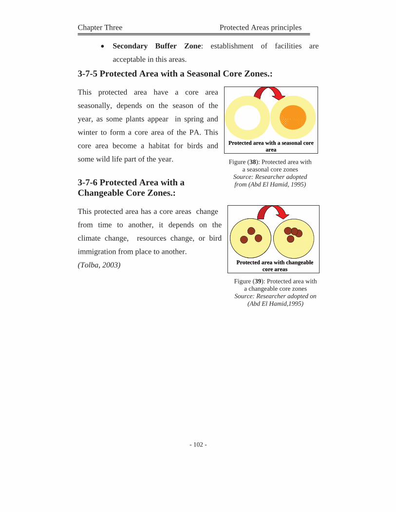
Chapter Three Protected Areas principles
- 102 -
Secondary Buffer Zone: establishment of facilities are
acceptable in this areas.
3-7-5 Protected Area with a Seasonal Core Zones.:
This protected area have a core area
seasonally, depends on the season of the
year, as some plants appear in spring and
winter to form a core area of the PA. This
core area become a habitat for birds and
some wild life part of the year.
3-7-6 Protected Area with a Changeable Core Zones.:
This protected area has a core areas change
from time to another, it depends on the
climate change, resources change, or bird
immigration from place to another.
(Tolba, 2003)
Protected area with a seasonal core area
Protected area with a seasonal core area
Figure (38): Protected area with a seasonal core zones
Source: Researcher adopted from (Abd El Hamid, 1995)
Protected area with changeable core areas
Protected area with changeable core areas
Figure (39): Protected area with a changeable core zones
Source: Researcher adopted on (Abd El Hamid,1995)
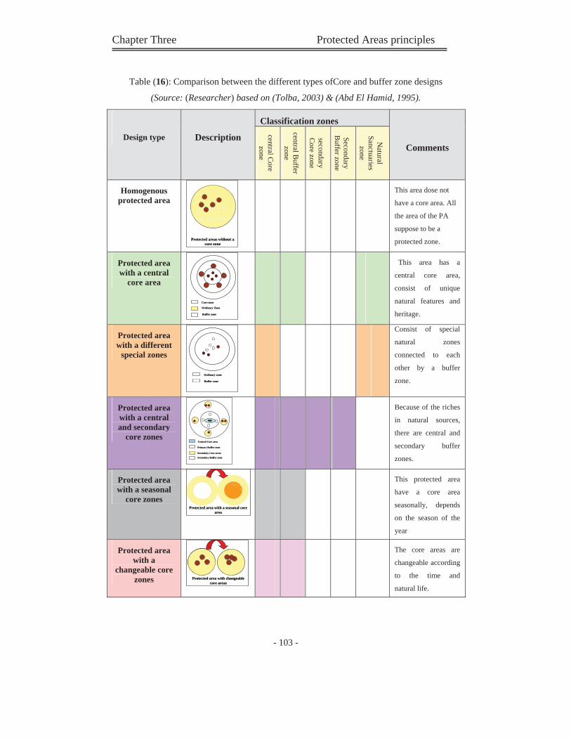
Chapter Three Protected Areas principles
- 103 -
Table (16): Comparison between the different types ofCore and buffer zone designs
(Source: (Researcher) based on (Tolba, 2003) & (Abd El Hamid, 1995).
Design type Description
Classification zones
Comments
central Core
zone
central Buffer
zone
secondary C
ore zone
Secondary B
uffer zone
Natural
Sanctuarieszone
Homogenous protected area
Protected areas without a core zone
Protected areas without a core zone
This area dose not
have a core area. All
the area of the PA
suppose to be a
protected zone.
Protected area with a central
core area
Buffer zone
Ordinary Zone
Core zone
Buffer zone
Ordinary Zone
Core zone
This area has a
central core area,
consist of unique
natural features and
heritage.
Protected area with a different
special zones
Buffer zone
Ordinary zone
Buffer zone
Ordinary zone
Consist of special
natural zones
connected to each
other by a buffer
zone.
Protected area with a central and secondary
core zonesPrimary Buffer zone
Central Core area
Secondary Buffer zone
Secondary Core areas
Primary Buffer zone
Central Core area
Secondary Buffer zone
Secondary Core areas
Because of the riches
in natural sources,
there are central and
secondary buffer
zones.
Protected area with a seasonal
core zones Protected area with a seasonal core
areaProtected area with a seasonal core
area
This protected area
have a core area
seasonally, depends
on the season of the
year
Protected area with a
changeable core zones Protected area with changeable
core areasProtected area with changeable
core areas
The core areas are
changeable according
to the time and
natural life.
Chapter Three Protected Areas principles
- 104 -
3-8 Management of the PAs:
Since PAs were recognized as areas of both environmental and economic
value, several management plans that aim to explore their development
potentials while conserving their ecological integrity have been formulated.
Most plans are developed and endorsed by international organizations
involved in conservation and development activities as well as local NGOs
operating in similar fields. The IUCN management classification system, is
the most comprehensive system, as it is applicable to any habitat type and is
the most widely ratified.
Protected areas should not be island in a sea of development, but must be
part of every country's strategy for sustainable management and the wise use
of its natural resources, set in a regional planning context.
According to IUCN categorization, protection has become as much about the
protection of processes, as about the conservation of species. Areas can in
theory cover land used for almost everything except industrial-scale activity
such as intensive farming, mining or large settlements. A wider definition
may be seen as less treating because it dose not necessarily mean a complete
block on human activity. Some activities are allowed and other not.
Generally level of human intervention depends on the category of the PAs.
(IUCN, 1994)
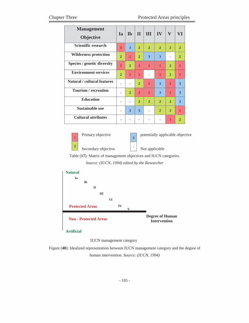
Chapter Three Protected Areas principles
- 105 -
Management
Objective Ia Ib II III IV V VI
Scientific research 1 3 2 2 2 2 2
Wilderness protection 2 1 2 3 3 - 2
Species / genetic diversity 1 2 1 1 1 2 1
Environment services 2 1 1 - 1 2 1
Natural / cultural features - - 2 1 3 1 3
Tourism / recreation - 2 1 1 3 1 3
Education - - 2 2 2 2 3
Sustainable use - 3 3 - 2 2 1
Cultural attributes - - - - - 1 2
Primary objective potentially applicable objective
Secondary objective Not applicable
Table (17): Matrix of management objectives and IUCN categories.
Source: (IUCN, 1994) edited by the Researcher
Figure (40): Idealized representation between IUCN management category and the degree of
human intervention. Source: (IUCN, 1994)
3
-
1
2
IV
Natural Ia
Degree of Human Intervention
Protected Areas
Non - Protected Areas
Artificial
IbII
III
VI
V
IUCN management category
Chapter Three Protected Areas principles
- 106 -
3-9 Summary of Chapter Three: (Protected Areas Principles & Management Concepts):
Good management is an essential element in the success of a
protected area. Many theories and principles are put in this field.
As protected areas are not isolated islands; there must be
integration between those significant areas and other urban uses, in
order to achieve an ideal relationship.
The degree of human intervention in protected areas is varied from
type to another. It is for example to limited in type I; Strict science
one.
The management objectives in PAs varied from type to another,
these management objectives govern the type of uses in or around
the Pas.
The zone configuration of the PAs presents the acceptable activities
in every part of the protected area, and also around the specific
protected zone.
There are many systems of this zone configuration, but the common
configuration divide the PA's zone to protected area and
recreational area (contains all other urban uses).
PAs are planned and managed as part of a mosaic of land uses that
together seeks to satisfy environmental and social needs.
protected areas should be designated within the framework of a
larger protected areas system or network.
Chapter Four ''Planning Principles set in Different
Countries''
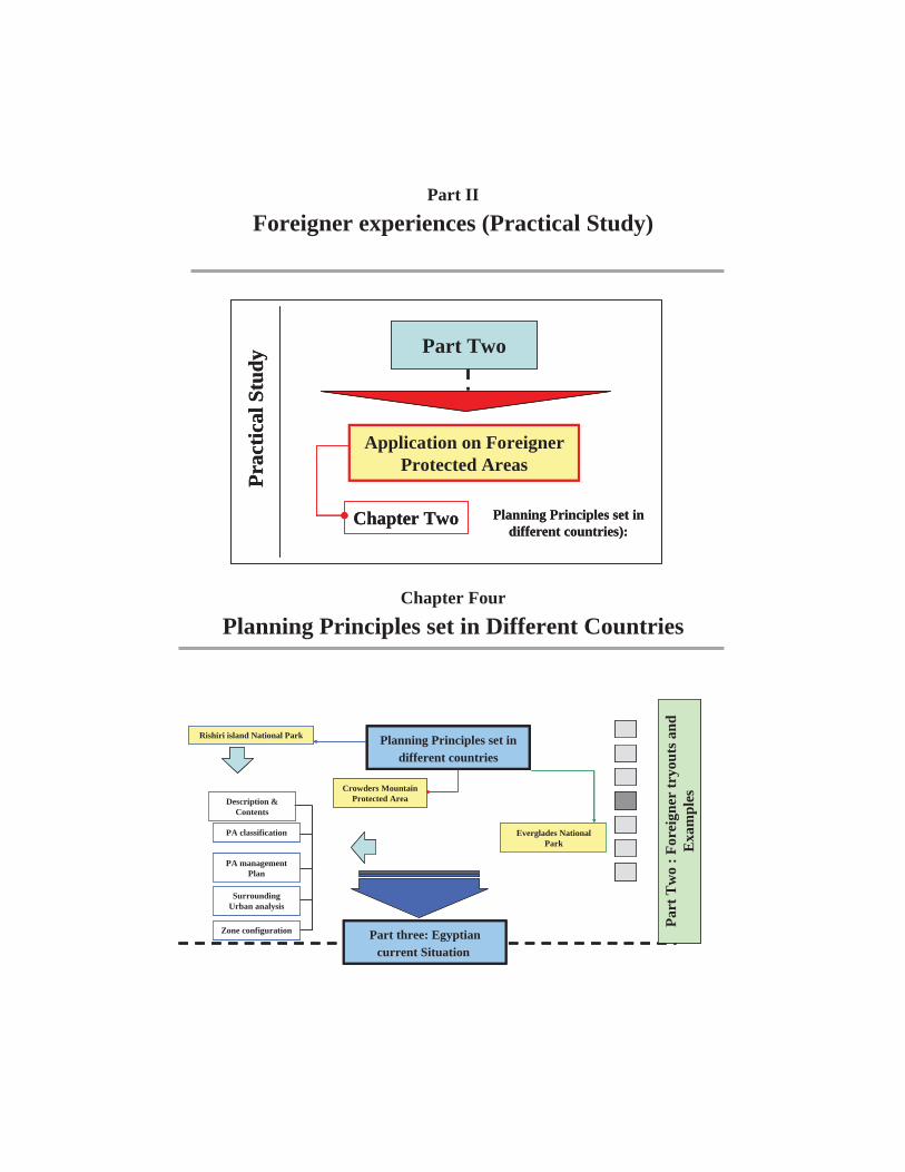
Part II
Foreigner experiences (Practical Study)
Chapter Four
Planning Principles set in Different Countries
Part Two
Application on Foreigner Protected Areas
Prac
tical
Stu
dy
Planning Principles set in different countries):
Chapter Two
Part Two
Application on Foreigner Protected Areas
Prac
tical
Stu
dy
Planning Principles set in different countries):
Chapter Two
Part
Tw
o : F
orei
gner
tryo
uts a
nd
Exa
mpl
es
Rishiri island National Park
Everglades National Park
Crowders Mountain Protected Area
Planning Principles set in different countries
Description & Contents
PA classification
PA management Plan
Surrounding Urban analysis
Zone configuration Part three: Egyptian current Situation
Part
Tw
o : F
orei
gner
tryo
uts a
nd
Exa
mpl
es
Rishiri island National Park
Everglades National Park
Crowders Mountain Protected Area
Planning Principles set in different countries
Description & Contents
PA classification
PA management Plan
Surrounding Urban analysis
Zone configuration
Part
Tw
o : F
orei
gner
tryo
uts a
nd
Exa
mpl
es
Rishiri island National Park
Everglades National Park
Crowders Mountain Protected Area
Planning Principles set in different countries
Description & Contents
PA classification
PA management Plan
Surrounding Urban analysis
Zone configuration Part three: Egyptian current Situation
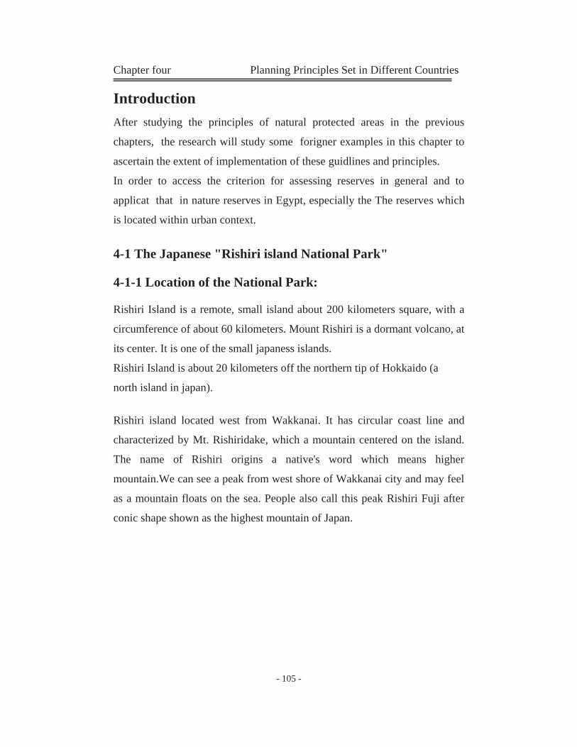
Chapter four Planning Principles Set in Different Countries
- 105 -
Introduction After studying the principles of natural protected areas in the previous
chapters, the research will study some forigner examples in this chapter to
ascertain the extent of implementation of these guidlines and principles.
In order to access the criterion for assessing reserves in general and to
applicat that in nature reserves in Egypt, especially the The reserves which
is located within urban context.
4-1 The Japanese "Rishiri island National Park"
4-1-1 Location of the National Park:
Rishiri Island is a remote, small island about 200 kilometers square, with a
circumference of about 60 kilometers. Mount Rishiri is a dormant volcano, at
its center. It is one of the small japaness islands.
Rishiri Island is about 20 kilometers off the northern tip of Hokkaido (a
north island in japan).
Rishiri island located west from Wakkanai. It has circular coast line and
characterized by Mt. Rishiridake, which a mountain centered on the island.
The name of Rishiri origins a native's word which means higher
mountain.We can see a peak from west shore of Wakkanai city and may feel
as a mountain floats on the sea. People also call this peak Rishiri Fuji after
conic shape shown as the highest mountain of Japan.
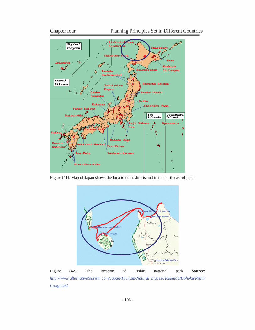
Chapter four Planning Principles Set in Different Countries
- 106 -
Figure (41): Map of Japan shows the location of rishiri island in the north east of japan
Figure (42): The location of Rishiri national park Source:
http://www.alternativetourism.com/Japan/Tourism/Natural_places/Hokkaido/Dohoku/Rishir
i_eng.html
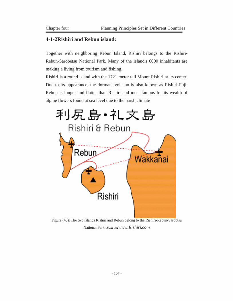
Chapter four Planning Principles Set in Different Countries
- 107 -
4-1-2Rishiri and Rebun island:
Together with neighboring Rebun Island, Rishiri belongs to the Rishiri-
Rebun-Sarobetsu National Park. Many of the island's 6000 inhabitants are
making a living from tourism and fishing.
Rishiri is a round island with the 1721 meter tall Mount Rishiri at its center.
Due to its appearance, the dormant volcano is also known as Rishiri-Fuji.
Rebun is longer and flatter than Rishiri and most famous for its wealth of
alpine flowers found at sea level due to the harsh climate
Figure (43): The two islands Rishiri and Rebun belong to the Rishiri-Rebun-Sarobtsu
National Park. Source:www.Rishiri.com
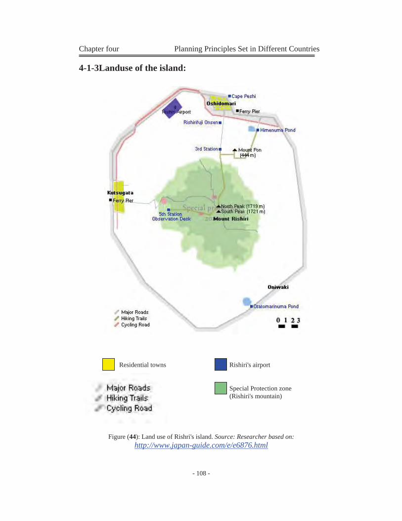
Chapter four Planning Principles Set in Different Countries
- 108 -
Residential towns Rishiri's airport
Special Protection zone(Rishiri's mountain)
4-1-3Landuse of the island:
Figure (44): Land use of Rishri's island. Source: Researcher based on: http://www.japan-guide.com/e/e6876.html
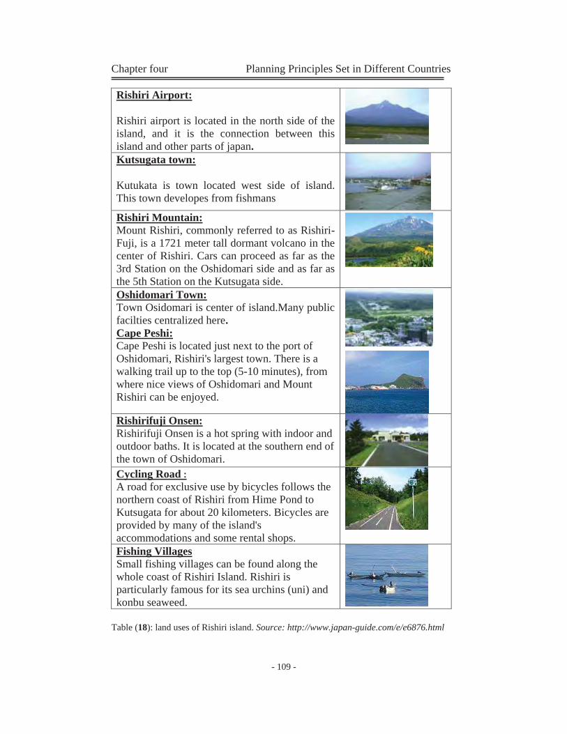
Chapter four Planning Principles Set in Different Countries
- 109 -
Rishiri Airport:
Rishiri airport is located in the north side of the island, and it is the connection between this island and other parts of japan.
Kutsugata town:
Kutukata is town located west side of island. This town developes from fishmans
Rishiri Mountain: Mount Rishiri, commonly referred to as Rishiri-Fuji, is a 1721 meter tall dormant volcano in the center of Rishiri. Cars can proceed as far as the 3rd Station on the Oshidomari side and as far as the 5th Station on the Kutsugata side.
Oshidomari Town: Town Osidomari is center of island.Many public facilties centralized here. Cape Peshi: Cape Peshi is located just next to the port of Oshidomari, Rishiri's largest town. There is a walking trail up to the top (5-10 minutes), from where nice views of Oshidomari and Mount Rishiri can be enjoyed.
Rishirifuji Onsen: Rishirifuji Onsen is a hot spring with indoor and outdoor baths. It is located at the southern end of the town of Oshidomari. Cycling Road : A road for exclusive use by bicycles follows the northern coast of Rishiri from Hime Pond to Kutsugata for about 20 kilometers. Bicycles are provided by many of the island's accommodations and some rental shops.
Fishing Villages Small fishing villages can be found along the whole coast of Rishiri Island. Rishiri is particularly famous for its sea urchins (uni) and konbu seaweed.
Table (18): land uses of Rishiri island. Source: http://www.japan-guide.com/e/e6876.html
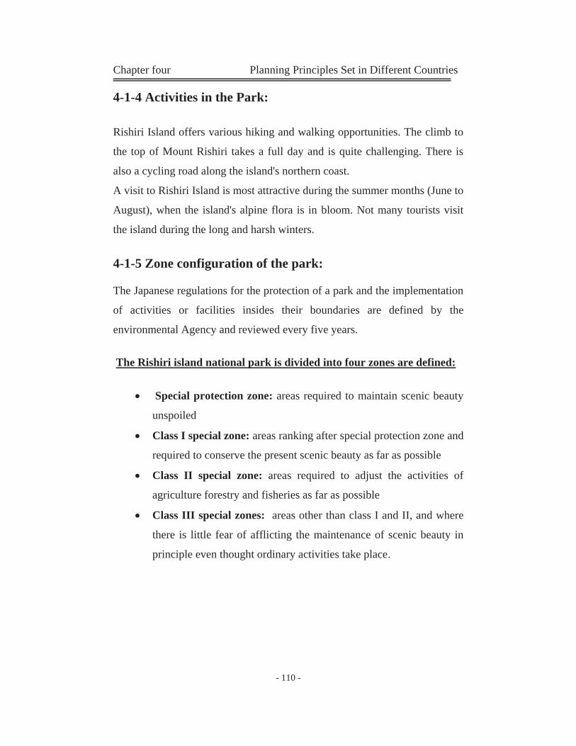
Chapter four Planning Principles Set in Different Countries
- 110 -
4-1-4 Activities in the Park:
Rishiri Island offers various hiking and walking opportunities. The climb to
the top of Mount Rishiri takes a full day and is quite challenging. There is
also a cycling road along the island's northern coast.
A visit to Rishiri Island is most attractive during the summer months (June to
August), when the island's alpine flora is in bloom. Not many tourists visit
the island during the long and harsh winters.
4-1-5 Zone configuration of the park:
The Japanese regulations for the protection of a park and the implementation
of activities or facilities insides their boundaries are defined by the
environmental Agency and reviewed every five years.
The Rishiri island national park is divided into four zones are defined:
Special protection zone: areas required to maintain scenic beauty
unspoiled
Class I special zone: areas ranking after special protection zone and
required to conserve the present scenic beauty as far as possible
Class II special zone: areas required to adjust the activities of
agriculture forestry and fisheries as far as possible
Class III special zones: areas other than class I and II, and where
there is little fear of afflicting the maintenance of scenic beauty in
principle even thought ordinary activities take place.

Chapter four Planning Principles Set in Different Countries
- 111 -
Nat
iona
l Par
kSp
ecia
l zon
eSp
ecia
l pr
otec
tion
zone
Cla
ss I
spec
ial z
one
Cla
ss I
I
spec
ial z
one
Cla
ss I
II
spec
ial z
one
Are
as
rank
ing
afte
r sp
ecia
l pr
otec
tion
zone
and
req
uire
d to
con
serv
e sc
ienc
e be
auty
Are
as r
equi
red
to a
djus
t th
e ac
tiviti
es
of
agric
ultu
re,
fore
stry
and
fish
erie
s as
far a
s po
ssib
le
Are
as o
ther
than
Cla
ss I
and
II
spec
ial z
ones
, and
whe
re th
ere
is l
ittle
fea
r of
aff
ectin
g th
e m
aint
enan
ce o
f sce
nic
beau
ty
Are
as
requ
ired
to
mai
ntai
n sc
enic
bea
uty
unsp
oilt
Mar
ine
park
zon
e
Ord
inar
y zo
ne
Are
as w
here
seas
cape
is
exce
llent
due
to a
bund
ant
mar
ine
anim
als a
nd p
lant
s
Are
as su
rrou
ndin
g sp
ecia
l zo
ne o
f sce
nic
beau
ty a
nd
requ
ired
to c
onse
rve
scen
ery
and
buff
er z
ones
in a
sens
e.
Som
e re
gula
tion
as in
the
spec
ial
prot
ectio
n zo
ne
As f
or la
rge
build
ings
whi
ch m
ay
obst
ruct
scen
ic b
eaut
y,
adm
inis
trativ
e ac
tion
can
be
take
n fo
r the
pur
pose
of
cons
erva
tion
Erec
tion
of st
ruct
ures
is
proh
ibite
d in
prin
cipl
es. N
amel
y,
the
regu
latio
n of
spec
ial
prot
ectio
n zo
ne a
pply
co
rres
pond
ingl
y to
this
zon
e.
Esta
blis
hmen
t of f
acili
ties
requ
ired
for t
he d
aily
life
of l
ocal
pe
ople
such
as h
ousi
ng a
nd
othe
r fac
ilitie
s rel
atin
g to
nor
mal
ac
tiviti
es ,
whi
ch a
re n
ot
obst
ruct
ive
to sc
enic
bea
uty.
Reg
ardi
ng e
rect
ion
of st
ruct
ures
, re
gula
tion
is a
lmos
t the
sam
e as
in
cla
ss II
spec
ial z
one.
With
re
gard
to fo
rest
ry, c
lear
cut
is
allo
wed
.
Erec
tion
of st
ruct
ures
is
proh
ibite
d in
prin
cipl
esN
atio
nal P
ark
Nat
iona
l Par
kSp
ecia
l zon
eSp
ecia
l zon
eSp
ecia
lpr
otec
tion
zone
Spec
ial
prot
ectio
n zo
ne
Cla
ss I
spec
ial z
one
Cla
ss I
spec
ial z
one
Cla
ss I
I
spec
ial z
one
Cla
ss I
I
spec
ial z
one
Cla
ss I
II
spec
ial z
one
Cla
ss I
II
spec
ial z
one
Are
as
rank
ing
afte
r sp
ecia
l pr
otec
tion
zone
and
req
uire
dto
con
serv
e sc
ienc
e be
auty
Are
as
rank
ing
afte
r sp
ecia
l pr
otec
tion
zone
and
req
uire
d to
con
serv
e sc
ienc
e be
auty
Are
as r
equi
red
to a
djus
t th
eac
tiviti
es
of
agric
ultu
re,
fore
stry
and
fish
erie
s as
far a
spo
ssib
le
Are
as r
equi
red
to a
djus
t th
e ac
tiviti
es
of
agric
ultu
re,
fore
stry
and
fish
erie
s as
far a
s po
ssib
le
Are
as o
ther
than
Cla
ss I
and
IIsp
ecia
l zon
es, a
nd w
here
ther
eis
litt
le f
ear
of a
ffec
ting
the
mai
nten
ance
of s
ceni
c be
auty
Are
as o
ther
than
Cla
ss I
and
II
spec
ial z
ones
, and
whe
re th
ere
is l
ittle
fea
r of
aff
ectin
g th
e m
aint
enan
ce o
f sce
nic
beau
ty
Are
as
requ
ired
to
mai
ntai
nsc
enic
bea
uty
unsp
oilt
Are
as
requ
ired
to
mai
ntai
n sc
enic
bea
uty
unsp
oilt
Mar
ine
park
zon
eM
arin
e pa
rk z
one
Ord
inar
y zo
neO
rdin
ary
zone
Are
as w
here
seas
cape
is
exce
llent
due
to a
bund
ant
mar
ine
anim
als a
nd p
lant
s
Are
as w
here
seas
cape
is
exce
llent
due
to a
bund
ant
mar
ine
anim
als a
nd p
lant
s
Are
as su
rrou
ndin
g sp
ecia
l zo
ne o
f sce
nic
beau
ty a
nd
requ
ired
to c
onse
rve
scen
ery
and
buff
er z
ones
in a
sens
e.
Are
as su
rrou
ndin
g sp
ecia
l zo
ne o
f sce
nic
beau
ty a
nd
requ
ired
to c
onse
rve
scen
ery
and
buff
er z
ones
in a
sens
e.
Som
e re
gula
tion
as in
the
spec
ial
prot
ectio
n zo
neSo
me
regu
latio
n as
in th
e sp
ecia
l pr
otec
tion
zone
As f
or la
rge
build
ings
whi
ch m
ay
obst
ruct
scen
ic b
eaut
y,ad
min
istra
tive
actio
n ca
n be
ta
ken
for t
he p
urpo
se o
f co
nser
vatio
n
As f
or la
rge
build
ings
whi
ch m
ay
obst
ruct
scen
ic b
eaut
y,
adm
inis
trativ
e ac
tion
can
be
take
n fo
r the
pur
pose
of
cons
erva
tion
Erec
tion
of st
ruct
ures
is
proh
ibite
d in
prin
cipl
es. N
amel
y,th
e re
gula
tion
of sp
ecia
lpr
otec
tion
zone
app
ly
corr
espo
ndin
gly
to th
is z
one.
Erec
tion
of st
ruct
ures
is
proh
ibite
d in
prin
cipl
es. N
amel
y,
the
regu
latio
n of
spec
ial
prot
ectio
n zo
ne a
pply
co
rres
pond
ingl
y to
this
zon
e.
Esta
blis
hmen
t of f
acili
ties
requ
ired
for t
he d
aily
life
of l
ocal
pe
ople
such
as h
ousi
ng a
ndot
her f
acili
ties r
elat
ing
to n
orm
al
activ
ities
, w
hich
are
not
ob
stru
ctiv
e to
scen
ic b
eaut
y.
Esta
blis
hmen
t of f
acili
ties
requ
ired
for t
he d
aily
life
of l
ocal
pe
ople
such
as h
ousi
ng a
nd
othe
r fac
ilitie
s rel
atin
g to
nor
mal
ac
tiviti
es ,
whi
ch a
re n
ot
obst
ruct
ive
to sc
enic
bea
uty.
Reg
ardi
ng e
rect
ion
of st
ruct
ures
, re
gula
tion
is a
lmos
t the
sam
e as
in c
lass
II sp
ecia
l zon
e. W
ith
rega
rd to
fore
stry
, cle
ar c
ut is
al
low
ed.
Reg
ardi
ng e
rect
ion
of st
ruct
ures
, re
gula
tion
is a
lmos
t the
sam
e as
in
cla
ss II
spec
ial z
one.
With
re
gard
to fo
rest
ry, c
lear
cut
is
allo
wed
.
Erec
tion
of st
ruct
ures
is
proh
ibite
d in
prin
cipl
esEr
ectio
n of
stru
ctur
es is
pr
ohib
ited
in p
rinci
ples
Figu
re (4
5): Z
ones
cla
ssifi
catio
n of
Ris
hiri
park
. Sou
rce:
(Bov
ey a
nd
Law
son,
199
8)
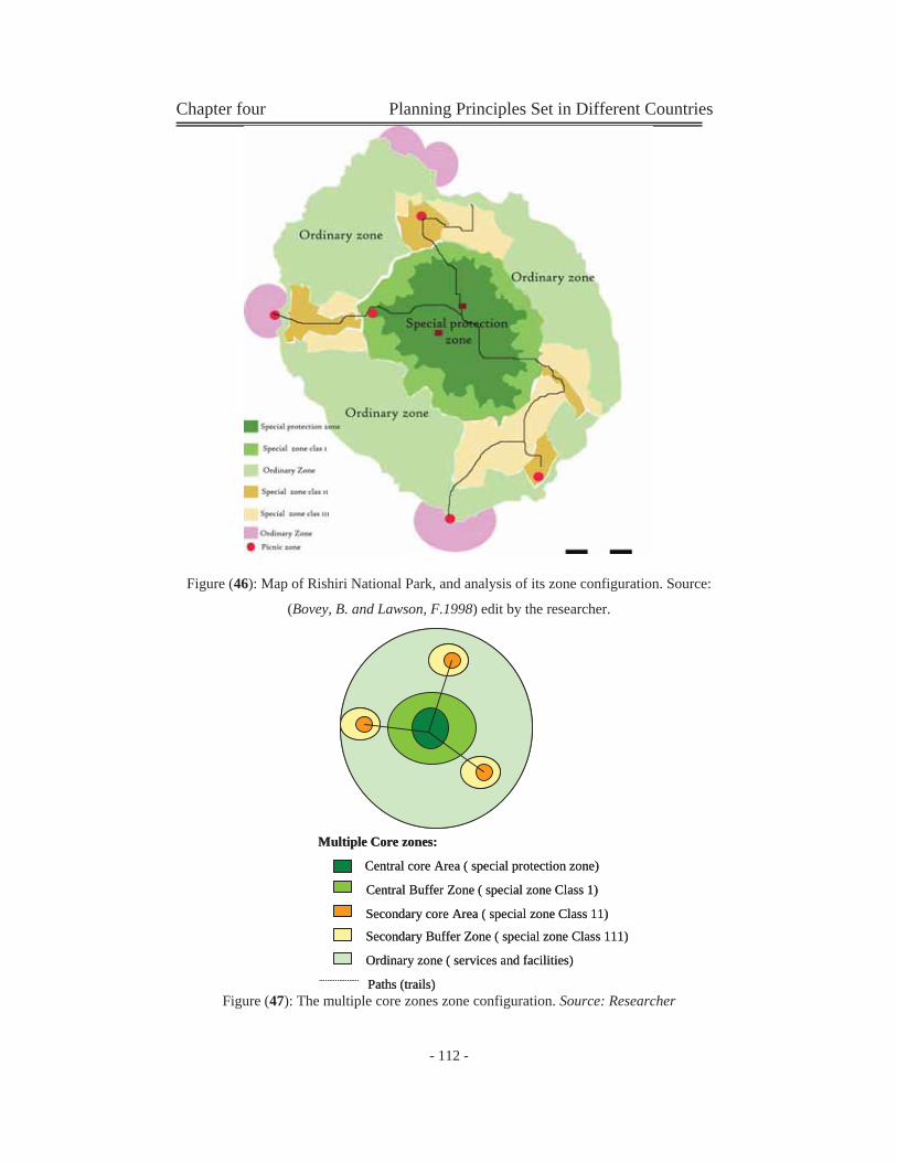
Chapter four Planning Principles Set in Different Countries
- 112 -
Multiple Core zones:
Central core Area ( special protection zone)
Central Buffer Zone ( special zone Class 1)
Secondary core Area ( special zone Class 11)
Secondary Buffer Zone ( special zone Class 111)
Ordinary zone ( services and facilities)
Paths (trails)
Multiple Core zones:
Central core Area ( special protection zone)
Central Buffer Zone ( special zone Class 1)
Secondary core Area ( special zone Class 11)
Secondary Buffer Zone ( special zone Class 111)
Ordinary zone ( services and facilities)
Paths (trails)
Figure (46): Map of Rishiri National Park, and analysis of its zone configuration. Source:
(Bovey, B. and Lawson, F.1998) edit by the researcher.
Figure (47): The multiple core zones zone configuration. Source: Researcher
Chapter four Planning Principles Set in Different Countries
- 113 -
4-1-6Current Situation of the Rishiri National Park:
From the map of the park we can analyse the following:
Zone configuration of the park is a multiple core zones system, which
consists of centeral core zone and a secondry zones.
Special protection zone is the main core zone, the protection of this
zone is very strict.
Ordinary zones are the area which supply all the recreational
facilities.
Around the main core zone, there is a primally buffer zone. This zone
need less protection than the strict protection of the core zones.
The secondary core zones are surrounded by another buffer zones,
this buffer zones separate the secondary zones from the ordinary
zones.
There are main pedestrian paths go through the core zones, and
supply a network of paths without damage any other areas of the PA.
In this example, there is no urbane uses inside the PA, some urban
uses situated arround it like:
- airport: to connect this island to other parts of Japan.
- Fishing villages: very small villages situated along the
beach, there inhabitants live from tourism and fishing.
- Two cities in the north and the east: they contains two
marinas, and mainly it develops from fishmen.
There are another ordinary zones, a marine zones which contains
marine facilities and services (located in the cities).
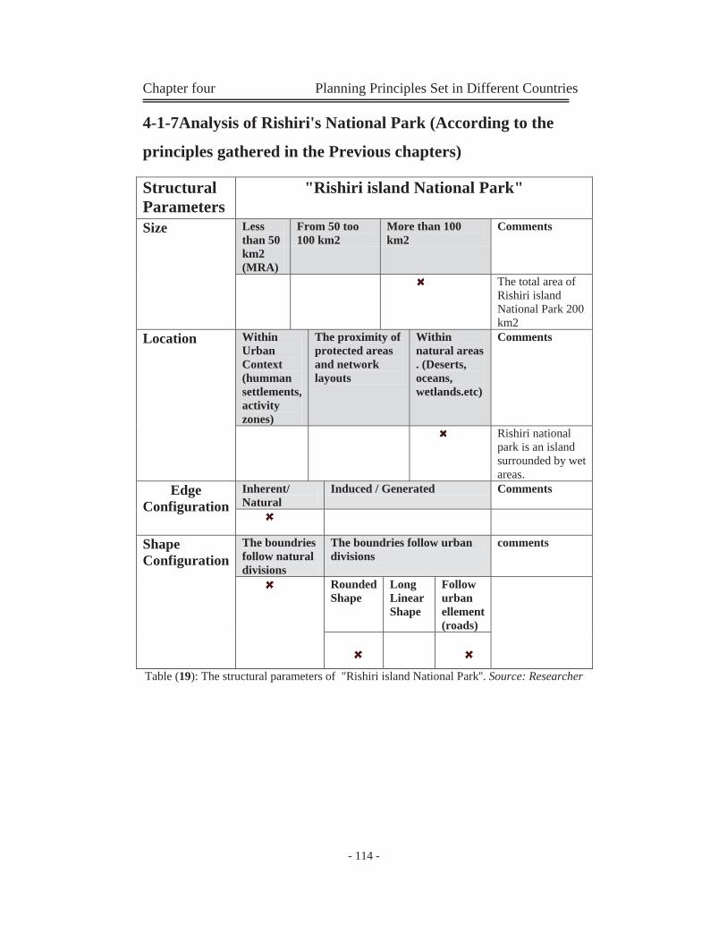
Chapter four Planning Principles Set in Different Countries
- 114 -
4-1-7Analysis of Rishiri's National Park (According to the
principles gathered in the Previous chapters)
Table (19): The structural parameters of "Rishiri island National Park''. Source: Researcher
Structural Parameters
"Rishiri island National Park"
Size Less than 50 km2 (MRA)
From 50 too 100 km2
More than 100 km2
Comments
The total area of Rishiri island National Park 200 km2
Location Within Urban Context (humman settlements, activity zones)
The proximity of protected areas and network layouts
Within natural areas . (Deserts, oceans, wetlands.etc)
Comments
Rishiri national park is an island surrounded by wet areas.
Edge Configuration
Inherent/ Natural
Induced / Generated Comments
Shape Configuration
The boundries follow natural divisions
The boundries follow urban divisions
comments
Rounded Shape
Long Linear Shape
Follow urban ellement (roads)

Chapter four Planning Principles Set in Different Countries
- 115 -
Table (20): Analysis of the current condition of "Rishiri island National Park" (Part 1). Source: Researcher gathered from different sources.
"Rishiri island National Park"
Description Comments Location In the northern side of Jaban.
Rishiri Island is about 20 kilometers off the northern tip of Hokkaido (a north island in Japan).
Description & contents
One of the small japaness islands. It has circular coast line and characterized
by Mt. Rishiridake which a mountain centered on the island.
It contains the highest mountain of Japan.
Photo (1): the Rishiri's mountain. Source: http://www.japan-guide.com
Natural life Comments Flora In August, the island's alpine flora is in bloom. Fauna Marine life, birds and insects. Geological features
mountain centered on the island.
Source: http://www.japan-guide.com

Chapter four Planning Principles Set in Different Countries
- 116 -
Table (21): Analysis of the current condition of "Rishiri island National Park" (Part 2). Source: Researcher gathered from different sources.
Management Category of the PA according to the IUCN management category system
The PA has a cetegory
The PA don’t have a define category
Category Comments
Category II National Park
Management objectives
Tourism & Recreation Species / genetic diversity Environment services
Management plan
- The management plan divide the park into three main zones:
Special zone Marine park zone Ordinary zone
- tourism & recreation is the most Management objective.
Zone configuration Type of uses inside the PA's land
- inside the PA's land, the major land use is the protected land and the scenic beauty zone.
Type of land use configuration
The zone configuration is a Multiple core zones system. It divides the protected area to central core area and buffer and secondry core and buffer areas.
Multiple Core zones:
Central core Area ( special protection zone)
Central Buffer Zone ( special zone Class 1)
Secondary core Area ( special zone Class 11)
Secondary Buffer Zone ( special zone Class 111)
Ordinary zone ( services and facilities)
Paths (trails)
Multiple Core zones:
Central core Area ( special protection zone)
Central Buffer Zone ( special zone Class 1)
Secondary core Area ( special zone Class 11)
Secondary Buffer Zone ( special zone Class 111)
Ordinary zone ( services and facilities)
Paths (trails)
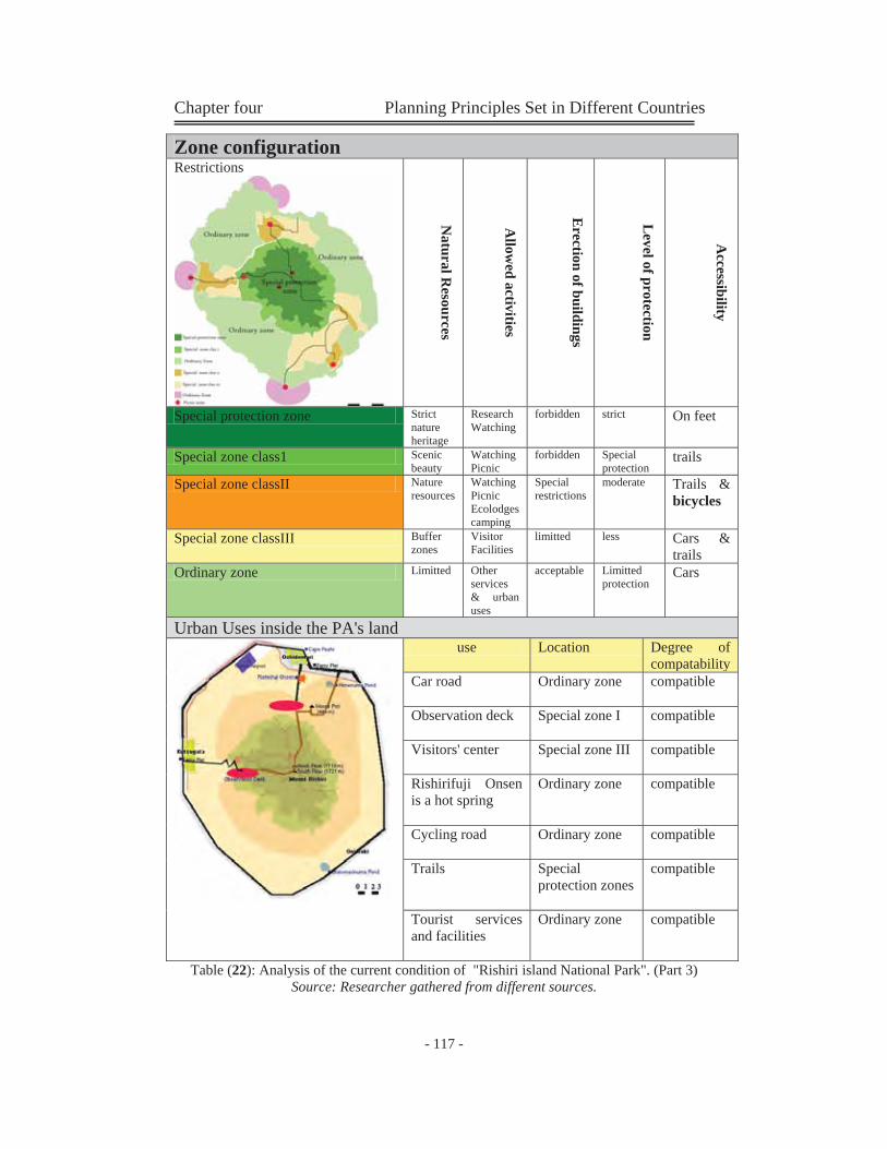
Chapter four Planning Principles Set in Different Countries
- 117 -
Table (22): Analysis of the current condition of "Rishiri island National Park". (Part 3) Source: Researcher gathered from different sources.
Zone configuration Restrictions
Natural R
esources
Allow
ed activities
Erection of buildings
Level of protection
Accessibility
Special protection zone Strict nature heritage
Research Watching
forbidden strict On feet
Special zone class1 Scenic beauty
Watching Picnic
forbidden Special protection
trails
Special zone classII Nature resources
Watching Picnic Ecolodges camping
Special restrictions
moderate Trails & bicycles
Special zone classIII Buffer zones
Visitor Facilities
limitted less Cars & trails
Ordinary zone Limitted Other services & urban uses
acceptable Limitted protection
Cars
Urban Uses inside the PA's land
use Location Degree of compatability
Car road
Ordinary zone compatible
Observation deck
Special zone I compatible
Visitors' center
Special zone III compatible
Rishirifuji Onsen is a hot spring
Ordinary zone compatible
Cycling road
Ordinary zone compatible
Trails
Special protection zones
compatible
Tourist services and facilities
Ordinary zone compatible
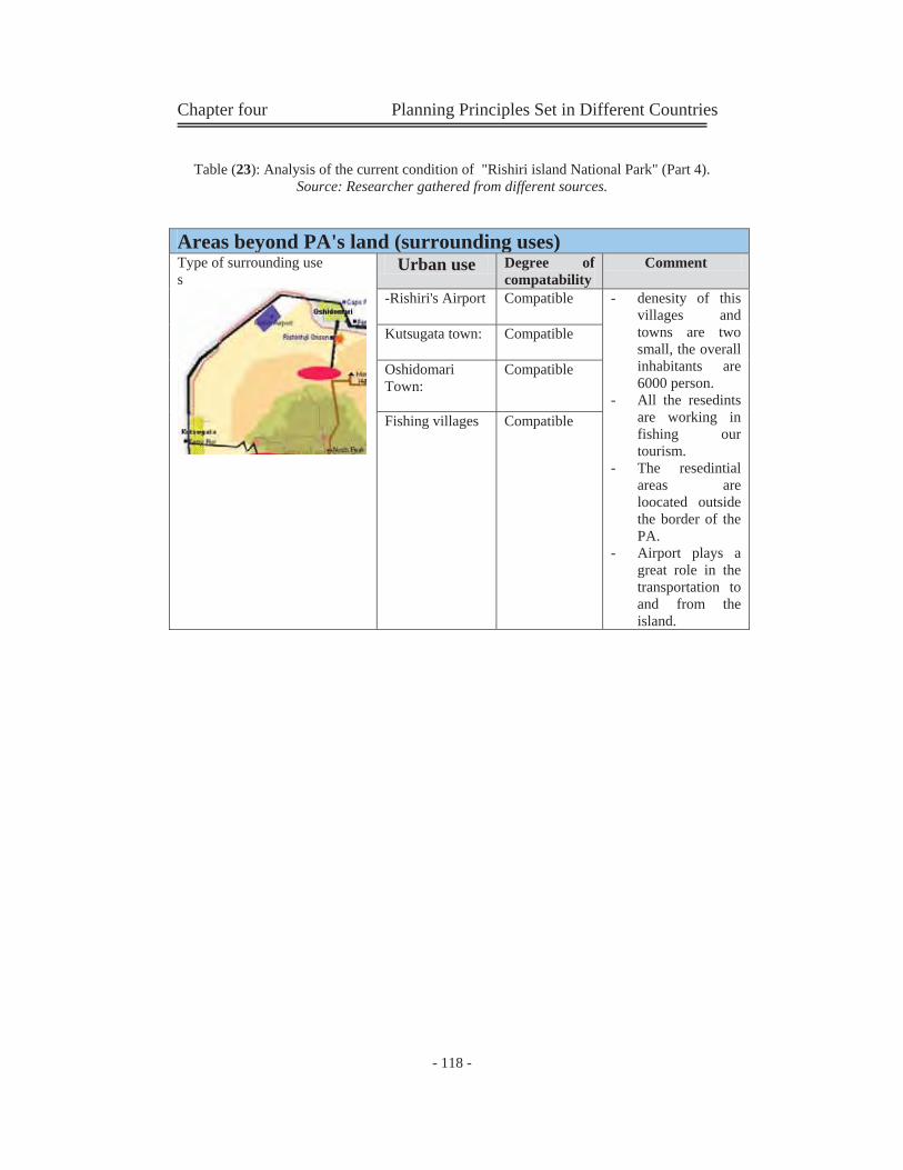
Chapter four Planning Principles Set in Different Countries
- 118 -
Table (23): Analysis of the current condition of "Rishiri island National Park" (Part 4). Source: Researcher gathered from different sources.
Areas beyond PA's land (surrounding uses) Type of surrounding use s
Urban use Degree of compatability
Comment
-Rishiri's Airport
Compatible - denesity of this villages and towns are two small, the overall inhabitants are 6000 person.
- All the resedints are working in fishing our tourism.
- The resedintial areas are loocated outside the border of the PA.
- Airport plays a great role in the transportation to and from the island.
Kutsugata town:
Compatible
Oshidomari Town:
Compatible
Fishing villages
Compatible
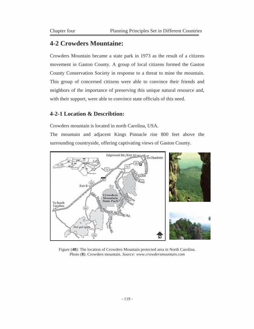
Chapter four Planning Principles Set in Different Countries
- 119 -
4-2 Crowders Mountaine:
Crowders Mountain became a state park in 1973 as the result of a citizens
movement in Gaston County. A group of local citizens formed the Gaston
County Conservation Society in response to a threat to mine the mountain.
This group of concerned citizens were able to convince their friends and
neighbors of the importance of preserving this unique natural resource and,
with their support, were able to convince state officials of this need.
4-2-1 Location & Describtion:
Crowders mountain is located in north Carolina, USA.
The mountain and adjacent Kings Pinnacle rise 800 feet above the
surrounding countryside, offering captivating views of Gaston County.
Figure (48): The location of Crowders Mountain protected area in North Carolina. Photo (8): Crowders mountain. Source: www.crowdersmountain.com
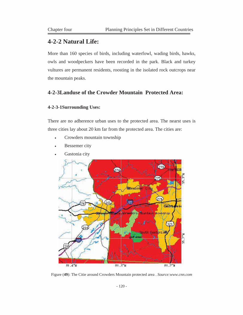
Chapter four Planning Principles Set in Different Countries
- 120 -
4-2-2 Natural Life:
More than 160 species of birds, including waterfowl, wading birds, hawks,
owls and woodpeckers have been recorded in the park. Black and turkey
vultures are permanent residents, roosting in the isolated rock outcrops near
the mountain peaks.
4-2-3Landuse of the Crowder Mountain Protected Area:
4-2-3-1Surrounding Uses:
There are no adherence urban uses to the protected area. The nearst uses is
three cities lay about 20 km far from the protected area. The cities are:
Crowders mountain township
Bessemer city
Gastonia city
Figure (49): The Citie around Crowders Mountain protected area . Source:www.cnn.com
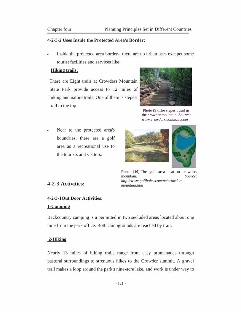
Chapter four Planning Principles Set in Different Countries
- 121 -
4-2-3-2 Uses Inside the Protected Area's Border:
Inside the protected area borders, there are no urban uses excepet some
tourist facilities and services like:
Hiking trails:
There are Eight trails at Crowders Mountain
State Park provide access to 12 miles of
hiking and nature trails. One of them is stepest
trail to the top. Photo (9):The stepes t trail in the crowder mountain. Source: www.crowdersmountain.com
Near to the protected area's
boundries, there are a golf
area as a recreational use to
the tourists and visitors.
4-2-3 Activities:
4-2-3-1Out Door Activities:
1-Camping
Backcountry camping is a permitted in two secluded areas located about one
mile from the park office. Both campgrounds are reached by trail.
2-Hiking
Nearly 13 miles of hiking trails range from easy promenades through
pastoral surroundings to strenuous hikes to the Crowder summit. A gravel
trail makes a loop around the park's nine-acre lake, and work is under way to
Photo (10):The golf area near to crowders mountain. Source: http://www.golfholes.com/nc/crowders-mountain.htm
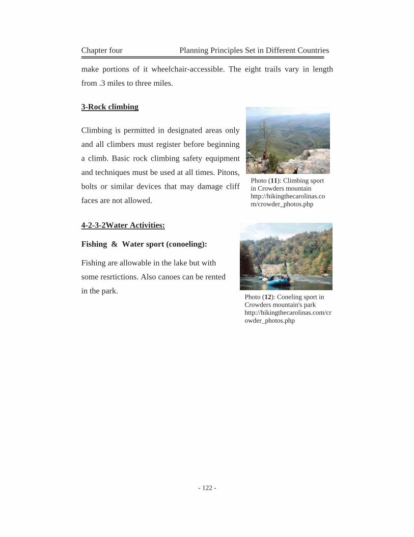
Chapter four Planning Principles Set in Different Countries
- 122 -
make portions of it wheelchair-accessible. The eight trails vary in length
from .3 miles to three miles.
3-Rock climbing
Climbing is permitted in designated areas only
and all climbers must register before beginning
a climb. Basic rock climbing safety equipment
and techniques must be used at all times. Pitons,
bolts or similar devices that may damage cliff
faces are not allowed.
4-2-3-2Water Activities:
Fishing & Water sport (conoeling):
Fishing are allowable in the lake but with
some resrtictions. Also canoes can be rented
in the park.canoes can be rented at the park
Photo (11): Climbing sport in Crowders mountain http://hikingthecarolinas.com/crowder_photos.php
Photo (12): Coneling sport in Crowders mountain's park http://hikingthecarolinas.com/crowder_photos.php
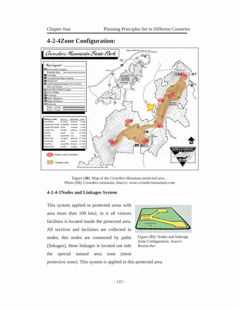
Chapter four Planning Principles Set in Different Countries
- 123 -
4-2-4Zone Configuration:
Figure (50): Map of the Crowders Mountain protected area .. Photo (13): Crowders mountain. Source: www.crowdersmountain.com
4-2-4-1Nodes and Linkages System
This system applied in protected areas with
area more than 100 km2, in it all visitors
facilities is located inside the protected area.
All services and facilaties are collected in
nodes, this nodes are connected by paths
(linkages), these linkages is located out side
the special natural area zone (most
protective zone). This system is applied in this protected area.
Figure (51): Nodes and linkeage Zone Configuration. Source: Researcher
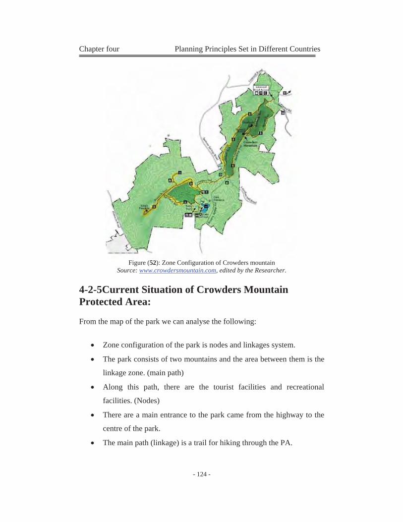
Chapter four Planning Principles Set in Different Countries
- 124 -
Figure (52): Zone Configuration of Crowders mountain
Source: www.crowdersmountain.com, edited by the Researcher.
4-2-5Current Situation of Crowders Mountain Protected Area:
From the map of the park we can analyse the following:
Zone configuration of the park is nodes and linkages system.
The park consists of two mountains and the area between them is the
linkage zone. (main path)
Along this path, there are the tourist facilities and recreational
facilities. (Nodes)
There are a main entrance to the park came from the highway to the
centre of the park.
The main path (linkage) is a trail for hiking through the PA.
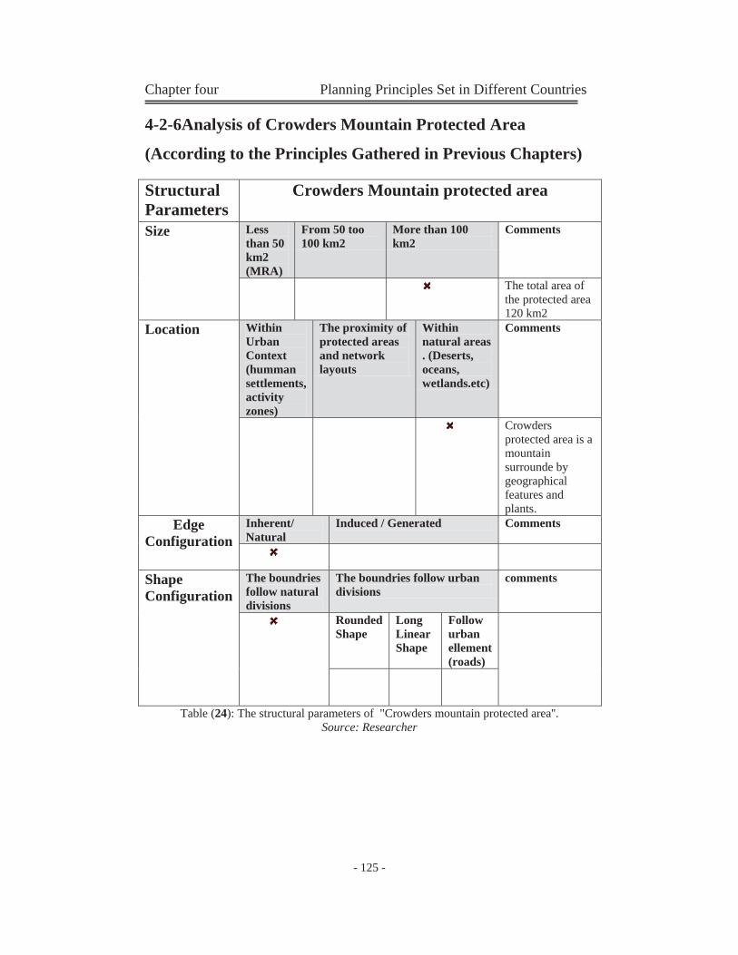
Chapter four Planning Principles Set in Different Countries
- 125 -
4-2-6Analysis of Crowders Mountain Protected Area
(According to the Principles Gathered in Previous Chapters)
Table (24): The structural parameters of "Crowders mountain protected area''. Source: Researcher
Structural Parameters
Crowders Mountain protected area
Size Less than 50 km2 (MRA)
From 50 too 100 km2
More than 100 km2
Comments
The total area of the protected area 120 km2
Location Within Urban Context (humman settlements, activity zones)
The proximity of protected areas and network layouts
Within natural areas . (Deserts, oceans, wetlands.etc)
Comments
Crowders protected area is a mountain surrounde by geographical features and plants.
Edge Configuration
Inherent/ Natural
Induced / Generated Comments
Shape Configuration
The boundries follow natural divisions
The boundries follow urban divisions
comments
Rounded Shape
Long Linear Shape
Follow urban ellement (roads)
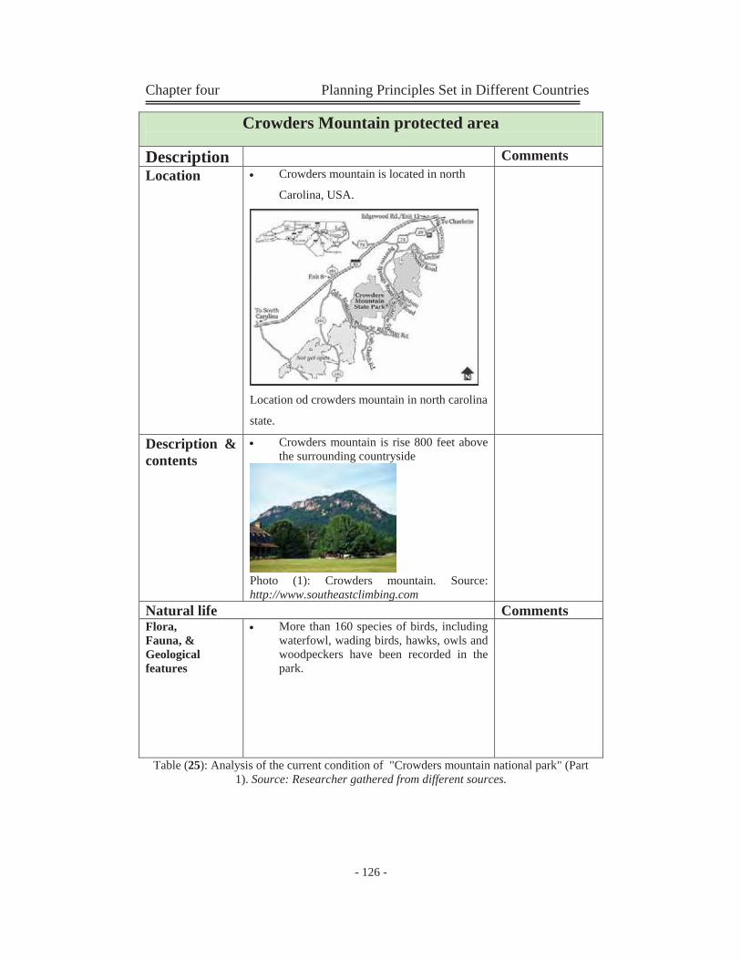
Chapter four Planning Principles Set in Different Countries
- 126 -
Table (25): Analysis of the current condition of "Crowders mountain national park" (Part 1). Source: Researcher gathered from different sources.
Crowders Mountain protected area Description Comments Location Crowders mountain is located in north
Carolina, USA.
Location od crowders mountain in north carolina
state.
Description & contents
Crowders mountain is rise 800 feet above the surrounding countryside
Photo (1): Crowders mountain. Source: http://www.southeastclimbing.com
Natural life Comments Flora, Fauna, & Geological features
More than 160 species of birds, including waterfowl, wading birds, hawks, owls and woodpeckers have been recorded in the park.
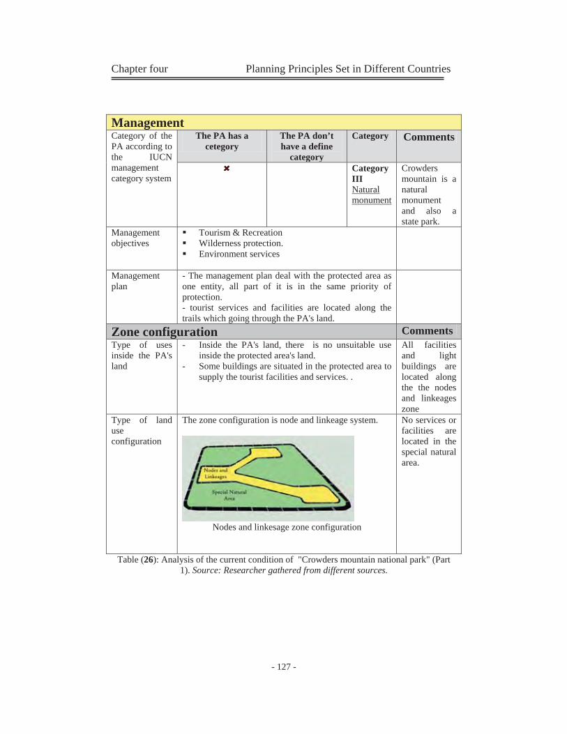
Chapter four Planning Principles Set in Different Countries
- 127 -
Table (26): Analysis of the current condition of "Crowders mountain national park" (Part 1). Source: Researcher gathered from different sources.
Management Category of the PA according to the IUCN management category system
The PA has a cetegory
The PA don’t have a define
category
Category Comments
Category III Natural monument
Crowders mountain is a natural monument and also a state park.
Management objectives
Tourism & Recreation Wilderness protection. Environment services
Management plan
- The management plan deal with the protected area as one entity, all part of it is in the same priority of protection. - tourist services and facilities are located along the trails which going through the PA's land.
Zone configuration Comments Type of uses inside the PA's land
- Inside the PA's land, there is no unsuitable use inside the protected area's land.
- Some buildings are situated in the protected area to supply the tourist facilities and services. .
All facilities and light buildings are located along the the nodes and linkeages zone
Type of land use configuration
The zone configuration is node and linkeage system.
Nodes and linkesage zone configuration
No services or facilities are located in the special natural area.

Chapter four Planning Principles Set in Different Countries
- 128 -
Table (27): Analysis of the current condition of "Crowders mountain national park" (Part 1). Source: Researcher gathered from different sources.
Zone configuration Restrictions
N
atural Resources
Allow
ed activities
Erection of buildings
Level of protection
Accessibility
Special protection zone ( mountain tip) Strict nature heritage
Research Watching
forbidden strict On feet
Special natural area Scenic beauty
Watching Picnic
forbidden Special protection
trails
Nodes and linkeage (trails & facilities) Nature resources
Watching Picnic Ecolodges camping
Acceptable moderate Trails
Urban Uses inside the PA's land use Location Degree of
compatability Car road
Natural area incompatible
Camping area
Nodes and linkeage zone
compatible
Visitors' center
Nodes and linkeage zone
compatible
Rest rooms
Nodes and linkeage zone
compatible
Picnic shelters
Nodes and linkeage zone
compatible
Trails
Nodes and linkeage zone
compatible
Tourist services and facilities
Nodes and linkeage zone
compatible
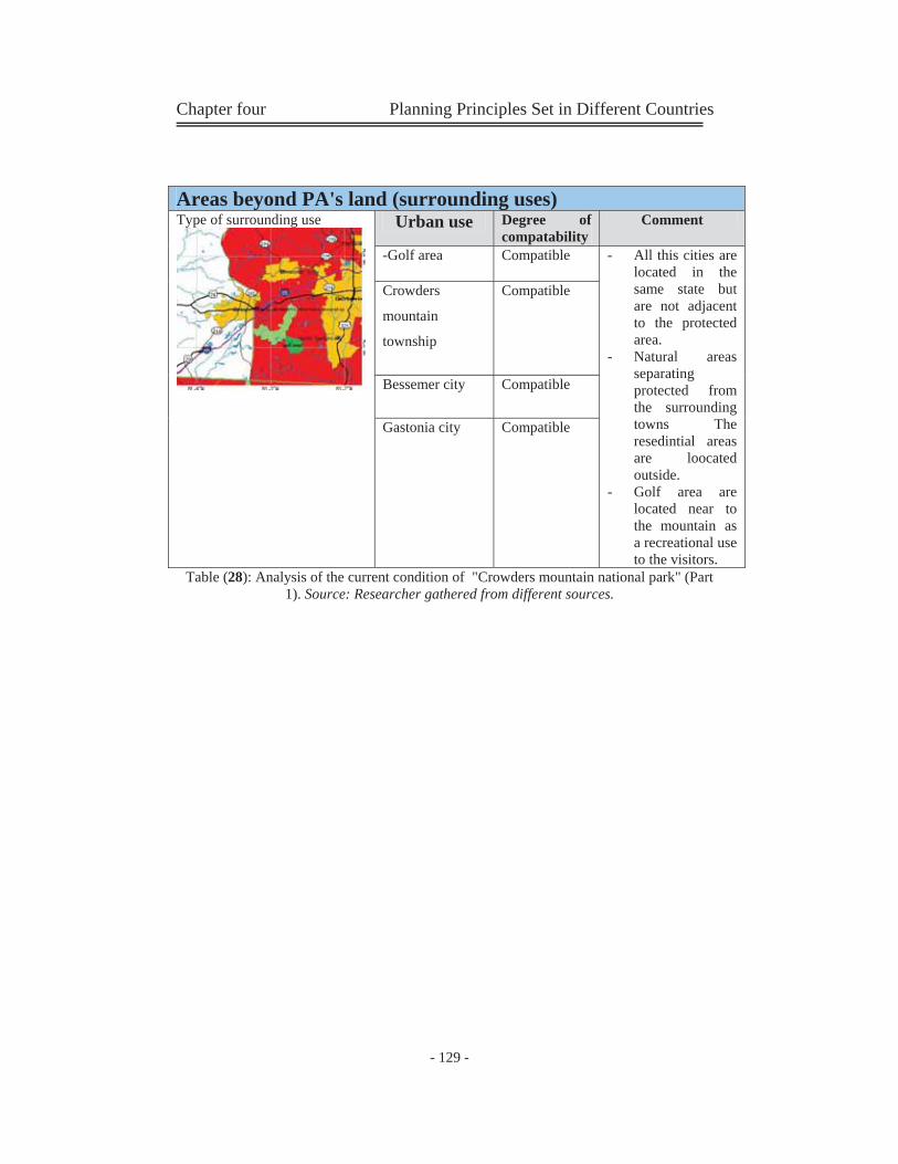
Chapter four Planning Principles Set in Different Countries
- 129 -
Table (28): Analysis of the current condition of "Crowders mountain national park" (Part 1). Source: Researcher gathered from different sources.
Areas beyond PA's land (surrounding uses) Type of surrounding use
Urban use Degree of compatability
Comment
-Golf area
Compatible - All this cities are located in the same state but are not adjacent to the protected area.
- Natural areas separating protected from the surrounding towns The resedintial areas are loocated outside.
- Golf area are located near to the mountain as a recreational use to the visitors.
Crowders
mountain
township
Compatible
Bessemer city
Compatible
Gastonia city
Compatible
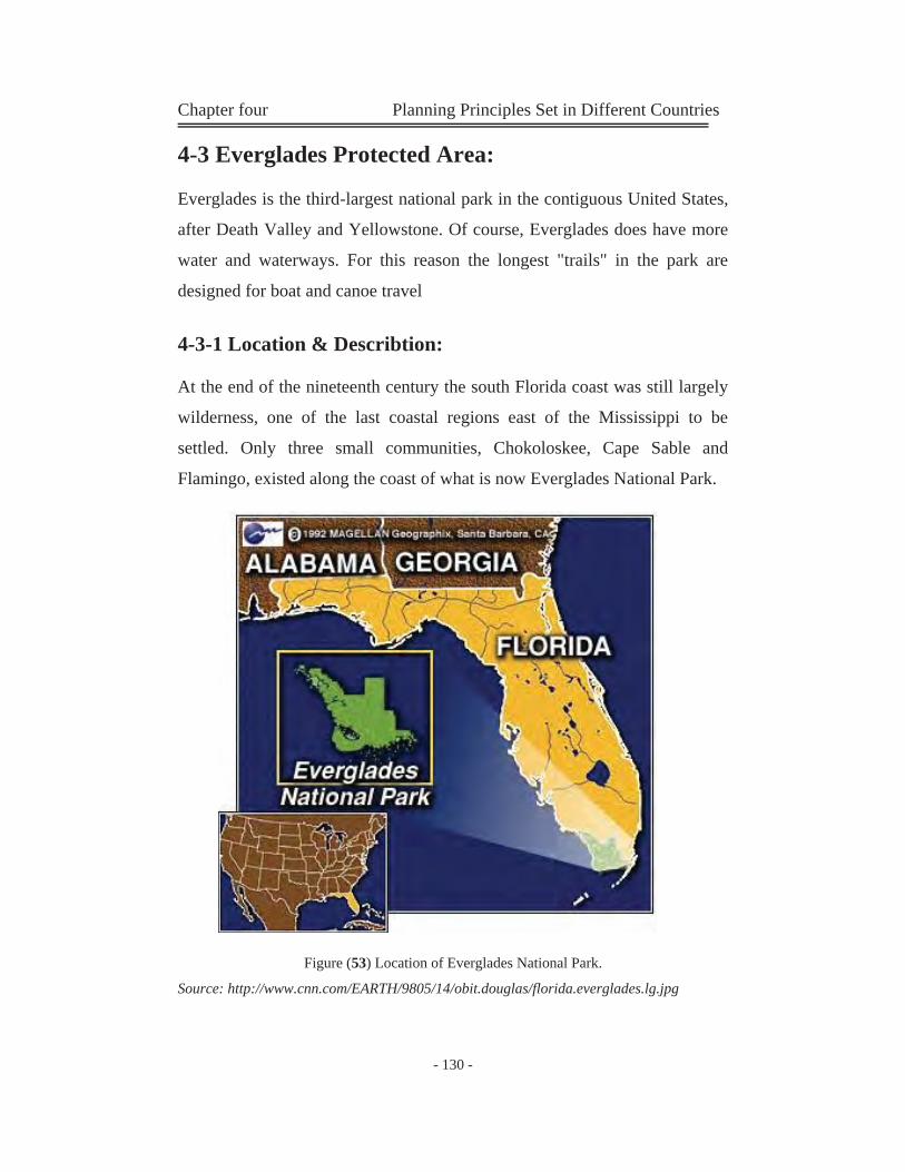
Chapter four Planning Principles Set in Different Countries
- 130 -
4-3 Everglades Protected Area:
Everglades is the third-largest national park in the contiguous United States,
after Death Valley and Yellowstone. Of course, Everglades does have more
water and waterways. For this reason the longest "trails" in the park are
designed for boat and canoe travel
4-3-1 Location & Describtion:
At the end of the nineteenth century the south Florida coast was still largely
wilderness, one of the last coastal regions east of the Mississippi to be
settled. Only three small communities, Chokoloskee, Cape Sable and
Flamingo, existed along the coast of what is now Everglades National Park.
Figure (53) Location of Everglades National Park.
Source: http://www.cnn.com/EARTH/9805/14/obit.douglas/florida.everglades.lg.jpg
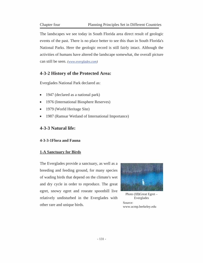
Chapter four Planning Principles Set in Different Countries
- 131 -
The landscapes we see today in South Florida area direct result of geologic
events of the past. There is no place better to see this than in South Florida's
National Parks. Here the geologic record is still fairly intact. Although the
activities of humans have altered the landscape somewhat, the overall picture
can still be seen. (www.everglades.com)
4-3-2 History of the Protected Area:
Everglades National Park declared as:
1947 (declared as a national park)
1976 (International Biosphere Reserves)
1979 (World Heritage Site)
1987 (Ramsar Wetland of International Importance)
4-3-3 Natural life:
4-3-3-1Flora and Fauna
1-A Sanctuary for Birds
The Everglades provide a sanctuary, as well as a
breeding and feeding ground, for many species
of wading birds that depend on the climate's wet
and dry cycle in order to reproduce. The great
egret, snowy egret and roseate spoonbill live
relatively undisturbed in the Everglades with
other rare and unique birds.
Photo (13)Great Egret – Everglades
Source: www.ucmp.berkeley.edu
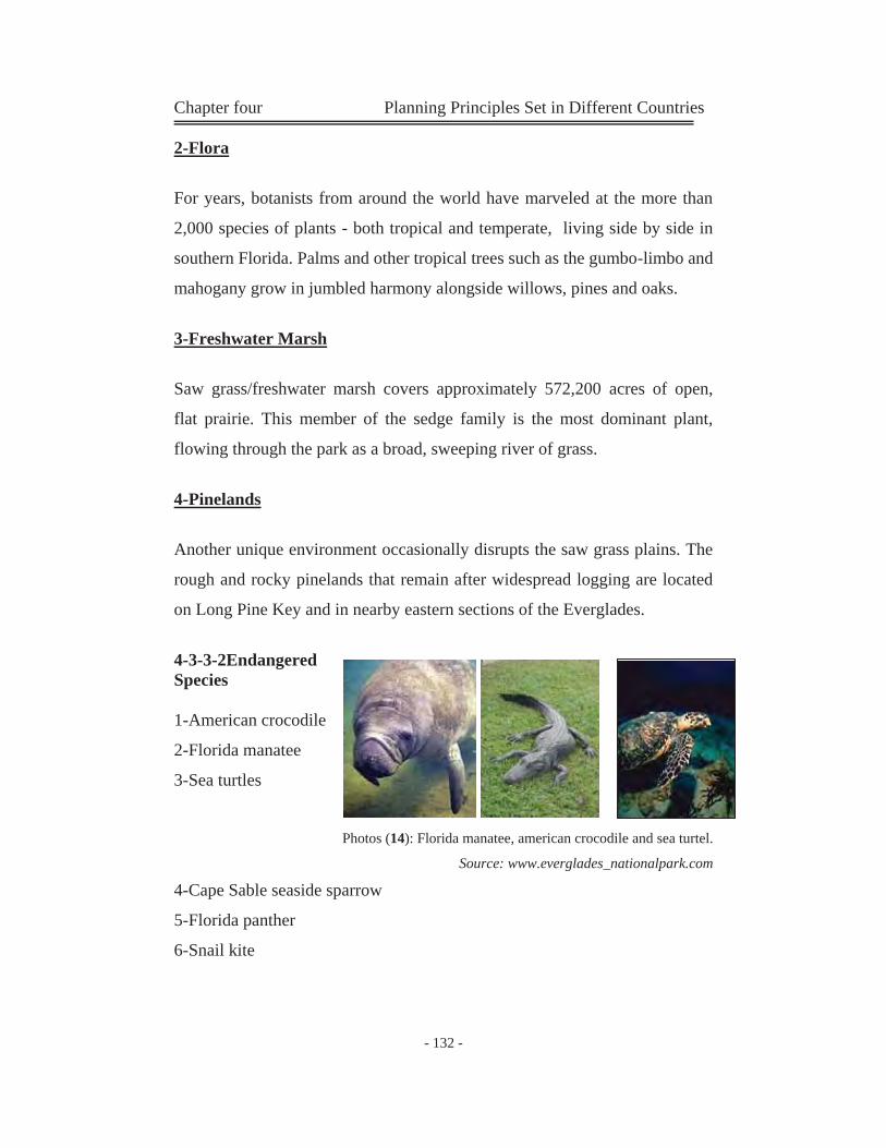
Chapter four Planning Principles Set in Different Countries
- 132 -
2-Flora
For years, botanists from around the world have marveled at the more than
2,000 species of plants - both tropical and temperate, living side by side in
southern Florida. Palms and other tropical trees such as the gumbo-limbo and
mahogany grow in jumbled harmony alongside willows, pines and oaks.
3-Freshwater Marsh
Saw grass/freshwater marsh covers approximately 572,200 acres of open,
flat prairie. This member of the sedge family is the most dominant plant,
flowing through the park as a broad, sweeping river of grass.
4-Pinelands
Another unique environment occasionally disrupts the saw grass plains. The
rough and rocky pinelands that remain after widespread logging are located
on Long Pine Key and in nearby eastern sections of the Everglades.
4-3-3-2Endangered Species
1-American crocodile
2-Florida manatee
3-Sea turtles
Photos (14): Florida manatee, american crocodile and sea turtel.
Source: www.everglades_nationalpark.com
4-Cape Sable seaside sparrow
5-Florida panther
6-Snail kite
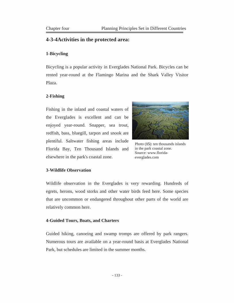
Chapter four Planning Principles Set in Different Countries
- 133 -
4-3-4Activities in the protected area:
1-Bicycling
Bicycling is a popular activity in Everglades National Park. Bicycles can be
rented year-round at the Flamingo Marina and the Shark Valley Visitor
Plaza.
2-Fishing
Fishing in the inland and coastal waters of
the Everglades is excellent and can be
enjoyed year-round. Snapper, sea trout,
redfish, bass, bluegill, tarpon and snook are
plentiful. Saltwater fishing areas include
Florida Bay, Ten Thousand Islands and
elsewhere in the park's coastal zone.
3-Wildlife Observation
Wildlife observation in the Everglades is very rewarding. Hundreds of
egrets, herons, wood storks and other water birds feed here. Some species
that are uncommon or endangered throughout other parts of the world are
relatively common here.
4-Guided Tours, Boats, and Charters
Guided hiking, canoeing and swamp tromps are offered by park rangers.
Numerous tours are available on a year-round basis at Everglades National
Park, but schedules are limited in the summer months.
Photo (15): ten thousands islands in the park coastal zone. Source: www.florida-everglades.com
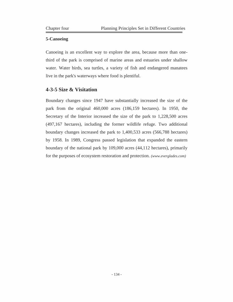
Chapter four Planning Principles Set in Different Countries
- 134 -
5-Canoeing
Canoeing is an excellent way to explore the area, because more than one-
third of the park is comprised of marine areas and estuaries under shallow
water. Water birds, sea turtles, a variety of fish and endangered manatees
live in the park's waterways where food is plentiful.
4-3-5 Size & Visitation
Boundary changes since 1947 have substantially increased the size of the
park from the original 460,000 acres (186,159 hectares). In 1950, the
Secretary of the Interior increased the size of the park to 1,228,500 acres
(497,167 hectares), including the former wildlife refuge. Two additional
boundary changes increased the park to 1,400,533 acres (566,788 hectares)
by 1958. In 1989, Congress passed legislation that expanded the eastern
boundary of the national park by 109,000 acres (44,112 hectares), primarily
for the purposes of ecosystem restoration and protection. (www.everglades.com)
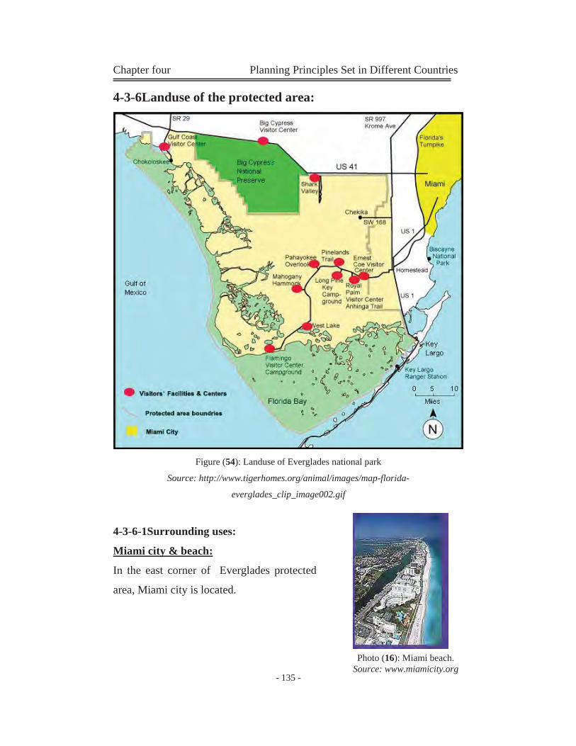
Chapter four Planning Principles Set in Different Countries
- 135 -
4-3-6Landuse of the protected area:
Figure (54): Landuse of Everglades national park
Source: http://www.tigerhomes.org/animal/images/map-florida-
everglades_clip_image002.gif
4-3-6-1Surrounding uses:
Miami city & beach:
In the east corner of Everglades protected
area, Miami city is located.
Photo (16): Miami beach. Source: www.miamicity.org
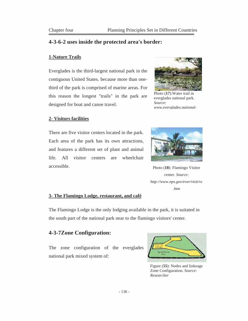
Chapter four Planning Principles Set in Different Countries
- 136 -
4-3-6-2 uses inside the protected area's border:
1-Nature Trails
Everglades is the third-largest national park in the
contiguous United States. because more than one-
third of the park is comprised of marine areas. For
this reason the longest "trails" in the park are
designed for boat and canoe travel.
2- Visitors facilities
There are five visitor centers located in the park.
Each area of the park has its own attractions,
and features a different set of plant and animal
life. All visitor centers are wheelchair
accessible.
3- The Flamingo Lodge, restaurant, and café
The Flamingo Lodge is the only lodging available in the park, it is suitated in
the south part of the national park near to the flamingo visitors' center.
4-3-7Zone Configuration:
The zone configuration of the everglades
national park mixed system of:
Figure (55): Nodes and linkeage Zone Configuration. Source: Researcher
Photo (18): Flamingo Visitor
center. Source:
http://www.nps.gov/ever/visit/vc
.htm
Photo (17):Water trail in everglades national park. Source: www.everglades.national-
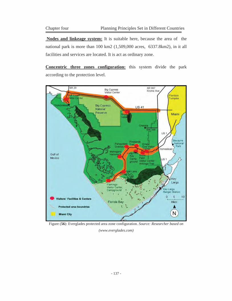
Chapter four Planning Principles Set in Different Countries
- 137 -
Nodes and linkeage system: It is suitable here, because the area of the
national park is more than 100 km2 (1,509,000 acres, 6337.8km2), in it all
facilities and services are located. It is act as ordinary zone.
Concentric three zones configuration: this system divide the park
according to the protection level.
Figure (56): Everglades protected area zone configuration. Source: Researcher based on
(www.everglades.com)
Chapter four Planning Principles Set in Different Countries
- 138 -
4-3-8Current situation of Everglades Protected Area:
From the map of the park we can analyse the following:
Zone configuration of the park is nodes and linkages system.
The park is full of unique natural flora and fauna. Because of that it is
declared as a Ramsar Wetland of International Importance.
Tourist facilities, camping areas and picnicking areas are situated
along the main path in PA (linkage), they are located in a centres
(Nodes).
There are many activities in the park; hiking, camping, watching and
marine activities.
Inside the PAs there are a strict protection zones, which dedicated
only for research and science.
Area consist of wetlands, rivers and natural lands. This make a
diversity in species and plantation of the PA.
Chapter four Planning Principles Set in Different Countries
- 139 -
4-3-9Analysis of Everglades National Park (According to the
principles gathered in the previous chapters)
Table (29): The structural parameters of "Rishiri island National Park''. Source: Researcher
Structural Parameters
"Rishiri island National Park"
Size Less than 50 km2 (MRA)
From 50 too 100 km2
More than 100 km2
Comments
The total area of Rishiri island National Park 6337.8 km2
Location Within Urban Context (humman settlements, activity zones)
The proximity of protected areas and network layouts
Within natural areas . (Deserts, oceans, wetlands.etc)
Comments
Everglades is located in the southern coast of florida.
Edge Configuration
Inherent/ Natural
Induced / Generated Comments
Shape Configuration
The boundries follow natural divisions
The boundries follow urban divisions
comments
Rounded Shape
Long Linear Shape
Follow urban ellement (roads)

Chapter four Planning Principles Set in Different Countries
- 140 -
Table (30): Analysis of the current condition of "Everglades National Park". (Part 1) Source: Researcher gathered from different sources.
"Rishiri island National Park"
Description Comments Location
- Everglades National Park is located in the southern tip of Florida, just west of the city of Miami
- Everglades is the third-largest national park in the contiguous United States, after Death Valley and Yellowstone.
Description & contents
The national park consist of three main natural area:
Freshwater Marsh : covers approximately 572,200 acres of open, flat prairie Beaches: cover all the protected area's boudries. Lands: Cover big part of the protected areas land, in it tourist facilities are located.
Photo (1): Everglades freshwater marsh. Source: http://www.everglades_nationalpark.com
- The park contains the longest trail in all the state's park. =This rail is a water trail.
Natural life Comments Flora 2,000 species of plants - both tropical and
temperate
Birds Many types of wading birds are living the park. Endangered species
1-American crocodile
2-Florida manatee
3-Sea turtles
4-Cape Sable seaside sparrow
5-Florida panther
6-Snail kite
Chapter four Planning Principles Set in Different Countries
- 141 -
Table (31): Analysis of the current condition of "Rishiri island National Park". (Part 2) Source: Researcher gathered from different sources.
Management Category of the PA according to the IUCN management category system
The PA has a cetegory
The PA don’t have a define
category
Category Comments
Category II National Park - Biosphere reserve. - world Heritage site - Ramsar wetland
Because of its
unique
features and
compounds, it
take four
classification.
Management objectives
Tourism & Recreation Species / genetic diversity Environment services Wilderness protection. Scientific research.
Management plan
- The management plan divide the park into three main zones:
Strict protection zone Natural protected zone Nodes and linkeage zone. (ordinary zone)
- Tourism & recreation is the most Management objective.
Zone configuration Type of uses inside the PA's land
- inside the PA's land, the major land use is the protected land and some tourist services and facilities.
Type of land use configuration
There are two types of the zone configuration here: 1- Nodes and linkeages system: it is used here
because of the large area of the park and it is used to locate the services and facilities along it.
2- Classic three zone configuration: which is used to separate the strict protection zones from other zones.
Chapter four Planning Principles Set in Different Countries
- 142 -
Table (32): Analysis of the current condition of "Rishiri island National Park". (Part 3) Source: Researcher gathered from different sources.
Zone configuration Restrictions
N
atural Resources
Allow
ed activities
Erection of buildings
Level of protection
Accessibility
Special protection zone Strict nature heritage
Research Watching
forbidden strict On feet
Special zone class1 Scenic beauty
Watching
forbidden Special protection
trails
Ordinary zone (nodes and linkeages zone) Nature resources
Watching Picnic Ecolodges camping
Special restrictions
moderate Trails, bicycles & canoes
Urban Uses inside the PA's land
use Location Degree of compatability
Car road
Boundry of the park
compatible
Visitors' center
Ordinary zone (nodes zone)
compatible
Flamingo lodge
Ordinary zone (nodes zone)
compatible
Watertrail
All over the park parts.
compatible
Trails
Ordinary zone (nodes zone)
compatible
Tourist services and facilities
Ordinary zone (nodes zone)
compatible
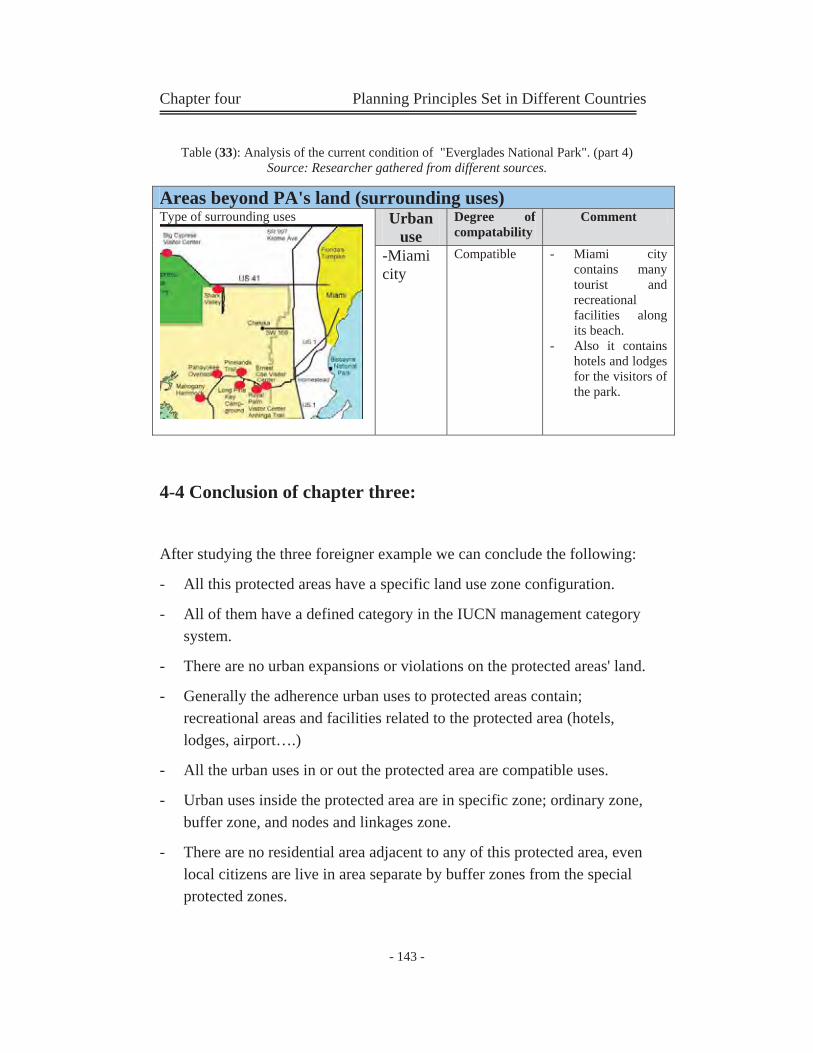
Chapter four Planning Principles Set in Different Countries
- 143 -
Table (33): Analysis of the current condition of "Everglades National Park". (part 4) Source: Researcher gathered from different sources.
4-4 Conclusion of chapter three:
After studying the three foreigner example we can conclude the following:
- All this protected areas have a specific land use zone configuration.
- All of them have a defined category in the IUCN management category system.
- There are no urban expansions or violations on the protected areas' land.
- Generally the adherence urban uses to protected areas contain; recreational areas and facilities related to the protected area (hotels, lodges, airport….)
- All the urban uses in or out the protected area are compatible uses.
- Urban uses inside the protected area are in specific zone; ordinary zone, buffer zone, and nodes and linkages zone.
- There are no residential area adjacent to any of this protected area, even local citizens are live in area separate by buffer zones from the special protected zones.
Areas beyond PA's land (surrounding uses) Type of surrounding uses
Urban use
Degree of compatability
Comment
-Miami city
Compatible - Miami city contains many tourist and recreational facilities along its beach.
- Also it contains hotels and lodges for the visitors of the park.
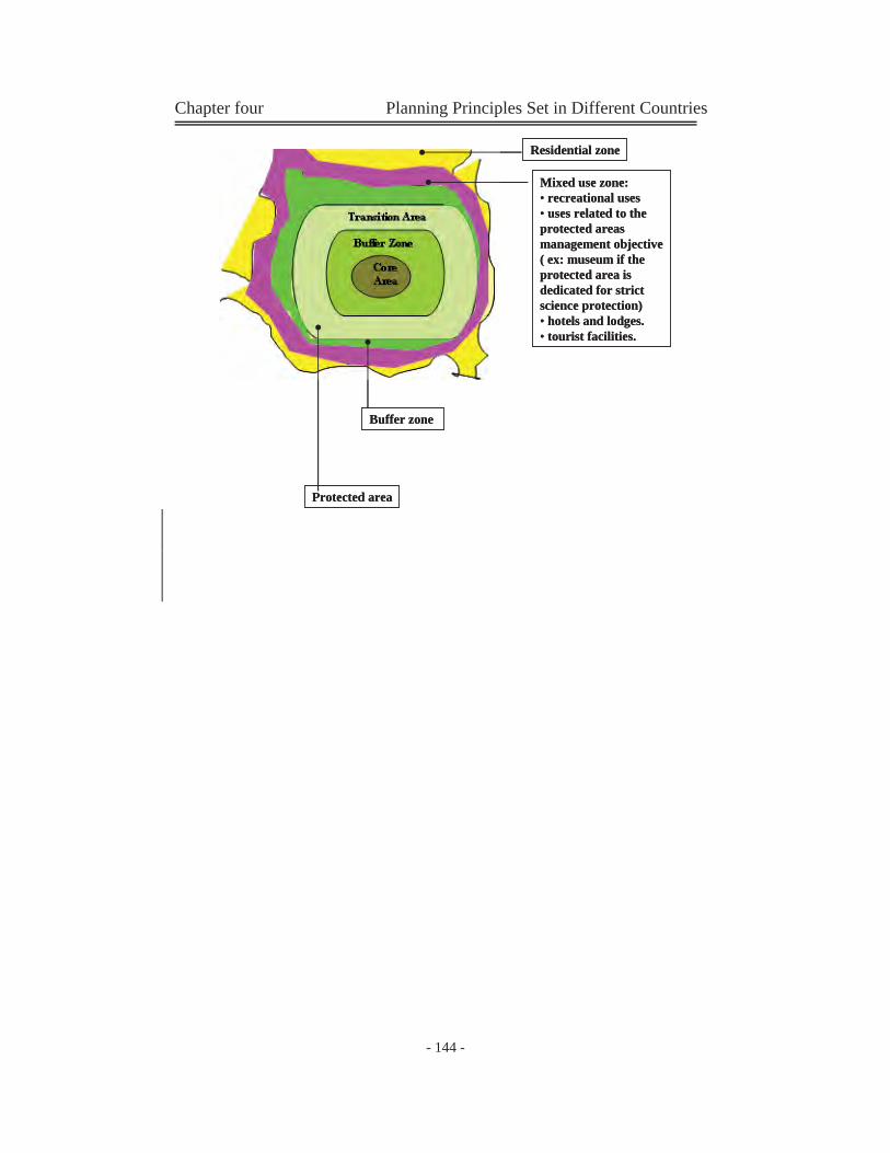
Chapter four Planning Principles Set in Different Countries
- 144 -
Residential zone
Mixed use zone:• recreational uses• uses related to the protected areas management objective ( ex: museum if the protected area is dedicated for strict science protection)• hotels and lodges.• tourist facilities.
Buffer zone
Protected area
Residential zone
Mixed use zone:• recreational uses• uses related to the protected areas management objective ( ex: museum if the protected area is dedicated for strict science protection)• hotels and lodges.• tourist facilities.
Buffer zone
Protected area
Chapter Five ''Protected Areas in Egypt, History and
Current Condition''

Part Three Egyptian Protected Areas Current Condition
History of environment protection in Egypt
Protected Area Definition
Authoritative Bodies
Participatory Bodies Egyptian PAsAnalysis
Biodiversity in Egypt
Examples of Egyptian PAsProblems
Egyptian law for PAs
Natural protectorates Classification
Dangers that face Environment
Protection in Egypt
Legislative decrees and conventions
Protected Areas in Egypt, History and Current
Condition
Part
Thr
ee:
E
gypt
ian
Situ
atio
n (C
ase
Stud
y)
The Petrified Forest Protected Area
Wadi DeglaProtected Area
Description & Contents
Urban Study
Study Phase
Description & Contents
Urban Study
Study Phase
PA classification
PA management Plan
Analysis Phase
Surrounding Urban analysis
Impacts on the PA
Zone configuration
PA classification
PA management Plan
Analysis Phase
Surrounding Urban analysis
Impacts on the PA
Zone configuration
Egyptian Phenomenon; Adherence of Urban
Environment to Protected Areas
Conclusion &Recommendations
General PAsconclusion Case study conclusion
Part
4:C
oncl
usio
n &
Rec
omm
enda
tions
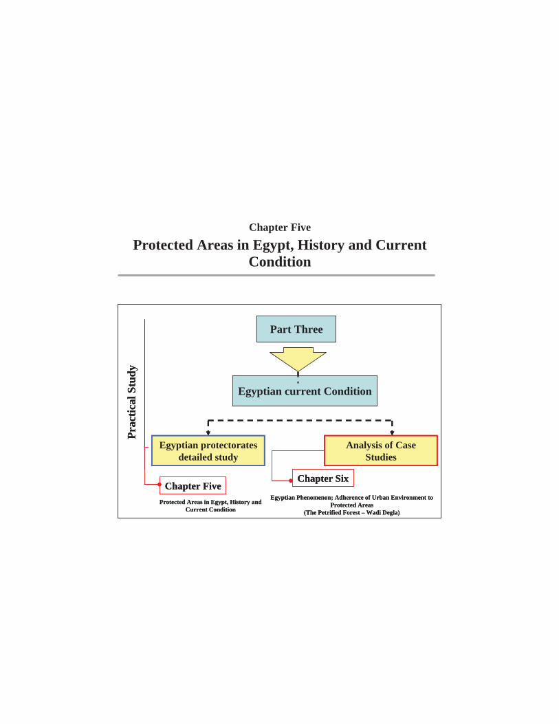
Chapter Five
Protected Areas in Egypt, History and Current Condition
Part Three
Egyptian current Condition
Prac
tical
Stu
dy
Egyptian protectorates detailed study
Analysis of Case Studies
Chapter SixChapter Five
Protected Areas in Egypt, History and Current Condition
Egyptian Phenomenon; Adherence of Urban Environment to Protected Areas
(The Petrified Forest – Wadi Degla)

Chapter five Protected Areas in Egypt
- 147 -
5-1 Introduction: The environment has long been a subject of interest in Egyptian culture;
ancient inscriptions such as those depicting the journeys of Queen
Hatshepsut (1450BC) illustrate the wildlife expedition to the land of
Punt. These, among others suggest that a form of nature protection exist
in a very early age in Egyptian history and include basic management
principles. In this chapter we will study the Egyptian tryouts in the field of
protection, which start from 1980 until now. Recently, conservation
movement in Egypt faces many dangers and conflicts; in this chapter we
will discuss the obstacles that face the protection process in Egypt.
5-2 History of Environment Protection in Egypt:
The first conservation legislation this century came into being with the
creation of the Royal hunting reserve at Wadi Rishrash in 1900. Current
interest by the authorities in nature conservation was initiated when a
delegation attended the 1955 Unesco meeting on nature protection in
Beirut. The first protected site was established at El Omayed and was
acquired by the University of Alexandria in 1974.
The Presidential Decree of 5 March 1980, expressed concern for
environmental matters established a mechanism for identifying and
protecting threatened areas and species through cooperation between
provincial governors; the Academy of Scientific Research and the
Ministry of Agriculture. Subsequently, Ministerial Decree No. 472 of 5
May 1982 ensured the prohibition of hunting all birds and animals in a
number of sites in Sinai. Eventually the promulgation of Law No.
102/83, which was passed by the People's Assembly on 20 July 1983,
Chapter five Protected Areas in Egypt
- 148 -
provided for the legal framework upon which the government could
establish protected areas throughout Egypt.
The sole category referred to in the Law No. 102/83 is the natural
protectorate. Article 1 defines the natural protectorate, its designation and
delineation by individual Prime Ministerial decrees, under the
recommendation of the Egyptian Environmental Affairs Agency
(EEAA). Sub-categories covered under the Prime Ministerial decrees
include scientific area, national Marine Park, conservation area, natural
area and protected area.
The EEAA is the main administrative body responsible for the
enforcement of environmental protection and conservation, and was
established under Decree No. 631 of 1982. In 1983 a presidential
directive established EEAA offices within each of the Governorate of
Egypt. In 1979, the Egyptian Wildlife Service (EWS) was established
under the authority of the Ministry of Agriculture Decree No. 349, with
responsibility for management of natural protectorates and wildlife
research. In 1991 the Minister of Cabinet Affairs and Minister of State
for Administrative Development, and the Minister in charge of
Environment issued Decree No. 30 for the reorganization of the EEAA.
(www.Egypt.com)
5-2-1 International Activities
Egypt has entered a number of cooperative agreements and legal
obligations. The International Plant Protection Convention was signed in
1953. The African Convention on the Conservation of Nature and
Natural Resources was accepted in Algeria in 1968. Egypt is party to the
Convention concerning the Protection of the World Cultural and Natural
Heritage (World Heritage Convention), which was ratified on 7 February
Chapter five Protected Areas in Egypt
- 149 -
1974. No natural sites have been inscribed to date. Egypt acceded to the
Convention on Wetlands of International Importance especially as
Waterfowl Habitat (Ramsar Convention) on 9 September 1988, at which
time two sites were designated under the terms of the Convention. Egypt
participates in the Unesco Man and the Biosphere Program and by 1991
had listed one site as a biosphere reserve (www.egypt.com)
5-3 Protected Area (PA) Definition (Egyptian Definition): The law No. 102/1983, issued on July31, 1983 defined a natural reserved
area as:
These areas will be designate and delineated by Decrees of the Prime
Minister under the recommendation of the Egyptian Environmental
affaires agency (EEAA.).
It is forbidden to commit actions or carry out activities, which would lead
to the destruction, damage, removal of plants, spoiling or destroying the
geological structures and other features from the natural reserves.
Law 102 of 1983 empowered the Prime Minister to designate certain
areas to be declared as protectorates. A Prime Minister's decree defines
the limits of each protected area and sets the basic principles for its
management and for the preservation of its resources. Till now 24
protectorates are declared. (EEAA, 2000)
In Egypt, protected areas is called protectorates, it is a different title to
the same identity and characteristics.
Protected Area (PA) is: An area of land, or coastal or inland water,
characterized by its flora, fauna and natural feature having cultural,
scientific tourist or aesthetic value.
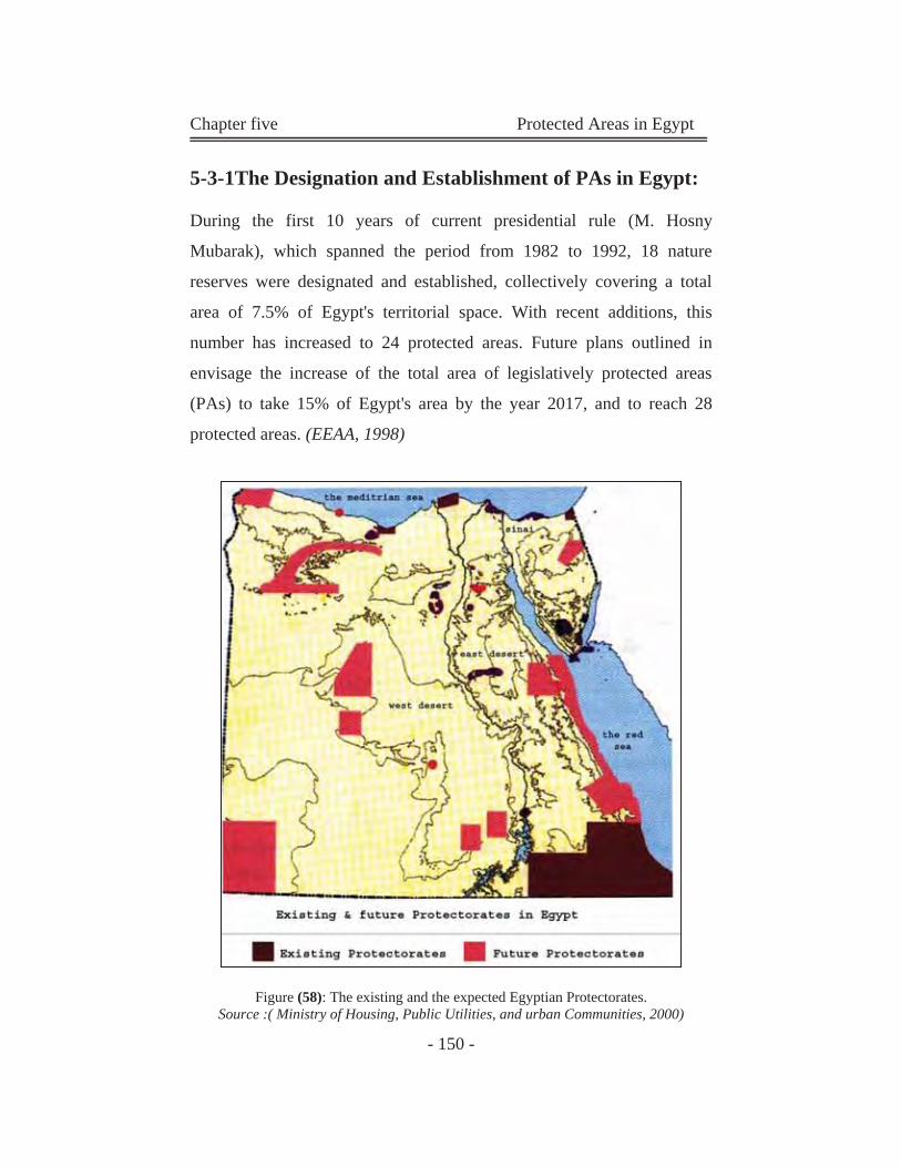
Chapter five Protected Areas in Egypt
- 150 -
5-3-1The Designation and Establishment of PAs in Egypt:
During the first 10 years of current presidential rule (M. Hosny
Mubarak), which spanned the period from 1982 to 1992, 18 nature
reserves were designated and established, collectively covering a total
area of 7.5% of Egypt's territorial space. With recent additions, this
number has increased to 24 protected areas. Future plans outlined in
envisage the increase of the total area of legislatively protected areas
(PAs) to take 15% of Egypt's area by the year 2017, and to reach 28
protected areas. (EEAA, 1998)
Figure (58): The existing and the expected Egyptian Protectorates. Source :( Ministry of Housing, Public Utilities, and urban Communities, 2000)
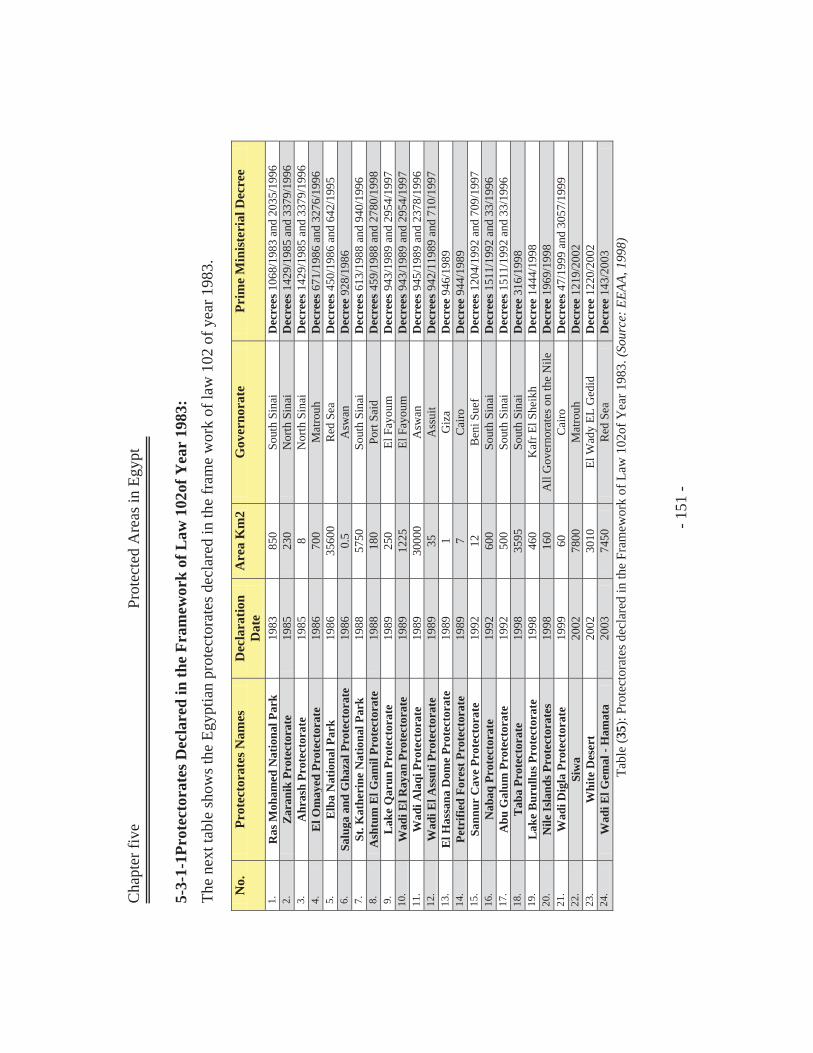
Cha
pter
five
Prot
ecte
d A
reas
in E
gypt
- 1
51 -
5-3-
1-1P
rote
ctor
ates
Dec
lare
d in
the
Fram
ewor
k of
Law
102
of Y
ear
1983
: Th
e ne
xt ta
ble
show
s the
Egy
ptia
n pr
otec
tora
tes d
ecla
red
in th
e fr
ame
wor
k of
law
102
of y
ear 1
983.
Tabl
e (3
5): P
rote
ctor
ates
dec
lare
d in
the
Fram
ewor
k of
Law
102
of Y
ear 1
983.
(Sou
rce:
EEA
A, 1
998)
No.
Pr
otec
tora
tes N
ames
D
ecla
ratio
n D
ate
Are
a K
m2
Gov
erno
rate
Pr
ime
Min
ister
ial D
ecre
e
1.
Ras
Moh
amed
Nat
iona
l Par
k 19
83
850
Sout
h Si
nai
Dec
rees
106
8/19
83 a
nd 2
035/
1996
2.
Z
aran
ik P
rote
ctor
ate
1985
23
0 N
orth
Sin
ai
Dec
rees
142
9/19
85 a
nd 3
379/
1996
3.
A
hras
h Pr
otec
tora
te
1985
8
Nor
th S
inai
D
ecre
es 1
429/
1985
and
337
9/19
96
4.
El O
may
ed P
rote
ctor
ate
1986
70
0 M
atro
uh
Dec
rees
671
/198
6 an
d 32
76/1
996
5.
Elb
a N
atio
nal P
ark
1986
35
600
Red
Sea
D
ecre
es 4
50/1
986
and
642/
1995
6.
Sa
luga
and
Gha
zal P
rote
ctor
ate
1986
0.
5 A
swan
D
ecre
e 92
8/19
86
7.
St. K
athe
rine
Nat
iona
l Par
k 19
88
5750
So
uth
Sina
i D
ecre
es 6
13/1
988
and
940/
1996
8.
A
shtu
m E
l Gam
il Pr
otec
tora
te
1988
18
0 Po
rt Sa
id
Dec
rees
459
/198
8 an
d 27
80/1
998
9.
Lak
e Q
arun
Pro
tect
orat
e 19
89
250
El F
ayou
m
Dec
rees
943
/198
9 an
d 29
54/1
997
10.
Wad
i El R
ayan
Pro
tect
orat
e 19
89
1225
El
Fay
oum
D
ecre
es 9
43/1
989
and
2954
/199
7 11
. W
adi A
laqi
Pro
tect
orat
e 19
89
3000
0 A
swan
D
ecre
es 9
45/1
989
and
2378
/199
6 12
. W
adi E
l Ass
uti P
rote
ctor
ate
1989
35
A
ssui
t D
ecre
es 9
42/1
1989
and
710
/199
7 13
. E
l Has
sana
Dom
e Pr
otec
tora
te
1989
1
Giz
a D
ecre
e 94
6/19
89
14.
Petr
ified
For
est P
rote
ctor
ate
1989
7
Cai
ro
Dec
ree
944/
1989
15
. Sa
nnur
Cav
e Pr
otec
tora
te
1992
12
B
eni S
uef
Dec
rees
120
4/19
92 a
nd 7
09/1
997
16.
Nab
aq P
rote
ctor
ate
1992
60
0 So
uth
Sina
i D
ecre
es 1
511/
1992
and
33/
1996
17
. A
bu G
alum
Pro
tect
orat
e 19
92
500
Sout
h Si
nai
Dec
rees
151
1/19
92 a
nd 3
3/19
96
18.
Tab
a Pr
otec
tora
te
1998
35
95
Sout
h Si
nai
Dec
ree
316/
1998
19
. L
ake
Bur
ullu
s Pro
tect
orat
e 19
98
460
Kaf
r El S
heik
h D
ecre
e 14
44/1
998
20.
Nile
Isla
nds P
rote
ctor
ates
19
98
160
All
Gov
erno
rate
s on
the
Nile
D
ecre
e 19
69/1
998
21.
Wad
i Dig
la P
rote
ctor
ate
1999
60
C
airo
D
ecre
es 4
7/19
99 a
nd 3
057/
1999
22
. Si
wa
2002
78
00
Mat
rouh
D
ecre
e 12
19/2
002
23.
Whi
te D
eser
t 20
02
3010
El
Wad
y EL
Ged
id
Dec
ree
1220
/200
2 24
. W
adi E
l Gem
al -
Ham
ata
2003
74
50
Red
Sea
D
ecre
e 14
3/20
03
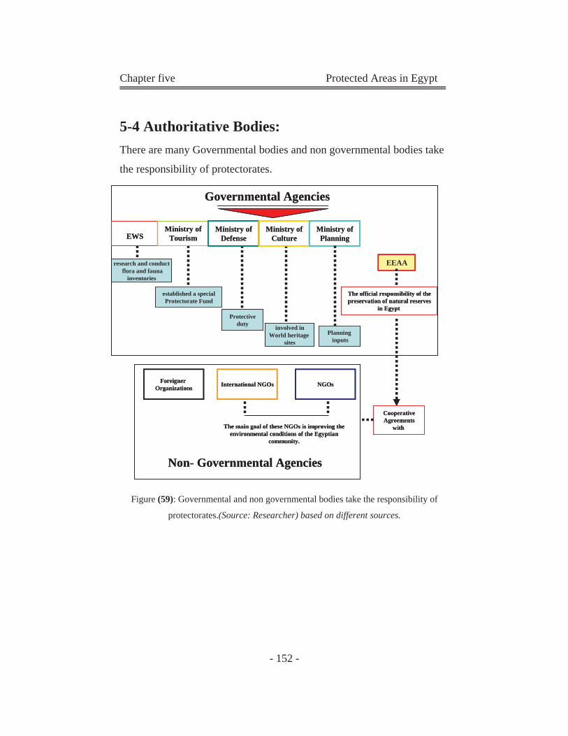
Chapter five Protected Areas in Egypt
- 152 -
5-4 Authoritative Bodies:
There are many Governmental bodies and non governmental bodies take
the responsibility of protectorates.
Figure (59): Governmental and non governmental bodies take the responsibility of
protectorates.(Source: Researcher) based on different sources.
research and conductflora and fauna
inventories
Protectiveduty involved in
World heritage sites
EWSMinistry of
TourismMinistry of
DefenseMinistry of
Culture
EEAA
International NGOs NGOs
Non- Governmental Agencies
Governmental Agencies
Ministry of Planning
Planninginputs
established a special Protectorate Fund
The official responsibility of the preservation of natural reserves
in Egypt
Foreigner Organizations
The main goal of these NGOs is improving the environmental conditions of the Egyptian
community.
Cooperative Agreements
with
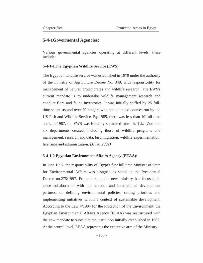
Chapter five Protected Areas in Egypt
- 153 -
5-4-1Govermental Agencies:
Various governmental agencies operating at different levels, these include:
5-4-1-1The Egyptian Wildlife Service (EWS)
The Egyptian wildlife service was established in 1979 under the authority
of the ministry of Agriculture Decree No. 349, with responsibility for
management of natural protectorates and wildlife research. The EWS's
current mandate is to undertake wildlife management research and
conduct flora and fauna inventories. It was initially staffed by 25 full-
time scientists and over 20 rangers who had attended courses run by the
US-Fish and Wildlife Service. By 1985, there was less than 10 full-time
staff. In 1987, the EWS was formally separated from the Giza Zoo and
six departments created, including those of wildlife programs and
management, research and data, bird migration, wildlife experimentation,
licensing and administration. (JICA, 2002)
5-4-1-2 Egyptian Environment Affairs Agency (EEAA):
In June 1997, the responsibility of Egypt's first full time Minister of State
for Environmental Affairs was assigned as stated in the Presidential
Decree no.275/1997. From thereon, the new ministry has focused, in
close collaboration with the national and international development
partners, on defining environmental policies, setting priorities and
implementing initiatives within a context of sustainable development.
According to the Law 4/1994 for the Protection of the Environment, the
Egyptian Environmental Affairs Agency (EEAA) was restructured with
the new mandate to substitute the institution initially established in 1982.
At the central level, EEAA represents the executive arm of the Ministry
Chapter five Protected Areas in Egypt
- 154 -
Principle functions of the agency include:
Formulating environmental policies.
Preparing the necessary plans for Environmental protection and
Environmental development projects, following up their
implementation, and undertaking Pilot Projects.
The Agency is the National Authority in charge of promoting
environmental relations between Egypt and other States, as well
as Regional and International Organizations. (See appendix 3)
5-4-1-3The Ministry of Tourism
The ministry of tourism through its Tourism Development Unit is
concerned with the environment and protected areas. It has been involved
in instigating a series of environmental assessments in and around natural
protectorates in Sinai and elsewhere. The ministry has, under Article 6 of
Law 102/1983, established a special fund entitled "Natural Protectorate
Fund", to be used as a means of supplementing the budget of the
administration bodies responsible for implementing Law No.102. The
fund aimed at environmental research and law enforcement. (JICA, 2002)
5-4-1-4The Ministry of Defense
The ministry of defense plays an active role in guarding protectorates
against poaching, in addition to have the authority to issue permits for
wildlife hunting in desert areas. Water police (Ministry of Defense) of
Lake Qaroun are entitled to arrest violators of Prime Minister Decree
No.943/89 pertaining to natural protectorates. (Raslan, 20030
Chapter five Protected Areas in Egypt
- 155 -
5-4-1-5The Ministry of Planning
The ministry of planning can be thought of as being the governmental
unit responsible for overseeing the planning process in all fields of
development and integrating them into a common policy. In this sense, it
becomes one of the most effective bodies participating in the
management process and is party to most decrees and polices issued on
this behalf.
5-4-1-6 Ministry of Housing, Public Utilities, and urban Communities
The agency responsible for urban planning and development, within this
ministry is the General Agency for Urban Planning (GAUP). The Urban
Planning Law No.3/1982 states That GAUP is the responsible agency for
drawing general planning polices and providing urban development
plans. This law also states that the general plan determines the different
land uses which are suited for a particular area, its character (of the city),
its conditions, and its inhabitant's needs. (JICA, 2002)
5-4-1-7Ministry of Culture
Natural areas are categorized as sites of both cultural and natural
heritage.
Although the EEAA took the official responsibility of the preservation of
natural reserves in Egypt, the ministry of Culture is actively involved in
many of as a relevant decision-making body in these areas, especially
those that contain UNESCO world heritage convention sites such as St.
Catherine's. The ministry of Culture and EEAA also collaborate in
projects undertake by "the National Center for Documentation of
Chapter five Protected Areas in Egypt
- 156 -
Cultural and Natural Heritage" and on the coastal management project in
Alexandria.
5-4-1-8 Governorates and Local-Level Governing Bodies
The Egyptian administrative system is one that can be characterized as
essentially being central and thus local governments, represented by
governorates and city councils, have yet to establish the importance of
their authoritative role and contributory role in the planning and
management process. (Raslan, 2003)
Chapter five Protected Areas in Egypt
- 157 -
Authoritative Bodies
Agency Main Task Responsibility toward
protectorates The Egyptian Wildlife
Service (EWS) - Established in 1979, under the authority of the
ministry of Agriculture Decree No. 349 to undertake
wildlife management research and conduct flora and
fauna inventories
responsibility for management of natural
protectorates and wildlife research
Egyptian Environment Affairs Agency
(EEAA)
- Established in June 1997 -Defining environmental policies, setting priorities and implementing initiatives within a context of sustainable development. -Protection of the Environment
The Agency is the National Authority in
charge of promoting environmental
relations between Egypt and other States
The Ministry of Tourism
-The ministry has, under Article 6 of Law 102/1983,
established a special fund entitled "Natural Protectorate
Fund"
Concerned in protectorates in Sinai,
touristic protectorates.
Like: Ras Mohammed, and Siwa
protectorate.
The Ministry of Defense
- Active role in guarding protectorates against poaching - It has the authority to issue permits for wildlife hunting in desert areas
Water police (Ministry of Defense) of Lake Qaroun are entitled to arrest violators of Prime Minister Decree No.943/89 pertaining to natural protectorates.
The Ministry of Planning
- The governmental unit responsible for overseeing the
planning process in all fields of development and
integrating them into a common policy
It becomes on of the most effective
bodies participating in the management
process and is party to most decrees and
polices issued on this behalf.
Ministry of Housing, Public Utilities, and urban Communities
- Within this ministry is the General Agency for Urban
Planning
- GAUP is the responsible agency for drawing general
planning polices and providing urban development
plans.
- It Determines the different land uses
which are suited for a particular area, its
character (of the city), its conditions, and
its inhabitant's needs. It deals with
protectorates as a land use not as
environmental significant areas.
Chapter five Protected Areas in Egypt
- 158 -
Authoritative Bodies
Agency Main Task Responsibility toward
protectorates Ministry of Culture -It is actively involved in many of as a relevant
decision-making body in these areas, especially those
that contain UNESCO world heritage convention sites
such as St. Catherine's.
The ministry of Culture and EEAA also
collaborate in projects undertake by "the
National Center for Documentation of
Cultural and Natural Heritage" and on the
coastal management project in
Alexandria.
Governorates and Local-Level
Governing Bodies
- The Egyptian administrative system can be
characterized as essentially being a central and thus
local government, represented by governorates and city
councils have yet to establish the importance of their
authoritative role and contributory role in the planning
and management process.
Involved in take decisions, especially
when this areas present a financial
potential. (There is a fight between new
communities agency and EEAA about the
land of the petrified forest, the agency
wants to take the land for the extension of
new Cairo city)
Table (36): Governmental bodies and non governmental bodies take the responsibility of protectorates. Source:
Researcher gathered from different sources.
Chapter five Protected Areas in Egypt
- 158 -
5-4-2 Non Governmental Agencies (Participatory Organization):
Participatory bodies are those that contribute to the authoritative process
in a variety of ways or by a variety of means while not officially being
part of governmental institutional hierarchy.
5-4-2-1 Foreign Non Governmental Organizations
Cooperative agreements between the wildlife management authorities
and foreign agencies or organizations are extensive. The World Bank,
through its Mediterranean program, has been funding environmental
impact assessments in protectorates, such as Lake Burullus. The
international council for bird preservation has been running conservation
projects in Egypt since 1987, and has been instrumental in establishing a
Central Conservation Education Center, which operates from Giza Zoo.
(JICA, 2002)
5-4-2-2 NGOs
Non-Governmental Organizations (NGOs) in Egypt have an important
role to play in contributing to the country’s social, economic, and
democratic development. In this respect, the Egyptian government has
been encouraging and supporting the establishment of various NGOs,
especially those working in the fields of environmental awareness and
protection. Currently, there are more than 2,000 environmental NGOs in
Egypt, some of them are more active than others, but collectively they
play an indispensable role in raising public awareness towards
environmental issues, and in conducting environmental protection and
conservation activities. (www.Egypttoday.com)
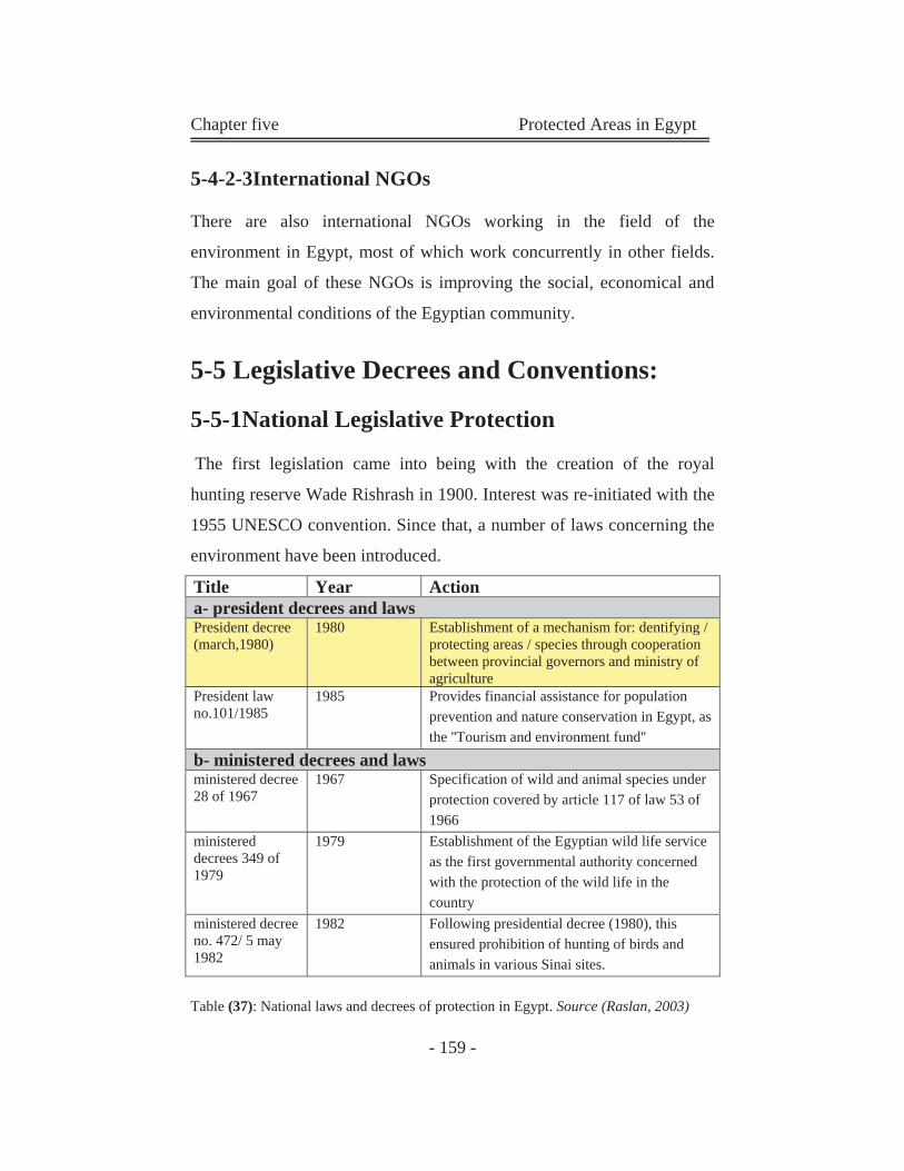
Chapter five Protected Areas in Egypt
- 159 -
5-4-2-3International NGOs
There are also international NGOs working in the field of the
environment in Egypt, most of which work concurrently in other fields.
The main goal of these NGOs is improving the social, economical and
environmental conditions of the Egyptian community.
5-5 Legislative Decrees and Conventions:
5-5-1National Legislative Protection
The first legislation came into being with the creation of the royal
hunting reserve Wade Rishrash in 1900. Interest was re-initiated with the
1955 UNESCO convention. Since that, a number of laws concerning the
environment have been introduced.
Title Year Action a- president decrees and laws President decree (march,1980)
1980 Establishment of a mechanism for: dentifying / protecting areas / species through cooperation between provincial governors and ministry of agriculture
President law no.101/1985
1985 Provides financial assistance for population prevention and nature conservation in Egypt, as the ''Tourism and environment fund''
b- ministered decrees and laws ministered decree 28 of 1967
1967 Specification of wild and animal species under protection covered by article 117 of law 53 of 1966
ministered decrees 349 of 1979
1979 Establishment of the Egyptian wild life service as the first governmental authority concerned with the protection of the wild life in the country
ministered decree no. 472/ 5 may 1982
1982 Following presidential decree (1980), this ensured prohibition of hunting of birds and animals in various Sinai sites.
Table (37): National laws and decrees of protection in Egypt. Source (Raslan, 2003)
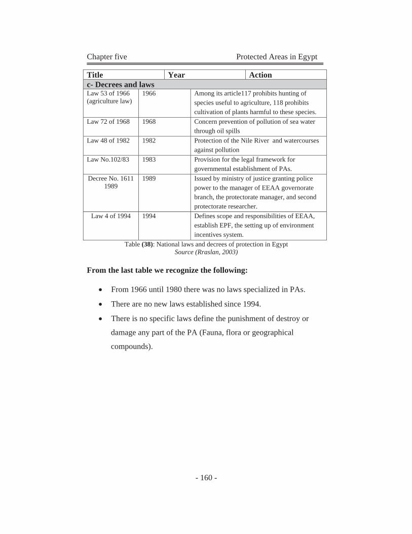
Chapter five Protected Areas in Egypt
- 160 -
Table (38): National laws and decrees of protection in Egypt Source (Rraslan, 2003)
From the last table we recognize the following:
From 1966 until 1980 there was no laws specialized in PAs.
There are no new laws established since 1994.
There is no specific laws define the punishment of destroy or
damage any part of the PA (Fauna, flora or geographical
compounds).
Title Year Action c- Decrees and laws Law 53 of 1966 (agriculture law)
1966 Among its article117 prohibits hunting of species useful to agriculture, 118 prohibits cultivation of plants harmful to these species.
Law 72 of 1968 1968 Concern prevention of pollution of sea water through oil spills
Law 48 of 1982 1982 Protection of the Nile River and watercourses against pollution
Law No.102/83 1983 Provision for the legal framework for governmental establishment of PAs.
Decree No. 1611 1989
1989 Issued by ministry of justice granting police power to the manager of EEAA governorate branch, the protectorate manager, and second protectorate researcher.
Law 4 of 1994 1994 Defines scope and responsibilities of EEAA, establish EPF, the setting up of environment incentives system.
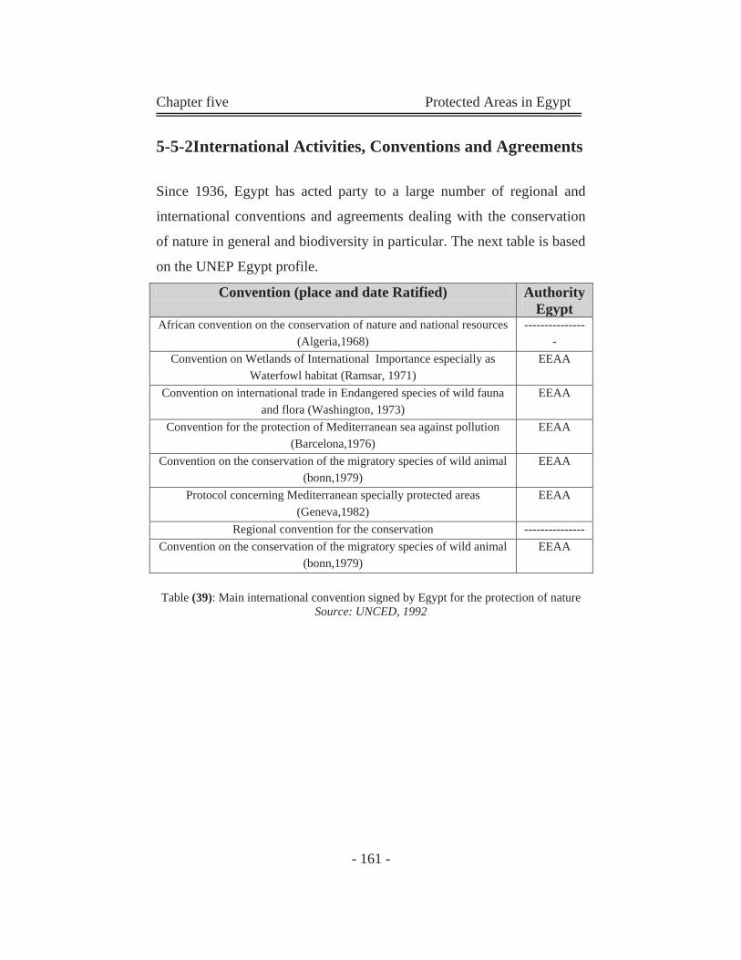
Chapter five Protected Areas in Egypt
- 161 -
5-5-2International Activities, Conventions and Agreements
Since 1936, Egypt has acted party to a large number of regional and
international conventions and agreements dealing with the conservation
of nature in general and biodiversity in particular. The next table is based
on the UNEP Egypt profile.
Convention (place and date Ratified) Authority Egypt
African convention on the conservation of nature and national resources (Algeria,1968)
----------------
Convention on Wetlands of International Importance especially as Waterfowl habitat (Ramsar, 1971)
EEAA
Convention on international trade in Endangered species of wild fauna and flora (Washington, 1973)
EEAA
Convention for the protection of Mediterranean sea against pollution (Barcelona,1976)
EEAA
Convention on the conservation of the migratory species of wild animal (bonn,1979)
EEAA
Protocol concerning Mediterranean specially protected areas (Geneva,1982)
EEAA
Regional convention for the conservation --------------- Convention on the conservation of the migratory species of wild animal
(bonn,1979) EEAA
Table (39): Main international convention signed by Egypt for the protection of nature Source: UNCED, 1992
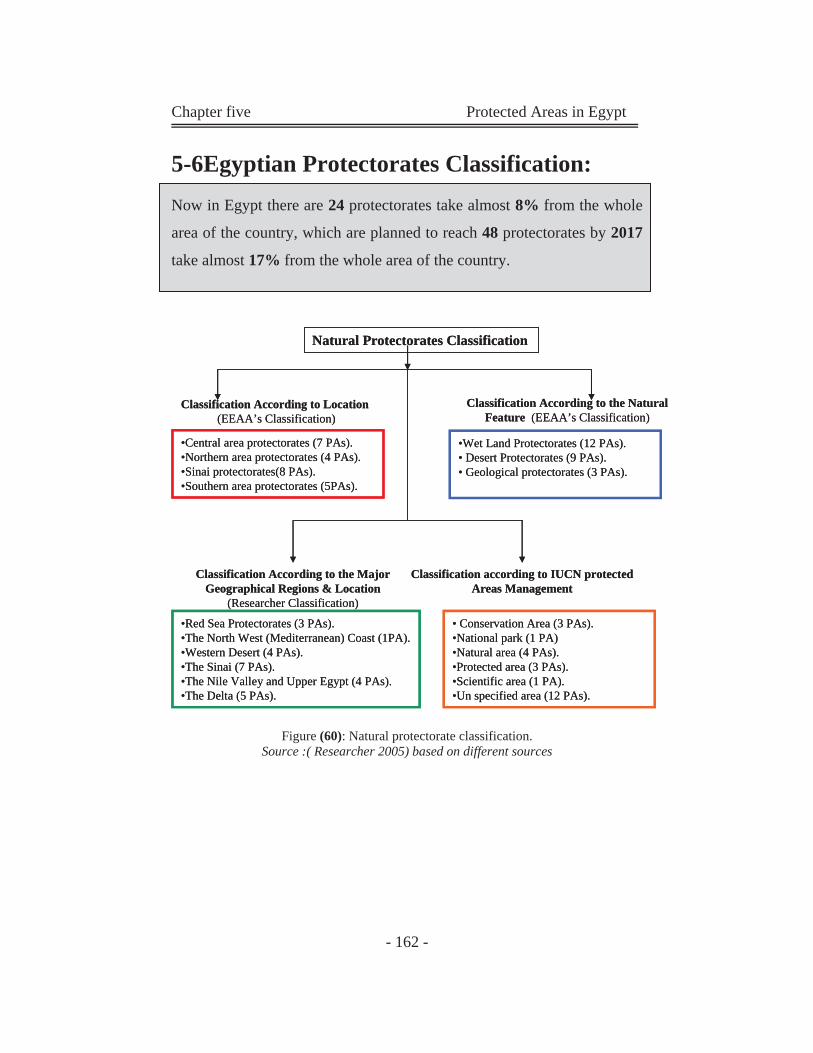
Chapter five Protected Areas in Egypt
- 162 -
5-6Egyptian Protectorates Classification:
Now in Egypt there are 24 protectorates take almost 8% from the whole
area of the country, which are planned to reach 48 protectorates by 2017
take almost 17% from the whole area of the country.
Figure (60): Natural protectorate classification. Source :( Researcher 2005) based on different sources
Natural Protectorates Classification
Classification According to Location(EEAA’s Classification)
Classification According to the Major Geographical Regions & Location
(Researcher Classification)
•Central area protectorates (7 PAs).•Northern area protectorates (4 PAs).•Sinai protectorates(8 PAs).•Southern area protectorates (5PAs).
•Red Sea Protectorates (3 PAs). •The North West (Mediterranean) Coast (1PA).•Western Desert (4 PAs).•The Sinai (7 PAs).•The Nile Valley and Upper Egypt (4 PAs).•The Delta (5 PAs).
Classification According to the Natural Feature (EEAA’s Classification)
•Wet Land Protectorates (12 PAs).• Desert Protectorates (9 PAs).• Geological protectorates (3 PAs).
Classification according to IUCN protected Areas Management
• Conservation Area (3 PAs).•National park (1 PA)•Natural area (4 PAs). •Protected area (3 PAs).•Scientific area (1 PA).•Un specified area (12 PAs).
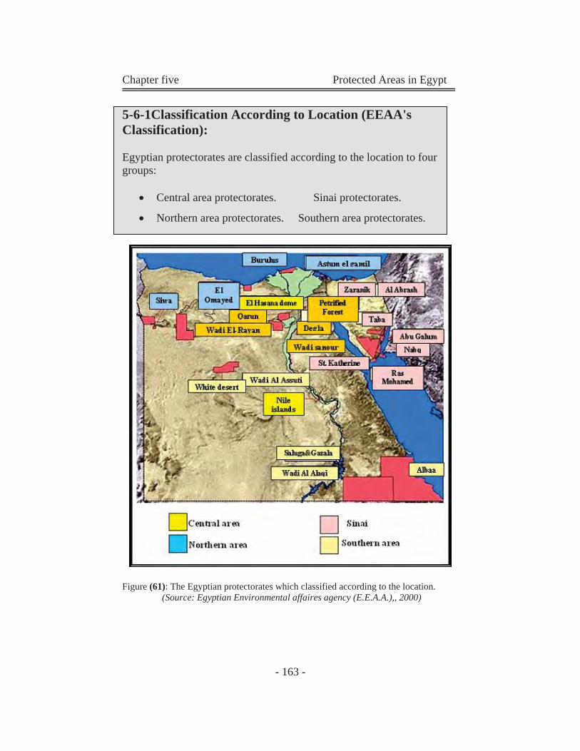
Chapter five Protected Areas in Egypt
- 163 -
5-6-1Classification According to Location (EEAA's Classification):
Egyptian protectorates are classified according to the location to four groups:
Central area protectorates. Sinai protectorates.
Northern area protectorates. Southern area protectorates.
Figure (61): The Egyptian protectorates which classified according to the location. (Source: Egyptian Environmental affaires agency (E.E.A.A.),, 2000)
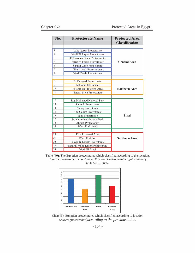
Chapter five Protected Areas in Egypt
- 164 -
Table (40): The Egyptian protectorates which classified according to the location.
(Source: Researcher according to: Egyptian Environmental affaires agency (E.E.A.A.),, 2000)
Chart (3): Egyptian protectorates which classified according to location Source: (Researcher)according to the previous table.
No. Protectorate Name Protected Area Classification
1 Lake Qarun Protectorate
Central Area
2 Wadi El Rayan Protectorate 3 El Hassana Dome Protectorate 4 Petrified Forest Protectorate 5 Sannur Cave Protectorate 6 Nile Islands Protectorates 7 Wadi Degla Protectorate
8 El Omayed Protectorate
Northern Area 9 Ashtoom El Gameel 10 El Borolos Protected Area 11 Natural Siwa Protectorate
12 Ras Mohamed National Park
Sinai
13 Zaranik Protectorate 14 Nabaq Protectorate 15 Abu Galum Protectorate 16 Taba Protectorate 17 St. Katherine National Park 18 Ahrash Protectorate 19 Wadi El Gameel
20 Elba Protected Area
Southern Area 21 Wadi El Asioti 22 Saloga & Gazale Protectorate 23 Natural White Desert Protectorate 24 Wadi El Alaqi
0
12
3
45
6
78
9
Central Area NorthernArea
Sinai SouthernArea
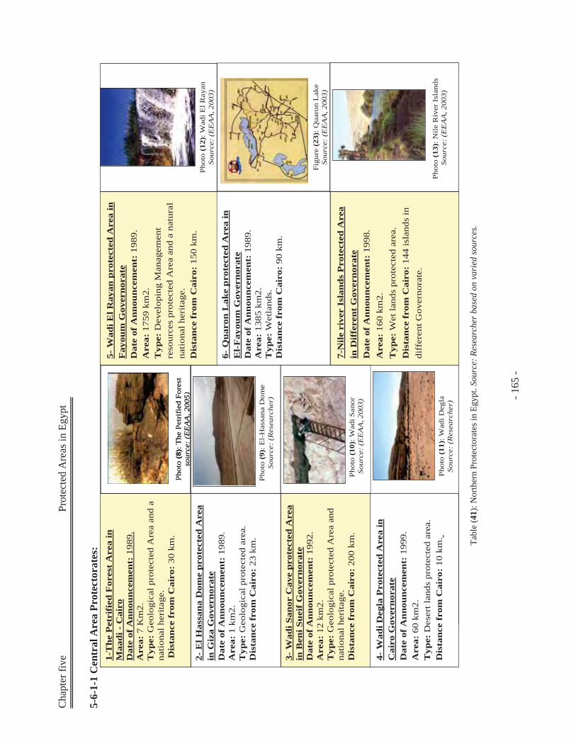
Cha
pter
five
Prot
ecte
d A
reas
in E
gypt
- 1
65 -
5-6-
1-1
Cen
tral
Are
a Pr
otec
tora
tes:
Tabl
e (4
1): N
orth
ern
Prot
ecto
rate
s in
Egyp
t. So
urce
: Res
earc
her b
ased
on
vari
ed so
urce
s.
Phot
o (8
): T
he P
etri
fied
For
est
sour
ce:
(EE
AA
, 200
5)Ph
oto
(8):
The
Pet
rifi
ed F
ores
t so
urce
: (E
EA
A, 2
005)
2-E
l Has
sana
Dom
e pr
otec
ted
Are
a in
Giz
aG
over
nora
teD
ate
of A
nnou
ncem
ent:
1989
. A
rea:
1 km
2.
Typ
e:G
eolo
gica
l pro
tect
ed a
rea.
Dis
tanc
e fr
om C
airo
:23
km
.Ph
oto
(9):
El-
Has
sana
Dom
e So
urce
: (R
esea
rche
r)
Phot
o (1
0): W
adiS
anor
Sour
ce:
(EE
AA
, 200
3)
3-W
adiS
anor
Cav
e pr
otec
ted
Are
a in
Ben
iSue
ifG
over
nora
te
Dat
e of
Ann
ounc
emen
t:19
92.
Are
a:12
km
2.
Typ
e:G
eolo
gica
l pro
tect
ed A
rea
and
natio
nal h
erita
ge.
Dis
tanc
e fr
om C
airo
:20
0 km
.
1-T
he P
etri
fied
For
est
Are
a in
M
aadi
-C
airo
Dat
e of
Ann
ounc
emen
t:19
89.
Are
a:7
Km
2.
Typ
e:G
eolo
gica
l pro
tect
ed A
rea
and
a na
tiona
l her
itage
.D
ista
nce
from
Cai
ro:
30 k
m.
5-W
adiE
l Ray
anpr
otec
ted
Are
a in
F
ayou
mG
over
nora
te
Dat
e of
Ann
ounc
emen
t:19
89.
Are
a:17
59 k
m2.
Typ
e:D
evel
opin
g M
anag
emen
t re
sour
ces
prot
ecte
d A
rea
and
a na
tura
l na
tiona
l her
itage
. D
ista
nce
from
Cai
ro:
150
km.
Phot
o (1
2): W
adiE
l Ray
anSo
urce
: (E
EA
A, 2
003)
6-Q
uaro
nL
ake
prot
ecte
d A
rea
in
El-
Fay
oum
Gov
erno
rate
Dat
e of
Ann
ounc
emen
t:19
89.
Are
a:13
85 k
m2.
Typ
e:W
etla
nds.
Dis
tanc
e fr
om C
airo
:90
km
.
Phot
o (1
3): N
ile R
iver
Isl
ands
So
urce
: (E
EA
A, 2
003)
7-N
ile r
iver
Isl
ands
Pro
tect
ed A
rea
in D
iffe
rent
Gov
erno
rate
D
ate
of A
nnou
ncem
ent:
1998
. A
rea:
160
km2.
T
ype:
Wet
land
s pr
otec
ted
area
. D
ista
nce
from
Cai
ro:
144
isla
nds
in
diff
eren
t Gov
erno
rate
.
Phot
o (1
1): W
adiD
egla
Sour
ce:
(Res
earc
her)
4-W
adiD
egla
Pro
tect
ed A
rea
in
Cai
ro G
over
nora
teD
ate
of A
nnou
ncem
ent:
199
9.A
rea:
60
km2.
Typ
e: D
eser
t lan
ds p
rote
cted
are
a.D
ista
nce
from
Cai
ro:
10 k
m.
Figu
re (
23):
Qua
ron
Lak
e So
urce
: (E
EA
A, 2
003)
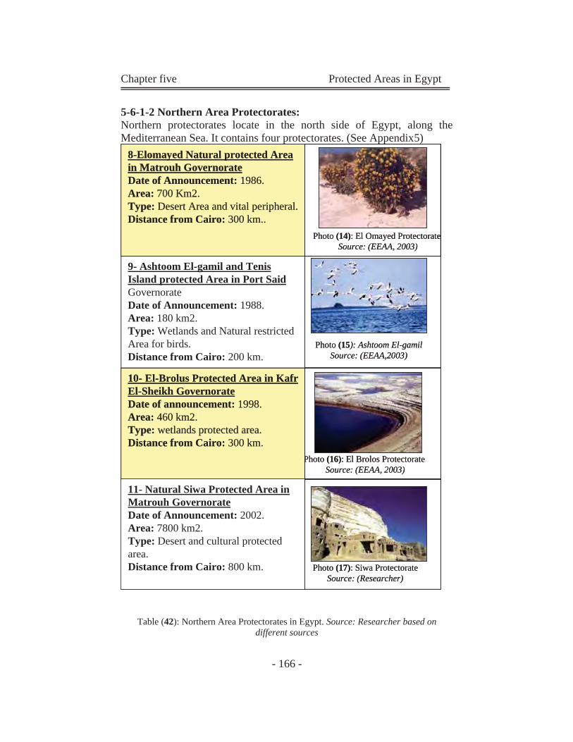
Chapter five Protected Areas in Egypt
- 166 -
5-6-1-2 Northern Area Protectorates: Northern protectorates locate in the north side of Egypt, along the Mediterranean Sea. It contains four protectorates. (See Appendix5)
Table (42): Northern Area Protectorates in Egypt. Source: Researcher based on different sources
9- Ashtoom El-gamil and TenisIsland protected Area in Port SaidGovernorate Date of Announcement: 1988. Area: 180 km2. Type: Wetlands and Natural restricted Area for birds. Distance from Cairo: 200 km.
Photo (15): Ashtoom El-gamilSource: (EEAA,2003)
Photo (16): El Brolos Protectorate Source: (EEAA, 2003)
10- El-Brolus Protected Area in KafrEl-Sheikh Governorate Date of announcement: 1998. Area: 460 km2. Type: wetlands protected area. Distance from Cairo: 300 km.
8-Elomayed Natural protected Area in Matrouh Governorate Date of Announcement: 1986. Area: 700 Km2. Type: Desert Area and vital peripheral.Distance from Cairo: 300 km..
Photo (17): Siwa ProtectorateSource: (Researcher)
11- Natural Siwa Protected Area in Matrouh GovernorateDate of Announcement: 2002. Area: 7800 km2.Type: Desert and cultural protected area. Distance from Cairo: 800 km.
Photo (14): El Omayed Protectorate Source: (EEAA, 2003)
9- Ashtoom El-gamil and TenisIsland protected Area in Port SaidGovernorate Date of Announcement: 1988. Area: 180 km2. Type: Wetlands and Natural restricted Area for birds. Distance from Cairo: 200 km.
Photo (15): Ashtoom El-gamilSource: (EEAA,2003)
Photo (16): El Brolos Protectorate Source: (EEAA, 2003)
10- El-Brolus Protected Area in KafrEl-Sheikh Governorate Date of announcement: 1998. Area: 460 km2.Type: wetlands protected area.Distance from Cairo: 300 km.
PPPP
10- El-Brolus Protected Area in KafrEl-Sheikh Governorate Date of announcement: 1998. Area: 460 km2. Type: wetlands protected area. Distance from Cairo: 300 km.
8-Elomayed Natural protected Area in Matrouh Governorate Date of Announcement: 1986. Area: 700 Km2.Type: Desert Area and vital peripheral.Distance from Cairo: 300 km..
8-Elomayed Natural protected Area in Matrouh Governorate Date of Announcement: 1986. Area: 700 Km2. Type: Desert Area and vital peripheral.Distance from Cairo: 300 km..
Photo (17): Siwa ProtectorateSource: (Researcher)
11- Natural Siwa Protected Area in Matrouh GovernorateDate of Announcement: 2002. Area: 7800 km2.Type: Desert and cultural protected area. Distance from Cairo: 800 km.
Photo (14): El Omayed Protectorate Source: (EEAA, 2003)
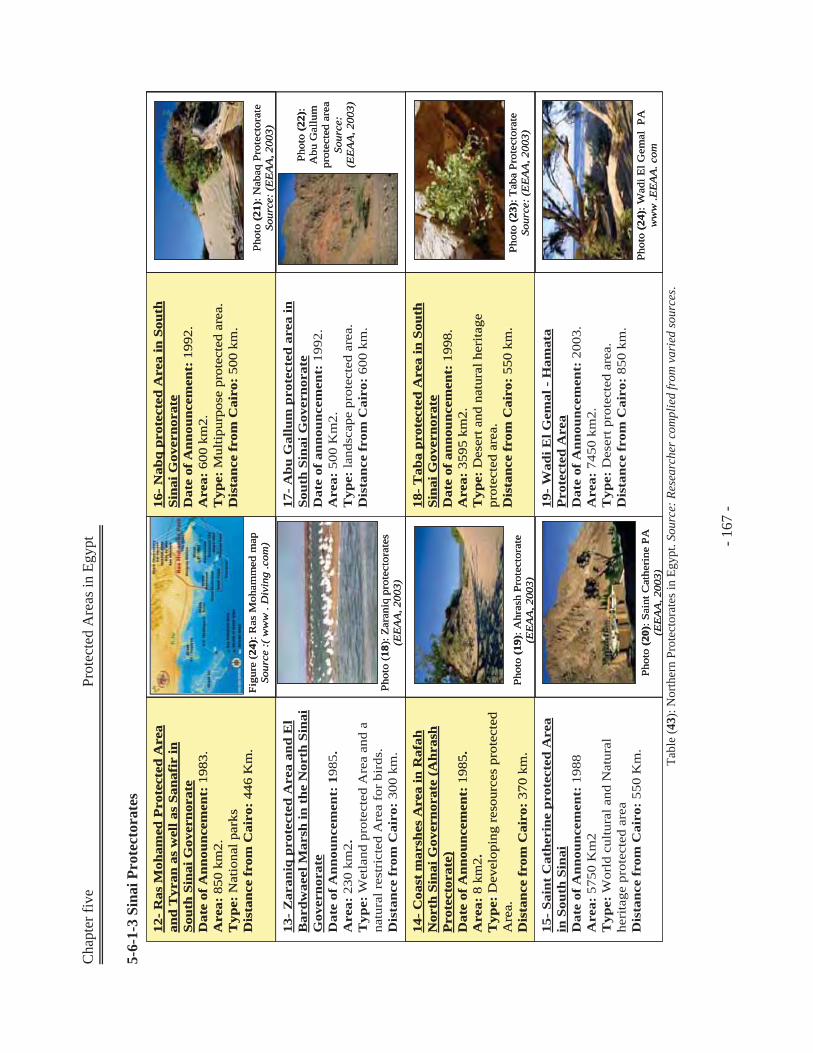
Cha
pter
five
Prot
ecte
d A
reas
in E
gypt
- 1
67 -
5-6-
1-3
Sina
i Pro
tect
orat
es
Tabl
e (4
3): N
orth
ern
Prot
ecto
rate
s in
Egyp
t. So
urce
: Res
earc
her c
ompl
ied
from
var
ied
sour
ces.
13-
Zar
aniq
prot
ecte
d A
rea
and
El
Bar
dwae
elM
arsh
in t
he N
orth
Sin
ai
Gov
erno
rate
Dat
e of
Ann
ounc
emen
t: 1
985.
A
rea:
230
km
2.
Typ
e: W
etla
nd p
rote
cted
Are
a an
d a
natu
ral r
estr
icte
d A
rea
for
bird
s.D
ista
nce
from
Cai
ro:
300
km.
14-
Coa
st m
arsh
es A
rea
in R
afah
Nor
th S
inai
Gov
erno
rate
(A
hras
hP
rote
ctor
ate)
D
ate
of A
nnou
ncem
ent:
198
5.
Are
a: 8
km
2.T
ype:
Dev
elop
ing
reso
urce
s pr
otec
ted
Are
a.D
ista
nce
from
Cai
ro:
370
km.
12-
Ras
Moh
amed
Pro
tect
ed A
rea
and
Tyr
anas
wel
l as
Sana
fir
in
Sout
h Si
nai G
over
nora
teD
ate
of A
nnou
ncem
ent:
198
3.A
rea:
850
km
2.T
ype:
Nat
iona
l par
ksD
ista
nce
from
Cai
ro:
446
Km
.
15-
Sain
t C
athe
rine
pro
tect
ed A
rea
in S
outh
Sin
aiD
ate
of A
nnou
ncem
ent:
198
8 A
rea:
575
0 K
m2
Typ
e: W
orld
cul
tura
l and
Nat
ural
he
rita
ge p
rote
cted
are
aD
ista
nce
from
Cai
ro:
550
Km
.
Figu
re (
24):
Ras
Moh
amm
ed m
ap
Sour
ce :(
ww
w .
Div
ing
.com
)
Phot
o (1
8): Z
aran
iqpr
otec
tora
tes
(EE
AA
, 200
3)
Phot
o (1
9): A
hras
hPr
otec
tora
te
(EE
AA
, 200
3)
Phot
o (2
0): S
aint
Cat
heri
ne P
A(E
EA
A, 2
003)
17-
Abu
Gal
lum
prot
ecte
d ar
ea in
So
uth
Sina
i Gov
erno
rate
Dat
e of
ann
ounc
emen
t: 1
992.
Are
a: 5
00 K
m2.
Typ
e: la
ndsc
ape
prot
ecte
d ar
ea.
Dis
tanc
e fr
om C
airo
: 60
0 km
.
18-
Tab
apr
otec
ted
Are
a in
Sou
th
Sina
i Gov
erno
rate
Dat
e of
ann
ounc
emen
t:19
98.
Are
a:35
95 k
m2.
T
ype:
Des
ert a
nd n
atur
al h
erita
ge
prot
ecte
d ar
ea.
Dis
tanc
e fr
om C
airo
:55
0 km
.
16-
Nab
qpr
otec
ted
Are
a in
Sou
th
Sina
i Gov
erno
rate
Dat
e of
Ann
ounc
emen
t:19
92.
Are
a:60
0 km
2.
Typ
e:M
ultip
urpo
se p
rote
cted
are
a.D
ista
nce
from
Cai
ro:
500
km.
19-
Wad
iEl G
emal
-H
amat
aP
rote
cted
Are
aD
ate
of A
nnou
ncem
ent:
2003
. A
rea:
7450
km
2.T
ype:
Des
ert p
rote
cted
are
a.
Dis
tanc
e fr
om C
airo
:85
0 km
.
Phot
o (2
1): N
abaq
Prot
ecto
rate
So
urce
: (E
EA
A, 2
003)
Phot
o (2
2):
Abu
Gal
lum
prot
ecte
d ar
ea
Sour
ce:
(EE
AA
, 200
3)
Phot
o (2
3): T
aba
Prot
ecto
rate
So
urce
: (E
EA
A, 2
003)
Phot
o (2
4): W
adiE
l Gem
alPA
ww
w .E
EA
A. c
om
13-
Zar
aniq
prot
ecte
d A
rea
and
El
Bar
dwae
elM
arsh
in t
he N
orth
Sin
ai
Gov
erno
rate
Dat
e of
Ann
ounc
emen
t: 1
985.
A
rea:
230
km
2.
Typ
e: W
etla
nd p
rote
cted
Are
a an
d a
natu
ral r
estr
icte
d A
rea
for
bird
s.D
ista
nce
from
Cai
ro:
300
km.
14-
Coa
st m
arsh
es A
rea
in R
afah
Nor
th S
inai
Gov
erno
rate
(A
hras
hP
rote
ctor
ate)
D
ate
of A
nnou
ncem
ent:
1985
. A
rea:
8 k
m2.
Typ
e:D
evel
opin
g re
sour
ces
prot
ecte
d A
rea.
Dis
tanc
e fr
om C
airo
:37
0 km
.
14-
Coa
st m
arsh
es A
rea
in R
afah
Nor
th S
inai
Gov
erno
rate
(A
hras
hP
rote
ctor
ate)
D
ate
of A
nnou
ncem
ent:
198
5.
Are
a: 8
km
2.T
ype:
Dev
elop
ing
reso
urce
s pr
otec
ted
Are
a.D
ista
nce
from
Cai
ro:
370
km.
12-
Ras
Moh
amed
Pro
tect
ed A
rea
and
Tyr
anas
wel
l as
Sana
fir
in
Sout
h Si
nai G
over
nora
teD
ate
of A
nnou
ncem
ent:
1983
.A
rea:
850
km
2.T
ype:
Nat
iona
l par
ksD
ista
nce
from
Cai
ro:
446
Km
.
12-
Ras
Moh
amed
Pro
tect
ed A
rea
and
Tyr
anas
wel
l as
Sana
fir
in
Sout
h Si
nai G
over
nora
teD
ate
of A
nnou
ncem
ent:
198
3.A
rea:
850
km
2.T
ype:
Nat
iona
l par
ksD
ista
nce
from
Cai
ro:
446
Km
.
15-
Sain
t C
athe
rine
pro
tect
ed A
rea
in S
outh
Sin
aiD
ate
of A
nnou
ncem
ent:
198
8 A
rea:
575
0 K
m2
Typ
e: W
orld
cul
tura
l and
Nat
ural
he
rita
ge p
rote
cted
are
aD
ista
nce
from
Cai
ro:
550
Km
.
Figu
re (
24):
Ras
Moh
amm
ed m
ap
Sour
ce :(
ww
w .
Div
ing
.com
)
Phot
o (1
8): Z
aran
iqpr
otec
tora
tes
(EE
AA
, 200
3)
Phot
o (1
9): A
hras
hPr
otec
tora
te
(EE
AA
, 200
3)
Phot
o (2
0): S
aint
Cat
heri
ne P
A(E
EA
A, 2
003)
17-
Abu
Gal
lum
prot
ecte
d ar
ea in
So
uth
Sina
i Gov
erno
rate
Dat
e of
ann
ounc
emen
t: 1
992.
Are
a: 5
00 K
m2.
Typ
e: la
ndsc
ape
prot
ecte
d ar
ea.
Dis
tanc
e fr
om C
airo
: 60
0 km
.
18-
Tab
apr
otec
ted
Are
a in
Sou
th
Sina
i Gov
erno
rate
Dat
e of
ann
ounc
emen
t:19
98.
Are
a:35
95 k
m2.
T
ype:
Des
ert a
nd n
atur
al h
erita
ge
prot
ecte
d ar
ea.
Dis
tanc
e fr
om C
airo
:55
0 km
.
18-
Tab
apr
otec
ted
Are
a in
Sou
th
Sina
i Gov
erno
rate
Dat
e of
ann
ounc
emen
t:19
98.
Are
a:35
95 k
m2.
T
ype:
Des
ert a
nd n
atur
al h
erita
ge
prot
ecte
d ar
ea.
Dis
tanc
e fr
om C
airo
:55
0 km
.
16-
Nab
qpr
otec
ted
Are
a in
Sou
th
Sina
i Gov
erno
rate
Dat
e of
Ann
ounc
emen
t:19
92.
Are
a:60
0 km
2.T
ype:
Mul
tipur
pose
pro
tect
ed a
rea.
Dis
tanc
e fr
om C
airo
:50
0 km
.
16-
Nab
qpr
otec
ted
Are
a in
Sou
th
Sina
i Gov
erno
rate
Dat
e of
Ann
ounc
emen
t:19
92.
Are
a:60
0 km
2.
Typ
e:M
ultip
urpo
se p
rote
cted
are
a.D
ista
nce
from
Cai
ro:
500
km.
19-
Wad
iEl G
emal
-H
amat
aP
rote
cted
Are
aD
ate
of A
nnou
ncem
ent:
2003
. A
rea:
7450
km
2.T
ype:
Des
ert p
rote
cted
are
a.
Dis
tanc
e fr
om C
airo
:85
0 km
.
Phot
o (2
1): N
abaq
Prot
ecto
rate
So
urce
: (E
EA
A, 2
003)
Phot
o (2
2):
Abu
Gal
lum
prot
ecte
d ar
ea
Sour
ce:
(EE
AA
, 200
3)
Phot
o (2
3): T
aba
Prot
ecto
rate
So
urce
: (E
EA
A, 2
003)
Phot
o (2
4): W
adiE
l Gem
alPA
ww
w .E
EA
A. c
om
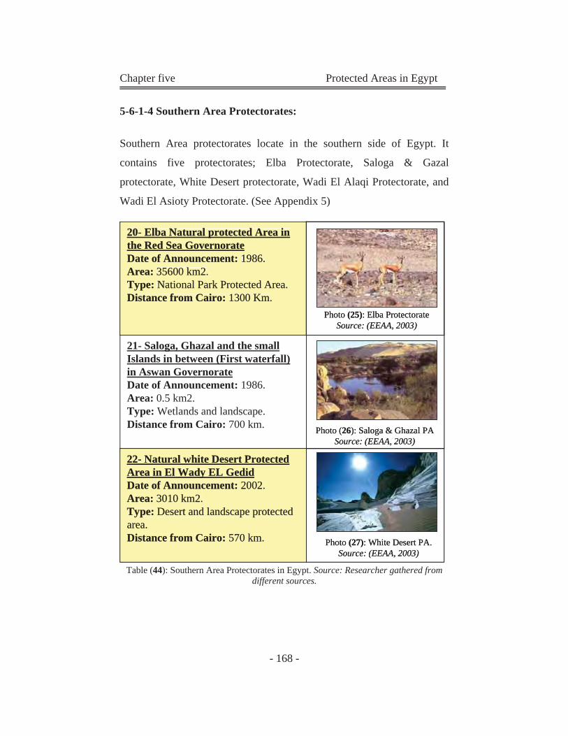
Chapter five Protected Areas in Egypt
- 168 -
5-6-1-4 Southern Area Protectorates:
Southern Area protectorates locate in the southern side of Egypt. It
contains five protectorates; Elba Protectorate, Saloga & Gazal
protectorate, White Desert protectorate, Wadi El Alaqi Protectorate, and
Wadi El Asioty Protectorate. (See Appendix 5)
Table (44): Southern Area Protectorates in Egypt. Source: Researcher gathered from different sources.
21- Saloga, Ghazal and the small Islands in between (First waterfall) in Aswan GovernorateDate of Announcement: 1986. Area: 0.5 km2.Type: Wetlands and landscape.Distance from Cairo: 700 km.
22- Natural white Desert Protected Area in El Wady EL GedidDate of Announcement: 2002. Area: 3010 km2.Type: Desert and landscape protected area. Distance from Cairo: 570 km.
20- Elba Natural protected Area in the Red Sea GovernorateDate of Announcement: 1986.Area: 35600 km2.Type: National Park Protected Area.Distance from Cairo: 1300 Km.
Photo (25): Elba Protectorate Source: (EEAA, 2003)
Photo (26): Saloga & Ghazal PASource: (EEAA, 2003)
Photo (27): White Desert PA.Source: (EEAA, 2003)
21- Saloga, Ghazal and the small Islands in between (First waterfall) in Aswan GovernorateDate of Announcement: 1986. Area: 0.5 km2.Type: Wetlands and landscape.Distance from Cairo: 700 km.
22- Natural white Desert ProtectedArea in El Wady EL GedidDate of Announcement: 2002.Area: 3010 km2.Type: Desert and landscape protected area. Distance from Cairo: 570 km.
22- Natural white Desert Protected Area in El Wady EL GedidDate of Announcement: 2002. Area: 3010 km2.Type: Desert and landscape protected area. Distance from Cairo: 570 km.
20- Elba Natural protected Area inthe Red Sea GovernorateDate of Announcement: 1986.Area: 35600 km2.Type: National Park Protected Area.Distance from Cairo: 1300 Km.
20- Elba Natural protected Area in the Red Sea GovernorateDate of Announcement: 1986.Area: 35600 km2.Type: National Park Protected Area.Distance from Cairo: 1300 Km.
Photo (25): Elba Protectorate Source: (EEAA, 2003)
Photo (26): Saloga & Ghazal PASource: (EEAA, 2003)
Photo (27): White Desert PA.Source: (EEAA, 2003)
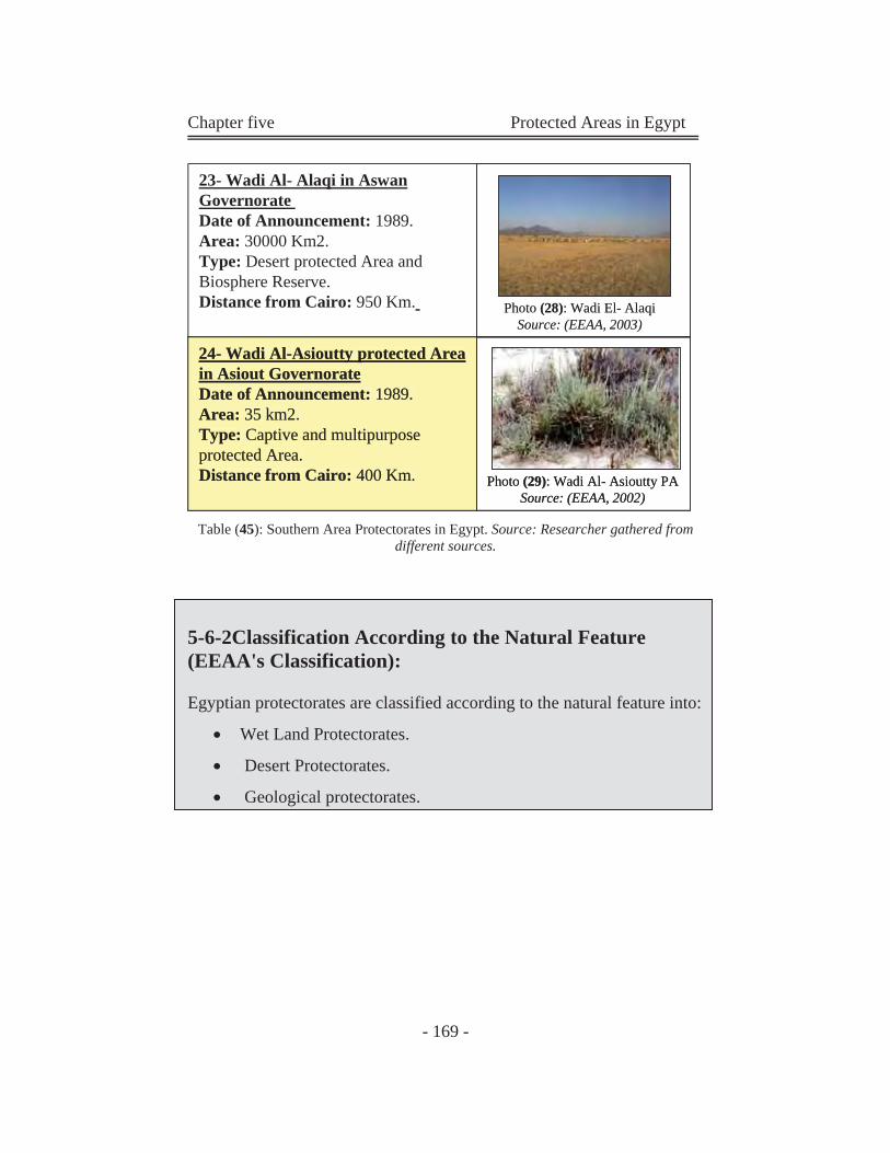
Chapter five Protected Areas in Egypt
- 169 -
Photo (28): Wadi El- AlaqiSource: (EEAA, 2003)
24- Wadi Al-Asioutty protected Area in Asiout Governorate Date of Announcement: 1989. Area: 35 km2. Type: Captive and multipurpose protected Area. Distance from Cairo: 400 Km. Photo (29): Wadi Al- Asioutty PA
Source: (EEAA, 2002)
23- Wadi Al- Alaqi in Aswan Governorate Date of Announcement: 1989.Area: 30000 Km2.Type: Desert protected Area and Biosphere Reserve.Distance from Cairo: 950 Km. Photo (28): Wadi El- Alaqi
Source: (EEAA, 2003)
24- Wadi Al-Asioutty protected Areain Asiout Governorate Date of Announcement: 1989. Area: 35 km2. Type: Captive and multipurpose protected Area.Distance from Cairo: 400 Km.
24- Wadi Al-Asioutty protected Area in Asiout Governorate Date of Announcement: 1989. Area: 35 km2. Type: Captive and multipurpose protected Area. Distance from Cairo: 400 Km. Photo (29): Wadi Al- Asioutty PA
Source: (EEAA, 2002)
Table (45): Southern Area Protectorates in Egypt. Source: Researcher gathered from different sources.
5-6-2Classification According to the Natural Feature (EEAA's Classification):
Egyptian protectorates are classified according to the natural feature into:
Wet Land Protectorates.
Desert Protectorates.
Geological protectorates.
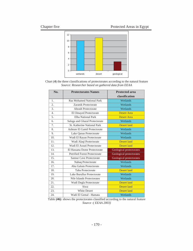
Chapter five Protected Areas in Egypt
- 170 -
Chart (4) the three classifications of protectorates according to the natural feature
Source: Researcher based on gathered data from EEAA
Table (46): shows the protectorates classified according to the natural feature Source :( EEAA 2003)
No. Protectorates Names Protected area classification
1. Ras Mohamed National Park Wetlands 2. Zaranik Protectorate Wetlands 3. Ahrash Protectorate Wetlands 4. El Omayed Protectorate Desert Area 5. Elba National Park Desert Area 6. Saluga and Ghazal Protectorate Wetlands 7. St. Katherine National Park Desert land 8. Ashtum El Gamil Protectorate Wetlands 9. Lake Qarun Protectorate Wetlands
10. Wadi El Rayan Protectorate Wetlands 11. Wadi Alaqi Protectorate Desert land 12. Wadi El Assuti Protectorate Desert land 13. El Hassana Dome Protectorate Geological protectorates 14. Petrified Forest Protectorate Geological protectorates 15. Sannur Cave Protectorate Geological protectorates 16. Nabaq Protectorate Wetlands 17. Abu Galum Protectorate Wetlands 18. Taba Protectorate Desert land 19. Lake Burullus Protectorate Wetlands 20. Nile Islands Protectorates Wetlands 21. Wadi Degla Protectorate Desert land 22. Siwa Desert land 23. White Desert Desert land 24. Wadi El Gemal - Hamata Wetlands
0
2
4
6
8
10
12
wetlands desert geological
Chapter five Protected Areas in Egypt
- 171 -
5-6-2-1 The Wet Land Protectorates:
Wetlands are low-lying marshy areas that connect inland waterways to
the sea. Wetlands are saturated or covered by water at least part of the
year, and have hydraulic soils. Hydraulic soils are saturated with water.
Oxygen diffuses about four times more slowly in water than in air, so
hydraulic soils have very little or no oxygen.
5-6-2-2 The Desert Protectorates:
Desert PAs are located in the desert, far away from any rivers, lakes or
seas. This PAs covered with seasonal plantation. (Depend on rains and
any other source of water).
5-6-2-3 The Geological Protectorates:
Geological PAs are protectorates which contain unique geological
features. Part of the PA's area or the total area is located in a geological
form.
5-6-3Classification According to the Major Geographical Regions (Researcher's Classification):
Egyptian protectorates are classified according to the major geographical
regions:
1-Eastern Desert. . 2-The North West (Mediterranean) Coast.
3-Western Desert. 4-Central Cairo Protectorate.
5-.The Nile Valley and Upper Egypt.
6-Sinai & Red Sea.
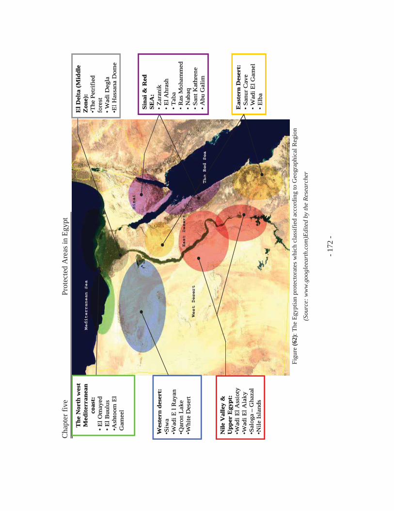
Cha
pter
five
Prot
ecte
d A
reas
in E
gypt
- 1
72 -
Figu
re (6
2): T
he E
gypt
ian
prot
ecto
rate
s whi
ch c
lass
ified
acc
ordi
ng to
Geo
grap
hica
l Reg
ion
(Sou
rce:
ww
w.g
oogl
eear
th.c
om)E
dite
d by
the
Rese
arch
er
The
Nor
th w
est
Med
iter
rane
an
coas
t:•
El O
may
ed•
El B
uulu
s•A
shto
omE
l G
amee
l
Wes
tern
des
ert:
•Siw
a•W
adiE
l R
ayan
•Qar
onL
ake
•Whi
te D
eser
t
Nile
Val
ley
&
Upp
er E
gypt
:•W
adiE
l Ass
ioty
•Wad
iEl A
laky
•Sal
oga
–G
haza
l•N
ile Is
land
s
El D
elta
(Mid
dle
Zon
e):
•The
Pet
rifi
ed
fore
st•
Wad
iDeg
la•E
l Has
sana
Dom
e
Sina
i & R
ed
SEA
:•
Zar
anik
•E
l Ahr
ash
•T
aba
•R
asM
oham
med
•N
abaq
•Sa
ntK
athr
ene
•A
bu G
alim
Eas
tern
Des
ert:
•Sa
nurC
ave
•W
adiE
l Gam
el•
Elb
a
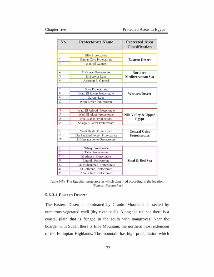
Chapter five Protected Areas in Egypt
- 173 -
Table (47): The Egyptian protectorates which classified according to the location. (Source: Researcher)
5-6-3-1 Eastern Desert:
The Eastern Desert is dominated by Granite Mountains dissected by
numerous vegetated wadi (dry river beds). Along the red sea there is a
coastal plain that is fringed in the south with mangroves. Near the
boarder with Sudan there is Elba Mountain, the northern most extension
of the Ethiopian Highlands. The mountain has high precipitation which
No. Protectorate Name Protected Area Classification
1 Elba Protectorate
Eastern Desert 2 Sanour Cave Protectorate 3 Wadi El Gameel
4 El Omead Protectorate Northern Mediterranean Sea 5 El Borolos Lake
6 Ashtoom El Gameel
7 Siwa Protectorate Western Desert 8 Wadi El Rayan Protectorate
9 Qaroun Lake 10 White Desert Protectorate
11 Wadi El Asiouti Protectorate
Nile Valley & Upper Egypt
12 Wadi El Alaqi Protectorate 13 Nile Islands Protectorate 14 Saloga & Gazal Protectorate
15 Wadi Degla Protectorate Central Cairo
Protectorates 16 The Petrified Forest Protectorate 17 El Hassana dome Protectorate
18 Nabaq Protectorate
Sinai & Red Sea
19 Taba Protectorate 20 El Ahrash Protectorate 21 Zaranik Protectorate 22 Ras Mohammed Protectorate 23 St Cathrene Protectorate 24 Abu Galum Protectorate
Chapter five Protected Areas in Egypt
- 174 -
gives rise to a rich biodiversity with plants and animals found no where
else in the country.
5-6- 3-2 The North West (Mediterranean) Coast:
While the Mediterranean Sea is lower in biodiversity than the red sea, it
has unique marine life and is home to multitude of species. The
Mediterranean coastal plain of the Western Desert is a hot spot for
biodiversity with some of the highest precipitation in the country giving
rise to a diverse flora and fauna.
5-6-3-3 Western Desert:
Although, most of the west desert of the Nile is Devoid of live, this
region has spectacular geological formations and scenery, including the
White Desert and Libyan sand sea. There are several large depressions in
the Western Desert where oases with saline lakes are found, including
Siwa oasis. Other depression close to the Delta region formed lakes such
as Quroun Lake.
5-6-3-4 The Nile Valley and Upper Egypt:
The Nile Valley is comprised of the Nile, and a thin band of cultivation
along its banks. The river, associated islands, and wetlands are home to
multitude of plant and animal life. Geographical formations are also
scattered along the uncultivated regions in this area.
5-6-3-5 Central Cairo Protectorates:
It contains the suburban Protectorates (protected areas situated within
urban context). As in Egypt, a strange phenomenon appears; adherence
of urban environment to protected Areas. This appear obviously in three
Chapter five Protected Areas in Egypt
- 175 -
Egyptian Protectorates; Wadi Degla, the Petrified Forest, and Wadi
Degla (we will study this phenomenon in details in chapter four). The
three protectorates situated in Big Cairo City; The Petrified Forest is
located in New Cairo City, Wadi Degla is located in Maadi, and El
Hassana Dome on Alexandria-Cairo road.
5-6-3-6 Sinai & Red Sea Protectorates:
Sinai desert is a region largely dominated by sand dunes and gravel
plains with several mountain outcrops. There are two lagoons along the
Sinai Mediterranean coast: Bardawil Lake and El Malaha. South Sinai, in
contrast is largely mountainous, with some of the highest peaks in the
country. The mountains around St. Cathrine with their high precipitation
are a biodiversity hot spot home to a multitude of plants and animals,
some of which are endemic.
The Red Sea includes a variety of rich marine ecosystems, which are on
of the highest in biodiversity. Coral reefs constitute the majority of these
ecosystems playing host a number of unique aquatic species as well as
having economic importance for the tourist industry and fisheries. These
are therefore considered as priority areas for protection. Mangroves,
particularly encountered in the southern part of the region, are also highly
productive ecosystems, supporting a large number of species. The coastal
plains of the Gulf of Suez and Elba Mountain are fringed by species rich
coral reefs and by the most northerly mangroves in the world.
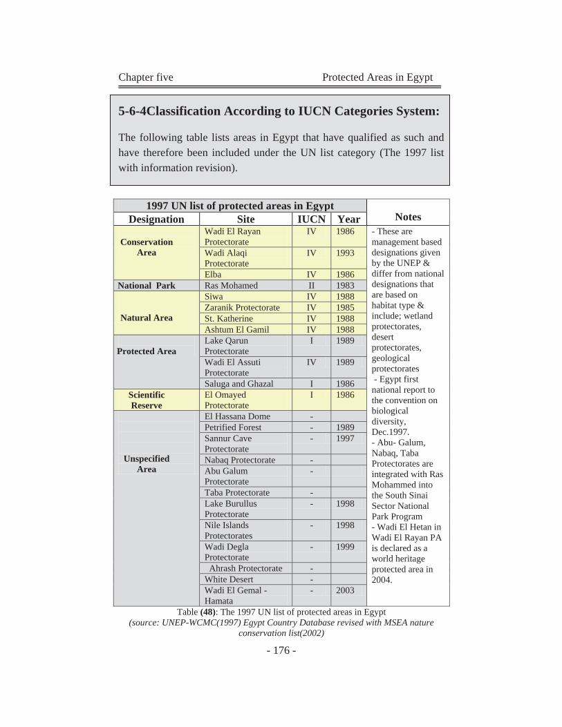
Chapter five Protected Areas in Egypt
- 176 -
5-6-4Classification According to IUCN Categories System:
The following table lists areas in Egypt that have qualified as such and have therefore been included under the UN list category (The 1997 list with information revision).
Table (48): The 1997 UN list of protected areas in Egypt (source: UNEP-WCMC(1997) Egypt Country Database revised with MSEA nature
conservation list(2002)
1997 UN list of protected areas in Egypt Notes Designation Site IUCN Year
Conservation
Area
Wadi El Rayan Protectorate
IV 1986 - These are management based designations given by the UNEP & differ from national designations that are based on habitat type & include; wetland protectorates, desert protectorates, geological protectorates - Egypt first national report to the convention on biological diversity, Dec.1997. - Abu- Galum, Nabaq, Taba Protectorates are integrated with Ras Mohammed into the South Sinai Sector National Park Program - Wadi El Hetan in Wadi El Rayan PA is declared as a world heritage protected area in 2004.
Wadi Alaqi Protectorate
IV 1993
Elba IV 1986 National Park Ras Mohamed II 1983
Natural Area
Siwa IV 1988 Zaranik Protectorate IV 1985 St. Katherine IV 1988 Ashtum El Gamil IV 1988
Protected Area
Lake Qarun Protectorate
I 1989
Wadi El Assuti Protectorate
IV 1989
Saluga and Ghazal I 1986 Scientific Reserve
El Omayed Protectorate
I 1986
Unspecified Area
El Hassana Dome - Petrified Forest - 1989 Sannur Cave Protectorate
- 1997
Nabaq Protectorate - Abu Galum Protectorate
-
Taba Protectorate - Lake Burullus Protectorate
- 1998
Nile Islands Protectorates
- 1998
Wadi Degla Protectorate
- 1999
Ahrash Protectorate - White Desert - Wadi El Gemal - Hamata
- 2003
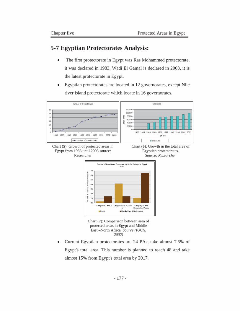
Chapter five Protected Areas in Egypt
- 177 -
5-7 Egyptian Protectorates Analysis:
The first protectorate in Egypt was Ras Mohammed protectorate,
it was declared in 1983. Wadi El Gamal is declared in 2003, it is
the latest protectorate in Egypt.
Egyptian protectorates are located in 12 governorates, except Nile
river island protectorate which locate in 16 governorates.
Current Egyptian protectorates are 24 PAs, take almost 7.5% of
Egypt's total area. This number is planned to reach 48 and take
almost 15% from Egypt's total area by 2017.
number of protectorates
0
5
10
15
20
25
30
1983 1985 1986 1988 1989 1992 1998 1999 2002 2003
number of protectorates
Chart (5): Growth of protected areas in Egypt from 1983 until 2003 source:
Researcher
total area
0
20000
4000060000
80000
100000
120000
1983 1985 1986 1988 1989 1992 1998 1999 2002 2003
years
tota
l are
a
total area
Chart (6): Growth in the total area of Egyptian protectorates.
Source: Researcher
Chart (7): Comparison between area of protected areas in Egypt and Middle East –North Africa. Source (IUCN,
2002)
Chapter five Protected Areas in Egypt
- 178 -
Almost 50% of the Egyptian PAs are unspecified in the IUCN
categories system
5-8 Biodiversity in Egypt:
Egypt lies at the northeast corner of Africa at the junction of four
biogeographically regions, Irano-Turanian, Mediterranean, Saharo-
Sindian and Afrotropical. At the same time it is at the center of the great
Saharo-sindian desert belt that runs from Maorocco on the northwest
corner of Africa to the high, cold deserts of central Asia. This unique
position is enhanced by the circumstance that it is divided by the Nile,
the longest river in the world. Most of Egypt is either arid or hyper arid.
however, due to its very varied eco-zones, the country is home to a
diversity of terrestrial habitats and a fauna and flora, which although low
in species numbers and with few endemic species, is extremely varied in
composition. Egypt is bounded on its north and east by two largely
enclosed seas, the Mediterranean Sea and Red Sea. The Red Sea is rich in
species and nurtures reef systems that are among the richest in the world
as will as stands of mangroves that play vital role in the health of the sea.
The reefs and the mangroves of the red sea are arguably among the most
important vehicles of biodiversity in the world. However, the fauna and
flora of the Red Sea is essentially a modified version of threat of the
Indo-Pacific and it also has relatively few endemic species. Ecosystems
and habitats must be maintained to safeguard species. Species must be
protected in order to conserve ecosystems and habitats. In Egypt, the lack
of species abundance and the relatively large number of eco-zones and
habitats makes the preservation of both especially important.
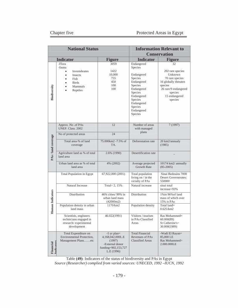
Chapter five Protected Areas in Egypt
- 179 -
Table (49): Indicators of the status of biodiversity and PAs in Egypt Source (Researcher) complied from varied sources: UNECED, 1992 –IUCN, 1992
National Status Information Relevant to Conservation
Indicator Figure Indicator Figure
Bio
dive
rsity
-Flora -fauna
Invertebrates Insects Fish Birds Mammals Reptiles
3059
1422 10,000
755 450 100 100
Endangered Species Endangered Species Endangered Species Endangered Species Endangered Species Endangered Species Endangered Species
32
202 rare species Unknown
70 rare species 16 globally threaten species 26 rare/9 endangered
species 15 endangered
species
PAs /
land
cov
erag
e
Approx .No .of PAs UNEP. Class. 2002
12 Number of areas with managed
plans
7 (1997)
No of protected areas 24
Total area-% of land coverage
75.000km2 -7.5% of TA.
Deforestation rate 20 km2/annualy (1985)
Agriculture land as % of total land area
2.6% (1990) Desertification rate _
Urban land area as % of total land area
4% (2002) Average projected Growth Rate
10174 km2/ annually (85-2005)
Hum
an In
dica
tors
Total Population in Egypt 67,922,000 (2001) Total population living on / in the vicialty of PAs
Sinai Bedouins 7000 Desert Governorates: 550000
Natural Increase Total= 2, 15% Natural increase sinai total increase=93%
Distribution 46% cities/ 99% in urban land mass
(42000m2)
Distribution 1%in 96%of land mass of which over 15% is PAs
Population density in urban land mass
1170/km2 Population density Total land= 0.625/km2
Scientists, engineers technicians engaged in research/ experimental
development
46.022(1991) Visitors / tourism in PAs Classified Areas
Ras Mohammed= 60.000(89) St Catherine's= 30.000(1989)
Fina
ncia
l In
dica
tors
Total Expenditure on Environmental Protection, Management Plans……etc
-5 yr plan= 4,168,042,000L.E
(1997) -External donor
funding=902,153,727 L.E (1996)
Total Financial Revenues of PAs Classified Areas
-Wadi El Rayan= 85,000 LE Ras Mohammed= 2.000.000LE
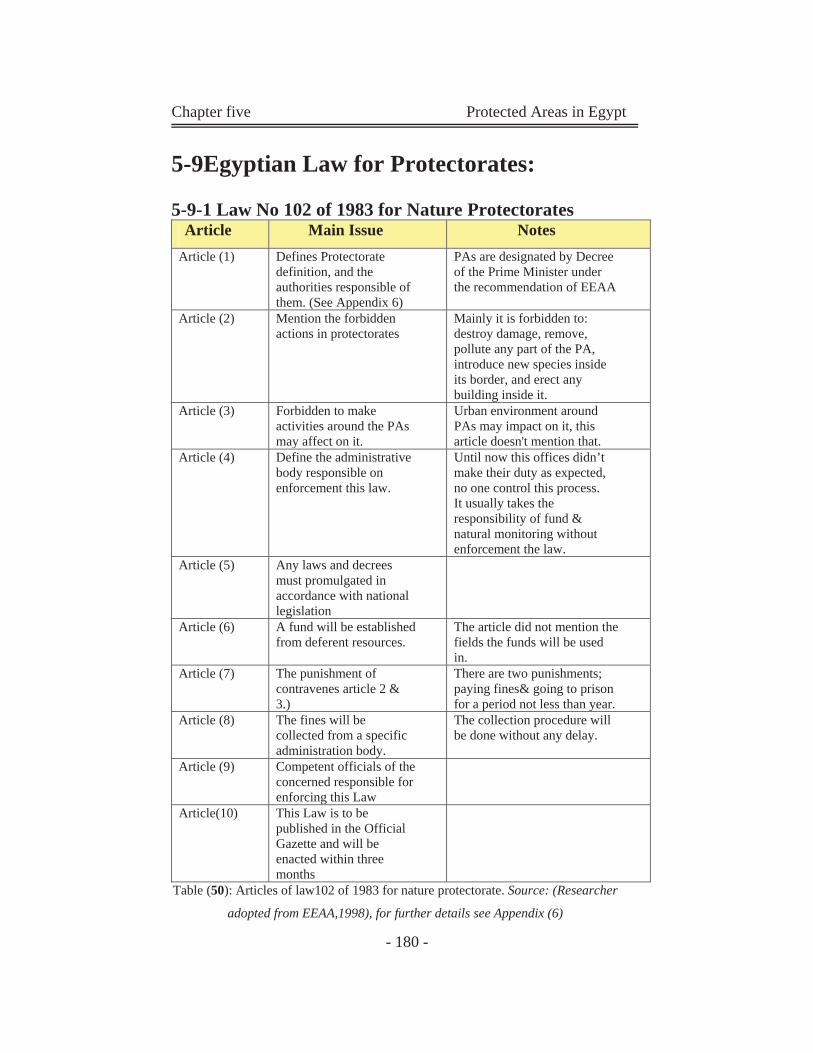
Chapter five Protected Areas in Egypt
- 180 -
5-9Egyptian Law for Protectorates:
5-9-1 Law No 102 of 1983 for Nature Protectorates
Article Main Issue Notes Article (1) Defines Protectorate
definition, and the authorities responsible of them. (See Appendix 6)
PAs are designated by Decree of the Prime Minister under the recommendation of EEAA
Article (2) Mention the forbidden actions in protectorates
Mainly it is forbidden to: destroy damage, remove, pollute any part of the PA, introduce new species inside its border, and erect any building inside it.
Article (3) Forbidden to make activities around the PAs may affect on it.
Urban environment around PAs may impact on it, this article doesn't mention that.
Article (4) Define the administrative body responsible on enforcement this law.
Until now this offices didn’t make their duty as expected, no one control this process. It usually takes the responsibility of fund & natural monitoring without enforcement the law.
Article (5) Any laws and decrees must promulgated in accordance with national legislation
Article (6) A fund will be established from deferent resources.
The article did not mention the fields the funds will be used in.
Article (7) The punishment of contravenes article 2 & 3.)
There are two punishments; paying fines& going to prison for a period not less than year.
Article (8) The fines will be collected from a specific administration body.
The collection procedure will be done without any delay.
Article (9) Competent officials of the concerned responsible for enforcing this Law
Article(10) This Law is to be published in the Official Gazette and will be enacted within three months
Table (50): Articles of law102 of 1983 for nature protectorate. Source: (Researcher
adopted from EEAA,1998), for further details see Appendix (6)
Chapter five Protected Areas in Egypt
- 181 -
From the analysis of the Egyptian law of nature protectorates we
can conclude the following points:
Article 2 discuses the forbidden action inside the border of
the protectorates.
Article 3 discusses the forbidden activities around
protectorates (without specify the forbidden or acceptable
uses)
Article 7 mentions the punishments of contravenes article 2
and 3.
Article 4 discusses the authority or administrative body
responsible for the enforcement of the banishment law.
This means that articles 2, 3, 4 and7 concerned with the
forbidden actions in and out the protectorates and
authoritative body concerned of enforcement the law and its
punishments.
Articles 5, 6, and 8 talk about the fund established for
protectorates and its resources (fees, fines, donations,
agreements, and grants).
The main problem faces this law is the weakness in
application, especially the punishment part.
There is a misunderstanding in administrative body
responsible for collecting fines; if it the administrative office
inside every protectorate, or it is an office in the EEAA.
Chapter five Protected Areas in Egypt
- 182 -
5-10 Environmental Impacts Assessment (EIA): The purpose of EIA is to ensure the protection and conservation of the
environment and natural resources including human health aspects
against uncontrolled development. The long-term objective is to ensure a
sustainable economic development that meets present needs without
compromising future generations' ability to meet their own needs. EIA is
an important tool in the integrated environmental management approach.
EIA must be performed for new establishments or projects and for
expansions or renovations of existing establishments according to the
Law for the Environment (Law no. 4 of 1994). (www.EEAA.com)
There are two types of the assessment; environmental screening form A,
and form B.
Form A discusses the following:
Description to the project
Wastes resulting from the activity during the operation stage and
treatment methods. (See Appendix7)
Form b discusses the following:
Description to the project
Wastes resulting from construction, control and disposal methods.
Wastes, treatment methods and ways of disposal.
Preliminary analysis of environmental impacts during operation
and methods of mitigation. (See Appendix4)
5-10-1Relation between EIA and protectorates:
As protectorates are significant areas must be treated in a special way, the
surrounding areas must be compatible and suitable to those areas. EIA is
a guide toll to select the surrounding urban uses, but until now there is no
Chapter five Protected Areas in Egypt
- 183 -
specific item in the assessment related to protectorates, and whether this
project is near to protected area, and how far between them.
5-11 Dangers that Face Environment
Protection in Egypt:
There are many challenges and dangers that face environment protection in Egypt. 5-11-1Conflicts in the PAs Management:
Many of the problems affecting PAs in Egypt are a direct result of the
lake of sustainable, effective system to address management issues.
Conservation activities and efforts promoting PAs management and the
sustainable use of natural resources are largely isolated from the
conception phase through to implementation, resulting in a deficit in the
capacity in the field of conservation. This occurs due to the following:
The lack of an organizational framework that specifies the
responsibilities and duties of involved authorities and
participants.
The indefinite nature of the status of ownership and authority
within PAs.
Communication deficiencies between involved parties and un-
coordinated development strategies between government
agencies and the duplication of roles.
Conflicts can be defined by the level at which they occur, and parties
involved:
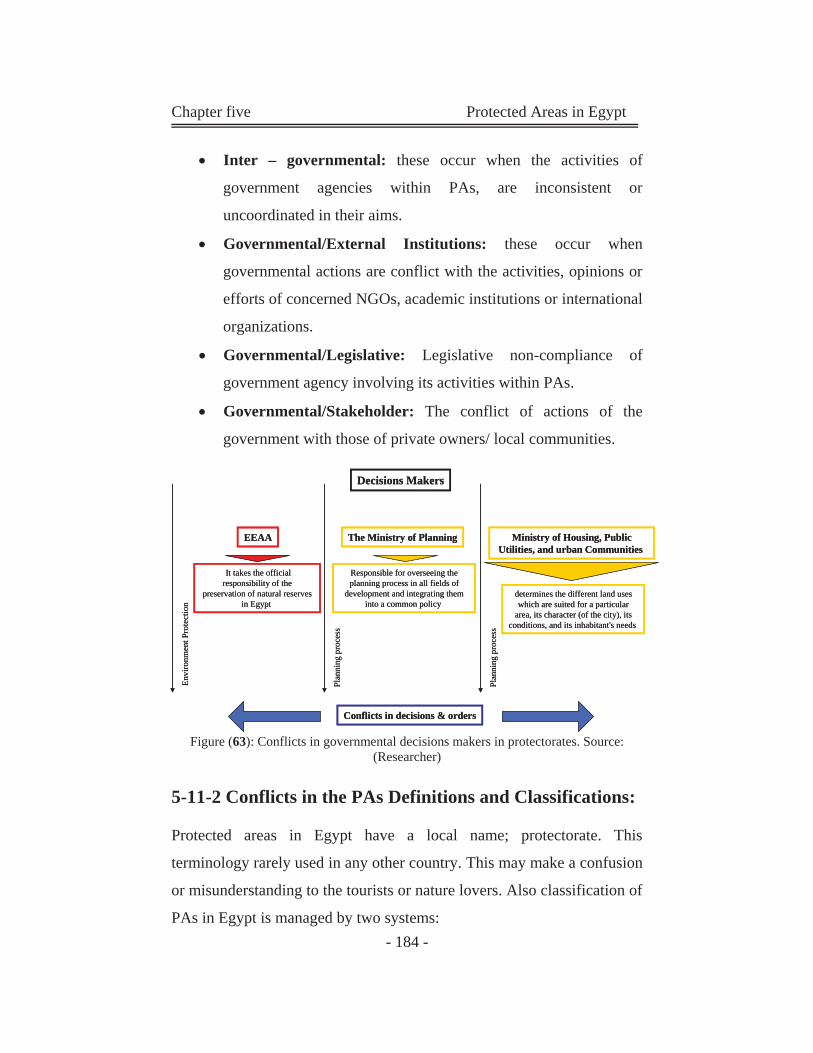
Chapter five Protected Areas in Egypt
- 184 -
Inter – governmental: these occur when the activities of
government agencies within PAs, are inconsistent or
uncoordinated in their aims.
Governmental/External Institutions: these occur when
governmental actions are conflict with the activities, opinions or
efforts of concerned NGOs, academic institutions or international
organizations.
Governmental/Legislative: Legislative non-compliance of
government agency involving its activities within PAs.
Governmental/Stakeholder: The conflict of actions of the
government with those of private owners/ local communities.
Figure (63): Conflicts in governmental decisions makers in protectorates. Source: (Researcher)
5-11-2 Conflicts in the PAs Definitions and Classifications:
Protected areas in Egypt have a local name; protectorate. This terminology rarely used in any other country. This may make a confusion
or misunderstanding to the tourists or nature lovers. Also classification of
PAs in Egypt is managed by two systems:
EEAA The Ministry of Planning
It takes the official responsibility of the
preservation of natural reserves in Egypt
Responsible for overseeing the planning process in all fields of
development and integrating them into a common policy
Ministry of Housing, Public Utilities, and urban Communities
determines the different land uses which are suited for a particular
area, its character (of the city), its conditions, and its inhabitant's needs
Plan
ning
pro
cess
Plan
ning
pro
cess
Envi
ronm
ent P
rote
ctio
n
Decisions Makers
Conflicts in decisions & orders

Chapter five Protected Areas in Egypt
- 185 -
Local Classification: this classification is submitted by EEAA,
and it is the official classification in our country. It is classified
PAs according to location (This type classifies PAs into 4
sectors), or according to natural feature (This type classifies PAs
into 3 sectors).
International Classification: the IUCN protected areas
categories is the worldwide classification. Here in Egypt Only
50% of the Egyptian PAs are classified in this system and the
other PAs are unspecified in this classification.
5-11-3 Conflict in Aims
The main conflict is between aims of conservation and aims of
development in Egypt:
The conservation strategy aims to not commit actions deeds or carry out
activities which would lead to the destruction or deterioration of the
natural environment or which would detract from the aesthetic standards
within the reserved area. (.EEAA- Department of Nature Protectorates,
1989)
In contrary, the development strategy aims to set communities and to
create activities that improve productions and reproductions.
This conflict appears in many of Egyptian protectorates between some
legislative bodies like; EEAA and Ministry of New Communities in new
Cairo city (a fight on the land of the Petrified Forest)
5-11-4 Shortage in the Publication of the PAs:
One of the most important problems that face Egyptian PAs is shortage
in the publication. Sinai's PAs is known to the public, but other PAs
suffer from neglecting from the government's publication. Only residents
of the adherence area of PAs know that there is a protected area. But they
Chapter five Protected Areas in Egypt
- 186 -
may not know what is a protected area is. This situation put PAs in crisis,
because of the damage and violation which may happen to the PA's
compounds.
5-11-5Shortage in the Financial Support of PAs:
Non-Governmental Organizations (NGOs) in Egypt have an important
role to play in the financial support of PAs. In this respect, the Egyptian
government has been encouraging and supporting the establishment of
various NGOs, especially those working in the fields of environmental
awareness and protection. Most of the financial support of PAs came
from international conventions, as EEAA suffers from the shortage of the
PAs budget from government. (Sinai protectorates are financially
managed from the European Union).
The Last Problems Threat the Safety of the Protectorates and cause
the Following PAs Problems:
5-12Some examples of Egyptian protectorates
problems:
5-12-1 Wadi Degla:
The lake of coordination between various government bodies has resulted
in the glaringly evident failure to actually protect the status of the wadi
degla ravine. An unannounced decision by the cairo government, the
local authoritative body governing the Wadi, has given permission to set
up a large garbage dump in the area slicing two kilometers off the east
end, known as Wadi-El Murr, to operate it. Accordingly, over the past
few months, the protectorate's boundaries have been redrawn several
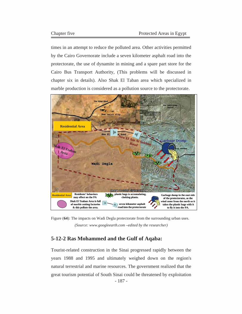
Chapter five Protected Areas in Egypt
- 187 -
times in an attempt to reduce the polluted area. Other activities permitted
by the Cairo Governorate include a seven kilometer asphalt road into the
protectorate, the use of dynamite in mining and a spare part store for the
Cairo Bus Transport Authority, (This problems will be discussed in
chapter six in details). Also Shak El Taban area which specialized in
marble production is considered as a pollution source to the protectorate.
Figure (64): The impacts on Wadi Degla protectorate from the surrounding urban uses. (Source: www.googleearth.com –edited by the researcher)
5-12-2 Ras Mohammed and the Gulf of Aqaba:
Tourist-related construction in the Sinai progressed rapidly between the
years 1988 and 1995 and ultimately weighed down on the region's
natural terrestrial and marine resources. The government realized that the
great tourism potential of South Sinai could be threatened by exploitation
Shak El TeabanArea
Residential Area
New El Ain Al SokhnaRoadGarbage Dump
Residential Area plastic bags is accumulating, choking plants.
seven kilometer asphalt road into the protectorate
Garbage dump in the east side of the protectorates, as the
wind come from the north so it takes the plastic bags with it
to fly it into the PA.
Residents’ behaviors may effect on the PA
Shak El Teaban Area is full of marble cutting factories
& this pollute the area.
Shak El TeabanArea
Residential Area
New El Ain Al SokhnaRoadGarbage Dump
Residential Area G
w
plastic bags is accumulating, choking plants.
seven kilometer asphalt road into the protectorate
Garbage dump in the east side of the protectorates, as the
wind come from the north so it takes the plastic bags with it
to fly it into the PA.
Residents’ behaviors may effect on the PA
Shak El Teaban Area is full of marble cutting factories
& this pollute the area.
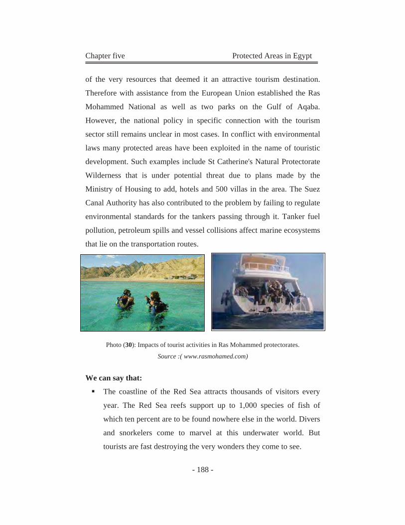
Chapter five Protected Areas in Egypt
- 188 -
of the very resources that deemed it an attractive tourism destination.
Therefore with assistance from the European Union established the Ras
Mohammed National as well as two parks on the Gulf of Aqaba.
However, the national policy in specific connection with the tourism
sector still remains unclear in most cases. In conflict with environmental
laws many protected areas have been exploited in the name of touristic
development. Such examples include St Catherine's Natural Protectorate
Wilderness that is under potential threat due to plans made by the
Ministry of Housing to add, hotels and 500 villas in the area. The Suez
Canal Authority has also contributed to the problem by failing to regulate
environmental standards for the tankers passing through it. Tanker fuel
pollution, petroleum spills and vessel collisions affect marine ecosystems
that lie on the transportation routes.
Photo (30): Impacts of tourist activities in Ras Mohammed protectorates.
Source :( www.rasmohamed.com)
We can say that:
The coastline of the Red Sea attracts thousands of visitors every
year. The Red Sea reefs support up to 1,000 species of fish of
which ten percent are to be found nowhere else in the world. Divers
and snorkelers come to marvel at this underwater world. But
tourists are fast destroying the very wonders they come to see.
Chapter five Protected Areas in Egypt
- 189 -
Corals are fragile by nature and sensitive to changes in their
surroundings, making them vulnerable to many forms of damage.
Resorts such as Ain Suhkna, Quseir and Marsa Alaam have some of
the richest colonies to be found anywhere. The construction of
hotels and holiday villages breaks up and destroys the reef terraces.
Silt from the debris floats away to smother reefs elsewhere. At
Hurghada development is so intense that the coral has been
completely destroyed.
There are other problems. The physical action of shore-divers is
gradually abrading the coral terraces. People interested in colorful
souvenirs are openly gathering specimens to take home. The
anchors of off-shore diving boats rip and scour away at coral
colonies and other marine organisms before taking hold.
The marine national park of Ras Mohamed is a protected and
relatively unaffected area, but the number of divers has increased
dramatically over the last couple of years. Although dive boats now
have fixed moorings, there is little enforcement and the diving
fraternity continually disturbs and plunders this diverse ecosystem.
The Gulf of Aqaba to the north of Ras Mohamed may run the same
gauntlet soon. Giant projects in Taba and Nuweiba are being
planned.
Government actions towards these problems:
In 1994 Egypt brought out a law forbidding building works within 200
meters of any shoreline. But by then sites up and down the west coast had
already been sold off. The prospects for effective control to minimize
damage now look bleak.
Since 1990 the Egyptian Government has invested vast amounts of
money to develop its coastal resorts. An income of $750 million is hoped
Chapter five Protected Areas in Egypt
- 190 -
for from the extra accommodation. Because of recent attacks on tourists
in the trouble-spots of the country’s interior the Government is
promoting the Red Sea as an alternative.
Egypt has a coral paradise that it can ill afford to lose. A rigorous code of
conduct is now required for both developers and tourists. If lessons can
be learnt from the mistakes of the past, then the future of those places
that have not been destroyed or over-exploited will be secured for
thousands of people to enjoy.
Clearly, there are still many problems to be addressed, and the balance
between environmental protection and tourism development is one of the
great challenges that Egypt currently faces. The Ministry of Tourism has
publicly stated that it aims to attract 16 million tourists annually by 2017,
with 300,000 hotel rooms along the Red Sea coast alone.
5-12-3 El Burullos and El Bardaouil Wetlands:
The Burullos and Bardaouil Wetland (which contain El Zarznik PA) are
administrated by the EWs, Giza Zoo and designated as an international
RAMSAR sites, are at the present time threatened by various activities
involving government agencies and stakeholders. The Ministry of Water
Resources is currently executing the Salam Peace Canal, on the west
bank of the Suez Canal. Upon its completion, the canal will form the core
of North Sinai Agriculture Development Project (NSADP), irrigating
0.25 million Acres in North Sinai. The construction process as well as the
further extension of pipelines will seriously damage the PAs and the
surrounding natural habitats.
Urban and tourist development activities on the shores of the wetlands
are set to be executed by the ministry of housing and ministry of Tourism
and land reclamation activities carried out by the ministry of agriculture
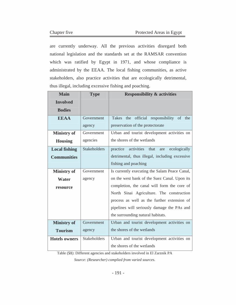
Chapter five Protected Areas in Egypt
- 191 -
are currently underway. All the previous activities disregard both
national legislation and the standards set at the RAMSAR convention
which was ratified by Egypt in 1971, and whose compliance is
administrated by the EEAA. The local fishing communities, as active
stakeholders, also practice activities that are ecologically detrimental,
thus illegal, including excessive fishing and poaching.
Main
Involved
Bodies
Type Responsibility & activities
EEAA Government
agency
Takes the official responsibility of the
preservation of the protectorate
Ministry of
Housing
Government
agencies
Urban and tourist development activities on
the shores of the wetlands
Local fishing
Communities
Stakeholders practice activities that are ecologically
detrimental, thus illegal, including excessive
fishing and poaching
Ministry of
Water
resource
Government
agency
Is currently executing the Salam Peace Canal,
on the west bank of the Suez Canal. Upon its
completion, the canal will form the core of
North Sinai Agriculture. The construction
process as well as the further extension of
pipelines will seriously damage the PAs and
the surrounding natural habitats.
Ministry of
Tourism
Government
agency
Urban and tourist development activities on
the shores of the wetlands
Hotels owners Stakeholders Urban and tourist development activities on
the shores of the wetlands
Table (51): Different agencies and stakeholders involved in El Zarznik PA
Source: (Researcher) complied from varied sources.
Chapter five Protected Areas in Egypt
- 192 -
5-12-4 The Western Desert Oases:
Due to relocation strategies, such as the New Valley Project, developed
by the government in the 1960's to alleviate population pressure in the
Nile Valley region, the Western Desert and its oases (including Siwa
Oases) has been overcome by an influx of migrant workers. Farmers are
using traditional flood irrigation techniques to irrigate heavily water-
dependant drops (especially in Baharia Oasis) drilling wells, forcing
excessive water to the surface and draining the very same aquifers which
are the focal point of the Ministry of Tourism's efforts to promote the
area as a site of a number of industrial projects, brought on by the
governmental offered to investors by the central government and the
local governorate. Resulting industrial wastes, however threaten, pollute
the oases aquifers and harm the sensitive desert ecosystem.
5-12-5 Wadi El Rayan and Lake Qarun:
Despite the PA status of Wadi El Rayan, the Tourist Promotion Authority
(TPA) which operates under the Ministry of Tourism participated in
supervisory capacity in organizing the Egyptian leg of the Paris-Dakar
Rally jointly with a private investor. The TPA gave permission for the
trail to run through the most fragile part of the Wadi, Gabal Al
Medawwara, and failed to coordinate the event with the EEAA and
officials in the Wadi El Rayan PA. In doing so, the TPA violated national
legislation concerning the restriction of activities within PAs and
disregarded the authoritative role of EEAA with the Wadi. Other
potential problems and concerns include Lake Qarun, where the Ministry
of Tourism has approved the construction of a tourist project on the area's
eastern core zone, foregoing environmental impact studies, standards and
procedures set by the EEAA.
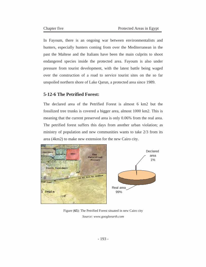
Chapter five Protected Areas in Egypt
- 193 -
In Fayoum, there is an ongoing war between environmentalists and
hunters, especially hunters coming from over the Mediterranean in the
past the Maltese and the Italians have been the main culprits to shoot
endangered species inside the protected area. Fayoum is also under
pressure from tourist development, with the latest battle being waged
over the construction of a road to service tourist sites on the so far
unspoiled northern shore of Lake Qarun, a protected area since 1989.
5-12-6 The Petrified Forest:
The declared area of the Petrified Forest is almost 6 km2 but the
fossilized tree trunks is covered a bigger area, almost 1000 km2. This is
meaning that the current preserved area is only 0.06% from the real area.
The petrified forest suffers this days from another urban violation; as
ministry of population and new communities wants to take 2/3 from its
area (4km2) to make new extension for the new Cairo city.
Figure (65): The Petrified Forest situated in new Cairo city
Source: www.googleearth.com
Declared area1%
Real area99%
Chapter five Protected Areas in Egypt
- 194 -
5-13 Summary of Chapter five: (Protected Areas in Egypt; History and Current Condition)
Environment protection has long been an important part of
Egyptian culture and heritage, but despite governmental
involvement, the designation and management of PAs in Egypt can
be considered as largely unexplored concepts.
There is a current problem in the compliance to the national
legislation concerning environment protection.
Many of the problems affecting PAs in Egypt are a direct result of
the lack of a sustainable, effective system to address management
issues.
Despite efforts, Egypt lacks an effective system to address
management issues and has a defect in the management of the PAs,
as many agencies and bodies are responsible for protectorates in
Egypt. This conflict represents a huge problem in the protection
process in Egypt.
Egyptian protectorates are classified according to national
measures. And almost 50% of these protectorates don’t have a
classification in the IUCN management system.
Protection process in Egypt faces many obstacles; one of this is the
conflict in national plans and conflicts in responsibilities.
As a result of all the obstacles that face protection movement in
Egypt, there are many problems are threatening the Safety of this
Protectorates and cause different Problems.
Chapter Six
Egyptian Phenomenon; Adherence of Urban Environment to Protected Areas.
(The Petrified Forest & Wadi Degla)
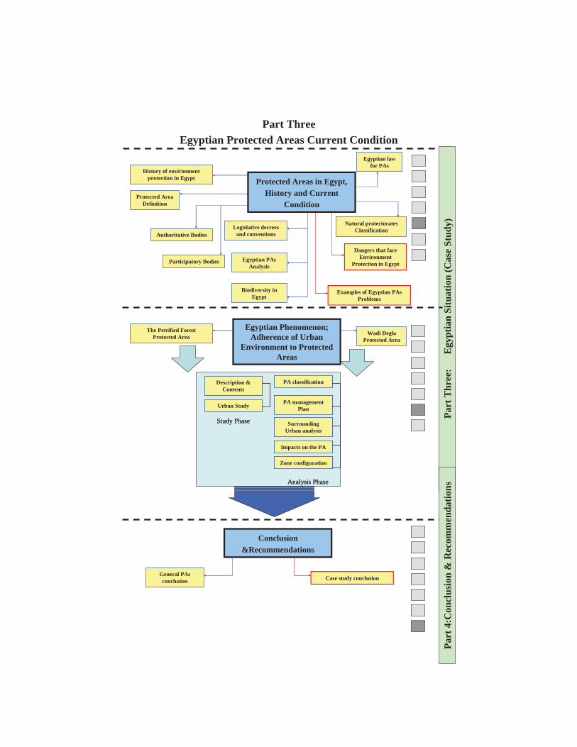
Part Three Egyptian Protected Areas Current Condition
History of environment protection in Egypt
Protected Area Definition
Authoritative Bodies
Participatory Bodies Egyptian PAsAnalysis
Biodiversity in Egypt
Examples of Egyptian PAsProblems
Egyptian law for PAs
Natural protectorates Classification
Dangers that face Environment
Protection in Egypt
Legislative decrees and conventions
Protected Areas in Egypt, History and Current
Condition
Part
Thr
ee:
E
gypt
ian
Situ
atio
n (C
ase
Stud
y)
The Petrified Forest Protected Area
Wadi DeglaProtected Area
Description & Contents
Urban Study
Study Phase
Description & Contents
Urban Study
Study Phase
PA classification
PA management Plan
Analysis Phase
Surrounding Urban analysis
Impacts on the PA
Zone configuration
PA classification
PA management Plan
Analysis Phase
Surrounding Urban analysis
Impacts on the PA
Zone configuration
Egyptian Phenomenon; Adherence of Urban
Environment to Protected Areas
Conclusion &Recommendations
General PAsconclusion Case study conclusion
Part
4:C
oncl
usio
n &
Rec
omm
enda
tions
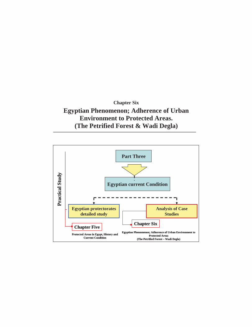
Chapter Six
Egyptian Phenomenon; Adherence of Urban Environment to Protected Areas.
(The Petrified Forest & Wadi Degla)
Part Three
Egyptian current Condition
Prac
tical
Stu
dy
Egyptian protectorates detailed study
Analysis of Case Studies
Chapter SixChapter Five
Protected Areas in Egypt, History and Current Condition
Egyptian Phenomenon; Adherence of Urban Environment to Protected Areas
(The Petrified Forest – Wadi Degla)
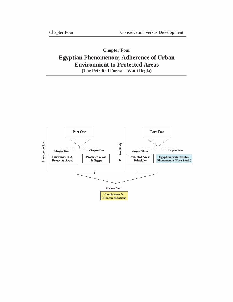
Chapter Four Conservation versus Development
Chapter Four
Egyptian Phenomenon; Adherence of Urban Environment to Protected Areas
(The Petrified Forest – Wadi Degla)
Part One
Lite
ratu
re re
view
Part Two
Prac
tical
Stu
dy
Environment &Protected Areas
Protected areasin Egypt
Protected AreasPrinciples
Egyptian protectorates Phenomenon (Case Study)
Chapter One Chapter Two Chapter Three Chapter Four
Conclusions & Recommendations
Chapter Five
Part One
Lite
ratu
re re
view
Part Two
Prac
tical
Stu
dy
Environment &Protected Areas
Protected areasin Egypt
Protected AreasPrinciples
Egyptian protectorates Phenomenon (Case Study)
Chapter One Chapter Two Chapter Three Chapter Four
Conclusions & Recommendations
Chapter Five
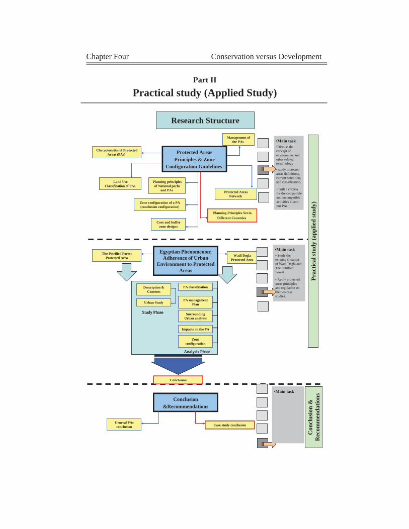
Chapter Four Conservation versus Development
Part II
Practical study (Applied Study)
Research Structure
Prac
tical
stud
y (a
pplie
d st
udy)
•Main task•Discuss the concept of environment and other related terminology
• study protected areas definitions, current condition, and classification.
•Main task• Study the existing situation of Wadi Degla and The Petrified Forest
• Apply protected areas principles and regulation on the two case studies.
The Petrified Forest Protected Area
• built a criteria for the compatible and incompatible activities in and out PAs.
Characteristics of Protected Areas (PAs)
Land Use Classification of PAs
Zone configuration of a PA (conclusion configuration)
Core and buffer zone designs
Planning Principles Set in Different Countries
Management of the PAs
Protected Areas Network
Planning principles of National parks
and PAs
Protected Areas Principles & Zone
Configuration Guidelines
Wadi DeglaProtected Area
Description & Contents
Urban Study
Study Phase
PA classification
PA management Plan
Analysis Phase
Surrounding Urban analysis
Impacts on the PA
Zone configuration
Egyptian Phenomenon; Adherence of Urban
Environment to Protected Areas
Conclusion
Con
clus
ion
&
Rec
omm
enda
tionsConclusion
&Recommendations
General PAsconclusion Case study conclusion
•Main task
Description &Contents
Urban Study
Study Phase
PA classification
PA managementPlan
Analysis Phase
Surrounding Urban analysis
Impacts on the PA
Zone configuration
Research Structure
Prac
tical
stud
y (a
pplie
d st
udy)
•Main task•Discuss the concept of environment and other related terminology
• study protected areas definitions, current condition, and classification.
•Main task• Study the existing situation of Wadi Degla and The Petrified Forest
• Apply protected areas principles and regulation on the two case studies.
The Petrified Forest Protected Area
• built a criteria for the compatible and incompatible activities in and out PAs.
Characteristics of Protected Areas (PAs)
Land Use Classification of PAs
Zone configuration of a PA (conclusion configuration)
Core and buffer zone designs
Planning Principles Set in Different Countries
Management of the PAs
Protected Areas Network
Planning principles of National parks
and PAs
Protected Areas Principles & Zone
Configuration Guidelines
Wadi DeglaProtected Area
Description & Contents
Urban Study
Study Phase
Description & Contents
Urban Study
Study Phase
PA classification
PA management Plan
Analysis Phase
Surrounding Urban analysis
Impacts on the PA
Zone configuration
PA classification
PA management Plan
Analysis Phase
Surrounding Urban analysis
Impacts on the PA
Zone configuration
Egyptian Phenomenon; Adherence of Urban
Environment to Protected Areas
Conclusion
Con
clus
ion
&
Rec
omm
enda
tionsConclusion
&Recommendations
General PAsconclusion Case study conclusion
•Main task•Main task
Chapter Six The Petrified Forest & Wadi Degla
- 195 -
6-1 Introduction:
Protected Areas not an isolated islands, isolated from the surrounding
areas; but it is a part of the urban and natural environment around it.
These natural preserved areas are supposed to play an importance role in
both of national and local levels. Its importance is not only due to its
ecological or visual values, but it can be a base of several urban
activities. Here in Egypt Protectorates suffer from the neglecting of
national plans to its presence. This conflict in laws and planning concepts
make what we call a special Egyptian phenomenon; adherence of urban
environment to protected areas. This obviously appears in three Egyptian
Protectorates; Wadi Degla, El Hassana Dome and The Petrified Forest.
6-2 Define Egyptian Problem:
Natural environment in Egypt has become subject to many shapes of
deteriorations caused by man, as protectorates areas suffer from many
phenomenon that threaten its safety, such as the presence of preserved
natural area within urban context, this was as a result of the unplanned
urban activities and its close adherence to these preserved areas, this
hazardous situation threatens the safety of preserved areas, and could
lead to the loss of an environmental and geological heritage.
In addition, those preserved areas have been neglected in the planning
process, as urban planning in Egypt usually neglects importance and
affect of those areas on the main development plan of any city.
Accordingly, the urban planning authorities have encouraged urban
expansions to surround some protected areas such as, The Petrified
Forest.
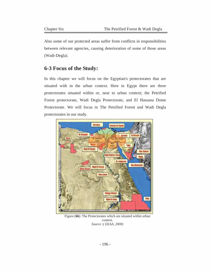
Chapter Six The Petrified Forest & Wadi Degla
- 196 -
Also some of our protected areas suffer from conflicts in responsibilities
between relevant agencies, causing deterioration of some of those areas
(Wadi-Degla).
6-3 Focus of the Study:
In this chapter we will focus on the Egyptian's protectorates that are
situated with in the urban context. Here in Egypt there are three
protectorates situated within or, near to urban context; the Petrified
Forest protectorate, Wadi Degla Protectorate, and El Hassana Dome
Protectorate. We will focus in The Petrified Forest and Wadi Degla
protectorates in our study.
Figure (66): The Protectorates which are situated within urban context.
Source :( EEAA, 2000)
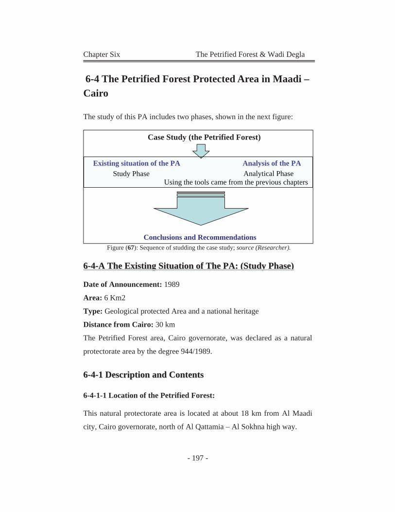
Chapter Six The Petrified Forest & Wadi Degla
- 197 -
6-4 The Petrified Forest Protected Area in Maadi – Cairo The study of this PA includes two phases, shown in the next figure:
Figure (67): Sequence of studding the case study; source (Researcher).
66--44--AA TThhee EExxiissttiinngg SSiittuuaattiioonn ooff TThhee PPAA:: ((SSttuuddyy PPhhaassee))
Date of Announcement: 1989
Area: 6 Km2
Type: Geological protected Area and a national heritage
Distance from Cairo: 30 km
The Petrified Forest area, Cairo governorate, was declared as a natural
protectorate area by the degree 944/1989.
66--44--11 DDeessccrriippttiioonn aanndd CCoonntteennttss
6-4-1-1 Location of the Petrified Forest:
This natural protectorate area is located at about 18 km from Al Maadi
city, Cairo governorate, north of Al Qattamia – Al Sokhna high way.
Case Study (the Petrified Forest)
Existing situation of the PA Analysis of the PA Study Phase Analytical Phase
Using the tools came from the previous chapters
Conclusions and Recommendations
Existing situation of the PA Analysis of the PAStudy Phase Phase Analytical Phase
Using the tools came from the previous chapters

Chapter Six The Petrified Forest & Wadi Degla
- 198 -
The area extends for 2 km along the main road, with a depth of 3 km to
the north; covering, therefore, an area of 6 km2 between long 30° 31'
27"N 30° 31' 28"N.
Figure (68): The location of the Petrified Forest; source (EEAA, 2000) edited by the Researcher
Photo (31): The entrance gate and administration building of the PA. Source: Researcher
The Petrified Forest is situated in the north-eastern corner of Egypt at the
borders gate with the dunes expansion that rises up to 60 meters above
sea level.
Therefore, the Petrified Forest Nature Area at New Cairo city finds many
obstacles to realize the needed and the efficient conservation,
maintenance, and management on one hand. On the other hand, the
presence of natural reserved area within the urban context might have
impacts on the main Development Plan of the city as it might be
influenced by its location inside new Cairo city.
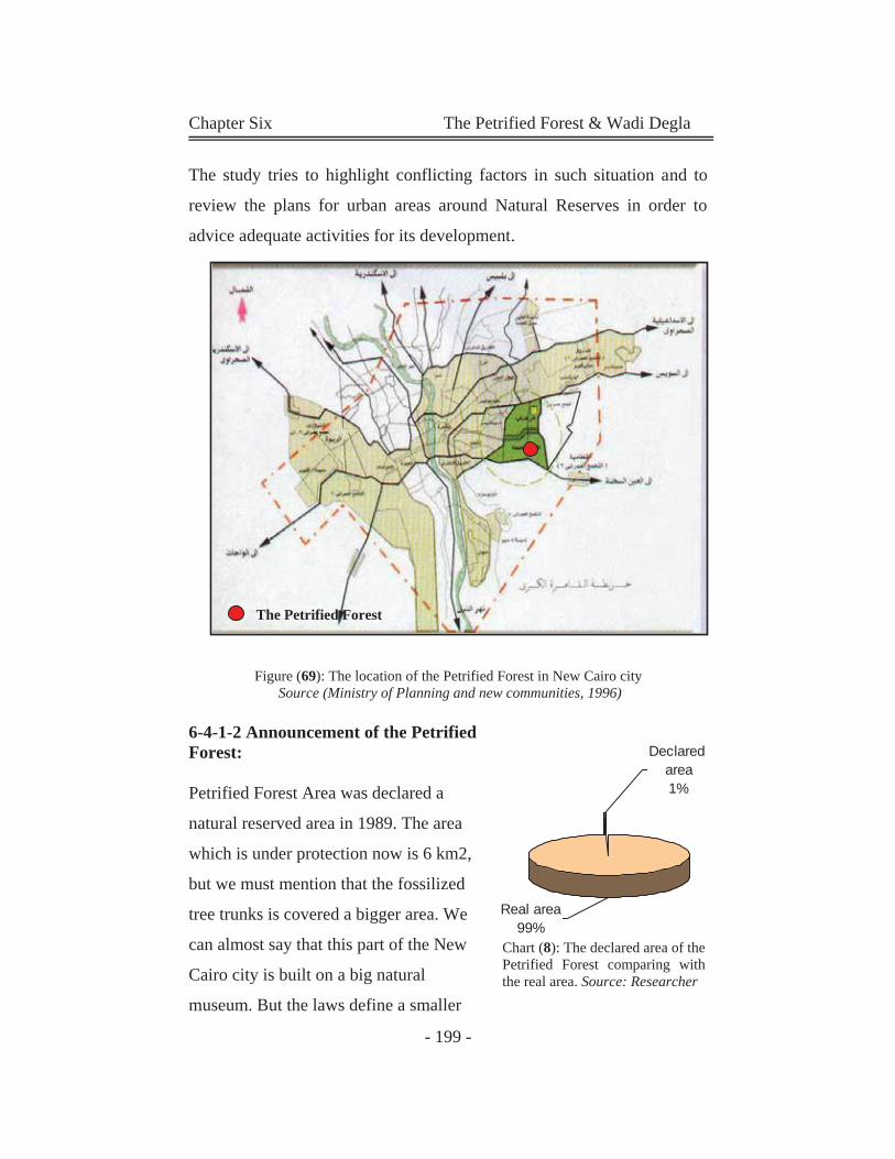
Chapter Six The Petrified Forest & Wadi Degla
- 199 -
The Petrified Forest
The study tries to highlight conflicting factors in such situation and to
review the plans for urban areas around Natural Reserves in order to
advice adequate activities for its development.
Figure (69): The location of the Petrified Forest in New Cairo city Source (Ministry of Planning and new communities, 1996)
6-4-1-2 Announcement of the Petrified Forest:
Petrified Forest Area was declared a
natural reserved area in 1989. The area
which is under protection now is 6 km2,
but we must mention that the fossilized
tree trunks is covered a bigger area. We
can almost say that this part of the New
Cairo city is built on a big natural
museum. But the laws define a smaller
Declared area1%
Real area99%
Chart (8): The declared area of the Petrified Forest comparing with the real area. Source: Researcher
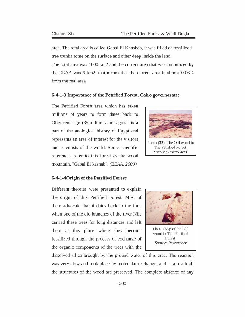
Chapter Six The Petrified Forest & Wadi Degla
- 200 -
area. The total area is called Gabal El Khashab, it was filled of fossilized
tree trunks some on the surface and other deep inside the land.
The total area was 1000 km2 and the current area that was announced by
the EEAA was 6 km2, that means that the current area is almost 0.06%
from the real area.
6-4-1-3 Importance of the Petrified Forest, Cairo governorate:
The Petrified Forest area which has taken
millions of years to form dates back to
Oligocene age (35million years ago).It is a
part of the geological history of Egypt and
represents an area of interest for the visitors
and scientists of the world. Some scientific
references refer to this forest as the wood
mountain, ''Gabal El kashab''. (EEAA, 2000)
6-4-1-4Origin of the Petrified Forest:
Different theories were presented to explain
the origin of this Petrified Forest. Most of
them advocate that it dates back to the time
when one of the old branches of the river Nile
carried these trees for long distances and left
them at this place where they become
fossilized through the process of exchange of
the organic components of the trees with the
dissolved silica brought by the ground water of this area. The reaction
was very slow and took place by molecular exchange, and as a result all
the structures of the wood are preserved. The complete absence of any
Photo (33): of the Old wood in The Petrified
Forest Source: Researcher
Photo (32): The Old wood in The Petrified Forest, Source (Researcher).
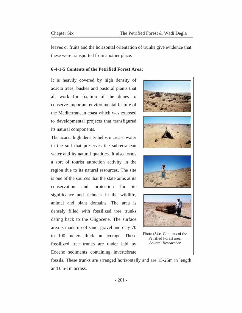
Chapter Six The Petrified Forest & Wadi Degla
- 201 -
leaves or fruits and the horizontal orientation of trunks give evidence that
these were transported from another place.
6-4-1-5 Contents of the Petrified Forest Area:
It is heavily covered by high density of
acacia trees, bushes and pastoral plants that
all work for fixation of the dunes to
conserve important environmental feature of
the Mediterranean coast which was exposed
to developmental projects that transfigured
its natural components.
The acacia high density helps increase water
in the soil that preserves the subterranean
water and its natural qualities. It also forms
a sort of tourist attraction activity in the
region due to its natural resources. The site
is one of the sources that the state aims at its
conservation and protection for its
significance and richness in the wildlife,
animal and plant domains. The area is
densely filled with fossilized tree trunks
dating back to the Oligocene. The surface
area is made up of sand, gravel and clay 70
to 100 meters thick on average. These
fossilized tree trunks are under laid by
Eocene sediments containing invertebrate
fossils. These trunks are arranged horizontally and are 15-25m in length
and 0.5-1m across.
Photo (34): Contents of the Petrified Forest area. Source: Researcher
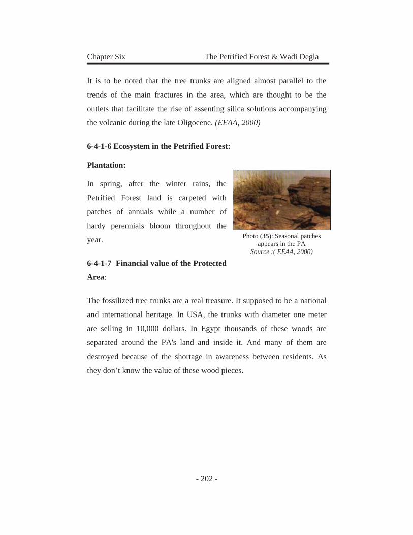
Chapter Six The Petrified Forest & Wadi Degla
- 202 -
It is to be noted that the tree trunks are aligned almost parallel to the
trends of the main fractures in the area, which are thought to be the
outlets that facilitate the rise of assenting silica solutions accompanying
the volcanic during the late Oligocene. (EEAA, 2000)
6-4-1-6 Ecosystem in the Petrified Forest:
Plantation:
In spring, after the winter rains, the
Petrified Forest land is carpeted with
patches of annuals while a number of
hardy perennials bloom throughout the
year.
6-4-1-7 Financial value of the Protected
Area:
The fossilized tree trunks are a real treasure. It supposed to be a national
and international heritage. In USA, the trunks with diameter one meter
are selling in 10,000 dollars. In Egypt thousands of these woods are
separated around the PA's land and inside it. And many of them are
destroyed because of the shortage in awareness between residents. As
they don’t know the value of these wood pieces.
Photo (35): Seasonal patches appears in the PA
Source :( EEAA, 2000)
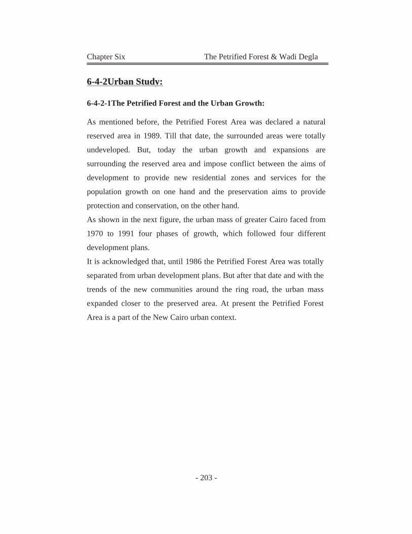
Chapter Six The Petrified Forest & Wadi Degla
- 203 -
66--44--22UUrrbbaann SSttuuddyy::
6-4-2-1The Petrified Forest and the Urban Growth:
As mentioned before, the Petrified Forest Area was declared a natural
reserved area in 1989. Till that date, the surrounded areas were totally
undeveloped. But, today the urban growth and expansions are
surrounding the reserved area and impose conflict between the aims of
development to provide new residential zones and services for the
population growth on one hand and the preservation aims to provide
protection and conservation, on the other hand. As shown in the next figure, the urban mass of greater Cairo faced from
1970 to 1991 four phases of growth, which followed four different
development plans.
It is acknowledged that, until 1986 the Petrified Forest Area was totally
separated from urban development plans. But after that date and with the
trends of the new communities around the ring road, the urban mass
expanded closer to the preserved area. At present the Petrified Forest
Area is a part of the New Cairo urban context.
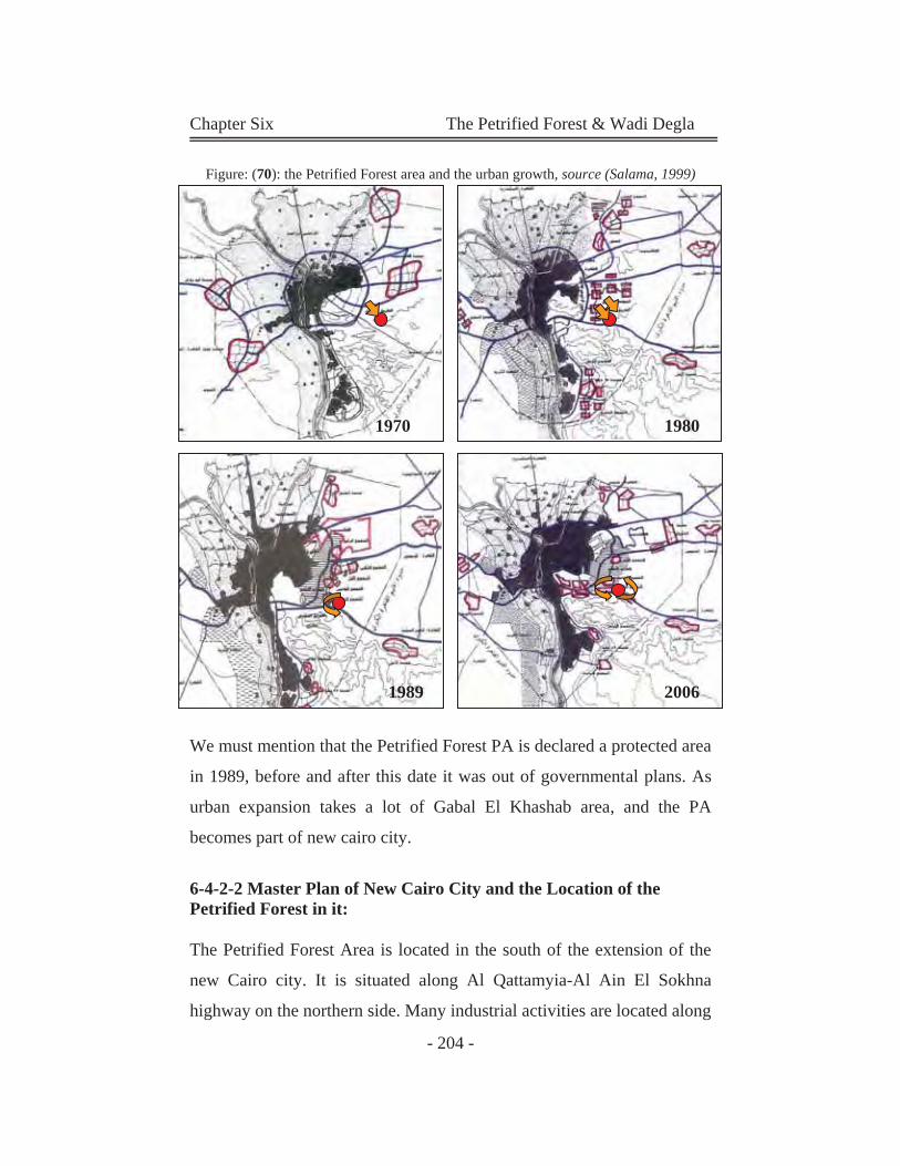
Chapter Six The Petrified Forest & Wadi Degla
- 204 -
1970 1980
1989 2006
Figure: (70): the Petrified Forest area and the urban growth, source (Salama, 1999)
We must mention that the Petrified Forest PA is declared a protected area
in 1989, before and after this date it was out of governmental plans. As
urban expansion takes a lot of Gabal El Khashab area, and the PA
becomes part of new cairo city.
6-4-2-2 Master Plan of New Cairo City and the Location of the Petrified Forest in it:
The Petrified Forest Area is located in the south of the extension of the
new Cairo city. It is situated along Al Qattamyia-Al Ain El Sokhna
highway on the northern side. Many industrial activities are located along
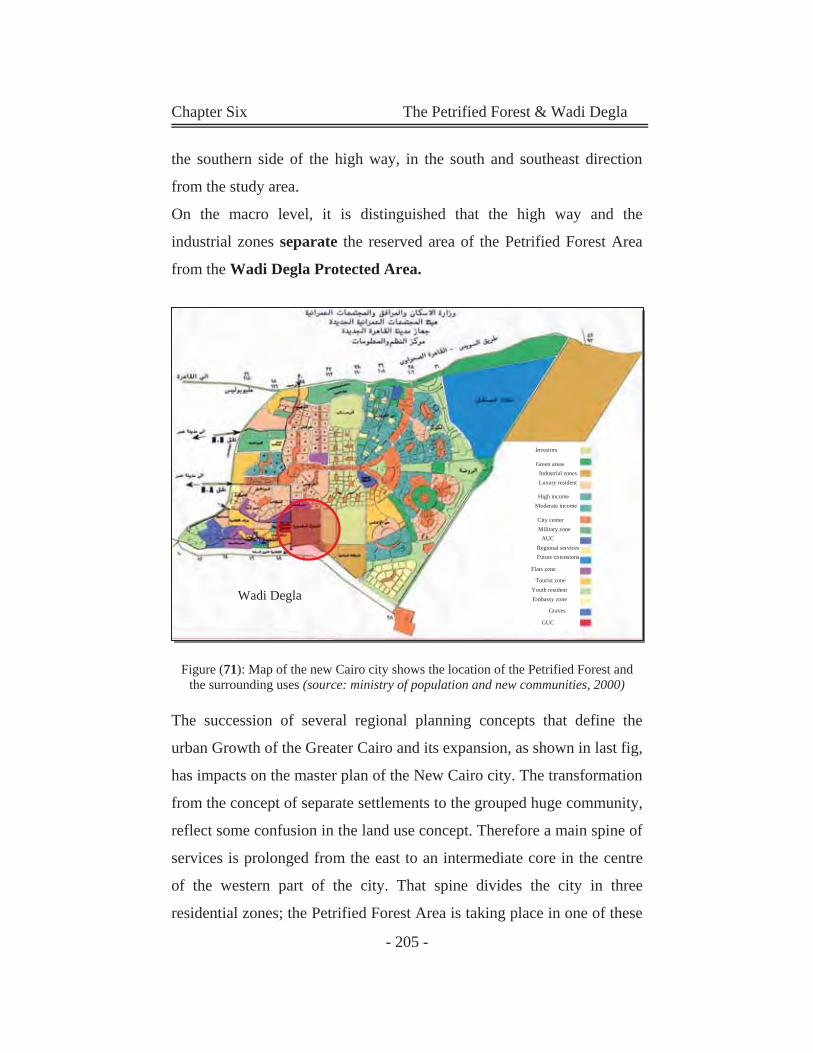
Chapter Six The Petrified Forest & Wadi Degla
- 205 -
the southern side of the high way, in the south and southeast direction
from the study area.
On the macro level, it is distinguished that the high way and the
industrial zones separate the reserved area of the Petrified Forest Area
from the Wadi Degla Protected Area.
Figure (71): Map of the new Cairo city shows the location of the Petrified Forest and the surrounding uses (source: ministry of population and new communities, 2000)
The succession of several regional planning concepts that define the
urban Growth of the Greater Cairo and its expansion, as shown in last fig,
has impacts on the master plan of the New Cairo city. The transformation
from the concept of separate settlements to the grouped huge community,
reflect some confusion in the land use concept. Therefore a main spine of
services is prolonged from the east to an intermediate core in the centre
of the western part of the city. That spine divides the city in three
residential zones; the Petrified Forest Area is taking place in one of these
Investors
Green areas Industrial zones Luxury resident
High income
GUC
Graves
Embassy zone Youth resident
Moderate income
City center Military zone
AUC Regional services Future extensions
Tourist zone
Flats zone
Wadi Degla
Chapter Six The Petrified Forest & Wadi Degla
- 206 -
zones. Therefore, that main spine has no link with the nature-reserved
area. On the micro level land use surrounding the study area is mainly
residential and commercial zones, and their related activities. Industrial
zone is at the southeast side of the study area, also there are some
petroleum stores and tanks near of the site.
Figure (72): Analysis of the new Cairo city planning and its relation with the Petrified Forest (source:Researcher)
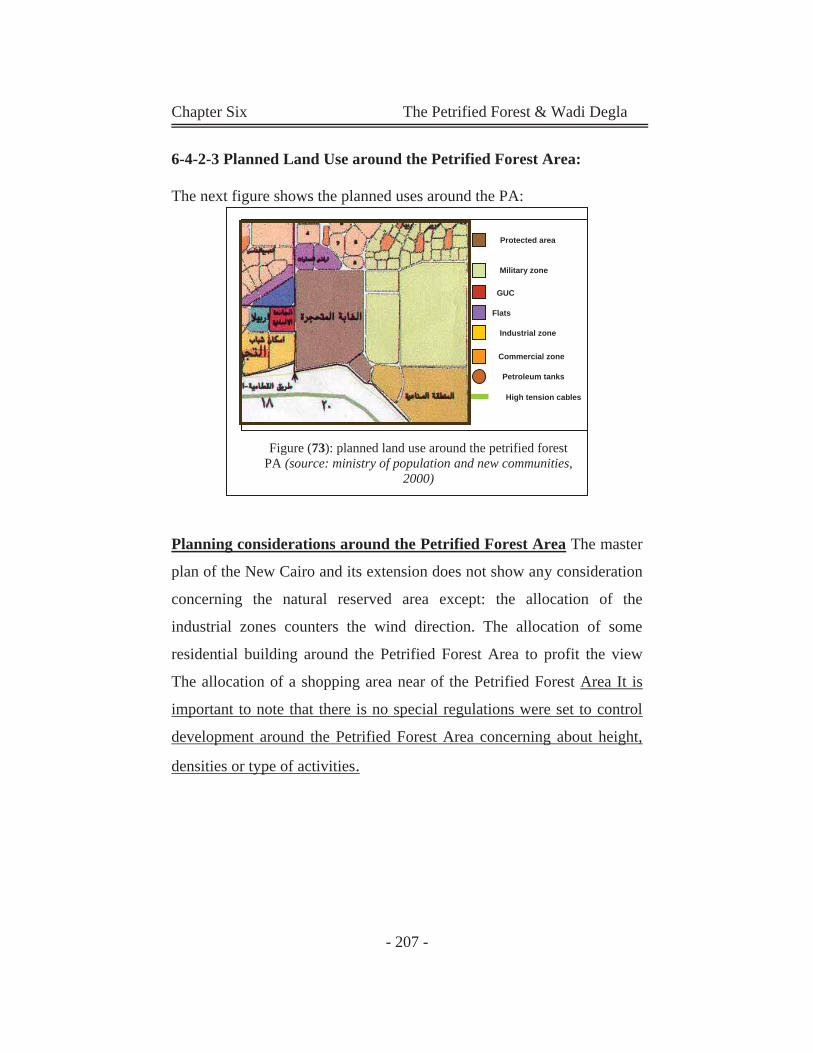
Chapter Six The Petrified Forest & Wadi Degla
- 207 -
6-4-2-3 Planned Land Use around the Petrified Forest Area:
The next figure shows the planned uses around the PA:
Planning considerations around the Petrified Forest Area The master
plan of the New Cairo and its extension does not show any consideration
concerning the natural reserved area except: the allocation of the
industrial zones counters the wind direction. The allocation of some
residential building around the Petrified Forest Area to profit the view
The allocation of a shopping area near of the Petrified Forest Area It is
important to note that there is no special regulations were set to control
development around the Petrified Forest Area concerning about height,
densities or type of activities.
Military zone
Protected area
GUC
Flats
Industrial zone
Commercial zone
Petroleum tanks
High tension cables
Figure (73): planned land use around the petrified forest PA (source: ministry of population and new communities,
2000)
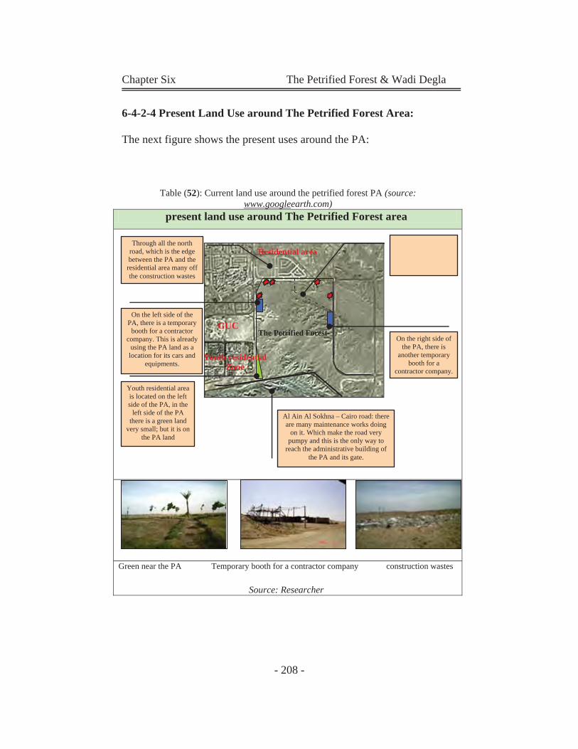
Chapter Six The Petrified Forest & Wadi Degla
- 208 -
6-4-2-4 Present Land Use around The Petrified Forest Area:
The next figure shows the present uses around the PA:
Table (52): Current land use around the petrified forest PA (source: www.googleearth.com)
present land use around The Petrified Forest area
Green near the PA Temporary booth for a contractor company construction wastes
Source: Researcher
Youth residential area is located on the left side of the PA, in the
left side of the PA there is a green land
very small; but it is on the PA land
On the left side of the PA, there is a temporary
booth for a contractor company. This is already
using the PA land as a location for its cars and
equipments.
Through all the north road, which is the edge between the PA and the residential area many off the construction wastes
On the right side of the PA, there is
another temporary booth for a
contractor company.
GUC
Youth residential Zone
The Petrified Forest
Residential area
Al Ain Al Sokhna – Cairo road: there are many maintenance works doing
on it. Which make the road very pumpy and this is the only way to
reach the administrative building of the PA and its gate.
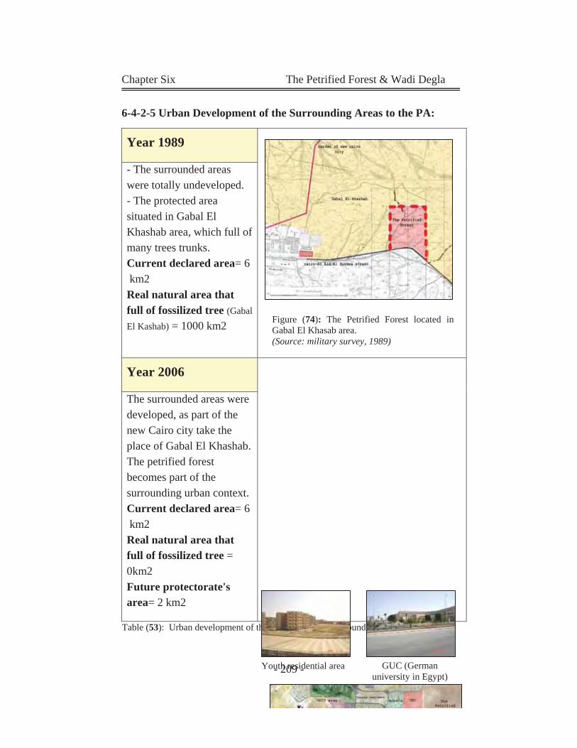
Chapter Six The Petrified Forest & Wadi Degla
- 209 -
6-4-2-5 Urban Development of the Surrounding Areas to the PA:
Table (53): Urban development of the surrounding areas around the PA from 1989 until now
Year 1989
- The surrounded areas were totally undeveloped. - The protected area situated in Gabal El Khashab area, which full of many trees trunks. Current declared area= 6 km2 Real natural area that full of fossilized tree (Gabal
El Kashab) = 1000 km2
Year 2006
The surrounded areas were developed, as part of the new Cairo city take the place of Gabal El Khashab. The petrified forest becomes part of the surrounding urban context. Current declared area= 6 km2 Real natural area that full of fossilized tree = 0km2 Future protectorate's area= 2 km2
Figure (74): The Petrified Forest located in Gabal El Khasab area. (Source: military survey, 1989)
Youth residential area GUC (German university in Egypt)
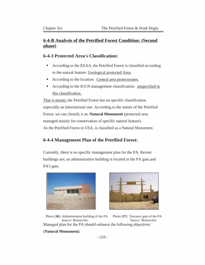
Chapter Six The Petrified Forest & Wadi Degla
- 210 -
66--44--BB AAnnaallyyssiiss ooff tthhee PPeettrriiffiieedd FFoorreesstt CCoonnddiittiioonn:: ((SSeeccoonndd pphhaassee))
6-4-3 Protected Area's Classification:
According to the EEAA, the Petrified Forest is classified according
to the natural feature: Geological protected Area.
According to the location: Central area protectorates..
According to the IUCN management classification: unspecified in
this classification.
That is means: the Petrified Forest has no specific classification,
especially an international one. According to the nature of the Petrified
Forest, we can classify it as: Natural Monument (protected area
managed mainly for conservation of specific natural feature).
As the Petrified Forest in USA, is classified as a Natural Monument.
6-4-4 Management Plan of the Petrified Forest:
Currently, there is no specific management plan for the PA. Recent
buildings are; an administration building is located in the PA gate,and
PA's gate.
Photo (36): Administration building of the PA Photo (37): Entrance gate of the PA Source: Researcher Source: Researcher Managed plan for the PA should enhance the following objectives:
(Natural Monument)
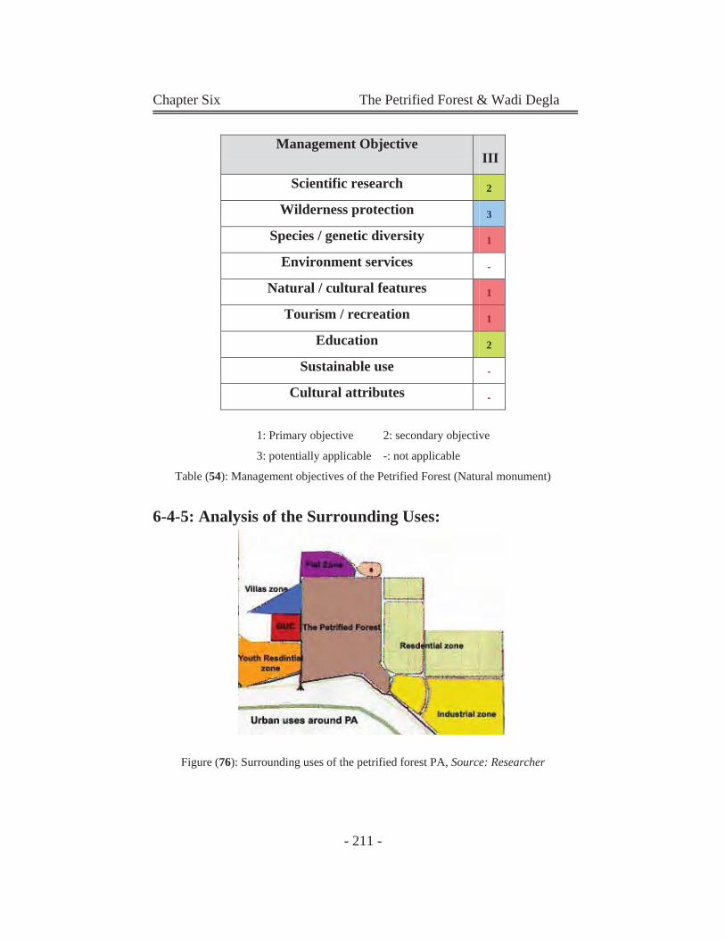
Chapter Six The Petrified Forest & Wadi Degla
- 211 -
1: Primary objective 2: secondary objective
3: potentially applicable -: not applicable
Table (54): Management objectives of the Petrified Forest (Natural monument)
6-4-5: Analysis of the Surrounding Uses:
Figure (76): Surrounding uses of the petrified forest PA, Source: Researcher
Management Objective III
Scientific research 2
Wilderness protection 3
Species / genetic diversity 1
Environment services -
Natural / cultural features 1
Tourism / recreation 1
Education 2
Sustainable use -
Cultural attributes -
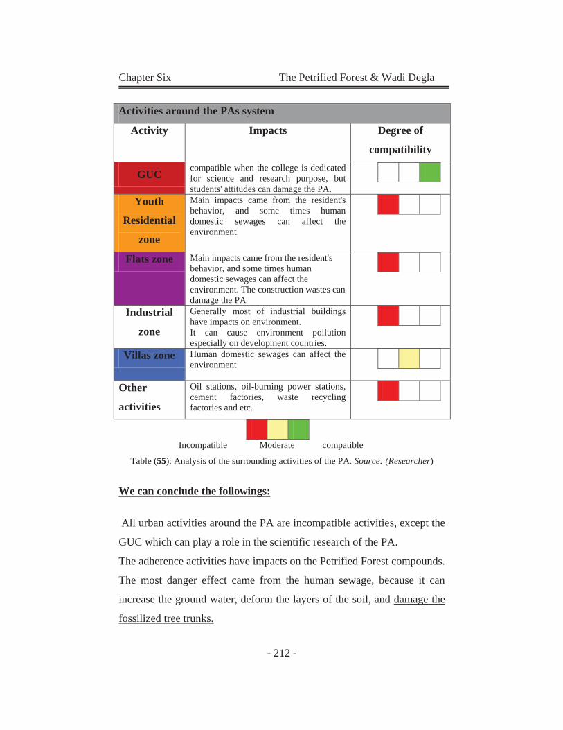
Chapter Six The Petrified Forest & Wadi Degla
- 212 -
Incompatible Moderate compatible
Table (55): Analysis of the surrounding activities of the PA. Source: (Researcher)
We can conclude the followings:
All urban activities around the PA are incompatible activities, except the
GUC which can play a role in the scientific research of the PA.
The adherence activities have impacts on the Petrified Forest compounds.
The most danger effect came from the human sewage, because it can
increase the ground water, deform the layers of the soil, and damage the
fossilized tree trunks.
Activities around the PAs system
Activity Impacts Degree of
compatibility
GUC compatible when the college is dedicated for science and research purpose, but students' attitudes can damage the PA.
Youth
Residential
zone
Main impacts came from the resident's behavior, and some times human domestic sewages can affect the environment.
Flats zone Main impacts came from the resident's behavior, and some times human domestic sewages can affect the environment. The construction wastes can damage the PA
Industrial
zone
Generally most of industrial buildings have impacts on environment. It can cause environment pollution especially on development countries.
Villas zone Human domestic sewages can affect the environment.
Other
activities
Oil stations, oil-burning power stations, cement factories, waste recycling factories and etc.
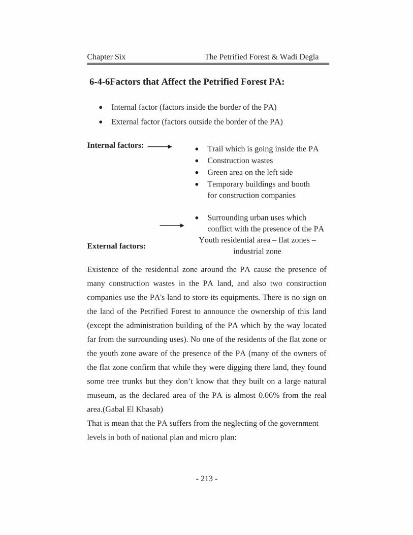
Chapter Six The Petrified Forest & Wadi Degla
- 213 -
6-4-6Factors that Affect the Petrified Forest PA:
Internal factor (factors inside the border of the PA)
External factor (factors outside the border of the PA)
Internal factors:
External factors:
Existence of the residential zone around the PA cause the presence of
many construction wastes in the PA land, and also two construction
companies use the PA's land to store its equipments. There is no sign on
the land of the Petrified Forest to announce the ownership of this land
(except the administration building of the PA which by the way located
far from the surrounding uses). No one of the residents of the flat zone or
the youth zone aware of the presence of the PA (many of the owners of
the flat zone confirm that while they were digging there land, they found
some tree trunks but they don’t know that they built on a large natural
museum, as the declared area of the PA is almost 0.06% from the real
area.(Gabal El Khasab)
That is mean that the PA suffers from the neglecting of the government
levels in both of national plan and micro plan:
Trail which is going inside the PA Construction wastes Green area on the left side Temporary buildings and booth
for construction companies
Surrounding urban uses which conflict with the presence of the PA
Youth residential area – flat zones – industrial zone
Chapter Six The Petrified Forest & Wadi Degla
- 214 -
Micro plan:
Until now there is no obvious management plan govern
the PA.
There is no publication to this protected area; as many
residents of new Cairo city don't know that there is PA
there.
National plan:
The national plan neglects the presence of the PA. The surrounding uses
doesn't match the presence of the Petrified Forest.
6-4-7Urban Growth on the Petrified Forest Land:
Protection in Egypt fights many obstacles concerning announcement
and protection of protectorates through years. The Petrified Forest
declared area is almost 6 km2, but the fossilized tree trunks cover a
bigger area, almost 1000 km2. That means that the current preserved
area is only 0.06% of the real area. We can almost say that this part of
the New Cairo city is built on a big natural museum. But the laws
define a smaller area. The total area is called Gabal El Khashab, it
was filled with fossilized tree trunks some on the surface and other
deep inside the land. The Petrified Forest suffers these days another urban assault; the
ministry of population and new communities wants to take 2/3 of its
area (4km2) to make new extensions to the new Cairo city.
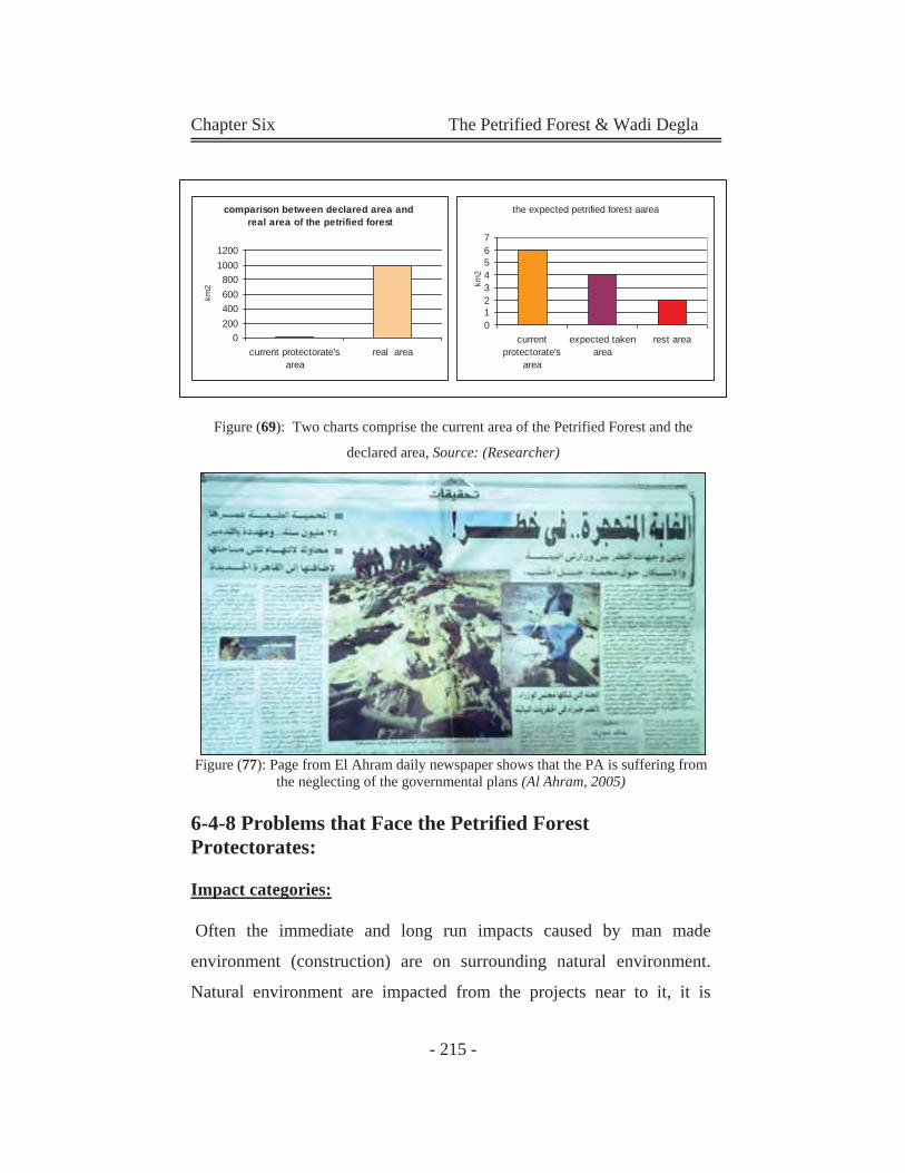
Chapter Six The Petrified Forest & Wadi Degla
- 215 -
Figure (69): Two charts comprise the current area of the Petrified Forest and the
declared area, Source: (Researcher)
Figure (77): Page from El Ahram daily newspaper shows that the PA is suffering from the neglecting of the governmental plans (Al Ahram, 2005)
6-4-8 Problems that Face the Petrified Forest Protectorates: Impact categories:
Often the immediate and long run impacts caused by man made
environment (construction) are on surrounding natural environment.
Natural environment are impacted from the projects near to it, it is
comparison between declared area and real area of the petrified forest
0200400600800
10001200
current protectorate'sarea
real area
km2
the expected petrified forest aarea
01234567
currentprotectorate's
area
expected takenarea
rest area
km2
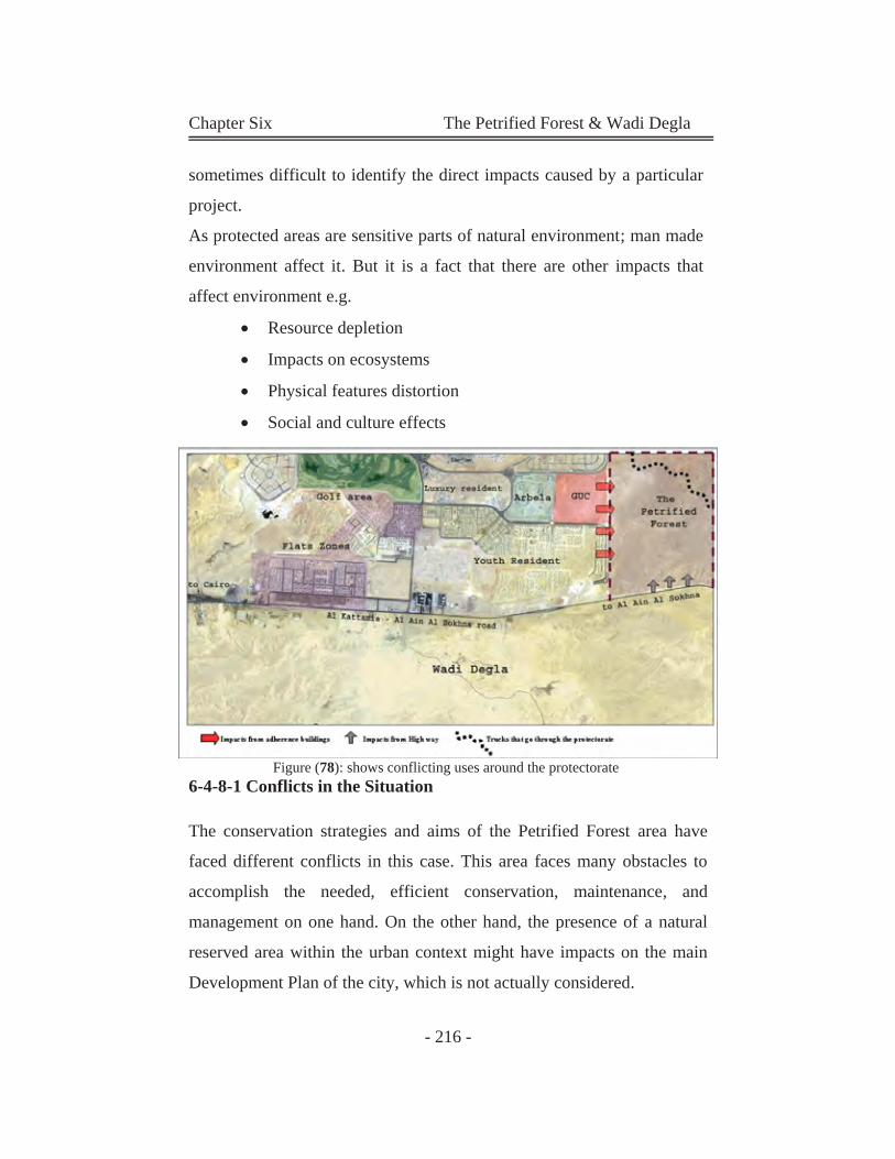
Chapter Six The Petrified Forest & Wadi Degla
- 216 -
sometimes difficult to identify the direct impacts caused by a particular
project.
As protected areas are sensitive parts of natural environment; man made
environment affect it. But it is a fact that there are other impacts that
affect environment e.g.
Resource depletion
Impacts on ecosystems
Physical features distortion
Social and culture effects
Figure (78): shows conflicting uses around the protectorate 6-4-8-1 Conflicts in the Situation
The conservation strategies and aims of the Petrified Forest area have
faced different conflicts in this case. This area faces many obstacles to
accomplish the needed, efficient conservation, maintenance, and
management on one hand. On the other hand, the presence of a natural
reserved area within the urban context might have impacts on the main
Development Plan of the city, which is not actually considered.
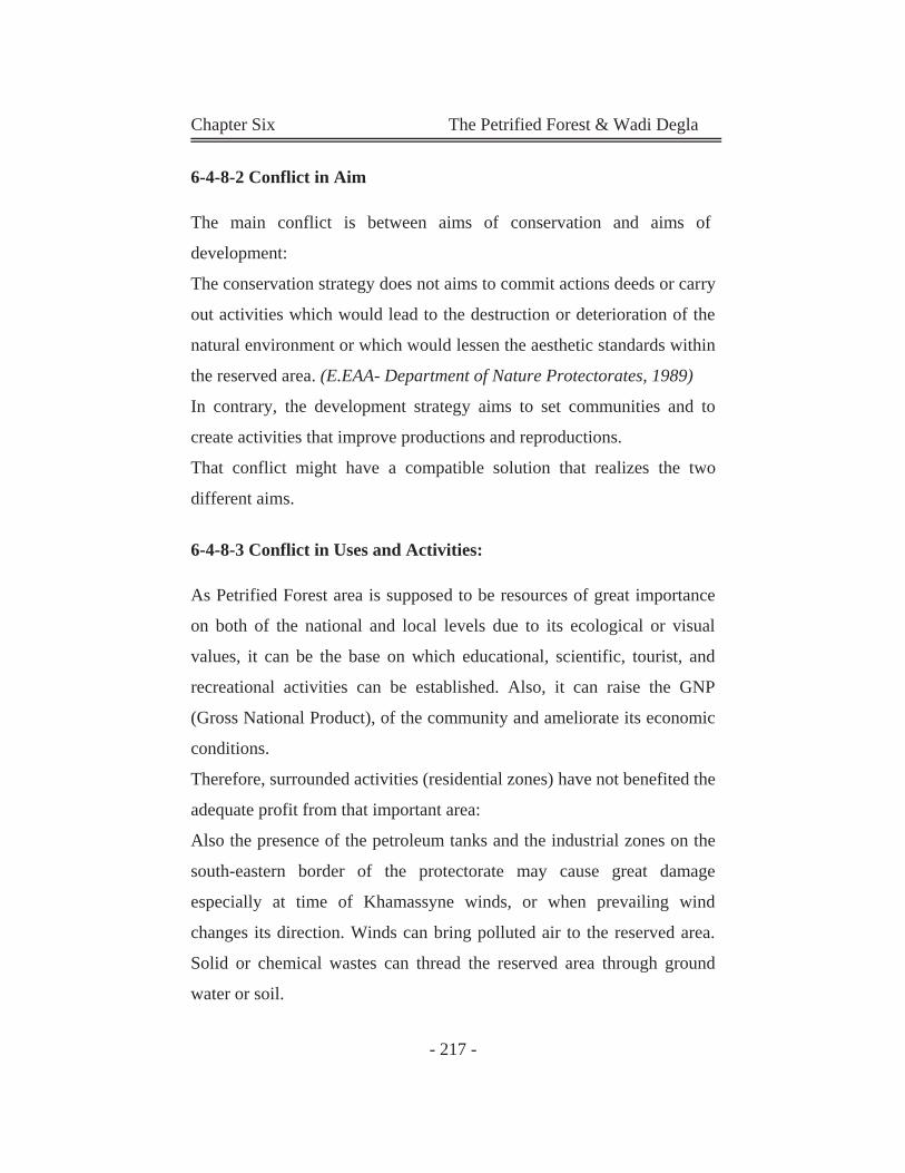
Chapter Six The Petrified Forest & Wadi Degla
- 217 -
6-4-8-2 Conflict in Aim
The main conflict is between aims of conservation and aims of
development:
The conservation strategy does not aims to commit actions deeds or carry
out activities which would lead to the destruction or deterioration of the
natural environment or which would lessen the aesthetic standards within
the reserved area. (E.EAA- Department of Nature Protectorates, 1989)
In contrary, the development strategy aims to set communities and to
create activities that improve productions and reproductions.
That conflict might have a compatible solution that realizes the two
different aims.
6-4-8-3 Conflict in Uses and Activities:
As Petrified Forest area is supposed to be resources of great importance
on both of the national and local levels due to its ecological or visual
values, it can be the base on which educational, scientific, tourist, and
recreational activities can be established. Also, it can raise the GNP
(Gross National Product), of the community and ameliorate its economic
conditions.
Therefore, surrounded activities (residential zones) have not benefited the
adequate profit from that important area:
Also the presence of the petroleum tanks and the industrial zones on the
south-eastern border of the protectorate may cause great damage
especially at time of Khamassyne winds, or when prevailing wind
changes its direction. Winds can bring polluted air to the reserved area.
Solid or chemical wastes can thread the reserved area through ground
water or soil.
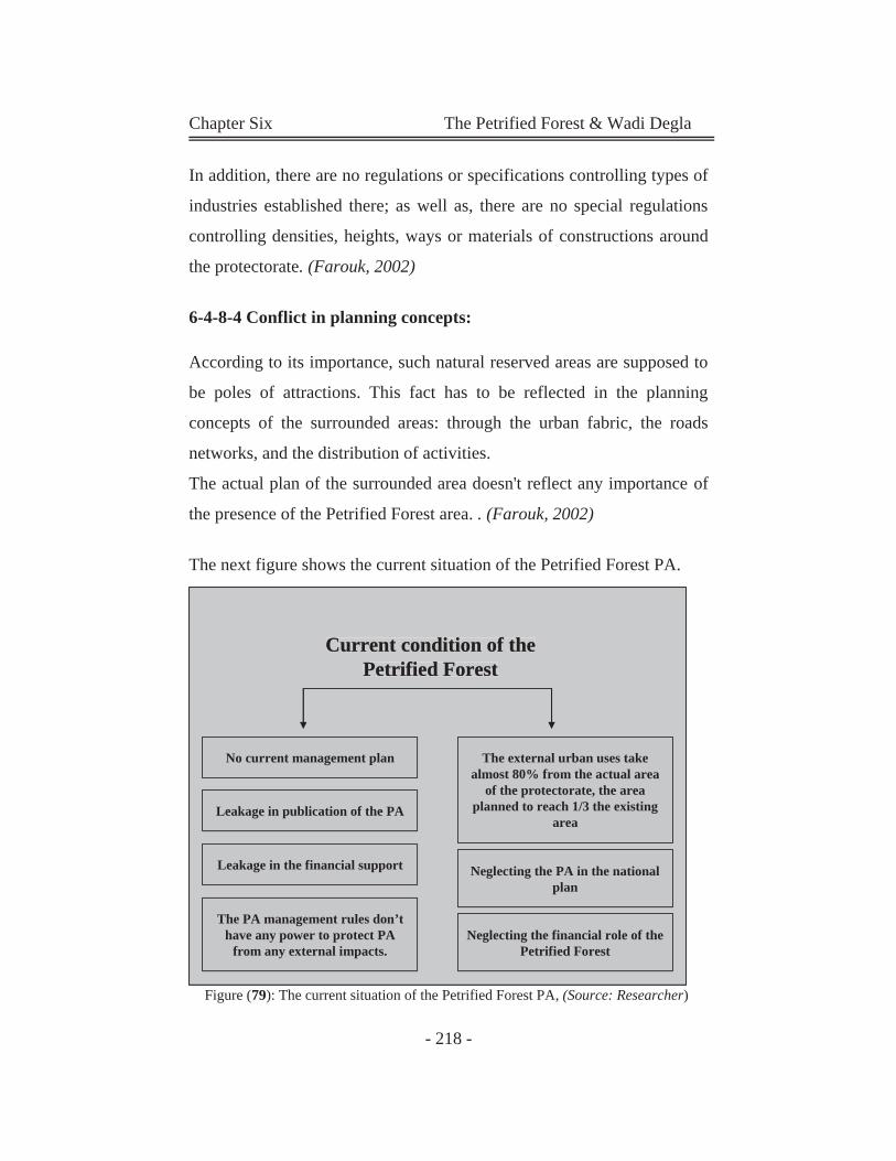
Chapter Six The Petrified Forest & Wadi Degla
- 218 -
No current management plan
Leakage in publication of the PA
Leakage in the financial support
The PA management rules don’t have any power to protect PA
from any external impacts.
Neglecting the PA in the national plan
The external urban uses take almost 80% from the actual area
of the protectorate, the area planned to reach 1/3 the existing
area
Neglecting the financial role of the Petrified Forest
Current condition of the Petrified Forest
No current management plan
Leakage in publication of the PA
Leakage in the financial support
The PA management rules don’thave any power to protect PA
from any external impacts.
Neglecting the PA in the nationalplan
The external urban uses takealmost 80% from the actual area
of the protectorate, the areaplanned to reach 1/3 the existing
area
Neglecting the financial role of the Petrified Forest
Current condition of thePetrified Forest
No current management plan
Leakage in publication of the PA
Leakage in the financial support
The PA management rules don’t have any power to protect PA
from any external impacts.
Neglecting the PA in the national plan
The external urban uses take almost 80% from the actual area
of the protectorate, the area planned to reach 1/3 the existing
area
Neglecting the financial role of the Petrified Forest
Current condition of the Petrified Forest
In addition, there are no regulations or specifications controlling types of
industries established there; as well as, there are no special regulations
controlling densities, heights, ways or materials of constructions around
the protectorate. (Farouk, 2002)
6-4-8-4 Conflict in planning concepts:
According to its importance, such natural reserved areas are supposed to
be poles of attractions. This fact has to be reflected in the planning
concepts of the surrounded areas: through the urban fabric, the roads
networks, and the distribution of activities.
The actual plan of the surrounded area doesn't reflect any importance of
the presence of the Petrified Forest area. . (Farouk, 2002)
The next figure shows the current situation of the Petrified Forest PA.
Figure (79): The current situation of the Petrified Forest PA, (Source: Researcher)
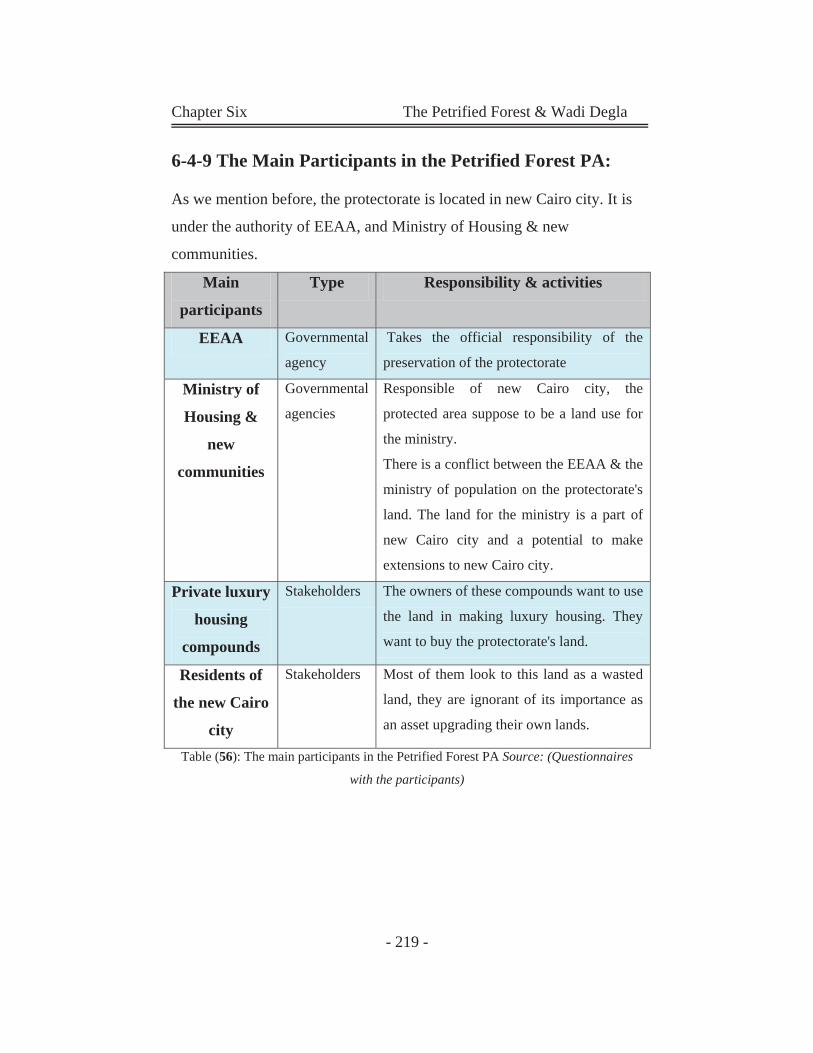
Chapter Six The Petrified Forest & Wadi Degla
- 219 -
6-4-9 The Main Participants in the Petrified Forest PA:
As we mention before, the protectorate is located in new Cairo city. It is
under the authority of EEAA, and Ministry of Housing & new
communities.
Main
participants
Type Responsibility & activities
EEAA Governmental
agency
Takes the official responsibility of the
preservation of the protectorate
Ministry of
Housing &
new
communities
Governmental
agencies
Responsible of new Cairo city, the
protected area suppose to be a land use for
the ministry.
There is a conflict between the EEAA & the
ministry of population on the protectorate's
land. The land for the ministry is a part of
new Cairo city and a potential to make
extensions to new Cairo city.
Private luxury
housing
compounds
Stakeholders The owners of these compounds want to use
the land in making luxury housing. They
want to buy the protectorate's land.
Residents of
the new Cairo
city
Stakeholders Most of them look to this land as a wasted
land, they are ignorant of its importance as
an asset upgrading their own lands.
Table (56): The main participants in the Petrified Forest PA Source: (Questionnaires
with the participants)
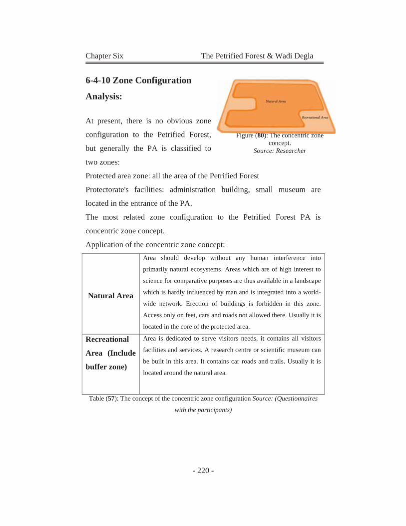
Chapter Six The Petrified Forest & Wadi Degla
- 220 -
6-4-10 Zone Configuration
Analysis:
At present, there is no obvious zone
configuration to the Petrified Forest,
but generally the PA is classified to
two zones:
Protected area zone: all the area of the Petrified Forest
Protectorate's facilities: administration building, small museum are
located in the entrance of the PA.
The most related zone configuration to the Petrified Forest PA is
concentric zone concept.
Application of the concentric zone concept:
Natural Area
Area should develop without any human interference into
primarily natural ecosystems. Areas which are of high interest to
science for comparative purposes are thus available in a landscape
which is hardly influenced by man and is integrated into a world-
wide network. Erection of buildings is forbidden in this zone.
Access only on feet, cars and roads not allowed there. Usually it is
located in the core of the protected area.
Recreational
Area (Include
buffer zone)
Area is dedicated to serve visitors needs, it contains all visitors
facilities and services. A research centre or scientific museum can
be built in this area. It contains car roads and trails. Usually it is
located around the natural area.
Table (57): The concept of the concentric zone configuration Source: (Questionnaires
with the participants)
Figure (80): The concentric zone concept.
Source: Researcher
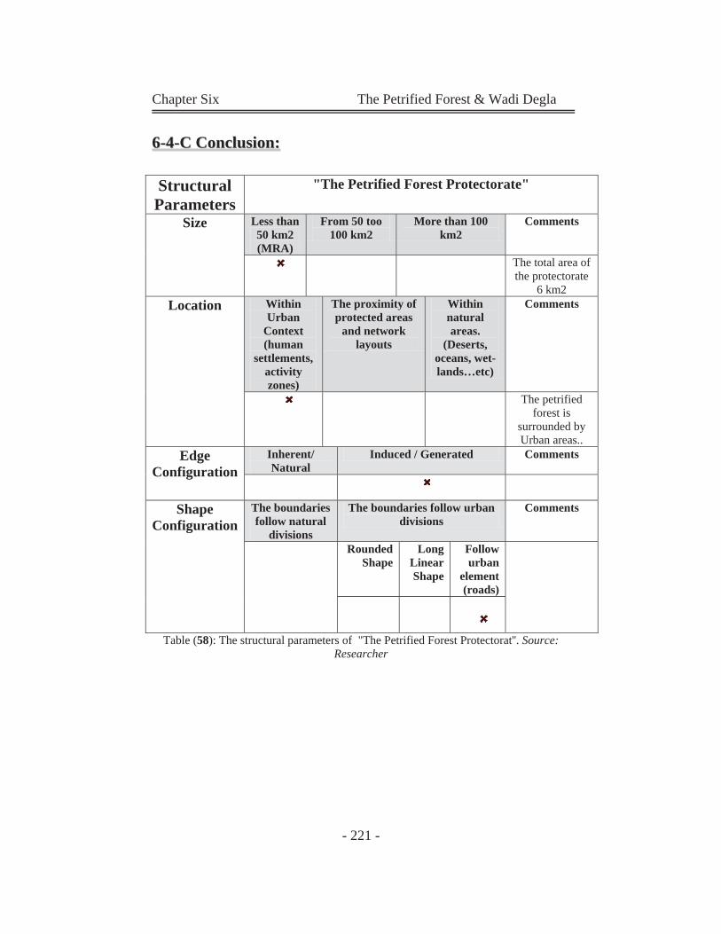
Chapter Six The Petrified Forest & Wadi Degla
- 221 -
66--44--CC CCoonncclluussiioonn::
Table (58): The structural parameters of "The Petrified Forest Protectorat''. Source: Researcher
Structural Parameters
"The Petrified Forest Protectorate"
Size Less than 50 km2 (MRA)
From 50 too 100 km2
More than 100 km2
Comments
The total area of the protectorate
6 km2 Location Within
Urban Context (human
settlements, activity zones)
The proximity of protected areas
and network layouts
Within natural areas.
(Deserts, oceans, wet-lands…etc)
Comments
The petrified forest is
surrounded by Urban areas..
Edge Configuration
Inherent/ Natural
Induced / Generated Comments
Shape Configuration
The boundaries follow natural
divisions
The boundaries follow urban divisions
Comments
Rounded Shape
Long Linear Shape
Follow urban
element (roads)
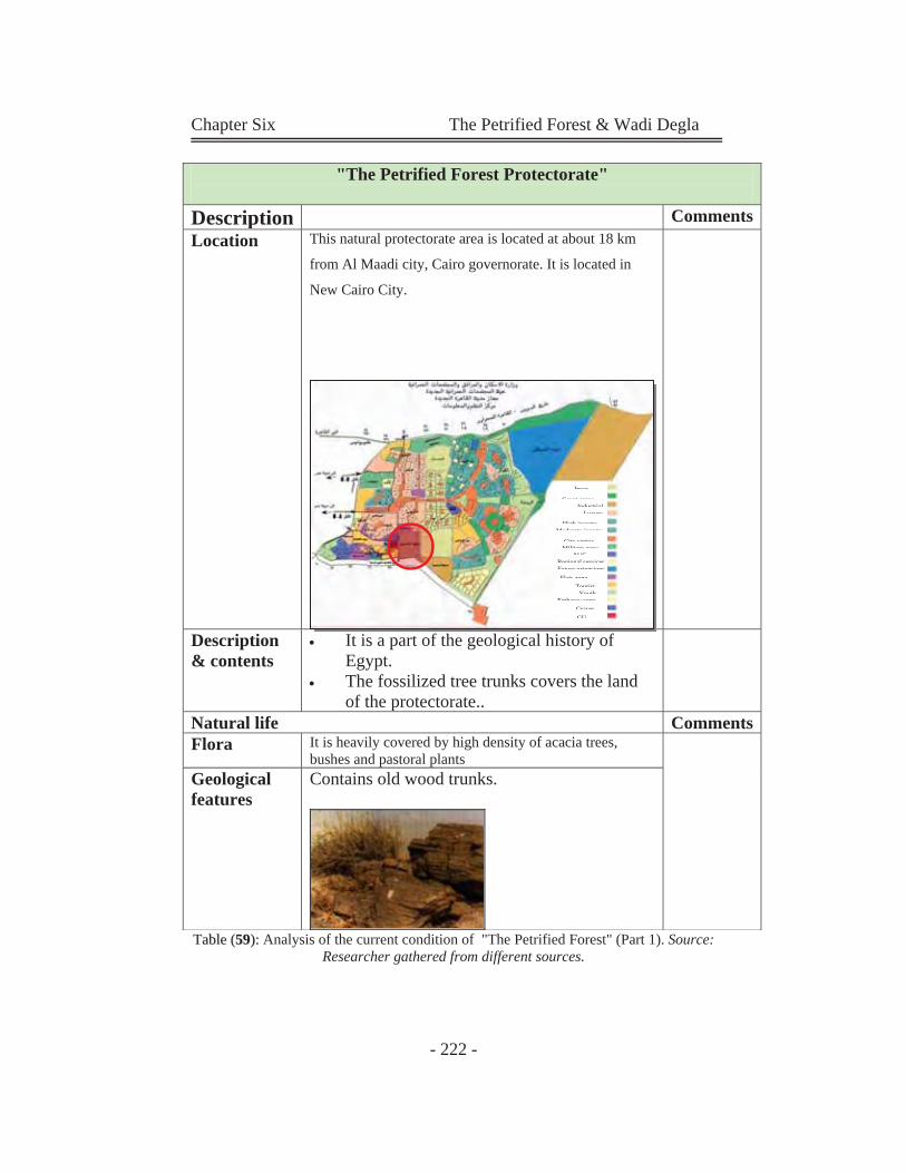
Chapter Six The Petrified Forest & Wadi Degla
- 222 -
TTaabbllee ((5599)):: Analysis of the current condition of "The Petrified Forest" (Part 1). Source: Researcher gathered from different sources.
"The Petrified Forest Protectorate"
Description CommentsLocation This natural protectorate area is located at about 18 km
from Al Maadi city, Cairo governorate. It is located in
New Cairo City.
Description & contents
It is a part of the geological history of Egypt.
The fossilized tree trunks covers the land of the protectorate..
Natural life CommentsFlora It is heavily covered by high density of acacia trees,
bushes and pastoral plantsGeological features
Contains old wood trunks.
InvesGreen areas
IndustrialLuxury
High income
GUGraves
Embassy zoneYouth
Moderate incomeCity center
Military zoneAUC
Regional servicesFuture extensions
TouristFlats zone
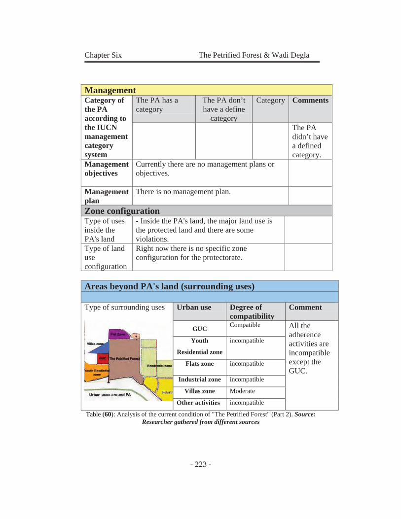
Chapter Six The Petrified Forest & Wadi Degla
- 223 -
TTaabbllee ((6600)):: Analysis of the current condition of "The Petrified Forest" (Part 2). Source: Researcher gathered from different sources
ManagementCategory of the PA according to the IUCN management category system
The PA has a category
The PA don’t have a define
category
Category Comments
The PA didn’t have a defined category.
Management objectives
Currently there are no management plans or objectives.
Management plan
There is no management plan.
Zone configurationType of uses inside the PA's land
- Inside the PA's land, the major land use is the protected land and there are some violations.
Type of land use configuration
Right now there is no specific zone configuration for the protectorate.
Areas beyond PA's land (surrounding uses) Type of surrounding uses
Urban use Degree of compatibility
Comment
GUC Compatible All the adherence activities are incompatible except the GUC.
Youth
Residential zone
incompatible
Flats zone incompatible
Industrial zone incompatible
Villas zone Moderate
Other activities incompatible
Chapter Six The Petrified Forest & Wadi Degla
- 224 -
The previous study can be summarized in the following points:
The Petrified Forest area faces different conflicts, and challenges, like:
There is no obvious management plan to protect this protectorate.
There is a conflict between; conservation (protection of the PA),
and development (extension of new Cairo city. This terminates all
efforts to stop the violations on the protectorates).
In this protectorate the external forces (urban influences) acting
on the area are greater than internal forces (conservation
management). As a result, the protected area suffers from
violations and neglecting.
There are many participants involved in the management of the
PAs. This hazardous situation causes many conflicts; one of these
conflicts is the conflict between aims of conservation and aims of
development.
The presence of the protected area doesn't have any reflect on the
urban planning of new Cairo city. In addition, the surrounding
uses may threaten the protectorate's safety. (The sewage may
increase the water ground, and deform the ground layers, and
damage the tree trunks).
There is an interrelation between Protected Area and urban
environment, but this interrelation appears in the Petrified Forest
in one way relationship; the impacts of urban environment on the
protectorate. The opposite relationship doesn't appear here.
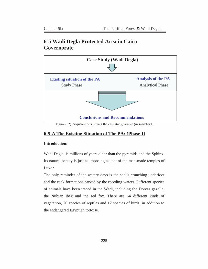
Chapter Six The Petrified Forest & Wadi Degla
- 225 -
6-5 Wadi Degla Protected Area in Cairo Governorate
Figure (82): Sequence of studying the case study; source (Researcher).
66--55--AA TThhee EExxiissttiinngg SSiittuuaattiioonn ooff TThhee PPAA:: ((PPhhaassee 11))
Introduction:
Wadi Degla, is millions of years older than the pyramids and the Sphinx.
Its natural beauty is just as imposing as that of the man-made temples of
Luxor.
The only reminder of the watery days is the shells crunching underfoot
and the rock formations carved by the receding waters. Different species
of animals have been traced in the Wadi, including the Dorcas gazelle,
the Nubian ibex and the red fox. There are 64 different kinds of
vegetation, 20 species of reptiles and 12 species of birds, in addition to
the endangered Egyptian tortoise.
Case Study (Wadi Degla)
Existing situation of the PA Analysis of the PA Study Phase Analytical Phase
Conclusions and Recommendations
Existing situation of the PA Analysis of the PAStudy Phase Analytical Phase
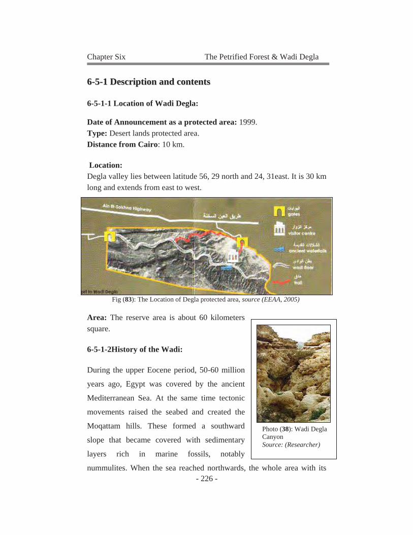
Chapter Six The Petrified Forest & Wadi Degla
- 226 -
66--55--11 DDeessccrriippttiioonn aanndd ccoonntteennttss
6-5-1-1 Location of Wadi Degla:
Date of Announcement as a protected area: 1999. Type: Desert lands protected area. Distance from Cairo: 10 km.
Location: Degla valley lies between latitude 56, 29 north and 24, 31east. It is 30 km long and extends from east to west.
Fig (83): The Location of Degla protected area, source (EEAA, 2005)
Area: The reserve area is about 60 kilometers square.
6-5-1-2History of the Wadi:
During the upper Eocene period, 50-60 million
years ago, Egypt was covered by the ancient
Mediterranean Sea. At the same time tectonic
movements raised the seabed and created the
Moqattam hills. These formed a southward
slope that became covered with sedimentary
layers rich in marine fossils, notably
nummulites. When the sea reached northwards, the whole area with its
Photo (38): Wadi Degla Canyon Source: (Researcher)
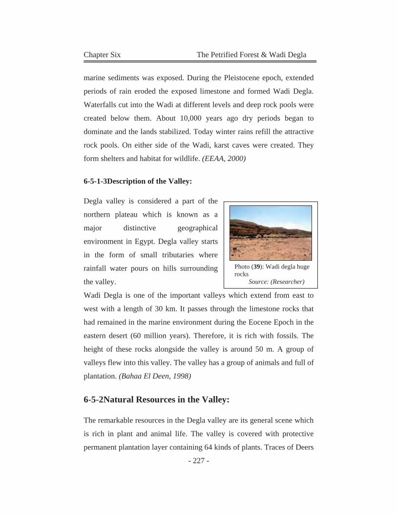
Chapter Six The Petrified Forest & Wadi Degla
- 227 -
marine sediments was exposed. During the Pleistocene epoch, extended
periods of rain eroded the exposed limestone and formed Wadi Degla.
Waterfalls cut into the Wadi at different levels and deep rock pools were
created below them. About 10,000 years ago dry periods began to
dominate and the lands stabilized. Today winter rains refill the attractive
rock pools. On either side of the Wadi, karst caves were created. They
form shelters and habitat for wildlife. (EEAA, 2000)
6-5-1-3Description of the Valley:
Degla valley is considered a part of the
northern plateau which is known as a
major distinctive geographical
environment in Egypt. Degla valley starts
in the form of small tributaries where
rainfall water pours on hills surrounding
the valley.
Wadi Degla is one of the important valleys which extend from east to
west with a length of 30 km. It passes through the limestone rocks that
had remained in the marine environment during the Eocene Epoch in the
eastern desert (60 million years). Therefore, it is rich with fossils. The
height of these rocks alongside the valley is around 50 m. A group of
valleys flew into this valley. The valley has a group of animals and full of
plantation. (Bahaa El Deen, 1998)
6-5-2Natural Resources in the Valley:
The remarkable resources in the Degla valley are its general scene which
is rich in plant and animal life. The valley is covered with protective
permanent plantation layer containing 64 kinds of plants. Traces of Deers
Photo (39): Wadi degla huge rocks
Source: (Researcher)
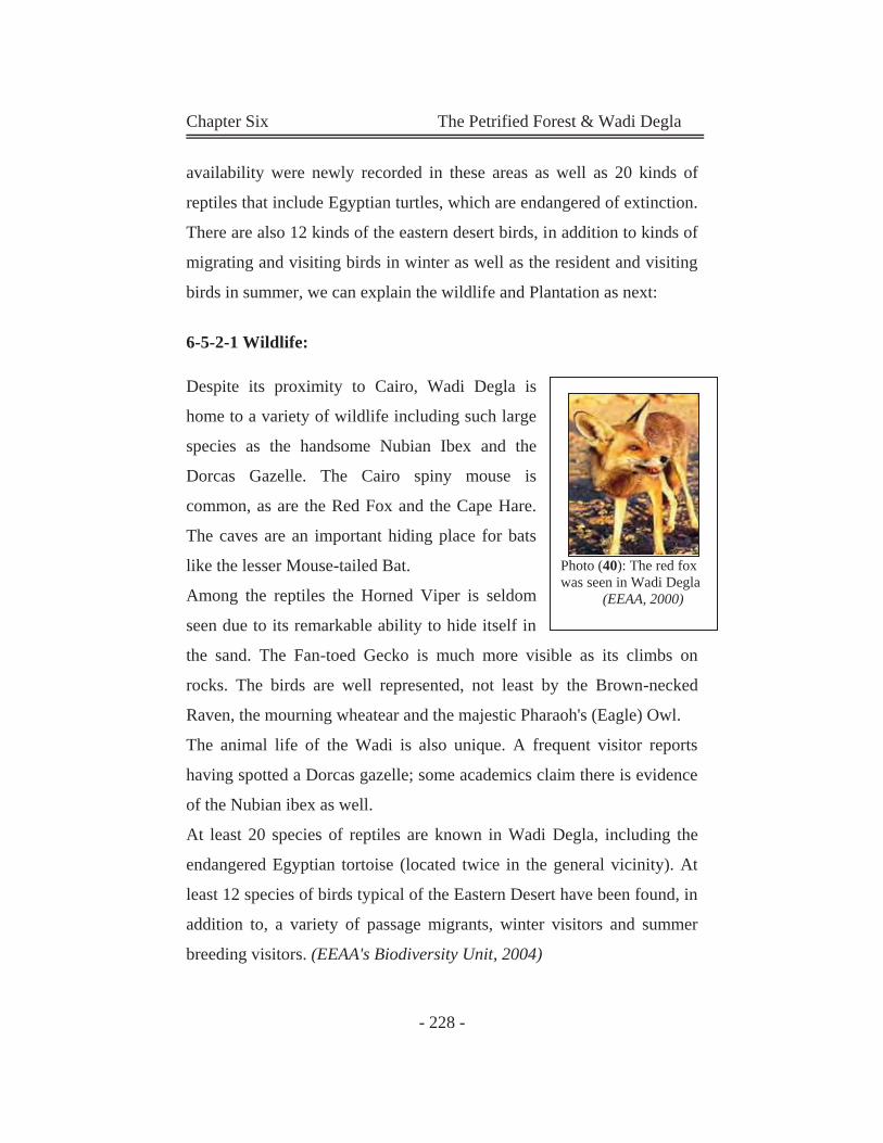
Chapter Six The Petrified Forest & Wadi Degla
- 228 -
availability were newly recorded in these areas as well as 20 kinds of
reptiles that include Egyptian turtles, which are endangered of extinction.
There are also 12 kinds of the eastern desert birds, in addition to kinds of
migrating and visiting birds in winter as well as the resident and visiting
birds in summer, we can explain the wildlife and Plantation as next:
6-5-2-1 Wildlife:
Despite its proximity to Cairo, Wadi Degla is
home to a variety of wildlife including such large
species as the handsome Nubian Ibex and the
Dorcas Gazelle. The Cairo spiny mouse is
common, as are the Red Fox and the Cape Hare.
The caves are an important hiding place for bats
like the lesser Mouse-tailed Bat.
Among the reptiles the Horned Viper is seldom
seen due to its remarkable ability to hide itself in
the sand. The Fan-toed Gecko is much more visible as its climbs on
rocks. The birds are well represented, not least by the Brown-necked
Raven, the mourning wheatear and the majestic Pharaoh's (Eagle) Owl.
The animal life of the Wadi is also unique. A frequent visitor reports
having spotted a Dorcas gazelle; some academics claim there is evidence
of the Nubian ibex as well.
At least 20 species of reptiles are known in Wadi Degla, including the
endangered Egyptian tortoise (located twice in the general vicinity). At
least 12 species of birds typical of the Eastern Desert have been found, in
addition to, a variety of passage migrants, winter visitors and summer
breeding visitors. (EEAA's Biodiversity Unit, 2004)
Photo (40): The red fox was seen in Wadi Degla
(EEAA, 2000)
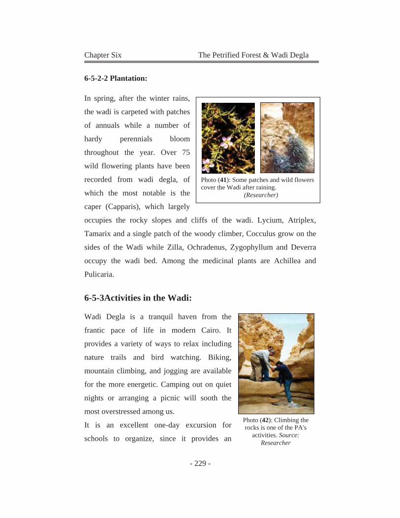
Chapter Six The Petrified Forest & Wadi Degla
- 229 -
6-5-2-2 Plantation:
In spring, after the winter rains,
the wadi is carpeted with patches
of annuals while a number of
hardy perennials bloom
throughout the year. Over 75
wild flowering plants have been
recorded from wadi degla, of
which the most notable is the
caper (Capparis), which largely
occupies the rocky slopes and cliffs of the wadi. Lycium, Atriplex,
Tamarix and a single patch of the woody climber, Cocculus grow on the
sides of the Wadi while Zilla, Ochradenus, Zygophyllum and Deverra
occupy the wadi bed. Among the medicinal plants are Achillea and
Pulicaria.
6-5-3Activities in the Wadi:
Wadi Degla is a tranquil haven from the
frantic pace of life in modern Cairo. It
provides a variety of ways to relax including
nature trails and bird watching. Biking,
mountain climbing, and jogging are available
for the more energetic. Camping out on quiet
nights or arranging a picnic will sooth the
most overstressed among us.
It is an excellent one-day excursion for
schools to organize, since it provides an
Photo (41): Some patches and wild flowers cover the Wadi after raining.
(Researcher)
Photo (42): Climbing the rocks is one of the PA's
activities. Source: Researcher
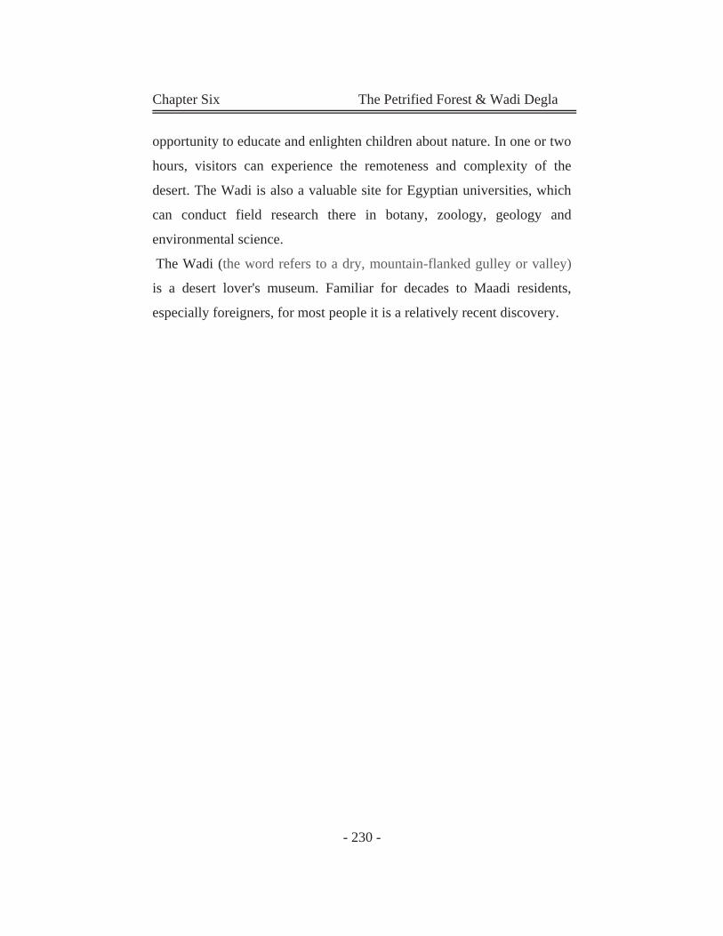
Chapter Six The Petrified Forest & Wadi Degla
- 230 -
opportunity to educate and enlighten children about nature. In one or two
hours, visitors can experience the remoteness and complexity of the
desert. The Wadi is also a valuable site for Egyptian universities, which
can conduct field research there in botany, zoology, geology and
environmental science.
The Wadi (the word refers to a dry, mountain-flanked gulley or valley)
is a desert lover's museum. Familiar for decades to Maadi residents,
especially foreigners, for most people it is a relatively recent discovery.
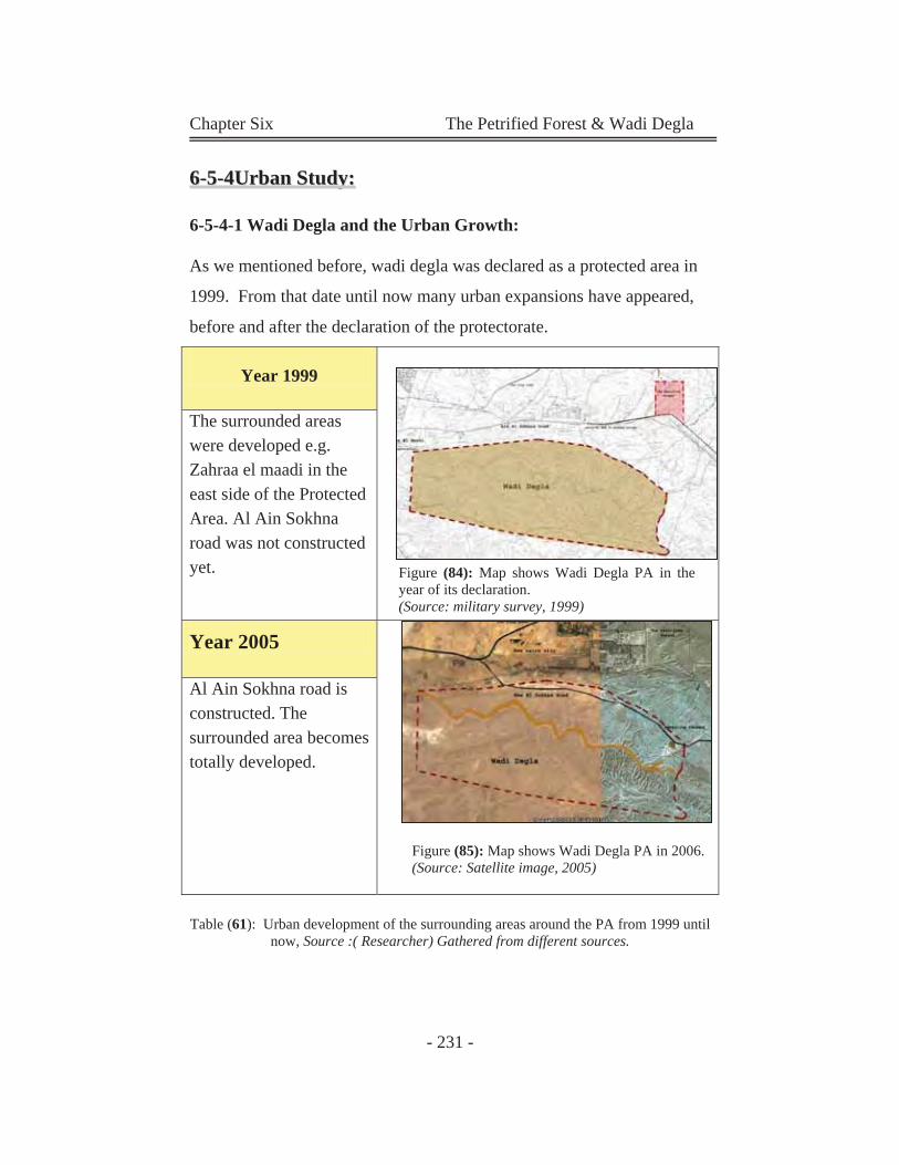
Chapter Six The Petrified Forest & Wadi Degla
- 231 -
66--55--44UUrrbbaann SSttuuddyy::
6-5-4-1 Wadi Degla and the Urban Growth:
As we mentioned before, wadi degla was declared as a protected area in
1999. From that date until now many urban expansions have appeared,
before and after the declaration of the protectorate.
Year 1999
The surrounded areas were developed e.g. Zahraa el maadi in the east side of the Protected Area. Al Ain Sokhna road was not constructed yet.
Year 2005
Al Ain Sokhna road is constructed. The surrounded area becomes totally developed.
Table (61): Urban development of the surrounding areas around the PA from 1999 until now, Source :( Researcher) Gathered from different sources.
Figure (84): Map shows Wadi Degla PA in the year of its declaration. (Source: military survey, 1999)
Figure (85): Map shows Wadi Degla PA in 2006. (Source: Satellite image, 2005)
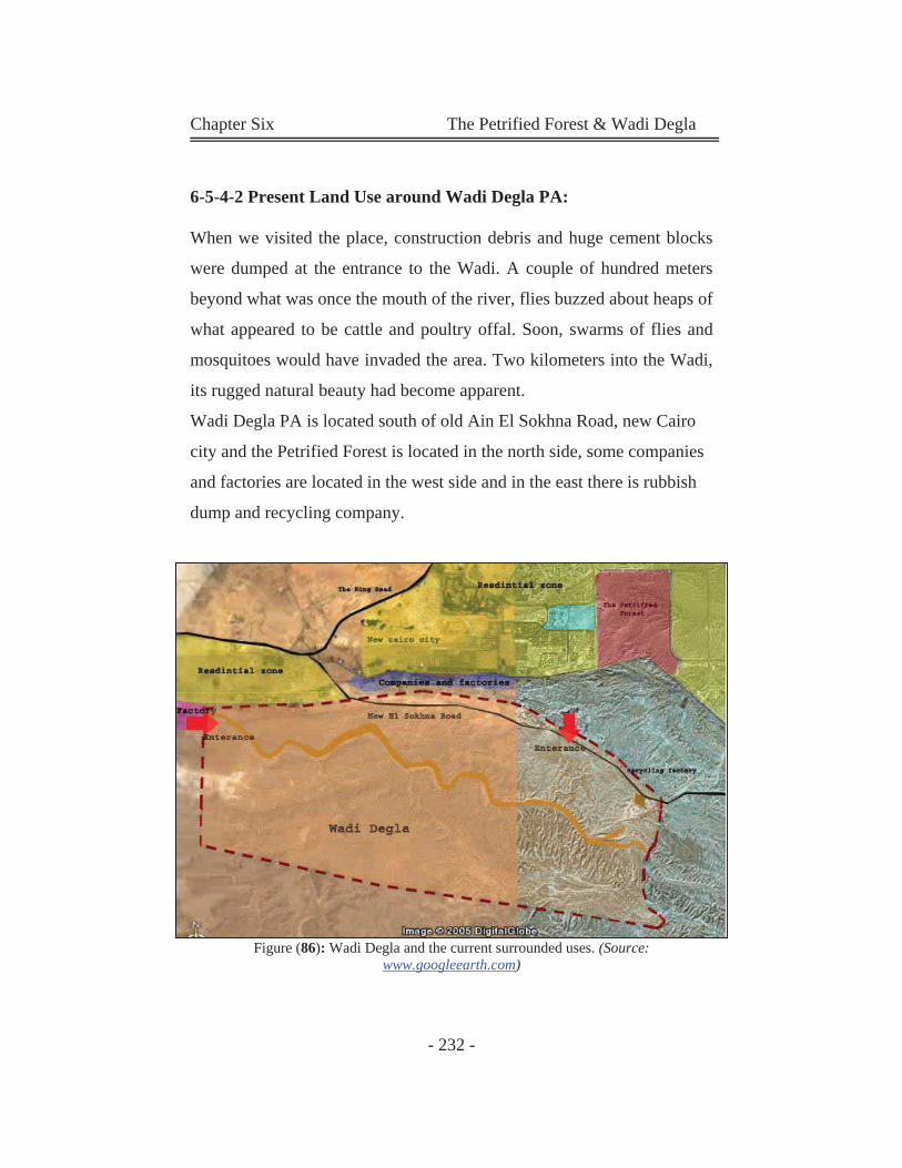
Chapter Six The Petrified Forest & Wadi Degla
- 232 -
6-5-4-2 Present Land Use around Wadi Degla PA:
When we visited the place, construction debris and huge cement blocks
were dumped at the entrance to the Wadi. A couple of hundred meters
beyond what was once the mouth of the river, flies buzzed about heaps of
what appeared to be cattle and poultry offal. Soon, swarms of flies and
mosquitoes would have invaded the area. Two kilometers into the Wadi,
its rugged natural beauty had become apparent.
Wadi Degla PA is located south of old Ain El Sokhna Road, new Cairo
city and the Petrified Forest is located in the north side, some companies
and factories are located in the west side and in the east there is rubbish
dump and recycling company.
Figure (86): Wadi Degla and the current surrounded uses. (Source: www.googleearth.com)
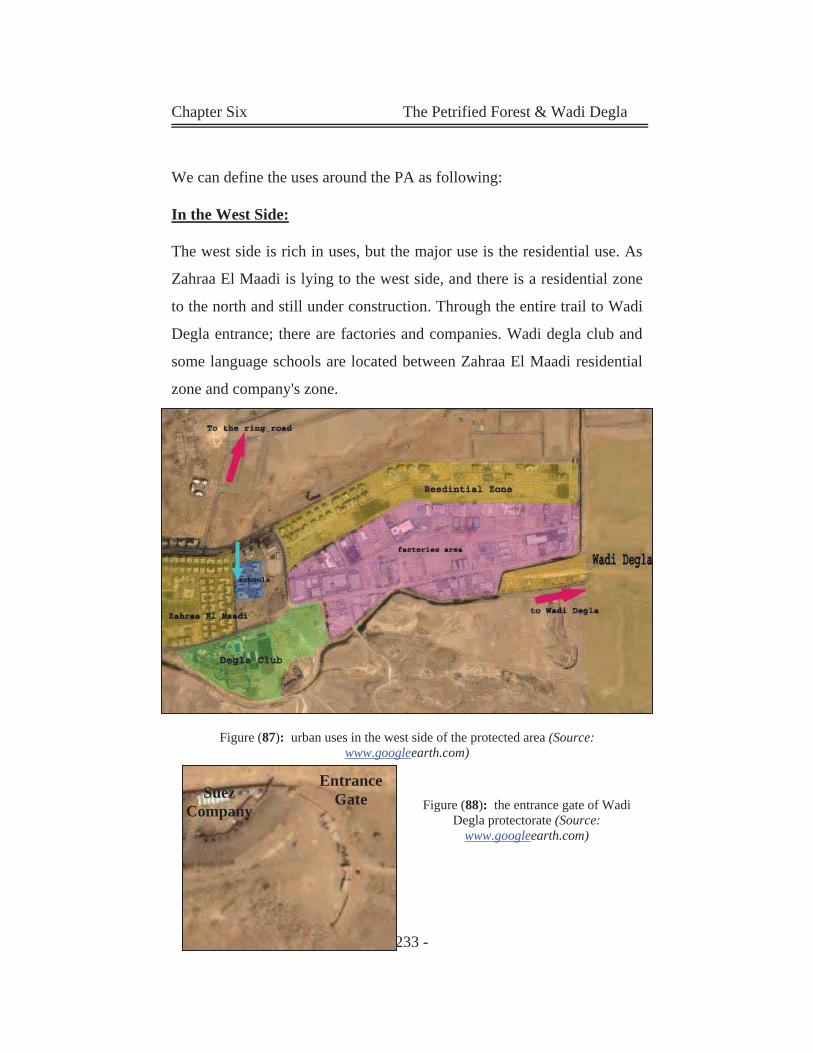
Chapter Six The Petrified Forest & Wadi Degla
- 233 -
We can define the uses around the PA as following:
In the West Side:
The west side is rich in uses, but the major use is the residential use. As
Zahraa El Maadi is lying to the west side, and there is a residential zone
to the north and still under construction. Through the entire trail to Wadi
Degla entrance; there are factories and companies. Wadi degla club and
some language schools are located between Zahraa El Maadi residential
zone and company's zone.
Figure (87): urban uses in the west side of the protected area (Source:
www.googleearth.com)
Figure (88): the entrance gate of Wadi
Degla protectorate (Source: www.googleearth.com)
Entrance Gate Suez
Company
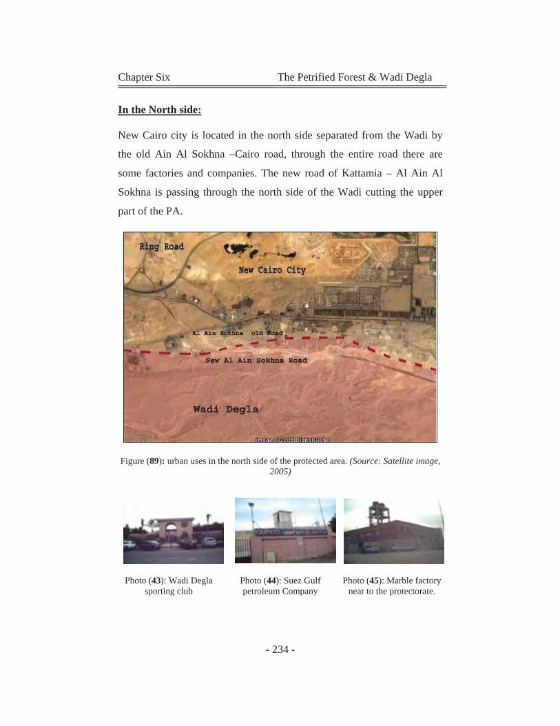
Chapter Six The Petrified Forest & Wadi Degla
- 234 -
In the North side:
New Cairo city is located in the north side separated from the Wadi by
the old Ain Al Sokhna –Cairo road, through the entire road there are
some factories and companies. The new road of Kattamia – Al Ain Al
Sokhna is passing through the north side of the Wadi cutting the upper
part of the PA.
Figure (89): urban uses in the north side of the protected area. (Source: Satellite image,
2005)
Photo (43): Wadi Degla
sporting club Photo (44): Suez Gulf petroleum Company
Photo (45): Marble factory near to the protectorate.
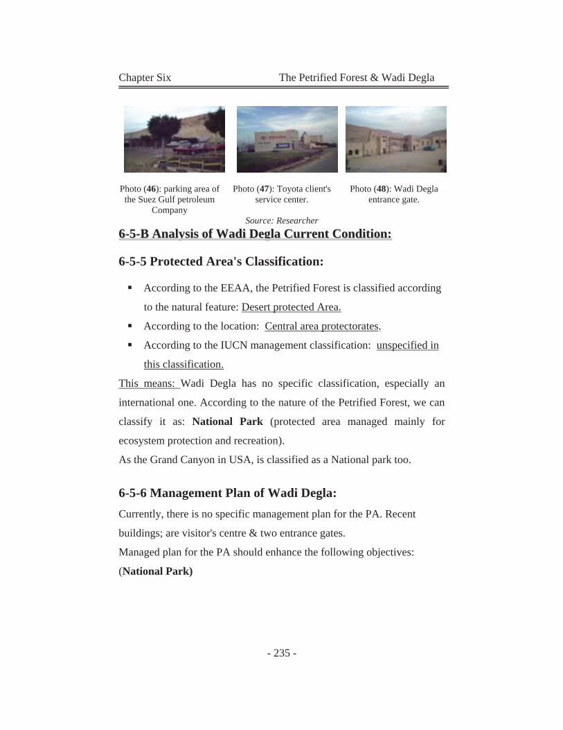
Chapter Six The Petrified Forest & Wadi Degla
- 235 -
Photo (46): parking area of
the Suez Gulf petroleum Company
Photo (47): Toyota client's service center.
Photo (48): Wadi Degla entrance gate.
Source: Researcher 66--55--BB AAnnaallyyssiiss ooff WWaaddii DDeeggllaa CCuurrrreenntt CCoonnddiittiioonn::
6-5-5 Protected Area's Classification:
According to the EEAA, the Petrified Forest is classified according
to the natural feature: Desert protected Area.
According to the location: Central area protectorates..
According to the IUCN management classification: unspecified in
this classification.
This means: Wadi Degla has no specific classification, especially an
international one. According to the nature of the Petrified Forest, we can
classify it as: National Park (protected area managed mainly for
ecosystem protection and recreation).
As the Grand Canyon in USA, is classified as a National park too.
6-5-6 Management Plan of Wadi Degla: Currently, there is no specific management plan for the PA. Recent
buildings; are visitor's centre & two entrance gates.
Managed plan for the PA should enhance the following objectives:
(National Park)
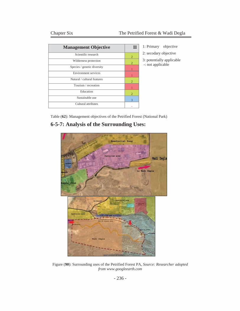
Chapter Six The Petrified Forest & Wadi Degla
- 236 -
1: Primary objective
2: secodary objective
3: potentially applicable -: not applicable
Table (62): Management objectives of the Petrified Forest (National Park)
6-5-7: Analysis of the Surrounding Uses:
Figure (90): Surrounding uses of the Petrified Forest PA, Source: Researcher adopted from www.googleearth.com
Management Objective II Scientific research
2 Wilderness protection
2 Species / genetic diversity
1 Environment services
1 Natural / cultural features
2 Tourism / recreation
1 Education
2 Sustainable use
3 Cultural attributes
-
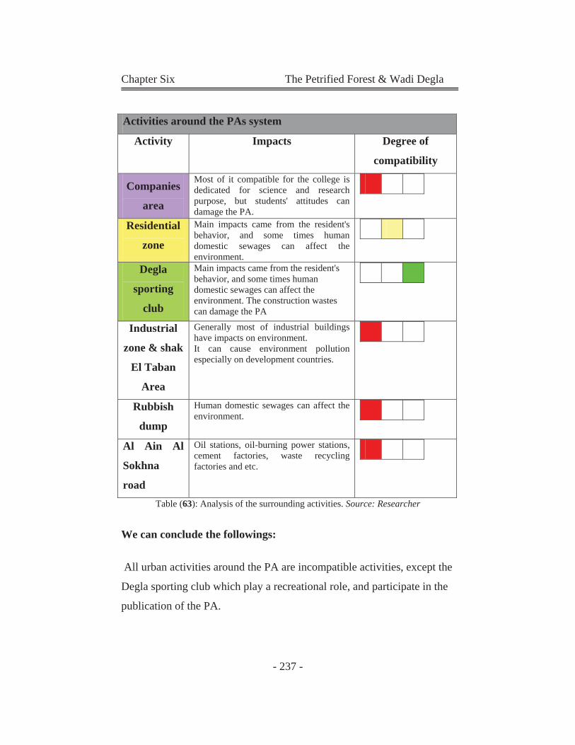
Chapter Six The Petrified Forest & Wadi Degla
- 237 -
Table (63): Analysis of the surrounding activities. Source: Researcher
We can conclude the followings:
All urban activities around the PA are incompatible activities, except the
Degla sporting club which play a recreational role, and participate in the
publication of the PA.
Activities around the PAs system
Activity Impacts Degree of
compatibility
Companies
area
Most of it compatible for the college is dedicated for science and research purpose, but students' attitudes can damage the PA.
Residential
zone
Main impacts came from the resident's behavior, and some times human domestic sewages can affect the environment.
Degla
sporting
club
Main impacts came from the resident's behavior, and some times human domestic sewages can affect the environment. The construction wastes can damage the PA
Industrial
zone & shak
El Taban
Area
Generally most of industrial buildings have impacts on environment. It can cause environment pollution especially on development countries.
Rubbish
dump
Human domestic sewages can affect the environment.
Al Ain Al
Sokhna
road
Oil stations, oil-burning power stations, cement factories, waste recycling factories and etc.
Chapter Six The Petrified Forest & Wadi Degla
- 238 -
6-5-8 the Main Participants in Wadi Degla PA:
As we mentioned before, the protectorate is located in El Maadi. It is
under the authority of EEAA, and cairo governorate. In addition some
stakeholders are involved like; owners of the rubbish dump, bus station
owners, Shak El Teaban marble factories' owners and ministry of traffic
and transportation is responsible of the new Al Ain Al Sokhna road
Main
participants
Type Responsibility & activities
EEAA Governmental
agency
Takes the official responsibility of the
preservation of the protectorate
Ministry of
Housing
Governmental
agencies
Responsible for urban planning process
The rubbish
dump owners
Stakeholders Responsible for the dump located in, it
is officially the owner of the land.
Ministry of
traffic and
transportation
Governmental
agency
Responsible of the Ain El Sokhna Road,
despite its being a part of the protected
area 's land
Shak El Teaban
factories owners
Stakeholders They are the owner of the factories land
which located in the west side of the
PA.
Table (64): The main participants in Wadi Degla PA Source: (Researcher) gathered
from different sources.
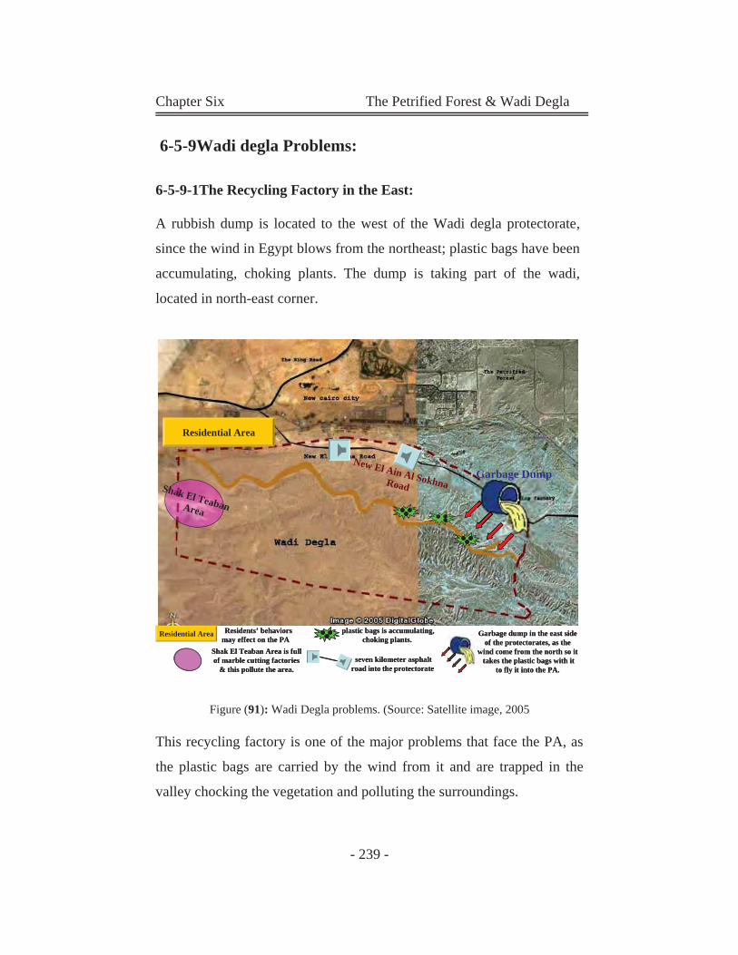
Chapter Six The Petrified Forest & Wadi Degla
- 239 -
6-5-9Wadi degla Problems: 6-5-9-1The Recycling Factory in the East:
A rubbish dump is located to the west of the Wadi degla protectorate,
since the wind in Egypt blows from the northeast; plastic bags have been
accumulating, choking plants. The dump is taking part of the wadi,
located in north-east corner.
Figure (91): Wadi Degla problems. (Source: Satellite image, 2005
This recycling factory is one of the major problems that face the PA, as
the plastic bags are carried by the wind from it and are trapped in the
valley chocking the vegetation and polluting the surroundings.
Shak El TeabanArea
Residential Area
New El Ain Al SokhnaRoadGarbage Dump
Residential Area plastic bags is accumulating, choking plants.
seven kilometer asphalt road into the protectorate
Garbage dump in the east side of the protectorates, as the
wind come from the north so it takes the plastic bags with it
to fly it into the PA.
Residents’ behaviors may effect on the PA
Shak El Teaban Area is full of marble cutting factories
& this pollute the area.
Shak El TeabanArea
Residential Area
New El Ain Al SokhnaRoadGarbage Dump
Residential Area G
w
plastic bags is accumulating, choking plants.
seven kilometer asphalt road into the protectorate
Garbage dump in the east side of the protectorates, as the
wind come from the north so it takes the plastic bags with it
to fly it into the PA.
Residents’ behaviors may effect on the PA
Shak El Teaban Area is full of marble cutting factories
& this pollute the area.
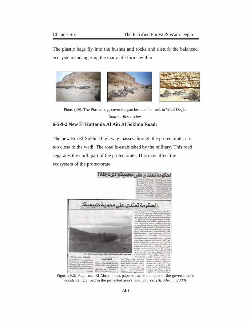
Chapter Six The Petrified Forest & Wadi Degla
- 240 -
The plastic bags fly into the bushes and rocks and disturb the balanced
ecosystem endangering the many life forms within.
Photo (49): The Plastic bags cover the patches and the rock in Wadi Degla.
Source: Researcher 6-5-9-2 New El Kattamia Al Ain Al Sokhna Road:
The new Ein El-Sokhna high way passes through the protectorate; it is
too close to the wadi. The road is established by the military. This road
separates the north part of the protectorate. This may affect the
ecosystem of the protectorate.
Figure (92): Page from El Ahram news paper shows the impact of the government's constructing a road in the protected area's land. Source: (AL Ahram, 2000)
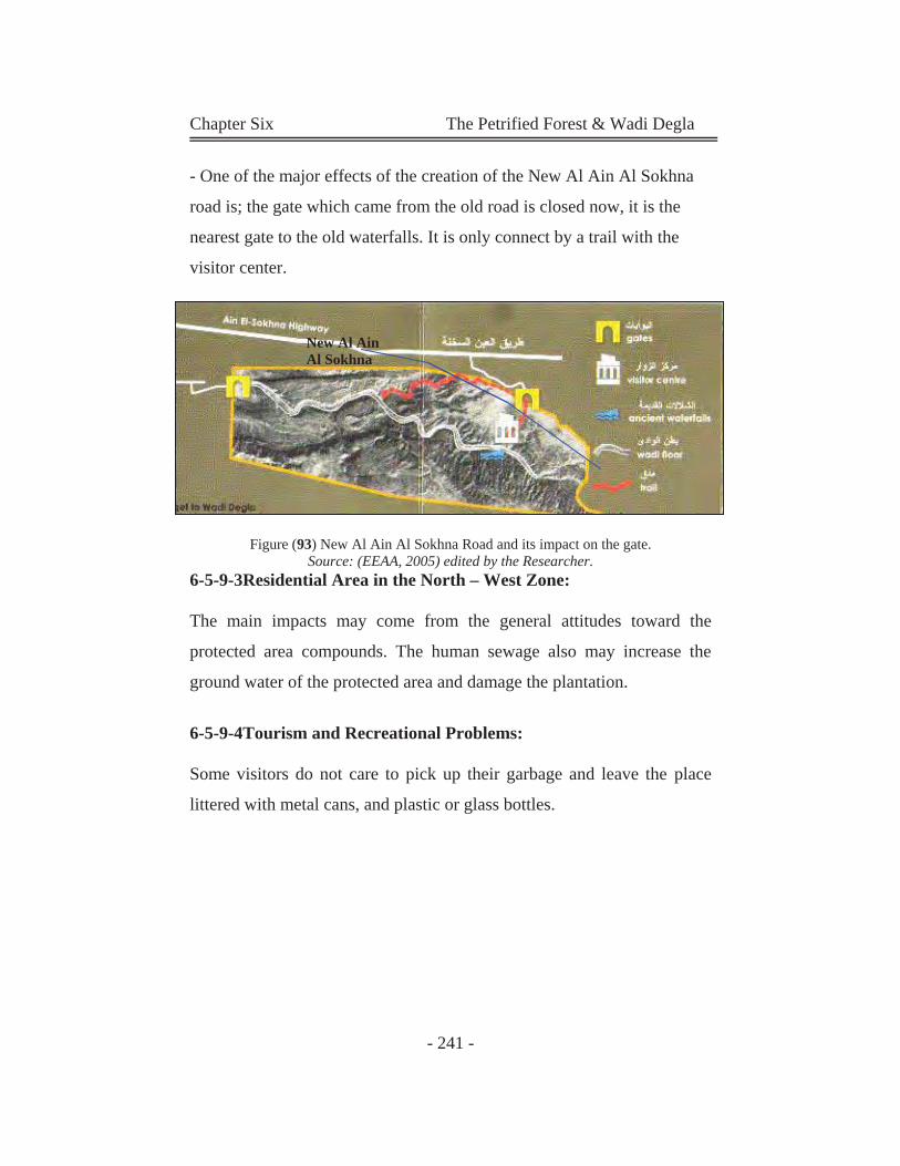
Chapter Six The Petrified Forest & Wadi Degla
- 241 -
- One of the major effects of the creation of the New Al Ain Al Sokhna
road is; the gate which came from the old road is closed now, it is the
nearest gate to the old waterfalls. It is only connect by a trail with the
visitor center.
Figure (93) New Al Ain Al Sokhna Road and its impact on the gate.
Source: (EEAA, 2005) edited by the Researcher. 6-5-9-3Residential Area in the North – West Zone:
The main impacts may come from the general attitudes toward the
protected area compounds. The human sewage also may increase the
ground water of the protected area and damage the plantation.
6-5-9-4Tourism and Recreational Problems:
Some visitors do not care to pick up their garbage and leave the place
littered with metal cans, and plastic or glass bottles.
New Al Ain Al Sokhna
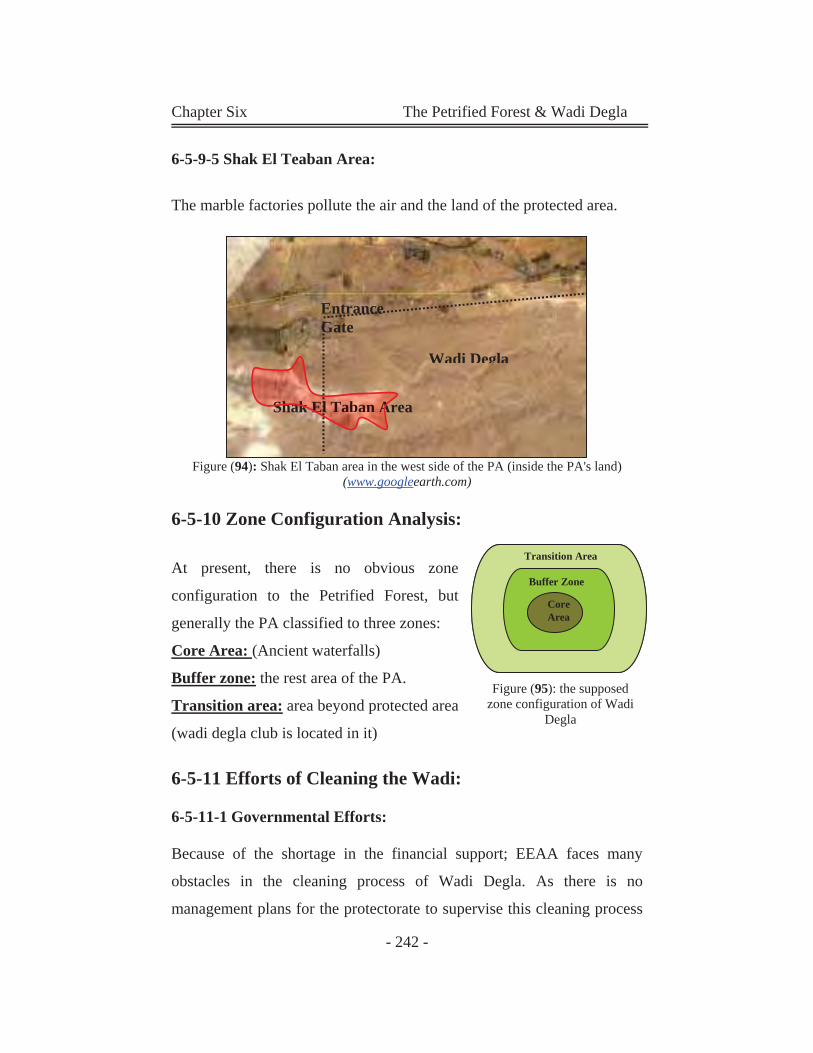
Chapter Six The Petrified Forest & Wadi Degla
- 242 -
6-5-9-5 Shak El Teaban Area:
The marble factories pollute the air and the land of the protected area.
Figure (94): Shak El Taban area in the west side of the PA (inside the PA's land) (www.googleearth.com)
6-5-10 Zone Configuration Analysis:
At present, there is no obvious zone
configuration to the Petrified Forest, but
generally the PA classified to three zones:
Core Area: (Ancient waterfalls)
Buffer zone: the rest area of the PA.
Transition area: area beyond protected area
(wadi degla club is located in it)
6-5-11 Efforts of Cleaning the Wadi:
6-5-11-1 Governmental Efforts:
Because of the shortage in the financial support; EEAA faces many
obstacles in the cleaning process of Wadi Degla. As there is no
management plans for the protectorate to supervise this cleaning process
Transition Area
Buffer Zone
CoreArea
Transition Area
Buffer Zone
CoreArea
Figure (95): the supposed zone configuration of Wadi
Degla
Wadi Degla
Shak El Taban Area Shak El Taban A
Entrance Gate
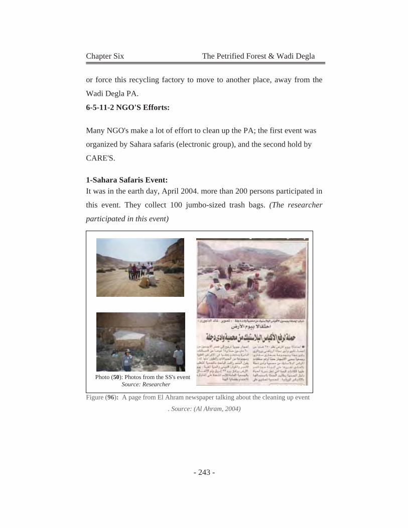
Chapter Six The Petrified Forest & Wadi Degla
- 243 -
or force this recycling factory to move to another place, away from the
Wadi Degla PA.
6-5-11-2 NGO'S Efforts:
Many NGO's make a lot of effort to clean up the PA; the first event was
organized by Sahara safaris (electronic group), and the second hold by
CARE'S.
1-Sahara Safaris Event: It was in the earth day, April 2004. more than 200 persons participated in
this event. They collect 100 jumbo-sized trash bags. (The researcher
participated in this event)
Figure (96): A page from El Ahram newspaper talking about the cleaning up event
. Source: (Al Ahram, 2004)
Photo (50): Photos from the SS's event Source: Researcher
Chapter Six The Petrified Forest & Wadi Degla
- 244 -
2-Tri-Earthalon Event:
In April, 2005, a CARE International cleanup campaign attracted
American School in Cairo students who were already on a field trip to
Wadi Degla, a group of students from an all-female public school in
Fayoum as well as SSG members and foreign residents of Cairo. Using
garbage bags and gloves, the team had managed to clear one entire
section of the wadi. "This kind of event aims not just at protecting the
environment but, more importantly, raising public awareness of it,"
according to Louis Alexander, assistant country director of CARE
Egypt. It is always important to demonstrate that cleanups are not the
work of garbage collectors; they are for people who want to clean up
their environment no matter what their position in society. "The
ultimate aim is to make a genuine difference."
With more than 100 jumbo-sized trash bags collected, the Tri-Earthalon
was able to promote community participation, environmental awareness
and Corporate Social Responsibility (CSR) in Egypt, while getting
people out of the busy city to rediscover the beauty and value of natural
settings like Wadi Degla
CARE Egypt organized the event in partnership with the Egyptian
Environmental Affairs Agency (EEAA). Various corporate sponsors sent
teams to participate in the clean up and donated generously, including
ShopRite chain of grocery stores that donated water and fresh fruits for
all the participants, Cadbury donated Moro chocolate bars, and Wadi
Degla Sporting Club catered the post event barbecue.
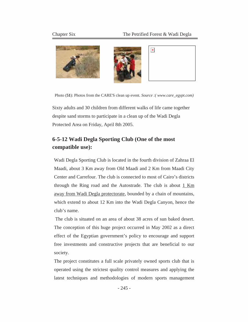
Chapter Six The Petrified Forest & Wadi Degla
- 245 -
Photo (51): Photos from the CARE'S clean up event. Source :( www.care_egypt.com)
Sixty adults and 30 children from different walks of life came together
despite sand storms to participate in a clean up of the Wadi Degla
Protected Area on Friday, April 8th 2005.
6-5-12 Wadi Degla Sporting Club (One of the most compatible use):
Wadi Degla Sporting Club is located in the fourth division of Zahraa El
Maadi, about 3 Km away from Old Maadi and 2 Km from Maadi City
Center and Carrefour. The club is connected to most of Cairo’s districts
through the Ring road and the Autostrade. The club is about 1 Km
away from Wadi Degla protectorate, bounded by a chain of mountains,
which extend to about 12 Km into the Wadi Degla Canyon, hence the
club’s name.
The club is situated on an area of about 38 acres of sun baked desert.
The conception of this huge project occurred in May 2002 as a direct
effect of the Egyptian government’s policy to encourage and support
free investments and constructive projects that are beneficial to our
society.
The project constitutes a full scale privately owned sports club that is
operated using the strictest quality control measures and applying the
latest techniques and methodologies of modern sports management
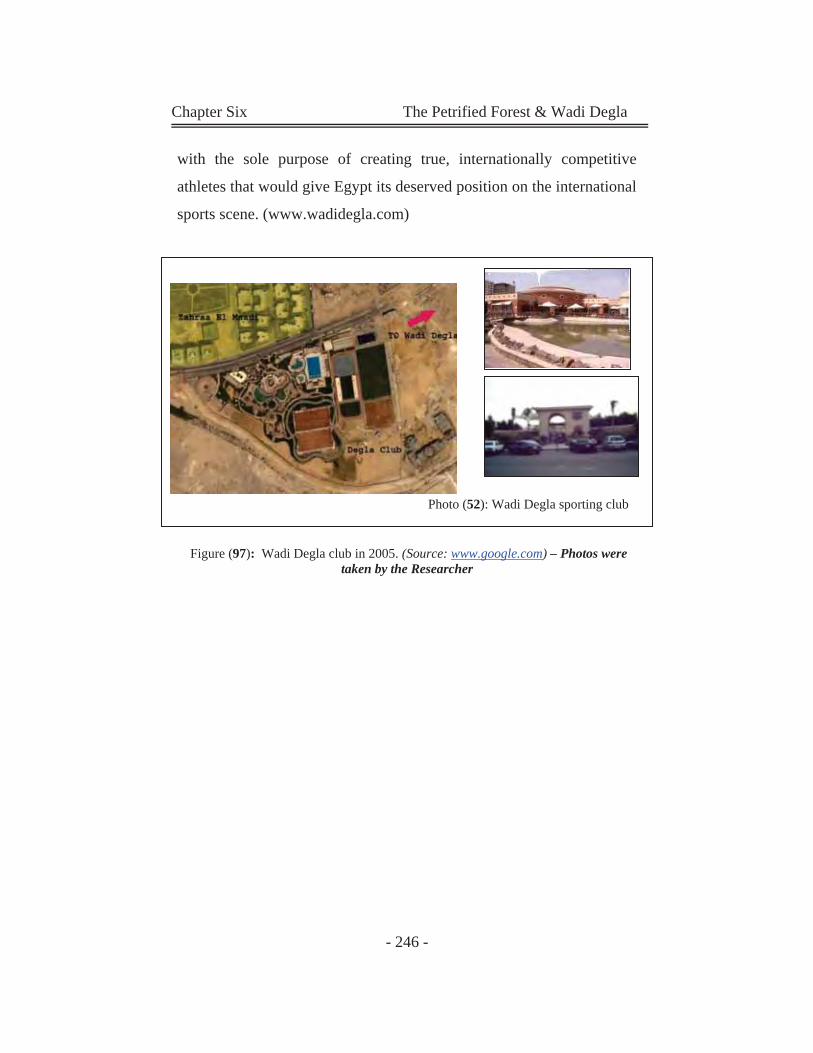
Chapter Six The Petrified Forest & Wadi Degla
- 246 -
with the sole purpose of creating true, internationally competitive
athletes that would give Egypt its deserved position on the international
sports scene. (www.wadidegla.com)
Figure (97): Wadi Degla club in 2005. (Source: www.google.com) – Photos were taken by the Researcher
Photo (52): Wadi Degla sporting club
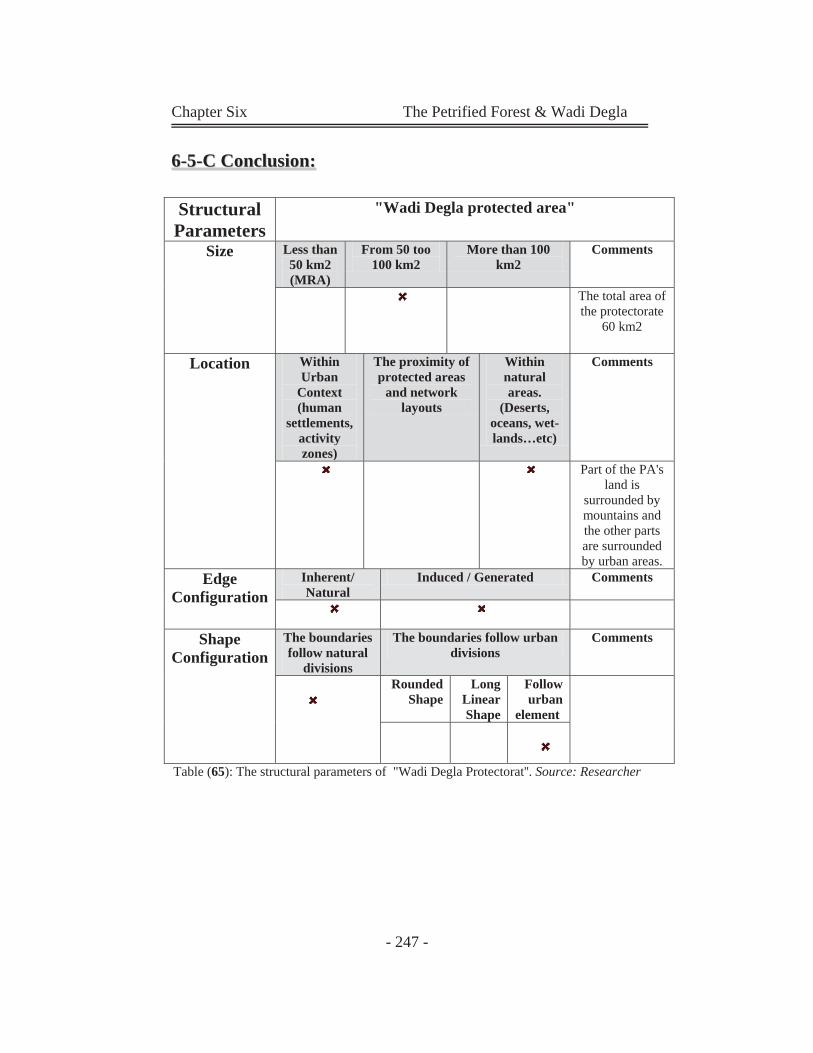
Chapter Six The Petrified Forest & Wadi Degla
- 247 -
66--55--CC CCoonncclluussiioonn::
Table (65): The structural parameters of "Wadi Degla Protectorat''. Source: Researcher
Structural Parameters
"Wadi Degla protected area"
Size Less than 50 km2 (MRA)
From 50 too 100 km2
More than 100 km2
Comments
The total area of the protectorate
60 km2
Location Within Urban
Context (human
settlements, activity zones)
The proximity of protected areas
and network layouts
Within natural areas.
(Deserts, oceans, wet-lands…etc)
Comments
Part of the PA's land is
surrounded by mountains and the other parts are surrounded by urban areas.
Edge Configuration
Inherent/ Natural
Induced / Generated Comments
Shape Configuration
The boundaries follow natural
divisions
The boundaries follow urban divisions
Comments
Rounded Shape
Long Linear Shape
Follow urban
element
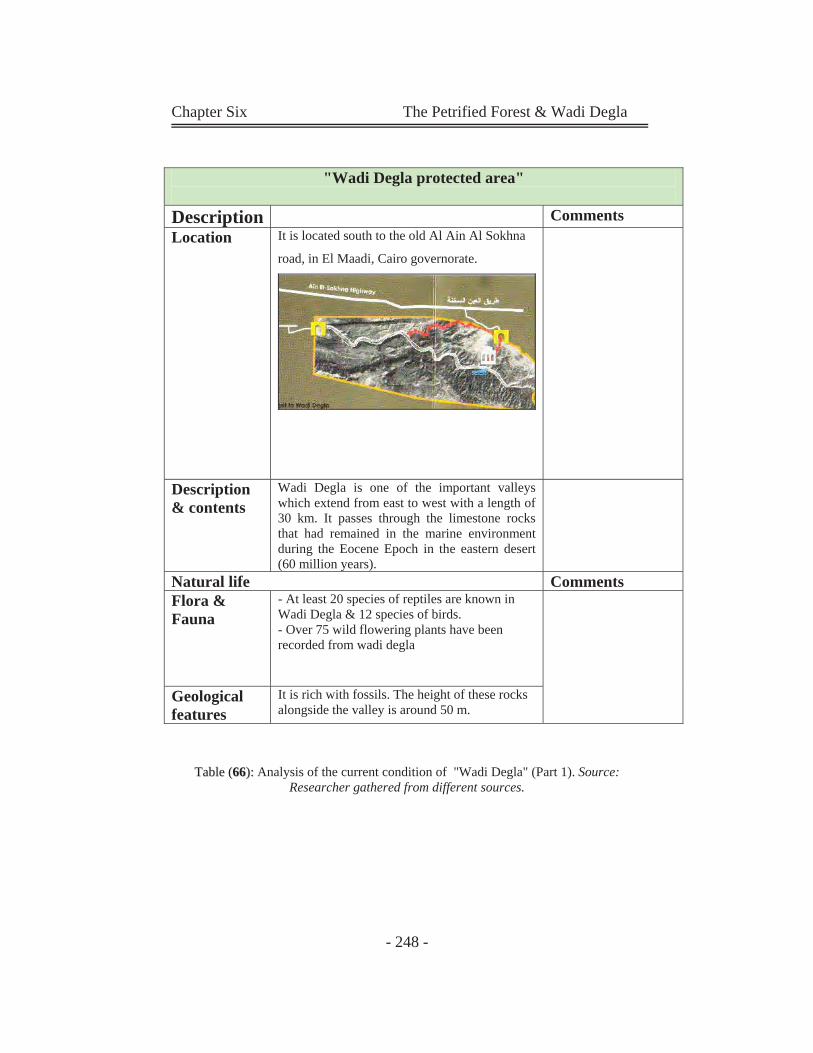
Chapter Six The Petrified Forest & Wadi Degla
- 248 -
TTaabbllee ((6666)):: Analysis of the current condition of "Wadi Degla" (Part 1). Source:
Researcher gathered from different sources.
"Wadi Degla protected area"
Description CommentsLocation It is located south to the old Al Ain Al Sokhna
road, in El Maadi, Cairo governorate.
Description & contents
Wadi Degla is one of the important valleys which extend from east to west with a length of 30 km. It passes through the limestone rocks that had remained in the marine environment during the Eocene Epoch in the eastern desert (60 million years).
Natural life CommentsFlora & Fauna
- At least 20 species of reptiles are known in Wadi Degla & 12 species of birds.- Over 75 wild flowering plants have been recorded from wadi degla
Geological features
It is rich with fossils. The height of these rocks alongside the valley is around 50 m.
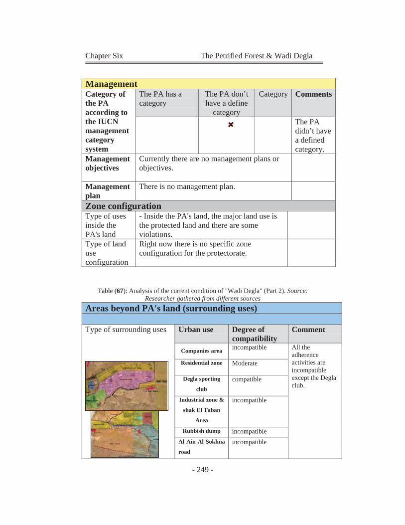
Chapter Six The Petrified Forest & Wadi Degla
- 249 -
TTaabbllee ((6677)):: Analysis of the current condition of "Wadi Degla" (Part 2). Source: Researcher gathered from different sources
ManagementCategory of the PA according to the IUCN management category system
The PA has a category
The PA don’t have a define
category
Category Comments
The PA didn’t have a defined category.
Management objectives
Currently there are no management plans or objectives.
Management plan
There is no management plan.
Zone configurationType of uses inside the PA's land
- Inside the PA's land, the major land use is the protected land and there are some violations.
Type of land use configuration
Right now there is no specific zone configuration for the protectorate.
Areas beyond PA's land (surrounding uses) Type of surrounding uses
Urban use Degree of compatibility
Comment
Companies area incompatible All the adherence activities are incompatible except the Degla club.
Residential zone Moderate
Degla sporting
club compatible
Industrial zone &
shak El Taban
Area
incompatible
Rubbish dump incompatible Al Ain Al Sokhna
road incompatible
Chapter Six The Petrified Forest & Wadi Degla
- 250 -
From the previous study can be summarized in the following points:
Only a good management plan could boost the status of Wadi
Degla. The area requires advertising: "What we can do is to
keep cleaning it up and preserving it, but the EEAA has to do
the rest, introducing a good marketing campaign to generate
resources.
Over the past few months, the protectorate's boundaries have
been redrawn several times in an attempt to reduce the polluted
area from the garbage. (In this protectorate also the external
forces (urban influences) acting on the area are greater than
internal forces (conservation management). As a result, the
protected area suffers from violations and neglecting).
Although the dangerous violations that took place in the national
protectorate of Wadi Degla in Maadi (such as constructing a
highway through it and the growing amount of garbage
surrounding it), there are no officials attitudes towards that
excepts the redraw of the boundaries.
It is necessary to save the protectorate from the severely
dangerous violations that it is facing.
It is necessary to take the necessary measures to stop these
violations as promptly as possible.
Most of the surrounding uses are incompatible use to the
protectorate. The most suitable and compatible use is wadi degla
club. (as a recreational facility)
The problem of wadi degla not only the growth of urban
expansions, but also the existing land uses. As wadi degla was
declared in 1999 and until that date some urban uses were
around it.
Chapter Six The Petrified Forest & Wadi Degla
- 251 -
There is a main conflict between aims of development and aims
of conservation in this protectorate.
Wadi degla also suffers from the neglection of its presence in
national plans.
6-6Relation between the Petrified Forest & Wadi
Degla:
The valley's geological life goes back more than 50 million years to the
Eocene epoch. The majestic cliffs to each side of the valley were the
river banks, and the valley itself was the river bed. The high cliffs are a
powerful natural barrier even now, and have protected the valley's
various life forms effectively.
The Petrified Forest nearby is 35 million years old. The geological
formations of Wadi Degla are 50-60 million years old; if the Wadi's
habitat or local environment is so different from a physiographic point of
view, this is because it forms part of the northern Eocene limestone
plateau," according to El-Qassass.
Only the Petrified Forest offers such a distinct habitat, although it lacks
the richness of plant and animal life one can observe in the Wadi. None
of Egypt's 24 other protected areas can boast such exceptional
characteristics.
This is why the researcher proposes that it would be wiser to consider the
Wadi as a part of the Petrified Forest reserve, rather than declaring it an
independent protected area, a network could be made between the two
protectorates.
Chapter Six The Petrified Forest & Wadi Degla
- 252 -
We don’t mean here a species network, but it can be a recreational and
multi use area.
6-7 Summary of Chapter six:
- Despite protection efforts in Egypt, Egyptian protectorates suffer from
many problems e.g:
The presence of a preserved natural area within the urban context,
as a result of unplanned urban activities in close adherence to
these preserved areas. This obviously appears in three Egyptian
protectorates; El Hassana Dome, The Petrified Forest and Wadi
Degla Protectorates. The main problem that faces these protectorates is; conflicts
between aims of conservation and aims of development.
Because of this conflicts, urban expansions grows covering
almost 99% of the real area of the petrified forest, as the declared
area is only 0.06 from the real area of the fossil tree trunks.
In addition, Wadi Degla and the petrified forest face many
conflicts and challenges; such as:
- Conflict in Situation (Those areas face many obstacles to fulfill the
needed, efficient conservation, maintenance, and management. the
presence of natural reserved area within the urban context might have
impacts on the main Development Plan of the city, which is not
recognized)
- Conflict in Aim (The main conflict is between aims of conservation
and aims of development)
Chapter Six The Petrified Forest & Wadi Degla
- 253 -
- Conflict in Uses and Activities: (surrounded activities are ignored to
the adequate profit derived from this important area)
There are no regulations controlling types of uses established
there; as well as, there are no special regulations controlling
densities, heights, ways or materials of constructions around the
protectorate.
Many Governmental Authorities bodies are involved in Wadi
Degla and the Petrified Forest Management. In addition, there is
no cooperation between this agencies and stakeholders, which
causes many problems and challenges in the protection process.
Evaluation of the Efficiency of Protection
It is clear that the Petrified Forest area and Wadi Degla lack efficient
protection due to the inadequate uses around its site. Such uses may
affect environment and destroy the fossilized tree trunks through polluted
air or underground polluted water, and destroy the geological form of
Wadi Degla
- The current plan of the peripheral area does not
provide the buffer zone needed to improve the
protection of the nature reserves.
- There are no restrictions of development in
accordance with the distance to the reserved area.
- The information centre (usually closed) doesn't have
staff highly skilled in protection and management
- Actually the external forces (urban influences) acting on
the area are greater than internal forces (conservation
management). As a result, the protected area suffers
from violations and neglect).
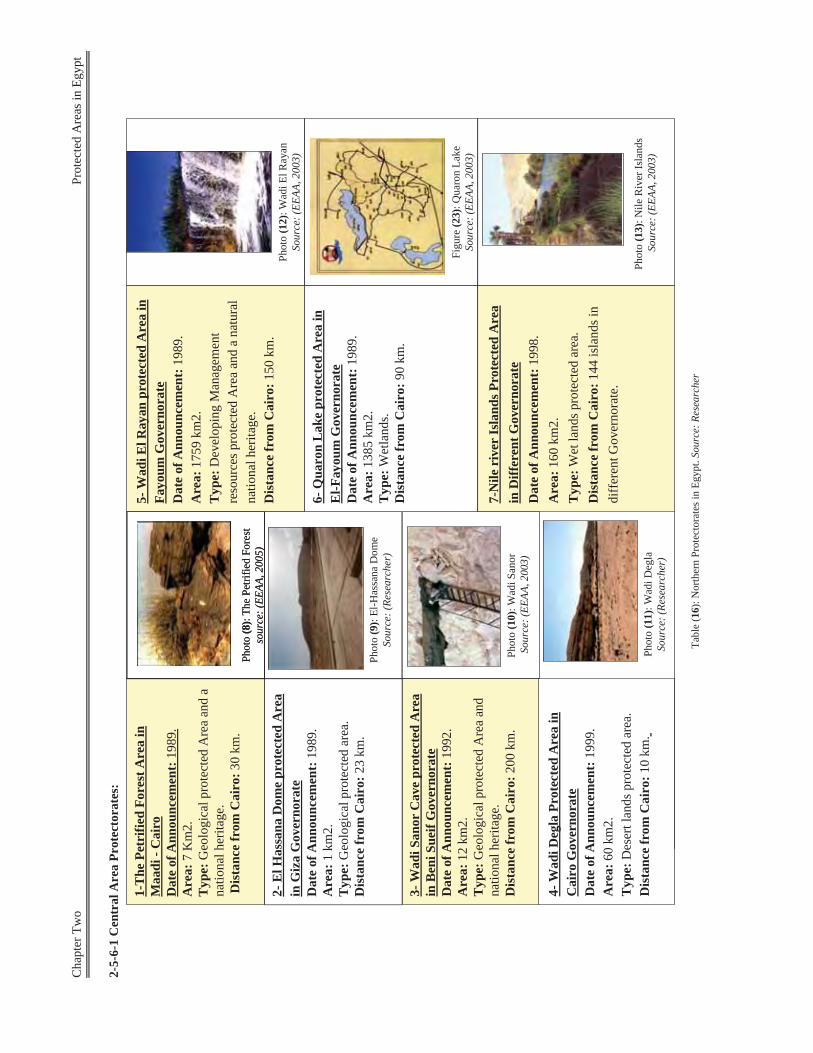
Cha
pter
Tw
o
Pro
tect
ed A
reas
in E
gypt
2-5-
6-1
Cen
tral
Are
a Pr
otec
tora
tes:
Tabl
e (1
6): N
orth
ern
Prot
ecto
rate
s in
Egyp
t. So
urce
: Res
earc
her
Phot
o (8
): Th
e Pe
trifie
d Fo
rest
so
urce
: (EE
AA, 2
005)
Phot
o (8
): Th
e Pe
trifie
d Fo
rest
so
urce
: (EE
AA, 2
005)
2-E
l Has
sana
Dom
e pr
otec
ted
Are
a in
Giz
aG
over
nora
teD
ate
of A
nnou
ncem
ent:
1989
. A
rea:
1 km
2.
Typ
e:G
eolo
gica
l pro
tect
ed a
rea.
Dis
tanc
e fr
om C
airo
:23
km.
Phot
o (9
): El
-Has
sana
Dom
e So
urce
: (Re
sear
cher
)
Phot
o (1
0): W
adiS
anor
Sour
ce: (
EEAA
, 200
3)
3-W
adiS
anor
Cav
e pr
otec
ted
Are
a in
Ben
iSue
ifG
over
nora
te
Dat
e of
Ann
ounc
emen
t:19
92.
Are
a:12
km
2.
Typ
e:G
eolo
gica
l pro
tect
ed A
rea
and
natio
nal h
erita
ge.
Dis
tanc
e fr
om C
airo
:200
km
.
1-T
he P
etri
fied
Fore
st A
rea
in
Maa
di-C
airo
Dat
e of
Ann
ounc
emen
t:19
89.
Are
a:7
Km
2.
Typ
e:G
eolo
gica
l pro
tect
ed A
rea
and
a na
tiona
l her
itage
.D
ista
nce
from
Cai
ro:3
0 km
.
5-W
adiE
l Ray
anpr
otec
ted
Are
a in
Fa
youm
Gov
erno
rate
D
ate
of A
nnou
ncem
ent:
1989
. A
rea:
1759
km
2.T
ype:
Dev
elop
ing
Man
agem
ent
reso
urce
s pro
tect
ed A
rea
and
a na
tura
l na
tiona
l her
itage
. D
ista
nce
from
Cai
ro:1
50 k
m.
Phot
o (1
2): W
adiE
l Ray
anSo
urce
: (EE
AA, 2
003)
6-Q
uaro
nL
ake
prot
ecte
d A
rea
in
El-F
ayou
mG
over
nora
teD
ate
of A
nnou
ncem
ent:
1989
. A
rea:
1385
km
2.T
ype:
Wet
land
s.D
ista
nce
from
Cai
ro:9
0 km
.
Phot
o (1
3): N
ile R
iver
Isla
nds
Sour
ce: (
EEAA
, 200
3)
7-N
ile r
iver
Isla
nds P
rote
cted
Are
a in
Diff
eren
t Gov
erno
rate
D
ate
of A
nnou
ncem
ent:
1998
. A
rea:
160
km2.
T
ype:
Wet
land
s pro
tect
ed a
rea.
D
ista
nce
from
Cai
ro:1
44 is
land
s in
diff
eren
t Gov
erno
rate
.
Phot
o (1
1): W
adiD
egla
Sour
ce: (
Rese
arch
er)
4-W
adiD
egla
Prot
ecte
d A
rea
in
Cai
ro G
over
nora
teD
ate
of A
nnou
ncem
ent:
1999
.A
rea:
60
km2.
Typ
e: D
eser
t lan
ds p
rote
cted
are
a.D
ista
nce
from
Cai
ro: 1
0 km
.
Figu
re (2
3): Q
uaro
nLa
ke
Sour
ce: (
EEAA
, 200
3)
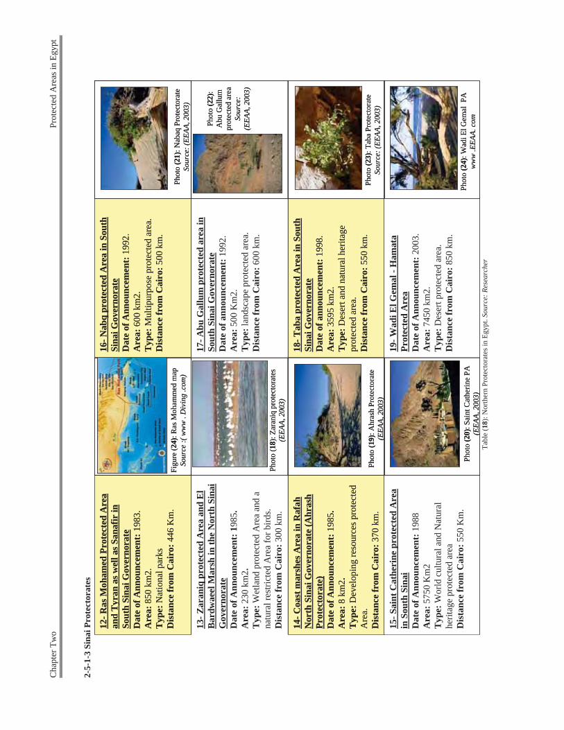
Cha
pter
Tw
o
Pro
tect
ed A
reas
in E
gypt
2-5-
1-3
Sina
i Pro
tect
orat
es
Tabl
e (1
8): N
orth
ern
Prot
ecto
rate
s in
Egyp
t. So
urce
: Res
earc
her
13-Z
aran
iqpr
otec
ted
Are
a an
d E
l B
ardw
aeel
Mar
sh in
the
Nor
th S
inai
G
over
nora
teD
ate
of A
nnou
ncem
ent:
1985
. A
rea:
230
km
2.
Typ
e: W
etla
nd p
rote
cted
Are
a an
d a
natu
ral r
estri
cted
Are
a fo
r bird
s.D
ista
nce
from
Cai
ro: 3
00 k
m.
14-C
oast
mar
shes
Are
a in
Raf
ahN
orth
Sin
ai G
over
nora
te (A
hras
hPr
otec
tora
te)
Dat
e of
Ann
ounc
emen
t: 19
85.
Are
a: 8
km
2.T
ype:
Dev
elop
ing
reso
urce
s pro
tect
ed
Are
a.D
ista
nce
from
Cai
ro: 3
70 k
m.
12-R
asM
oham
ed P
rote
cted
Are
a an
d Ty
ran
as w
ell a
s San
afir
in
Sout
h Si
nai G
over
nora
teD
ate
of A
nnou
ncem
ent:
1983
.A
rea:
850
km
2.T
ype:
Nat
iona
l par
ksD
ista
nce
from
Cai
ro: 4
46 K
m.
15-S
aint
Cat
heri
ne p
rote
cted
Are
a in
Sou
th S
inai
Dat
e of
Ann
ounc
emen
t: 19
88
Are
a: 5
750
Km
2T
ype:
Wor
ld c
ultu
ral a
nd N
atur
al
herit
age
prot
ecte
d ar
eaD
ista
nce
from
Cai
ro: 5
50 K
m.
Figu
re (2
4): R
asM
oham
med
map
So
urce
:( w
ww
. D
ivin
g .c
om)
Phot
o (1
8): Z
aran
iqpr
otec
tora
tes
(EEA
A, 2
003)
Phot
o (1
9): A
hras
hPr
otec
tora
te
(EEA
A, 2
003)
Phot
o (2
0): S
aint
Cat
herin
e PA
(EEA
A, 2
003)
17-A
bu G
allu
mpr
otec
ted
area
in
Sout
h Si
nai G
over
nora
teD
ate
of a
nnou
ncem
ent:
1992
.A
rea:
500
Km
2.T
ype:
land
scap
e pr
otec
ted
area
.D
ista
nce
from
Cai
ro: 6
00 k
m.
18-T
aba
prot
ecte
d A
rea
in S
outh
Si
nai G
over
nora
teD
ate
of a
nnou
ncem
ent:
1998
. A
rea:
3595
km
2.
Typ
e:D
eser
t and
nat
ural
her
itage
pr
otec
ted
area
. D
ista
nce
from
Cai
ro:5
50 k
m.
16-N
abq
prot
ecte
d A
rea
in S
outh
Si
nai G
over
nora
teD
ate
of A
nnou
ncem
ent:
1992
.A
rea:
600
km2.
T
ype:
Mul
tipur
pose
pro
tect
ed a
rea.
Dis
tanc
e fr
om C
airo
:500
km
.
19-W
adiE
l Gem
al-H
amat
aPr
otec
ted
Are
aD
ate
of A
nnou
ncem
ent:
2003
. A
rea:
7450
km
2.T
ype:
Des
ert p
rote
cted
are
a.
Dis
tanc
e fr
om C
airo
:850
km
.
Phot
o (2
1): N
abaq
Prot
ecto
rate
So
urce
: (EE
AA, 2
003)
Phot
o (2
2):
Abu
Gal
lum
prot
ecte
d ar
ea
Sour
ce:
(EEA
A, 2
003)
Phot
o (2
3): T
aba
Prot
ecto
rate
So
urce
: (EE
AA, 2
003)
Phot
o (2
4): W
adiE
l Gem
alPA
ww
w .E
EAA.
com
13-Z
aran
iqpr
otec
ted
Are
a an
d E
l B
ardw
aeel
Mar
sh in
the
Nor
th S
inai
G
over
nora
teD
ate
of A
nnou
ncem
ent:
1985
. A
rea:
230
km
2.
Typ
e: W
etla
nd p
rote
cted
Are
a an
d a
natu
ral r
estri
cted
Are
a fo
r bird
s.D
ista
nce
from
Cai
ro: 3
00 k
m.
14-C
oast
mar
shes
Are
a in
Raf
ahN
orth
Sin
ai G
over
nora
te (A
hras
hPr
otec
tora
te)
Dat
e of
Ann
ounc
emen
t: 19
85.
Are
a:8
km2.
Typ
e: D
evel
opin
g re
sour
ces p
rote
cted
A
rea.
Dis
tanc
e fr
om C
airo
:370
km
.
14-C
oast
mar
shes
Are
a in
Raf
ahN
orth
Sin
ai G
over
nora
te (A
hras
hPr
otec
tora
te)
Dat
e of
Ann
ounc
emen
t: 19
85.
Are
a: 8
km
2.T
ype:
Dev
elop
ing
reso
urce
s pro
tect
ed
Are
a.D
ista
nce
from
Cai
ro: 3
70 k
m.
12-R
asM
oham
ed P
rote
cted
Are
aan
dTy
ran
as w
ell a
sSan
afir
in
Sout
h Si
nai G
over
nora
teD
ate
of A
nnou
ncem
ent:
1983
.A
rea:
850
km2.
Typ
e:N
atio
nal p
arks
Dis
tanc
e fr
om C
airo
: 446
Km
.
12-R
asM
oham
ed P
rote
cted
Are
a an
d Ty
ran
as w
ell a
s San
afir
in
Sout
h Si
nai G
over
nora
teD
ate
of A
nnou
ncem
ent:
1983
.A
rea:
850
km
2.T
ype:
Nat
iona
l par
ksD
ista
nce
from
Cai
ro: 4
46 K
m.
15-S
aint
Cat
heri
ne p
rote
cted
Are
a in
Sou
th S
inai
Dat
e of
Ann
ounc
emen
t: 19
88
Are
a: 5
750
Km
2T
ype:
Wor
ld c
ultu
ral a
nd N
atur
al
herit
age
prot
ecte
d ar
eaD
ista
nce
from
Cai
ro: 5
50 K
m.
Figu
re (2
4): R
asM
oham
med
map
So
urce
:( w
ww
. D
ivin
g .c
om)
Phot
o (1
8): Z
aran
iqpr
otec
tora
tes
(EEA
A, 2
003)
Phot
o (1
9): A
hras
hPr
otec
tora
te
(EEA
A, 2
003)
Phot
o (2
0): S
aint
Cat
herin
e PA
(EEA
A, 2
003)
17-A
bu G
allu
mpr
otec
ted
area
in
Sout
h Si
nai G
over
nora
teD
ate
of a
nnou
ncem
ent:
1992
.A
rea:
500
Km
2.T
ype:
land
scap
e pr
otec
ted
area
.D
ista
nce
from
Cai
ro: 6
00 k
m.
18-T
aba
prot
ecte
d A
rea
in S
outh
Si
nai G
over
nora
teD
ate
of a
nnou
ncem
ent:
1998
. A
rea:
3595
km
2.
Typ
e:D
eser
t and
nat
ural
her
itage
prot
ecte
d ar
ea.
Dis
tanc
e fr
om C
airo
:550
km
.
18-T
aba
prot
ecte
d A
rea
in S
outh
Si
nai G
over
nora
teD
ate
of a
nnou
ncem
ent:
1998
. A
rea:
3595
km
2.
Typ
e:D
eser
t and
nat
ural
her
itage
pr
otec
ted
area
. D
ista
nce
from
Cai
ro:5
50 k
m.
16-N
abq
prot
ecte
d A
rea
in S
outh
Sina
i Gov
erno
rate
Dat
e of
Ann
ounc
emen
t:19
92.
Are
a:60
0 km
2.T
ype:
Mul
tipur
pose
pro
tect
ed a
rea.
Dis
tanc
e fr
om C
airo
:500
km
.
16-N
abq
prot
ecte
d A
rea
in S
outh
Si
nai G
over
nora
teD
ate
of A
nnou
ncem
ent:
1992
.A
rea:
600
km2.
T
ype:
Mul
tipur
pose
pro
tect
ed a
rea.
Dis
tanc
e fr
om C
airo
:500
km
.
19-W
adiE
l Gem
al-H
amat
aPr
otec
ted
Are
aD
ate
of A
nnou
ncem
ent:
2003
. A
rea:
7450
km
2.T
ype:
Des
ert p
rote
cted
are
a.
Dis
tanc
e fr
om C
airo
:850
km
.
Phot
o (2
1): N
abaq
Prot
ecto
rate
So
urce
: (EE
AA, 2
003)
Phot
o (2
2):
Abu
Gal
lum
prot
ecte
d ar
ea
Sour
ce:
(EEA
A, 2
003)
Phot
o (2
3): T
aba
Prot
ecto
rate
So
urce
: (EE
AA, 2
003)
Phot
o (2
4): W
adiE
l Gem
alPA
ww
w .E
EAA.
com
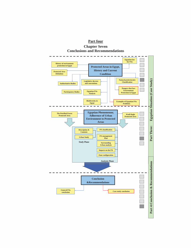
Part four Chapter Seven
Conclusions and Recommendations
History of environment protection in Egypt
Protected Area Definition
Authoritative Bodies
Participatory Bodies Egyptian PAsAnalysis
Biodiversity in Egypt
Examples of Egyptian PAsProblems
Egyptian law for PAs
Natural protectorates Classification
Dangers that face Environment
Protection in Egypt
Legislative decrees and conventions
Protected Areas in Egypt, History and Current
Condition
Part
Thr
ee:
E
gypt
ian
Situ
atio
n (C
ase
Stud
y)
The Petrified Forest Protected Area
Wadi DeglaProtected Area
Description & Contents
Urban Study
Study Phase
Description & Contents
Urban Study
Study Phase
PA classification
PA management Plan
Analysis Phase
Surrounding Urban analysis
Impacts on the PA
Zone configuration
PA classification
PA management Plan
Analysis Phase
Surrounding Urban analysis
Impacts on the PA
Zone configuration
Egyptian Phenomenon; Adherence of Urban
Environment to Protected Areas
Conclusion &Recommendations
General PAsconclusion Case study conclusion
Part
4:C
oncl
usio
n &
Rec
omm
enda
tions
Chapter seven Conclusions & Recommendations
254
Conclusions & Recommendations:
Despite protection efforts in Egypt, Egyptian protectorates suffer from
many problems:
The presence of preserved natural area within the urban context,
this was as a result of the unplanned urban activities and its close
adherence to these preserved areas. This obviously appears in
three Egyptian protectorates; El Hassana Dome, The Petrified
Forest and Wadi Degla Protectorates. The main problem that faces these protectorates is; conflicts
between aims of conservation and aims of development.
Because of this conflicts, urban expansions grows to take almost
99% of the real area of the petrified forest, as the declared area is
takes only 0.06 from the real area of the fossil tree trunks.
Beside that, Wadi Degla and the petrified forest face many
conflicts and challenges; like:
- Conflict in Situation (Those areas find many obstacles to realize the
needed and the efficient conservation, maintenance, and management
on one hand. On the other hand, the presence of natural reserved area
within the urban context might have impacts on the main
Development Plan of the city, which is not realized in fact)
- Conflict in Aim (The main conflict is between aims of conservation
and aims of development)
- Conflict in Uses and Activities: (surrounded activities don't realize
the adequate profit from that important area)
Chapter seven Conclusions & Recommendations
255
There is no regulation or restrictions controlling types of uses
established there; as well as, there are no special regulations
controlling densities, heights, ways or materials of constructions
around the protectorate.
Many participants are involved in Wadi Degla and the Petrified
Forest Management. In addition, there is no cooperation between
this agencies and stakeholders, this cause many problems and
challenges in the protection process.
It's clear now that the current situation of the Petrified Forest Area and
Wadi Degla represent a threat that can destroy the unique ecological
feature. Then, an important scientific and tourist resource might be
loosed.
The study is primarily concerned with the formulation of a methodology
by which areas of distinct environmental value can be maintained in
today's situation of burgeoning human needs. This is attempted through
the integration, of conservation and development by means of
management tools.
In discussing and analyzing these tools. The research has provided an
understanding of the following concepts:
The conservation of ecological processes is essential for the
sustenance of existence of all life, including human, on earth. Man's
responsibilities to maintain the self-renewing capability of these
processes and natural environment must be recognized.
The eco-centric attitude establishes that conservation and
development are closely related concepts, whose aims and objectives
Chapter seven Conclusions & Recommendations
256
can be integrated through the framework offered by management
tools.
Protected areas (PAs) are natural sites that conform to environmental
criteria which describe their value as deposits of natural wealth and
their important role in maintaining ecological processes. PAs should
be conserved through the promotion of their developmental value to
insure intergenerational continuity, equity and sustainability. This
should be based on a systematic analysis of the area and of its
ecological links with its surroundings.
In Egypt, despite the long history and multi –sectoral involvement in
conservation, only 24 protected areas are legally protected. These
protected areas cover a diverse range of habitats and contain a
significant percentage of the country's natural resources.
Additionally, they offer much needed development potentials, which
can be sustainable if planned and managed correctly.
Specific recommendations concerning the management of the PAs in
Egypt:
The following recommendations, specifically concerning the situation of
protected areas and their management, have been deduced taking into
account the current degree of development in present in Egypt.
The problem:
Despite efforts, Egypt lacks a sustainable and effective system to
address management issues and has a deficit in national capacity
in the field of nature conservation. This is because the conflicts
between aim of conservation and aims of development.
Chapter seven Conclusions & Recommendations
257
The external forces (urban influences) acting on the
protected areas are greater than internal forces (conservation
management). As a result, the protected area suffers from
violations and neglecting).
The solution:
- There Must be a coordination between the objectives of
preservation of the protected areas and the concept of
development.
- Co-operation with different partners responsible for the
preserved areas in Egypt.
- Good management of the protected areas and supply
financial and publication support.
- The protected area is not a constraint but it can be a
potential to develop the surrounded uses.
- Respect restrictions and enforce the law of the
protectorates.
Recommended actions:
Establish or develop a data collection and inventory program for
natural heritage resources.
Develop and apply criteria and procedures for selecting,
evaluating and designating PAs.
Involved agencies should be provided with the necessary tools to
obtain process, consult and analyze relevant information.
Chapter seven Conclusions & Recommendations
258
The definition of the overall strategy for conserving the natural
environment and PAs system and their inclusion in sectoral
policies and strategies.
Mechanisms for communication and cooperation between the
main authoritative body (EEAA) and other involved agencies
(ministries, local government ...etc) should be set up to avoid
management conflicts.
Encouraging the involvement of local communities and other social and
economic stakeholders in the area. The delegation of supervisory roles
and relevant information should be provided to facilitate participation
and communication.
Recommendations for the Petrified Forest: Conservation and protection for the ecological environment of the
protectorate need highly skilled staff for management and maintenance.
They are concerning the reviewing of the environmental conditions
periodically, and setting the adequate policies and actions.
The Petrified Forest Nature Area that is characterized by natural and
ecological unique features can be the base of the establishment and the
development of many activities, such as tourist, recreational, scientific
activities. Museums, terrarium, research centres are examples of
activities that improve the significance of the protectorate.
Accommodations of light structures, for visitors and daily trippers
camping sites and picnic areas are adequate activities that don't cause
negative impacts to the reserved area, and can improve the recreational
and tourist development around the Petrified Forest Area.
Chapter seven Conclusions & Recommendations
259
The Petrified Forest Nature area needs such development to realize
economic benefit that can contribute to the management and
maintenance costs.
The concentric zones planning concept is the adequate planning concept
that realize the conservation of the natural reserves and the development
of the surrounded area at the same time.
To realize efficient protection for the Petrified Forest areas it is
recommended to:
'Displace all industrial and threatening activities away
from the reserved areas. As well as accomplish as soon
as possible the construction of the fence (the fence may
be a buffer zone not a built fence) and the controlled
entry of the, Petrified Forest Area.
Put regulations and restrictions for any new construction
around the protected area.
Develop the limits of acceptable use and regulations for
all parts in the periphery of the protected areas, set
environmental standards, and ensure they are met.
Determine which tourist activities are compatible with
the protected area such as camping, sightseeing,
picnicking, and develop related policies. Their incomes
should contribute in the maintenance and the
management of the reserved areas
Develop educational and interpretation programs for
visitors and local people that increase understanding and
appreciation of the reserved area
Chapter seven Conclusions & Recommendations
260
The establishment of a research centre and information
centre, to arrange tours and encourage the related
scientific research.
Training programs to improve high skilled staff for the
nature reserves management.
Recommendations for Wadi Degla: To realize efficient protection for the Petrified Forest areas it is
recommended to:
'Displace all the dangerous and threaten activities away
from the reserved areas. (rubbish dump – Shak El
Teaban Area)
Put regulations and restrictions to any new construction
around the protected area.
Develop the limits of acceptable use and regulations for
all parts in the periphery of the protected areas, set
environmental standards, and ensure they are met.
Determine which tourist activities are compatible with
the protected area such as camping, sightseeing,
picnicking, and develop related policies. Their incomes
should contribute in the maintenance and the
management of the reserved areas
Develop educational and interpretation programs for
visitors and local people that increase understanding and
appreciation of the reserved area
The establishment of tourists' facilities and arrange tours
and encourage the related scientific research.
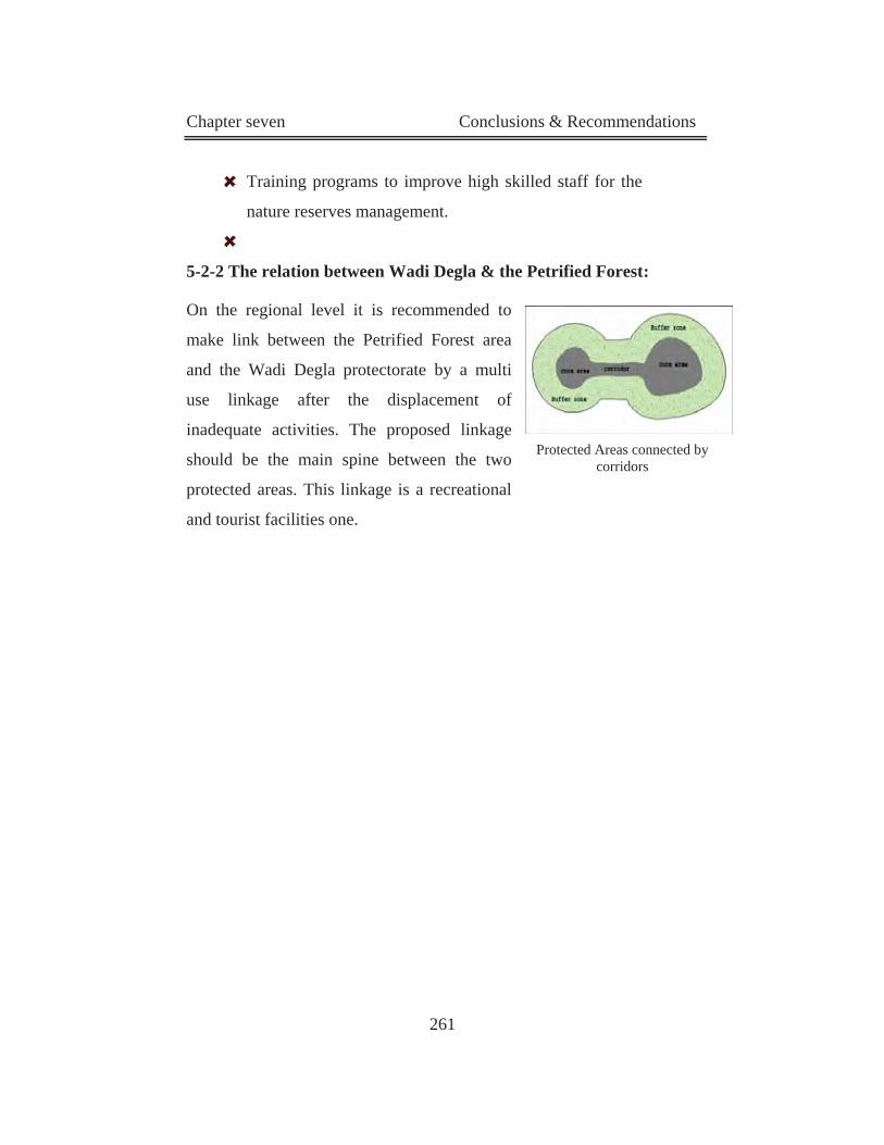
Chapter seven Conclusions & Recommendations
261
Training programs to improve high skilled staff for the
nature reserves management.
5-2-2 The relation between Wadi Degla & the Petrified Forest:
On the regional level it is recommended to
make link between the Petrified Forest area
and the Wadi Degla protectorate by a multi
use linkage after the displacement of
inadequate activities. The proposed linkage
should be the main spine between the two
protected areas. This linkage is a recreational
and tourist facilities one.
Protected Areas connected by corridors

Chapter Seven Conclusions and Recommendations
235
ســــــــــن شمــة عيـــــــــجامع ةـــــــــــــــــة الهندســــــــــــكلي
قسم التخطيط والتصميم الحضري
العالقات المتبادلة بين المحميات الطبيعية والبيئة العمرانية
بحث مقدم للحصول علي درجة الماجستير في التخطيط العمراني
مقدم من الخطيب سماح محمد السيد .م
جامعة عين شمس, كلية الهندسة, معيد بقسم التخطيط العمراني
تحت إشراف محمد تامر الخرزاتي. د.أ
األستاذ بقسم التخطيــــط و التصميــــم العمرانـــي جامعـــة عيــن شمـــس –كليــــــة الهــندســـــــة
غادة فاروق حسن .: د.م.أ يط و التصميم العمراني األستاذ المساعد بقسم التخط
جامعـــة عيــن شمـــس –كليــــــة الهــندســـــــة
2006
:مقدمة
ة , نسان من غالف جوي ويابسةإلالبيئة الطبيعية هي كل ما يحيط با اة البيولوجي ا تتضمن الحي ع كم بجميا ما بين اإلو هناك الكثير من العالقات المتبادلة ,نبات أو حيوان أنواعها من ؤثر فيه ة بحيث ي نسان والبيئ .وتؤثر فيه
ة ة والترفيهي ان الصناعية و األجتماعي طة األنس ة ألنش ي, ونتيج دهور البيئ دود الت ي ح ة إل , وصلت البيئادي بضرو د من األصوات التي تن ة ووظهرت العدي وارد الطبيعي ي الم اظ عل ة رة الحف والمحافظة , البيئي
.حد من التدهورعلي التوازن البيئي والل و م كام ي تفه ول إل ريع للوص دخل الس ب الت ي تتطل ة والت ة الهام ايا البيئي د القض ث ألح رض البح يتع
ة والتي جاء أعالنها كرد فعل صحي, ألبعادها المختلفة أال وهي المحميات الطبيعية ه البيئ لما أصبحت علي.اف مواردها الطبيعيةزن أخطار نتيجة الجور عليها واستنوما تتعرض له م, من تدهور
ام أو تعد الواليات المتحدة األمريكية هي أول من ك ع الم و ذل ة في الع ة طبيعي أ محمي وهي , م 1890نشاللوا, و ذلك لحماية الحيوانات النادرة) يلو ستون بارك ( محمية ر من ث ث تي أصبحت مزارا سياحيا ألكث
.ماليين سائح سنوياةو قد تأخرت مصر بصورة كبيرة ات الطبيعي ام , في إعالن المحمي م 1983ففي ع انون رق م اصدار ق ت
افي و ال, 1983لعام 102 راث الطبيعي والثق ة الت ك لحماي ة هي ذيوذل ة الطبيعي ر أن المحمي ة ( اعتب أية –من األرض أو المياه الساحلية أو الداخلية تتميز بما تتضمه من كائنات حية ةمساح أو , نباتية أو حيواني
ة أو ة ثقافي ة ذات قيم واهر طبيعي ماك أو ظ ة أس ياحية أو جمالي ة أو س ن ,علمي رار م دها ق ويصدر بتحدي .)و ذلك بناء علي اقتراح جهاز شئون البيئة لمجلس الوزراء, رئيس مجلس الوزراء
ي ي مصر إل ة ف ات الطبيعي دد المحمي د وصل ع والي 24وق ة تغطي ح ة طبيعي الي % 8محمي ن اجم ماح ن المنتظر أن تصل ة السطحيةالمس بالد وم ي لل ة 48إل ة طبيعي غ محمي احةلتبل ذه المس ن %17 ه م
.2017عام لبحلو مساحة مصر ذا د ه دت ي د ام ان وق ل األنس ور بفع دهور و الج كال الت م أش ي مصر لمعظ ة ف ة الطبيعي و تتعرض البيئ
يعية في مصر من الكثير من الظواهر التي وتعاني المحميات الطب, التدهور لتصل لهذه المحميات الطبيعية ة في , تهدد سالمتها ات الطبيعي ران للمحمي ة العم ا هي متاخم دة من نوعه و تظهر في مصر ظاهرة فري
.و جيولوجي ال يقدر بثمنبشكل يهدد سالمتها و ينذر بضياع إرث بيئي , مصر ا مخزف ر من كونه ات المحمية الطبيعية يجب النظر إليها بشولية أكث ات والنبات ل , ن أو مستودع للحيوان ب
ا يش فيه ي يع ة الت ه بالبيئ ان و عالقت رتبط باألنس املة ت ة ش ة تنمي ا عملي ا , إنه ل معه ة , ويتفاع فالمحمي .بل هي جزء من حياة اإلنسان , الطبيعية ليست خريطة لها حدود ترسم
ا و دخول بعض هذه المحميات الطبيهية داخل حدود الحيز العمراني ران له د , و متاخمة العم ي ق ؤثر عل يران و تأثيراتيهتم البحث بإلقاء الضوء علي هذه السوف و , هذه المحميات الطبيعية ين العم المتبادلة ما ب
.ثر في اآلخر و يتأثر به ؤالمحميات الطبيعية و كيف أن كالهما ي
:المشكلة البحثية
ات ع المحميات الطبيعية في مصرميقتصر التعامل ذه المحمي ة له ات الطبيعي ي المكون , علي المحافظة علة تم بالبيئ ات و ال ته ذه المحمي تم فقط بحدود ه ات ته ذه المحمي فالجهات اإلدارية المختصة بالتعامل مع ه
.المجاورة لهاديات ن التح ر م ي مصر الكثي ة ف ات الطبيعي ه المحمي المتهاو تواج دد س ي ته ي الت داد العمران ا األمت منه
ا ة , المجاور له ات الطبيعي ران للمحمي ة العم ا هي متاخم دة من نوعه ا أظهر في مصر ظاهرة فري , مم .محمية الغابة المتحجرة(ودخول بعض هذه المحميات لتصبح داخل النسيج العمراني في بعض المناطق
ري اهرة الكب ة في مصر و خاصة في نطاق الق ي مستوي الدول ذه ال , فالمخططات العمرانية عل تم به تهة التي ال ,المحميات ونطاق تأثيرها ات مجموعة من األستعماالت العمراني ذه المحمي لذلك ظهرت حول هي بعض , )محمية الغابة المتحجرة(تتناسب مع هذه المحميات إلي جانب امتداد يد األهمال لتؤثر بالسلب عل
.)محمية وادي دجلة (هذه المحميات الفعال الذي من الممكن أن تلعبه هذه المحميات كعنصر فعال كذلك تتجاهل هذه المخططات العمرانية الدور
.يؤثر ويتأثر بالبيئة العمرانية و خاصة من الناحية البيئية واألقتصادية
:البحثية الفرضية
ة ات الطبيعي ات المحمي ي مكون لبية عل أثيرات س دوث ت رض البحث ح ل يفت ة لتجاه ات نتيج ذه المحمي هة , دد نطاقها وحدودهاحواألهتمام فقط بترسيم خريطة ت, ة العمراني ي البيئ ا عل , وعدم مراعاة نطاق تأثيره
ات ذه المحمي اخم له ة , بشكل أسهم في تشجيع النمو العمراني ليصبح مت اب األشتراطات التخطيطي مع غيي اري سليم يدير هذه المحميات ويوجود هيكل إدعدم و,التي يجب توافرها لهذه المناطق الحساسة حافظ عل
.مكوناتها ونطاق تأثيرها
:الهدف من البحث
.والعوامل التي تؤثر عليها بالسلب, إلقاء الضوء على مفاهيم الحماية والمحميات .دراسة الوضع الراهن للمحميات الطبيعية في مصر .المحميات الطبيعية في مصردراسة الظاهرة المصرية الفريدة وهي متاخمة العمران لبعض .تغيير النظرة إلى المحميات من كونها معوق للتنمية إلى امكانية للتنمية العمرانية
:المنهجية البحثية
:يعتمد منهج العمل في اختبار الفرضية البحثية علي ثالثة محاور رئيسية
ا سواء ؤا والعوامل التي تدراسة عامة للمحميات الطبيعية من حيث طبيعتها وأسلوب حمايته: أوال ثر عليه .ودراسة تفصيلية للمحميات الطبيعية في مصر من حيث الموقع والتصنيف, بالسلب أو اإليجاب
.وتصميم األستعماالت بها, القواعد و األسس المرتبطة بالمحميات الطبيعيةدراسة :ثانيا
ا بين المحميات الطبيعية ات المتبادلة بين تحليل العالق :ثالثا دل بينهم أثير المتب ة وات ة العمراني يتم (والبيئ سة المتحجرة ة الغاب ل محمي ي مث و التركيز علي عدة أمثلة لمحميات طبيعية أصبحت داخل النطاق العمران
).محمية وادي دجلة
:الباب األول . عن البيئة والمحميات الطبيعيةدراسات نظرية -
:الفصل األول لتنمية و الحفاظ على البيئةمفاهيم البيئة وا -
تدامة و األنشطة يتناول دراسة ة المس للتعاريف البيئية المختلفة و مفاهيم الحفاظ على البيئة والتنمية والتنمي . العمرانية التي تؤثر تأثيرات سلبية على البيئة
:الفصل الثانى
. تعاريف وتصنيف المحميات الطبيعية -االمحميات الطبيعيقوم بدراسة اول , ية من حيث التعاريف المختلفة والجهات المسئولة عن حمايته ذلك يتن ك
ة وبعد ذلك يتعرض هذا الفصل تصنيف المحميات العالمي ات ومدى مالئم لألنشطة حول و داخل المحمي . أو عدم مالئمة هذه األنشطة لوجود المحمية الطبيعية
:الفصل الثالث . قواعد المحميات و أسس إدارتها -
ة وم بدراس ل يق ول و داخ طة ح ع األنش ة بتوزي د و األسس الخاص ث القواع ن حي ة م ات الطبيعي المحمية ة , المحمي ي واإلداري للمحمي يم العمران زاء , والتقس ع أج ة بجمي ميم الخاص يط والتص د التخط و قواع
.المحمية الطبيعية
:الباب الثاني . ميات الطبيعيةفي مجال حماية البيئة والمحالتجارب العالمية
: رابعالفصل ال . تحليل بعض األمثلة العالمية لبعض المحميات العالمية -
ا يقوم بعرض ا والتعرض إليه م تجميعه ذي ت بعض النماذج العالمية وتحليلها باستخدام القواعد و األسس اللدراسية المصرية في فصول الباب السابق من أجل الوصول إلى معايير يمكن على أساسها اختبار الحالة ا
. )متاخمة العمران لبعض المحميات الطبيعية(
:الباب الثالث تحليل التجربة المصرية في مجال المحميات الطبيعية
:الفصل الخامس )تاريخها و حالتها الحالية (المحميات الطبيعية في مصر -
ة و دراسة حاليقوم بعرض تها التاريخي ة في مصر و دراس ات الطبيعي رز المشكالت المحمي ااآلن و أب ته .والعوائق التي تواجه عملية الحماية البيئية في مصر و المشكالت التي تهدد سالمة بعض هذه المحميات
:الفصل السادس ل وادي ( الحالة الدراسية المصرية تحليل - متاخمة العمران لبعض المحميات الطبيعية في مصر مث
. )دجلة والغابة المتحجرة
:مكونات البحث

ذا وم ه ل يق زء بتحلي ران الج قة العم ة ومالص يهم بوضوح متاخم ر ف يتين مصريتين يظه التين دراس حة المتحجرة ة والغاب ي وادي دجل ا محميت ة وهم م , لمكونات المحمي ايير التي ت تفادة من المع تم اإلس حيث ي
.يتينلتحليل و دراسة هاتين المحم) المعايير و القواعد العالمية(الوصول إليها في الباب الثاني
: رابعالباب ال
.النتائج و التوصيات
References
303
English References: Books 1- Barton, H., Davis, G, and Guise, R. (1995), ''Sustainable Settlements: A guide for planners, designers and developers'', Luton, the local Government Management Board, U.K.
2- Bates, A.K. (1990).'' Climate in Crisis''. The book publishing company, UK.
2- Bovey, B., & Lawson, F., (1998), ''Tourism and Recreation Handbook of Planning and Design'', Lawson Publications, UK.
3- Chape, S., Blyth, S., Fish, L., Fox, P. & Spalding, M. (2003), ''2003 United Nations List of Protected Areas'', IUCN Publication Services Unit, UK.
4- Craig, L& Grace, C, (1997), "Sustainable Practices in the Built Environment",
5- Eagles, P., Bowman, M. and Chang-Hung Tao, T. (2001), ''Guidelines for Tourism in Parks and Protected Areas of East Asia'', IUCN publication.
6-Graham, P., (2000), "Building Ecology", Melbourne Publishing, Australia.
7- Gupta, A. and Asher, M.G. (1998) 'Environment and the Developing World: Principles, Policies and Management' John Wiley and Sons
8- Haughton & Hunter, C. (1994), ''Sustainable Cities: Regional Policy & Development Series''; vol. 7" Jessica Kinsley Publisher Ltd, United Kingdom.
9- IUCN, (1980). The World Conservation Strategy: living resource conservation for sustainable development Gland, Switzerland, IUCN/UNEP/WWF.
10- IUCN. 1990. 1990 United Nations list of national parks and protected
areas. Gland, Switzerland, IUCN.
References
304
11- IUCN, UNEP and WWF. (1991). A strategy for sustainable living. IUCN publications Gland, Switzerland.
12- IUCN and the World Conservation Union, (1994), ''Guidelines for Protected Area Management Categories'', IUCN publications.
13- IUCN, (1994), "Guidelines for Protected Area Management Categories'', IUCN, the World Conservation Union, Gland.
14- IUCN and the World Conservation Monitoring, (1994), ''Guidelines for Protected Area Management Categories'', Gland, Switzerland and Cambridge, UK.
15- Japan International Cooperation Agency (JICA), (2002), "Country Profile on Environment- Egypt" Planning & Evaluation Department, , United Nations, Johannesburg, South Africa.
16- Kirby, J., O' keefe, P. and Timberlake, L. (1995), ''The Earth scan Reader in Sustainable Development'', Earth scan publications. 17- Lucas, P.H.C. (1992), ''Protected landscape: A guide for policy makers and planners'', IUCN Conservation Library, Gland, Switzerland.
18- McNeely, J.A. & Miller, K.R., eds. 1984. National parks,
conservation and development: the role of protected areas in sustaining
society. Washington, DC, IUCN/Smithsonian Institution Press.
19- McNeely, J., K. Miller,W. Reid, and T.Werner, (1990), ''Conserving the World’s Biological Diversity'', World Resources Institute, IUCN, Conservation International, World Wildlife Fund, Gland, Switzerland, and World Bank,Washington, DC, USA.
20- Raslan , R.(2003), " Management of Urban Development in Environmentally Significant Areas", Unpublished MsC, Alexandria University , Faculty of Engineering, Egypt.
21- Thorsell, J. 1992. World heritage twenty years later. Gland, Switzerland,
IUCN.
References
305
22- Tolba, M., (2003), "Urbanization & Land Use Development for the Natural Protected Areas in Egypt", unpublished PHD, Al Azaher University, Egypt.
23- UNEP, (1999), '' Global Environment Outlook 2000'', United Nations Environment Programme, Earthscan Publications.
24- UNEP, (2002), "Convention on International Trade in Endangered Species", IUCN publications, Gland.
25- WCPA, (2000), "Application of IUCN Protected Area Management Categories", Draft Austrian Handbook, WCPA, Publication, UK.
Papers:
1- Baha El-Den, S. , (1998), " Towards Establishing a Network Plan for Protected Areas in Egypt", Draft Consultative Document, nature Conservation Sector (NCS), Egyptian Environment Affairs Agency (EEAA), Egypt.
2- EEAA. (1998). ''National Strategy and action plan for Biodiversity Conservation''. Conservation sector.
3- EEAA, (1998), the Petrified Forest Protected Area, Department of Nature Protectorates, Cairo, Egypt.
4- EEAA, (2002), ''Ras Mohamed National Park Report'', Department of Nature Protectorates, Cairo, Egypt.
5- EEAA, (2004), " Nature Conservation sector: ''Wadi Degla Protected Area Report". EEAA Publications, Egypt.
6- EEAA, (2004), ''Biodiversity in Egypt'', EEAA, Biodiversity unit, Cairo, Egypt.
7- Farouk, G.,( 2003), "National Reserved Area Situated within urban context", unpublished paper, Ain Shams University.
8- IUCN, 1993, United Nations List of National Parks and Protected Area, WCMC and CNPPA, Gland 1994.
References
306
9- World Commission on Environment and Development (1990). Our Common future. ( Australian edition). Oxford University Press.
Sources from World Wide Web:
1- www.webshots.com , (2005) .
2- www.Googleearth.com , (2005) .
3- (EEAA), www.eeaa.org, (2005)
4- www.amsterdamsebos.com
5- (IUCN) www.iucn.org, (2005)
6- (IUCN) www.iucn.org, (2006)
7- www.yellowstonepark.com
8- www.panamatours.com
9- http://www.naturenw.org/wild-middle-santiam.htm
10- http://www.deh.gov.au/parks/booderee.html
11- http://www.americansouthwest.net/arizona/petrified_forest.html
12- http://www.biosphaerenreservat.html 13- (UNEP) www.unep-wcmc.org /protected_areas.htm
14- http://www.americansouthwest.net/arizona/petrified_forests.html)
15- www.state.nj.us/dep/fgw/wmaland.htm
16- www.crowdersmountain.com
17- www.everglades_nationalpark.com
18-www.CARE-egypt.com(2005)
19-www.wadi degla.com(2004)
:المراجع العربية
:الكتب والمؤلفات
و رؤي -المحميات الطبيعية و الجذب السياحي "، ) 2001( محمد يسري ابراهيم دعبس ،-1، سلسلة الدراسات السياحية و المتحفية الجزء السايع ، " دراسات في انثربولوحيا السياحة
.البيطاش سنتر للنشر و التوزيع، مصر
References
307
، سلسلة " المحميات الطبيعية و التوازن البيئي" ، ) 2000( عبس ،محمد يسري ابراهيم د-2 .الجزء العاشر ، البيطاش سنتر للنشر و التوزيع، مصر , التنمية والبيئة
, القاهرة, محمية الغابة المتحجرة , إدارة المحميات الطبيعية ) 2005(,جهاز شئون البيئة -3 . مصر
. مصر, القاهرة, محمية وادي دجلة , لمحميات الطبيعية إدارة ا) 2005(,جهاز شئون البيئة -4
:رسائل العلميةال
، رسالة دكتوراة ، " عمران المحميات الطبيعية في مصر"،)2003( معتز محمود طلبة ،-1 .جامعة األزهر
دراسة حالة –تخطيط و تصميم المناطق المحمية في مصر ) "1995(عاصم عبد الحميد -2، رسالة ماجستير ، كلية التخطيط األقليمي و العمراني، جامعة القاهرة ، " محمية وادي الريان
.مصر
:المجالت
.، القاهرة ، مصر" حالة البيئة في مصر " 2006يناير 598مجلة المهندسين ، العدد -1
في مصر المحميات الطبيعية و التنوع البيولوجي" ، ) 2001( محمد ابراهيم محمد ابراهيم ،-2 .مصر, أسيوط , لة أسيوط للدراسات البيئية ، مج"
، مجلة أسيوط " المحميات الطبيعية في مصر" ، ) 2001( عبد العاطي أشرف صبحي ،-3 .مصر, أسيوط , للدراسات البيئية
. مصر, القاهرة, " الغابة المتحجرة في خطر)" 2005(,األهرام -4
.مصر, القاهرة, "رة الغابة المتحجرة ما زالت حائ) " 2006( ,األهرام -5
االدارة المركزية لحماية البيئة " المحميات الطبيعية في مصر " ، 2001جهاز شئون البيئة، -6 .مصر, القاهرة, "
:الخرائط
)1985(, خرائط مدينة القاهرة , المساحة العسكرية -1
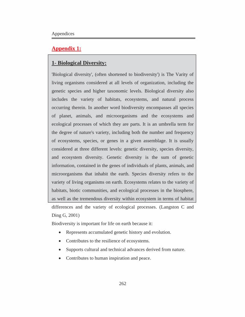
Appendices
262
AAppppeennddiixx 11::
1- Biological Diversity:
'Biological diversity', (often shortened to biodiversity') is The Varity of
living organisms considered at all levels of organization, including the
genetic species and higher taxonomic levels. Biological diversity also
includes the variety of habitats, ecosystems, and natural process
occurring therein. In another word biodiversity encompasses all species
of planet, animals, and microorganisms and the ecosystems and
ecological processes of which they are parts. It is an umbrella term for
the degree of nature's variety, including both the number and frequency
of ecosystems, species, or genes in a given assemblage. It is usually
considered at three different levels: genetic diversity, species diversity,
and ecosystem diversity. Genetic diversity is the sum of genetic
information, contained in the genes of individuals of plants, animals, and
microorganisms that inhabit the earth. Species diversity refers to the
variety of living organisms on earth. Ecosystems relates to the variety of
habitats, biotic communities, and ecological processes in the biosphere,
as well as the tremendous diversity within ecosystem in terms of habitat
differences and the variety of ecological processes. (Langston C and
Ding G, 2001)
Biodiversity is important for life on earth because it:
Represents accumulated genetic history and evolution.
Contributes to the resilience of ecosystems.
Supports cultural and technical advances derived from nature.
Contributes to human inspiration and peace.
Appendices
263
2- Species:
Group of organisms formally recognized as distinct from other groups,
species richness is the absolute number of species in a given area. (Asem
Abdel Hamid, 1995)
3- Habitat:
The locality, site and particular type of local environment occupied by an
organism, habitat fragmentation is the process of dividing a continuous
habitat into non-continuous, smaller sub-units.
4- Ecosystems:
Ecosystems are referring to the dynamic and interrelating complex of
plant and animal communities and their associated non-living
environment.
The ecosystem concept helps to define the order of the natural world. An
ecosystem refers to its biotic organisms (plants, animals, fungi, etc.) and
interactions among those organisms, as well as the A-biotic physical
processes of the system (climate, topography, geology, etc.). Ecosystems
are chock-full of lessons in biology, physical sciences, history and other
disciplines.
Ecosystem is the natural stock of ecological resources, such as soil,
ground and surface water, land biomass and water biomass. (Peter
Graham, 2003)
Ecosystems play a vital life-support function and should be protected.
Appendices
264
Ecosystem consists of:
a- Biotic:
Biotic refers to the living components of a system; it is classified into
three objects:
Producers
Consumers
Decomposers
1-Producers:
Organisms that obtain energy from a physical or chemical source, Plants
are producers; they convert the sun’s energy into sugars and
carbohydrates. Bacterial microorganisms called cyan bacteria, which live
in the ocean depths, create their food from chemical compounds. (Asem
Abdel Hamid, 1995)
2-Consumers:
Organisms that; obtain their energy or food from producers; plants or
other consumers.
3-Decomposers:
Living organisms that; obtain their food from decomposed organic
material.
The most important types are bacteria and fungi. They play essential role
in decomposition of living organisms after their death.
b- A- biotic:
A biotic refers to the non-living components of a system (climate,
Appendices
265
topography, geology, etc.)
5- Natural Resources:
Natural resources are the compounds of environment from air, water, plants, etc. It is classified according to the condition, and according to the ownership.
a- Classification of Natural Resources According to Condition:
This kind classifies natural resources into two groups:
Renewable resources.
Nonrenewable resources.
1-Renewable Resources:
Resources such as trees, fish, oxygen, and fresh water are generally
considered to be renewable resources as they can be continually
reproduced. Fresh water comes out from the Earth's recycling process,
fresh air from the oxygen produced by plants and trees, and trees and fish
which can reproduce them.
Renewable is defined as:
Capable of being replaced by natural ecological cycles or sound
management practices. (Abdel Hamid, 1995)
2-Non Renewable Resources:
Such things as fossil fuels (oil, coal, gas) and minerals that cannot be
reproduced and therefore can be vanish. These are called non-renewable
resources.
Humans are using up natural resources at a great rate and at a great cost
to the health of the natural environment and life on Earth.
Appendices
266
How can natural resources affect our environment unnaturally?
It is not the natural resources by themselves that harm the Earth's
environment; it is what humans do with the natural resources that cause
the problems to the environment and to the health of living organisms,
including other human beings.
The burning of fossil fuels in factories in order to make products and
power, and the fuels used by trucks, automobiles and jet planes have
caused acid rain and a great increase in carbon dioxide and pollution in
the atmosphere. Moreover forests which are used to absorb carbon
dioxide have been destroyed causing traps heat in our atmosphere.
Scientists believe those human activities have led to global warming.
Global warming (worldwide increased temperature) is causing glaciers to
melt, seas to raise, climates to change, violent weather, destruction of
coral reef ecosystems, crops to die, famine, floods, topsoil to wash away,
droughts, and the loss of plants and animals.
b- Classification of Natural Resources According to Ownership:
This kind classifies natural resources into two groups:
Moving or un-owned resources.
Owned resources.
1-Moving or Un-Owned Resources:
Resources are not lying under ownership of any government or any
specific region. We cannot govern it under a physical border, like fishing
outside regional water.
2-Owned Resources:
Resources are lying under the authority of a government or a regi
Appendices
- 267 -
AAppppeennddiixx 22::
The Brundtland Report and Sustainable Development:
The Brundtland Report is considered to be anthropogenic, or human-
centered, which means that it is primarily concerned with human welfare
through meeting needs and ensuring quality of life over and above
protection of the environment (Kirby et al., 1995). The Brundtland
Report does not guarantee the needs or quality of life of animals or other
living organisms, except in so much as this will benefit humankind.
However, to ecologists, living organisms have a right to exists regardless
of whether they are beneficial or valuable to humans. (Langston and
Ding, 2001)
The Brundtland Report suggests that equity can be used to overcome
environment problems. This means that inequality between the developed
and developing countries has to be dealt with by raising the living
conditions in the developing countries that are generally impoverished.
The Brundtland Report suggests seven strategies to sustainable
development:
1- Reviving growth.
2- Changing the quality of growth.
3- Meeting essential needs for jobs, food, energy, water and
sanitation.
4- Ensuring a sustainable level of population.
5- Conserving and enhancing the resource base.
6- Reorienting technology and managing risks.
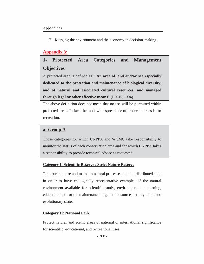
Appendices
- 268 -
7- Merging the environment and the economy in decision-making.
AAppppeennddiixx 33::
1- Protected Area Categories and Management
Objectives A protected area is defined as: “AAnn aarreeaa ooff llaanndd aanndd//oorr sseeaa eessppeecciiaallllyy
ddeeddiiccaatteedd ttoo tthhee pprrootteeccttiioonn aanndd mmaaiinntteennaannccee ooff bbiioollooggiiccaall ddiivveerrssiittyy,,
aanndd ooff nnaattuurraall aanndd aassssoocciiaatteedd ccuullttuurraall rreessoouurrcceess,, aanndd mmaannaaggeedd
tthhrroouugghh lleeggaall oorr ootthheerr eeffffeeccttiivvee mmeeaannss”” ((IIUUCCNN,, 11999944))..
The above definition does not mean that no use will be permitted within
protected areas. In fact, the most wide spread use of protected areas is for
recreation.
a- Group A
Those categories for which CNPPA and WCMC take responsibility to
monitor the status of each conservation area and for which CNPPA takes
a responsibility to provide technical advice as requested.
CCaatteeggoorryy II:: SScciieennttiiffiicc RReesseerrvvee // SSttrriicctt NNaattuurree RReesseerrvvee
To protect nature and maintain natural processes in an undistributed state
in order to have ecologically representative examples of the natural
environment available for scientific study, environmental monitoring,
education, and for the maintenance of genetic resources in a dynamic and
evolutionary state.
CCaatteeggoorryy IIII:: NNaattiioonnaall PPaarrkk
Protect natural and scenic areas of national or international significance
for scientific, educational, and recreational uses.
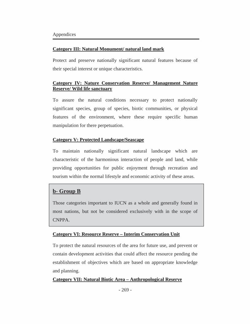
Appendices
- 269 -
CCaatteeggoorryy IIIIII:: NNaattuurraall MMoonnuummeenntt// nnaattuurraall llaanndd mmaarrkk
Protect and preserve nationally significant natural features because of
their special interest or unique characteristics.
CCaatteeggoorryy IIVV:: NNaattuurree CCoonnsseerrvvaattiioonn RReesseerrvvee// MMaannaaggeemmeenntt NNaattuurree RReesseerrvvee// WWiilldd lliiffee ssaannccttuuaarryy
To assure the natural conditions necessary to protect nationally
significant species, group of species, biotic communities, or physical
features of the environment, where these require specific human
manipulation for there perpetuation.
CCaatteeggoorryy VV:: PPrrootteecctteedd LLaannddssccaappee//SSeeaassccaappee
To maintain nationally significant natural landscape which are
characteristic of the harmonious interaction of people and land, while
providing opportunities for public enjoyment through recreation and
tourism within the normal lifestyle and economic activity of these areas.
b- Group B
Those categories important to IUCN as a whole and generally found in
most nations, but not be considered exclusively with in the scope of
CNPPA.
CCaatteeggoorryy VVII:: RReessoouurrccee RReesseerrvvee –– IInntteerriimm CCoonnsseerrvvaattiioonn UUnniitt
To protect the natural resources of the area for future use, and prevent or
contain development activities that could affect the resource pending the
establishment of objectives which are based on appropriate knowledge
and planning.
CCaatteeggoorryy VVIIII:: NNaattuurraall BBiioottiicc AArreeaa –– AAnntthhrrooppoollooggiiccaall RReesseerrvvee
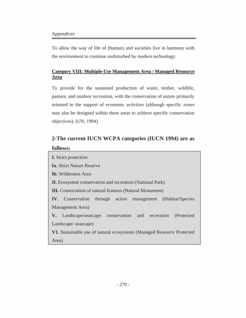
Appendices
- 270 -
To allow the way of life of (human) and societies live in harmony with
the environment to continue undisturbed by modern technology.
CCaatteeggoorryy VVIIIIII:: MMuullttiippllee--UUssee MMaannaaggeemmeenntt AArreeaa // MMaannaaggeedd RReessoouurrccee AArreeaa
To provide for the sustained production of water, timber, wildlife,
pasture, and outdoor recreation, with the conservation of nature primarily
oriented to the support of economic activities (although specific zones
may also be designed within these areas to achieve specific conservation
objectives). (UN, 1994)
2-The current IUCN WCPA categories (IUCN 1994) are as
follows: I. Strict protection
Ia. Strict Nature Reserve
Ib. Wilderness Area
II. Ecosystem conservation and recreation (National Park)
III. Conservation of natural features (Natural Monument)
IV. Conservation through active management (Habitat/Species
Management Area)
V. Landscape/seascape conservation and recreation (Protected
Landscape/ seascape)
V1. Sustainable use of natural ecosystems (Managed Resource Protected
Area)
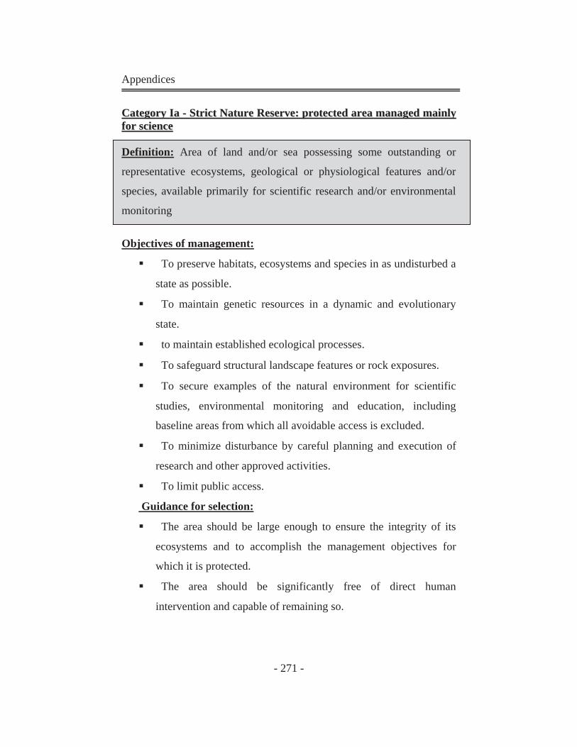
Appendices
- 271 -
CCaatteeggoorryy IIaa -- SSttrriicctt NNaattuurree RReesseerrvvee:: pprrootteecctteedd aarreeaa mmaannaaggeedd mmaaiinnllyy ffoorr sscciieennccee
Definition: Area of land and/or sea possessing some outstanding or
representative ecosystems, geological or physiological features and/or
species, available primarily for scientific research and/or environmental
monitoring
Objectives of management:
To preserve habitats, ecosystems and species in as undisturbed a
state as possible.
To maintain genetic resources in a dynamic and evolutionary
state.
to maintain established ecological processes.
To safeguard structural landscape features or rock exposures.
To secure examples of the natural environment for scientific
studies, environmental monitoring and education, including
baseline areas from which all avoidable access is excluded.
To minimize disturbance by careful planning and execution of
research and other approved activities.
To limit public access.
Guidance for selection:
The area should be large enough to ensure the integrity of its
ecosystems and to accomplish the management objectives for
which it is protected.
The area should be significantly free of direct human
intervention and capable of remaining so.
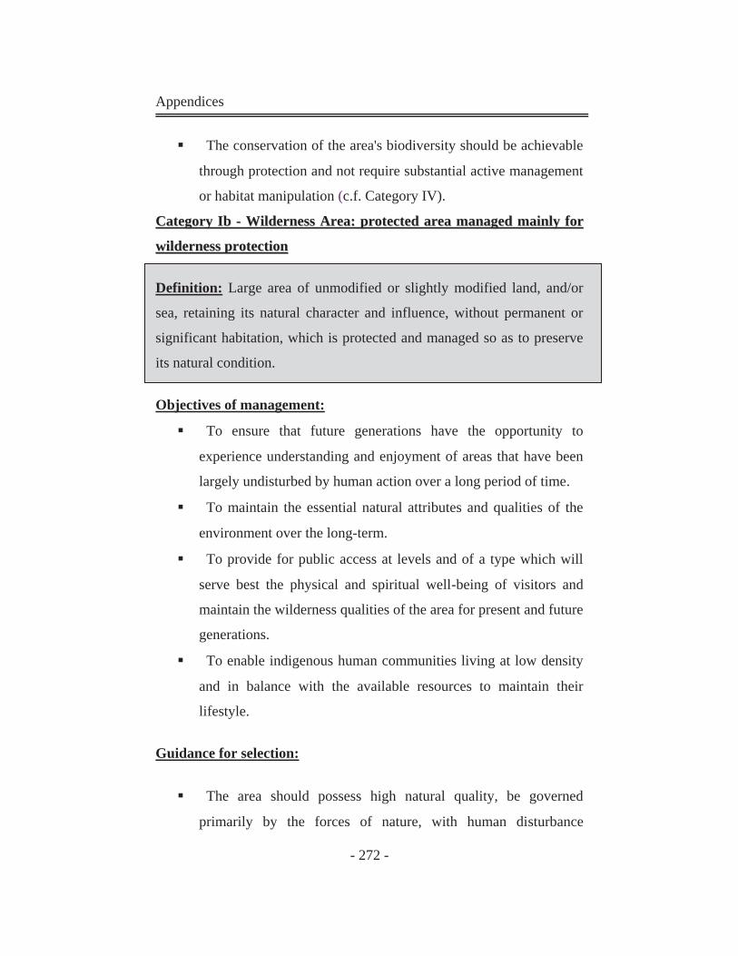
Appendices
- 272 -
The conservation of the area's biodiversity should be achievable
through protection and not require substantial active management
or habitat manipulation (c.f. Category IV).
CCaatteeggoorryy IIbb -- WWiillddeerrnneessss AArreeaa:: pprrootteecctteedd aarreeaa mmaannaaggeedd mmaaiinnllyy ffoorr
wwiillddeerrnneessss pprrootteeccttiioonn
Definition: Large area of unmodified or slightly modified land, and/or
sea, retaining its natural character and influence, without permanent or
significant habitation, which is protected and managed so as to preserve
its natural condition.
Objectives of management:
To ensure that future generations have the opportunity to
experience understanding and enjoyment of areas that have been
largely undisturbed by human action over a long period of time.
To maintain the essential natural attributes and qualities of the
environment over the long-term.
To provide for public access at levels and of a type which will
serve best the physical and spiritual well-being of visitors and
maintain the wilderness qualities of the area for present and future
generations.
To enable indigenous human communities living at low density
and in balance with the available resources to maintain their
lifestyle.
Guidance for selection:
The area should possess high natural quality, be governed
primarily by the forces of nature, with human disturbance
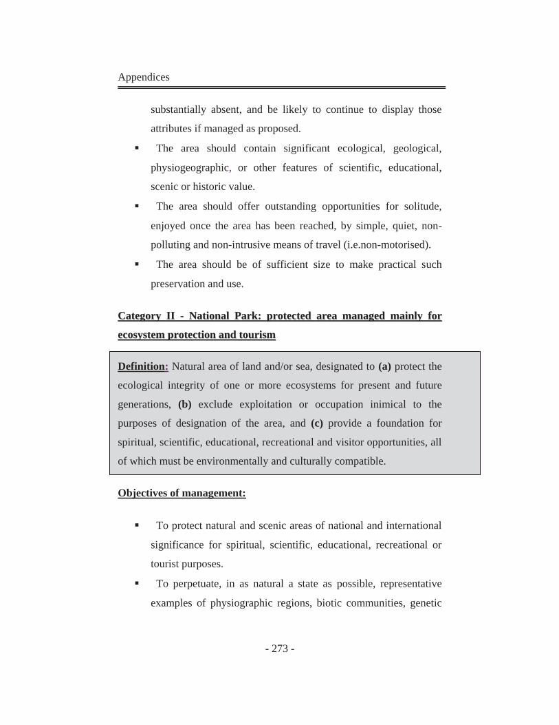
Appendices
- 273 -
substantially absent, and be likely to continue to display those
attributes if managed as proposed.
The area should contain significant ecological, geological,
physiogeographic, or other features of scientific, educational,
scenic or historic value.
The area should offer outstanding opportunities for solitude,
enjoyed once the area has been reached, by simple, quiet, non-
polluting and non-intrusive means of travel (i.e.non-motorised).
The area should be of sufficient size to make practical such
preservation and use.
CCaatteeggoorryy IIII -- NNaattiioonnaall PPaarrkk:: pprrootteecctteedd aarreeaa mmaannaaggeedd mmaaiinnllyy ffoorr
eeccoossyysstteemm pprrootteeccttiioonn aanndd ttoouurriissmm
Definition: Natural area of land and/or sea, designated to (a) protect the
ecological integrity of one or more ecosystems for present and future
generations, (b) exclude exploitation or occupation inimical to the
purposes of designation of the area, and (c) provide a foundation for
spiritual, scientific, educational, recreational and visitor opportunities, all
of which must be environmentally and culturally compatible.
Objectives of management:
To protect natural and scenic areas of national and international
significance for spiritual, scientific, educational, recreational or
tourist purposes.
To perpetuate, in as natural a state as possible, representative
examples of physiographic regions, biotic communities, genetic
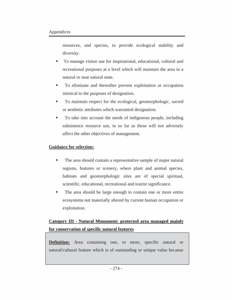
Appendices
- 274 -
resources, and species, to provide ecological stability and
diversity.
To manage visitor use for inspirational, educational, cultural and
recreational purposes at a level which will maintain the area in a
natural or near natural state.
To eliminate and thereafter prevent exploitation or occupation
inimical to the purposes of designation.
To maintain respect for the ecological, geomorphologic, sacred
or aesthetic attributes which warranted designation.
To take into account the needs of indigenous people, including
subsistence resource use, in so far as these will not adversely
affect the other objectives of management.
Guidance for selection:
The area should contain a representative sample of major natural
regions, features or scenery, where plant and animal species,
habitats and geomorphologic sites are of special spiritual,
scientific, educational, recreational and tourist significance.
The area should be large enough to contain one or more entire
ecosystems not materially altered by current human occupation or
exploitation.
CCaatteeggoorryy IIIIII -- NNaattuurraall MMoonnuummeenntt:: pprrootteecctteedd aarreeaa mmaannaaggeedd mmaaiinnllyy
ffoorr ccoonnsseerrvvaattiioonn ooff ssppeecciiffiicc nnaattuurraall ffeeaattuurreess
Definition: Area containing one, or more, specific natural or
natural/cultural feature which is of outstanding or unique value because

Appendices
- 275 -
of its inherent rarity, representative or aesthetic qualities or cultural
significance.
Objectives of management:
To protect or preserve in perpetuity specific outstanding natural
features because of their natural significance, unique or
representational quality, and/or spiritual connotations.
To an extent consistent with the foregoing objective, to provide
opportunities for research, education, interpretation and public
appreciation.
To eliminate and thereafter prevent exploitation or occupation
inimical to the p purpose of designation.
To deliver to any resident population such benefits as are
consistent with the other objectives of management.
Guidance for selection:
The area should contain one or more features of outstanding
significance (appropriate natural features include spectacular
waterfalls, caves, craters, fossil beds, sand dunes and marine
features, along with unique or representative fauna and flora;
associated cultural features might include cave dwellings, cliff-
top forts, archaeological sites, or natural sites which have heritage
significance to indigenous peoples).
The area should be large enough to protect the integrity of the
feature and its immediately related surroundings.
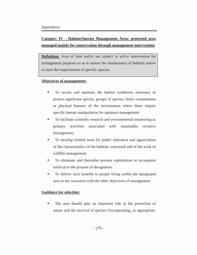
Appendices
- 276 -
CCaatteeggoorryy IIVV -- HHaabbiittaatt//SSppeecciieess MMaannaaggeemmeenntt AArreeaa:: pprrootteecctteedd aarreeaa
mmaannaaggeedd mmaaiinnllyy ffoorr ccoonnsseerrvvaattiioonn tthhrroouugghh mmaannaaggeemmeenntt iinntteerrvveennttiioonn
Definition: Area of land and/or sea subject to active intervention for
management purposes so as to ensure the maintenance of habitats and/or
to meet the requirements of specific species.
Objectives of management:
To secure and maintain the habitat conditions necessary to
protect significant species, groups of species, biotic communities
or physical features of the environment where these require
specific human manipulation for optimum management.
To facilitate scientific research and environmental monitoring as
primary activities associated with sustainable resource
management;
To develop limited areas for public education and appreciation
of the characteristics of the habitats concerned and of the work of
wildlife management.
To eliminate and thereafter prevent exploitation or occupation
inimical to the purpose of designation.
To deliver such benefits to people living within the designated
area as are consistent with the other objectives of management.
Guidance for selection:
The area should play an important role in the protection of
nature and the survival of species ('incorporating, as appropriate,
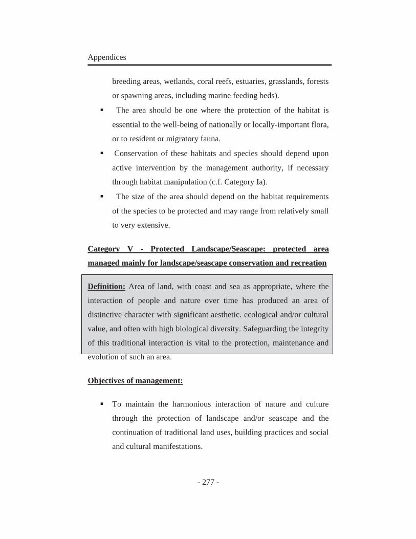
Appendices
- 277 -
breeding areas, wetlands, coral reefs, estuaries, grasslands, forests
or spawning areas, including marine feeding beds).
The area should be one where the protection of the habitat is
essential to the well-being of nationally or locally-important flora,
or to resident or migratory fauna.
Conservation of these habitats and species should depend upon
active intervention by the management authority, if necessary
through habitat manipulation (c.f. Category Ia).
The size of the area should depend on the habitat requirements
of the species to be protected and may range from relatively small
to very extensive.
CCaatteeggoorryy VV -- PPrrootteecctteedd LLaannddssccaappee//SSeeaassccaappee:: pprrootteecctteedd aarreeaa
mmaannaaggeedd mmaaiinnllyy ffoorr llaannddssccaappee//sseeaassccaappee ccoonnsseerrvvaattiioonn aanndd rreeccrreeaattiioonn
Definition: Area of land, with coast and sea as appropriate, where the
interaction of people and nature over time has produced an area of
distinctive character with significant aesthetic. ecological and/or cultural
value, and often with high biological diversity. Safeguarding the integrity
of this traditional interaction is vital to the protection, maintenance and
evolution of such an area.
Objectives of management:
To maintain the harmonious interaction of nature and culture
through the protection of landscape and/or seascape and the
continuation of traditional land uses, building practices and social
and cultural manifestations.
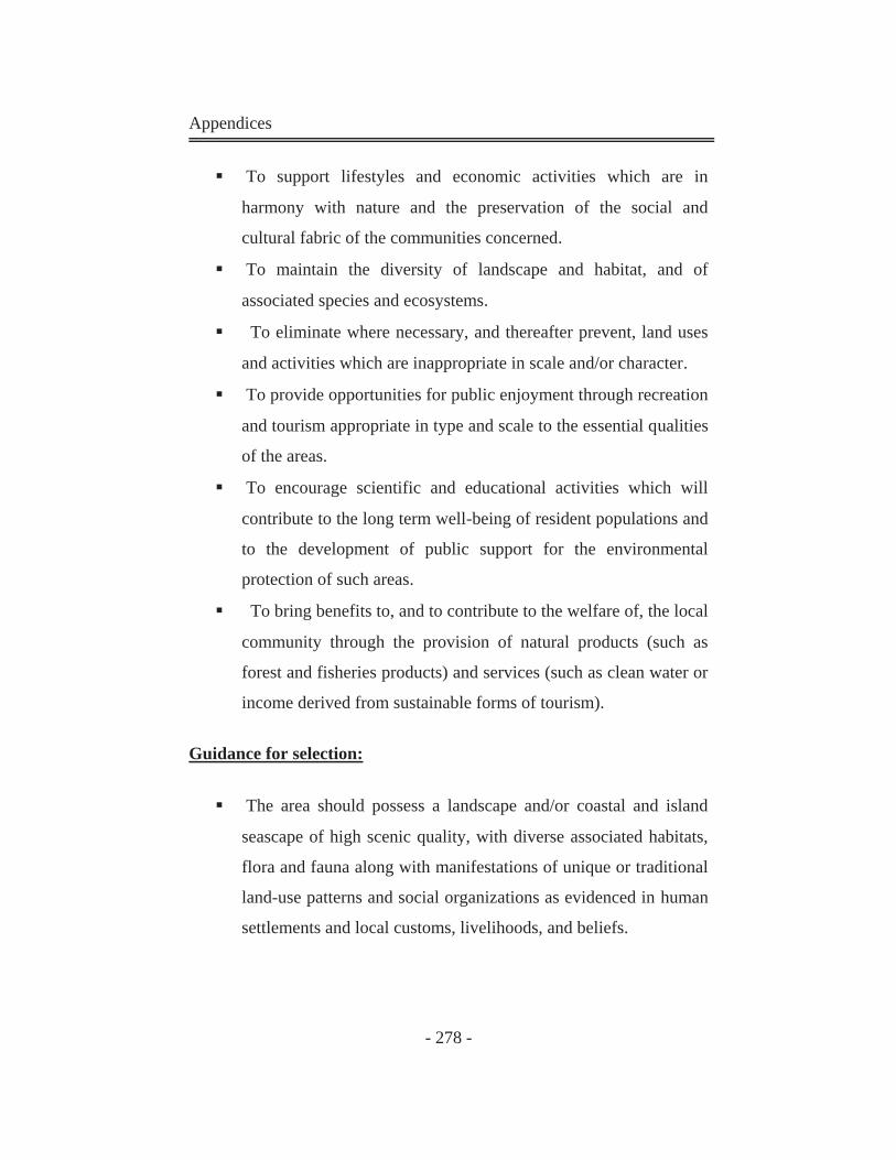
Appendices
- 278 -
To support lifestyles and economic activities which are in
harmony with nature and the preservation of the social and
cultural fabric of the communities concerned.
To maintain the diversity of landscape and habitat, and of
associated species and ecosystems.
To eliminate where necessary, and thereafter prevent, land uses
and activities which are inappropriate in scale and/or character.
To provide opportunities for public enjoyment through recreation
and tourism appropriate in type and scale to the essential qualities
of the areas.
To encourage scientific and educational activities which will
contribute to the long term well-being of resident populations and
to the development of public support for the environmental
protection of such areas.
To bring benefits to, and to contribute to the welfare of, the local
community through the provision of natural products (such as
forest and fisheries products) and services (such as clean water or
income derived from sustainable forms of tourism).
Guidance for selection:
The area should possess a landscape and/or coastal and island
seascape of high scenic quality, with diverse associated habitats,
flora and fauna along with manifestations of unique or traditional
land-use patterns and social organizations as evidenced in human
settlements and local customs, livelihoods, and beliefs.
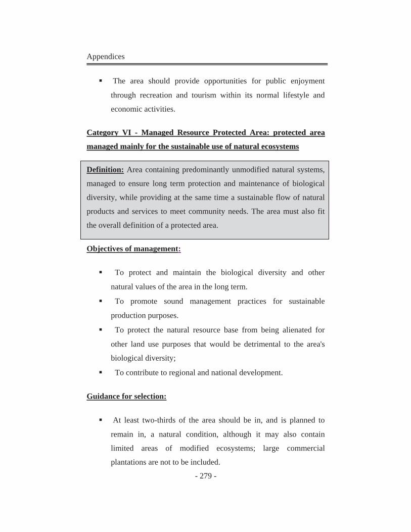
Appendices
- 279 -
The area should provide opportunities for public enjoyment
through recreation and tourism within its normal lifestyle and
economic activities.
CCaatteeggoorryy VVII -- MMaannaaggeedd RReessoouurrccee PPrrootteecctteedd AArreeaa:: pprrootteecctteedd aarreeaa
mmaannaaggeedd mmaaiinnllyy ffoorr tthhee ssuussttaaiinnaabbllee uussee ooff nnaattuurraall eeccoossyysstteemmss
Definition: Area containing predominantly unmodified natural systems,
managed to ensure long term protection and maintenance of biological
diversity, while providing at the same time a sustainable flow of natural
products and services to meet community needs. The area must also fit
the overall definition of a protected area.
Objectives of management:
To protect and maintain the biological diversity and other
natural values of the area in the long term.
To promote sound management practices for sustainable
production purposes.
To protect the natural resource base from being alienated for
other land use purposes that would be detrimental to the area's
biological diversity;
To contribute to regional and national development.
Guidance for selection:
At least two-thirds of the area should be in, and is planned to
remain in, a natural condition, although it may also contain
limited areas of modified ecosystems; large commercial
plantations are not to be included.

Appendices
- 280 -
The area should be large enough to absorb sustainable resource
uses without detriment to its overall long-term natural values.
A management authority must be in place
Appendix
- 281 -
AAppppeennddiixx 44::
Egyptian Environmental Affairs Agency: EEAA
EEAA was first established in 1982 as the authority responsible for
promoting and protecting the environment in Egypt. In 1994, EEAA was
re-established in accordance to Law 4/1994 for the Environment, and was
restructured with a new mandate to substitute the initially established
Agency. Based on Law 4/1994, EEAA has a public juridical personality
and is to be affiliated with the competent Minister for Environmental
Affairs, who heads EEAA’s governing board.
The overall objectives of EEAA are to protect the environment and
promote the different environmental activities. These objectives are
realized by integrating environmental issues into all national policies,
plans and programs.
The specific activities and functions of EEAA, necessary to fulfill these
objectives, are clearly defined within Law 4/1994 for the Environment.
One of the most significant activities of EEAA is the enforcement of Law
4/1994 and its executive regulations. Moreover, EEAA together with the
Ministry of Foreign Affairs plays an important role in coordinating and
fostering the environmental partnerships at bilateral, regional and
international levels. Other activities for EEAA according to Law
4/1994 for the environment include:
� Preparation of draft legislation and decrees relevant to the protection of
the environment.
� Preparation of studies related to the state of the environment of the
country, and formulation of the national plan for the protection of the
environment.
Appendix
- 282 -
� Establishment of standards and conditions that project owners and
establishments must comply with before construction begins, and during
the operation of these projects.
� Collection and publication of national and international information
related to the environment on a periodical basis, in cooperation with
information centers of other agencies.
� Preparation of a plan for environmental training, and supervision of its
implementation.
� Implementation of pilot projects for the preservation of natural
resources, and for the protection of the environment from pollution.
At the regional level, EEAA is currently establishing 8 Regional Branch
Offices (RBOs). Each of the RBOs is to provide support to 3-4
governorates in their environmental management efforts. According to
decree number 56/2000 issued by the Minister of State for Environmental
Affairs, the mandates of the RBOs include:
� Preparing studies which address the environmental status of the
governorates within the region, and providing EEAA with environmental
maps and information to use in the formulation of the National
Environmental Action Plan (NEAP).
� Formulating regional plans for environmental protection.
� Establishing coordination links between the Ministry of Environment
and EEAA, and the governorates in order to achieve EEAA objectives
for environmental protection.
� Supervising environmental monitoring networks at the governorate
level, and reporting to the EEAAhead office.
� Spreading environmental awareness in the governorates and
coordinating with the respective local agencies. (JICA, 2002)
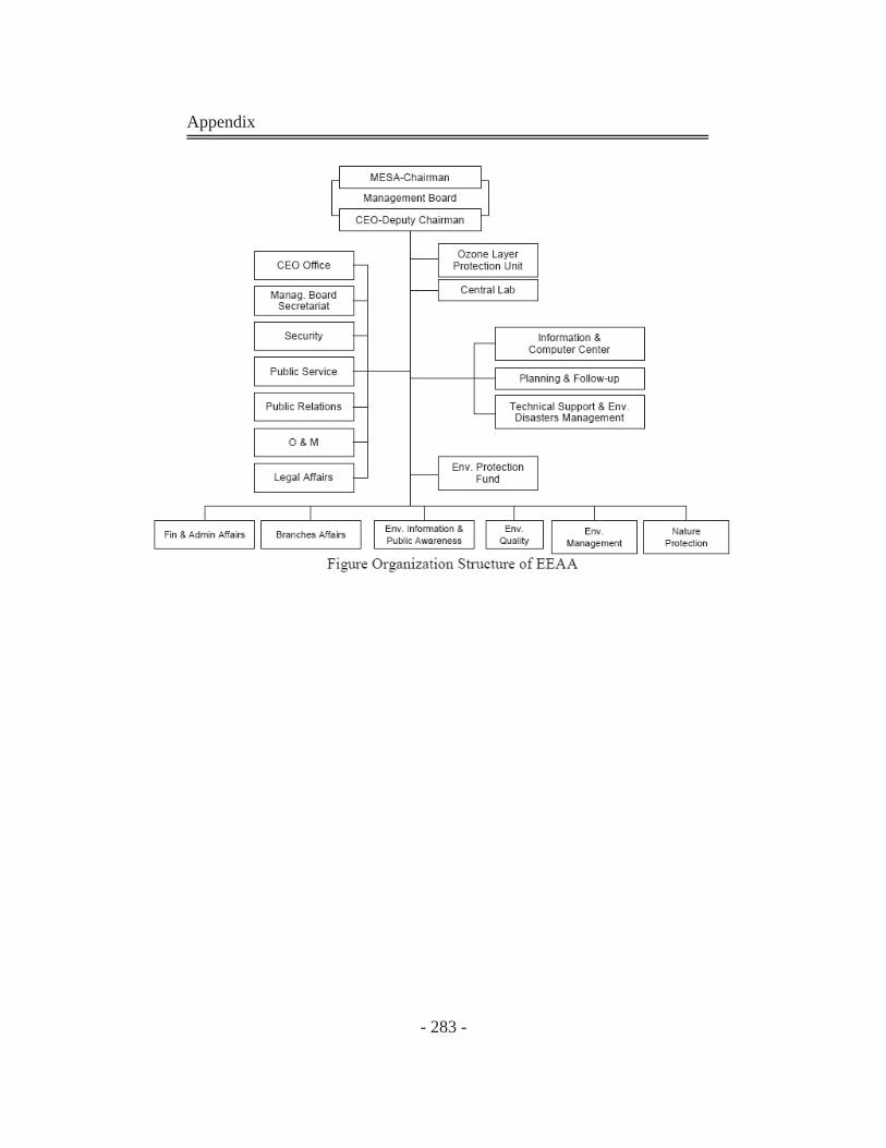
Appendix
- 283 -
Appendix
- 284 -
AAppppeennddiixx 55::
1- The Petrified Forest Area in Maadi - Cairo Date of Announcement: 1989. Area: 7 Km2. Type: Geological protected Area and a national heritage. Distance from Cairo: 30 km.
The Rocky wood Area is abundant of dense rocky stems of trees in the
formation of the wood mountain that belongs to the Oligocene epoch. It
consists of layers of sand, gravel, mud and rocky wood with a thickness
of 70-100 meters. It is significantly rich with remains and stems of large
rocky trees, taking the shape of rocks with cylindrical sections varying in
dimension from a few centimeters up to several meters. Thus, the
formation of the rocky wood in Maadi is most probably attributed to one
of the ancient branches of the River Nile from ancient geological era. It
carried those trees along and threw them in that place where they were
buried and changed into rocks.
2- El Hassana Dome protected Area in Giza Governorate Date of Announcement: 1989. Area: 1 km2. Type: Geological protected area. Distance from Cairo: 23 km.
Hassana Dome protected Area is a museum and specialized scientific
institute that helps in studying geology and different geological
formations like folds, Foults, also they can be compared with similar
formations in other places. The existence of fossils gathering in perfect
reserved colonies makes Hassana Dome a perfect area for studying
fossils science or the science of paleo life and also the features of the
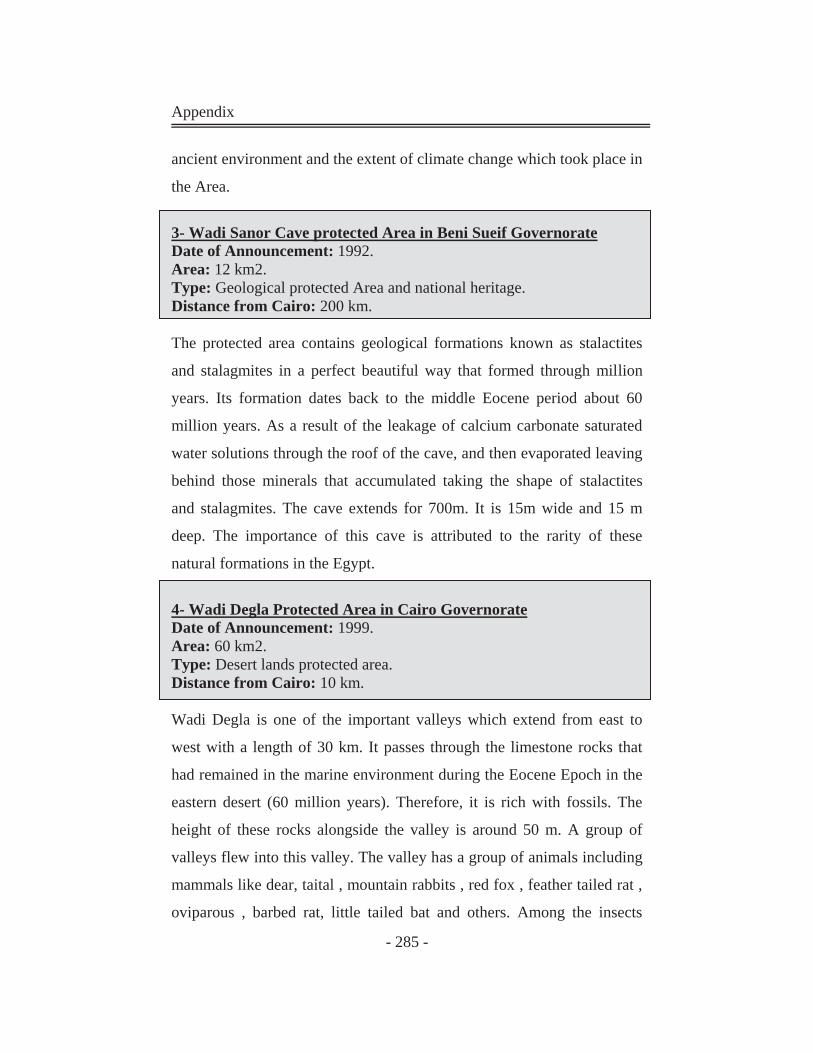
Appendix
- 285 -
ancient environment and the extent of climate change which took place in
the Area.
3- Wadi Sanor Cave protected Area in Beni Sueif Governorate Date of Announcement: 1992. Area: 12 km2. Type: Geological protected Area and national heritage. Distance from Cairo: 200 km.
The protected area contains geological formations known as stalactites
and stalagmites in a perfect beautiful way that formed through million
years. Its formation dates back to the middle Eocene period about 60
million years. As a result of the leakage of calcium carbonate saturated
water solutions through the roof of the cave, and then evaporated leaving
behind those minerals that accumulated taking the shape of stalactites
and stalagmites. The cave extends for 700m. It is 15m wide and 15 m
deep. The importance of this cave is attributed to the rarity of these
natural formations in the Egypt.
4- Wadi Degla Protected Area in Cairo Governorate Date of Announcement: 1999. Area: 60 km2. Type: Desert lands protected area. Distance from Cairo: 10 km. Wadi Degla is one of the important valleys which extend from east to
west with a length of 30 km. It passes through the limestone rocks that
had remained in the marine environment during the Eocene Epoch in the
eastern desert (60 million years). Therefore, it is rich with fossils. The
height of these rocks alongside the valley is around 50 m. A group of
valleys flew into this valley. The valley has a group of animals including
mammals like dear, taital , mountain rabbits , red fox , feather tailed rat ,
oviparous , barbed rat, little tailed bat and others. Among the insects
Appendix
- 286 -
there are and many others. 18 species of reptiles have been recorded. The
rain water dropping from the waterfalls affected the limestone rocks
along the years and formed the so called canyon Degla, which resembles
the Grand Canyon in the U.S.
5- Wadi El Rayan protected Area in Fayoum Governorate Date of Announcement: 1989.
Area: 1759 km2.
Type: Developing Management resources protected Area and a natural
national heritage.
Distance from Cairo: 150 km.
Wadi El -Rayan area is characterized by its integrated desert
environment, consisting of sand dunes, natural springs, large water
bodies and a different botanical life, different wild animals and important
and various sea fossils. The area of El-Rayan Lake is a calm natural
environment and free of pollution.
Wadi El- Rayan consists of the following important areas:
1-Waterfall Area
2-The Area of El -Rayan Mountain El -Mashgaeega Mountain
3-Wadi Al-Hitan
6- Quaron Lake protected Area in El-Fayoum Governorate Date of Announcement: 1989.
Area: 1385 km2.
Type: Wetlands.
Distance from Cairo: 90 km.
Appendix
- 287 -
It is one of the ancient natural lakes in the world. It is the remaining part
of the ancient Morris Lake. It is globally renowned for the abundance of
sea, river, continent fossils which date back to 40 million years like El-
Fayoum Giant animal which resembles rhinoceros. There was a huge
river mouth that had sedimentary cycles upon which the ancient
elephants ancestors, sea horse and dolphins, also sharks and birds
ancestors which live in Africa. In this Area, there is a large variety of
kinds of reptiles, amphibians and mammals that have a great importance
in the environmental system of the protected area. The existence of a lot
of historical monuments "North Qaroon Lake represents cultural heritage
that is utilized in Tourism. They date back to the Roman and Pharanoic
Period, Qaret Al-Rusas Area in the North East of the Lake, the area of
churches and Abu Lifa Monastery.
7- Nile river Islands Protected Area in Different Governorate Date of Announcement: 1998.
Area: 160 km2.
Type: Wet lands protected area.
Distance from Cairo: 144 islands in different Governorate.
The Nile River islands are natural protected areas amounting to 144
islands in different Governorates in Egypt. Alongside the main stream
from Aswan until the Barrages, there are 95 Islands within area of 32500
Feddans. In Rasheed branch there are 30 islands within an area of 3400
Feddans, in Damietta Branch there are 19 islands within and area of 1250
Feddans. The total area of all the Nile River islands is 37150 Faddan.
Appendix
- 288 -
8-Elomayed Natural protected Area in Matrouh Governorate Date of Announcement: 1986.
Area: 700 Km2.
Type: Desert Area and vital peripheral.
Distance from Cairo: 300 km.
There are around 170 species of wild plants growing in different
ecosystem, be they sand dunes or internal hills. Studies showed that this
wild plants have economic and medical benefits since there are about 70
species that can used for medical and thera peutical purposes like squall,
wormwood, plantain, wood, sorrel.
9- Ashtoom El-gamil and Tenis Island protected Area in Port Said
Governorate
Date of Announcement: 1988.
Area: 180 km2.
Type: Wetlands and Natural restricted Area for birds.
Distance from Cairo: 200 km.
The protected Area includes the bays of El Gamil and Ashtoon El Gamil
and Al Manzala lagoon. Tenis Island is located in El Manzala lagoon, the
largest among Delta lagoons with various environmental systems. El
Manzala lagoon Area was a rich agricultural land that fell down due to an
earthquake that occurred in the late sixth century; the sea water
overflowed the sand dunes which used to separate the sea from the
agricultural land.
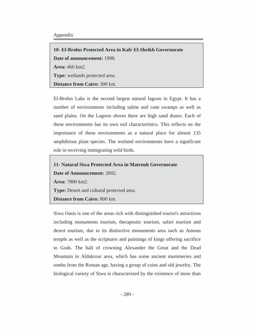
Appendix
- 289 -
10- El-Brolus Protected Area in Kafr El-Sheikh Governorate Date of announcement: 1998.
Area: 460 km2.
Type: wetlands protected area.
Distance from Cairo: 300 km.
El-Brolus Lake is the second largest natural lagoon in Egypt. It has a
number of environments including saline and cane swamps as well as
sand plains. On the Lagoon shores there are high sand dunes. Each of
these environments has its own soil characteristics. This reflects on the
importance of these environments as a natural place for almost 135
amphibious plant species. The wetland environments have a significant
role in receiving immigrating wild birds.
11- Natural Siwa Protected Area in Matrouh Governorate Date of Announcement: 2002.
Area: 7800 km2.
Type: Desert and cultural protected area.
Distance from Cairo: 800 km.
Siwa Oasis is one of the areas rich with distinguished tourist's attractions
including monuments tourism, therapeutic tourism, safari tourism and
desert tourism, due to its distinctive monuments area such as Amoun
temple as well as the scriptures and paintings of kings offering sacrifice
to Gods. The hall of crowning Alexander the Great and the Dead
Mountain in Aldakrour area, which has some ancient mummeries and
tombs from the Roman age, having a group of coins and old jewelry. The
biological variety of Siwa is characterized by the existence of more than
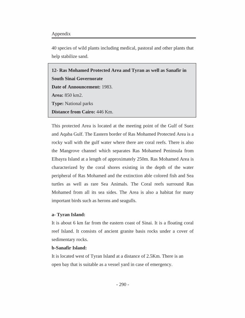
Appendix
- 290 -
40 species of wild plants including medical, pastoral and other plants that
help stabilize sand.
12- Ras Mohamed Protected Area and Tyran as well as Sanafir in
South Sinai Governorate Date of Announcement: 1983.
Area: 850 km2.
Type: National parks
Distance from Cairo: 446 Km.
This protected Area is located at the meeting point of the Gulf of Suez
and Aqaba Gulf. The Eastern border of Ras Mohamed Protected Area is a
rocky wall with the gulf water where there are coral reefs. There is also
the Mangrove channel which separates Ras Mohamed Peninsula from
Elbayra Island at a length of approximately 250m. Ras Mohamed Area is
characterized by the coral shores existing in the depth of the water
peripheral of Ras Mohamed and the extinction able colored fish and Sea
turtles as well as rare Sea Animals. The Coral reefs surround Ras
Mohamed from all its sea sides. The Area is also a habitat for many
important birds such as herons and seagulls.
a- Tyran Island:
It is about 6 km far from the eastern coast of Sinai. It is a floating coral
reef Island. It consists of ancient granite basis rocks under a cover of
sedimentary rocks.
b-Sanafir Island:
It is located west of Tyran Island at a distance of 2.5Km. There is an
open bay that is suitable as a vessel yard in case of emergency.
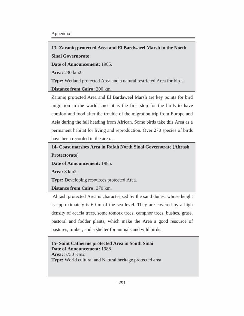
Appendix
- 291 -
13- Zaraniq protected Area and El Bardwaeel Marsh in the North
Sinai Governorate Date of Announcement: 1985.
Area: 230 km2.
Type: Wetland protected Area and a natural restricted Area for birds.
Distance from Cairo: 300 km.
Zaraniq protected Area and El Bardaweel Marsh are key points for bird
migration in the world since it is the first stop for the birds to have
comfort and food after the trouble of the migration trip from Europe and
Asia during the fall heading from African. Some birds take this Area as a
permanent habitat for living and reproduction. Over 270 species of birds
have been recorded in the area. .
14- Coast marshes Area in Rafah North Sinai Governorate (Ahrash
Protectorate) Date of Announcement: 1985.
Area: 8 km2.
Type: Developing resources protected Area.
Distance from Cairo: 370 km.
Ahrash protected Area is characterized by the sand dunes, whose height
is approximately is 60 m of the sea level. They are covered by a high
density of acacia trees, some tomorx trees, camphor trees, bushes, grass,
pastoral and fodder plants, which make the Area a good resource of
pastures, timber, and a shelter for animals and wild birds.
15- Saint Catherine protected Area in South Sinai Date of Announcement: 1988 Area: 5750 Km2 Type: World cultural and Natural heritage protected area
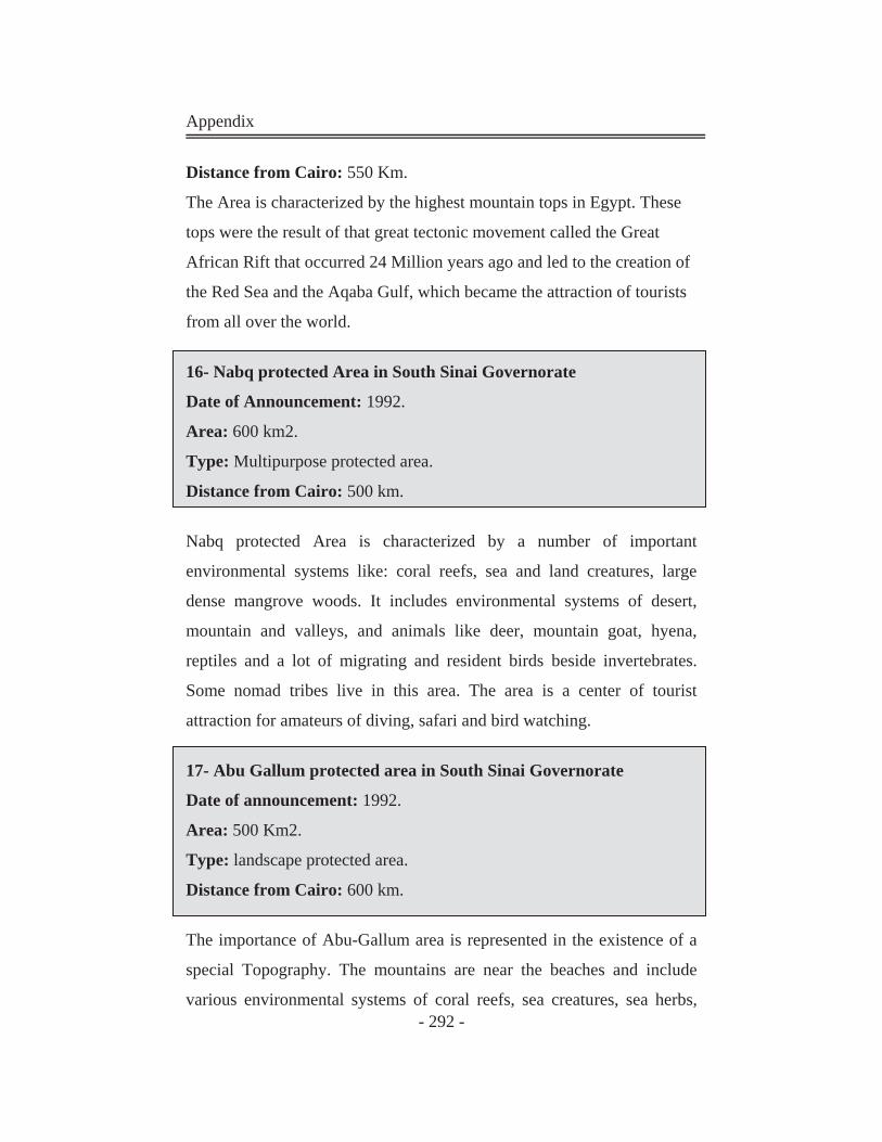
Appendix
- 292 -
Distance from Cairo: 550 Km.
The Area is characterized by the highest mountain tops in Egypt. These
tops were the result of that great tectonic movement called the Great
African Rift that occurred 24 Million years ago and led to the creation of
the Red Sea and the Aqaba Gulf, which became the attraction of tourists
from all over the world.
16- Nabq protected Area in South Sinai Governorate Date of Announcement: 1992.
Area: 600 km2.
Type: Multipurpose protected area.
Distance from Cairo: 500 km.
Nabq protected Area is characterized by a number of important
environmental systems like: coral reefs, sea and land creatures, large
dense mangrove woods. It includes environmental systems of desert,
mountain and valleys, and animals like deer, mountain goat, hyena,
reptiles and a lot of migrating and resident birds beside invertebrates.
Some nomad tribes live in this area. The area is a center of tourist
attraction for amateurs of diving, safari and bird watching.
17- Abu Gallum protected area in South Sinai Governorate Date of announcement: 1992.
Area: 500 Km2.
Type: landscape protected area.
Distance from Cairo: 600 km.
The importance of Abu-Gallum area is represented in the existence of a
special Topography. The mountains are near the beaches and include
various environmental systems of coral reefs, sea creatures, sea herbs,

Appendix
- 293 -
lagoons, mountain and desert environment systems. The mountains and
valleys are abundant of wild animals, birds and plants, which make the
area a tourist attraction for the amateurs of diving, safari as well as bird
and animal watching. The area comprises around 165 species of plants
including 44 that only exist in this area.
18- Taba protected Area in South Sinai Governorate Date of announcement: 1998.
Area: 3595 km2.
Type: Desert and natural heritage protected area.
Distance from Cairo: 550 km.
The area is characterized by its distinguished Geological formations and
monument sites that date back to 5000 years ago, as well the rare wild
life and nice scenery and traditional heritage of nomads: Some of these
valleys are significant as a support for wild life like deer, large birds
including bustard. These valleys have important plant communities like
acacia. 72 species of plants have been recorded in water valley including
Ba'ataran, Ratam and Rimth. In the adjacent areas there is a big group of
plants amounting to 480 species.
19- Wadi El Gemal - Hamata Protected Area
Date of Announcement: 2003.
Area: 7450 km2.
Type: Desert protected area.
Distance from Cairo: 850 km.
The Protected Area encompasses the segment of the Red Sea coastal
plain and mountains extending roughly between 24°51'N in the north and
24°06'N in the south; and between the Red Sea shoreline in the east to
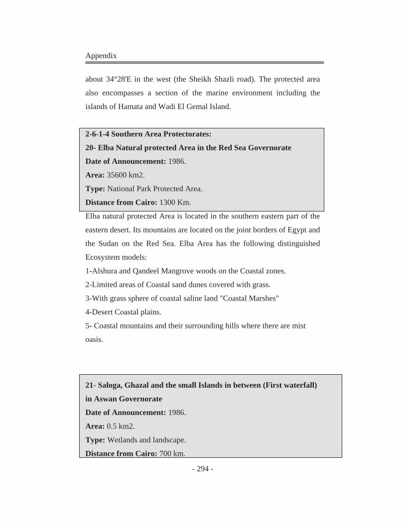
Appendix
- 294 -
about 34°28'E in the west (the Sheikh Shazli road). The protected area
also encompasses a section of the marine environment including the
islands of Hamata and Wadi El Gemal Island.
2-6-1-4 Southern Area Protectorates:
20- Elba Natural protected Area in the Red Sea Governorate Date of Announcement: 1986.
Area: 35600 km2.
Type: National Park Protected Area.
Distance from Cairo: 1300 Km.
Elba natural protected Area is located in the southern eastern part of the
eastern desert. Its mountains are located on the joint borders of Egypt and
the Sudan on the Red Sea. Elba Area has the following distinguished
Ecosystem models:
1-Alshura and Qandeel Mangrove woods on the Coastal zones.
2-Limited areas of Coastal sand dunes covered with grass.
3-With grass sphere of coastal saline land "Coastal Marshes"
4-Desert Coastal plains.
5- Coastal mountains and their surrounding hills where there are mist
oasis.
21- Saloga, Ghazal and the small Islands in between (First waterfall)
in Aswan Governorate Date of Announcement: 1986.
Area: 0.5 km2.
Type: Wetlands and landscape.
Distance from Cairo: 700 km.
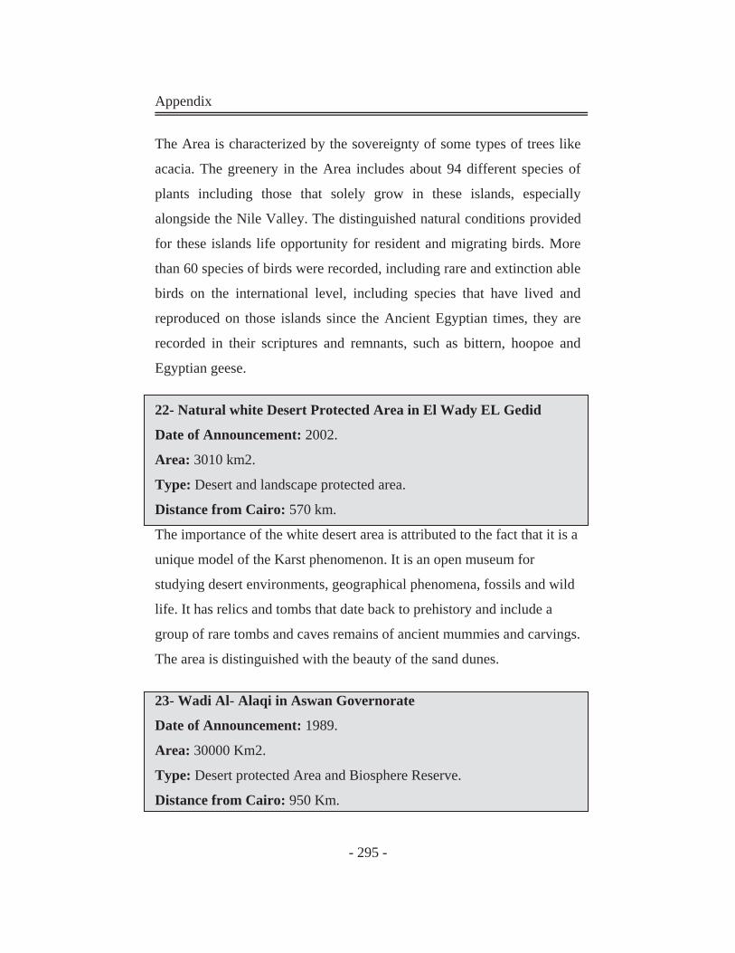
Appendix
- 295 -
The Area is characterized by the sovereignty of some types of trees like
acacia. The greenery in the Area includes about 94 different species of
plants including those that solely grow in these islands, especially
alongside the Nile Valley. The distinguished natural conditions provided
for these islands life opportunity for resident and migrating birds. More
than 60 species of birds were recorded, including rare and extinction able
birds on the international level, including species that have lived and
reproduced on those islands since the Ancient Egyptian times, they are
recorded in their scriptures and remnants, such as bittern, hoopoe and
Egyptian geese.
22- Natural white Desert Protected Area in El Wady EL Gedid Date of Announcement: 2002.
Area: 3010 km2.
Type: Desert and landscape protected area.
Distance from Cairo: 570 km.
The importance of the white desert area is attributed to the fact that it is a
unique model of the Karst phenomenon. It is an open museum for
studying desert environments, geographical phenomena, fossils and wild
life. It has relics and tombs that date back to prehistory and include a
group of rare tombs and caves remains of ancient mummies and carvings.
The area is distinguished with the beauty of the sand dunes.
23- Wadi Al- Alaqi in Aswan Governorate Date of Announcement: 1989.
Area: 30000 Km2.
Type: Desert protected Area and Biosphere Reserve.
Distance from Cairo: 950 Km.
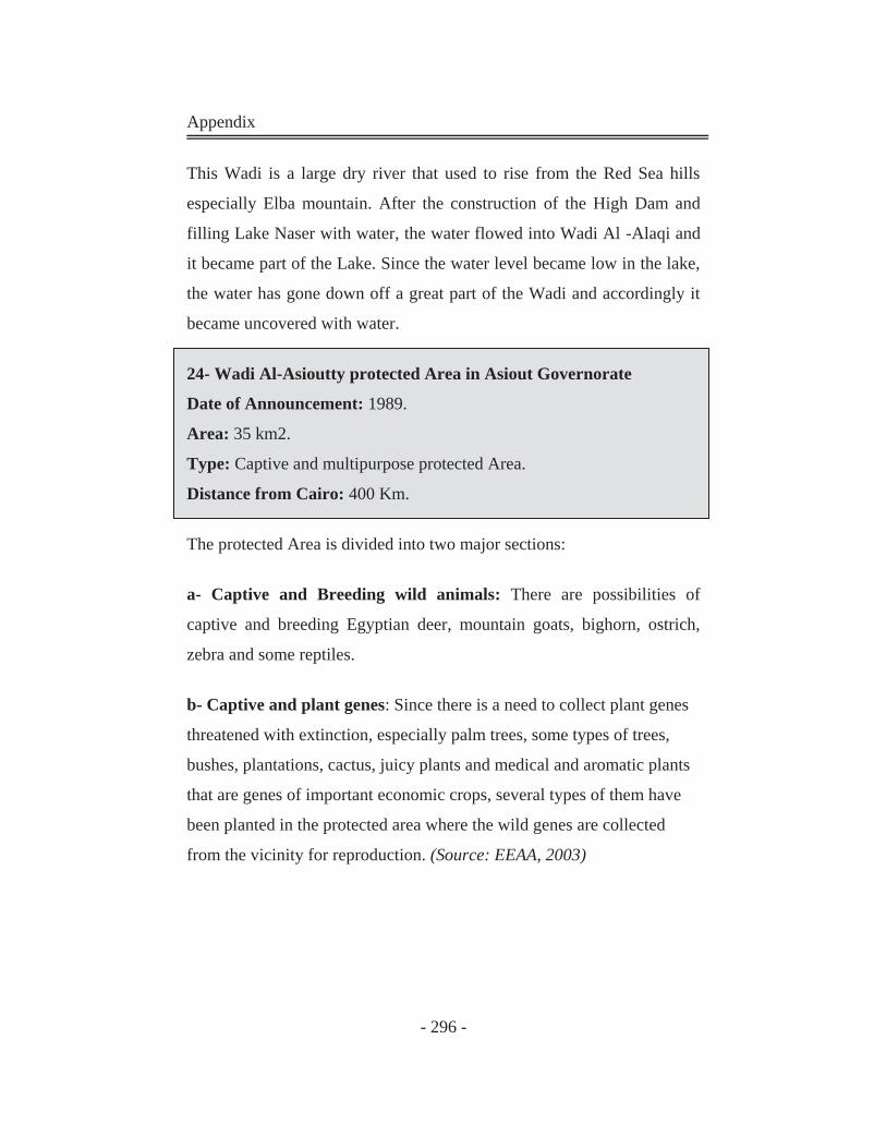
Appendix
- 296 -
This Wadi is a large dry river that used to rise from the Red Sea hills
especially Elba mountain. After the construction of the High Dam and
filling Lake Naser with water, the water flowed into Wadi Al -Alaqi and
it became part of the Lake. Since the water level became low in the lake,
the water has gone down off a great part of the Wadi and accordingly it
became uncovered with water.
24- Wadi Al-Asioutty protected Area in Asiout Governorate
Date of Announcement: 1989.
Area: 35 km2.
Type: Captive and multipurpose protected Area.
Distance from Cairo: 400 Km.
The protected Area is divided into two major sections:
a- Captive and Breeding wild animals: There are possibilities of
captive and breeding Egyptian deer, mountain goats, bighorn, ostrich,
zebra and some reptiles.
b- Captive and plant genes: Since there is a need to collect plant genes
threatened with extinction, especially palm trees, some types of trees,
bushes, plantations, cactus, juicy plants and medical and aromatic plants
that are genes of important economic crops, several types of them have
been planted in the protected area where the wild genes are collected
from the vicinity for reproduction. (Source: EEAA, 2003)
Appendix
- 297 -
AAppppeennddiixx 66::
Egyptian Law for Protectorates: 11--LLaaww NNoo 110022 ooff 11998833 ffoorr NNaattuurree PPrrootteeccttoorraatteess AArrttiiccllee ((11))
In implementing the articles of this Law, a natural protectorate is
defined as any area of Land, or coastal or inland water characterized
by flora, fauna, and natural features having cultural, scientific,
touristic or esthetic value. These areas will be designated and
delineated by Decree of the Prime Minister upon the recommendation
of the Egyptian Environmental Affairs Agency.
AArrttiiccllee ((22))
It is forbidden to commit actions (deeds or activities or undertakings)
which will lead to the destruction or deterioration of the natural
environment or harm the biota (terrestrial, marine or fresh water), or
which will detract from the esthetic (beauty) standards within
protected areas.
In particular, the following acts are forbidden:
Catching transporting killing or disturbing wildlife.
Damaging or removing any living organisms or natural features
and resources, such as shells, corals, rocks, or soil for any
purpose.
Damaging or removing plants (from) the protected areas.
Spoiling or destroying the geological structures (and other
features) of areas serving as natural habitats and breeding areas
for plants and animals.
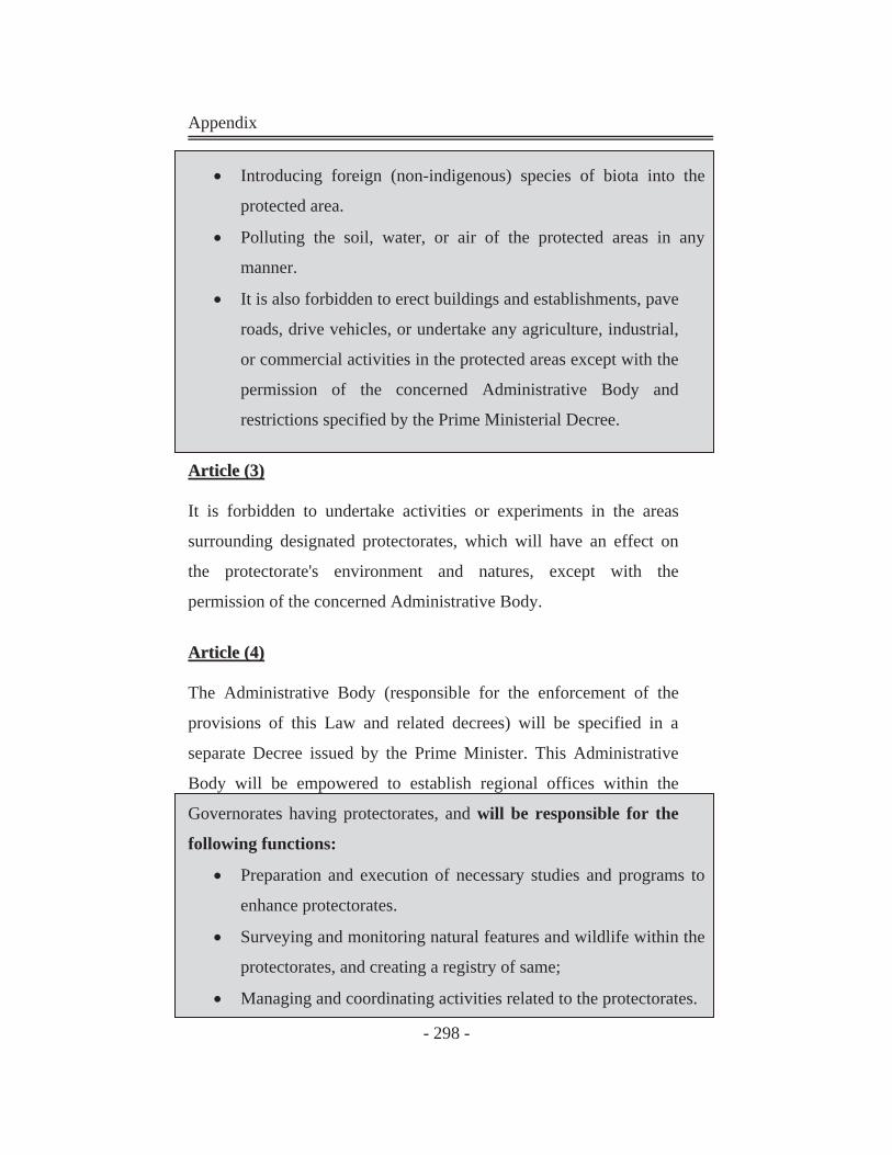
Appendix
- 298 -
Introducing foreign (non-indigenous) species of biota into the
protected area.
Polluting the soil, water, or air of the protected areas in any
manner.
It is also forbidden to erect buildings and establishments, pave
roads, drive vehicles, or undertake any agriculture, industrial,
or commercial activities in the protected areas except with the
permission of the concerned Administrative Body and
restrictions specified by the Prime Ministerial Decree.
AArrttiiccllee ((33))
It is forbidden to undertake activities or experiments in the areas
surrounding designated protectorates, which will have an effect on
the protectorate's environment and natures, except with the
permission of the concerned Administrative Body.
AArrttiiccllee ((44))
The Administrative Body (responsible for the enforcement of the
provisions of this Law and related decrees) will be specified in a
separate Decree issued by the Prime Minister. This Administrative
Body will be empowered to establish regional offices within the
Governorates having protectorates, and will be responsible for the
following functions:
Preparation and execution of necessary studies and programs to
enhance protectorates.
Surveying and monitoring natural features and wildlife within the
protectorates, and creating a registry of same;
Managing and coordinating activities related to the protectorates.
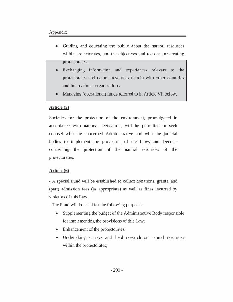
Appendix
- 299 -
Guiding and educating the public about the natural resources
within protectorates, and the objectives and reasons for creating
protectorates.
Exchanging information and experiences relevant to the
protectorates and natural resources therein with other countries
and international organizations.
Managing (operational) funds referred to in Article VI, below.
AArrttiiccllee ((55))
Societies for the protection of the environment, promulgated in
accordance with national legislation, will be permitted to seek
counsel with the concerned Administrative and with the judicial
bodies to implement the provisions of the Laws and Decrees
concerning the protection of the natural resources of the
protectorates.
AArrttiiccllee ((66))
- A special Fund will be established to collect donations, grants, and
(part) admission fees (as appropriate) as well as fines incurred by
violators of this Law.
- The Fund will be used for the following purposes:
Supplementing the budget of the Administrative Body responsible
for implementing the provisions of this Law;
Enhancement of the protectorates;
Undertaking surveys and field research on natural resources
within the protectorates;
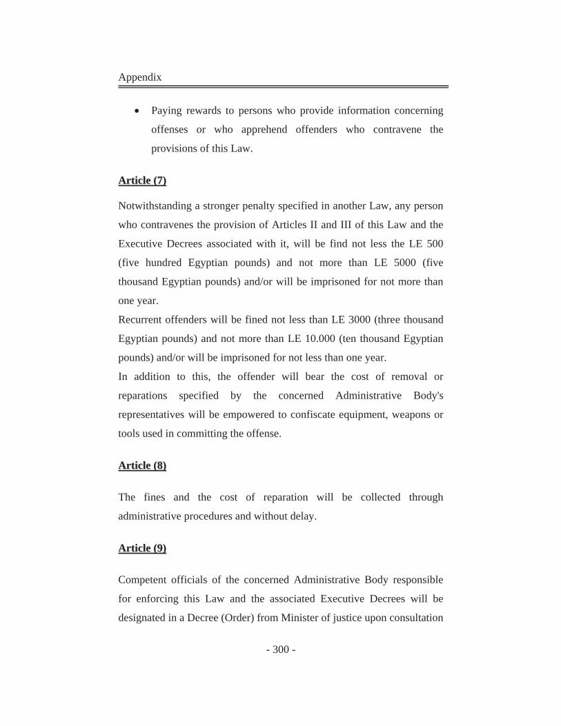
Appendix
- 300 -
Paying rewards to persons who provide information concerning
offenses or who apprehend offenders who contravene the
provisions of this Law.
AArrttiiccllee ((77))
Notwithstanding a stronger penalty specified in another Law, any person
who contravenes the provision of Articles II and III of this Law and the
Executive Decrees associated with it, will be find not less the LE 500
(five hundred Egyptian pounds) and not more than LE 5000 (five
thousand Egyptian pounds) and/or will be imprisoned for not more than
one year.
Recurrent offenders will be fined not less than LE 3000 (three thousand
Egyptian pounds) and not more than LE 10.000 (ten thousand Egyptian
pounds) and/or will be imprisoned for not less than one year.
In addition to this, the offender will bear the cost of removal or
reparations specified by the concerned Administrative Body's
representatives will be empowered to confiscate equipment, weapons or
tools used in committing the offense.
AArrttiiccllee ((88))
The fines and the cost of reparation will be collected through
administrative procedures and without delay.
AArrttiiccllee ((99))
Competent officials of the concerned Administrative Body responsible
for enforcing this Law and the associated Executive Decrees will be
designated in a Decree (Order) from Minister of justice upon consultation
Appendix
- 301 -
with the concerned Minister, and shall be accorded magistrate-level
judicial powers concerning violations specified in this Law.
AArrttiiccllee ((1100))
Any provision contrary to the provisions of this Law is abrogated.
AArrttiiccllee ((1111))
- This Law is to be published in the Official Gazette and will be enacted
within three months of the date of publication.
- Issued at the presidency on July 18, 1983 (9 Shawwal 1403 11.) and
signed by Hosny Mubarak.
- Ratified by the Egyptian parliament (people's Assembly) and Senate
(Shura Council) on July 31, (EEAA, 1998)
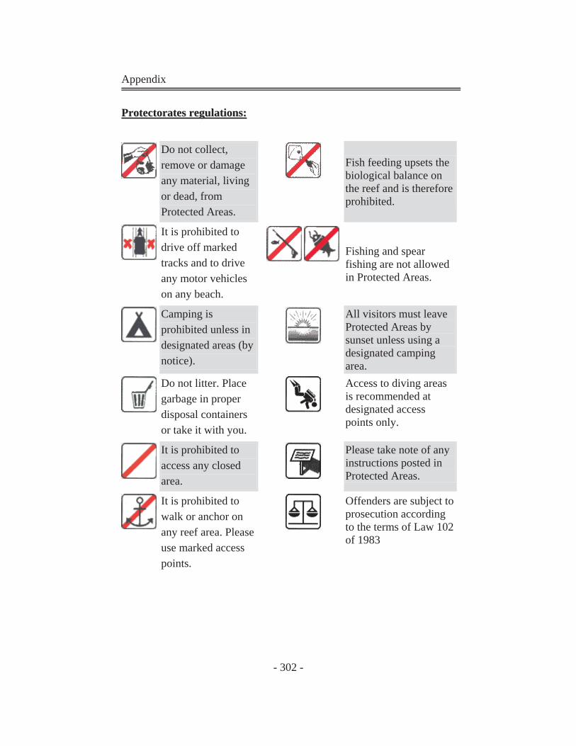
Appendix
- 302 -
PPrrootteeccttoorraatteess rreegguullaattiioonnss::
Do not collect, remove or damage any material, living or dead, from Protected Areas.
Fish feeding upsets the biological balance on the reef and is therefore prohibited.
It is prohibited to drive off marked tracks and to drive any motor vehicles on any beach.
Fishing and spear fishing are not allowed in Protected Areas.
Camping is prohibited unless in designated areas (by notice).
All visitors must leave Protected Areas by sunset unless using a designated camping area.
Do not litter. Place garbage in proper disposal containers or take it with you.
Access to diving areas is recommended at designated access points only.
It is prohibited to access any closed area.
Please take note of any instructions posted in Protected Areas.
It is prohibited to walk or anchor on any reef area. Please use marked access points.
Offenders are subject to prosecution according to the terms of Law 102 of 1983