Embed Size (px)
Citation preview
Joint Center for Satellite Data Assimilation
Overview of activities
Lars Peter Riishojgaard, JCSDA DirectorSid Boukabara, JCSDA Executive Deputy Director
Jim Yoe, JCSDA Chief Administrative Officer
NOAA Satellite Science MeetingMarch 21, 2013 1
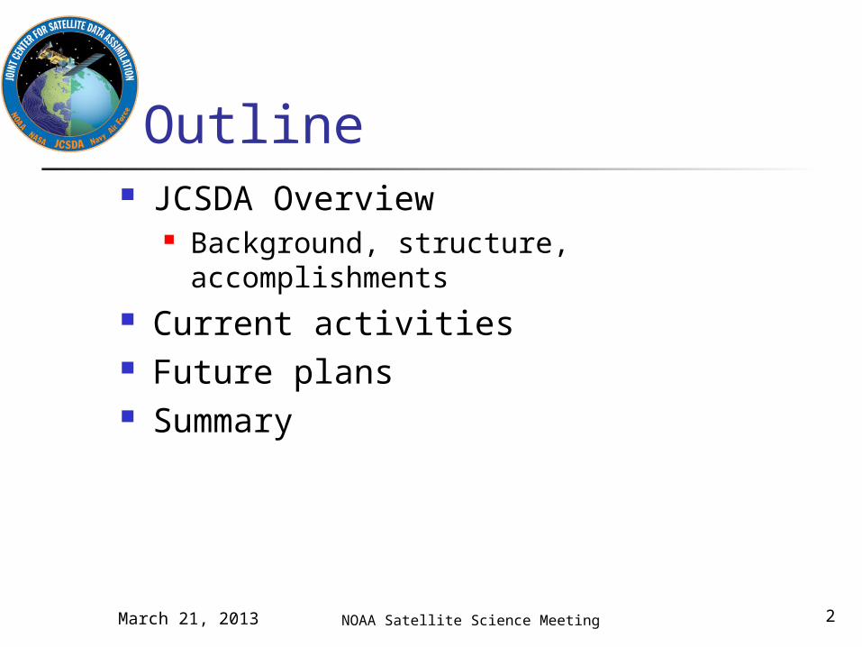
Outline JCSDA Overview
Background, structure, accomplishments Current activities Future plans Summary
NOAA Satellite Science MeetingMarch 21, 2013 2
JCSDA Overview
NOAA Satellite Science MeetingMarch 21, 2013 3
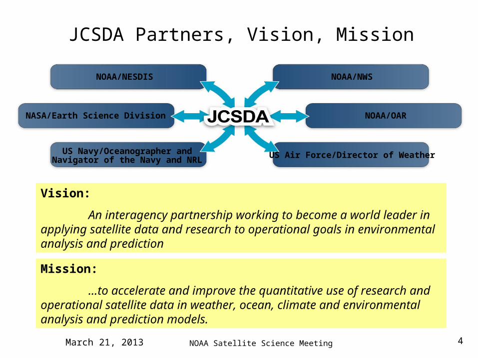
NASA/Earth Science Division
US Navy/Oceanographer andNavigator of the Navy and NRL
NOAA/NESDIS NOAA/NWS
NOAA/OAR
US Air Force/Director of Weather
Mission:
…to accelerate and improve the quantitative use of research and operational satellite data in weather, ocean, climate and environmental analysis and prediction models.
Vision:
An interagency partnership working to become a world leader in applying satellite data and research to operational goals in environmental analysis and prediction
JCSDA Partners, Vision, Mission
NOAA Satellite Science MeetingMarch 21, 2013 4
NOAA Satellite Science Meeting
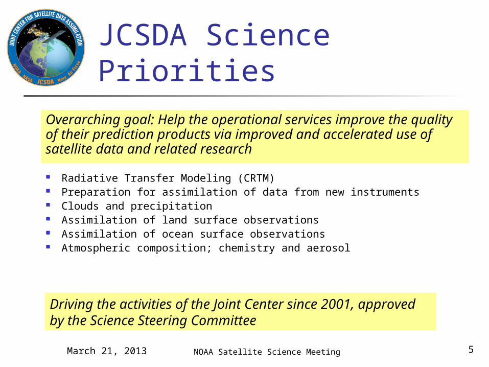
JCSDA Science Priorities
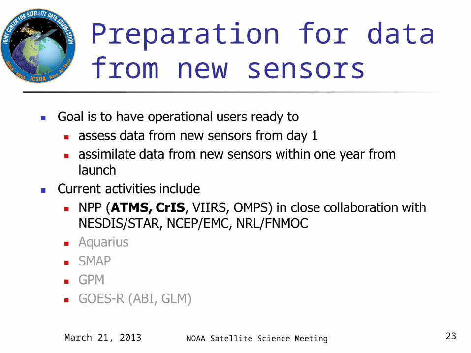
Radiative Transfer Modeling (CRTM) Preparation for assimilation of data from new instruments Clouds and precipitation Assimilation of land surface observations Assimilation of ocean surface observations Atmospheric composition; chemistry and aerosol
Driving the activities of the Joint Center since 2001, approved by the Science Steering Committee
Overarching goal: Help the operational services improve the quality of their prediction products via improved and accelerated use of satellite data and related research
March 21, 2013 5
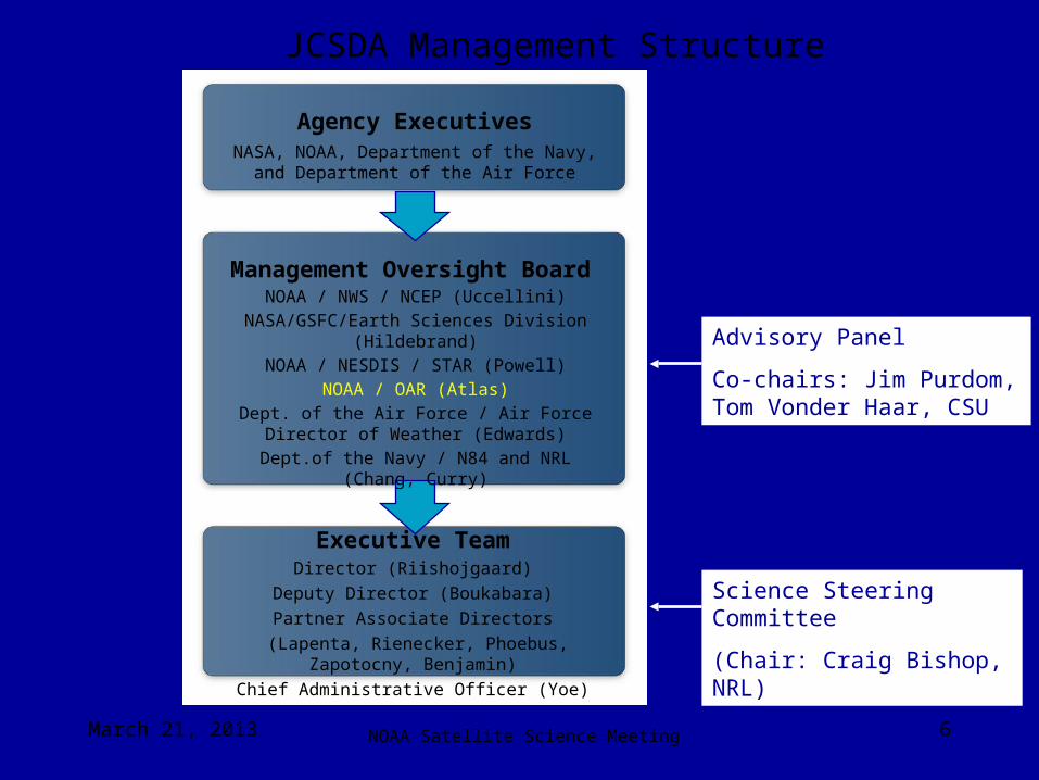
Executive TeamDirector (Riishojgaard)
Deputy Director (Boukabara)
Partner Associate Directors
(Lapenta, Rienecker, Phoebus, Zapotocny, Benjamin)
Chief Administrative Officer (Yoe)
Management Oversight Board
NOAA / NWS / NCEP (Uccellini)NASA/GSFC/Earth Sciences Division
(Hildebrand)NOAA / NESDIS / STAR (Powell)
NOAA / OAR (Atlas)Dept. of the Air Force / Air Force Director of
Weather (Edwards)Dept.of the Navy / N84 and NRL (Chang, Curry)
Agency ExecutivesNASA, NOAA, Department of the Navy, and
Department of the Air Force
Advisory Panel
Co-chairs: Jim Purdom, Tom Vonder Haar, CSU
Science Steering Committee
(Chair: Craig Bishop, NRL)
JCSDA Management Structure
NOAA Satellite Science MeetingMarch 21, 2013 6
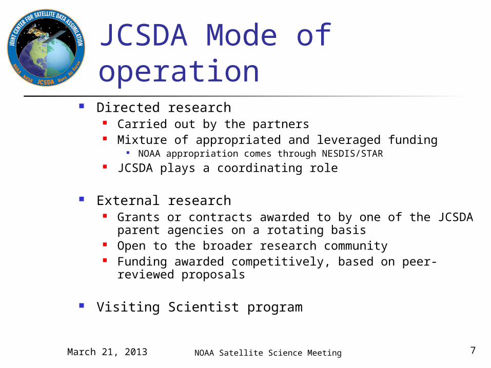
JCSDA Mode of operation
NOAA Satellite Science Meeting
Directed research Carried out by the partners Mixture of appropriated and leveraged funding
NOAA appropriation comes through NESDIS/STAR JCSDA plays a coordinating role
External research Grants or contracts awarded to by one of the JCSDA parent
agencies on a rotating basis Open to the broader research community Funding awarded competitively, based on peer-reviewed
proposals
Visiting Scientist program
March 21, 2013 7

NOAA Satellite Science Meeting
JCSDA accomplishments Common assimilation infrastructure (NOAA, GMAO, AFWA) Community radiative transfer model (all partners) Common NOAA/NASA land data assimilation system (NOAA,
GSFC, AFWA) Numerous new satellite data assimilated operationally, e.g.
MODIS (Winds and AOD), AIRS and IASI hyperspectral IR radiances, GPSRO sensors (COSMIC, GRAS, GRACE), SSMI/S, Windsat, Jason-2,…)
Advanced sensors tested for operational readiness, e.g. ASCAT, MLS, SEVIRI (radiances),…
Ongoing methodology improvement for sensors already assimilated, e.g. AIRS, GPSRO, SSMI/S,…
Improved physically based SST analysis Adjoint sensitivity diagnostics
March 21, 2013 8
NOAA Satellite Science Meeting
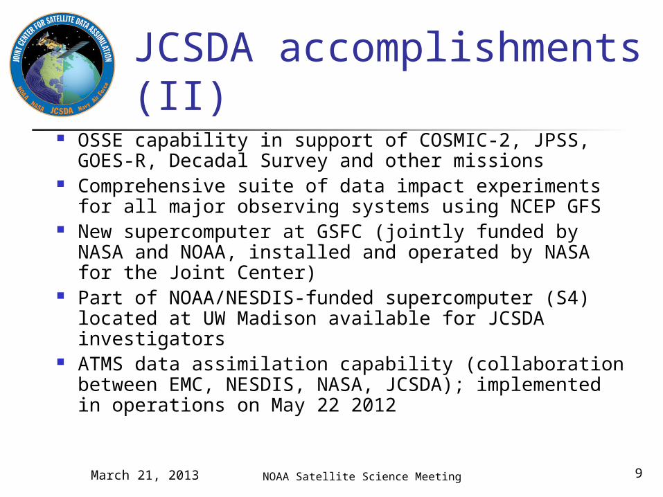
JCSDA accomplishments (II)
OSSE capability in support of COSMIC-2, JPSS, GOES-R, Decadal Survey and other missions
Comprehensive suite of data impact experiments for all major observing systems using NCEP GFS
New supercomputer at GSFC (jointly funded by NASA and NOAA, installed and operated by NASA for the Joint Center)
Part of NOAA/NESDIS-funded supercomputer (S4) located at UW Madison available for JCSDA investigators
ATMS data assimilation capability (collaboration between EMC, NESDIS, NASA, JCSDA); implemented in operations on May 22 2012
March 21, 2013 9
Current Activities
NOAA Satellite Science MeetingMarch 21, 2013 10
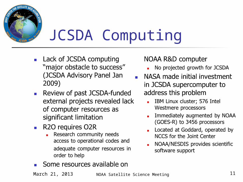
JCSDA Computing
NOAA Satellite Science MeetingMarch 21, 2013 11
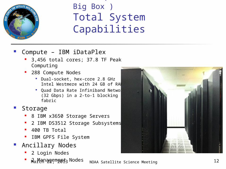
Jibb (“Joint Center in a Big Box”)
Total System Capabilities
Compute – IBM iDataPlex 3,456 total cores; 37.8 TF Peak
Computing 288 Compute Nodes
Dual-socket, hex-core 2.8 GHz Intel Westmere with 24 GB of RAM
Quad Data Rate Infiniband Network (32 Gbps) in a 2-to-1 blocking fabric
Storage 8 IBM x3650 Storage Servers 2 IBM DS3512 Storage Subsystems 400 TB Total IBM GPFS File System
Ancillary Nodes 2 Login Nodes 2 Management Nodes
NOAA Satellite Science MeetingMarch 21, 2013 12
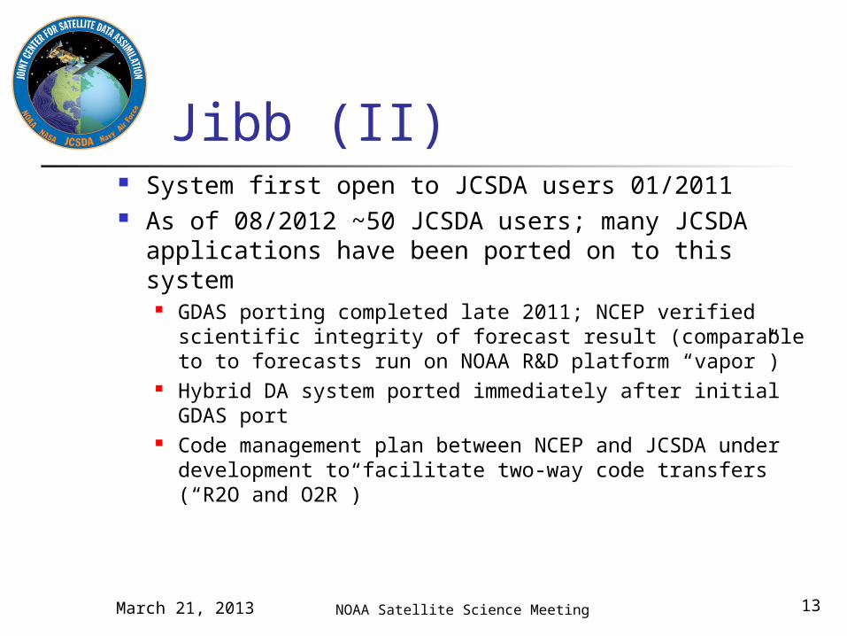
Jibb (II) System first open to JCSDA users 01/2011 As of 08/2012 ~50 JCSDA users; many JCSDA
applications have been ported on to this system GDAS porting completed late 2011; NCEP verified
scientific integrity of forecast result (comparable to to forecasts run on NOAA R&D platform “vapor”)
Hybrid DA system ported immediately after initial GDAS port
Code management plan between NCEP and JCSDA under development to facilitate two-way code transfers (“R2O and O2R”)
NOAA Satellite Science MeetingMarch 21, 2013 13
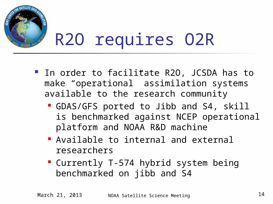
R2O requires O2R
In order to facilitate R2O, JCSDA has to make “operational” assimilation systems available to the research community GDAS/GFS ported to Jibb and S4, skill is
benchmarked against NCEP operational platform and NOAA R&D machine
Available to internal and external researchers
Currently T-574 hybrid system being benchmarked on jibb and S4
NOAA Satellite Science MeetingMarch 21, 2013 14
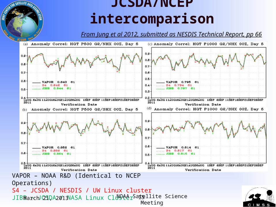
JCSDA/NCEP intercomparison
VAPOR – NOAA R&D (Identical to NCEP Operations)S4 – JCSDA / NESDIS / UW Linux clusterJIBB – JCSDA / NASA Linux Cluster
From Jung et al 2012, submitted as NESDIS Technical Report, pp 66
NOAA Satellite Science Meeting
March 21, 2013 15

500 hPa Anomaly Correlations15 Aug – 30 Sep 2010
No Satellite / No Conventional Data
Northern Hemisphere
Southern Hemisphere
Example of OSE diagnostics (J. Jung, 5th WMO Impact Workshop, Sedona 2012)
NOAA Satellite Science Meeting March 21, 201316
Aim High…Fly, Fight, Win
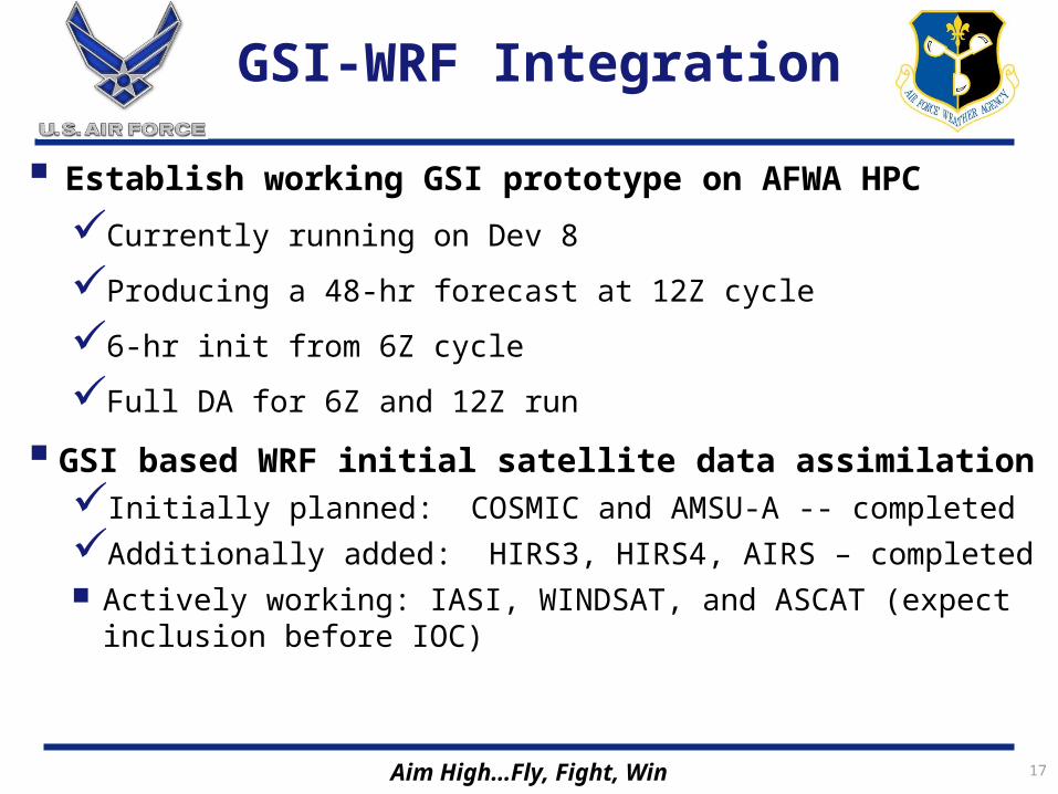
GSI-WRF Integration
Establish working GSI prototype on AFWA HPC
Currently running on Dev 8
Producing a 48-hr forecast at 12Z cycle
6-hr init from 6Z cycle
Full DA for 6Z and 12Z run
GSI based WRF initial satellite data assimilationInitially planned: COSMIC and AMSU-A -- completed
Additionally added: HIRS3, HIRS4, AIRS – completed Actively working: IASI, WINDSAT, and ASCAT (expect inclusion
before IOC)
17
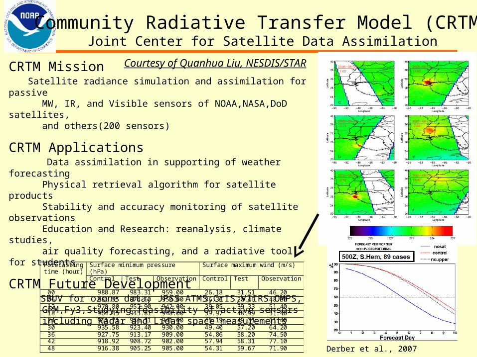
Community Radiative Transfer Model (CRTM)Joint Center for Satellite Data Assimilation
CRTM Mission Satellite radiance simulation and assimilation for passive MW, IR, and Visible sensors of NOAA,NASA,DoD satellites, and others(200 sensors)
CRTM Applications Data assimilation in supporting of weather forecasting Physical retrieval algorithm for satellite products Stability and accuracy monitoring of satellite observations Education and Research: reanalysis, climate studies, air quality forecasting, and a radiative tool for students
CRTM Future Development SBUV for ozone data, JPSS ATMS,CrIS,VIIRS,OMPS, GPM,Fy3,Studying feasibility of active sensors including Radar and Lidar space measurements
Forecasting time (hour)
Surface minimum pressure (hPa)
Surface maximum wind (m/s)
Control Test Observation Control Test Observation
00 988.87 983.31 959.00 26.18 31.51 46.20 06 981.55 974.60 950.00 36.36 30.46 48.80 12 970.80 957.90 942.00 39.05 39.33 51.40 18 964.45 945.81 948.00 39.97 48.99 51.40 24 951.71 936.11 941.00 45.19 49.31 51.40 30 935.58 923.40 930.00 49.40 57.20 64.20 36 927.75 913.17 909.00 54.86 58.20 74.50 42 918.92 908.72 902.00 57.94 58.31 77.10 48 916.38 905.25 905.00 54.31 59.67 71.90
Derber et al., 2007
Courtesy of Quanhua Liu, NESDIS/STAR
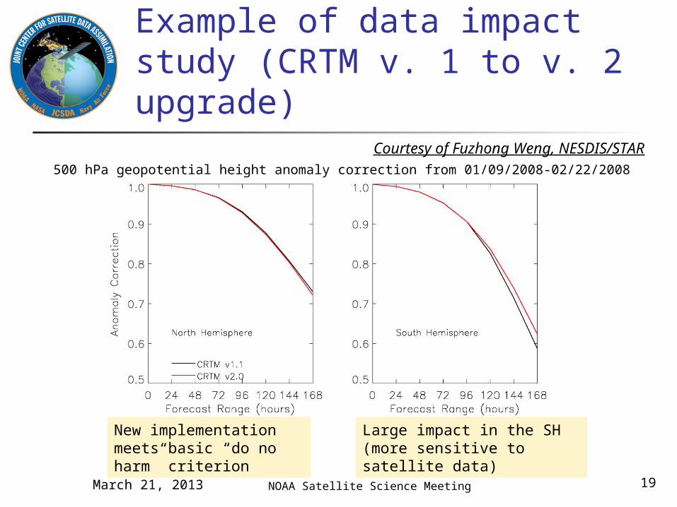
500 hPa geopotential height anomaly correction from 01/09/2008-02/22/2008
Example of data impact study (CRTM v. 1 to v. 2 upgrade)
NOAA Satellite Science Meeting
New implementation meets basic “do no harm” criterion
Large impact in the SH (more sensitive to satellite data)
Courtesy of Fuzhong Weng, NESDIS/STAR
March 21, 2013 19
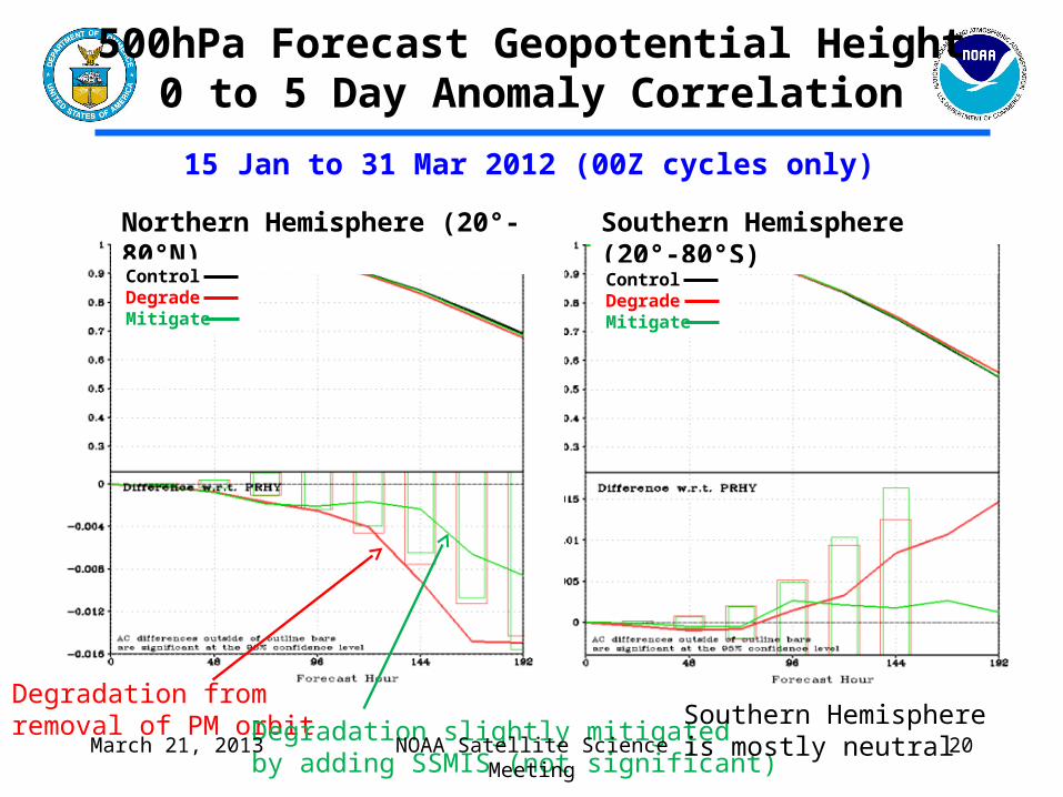
500hPa Forecast Geopotential Height0 to 5 Day Anomaly Correlation
Degradation from removal of PM orbit Degradation slightly mitigated
by adding SSMIS (not significant)
Northern Hemisphere (20°-80°N) Southern Hemisphere (20°-80°S)
Southern Hemisphereis mostly neutral
15 Jan to 31 Mar 2012 (00Z cycles only)
ControlDegradeMitigate
ControlDegradeMitigate
NOAA Satellite Science MeetingMarch 21, 2013 20
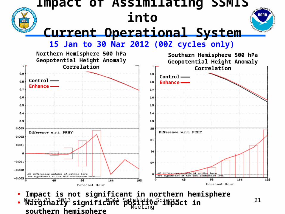
• Impact is not significant in northern hemisphere• Marginally significant positive impact in southern hemisphere
Impact of Assimilating SSMIS intoCurrent Operational System
15 Jan to 30 Mar 2012 (00Z cycles only)
ControlEnhance
ControlEnhance
Northern Hemisphere 500 hPa Geopotential Height Anomaly Correlation
Southern Hemisphere 500 hPa Geopotential Height Anomaly Correlation
NOAA Satellite Science MeetingMarch 21, 2013 21
Summary of SSM/IS experiments
• Weakness of SSMIS from a data assimilation perspective: Only microwave channels– No IR Variable biases due to poor instrument design and/or build Redundant information with other AM data
• Loss of all radiance data from PM satellite orbits will likely have a statistically significant negative impact on operational NOAA numerical guidance skill
• Assimilation of SSMIS observations mitigates a small (not statistically significant) fraction of the negative impact of removing all satellite radiances in the PM orbit
• SSMIS radiances can be used to improve (statistically significant for some variables) current day operational numerical weather prediction at NOAA after successful removal of calibration artifacts
• SSMIS will be considered for inclusion in the next operational upgrade (FY14)
NOAA Satellite Science MeetingMarch 21, 2013 22
NOAA Satellite Science Meeting
Preparation for data from new sensors
March 21, 2013 23
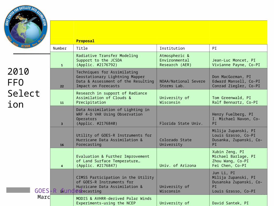
March 21, 2013 NOAA Satellite Science Meeting 24
Proposal
Number Title Institution PI
1
Radiative Transfer Modeling Support to the JCSDA (Applic. #2176792)
Atmospheric & Environmental Research (AER)
Jean-Luc Moncet, PIVivianne Payne, Co-PI
22
Techniques for Assimilating Geostationary Lightning Mapper Data & Assessment of the Resulting Impact on Forecasts
NOAA/National Severe Storms Lab.
Don MacGorman, PIEdward Mansell, Co-PIConrad Ziegler, Co-PI
11
Research in support of Radiance Assimilation of Clouds & Precipitation University of Wisconsin
Tom Greenwald, PIRalf Bennartz, Co-PI
3
Data Assimilation of Lighting in WRF 4-D VAR Using Observation Operators(Applic. #2176840) Florida State Univ.
Henry Fuelberg, PII. Michael Navon, Co-PI
16
Utility of GOES-R Instruments for Hurricane Data Assimilation & Forecasting Colorado State University
Milija Zupanski, PILouis Grasso, Co-PIDusanka, Zupanski, Co-PI
4
Evaluation & Further Improvement of Land Surface Temperature…(Applic. #2176847) Univ. of Arizona
Xubin Zeng, PIMichael Barlage, PIZhou Wang, Co-PIFei Chen, Co-PI
14
CIMSS Participation in the Utility of GOES-R Instruments for Hurricane Data Assimilation & Forecasting University of Wisconsin
Jun Li, PIMilija Zupanski, PIDusanska Zupanski, Co-PILouis Grasso, Co-PI
10
MODIS & AVHRR-derived Polar Winds Experiments-using the NCEP GDAS/GFS University of Wisconsin
David Santek, PIJames Jung, Co-PI
GOES-R funded
2010 FFO Selection
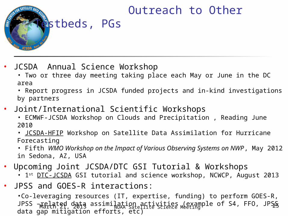
Outreach to Other Testbeds, PGs
• JCSDA Annual Science Workshop• Two or three day meeting taking place each May or June in the DC area• Report progress in JCSDA funded projects and in-kind investigations by partners
• Joint/International Scientific Workshops • ECMWF-JCSDA Workshop on Clouds and Precipitation , Reading June 2010• JCSDA-HFIP Workshop on Satellite Data Assimilation for Hurricane Forecasting• Fifth WMO Workshop on the Impact of Various Observing Systems on NWP, May 2012 in Sedona, AZ, USA
• Upcoming Joint JCSDA/DTC GSI Tutorial & Workshops• 1st DTC-JCSDA GSI tutorial and science workshop, NCWCP, August 2013
• JPSS and GOES-R interactions: •Co-leveraging resources (IT, expertise, funding) to perform GOES-R, JPSS –related data assimilation activities (example of S4, FFO, JPSS data gap mitigation efforts, etc)
NOAA Satellite Science MeetingMarch 21, 2013 25
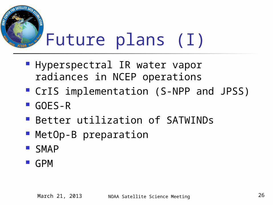
Future plans (I) Hyperspectral IR water vapor radiances
in NCEP operations CrIS implementation (S-NPP and JPSS) GOES-R Better utilization of SATWINDs MetOp-B preparation SMAP GPM
NOAA Satellite Science MeetingMarch 21, 2013 26
Future Plans (II) Additional Impact Assessments (OSEs) Additional OSSEs
New high-resolution Nature Run required External research announcement by NOAA in
FY2013 New model for rotation of External Research
Announcement Reviews complete and selection package in preparation
Pursuing possibilities for updating JIBB/S4 to new high-resolution DA systems
JCSDA Symposium at 2014 AMS Annual Meeting
NOAA Satellite Science MeetingMarch 21, 2013 27
Summary JCSDA activities have had clear impact on operational
activities of all partners, including NWS/NCEP Joint systems and code (CRTM, LIS, GSI) Additional sensors (AIRS, MODIS, COSMIC, IASI, SSMI/S,
ATMS) Ongoing improvements to assimilation methodology and
diagnostics (observation operators, adjoint sensitivity) Major improvements in forecast skill result from adding
large number of small improvements Increased collaboration both internally (between partners),
nationally, and internationally Preparation for new sensors critical for NOAA and JCSDA
partners
NOAA Satellite Science MeetingMarch 21, 2013 28