Embed Size (px)
Citation preview
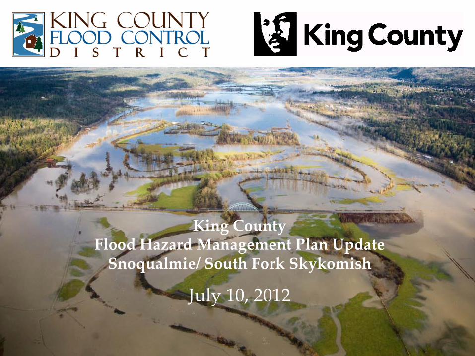
King County Flood Hazard Management Plan Update
Snoqualmie/ South Fork Skykomish
July 10, 2012
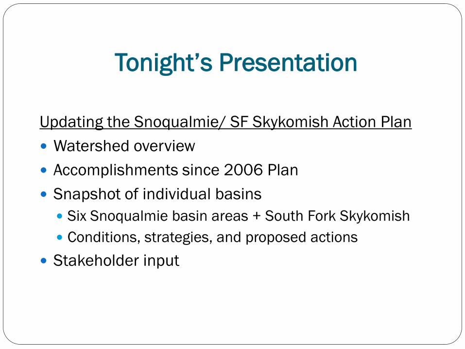
Tonight’s Presentation
Updating the Snoqualmie/ SF Skykomish Action Plan Watershed overview Accomplishments since 2006 Plan Snapshot of individual basins Six Snoqualmie basin areas + South Fork Skykomish Conditions, strategies, and proposed actions
Stakeholder input
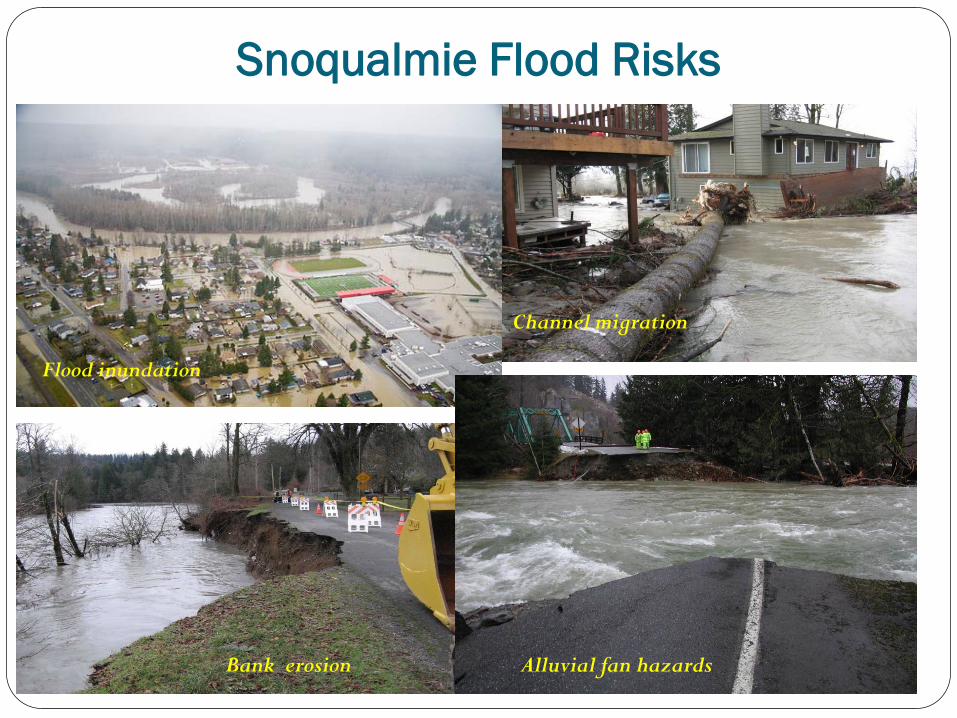
Snoqualmie Flood Risks
Flood inundation
Bank erosion
Channel migration
Alluvial fan hazards
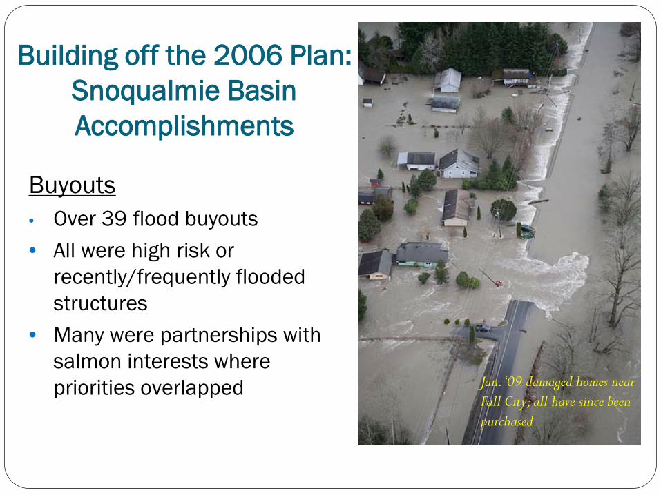
Building off the 2006 Plan: Snoqualmie Basin Accomplishments
Buyouts • Over 39 flood buyouts • All were high risk or
recently/frequently flooded structures
• Many were partnerships with salmon interests where priorities overlapped Jan. ‘09 damaged homes near
Fall City; all have since been purchased
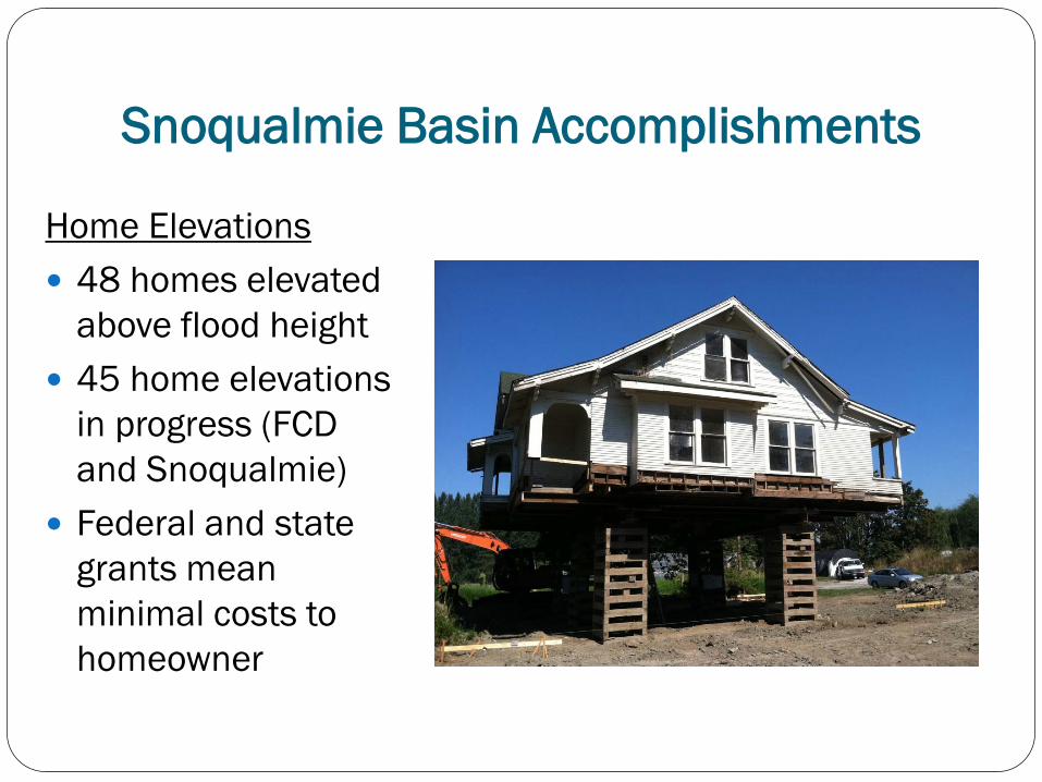
Home Elevations 48 homes elevated
above flood height 45 home elevations
in progress (FCD and Snoqualmie)
Federal and state grants mean minimal costs to homeowner
Snoqualmie Basin Accomplishments
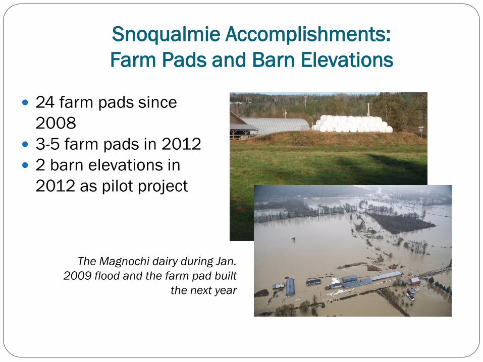
Snoqualmie Accomplishments: Farm Pads and Barn Elevations
24 farm pads since 2008
3-5 farm pads in 2012 2 barn elevations in
2012 as pilot project
The Magnochi dairy during Jan. 2009 flood and the farm pad built
the next year
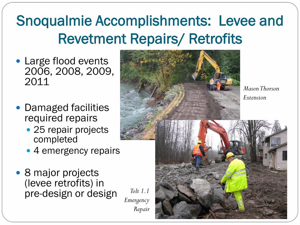
Snoqualmie Accomplishments: Levee and Revetment Repairs/ Retrofits
Large flood events 2006, 2008, 2009, 2011
Damaged facilities required repairs 25 repair projects
completed 4 emergency repairs
8 major projects
(levee retrofits) in pre-design or design
Mason Thorson Extension
Tolt 1.1 Emergency
Repair
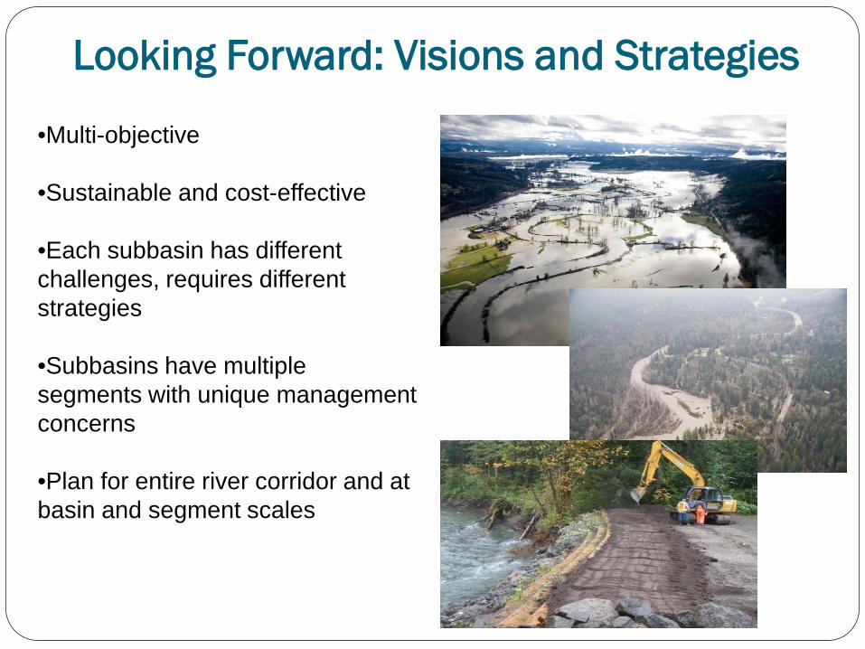
•Multi-objective
•Sustainable and cost-effective
•Each subbasin has different challenges, requires different strategies
•Subbasins have multiple segments with unique management concerns
•Plan for entire river corridor and at basin and segment scales
Looking Forward: Visions and Strategies
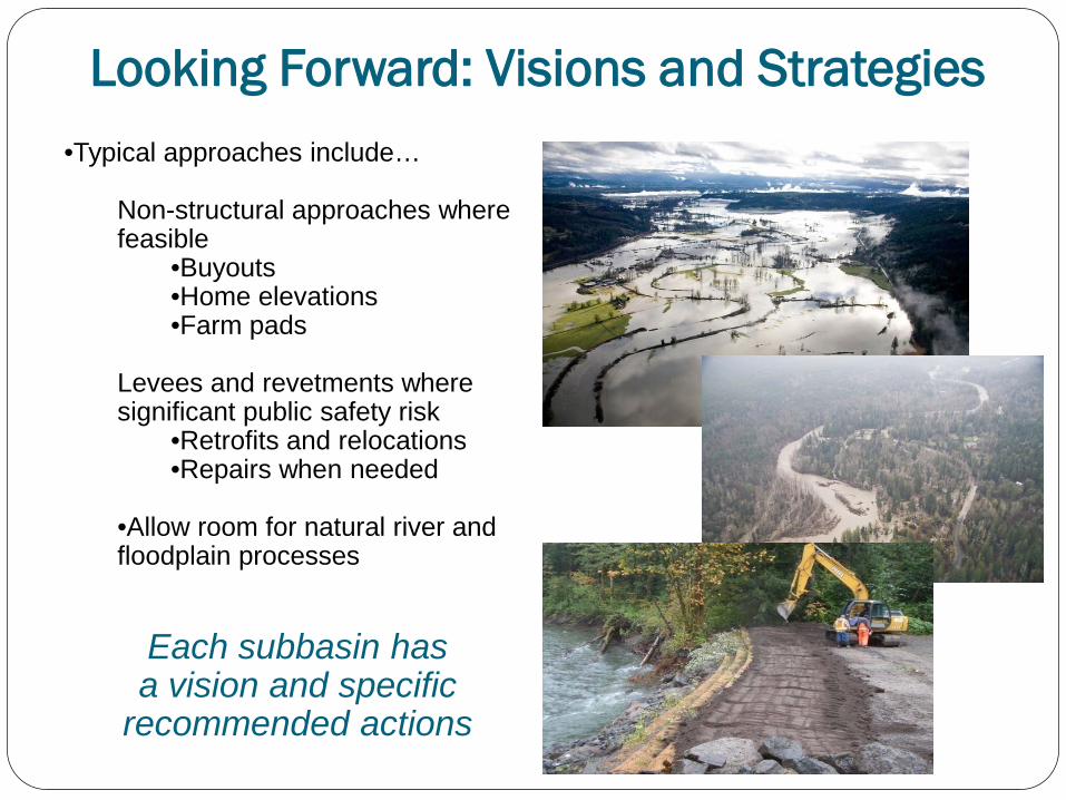
•Typical approaches include…
Non-structural approaches where feasible
•Buyouts •Home elevations •Farm pads
Levees and revetments where significant public safety risk
•Retrofits and relocations •Repairs when needed
•Allow room for natural river and floodplain processes
Each subbasin has a vision and specific
recommended actions
Looking Forward: Visions and Strategies

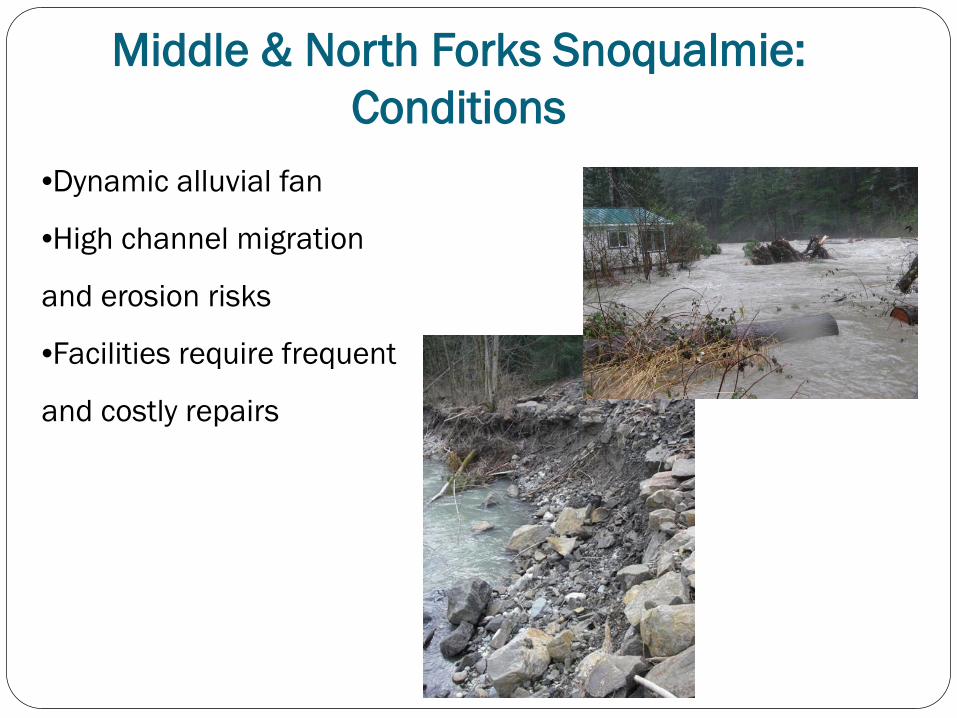
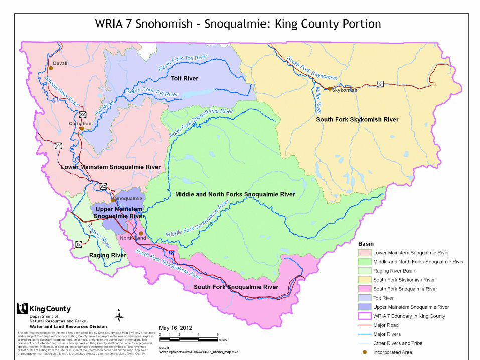
Middle & North Forks Snoqualmie: Conditions
•Dynamic alluvial fan
•High channel migration
and erosion risks
•Facilities require frequent
and costly repairs
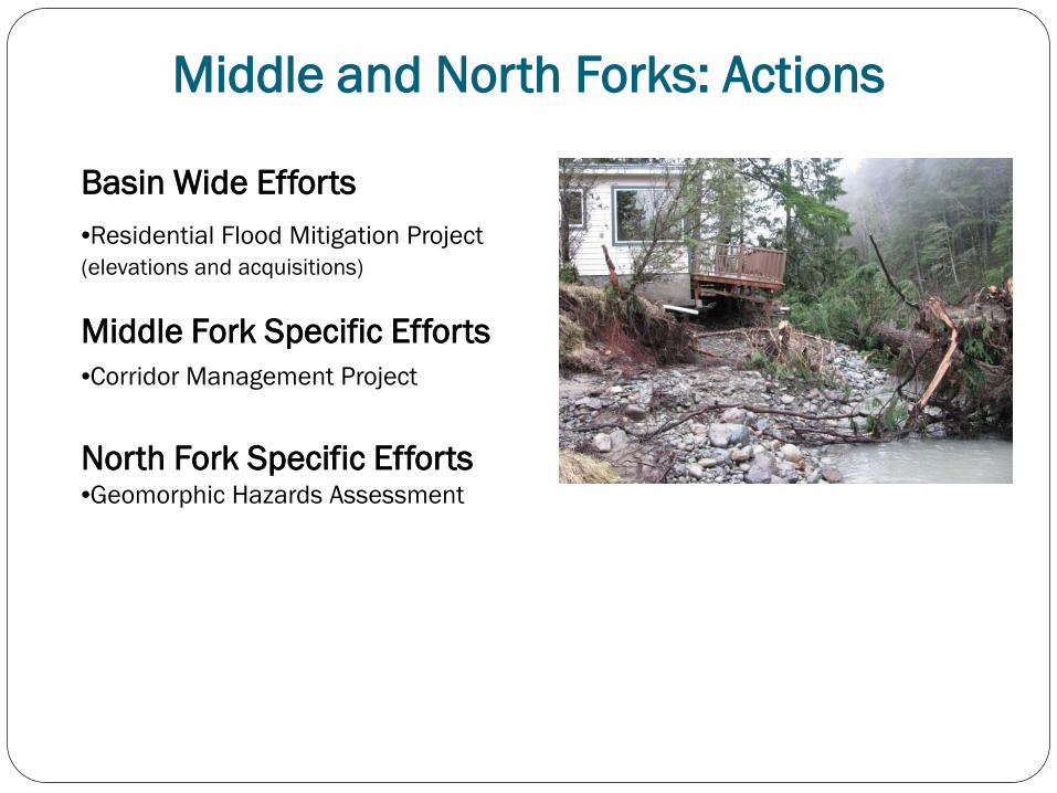
Middle and North Forks: Actions
Basin Wide Efforts •Residential Flood Mitigation Project (elevations and acquisitions)
Middle Fork Specific Efforts •Corridor Management Project North Fork Specific Efforts •Geomorphic Hazards Assessment
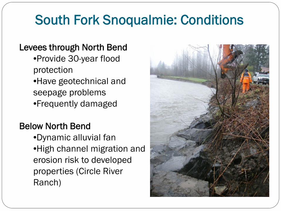
South Fork Snoqualmie: Conditions
Levees through North Bend •Provide 30-year flood protection •Have geotechnical and seepage problems •Frequently damaged
Below North Bend
•Dynamic alluvial fan •High channel migration and erosion risk to developed properties (Circle River Ranch)
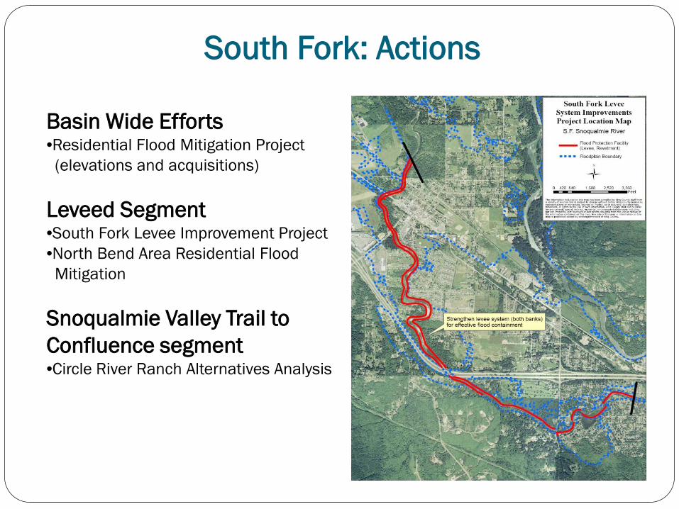
South Fork: Actions
Basin Wide Efforts •Residential Flood Mitigation Project (elevations and acquisitions) Leveed Segment •South Fork Levee Improvement Project •North Bend Area Residential Flood Mitigation Snoqualmie Valley Trail to Confluence segment •Circle River Ranch Alternatives Analysis
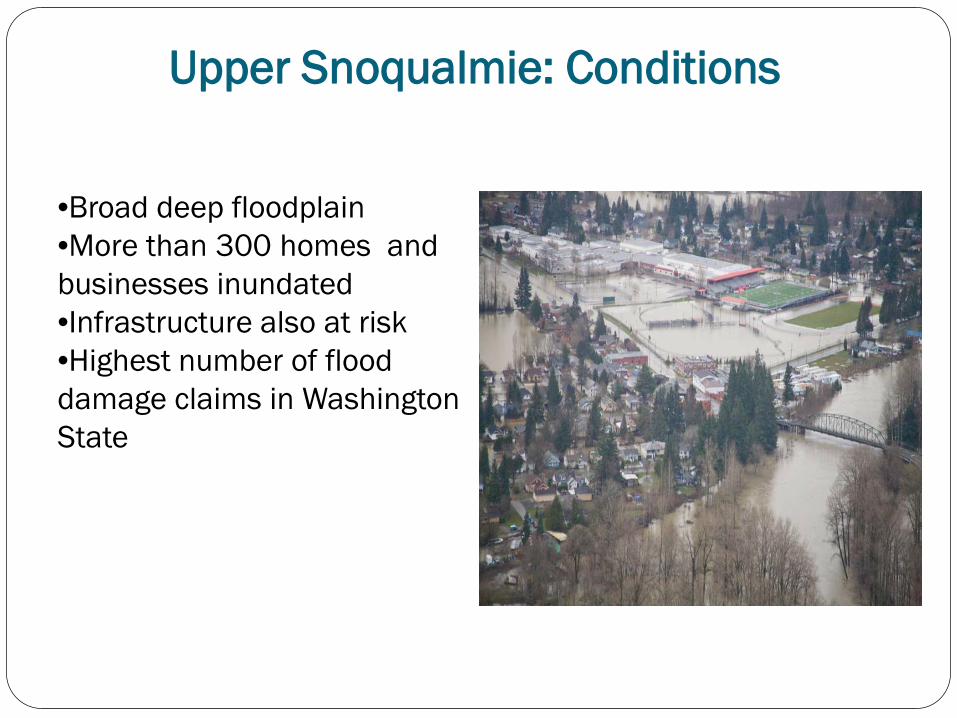
Upper Snoqualmie: Conditions
•Broad deep floodplain •More than 300 homes and businesses inundated •Infrastructure also at risk •Highest number of flood damage claims in Washington State
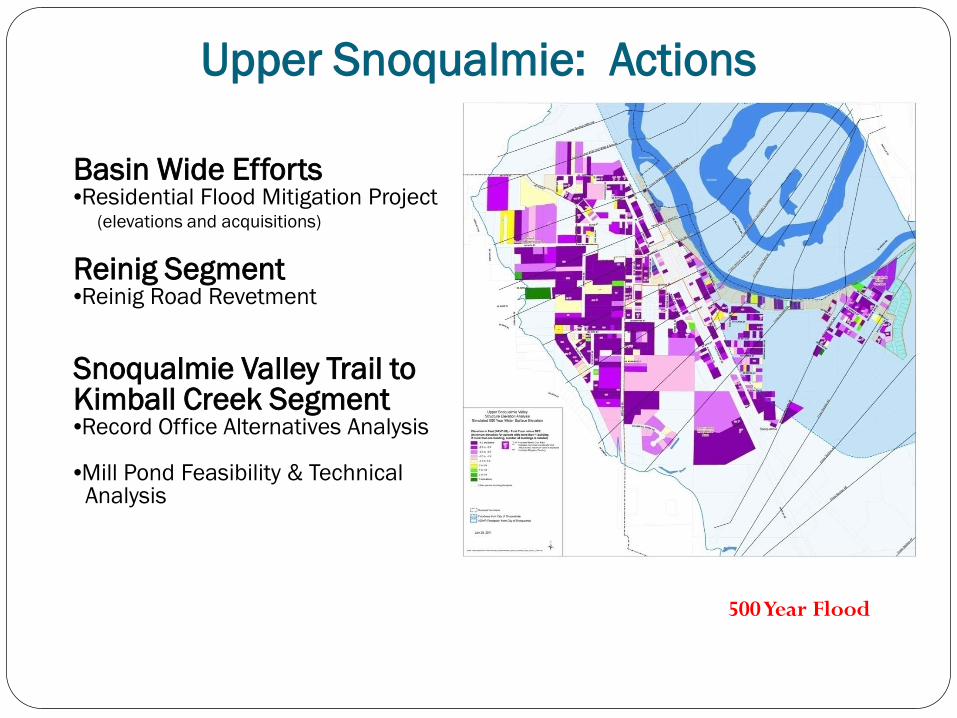
Upper Snoqualmie: Actions
Basin Wide Efforts •Residential Flood Mitigation Project (elevations and acquisitions) Reinig Segment •Reinig Road Revetment
Snoqualmie Valley Trail to Kimball Creek Segment •Record Office Alternatives Analysis •Mill Pond Feasibility & Technical Analysis
500 Year Flood

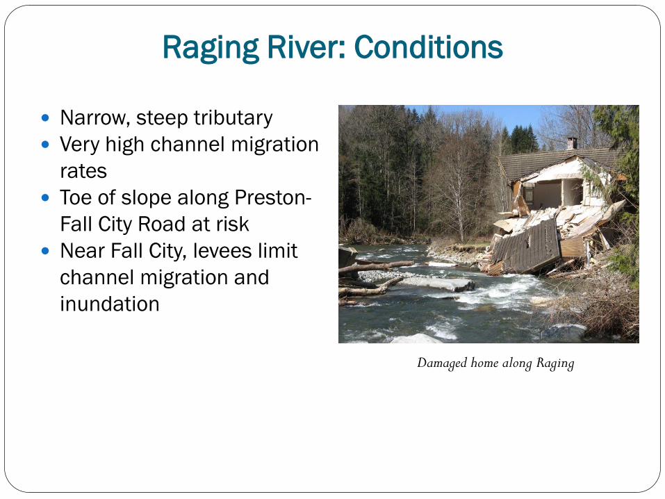
Raging River: Conditions
Narrow, steep tributary Very high channel migration
rates Toe of slope along Preston-
Fall City Road at risk Near Fall City, levees limit
channel migration and inundation
Damaged home along Raging
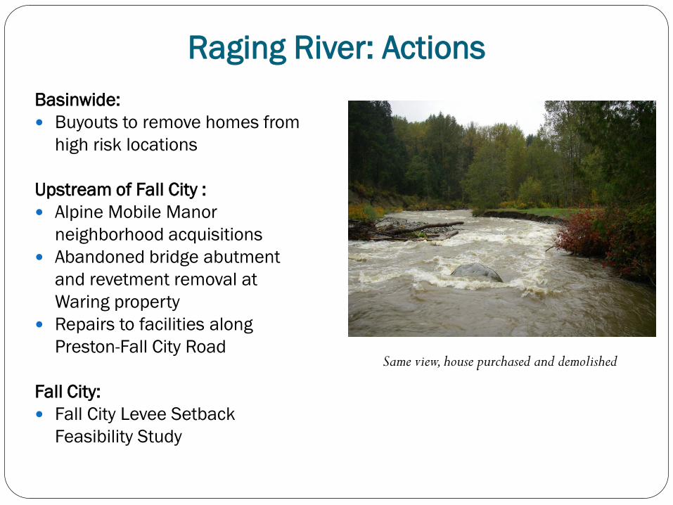
Raging River: Actions Basinwide: Buyouts to remove homes from
high risk locations
Upstream of Fall City : Alpine Mobile Manor
neighborhood acquisitions Abandoned bridge abutment
and revetment removal at Waring property
Repairs to facilities along Preston-Fall City Road
Fall City: Fall City Levee Setback
Feasibility Study
Same view, house purchased and demolished
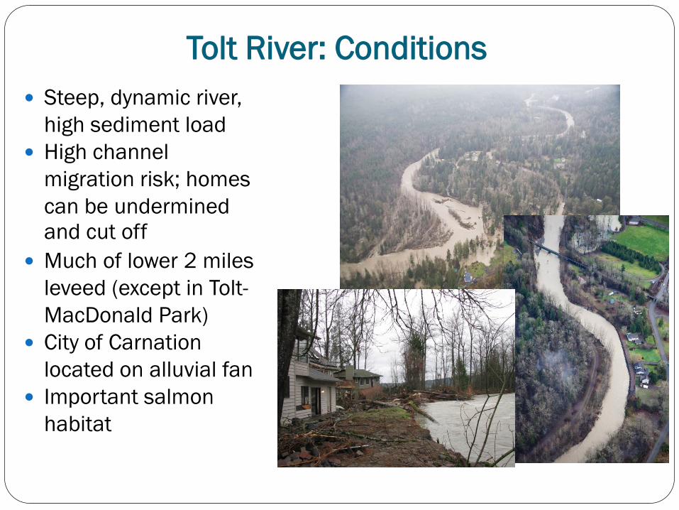
Steep, dynamic river, high sediment load
High channel migration risk; homes can be undermined and cut off
Much of lower 2 miles leveed (except in Tolt-MacDonald Park)
City of Carnation located on alluvial fan
Important salmon habitat
Tolt River: Conditions
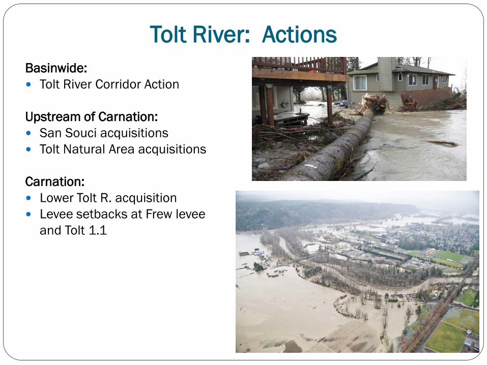
Tolt River: Actions Basinwide: Tolt River Corridor Action
Upstream of Carnation: San Souci acquisitions Tolt Natural Area acquisitions Carnation: Lower Tolt R. acquisition Levee setbacks at Frew levee
and Tolt 1.1
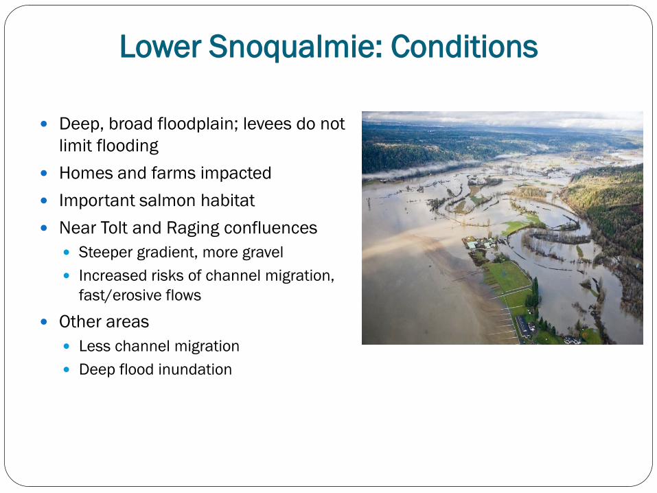
Lower Snoqualmie: Conditions Deep, broad floodplain; levees do not
limit flooding Homes and farms impacted Important salmon habitat Near Tolt and Raging confluences
Steeper gradient, more gravel Increased risks of channel migration,
fast/erosive flows
Other areas Less channel migration Deep flood inundation
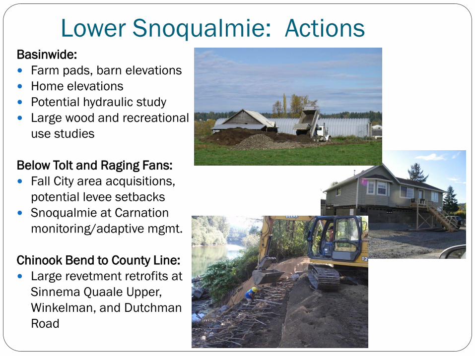
Basinwide: Farm pads, barn elevations Home elevations Potential hydraulic study Large wood and recreational
use studies
Below Tolt and Raging Fans: Fall City area acquisitions,
potential levee setbacks Snoqualmie at Carnation
monitoring/adaptive mgmt. Chinook Bend to County Line: Large revetment retrofits at
Sinnema Quaale Upper, Winkelman, and Dutchman Road
Lower Snoqualmie: Actions
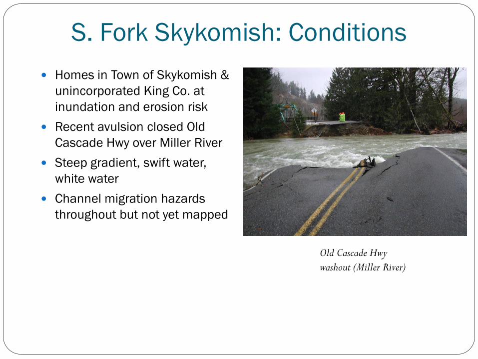
S. Fork Skykomish: Conditions Homes in Town of Skykomish &
unincorporated King Co. at inundation and erosion risk
Recent avulsion closed Old Cascade Hwy over Miller River
Steep gradient, swift water, white water
Channel migration hazards throughout but not yet mapped
Old Cascade Hwy
washout (Miller River)
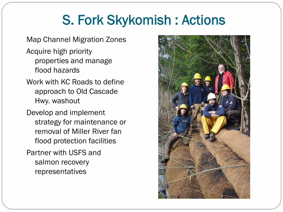
S. Fork Skykomish : Actions Map Channel Migration Zones Acquire high priority
properties and manage flood hazards
Work with KC Roads to define approach to Old Cascade Hwy. washout
Develop and implement strategy for maintenance or removal of Miller River fan flood protection facilities
Partner with USFS and salmon recovery representatives
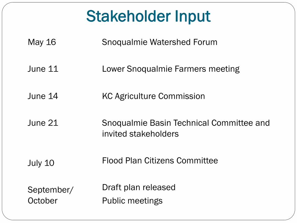
Stakeholder Input May 16 June 11
Snoqualmie Watershed Forum Lower Snoqualmie Farmers meeting
June 14 June 21 July 10 September/ October
KC Agriculture Commission Snoqualmie Basin Technical Committee and invited stakeholders Flood Plan Citizens Committee Draft plan released Public meetings
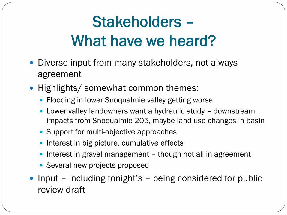
Stakeholders – What have we heard?
Diverse input from many stakeholders, not always agreement
Highlights/ somewhat common themes: Flooding in lower Snoqualmie valley getting worse Lower valley landowners want a hydraulic study – downstream
impacts from Snoqualmie 205, maybe land use changes in basin Support for multi-objective approaches Interest in big picture, cumulative effects Interest in gravel management – though not all in agreement Several new projects proposed
Input – including tonight’s – being considered for public review draft
Questions? Comments?
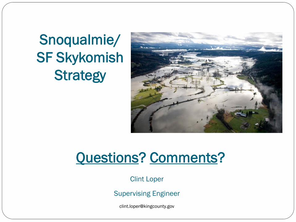
Snoqualmie/ SF Skykomish
Strategy
Clint Loper
Supervising Engineer