Embed Size (px)
Citation preview

Lake Nyasa/ Malawi An instance of:
International Customary
(Water) Law
And
Colonial-era Bilateral Treaties
Lake view, courtesy of www.mininginmalawi.com
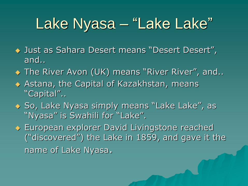
Lake Nyasa – “Lake Lake”
Just as Sahara Desert means “Desert Desert”, and..
The River Avon (UK) means “River River”, and..
Astana, the Capital of Kazakhstan, means “Capital”..
So, Lake Nyasa simply means “Lake Lake”, as “Nyasa” is Swahili for “Lake”.
European explorer David Livingstone reached (“discovered”) the Lake in 1859, and gave it the
name of Lake Nyasa.

Reproduced with kind permission of the artist, Godfrey Mwampembwa , @iGado on Twitter, see tweet of 13.11.13
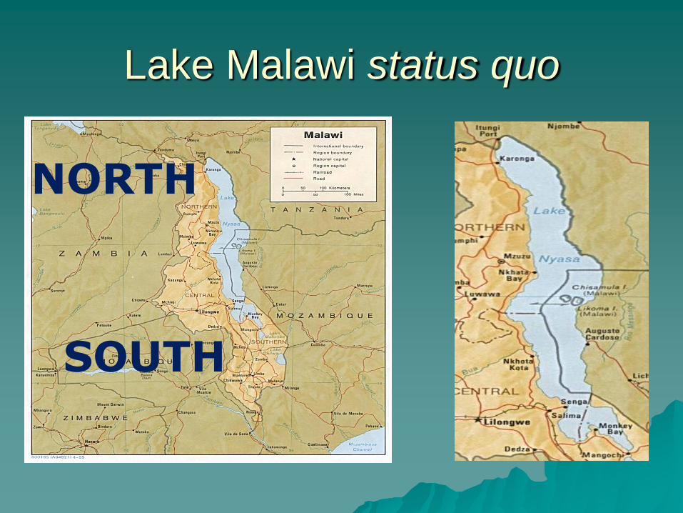
Lake Malawi status quo
SOUTH
NORTH
Southern Border
Southern border agreed by a series of Anglo-Portuguese treaties, dating from 1891 to 1954
UK & Portugal treaties relating to ...
– British Central African Protectorate (to 1907)/ Federation of Rhodesia and Nyasaland (1953 – 1963)/ Nyasaland (1907–1953 & 1963–1964)/ Malawi (from 1964); and
– Overseas Province of Mozambique, State of East Africa (to 1975) / Mozambique (from 1975)
Full USA State Department briefing (1971) at www.law.fsu.edu/library/collection/limitsinseas/ibs112.pdf
1891 Treaty gave Lake Malawi to Nyasaland (Malawi)
1954 Treaty resulted in an equitable split
Southern Border, ‘54
Lake Nyasa:
– the boundary was shifted from the eastern shore to the median line
– 2,471 square miles of water surface area to Portugal
Outwith Lake Nyasa:
– 23 square miles was included in the entity by redemarcating the line westward in Lake Chiuta (c. 50/50)
– 2 square miles of land also was given to Mozambique in the vicinity of Nsanje.
– UK Nyasaland received about eight square miles of Portuguese territory in the Angonia area of the Tete District
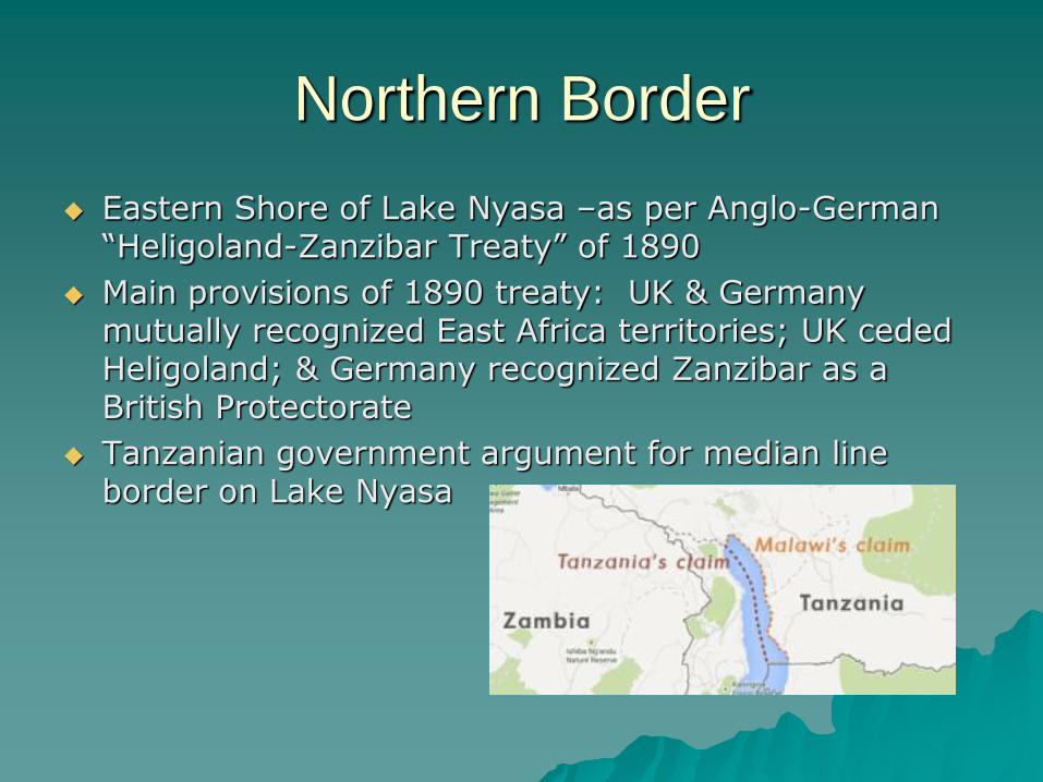
Northern Border
Eastern Shore of Lake Nyasa –as per Anglo-German “Heligoland-Zanzibar Treaty” of 1890
Main provisions of 1890 treaty: UK & Germany mutually recognized East Africa territories; UK ceded Heligoland; & Germany recognized Zanzibar as a British Protectorate
Tanzanian government argument for median line border on Lake Nyasa

Northern Border – Talks
January 1967: – Tanzanian government letter to Malawian government proposing a
negotiated settlement
– Letter acknowledged, Malawians stating response to issues raised to follow
June 1967: Malawian President Kamuzu Banda addresses National Assembly and asserts sovereignty
June 2005: Malawian President Bingu Mutharika wrote to Tanzanian President Ben Mkapa suggesting negotiations
August 2013: Malawian president Joyce Banda held talks with Tanzania’s president Jakaya Kikwete at Southern Africa Development Community Summit. Further inter-governmental talks planned.

September 2013 mediation
deadline... now passed Deadline was set by Malawian President Joyce Banda
Quent Kalichero, Malawian Mining Ministry spokesman:
– “Indeed, the mediation team was initially given up to September to conclude the mediation process. However, the team indicated that there were some technicalities that were not in place then, that made it not possible for the work to be done by the set deadline.”
– “There has since been movement on the technicalities, and the Government of Malawi hopes that the mediation process will be finalised in the shortest time possible”.

Thank You, Any Questions?
@edwindunee (Twitter)

![SURIRELLA ENGLERI O. MÜLLER A STUDY OF ITS ......Nyassa [Lake Malawi, Tanzania]. (B 2.0037): Lake Malombe after discharge of Lake Nyassa [Lake Malawi, Malawi]; collected by Fulleborn](https://img.pdfslide.net/doc/110x75/5f1be7b43262502bb927d1f5/surirella-engleri-o-moeller-a-study-of-its-nyassa-lake-malawi-tanzania.jpg)