Embed Size (px)
Citation preview
#*
#*
!|[d
[¡ I*
IA
IA
IA
[°[°
[°
[°
[°
[°
[°
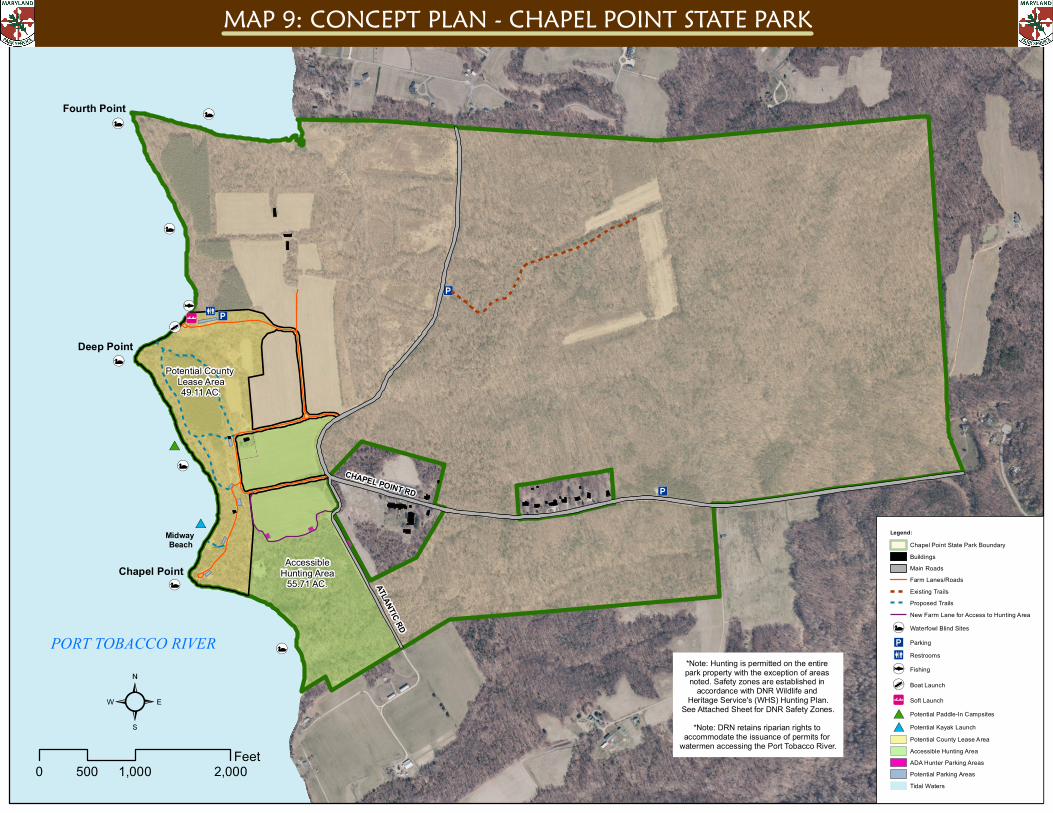
DoIT, MD iMAP, MDP
Legend:Chapel Point State Park BoundaryBuildingsMain RoadsFarm Lanes/RoadsExisting TrailsProposed TrailsNew Farm Lane for Access to Hunting Area
[° Waterfowl Blind Sites
IA Parking
I* Restrooms
[¡ Fishing
[d Boat Launch
!| Soft Launch
#* Potential Paddle-In Campsites
#* Potential Kayak LaunchPotential County Lease AreaAccessible Hunting AreaADA Hunter Parking AreasPotential Parking AreasTidal Waters
²0 1,000 2,000500
Feet
PORT TOBACCO RIVER
CHAPEL POINT RD
ATLANTIC RD
Fourth Point
Deep Point
Chapel Point
Midway Beach
MAP 9: CONCEPT PLAN - CHAPEL POINT STATE PARK
Potential County Lease Area49.11 AC.
AccessibleHunting Area
55.71 AC.
*Note: Hunting is permitted on the entire park property with the exception of areas
noted. Safety zones are established in accordance with DNR Wildlife and
Heritage Service's (WHS) Hunting Plan.See Attached Sheet for DNR Safety Zones.
*Note: DRN retains riparian rights to accommodate the issuance of permits for
watermen accessing the Port Tobacco River.