Embed Size (px)
Citation preview
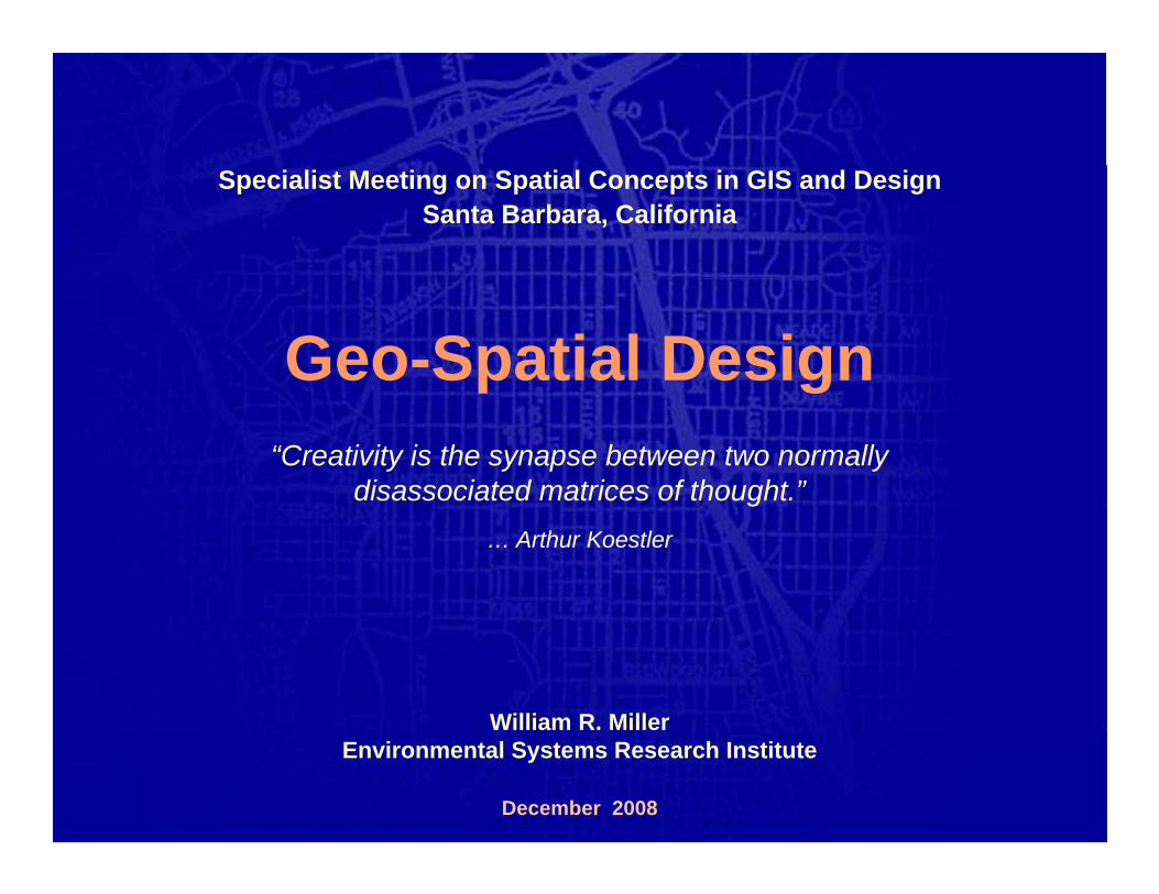
Specialist Meeting on Spatial Concepts in GIS and DesignSanta Barbara, California
Geo-Spatial Designp g“Creativity is the synapse between two normally
disassociated matrices of thought.”g… Arthur Koestler
William R. MillerWilliam R. MillerEnvironmental Systems Research Institute
December 2008
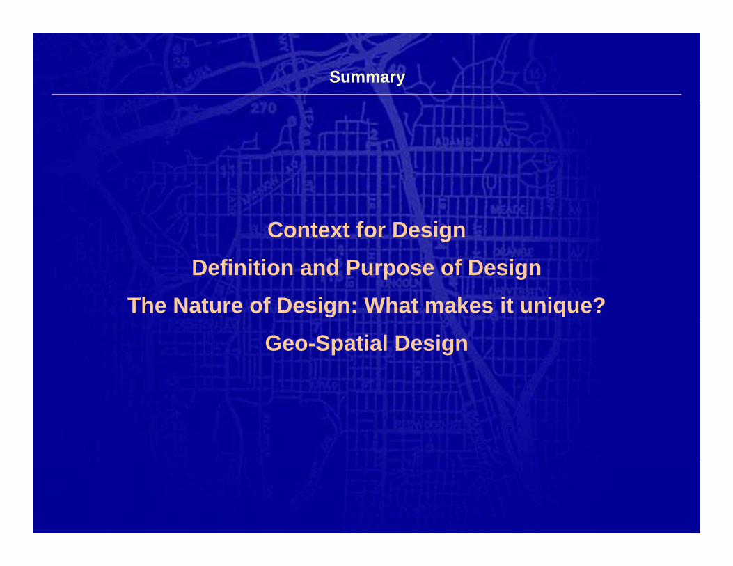
Summary
Context for DesignDefinition and Purpose of Design
The Nature of Design: What makes it unique?Geo-Spatial Design

Context for Design
Every organization does three things …
DATA DESIGNANALYSIS
Get & Manage Analyze & Assess Create or RecreateGet & ManageInformation
Analyze & AssessInformation
Create or RecreateGoods &/or Services
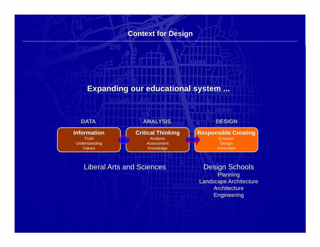
Context for Design
Expanding our educational system ...
InformationTruth
Critical ThinkingAnalysis
Responsible CreatingEnvision
DATA DESIGNANALYSIS
TruthUnderstanding
Values
AnalysisAssessmentKnowledge
EnvisionDesign
Instantiate
Liberal Arts and Sciences Design SchoolsgPlanning
Landscape ArchitectureArchitectureEngineering
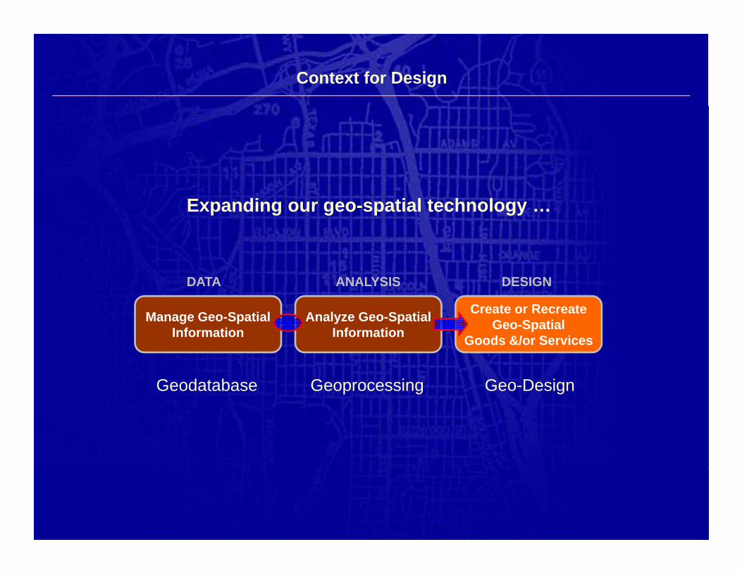
Context for Design
Expanding our geo-spatial technology …
DATA DESIGNANALYSIS
Manage Geo-Spatial Analyze Geo-Spatial Create or RecreateGeo Spatialg p
Informationy pInformation Geo-Spatial
Goods &/or Services
Geodatabase Geo-DesignGeoprocessing
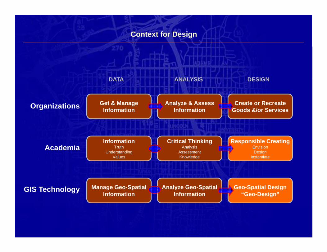
Context for Design
DATA DESIGNANALYSISDATA DESIGNANALYSIS
Get & ManageInformation
Analyze & AssessInformation
Create or RecreateGoods &/or ServicesOrganizations
Responsible CreatingInformation Critical Thinking
Information Information Goods &/or Services
Responsible CreatingEnvisionDesign
Instantiate
InformationTruth
UnderstandingValues
Critical ThinkingAnalysis
AssessmentKnowledge
Academia
Geo-Spatial Design“Geo-Design”
Manage Geo-SpatialInformation
Analyze Geo-SpatialInformation
GIS Technology
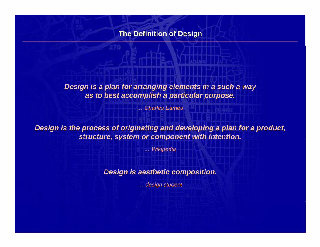
The Definition of Design
Design is a plan for arranging elements in a such a wayas to best accomplish a particular purpose.
Charles Eames
Design is the process of originating and developing a plan for a product,structure, system or component with intention.
… Charles Eames
, y p… Wikipedia
D i i th ti itiDesign is aesthetic composition.… design student
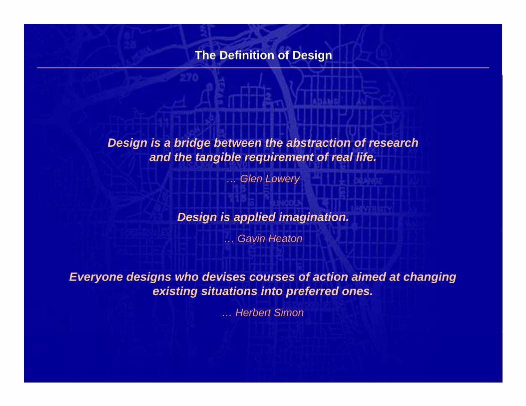
The Definition of Design
Design is a bridge between the abstraction of researchand the tangible requirement of real life.
Glen Lowery
Design is applied imagination.
… Glen Lowery
… Gavin Heaton
Everyone designs who devises courses of action aimed at changingEveryone designs who devises courses of action aimed at changingexisting situations into preferred ones.
… Herbert Simon
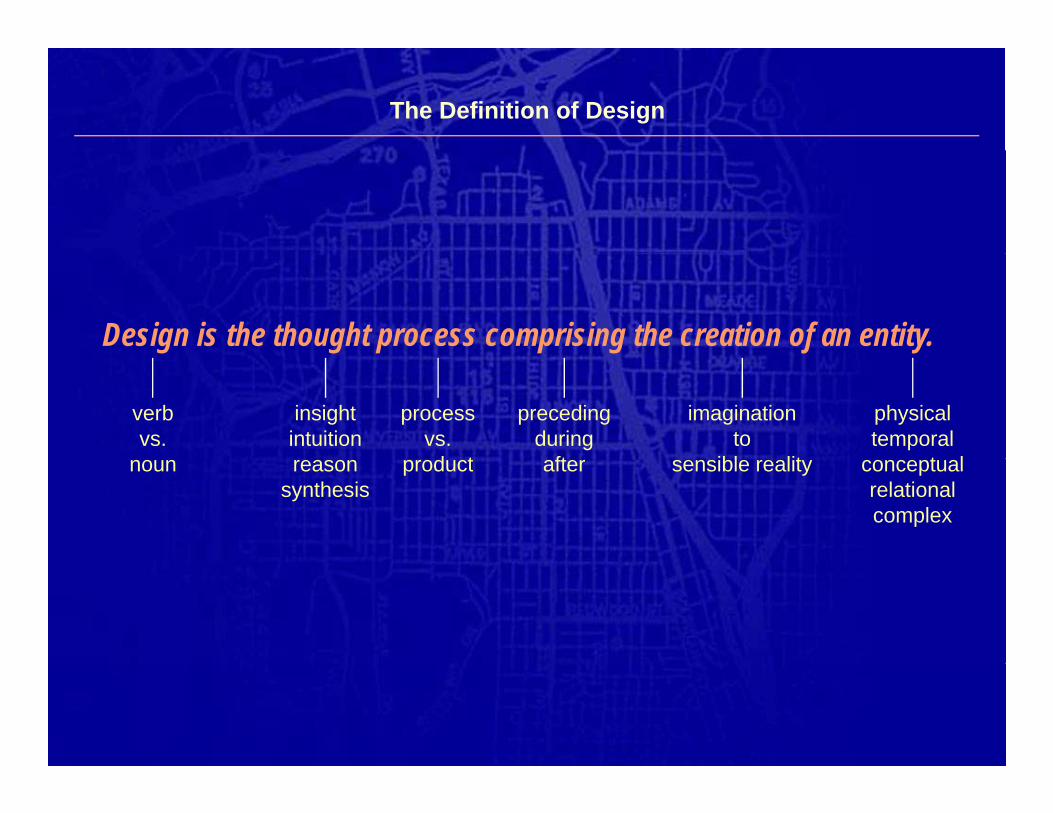
The Definition of Design
Design is the thought process comprising the creation of an entity.
verbvs.
insightintuition
processvs.d t
precedingduring
ft
imaginationto
ibl lit
physicaltemporal
t lnoun reasonsynthesis
product after sensible reality conceptualrelationalcomplex
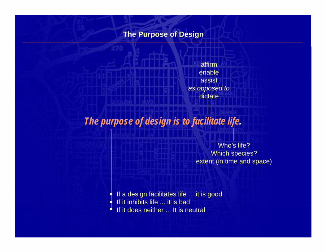
The Purpose of Design
affirmenable
i tassistas opposed to
dictate
The purpose of design is to facilitate life.
Who’s life?Which species?
extent (in time and space)
If a design facilitates life ... it is goodIf it inhibits life ... it is badIf it does neither ... It is neutral
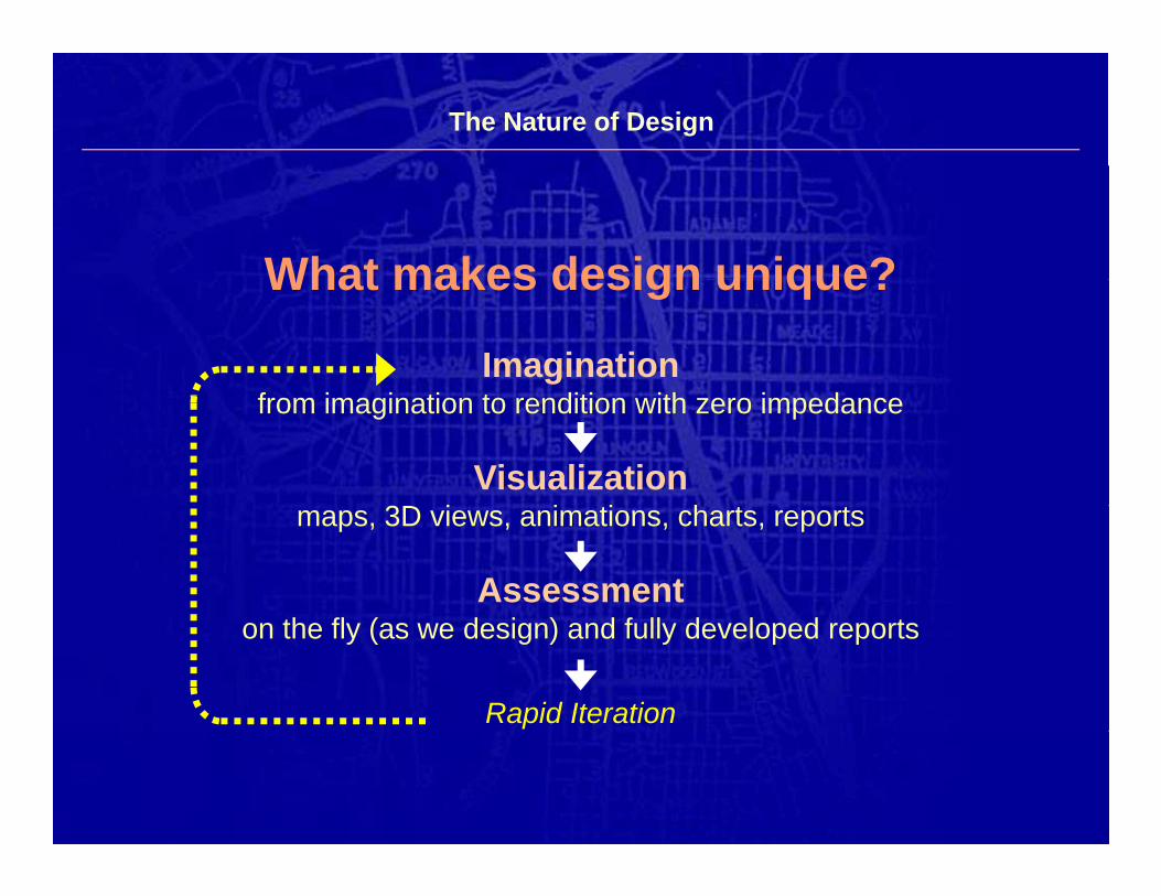
The Nature of Design
What makes design unique?What makes design unique?
Imaginationfrom imagination to rendition with zero impedance
Visualizationmaps, 3D views, animations, charts, reports
Assessmenth fl ( d i ) d f ll d l don the fly (as we design) and fully developed reports
Rapid Iteration
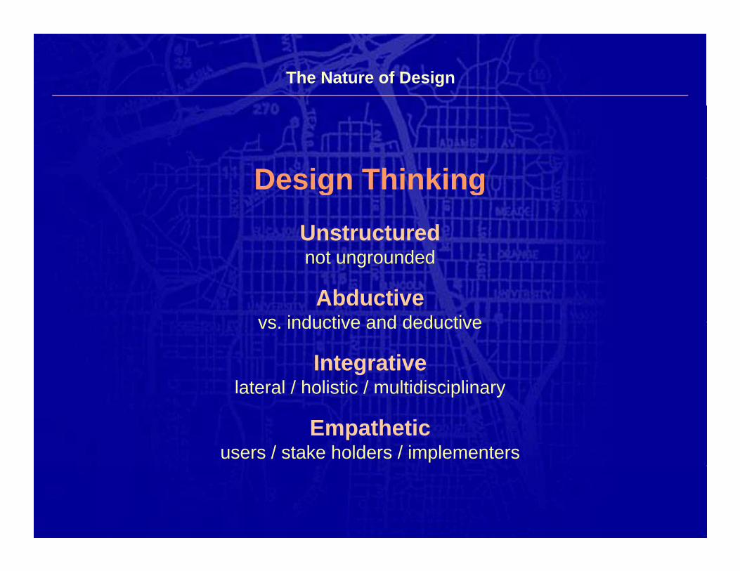
The Nature of Design
Design ThinkingDesign ThinkingUnstructurednot ungrounded
Abductivevs inductive and deductivevs. inductive and deductive
Integrativelateral / holistic / multidisciplinaryate a / o st c / u t d sc p a y
Empatheticusers / stake holders / implementers
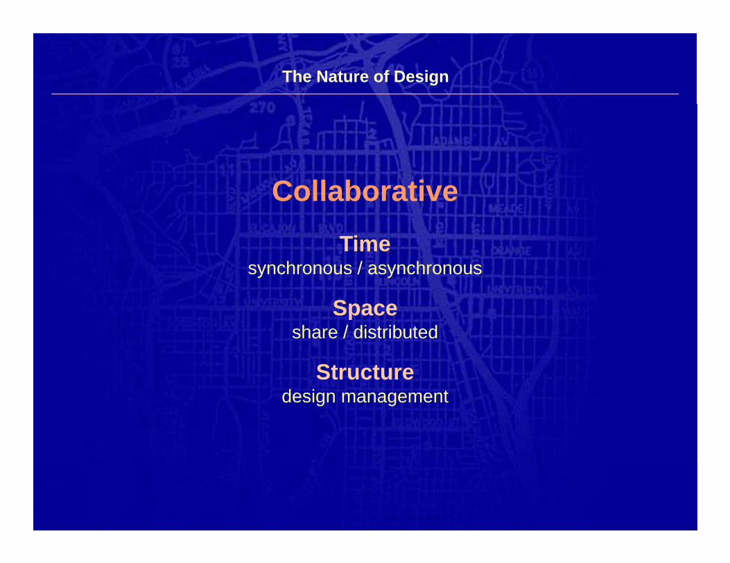
The Nature of Design
CollaborativeTimeTime
synchronous / asynchronous
Spacepshare / distributed
Structuredesign management
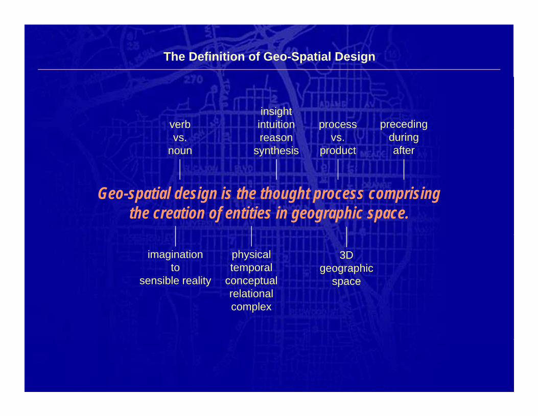
The Definition of Geo-Spatial Design
verbinsightintuition process preceding
vs.noun
reasonsynthesis
pvs.
product
p gduringafter
Geo-spatial design is the thought process comprisingthe creation of entities in geographic space.
imaginationto
sensible reality
physicaltemporal
conceptual
3Dgeographic
spacerelationalcomplex
p
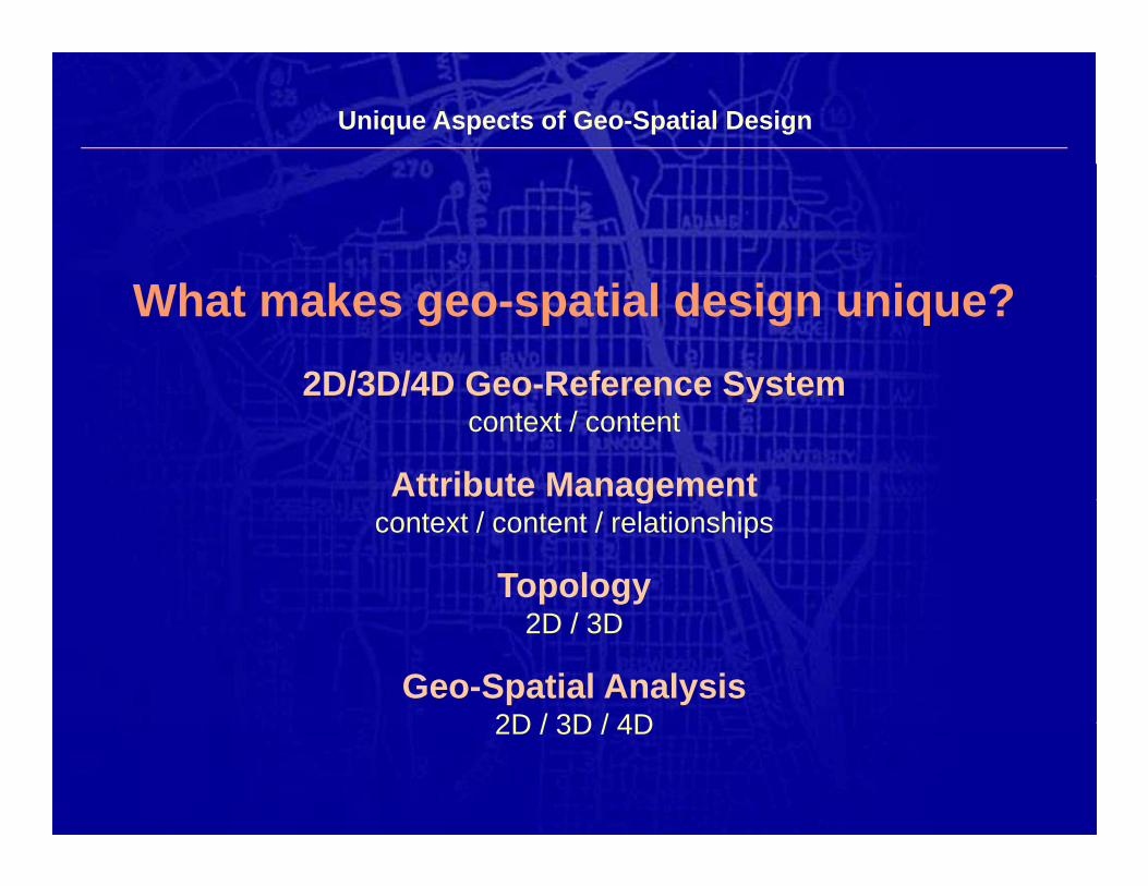
Unique Aspects of Geo-Spatial Design
What makes geo-spatial design unique?2D/3D/4D Geo-Reference System2D/3D/4D Geo-Reference System
context / content
Attribute Managementgcontext / content / relationships
Topology2D / 3D
Geo-Spatial Analysis2D / 3D / 4D2D / 3D / 4D
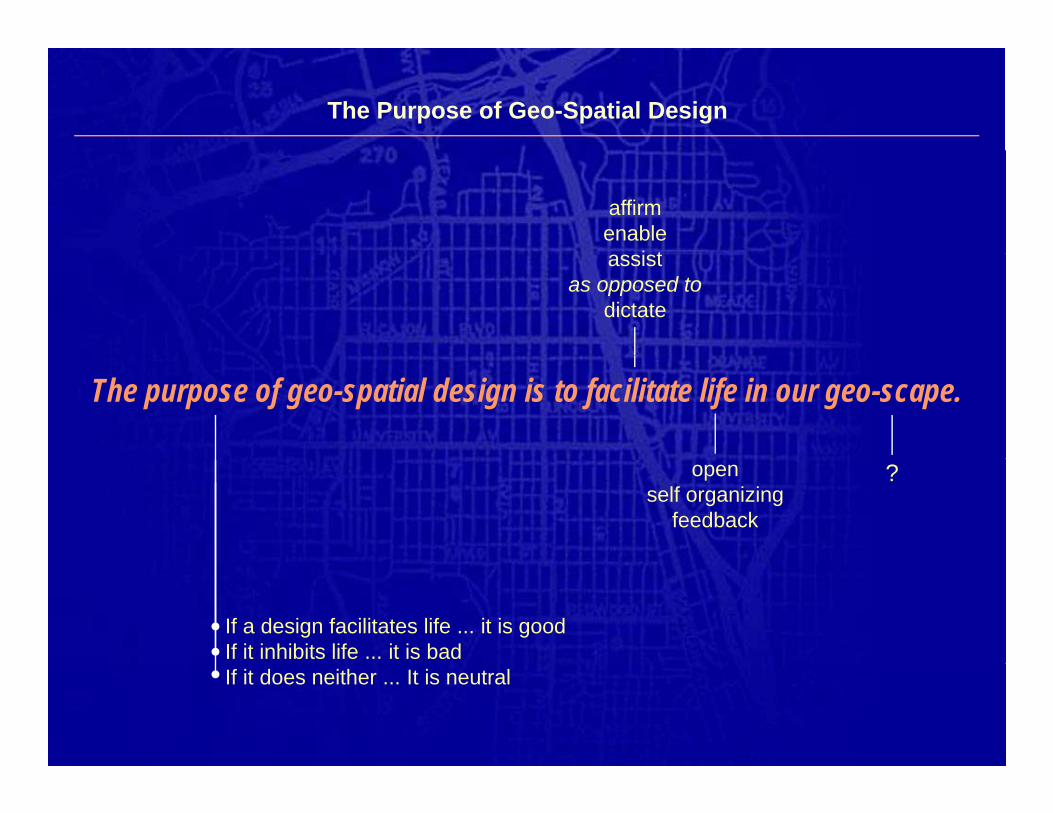
The Purpose of Geo-Spatial Design
affirmenable
i tassistas opposed to
dictate
The purpose of geo-spatial design is to facilitate life in our geo-scape.
openself organizing
feedback
?
If a design facilitates life ... it is goodIf it inhibits life ... it is badIf it does neither ... It is neutral
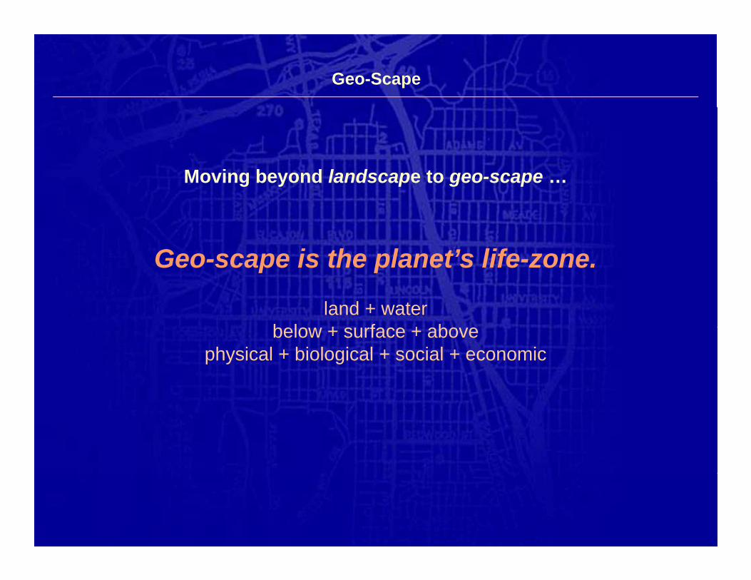
Geo-Scape
Moving beyond landscape to geo-scape …Moving beyond landscape to geo scape …
Geo scape is the planet’s life oneGeo-scape is the planet’s life-zone.
land + waterb l + f + bbelow + surface + above
physical + biological + social + economic
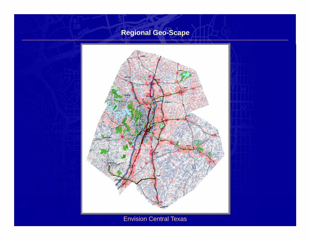
Regional Geo-Scape
Envision Central Texas
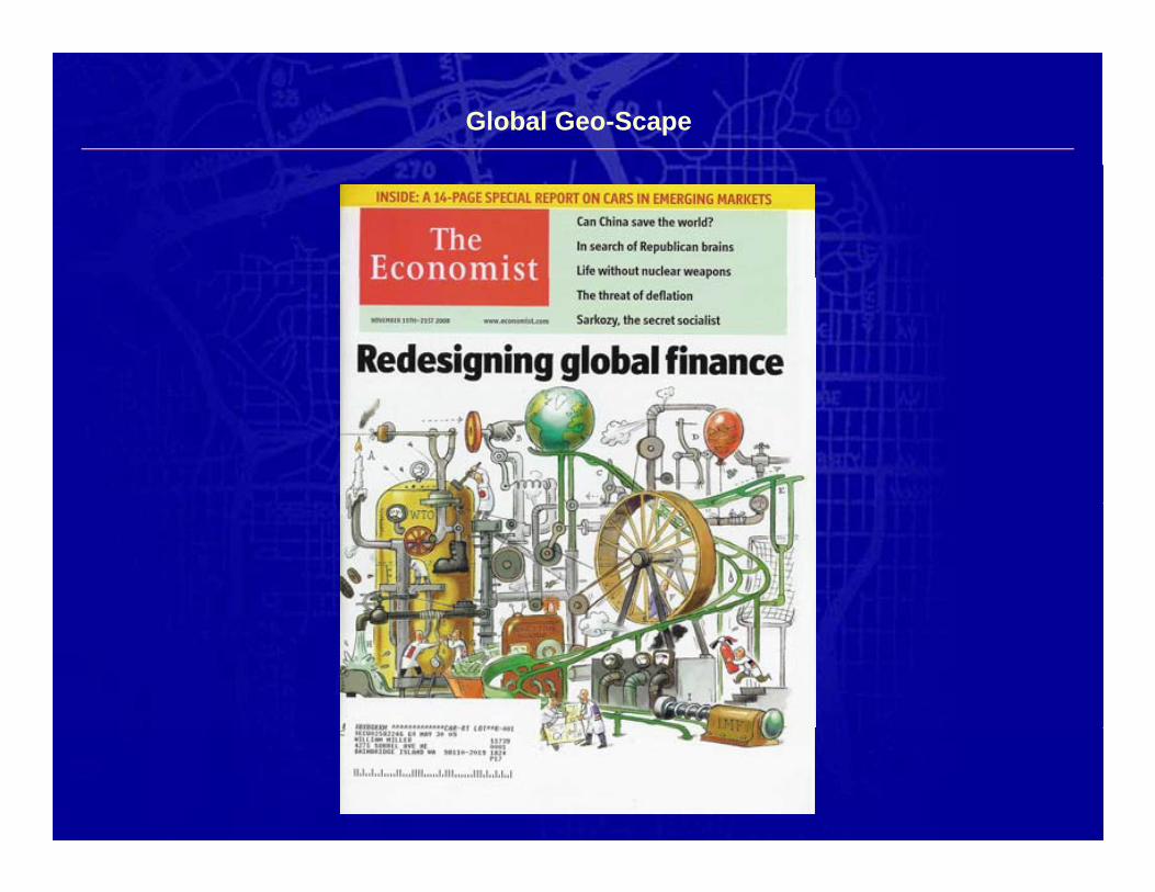
Global Geo-Scape
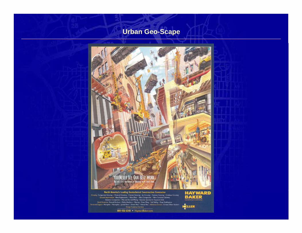
Urban Geo-Scape
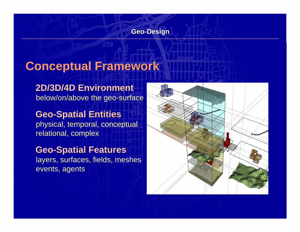
Geo-Design
Conceptual Frameworkp2D/3D/4D Environmentbelow/on/above the geo-surfaceg
Geo-Spatial Entitiesphysical, temporal, conceptual
l ti l lrelational, complex
Geo-Spatial Featureslayers surfaces fields mesheslayers, surfaces, fields, meshesevents, agents
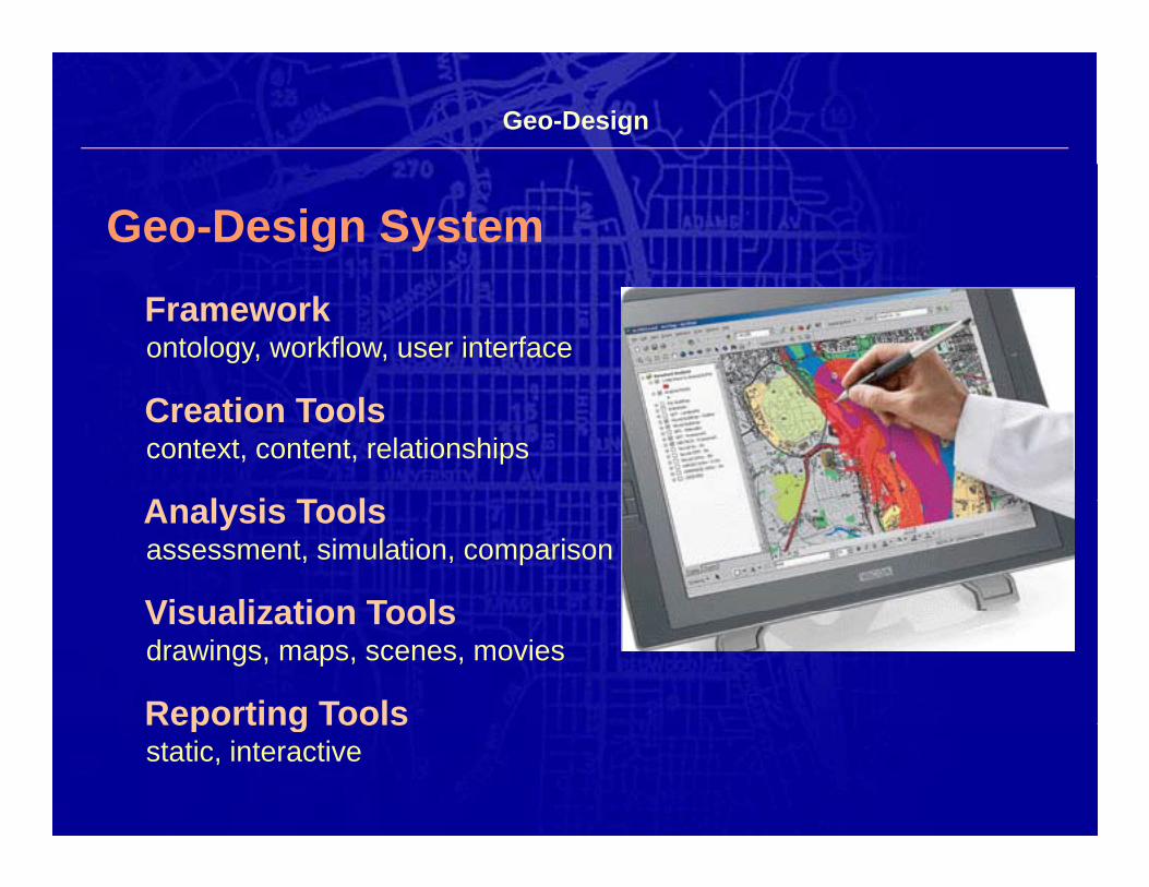
Geo-Design
Geo-Design SystemFrameworkontology, workflow, user interface
Creation Toolscontext, content, relationships
A l i T lAnalysis Toolsassessment, simulation, comparison
Visualization ToolsVisualization Toolsdrawings, maps, scenes, movies
Reporting ToolsReporting Toolsstatic, interactive
Geo-Design
Challenge #1
Develop a comprehensive understandingof geo-design and then work together to translate thatg g g
understanding into a shared vision.
Geo-Design
Challenge #2
Develop an appropriate (design centric) GIS technologyand apply that technology to a wide varietypp y gy y
of geo-spatial design problems.
Geo-Design
Challenge #3
Work together to establish a new profession of geo-design, both in practice and academia.p
Geo-Spatial Design
Thank you
“The best way to predict the future is to create it.”
… Buckminster Fuller
William R. MillerWilliam R. MillerEnvironmental Systems Research Institute
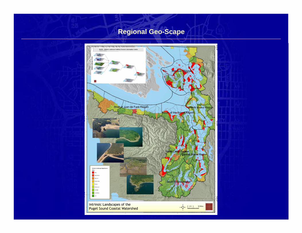
Regional Geo-Scape