Embed Size (px)
DESCRIPTION
National Hydrography Dataset Applications Overview. Symposium on Terrain Analysis for Water Resources Applications Austin, Texas December 16, 2002. 2. 1. 3. The National Hydrography Dataset Provides:. Rich cartographic feature content for making maps - PowerPoint PPT Presentation
Citation preview
1
National Hydrography Dataset Applications Overview
Symposium on
Terrain Analysis for Water Resources Applications
Austin, Texas
December 16, 2002
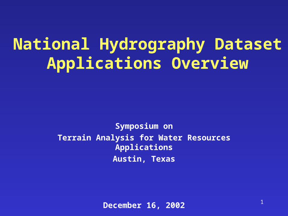
The National Hydrography Dataset Provides:
• Rich cartographic feature content for making maps
• A stream addressing system for linking water-related information to the national drainage network
• Upstream/downstream modeling along the drainage network
• Infrastructure for maintenance and enhancement
1 2
3
3
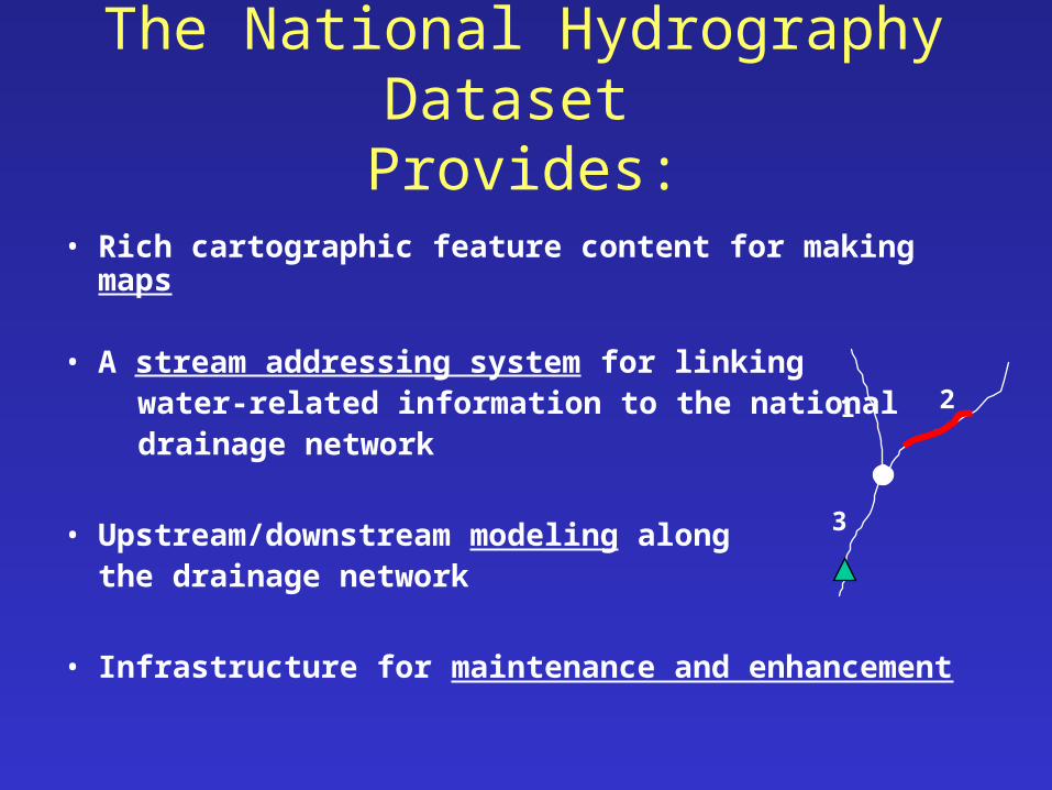
NHD Modeling Components
• Upstream and downstream navigation• Reach-to-reach relationships• Computed attributes
• Reach drainage areas (catchments) connect the land surface to the drainage network
• Flow volume and velocity for dilution modeling
( Watershed and Stream Characteristics Track,9:30 – 5:00 Wednesday )
4
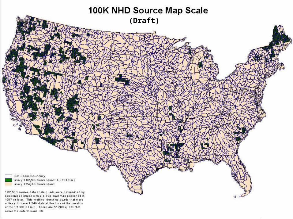
(Draft)
5
6
7

8
WB 12-digit
Nhddrain
DEM SEED
Burned NHD with WB
Burned NHD no WB
9
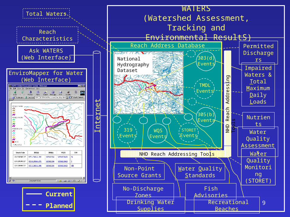
Reach Address Database
WATERS(Watershed Assessment, Tracking and
Environmental ResultS)Reach Characteristics
Total Waters
Current
Planned
NationalHydrographyDatasetEnviroMapper for Water
(Web Interface)
Inte
rnet
Ask WATERS(Web Interface)
Nutrients
ImpairedWaters &
TotalMaximum
DailyLoads
Water QualityAssessments
Water Quality
Monitoring(STORET)
Water QualityStandards
Non-PointSource Grants
Drinking Water Supplies
No-Discharge Zones
Recreational Beaches
Permitted Dischargers
Fish Advisories
303(d)Events
305(b)Events
TMDLEvents
STORET
EventsWQS
Events319
Events
NHD Reach Addressing Tools
NH
D R
ea
ch A
dd
ress
ing
To
ols
10
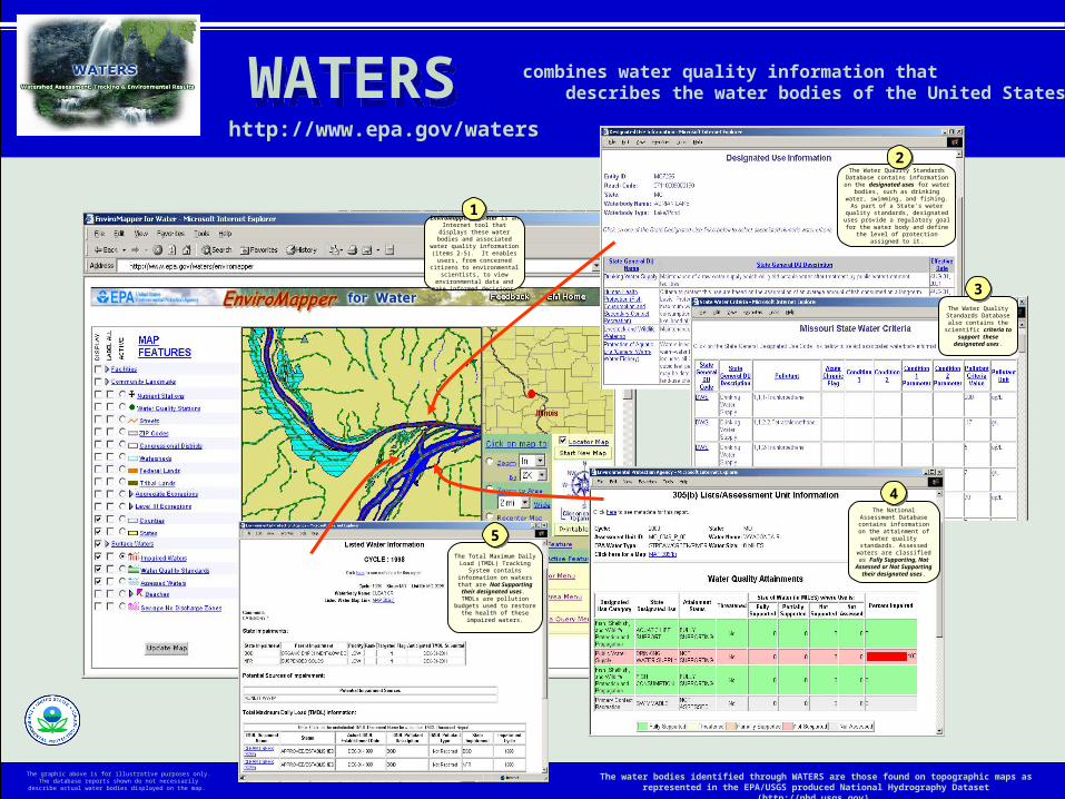
WATERS WATERS combines water quality information that describes the water bodies of the United States
http://www.epa.gov/waters
EnviroMapper for Water is an Internet tool that displays these
water bodies and associated water quality information (items 2-5). It enables users, from concerned
citizens to environmental scientists, to view environmental
data and make informed decisions.
11
The Water Quality Standards Database contains information on the designated uses for water bodies, such as drinking
water, swimming, and fishing. As part of a State's water quality standards,
designated uses provide a regulatory goal for the water body and define the level of
protection assigned to it.
22
The water bodies identified through WATERS are those found on topographic maps as represented in the EPA/USGS produced National Hydrography Dataset (http://nhd.usgs.gov).
The Water Quality Standards Database also
contains the scientific criteria to support these
designated uses.
33
The National Assessment Database contains information
on the attainment of water quality standards. Assessed waters are classified as Fully
Supporting, Not Assessed or Not Supporting their
designated uses.
44
The Total Maximum Daily Load (TMDL) Tracking System
contains information on waters that are Not Supporting their designated uses. TMDLs are
pollution budgets used to restore the health of these impaired
waters.
55
The graphic above is for illustrative purposes only. The database reports shown do not necessarily describe actual water bodies displayed on the
map.
11
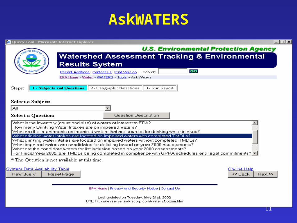
AskWATERS
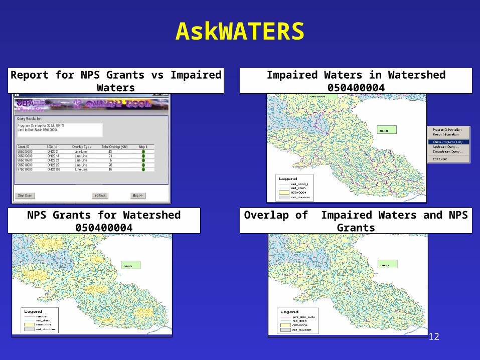
12
NPS Grants for Watershed 050400004
Impaired Waters in Watershed 050400004
Overlap of Impaired Waters and NPS Grants
Report for NPS Grants vs Impaired Waters
AskWATERS
13
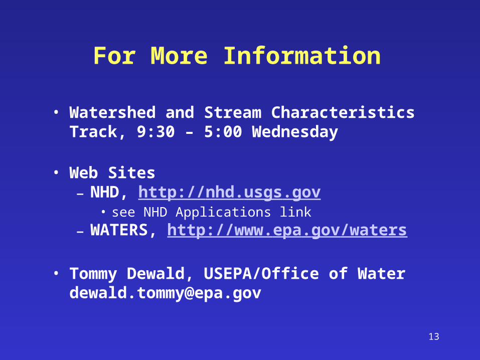
• Watershed and Stream Characteristics Track, 9:30 – 5:00 Wednesday
• Web Sites– NHD, http://nhd.usgs.gov
• see NHD Applications link– WATERS, http://www.epa.gov/waters
• Tommy Dewald, USEPA/Office of [email protected]
For More Information