Embed Size (px)
Citation preview

NATO/CCMS PILOT STUDY
Prevention and Remediation In Selected Industrial Sectors:
Rehabilitation of Old Landfills
Cardiff, WalesMay 23-26, 2004
UMSUnderground Monitoring
System
NATO/CCMS May 2004
ESPOSITOGROUP
Via Polveriera Località Cangio Nola-Naples-Italy
152 Notre-Dame est., suite 400 Montreal, Quebec - Canada H2Y 3P6
UMS
A Tool for Dry Directional Monitoring
System
P. Costa, A. Campanile, C. Manna
NATO/CCMS May 2004
WHAT IS UMS
UMS IS A NEW MACHINE FOR SITE CHARACTERISATION IN HOSTILE ENVIRONMENTS.
UMS REPRESENTS AN EXTENSION OF INTRUSIVE TECHNOLOGIES FOR SITE CHARACTERISATION.
IS BASED ON HORIZONTAL DRY DIRECTIONAL DRILLING TECHNOLOGIES
NATO/CCMS May 2004
DRY DIRECTIONAL MONITORING SYSTEMDRY DIRECTIONAL MONITORING SYSTEM
SURGERY METAPHORE
In medical practice a Biopsy needle is used for tissues characterisation
UMS uses a new tool called geopsy needle since it achieves site diagnosis by aspiration
through a needle as in tissue biopsy.
NATO/CCMS May 2004
DRY DIRECTIONAL MONITORING SYSTEMDRY DIRECTIONAL MONITORING SYSTEM
WHAT IS UMS
UMS IS A NEW TOOL FOR BOREHOLE DRILLING INTRUSIVE INVESTIGATION
NATO/CCMS May 2004
DRY DIRECTIONAL MONITORING SYSTEMDRY DIRECTIONAL MONITORING SYSTEM
WHAT IS UMS
UMS IS BASED ON ESPOSITOGROUP PROPRIETARY TECHNOLOGY FOR
HORIZONTAL DIRECTIONAL DRILLING
NATO/CCMS May 2004
DRY DIRECTIONAL MONITORING SYSTEMDRY DIRECTIONAL MONITORING SYSTEM
WHAT IS UMS
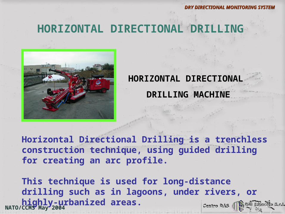
Horizontal Directional Drilling is a trenchless construction technique, using guided drilling for creating an arc profile.
This technique is used for long-distance drilling such as in lagoons, under rivers, or highly-urbanized areas.
HORIZONTAL DIRECTIONAL
DRILLING MACHINE
NATO/CCMS May 2004
DRY DIRECTIONAL MONITORING SYSTEMDRY DIRECTIONAL MONITORING SYSTEM
HORIZONTAL DIRECTIONAL DRILLING
The process involves three main stages:
1. drilling a pilot hole2. enlargement of the pilot hole3. pullback installation of the carrier pipe
Horizontal Directional Drilling is becoming a preferred practice for installing pipelines, cables, water and sewer lines, horizontal wells for contaminated site remediation and for drinking water supply, and other infrastructural elements.
HORIZONTAL DIRECTIONAL DRILLING
NATO/CCMS May 2004
DRY DIRECTIONAL MONITORING SYSTEMDRY DIRECTIONAL MONITORING SYSTEM
Main advantage is the combination of speed and reliability with minimal environmental impact in
installation.
HORIZONTAL DIRECTIONAL DRILLING
NATO/CCMS May 2004
DRY DIRECTIONAL MONITORING SYSTEMDRY DIRECTIONAL MONITORING SYSTEM
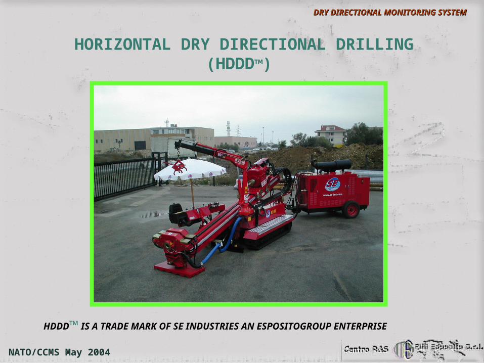
HORIZONTAL DRY DIRECTIONAL DRILLING (HDDD™)
HDDD™ IS A TRADE MARK OF SE INDUSTRIES AN ESPOSITOGROUP ENTERPRISE
NATO/CCMS May 2004
DRY DIRECTIONAL MONITORING SYSTEMDRY DIRECTIONAL MONITORING SYSTEM
The operation of the SE Technology boring system is based on a directional boring head with a percussion system.
The unit operates by using compressed air to drive both thrust and pullback actions as well as rotation and percussion at the drill head.
Spoil is removed by the compressed air flow through the bore hole.
NATO/CCMS May 2004
DRY DIRECTIONAL MONITORING SYSTEMDRY DIRECTIONAL MONITORING SYSTEM
HORIZONTAL DRY DIRECTIONAL DRILLING
Tracking is achieved by similar techniques to systems using liquid drilling fluids, but the electronic sonde in the head has to be fitted with a shock absorber to dampen the effects of the percussion system.
The system can be used to drill all soil types. Further advantages include no requirement for a mud mixing plant, no bentonite requirement and therefore no fluid losses to the ground.
NATO/CCMS May 2004
DRY DIRECTIONAL MONITORING SYSTEMDRY DIRECTIONAL MONITORING SYSTEM
HORIZONTAL DRY DIRECTIONAL DRILLING
HOW DOES IT WORK
NATO/CCMS May 2004
DRY DIRECTIONAL MONITORING SYSTEMDRY DIRECTIONAL MONITORING SYSTEM
HORIZONTAL DRY DIRECTIONAL DRILLING
BASED ON HORIZONAL DRY DIRECTIONAL DRILLING TECHNOLOGY
A NEW TOOL
UNDERGROUND MONITORING SYSTEM
NATO/CCMS May 2004
DRY DIRECTIONAL MONITORING SYSTEMDRY DIRECTIONAL MONITORING SYSTEM
UMS is a technology derived from the CADRIANN research project.
CADRIANN is a research project funded by the Italian Ministry for Higher Education, Training and Research (Anagrafe nazionale della Ricerca 51018XTU).
NATO/CCMS May 2004
DRY DIRECTIONAL MONITORING SYSTEMDRY DIRECTIONAL MONITORING SYSTEM
UNDERGROUND MONITORING SYSTEM
RESEARCH DIRECTORPAOLO COSTA
SCIENTIFIC REFEREEFRANCESCO JOVANE
ITIA - CNR
NATO/CCMS May 2004
DRY DIRECTIONAL MONITORING SYSTEMDRY DIRECTIONAL MONITORING SYSTEM
This project has improved HDDD™ technology with:
a learning system called Ground Recognition System capable to recognize underground properties while drilling, storing and enhancing its experience with time.
an on-line path correction based on a dynamic programming method.
a proprietary Wireline Inertial Measurement Unit (WIMU) by which the driller can track the orientation and position of the bore hole assembly, in real-time
UNDERGROUND MONITORING SYSTEM
NATO/CCMS May 2004
DRY DIRECTIONAL MONITORING SYSTEMDRY DIRECTIONAL MONITORING SYSTEM
UNDERGROUND MONITORING SYSTEM
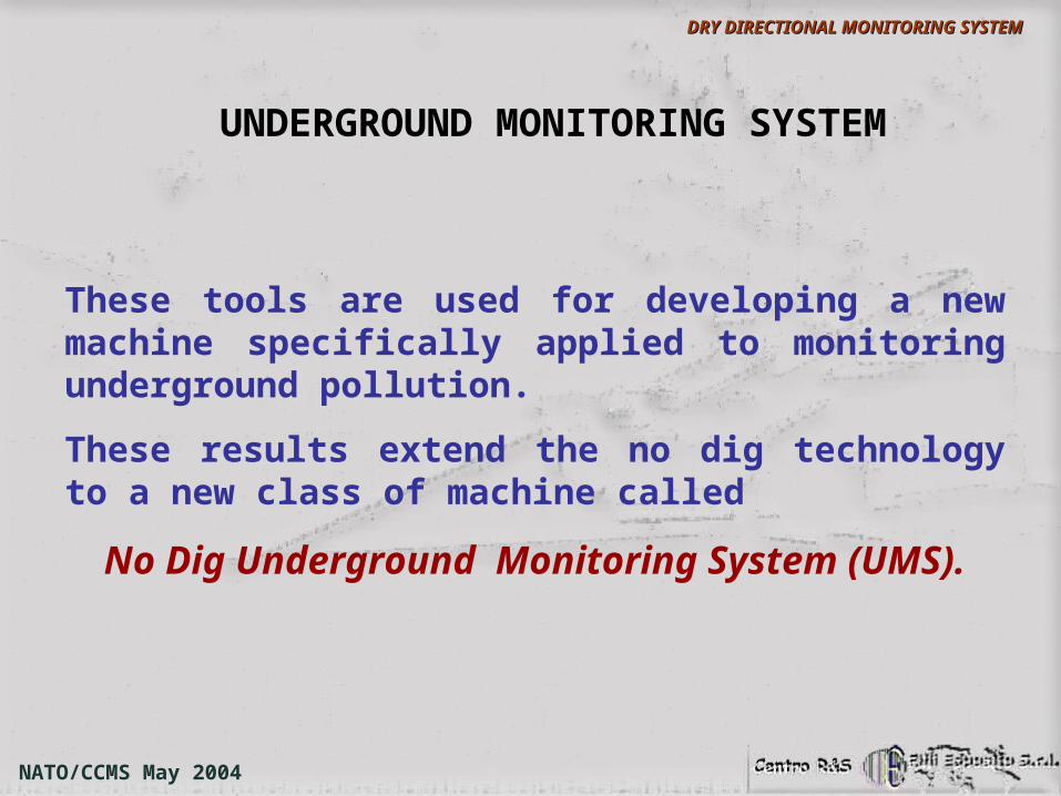
These tools are used for developing a new machine specifically applied to monitoring underground pollution.
These results extend the no dig technology to a new class of machine called
No Dig Underground Monitoring System (UMS).
NATO/CCMS May 2004
DRY DIRECTIONAL MONITORING SYSTEMDRY DIRECTIONAL MONITORING SYSTEM
HOW DOES IT WORK
UNDERGROUND MONITORING SYSTEM
NATO/CCMS May 2004
DRY DIRECTIONAL MONITORING SYSTEMDRY DIRECTIONAL MONITORING SYSTEM
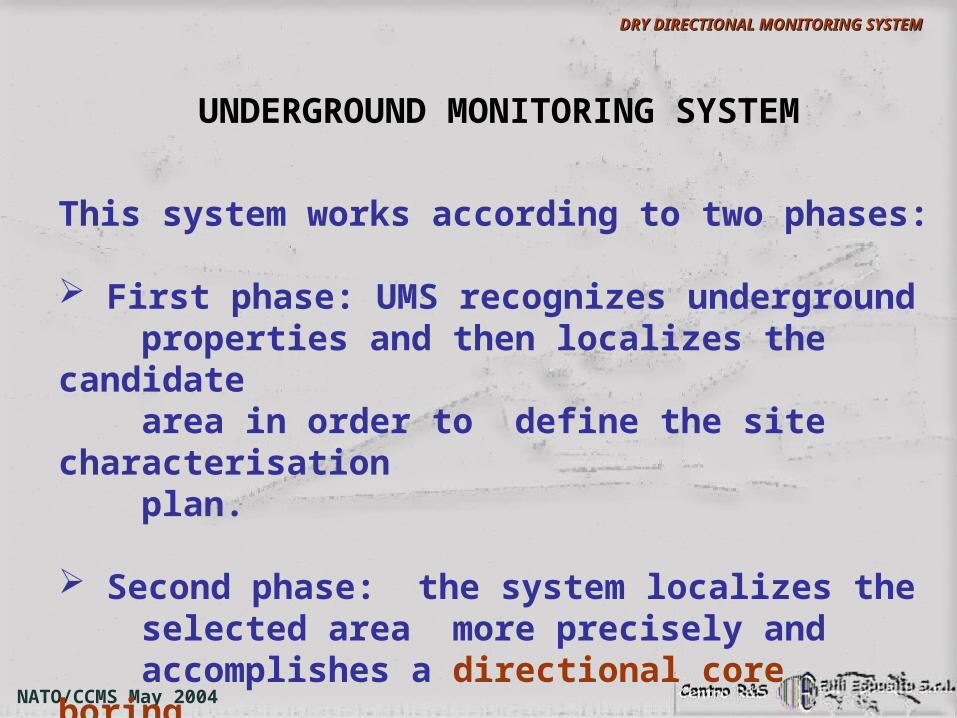
This system works according to two phases:
First phase: UMS recognizes underground properties and then localizes the candidate area in order to define the site characterisation plan.
Second phase: the system localizes the selected area more precisely and accomplishes a directional core boring.
UNDERGROUND MONITORING SYSTEM
NATO/CCMS May 2004
DRY DIRECTIONAL MONITORING SYSTEMDRY DIRECTIONAL MONITORING SYSTEM
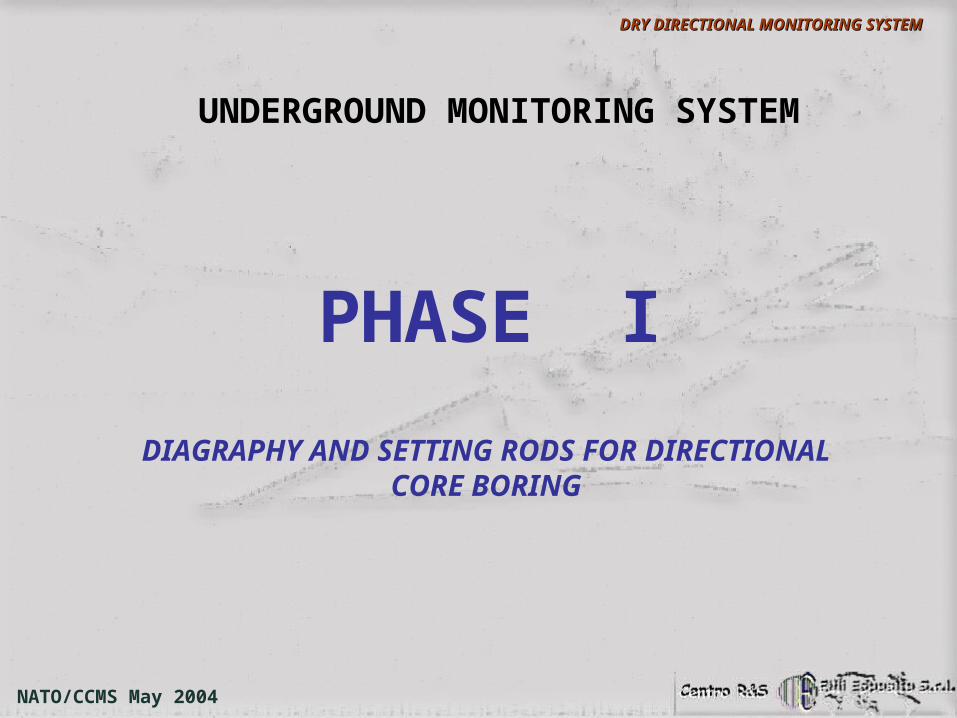
PHASE I
DIAGRAPHY AND SETTING RODS FOR DIRECTIONAL CORE BORING
UNDERGROUND MONITORING SYSTEM
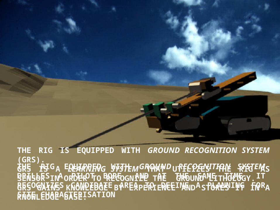
THE RIG IS EQUIPPED WITH GROUND RECOGNITION SYSTEM (GRS).GRS IS A LEARNING SYSTEM THAT UTILIZES THE RIG AS SENSOR IN ORDER TO RECOGNIZE THE GROUND LITHOLOGY.GRS GAINS KNOWLEDGE BY EXPERIENCE AND STORES IT IN A KNOWLEDGE BASE.
THE RIG EQUIPPED WITH GROUND RECOGNITION SYSTEM DRILLES A PILOT BORE, AND AT THE SAME TIME, IT RECOGNIZES CANDIDATE AREA TO DEFINE A PLANNING FOR SITE CHARACTERISATION
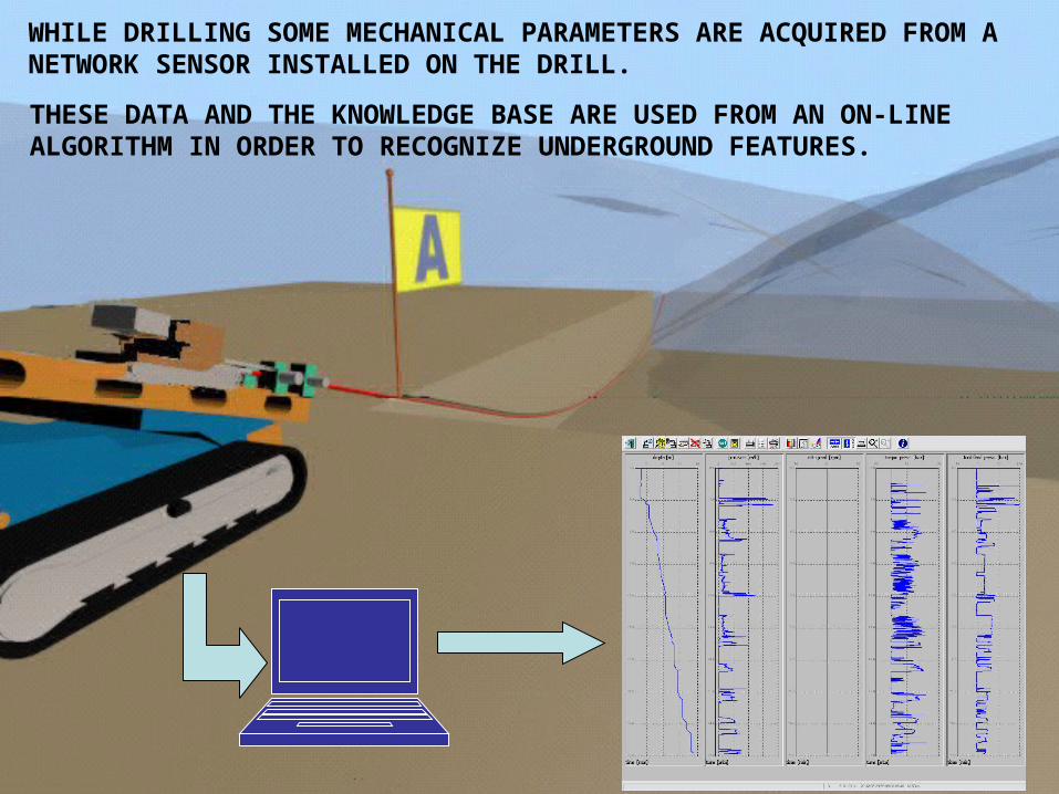
WHILE DRILLING SOME MECHANICAL PARAMETERS ARE ACQUIRED FROM A NETWORK SENSOR INSTALLED ON THE DRILL.
THESE DATA AND THE KNOWLEDGE BASE ARE USED FROM AN ON-LINE ALGORITHM IN ORDER TO RECOGNIZE UNDERGROUND FEATURES.
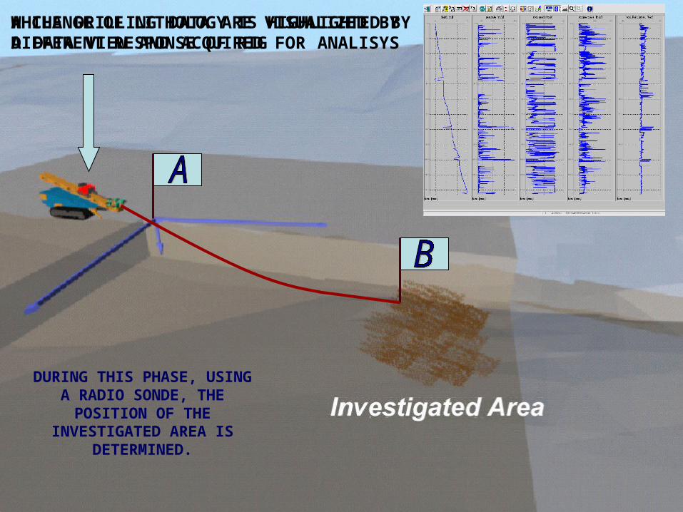
WHILE DRILLING DATA ARE VISUALIZED BY A DATA VIEW AND ACQUIRED FOR ANALISYS
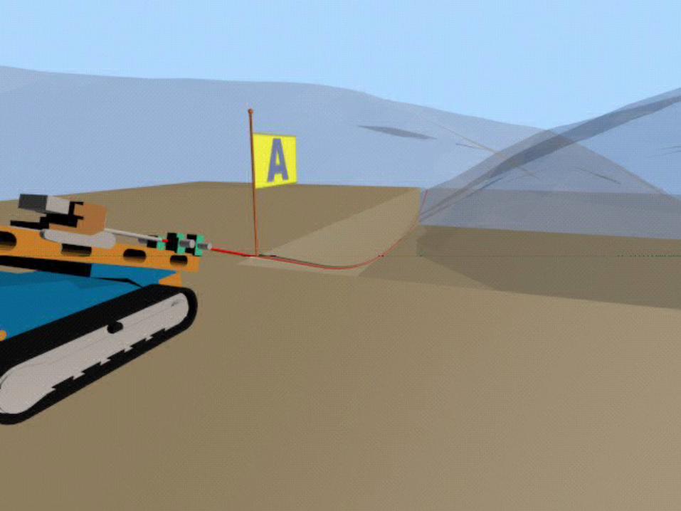
DURING THIS PHASE, USING A RADIO SONDE, THE POSITION OF THE INVESTIGATED AREA
IS DETERMINED.
A CHANGE OF LITHOLOGY IS HIGHLIGHTED BY DIFFERENT RESPONSE OF RIG
NATO/CCMS May 2004
DRY DIRECTIONAL MONITORING SYSTEMDRY DIRECTIONAL MONITORING SYSTEM
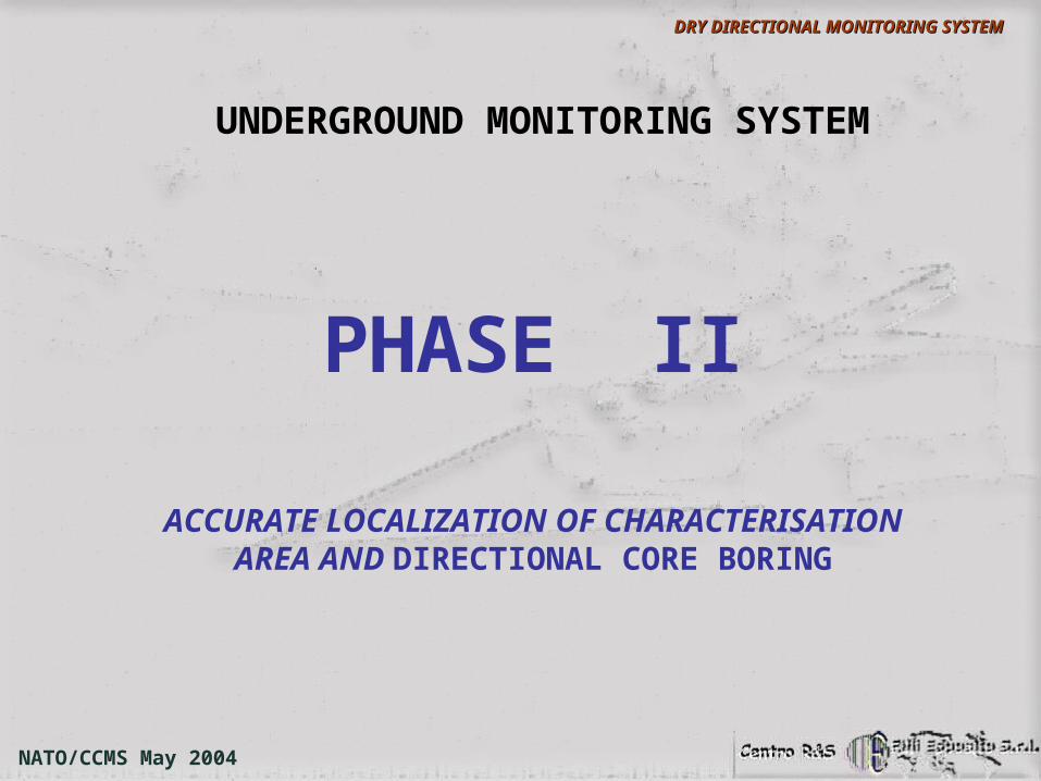
PHASE II
ACCURATE LOCALIZATION OF CHARACTERISATION AREA AND DIRECTIONAL
CORE BORING
UNDERGROUND MONITORING SYSTEM
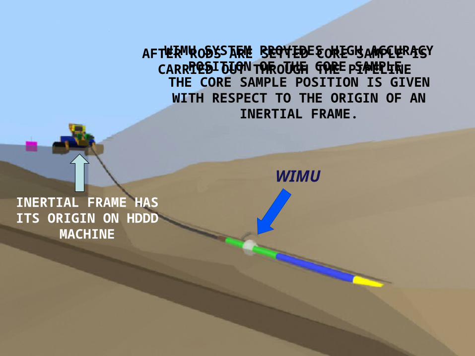
AFTER RODS ARE SETTED CORE SAMPLE IS CARRIED OUT THROUGH THE PIPELINE
WIMU
WIMU SYSTEM PROVIDES HIGH ACCURACY POSITION OF THE CORE SAMPLE.
THE CORE SAMPLE POSITION IS GIVENWITH RESPECT TO THE ORIGIN OF AN
INERTIAL FRAME.
INERTIAL FRAME HAS ITS ORIGIN ON HDDD
MACHINE
NATO/CCMS May 2004
DRY DIRECTIONAL MONITORING SYSTEMDRY DIRECTIONAL MONITORING SYSTEM
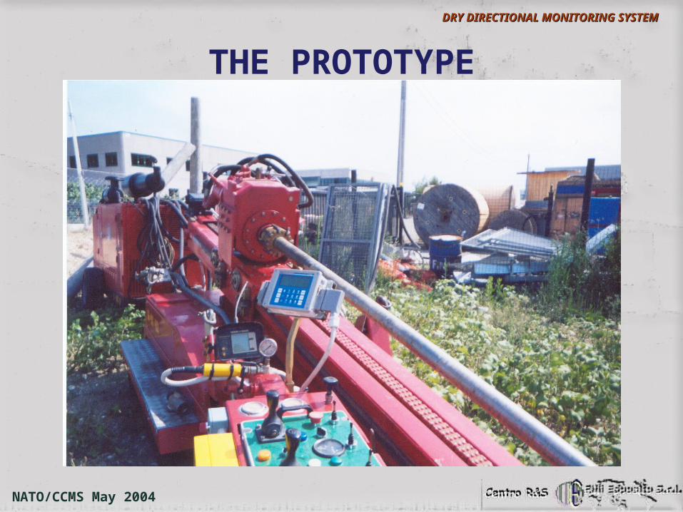
THE PROTOTYPE
NATO/CCMS May 2004
DRY DIRECTIONAL MONITORING SYSTEMDRY DIRECTIONAL MONITORING SYSTEM
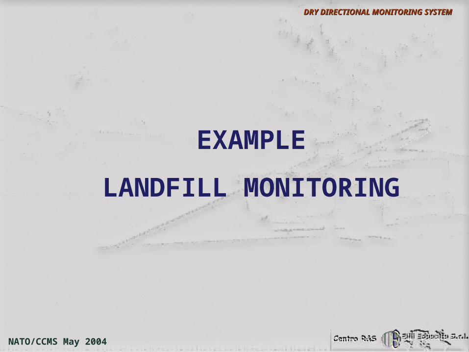
EXAMPLE
LANDFILL MONITORING
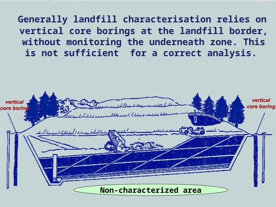
Generally landfill characterisation relies on vertical core borings at the landfill border, without monitoring the underneath zone. This is not sufficient for a correct
analysis.
Non-characterized area
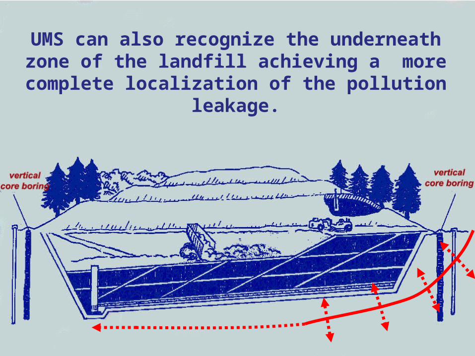
UMS can also recognize the underneath zone of the landfill achieving a more complete
localization of the pollution leakage.
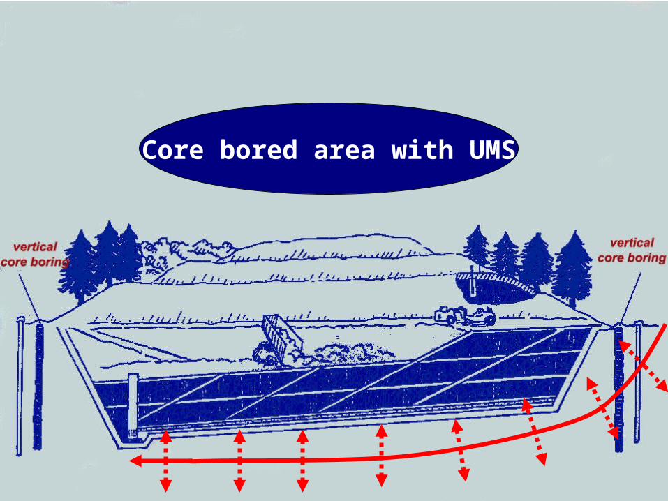
Core bored area with UMS
NATO/CCMS May 2004
DRY DIRECTIONAL MONITORING SYSTEMDRY DIRECTIONAL MONITORING SYSTEM
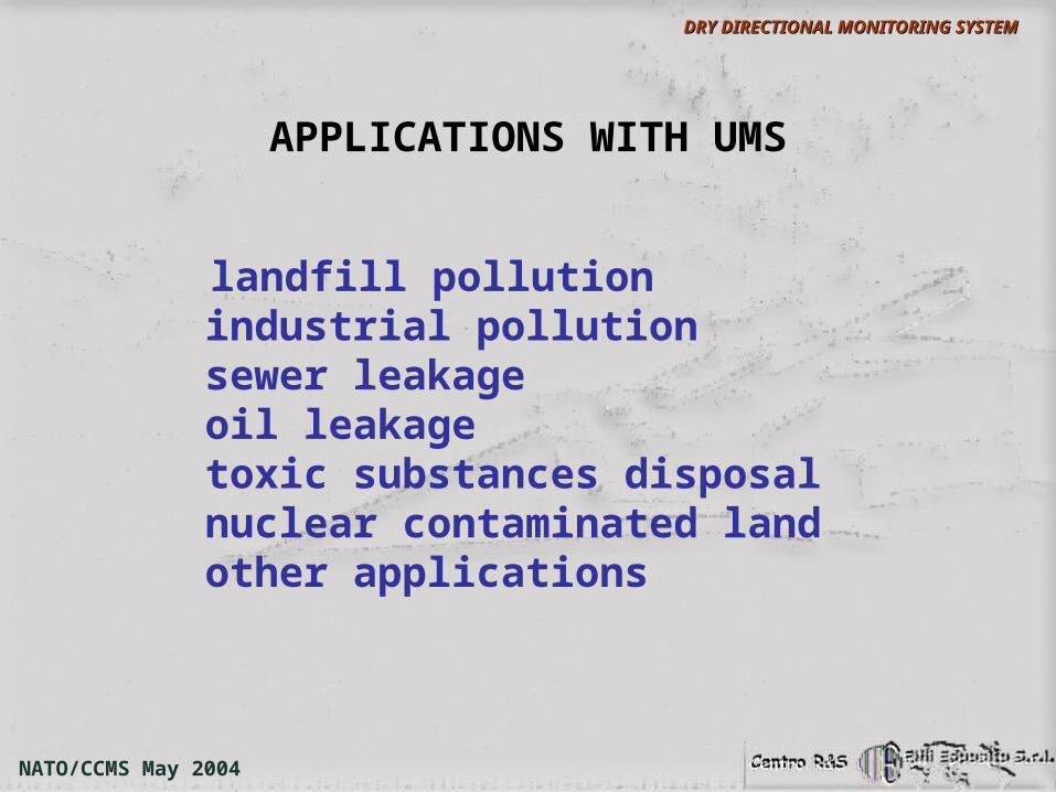
APPLICATIONS WITH UMS
landfill pollution industrial pollution sewer leakage oil leakage toxic substances disposal nuclear contaminated land other applications
NATO/CCMS May 2004
DRY DIRECTIONAL MONITORING SYSTEMDRY DIRECTIONAL MONITORING SYSTEM
PLANNED WORKS
AT PRESENT ESPOSITOGROUP IS INVOLVED IN TWO SITE CHARACTERISATION PROJECT WITH UMS IN POLLUTED AREAS:
• AN INDUSTRIAL POLLUTED AREA IN NORTH-EAST ITALY
• A LANDFILL SITE IN SOUTHERN ITALY
Generally a full site characterization requires both intrusive and non-intrusive methods.
NATO/CCMS May 2004
DRY DIRECTIONAL MONITORING SYSTEMDRY DIRECTIONAL MONITORING SYSTEM
FUTURE WORKS
AT STATE OF ART NON-INTRUSIVE METHODS PROVIDE CHARACTERISATION OF THE NEAR
SURFACE ENVIROMENT NO MORE THAN FEW METERS FROM GROUND SURFACE
NATO/CCMS May 2004
DRY DIRECTIONAL MONITORING SYSTEMDRY DIRECTIONAL MONITORING SYSTEM
FUTURE WORKS
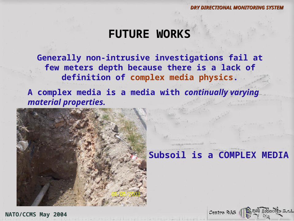
Generally non-intrusive investigations fail at few meters depth because there is a lack of definition of complex media
physics.
A complex media is a media with continually varying material properties.
Subsoil is a COMPLEX MEDIA
NATO/CCMS May 2004
DRY DIRECTIONAL MONITORING SYSTEMDRY DIRECTIONAL MONITORING SYSTEM
FUTURE WORKS

COMPLEX MEDIA PHYSICS
The complex media physics is the study of the behavior of electrical, acoustic, electromagnetic
fields in a complex media.
NATO/CCMS May 2004
DRY DIRECTIONAL MONITORING SYSTEMDRY DIRECTIONAL MONITORING SYSTEM
FUTURE WORKS
The underground is a complex geotonic (i.e. with spatially-dependent properties) media.
The problem is:
learning in real-time the behaviour of physical fields in geotonics complex media by inverse methods in a minimum range of 0-100 meters below surface.
Presently this is the open problem for the Espositogroup research center
NATO/CCMS May 2004
DRY DIRECTIONAL MONITORING SYSTEMDRY DIRECTIONAL MONITORING SYSTEM
FUTURE WORKS
NATO/CCMS May 2004
DRY DIRECTIONAL MONITORING SYSTEMDRY DIRECTIONAL MONITORING SYSTEM


![Ccms Administrators Guide[1]](https://img.pdfslide.net/doc/110x75/547f4859b4af9fb4158b58ea/ccms-administrators-guide1.jpg)