Embed Size (px)
Citation preview
North Carolina Landforms, Weather, and Climate
Tom Shields
NCST 2000
(Fall 2001)
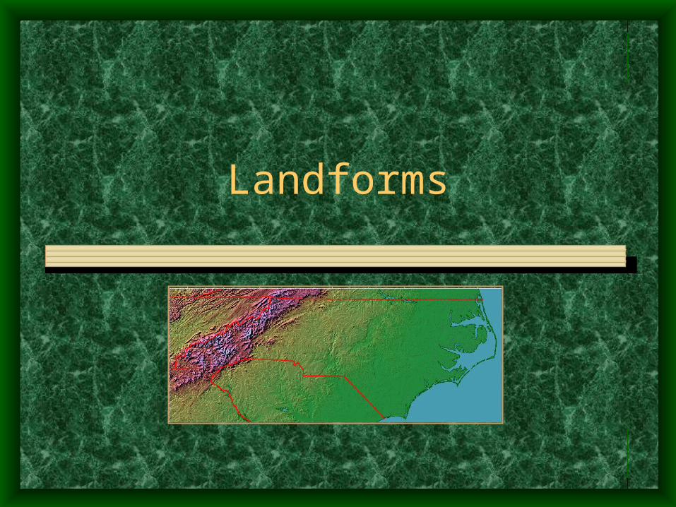
Landforms
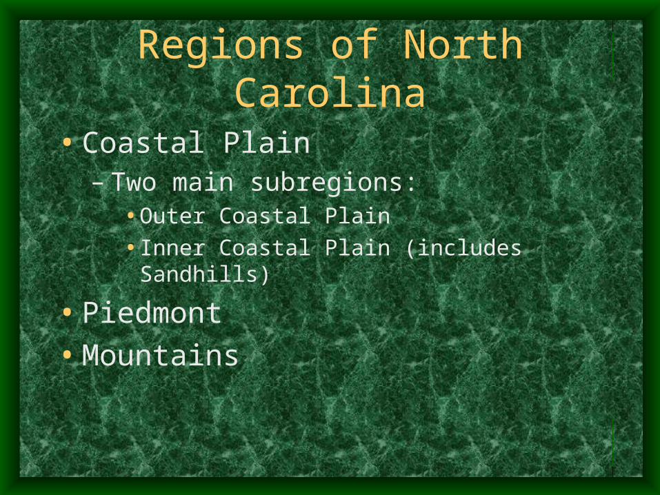
Regions of North Carolina
• Coastal Plain– Two main subregions:
• Outer Coastal Plain
• Inner Coastal Plain (includes Sandhills)
• Piedmont
• Mountains
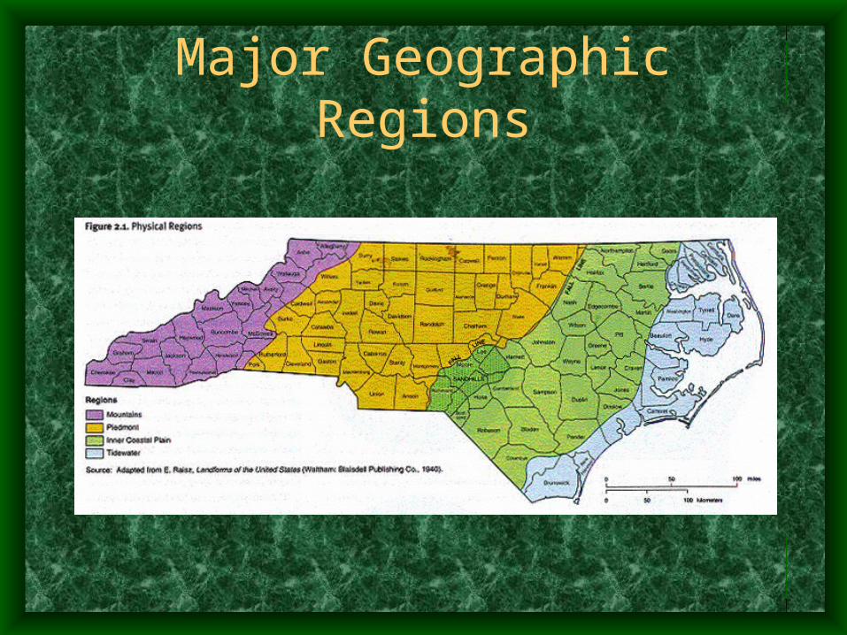
Major Geographic Regions
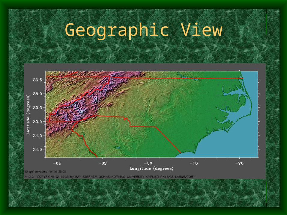
Geographic View
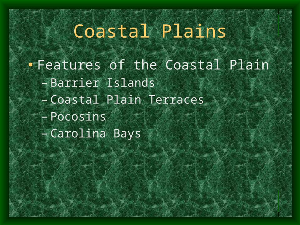
Coastal Plains
• Features of the Coastal Plain– Barrier Islands – Coastal Plain Terraces– Pocosins– Carolina Bays
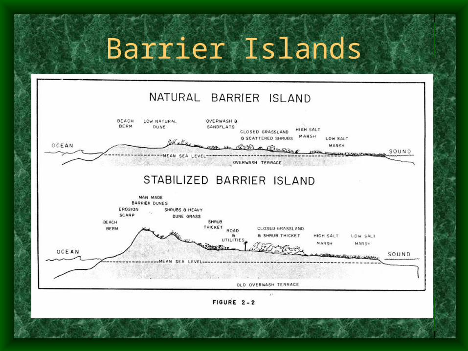
Barrier Islands
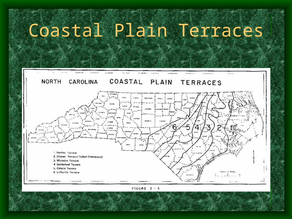
Coastal Plain Terraces
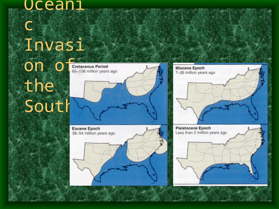
Oceanic Invasion of the South
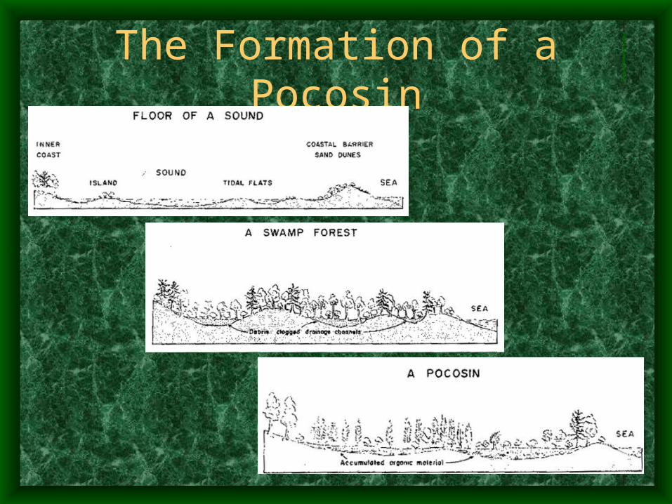
The Formation of a Pocosin
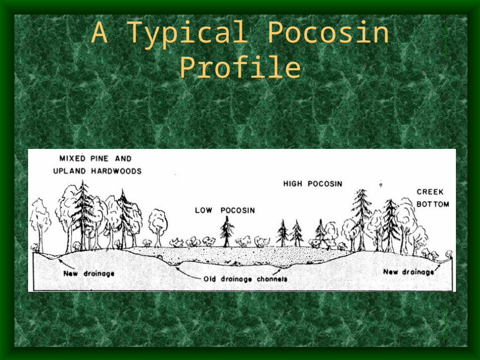
A Typical Pocosin Profile
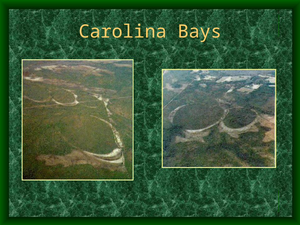
Carolina Bays
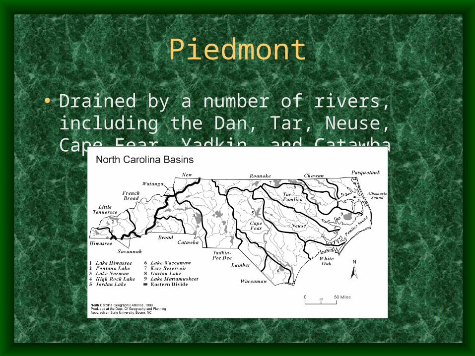
Piedmont
• Drained by a number of rivers, including the Dan, Tar, Neuse, Cape Fear, Yadkin, and Catawba
Mountains
• Main chains of mountain ranges running from northeast to southwest
• Other chains run between the main chains, creating coves, basins, and valleys.
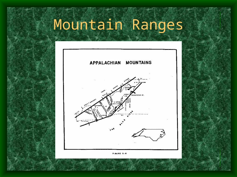
Mountain Ranges
Weather and Climate
Climatic Considerations
• Geographic Considerations– Air Masses
– Elevation
– Bodies of Water
• Climatic Concerns– Temperature
– Precipitation
– Sunshine
– Frost
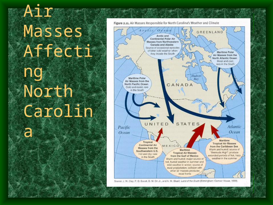
Air Masses Affecting North Carolina
Types of Precipitation
• Orographic Precipitation
• Convectional Precipitation
• Cyclonic Precipitation
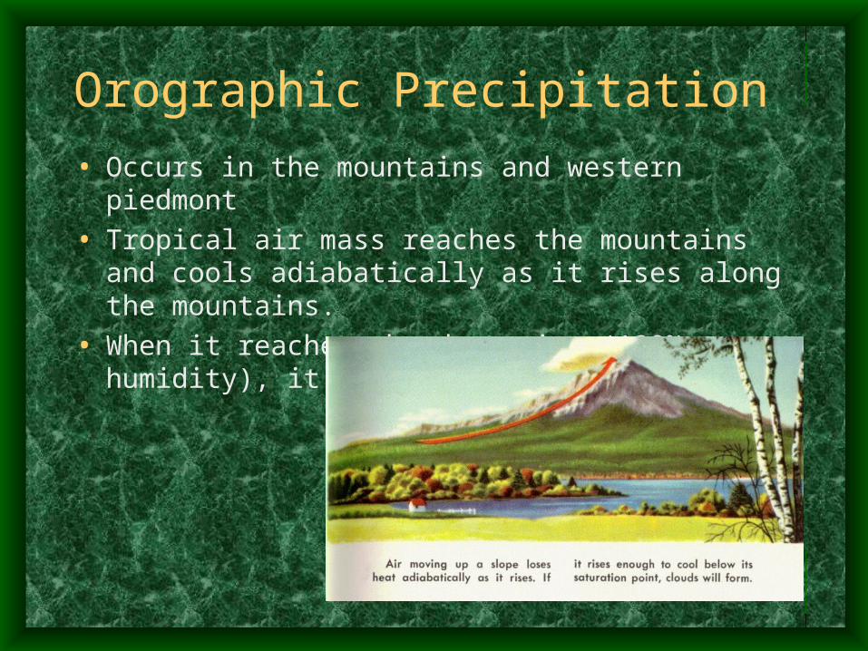
Orographic Precipitation
• Occurs in the mountains and western piedmont
• Tropical air mass reaches the mountains and cools adiabatically as it rises along the mountains.
• When it reaches the dew point (100% humidity), it results in rain or snow.
Adiabatic
• adiabatic: describing a process in which there is no transfer of heat into or out of the system in question.
• saturation-adiabatic process: an adiabatic process in which the air is maintained at saturation by the evaporation or condensation of water substance, the latent heat being supplied by or to the air respectively; the ascent of cloudy air, for example, is often assumed to be such a process.
Convectional Precipitation
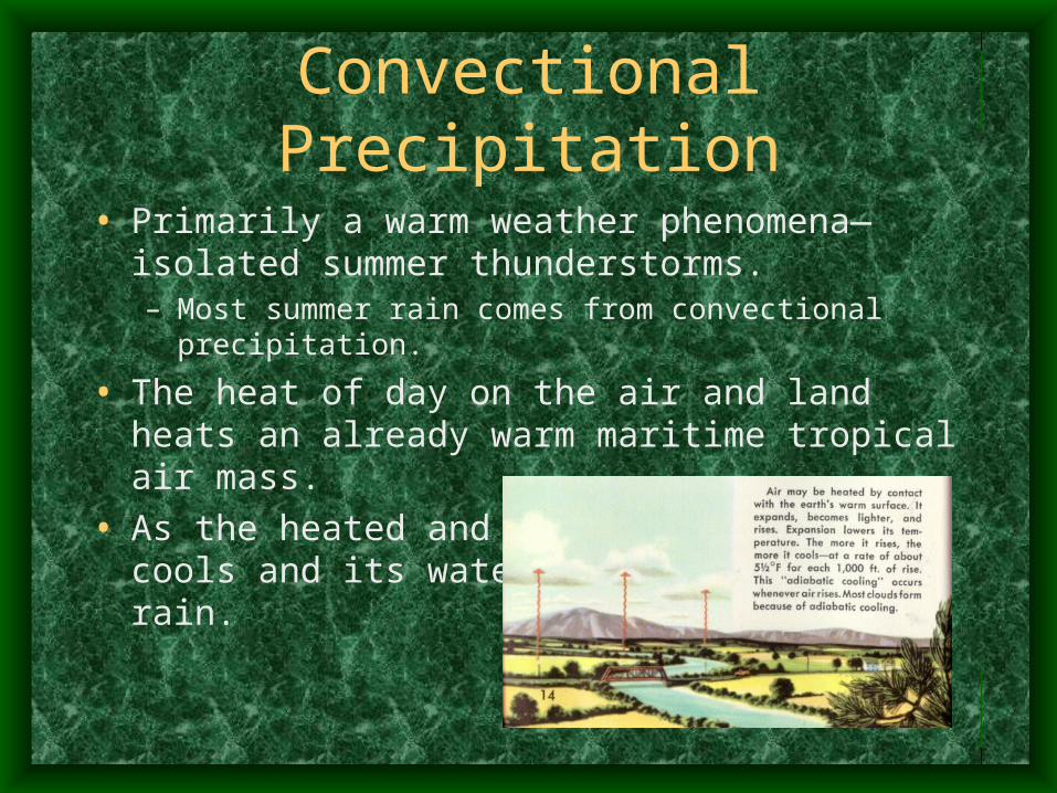
• Primarily a warm weather phenomena—isolated summer thunderstorms.– Most summer rain comes from convectional precipitation.
• The heat of day on the air and land heats an already warm maritime tropical air mass.
• As the heated and moist air rises, it cools and its water vapor turns into rain.
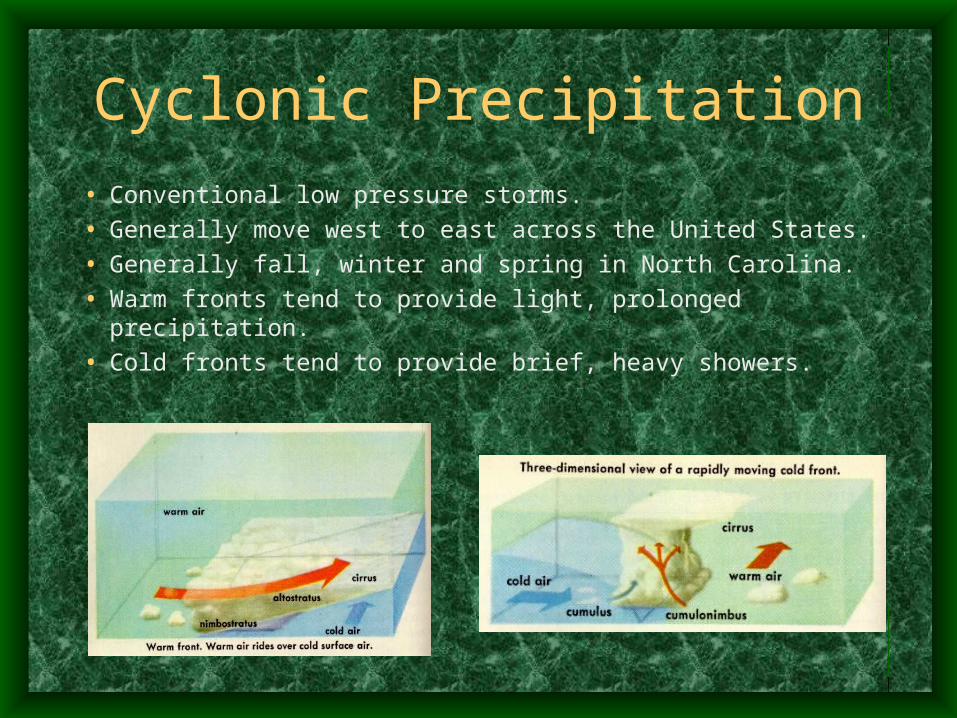
Cyclonic Precipitation
• Conventional low pressure storms.
• Generally move west to east across the United States.
• Generally fall, winter and spring in North Carolina.
• Warm fronts tend to provide light, prolonged precipitation.
• Cold fronts tend to provide brief, heavy showers.
Exceptional Weather
• Tornados
• Hurricanes
Climatic Measures
• Average Temperatures
• Frost-Free Seasons
• Average Annual Rainfall
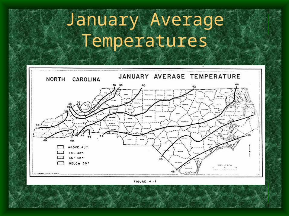
January Average Temperatures
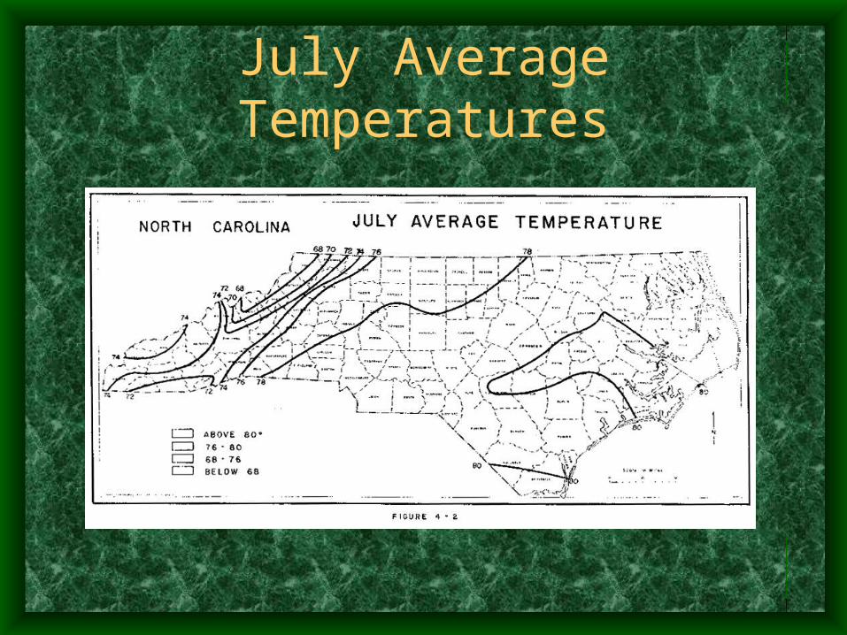
July Average Temperatures
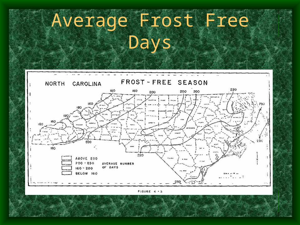
Average Frost Free Days
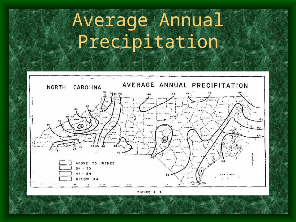
Average Annual Precipitation
Geography and Climate
Sample Situations
Human Effects on Geography
• In the 1800s (and earlier) eastern North Carolina's economy affected the landscape:– Naval Stores—use of region’s longleaf pine for timber
and tar:• Some barrier island forests harvested to the point of
deforestation.• Parts of the coastal plains destroyed by insect infestations,
burnings, windstorms, etc., once trees were cut with V’s to drain sap for tar.
– Draining of swamps:• Drained for farming and rice growing.• Draining lowered water levels in rivers and allowed for major
forest fires.
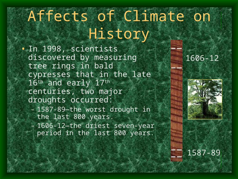
Affects of Climate on History
• In 1998, scientists discovered by measuring tree rings in bald cypresses that in the late 16th and early 17th centuries, two major droughts occurred:– 1587-89—the worst drought in the
last 800 years.– 1606-12—the driest seven-year
period in the last 800 years.
1606-12
1587-89


![Landforms Mady By Wind [Desert Landforms]](https://img.pdfslide.net/doc/110x75/56813971550346895da1066c/landforms-mady-by-wind-desert-landforms.jpg)