Embed Size (px)
Citation preview

NWS Burlington Winter/Spring Flood Outlook
1
This brief is to provide graphical representation of the local Spring Flood Potential Outlook product issued earlier today.
Valid For Northern
NY and all of VT
Valid April 16 – April 30, 2020
Local BTV Text Product - https://w1.weather.gov/data/BTV/ESFBTV

OVERVIEW:
▪ Open water flood potential is near normal across most of northern New
York and all of Vermont. Slightly below normal potential exists across
the St. Lawrence Valley.
▪ Flooding due to ice jams has ended for the season.
▪ Snow cover and water content is largely confined to higher elevations
above 2,500 feet and poses little additional threat to future flooding.
▪ Below normal temperatures and near normal precipitation are
expected on average for the two-week forecast period.
Link to Detailed BTV Spring Flood Outlook Link to NERFC Spring Flood Outlook
HAZARDS &
IMPACTS ▪ Minimal impacts are expected through the period.
OUTLOOK
CHALLENGES
▪ Some typical uncertainty for temperatures and precipitation
across the North Country over the next two weeks. The highest
confidence is in somewhat cooler than normal temperatures.
ADDITIONAL
INFORMATION
▪ Recent precipitation: Above
normal
▪ Snow cover: Below normal
▪ Snow water equivalent: Below
normal
▪ River levels: Normal
▪ Soil Moisture: Near to above normal
▪ Groundwater: Near to above normal
▪ Temperature outlook: Below normal
▪ Future precipitation: Near normal
FLOOD POTENTIAL REGIONS
MUCH ABOVE None for our area
ABOVE None for our area
NORMAL All of VT/most of northern NY
BELOW St. Lawrence Valley
MUCH BELOW None for our area
NEXT BRIEFING Last briefing
Overview

Snow Data as of April 15, 2020
4
Snow DepthsChamplain, and St. Lawrence Valleys: none
Valleys of southern VT: noneValleys of northeast VT: none
Mid-terrain (1500-2500’): 2 to 6 inchesHigher Summits: 2’+
Below Normal
Water Equivalents (Water Content)Champlain, Lower CT and St. Lawrence Valleys : none
Other Valleys: none Mid-terrain (1500-2500’): less than 1 inch
Higher Summits: 4-8”
Below Normal
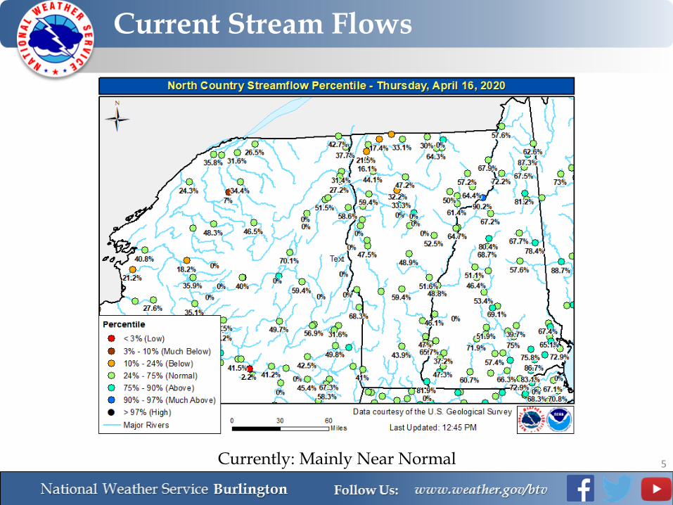
Current Stream Flows
5Currently: Mainly Near Normal

Lake Champlain
6
No immediate concerns, running just slightly above normal
Flood Stage
April 15Current: 98.63 feetNormal: 98.50 feet

TEMPERATURES: Below NormalPRECIPITATION: Near Normal
7
6-10 Day Outlook (April 21-25)Normal - Highs: Lower to mid 50s Lows: Upper 20s to mid 30s
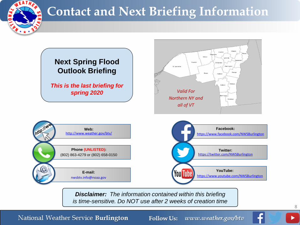
Contact and Next Briefing Information
8
Next Spring Flood
Outlook Briefing
This is the last briefing for
spring 2020 Valid For
Northern NY and
all of VT
Web:http://www.weather.gov/btv/
Phone (UNLISTED):
(802) 863-4279 or (802) 658-0150
E-mail:
Facebook:
https://www.facebook.com/NWSBurlington
Twitter:https://twitter.com/NWSBurlington
YouTube:
https://www.youtube.com/NWSBurlington
Disclaimer: The information contained within this briefing
is time-sensitive. Do NOT use after 2 weeks of creation time