Embed Size (px)
Citation preview
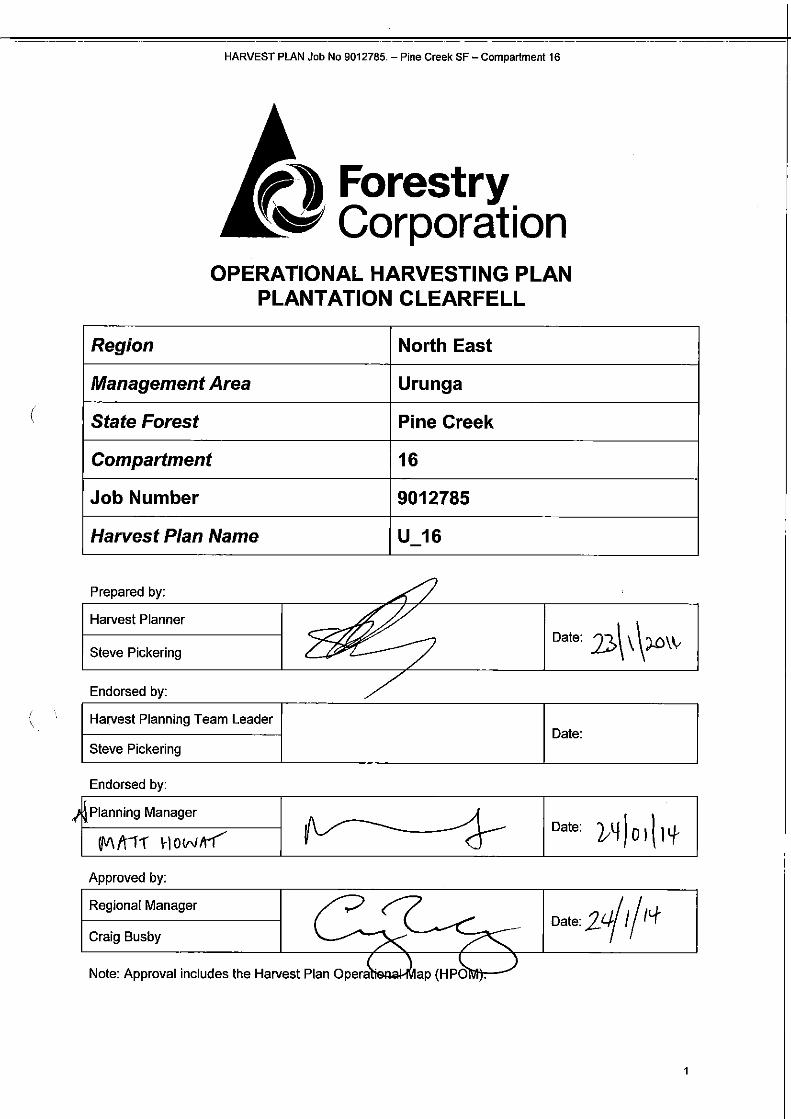
HARVEST PLAN Job No 9012785.- Pine Creek SF- Compartment 16
OPERATIONAL HARVESTING PLAN PLANTATION CLEARFELL
Region North East
Management Area Urunga
State Forest Pine Creek
Compartment 16
Job Number 9012785
Harvest Plan Name U_16
(
Prepared by:
Harvest Planner
Date: n\\\J-0\\.Steve Pickering
Endorsed by:
( Harvest Planning Team Leader Date:
Steve Pickering
Endorsed by:
~~Planning Manager
--'1( Date: b~ J0 dllfUV\ fr11" How11-f' Approved by:
Craig Busby
Regional Manager Date: 2r..tj /I l<f
HARVEST PLAN Job No 9012785.- Pine Creek SF- Compartment 16
1. Area Identification
Region North East Region
Management Area Urunga
State Forest Pine Creek
Compartment 16
Compartment Number 16
Gross Area (ha) 56.5
Net Harvest Area (ha) 40.3
Pricing Area Urunga Coastal
Operation Type Clearfall
2. Description of Proposal
2.1 Integrated Harvesting of Plantation Areas
Clearfelling of Flooded Gum (E.grandis) and Blackbutt (E.pilularis) plantation.
2.2 Other Proposed Works
Roadworks
Post-harvest Burning
Rehabilitation
Proposed
Yes
Yes
No
Details
Roadworks Plan (attached).
Plan to be prepared separately.
Plan to be prepared separately.
3. Plantation Condition and Silvicultural Prescription
3.1 Plantation Descnptton
( Species Flooded Gum/Blue Gum Blackbutt
Age Class 1969, 1970 1968
Area (ha) 38.1 2.2
Stand Health Varying quality from moderate/poor on ridges to better quality on lower slopes
Generally good quality
3.2 Silvicultural History and Product Types
Original forest type was likely to have consisted of mixed hardwood types on ridges (Tallowwood, Grey Gum, White Mahogany, Red Mahogany, Grey lronbark, Bloodwood, Blue Gum) with Brushbox types on lower slopes (Brushbox, Turpentine, Flooded Gum). The area was cleared in the late 1960's and plantation was established in 1968-1970.
A thinning was undertaken in 2002.
Some areas of natural regeneration through seed or coppice growth occur throughout. These areas are to be retained (see special condition 6.2)
2
HARVEST PLAN Job No 9012785.- Pine Creek SF- Compartment 16
(
Silvicultural Objectives and Prescriptions
• It is proposed to clearfell all the planted trees and replant within 12-18 months.
3.3 Desired Return Time Clearfell areas should be re-established within 12-18 months (work to be carried out by FCNSW Planted Forests Division).
4. Legal Conditions
The area to be harvested is an authorised plantation under the Plantations and Reafforestation Act (1999) (Authorisation no. GR0723P).
As such, the operation must comply with:
• Plantations and Reafforestation Act ( 1999).
• Plantations and Reafforestation (Code) Regulation (2001)- (amended 2010), subject to the conditions described in Attachment 1 of the Authorisation for the timber plantation.
Legislation relating to the operations on State Forests and other Crown Timber Lands is detailed in FNSW Forest Practices Codes. In addition this operation must specifically comply with:
• Forests NSW Forest Practices Code part 1 (Timber Harvesting in Forest NSW Plantations 2006).
• Forests NSW Forest Practices Code part 4, Forest Roads and Fire Trails (February 1999).
• Licence Conditions issued by Forests NSW under the Forestry Act (2012).
5. Special Conditions
5.1 Non-Harvest Areas The Operational Map indicates the non-harvest areas in the compartment, as detailed in the legend.
• Harvesting disturbance is not permitted in non-harvest areas without contacting the Harvest Planner to obtain the required Regional approval.
• Harvesting may take place within buffer zones of 1st and 2nd order drainage lines (as indicated on the operational map) and unmapped drainage lines in accordance with the conditions outlined in section 1 0.2.
• No harvesting or other disturbance may take place within the 20m buffer on 3rd order (or greater) drainage lines, wetlands or rivers. No machinery may enter the buffer (except were crossing a drainage line with prior SFO authorisation) and no trees are to be removed.
5.2 Native forest regeneration In some areas, particularly along Mailmans Track, native forest regeneration through seed or coppice has occurred. These areas can be recognised through the dominance of non-planted species such as Grey Gum, Tallowwwood, Turpentine, lronbark and Mahogany. Where these regrowth trees are clumped in patches (e.g.~ 12 trees in a 40 x 40m2 area) these clumps must be marked and retained. Isolated native forest regrowth trees may be harvested.
5 3 Leases Permits Plots ' ' Type Present Details Conditions
Crown Leases No
Occupation Permits (Grazing) No
Occupations Permits (Apiary) No
Occupation Permits (Other) No
Permanent Growth Plots No
Research Plots No
Plus Trees No
Special Purpose Permits No
5.4 Noise and Dust Residences located immediately to the south and west of the harvest area are likely to be affected by
3
HARVEST PLAN Job No 9012785. -Pine Creek SF- Compartment 16
(
noise. Site-specific operational conditions may be required to mitigate the impact of noise on residents, if so, these should be developed by the SFO and contractor in conjunction with the residents. These conditions must be approved by the Harvesting Team Leader prior to operations commencing in this area.
Measures may include;
• Liaising with neighbours regarding noise issues.
• Changes to the activity that would reduce the noise impact or disturbance.
• Restricting hours of operation.
5.5 Power Lines • A transmission line traverses the eastern end of Cpt 16, as shown on the operational map.
• The transmission line is a 66Kv line, operated by Essential Energy.
• A safe working procedure must be developed prior to working within 2 tree lengths of the easement. (Safety Standard 1.3.12 is attached for reference).
5.6 Underground Cables • Two major optic fibre cables of national significance (Telstra and Optus) occur in the east of the
compartment in the vicinity of the powerline. Ensure that the exact location of this cable is known and use dial before you dig procedures before conducting any earthworks in this area. Plans are held on file.
5.7 Critical Boundaries
5. 7. 1 Private Property
Private property adjoins compartment 16 from the south. This boundary is fenced.
5. 7.2 National Park
Bongil Bongil NP adjoins compartment 16 to the north of Mailmans Track. The boundary is 20m north of the centreline of Mail mans Track.
• Harvesting activities must not impact north of Mailmans Track.
• Harvesting must not impact on private property or National Park or any fence line.
• Any damage to a functional fence must be immediately repaired by the contractor.
5.8 Wet Weather Operational Area Areas on the operational map have been identified as indicative wet weather harvesting areas (marked as yellow with brown dots).
5.9 Rainforest I Endangered Ecological Communities
• Rainforest has been mapped within the compartments. The line work generated may be inconsistent with actual field vegetation types. These mapped areas should be inspected in the field and assessed against RN17 forest types. Verified rainforest (RN17 forest types 1-23) are to be marked for exclusion. Other areas of unmapped rainforest are also to be marked for exclusion as described in the Forests NSW Forest Practices Circular 2005/02. Areas found through field inspection to not constitute rainforest are available for harvest.
• Endangered Ecological Community (EEC) 'Lowland Rainforest in the NSW North Coast and Sydney Basin Bioregions' is potentially present within these compartments outside the mapped rainforest extent. Areas of this forest community must be identified as described in the FNSW EEC Identification Guide, and if present within the operation area, excluded from harvesting.
5.10 LiDAR Corrected Drainage • The locations of drainage lines shown on the HPOM have been altered using information
available from LiDAR. This should more accurately reflect the location of mapped drainage lines.
5.11 Haulage Considerations • Haulage is planned to access the Pacific Highway via Mailmans Track. This route may be used
by B-doubles.
• Mailmans Track must be closed during use by B-doubles and for roadside loading.
• The Harvesting Team Leader must ensure that a current consent to close Mailmans Track has been obtained from the Office of Environment and Heritage prior to road closures.
4

HARVEST PLAN Job No 9012785.- Pine Creek SF- Compartment 16
o The Harvesting Team Leader must ensure that all conditions of closure are met prior to and during the road closure. Conditions include notification prior to closure and signage during closure.
o Residents may access the Highway via Hunters Road.
o Permits may be issued to local residents for use of Mailmans Track. Harvesting contractor must develop a safe working procedure in consultation with the Harvesting Manager and Sales Manager for permitted and non-permitted road users.
o B-double configuration trucks are required to travel at speeds not exceeding 30km/hr along Mailmans Track.
5.12 Unique and Special Wildlife Values o Records of Marsdenia longilobia have been located nearby and are potentially present within
the harvest area.
o A species profile is attached to assist SFO and operators to identify any individuals within the harvest area.
o If any individuals are identified during the operation, the Harvesting Team leader must be notified. Operations must cease immediately until the Regional ecologist has determined the extent of the population and conditions under which operations can commence without impacting on known populations.
6. Forest Management Zoning Conditions
The following Forest Management Zones and conditions apply:
(
FMZ Type Notes
Zone4 General Management
Harvesting activities not permitted in FMZ 4 areas (north of Mailmans Track). Mailmans Track is the plantation boundary with the exception of some native forest regrowth along the road verges. This regrowth where it occurs is to be retained- (see section 5.2)
Zone5 Hardwood Plantation
Harvesting permitted under this harvest plan in accordance with the conditions of this harvest plan.
Zone 8 Further Assessment
These areas are to be rezoned FMZ 5 with management by prescription (Standard Harvest Plan Conditions for Plantation Forest Operations in North East Region apply). These areas include:
- Mapping irregularities on the edge of plantation polygons.
- Areas of regrowth that may constitute plantation.
7. Cultural Heritage
8.1 Aboriginal Cultural Heritage
0 No special conditions apply
8.2 Non Aboriginal Cultural Heritage 0 No special conditions apply
8. Soils and Water
Compartment 16
Inherent Hazard Level 1
Dispersible Soils No
Mass Movement Hazard No
Seasonality No
8.1 Wet Weather Controls Conditions 14.1-14.5 of FCNSW Forest Practices Code Part 1 -Timber harvesting in Forests NSW Plantations apply:
5

HARVEST PLAN Job No 9012785.- Pine Creek SF- Compartment 16
• Automatic Closures apply to forwarders and loaders when water is running on extraction tracks.
• Automatic closures apply to loaders when there is run-off from the landing surface.
• Automatic closures apply to the use of natural surface roads when there is runoff from the road.
• Machinery must not exceed acceptable rutting limits (see Condition 14.4 of the Forest Practices Code and condition 50 of the P&R Code).
• Harvesting is only permitted to continue within drainage feature protection areas if the top 200mm of soil is dry enough to avoid soil erosion.
9. Drainage Features
9.1 Drainage feature protection
• The Operational Map indicates known mapped drainage features and widths of protective measures. (Note: Some of the drainage features indicated on the Operational Map with filter strips may, at the time of marking, be determined as depressions).
• The minimum buffer zone width for each side of drainage features is shown below.
( Stream Order
Buffer zones each side of drainage features (m)
(Hazard Class 1)
Drainage Depressions 5
Unmapped Drainage Lines 10
1st Order Streams 10
2nd Order Streams 10
3rd Order Streams 20
4th Order Streams (or greater) 20
9.2 Operational Conditions for Drainage Features
• Harvesting within buffer zones must comply with conditions 15, 16, 62-63 of the Plantations and Reafforestation (Code) Regulation 2001.
• No harvesting is permitted within the buffer zone of a wetland or river (3rd order or greater drainage line).
• Harvesting within the buffer zone of a 1st or 2nd order drainage line can only occur when the person carrying out the harvesting operation is satisfied that the top 200mm of soil is dry enough to allow operations without risk of soil erosion to the edge of the drainage feature.
• No harvesting machinery is permitted to enter the 5m zone (area immediately surrounding either side of all drainage lines) for the purposes of harvesting. Harvesting operations must use "reach in" techniques to harvest this area.
10. Tree Marking Conditions and Code
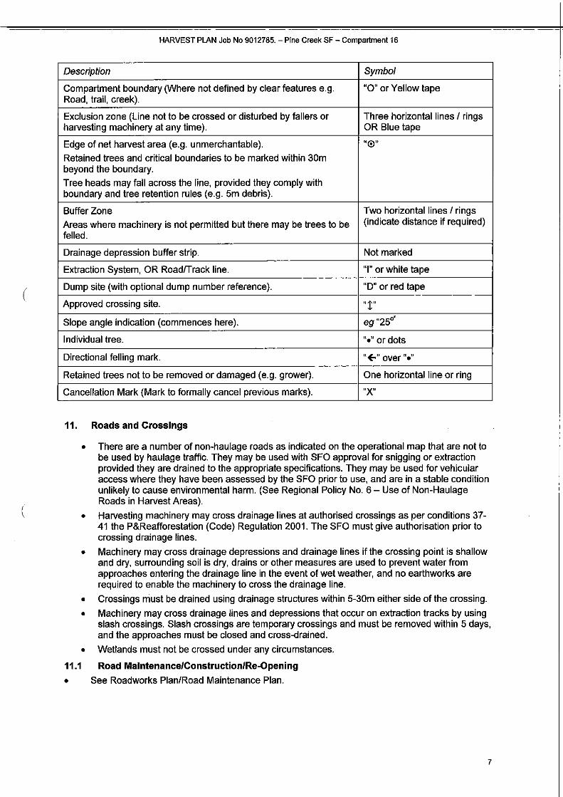
Standard Markings/Symbols: Markings/Symbols that deliver key requirements on a state-wide basis.
6
HARVEST PLAN Job No 9012785.- Pine Creek SF- Compartment 16
Description Symbol
Compartment boundary (Where not defined by clear features e.g. Road, trail, creek).
"0" or Yellow tape
Exclusion zone (Line not to be crossed or disturbed by fallers or harvesting machinery at any time).
Three horizontal lines I rings OR Blue tape
Edge of net harvest area (e.g. unmerchantable).
Retained trees and critical boundaries to be marked within 30m beyond the boundary.
Tree heads may fall across the line, provided they comply with boundary and tree retention rules (e.g. 5m debris).
'~®"
Buffer Zone
Areas where machinery is not permitted but there may be trees to be felled.
Two horizontal lines I rings (indicate distance if required)
Drainage depression buffer strip. Not marked
Extraction System, OR Road/Track line. "I" or white tape
Dump site (with optional dump number reference). "D" or red tape
Approved crossing site. "!" Slope angle indication (commences here). eg"25°.
Individual tree. "•" or dots
Directional felling mark. "E-" over "•"
Retained trees not to be removed or damaged (e.g. grower). One horizontal line or ring
Cancellation Mark (Mark to formally cancel previous marks). "X"
(
(
11. Roads and Crossings
• There are a number of non-haulage roads as indicated on the operational map that are not to be used by haulage traffic. They may be used with SFO approval for snigging or extraction provided they are drained to the appropriate specifications. They may be used for vehicular access where they have been assessed by the SFO prior to use, and are in a stable condition unlikely to cause environmental harm. (See Regional Policy No. 6- Use of Non-Haulage Roads in Harvest Areas).
• Harvesting machinery may cross drainage lines at authorised crossings as per conditions 3741 the P&Reafforestation (Code) Regulation 2001. The SFO must give authorisation prior to crossing drainage lines.
• Machinery may cross drainage depressions and drainage lines if the crossing point is shallow and dry, surrounding soil is dry, drains or other measures are used to prevent water from approaches entering the drainage line in the event of wet weather, and no earthworks are required to enable the machinery to cross the drainage line.
• Crossings must be drained using drainage structures within 5-30m either side of the crossing.
• Machinery may cross drainage lines and depressions that occur on extraction tracks by using slash crossings. Slash crossings are temporary crossings and must be removed within 5 days, and the approaches must be closed and cross-drained.
• Wetlands must not be crossed under any circumstances.
11.1 Road Maintenance/Construction/Re-Opening • See Roadworks Plan/Road Maintenance Plan.
7

HARVEST PLAN Job No 9012785.- Pine Creek SF- Compartment 16
(
12. Log Dumps
12.1 Location
• Log dumps and landings that require construction must be located outside buffer zones, areas of native vegetation and zones marked as 'No Loading Permitted' zones on the Harvest Plan Operational Map.
• Log stockpile areas within native forest areas must be approved by the Regional Manager prior to establishment and should be located so as to minimise disturbance to understorey elements.
• Log stockpile sites (no construction required) are permitted along all sections of road within the plantation area unless marked as 'No Loading Permitted' zones on the Harvest Plan Operational Map.
12.2 Treatment
• Conditions 60-61 of the P & R Code, and 17.2-17.4 of the Forest Practices Code (FPC) 2005 must apply.
• Debris accumulated during processing at log dumps and landings must be located outside the boundary of buffer zones. Even distribution of slash and debris across running tracks is required. This will alleviate ground compaction and reduce exposure of soil to erosion and runoff.
• If any area used as a log dump or landing for harvesting operations ceases to be so used for more that one week, measures to minimise soil erosion must be put in place.
13. Extraction Tracks
13.1 Relevant Conditions Conditions 64(a)-(c) of the Plantation & Reafforestation Code, and 9.1-9.4 and 14.1-14.4 of the Forest Practices Code 2005.
• The grade of constructed extraction tracks must not exceed 25'.
• Blading-off of extraction tracks is not allowed.
13.2 Walk-over Extraction Special attention must be paid to the placement of slash over ground area of any concentrated machinery movement. Such areas will include the exits of extraction tracks onto roads, at the intersection of running tracks in the harvest area and at log landings.
13.3 Extraction Track Drainage Soil erosion from tracks should be minimised by:
• Retaining groundcover and using slash and leaf litter. Slash should be placed evenly across the track to divert water.
• Using natural cross-fall drainage.
Drainage structures must be constructed if concentrated water flow occurs for distances exceeding those in the following table- Maximum distance of water flow or potential water flow along snig tracks or extraction tracks (metres measured along the ground surface):
Track Grade (degrees) Maximum Distance (m)
0-5 100
5-10 60
10-15 40
15-20 30
20-25 25
13.4 Wet Weather Provisions Machinery used for harvesting must not be operated on a harvesting area or natural surface log dump or landing if surface runoff is occurring. This machinery can operate on saturated soils if:
• The machinery is supported by a bed of slash; and
8
HARVEST PLAN Job No 9012785.- Pine Creek SF- Compartment16
• Walkover extraction techniques are utilised; and
• The rutting depths to not exceed the depths specified in the table below.
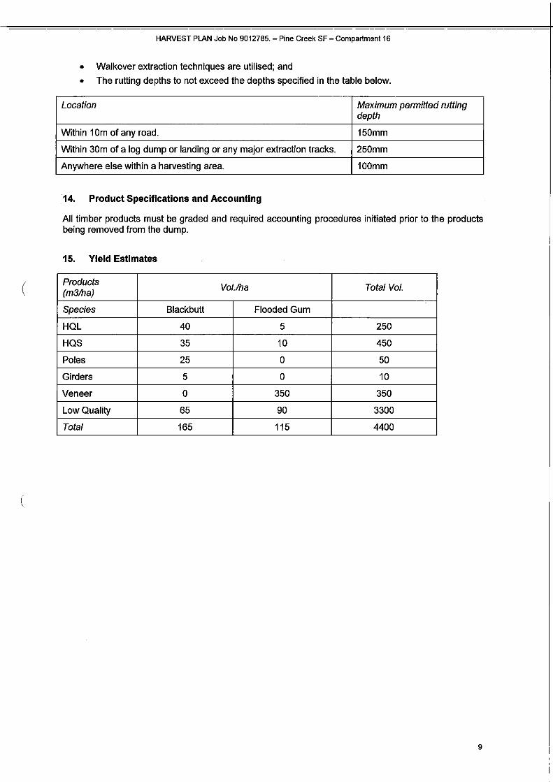
Location Maximum permitted rutting depth
Within 1Om of any road. 150mm
Within 30m of a log dump or landing or any major extraction tracks. 250mm
Anywhere else within a harvesting area. 100mm
14. Product Specifications and Accounting
All timber products must be graded and required accounting procedures initialed prior to the products being removed from the dump.
15. Yield Estimates
( Products (m3/ha)
Vol.lha Total Vol.
Species Blackbutt Flooded Gum
HQL 40 5 250
HQS 35 10 450
Poles 25 0 50
Girders 5 0 10
Veneer 0 350 350
Low Quality 65 90 3300
Total 165 115 4400
9

16. Operational Control
Contractor Team Leader to sign here I acknowledge that I have received a copy of the plan documents and that I have been briefed on the conditions of the Plan. I understand the operational control requirements as outlined in the plan and take responsibility for the implementation of plan conditions as the principle controller of the operation. I will brief any other operators not present at this briefing prior to them starting any work on site and ensure that risk assessment for the Safety Management Plan is completed for this area prior to operations commencing.
Name Signature
Position
Company Date
From
To
Principal SFO to sign here (handovers between principal SFOs also to be recorded) I acknowledge that I have received a copy of the plan documents and that I have been briefed on the conditions of the Plan. I understand the operational control requirements as outlined in the plan and take
( responsibility as the principle SFO.
Name Signature
Position
Company Date
From
To
Name Signature
Position
Company Date
From
To
(
Name Signature
Position
Company Date
From
To
Name Signature
Position
Company Date
From
To
10

HARVEST PLAN Job No 9012785.- Pine Creek SF- Compartment 16
17. Handover Briefing
I acknowledge that I have received a copy of the plan documents and that I have been briefed on the conditions of the Plan. I understand the operational control requirements as outlined in the plan.
(
Company Name Signature Date
Induction Questionnaire 1. What are the conditions relating to native forest regrowth stems such as grey gum/ironbark,
bloodwood 2. What infrastructure and public utilities are located in or close to the harvest area and what are
the conditions surrounding these. 3. What must be in place prior to loading adjacent Mailmans track and hauling 8-doubles on
Mailmans Track 4. What threatened species may be in the area? 5. Identify the large low-lying non-plantation area to be excluded from harvesting.
11
ROADING PLAN- Pine Creek State Forest, Compartment16
FORESTRY CORPORATION OF NSW- NORTH EAST REGION
ROADWORKS PLAN
Pine Creek State Forest; Compartment 16
ASSOCIATED HARVEST PLAN Job N0.9012785.
Certification
Prepared by:
Harvest Planner
Road Works and Operational Expenditure A
Regional Manager
Date: 2<t j rj1 '"t Craig Busby
Duration of Approval:
The above approval is valid until 12 months from date of signature.
Contents 1. Cover Page
2. Operational Map
3. Goslings
4. Roadworks Plan Text/Prescriptions/Road and crossings work sheets (
5. Locality Map
6. Safety Plan HAMEEP
7. Harvesting Plan
B. Harvesting Notification List (Operations Team Leader and Roading Supervisor Only)

ROADING PLAN- Pine Creek State Forest, Compartment 16
2
ROADING PLAN- Pine Creek State Forest, Compartment16
1. Objectives
• Roadworks are required to service plantation harvesting operations within the above compartments. These compartments are scheduled for harvest in 2014.
• The operational map shows the location of the proposed works. • Attachments: Financial Analysis Spreadsheet gives full details of costs, benefits, material &
plant requirements.
2. Specifications and Legal Conditions
This operation must comply with: • State Forests of NSW Forest Practices Code - Part 1 Timber Harvesting in Forests NSW
Plantations 2005 and Forest Practices Code Part 4 Forest Roads and Fire Trails (February 1999).
• Plantations and Reafforestation Act ( 1999).
• Plantations and Reafforestation (Code) Regulation (2001), subject to the conditions described in Attachment 1 of the Authorisation for the timber plantation.
• Standard Harvest Plan Conditions for Plantation Operations in North East Region.
• Licence Conditions issued by Forestry Corporation of NSW under the Forestry Act (1912). • Technical Guidance Notes for Roadworks.
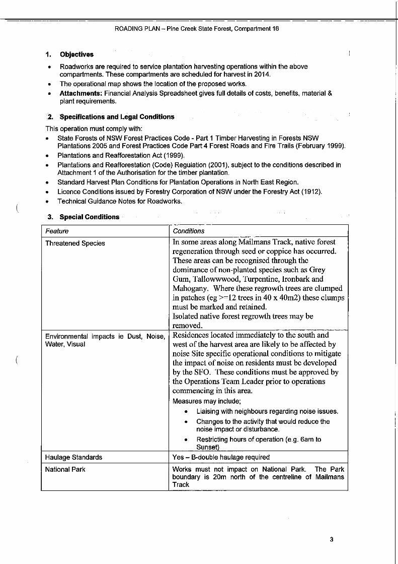
3. Special Conditions (
Feature Conditions
Threatened Species In some areas along Mailmans Track, native forest regeneration through seed or coppice has occurred. These areas can be recognised through the dominance ofnon-planted species such as Grey Gum, Tallowwwood, Turpentine, Ironbark and Mahogany. Where these regrowth trees are clumped in patches (eg >=12 trees in 40 x 40m2) these clumps must be marked and retained. Isolated native forest regrowth trees may be removed.
Environmental impacts ie Dust, Noise, Water, Visual
Residences located immediately to the south and west of the harvest area are likely to be affected by noise Site specific operational conditions to mitigate the impact ofnoise on residents must be developed by the SFO. These conditions must be approved by the Operations Team Leader prior to operations commencing in this area.
Measures may include;
• Liaising with neighbours regarding noise issues .
• Changes to the activity that would reduce the noise impact or disturbance.
• Restricting hours of operation (e.g. 6am to Sunset)
Haulage Standards Yes- B-double haulage required
National Park Works must not impact on National Park. The Park boundary is 20m north of the centreline of Mailmans Track
3
ROADING PLAN- Pine Creek State Forest, Compartment 16
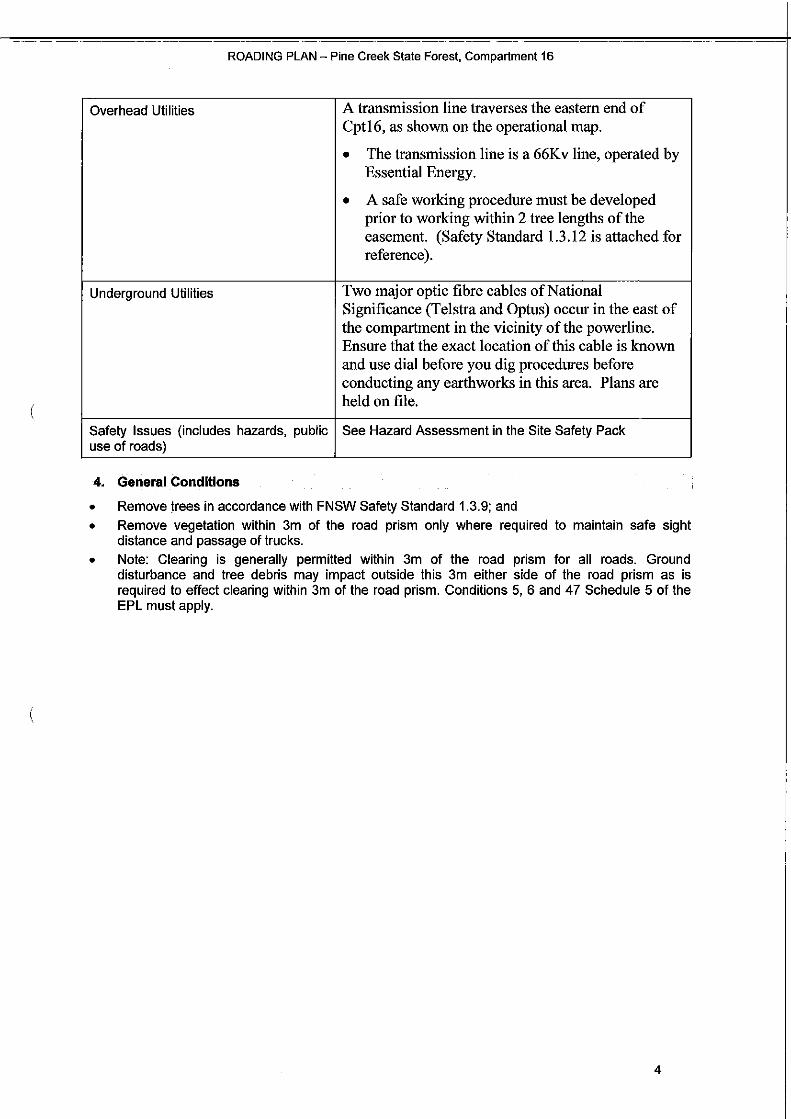
Overhead Utilities A transmission line traverses the eastern end of Cpt16, as shown on the operational map.
• The transmission line is a 66K v line, operated by Essential Energy.
• A safe working procedure must be developed prior to working within 2 tree lengths of the easement. (Safety Standard 1.3 .12 is attached for reference).
Underground Utilities Two major optic fibre cables ofNational Significance (Telstra and Optus) occur in the east of the compartment in the vicinity of the powerline. Ensure that the exact location of this cable is known and use dial before you dig procedures before conducting any earthworks in this area. Plans are held on file.
Safety Issues (includes hazards, public use of roads)
See Hazard Assessment in the Site Safety Pack
4. General Conditions
• Remove trees in accordance with FNSW Safety Standard 1.3.9; and • Remove vegetation within 3m of the road prism only where required to maintain safe sight
distance and passage of trucks. • Note: Clearing is generally permitted within 3m of the road prism for all roads. Ground
disturbance and tree debris may impact outside this 3m either side of the road prism as is required to effect clearing within 3m of the road prism. Conditions 5, 6 and 47 Schedule 5 of the EPL must apply.
4
ROADING PLAN- Pine Creek State Forest, Compartment 16
- ' .. ~~-
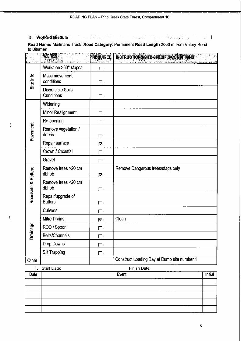
Road Name: Mailmans Track Road Category: Permanent Road Length 2000 m from Valery Road to Bitumen
--, '--.~··· ~··• .• ·c: . ll'f\ll'll ':. ~·· ..
. ··' ...'. . ·~ > ":: ' ''. . ' . . ' ·,
.E -= .l!! tn
c( -., E., i; tL
I!!., Remove trees >20 em Remove Dangerous trees/stags only :a:: Cl1
dbhob p,. m oil Remove trees <20 em ., "C 'iii
dbhob r~
"C Cl1 Repair/upgrade of ~ Batters r.
Culverts r.
., Mitre Drains Pi· Clean 0'1 Cl1 c
ROD/ Spoon r. ·e c Belts/Channels r.
Drop Downs r. Silt Trapping f'·
Other
1. Start Date:
Construct Loading Bay at Dump site number 1
Finish Date:
Works on >30° slopes r . Mass movement conditions r . Dispersible Soils Conditions r. Widening
Minor Realignment r Re-opening r. Remove vegetation I debris r. Repair surface p,
Crown I Crossfall r. Gravel r.
Date Event Initial
5

ROADING PLAN - Pine Creek State Forest, Compartment 16
Road Name: Dump 3 Road Road Category: Temporary Road Length 200 m from Mailmans Track to Dump 3
·. I"'I· ·.~..
Works on >30" slopes
.E Mass movement
.5 conditions i:i)-..
Dispersible Soils Conditions
Widening
Minor Realignment
- Re·opening r::::.. Remove vegetation IE.. debris..>( D..
Repair surface
Crown I Crossfall
Gravel
Remove trees >20 em dbhob
I!!
~ Ill
Remove trees <20 em dbhob
o!l.. ·u;""
Repair/upgrade of"".. ~ Batters
Culverts
Mitre Drains.. C'l ROD I Spoon.. r::::'i! Belts/ChannelsCl
Drop Downs
Silt Trapping
1 . Start Date:
r.Rk~1J·"' ..· r .
r .
r.
r r
r. p.
r. r.
p.
r.
r:. r. r . r . 17'
f'· n.
:. i! < .;,...,. .,.· ·c· ·<''C'7
<
·. '' > · ... :
Construct turnaround at end of road
Remove Dangerous trees/stags only
Finish Date:
Date Event Initial
6

ROADING PLAN- Pine Creek State Forest, Compartment 16
Road Name: Dump 4 Track Road Category: Temporary Road Length 200 m from Mailmans Track to Dump4
'"•';~-
Works on >30° slopes
.e Mass movement -= conditionsCll ;!:: U) Dispersible Soils
Conditions
Widening
Minor Realignment
- Re-opening c Cll Remove vegetation IE Cll debris~( a.
Repair surface
Crown I Crossfall
Gravel
Remove trees >20 emI!! .. Cll :1::: dbhob Ill
Remove trees <20 emoil Cll dbhob:5! -c "' .. Repair/upgrade of 0
0:: Batters
Culverts
Mitre Drains
.. Cll Cl ROD /Spoon
( ·e c Belts/Channelsc Drop Downs
Silt Trapping
1. Start Date:
·-~ -;,-..i: -1>-- .··· :,'~r _- ..• · -•- "• - ,;;';' --"- . - ..
r .
r.
r. lJor,~ .. ""' turnaround at end of road
r. r.
r. 17·
r. r.
Remove Dangerous trees/stags only 17
r-
r. r.
CleanM~
M·
M~
r;.
r. Finish Date:
Date Event Initial
7

ROADING PLAN- Pine Creek State Forest, Compartment 16
Road Name: Dump 5 Track Road Category: Temporary Road Length 100m from Mailmans Track to Dump 5
.li!Pil'lllllilliiri; •i&oiiio.i .
·"· ., ....~
' : ' ,-~··~<-''
r .
r .
r. \Jonsiruct tun ""uuo ou at end of road
r. r
r. p.
r. r.
Remove Dangerous trees/stags only p:.
r.
r. r. p .
P'· fi·
f'·
f'· Finish Date:
(
(
~ '· ' .,,.' ' ,; .
Works on >30° slopes
Mass movement conditions
Dispersible Soils Conditions
Widening
Minor Realignment
Re-opening
Remove vegetation I debris
Repair surface
Crown I Crossfall
Gravel
Remove trees >20 em dbhob
Remove trees <20 em dbhob
Repair/upgrade of Batters
Culverts
Mitre Drains
ROD /Spoon
Belts/Channels
Drop Downs
Silt Trapping
Start Date:
"I' , ___ ,
.E
.5..-i:i)
-r::::.. E.. 1:;
D..
I!! .l!! 'Iii Ill all.. -c·u; -c.. ~
.. 0>.. r:::: ·e c
1. Date Event Initial
8

ROADING PLAN - Pine Creek State Forest, Compartment 16
•6. Operational Control
Roading Supervisor to sign here
I acknowledge that I have received a copy of the plan documents and that I have been briefed on the conditions of the Plan. I understand the operational control requirements as outlined in the plan and take responsibility for the implementation of plan conditions as the principle controller of the operation.
I will brief any other operators not present at this briefing prior to them starting any work on site and ensure that risk assessment for the Safety Management Plan is completed for this area prior to operations commencing
Name: Signature:
Position: Date: From
Company: To
Name: Signature:
Position: Date: From
Company: To
Name: Signature:
Position: Date: From
Company: To
Name:
Position:
Signature:
Date: From
Company: To
Name: Signature:
Position: Date: From
Company: To
9