Embed Size (px)
Citation preview
IDAHO��MONTANA��NEVADA��OREGON��UTAH��WASHINGTON��WYOMING�www.stratageotech.com��1428�South�Main�Street,�Moscow,�ID��83843���P.208.882.1006�F.208.883.4750�
October 15, 2010 MOSCIT M10105A
Mr. Bill Belknap Community Development Director City of Moscow 221 East Second Street Moscow, Idaho 83843
RE: Phase I Environmental Site Assessment with Limited Soil Sampling
Lilly and Asbury Properties Moscow, Idaho Dear Mr. Bellknap:
Strata, a Professional Services Corporation, (STRATA), is pleased to provide this Phase I Environmental Site Assessment (ESA) with limited soil sampling for the site occupying the former Dumas elevator railroad spur between Asbury and Lilly Streets in Moscow, Idaho. Our scopes of services for this Phase I ESA, including this report, were accomplished referencing ASTM E1527-05 and our proposal dated August 23, 2010. The following summarizes this report’s findings and conclusions, however the report must be read in its entirety to more fully develop an understanding of the findings and conclusions presented below.
Based on the scope of services and limitations of this assessment, STRATA did not identify recognized environmental conditions (RECs) in connection with the site which except for the following:
� Potential petroleum groundwater contamination from the UST previously at the former Dumas/Columbia Grain elevators property approximately 300 feet up gradient from the site along the Hog Creek drainage is a REC. However, based upon STRATA’s experience assessing petroleum sites located within the Paradise Creek drainage, a similar depositional environment, a prolonged, chronic petroleum release would likely have been necessary to result in site petroleum impacts.
� Soil and potential groundwater contamination from creosoted railroad ties, coal clinkers, and pesticide application is an REC. This is confirmed by soil analytical test results.
STRATA recommends groundwater sampling and a site-specific risk evaluation be performed. We understand that the installing monitoring wells on-site is prohibited in the purchase agreement with Columbia Grain. If possible and in compliance with the purchase agreement, STRATA recommends installing temporary/one time use groundwater sampling points to further evaluate site arsenic, benzo(a)anthracene, benzo(b)fluoranthene, dibenzo(a,h)anthracene, indeno(1,2,3-cd)pyrene and lead groundwater concentrations. This would facilitate a better understanding of actual site groundwater and potential Hog Creek impacts rather than those
Lilly and Asbury Properties Phase I ESA MOSCIT M10105A
Page 2
IDAHO MONTANA NEVADA OREGON UTAH WASHINGTON WYOMING www.STRATAgeotech.com
conservatively predicted by the model. The same sampling points could also be utilized to evaluate potential site impacts associated with the up gradient Dumas/Columbia Grain UST.
STRATA further recommends an evaluation of potential remedial alternatives be performed. We understand that upon purchasing the property the City is considering constructing a City park. Depending upon park grading requirements limited surface soil removal and site capping with clean imported fill material can reduce future exposure to contaminated surface soils, thereby removing one exposure pathway. Specific recommendations should be developed after collection of groundwater data, additional risk evaluation, consultation with DEQ, and review/discussion of future site development plans. Alternatives may also include deed/ activity and use restrictions for the site.
During park construction there may be some bank enhancement/naturalization for Hog Creek. STRATA recommends developing a construction stormwater pollution prevention plan for park construction and bank modification to protect Hog Creek from sediment and site environmental contaminants.
This report has been prepared for the exclusive use of the City of Moscow, and we do not authorize its use to other parties without the City’s and STRATA’s authorization. This evaluation reflects only conditions reported and/or observed at the site at the time of this evaluation. This acknowledgement is in lieu of any express or implied warranties. We appreciate the opportunity to work with you on this project. Please contact us if you have any questions or comments.
Sincerely, STRATA, Inc.
Shawn Ringo Environmental Project Manager
William H. Holder, P.E.Senior Environmental Engineer
SR/WHH/mg

Phase I Environmental Site Assessment with Limited Soil SamplingLilly and Asbury Properties
Moscow, Idaho
PREPARED FOR:
Mr. Bill Belknap Community Development Director
City of Moscow 221 East Second Street Moscow, Idaho 83843
PREPARED BY: STRATA, Inc.
A Professional Services Corporation 1428 South Main
Moscow, Idaho 83843 Telephone (208) 882-1006 Facsimile (208) 883-4750
October 15, 2010

IDAHO MONTANA NEVADA OREGON UTAH WASHINGTON WYOMING www.STRATAgeotech.com
TABLE OF CONTENTS
1.0 INTRODUCTION ............................................................................................................... 1
1.1 PURPOSE ........................................................................................................................... 1
1.2 SCOPE OF SERVICES .......................................................................................................... 1
1.3 SIGNIFICANT ASSUMPTIONS ................................................................................................ 3
1.4 SCOPE LIMITATIONS AND ASTM EXCEPTIONS ...................................................................... 3
1.5 RELIANCE ........................................................................................................................... 4
2.0 SITE DESCRIPTION / PHYSICAL SETTING ................................................................... 4
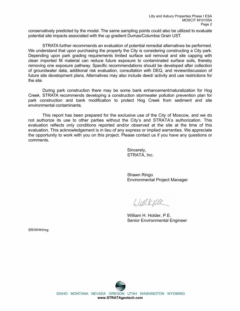
2.1 ADJOINING PROPERTIES...................................................................................................... 4
3.0 USER PROVIDED INFORMATION .................................................................................. 5
3.1 ENVIRONMENTAL LIENS OR ACTIVITY AND USE LIMITATIONS ................................................. 5
3.2 SPECIALIZED KNOWLEDGE .................................................................................................. 5
3.3 COMMONLY KNOWN OR REASONABLY ASCERTAINABLE INFORMATION .................................. 5
3.4 VALUATION REDUCTION FOR ENVIRONMENTAL ISSUES ......................................................... 5
3.5 REASON FOR PERFORMING PHASE I .................................................................................... 5
4.0 RECORDS REVIEW ......................................................................................................... 6
4.1 FEDERAL AND STATE/TRIBAL DATABASES ............................................................................ 6
4.1.1 Zip Trip #16 (AKA Conoco 16) .................................................................................. 8
4.1.2 Kelson Distributing Co. .............................................................................................. 9
4.1.3 Dumas Corporation ................................................................................................... 9
4.2 LOCAL AGENCY INQUIRIES................................................................................................... 9
4.2.1 Building, Planning and Zoning Departments ............................................................. 9
4.2.2 Health Department .................................................................................................. 10
4.2.3 Fire Department ...................................................................................................... 10
5.0 PHYSICAL SETTING ...................................................................................................... 10
6.0 HISTORICAL USE INFORMATION ................................................................................ 11
6.1 HISTORICAL TOPOGRAPHIC MAPS ..................................................................................... 11
6.2 HISTORICAL AERIAL PHOTOGRAPHS .................................................................................. 12
6.3 HISTORICAL CITY DIRECTORIES ......................................................................................... 12
6.4 HISTORICAL FIRE INSURANCE MAPS .................................................................................. 13
6.5 PROPERTY TAX FILE INFORMATION .................................................................................... 13
6.6 TITLE SEARCH .................................................................................................................. 13

IDAHO MONTANA NEVADA OREGON UTAH WASHINGTON WYOMING www.STRATAgeotech.com
6.7 ENVIRONMENTAL LIENS AND ACTIVITY USE LIMITATIONS .................................................... 13
6.8 HISTORICAL INTERVIEWS ................................................................................................... 14
6.8.1 Columbia Grain General Manager; Mr. Randy Olstad ............................................ 14
6.8.2 Former Dumas Elevator Employee; Mr. Bob Martson ............................................. 14
6.9 PRIOR REPORT REVIEW .................................................................................................... 14
6.10 SITE HISTORY SUMMARY................................................................................................... 14
6.11 SIGNIFICANT DATA GAPS................................................................................................... 15
7.0 SITE RECONNAISSANCE ............................................................................................. 15
7.1 GENERAL SITE INFORMATION ............................................................................................ 15
7.2 GENERAL DESCRIPTION OF SITE, OCCUPANTS AND OPERATIONS ....................................... 16
7.3 SITE OBSERVATIONS ......................................................................................................... 16
7.3.1 Electrical Transformers/PCBs ................................................................................. 17
7.3.2 Evidence of Releases or Potential Releases .......................................................... 18
7.4 INTERVIEWS WITH PRESENT OWNERS AND OCCUPANTS ..................................................... 18
8.0 ADDITIONAL SERVICES ............................................................................................... 18
9.0 FINDINGS ....................................................................................................................... 20
10.0 CONCLUSIONS .............................................................................................................. 21
11.0 RECOMMENDATIONS ................................................................................................... 21
12.0 QUALIFICATION(S) OF ENVIRONMENTAL PROFESSIONAL(S) ................................ 22
REFERENCES ........................................................................................................................... 23

IDAHO MONTANA NEVADA OREGON UTAH WASHINGTON WYOMING www.STRATAgeotech.com
Phase 1 Environmental Site Assessment with Limited Soil Sampling Lilly and Asbury Properties
Moscow, ID
1.0 INTRODUCTION 1.1 Purpose
STRATA is providing this authorized Phase I Environmental Site Assessment (ESA) with
limited soil sampling for the Lilly and Asbury properties site occupying the former Dumas
elevator railroad spur between Asbury and Lilly Streets in Moscow, Idaho. The purpose of this
Phase 1 ESA is to provide general information regarding the potential for recognized environmental
conditions to exist on the subject site or properties within the Approximate Minimum Search
Distance (AMSD) to contribute recognized environmental conditions (RECs) to the subject site.
Recognized environmental conditions are defined as the presence or likely presence of any
hazardous substances or petroleum products on a property under conditions that indicate an
existing release, a past release or a material threat of a release on the property. This report
summarizes the results of our physical and historical records review, interviews and visual site
reconnaissance and presents our conclusions.
1.2 Scope of Services This Phase I ESA was performed referencing our proposal dated August 23, 2010 and
ASTM E1527-05 procedures. To perform this Phase I ESA, we accomplished the following
specific tasks:
1.2.1 Records Review
1. Standard local, federal and state/tribal regulatory databases within the AMSDs were reviewed to help identify RECs in connection with the site. Records reviewed were documented even if a source revealed no findings.
2. Available local, state and/or government records applicable to the site were requested referencing the generally accepted professional practice in the area.
3. Available United States Geologic Survey (USGS) topographic map(s) including the site and site vicinity were reviewed.
4. Historical site and surrounding property use information was reviewed to identify past uses with the potential to be a REC or historical recognized environmental conditions (HRECs). ASTM E 1527-05 requires that all obvious uses of the site shall be identified from the present back to the site’s first developed use, or back to 1940, whichever is earlier. Site use history not identified is deemed a data gap and evaluated with respect to the findings and conclusions of the report. The review includes sources deemed reasonably ascertainable, useful, accurate and complete. The following standard historical sources were checked and/or used:

Lilly and Asbury Properties Phase I ESA MOSCIT M10105A
Page 2
IDAHO MONTANA NEVADA OREGON UTAH WASHINGTON WYOMING www.STRATAgeotech.com
Historical Source Available Reasonably Ascertainable Used
Historical aerial photographs showing the site and surrounding areas Yes Yes Yes
Zoning/Land use records Yes Yes Yes Property tax files and/or recorded land title records Yes No No
Historical City Directories Yes Yes No Historical USGS Topographic Maps Yes Yes Yes Sanborn Fire Insurance Maps Yes Yes Yes
1.2.2 Site Reconnaissance
5. A site reconnaissance was performed to look for evidence of RECs in connection with the site.
6. Surface water receptors such as streams, rivers, lakes or runoff ditches and storm drains were located on or near the site.
7. The current site use and surrounding properties, site topography, a general description of structures, roads, potable water supply and sewage disposal system associated with the site were identified through visual or physical observation at the time of our site visit.
8. STRATA attempted to identify potential site use for the treatment, storage, disposal, or generate of hazardous substances and/or petroleum products. In addition, we attempted to identify above or below ground storage tanks, odors, pools of liquids, drums, stained soil or pavement, stressed vegetation, solid waste, pits, ponds or lagoons, wastewater, wells and septic systems.
1.2.3 Personal Interviews
9. The present and past site owners were interviewed to obtain information indicating RECs in connection with the site. It was the responsibility of the City of Moscow to identify key individuals having significant site knowledge. The City of Moscow identified Mr. Randy Olstad as the individual appropriate for interview. Please recognize that STRATA cannot verify the accuracy of the information provided and cannot be responsible for errors or omissions associated with the ownership history information.
1.2.4 Additional Services
10. STRATA collected 3 surface soil composite samples; each comprising 10 sample aliquots from the former railroad spur alignment. Composite samples were analyzed for Resource Conservation Recovery Act (RCRA) – 8 metals (arsenic, barium, cadmium, chromium, lead, mercury, selenium and silver) by EPA method 200.8/6020, for pesticides by EPA method 8270 modified and for semi-volatile organic compounds (SVOCs) by EPA method 8270.
11. Composite samples metals, pesticides and SVOC concentrations were compared to Idaho Department of Environmental Quality (DEQ) Initial Default Target Levels (IDTLs). IDTLs are conservative cleanup levels published in DEQ’s Risk Evaluation Manual (REM).
1.2.5 Phase I ESA Report
12. Our findings, opinions, conclusions and recommendations for this Phase I ESA are

Lilly and Asbury Properties Phase I ESA MOSCIT M10105A
Page 3
IDAHO MONTANA NEVADA OREGON UTAH WASHINGTON WYOMING www.STRATAgeotech.com
provided in this report and supported by documentation in accordance with ASTM E1527-05. Photographic documentation and copies of records, drawings, maps, etc. are included in this report.
1.3 Significant Assumptions In order to conduct the above scope of services, STRATA made necessary
assumptions. This included the assumption that any historic releases of hazardous materials to
the environment were duly reported and noted in the files of the agency having jurisdiction. We
also assumed there were no hazardous material releases to the environment before the
recording of information was initiated.
1.4 Scope Limitations and ASTM Exceptions Our findings related to field observations, historical research, and interviews in this report
reflect the conditions of the subject site as of October 15, 2010. This is a historical review and
visual surface assessment. Conditions may exist below the ground surface which were not
apparent during the site reconnaissance. Certain hazardous substance or petroleum product
indicators may have been latent, inaccessible, unobservable, or not present during our
reconnaissance and may subsequently become observable (such as after site renovation or
development). Information provided to STRATA, Inc. is believed to be reliable, but STRATA,
cannot warrant or guarantee that the information is complete or accurate. Performance of this ESA
is intended to reduce, but not eliminate uncertainty regarding the potential for recognized
environmental conditions in connection with the site, and this practice recognizes reasonable limits
of time and cost. Furthermore, these services are not to be construed as legal interpretation or
advice.
Our services consist of professional opinions and recommendations made referencing
ASTM E 1527-05 and generally accepted environmental assessment practices. This
acknowledgment is in lieu of all express or implied warranties.
Reasonable attempts were made to obtain information within the scope and time
constraints set forth by Client Name; however, in some instances, information requested is not or
was not received by the issuance date of the report. Consideration of such information is beyond
the scope of this assessment. This ESA was further limited by the following:
� A written request was submitted to local government agencies regarding documented recognized environmental conditions on the site. Records were not requested for off-site properties.

Lilly and Asbury Properties Phase I ESA MOSCIT M10105A
Page 4
IDAHO MONTANA NEVADA OREGON UTAH WASHINGTON WYOMING www.STRATAgeotech.com
Findings in this report are based upon the site’s current utilization, information derived from
the most recent reconnaissance and from other activities described herein; such information is
subject to change. Certain indicators of the presence of hazardous substances or petroleum
products may have been latent, inaccessible, unobservable or not present during our
reconnaissance and may subsequently become observable (such as after site renovation or
development). Further, these services are not to be construed as legal interpretation or advice.
1.5 Reliance This report has been prepared for the express use of City of Moscow and reflects only
the conditions reported and/or observed at the site. STRATA entitles no third parties the right to
rely upon the information contained in the report unless our expressed written consent is first
obtained. Reliance on the ESA by the client and all authorized parties will be subject to the terms,
conditions and limitations stated in the proposal, Phase I ESA report and STRATA’s General
Conditions for Environmental Consulting Services. In addition, this report must not be used for
evaluation of other sites.
2.0 SITE DESCRIPTION / PHYSICAL SETTING
Site Name Former Dumas Elevator Railroad Spur
Site Location/Address Railroad spur right of way between Lilly and Asbury Streets, Moscow, ID
Land Area 0.5 acres
Additional Site Improvements Railroad spur removed, gravel surface
The site location is depicted on Plate 1, which was reproduced from a portion of the
Moscow, Idaho USGS 7.5-minute series topographic map. Plate 2 shows the site and adjoining
properties depicted on a 2008 aerial photograph. Acronyms and terms used in this report are
described in Appendix A.
2.1 Adjoining Properties Visual observations of adjoining/surrounding properties (from site boundaries and readily
accessible public areas) are summarized below.
Lilly and Asbury Properties Phase I ESA MOSCIT M10105A
Page 5
IDAHO MONTANA NEVADA OREGON UTAH WASHINGTON WYOMING www.STRATAgeotech.com
Adjoining/Surrounding Properties
Direction Description
North Residential Homes
South Hog Creek, Residential Homes
East Asbury Street, Former Dumas Elevator/Columbia Grain Inc.
West Lilly Street, First Street, Residential Homes/Multifamily Residential Apartments
3.0 USER-PROVIDED INFORMATION STRATA provided a User Questionnaire, as outlined in ASTM E 1527-05, to Mr. Bill
Belknap, the Community Development Director for the City of Moscow, on August 23, 2010. Mr.
Belknap provided the answers to the questions provided in the user questionnaire on
September 17, 2010. The answers are summarized in the following sections.
3.1 Environmental Liens or Activity and Use Limitations Mr. Bill Belknap was not aware of any environmental liens filed against the site or activity
and use limitations in association with the property.
3.2 Specialized Knowledge Mr. Belknap did not have any specialized knowledge in connection with the site or
adjacent properties.
3.3 Commonly Known or Reasonably Ascertainable Information Mr. Belknap was not aware of commonly known or reasonably ascertainable information
indicative of a release of hazardous materials or petroleum products at the site. Mr. Belknap
was aware that the site was formerly occupied by a railroad spur that served the former
Dumas/Columbia Grain elevators.
3.4 Valuation Reduction for Environmental Issues Mr. Belknap indicated the site purchase price was reflective of fair market value with a
slight deduction to accommodate minor cleanup associated with railroad ties.
3.5 Reason for Performing Phase I According to Bill Belknap, this Phase 1 ESA is being performed as a land purchase due-
diligence requirement.
Lilly and Asbury Properties Phase I ESA MOSCIT M10105A
Page 6
IDAHO MONTANA NEVADA OREGON UTAH WASHINGTON WYOMING www.STRATAgeotech.com
4.0 RECORDS REVIEW The United States EPA and State of Idaho database information was provided by
Environmental Data Resources (EDR), a contract information services company, for indications of
environmental concern on and in the vicinity of the site. Information in this section is subject to the
accuracy of the data provided by the information services company and the date at which the
information is updated. The scope herein did not include location of facilities listed as “orphan”
or "unmappable,” unless it was readily identifiable by the information provided.
In some of the following subsections, the words up-gradient, cross-gradient and down-
gradient refer to the topographic gradient in relation to the site. Based upon STRATA’s previous
experience in the site vicinity groundwater is likely flowing from the northeast, following the historic
Hog Creek drainage toward the confluence with Paradise Creek to the southwest.
4.1 Federal and State/Tribal Databases Listed below are the facility listings identified on federal and state/tribal databases within the
ASTM required search distances from the approximate site boundaries. The standard search
radius requested for the database search report provided by EDR was expanded by ¼ mile to
capture facilities at or near the boundaries of the ASTM standard search radii. Only facilities within
the ASTM standard search radii are reported in the following table. Database definition,
descriptions and the database search report are included in Appendix B.

Lilly and Asbury Properties Phase I ESA MOSCIT M10105A
Page 7
IDAHO MONTANA NEVADA OREGON UTAH WASHINGTON WYOMING www.STRATAgeotech.com
Federal and State Databases
Database Description Radius (Miles) Facilities
Federal
NPLThe National Priorities List (NPL) is the USEPA’s database of uncontrolled or abandoned hazardous waste facilities that have been listed for priority remedial actions under the Superfund Program.
1.0 0
CERCLIS/NFRAP
The CERCLIS database is a compilation of facilities which the USEPA has investigated or is currently investigating for a release or threatened release of hazardous substances pursuant to the Comprehensive Environmental Response, Compensation and Liability Act (CERCLA) of 1980. NFRAP (No Further Remedial Action Planned) refers to facilities that have been removed and archived from its inventory of CERCLA sites.
0.5 0
RCRA CORRACTS/
TSD
The USEPA maintains a database of RCRA facilities associated with treatment, storage and disposal (TSD) of hazardous materials that are undergoing “corrective action”. A “corrective action” order is issued when there has been a release of hazardous waste or constituents into the environment from a RCRA facility.
1.0 0
RCRA Non-CORRACTS/
TSD
The RCRA Non-CORRACTS/TSD Database is a compilation by the USEPA of facilities that report storage, transportation, treatment or disposal of hazardous waste. Unlike the RCRA CORRACTS/TSD database, the RCRA Non-CORRACTS/TSD database does not include RCRA facilities where corrective action is required.
0.5 0
RCRA Generators
The Resource Conservation and Recovery Act (RCRA) Generators database, maintained by the USEPA, lists facilities that generate hazardous waste as part of their normal business practices. Generators are listed as large, small or conditionally exempt. Large quantity generators (LQG) produce at least 1000 kg/month of non-acutely hazardous waste or 1 kg/month of acutely hazardous waste. Small quantity generators (SQG) produce 100-1000 kg/month of non-acutely hazardous waste. Conditionally exempt small quantity generators (CESQG) are those that generate less than 100 kg/month of non-acutely hazardous waste.
Site and Adjoining 0
ERNS The Emergency Response Notification System (ERNS) is a listing compiled by the USEPA on reported releases of petroleum and hazardous substances to the air, soil and/or water. Site 0
State
SPLThe DEQ maintains a database of state equivalent national priority list (SPL) facilities in the State of Washington. 1.0 0
SHWS The DEQ does not maintain a database of state equivalent CERCLIS (SCL) facilities in the State of Idaho. 0.5 0
SWFThe DEQ maintains a database of Solid Waste Facilities located within Idaho. The database information may include the facility name, class, operation type, area, estimated operational life and owner.
0.5 0
LUST The DEQ provides a computer generated database of the Leaking Underground Storage Tanks in the State of Idaho. 0.5 11
USTThe DEQ has compiled a database of registered Underground Storage Tanks in the State of Idaho, which may include the owner and location of the USTs. This database may also include registered Above ground Storage Tanks (ASTs).
Site and Adjoining 1

Lilly and Asbury Properties Phase I ESA MOSCIT M10105A
Page 8
IDAHO MONTANA NEVADA OREGON UTAH WASHINGTON WYOMING www.STRATAgeotech.com
The following table summarizes the site-specific information provided by the database
search and/or gathered by STRATA for the identified facilities. Additional discussion for selected
facilities may follow the summary table.
Listed Facilities
Facility Name and Location Estimated Distance/Direction/Topographic Position Database Listings
Dumas Corporation 225 West A Street Moscow, Idaho
Adjoining, 50 feet east across Asbury Street/ Up topographic gradient UST
Sunset Mart 3 409 W. 3rd Street Moscow, ID 83843
430 ft./ SSE / Down topographic gradient LUST
Zimmer Motor Co. 525 W 3rd Street Moscow, ID 83843
510 ft. / SW / Down topographic gradient LUST
Vern’s Chevron 203 W. 3rd Street Moscow, ID 83843
800 ft. / ESE / Up topographic gradient LUST
Latah County Grain Grower 317 W. 6th Street Moscow, ID 83843
1,300 ft. / SSE / Down topographic gradient LUST
Zip Trip #16 (AKA Conoco 16) 340 N. Main Street Moscow, ID 83843
1,400ft. / NE/ Up topographic gradient LUST
Ambassador Auto Service 115 W. 6th Street Moscow, ID 83843
1,500 ft. / SE / Down topographic gradient LUST
The Vox 6th and S. Main Street Moscow, ID 83843
1,600 ft. / SE / Down topographic gradient LUST
Husky Sport Shop 1006 Pullman Road Moscow, ID 83843
1,900 ft. / W / Down topographic gradient LUST
Gritman Medical Center 728 S. Main Street Moscow, ID 83843
2,000 ft. / SSE / Down topographic gradient LUST
Fearless Farris Service Station #38 1044 Pullman Road Moscow, ID 83843
2,000 ft. / W / Down topographic gradient LUST
Kelson Distributing Co. 214 W. Morton Street Moscow, ID 83843
2,300 ft. / NNE / Up topographic gradient LUST
4.1.1 Zip Trip #16 (AKA Conoco 16)
The Zip Trip #16 is listed as having a leaking underground storage tank (LUST) and
underground storage tanks (USTs). STRATA reviewed DEQ’s LUST file, which indicated that
there was a confirmed petroleum release into soil in October 26, 1992. Site cleanup resulting
from the LUST event was started on November 21, 2006. Ms. Gayle Westhoff with DEQ’s
Lewiston regional office was contacted and indicated that site cleanup was complete with

Lilly and Asbury Properties Phase I ESA MOSCIT M10105A
Page 9
IDAHO MONTANA NEVADA OREGON UTAH WASHINGTON WYOMING www.STRATAgeotech.com
respect to this older LUST event. However, Ms. Westhoff indicated that more recently, in
February, 2009 a release was reported from one of the USTs. Ms. Westhoff indicated that
assessment and cleanup is underway with respect to the more recent release. The Zip Trip #16
property does not appear to be a REC with respect to the site at this time based on its distance
from the site.
4.1.2 Kelson Distributing Co.
The Kelson Distributing Co. is listed as having a leaking underground storage tank
(LUST) and underground storage tanks (USTs). There was a confirmed petroleum release into
soil December 16, 1998. Site cleanup resulting from the LUST event was reported complete on
December 16, 1998. The DEQ waste division inventory (WDI) database was queried, and
confirmed the remediation was completed. A 1,000 gallon gasoline UST installed in 1988 was
registered on site. The tank was documented as removed from the ground on December 16,
1998. The Kelson Distributing Co. property does not appear to be a REC with respect to the site
at this time based on its regulatory status and distance from the site.
4.1.3 Dumas Corporation
The Dumas Corporation is listed as having operated an UST at their grain elevators
located east across Asbury Street from the site. The DEQ waste division inventory reports that
the UST was removed from the ground on December 12, 1991. A Phase I ESA entitled Phase I
Environmental Sites Assessment Report 109 N. Almon Street Moscow, Idaho 83843 was
prepared for the Dumas Corporation property by TerraGraphics Environmental Engineering in
June, 2007. The report indicated that there was evidence of a petroleum release when the tank
was pulled from the ground but no soil samples were collected. The UST was located
approximately 300 feet up gradient from the site along the Hog Creek drainage. These up
gradient petroleum impacts are considered a REC with respect to the site. However, based
upon STRATA’s experience assessing petroleum sites located within the Paradise Creek
drainage, a similar depositional environment, a prolonged, chronic petroleum release would
likely have been necessary to result in site petroleum impacts 300 feet from the former UST.
Remaining listed facilities are not considered RECs with respect to the site at this time
due to their location with relative to topographic gradient and the Hog Creek and Paradise
Creek drainages.
4.2 Local Agency Inquiries 4.2.1 Building, Planning and Zoning Departments
Mr. Bill Belknap is the Community Planning Director with the City of Moscow. Mr.

Lilly and Asbury Properties Phase I ESA MOSCIT M10105A
Page 10
IDAHO MONTANA NEVADA OREGON UTAH WASHINGTON WYOMING www.STRATAgeotech.com
Belknap provided the answers to the user questionnaire available in Section 3.0 of this report.
The site is presently zoned industrial.
4.2.2 Health Department
STRATA contacted the North Central District Health Department (NCDHD) via
telephone on October 4, 1010 to obtain information that may be material in the identification of
RECs in connection with the site. Ms. Nancy Becker with the NCDHD responded and indicated
that the Health Department had no records pertaining to the use of hazardous materials or soil
contamination on-site.
4.2.3 Fire Department
Mr. Ed Button with the City of Moscow Volunteer Fire Department was contacted
by telephone to obtain information that may be material in the identification of RECs in
connection with the site. Mr. Button recalled observing the railroad spraying herbicides on-site.
He recognized the potential for creosote contamination and petroleum impacts associated with
historic railroad operations. Mr. Button generally considers railroad properties suspect with
respect to the potential for environmental impacts.
5.0 PHYSICAL SETTING PHYSICAL SETTING INFORMATION FOR SITE AND SURROUNDING AREA SOURCE
Topography (Refer to Plate 1 for an excerpt of the Topographic Map)
Site Elevation 2,606 feet Above Mean Sea Level Moscow East USGS Topographic Map, Dated 1975 Photo revised 1960
Surface Runoff/ Topographic Gradient East-southeast
Closest Surface Water Paradise Creek 450 feet east
Soil Characteristics Soil Type: Latahco silt loam Latah County, Idaho USDA,
Natural Resource Conservation Service Soil Survey issued 1979
Description: Alluvium derived from loess, deep, somewhat poorly drained
Geology/Hydrogeology
Formation: Surficial deposits Bedrock Geologic Map of the Moscow East Quadrangle, John H. Bush et al, 2000 Description: Alluvium and Colluvium, stream deposits of reworked
loess
Estimated Depth to First Occurrence of Groundwater:
Approximately 8 feet
STRATA: Geotechnical Engineering Evaluation: Restoration of the Paradise Creek Ecosystem, University of Idaho Campus, 1/18/2010
Primary Aquifer Wanapum and Grande Ronde basalt aquifers http://www.moscow.id.us/pub_works/water 8/26/2010
Lilly and Asbury Properties Phase I ESA MOSCIT M10105A
Page 11
IDAHO MONTANA NEVADA OREGON UTAH WASHINGTON WYOMING www.STRATAgeotech.com
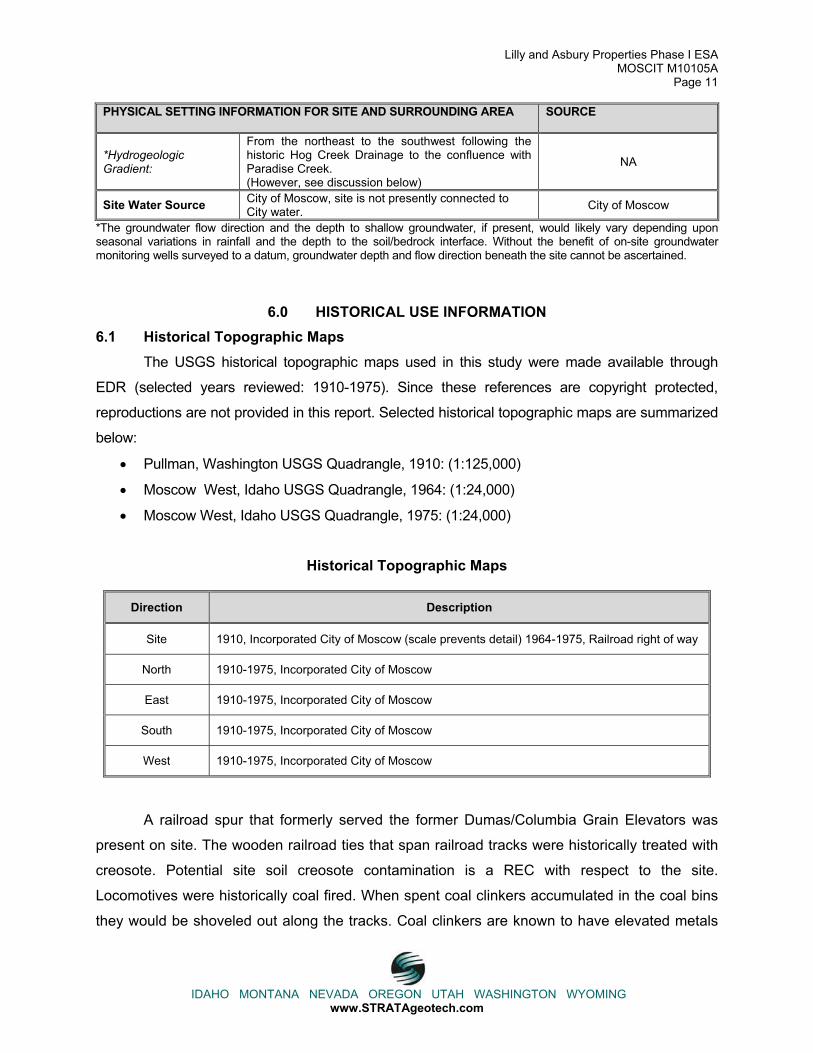
PHYSICAL SETTING INFORMATION FOR SITE AND SURROUNDING AREA SOURCE
*Hydrogeologic Gradient:
From the northeast to the southwest following the historic Hog Creek Drainage to the confluence with Paradise Creek. (However, see discussion below)
NA
Site Water Source City of Moscow, site is not presently connected to City water. City of Moscow
*The groundwater flow direction and the depth to shallow groundwater, if present, would likely vary depending upon seasonal variations in rainfall and the depth to the soil/bedrock interface. Without the benefit of on-site groundwater monitoring wells surveyed to a datum, groundwater depth and flow direction beneath the site cannot be ascertained.
6.0 HISTORICAL USE INFORMATION 6.1 Historical Topographic Maps The USGS historical topographic maps used in this study were made available through
EDR (selected years reviewed: 1910-1975). Since these references are copyright protected,
reproductions are not provided in this report. Selected historical topographic maps are summarized
below:
� Pullman, Washington USGS Quadrangle, 1910: (1:125,000)
� Moscow West, Idaho USGS Quadrangle, 1964: (1:24,000)
� Moscow West, Idaho USGS Quadrangle, 1975: (1:24,000)
Historical Topographic Maps
Direction Description
Site 1910, Incorporated City of Moscow (scale prevents detail) 1964-1975, Railroad right of way
North 1910-1975, Incorporated City of Moscow
East 1910-1975, Incorporated City of Moscow
South 1910-1975, Incorporated City of Moscow
West 1910-1975, Incorporated City of Moscow
A railroad spur that formerly served the former Dumas/Columbia Grain Elevators was
present on site. The wooden railroad ties that span railroad tracks were historically treated with
creosote. Potential site soil creosote contamination is a REC with respect to the site.
Locomotives were historically coal fired. When spent coal clinkers accumulated in the coal bins
they would be shoveled out along the tracks. Coal clinkers are known to have elevated metals

Lilly and Asbury Properties Phase I ESA MOSCIT M10105A
Page 12
IDAHO MONTANA NEVADA OREGON UTAH WASHINGTON WYOMING www.STRATAgeotech.com
concentrations. Potential metals soil contamination from the presence of coal clinkers along the
former railway is a REC with respect to the site. The railroad historically sprayed the railroad
right of ways with pesticides to manage weeds. The potential accumulation of pesticides in site
soil resulting from spilled treated grain or from pesticides applied to the alignment is a REC with
respect to the site. The potential creosote contamination (creosote constituents are SVOCs),
potential metals contamination and potential pesticide accumulation RECs are addressed in
Additional Services, Section 8 of this report.
6.2 Historical Aerial Photographs Selected historical aerial photographs were reviewed at approximate 15 to 20-year
intervals, if readily available, to identify RECs in connection with the site. A photograph’s quality
and scale may limit evaluation of these aerials. Copies of aerial photographs from 1960, 1971,
1982, 1990, 2000 and 2008 are included as Plates 2 through 7. Selected photographs are
summarized below:
Historical Aerial Photographs
Direction Description
Site 1960-2009, Railroad Right of way, 2010, Former railroad right of way
North 1960-Present, Residential
East 1960-Present, Asbury Street and Seed Warehouse
South 1960-Present, Residential 1960-Present
West Lilly Street and First Street, 1960-2000
The RECs associated with site railroad use are discussed previously in Section 6.1, Historic
Topographic Maps. The former Dumas/Columbia Grain Elevators formerly operated a UST. The
UST is discussed in Section 4.1 of this report. Seed operations such as Dumas/Columbia Grain
often treated seeds with pesticides. However, an interview with Mr. Bob Martson provided in
Section 6.8 of this report suggests that facility operations were not focused on seed treatment.
6.3 Historical City Directories A City Directory search was requested from EDR however, at the time this report was
produced STRATA had yet to receive the search results. If upon receipt the City Directory
search provides information that would contribute to identifying site RECs, STRATA will issue
an addendum to this report.
Lilly and Asbury Properties Phase I ESA MOSCIT M10105A
Page 13
IDAHO MONTANA NEVADA OREGON UTAH WASHINGTON WYOMING www.STRATAgeotech.com
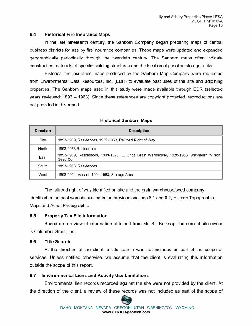
6.4 Historical Fire Insurance Maps In the late nineteenth century, the Sanborn Company began preparing maps of central
business districts for use by fire insurance companies. These maps were updated and expanded
geographically periodically through the twentieth century. The Sanborn maps often indicate
construction materials of specific building structures and the location of gasoline storage tanks.
Historical fire insurance maps produced by the Sanborn Map Company were requested
from Environmental Data Resources, Inc. (EDR) to evaluate past uses of the site and adjoining
properties. The Sanborn maps used in this study were made available through EDR (selected
years reviewed: 1893 – 1963). Since these references are copyright protected, reproductions are
not provided in this report.
Historical Sanborn Maps
Direction Description
Site 1893-1909, Residences, 1909-1963, Railroad Right of Way
North 1893-1963 Residences
East 1893-1909, Residences, 1909-1928, E. Grice Grain Warehouse, 1928-1963, Washburn Wilson Seed Co.
South 1893-1963, Residences
West 1893-1904, Vacant, 1904-1963, Storage Area
The railroad right of way identified on-site and the grain warehouse/seed company
identified to the east were discussed in the previous sections 6.1 and 6.2, Historic Topographic
Maps and Aerial Photographs.
6.5 Property Tax File Information Based on a review of information obtained from Mr. Bill Belknap, the current site owner
is Columbia Grain, Inc.
6.6 Title Search At the direction of the client, a title search was not included as part of the scope of
services. Unless notified otherwise, we assume that the client is evaluating this information
outside the scope of this report.
6.7 Environmental Liens and Activity Use Limitations Environmental lien records recorded against the site were not provided by the client. At
the direction of the client, a review of these records was not included as part of the scope of

Lilly and Asbury Properties Phase I ESA MOSCIT M10105A
Page 14
IDAHO MONTANA NEVADA OREGON UTAH WASHINGTON WYOMING www.STRATAgeotech.com
services and unless notified otherwise, we assume that the client is evaluating this information
outside the scope of this report.
6.8 Historical Interviews 6.8.1 Columbia Grain General Manager; Mr. Randy Olstad
STRATA interviewed Mr. Randy Olstad, the current Clarkston General Manager of
Columbia Grain, Inc for 1 year and previously the Pullman General Manager of Columbia Grain,
Inc. for 4 years. Mr. Olstad indicated that Columbia Grain, Inc. has owned the site since 1998.
He recalled the former railroad spur that occupied the site had been in place since they owned
the property. Mr. Olstad was unaware of previous site development or use. Mr. Olstad had no
knowledge of the historic storage or transfer of hazardous materials or petroleum products on-
site, or site activities that may have resulted in a release of hazardous materials or petroleum
product to the site. Mr. Randy Olstad was not aware of any pending, threatened or past
environmental litigation, proceedings or notices of possible violations of environmental laws or
liability in connection with the site.
6.8.2 Former Dumas Elevator Employee; Mr. Bob Martson
STRATA interviewed Mr. Bob Martson, an employee at the former Dumas elevators for
25 years. Mr. Martson recalled that the elevators handled commercial grain intended for use as
food. He indicated that the Dumas Seed elevator, which produced treated seed was located on
the south end of town on the Troy Highway (State Highway 8). Mr. Martson recalled that the
facility processed pearled wheat and barley for shipment to Korea and split peas. He indicated
that the peas were split with steam and that the steam was supplied at first by a coal fired boiler
which was later replaced by a natural gas fired boiler. Mr. Martson did recall a UST associated
with the elevator facility which supplied gasoline to a pump located on the eastern elevator
property adjacent to Almon Street. Mr. Martson indicated to his recollection the railroad spur
occupying the site was at first owned by Great Northern and subsequently Burlington Northern
Santa Fe prior to its acquisition by Palouse River Coulee City Railroad.
6.9 Prior Report Review Previous environmental reports for the site were not provided for review.
6.10 Site History Summary The following table summarizes past site uses based upon our review of historical
topographic maps, aerial photographs, historical City Directories, Sanborn fire insurance maps
and interviews.

Lilly and Asbury Properties Phase I ESA MOSCIT M10105A
Page 15
IDAHO MONTANA NEVADA OREGON UTAH WASHINGTON WYOMING www.STRATAgeotech.com
Site Use Summary
Approximate Dates Historic Site Use
1893-1909 Residential
1909-Present Railroad Right of Way
6.11 Significant Data Gaps ASTM 1527-05 requires that the site history be researched back to 1940 or the site’s first
developed use. STRATA was able to identify site use extending back to 1893 when the site was
developed with a residence however, when the site was first developed for residential use or
previous site use was not determined. Site use prior to 1893 is unlikely to alter this report’s
findings and conclusions.
7.0 SITE RECONNAISSANCE 7.1 General Site Information Information contained in this section is based on a visual reconnaissance conducted while
walking through the site and the accessible interior areas of structures, if any, located on the site. A
summary of information obtained from interviews and other references presented in the following
subsections is also provided. Plate 2 depicts the site and surrounding properties a 2008 aerial
photograph. Photographic documentation of the site at the time of the visual reconnaissance is
provided as Plates 9 to 11.
Lilly and Asbury Properties Phase I ESA MOSCIT M10105A
Page 16
IDAHO MONTANA NEVADA OREGON UTAH WASHINGTON WYOMING www.STRATAgeotech.com
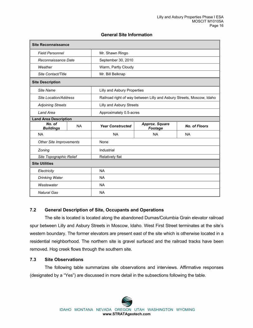
General Site Information
Site Reconnaissance
Field Personnel Mr. Shawn Ringo
Reconnaissance Date September 30, 2010
Weather Warm, Partly Cloudy
Site Contact/Title Mr. Bill Belknap
Site Description
Site Name Lilly and Asbury Properties
Site Location/Address Railroad right of way between Lilly and Asbury Streets, Moscow, Idaho
Adjoining Streets Lilly and Asbury Streets
Land Area Approximately 0.5-acres
Land Area Description No. of
Buildings NA Year Constructed Approx. Square Footage No. of Floors
NA NA NA NA
Other Site Improvements None
Zoning Industrial
Site Topographic Relief Relatively flat
Site Utilities
Electricity NA
Drinking Water NA
Wastewater NA
Natural Gas NA
7.2 General Description of Site, Occupants and Operations The site is located is located along the abandoned Dumas/Columbia Grain elevator railroad
spur between Lilly and Asbury Streets in Moscow, Idaho. West First Street terminates at the site’s
western boundary. The former elevators are present east of the site which is otherwise located in a
residential neighborhood. The northern site is gravel surfaced and the railroad tracks have been
removed. Hog creek flows through the southern site.
7.3 Site Observations The following table summarizes site observations and interviews. Affirmative responses
(designated by a “Yes”) are discussed in more detail in the subsections following the table.

Lilly and Asbury Properties Phase I ESA MOSCIT M10105A
Page 17
IDAHO MONTANA NEVADA OREGON UTAH WASHINGTON WYOMING www.STRATAgeotech.com
Site Characteristics
Category Item or Feature Item or Feature Observed
Site Operations, Processes, and
Equipment
Emergency generators No Elevators No Air compressors NoHydraulic lifts No Photo Processing No Laboratory Hoods and/or incinerators No Waste treatment systems and/or water treatment systems No Heating and/or Cooling Systems No Generators No
Aboveground Chemical or Waste
Storage
Evidence of aboveground storage tanks No Drums, barrels and/or containers � 5 gallons No Cleaning and/or similar supplies No MSDS No
Underground Chemical or Waste
Storage, Drainage or Collection Systems
Evidence of underground storage tanks or ancillary UST equipment
No
Sumps, cisterns, catch basins and/or dry wells No Grease traps No Septic tanks and/or leach fields No Oil/water separators No Pipeline markers No Interior floor drains No
ElectricalTransformers/ PCBs
Pad or pole mounted transformers and/or capacitors Yes
Evidence of Releases or Potential Releases
Stressed vegetation No Stained soil No Stained pavement or similar surface No Trash, debris and/or other waste materials YesDumping or disposal areas No Construction/demolition debris and/or dumped fill dirt No Surface water discoloration, odor, sheen, and/or free floating product
No
Strong, pungent or noxious odors No
Exterior pipe discharges and/or other effluent discharges No
Other Notable Site Features
Surface water bodies No Quarries or pits No Wells No
Those entries above designated by a “Yes” indicate that the Item or Feature was observed
during the site visit. If a “No” designation appears above, then the Item or Feature was not
observed on the date of the site visit.
7.3.1 Electrical Transformers/PCBs
Pad or Pole Mounted Transformers
Two pole mounted transformers were observed adjacent to the site in the alley that splits
the two parcels. PCB labeling was not visible from the ground but staining or leaking was not

Lilly and Asbury Properties Phase I ESA MOSCIT M10105A
Page 18
IDAHO MONTANA NEVADA OREGON UTAH WASHINGTON WYOMING www.STRATAgeotech.com
observed. The pole mounted transformers do not appear to represent a REC with respect to the
site.
7.3.2 Evidence of Releases or Potential Releases
Trash, Debris and/or Other Waste Materials
Trash was observed in the upper foot of surface fill material while collecting site surface
soil samples for laboratory analysis. Site sampling will be discussed more thoroughly in the
Additional Services Section of this report. The trash and debris observed are unlikely to
contribute RECs to the site, but are poor fill materials and may require removal and
replacement.
7.4 Interviews with Present Owners and Occupants The following individuals were interviewed regarding the presence or absence of the items
or features listed in the table above. Unless otherwise noted herein, the interviewee was not aware
of the listed features (identified in the Site Characteristics Table) at the site.
Interviewees
Interviewee Title
Mr. Randy Olstad Clarkston General Manager
Mr. Bob Martson Former Elevator Employee
Information obtained from the above-listed interviewees is discussed in Sections 6.8.
8.0 ADDITIONAL SERVICES Site surface soil sampling was performed to evaluate the potential creosote contamination
(creosote constituents are SVOCs), potential metals contamination, and potential pesticide
accumulation RECs. STRATA collected 3 surface soil composite samples each comprising 10
sample aliquots from the former railroad spur alignment. One western parcel composite sample
and 2 eastern parcel composite samples were collected for analysis. Sample aliquots locations
were evenly spaced along the former rail alignment on the western parcel and along the
convergence of 2 tracks on the eastern parcel. Site aliquot sample locations are provided on Plate
8. Photographic documentation of site sampling is provided on Plates 9 and 11. A pick and shovel
were used to remove the upper foot of fill material to reach the approximate depth of the railroad
track bed. Fill material consisted of ¾ inch minus gravel with silt and fragments of railroad tie were
observed in the excavations. Silt with some rounded 1 inch minus gravel fill material was observed
approximately one foot beneath the existing ground surface.
Lilly and Asbury Properties Phase I ESA MOSCIT M10105A
Page 19
IDAHO MONTANA NEVADA OREGON UTAH WASHINGTON WYOMING www.STRATAgeotech.com
Upon exposing site soil one foot below the existing gravel surface, a stainless steel spoon
was utilized to collect 10 approximately equally portioned sample aliquots for a western rail
alignment composite sample and northern and southern composite samples along the eastern rail
alignment. Sample aliquots were placed in a stainless steel bowl and mixed prior to collection in
laboratory prepared glassware provided by Anatek Labs in Moscow, Idaho. The stainless steel
spoon and bowl were decontaminated using an alconox detergent wash and potable water rinse
between composite samples. Upon collection, composite samples were labeled with the sample
location, date and time and the sample jars were placed on ice in a cooler. Composite samples
were transported by STRATA personnel to Anatek Labs along with a chain of custody form.
Composite samples were analyzed for Resource Conservation Recovery Act (RCRA) – 8
metals (arsenic, barium, cadmium, chromium, lead, mercury, selenium and silver) by EPA method
200.8/6020, for pesticides by EPA method 8270 modified and for semi-volatile organic compounds
(SVOCs) by EPA method 8270. Analytical data sheets are available in Appendix C.
Composite samples’ metals, pesticides and SVOC concentrations were compared to DEQ
Initial Default Target Levels (IDTLs). DEQ calculated the IDTLs by examining the inhalation, dermal
contact and ingestion routes of exposure for soil vapor, surficial soil, subsurface soil and
groundwater for both residential and non-residential land uses as well as evaluating whether the
surface water and groundwater are predicted to meet quality standards. The IDTLs assume
conservative default fate transport model input parameters for each chemical in the scenarios listed
in the tables above. They are intended to be protective of human health and the environment, and
to be used as a screening tool to help determine when additional investigation is warranted. The
following table summarizes the soil analytical test results exceeding IDTLs. The IDTL and critical
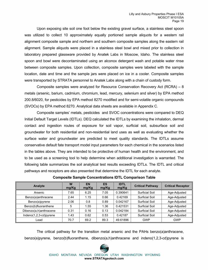
pathways and receptors are also presented that determine the IDTL for each analyte.
Composite Sample Concentrations IDTL Comparison Table
Analyte Wmg/Kg
ENmg/Kg
ESmg/Kg
IDTLmg/Kg Critical Pathway Critical Receptor
Arsenic 7.65 6.25 7.05 0.390641 Surficial Soil Age-Adjusted Benzo(a)anthracene 2.44 1.15 0.66 0.42169 Surficial Soil Age-Adjusted
Benzo(a)pyrene 2.06 0.8 0.89 0.042167 Surficial Soil Age-Adjusted Benzo(b)fluoranthene 5 1.55 1.36 0.421531 Surficial Soil Age-Adjusted
Dibenzo(a,h)anthracene 0.31 0.16 0.13 0.042184 Surficial Soil Age-Adjusted Indeno(1,2,3-cd)pyrene 1.43 0.62 0.53 0.42187 Surficial Soil Age-Adjusted
Lead 70.7 69.2 89.3 49.61896 GWP GWP
The critical pathway for the transition metal arsenic and the PAHs benzo(a)anthracene,
benzo(a)pyrene, benzo(b)fluoranthene, dibenzo(a,h)anthracene and indeno(1,2,3-cd)pyrene is

Lilly and Asbury Properties Phase I ESA MOSCIT M10105A
Page 20
IDAHO MONTANA NEVADA OREGON UTAH WASHINGTON WYOMING www.STRATAgeotech.com
exposure to surface soil and the critical receptor is an age adjusted adult. An age adjusted adult is
a composite receptor exposed as a child, adolescent and as an adult. The critical pathway for lead
is the soil leaching to groundwater pathway and the critical receptor is an individual ingesting
groundwater. For comparison the EPA Region 9 soil screening level for lead in surface soil is 400
mg/Kg.
Site soil arsenic, benzo(a)anthracene, benzo(b)fluoranthene, dibenzo(a,h)anthracene,
indeno(1,2,3-cd)pyrene, and lead concentrations also exceed calculated concentrations
protective of a theoretical on-site drinking water well using DEQ’s RE-1 Risk Evaluation
spreadsheet and default fate-transport parameters. The RE-1 evaluation predicted that the site
soil analyte concentrations exceeding IDTLs would be protective of the City well located on the
corner of A and Jackson Streets. Site soil analyte concentrations exceeding IDTLs are also
predicted to be protective of and a well mapped on the Idaho Department of Water Resources
interactive map viewer (http://maps.idwr.idaho.gov/mapall2/viewer.htm) located to the
southwest, 1,000 feet away from the site.
Site soil benzo(a)anthracene, benzo(a)anthracene, benzo(b)fluoranthene and lead
concentrations also exceed DEQ RE-1 predicted concentrations protective of Hog Creek.
9.0 FINDINGS The site reconnaissance was performed on September 30, 2010 by Mr. Shawn Ringo with
STRATA. The site is occupied by the railroad right of way between Lilly and Asbury Streets in
Moscow, Latah County, Idaho. A cursory summary of findings is provided below. However, details
were not included or fully developed in this section, and the report must be read in its entirety for a
comprehensive understanding of the items contained herein.
� The site is located is located along the abandoned Dumas/Columbia Grain elevator railroad spur between Lilly and Asbury Streets in Moscow, Idaho. West First Street terminates at the site’s western boundary. The former grain elevators are present east of the site which is otherwise located in a residential neighborhood. The northern site is gravel surfaced and the railroad tracks have been removed. Hog creek flows through the southern site.
� The site was occupied by a railroad right of way servicing the eastern grain elevators from 1909 to 2009. From 1893 to 1909, the site was occupied by residences. When the site was first developed for residential use or previous site use was not determined and this is considered a data gap. However, site use prior to 1893 is unlikely to alter this report’s findings and conclusions.
� A UST was located at the former Dumas/Columbia Grain elevators approximately 300 feet up gradient from the site along the hog creek drainage. Petroleum impacts were reportedly observed when the UST was removed from the ground, but samples were not collected and remediation was not performed. Potential petroleum groundwater contamination from the release at the Dumas grain elevators property is a REC. Other sites listed in regulatory
Lilly and Asbury Properties Phase I ESA MOSCIT M10105A
Page 21
IDAHO MONTANA NEVADA OREGON UTAH WASHINGTON WYOMING www.STRATAgeotech.com
databases within the search radii do not appear to be RECs with respect to the site based upon hydrogeologic relationship with respect to the site or regulatory status.
� STRATA collected three composite soil samples to perform initial evaluation of potential site impacts from creasoted railroad ties, coal clinkers, and presticide application. Metals and PAHs were detected above laboratory practical quantitation limits and pesticides were not detected.
o Surficial soil arsenic, benzo(a)anthracene, benzo(a)pyrene, benzo(b)fluoranthene, dibenzo(a,h)anthracene and indeno(1,2,3-cd)pyrene concentrations exceeded DEQ IDTLs for the direct contact pathway for residential age adjusted adults.
o Site soil arsenic, benzo(a)anthracene, benzo(b)fluoranthene, dibenzo(a,h)anthracene, indeno(1,2,3-cd)pyrene and lead concentrations exceed DEQ RE-1 predicted concentrations protective of a theoretical on-site drinking water well.
o Site soil benzo(a)anthracene, benzo(a)anthracene, benzo(b)fluoranthene and lead concentrations exceed DEQ RE-1 predicted concentrations protective of Hog Creek.
10.0 CONCLUSIONS We have performed this Phase I ESA in general accordance with the scope and
limitations of ASTM Practice E1527-05 for the Lilly and Asbury properties site located at the
Railroad ROW between Lilly and Asbury Streets, Moscow, Idaho. Any exceptions to or deletions
from this practice are described in Section 1.4 and any significant data gaps are described in
Sections 6.11 and 9.0 of this report. This assessment has revealed no evidence of RECs in
connection with the site except for the following:
� Potential petroleum groundwater contamination from the UST previously at the former Dumas/Columbia Grain elevators property approximately 300 feet up gradient from the site along the Hog Creek drainage is a REC. However, based upon STRATA’s experience assessing petroleum sites located within the Paradise Creek drainage, a similar depositional environment, a prolonged, chronic petroleum release would likely have been necessary to result in site petroleum impacts.
� Soil and potential groundwater contamination from creosoted railroad ties, coal clinkers, and pesticide application is an REC. This is confirmed by soil analytical test results.
11.0 RECOMMENDATIONS STRATA recommends groundwater sampling and a site-specific risk evaluation be
performed. We understand that the installing monitoring wells on-site is prohibited in the purchase
agreement with Columbia Grain. If possible and in compliance with the purchase agreement,
STRATA recommends installing temporary/one time use groundwater sampling points to further
evaluate site arsenic, benzo(a)anthracene, benzo(b)fluoranthene, dibenzo(a,h)anthracene,
indeno(1,2,3-cd)pyrene and lead groundwater concentrations. This would facilitate a better
understanding of actual site groundwater and potential Hog Creek impacts rather than those
Lilly and Asbury Properties Phase I ESA MOSCIT M10105A
Page 22
IDAHO MONTANA NEVADA OREGON UTAH WASHINGTON WYOMING www.STRATAgeotech.com
conservatively predicted by the model. The same sampling points could also be utilized to evaluate
potential site impacts associated with the up gradient Dumas/Columbia Grain UST.
STRATA further recommends an evaluation of potential remedial alternatives be performed.
We understand that upon purchasing the property the City is considering constructing a City park.
Depending upon park grading requirements limited surface soil removal and site capping with
clean imported fill material can reduce future exposure to contaminated surface soils, thereby
removing one exposure pathway. Specific recommendations should be developed after collection
of groundwater data, additional risk evaluation, consultation with DEQ, and review/discussion of
future site development plans. Alternatives may also include deed/ activity and use restrictions for
the site.
During park construction there may be some bank enhancement/naturalization for Hog
Creek. STRATA recommends developing a construction stormwater pollution prevention plan for
park construction and bank modification to protect Hog Creek from sediment and site
environmental contaminants.
12.0 QUALIFICATION(S) OF ENVIRONMENTAL PROFESSIONAL(S) STRATA declares that, to the best of our professional knowledge and belief, we meet
the definition of an Environmental Professional as defined in §312.10 of 40 CFR 312. We have
the specific qualifications based on education, training and experience to assess a site of the
nature, history and setting of the subject site. We have developed and performed all the
appropriate inquiries in conformance with the standards and practices set forth in 40 CFR Part
312.
Supporting documentation and the qualifications of the environmental professional and
personnel conducting the site reconnaissance and interviews are provided in Appendix D.
The following plates and appendices accompany and complete this report:
Plate 1: USGS Topographic Map Plate 2: Site Diagram and 2008 Aerial Photograph Plates 3 to 7: Aerial Photographs Plate 8: Composite Sample Locations Plates 9 to 11: Photographic Documentation Appendix A: Acronyms Appendix B: Regulatory Database Information Appendix C: Laboratory Analytical Results Appendix D: SOQ

Lilly and Asbury Properties Phase I ESA MOSCIT M10105A
Page 23
IDAHO MONTANA NEVADA OREGON UTAH WASHINGTON WYOMING www.STRATAgeotech.com
REFERENCES
ASTM International. “ASTM Standards on Environmental Site Assessments for Commercial Real Estate, Fifth Edition” ASTM E 1527-05 and ASTM E 1528-05, ©2006.
Bedrock Geologic Map of the Moscow East Quadrangle John H. Bush et al 2000.
Belknap, Bill, City of Moscow Planning and Development, personal communication, October 13, 2010.
City of Moscow website http://www.moscow.id.us/pub_works/water. Accessed August 25, 2010.
Environmental Data Resources, Inc. (EDR), The EDR Radius Map Report, Moscow and Rayann Apartments, 315 and 404 South Grant Street Moscow, Idaho, Inquiry No. 2880000.2s. September 27, 2010.
Environmental Protection Agency. “Federal Register, Part III Standards and Practices for All Appropriate Inquiries; Final Rule” 40 CFR Part 312, ©November 1, 2005.
Phase I Environmental Site Assessment Report, 109 N Almon Street Moscow, ID 83843. TerraGraphics Environmental Engineering, June, 2007.
Soil Survey of Latah County Area, Idaho United States Department of Agriculture Soil Conservation Service, 1979.
United States Geologic Survey (USGS), 1975, 7½-Minute Series (Topographic) Quadrangle
Map, Moscow East, Idaho, 1:24,000
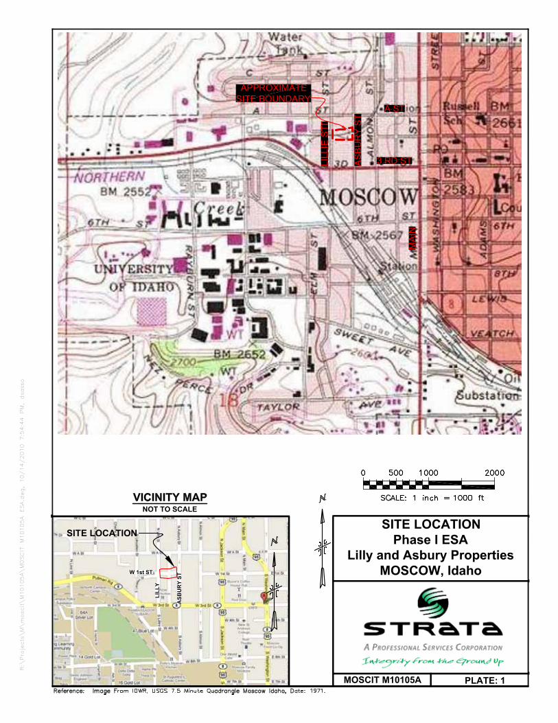
SITE LOCATIONPhase I ESA
Lilly and Asbury PropertiesMOSCOW, Idaho
NOT TO SCALE
SITE LOCATION
PLATE: 1MOSCIT M10105A
LILL
Y
APPROXIMATESITE BOUNDARY
MAI
N
3 RD ST
A ST
LILL
IE S
TLI
LLIE
ST
ASB
UR
Y ST
ASB
UR
Y ST
W 1st ST
R:\Projects\M\moscit\M10105A\MOSCIT M10105A ESA.dwg, 10/14/2010 7:54:44 PM, dsasso
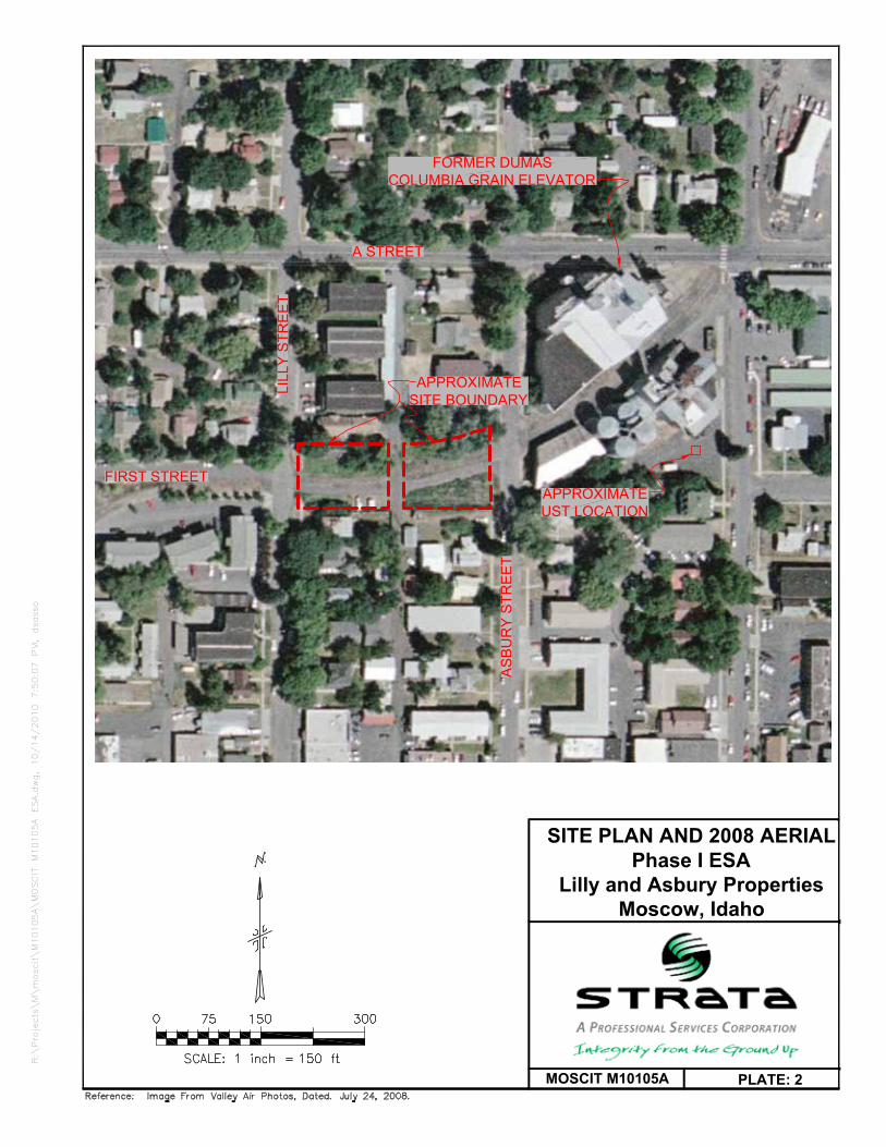
PLATE: 2MOSCIT M10105A
SITE PLAN AND 2008 AERIALPhase I ESA
Lilly and Asbury PropertiesMoscow, Idaho
FORMER DUMASCOLUMBIA GRAIN ELEVATOR
AS
BU
RY
STR
EE
T
A STREET
APPROXIMATESITE BOUNDARY
FIRST STREET
LILL
Y S
TRE
ET
APPROXIMATEUST LOCATION
R:\Projects\M\moscit\M10105A\MOSCIT M10105A ESA.dwg, 10/14/2010 7:50:07 PM, dsasso

PLATE: 3MOSCIT M10105A
2000 AERIALPhase I ESA
Lilly and Asbury PropertiesMoscow, Idaho
AS
BU
RY
STR
EE
T
A STREET
APPROXIMATESITE BOUNDARY
FIRST STREET
LILL
YS
TRE
ET
R:\Projects\M\moscit\M10105A\MOSCIT M10105A ESA.dwg, 10/14/2010 7:50:24 PM, dsasso

PLATE: 4MOSCIT M10105A
1990 AERIALPhase I ESA
Lilly and Asbury PropertiesMoscow, Idaho
AS
BU
RY
STR
EE
T
A STREET
APPROXIMATESITE BOUNDARY
FIRST STREET
LILL
YS
TRE
ET
R:\Projects\M\moscit\M10105A\MOSCIT M10105A ESA.dwg, 10/14/2010 7:50:30 PM, dsasso

PLATE: 5MOSCIT M10105A
1982 AERIALPhase I ESA
Lilly and Asbury PropertiesMoscow, Idaho
AS
BU
RY
STR
EE
T
A STREET
APPROXIMATESITE BOUNDARY
FIRST STREET
LILL
YS
TRE
ET
R:\Projects\M\moscit\M10105A\MOSCIT M10105A ESA.dwg, 10/14/2010 7:50:32 PM, dsasso

PLATE: 6MOSCIT M10105A
1971 AERIALPhase I ESA
Lilly and Asbury PropertiesMoscow, Idaho
AS
BU
RY
STR
EE
T
A STREET
APPROXIMATESITE BOUNDARY
FIRST STREET
LILL
YS
TRE
ET
R:\Projects\M\moscit\M10105A\MOSCIT M10105A ESA.dwg, 10/14/2010 7:50:33 PM, dsasso

PLATE: 7MOSCIT M10105A
1960 AERIALPhase I ESA
Lilly and Asbury PropertiesMoscow, Idaho
AS
BU
RY
STR
EE
T
A STREET
APPROXIMATESITE BOUNDARY
FIRST STREET
LILL
YS
TRE
ET
R:\Projects\M\moscit\M10105A\MOSCIT M10105A ESA.dwg, 10/14/2010 7:50:39 PM, dsasso

PLATE: 8MOSCIT M10105A
COMPOSITE SAMPLELOCATIONSPhase I ESA
Lilly and Asbury PropertiesMoscow, Idaho
AS
BU
RY
STR
EE
T
A STREET
APPROXIMATESITE BOUNDARY
FIRST STREET
LILL
Y S
TRE
ET
EASTERN NORTHCOMPOSITE
SAMPLE LOCATION
EASTERN SOUTHCOMPOSITE
SAMPLE LOCATIONWESTERN
COMPOSITESAMPLE LOCATION
R:\Projects\M\moscit\M10105A\MOSCIT M10105A ESA.dwg, 10/14/2010 7:50:42 PM, dsasso

Lilly and Asbury Properties Phase I ESA Photographic Documentation
MOSCIT M10105A Plate 9
Photo 1 – Elevators east of site and former rail alignment in Asbury Street.
Photo 2 – Elevators east of site.
Photo 3 – Hog Creek on south site. Photo 4 – Hog Creek culvert.

Lilly and Asbury Properties Phase I ESA Photographic Documentation
MOSCIT M10105A Plate 10
Photo 5 – Cat tails in Hog Creek. Photo 6 – Elevators east of site.
Photo 7 – Western composite sample aliquot location.
Photo 8 – Composite sample aliquot location with railroad tie debris.

Lilly and Asbury Properties Phase I ESA Photographic Documentation
MOSCIT M10105A Plate 11
Photo 9 – Western composite sample aliquot locations.
Photo 10 – Eastern north and south rail alignment composite sample locations.
North
North

Appendix A:
Acronyms

Description of Selected General Terms and Acronyms Term/Acronym Description
ACM
Asbestos Containing Material. Asbestos is a naturally occurring mineral, three varieties of which (chrysotile, amosite, crocidolite) have been commonly used as fireproofing or binding agents in construction materials. Exposure to asbestos, as well as ACM, has been documented to cause lung diseases including asbestosis (scarring of the lung), lung cancer and mesothelioma (a cancer of the lung lining). Regulatory agencies have generally defined ACM as a material containing greater that one (1) percent asbestos, however some states (e.g. California) define ACM as materials having 0.1% asbestos. In order to define a homogenous material as non-ACM, a minimum number of samples must be collected from the material dependent upon its type and quantity. Homogenous materials defined as non-ACM must either have 1) no asbestos identified in all of its samples or 2) an identified asbestos concentration below the appropriate regulatory threshold. Asbestos concentrations are generally determined using polarized light microscopy or transmission electron microscopy. Point counting is an analytical method to statistically quantify the percentage of asbestos in a sample. The asbestos component of ACM may either be friable or non-friable. Friable materials, when dry, can be crumbled, pulverized, or reduced to powder by hand pressure and have a higher potential for a fiber release than non-friable ACM. Non-friable ACM are materials that are firmly bound in a matrix by plastic, cement, etc. and, if handled carefully, will not become friable. Federal and state regulations require that either all suspect building materials be presumed ACM or that an asbestos survey be performed prior to renovation, dismantling, demolition, or other activities that may disturb potential ACM. Notifications are required prior to demolition and/or renovation activities that may impact the condition of ACM in a building. ACM removal may be required if the ACM becomes damaged or is likely to be disturbed or damaged during demolition or renovation. Abatement of friable or potentially friable ACM must be performed by a licensed abatement contractor in accordance with state rules and NESHAP. Additionally, OSHA regulations for work classification, worker training and worker protection will apply.
AHERA Asbestos Hazard Emergency Response Act
AST Above Ground Storage Tanks. ASTs are generally described as storage tanks less than 10% of which are below ground (i.e., buried). Tanks located in a basement, but not buried, are also considered ASTs. Whether, and the extent to which, an AST is regulated, is determined on a case-by-case basis and depends upon tank size, its contents and the jurisdiction of its location.
BGS Below Ground Surface BTEX Benzene, Toluene, Ethylbenzene, and Xylenes. BTEX are VOC components found in gasoline and commonly used as analytical indicators of a petroleum hydrocarbon release.
CERCLA Comprehensive Environmental Response, Compensation and Liability Act (a.k.a. Superfund). CERCLA is the federal act that regulates abandoned or uncontrolled hazardous waste sites. Under this Act, joint and several liability may be imposed on potentially responsible parties for cleanup-related costs.
CERCLIS Comprehensive Environmental Response, Compensation and Liability Information System. An EPA compilation of sites having suspected or actual releases of hazardous substances to the environment. CERCLIS also contains information on site inspections, preliminary assessments and remediation of hazardous waste sites. These sites are typically reported to EPA by states and municipalities or by third parties pursuant to CERCLA Section 103.
CFR Code of Federal Regulations DOT U.S. Department of Transportation EPA U.S. Environmental Protection Agency
ERNS Emergency Response Notification System. An EPA-maintained federal database which stores information on notifications of oil discharges and hazardous substance releases in quantities greater than the applicable reportable quantity under CERCLA. ERNS is a cooperative data-sharing effort between EPA, DOT, and the National Response Center.
ESA Environmental Site Assessment FRP Fiberglass Reinforced Plastic
Hazardous Substance
As defined under CERCLA, this is (A) any substance designated pursuant to section 1321(b)(2)(A) of Title 33, (B) any element, compound, mixture, solution, or substance designated pursuant to section 9602 of this title; (C) any hazardous waste having characteristics identified under or listed pursuant to section 3001 of the Solid Waste Disposal Act (with some exclusions); (D) any toxic pollutant listed under section 1317(a) of Title 33; (E) any hazardous air pollutant listed under section 112 of the Clear Air Act; and (F) any imminently hazardous chemical substance or mixture with respect to which the EPA Administrator has taken action under section 2606 of Title 15. This term does not include petroleum, including crude oil or any fraction thereof which is not otherwise listed as a hazardous substance under subparagraphs (A) through (F) above, and the term does not include natural gas, or synthetic gas usable for fuel (or mixtures of natural gas and such synthetic gas).

Term/Acronym Description
Hazardous Waste
This is defined as having characteristics identified or listed under section 3001 of the Solid Waste Disposal Act (with some exceptions). RCRA, as amended by the Solid Waste Disposal Act of 1980, defines this term as a “solid waste, or combination of solid wastes, which because of its quantity, concentration, or physical, chemical, or infectious characteristics may (A) cause, or significantly contribute to an increase in mortality or an increase in serious irreversible, or incapacitating reversible illness; or (B) pose a substantial present or potential hazard to human health or the environment when improperly treated, stored, transported, or disposed of, or otherwise managed.”
HREC
Historical Recognized Environmental Condition. Environmental condition which in the past would have been considered a recognized environmental condition (REC), but which may or may not be considered a REC currently. The final decision rests with the environmental professional and will be influenced by the current impact of the HREC on the property. If a past release of any hazardous substances or petroleum products has occurred in connection with the property and has been remediated, with such remediation accepted by the responsible regulatory agency (for example, as evidence by the issuance of a no further action letter or equivalent), this condition shall be considered an historical recognized environmental condition.
LUST Leaking Underground Storage Tank. This is a federal term set forth under RCRA for leaking USTs. Some states also utilize this term.
MCL Maximum Contaminant Level. This Safe Drinking Water concept (and also used by many states as a groundwater cleanup criteria) refers to the limit on drinking water contamination that determines whether a supplier can deliver water from a specific source without treatment.
MSDS Material Safety Data Sheets. Written/printed forms prepared by chemical manufacturers, importers and employers that identify the physical and chemical traits of hazardous chemicals under OSHA’s Hazard Communication Standard.
NESHAP National Emissions Standard for Hazardous Air Pollutants (Federal Clean Air Act). This part of the Clean Air Act regulates emissions of hazardous air pollutants. NFRAP Facilities where there is “No Further Remedial Action Planned,” as more particularly described under the Records Review section of this report.
NOV Notice of Violation. A notice of violation or similar citation issued to an entity, company or individual by a state or federal regulatory body indicating a violation of applicable rule or regulations has been identified.
NPDES National Pollutant Discharge Elimination System (Clean Water Act). The federal permit system for discharges of polluted water. NPL National Priorities List, as more particularly described under the Records Review section of this report. OSHA Occupational Safety and Health Administration or Occupational Safety and Health Act
PACM Presumed Asbestos-Containing Material. A material that is suspected of containing or presumed to contain asbestos but which has not been analyzed to confirm the presence or absence of asbestos.
PCB
Polychlorinated Biphenyl. A halogenated organic compound commonly in the form of a viscous liquid or resin, a flowing yellow oil, or a waxy solid. This compound was historically used as dielectric fluid in electrical equipment (such as electrical transformers and capacitors, electrical ballasts, hydraulic and heat transfer fluids), and for numerous heat and fire sensitive applications. PCB was preferred due to its durability, stability (even at high temperatures), good chemical resistance, low volatility, flammability, and conductivity. PCBs, however, do not break down in the environment and are classified by the EPA as a suspected carcinogen. 1978 regulations, under the Toxic Substances Control Act, prohibit manufacturing of PCB-containing equipment; however, some of this equipment may still be in use today.
pCi/l picoCuries per Liter of Air. Unit of measurement for Radon and similar radioactive materials. PLM Polarized Light Microscopy (see ACM section of the report, if included in the scope of services) PST Petroleum Storage Tank. An AST or UST that contains a petroleum product.
Radon
A radioactive gas resulting from radioactive decay of naturally-occurring radioactive materials in rocks and soils containing uranium, granite, shale, phosphate, and pitchblende. Radon concentrations are measured in picoCuries per liter of air. Exposure to elevated levels of radon creates a risk of lung cancer; this risk generally increases as the level of radon and the duration of exposure increases. Outdoors, radon is diluted to such low concentrations that it usually does not present a health concern. However, radon can accumulate in building basements or similar enclosed spaces to levels that can pose a risk to human health. Indoor radon concentrations depend primarily upon the building's construction, design and the concentration of radon in the underlying soil and groundwater. The EPA recommended annual average indoor “action level” concentration for residential structures is 4.0 pCi/l.
RCRA Resource Conservation and Recovery Act. Federal act regulating solid and hazardous wastes from point of generation to time of disposal (‘cradle to grave”). 42 U.S.C. 6901 et seq.
RCRA Generators The RCRA generators list is part of the RCRIS database maintained by EPA and lists facilities that generate hazardous waste as part of their normal business operations, as more particularly defined under Section 5.0 of this report.

Term/Acronym Description RCRA CORRACTS/TSDs
The USEPA maintains a database of RCRA facilities associated with treatment, storage, and disposal (TSD) of hazardous materials, which are undergoing “corrective action”. A “corrective action” order is issued when there is a release of hazardous waste or constituents into the environment from a RCRA facility.
RCRA Non-CORRACTS/TSDs
The RCRA Non-CORRACTS/TSD Database is a compilation by the USEPA of facilities that report storage, transportation, treatment, or disposal of hazardous waste. Unlike the RCRA CORRACTS/TSD database, the RCRA Non-CORRACTS/TSD database does not include RCRA facilities where corrective action is required.
RCRA Violators List
RAATS. RCRA Administrative Actions Taken. RAATS information is now contained in the RCRIS database and includes records of administrative enforcement actions against facilities for noncompliance.
RCRIS Resource Conservation and Recovery Information System, as defined in the Records Review section of this report.
REC
Recognized Environmental Condition is defined by ASTM E 1527-00 as “the presence or likely presence of any hazardous substances or petroleum products on a property under conditions that indicate an existing release, a past release, or a material threat of release of any hazardous substances or petroleum products into structures on the property or into the ground, groundwater, or surface water of the property. The term includes hazardous substances or petroleum products even under conditions of compliance with laws. The term is not intended to include de minimis conditions that generally do not present a material risk of harm to the public health or the environment and that generally would not be the subject of an enforcement action if brought to the attention of appropriate governmental agencies.
SPCC Spill Prevention, Control and Countermeasures. SPCC plans are required under federal law (Clean Water Act and Oil Pollution Act) for any facility storing petroleum in tanks and/or containers of 55-gallons or more that when taken in aggregate exceed 1,320 gallons. SPCC plans are also required for facilities with underground petroleum storage tanks with capacities of over 42,000 gallons. Many states have similar spill prevention programs, which may have additional requirements.
SWF Solid Waste Facility List. A Vista Information Solutions, Inc. database of solid waste facilities listed by state. TPH Total Petroleum Hydrocarbons
TRI Toxic Release Inventory. Routine EPA report on releases of toxic chemicals to the environment based upon information submitted by entities subject to reporting under the Emergency Planning and Community Right to Know Act.
TSCA Toxic Substances Control Act. A federal law regulating manufacture, import, processing and distribution of chemical substances not specifically regulated by other federal laws (such as asbestos, PCBs, lead-based paint and radon). 15 U.S.C 2601 et seq.
USACE United States Army Corps of Engineers USC United States Code USGS United States Geological Survey USNRCS United States Department of Agriculture-Natural Resource Conservation Service
UST Underground Storage Tank. Most federal and state regulations, as well as ASTM E1527, define this as any tank, including, underground piping connected to the tank, that is or has been used to contain hazardous substances or petroleum products and the volume of which is 10% or more beneath the surface of the ground (i.e., buried).
VCP Voluntary Cleanup Program VOC Volatile Organic Compound
Wetlands
Areas that are typically saturated with surface or groundwater that create an environment supportive of wetland vegetation (i.e., swamps, marshes, bogs). The Corps of Engineers Wetlands Delineation Manual (Technical Report Y-87-1) defines wetlands as areas inundated or saturated by surface or groundwater at a frequency and duration sufficient to support, and that under normal circumstances do support, a prevalence of vegetation typically adapted for life in saturated soil conditions. For an area to be considered a jurisdictional wetland, it must meet the following criteria: more than 50 percent of the dominant plant species must be categorized as Obligate, Facultative Wetland, or Facultative on lists of plant species that occur in wetlands; the soil must be hydric; and, wetland hydrology must be present. The federal Clean Water Act which regulates “waters of the US,” also regulates wetlands, a program jointly administered by the USACE and the EPA. Waters of the U.S. are defined as: (1) waters used in interstate or foreign commerce, including all waters subject to the ebb and flow of tides; (2) all interstate waters including interstate wetlands; (3) all other waters such as intrastate lakes, rivers, streams (including intermittent streams), mudflats, sandflats, wetlands, sloughs, prairie potholes, wet meadows, playa lakes, or natural ponds, etc., which the use, degradation, or destruction could affect interstate/ foreign commerce; (4) all impoundments of waters otherwise defined as waters of the U. S., (5) tributaries of waters identified in 1 through 4 above; (6) the territorial seas; and (7) wetlands adjacent to waters identified in 1 through 6 above. Only the USACE has the authority to make a final wetlands jurisdictional determination.

Idaho Term/Acronym Description LUST Leaking Underground Storage Tank (Idaho) CDH Central District Health CDL Clandestine Drug Labs – Database Maintained by Idaho State Police IDEQ Idaho Department of Environmental Quality IDEQ LUST List Registered PST facilities with identified releases. IDEQ Spills List Listing of spills reported to the TNRCC. IDEQ SWF/LF Solid Waste Landfills IDEQ UST List Facilities with registered USTs (both underground and above ground). INDIAN LUST Leaking Underground Storage Tanks on Indian Land – Maintained by EPA Region 10 INDIAN UST Underground Storage Tanks on Indian Land – Maintained by EPA Region 10 NCDH North Central District Health SCDH South Central District Health SWDH Southwest District Health
Appendix B:
Regulatory Database Information

FORM-STD-ARB
®kcehCoeGhtiwtropeR™paMsuidaRRDEehT
440 Wheelers Farms RoadMilford, CT 06461Toll Free: 800.352.0050www.edrnet.com
Former Columbia Grain, Inc. Rail AllignmentRail ROW Between Asbury and Lilly StreetsMoscow, ID 83843
Inquiry Number: 2880000.2sSeptember 27, 2010
SECTION PAGE
Executive Summary ES1
Overview Map 2
Detail Map 3
Map Findings Summary 4
Map Findings 7
Orphan Summary 86
Government Records Searched/Data Currency Tracking GR-1
GEOCHECK ADDENDUM
Physical Setting Source Addendum A-1
Physical Setting Source Summary A-2
Physical Setting SSURGO Soil Map A-5
Physical Setting Source Map A-13
Physical Setting Source Map Findings A-15
Physical Setting Source Records Searched A-124
TC2880000.2s Page 1
Thank you for your business.Please contact EDR at 1-800-352-0050
with any questions or comments.
Disclaimer - Copyright and Trademark NoticeThis Report contains certain information obtained from a variety of public and other sources reasonably available to Environmental DataResources, Inc. It cannot be concluded from this Report that coverage information for the target and surrounding properties does not exist fromother sources. NO WARRANTY EXPRESSED OR IMPLIED, IS MADE WHATSOEVER IN CONNECTION WITH THIS REPORT. ENVIRONMENTALDATA RESOURCES, INC. SPECIFICALLY DISCLAIMS THE MAKING OF ANY SUCH WARRANTIES, INCLUDING WITHOUT LIMITATION,MERCHANTABILITY OR FITNESS FOR A PARTICULAR USE OR PURPOSE. ALL RISK IS ASSUMED BY THE USER. IN NO EVENT SHALLENVIRONMENTAL DATA RESOURCES, INC. BE LIABLE TO ANYONE, WHETHER ARISING OUT OF ERRORS OR OMISSIONS, NEGLIGENCE,ACCIDENT OR ANY OTHER CAUSE, FOR ANY LOSS OF DAMAGE, INCLUDING, WITHOUT LIMITATION, SPECIAL, INCIDENTAL,CONSEQUENTIAL, OR EXEMPLARY DAMAGES. ANY LIABILITY ON THE PART OF ENVIRONMENTAL DATA RESOURCES, INC. IS STRICTLYLIMITED TO A REFUND OF THE AMOUNT PAID FOR THIS REPORT. Purchaser accepts this Report "AS IS". Any analyses, estimates, ratings,environmental risk levels or risk codes provided in this Report are provided for illustrative purposes only, and are not intended to provide, norshould they be interpreted as providing any facts regarding, or prediction or forecast of, any environmental risk for any property. Only a Phase IEnvironmental Site Assessment performed by an environmental professional can provide information regarding the environmental risk for anyproperty. Additionally, the information provided in this Report is not to be construed as legal advice.
Copyright 2010 by Environmental Data Resources, Inc. All rights reserved. Reproduction in any media or format, in wholeor in part, of any report or map of Environmental Data Resources, Inc., or its affiliates, is prohibited without prior written permission.EDR and its logos (including Sanborn and Sanborn Map) are trademarks of Environmental Data Resources, Inc. or its affiliates. All othertrademarks used herein are the property of their respective owners.
TABLE OF CONTENTS

EXECUTIVE SUMMARY
TC2880000.2s EXECUTIVE SUMMARY 1
A search of available environmental records was conducted by Environmental Data Resources, Inc (EDR).The report was designed to assist parties seeking to meet the search requirements of EPA’s Standardsand Practices for All Appropriate Inquiries (40 CFR Part 312), the ASTM Standard Practice forEnvironmental Site Assessments (E 1527-05) or custom requirements developed for the evaluation ofenvironmental risk associated with a parcel of real estate.
TARGET PROPERTY INFORMATION
ADDRESS
RAIL ROW BETWEEN ASBURY AND LILLY STREETSMOSCOW, ID 83843
COORDINATES
46.733700 - 46˚ 44’ 1.3’’Latitude (North): 117.006000 - 117˚ 0’ 21.6’’Longitude (West): Zone 11Universal Tranverse Mercator: 499541.6UTM X (Meters): 5175353.5UTM Y (Meters): 2560 ft. above sea levelElevation:
USGS TOPOGRAPHIC MAP ASSOCIATED WITH TARGET PROPERTY
46117-F1 MOSCOW WEST, WATarget Property Map:1975Most Recent Revision:
46116-F8 MOSCOW EAST, IDEast Map:1975Most Recent Revision:
AERIAL PHOTOGRAPHY IN THIS REPORT
2005, 2006Portions of Photo from:USDASource:
TARGET PROPERTY SEARCH RESULTS
The target property was not listed in any of the databases searched by EDR.
DATABASES WITH NO MAPPED SITES
No mapped sites were found in EDR’s search of available ("reasonably ascertainable ") governmentrecords either on the target property or within the search radius around the target property for thefollowing databases:
STANDARD ENVIRONMENTAL RECORDS
Federal NPL site listNPL National Priority List

EXECUTIVE SUMMARY
TC2880000.2s EXECUTIVE SUMMARY 2
Proposed NPL Proposed National Priority List SitesNPL LIENS Federal Superfund Liens
Federal Delisted NPL site listDelisted NPL National Priority List Deletions
Federal CERCLIS listCERCLIS Comprehensive Environmental Response, Compensation, and Liability Information SystemFEDERAL FACILITY Federal Facility Site Information listing
Federal RCRA CORRACTS facilities listCORRACTS Corrective Action Report
Federal RCRA non-CORRACTS TSD facilities listRCRA-TSDF RCRA - Treatment, Storage and Disposal
Federal RCRA generators listRCRA-LQG RCRA - Large Quantity GeneratorsRCRA-SQG RCRA - Small Quantity Generators
Federal institutional controls / engineering controls registriesUS ENG CONTROLS Engineering Controls Sites ListUS INST CONTROL Sites with Institutional Controls
Federal ERNS listERNS Emergency Response Notification System
State- and tribal - equivalent CERCLISSHWS This state does not maintain a SHWS list. See the Federal CERCLIS list and Federal NPL list.
State and tribal landfill and/or solid waste disposal site listsSWF/LF Solid Waste Landfills
State and tribal leaking storage tank listsLAST Leaking Aboveground Storage TanksINDIAN LUST Leaking Underground Storage Tanks on Indian Land
State and tribal registered storage tank listsINDIAN UST Underground Storage Tanks on Indian LandFEMA UST Underground Storage Tank Listing
State and tribal institutional control / engineering control registriesINST CONTROL Sites with Institutional Controls Restricting Use

EXECUTIVE SUMMARY
TC2880000.2s EXECUTIVE SUMMARY 3
State and tribal voluntary cleanup sitesVCP Voluntary Cleanup Program SitesINDIAN VCP Voluntary Cleanup Priority Listing
State and tribal Brownfields sitesBROWNFIELDS Brownfields Inventory
ADDITIONAL ENVIRONMENTAL RECORDS
Local Brownfield listsUS BROWNFIELDS A Listing of Brownfields Sites
Local Lists of Landfill / Solid Waste Disposal SitesODI Open Dump InventoryDEBRIS REGION 9 Torres Martinez Reservation Illegal Dump Site LocationsSWTIRE Waste Tire Collection SitesHIST LF Idaho Historical LandfillsINDIAN ODI Report on the Status of Open Dumps on Indian Lands
Local Lists of Hazardous waste / Contaminated SitesUS CDL Clandestine Drug LabsCDL Clandestine Drug LabsUS HIST CDL National Clandestine Laboratory Register
Local Land RecordsLIENS 2 CERCLA Lien InformationLUCIS Land Use Control Information System
Records of Emergency Release ReportsHMIRS Hazardous Materials Information Reporting System
Other Ascertainable RecordsDOT OPS Incident and Accident DataDOD Department of Defense SitesFUDS Formerly Used Defense SitesCONSENT Superfund (CERCLA) Consent DecreesROD Records Of DecisionUMTRA Uranium Mill Tailings SitesMINES Mines Master Index FileTRIS Toxic Chemical Release Inventory SystemTSCA Toxic Substances Control ActFTTS FIFRA/ TSCA Tracking System - FIFRA (Federal Insecticide, Fungicide, & Rodenticide Act)/TSCA (Toxic Substances Control Act)HIST FTTS FIFRA/TSCA Tracking System Administrative Case ListingSSTS Section 7 Tracking Systems

EXECUTIVE SUMMARY
TC2880000.2s EXECUTIVE SUMMARY 4
ICIS Integrated Compliance Information SystemPADS PCB Activity Database SystemMLTS Material Licensing Tracking SystemRADINFO Radiation Information DatabaseRAATS RCRA Administrative Action Tracking SystemUIC Underground Injection Wells Database ListingAIRS Permitted Sources & Emissions ListingTIER 2 Tier 2 Data ListingINDIAN RESERV Indian ReservationsSCRD DRYCLEANERS State Coalition for Remediation of Drycleaners ListingPCB TRANSFORMER PCB Transformer Registration DatabaseCOAL ASH EPA Coal Combustion Residues Surface Impoundments ListCOAL ASH DOE Sleam-Electric Plan Operation Data
EDR PROPRIETARY RECORDS
EDR Proprietary RecordsManufactured Gas Plants EDR Proprietary Manufactured Gas Plants
SURROUNDING SITES: SEARCH RESULTS
Surrounding sites were identified in the following databases.
Elevations have been determined from the USGS Digital Elevation Model and should be evaluated ona relative (not an absolute) basis. Relative elevation information between sites of close proximityshould be field verified. Sites with an elevation equal to or higher than the target property have beendifferentiated below from sites with an elevation lower than the target property.Page numbers and map identification numbers refer to the EDR Radius Map report where detaileddata on individual sites can be reviewed.
Sites listed in bold italics are in multiple databases.
Unmappable (orphan) sites are not considered in the foregoing analysis.
STANDARD ENVIRONMENTAL RECORDS
Federal CERCLIS NFRAP site ListCERC-NFRAP: Archived sites are sites that have been removed and archived from the inventory of CERCLISsites. Archived status indicates that, to the best of EPA’s knowledge, assessment at a site has been completedand that EPA has determined no further steps will be taken to list this site on the National Priorities List(NPL), unless information indicates this decision was not appropriate or other considerations require arecommendation for listing at a later time. This decision does not necessarily mean that there is no hazardassociated with a given site; it only means that, based upon available information, the location is not judgedto be a potential NPL site.
A review of the CERC-NFRAP list, as provided by EDR, and dated 06/23/2009 has revealed that there is 1 CERC-NFRAP site within approximately 0.625 miles of the target property.
PageMap IDDirection / Distance Address Lower Elevation ____________________ ________ ___________________ _____ _____
ID UOI MOSCOW 1108 WEST SIXTH ST. WSW 1/2 - 1 (0.509 mi.) N47 40

EXECUTIVE SUMMARY
TC2880000.2s EXECUTIVE SUMMARY 5
Federal RCRA generators listRCRA-CESQG: RCRAInfo is EPA’s comprehensive information system, providing access to data supportingthe Resource Conservation and Recovery Act (RCRA) of 1976 and the Hazardous and Solid Waste Amendments (HSWA)of 1984. The database includes selective information on sites which generate, transport, store, treat and/ordispose of hazardous waste as defined by the Resource Conservation and Recovery Act (RCRA). Conditionallyexempt small quantity generators (CESQGs) generate less than 100 kg of hazardous waste, or less than 1 kg ofacutely hazardous waste per month.
A review of the RCRA-CESQG list, as provided by EDR, and dated 02/17/2010 has revealed that there are 4 RCRA-CESQG sites within approximately 0.375 miles of the target property.
PageMap IDDirection / Distance Address Equal/Higher Elevation ____________________ ________ ___________________ _____ _____
MOSCOW BODY & GLASS SHOP 207 N MAIN ENE 1/8 - 1/4 (0.227 mi.) F19 19 MOSCOW CITY 206 E 3RD ST ESE 1/4 - 1/2 (0.304 mi.) 27 25
PageMap IDDirection / Distance Address Lower Elevation ____________________ ________ ___________________ _____ _____
COLUMBIA PAINT & COATINGS CO M 524 W THIRD ST SW 0 - 1/8 (0.118 mi.) B4 10 GREENS CLEANERS 616 S MAIN SE 1/4 - 1/2 (0.342 mi.) I31 29
State and tribal leaking storage tank listsLUST: The Leaking Underground Storage Tank Incident Reports contain an inventory of reportedleaking underground storage tank incidents. The data come from the Department of Environmental Quality’s IdahoLeaking UST Tracking Form database.
A review of the LUST list, as provided by EDR, and dated 07/13/2010 has revealed that there are 13 LUST sites within approximately 0.625 miles of the target property.
PageMap IDDirection / Distance Address Equal/Higher Elevation ____________________ ________ ___________________ _____ _____
VERN’S CHEVRON 203 W 3RD ST ESE 1/8 - 1/4 (0.179 mi.) 14 18Cleanup Date: 01/09/1997
ZIP TRIP #16 (AKA CONOCO 16) 340 N MAIN ST NE 1/4 - 1/2 (0.303 mi.) G24 23 KELSON DISTRIBUTING CO 214 W MORTON ST NNE 1/4 - 1/2 (0.449 mi.) M44 39
Cleanup Date: 12/16/1998
LATAH COUNTY 520 ADAMS ST NE 1/2 - 1 (0.558 mi.) 49 84Cleanup Date: 11/02/2001
PageMap IDDirection / Distance Address Lower Elevation ____________________ ________ ___________________ _____ _____
SUNSET MART 3 409 W 3RD SSE 0 - 1/8 (0.097 mi.) A1 7Cleanup Date: 07/11/2001
ZIMMER MOTOR CO INC 525 W 3RD ST SW 0 - 1/8 (0.119 mi.) B5 12Cleanup Date: 06/30/1992
LATAH COUNTY GRAIN GROWER (1) 317 W 6TH ST SSE 1/4 - 1/2 (0.267 mi.) 21 22Cleanup Date: 03/14/2001
AMBASSADOR AUTO SERVICE 115 W 6TH SE 1/4 - 1/2 (0.327 mi.) I30 28Cleanup Date: 03/01/1993
THE VOX S MAIN SE 1/4 - 1/2 (0.378 mi.) 36 35Cleanup Date: 08/21/1998
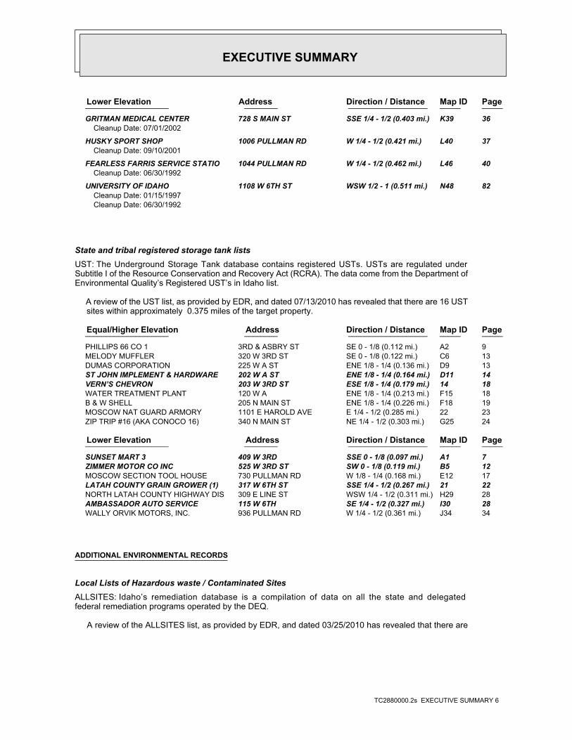
EXECUTIVE SUMMARY
TC2880000.2s EXECUTIVE SUMMARY 6
PageMap IDDirection / Distance Address Lower Elevation ____________________ ________ ___________________ _____ _____
GRITMAN MEDICAL CENTER 728 S MAIN ST SSE 1/4 - 1/2 (0.403 mi.) K39 36Cleanup Date: 07/01/2002
HUSKY SPORT SHOP 1006 PULLMAN RD W 1/4 - 1/2 (0.421 mi.) L40 37Cleanup Date: 09/10/2001
FEARLESS FARRIS SERVICE STATIO 1044 PULLMAN RD W 1/4 - 1/2 (0.462 mi.) L46 40Cleanup Date: 06/30/1992
UNIVERSITY OF IDAHO 1108 W 6TH ST WSW 1/2 - 1 (0.511 mi.) N48 82Cleanup Date: 01/15/1997Cleanup Date: 06/30/1992
State and tribal registered storage tank listsUST: The Underground Storage Tank database contains registered USTs. USTs are regulated underSubtitle I of the Resource Conservation and Recovery Act (RCRA). The data come from the Department ofEnvironmental Quality’s Registered UST’s in Idaho list.
A review of the UST list, as provided by EDR, and dated 07/13/2010 has revealed that there are 16 UST sites within approximately 0.375 miles of the target property.
PageMap IDDirection / Distance Address Equal/Higher Elevation ____________________ ________ ___________________ _____ _____
PHILLIPS 66 CO 1 3RD & ASBRY ST SE 0 - 1/8 (0.112 mi.) A2 9 MELODY MUFFLER 320 W 3RD ST SE 0 - 1/8 (0.122 mi.) C6 13 DUMAS CORPORATION 225 W A ST ENE 1/8 - 1/4 (0.136 mi.) D9 13 ST JOHN IMPLEMENT & HARDWARE 202 W A ST ENE 1/8 - 1/4 (0.164 mi.) D11 14 VERN’S CHEVRON 203 W 3RD ST ESE 1/8 - 1/4 (0.179 mi.) 14 18 WATER TREATMENT PLANT 120 W A ENE 1/8 - 1/4 (0.213 mi.) F15 18 B & W SHELL 205 N MAIN ST ENE 1/8 - 1/4 (0.226 mi.) F18 19 MOSCOW NAT GUARD ARMORY 1101 E HAROLD AVE E 1/4 - 1/2 (0.285 mi.) 22 23 ZIP TRIP #16 (AKA CONOCO 16) 340 N MAIN ST NE 1/4 - 1/2 (0.303 mi.) G25 24
PageMap IDDirection / Distance Address Lower Elevation ____________________ ________ ___________________ _____ _____
SUNSET MART 3 409 W 3RD SSE 0 - 1/8 (0.097 mi.) A1 7 ZIMMER MOTOR CO INC 525 W 3RD ST SW 0 - 1/8 (0.119 mi.) B5 12 MOSCOW SECTION TOOL HOUSE 730 PULLMAN RD W 1/8 - 1/4 (0.168 mi.) E12 17 LATAH COUNTY GRAIN GROWER (1) 317 W 6TH ST SSE 1/4 - 1/2 (0.267 mi.) 21 22 NORTH LATAH COUNTY HIGHWAY DIS 309 E LINE ST WSW 1/4 - 1/2 (0.311 mi.) H29 28 AMBASSADOR AUTO SERVICE 115 W 6TH SE 1/4 - 1/2 (0.327 mi.) I30 28 WALLY ORVIK MOTORS, INC. 936 PULLMAN RD W 1/4 - 1/2 (0.361 mi.) J34 34
ADDITIONAL ENVIRONMENTAL RECORDS
Local Lists of Hazardous waste / Contaminated SitesALLSITES: Idaho’s remediation database is a compilation of data on all the state and delegatedfederal remediation programs operated by the DEQ.
A review of the ALLSITES list, as provided by EDR, and dated 03/25/2010 has revealed that there are

EXECUTIVE SUMMARY
TC2880000.2s EXECUTIVE SUMMARY 7
31 ALLSITES sites within approximately 0.625 miles of the target property.
PageMap IDDirection / Distance Address Equal/Higher Elevation ____________________ ________ ___________________ _____ _____
MELODY MUFFLER 320 W 3RD ST SE 0 - 1/8 (0.122 mi.) C7 13 DUMAS CORPORATION 225 W A ST ENE 1/8 - 1/4 (0.136 mi.) D8 13 HELBLING BROS INC 202 W A ST ENE 1/8 - 1/4 (0.164 mi.) D10 14 VERN’S CHEVRON 203 W 3RD ST ESE 1/8 - 1/4 (0.179 mi.) 14 18 WATER TREATMENT PLANT 120 W A ENE 1/8 - 1/4 (0.213 mi.) F16 19 B & W SHELL 205 N MAIN ST ENE 1/8 - 1/4 (0.226 mi.) F17 19 ZIP TRIP #16 (AKA CONOCO 16) 340 N MAIN ST NE 1/4 - 1/2 (0.303 mi.) G24 23 MOSCOW GAS SHED (1420-BO2) 122 W E ST NNE 1/4 - 1/2 (0.393 mi.) 38 36 KNOKE CONSTRUCTION CO 301 COLLEGE AVE S 1/4 - 1/2 (0.430 mi.) 42 38 KELSON DISTRIBUTING CO 214 W MORTON ST NNE 1/4 - 1/2 (0.449 mi.) M44 39 BRENT LONEY 206 W MORTON ST NNE 1/4 - 1/2 (0.451 mi.) M45 39 LATAH COUNTY 520 ADAMS ST NE 1/2 - 1 (0.558 mi.) 49 84 PUREGRO 320 SWEET AVE S 1/2 - 1 (0.576 mi.) 50 84 SOUTHSIDE MINI MART 202 SPOTSWOOD SSE 1/2 - 1 (0.602 mi.) 51 85
PageMap IDDirection / Distance Address Lower Elevation ____________________ ________ ___________________ _____ _____
SUNSET MART 3 409 W 3RD SSE 0 - 1/8 (0.097 mi.) A1 7 ZIMMER MOTOR CO INC 525 W 3RD ST SW 0 - 1/8 (0.119 mi.) B5 12 MOSCOW SECTION TOOL HOUSE 730 PULLMAN RD W 1/8 - 1/4 (0.168 mi.) E13 17 UNIVERSITY OF IDAHO PLANT SCIE 415 W 6TH ST, PLANT SCI S 1/4 - 1/2 (0.259 mi.) 20 22 LATAH COUNTY GRAIN GROWER (1) 317 W 6TH ST SSE 1/4 - 1/2 (0.267 mi.) 21 22 A F & A M LODGE 531 S MAIN SE 1/4 - 1/2 (0.300 mi.) 23 23 NORTH LATAH COUNTY HIGHWAY DIS 309 E LINE ST WSW 1/4 - 1/2 (0.311 mi.) H28 27 AMBASSADOR AUTO SERVICE 115 W 6TH SE 1/4 - 1/2 (0.327 mi.) I30 28 WALLY ORVIK MOTORS, INC. 936 PULLMAN RD W 1/4 - 1/2 (0.361 mi.) J35 34 THE VOX S MAIN SE 1/4 - 1/2 (0.378 mi.) 36 35 GRITMAN HOSPITAL ANNEX 700 S MAIN ST SE 1/4 - 1/2 (0.388 mi.) K37 35 GRITMAN MEDICAL CENTER 728 S MAIN ST SSE 1/4 - 1/2 (0.403 mi.) K39 36 HUSKY SPORT SHOP 1006 PULLMAN RD W 1/4 - 1/2 (0.421 mi.) L40 37 CITY NORTH AMERICAN 234 1/2 W 8TH ST SSE 1/4 - 1/2 (0.428 mi.) 41 38 BOBS GARAGE 8TH / MAIN SSE 1/4 - 1/2 (0.445 mi.) 43 38 FEARLESS FARRIS SERVICE STATIO 1044 PULLMAN RD W 1/4 - 1/2 (0.462 mi.) L46 40 UNIVERSITY OF IDAHO 1108 W 6TH ST WSW 1/2 - 1 (0.511 mi.) N48 82
Records of Emergency Release ReportsSPILLS: A listing of hazardous materials spills, releases or accidents as reported to the State ofIdaho’s central Communications Center.
A review of the SPILLS list, as provided by EDR, and dated 03/25/2010 has revealed that there are 2 SPILLS sites within approximately 0.125 miles of the target property.
PageMap IDDirection / Distance Address Lower Elevation ____________________ ________ ___________________ _____ _____
SUNSET MART 3 409 W 3RD SSE 0 - 1/8 (0.097 mi.) A1 7 ZIMMER MOTOR CO INC 525 W 3RD ST SW 0 - 1/8 (0.119 mi.) B5 12

EXECUTIVE SUMMARY
TC2880000.2s EXECUTIVE SUMMARY 8
Other Ascertainable RecordsRCRA-NonGen: RCRAInfo is EPA’s comprehensive information system, providing access to data supportingthe Resource Conservation and Recovery Act (RCRA) of 1976 and the Hazardous and Solid Waste Amendments (HSWA)of 1984. The database includes selective information on sites which generate, transport, store, treat and/ordispose of hazardous waste as defined by the Resource Conservation and Recovery Act (RCRA). Non-Generators donot presently generate hazardous waste.
A review of the RCRA-NonGen list, as provided by EDR, and dated 02/17/2010 has revealed that there are 4 RCRA-NonGen sites within approximately 0.375 miles of the target property.
PageMap IDDirection / Distance Address Equal/Higher Elevation ____________________ ________ ___________________ _____ _____
ST JOHN IMPLEMENT & HARDWARE 202 W A ST ENE 1/8 - 1/4 (0.164 mi.) D11 14 CONOCO STORE 12004 340 N MAIN NE 1/4 - 1/2 (0.303 mi.) G26 24
PageMap IDDirection / Distance Address Lower Elevation ____________________ ________ ___________________ _____ _____
SUNSET MART 3 409 W 3RD SSE 0 - 1/8 (0.097 mi.) A1 7 KARL TYLER MOTORS 936 PULLMAN RD W 1/4 - 1/2 (0.361 mi.) J33 31
FINDS: The Facility Index System contains both facility information and "pointers" to othersources of information that contain more detail. These include: RCRIS; Permit Compliance System (PCS);Aerometric Information Retrieval System (AIRS); FATES (FIFRA [Federal Insecticide Fungicide Rodenticide Act]and TSCA Enforcement System, FTTS [FIFRA/TSCA Tracking System]; CERCLIS; DOCKET (Enforcement Docket used tomanage and track information on civil judicial enforcement cases for all environmental statutes); FederalUnderground Injection Control (FURS); Federal Reporting Data System (FRDS); Surface Impoundments (SIA); TSCAChemicals in Commerce Information System (CICS); PADS; RCRA-J (medical waste transporters/disposers); TRIS;and TSCA. The source of this database is the U.S. EPA/NTIS.
A review of the FINDS list, as provided by EDR, and dated 04/14/2010 has revealed that there are 3 FINDS sites within approximately 0.125 miles of the target property.
PageMap IDDirection / Distance Address Lower Elevation ____________________ ________ ___________________ _____ _____
SUNSET MART 3 409 W 3RD SSE 0 - 1/8 (0.097 mi.) A1 7 AMBASSADOR AUTO SVS 515 W. THIRD SSW 0 - 1/8 (0.113 mi.) B3 9 COLUMBIA PAINT & COATINGS CO M 524 W THIRD ST SW 0 - 1/8 (0.118 mi.) B4 10
DRYCLEANERS: A listing of drycleaner locations.
A review of the DRYCLEANERS list, as provided by EDR, and dated 07/06/2009 has revealed that there is 1 DRYCLEANERS site within approximately 0.375 miles of the target property.
PageMap IDDirection / Distance Address Lower Elevation ____________________ ________ ___________________ _____ _____
GREENS CLEANERS 616 S MAIN STREET SE 1/4 - 1/2 (0.342 mi.) I32 30
EXECUTIVE SUMMARY
TC2880000.2s EXECUTIVE SUMMARY 9
Due to poor or inadequate address information, the following sites were not mapped:
Site Name Database(s)____________ ____________
GOODMAN OIL (A) ALLSITESLATAH COUNTY GRAIN GROWER (3) ALLSITESPHILLIPS 66 CO 1 ALLSITESU OF I STUDENT UNION BUILDING ALLSITESMOSCOW NAT GUARD ARMORY ALLSITESCHEVRON USA 90660 ALLSITESGRITMAN EXPANSION ALLSITES, SPILLSGTE PARADISE RIDGE MICROWAVE ALLSITESPRAIRIE LAND AND TIMBER ALLSITES, SPILLS1108 W 6TH ST FTTS, HIST FTTSUNIVERSITY OF IDAHO FTTS, HIST FTTSTROY HWY CERC-NFRAPLATAH COUNTY LANDFILL SWF/LF, HIST LFLATAH SANITATION, INC SWF/LFLATAH SANITATION, INC NON-MSWLF SWF/LFGOODMAN OIL (A) UST3347 N 7 E RCRA-NonGen, FINDSMOSCOW HWY RCRA-NonGen, FINDSCHS, INC. - PRIMELAND COOPERATIVES SSTSCHS, INC. - PRIMELAND COOPERATIVE SSTS

EDR Inc.EDR Inc.EDR Inc.EDR Inc.EDR Inc.EDR Inc.EDR Inc.EDR Inc.EDR Inc.EDR Inc.EDR Inc.EDR Inc.EDR Inc.EDR Inc.EDR Inc.EDR Inc.EDR Inc.EDR Inc.EDR Inc.EDR Inc.EDR Inc.EDR Inc.EDR Inc.EDR Inc.EDR Inc.EDR Inc.EDR Inc.EDR Inc.EDR Inc.EDR Inc.EDR Inc.EDR Inc.EDR Inc.EDR Inc.EDR Inc.EDR Inc.EDR Inc.EDR Inc.EDR Inc.EDR Inc.
115 kV
115 kV
115 kV
115 kV
115 kV115 kV
115 kV
115 kV
115 kV
115 kV
115 kV
115 kV115 kV115 kV
115 kV
115 kV
115 k
V
115 k
V
115
kV11
5 kV
115
kV

EDR Inc.EDR Inc.EDR Inc.EDR Inc.EDR Inc.EDR Inc.EDR Inc.EDR Inc.EDR Inc.EDR Inc.EDR Inc.EDR Inc.EDR Inc.EDR Inc.EDR Inc.EDR Inc.EDR Inc.EDR Inc.EDR Inc.EDR Inc.EDR Inc.EDR Inc.EDR Inc.EDR Inc.EDR Inc.EDR Inc.EDR Inc.EDR Inc.EDR Inc.EDR Inc.EDR Inc.EDR Inc.EDR Inc.EDR Inc.EDR Inc.EDR Inc.EDR Inc.EDR Inc.EDR Inc.EDR Inc.

MAP FINDINGS SUMMARY
SearchTarget Distance Total
Database Property (Miles) < 1/8 1/8 - 1/4 1/4 - 1/2 1/2 - 1 > 1 Plotted
STANDARD ENVIRONMENTAL RECORDS
Federal NPL site list 0 0 0 0 0 0 1.125NPL 0 0 0 0 0 0 1.125Proposed NPL 0 NR NR NR NR 0 0.125NPL LIENS
Federal Delisted NPL site list 0 0 0 0 0 0 1.125Delisted NPL
Federal CERCLIS list 0 NR 0 0 0 0 0.625CERCLIS 0 0 0 0 0 0 1.125FEDERAL FACILITY
Federal CERCLIS NFRAP site List 1 NR 1 0 0 0 0.625CERC-NFRAP
Federal RCRA CORRACTS facilities list 0 0 0 0 0 0 1.125CORRACTS
Federal RCRA non-CORRACTS TSD facilities list 0 NR 0 0 0 0 0.625RCRA-TSDF
Federal RCRA generators list 0 NR NR 0 0 0 0.375RCRA-LQG 0 NR NR 0 0 0 0.375RCRA-SQG 4 NR NR 2 1 1 0.375RCRA-CESQG
Federal institutional controls /engineering controls registries
0 NR 0 0 0 0 0.625US ENG CONTROLS 0 NR 0 0 0 0 0.625US INST CONTROL
Federal ERNS list 0 NR NR NR NR 0 0.125ERNS
State- and tribal - equivalent CERCLIS N/A N/A N/A N/A N/A N/A N/ASHWS
State and tribal landfill and/orsolid waste disposal site lists
0 NR 0 0 0 0 0.625SWF/LF
State and tribal leaking storage tank lists 13 NR 2 8 1 2 0.625LUST 0 NR 0 0 0 0 0.625LAST 0 NR 0 0 0 0 0.625INDIAN LUST
State and tribal registered storage tank lists 16 NR NR 6 6 4 0.375UST
TC2880000.2s Page 4

MAP FINDINGS SUMMARY
SearchTarget Distance Total
Database Property (Miles) < 1/8 1/8 - 1/4 1/4 - 1/2 1/2 - 1 > 1 Plotted
0 NR NR 0 0 0 0.375INDIAN UST 0 NR NR 0 0 0 0.375FEMA UST
State and tribal institutionalcontrol / engineering control registries
0 NR 0 0 0 0 0.625INST CONTROL
State and tribal voluntary cleanup sites 0 NR 0 0 0 0 0.625VCP 0 NR 0 0 0 0 0.625INDIAN VCP
State and tribal Brownfields sites 0 NR 0 0 0 0 0.625BROWNFIELDS
ADDITIONAL ENVIRONMENTAL RECORDS
Local Brownfield lists 0 NR 0 0 0 0 0.625US BROWNFIELDS
Local Lists of Landfill / SolidWaste Disposal Sites
0 NR 0 0 0 0 0.625ODI 0 NR 0 0 0 0 0.625DEBRIS REGION 9 0 NR 0 0 0 0 0.625SWTIRE 0 NR 0 0 0 0 0.625HIST LF 0 NR 0 0 0 0 0.625INDIAN ODI
Local Lists of Hazardous waste /Contaminated Sites
0 NR NR NR NR 0 0.125US CDL 31 NR 4 18 6 3 0.625ALLSITES 0 NR NR NR NR 0 0.125CDL 0 NR NR NR NR 0 0.125US HIST CDL
Local Land Records 0 NR NR NR NR 0 0.125LIENS 2 0 NR 0 0 0 0 0.625LUCIS
Records of Emergency Release Reports 0 NR NR NR NR 0 0.125HMIRS 2 NR NR NR NR 2 0.125SPILLS
Other Ascertainable Records 4 NR NR 2 1 1 0.375RCRA-NonGen 0 NR NR NR NR 0 0.125DOT OPS 0 0 0 0 0 0 1.125DOD 0 0 0 0 0 0 1.125FUDS 0 0 0 0 0 0 1.125CONSENT 0 0 0 0 0 0 1.125ROD 0 NR 0 0 0 0 0.625UMTRA
TC2880000.2s Page 5
MAP FINDINGS SUMMARY
SearchTarget Distance Total
Database Property (Miles) < 1/8 1/8 - 1/4 1/4 - 1/2 1/2 - 1 > 1 Plotted
0 NR NR 0 0 0 0.375MINES 0 NR NR NR NR 0 0.125TRIS 0 NR NR NR NR 0 0.125TSCA 0 NR NR NR NR 0 0.125FTTS 0 NR NR NR NR 0 0.125HIST FTTS 0 NR NR NR NR 0 0.125SSTS 0 NR NR NR NR 0 0.125ICIS 0 NR NR NR NR 0 0.125PADS 0 NR NR NR NR 0 0.125MLTS 0 NR NR NR NR 0 0.125RADINFO 3 NR NR NR NR 3 0.125FINDS 0 NR NR NR NR 0 0.125RAATS 0 NR NR NR NR 0 0.125UIC 1 NR NR 1 0 0 0.375DRYCLEANERS 0 NR NR NR NR 0 0.125AIRS 0 NR NR NR NR 0 0.125TIER 2 0 0 0 0 0 0 1.125INDIAN RESERV 0 NR 0 0 0 0 0.625SCRD DRYCLEANERS 0 NR NR NR NR 0 0.125PCB TRANSFORMER 0 NR 0 0 0 0 0.625COAL ASH EPA 0 NR NR NR NR 0 0.125COAL ASH DOE
EDR PROPRIETARY RECORDS
EDR Proprietary Records 0 0 0 0 0 0 1.125Manufactured Gas Plants
NOTES:
TP = Target Property
NR = Not Requested at this Search Distance
Sites may be listed in more than one database
N/A = This State does not maintain a SHWS list. See the Federal CERCLIS list.
TC2880000.2s Page 6

MAP FINDINGSMap IDDirection
EDR ID NumberDistanceEPA ID NumberDatabase(s)SiteElevation
IGNITABLE HAZARDOUS WASTES ARE THOSE WASTES WHICH HAVE A FLASHPOINT OFWaste name: D001Waste code:
Hazardous Waste Summary:
Verified to be non-commercialOff-site waste receiver: NoUsed oil transporter: NoUsed oil transfer facility: NoUsed oil Specification marketer: NoUsed oil fuel marketer to burner: NoUser oil refiner: NoUsed oil processor: NoUsed oil fuel burner: NoFurnace exemption: NoOn-site burner exemption: NoUnderground injection activity: NoTreater, storer or disposer of HW: NoTransporter of hazardous waste: NoRecycler of hazardous waste: UnknownMixed waste (haz. and radioactive): NoU.S. importer of hazardous waste:
Handler Activities Summary:
Not reportedOwner/Op end date: Not reportedOwner/Op start date: OwnerOwner/Operator Type: PrivateLegal status: (208) 772-4031Owner/operator telephone: Not reportedOwner/operator country: COEUR D’ALENE, ID 83814 7415 N GOVERNMENT WAYOwner/operator address: CAROLE BAILEYOwner/operator name:
Owner/Operator Summary:
Handler: Non-Generators do not presently generate hazardous wasteDescription: Non-GeneratorClassification: PrivateLand type: 10EPA Region: Not reportedContact email: (208) 772-4031Contact telephone: USContact country: HAYDEN LAKE, ID 838350825 PO BOX 825Contact address: CAROLE BAILEYContact: HAYDEN LAKE, ID 838350825 PO BOX 825Mailing address: IDD984674903EPA ID: MOSCOW, ID 83843 409 W 3RDFacility address: SUNSET MART 3Facility name: 12/22/1992Date form received by agency:
RCRA-NonGen:
SPILLS513 ft. USTSite 1 of 2 in cluster A0.097 mi. LUST
Relative:Lower
Actual:2557 ft.
< 1/8 ALLSITESMOSCOW, ID 83843SSE FINDS409 W 3RD IDD984674903A1 RCRA-NonGenSUNSET MART 3 1000823474
TC2880000.2s Page 7

MAP FINDINGSMap IDDirection
EDR ID NumberDistanceEPA ID NumberDatabase(s)SiteElevation
Not reportedTax Parcel Id: CAROL M. BAILEYOwner Name: Not reportedAlias: 702Facility Id:
Facility InformationIncidents: USTSite ID: No attached deeds.Deed Rest: 46.73226000 / -117.00565000Latitude/Longitude: Not reportedTax Parcel Id: CAROL M. BAILEYOwner Name: Not reportedAlias: 702Facility Id:
ALLSITES:
corrective action activities required under RCRA.program staff to track the notification, permit, compliance, andand treat, store, or dispose of hazardous waste. RCRAInfo allows RCRAevents and activities related to facilities that generate, transport,Conservation and Recovery Act (RCRA) program through the tracking ofRCRAInfo is a national information system that supports the Resource
Environmental Interest/Information System
110005789691Registry ID:
FINDS:
StateEvaluation lead agency: 09/23/1993Date achieved compliance: Generators - Records/ReportingArea of violation: NON-FINANCIAL RECORD REVIEWEvaluation: 08/31/1993Evaluation date:
Evaluation Action Summary:
Not reported Paid penalty amount: Not reported Final penalty amount: Not reported Proposed penalty amount: State Enforcement lead agency: Not reported Enf. disp. status date: Not reported Enf. disposition status: 08/31/1993 Enforcement action date: WRITTEN INFORMAL Enforcement action: StateViolation lead agency: 09/23/1993Date achieved compliance: 08/31/1993Date violation determined: Generators - Records/ReportingArea of violation: SS - IC 39-4411(4)Regulation violated:
Facility Has Received Notices of Violations:
WHICH WOULD BE CONSIDERED AS IGNITABLE HAZARDOUS WASTE. MATERIAL. LACQUER THINNER IS AN EXAMPLE OF A COMMONLY USED SOLVENT WHICH CAN BE OBTAINED FROM THE MANUFACTURER OR DISTRIBUTOR OF THE FLASH POINT OF A WASTE IS TO REVIEW THE MATERIAL SAFETY DATA SHEET, CLOSED CUP FLASH POINT TESTER. ANOTHER METHOD OF DETERMINING THE LESS THAN 140 DEGREES FAHRENHEIT AS DETERMINED BY A PENSKY-MARTENS
SUNSET MART 3 (Continued) 1000823474
TC2880000.2s Page 8
MAP FINDINGSMap IDDirection
EDR ID NumberDistanceEPA ID NumberDatabase(s)SiteElevation
7/11/2001Close Date: 6/30/1992Open Date: Not reportedFacility ID: PetroleumContaminant: Not reportedProgram:
ID SPILL:
3Total Tanks:ClosedStatus:2-290097Facility ID:
UST:
120Event ID:07/11/2001Cleanup Date:06/30/1992Release Date:ClosedStatus:2-290097Facid ID:
LUST:
NOT LISTED RELEASEPRIORITY 2Incidents: LUSTSite ID: No attached deeds.Deed Rest: 46.73226000 / -117.00565000Latitude/Longitude:
SUNSET MART 3 (Continued) 1000823474
2Total Tanks:ClosedStatus:2-290051Facility ID:
UST:
591 ft. Site 2 of 2 in cluster A0.112 mi.
Relative:Equal
Actual:2560 ft.
< 1/8 MOSCOW, ID 83843SE 3RD & ASBRY ST N/AA2 USTPHILLIPS 66 CO 1 U003724369
estimation of total national emissions. AFS is undergoing a majorto comply with regulatory programs and by EPA as an input for theAFS data are utilized by states to prepare State Implementation Plansused to track emissions and compliance data from industrial plants.information concerning airborne pollution in the United States. AFS isAerometric Data (SAROAD). AIRS is the national repository forNational Emission Data System (NEDS), and the Storage and Retrieval ofSubsystem) replaces the former Compliance Data System (CDS), theAFS (Aerometric Information Retrieval System (AIRS) Facility
Environmental Interest/Information System
110007359250Registry ID:
FINDS:
597 ft. Site 1 of 3 in cluster B0.113 mi.
Relative:Lower
Actual:2555 ft.
< 1/8 MOSCOW, ID 83843SSW 515 W. THIRD N/AB3 FINDSAMBASSADOR AUTO SVS 1005636594
TC2880000.2s Page 9

MAP FINDINGSMap IDDirection
EDR ID NumberDistanceEPA ID NumberDatabase(s)SiteElevation
of the Clean Air Act.redesign to support facility operating permits required under Title V
AMBASSADOR AUTO SVS (Continued) 1005636594
NoTransporter of hazardous waste: NoRecycler of hazardous waste: UnknownMixed waste (haz. and radioactive): NoU.S. importer of hazardous waste:
Handler Activities Summary:
Not reportedOwner/Op end date: Not reportedOwner/Op start date: OwnerOwner/Operator Type: PrivateLegal status: (509) 535-9741Owner/operator telephone: Not reportedOwner/operator country: SPOKANE, WA 99202 PO BOX 4569Owner/operator address: COLUMBIA PAINT & COATINGS COOwner/operator name:
Owner/Operator Summary:
hazardous waste the cleanup of a spill, into or on any land or water, of acutely any residue or contaminated soil, waste or other debris resulting from time: 1 kg or less of acutely hazardous waste; or 100 kg or less of hazardous waste during any calendar month, and accumulates at any from the cleanup of a spill, into or on any land or water, of acutely of any residue or contaminated soil, waste or other debris resulting land or water, of acutely hazardous waste; or generates 100 kg or less other debris resulting from the cleanup of a spill, into or on any waste; or 100 kg or less of any residue or contaminated soil, waste or month, and accumulates at any time: 1 kg or less of acutely hazardous or generates 1 kg or less of acutely hazardous waste per calendar month, and accumulates 1000 kg or less of hazardous waste at any time; Handler: generates 100 kg or less of hazardous waste per calendarDescription: Conditionally Exempt Small Quantity GeneratorClassification: 10EPA Region: Not reportedContact email: (208) 882-6544Contact telephone: USContact country: MOSCOW, ID 838432209 524 W THIRD STContact address: AL BANTAContact: MOSCOW, ID 838432209 W THIRD STMailing address: ID0001004662EPA ID: MOSCOW, ID 838432209 524 W THIRD STFacility address: COLUMBIA PAINT & COATINGS CO MOSCOWFacility name: 12/05/1994Date form received by agency:
RCRA-CESQG:
621 ft. Site 2 of 3 in cluster B0.118 mi.
Relative:Lower
Actual:2555 ft.
< 1/8 MOSCOW, ID 83843SW FINDS524 W THIRD ST ID0001004662B4 RCRA-CESQGCOLUMBIA PAINT & COATINGS CO MOSCOW 1004691573
TC2880000.2s Page 10

MAP FINDINGSMap IDDirection
EDR ID NumberDistanceEPA ID NumberDatabase(s)SiteElevation
Environmental Interest/Information System
110005780510Registry ID:
FINDS:
No violations foundViolation Status:
THESE SPENT SOLVENTS AND SPENT SOLVENT MIXTURES. LISTED IN F001, F002, OR F004; AND STILL BOTTOMS FROM THE RECOVERY OF ONE OR MORE OF THE ABOVE NON-HALOGENATED SOLVENTS OR THOSE SOLVENTS CONTAINING, BEFORE USE, A TOTAL OF TEN PERCENT OR MORE (BY VOLUME) OF 2-ETHOXYETHANOL, AND 2-NITROPROPANE; ALL SPENT SOLVENT MIXTURES/BLENDS KETONE, CARBON DISULFIDE, ISOBUTANOL, PYRIDINE, BENZENE, THE FOLLOWING SPENT NON-HALOGENATED SOLVENTS: TOLUENE, METHYL ETHYLWaste name: F005Waste code:
MIXTURES. BOTTOMS FROM THE RECOVERY OF THESE SPENT SOLVENTS AND SPENT SOLVENT MORE OF THOSE SOLVENTS LISTED IN F001, F002, F004, AND F005, AND STILL SOLVENTS, AND, A TOTAL OF TEN PERCENT OR MORE (BY VOLUME) OF ONE OR CONTAINING, BEFORE USE, ONE OR MORE OF THE ABOVE NON-HALOGENATED NON-HALOGENATED SOLVENTS; AND ALL SPENT SOLVENT MIXTURES/BLENDS MIXTURES/BLENDS CONTAINING, BEFORE USE, ONLY THE ABOVE SPENT ALCOHOL, CYCLOHEXANONE, AND METHANOL; ALL SPENT SOLVENT ACETATE, ETHYL BENZENE, ETHYL ETHER, METHYL ISOBUTYL KETONE, N-BUTYL THE FOLLOWING SPENT NON-HALOGENATED SOLVENTS: XYLENE, ACETONE, ETHYLWaste name: F003Waste code:
METHYL ETHYL KETONEWaste name: D035Waste code:
LEADWaste name: D008Waste code:
WHICH WOULD BE CONSIDERED AS IGNITABLE HAZARDOUS WASTE. MATERIAL. LACQUER THINNER IS AN EXAMPLE OF A COMMONLY USED SOLVENT WHICH CAN BE OBTAINED FROM THE MANUFACTURER OR DISTRIBUTOR OF THE FLASH POINT OF A WASTE IS TO REVIEW THE MATERIAL SAFETY DATA SHEET, CLOSED CUP FLASH POINT TESTER. ANOTHER METHOD OF DETERMINING THE LESS THAN 140 DEGREES FAHRENHEIT AS DETERMINED BY A PENSKY-MARTENS IGNITABLE HAZARDOUS WASTES ARE THOSE WASTES WHICH HAVE A FLASHPOINT OFWaste name: D001Waste code:
Hazardous Waste Summary:
Verified to be non-commercialOff-site waste receiver: NoUsed oil transporter: NoUsed oil transfer facility: NoUsed oil Specification marketer: NoUsed oil fuel marketer to burner: NoUser oil refiner: NoUsed oil processor: NoUsed oil fuel burner: NoFurnace exemption: NoOn-site burner exemption: NoUnderground injection activity: NoTreater, storer or disposer of HW:
COLUMBIA PAINT & COATINGS CO MOSCOW (Continued) 1004691573
TC2880000.2s Page 11

MAP FINDINGSMap IDDirection
EDR ID NumberDistanceEPA ID NumberDatabase(s)SiteElevation
corrective action activities required under RCRA.program staff to track the notification, permit, compliance, andand treat, store, or dispose of hazardous waste. RCRAInfo allows RCRAevents and activities related to facilities that generate, transport,Conservation and Recovery Act (RCRA) program through the tracking ofRCRAInfo is a national information system that supports the Resource
COLUMBIA PAINT & COATINGS CO MOSCOW (Continued) 1004691573
6/30/1992Close Date: 6/30/1992Open Date: Not reportedFacility ID: PetroleumContaminant: Not reportedProgram:
ID SPILL:
2Total Tanks:ClosedStatus:2-290064Facility ID:
UST:
680Event ID:06/30/1992Cleanup Date:06/30/1992Release Date:ClosedStatus:2-290064Facid ID:
LUST:
AMENDED PER EPAUST 2-4-98Incidents: USTSite ID: No attached deeds.Deed Rest: Not reportedLatitude/Longitude: Not reportedTax Parcel Id: ZIMMER MOTOR CO INCOwner Name: Not reportedAlias: 676Facility Id:
AMENDED PER EPAUST 2-4-98Incidents: LUSTSite ID: No attached deeds.Deed Rest: Not reportedLatitude/Longitude: Not reportedTax Parcel Id: ZIMMER MOTOR CO INCOwner Name: Not reportedAlias: 676Facility Id:
ALLSITES:
629 ft. Site 3 of 3 in cluster B0.119 mi. SPILLS
Relative:Lower
Actual:2555 ft.
< 1/8 USTMOSCOW, ID 83843SW LUST525 W 3RD ST N/AB5 ALLSITESZIMMER MOTOR CO INC U003724381
TC2880000.2s Page 12

MAP FINDINGSMap IDDirection
EDR ID NumberDistanceEPA ID NumberDatabase(s)SiteElevation
2Total Tanks:ClosedStatus:2-290044Facility ID:
UST:
642 ft. Site 1 of 2 in cluster C0.122 mi.
Relative:Equal
Actual:2560 ft.
< 1/8 MOSCOW, ID 83843SE 320 W 3RD ST N/AC6 USTMELODY MUFFLER U003724364
to the May 8, 1986 registration date requirement. USTas item # 61. It is believed that these tanks were removed prior The hard file for this facility was archived 8-6-99 in Box #1 forIncidents: USTSite ID: No attached deeds.Deed Rest: 46.73263000 / -117.00528000Latitude/Longitude: Not reportedTax Parcel Id: LARRY HALVORSONOwner Name: Not reportedAlias: 658Facility Id:
ALLSITES:
642 ft. Site 2 of 2 in cluster C0.122 mi.
Relative:Equal
Actual:2560 ft.
< 1/8 MOSCOW, ID 83843SE 320 W 3RD ST N/AC7 ALLSITESMELODY MUFFLER S108275252
Facility InformationIncidents: USTSite ID: No attached deeds.Deed Rest: 46.73440000 / -117.00404000Latitude/Longitude: Not reportedTax Parcel Id: DUMAS CORPOwner Name: Not reportedAlias: 641Facility Id:
ALLSITES:
719 ft. Site 1 of 4 in cluster D0.136 mi.
Relative:Higher
Actual:2561 ft.
1/8-1/4 MOSCOW, ID 83843ENE 225 W A ST N/AD8 ALLSITESDUMAS CORPORATION S108274282
1Total Tanks:ClosedStatus:2-290025Facility ID:
UST:
719 ft. Site 2 of 4 in cluster D0.136 mi.
Relative:Higher
Actual:2561 ft.
1/8-1/4 MOSCOW, ID 83843ENE 225 W A ST N/AD9 USTDUMAS CORPORATION U003724348
TC2880000.2s Page 13

MAP FINDINGSMap IDDirection
EDR ID NumberDistanceEPA ID NumberDatabase(s)SiteElevation
EPAUSTIncidents: USTSite ID: No attached deeds.Deed Rest: 46.73464000 / -117.00307000Latitude/Longitude: Not reportedTax Parcel Id: HELBLING BROS INCOwner Name: Not reportedAlias: 649Facility Id:
ALLSITES:
864 ft. Site 3 of 4 in cluster D0.164 mi.
Relative:Higher
Actual:2563 ft.
1/8-1/4 MOSCOW, ID 83843ENE 202 W A ST N/AD10 ALLSITESHELBLING BROS INC S108274632
OwnerOwner/Operator Type: PrivateLegal status: Not reportedOwner/operator telephone: Not reportedOwner/operator country: Not reported Not reportedOwner/operator address: HELBLING BROS INCOwner/operator name:
Not reportedOwner/Op end date: 01/01/0001Owner/Op start date: OwnerOwner/Operator Type: PrivateLegal status: Not reportedOwner/operator telephone: Not reportedOwner/operator country: Not reported Not reportedOwner/operator address: HELBLING BROS INCOwner/operator name:
Owner/Operator Summary:
Handler: Non-Generators do not presently generate hazardous wasteDescription: Non-GeneratorClassification: PrivateLand type: 10EPA Region: Not reportedContact email: (208) 882-7501Contact telephone: USContact country: MOSCOW, ID 83843 W A STContact address: ROB KNEALEContact: MOSCOW, ID 83843 W A STMailing address: IDD033979733EPA ID: MOSCOW, ID 83843 202 W A STFacility address: ST JOHN IMPLEMENT & HARDWAREFacility name: 06/27/2003Date form received by agency:
RCRA-NonGen:
864 ft. Site 4 of 4 in cluster D0.164 mi.
Relative:Higher
Actual:2563 ft.
1/8-1/4 USTMOSCOW, ID 83843ENE FINDS202 W A ST IDD033979733D11 RCRA-NonGenST JOHN IMPLEMENT & HARDWARE 1000163807
TC2880000.2s Page 14
MAP FINDINGSMap IDDirection
EDR ID NumberDistanceEPA ID NumberDatabase(s)SiteElevation
Not reported Enf. disposition status: 09/12/1995 Enforcement action date: WRITTEN INFORMAL Enforcement action: StateViolation lead agency: 09/20/1995Date achieved compliance: 09/12/1995Date violation determined: Generators - Records/ReportingArea of violation: SS - IC 39 4411(4)Regulation violated:
Facility Has Received Notices of Violations:
DISPOSED, THE WASTE WOULD BE A CORROSIVE HAZARDOUS WASTE. THESE CAUSTIC OR ACID SOLUTIONS BECOME CONTAMINATED AND MUST BE USED BY MANY INDUSTRIES TO CLEAN METAL PARTS PRIOR TO PAINTING. WHEN OR DEGREASE PARTS. HYDROCHLORIC ACID, A SOLUTION WITH A LOW PH, IS CAUSTIC SOLUTION WITH A HIGH PH, IS OFTEN USED BY INDUSTRIES TO CLEAN CONSIDERED TO BE A CORROSIVE HAZARDOUS WASTE. SODIUM HYDROXIDE, A A WASTE WHICH HAS A PH OF LESS THAN 2 OR GREATER THAN 12.5 ISWaste name: D002Waste code:
WHICH WOULD BE CONSIDERED AS IGNITABLE HAZARDOUS WASTE. MATERIAL. LACQUER THINNER IS AN EXAMPLE OF A COMMONLY USED SOLVENT WHICH CAN BE OBTAINED FROM THE MANUFACTURER OR DISTRIBUTOR OF THE FLASH POINT OF A WASTE IS TO REVIEW THE MATERIAL SAFETY DATA SHEET, CLOSED CUP FLASH POINT TESTER. ANOTHER METHOD OF DETERMINING THE LESS THAN 140 DEGREES FAHRENHEIT AS DETERMINED BY A PENSKY-MARTENS IGNITABLE HAZARDOUS WASTES ARE THOSE WASTES WHICH HAVE A FLASHPOINT OFWaste name: D001Waste code:
Hazardous Waste Summary:
Conditionally Exempt Small Quantity GeneratorClassification: HELBLING BROS INCSite name: ST JOHN IMPLEMENT & HARDWAREFacility name: 09/04/1986Date form received by agency:
Historical Generators:
Commercial status unknownOff-site waste receiver: UnknownUsed oil transporter: UnknownUsed oil transfer facility: UnknownUsed oil Specification marketer: UnknownUsed oil fuel marketer to burner: UnknownUser oil refiner: UnknownUsed oil processor: UnknownUsed oil fuel burner: UnknownFurnace exemption: UnknownOn-site burner exemption: UnknownUnderground injection activity: UnknownTreater, storer or disposer of HW: UnknownTransporter of hazardous waste: UnknownRecycler of hazardous waste: UnknownMixed waste (haz. and radioactive): UnknownU.S. importer of hazardous waste:
Handler Activities Summary:
Not reportedOwner/Op end date: Not reportedOwner/Op start date:
ST JOHN IMPLEMENT & HARDWARE (Continued) 1000163807
TC2880000.2s Page 15
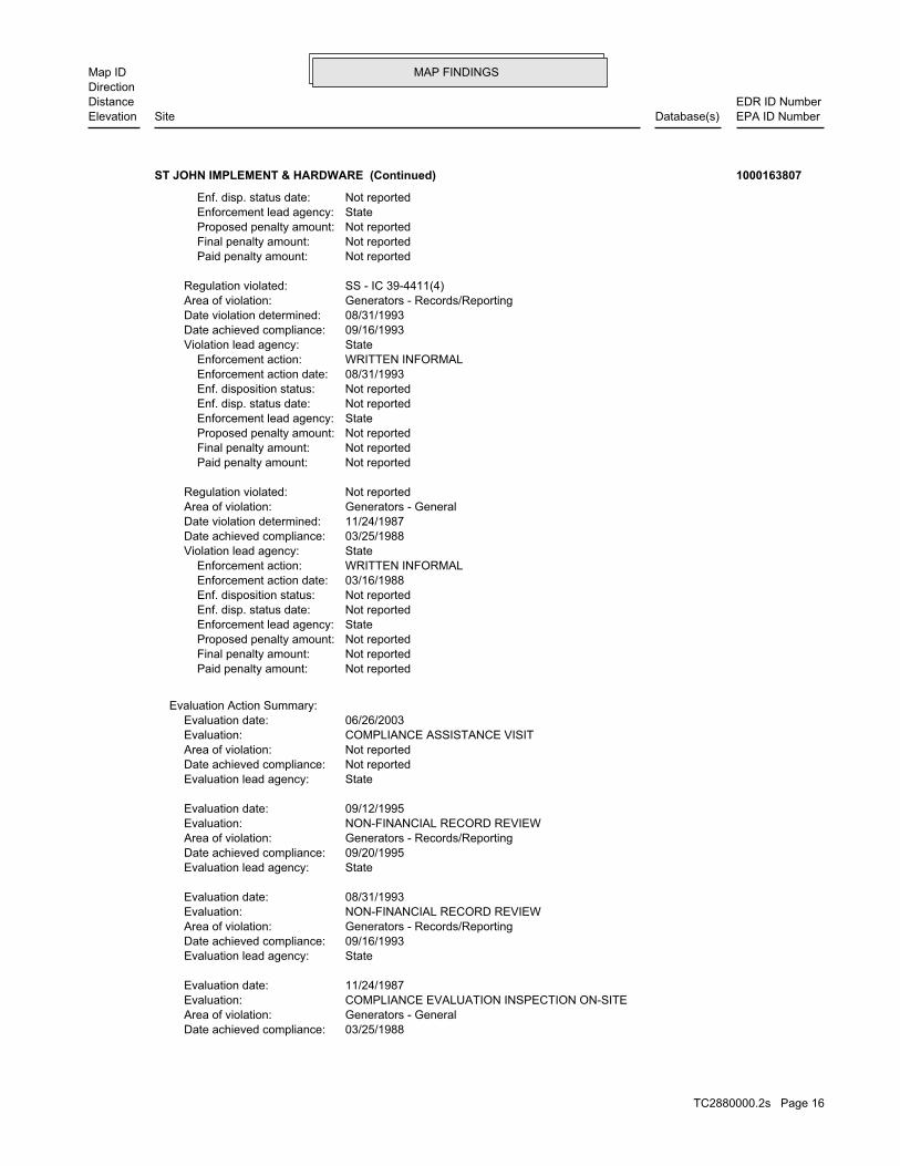
MAP FINDINGSMap IDDirection
EDR ID NumberDistanceEPA ID NumberDatabase(s)SiteElevation
03/25/1988Date achieved compliance: Generators - GeneralArea of violation: COMPLIANCE EVALUATION INSPECTION ON-SITEEvaluation: 11/24/1987Evaluation date:
StateEvaluation lead agency: 09/16/1993Date achieved compliance: Generators - Records/ReportingArea of violation: NON-FINANCIAL RECORD REVIEWEvaluation: 08/31/1993Evaluation date:
StateEvaluation lead agency: 09/20/1995Date achieved compliance: Generators - Records/ReportingArea of violation: NON-FINANCIAL RECORD REVIEWEvaluation: 09/12/1995Evaluation date:
StateEvaluation lead agency: Not reportedDate achieved compliance: Not reportedArea of violation: COMPLIANCE ASSISTANCE VISITEvaluation: 06/26/2003Evaluation date:
Evaluation Action Summary:
Not reported Paid penalty amount: Not reported Final penalty amount: Not reported Proposed penalty amount: State Enforcement lead agency: Not reported Enf. disp. status date: Not reported Enf. disposition status: 03/16/1988 Enforcement action date: WRITTEN INFORMAL Enforcement action: StateViolation lead agency: 03/25/1988Date achieved compliance: 11/24/1987Date violation determined: Generators - GeneralArea of violation: Not reportedRegulation violated:
Not reported Paid penalty amount: Not reported Final penalty amount: Not reported Proposed penalty amount: State Enforcement lead agency: Not reported Enf. disp. status date: Not reported Enf. disposition status: 08/31/1993 Enforcement action date: WRITTEN INFORMAL Enforcement action: StateViolation lead agency: 09/16/1993Date achieved compliance: 08/31/1993Date violation determined: Generators - Records/ReportingArea of violation: SS - IC 39-4411(4)Regulation violated:
Not reported Paid penalty amount: Not reported Final penalty amount: Not reported Proposed penalty amount: State Enforcement lead agency: Not reported Enf. disp. status date:
ST JOHN IMPLEMENT & HARDWARE (Continued) 1000163807
TC2880000.2s Page 16

MAP FINDINGSMap IDDirection
EDR ID NumberDistanceEPA ID NumberDatabase(s)SiteElevation
3Total Tanks:ClosedStatus:2-290033Facility ID:
UST:
corrective action activities required under RCRA.program staff to track the notification, permit, compliance, andand treat, store, or dispose of hazardous waste. RCRAInfo allows RCRAevents and activities related to facilities that generate, transport,Conservation and Recovery Act (RCRA) program through the tracking ofRCRAInfo is a national information system that supports the Resource
Environmental Interest/Information System
110005782233Registry ID:
FINDS:
StateEvaluation lead agency:
ST JOHN IMPLEMENT & HARDWARE (Continued) 1000163807
2Total Tanks:ClosedStatus:2-290058Facility ID:
UST:
885 ft. Site 1 of 2 in cluster E0.168 mi.
Relative:Lower
Actual:2556 ft.
1/8-1/4 MOSCOW, ID 83843West 730 PULLMAN RD N/AE12 USTMOSCOW SECTION TOOL HOUSE U003724375
Facility InformationIncidents: USTSite ID: No attached deeds.Deed Rest: 46.73371000 / -117.01099000Latitude/Longitude: Not reportedTax Parcel Id: UNION PACIFIC RAILROADOwner Name: Not reportedAlias: 670Facility Id:
ALLSITES:
885 ft. Site 2 of 2 in cluster E0.168 mi.
Relative:Lower
Actual:2556 ft.
1/8-1/4 MOSCOW, ID 83843West 730 PULLMAN RD N/AE13 ALLSITESMOSCOW SECTION TOOL HOUSE S108275338
TC2880000.2s Page 17

MAP FINDINGSMap IDDirection
EDR ID NumberDistanceEPA ID NumberDatabase(s)SiteElevation
1/9/1997Close Date: 6/30/1992Open Date: Not reportedFacility ID: PetroleumContaminant: Not reportedProgram:
ID SPILL:
7Total Tanks:ClosedStatus:2-290049Facility ID:
UST:
678Event ID:01/09/1997Cleanup Date:06/30/1992Release Date:ClosedStatus:2-290049Facid ID:
LUST:
Not reported EPAUSTSITE VISITED BY JB 10-16-0330 DAY NOTICE OF CLOSURE RCVD 8/16/04Incidents: USTSite ID: No attached deeds.Deed Rest: 46.73218000 / -117.00322000Latitude/Longitude: Not reportedTax Parcel Id: VERN M PELTONOwner Name: Not reportedAlias: 662Facility Id:
Not reported EPAUSTSITE VISITED BY JB 10-16-0330 DAY NOTICE OF CLOSURE RCVD 8/16/04Incidents: LUSTSite ID: No attached deeds.Deed Rest: 46.73218000 / -117.00322000Latitude/Longitude: Not reportedTax Parcel Id: VERN M PELTONOwner Name: Not reportedAlias: 662Facility Id:
ALLSITES:
947 ft.0.179 mi. SPILLS
Relative:Higher
Actual:2562 ft.
1/8-1/4 USTMOSCOW, ID 83843ESE LUST203 W 3RD ST N/A14 ALLSITESVERN’S CHEVRON U003724368
2Total Tanks:OpenStatus:2-290047Facility ID:
UST:
1126 ft. Site 1 of 5 in cluster F0.213 mi.
Relative:Higher
Actual:2569 ft.
1/8-1/4 MOSCOW, ID 83843ENE 120 W A N/AF15 USTWATER TREATMENT PLANT U003791275
TC2880000.2s Page 18
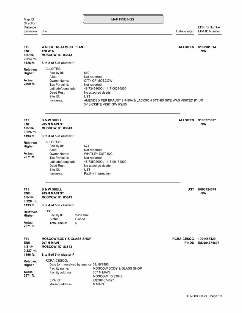
MAP FINDINGSMap IDDirection
EDR ID NumberDistanceEPA ID NumberDatabase(s)SiteElevation
3-18-03SITE VISIT GW 6/9/05 AMENDED PER EPAUST 2-4-98A & JACKSON STTHIS SITE WAS VISITED BY JRIncidents: USTSite ID: No attached deeds.Deed Rest: 46.73454000 / -117.00230000Latitude/Longitude: Not reportedTax Parcel Id: CITY OF MOSCOWOwner Name: Not reportedAlias: 660Facility Id:
ALLSITES:
1126 ft. Site 2 of 5 in cluster F0.213 mi.
Relative:Higher
Actual:2569 ft.
1/8-1/4 MOSCOW, ID 83843ENE 120 W A N/AF16 ALLSITESWATER TREATMENT PLANT S107981814
Facility InformationIncidents: USTSite ID: No attached deeds.Deed Rest: 46.73502000 / -117.00154000Latitude/Longitude: Not reportedTax Parcel Id: WHITLEY DIST INCOwner Name: Not reportedAlias: 674Facility Id:
ALLSITES:
1193 ft. Site 3 of 5 in cluster F0.226 mi.
Relative:Higher
Actual:2571 ft.
1/8-1/4 MOSCOW, ID 83843ENE 205 N MAIN ST N/AF17 ALLSITESB & W SHELL S108273587
5Total Tanks:ClosedStatus:2-290062Facility ID:
UST:
1193 ft. Site 4 of 5 in cluster F0.226 mi.
Relative:Higher
Actual:2571 ft.
1/8-1/4 MOSCOW, ID 83843ENE 205 N MAIN ST N/AF18 USTB & W SHELL U003724379
N MAINMailing address: IDD984674697EPA ID: MOSCOW, ID 83843 207 N MAINFacility address: MOSCOW BODY & GLASS SHOPFacility name: 02/16/1993Date form received by agency:
RCRA-CESQG:
1196 ft. Site 5 of 5 in cluster F0.227 mi.
Relative:Higher
Actual:2571 ft.
1/8-1/4 MOSCOW, ID 83843ENE FINDS207 N MAIN IDD984674697F19 RCRA-CESQGMOSCOW BODY & GLASS SHOP 1001487420
TC2880000.2s Page 19

MAP FINDINGSMap IDDirection
EDR ID NumberDistanceEPA ID NumberDatabase(s)SiteElevation
D001Waste code:Hazardous Waste Summary:
Verified to be non-commercialOff-site waste receiver: NoUsed oil transporter: NoUsed oil transfer facility: NoUsed oil Specification marketer: NoUsed oil fuel marketer to burner: NoUser oil refiner: NoUsed oil processor: NoUsed oil fuel burner: NoFurnace exemption: NoOn-site burner exemption: NoUnderground injection activity: NoTreater, storer or disposer of HW: NoTransporter of hazardous waste: NoRecycler of hazardous waste: UnknownMixed waste (haz. and radioactive): NoU.S. importer of hazardous waste:
Handler Activities Summary:
Not reportedOwner/Op end date: Not reportedOwner/Op start date: OwnerOwner/Operator Type: PrivateLegal status: (208) 882-2916Owner/operator telephone: Not reportedOwner/operator country: MOSCOW, ID 83843 207 N MAINOwner/operator address: TRIBBLE, RONALDOwner/operator name:
Owner/Operator Summary:
hazardous waste the cleanup of a spill, into or on any land or water, of acutely any residue or contaminated soil, waste or other debris resulting from time: 1 kg or less of acutely hazardous waste; or 100 kg or less of hazardous waste during any calendar month, and accumulates at any from the cleanup of a spill, into or on any land or water, of acutely of any residue or contaminated soil, waste or other debris resulting land or water, of acutely hazardous waste; or generates 100 kg or less other debris resulting from the cleanup of a spill, into or on any waste; or 100 kg or less of any residue or contaminated soil, waste or month, and accumulates at any time: 1 kg or less of acutely hazardous or generates 1 kg or less of acutely hazardous waste per calendar month, and accumulates 1000 kg or less of hazardous waste at any time; Handler: generates 100 kg or less of hazardous waste per calendarDescription: Conditionally Exempt Small Quantity GeneratorClassification: PrivateLand type: 10EPA Region: Not reportedContact email: (208) 882-2916Contact telephone: USContact country: MOSCOW, ID 83843 207 N MAINContact address: RONALD TRIBBLEContact: MOSCOW, ID 83843
MOSCOW BODY & GLASS SHOP (Continued) 1001487420
TC2880000.2s Page 20

MAP FINDINGSMap IDDirection
EDR ID NumberDistanceEPA ID NumberDatabase(s)SiteElevation
corrective action activities required under RCRA.program staff to track the notification, permit, compliance, andand treat, store, or dispose of hazardous waste. RCRAInfo allows RCRAevents and activities related to facilities that generate, transport,Conservation and Recovery Act (RCRA) program through the tracking ofRCRAInfo is a national information system that supports the Resource
Environmental Interest/Information System
110005789566Registry ID:
FINDS:
StateEvaluation lead agency: Not reportedDate achieved compliance: Not reportedArea of violation: COMPLIANCE ASSISTANCE VISITEvaluation: 05/12/1999Evaluation date:
StateEvaluation lead agency: Not reportedDate achieved compliance: Not reportedArea of violation: COMPLIANCE ASSISTANCE VISITEvaluation: 11/02/1999Evaluation date:
Evaluation Action Summary:
No violations foundViolation Status:
THESE SPENT SOLVENTS AND SPENT SOLVENT MIXTURES. LISTED IN F001, F002, OR F004; AND STILL BOTTOMS FROM THE RECOVERY OF ONE OR MORE OF THE ABOVE NON-HALOGENATED SOLVENTS OR THOSE SOLVENTS CONTAINING, BEFORE USE, A TOTAL OF TEN PERCENT OR MORE (BY VOLUME) OF 2-ETHOXYETHANOL, AND 2-NITROPROPANE; ALL SPENT SOLVENT MIXTURES/BLENDS KETONE, CARBON DISULFIDE, ISOBUTANOL, PYRIDINE, BENZENE, THE FOLLOWING SPENT NON-HALOGENATED SOLVENTS: TOLUENE, METHYL ETHYLWaste name: F005Waste code:
MIXTURES. BOTTOMS FROM THE RECOVERY OF THESE SPENT SOLVENTS AND SPENT SOLVENT MORE OF THOSE SOLVENTS LISTED IN F001, F002, F004, AND F005, AND STILL SOLVENTS, AND, A TOTAL OF TEN PERCENT OR MORE (BY VOLUME) OF ONE OR CONTAINING, BEFORE USE, ONE OR MORE OF THE ABOVE NON-HALOGENATED NON-HALOGENATED SOLVENTS; AND ALL SPENT SOLVENT MIXTURES/BLENDS MIXTURES/BLENDS CONTAINING, BEFORE USE, ONLY THE ABOVE SPENT ALCOHOL, CYCLOHEXANONE, AND METHANOL; ALL SPENT SOLVENT ACETATE, ETHYL BENZENE, ETHYL ETHER, METHYL ISOBUTYL KETONE, N-BUTYL THE FOLLOWING SPENT NON-HALOGENATED SOLVENTS: XYLENE, ACETONE, ETHYLWaste name: F003Waste code:
WHICH WOULD BE CONSIDERED AS IGNITABLE HAZARDOUS WASTE. MATERIAL. LACQUER THINNER IS AN EXAMPLE OF A COMMONLY USED SOLVENT WHICH CAN BE OBTAINED FROM THE MANUFACTURER OR DISTRIBUTOR OF THE FLASH POINT OF A WASTE IS TO REVIEW THE MATERIAL SAFETY DATA SHEET, CLOSED CUP FLASH POINT TESTER. ANOTHER METHOD OF DETERMINING THE LESS THAN 140 DEGREES FAHRENHEIT AS DETERMINED BY A PENSKY-MARTENS IGNITABLE HAZARDOUS WASTES ARE THOSE WASTES WHICH HAVE A FLASHPOINT OFWaste name:
MOSCOW BODY & GLASS SHOP (Continued) 1001487420
TC2880000.2s Page 21
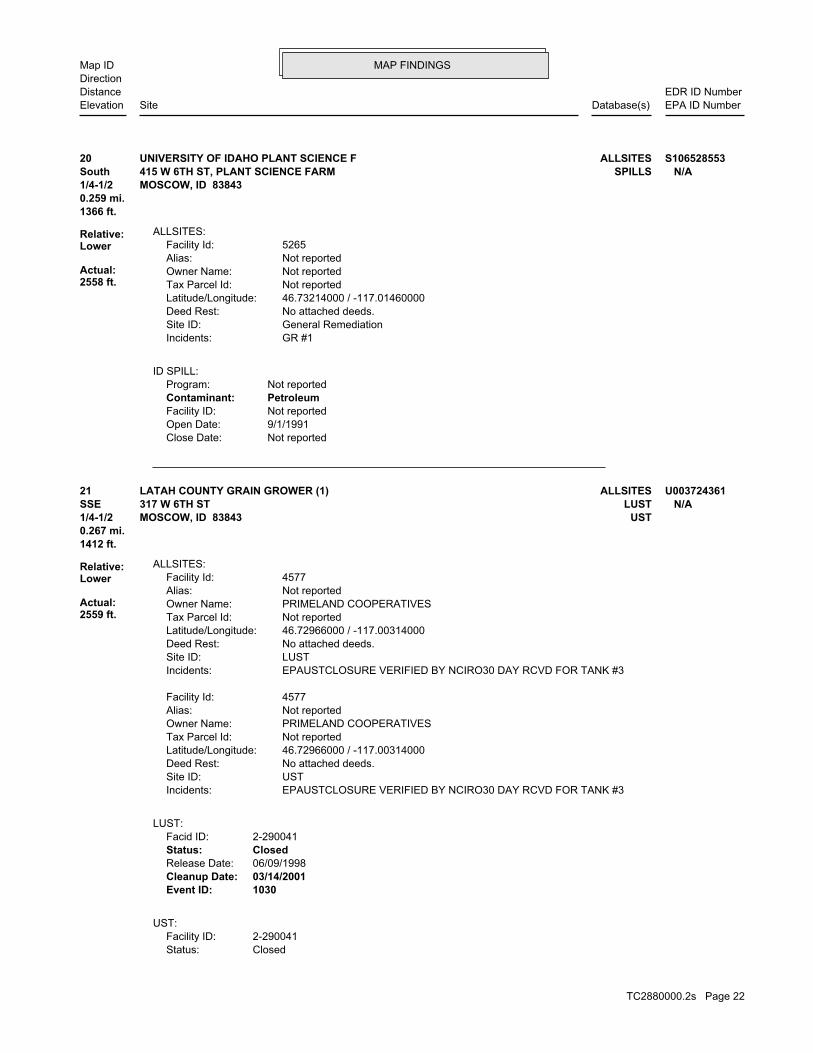
MAP FINDINGSMap IDDirection
EDR ID NumberDistanceEPA ID NumberDatabase(s)SiteElevation
Not reportedClose Date: 9/1/1991Open Date: Not reportedFacility ID: PetroleumContaminant: Not reportedProgram:
ID SPILL:
GR #1Incidents: General RemediationSite ID: No attached deeds.Deed Rest: 46.73214000 / -117.01460000Latitude/Longitude: Not reportedTax Parcel Id: Not reportedOwner Name: Not reportedAlias: 5265Facility Id:
ALLSITES:
1366 ft.0.259 mi.
Relative:Lower
Actual:2558 ft.
1/4-1/2 MOSCOW, ID 83843South SPILLS415 W 6TH ST, PLANT SCIENCE FARM N/A20 ALLSITESUNIVERSITY OF IDAHO PLANT SCIENCE F S106528553
ClosedStatus:2-290041Facility ID:
UST:
1030Event ID:03/14/2001Cleanup Date:06/09/1998Release Date:ClosedStatus:2-290041Facid ID:
LUST:
EPAUSTCLOSURE VERIFIED BY NCIRO30 DAY RCVD FOR TANK #3Incidents: USTSite ID: No attached deeds.Deed Rest: 46.72966000 / -117.00314000Latitude/Longitude: Not reportedTax Parcel Id: PRIMELAND COOPERATIVESOwner Name: Not reportedAlias: 4577Facility Id:
EPAUSTCLOSURE VERIFIED BY NCIRO30 DAY RCVD FOR TANK #3Incidents: LUSTSite ID: No attached deeds.Deed Rest: 46.72966000 / -117.00314000Latitude/Longitude: Not reportedTax Parcel Id: PRIMELAND COOPERATIVESOwner Name: Not reportedAlias: 4577Facility Id:
ALLSITES:
1412 ft.0.267 mi.
Relative:Lower
Actual:2559 ft.
1/4-1/2 USTMOSCOW, ID 83843SSE LUST317 W 6TH ST N/A21 ALLSITESLATAH COUNTY GRAIN GROWER (1) U003724361
TC2880000.2s Page 22
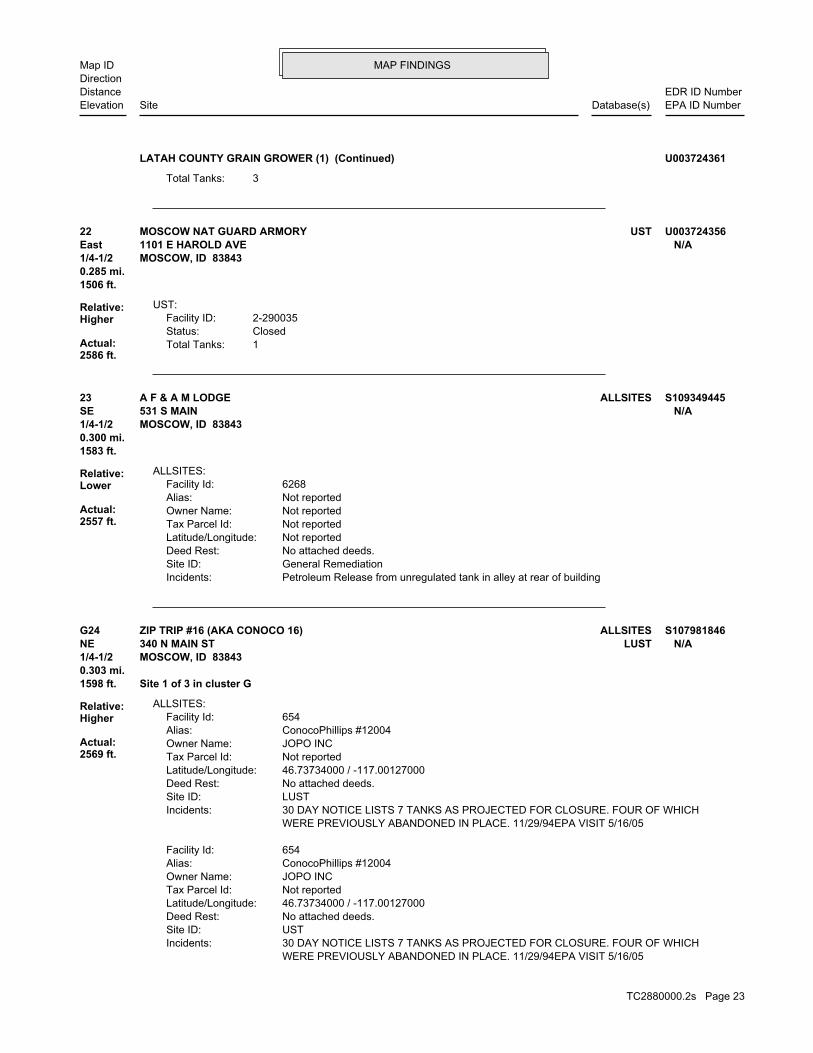
MAP FINDINGSMap IDDirection
EDR ID NumberDistanceEPA ID NumberDatabase(s)SiteElevation
3Total Tanks:
LATAH COUNTY GRAIN GROWER (1) (Continued) U003724361
1Total Tanks:ClosedStatus:2-290035Facility ID:
UST:
1506 ft.0.285 mi.
Relative:Higher
Actual:2586 ft.
1/4-1/2 MOSCOW, ID 83843East 1101 E HAROLD AVE N/A22 USTMOSCOW NAT GUARD ARMORY U003724356
Petroleum Release from unregulated tank in alley at rear of buildingIncidents: General RemediationSite ID: No attached deeds.Deed Rest: Not reportedLatitude/Longitude: Not reportedTax Parcel Id: Not reportedOwner Name: Not reportedAlias: 6268Facility Id:
ALLSITES:
1583 ft.0.300 mi.
Relative:Lower
Actual:2557 ft.
1/4-1/2 MOSCOW, ID 83843SE 531 S MAIN N/A23 ALLSITESA F & A M LODGE S109349445
WERE PREVIOUSLY ABANDONED IN PLACE. 11/29/94EPA VISIT 5/16/05 30 DAY NOTICE LISTS 7 TANKS AS PROJECTED FOR CLOSURE. FOUR OF WHICHIncidents: USTSite ID: No attached deeds.Deed Rest: 46.73734000 / -117.00127000Latitude/Longitude: Not reportedTax Parcel Id: JOPO INCOwner Name: ConocoPhillips #12004Alias: 654Facility Id:
WERE PREVIOUSLY ABANDONED IN PLACE. 11/29/94EPA VISIT 5/16/05 30 DAY NOTICE LISTS 7 TANKS AS PROJECTED FOR CLOSURE. FOUR OF WHICHIncidents: LUSTSite ID: No attached deeds.Deed Rest: 46.73734000 / -117.00127000Latitude/Longitude: Not reportedTax Parcel Id: JOPO INCOwner Name: ConocoPhillips #12004Alias: 654Facility Id:
ALLSITES:
1598 ft. Site 1 of 3 in cluster G0.303 mi.
Relative:Higher
Actual:2569 ft.
1/4-1/2 MOSCOW, ID 83843NE LUST340 N MAIN ST N/AG24 ALLSITESZIP TRIP #16 (AKA CONOCO 16) S107981846
TC2880000.2s Page 23

MAP FINDINGSMap IDDirection
EDR ID NumberDistanceEPA ID NumberDatabase(s)SiteElevation
113Event ID:Not reportedCleanup Date:10/26/1992Release Date:OpenStatus:2-290038Facid ID:
LUST:
ZIP TRIP #16 (AKA CONOCO 16) (Continued) S107981846
9Total Tanks:OpenStatus:2-290038Facility ID:
UST:
1598 ft. Site 2 of 3 in cluster G0.303 mi.
Relative:Higher
Actual:2569 ft.
1/4-1/2 MOSCOW, ID 83843NE 340 N MAIN ST N/AG25 USTZIP TRIP #16 (AKA CONOCO 16) U003724359
Not reportedOwner/Op end date: Not reportedOwner/Op start date: OwnerOwner/Operator Type: PrivateLegal status: (713) 293-3593Owner/operator telephone: Not reportedOwner/operator country: HOUSTON, TX 77069 600 N DAIRY-ASHFORDOwner/operator address: CONOCOOwner/operator name:
Owner/Operator Summary:
Handler: Non-Generators do not presently generate hazardous wasteDescription: Non-GeneratorClassification: PrivateLand type: 10EPA Region: Not reportedContact email: (713) 293-3593Contact telephone: USContact country: HOUSTON, TX 772104784 PO BOX 4784Contact address: KEITH COFFMANContact: HOUSTON, TX 772104784 PO BOX 4784Mailing address: IDD984674606EPA ID: MOSCOW, ID 83843 340 N MAINFacility address: CONOCO STORE 12004Facility name: 01/15/1993Date form received by agency:
RCRA-NonGen:
1598 ft. Site 3 of 3 in cluster G0.303 mi.
Relative:Higher
Actual:2569 ft.
1/4-1/2 MOSCOW, ID 83843NE FINDS340 N MAIN IDD984674606G26 RCRA-NonGenCONOCO STORE 12004 1000823447
TC2880000.2s Page 24

MAP FINDINGSMap IDDirection
EDR ID NumberDistanceEPA ID NumberDatabase(s)SiteElevation
corrective action activities required under RCRA.program staff to track the notification, permit, compliance, andand treat, store, or dispose of hazardous waste. RCRAInfo allows RCRAevents and activities related to facilities that generate, transport,Conservation and Recovery Act (RCRA) program through the tracking ofRCRAInfo is a national information system that supports the Resource
Environmental Interest/Information System
110005789487Registry ID:
FINDS:
StateEvaluation lead agency: Not reportedDate achieved compliance: Not reportedArea of violation: COMPLIANCE EVALUATION INSPECTION ON-SITEEvaluation: 02/12/1993Evaluation date:
Evaluation Action Summary:
No violations foundViolation Status:
LEADWaste name: D008Waste code:
Hazardous Waste Summary:
Verified to be non-commercialOff-site waste receiver: NoUsed oil transporter: NoUsed oil transfer facility: NoUsed oil Specification marketer: NoUsed oil fuel marketer to burner: NoUser oil refiner: NoUsed oil processor: NoUsed oil fuel burner: NoFurnace exemption: NoOn-site burner exemption: NoUnderground injection activity: NoTreater, storer or disposer of HW: NoTransporter of hazardous waste: NoRecycler of hazardous waste: UnknownMixed waste (haz. and radioactive): NoU.S. importer of hazardous waste:
Handler Activities Summary:
CONOCO STORE 12004 (Continued) 1000823447
PO BOX 9203Mailing address: IDR000002493EPA ID: MOSCOW, ID 83843 206 E 3RD STFacility address: MOSCOW CITYFacility name: 06/30/2005Date form received by agency:
RCRA-CESQG:
1608 ft.0.304 mi.
Relative:Higher
Actual:2584 ft.
1/4-1/2 MOSCOW, ID 83843ESE FINDS206 E 3RD ST IDR00000249327 RCRA-CESQGMOSCOW CITY 1004692077
TC2880000.2s Page 25
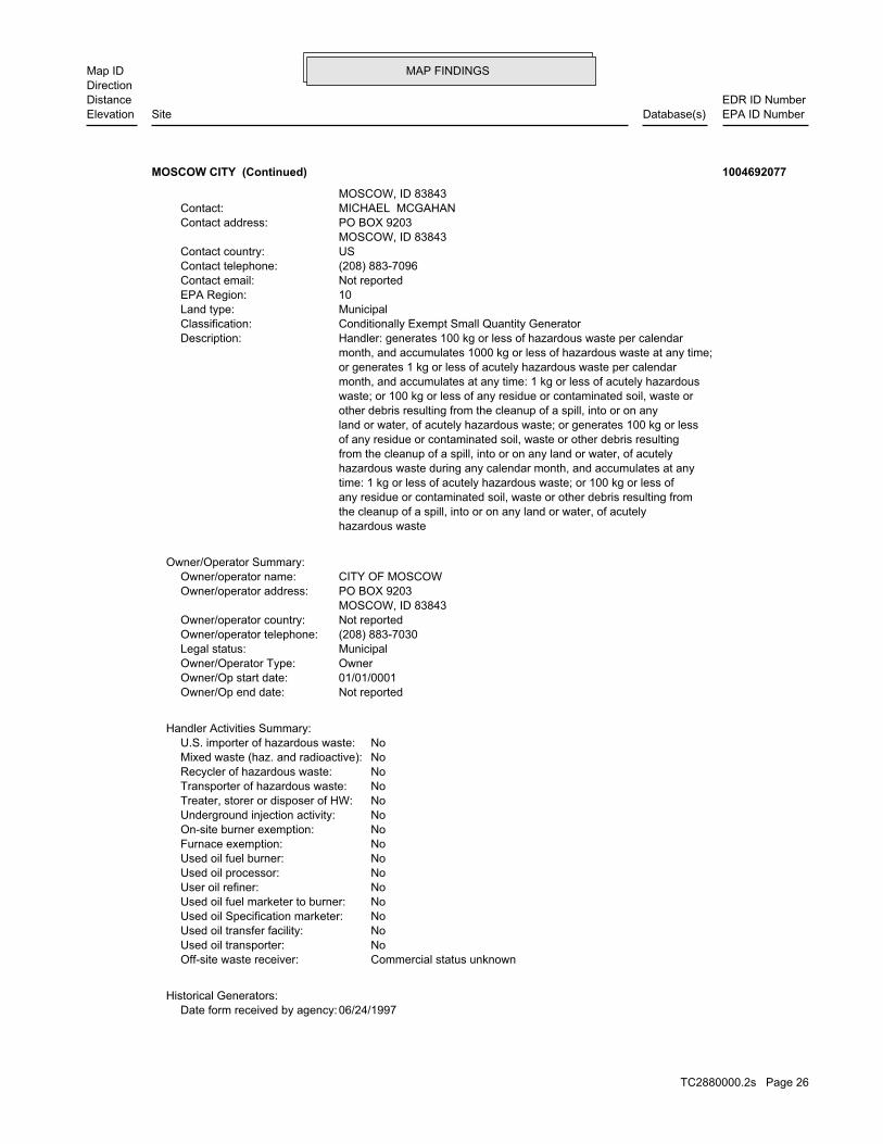
MAP FINDINGSMap IDDirection
EDR ID NumberDistanceEPA ID NumberDatabase(s)SiteElevation
06/24/1997Date form received by agency:Historical Generators:
Commercial status unknownOff-site waste receiver: NoUsed oil transporter: NoUsed oil transfer facility: NoUsed oil Specification marketer: NoUsed oil fuel marketer to burner: NoUser oil refiner: NoUsed oil processor: NoUsed oil fuel burner: NoFurnace exemption: NoOn-site burner exemption: NoUnderground injection activity: NoTreater, storer or disposer of HW: NoTransporter of hazardous waste: NoRecycler of hazardous waste: NoMixed waste (haz. and radioactive): NoU.S. importer of hazardous waste:
Handler Activities Summary:
Not reportedOwner/Op end date: 01/01/0001Owner/Op start date: OwnerOwner/Operator Type: MunicipalLegal status: (208) 883-7030Owner/operator telephone: Not reportedOwner/operator country: MOSCOW, ID 83843 PO BOX 9203Owner/operator address: CITY OF MOSCOWOwner/operator name:
Owner/Operator Summary:
hazardous waste the cleanup of a spill, into or on any land or water, of acutely any residue or contaminated soil, waste or other debris resulting from time: 1 kg or less of acutely hazardous waste; or 100 kg or less of hazardous waste during any calendar month, and accumulates at any from the cleanup of a spill, into or on any land or water, of acutely of any residue or contaminated soil, waste or other debris resulting land or water, of acutely hazardous waste; or generates 100 kg or less other debris resulting from the cleanup of a spill, into or on any waste; or 100 kg or less of any residue or contaminated soil, waste or month, and accumulates at any time: 1 kg or less of acutely hazardous or generates 1 kg or less of acutely hazardous waste per calendar month, and accumulates 1000 kg or less of hazardous waste at any time; Handler: generates 100 kg or less of hazardous waste per calendarDescription: Conditionally Exempt Small Quantity GeneratorClassification: MunicipalLand type: 10EPA Region: Not reportedContact email: (208) 883-7096Contact telephone: USContact country: MOSCOW, ID 83843 PO BOX 9203Contact address: MICHAEL MCGAHANContact: MOSCOW, ID 83843
MOSCOW CITY (Continued) 1004692077
TC2880000.2s Page 26

MAP FINDINGSMap IDDirection
EDR ID NumberDistanceEPA ID NumberDatabase(s)SiteElevation
corrective action activities required under RCRA.program staff to track the notification, permit, compliance, andand treat, store, or dispose of hazardous waste. RCRAInfo allows RCRAevents and activities related to facilities that generate, transport,Conservation and Recovery Act (RCRA) program through the tracking ofRCRAInfo is a national information system that supports the Resource
Environmental Interest/Information System
110005791740Registry ID:
FINDS:
StateEvaluation lead agency: Not reportedDate achieved compliance: Not reportedArea of violation: COMPLIANCE ASSISTANCE VISITEvaluation: 06/09/2005Evaluation date:
Evaluation Action Summary:
No violations foundViolation Status:
LEADWaste name: D008Waste code:
Hazardous Waste Summary:
Conditionally Exempt Small Quantity GeneratorClassification: MOSCOW CITYFacility name:
MOSCOW CITY (Continued) 1004692077
DANE PAIN 877-1101SITE VISITED BY JB 10-16-03Site visit GW 3/8/07 IST AVE E LINE STEPAUSTTHIS SITE WAS VISITED BY THE LRO 8-00POC ISIncidents: USTSite ID: No attached deeds.Deed Rest: 46.79851000 / -116.56231000Latitude/Longitude: Not reportedTax Parcel Id: NORTH LATAH COUNTY HIGHWAY DISTOwner Name: Not reportedAlias: 829Facility Id:
ALLSITES:
1644 ft. Site 1 of 2 in cluster H0.311 mi.
Relative:Lower
Actual:2555 ft.
1/4-1/2 DEARY, ID 83823WSW 309 E LINE ST N/AH28 ALLSITESNORTH LATAH COUNTY HIGHWAY DIST (1) S107981468
TC2880000.2s Page 27

MAP FINDINGSMap IDDirection
EDR ID NumberDistanceEPA ID NumberDatabase(s)SiteElevation
4Total Tanks:OpenStatus:2-290613Facility ID:
UST:
1644 ft. Site 2 of 2 in cluster H0.311 mi.
Relative:Lower
Actual:2555 ft.
1/4-1/2 DEARY, ID 83823WSW 309 E LINE ST N/AH29 USTNORTH LATAH COUNTY HIGHWAY DIST (1) U003724416
3/1/1993Close Date: 6/30/1992Open Date: Not reportedFacility ID: PetroleumContaminant: Not reportedProgram:
ID SPILL:
3Total Tanks:ClosedStatus:2-290021Facility ID:
UST:
676Event ID:03/01/1993Cleanup Date:06/30/1992Release Date:ClosedStatus:2-290021Facid ID:
LUST:
Facility InformationIncidents: USTSite ID: No attached deeds.Deed Rest: 46.73217000 / -117.00801000Latitude/Longitude: Not reportedTax Parcel Id: AMBASSADOR AUTO SERVICE INCOwner Name: Not reportedAlias: 638Facility Id:
NOT LISTED RELEASEPRIORITY 00Incidents: LUSTSite ID: No attached deeds.Deed Rest: 46.73217000 / -117.00801000Latitude/Longitude: Not reportedTax Parcel Id: AMBASSADOR AUTO SERVICE INCOwner Name: Not reportedAlias: 638Facility Id:
ALLSITES:
1724 ft. Site 1 of 3 in cluster I0.327 mi. SPILLS
Relative:Lower
Actual:2557 ft.
1/4-1/2 USTMOSCOW, ID 83843SE LUST115 W 6TH N/AI30 ALLSITESAMBASSADOR AUTO SERVICE U003724346
TC2880000.2s Page 28

MAP FINDINGSMap IDDirection
EDR ID NumberDistanceEPA ID NumberDatabase(s)SiteElevation
NoFurnace exemption: NoOn-site burner exemption: NoUnderground injection activity: NoTreater, storer or disposer of HW: NoTransporter of hazardous waste: NoRecycler of hazardous waste: UnknownMixed waste (haz. and radioactive): NoU.S. importer of hazardous waste:
Handler Activities Summary:
Not reportedOwner/Op end date: Not reportedOwner/Op start date: OwnerOwner/Operator Type: PrivateLegal status: Not reportedOwner/operator telephone: Not reportedOwner/operator country: Not reported Not reportedOwner/operator address: ROGER D VIRGINOwner/operator name:
Owner/Operator Summary:
hazardous waste the cleanup of a spill, into or on any land or water, of acutely any residue or contaminated soil, waste or other debris resulting from time: 1 kg or less of acutely hazardous waste; or 100 kg or less of hazardous waste during any calendar month, and accumulates at any from the cleanup of a spill, into or on any land or water, of acutely of any residue or contaminated soil, waste or other debris resulting land or water, of acutely hazardous waste; or generates 100 kg or less other debris resulting from the cleanup of a spill, into or on any waste; or 100 kg or less of any residue or contaminated soil, waste or month, and accumulates at any time: 1 kg or less of acutely hazardous or generates 1 kg or less of acutely hazardous waste per calendar month, and accumulates 1000 kg or less of hazardous waste at any time; Handler: generates 100 kg or less of hazardous waste per calendarDescription: Conditionally Exempt Small Quantity GeneratorClassification: Facility is not located on Indian land. Additional information is not known.Land type: 10EPA Region: Not reportedContact email: (208) 882-4231Contact telephone: USContact country: MOSCOW, ID 83843 616 S MAINContact address: ROGER VIRGINContact: MOSCOW, ID 83843 S MAINMailing address: IDD033979642EPA ID: MOSCOW, ID 83843 616 S MAINFacility address: GREENS CLEANERSFacility name: 06/24/1988Date form received by agency:
RCRA-CESQG:
1807 ft. Site 2 of 3 in cluster I0.342 mi.
Relative:Lower
Actual:2557 ft.
1/4-1/2 MOSCOW, ID 83843SE FINDS616 S MAIN IDD033979642I31 RCRA-CESQGGREENS CLEANERS 1004691658
TC2880000.2s Page 29

MAP FINDINGSMap IDDirection
EDR ID NumberDistanceEPA ID NumberDatabase(s)SiteElevation
corrective action activities required under RCRA.program staff to track the notification, permit, compliance, andand treat, store, or dispose of hazardous waste. RCRAInfo allows RCRAevents and activities related to facilities that generate, transport,Conservation and Recovery Act (RCRA) program through the tracking ofRCRAInfo is a national information system that supports the Resource
Environmental Interest/Information System
110005782224Registry ID:
FINDS:
StateEvaluation lead agency: Not reportedDate achieved compliance: Not reportedArea of violation: COMPLIANCE ASSISTANCE VISITEvaluation: 03/20/2002Evaluation date:
Evaluation Action Summary:
No violations foundViolation Status:
SPENT SOLVENT MIXTURES. F005, AND STILL BOTTOMS FROM THE RECOVERY OF THESE SPENT SOLVENTS AND OF THE ABOVE HALOGENATED SOLVENTS OR THOSE LISTED IN F001, F004, OR BEFORE USE, A TOTAL OF TEN PERCENT OR MORE (BY VOLUME) OF ONE OR MORE 1,1,2-TRICHLOROETHANE; ALL SPENT SOLVENT MIXTURES/BLENDS CONTAINING, ORTHO-DICHLOROBENZENE, TRICHLOROFLUOROMETHANE, AND CHLOROBENZENE, 1,1,2-TRICHLORO-1,2,2-TRIFLUOROETHANE, METHYLENE CHLORIDE, TRICHLOROETHYLENE, 1,1,1-TRICHLOROETHANE, THE FOLLOWING SPENT HALOGENATED SOLVENTS: TETRACHLOROETHYLENE,Waste name: F002Waste code:
Hazardous Waste Summary:
Verified to be non-commercialOff-site waste receiver: NoUsed oil transporter: NoUsed oil transfer facility: NoUsed oil Specification marketer: NoUsed oil fuel marketer to burner: NoUser oil refiner: NoUsed oil processor: NoUsed oil fuel burner:
GREENS CLEANERS (Continued) 1004691658
Roger VirginContact Name:Perc DCFacility Type:DT1-098Facility ID:
Drycleaners:
1807 ft. Site 3 of 3 in cluster I0.342 mi.
Relative:Lower
Actual:2557 ft.
1/4-1/2 MOSCOW, ID SE 616 S MAIN STREET N/AI32 DRYCLEANERSGREENS CLEANERS S107470755
TC2880000.2s Page 30
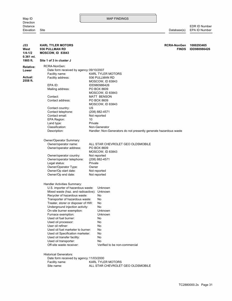
MAP FINDINGSMap IDDirection
EDR ID NumberDistanceEPA ID NumberDatabase(s)SiteElevation
ALL STAR CHEVROLET GEO OLDSMOBILESite name: KARL TYLER MOTORSFacility name: 11/03/2000Date form received by agency:
Historical Generators:
Verified to be non-commercialOff-site waste receiver: NoUsed oil transporter: NoUsed oil transfer facility: NoUsed oil Specification marketer: NoUsed oil fuel marketer to burner: NoUser oil refiner: NoUsed oil processor: NoUsed oil fuel burner: UnknownFurnace exemption: UnknownOn-site burner exemption: NoUnderground injection activity: NoTreater, storer or disposer of HW: NoTransporter of hazardous waste: NoRecycler of hazardous waste: UnknownMixed waste (haz. and radioactive): UnknownU.S. importer of hazardous waste:
Handler Activities Summary:
Not reportedOwner/Op end date: Not reportedOwner/Op start date: OwnerOwner/Operator Type: PrivateLegal status: (208) 882-4571Owner/operator telephone: Not reportedOwner/operator country: MOSCOW, ID 83843 PO BOX 8609Owner/operator address: ALL STAR CHEVROLET GEO OLDSMOBILEOwner/operator name:
Owner/Operator Summary:
Handler: Non-Generators do not presently generate hazardous wasteDescription: Non-GeneratorClassification: PrivateLand type: 10EPA Region: Not reportedContact email: (208) 882-4571Contact telephone: USContact country: MOSCOW, ID 83843 PO BOX 8609Contact address: MATT BENSONContact: MOSCOW, ID 83843 PO BOX 8609Mailing address: IDD980986426EPA ID: MOSCOW, ID 83843 936 PULLMAN RDFacility address: KARL TYLER MOTORSFacility name: 09/10/2007Date form received by agency:
RCRA-NonGen:
1905 ft. Site 1 of 3 in cluster J0.361 mi.
Relative:Lower
Actual:2558 ft.
1/4-1/2 MOSCOW, ID 83843West FINDS936 PULLMAN RD IDD980986426J33 RCRA-NonGenKARL TYLER MOTORS 1000293465
TC2880000.2s Page 31

MAP FINDINGSMap IDDirection
EDR ID NumberDistanceEPA ID NumberDatabase(s)SiteElevation
FLASH POINT OF A WASTE IS TO REVIEW THE MATERIAL SAFETY DATA SHEET, CLOSED CUP FLASH POINT TESTER. ANOTHER METHOD OF DETERMINING THE LESS THAN 140 DEGREES FAHRENHEIT AS DETERMINED BY A PENSKY-MARTENS IGNITABLE HAZARDOUS WASTES ARE THOSE WASTES WHICH HAVE A FLASHPOINT OFWaste name: D001Waste code:
THESE SPENT SOLVENTS AND SPENT SOLVENT MIXTURES. LISTED IN F001, F002, OR F004; AND STILL BOTTOMS FROM THE RECOVERY OF ONE OR MORE OF THE ABOVE NON-HALOGENATED SOLVENTS OR THOSE SOLVENTS CONTAINING, BEFORE USE, A TOTAL OF TEN PERCENT OR MORE (BY VOLUME) OF 2-ETHOXYETHANOL, AND 2-NITROPROPANE; ALL SPENT SOLVENT MIXTURES/BLENDS KETONE, CARBON DISULFIDE, ISOBUTANOL, PYRIDINE, BENZENE, THE FOLLOWING SPENT NON-HALOGENATED SOLVENTS: TOLUENE, METHYL ETHYLWaste name: F005Waste code:
SPENT SOLVENTS AND SPENT SOLVENT MIXTURES. F001, F002, AND F005; AND STILL BOTTOMS FROM THE RECOVERY OF THESE OF THE ABOVE NON-HALOGENATED SOLVENTS OR THOSE SOLVENTS LISTED IN BEFORE USE, A TOTAL OF TEN PERCENT OR MORE (BY VOLUME) OF ONE OR MORE ACID, AND NITROBENZENE; ALL SPENT SOLVENT MIXTURES/BLENDS CONTAINING, THE FOLLOWING SPENT NON-HALOGENATED SOLVENTS: CRESOLS AND CRESYLICWaste name: F004Waste code:
MIXTURES. BOTTOMS FROM THE RECOVERY OF THESE SPENT SOLVENTS AND SPENT SOLVENT MORE OF THOSE SOLVENTS LISTED IN F001, F002, F004, AND F005, AND STILL SOLVENTS, AND, A TOTAL OF TEN PERCENT OR MORE (BY VOLUME) OF ONE OR CONTAINING, BEFORE USE, ONE OR MORE OF THE ABOVE NON-HALOGENATED NON-HALOGENATED SOLVENTS; AND ALL SPENT SOLVENT MIXTURES/BLENDS MIXTURES/BLENDS CONTAINING, BEFORE USE, ONLY THE ABOVE SPENT ALCOHOL, CYCLOHEXANONE, AND METHANOL; ALL SPENT SOLVENT ACETATE, ETHYL BENZENE, ETHYL ETHER, METHYL ISOBUTYL KETONE, N-BUTYL THE FOLLOWING SPENT NON-HALOGENATED SOLVENTS: XYLENE, ACETONE, ETHYLWaste name: F003Waste code:
SPENT SOLVENT MIXTURES. F005, AND STILL BOTTOMS FROM THE RECOVERY OF THESE SPENT SOLVENTS AND OF THE ABOVE HALOGENATED SOLVENTS OR THOSE LISTED IN F001, F004, OR BEFORE USE, A TOTAL OF TEN PERCENT OR MORE (BY VOLUME) OF ONE OR MORE 1,1,2-TRICHLOROETHANE; ALL SPENT SOLVENT MIXTURES/BLENDS CONTAINING, ORTHO-DICHLOROBENZENE, TRICHLOROFLUOROMETHANE, AND CHLOROBENZENE, 1,1,2-TRICHLORO-1,2,2-TRIFLUOROETHANE, METHYLENE CHLORIDE, TRICHLOROETHYLENE, 1,1,1-TRICHLOROETHANE, THE FOLLOWING SPENT HALOGENATED SOLVENTS: TETRACHLOROETHYLENE,Waste name: F002Waste code:
WHICH WOULD BE CONSIDERED AS IGNITABLE HAZARDOUS WASTE. MATERIAL. LACQUER THINNER IS AN EXAMPLE OF A COMMONLY USED SOLVENT WHICH CAN BE OBTAINED FROM THE MANUFACTURER OR DISTRIBUTOR OF THE FLASH POINT OF A WASTE IS TO REVIEW THE MATERIAL SAFETY DATA SHEET, CLOSED CUP FLASH POINT TESTER. ANOTHER METHOD OF DETERMINING THE LESS THAN 140 DEGREES FAHRENHEIT AS DETERMINED BY A PENSKY-MARTENS IGNITABLE HAZARDOUS WASTES ARE THOSE WASTES WHICH HAVE A FLASHPOINT OFWaste name: D001Waste code:
Hazardous Waste Summary:
Not a generator, verifiedClassification:
KARL TYLER MOTORS (Continued) 1000293465
TC2880000.2s Page 32

MAP FINDINGSMap IDDirection
EDR ID NumberDistanceEPA ID NumberDatabase(s)SiteElevation
Not reported Final penalty amount: Not reported Proposed penalty amount: State Enforcement lead agency: Not reported Enf. disp. status date: Not reported Enf. disposition status: 10/15/1992 Enforcement action date: WRITTEN INFORMAL Enforcement action: StateViolation lead agency: 03/17/1994Date achieved compliance: 10/15/1992Date violation determined: Generators - Records/ReportingArea of violation: SS - IDAHO CODE 39-4411 (4)Regulation violated:
Facility Has Received Notices of Violations:
THESE SPENT SOLVENTS AND SPENT SOLVENT MIXTURES. LISTED IN F001, F002, OR F004; AND STILL BOTTOMS FROM THE RECOVERY OF ONE OR MORE OF THE ABOVE NON-HALOGENATED SOLVENTS OR THOSE SOLVENTS CONTAINING, BEFORE USE, A TOTAL OF TEN PERCENT OR MORE (BY VOLUME) OF 2-ETHOXYETHANOL, AND 2-NITROPROPANE; ALL SPENT SOLVENT MIXTURES/BLENDS KETONE, CARBON DISULFIDE, ISOBUTANOL, PYRIDINE, BENZENE, THE FOLLOWING SPENT NON-HALOGENATED SOLVENTS: TOLUENE, METHYL ETHYLWaste name: F005Waste code:
SPENT SOLVENTS AND SPENT SOLVENT MIXTURES. F001, F002, AND F005; AND STILL BOTTOMS FROM THE RECOVERY OF THESE OF THE ABOVE NON-HALOGENATED SOLVENTS OR THOSE SOLVENTS LISTED IN BEFORE USE, A TOTAL OF TEN PERCENT OR MORE (BY VOLUME) OF ONE OR MORE ACID, AND NITROBENZENE; ALL SPENT SOLVENT MIXTURES/BLENDS CONTAINING, THE FOLLOWING SPENT NON-HALOGENATED SOLVENTS: CRESOLS AND CRESYLICWaste name: F004Waste code:
MIXTURES. BOTTOMS FROM THE RECOVERY OF THESE SPENT SOLVENTS AND SPENT SOLVENT MORE OF THOSE SOLVENTS LISTED IN F001, F002, F004, AND F005, AND STILL SOLVENTS, AND, A TOTAL OF TEN PERCENT OR MORE (BY VOLUME) OF ONE OR CONTAINING, BEFORE USE, ONE OR MORE OF THE ABOVE NON-HALOGENATED NON-HALOGENATED SOLVENTS; AND ALL SPENT SOLVENT MIXTURES/BLENDS MIXTURES/BLENDS CONTAINING, BEFORE USE, ONLY THE ABOVE SPENT ALCOHOL, CYCLOHEXANONE, AND METHANOL; ALL SPENT SOLVENT ACETATE, ETHYL BENZENE, ETHYL ETHER, METHYL ISOBUTYL KETONE, N-BUTYL THE FOLLOWING SPENT NON-HALOGENATED SOLVENTS: XYLENE, ACETONE, ETHYLWaste name: F003Waste code:
SPENT SOLVENT MIXTURES. F005, AND STILL BOTTOMS FROM THE RECOVERY OF THESE SPENT SOLVENTS AND OF THE ABOVE HALOGENATED SOLVENTS OR THOSE LISTED IN F001, F004, OR BEFORE USE, A TOTAL OF TEN PERCENT OR MORE (BY VOLUME) OF ONE OR MORE 1,1,2-TRICHLOROETHANE; ALL SPENT SOLVENT MIXTURES/BLENDS CONTAINING, ORTHO-DICHLOROBENZENE, TRICHLOROFLUOROMETHANE, AND CHLOROBENZENE, 1,1,2-TRICHLORO-1,2,2-TRIFLUOROETHANE, METHYLENE CHLORIDE, TRICHLOROETHYLENE, 1,1,1-TRICHLOROETHANE, THE FOLLOWING SPENT HALOGENATED SOLVENTS: TETRACHLOROETHYLENE,Waste name: F002Waste code:
WHICH WOULD BE CONSIDERED AS IGNITABLE HAZARDOUS WASTE. MATERIAL. LACQUER THINNER IS AN EXAMPLE OF A COMMONLY USED SOLVENT WHICH CAN BE OBTAINED FROM THE MANUFACTURER OR DISTRIBUTOR OF THE
KARL TYLER MOTORS (Continued) 1000293465
TC2880000.2s Page 33

MAP FINDINGSMap IDDirection
EDR ID NumberDistanceEPA ID NumberDatabase(s)SiteElevation
corrective action activities required under RCRA.program staff to track the notification, permit, compliance, andand treat, store, or dispose of hazardous waste. RCRAInfo allows RCRAevents and activities related to facilities that generate, transport,Conservation and Recovery Act (RCRA) program through the tracking ofRCRAInfo is a national information system that supports the Resource
Environmental Interest/Information System
110005785150Registry ID:
FINDS:
StateEvaluation lead agency: 03/17/1994Date achieved compliance: Generators - Records/ReportingArea of violation: NON-FINANCIAL RECORD REVIEWEvaluation: 10/15/1992Evaluation date:
StateEvaluation lead agency: Not reportedDate achieved compliance: Not reportedArea of violation: COMPLIANCE EVALUATION INSPECTION ON-SITEEvaluation: 01/18/2002Evaluation date:
StateEvaluation lead agency: Not reportedDate achieved compliance: Not reportedArea of violation: COMPLIANCE ASSISTANCE VISITEvaluation: 09/07/2007Evaluation date:
Evaluation Action Summary:
Not reported Paid penalty amount:
KARL TYLER MOTORS (Continued) 1000293465
3Total Tanks:ClosedStatus:2-290086Facility ID:
UST:
1905 ft. Site 2 of 3 in cluster J0.361 mi.
Relative:Lower
Actual:2558 ft.
1/4-1/2 MOSCOW, ID 83843West 936 PULLMAN RD N/AJ34 USTWALLY ORVIK MOTORS, INC. U003724398
Not reportedTax Parcel Id: WALLY ORVIK MOTORS INCOwner Name: Not reportedAlias: 695Facility Id:
ALLSITES:
1905 ft. Site 3 of 3 in cluster J0.361 mi.
Relative:Lower
Actual:2558 ft.
1/4-1/2 MOSCOW, ID 83843West 936 PULLMAN RD N/AJ35 ALLSITESWALLY ORVIK MOTORS, INC. S108276305
TC2880000.2s Page 34

MAP FINDINGSMap IDDirection
EDR ID NumberDistanceEPA ID NumberDatabase(s)SiteElevation
Facility InformationIncidents: USTSite ID: No attached deeds.Deed Rest: 46.73362000 / -117.01283000Latitude/Longitude:
WALLY ORVIK MOTORS, INC. (Continued) S108276305
1Total Tanks:ClosedStatus:2-290628Facility ID:
UST:
1170Event ID:08/21/1998Cleanup Date:08/04/1998Release Date:ClosedStatus:2-290628Facid ID:
LUST:
NO NOTIFICATION FORM. DATA TAKEN FROM LUST DATABASE ENTRY FORMIncidents: USTSite ID: No attached deeds.Deed Rest: 46.73515000 / -116.98707000Latitude/Longitude: Not reportedTax Parcel Id: ROSCOE WILLIAMSOwner Name: Not reportedAlias: 4562Facility Id:
NO NOTIFICATION FORM. DATA TAKEN FROM LUST DATABASE ENTRY FORMIncidents: LUSTSite ID: No attached deeds.Deed Rest: 46.73515000 / -116.98707000Latitude/Longitude: Not reportedTax Parcel Id: ROSCOE WILLIAMSOwner Name: Not reportedAlias: 4562Facility Id:
ALLSITES:
1994 ft.0.378 mi.
Relative:Lower
Actual:2559 ft.
1/4-1/2 USTMOSCOW, ID 83843SE LUSTS MAIN N/A36 ALLSITESTHE VOX U003724427
No attached deeds.Deed Rest: 46.72817000 / -117.00117000Latitude/Longitude: Not reportedTax Parcel Id: Not reportedOwner Name: Not reportedAlias: 5275Facility Id:
ALLSITES:
2049 ft. Site 1 of 2 in cluster K0.388 mi.
Relative:Lower
Actual:2557 ft.
1/4-1/2 MOSCOW, ID 83843SE SPILLS700 S MAIN ST N/AK37 ALLSITESGRITMAN HOSPITAL ANNEX 1004471187
TC2880000.2s Page 35

MAP FINDINGSMap IDDirection
EDR ID NumberDistanceEPA ID NumberDatabase(s)SiteElevation
5/3/2003Close Date: 6/1/2001Open Date: Not reportedFacility ID: PetroleumContaminant: Not reportedProgram:
ID SPILL:
GR #1Incidents: General RemediationSite ID:
GRITMAN HOSPITAL ANNEX (Continued) 1004471187
SITE VISITED BY JB 10-17-03Incidents: USTSite ID: No attached deeds.Deed Rest: 46.73880000 / -117.00199000Latitude/Longitude: Not reportedTax Parcel Id: VERIZONOwner Name: Not reportedAlias: 643Facility Id:
ALLSITES:
2075 ft.0.393 mi.
Relative:Higher
Actual:2578 ft.
1/4-1/2 MOSCOW, ID 83843NNE 122 W E ST N/A38 ALLSITESMOSCOW GAS SHED (1420-BO2) S107981432
05/15/1993Release Date:ClosedStatus:2-290032Facid ID:
LUST:
Facility InformationIncidents: USTSite ID: No attached deeds.Deed Rest: 46.72845000 / -117.00100000Latitude/Longitude: Not reportedTax Parcel Id: GRITMAN MEDICAL CENTEROwner Name: Not reportedAlias: 648Facility Id:
GASOLINE RELEASEPRIORITY 00Incidents: LUSTSite ID: No attached deeds.Deed Rest: 46.72845000 / -117.00100000Latitude/Longitude: Not reportedTax Parcel Id: GRITMAN MEDICAL CENTEROwner Name: Not reportedAlias: 648Facility Id:
ALLSITES:
2129 ft. Site 2 of 2 in cluster K0.403 mi.
Relative:Lower
Actual:2556 ft.
1/4-1/2 USTMOSCOW, ID 83843SSE LUST728 S MAIN ST N/AK39 ALLSITESGRITMAN MEDICAL CENTER U003724355
TC2880000.2s Page 36

MAP FINDINGSMap IDDirection
EDR ID NumberDistanceEPA ID NumberDatabase(s)SiteElevation
4Total Tanks:ClosedStatus:2-290032Facility ID:
UST:
110Event ID:07/01/2002Cleanup Date:
GRITMAN MEDICAL CENTER (Continued) U003724355
9/10/2001Close Date: 8/1/1995Open Date: Not reportedFacility ID: PetroleumContaminant: Not reportedProgram:
ID SPILL:
8Total Tanks:ClosedStatus:2-290602Facility ID:
UST:
122Event ID:09/10/2001Cleanup Date:08/01/1995Release Date:ClosedStatus:2-290602Facid ID:
LUST:
12/14/04 AMENDED PER EPAUSTSITE VISITED BY JF 6/15/0430 DAY CLOSURE RCVDIncidents: USTSite ID: No attached deeds.Deed Rest: 46.73335000 / -117.01462000Latitude/Longitude: Not reportedTax Parcel Id: DARRELL R TOWNOwner Name: Not reportedAlias: 706Facility Id:
12/14/04 AMENDED PER EPAUSTSITE VISITED BY JF 6/15/0430 DAY CLOSURE RCVDIncidents: LUSTSite ID: No attached deeds.Deed Rest: 46.73335000 / -117.01462000Latitude/Longitude: Not reportedTax Parcel Id: DARRELL R TOWNOwner Name: Not reportedAlias: 706Facility Id:
ALLSITES:
2224 ft. Site 1 of 2 in cluster L0.421 mi. SPILLS
Relative:Lower
Actual:2556 ft.
1/4-1/2 USTMOSCOW, ID 83843West LUST1006 PULLMAN RD N/AL40 ALLSITESHUSKY SPORT SHOP U003724407
TC2880000.2s Page 37
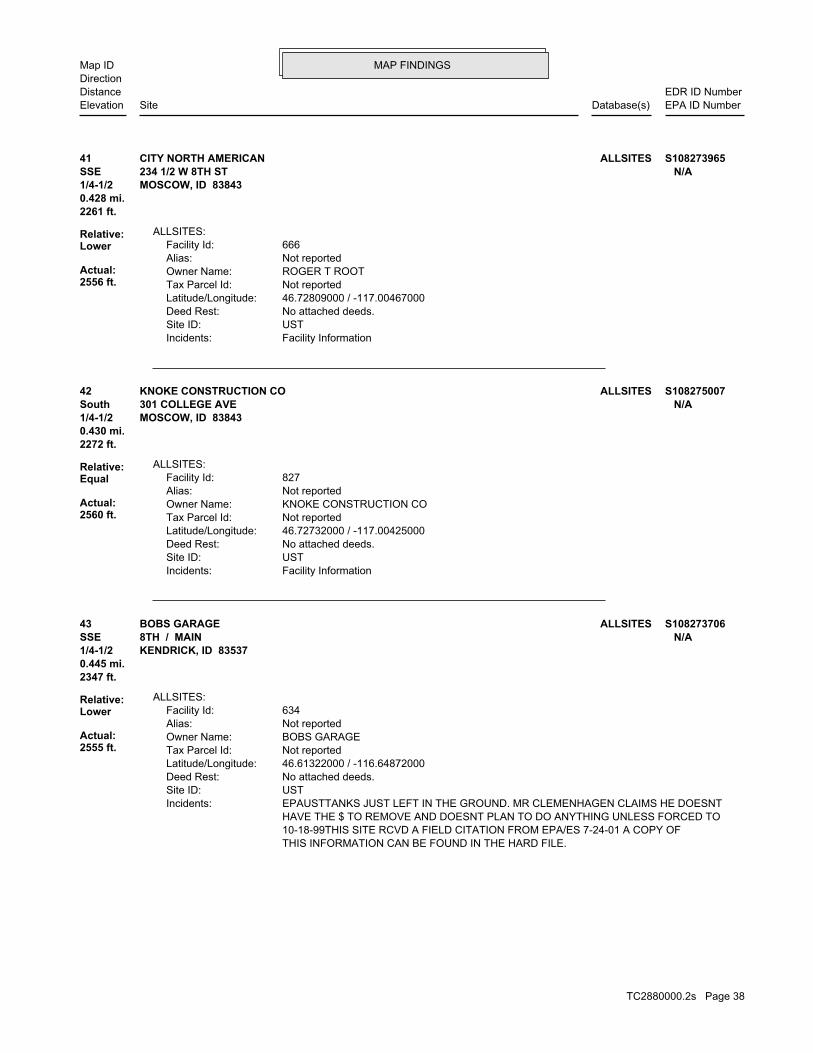
MAP FINDINGSMap IDDirection
EDR ID NumberDistanceEPA ID NumberDatabase(s)SiteElevation
Facility InformationIncidents: USTSite ID: No attached deeds.Deed Rest: 46.72809000 / -117.00467000Latitude/Longitude: Not reportedTax Parcel Id: ROGER T ROOTOwner Name: Not reportedAlias: 666Facility Id:
ALLSITES:
2261 ft.0.428 mi.
Relative:Lower
Actual:2556 ft.
1/4-1/2 MOSCOW, ID 83843SSE 234 1/2 W 8TH ST N/A41 ALLSITESCITY NORTH AMERICAN S108273965
Facility InformationIncidents: USTSite ID: No attached deeds.Deed Rest: 46.72732000 / -117.00425000Latitude/Longitude: Not reportedTax Parcel Id: KNOKE CONSTRUCTION COOwner Name: Not reportedAlias: 827Facility Id:
ALLSITES:
2272 ft.0.430 mi.
Relative:Equal
Actual:2560 ft.
1/4-1/2 MOSCOW, ID 83843South 301 COLLEGE AVE N/A42 ALLSITESKNOKE CONSTRUCTION CO S108275007
THIS INFORMATION CAN BE FOUND IN THE HARD FILE. 10-18-99THIS SITE RCVD A FIELD CITATION FROM EPA/ES 7-24-01 A COPY OF HAVE THE $ TO REMOVE AND DOESNT PLAN TO DO ANYTHING UNLESS FORCED TO EPAUSTTANKS JUST LEFT IN THE GROUND. MR CLEMENHAGEN CLAIMS HE DOESNTIncidents: USTSite ID: No attached deeds.Deed Rest: 46.61322000 / -116.64872000Latitude/Longitude: Not reportedTax Parcel Id: BOBS GARAGEOwner Name: Not reportedAlias: 634Facility Id:
ALLSITES:
2347 ft.0.445 mi.
Relative:Lower
Actual:2555 ft.
1/4-1/2 KENDRICK, ID 83537SSE 8TH / MAIN N/A43 ALLSITESBOBS GARAGE S108273706
TC2880000.2s Page 38
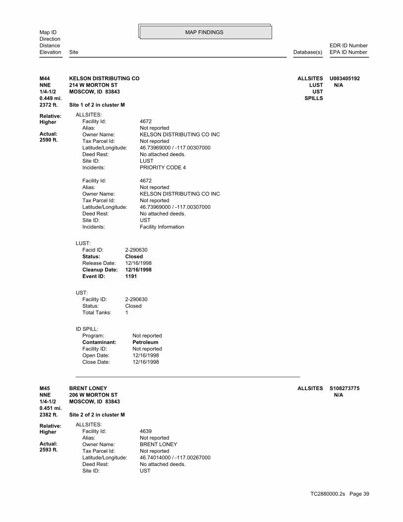
MAP FINDINGSMap IDDirection
EDR ID NumberDistanceEPA ID NumberDatabase(s)SiteElevation
12/16/1998Close Date: 12/16/1998Open Date: Not reportedFacility ID: PetroleumContaminant: Not reportedProgram:
ID SPILL:
1Total Tanks:ClosedStatus:2-290630Facility ID:
UST:
1191Event ID:12/16/1998Cleanup Date:12/16/1998Release Date:ClosedStatus:2-290630Facid ID:
LUST:
Facility InformationIncidents: USTSite ID: No attached deeds.Deed Rest: 46.73969000 / -117.00307000Latitude/Longitude: Not reportedTax Parcel Id: KELSON DISTRIBUTING CO INCOwner Name: Not reportedAlias: 4672Facility Id:
PRIORITY CODE 4Incidents: LUSTSite ID: No attached deeds.Deed Rest: 46.73969000 / -117.00307000Latitude/Longitude: Not reportedTax Parcel Id: KELSON DISTRIBUTING CO INCOwner Name: Not reportedAlias: 4672Facility Id:
ALLSITES:
2372 ft. Site 1 of 2 in cluster M0.449 mi. SPILLS
Relative:Higher
Actual:2590 ft.
1/4-1/2 USTMOSCOW, ID 83843NNE LUST214 W MORTON ST N/AM44 ALLSITESKELSON DISTRIBUTING CO U003405192
USTSite ID: No attached deeds.Deed Rest: 46.74014000 / -117.00267000Latitude/Longitude: Not reportedTax Parcel Id: BRENT LONEYOwner Name: Not reportedAlias: 4639Facility Id:
ALLSITES:
2382 ft. Site 2 of 2 in cluster M0.451 mi.
Relative:Higher
Actual:2593 ft.
1/4-1/2 MOSCOW, ID 83843NNE 206 W MORTON ST N/AM45 ALLSITESBRENT LONEY S108273775
TC2880000.2s Page 39

MAP FINDINGSMap IDDirection
EDR ID NumberDistanceEPA ID NumberDatabase(s)SiteElevation
Facility InformationIncidents:
BRENT LONEY (Continued) S108273775
677Event ID:06/30/1992Cleanup Date:06/30/1992Release Date:ClosedStatus:2-290026Facid ID:
LUST:
9/13/07 THIS SITE WAS VISITED BY JR 5-21-03EPA VISIT 5/16/05Inspection GWIncidents: USTSite ID: No attached deeds.Deed Rest: 46.73314000 / -117.01582000Latitude/Longitude: Not reportedTax Parcel Id: Stinker StoresOwner Name: Not reportedAlias: 642Facility Id:
9/13/07 THIS SITE WAS VISITED BY JR 5-21-03EPA VISIT 5/16/05Inspection GWIncidents: LUSTSite ID: No attached deeds.Deed Rest: 46.73314000 / -117.01582000Latitude/Longitude: Not reportedTax Parcel Id: Stinker StoresOwner Name: Not reportedAlias: 642Facility Id:
ALLSITES:
2439 ft. Site 2 of 2 in cluster L0.462 mi.
Relative:Lower
Actual:2555 ft.
1/4-1/2 MOSCOW, ID 83843West LUST1044 PULLMAN RD N/AL46 ALLSITESFEARLESS FARRIS SERVICE STATION #38 S107980979
PRELIMINARY ASSESSMENTAction:
Not reportedPriority Level: 08/01/1979Date Completed: Not reportedDate Started: DISCOVERYAction:
CERCLIS-NFRAP Assessment History:
NFRAPNon NPL Status: Not on the NPLNPL Status: Not a Federal FacilityFederal Facility: 1000212Site ID:
CERC-NFRAP:
2686 ft. MANIFESTSite 1 of 2 in cluster N0.509 mi. FINDS
Relative:Lower
Actual:2558 ft.
1/2-1 PADSMOSCOW, ID 83844WSW RCRA-LQG1108 WEST SIXTH ST. IDD075746271N47 CERC-NFRAPID UOI MOSCOW 1000431569
TC2880000.2s Page 40
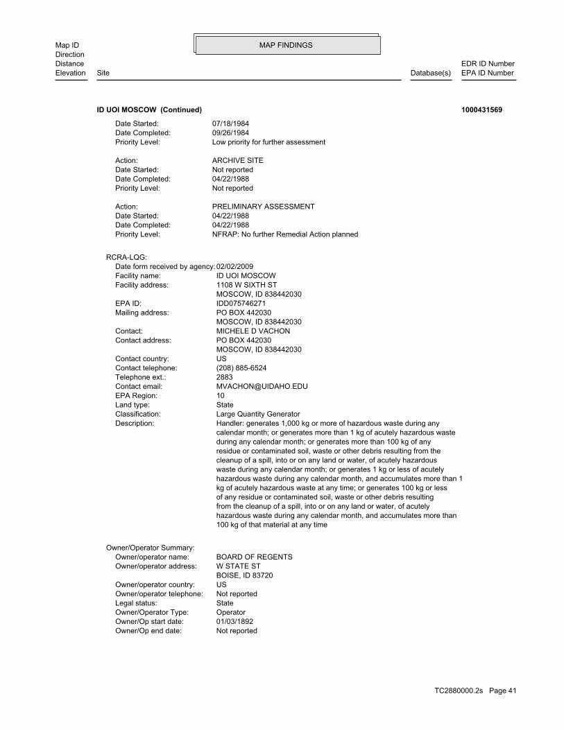
MAP FINDINGSMap IDDirection
EDR ID NumberDistanceEPA ID NumberDatabase(s)SiteElevation
Not reportedOwner/Op end date: 01/03/1892Owner/Op start date: OperatorOwner/Operator Type: StateLegal status: Not reportedOwner/operator telephone: USOwner/operator country: BOISE, ID 83720 W STATE STOwner/operator address: BOARD OF REGENTSOwner/operator name:
Owner/Operator Summary:
100 kg of that material at any time hazardous waste during any calendar month, and accumulates more than from the cleanup of a spill, into or on any land or water, of acutely of any residue or contaminated soil, waste or other debris resulting kg of acutely hazardous waste at any time; or generates 100 kg or less hazardous waste during any calendar month, and accumulates more than 1 waste during any calendar month; or generates 1 kg or less of acutely cleanup of a spill, into or on any land or water, of acutely hazardous residue or contaminated soil, waste or other debris resulting from the during any calendar month; or generates more than 100 kg of any calendar month; or generates more than 1 kg of acutely hazardous waste Handler: generates 1,000 kg or more of hazardous waste during anyDescription: Large Quantity GeneratorClassification: StateLand type: 10EPA Region: [email protected] email: 2883Telephone ext.: (208) 885-6524Contact telephone: USContact country: MOSCOW, ID 838442030 PO BOX 442030Contact address: MICHELE D VACHONContact: MOSCOW, ID 838442030 PO BOX 442030Mailing address: IDD075746271EPA ID: MOSCOW, ID 838442030 1108 W SIXTH STFacility address: ID UOI MOSCOWFacility name: 02/02/2009Date form received by agency:
RCRA-LQG:
NFRAP: No further Remedial Action plannedPriority Level: 04/22/1988Date Completed: 04/22/1988Date Started: PRELIMINARY ASSESSMENTAction:
Not reportedPriority Level: 04/22/1988Date Completed: Not reportedDate Started: ARCHIVE SITEAction:
Low priority for further assessmentPriority Level: 09/26/1984Date Completed: 07/18/1984Date Started:
ID UOI MOSCOW (Continued) 1000431569
TC2880000.2s Page 41
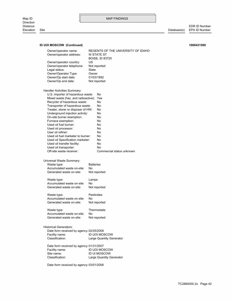
MAP FINDINGSMap IDDirection
EDR ID NumberDistanceEPA ID NumberDatabase(s)SiteElevation
03/01/2006Date form received by agency:
Large Quantity GeneratorClassification: ID UI MOSCOWSite name: ID UOI MOSCOWFacility name: 01/31/2007Date form received by agency:
Large Quantity GeneratorClassification: ID UOI MOSCOWFacility name: 02/25/2008Date form received by agency:
Historical Generators:
Not reportedGenerated waste on-site: NoAccumulated waste on-site: ThermostatsWaste type:
Not reportedGenerated waste on-site: NoAccumulated waste on-site: PesticidesWaste type:
Not reportedGenerated waste on-site: NoAccumulated waste on-site: LampsWaste type:
Not reportedGenerated waste on-site: NoAccumulated waste on-site: BatteriesWaste type:
Universal Waste Summary:
Commercial status unknownOff-site waste receiver: NoUsed oil transporter: NoUsed oil transfer facility: NoUsed oil Specification marketer: NoUsed oil fuel marketer to burner: NoUser oil refiner: NoUsed oil processor: NoUsed oil fuel burner: NoFurnace exemption: NoOn-site burner exemption: NoUnderground injection activity: NoTreater, storer or disposer of HW: NoTransporter of hazardous waste: NoRecycler of hazardous waste: YesMixed waste (haz. and radioactive): NoU.S. importer of hazardous waste:
Handler Activities Summary:
Not reportedOwner/Op end date: 01/03/1892Owner/Op start date: OwnerOwner/Operator Type: StateLegal status: Not reportedOwner/operator telephone: USOwner/operator country: BOISE, ID 83720 W STATE STOwner/operator address: REGENTS OF THE UNIVERSITY OF IDAHOOwner/operator name:
ID UOI MOSCOW (Continued) 1000431569
TC2880000.2s Page 42

MAP FINDINGSMap IDDirection
EDR ID NumberDistanceEPA ID NumberDatabase(s)SiteElevation
IGNITABLE HAZARDOUS WASTES ARE THOSE WASTES WHICH HAVE A FLASHPOINT OFWaste name: D001Waste code:
Hazardous Waste Summary:
Large Quantity GeneratorClassification: ID UI MOSCOWSite name: ID UOI MOSCOWFacility name: 06/10/1981Date form received by agency:
Large Quantity GeneratorClassification: UNIVERSITY OF IDAHO - MOSCOW SAFETY OFFISite name: ID UOI MOSCOWFacility name: 02/28/1990Date form received by agency:
Large Quantity GeneratorClassification: ID UI MOSCOWSite name: ID UOI MOSCOWFacility name: 10/21/1991Date form received by agency:
Large Quantity GeneratorClassification: UNIVERSITY OF IDAHO MOSCOW CAMPUSSite name: ID UOI MOSCOWFacility name: 03/05/1992Date form received by agency:
Large Quantity GeneratorClassification: UNIVERSITY OF IDAHO MOSCOWSite name: ID UOI MOSCOWFacility name: 02/25/1994Date form received by agency:
Large Quantity GeneratorClassification: UNIVERSITY OF IDAHO MOSCOWSite name: ID UOI MOSCOWFacility name: 02/23/1996Date form received by agency:
Large Quantity GeneratorClassification: UNIVERSITY OF IDAHOSite name: ID UOI MOSCOWFacility name: 07/02/1998Date form received by agency:
Large Quantity GeneratorClassification: UNIVERSITY OF IDAHO MOSCOWSite name: ID UOI MOSCOWFacility name: 03/13/2000Date form received by agency:
Large Quantity GeneratorClassification: ID UI MOSCOWSite name: ID UOI MOSCOWFacility name: 02/28/2002Date form received by agency:
Large Quantity GeneratorClassification: ID UI MOSCOWSite name: ID UOI MOSCOWFacility name: 02/23/2004Date form received by agency:
Large Quantity GeneratorClassification: UNIVERSITY OF IDAHO, MOSCOWSite name: ID UOI MOSCOWFacility name:
ID UOI MOSCOW (Continued) 1000431569
TC2880000.2s Page 43
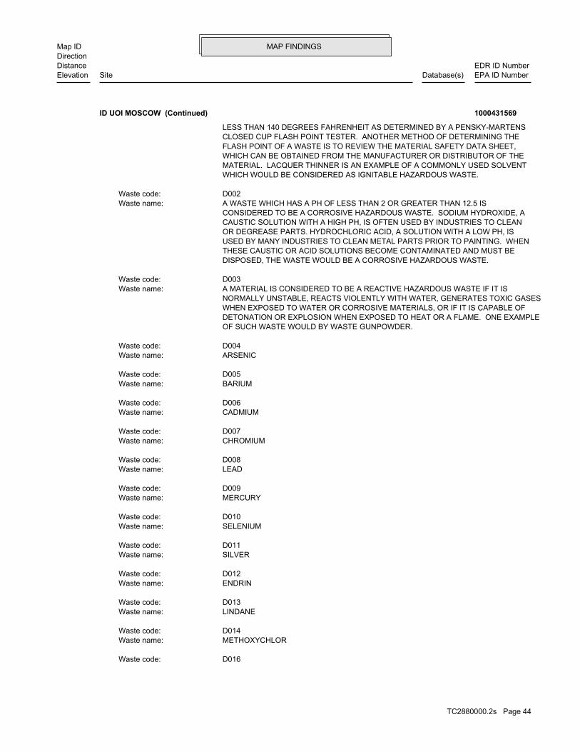
MAP FINDINGSMap IDDirection
EDR ID NumberDistanceEPA ID NumberDatabase(s)SiteElevation
D016Waste code:
METHOXYCHLORWaste name: D014Waste code:
LINDANEWaste name: D013Waste code:
ENDRINWaste name: D012Waste code:
SILVERWaste name: D011Waste code:
SELENIUMWaste name: D010Waste code:
MERCURYWaste name: D009Waste code:
LEADWaste name: D008Waste code:
CHROMIUMWaste name: D007Waste code:
CADMIUMWaste name: D006Waste code:
BARIUMWaste name: D005Waste code:
ARSENICWaste name: D004Waste code:
OF SUCH WASTE WOULD BY WASTE GUNPOWDER. DETONATION OR EXPLOSION WHEN EXPOSED TO HEAT OR A FLAME. ONE EXAMPLE WHEN EXPOSED TO WATER OR CORROSIVE MATERIALS, OR IF IT IS CAPABLE OF NORMALLY UNSTABLE, REACTS VIOLENTLY WITH WATER, GENERATES TOXIC GASES A MATERIAL IS CONSIDERED TO BE A REACTIVE HAZARDOUS WASTE IF IT ISWaste name: D003Waste code:
DISPOSED, THE WASTE WOULD BE A CORROSIVE HAZARDOUS WASTE. THESE CAUSTIC OR ACID SOLUTIONS BECOME CONTAMINATED AND MUST BE USED BY MANY INDUSTRIES TO CLEAN METAL PARTS PRIOR TO PAINTING. WHEN OR DEGREASE PARTS. HYDROCHLORIC ACID, A SOLUTION WITH A LOW PH, IS CAUSTIC SOLUTION WITH A HIGH PH, IS OFTEN USED BY INDUSTRIES TO CLEAN CONSIDERED TO BE A CORROSIVE HAZARDOUS WASTE. SODIUM HYDROXIDE, A A WASTE WHICH HAS A PH OF LESS THAN 2 OR GREATER THAN 12.5 ISWaste name: D002Waste code:
WHICH WOULD BE CONSIDERED AS IGNITABLE HAZARDOUS WASTE. MATERIAL. LACQUER THINNER IS AN EXAMPLE OF A COMMONLY USED SOLVENT WHICH CAN BE OBTAINED FROM THE MANUFACTURER OR DISTRIBUTOR OF THE FLASH POINT OF A WASTE IS TO REVIEW THE MATERIAL SAFETY DATA SHEET, CLOSED CUP FLASH POINT TESTER. ANOTHER METHOD OF DETERMINING THE LESS THAN 140 DEGREES FAHRENHEIT AS DETERMINED BY A PENSKY-MARTENS
ID UOI MOSCOW (Continued) 1000431569
TC2880000.2s Page 44

MAP FINDINGSMap IDDirection
EDR ID NumberDistanceEPA ID NumberDatabase(s)SiteElevation
CHLOROBENZENE, 1,1,2-TRICHLORO-1,2,2-TRIFLUOROETHANE, METHYLENE CHLORIDE, TRICHLOROETHYLENE, 1,1,1-TRICHLOROETHANE, THE FOLLOWING SPENT HALOGENATED SOLVENTS: TETRACHLOROETHYLENE,Waste name: F002Waste code:
TRICHLOROETHYLENEWaste name: D040Waste code:
PYRIDINEWaste name: D038Waste code:
PENTRACHLOROPHENOLWaste name: D037Waste code:
NITROBENZENEWaste name: D036Waste code:
METHYL ETHYL KETONEWaste name: D035Waste code:
HEXACHLOROBENZENEWaste name: D032Waste code:
HEPTACHLOR (AND ITS EPOXIDE).Waste name: D031Waste code:
2,4-DINITROTOLUENEWaste name: D030Waste code:
1,1-DICHLOROETHYLENEWaste name: D029Waste code:
1,2-DICHLOROETHANEWaste name: D028Waste code:
1,4-DICHLOROBENZENEWaste name: D027Waste code:
P-CRESOLWaste name: D025Waste code:
CHLOROFORMWaste name: D022Waste code:
CHLOROBENZENEWaste name: D021Waste code:
CHLORDANEWaste name: D020Waste code:
CARBON TETRACHLORIDEWaste name: D019Waste code:
BENZENEWaste name: D018Waste code:
2,4-DWaste name:
ID UOI MOSCOW (Continued) 1000431569
TC2880000.2s Page 45

MAP FINDINGSMap IDDirection
EDR ID NumberDistanceEPA ID NumberDatabase(s)SiteElevation
1-BUTANOL (I)Waste name: U031Waste code:
BENZENE (I,T)Waste name: U019Waste code:
ACRYLAMIDEWaste name: U007Waste code:
ACETONITRILE (I,T)Waste name: U003Waste code:
ACETONE (I)Waste name: U002Waste code:
SODIUM CYANIDEWaste name: P106Waste code:
SODIUM AZIDEWaste name: P105Waste code:
POTASSIUM CYANIDEWaste name: P098Waste code:
DINOSEBWaste name: P020Waste code:
LAB PACKWaste name: LABPWaste code:
THESE SPENT SOLVENTS AND SPENT SOLVENT MIXTURES. LISTED IN F001, F002, OR F004; AND STILL BOTTOMS FROM THE RECOVERY OF ONE OR MORE OF THE ABOVE NON-HALOGENATED SOLVENTS OR THOSE SOLVENTS CONTAINING, BEFORE USE, A TOTAL OF TEN PERCENT OR MORE (BY VOLUME) OF 2-ETHOXYETHANOL, AND 2-NITROPROPANE; ALL SPENT SOLVENT MIXTURES/BLENDS KETONE, CARBON DISULFIDE, ISOBUTANOL, PYRIDINE, BENZENE, THE FOLLOWING SPENT NON-HALOGENATED SOLVENTS: TOLUENE, METHYL ETHYLWaste name: F005Waste code:
MIXTURES. BOTTOMS FROM THE RECOVERY OF THESE SPENT SOLVENTS AND SPENT SOLVENT MORE OF THOSE SOLVENTS LISTED IN F001, F002, F004, AND F005, AND STILL SOLVENTS, AND, A TOTAL OF TEN PERCENT OR MORE (BY VOLUME) OF ONE OR CONTAINING, BEFORE USE, ONE OR MORE OF THE ABOVE NON-HALOGENATED NON-HALOGENATED SOLVENTS; AND ALL SPENT SOLVENT MIXTURES/BLENDS MIXTURES/BLENDS CONTAINING, BEFORE USE, ONLY THE ABOVE SPENT ALCOHOL, CYCLOHEXANONE, AND METHANOL; ALL SPENT SOLVENT ACETATE, ETHYL BENZENE, ETHYL ETHER, METHYL ISOBUTYL KETONE, N-BUTYL THE FOLLOWING SPENT NON-HALOGENATED SOLVENTS: XYLENE, ACETONE, ETHYLWaste name: F003Waste code:
SPENT SOLVENT MIXTURES. F005, AND STILL BOTTOMS FROM THE RECOVERY OF THESE SPENT SOLVENTS AND OF THE ABOVE HALOGENATED SOLVENTS OR THOSE LISTED IN F001, F004, OR BEFORE USE, A TOTAL OF TEN PERCENT OR MORE (BY VOLUME) OF ONE OR MORE 1,1,2-TRICHLOROETHANE; ALL SPENT SOLVENT MIXTURES/BLENDS CONTAINING, ORTHO-DICHLOROBENZENE, TRICHLOROFLUOROMETHANE, AND
ID UOI MOSCOW (Continued) 1000431569
TC2880000.2s Page 46
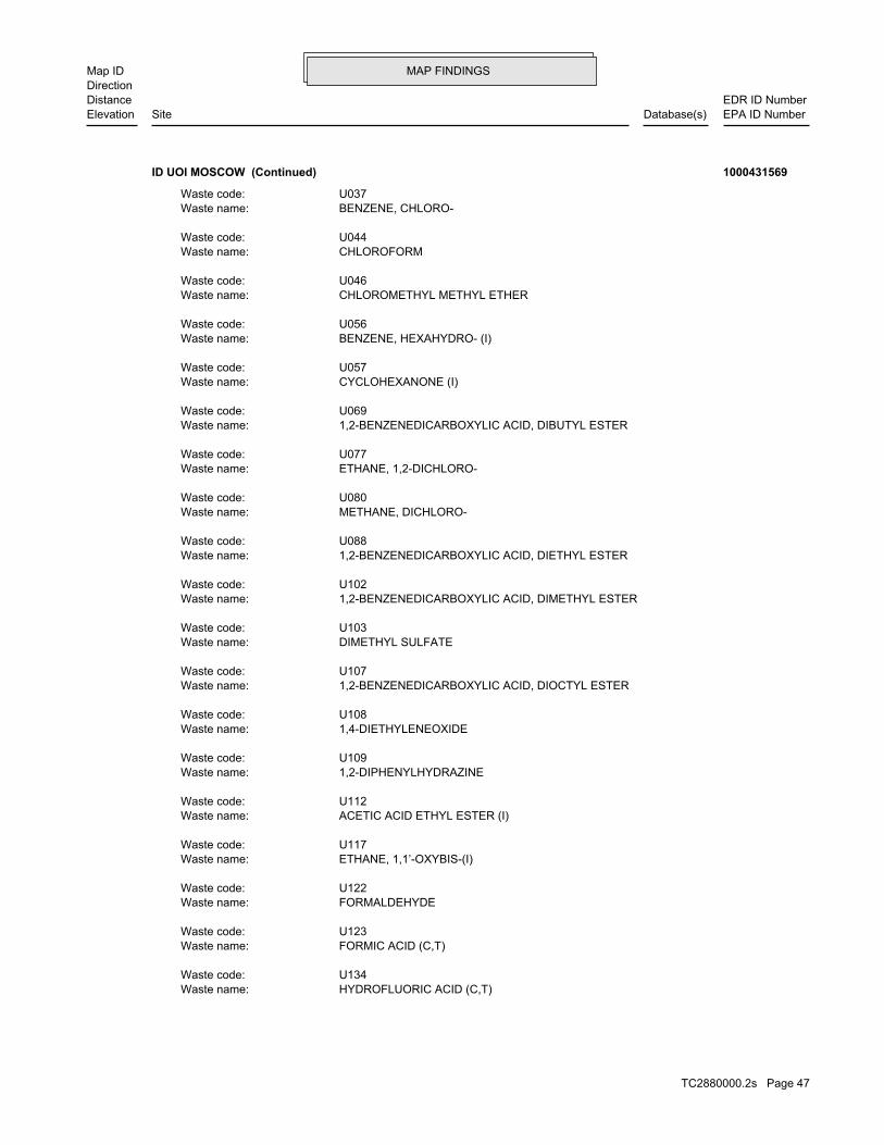
MAP FINDINGSMap IDDirection
EDR ID NumberDistanceEPA ID NumberDatabase(s)SiteElevation
HYDROFLUORIC ACID (C,T)Waste name: U134Waste code:
FORMIC ACID (C,T)Waste name: U123Waste code:
FORMALDEHYDEWaste name: U122Waste code:
ETHANE, 1,1’-OXYBIS-(I)Waste name: U117Waste code:
ACETIC ACID ETHYL ESTER (I)Waste name: U112Waste code:
1,2-DIPHENYLHYDRAZINEWaste name: U109Waste code:
1,4-DIETHYLENEOXIDEWaste name: U108Waste code:
1,2-BENZENEDICARBOXYLIC ACID, DIOCTYL ESTERWaste name: U107Waste code:
DIMETHYL SULFATEWaste name: U103Waste code:
1,2-BENZENEDICARBOXYLIC ACID, DIMETHYL ESTERWaste name: U102Waste code:
1,2-BENZENEDICARBOXYLIC ACID, DIETHYL ESTERWaste name: U088Waste code:
METHANE, DICHLORO-Waste name: U080Waste code:
ETHANE, 1,2-DICHLORO-Waste name: U077Waste code:
1,2-BENZENEDICARBOXYLIC ACID, DIBUTYL ESTERWaste name: U069Waste code:
CYCLOHEXANONE (I)Waste name: U057Waste code:
BENZENE, HEXAHYDRO- (I)Waste name: U056Waste code:
CHLOROMETHYL METHYL ETHERWaste name: U046Waste code:
CHLOROFORMWaste name: U044Waste code:
BENZENE, CHLORO-Waste name: U037Waste code:
ID UOI MOSCOW (Continued) 1000431569
TC2880000.2s Page 47

MAP FINDINGSMap IDDirection
EDR ID NumberDistanceEPA ID NumberDatabase(s)SiteElevation
FLASH POINT OF A WASTE IS TO REVIEW THE MATERIAL SAFETY DATA SHEET, CLOSED CUP FLASH POINT TESTER. ANOTHER METHOD OF DETERMINING THE LESS THAN 140 DEGREES FAHRENHEIT AS DETERMINED BY A PENSKY-MARTENS IGNITABLE HAZARDOUS WASTES ARE THOSE WASTES WHICH HAVE A FLASHPOINT OFWaste name: D001Waste code:
Annual Waste Handled:
Last Biennial Reporting Year: 2009
Biennial Reports:
BENZENE, DIMETHYL- (I,T)Waste name: U239Waste code:
ETHENE, TRICHLORO-Waste name: U228Waste code:
BENZENE, METHYL-Waste name: U220Waste code:
THIOUREAWaste name: U219Waste code:
FURAN, TETRAHYDRO-(I)Waste name: U213Waste code:
CARBON TETRACHLORIDEWaste name: U211Waste code:
ETHENE, TETRACHLORO-Waste name: U210Waste code:
PYRIDINEWaste name: U196Waste code:
PHENOLWaste name: U188Waste code:
BENZENE, NITRO-Waste name: U169Waste code:
METHYL ISOBUTYL KETONE (I)Waste name: U161Waste code:
2-BUTANONE (I,T)Waste name: U159Waste code:
METHANOL (I)Waste name: U154Waste code:
ACETIC ACID, LEAD(2+) SALTWaste name: U144Waste code:
ISOBUTYL ALCOHOL (I,T)Waste name: U140Waste code:
METHANE, IODO-Waste name: U138Waste code:
ID UOI MOSCOW (Continued) 1000431569
TC2880000.2s Page 48

MAP FINDINGSMap IDDirection
EDR ID NumberDistanceEPA ID NumberDatabase(s)SiteElevation
METHOXYCHLORWaste name: D014Waste code:
7365Amount (Lbs): SILVERWaste name: D011Waste code:
6464Amount (Lbs): SELENIUMWaste name: D010Waste code:
1395Amount (Lbs): MERCURYWaste name: D009Waste code:
11783Amount (Lbs): LEADWaste name: D008Waste code:
13398Amount (Lbs): CHROMIUMWaste name: D007Waste code:
10946Amount (Lbs): CADMIUMWaste name: D006Waste code:
10641Amount (Lbs): BARIUMWaste name: D005Waste code:
7868Amount (Lbs): ARSENICWaste name: D004Waste code:
6378Amount (Lbs): OF SUCH WASTE WOULD BY WASTE GUNPOWDER. DETONATION OR EXPLOSION WHEN EXPOSED TO HEAT OR A FLAME. ONE EXAMPLE WHEN EXPOSED TO WATER OR CORROSIVE MATERIALS, OR IF IT IS CAPABLE OF NORMALLY UNSTABLE, REACTS VIOLENTLY WITH WATER, GENERATES TOXIC GASES A MATERIAL IS CONSIDERED TO BE A REACTIVE HAZARDOUS WASTE IF IT ISWaste name: D003Waste code:
10205Amount (Lbs): DISPOSED, THE WASTE WOULD BE A CORROSIVE HAZARDOUS WASTE. THESE CAUSTIC OR ACID SOLUTIONS BECOME CONTAMINATED AND MUST BE USED BY MANY INDUSTRIES TO CLEAN METAL PARTS PRIOR TO PAINTING. WHEN OR DEGREASE PARTS. HYDROCHLORIC ACID, A SOLUTION WITH A LOW PH, IS CAUSTIC SOLUTION WITH A HIGH PH, IS OFTEN USED BY INDUSTRIES TO CLEAN CONSIDERED TO BE A CORROSIVE HAZARDOUS WASTE. SODIUM HYDROXIDE, A A WASTE WHICH HAS A PH OF LESS THAN 2 OR GREATER THAN 12.5 ISWaste name: D002Waste code:
16076Amount (Lbs): WHICH WOULD BE CONSIDERED AS IGNITABLE HAZARDOUS WASTE. MATERIAL. LACQUER THINNER IS AN EXAMPLE OF A COMMONLY USED SOLVENT WHICH CAN BE OBTAINED FROM THE MANUFACTURER OR DISTRIBUTOR OF THE
ID UOI MOSCOW (Continued) 1000431569
TC2880000.2s Page 49

MAP FINDINGSMap IDDirection
EDR ID NumberDistanceEPA ID NumberDatabase(s)SiteElevation
ONE OR MORE OF THE ABOVE NON-HALOGENATED SOLVENTS OR THOSE SOLVENTS CONTAINING, BEFORE USE, A TOTAL OF TEN PERCENT OR MORE (BY VOLUME) OF 2-ETHOXYETHANOL, AND 2-NITROPROPANE; ALL SPENT SOLVENT MIXTURES/BLENDS KETONE, CARBON DISULFIDE, ISOBUTANOL, PYRIDINE, BENZENE, THE FOLLOWING SPENT NON-HALOGENATED SOLVENTS: TOLUENE, METHYL ETHYLWaste name: F005Waste code:
10811Amount (Lbs): MIXTURES. BOTTOMS FROM THE RECOVERY OF THESE SPENT SOLVENTS AND SPENT SOLVENT MORE OF THOSE SOLVENTS LISTED IN F001, F002, F004, AND F005, AND STILL SOLVENTS, AND, A TOTAL OF TEN PERCENT OR MORE (BY VOLUME) OF ONE OR CONTAINING, BEFORE USE, ONE OR MORE OF THE ABOVE NON-HALOGENATED NON-HALOGENATED SOLVENTS; AND ALL SPENT SOLVENT MIXTURES/BLENDS MIXTURES/BLENDS CONTAINING, BEFORE USE, ONLY THE ABOVE SPENT ALCOHOL, CYCLOHEXANONE, AND METHANOL; ALL SPENT SOLVENT ACETATE, ETHYL BENZENE, ETHYL ETHER, METHYL ISOBUTYL KETONE, N-BUTYL THE FOLLOWING SPENT NON-HALOGENATED SOLVENTS: XYLENE, ACETONE, ETHYLWaste name: F003Waste code:
8206Amount (Lbs): SPENT SOLVENT MIXTURES. F005, AND STILL BOTTOMS FROM THE RECOVERY OF THESE SPENT SOLVENTS AND OF THE ABOVE HALOGENATED SOLVENTS OR THOSE LISTED IN F001, F004, OR BEFORE USE, A TOTAL OF TEN PERCENT OR MORE (BY VOLUME) OF ONE OR MORE 1,1,2-TRICHLOROETHANE; ALL SPENT SOLVENT MIXTURES/BLENDS CONTAINING, ORTHO-DICHLOROBENZENE, TRICHLOROFLUOROMETHANE, AND CHLOROBENZENE, 1,1,2-TRICHLORO-1,2,2-TRIFLUOROETHANE, METHYLENE CHLORIDE, TRICHLOROETHYLENE, 1,1,1-TRICHLOROETHANE, THE FOLLOWING SPENT HALOGENATED SOLVENTS: TETRACHLOROETHYLENE,Waste name: F002Waste code:
1493Amount (Lbs): TRICHLOROETHYLENEWaste name: D040Waste code:
3099Amount (Lbs): PYRIDINEWaste name: D038Waste code:
2119Amount (Lbs): METHYL ETHYL KETONEWaste name: D035Waste code:
6290Amount (Lbs): CHLOROFORMWaste name: D022Waste code:
980Amount (Lbs): CARBON TETRACHLORIDEWaste name: D019Waste code:
7360Amount (Lbs): BENZENEWaste name: D018Waste code:
980Amount (Lbs):
ID UOI MOSCOW (Continued) 1000431569
TC2880000.2s Page 50

MAP FINDINGSMap IDDirection
EDR ID NumberDistanceEPA ID NumberDatabase(s)SiteElevation
U103Waste code:
2119Amount (Lbs): ETHANE, 1,2-DICHLORO-Waste name: U077Waste code:
2119Amount (Lbs): BENZENE, HEXAHYDRO- (I)Waste name: U056Waste code:
2463Amount (Lbs): O-CHLOROPHENOLWaste name: U048Waste code:
3443Amount (Lbs): CHLOROFORMWaste name: U044Waste code:
4582Amount (Lbs): 1-BUTANOL (I)Waste name: U031Waste code:
2463Amount (Lbs): ACRYLAMIDEWaste name: U007Waste code:
2119Amount (Lbs): ACETONE (I)Waste name: U002Waste code:
33Amount (Lbs): SODIUM CYANIDEWaste name: P106Waste code:
33Amount (Lbs): SODIUM AZIDEWaste name: P105Waste code:
100Amount (Lbs): POTASSIUM CYANIDEWaste name: P098Waste code:
5Amount (Lbs): NICOTINE, & SALTSWaste name: P075Waste code:
2463Amount (Lbs): DINOSEBWaste name: P020Waste code:
5316Amount (Lbs): LAB PACKWaste name: LABPWaste code:
10794Amount (Lbs): THESE SPENT SOLVENTS AND SPENT SOLVENT MIXTURES. LISTED IN F001, F002, OR F004; AND STILL BOTTOMS FROM THE RECOVERY OF
ID UOI MOSCOW (Continued) 1000431569
TC2880000.2s Page 51

MAP FINDINGSMap IDDirection
EDR ID NumberDistanceEPA ID NumberDatabase(s)SiteElevation
THIOUREAWaste name: U219Waste code:
2050Amount (Lbs): 1,3-ISOBENZOFURANDIONEWaste name: U190Waste code:
2463Amount (Lbs): PHENOLWaste name: U188Waste code:
2463Amount (Lbs): BENZENAMINE, 2-METHYL-5-NITRO-Waste name: U181Waste code:
2463Amount (Lbs): BENZENE, NITRO-Waste name: U169Waste code:
2119Amount (Lbs): METHANOL (I)Waste name: U154Waste code:
2463Amount (Lbs): ACETIC ACID, LEAD(2+) SALTWaste name: U144Waste code:
2050Amount (Lbs): HYDROFLUORIC ACID (C,T)Waste name: U134Waste code:
2463Amount (Lbs): FORMIC ACID (C,T)Waste name: U123Waste code:
2463Amount (Lbs): FORMALDEHYDEWaste name: U122Waste code:
2119Amount (Lbs): ETHANE, 1,1’-OXYBIS-(I)Waste name: U117Waste code:
2119Amount (Lbs): ACETIC ACID ETHYL ESTER (I)Waste name: U112Waste code:
2463Amount (Lbs): 1,2-DIPHENYLHYDRAZINEWaste name: U109Waste code:
2119Amount (Lbs): 1,4-DIETHYLENEOXIDEWaste name: U108Waste code:
5Amount (Lbs): DIMETHYL SULFATEWaste name:
ID UOI MOSCOW (Continued) 1000431569
TC2880000.2s Page 52

MAP FINDINGSMap IDDirection
EDR ID NumberDistanceEPA ID NumberDatabase(s)SiteElevation
24158 Paid penalty amount: 24158 Final penalty amount: Not reported Proposed penalty amount: State Enforcement lead agency: Not reported Enf. disp. status date: Not reported Enf. disposition status: 12/08/2008 Enforcement action date: FINAL 3008(A) COMPLIANCE ORDER Enforcement action: StateViolation lead agency: Not reportedDate achieved compliance: 08/20/2008Date violation determined: Generators - GeneralArea of violation: Not reportedRegulation violated:
24158 Paid penalty amount: 24158 Final penalty amount: Not reported Proposed penalty amount: State Enforcement lead agency: Not reported Enf. disp. status date: Not reported Enf. disposition status: 12/08/2008 Enforcement action date: FINAL 3008(A) COMPLIANCE ORDER Enforcement action: StateViolation lead agency: 09/15/2008Date achieved compliance: 08/20/2008Date violation determined: TSD IS-Container Use and ManagementArea of violation: Not reportedRegulation violated:
24158 Paid penalty amount: 24158 Final penalty amount: Not reported Proposed penalty amount: State Enforcement lead agency: Not reported Enf. disp. status date: Not reported Enf. disposition status: 12/08/2008 Enforcement action date: FINAL 3008(A) COMPLIANCE ORDER Enforcement action: StateViolation lead agency: Not reportedDate achieved compliance: 08/20/2008Date violation determined: Universal Waste - Large Quantity HandlersArea of violation: Not reportedRegulation violated:
Facility Has Received Notices of Violations:
2119Amount (Lbs): BENZENE, DIMETHYL- (I,T)Waste name: U239Waste code:
2463Amount (Lbs): ETHENE, TRICHLORO-Waste name: U228Waste code:
2119Amount (Lbs): BENZENE, METHYL-Waste name: U220Waste code:
2463Amount (Lbs):
ID UOI MOSCOW (Continued) 1000431569
TC2880000.2s Page 53

MAP FINDINGSMap IDDirection
EDR ID NumberDistanceEPA ID NumberDatabase(s)SiteElevation
Not reportedRegulation violated:
24158 Paid penalty amount: 24158 Final penalty amount: Not reported Proposed penalty amount: State Enforcement lead agency: Not reported Enf. disp. status date: Not reported Enf. disposition status: 12/08/2008 Enforcement action date: FINAL 3008(A) COMPLIANCE ORDER Enforcement action: StateViolation lead agency: 09/15/2008Date achieved compliance: 08/20/2008Date violation determined: LDR - GeneralArea of violation: Not reportedRegulation violated:
24158 Paid penalty amount: 24158 Final penalty amount: Not reported Proposed penalty amount: State Enforcement lead agency: Not reported Enf. disp. status date: Not reported Enf. disposition status: 12/08/2008 Enforcement action date: FINAL 3008(A) COMPLIANCE ORDER Enforcement action: StateViolation lead agency: 09/15/2008Date achieved compliance: 08/20/2008Date violation determined: Generators - Pre-transportArea of violation: Not reportedRegulation violated:
Not reported Paid penalty amount: Not reported Final penalty amount: Not reported Proposed penalty amount: State Enforcement lead agency: Not reported Enf. disp. status date: Not reported Enf. disposition status: 08/11/2008 Enforcement action date: WRITTEN INFORMAL Enforcement action: StateViolation lead agency: 09/15/2008Date achieved compliance: 08/20/2008Date violation determined: LDR - GeneralArea of violation: Not reportedRegulation violated:
Not reported Paid penalty amount: Not reported Final penalty amount: Not reported Proposed penalty amount: State Enforcement lead agency: Not reported Enf. disp. status date: Not reported Enf. disposition status: 08/11/2008 Enforcement action date: WRITTEN INFORMAL Enforcement action: StateViolation lead agency: 09/15/2008Date achieved compliance: 08/20/2008Date violation determined: TSD IS-Container Use and ManagementArea of violation: Not reportedRegulation violated:
ID UOI MOSCOW (Continued) 1000431569
TC2880000.2s Page 54

MAP FINDINGSMap IDDirection
EDR ID NumberDistanceEPA ID NumberDatabase(s)SiteElevation
LDR - Treatment StandardsArea of violation: Not reportedRegulation violated:
24158 Paid penalty amount: 24158 Final penalty amount: Not reported Proposed penalty amount: State Enforcement lead agency: Not reported Enf. disp. status date: Not reported Enf. disposition status: 12/08/2008 Enforcement action date: FINAL 3008(A) COMPLIANCE ORDER Enforcement action: StateViolation lead agency: 09/15/2008Date achieved compliance: 08/20/2008Date violation determined: Generators - Records/ReportingArea of violation: Not reportedRegulation violated:
Not reported Paid penalty amount: Not reported Final penalty amount: Not reported Proposed penalty amount: State Enforcement lead agency: Not reported Enf. disp. status date: Not reported Enf. disposition status: 08/11/2008 Enforcement action date: WRITTEN INFORMAL Enforcement action: StateViolation lead agency: 09/15/2008Date achieved compliance: 08/20/2008Date violation determined: Generators - Records/ReportingArea of violation: Not reportedRegulation violated:
Not reported Paid penalty amount: Not reported Final penalty amount: Not reported Proposed penalty amount: State Enforcement lead agency: Not reported Enf. disp. status date: Not reported Enf. disposition status: 08/11/2008 Enforcement action date: WRITTEN INFORMAL Enforcement action: StateViolation lead agency: Not reportedDate achieved compliance: 08/20/2008Date violation determined: LDR - Treatment StandardsArea of violation: Not reportedRegulation violated:
Not reported Paid penalty amount: Not reported Final penalty amount: Not reported Proposed penalty amount: State Enforcement lead agency: Not reported Enf. disp. status date: Not reported Enf. disposition status: 08/11/2008 Enforcement action date: WRITTEN INFORMAL Enforcement action: StateViolation lead agency: Not reportedDate achieved compliance: 08/20/2008Date violation determined: Generators - GeneralArea of violation:
ID UOI MOSCOW (Continued) 1000431569
TC2880000.2s Page 55

MAP FINDINGSMap IDDirection
EDR ID NumberDistanceEPA ID NumberDatabase(s)SiteElevation
08/20/2008Date violation determined: LDR - GeneralArea of violation: Not reportedRegulation violated:
24158 Paid penalty amount: 24158 Final penalty amount: Not reported Proposed penalty amount: State Enforcement lead agency: Not reported Enf. disp. status date: Not reported Enf. disposition status: 12/08/2008 Enforcement action date: FINAL 3008(A) COMPLIANCE ORDER Enforcement action: StateViolation lead agency: Not reportedDate achieved compliance: 08/20/2008Date violation determined: LDR - GeneralArea of violation: Not reportedRegulation violated:
Not reported Paid penalty amount: Not reported Final penalty amount: Not reported Proposed penalty amount: State Enforcement lead agency: Not reported Enf. disp. status date: Not reported Enf. disposition status: 08/11/2008 Enforcement action date: WRITTEN INFORMAL Enforcement action: StateViolation lead agency: 09/15/2008Date achieved compliance: 08/20/2008Date violation determined: Generators - Pre-transportArea of violation: Not reportedRegulation violated:
Not reported Paid penalty amount: Not reported Final penalty amount: Not reported Proposed penalty amount: State Enforcement lead agency: Not reported Enf. disp. status date: Not reported Enf. disposition status: 08/11/2008 Enforcement action date: WRITTEN INFORMAL Enforcement action: StateViolation lead agency: Not reportedDate achieved compliance: 08/20/2008Date violation determined: Universal Waste - Large Quantity HandlersArea of violation: Not reportedRegulation violated:
24158 Paid penalty amount: 24158 Final penalty amount: Not reported Proposed penalty amount: State Enforcement lead agency: Not reported Enf. disp. status date: Not reported Enf. disposition status: 12/08/2008 Enforcement action date: FINAL 3008(A) COMPLIANCE ORDER Enforcement action: StateViolation lead agency: Not reportedDate achieved compliance: 08/20/2008Date violation determined:
ID UOI MOSCOW (Continued) 1000431569
TC2880000.2s Page 56

MAP FINDINGSMap IDDirection
EDR ID NumberDistanceEPA ID NumberDatabase(s)SiteElevation
06/01/2006Date achieved compliance: 05/23/2005Date violation determined: Used Oil - GeneratorsArea of violation: FR - 40 CFR 279.22(c)(1)Regulation violated:
27060 Paid penalty amount: 27060 Final penalty amount: Not reported Proposed penalty amount: State Enforcement lead agency: 06/01/2006 Enf. disp. status date: Action Satisfied (Case Closed) Enf. disposition status: 09/01/2005 Enforcement action date: FINAL 3008(A) COMPLIANCE ORDER Enforcement action: StateViolation lead agency: 06/01/2006Date achieved compliance: 05/23/2005Date violation determined: Generators - Pre-transportArea of violation: FR - 40 CFR 262.34Regulation violated:
27060 Paid penalty amount: 27060 Final penalty amount: Not reported Proposed penalty amount: State Enforcement lead agency: 06/01/2006 Enf. disp. status date: Action Satisfied (Case Closed) Enf. disposition status: 09/01/2005 Enforcement action date: FINAL 3008(A) COMPLIANCE ORDER Enforcement action: StateViolation lead agency: 06/01/2006Date achieved compliance: 05/23/2005Date violation determined: Generators - Pre-transportArea of violation: FR - 40 CFR 262.34(c)(1)Regulation violated:
Not reported Paid penalty amount: Not reported Final penalty amount: 39300 Proposed penalty amount: State Enforcement lead agency: Not reported Enf. disp. status date: Not reported Enf. disposition status: 05/23/2005 Enforcement action date: WRITTEN INFORMAL Enforcement action: StateViolation lead agency: 06/01/2006Date achieved compliance: 05/23/2005Date violation determined: Generators - GeneralArea of violation: FR - 40 CFR 262.11Regulation violated:
Not reported Paid penalty amount: Not reported Final penalty amount: Not reported Proposed penalty amount: State Enforcement lead agency: Not reported Enf. disp. status date: Not reported Enf. disposition status: 08/11/2008 Enforcement action date: WRITTEN INFORMAL Enforcement action: StateViolation lead agency: Not reportedDate achieved compliance:
ID UOI MOSCOW (Continued) 1000431569
TC2880000.2s Page 57

MAP FINDINGSMap IDDirection
EDR ID NumberDistanceEPA ID NumberDatabase(s)SiteElevation
StateViolation lead agency: 06/01/2006Date achieved compliance: 05/23/2005Date violation determined: TSD - Container Use and ManagementArea of violation: FR - 40 CFR 265.117(c)Regulation violated:
27060 Paid penalty amount: 27060 Final penalty amount: Not reported Proposed penalty amount: State Enforcement lead agency: 06/01/2006 Enf. disp. status date: Action Satisfied (Case Closed) Enf. disposition status: 09/01/2005 Enforcement action date: FINAL 3008(A) COMPLIANCE ORDER Enforcement action: StateViolation lead agency: 06/01/2006Date achieved compliance: 05/23/2005Date violation determined: Generators - GeneralArea of violation: FR - 40 CFR 273.35(a-e)&.65(c)(1-6)Regulation violated:
27060 Paid penalty amount: 27060 Final penalty amount: Not reported Proposed penalty amount: State Enforcement lead agency: 06/01/2006 Enf. disp. status date: Action Satisfied (Case Closed) Enf. disposition status: 09/01/2005 Enforcement action date: FINAL 3008(A) COMPLIANCE ORDER Enforcement action: StateViolation lead agency: 06/01/2006Date achieved compliance: 05/23/2005Date violation determined: Permits - General InformationArea of violation: SS - IC 39-4408Regulation violated:
Not reported Paid penalty amount: Not reported Final penalty amount: 39300 Proposed penalty amount: State Enforcement lead agency: Not reported Enf. disp. status date: Not reported Enf. disposition status: 05/23/2005 Enforcement action date: WRITTEN INFORMAL Enforcement action: StateViolation lead agency: 06/01/2006Date achieved compliance: 05/23/2005Date violation determined: Permits - General InformationArea of violation: SS - IC 39-4408Regulation violated:
27060 Paid penalty amount: 27060 Final penalty amount: Not reported Proposed penalty amount: State Enforcement lead agency: 06/01/2006 Enf. disp. status date: Action Satisfied (Case Closed) Enf. disposition status: 09/01/2005 Enforcement action date: FINAL 3008(A) COMPLIANCE ORDER Enforcement action: StateViolation lead agency:
ID UOI MOSCOW (Continued) 1000431569
TC2880000.2s Page 58

MAP FINDINGSMap IDDirection
EDR ID NumberDistanceEPA ID NumberDatabase(s)SiteElevation
WRITTEN INFORMAL Enforcement action: StateViolation lead agency: 06/01/2006Date achieved compliance: 05/23/2005Date violation determined: Generators - GeneralArea of violation: FR - 40 CFR 273.35(a-e)&.65(c)(1-6)Regulation violated:
Not reported Paid penalty amount: Not reported Final penalty amount: 39300 Proposed penalty amount: State Enforcement lead agency: Not reported Enf. disp. status date: Not reported Enf. disposition status: 05/23/2005 Enforcement action date: WRITTEN INFORMAL Enforcement action: StateViolation lead agency: 06/01/2006Date achieved compliance: 05/23/2005Date violation determined: LDR - GeneralArea of violation: FR - 40 CFR 268.7(a)(8)Regulation violated:
27060 Paid penalty amount: 27060 Final penalty amount: Not reported Proposed penalty amount: State Enforcement lead agency: 06/01/2006 Enf. disp. status date: Action Satisfied (Case Closed) Enf. disposition status: 09/01/2005 Enforcement action date: FINAL 3008(A) COMPLIANCE ORDER Enforcement action: StateViolation lead agency: 06/01/2006Date achieved compliance: 05/23/2005Date violation determined: Generators - GeneralArea of violation: FR - 40 CFR 262.11Regulation violated:
27060 Paid penalty amount: 27060 Final penalty amount: Not reported Proposed penalty amount: State Enforcement lead agency: 06/01/2006 Enf. disp. status date: Action Satisfied (Case Closed) Enf. disposition status: 09/01/2005 Enforcement action date: FINAL 3008(A) COMPLIANCE ORDER Enforcement action: StateViolation lead agency: 06/01/2006Date achieved compliance: 05/23/2005Date violation determined: TSD - Container Use and ManagementArea of violation: FR - 40 CFR 265.117(c)Regulation violated:
Not reported Paid penalty amount: Not reported Final penalty amount: 39300 Proposed penalty amount: State Enforcement lead agency: Not reported Enf. disp. status date: Not reported Enf. disposition status: 05/23/2005 Enforcement action date: WRITTEN INFORMAL Enforcement action:
ID UOI MOSCOW (Continued) 1000431569
TC2880000.2s Page 59

MAP FINDINGSMap IDDirection
EDR ID NumberDistanceEPA ID NumberDatabase(s)SiteElevation
05/23/2005 Enforcement action date: WRITTEN INFORMAL Enforcement action: StateViolation lead agency: 06/01/2006Date achieved compliance: 05/23/2005Date violation determined: Generators - Pre-transportArea of violation: FR - 40 CFR 262.34(c)(1)Regulation violated:
27060 Paid penalty amount: 27060 Final penalty amount: Not reported Proposed penalty amount: State Enforcement lead agency: 06/01/2006 Enf. disp. status date: Action Satisfied (Case Closed) Enf. disposition status: 09/01/2005 Enforcement action date: FINAL 3008(A) COMPLIANCE ORDER Enforcement action: StateViolation lead agency: 06/01/2006Date achieved compliance: 05/23/2005Date violation determined: Generators - Pre-transportArea of violation: FR - 40 CFR 262.34(a)(2) & (3)Regulation violated:
Not reported Paid penalty amount: Not reported Final penalty amount: 39300 Proposed penalty amount: State Enforcement lead agency: Not reported Enf. disp. status date: Not reported Enf. disposition status: 05/23/2005 Enforcement action date: WRITTEN INFORMAL Enforcement action: StateViolation lead agency: 06/01/2006Date achieved compliance: 05/23/2005Date violation determined: Generators - Pre-transportArea of violation: FR - 40 CFR 262.34Regulation violated:
Not reported Paid penalty amount: Not reported Final penalty amount: 39300 Proposed penalty amount: State Enforcement lead agency: Not reported Enf. disp. status date: Not reported Enf. disposition status: 05/23/2005 Enforcement action date: WRITTEN INFORMAL Enforcement action: StateViolation lead agency: 06/01/2006Date achieved compliance: 05/23/2005Date violation determined: Used Oil - GeneratorsArea of violation: FR - 40 CFR 279.22(c)(1)Regulation violated:
Not reported Paid penalty amount: Not reported Final penalty amount: 39300 Proposed penalty amount: State Enforcement lead agency: Not reported Enf. disp. status date: Not reported Enf. disposition status: 05/23/2005 Enforcement action date:
ID UOI MOSCOW (Continued) 1000431569
TC2880000.2s Page 60

MAP FINDINGSMap IDDirection
EDR ID NumberDistanceEPA ID NumberDatabase(s)SiteElevation
Not reported Enf. disposition status: 10/02/2002 Enforcement action date: FINAL 3008(A) COMPLIANCE ORDER Enforcement action: StateViolation lead agency: 02/05/2003Date achieved compliance: 07/08/2002Date violation determined: Used Oil - GeneratorsArea of violation: FR - 40 CFR 279.22(d)Regulation violated:
Not reported Paid penalty amount: Not reported Final penalty amount: 24725 Proposed penalty amount: State Enforcement lead agency: Not reported Enf. disp. status date: Not reported Enf. disposition status: 07/08/2002 Enforcement action date: WRITTEN INFORMAL Enforcement action: StateViolation lead agency: 02/05/2003Date achieved compliance: 07/08/2002Date violation determined: Generators - Pre-transportArea of violation: FR - 40 CFR 262.34(a)(4)&265.52(d)Regulation violated:
Not reported Paid penalty amount: Not reported Final penalty amount: 39300 Proposed penalty amount: State Enforcement lead agency: Not reported Enf. disp. status date: Not reported Enf. disposition status: 05/23/2005 Enforcement action date: WRITTEN INFORMAL Enforcement action: StateViolation lead agency: 06/01/2006Date achieved compliance: 05/23/2005Date violation determined: Generators - Pre-transportArea of violation: FR - 40 CFR 262.34(a)(2) & (3)Regulation violated:
27060 Paid penalty amount: 27060 Final penalty amount: Not reported Proposed penalty amount: State Enforcement lead agency: 06/01/2006 Enf. disp. status date: Action Satisfied (Case Closed) Enf. disposition status: 09/01/2005 Enforcement action date: FINAL 3008(A) COMPLIANCE ORDER Enforcement action: StateViolation lead agency: 06/01/2006Date achieved compliance: 05/23/2005Date violation determined: LDR - GeneralArea of violation: FR - 40 CFR 268.7(a)(8)Regulation violated:
Not reported Paid penalty amount: Not reported Final penalty amount: 39300 Proposed penalty amount: State Enforcement lead agency: Not reported Enf. disp. status date: Not reported Enf. disposition status:
ID UOI MOSCOW (Continued) 1000431569
TC2880000.2s Page 61

MAP FINDINGSMap IDDirection
EDR ID NumberDistanceEPA ID NumberDatabase(s)SiteElevation
Not reported Enf. disp. status date: Not reported Enf. disposition status: 10/02/2002 Enforcement action date: FINAL 3008(A) COMPLIANCE ORDER Enforcement action: StateViolation lead agency: 02/05/2003Date achieved compliance: 07/08/2002Date violation determined: LDR - GeneralArea of violation: FR - 40 CFR 268.7(a)(3)(i)Regulation violated:
Not reported Paid penalty amount: Not reported Final penalty amount: 24725 Proposed penalty amount: State Enforcement lead agency: Not reported Enf. disp. status date: Not reported Enf. disposition status: 07/08/2002 Enforcement action date: WRITTEN INFORMAL Enforcement action: StateViolation lead agency: 02/05/2003Date achieved compliance: 07/08/2002Date violation determined: Generators - Pre-transportArea of violation: FR - 40 CFR 262.34(a)(1)(i)&265.174Regulation violated:
Not reported Paid penalty amount: Not reported Final penalty amount: 24725 Proposed penalty amount: State Enforcement lead agency: Not reported Enf. disp. status date: Not reported Enf. disposition status: 07/08/2002 Enforcement action date: WRITTEN INFORMAL Enforcement action: StateViolation lead agency: 02/05/2003Date achieved compliance: 07/08/2002Date violation determined: Used Oil - GeneratorsArea of violation: FR - 40 CFR 279.22(c)Regulation violated:
Not reported Paid penalty amount: Not reported Final penalty amount: 24725 Proposed penalty amount: State Enforcement lead agency: Not reported Enf. disp. status date: Not reported Enf. disposition status: 07/08/2002 Enforcement action date: WRITTEN INFORMAL Enforcement action: StateViolation lead agency: 02/05/2003Date achieved compliance: 07/08/2002Date violation determined: LDR - GeneralArea of violation: FR - 40 CFR 268.7(a)(3)(i)Regulation violated:
20456 Paid penalty amount: 18500 Final penalty amount: Not reported Proposed penalty amount: State Enforcement lead agency: Not reported Enf. disp. status date:
ID UOI MOSCOW (Continued) 1000431569
TC2880000.2s Page 62

MAP FINDINGSMap IDDirection
EDR ID NumberDistanceEPA ID NumberDatabase(s)SiteElevation
State Enforcement lead agency: Not reported Enf. disp. status date: Not reported Enf. disposition status: 10/02/2002 Enforcement action date: FINAL 3008(A) COMPLIANCE ORDER Enforcement action: StateViolation lead agency: 02/05/2003Date achieved compliance: 07/08/2002Date violation determined: Generators - Pre-transportArea of violation: FR - 40 CFR 262.34(a) & (b)Regulation violated:
Not reported Paid penalty amount: Not reported Final penalty amount: 24725 Proposed penalty amount: State Enforcement lead agency: Not reported Enf. disp. status date: Not reported Enf. disposition status: 07/08/2002 Enforcement action date: WRITTEN INFORMAL Enforcement action: StateViolation lead agency: 02/05/2003Date achieved compliance: 07/08/2002Date violation determined: Used Oil - GeneratorsArea of violation: FR - 40 CFR 279.22(d)Regulation violated:
20456 Paid penalty amount: 18500 Final penalty amount: Not reported Proposed penalty amount: State Enforcement lead agency: Not reported Enf. disp. status date: Not reported Enf. disposition status: 10/02/2002 Enforcement action date: FINAL 3008(A) COMPLIANCE ORDER Enforcement action: StateViolation lead agency: 02/05/2003Date achieved compliance: 07/08/2002Date violation determined: Generators - Pre-transportArea of violation: FR - 40 CFR 262.34(a)(1)(i)&265.174Regulation violated:
20456 Paid penalty amount: 18500 Final penalty amount: Not reported Proposed penalty amount: State Enforcement lead agency: Not reported Enf. disp. status date: Not reported Enf. disposition status: 10/02/2002 Enforcement action date: FINAL 3008(A) COMPLIANCE ORDER Enforcement action: StateViolation lead agency: 02/05/2003Date achieved compliance: 07/08/2002Date violation determined: Used Oil - GeneratorsArea of violation: FR - 40 CFR 279.22(c)Regulation violated:
20456 Paid penalty amount: 18500 Final penalty amount: Not reported Proposed penalty amount: State Enforcement lead agency:
ID UOI MOSCOW (Continued) 1000431569
TC2880000.2s Page 63

MAP FINDINGSMap IDDirection
EDR ID NumberDistanceEPA ID NumberDatabase(s)SiteElevation
Not reported Proposed penalty amount: State Enforcement lead agency: Not reported Enf. disp. status date: Not reported Enf. disposition status: 07/11/1994 Enforcement action date: WRITTEN INFORMAL Enforcement action: StateViolation lead agency: 03/28/1995Date achieved compliance: 06/22/1994Date violation determined: Generators - GeneralArea of violation: FR - 40 CFR 262.11Regulation violated:
Not reported Paid penalty amount: Not reported Final penalty amount: Not reported Proposed penalty amount: State Enforcement lead agency: Not reported Enf. disp. status date: Not reported Enf. disposition status: 03/28/1995 Enforcement action date: FINAL 3008(A) COMPLIANCE ORDER Enforcement action: StateViolation lead agency: 03/28/1995Date achieved compliance: 06/22/1994Date violation determined: Generators - ManifestArea of violation: FR - 40 CFR 262.20(A)Regulation violated:
20456 Paid penalty amount: 18500 Final penalty amount: Not reported Proposed penalty amount: State Enforcement lead agency: Not reported Enf. disp. status date: Not reported Enf. disposition status: 10/02/2002 Enforcement action date: FINAL 3008(A) COMPLIANCE ORDER Enforcement action: StateViolation lead agency: 02/05/2003Date achieved compliance: 07/08/2002Date violation determined: Generators - Pre-transportArea of violation: FR - 40 CFR 262.34(a)(4)&265.52(d)Regulation violated:
Not reported Paid penalty amount: Not reported Final penalty amount: 24725 Proposed penalty amount: State Enforcement lead agency: Not reported Enf. disp. status date: Not reported Enf. disposition status: 07/08/2002 Enforcement action date: WRITTEN INFORMAL Enforcement action: StateViolation lead agency: 02/05/2003Date achieved compliance: 07/08/2002Date violation determined: Generators - Pre-transportArea of violation: FR - 40 CFR 262.34(a) & (b)Regulation violated:
20456 Paid penalty amount: 18500 Final penalty amount: Not reported Proposed penalty amount:
ID UOI MOSCOW (Continued) 1000431569
TC2880000.2s Page 64

MAP FINDINGSMap IDDirection
EDR ID NumberDistanceEPA ID NumberDatabase(s)SiteElevation
Not reported Final penalty amount: Not reported Proposed penalty amount: State Enforcement lead agency: Not reported Enf. disp. status date: Not reported Enf. disposition status: 07/11/1994 Enforcement action date: WRITTEN INFORMAL Enforcement action: StateViolation lead agency: 03/28/1995Date achieved compliance: 06/22/1994Date violation determined: Generators - GeneralArea of violation: SR - IDAHO CODE 39-4408Regulation violated:
Not reported Paid penalty amount: Not reported Final penalty amount: Not reported Proposed penalty amount: State Enforcement lead agency: Not reported Enf. disp. status date: Not reported Enf. disposition status: 03/28/1995 Enforcement action date: FINAL 3008(A) COMPLIANCE ORDER Enforcement action: StateViolation lead agency: 03/28/1995Date achieved compliance: 06/22/1994Date violation determined: Generators - Pre-transportArea of violation: FR - 40 CFR 262.34(C)(1)Regulation violated:
Not reported Paid penalty amount: Not reported Final penalty amount: Not reported Proposed penalty amount: State Enforcement lead agency: Not reported Enf. disp. status date: Not reported Enf. disposition status: 07/11/1994 Enforcement action date: WRITTEN INFORMAL Enforcement action: StateViolation lead agency: 03/28/1995Date achieved compliance: 06/22/1994Date violation determined: Generators - ManifestArea of violation: FR - 40 CFR 262.20(A)Regulation violated:
Not reported Paid penalty amount: Not reported Final penalty amount: Not reported Proposed penalty amount: State Enforcement lead agency: Not reported Enf. disp. status date: Not reported Enf. disposition status: 03/28/1995 Enforcement action date: FINAL 3008(A) COMPLIANCE ORDER Enforcement action: StateViolation lead agency: 03/28/1995Date achieved compliance: 06/22/1994Date violation determined: Used Oil - GeneratorsArea of violation: FR - 40 CFR 279.22(C)Regulation violated:
Not reported Paid penalty amount: Not reported Final penalty amount:
ID UOI MOSCOW (Continued) 1000431569
TC2880000.2s Page 65
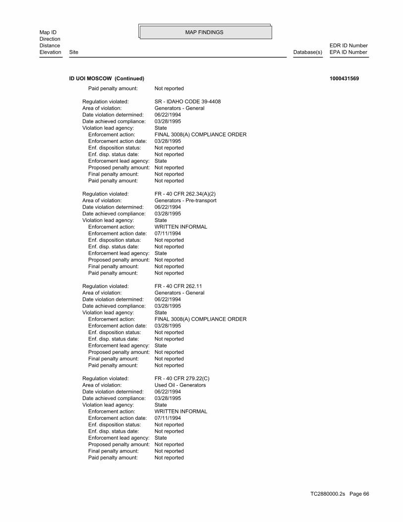
MAP FINDINGSMap IDDirection
EDR ID NumberDistanceEPA ID NumberDatabase(s)SiteElevation
Not reported Paid penalty amount: Not reported Final penalty amount: Not reported Proposed penalty amount: State Enforcement lead agency: Not reported Enf. disp. status date: Not reported Enf. disposition status: 07/11/1994 Enforcement action date: WRITTEN INFORMAL Enforcement action: StateViolation lead agency: 03/28/1995Date achieved compliance: 06/22/1994Date violation determined: Used Oil - GeneratorsArea of violation: FR - 40 CFR 279.22(C)Regulation violated:
Not reported Paid penalty amount: Not reported Final penalty amount: Not reported Proposed penalty amount: State Enforcement lead agency: Not reported Enf. disp. status date: Not reported Enf. disposition status: 03/28/1995 Enforcement action date: FINAL 3008(A) COMPLIANCE ORDER Enforcement action: StateViolation lead agency: 03/28/1995Date achieved compliance: 06/22/1994Date violation determined: Generators - GeneralArea of violation: FR - 40 CFR 262.11Regulation violated:
Not reported Paid penalty amount: Not reported Final penalty amount: Not reported Proposed penalty amount: State Enforcement lead agency: Not reported Enf. disp. status date: Not reported Enf. disposition status: 07/11/1994 Enforcement action date: WRITTEN INFORMAL Enforcement action: StateViolation lead agency: 03/28/1995Date achieved compliance: 06/22/1994Date violation determined: Generators - Pre-transportArea of violation: FR - 40 CFR 262.34(A)(2)Regulation violated:
Not reported Paid penalty amount: Not reported Final penalty amount: Not reported Proposed penalty amount: State Enforcement lead agency: Not reported Enf. disp. status date: Not reported Enf. disposition status: 03/28/1995 Enforcement action date: FINAL 3008(A) COMPLIANCE ORDER Enforcement action: StateViolation lead agency: 03/28/1995Date achieved compliance: 06/22/1994Date violation determined: Generators - GeneralArea of violation: SR - IDAHO CODE 39-4408Regulation violated:
Not reported Paid penalty amount:
ID UOI MOSCOW (Continued) 1000431569
TC2880000.2s Page 66
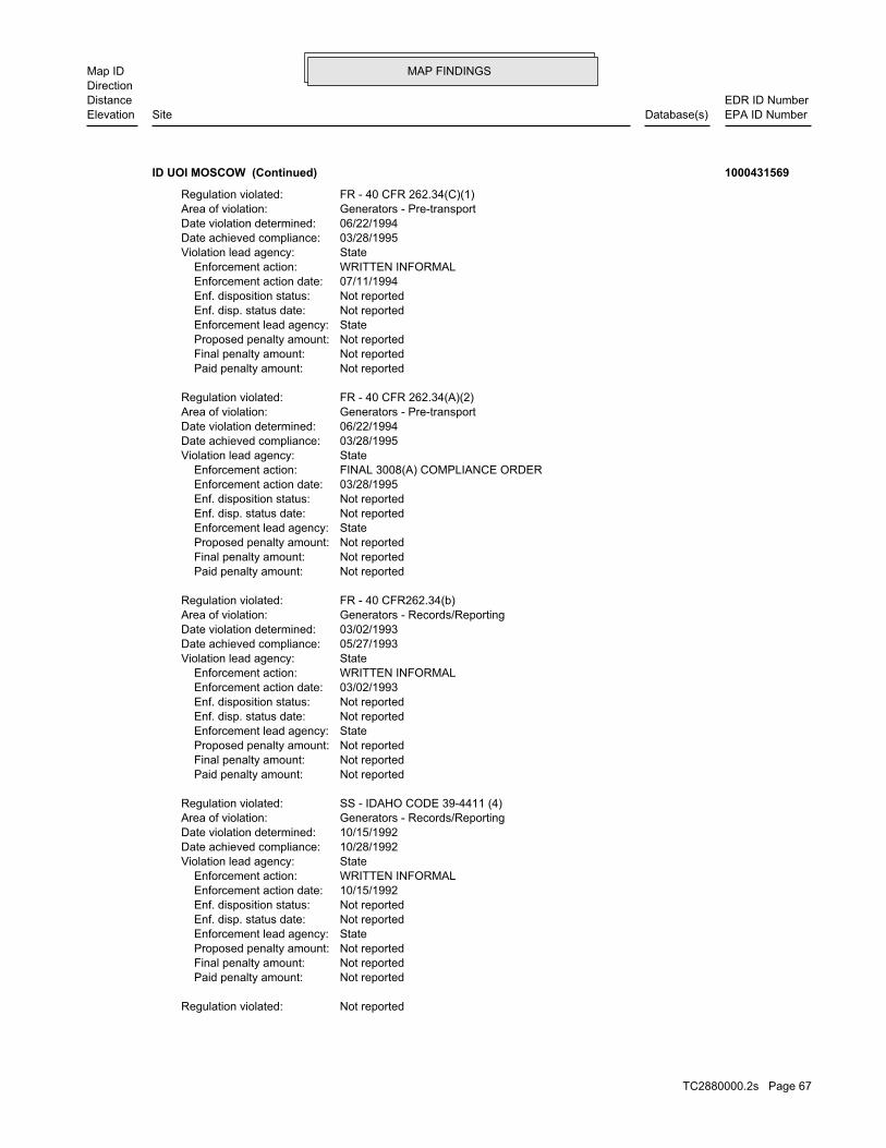
MAP FINDINGSMap IDDirection
EDR ID NumberDistanceEPA ID NumberDatabase(s)SiteElevation
Not reportedRegulation violated:
Not reported Paid penalty amount: Not reported Final penalty amount: Not reported Proposed penalty amount: State Enforcement lead agency: Not reported Enf. disp. status date: Not reported Enf. disposition status: 10/15/1992 Enforcement action date: WRITTEN INFORMAL Enforcement action: StateViolation lead agency: 10/28/1992Date achieved compliance: 10/15/1992Date violation determined: Generators - Records/ReportingArea of violation: SS - IDAHO CODE 39-4411 (4)Regulation violated:
Not reported Paid penalty amount: Not reported Final penalty amount: Not reported Proposed penalty amount: State Enforcement lead agency: Not reported Enf. disp. status date: Not reported Enf. disposition status: 03/02/1993 Enforcement action date: WRITTEN INFORMAL Enforcement action: StateViolation lead agency: 05/27/1993Date achieved compliance: 03/02/1993Date violation determined: Generators - Records/ReportingArea of violation: FR - 40 CFR262.34(b)Regulation violated:
Not reported Paid penalty amount: Not reported Final penalty amount: Not reported Proposed penalty amount: State Enforcement lead agency: Not reported Enf. disp. status date: Not reported Enf. disposition status: 03/28/1995 Enforcement action date: FINAL 3008(A) COMPLIANCE ORDER Enforcement action: StateViolation lead agency: 03/28/1995Date achieved compliance: 06/22/1994Date violation determined: Generators - Pre-transportArea of violation: FR - 40 CFR 262.34(A)(2)Regulation violated:
Not reported Paid penalty amount: Not reported Final penalty amount: Not reported Proposed penalty amount: State Enforcement lead agency: Not reported Enf. disp. status date: Not reported Enf. disposition status: 07/11/1994 Enforcement action date: WRITTEN INFORMAL Enforcement action: StateViolation lead agency: 03/28/1995Date achieved compliance: 06/22/1994Date violation determined: Generators - Pre-transportArea of violation: FR - 40 CFR 262.34(C)(1)Regulation violated:
ID UOI MOSCOW (Continued) 1000431569
TC2880000.2s Page 67

MAP FINDINGSMap IDDirection
EDR ID NumberDistanceEPA ID NumberDatabase(s)SiteElevation
Universal Waste - Large Quantity HandlersArea of violation: COMPLIANCE EVALUATION INSPECTION ON-SITEEvaluation: 04/22/2008Evaluation date:
StateEvaluation lead agency: Not reportedDate achieved compliance: LDR - Treatment StandardsArea of violation: COMPLIANCE EVALUATION INSPECTION ON-SITEEvaluation: 04/22/2008Evaluation date:
StateEvaluation lead agency: Not reportedDate achieved compliance: Not reportedArea of violation: SIGNIFICANT NON-COMPLIEREvaluation: 08/11/2008Evaluation date:
Evaluation Action Summary:
Not reported Paid penalty amount: Not reported Final penalty amount: Not reported Proposed penalty amount: State Enforcement lead agency: Not reported Enf. disp. status date: Not reported Enf. disposition status: 03/05/1986 Enforcement action date: FINAL 3008(A) COMPLIANCE ORDER Enforcement action: StateViolation lead agency: 04/03/1986Date achieved compliance: 04/24/1985Date violation determined: Generators - GeneralArea of violation: Not reportedRegulation violated:
Not reported Paid penalty amount: Not reported Final penalty amount: Not reported Proposed penalty amount: State Enforcement lead agency: Not reported Enf. disp. status date: Not reported Enf. disposition status: 12/02/1985 Enforcement action date: WRITTEN INFORMAL Enforcement action: StateViolation lead agency: 04/03/1986Date achieved compliance: 04/24/1985Date violation determined: Generators - GeneralArea of violation: Not reportedRegulation violated:
Not reported Paid penalty amount: Not reported Final penalty amount: Not reported Proposed penalty amount: State Enforcement lead agency: Not reported Enf. disp. status date: Not reported Enf. disposition status: 01/26/1987 Enforcement action date: FINAL 3008(A) COMPLIANCE ORDER Enforcement action: StateViolation lead agency: 02/05/1987Date achieved compliance: 06/11/1986Date violation determined: Generators - GeneralArea of violation:
ID UOI MOSCOW (Continued) 1000431569
TC2880000.2s Page 68

MAP FINDINGSMap IDDirection
EDR ID NumberDistanceEPA ID NumberDatabase(s)SiteElevation
StateEvaluation lead agency: 06/01/2006Date achieved compliance: LDR - GeneralArea of violation: COMPLIANCE EVALUATION INSPECTION ON-SITEEvaluation: 03/08/2005Evaluation date:
StateEvaluation lead agency: 06/01/2006Date achieved compliance: TSD - Container Use and ManagementArea of violation: COMPLIANCE EVALUATION INSPECTION ON-SITEEvaluation: 03/08/2005Evaluation date:
StateEvaluation lead agency: 06/01/2006Date achieved compliance: Generators - GeneralArea of violation: COMPLIANCE EVALUATION INSPECTION ON-SITEEvaluation: 03/08/2005Evaluation date:
StateEvaluation lead agency: Not reportedDate achieved compliance: Generators - GeneralArea of violation: COMPLIANCE EVALUATION INSPECTION ON-SITEEvaluation: 04/22/2008Evaluation date:
StateEvaluation lead agency: 09/15/2008Date achieved compliance: TSD IS-Container Use and ManagementArea of violation: COMPLIANCE EVALUATION INSPECTION ON-SITEEvaluation: 04/22/2008Evaluation date:
StateEvaluation lead agency: Not reportedDate achieved compliance: LDR - GeneralArea of violation: COMPLIANCE EVALUATION INSPECTION ON-SITEEvaluation: 04/22/2008Evaluation date:
StateEvaluation lead agency: 09/15/2008Date achieved compliance: Generators - Pre-transportArea of violation: COMPLIANCE EVALUATION INSPECTION ON-SITEEvaluation: 04/22/2008Evaluation date:
StateEvaluation lead agency: 09/15/2008Date achieved compliance: Generators - Records/ReportingArea of violation: COMPLIANCE EVALUATION INSPECTION ON-SITEEvaluation: 04/22/2008Evaluation date:
StateEvaluation lead agency: 09/15/2008Date achieved compliance: LDR - GeneralArea of violation: COMPLIANCE EVALUATION INSPECTION ON-SITEEvaluation: 04/22/2008Evaluation date:
StateEvaluation lead agency: Not reportedDate achieved compliance:
ID UOI MOSCOW (Continued) 1000431569
TC2880000.2s Page 69

MAP FINDINGSMap IDDirection
EDR ID NumberDistanceEPA ID NumberDatabase(s)SiteElevation
LDR - GeneralArea of violation: COMPLIANCE EVALUATION INSPECTION ON-SITEEvaluation: 04/30/2002Evaluation date:
StateEvaluation lead agency: 02/05/2003Date achieved compliance: Generators - Pre-transportArea of violation: COMPLIANCE EVALUATION INSPECTION ON-SITEEvaluation: 04/30/2002Evaluation date:
EPA-Initiated Oversight/Observation/Training ActionsEvaluation lead agency: Not reportedDate achieved compliance: Not reportedArea of violation: COMPLIANCE EVALUATION INSPECTION ON-SITEEvaluation: 04/30/2002Evaluation date:
StateEvaluation lead agency: 02/05/2003Date achieved compliance: Used Oil - GeneratorsArea of violation: COMPLIANCE EVALUATION INSPECTION ON-SITEEvaluation: 04/30/2002Evaluation date:
StateEvaluation lead agency: Not reportedDate achieved compliance: Not reportedArea of violation: SIGNIFICANT NON-COMPLIEREvaluation: 07/26/2002Evaluation date:
StateEvaluation lead agency: Not reportedDate achieved compliance: Not reportedArea of violation: NOT A SIGNIFICANT NON-COMPLIEREvaluation: 10/04/2002Evaluation date:
StateEvaluation lead agency: 06/01/2006Date achieved compliance: Permits - General InformationArea of violation: COMPLIANCE EVALUATION INSPECTION ON-SITEEvaluation: 03/08/2005Evaluation date:
EPA-Initiated Oversight/Observation/Training ActionsEvaluation lead agency: Not reportedDate achieved compliance: Not reportedArea of violation: COMPLIANCE EVALUATION INSPECTION ON-SITEEvaluation: 03/08/2005Evaluation date:
StateEvaluation lead agency: 06/01/2006Date achieved compliance: Generators - Pre-transportArea of violation: COMPLIANCE EVALUATION INSPECTION ON-SITEEvaluation: 03/08/2005Evaluation date:
StateEvaluation lead agency: 06/01/2006Date achieved compliance: Used Oil - GeneratorsArea of violation: COMPLIANCE EVALUATION INSPECTION ON-SITEEvaluation: 03/08/2005Evaluation date:
ID UOI MOSCOW (Continued) 1000431569
TC2880000.2s Page 70
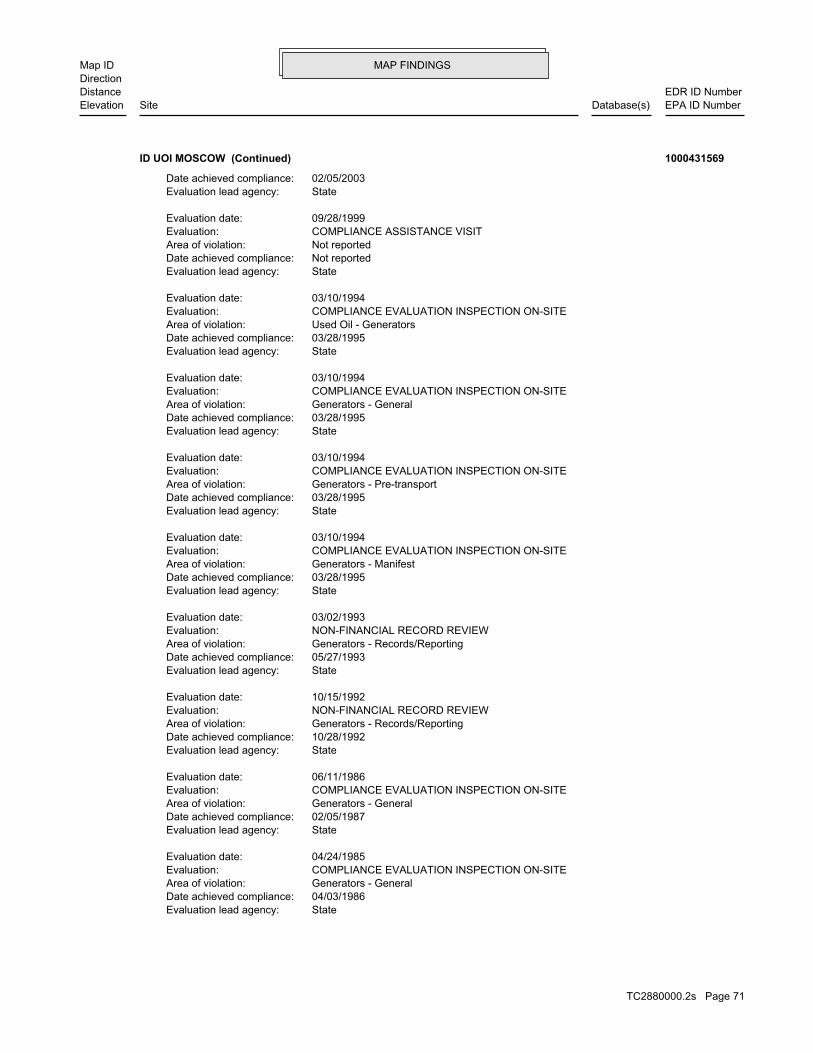
MAP FINDINGSMap IDDirection
EDR ID NumberDistanceEPA ID NumberDatabase(s)SiteElevation
StateEvaluation lead agency: 04/03/1986Date achieved compliance: Generators - GeneralArea of violation: COMPLIANCE EVALUATION INSPECTION ON-SITEEvaluation: 04/24/1985Evaluation date:
StateEvaluation lead agency: 02/05/1987Date achieved compliance: Generators - GeneralArea of violation: COMPLIANCE EVALUATION INSPECTION ON-SITEEvaluation: 06/11/1986Evaluation date:
StateEvaluation lead agency: 10/28/1992Date achieved compliance: Generators - Records/ReportingArea of violation: NON-FINANCIAL RECORD REVIEWEvaluation: 10/15/1992Evaluation date:
StateEvaluation lead agency: 05/27/1993Date achieved compliance: Generators - Records/ReportingArea of violation: NON-FINANCIAL RECORD REVIEWEvaluation: 03/02/1993Evaluation date:
StateEvaluation lead agency: 03/28/1995Date achieved compliance: Generators - ManifestArea of violation: COMPLIANCE EVALUATION INSPECTION ON-SITEEvaluation: 03/10/1994Evaluation date:
StateEvaluation lead agency: 03/28/1995Date achieved compliance: Generators - Pre-transportArea of violation: COMPLIANCE EVALUATION INSPECTION ON-SITEEvaluation: 03/10/1994Evaluation date:
StateEvaluation lead agency: 03/28/1995Date achieved compliance: Generators - GeneralArea of violation: COMPLIANCE EVALUATION INSPECTION ON-SITEEvaluation: 03/10/1994Evaluation date:
StateEvaluation lead agency: 03/28/1995Date achieved compliance: Used Oil - GeneratorsArea of violation: COMPLIANCE EVALUATION INSPECTION ON-SITEEvaluation: 03/10/1994Evaluation date:
StateEvaluation lead agency: Not reportedDate achieved compliance: Not reportedArea of violation: COMPLIANCE ASSISTANCE VISITEvaluation: 09/28/1999Evaluation date:
StateEvaluation lead agency: 02/05/2003Date achieved compliance:
ID UOI MOSCOW (Continued) 1000431569
TC2880000.2s Page 71
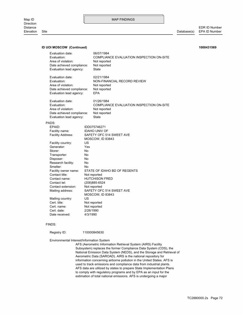
MAP FINDINGSMap IDDirection
EDR ID NumberDistanceEPA ID NumberDatabase(s)SiteElevation
estimation of total national emissions. AFS is undergoing a majorto comply with regulatory programs and by EPA as an input for theAFS data are utilized by states to prepare State Implementation Plansused to track emissions and compliance data from industrial plants.information concerning airborne pollution in the United States. AFS isAerometric Data (SAROAD). AIRS is the national repository forNational Emission Data System (NEDS), and the Storage and Retrieval ofSubsystem) replaces the former Compliance Data System (CDS), theAFS (Aerometric Information Retrieval System (AIRS) Facility
Environmental Interest/Information System
110000845630Registry ID:
FINDS:
4/3/1990Date received: 2/26/1990Cert. date: Not reportedCert. name: Not reportedCert. title: USMailing country: MOSCOW, ID 83843 SAFETY OFC 514 SWEET AVEMailing address: Not reportedContact extension: (208)885-6524Contact tel: HUTCHISON FREDContact name: Not reportedContact title: STATE OF IDAHO BD OF REGENTSFacility owner name: NoSmelter: NoResearch facility: NoDisposer: NoTransporter: NoStorer: YesGenerator: USFacility country: MOSCOW, ID 83843 SAFETY OFC 514 SWEET AVEFacility Address: IDAHO UNIV OFFacility name: IDD075746271EPAID:
PADS:
StateEvaluation lead agency: Not reportedDate achieved compliance: Not reportedArea of violation: COMPLIANCE EVALUATION INSPECTION ON-SITEEvaluation: 01/26/1984Evaluation date:
EPAEvaluation lead agency: Not reportedDate achieved compliance: Not reportedArea of violation: NON-FINANCIAL RECORD REVIEWEvaluation: 02/21/1984Evaluation date:
StateEvaluation lead agency: Not reportedDate achieved compliance: Not reportedArea of violation: COMPLIANCE EVALUATION INSPECTION ON-SITEEvaluation: 06/07/1984Evaluation date:
ID UOI MOSCOW (Continued) 1000431569
TC2880000.2s Page 72

MAP FINDINGSMap IDDirection
EDR ID NumberDistanceEPA ID NumberDatabase(s)SiteElevation
permit, compliance, and enforcement status of NPDES facilities.Elimination System (NPDES) permit holding facilities. PCS tracks theinformation system that contains data on National Pollutant DischargePCS (Permit Compliance System) is a computerized management
Incident Tracking, Compliance Assistance, and Compliance Monitoring.that support Compliance and Enforcement programs. These include;has the capability to track other activities occurring in the Regionthat information with Federal actions already in the system. ICIS alsoCompliance System (PCS) which supports the NPDES and will integrateit Headquarters. A future release of ICIS will replace the Permitinformation is maintained in ICIS by EPA in the Regional offices andFederal Administrative and Judicial enforcement actions. Thisa single repository for that information. Currently, ICIS contains allreplace EPA’s independent databases that contain Enforcement data withinformation across most of EPA’s programs. The vision for ICIS is tocomplete, will contain integrated Enforcement and ComplianceCompliance Information System and provides a database that, whenICIS (Integrated Compliance Information System) is the Integrated
corrective action activities required under RCRA.program staff to track the notification, permit, compliance, andand treat, store, or dispose of hazardous waste. RCRAInfo allows RCRAevents and activities related to facilities that generate, transport,Conservation and Recovery Act (RCRA) program through the tracking ofRCRAInfo is a national information system that supports the Resource
discharge does not adversely affect water quality.requirements, and include other provisions to ensure that thelimits on what can be discharged, impose monitoring and reportingStates are required to obtain a permit. The permit will likely containdischarge pollutants from any point source into waters of the Unitedissued under the Clean Water Act. Under NPDES, all facilities thatthe Compliance Information System (ICIS) tracks surface water permitsUS National Pollutant Discharge Elimination System (NPDES) module of
customers is safe for human consumption.monitoring and reporting requirements to ensure that water provided toestablish maximum contaminant levels (MCL), treatment techniques, andsafe drinking water. These statutes and accompanying regulationspublic water systems and their violations of EPA’s regulations forinformation is stored in EPA’s SDWIS, which contains information aboutsystem will purchase water from several facilities. Drinking waterWater Systems can have one or more water system facilities. The waterSDWIS [WS] (Safe Drinking Water Information System (Water System) ).
and settlements.regions and states with cooperative agreements, enforcement actions,Toxic Substances Control Act (TSCA). The system tracks inspections inFederal Insecticide, Fungicide, and Rodenticide Act (FIFRA) and theNCDB (National Compliance Data Base) supports implementation of the
of the Clean Air Act.redesign to support facility operating permits required under Title V
ID UOI MOSCOW (Continued) 1000431569
TC2880000.2s Page 73

MAP FINDINGSMap IDDirection
EDR ID NumberDistanceEPA ID NumberDatabase(s)SiteElevation
Not reportedDiscr Residue Ind: Not reportedDiscr Type Ind: Not reportedDiscr Quantity Ind: Not reportedExport Ind: Not reportedImport Ind: Not reportedManifest Tracking Num: 86Year: 100Specific Gravity: T Chemical, physical, or biological treatment.Handling Method: DM - Metal drums, barrelsContainer Type: 001Number of Containers: Y - Cubic yards* (.85 tons)Units: 00028Quantity: Not reportedWaste Code: 100Specific Gravity: T Chemical, physical, or biological treatment.Handling Method: DM - Metal drums, barrelsContainer Type: 001Number of Containers: Y - Cubic yards* (.85 tons)Units: 00028Quantity: Not reportedWaste Code: 100Specific Gravity: T Chemical, physical, or biological treatment.Handling Method: DM - Metal drums, barrelsContainer Type: 001Number of Containers: Y - Cubic yards* (.85 tons)Units: 00028Quantity: D002 - NON-LISTED CORROSIVE WASTESWaste Code: NYD000632372TSDF ID: Not reportedTrans2 EPA ID: NYD980769947Trans1 EPA ID: IDD075746271Generator EPA ID: 860404Part B Recv Date: 860326Part A Recv Date: 860401TSD Site Recv Date: Not reportedTrans2 Recv Date: 860319Trans1 Recv Date: 860319Generator Ship Date: Not reportedTrans2 State ID: V-44083NYTrans1 State ID: Completed copyManifest Status: NYA3404474Document ID:
208-885-6524Mailing Phone: USAMailing Country: Not reportedMailing Zip4: 83843Mailing Zip: IDMailing State: MOSCOWMailing City: Not reportedMailing Address 2: SAFETY OFFICE ADO 204Mailing Address: UNIVERSITY OF IDAHOMailing Contact: UNIVERSITY OF IDAHOMailing Name: USACountry: IDD075746271EPA ID:
NY MANIFEST:
ID UOI MOSCOW (Continued) 1000431569
TC2880000.2s Page 74

MAP FINDINGSMap IDDirection
EDR ID NumberDistanceEPA ID NumberDatabase(s)SiteElevation
Not reportedMgmt Method Type Code: Not reportedAlt Fac Sign Date: Not reportedAlt Fac RCRA Id: Not reportedManifest Ref Num: Not reportedDiscr Full Reject Ind: Not reportedDiscr Partial Reject Ind: Not reportedDiscr Residue Ind: Not reportedDiscr Type Ind: Not reportedDiscr Quantity Ind: Not reportedExport Ind: Not reportedImport Ind: Not reportedManifest Tracking Num: 86Year: 100Specific Gravity: B Incineration, heat recovery, burning.Handling Method: DM - Metal drums, barrelsContainer Type: 001Number of Containers: Y - Cubic yards* (.85 tons)Units: 00028Quantity: Not reportedWaste Code: 100Specific Gravity: T Chemical, physical, or biological treatment.Handling Method: DM - Metal drums, barrelsContainer Type: 002Number of Containers: Y - Cubic yards* (.85 tons)Units: 00056Quantity: Not reportedWaste Code: 100Specific Gravity: T Chemical, physical, or biological treatment.Handling Method: DM - Metal drums, barrelsContainer Type: 001Number of Containers: Y - Cubic yards* (.85 tons)Units: 00028Quantity: D003 - NON-LISTED REACTIVE WASTESWaste Code: NYD000632372TSDF ID: Not reportedTrans2 EPA ID: NYD980769947Trans1 EPA ID: IDD075746271Generator EPA ID: 860407Part B Recv Date: 860326Part A Recv Date: 860401TSD Site Recv Date: Not reportedTrans2 Recv Date: 860319Trans1 Recv Date: 860319Generator Ship Date: Not reportedTrans2 State ID: V-44083NYTrans1 State ID: Completed copyManifest Status: NYA3404463Document ID:
Not reportedMgmt Method Type Code: Not reportedAlt Fac Sign Date: Not reportedAlt Fac RCRA Id: Not reportedManifest Ref Num: Not reportedDiscr Full Reject Ind: Not reportedDiscr Partial Reject Ind:
ID UOI MOSCOW (Continued) 1000431569
TC2880000.2s Page 75
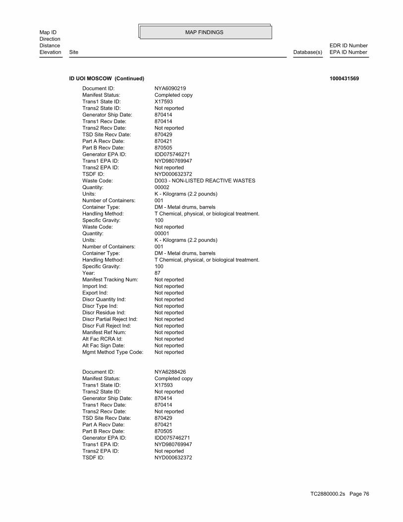
MAP FINDINGSMap IDDirection
EDR ID NumberDistanceEPA ID NumberDatabase(s)SiteElevation
NYD000632372TSDF ID: Not reportedTrans2 EPA ID: NYD980769947Trans1 EPA ID: IDD075746271Generator EPA ID: 870505Part B Recv Date: 870421Part A Recv Date: 870429TSD Site Recv Date: Not reportedTrans2 Recv Date: 870414Trans1 Recv Date: 870414Generator Ship Date: Not reportedTrans2 State ID: X17593Trans1 State ID: Completed copyManifest Status: NYA6288426Document ID:
Not reportedMgmt Method Type Code: Not reportedAlt Fac Sign Date: Not reportedAlt Fac RCRA Id: Not reportedManifest Ref Num: Not reportedDiscr Full Reject Ind: Not reportedDiscr Partial Reject Ind: Not reportedDiscr Residue Ind: Not reportedDiscr Type Ind: Not reportedDiscr Quantity Ind: Not reportedExport Ind: Not reportedImport Ind: Not reportedManifest Tracking Num: 87Year: 100Specific Gravity: T Chemical, physical, or biological treatment.Handling Method: DM - Metal drums, barrelsContainer Type: 001Number of Containers: K - Kilograms (2.2 pounds)Units: 00001Quantity: Not reportedWaste Code: 100Specific Gravity: T Chemical, physical, or biological treatment.Handling Method: DM - Metal drums, barrelsContainer Type: 001Number of Containers: K - Kilograms (2.2 pounds)Units: 00002Quantity: D003 - NON-LISTED REACTIVE WASTESWaste Code: NYD000632372TSDF ID: Not reportedTrans2 EPA ID: NYD980769947Trans1 EPA ID: IDD075746271Generator EPA ID: 870505Part B Recv Date: 870421Part A Recv Date: 870429TSD Site Recv Date: Not reportedTrans2 Recv Date: 870414Trans1 Recv Date: 870414Generator Ship Date: Not reportedTrans2 State ID: X17593Trans1 State ID: Completed copyManifest Status: NYA6090219Document ID:
ID UOI MOSCOW (Continued) 1000431569
TC2880000.2s Page 76

MAP FINDINGSMap IDDirection
EDR ID NumberDistanceEPA ID NumberDatabase(s)SiteElevation
NYD000632372TSDF ID: Not reportedTrans2 EPA ID: NYD980769947Trans1 EPA ID: IDD075746271Generator EPA ID: 871106Part B Recv Date: 871020Part A Recv Date: 871102TSD Site Recv Date: Not reportedTrans2 Recv Date: 871014Trans1 Recv Date: 871014Generator Ship Date: 75318BNYTrans2 State ID: 47490A-NYTrans1 State ID: Completed copyManifest Status: NYA5462136Document ID:
Not reportedMgmt Method Type Code: Not reportedAlt Fac Sign Date: Not reportedAlt Fac RCRA Id: Not reportedManifest Ref Num: Not reportedDiscr Full Reject Ind: Not reportedDiscr Partial Reject Ind: Not reportedDiscr Residue Ind: Not reportedDiscr Type Ind: Not reportedDiscr Quantity Ind: Not reportedExport Ind: Not reportedImport Ind: Not reportedManifest Tracking Num: 87Year: 100Specific Gravity: T Chemical, physical, or biological treatment.Handling Method: DM - Metal drums, barrelsContainer Type: 001Number of Containers: K - Kilograms (2.2 pounds)Units: 00001Quantity: Not reportedWaste Code: 100Specific Gravity: T Chemical, physical, or biological treatment.Handling Method: DM - Metal drums, barrelsContainer Type: 001Number of Containers: K - Kilograms (2.2 pounds)Units: 00002Quantity: Not reportedWaste Code: 100Specific Gravity: T Chemical, physical, or biological treatment.Handling Method: DM - Metal drums, barrelsContainer Type: 001Number of Containers: K - Kilograms (2.2 pounds)Units: 00002Quantity: Not reportedWaste Code: 100Specific Gravity: T Chemical, physical, or biological treatment.Handling Method: DM - Metal drums, barrelsContainer Type: 001Number of Containers: K - Kilograms (2.2 pounds)Units: 00001Quantity: U246 - CYANOGEN BROMIDEWaste Code:
ID UOI MOSCOW (Continued) 1000431569
TC2880000.2s Page 77

MAP FINDINGSMap IDDirection
EDR ID NumberDistanceEPA ID NumberDatabase(s)SiteElevation
Not reportedMgmt Method Type Code: Not reportedAlt Fac Sign Date: Not reportedAlt Fac RCRA Id: Not reportedManifest Ref Num: Not reportedDiscr Full Reject Ind: Not reportedDiscr Partial Reject Ind: Not reportedDiscr Residue Ind: Not reportedDiscr Type Ind: Not reportedDiscr Quantity Ind: Not reportedExport Ind: Not reportedImport Ind: Not reportedManifest Tracking Num: 87Year: 100Specific Gravity: T Chemical, physical, or biological treatment.Handling Method: DM - Metal drums, barrelsContainer Type: 001Number of Containers: LUnits: 00003Quantity: D002 - NON-LISTED CORROSIVE WASTESWaste Code: 100Specific Gravity: T Chemical, physical, or biological treatment.Handling Method: DM - Metal drums, barrelsContainer Type: 001Number of Containers: LUnits: 00003Quantity: Not reportedWaste Code: 100Specific Gravity: T Chemical, physical, or biological treatment.Handling Method: DM - Metal drums, barrelsContainer Type: 001Number of Containers: K - Kilograms (2.2 pounds)Units: 00001Quantity: Not reportedWaste Code: 100Specific Gravity: T Chemical, physical, or biological treatment.Handling Method: DM - Metal drums, barrelsContainer Type: 001Number of Containers: K - Kilograms (2.2 pounds)Units: 00007Quantity: Not reportedWaste Code: 100Specific Gravity: B Incineration, heat recovery, burning.Handling Method: DM - Metal drums, barrelsContainer Type: 001Number of Containers: K - Kilograms (2.2 pounds)Units: 00006Quantity: Not reportedWaste Code: 100Specific Gravity: T Chemical, physical, or biological treatment.Handling Method: DM - Metal drums, barrelsContainer Type: 001Number of Containers: LUnits: 00008Quantity: D003 - NON-LISTED REACTIVE WASTESWaste Code:
ID UOI MOSCOW (Continued) 1000431569
TC2880000.2s Page 78
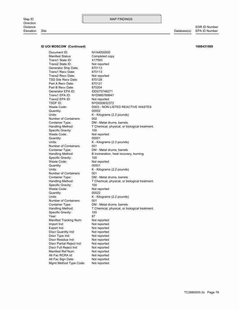
MAP FINDINGSMap IDDirection
EDR ID NumberDistanceEPA ID NumberDatabase(s)SiteElevation
Not reportedMgmt Method Type Code: Not reportedAlt Fac Sign Date: Not reportedAlt Fac RCRA Id: Not reportedManifest Ref Num: Not reportedDiscr Full Reject Ind: Not reportedDiscr Partial Reject Ind: Not reportedDiscr Residue Ind: Not reportedDiscr Type Ind: Not reportedDiscr Quantity Ind: Not reportedExport Ind: Not reportedImport Ind: Not reportedManifest Tracking Num: 87Year: 100Specific Gravity: T Chemical, physical, or biological treatment.Handling Method: DM - Metal drums, barrelsContainer Type: 001Number of Containers: K - Kilograms (2.2 pounds)Units: 00022Quantity: Not reportedWaste Code: 100Specific Gravity: T Chemical, physical, or biological treatment.Handling Method: DM - Metal drums, barrelsContainer Type: 001Number of Containers: K - Kilograms (2.2 pounds)Units: 00001Quantity: Not reportedWaste Code: 100Specific Gravity: B Incineration, heat recovery, burning.Handling Method: DM - Metal drums, barrelsContainer Type: 001Number of Containers: K - Kilograms (2.2 pounds)Units: 00001Quantity: Not reportedWaste Code: 100Specific Gravity: T Chemical, physical, or biological treatment.Handling Method: DM - Metal drums, barrelsContainer Type: 002Number of Containers: K - Kilograms (2.2 pounds)Units: 00002Quantity: D003 - NON-LISTED REACTIVE WASTESWaste Code: NYD000632372TSDF ID: Not reportedTrans2 EPA ID: NYD980769947Trans1 EPA ID: IDD075746271Generator EPA ID: 870204Part B Recv Date: 870121Part A Recv Date: 870128TSD Site Recv Date: Not reportedTrans2 Recv Date: 870113Trans1 Recv Date: 870113Generator Ship Date: Not reportedTrans2 State ID: X17593Trans1 State ID: Completed copyManifest Status: NYA4050000Document ID:
ID UOI MOSCOW (Continued) 1000431569
TC2880000.2s Page 79
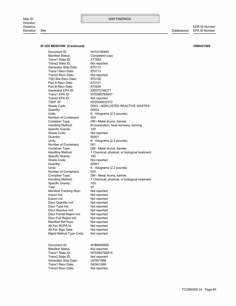
MAP FINDINGSMap IDDirection
EDR ID NumberDistanceEPA ID NumberDatabase(s)SiteElevation
Not reportedTrans2 Recv Date: 04/06/1998Trans1 Recv Date: 04/06/1998Generator Ship Date: Not reportedTrans2 State ID: NYD982792814Trans1 State ID: Not reportedManifest Status: NYB8495685Document ID:
Not reportedMgmt Method Type Code: Not reportedAlt Fac Sign Date: Not reportedAlt Fac RCRA Id: Not reportedManifest Ref Num: Not reportedDiscr Full Reject Ind: Not reportedDiscr Partial Reject Ind: Not reportedDiscr Residue Ind: Not reportedDiscr Type Ind: Not reportedDiscr Quantity Ind: Not reportedExport Ind: Not reportedImport Ind: Not reportedManifest Tracking Num: 87Year: 100Specific Gravity: T Chemical, physical, or biological treatment.Handling Method: DM - Metal drums, barrelsContainer Type: 003Number of Containers: K - Kilograms (2.2 pounds)Units: 00001Quantity: Not reportedWaste Code: 100Specific Gravity: T Chemical, physical, or biological treatment.Handling Method: DM - Metal drums, barrelsContainer Type: 001Number of Containers: K - Kilograms (2.2 pounds)Units: 00001Quantity: Not reportedWaste Code: 100Specific Gravity: B Incineration, heat recovery, burning.Handling Method: DM - Metal drums, barrelsContainer Type: 003Number of Containers: K - Kilograms (2.2 pounds)Units: 00002Quantity: D003 - NON-LISTED REACTIVE WASTESWaste Code: NYD000632372TSDF ID: Not reportedTrans2 EPA ID: NYD980769947Trans1 EPA ID: IDD075746271Generator EPA ID: 870204Part B Recv Date: 870121Part A Recv Date: 870128TSD Site Recv Date: Not reportedTrans2 Recv Date: 870113Trans1 Recv Date: 870113Generator Ship Date: Not reportedTrans2 State ID: X17593Trans1 State ID: Completed copyManifest Status: NYA3196440Document ID:
ID UOI MOSCOW (Continued) 1000431569
TC2880000.2s Page 80
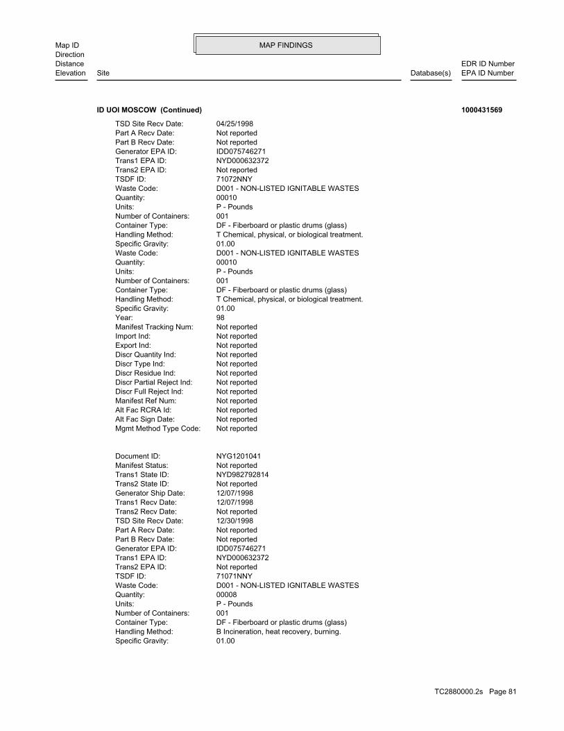
MAP FINDINGSMap IDDirection
EDR ID NumberDistanceEPA ID NumberDatabase(s)SiteElevation
01.00Specific Gravity: B Incineration, heat recovery, burning.Handling Method: DF - Fiberboard or plastic drums (glass)Container Type: 001Number of Containers: P - PoundsUnits: 00008Quantity: D001 - NON-LISTED IGNITABLE WASTESWaste Code: 71071NNYTSDF ID: Not reportedTrans2 EPA ID: NYD000632372Trans1 EPA ID: IDD075746271Generator EPA ID: Not reportedPart B Recv Date: Not reportedPart A Recv Date: 12/30/1998TSD Site Recv Date: Not reportedTrans2 Recv Date: 12/07/1998Trans1 Recv Date: 12/07/1998Generator Ship Date: Not reportedTrans2 State ID: NYD982792814Trans1 State ID: Not reportedManifest Status: NYG1201041Document ID:
Not reportedMgmt Method Type Code: Not reportedAlt Fac Sign Date: Not reportedAlt Fac RCRA Id: Not reportedManifest Ref Num: Not reportedDiscr Full Reject Ind: Not reportedDiscr Partial Reject Ind: Not reportedDiscr Residue Ind: Not reportedDiscr Type Ind: Not reportedDiscr Quantity Ind: Not reportedExport Ind: Not reportedImport Ind: Not reportedManifest Tracking Num: 98Year: 01.00Specific Gravity: T Chemical, physical, or biological treatment.Handling Method: DF - Fiberboard or plastic drums (glass)Container Type: 001Number of Containers: P - PoundsUnits: 00010Quantity: D001 - NON-LISTED IGNITABLE WASTESWaste Code: 01.00Specific Gravity: T Chemical, physical, or biological treatment.Handling Method: DF - Fiberboard or plastic drums (glass)Container Type: 001Number of Containers: P - PoundsUnits: 00010Quantity: D001 - NON-LISTED IGNITABLE WASTESWaste Code: 71072NNYTSDF ID: Not reportedTrans2 EPA ID: NYD000632372Trans1 EPA ID: IDD075746271Generator EPA ID: Not reportedPart B Recv Date: Not reportedPart A Recv Date: 04/25/1998TSD Site Recv Date:
ID UOI MOSCOW (Continued) 1000431569
TC2880000.2s Page 81

MAP FINDINGSMap IDDirection
EDR ID NumberDistanceEPA ID NumberDatabase(s)SiteElevation
Not reportedMgmt Method Type Code: Not reportedAlt Fac Sign Date: Not reportedAlt Fac RCRA Id: Not reportedManifest Ref Num: Not reportedDiscr Full Reject Ind: Not reportedDiscr Partial Reject Ind: Not reportedDiscr Residue Ind: Not reportedDiscr Type Ind: Not reportedDiscr Quantity Ind: Not reportedExport Ind: Not reportedImport Ind: Not reportedManifest Tracking Num: 98Year: 01.00Specific Gravity: T Chemical, physical, or biological treatment.Handling Method: DF - Fiberboard or plastic drums (glass)Container Type: 001Number of Containers: P - PoundsUnits: 00008Quantity: D002 - NON-LISTED CORROSIVE WASTESWaste Code: 01.00Specific Gravity: B Incineration, heat recovery, burning.Handling Method: DF - Fiberboard or plastic drums (glass)Container Type: 001Number of Containers: P - PoundsUnits: 00008Quantity: D001 - NON-LISTED IGNITABLE WASTESWaste Code:
ID UOI MOSCOW (Continued) 1000431569
46.72979000 / -117.02598000Latitude/Longitude: Not reportedTax Parcel Id: UNIVERSITY OF IDAHOOwner Name: Not reportedAlias: 671Facility Id:
2008 RCRA/HWMA InspectionIncidents: RCRASite ID: No attached deeds.Deed Rest: 46.72979000 / -117.02598000Latitude/Longitude: Not reportedTax Parcel Id: UNIVERSITY OF IDAHOOwner Name: Not reportedAlias: 671Facility Id:
2008 HWMA/RCRA InspectionIncidents: RCRASite ID: No attached deeds.Deed Rest: 46.72979000 / -117.02598000Latitude/Longitude: Not reportedTax Parcel Id: UNIVERSITY OF IDAHOOwner Name: Not reportedAlias: 671Facility Id:
ALLSITES:
2701 ft. Site 2 of 2 in cluster N0.511 mi. SPILLS
Relative:Lower
Actual:2557 ft.
1/2-1 USTMOSCOW, ID 83844WSW LUST1108 W 6TH ST N/AN48 ALLSITESUNIVERSITY OF IDAHO U003724376
TC2880000.2s Page 82

MAP FINDINGSMap IDDirection
EDR ID NumberDistanceEPA ID NumberDatabase(s)SiteElevation
6/30/1992Close Date: 6/30/1992Open Date: Not reportedFacility ID: PetroleumContaminant: Not reportedProgram:
ID SPILL:
14Total Tanks:ClosedStatus:2-290059Facility ID:
UST:
679Event ID:06/30/1992Cleanup Date:06/30/1992Release Date:ClosedStatus:2-290059Facid ID:
119Event ID:01/15/1997Cleanup Date:06/30/1992Release Date:ClosedStatus:2-290059Facid ID:
LUST:
GASOLINE RELEASEPRIORITY 00Incidents: LUSTSite ID: No attached deeds.Deed Rest: 46.72979000 / -117.02598000Latitude/Longitude: Not reportedTax Parcel Id: UNIVERSITY OF IDAHOOwner Name: Not reportedAlias: 671Facility Id:
RCRA Release #1Incidents: RCRASite ID: No attached deeds.Deed Rest: 46.72979000 / -117.02598000Latitude/Longitude: Not reportedTax Parcel Id: UNIVERSITY OF IDAHOOwner Name: Not reportedAlias: 671Facility Id:
GASOLINE, DIESEL RELEASEPRIORITY 00Incidents: LUSTSite ID: No attached deeds.Deed Rest: 46.72979000 / -117.02598000Latitude/Longitude: Not reportedTax Parcel Id: UNIVERSITY OF IDAHOOwner Name: Not reportedAlias: 671Facility Id:
Facility InformationIncidents: USTSite ID: No attached deeds.Deed Rest:
UNIVERSITY OF IDAHO (Continued) U003724376
TC2880000.2s Page 83

MAP FINDINGSMap IDDirection
EDR ID NumberDistanceEPA ID NumberDatabase(s)SiteElevation
11/2/2001Close Date: 6/30/1992Open Date: Not reportedFacility ID: PetroleumContaminant: Not reportedProgram:
ID SPILL:
1Total Tanks:ClosedStatus:2-290090Facility ID:
UST:
118Event ID:11/02/2001Cleanup Date:06/30/1992Release Date:ClosedStatus:2-290090Facid ID:
LUST:
Facility InformationIncidents: USTSite ID: No attached deeds.Deed Rest: 46.73923000 / -116.99711000Latitude/Longitude: Not reportedTax Parcel Id: LATAH COUNTYOwner Name: Not reportedAlias: 699Facility Id:
NOT LISTED RELEASEPRIORITY 2Incidents: LUSTSite ID: No attached deeds.Deed Rest: 46.73923000 / -116.99711000Latitude/Longitude: Not reportedTax Parcel Id: LATAH COUNTYOwner Name: Not reportedAlias: 699Facility Id:
ALLSITES:
2945 ft.0.558 mi. SPILLS
Relative:Higher
Actual:2578 ft.
1/2-1 USTMOSCOW, ID 83843NE LUST520 ADAMS ST N/A49 ALLSITESLATAH COUNTY U003724402
General RemediationSite ID: No attached deeds.Deed Rest: 46.72632000 / -117.00372000Latitude/Longitude: Not reportedTax Parcel Id: Not reportedOwner Name: Not reportedAlias: 5284Facility Id:
ALLSITES:
3041 ft.0.576 mi.
Relative:Higher
Actual:2563 ft.
1/2-1 MOSCOW, ID 83843South SPILLS320 SWEET AVE N/A50 ALLSITESPUREGRO S106528269
TC2880000.2s Page 84
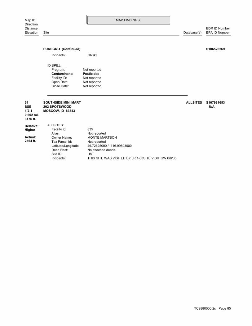
MAP FINDINGSMap IDDirection
EDR ID NumberDistanceEPA ID NumberDatabase(s)SiteElevation
Not reportedClose Date: Not reportedOpen Date: Not reportedFacility ID: PesticidesContaminant: Not reportedProgram:
ID SPILL:
GR #1Incidents:
PUREGRO (Continued) S106528269
THIS SITE WAS VISITED BY JR 1-03SITE VISIT GW 6/8/05Incidents: USTSite ID: No attached deeds.Deed Rest: 46.72625000 / -116.99893000Latitude/Longitude: Not reportedTax Parcel Id: MONTE MARTSONOwner Name: Not reportedAlias: 835Facility Id:
ALLSITES:
3176 ft.0.602 mi.
Relative:Higher
Actual:2564 ft.
1/2-1 MOSCOW, ID 83843SSE 202 SPOTSWOOD N/A51 ALLSITESSOUTHSIDE MINI MART S107981653
TC2880000.2s Page 85

ORPHAN SUMMARY
City EDR ID Site Name Site Address Zip Database(s)
MOSCOW S107981056 GOODMAN OIL (A) RT 1 83843 ALLSITESMOSCOW U003724354 GOODMAN OIL (A) RT 1 83843 USTMOSCOW 1007297758 1108 W 6TH ST 83843 FTTS, HIST FTTSMOSCOW 1004691956 3347 N 7 E 83843 RCRA-NonGen, FINDSMOSCOW S107981315 LATAH COUNTY GRAIN GROWER (3) 4169 HWY 95 S 83843 ALLSITESMOSCOW 1012049418 CHS, INC. - PRIMELAND COOPERATIVES 2551 HWY 95 S 83843 SSTSMOSCOW 1012050788 CHS, INC. - PRIMELAND COOPERATIVE 2555 HWY 95 S 83843 SSTSMOSCOW S108275552 PHILLIPS 66 CO 1 3RD & ASBRY ST 83843 ALLSITESMOSCOW S108276177 U OF I STUDENT UNION BUILDING 709 DEAKIN AVE 83843 ALLSITESMOSCOW S108275336 MOSCOW NAT GUARD ARMORY 1101 E HAROLD AVE 83843 ALLSITESMOSCOW S107980823 CHEVRON USA 90660 433 MAIN ST 83843 ALLSITESMOSCOW S106528548 GRITMAN EXPANSION MAIN ST 83843 ALLSITES, SPILLSMOSCOW S102688246 LATAH COUNTY LANDFILL 6 MILES E OF MOSCOW 83843 SWF/LF, HIST LFMOSCOW S109329853 LATAH SANITATION, INC 5 MILES E OF MOSCOW 83843 SWF/LFMOSCOW S109329854 LATAH SANITATION, INC NON-MSWLF 5 MILES E OF MOSCOW 83843 SWF/LFMOSCOW 1006806857 MOSCOW HWY 83843 RCRA-NonGen, FINDSMOSCOW S108274581 GTE PARADISE RIDGE MICROWAVE PARADISE RIDGE 83843 ALLSITESMOSCOW 1003880195 TROY HWY 83843 CERC-NFRAPMOSCOW S106528268 PRAIRIE LAND AND TIMBER USHY 95 N 83843 ALLSITES, SPILLSMOSCOW 1009525294 UNIVERSITY OF IDAHO 422 W WASHINGTON 83843 FTTS, HIST FTTS
TC2880000.2s Page 86
To maintain currency of the following federal and state databases, EDR contacts the appropriate governmental agencyon a monthly or quarterly basis, as required.
Number of Days to Update: Provides confirmation that EDR is reporting records that have been updated within 90 daysfrom the date the government agency made the information available to the public.
STANDARD ENVIRONMENTAL RECORDS
Federal NPL site list
NPL: National Priority ListNational Priorities List (Superfund). The NPL is a subset of CERCLIS and identifies over 1,200 sites for prioritycleanup under the Superfund Program. NPL sites may encompass relatively large areas. As such, EDR provides polygoncoverage for over 1,000 NPL site boundaries produced by EPA’s Environmental Photographic Interpretation Center(EPIC) and regional EPA offices.
Date of Government Version: 03/31/2010Date Data Arrived at EDR: 04/02/2010Date Made Active in Reports: 04/12/2010Number of Days to Update: 10
Source: EPATelephone: N/ALast EDR Contact: 07/14/2010Next Scheduled EDR Contact: 10/25/2010Data Release Frequency: Quarterly
NPL Site Boundaries
Sources:
EPA’s Environmental Photographic Interpretation Center (EPIC)Telephone: 202-564-7333
EPA Region 1 EPA Region 6Telephone 617-918-1143 Telephone: 214-655-6659
EPA Region 3 EPA Region 7Telephone 215-814-5418 Telephone: 913-551-7247
EPA Region 4 EPA Region 8Telephone 404-562-8033 Telephone: 303-312-6774
EPA Region 5 EPA Region 9Telephone 312-886-6686 Telephone: 415-947-4246
EPA Region 10Telephone 206-553-8665
Proposed NPL: Proposed National Priority List SitesA site that has been proposed for listing on the National Priorities List through the issuance of a proposed rulein the Federal Register. EPA then accepts public comments on the site, responds to the comments, and places onthe NPL those sites that continue to meet the requirements for listing.
Date of Government Version: 03/31/2010Date Data Arrived at EDR: 04/02/2010Date Made Active in Reports: 04/12/2010Number of Days to Update: 10
Source: EPATelephone: N/ALast EDR Contact: 07/14/2010Next Scheduled EDR Contact: 10/25/2010Data Release Frequency: Quarterly
NPL LIENS: Federal Superfund LiensFederal Superfund Liens. Under the authority granted the USEPA by CERCLA of 1980, the USEPA has the authorityto file liens against real property in order to recover remedial action expenditures or when the property ownerreceived notification of potential liability. USEPA compiles a listing of filed notices of Superfund Liens.
Date of Government Version: 10/15/1991Date Data Arrived at EDR: 02/02/1994Date Made Active in Reports: 03/30/1994Number of Days to Update: 56
Source: EPATelephone: 202-564-4267Last EDR Contact: 08/16/2010Next Scheduled EDR Contact: 11/29/2010Data Release Frequency: No Update Planned
TC2880000.2s Page GR-1
GOVERNMENT RECORDS SEARCHED / DATA CURRENCY TRACKING

Federal Delisted NPL site list
DELISTED NPL: National Priority List DeletionsThe National Oil and Hazardous Substances Pollution Contingency Plan (NCP) establishes the criteria that theEPA uses to delete sites from the NPL. In accordance with 40 CFR 300.425.(e), sites may be deleted from theNPL where no further response is appropriate.
Date of Government Version: 03/31/2010Date Data Arrived at EDR: 04/02/2010Date Made Active in Reports: 04/12/2010Number of Days to Update: 10
Source: EPATelephone: N/ALast EDR Contact: 07/14/2010Next Scheduled EDR Contact: 10/25/2010Data Release Frequency: Quarterly
Federal CERCLIS list
CERCLIS: Comprehensive Environmental Response, Compensation, and Liability Information SystemCERCLIS contains data on potentially hazardous waste sites that have been reported to the USEPA by states, municipalities,private companies and private persons, pursuant to Section 103 of the Comprehensive Environmental Response, Compensation,and Liability Act (CERCLA). CERCLIS contains sites which are either proposed to or on the National PrioritiesList (NPL) and sites which are in the screening and assessment phase for possible inclusion on the NPL.
Date of Government Version: 01/29/2010Date Data Arrived at EDR: 02/09/2010Date Made Active in Reports: 04/12/2010Number of Days to Update: 62
Source: EPATelephone: 703-412-9810Last EDR Contact: 09/02/2010Next Scheduled EDR Contact: 10/11/2010Data Release Frequency: Quarterly
FEDERAL FACILITY: Federal Facility Site Information listingA listing of National Priority List (NPL) and Base Realignment and Closure (BRAC) sites found in the ComprehensiveEnvironmental Response, Compensation and Liability Information System (CERCLIS) Database where EPAa??s FederalFacilities Restoration and Reuse Office is involved in cleanup activities.
Date of Government Version: 06/23/2009Date Data Arrived at EDR: 01/15/2010Date Made Active in Reports: 02/10/2010Number of Days to Update: 26
Source: Environmental Protection AgencyTelephone: 703-603-8704Last EDR Contact: 07/21/2010Next Scheduled EDR Contact: 10/25/2010Data Release Frequency: Varies
Federal CERCLIS NFRAP site List
CERCLIS-NFRAP: CERCLIS No Further Remedial Action PlannedArchived sites are sites that have been removed and archived from the inventory of CERCLIS sites. Archived statusindicates that, to the best of EPA’s knowledge, assessment at a site has been completed and that EPA has determinedno further steps will be taken to list this site on the National Priorities List (NPL), unless information indicatesthis decision was not appropriate or other considerations require a recommendation for listing at a later time.This decision does not necessarily mean that there is no hazard associated with a given site; it only means that,based upon available information, the location is not judged to be a potential NPL site.
Date of Government Version: 06/23/2009Date Data Arrived at EDR: 09/02/2009Date Made Active in Reports: 09/21/2009Number of Days to Update: 19
Source: EPATelephone: 703-412-9810Last EDR Contact: 09/02/2010Next Scheduled EDR Contact: 12/13/2010Data Release Frequency: Quarterly
Federal RCRA CORRACTS facilities list
CORRACTS: Corrective Action ReportCORRACTS identifies hazardous waste handlers with RCRA corrective action activity.
TC2880000.2s Page GR-2
GOVERNMENT RECORDS SEARCHED / DATA CURRENCY TRACKING

Date of Government Version: 03/25/2010Date Data Arrived at EDR: 03/31/2010Date Made Active in Reports: 05/27/2010Number of Days to Update: 57
Source: EPATelephone: 800-424-9346Last EDR Contact: 08/16/2010Next Scheduled EDR Contact: 11/29/2010Data Release Frequency: Quarterly
Federal RCRA non-CORRACTS TSD facilities list
RCRA-TSDF: RCRA - Treatment, Storage and DisposalRCRAInfo is EPA’s comprehensive information system, providing access to data supporting the Resource Conservationand Recovery Act (RCRA) of 1976 and the Hazardous and Solid Waste Amendments (HSWA) of 1984. The databaseincludes selective information on sites which generate, transport, store, treat and/or dispose of hazardous wasteas defined by the Resource Conservation and Recovery Act (RCRA). Transporters are individuals or entities thatmove hazardous waste from the generator offsite to a facility that can recycle, treat, store, or dispose of thewaste. TSDFs treat, store, or dispose of the waste.
Date of Government Version: 02/17/2010Date Data Arrived at EDR: 02/19/2010Date Made Active in Reports: 05/17/2010Number of Days to Update: 87
Source: Environmental Protection AgencyTelephone: (206) 553-1200Last EDR Contact: 08/19/2010Next Scheduled EDR Contact: 10/18/2010Data Release Frequency: Quarterly
Federal RCRA generators list
RCRA-LQG: RCRA - Large Quantity GeneratorsRCRAInfo is EPA’s comprehensive information system, providing access to data supporting the Resource Conservationand Recovery Act (RCRA) of 1976 and the Hazardous and Solid Waste Amendments (HSWA) of 1984. The databaseincludes selective information on sites which generate, transport, store, treat and/or dispose of hazardous wasteas defined by the Resource Conservation and Recovery Act (RCRA). Large quantity generators (LQGs) generateover 1,000 kilograms (kg) of hazardous waste, or over 1 kg of acutely hazardous waste per month.
Date of Government Version: 02/17/2010Date Data Arrived at EDR: 02/19/2010Date Made Active in Reports: 05/17/2010Number of Days to Update: 87
Source: Environmental Protection AgencyTelephone: (206) 553-1200Last EDR Contact: 08/19/2010Next Scheduled EDR Contact: 10/18/2010Data Release Frequency: Quarterly
RCRA-SQG: RCRA - Small Quantity GeneratorsRCRAInfo is EPA’s comprehensive information system, providing access to data supporting the Resource Conservationand Recovery Act (RCRA) of 1976 and the Hazardous and Solid Waste Amendments (HSWA) of 1984. The databaseincludes selective information on sites which generate, transport, store, treat and/or dispose of hazardous wasteas defined by the Resource Conservation and Recovery Act (RCRA). Small quantity generators (SQGs) generatebetween 100 kg and 1,000 kg of hazardous waste per month.
Date of Government Version: 02/17/2010Date Data Arrived at EDR: 02/19/2010Date Made Active in Reports: 05/17/2010Number of Days to Update: 87
Source: Environmental Protection AgencyTelephone: (206) 553-1200Last EDR Contact: 08/19/2010Next Scheduled EDR Contact: 10/18/2010Data Release Frequency: Quarterly
RCRA-CESQG: RCRA - Conditionally Exempt Small Quantity GeneratorsRCRAInfo is EPA’s comprehensive information system, providing access to data supporting the Resource Conservationand Recovery Act (RCRA) of 1976 and the Hazardous and Solid Waste Amendments (HSWA) of 1984. The databaseincludes selective information on sites which generate, transport, store, treat and/or dispose of hazardous wasteas defined by the Resource Conservation and Recovery Act (RCRA). Conditionally exempt small quantity generators(CESQGs) generate less than 100 kg of hazardous waste, or less than 1 kg of acutely hazardous waste per month.
Date of Government Version: 02/17/2010Date Data Arrived at EDR: 02/19/2010Date Made Active in Reports: 05/17/2010Number of Days to Update: 87
Source: Environmental Protection AgencyTelephone: (206) 553-1200Last EDR Contact: 08/19/2010Next Scheduled EDR Contact: 10/18/2010Data Release Frequency: Varies
TC2880000.2s Page GR-3
GOVERNMENT RECORDS SEARCHED / DATA CURRENCY TRACKING

Federal institutional controls / engineering controls registries
US ENG CONTROLS: Engineering Controls Sites ListA listing of sites with engineering controls in place. Engineering controls include various forms of caps, buildingfoundations, liners, and treatment methods to create pathway elimination for regulated substances to enter environmentalmedia or effect human health.
Date of Government Version: 12/20/2009Date Data Arrived at EDR: 01/20/2010Date Made Active in Reports: 04/12/2010Number of Days to Update: 82
Source: Environmental Protection AgencyTelephone: 703-603-0695Last EDR Contact: 09/13/2010Next Scheduled EDR Contact: 12/27/2010Data Release Frequency: Varies
US INST CONTROL: Sites with Institutional ControlsA listing of sites with institutional controls in place. Institutional controls include administrative measures,such as groundwater use restrictions, construction restrictions, property use restrictions, and post remediationcare requirements intended to prevent exposure to contaminants remaining on site. Deed restrictions are generallyrequired as part of the institutional controls.
Date of Government Version: 12/20/2009Date Data Arrived at EDR: 01/20/2010Date Made Active in Reports: 04/12/2010Number of Days to Update: 82
Source: Environmental Protection AgencyTelephone: 703-603-0695Last EDR Contact: 09/13/2010Next Scheduled EDR Contact: 12/27/2010Data Release Frequency: Varies
Federal ERNS list
ERNS: Emergency Response Notification SystemEmergency Response Notification System. ERNS records and stores information on reported releases of oil and hazardoussubstances.
Date of Government Version: 07/09/2010Date Data Arrived at EDR: 07/09/2010Date Made Active in Reports: 08/17/2010Number of Days to Update: 39
Source: National Response Center, United States Coast GuardTelephone: 202-267-2180Last EDR Contact: 07/09/2010Next Scheduled EDR Contact: 10/18/2010Data Release Frequency: Annually
State- and tribal - equivalent CERCLIS
SHWS: This state does not maintain a SHWS list. See the Federal CERCLIS list and Federal NPL list.State Hazardous Waste Sites. State hazardous waste site records are the states’ equivalent to CERCLIS. These sitesmay or may not already be listed on the federal CERCLIS list. Priority sites planned for cleanup using state funds(state equivalent of Superfund) are identified along with sites where cleanup will be paid for by potentiallyresponsible parties. Available information varies by state.
Date of Government Version: N/ADate Data Arrived at EDR: N/ADate Made Active in Reports: N/ANumber of Days to Update: N/A
Source: Department of Environmental QualityTelephone: 208-373-0502Last EDR Contact: 09/13/2010Next Scheduled EDR Contact: 12/27/2010Data Release Frequency: N/A
State and tribal landfill and/or solid waste disposal site lists
SWF/LF: Solid Waste LandfillsSolid Waste Facilities/Landfill Sites. SWF/LF type records typically contain an inventory of solid waste disposalfacilities or landfills in a particular state. Depending on the state, these may be active or inactive facilitiesor open dumps that failed to meet RCRA Subtitle D Section 4004 criteria for solid waste landfills or disposalsites.
TC2880000.2s Page GR-4
GOVERNMENT RECORDS SEARCHED / DATA CURRENCY TRACKING

Date of Government Version: 08/02/2010Date Data Arrived at EDR: 08/02/2010Date Made Active in Reports: 09/17/2010Number of Days to Update: 46
Source: Department of Environmental QualityTelephone: 208-334-5860Last EDR Contact: 08/02/2010Next Scheduled EDR Contact: 11/01/2010Data Release Frequency: Annually
State and tribal leaking storage tank lists
LUST: Leaking Underground Storage Tank SitesLeaking Underground Storage Tank Incident Reports. LUST records contain an inventory of reported leaking undergroundstorage tank incidents. Not all states maintain these records, and the information stored varies by state.
Date of Government Version: 07/13/2010Date Data Arrived at EDR: 07/14/2010Date Made Active in Reports: 07/26/2010Number of Days to Update: 12
Source: Department of Environmental QualityTelephone: 208-373-0130Last EDR Contact: 07/14/2010Next Scheduled EDR Contact: 10/25/2010Data Release Frequency: Quarterly
LAST: Leaking Aboveground Storage TanksA listing of leaking aboveground storage tank locations.
Date of Government Version: 03/25/2010Date Data Arrived at EDR: 03/26/2010Date Made Active in Reports: 04/16/2010Number of Days to Update: 21
Source: Department of Environmental QualityTelephone: 208-373-0347Last EDR Contact: 09/13/2010Next Scheduled EDR Contact: 12/27/2010Data Release Frequency: Quarterly
INDIAN LUST R4: Leaking Underground Storage Tanks on Indian LandLUSTs on Indian land in Florida, Mississippi and North Carolina.
Date of Government Version: 05/19/2010Date Data Arrived at EDR: 05/21/2010Date Made Active in Reports: 08/09/2010Number of Days to Update: 80
Source: EPA Region 4Telephone: 404-562-8677Last EDR Contact: 08/02/2010Next Scheduled EDR Contact: 11/15/2010Data Release Frequency: Semi-Annually
INDIAN LUST R8: Leaking Underground Storage Tanks on Indian LandLUSTs on Indian land in Colorado, Montana, North Dakota, South Dakota, Utah and Wyoming.
Date of Government Version: 05/24/2010Date Data Arrived at EDR: 05/27/2010Date Made Active in Reports: 08/09/2010Number of Days to Update: 74
Source: EPA Region 8Telephone: 303-312-6271Last EDR Contact: 08/02/2010Next Scheduled EDR Contact: 11/15/2010Data Release Frequency: Quarterly
INDIAN LUST R9: Leaking Underground Storage Tanks on Indian LandLUSTs on Indian land in Arizona, California, New Mexico and Nevada
Date of Government Version: 05/27/2010Date Data Arrived at EDR: 05/28/2010Date Made Active in Reports: 08/09/2010Number of Days to Update: 73
Source: Environmental Protection AgencyTelephone: 415-972-3372Last EDR Contact: 08/02/2010Next Scheduled EDR Contact: 11/15/2010Data Release Frequency: Quarterly
INDIAN LUST R10: Leaking Underground Storage Tanks on Indian LandLUSTs on Indian land in Alaska, Idaho, Oregon and Washington.
Date of Government Version: 05/04/2010Date Data Arrived at EDR: 05/05/2010Date Made Active in Reports: 05/27/2010Number of Days to Update: 22
Source: EPA Region 10Telephone: 206-553-2857Last EDR Contact: 08/02/2010Next Scheduled EDR Contact: 11/15/2010Data Release Frequency: Quarterly
TC2880000.2s Page GR-5
GOVERNMENT RECORDS SEARCHED / DATA CURRENCY TRACKING

INDIAN LUST R1: Leaking Underground Storage Tanks on Indian LandA listing of leaking underground storage tank locations on Indian Land.
Date of Government Version: 02/19/2009Date Data Arrived at EDR: 02/19/2009Date Made Active in Reports: 03/16/2009Number of Days to Update: 25
Source: EPA Region 1Telephone: 617-918-1313Last EDR Contact: 08/02/2010Next Scheduled EDR Contact: 11/15/2010Data Release Frequency: Varies
INDIAN LUST R6: Leaking Underground Storage Tanks on Indian LandLUSTs on Indian land in New Mexico and Oklahoma.
Date of Government Version: 05/03/2010Date Data Arrived at EDR: 05/05/2010Date Made Active in Reports: 05/27/2010Number of Days to Update: 22
Source: EPA Region 6Telephone: 214-665-6597Last EDR Contact: 08/02/2010Next Scheduled EDR Contact: 11/15/2010Data Release Frequency: Varies
INDIAN LUST R7: Leaking Underground Storage Tanks on Indian LandLUSTs on Indian land in Iowa, Kansas, and Nebraska
Date of Government Version: 11/04/2009Date Data Arrived at EDR: 05/04/2010Date Made Active in Reports: 07/07/2010Number of Days to Update: 64
Source: EPA Region 7Telephone: 913-551-7003Last EDR Contact: 08/11/2010Next Scheduled EDR Contact: 11/15/2010Data Release Frequency: Varies
State and tribal registered storage tank lists
UST: Registered Underground Storage Tanks in IdahoRegistered Underground Storage Tanks. UST’s are regulated under Subtitle I of the Resource Conservation and RecoveryAct (RCRA) and must be registered with the state department responsible for administering the UST program. Availableinformation varies by state program.
Date of Government Version: 07/13/2010Date Data Arrived at EDR: 07/14/2010Date Made Active in Reports: 07/26/2010Number of Days to Update: 12
Source: Department of Environmental QualityTelephone: 208-373-0130Last EDR Contact: 07/14/2010Next Scheduled EDR Contact: 10/25/2010Data Release Frequency: Quarterly
INDIAN UST R1: Underground Storage Tanks on Indian LandThe Indian Underground Storage Tank (UST) database provides information about underground storage tanks on Indianland in EPA Region 1 (Connecticut, Maine, Massachusetts, New Hampshire, Rhode Island, Vermont and ten TribalNations).
Date of Government Version: 02/19/2009Date Data Arrived at EDR: 02/19/2009Date Made Active in Reports: 03/16/2009Number of Days to Update: 25
Source: EPA, Region 1Telephone: 617-918-1313Last EDR Contact: 08/02/2010Next Scheduled EDR Contact: 11/15/2010Data Release Frequency: Varies
INDIAN UST R10: Underground Storage Tanks on Indian LandThe Indian Underground Storage Tank (UST) database provides information about underground storage tanks on Indianland in EPA Region 10 (Alaska, Idaho, Oregon, Washington, and Tribal Nations).
Date of Government Version: 05/04/2010Date Data Arrived at EDR: 05/05/2010Date Made Active in Reports: 05/27/2010Number of Days to Update: 22
Source: EPA Region 10Telephone: 206-553-2857Last EDR Contact: 08/02/2010Next Scheduled EDR Contact: 11/15/2010Data Release Frequency: Quarterly
TC2880000.2s Page GR-6
GOVERNMENT RECORDS SEARCHED / DATA CURRENCY TRACKING

INDIAN UST R7: Underground Storage Tanks on Indian LandThe Indian Underground Storage Tank (UST) database provides information about underground storage tanks on Indianland in EPA Region 7 (Iowa, Kansas, Missouri, Nebraska, and 9 Tribal Nations).
Date of Government Version: 04/01/2008Date Data Arrived at EDR: 12/30/2008Date Made Active in Reports: 03/16/2009Number of Days to Update: 76
Source: EPA Region 7Telephone: 913-551-7003Last EDR Contact: 08/11/2010Next Scheduled EDR Contact: 11/15/2010Data Release Frequency: Varies
INDIAN UST R8: Underground Storage Tanks on Indian LandThe Indian Underground Storage Tank (UST) database provides information about underground storage tanks on Indianland in EPA Region 8 (Colorado, Montana, North Dakota, South Dakota, Utah, Wyoming and 27 Tribal Nations).
Date of Government Version: 05/24/2010Date Data Arrived at EDR: 05/27/2010Date Made Active in Reports: 08/09/2010Number of Days to Update: 74
Source: EPA Region 8Telephone: 303-312-6137Last EDR Contact: 08/02/2010Next Scheduled EDR Contact: 11/15/2010Data Release Frequency: Quarterly
INDIAN UST R9: Underground Storage Tanks on Indian LandThe Indian Underground Storage Tank (UST) database provides information about underground storage tanks on Indianland in EPA Region 9 (Arizona, California, Hawaii, Nevada, the Pacific Islands, and Tribal Nations).
Date of Government Version: 05/27/2010Date Data Arrived at EDR: 05/28/2010Date Made Active in Reports: 08/09/2010Number of Days to Update: 73
Source: EPA Region 9Telephone: 415-972-3368Last EDR Contact: 08/02/2010Next Scheduled EDR Contact: 11/15/2010Data Release Frequency: Quarterly
INDIAN UST R4: Underground Storage Tanks on Indian LandThe Indian Underground Storage Tank (UST) database provides information about underground storage tanks on Indianland in EPA Region 4 (Alabama, Florida, Georgia, Kentucky, Mississippi, North Carolina, South Carolina, Tennesseeand Tribal Nations)
Date of Government Version: 05/19/2010Date Data Arrived at EDR: 05/21/2010Date Made Active in Reports: 08/09/2010Number of Days to Update: 80
Source: EPA Region 4Telephone: 404-562-9424Last EDR Contact: 08/02/2010Next Scheduled EDR Contact: 11/15/2010Data Release Frequency: Semi-Annually
INDIAN UST R5: Underground Storage Tanks on Indian LandThe Indian Underground Storage Tank (UST) database provides information about underground storage tanks on Indianland in EPA Region 5 (Michigan, Minnesota and Wisconsin and Tribal Nations).
Date of Government Version: 02/11/2010Date Data Arrived at EDR: 02/11/2010Date Made Active in Reports: 04/12/2010Number of Days to Update: 60
Source: EPA Region 5Telephone: 312-886-6136Last EDR Contact: 08/02/2010Next Scheduled EDR Contact: 11/15/2010Data Release Frequency: Varies
INDIAN UST R6: Underground Storage Tanks on Indian LandThe Indian Underground Storage Tank (UST) database provides information about underground storage tanks on Indianland in EPA Region 6 (Louisiana, Arkansas, Oklahoma, New Mexico, Texas and 65 Tribes).
Date of Government Version: 05/03/2010Date Data Arrived at EDR: 05/05/2010Date Made Active in Reports: 05/27/2010Number of Days to Update: 22
Source: EPA Region 6Telephone: 214-665-7591Last EDR Contact: 08/02/2010Next Scheduled EDR Contact: 11/15/2010Data Release Frequency: Semi-Annually
TC2880000.2s Page GR-7
GOVERNMENT RECORDS SEARCHED / DATA CURRENCY TRACKING

FEMA UST: Underground Storage Tank ListingA listing of all FEMA owned underground storage tanks.
Date of Government Version: 01/01/2010Date Data Arrived at EDR: 02/16/2010Date Made Active in Reports: 04/12/2010Number of Days to Update: 55
Source: FEMATelephone: 202-646-5797Last EDR Contact: 07/19/2010Next Scheduled EDR Contact: 11/01/2010Data Release Frequency: Varies
State and tribal institutional control / engineering control registries
INST CONTROL: Sites with Institutional Controls Restricting UseSites included in the Remediation Sites database that have institutional controls stricting use.
Date of Government Version: 07/13/2010Date Data Arrived at EDR: 07/14/2010Date Made Active in Reports: 07/26/2010Number of Days to Update: 12
Source: Department of Environmental QualityTelephone: 208-373-0347Last EDR Contact: 09/15/2010Next Scheduled EDR Contact: 12/27/2010Data Release Frequency: Quarterly
State and tribal voluntary cleanup sites
INDIAN VCP R7: Voluntary Cleanup Priority LisitngA listing of voluntary cleanup priority sites located on Indian Land located in Region 7.
Date of Government Version: 03/20/2008Date Data Arrived at EDR: 04/22/2008Date Made Active in Reports: 05/19/2008Number of Days to Update: 27
Source: EPA, Region 7Telephone: 913-551-7365Last EDR Contact: 04/20/2009Next Scheduled EDR Contact: 07/20/2009Data Release Frequency: Varies
VCP: Voluntary Cleanup Program SitesThe Idaho Legislature created the Idaho land Remediation Act, DEQ’s Voluntary Cleanup Program, to encourage innovationand cooperation between the state, local communities and private parties working to revitalize properties withhazardous substance or petroleum contamination.
Date of Government Version: 03/25/2010Date Data Arrived at EDR: 03/26/2010Date Made Active in Reports: 04/16/2010Number of Days to Update: 21
Source: Department of Environmental QualityTelephone: 208-373-0495Last EDR Contact: 09/13/2010Next Scheduled EDR Contact: 12/27/2010Data Release Frequency: Varies
INDIAN VCP R1: Voluntary Cleanup Priority ListingA listing of voluntary cleanup priority sites located on Indian Land located in Region 1.
Date of Government Version: 04/02/2008Date Data Arrived at EDR: 04/22/2008Date Made Active in Reports: 05/19/2008Number of Days to Update: 27
Source: EPA, Region 1Telephone: 617-918-1102Last EDR Contact: 07/08/2010Next Scheduled EDR Contact: 10/18/2010Data Release Frequency: Varies
State and tribal Brownfields sites
BROWNFIELDS: Brownfields InventoryBrownfields are abandoned or underutilized properties where the reuse is complicated by actual or perceived environmentalcontamination. With the help of Idaho Counties, Cities, Economic Development Districts, Urban Renewal Entities,developers and brokers, DEQ is developing a comprehensive, statewide inventory of Brownfields.
Date of Government Version: 03/25/2010Date Data Arrived at EDR: 03/26/2010Date Made Active in Reports: 04/16/2010Number of Days to Update: 21
Source: Department of Environmental QualityTelephone: 208-373-0495Last EDR Contact: 09/13/2010Next Scheduled EDR Contact: 12/27/2010Data Release Frequency: Quarterly
TC2880000.2s Page GR-8
GOVERNMENT RECORDS SEARCHED / DATA CURRENCY TRACKING

ADDITIONAL ENVIRONMENTAL RECORDS
Local Brownfield lists
US BROWNFIELDS: A Listing of Brownfields SitesIncluded in the listing are brownfields properties addresses by Cooperative Agreement Recipients and brownfieldsproperties addressed by Targeted Brownfields Assessments. Targeted Brownfields Assessments-EPA’s Targeted BrownfieldsAssessments (TBA) program is designed to help states, tribes, and municipalities--especially those without EPABrownfields Assessment Demonstration Pilots--minimize the uncertainties of contamination often associated withbrownfields. Under the TBA program, EPA provides funding and/or technical assistance for environmental assessmentsat brownfields sites throughout the country. Targeted Brownfields Assessments supplement and work with other effortsunder EPA’s Brownfields Initiative to promote cleanup and redevelopment of brownfields. Cooperative AgreementRecipients-States, political subdivisions, territories, and Indian tribes become Brownfields Cleanup RevolvingLoan Fund (BCRLF) cooperative agreement recipients when they enter into BCRLF cooperative agreements with theU.S. EPA. EPA selects BCRLF cooperative agreement recipients based on a proposal and application process. BCRLFcooperative agreement recipients must use EPA funds provided through BCRLF cooperative agreement for specifiedbrownfields-related cleanup activities.
Date of Government Version: 06/24/2010Date Data Arrived at EDR: 06/25/2010Date Made Active in Reports: 08/17/2010Number of Days to Update: 53
Source: Environmental Protection AgencyTelephone: 202-566-2777Last EDR Contact: 06/25/2010Next Scheduled EDR Contact: 10/11/2010Data Release Frequency: Semi-Annually
Local Lists of Landfill / Solid Waste Disposal Sites
ODI: Open Dump InventoryAn open dump is defined as a disposal facility that does not comply with one or more of the Part 257 or Part 258Subtitle D Criteria.
Date of Government Version: 06/30/1985Date Data Arrived at EDR: 08/09/2004Date Made Active in Reports: 09/17/2004Number of Days to Update: 39
Source: Environmental Protection AgencyTelephone: 800-424-9346Last EDR Contact: 06/09/2004Next Scheduled EDR Contact: N/AData Release Frequency: No Update Planned
DEBRIS REGION 9: Torres Martinez Reservation Illegal Dump Site LocationsA listing of illegal dump sites location on the Torres Martinez Indian Reservation located in eastern RiversideCounty and northern Imperial County, California.
Date of Government Version: 01/12/2009Date Data Arrived at EDR: 05/07/2009Date Made Active in Reports: 09/21/2009Number of Days to Update: 137
Source: EPA, Region 9Telephone: 415-947-4219Last EDR Contact: 09/27/2010Next Scheduled EDR Contact: 01/10/2011Data Release Frequency: Varies
SWTIRE: Waste Tire Collection SitesA listing of registered waste tire collection sites.
Date of Government Version: 03/15/2002Date Data Arrived at EDR: 09/16/2004Date Made Active in Reports: 11/02/2004Number of Days to Update: 47
Source: Department of Environmental QualityTelephone: 208-373-0416Last EDR Contact: 08/23/2010Next Scheduled EDR Contact: 12/06/2010Data Release Frequency: No Update Planned
HISTORICAL LANDFILL: Idaho Historical LandfillsA listing of older landfills. The listing has not been updated since July 1997.
Date of Government Version: 07/10/1997Date Data Arrived at EDR: 02/21/2002Date Made Active in Reports: 03/27/2002Number of Days to Update: 34
Source: Department of Environmental QualityTelephone: 208-373-0502Last EDR Contact: 02/02/2009Next Scheduled EDR Contact: 05/04/2009Data Release Frequency: No Update Planned
TC2880000.2s Page GR-9
GOVERNMENT RECORDS SEARCHED / DATA CURRENCY TRACKING
INDIAN ODI: Report on the Status of Open Dumps on Indian LandsLocation of open dumps on Indian land.
Date of Government Version: 12/31/1998Date Data Arrived at EDR: 12/03/2007Date Made Active in Reports: 01/24/2008Number of Days to Update: 52
Source: Environmental Protection AgencyTelephone: 703-308-8245Last EDR Contact: 09/07/2010Next Scheduled EDR Contact: 11/22/2010Data Release Frequency: Varies
Local Lists of Hazardous waste / Contaminated Sites
US CDL: Clandestine Drug LabsA listing of clandestine drug lab locations. The U.S. Department of Justice ("the Department") provides thisweb site as a public service. It contains addresses of some locations where law enforcement agencies reportedthey found chemicals or other items that indicated the presence of either clandestine drug laboratories or dumpsites.In most cases, the source of the entries is not the Department, and the Department has not verified the entryand does not guarantee its accuracy. Members of the public must verify the accuracy of all entries by, for example,contacting local law enforcement and local health departments.
Date of Government Version: 05/07/2010Date Data Arrived at EDR: 06/18/2010Date Made Active in Reports: 08/17/2010Number of Days to Update: 60
Source: Drug Enforcement AdministrationTelephone: 202-307-1000Last EDR Contact: 09/17/2010Next Scheduled EDR Contact: 12/20/2010Data Release Frequency: Quarterly
ALLSITES: Remediation DatabaseIdaho’s remediation database is a compilation of data on all the state and delegated federal remediation programsoperated by the DEQ. Programs included are AST, Brownfield, ER, General Remediation, LUST, Mining, Miscellaneous,RCRA, Solid Waste, UST and VCP.
Date of Government Version: 03/25/2010Date Data Arrived at EDR: 03/26/2010Date Made Active in Reports: 04/16/2010Number of Days to Update: 21
Source: Department of Environmental QualityTelephone: 208-373-0309Last EDR Contact: 09/13/2010Next Scheduled EDR Contact: 12/27/2010Data Release Frequency: Quarterly
CDL: Clandestine Drug LabsThese are labs in which the Idaho State Police have investigated.
Date of Government Version: 06/16/2010Date Data Arrived at EDR: 07/12/2010Date Made Active in Reports: 07/26/2010Number of Days to Update: 14
Source: Idaho State PoliceTelephone: 208-884-7000Last EDR Contact: 09/27/2010Next Scheduled EDR Contact: 12/27/2010Data Release Frequency: Varies
CDL 2: Clandestine Drug (Meth) Laboratory Site Property ListA listing of clandestine drug lab site locations.
Date of Government Version: 04/01/2010Date Data Arrived at EDR: 06/16/2010Date Made Active in Reports: 07/26/2010Number of Days to Update: 40
Source: Dept of Health & WelfareTelephone: 208-334-5500Last EDR Contact: 09/14/2010Next Scheduled EDR Contact: 12/27/2010Data Release Frequency: Varies
US HIST CDL: National Clandestine Laboratory RegisterA listing of clandestine drug lab locations. The U.S. Department of Justice ("the Department") provides thisweb site as a public service. It contains addresses of some locations where law enforcement agencies reportedthey found chemicals or other items that indicated the presence of either clandestine drug laboratories or dumpsites.In most cases, the source of the entries is not the Department, and the Department has not verified the entryand does not guarantee its accuracy. Members of the public must verify the accuracy of all entries by, for example,contacting local law enforcement and local health departments.
TC2880000.2s Page GR-10
GOVERNMENT RECORDS SEARCHED / DATA CURRENCY TRACKING

Date of Government Version: 09/01/2007Date Data Arrived at EDR: 11/19/2008Date Made Active in Reports: 03/30/2009Number of Days to Update: 131
Source: Drug Enforcement AdministrationTelephone: 202-307-1000Last EDR Contact: 03/23/2009Next Scheduled EDR Contact: 06/22/2009Data Release Frequency: No Update Planned
Local Land Records
LIENS 2: CERCLA Lien InformationA Federal CERCLA (’Superfund’) lien can exist by operation of law at any site or property at which EPA has spentSuperfund monies. These monies are spent to investigate and address releases and threatened releases of contamination.CERCLIS provides information as to the identity of these sites and properties.
Date of Government Version: 05/06/2010Date Data Arrived at EDR: 05/11/2010Date Made Active in Reports: 08/09/2010Number of Days to Update: 90
Source: Environmental Protection AgencyTelephone: 202-564-6023Last EDR Contact: 08/02/2010Next Scheduled EDR Contact: 11/15/2010Data Release Frequency: Varies
LUCIS: Land Use Control Information SystemLUCIS contains records of land use control information pertaining to the former Navy Base Realignment and Closureproperties.
Date of Government Version: 12/09/2005Date Data Arrived at EDR: 12/11/2006Date Made Active in Reports: 01/11/2007Number of Days to Update: 31
Source: Department of the NavyTelephone: 843-820-7326Last EDR Contact: 09/08/2010Next Scheduled EDR Contact: 12/06/2010Data Release Frequency: Varies
Records of Emergency Release Reports
HMIRS: Hazardous Materials Information Reporting SystemHazardous Materials Incident Report System. HMIRS contains hazardous material spill incidents reported to DOT.
Date of Government Version: 04/06/2010Date Data Arrived at EDR: 04/07/2010Date Made Active in Reports: 05/27/2010Number of Days to Update: 50
Source: U.S. Department of TransportationTelephone: 202-366-4555Last EDR Contact: 07/09/2010Next Scheduled EDR Contact: 10/18/2010Data Release Frequency: Annually
SPILLS: Spills DataA listing of hazardous materials spills, releases or accidents as reported to the State of Idaho’s central CommunicationsCenter.
Date of Government Version: 03/25/2010Date Data Arrived at EDR: 03/26/2010Date Made Active in Reports: 04/16/2010Number of Days to Update: 21
Source: Department of Environmental QualityTelephone: 208-373-0502Last EDR Contact: 09/13/2010Next Scheduled EDR Contact: 12/27/2010Data Release Frequency: Varies
Other Ascertainable Records
RCRA-NonGen: RCRA - Non GeneratorsRCRAInfo is EPA’s comprehensive information system, providing access to data supporting the Resource Conservationand Recovery Act (RCRA) of 1976 and the Hazardous and Solid Waste Amendments (HSWA) of 1984. The databaseincludes selective information on sites which generate, transport, store, treat and/or dispose of hazardous wasteas defined by the Resource Conservation and Recovery Act (RCRA). Non-Generators do not presently generate hazardouswaste.
TC2880000.2s Page GR-11
GOVERNMENT RECORDS SEARCHED / DATA CURRENCY TRACKING

Date of Government Version: 02/17/2010Date Data Arrived at EDR: 02/19/2010Date Made Active in Reports: 05/17/2010Number of Days to Update: 87
Source: Environmental Protection AgencyTelephone: (206) 553-1200Last EDR Contact: 08/19/2010Next Scheduled EDR Contact: 10/18/2010Data Release Frequency: Varies
DOT OPS: Incident and Accident DataDepartment of Transporation, Office of Pipeline Safety Incident and Accident data.
Date of Government Version: 01/12/2010Date Data Arrived at EDR: 02/09/2010Date Made Active in Reports: 04/12/2010Number of Days to Update: 62
Source: Department of Transporation, Office of Pipeline SafetyTelephone: 202-366-4595Last EDR Contact: 08/11/2010Next Scheduled EDR Contact: 11/22/2010Data Release Frequency: Varies
DOD: Department of Defense SitesThis data set consists of federally owned or administered lands, administered by the Department of Defense, thathave any area equal to or greater than 640 acres of the United States, Puerto Rico, and the U.S. Virgin Islands.
Date of Government Version: 12/31/2005Date Data Arrived at EDR: 11/10/2006Date Made Active in Reports: 01/11/2007Number of Days to Update: 62
Source: USGSTelephone: 703-692-8801Last EDR Contact: 07/22/2010Next Scheduled EDR Contact: 11/01/2010Data Release Frequency: Semi-Annually
FUDS: Formerly Used Defense SitesThe listing includes locations of Formerly Used Defense Sites properties where the US Army Corps of Engineersis actively working or will take necessary cleanup actions.
Date of Government Version: 12/31/2008Date Data Arrived at EDR: 09/30/2009Date Made Active in Reports: 12/01/2009Number of Days to Update: 62
Source: U.S. Army Corps of EngineersTelephone: 202-528-4285Last EDR Contact: 09/14/2010Next Scheduled EDR Contact: 12/27/2010Data Release Frequency: Varies
CONSENT: Superfund (CERCLA) Consent DecreesMajor legal settlements that establish responsibility and standards for cleanup at NPL (Superfund) sites. Releasedperiodically by United States District Courts after settlement by parties to litigation matters.
Date of Government Version: 04/11/2010Date Data Arrived at EDR: 04/19/2010Date Made Active in Reports: 05/17/2010Number of Days to Update: 28
Source: Department of Justice, Consent Decree LibraryTelephone: VariesLast EDR Contact: 07/08/2010Next Scheduled EDR Contact: 10/18/2010Data Release Frequency: Varies
ROD: Records Of DecisionRecord of Decision. ROD documents mandate a permanent remedy at an NPL (Superfund) site containing technicaland health information to aid in the cleanup.
Date of Government Version: 06/01/2010Date Data Arrived at EDR: 06/16/2010Date Made Active in Reports: 08/17/2010Number of Days to Update: 62
Source: EPATelephone: 703-416-0223Last EDR Contact: 09/15/2010Next Scheduled EDR Contact: 12/27/2010Data Release Frequency: Annually
UMTRA: Uranium Mill Tailings SitesUranium ore was mined by private companies for federal government use in national defense programs. When the millsshut down, large piles of the sand-like material (mill tailings) remain after uranium has been extracted fromthe ore. Levels of human exposure to radioactive materials from the piles are low; however, in some cases tailingswere used as construction materials before the potential health hazards of the tailings were recognized.
TC2880000.2s Page GR-12
GOVERNMENT RECORDS SEARCHED / DATA CURRENCY TRACKING

Date of Government Version: 01/05/2009Date Data Arrived at EDR: 05/07/2009Date Made Active in Reports: 05/08/2009Number of Days to Update: 1
Source: Department of EnergyTelephone: 505-845-0011Last EDR Contact: 09/01/2010Next Scheduled EDR Contact: 12/13/2010Data Release Frequency: Varies
MINES: Mines Master Index FileContains all mine identification numbers issued for mines active or opened since 1971. The data also includesviolation information.
Date of Government Version: 05/07/2010Date Data Arrived at EDR: 06/09/2010Date Made Active in Reports: 08/30/2010Number of Days to Update: 82
Source: Department of Labor, Mine Safety and Health AdministrationTelephone: 303-231-5959Last EDR Contact: 09/09/2010Next Scheduled EDR Contact: 12/20/2010Data Release Frequency: Semi-Annually
TRIS: Toxic Chemical Release Inventory SystemToxic Release Inventory System. TRIS identifies facilities which release toxic chemicals to the air, water andland in reportable quantities under SARA Title III Section 313.
Date of Government Version: 12/31/2008Date Data Arrived at EDR: 01/13/2010Date Made Active in Reports: 02/18/2010Number of Days to Update: 36
Source: EPATelephone: 202-566-0250Last EDR Contact: 09/01/2010Next Scheduled EDR Contact: 12/13/2010Data Release Frequency: Annually
TSCA: Toxic Substances Control ActToxic Substances Control Act. TSCA identifies manufacturers and importers of chemical substances included on theTSCA Chemical Substance Inventory list. It includes data on the production volume of these substances by plantsite.
Date of Government Version: 12/31/2002Date Data Arrived at EDR: 04/14/2006Date Made Active in Reports: 05/30/2006Number of Days to Update: 46
Source: EPATelephone: 202-260-5521Last EDR Contact: 07/07/2010Next Scheduled EDR Contact: 10/11/2010Data Release Frequency: Every 4 Years
FTTS: FIFRA/ TSCA Tracking System - FIFRA (Federal Insecticide, Fungicide, & Rodenticide Act)/TSCA (Toxic Substances Control Act)FTTS tracks administrative cases and pesticide enforcement actions and compliance activities related to FIFRA,TSCA and EPCRA (Emergency Planning and Community Right-to-Know Act). To maintain currency, EDR contacts theAgency on a quarterly basis.
Date of Government Version: 04/09/2009Date Data Arrived at EDR: 04/16/2009Date Made Active in Reports: 05/11/2009Number of Days to Update: 25
Source: EPA/Office of Prevention, Pesticides and Toxic SubstancesTelephone: 202-566-1667Last EDR Contact: 08/30/2010Next Scheduled EDR Contact: 12/13/2010Data Release Frequency: Quarterly
FTTS INSP: FIFRA/ TSCA Tracking System - FIFRA (Federal Insecticide, Fungicide, & Rodenticide Act)/TSCA (Toxic Substances Control Act)A listing of FIFRA/TSCA Tracking System (FTTS) inspections and enforcements.
Date of Government Version: 04/09/2009Date Data Arrived at EDR: 04/16/2009Date Made Active in Reports: 05/11/2009Number of Days to Update: 25
Source: EPATelephone: 202-566-1667Last EDR Contact: 08/30/2010Next Scheduled EDR Contact: 12/13/2010Data Release Frequency: Quarterly
HIST FTTS: FIFRA/TSCA Tracking System Administrative Case ListingA complete administrative case listing from the FIFRA/TSCA Tracking System (FTTS) for all ten EPA regions. Theinformation was obtained from the National Compliance Database (NCDB). NCDB supports the implementation of FIFRA(Federal Insecticide, Fungicide, and Rodenticide Act) and TSCA (Toxic Substances Control Act). Some EPA regionsare now closing out records. Because of that, and the fact that some EPA regions are not providing EPA Headquarterswith updated records, it was decided to create a HIST FTTS database. It included records that may not be includedin the newer FTTS database updates. This database is no longer updated.
TC2880000.2s Page GR-13
GOVERNMENT RECORDS SEARCHED / DATA CURRENCY TRACKING
Date of Government Version: 10/19/2006Date Data Arrived at EDR: 03/01/2007Date Made Active in Reports: 04/10/2007Number of Days to Update: 40
Source: Environmental Protection AgencyTelephone: 202-564-2501Last EDR Contact: 12/17/2007Next Scheduled EDR Contact: 03/17/2008Data Release Frequency: No Update Planned
HIST FTTS INSP: FIFRA/TSCA Tracking System Inspection & Enforcement Case ListingA complete inspection and enforcement case listing from the FIFRA/TSCA Tracking System (FTTS) for all ten EPAregions. The information was obtained from the National Compliance Database (NCDB). NCDB supports the implementationof FIFRA (Federal Insecticide, Fungicide, and Rodenticide Act) and TSCA (Toxic Substances Control Act). SomeEPA regions are now closing out records. Because of that, and the fact that some EPA regions are not providingEPA Headquarters with updated records, it was decided to create a HIST FTTS database. It included records thatmay not be included in the newer FTTS database updates. This database is no longer updated.
Date of Government Version: 10/19/2006Date Data Arrived at EDR: 03/01/2007Date Made Active in Reports: 04/10/2007Number of Days to Update: 40
Source: Environmental Protection AgencyTelephone: 202-564-2501Last EDR Contact: 12/17/2008Next Scheduled EDR Contact: 03/17/2008Data Release Frequency: No Update Planned
SSTS: Section 7 Tracking SystemsSection 7 of the Federal Insecticide, Fungicide and Rodenticide Act, as amended (92 Stat. 829) requires allregistered pesticide-producing establishments to submit a report to the Environmental Protection Agency by March1st each year. Each establishment must report the types and amounts of pesticides, active ingredients and devicesbeing produced, and those having been produced and sold or distributed in the past year.
Date of Government Version: 12/31/2008Date Data Arrived at EDR: 01/06/2010Date Made Active in Reports: 02/10/2010Number of Days to Update: 35
Source: EPATelephone: 202-564-4203Last EDR Contact: 08/16/2010Next Scheduled EDR Contact: 11/15/2010Data Release Frequency: Annually
ICIS: Integrated Compliance Information SystemThe Integrated Compliance Information System (ICIS) supports the information needs of the national enforcementand compliance program as well as the unique needs of the National Pollutant Discharge Elimination System (NPDES)program.
Date of Government Version: 04/24/2010Date Data Arrived at EDR: 04/29/2010Date Made Active in Reports: 05/17/2010Number of Days to Update: 18
Source: Environmental Protection AgencyTelephone: 202-564-5088Last EDR Contact: 09/27/2010Next Scheduled EDR Contact: 01/10/2011Data Release Frequency: Quarterly
PADS: PCB Activity Database SystemPCB Activity Database. PADS Identifies generators, transporters, commercial storers and/or brokers and disposersof PCB’s who are required to notify the EPA of such activities.
Date of Government Version: 02/01/2010Date Data Arrived at EDR: 04/22/2010Date Made Active in Reports: 08/09/2010Number of Days to Update: 109
Source: EPATelephone: 202-566-0500Last EDR Contact: 07/30/2010Next Scheduled EDR Contact: 11/01/2010Data Release Frequency: Annually
MLTS: Material Licensing Tracking SystemMLTS is maintained by the Nuclear Regulatory Commission and contains a list of approximately 8,100 sites whichpossess or use radioactive materials and which are subject to NRC licensing requirements. To maintain currency,EDR contacts the Agency on a quarterly basis.
Date of Government Version: 03/18/2010Date Data Arrived at EDR: 04/06/2010Date Made Active in Reports: 05/27/2010Number of Days to Update: 51
Source: Nuclear Regulatory CommissionTelephone: 301-415-7169Last EDR Contact: 09/13/2010Next Scheduled EDR Contact: 12/27/2010Data Release Frequency: Quarterly
TC2880000.2s Page GR-14
GOVERNMENT RECORDS SEARCHED / DATA CURRENCY TRACKING

RADINFO: Radiation Information DatabaseThe Radiation Information Database (RADINFO) contains information about facilities that are regulated by U.S.Environmental Protection Agency (EPA) regulations for radiation and radioactivity.
Date of Government Version: 07/13/2010Date Data Arrived at EDR: 07/14/2010Date Made Active in Reports: 08/09/2010Number of Days to Update: 26
Source: Environmental Protection AgencyTelephone: 202-343-9775Last EDR Contact: 07/14/2010Next Scheduled EDR Contact: 10/25/2010Data Release Frequency: Quarterly
FINDS: Facility Index System/Facility Registry SystemFacility Index System. FINDS contains both facility information and ’pointers’ to other sources that contain moredetail. EDR includes the following FINDS databases in this report: PCS (Permit Compliance System), AIRS (AerometricInformation Retrieval System), DOCKET (Enforcement Docket used to manage and track information on civil judicialenforcement cases for all environmental statutes), FURS (Federal Underground Injection Control), C-DOCKET (CriminalDocket System used to track criminal enforcement actions for all environmental statutes), FFIS (Federal FacilitiesInformation System), STATE (State Environmental Laws and Statutes), and PADS (PCB Activity Data System).
Date of Government Version: 04/14/2010Date Data Arrived at EDR: 04/16/2010Date Made Active in Reports: 05/27/2010Number of Days to Update: 41
Source: EPATelephone: (206) 553-1200Last EDR Contact: 09/15/2010Next Scheduled EDR Contact: 12/27/2010Data Release Frequency: Quarterly
RAATS: RCRA Administrative Action Tracking SystemRCRA Administration Action Tracking System. RAATS contains records based on enforcement actions issued under RCRApertaining to major violators and includes administrative and civil actions brought by the EPA. For administrationactions after September 30, 1995, data entry in the RAATS database was discontinued. EPA will retain a copy ofthe database for historical records. It was necessary to terminate RAATS because a decrease in agency resourcesmade it impossible to continue to update the information contained in the database.
Date of Government Version: 04/17/1995Date Data Arrived at EDR: 07/03/1995Date Made Active in Reports: 08/07/1995Number of Days to Update: 35
Source: EPATelephone: 202-564-4104Last EDR Contact: 06/02/2008Next Scheduled EDR Contact: 09/01/2008Data Release Frequency: No Update Planned
BRS: Biennial Reporting SystemThe Biennial Reporting System is a national system administered by the EPA that collects data on the generationand management of hazardous waste. BRS captures detailed data from two groups: Large Quantity Generators (LQG)and Treatment, Storage, and Disposal Facilities.
Date of Government Version: 12/31/2007Date Data Arrived at EDR: 02/25/2010Date Made Active in Reports: 05/12/2010Number of Days to Update: 76
Source: EPA/NTISTelephone: 800-424-9346Last EDR Contact: 08/24/2010Next Scheduled EDR Contact: 12/06/2010Data Release Frequency: Biennially
UIC: Underground Injection Wells Database ListingDeep and shallow underground injection wells locations.
Date of Government Version: 08/02/2010Date Data Arrived at EDR: 08/02/2010Date Made Active in Reports: 09/17/2010Number of Days to Update: 46
Source: Department of Water ResourcesTelephone: 208-287-4932Last EDR Contact: 08/02/2010Next Scheduled EDR Contact: 11/15/2010Data Release Frequency: Varies
DRYCLEANERS: Drycleaner ListingA listing of drycleaner locations.
TC2880000.2s Page GR-15
GOVERNMENT RECORDS SEARCHED / DATA CURRENCY TRACKING
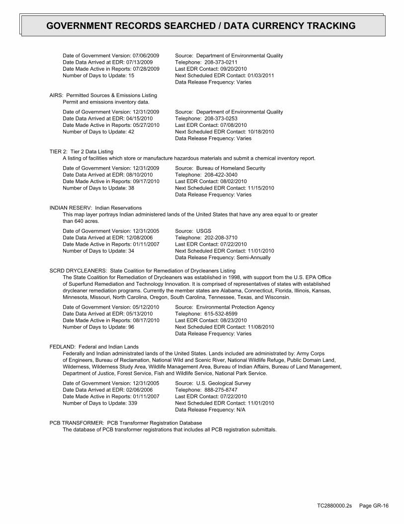
Date of Government Version: 07/06/2009Date Data Arrived at EDR: 07/13/2009Date Made Active in Reports: 07/28/2009Number of Days to Update: 15
Source: Department of Environmental QualityTelephone: 208-373-0211Last EDR Contact: 09/20/2010Next Scheduled EDR Contact: 01/03/2011Data Release Frequency: Varies
AIRS: Permitted Sources & Emissions ListingPermit and emissions inventory data.
Date of Government Version: 12/31/2009Date Data Arrived at EDR: 04/15/2010Date Made Active in Reports: 05/27/2010Number of Days to Update: 42
Source: Department of Environmental QualityTelephone: 208-373-0253Last EDR Contact: 07/08/2010Next Scheduled EDR Contact: 10/18/2010Data Release Frequency: Varies
TIER 2: Tier 2 Data ListingA listing of facilities which store or manufacture hazardous materials and submit a chemical inventory report.
Date of Government Version: 12/31/2009Date Data Arrived at EDR: 08/10/2010Date Made Active in Reports: 09/17/2010Number of Days to Update: 38
Source: Bureau of Homeland SecurityTelephone: 208-422-3040Last EDR Contact: 08/02/2010Next Scheduled EDR Contact: 11/15/2010Data Release Frequency: Varies
INDIAN RESERV: Indian ReservationsThis map layer portrays Indian administered lands of the United States that have any area equal to or greaterthan 640 acres.
Date of Government Version: 12/31/2005Date Data Arrived at EDR: 12/08/2006Date Made Active in Reports: 01/11/2007Number of Days to Update: 34
Source: USGSTelephone: 202-208-3710Last EDR Contact: 07/22/2010Next Scheduled EDR Contact: 11/01/2010Data Release Frequency: Semi-Annually
SCRD DRYCLEANERS: State Coalition for Remediation of Drycleaners ListingThe State Coalition for Remediation of Drycleaners was established in 1998, with support from the U.S. EPA Officeof Superfund Remediation and Technology Innovation. It is comprised of representatives of states with establisheddrycleaner remediation programs. Currently the member states are Alabama, Connecticut, Florida, Illinois, Kansas,Minnesota, Missouri, North Carolina, Oregon, South Carolina, Tennessee, Texas, and Wisconsin.
Date of Government Version: 05/12/2010Date Data Arrived at EDR: 05/13/2010Date Made Active in Reports: 08/17/2010Number of Days to Update: 96
Source: Environmental Protection AgencyTelephone: 615-532-8599Last EDR Contact: 08/23/2010Next Scheduled EDR Contact: 11/08/2010Data Release Frequency: Varies
FEDLAND: Federal and Indian LandsFederally and Indian administrated lands of the United States. Lands included are administrated by: Army Corpsof Engineers, Bureau of Reclamation, National Wild and Scenic River, National Wildlife Refuge, Public Domain Land,Wilderness, Wilderness Study Area, Wildlife Management Area, Bureau of Indian Affairs, Bureau of Land Management,Department of Justice, Forest Service, Fish and Wildlife Service, National Park Service.
Date of Government Version: 12/31/2005Date Data Arrived at EDR: 02/06/2006Date Made Active in Reports: 01/11/2007Number of Days to Update: 339
Source: U.S. Geological SurveyTelephone: 888-275-8747Last EDR Contact: 07/22/2010Next Scheduled EDR Contact: 11/01/2010Data Release Frequency: N/A
PCB TRANSFORMER: PCB Transformer Registration DatabaseThe database of PCB transformer registrations that includes all PCB registration submittals.
TC2880000.2s Page GR-16
GOVERNMENT RECORDS SEARCHED / DATA CURRENCY TRACKING
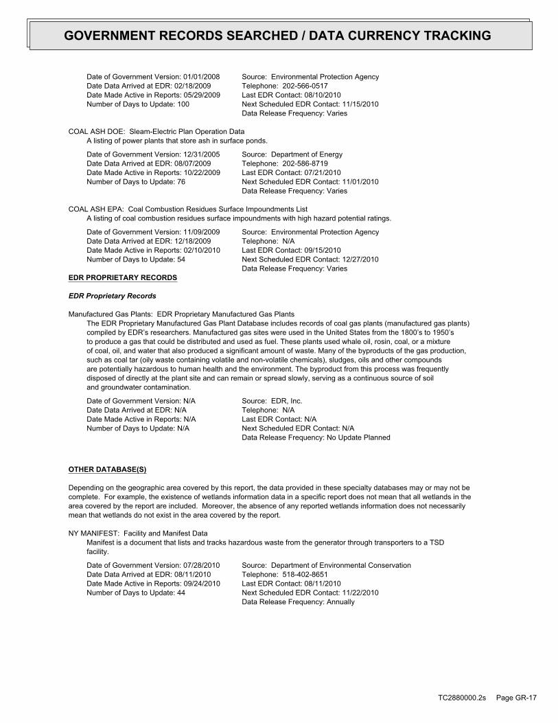
Date of Government Version: 01/01/2008Date Data Arrived at EDR: 02/18/2009Date Made Active in Reports: 05/29/2009Number of Days to Update: 100
Source: Environmental Protection AgencyTelephone: 202-566-0517Last EDR Contact: 08/10/2010Next Scheduled EDR Contact: 11/15/2010Data Release Frequency: Varies
COAL ASH DOE: Sleam-Electric Plan Operation DataA listing of power plants that store ash in surface ponds.
Date of Government Version: 12/31/2005Date Data Arrived at EDR: 08/07/2009Date Made Active in Reports: 10/22/2009Number of Days to Update: 76
Source: Department of EnergyTelephone: 202-586-8719Last EDR Contact: 07/21/2010Next Scheduled EDR Contact: 11/01/2010Data Release Frequency: Varies
COAL ASH EPA: Coal Combustion Residues Surface Impoundments ListA listing of coal combustion residues surface impoundments with high hazard potential ratings.
Date of Government Version: 11/09/2009Date Data Arrived at EDR: 12/18/2009Date Made Active in Reports: 02/10/2010Number of Days to Update: 54
Source: Environmental Protection AgencyTelephone: N/ALast EDR Contact: 09/15/2010Next Scheduled EDR Contact: 12/27/2010Data Release Frequency: Varies
EDR PROPRIETARY RECORDS
EDR Proprietary Records
Manufactured Gas Plants: EDR Proprietary Manufactured Gas PlantsThe EDR Proprietary Manufactured Gas Plant Database includes records of coal gas plants (manufactured gas plants)compiled by EDR’s researchers. Manufactured gas sites were used in the United States from the 1800’s to 1950’sto produce a gas that could be distributed and used as fuel. These plants used whale oil, rosin, coal, or a mixtureof coal, oil, and water that also produced a significant amount of waste. Many of the byproducts of the gas production,such as coal tar (oily waste containing volatile and non-volatile chemicals), sludges, oils and other compoundsare potentially hazardous to human health and the environment. The byproduct from this process was frequentlydisposed of directly at the plant site and can remain or spread slowly, serving as a continuous source of soiland groundwater contamination.
Date of Government Version: N/ADate Data Arrived at EDR: N/ADate Made Active in Reports: N/ANumber of Days to Update: N/A
Source: EDR, Inc.Telephone: N/ALast EDR Contact: N/ANext Scheduled EDR Contact: N/AData Release Frequency: No Update Planned
OTHER DATABASE(S)
Depending on the geographic area covered by this report, the data provided in these specialty databases may or may not becomplete. For example, the existence of wetlands information data in a specific report does not mean that all wetlands in thearea covered by the report are included. Moreover, the absence of any reported wetlands information does not necessarilymean that wetlands do not exist in the area covered by the report.
NY MANIFEST: Facility and Manifest DataManifest is a document that lists and tracks hazardous waste from the generator through transporters to a TSDfacility.
Date of Government Version: 07/28/2010Date Data Arrived at EDR: 08/11/2010Date Made Active in Reports: 09/24/2010Number of Days to Update: 44
Source: Department of Environmental ConservationTelephone: 518-402-8651Last EDR Contact: 08/11/2010Next Scheduled EDR Contact: 11/22/2010Data Release Frequency: Annually
TC2880000.2s Page GR-17
GOVERNMENT RECORDS SEARCHED / DATA CURRENCY TRACKING
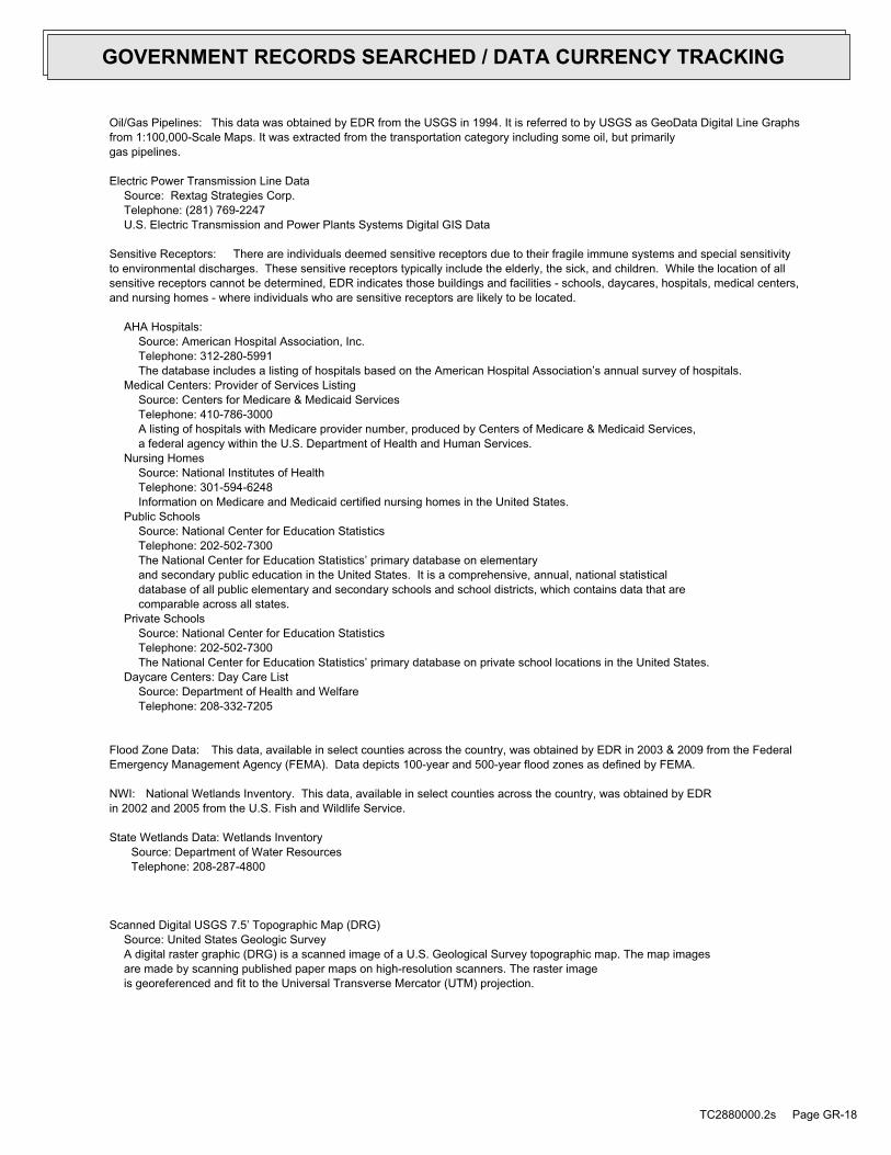
Oil/Gas Pipelines: This data was obtained by EDR from the USGS in 1994. It is referred to by USGS as GeoData Digital Line Graphsfrom 1:100,000-Scale Maps. It was extracted from the transportation category including some oil, but primarilygas pipelines.
Electric Power Transmission Line DataSource: Rextag Strategies Corp.Telephone: (281) 769-2247U.S. Electric Transmission and Power Plants Systems Digital GIS Data
Sensitive Receptors: There are individuals deemed sensitive receptors due to their fragile immune systems and special sensitivityto environmental discharges. These sensitive receptors typically include the elderly, the sick, and children. While the location of allsensitive receptors cannot be determined, EDR indicates those buildings and facilities - schools, daycares, hospitals, medical centers,and nursing homes - where individuals who are sensitive receptors are likely to be located.
AHA Hospitals:Source: American Hospital Association, Inc.Telephone: 312-280-5991The database includes a listing of hospitals based on the American Hospital Association’s annual survey of hospitals.
Medical Centers: Provider of Services ListingSource: Centers for Medicare & Medicaid ServicesTelephone: 410-786-3000A listing of hospitals with Medicare provider number, produced by Centers of Medicare & Medicaid Services,a federal agency within the U.S. Department of Health and Human Services.
Nursing HomesSource: National Institutes of HealthTelephone: 301-594-6248Information on Medicare and Medicaid certified nursing homes in the United States.
Public SchoolsSource: National Center for Education StatisticsTelephone: 202-502-7300The National Center for Education Statistics’ primary database on elementaryand secondary public education in the United States. It is a comprehensive, annual, national statisticaldatabase of all public elementary and secondary schools and school districts, which contains data that arecomparable across all states.
Private SchoolsSource: National Center for Education StatisticsTelephone: 202-502-7300The National Center for Education Statistics’ primary database on private school locations in the United States.
Daycare Centers: Day Care ListSource: Department of Health and WelfareTelephone: 208-332-7205
Flood Zone Data: This data, available in select counties across the country, was obtained by EDR in 2003 & 2009 from the FederalEmergency Management Agency (FEMA). Data depicts 100-year and 500-year flood zones as defined by FEMA.
NWI: National Wetlands Inventory. This data, available in select counties across the country, was obtained by EDRin 2002 and 2005 from the U.S. Fish and Wildlife Service.
State Wetlands Data: Wetlands InventorySource: Department of Water ResourcesTelephone: 208-287-4800
Scanned Digital USGS 7.5’ Topographic Map (DRG)Source: United States Geologic SurveyA digital raster graphic (DRG) is a scanned image of a U.S. Geological Survey topographic map. The map imagesare made by scanning published paper maps on high-resolution scanners. The raster imageis georeferenced and fit to the Universal Transverse Mercator (UTM) projection.
TC2880000.2s Page GR-18
GOVERNMENT RECORDS SEARCHED / DATA CURRENCY TRACKING

STREET AND ADDRESS INFORMATION
© 2010 Tele Atlas North America, Inc. All rights reserved. This material is proprietary and the subject of copyright protectionand other intellectual property rights owned by or licensed to Tele Atlas North America, Inc. The use of this material is subjectto the terms of a license agreement. You will be held liable for any unauthorized copying or disclosure of this material.
TC2880000.2s Page GR-19
GOVERNMENT RECORDS SEARCHED / DATA CURRENCY TRACKING
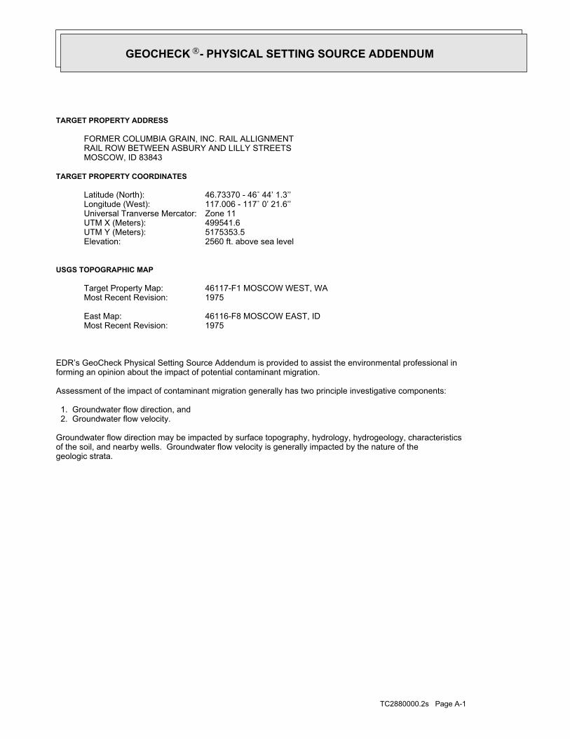
TC2880000.2s Page A-1
geologic strata.of the soil, and nearby wells. Groundwater flow velocity is generally impacted by the nature of theGroundwater flow direction may be impacted by surface topography, hydrology, hydrogeology, characteristics
2. Groundwater flow velocity. 1. Groundwater flow direction, and
Assessment of the impact of contaminant migration generally has two principle investigative components:
forming an opinion about the impact of potential contaminant migration.EDR’s GeoCheck Physical Setting Source Addendum is provided to assist the environmental professional in
1975Most Recent Revision:46116-F8 MOSCOW EAST, IDEast Map:
1975Most Recent Revision:46117-F1 MOSCOW WEST, WATarget Property Map:
USGS TOPOGRAPHIC MAP
2560 ft. above sea levelElevation:5175353.5UTM Y (Meters): 499541.6UTM X (Meters): Zone 11Universal Tranverse Mercator: 117.006 - 117˚ 0’ 21.6’’Longitude (West): 46.73370 - 46˚ 44’ 1.3’’Latitude (North):
TARGET PROPERTY COORDINATES
MOSCOW, ID 83843RAIL ROW BETWEEN ASBURY AND LILLY STREETSFORMER COLUMBIA GRAIN, INC. RAIL ALLIGNMENT
TARGET PROPERTY ADDRESS
GEOCHECK - PHYSICAL SETTING SOURCE ADDENDUM®

TC2880000.2s Page A-2
should be field verified.on a relative (not an absolute) basis. Relative elevation information between sites of close proximitySource: Topography has been determined from the USGS 7.5’ Digital Elevation Model and should be evaluated
SURROUNDING TOPOGRAPHY: ELEVATION PROFILES
Ele
vatio
n (ft
)E
leva
tion
(ft)
TP
TP0 1/2 1 Miles✩Target Property Elevation: 2560 ft.
North South
West East
2664
265626212578
2568
2560
2558
2557
2556
2560
2573
26312588
2617
2615
2610
2633
2636
27012546
2570
2573
2588 2560
2565
2561
2559
2559
2560
2562
2567
2590
2628
2655
2659
2651
2640
2637
General SouthGeneral Topographic Gradient:TARGET PROPERTY TOPOGRAPHY
should contamination exist on the target property, what downgradient sites might be impacted.assist the environmental professional in forming an opinion about the impact of nearby contaminated properties or,Surface topography may be indicative of the direction of surficial groundwater flow. This information can be used toTOPOGRAPHIC INFORMATION
collected on nearby properties, and regional groundwater flow information (from deep aquifers).sources of information, such as surface topographic information, hydrologic information, hydrogeologic datausing site-specific well data. If such data is not reasonably ascertainable, it may be necessary to rely on otherGroundwater flow direction for a particular site is best determined by a qualified environmental professionalGROUNDWATER FLOW DIRECTION INFORMATION
GEOCHECK - PHYSICAL SETTING SOURCE SUMMARY®

TC2880000.2s Page A-3
Not Reported
GENERAL DIRECTIONLOCATIONGROUNDWATER FLOWFROM TPMAP ID
hydrogeologically, and the depth to water table.authorities at select sites and has extracted the date of the report, groundwater flow direction as determinedflow at specific points. EDR has reviewed reports submitted by environmental professionals to regulatoryEDR has developed the AQUIFLOW Information System to provide data on the general direction of groundwater
AQUIFLOW®
Search Radius: 1.000 Mile.
contamination exist on the target property, what downgradient sites might be impacted.environmental professional in forming an opinion about the impact of nearby contaminated properties or, shouldof groundwater flow direction in the immediate area. Such hydrogeologic information can be used to assist theHydrogeologic information obtained by installation of wells on a specific site can often be an indicatorHYDROGEOLOGIC INFORMATION
YES - refer to the Overview Map and Detail MapMOSCOW WEST
NATIONAL WETLAND INVENTORYNWI ElectronicData CoverageNWI Quad at Target Property
Not ReportedAdditional Panels in search area:
Not ReportedFlood Plain Panel at Target Property:
Not AvailableLATAH, ID
FEMA FLOOD ZONEFEMA FloodElectronic DataTarget Property County
and bodies of water).Refer to the Physical Setting Source Map following this summary for hydrologic information (major waterways
contamination exist on the target property, what downgradient sites might be impacted.the environmental professional in forming an opinion about the impact of nearby contaminated properties or, shouldSurface water can act as a hydrologic barrier to groundwater flow. Such hydrologic information can be used to assistHYDROLOGIC INFORMATION
GEOCHECK - PHYSICAL SETTING SOURCE SUMMARY®

TC2880000.2s Page A-4
Map, USGS Digital Data Series DDS - 11 (1994).of the Conterminous U.S. at 1:2,500,000 Scale - a digital representation of the 1974 P.B. King and H.M. BeikmanGeologic Age and Rock Stratigraphic Unit Source: P.G. Schruben, R.E. Arndt and W.J. Bawiec, Geology
ROCK STRATIGRAPHIC UNIT GEOLOGIC AGE IDENTIFICATION
Plutonic and Intrusive RocksCategory:MesozoicEra:CretaceousSystem:Cretaceous granitic rocksSeries:KgCode: (decoded above as Era, System & Series)
at which contaminant migration may be occurring.Geologic information can be used by the environmental professional in forming an opinion about the relative speedGEOLOGIC INFORMATION IN GENERAL AREA OF TARGET PROPERTY
move more quickly through sandy-gravelly types of soils than silty-clayey types of soils.characteristics data collected on nearby properties and regional soil information. In general, contaminant plumesto rely on other sources of information, including geologic age identification, rock stratigraphic unit and soilusing site specific geologic and soil strata data. If such data are not reasonably ascertainable, it may be necessaryGroundwater flow velocity information for a particular site is best determined by a qualified environmental professionalGROUNDWATER FLOW VELOCITY INFORMATION
GEOCHECK - PHYSICAL SETTING SOURCE SUMMARY®

EDR Inc.EDR Inc.EDR Inc.EDR Inc.EDR Inc.EDR Inc.EDR Inc.EDR Inc.EDR Inc.EDR Inc.EDR Inc.EDR Inc.EDR Inc.EDR Inc.EDR Inc.EDR Inc.EDR Inc.EDR Inc.EDR Inc.EDR Inc.EDR Inc.EDR Inc.EDR Inc.EDR Inc.EDR Inc.EDR Inc.EDR Inc.EDR Inc.EDR Inc.EDR Inc.EDR Inc.EDR Inc.EDR Inc.EDR Inc.EDR Inc.EDR Inc.EDR Inc.EDR Inc.EDR Inc.EDR Inc.
4
3
1
2
2
5
0 1/16 1/8 1/4 Miles

TC2880000.2s Page A-6
Min: 7.4Max: 8.4
Min: 1.41Max: 4.23
50%), Lean Claylimit less thanClays (liquidSOILS, Silts andFINE-GRAINED
Soils.200), Clayeypassing No.than 35 pct.Materials (moreSilt-Claysilty clay loam59 inches27 inches 4
Min: 7.4Max: 8.4
Min: 1.41Max: 4.23
50%), Lean Claylimit less thanClays (liquidSOILS, Silts andFINE-GRAINED
Soils.200), Clayeypassing No.than 35 pct.Materials (moreSilt-Claysilt loam27 inches20 inches 3
Min: 7.4Max: 8.4
Min: 1.41Max: 4.23
50%), Lean Claylimit less thanClays (liquidSOILS, Silts andFINE-GRAINED
Soils.200), Clayeypassing No.than 35 pct.Materials (moreSilt-Claysilt loam20 inches14 inches 2
Min: 7.4Max: 8.4
Min: 1.41Max: 4.23
50%), Lean Claylimit less thanClays (liquidSOILS, Silts andFINE-GRAINED
Soils.200), Clayeypassing No.than 35 pct.Materials (moreSilt-Claysilt loam14 inches 0 inches 1
Soil Layer Information
Boundary Classification Saturatedhydraulicconductivitymicro m/sec
Layer Upper Lower Soil Texture Class AASHTO Group Unified Soil Soil Reaction(pH)
> 69 inchesDepth to Watertable Min:
> 0 inchesDepth to Bedrock Min:
HighCorrosion Potential - Uncoated Steel:
Hydric Status: Partially hydric
Somewhat poorly drainedSoil Drainage Class:
movement of water, or soils with moderately fine or fine textures.Class C - Slow infiltration rates. Soils with layers impeding downwardHydrologic Group:
silt loamSoil Surface Texture:
LatahcoSoil Component Name:
Soil Map ID: 1
in a landscape. The following information is based on Soil Conservation Service SSURGO data.for privately owned lands in the United States. A soil map in a soil survey is a representation of soil patternsSurvey (NCSS) and is responsible for collecting, storing, maintaining and distributing soil survey informationThe U.S. Department of Agriculture’s (USDA) Soil Conservation Service (SCS) leads the National Cooperative Soil
DOMINANT SOIL COMPOSITION IN GENERAL AREA OF TARGET PROPERTY
GEOCHECK - PHYSICAL SETTING SOURCE SUMMARY®
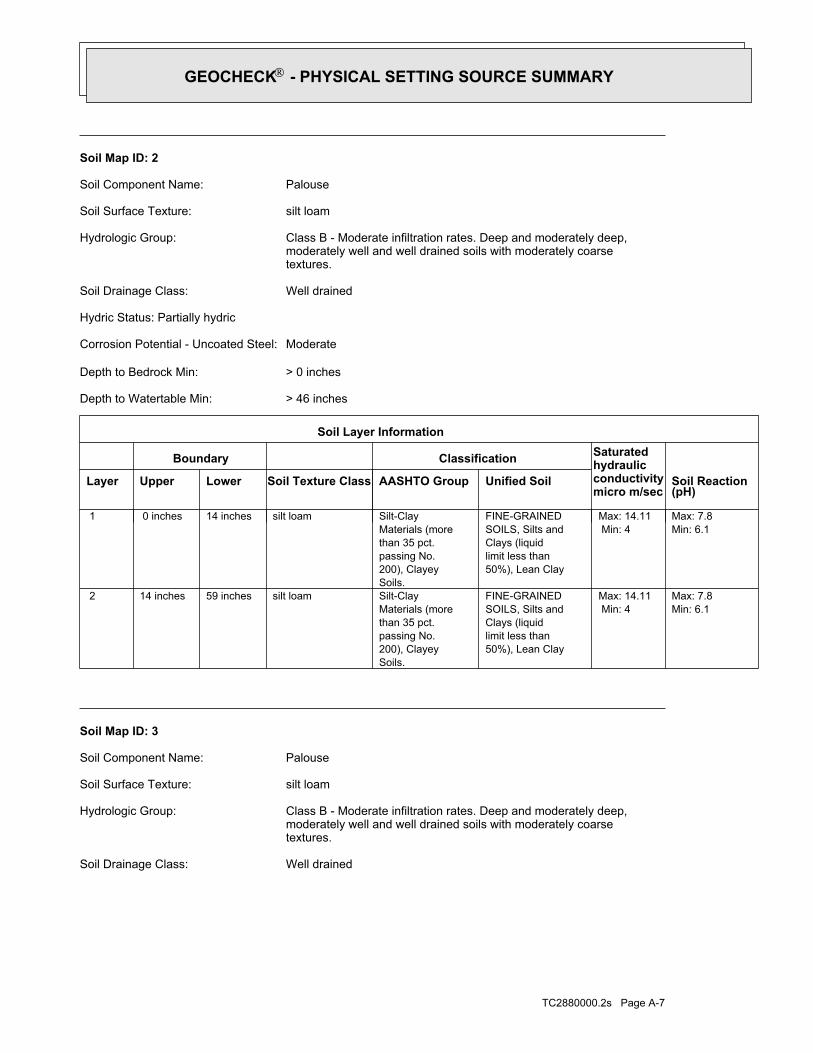
TC2880000.2s Page A-7
Well drainedSoil Drainage Class:
textures.moderately well and well drained soils with moderately coarseClass B - Moderate infiltration rates. Deep and moderately deep,Hydrologic Group:
silt loamSoil Surface Texture:
PalouseSoil Component Name:
Soil Map ID: 3
Min: 6.1Max: 7.8
Min: 4Max: 14.11
50%), Lean Claylimit less thanClays (liquidSOILS, Silts andFINE-GRAINED
Soils.200), Clayeypassing No.than 35 pct.Materials (moreSilt-Claysilt loam59 inches14 inches 2
Min: 6.1Max: 7.8
Min: 4Max: 14.11
50%), Lean Claylimit less thanClays (liquidSOILS, Silts andFINE-GRAINED
Soils.200), Clayeypassing No.than 35 pct.Materials (moreSilt-Claysilt loam14 inches 0 inches 1
Soil Layer Information
Boundary Classification Saturatedhydraulicconductivitymicro m/sec
Layer Upper Lower Soil Texture Class AASHTO Group Unified Soil Soil Reaction(pH)
> 46 inchesDepth to Watertable Min:
> 0 inchesDepth to Bedrock Min:
ModerateCorrosion Potential - Uncoated Steel:
Hydric Status: Partially hydric
Well drainedSoil Drainage Class:
textures.moderately well and well drained soils with moderately coarseClass B - Moderate infiltration rates. Deep and moderately deep,Hydrologic Group:
silt loamSoil Surface Texture:
PalouseSoil Component Name:
Soil Map ID: 2
GEOCHECK - PHYSICAL SETTING SOURCE SUMMARY®

TC2880000.2s Page A-8
> 92 inchesDepth to Watertable Min:
> 0 inchesDepth to Bedrock Min:
ModerateCorrosion Potential - Uncoated Steel:
Hydric Status: Not hydric
Moderately well drainedSoil Drainage Class:
movement of water, or soils with moderately fine or fine textures.Class C - Slow infiltration rates. Soils with layers impeding downwardHydrologic Group:
silt loamSoil Surface Texture:
ThatunaSoil Component Name:
Soil Map ID: 4
Min: 6.1Max: 7.8
Min: 4Max: 14.11
50%), Lean Claylimit less thanClays (liquidSOILS, Silts andFINE-GRAINED
Soils.200), Clayeypassing No.than 35 pct.Materials (moreSilt-Claysilt loam59 inches14 inches 2
Min: 6.1Max: 7.8
Min: 4Max: 14.11
50%), Lean Claylimit less thanClays (liquidSOILS, Silts andFINE-GRAINED
Soils.200), Clayeypassing No.than 35 pct.Materials (moreSilt-Claysilt loam14 inches 0 inches 1
Soil Layer Information
Boundary Classification Saturatedhydraulicconductivitymicro m/sec
Layer Upper Lower Soil Texture Class AASHTO Group Unified Soil Soil Reaction(pH)
> 0 inchesDepth to Watertable Min:
> 0 inchesDepth to Bedrock Min:
ModerateCorrosion Potential - Uncoated Steel:
Hydric Status: Not hydric
GEOCHECK - PHYSICAL SETTING SOURCE SUMMARY®

TC2880000.2s Page A-9
Min: 6.6Max: 7.3
Min: 1.41Max: 4.23
50%), Lean Claylimit less thanClays (liquidSOILS, Silts andFINE-GRAINED
Soils.200), Clayeypassing No.than 35 pct.Materials (moreSilt-Claysilt loam33 inches 0 inches 1
Soil Layer Information
Boundary Classification Saturatedhydraulicconductivitymicro m/sec
Layer Upper Lower Soil Texture Class AASHTO Group Unified Soil Soil Reaction(pH)
> 31 inchesDepth to Watertable Min:
> 0 inchesDepth to Bedrock Min:
HighCorrosion Potential - Uncoated Steel:
Hydric Status: Partially hydric
Somewhat poorly drainedSoil Drainage Class:
water table, or are shallow to an impervious layer.Class D - Very slow infiltration rates. Soils are clayey, have a highHydrologic Group:
silt loamSoil Surface Texture:
WestlakeSoil Component Name:
Soil Map ID: 5
Min: 6.1Max: 7.3
Min: 0.42Max: 1.41
50%), Lean Claylimit less thanClays (liquidSOILS, Silts andFINE-GRAINED
Soils.200), Siltypassing No.than 35 pct.Materials (moreSilt-Claysilty clay loam59 inches44 inches 2
Min: 6.1Max: 7.3
Min: 0.42Max: 1.41
50%), Lean Claylimit less thanClays (liquidSOILS, Silts andFINE-GRAINED
Soils.200), Siltypassing No.than 35 pct.Materials (moreSilt-Claysilt loam44 inches 0 inches 1
Soil Layer Information
Boundary Classification Saturatedhydraulicconductivitymicro m/sec
Layer Upper Lower Soil Texture Class AASHTO Group Unified Soil Soil Reaction(pH)
GEOCHECK - PHYSICAL SETTING SOURCE SUMMARY®
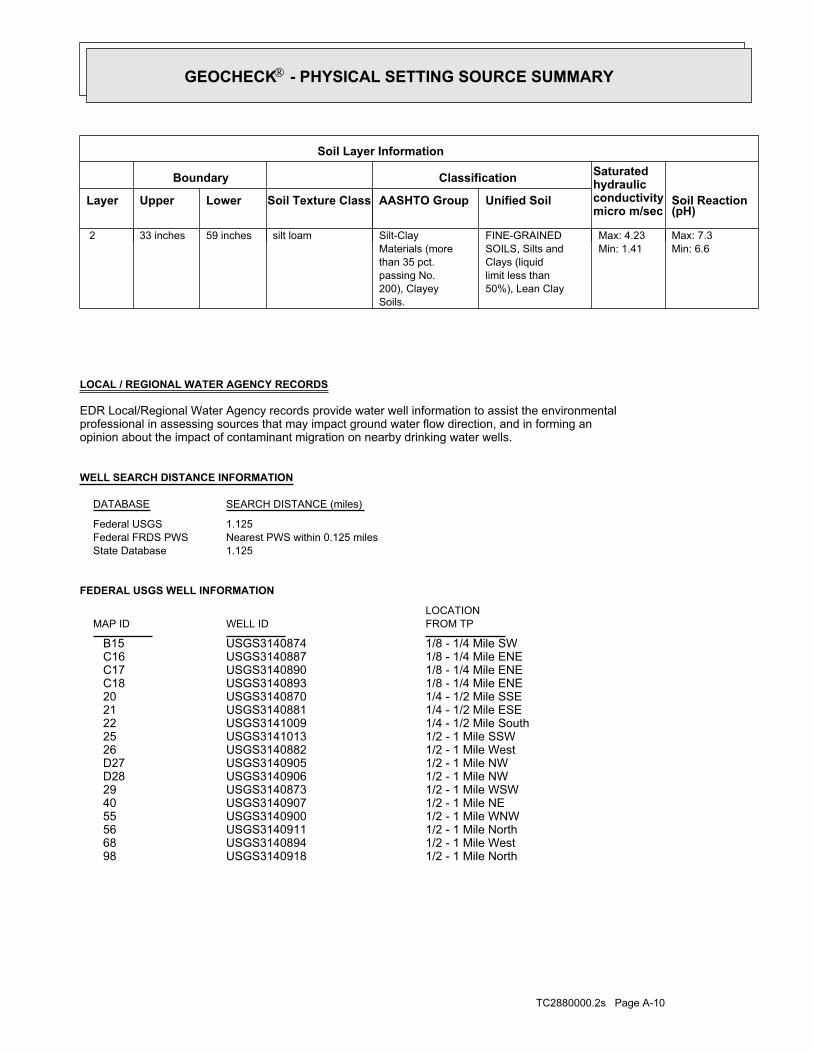
TC2880000.2s Page A-10
1/2 - 1 Mile NorthUSGS3140918 981/2 - 1 Mile WestUSGS3140894 681/2 - 1 Mile NorthUSGS3140911 561/2 - 1 Mile WNWUSGS3140900 551/2 - 1 Mile NEUSGS3140907 401/2 - 1 Mile WSWUSGS3140873 291/2 - 1 Mile NWUSGS3140906 D281/2 - 1 Mile NWUSGS3140905 D271/2 - 1 Mile WestUSGS3140882 261/2 - 1 Mile SSWUSGS3141013 251/4 - 1/2 Mile SouthUSGS3141009 221/4 - 1/2 Mile ESEUSGS3140881 211/4 - 1/2 Mile SSEUSGS3140870 201/8 - 1/4 Mile ENEUSGS3140893 C181/8 - 1/4 Mile ENEUSGS3140890 C171/8 - 1/4 Mile ENEUSGS3140887 C161/8 - 1/4 Mile SWUSGS3140874 B15
FEDERAL USGS WELL INFORMATION
LOCATIONFROM TPWELL IDMAP ID
1.125State DatabaseNearest PWS within 0.125 milesFederal FRDS PWS1.125Federal USGS
WELL SEARCH DISTANCE INFORMATION
SEARCH DISTANCE (miles)DATABASE
opinion about the impact of contaminant migration on nearby drinking water wells.professional in assessing sources that may impact ground water flow direction, and in forming anEDR Local/Regional Water Agency records provide water well information to assist the environmental
LOCAL / REGIONAL WATER AGENCY RECORDS
Min: 6.6Max: 7.3
Min: 1.41Max: 4.23
50%), Lean Claylimit less thanClays (liquidSOILS, Silts andFINE-GRAINED
Soils.200), Clayeypassing No.than 35 pct.Materials (moreSilt-Claysilt loam59 inches33 inches 2
Soil Layer Information
Boundary Classification Saturatedhydraulicconductivitymicro m/sec
Layer Upper Lower Soil Texture Class AASHTO Group Unified Soil Soil Reaction(pH)
GEOCHECK - PHYSICAL SETTING SOURCE SUMMARY®

TC2880000.2s Page A-11
1/2 - 1 Mile ENEID6000000143411 H451/2 - 1 Mile WNWID6000000143436 441/2 - 1 Mile ENEID6000000143447 G431/2 - 1 Mile ENEID6000000143446 G421/2 - 1 Mile ENEID6000000143445 G411/2 - 1 Mile WSWID6000000143331 391/2 - 1 Mile SSWID6000000143184 F381/2 - 1 Mile SSWID6000000143185 F371/2 - 1 Mile SSWID6000000143182 F361/2 - 1 Mile SSWID6000000143183 F351/2 - 1 Mile SouthID6000000143190 E341/2 - 1 Mile SouthID6000000143191 E331/2 - 1 Mile SouthID6000000143189 E321/2 - 1 Mile SouthID6000000143187 E311/2 - 1 Mile SouthID6000000143188 E301/2 - 1 Mile NWID6000000143458 D241/2 - 1 Mile NEID6000000143444 231/8 - 1/4 Mile SWID6000000143335 B191/8 - 1/4 Mile SSEID6000000143339 A141/8 - 1/4 Mile SSEID6000000143340 A131/8 - 1/4 Mile SSEID6000000143337 A121/8 - 1/4 Mile SSEID6000000143338 A111/8 - 1/4 Mile SSEID6000000143347 A101/8 - 1/4 Mile SSEID6000000143346 A91/8 - 1/4 Mile SSEID6000000143348 A81/8 - 1/4 Mile SSEID6000000143350 A71/8 - 1/4 Mile SSEID6000000143349 A61/8 - 1/4 Mile SSEID6000000143342 A51/8 - 1/4 Mile SSEID6000000143341 A41/8 - 1/4 Mile SSEID6000000143343 A31/8 - 1/4 Mile SSEID6000000143345 A21/8 - 1/4 Mile SSEID6000000143344 A1
STATE DATABASE WELL INFORMATION
LOCATIONFROM TPWELL IDMAP ID
Note: PWS System location is not always the same as well location.
No PWS System Found
FEDERAL FRDS PUBLIC WATER SUPPLY SYSTEM INFORMATION
LOCATIONFROM TPWELL IDMAP ID
1 - 2 Miles NorthUSGS3140924 1131 - 2 Miles NNEUSGS3140922 1051 - 2 Miles ENEUSGS3122816 P1031 - 2 Miles ENEUSGS3122809 P1021 - 2 Miles NNWUSGS3140921 99
FEDERAL USGS WELL INFORMATION
LOCATIONFROM TPWELL IDMAP ID
GEOCHECK - PHYSICAL SETTING SOURCE SUMMARY®
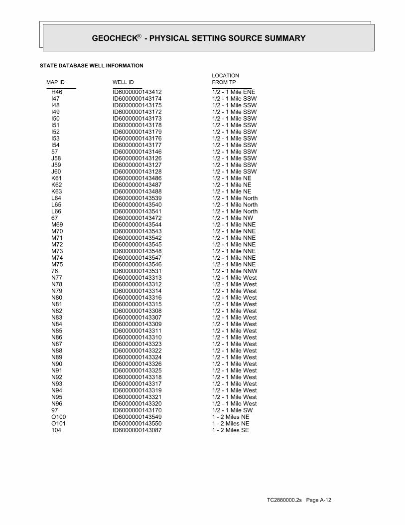
TC2880000.2s Page A-12
1 - 2 Miles SEID6000000143087 1041 - 2 Miles NEID6000000143550 O1011 - 2 Miles NEID6000000143549 O1001/2 - 1 Mile SWID6000000143170 971/2 - 1 Mile WestID6000000143320 N961/2 - 1 Mile WestID6000000143321 N951/2 - 1 Mile WestID6000000143319 N941/2 - 1 Mile WestID6000000143317 N931/2 - 1 Mile WestID6000000143318 N921/2 - 1 Mile WestID6000000143325 N911/2 - 1 Mile WestID6000000143326 N901/2 - 1 Mile WestID6000000143324 N891/2 - 1 Mile WestID6000000143322 N881/2 - 1 Mile WestID6000000143323 N871/2 - 1 Mile WestID6000000143310 N861/2 - 1 Mile WestID6000000143311 N851/2 - 1 Mile WestID6000000143309 N841/2 - 1 Mile WestID6000000143307 N831/2 - 1 Mile WestID6000000143308 N821/2 - 1 Mile WestID6000000143315 N811/2 - 1 Mile WestID6000000143316 N801/2 - 1 Mile WestID6000000143314 N791/2 - 1 Mile WestID6000000143312 N781/2 - 1 Mile WestID6000000143313 N771/2 - 1 Mile NNWID6000000143531 761/2 - 1 Mile NNEID6000000143546 M751/2 - 1 Mile NNEID6000000143547 M741/2 - 1 Mile NNEID6000000143548 M731/2 - 1 Mile NNEID6000000143545 M721/2 - 1 Mile NNEID6000000143542 M711/2 - 1 Mile NNEID6000000143543 M701/2 - 1 Mile NNEID6000000143544 M691/2 - 1 Mile NWID6000000143472 671/2 - 1 Mile NorthID6000000143541 L661/2 - 1 Mile NorthID6000000143540 L651/2 - 1 Mile NorthID6000000143539 L641/2 - 1 Mile NEID6000000143488 K631/2 - 1 Mile NEID6000000143487 K621/2 - 1 Mile NEID6000000143486 K611/2 - 1 Mile SSWID6000000143128 J601/2 - 1 Mile SSWID6000000143127 J591/2 - 1 Mile SSWID6000000143126 J581/2 - 1 Mile SSWID6000000143146 571/2 - 1 Mile SSWID6000000143177 I541/2 - 1 Mile SSWID6000000143176 I531/2 - 1 Mile SSWID6000000143179 I521/2 - 1 Mile SSWID6000000143178 I511/2 - 1 Mile SSWID6000000143173 I501/2 - 1 Mile SSWID6000000143172 I491/2 - 1 Mile SSWID6000000143175 I481/2 - 1 Mile SSWID6000000143174 I471/2 - 1 Mile ENEID6000000143412 H46
STATE DATABASE WELL INFORMATION
LOCATIONFROM TPWELL IDMAP ID
GEOCHECK - PHYSICAL SETTING SOURCE SUMMARY®

TC2880000.2s Page A-13
1 - 2 Miles NEID6000000143525 R1121 - 2 Miles NEID6000000143526 R1111 - 2 Miles NEID6000000143523 R1101 - 2 Miles NEID6000000143524 R1091 - 2 Miles WSWID6000000143291 Q1081 - 2 Miles WSWID6000000143293 Q1071 - 2 Miles WSWID6000000143292 Q106
STATE DATABASE WELL INFORMATION
LOCATIONFROM TPWELL IDMAP ID
GEOCHECK - PHYSICAL SETTING SOURCE SUMMARY®
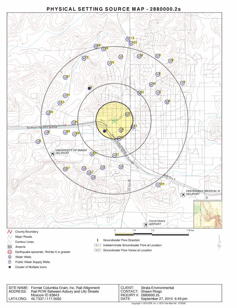
EDR Inc.EDR Inc.EDR Inc.EDR Inc.EDR Inc.EDR Inc.EDR Inc.EDR Inc.EDR Inc.EDR Inc.EDR Inc.EDR Inc.EDR Inc.EDR Inc.EDR Inc.EDR Inc.EDR Inc.EDR Inc.EDR Inc.EDR Inc.EDR Inc.EDR Inc.EDR Inc.EDR Inc.EDR Inc.EDR Inc.EDR Inc.EDR Inc.EDR Inc.EDR Inc.EDR Inc.EDR Inc.EDR Inc.EDR Inc.EDR Inc.EDR Inc.EDR Inc.EDR Inc.EDR Inc.EDR Inc.
0
2 7 2026 8 0
2 68 0
2 7 2 0
2 6 0 0
2 6 0 0
2 6 0 02 6 4 0
2 6 4 0
2 6 4 0
2 6 80
2 6 8 0
2 6 8 0
2 6 8 0
2 7
2 02 6 8
0
2 680
2 6 4 0
2
2 6 4 0
2 6 40
2 6 8 0
2640
2 6 8 0
26
80 2 6 8 0
2 6 8 026
00
2 6 8 0
26
802 6 8 0
26
8 0
2680
2 7 2 0
2 7 20 2640
27
20
26
80
2 6 8 0
26 8 0
26
80
2 6 4 0
2 6 4 0
2 6 4 0
4 0
2 6 4 0
26
4 0
2 6 8 02 6 80
6 4 0
2 6 4 0
26
40
26
40
2 6 4 0
2 6 4 0
26
40
2 6 0 0
0 0
2 6 0 0 26
00
2 6 0 0
26
00
2 6 0 02 6
0 0
2 5 6 0
2 5 6 0
25602
56 0
25
60
2 720
2 7 2 02 7 2 0
2 7 2 0 27
20
2 7 2 0
0
2 5 6 0
2 5 6 0
2 5 6 0
2 7 2 0
27
20
2 6 0 0
26 0
0
26
00
2 6 0 0
2 6 0 0
2 6
8 0
2 6 8 0
2 6 8 0
26
80
2 6 8 0
2 6 8 0
2 6 8 0
2 6 8 0
2 6 4 0
2 6 4 0
2 6 4 0
26
40
26
40
2 6 4 0
2 6 4 0
2 6 4 0
2 6 4 0
2 6 0 02 6 0 0
2 6 0 0
26
0 0
25
60
2 5 6 0
2 5 6 0
2 6 8 0
2 6 82
64 0
2 68
0
2 6 8 0
26
80
26
80
26
40
2 6 4 0
2 6 8 0
2
26
40
2 6 4 0
2 6 4 0
26
4 0
2 6 4 0
26
40
2 6 4 0
25 60
2 60 0
26 0
0
2
6 0 0
2 6 0 0
26
00
2 6
2 6 0 0
2 6 0 0
2 6 0 0
2 6 8 02 6 4 0
2 6 4 0
2 5 6 0
2
5 6 0
2 6 0 0 2 6 0 0
2 6 4 0
2
ID
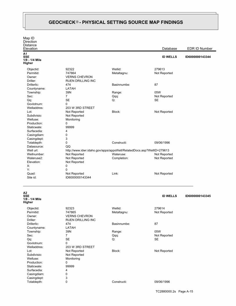
TC2880000.2s Page A-15
09/06/1996Constructi:0Totaldepth:3Casingdept:0Casingdiam:4Surfacedia:99999Staticwate:0Production:MonitoringWelluse:Not ReportedSubdivisio:
Not ReportedBlock:Not ReportedLot:203 W 3RD STREETWelladdres:0Govlotnum:
SEQ:SEQq:Not ReportedQqq:7Sec:05WRange:39NTownship:
LATAHCountyname:87Basinnumbe:474Drillerlic:
RUEN DRILLING INCDriller:VERNS CHEVRONOwner:
Not ReportedMetaltagnu:747865Permitid:279614Wellid:92323Objectid:
A2SSE1/8 - 1/4 MileHigher
ID6000000143345ID WELLS
ID6000000143344Site id:Not ReportedLink:Not ReportedQuad:
0Y:0X:Not ReportedElevation:
Not ReportedCompletion:Not ReportedWateruse2:Not ReportedWateruse:Not ReportedWellnumber:
http://www.idwr.idaho.gov/apps/appsWell/RelatedDocs.asp?WellID=279613Well url:QQDatasource:
09/06/1996Constructi:0Totaldepth:3Casingdept:0Casingdiam:4Surfacedia:99999Staticwate:0Production:MonitoringWelluse:Not ReportedSubdivisio:
Not ReportedBlock:Not ReportedLot:203 W 3RD STREETWelladdres:0Govlotnum:
SEQ:SEQq:Not ReportedQqq:7Sec:05WRange:39NTownship:
LATAHCountyname:87Basinnumbe:474Drillerlic:
RUEN DRILLING INCDriller:VERNS CHEVRONOwner:
Not ReportedMetaltagnu:747864Permitid:279613Wellid:92322Objectid:
A1SSE1/8 - 1/4 MileHigher
ID6000000143344ID WELLS
Map IDDirectionDistanceElevation EDR ID NumberDatabase
GEOCHECK - PHYSICAL SETTING SOURCE MAP FINDINGS®

TC2880000.2s Page A-16
0Govlotnum:SEQ:SEQq:Not ReportedQqq:7Sec:05WRange:39NTownship:
LATAHCountyname:87Basinnumbe:474Drillerlic:
RUEN DRILLING INCDriller:VERNS CHEVRONOwner:
Not ReportedMetaltagnu:747863Permitid:279612Wellid:92319Objectid:
A4SSE1/8 - 1/4 MileHigher
ID6000000143341ID WELLS
ID6000000143343Site id:Not ReportedLink:Not ReportedQuad:
0Y:0X:Not ReportedElevation:
Not ReportedCompletion:Not ReportedWateruse2:Not ReportedWateruse:Not ReportedWellnumber:
http://www.idwr.idaho.gov/apps/appsWell/RelatedDocs.asp?WellID=279613Well url:QQDatasource:
09/06/1996Constructi:0Totaldepth:3Casingdept:0Casingdiam:4Surfacedia:99999Staticwate:0Production:MonitoringWelluse:Not ReportedSubdivisio:
Not ReportedBlock:Not ReportedLot:203 W 3RD STREETWelladdres:0Govlotnum:
SEQ:SEQq:Not ReportedQqq:7Sec:05WRange:39NTownship:
LATAHCountyname:87Basinnumbe:474Drillerlic:
RUEN DRILLING INCDriller:AGRA EARTH & ENVIRONMENTALOwner:
Not ReportedMetaltagnu:747864Permitid:279613Wellid:92321Objectid:
A3SSE1/8 - 1/4 MileHigher
ID6000000143343ID WELLS
ID6000000143345Site id:Not ReportedLink:Not ReportedQuad:
0Y:0X:Not ReportedElevation:
Not ReportedCompletion:Not ReportedWateruse2:Not ReportedWateruse:Not ReportedWellnumber:
http://www.idwr.idaho.gov/apps/appsWell/RelatedDocs.asp?WellID=279614Well url:QQDatasource:
GEOCHECK - PHYSICAL SETTING SOURCE MAP FINDINGS®

TC2880000.2s Page A-17
ID6000000143342Site id:Not ReportedLink:Not ReportedQuad:
0Y:0X:Not ReportedElevation:
Not ReportedCompletion:Not ReportedWateruse2:Not ReportedWateruse:Not ReportedWellnumber:
http://www.idwr.idaho.gov/apps/appsWell/RelatedDocs.asp?WellID=279612Well url:QQDatasource:
09/05/1996Constructi:0Totaldepth:3Casingdept:0Casingdiam:2Surfacedia:99999Staticwate:0Production:MonitoringWelluse:Not ReportedSubdivisio:
Not ReportedBlock:Not ReportedLot:203 W 3RD STREETWelladdres:0Govlotnum:
SEQ:SEQq:Not ReportedQqq:7Sec:05WRange:39NTownship:
LATAHCountyname:87Basinnumbe:474Drillerlic:
RUEN DRILLING INCDriller:AGRA EARTH & ENVIRONMENTALOwner:
Not ReportedMetaltagnu:747863Permitid:279612Wellid:92320Objectid:
A5SSE1/8 - 1/4 MileHigher
ID6000000143342ID WELLS
ID6000000143341Site id:Not ReportedLink:Not ReportedQuad:
0Y:0X:Not ReportedElevation:
Not ReportedCompletion:Not ReportedWateruse2:Not ReportedWateruse:Not ReportedWellnumber:
http://www.idwr.idaho.gov/apps/appsWell/RelatedDocs.asp?WellID=279612Well url:QQDatasource:
09/05/1996Constructi:0Totaldepth:3Casingdept:0Casingdiam:2Surfacedia:99999Staticwate:0Production:MonitoringWelluse:Not ReportedSubdivisio:
Not ReportedBlock:Not ReportedLot:203 W 3RD STREETWelladdres:
GEOCHECK - PHYSICAL SETTING SOURCE MAP FINDINGS®

TC2880000.2s Page A-18
04/07/1997Constructi:0Totaldepth:16Casingdept:0Casingdiam:2Surfacedia:8Staticwate:0Production:MonitoringWelluse:Not ReportedSubdivisio:
Not ReportedBlock:Not ReportedLot:203 WEST 3RD STREETWelladdres:0Govlotnum:
SEQ:SEQq:Not ReportedQqq:7Sec:05WRange:39NTownship:
BENEWAHCountyname:87Basinnumbe:474Drillerlic:
RUEN DRILLING INCDriller:VERNS CHEVRONOwner:
Not ReportedMetaltagnu:747894Permitid:279649Wellid:92330Objectid:
A7SSE1/8 - 1/4 MileHigher
ID6000000143350ID WELLS
ID6000000143349Site id:Not ReportedLink:Not ReportedQuad:
0Y:0X:Not ReportedElevation:
Not ReportedCompletion:Not ReportedWateruse2:Not ReportedWateruse:Not ReportedWellnumber:
http://www.idwr.idaho.gov/apps/appsWell/RelatedDocs.asp?WellID=279648Well url:QQDatasource:
04/07/1997Constructi:0Totaldepth:16Casingdept:0Casingdiam:2Surfacedia:8Staticwate:0Production:MonitoringWelluse:Not ReportedSubdivisio:
Not ReportedBlock:Not ReportedLot:203 WEST 3RD STREETWelladdres:0Govlotnum:
SEQ:SEQq:Not ReportedQqq:7Sec:05WRange:39NTownship:
BENEWAHCountyname:87Basinnumbe:474Drillerlic:
RUEN DRILLING INCDriller:VERNS CHEVRONOwner:
Not ReportedMetaltagnu:747893Permitid:279648Wellid:92329Objectid:
A6SSE1/8 - 1/4 MileHigher
ID6000000143349ID WELLS
Map IDDirectionDistanceElevation EDR ID NumberDatabase
GEOCHECK - PHYSICAL SETTING SOURCE MAP FINDINGS®

TC2880000.2s Page A-19
0Govlotnum:SEQ:SEQq:Not ReportedQqq:7Sec:05WRange:39NTownship:
LATAHCountyname:87Basinnumbe:474Drillerlic:
RUEN DRILLING INCDriller:AGRA EARTH & ENVIRONMENTALOwner:
Not ReportedMetaltagnu:747865Permitid:279614Wellid:92324Objectid:
A9SSE1/8 - 1/4 MileHigher
ID6000000143346ID WELLS
ID6000000143348Site id:Not ReportedLink:Not ReportedQuad:
0Y:0X:Not ReportedElevation:
Not ReportedCompletion:Not ReportedWateruse2:Not ReportedWateruse:Not ReportedWellnumber:
http://www.idwr.idaho.gov/apps/appsWell/RelatedDocs.asp?WellID=279615Well url:QQDatasource:
09/05/1996Constructi:0Totaldepth:16Casingdept:0Casingdiam:2Surfacedia:99999Staticwate:0Production:MonitoringWelluse:Not ReportedSubdivisio:
Not ReportedBlock:Not ReportedLot:203 W 3RD STREETWelladdres:0Govlotnum:
SEQ:SEQq:Not ReportedQqq:7Sec:05WRange:39NTownship:
LATAHCountyname:87Basinnumbe:474Drillerlic:
RUEN DRILLING INCDriller:AGRA EARTH & ENVIRONMENTALOwner:
Not ReportedMetaltagnu:747866Permitid:279615Wellid:92326Objectid:
A8SSE1/8 - 1/4 MileHigher
ID6000000143348ID WELLS
ID6000000143350Site id:Not ReportedLink:Not ReportedQuad:
0Y:0X:Not ReportedElevation:
Not ReportedCompletion:Not ReportedWateruse2:Not ReportedWateruse:Not ReportedWellnumber:
http://www.idwr.idaho.gov/apps/appsWell/RelatedDocs.asp?WellID=279649Well url:QQDatasource:
GEOCHECK - PHYSICAL SETTING SOURCE MAP FINDINGS®
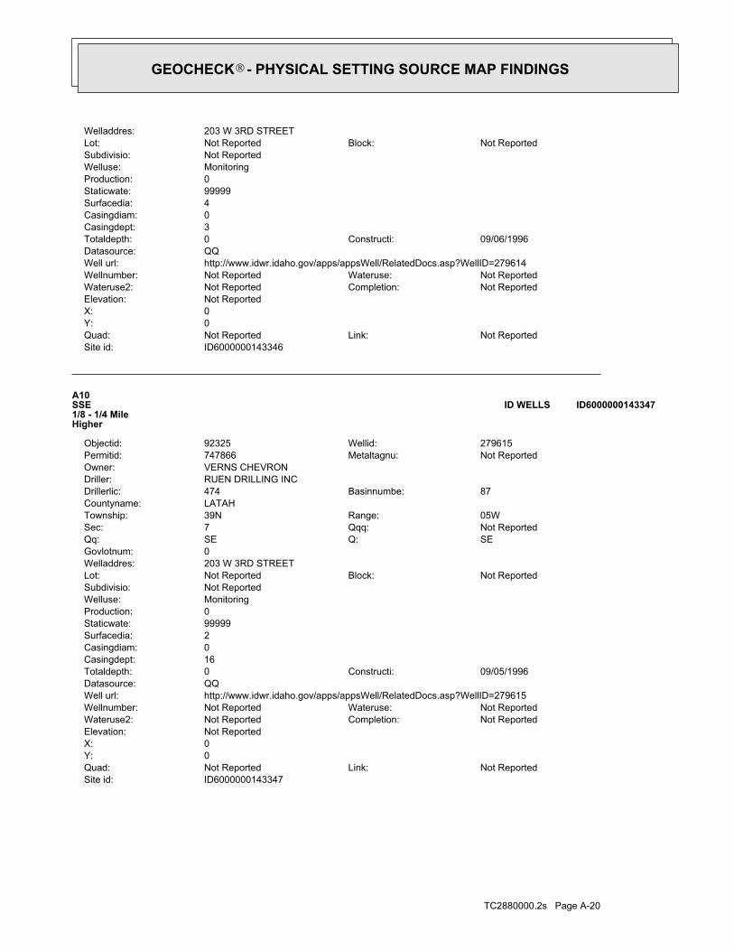
TC2880000.2s Page A-20
ID6000000143347Site id:Not ReportedLink:Not ReportedQuad:
0Y:0X:Not ReportedElevation:
Not ReportedCompletion:Not ReportedWateruse2:Not ReportedWateruse:Not ReportedWellnumber:
http://www.idwr.idaho.gov/apps/appsWell/RelatedDocs.asp?WellID=279615Well url:QQDatasource:
09/05/1996Constructi:0Totaldepth:16Casingdept:0Casingdiam:2Surfacedia:99999Staticwate:0Production:MonitoringWelluse:Not ReportedSubdivisio:
Not ReportedBlock:Not ReportedLot:203 W 3RD STREETWelladdres:0Govlotnum:
SEQ:SEQq:Not ReportedQqq:7Sec:05WRange:39NTownship:
LATAHCountyname:87Basinnumbe:474Drillerlic:
RUEN DRILLING INCDriller:VERNS CHEVRONOwner:
Not ReportedMetaltagnu:747866Permitid:279615Wellid:92325Objectid:
A10SSE1/8 - 1/4 MileHigher
ID6000000143347ID WELLS
ID6000000143346Site id:Not ReportedLink:Not ReportedQuad:
0Y:0X:Not ReportedElevation:
Not ReportedCompletion:Not ReportedWateruse2:Not ReportedWateruse:Not ReportedWellnumber:
http://www.idwr.idaho.gov/apps/appsWell/RelatedDocs.asp?WellID=279614Well url:QQDatasource:
09/06/1996Constructi:0Totaldepth:3Casingdept:0Casingdiam:4Surfacedia:99999Staticwate:0Production:MonitoringWelluse:Not ReportedSubdivisio:
Not ReportedBlock:Not ReportedLot:203 W 3RD STREETWelladdres:
GEOCHECK - PHYSICAL SETTING SOURCE MAP FINDINGS®

TC2880000.2s Page A-21
09/05/1996Constructi:0Totaldepth:3Casingdept:0Casingdiam:2Surfacedia:99999Staticwate:0Production:MonitoringWelluse:Not ReportedSubdivisio:
Not ReportedBlock:Not ReportedLot:203 W 3RD STREETWelladdres:0Govlotnum:
SEQ:SEQq:Not ReportedQqq:7Sec:05WRange:39NTownship:
LATAHCountyname:87Basinnumbe:474Drillerlic:
RUEN DRILLING INCDriller:AGRA EARTH & ENVIRONMENTALOwner:
Not ReportedMetaltagnu:747861Permitid:279610Wellid:78977Objectid:
A12SSE1/8 - 1/4 MileHigher
ID6000000143337ID WELLS
ID6000000143338Site id:Not ReportedLink:Not ReportedQuad:
0Y:0X:Not ReportedElevation:
Not ReportedCompletion:Not ReportedWateruse2:Not ReportedWateruse:Not ReportedWellnumber:
http://www.idwr.idaho.gov/apps/appsWell/RelatedDocs.asp?WellID=279610Well url:QQDatasource:
09/05/1996Constructi:0Totaldepth:3Casingdept:0Casingdiam:2Surfacedia:99999Staticwate:0Production:MonitoringWelluse:Not ReportedSubdivisio:
Not ReportedBlock:Not ReportedLot:203 W 3RD STREETWelladdres:0Govlotnum:
SEQ:SEQq:Not ReportedQqq:7Sec:05WRange:39NTownship:
LATAHCountyname:87Basinnumbe:474Drillerlic:
RUEN DRILLING INCDriller:VERNS CHEVRONOwner:
Not ReportedMetaltagnu:747861Permitid:279610Wellid:78978Objectid:
A11SSE1/8 - 1/4 MileHigher
ID6000000143338ID WELLS
Map IDDirectionDistanceElevation EDR ID NumberDatabase
GEOCHECK - PHYSICAL SETTING SOURCE MAP FINDINGS®
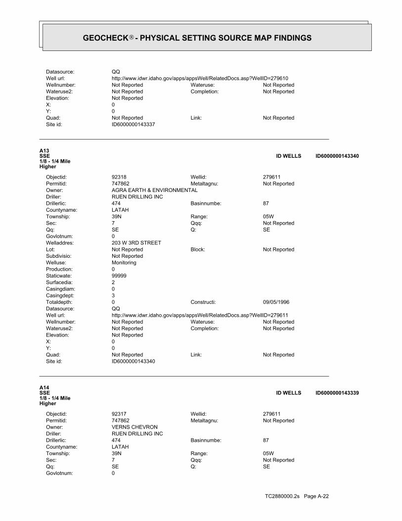
TC2880000.2s Page A-22
0Govlotnum:SEQ:SEQq:Not ReportedQqq:7Sec:05WRange:39NTownship:
LATAHCountyname:87Basinnumbe:474Drillerlic:
RUEN DRILLING INCDriller:VERNS CHEVRONOwner:
Not ReportedMetaltagnu:747862Permitid:279611Wellid:92317Objectid:
A14SSE1/8 - 1/4 MileHigher
ID6000000143339ID WELLS
ID6000000143340Site id:Not ReportedLink:Not ReportedQuad:
0Y:0X:Not ReportedElevation:
Not ReportedCompletion:Not ReportedWateruse2:Not ReportedWateruse:Not ReportedWellnumber:
http://www.idwr.idaho.gov/apps/appsWell/RelatedDocs.asp?WellID=279611Well url:QQDatasource:
09/05/1996Constructi:0Totaldepth:3Casingdept:0Casingdiam:2Surfacedia:99999Staticwate:0Production:MonitoringWelluse:Not ReportedSubdivisio:
Not ReportedBlock:Not ReportedLot:203 W 3RD STREETWelladdres:0Govlotnum:
SEQ:SEQq:Not ReportedQqq:7Sec:05WRange:39NTownship:
LATAHCountyname:87Basinnumbe:474Drillerlic:
RUEN DRILLING INCDriller:AGRA EARTH & ENVIRONMENTALOwner:
Not ReportedMetaltagnu:747862Permitid:279611Wellid:92318Objectid:
A13SSE1/8 - 1/4 MileHigher
ID6000000143340ID WELLS
ID6000000143337Site id:Not ReportedLink:Not ReportedQuad:
0Y:0X:Not ReportedElevation:
Not ReportedCompletion:Not ReportedWateruse2:Not ReportedWateruse:Not ReportedWellnumber:
http://www.idwr.idaho.gov/apps/appsWell/RelatedDocs.asp?WellID=279610Well url:QQDatasource:
GEOCHECK - PHYSICAL SETTING SOURCE MAP FINDINGS®

TC2880000.2s Page A-23
3Ground water data count:1985-03-14Ground water data end date:Ground water data begin date: 1972-03-210Water quality data count:0000-00-00Water quality data end date:0000-00-00Water quality data begin date:0Peak flow data count:0000-00-00Peak flow data end date:0000-00-00Peak flow data begin date:0Daily flow data count:0000-00-00Daily flow data end date:0000-00-00Daily flow data begin date:0Real time data flag:
ID-73-107Project number:Not ReportedSource of depth data:
238Hole depth:238Well depth:Not ReportedAquifer:Not ReportedAquifer Type:Single well, other than collector or Ranney typeType of ground water site:YLocal standard time flag:
PSTMean greenwich time offset:Not ReportedDate inventoried:19720824Date construction:Ground-water other than SpringSite type:
Flat surfaceTopographic:Palouse. Idaho, Washington. Area = 2360 sq.mi.Hydrologic:National Geodetic Vertical Datum of 1929Altitude datum:.01Altitude accuracy:Level or other surveying methodAltitude method:2560.37Altitude:
24000Map scale:MOSCOW WESTLocation map:NESWSES07 T39N R05W BLand net:USCountry:057County:16State:16District:NAD83Dec latlong datum:NAD27Latlong datum:SCoor accr:MCoor meth:-117.0082209Dec lon:46.73155407Dec lat:1170026Longitude:USGS3140874EDR Site id:464354Latitude:
39N 05W 07DCA1Site name:464354117002601Site no:USGSAgency cd:
B15SW1/8 - 1/4 MileLower
USGS3140874FED USGS
ID6000000143339Site id:Not ReportedLink:Not ReportedQuad:
0Y:0X:Not ReportedElevation:
Not ReportedCompletion:Not ReportedWateruse2:Not ReportedWateruse:Not ReportedWellnumber:
http://www.idwr.idaho.gov/apps/appsWell/RelatedDocs.asp?WellID=279611Well url:QQDatasource:
09/05/1996Constructi:0Totaldepth:3Casingdept:0Casingdiam:2Surfacedia:99999Staticwate:0Production:MonitoringWelluse:Not ReportedSubdivisio:
Not ReportedBlock:Not ReportedLot:203 W 3RD STREETWelladdres:
GEOCHECK - PHYSICAL SETTING SOURCE MAP FINDINGS®

TC2880000.2s Page A-24
1956-05 90 1956-05 901956-06 90 1956-06 901956-07 94 1956-07 941956-08 96 1956-08 961956-09 95 1956-09 951956-11 95 1956-11 951956-12 93 1956-12 931971-04 68.61 1971-04 68.611972-06-20 65.74 1972-06-20 65.741973-03-21 64.78 1973-03-21 64.78
DateFeet belowSurface
Feet toSealevel
-------------------------------------------------Date
Feet belowSurface
Feet toSealevel
-------------------------------------------------
Ground-water levels, Number of Measurements: 242
121Ground water data count:1973-03-21Ground water data end date:Ground water data begin date: 1895-00-000Water quality data count:0000-00-00Water quality data end date:0000-00-00Water quality data begin date:0Peak flow data count:0000-00-00Peak flow data end date:0000-00-00Peak flow data begin date:0Daily flow data count:0000-00-00Daily flow data end date:0000-00-00Daily flow data begin date:0Real time data flag:
ID-73-107Project number:Not ReportedSource of depth data:
245Hole depth:245Well depth:Not ReportedAquifer:Not ReportedAquifer Type:Single well, other than collector or Ranney typeType of ground water site:YLocal standard time flag:
PSTMean greenwich time offset:Not ReportedDate inventoried:18820101Date construction:Ground-water other than SpringSite type:
UndulatingTopographic:Palouse. Idaho, Washington. Area = 2360 sq.mi.Hydrologic:National Geodetic Vertical Datum of 1929Altitude datum:10.Altitude accuracy:Interpolated from topographic mapAltitude method:2568.00Altitude:
24000Map scale:MOSCOW WESTLocation map:SENESES07 T39N R05W BLand net:USCountry:057County:16State:16District:NAD83Dec latlong datum:NAD27Latlong datum:SCoor accr:MCoor meth:-117.00238744Dec lon:46.73460971Dec lat:1170005Longitude:USGS3140887EDR Site id:464405Latitude:
39N 05W 07DAD1Site name:464405117000501Site no:USGSAgency cd:
C16ENE1/8 - 1/4 MileHigher
USGS3140887FED USGS
1972-03-21 55.501985-03-14 48.88 1972-11-07 56.84
DateFeet belowSurface
Feet toSealevel
-------------------------------------------------Date
Feet belowSurface
Feet toSealevel
-------------------------------------------------
Ground-water levels, Number of Measurements: 3
GEOCHECK - PHYSICAL SETTING SOURCE MAP FINDINGS®

TC2880000.2s Page A-25
1938-10-15 64 1938-10-15 641938-10-28 66 1938-10-28 661938-11-11 62 1938-11-11 621938-12-03 60 1938-12-03 601938-12-16 60 1938-12-16 601938-12-29 60 1938-12-29 601939-01-14 61 1939-01-14 611939-01-27 62 1939-01-27 621939-02-10 62 1939-02-10 621939-02-24 62 1939-02-24 621939-03-10 62 1939-03-10 621939-03-24 62 1939-03-24 621939-04-03 62 1939-04-03 621939-04-21 62 1939-04-21 621939-05-05 62 1939-05-05 621939-05-19 62 1939-05-19 621939-05-31 62 1939-05-31 621939-06-26 62 1939-06-26 621939-07-19 66 1939-07-19 661939-08-01 66 1939-08-01 661939-08-16 64 1939-08-16 641939-09-03 65 1939-09-03 651939-10-29 63 1939-10-29 631939-11-11 62 1939-11-11 621939-11-25 62 1939-11-25 621939-12-11 64 1939-12-11 641939-12-21 58 1939-12-21 581940-01-06 61 1940-01-06 611940-01-20 60 1940-01-20 601940-02-06 60 1940-02-06 601940-02-20 61 1940-02-20 611940-03-05 60 1940-03-05 601940-03-19 60 1940-03-19 601940-04-03 61 1940-04-03 611940-04-16 58 1940-04-16 581940-04-30 66 1940-04-30 661940-05-14 65 1940-05-14 651940-05-30 60 1940-05-30 601940-06-10 80 1940-06-10 801940-06-24 80 1940-06-24 801940-07-19 86 1940-07-19 861940-08-22 86 1940-08-22 861940-09-18 81 1940-09-18 811940-10-03 80 1940-10-03 801947-05-02 67 1947-05-02 671955-08 94 1955-08 941955-09 95 1955-09 951955-10 92 1955-10 921955-10-25 94.38 1955-10-25 94.381955-11 94 1955-11 941955-12 92 1955-12 921956-01 90 1956-01 901956-02 90 1956-02 901956-03 90 1956-03 901956-04 90 1956-04 90
DateFeet belowSurface
Feet toSealevel
-------------------------------------------------Date
Feet belowSurface
Feet toSealevel
-------------------------------------------------
Ground-water levels, continued.
GEOCHECK - PHYSICAL SETTING SOURCE MAP FINDINGS®

TC2880000.2s Page A-26
1895-01-01 0.00 1895-01-01 0.001923 44 1923 441930 50 1930 501931 55 1931 551932-12 54 1932-12 541934-08-09 58 1934-08-09 581934-09-16 56 1934-09-16 561934-12-13 56 1934-12-13 561934-12-18 57 1934-12-18 571935-02-18 56 1935-02-18 561935-04-04 56 1935-04-04 561935-04-26 56 1935-04-26 561935-05-08 56 1935-05-08 561935-05-29 57 1935-05-29 571935-06-26 57 1935-06-26 571936-05-22 57 1936-05-22 571936-05-28 58 1936-05-28 581936-06-04 59 1936-06-04 591936-06-11 59 1936-06-11 591936-06-18 58 1936-06-18 581936-06-24 59 1936-06-24 591936-07-02 59 1936-07-02 591936-07-08 59 1936-07-08 591936-07-23 60 1936-07-23 601936-07-29 60 1936-07-29 601937-06-09 61 1937-06-09 611937-06-23 61 1937-06-23 611937-07-07 62 1937-07-07 621937-07-21 63 1937-07-21 631937-07-27 64 1937-07-27 641937-08-05 63 1937-08-05 631937-08-18 62 1937-08-18 621937-09-03 62 1937-09-03 621937-09-15 63 1937-09-15 631937-10-01 62 1937-10-01 621937-10-15 62 1937-10-15 621937-11-12 62 1937-11-12 621937-12-02 61 1937-12-02 611937-12-30 61 1937-12-30 611938-01-13 61 1938-01-13 611938-01-26 62 1938-01-26 621938-02-28 60 1938-02-28 601938-03-08 60 1938-03-08 601938-03-23 60 1938-03-23 601938-04-05 60 1938-04-05 601938-04-19 60 1938-04-19 601938-05-03 60 1938-05-03 601938-05-17 60 1938-05-17 601938-06-01 60 1938-06-01 601938-06-15 60 1938-06-15 601938-06-28 60 1938-06-28 601938-07-11 63 1938-07-11 631938-07-30 64 1938-07-30 641938-09-16 62 1938-09-16 621938-09-30 62 1938-09-30 62
DateFeet belowSurface
Feet toSealevel
-------------------------------------------------Date
Feet belowSurface
Feet toSealevel
-------------------------------------------------
Ground-water levels, continued.
GEOCHECK - PHYSICAL SETTING SOURCE MAP FINDINGS®

TC2880000.2s Page A-27
1968-01-28 83 1968-01-28 831968-02 82 1968-02 821968-03 81 1968-03 811968-04 81 1968-04 811968-05-26 82 1968-05-26 821968-06-06 82 1968-06-06 821968-07-02 93 1968-07-02 931969-05-31 89 1969-05-31 891969-06-24 86 1969-06-24 861971-04 68.70 1971-04 68.701985-03-15 58.60 1985-03-15 58.60
DateFeet belowSurface
Feet toSealevel
-------------------------------------------------Date
Feet belowSurface
Feet toSealevel
-------------------------------------------------
Ground-water levels, Number of Measurements: 454
227Ground water data count:1985-03-15Ground water data end date:Ground water data begin date: 1938-09-164Water quality data count:1990-10-16Water quality data end date:1955-03-29Water quality data begin date:0Peak flow data count:0000-00-00Peak flow data end date:0000-00-00Peak flow data begin date:0Daily flow data count:0000-00-00Daily flow data end date:0000-00-00Daily flow data begin date:0Real time data flag:
ID-73-107Project number:drillerSource of depth data:
560.Hole depth:240.Well depth:Not ReportedAquifer:Not ReportedAquifer Type:Single well, other than collector or Ranney typeType of ground water site:YLocal standard time flag:
PSTMean greenwich time offset:Not ReportedDate inventoried:19250101Date construction:Ground-water other than SpringSite type:
UndulatingTopographic:Palouse. Idaho, Washington. Area = 2360 sq.mi.Hydrologic:National Geodetic Vertical Datum of 1929Altitude datum:10.Altitude accuracy:Interpolated from topographic mapAltitude method:2568.00Altitude:
24000Map scale:MOSCOW WESTLocation map:SENESES07 T39N R05W BLand net:USCountry:057County:16State:16District:NAD83Dec latlong datum:NAD27Latlong datum:SCoor accr:MCoor meth:-117.00238745Dec lon:46.73488749Dec lat:1170005Longitude:USGS3140890EDR Site id:464406Latitude:
39N 05W 07DAD2Site name:464406117000501Site no:USGSAgency cd:
C17ENE1/8 - 1/4 MileHigher
USGS3140890FED USGS
1895 0 1895 0
DateFeet belowSurface
Feet toSealevel
-------------------------------------------------Date
Feet belowSurface
Feet toSealevel
-------------------------------------------------
Ground-water levels, continued.
GEOCHECK - PHYSICAL SETTING SOURCE MAP FINDINGS®

TC2880000.2s Page A-28
1962-08 120 1962-08 1201962-09 120 1962-09 1201962-10 118 1962-10 1181962-11 118 1962-11 1181962-12 117 1962-12 1171963-01 116 1963-01 1161963-02 115 1963-02 1151963-03 115 1963-03 1151963-04 115 1963-04 1151963-05 115 1963-05 1151963-06 118 1963-06 1181963-07 120 1963-07 1201963-08 121 1963-08 1211963-09 121 1963-09 1211963-10 120 1963-10 1201963-11 120 1963-11 1201963-12 101 1963-12 1011964-02 100 1964-02 1001964-03 100 1964-03 1001964-04 100 1964-04 1001964-05 100 1964-05 1001964-06 99 1964-06 991964-07 100 1964-07 1001964-08 100 1964-08 1001964-09 100 1964-09 1001964-10 100 1964-10 1001964-11 100 1964-11 1001964-12 100 1964-12 1001965-01 100 1965-01 1001965-02 100 1965-02 1001965-03 100 1965-03 1001965-04 100 1965-04 1001965-05 100 1965-05 1001965-06 100 1965-06 1001965-07 100 1965-07 1001966-05 91 1966-05 911966-06 91 1966-06 911966-07 91 1966-07 911966-08 90 1966-08 901966-09 91 1966-09 911966-10 91 1966-10 911966-11 91 1966-11 911966-12 91 1966-12 911967-01 91 1967-01 911967-02 91 1967-02 911967-03 91 1967-03 911967-04 85 1967-04 851967-05 85 1967-05 851967-06 84 1967-06 841967-07 84 1967-07 841967-08 84 1967-08 841967-09 84 1967-09 841967-10 84 1967-10 841967-11-26 84 1967-11-26 841967-12-26 83 1967-12-26 83
DateFeet belowSurface
Feet toSealevel
-------------------------------------------------Date
Feet belowSurface
Feet toSealevel
-------------------------------------------------
Ground-water levels, continued.
GEOCHECK - PHYSICAL SETTING SOURCE MAP FINDINGS®

TC2880000.2s Page A-29
1956-04 90 1956-04 901956-05 90 1956-05 901956-06 92 1956-06 921956-07 94 1956-07 941956-08 96 1956-08 961956-09 95 1956-09 951956-10 94 1956-10 941956-11 95 1956-11 951956-12 93 1956-12 931957-06 95 1957-06 951957-07 97 1957-07 971957-08 98 1957-08 981957-09 96 1957-09 961957-10 95 1957-10 951957-11 95 1957-11 951957-12 95 1957-12 951958-01 90 1958-01 901958-02 88 1958-02 881958-03 89 1958-03 891958-04 89 1958-04 891958-05 89 1958-05 891958-06 92 1958-06 921958-07 92 1958-07 921958-08 94 1958-08 941958-09 90 1958-09 901958-10 90 1958-10 901958-11 110 1958-11 1101958-12 110 1958-12 1101959-01 110 1959-01 1101959-02 110 1959-02 1101959-03 110 1959-03 1101959-04 110 1959-04 1101959-05 110 1959-05 1101959-06 112 1959-06 1121959-07 116 1959-07 1161959-08 116 1959-08 1161959-09 110 1959-09 1101959-10 110 1959-10 1101959-11 109 1959-11 1091959-12 108 1959-12 1081960-01 108 1960-01 1081960-02 109 1960-02 1091960-03 108 1960-03 1081960-04 108 1960-04 1081960-05 109 1960-05 1091960-06 111 1960-06 1111960-07 110 1960-07 1101960-08 110 1960-08 1101960-09 109 1960-09 1091960-10 108 1960-10 1081962-03 110 1962-03 1101962-04 114 1962-04 1141962-05 114 1962-05 1141962-06 114 1962-06 1141962-07 118 1962-07 118
DateFeet belowSurface
Feet toSealevel
-------------------------------------------------Date
Feet belowSurface
Feet toSealevel
-------------------------------------------------
Ground-water levels, continued.
GEOCHECK - PHYSICAL SETTING SOURCE MAP FINDINGS®

TC2880000.2s Page A-30
1951-09 84 1951-09 841951-10 83 1951-10 831951-11 82 1951-11 821951-12 82 1951-12 821952-01 82 1952-01 821952-02 82 1952-02 821952-03 82 1952-03 821952-04 82 1952-04 821952-05 82 1952-05 821952-06 83 1952-06 831952-07 83 1952-07 831952-08 85 1952-08 851952-09 84 1952-09 841952-10 84 1952-10 841952-11 84 1952-11 841952-12 82 1952-12 821953-01 82 1953-01 821953-02 81 1953-02 811953-03 82 1953-03 821953-04 82 1953-04 821953-05 82 1953-05 821953-06 82 1953-06 821953-07 82 1953-07 821953-08 86 1953-08 861953-09 86 1953-09 861953-10 85 1953-10 851953-11 84 1953-11 841953-12 83 1953-12 831954-01 82 1954-01 821954-02 82 1954-02 821954-03 82 1954-03 821954-04 82 1954-04 821954-05 82 1954-05 821954-06 82 1954-06 821954-07 83 1954-07 831954-08 84 1954-08 841954-09 83 1954-09 831954-10 85 1954-10 851954-11 76 1954-11 761954-12 76 1954-12 761955-01 76 1955-01 761955-02 76 1955-02 761955-03 78 1955-03 781955-04 78 1955-04 781955-05 78 1955-05 781955-06 92 1955-06 921955-07 90 1955-07 901955-08 93 1955-08 931955-09 95 1955-09 951955-10 92 1955-10 921955-11 90 1955-11 901955-12 92 1955-12 921956-01 88 1956-01 881956-02 96 1956-02 961956-03 106 1956-03 106
DateFeet belowSurface
Feet toSealevel
-------------------------------------------------Date
Feet belowSurface
Feet toSealevel
-------------------------------------------------
Ground-water levels, continued.
GEOCHECK - PHYSICAL SETTING SOURCE MAP FINDINGS®

TC2880000.2s Page A-31
1938-09-16 64 1938-09-16 641938-09-30 64 1938-09-30 641938-10-15 66 1938-10-15 661938-10-28 67 1938-10-28 671938-11-11 63 1938-11-11 631938-11-16 62 1938-11-16 621938-11-29 61 1938-11-29 611938-12-03 62 1938-12-03 621938-12-16 62 1938-12-16 621938-12-29 61 1938-12-29 611939-01-14 62 1939-01-14 621939-01-27 60 1939-01-27 601939-02-10 62 1939-02-10 621939-02-24 62 1939-02-24 621939-03-10 62 1939-03-10 621939-03-24 62 1939-03-24 621939-04-03 62 1939-04-03 621939-04-21 61 1939-04-21 611939-05-05 62 1939-05-05 621939-05-19 64 1939-05-19 641939-05-31 63 1939-05-31 631939-06-26 64 1939-06-26 641939-08-01 67 1939-08-01 671939-08-15 68 1939-08-15 681939-09-03 67 1939-09-03 671939-11-11 64 1939-11-11 641939-11-25 64 1939-11-25 641939-12-11 64 1939-12-11 641939-12-21 64 1939-12-21 641940-01-06 63 1940-01-06 631940-01-20 64 1940-01-20 641940-02-06 62 1940-02-06 621940-02-20 64 1940-02-20 641940-03-05 63 1940-03-05 631940-03-19 63 1940-03-19 631940-04-03 63 1940-04-03 631940-04-16 63 1940-04-16 631940-04-30 63 1940-04-30 631940-05-14 64 1940-05-14 641940-05-30 66 1940-05-30 661940-06-10 66 1940-06-10 661940-06-24 68 1940-06-24 681940-07-19 68 1940-07-19 681940-08-22 69 1940-08-22 691940-09-18 68 1940-09-18 681940-10-03 66 1940-10-03 661951-01 84 1951-01 841951-04 84 1951-04 841951-06 83 1951-06 831951-07 85 1951-07 851951-08 85 1951-08 85
DateFeet belowSurface
Feet toSealevel
-------------------------------------------------Date
Feet belowSurface
Feet toSealevel
-------------------------------------------------
Ground-water levels, continued.
GEOCHECK - PHYSICAL SETTING SOURCE MAP FINDINGS®

TC2880000.2s Page A-32
2000-01-14 65.22 2000-01-14 65.222000-02-10 64.89 2000-02-10 64.892000-03-14 65.22 2000-03-14 65.222000-04-05 65.31 2000-04-05 65.312000-05-03 64.13 2000-05-03 64.132000-06-14 64.21 2000-06-14 64.21 Note: The site was being pumped.2000-07-27 71.20 Note: The site was being pumped.2000-07-27 71.20 Note: The site had been pumped recently.2000-08-24 68.87 Note: The site had been pumped recently.2000-08-24 68.872000-09-11 68.57 2000-09-11 68.57
DateFeet belowSurface
Feet toSealevel
-------------------------------------------------Date
Feet belowSurface
Feet toSealevel
-------------------------------------------------
Ground-water levels, Number of Measurements: 704
352Ground water data count:2000-09-11Ground water data end date:Ground water data begin date: 1936-05-221Water quality data count:1956-05-28Water quality data end date:1956-05-28Water quality data begin date:0Peak flow data count:0000-00-00Peak flow data end date:0000-00-00Peak flow data begin date:0Daily flow data count:0000-00-00Daily flow data end date:0000-00-00Daily flow data begin date:0Real time data flag:
ID-73-107Project number:drillerSource of depth data:
262Hole depth:235Well depth:Not ReportedAquifer:Not ReportedAquifer Type:Single well, other than collector or Ranney typeType of ground water site:YLocal standard time flag:
PSTMean greenwich time offset:Not ReportedDate inventoried:19350101Date construction:Ground-water other than SpringSite type:
UndulatingTopographic:Palouse. Idaho, Washington. Area = 2360 sq.mi.Hydrologic:National Geodetic Vertical Datum of 1929Altitude datum:10.Altitude accuracy:Interpolated from topographic mapAltitude method:2568.00Altitude:
24000Map scale:MOSCOW WESTLocation map:SENESES07 T39N R05W BLand net:USCountry:057County:16State:16District:NAD83Dec latlong datum:NAD27Latlong datum:SCoor accr:MCoor meth:-117.00210967Dec lon:46.73516527Dec lat:1170004Longitude:USGS3140893EDR Site id:464407Latitude:
39N 05W 07DAD3Site name:464407117000401Site no:USGSAgency cd:
C18ENE1/8 - 1/4 MileHigher
USGS3140893FED USGS
Map IDDirectionDistanceElevation EDR ID NumberDatabase
GEOCHECK - PHYSICAL SETTING SOURCE MAP FINDINGS®
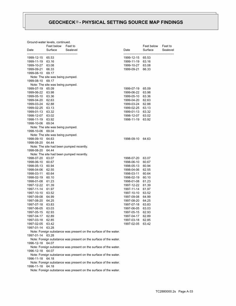
TC2880000.2s Page A-33
Note: Foreign substance was present on the surface of the water.1996-11-18 64.18 Note: Foreign substance was present on the surface of the water.1996-11-18 64.18 Note: Foreign substance was present on the surface of the water.1996-12-18 64.07 Note: Foreign substance was present on the surface of the water.1996-12-18 64.07 Note: Foreign substance was present on the surface of the water.1997-01-14 63.28 Note: Foreign substance was present on the surface of the water.1997-01-14 63.281997-02-05 63.42 1997-02-05 63.421997-03-18 62.85 1997-03-18 62.851997-04-17 62.89 1997-04-17 62.891997-05-15 62.93 1997-05-15 62.931997-06-05 63.03 1997-06-05 63.031997-07-18 63.83 1997-07-18 63.831997-08-20 64.25 1997-08-20 64.251997-09-08 64.99 1997-09-08 64.991997-10-10 63.52 1997-10-10 63.521997-11-14 61.97 1997-11-14 61.971997-12-22 61.39 1997-12-22 61.391998-01-08 61.23 1998-01-08 61.231998-02-19 60.10 1998-02-19 60.101998-03-11 60.64 1998-03-11 60.641998-04-06 62.55 1998-04-06 62.551998-05-13 60.94 1998-05-13 60.941998-06-10 60.67 1998-06-10 60.671998-07-20 63.07 1998-07-20 63.07 Note: The site had been pumped recently.1998-08-20 64.44 Note: The site had been pumped recently.1998-08-20 64.441998-09-10 64.63 1998-09-10 64.63 Note: The site was being pumped.1998-10-06 69.04 Note: The site was being pumped.1998-10-06 69.041998-11-19 63.92 1998-11-19 63.921998-12-07 63.02 1998-12-07 63.021999-01-13 63.32 1999-01-13 63.321999-02-25 63.13 1999-02-25 63.131999-03-24 62.88 1999-03-24 62.881999-04-20 62.63 1999-04-20 62.631999-05-10 63.36 1999-05-10 63.361999-06-22 63.98 1999-06-22 63.981999-07-19 65.09 1999-07-19 65.09 Note: The site was being pumped.1999-08-10 69.17 Note: The site was being pumped.1999-08-10 69.171999-09-21 66.33 1999-09-21 66.331999-10-27 63.08 1999-10-27 63.081999-11-19 63.16 1999-11-19 63.161999-12-15 65.53 1999-12-15 65.53
DateFeet belowSurface
Feet toSealevel
-------------------------------------------------Date
Feet belowSurface
Feet toSealevel
-------------------------------------------------
Ground-water levels, continued.
GEOCHECK - PHYSICAL SETTING SOURCE MAP FINDINGS®

TC2880000.2s Page A-34
Note: The site was being pumped.1994-07-20 64.56 Note: The site was being pumped.1994-08-23 64.37 Note: The site was being pumped.1994-08-23 64.371994-09-20 59.26 1994-09-20 59.261994-10-18 58.79 1994-10-18 58.791994-11-15 58.29 1994-11-15 58.291994-12-14 57.90 1994-12-14 57.901995-01-20 58.53 1995-01-20 58.531995-02-14 58.13 1995-02-14 58.131995-03-14 58.44 1995-03-14 58.441995-04-11 59.20 1995-04-11 59.201995-05-16 58.41 1995-05-16 58.411995-06-13 58.68 1995-06-13 58.68 Note: The site was being pumped.1995-07-12 65.47 Note: The site was being pumped.1995-07-12 65.47 Note: The site was being pumped.1995-08-14 67.85 Note: The site was being pumped.1995-08-14 67.851995-09-11 62.20 1995-09-11 62.20 Note: The site was being pumped.1995-10-24 66.00 Note: The site was being pumped.1995-10-24 66.001995-11-20 62.19 1995-11-20 62.191995-12-11 62.11 1995-12-11 62.111996-01-24 62.38 1996-01-24 62.381996-02-13 63.35 1996-02-13 63.351996-03-12 63.33 1996-03-12 63.33 Note: The site was being pumped.1996-04-19 67.82 Note: The site was being pumped.1996-04-19 67.82 Note: The site was being pumped.1996-05-14 67.33 Note: The site was being pumped.1996-05-14 67.331996-06-14 62.45 1996-06-14 62.451996-07-08 62.68 1996-07-08 62.68 Note: Foreign substance was present on the surface of the water.1996-08-16 63.18 Note: Foreign substance was present on the surface of the water.1996-08-16 63.18 Note: Foreign substance was present on the surface of the water.1996-09-11 64.01 Note: Foreign substance was present on the surface of the water.1996-09-11 64.01 Note: Foreign substance was present on the surface of the water.1996-10-22 64.02 Note: Foreign substance was present on the surface of the water.1996-10-22 64.02
DateFeet belowSurface
Feet toSealevel
-------------------------------------------------Date
Feet belowSurface
Feet toSealevel
-------------------------------------------------
Ground-water levels, continued.
GEOCHECK - PHYSICAL SETTING SOURCE MAP FINDINGS®

TC2880000.2s Page A-35
1990-08-29 54.48 1990-08-29 54.481990-09-20 54.81 1990-09-20 54.811990-10-10 54.84 1990-10-10 54.841990-11-29 54.67 1990-11-29 54.67 Note: The site had been pumped recently.1990-12-20 55.00 Note: The site had been pumped recently.1990-12-20 55.001991-01-10 54.92 1991-01-10 54.921991-02-19 54.04 1991-02-19 54.041991-03-21 54.16 1991-03-21 54.161991-04-16 54.20 1991-04-16 54.201991-05-23 54.89 1991-05-23 54.891991-06-24 54.47 1991-06-24 54.471991-07-18 54.87 1991-07-18 54.871991-08-22 55.43 1991-08-22 55.431991-09-23 55.95 1991-09-23 55.951991-10-21 54.98 1991-10-21 54.981991-11-27 55.97 1991-11-27 55.971991-12-19 55.55 1991-12-19 55.551992-01-22 55.84 1992-01-22 55.841992-02-28 56.37 1992-02-28 56.371992-03-16 56.11 1992-03-16 56.111992-04-23 56.39 1992-04-23 56.391992-05-19 55.76 1992-05-19 55.761992-06-24 55.63 1992-06-24 55.63 Note: Foreign substance was present on the surface of the water.1992-07-20 56.06 Note: Foreign substance was present on the surface of the water.1992-07-20 56.061992-08-26 57.13 1992-08-26 57.131992-09-23 56.41 1992-09-23 56.411992-10-19 56.53 1992-10-19 56.531992-11-23 56.69 1992-11-23 56.691992-12-16 56.22 1992-12-16 56.221993-01-26 56.57 1993-01-26 56.571993-02-23 55.91 1993-02-23 55.911993-03-24 55.98 1993-03-24 55.981993-04-22 56.04 1993-04-22 56.041993-05-25 55.91 1993-05-25 55.911993-06-16 56.50 1993-06-16 56.501993-07-21 56.76 1993-07-21 56.761993-08-18 57.12 1993-08-18 57.121993-09-24 57.37 1993-09-24 57.371993-10-26 57.64 1993-10-26 57.641993-11-18 56.99 1993-11-18 56.991993-12-14 56.33 1993-12-14 56.331994-01-20 56.52 1994-01-20 56.521994-02-24 56.40 1994-02-24 56.401994-03-17 56.78 1994-03-17 56.781994-04-20 56.50 1994-04-20 56.501994-05-25 56.56 1994-05-25 56.561994-06-22 56.80 1994-06-22 56.80 Note: The site was being pumped.1994-07-20 64.56
DateFeet belowSurface
Feet toSealevel
-------------------------------------------------Date
Feet belowSurface
Feet toSealevel
-------------------------------------------------
Ground-water levels, continued.
GEOCHECK - PHYSICAL SETTING SOURCE MAP FINDINGS®

TC2880000.2s Page A-36
1964-08 139 1964-08 1391964-09 139 1964-09 1391964-10 139 1964-10 1391964-11-18 139 1964-11-18 1391966-08 81 1966-08 811966-09 81 1966-09 811966-10 84 1966-10 841966-11 84 1966-11 841966-12 84 1966-12 841967-01 84 1967-01 841967-02 84 1967-02 841967-03 84 1967-03 841967-04 84 1967-04 841967-05 84 1967-05 841967-06 84 1967-06 841967-07 84 1967-07 841967-08 84 1967-08 841972-06-20 65.48 1972-06-20 65.481973-03-21 64.67 1973-03-21 64.671985-03-15 58.78 1985-03-15 58.781987-09-15 59.28 1987-09-15 59.281987-10-28 54.66 1987-10-28 54.661987-11-19 54.87 1987-11-19 54.871987-12-19 55.20 1987-12-19 55.201988-01-21 55.67 1988-01-21 55.671988-02-19 55.31 1988-02-19 55.311988-03-18 54.37 1988-03-18 54.371988-04-18 54.66 1988-04-18 54.661988-05-11 54.45 1988-05-11 54.451988-06-24 54.10 1988-06-24 54.101988-07-18 54.17 1988-07-18 54.171988-08-26 55.83 1988-08-26 55.831988-09-30 54.49 1988-09-30 54.491988-10-31 54.05 1988-10-31 54.051988-11-21 53.72 1988-11-21 53.721988-12-22 53.24 1988-12-22 53.241989-01-12 54.04 1989-01-12 54.041989-02-22 53.37 1989-02-22 53.371989-03-27 53.31 1989-03-27 53.311989-04-14 53.06 1989-04-14 53.061989-05-18 53.00 1989-05-18 53.001989-06-15 53.13 1989-06-15 53.131989-07-11 53.52 1989-07-11 53.521989-08-22 53.90 1989-08-22 53.901989-09-18 53.77 1989-09-18 53.771989-10-26 53.83 1989-10-26 53.831989-11-14 53.50 1989-11-14 53.501989-12-07 53.39 1989-12-07 53.391990-01-18 53.41 1990-01-18 53.411990-02-22 53.92 1990-02-22 53.921990-03-19 53.58 1990-03-19 53.581990-04-25 53.47 1990-04-25 53.471990-05-25 53.89 1990-05-25 53.891990-06-20 53.93 1990-06-20 53.931990-07-23 54.11 1990-07-23 54.11
DateFeet belowSurface
Feet toSealevel
-------------------------------------------------Date
Feet belowSurface
Feet toSealevel
-------------------------------------------------
Ground-water levels, continued.
GEOCHECK - PHYSICAL SETTING SOURCE MAP FINDINGS®

TC2880000.2s Page A-37
1957-07 100 1957-07 1001957-08 100 1957-08 1001957-09 99 1957-09 991957-10 98 1957-10 981957-11 98 1957-11 981957-12 98 1957-12 981958-01 98 1958-01 981958-02 98 1958-02 981958-03 98 1958-03 981958-04 98 1958-04 981958-06 100 1958-06 1001958-07 100 1958-07 1001958-08 103 1958-08 1031958-09 101 1958-09 1011958-10 100 1958-10 1001958-11 100 1958-11 1001958-12 98 1958-12 981959-01 98 1959-01 981959-02 98 1959-02 981959-03 98 1959-03 981959-04 98 1959-04 981959-05 98 1959-05 981959-06 98 1959-06 981959-07 108 1959-07 1081959-08 122 1959-08 1221959-09 119 1959-09 1191959-10 118 1959-10 1181959-11 117 1959-11 1171959-12 116 1959-12 1161960-01 116 1960-01 1161960-02 120 1960-02 1201960-03 120 1960-03 1201960-04 123 1960-04 1231960-05 126 1960-05 1261960-06 129 1960-06 1291960-07 138 1960-07 1381960-08 138 1960-08 1381960-09 138 1960-09 1381960-10 138 1960-10 1381962-06 131 1962-06 1311962-07 131 1962-07 1311962-08 131 1962-08 1311962-09 131 1962-09 1311963-05 130 1963-05 1301963-06 138 1963-06 1381963-07 138 1963-07 1381963-08 138 1963-08 1381963-09 138 1963-09 1381963-10-14 145 1963-10-14 1451963-11 138 1963-11 1381963-12 138 1963-12 1381964-01 138 1964-01 1381964-02-15 138 1964-02-15 1381964-06 139 1964-06 1391964-07 139 1964-07 139
DateFeet belowSurface
Feet toSealevel
-------------------------------------------------Date
Feet belowSurface
Feet toSealevel
-------------------------------------------------
Ground-water levels, continued.
GEOCHECK - PHYSICAL SETTING SOURCE MAP FINDINGS®
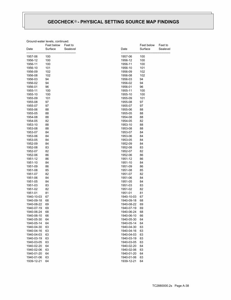
TC2880000.2s Page A-38
1939-12-21 64 1939-12-21 641940-01-06 63 1940-01-06 631940-01-20 64 1940-01-20 641940-02-06 63 1940-02-06 631940-02-20 64 1940-02-20 641940-03-05 63 1940-03-05 631940-03-19 63 1940-03-19 631940-04-03 63 1940-04-03 631940-04-16 63 1940-04-16 631940-04-30 63 1940-04-30 631940-05-14 64 1940-05-14 641940-05-30 64 1940-05-30 641940-06-10 66 1940-06-10 661940-06-24 68 1940-06-24 681940-07-19 69 1940-07-19 691940-08-22 69 1940-08-22 691940-09-18 68 1940-09-18 681940-10-03 67 1940-10-03 671951-01 81 1951-01 811951-02 82 1951-02 821951-03 83 1951-03 831951-05 84 1951-05 841951-06 84 1951-06 841951-07 82 1951-07 821951-08 85 1951-08 851951-09 86 1951-09 861951-10 84 1951-10 841951-12 86 1951-12 861952-06 86 1952-06 861952-07 82 1952-07 821952-08 83 1952-08 831952-09 84 1952-09 841953-05 84 1953-05 841953-06 84 1953-06 841953-07 84 1953-07 841953-08 88 1953-08 881953-10 88 1953-10 881954-05 82 1954-05 821954-08 88 1954-08 881955-05 88 1955-05 881955-06 88 1955-06 881955-07 97 1955-07 971955-08 97 1955-08 971955-09 101 1955-09 1011955-10 100 1955-10 1001955-11 100 1955-11 1001956-01 96 1956-01 961956-02 94 1956-02 941956-03 94 1956-03 941956-08 102 1956-08 1021956-09 102 1956-09 1021956-10 101 1956-10 1011956-11 100 1956-11 1001956-12 100 1956-12 1001957-06 100 1957-06 100
DateFeet belowSurface
Feet toSealevel
-------------------------------------------------Date
Feet belowSurface
Feet toSealevel
-------------------------------------------------
Ground-water levels, continued.
GEOCHECK - PHYSICAL SETTING SOURCE MAP FINDINGS®

TC2880000.2s Page A-39
1937-06-09 61 1937-06-09 611937-06-23 61 1937-06-23 611937-07-07 62 1937-07-07 621937-07-21 64 1937-07-21 641937-07-27 64 1937-07-27 641937-08-05 63 1937-08-05 631937-08-18 63 1937-08-18 631937-09-03 63 1937-09-03 631937-09-15 64 1937-09-15 641937-10-01 64 1937-10-01 641937-10-15 64 1937-10-15 641937-11-12 64 1937-11-12 641937-12-02 62 1937-12-02 621937-12-30 62 1937-12-30 621938-01-13 62 1938-01-13 621938-01-26 62 1938-01-26 621938-02-28 60 1938-02-28 601938-03-08 60 1938-03-08 601938-03-23 60 1938-03-23 601938-04-05 60 1938-04-05 601938-04-19 60 1938-04-19 601938-05-03 60 1938-05-03 601938-05-17 60 1938-05-17 601938-06-01 61 1938-06-01 611938-06-15 62 1938-06-15 621938-06-28 62 1938-06-28 621938-07-20 63 1938-07-20 631938-07-31 64 1938-07-31 641938-09-16 64 1938-09-16 641938-09-30 64 1938-09-30 641938-10-15 66 1938-10-15 661938-10-28 67 1938-10-28 671938-11-11 63 1938-11-11 631938-12-03 62 1938-12-03 621938-12-16 62 1938-12-16 621938-12-29 61 1938-12-29 611939-01-14 62 1939-01-14 621939-01-27 61 1939-01-27 611939-02-10 62 1939-02-10 621939-02-24 62 1939-02-24 621939-03-10 62 1939-03-10 621939-03-24 62 1939-03-24 621939-04-03 62 1939-04-03 621939-04-21 62 1939-04-21 621939-05-05 62 1939-05-05 621939-05-19 64 1939-05-19 641939-05-31 63 1939-05-31 631939-06-26 64 1939-06-26 641939-07-19 68 1939-07-19 681939-08-01 67 1939-08-01 671939-08-16 68 1939-08-16 681939-09-03 67 1939-09-03 671939-10-29 65 1939-10-29 651939-11-11 64 1939-11-11 641939-12-11 64 1939-12-11 64
DateFeet belowSurface
Feet toSealevel
-------------------------------------------------Date
Feet belowSurface
Feet toSealevel
-------------------------------------------------
Ground-water levels, continued.
GEOCHECK - PHYSICAL SETTING SOURCE MAP FINDINGS®

TC2880000.2s Page A-40
20SSE1/4 - 1/2 MileLower
USGS3140870FED USGS
ID6000000143335Site id:Not ReportedLink:Not ReportedQuad:
0Y:0X:Not ReportedElevation:
Not ReportedCompletion:Not ReportedWateruse2:Not ReportedWateruse:Not ReportedWellnumber:
http://www.idwr.idaho.gov/apps/appsWell/RelatedDocs.asp?WellID=280411Well url:QQDatasource:
08/25/1972Constructi:0Totaldepth:54Casingdept:0Casingdiam:8Surfacedia:76Staticwate:40Production:Domestic-Single ResidenceWelluse:Not ReportedSubdivisio:
Not ReportedBlock:Not ReportedLot:Not ReportedWelladdres:0Govlotnum:
SEQ:SWQq:Not ReportedQqq:7Sec:05WRange:39NTownship:
LATAHCountyname:87Basinnumbe:115Drillerlic:
ADCOCK AIR DRILLINGDriller:LOVIS OLSENOwner:
Not ReportedMetaltagnu:747118Permitid:280411Wellid:94605Objectid:
B19SW1/8 - 1/4 MileLower
ID6000000143335ID WELLS
1936-05-22 60 1936-05-22 601936-05-28 61 1936-05-28 611936-06-04 60 1936-06-04 601936-06-11 60 1936-06-11 601936-06-18 61 1936-06-18 611936-06-24 61 1936-06-24 611936-07-02 61 1936-07-02 611936-07-08 62 1936-07-08 621936-07-23 63 1936-07-23 631936-07-29 63 1936-07-29 63
DateFeet belowSurface
Feet toSealevel
-------------------------------------------------Date
Feet belowSurface
Feet toSealevel
-------------------------------------------------
Ground-water levels, continued.
GEOCHECK - PHYSICAL SETTING SOURCE MAP FINDINGS®

TC2880000.2s Page A-41
1985-10-27 50.27 1985-10-27 50.271985-11-30 50.44 1985-11-30 50.441986-01-07 50.07 1986-01-07 50.071986-02-23 49.04 1986-02-23 49.041986-03-22 49.12 1986-03-22 49.121986-04-26 48.65 1986-04-26 48.651986-05-17 48.45 1986-05-17 48.451986-06-04 48.05 1986-06-04 48.051986-07-15 48.00 1986-07-15 48.001986-08-14 49.08 1986-08-14 49.081986-09-12 48.37 1986-09-12 48.371986-10-17 48.02 1986-10-17 48.021986-11-18 47.17 1986-11-18 47.171986-12-18 49.62 1986-12-18 49.621987-01-16 47.67 1987-01-16 47.671987-02-24 46.83 1987-02-24 46.831987-03-27 47.19 1987-03-27 47.191987-04-21 47.49 1987-04-21 47.49 Note: The measurement was discontinued.1987-06-23 Note: The measurement was discontinued.1987-06-23
DateFeet belowSurface
Feet toSealevel
-------------------------------------------------Date
Feet belowSurface
Feet toSealevel
-------------------------------------------------
Ground-water levels, Number of Measurements: 1044
522Ground water data count:1987-06-23Ground water data end date:Ground water data begin date: 1937-05-290Water quality data count:0000-00-00Water quality data end date:0000-00-00Water quality data begin date:0Peak flow data count:0000-00-00Peak flow data end date:0000-00-00Peak flow data begin date:0Daily flow data count:0000-00-00Daily flow data end date:0000-00-00Daily flow data begin date:0Real time data flag:
ID-00-002Project number:reporting agency (generally USGS)Source of depth data:
240.00Hole depth:240.00Well depth:Not ReportedAquifer:Not ReportedAquifer Type:Single well, other than collector or Ranney typeType of ground water site:YLocal standard time flag:
PSTMean greenwich time offset:Not ReportedDate inventoried:Not ReportedDate construction:Ground-water other than SpringSite type:
Valley flatTopographic:Palouse. Idaho, Washington. Area = 2360 sq.mi.Hydrologic:National Geodetic Vertical Datum of 1929Altitude datum:.01Altitude accuracy:Level or other surveying methodAltitude method:2560.93Altitude:
24000Map scale:MOSCOW WESTLocation map:SWSESES07 T39N R05W BLand net:USCountry:057County:16State:16District:NAD83Dec latlong datum:NAD27Latlong datum:SCoor accr:MCoor meth:-117.00460962Dec lon:46.73016521Dec lat:1170013Longitude:USGS3140870EDR Site id:464349Latitude:
39N 05W 07DDC1Site name:464349117001301Site no:USGSAgency cd:
GEOCHECK - PHYSICAL SETTING SOURCE MAP FINDINGS®
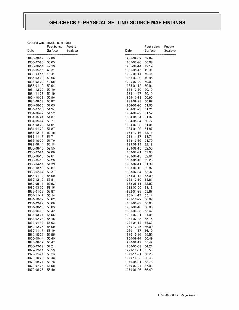
TC2880000.2s Page A-42
1979-06-26 56.40 1979-06-26 56.401979-07-24 57.98 1979-07-24 57.981979-08-21 58.78 1979-08-21 58.781979-10-25 56.43 1979-10-25 56.431979-11-21 56.23 1979-11-21 56.231979-12-01 55.53 1979-12-01 55.531980-03-09 54.21 1980-03-09 54.211980-06-17 55.47 1980-06-17 55.471980-09-14 56.49 1980-09-14 56.491980-10-26 55.55 1980-10-26 55.551980-11-17 56.19 1980-11-17 56.191980-12-23 56.09 1980-12-23 56.091981-01-13 55.63 1981-01-13 55.631981-02-23 55.15 1981-02-23 55.151981-03-31 54.95 1981-03-31 54.951981-06-08 53.42 1981-06-08 53.421981-08-10 56.83 1981-08-10 56.831981-09-22 58.60 1981-09-22 58.601981-10-22 56.62 1981-10-22 56.621981-11-17 55.14 1981-11-17 55.141982-01-28 53.87 1982-01-28 53.871982-03-09 53.15 1982-03-09 53.151982-05-11 52.52 1982-05-11 52.521982-12-10 53.81 1982-12-10 53.811983-01-12 53.00 1983-01-12 53.001983-02-04 53.37 1983-02-04 53.371983-03-10 52.87 1983-03-10 52.871983-04-11 51.39 1983-04-11 51.391983-05-13 52.23 1983-05-13 52.231983-06-13 52.61 1983-06-13 52.611983-07-21 52.08 1983-07-21 52.081983-08-15 52.55 1983-08-15 52.551983-09-14 52.18 1983-09-14 52.181983-10-26 51.70 1983-10-26 51.701983-11-17 51.71 1983-11-17 51.711983-12-16 52.15 1983-12-16 52.151984-01-20 51.87 1984-01-20 51.871984-03-23 51.01 1984-03-23 51.011984-05-04 50.77 1984-05-04 50.771984-05-24 51.37 1984-05-24 51.371984-06-22 51.52 1984-06-22 51.521984-07-23 51.24 1984-07-23 51.241984-08-20 51.65 1984-08-20 51.651984-09-29 50.97 1984-09-29 50.971984-10-29 50.96 1984-10-29 50.961984-11-27 50.19 1984-11-27 50.191984-12-20 50.10 1984-12-20 50.101985-01-12 50.94 1985-01-12 50.941985-02-20 49.98 1985-02-20 49.981985-03-09 49.96 1985-03-09 49.961985-04-14 49.41 1985-04-14 49.411985-05-15 49.31 1985-05-15 49.311985-06-14 49.19 1985-06-14 49.191985-07-26 50.69 1985-07-26 50.691985-09-02 49.89 1985-09-02 49.89
DateFeet belowSurface
Feet toSealevel
-------------------------------------------------Date
Feet belowSurface
Feet toSealevel
-------------------------------------------------
Ground-water levels, continued.
GEOCHECK - PHYSICAL SETTING SOURCE MAP FINDINGS®

TC2880000.2s Page A-43
1974-04-19 54.84 1974-04-19 54.841974-05-20 55.12 1974-05-20 55.121974-06-20 57.42 1974-06-20 57.421974-08-05 57.90 1974-08-05 57.901974-09-23 60.00 1974-09-23 60.001974-11-05 56.83 1974-11-05 56.831974-12-16 55.60 1974-12-16 55.601975-03-18 54.85 1975-03-18 54.851975-05-06 54.93 1975-05-06 54.931975-06-23 56.35 1975-06-23 56.351975-08-01 59.14 1975-08-01 59.141975-08-18 60.58 1975-08-18 60.581975-09-17 61.48 1975-09-17 61.481975-10-16 61.10 1975-10-16 61.101975-11-14 59.66 1975-11-14 59.661975-12-12 58.64 1975-12-12 58.641976-01-20 57.57 1976-01-20 57.571976-02-24 56.05 1976-02-24 56.051976-03-23 55.80 1976-03-23 55.801976-04-25 55.52 1976-04-25 55.521976-04-26 55.33 1976-04-26 55.331976-05-17 54.94 1976-05-17 54.941976-06-14 54.74 1976-06-14 54.741976-07-14 55.81 1976-07-14 55.811976-08-13 56.28 1976-08-13 56.281976-09-14 55.72 1976-09-14 55.721976-10-19 55.41 1976-10-19 55.411976-11-19 56.29 1976-11-19 56.291976-12-17 56.07 1976-12-17 56.071977-01-11 55.95 1977-01-11 55.951977-02-18 56.67 1977-02-18 56.671977-03-15 55.45 1977-03-15 55.451977-04-14 54.89 1977-04-14 54.891977-05-10 54.38 1977-05-10 54.381977-06-07 54.20 1977-06-07 54.201977-07-27 56.34 1977-07-27 56.341977-08-22 58.18 1977-08-22 58.181977-09-20 55.84 1977-09-20 55.841977-10-17 54.98 1977-10-17 54.981977-11-17 54.65 1977-11-17 54.651977-12-15 53.74 1977-12-15 53.741978-01-24 54.10 1978-01-24 54.101978-02-14 53.63 1978-02-14 53.631978-03-23 53.48 1978-03-23 53.481978-04-18 53.44 1978-04-18 53.441978-05-26 53.91 1978-05-26 53.911978-06-21 56.12 1978-06-21 56.121978-07-19 56.95 1978-07-19 56.951978-08-22 57.40 1978-08-22 57.401978-09-19 55.58 1978-09-19 55.581978-10-17 55.21 1978-10-17 55.211978-11-14 56.10 1978-11-14 56.101979-03-23 57.19 1979-03-23 57.191979-04-19 55.63 1979-04-19 55.631979-05-21 54.91 1979-05-21 54.91
DateFeet belowSurface
Feet toSealevel
-------------------------------------------------Date
Feet belowSurface
Feet toSealevel
-------------------------------------------------
Ground-water levels, continued.
GEOCHECK - PHYSICAL SETTING SOURCE MAP FINDINGS®
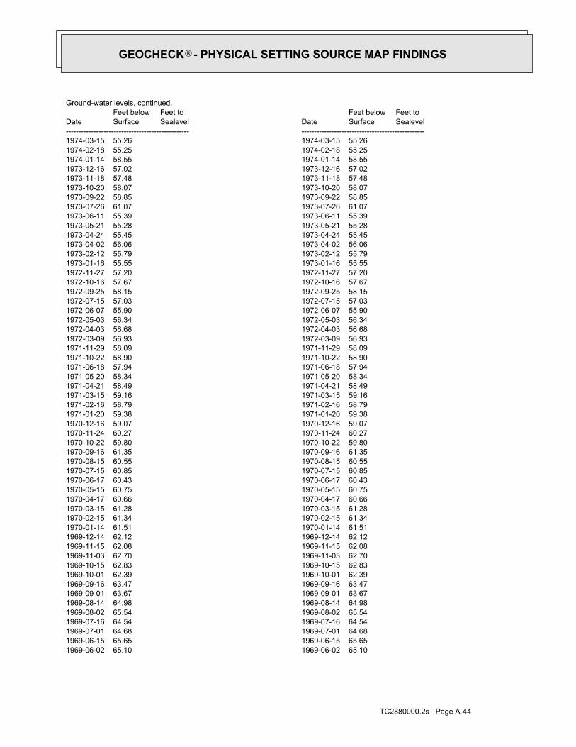
TC2880000.2s Page A-44
1969-06-02 65.10 1969-06-02 65.101969-06-15 65.65 1969-06-15 65.651969-07-01 64.68 1969-07-01 64.681969-07-16 64.54 1969-07-16 64.541969-08-02 65.54 1969-08-02 65.541969-08-14 64.98 1969-08-14 64.981969-09-01 63.67 1969-09-01 63.671969-09-16 63.47 1969-09-16 63.471969-10-01 62.39 1969-10-01 62.391969-10-15 62.83 1969-10-15 62.831969-11-03 62.70 1969-11-03 62.701969-11-15 62.08 1969-11-15 62.081969-12-14 62.12 1969-12-14 62.121970-01-14 61.51 1970-01-14 61.511970-02-15 61.34 1970-02-15 61.341970-03-15 61.28 1970-03-15 61.281970-04-17 60.66 1970-04-17 60.661970-05-15 60.75 1970-05-15 60.751970-06-17 60.43 1970-06-17 60.431970-07-15 60.85 1970-07-15 60.851970-08-15 60.55 1970-08-15 60.551970-09-16 61.35 1970-09-16 61.351970-10-22 59.80 1970-10-22 59.801970-11-24 60.27 1970-11-24 60.271970-12-16 59.07 1970-12-16 59.071971-01-20 59.38 1971-01-20 59.381971-02-16 58.79 1971-02-16 58.791971-03-15 59.16 1971-03-15 59.161971-04-21 58.49 1971-04-21 58.491971-05-20 58.34 1971-05-20 58.341971-06-18 57.94 1971-06-18 57.941971-10-22 58.90 1971-10-22 58.901971-11-29 58.09 1971-11-29 58.091972-03-09 56.93 1972-03-09 56.931972-04-03 56.68 1972-04-03 56.681972-05-03 56.34 1972-05-03 56.341972-06-07 55.90 1972-06-07 55.901972-07-15 57.03 1972-07-15 57.031972-09-25 58.15 1972-09-25 58.151972-10-16 57.67 1972-10-16 57.671972-11-27 57.20 1972-11-27 57.201973-01-16 55.55 1973-01-16 55.551973-02-12 55.79 1973-02-12 55.791973-04-02 56.06 1973-04-02 56.061973-04-24 55.45 1973-04-24 55.451973-05-21 55.28 1973-05-21 55.281973-06-11 55.39 1973-06-11 55.391973-07-26 61.07 1973-07-26 61.071973-09-22 58.85 1973-09-22 58.851973-10-20 58.07 1973-10-20 58.071973-11-18 57.48 1973-11-18 57.481973-12-16 57.02 1973-12-16 57.021974-01-14 58.55 1974-01-14 58.551974-02-18 55.25 1974-02-18 55.251974-03-15 55.26 1974-03-15 55.26
DateFeet belowSurface
Feet toSealevel
-------------------------------------------------Date
Feet belowSurface
Feet toSealevel
-------------------------------------------------
Ground-water levels, continued.
GEOCHECK - PHYSICAL SETTING SOURCE MAP FINDINGS®

TC2880000.2s Page A-45
1966-04-16 71.91 1966-04-16 71.911966-04-23 72.37 1966-04-23 72.371966-04-30 73.32 1966-04-30 73.321966-05-07 73.30 1966-05-07 73.301966-05-14 72.42 1966-05-14 72.421966-05-21 72.57 1966-05-21 72.571966-05-28 72.44 1966-05-28 72.441966-06-04 72.39 1966-06-04 72.391966-08-05 73.25 1966-08-05 73.251966-09-08 71.63 1966-09-08 71.631966-10-07 71.27 1966-10-07 71.271967-02-01 69.31 1967-02-01 69.311967-03-03 68.67 1967-03-03 68.671967-04-11 67.95 1967-04-11 67.951967-05-01 68.19 1967-05-01 68.191967-06-03 67.54 1967-06-03 67.541967-07-03 67.89 1967-07-03 67.891967-08-02 68.78 1967-08-02 68.781967-09-01 69.19 1967-09-01 69.191967-10-01 68.28 1967-10-01 68.281967-10-16 68.11 1967-10-16 68.111967-11-01 67.63 1967-11-01 67.631967-11-15 67.43 1967-11-15 67.431967-12-01 67.44 1967-12-01 67.441967-12-24 67.26 1967-12-24 67.261968-01-15 66.32 1968-01-15 66.321968-02-01 66.50 1968-02-01 66.501968-02-15 66.31 1968-02-15 66.311968-03-01 65.87 1968-03-01 65.871968-03-15 65.66 1968-03-15 65.661968-04-01 65.16 1968-04-01 65.161968-04-15 65.68 1968-04-15 65.681968-05-01 65.50 1968-05-01 65.501968-05-15 65.88 1968-05-15 65.881968-05-18 66.02 1968-05-18 66.021968-05-21 66.47 1968-05-21 66.471968-05-25 66.85 1968-05-25 66.851968-06-14 65.98 1968-06-14 65.981968-07-01 68.54 1968-07-01 68.541968-07-14 67.49 1968-07-14 67.491968-08-02 68.38 1968-08-02 68.381968-08-19 67.27 1968-08-19 67.271968-09-03 67.91 1968-09-03 67.911968-09-20 67.63 1968-09-20 67.631968-10-01 68.80 1968-10-01 68.801968-10-15 65.68 1968-10-15 65.681968-11-03 65.35 1968-11-03 65.351968-11-16 65.30 1968-11-16 65.301968-12-10 64.40 1968-12-10 64.401969-01-26 65.82 1969-01-26 65.821969-04-01 63.78 1969-04-01 63.781969-04-15 63.12 1969-04-15 63.121969-05-02 62.82 1969-05-02 62.821969-05-06 62.83 1969-05-06 62.831969-05-15 64.04 1969-05-15 64.04
DateFeet belowSurface
Feet toSealevel
-------------------------------------------------Date
Feet belowSurface
Feet toSealevel
-------------------------------------------------
Ground-water levels, continued.
GEOCHECK - PHYSICAL SETTING SOURCE MAP FINDINGS®

TC2880000.2s Page A-46
1965-02-23 82.67 1965-02-23 82.671965-03-08 82.66 1965-03-08 82.661965-03-15 82.36 1965-03-15 82.361965-03-22 82.22 1965-03-22 82.221965-03-29 82.13 1965-03-29 82.131965-04-05 82.11 1965-04-05 82.111965-04-12 81.80 1965-04-12 81.801965-04-19 81.19 1965-04-19 81.191965-04-26 81.70 1965-04-26 81.701965-05-03 81.68 1965-05-03 81.681965-05-10 84.38 1965-05-10 84.381965-05-17 83.23 1965-05-17 83.231965-05-24 81.42 1965-05-24 81.421965-06-01 82.41 1965-06-01 82.411965-06-14 82.80 1965-06-14 82.801965-06-21 81.92 1965-06-21 81.921965-07-02 83.23 1965-07-02 83.231965-07-09 80.76 1965-07-09 80.761965-07-16 79.87 1965-07-16 79.871965-07-23 79.68 1965-07-23 79.681965-07-30 80.69 1965-07-30 80.691965-08-06 78.92 1965-08-06 78.921965-08-13 78.76 1965-08-13 78.761965-08-20 84.13 1965-08-20 84.131965-08-27 77.84 1965-08-27 77.841965-09-03 77.34 1965-09-03 77.341965-09-15 76.79 1965-09-15 76.791965-09-24 76.47 1965-09-24 76.471965-10-01 80.66 1965-10-01 80.661965-10-08 76.02 1965-10-08 76.021965-10-15 75.77 1965-10-15 75.771965-10-22 75.84 1965-10-22 75.841965-10-29 75.52 1965-10-29 75.521965-11-05 75.41 1965-11-05 75.411965-11-12 76.95 1965-11-12 76.951965-11-19 76.49 1965-11-19 76.491965-11-27 75.02 1965-11-27 75.021965-12-04 74.63 1965-12-04 74.631965-12-11 74.41 1965-12-11 74.411965-12-17 74.39 1965-12-17 74.391965-12-24 73.95 1965-12-24 73.951966-01-08 75.31 1966-01-08 75.311966-01-15 73.92 1966-01-15 73.921966-01-22 73.36 1966-01-22 73.361966-01-30 73.92 1966-01-30 73.921966-02-05 73.01 1966-02-05 73.011966-02-12 73.20 1966-02-12 73.201966-02-19 72.71 1966-02-19 72.711966-02-26 73.05 1966-02-26 73.051966-03-05 72.69 1966-03-05 72.691966-03-12 72.34 1966-03-12 72.341966-03-22 72.72 1966-03-22 72.721966-03-26 72.23 1966-03-26 72.231966-04-02 72.35 1966-04-02 72.351966-04-09 71.17 1966-04-09 71.17
DateFeet belowSurface
Feet toSealevel
-------------------------------------------------Date
Feet belowSurface
Feet toSealevel
-------------------------------------------------
Ground-water levels, continued.
GEOCHECK - PHYSICAL SETTING SOURCE MAP FINDINGS®
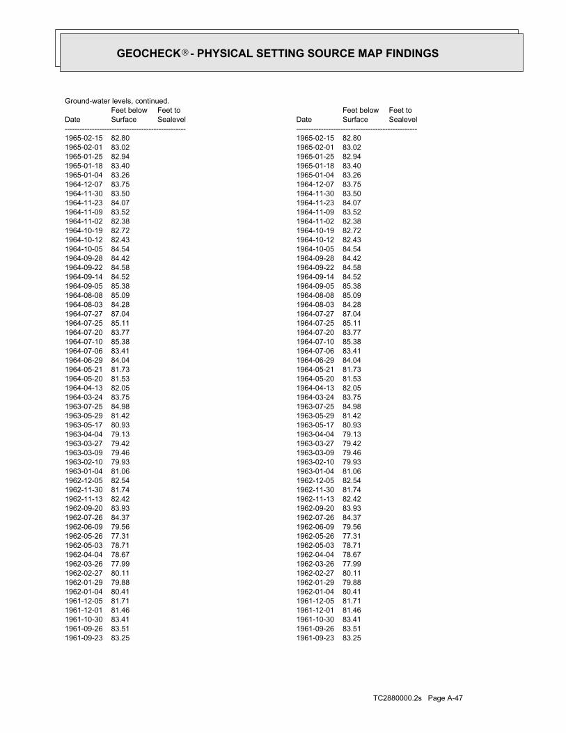
TC2880000.2s Page A-47
1961-09-23 83.25 1961-09-23 83.251961-09-26 83.51 1961-09-26 83.511961-10-30 83.41 1961-10-30 83.411961-12-01 81.46 1961-12-01 81.461961-12-05 81.71 1961-12-05 81.711962-01-04 80.41 1962-01-04 80.411962-01-29 79.88 1962-01-29 79.881962-02-27 80.11 1962-02-27 80.111962-03-26 77.99 1962-03-26 77.991962-04-04 78.67 1962-04-04 78.671962-05-03 78.71 1962-05-03 78.711962-05-26 77.31 1962-05-26 77.311962-06-09 79.56 1962-06-09 79.561962-07-26 84.37 1962-07-26 84.371962-09-20 83.93 1962-09-20 83.931962-11-13 82.42 1962-11-13 82.421962-11-30 81.74 1962-11-30 81.741962-12-05 82.54 1962-12-05 82.541963-01-04 81.06 1963-01-04 81.061963-02-10 79.93 1963-02-10 79.931963-03-09 79.46 1963-03-09 79.461963-03-27 79.42 1963-03-27 79.421963-04-04 79.13 1963-04-04 79.131963-05-17 80.93 1963-05-17 80.931963-05-29 81.42 1963-05-29 81.421963-07-25 84.98 1963-07-25 84.981964-03-24 83.75 1964-03-24 83.751964-04-13 82.05 1964-04-13 82.051964-05-20 81.53 1964-05-20 81.531964-05-21 81.73 1964-05-21 81.731964-06-29 84.04 1964-06-29 84.041964-07-06 83.41 1964-07-06 83.411964-07-10 85.38 1964-07-10 85.381964-07-20 83.77 1964-07-20 83.771964-07-25 85.11 1964-07-25 85.111964-07-27 87.04 1964-07-27 87.041964-08-03 84.28 1964-08-03 84.281964-08-08 85.09 1964-08-08 85.091964-09-05 85.38 1964-09-05 85.381964-09-14 84.52 1964-09-14 84.521964-09-22 84.58 1964-09-22 84.581964-09-28 84.42 1964-09-28 84.421964-10-05 84.54 1964-10-05 84.541964-10-12 82.43 1964-10-12 82.431964-10-19 82.72 1964-10-19 82.721964-11-02 82.38 1964-11-02 82.381964-11-09 83.52 1964-11-09 83.521964-11-23 84.07 1964-11-23 84.071964-11-30 83.50 1964-11-30 83.501964-12-07 83.75 1964-12-07 83.751965-01-04 83.26 1965-01-04 83.261965-01-18 83.40 1965-01-18 83.401965-01-25 82.94 1965-01-25 82.941965-02-01 83.02 1965-02-01 83.021965-02-15 82.80 1965-02-15 82.80
DateFeet belowSurface
Feet toSealevel
-------------------------------------------------Date
Feet belowSurface
Feet toSealevel
-------------------------------------------------
Ground-water levels, continued.
GEOCHECK - PHYSICAL SETTING SOURCE MAP FINDINGS®

TC2880000.2s Page A-48
1953-08-23 77.35 1953-08-23 77.351953-10-23 76.67 1953-10-23 76.671954-02-17 75.85 1954-02-17 75.851954-05-18 76.36 1954-05-18 76.361954-06-08 77.72 1954-06-08 77.721954-08-03 80.01 1954-08-03 80.011954-09-02 79.57 1954-09-02 79.571954-10-06 79.68 1954-10-06 79.681954-11-10 80.67 1954-11-10 80.671954-12-08 80.56 1954-12-08 80.561955-01-04 80.18 1955-01-04 80.181955-04-26 82.12 1955-04-26 82.121955-06-22 84.25 1955-06-22 84.251955-07-07 83.59 1955-07-07 83.591955-08-03 84.30 1955-08-03 84.301955-10-04 85.65 1955-10-04 85.651955-11-01 84.69 1955-11-01 84.691955-12-07 85.38 1955-12-07 85.381956-01-11 83.03 1956-01-11 83.031956-02-08 82.23 1956-02-08 82.231956-03-06 78.79 1956-03-06 78.791956-04-03 78.38 1956-04-03 78.381956-05-10 78.00 1956-05-10 78.001956-06-06 78.67 1956-06-06 78.671956-06-29 79.37 1956-06-29 79.371956-07-25 81.71 1956-07-25 81.711956-08-24 83.69 1956-08-24 83.691956-10-03 85.11 1956-10-03 85.111956-12-18 83.62 1956-12-18 83.621957-04-27 82.84 1957-04-27 82.841957-05-21 83.54 1957-05-21 83.541957-06-25 83.13 1957-06-25 83.131957-08-23 88.26 1957-08-23 88.261957-10-24 88.18 1957-10-24 88.181957-10-31 85.68 1957-10-31 85.681958-02-23 82.54 1958-02-23 82.541958-06-25 86.30 1958-06-25 86.301958-09-12 87.01 1958-09-12 87.011958-10-20 88.32 1958-10-20 88.321958-12-17 89.21 1958-12-17 89.211959-10-29 84.71 1959-10-29 84.711960-03-29 84.94 1960-03-29 84.941960-05-24 85.89 1960-05-24 85.891960-09-30 84.47 1960-09-30 84.471960-11-27 79.29 1960-11-27 79.291960-12-01 78.82 1960-12-01 78.821960-12-31 77.53 1960-12-31 77.531961-01-26 76.97 1961-01-26 76.971961-01-31 76.81 1961-01-31 76.811961-02-26 76.02 1961-02-26 76.021961-04-03 75.15 1961-04-03 75.151961-05-04 74.16 1961-05-04 74.161961-06-11 78.55 1961-06-11 78.551961-07-26 79.85 1961-07-26 79.851961-08-19 83.80 1961-08-19 83.80
DateFeet belowSurface
Feet toSealevel
-------------------------------------------------Date
Feet belowSurface
Feet toSealevel
-------------------------------------------------
Ground-water levels, continued.
GEOCHECK - PHYSICAL SETTING SOURCE MAP FINDINGS®

TC2880000.2s Page A-49
1940-01-06 53.67 1940-01-06 53.671940-01-20 53.90 1940-01-20 53.901940-02-06 53.19 1940-02-06 53.191940-02-20 54.15 1940-02-20 54.151940-03-05 53.71 1940-03-05 53.711940-03-19 53.60 1940-03-19 53.601940-04-03 53.18 1940-04-03 53.181940-04-16 54.01 1940-04-16 54.011940-04-30 54.15 1940-04-30 54.151940-05-30 53.81 1940-05-30 53.811940-06-10 54.51 1940-06-10 54.511940-06-25 56.46 1940-06-25 56.461940-07-19 57.49 1940-07-19 57.491940-08-22 57.98 1940-08-22 57.981940-09-18 56.14 1940-09-18 56.141940-10-07 57.07 1940-10-07 57.071947-05-02 63.10 1947-05-02 63.101948-08-24 64.33 1948-08-24 64.331949-03-21 64.52 1949-03-21 64.521949-04-29 64.99 1949-04-29 64.991950-01-04 65.48 1950-01-04 65.481950-03-29 65.41 1950-03-29 65.411950-04-14 67.21 1950-04-14 67.211950-08-29 69.95 1950-08-29 69.951950-10-27 68.30 1950-10-27 68.301950-12-18 70.00 1950-12-18 70.001951-02-14 67.55 1951-02-14 67.551951-04-10 67.40 1951-04-10 67.401951-06-18 71.33 1951-06-18 71.331951-08-14 74.70 1951-08-14 74.701951-08-25 74.90 1951-08-25 74.901951-10-20 72.63 1951-10-20 72.631951-11-19 72.72 1951-11-19 72.721951-12-13 72.10 1951-12-13 72.101952-02-15 71.38 1952-02-15 71.381952-04-14 71.70 1952-04-14 71.701952-04-15 71.40 1952-04-15 71.401952-04-21 72.00 1952-04-21 72.001952-04-28 72.70 1952-04-28 72.701952-06-04 73.60 1952-06-04 73.601952-06-05 73.61 1952-06-05 73.611952-06-16 72.70 1952-06-16 72.701952-06-23 72.50 1952-06-23 72.501952-06-30 72.40 1952-06-30 72.401952-07-07 73.20 1952-07-07 73.201952-07-14 74.40 1952-07-14 74.401952-07-21 74.60 1952-07-21 74.601952-07-28 74.50 1952-07-28 74.501952-08-11 73.10 1952-08-11 73.101952-08-15 73.86 1952-08-15 73.861952-12-09 72.19 1952-12-09 72.191953-02-18 72.14 1953-02-18 72.141953-04-25 72.46 1953-04-25 72.461953-05-01 72.41 1953-05-01 72.411953-06-19 70.35 1953-06-19 70.35
DateFeet belowSurface
Feet toSealevel
-------------------------------------------------Date
Feet belowSurface
Feet toSealevel
-------------------------------------------------
Ground-water levels, continued.
GEOCHECK - PHYSICAL SETTING SOURCE MAP FINDINGS®

TC2880000.2s Page A-50
1937-07-27 52.13 1937-07-27 52.131937-08-05 52.55 1937-08-05 52.551937-08-19 52.47 1937-08-19 52.471937-09-03 52.28 1937-09-03 52.281937-09-15 52.83 1937-09-15 52.831937-10-01 51.87 1937-10-01 51.871937-10-15 51.65 1937-10-15 51.651937-10-27 51.72 1937-10-27 51.721937-11-12 51.91 1937-11-12 51.911937-12-02 51.76 1937-12-02 51.761937-12-15 51.67 1937-12-15 51.671937-12-30 51.31 1937-12-30 51.311938-01-26 51.57 1938-01-26 51.571938-02-28 51.33 1938-02-28 51.331938-03-08 51.09 1938-03-08 51.091938-03-22 50.98 1938-03-22 50.981938-03-23 51.13 1938-03-23 51.131938-04-05 50.83 1938-04-05 50.831938-04-19 50.10 1938-04-19 50.101938-05-03 50.23 1938-05-03 50.231938-05-16 50.21 1938-05-16 50.211938-06-01 50.66 1938-06-01 50.661938-06-15 51.79 1938-06-15 51.791938-06-28 52.57 1938-06-28 52.571938-07-20 53.68 1938-07-20 53.681938-08-11 54.21 1938-08-11 54.211938-08-31 54.31 1938-08-31 54.311938-09-16 53.44 1938-09-16 53.441938-09-30 53.39 1938-09-30 53.391938-10-15 53.30 1938-10-15 53.301938-10-22 53.47 1938-10-22 53.471938-11-11 53.14 1938-11-11 53.141938-12-03 51.81 1938-12-03 51.811938-12-16 52.23 1938-12-16 52.231938-12-28 51.89 1938-12-28 51.891939-01-14 51.89 1939-01-14 51.891939-01-27 51.71 1939-01-27 51.711939-02-10 52.22 1939-02-10 52.221939-02-24 52.90 1939-02-24 52.901939-03-10 51.71 1939-03-10 51.711939-03-24 52.85 1939-03-24 52.851939-04-03 51.99 1939-04-03 51.991939-04-21 52.78 1939-04-21 52.781939-05-05 53.74 1939-05-05 53.741939-05-19 53.48 1939-05-19 53.481939-05-31 53.85 1939-05-31 53.851939-06-26 53.37 1939-06-26 53.371939-07-17 54.98 1939-07-17 54.981939-08-01 56.00 1939-08-01 56.001939-08-17 56.27 1939-08-17 56.271939-09-03 55.67 1939-09-03 55.671939-10-22 55.08 1939-10-22 55.081939-11-18 54.70 1939-11-18 54.701939-12-02 54.42 1939-12-02 54.421939-12-21 54.14 1939-12-21 54.14
DateFeet belowSurface
Feet toSealevel
-------------------------------------------------Date
Feet belowSurface
Feet toSealevel
-------------------------------------------------
Ground-water levels, continued.
GEOCHECK - PHYSICAL SETTING SOURCE MAP FINDINGS®

TC2880000.2s Page A-51
1966-06-04 85.84 1966-06-04 85.841966-08-05 85.65 1966-08-05 85.651966-11-04 83.86 1966-11-04 83.861966-12-15 83.56 1966-12-15 83.56
DateFeet belowSurface
Feet toSealevel
-------------------------------------------------Date
Feet belowSurface
Feet toSealevel
-------------------------------------------------
Ground-water levels, Number of Measurements: 82
41Ground water data count:1966-12-15Ground water data end date:Ground water data begin date: 1955-10-260Water quality data count:0000-00-00Water quality data end date:0000-00-00Water quality data begin date:0Peak flow data count:0000-00-00Peak flow data end date:0000-00-00Peak flow data begin date:0Daily flow data count:0000-00-00Daily flow data end date:0000-00-00Daily flow data begin date:0Real time data flag:
ID-73-107Project number:Not ReportedSource of depth data:
140Hole depth:140Well depth:Not ReportedAquifer:Not ReportedAquifer Type:Single well, other than collector or Ranney typeType of ground water site:YLocal standard time flag:
PSTMean greenwich time offset:Not ReportedDate inventoried:19450101Date construction:Ground-water other than SpringSite type:
Valley flatTopographic:Palouse. Idaho, Washington. Area = 2360 sq.mi.Hydrologic:National Geodetic Vertical Datum of 1929Altitude datum:10.Altitude accuracy:Interpolated from topographic mapAltitude method:2575.00Altitude:
24000Map scale:MOSCOW EASTLocation map:SWSWSWS08 T39N R05W BLand net:USCountry:057County:16State:16District:NAD83Dec latlong datum:NAD27Latlong datum:SCoor accr:MCoor meth:-117.00072066Dec lon:46.73238749Dec lat:1165959Longitude:USGS3140881EDR Site id:464357Latitude:
39N 05W 08CCC1Site name:464357116595901Site no:USGSAgency cd:
21ESE1/4 - 1/2 MileHigher
USGS3140881FED USGS
1937-05-29 50.76 1937-05-29 50.761937-06-02 50.11 1937-06-02 50.111937-06-09 50.97 1937-06-09 50.971937-06-23 50.48 1937-06-23 50.481937-06-30 50.54 1937-06-30 50.541937-07-07 50.60 1937-07-07 50.601937-07-13 50.95 1937-07-13 50.951937-07-21 52.32 1937-07-21 52.32
DateFeet belowSurface
Feet toSealevel
-------------------------------------------------Date
Feet belowSurface
Feet toSealevel
-------------------------------------------------
Ground-water levels, continued.
GEOCHECK - PHYSICAL SETTING SOURCE MAP FINDINGS®
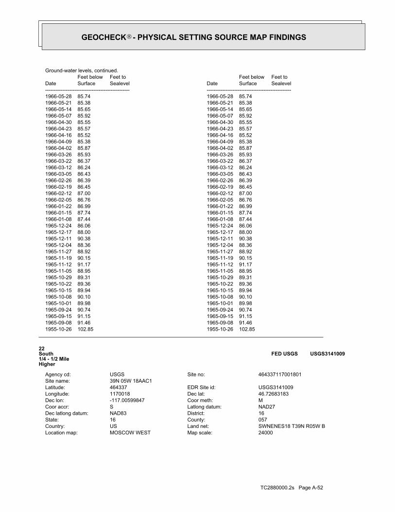
TC2880000.2s Page A-52
24000Map scale:MOSCOW WESTLocation map:SWNENES18 T39N R05W BLand net:USCountry:057County:16State:16District:NAD83Dec latlong datum:NAD27Latlong datum:SCoor accr:MCoor meth:-117.00599847Dec lon:46.72683183Dec lat:1170018Longitude:USGS3141009EDR Site id:464337Latitude:
39N 05W 18AAC1Site name:464337117001801Site no:USGSAgency cd:
22South1/4 - 1/2 MileHigher
USGS3141009FED USGS
1955-10-26 102.85 1955-10-26 102.851965-09-08 91.46 1965-09-08 91.461965-09-15 91.15 1965-09-15 91.151965-09-24 90.74 1965-09-24 90.741965-10-01 89.98 1965-10-01 89.981965-10-08 90.10 1965-10-08 90.101965-10-15 89.94 1965-10-15 89.941965-10-22 89.36 1965-10-22 89.361965-10-29 89.31 1965-10-29 89.311965-11-05 88.95 1965-11-05 88.951965-11-12 91.17 1965-11-12 91.171965-11-19 90.15 1965-11-19 90.151965-11-27 88.92 1965-11-27 88.921965-12-04 88.36 1965-12-04 88.361965-12-11 90.38 1965-12-11 90.381965-12-17 88.00 1965-12-17 88.001965-12-24 86.06 1965-12-24 86.061966-01-08 87.44 1966-01-08 87.441966-01-15 87.74 1966-01-15 87.741966-01-22 86.99 1966-01-22 86.991966-02-05 86.76 1966-02-05 86.761966-02-12 87.00 1966-02-12 87.001966-02-19 86.45 1966-02-19 86.451966-02-26 86.39 1966-02-26 86.391966-03-05 86.43 1966-03-05 86.431966-03-12 86.24 1966-03-12 86.241966-03-22 86.37 1966-03-22 86.371966-03-26 85.93 1966-03-26 85.931966-04-02 85.87 1966-04-02 85.871966-04-09 85.38 1966-04-09 85.381966-04-16 85.52 1966-04-16 85.521966-04-23 85.57 1966-04-23 85.571966-04-30 85.55 1966-04-30 85.551966-05-07 85.92 1966-05-07 85.921966-05-14 85.65 1966-05-14 85.651966-05-21 85.38 1966-05-21 85.381966-05-28 85.74 1966-05-28 85.74
DateFeet belowSurface
Feet toSealevel
-------------------------------------------------Date
Feet belowSurface
Feet toSealevel
-------------------------------------------------
Ground-water levels, continued.
GEOCHECK - PHYSICAL SETTING SOURCE MAP FINDINGS®
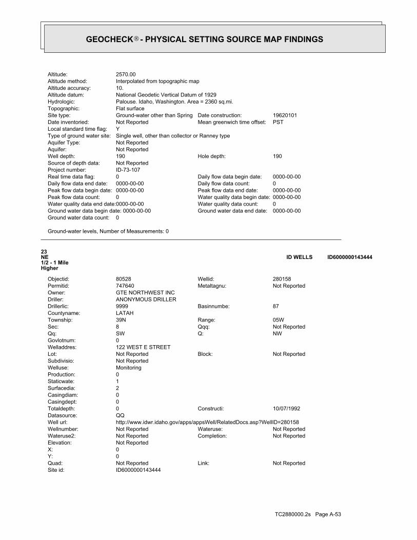
TC2880000.2s Page A-53
ID6000000143444Site id:Not ReportedLink:Not ReportedQuad:
0Y:0X:Not ReportedElevation:
Not ReportedCompletion:Not ReportedWateruse2:Not ReportedWateruse:Not ReportedWellnumber:
http://www.idwr.idaho.gov/apps/appsWell/RelatedDocs.asp?WellID=280158Well url:QQDatasource:
10/07/1992Constructi:0Totaldepth:0Casingdept:0Casingdiam:2Surfacedia:1Staticwate:0Production:MonitoringWelluse:Not ReportedSubdivisio:
Not ReportedBlock:Not ReportedLot:122 WEST E STREETWelladdres:0Govlotnum:
NWQ:SWQq:Not ReportedQqq:8Sec:05WRange:39NTownship:
LATAHCountyname:87Basinnumbe:9999Drillerlic:
ANONYMOUS DRILLERDriller:GTE NORTHWEST INCOwner:
Not ReportedMetaltagnu:747640Permitid:280158Wellid:80528Objectid:
23NE1/2 - 1 MileHigher
ID6000000143444ID WELLS
Ground-water levels, Number of Measurements: 0
0Ground water data count:0000-00-00Ground water data end date:Ground water data begin date: 0000-00-000Water quality data count:0000-00-00Water quality data end date:0000-00-00Water quality data begin date:0Peak flow data count:0000-00-00Peak flow data end date:0000-00-00Peak flow data begin date:0Daily flow data count:0000-00-00Daily flow data end date:0000-00-00Daily flow data begin date:0Real time data flag:
ID-73-107Project number:Not ReportedSource of depth data:
190Hole depth:190Well depth:Not ReportedAquifer:Not ReportedAquifer Type:Single well, other than collector or Ranney typeType of ground water site:YLocal standard time flag:
PSTMean greenwich time offset:Not ReportedDate inventoried:19620101Date construction:Ground-water other than SpringSite type:
Flat surfaceTopographic:Palouse. Idaho, Washington. Area = 2360 sq.mi.Hydrologic:National Geodetic Vertical Datum of 1929Altitude datum:10.Altitude accuracy:Interpolated from topographic mapAltitude method:2570.00Altitude:
GEOCHECK - PHYSICAL SETTING SOURCE MAP FINDINGS®
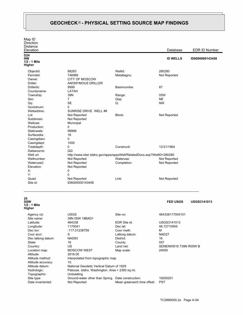
TC2880000.2s Page A-54
PSTMean greenwich time offset:Not ReportedDate inventoried:19200201Date construction:Ground-water other than SpringSite type:
UndulatingTopographic:Palouse. Idaho, Washington. Area = 2360 sq.mi.Hydrologic:National Geodetic Vertical Datum of 1929Altitude datum:10.Altitude accuracy:Interpolated from topographic mapAltitude method:2618.00Altitude:
24000Map scale:MOSCOW WESTLocation map:SENENWS18 T39N R05W BLand net:USCountry:057County:16State:16District:NAD83Dec latlong datum:NAD27Latlong datum:SCoor accr:MCoor meth:-117.01238759Dec lon:46.72710955Dec lat:1170041Longitude:USGS3141013EDR Site id:464338Latitude:
39N 05W 18BAD1Site name:464338117004101Site no:USGSAgency cd:
25SSW1/2 - 1 MileHigher
USGS3141013FED USGS
ID6000000143458Site id:Not ReportedLink:Not ReportedQuad:
0Y:0X:Not ReportedElevation:
Not ReportedCompletion:Not ReportedWateruse2:Not ReportedWateruse:Not ReportedWellnumber:
http://www.idwr.idaho.gov/apps/appsWell/RelatedDocs.asp?WellID=280280Well url:QQDatasource:
12/31/1964Constructi:0Totaldepth:1000Casingdept:0Casingdiam:16Surfacedia:99999Staticwate:0Production:MunicipalWelluse:Not ReportedSubdivisio:
Not ReportedBlock:Not ReportedLot:SUNRISE DRIVE WELL #8Welladdres:0Govlotnum:
NWQ:SEQq:NEQqq:7Sec:05WRange:39NTownship:
LATAHCountyname:87Basinnumbe:9999Drillerlic:
ANONYMOUS DRILLERDriller:CITY OF MOSCOWOwner:
Not ReportedMetaltagnu:746989Permitid:280280Wellid:88283Objectid:
D24NW1/2 - 1 MileHigher
ID6000000143458ID WELLS
Map IDDirectionDistanceElevation EDR ID NumberDatabase
GEOCHECK - PHYSICAL SETTING SOURCE MAP FINDINGS®

TC2880000.2s Page A-55
0000-00-00Peak flow data end date:0000-00-00Peak flow data begin date:0Daily flow data count:0000-00-00Daily flow data end date:0000-00-00Daily flow data begin date:0Real time data flag:
ID-73-107Project number:Not ReportedSource of depth data:
Not ReportedHole depth:Not ReportedWell depth:Not ReportedAquifer:Not ReportedAquifer Type:Single well, other than collector or Ranney typeType of ground water site:YLocal standard time flag:
PSTMean greenwich time offset:Not ReportedDate inventoried:19551027Date construction:Ground-water other than SpringSite type:
Valley flatTopographic:Palouse. Idaho, Washington. Area = 2360 sq.mi.Hydrologic:National Geodetic Vertical Datum of 1929Altitude datum:10.Altitude accuracy:Interpolated from topographic mapAltitude method:2540.00Altitude:
24000Map scale:MOSCOW WESTLocation map:SWSW S07 T39N R05W BLand net:USCountry:057County:16State:16District:NAD83Dec latlong datum:NAD27Latlong datum:MCoor accr:MCoor meth:-117.01766572Dec lon:46.73322065Dec lat:1170100Longitude:USGS3140882EDR Site id:464400Latitude:
39N 05W 07CC 1Site name:464400117010001Site no:USGSAgency cd:
26West1/2 - 1 MileHigher
USGS3140882FED USGS
1921-01-01 68.00 1921 681938-02-25 85 1935-11 891942 97 1940-01 841958-12-16 126 1955-03-29 110
DateFeet belowSurface
Feet toSealevel
-------------------------------------------------Date
Feet belowSurface
Feet toSealevel
-------------------------------------------------
Ground-water levels, Number of Measurements: 8
8Ground water data count:1958-12-16Ground water data end date:Ground water data begin date: 1921-00-001Water quality data count:1955-03-29Water quality data end date:1955-03-29Water quality data begin date:0Peak flow data count:0000-00-00Peak flow data end date:0000-00-00Peak flow data begin date:0Daily flow data count:0000-00-00Daily flow data end date:0000-00-00Daily flow data begin date:0Real time data flag:
ID-73-107Project number:drillerSource of depth data:
330Hole depth:313Well depth:Not ReportedAquifer:Not ReportedAquifer Type:Single well, other than collector or Ranney typeType of ground water site:YLocal standard time flag:
GEOCHECK - PHYSICAL SETTING SOURCE MAP FINDINGS®
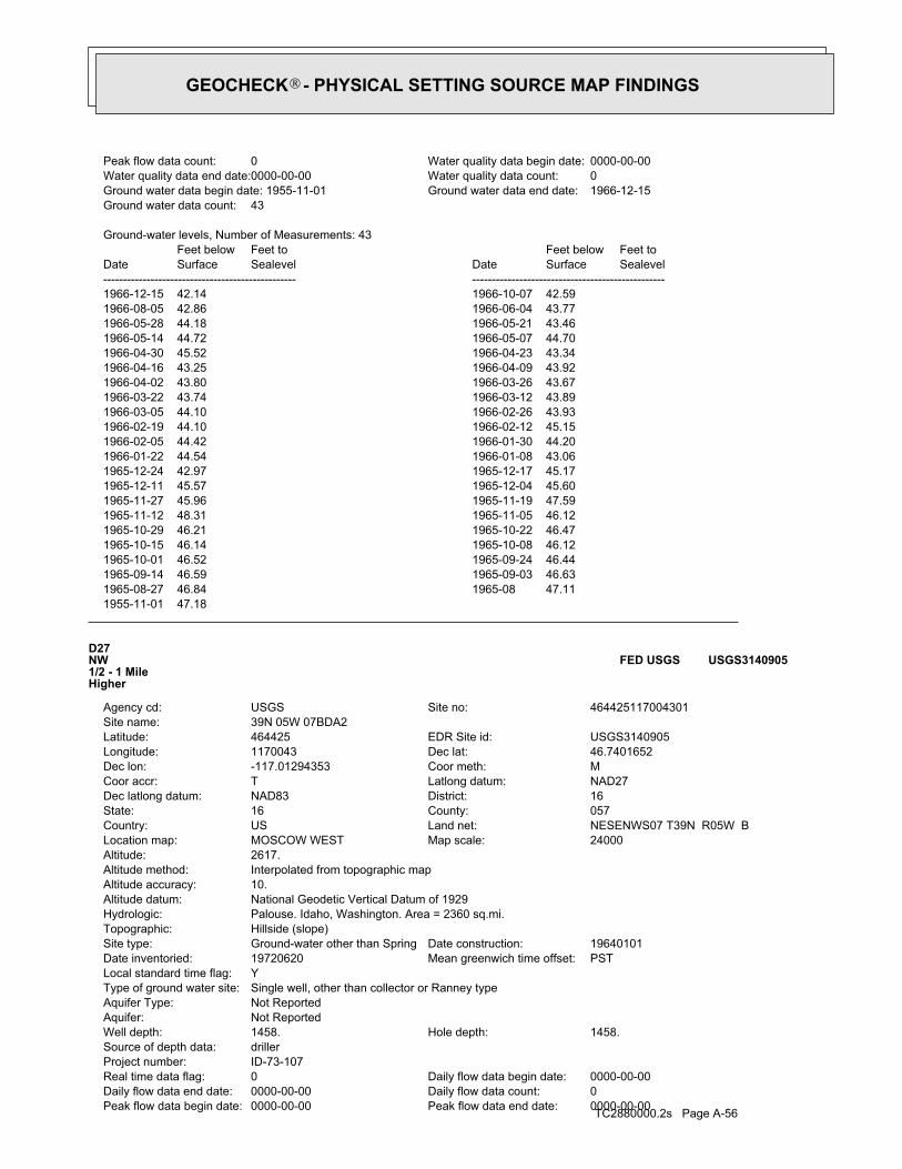
TC2880000.2s Page A-560000-00-00Peak flow data end date:0000-00-00Peak flow data begin date:0Daily flow data count:0000-00-00Daily flow data end date:0000-00-00Daily flow data begin date:0Real time data flag:
ID-73-107Project number:drillerSource of depth data:
1458.Hole depth:1458.Well depth:Not ReportedAquifer:Not ReportedAquifer Type:Single well, other than collector or Ranney typeType of ground water site:YLocal standard time flag:
PSTMean greenwich time offset:19720620Date inventoried:19640101Date construction:Ground-water other than SpringSite type:
Hillside (slope)Topographic:Palouse. Idaho, Washington. Area = 2360 sq.mi.Hydrologic:National Geodetic Vertical Datum of 1929Altitude datum:10.Altitude accuracy:Interpolated from topographic mapAltitude method:2617.Altitude:
24000Map scale:MOSCOW WESTLocation map:NESENWS07 T39N R05W BLand net:USCountry:057County:16State:16District:NAD83Dec latlong datum:NAD27Latlong datum:TCoor accr:MCoor meth:-117.01294353Dec lon:46.7401652Dec lat:1170043Longitude:USGS3140905EDR Site id:464425Latitude:
39N 05W 07BDA2Site name:464425117004301Site no:USGSAgency cd:
D27NW1/2 - 1 MileHigher
USGS3140905FED USGS
1955-11-01 47.181965-08-27 46.84 1965-08 47.111965-09-14 46.59 1965-09-03 46.631965-10-01 46.52 1965-09-24 46.441965-10-15 46.14 1965-10-08 46.121965-10-29 46.21 1965-10-22 46.471965-11-12 48.31 1965-11-05 46.121965-11-27 45.96 1965-11-19 47.591965-12-11 45.57 1965-12-04 45.601965-12-24 42.97 1965-12-17 45.171966-01-22 44.54 1966-01-08 43.061966-02-05 44.42 1966-01-30 44.201966-02-19 44.10 1966-02-12 45.151966-03-05 44.10 1966-02-26 43.931966-03-22 43.74 1966-03-12 43.891966-04-02 43.80 1966-03-26 43.671966-04-16 43.25 1966-04-09 43.921966-04-30 45.52 1966-04-23 43.341966-05-14 44.72 1966-05-07 44.701966-05-28 44.18 1966-05-21 43.461966-08-05 42.86 1966-06-04 43.771966-12-15 42.14 1966-10-07 42.59
DateFeet belowSurface
Feet toSealevel
-------------------------------------------------Date
Feet belowSurface
Feet toSealevel
-------------------------------------------------
Ground-water levels, Number of Measurements: 43
43Ground water data count:1966-12-15Ground water data end date:Ground water data begin date: 1955-11-010Water quality data count:0000-00-00Water quality data end date:0000-00-00Water quality data begin date:0Peak flow data count:
GEOCHECK - PHYSICAL SETTING SOURCE MAP FINDINGS®

TC2880000.2s Page A-57
D28NW1/2 - 1 MileHigher
USGS3140906FED USGS
1965-03-21 308.05 1964-12-11 3201965-04-02 307.46 1965-03-26 307.531965-04-16 307.82 1965-04-13 307.251965-08 325 1965-07 3261965-10 326 1965-09 3261965-12 326 1965-11 3271966-02 327 1966-01 3271966-04 328 1966-03 3261966-06 325 1966-05 3301966-08 318 1966-07 3201966-10 321 1966-09 3211966-12 319 1966-11 3201967-02 326 1967-01 3281967-04 324 1967-03 3271967-06 328 1967-05 3261967-08 337 1967-07-24 3521967-10 320 1967-09 3241967-12 313 1967-11 3041968-02 312 1968-01 3231968-04 318 1968-03 3181968-08 320 1968-05-28 3061968-10-27 320 1968-09 3211968-12-11 320 1968-11 3201969-05-11 315 1969-04 3201969-07-29 335 1969-06 3151969-09 320 1969-08 3251969-11-29 315 1969-10-27 3201970-01 325 1969-12 3221970-04-27 320 1970-03 3201970-06 325 1970-05-22 3251970-08-29 335 1970-07 3301970-10 330 1970-09-20 3251970-12 340 1970-11-25 335 Note: The site was being pumped.1972-06-20 388.50 Note: The site was being pumped.1972-07-27 388.37 Note: The site had been pumped recently.1973-03-22 339.51
DateFeet belowSurface
Feet toSealevel
-------------------------------------------------Date
Feet belowSurface
Feet toSealevel
-------------------------------------------------
Ground-water levels, Number of Measurements: 69
69Ground water data count:1973-03-22Ground water data end date:Ground water data begin date: 1964-12-112Water quality data count:2000-08-10Water quality data end date:2000-08-10Water quality data begin date:0Peak flow data count:
GEOCHECK - PHYSICAL SETTING SOURCE MAP FINDINGS®

TC2880000.2s Page A-58
1966-05-10 216.86 1966-05-05 216.921966-05-20 216.89 1966-05-15 216.931966-05-28 217.00 1966-05-25 216.961966-06-15 217.02 1966-06-13 217.101966-06-25 217.10 1966-06-20 217.041966-07-05 217.28 1966-06-28 217.101966-07-15 217.28 1966-07-10 217.221966-07-25 217.32 1966-07-20 217.381966-08-04 217.42 1966-07-31 217.401966-09-10 217.33 1966-09-07 217.401966-09-20 217.50 1966-09-15 217.431966-09-30 217.54 1966-09-25 217.451966-10-10 217.50 1966-10-05 217.541966-10-15 217.60 1966-10-14 217.621966-10-25 217.50 1966-10-20 217.411966-11-05 217.35 1966-10-31 217.611966-11-15 217.37 1966-11-10 217.381966-11-25 217.30 1966-11-20 217.241966-12-04 217.16 1966-11-30 217.301966-12-20 217.13 1966-12-15 217.241966-12-31 217.13 1966-12-25 217.131973-07-27 101.67 1972-06-20 118.15
DateFeet belowSurface
Feet toSealevel
-------------------------------------------------Date
Feet belowSurface
Feet toSealevel
-------------------------------------------------
Ground-water levels, Number of Measurements: 217
217Ground water data count:1973-07-27Ground water data end date:Ground water data begin date: 1963-11-013Water quality data count:1996-09-10Water quality data end date:1992-08-19Water quality data begin date:0Peak flow data count:0000-00-00Peak flow data end date:0000-00-00Peak flow data begin date:0Daily flow data count:0000-00-00Daily flow data end date:0000-00-00Daily flow data begin date:0Real time data flag:
ID-73-107Project number:drillerSource of depth data:
667.Hole depth:667.Well depth:Not ReportedAquifer:Not ReportedAquifer Type:Single well, other than collector or Ranney typeType of ground water site:YLocal standard time flag:
PSTMean greenwich time offset:19720620Date inventoried:19620101Date construction:Ground-water other than SpringSite type:
Hillside (slope)Topographic:Palouse. Idaho, Washington. Area = 2360 sq.mi.Hydrologic:National Geodetic Vertical Datum of 1929Altitude datum:10.Altitude accuracy:Interpolated from topographic mapAltitude method:2614.Altitude:
24000Map scale:MOSCOW WESTLocation map:NESENWS07 T39N R05W BLand net:USCountry:057County:16State:16District:NAD83Dec latlong datum:NAD27Latlong datum:TCoor accr:MCoor meth:-117.01322131Dec lon:46.7401652Dec lat:1170044Longitude:USGS3140906EDR Site id:464425Latitude:
39N 05W 07BDA1Site name:464425117004401Site no:USGSAgency cd:
GEOCHECK - PHYSICAL SETTING SOURCE MAP FINDINGS®

TC2880000.2s Page A-59
1964-09-25 219.84 1964-09-20 219.881964-10-05 220.01 1964-09-30 219.901964-10-15 219.82 1964-10-10 219.851964-10-25 219.96 1964-10-20 219.981964-11-05 220.10 1964-10-31 219.961964-11-15 220.16 1964-11-10 219.881964-11-25 219.73 1964-11-20 220.081964-12-05 219.88 1964-11-30 219.761964-12-15 219.29 1964-12-10 219.511964-12-25 219.20 1964-12-20 219.321965-01-05 219.07 1964-12-31 219.181965-01-15 219.30 1965-01-10 219.501965-01-20 219.09 1965-01-17 219.311965-01-31 218.96 1965-01-25 219.001965-02-10 218.99 1965-02-05 218.801965-02-23 219.04 1965-02-15 219.021965-02-28 219.07 1965-02-25 219.001965-03-10 219.01 1965-03-05 219.021965-03-20 219.03 1965-03-15 218.971965-03-31 218.87 1965-03-25 218.901965-04-10 218.89 1965-04-05 218.871965-04-20 218.80 1965-04-15 218.781965-04-30 218.68 1965-04-26 218.781965-05-10 218.70 1965-05-05 218.621965-05-20 218.60 1965-05-15 218.611965-05-31 218.51 1965-05-25 218.611965-06-10 218.56 1965-06-05 218.541965-06-20 218.44 1965-06-15 218.531965-06-30 218.46 1965-06-25 218.401965-07-10 218.31 1965-07-05 218.451965-07-20 218.22 1965-07-15 218.281965-07-31 218.24 1965-07-25 218.181965-08-10 218.18 1965-08-05 218.221965-08-20 218.15 1965-08-15 218.191965-08-31 218.13 1965-08-25 218.081965-09-10 218.05 1965-09-05 218.051965-09-20 218.03 1965-09-15 218.031965-11-05 217.08 1965-09-22 218.021965-11-14 216.86 1965-11-10 216.981965-11-27 217.78 1965-11-15 216.891965-12-05 217.64 1965-11-30 217.691965-12-15 217.56 1965-12-10 217.541965-12-25 217.43 1965-12-20 217.481966-01-05 217.08 1965-12-31 217.251966-01-20 217.11 1966-01-15 217.201966-01-31 216.90 1966-01-25 217.011966-02-10 216.96 1966-02-05 216.981966-02-20 216.93 1966-02-15 216.961966-02-28 216.80 1966-02-25 216.821966-03-10 216.82 1966-03-05 216.921966-03-20 216.66 1966-03-15 216.721966-03-31 216.87 1966-03-25 216.821966-04-10 216.78 1966-04-05 216.851966-04-20 216.88 1966-04-15 216.941966-04-30 216.95 1966-04-25 216.91
DateFeet belowSurface
Feet toSealevel
-------------------------------------------------Date
Feet belowSurface
Feet toSealevel
-------------------------------------------------
Ground-water levels, continued.
GEOCHECK - PHYSICAL SETTING SOURCE MAP FINDINGS®

TC2880000.2s Page A-60
PSTMean greenwich time offset:Not ReportedDate inventoried:19510224Date construction:Ground-water other than SpringSite type:
UndulatingTopographic:Palouse. Idaho, Washington. Area = 2360 sq.mi.Hydrologic:National Geodetic Vertical Datum of 1929Altitude datum:10.Altitude accuracy:Interpolated from topographic mapAltitude method:2552.00Altitude:
24000Map scale:MOSCOW WESTLocation map:SWSESWS07 T39N R05W BLand net:USCountry:057County:16State:16District:NAD83Dec latlong datum:NAD27Latlong datum:SCoor accr:MCoor meth:-117.01738787Dec lon:46.73099841Dec lat:1170059Longitude:USGS3140873EDR Site id:464352Latitude:
39N 05W 07CDC1Site name:464352117005901Site no:USGSAgency cd:
29WSW1/2 - 1 MileLower
USGS3140873FED USGS
1963-11-01 218.101963-11-10 217.80 1963-11-05 217.831963-11-20 217.82 1963-11-15 217.741963-12-06 218.03 1963-11-23 217.971963-12-15 218.20 1963-12-10 218.051963-12-25 218.54 1963-12-20 218.311964-01-04 218.65 1963-12-31 218.551964-01-20 218.50 1964-01-16 218.591964-01-31 218.78 1964-01-25 218.671964-02-10 218.76 1964-02-05 218.901964-02-20 218.99 1964-02-15 218.751964-02-29 218.10 1964-02-25 218.721964-03-10 217.99 1964-03-05 218.021964-03-20 217.06 1964-03-15 217.201964-03-25 217.20 1964-03-22 217.001964-04-05 217.34 1964-03-31 217.261964-04-15 218.32 1964-04-10 218.011964-04-25 218.62 1964-04-20 218.561964-05-05 218.80 1964-04-30 218.811964-05-15 219.20 1964-05-11 219.241964-05-25 219.59 1964-05-20 219.281964-06-05 219.64 1964-05-31 219.591964-06-15 219.69 1964-06-10 219.501964-06-25 219.65 1964-06-22 219.851964-07-05 219.65 1964-06-30 219.841964-07-15 219.68 1964-07-10 219.861964-07-25 219.86 1964-07-20 219.781964-08-05 219.94 1964-07-31 219.801964-08-17 219.85 1964-08-10 219.941964-08-25 219.68 1964-08-20 219.851964-09-05 219.70 1964-08-31 219.701964-09-15 219.95 1964-09-10 219.81
DateFeet belowSurface
Feet toSealevel
-------------------------------------------------Date
Feet belowSurface
Feet toSealevel
-------------------------------------------------
Ground-water levels, continued.
GEOCHECK - PHYSICAL SETTING SOURCE MAP FINDINGS®

TC2880000.2s Page A-61
1958-08 91 1958-07 751958-10 93 1958-09 971958-12 89 1958-11 921959-01 89 1958-12-17 931959-03 89 1959-02 891959-06 89 1959-05 851959-08 104 1959-07 901959-10 87 1959-09 931960-01 81 1959-11 851960-03 89 1960-02 831960-05 88 1960-04 871960-07 102 1960-06 901960-09 84 1960-08 901960-11 87 1960-10 861961-01 83 1960-12 851961-04 75 1961-02 851961-06 73 1961-05 721961-08 85 1961-07 831961-10 85 1961-09 891961-12 77 1961-11 831962-02 75 1962-01 751962-04 73 1962-03 651962-06 75 1962-05 751962-08 85 1962-07 891962-10 97 1962-09 851962-12 91 1962-11 891963-02 83 1963-01 891963-04 79 1963-03 831963-06 81 1963-05 781963-08 85 1963-07 891963-10 97 1963-09 851964-07 69 1964-06 691964-09 75 1964-08 691964-11 97 1964-10 751965-08-27 88 1965-02 891988-11-21 38.02 1988-09-29 41.061989-03-27 37.88 1989-01-12 37.771989-07-10 38.45 1989-05-18 35.17 Note: The measurement was discontinued.1989-07-31
DateFeet belowSurface
Feet toSealevel
-------------------------------------------------Date
Feet belowSurface
Feet toSealevel
-------------------------------------------------
Ground-water levels, Number of Measurements: 103
103Ground water data count:1989-07-31Ground water data end date:Ground water data begin date: 1951-02-241Water quality data count:1955-03-29Water quality data end date:1955-03-29Water quality data begin date:0Peak flow data count:0000-00-00Peak flow data end date:0000-00-00Peak flow data begin date:0Daily flow data count:0000-00-00Daily flow data end date:0000-00-00Daily flow data begin date:0Real time data flag:
ID-73-107Project number:drillerSource of depth data:
355Hole depth:354Well depth:Not ReportedAquifer:Not ReportedAquifer Type:Single well, other than collector or Ranney typeType of ground water site:YLocal standard time flag:
GEOCHECK - PHYSICAL SETTING SOURCE MAP FINDINGS®

TC2880000.2s Page A-62
E31South1/2 - 1 MileHigher
ID6000000143187ID WELLS
ID6000000143188Site id:Not ReportedLink:Not ReportedQuad:
0Y:0X:Not ReportedElevation:
Not ReportedCompletion:Not ReportedWateruse2:Not ReportedWateruse:Not ReportedWellnumber:
http://www.idwr.idaho.gov/apps/appsWell/RelatedDocs.asp?WellID=280103Well url:QQDatasource:
03/26/1992Constructi:0Totaldepth:25Casingdept:0Casingdiam:8Surfacedia:99999Staticwate:0Production:MonitoringWelluse:Not ReportedSubdivisio:
Not ReportedBlock:Not ReportedLot:SWEET AVE - BETWEEN COLLEGEWelladdres:0Govlotnum:
NEQ:SEQq:Not ReportedQqq:18Sec:05WRange:39NTownship:
LATAHCountyname:87Basinnumbe:228Drillerlic:
PONDEROSA DRILLING & DEVELOPMENT INCDriller:TERAGRAPHICS ENVIRONMENTAL ENGINEERINGOwner:
Not ReportedMetaltagnu:747589Permitid:280103Wellid:80492Objectid:
E30South1/2 - 1 MileHigher
ID6000000143188ID WELLS
1952-05-13 52 1951-02-24 501953-09 83 1953-08 851955-08 85 1953-10 751955-10 90 1955-09 901956-01 78 1955-12 851956-07 75 1956-02 851956-09 80 1956-08 751957-08 81 1957-06 691957-10 79 1957-09 831957-12 78 1957-11 721958-02 70 1958-01-08 701958-04 68 1958-03 691958-06 77 1958-05 71
DateFeet belowSurface
Feet toSealevel
-------------------------------------------------Date
Feet belowSurface
Feet toSealevel
-------------------------------------------------
Ground-water levels, continued.
GEOCHECK - PHYSICAL SETTING SOURCE MAP FINDINGS®
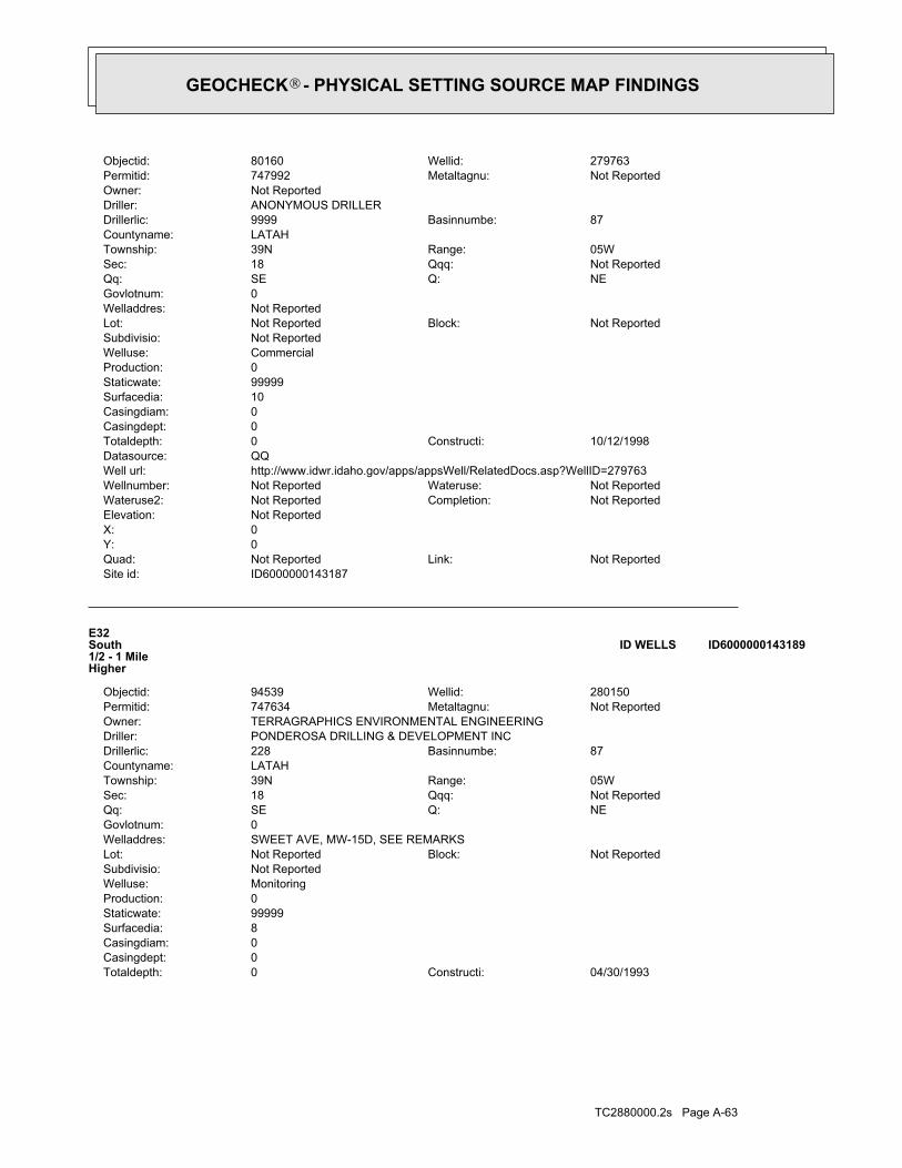
TC2880000.2s Page A-63
04/30/1993Constructi:0Totaldepth:0Casingdept:0Casingdiam:8Surfacedia:99999Staticwate:0Production:MonitoringWelluse:Not ReportedSubdivisio:
Not ReportedBlock:Not ReportedLot:SWEET AVE, MW-15D, SEE REMARKSWelladdres:0Govlotnum:
NEQ:SEQq:Not ReportedQqq:18Sec:05WRange:39NTownship:
LATAHCountyname:87Basinnumbe:228Drillerlic:
PONDEROSA DRILLING & DEVELOPMENT INCDriller:TERRAGRAPHICS ENVIRONMENTAL ENGINEERINGOwner:
Not ReportedMetaltagnu:747634Permitid:280150Wellid:94539Objectid:
E32South1/2 - 1 MileHigher
ID6000000143189ID WELLS
ID6000000143187Site id:Not ReportedLink:Not ReportedQuad:
0Y:0X:Not ReportedElevation:
Not ReportedCompletion:Not ReportedWateruse2:Not ReportedWateruse:Not ReportedWellnumber:
http://www.idwr.idaho.gov/apps/appsWell/RelatedDocs.asp?WellID=279763Well url:QQDatasource:
10/12/1998Constructi:0Totaldepth:0Casingdept:0Casingdiam:10Surfacedia:99999Staticwate:0Production:CommercialWelluse:Not ReportedSubdivisio:
Not ReportedBlock:Not ReportedLot:Not ReportedWelladdres:0Govlotnum:
NEQ:SEQq:Not ReportedQqq:18Sec:05WRange:39NTownship:
LATAHCountyname:87Basinnumbe:9999Drillerlic:
ANONYMOUS DRILLERDriller:Not ReportedOwner:
Not ReportedMetaltagnu:747992Permitid:279763Wellid:80160Objectid:
GEOCHECK - PHYSICAL SETTING SOURCE MAP FINDINGS®

TC2880000.2s Page A-64
0Govlotnum:NEQ:SEQq:Not ReportedQqq:18Sec:05WRange:39NTownship:
LATAHCountyname:87Basinnumbe:228Drillerlic:
PONDEROSA DRILLING & DEVELOPMENT INCDriller:GRITMAN CONSTRUCTION COOwner:
Not ReportedMetaltagnu:747634Permitid:280150Wellid:94540Objectid:
E34South1/2 - 1 MileHigher
ID6000000143190ID WELLS
ID6000000143191Site id:Not ReportedLink:Not ReportedQuad:
0Y:0X:Not ReportedElevation:
Not ReportedCompletion:Not ReportedWateruse2:Not ReportedWateruse:Not ReportedWellnumber:
http://www.idwr.idaho.gov/apps/appsWell/RelatedDocs.asp?WellID=280151Well url:QQDatasource:
05/01/1993Constructi:0Totaldepth:0Casingdept:0Casingdiam:8Surfacedia:99999Staticwate:0Production:MonitoringWelluse:Not ReportedSubdivisio:
Not ReportedBlock:Not ReportedLot:SWEET AVE, SEE REMARKS, MW-16DWelladdres:0Govlotnum:
NEQ:SEQq:Not ReportedQqq:18Sec:05WRange:39NTownship:
LATAHCountyname:87Basinnumbe:228Drillerlic:
PONDEROSA DRILLING & DEVELOPMENT INCDriller:TERRAGRAPHICS ENVIRONMENTAL ENGINEERINGOwner:
Not ReportedMetaltagnu:747635Permitid:280151Wellid:94541Objectid:
E33South1/2 - 1 MileHigher
ID6000000143191ID WELLS
ID6000000143189Site id:Not ReportedLink:Not ReportedQuad:
0Y:0X:Not ReportedElevation:
Not ReportedCompletion:Not ReportedWateruse2:Not ReportedWateruse:Not ReportedWellnumber:
http://www.idwr.idaho.gov/apps/appsWell/RelatedDocs.asp?WellID=280150Well url:QQDatasource:
GEOCHECK - PHYSICAL SETTING SOURCE MAP FINDINGS®
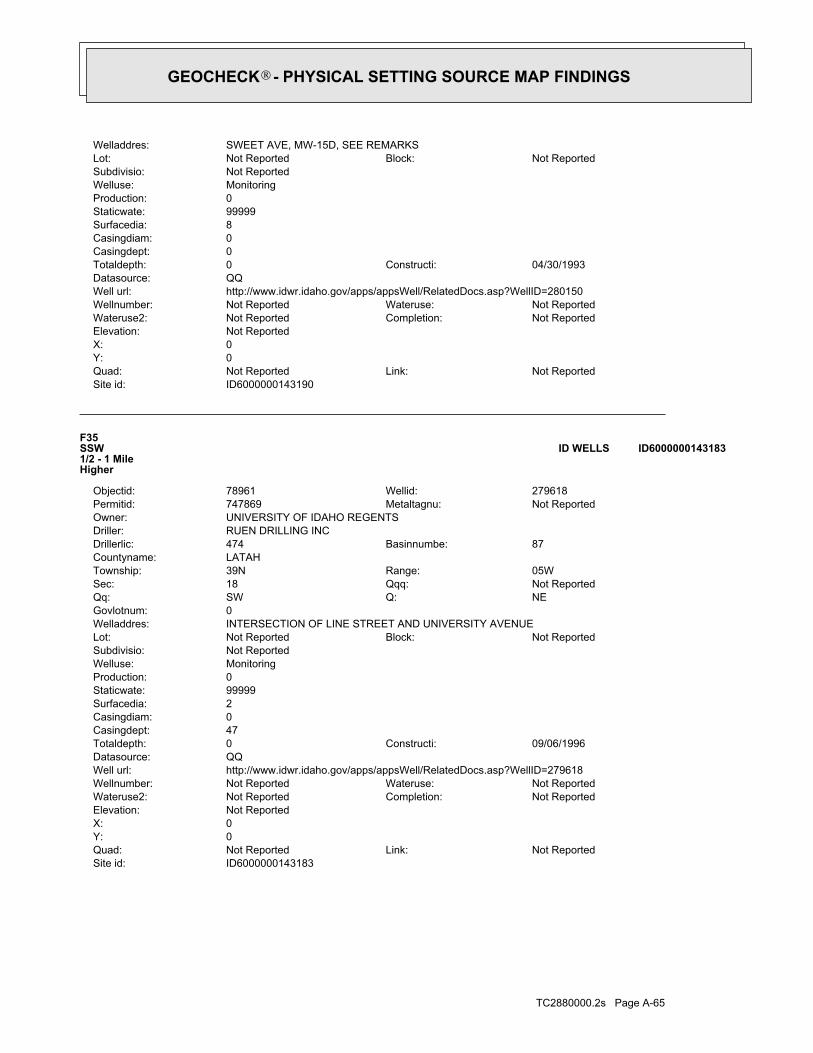
TC2880000.2s Page A-65
ID6000000143183Site id:Not ReportedLink:Not ReportedQuad:
0Y:0X:Not ReportedElevation:
Not ReportedCompletion:Not ReportedWateruse2:Not ReportedWateruse:Not ReportedWellnumber:
http://www.idwr.idaho.gov/apps/appsWell/RelatedDocs.asp?WellID=279618Well url:QQDatasource:
09/06/1996Constructi:0Totaldepth:47Casingdept:0Casingdiam:2Surfacedia:99999Staticwate:0Production:MonitoringWelluse:Not ReportedSubdivisio:
Not ReportedBlock:Not ReportedLot:INTERSECTION OF LINE STREET AND UNIVERSITY AVENUEWelladdres:0Govlotnum:
NEQ:SWQq:Not ReportedQqq:18Sec:05WRange:39NTownship:
LATAHCountyname:87Basinnumbe:474Drillerlic:
RUEN DRILLING INCDriller:UNIVERSITY OF IDAHO REGENTSOwner:
Not ReportedMetaltagnu:747869Permitid:279618Wellid:78961Objectid:
F35SSW1/2 - 1 MileHigher
ID6000000143183ID WELLS
ID6000000143190Site id:Not ReportedLink:Not ReportedQuad:
0Y:0X:Not ReportedElevation:
Not ReportedCompletion:Not ReportedWateruse2:Not ReportedWateruse:Not ReportedWellnumber:
http://www.idwr.idaho.gov/apps/appsWell/RelatedDocs.asp?WellID=280150Well url:QQDatasource:
04/30/1993Constructi:0Totaldepth:0Casingdept:0Casingdiam:8Surfacedia:99999Staticwate:0Production:MonitoringWelluse:Not ReportedSubdivisio:
Not ReportedBlock:Not ReportedLot:SWEET AVE, MW-15D, SEE REMARKSWelladdres:
GEOCHECK - PHYSICAL SETTING SOURCE MAP FINDINGS®

TC2880000.2s Page A-66
09/07/1996Constructi:0Totaldepth:25Casingdept:0Casingdiam:2Surfacedia:99999Staticwate:0Production:MonitoringWelluse:Not ReportedSubdivisio:
Not ReportedBlock:Not ReportedLot:INTERSECTION OF LINE STREET AND UNIVERSITY AVENUEWelladdres:0Govlotnum:
NEQ:SWQq:Not ReportedQqq:18Sec:05WRange:39NTownship:
LATAHCountyname:87Basinnumbe:474Drillerlic:
RUEN DRILLING INCDriller:UNIVERSITY OF IDAHO REGENTSOwner:
Not ReportedMetaltagnu:747870Permitid:279619Wellid:78980Objectid:
F37SSW1/2 - 1 MileHigher
ID6000000143185ID WELLS
ID6000000143182Site id:Not ReportedLink:Not ReportedQuad:
0Y:0X:Not ReportedElevation:
Not ReportedCompletion:Not ReportedWateruse2:Not ReportedWateruse:Not ReportedWellnumber:
http://www.idwr.idaho.gov/apps/appsWell/RelatedDocs.asp?WellID=279616Well url:QQDatasource:
09/04/1996Constructi:0Totaldepth:38Casingdept:0Casingdiam:2Surfacedia:99999Staticwate:0Production:MonitoringWelluse:Not ReportedSubdivisio:
Not ReportedBlock:Not ReportedLot:INTERSECTION OF LINE STREET AND UNIVERSITY AVENUEWelladdres:0Govlotnum:
NEQ:SWQq:Not ReportedQqq:18Sec:05WRange:39NTownship:
LATAHCountyname:87Basinnumbe:474Drillerlic:
RUEN DRILLING INCDriller:UNIVERSITY OF IDAHO REGENTSOwner:
Not ReportedMetaltagnu:747867Permitid:279616Wellid:78960Objectid:
F36SSW1/2 - 1 MileHigher
ID6000000143182ID WELLS
Map IDDirectionDistanceElevation EDR ID NumberDatabase
GEOCHECK - PHYSICAL SETTING SOURCE MAP FINDINGS®

TC2880000.2s Page A-67
0Govlotnum:SWQ:SWQq:Not ReportedQqq:7Sec:05WRange:39NTownship:
LATAHCountyname:87Basinnumbe:485Drillerlic:
ENVIRONMENTAL WEST EXPLORATION INCDriller:BUDGET OIL COOwner:
Not ReportedMetaltagnu:747620Permitid:280136Wellid:80502Objectid:
39WSW1/2 - 1 MileLower
ID6000000143331ID WELLS
ID6000000143184Site id:Not ReportedLink:Not ReportedQuad:
0Y:0X:Not ReportedElevation:
Not ReportedCompletion:Not ReportedWateruse2:Not ReportedWateruse:Not ReportedWellnumber:
http://www.idwr.idaho.gov/apps/appsWell/RelatedDocs.asp?WellID=279617Well url:QQDatasource:
09/05/1996Constructi:0Totaldepth:50Casingdept:0Casingdiam:2Surfacedia:99999Staticwate:0Production:MonitoringWelluse:Not ReportedSubdivisio:
Not ReportedBlock:Not ReportedLot:INTERSECTION OF LINE STREET AND UNIVERSITY AVENUEWelladdres:0Govlotnum:
NEQ:SWQq:Not ReportedQqq:18Sec:05WRange:39NTownship:
LATAHCountyname:87Basinnumbe:474Drillerlic:
RUEN DRILLING INCDriller:UNIVERSITY OF IDAHO REGENTSOwner:
Not ReportedMetaltagnu:747868Permitid:279617Wellid:78979Objectid:
F38SSW1/2 - 1 MileHigher
ID6000000143184ID WELLS
ID6000000143185Site id:Not ReportedLink:Not ReportedQuad:
0Y:0X:Not ReportedElevation:
Not ReportedCompletion:Not ReportedWateruse2:Not ReportedWateruse:Not ReportedWellnumber:
http://www.idwr.idaho.gov/apps/appsWell/RelatedDocs.asp?WellID=279619Well url:QQDatasource:
GEOCHECK - PHYSICAL SETTING SOURCE MAP FINDINGS®

TC2880000.2s Page A-68
103Ground water data count:1969-05-00Ground water data end date:Ground water data begin date: 1960-04-270Water quality data count:0000-00-00Water quality data end date:0000-00-00Water quality data begin date:0Peak flow data count:0000-00-00Peak flow data end date:0000-00-00Peak flow data begin date:0Daily flow data count:0000-00-00Daily flow data end date:0000-00-00Daily flow data begin date:0Real time data flag:
ID-73-107Project number:Not ReportedSource of depth data:
1305Hole depth:1305Well depth:Not ReportedAquifer:Not ReportedAquifer Type:Single well, other than collector or Ranney typeType of ground water site:YLocal standard time flag:
PSTMean greenwich time offset:Not ReportedDate inventoried:19551020Date construction:Ground-water other than SpringSite type:
UndulatingTopographic:Palouse. Idaho, Washington. Area = 2360 sq.mi.Hydrologic:National Geodetic Vertical Datum of 1929Altitude datum:10.Altitude accuracy:Interpolated from topographic mapAltitude method:2588.00Altitude:
24000Map scale:MOSCOW EASTLocation map:NWSENWS08 T39N R05W BLand net:USCountry:057County:16State:16District:NAD83Dec latlong datum:NAD27Latlong datum:SCoor accr:MCoor meth:-116.99544295Dec lon:46.74072098Dec lat:1165940Longitude:USGS3140907EDR Site id:464427Latitude:
39N 05W 08BDB1Site name:464427116594001Site no:USGSAgency cd:
40NE1/2 - 1 MileHigher
USGS3140907FED USGS
ID6000000143331Site id:Not ReportedLink:Not ReportedQuad:
0Y:0X:Not ReportedElevation:
Not ReportedCompletion:Not ReportedWateruse2:Not ReportedWateruse:Not ReportedWellnumber:
http://www.idwr.idaho.gov/apps/appsWell/RelatedDocs.asp?WellID=280136Well url:QQDatasource:
08/19/1992Constructi:0Totaldepth:0Casingdept:0Casingdiam:0Surfacedia:0Staticwate:0Production:MonitoringWelluse:Not ReportedSubdivisio:
Not ReportedBlock:Not ReportedLot:1436 PULLMAN RD.Welladdres:
GEOCHECK - PHYSICAL SETTING SOURCE MAP FINDINGS®

TC2880000.2s Page A-69
1964-07 287 1964-07 2871964-08 287 1964-08 2871964-09 287 1964-09 2871964-10 287 1964-10 2871964-11 287 1964-11 2871964-12 287 1964-12 2871965-01 287 1965-01 2871965-02 287 1965-02 2871965-03 287 1965-03 2871965-04 287 1965-04 2871965-05 287 1965-05 2871965-06 287 1965-06 2871965-07 289 1965-07 2891965-08 288 1965-08 2881965-09 287 1965-09 2871965-10 287 1965-10 2871965-11 289 1965-11 2891965-12 287 1965-12 2871966-01 287 1966-01 2871966-02 287 1966-02 2871966-03 287 1966-03 2871966-04 287 1966-04 2871966-05 288 1966-05 2881966-06 289 1966-06 2891966-07 289 1966-07 2891966-08 297 1966-08 2971966-09 292 1966-09 2921966-10 291 1966-10 2911966-11 291 1966-11 2911966-12 289 1966-12 2891967-01 289.20 1967-01 289.201967-05-31 292 1967-05-31 2921967-06-29 296 1967-06-29 2961967-07-26 309 1967-07-26 3091967-08-31 304 1967-08-31 3041967-09-30 302 1967-09-30 3021967-10-31 304 1967-10-31 3041967-11 281 1967-11 2811967-12 280 1967-12 2801968-01 280 1968-01 2801968-02 281 1968-02 2811968-03 283 1968-03 2831968-05-26 315 1968-05-26 3151968-06 276 1968-06 2761968-07-23 282 1968-07-23 2821968-08 283 1968-08 2831968-09-29 287 1968-09-29 2871968-10 290 1968-10 2901968-11 282 1968-11 2821968-12 285 1968-12 2851969-01 300 1969-01 3001969-02 300 1969-02 3001969-03 315 1969-03 3151969-04 285 1969-04 2851969-05 280 1969-05 280
DateFeet belowSurface
Feet toSealevel
-------------------------------------------------Date
Feet belowSurface
Feet toSealevel
-------------------------------------------------
Ground-water levels, Number of Measurements: 206
GEOCHECK - PHYSICAL SETTING SOURCE MAP FINDINGS®

TC2880000.2s Page A-70
G41ENE1/2 - 1 MileHigher
ID6000000143445ID WELLS
1960-04-27 287 1960-04-27 2871960-08 284 1960-08 2841960-09 284 1960-09 2841960-10 285 1960-10 2851960-11 286 1960-11 2861960-12 287 1960-12 2871961-01 287 1961-01 2871961-02 287 1961-02 2871961-03 288 1961-03 2881961-04 288 1961-04 2881961-05 287 1961-05 2871961-06 285 1961-06 2851961-07 286 1961-07 2861961-08 286 1961-08 2861961-09 285 1961-09 2851961-10 285 1961-10 2851961-11 284 1961-11 2841961-12 285 1961-12 2851962-01 285 1962-01 2851962-02 285 1962-02 2851962-03 285 1962-03 2851962-04 285 1962-04 2851962-05 285 1962-05 2851962-06 285 1962-06 2851962-07 287 1962-07 2871962-08 286 1962-08 2861962-09 286 1962-09 2861962-10 285 1962-10 2851962-11 285 1962-11 2851962-12 285 1962-12 2851963-01 285 1963-01 2851963-02 286 1963-02 2861963-03 286 1963-03 2861963-04 286 1963-04 2861963-05 286 1963-05 2861963-06 286 1963-06 2861963-07 288 1963-07 2881963-08 288 1963-08 2881963-09 287 1963-09 2871963-10 287 1963-10 2871963-11 287 1963-11 2871963-12 287 1963-12 2871964-01 287 1964-01 2871964-02 287 1964-02 2871964-03 287 1964-03 2871964-04 287 1964-04 2871964-05 287 1964-05 2871964-06 287 1964-06 287
DateFeet belowSurface
Feet toSealevel
-------------------------------------------------Date
Feet belowSurface
Feet toSealevel
-------------------------------------------------
Ground-water levels, continued.
GEOCHECK - PHYSICAL SETTING SOURCE MAP FINDINGS®

TC2880000.2s Page A-71
05/25/1960Constructi:0Totaldepth:905Casingdept:0Casingdiam:14Surfacedia:275Staticwate:1150Production:MunicipalWelluse:Not ReportedSubdivisio:
Not ReportedBlock:Not ReportedLot:Not ReportedWelladdres:0Govlotnum:
NWQ:SEQq:Not ReportedQqq:8Sec:05WRange:39NTownship:
LATAHCountyname:87Basinnumbe:47Drillerlic:
ENGLEMAN WELL DRILLINGDriller:CITY OF MOSCOWOwner:
Not ReportedMetaltagnu:746965Permitid:280256Wellid:80722Objectid:
G42ENE1/2 - 1 MileHigher
ID6000000143446ID WELLS
ID6000000143445Site id:Not ReportedLink:Not ReportedQuad:
0Y:0X:Not ReportedElevation:
Not ReportedCompletion:Not ReportedWateruse2:Not ReportedWateruse:Not ReportedWellnumber:
http://www.idwr.idaho.gov/apps/appsWell/RelatedDocs.asp?WellID=279761Well url:QQDatasource:
10/12/1998Constructi:0Totaldepth:40Casingdept:0Casingdiam:10Surfacedia:69Staticwate:99999Production:Cathodic ProtectionWelluse:Not ReportedSubdivisio:
Not ReportedBlock:Not ReportedLot:8" WAIVER - MAIN STREET & THIRDWelladdres:0Govlotnum:
NWQ:SEQq:Not ReportedQqq:8Sec:05WRange:39NTownship:
LATAHCountyname:87Basinnumbe:545Drillerlic:
STUIVENGA VESSEY DRILLINGDriller:PREMIER CATHODIC PROTECTIONOwner:
D0005470Metaltagnu:747990Permitid:279761Wellid:80159Objectid:
GEOCHECK - PHYSICAL SETTING SOURCE MAP FINDINGS®

TC2880000.2s Page A-72
0Govlotnum:NWQ:SWQq:Not ReportedQqq:7Sec:05WRange:39NTownship:
LATAHCountyname:87Basinnumbe:61Drillerlic:
CHARLES JUNGMANN DRILLING CODriller:UNIVERSITY OF IDAHO REGENTSOwner:
Not ReportedMetaltagnu:746974Permitid:280265Wellid:80736Objectid:
44WNW1/2 - 1 MileHigher
ID6000000143436ID WELLS
ID6000000143447Site id:Not ReportedLink:Not ReportedQuad:
0Y:0X:Not ReportedElevation:
Not ReportedCompletion:Not ReportedWateruse2:Not ReportedWateruse:Not ReportedWellnumber:
http://www.idwr.idaho.gov/apps/appsWell/RelatedDocs.asp?WellID=280255Well url:QQDatasource:
12/20/1956Constructi:0Totaldepth:14Casingdept:0Casingdiam:28Surfacedia:110Staticwate:2000Production:MunicipalWelluse:Not ReportedSubdivisio:
Not ReportedBlock:Not ReportedLot:Not ReportedWelladdres:0Govlotnum:
NWQ:SEQq:Not ReportedQqq:8Sec:05WRange:39NTownship:
LATAHCountyname:87Basinnumbe:9999Drillerlic:
ANONYMOUS DRILLERDriller:CITY OF MOSCOWOwner:
Not ReportedMetaltagnu:746964Permitid:280255Wellid:80734Objectid:
G43ENE1/2 - 1 MileHigher
ID6000000143447ID WELLS
ID6000000143446Site id:Not ReportedLink:Not ReportedQuad:
0Y:0X:Not ReportedElevation:
Not ReportedCompletion:Not ReportedWateruse2:Not ReportedWateruse:Not ReportedWellnumber:
http://www.idwr.idaho.gov/apps/appsWell/RelatedDocs.asp?WellID=280256Well url:QQDatasource:
GEOCHECK - PHYSICAL SETTING SOURCE MAP FINDINGS®

TC2880000.2s Page A-73
ID6000000143411Site id:Not ReportedLink:Not ReportedQuad:
0Y:0X:Not ReportedElevation:
Not ReportedCompletion:Not ReportedWateruse2:Not ReportedWateruse:Not ReportedWellnumber:
http://www.idwr.idaho.gov/apps/appsWell/RelatedDocs.asp?WellID=280312Well url:QQDatasource:
07/12/1968Constructi:0Totaldepth:98Casingdept:0Casingdiam:8Surfacedia:30Staticwate:10Production:Domestic-Single ResidenceWelluse:Not ReportedSubdivisio:
Not ReportedBlock:Not ReportedLot:Not ReportedWelladdres:0Govlotnum:
NEQ:Not ReportedQq:Not ReportedQqq:8Sec:05WRange:39NTownship:
LATAHCountyname:87Basinnumbe:13Drillerlic:
ALVA E SPRAY WELL DRILLINGDriller:JOHN NUTTERVILLEOwner:
Not ReportedMetaltagnu:747021Permitid:280312Wellid:88815Objectid:
H45ENE1/2 - 1 MileHigher
ID6000000143411ID WELLS
ID6000000143436Site id:Not ReportedLink:Not ReportedQuad:
0Y:0X:Not ReportedElevation:
Not ReportedCompletion:Not ReportedWateruse2:Not ReportedWateruse:Not ReportedWellnumber:
http://www.idwr.idaho.gov/apps/appsWell/RelatedDocs.asp?WellID=280265Well url:QQDatasource:
09/14/1963Constructi:0Totaldepth:101Casingdept:0Casingdiam:24Surfacedia:256Staticwate:2400Production:Domestic-Single ResidenceWelluse:Not ReportedSubdivisio:
Not ReportedBlock:Not ReportedLot:Not ReportedWelladdres:
GEOCHECK - PHYSICAL SETTING SOURCE MAP FINDINGS®

TC2880000.2s Page A-74
03/08/2000Constructi:30Totaldepth:-28Casingdept:2Casingdiam:8Surfacedia:16Staticwate:0Production:MonitoringWelluse:Not ReportedSubdivisio:
Not ReportedBlock:Not ReportedLot:UNIVERSITY OF ID GOLF COURSEWelladdres:0Govlotnum:
NWQ:SEQq:Not ReportedQqq:18Sec:05WRange:39NTownship:
LATAHCountyname:87Basinnumbe:474Drillerlic:
RUEN DRILLING INCDriller:UNIVERSITY OF IDAHO REGENTSOwner:
D0010341Metaltagnu:763468Permitid:335464Wellid:55769Objectid:
I47SSW1/2 - 1 MileHigher
ID6000000143174ID WELLS
ID6000000143412Site id:Not ReportedLink:Not ReportedQuad:
0Y:0X:Not ReportedElevation:
Not ReportedCompletion:Not ReportedWateruse2:Not ReportedWateruse:Not ReportedWellnumber:
http://www.idwr.idaho.gov/apps/appsWell/RelatedDocs.asp?WellID=280312Well url:QQDatasource:
07/12/1968Constructi:0Totaldepth:98Casingdept:0Casingdiam:8Surfacedia:30Staticwate:10Production:Domestic-Single ResidenceWelluse:Not ReportedSubdivisio:
Not ReportedBlock:Not ReportedLot:Not ReportedWelladdres:0Govlotnum:
NEQ:Not ReportedQq:Not ReportedQqq:8Sec:05WRange:39NTownship:
LATAHCountyname:87Basinnumbe:13Drillerlic:
ALVA E SPRAY WELL DRILLINGDriller:FRANK HALVERSONOwner:
Not ReportedMetaltagnu:747021Permitid:280312Wellid:88816Objectid:
H46ENE1/2 - 1 MileHigher
ID6000000143412ID WELLS
Map IDDirectionDistanceElevation EDR ID NumberDatabase
GEOCHECK - PHYSICAL SETTING SOURCE MAP FINDINGS®

TC2880000.2s Page A-75
0Govlotnum:NWQ:SEQq:Not ReportedQqq:18Sec:05WRange:39NTownship:
LATAHCountyname:87Basinnumbe:474Drillerlic:
RUEN DRILLING INCDriller:PETROLEUM STORAGE TANK FUNDOwner:
D0010340Metaltagnu:763466Permitid:335462Wellid:55526Objectid:
I49SSW1/2 - 1 MileHigher
ID6000000143172ID WELLS
ID6000000143175Site id:Not ReportedLink:Not ReportedQuad:
0Y:0X:Not ReportedElevation:
Not ReportedCompletion:Not ReportedWateruse2:Not ReportedWateruse:Not ReportedWellnumber:
http://www.idwr.idaho.gov/apps/appsWell/RelatedDocs.asp?WellID=335465Well url:QQDatasource:
03/07/2000Constructi:25Totaldepth:-10Casingdept:2Casingdiam:2Surfacedia:16Staticwate:0Production:MonitoringWelluse:Not ReportedSubdivisio:
Not ReportedBlock:Not ReportedLot:UNIVERSITY OF ID GOLF COURSEWelladdres:0Govlotnum:
NWQ:SEQq:Not ReportedQqq:18Sec:05WRange:39NTownship:
LATAHCountyname:87Basinnumbe:474Drillerlic:
RUEN DRILLING INCDriller:PETROLEUM STORAGE TANK FUNDOwner:
D0010342Metaltagnu:763469Permitid:335465Wellid:55770Objectid:
I48SSW1/2 - 1 MileHigher
ID6000000143175ID WELLS
ID6000000143174Site id:Not ReportedLink:Not ReportedQuad:
0Y:0X:Not ReportedElevation:
Not ReportedCompletion:Not ReportedWateruse2:Not ReportedWateruse:Not ReportedWellnumber:
http://www.idwr.idaho.gov/apps/appsWell/RelatedDocs.asp?WellID=335464Well url:QQDatasource:
GEOCHECK - PHYSICAL SETTING SOURCE MAP FINDINGS®

TC2880000.2s Page A-76
ID6000000143173Site id:Not ReportedLink:Not ReportedQuad:
0Y:0X:Not ReportedElevation:
Not ReportedCompletion:Not ReportedWateruse2:Not ReportedWateruse:Not ReportedWellnumber:
http://www.idwr.idaho.gov/apps/appsWell/RelatedDocs.asp?WellID=335464Well url:QQDatasource:
03/08/2000Constructi:30Totaldepth:-28Casingdept:2Casingdiam:8Surfacedia:16Staticwate:0Production:MonitoringWelluse:Not ReportedSubdivisio:
Not ReportedBlock:Not ReportedLot:UNIVERSITY OF ID GOLF COURSEWelladdres:0Govlotnum:
NWQ:SEQq:Not ReportedQqq:18Sec:05WRange:39NTownship:
LATAHCountyname:87Basinnumbe:474Drillerlic:
RUEN DRILLING INCDriller:PETROLEUM STORAGE TANK FUNDOwner:
D0010341Metaltagnu:763468Permitid:335464Wellid:55768Objectid:
I50SSW1/2 - 1 MileHigher
ID6000000143173ID WELLS
ID6000000143172Site id:Not ReportedLink:Not ReportedQuad:
0Y:0X:Not ReportedElevation:
Not ReportedCompletion:Not ReportedWateruse2:Not ReportedWateruse:Not ReportedWellnumber:
http://www.idwr.idaho.gov/apps/appsWell/RelatedDocs.asp?WellID=335462Well url:QQDatasource:
03/07/2000Constructi:35Totaldepth:5Casingdept:4Casingdiam:4Surfacedia:16Staticwate:0Production:MonitoringWelluse:Not ReportedSubdivisio:
Not ReportedBlock:Not ReportedLot:UNIVERSITY OF ID GOLF COURSEWelladdres:
GEOCHECK - PHYSICAL SETTING SOURCE MAP FINDINGS®

TC2880000.2s Page A-77
05/18/2001Constructi:25Totaldepth:10Casingdept:2Casingdiam:2Surfacedia:0Staticwate:0Production:MonitoringWelluse:Not ReportedSubdivisio:
Not ReportedBlock:Not ReportedLot:U OF I GOLF COURSE MAINT BLDG-ORIGINAL HOLE NO 10342Welladdres:0Govlotnum:
NWQ:SEQq:Not ReportedQqq:18Sec:05WRange:39NTownship:
LATAHCountyname:87Basinnumbe:554Drillerlic:
BORETEC INCDriller:UNIVERSITY OF IDAHO REGENTSOwner:
D0017229Metaltagnu:768943Permitid:340934Wellid:62667Objectid:
I52SSW1/2 - 1 MileHigher
ID6000000143179ID WELLS
ID6000000143178Site id:Not ReportedLink:Not ReportedQuad:
0Y:0X:Not ReportedElevation:
Not ReportedCompletion:Not ReportedWateruse2:Not ReportedWateruse:Not ReportedWellnumber:
http://www.idwr.idaho.gov/apps/appsWell/RelatedDocs.asp?WellID=340934Well url:QQDatasource:
05/18/2001Constructi:25Totaldepth:10Casingdept:2Casingdiam:2Surfacedia:0Staticwate:0Production:MonitoringWelluse:Not ReportedSubdivisio:
Not ReportedBlock:Not ReportedLot:U OF I GOLF COURSE MAINT BLDG-ORIGINAL HOLE NO 10342Welladdres:0Govlotnum:
NWQ:SEQq:Not ReportedQqq:18Sec:05WRange:39NTownship:
LATAHCountyname:87Basinnumbe:554Drillerlic:
BORETEC INCDriller:IDAHO PETROLEUM STORAGE TANK FUNDOwner:
D0017229Metaltagnu:768943Permitid:340934Wellid:62666Objectid:
I51SSW1/2 - 1 MileHigher
ID6000000143178ID WELLS
Map IDDirectionDistanceElevation EDR ID NumberDatabase
GEOCHECK - PHYSICAL SETTING SOURCE MAP FINDINGS®

TC2880000.2s Page A-78
0Govlotnum:NWQ:SEQq:Not ReportedQqq:18Sec:05WRange:39NTownship:
LATAHCountyname:87Basinnumbe:554Drillerlic:
BORETEC INCDriller:UNIVERSITY OF IDAHO REGENTSOwner:
D0017227Metaltagnu:768941Permitid:340932Wellid:62499Objectid:
I54SSW1/2 - 1 MileHigher
ID6000000143177ID WELLS
ID6000000143176Site id:Not ReportedLink:Not ReportedQuad:
0Y:0X:Not ReportedElevation:
Not ReportedCompletion:Not ReportedWateruse2:Not ReportedWateruse:Not ReportedWellnumber:
http://www.idwr.idaho.gov/apps/appsWell/RelatedDocs.asp?WellID=335465Well url:QQDatasource:
03/07/2000Constructi:25Totaldepth:-10Casingdept:2Casingdiam:2Surfacedia:16Staticwate:0Production:MonitoringWelluse:Not ReportedSubdivisio:
Not ReportedBlock:Not ReportedLot:UNIVERSITY OF ID GOLF COURSEWelladdres:0Govlotnum:
NWQ:SEQq:Not ReportedQqq:18Sec:05WRange:39NTownship:
LATAHCountyname:87Basinnumbe:474Drillerlic:
RUEN DRILLING INCDriller:UNIVERSITY OF IDAHO REGENTSOwner:
D0010342Metaltagnu:763469Permitid:335465Wellid:55771Objectid:
I53SSW1/2 - 1 MileHigher
ID6000000143176ID WELLS
ID6000000143179Site id:Not ReportedLink:Not ReportedQuad:
0Y:0X:Not ReportedElevation:
Not ReportedCompletion:Not ReportedWateruse2:Not ReportedWateruse:Not ReportedWellnumber:
http://www.idwr.idaho.gov/apps/appsWell/RelatedDocs.asp?WellID=340934Well url:QQDatasource:
GEOCHECK - PHYSICAL SETTING SOURCE MAP FINDINGS®

TC2880000.2s Page A-79
258Ground water data count:2000-09-11Ground water data end date:Ground water data begin date: 1963-09-050Water quality data count:0000-00-00Water quality data end date:0000-00-00Water quality data begin date:0Peak flow data count:0000-00-00Peak flow data end date:0000-00-00Peak flow data begin date:0Daily flow data count:0000-00-00Daily flow data end date:0000-00-00Daily flow data begin date:0Real time data flag:
ID-73-107Project number:Not ReportedSource of depth data:
1336Hole depth:1336Well depth:Not ReportedAquifer:Not ReportedAquifer Type:Single well, other than collector or Ranney typeType of ground water site:YLocal standard time flag:
PSTMean greenwich time offset:Not ReportedDate inventoried:19620509Date construction:Ground-water other than SpringSite type:
UndulatingTopographic:Palouse. Idaho, Washington. Area = 2360 sq.mi.Hydrologic:National Geodetic Vertical Datum of 1929Altitude datum:10.Altitude accuracy:Interpolated from topographic mapAltitude method:2558.00Altitude:
24000Map scale:MOSCOW WESTLocation map:NWNWSWS07 T39N R05W BLand net:USCountry:057County:16State:16District:NAD83Dec latlong datum:NAD27Latlong datum:SCoor accr:MCoor meth:-117.02155486Dec lon:46.73710953Dec lat:1170114Longitude:USGS3140900EDR Site id:464414Latitude:
39N 05W 07CBB1Site name:464414117011401Site no:USGSAgency cd:
55WNW1/2 - 1 MileHigher
USGS3140900FED USGS
ID6000000143177Site id:Not ReportedLink:Not ReportedQuad:
0Y:0X:Not ReportedElevation:
Not ReportedCompletion:Not ReportedWateruse2:Not ReportedWateruse:Not ReportedWellnumber:
http://www.idwr.idaho.gov/apps/appsWell/RelatedDocs.asp?WellID=340932Well url:QQDatasource:
05/18/2001Constructi:35Totaldepth:5Casingdept:4Casingdiam:4Surfacedia:0Staticwate:0Production:MonitoringWelluse:Not ReportedSubdivisio:
Not ReportedBlock:Not ReportedLot:U O I GOLFCOURSE MAINT BLDG-ORIGINAL HOLE NO 10340Welladdres:
GEOCHECK - PHYSICAL SETTING SOURCE MAP FINDINGS®
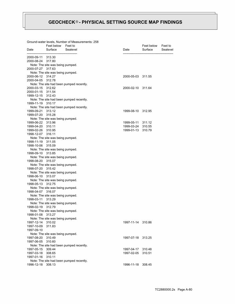
TC2880000.2s Page A-80
1996-12-18 308.13 1996-11-18 308.45 Note: The site had been pumped recently.1997-01-16 310.111997-03-18 308.65 1997-02-05 310.511997-05-15 309.44 1997-04-17 310.48 Note: The site had been pumped recently.1997-06-05 310.601997-08-20 310.49 1997-07-18 313.25 Note: The site was being pumped.1997-09-101997-10-09 311.831997-12-14 310.02 1997-11-14 310.86 Note: The site was being pumped.1998-01-08 313.27 Note: The site was being pumped.1998-02-19 312.79 Note: The site was being pumped.1998-03-11 313.29 Note: The site was being pumped.1998-04-07 316.07 Note: The site was being pumped.1998-05-13 312.75 Note: The site was being pumped.1998-06-10 313.07 Note: The site was being pumped.1998-07-20 315.42 Note: The site was being pumped.1998-08-20 315.07 Note: The site was being pumped.1998-09-10 313.85 Note: The site was being pumped.1998-10-06 315.091998-11-19 311.05 Note: The site was being pumped.1998-12-07 316.111999-02-26 310.95 1999-01-13 310.791999-04-20 310.11 1999-03-24 310.551999-06-22 313.96 1999-05-11 311.12 Note: The site was being pumped.1999-07-20 315.281999-09-21 313.12 1999-08-10 312.95 Note: The site had been pumped recently.1999-11-19 310.17 Note: The site had been pumped recently.1999-12-15 312.432000-01-15 311.542000-03-15 312.62 2000-02-10 311.64 Note: The site had been pumped recently.2000-04-05 312.782000-06-12 314.27 2000-05-03 311.55 Note: The site was being pumped.2000-07-27 317.63 Note: The site was being pumped.2000-08-24 317.802000-09-11 313.30
DateFeet belowSurface
Feet toSealevel
-------------------------------------------------Date
Feet belowSurface
Feet toSealevel
-------------------------------------------------
Ground-water levels, Number of Measurements: 258
GEOCHECK - PHYSICAL SETTING SOURCE MAP FINDINGS®
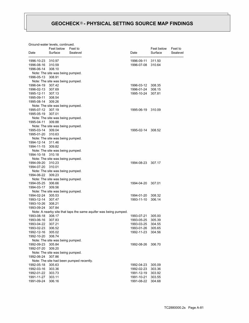
TC2880000.2s Page A-81
1991-09-24 306.16 1991-08-22 304.681991-11-27 303.11 1991-10-21 303.551992-01-22 303.73 1991-12-19 303.921992-03-16 303.36 1992-02-23 303.361992-05-18 305.63 1992-04-23 305.09 Note: The site had been pumped recently.1992-06-24 307.86 Note: The site was being pumped.1992-07-20 309.201992-09-23 305.84 1992-08-26 306.70 Note: The site was being pumped.1992-10-20 308.741992-12-16 305.02 1992-11-23 304.561993-02-23 306.52 1993-01-26 305.651993-04-22 307.21 1993-03-25 304.551993-06-16 307.83 1993-05-25 305.391993-08-18 308.17 1993-07-21 305.00 Note: A nearby site that taps the same aquifer was being pumped.1993-09-24 307.841993-10-26 308.211993-12-14 307.47 1993-11-10 306.141994-02-24 305.53 1994-01-20 308.32 Note: The site was being pumped.1994-03-17 309.561994-05-25 306.66 1994-04-20 307.01 Note: The site was being pumped.1994-06-22 309.23 Note: The site was being pumped.1994-07-20 310.011994-09-20 310.23 1994-08-23 307.17 Note: The site was being pumped.1994-10-18 310.18 Note: The site was being pumped.1994-11-15 309.821994-12-14 311.46 Note: The site was being pumped.1995-01-20 310.631995-03-14 309.04 1995-02-14 308.52 Note: The site was being pumped.1995-04-11 309.88 Note: The site was being pumped.1995-05-19 307.011995-07-12 307.19 1995-06-19 310.09 Note: The site was being pumped.1995-08-14 309.261995-09-11 308.541995-12-11 307.13 1995-10-24 307.811996-02-13 307.69 1996-01-24 308.151996-04-19 307.42 1996-03-12 308.35 Note: The site was being pumped.1996-05-13 308.91 Note: The site was being pumped.1996-06-14 308.101996-08-16 310.59 1996-07-08 310.641996-10-23 310.97 1996-09-11 311.50
DateFeet belowSurface
Feet toSealevel
-------------------------------------------------Date
Feet belowSurface
Feet toSealevel
-------------------------------------------------
Ground-water levels, continued.
GEOCHECK - PHYSICAL SETTING SOURCE MAP FINDINGS®

TC2880000.2s Page A-82
1965-11-27 256.76 1965-11-19 262.581965-12-11 256.65 1965-12-04 256.691966-02-05 256.60 1966-01-15 256.981966-02-26 256.85 1966-02-12 256.891966-03-22 256.81 1966-03-12 256.941966-04-02 256.95 1966-03-26 256.991966-04-23 256.74 1966-04-09 256.861966-05-07 257.44 1966-04-30 257.251966-05-21 257.27 1966-05-14 257.281966-09-07 259.20 1966-06-04 257.981966-11-04 260.51 1966-10-07 258.621967-10 263 1966-12-15 260.441968-10 265 1968-06 2631969-10 268 1969-06 2661970-10 273 1970-06 2721971-10 271 1971-06 2711987-09-15 300.06 1985-03-14 293.61 Note: The site was being pumped.1987-10-28 301.221987-11-19 299.741988-01-21 300.62 1987-12-18 298.681988-03-18 299.49 1988-02-19 299.291988-05-12 299.56 1988-04-14 300.52 Note: The site was being pumped.1988-06-24 302.281988-07-18 301.43 Note: The site was being pumped.1988-08-26 302.891988-09-30 300.49 Note: The site was being pumped.1988-10-31 302.621988-12-22 299.28 1988-11-21 300.621989-02-24 301.17 1989-01-12 301.381989-04-14 300.74 1989-03-27 301.561989-06-15 301.40 1989-05-19 300.461989-08-22 302.56 1989-07-11 302.801989-10-26 301.82 1989-09-19 301.32 Note: The site had been pumped recently.1989-11-16 301.511989-12-07 301.301990-02-22 301.53 1990-01-18 300.751990-04-25 301.88 1990-03-19 301.401990-06-20 301.62 1990-05-25 301.20 Note: The site was being pumped.1990-07-23 305.271990-09-20 303.69 1990-08-29 303.401990-11-29 303.24 1990-10-10 303.52 Note: The site had been pumped recently.1990-12-20 301.881991-01-10 302.141991-03-21 303.28 1991-02-19 303.121991-05-23 303.45 1991-04-16 303.19 Note: The site was being pumped.1991-06-25 303.731991-07-19 303.78
DateFeet belowSurface
Feet toSealevel
-------------------------------------------------Date
Feet belowSurface
Feet toSealevel
-------------------------------------------------
Ground-water levels, continued.
GEOCHECK - PHYSICAL SETTING SOURCE MAP FINDINGS®

TC2880000.2s Page A-83
24000Map scale:MOSCOW WESTLocation map:SESWSES06 T39N R05W BLand net:USCountry:057County:16State:16District:NAD83Dec latlong datum:NAD27Latlong datum:SCoor accr:MCoor meth:-117.00738791Dec lon:46.74488752Dec lat:1170023Longitude:USGS3140911EDR Site id:464442Latitude:
39N 05W 06DCD1Site name:464442117002301Site no:USGSAgency cd:
56North1/2 - 1 MileHigher
USGS3140911FED USGS
1963-12-12 256 1963-09-05 2571963-12-25 251.75 1963-12-20 251.821964-01-06 251.40 1963-12-26 251.951964-01-19 251.00 1964-01-07 251.551964-02-01 252.02 1964-01-22 251.271964-02-27 251.65 1964-02-15 251.821964-03-12 251.45 1964-03-02 251.571964-03-29 251.50 1964-03-22 251.501964-04-11 251.71 1964-04-05 251.651964-04-30 251.58 1964-04-22 251.381964-05-11 252.17 1964-05-05 251.431964-05-24 252.17 1964-05-18 251.961964-06-08 251.72 1964-06-02 252.031964-06-28 252.46 1964-06-22 252.521964-07-14 252.63 1964-07-06 252.591964-08-17 253.30 1964-08-09 253.101964-08-31 253.14 1964-08-24 253.421964-09-15 253.58 1964-09-08 253.191964-10-05 253.67 1964-09-28 253.311964-12-07 253.68 1964-11-09 252.931965-01-18 253.85 1965-01-04 253.281965-02-01 253.61 1965-01-25 253.331965-02-15 253.95 1965-02-09 254.071965-03-01 254.19 1965-02-23 253.861965-03-29 253.64 1965-03-15 253.751965-04-12 253.71 1965-04-05 253.541965-04-26 253.97 1965-04-19 253.701965-05-10 253.99 1965-05-03 253.741965-05-24 253.98 1965-05-17 253.591965-06-14 254.10 1965-06-07 254.201965-07-16 256.88 1965-06-21 254.401965-08-20 256.50 1965-08-13 259.251965-09-03 256.18 1965-08-27 256.251965-09-24 257.67 1965-09-15 256.621965-11-05 281.25 1965-10-29 260.55
DateFeet belowSurface
Feet toSealevel
-------------------------------------------------Date
Feet belowSurface
Feet toSealevel
-------------------------------------------------
Ground-water levels, continued.
GEOCHECK - PHYSICAL SETTING SOURCE MAP FINDINGS®

TC2880000.2s Page A-84
07/31/2000Constructi:30Totaldepth:-15Casingdept:2Casingdiam:2Surfacedia:20Staticwate:0Production:MonitoringWelluse:Not ReportedSubdivisio:
Not ReportedBlock:Not ReportedLot:KIBBIE DOMEWelladdres:0Govlotnum:
NWQ:SEQq:SEQqq:18Sec:05WRange:39NTownship:
LATAHCountyname:87Basinnumbe:485Drillerlic:
ENVIRONMENTAL WEST EXPLORATION INCDriller:UNIVERSITY OF IDAHO REGENTSOwner:
D0013474Metaltagnu:765339Permitid:337335Wellid:84702Objectid:
57SSW1/2 - 1 MileHigher
ID6000000143146ID WELLS
1973-03-21 146.32 1972-06-22 147.10
DateFeet belowSurface
Feet toSealevel
-------------------------------------------------Date
Feet belowSurface
Feet toSealevel
-------------------------------------------------
Ground-water levels, Number of Measurements: 2
2Ground water data count:1973-03-21Ground water data end date:Ground water data begin date: 1972-06-220Water quality data count:0000-00-00Water quality data end date:0000-00-00Water quality data begin date:0Peak flow data count:0000-00-00Peak flow data end date:0000-00-00Peak flow data begin date:0Daily flow data count:0000-00-00Daily flow data end date:0000-00-00Daily flow data begin date:0Real time data flag:
ID-73-107Project number:Not ReportedSource of depth data:
376Hole depth:376Well depth:Not ReportedAquifer:Not ReportedAquifer Type:Single well, other than collector or Ranney typeType of ground water site:YLocal standard time flag:
PSTMean greenwich time offset:Not ReportedDate inventoried:19551026Date construction:Ground-water other than SpringSite type:
Hillside (slope)Topographic:Palouse. Idaho, Washington. Area = 2360 sq.mi.Hydrologic:National Geodetic Vertical Datum of 1929Altitude datum:10.Altitude accuracy:Interpolated from topographic mapAltitude method:2655.00Altitude:
GEOCHECK - PHYSICAL SETTING SOURCE MAP FINDINGS®

TC2880000.2s Page A-85
0Govlotnum:NEQ:Not ReportedQq:Not ReportedQqq:18Sec:05WRange:39NTownship:
LATAHCountyname:87Basinnumbe:485Drillerlic:
ENVIRONMENTAL WEST EXPLORATION INCDriller:STATE OF IDAHO DEPT OF TRANSPORTATIONOwner:
Not ReportedMetaltagnu:747914Permitid:279681Wellid:102763Objectid:
J59SSW1/2 - 1 MileHigher
ID6000000143127ID WELLS
ID6000000143126Site id:Not ReportedLink:Not ReportedQuad:
0Y:0X:Not ReportedElevation:
Not ReportedCompletion:Not ReportedWateruse2:Not ReportedWateruse:Not ReportedWellnumber:
http://www.idwr.idaho.gov/apps/appsWell/RelatedDocs.asp?WellID=279680Well url:QQDatasource:
06/11/1997Constructi:0Totaldepth:15Casingdept:0Casingdiam:2Surfacedia:7Staticwate:0Production:MonitoringWelluse:Not ReportedSubdivisio:
Not ReportedBlock:Not ReportedLot:STATE HIGHWAY 8 AT JACKSON STREET (MW#9)Welladdres:0Govlotnum:
NEQ:Not ReportedQq:Not ReportedQqq:18Sec:05WRange:39NTownship:
LATAHCountyname:87Basinnumbe:485Drillerlic:
ENVIRONMENTAL WEST EXPLORATION INCDriller:STATE OF IDAHO DEPT OF TRANSPORTATIONOwner:
Not ReportedMetaltagnu:747913Permitid:279680Wellid:88651Objectid:
J58SSW1/2 - 1 MileHigher
ID6000000143126ID WELLS
ID6000000143146Site id:Not ReportedLink:Not ReportedQuad:
0Y:0X:Not ReportedElevation:
Not ReportedCompletion:Not ReportedWateruse2:Not ReportedWateruse:Not ReportedWellnumber:
http://www.idwr.idaho.gov/apps/appsWell/RelatedDocs.asp?WellID=337335Well url:QQDatasource:
GEOCHECK - PHYSICAL SETTING SOURCE MAP FINDINGS®

TC2880000.2s Page A-86
ID6000000143128Site id:Not ReportedLink:Not ReportedQuad:
0Y:0X:Not ReportedElevation:
Not ReportedCompletion:Not ReportedWateruse2:Not ReportedWateruse:Not ReportedWellnumber:
http://www.idwr.idaho.gov/apps/appsWell/RelatedDocs.asp?WellID=279686Well url:QQDatasource:
06/12/1997Constructi:0Totaldepth:0Casingdept:0Casingdiam:99Surfacedia:99999Staticwate:0Production:Domestic-Single ResidenceWelluse:Not ReportedSubdivisio:
Not ReportedBlock:Not ReportedLot:701/703 TAYLORWelladdres:0Govlotnum:
NEQ:Not ReportedQq:Not ReportedQqq:18Sec:05WRange:39NTownship:
LATAHCountyname:87Basinnumbe:9999Drillerlic:
ANONYMOUS DRILLERDriller:JOE HAENEROwner:
Not ReportedMetaltagnu:747919Permitid:279686Wellid:102764Objectid:
J60SSW1/2 - 1 MileHigher
ID6000000143128ID WELLS
ID6000000143127Site id:Not ReportedLink:Not ReportedQuad:
0Y:0X:Not ReportedElevation:
Not ReportedCompletion:Not ReportedWateruse2:Not ReportedWateruse:Not ReportedWellnumber:
http://www.idwr.idaho.gov/apps/appsWell/RelatedDocs.asp?WellID=279681Well url:QQDatasource:
06/12/1997Constructi:0Totaldepth:10Casingdept:0Casingdiam:2Surfacedia:14Staticwate:0Production:MonitoringWelluse:Not ReportedSubdivisio:
Not ReportedBlock:Not ReportedLot:STATE HIGHWAY 8 AT JACKSON STREET (MW#13)Welladdres:
GEOCHECK - PHYSICAL SETTING SOURCE MAP FINDINGS®

TC2880000.2s Page A-87
08/13/1976Constructi:0Totaldepth:87Casingdept:0Casingdiam:6Surfacedia:90Staticwate:3Production:Domestic-Single ResidenceWelluse:Not ReportedSubdivisio:
Not ReportedBlock:Not ReportedLot:Not ReportedWelladdres:0Govlotnum:
NWQ:NEQq:Not ReportedQqq:8Sec:05WRange:39NTownship:
LATAHCountyname:87Basinnumbe:58Drillerlic:
WITT WELL DRILLINGDriller:BOB FORESTOwner:
Not ReportedMetaltagnu:747231Permitid:280527Wellid:80874Objectid:
K62NE1/2 - 1 MileHigher
ID6000000143487ID WELLS
ID6000000143486Site id:Not ReportedLink:Not ReportedQuad:
0Y:0X:Not ReportedElevation:
Not ReportedCompletion:Not ReportedWateruse2:Not ReportedWateruse:Not ReportedWellnumber:
http://www.idwr.idaho.gov/apps/appsWell/RelatedDocs.asp?WellID=280275Well url:QQDatasource:
09/14/1963Constructi:0Totaldepth:40Casingdept:0Casingdiam:18Surfacedia:10Staticwate:1400Production:MunicipalWelluse:Not ReportedSubdivisio:
Not ReportedBlock:Not ReportedLot:Not ReportedWelladdres:0Govlotnum:
NWQ:NEQq:Not ReportedQqq:8Sec:05WRange:39NTownship:
LATAHCountyname:87Basinnumbe:47Drillerlic:
ENGLEMAN WELL DRILLINGDriller:CITY OF MOSCOWOwner:
Not ReportedMetaltagnu:746984Permitid:280275Wellid:80737Objectid:
K61NE1/2 - 1 MileHigher
ID6000000143486ID WELLS
Map IDDirectionDistanceElevation EDR ID NumberDatabase
GEOCHECK - PHYSICAL SETTING SOURCE MAP FINDINGS®
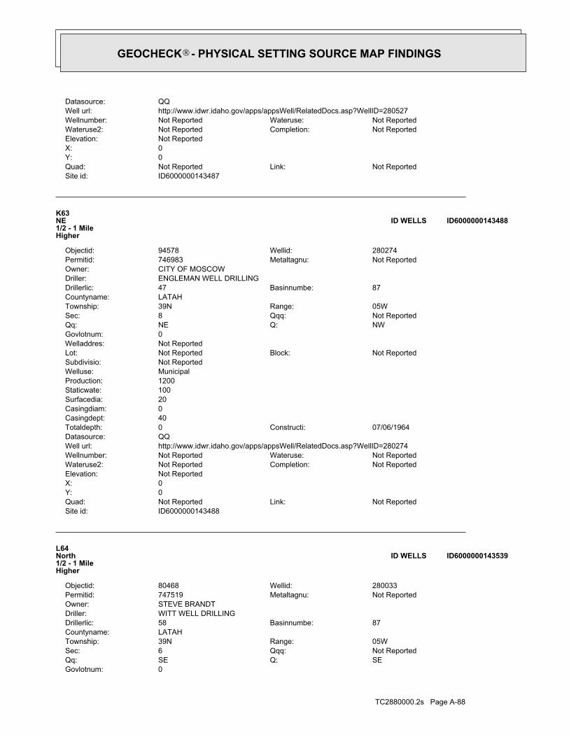
TC2880000.2s Page A-88
0Govlotnum:SEQ:SEQq:Not ReportedQqq:6Sec:05WRange:39NTownship:
LATAHCountyname:87Basinnumbe:58Drillerlic:
WITT WELL DRILLINGDriller:STEVE BRANDTOwner:
Not ReportedMetaltagnu:747519Permitid:280033Wellid:80468Objectid:
L64North1/2 - 1 MileHigher
ID6000000143539ID WELLS
ID6000000143488Site id:Not ReportedLink:Not ReportedQuad:
0Y:0X:Not ReportedElevation:
Not ReportedCompletion:Not ReportedWateruse2:Not ReportedWateruse:Not ReportedWellnumber:
http://www.idwr.idaho.gov/apps/appsWell/RelatedDocs.asp?WellID=280274Well url:QQDatasource:
07/06/1964Constructi:0Totaldepth:40Casingdept:0Casingdiam:20Surfacedia:100Staticwate:1200Production:MunicipalWelluse:Not ReportedSubdivisio:
Not ReportedBlock:Not ReportedLot:Not ReportedWelladdres:0Govlotnum:
NWQ:NEQq:Not ReportedQqq:8Sec:05WRange:39NTownship:
LATAHCountyname:87Basinnumbe:47Drillerlic:
ENGLEMAN WELL DRILLINGDriller:CITY OF MOSCOWOwner:
Not ReportedMetaltagnu:746983Permitid:280274Wellid:94578Objectid:
K63NE1/2 - 1 MileHigher
ID6000000143488ID WELLS
ID6000000143487Site id:Not ReportedLink:Not ReportedQuad:
0Y:0X:Not ReportedElevation:
Not ReportedCompletion:Not ReportedWateruse2:Not ReportedWateruse:Not ReportedWellnumber:
http://www.idwr.idaho.gov/apps/appsWell/RelatedDocs.asp?WellID=280527Well url:QQDatasource:
GEOCHECK - PHYSICAL SETTING SOURCE MAP FINDINGS®
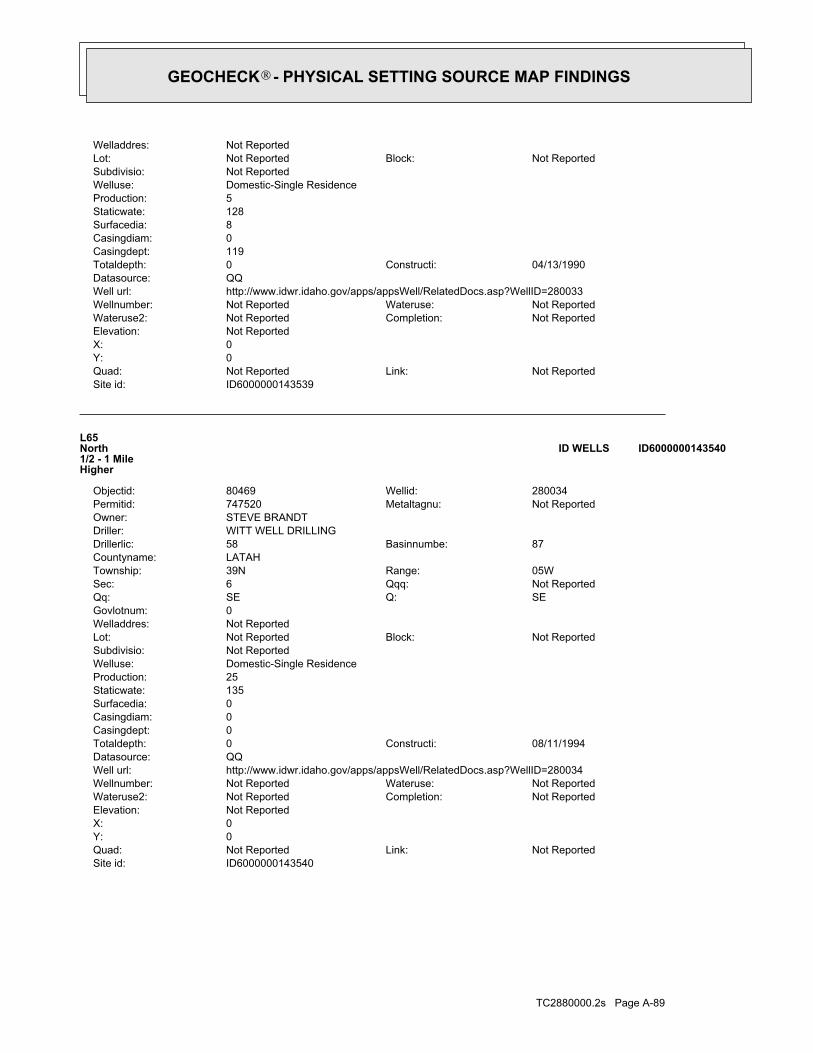
TC2880000.2s Page A-89
ID6000000143540Site id:Not ReportedLink:Not ReportedQuad:
0Y:0X:Not ReportedElevation:
Not ReportedCompletion:Not ReportedWateruse2:Not ReportedWateruse:Not ReportedWellnumber:
http://www.idwr.idaho.gov/apps/appsWell/RelatedDocs.asp?WellID=280034Well url:QQDatasource:
08/11/1994Constructi:0Totaldepth:0Casingdept:0Casingdiam:0Surfacedia:135Staticwate:25Production:Domestic-Single ResidenceWelluse:Not ReportedSubdivisio:
Not ReportedBlock:Not ReportedLot:Not ReportedWelladdres:0Govlotnum:
SEQ:SEQq:Not ReportedQqq:6Sec:05WRange:39NTownship:
LATAHCountyname:87Basinnumbe:58Drillerlic:
WITT WELL DRILLINGDriller:STEVE BRANDTOwner:
Not ReportedMetaltagnu:747520Permitid:280034Wellid:80469Objectid:
L65North1/2 - 1 MileHigher
ID6000000143540ID WELLS
ID6000000143539Site id:Not ReportedLink:Not ReportedQuad:
0Y:0X:Not ReportedElevation:
Not ReportedCompletion:Not ReportedWateruse2:Not ReportedWateruse:Not ReportedWellnumber:
http://www.idwr.idaho.gov/apps/appsWell/RelatedDocs.asp?WellID=280033Well url:QQDatasource:
04/13/1990Constructi:0Totaldepth:119Casingdept:0Casingdiam:8Surfacedia:128Staticwate:5Production:Domestic-Single ResidenceWelluse:Not ReportedSubdivisio:
Not ReportedBlock:Not ReportedLot:Not ReportedWelladdres:
GEOCHECK - PHYSICAL SETTING SOURCE MAP FINDINGS®

TC2880000.2s Page A-90
04/16/1990Constructi:0Totaldepth:20Casingdept:0Casingdiam:8Surfacedia:14Staticwate:5Production:Domestic-Single ResidenceWelluse:Not ReportedSubdivisio:
Not ReportedBlock:Not ReportedLot:Not ReportedWelladdres:0Govlotnum:
NWQ:NWQq:Not ReportedQqq:7Sec:05WRange:39NTownship:
LATAHCountyname:87Basinnumbe:376Drillerlic:
MC PHERSON & WRIGHT DRILLINGDriller:GORDON SHEETSOwner:
Not ReportedMetaltagnu:747523Permitid:280037Wellid:80423Objectid:
67NW1/2 - 1 MileHigher
ID6000000143472ID WELLS
ID6000000143541Site id:Not ReportedLink:Not ReportedQuad:
0Y:0X:Not ReportedElevation:
Not ReportedCompletion:Not ReportedWateruse2:Not ReportedWateruse:Not ReportedWellnumber:
http://www.idwr.idaho.gov/apps/appsWell/RelatedDocs.asp?WellID=279760Well url:QQDatasource:
10/15/1998Constructi:0Totaldepth:140Casingdept:0Casingdiam:8Surfacedia:117Staticwate:6Production:Domestic-Single ResidenceWelluse:Not ReportedSubdivisio:
Not ReportedBlock:Not ReportedLot:8" WAIVER - 1040 N US 95Welladdres:0Govlotnum:
SEQ:SEQq:Not ReportedQqq:6Sec:05WRange:39NTownship:
LATAHCountyname:87Basinnumbe:376Drillerlic:
MC PHERSON & WRIGHT DRILLINGDriller:ALLEN COAHRANOwner:
D0005357Metaltagnu:747989Permitid:279760Wellid:94459Objectid:
L66North1/2 - 1 MileHigher
ID6000000143541ID WELLS
Map IDDirectionDistanceElevation EDR ID NumberDatabase
GEOCHECK - PHYSICAL SETTING SOURCE MAP FINDINGS®
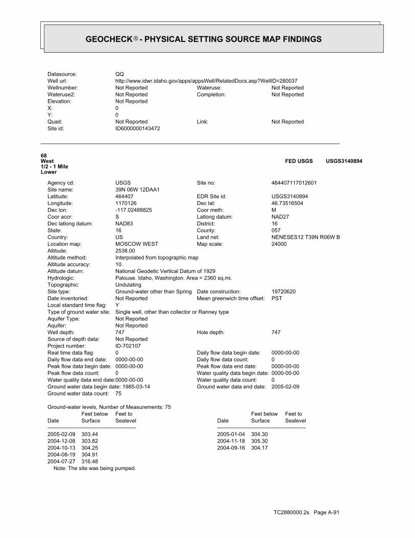
TC2880000.2s Page A-91
Note: The site was being pumped.2004-07-27 316.482004-08-19 304.912004-10-13 304.25 2004-09-16 304.172004-12-08 303.82 2004-11-18 305.302005-02-09 303.44 2005-01-04 304.30
DateFeet belowSurface
Feet toSealevel
-------------------------------------------------Date
Feet belowSurface
Feet toSealevel
-------------------------------------------------
Ground-water levels, Number of Measurements: 75
75Ground water data count:2005-02-09Ground water data end date:Ground water data begin date: 1985-03-140Water quality data count:0000-00-00Water quality data end date:0000-00-00Water quality data begin date:0Peak flow data count:0000-00-00Peak flow data end date:0000-00-00Peak flow data begin date:0Daily flow data count:0000-00-00Daily flow data end date:0000-00-00Daily flow data begin date:0Real time data flag:
ID-702107Project number:Not ReportedSource of depth data:
747Hole depth:747Well depth:Not ReportedAquifer:Not ReportedAquifer Type:Single well, other than collector or Ranney typeType of ground water site:YLocal standard time flag:
PSTMean greenwich time offset:Not ReportedDate inventoried:19720620Date construction:Ground-water other than SpringSite type:
UndulatingTopographic:Palouse. Idaho, Washington. Area = 2360 sq.mi.Hydrologic:National Geodetic Vertical Datum of 1929Altitude datum:10.Altitude accuracy:Interpolated from topographic mapAltitude method:2538.00Altitude:
24000Map scale:MOSCOW WESTLocation map:NENESES12 T39N R06W BLand net:USCountry:057County:16State:16District:NAD83Dec latlong datum:NAD27Latlong datum:SCoor accr:MCoor meth:-117.02488825Dec lon:46.73516504Dec lat:1170126Longitude:USGS3140894EDR Site id:464407Latitude:
39N 06W 12DAA1Site name:464407117012601Site no:USGSAgency cd:
68West1/2 - 1 MileLower
USGS3140894FED USGS
ID6000000143472Site id:Not ReportedLink:Not ReportedQuad:
0Y:0X:Not ReportedElevation:
Not ReportedCompletion:Not ReportedWateruse2:Not ReportedWateruse:Not ReportedWellnumber:
http://www.idwr.idaho.gov/apps/appsWell/RelatedDocs.asp?WellID=280037Well url:QQDatasource:
GEOCHECK - PHYSICAL SETTING SOURCE MAP FINDINGS®
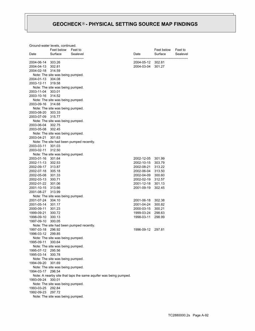
TC2880000.2s Page A-92
Note: The site was being pumped.1992-09-23 297.721993-03-25 292.84 Note: The site was being pumped.1993-09-24 300.01 Note: A nearby site that taps the same aquifer was being pumped.1994-03-17 296.54 Note: The site was being pumped.1994-09-20 301.69 Note: The site was being pumped.1995-03-14 300.781995-07-12 295.56 Note: The site was being pumped.1995-09-11 300.64 Note: The site was being pumped.1996-03-12 299.851997-03-18 296.92 1996-09-12 297.81 Note: The site had been pumped recently.1997-09-10 300.051998-09-10 300.13 1998-03-11 298.991999-09-21 300.72 1999-03-24 298.632000-09-11 301.23 2000-03-15 300.212001-05-14 301.17 2001-04-24 300.822001-07-24 304.10 2001-06-18 302.38 Note: The site was being pumped.2001-08-27 313.992001-10-15 313.66 2001-09-19 302.452002-01-22 301.06 2001-12-18 301.132002-03-13 300.71 2002-02-19 312.572002-05-08 301.33 2002-04-09 300.602002-07-18 305.18 2002-06-04 313.502002-09-17 313.87 2002-08-21 313.222002-11-13 302.53 2002-10-15 303.792003-01-16 301.64 2002-12-05 301.99 Note: The site was being pumped.2003-02-11 312.502003-03-11 301.03 Note: The site had been pumped recently.2003-04-21 301.63 Note: The site was being pumped.2003-05-08 302.452003-06-04 302.75 Note: The site was being pumped.2003-07-09 315.772003-08-20 303.33 Note: The site was being pumped.2003-09-16 314.68 Note: The site was being pumped.2003-10-16 314.522003-11-04 303.01 Note: The site was being pumped.2003-12-11 319.582004-01-13 304.08 Note: The site was being pumped.2004-02-18 314.592004-04-13 302.81 2004-03-04 301.272004-06-14 303.26 2004-05-12 302.81
DateFeet belowSurface
Feet toSealevel
-------------------------------------------------Date
Feet belowSurface
Feet toSealevel
-------------------------------------------------
Ground-water levels, continued.
GEOCHECK - PHYSICAL SETTING SOURCE MAP FINDINGS®

TC2880000.2s Page A-93
M70NNE1/2 - 1 MileHigher
ID6000000143543ID WELLS
ID6000000143544Site id:Not ReportedLink:Not ReportedQuad:
0Y:0X:Not ReportedElevation:
Not ReportedCompletion:Not ReportedWateruse2:Not ReportedWateruse:Not ReportedWellnumber:
http://www.idwr.idaho.gov/apps/appsWell/RelatedDocs.asp?WellID=279938Well url:QQDatasource:
08/29/1987Constructi:0Totaldepth:89Casingdept:0Casingdiam:8Surfacedia:30Staticwate:10Production:Domestic-Single ResidenceWelluse:Not ReportedSubdivisio:
Not ReportedBlock:Not ReportedLot:Not ReportedWelladdres:0Govlotnum:
SWQ:SWQq:Not ReportedQqq:5Sec:05WRange:39NTownship:
LATAHCountyname:87Basinnumbe:155Drillerlic:
DON TOWN WELL DRILLINGDriller:ARTHUR FRANKLINOwner:
Not ReportedMetaltagnu:747426Permitid:279938Wellid:80401Objectid:
M69NNE1/2 - 1 MileHigher
ID6000000143544ID WELLS
1985-03-14 282.41 Note: The site was being pumped.1987-09-15 290.70 Note: The site was being pumped.1988-03-18 289.551989-03-27 289.95 1988-09-30 283.991990-03-19 289.62 1989-09-19 289.42 Note: The site was being pumped.1990-09-20 293.871991-05-23 291.11 Note: The site was being pumped.1991-09-24 296.301992-03-16 291.31
DateFeet belowSurface
Feet toSealevel
-------------------------------------------------Date
Feet belowSurface
Feet toSealevel
-------------------------------------------------
Ground-water levels, continued.
GEOCHECK - PHYSICAL SETTING SOURCE MAP FINDINGS®

TC2880000.2s Page A-94
08/12/1997Constructi:0Totaldepth:65Casingdept:0Casingdiam:6Surfacedia:90Staticwate:12Production:Domestic-Single ResidenceWelluse:Not ReportedSubdivisio:
Not ReportedBlock:Not ReportedLot:1 MILE ON MT VIEW ROAD NORTH OFWelladdres:0Govlotnum:
SWQ:SWQq:Not ReportedQqq:5Sec:05WRange:39NTownship:
LATAHCountyname:87Basinnumbe:125Drillerlic:
TWO U DRILLING LLCDriller:RANDY RAUCHOwner:
D0003167Metaltagnu:747925Permitid:279692Wellid:78993Objectid:
M71NNE1/2 - 1 MileHigher
ID6000000143542ID WELLS
ID6000000143543Site id:Not ReportedLink:Not ReportedQuad:
0Y:0X:Not ReportedElevation:
Not ReportedCompletion:Not ReportedWateruse2:Not ReportedWateruse:Not ReportedWellnumber:
http://www.idwr.idaho.gov/apps/appsWell/RelatedDocs.asp?WellID=279839Well url:QQDatasource:
10/31/1980Constructi:0Totaldepth:70Casingdept:0Casingdiam:8Surfacedia:34Staticwate:15Production:Domestic-Single ResidenceWelluse:Not ReportedSubdivisio:
Not ReportedBlock:Not ReportedLot:Not ReportedWelladdres:0Govlotnum:
SWQ:SWQq:Not ReportedQqq:5Sec:05WRange:39NTownship:
LATAHCountyname:87Basinnumbe:58Drillerlic:
WITT WELL DRILLINGDriller:JAY MC COYOwner:
Not ReportedMetaltagnu:747327Permitid:279839Wellid:80339Objectid:
GEOCHECK - PHYSICAL SETTING SOURCE MAP FINDINGS®

TC2880000.2s Page A-95
0Govlotnum:SWQ:SWQq:Not ReportedQqq:5Sec:05WRange:39NTownship:
LATAHCountyname:87Basinnumbe:58Drillerlic:
WITT WELL DRILLINGDriller:KEITH MOENOwner:
Not ReportedMetaltagnu:747660Permitid:280178Wellid:80548Objectid:
M73NNE1/2 - 1 MileHigher
ID6000000143548ID WELLS
ID6000000143545Site id:Not ReportedLink:Not ReportedQuad:
0Y:0X:Not ReportedElevation:
Not ReportedCompletion:Not ReportedWateruse2:Not ReportedWateruse:Not ReportedWellnumber:
http://www.idwr.idaho.gov/apps/appsWell/RelatedDocs.asp?WellID=279959Well url:QQDatasource:
06/02/1987Constructi:0Totaldepth:106Casingdept:0Casingdiam:8Surfacedia:85Staticwate:3Production:Domestic-Single ResidenceWelluse:Not ReportedSubdivisio:
Not ReportedBlock:Not ReportedLot:Not ReportedWelladdres:0Govlotnum:
SWQ:SWQq:Not ReportedQqq:5Sec:05WRange:39NTownship:
LATAHCountyname:87Basinnumbe:155Drillerlic:
DON TOWN WELL DRILLINGDriller:ARTHUR FRANKLINOwner:
Not ReportedMetaltagnu:747446Permitid:279959Wellid:80407Objectid:
M72NNE1/2 - 1 MileHigher
ID6000000143545ID WELLS
ID6000000143542Site id:Not ReportedLink:Not ReportedQuad:
0Y:0X:Not ReportedElevation:
Not ReportedCompletion:Not ReportedWateruse2:Not ReportedWateruse:Not ReportedWellnumber:
http://www.idwr.idaho.gov/apps/appsWell/RelatedDocs.asp?WellID=279692Well url:QQDatasource:
GEOCHECK - PHYSICAL SETTING SOURCE MAP FINDINGS®

TC2880000.2s Page A-96
ID6000000143547Site id:Not ReportedLink:Not ReportedQuad:
0Y:0X:Not ReportedElevation:
Not ReportedCompletion:Not ReportedWateruse2:Not ReportedWateruse:Not ReportedWellnumber:
http://www.idwr.idaho.gov/apps/appsWell/RelatedDocs.asp?WellID=280134Well url:QQDatasource:
08/19/1992Constructi:0Totaldepth:64Casingdept:0Casingdiam:8Surfacedia:93Staticwate:50Production:Domestic-Single ResidenceWelluse:Not ReportedSubdivisio:
Not ReportedBlock:Not ReportedLot:Not ReportedWelladdres:0Govlotnum:
SWQ:SWQq:Not ReportedQqq:5Sec:05WRange:39NTownship:
LATAHCountyname:87Basinnumbe:58Drillerlic:
WITT WELL DRILLINGDriller:DOUG WILSONOwner:
Not ReportedMetaltagnu:747618Permitid:280134Wellid:80501Objectid:
M74NNE1/2 - 1 MileHigher
ID6000000143547ID WELLS
ID6000000143548Site id:Not ReportedLink:Not ReportedQuad:
0Y:0X:Not ReportedElevation:
Not ReportedCompletion:Not ReportedWateruse2:Not ReportedWateruse:Not ReportedWellnumber:
http://www.idwr.idaho.gov/apps/appsWell/RelatedDocs.asp?WellID=280178Well url:QQDatasource:
09/15/1993Constructi:0Totaldepth:66Casingdept:0Casingdiam:8Surfacedia:95Staticwate:35Production:Domestic-Single ResidenceWelluse:Not ReportedSubdivisio:
Not ReportedBlock:Not ReportedLot:NORTH POLK_EXT.Welladdres:
GEOCHECK - PHYSICAL SETTING SOURCE MAP FINDINGS®
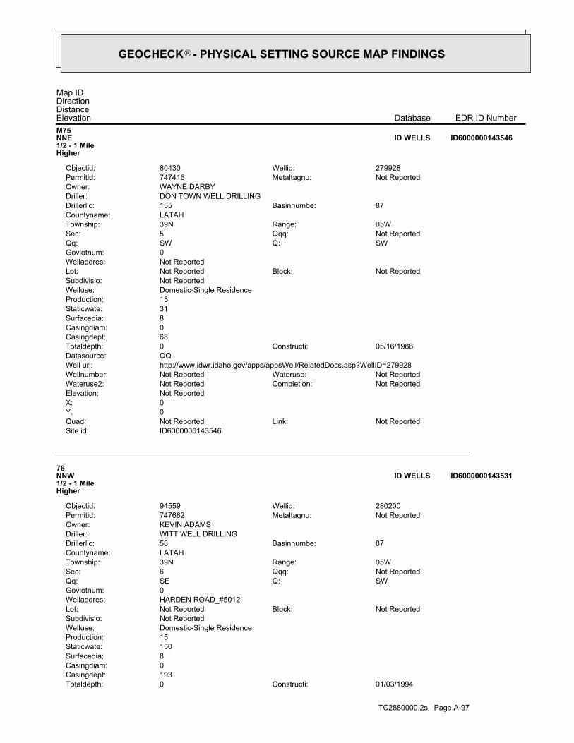
TC2880000.2s Page A-97
01/03/1994Constructi:0Totaldepth:193Casingdept:0Casingdiam:8Surfacedia:150Staticwate:15Production:Domestic-Single ResidenceWelluse:Not ReportedSubdivisio:
Not ReportedBlock:Not ReportedLot:HARDEN ROAD_#5012Welladdres:0Govlotnum:
SWQ:SEQq:Not ReportedQqq:6Sec:05WRange:39NTownship:
LATAHCountyname:87Basinnumbe:58Drillerlic:
WITT WELL DRILLINGDriller:KEVIN ADAMSOwner:
Not ReportedMetaltagnu:747682Permitid:280200Wellid:94559Objectid:
76NNW1/2 - 1 MileHigher
ID6000000143531ID WELLS
ID6000000143546Site id:Not ReportedLink:Not ReportedQuad:
0Y:0X:Not ReportedElevation:
Not ReportedCompletion:Not ReportedWateruse2:Not ReportedWateruse:Not ReportedWellnumber:
http://www.idwr.idaho.gov/apps/appsWell/RelatedDocs.asp?WellID=279928Well url:QQDatasource:
05/16/1986Constructi:0Totaldepth:68Casingdept:0Casingdiam:8Surfacedia:31Staticwate:15Production:Domestic-Single ResidenceWelluse:Not ReportedSubdivisio:
Not ReportedBlock:Not ReportedLot:Not ReportedWelladdres:0Govlotnum:
SWQ:SWQq:Not ReportedQqq:5Sec:05WRange:39NTownship:
LATAHCountyname:87Basinnumbe:155Drillerlic:
DON TOWN WELL DRILLINGDriller:WAYNE DARBYOwner:
Not ReportedMetaltagnu:747416Permitid:279928Wellid:80430Objectid:
M75NNE1/2 - 1 MileHigher
ID6000000143546ID WELLS
Map IDDirectionDistanceElevation EDR ID NumberDatabase
GEOCHECK - PHYSICAL SETTING SOURCE MAP FINDINGS®

TC2880000.2s Page A-98
0Govlotnum:SEQ:SEQq:Not ReportedQqq:12Sec:06WRange:39NTownship:
LATAHCountyname:87Basinnumbe:485Drillerlic:
ENVIRONMENTAL WEST EXPLORATION INCDriller:BUDGET OIL COOwner:
D0005350Metaltagnu:747994Permitid:279767Wellid:80300Objectid:
N78West1/2 - 1 MileLower
ID6000000143312ID WELLS
ID6000000143313Site id:Not ReportedLink:Not ReportedQuad:
0Y:0X:Not ReportedElevation:
Not ReportedCompletion:Not ReportedWateruse2:Not ReportedWateruse:Not ReportedWellnumber:
http://www.idwr.idaho.gov/apps/appsWell/RelatedDocs.asp?WellID=279768Well url:QQDatasource:
11/03/1998Constructi:0Totaldepth:5Casingdept:0Casingdiam:2Surfacedia:8Staticwate:0Production:MonitoringWelluse:Not ReportedSubdivisio:
Not ReportedBlock:Not ReportedLot:1436 MOSCOW PULLMAN HIGHWAYWelladdres:0Govlotnum:
SEQ:SEQq:Not ReportedQqq:12Sec:06WRange:39NTownship:
LATAHCountyname:87Basinnumbe:485Drillerlic:
ENVIRONMENTAL WEST EXPLORATION INCDriller:BUDGET OIL COOwner:
D0005351Metaltagnu:747995Permitid:279768Wellid:80301Objectid:
N77West1/2 - 1 MileLower
ID6000000143313ID WELLS
ID6000000143531Site id:Not ReportedLink:Not ReportedQuad:
0Y:0X:Not ReportedElevation:
Not ReportedCompletion:Not ReportedWateruse2:Not ReportedWateruse:Not ReportedWellnumber:
http://www.idwr.idaho.gov/apps/appsWell/RelatedDocs.asp?WellID=280200Well url:QQDatasource:
GEOCHECK - PHYSICAL SETTING SOURCE MAP FINDINGS®

TC2880000.2s Page A-99
ID6000000143314Site id:Not ReportedLink:Not ReportedQuad:
0Y:0X:Not ReportedElevation:
Not ReportedCompletion:Not ReportedWateruse2:Not ReportedWateruse:Not ReportedWellnumber:
http://www.idwr.idaho.gov/apps/appsWell/RelatedDocs.asp?WellID=279769Well url:QQDatasource:
11/03/1998Constructi:0Totaldepth:5Casingdept:0Casingdiam:2Surfacedia:999Staticwate:0Production:MonitoringWelluse:Not ReportedSubdivisio:
Not ReportedBlock:Not ReportedLot:1436 MOSCOW PULLMAN HIGHWAYWelladdres:0Govlotnum:
SEQ:SEQq:Not ReportedQqq:12Sec:06WRange:39NTownship:
LATAHCountyname:87Basinnumbe:485Drillerlic:
ENVIRONMENTAL WEST EXPLORATION INCDriller:BUDGET OIL COOwner:
D0005639Metaltagnu:747996Permitid:279769Wellid:80302Objectid:
N79West1/2 - 1 MileLower
ID6000000143314ID WELLS
ID6000000143312Site id:Not ReportedLink:Not ReportedQuad:
0Y:0X:Not ReportedElevation:
Not ReportedCompletion:Not ReportedWateruse2:Not ReportedWateruse:Not ReportedWellnumber:
http://www.idwr.idaho.gov/apps/appsWell/RelatedDocs.asp?WellID=279767Well url:QQDatasource:
11/03/1998Constructi:0Totaldepth:5Casingdept:0Casingdiam:2Surfacedia:99999Staticwate:99999Production:MonitoringWelluse:Not ReportedSubdivisio:
Not ReportedBlock:Not ReportedLot:1436 MOSCOW PULLMAN HIGHWAYWelladdres:
GEOCHECK - PHYSICAL SETTING SOURCE MAP FINDINGS®
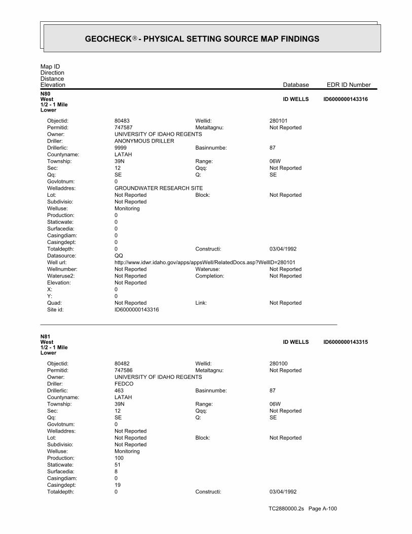
TC2880000.2s Page A-100
03/04/1992Constructi:0Totaldepth:19Casingdept:0Casingdiam:8Surfacedia:51Staticwate:100Production:MonitoringWelluse:Not ReportedSubdivisio:
Not ReportedBlock:Not ReportedLot:Not ReportedWelladdres:0Govlotnum:
SEQ:SEQq:Not ReportedQqq:12Sec:06WRange:39NTownship:
LATAHCountyname:87Basinnumbe:463Drillerlic:
FEDCODriller:UNIVERSITY OF IDAHO REGENTSOwner:
Not ReportedMetaltagnu:747586Permitid:280100Wellid:80482Objectid:
N81West1/2 - 1 MileLower
ID6000000143315ID WELLS
ID6000000143316Site id:Not ReportedLink:Not ReportedQuad:
0Y:0X:Not ReportedElevation:
Not ReportedCompletion:Not ReportedWateruse2:Not ReportedWateruse:Not ReportedWellnumber:
http://www.idwr.idaho.gov/apps/appsWell/RelatedDocs.asp?WellID=280101Well url:QQDatasource:
03/04/1992Constructi:0Totaldepth:0Casingdept:0Casingdiam:0Surfacedia:0Staticwate:0Production:MonitoringWelluse:Not ReportedSubdivisio:
Not ReportedBlock:Not ReportedLot:GROUNDWATER RESEARCH SITEWelladdres:0Govlotnum:
SEQ:SEQq:Not ReportedQqq:12Sec:06WRange:39NTownship:
LATAHCountyname:87Basinnumbe:9999Drillerlic:
ANONYMOUS DRILLERDriller:UNIVERSITY OF IDAHO REGENTSOwner:
Not ReportedMetaltagnu:747587Permitid:280101Wellid:80483Objectid:
N80West1/2 - 1 MileLower
ID6000000143316ID WELLS
Map IDDirectionDistanceElevation EDR ID NumberDatabase
GEOCHECK - PHYSICAL SETTING SOURCE MAP FINDINGS®

TC2880000.2s Page A-101
0Govlotnum:SEQ:SEQq:Not ReportedQqq:12Sec:06WRange:39NTownship:
LATAHCountyname:87Basinnumbe:474Drillerlic:
RUEN DRILLING INCDriller:BUDGET OIL COOwner:
D0017246Metaltagnu:768970Permitid:340959Wellid:62673Objectid:
N83West1/2 - 1 MileLower
ID6000000143307ID WELLS
ID6000000143308Site id:Not ReportedLink:Not ReportedQuad:
0Y:0X:Not ReportedElevation:
Not ReportedCompletion:Not ReportedWateruse2:Not ReportedWateruse:Not ReportedWellnumber:
http://www.idwr.idaho.gov/apps/appsWell/RelatedDocs.asp?WellID=340956Well url:QQDatasource:
05/15/2001Constructi:20Totaldepth:0Casingdept:0Casingdiam:2Surfacedia:11Staticwate:0Production:MonitoringWelluse:Not ReportedSubdivisio:
Not ReportedBlock:Not ReportedLot:1436 MOSCOW PULLMAN HWYWelladdres:0Govlotnum:
SEQ:SEQq:Not ReportedQqq:12Sec:06WRange:39NTownship:
LATAHCountyname:87Basinnumbe:474Drillerlic:
RUEN DRILLING INCDriller:BUDGET OIL COOwner:
D0017244Metaltagnu:768967Permitid:340956Wellid:77496Objectid:
N82West1/2 - 1 MileLower
ID6000000143308ID WELLS
ID6000000143315Site id:Not ReportedLink:Not ReportedQuad:
0Y:0X:Not ReportedElevation:
Not ReportedCompletion:Not ReportedWateruse2:Not ReportedWateruse:Not ReportedWellnumber:
http://www.idwr.idaho.gov/apps/appsWell/RelatedDocs.asp?WellID=280100Well url:QQDatasource:
GEOCHECK - PHYSICAL SETTING SOURCE MAP FINDINGS®

TC2880000.2s Page A-102
ID6000000143309Site id:Not ReportedLink:Not ReportedQuad:
0Y:0X:Not ReportedElevation:
Not ReportedCompletion:Not ReportedWateruse2:Not ReportedWateruse:Not ReportedWellnumber:
http://www.idwr.idaho.gov/apps/appsWell/RelatedDocs.asp?WellID=340957Well url:QQDatasource:
05/17/2001Constructi:16Totaldepth:0Casingdept:0Casingdiam:2Surfacedia:0Staticwate:0Production:MonitoringWelluse:Not ReportedSubdivisio:
Not ReportedBlock:Not ReportedLot:1436 MOSCOW PULLMAN HWY ORIGINAL HOLE #001 MW-20Welladdres:0Govlotnum:
SEQ:SEQq:Not ReportedQqq:12Sec:06WRange:39NTownship:
LATAHCountyname:87Basinnumbe:474Drillerlic:
RUEN DRILLING INCDriller:BUDGET OIL COOwner:
D0017245Metaltagnu:768968Permitid:340957Wellid:77497Objectid:
N84West1/2 - 1 MileLower
ID6000000143309ID WELLS
ID6000000143307Site id:Not ReportedLink:Not ReportedQuad:
0Y:0X:Not ReportedElevation:
Not ReportedCompletion:Not ReportedWateruse2:Not ReportedWateruse:Not ReportedWellnumber:
http://www.idwr.idaho.gov/apps/appsWell/RelatedDocs.asp?WellID=340959Well url:QQDatasource:
05/17/2001Constructi:16Totaldepth:0Casingdept:0Casingdiam:2Surfacedia:2Staticwate:0Production:MonitoringWelluse:Not ReportedSubdivisio:
Not ReportedBlock:Not ReportedLot:1436 MOSCOW PULLMAN HWY ORIGINAL HOLE #001 MW-20Welladdres:
GEOCHECK - PHYSICAL SETTING SOURCE MAP FINDINGS®

TC2880000.2s Page A-103
09/06/1994Constructi:0Totaldepth:16Casingdept:0Casingdiam:2Surfacedia:99999Staticwate:0Production:MonitoringWelluse:Not ReportedSubdivisio:
Not ReportedBlock:Not ReportedLot:WEST FARM OPERATIONS 6TH ST, WELL VE-12Welladdres:0Govlotnum:
SEQ:SEQq:Not ReportedQqq:12Sec:06WRange:39NTownship:
LATAHCountyname:87Basinnumbe:497Drillerlic:
IDAHO WATER RESOURCES RESEARCH INSTITUTEDriller:UNIVERSITY OF IDAHO REGENTSOwner:
Not ReportedMetaltagnu:747727Permitid:279463Wellid:78719Objectid:
N86West1/2 - 1 MileLower
ID6000000143310ID WELLS
ID6000000143311Site id:Not ReportedLink:Not ReportedQuad:
0Y:0X:Not ReportedElevation:
Not ReportedCompletion:Not ReportedWateruse2:Not ReportedWateruse:Not ReportedWellnumber:
http://www.idwr.idaho.gov/apps/appsWell/RelatedDocs.asp?WellID=279783Well url:QQDatasource:
05/21/1999Constructi:0Totaldepth:0Casingdept:0Casingdiam:0Surfacedia:300Staticwate:0Production:MunicipalWelluse:Not ReportedSubdivisio:
Not ReportedBlock:Not ReportedLot:1 BLK OFF MAIN HWY BEHIND WAREMART STORE (SEE PERMIT REMARKSWelladdres:0Govlotnum:
SEQ:SEQq:Not ReportedQqq:12Sec:06WRange:39NTownship:
LATAHCountyname:87Basinnumbe:108Drillerlic:
HOLMAN DRILLING CORPDriller:UNIVERSITY OF IDAHO REGENTSOwner:
D0010030Metaltagnu:748004Permitid:279783Wellid:80290Objectid:
N85West1/2 - 1 MileLower
ID6000000143311ID WELLS
Map IDDirectionDistanceElevation EDR ID NumberDatabase
GEOCHECK - PHYSICAL SETTING SOURCE MAP FINDINGS®
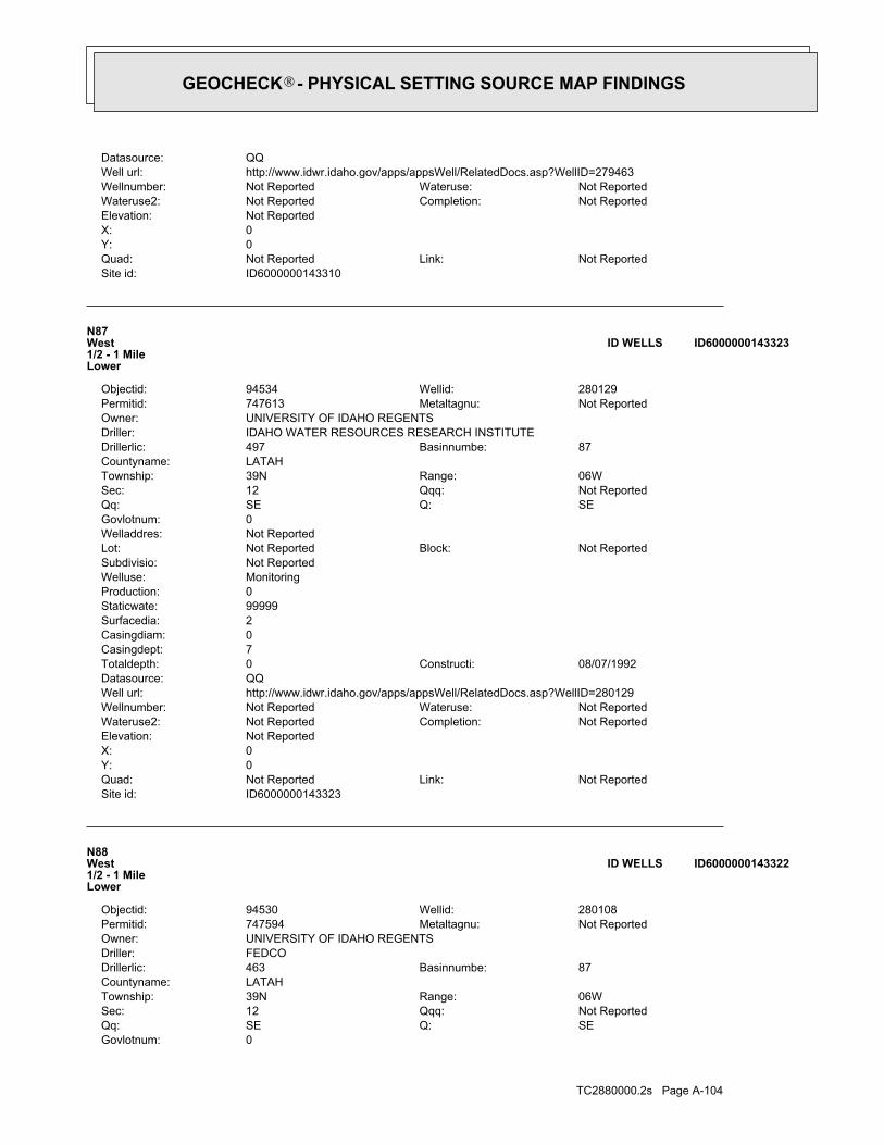
TC2880000.2s Page A-104
0Govlotnum:SEQ:SEQq:Not ReportedQqq:12Sec:06WRange:39NTownship:
LATAHCountyname:87Basinnumbe:463Drillerlic:
FEDCODriller:UNIVERSITY OF IDAHO REGENTSOwner:
Not ReportedMetaltagnu:747594Permitid:280108Wellid:94530Objectid:
N88West1/2 - 1 MileLower
ID6000000143322ID WELLS
ID6000000143323Site id:Not ReportedLink:Not ReportedQuad:
0Y:0X:Not ReportedElevation:
Not ReportedCompletion:Not ReportedWateruse2:Not ReportedWateruse:Not ReportedWellnumber:
http://www.idwr.idaho.gov/apps/appsWell/RelatedDocs.asp?WellID=280129Well url:QQDatasource:
08/07/1992Constructi:0Totaldepth:7Casingdept:0Casingdiam:2Surfacedia:99999Staticwate:0Production:MonitoringWelluse:Not ReportedSubdivisio:
Not ReportedBlock:Not ReportedLot:Not ReportedWelladdres:0Govlotnum:
SEQ:SEQq:Not ReportedQqq:12Sec:06WRange:39NTownship:
LATAHCountyname:87Basinnumbe:497Drillerlic:
IDAHO WATER RESOURCES RESEARCH INSTITUTEDriller:UNIVERSITY OF IDAHO REGENTSOwner:
Not ReportedMetaltagnu:747613Permitid:280129Wellid:94534Objectid:
N87West1/2 - 1 MileLower
ID6000000143323ID WELLS
ID6000000143310Site id:Not ReportedLink:Not ReportedQuad:
0Y:0X:Not ReportedElevation:
Not ReportedCompletion:Not ReportedWateruse2:Not ReportedWateruse:Not ReportedWellnumber:
http://www.idwr.idaho.gov/apps/appsWell/RelatedDocs.asp?WellID=279463Well url:QQDatasource:
GEOCHECK - PHYSICAL SETTING SOURCE MAP FINDINGS®

TC2880000.2s Page A-105
ID6000000143324Site id:Not ReportedLink:Not ReportedQuad:
0Y:0X:Not ReportedElevation:
Not ReportedCompletion:Not ReportedWateruse2:Not ReportedWateruse:Not ReportedWellnumber:
http://www.idwr.idaho.gov/apps/appsWell/RelatedDocs.asp?WellID=280130Well url:QQDatasource:
08/14/1992Constructi:0Totaldepth:25Casingdept:0Casingdiam:2Surfacedia:99999Staticwate:0Production:Air-SpargeWelluse:Not ReportedSubdivisio:
Not ReportedBlock:Not ReportedLot:Not ReportedWelladdres:0Govlotnum:
SEQ:SEQq:Not ReportedQqq:12Sec:06WRange:39NTownship:
LATAHCountyname:87Basinnumbe:497Drillerlic:
IDAHO WATER RESOURCES RESEARCH INSTITUTEDriller:UNIVERSITY OF IDAHO REGENTSOwner:
Not ReportedMetaltagnu:747614Permitid:280130Wellid:94535Objectid:
N89West1/2 - 1 MileLower
ID6000000143324ID WELLS
ID6000000143322Site id:Not ReportedLink:Not ReportedQuad:
0Y:0X:Not ReportedElevation:
Not ReportedCompletion:Not ReportedWateruse2:Not ReportedWateruse:Not ReportedWellnumber:
http://www.idwr.idaho.gov/apps/appsWell/RelatedDocs.asp?WellID=280108Well url:QQDatasource:
06/10/1992Constructi:0Totaldepth:0Casingdept:0Casingdiam:0Surfacedia:0Staticwate:0Production:MonitoringWelluse:Not ReportedSubdivisio:
Not ReportedBlock:Not ReportedLot:PERIMETER DRWelladdres:
GEOCHECK - PHYSICAL SETTING SOURCE MAP FINDINGS®

TC2880000.2s Page A-106
08/14/1992Constructi:0Totaldepth:25Casingdept:0Casingdiam:2Surfacedia:99999Staticwate:0Production:Air-SpargeWelluse:Not ReportedSubdivisio:
Not ReportedBlock:Not ReportedLot:Not ReportedWelladdres:0Govlotnum:
SEQ:SEQq:Not ReportedQqq:12Sec:06WRange:39NTownship:
LATAHCountyname:87Basinnumbe:497Drillerlic:
IDAHO WATER RESOURCES RESEARCH INSTITUTEDriller:UNIVERSITY OF IDAHO REGENTSOwner:
Not ReportedMetaltagnu:747615Permitid:280131Wellid:94536Objectid:
N91West1/2 - 1 MileLower
ID6000000143325ID WELLS
ID6000000143326Site id:Not ReportedLink:Not ReportedQuad:
0Y:0X:Not ReportedElevation:
Not ReportedCompletion:Not ReportedWateruse2:Not ReportedWateruse:Not ReportedWellnumber:
http://www.idwr.idaho.gov/apps/appsWell/RelatedDocs.asp?WellID=280132Well url:QQDatasource:
08/07/1992Constructi:0Totaldepth:7Casingdept:0Casingdiam:2Surfacedia:99999Staticwate:0Production:Air-SpargeWelluse:Not ReportedSubdivisio:
Not ReportedBlock:Not ReportedLot:Not ReportedWelladdres:0Govlotnum:
SEQ:SEQq:Not ReportedQqq:12Sec:06WRange:39NTownship:
LATAHCountyname:87Basinnumbe:497Drillerlic:
IDAHO WATER RESOURCES RESEARCH INSTITUTEDriller:UNIVERSITY OF IDAHO REGENTSOwner:
Not ReportedMetaltagnu:747616Permitid:280132Wellid:94537Objectid:
N90West1/2 - 1 MileLower
ID6000000143326ID WELLS
Map IDDirectionDistanceElevation EDR ID NumberDatabase
GEOCHECK - PHYSICAL SETTING SOURCE MAP FINDINGS®
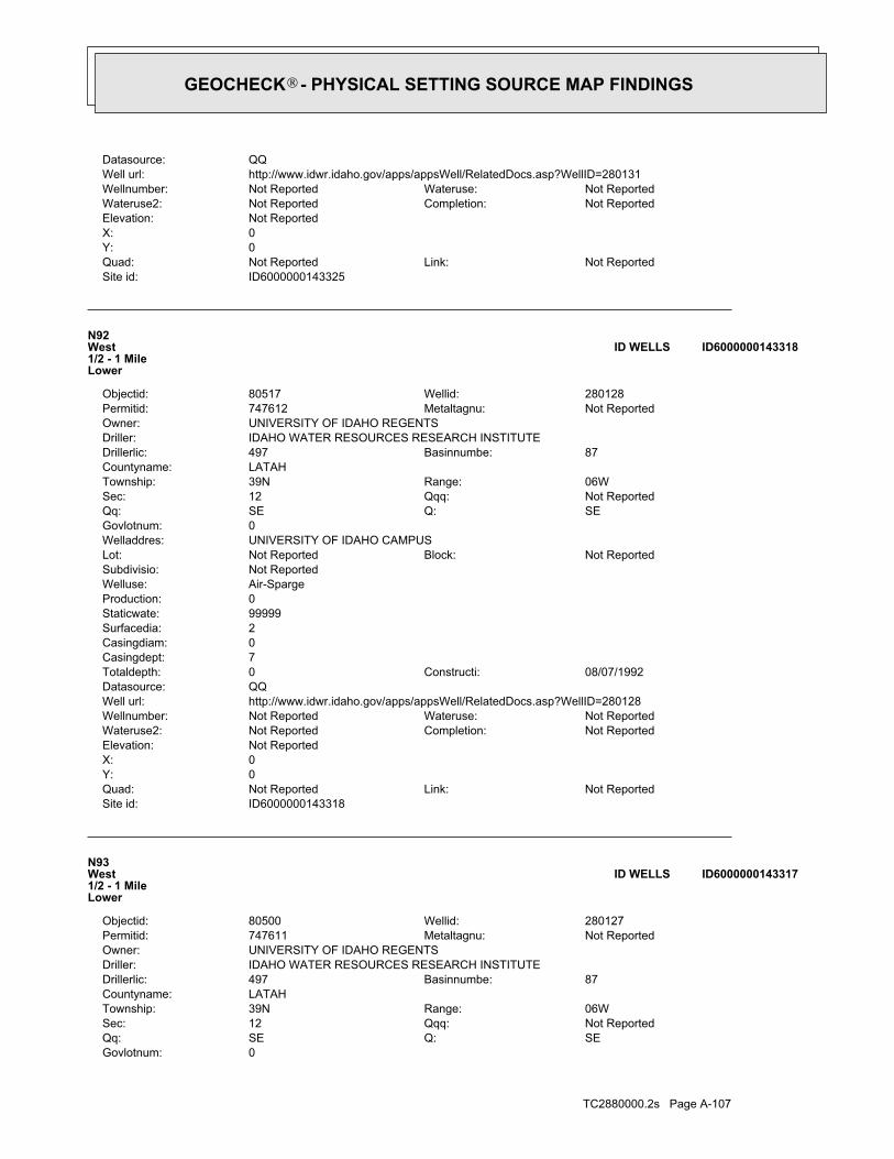
TC2880000.2s Page A-107
0Govlotnum:SEQ:SEQq:Not ReportedQqq:12Sec:06WRange:39NTownship:
LATAHCountyname:87Basinnumbe:497Drillerlic:
IDAHO WATER RESOURCES RESEARCH INSTITUTEDriller:UNIVERSITY OF IDAHO REGENTSOwner:
Not ReportedMetaltagnu:747611Permitid:280127Wellid:80500Objectid:
N93West1/2 - 1 MileLower
ID6000000143317ID WELLS
ID6000000143318Site id:Not ReportedLink:Not ReportedQuad:
0Y:0X:Not ReportedElevation:
Not ReportedCompletion:Not ReportedWateruse2:Not ReportedWateruse:Not ReportedWellnumber:
http://www.idwr.idaho.gov/apps/appsWell/RelatedDocs.asp?WellID=280128Well url:QQDatasource:
08/07/1992Constructi:0Totaldepth:7Casingdept:0Casingdiam:2Surfacedia:99999Staticwate:0Production:Air-SpargeWelluse:Not ReportedSubdivisio:
Not ReportedBlock:Not ReportedLot:UNIVERSITY OF IDAHO CAMPUSWelladdres:0Govlotnum:
SEQ:SEQq:Not ReportedQqq:12Sec:06WRange:39NTownship:
LATAHCountyname:87Basinnumbe:497Drillerlic:
IDAHO WATER RESOURCES RESEARCH INSTITUTEDriller:UNIVERSITY OF IDAHO REGENTSOwner:
Not ReportedMetaltagnu:747612Permitid:280128Wellid:80517Objectid:
N92West1/2 - 1 MileLower
ID6000000143318ID WELLS
ID6000000143325Site id:Not ReportedLink:Not ReportedQuad:
0Y:0X:Not ReportedElevation:
Not ReportedCompletion:Not ReportedWateruse2:Not ReportedWateruse:Not ReportedWellnumber:
http://www.idwr.idaho.gov/apps/appsWell/RelatedDocs.asp?WellID=280131Well url:QQDatasource:
GEOCHECK - PHYSICAL SETTING SOURCE MAP FINDINGS®

TC2880000.2s Page A-108
ID6000000143319Site id:Not ReportedLink:Not ReportedQuad:
0Y:0X:Not ReportedElevation:
Not ReportedCompletion:Not ReportedWateruse2:Not ReportedWateruse:Not ReportedWellnumber:
http://www.idwr.idaho.gov/apps/appsWell/RelatedDocs.asp?WellID=279464Well url:QQDatasource:
09/07/1994Constructi:0Totaldepth:20Casingdept:0Casingdiam:2Surfacedia:99999Staticwate:0Production:MonitoringWelluse:Not ReportedSubdivisio:
Not ReportedBlock:Not ReportedLot:WEST FARM OPERATIONS 6TH STWelladdres:0Govlotnum:
SEQ:SEQq:Not ReportedQqq:12Sec:06WRange:39NTownship:
LATAHCountyname:87Basinnumbe:497Drillerlic:
IDAHO WATER RESOURCES RESEARCH INSTITUTEDriller:UNIVERSITY OF IDAHO REGENTSOwner:
Not ReportedMetaltagnu:747728Permitid:279464Wellid:92277Objectid:
N94West1/2 - 1 MileLower
ID6000000143319ID WELLS
ID6000000143317Site id:Not ReportedLink:Not ReportedQuad:
0Y:0X:Not ReportedElevation:
Not ReportedCompletion:Not ReportedWateruse2:Not ReportedWateruse:Not ReportedWellnumber:
http://www.idwr.idaho.gov/apps/appsWell/RelatedDocs.asp?WellID=280127Well url:QQDatasource:
08/07/1992Constructi:0Totaldepth:7Casingdept:0Casingdiam:2Surfacedia:99999Staticwate:0Production:Air-SpargeWelluse:Not ReportedSubdivisio:
Not ReportedBlock:Not ReportedLot:Not ReportedWelladdres:
GEOCHECK - PHYSICAL SETTING SOURCE MAP FINDINGS®

TC2880000.2s Page A-109
09/08/1994Constructi:0Totaldepth:22Casingdept:0Casingdiam:2Surfacedia:99999Staticwate:0Production:MonitoringWelluse:Not ReportedSubdivisio:
Not ReportedBlock:Not ReportedLot:6TH ST EXTENSION, WELL VE-14Welladdres:0Govlotnum:
SEQ:SEQq:Not ReportedQqq:12Sec:06WRange:39NTownship:
LATAHCountyname:87Basinnumbe:497Drillerlic:
IDAHO WATER RESOURCES RESEARCH INSTITUTEDriller:UNIVERSITY OF IDAHO REGENTSOwner:
Not ReportedMetaltagnu:747730Permitid:279466Wellid:92280Objectid:
N96West1/2 - 1 MileLower
ID6000000143320ID WELLS
ID6000000143321Site id:Not ReportedLink:Not ReportedQuad:
0Y:0X:Not ReportedElevation:
Not ReportedCompletion:Not ReportedWateruse2:Not ReportedWateruse:Not ReportedWellnumber:
http://www.idwr.idaho.gov/apps/appsWell/RelatedDocs.asp?WellID=280107Well url:QQDatasource:
06/10/1992Constructi:0Totaldepth:202Casingdept:0Casingdiam:2Surfacedia:55Staticwate:0Production:MonitoringWelluse:Not ReportedSubdivisio:
Not ReportedBlock:Not ReportedLot:Not ReportedWelladdres:0Govlotnum:
SEQ:SEQq:Not ReportedQqq:12Sec:06WRange:39NTownship:
LATAHCountyname:87Basinnumbe:463Drillerlic:
FEDCODriller:UNIVERSITY OF IDAHO REGENTSOwner:
Not ReportedMetaltagnu:747593Permitid:280107Wellid:94529Objectid:
N95West1/2 - 1 MileLower
ID6000000143321ID WELLS
Map IDDirectionDistanceElevation EDR ID NumberDatabase
GEOCHECK - PHYSICAL SETTING SOURCE MAP FINDINGS®
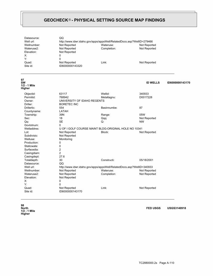
TC2880000.2s Page A-110
98North1/2 - 1 MileHigher
USGS3140918FED USGS
ID6000000143170Site id:Not ReportedLink:Not ReportedQuad:
0Y:0X:Not ReportedElevation:
Not ReportedCompletion:Not ReportedWateruse2:Not ReportedWateruse:Not ReportedWellnumber:
http://www.idwr.idaho.gov/apps/appsWell/RelatedDocs.asp?WellID=340933Well url:QQDatasource:
05/18/2001Constructi:30Totaldepth:27.6Casingdept:2Casingdiam:2Surfacedia:0Staticwate:0Production:MonitoringWelluse:Not ReportedSubdivisio:
Not ReportedBlock:Not ReportedLot:U OF I GOLF COURSE MAINT BLDG-ORIGINAL HOLE NO 10341Welladdres:0Govlotnum:
NWQ:SEQq:Not ReportedQqq:18Sec:05WRange:39NTownship:
LATAHCountyname:87Basinnumbe:554Drillerlic:
BORETEC INCDriller:UNIVERSITY OF IDAHO REGENTSOwner:
D0017228Metaltagnu:768942Permitid:340933Wellid:63117Objectid:
97SW1/2 - 1 MileHigher
ID6000000143170ID WELLS
ID6000000143320Site id:Not ReportedLink:Not ReportedQuad:
0Y:0X:Not ReportedElevation:
Not ReportedCompletion:Not ReportedWateruse2:Not ReportedWateruse:Not ReportedWellnumber:
http://www.idwr.idaho.gov/apps/appsWell/RelatedDocs.asp?WellID=279466Well url:QQDatasource:
GEOCHECK - PHYSICAL SETTING SOURCE MAP FINDINGS®
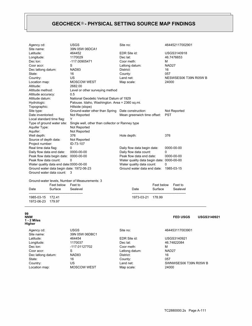
TC2880000.2s Page A-111
24000Map scale:MOSCOW WESTLocation map:SWNWSES06 T39N R05W BLand net:USCountry:057County:16State:16District:NAD83Dec latlong datum:NAD27Latlong datum:SCoor accr:MCoor meth:-117.01127702Dec lon:46.74822084Dec lat:1170037Longitude:USGS3140921EDR Site id:464454Latitude:
39N 05W 06DBC1Site name:464453117003901Site no:USGSAgency cd:
99NNW1 - 2 MilesHigher
USGS3140921FED USGS
1972-06-23 179.971985-03-15 172.41 1973-03-21 178.99
DateFeet belowSurface
Feet toSealevel
-------------------------------------------------Date
Feet belowSurface
Feet toSealevel
-------------------------------------------------
Ground-water levels, Number of Measurements: 3
3Ground water data count:1985-03-15Ground water data end date:Ground water data begin date: 1972-06-230Water quality data count:0000-00-00Water quality data end date:0000-00-00Water quality data begin date:0Peak flow data count:0000-00-00Peak flow data end date:0000-00-00Peak flow data begin date:0Daily flow data count:0000-00-00Daily flow data end date:0000-00-00Daily flow data begin date:0Real time data flag:
ID-73-107Project number:Not ReportedSource of depth data:
376Hole depth:376Well depth:Not ReportedAquifer:Not ReportedAquifer Type:Single well, other than collector or Ranney typeType of ground water site:YLocal standard time flag:
PSTMean greenwich time offset:Not ReportedDate inventoried:Not ReportedDate construction:Ground-water other than SpringSite type:
Hillside (slope)Topographic:Palouse. Idaho, Washington. Area = 2360 sq.mi.Hydrologic:National Geodetic Vertical Datum of 1929Altitude datum:0.5Altitude accuracy:Level or other surveying methodAltitude method:2682.00Altitude:
24000Map scale:MOSCOW WESTLocation map:NESWSES06 T39N R05W BLand net:USCountry:057County:16State:16District:NAD83Dec latlong datum:NAD27Latlong datum:SCoor accr:MCoor meth:-117.00905471Dec lon:46.7476653Dec lat:1170029Longitude:USGS3140918EDR Site id:464452Latitude:
39N 05W 06DCA1Site name:464452117002901Site no:USGSAgency cd:
GEOCHECK - PHYSICAL SETTING SOURCE MAP FINDINGS®

TC2880000.2s Page A-112
06/27/1988Constructi:0Totaldepth:90Casingdept:0Casingdiam:8Surfacedia:55Staticwate:20Production:Domestic-Single ResidenceWelluse:Not ReportedSubdivisio:
Not ReportedBlock:Not ReportedLot:Not ReportedWelladdres:0Govlotnum:
SWQ:SEQq:Not ReportedQqq:5Sec:05WRange:39NTownship:
LATAHCountyname:87Basinnumbe:58Drillerlic:
WITT WELL DRILLINGDriller:LEONARD HYKEOwner:
Not ReportedMetaltagnu:747476Permitid:279990Wellid:80441Objectid:
O100NE1 - 2 MilesHigher
ID6000000143549ID WELLS
1972-06-22 127.821985-03-15 120.55 1973-03-21 127.23
DateFeet belowSurface
Feet toSealevel
-------------------------------------------------Date
Feet belowSurface
Feet toSealevel
-------------------------------------------------
Ground-water levels, Number of Measurements: 3
3Ground water data count:1985-03-15Ground water data end date:Ground water data begin date: 1972-06-220Water quality data count:0000-00-00Water quality data end date:0000-00-00Water quality data begin date:0Peak flow data count:0000-00-00Peak flow data end date:0000-00-00Peak flow data begin date:0Daily flow data count:0000-00-00Daily flow data end date:0000-00-00Daily flow data begin date:0Real time data flag:
ID-73-107Project number:Not ReportedSource of depth data:
150Hole depth:150Well depth:Not ReportedAquifer:Not ReportedAquifer Type:Single well, other than collector or Ranney typeType of ground water site:YLocal standard time flag:
PSTMean greenwich time offset:Not ReportedDate inventoried:Not ReportedDate construction:Ground-water other than SpringSite type:
UndulatingTopographic:Palouse. Idaho, Washington. Area = 2360 sq.mi.Hydrologic:National Geodetic Vertical Datum of 1929Altitude datum:0.5Altitude accuracy:Level or other surveying methodAltitude method:2630.60Altitude:
GEOCHECK - PHYSICAL SETTING SOURCE MAP FINDINGS®

TC2880000.2s Page A-113
P102ENE1 - 2 MilesHigher
USGS3122809FED USGS
ID6000000143550Site id:Not ReportedLink:Not ReportedQuad:
0Y:0X:Not ReportedElevation:
Not ReportedCompletion:Not ReportedWateruse2:Not ReportedWateruse:Not ReportedWellnumber:
http://www.idwr.idaho.gov/apps/appsWell/RelatedDocs.asp?WellID=280052Well url:QQDatasource:
09/09/1990Constructi:0Totaldepth:64Casingdept:0Casingdiam:8Surfacedia:90Staticwate:60Production:Domestic-Single ResidenceWelluse:Not ReportedSubdivisio:
Not ReportedBlock:Not ReportedLot:Not ReportedWelladdres:0Govlotnum:
SWQ:SEQq:Not ReportedQqq:5Sec:05WRange:39NTownship:
LATAHCountyname:87Basinnumbe:58Drillerlic:
WITT WELL DRILLINGDriller:MATT GRAYOwner:
Not ReportedMetaltagnu:747538Permitid:280052Wellid:80473Objectid:
O101NE1 - 2 MilesHigher
ID6000000143550ID WELLS
ID6000000143549Site id:Not ReportedLink:Not ReportedQuad:
0Y:0X:Not ReportedElevation:
Not ReportedCompletion:Not ReportedWateruse2:Not ReportedWateruse:Not ReportedWellnumber:
http://www.idwr.idaho.gov/apps/appsWell/RelatedDocs.asp?WellID=279990Well url:QQDatasource:
GEOCHECK - PHYSICAL SETTING SOURCE MAP FINDINGS®
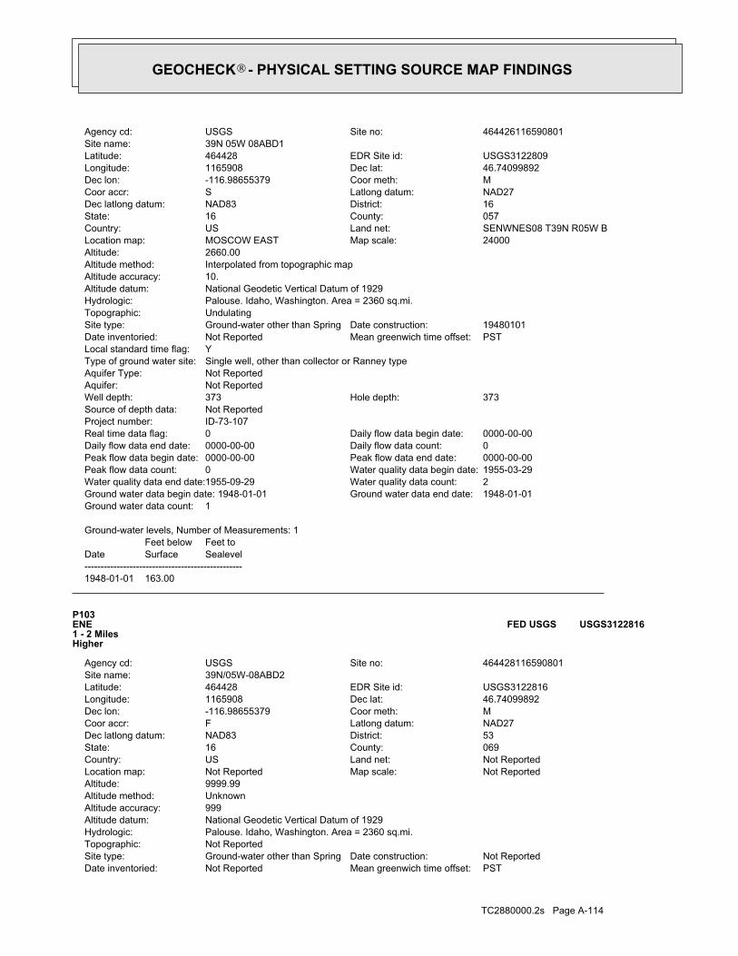
TC2880000.2s Page A-114
PSTMean greenwich time offset:Not ReportedDate inventoried:Not ReportedDate construction:Ground-water other than SpringSite type:
Not ReportedTopographic:Palouse. Idaho, Washington. Area = 2360 sq.mi.Hydrologic:National Geodetic Vertical Datum of 1929Altitude datum:999Altitude accuracy:UnknownAltitude method:9999.99Altitude:
Not ReportedMap scale:Not ReportedLocation map:Not ReportedLand net:USCountry:069County:16State:53District:NAD83Dec latlong datum:NAD27Latlong datum:FCoor accr:MCoor meth:-116.98655379Dec lon:46.74099892Dec lat:1165908Longitude:USGS3122816EDR Site id:464428Latitude:
39N/05W-08ABD2Site name:464428116590801Site no:USGSAgency cd:
P103ENE1 - 2 MilesHigher
USGS3122816FED USGS
1948-01-01 163.00
DateFeet belowSurface
Feet toSealevel
-------------------------------------------------
Ground-water levels, Number of Measurements: 1
1Ground water data count:1948-01-01Ground water data end date:Ground water data begin date: 1948-01-012Water quality data count:1955-09-29Water quality data end date:1955-03-29Water quality data begin date:0Peak flow data count:0000-00-00Peak flow data end date:0000-00-00Peak flow data begin date:0Daily flow data count:0000-00-00Daily flow data end date:0000-00-00Daily flow data begin date:0Real time data flag:
ID-73-107Project number:Not ReportedSource of depth data:
373Hole depth:373Well depth:Not ReportedAquifer:Not ReportedAquifer Type:Single well, other than collector or Ranney typeType of ground water site:YLocal standard time flag:
PSTMean greenwich time offset:Not ReportedDate inventoried:19480101Date construction:Ground-water other than SpringSite type:
UndulatingTopographic:Palouse. Idaho, Washington. Area = 2360 sq.mi.Hydrologic:National Geodetic Vertical Datum of 1929Altitude datum:10.Altitude accuracy:Interpolated from topographic mapAltitude method:2660.00Altitude:
24000Map scale:MOSCOW EASTLocation map:SENWNES08 T39N R05W BLand net:USCountry:057County:16State:16District:NAD83Dec latlong datum:NAD27Latlong datum:SCoor accr:MCoor meth:-116.98655379Dec lon:46.74099892Dec lat:1165908Longitude:USGS3122809EDR Site id:464428Latitude:
39N 05W 08ABD1Site name:464426116590801Site no:USGSAgency cd:
GEOCHECK - PHYSICAL SETTING SOURCE MAP FINDINGS®

TC2880000.2s Page A-115
105NNE1 - 2 MilesHigher
USGS3140922FED USGS
ID6000000143087Site id:Not ReportedLink:Not ReportedQuad:
0Y:0X:Not ReportedElevation:
Not ReportedCompletion:Not ReportedWateruse2:Not ReportedWateruse:Not ReportedWellnumber:
http://www.idwr.idaho.gov/apps/appsWell/RelatedDocs.asp?WellID=279997Well url:QQDatasource:
09/23/1988Constructi:0Totaldepth:65Casingdept:0Casingdiam:8Surfacedia:84Staticwate:.5Production:Domestic-Single ResidenceWelluse:Not ReportedSubdivisio:
Not ReportedBlock:Not ReportedLot:Not ReportedWelladdres:0Govlotnum:
SWQ:NEQq:Not ReportedQqq:17Sec:05WRange:39NTownship:
LATAHCountyname:87Basinnumbe:376Drillerlic:
MC PHERSON & WRIGHT DRILLINGDriller:WILLIAM VENOSDELOwner:
Not ReportedMetaltagnu:747483Permitid:279997Wellid:80452Objectid:
104SE1 - 2 MilesHigher
ID6000000143087ID WELLS
Ground-water levels, Number of Measurements: 0
Not ReportedGround water data count:Not ReportedGround water data end date:Ground water data begin date: Not ReportedNot ReportedWater quality data count:Not ReportedWater quality data end date:Not ReportedWater quality data begin date:Not ReportedPeak flow data count:Not ReportedPeak flow data end date:Not ReportedPeak flow data begin date:Not ReportedDaily flow data count:Not ReportedDaily flow data end date:Not ReportedDaily flow data begin date:Not ReportedReal time data flag:
WA36500Project number:Not ReportedSource of depth data:
Not ReportedHole depth:Not ReportedWell depth:Not ReportedAquifer:Not ReportedAquifer Type:Single well, other than collector or Ranney typeType of ground water site:YLocal standard time flag:
GEOCHECK - PHYSICAL SETTING SOURCE MAP FINDINGS®

TC2880000.2s Page A-116
0Govlotnum:NEQ:SWQq:Not ReportedQqq:12Sec:06WRange:39NTownship:
LATAHCountyname:87Basinnumbe:125Drillerlic:
TWO U DRILLING LLCDriller:UNIVERSITY OF IDAHO REGENTSOwner:
Not ReportedMetaltagnu:747544Permitid:280058Wellid:80428Objectid:
Q106WSW1 - 2 MilesHigher
ID6000000143292ID WELLS
1972-06-22 42.22 1972-06-22 42.22
DateFeet belowSurface
Feet toSealevel
-------------------------------------------------Date
Feet belowSurface
Feet toSealevel
-------------------------------------------------
Ground-water levels, Number of Measurements: 2
1Ground water data count:1972-06-22Ground water data end date:Ground water data begin date: 1972-06-220Water quality data count:0000-00-00Water quality data end date:0000-00-00Water quality data begin date:0Peak flow data count:0000-00-00Peak flow data end date:0000-00-00Peak flow data begin date:0Daily flow data count:0000-00-00Daily flow data end date:0000-00-00Daily flow data begin date:0Real time data flag:
ID-73-107Project number:Not ReportedSource of depth data:
90.0Hole depth:75.0Well depth:Not ReportedAquifer:Not ReportedAquifer Type:Single well, other than collector or Ranney typeType of ground water site:YLocal standard time flag:
PSTMean greenwich time offset:Not ReportedDate inventoried:Not ReportedDate construction:Ground-water other than SpringSite type:
UndulatingTopographic:Palouse. Idaho, Washington. Area = 2360 sq.mi.Hydrologic:National Geodetic Vertical Datum of 1929Altitude datum:10.Altitude accuracy:Interpolated from topographic mapAltitude method:2660.00Altitude:
24000Map scale:MOSCOW WESTLocation map:SWNWSWS05 T39N R05W BLand net:USCountry:057County:16State:16District:NAD83Dec latlong datum:NAD27Latlong datum:SCoor accr:MCoor meth:-117.00127669Dec lon:46.7487765Dec lat:1170001Longitude:USGS3140922EDR Site id:464456Latitude:
39N 05W 05CBC1Site name:464456117000101Site no:USGSAgency cd:
GEOCHECK - PHYSICAL SETTING SOURCE MAP FINDINGS®
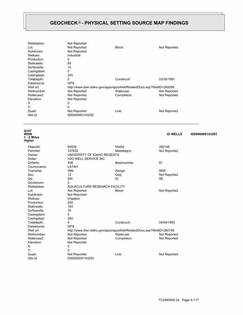
TC2880000.2s Page A-117
ID6000000143293Site id:Not ReportedLink:Not ReportedQuad:
0Y:0X:Not ReportedElevation:
Not ReportedCompletion:Not ReportedWateruse2:Not ReportedWateruse:Not ReportedWellnumber:
http://www.idwr.idaho.gov/apps/appsWell/RelatedDocs.asp?WellID=280148Well url:GPSDatasource:
05/04/1993Constructi:0Totaldepth:284Casingdept:0Casingdiam:16Surfacedia:183Staticwate:200Production:IrrigationWelluse:Not ReportedSubdivisio:
Not ReportedBlock:Not ReportedLot:AQUACULTURE RESEARCH FACILITYWelladdres:0Govlotnum:
SEQ:SWQq:Not ReportedQqq:12Sec:06WRange:39NTownship:
LATAHCountyname:87Basinnumbe:448Drillerlic:
H2O WELL SERVICE INCDriller:UNIVERSITY OF IDAHO REGENTSOwner:
Not ReportedMetaltagnu:747632Permitid:280148Wellid:94538Objectid:
Q107WSW1 - 2 MilesHigher
ID6000000143293ID WELLS
ID6000000143292Site id:Not ReportedLink:Not ReportedQuad:
0Y:0X:Not ReportedElevation:
Not ReportedCompletion:Not ReportedWateruse2:Not ReportedWateruse:Not ReportedWellnumber:
http://www.idwr.idaho.gov/apps/appsWell/RelatedDocs.asp?WellID=280058Well url:GPSDatasource:
03/30/1991Constructi:0Totaldepth:245Casingdept:0Casingdiam:12Surfacedia:83Staticwate:0Production:IndustrialWelluse:Not ReportedSubdivisio:
Not ReportedBlock:Not ReportedLot:Not ReportedWelladdres:
GEOCHECK - PHYSICAL SETTING SOURCE MAP FINDINGS®

TC2880000.2s Page A-118
08/24/2001Constructi:165Totaldepth:165Casingdept:6Casingdiam:8Surfacedia:55Staticwate:100Production:Domestic-Single ResidenceWelluse:Not ReportedSubdivisio:
Not ReportedBlock:Not ReportedLot:1040 RODEO DRWelladdres:0Govlotnum:
SEQ:SWQq:Not ReportedQqq:5Sec:05WRange:39NTownship:
LATAHCountyname:87Basinnumbe:103Drillerlic:
BURNS WELL DRILLING INCDriller:KENNETH L MARBLEOwner:
D0017523Metaltagnu:770704Permitid:342650Wellid:105175Objectid:
R109NE1 - 2 MilesHigher
ID6000000143524ID WELLS
ID6000000143291Site id:Not ReportedLink:Not ReportedQuad:
0Y:0X:Not ReportedElevation:
Not ReportedCompletion:Not ReportedWateruse2:Not ReportedWateruse:Not ReportedWellnumber:
http://www.idwr.idaho.gov/apps/appsWell/RelatedDocs.asp?WellID=280142Well url:GPSDatasource:
02/05/1993Constructi:0Totaldepth:62Casingdept:0Casingdiam:8Surfacedia:148Staticwate:200Production:Fish PropagationWelluse:Not ReportedSubdivisio:
Not ReportedBlock:Not ReportedLot:WEST 6TH STREETWelladdres:0Govlotnum:
SEQ:SWQq:Not ReportedQqq:12Sec:06WRange:39NTownship:
LATAHCountyname:87Basinnumbe:448Drillerlic:
H2O WELL SERVICE INCDriller:UNIVERSITY OF IDAHO REGENTSOwner:
Not ReportedMetaltagnu:747626Permitid:280142Wellid:80503Objectid:
Q108WSW1 - 2 MilesHigher
ID6000000143291ID WELLS
Map IDDirectionDistanceElevation EDR ID NumberDatabase
GEOCHECK - PHYSICAL SETTING SOURCE MAP FINDINGS®

TC2880000.2s Page A-119
0Govlotnum:SEQ:SWQq:Not ReportedQqq:5Sec:05WRange:39NTownship:
LATAHCountyname:87Basinnumbe:103Drillerlic:
BURNS WELL DRILLING INCDriller:MARGO KAY MARBLEOwner:
D0017523Metaltagnu:770704Permitid:342650Wellid:105177Objectid:
R111NE1 - 2 MilesHigher
ID6000000143526ID WELLS
ID6000000143523Site id:Not ReportedLink:Not ReportedQuad:
0Y:0X:Not ReportedElevation:
Not ReportedCompletion:Not ReportedWateruse2:Not ReportedWateruse:Not ReportedWellnumber:
http://www.idwr.idaho.gov/apps/appsWell/RelatedDocs.asp?WellID=342650Well url:GPSDatasource:
08/24/2001Constructi:165Totaldepth:58Casingdept:8Casingdiam:8Surfacedia:55Staticwate:100Production:Domestic-Single ResidenceWelluse:Not ReportedSubdivisio:
Not ReportedBlock:Not ReportedLot:1040 RODEO DRWelladdres:0Govlotnum:
SEQ:SWQq:Not ReportedQqq:5Sec:05WRange:39NTownship:
LATAHCountyname:87Basinnumbe:103Drillerlic:
BURNS WELL DRILLING INCDriller:KENNETH L MARBLEOwner:
D0017523Metaltagnu:770704Permitid:342650Wellid:105174Objectid:
R110NE1 - 2 MilesHigher
ID6000000143523ID WELLS
ID6000000143524Site id:Not ReportedLink:Not ReportedQuad:
0Y:0X:Not ReportedElevation:
Not ReportedCompletion:Not ReportedWateruse2:Not ReportedWateruse:Not ReportedWellnumber:
http://www.idwr.idaho.gov/apps/appsWell/RelatedDocs.asp?WellID=342650Well url:GPSDatasource:
GEOCHECK - PHYSICAL SETTING SOURCE MAP FINDINGS®

TC2880000.2s Page A-120
ID6000000143525Site id:Not ReportedLink:Not ReportedQuad:
0Y:0X:Not ReportedElevation:
Not ReportedCompletion:Not ReportedWateruse2:Not ReportedWateruse:Not ReportedWellnumber:
http://www.idwr.idaho.gov/apps/appsWell/RelatedDocs.asp?WellID=342650Well url:GPSDatasource:
08/24/2001Constructi:165Totaldepth:165Casingdept:6Casingdiam:8Surfacedia:55Staticwate:100Production:Domestic-Single ResidenceWelluse:Not ReportedSubdivisio:
Not ReportedBlock:Not ReportedLot:1040 RODEO DRWelladdres:0Govlotnum:
SEQ:SWQq:Not ReportedQqq:5Sec:05WRange:39NTownship:
LATAHCountyname:87Basinnumbe:103Drillerlic:
BURNS WELL DRILLING INCDriller:MARGO KAY MARBLEOwner:
D0017523Metaltagnu:770704Permitid:342650Wellid:105176Objectid:
R112NE1 - 2 MilesHigher
ID6000000143525ID WELLS
ID6000000143526Site id:Not ReportedLink:Not ReportedQuad:
0Y:0X:Not ReportedElevation:
Not ReportedCompletion:Not ReportedWateruse2:Not ReportedWateruse:Not ReportedWellnumber:
http://www.idwr.idaho.gov/apps/appsWell/RelatedDocs.asp?WellID=342650Well url:GPSDatasource:
08/24/2001Constructi:165Totaldepth:58Casingdept:8Casingdiam:8Surfacedia:55Staticwate:100Production:Domestic-Single ResidenceWelluse:Not ReportedSubdivisio:
Not ReportedBlock:Not ReportedLot:1040 RODEO DRWelladdres:
GEOCHECK - PHYSICAL SETTING SOURCE MAP FINDINGS®

TC2880000.2s Page A-121
1972-06-22 61.05 1972-06-22 61.051973-03-21 61.42 1973-03-21 61.42
DateFeet belowSurface
Feet toSealevel
-------------------------------------------------Date
Feet belowSurface
Feet toSealevel
-------------------------------------------------
Ground-water levels, Number of Measurements: 4
2Ground water data count:1973-03-21Ground water data end date:Ground water data begin date: 1972-06-220Water quality data count:0000-00-00Water quality data end date:0000-00-00Water quality data begin date:0Peak flow data count:0000-00-00Peak flow data end date:0000-00-00Peak flow data begin date:0Daily flow data count:0000-00-00Daily flow data end date:0000-00-00Daily flow data begin date:0Real time data flag:
ID-73-107Project number:Not ReportedSource of depth data:
90.0Hole depth:90.0Well depth:Not ReportedAquifer:Not ReportedAquifer Type:Single well, other than collector or Ranney typeType of ground water site:YLocal standard time flag:
PSTMean greenwich time offset:Not ReportedDate inventoried:Not ReportedDate construction:Ground-water other than SpringSite type:
HilltopTopographic:Palouse. Idaho, Washington. Area = 2360 sq.mi.Hydrologic:National Geodetic Vertical Datum of 1929Altitude datum:10.Altitude accuracy:Interpolated from topographic mapAltitude method:2650.00Altitude:
24000Map scale:MOSCOW WESTLocation map:SENESES06 T39N R05W BLand net:USCountry:057County:16State:16District:NAD83Dec latlong datum:NAD27Latlong datum:SCoor accr:MCoor meth:-117.00211007Dec lon:46.74960983Dec lat:1170004Longitude:USGS3140924EDR Site id:464459Latitude:
39N 05W 06DAD1Site name:464459117000401Site no:USGSAgency cd:
113North1 - 2 MilesHigher
USGS3140924FED USGS
Map IDDirectionDistanceElevation EDR ID NumberDatabase
GEOCHECK - PHYSICAL SETTING SOURCE MAP FINDINGS®

TC2880000.2s Page A-122
LATAH2.30.812/10/200383843LATAH2.30.81/25/199683843LATAH2.30.7B5/30/200383843LATAH2.30.7B4/21/199083843LATAH2.30.71/25/199683843LATAH2.30.71/25/199683843LATAH2.30.6B3/26/199083843LATAH2.30.61/25/199683843LATAH2.30.61/25/199683843LATAH2.30.61/25/199683843LATAH2.30.6B3/10/199083843LATAH2.30.61/25/199683843LATAH2.30.6B2/12/200383843LATAH2.30.5B3/12/200383843LATAH2.30.513/12/199083843LATAH2.30.51/25/199683843LATAH2.30.51/25/199683843LATAH2.30.51/25/199683843LATAH2.30.515/1/199083843LATAH2.30.415/28/199083843LATAH2.30.41/25/199683843LATAH2.30.413/30/199083843LATAH2.30.4B3/19/199083843LATAH2.30.413/8/199083843LATAH2.30.31/25/199683843LATAH2.30.32/19/199783843LATAH2.30.313/12/199083843LATAH2.30.31/25/199683843LATAH2.30.31/25/199683843LATAH2.30.312/19/199683843LATAH2.30.313/26/199083843LATAH2.30.3B3/20/199083843LATAH2.30.2B3/12/200383843LATAH2.30.2B3/8/199083843LATAH2.30.213/8/199083843LATAH2.30.213/13/199083843LATAH2.30.2B3/7/199083843LATAH2.30.212/17/199083843LATAH2.30.11/25/199683843LATAH2.30.11/25/199683843LATAH2.30.1B3/6/199083843LATAH2.30.1B3/27/199083843LATAH2.30.11/25/199683843LATAH2.30.11/25/199683843LATAH2.30.11/25/199683843LATAH2.30.11/25/199683843LATAH
_________________________________Avg pCi/LResult pCi/LFloorDateZipCounty
Radon Test Results (pCi/L)
State Database: ID Radon
AREA RADON INFORMATION
GEOCHECK - PHYSICAL SETTING SOURCE MAP FINDINGSRADON
®

TC2880000.2s Page A-123
0%18%82%3.132 pCi/LBasementNot ReportedNot ReportedNot ReportedNot ReportedLiving Area - 2nd Floor0%7%93%0.907 pCi/LLiving Area - 1st Floor
% >20 pCi/L% 4-20 pCi/L% <4 pCi/LAverage ActivityArea
Number of sites tested: 22
Federal Area Radon Information for Zip Code: 83843
: Zone 3 indoor average level < 2 pCi/L. : Zone 2 indoor average level >= 2 pCi/L and <= 4 pCi/L. Note: Zone 1 indoor average level > 4 pCi/L.
Federal EPA Radon Zone for LATAH County: 1
2.318.1B3/5/199083843LATAH2.315.4B1/24/200383843LATAH2.314.7B3/26/199083843LATAH2.310.6B4/2/199083843LATAH2.310.06/14/199383843LATAH2.39.811/5/199383843LATAH2.39.583843LATAH2.38.5B12/6/200383843LATAH2.38.311/24/199783843LATAH2.36.511/10/199783843LATAH2.36.013/9/199083843LATAH2.34.513/2/200483843LATAH2.34.3B3/12/199083843LATAH2.33.92/27/199083843LATAH2.33.8B10/31/200183843LATAH2.33.5B3/24/199083843LATAH2.33.4B11/6/200183843LATAH2.33.2B3/20/199083843LATAH2.32.612/27/199083843LATAH2.32.213/6/200383843LATAH2.32.2B3/27/199083843LATAH2.32.013/31/199083843LATAH2.31.812/23/199083843LATAH2.31.76/29/199683843LATAH2.31.6110/27/200183843LATAH2.31.3B3/25/199083843LATAH2.31.21/25/199683843LATAH2.31.21/25/199683843LATAH2.31.0B3/13/199083843LATAH2.31.01/25/199683843LATAH2.31.0111/6/200183843LATAH2.31.01/25/199683843LATAH2.31.0B3/10/199083843LATAH2.31.0B2/24/199083843LATAH2.30.91/25/199683843LATAH2.30.9B3/5/199083843LATAH2.30.81/25/199683843
AREA RADON INFORMATION
GEOCHECK - PHYSICAL SETTING SOURCE MAP FINDINGSRADON
®

TOPOGRAPHIC INFORMATION
USGS 7.5’ Digital Elevation Model (DEM)Source: United States Geologic SurveyEDR acquired the USGS 7.5’ Digital Elevation Model in 2002 and updated it in 2006. The 7.5 minute DEM correspondsto the USGS 1:24,000- and 1:25,000-scale topographic quadrangle maps. The DEM provides elevation datawith consistent elevation units and projection.
Scanned Digital USGS 7.5’ Topographic Map (DRG)Source: United States Geologic SurveyA digital raster graphic (DRG) is a scanned image of a U.S. Geological Survey topographic map. The map imagesare made by scanning published paper maps on high-resolution scanners. The raster imageis georeferenced and fit to the Universal Transverse Mercator (UTM) projection.
HYDROLOGIC INFORMATION
Flood Zone Data: This data, available in select counties across the country, was obtained by EDR in 2003 & 2009 from the FederalEmergency Management Agency (FEMA). Data depicts 100-year and 500-year flood zones as defined by FEMA.
NWI: National Wetlands Inventory. This data, available in select counties across the country, was obtained by EDRin 2002 and 2005 from the U.S. Fish and Wildlife Service.
State Wetlands Data: Wetlands InventorySource: Department of Water ResourcesTelephone: 208-287-4800
HYDROGEOLOGIC INFORMATION
AQUIFLOW Information SystemRSource: EDR proprietary database of groundwater flow informationEDR has developed the AQUIFLOW Information System (AIS) to provide data on the general direction of groundwater
flow at specific points. EDR has reviewed reports submitted to regulatory authorities at select sites and hasextracted the date of the report, hydrogeologically determined groundwater flow direction and depth to water tableinformation.
GEOLOGIC INFORMATION
Geologic Age and Rock Stratigraphic UnitSource: P.G. Schruben, R.E. Arndt and W.J. Bawiec, Geology of the Conterminous U.S. at 1:2,500,000 Scale - A digitalrepresentation of the 1974 P.B. King and H.M. Beikman Map, USGS Digital Data Series DDS - 11 (1994).
STATSGO: State Soil Geographic DatabaseSource: Department of Agriculture, Natural Resources Conservation ServicesThe U.S. Department of Agriculture’s (USDA) Natural Resources Conservation Service (NRCS) leads the nationalConservation Soil Survey (NCSS) and is responsible for collecting, storing, maintaining and distributing soilsurvey information for privately owned lands in the United States. A soil map in a soil survey is a representationof soil patterns in a landscape. Soil maps for STATSGO are compiled by generalizing more detailed (SSURGO)soil survey maps.
SSURGO: Soil Survey Geographic DatabaseSource: Department of Agriculture, Natural Resources Conservation Services (NRCS)Telephone: 800-672-5559SSURGO is the most detailed level of mapping done by the Natural Resources Conservation Services, mappingscales generally range from 1:12,000 to 1:63,360. Field mapping methods using national standards are used toconstruct the soil maps in the Soil Survey Geographic (SSURGO) database. SSURGO digitizing duplicates theoriginal soil survey maps. This level of mapping is designed for use by landowners, townships and countynatural resource planning and management.
TC2880000.2s Page A-124
PHYSICAL SETTING SOURCE RECORDS SEARCHED
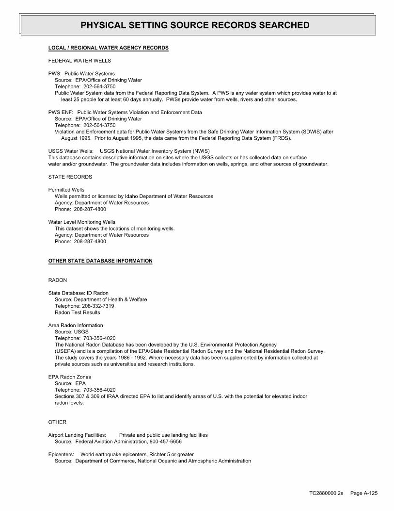
LOCAL / REGIONAL WATER AGENCY RECORDS
FEDERAL WATER WELLS
PWS: Public Water SystemsSource: EPA/Office of Drinking WaterTelephone: 202-564-3750Public Water System data from the Federal Reporting Data System. A PWS is any water system which provides water to at
least 25 people for at least 60 days annually. PWSs provide water from wells, rivers and other sources.
PWS ENF: Public Water Systems Violation and Enforcement DataSource: EPA/Office of Drinking WaterTelephone: 202-564-3750Violation and Enforcement data for Public Water Systems from the Safe Drinking Water Information System (SDWIS) after
August 1995. Prior to August 1995, the data came from the Federal Reporting Data System (FRDS).
USGS Water Wells: USGS National Water Inventory System (NWIS)This database contains descriptive information on sites where the USGS collects or has collected data on surfacewater and/or groundwater. The groundwater data includes information on wells, springs, and other sources of groundwater.
STATE RECORDS
Permitted WellsWells permitted or licensed by Idaho Department of Water ResourcesAgency: Department of Water ResourcesPhone: 208-287-4800
Water Level Monitoring WellsThis dataset shows the locations of monitoring wells.Agency: Department of Water ResourcesPhone: 208-287-4800
OTHER STATE DATABASE INFORMATION
RADON
State Database: ID RadonSource: Department of Health & WelfareTelephone: 208-332-7319Radon Test Results
Area Radon InformationSource: USGSTelephone: 703-356-4020The National Radon Database has been developed by the U.S. Environmental Protection Agency(USEPA) and is a compilation of the EPA/State Residential Radon Survey and the National Residential Radon Survey.The study covers the years 1986 - 1992. Where necessary data has been supplemented by information collected atprivate sources such as universities and research institutions.
EPA Radon ZonesSource: EPATelephone: 703-356-4020Sections 307 & 309 of IRAA directed EPA to list and identify areas of U.S. with the potential for elevated indoorradon levels.
OTHER
Airport Landing Facilities: Private and public use landing facilitiesSource: Federal Aviation Administration, 800-457-6656
Epicenters: World earthquake epicenters, Richter 5 or greaterSource: Department of Commerce, National Oceanic and Atmospheric Administration
TC2880000.2s Page A-125
PHYSICAL SETTING SOURCE RECORDS SEARCHED
STREET AND ADDRESS INFORMATION
© 2010 Tele Atlas North America, Inc. All rights reserved. This material is proprietary and the subject of copyright protectionand other intellectual property rights owned by or licensed to Tele Atlas North America, Inc. The use of this material is subjectto the terms of a license agreement. You will be held liable for any unauthorized copying or disclosure of this material.
TC2880000.2s Page A-126
PHYSICAL SETTING SOURCE RECORDS SEARCHED

����������� �������������
Former Columbia Grain, Inc. Rail AllignmentRail ROW Between Asbury and Lilly StreetsMoscow, ID 83843
Inquiry Number: 2880000.3September 28, 2010

Certified Sanborn® Map Report 9/28/10
Site Name:Former Columbia Grain, Inc.Rail ROW Between Asbury andMoscow, ID 83843
Client Name:Strata Environmental1428 South Main StreetMoscow, ID 83843
EDR Inquiry # 2880000.3 Contact: Shawn Ringo
The complete Sanborn Library collection has been searched by EDR, and fire insurance maps covering the targetproperty location provided by Strata Environmental were identified for the years listed below. The certified SanbornLibrary search results in this report can be authenticated by visiting www.edrnet.com/sanborn and entering thecertification number. Only Environmental Data Resources Inc. (EDR) is authorized to grant rights for commercialreproduction of maps by Sanborn Library LLC, the copyright holder for the collection.
Certified Sanborn Results:
Site Name: Former Columbia Grain, Inc. Rail AllignmentAddress: Rail ROW Between Asbury and Lilly StreetsCity, State, Zip: Moscow, ID 83843Cross Street:P.O. # MOSCIT M10105AProject: MOSCIT M10105ACertification # 178F-44CB-B928
Library of Congress
University Publications of America
EDR Private Collection
The Sanborn Library LLC Since 1866™
The Sanborn Library includes more than 1.2 millionSanborn fire insurance maps, which track historicalproperty usage in approximately 12,000 Americancities and towns. Collections searched:
Sanborn® Library search resultsCertification # 178F-44CB-B928
Maps Provided:
196319551950192819091904
18961893
Limited Permission To Make CopiesStrata Environmental (the client) is permitted to make up to THREE photocopies of this Sanborn Map transmittal and each fire insurance mapaccompanying this report solely for the limited use of its customer. No one other than the client is authorized to make copies. Upon request madedirectly to an EDR Account Executive, the client may be permitted to make a limited number of additional photocopies. This permission isconditioned upon compliance by the client, its customer and their agents with EDR's copyright policy; a copy of which is available upon request.
Disclaimer - Copyright and Trademark noticeThis Report contains certain information obtained from a variety of public and other sources reasonably available to Environmental Data Resources, Inc. It cannot beconcluded from this Report that coverage information for the target and surrounding properties does not exist from other sources. NO WARRANTY EXPRESSED ORIMPLIED, IS MADE WHATSOEVER IN CONNECTION WITH THIS REPORT. ENVIRONMENTAL DATA RESOURCES, INC. SPECIFICALLY DISCLAIMS THEMAKING OF ANY SUCH WARRANTIES, INCLUDING WITHOUT LIMITATION, MERCHANTABILITY OR FITNESS FOR A PARTICULAR USE OR PURPOSE. ALLRISK IS ASSUMED BY THE USER. IN NO EVENT SHALL ENVIRONMENTAL DATA RESOURCES, INC. BE LIABLE TO ANYONE, WHETHER ARISING OUT OFERRORS OR OMISSIONS, NEGLIGENCE, ACCIDENT OR ANY OTHER CAUSE, FOR ANY LOSS OF DAMAGE, INCLUDING, WITHOUT LIMITATION, SPECIAL,INCIDENTAL CONSEQUENTIAL, OR EXEMPLARY DAMAGES. ANY LIABILITY ON THE PART OF ENVIRONMENTAL DATA RESOURCES, INC. IS STRICTLYLIMITED TO A REFUND OF THE AMOUNT PAID FOR THIS REPORT. Purchaser accepts this Report "AS IS". Any analyses, estimates, ratings, environmental risklevels or risk codes provided in this Report are provided for illustrative purposes only, and are not intended to provide, nor should they be interpreted as providingany facts regarding, or prediction or forecast of, any environmental risk for any property. Only a Phase I Environmental Site Assessment performed by anenvironmental professional can provide information regarding the environmental risk for any property. Additionally, the information provided in this Report is not to beconstrued as legal advice.
Copyright 2010 by Environmental Data Resources, Inc. All rights reserved. Reproduction in any media or format, in whole or in part, of any report or map ofEnvironmental Data Resources, Inc., or its affiliates, is prohibited without prior written permission.
EDR and its logos (including Sanborn and Sanborn Map) are trademarks of Environmental Data Resources, Inc. or its affiliates. All other trademarks used herein arethe property of their respective owners.
2880000 - 3 page 2
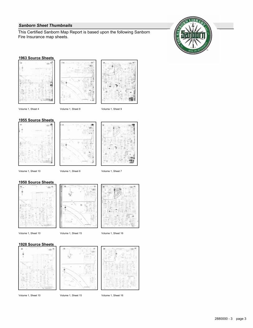
Sanborn Sheet ThumbnailsThis Certified Sanborn Map Report is based upon the following SanbornFire Insurance map sheets.
1963 Source Sheets
Volume 1, Sheet 4 Volume 1, Sheet 8 Volume 1, Sheet 9
1955 Source Sheets
Volume 1, Sheet 10 Volume 1, Sheet 6 Volume 1, Sheet 7
1950 Source Sheets
Volume 1, Sheet 10 Volume 1, Sheet 15 Volume 1, Sheet 16
1928 Source Sheets
Volume 1, Sheet 10 Volume 1, Sheet 15 Volume 1, Sheet 16
2880000 - 3 page 3

1909 Source Sheets
Volume 1, Sheet 3 Volume 1, Sheet 8
1904 Source Sheets
Volume 1, Sheet 2 Volume 1, Sheet 7
1896 Source Sheets
Volume 1, Sheet 7 Volume 1, Sheet 9
1893 Source Sheets
Volume 1, Sheet 7
2880000 - 3 page 4

1963 Certified Sanborn Map
178F-44CB
-B928
Order Date:EDR Inquiry:
Client:
Site Name:Address:
City, ST, ZIP:
Certification #
Copyright: 1963
9/28/2010 10:28:12 AM2880000.3
Strata Environmental
Former Columbia Grain, Inc. RailAllignmentRail ROW Between Asbury and LillyStreetsMoscow ID 83843
178F-44CB-B928
This Certified Sanborn Map combines the following sheets.Outlined areas indicate map sheets within the collection.
Volume 1, Sheet 4
Volume 1, Sheet 8
Volume 1, Sheet 9
0 Feet 150 300 600
2880000 - 3 page 5

1955 Certified Sanborn Map
178F-44CB
-B928
Order Date:EDR Inquiry:
Client:
Site Name:Address:
City, ST, ZIP:
Certification #
Copyright: 1955
9/28/2010 10:28:12 AM2880000.3
Strata Environmental
Former Columbia Grain, Inc. RailAllignmentRail ROW Between Asbury and LillyStreetsMoscow ID 83843
178F-44CB-B928
This Certified Sanborn Map combines the following sheets.Outlined areas indicate map sheets within the collection.
Volume 1, Sheet 10
Volume 1, Sheet 6
Volume 1, Sheet 7
0 Feet 150 300 600
2880000 - 3 page 6

1950 Certified Sanborn Map
178F-44CB
-B928
Order Date:EDR Inquiry:
Client:
Site Name:Address:
City, ST, ZIP:
Certification #
Copyright: 1950
9/28/2010 10:28:12 AM2880000.3
Strata Environmental
Former Columbia Grain, Inc. RailAllignmentRail ROW Between Asbury and LillyStreetsMoscow ID 83843
178F-44CB-B928
This Certified Sanborn Map combines the following sheets.Outlined areas indicate map sheets within the collection.
Volume 1, Sheet 10
Volume 1, Sheet 15
Volume 1, Sheet 16
0 Feet 150 300 600
2880000 - 3 page 7

1928 Certified Sanborn Map
178F-44CB
-B928
Order Date:EDR Inquiry:
Client:
Site Name:Address:
City, ST, ZIP:
Certification #
Copyright: 1928
9/28/2010 10:28:12 AM2880000.3
Strata Environmental
Former Columbia Grain, Inc. RailAllignmentRail ROW Between Asbury and LillyStreetsMoscow ID 83843
178F-44CB-B928
This Certified Sanborn Map combines the following sheets.Outlined areas indicate map sheets within the collection.
Volume 1, Sheet 10
Volume 1, Sheet 15
Volume 1, Sheet 16
0 Feet 150 300 600
2880000 - 3 page 8

1909 Certified Sanborn Map
178F-44CB
-B928
Order Date:EDR Inquiry:
Client:
Site Name:Address:
City, ST, ZIP:
Certification #
Copyright: 1909
9/28/2010 10:28:12 AM2880000.3
Strata Environmental
Former Columbia Grain, Inc. RailAllignmentRail ROW Between Asbury and LillyStreetsMoscow ID 83843
178F-44CB-B928
This Certified Sanborn Map combines the following sheets.Outlined areas indicate map sheets within the collection.
Volume 1, Sheet 3
Volume 1, Sheet 8
0 Feet 150 300 600
2880000 - 3 page 9

1904 Certified Sanborn Map
178F-44CB
-B928
Order Date:EDR Inquiry:
Client:
Site Name:Address:
City, ST, ZIP:
Certification #
Copyright: 1904
9/28/2010 10:28:12 AM2880000.3
Strata Environmental
Former Columbia Grain, Inc. RailAllignmentRail ROW Between Asbury and LillyStreetsMoscow ID 83843
178F-44CB-B928
This Certified Sanborn Map combines the following sheets.Outlined areas indicate map sheets within the collection.
Volume 1, Sheet 2
Volume 1, Sheet 7
0 Feet 150 300 600
2880000 - 3 page 10

1896 Certified Sanborn Map
178F-44CB
-B928
Order Date:EDR Inquiry:
Client:
Site Name:Address:
City, ST, ZIP:
Certification #
Copyright: 1896
9/28/2010 10:28:12 AM2880000.3
Strata Environmental
Former Columbia Grain, Inc. RailAllignmentRail ROW Between Asbury and LillyStreetsMoscow ID 83843
178F-44CB-B928
This Certified Sanborn Map combines the following sheets.Outlined areas indicate map sheets within the collection.
Volume 1, Sheet 7
Volume 1, Sheet 9
0 Feet 150 300 600
2880000 - 3 page 11
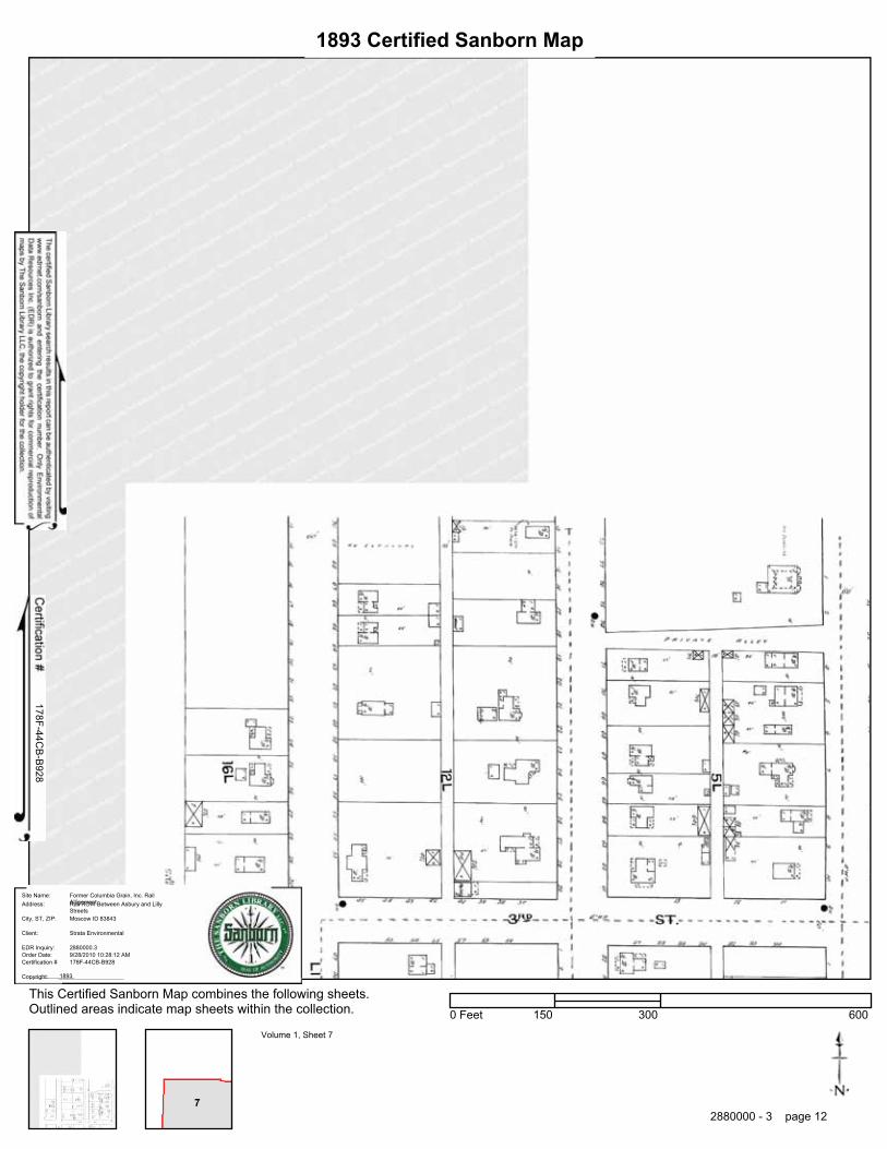
1893 Certified Sanborn Map
178F-44CB
-B928
Order Date:EDR Inquiry:
Client:
Site Name:Address:
City, ST, ZIP:
Certification #
Copyright: 1893
9/28/2010 10:28:12 AM2880000.3
Strata Environmental
Former Columbia Grain, Inc. RailAllignmentRail ROW Between Asbury and LillyStreetsMoscow ID 83843
178F-44CB-B928
This Certified Sanborn Map combines the following sheets.Outlined areas indicate map sheets within the collection.
Volume 1, Sheet 7
0 Feet 150 300 600
2880000 - 3 page 12

���������������������������������
Former Columbia Grain, Inc. Rail AllignmentRail ROW Between Asbury and Lilly StreetsMoscow, ID 83843
Inquiry Number: 2880000.4September 28, 2010
EDR Historical Topographic Map Report
Environmental Data Resources, Inc.s (EDR) Historical Topographic Map Report is designed to assist professionals inevaluating potential liability on a target property resulting from past activities. EDRs Historical Topographic Map Reportincludes a search of a collection of public and private color historical topographic maps, dating back to the early 1900s.
Thank you for your business.Please contact EDR at 1-800-352-0050
with any questions or comments.
Disclaimer - Copyright and Trademark Notice
This Report contains certain information obtained from a variety of public and other sources reasonably available to Environmental Data Resources, Inc.It cannot be concluded from this Report that coverage information for the target and surrounding properties does not exist from other sources. NOWARRANTY EXPRESSED OR IMPLIED, IS MADE WHATSOEVER IN CONNECTION WITH THIS REPORT. ENVIRONMENTAL DATARESOURCES, INC. SPECIFICALLY DISCLAIMS THE MAKING OF ANY SUCH WARRANTIES, INCLUDING WITHOUT LIMITATION,MERCHANTABILITY OR FITNESS FOR A PARTICULAR USE OR PURPOSE. ALL RISK IS ASSUMED BY THE USER. IN NO EVENT SHALLENVIRONMENTAL DATA RESOURCES, INC. BE LIABLE TO ANYONE, WHETHER ARISING OUT OF ERRORS OR OMISSIONS, NEGLIGENCE,ACCIDENT OR ANY OTHER CAUSE, FOR ANY LOSS OF DAMAGE, INCLUDING, WITHOUT LIMITATION, SPECIAL, INCIDENTAL,CONSEQUENTIAL, OR EXEMPLARY DAMAGES. ANY LIABILITY ON THE PART OF ENVIRONMENTAL DATA RESOURCES, INC. IS STRICTLYLIMITED TO A REFUND OF THE AMOUNT PAID FOR THIS REPORT. Purchaser accepts this Report AS IS. Any analyses, estimates, ratings,environmental risk levels or risk codes provided in this Report are provided for illustrative purposes only, and are not intended to provide, nor should theybe interpreted as providing any facts regarding, or prediction or forecast of, any environmental risk for any property. Only a Phase I Environmental SiteAssessment performed by an environmental professional can provide information regarding the environmental risk for any property. Additionally, theinformation provided in this Report is not to be construed as legal advice.
Copyright 2010 by Environmental Data Resources, Inc. All rights reserved. Reproduction in any media or format, in whole or in part, of any report or mapof Environmental Data Resources, Inc., or its affiliates, is prohibited without prior written permission.
EDR and its logos (including Sanborn and Sanborn Map) are trademarks of Environmental Data Resources, Inc. or its affiliates. All other trademarksused herein are the property of their respective owners.

Historical Topographic Map→
NTARGET QUADTARGET QUADNAME: PULLMANMAP YEAR: 1910
SERIES: 30SCALE: 1:125000
SITE NAME: Former Columbia Grain, Inc. RailAllignment
ADDRESS: Rail ROW Between Asbury and LillyStreetsMoscow, ID 83843
LAT/LONG: 46.7337 / -117.006
CLIENT: Strata EnvironmentalCONTACT: Shawn RingoINQUIRY#: 2880000.4RESEARCH DATE: 09/28/2010

Historical Topographic Map→
NTARGET QUADTARGET QUADNAME: MOSCOW WESTMAP YEAR: 1964
SERIES: 7.5SCALE: 1:24000
SITE NAME: Former Columbia Grain, Inc. RailAllignment
ADDRESS: Rail ROW Between Asbury and LillyStreetsMoscow, ID 83843
LAT/LONG: 46.7337 / -117.006
CLIENT: Strata EnvironmentalCONTACT: Shawn RingoINQUIRY#: 2880000.4RESEARCH DATE: 09/28/2010

Historical Topographic Map→
NTARGET QUADTARGET QUADNAME: MOSCOW WESTMAP YEAR: 1975PHOTOREVISED:1964SERIES: 7.5SCALE: 1:24000
SITE NAME: Former Columbia Grain, Inc. RailAllignment
ADDRESS: Rail ROW Between Asbury and LillyStreetsMoscow, ID 83843
LAT/LONG: 46.7337 / -117.006
CLIENT: Strata EnvironmentalCONTACT: Shawn RingoINQUIRY#: 2880000.4RESEARCH DATE: 09/28/2010

Historical Topographic Map→
N
ADJOINING QUADADJOINING QUADNAME: MOSCOW EASTMAP YEAR: 1960
SERIES: 7.5SCALE: 1:24000
SITE NAME: Former Columbia Grain, Inc. RailAllignment
ADDRESS: Rail ROW Between Asbury and LillyStreetsMoscow, ID 83843
LAT/LONG: 46.7337 / -117.006
CLIENT: Strata EnvironmentalCONTACT: Shawn RingoINQUIRY#: 2880000.4RESEARCH DATE: 09/28/2010

Historical Topographic Map→
N
ADJOINING QUADADJOINING QUADNAME: MOSCOWMAP YEAR: 1961
SERIES: 15SCALE: 1:62500
SITE NAME: Former Columbia Grain, Inc. RailAllignment
ADDRESS: Rail ROW Between Asbury and LillyStreetsMoscow, ID 83843
LAT/LONG: 46.7337 / -117.006
CLIENT: Strata EnvironmentalCONTACT: Shawn RingoINQUIRY#: 2880000.4RESEARCH DATE: 09/28/2010

Historical Topographic Map→
N
ADJOINING QUADADJOINING QUADNAME: MOSCOW EASTMAP YEAR: 1975PHOTOREVISED:1960SERIES: 7.5SCALE: 1:24000
SITE NAME: Former Columbia Grain, Inc. RailAllignment
ADDRESS: Rail ROW Between Asbury and LillyStreetsMoscow, ID 83843
LAT/LONG: 46.7337 / -117.006
CLIENT: Strata EnvironmentalCONTACT: Shawn RingoINQUIRY#: 2880000.4RESEARCH DATE: 09/28/2010
Appendix C:
Laboratory Analytical Results

Client: STRATA GEOTECHNICAL MOSCOW
Attn: SHAWN RINGO
Address: 1428 SOUTH MAINMOSCOW, ID 83843
Analytical Results Report
Batch #: 101001006Project Name: ABANDONED DUMAS RR
SPUR
Anatek Labs, Inc.1282 Alturas Drive • Moscow, ID 83843 • (208) 883-2839 • Fax (208) 882-9246 • email [email protected]
504 E Sprague Ste. D • Spokane WA 99202 • (509) 838-3999 • Fax (509) 838-4433 • email [email protected]
101001006-001Sample Number
Matrix Soil
Parameter Result Units Analysis Date Analyst Method QualifierPQL
Client Sample IDSampling Date 9/30/2010Sampling Time 5:10 PM
Date/Time Received 10/1/2010
Sample LocationExtraction DateW 10/5/2010
8:41 AM
Comments
mg/Kg EMP10/5/20104,4-DDD EPA 8270CND 0.1mg/Kg EMP10/5/20104,4-DDE EPA 8270CND 0.1mg/Kg EMP10/5/20104,4-DDT EPA 8270CND 0.1mg/Kg EMP10/5/2010Alachlor EPA 8270CND 0.1mg/Kg EMP10/5/2010Aldrin EPA 8270CND 0.1mg/Kg EMP10/5/2010alpha-BHC EPA 8270CND 0.1mg/Kg EMP10/5/2010Atrazine EPA 8270CND 0.1mg/Kg EMP10/5/2010Azinphos-methyl EPA 8270CND 0.1mg/Kg EMP10/5/2010beta-BHC EPA 8270CND 0.1mg/Kg EMP10/5/2010Bolstar EPA 8270CND 0.1mg/kg EMP10/5/2010Bromacil EPA 8270CND 0.1mg/Kg EMP10/5/2010Carbophenothion EPA 8270CND 0.1mg/Kg EMP10/5/2010Chlorpyrifos EPA 8270CND 0.1mg/Kg EMP10/5/2010Coumaphos EPA 8270CND 0.1mg/Kg EMP10/5/2010delta-BHC EPA 8270CND 0.1mg/Kg EMP10/5/2010Demeton EPA 8270CND 0.1mg/Kg EMP10/5/2010Diazinon EPA 8270CND 0.1mg/Kg EMP10/5/2010Dichlorvos EPA 8270CND 0.1mg/Kg EMP10/5/2010Dieldrin EPA 8270CND 0.1mg/Kg EMP10/5/2010Dimethoate EPA 8270CND 0.1mg/Kg EMP10/5/2010Disulfoton EPA 8270CND 0.1mg/Kg EMP10/5/2010Endosulfan I EPA 8270CND 0.1mg/Kg EMP10/5/2010Endosulfan II EPA 8270CND 0.1mg/Kg EMP10/5/2010Endosulfan sulfate EPA 8270CND 0.1mg/Kg EMP10/5/2010Endrin EPA 8270CND 0.1mg/Kg EMP10/5/2010Endrin aldehyde EPA 8270CND 0.1mg/Kg EMP10/5/2010Endrin ketone EPA 8270CND 0.1mg/Kg EMP10/5/2010EPN EPA 8270CND 0.1mg/Kg EMP10/5/2010Ethoprop EPA 8270CND 0.1mg/Kg EMP10/5/2010Ethyl parathion EPA 8270CND 0.1mg/Kg EMP10/5/2010Fensulfothion EPA 8270CND 0.1mg/Kg EMP10/5/2010Fenthion EPA 8270CND 0.1mg/Kg EMP10/5/2010gamma-BHC (Lindane) EPA 8270CND 0.1mg/Kg EMP10/5/2010Heptachlor EPA 8270CND 0.1mg/Kg EMP10/5/2010Heptachlor epoxide EPA 8270CND 0.1
Page 1 of 6Wednesday, October 13, 2010
Certifications held by Anatek Labs ID: EPA:ID00013; AZ:0701; CO:ID00013; FL(NELAP):E87893; ID:ID00013; IN:C-ID-01; KY:90142; MT:CERT0028; NM: ID00013; OR:ID200001-002; WA:C595Certifications held by Anatek Labs WA: EPA:WA00169; CA:Cert2632; ID:WA00169; WA:C585; MT:Cert0095

Client: STRATA GEOTECHNICAL MOSCOW
Attn: SHAWN RINGO
Address: 1428 SOUTH MAINMOSCOW, ID 83843
Analytical Results Report
Batch #: 101001006Project Name: ABANDONED DUMAS RR
SPUR
Anatek Labs, Inc.1282 Alturas Drive • Moscow, ID 83843 • (208) 883-2839 • Fax (208) 882-9246 • email [email protected]
504 E Sprague Ste. D • Spokane WA 99202 • (509) 838-3999 • Fax (509) 838-4433 • email [email protected]
101001006-001Sample Number
Matrix Soil
Parameter Result Units Analysis Date Analyst Method QualifierPQL
Client Sample IDSampling Date 9/30/2010Sampling Time 5:10 PM
Date/Time Received 10/1/2010
Sample LocationExtraction DateW 10/5/2010
8:41 AM
Comments
mg/Kg EMP10/5/2010Malathion EPA 8270CND 0.1mg/Kg EMP10/5/2010Merphos EPA 8270CND 0.1mg/Kg EMP10/5/2010Methoxychlor EPA 8270CND 0.1mg/Kg EMP10/5/2010Methyl parathion EPA 8270CND 0.1mg/kg EMP10/5/2010Metribuzin EPA 8270CND 0.1mg/Kg EMP10/5/2010Mevinphos EPA 8270CND 0.1mg/Kg EMP10/5/2010Monocrotophos EPA 8270CND 0.1mg/Kg EMP10/5/2010Naled EPA 8270CND 0.1mg/kg EMP10/5/2010Pendimethalin EPA 8270CND 0.1mg/kg EMP10/5/2010Permethrin EPA 8270CND 0.1mg/Kg EMP10/5/2010Phorate EPA 8270CND 0.1mg/Kg EMP10/5/2010Phosmet EPA 8270CND 0.1mg/Kg EMP10/5/2010Ronnel EPA 8270CND 0.1mg/Kg EMP10/5/2010Simazine EPA 8270CND 0.1mg/Kg EMP10/5/2010Stirophos EPA 8270CND 0.1mg/Kg EMP10/5/2010Sulfotep EPA 8270CND 0.1mg/Kg EMP10/5/2010Terbacil EPA 8270CND 0.1mg/Kg EMP10/5/2010Tokuthion EPA 8270CND 0.1mg/Kg EMP10/5/2010Trichloronate EPA 8270CND 0.1mg/Kg EMP10/5/2010Trifluralin EPA 8270CND 0.1Percent EMP10/6/2010%moisture %moisture8.9
Surrogate Data
Surrogate Standard Percent Recovery Control LimitsSample Number 101001006-001
MethodTerphenyl-d14 120.2 30-140EPA 8270C
Page 2 of 6Wednesday, October 13, 2010
Certifications held by Anatek Labs ID: EPA:ID00013; AZ:0701; CO:ID00013; FL(NELAP):E87893; ID:ID00013; IN:C-ID-01; KY:90142; MT:CERT0028; NM: ID00013; OR:ID200001-002; WA:C595Certifications held by Anatek Labs WA: EPA:WA00169; CA:Cert2632; ID:WA00169; WA:C585; MT:Cert0095

Client: STRATA GEOTECHNICAL MOSCOW
Attn: SHAWN RINGO
Address: 1428 SOUTH MAINMOSCOW, ID 83843
Analytical Results Report
Batch #: 101001006Project Name: ABANDONED DUMAS RR
SPUR
Anatek Labs, Inc.1282 Alturas Drive • Moscow, ID 83843 • (208) 883-2839 • Fax (208) 882-9246 • email [email protected]
504 E Sprague Ste. D • Spokane WA 99202 • (509) 838-3999 • Fax (509) 838-4433 • email [email protected]
101001006-002Sample Number
Matrix Soil
Parameter Result Units Analysis Date Analyst Method QualifierPQL
Client Sample IDSampling Date 9/30/2010Sampling Time 6:18 PM
Date/Time Received 10/1/2010
Sample LocationExtraction DateEN 10/5/2010
8:41 AM
Comments
mg/Kg EMP10/5/20104,4-DDD EPA 8270CND 0.1mg/Kg EMP10/5/20104,4-DDE EPA 8270CND 0.1mg/Kg EMP10/5/20104,4-DDT EPA 8270CND 0.1mg/Kg EMP10/5/2010Alachlor EPA 8270CND 0.1mg/Kg EMP10/5/2010Aldrin EPA 8270CND 0.1mg/Kg EMP10/5/2010alpha-BHC EPA 8270CND 0.1mg/Kg EMP10/5/2010Atrazine EPA 8270CND 0.1mg/Kg EMP10/5/2010Azinphos-methyl EPA 8270CND 0.1mg/Kg EMP10/5/2010beta-BHC EPA 8270CND 0.1mg/Kg EMP10/5/2010Bolstar EPA 8270CND 0.1mg/kg EMP10/5/2010Bromacil EPA 8270CND 0.1mg/Kg EMP10/5/2010Carbophenothion EPA 8270CND 0.1mg/Kg EMP10/5/2010Chlorpyrifos EPA 8270CND 0.1mg/Kg EMP10/5/2010Coumaphos EPA 8270CND 0.1mg/Kg EMP10/5/2010delta-BHC EPA 8270CND 0.1mg/Kg EMP10/5/2010Demeton EPA 8270CND 0.1mg/Kg EMP10/5/2010Diazinon EPA 8270CND 0.1mg/Kg EMP10/5/2010Dichlorvos EPA 8270CND 0.1mg/Kg EMP10/5/2010Dieldrin EPA 8270CND 0.1mg/Kg EMP10/5/2010Dimethoate EPA 8270CND 0.1mg/Kg EMP10/5/2010Disulfoton EPA 8270CND 0.1mg/Kg EMP10/5/2010Endosulfan I EPA 8270CND 0.1mg/Kg EMP10/5/2010Endosulfan II EPA 8270CND 0.1mg/Kg EMP10/5/2010Endosulfan sulfate EPA 8270CND 0.1mg/Kg EMP10/5/2010Endrin EPA 8270CND 0.1mg/Kg EMP10/5/2010Endrin aldehyde EPA 8270CND 0.1mg/Kg EMP10/5/2010Endrin ketone EPA 8270CND 0.1mg/Kg EMP10/5/2010EPN EPA 8270CND 0.1mg/Kg EMP10/5/2010Ethoprop EPA 8270CND 0.1mg/Kg EMP10/5/2010Ethyl parathion EPA 8270CND 0.1mg/Kg EMP10/5/2010Fensulfothion EPA 8270CND 0.1mg/Kg EMP10/5/2010Fenthion EPA 8270CND 0.1mg/Kg EMP10/5/2010gamma-BHC (Lindane) EPA 8270CND 0.1mg/Kg EMP10/5/2010Heptachlor EPA 8270CND 0.1mg/Kg EMP10/5/2010Heptachlor epoxide EPA 8270CND 0.1mg/Kg EMP10/5/2010Malathion EPA 8270CND 0.1mg/Kg EMP10/5/2010Merphos EPA 8270CND 0.1
Page 3 of 6Wednesday, October 13, 2010
Certifications held by Anatek Labs ID: EPA:ID00013; AZ:0701; CO:ID00013; FL(NELAP):E87893; ID:ID00013; IN:C-ID-01; KY:90142; MT:CERT0028; NM: ID00013; OR:ID200001-002; WA:C595Certifications held by Anatek Labs WA: EPA:WA00169; CA:Cert2632; ID:WA00169; WA:C585; MT:Cert0095

Client: STRATA GEOTECHNICAL MOSCOW
Attn: SHAWN RINGO
Address: 1428 SOUTH MAINMOSCOW, ID 83843
Analytical Results Report
Batch #: 101001006Project Name: ABANDONED DUMAS RR
SPUR
Anatek Labs, Inc.1282 Alturas Drive • Moscow, ID 83843 • (208) 883-2839 • Fax (208) 882-9246 • email [email protected]
504 E Sprague Ste. D • Spokane WA 99202 • (509) 838-3999 • Fax (509) 838-4433 • email [email protected]
101001006-002Sample Number
Matrix Soil
Parameter Result Units Analysis Date Analyst Method QualifierPQL
Client Sample IDSampling Date 9/30/2010Sampling Time 6:18 PM
Date/Time Received 10/1/2010
Sample LocationExtraction DateEN 10/5/2010
8:41 AM
Comments
mg/Kg EMP10/5/2010Methoxychlor EPA 8270CND 0.1mg/Kg EMP10/5/2010Methyl parathion EPA 8270CND 0.1mg/kg EMP10/5/2010Metribuzin EPA 8270CND 0.1mg/Kg EMP10/5/2010Mevinphos EPA 8270CND 0.1mg/Kg EMP10/5/2010Monocrotophos EPA 8270CND 0.1mg/Kg EMP10/5/2010Naled EPA 8270CND 0.1mg/kg EMP10/5/2010Pendimethalin EPA 8270CND 0.1mg/kg EMP10/5/2010Permethrin EPA 8270CND 0.1mg/Kg EMP10/5/2010Phorate EPA 8270CND 0.1mg/Kg EMP10/5/2010Phosmet EPA 8270CND 0.1mg/Kg EMP10/5/2010Ronnel EPA 8270CND 0.1mg/Kg EMP10/5/2010Simazine EPA 8270CND 0.1mg/Kg EMP10/5/2010Stirophos EPA 8270CND 0.1mg/Kg EMP10/5/2010Sulfotep EPA 8270CND 0.1mg/Kg EMP10/5/2010Terbacil EPA 8270CND 0.1mg/Kg EMP10/5/2010Tokuthion EPA 8270CND 0.1mg/Kg EMP10/5/2010Trichloronate EPA 8270CND 0.1mg/Kg EMP10/5/2010Trifluralin EPA 8270CND 0.1Percent EMP10/6/2010%moisture %moisture7.4
Surrogate Data
Surrogate Standard Percent Recovery Control LimitsSample Number 101001006-002
MethodTerphenyl-d14 128.0 30-140EPA 8270C
Page 4 of 6Wednesday, October 13, 2010
Certifications held by Anatek Labs ID: EPA:ID00013; AZ:0701; CO:ID00013; FL(NELAP):E87893; ID:ID00013; IN:C-ID-01; KY:90142; MT:CERT0028; NM: ID00013; OR:ID200001-002; WA:C595Certifications held by Anatek Labs WA: EPA:WA00169; CA:Cert2632; ID:WA00169; WA:C585; MT:Cert0095

Client: STRATA GEOTECHNICAL MOSCOW
Attn: SHAWN RINGO
Address: 1428 SOUTH MAINMOSCOW, ID 83843
Analytical Results Report
Batch #: 101001006Project Name: ABANDONED DUMAS RR
SPUR
Anatek Labs, Inc.1282 Alturas Drive • Moscow, ID 83843 • (208) 883-2839 • Fax (208) 882-9246 • email [email protected]
504 E Sprague Ste. D • Spokane WA 99202 • (509) 838-3999 • Fax (509) 838-4433 • email [email protected]
101001006-003Sample Number
Matrix Soil
Parameter Result Units Analysis Date Analyst Method QualifierPQL
Client Sample IDSampling Date 9/30/2010Sampling Time 6:29 PM
Date/Time Received 10/1/2010
Sample LocationExtraction DateES 10/5/2010
8:41 AM
Comments
mg/Kg EMP10/5/20104,4-DDD EPA 8270CND 0.1mg/Kg EMP10/5/20104,4-DDE EPA 8270CND 0.1mg/Kg EMP10/5/20104,4-DDT EPA 8270CND 0.1mg/Kg EMP10/5/2010Alachlor EPA 8270CND 0.1mg/Kg EMP10/5/2010Aldrin EPA 8270CND 0.1mg/Kg EMP10/5/2010alpha-BHC EPA 8270CND 0.1mg/Kg EMP10/5/2010Atrazine EPA 8270CND 0.1mg/Kg EMP10/5/2010Azinphos-methyl EPA 8270CND 0.1mg/Kg EMP10/5/2010beta-BHC EPA 8270CND 0.1mg/Kg EMP10/5/2010Bolstar EPA 8270CND 0.1mg/kg EMP10/5/2010Bromacil EPA 8270CND 0.1mg/Kg EMP10/5/2010Carbophenothion EPA 8270CND 0.1mg/Kg EMP10/5/2010Chlorpyrifos EPA 8270CND 0.1mg/Kg EMP10/5/2010Coumaphos EPA 8270CND 0.1mg/Kg EMP10/5/2010delta-BHC EPA 8270CND 0.1mg/Kg EMP10/5/2010Demeton EPA 8270CND 0.1mg/Kg EMP10/5/2010Diazinon EPA 8270CND 0.1mg/Kg EMP10/5/2010Dichlorvos EPA 8270CND 0.1mg/Kg EMP10/5/2010Dieldrin EPA 8270CND 0.1mg/Kg EMP10/5/2010Dimethoate EPA 8270CND 0.1mg/Kg EMP10/5/2010Disulfoton EPA 8270CND 0.1mg/Kg EMP10/5/2010Endosulfan I EPA 8270CND 0.1mg/Kg EMP10/5/2010Endosulfan II EPA 8270CND 0.1mg/Kg EMP10/5/2010Endosulfan sulfate EPA 8270CND 0.1mg/Kg EMP10/5/2010Endrin EPA 8270CND 0.1mg/Kg EMP10/5/2010Endrin aldehyde EPA 8270CND 0.1mg/Kg EMP10/5/2010Endrin ketone EPA 8270CND 0.1mg/Kg EMP10/5/2010EPN EPA 8270CND 0.1mg/Kg EMP10/5/2010Ethoprop EPA 8270CND 0.1mg/Kg EMP10/5/2010Ethyl parathion EPA 8270CND 0.1mg/Kg EMP10/5/2010Fensulfothion EPA 8270CND 0.1mg/Kg EMP10/5/2010Fenthion EPA 8270CND 0.1mg/Kg EMP10/5/2010gamma-BHC (Lindane) EPA 8270CND 0.1mg/Kg EMP10/5/2010Heptachlor EPA 8270CND 0.1mg/Kg EMP10/5/2010Heptachlor epoxide EPA 8270CND 0.1mg/Kg EMP10/5/2010Malathion EPA 8270CND 0.1mg/Kg EMP10/5/2010Merphos EPA 8270CND 0.1
Page 5 of 6Wednesday, October 13, 2010
Certifications held by Anatek Labs ID: EPA:ID00013; AZ:0701; CO:ID00013; FL(NELAP):E87893; ID:ID00013; IN:C-ID-01; KY:90142; MT:CERT0028; NM: ID00013; OR:ID200001-002; WA:C595Certifications held by Anatek Labs WA: EPA:WA00169; CA:Cert2632; ID:WA00169; WA:C585; MT:Cert0095
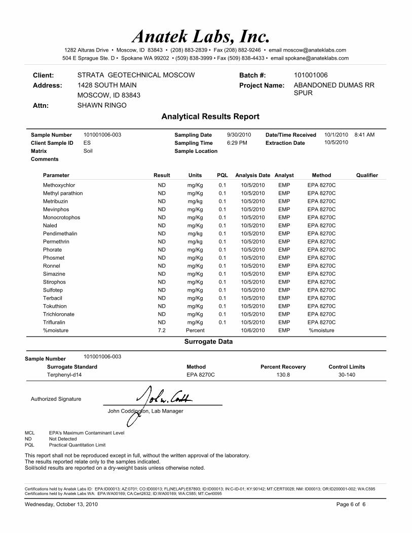
Client: STRATA GEOTECHNICAL MOSCOW
Attn: SHAWN RINGO
Address: 1428 SOUTH MAINMOSCOW, ID 83843
Analytical Results Report
Batch #: 101001006Project Name: ABANDONED DUMAS RR
SPUR
Anatek Labs, Inc.1282 Alturas Drive • Moscow, ID 83843 • (208) 883-2839 • Fax (208) 882-9246 • email [email protected]
504 E Sprague Ste. D • Spokane WA 99202 • (509) 838-3999 • Fax (509) 838-4433 • email [email protected]
101001006-003Sample Number
Matrix Soil
Parameter Result Units Analysis Date Analyst Method QualifierPQL
Client Sample IDSampling Date 9/30/2010Sampling Time 6:29 PM
Date/Time Received 10/1/2010
Sample LocationExtraction DateES 10/5/2010
8:41 AM
Comments
mg/Kg EMP10/5/2010Methoxychlor EPA 8270CND 0.1mg/Kg EMP10/5/2010Methyl parathion EPA 8270CND 0.1mg/kg EMP10/5/2010Metribuzin EPA 8270CND 0.1mg/Kg EMP10/5/2010Mevinphos EPA 8270CND 0.1mg/Kg EMP10/5/2010Monocrotophos EPA 8270CND 0.1mg/Kg EMP10/5/2010Naled EPA 8270CND 0.1mg/kg EMP10/5/2010Pendimethalin EPA 8270CND 0.1mg/kg EMP10/5/2010Permethrin EPA 8270CND 0.1mg/Kg EMP10/5/2010Phorate EPA 8270CND 0.1mg/Kg EMP10/5/2010Phosmet EPA 8270CND 0.1mg/Kg EMP10/5/2010Ronnel EPA 8270CND 0.1mg/Kg EMP10/5/2010Simazine EPA 8270CND 0.1mg/Kg EMP10/5/2010Stirophos EPA 8270CND 0.1mg/Kg EMP10/5/2010Sulfotep EPA 8270CND 0.1mg/Kg EMP10/5/2010Terbacil EPA 8270CND 0.1mg/Kg EMP10/5/2010Tokuthion EPA 8270CND 0.1mg/Kg EMP10/5/2010Trichloronate EPA 8270CND 0.1mg/Kg EMP10/5/2010Trifluralin EPA 8270CND 0.1Percent EMP10/6/2010%moisture %moisture7.2
Surrogate Data
Surrogate Standard Percent Recovery Control LimitsSample Number 101001006-003
MethodTerphenyl-d14 130.8 30-140EPA 8270C
Authorized Signature
John Coddington, Lab Manager
MCL EPA's Maximum Contaminant LevelND Not DetectedPQL Practical Quantitation Limit
This report shall not be reproduced except in full, without the written approval of the laboratory.The results reported relate only to the samples indicated.Soil/solid results are reported on a dry-weight basis unless otherwise noted.
Page 6 of 6Wednesday, October 13, 2010
Certifications held by Anatek Labs ID: EPA:ID00013; AZ:0701; CO:ID00013; FL(NELAP):E87893; ID:ID00013; IN:C-ID-01; KY:90142; MT:CERT0028; NM: ID00013; OR:ID200001-002; WA:C595Certifications held by Anatek Labs WA: EPA:WA00169; CA:Cert2632; ID:WA00169; WA:C585; MT:Cert0095

Client: STRATA GEOTECHNICAL MOSCOW
Attn: SHAWN RINGO
Address: 1428 SOUTH MAINMOSCOW, ID 83843
Analytical Results Report
Batch #: 101001006Project Name: ABANDONED DUMAS RR
SPUR
Anatek Labs, Inc.1282 Alturas Drive • Moscow, ID 83843 • (208) 883-2839 • Fax (208) 882-9246 • email [email protected]
504 E Sprague Ste. D • Spokane WA 99202 • (509) 838-3999 • Fax (509) 838-4433 • email [email protected]
101001006-001Sample Number
Matrix Soil
Parameter Result Units Analysis Date Analyst Method QualifierPQL
Client Sample IDSampling Date 9/30/2010Sampling Time 5:10 PM
Date/Time Received 10/1/2010
Sample LocationExtraction DateW 10/5/2010
8:41 AM
Comments
mg/Kg EMP10/11/20101,2,4-Trichlorobenzene EPA 8270CND 0.05mg/Kg EMP10/11/20101,2-Dichlorobenzene EPA 8270CND 0.05mg/Kg EMP10/11/20101,2-Diphenyl hydrazine EPA 8270CND 0.05mg/Kg EMP10/11/20101,3-Dichlorobenzene EPA 8270CND 0.05mg/Kg EMP10/11/20101,4-Dichlorobenzene EPA 8270CND 0.05mg/Kg EMP10/11/20101-Methylnaphthalene EPA 8270C0.13 0.05mg/Kg EMP10/11/20102,3,4,6-Tetrachlorophenol EPA 8270CND 0.05mg/Kg EMP10/11/20102,3,5,6-Tetrachlorophenol EPA 8270CND 0.05mg/Kg EMP10/11/20102,4,5-Trichlorophenol EPA 8270CND 0.05mg/Kg EMP10/11/20102,4,6-Trichlorophenol EPA 8270CND 0.05mg/Kg EMP10/11/20102,4-Dichlorophenol EPA 8270CND 0.05mg/Kg EMP10/11/20102,4-Dimethylphenol EPA 8270CND 0.05mg/Kg EMP10/11/20102,4-Dinitrophenol EPA 8270CND 0.05mg/Kg EMP10/11/20102,4-Dinitrotoluene EPA 8270CND 0.05mg/Kg EMP10/11/20102,6-Dinitrotoluene EPA 8270CND 0.05mg/Kg EMP10/11/20102-Chloronaphthalene EPA 8270CND 0.05mg/Kg EMP10/11/20102-Chlorophenol EPA 8270CND 0.05mg/Kg EMP10/11/20102-Methylnaphthalene EPA 8270C0.21 0.05mg/Kg EMP10/11/20102-Methylphenol EPA 8270CND 0.05mg/Kg EMP10/11/20102-Nitroaniline EPA 8270CND 0.05mg/Kg EMP10/11/20102-Nitrophenol EPA 8270CND 0.05mg/Kg EMP10/11/20103,3'-Dichlorobenzidine EPA 8270CND 0.05mg/Kg EMP10/11/20103+4-Methylphenol EPA 8270CND 0.05mg/Kg EMP10/11/20103-Nitroaniline EPA 8270CND 0.05mg/Kg EMP10/11/20104,6-Dinitro-2-methylphenol EPA 8270CND 0.05mg/Kg EMP10/11/20104-Bromophenyl-phenylether EPA 8270CND 0.05mg/Kg EMP10/11/20104-Chloro-3-methylphenol EPA 8270CND 0.05mg/Kg EMP10/11/20104-Chloroaniline EPA 8270CND 0.05mg/Kg EMP10/11/20104-Chlorophenyl-phenylether EPA 8270CND 0.05mg/Kg EMP10/11/20104-Nitroaniline EPA 8270CND 0.05mg/Kg EMP10/11/20104-Nitrophenol EPA 8270CND 0.05mg/Kg EMP10/11/2010Acenaphthene EPA 8270C0.39 0.05mg/Kg EMP10/11/2010Acenaphthylene EPA 8270C0.49 0.05mg/Kg EMP10/11/2010Aniline EPA 8270CND 0.05
Page 1 of 9Wednesday, October 13, 2010
Certifications held by Anatek Labs ID: EPA:ID00013; AZ:0701; CO:ID00013; FL(NELAP):E87893; ID:ID00013; IN:C-ID-01; KY:90142; MT:CERT0028; NM: ID00013; OR:ID200001-002; WA:C595Certifications held by Anatek Labs WA: EPA:WA00169; CA:Cert2632; ID:WA00169; WA:C585; MT:Cert0095

Client: STRATA GEOTECHNICAL MOSCOW
Attn: SHAWN RINGO
Address: 1428 SOUTH MAINMOSCOW, ID 83843
Analytical Results Report
Batch #: 101001006Project Name: ABANDONED DUMAS RR
SPUR
Anatek Labs, Inc.1282 Alturas Drive • Moscow, ID 83843 • (208) 883-2839 • Fax (208) 882-9246 • email [email protected]
504 E Sprague Ste. D • Spokane WA 99202 • (509) 838-3999 • Fax (509) 838-4433 • email [email protected]
101001006-001Sample Number
Matrix Soil
Parameter Result Units Analysis Date Analyst Method QualifierPQL
Client Sample IDSampling Date 9/30/2010Sampling Time 5:10 PM
Date/Time Received 10/1/2010
Sample LocationExtraction DateW 10/5/2010
8:41 AM
Comments
mg/Kg EMP10/11/2010Anthracene EPA 8270C0.92 0.05mg/Kg EMP10/11/2010Benzidine EPA 8270CND 0.05mg/Kg EMP10/11/2010Benzo(ghi)perylene EPA 8270C1.80 0.05mg/Kg EMP10/11/2010Benzo[a]anthracene EPA 8270C2.44 0.05mg/Kg EMP10/11/2010Benzo[a]pyrene EPA 8270C2.06 0.05mg/Kg EMP10/11/2010Benzo[b]fluoranthene EPA 8270C5.00 0.05mg/Kg EMP10/11/2010Benzo[k]fluoranthene EPA 8270C1.28 0.05mg/Kg EMP10/11/2010Benzyl alcohol EPA 8270CND 0.05mg/Kg EMP10/11/2010bis(2-Chloroethoxy)methane EPA 8270CND 0.05mg/Kg EMP10/11/2010bis(2-Chloroethyl)ether EPA 8270CND 0.05mg/Kg EMP10/11/2010bis(2-chloroisopropyl)ether EPA 8270CND 0.05mg/Kg EMP10/11/2010bis(2-Ethylhexyl)phthalate EPA 8270C0.18 0.05mg/Kg EMP10/11/2010Butylbenzylphthalate EPA 8270CND 0.05mg/Kg EMP10/11/2010Carbazole EPA 8270C0.51 0.05mg/Kg EMP10/11/2010Chrysene EPA 8270C3.47 0.05mg/Kg EMP10/11/2010Dibenz[a,h]anthracene EPA 8270C0.31 0.05mg/Kg EMP10/11/2010Dibenzofuran EPA 8270C0.25 0.05mg/Kg EMP10/11/2010Diethylphthalate EPA 8270CND 0.05mg/Kg EMP10/11/2010Dimethylphthalate EPA 8270CND 0.05mg/Kg EMP10/11/2010Di-n-butylphthalate EPA 8270CND 0.05mg/Kg EMP10/11/2010Di-n-octylphthalate EPA 8270CND 0.05mg/Kg EMP10/11/2010Fluoranthene EPA 8270C4.13 0.05mg/Kg EMP10/11/2010Fluorene EPA 8270C0.31 0.05mg/Kg EMP10/11/2010Hexachlorobenzene EPA 8270CND 0.05mg/Kg EMP10/11/2010Hexachlorobutadiene EPA 8270CND 0.05mg/Kg EMP10/11/2010Hexachlorocyclopentadiene EPA 8270CND 0.05mg/Kg EMP10/11/2010Hexachloroethane EPA 8270CND 0.05mg/Kg EMP10/11/2010Indeno[1,2,3-cd]pyrene EPA 8270C1.43 0.05mg/Kg EMP10/11/2010Isophorone EPA 8270CND 0.05mg/Kg EMP10/11/2010Naphthalene EPA 8270C0.33 0.05mg/Kg EMP10/11/2010Nitrobenzene EPA 8270CND 0.05mg/Kg EMP10/11/2010Nitrosodimethylamine EPA 8270CND 0.05mg/Kg EMP10/11/2010n-Nitroso-di-n-propylamine EPA 8270CND 0.05mg/Kg EMP10/11/2010n-Nitrosodiphenylamine EPA 8270CND 0.05mg/Kg EMP10/11/2010Pentachlorophenol EPA 8270CND 0.05mg/Kg EMP10/11/2010Phenanthrene EPA 8270C1.43 0.05
Page 2 of 9Wednesday, October 13, 2010
Certifications held by Anatek Labs ID: EPA:ID00013; AZ:0701; CO:ID00013; FL(NELAP):E87893; ID:ID00013; IN:C-ID-01; KY:90142; MT:CERT0028; NM: ID00013; OR:ID200001-002; WA:C595Certifications held by Anatek Labs WA: EPA:WA00169; CA:Cert2632; ID:WA00169; WA:C585; MT:Cert0095

Client: STRATA GEOTECHNICAL MOSCOW
Attn: SHAWN RINGO
Address: 1428 SOUTH MAINMOSCOW, ID 83843
Analytical Results Report
Batch #: 101001006Project Name: ABANDONED DUMAS RR
SPUR
Anatek Labs, Inc.1282 Alturas Drive • Moscow, ID 83843 • (208) 883-2839 • Fax (208) 882-9246 • email [email protected]
504 E Sprague Ste. D • Spokane WA 99202 • (509) 838-3999 • Fax (509) 838-4433 • email [email protected]
101001006-001Sample Number
Matrix Soil
Parameter Result Units Analysis Date Analyst Method QualifierPQL
Client Sample IDSampling Date 9/30/2010Sampling Time 5:10 PM
Date/Time Received 10/1/2010
Sample LocationExtraction DateW 10/5/2010
8:41 AM
Comments
mg/Kg EMP10/11/2010Phenol EPA 8270C0.18 0.05mg/Kg EMP10/11/2010Pyrene EPA 8270C3.85 0.05mg/Kg EMP10/11/2010Pyridine EPA 8270CND 0.05Percent EMP10/6/2010%moisture %moisture8.9
Surrogate Data
Surrogate Standard Percent Recovery Control LimitsSample Number 101001006-001
Method2,4,6-Tribromophenol 102.8 19-122EPA 8270C2-Fluorobiphenyl 95.8 30-115EPA 8270C2-Fluorophenol 80.3 25-121EPA 8270CNitrobenzene-d5 85.0 17-112EPA 8270CPhenol-d5 74.4 24-113EPA 8270CTerphenyl-d14 98.2 18-137EPA 8270C
Page 3 of 9Wednesday, October 13, 2010
Certifications held by Anatek Labs ID: EPA:ID00013; AZ:0701; CO:ID00013; FL(NELAP):E87893; ID:ID00013; IN:C-ID-01; KY:90142; MT:CERT0028; NM: ID00013; OR:ID200001-002; WA:C595Certifications held by Anatek Labs WA: EPA:WA00169; CA:Cert2632; ID:WA00169; WA:C585; MT:Cert0095

Client: STRATA GEOTECHNICAL MOSCOW
Attn: SHAWN RINGO
Address: 1428 SOUTH MAINMOSCOW, ID 83843
Analytical Results Report
Batch #: 101001006Project Name: ABANDONED DUMAS RR
SPUR
Anatek Labs, Inc.1282 Alturas Drive • Moscow, ID 83843 • (208) 883-2839 • Fax (208) 882-9246 • email [email protected]
504 E Sprague Ste. D • Spokane WA 99202 • (509) 838-3999 • Fax (509) 838-4433 • email [email protected]
101001006-002Sample Number
Matrix Soil
Parameter Result Units Analysis Date Analyst Method QualifierPQL
Client Sample IDSampling Date 9/30/2010Sampling Time 6:18 PM
Date/Time Received 10/1/2010
Sample LocationExtraction DateEN 10/5/2010
8:41 AM
Comments
mg/Kg EMP10/11/20101,2,4-Trichlorobenzene EPA 8270CND 0.05mg/Kg EMP10/11/20101,2-Dichlorobenzene EPA 8270CND 0.05mg/Kg EMP10/11/20101,2-Diphenyl hydrazine EPA 8270CND 0.05mg/Kg EMP10/11/20101,3-Dichlorobenzene EPA 8270CND 0.05mg/Kg EMP10/11/20101,4-Dichlorobenzene EPA 8270CND 0.05mg/Kg EMP10/11/20101-Methylnaphthalene EPA 8270C0.05 0.05mg/Kg EMP10/11/20102,3,4,6-Tetrachlorophenol EPA 8270CND 0.05mg/Kg EMP10/11/20102,3,5,6-Tetrachlorophenol EPA 8270CND 0.05mg/Kg EMP10/11/20102,4,5-Trichlorophenol EPA 8270CND 0.05mg/Kg EMP10/11/20102,4,6-Trichlorophenol EPA 8270CND 0.05mg/Kg EMP10/11/20102,4-Dichlorophenol EPA 8270CND 0.05mg/Kg EMP10/11/20102,4-Dimethylphenol EPA 8270CND 0.05mg/Kg EMP10/11/20102,4-Dinitrophenol EPA 8270CND 0.05mg/Kg EMP10/11/20102,4-Dinitrotoluene EPA 8270CND 0.05mg/Kg EMP10/11/20102,6-Dinitrotoluene EPA 8270CND 0.05mg/Kg EMP10/11/20102-Chloronaphthalene EPA 8270CND 0.05mg/Kg EMP10/11/20102-Chlorophenol EPA 8270CND 0.05mg/Kg EMP10/11/20102-Methylnaphthalene EPA 8270C0.10 0.05mg/Kg EMP10/11/20102-Methylphenol EPA 8270CND 0.05mg/Kg EMP10/11/20102-Nitroaniline EPA 8270CND 0.05mg/Kg EMP10/11/20102-Nitrophenol EPA 8270CND 0.05mg/Kg EMP10/11/20103,3'-Dichlorobenzidine EPA 8270CND 0.05mg/Kg EMP10/11/20103+4-Methylphenol EPA 8270CND 0.05mg/Kg EMP10/11/20103-Nitroaniline EPA 8270CND 0.05mg/Kg EMP10/11/20104,6-Dinitro-2-methylphenol EPA 8270CND 0.05mg/Kg EMP10/11/20104-Bromophenyl-phenylether EPA 8270CND 0.05mg/Kg EMP10/11/20104-Chloro-3-methylphenol EPA 8270CND 0.05mg/Kg EMP10/11/20104-Chloroaniline EPA 8270CND 0.05mg/Kg EMP10/11/20104-Chlorophenyl-phenylether EPA 8270CND 0.05mg/Kg EMP10/11/20104-Nitroaniline EPA 8270CND 0.05mg/Kg EMP10/11/20104-Nitrophenol EPA 8270CND 0.05mg/Kg EMP10/11/2010Acenaphthene EPA 8270C0.13 0.05mg/Kg EMP10/11/2010Acenaphthylene EPA 8270C0.37 0.05mg/Kg EMP10/11/2010Aniline EPA 8270CND 0.05mg/Kg EMP10/11/2010Anthracene EPA 8270C0.72 0.05mg/Kg EMP10/11/2010Benzidine EPA 8270CND 0.05
Page 4 of 9Wednesday, October 13, 2010
Certifications held by Anatek Labs ID: EPA:ID00013; AZ:0701; CO:ID00013; FL(NELAP):E87893; ID:ID00013; IN:C-ID-01; KY:90142; MT:CERT0028; NM: ID00013; OR:ID200001-002; WA:C595Certifications held by Anatek Labs WA: EPA:WA00169; CA:Cert2632; ID:WA00169; WA:C585; MT:Cert0095

Client: STRATA GEOTECHNICAL MOSCOW
Attn: SHAWN RINGO
Address: 1428 SOUTH MAINMOSCOW, ID 83843
Analytical Results Report
Batch #: 101001006Project Name: ABANDONED DUMAS RR
SPUR
Anatek Labs, Inc.1282 Alturas Drive • Moscow, ID 83843 • (208) 883-2839 • Fax (208) 882-9246 • email [email protected]
504 E Sprague Ste. D • Spokane WA 99202 • (509) 838-3999 • Fax (509) 838-4433 • email [email protected]
101001006-002Sample Number
Matrix Soil
Parameter Result Units Analysis Date Analyst Method QualifierPQL
Client Sample IDSampling Date 9/30/2010Sampling Time 6:18 PM
Date/Time Received 10/1/2010
Sample LocationExtraction DateEN 10/5/2010
8:41 AM
Comments
mg/Kg EMP10/11/2010Benzo(ghi)perylene EPA 8270C0.82 0.05mg/Kg EMP10/11/2010Benzo[a]anthracene EPA 8270C1.15 0.05mg/Kg EMP10/11/2010Benzo[a]pyrene EPA 8270C0.80 0.05mg/Kg EMP10/11/2010Benzo[b]fluoranthene EPA 8270C1.55 0.05mg/Kg EMP10/11/2010Benzo[k]fluoranthene EPA 8270C0.77 0.05mg/Kg EMP10/11/2010Benzyl alcohol EPA 8270CND 0.05mg/Kg EMP10/11/2010bis(2-Chloroethoxy)methane EPA 8270CND 0.05mg/Kg EMP10/11/2010bis(2-Chloroethyl)ether EPA 8270CND 0.05mg/Kg EMP10/11/2010bis(2-chloroisopropyl)ether EPA 8270CND 0.05mg/Kg EMP10/11/2010bis(2-Ethylhexyl)phthalate EPA 8270C0.19 0.05mg/Kg EMP10/11/2010Butylbenzylphthalate EPA 8270CND 0.05mg/Kg EMP10/11/2010Carbazole EPA 8270C0.37 0.05mg/Kg EMP10/11/2010Chrysene EPA 8270C1.22 0.05mg/Kg EMP10/11/2010Dibenz[a,h]anthracene EPA 8270C0.16 0.05mg/Kg EMP10/11/2010Dibenzofuran EPA 8270C0.07 0.05mg/Kg EMP10/11/2010Diethylphthalate EPA 8270CND 0.05mg/Kg EMP10/11/2010Dimethylphthalate EPA 8270CND 0.05mg/Kg EMP10/11/2010Di-n-butylphthalate EPA 8270CND 0.05mg/Kg EMP10/11/2010Di-n-octylphthalate EPA 8270CND 0.05mg/Kg EMP10/11/2010Fluoranthene EPA 8270C2.26 0.05mg/Kg EMP10/11/2010Fluorene EPA 8270C0.11 0.05mg/Kg EMP10/11/2010Hexachlorobenzene EPA 8270CND 0.05mg/Kg EMP10/11/2010Hexachlorobutadiene EPA 8270CND 0.05mg/Kg EMP10/11/2010Hexachlorocyclopentadiene EPA 8270CND 0.05mg/Kg EMP10/11/2010Hexachloroethane EPA 8270CND 0.05mg/Kg EMP10/11/2010Indeno[1,2,3-cd]pyrene EPA 8270C0.62 0.05mg/Kg EMP10/11/2010Isophorone EPA 8270CND 0.05mg/Kg EMP10/11/2010Naphthalene EPA 8270C0.32 0.05mg/Kg EMP10/11/2010Nitrobenzene EPA 8270CND 0.05mg/Kg EMP10/11/2010Nitrosodimethylamine EPA 8270CND 0.05mg/Kg EMP10/11/2010n-Nitroso-di-n-propylamine EPA 8270CND 0.05mg/Kg EMP10/11/2010n-Nitrosodiphenylamine EPA 8270CND 0.05mg/Kg EMP10/11/2010Pentachlorophenol EPA 8270CND 0.05mg/Kg EMP10/11/2010Phenanthrene EPA 8270C0.69 0.05mg/Kg EMP10/11/2010Phenol EPA 8270C0.16 0.05mg/Kg EMP10/11/2010Pyrene EPA 8270C1.93 0.05
Page 5 of 9Wednesday, October 13, 2010
Certifications held by Anatek Labs ID: EPA:ID00013; AZ:0701; CO:ID00013; FL(NELAP):E87893; ID:ID00013; IN:C-ID-01; KY:90142; MT:CERT0028; NM: ID00013; OR:ID200001-002; WA:C595Certifications held by Anatek Labs WA: EPA:WA00169; CA:Cert2632; ID:WA00169; WA:C585; MT:Cert0095
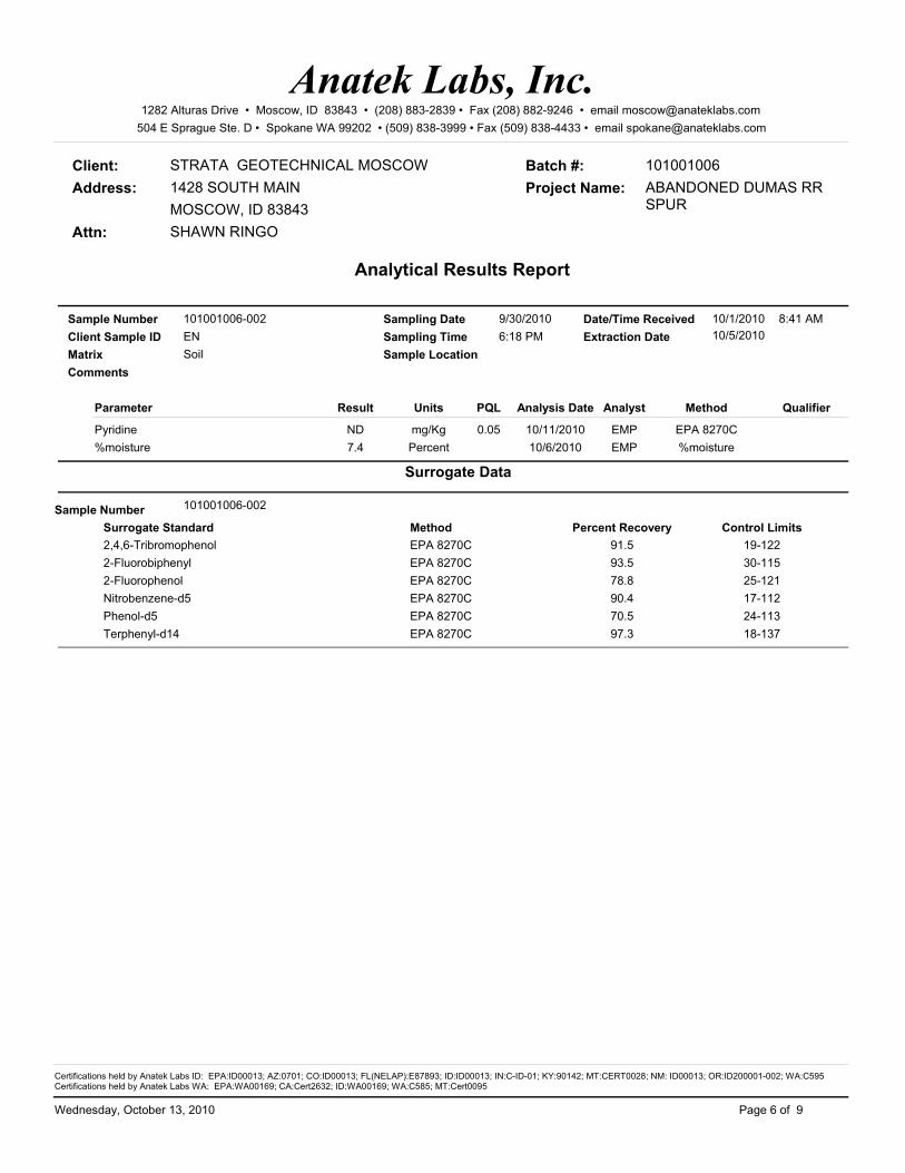
Client: STRATA GEOTECHNICAL MOSCOW
Attn: SHAWN RINGO
Address: 1428 SOUTH MAINMOSCOW, ID 83843
Analytical Results Report
Batch #: 101001006Project Name: ABANDONED DUMAS RR
SPUR
Anatek Labs, Inc.1282 Alturas Drive • Moscow, ID 83843 • (208) 883-2839 • Fax (208) 882-9246 • email [email protected]
504 E Sprague Ste. D • Spokane WA 99202 • (509) 838-3999 • Fax (509) 838-4433 • email [email protected]
101001006-002Sample Number
Matrix Soil
Parameter Result Units Analysis Date Analyst Method QualifierPQL
Client Sample IDSampling Date 9/30/2010Sampling Time 6:18 PM
Date/Time Received 10/1/2010
Sample LocationExtraction DateEN 10/5/2010
8:41 AM
Comments
mg/Kg EMP10/11/2010Pyridine EPA 8270CND 0.05Percent EMP10/6/2010%moisture %moisture7.4
Surrogate Data
Surrogate Standard Percent Recovery Control LimitsSample Number 101001006-002
Method2,4,6-Tribromophenol 91.5 19-122EPA 8270C2-Fluorobiphenyl 93.5 30-115EPA 8270C2-Fluorophenol 78.8 25-121EPA 8270CNitrobenzene-d5 90.4 17-112EPA 8270CPhenol-d5 70.5 24-113EPA 8270CTerphenyl-d14 97.3 18-137EPA 8270C
Page 6 of 9Wednesday, October 13, 2010
Certifications held by Anatek Labs ID: EPA:ID00013; AZ:0701; CO:ID00013; FL(NELAP):E87893; ID:ID00013; IN:C-ID-01; KY:90142; MT:CERT0028; NM: ID00013; OR:ID200001-002; WA:C595Certifications held by Anatek Labs WA: EPA:WA00169; CA:Cert2632; ID:WA00169; WA:C585; MT:Cert0095

Client: STRATA GEOTECHNICAL MOSCOW
Attn: SHAWN RINGO
Address: 1428 SOUTH MAINMOSCOW, ID 83843
Analytical Results Report
Batch #: 101001006Project Name: ABANDONED DUMAS RR
SPUR
Anatek Labs, Inc.1282 Alturas Drive • Moscow, ID 83843 • (208) 883-2839 • Fax (208) 882-9246 • email [email protected]
504 E Sprague Ste. D • Spokane WA 99202 • (509) 838-3999 • Fax (509) 838-4433 • email [email protected]
101001006-003Sample Number
Matrix Soil
Parameter Result Units Analysis Date Analyst Method QualifierPQL
Client Sample IDSampling Date 9/30/2010Sampling Time 6:29 PM
Date/Time Received 10/1/2010
Sample LocationExtraction DateES 10/5/2010
8:41 AM
Comments
mg/Kg EMP10/12/20101,2,4-Trichlorobenzene EPA 8270CND 0.05mg/Kg EMP10/12/20101,2-Dichlorobenzene EPA 8270CND 0.05mg/Kg EMP10/12/20101,2-Diphenyl hydrazine EPA 8270CND 0.05mg/Kg EMP10/12/20101,3-Dichlorobenzene EPA 8270CND 0.05mg/Kg EMP10/12/20101,4-Dichlorobenzene EPA 8270CND 0.05mg/Kg EMP10/12/20101-Methylnaphthalene EPA 8270CND 0.05mg/Kg EMP10/12/20102,3,4,6-Tetrachlorophenol EPA 8270CND 0.05mg/Kg EMP10/12/20102,3,5,6-Tetrachlorophenol EPA 8270CND 0.05mg/Kg EMP10/12/20102,4,5-Trichlorophenol EPA 8270CND 0.05mg/Kg EMP10/12/20102,4,6-Trichlorophenol EPA 8270CND 0.05mg/Kg EMP10/12/20102,4-Dichlorophenol EPA 8270CND 0.05mg/Kg EMP10/12/20102,4-Dimethylphenol EPA 8270CND 0.05mg/Kg EMP10/12/20102,4-Dinitrophenol EPA 8270CND 0.05mg/Kg EMP10/12/20102,4-Dinitrotoluene EPA 8270CND 0.05mg/Kg EMP10/12/20102,6-Dinitrotoluene EPA 8270CND 0.05mg/Kg EMP10/12/20102-Chloronaphthalene EPA 8270CND 0.05mg/Kg EMP10/12/20102-Chlorophenol EPA 8270CND 0.05mg/Kg EMP10/12/20102-Methylnaphthalene EPA 8270C0.08 0.05mg/Kg EMP10/12/20102-Methylphenol EPA 8270CND 0.05mg/Kg EMP10/12/20102-Nitroaniline EPA 8270CND 0.05mg/Kg EMP10/12/20102-Nitrophenol EPA 8270CND 0.05mg/Kg EMP10/12/20103,3'-Dichlorobenzidine EPA 8270CND 0.05mg/Kg EMP10/12/20103+4-Methylphenol EPA 8270CND 0.05mg/Kg EMP10/12/20103-Nitroaniline EPA 8270CND 0.05mg/Kg EMP10/12/20104,6-Dinitro-2-methylphenol EPA 8270CND 0.05mg/Kg EMP10/12/20104-Bromophenyl-phenylether EPA 8270CND 0.05mg/Kg EMP10/12/20104-Chloro-3-methylphenol EPA 8270CND 0.05mg/Kg EMP10/12/20104-Chloroaniline EPA 8270CND 0.05mg/Kg EMP10/12/20104-Chlorophenyl-phenylether EPA 8270CND 0.05mg/Kg EMP10/12/20104-Nitroaniline EPA 8270CND 0.05mg/Kg EMP10/12/20104-Nitrophenol EPA 8270CND 0.05mg/Kg EMP10/12/2010Acenaphthene EPA 8270C0.08 0.05mg/Kg EMP10/12/2010Acenaphthylene EPA 8270C0.36 0.05mg/Kg EMP10/12/2010Aniline EPA 8270CND 0.05mg/Kg EMP10/12/2010Anthracene EPA 8270CND 0.05mg/Kg EMP10/12/2010Benzidine EPA 8270CND 0.05
Page 7 of 9Wednesday, October 13, 2010
Certifications held by Anatek Labs ID: EPA:ID00013; AZ:0701; CO:ID00013; FL(NELAP):E87893; ID:ID00013; IN:C-ID-01; KY:90142; MT:CERT0028; NM: ID00013; OR:ID200001-002; WA:C595Certifications held by Anatek Labs WA: EPA:WA00169; CA:Cert2632; ID:WA00169; WA:C585; MT:Cert0095
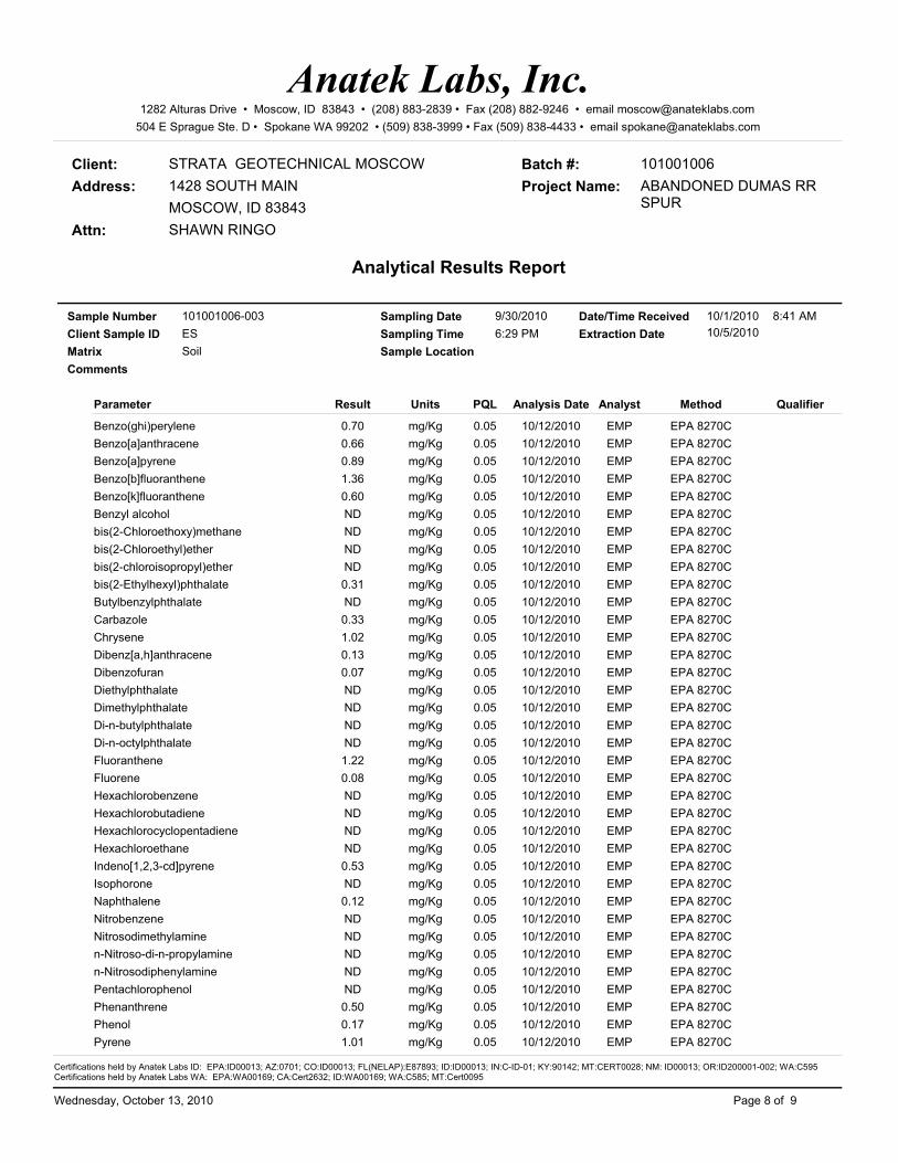
Client: STRATA GEOTECHNICAL MOSCOW
Attn: SHAWN RINGO
Address: 1428 SOUTH MAINMOSCOW, ID 83843
Analytical Results Report
Batch #: 101001006Project Name: ABANDONED DUMAS RR
SPUR
Anatek Labs, Inc.1282 Alturas Drive • Moscow, ID 83843 • (208) 883-2839 • Fax (208) 882-9246 • email [email protected]
504 E Sprague Ste. D • Spokane WA 99202 • (509) 838-3999 • Fax (509) 838-4433 • email [email protected]
101001006-003Sample Number
Matrix Soil
Parameter Result Units Analysis Date Analyst Method QualifierPQL
Client Sample IDSampling Date 9/30/2010Sampling Time 6:29 PM
Date/Time Received 10/1/2010
Sample LocationExtraction DateES 10/5/2010
8:41 AM
Comments
mg/Kg EMP10/12/2010Benzo(ghi)perylene EPA 8270C0.70 0.05mg/Kg EMP10/12/2010Benzo[a]anthracene EPA 8270C0.66 0.05mg/Kg EMP10/12/2010Benzo[a]pyrene EPA 8270C0.89 0.05mg/Kg EMP10/12/2010Benzo[b]fluoranthene EPA 8270C1.36 0.05mg/Kg EMP10/12/2010Benzo[k]fluoranthene EPA 8270C0.60 0.05mg/Kg EMP10/12/2010Benzyl alcohol EPA 8270CND 0.05mg/Kg EMP10/12/2010bis(2-Chloroethoxy)methane EPA 8270CND 0.05mg/Kg EMP10/12/2010bis(2-Chloroethyl)ether EPA 8270CND 0.05mg/Kg EMP10/12/2010bis(2-chloroisopropyl)ether EPA 8270CND 0.05mg/Kg EMP10/12/2010bis(2-Ethylhexyl)phthalate EPA 8270C0.31 0.05mg/Kg EMP10/12/2010Butylbenzylphthalate EPA 8270CND 0.05mg/Kg EMP10/12/2010Carbazole EPA 8270C0.33 0.05mg/Kg EMP10/12/2010Chrysene EPA 8270C1.02 0.05mg/Kg EMP10/12/2010Dibenz[a,h]anthracene EPA 8270C0.13 0.05mg/Kg EMP10/12/2010Dibenzofuran EPA 8270C0.07 0.05mg/Kg EMP10/12/2010Diethylphthalate EPA 8270CND 0.05mg/Kg EMP10/12/2010Dimethylphthalate EPA 8270CND 0.05mg/Kg EMP10/12/2010Di-n-butylphthalate EPA 8270CND 0.05mg/Kg EMP10/12/2010Di-n-octylphthalate EPA 8270CND 0.05mg/Kg EMP10/12/2010Fluoranthene EPA 8270C1.22 0.05mg/Kg EMP10/12/2010Fluorene EPA 8270C0.08 0.05mg/Kg EMP10/12/2010Hexachlorobenzene EPA 8270CND 0.05mg/Kg EMP10/12/2010Hexachlorobutadiene EPA 8270CND 0.05mg/Kg EMP10/12/2010Hexachlorocyclopentadiene EPA 8270CND 0.05mg/Kg EMP10/12/2010Hexachloroethane EPA 8270CND 0.05mg/Kg EMP10/12/2010Indeno[1,2,3-cd]pyrene EPA 8270C0.53 0.05mg/Kg EMP10/12/2010Isophorone EPA 8270CND 0.05mg/Kg EMP10/12/2010Naphthalene EPA 8270C0.12 0.05mg/Kg EMP10/12/2010Nitrobenzene EPA 8270CND 0.05mg/Kg EMP10/12/2010Nitrosodimethylamine EPA 8270CND 0.05mg/Kg EMP10/12/2010n-Nitroso-di-n-propylamine EPA 8270CND 0.05mg/Kg EMP10/12/2010n-Nitrosodiphenylamine EPA 8270CND 0.05mg/Kg EMP10/12/2010Pentachlorophenol EPA 8270CND 0.05mg/Kg EMP10/12/2010Phenanthrene EPA 8270C0.50 0.05mg/Kg EMP10/12/2010Phenol EPA 8270C0.17 0.05mg/Kg EMP10/12/2010Pyrene EPA 8270C1.01 0.05
Page 8 of 9Wednesday, October 13, 2010
Certifications held by Anatek Labs ID: EPA:ID00013; AZ:0701; CO:ID00013; FL(NELAP):E87893; ID:ID00013; IN:C-ID-01; KY:90142; MT:CERT0028; NM: ID00013; OR:ID200001-002; WA:C595Certifications held by Anatek Labs WA: EPA:WA00169; CA:Cert2632; ID:WA00169; WA:C585; MT:Cert0095
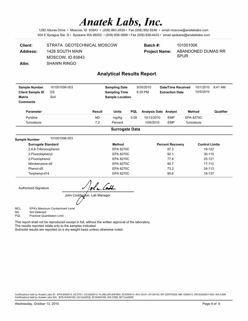
Client: STRATA GEOTECHNICAL MOSCOW
Attn: SHAWN RINGO
Address: 1428 SOUTH MAINMOSCOW, ID 83843
Analytical Results Report
Batch #: 101001006Project Name: ABANDONED DUMAS RR
SPUR
Anatek Labs, Inc.1282 Alturas Drive • Moscow, ID 83843 • (208) 883-2839 • Fax (208) 882-9246 • email [email protected]
504 E Sprague Ste. D • Spokane WA 99202 • (509) 838-3999 • Fax (509) 838-4433 • email [email protected]
101001006-003Sample Number
Matrix Soil
Parameter Result Units Analysis Date Analyst Method QualifierPQL
Client Sample IDSampling Date 9/30/2010Sampling Time 6:29 PM
Date/Time Received 10/1/2010
Sample LocationExtraction DateES 10/5/2010
8:41 AM
Comments
mg/Kg EMP10/12/2010Pyridine EPA 8270CND 0.05Percent EMP10/6/2010%moisture %moisture7.2
Surrogate Data
Surrogate Standard Percent Recovery Control LimitsSample Number 101001006-003
Method2,4,6-Tribromophenol 87.3 19-122EPA 8270C2-Fluorobiphenyl 92.1 30-115EPA 8270C2-Fluorophenol 77.8 25-121EPA 8270CNitrobenzene-d5 90.7 17-112EPA 8270CPhenol-d5 73.2 24-113EPA 8270CTerphenyl-d14 90.6 18-137EPA 8270C
Authorized Signature
John Coddington, Lab Manager
MCL EPA's Maximum Contaminant LevelND Not DetectedPQL Practical Quantitation Limit
This report shall not be reproduced except in full, without the written approval of the laboratory.The results reported relate only to the samples indicated.Soil/solid results are reported on a dry-weight basis unless otherwise noted.
Page 9 of 9Wednesday, October 13, 2010
Certifications held by Anatek Labs ID: EPA:ID00013; AZ:0701; CO:ID00013; FL(NELAP):E87893; ID:ID00013; IN:C-ID-01; KY:90142; MT:CERT0028; NM: ID00013; OR:ID200001-002; WA:C595Certifications held by Anatek Labs WA: EPA:WA00169; CA:Cert2632; ID:WA00169; WA:C585; MT:Cert0095

Client: STRATA GEOTECHNICAL MOSCOW
Attn: SHAWN RINGO
Address: 1428 SOUTH MAINMOSCOW, ID 83843
Batch #: 101001006
Analytical Results Report
Project Name: ABANDONED DUMAS RR SPUR
Anatek Labs, Inc.1282 Alturas Drive • Moscow, ID 83843 • (208) 883-2839 • Fax (208) 882-9246 • email [email protected]
504 E Sprague Ste. D • Spokane WA 99202 • (509) 838-3999 • Fax (509) 838-4433 • email [email protected]
101001006-001Sample Number
Matrix Soil
Parameter Result Units Analysis Date Analyst Method QualifierPQL
Client Sample IDSampling Date 9/30/2010Sampling Time 5:10 PM
Date/Time Received 10/1/2010
Sample LocationW
8:41 AM
Comments
mg/Kg JTT10/11/2010Arsenic EPA 6020A7.65 0.5mg/Kg JTT10/11/2010Barium EPA 6020A95.9 0.5mg/Kg JTT10/11/2010Cadmium EPA 6020AND 0.5mg/Kg JTT10/11/2010Chromium EPA 6020A19.1 0.5mg/Kg JTT10/11/2010Lead EPA 6020A70.7 0.5mg/Kg JTT10/11/2010Mercury-ICPMS EPA 6020AND 0.05mg/Kg JTT10/11/2010Selenium EPA 6020AND 0.5mg/Kg JTT10/11/2010Silver EPA 6020AND 0.5Percent EMP10/6/2010%moisture %moisture8.9
101001006-002Sample Number
Matrix Soil
Parameter Result Units Analysis Date Analyst Method QualifierPQL
Client Sample IDSampling Date 9/30/2010Sampling Time 6:18 PM
Date/Time Received 10/1/2010
Sample LocationEN
8:41 AM
Comments
mg/Kg JTT10/11/2010Arsenic EPA 6020A6.25 0.5mg/Kg JTT10/11/2010Barium EPA 6020A102 0.5mg/Kg JTT10/11/2010Cadmium EPA 6020AND 0.5mg/Kg JTT10/11/2010Chromium EPA 6020A25.0 0.5mg/Kg JTT10/11/2010Lead EPA 6020A69.2 0.5mg/Kg JTT10/11/2010Mercury-ICPMS EPA 6020A0.0556 0.05mg/Kg JTT10/11/2010Selenium EPA 6020AND 0.5mg/Kg JTT10/11/2010Silver EPA 6020AND 0.5Percent EMP10/6/2010%moisture %moisture7.4
Page 1 of 2Wednesday, October 13, 2010
Certifications held by Anatek Labs ID: EPA:ID00013; AZ:0701; CO:ID00013; FL(NELAP):E87893; ID:ID00013; IN:C-ID-01; KY:90142; MT:CERT0028; NM: ID00013; OR:ID200001-002; WA:C595Certifications held by Anatek Labs WA: EPA:WA00169; CA:Cert2632; ID:WA00169; WA:C585; MT:Cert0095

Client: STRATA GEOTECHNICAL MOSCOW
Attn: SHAWN RINGO
Address: 1428 SOUTH MAINMOSCOW, ID 83843
Batch #: 101001006
Analytical Results Report
Project Name: ABANDONED DUMAS RR SPUR
Anatek Labs, Inc.1282 Alturas Drive • Moscow, ID 83843 • (208) 883-2839 • Fax (208) 882-9246 • email [email protected]
504 E Sprague Ste. D • Spokane WA 99202 • (509) 838-3999 • Fax (509) 838-4433 • email [email protected]
101001006-003Sample Number
Matrix Soil
Parameter Result Units Analysis Date Analyst Method QualifierPQL
Client Sample IDSampling Date 9/30/2010Sampling Time 6:29 PM
Date/Time Received 10/1/2010
Sample LocationES
8:41 AM
Comments
mg/Kg JTT10/11/2010Arsenic EPA 6020A7.05 0.5mg/Kg JTT10/11/2010Barium EPA 6020A121 0.5mg/Kg JTT10/11/2010Cadmium EPA 6020A0.529 0.5mg/Kg JTT10/11/2010Chromium EPA 6020A25.4 0.5mg/Kg JTT10/11/2010Lead EPA 6020A89.3 0.5mg/Kg JTT10/11/2010Mercury-ICPMS EPA 6020AND 0.05mg/Kg JTT10/11/2010Selenium EPA 6020AND 0.5mg/Kg JTT10/11/2010Silver EPA 6020AND 0.5Percent EMP10/6/2010%moisture %moisture7.2
Authorized Signature
John Coddington, Lab Manager
MCL EPA's Maximum Contaminant LevelND Not DetectedPQL Practical Quantitation Limit
This report shall not be reproduced except in full, without the written approval of the laboratory.The results reported relate only to the samples indicated.Soil/solid results are reported on a dry-weight basis unless otherwise noted.
Page 2 of 2Wednesday, October 13, 2010
Certifications held by Anatek Labs ID: EPA:ID00013; AZ:0701; CO:ID00013; FL(NELAP):E87893; ID:ID00013; IN:C-ID-01; KY:90142; MT:CERT0028; NM: ID00013; OR:ID200001-002; WA:C595Certifications held by Anatek Labs WA: EPA:WA00169; CA:Cert2632; ID:WA00169; WA:C585; MT:Cert0095

Login Report
Anatek Labs, Inc.1282 Alturas Drive • Moscow, ID 83843 • (208) 883-2839 • Fax (208) 882-9246 • email [email protected]
504 E Sprague Ste. D • Spokane WA 99202 • (509) 838-3999 • Fax (509) 838-4433 • email [email protected]
Order ID: 101001006Customer Name: STRATA GEOTECHNICAL MOSCOW
1428 SOUTH MAIN
Contact Name: SHAWN RINGO
Comment:
Order Date: 10/1/2010
Project Name: ABANDONED DUMAS RR SPUR
MOSCOW ID 83843
Sample #: 101001006-001
Date Collected: 9/30/2010
Date Received: 10/1/2010 8:41:00 A
Customer Sample #: W
Comment:
Collector:
Matrix: SoilQuantity: 1
Recv'd:
Test Method Due Date Priority
%Moisture 10/13/2010%moisture Normal (6-10 Days)PEST SCREEN 8270 10/13/2010EPA 8270C Normal (6-10 Days)SEMIVOLATILES 8270 10/13/2010EPA 8270C Normal (6-10 Days)Arsenic 10/13/2010EPA 6020A Normal (6-10 Days)Barium 10/13/2010EPA 6020A Normal (6-10 Days)Cadmium 10/13/2010EPA 6020A Normal (6-10 Days)Chromium 10/13/2010EPA 6020A Normal (6-10 Days)Lead 10/13/2010EPA 6020A Normal (6-10 Days)Mercury-ICPMS 10/13/2010EPA 6020A Normal (6-10 Days)Selenium 10/13/2010EPA 6020A Normal (6-10 Days)Silver 10/13/2010EPA 6020A Normal (6-10 Days)TOTAL 8 10/13/2010N/A Normal (6-10 Days)
Sample #: 101001006-002
Date Collected: 9/30/2010
Date Received: 10/1/2010 8:41:00 A
Customer Sample #: EN
Comment:
Collector:
Matrix: SoilQuantity: 1
Recv'd:
Test Method Due Date Priority
%Moisture 10/13/2010%moisture Normal (6-10 Days)PEST SCREEN 8270 10/13/2010EPA 8270C Normal (6-10 Days)SEMIVOLATILES 8270 10/13/2010EPA 8270C Normal (6-10 Days)Arsenic 10/13/2010EPA 6020A Normal (6-10 Days)
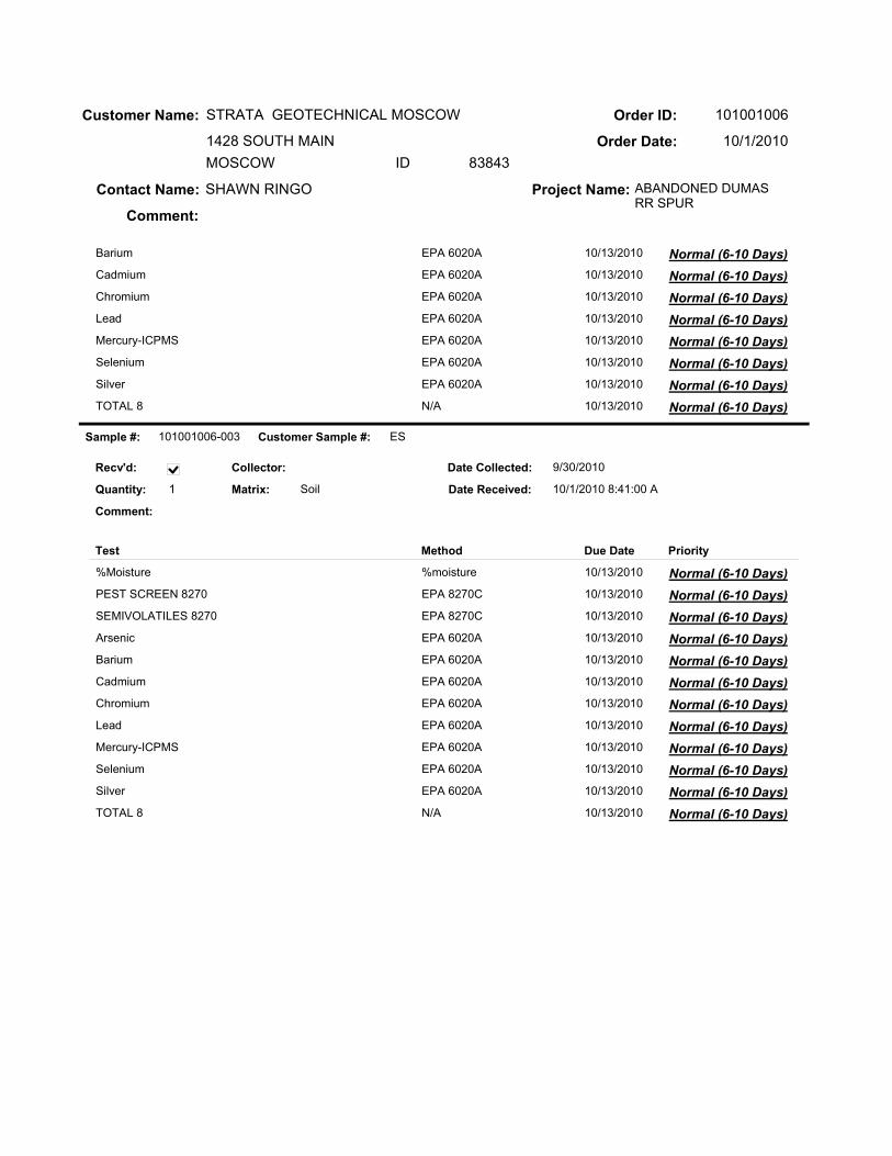
Order ID: 101001006Customer Name: STRATA GEOTECHNICAL MOSCOW
1428 SOUTH MAIN
Contact Name: SHAWN RINGO
Comment:
Order Date: 10/1/2010
Project Name: ABANDONED DUMAS RR SPUR
MOSCOW ID 83843
Barium 10/13/2010EPA 6020A Normal (6-10 Days)Cadmium 10/13/2010EPA 6020A Normal (6-10 Days)Chromium 10/13/2010EPA 6020A Normal (6-10 Days)Lead 10/13/2010EPA 6020A Normal (6-10 Days)Mercury-ICPMS 10/13/2010EPA 6020A Normal (6-10 Days)Selenium 10/13/2010EPA 6020A Normal (6-10 Days)Silver 10/13/2010EPA 6020A Normal (6-10 Days)TOTAL 8 10/13/2010N/A Normal (6-10 Days)
Sample #: 101001006-003
Date Collected: 9/30/2010
Date Received: 10/1/2010 8:41:00 A
Customer Sample #: ES
Comment:
Collector:
Matrix: SoilQuantity: 1
Recv'd:
Test Method Due Date Priority
%Moisture 10/13/2010%moisture Normal (6-10 Days)PEST SCREEN 8270 10/13/2010EPA 8270C Normal (6-10 Days)SEMIVOLATILES 8270 10/13/2010EPA 8270C Normal (6-10 Days)Arsenic 10/13/2010EPA 6020A Normal (6-10 Days)Barium 10/13/2010EPA 6020A Normal (6-10 Days)Cadmium 10/13/2010EPA 6020A Normal (6-10 Days)Chromium 10/13/2010EPA 6020A Normal (6-10 Days)Lead 10/13/2010EPA 6020A Normal (6-10 Days)Mercury-ICPMS 10/13/2010EPA 6020A Normal (6-10 Days)Selenium 10/13/2010EPA 6020A Normal (6-10 Days)Silver 10/13/2010EPA 6020A Normal (6-10 Days)TOTAL 8 10/13/2010N/A Normal (6-10 Days)

Order ID: 101001006Customer Name: STRATA GEOTECHNICAL MOSCOW
1428 SOUTH MAIN
Contact Name: SHAWN RINGO
Comment:
Order Date: 10/1/2010
Project Name: ABANDONED DUMAS RR SPUR
MOSCOW ID 83843
SAMPLE CONDITION RECORDSamples received in a cooler? Yes
Samples received intact? Yes
What is the temperature inside the cooler? 0.3
Samples received with a COC? Yes
Samples received within holding time? Yes
Are all sample bottles properly preserved? Yes
Are VOC samples free of headspace? N/A
Is there a trip blank to accompany VOC samples? N/A
Labels and chain agree? Yes
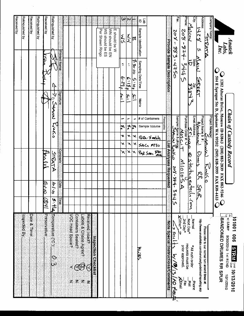
E should be W
WN
should be EN
WS
should be ES
Per S
hawn R
ingo

Appendix D:
SOQ

IDAHO MONTANA NEVADA OREGON UTAH WASHINGTON WYOMING www.stratageotech.com 10020 E. Knox Ave., Suite 200, Spokane, WA 99206-4748 P.509.891.1904 F.509.891.2012
STATEMENT OF QUALIFICATIONS TO PROVIDE ENVIRONMENTAL
CONSULTING SERVICES

IDAHO MONTANA NEVADA OREGON UTAH WASHINGTON WYOMING www.stratageotech.com 10020 E. Knox Ave., Suite 200, Spokane, WA 99206-4748 P.509.891.1904 F.509.891.2012
CCOOMMPPAANNYY OOVVEERRVVIIEEWW
STRATA Geotechnical Engineering and Materials Testing, Inc. (STRATA), is pleased to provide this Statement of Qualifications (SOQ) to provide environmental consulting services. STRATA works closely with lenders, owners, agencies, developers, engineers, architects, contractors, and project stakeholders on all aspects of project development to provide cost-effective environmental, geotechnical and construction material testing services. Our knowledgeable and experienced project managers can be an important asset to your team. The information presented herein will outline our history, resources, basic qualifications and environmental expertise.
STRATA assembles uniquely qualified teams for each project. Teams consist of experienced, key professionals and support personnel to provide assistance to the design team and project owners from project identification through schematic design and construction. Our project teams are lead by professional engineers, geologists, environmental professionals, and material testing professionals. Team members have a detailed and unmatched knowledge of the local history, geology and soil conditions from firsthand experience. Our staff will use their technical training and project experience to successfully complete all aspects of the project to support the design team and project stakeholders. FFIIRRMM HHIISSTTOORRYY
STRATA was founded in 1974 to provide geotechnical, environmental, and construction consultation and special inspection services throughout the northwestern United States from multiple established offices in Idaho, Washington, Montana and Oregon. STRATA’s consistent and planned growth established regional offices to support our client’s needs throughout these areas. STRATA is currently led by board members Travis Wambeke, P.E., Scott Cron, S.E.T., Rick Woodworth, S.E.T., and Bart Larsen. STRATA provides quality geotechnical, environmental, and material testing services through regional managers and employees in each of STRATA’s offices. RREESSOOUURRCCEESS STRATA’s geotechnical engineers, environmental professionals, geologists, and hydrogeologists are trained and skilled in the earth sciences. In addition, STRATA’s construction field professionals and inspectors have ICC, WAQTC and NICET Certifications in soil, asphalt, concrete, masonry and steel. Project engineers have advanced degrees including masters Degrees in civil, geotechnical, environmental and geological engineering. Certification in individual areas of expertise is required of staff members at every level. STRATA encourages continual advancement in technical skills and active participation in community and local chapters of professional affiliations.
IDAHO MONTANA NEVADA OREGON UTAH WASHINGTON WYOMING www.stratageotech.com 10020 E. Knox Ave., Suite 200, Spokane, WA 99206-4748 P.509.891.1904 F.509.891.2012
MMIISSSSIIOONN SSTTAATTEEMMEENNTT “STRATA is committed to providing timely and innovative environmental, geotechnical engineering and construction material testing services to our clients by maintaining ethical and professional value-based products. We recognize employees as our most valuable resource to achieve these goals, serve our clients and perpetuate our organization”.
EENNVVIIRROONNMMEENNTTAALL QQUUAALLIIFFIICCAATTIIOONNSS
STRATA has provided environmental, geotechnical engineering and construction material testing services to clients ranging from local, county, state and federal agencies to public schools and private commercial developments. Each client is unique and requires unique solutions to their specific project. STRATA provides environmental services for educational institutes, industrial, commercial, governmental and residential projects throughout the northwestern United States. Soil mechanics, foundation engineering, environmental geology, and earth science principles are utilized to interpret and solve soil or geologic engineering problems. We have served the northwest United States for over 30 years and have established a reputation for providing dependable and quality consulting services. Each of our offices supports the others by supplying personnel with diverse expertise, equipment and testing.
EENNVVIIRROONNMMEENNTTAALL SSIITTEE AASSSSEESSSSMMEENNTT SSEERRVVIICCEESSSTRATA provides environmental consulting services throughout the northwestern United States. Phase I Environmental Site Assessments (ESAs) are typically conducted prior to a property transaction. STRATA can perform Phase I ESAs, geotechnical engineering, and construction support services from project conception through completion. Phase I ESA's are performed to identify “Recognized Environmental Conditions” (RECs). A REC is defined as “the presence or likely presence of hazardous substances or petroleum products on a property under conditions that indicate an existing release, a past release, or a material threat of a release of any hazardous substances or petroleum products into structures on the property or into the ground, groundwater or surface water of the property”. The Environmental Protection Agency (EPA) has determined that Phase I ESAs performed in accordance with ASTM Standard E1527-05 are in compliance with the requirements for conducting “all appropriate inquiries.” Conducting an all appropriate inquiry prior to purchasing a site is one of the requirements to qualify for the innocent landowner, contiguous property owner, or bona fide prospective purchaser limitations under the Comprehensive Environmental Response, Compensation, and Liability Act (CERCLA). On sites with known soil or groundwater contamination or where RECs are revealed in the Phase I ESA, STRATA can perform subsurface investigations to delineate the extent and magnitude of soil and groundwater contamination. We can help developers and site owners with Corrective Action Plans (CAPs) for remediating contaminated soil and groundwater. STRATA typically presents the CAP to appropriate agencies and assists the owner with initiating cleanup and with site monitoring and documentation.

IDAHO MONTANA NEVADA OREGON UTAH WASHINGTON WYOMING www.stratageotech.com 10020 E. Knox Ave., Suite 200, Spokane, WA 99206-4748 P.509.891.1904 F.509.891.2012
Large Multi-Site ESAs
STRATA brings a multi-disciplinary team that provides value-oriented solutions from project conception through construction. STRATA performs due diligence services for downtown revitalization and transportation corridor projects. In addition to Phase I ESAs, these projects often include contaminated sites that require additional site investigation, risk assessment and corrective action plan services. STRATA dedicates time up front with the client developing a holistic, cost effective scope of services to reduce service overlap on adjoining sites, and to provide timely consulting and deliverables to meet the client’s risk management objectives. STRATA’s environmental professionals work closely with the client throughout the project and provide periodic progress and findings updates and solicit client input at key decision points to update scope of services as necessary to keep the project moving forward. AADDDDIITTIIOONNAALL EENNVVIIRROONNMMEENNTTAALL CCOONNSSUULLTTIINNGG SSEERRVVIICCEESS Limited Site Investigation or Extensive Subsurface Investigation
On sites with known soil or groundwater contamination or where RECs are revealed in the Phase I ESA, STRATA provides limited site or alternatively, extensive subsurface investigations to identify the extent and magnitude of soil and groundwater contamination.
HOKU SCIENTIFIC POLYSILICON SITE— PHASE I & II ESA and STORM WATER POLLUTION PREVENTION PLAN (SWPPP)
Site Characterization / Assessment Services Site Characterizations are very similar to Limited Site Investigations except they are typically focused on determining the quantity and extent of contamination so that sufficient data is available to make remediation/site closure recommendations. Human health and environmental risk assessments are typically performed to quantify the risks associated the contaminating and to develop site specific cleanup goals.

IDAHO MONTANA NEVADA OREGON UTAH WASHINGTON WYOMING www.stratageotech.com 10020 E. Knox Ave., Suite 200, Spokane, WA 99206-4748 P.509.891.1904 F.509.891.2012
Environmental Evaluations STRATA also has significant environmental consulting experience and provides a comprehensive array of environmental services such as:
� Corrective Action Plans � Landfill Construction Quality Control/Assurance � Groundwater Monitoring/Evaluation � Groundwater Monitoring/Statistical Analyses � Risk Assessment � Hydrology � Landfill Geotechnical Evaluation � Nutrient Pathogen Evaluations � SPCC Plans � Radon Sampling � UST Closure Consulting � Well Siting Studies � Landfill Siting and Permitting � SWPPP � Asbestos Inspections � Erosion and Sediment Control Plans � Landfill Closure Engineering � NPDES Permitting � Geosynthetics � Hazardous Waste Management Plans � Landfill Gas � Asbestos Abatement Oversight � Remediation
� Regulatory Compliance � Brownfields
AADDDDIITTIIOONNAALL SSTTRRAATTAA SSEERRVVIICCEESS
Geotechnical Engineering
STRATA provides geotechnical engineering services for educational institutes, industrial, commercial, governmental and residential projects throughout the northwestern United States. Soil mechanics, foundation engineering, environmental geology and earth science principles are utilized to interpret and solve soil or geologic engineering problems. We have served the northwest United States for over 30 years and have established a reputation for providing a dependable and quality geotechnical service. Geotechnical engineering requires establishing the surface and subsurface soil, geologic and hydrogeologic characteristics that will respond to the project or structure. STRATA utilizes conventional exploration methods and the latest technology to establish the geoenvironmental aspects of each project site.
Construction Material Testing
Construction material testing furnishes verification to the owner, architect, engineer and contractor that construction has been accomplished in accordance with the project plans and specifications. STRATA provides both field and laboratory testing for common construction materials. Experienced inspectors, engineers and technicians provide on-site observations and testing to assist construction efforts. Our construction material testing division compliments geotechnical design efforts and provides continuity from design through construction with local personnel. This continuity provides project owners with efficient, cost effective and knowledgeable design and construction services that often result in soil engineering and construction related efficiencies.

Statement of Qualifications
IDAHO MONTANA NEVADA OREGON UTAH WASHINGTON WYOMING
www.stratageotech.com 10020 East Knox Avenue, Spokane, Washington P. 509.891.1904 / F. 509.891.2012
STRATA is accredited through the American Association for Laboratory Accreditation (A2LA), American Association of State Highway and Transportation Officials (AASHTO), Washington Association of Building Officials (WABO), and Idaho Transportation Department (ITD). Voluntary participation in national laboratory proficiency programs help to ensure the accuracy of our test results. Our field and laboratory professionals maintain certification through the International Code Council (ICC), Western Alliance for Quality Transportation Construction (WAQTC), National Institute for Certification of Engineering Technicians (NICET) and the American Concrete Institute (ACI). Laboratory Testing STRATA provides many types of laboratory testing for soil and construction materials. Our experienced personnel regularly perform complex geotechnical tests such as triaxial shear, direct shear, permeability, consolidation, hydrometer, and many others. STRATA maintains AASHTO accredited and A2LA accredited laboratories in Spokane, Washington and Boise, Idaho. STRATA also maintains soil testing laboratories in our Moscow and Pocatello, Idaho, Missoula, Montana, and Ontario, Oregon offices. These laboratories meet the ASTM qualifications as set forth in ASTM E 329, C 1077, C 1093, D 3666, and D 3740. Our testing personnel maintain certifications through the International Code Council (ICC), the National Institute for Certification of Engineering Technicians (NICET), the American Concrete Institute (ACI), and the American Welding Society (AWS). SSTTRRAATTAA OOFFFFIICCEE LLOOCCAATTIIOONNSS STRATA has seven offices in the northwestern United States to support client projects. Our staff includes environmental professionals, professional geologists licensed in Idaho and Washington, and professional engineers licensed in Idaho, Washington, Oregon, Montana, Utah, Wyoming and Nevada. Our construction materials testing professionals are certified throughout the northwest. Further, we have certified mobile laboratories to help serve regional projects and reduce our client’s costs.
Moscow, Idaho
Boise, Idaho
Pocatello, Idaho
Coeur d’Alene, IdahoMissoula, Montana
Ontario, Oregon
Spokane, Washington

Statement of Qualifications
IDAHO MONTANA NEVADA OREGON UTAH WASHINGTON WYOMING
www.stratageotech.com 10020 East Knox Avenue, Spokane, Washington P. 509.891.1904 / F. 509.891.2012
SSTTRRAATTAA CCOONNTTAACCTTSS
Spokane, Washington Coeur d’Alene, Idaho 10020 E. Knox Avenue, Ste 200 – 99206 West 280 Prairie Avenue – 83815 Michael Pereira, Environmental Manager Michael Pereira, Environmental Manager Chris Comstock, Area Manager Chris Comstock, Area Manager 509.891-1904 208.772.2428 Boise, Idaho Moscow, Idaho 8653 W. Hackamore Drive – 83709 1428 S. Main Street – 83843 Bill Holder, Corporate Environmental Manager Shawn Ringo, Environmental Manager Scott Cron, Area Manager Travis Wambeke, Area Manager 208.376.8200 208.882.1006 Pocatello, Idaho Missoula, Montana 4460 Kings Way #3, Chubbuck – 83202 723 Ronan Street – 59801 Bill Holder, Corporate Environmental Manager Shawn Ringo, Environmental Manager Bart Larsen, Area Manager Zachary St. Jean, Area Manager 208.237.3400 406.829.1600 Ontario, Oregon 347 SW 19th St – 97914 Bill Holder, Corporate Environmental Manager Sean Clow, Manager 541.881.0800

Statement of Qualifications
IDAHO MONTANA NEVADA OREGON UTAH WASHINGTON WYOMING
www.stratageotech.com 10020 East Knox Avenue, Spokane, Washington P. 509.891.1904 / F. 509.891.2012
TTEESSTTIIMMOONNIIAALLSS –– WWhhaatt ssoommee ooff oouurr cclliieennttss hhaavvee ttoo ssaayy....
“STRATA’s quick response and professional attitudes of your entire team are appreciated and has been a key part in the success or our project schedule”. Jim Link, Vice President BAUGH SKANSKA
“We appreciate STRATA’s prompt response to our questions, meeting our deadlines and STRATA’s availability during construction and once again, your willingness to look beyond the conventional to develop innovative solution to our needs. We would have no reservations in recommending STRATA to our clients and we look forward to working with you in the future”.
Scott Straubhar, Principal Hummel Architects
“STRATA managed the project inspection requirements both timely and professionally. I enjoyed working with STRATA and would not hesitate to recommend them for any future work”.
Jeffrey W. Martin, President and CEO Gritman Medical Center
“I would like to thank STRATA for providing excellent support for our Tongass Highway project in Ketchikan, Alaska. Over the years, I’ve come to expect quality service and quality staff from your organization and once again I was not disappointed”. Richard H. Olson, Technical Manager SECON

Shawn Patrick [email protected]
IDAHO MONTANA NEVADA OREGON UTAH WASHINGTON WYOMING www.stratageotech.com
Professional Licenses andCertifications:
AHERA Accredited Asbestos InspectorNational
AHERA Accredited Asbestos SupervisorNational
AHERA Accredited Management Planner National
Resource Protection Well Constructor Idaho and Oregon
Education:
Bachelor of Science –1997Environmental Science and Regional Planning Water Quality Emphasis Washington State University
CLIENT COMMITMENT:"I am personally committed to
contributing to the success through top performance in an
organization whose products and mission positively serve the
community."
Project Assignment: Environmental Project Lead
Shawn is the lead environmental scientist for STRATA’s regional offices. Shawn has more than 13 years experience conducting environmental site assessments and performing hazardous material investigations on projects throughout Idaho, Oregon and Washington.
Specialization areas include: AHERA regulatory compliance, contaminant fate and transport and remediation analysis, asbestos and lead paint inspection/abatement, risk evaluation modeling and Model Toxics Control Act remedy selection.
Representative Experience:
� Washington State University—Pullman, Washington. Regularly perform numerous asbestos inspections and abatement oversight projects. Assist WSU Facilities Operations and Capital Planning personnel with hazardous material regulatory compliance.
� Independent School District # 1—Lewiston, Idaho. Performed District Wide AHERA re-inspection and Management Plan update.
� Idaho Department of Environmental Quality—Idaho. Provided technical assistance and conducted subsurface investigations for numerous State Brownfields projects.
� Gritman Medical Center—Moscow, Idaho. Performed asbestos inspections prior to renovating an active medical facility, Phase I ESAs and subsurface investigations.
� Big Creek Repository—Bunker Hill Superfund Site, Idaho. Led drill derived subsurface investigation of former settlement ponds underlying lead contaminated superfund soil repository.
� Veterans Administration Medical Center—Tacoma, Washington. Performed ESA and site groundwater and geotechnical evaluation of VA property prior to new construction.
� Moscow Seed Elevators—Moscow, Idaho. Inspect and delineate more than 1000 of feet of ACM TSI located in the former elevator, subsurface tunnels and boiler building. Provide demolition level inspection and inventory of surfacing and miscellaneous materials associated with the facility.

William H. Holder, P.E.www.stratageotech.com [email protected]
PROJECT ASSIGNMENT:
Senior Environmental/Geotechnical Engineer
Bill Holder is STRATA’s Corporate Environmental Manager. Bill has 16 years experience in Project Management; Phase I and Phase II Environmental Site Assessments; Environmental Engineering; NEPA Screening, Site Characterization; Groundwater Hydrology, Contaminant Transport, Nutrient-Pathogen Studies, SPCC Plans, UST/AST Management, Permitting; Geotechnical Engineering: Foundation Studies, Pavement Design, Geogrid Reinforced Pavement Design, Slope Stability, Borrow Evaluations, Liquefaction Analysis, Geosynthetic and Soil Liner Construction Quality Assurance; Landfills: Site Studies, Groundwater Monitoring, Geotechnical Analysis, Construction Quality Assurance; and Land Development.
EDUCATION:
M.E., Civil Engineering University of South Carolina, 2000
B.S., Civil Engineering Virginia Polytechnic Institute & State University, 1990
PROFESSIONAL REGISTRATION ANDAFFILIATIONS:
� Professional Engineer: Idaho � OSHA 40-hour Hazwoper � OSHA Hazwoper Supervisor � AHERA Asbestos Inspector � OSHA Confined Space Entry � ASCE, Past President of Southern
Idaho Section. � ASCE Geoinstitute
ISPE, Current Future City Committee
CLIENT COMMITMENT:
“My commitment to our clients is to provide quality service in a timely manner.”
� Chair; Former Public Relations and Eweek Committee Chair
� ACEC Idaho, Former ACEC-ITD Liaison Geogrid Subcommittee Chair
� National Engineers Week Future City Competition – Idaho Regional Coordinator 2004 to Present Idaho Environmental Forum
REPRESENTATIVE PROJECT EXPERIENCE:
Hydrogeologic Investigations – NP Studies
Project engineer/manager/reviewer for 50+ NP studies in ID. Many of these projects included conducting pumping tests and evaluating the data to evaluate aquifer hydrologic properties and modeling of contaminant fate/transport.

William H. Holder, P.E.www.stratageotech.com [email protected]
REPRESENTATIVE PROJECT EXPERIENCE:
Underground Storage Tanks
Project Manager for the investigation of a former bulk petroleum storage facility in Caldwell, Idaho.
Project Manager for the investigation of petroleum contamination from rental car facilities at the Spokane International Airport in Spokane, Washington.
Project Manager for the remediation of petroleum contaminated groundwater at a gasoline station in Emmett, Idaho.
Project Manager for the investigation of potential petroleum contaminated soils at a trucking facility in Boise, Idaho.
Project Manager for the investigation of petroleum contaminated soil and groundwater at a former gasoline station in Caldwell, Idaho.
Project Manager/Reviewer for 20+ site characterization projects involving leaking underground storage tanks in Idaho, South Carolina and Virginia. Responsibilities included planning and executing subsurface investigations, interpreting site hydrogeology, performing contaminant transport analysis and risk assessment, and recommending remediation alternatives for the sites.
Project Engineer for the preparation of Initial Abatement Measures, Site Characterization, Tank Closure, and Site Assessment Reports for facilities with leaking underground storage tanks and surface petroleum contamination in central Virginia.
Project Engineer for reimbursement packages for the Virginia Underground
Petroleum Storage Tank Fund (VUPSTF) for various projects in central Virginia. Project Manager for the preparation of a Corrective Actions Permit for remediation of petroleum contaminated soils at a maintenance facility in central Virginia.
Environmental Site Assessments
Project engineer/manager/reviewer for 400+ Phase I ESAs and 60+ Phase II ESAs.
Project manager for a Phase II ESA for a dry cleaner site in Boise, Idaho.
Project manager for a fast-track Phase I ESA (3 day turnaround) for a 400+ ace fish hatchery site in Pocetello, Idaho.
Litigation Suport
Contaminant transport modeling for a perchloroethylene-contaminated site in upstate South Carolina to identify the PRP.
Performed technical support to serve as a fact witness in a trial regarding methylene chloride contamination at an airplane painting facility in Petersburg, Virginia.
RCRA Facility Investigation
Project manager for the investigation of a methylene chloride contaminated site.
Geophysical Investigations
Project engineer for several projects using various geophysical methods for subsurface evaluation including an industrial site in Weiser, ID where ground penetrating radar was used to identify areas with suspect buried drums.
William H. Holder, P.E.www.stratageotech.com [email protected]
REPRESENTATIVE PROJECT EXPERIENCE:
National Environmental Policy Act (NEPA) Screenings
Project engineer/manager for NEPA screenings for 100+ proposed communications tower sites.
Landfill Engineering
Performed senior engineer construction inspection of the INEEL CERCLA Disposal Facility for the Idaho Department of Environmental Quality.
Project Manager for the groundwater monitoring and statistical analysis at a sanitary landfill in Sussex County, VA. The monitoring network consisted of 16 wells.
Project Manager for the settlement and slope stability analysis of a 17.5-acre landfill expansion in Sussex County, VA.
Project Manager for Phase I and Phase II (33 and 14.5 acres, respectively) construction quality assurance of a double composite lined sanitary landfill in Sussex County, VA.
Project Manager for the construction quality assurance for a 19-acre soil cap at a sanitary landfill in Campbell County, VA.
Project Manager for the geosynthetics construction quality assurance of a 2-acre VLDPE cap at a recycling facility in Richmond, VA.
Project Manager for construction quality assurance of a 6.5-acre soil liner at a sanitary landfill in Campbell County, VA. Included a borrow study to find potential liner soils.
Project Manager for the construction quality assurance of a 4.5-acre composite liner at a sanitary landfill in Rappahannock County, VA.
Project Manager for the subsurface exploration and hydrogeologic portion of the Part A Permit Application for a 670-acre landfill expansion in Sussex County, VA.
Staff Engineer for the construction quality assurance for a composite liner at a sanitary landfill in Chester, VA.
Performed slope stability and settlement analyses for the Part B Permit Application for a sanitary landfill in Chester, VA.
Staff Engineer for the preparation of Part A Permit applications for sanitary landfills in Greene County and Dinwiddie Counties, VA.
Staff Engineer for groundwater sampling and analysis for debris and sanitary landfills in Chester, Virginia, and Orange Counties, VA.
Othe����Other�Environmental�Projects�Prepared and senior reviewed well siting studies for municipal wells in Idaho.
Prepared environmental information document for water system improvements in Heyburn, ID.
Prepared air permits for a flexogrpahic printing facility and a commercial bakery in Richmond, VA.
Prepared a wastewater discharge permit for a flexographic printing facility in Richmond, VA.
Provided environmental consulting services to a fish processing facility for disposal of their spent clay filter media waste stream.

Travis�J.�Wambeke,�P.E.,�P.G.�[email protected]�
PROJECT�ASSIGNMENT:�Project�Manager�Travis�is�the�President�of�STRATA,�Inc.�and�is�the�Moscow,�Idaho�Area� Manager.� Travis� has� numerous� years� experience� with�environmental,� material� testing� and� geotechnical� engineering�projects�throughout�Idaho�and�Washington�and�provides�overall�leadership�for�project�team�activities.����
Areas� of� specialization� are� subsurface� soil� exploration,�remediation�analysis�and�geologic�characterization,�conventional�and� deep� foundation� design,� asphalt� pavement� evaluation,�geotechnical� analysis� of� landslides� and� slope� stability,�environmental� site� assessments,� site� monitoring� and�construction�materials�testing.��
REPRESENTATIVE�EXPERIENCE:��� Pullman� Memorial� Hospital,� Pullman,� Washington.�
Geotechnical� evaluation,� Level� I� environmental� site�assessment�and�construction�materials�testing.��
�� Square� I� Building,� Pullman,� Washington.� � Level� I� site�assessment,� remediation� planning,� compliance� testing� and�reporting,�WDOE�closure�and�material�testing.��
�� Corporate� Point� Office� Building,� Pullman,� Washington.��Geotechnical� engineering� evaluation� of� new,� two�story�professional�office�space.��
�� Power� Plant� Addition,� Washington� State� University,�Pullman,� Washington.� � Geotechnical� foundation� and�shoring�evaluation�with�MSE�wall�support.��
�� Gritman� Medical� Center,� Moscow,� Idaho.� � Geotechnical�evaluation,� environmental� site� assessment,� compliance�monitoring�and� testing,�design,� installation�and�monitoring�of�a�sub�floor�vapor�emission�collection�system.����
�� Les�Schwab,�Pullman,�Washington.�
Geotechnical�evaluation�and�environmental�assessment� for�the� staged� construction� of� new� addition� on� the� existing�building.���
�� Aspen� Village/Pine� Ridge� Apartments,� Pullman,�Washington.� � Geotechnical� evaluation� of� a� large,� multi�tenant� resi�dential� development� north� of� Terreview� Drive.��Hillside� development� evaluation� included� drainage�character�istics,� pavement� design,� soft� soil� stabili�zation,�slope� stability,� foundation� design� and� construction�consultation.��
PROFESSIONAL�REGISTRATION�AND��AFFILIATIONS:��� Professional�Engineer�
Idaho�and�Washington��� Professional�Geologist�
Washington��� ICBO�
Reinforced�Concrete�Inspector��#8863�
�� WABO�
Technical�Director��� ISPE�
President�–�2002,�2001,�2000�Vice�President�–�1999�
�EDUCATION:�Bachelor�of�Science�–1993�Geological�Engineering��University�of�Idaho��Master�of�Science�–1996�Geological�Engineering��University�of�Idaho��Fundamentals�of�Professional�Practices,�ASFE�–�1998�
�
�
Client�Commitment:�
"I�strive�to�provide�continuous�client�communication�to�incorporate�design�efficiencies�and�develop�cost�effective�solutions�to�soil�engineering�problems.”�

![such€¦ · epa ih(.' agency (sip) " ((;aa) ((:],,[(,), epa-[[cbi), \'< ov • epa. • • (•. •.'%.• (].}'•}).\](https://img.pdfslide.net/doc/110x75/5fea5a1bdc048408ab016e1b/such-epa-ih-agency-sip-aa-epa-cbi-ov-a.jpg)