Embed Size (px)
Citation preview

Cambridgeshire County Council
Cambridgeshire Preliminary Flood Risk Assessment
Draft Preliminary Assessment Report


Cambridgeshire Preliminary Flood Risk Assessment—Preliminary Assessment Report
Hyder Consulting (UK) Limited-2212959 k:\ua002163 - cambridgeshire swmp\f-reports\5008 pfra\5008-ua002163-bmr-03 preliminary flood risk assessment report.docx
Hyder Consulting (UK) Limited
2212959
Aston Cross Business Village 50 Rocky Lane Aston Birmingham B6 5RQ United Kingdom
Tel: +44 (0)121 333 4466
Fax: +44 (0)121 333 4275
www.hyderconsulting.com
Cambridgeshire County Council
Cambridgeshire Preliminary Flood Risk Assessment
Draft Preliminary Assessment Report
Author Tom Lester
Checker Liam Foster
Approver R Gunasekara
Report No 5008-UA002163-BMR-02
Date February 2011
This report has been prepared for Cambridgeshire County Council in accordance with the terms and
conditions of appointment for Surface Water Management Plan Framework dated September 2010.
Hyder Consulting (UK) Limited (2212959) cannot accept any responsibility for any use of or reliance on the
contents of this report by any third party.

Cambridgeshire Preliminary Flood Risk Assessment Preliminary Assessment Report
Hyder Consulting (UK) Limited-2212959 Page 4 k:\ua002163 - cambridgeshire swmp\f-reports\5008 pfra\5008-ua002163-bmr-03 preliminary flood risk assessment report.docx
Report Version Control Schedule
Version Date of
Issue
Document Reference Status Author Checker Approver
0.1 21/02/2011 20110221_Cambs Preliminary Assessment Report
Draft Thomas Lester
Liam Foster Renuka Gunasekara
0.2 31/03/2011 20110331_Cambs Preliminary Assessment Report
Final Thomas Lester
Liam Foster Renuka Gunasekara

Cambridgeshire Preliminary Flood Risk Assessment—Preliminary Assessment Report
Hyder Consulting (UK) Limited-2212959 Page i k:\ua002163 - cambridgeshire swmp\f-reports\5008 pfra\5008-ua002163-bmr-03 preliminary flood risk assessment report.docx
CONTENTS
Executive Summary ........................................................................................ 1
1 Introduction ........................................................................................... 2
1.1 Scope and Purpose of the Report ........................................................ 2
1.2 Study Area – Geographic Extent .......................................................... 2
1.3 Study Area - Demographics .................................................................. 3
2 Lead Local Flood Authority Responsibilities ........................................ 4
2.1 Flood Risk Regulations ......................................................................... 4
2.2 Cambridgeshire Flood Risk Management Partnership ......................... 4
2.3 PFRA Project Board ............................................................................. 5
2.4 Communication Methods ...................................................................... 5
3 Methodology and Data Review ............................................................ 7
3.1 Sources of Local Flooding Considered ................................................. 7
3.2 Sources of Data .................................................................................... 7
3.3 Data Collection and Review .................................................................. 9
4 Past Flood Risk .................................................................................. 10
4.1 Overview............................................................................................. 10
4.2 Significant Harmful Consequences ..................................................... 11
4.3 Cambridgeshire Historic Flooding ....................................................... 11
4.4 Cambridgeshire Flood Memories ........................................................ 11
5 Future Flooding Risk .......................................................................... 13
5.1 Overview............................................................................................. 13
5.2 Locally Agreed Surface Water Information ......................................... 13
5.3 Climate Change .................................................................................. 14
5.4 Long Term Developments .................................................................. 15
5.5 Future Floods and Consequences ...................................................... 16
6 Flood Risk Areas ................................................................................ 17
6.1 Review of Indicative Flood Risk Areas ............................................... 17
7 Identification of Flood Risk Areas ....................................................... 18
7.1 Amendments to Flood Risk Areas ...................................................... 18
7.2 New Flood Risk Areas ........................................................................ 18
8 Next Steps .......................................................................................... 18
8.1 Ongoing Flood Risk Management Activities ....................................... 18
8.2 Improved Data Collection and Management....................................... 19
8.3 Scrutiny and Review ........................................................................... 20

Cambridgeshire Preliminary Flood Risk Assessment Preliminary Assessment Report
Hyder Consulting (UK) Limited-2212959 Page ii k:\ua002163 - cambridgeshire swmp\f-reports\5008 pfra\5008-ua002163-bmr-03 preliminary flood risk assessment report.docx
9 References ......................................................................................... 21
List of Figures
Figure 1-1 Study Area.....................................................................................3
Figure 3-1 Flooding from Local Sources.........................................................7
Figure 4-1 Summary of Cambridgeshire Flood Memory Results ...................12
Figure 5-1 Location of Locally Agreed Flood Risk Information.......................14
Figure 6-1 UK Indicative Flood Risk Areas.....................................................17
List of Tables
Table 1-1 Study Area.....................................................................................3
Table 2-1 Flooding from Local Sources.........................................................5
Table 3-1 Stakeholders Consulted and Information Obtained.......................8
Table 4-1 Significant Cambridgeshire Flood Events.....................................10
Table 5-1 Future Developments Impact on Future Flood Risk......................16

Cambridgeshire Preliminary Flood Risk Assessment—Preliminary Assessment Report
Hyder Consulting (UK) Limited-2212959 Page 1 k:\ua002163 - cambridgeshire swmp\f-reports\5008 pfra\5008-ua002163-bmr-03 preliminary flood risk assessment report.docx
Executive Summary
The Flood Risk Regulations 2009 implement the European Floods Directive (2007/60/EC) providing a consistent approach to managing flood risk across Europe, through a six year planning cycle based on a four stage process of:
Undertaking a Preliminary Flood Risk Assessment (PFRA),
Identifying Flood Risk Areas,
Preparing flood hazard and risk maps
Preparing flood risk management plans.
The following report summarises the results of the PFRA process for Cambridgeshire following the national guidance published by the Environment Agency for the Lead Local Flood Authorities. Both past and future flooding have been interrogated using National and Local datasets in order to assess where areas of significant flood risk lie within the county. Past flood events whether significant or not are collated in order to assess local flood risk and inform future local flood management strategies.
This PFRA document has been produced to satisfy the Flood Risk Regulations (2009). The current national Flood Risk Areas identified by the Environment Agency are reviewed but no new Indicative Flood Risk Areas within the county are proposed by this PFRA.
The Cambridgeshire Surface Water Management Plan and the Cambridge & Milton Surface Water Management Plan work currently being concluded by Cambridgeshire County Council provides more detailed information on local flood risk.

Cambridgeshire Preliminary Flood Risk Assessment Preliminary Assessment Report
Hyder Consulting (UK) Limited-2212959 Page 2 k:\ua002163 - cambridgeshire swmp\f-reports\5008 pfra\5008-ua002163-bmr-03 preliminary flood risk assessment report.docx
1 Introduction
1.1 Scope and Purpose of the Report
The Preliminary Flood Risk Assessment (PFRA) is a high level screening exercise that brings together the easily available information from a number of sources to assess local flood risk. The key stages of PFRA involve:
Collecting information on past (historic) and future (potential) floods and flood risk.
Assembling the information into a Preliminary Assessment Report.
Identification of Flood Risk Areas by reviewing the national indicative areas produced by the Environment Agency alongside local information from the Preliminary Assessment Report.
This Preliminary Assessment Report is the first stage output of the Preliminary Flood Risk Assessment (PFRA) undertaken for Cambridgeshire. It fulfils Cambridgeshire County Council‘s (CCC‘s) new obligations, as the Lead Local Flood Authority, under the requirements of the Flood Risk Regulations 2009
1 and provides the evidence for the second stage of identifying
Flood Risk Areas within Cambridgeshire.
The report provides the information used, methodology adopted and level of local flood risk in Cambridgeshire that is principally associated with surface runoff, groundwater and ordinary watercourses. It will be a key document that informs the preparation of future Local Flood Risk Management Strategies as required by the Floods and Water Management Act 2010
2.
1.2 Study Area – Geographic Extent
The Cambridgeshire Preliminary Flood Risk Assessment (PFRA) study area covers the whole county area of Cambridgeshire, in the east of Great Britain, and falls within the Anglian River Basin District, as shown in Figure 1-1. The county area is approximately 304,400 ha. The county is comprised of five second tier local Authorities: Cambridge City and the four districts of East Cambridgeshire, Fenland, Huntingdonshire and South Cambridgeshire. The main settlements are Cambridge, Ely, Huntingdon and Wisbech.
The Fens include the lowest lying land surrounding the City of Ely in the study area, with Holme Fen being, not only the lowest point in the county, but also the lowest point in the UK, approximately 2.75m below sea level. There are a series of notable hills at Little Trees Hill, Wandlebury Hill, River Hill above Linton and Madingley Hills.

Cambridgeshire Preliminary Flood Risk Assessment—Preliminary Assessment Report
Hyder Consulting (UK) Limited-2212959 Page 3 k:\ua002163 - cambridgeshire swmp\f-reports\5008 pfra\5008-ua002163-bmr-03 preliminary flood risk assessment report.docx
Figure 1-1 Study Area
1.3 Study Area - Demographics
The population of the county in 2008 was approximately 600,000, and this is expected to increase by an average of 13% in the next 13 years, with the largest predicted growth in Cambridge City, at ~31%. The number of households was approximately 250,000 and this is predicted to increase by an average of 19% over the next 13 years. (Cambridgeshire County Council, March 2010). Table 1-1 below shows a summary of the predicted population and household increases in the next 13 years.
District
Population Households
2008 Predicted
Increase
(%)
2021 2008 Predicted
Increase
(%)
2021
Cambridge City 117,700 30.6 153,700 45,200 35 61,100
East Cambridgeshire 79,400 2 81,000 34,300 10 37,600
Fenland 92,900 7.9 100,200 39,500 14 45,100
Huntingdonshire 163,200 2.4 167,000 68,400 10 75,400
South Cambridgeshire 142,500 20.6 171,900 59,000 28 75,400
Table 1-1 Population and Household Information (Cambridgeshire County Council, March 2010)
Cambridgeshire Preliminary Flood Risk Assessment Preliminary Assessment Report
Hyder Consulting (UK) Limited-2212959 Page 4 k:\ua002163 - cambridgeshire swmp\f-reports\5008 pfra\5008-ua002163-bmr-03 preliminary flood risk assessment report.docx
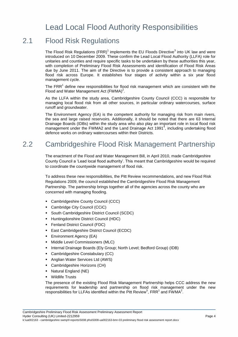
Lead Local Flood Authority Responsibilities
2.1 Flood Risk Regulations
The Flood Risk Regulations (FRR)1 implements the EU Floods Directive
3 into UK law and were
introduced on 10 December 2009. These confirm the Lead Local Flood Authority (LLFA) role for unitaries and counties and require specific tasks to be undertaken by these authorities this year, with completion of Preliminary Flood Risk Assessments and identification of Flood Risk Areas due by June 2011. The aim of the Directive is to provide a consistent approach to managing flood risk across Europe. It establishes four stages of activity within a six year flood management cycle.
The FRR1 define new responsibilities for flood risk management which are consistent with the
Flood and Water Management Act (FWMA)2.
As the LLFA within the study area, Cambridgeshire County Council (CCC) is responsible for managing local flood risk from all other sources, in particular ordinary watercourses, surface runoff and groundwater.
The Environment Agency (EA) is the competent authority for managing risk from main rivers, the sea and large raised reservoirs. Additionally, it should be noted that there are 63 Internal Drainage Boards (IDBs) within the study area who also play an important role in local flood risk management under the FWMA2 and the Land Drainage Act 1991
4, including undertaking flood
defence works on ordinary watercourses within their Districts.
2.2 Cambridgeshire Flood Risk Management Partnership
The enactment of the Flood and Water Management Bill, in April 2010, made Cambridgeshire
County Council a ‗Lead local flood authority‘. This meant that Cambridgeshire would be required
to coordinate the countywide management of flood risk.
To address these new responsibilities, the Pitt Review recommendations, and new Flood Risk
Regulations 2009, the council established the Cambridgeshire Flood Risk Management
Partnership. The partnership brings together all of the agencies across the county who are
concerned with managing flooding.
Cambridgeshire County Council (CCC)
Cambridge City Council (CCiC)
South Cambridgeshire District Council (SCDC)
Huntingdonshire District Council (HDC)
Fenland District Council (FDC)
East Cambridgeshire District Council (ECDC)
Environment Agency (EA)
Middle Level Commissioners (MLC)
Internal Drainage Boards (Ely Group; North Level; Bedford Group) (IDB)
Cambridgeshire Constabulary (CC)
Anglian Water Services Ltd (AWS)
Cambridgeshire Horizons (CH)
Natural England (NE)
Wildlife Trusts
The presence of the existing Flood Risk Management Partnership helps CCC address the new requirements for leadership and partnership on flood risk management under the new responsibilities for LLFAs identified within the Pitt Review
5, FRR
1 and FWMA
2.

Cambridgeshire Preliminary Flood Risk Assessment—Preliminary Assessment Report
Hyder Consulting (UK) Limited-2212959 Page 5 k:\ua002163 - cambridgeshire swmp\f-reports\5008 pfra\5008-ua002163-bmr-03 preliminary flood risk assessment report.docx
As Cambridgeshire County Council has a key leadership role in Co-ordinating Flood Risk Management across the county, it was hoped that the partnership working would allow them to fulfil this key role.
2.3 PFRA Project Board
The PFRA Project Board sits within the Cambridge Flood Risk Management Partnership
(CFRMP). The PFRA Project Board is summarised in the Table 1-1 Below
Organisation CFRMP PFRA Project Board
Cambridgeshire County Council
Cambridge City Council
East Cambridgeshire District Council
Fenland District Council
Huntingdonshire District Council
South Cambridgeshire District Council
Cambridgeshire Horizons
Anglian Water Services
Environment Agency
Cambridgeshire County Council Highways Authority
Middle Level Commissioners and associated IDBs
Ely Group of Drainage Boards
Bedford Group of Drainage Boards
Table 2-1 PFRA Project Board
2.4 Communication Methods
A Stakeholder Engagement Plan6 has been developed by the CFRMP. The purpose of the
engagement plan is to improve how the partnership consults and involves citizens and other
stakeholders in decision making, and to ensure that their views are used to develop targeted
and appropriate flood risk strategies within Cambridgeshire. The strategy sets out clear
objectives and principles, along with proposed methods of communication to engage the
varying stakeholders.
The objectives and principles of the CFRMP engagement strategy are tabulated below.
Objective / Principle
Ob
jecti
ve
s
Raise awareness and provide an understanding about the CFRMP programme of work and its objectives for all key stakeholder groups
Ensure that the key stakeholders are aware of who they should contact for different flood risk management activities and how
Provide key stakeholder groups with an update on the progress of the programme of work, the programme governance arrangements, who the key project representatives are in each area
Identify the most appropriate communication methods for communicating with each stakeholder group

Cambridgeshire Preliminary Flood Risk Assessment Preliminary Assessment Report
Hyder Consulting (UK) Limited-2212959 Page 6 k:\ua002163 - cambridgeshire swmp\f-reports\5008 pfra\5008-ua002163-bmr-03 preliminary flood risk assessment report.docx
Providing key stakeholders with a mechanism to feedback to the Programme and Project Managers in relation to the work of the partnership
Ensure communication identifies clear links with other inter-dependent projects/areas of work to avoid confusing and conflicting messages to key stakeholder groups
Effectively monitor communication activities and use this to influence future planning, messages and communication activities throughout the programme
Pri
nc
iple
s Tell stakeholders what they can expect from the work of the Partnership
Provide clear, accurate and easy to understand information – using plain English and offering a range of formats
Make sure the communications and messages are consistent with one another
Get the right balance in relation to the amount and level of communications with each of the stakeholder groups
During the progression of this PFRA and the associated Surface Water Management Plan
(SWMP) that is currently being undertaken, Hyder Consulting Limited has contributed to the
Stakeholder Engagement Plan through various media: meetings and workshops have been
held throughout the study, providing an opportunity for all stakeholders to present their opinions
on the preparation of the SWMP and PFRA. Additional stakeholders such as CCC Highways
Authority and emergency planning teams were consulted as part of this process.
CCC, as the LLFA, will review and communicate the key findings of the PFRA and SWMP
along with clarifying respective responsibilities and governance for future decision making in
local flood risk management.

Cambridgeshire Preliminary Flood Risk Assessment—Preliminary Assessment Report
Hyder Consulting (UK) Limited-2212959 Page 7 k:\ua002163 - cambridgeshire swmp\f-reports\5008 pfra\5008-ua002163-bmr-03 preliminary flood risk assessment report.docx
3 Methodology and Data Review
3.1 Sources of Local Flooding Considered
CCC is responsible for assessing the risk of flooding from all sources of flooding other than main rivers, the sea and reservoirs. This local flood risk principally means surface runoff, groundwater and ordinary watercourses and their interactions with flooding from the sea, main river or reservoirs. For further details of the sources considered within this report, please refer to the PFRA Guidance
7 produced by the EA, as demonstrated by Figure 3-1 below.
Figure 3-1 Flooding from local sources (reproduced from EA Guidance6)
3.2 Sources of Data
A number of differing stakeholders were consulted and provided information used to inform this PFRA. The data obtained is summarised in the table below.
Stakeholder Information Provided
Publicly Available Not Publicly Available
Cambridgeshire
County Council
Administrative boundaries, raster mapping,
LiDAR, ordinary watercourses, critical
infrastructure (fire stations, schools etc), listed
buildings, SAMs, conservation areas, historical
flooding locations, transport infrastructure
(bridges, culverts), Great Ouse CFMP (2010),
Highways Customer Complaints Database.
Cambridge City
Council
SCDC and City SFRA (2010) MasterMaps, Historic mapping, ordinary
watercourses, critical infrastructure (fire stations,
schools etc), listed buildings, conservation areas,
historical flooding locations, transport
infrastructure (bridges, culverts), SCDC and City
SFRA (2010), Cambridgeshire Surface Water
Management Plan (2011), Cambridge & Milton
Surface Water Management Plan (2011),

Cambridgeshire Preliminary Flood Risk Assessment Preliminary Assessment Report
Hyder Consulting (UK) Limited-2212959 Page 8 k:\ua002163 - cambridgeshire swmp\f-reports\5008 pfra\5008-ua002163-bmr-03 preliminary flood risk assessment report.docx
proposed development
East
Cambridgeshire
District Council
ECDC and Fenland WCS
Scoping Study (2009)
Ordinary watercourses, critical infrastructure (fire
stations, schools etc), listed buildings,
conservation areas, article 4s, historical flooding
locations, EDC and Fenland SFRA Level 1 (2010)
Fenland District
Council
Wisbech SFRA Level 2
(2008), EDC and Fenland
WCS Scoping Study (2009)
Ordinary watercourses, critical infrastructure (fire
stations, schools etc), listed buildings,
conservation areas, article 4s, historical flooding
locations, EDC and Fenland SFRA Level 1
(2010), Update to Wisbech Level 2 SFRA (to be
completed April – May 2011)
Huntingdonshire
District Council
Huntingdonshire SFRA (July
2010)
Critical infrastructure (fire stations, schools etc),
conservation areas, historical flooding locations
South
Cambridgeshire
District Council
SCDC and City SFRA (2010) Ordinary watercourses, critical infrastructure (fire
stations, schools etc), listed buildings,
conservation areas, historical flooding locations
Environment
Agency
Flood Zone 2 & 3 National Receptor Databases, historical flood
outlines, modelled flood event outlines, flood
affected properties, flood defences, rain, level and
flow gauges, main rivers, detailed river network,
Area Susceptible to Surface Water Flood Maps,
Flood Risk Mapping for Surface Water Flooding.
Anglian Water Sewerage networks, asset information, DG5
flooding locations
Bedfordshire IDB IDB maintained watercourses, IDB districts,
historic flooding locations
Ely IDB IDB maintained watercourses and assets, IDB
districts
Middle Level IDB IDB maintained watercourses, historic flooding
locations
North Level IDB IDB maintained watercourses and assets
Natural England Special Areas of
Conservation, Sites of Special
Scientific Interest, Special
Protection Areas, Ancient
woodland, Local Nature
Reserves, National Nature
Reserves, Ramsar, woodland,
agricultural land classifications
Wider Stakeholders
of Cambridge Flood
Risk Management
Partnership
Flood Memories Project
Table 3-1 Stakeholders Consulted and Information Obtained

Cambridgeshire Preliminary Flood Risk Assessment—Preliminary Assessment Report
Hyder Consulting (UK) Limited-2212959 Page 9 k:\ua002163 - cambridgeshire swmp\f-reports\5008 pfra\5008-ua002163-bmr-03 preliminary flood risk assessment report.docx
3.3 Data Collection and Review
3.3.1 Availability
All relevant stakeholders within the CCC area were contacted to try to collate as much relevant flood risk information about the study area as possible. The county, district councils, the EA, AWS and the IDBs were able to provide any data relating to past flood events. Other stakeholders provided GIS and asset data to assist with the PFRA study but were unable to provide any records relating to flooding for their particular assets.
Additionally, AWS provided the DG5 Flooding from Sewers record. The DG5 register is a performance indicator where by Water Companies report to Ofwat the number of properties at risk of flooding because of overloaded sewers under two categories:
Once in every ten years
Twice or more in every ten years.
3.3.2 Limitations
There are a number of limitations with the data provided during the PFRA process. The most significant limitation relates to the lack of specific event detail contained within the flood incident records, provided from the many partners. The amount of detail provided regarding each incident is not consistent.
The AWS data provided for this study contained information on the frequency of property flooding and also a street location. However it did not include a date of when the flooding occurred, the number of properties that experience flooding or the depth of flooding. As such, the DG5 flooding data was used to supplement other records of historical flooding in the area but was not taken as an indication of surface water flooding issues by itself.
The CCC Customer Complaints of flooding contained text on the nature of each complaint recorded by the council. However for some records the information contained was incomplete or not of a sufficient quality to be able to determine the actual source of flooding (groundwater, surface water flooding, blocked drains) or to what extent any properties had been flooded. This data did include dates, allowing the analysis of a number of reports on the same day with rainfall data in the area at the time. A breakdown of the Customer Reports of significant flooding data is included in Annex 5.
3.3.3 Security, Licensing and Use Restrictions
A majority of the data provided for this study is not publicly available; therefore there are restrictions on data use. Data on previous flood risk is currently held at either County Wide or District Scale. Data is stored using either paper records or, more commonly using Geographic Information System Layers. In the future it may be possible to centralise data storage either within CCC or utilising the links established following the formation of the CFRMP.
A number of specific agreements have been put in place for the PFRA and SWMP to facilitate the sharing of data between partners:
AWS Confidentiality agreement setting out the terms under which their data can be used.
GIS licences for mapping and data supplied by CCC and Cambridge City Council
British Geological Society (BGS) licence for geological data supplied by GIS
Environment Agency Standard data licence
Environment Agency surface water susceptibility maps licence
Environment Agency LIDAR licence.

Cambridgeshire Preliminary Flood Risk Assessment Preliminary Assessment Report
Hyder Consulting (UK) Limited-2212959 Page 10 k:\ua002163 - cambridgeshire swmp\f-reports\5008 pfra\5008-ua002163-bmr-03 preliminary flood risk assessment report.docx
3.3.4 Quality Assurance and Control
Flood historical data was assessed for its data quality and suitability for use in the Assessment
of Significant Risk as per the Environment Agency‘s PFRA Guidance. Further quality checks
were undertaken as part of SWMP in accordance with Defra guidance.
4 Past Flood Risk
4.1 Overview
As per Section 3.4 of the PFRA guidance5 it has been attempted to collate all the relevant
information readily available on past floods. This is included in Annex 5 with a more detailed analysis of past flooding on a district-by-district basis in the form of Flood Incident Register. Whilst not all of these events will be included in the required PFRA spreadsheet deliverable, it is hoped that the information in Annex 5 may be used to help inform the development of future local strategies.
The significant events included in Annex 1 of the Preliminary Assessment Report are listed in Table 4-1 below. The number of Properties flooded in the Table relates only to those that we have estimated as flooding from Ordinary Watercourses. The total number of flooded properties from all sources is likely to be larger.
Flood Event (yyyy-mm) Number of Residential
Properties Flooded
Number of Commercial
Properties Flooded
Drawing Reference
1947-03 202 19 0075-UA002163-BMD-02
1968-09 19 0 0076-UA002163-BMD-02
1978-05 106 5 0077-UA002163-BMD-01
1998-041 0 0 0080-UA002163-BMD-01
2001-102 380 0 0081-UA002163-BMD-02
Table 4-1: Significant Cambridgeshire Flood Events.
The 1947 flood event caused widespread flooding throughout the district as a result of very fast snow melt. The main source of flooding was Main River but there were consequences of ordinary watercourse flooding on residential and commercial properties. Flooding in September 1968 from Fluvial Main river Watercourses as well as Ordinary Watercourses. In May 1978 flooding in approximately 6 village locations in the County following exceedance of Ordinary Watercourses in the area. This flooding was part of a larger Main River Fluvial flood event that affected a large part of the county. The Easter 1998 floods caused widespread flooding and disruption to the county. In October 2001 there was widespread flooding in the county following very heavy rainfall. Properties were flooded by surface water flooding and exceedance of local drainage ditches as well as Main River Fluvial flooding.
There have been a number of studies which have assessed the flood risk across CCC area. Reports like the Great Ouse Catchment Flood Management Plan
8 predominantly focussed on
1 Unable to calculate the total number of properties flooded during the 1998 flood from non-main river using the information provided.
2 Unable to distinguish between residential or commercial properties for this flooded event, so all properties are included as residential. Some commercial flooding is likely to have
occurred.

Cambridgeshire Preliminary Flood Risk Assessment—Preliminary Assessment Report
Hyder Consulting (UK) Limited-2212959 Page 11 k:\ua002163 - cambridgeshire swmp\f-reports\5008 pfra\5008-ua002163-bmr-03 preliminary flood risk assessment report.docx
fluvial flood risk from the main rivers, but this document did identify the completion of a Surface Water Management Plan as a key next step. The CFMP identifies St Neots as an area susceptible to Surface Water Flooding, and calls for Upper Tier Councils including Cambridgeshire County Council to complete a SWMP.
Drawing numbers 0075-0081-UA002163-BMD summarise the historic surface water or ordinary watercourse flooding incidents across CCC for the key events detailed in Table 4-1. The mapped incidents were provided by a number of different sources including the county and district councils. The recorded incidents were predominantly the result of drainage issues leading to surface water ponding or flooding from ordinary watercourses. In most cases the most likely cause of flooding was as a result of the interaction between the main river and the ordinary watercourse.
The historic ground water flood incidents are displayed in drawing number 0082-UA002163-BMD-01. The dataset shows a number of incidents in the East of Cambridgeshire. The drawing also shows how these incidents correlate with the Areas Susceptible to Groundwater Flooding, although it should be noted that this dataset does not indicate risk of groundwater flooding just where flooding may occur and should be used with caution.
4.2 Significant Harmful Consequences
For the purpose of reporting past floods (in Annex 1), a flood is deemed significant if it:
caused internal flooding to 10 or more residential properties, or
flooded 5 or more business premises, or
flooded one or more items of critical infrastructure, or
caused a transport link to be totally impassable for a significant period.
4.3 Cambridgeshire Historic Flooding
All data provided was collated into a Flood Incident Register that is provided in Annex 5. In total there were 3348 recorded incidents of flooding recorded across the county, these did not include properties that could be identified within the Environment Agency provided historic flood outlines following a simple GIS query. Flooding was recorded on approximately 848 different dates (including 663 records on an unknown date).
The locations with the single most recorded incidents of flooding were Cambridge (503), March (140) and Wisbech (102). Analysis of this data provides some information on likely sources of flooding in the county. However as some information provided is incomplete the 3 locations mentioned above should not be considered as the 3 locations where flood risk is greatest in the county.
The predominant source of flooding from the flood incident register was Unknown (1273 recorded incidents), with the second highest being highway drain (572). This is perhaps reflective of the number of records of highway flooding or blocked drains that were recorded by the council.
Section 4.4 below summarises some of the outputs from the Flood Memories project recently completed by CCC.
4.4 Cambridgeshire Flood Memories
The Cambridgeshire Flood Risk Management Partnership carried out a programme of collecting flood risk data focusing predominantly on small to medium localised flooding events. Members of the public were asked to complete a questionnaire on their memories of flooding incidents, either via a paper or online questionnaire, or via five road shows across the county. Over 250 responses were received and the results of this programme are summarised in the figure 4-1 below.

Cambridgeshire Preliminary Flood Risk Assessment Preliminary Assessment Report
Hyder Consulting (UK) Limited-2212959 Page 12 k:\ua002163 - cambridgeshire swmp\f-reports\5008 pfra\5008-ua002163-bmr-03 preliminary flood risk assessment report.docx
When did the flooding occur? How long did the flooding last?
How many times has the flooding occurred?
Do you know the source of the flooding?
Figure 4-1: Summary of Cambridgeshire Flood Memories Results.
Further analysis of the data supplied show how the Flood Memories exercise is a good tool to engage with the local public and is beneficial for them to understand the source of flooding they are at risk from. However it is possible that on some occasion‘s people‘s choice of source of
0
20
40
60
80
1-3 Years Ago
4-10 Years Ago
10-15 Years Ago
More Than 15 Years Ago
Not recorded
0
20
40
60
80
100
120
0 Days 1-2 Days 2-5 Days 5-10 Days Longer Than 10
Days
Don't Know/Not recorded
020406080
100
Regu
larly with
every h
eavy rainfall
Every Year
2-5
times
5-1
0 tim
es
Mo
re than
10
times
On
e off
Un
kno
wn
bu
t no
t a o
ne o
ff
0
20
40
60
80
100
120
Cu
lvert
Ditch
Un
kno
wn
Heavy D
ow
np
ou
r
Main
River Flo
od
ing
Man
-mad
e chan
nel
Ord
inary W
atercou
rse Flo
od
ing/W
atercou
rse no
t …
Oth
er
Oth
er Drain
age Pip
e
Rain
water p
on
din
g on
surfaces
Ru
n-o
ff from
fields
Sewerage P
ipe (fo
ul sew
er)
Surface W
ater Ru
n-o
ff
Surface W
ater Sewer
Cambridgeshire Preliminary Flood Risk Assessment—Preliminary Assessment Report
Hyder Consulting (UK) Limited-2212959 Page 13 k:\ua002163 - cambridgeshire swmp\f-reports\5008 pfra\5008-ua002163-bmr-03 preliminary flood risk assessment report.docx
flooding may not have been correct, or that the flooding was as a result of a more complex interaction.
An example of this is that 23% of the reported incidents of flooding are as a result of a heavy downpour lasted for between 2-10 days. This duration of inundation suggests that there was a complex interaction between surface drainage networks and local watercourses.
Overall the flooding memories project had to strike a balance between offering users enough information from which they could select a source of flooding, but which had to be easily understandable and accessible to the user, but also gave enough information on the source of flooding for detailed analysis later.
The lack of information of the consequence of flooding for some Flood Memories made it difficult to include these records in the analysis of Past Significant Future Flooding. The distribution of flooding Memories Locations and their Source of Flooding is in Drawing Ref: 0103-UA002163-BMD-02.
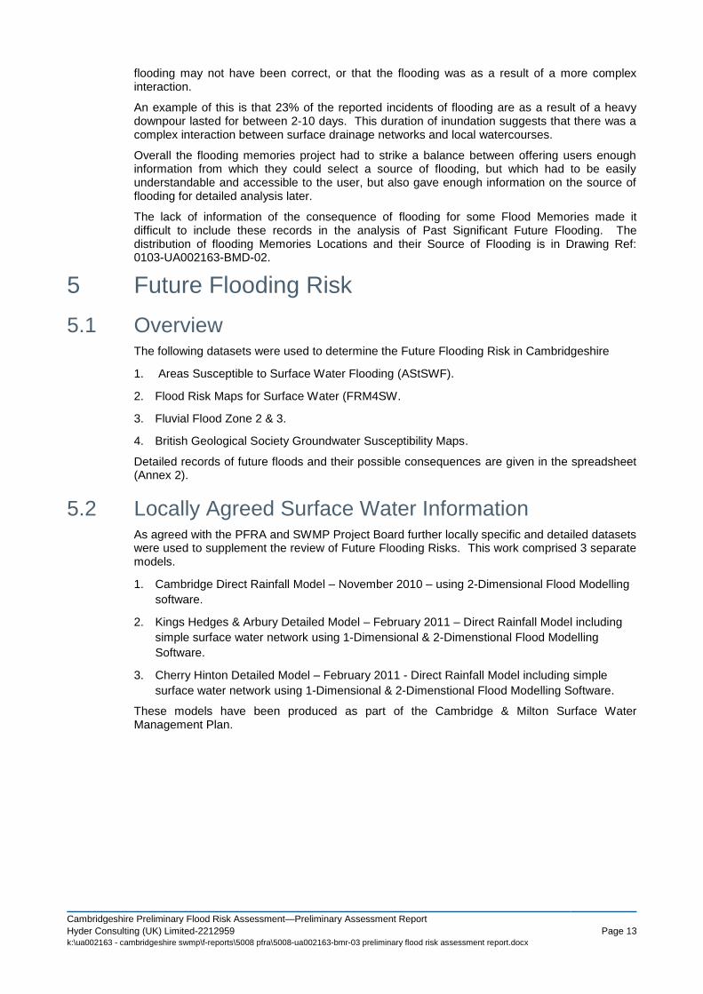
5 Future Flooding Risk
5.1 Overview The following datasets were used to determine the Future Flooding Risk in Cambridgeshire
1. Areas Susceptible to Surface Water Flooding (AStSWF).
2. Flood Risk Maps for Surface Water (FRM4SW.
3. Fluvial Flood Zone 2 & 3.
4. British Geological Society Groundwater Susceptibility Maps.
Detailed records of future floods and their possible consequences are given in the spreadsheet (Annex 2).
5.2 Locally Agreed Surface Water Information As agreed with the PFRA and SWMP Project Board further locally specific and detailed datasets were used to supplement the review of Future Flooding Risks. This work comprised 3 separate models.
1. Cambridge Direct Rainfall Model – November 2010 – using 2-Dimensional Flood Modelling
software.
2. Kings Hedges & Arbury Detailed Model – February 2011 – Direct Rainfall Model including
simple surface water network using 1-Dimensional & 2-Dimenstional Flood Modelling
Software.
3. Cherry Hinton Detailed Model – February 2011 - Direct Rainfall Model including simple
surface water network using 1-Dimensional & 2-Dimenstional Flood Modelling Software.
These models have been produced as part of the Cambridge & Milton Surface Water Management Plan.

Cambridgeshire Preliminary Flood Risk Assessment Preliminary Assessment Report
Hyder Consulting (UK) Limited-2212959 Page 14 k:\ua002163 - cambridgeshire swmp\f-reports\5008 pfra\5008-ua002163-bmr-03 preliminary flood risk assessment report.docx
District Boundary
Cambridge Direct Rainfall Model
Cherry Hinton Detailed Modelling
Kings Hedges & Arbury Detailed Modelling
Figure 5-1: Location of Locally Agreed Flood Risk Information
5.3 Climate Change
The Evidence
There is clear scientific evidence that global climate change is happening now. It cannot be ignored.
Over the past century around the UK we have seen sea level rise and more of our winter rain falling in intense wet spells. Seasonal rainfall is highly variable. It seems to have decreased in summer and increased in winter, although winter amounts changed little in the last 50 years. Some of the changes might reflect natural variation, however the broad trends are in line with projections from climate models.
Greenhouse gas (GHG) levels in the atmosphere are likely to cause higher winter rainfall in future. Past GHG emissions mean some climate change is inevitable in the next 20-30 years. Lower emissions could reduce the amount of climate change further into the future, but changes are still projected at least as far ahead as the 2080s.
We have enough confidence in large scale climate models to say that we must plan for change. There is more uncertainty at a local scale but model results can still help us plan to adapt. For example we understand rain storms may become more intense, even if we can‘t be sure about exactly where or when. By the 2080s, the latest UK climate projections (UKCP09) are that there could be around three times as many days in winter with heavy rainfall (defined as more than 25mm in a day). It is plausible that the amount of rain in extreme storms (with a 1 in 5 annual chance, or rarer) could increase locally by 40%.
Key Projections for Anglian River Basin District
If emissions follow a medium future scenario, UKCP09 projected changes by the 2050s relative to the recent past are
Winter precipitation increases of around 14% (very likely to be between 3 and 31%)
Precipitation on the wettest day in winter up by around 14% (very unlikely to be more than 29%)
Relative sea level at Felixstowe very likely to be up between 10 and 41cm from 1990 levels (not including extra potential rises from polar ice sheet loss)

Cambridgeshire Preliminary Flood Risk Assessment—Preliminary Assessment Report
Hyder Consulting (UK) Limited-2212959 Page 15 k:\ua002163 - cambridgeshire swmp\f-reports\5008 pfra\5008-ua002163-bmr-03 preliminary flood risk assessment report.docx
Peak river flows in a typical catchment likely to increase between 8 and 16%
Implications for Flood Risk
Climate changes can affect local flood risk in several ways. Impacts will depend on local conditions and vulnerability.
Wetter winters and more of this rain falling in wet spells may increase river flooding. More intense rainfall causes more surface runoff, increasing localised flooding and erosion. In turn, this may increase pressure on drains, sewers and water quality. Storm intensity in summer could increase even in drier summers, so we need to be prepared for the unexpected.
Drainage systems in the district have been modified to manage water levels and could help in adapting locally to some impacts of future climate on flooding, but may also need to be managed differently. Rising sea or river levels may also increase local flood risk inland or away from major rivers because of interactions with drains, sewers and smaller watercourses. Even small rises in sea level could add to very high tides so as to affect places a long way inland.
Where appropriate, we need local studies to understand climate impacts in detail, including effects from other factors like land use. Sustainable development and drainage will help us adapt to climate change and manage the risk of damaging floods in future.
Adapting to Change Past emission means some climate change is inevitable. It is essential we respond by planning ahead. We can prepare by understanding our current and future vulnerability to flooding, developing plans for increased resilience and building the capacity to adapt. Regular review and adherence to these plans is key to achieving long-term, sustainable benefits. Although the broad climate change picture is clear, we have to make local decisions uncertainty. We will therefore consider a range of measures and retain flexibility to adapt. This approach, embodied within flood risk appraisal guidance, will help to ensure that we do not increase our vulnerability to flooding.
5.4 Long Term Developments
It is possible that long term developments might affect the occurrence and significance of flooding. However current planning policy aims to prevent new development from increasing flood risk.
In England, Planning Policy Statement 25 (PPS25) on development and flood risk aims to "ensure that flood risk is taken into account at all stages in the planning process to avoid inappropriate development in areas at risk of flooding, and to direct development away from areas at highest risk. Where new development is, exceptionally, necessary in such areas, policy aims to make it safe without increasing flood risk elsewhere and where possible, reducing flood risk overall."
In Wales, Technical Advice Note 15 (TAN15) on development and flood risk sets out a precautionary framework to guide planning decisions. The overarching aim of the precautionary framework is "to direct new development away from those areas which are at high risk of flooding."
Adherence to Government policy ensures that new development does not increase local flood risk. However, in exceptional circumstances the Local Planning Authority may accept that flood risk can be increased contrary to Government policy, usually because of the wider benefits of a new or proposed major development. Any exceptions would not be expected to increase risk to levels which are "significant" (in terms of the Government's criteria).
Growth is a major issue for Cambridgeshire. The growth strategy proposes at least 73,300 new homes, 50,000 new jobs and over £4 billion worth of new infrastructure by 2021.
The affect of those future developments identified in district SFRAs is summarised in Table 5-1 below. Those developments identified in Table 5-1 do not account for all the homes required by 2021, and as such there are likely to be more examples across the County of Future Developments.

Cambridgeshire Preliminary Flood Risk Assessment Preliminary Assessment Report
Hyder Consulting (UK) Limited-2212959 Page 16 k:\ua002163 - cambridgeshire swmp\f-reports\5008 pfra\5008-ua002163-bmr-03 preliminary flood risk assessment report.docx
Name of Future
Development
Identified In/By Future Flood Risk
Cambourne South Cambridgeshire SFRA Foul water flooding,
following surface water
ingress into foul water
network.
Northstowe South Cambridgeshire SFRA None identified.
Chatteris – various sites Fenland SFRA1 (Draft) None identified
March – various sites Fenland SFRA1 (Draft) None identified
Whittlesey – various sites Fenland SFRA1 (Draft) None identified
Wisbech - various sites Fenland SFRA1 (Draft)
Wisbech SFRA2 2009
Areas in and around the
town (esp to north and
west) are within Flood
Zones 2 and 3
Sawtry (Site With Outline
Planning Permission)
Cambridgeshire County Council
Research and Monitoring Team Dec
2010
None identified
Ramsey (Site With
Outline Planning
Permission)
Cambridgeshire County Council
Research and Monitoring Team Dec
2010
None identified
St Neots (Site With
Outline Planning
Permission)
Cambridgeshire County Council
Research and Monitoring Team Dec
2010
None identified
Trumpington (Site With
Outline Planning
Permission)
Cambridgeshire County Council
Research and Monitoring Team Dec
2010
None identified
Table 5-1: Future Developments Impact on Future Flood Risk
5.5 Future Floods and Consequences
The future flooding and consequences is reported in Annex 2 of this report.
This annex identifies the key sources of future flooding for Cambridgeshire and also includes information on the locally agreed sources of flooding.
At this stage in the PFRA process no finalised property counts have been included in this Annex. This is based on recommendations received from the Environment Agency.

Cambridgeshire Preliminary Flood Risk Assessment—Preliminary Assessment Report
Hyder Consulting (UK) Limited-2212959 Page 17 k:\ua002163 - cambridgeshire swmp\f-reports\5008 pfra\5008-ua002163-bmr-03 preliminary flood risk assessment report.docx
6 Flood Risk Areas
6.1 Review of Indicative Flood Risk Areas
Figure 6-1: UK Indicative Flood Risk Areas (this document can be viewed in full at
http://www.environment-
agency.gov.uk/static/documents/Research/Indicative_Flood_Risk_Areas_England.pdf)

Cambridgeshire Preliminary Flood Risk Assessment Preliminary Assessment Report
Hyder Consulting (UK) Limited-2212959 Page 18 k:\ua002163 - cambridgeshire swmp\f-reports\5008 pfra\5008-ua002163-bmr-03 preliminary flood risk assessment report.docx
7 Identification of Flood Risk Areas
7.1 Amendments to Flood Risk Areas
No amendments are proposed by this PFRA process to the nationally proposed Flood Risk Areas as a result of the thresholds set nationally for Significance. There are areas within CCC‘s boundary, that have high levels of flood risk from a variety of sources, however it is proposed that these areas will be most effectively managed at a local scale through the future preparation of local flood risk management strategies involving SWMPs as further detailed in Section 8.
7.2 New Flood Risk Areas
None proposed.
8 Next Steps
8.1 Ongoing Flood Risk Management Activities
8.1.1 Surface Water Management Plan
The methods for selecting new flood risk areas outlined in the DeFRA guidance12
document gave credence to many of the social, environmental and economic criteria used currently by CCC for assessing local flood risk. These methods have been identified within the Cambridgeshire County Wide Surface Water Management Plan
13 and have helped to identify
‗wetspots‘ across the county. It details the recommended wetspots that require intermediate and detailed assessments to develop preferred flood management options following an options appraisal process. The report summarises the key information reviewed along with the extent of historic and future local flood risk and key recommendations to manage future risk across the county.
Additionally, detailed efforts are taking place within the Cambridge and Milton Detailed Surface Water Management Plan
14. This study includes more detailed modelling identified in Section
5.1, as well as option appraisal and mitigation.
As part of the above SWMPs a Flood Incident Register and a Web GIS database have been developed, which have info on properties, critical services and other receptors impacted by future and historic flooding along with the details wetspots identified and Multi Criteria Assessment findings.
8.1.2 Local Flood Risk Management Strategy
Local Flood Risk Management Strategies15
came into force as part of the Flood and Water Management Act 2010. As Lead Local Flood Authority, CCC must develop a strategy for local flood risk management. The strategy must be consistent with the National Flood and Coastal Erosion Risk Management Strategy for England, and should be developed and maintained with consultation from other stakeholders, such as the public and other risk management authorities.
The strategy must specify:
the risk management authorities in the authority's area,

Cambridgeshire Preliminary Flood Risk Assessment—Preliminary Assessment Report
Hyder Consulting (UK) Limited-2212959 Page 19 k:\ua002163 - cambridgeshire swmp\f-reports\5008 pfra\5008-ua002163-bmr-03 preliminary flood risk assessment report.docx
the flood and coastal erosion risk management functions that may be exercised by those
authorities in relation to the area,
the objectives for managing local flood risk (including any objectives included in the
authority's flood risk management plan prepared in accordance with the Flood Risk
Regulations 2009),
the measures proposed to achieve those objectives,
how and when the measures are expected to be implemented,
the costs and benefits of those measures, and how they are to be paid for,
the assessment of local flood risk for the purpose of the strategy,
how and when the strategy is to be reviewed, and
how the strategy contributes to the achievement of wider environmental objectives.
A Cambridgeshire Local Flood Risk Management Strategy that involves various ongoing and future activities of CFRMP (including SWMPs above and improved data collection and management described below) will help to better coordinate and manage local flood risk in the county and help preparing 2
nd cycle of PFRA in six years time.
8.2 Improved Data Collection and Management
8.2.1 Asset Register
An asset register should be developed in accordance with Flood Risk Regulations 2009 and
Defra SWMP guidance. It should be kept up to date with additional data as it becomes
available.
Stakeholders and partners should be encouraged to use GIS formats to store their data in order
to facilitate exchange and management of such data. A data management plan for the CFRMP
would be valuable in ensuring data-sets are kept up to date and consistent across all
stakeholders. Future work by the CFRMP could also consider the development of the Web-GIS
database for the asset register to enable a wider range of organisations to contribute
information.
Responsibility with the overall management of the data should lie with CCC, as the Lead Local
Flood Authority, who should coordinate the updating of the databases either using internal
systems or via the web based interface.
8.2.2 Incident Database
CCC should maintain flood records as per the Annex 1 PFRA spreadsheet. This will ensure a consistent level of detail is recorded for each significantly harmful event and will aid the next PFRA in 6 years time. At the very least for each new flood event with significant consequences, provision should be made to record:
Flood location
Flood type
Date of each flood
Duration of flood
Estimated adverse consequences on the population, economic damage, cultural heritage and environment.
Any post event questionnaire produced to record information on flood events should give consideration to the information required in the PFRA process and tailor the questions asked to the type of information required in Annex 1 of the PFRA.

Cambridgeshire Preliminary Flood Risk Assessment Preliminary Assessment Report
Hyder Consulting (UK) Limited-2212959 Page 20 k:\ua002163 - cambridgeshire swmp\f-reports\5008 pfra\5008-ua002163-bmr-03 preliminary flood risk assessment report.docx
Attempts to quantify consequence of past floods on transport infrastructure have not been possible within the current PFRA process as this information has not always been fully recorded. This will need to be recorded during future flood events to quantify the consequence of flooding on the county transport network. The definition of ―significant period‖ is dependent on the transport link affected as follows (Highway categories are as set out in Table 1 of the UK Roads Liaison Group Code of Practice for Highway Maintenance).
Category 1 highways (motorways) and major rail links – 2 hours or more
Category 2 and 3a highways and other railway links – 4 hours or more
Category 3b and 4a highways – 10 hours or more
Category 4b highways – 24 hours or more
8.3 Scrutiny and Review
It is recommended that CCC and other members of CFRMP review what is needed in regard to
Scrutiny and Review to assist the PFRA process in the future. This should be based on the key
findings (including data gaps and recommendations) of this Preliminary Assessment Report and
emerging SWMPs and Local Flood Risk Management Strategy for Cambridgeshire. The key
findings and observations of the LLFAs and the Environment Agency‘s Area and National
scrutiny committees across the UK as part of 1st cycle of PFRA process in the next few months
should be vital to decide such requirements.
The next stages of the Flood Risk Regulations following the submission of the Preliminary
Assessment Report and Identification of Flood Risk Areas, is the preparation of Flood Hazard
and Flood Risk Maps by 2013, and the preparation of Flood Risk Management Plans for Flood
Risk Areas by 2015. The PFRA Cycle starts again in 2016.

Cambridgeshire Preliminary Flood Risk Assessment—Preliminary Assessment Report
Hyder Consulting (UK) Limited-2212959 Page 21 k:\ua002163 - cambridgeshire swmp\f-reports\5008 pfra\5008-ua002163-bmr-03 preliminary flood risk assessment report.docx
9 References
1 Defra (2009) Flood Risk Regulations 2009 - http://www.legislation.gov.uk/uksi/2009/3042/contents/made
2 Defra (2010) Floods and Water Management Act 2010 c29.
http://www.legislation.gov.uk/ukpga/2010/29/pdfs/ukpga_20100029_en.pdf
3 European Parliament, Council, Directive 2007/60/EC EU Flood Directive
http://ec.europa.eu/environment/water/flood_risk/index.htm
4 Defra (1991) Land Drainage Act 1991. http://www.legislation.gov.uk/ukpga/1991/59/contents
5 Sir Michael Pitt (2008). Lessons Learnt from the 2007 Summer Floods.
http://www.preventionweb.net/files/2935_250608floodssummary.pdf
6 CFRMP Stakeholder Engagement Plan (2010)
7 Environment Agency (2010)
1 - Preliminary Flood Risk Assessment (PFRA) Final Guidance.
www.publications.environment-agency.gov.uk/pdf/GEHO1210BTGH-e-e.pdf
8 Environment Agency (2010)² - Great Ouse Draft Catchment Flood Management Plan – Consultation Draft April 2010.
https://consult.environment-agency.gov.uk/portal/re/flood/anglian/cfmp290310/gocfmp?pointId=1269625651926
12 Selecting and reviewing Flood Risk Areas for local sources of flooding.
http://www.defra.gov.uk/environment/flooding/documents/research/flood-risk-method.pdf
13 Cambridgeshire County Council. Cambridgeshire Surface Water Management Plan – Strategic Assessment Report
(2011).
14 Cambridgeshire County Council. Cambridge & Milton Surface Water Management Plan - Preliminary Assessment
Report (2011).
15 Defra (2010) Flood and Water Management Act Section 9 – Local Flood Risk Management Strategies