Embed Size (px)
Citation preview
Bhattacharya, 2006 Field Trip
1
Ancient Rivers and Deltas in the Cretaceous Seaway:Analogs to the subsurface
University of Houston Quantitative Sedimentology Research Consortium Field Trip,Sunday August 13th – Friday August 18th.
Dr. Janok P. BhattacharyaRobert E. Sheriff Professor of Sequence Stratigraphy
Geosciences Department
SR1 Rm 312, University of Houston
4800 Calhoun Rd., Houston, Texas 77204-5007
E-MAIL: [email protected]
Wk: 713/743-4720; Fax: 713/748-7906
Purpose of Trip
This trip will provide an overview of fluvial deltaic systems in the superb Cretaceousoutcrops in Central Utah. The trip will show examples of fluvial, storm and wave-influenced deltaic and shoreline systems and the associated feeding fluvial deposits. Wewill show examples of incised valleys and discuss how they differ from distributarychannels as well as examining changes in fluvial style across sequence boundaries. Thetrip will also examine the interaction of sedimentary processes and the generation ofgrowth faults as well as discuss some aspects of fault-seal quality across extensionalnormal faults.
Most of this work has been supported by the consortium members over the last 7 years,but this will be the first time the trip has been led to the Utah area, since most of ourfocus in previous years has been on the Frontier Formation outcrops in Wyoming.
Getting There
You should plan to arrive in Salt Lake City Sunday afternoon or evening. Eachparticipant is responsible for transportation to Shaheen’s Best Western in Salina, Utah. I
Example of an incised valley in the Ferron Sanstone, Facory Butte, Utah.
Bhattacharya, 2006 Field Trip
2
recommend that you vehicle pool, 4WD vehicles are recommended. The fastest way toget to Salina is to take Highway 15 south to Highway 50. It will take about 2.5 hours (seeinstructions at the back of this document).
The field trip will officially leave at 8am Monday Morning from the Best Westernparking lot. The field trip will end at about 5pm, August 17th near Hanksville. The plan isto overnight in Hanksville and then drive to Salt Lake City the next day. It is about a 4.5hour drive to Salt Lake City from Hanksville (see directions at end).
Hotels
Book Your Rooms Before July 30th!To book your rooms call the numbers below and advise them that you are with theUniversity of Houston (code - UOH). The rooms are being held until July 30th, but theWhispering Sands would prefer if you can book earlier. If you book by July 30th and needto cancel at a later date, they will hold your room until August 10th.
Best Western Shaheen’s Hotel (August 13th-14th)1225 S State StreetSalina, Utah, 84654-1616,Phone: 435-529-7455
Holiday Inn Hotel and Suites (August 15th)838 Westwood BlvdPrice, UT 84501Hotel Reservations:1-435-637-8880 Code UOH (University of Houston)
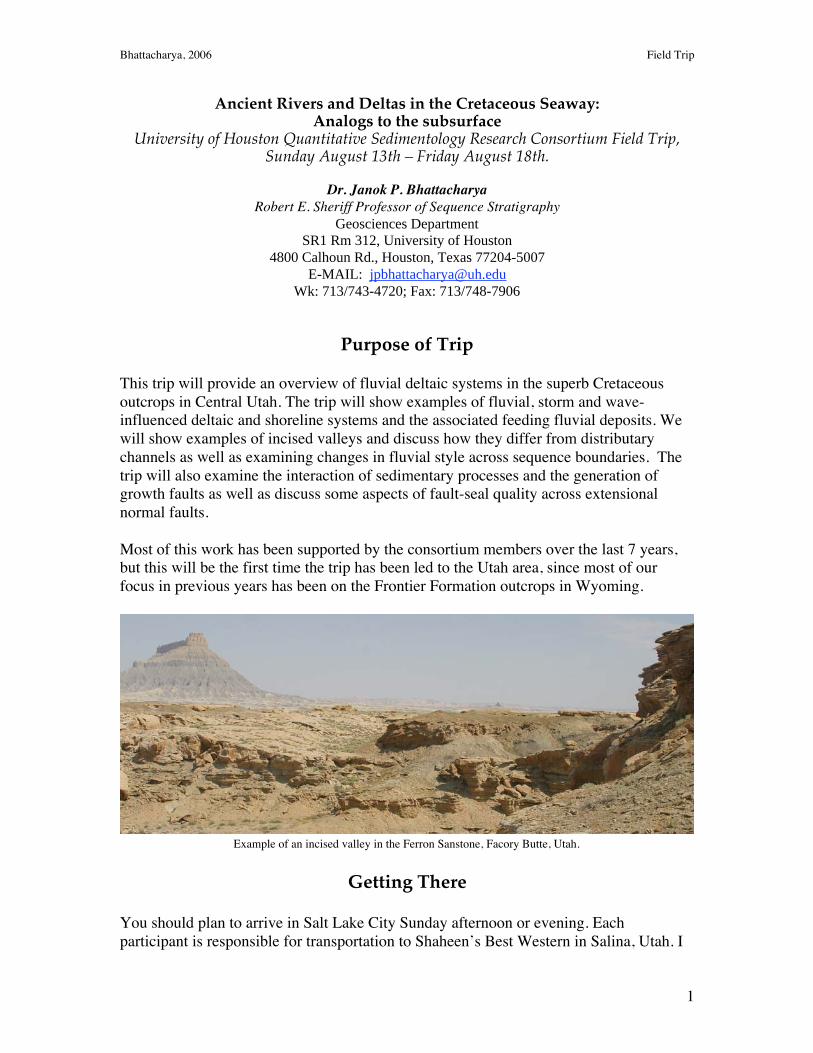
Whispering Sands Motel (August 16th – 17th)Highway 95. Box 158.Hanksville Utah 84734.Phone Reservations 435-542-3238. Fax 435-542-3429e-mail: [email protected]
View of Henry Mountains from Hanksville, Utah
Bhattacharya, 2006 Field Trip
3
What To Bring/Safety
Here is a list of suggested equipment and supplies that will be needed for the field trip.Note that we will be working in a desert. Expect temperatures to be 85-110°F during theday and 50 - 80°F at night. Clothing worn during the day should be light-colored, loosefitting, and cover as much of your body as is comfortable to reduce exposure
RECOMMENDED FIELD EQUIPMENTClothing
• Shirts –T-shirts1 or long sleeve shirts• Pants – We recommend wearing pants rather than shorts, because the desert
environment is replete with a variety of thorny plants, cacti, and trees, not tomention ticks and chiggers.
• Hiking boots (esseential)• Hat – Wide-brimmed (e.g. Army booney hat) to shade neck and face.• Socks2
• Sweatshirt or fleece• Light weight rain jacket (± pants) or poncho
Gear• Backpack or waistpack for carrying raingear, water bottle, field guide• Sunglasses –The desert sun is intense and can potentially lead to sun-blindness
over long periods of exposure.• Sunscreen – high SPF (e.g. 30) is recommended• Lip balm with sunscreen• Insect repellent• Canteen or hydration pack (e.g. Camelback®)• Camera• Rock Hammer• Hand Lens
SAFETY AND FIRST AIDYou may wish to carry a small first aid kit, although we will have them available,
and BP HSC personnel will also have safety gear. Some safety information is provided atthe end of this document. The main safety considerations are:
• Road safety (practice safe driving)• Road field stops (take care crossing roads and keep off pavement)• Dehydration and Heat Exhaustion and Heat Stroke (keep hydrated!)• Sunburn (wear hat, lipbalm, and suncreen)• Loose Rocks, Steep Cliffs and Overhangs (watch for falling rocks, wear
appropriate safety gear near cliffs, good boots help)
Bhattacharya, 2006 Field Trip
4
Itinerary
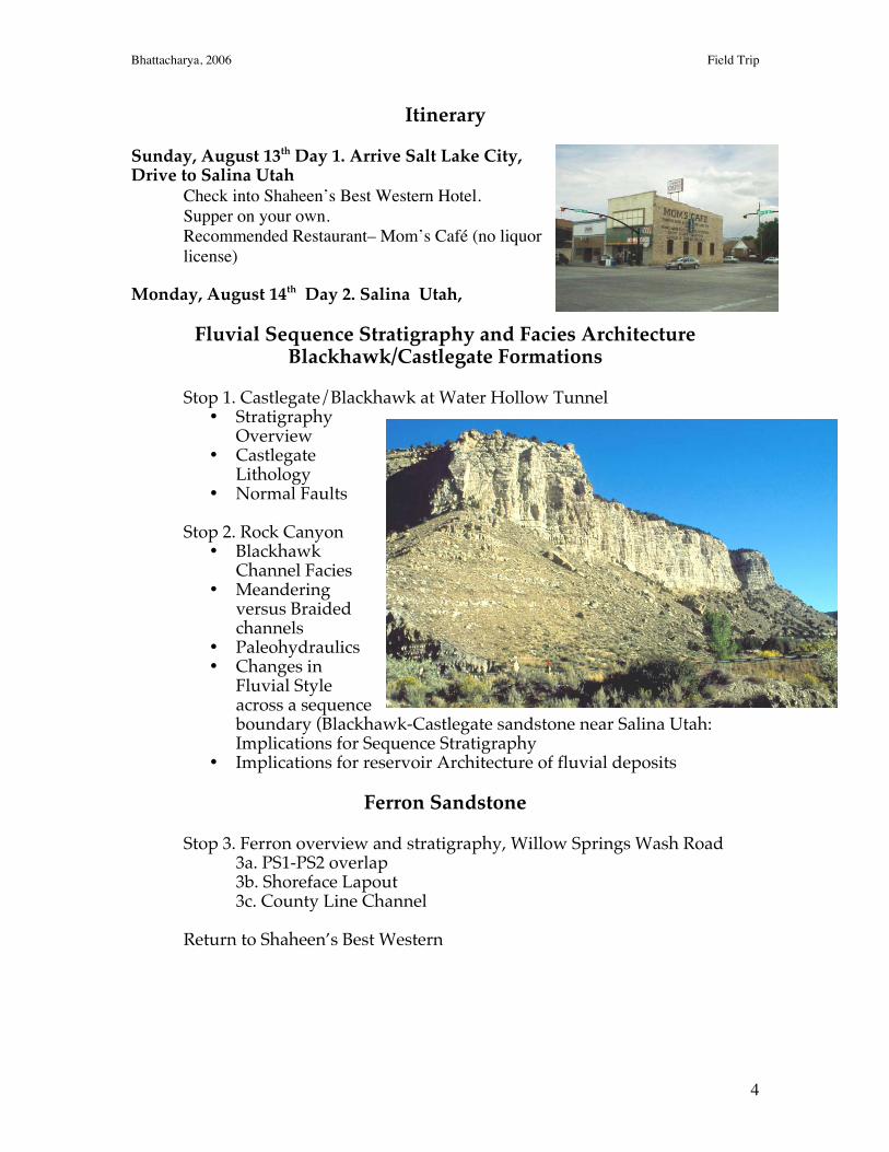
Sunday, August 13th Day 1. Arrive Salt Lake City,Drive to Salina Utah
Check into Shaheen’s Best Western Hotel.Supper on your own.Recommended Restaurant– Mom’s Café (no liquorlicense)
Monday, August 14th Day 2. Salina Utah,
Fluvial Sequence Stratigraphy and Facies ArchitectureBlackhawk/Castlegate Formations
Stop 1. Castlegate/Blackhawk at Water Hollow Tunnel• Stratigraphy
Overview• Castlegate
Lithology• Normal Faults
Stop 2. Rock Canyon• Blackhawk
Channel Facies• Meandering
versus Braidedchannels
• Paleohydraulics• Changes in
Fluvial Styleacross a sequenceboundary (Blackhawk-Castlegate sandstone near Salina Utah:Implications for Sequence Stratigraphy
• Implications for reservoir Architecture of fluvial deposits
Ferron Sandstone
Stop 3. Ferron overview and stratigraphy, Willow Springs Wash Road3a. PS1-PS2 overlap3b. Shoreface Lapout3c. County Line Channel
Return to Shaheen’s Best Western
Bhattacharya, 2006 Field Trip
5
Day 3. Tuesday, August 15th
Ferron Sandstone (cntd.)
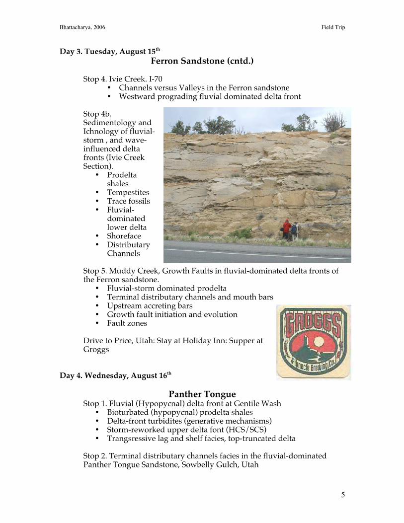
Stop 4. Ivie Creek. I-70• Channels versus Valleys in the Ferron sandstone• Westward prograding fluvial dominated delta front
Stop 4b.Sedimentology andIchnology of fluvial-storm , and wave-influenced deltafronts (Ivie CreekSection).
• Prodeltashales
• Tempestites• Trace fossils• Fluvial-
dominatedlower delta
• Shoreface• Distributary
Channels
Stop 5. Muddy Creek, Growth Faults in fluvial-dominated delta fronts ofthe Ferron sandstone.
• Fluvial-storm dominated prodelta• Terminal distributary channels and mouth bars• Upstream accreting bars• Growth fault initiation and evolution• Fault zones
Drive to Price, Utah: Stay at Holiday Inn: Supper atGroggs
Day 4. Wednesday, August 16th
Panther TongueStop 1. Fluvial (Hypopycnal) delta front at Gentile Wash
• Bioturbated (hypopycnal) prodelta shales• Delta-front turbidites (generative mechanisms)• Storm-reworked upper delta font (HCS/SCS)• Trangsressive lag and shelf facies, top-truncated delta
Stop 2. Terminal distributary channels facies in the fluvial-dominatedPanther Tongue Sandstone, Sowbelly Gulch, Utah
Bhattacharya, 2006 Field Trip
6
• Terminal distributary channels• Seaward-dipping delta front• Delta front turbidites• Landward accreting bars• Soft sediment deformation
Drive to Hanksville,
Ferron Sandstone, Notom DeltaStop 3. Introduction to Ferron, Notom delta, Caineville, Utah.
Prodelta shalesDistributary-channel to fluvial transitionFluvial section
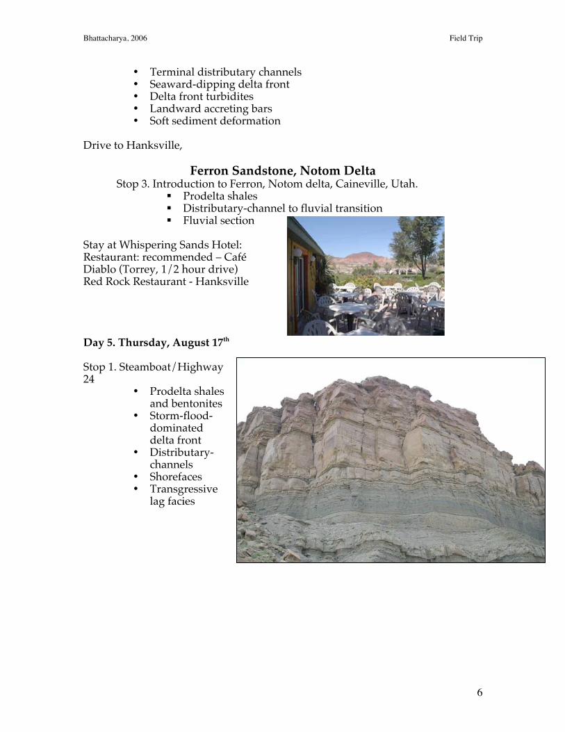
Stay at Whispering Sands Hotel:Restaurant: recommended – CaféDiablo (Torrey, 1/2 hour drive)Red Rock Restaurant - Hanksville
Day 5. Thursday, August 17th
Stop 1. Steamboat/Highway24
• Prodelta shalesand bentonites
• Storm-flood-dominateddelta front
• Distributary-channels
• Shorefaces• Transgressive
lag facies
Bhattacharya, 2006 Field Trip
7
Stop 2. Incised valleys, Factory Butte Road• Various stops along canyon• Top of marine parasequences
Stop 3. Incised Valley, Fremont River cut.
Evening at Whispering Sands:
Day 6. Friday, August 18th
Drive to Salt Lake City, Fly Home.
Bhattacharya, 2006 Field Trip
8
Safety Considerations
The matter of safety in the field deals with both personal safety and safety
associated with the larger group. The most dangerous implement is the rock hammer.
Bruised toes and fingers as well as lacerations that result from rock and steel chips
produced on impact are common. Of serious concern is the impact of one of these chips
in an individual’s eye. These problems can be minimized by wearing protective goggles
and practicing good common sense while recovering a fresh rock sample.
Be certain that no one else is within 10-15 feet of the point where rock chips may
be produced. It is also worth making sure that people are not facing toward the impact
site. Care should always be exercised when freeing a sample. You may place your boot
over the sample site to catch any rock and flying chips. Do not use your fingers. A
single well-placed blow should be sufficient. Particularly hard and brittle rocks like
quartzite make difficult specimens from which to extract samples. A single, well-placed
blow on a fractured corner is more likely to produce an adequate specimen than pounding
upon on a large rounded surface.
A second area of concern dealing with safety in the field pertains to steep canyon
walls, road cuts, and other natural exposures. Canyon walls are can be very steep with
precarious overhanging projections. Use caution around such over hangs. On steep
climbable slopes care should be exercised while attempting to reach the Rosetta stone.
Dislodged rocks pose a serious threat to persons at the base of the slope below the
climber. Observation is far more a powerful tool than climbing to solve problems. Injury
is more likely going down than going up to the site. We have all had structural geology,
so be sure and remember your Mohr’s circle and Coulomb’s fracture criteria for
maintaining solid footing on slopes.
When you are at the top of a steep slope, the obvious problem of falling should
not be ignored. Eroded cliff faces may be unstable or changes of wind speed and
direction pose problems. It is simply best to stay away from such hazards. Some
individuals have the urge to throw rocks. This is a potential hazard for people at the
bottom of the slope. In wilderness areas where there are not likely to be people, there is
always the real danger of striking wildlife or livestock.
Wet lichen or moss covered rocks provide precarious footing. Fences should be
avoided. Where possible, gates should be used. Gates are always left in the exact
manner they were found. Barbed wire fences are best crossed in groups with one or more
persons spreading the wires apart, and others passing through the opening provided.
Never step on the wire. Look for an opening that will allow you to crawl under. Streams
and irrigation ditches should be treated with caution. A bad landing after a broad jump
may result in a broken or twisted ankle. Instead, look for natural bridges or shallow
fords.
Livestock, snakes, bears and other forms of wildlife should be avoided. When
wildlife is encountered in the field, keep in mind that geologists do geologist things,
snakes do snake things, that badgers do badger things and so on. Teasing or catching
potentially dangerous animals, particularly in a group, is foolhardy. Animals will usually
evacuate the area and pose no threat. Do not reach into any crevasse or place your hand
on an overhanging ledge without looking and checking for danger first. If someone were
Bhattacharya, 2006 Field Trip
9
to be bitten by a snake, remain calm and treat the victim for shock. In most cases, the
individual is not at risk from the bite; although, medical attention is required.
Perhaps the most serious threat to field participants is the danger associated with
traffic along roadways. When crossing a road, it is important, especially in large groups
that all participants cross together. Needless shifting from one side to the other should be
avoided in all circumstances. Observations or discussions should never be attempted
from any part of the roadway. It is probable that more persons are injured on highways
than in any other manner associated with geological field trips.
Fair-skinned participants should use sun-screen and wide brimmed hat. At five to
six thousand feet above sea-level the atmosphere is not as effective at blocking out the
Sun’s harmful rays. SPF 30 or more is recommended. Plenty of drinking water should
be carried. Each participant should be aware of his or her fluid requirements. Insect
repellant should be used when needed. Although we do not anticipate rain, afternoon
thunderstorms can develop. Each participant should bring wet weather gear.
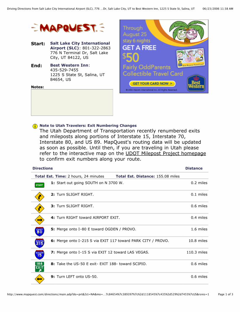
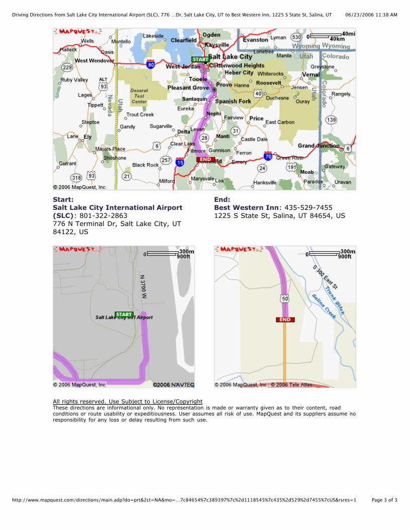
06/23/2006 11:38 AMDriving Directions from Salt Lake City International Airport (SLC), 776 …Dr, Salt Lake City, UT to Best Western Inn, 1225 S State St, Salina, UT
Page 1 of 3http://www.mapquest.com/directions/main.adp?do=prt&2ct=NA&mo=…7c84654%7c389397%7c%2d1118545%7c435%2d529%2d7455%7cUS&rsres=1
Start: Salt Lake City InternationalAirport (SLC): 801-322-2863776 N Terminal Dr, Salt LakeCity, UT 84122, US
End: Best Western Inn:435-529-74551225 S State St, Salina, UT84654, US
Notes:
Note to Utah Travelers: Exit Numbering Changes
The Utah Department of Transportation recently renumbered exitsand mileposts along portions of Interstate 15, Interstate 70,Interstate 80, and US 89. MapQuest's routing data will be updatedas soon as possible. Until then, if you are traveling in Utah pleaserefer to the interactive map on the UDOT Milepost Project homepageto confirm exit numbers along your route.
Directions Distance
Total Est. Time: 2 hours, 24 minutes Total Est. Distance: 155.08 miles
1: Start out going SOUTH on N 3700 W. 0.2 miles
2: Turn SLIGHT RIGHT. 0.1 miles
3: Turn SLIGHT RIGHT. 0.6 miles
4: Turn RIGHT toward AIRPORT EXIT. 0.4 miles
5: Merge onto I-80 E toward OGDEN / PROVO. 1.6 miles
6: Merge onto I-215 S via EXIT 117 toward PARK CITY / PROVO. 10.8 miles
7: Merge onto I-15 S via EXIT 12 toward LAS VEGAS. 110.3 miles
8: Take the US-50 E exit- EXIT 188- toward SCIPIO. 0.6 miles
9: Turn LEFT onto US-50. 0.6 miles
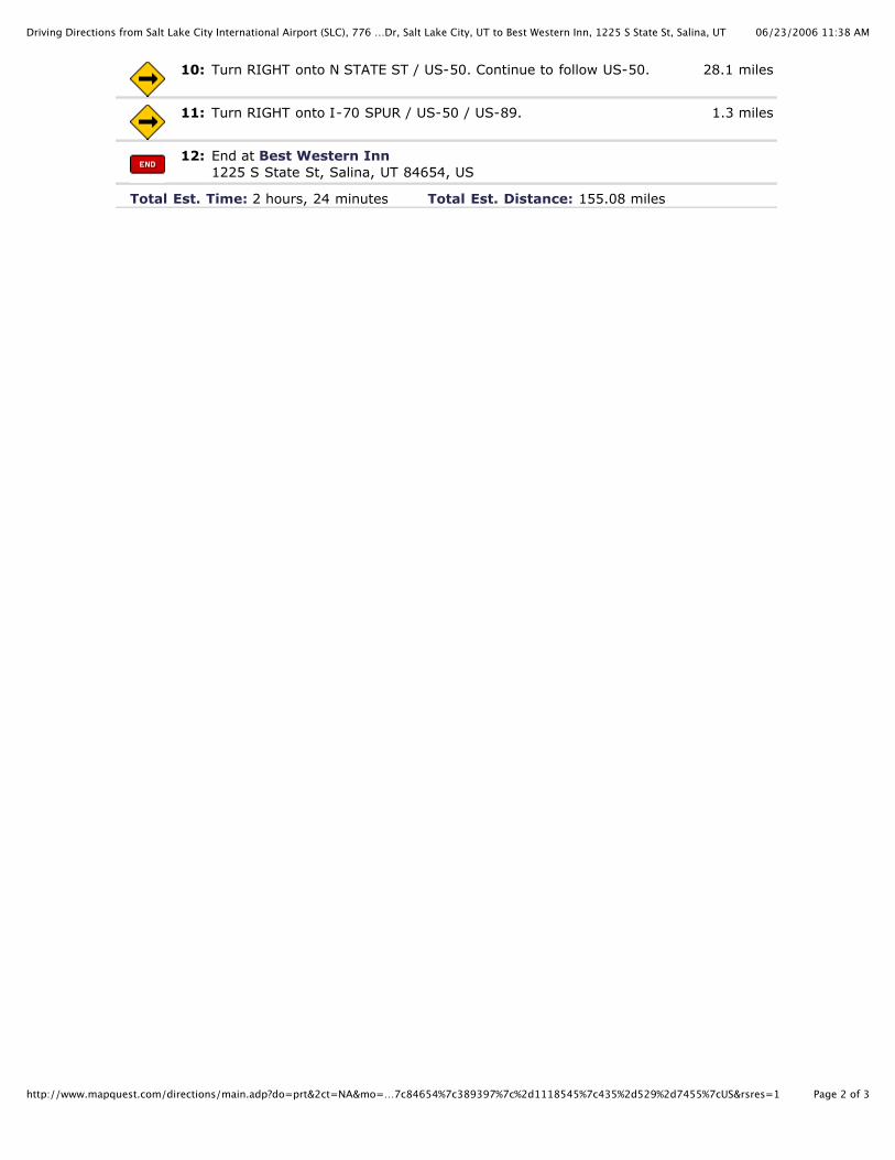
06/23/2006 11:38 AMDriving Directions from Salt Lake City International Airport (SLC), 776 …Dr, Salt Lake City, UT to Best Western Inn, 1225 S State St, Salina, UT
Page 2 of 3http://www.mapquest.com/directions/main.adp?do=prt&2ct=NA&mo=…7c84654%7c389397%7c%2d1118545%7c435%2d529%2d7455%7cUS&rsres=1
10: Turn RIGHT onto N STATE ST / US-50. Continue to follow US-50. 28.1 miles
11: Turn RIGHT onto I-70 SPUR / US-50 / US-89. 1.3 miles
12: End at Best Western Inn1225 S State St, Salina, UT 84654, US
Total Est. Time: 2 hours, 24 minutes Total Est. Distance: 155.08 miles
06/23/2006 11:38 AMDriving Directions from Salt Lake City International Airport (SLC), 776 …Dr, Salt Lake City, UT to Best Western Inn, 1225 S State St, Salina, UT
Page 3 of 3http://www.mapquest.com/directions/main.adp?do=prt&2ct=NA&mo=…7c84654%7c389397%7c%2d1118545%7c435%2d529%2d7455%7cUS&rsres=1
Start:Salt Lake City International Airport(SLC): 801-322-2863776 N Terminal Dr, Salt Lake City, UT84122, US
End:Best Western Inn: 435-529-74551225 S State St, Salina, UT 84654, US
All rights reserved. Use Subject to License/CopyrightThese directions are informational only. No representation is made or warranty given as to their content, roadconditions or route usability or expeditiousness. User assumes all risk of use. MapQuest and its suppliers assume noresponsibility for any loss or delay resulting from such use.
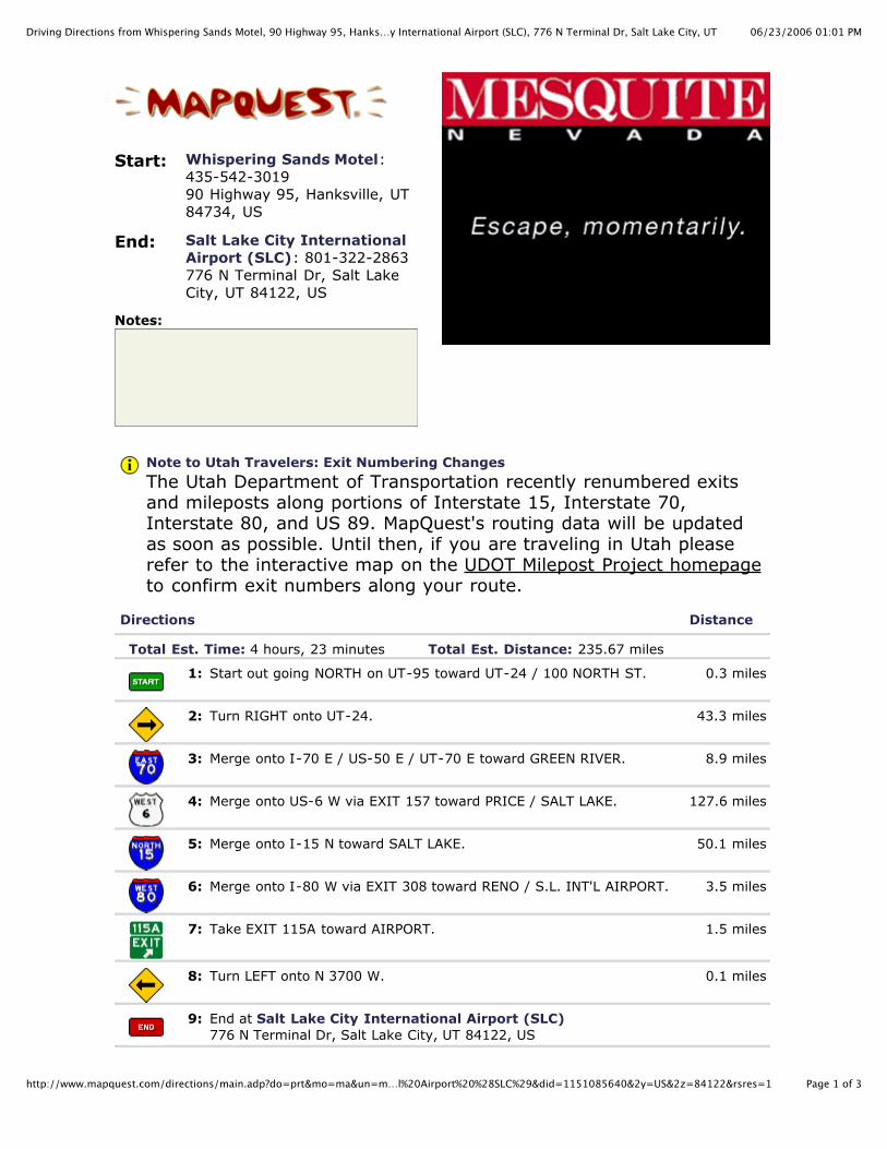
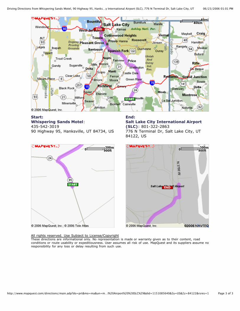
06/23/2006 01:01 PMDriving Directions from Whispering Sands Motel, 90 Highway 95, Hanks…y International Airport (SLC), 776 N Terminal Dr, Salt Lake City, UT
Page 1 of 3http://www.mapquest.com/directions/main.adp?do=prt&mo=ma&un=m…l%20Airport%20%28SLC%29&did=1151085640&2y=US&2z=84122&rsres=1
Start: Whispering Sands Motel:435-542-301990 Highway 95, Hanksville, UT84734, US
End: Salt Lake City InternationalAirport (SLC): 801-322-2863776 N Terminal Dr, Salt LakeCity, UT 84122, US
Notes:
Note to Utah Travelers: Exit Numbering Changes
The Utah Department of Transportation recently renumbered exitsand mileposts along portions of Interstate 15, Interstate 70,Interstate 80, and US 89. MapQuest's routing data will be updatedas soon as possible. Until then, if you are traveling in Utah pleaserefer to the interactive map on the UDOT Milepost Project homepageto confirm exit numbers along your route.
Directions Distance
Total Est. Time: 4 hours, 23 minutes Total Est. Distance: 235.67 miles
1: Start out going NORTH on UT-95 toward UT-24 / 100 NORTH ST. 0.3 miles
2: Turn RIGHT onto UT-24. 43.3 miles
3: Merge onto I-70 E / US-50 E / UT-70 E toward GREEN RIVER. 8.9 miles
4: Merge onto US-6 W via EXIT 157 toward PRICE / SALT LAKE. 127.6 miles
5: Merge onto I-15 N toward SALT LAKE. 50.1 miles
6: Merge onto I-80 W via EXIT 308 toward RENO / S.L. INT'L AIRPORT. 3.5 miles
7: Take EXIT 115A toward AIRPORT. 1.5 miles
8: Turn LEFT onto N 3700 W. 0.1 miles
9: End at Salt Lake City International Airport (SLC)776 N Terminal Dr, Salt Lake City, UT 84122, US

06/23/2006 01:01 PMDriving Directions from Whispering Sands Motel, 90 Highway 95, Hanks…y International Airport (SLC), 776 N Terminal Dr, Salt Lake City, UT
Page 2 of 3http://www.mapquest.com/directions/main.adp?do=prt&mo=ma&un=m…l%20Airport%20%28SLC%29&did=1151085640&2y=US&2z=84122&rsres=1
Total Est. Time: 4 hours, 23 minutes Total Est. Distance: 235.67 miles
06/23/2006 01:01 PMDriving Directions from Whispering Sands Motel, 90 Highway 95, Hanks…y International Airport (SLC), 776 N Terminal Dr, Salt Lake City, UT
Page 3 of 3http://www.mapquest.com/directions/main.adp?do=prt&mo=ma&un=m…l%20Airport%20%28SLC%29&did=1151085640&2y=US&2z=84122&rsres=1
Start:Whispering Sands Motel:435-542-301990 Highway 95, Hanksville, UT 84734, US
End:Salt Lake City International Airport(SLC): 801-322-2863776 N Terminal Dr, Salt Lake City, UT84122, US
All rights reserved. Use Subject to License/CopyrightThese directions are informational only. No representation is made or warranty given as to their content, roadconditions or route usability or expeditiousness. User assumes all risk of use. MapQuest and its suppliers assume noresponsibility for any loss or delay resulting from such use.