Embed Size (px)
Citation preview

1
Rift valley system in the Pachmarhi
Dr. N.L. Dongre
The Rift valleys of the Pachmarhi are tectonic land forms elongated depressions whose origins are
primarily tectonic, not erosional. Tectonic forms fault scarps monoclinal scarps are introduced
into the Pachmarhi and, until eroded, are easily recognizable.
In the Pachmarhi, its simplest and classical form a rift valley is a canyn bordered by
opposed normal fault scarps. The resulting structure is two symmetrically opposed fault planes
2
enclosing a down-faulted block. By its nature the length can hardly be other than a multiple of the
width.
A rift valley is a graben, whose width has the order of magnitude of that of the local
thickness of the brittle crust. Therefore, beneath a rift valley the crust is affected for its full
thickness. A graben of lower order of magnitude, by decrease in angle of dip of the fault planes or
failure of the faults to penetrate the zone of plasticity, must be confined to the upper layers of the
crust (Quennell.A.M. ).
The original definition of rift valley was given by Gregory in 1894.- The centre of the
arch has fallen in, forming one of those valleys of subsidence with long steep, parallel walls
which Professor Suess has called 'Graben'. Rift valleys as they may be called (Gregory, ).
However, with time, his term has come to have a wider connotation. This was inevitable with the
growth of knowledge and the evolution of tectonic hypotheses that accompanied changes in the
favored earth model. Examples of forms, other than graben, now included are valleys of
asymmetry or fault-angle depressions and features resulting from major wrench (transcurrent)
faults, sometimes described as rifts, which have developed simulated graben.
The terminations of individual rift valleys are generally tectonic or structural forms. In
the case of rift valleys, they can be: (1) cross faults; (2) pitching elongated blocks; (3) the dying
out of one fault by decrease in throw and the transition into an asymmetric rift valley or a region
of block faulting; (4) the lateral transition into another rift valley placed an echelon; and (5) the
disappearance beneath a younger belt of folded rocks.
Rift zones and rift systems
The Pachmarhi rift zone is made up of rift valleys that are structurally connected by
recognizable faults, giving rise to an enechelon pattern. The Pachmarhi rift system, on the other
hand, consists of rift valleys of rift zones, technically, not structurally, connected, arranged in a
belt, along the length of which are operative the stresses that resulted in the rift valley formation.
The stress is tensile and transverse to the zone; the rift valleys are single graben type with
normal faults. The tensile stress is effective over a wide belt and block faulting is resulted. Shear
stress acts along a zone, a wrench fault system are accompanying with rift-valley topographic
forms.
Crustal setting
Rift valleys are found in differing crustal settings. The model, derived from laboratory
experiments, of a slab of elastic or brittle crust, homogeneous and isotropic, resting on a plastic or
ductile layer, subjected to uniform horizontal tensile stress over its whole thickness so as to
reproduce a rift valley structure, is no longer credible. Not only is the crust anisotropic,
heterogeneous, and of varying thickness, but the applied stress is not uniform and deformations
result in changes in axis orientation. From these factors arises the wide variation in rift valley
structure .The rift settings include: (1) Platform, that is, areas of generally crystalline rocks that
have undergone cratonization in varying degree. Orogenic belts may have retained anisotropism
sufficiently to influence the trend of later rift faulting and flexuring, whereas some areas have lost
any significant trend, and the strike of rift faults will be determined by other factors; (2) Rift-
valley topographic forms, if they ever existed, will have been in filled and masked by the younger
sediments. Prerift sediments may have been down-faulted. The rift or graben structure will be
present; (3) Within these belts conditions for graben faulting may occur. These can be a change
from compressional (folding) to tensional (normal faulting).

3
Tectonic regimes
Of the four tectonic regimes—orogenic, epeirogenic, taphrogenic, and lineagenic
conditions for the origin of rift valleys are most favorable in the taphrogenic where, in the
structural setting, horizontal (tangential) tensile stress operates. Brittle crust will fracture,
resulting in either the graben type of rift valley, or block faulting.
Major wrench faulting can result in rift valleys and these belong to the lineagenic regime,
a term originated by Hills ( ). In plate tectonics these correspond to conservative margins.
Mention is made above of conditions of tension succeeding the compressional phase
during which, young geosynciinal sediments have been folded into orogenic belts. Thus rift
valleys also can belong to the orogenic regime. Destructive plate margins (subduction zones) are
supposed to underlie or to have underlain orogenic belts.
Some rift systems lie around the flanks of major continental swells but their fault scarps
must not be confused with the erosion scarps of a new cycle of plantation. Rift valleys can
originate under epeirogenic conditions wherever tensile stress exists.
Some authors (for example, Dixey, ) who reject plate tectonics go further. Under the
title vertical tectonics, which they equate with epeirogeny, they regard all rift valleys, even
oceanic, as either graben subsidences or as "lag" areas flanked by uplifts.
Taphrogeny, a term used by Krenkel ( ) to mean "Tearing Apart," can conceivably
result in the freeing of adjacent blocks that have been constrained from isostatic adjustment.
Normal block faulting of rift valleys could therefore be a result of operation of taphrogeny, that
is, of primarily horizontal and only subsequently vertical forces.
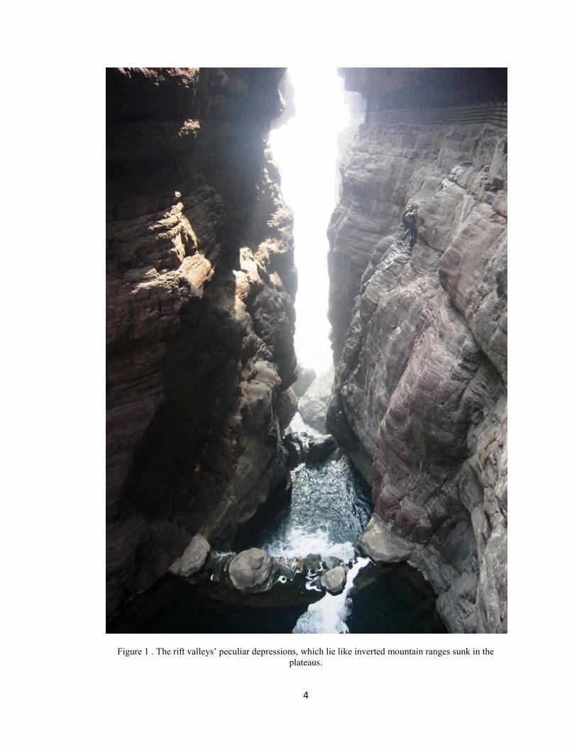
The rift valleys, those peculiar depressions which lie like inverted mountain ranges sunk
in the plateaus (Figure 1). At an early stage of the study, it became apparent that the plateaus
themselves are the question. They are of exceptional extent and notable elevation. The Pachmarhi
characterize, which, differs from other landscape where plains and mountain chains prevail. Thus
the problem shifted to the query: Why Mountains? And to the related question: Why rift valleys
in Mountains? ; -
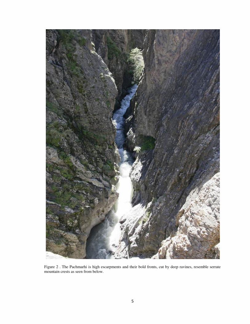
It is a fact that the surface of the Pachmarhi is flat and high, escarpments there are, and
their bold fronts, cut by deep ravines, resemble serrate mountain crests as seen from
below;(Figure 2) hence such names as Dhupgarh, Mahadeva, Chauragarh and Tamia mountains;
but when one has climbed to the summit .finds a broad highland, a plateau, hills rise from its flat
surface and some are of imposing height, but they are remnants of an older plateau, which has
over wide areas been eroded down to the level of the existing younger one. There are no
mountain chains or ranges in the Pachmarhi.
The Pachmarhi thus differs from other highlands in some fundamental way which is
expressed in the elevation of large portions of its great mass, as if by a vertical force; whereas in
other narrow belts are folded up, as if by a horizontal. Force.
Horizontal force of one type or another has been the active cause of rift valleys,
according to previous interpretations. The simplest and earliest thought was that the Pachmarhi
had been pulled apart. A rift valley represented a crack or split. Or if arched up and then
4
Figure 1 . The rift valleys’ peculiar depressions, which lie like inverted mountain ranges sunk in the plateaus.
5
Figure 2 . The Pachmarhi is high escarpments and their bold fronts, cut by deep ravines, resemble serrate
mountain crests as seen from below.
6
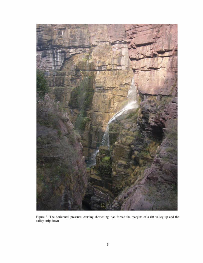
Figure 3. The horizontal pressure, causing shortening, had forced the margins of a rift valley up and the
valley strip down
7
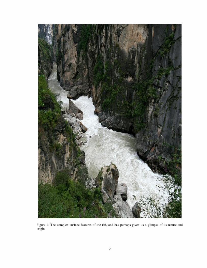
Figure 4. The complex surface features of the rift, and has perhaps given us a glimpse of its nature and
origin
8
stretched, it corresponded with a dropped keystone. On the other hand it was argued that
horizontal pressure, causing shortening, had forced the margins of a rift valley up and the valley
strip down (Figure 3). Thus the earlier explanations appealed to tension and the later to
compression, and the alternative has long divided and still divides two schools of theory in
geology. Each school can cite evidence of facts. There are rift valleys where there has been
tension. There are also rift valleys where there has been compression. But in each such case the
effects of the horizontal pulling or pushing are subordinate to those of the vertical lift that has
raised one section or another more than an adjoining one.
The arch to have been extended in the course of the Denwa Valley,higher in the south
than in the north. The elevating force had been centrifugal and had accumulated directly in the
elevated mass. The outer layers of this section must have been extended to cover the larger area,
they must have been rent apart, and portions of the crust were thus given opportunity to sink into
the depths."This valley is the result of a subsidence of the central part of the ancient Pachmarhi of
the Satpura that this subsidence assumed the form of sunken strips, en echelon, bounded by
equivalent fractures, that is something which no one would dispute .But there was simply a
subsidence of the central section, while the external lips of the great fracture remained standing at
their original level, that is. Something, we believe one may be permitted gravely to doubt."
"It is a striking fact that each of the rift valleys lies on the major axis of an elevated zone,
while between the two uplifts extends a central sunken area, so that the position of the Denwa
appears to be definitely fixed".
The Sonbhadra is a great, super-elevated arch (voussoir), whose axis, directed from north
to south, has been appreciably bent and which is flanked on the sides by two ridges, more abrupt
and more localized, or at least by two violent folds, whose axes, by their subsidence, have each
one given rise to a graben or trough. In this manner, there has well occurred the collapse of a
zone, but only there where the earlier elevation, which had been exceptional.is it to be assumed
that the landmass of old crystalline rocks on either side of the Sonbhadra owes its actual elevation
to a renewed folding of the ancient, almost leveled continent, which seems very improbable; or
may one accept the formation of many horsts, which have been welded together by young
volcanic material to form a superficially united mass; or finally, should one assume a single broad
updoming; in any case the present form of the entire region is that of a broad, low back, with
south -north axis, in the summit of which the Great Rift Valley lies depressed. I, myself, for
various reasons which if here detailed would carry me too far, assume that we have to do with
one great dome-like arch. "The increase of dimension in consequence of the anticlinal stretching
is made evident in the most convincing manner by the numerous graben or depressions, which
constitute an eastern and a western fosse. Throughout the length of the Pachmarhi we observe as
direct and indirect effects of the extension (Distraktion) in the anticlinal zone the occurrence of
seism tectonic and volcanic phenomena, the/ latter more than 1000 kilometer from the coast."
Thrust structures
In so far as the views which attribute rift valleys to some kind of doming and collapse of
an arch involve the assumption of horizontal compression, they are to that extent related to those
which invoke thrust faulting. There are sufficient evidence regarding the development of the
Denwa graben. Through borings drilled in the margins of the graben it appeared that younger
strata occur beneath older, in such a relation as to demonstrate the presence of over thrusts. There
is no doubt of the correctness of the observations, but the effects may be regarded as subsidiary to
conditions of vertical displacements
.
9
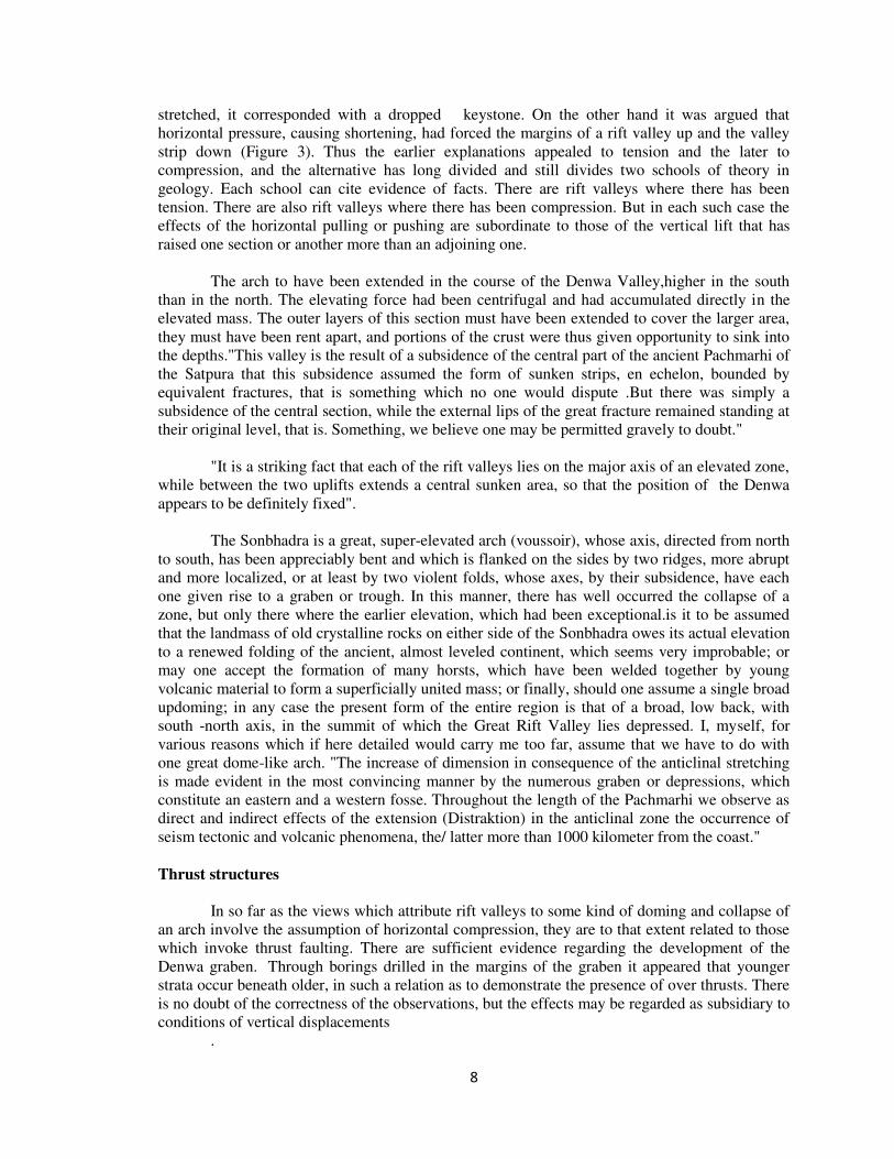
Figure 5. The Pachmarhi rift system as a whole was essentially a feature of the post-Tertiary, and that the
main structures were rifts in the sense that, as in these rifts, the floors represent relatively down-faulted
strips of the bordering plateau surfaces.
10
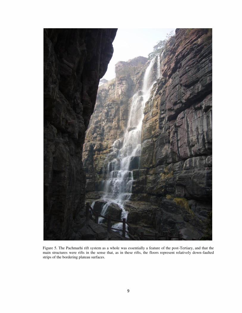
Figure 6. The Dinosaur Beds in the Denwa valley which showed that many of the visible features of this
part of the rift dated from the early Cretaceous.
11
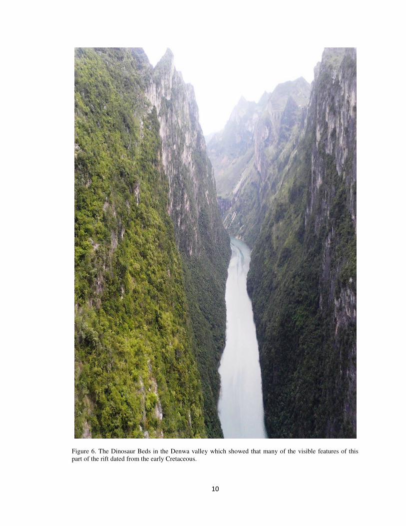
Figure 7. The older scarps, long subject to erosion, are often fault-line scarps rather than simple fault
scarps.
12
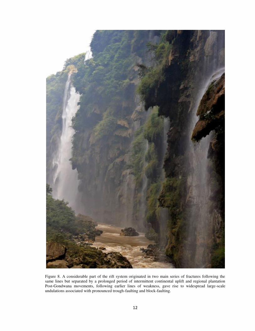
Figure 8. A considerable part of the rift system originated in two main series of fractures following the
same lines but separated by a prolonged period of intermittent continental uplift and regional plantation
Post-Gondwana movements, following earlier lines of weakness, gave rise to widespread large-scale
undulations associated with pronounced trough-faulting and block-faulting.
13
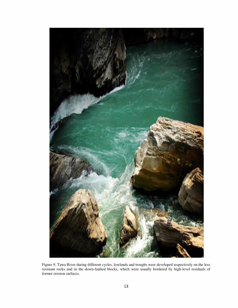
Figure 9. Tawa River during different cycles, lowlands and troughs were developed respectively on the less
resistant rocks and in the down-faulted blocks, which were usually bordered by high-level residuals of
former erosion surfaces.
14
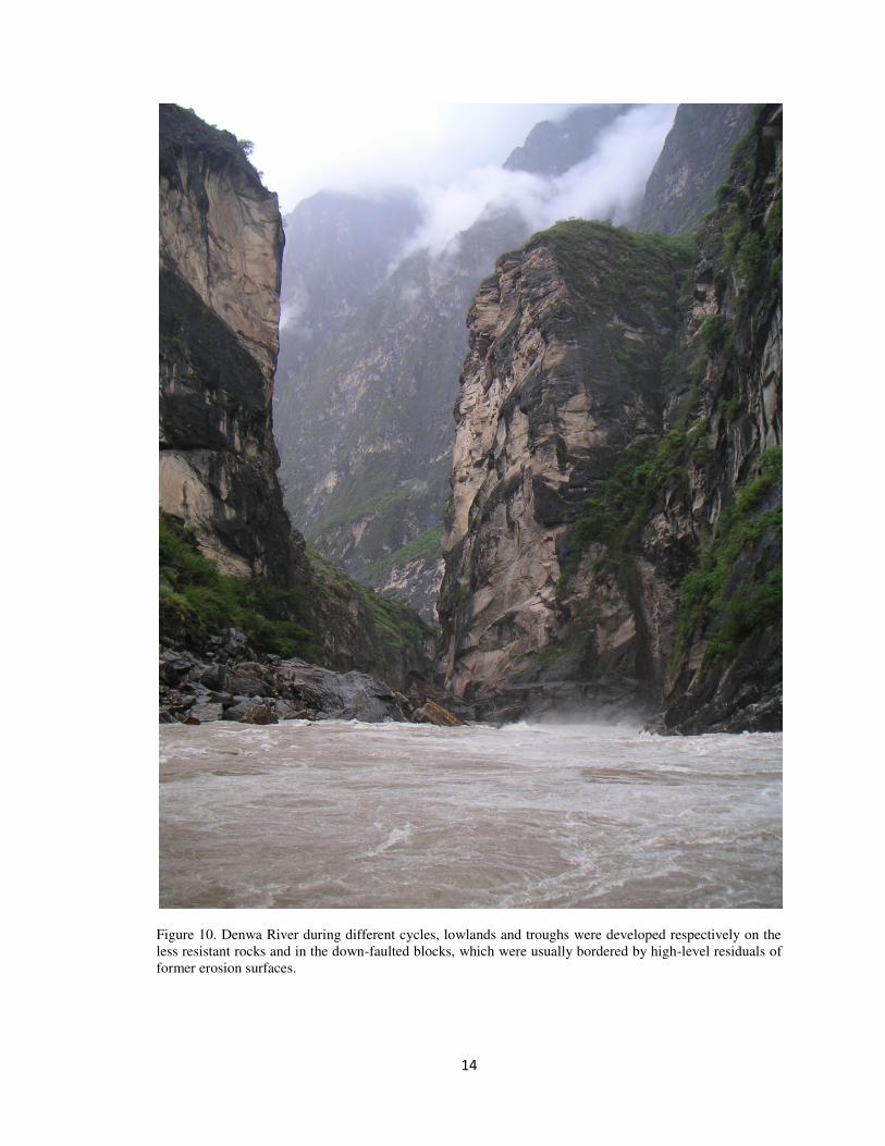
Figure 10. Denwa River during different cycles, lowlands and troughs were developed respectively on the
less resistant rocks and in the down-faulted blocks, which were usually bordered by high-level residuals of
former erosion surfaces.
15
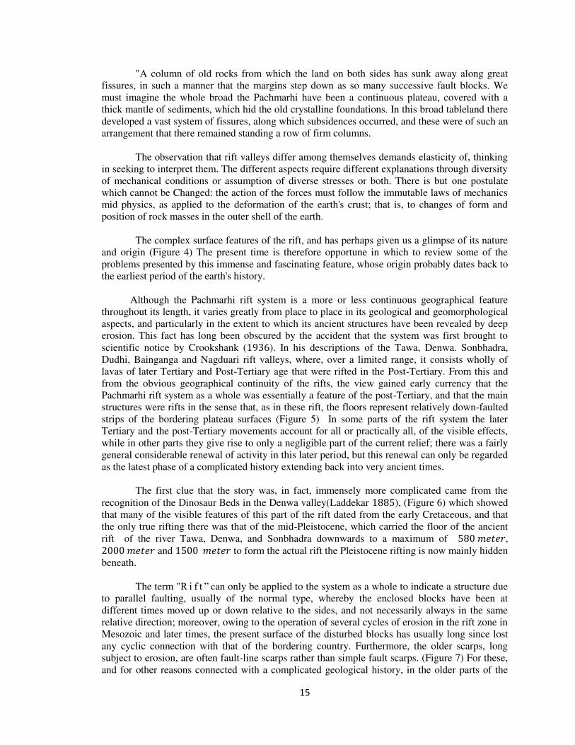
"A column of old rocks from which the land on both sides has sunk away along great
fissures, in such a manner that the margins step down as so many successive fault blocks. We
must imagine the whole broad the Pachmarhi have been a continuous plateau, covered with a
thick mantle of sediments, which hid the old crystalline foundations. In this broad tableland there
developed a vast system of fissures, along which subsidences occurred, and these were of such an
arrangement that there remained standing a row of firm columns.
The observation that rift valleys differ among themselves demands elasticity of, thinking
in seeking to interpret them. The different aspects require different explanations through diversity
of mechanical conditions or assumption of diverse stresses or both. There is but one postulate
which cannot be Changed: the action of the forces must follow the immutable laws of mechanics
mid physics, as applied to the deformation of the earth's crust; that is, to changes of form and
position of rock masses in the outer shell of the earth.
The complex surface features of the rift, and has perhaps given us a glimpse of its nature
and origin (Figure 4) The present time is therefore opportune in which to review some of the
problems presented by this immense and fascinating feature, whose origin probably dates back to
the earliest period of the earth's history.
Although the Pachmarhi rift system is a more or less continuous geographical feature
throughout its length, it varies greatly from place to place in its geological and geomorphological
aspects, and particularly in the extent to which its ancient structures have been revealed by deep
erosion. This fact has long been obscured by the accident that the system was first brought to
scientific notice by Crookshank ( ). In his descriptions of the Tawa, Denwa. Sonbhadra,
Dudhi, Bainganga and Nagduari rift valleys, where, over a limited range, it consists wholly of
lavas of later Tertiary and Post-Tertiary age that were rifted in the Post-Tertiary. From this and
from the obvious geographical continuity of the rifts, the view gained early currency that the
Pachmarhi rift system as a whole was essentially a feature of the post-Tertiary, and that the main
structures were rifts in the sense that, as in these rift, the floors represent relatively down-faulted
strips of the bordering plateau surfaces (Figure 5) In some parts of the rift system the later
Tertiary and the post-Tertiary movements account for all or practically all, of the visible effects,
while in other parts they give rise to only a negligible part of the current relief; there was a fairly
general considerable renewal of activity in this later period, but this renewal can only be regarded
as the latest phase of a complicated history extending back into very ancient times.
The first clue that the story was, in fact, immensely more complicated came from the
recognition of the Dinosaur Beds in the Denwa valley(Laddekar ), (Figure 6) which showed
that many of the visible features of this part of the rift dated from the early Cretaceous, and that
the only true rifting there was that of the mid-Pleistocene, which carried the floor of the ancient
rift of the river Tawa, Denwa, and Sonbhadra downwards to a maximum of 𝑒 𝑒 , 𝑒 𝑒 and 𝑒 𝑒 to form the actual rift the Pleistocene rifting is now mainly hidden
beneath.
The term "R i f t ” can only be applied to the system as a whole to indicate a structure due
to parallel faulting, usually of the normal type, whereby the enclosed blocks have been at
different times moved up or down relative to the sides, and not necessarily always in the same
relative direction; moreover, owing to the operation of several cycles of erosion in the rift zone in
Mesozoic and later times, the present surface of the disturbed blocks has usually long since lost
any cyclic connection with that of the bordering country. Furthermore, the older scarps, long
subject to erosion, are often fault-line scarps rather than simple fault scarps. (Figure 7) For these,
and for other reasons connected with a complicated geological history, in the older parts of the
16
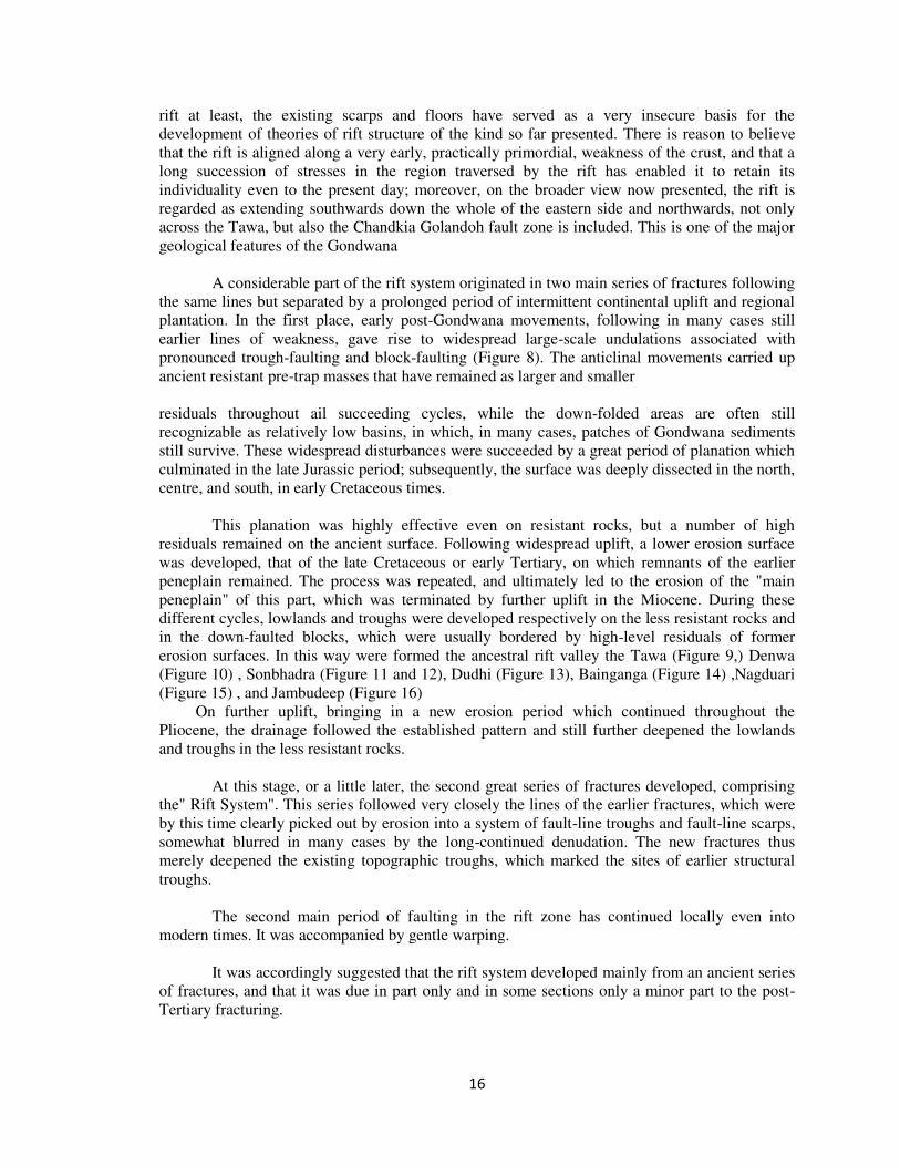
rift at least, the existing scarps and floors have served as a very insecure basis for the
development of theories of rift structure of the kind so far presented. There is reason to believe
that the rift is aligned along a very early, practically primordial, weakness of the crust, and that a
long succession of stresses in the region traversed by the rift has enabled it to retain its
individuality even to the present day; moreover, on the broader view now presented, the rift is
regarded as extending southwards down the whole of the eastern side and northwards, not only
across the Tawa, but also the Chandkia Golandoh fault zone is included. This is one of the major
geological features of the Gondwana
A considerable part of the rift system originated in two main series of fractures following
the same lines but separated by a prolonged period of intermittent continental uplift and regional
plantation. In the first place, early post-Gondwana movements, following in many cases still
earlier lines of weakness, gave rise to widespread large-scale undulations associated with
pronounced trough-faulting and block-faulting (Figure 8). The anticlinal movements carried up
ancient resistant pre-trap masses that have remained as larger and smaller
residuals throughout ail succeeding cycles, while the down-folded areas are often still
recognizable as relatively low basins, in which, in many cases, patches of Gondwana sediments
still survive. These widespread disturbances were succeeded by a great period of planation which
culminated in the late Jurassic period; subsequently, the surface was deeply dissected in the north,
centre, and south, in early Cretaceous times.
This planation was highly effective even on resistant rocks, but a number of high
residuals remained on the ancient surface. Following widespread uplift, a lower erosion surface
was developed, that of the late Cretaceous or early Tertiary, on which remnants of the earlier
peneplain remained. The process was repeated, and ultimately led to the erosion of the "main
peneplain" of this part, which was terminated by further uplift in the Miocene. During these
different cycles, lowlands and troughs were developed respectively on the less resistant rocks and
in the down-faulted blocks, which were usually bordered by high-level residuals of former
erosion surfaces. In this way were formed the ancestral rift valley the Tawa (Figure 9,) Denwa
(Figure 10) , Sonbhadra (Figure 11 and 12), Dudhi (Figure 13), Bainganga (Figure 14) ,Nagduari
(Figure 15) , and Jambudeep (Figure 16)
On further uplift, bringing in a new erosion period which continued throughout the
Pliocene, the drainage followed the established pattern and still further deepened the lowlands
and troughs in the less resistant rocks.
At this stage, or a little later, the second great series of fractures developed, comprising
the" Rift System". This series followed very closely the lines of the earlier fractures, which were
by this time clearly picked out by erosion into a system of fault-line troughs and fault-line scarps,
somewhat blurred in many cases by the long-continued denudation. The new fractures thus
merely deepened the existing topographic troughs, which marked the sites of earlier structural
troughs.
The second main period of faulting in the rift zone has continued locally even into
modern times. It was accompanied by gentle warping.
It was accordingly suggested that the rift system developed mainly from an ancient series
of fractures, and that it was due in part only and in some sections only a minor part to the post-
Tertiary fracturing.
17
Figure 11. Sonbhadra in the history of the Rift Zone and the high-level residual plateaux were believed to
represent a “Late Jurassic peneplain ".
18
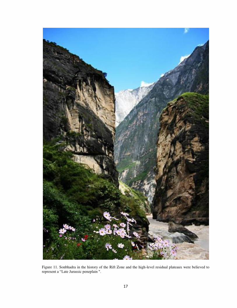
Figure 12. Fascinating Sonbhadra Gorge.
19
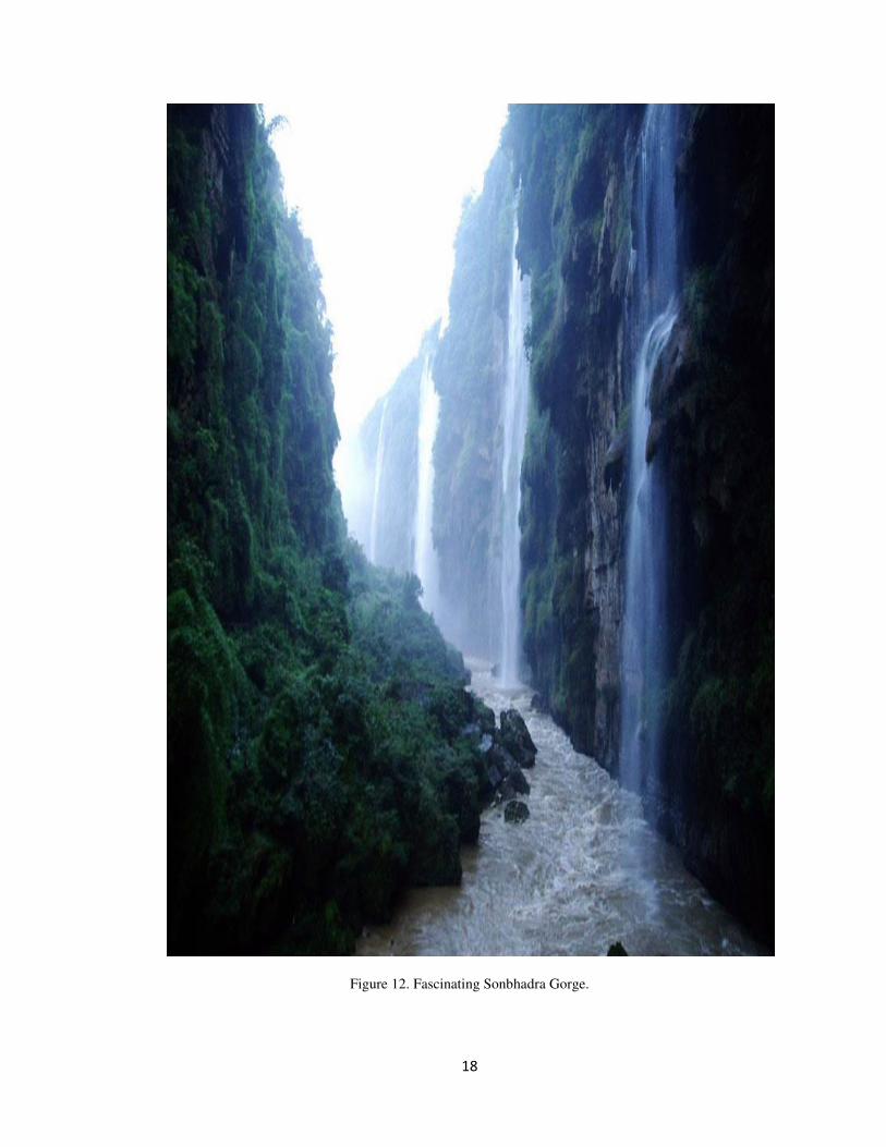
Figure 13. Dudhi River in the history of the Rift Zone, and the High-Level residual plateaux were believed
to represent a "Llate Jurassic Peneplain ".
20
The sequence of later Jurassic faulting, planation, pronounced regional uplift, erosion of
the weaker sediments to the new base-level, and early Cretaceous sedimentation on the lowlands,
already recorded from the Denwa Rift Valley and recognised in the vicinity of the great southern
scarp of the Pachmarhi. Planation of Jurassic age and vigorous early Cretaceous and subsequent
erosion were accordingly regarded as important features in the history of the Rift Zone, and the
high-level residual plateaux were believed to represent a "late Jurassic peneplain ".
Since this Interpretation was written much additional geological work has been carried
out; the suggestions regarding the importance of Pre-Cambrian structures to rift tectonics, and the
probable early Cretaceous age of the troughs, have been confirmed and strengthened. The
presence in central Pachmarhi of a late Cretaceous surface has been confirmed on
palaeontological and strati-graphical grounds, and much additional evidence regarding the tilting
of surfaces in the vicinity of rifts has been gained. Furthermore, the high-level plateau remnants,
formerly believed to represent a late Jurassic peneplain are now regarded as remnants of bevels
developed on regional upwarps of Jurassic age, and associated, somewhat lower, "surfaces" are
regarded as bevels due to intermittent upwarping along similar lines. Finally, on the basis of
evidence , there is reason to believe that the older bevels were eroded on uplands formed by a
"rise to the rift" in early Jurassic times, when the Pachmarhi fault-troughs were being formed, and
comparable with the arching that normally accompanied the Tertiary and post-Tertiary rifts.
Wayland ( ) and others have long stressed the importance of compression in at least
the earliest (Pre-Cambrian) phase of the rift structures. Further work has tended to confirm this
view, but, as will be seen later, there still remains a considerable difference of opinion as to the
relation between these structures and the obvious normal faults of the rifts. There can now be no
doubt as to the importance of the pre-Cambrian association and of the frequent rejuvenation of
old faults, but in the Mesozoic, the Tertiary and the post-Tertiary, the visible faults with possibly
rare exceptions appear to have been normal, and the relations of these to the structures of deep-
seated origin are still not fully understood.
In the Pachmarhi rift, there is a complete overlap of Tertiary and Jurassic faulting, and, as
the Jurassic structures of at least the southern part of this zone form part of the Patalkot
monocline, it is reasonable to regard this structure also as contemporary with, and marking a
southern extension of, an important phase of the rift movements.
Tawa rift valley
The Tawa valley consists of one of the three sections of the Western Rift valley, which
represent western part. Normal sedimentary contacts between rocks of the basement are more
common on both sides of Tawa rift. It has shown that the sediments thicken rapidly away from
the margins. Much of the rift faulting in this area is very late, but the fault running east-north-east
parallel to the Tawa might be the oldest rift fault with physiographic expression. Wide
embayments have been cut in the scarp, extending back for many kilometers. The fault has been
rejuvenated at a late stage.
The Tawa depression was formed mainly by warping and tilting to the west and north-
west. On the west side of the basin tilting has not been so marked. The bounding Chandkia
Golandoh fault in west may have existed from an early stage, in which the basin was let down by
faulting on the north-south rather than on the north-west in contrast to part of the Tawa valley,
where the main bounding fault is on the north-west side.
21
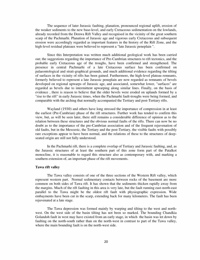
Figure 14. The Bain Ganga River Cretaceous age of the troughs, have been confirmed and strengthened.
22
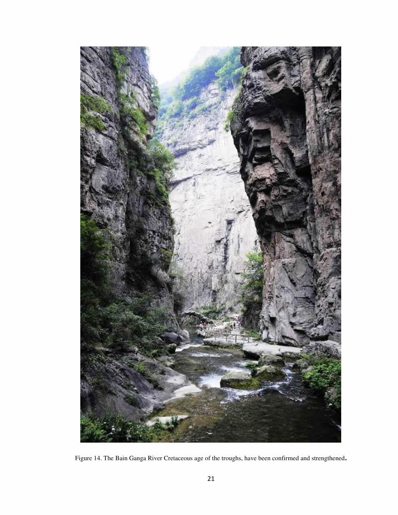
Figure 15. Nagduwari Rift Vally.
23
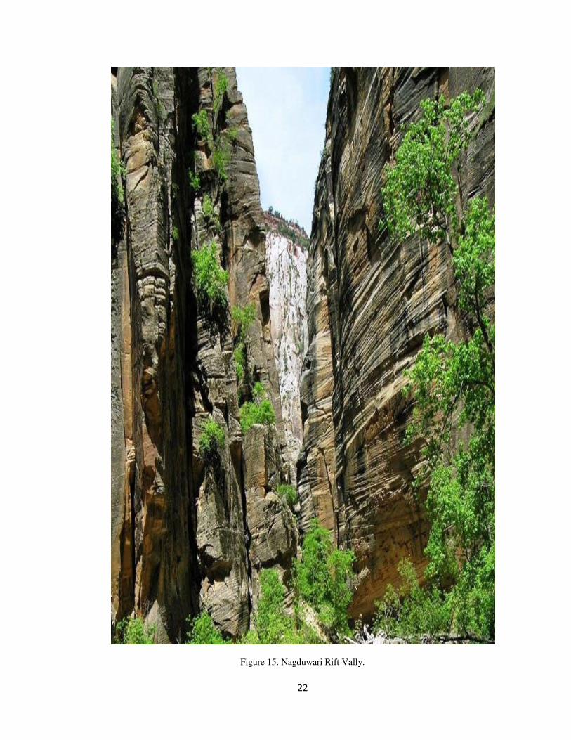
Figure 16. Jambudeep River. Long stressed the compression in at the earliest (pre-Cambrian) phase of the
rift Sructures
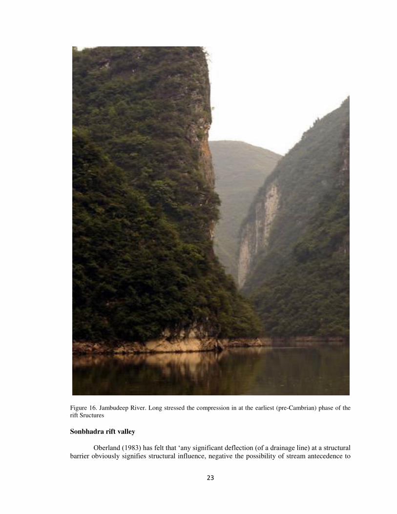
Sonbhadra rift valley
Oberland (1983) has felt that ‘any significant deflection (of a drainage line) at a structural barrier obviously signifies structural influence, negative the possibility of stream antecedence to
24
structure’. Venkatakrishnan (1984) also supporting the antecedence, the course of the Sonbhadra
across the Pachmarhi is not withstanding would require ‘unusual’ ‘coincidence’. The author, based mainly on the geomorphic evidence, clearly concludes that the Sonbhadra was antecedent
to the Pachmarhi stage. Now the present description, showing that the Sonbhadra mostly
following geological structure from its source to the Denwa and especially around the Bijori stage
and that the upper Sonbhadra is a strike stream and not a dip stream as required in the
antecedence drainage. Sonbhadra cannot be younger than the Denwa, was tightly contorted into a
very steep and high antiform the upper portion of which has now been obliterated exposing the
core.
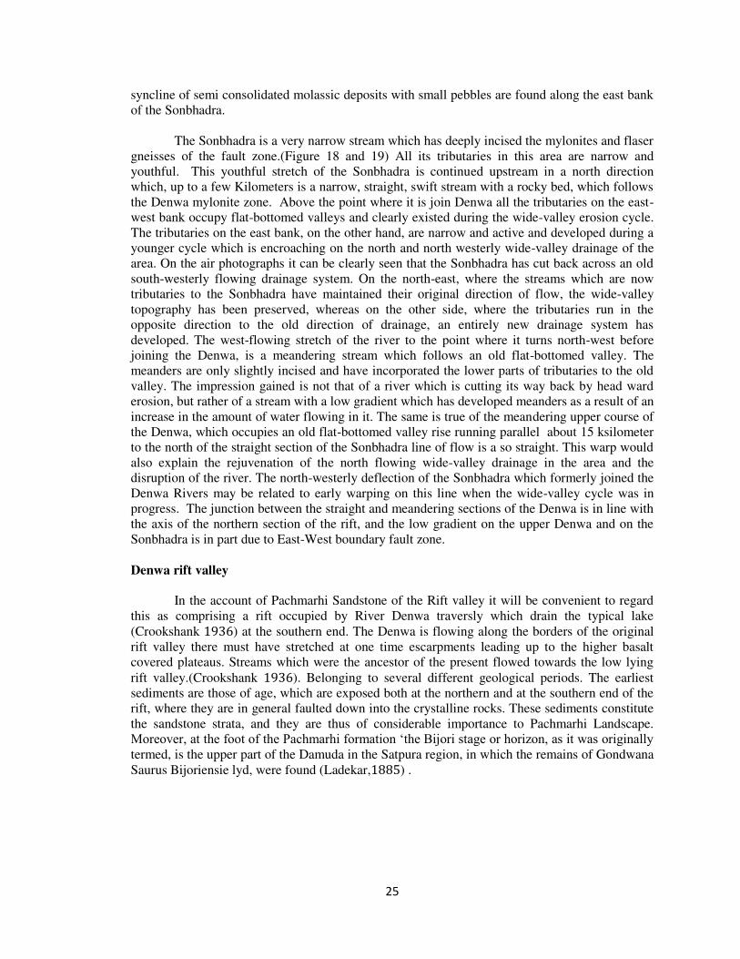
The profile of the Sonbhadra, apart from a few minor nicks across resistant rock strata
shows increasing gradients across Bijori stage. This has been linked with the tectonic activity of
the region. The Sonbhadra gorge between Somgarh and Deogarh has 4 to 5 terrace level with the
highest which one at 𝑒 𝑒 above the valley floor, also denotes Satpura upliftment. (Figure
17)
Headward erosion along a lineament was perhaps also responsible for the course of the
Sonbhadra across the Bijori formation. The events probably captured a system flowing to the
Tawa drainage system cross the Pachmarhi formation from the south because the event might
have taken place well into the cretaceous or even earlier, after the upliftment was completed. The
Sonbhadra was probably flowing through the western side of the gravel filled valley before an
erosional phase had set in. Down-cutting the sediments, being fixed in the same position, the river
probably encountered the Basalt intrusion and Basalt flow in the area which to the east and west
of the lithological contact, and it went on eroding the rock shifted from original guiding
lineament.
Another crucial observation, calling for an explanation, is the ‘enigmatic’. Ferruginous sandstones found along the Sonbhadra gorge. Its transgressive nature on both sides of the canyon
wall indicates that the gorge was well established before the pleistocene though perhaps at a
lower altitude.
The clastic sediments with pebbles into it were probably laid down by the Sonbhadra
itself which maintained its course along the gorge when the sequence was folded at a later time,
possibly as a side effect of the regional upliftment and reactivation of one of the faults that cross
the area. An equivalent sequence of events has been reported from the Dhupgarh, Chauragarh,
Mahadeva arch. Here, a stretch of the valley was filled-up by sediments brought by Sonbhadra.
The Pachmarhi Sandstones are preserved in the deepest part of the young gorge and not high on
the slope. It is obviously difficult to answer the rate of uplift and down cutting rate of the
Sonbhadra at the gorge. But it has been minimum since the age of the formation of Pachmarhi
sandstone. The Sonbhadra crosses the central axis of the East-West lineament of the Pachmarhi
formation here through a well known Sonbhadra gorge. Before entering this formation the
Sonbhadra turns sharply to its prevailing direction, following a segment of the left lateral fault. In
this way two to ten kilometer. apart almost parallel North South aligned reaches are formed,
along which the Sonbhadra travels in different circumstances. In this valley the Sonbhadra flows
over the epidiorites and basic intrusive related to the Deccan trap flow. It initially picks up the
contact between the western pre-cambrian meta-sedimentaries and the Gondwana sandstone (
my old) of the massif for a short 𝑖 𝑒 𝑒 stretch. Soon the former are replaced by the basic
intrusive situated East-West direction, the river curves eastwards and being guided by the same
lithological contact, which now changed into a north dipping paralleling the fault zone of the
west, enters the deepest part of the gorge. The clastic sandstones steeply folded (upto °) in to
25
syncline of semi consolidated molassic deposits with small pebbles are found along the east bank
of the Sonbhadra.
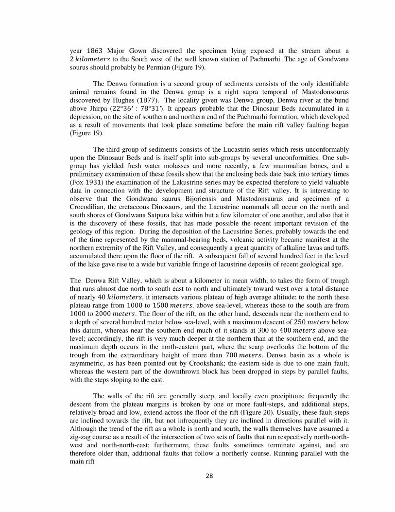
The Sonbhadra is a very narrow stream which has deeply incised the mylonites and flaser
gneisses of the fault zone.(Figure 18 and 19) All its tributaries in this area are narrow and
youthful. This youthful stretch of the Sonbhadra is continued upstream in a north direction
which, up to a few Kilometers is a narrow, straight, swift stream with a rocky bed, which follows
the Denwa mylonite zone. Above the point where it is join Denwa all the tributaries on the east-
west bank occupy flat-bottomed valleys and clearly existed during the wide-valley erosion cycle.
The tributaries on the east bank, on the other hand, are narrow and active and developed during a
younger cycle which is encroaching on the north and north westerly wide-valley drainage of the
area. On the air photographs it can be clearly seen that the Sonbhadra has cut back across an old
south-westerly flowing drainage system. On the north-east, where the streams which are now
tributaries to the Sonbhadra have maintained their original direction of flow, the wide-valley
topography has been preserved, whereas on the other side, where the tributaries run in the
opposite direction to the old direction of drainage, an entirely new drainage system has
developed. The west-flowing stretch of the river to the point where it turns north-west before
joining the Denwa, is a meandering stream which follows an old flat-bottomed valley. The
meanders are only slightly incised and have incorporated the lower parts of tributaries to the old
valley. The impression gained is not that of a river which is cutting its way back by head ward
erosion, but rather of a stream with a low gradient which has developed meanders as a result of an
increase in the amount of water flowing in it. The same is true of the meandering upper course of
the Denwa, which occupies an old flat-bottomed valley rise running parallel about 15 ksilometer
to the north of the straight section of the Sonbhadra line of flow is a so straight. This warp would
also explain the rejuvenation of the north flowing wide-valley drainage in the area and the
disruption of the river. The north-westerly deflection of the Sonbhadra which formerly joined the
Denwa Rivers may be related to early warping on this line when the wide-valley cycle was in
progress. The junction between the straight and meandering sections of the Denwa is in line with
the axis of the northern section of the rift, and the low gradient on the upper Denwa and on the
Sonbhadra is in part due to East-West boundary fault zone.
Denwa rift valley
In the account of Pachmarhi Sandstone of the Rift valley it will be convenient to regard
this as comprising a rift occupied by River Denwa traversly which drain the typical lake
(Crookshank ) at the southern end. The Denwa is flowing along the borders of the original
rift valley there must have stretched at one time escarpments leading up to the higher basalt
covered plateaus. Streams which were the ancestor of the present flowed towards the low lying
rift valley.(Crookshank ). Belonging to several different geological periods. The earliest
sediments are those of age, which are exposed both at the northern and at the southern end of the
rift, where they are in general faulted down into the crystalline rocks. These sediments constitute
the sandstone strata, and they are thus of considerable importance to Pachmarhi Landscape.
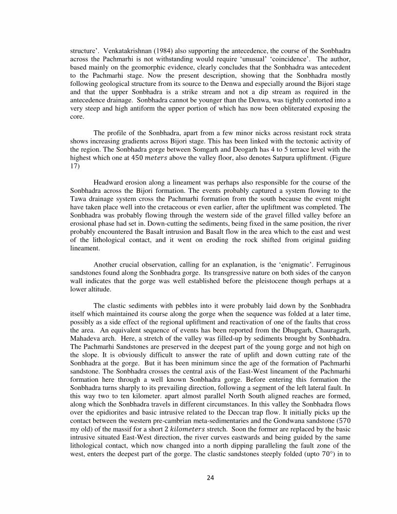
Moreover, at the foot of the Pachmarhi formation ‘the Bijori stage or horizon, as it was originally termed, is the upper part of the Damuda in the Satpura region, in which the remains of Gondwana
Saurus Bijoriensie lyd, were found (Ladekar, ) .
26
Fig
ure
17.
27
Figure 18 . Sonbhadra : This has been linked with the tectonic activity of the region. The Sonbhadra gorge
between Somgarh and Deogarh has 4 to 5 terrace level with the highest which one at 450 meter above the
valley floor, also denotes Satpura upliftment.
The country in the immediate neighborhood of the rift valley is made up largely of various
gneisses and schists, with intrusions of basalt and related rocks, which are all probably of
Precambrian age; there ancient rocks are overlain by relatively young thick sedimentary rocks In
28
year Major Gown discovered the specimen lying exposed at the stream about a 𝑖 𝑒 𝑒 to the South west of the well known station of Pachmarhi. The age of Gondwana
sourus should probably be Permian (Figure 19).
The Denwa formation is a second group of sediments consists of the only identifiable
animal remains found in the Denwa group is a right supra temporal of Mastodonsourus
discovered by Hughes ( ). The locality given was Denwa group, Denwa river at the bund
above Jhirpa ( ° ′ : ° ′). It appears probable that the Dinosaur Beds accumulated in a
depression, on the site of southern and northern end of the Pachmarhi formation, which developed
as a result of movements that took place sometime before the main rift valley faulting began
(Figure 19).
The third group of sediments consists of the Lucastrin series which rests unconformably
upon the Dinosaur Beds and is itself split into sub-groups by several unconformities. One sub-
group has yielded fresh water molasses and more recently, a few mammalian bones, and a
preliminary examination of these fossils show that the enclosing beds date back into tertiary times
(Fox ) the examination of the Lakustrine series may be expected therefore to yield valuable
data in connection with the development and structure of the Rift valley. It is interesting to
observe that the Gondwana saurus Bijoriensis and Mastodonsaurus and specimen of a
Crocodilian, the cretaceous Dinosaurs, and the Lacustrine mammals all occur on the north and
south shores of Gondwana Satpura lake within but a few kilometer of one another, and also that it
is the discovery of these fossils, that has made possible the recent important revision of the
geology of this region. During the deposition of the Lacustrine Series, probably towards the end
of the time represented by the mammal-bearing beds, volcanic activity became manifest at the
northern extremity of the Rift Valley, and consequently a great quantity of alkaline lavas and tuffs
accumulated there upon the floor of the rift. A subsequent fall of several hundred feet in the level
of the lake gave rise to a wide but variable fringe of lacustrine deposits of recent geological age.
The Denwa Rift Valley, which is about a kilometer in mean width, to takes the form of trough
that runs almost due north to south east to north and ultimately toward west over a total distance
of nearly 𝑖 𝑒 𝑒 , it intersects various plateau of high average altitude; to the north these
plateau range from to 𝑒 𝑒 . above sea-level, whereas those to the south are from
to 𝑒 𝑒 . The floor of the rift, on the other hand, descends near the northern end to
a depth of several hundred meter below sea-level, with a maximum descent of 𝑒 𝑒 below
this datum, whereas near the southern end much of it stands at 300 to 𝑒 𝑒 above sea-
level; accordingly, the rift is very much deeper at the northern than at the southern end, and the
maximum depth occurs in the north-eastern part, where the scarp overlooks the bottom of the
trough from the extraordinary height of more than 𝑒 𝑒 . Denwa basin as a whole is
asymmetric, as has been pointed out by Crookshank; the eastern side is due to one main fault,
whereas the western part of the downthrown block has been dropped in steps by parallel faults,
with the steps sloping to the east.
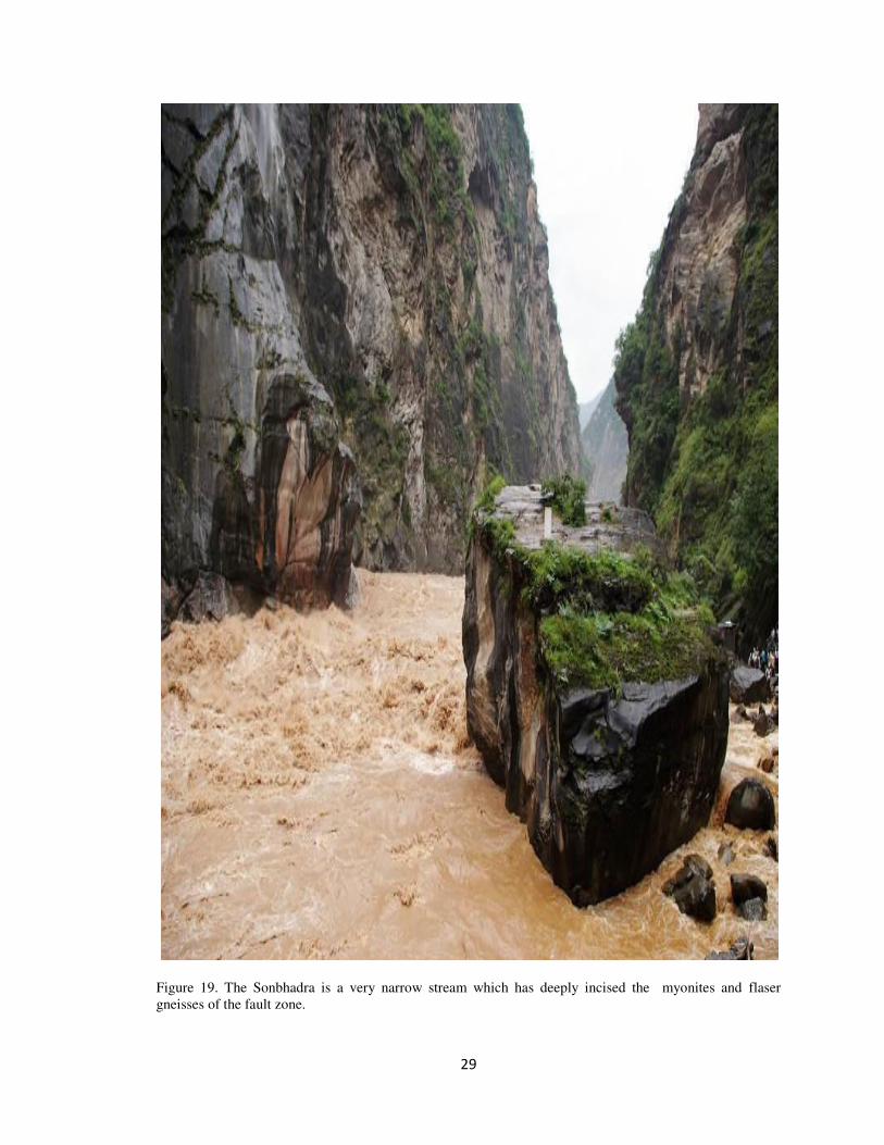
The walls of the rift are generally steep, and locally even precipitous; frequently the
descent from the plateau margins is broken by one or more fault-steps, and additional steps,
relatively broad and low, extend across the floor of the rift (Figure 20). Usually, these fault-steps
are inclined towards the rift, but not infrequently they are inclined in directions parallel with it.
Although the trend of the rift as a whole is north and south, the walls themselves have assumed a
zig-zag course as a result of the intersection of two sets of faults that run respectively north-north-
west and north-north-east; furthermore, these faults sometimes terminate against, and are
therefore older than, additional faults that follow a northerly course. Running parallel with the
main rift
29
Figure 19. The Sonbhadra is a very narrow stream which has deeply incised the myonites and flaser
gneisses of the fault zone.
30
Figure 20 . Denwa River : The walls of the rift are generally steep, and locally even precipitous; frequently
the descent from the plateau margins is broken by one or more fault-steps, and additional steps, relatively
broad and low, extend across the floor of the rift.
there are, particularly on the western side, minor rifts standing at various elevations; these rifts
are separated by rectilinear crystalline ridges. The greater part of the floor of the main rift is
occupied by river Denwa around which extends a fringe of tributaries of varying width. The
31
slope of the plateau lying along the north-western part of the river is continued for many
kilometre. Almost to the lacustrine sediment, where the maximum depth of 𝑒 𝑒 . has
been recorded. Further south, adjacent section of the river Bijori floor is tilted in the opposite
direction, towards the foot of the southern scarpment rises abruptly from the floor of the river in a
manner similar to that of the. In a third and shallower section extending to the southern end of
the river the floor is gently concave, and here a well-developed drowned topography may be
observed along many parts of the Bijori stage.
The plateau are sometimes built up of great thicknesses of sand and clay, but sometimes
they consist of even crystalline platforms that dip gently, except where traversed by young faults,
below the level of the rivers, as in the area south of scarpline; these crystalline platforms are
usually overlain by thin patches of pebbly gravel. The plateau, however, is traversed by a number
of crystalline fault-ridges running parallel with the river flow and between these ridges lie narrow
strips of the sediments.
Towards the close of the period of deposition of the Lacustrine Series, the crystalline
ridges were more or less completely buried under these sediments; as the waters of the lake
receded, the streams that ran towards the lake over the surface of that time gradually cut their way
down to the buried ridges, and then in due course incised deep narrow gorges through them; at the
same time the secondary streams opened up wide transverse valleys in the soft sediments lying
between the ridges. Consequently, in this region the rivers of to-day may be observed to run
directly across the grain of the country in their progress from the foot of the southern scarp to the
east of Patalkot, so that instead of flowing along the broad shallow troughs running parallel, they
first enter the troughs on one side through a deep narrow gorge and then depart from them again
by a similar gorge situated almost directly opposite. Some of the weaker streams were naturally
unable to maintain their courses across the hard ridges, so that after a time they were obliged to
abandon the gorges they had already cut, and these now remain only as wind gaps; the streams
were then obliged to find an easier course to the lake through the softer rocks, or else they were
captured by the head ward erosion of the tributaries of neighbouring more vigorous streams.
In many places old beaches and lines of conglomerate run parallel with the river line, and
between them swamps may often be observed; ridges of similar form may continue below the
water-line, and these sometimes make landing very difficult for the river craft.
Lacustrine deposits and raised beaches show that the level of the river has varied
considerably from time to time. The older lacustrine deposits range from to 𝑒 𝑒 .
above the present level of the river, while gravels and raised beach deposits of very late age stand
at the following successive levels: , , and 𝑒 𝑒 . The river appears to have been
able to effect but very little lateral erosion into the crystalline rocks that about upon its bank,
although severe storms are of common occurrence at certain seasons of the year; this is probably
due to the circumstance that the rather wide seasonal and periodical variations in the level of the
river, combined with the instability of level indicated by the river banks have rarely if ever
enabled the waves to concentrate their efforts within suitable limits.
The fact that the water of present river is fresh, and that the only fossils found in the older
lacustrine deposits are of fresh-water origin in Denwa and Bijori formation indicates that the river
has had a more or less continuous outlet to the lake almost from the beginning, in spite of the
vicissitudes it has undergone.
The Bainganga rift valley
The Bainganga basin is an elevated block, which slopes steeply and disappears below the
sediments of the rift both at its northern and southern ends. On the west side, Mahadeva is

32
bounded by two overlapping upland with a maximum throw of probably well over , 𝑒 𝑒 .
The throw decreases steadily to the north and the fault, after swinging east for a short distance, is
continued beyond the northern nose of the mountains. The lower part of the fault scarp shows,
faceted spurs and, as on the eastern margins of the rift, the faults have been rejuvenated.
The northern half of the Bainganga Basin bounded on the east by a Denwa rift valley. In
the central part, the mountain spurs slope below the sediments deposited in trough, but in the
south again the hills rise sharply and their edges may mark a much indented fault-line scarp.
I have regarded Bainganga Basin is an ancient residual mass. All the evidence now
available, however, shows that it is of ancient origin and attained its present elevation largely
during the final phases of movement along the rift valley.
The southern part of the Basin has a uniform easterly slope. The deep dissection of the
mountain block has not destroyed all traces of old surfaces; some relics still remain. The best
example of such a relic occurs above is sloping relic, about to 𝑖 𝑒 𝑒 long and 𝑖 𝑒 𝑒 . To 𝑖 𝑒 𝑒 . Wide, has a drainage pattern which, though the valleys are more
deeply incised, is similar to the pattern formed during the wide-valley cycle of erosion in the
lower Denwa area It is very likely, therefore, that the sloping relics represent the uplifted and
tilted lower laterite surface, and that the flat-bottomed valleys were already in course of
development before the main uplift occurred. The formations of the Bainganga system continue
without change in lithology from eastern Pachmarhi across the Plateau and there is no reason to
believe that a large transverse erosional residual would have been preserved between two mature
west-flowing rivers with no major highlands upstream in their basins; atleast as far east as the
Denwa river represent South north flow.
It is important to appreciate the position of the Bainganga drainage in relation to the rift
valley troughs. It is situated between the east ends of the Bainganga drainage basin. The tilting
of the block may therefore represent an accentuation of the general rise to the rift caused by
depression of the eastern end of the Bainganga basin. This would not, however, account for the
total uplift of the block between its boundary faults, which probably has to be explained by some
Isostatic mechanism.
The easterly course of the Bainganga river in the area suggests that during the
development of the flat-bottomed valleys the area now occupied was already rising faster than the
rest of the country. (Figure 19 ).The morphology of the boundary scarps, however, shows that
they are in the main of very recent origin, probably partly earlier than, but largely
contemporaneous with, the first stage of the faulting which produced the rift scarps elsewhere.
However, a scarp may have existed along the line of the eastern boundary fault from an early
stage in the development of the trough.
Topography of the Hills is in a mature stage of development. The drainage pattern is
roughly dendritic, although the predominant trend of streams is Easterly, from the major divide in
which the streams head, to the sloping fan surfaces which encroach from the south upon the
ragged foothill belt of the mountain base. Although there are many irregularities of bed-rock
composition and structure, these seem to have rather minor influences upon the placement of
minor streams and divides.
Slopes are steep with a tendency to straightness of profile. Divides tend to be smoothly
rounded. Relief is not great, despite the steep slopes. The areas studied have less than 40Meter
33
total relief while most slope profiles measured in the field have less than 𝑒 𝑒 .of difference
in elevation from divide to channel.
Ravines may be subdivided into two classes: (1) The smaller ravines and the upper ends
of the larger ones are V-shaped in ° to ° for the most part. The stream channel, dry most of
the time, is narrow and is cut in bedrock. Locally, however, the channel is clogged with debris
which has slid, rolled or flowed from the steep walls. (2) The lower courses of most of the larger
canyons are graded and have a flat alluvial floor ranging from a few meter to one or two hundred
meter wide. To what extent the flat is due to later corrosion in bedrock, rather than to alluviation
by flood-and mud-flow of a formerly V-shaped valley is not easily determined. In the areas
studied, a period of recent channel trenching showed alluvial flow fill. Streams strongly impinge
on the base of the steep canyon walls, undercutting the bedrock. Where the stream has
temporarily moved away from the slope base steep cones of talus have been built, causing a
smoothed, concave-up basal slope of accumulation to be present.
Ravine heads are steep-walled, funnel-like amphitheaters which may be termed
“hoppers” because their converging slopes feed detritus into the uppermost end of the stream channel. Hopper walls tend to be nearly straight in profile and to make the form of an inverted
part-cone. Most hopper walls are very steep, above ° in angle. Evidences of rolling and sliding
of weathered rock are conspicuous. Bedrock exposure comprises from one-third to three- fourths
of the hopper walls. Locally a layer or lens of resistant rock may produce a nearly vertical cliff,
but for the most part the rock surfaces conform closely, to the straight hopper walls.
Some hopper walls intersect the broadly rounded divide with a sharp, clearly defined
break in slope, indicating the rapid expansion of the steep hopper slopes by rapid mass movement
into a more stable profile determined by slower processes of creep and rain-wash. Elsewhere the
hopper walls merge smoothly into the rounded divide profile and suggest a more nearly balanced
slope condition.
The lateral slopes which extend from divide to ravine bottom are characteristically
straight in profile for a considerable part of their length. At the upper end the profile merges
smoothly 8 into the curve of the divide; at the lower end the straight profile reaches the ravine
floor. In some ravines a composite profile was found, having a lower, or inner, segment steeper
than that above it. This was interpreted as the result of a recent epicycle of accelerated erosion
locally affecting some of the canyons.
Rift cyclic models
In order to explain the above relationships, it is useful to establish a model against which
the present landscape surface can be compared. Since this upwarp occurs in an area whose
planation surfaces as described above have been warped, it means that any surface formed prior
to the initiation of the upwarp will be distorted as the tectonic deformation took place, and the
rivers incised into the surface as soon as further uplift continues. Planation however continues so
long as there is a period of tectonic quiescence of sufficient duration for the surface to develop in
between two successive uplifts, and as long as the rate of drainage incision keeps pace with the
rate of uplift along the tectonic axis. If however the latter becomes excessive the river tends to
reverse. Since the Dhupgarh Surface had a radial slope in relation to the axis, allowance must be
made for this; if however it is assumed that the slope of this surface was as much as 𝑖 𝑒 /𝑖 𝑒 𝑒 , the total uplift would be 𝑒 𝑒 . The lowland by contrast shows an opposite
rise. Thus it would be necessary to invoke a shift of the axis of up warping by some 𝑖 𝑒 𝑒 . to the south, to lie now near the Deccan Trap cliffs.
34
Drainage can be expected to develop in an area such as this, where relief barriers can be
fixed by shallow dips, and where uplift with consequent rejuvenation tends to draw the rivers
across the east-west structural grain, but the process remains questionable. The water gaps, and
wind gaps too are sufficiently aligned and independent of the transverse structure to disqualify the
explanation of regressive erosion and capture, and crest beveling was not as advanced as to allow
major rivers to swing across the interfluves. It however, seems possible that the drainage evolved
from a combination of part inheritance and limited superimposition at the close of the Pachmarhi
leveling, when the southward shift of the axis of up arch assisted in drawing the drainage lines
across the low relief barriers of the Dhupgarh Surface. It s plausible that the streams were
inherited from an earlier planation surface, the Dhupgarh Surface and the final leveling as a result
of the pedimentation of the Pachmarhi Surface, when relief barriers were subdued enough for the
rivers now rejuvenated to be superimposed on the lower and surfaces below. Based on these
considerations a scheme of events leading to the morpho evolution of the Pachmarhi area has
been worked out. Stage wise development of the morphology is schematically depicted in Relict
planation surfaces are found to be the most potent guides in formulating the sequence of event. In
addition they strongly indicate the activeness of the area that had been hitherto regarded as a part
of an eventless stable landmass which is further corroborated by the (a)Presence of numerous
waterfalls both cascade and other types, wind and water gaps at high elevation, deep gorges
carved out by perennial streams, numerous springs, Karst-like topography including subterranean
drainage, caves and caverns etc. (b) Complete absence of flood plains. Thus above features bear
testimony to the youthful character of the area. Further expansion of the Lowland Surface is
particularly noticeable. In this connection possibly a southward shift in the axis of the domal up-
arching resulted in the warping of the Upland surfaces and caused the limited superimposition
and discordance of the major drainage lines, which lead to the formation of the Lowland surface
(exhumed by the uncapping and denudation of the Deccan Trap Lavas) evolving at the cost of
Uplands, being consumed due to scarp retreat.
References
Dixey, F., 1939b, The Early Cretaceous valley-floor peneplain of the Lake Nyasa Region, and its relation
toTertiary Rift structures, Quart .geol. Soc. Lond., Vol. 95, Pt. 1, pp. 75-108 .
Dixey, F., 1943a, Erosion cycles in centra! and southern Africa, Trans.geol. Soc. S. Air., 1942,Vol. 45, pp.
151-181.
Dixey, F., 1946, Erosion and tectonics in the East African Rift System, Quart.!, geol. Soc. Lond.,Vol. 102,
Pt. 3, pp. 339-379, figs.
Dixey, F., 1959, Vertical tectonics in the East African rift zone, 20th Intern. Ceoi. Congr. Proc.Assoc. Air.
Geol. Surv., pp. 359-375.
Gregory, J. W., 1894, Contribution to the physical geology of British East Africa, Ceog. lour. 4: 2903 15,
408- 4 24,505-514
Heezen, B. C, 1969, The world rift system: An introduction to the symposium, Tectonophysics 8:269-279.
Heezen, B. C; and M. Ewing, 1961, The mid-oceanic ridge and its extension through the Arcticbasin, in
Geology of the Arctic, University of Toronto Press, Toronto, pp. 622-642.
Hills, E. S., 1963, Elements of Structural Geology, Methuen, London, 483p.
Krenkel, E., 1925, Geologie Afrikas, vol. 1, Borntraeger, Berlin, 1918p.
Milanovsky, E. E., 1972, Continental rift zones: Their arrangement and development,Tectonophysics
15:65-70.
Wayland, E. J., 1930, Rift valleys and Lake Victoria, C.R. 11e Sess., Congr.geol. internal, S. Ah., 1929,
Vol 2, pp. 323-353, figs.
______________________________________________________________________________