Embed Size (px)
Citation preview
WORLD STUDIES
September 3, 2013
Bell Ringer - Quiz
1. Step 1: Draw two circles on your paper.
Step 2: In the first circle, draw and label the equator.
Step 3: In the first circle, draw three lines of latitude on both sides of the equator.
Step 4: In the second circle, draw and label the Prime Meridian.
Step 5: In the second, draw three lines of longitude on both sides of the Prime Meridian.
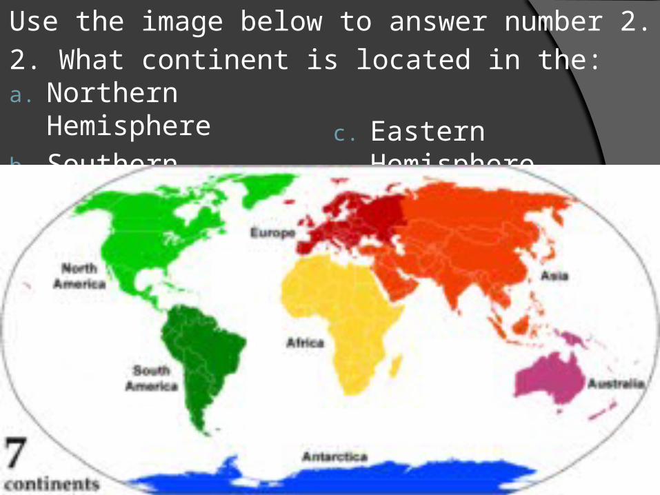
a. Northern Hemisphere
b. Southern Hemisphere
c. Eastern Hemisphere
d. Western Hemisphere
Use the image below to answer number 2.
2. What continent is located in the:
3. What is the definition of absolute location?
4. What is the definition of relative location?
Questions 5 -10 – Use your atlas
5. Pg 88 – What is the approximate absolute location of Seward, Alaska?
6. Pg 138 – What is the approximate absolute location of Rio De Janeiro, Brazil?
7. Pg. 154 – What city is located at approximately 38ºN and 24ºE?
8. Pg. 212 - What city is located at approximately 2ºN and 104ºE?
9. Pg. 154 – Using Paris, France as a reference point, what is the relative location of Naples, Italy?
10. Pg. 154-155 – Using Homs, Syria as a reference point, what is the relative location of Warsaw, Poland?
Questions 11-15 – Use the atlas
11. Pg 104-105 – How many miles does the scale measure at its fullest?
12. Pg. 104-105 – How far is it from Atlanta, GA to Chicago, IL?
13. Pg. 194 How many kilometers does the scale measure at its fullest?
14. Pg. 194 How many kilometers is it from Karachi, Pakistan to Baghdad, Iraq?
15. Pg.104 – using Denver, CO as a reference point– tell me another city, its absolute location, and its relative location from Denver (three answers)
Types of Maps – Physical and Political
Physical maps show the location and the topography, or shape of the Earth’s physical features. A study of an area’s physical features can help explain its historical development
Political maps shows the boundaries and locations of political units such as countries, states, and cities (often divided by color). A study of a political map gives you a context for the region.
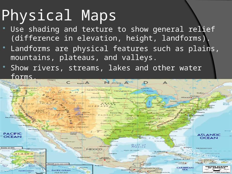
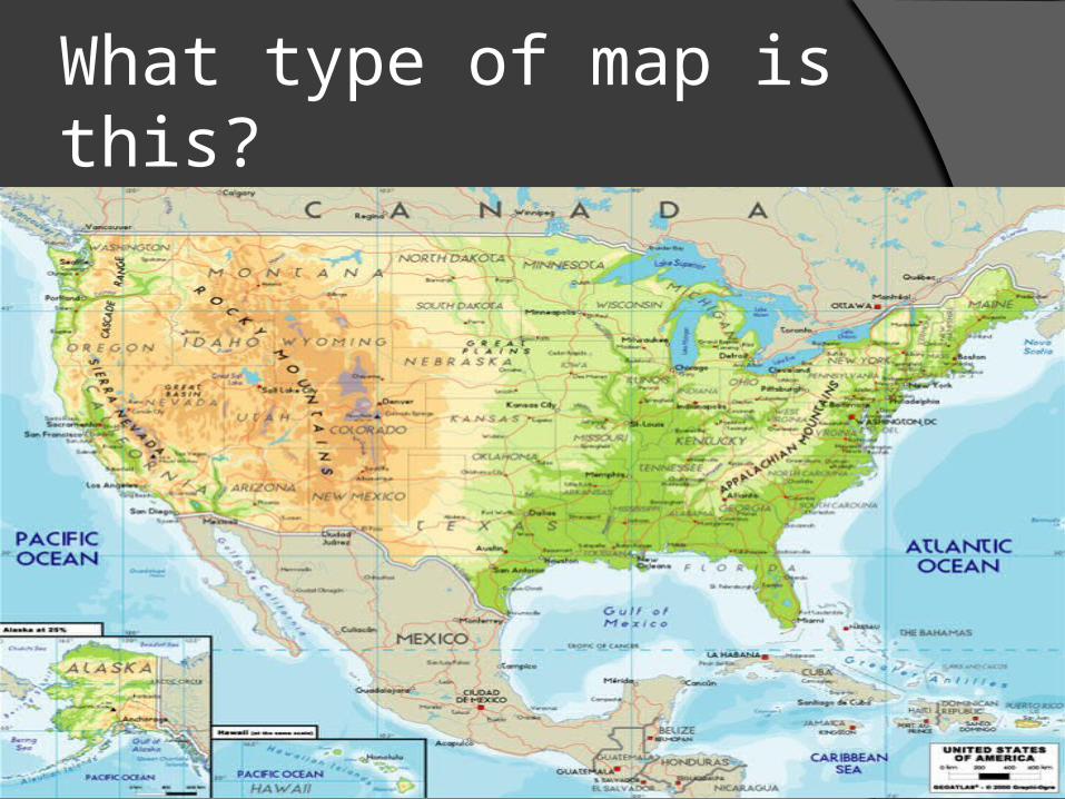
Physical Maps Use shading and texture to show general relief
(difference in elevation, height, landforms). Landforms are physical features such as plains,
mountains, plateaus, and valleys. Show rivers, streams, lakes and other water forms.
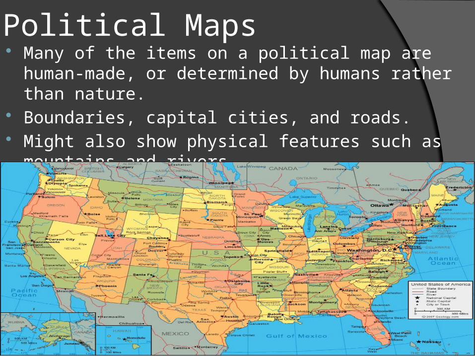
Political Maps Many of the items on a political map are human-
made, or determined by humans rather than nature. Boundaries, capital cities, and roads. Might also show physical features such as
mountains and rivers.
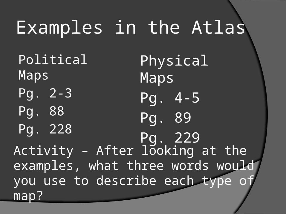
Examples in the Atlas
Political Maps
Pg. 2-3
Pg. 88
Pg. 228
Physical Maps
Pg. 4-5
Pg. 89
Pg. 229
Activity – After looking at the examples, what three words would you use to describe each type of map?

Thematic Maps – maps that provide a particular kind of information or a single idea
Qualitative Maps – use colors, symbols, lines, or dots to show information related to a specific idea.
Examples in Atlas:Pg. 32-33
Pg. 40-41
Flow-Line maps – use arrows to show the movement of people, ideas, or physical systems.
Examples in Atlas: Pg. 20-21 PG. 58-59
Activity: When would you use a qualitative map? A Flow-Line map?What three words would you use to describe each type of map?
September 5, 2013
Bell Ringer
Identify the types of maps:
Physical
Political
Qualitative
Flow-Line

What type of map is this?

What type of map is this?

What type of map is this?
What type of map is this?
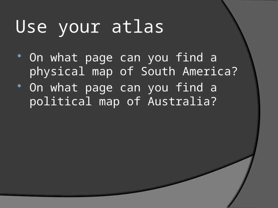
Use your atlas
On what page can you find a physical map of South America?
On what page can you find a political map of Australia?
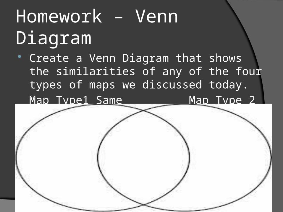
Homework – Venn Diagram Create a Venn Diagram that shows the similarities
of any of the four types of maps we discussed today.
Map Type1 Same Map Type 2

Summer Map Sheet
Please get your summer map sheet out. If you didn’t receive one, raise your hand.
Instructions – take 5 minutes to label the continents and oceans
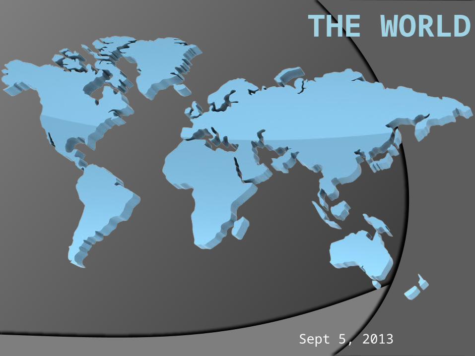
THE WORLD
Sept 5, 2013
List the Seven Continents
North America
South America
Europe
Africa
Asia
Australia
Antarctica
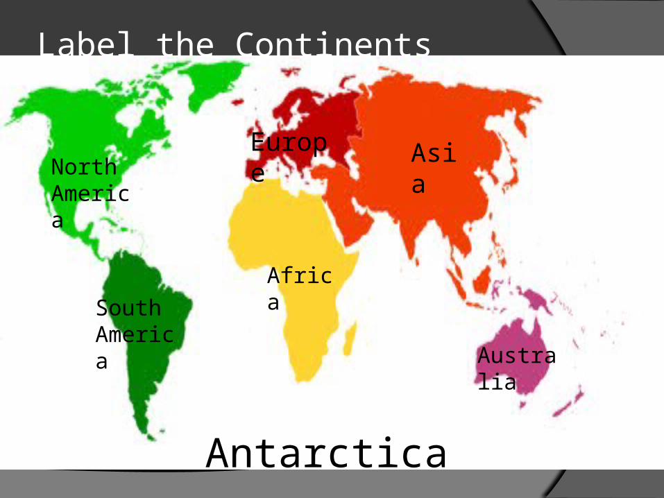
Label the Continents
North America
South America
Europe
Africa
Asia
Australia
Antarctica
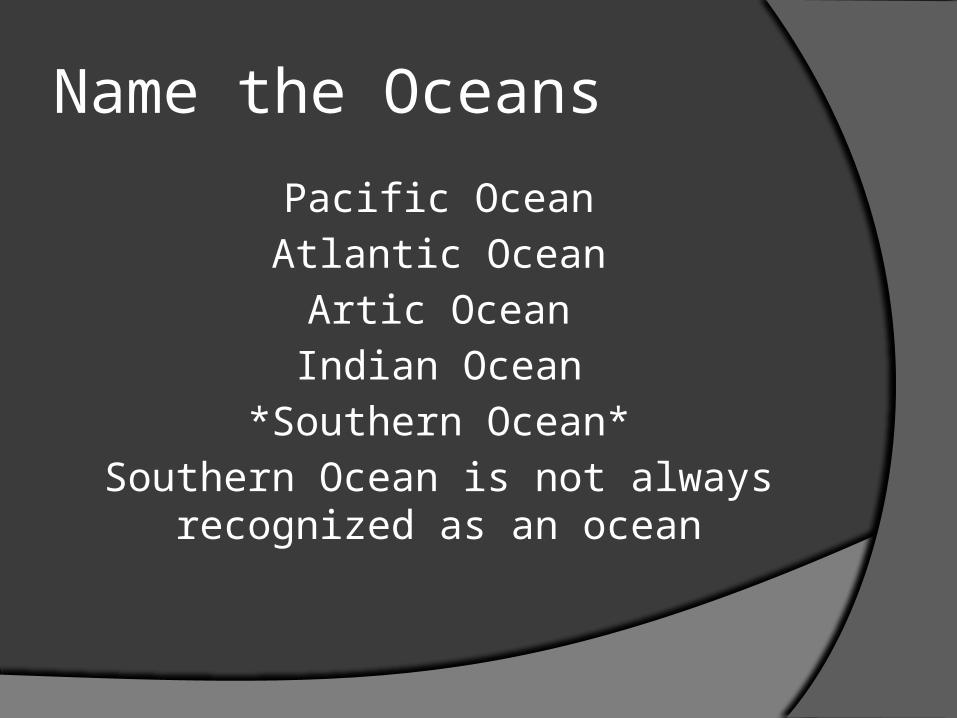
Name the Oceans
Pacific Ocean
Atlantic Ocean
Artic Ocean
Indian Ocean
*Southern Ocean*
Southern Ocean is not always recognized as an ocean

Label the Oceans
Pacific Ocean
Atlantic Ocean
Indian Ocean
Arctic Ocean
Pacific Ocean
Southern Ocean

Name the countries of North America Bermuda (UK) Canada Greenland (Den.) Mexico Saint Pierre and Miquelon (Fr.) United States
Caribbean Anguilla (UK) Antigua and Barbuda Aruba (Neth.) Bahamas, The[note 4]
Barbados Bonaire (Neth.) British Virgin Islands (UK) Cayman Islands (UK) Cuba Curaçao (Neth.)
• Curaçao (Neth.)• Dominica• Dominican Republic• Grenada• Guadeloupe (Fr.)• Haiti• Jamaica• Martinique (Fr.)• Montserrat (UK)• Navassa Island (US)• Puerto Rico (US)• Saba (Neth.)• Saint Barthélemy (Fr.)
• Saint Kitts and Nevis• Saint Lucia• Saint Martin (Fr.)• Saint Vincent and the Grenadines• Sint Eustatius (Neth.)• Sint Maarten (Neth.)• Trinidad and Tobago[86]
• Turks and Caicos Islands[note 6] (UK)• United States Virgin Islands (US)
• Central America• Belize• Costa Rica• El Salvador• Guatemala• Honduras• Nicaragua• Panama

North America
Canada
United States
Mexico
Greenland
CubaHaiti
Dominican Republic
Puerto Rico
Belize
Guatemala
Honduras
Nicaragua
Costa Rica PanamaEl Salvador
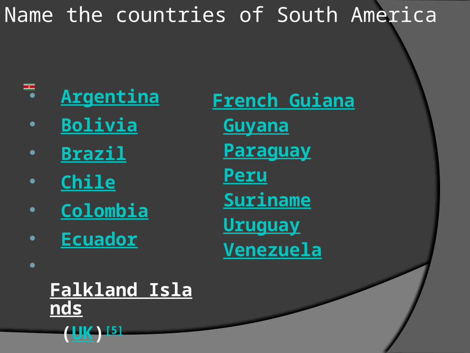
Name the countries of South America
Argentina Bolivia Brazil Chile Colombia Ecuador Falkland Islands
(UK)[5]
French Guiana Guyana Paraguay Peru Suriname Uruguay Venezuela
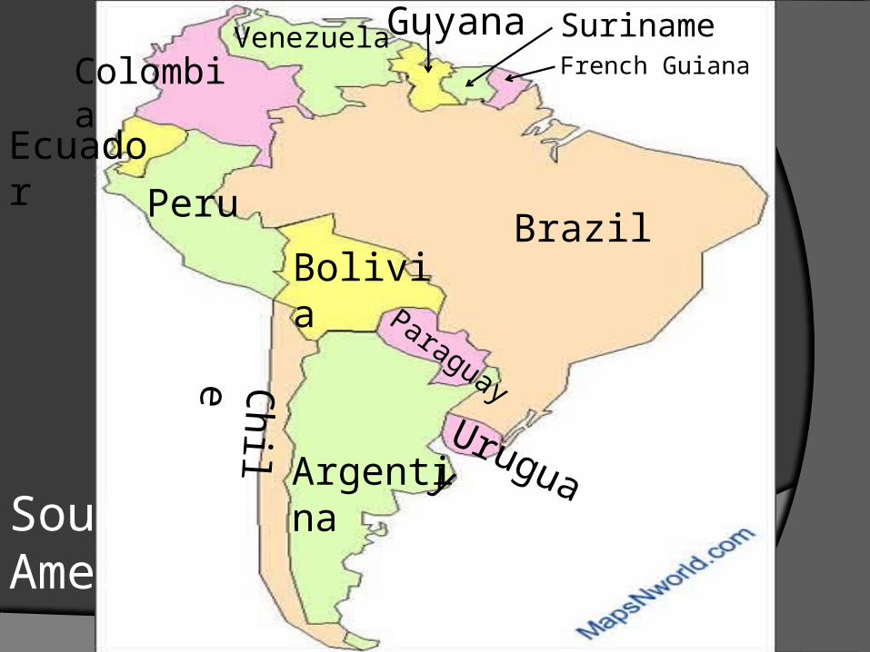
Colombia
South America
Peru
Chile
Argentina
BoliviaBrazil
Uruguay
Paraguay
Venezuela
Ecuador
French GuianaSurinameGuyana


![Watson.guptill.[How to Draw] Portrait Drawing a Step-By-Step Art Instructio](https://img.pdfslide.net/doc/110x75/577d1e031a28ab4e1e8d8a36/watsonguptillhow-to-draw-portrait-drawing-a-step-by-step-art-instructio.jpg)
