Embed Size (px)
Citation preview
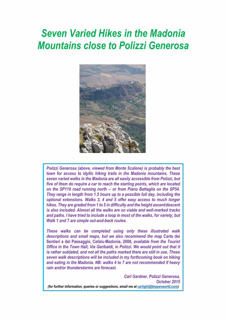
Seven Varied Hikes in the Madonia Mountains close to Polizzi Generosa
Polizzi Generosa (above, viewed from Monte Scalone) is probably the best town for access to idyllic hiking trails in the Madonia mountains. These seven varied walks in the Madonia are all easily accessible from Polizzi, but five of them do require a car to reach the starting points, which are located on the SP119 road running north -- or from Piano Battaglia on the SP54. They range in length from 1.5 hours up to a possible full day, including the optional extensions. Walks 3, 4 and 5 offer easy access to much longer hikes. They are graded from 1 to 5 in difficulty and the height ascent/descent is also included. Almost all the walks are on viable and well-marked tracks and paths. I have tried to include a loop in most of the walks, for variety, but Walk 1 and 7 are simple out-and-back routes. These walks can be completed using only these illustrated walk descriptions and small maps, but we also recommend the map Carta dei Sentieri e del Paesaggio, Cefalu-Madonie, 2008, available from the Tourist Office in the Town Hall, Via Garibaldi, in Polizzi. We would point out that it is rather outdated, and not all the paths marked there are still in use. These seven walk descriptions will be included in my forthcoming book on hiking and eating in the Madonia. NB: walks 4 to 7 are not recommended if heavy rain and/or thunderstorms are forecast.
Carl Gardner, Polizzi Generosa, October 2015
(for further information, queries or suggestions, email me at [email protected])
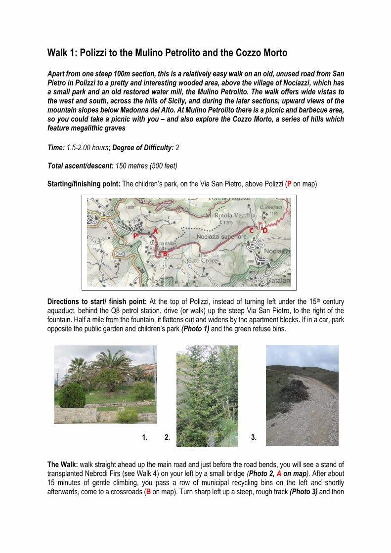
Walk 1: Polizzi to the Mulino Petrolito and the Cozzo Morto Apart from one steep 100m section, this is a relatively easy walk on an old, unused road from San Pietro in Polizzi to a pretty and interesting wooded area, above the village of Nociazzi, which has a small park and an old restored water mill, the Mulino Petrolito. The walk offers wide vistas to the west and south, across the hills of Sicily, and during the later sections, upward views of the mountain slopes below Madonna del Alto. At Mulino Petrolito there is a picnic and barbecue area, so you could take a picnic with you – and also explore the Cozzo Morto, a series of hills which feature megalithic graves
Time: 1.5-2.00 hours; Degree of Difficulty: 2 Total ascent/descent: 150 metres (500 feet) Starting/finishing point: The children’s park, on the Via San Pietro, above Polizzi (P on map) Directions to start/ finish point: At the top of Polizzi, instead of turning left under the 15th century aquaduct, behind the Q8 petrol station, drive (or walk) up the steep Via San Pietro, to the right of the fountain. Half a mile from the fountain, it flattens out and widens by the apartment blocks. If in a car, park opposite the public garden and children’s park (Photo 1) and the green refuse bins.
1. 2. 3. The Walk: walk straight ahead up the main road and just before the road bends, you will see a stand of transplanted Nebrodi Firs (see Walk 4) on your left by a small bridge (Photo 2, A on map). After about 15 minutes of gentle climbing, you pass a row of municipal recycling bins on the left and shortly afterwards, come to a crossroads (B on map). Turn sharp left up a steep, rough track (Photo 3) and then
right. Walking through shrubs and grazing land, the road becomes metalled again after 25 minutes and you have a view down to Castellana Sicula on your right. The road then climbs to its highest point at 35 minutes, easing through a gap between the rounded hill of Cozzo Croce on your right and steeper slopes on the left. It then descends, with widening views of the wooded mountain slopes below Madonna del Alto on your left. On the right you have a fine view of the hamlet of Nociazzi.
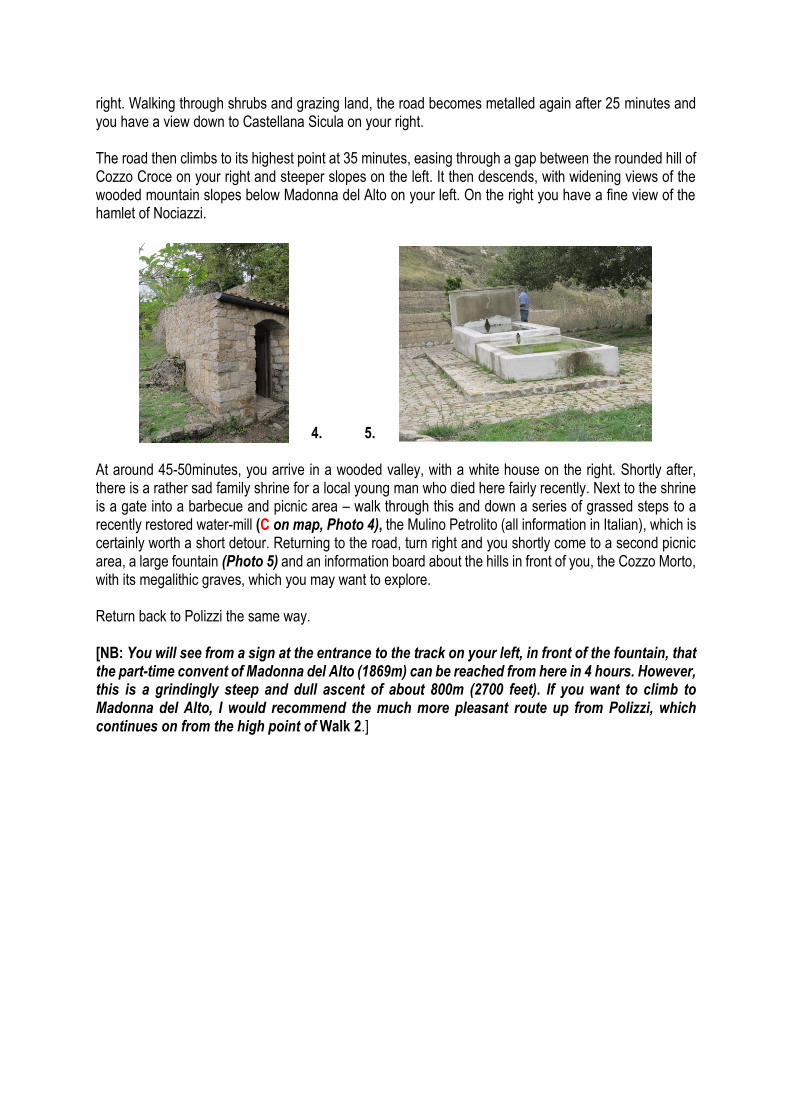
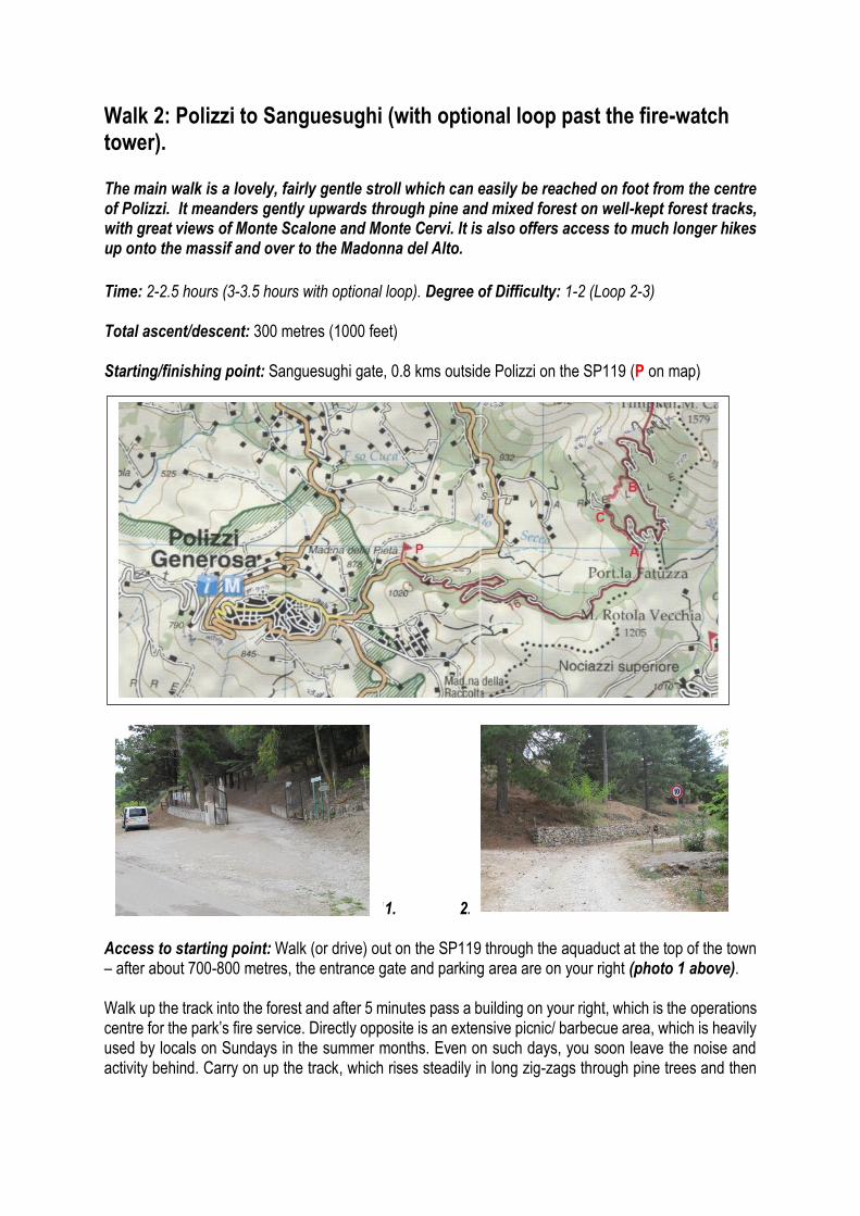
2. 4. 5. At around 45-50minutes, you arrive in a wooded valley, with a white house on the right. Shortly after, there is a rather sad family shrine for a local young man who died here fairly recently. Next to the shrine is a gate into a barbecue and picnic area – walk through this and down a series of grassed steps to a recently restored water-mill (C on map, Photo 4), the Mulino Petrolito (all information in Italian), which is certainly worth a short detour. Returning to the road, turn right and you shortly come to a second picnic area, a large fountain (Photo 5) and an information board about the hills in front of you, the Cozzo Morto, with its megalithic graves, which you may want to explore. Return back to Polizzi the same way. [NB: You will see from a sign at the entrance to the track on your left, in front of the fountain, that the part-time convent of Madonna del Alto (1869m) can be reached from here in 4 hours. However, this is a grindingly steep and dull ascent of about 800m (2700 feet). If you want to climb to Madonna del Alto, I would recommend the much more pleasant route up from Polizzi, which continues on from the high point of Walk 2.]
Walk 2: Polizzi to Sanguesughi (with optional loop past the fire-watch tower). The main walk is a lovely, fairly gentle stroll which can easily be reached on foot from the centre of Polizzi. It meanders gently upwards through pine and mixed forest on well-kept forest tracks, with great views of Monte Scalone and Monte Cervi. It is also offers access to much longer hikes up onto the massif and over to the Madonna del Alto.
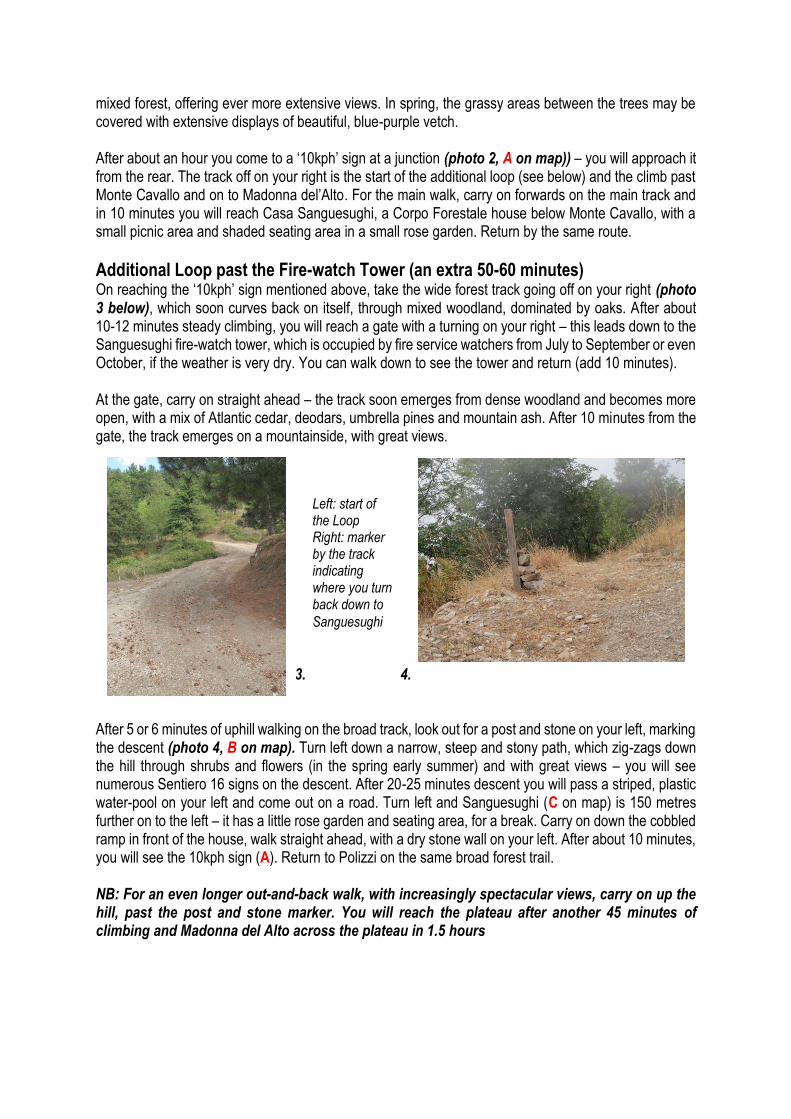
Time: 2-2.5 hours (3-3.5 hours with optional loop). Degree of Difficulty: 1-2 (Loop 2-3) Total ascent/descent: 300 metres (1000 feet) Starting/finishing point: Sanguesughi gate, 0.8 kms outside Polizzi on the SP119 (P on map) 11. 2. Access to starting point: Walk (or drive) out on the SP119 through the aquaduct at the top of the town – after about 700-800 metres, the entrance gate and parking area are on your right (photo 1 above). Walk up the track into the forest and after 5 minutes pass a building on your right, which is the operations centre for the park’s fire service. Directly opposite is an extensive picnic/ barbecue area, which is heavily used by locals on Sundays in the summer months. Even on such days, you soon leave the noise and activity behind. Carry on up the track, which rises steadily in long zig-zags through pine trees and then
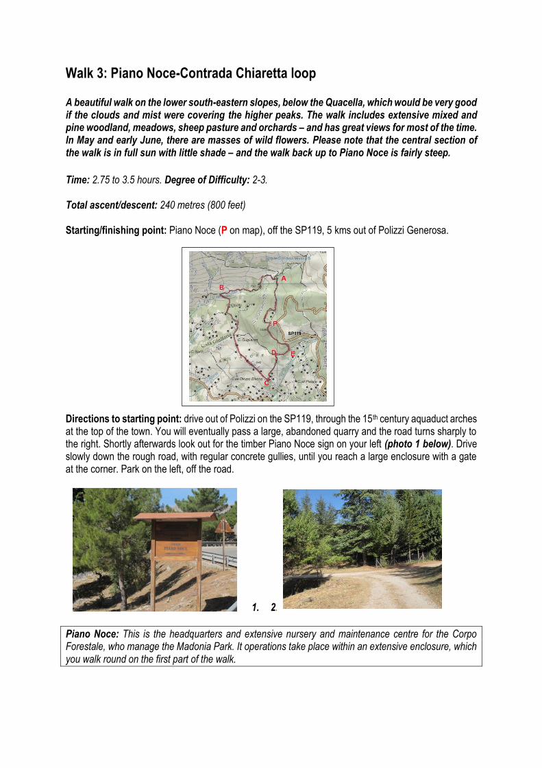
mixed forest, offering ever more extensive views. In spring, the grassy areas between the trees may be covered with extensive displays of beautiful, blue-purple vetch. After about an hour you come to a ‘10kph’ sign at a junction (photo 2, A on map)) – you will approach it from the rear. The track off on your right is the start of the additional loop (see below) and the climb past Monte Cavallo and on to Madonna del’Alto. For the main walk, carry on forwards on the main track and in 10 minutes you will reach Casa Sanguesughi, a Corpo Forestale house below Monte Cavallo, with a small picnic area and shaded seating area in a small rose garden. Return by the same route.
Additional Loop past the Fire-watch Tower (an extra 50-60 minutes) On reaching the ‘10kph’ sign mentioned above, take the wide forest track going off on your right (photo 3 below), which soon curves back on itself, through mixed woodland, dominated by oaks. After about 10-12 minutes steady climbing, you will reach a gate with a turning on your right – this leads down to the Sanguesughi fire-watch tower, which is occupied by fire service watchers from July to September or even October, if the weather is very dry. You can walk down to see the tower and return (add 10 minutes). At the gate, carry on straight ahead – the track soon emerges from dense woodland and becomes more open, with a mix of Atlantic cedar, deodars, umbrella pines and mountain ash. After 10 minutes from the gate, the track emerges on a mountainside, with great views. 3. 4. After 5 or 6 minutes of uphill walking on the broad track, look out for a post and stone on your left, marking the descent (photo 4, B on map). Turn left down a narrow, steep and stony path, which zig-zags down the hill through shrubs and flowers (in the spring early summer) and with great views – you will see numerous Sentiero 16 signs on the descent. After 20-25 minutes descent you will pass a striped, plastic water-pool on your left and come out on a road. Turn left and Sanguesughi (C on map) is 150 metres further on to the left – it has a little rose garden and seating area, for a break. Carry on down the cobbled ramp in front of the house, walk straight ahead, with a dry stone wall on your left. After about 10 minutes, you will see the 10kph sign (A). Return to Polizzi on the same broad forest trail. NB: For an even longer out-and-back walk, with increasingly spectacular views, carry on up the hill, past the post and stone marker. You will reach the plateau after another 45 minutes of climbing and Madonna del Alto across the plateau in 1.5 hours
Left: start of the Loop Right: marker by the track indicating where you turn back down to
Sanguesughi
Walk 3: Piano Noce-Contrada Chiaretta loop A beautiful walk on the lower south-eastern slopes, below the Quacella, which would be very good if the clouds and mist were covering the higher peaks. The walk includes extensive mixed and pine woodland, meadows, sheep pasture and orchards – and has great views for most of the time. In May and early June, there are masses of wild flowers. Please note that the central section of the walk is in full sun with little shade – and the walk back up to Piano Noce is fairly steep.
Time: 2.75 to 3.5 hours. Degree of Difficulty: 2-3. Total ascent/descent: 240 metres (800 feet) Starting/finishing point: Piano Noce (P on map), off the SP119, 5 kms out of Polizzi Generosa. Directions to starting point: drive out of Polizzi on the SP119, through the 15th century aquaduct arches at the top of the town. You will eventually pass a large, abandoned quarry and the road turns sharply to the right. Shortly afterwards look out for the timber Piano Noce sign on your left (photo 1 below). Drive slowly down the rough road, with regular concrete gullies, until you reach a large enclosure with a gate at the corner. Park on the left, off the road.
1. 2.
Piano Noce: This is the headquarters and extensive nursery and maintenance centre for the Corpo Forestale, who manage the Madonia Park. It operations take place within an extensive enclosure, which you walk round on the first part of the walk.
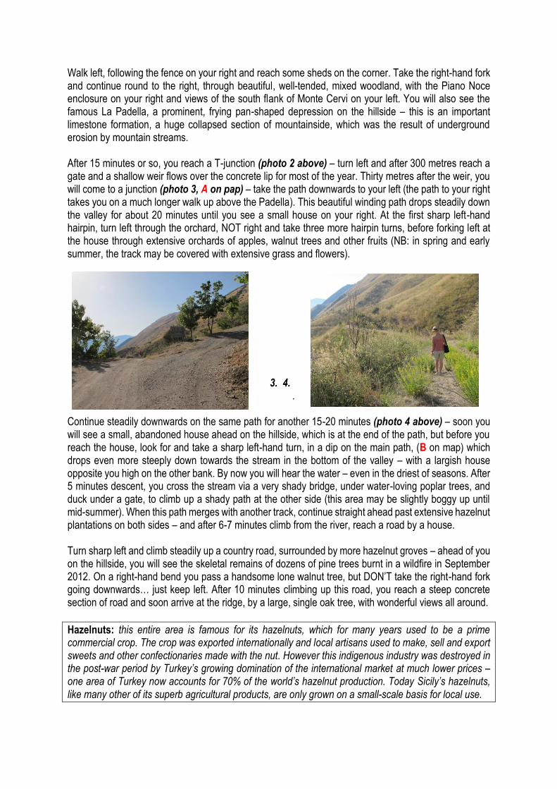
Walk left, following the fence on your right and reach some sheds on the corner. Take the right-hand fork and continue round to the right, through beautiful, well-tended, mixed woodland, with the Piano Noce enclosure on your right and views of the south flank of Monte Cervi on your left. You will also see the famous La Padella, a prominent, frying pan-shaped depression on the hillside – this is an important limestone formation, a huge collapsed section of mountainside, which was the result of underground erosion by mountain streams. After 15 minutes or so, you reach a T-junction (photo 2 above) – turn left and after 300 metres reach a gate and a shallow weir flows over the concrete lip for most of the year. Thirty metres after the weir, you will come to a junction (photo 3, A on pap) – take the path downwards to your left (the path to your right takes you on a much longer walk up above the Padella). This beautiful winding path drops steadily down the valley for about 20 minutes until you see a small house on your right. At the first sharp left-hand hairpin, turn left through the orchard, NOT right and take three more hairpin turns, before forking left at the house through extensive orchards of apples, walnut trees and other fruits (NB: in spring and early summer, the track may be covered with extensive grass and flowers).
3. 4. .
Continue steadily downwards on the same path for another 15-20 minutes (photo 4 above) – soon you will see a small, abandoned house ahead on the hillside, which is at the end of the path, but before you reach the house, look for and take a sharp left-hand turn, in a dip on the main path, (B on map) which drops even more steeply down towards the stream in the bottom of the valley – with a largish house opposite you high on the other bank. By now you will hear the water – even in the driest of seasons. After 5 minutes descent, you cross the stream via a very shady bridge, under water-loving poplar trees, and duck under a gate, to climb up a shady path at the other side (this area may be slightly boggy up until mid-summer). When this path merges with another track, continue straight ahead past extensive hazelnut plantations on both sides – and after 6-7 minutes climb from the river, reach a road by a house. Turn sharp left and climb steadily up a country road, surrounded by more hazelnut groves – ahead of you on the hillside, you will see the skeletal remains of dozens of pine trees burnt in a wildfire in September 2012. On a right-hand bend you pass a handsome lone walnut tree, but DON’T take the right-hand fork going downwards… just keep left. After 10 minutes climbing up this road, you reach a steep concrete section of road and soon arrive at the ridge, by a large, single oak tree, with wonderful views all around.
Hazelnuts: this entire area is famous for its hazelnuts, which for many years used to be a prime commercial crop. The crop was exported internationally and local artisans used to make, sell and export sweets and other confectionaries made with the nut. However this indigenous industry was destroyed in the post-war period by Turkey’s growing domination of the international market at much lower prices – one area of Turkey now accounts for 70% of the world’s hazelnut production. Today Sicily’s hazelnuts, like many other of its superb agricultural products, are only grown on a small-scale basis for local use.
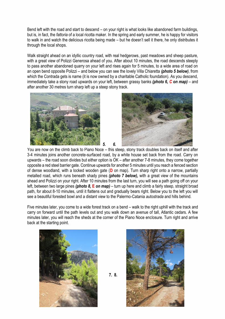
Bend left with the road and start to descend – on your right is what looks like abandoned farm buildings, but is, in fact, the fattoria of a local ricotta maker. In the spring and early summer, he is happy for visitors to walk in and watch the delicious ricotta being made – but he doesn’t sell it there, he only distributes it through the local shops. Walk straight ahead on an idyllic country road, with real hedgerows, past meadows and sheep pasture, with a great view of Polizzi Generosa ahead of you. After about 10 minutes, the road descends steeply to pass another abandoned quarry on your left and rises again for 5 minutes, to a wide area of road on an open bend opposite Polizzi – and below you can see the lovely Villa Chiaretta (photo 5 below), from which the Contrada gets is name (it is now owned by a charitable Catholic foundation). As you descend, immediately take a stony road upwards on your left, between grassy banks (photo 6, C on map) – and after another 30 metres turn sharp left up a steep stony track. 5. 6. You are now on the climb back to Piano Noce – this steep, stony track doubles back on itself and after 3-4 minutes joins another concrete-surfaced road, by a white house set back from the road. Carry on upwards – the road soon divides but either option is OK – after another 7-8 minutes, they come together opposite a red steel barrier gate. Continue upwards for another 5 minutes until you reach a fenced section of dense woodland, with a locked wooden gate (D on map). Turn sharp right onto a narrow, partially metalled road, which runs beneath shady pines (photo 7 below), with a great view of the mountains ahead and Polizzi on your right. After 10 minutes from the last turn, you will see a path going off on your left, between two large pines (photo 8, E on map) – turn up here and climb a fairly steep, straight broad path, for about 8-10 minutes, until it flattens out and gradually bears right. Below you to the left you will see a beautiful forested bowl and a distant view to the Palermo-Catania autostrada and hills behind. Five minutes later, you come to a wide forest track on a bend – walk to the right uphill with the track and carry on forward until the path levels out and you walk down an avenue of tall, Atlantic cedars. A few minutes later, you will reach the sheds at the corner of the Piano Noce enclosure. Turn right and arrive back at the starting point. 7. 8.
Walk 4: Vallone Madonna degli Angeli and the Nebrodi Firs (with optional walk to top of the Quacella) With good reason this is one of the most popular and best-known walks in the Madonie. An interesting loop takes you first up through thick beech forest and past some of the rare examples of the Nebrodi Firs (Abies Nebrodensis), up onto the limestone plateau. This is followed by a steep, scenic descent on a good road through the beautiful Vallone Madonna degli Angeli – please note this is in full sun, without much shade in the summer. Extensive views throughout – and there are lots of alpine plants to see from April-July. An optional extension of 45 minutes each way will take you to the top of the spectacular Quacella escarpment. Further easy but long extensions are also possible to Monte San Salvatore and the Madonna del Alto.
Time: 2.45-3.15 hours (4.00-4.45 with the Quacella extension). Degree of Difficulty: 4-5. Total ascent/descent: 650 metres (2100 feet) Starting/finishing point: Gate on the SP119, 9kms out of Polizzi Generosa. (P on map)
1. The entrance gate 2. Gradual route on left, steeper route to the right
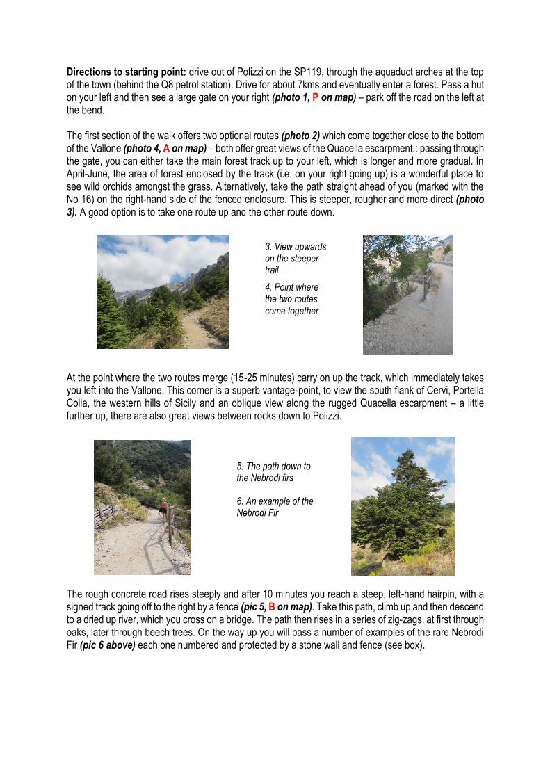
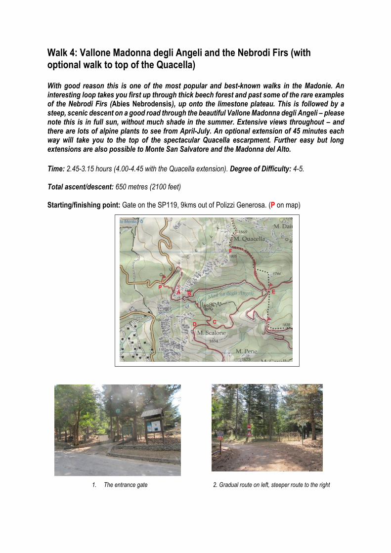
Directions to starting point: drive out of Polizzi on the SP119, through the aquaduct arches at the top of the town (behind the Q8 petrol station). Drive for about 7kms and eventually enter a forest. Pass a hut on your left and then see a large gate on your right (photo 1, P on map) – park off the road on the left at the bend. The first section of the walk offers two optional routes (photo 2) which come together close to the bottom of the Vallone (photo 4, A on map) – both offer great views of the Quacella escarpment.: passing through the gate, you can either take the main forest track up to your left, which is longer and more gradual. In April-June, the area of forest enclosed by the track (i.e. on your right going up) is a wonderful place to see wild orchids amongst the grass. Alternatively, take the path straight ahead of you (marked with the No 16) on the right-hand side of the fenced enclosure. This is steeper, rougher and more direct (photo 3). A good option is to take one route up and the other route down. At the point where the two routes merge (15-25 minutes) carry on up the track, which immediately takes you left into the Vallone. This corner is a superb vantage-point, to view the south flank of Cervi, Portella Colla, the western hills of Sicily and an oblique view along the rugged Quacella escarpment – a little further up, there are also great views between rocks down to Polizzi. The rough concrete road rises steeply and after 10 minutes you reach a steep, left-hand hairpin, with a signed track going off to the right by a fence (pic 5, B on map). Take this path, climb up and then descend to a dried up river, which you cross on a bridge. The path then rises in a series of zig-zags, at first through oaks, later through beech trees. On the way up you will pass a number of examples of the rare Nebrodi Fir (pic 6 above) each one numbered and protected by a stone wall and fence (see box).
3. View upwards on the steeper trail
4. Point where the two routes
come together
5. The path down to the Nebrodi firs 6. An example of the Nebrodi Fir

The Nebrodi Fir The Nebrodi Fir (Abies nebrodensis), sometimes called the Sicilian fir, is a very rare medium-sized evergreen native to the Madonie mountains. There are only 31 closely protected specimens growing in the wild, all within the confines of the Vallone Madonna degli Angeli, above 1400 metres. It is a sub-species of the silver fir (abies alba) which replaces it in the Apennine Mountains of Italy and elsewhere further north in Europe, but unlike its close relative, nebrodiensis is classified as critically endangered by the IUCN Red List. However, you will see re-planted examples of the fir in local gardens – as well as in a large pot in the square next to the Comune in the centre of Polizzi Generosa.
After 15 minutes’ climbing, you will reach a small spring beneath some tall beeches on a right-hand bend, which flows for most of the year. After a further 10 minutes you cross a scree fall and after just over an hour of walking, reach a T-junction, with a number of signs (photo 7, C on map), including two for the EcoMaratone (a gruelling marathon run each year in the mountains in early June). Even if you don’t want to walk all the way back to Polizzi (2.5-3.00 hours walk from here) it is worth turning right and climbing up for about five minutes, and you come out on the upper slopes of Monte Scalone, with absolutely staggering views to Polizzi and beyond (photo 8, D on map). 7. 8. Retrace your steps to the signposts and carry on straight ahead. After a few minutes you will cross the same scree fall higher up and within 10 minutes you will enter the pine forest, as the path flattens out. Soon you will emerge onto the open plateau (you will see a rain gauge over to your left). The path snakes ahead across the plateau, with great views of Monte Cervi and the Vallone below you, and then re-enters the beech forest and starts to descend. At about 1.30-1.45 from the start, you will come to a junction (E on map), where you have two options. Turn immediately left down the Vallone and you will reach the gate and your car in another hour or so. Turn right and round a couple of bends you will see on the wall low down to your left a sign saying ‘Quacella’ with an arrow pointing into the trees (pic 9 below). Just above this point on the right, you will also see signs indicating possible walk extensions to Monte San Salvatore and the Madonna del Alto – all on wide forest trails. These are easy to follow and could add 2-3 hours to the main walk.
9. Sign to the Quacella 10. The
Quacella

Quacella extension: This diversion will take you 35-45 minutes each way. The path is fairly well marked with red bars, although sometimes widely spaced in rocky areas – but the end point is magnificent, bringing you to the lip of the precipitous Quacella escarpment (pic 10 above, F on map), with stunning vistas. You can also climb another 50m to the top of Monte Quacella – 1869 metres.
Taking the route back down the Vallone, you will soon pass a fountain spring on your right (pure drinking water, so re-fill your bottles) and a little further down, a pretty pink house, which is used by Corpo Forestale workers. On your left, between the fountain and the house, across a patch of grass, you can examine two ‘escapee’ specimens of the Nebrodi Fir. From the house, the road drops steeply for another 25 minutes until you come to the hair-pin where you turned off to climb up to the beech forest at the beginning. Carry on down, taking either the steep path or the more gradual track, and you will reach the start in another 30-35 minutes.

Walk 5: Piano Cervi (+ extensions) This wonderful hike, almost all on wide forest track, offers the most intensive experience of the unique beech forests that top the Madonie – in fact about 50% of the walk is within the beeches, making it an ideal walk for hot, spring/summer days, as the dappled shade takes a good 5-80C off the temperature in the sun. It is rightly one of the most beautiful and celebrated walks in these mountains – and you can often see wild deer and wild pigs. Time: 3 to 3hrs 15 mins (main loop), with optional out-and-back extensions adding 1, 2 or 3 hours. If you plan to climb Monte dei Cervi itself, take a small ball of ribbon or string and a pair of scissors – see box. Height ascent/descent (main loop): 220m (750 feet); (with Monte dei Cervi): 350m (1150 feet) Degree of Difficulty: 3-4 (Monte dei Cervi, 4) Starting/finishing point: Portella Colla (1421 metres/4600 feet) about 10 kms north of Polizzi, at the junction of the SP119 and the SP54 from Cefalu to Petralia Sottana (P on map). Park by the Parco information board at the wide part of the junction (photo 1 below). The start of the walk is the track that descends behind the sign. Most of the main loop is a marked Parco track – Sentiero 11 and 11b.
1. 2. The Walk The path descends and then rises, with an extensive view on your right of the west flank of Pizzo Carbonara, the highest mountain in the Madonie. After 10 minutes you will come to a locked gate, with a pedestrian entrance – on your left note a shrine for a young man who died there in some family vendetta a quarter of a century ago. The wide track now climbs steadily in long loops, with distant views of the sea
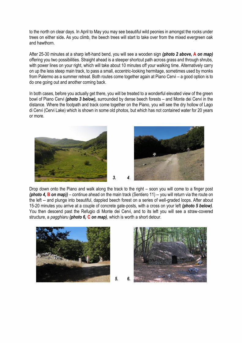
to the north on clear days. In April to May you may see beautiful wild peonies in amongst the rocks under trees on either side. As you climb, the beech trees will start to take over from the mixed evergreen oak and hawthorn. After 25-30 minutes at a sharp left-hand bend, you will see a wooden sign (photo 2 above, A on map) offering you two possibilities. Straight ahead is a steeper shortcut path across grass and through shrubs, with power lines on your right, which will take about 10 minutes off your walking time. Alternatively carry on up the less steep main track, to pass a small, eccentric-looking hermitage, sometimes used by monks from Palermo as a summer retreat. Both routes come together again at Piano Cervi – a good option is to do one going out and another coming back. In both cases, before you actually get there, you will be treated to a wonderful elevated view of the green bowl of Piano Cervi (photo 3 below), surrounded by dense beech forests – and Monte dei Cervi in the distance. Where the footpath and track come together on the Piano, you will see the dry hollow of Lago di Cervi (Cervi Lake) which is shown in some old photos, but which has not contained water for 20 years or more. 3. 4. Drop down onto the Piano and walk along the track to the right – soon you will come to a finger post (photo 4, B on map)) – continue ahead on the main track (Sentiero 11) -- you will return via the route on the left -- and plunge into beautiful, dappled beech forest on a series of well-graded loops. After about 15-20 minutes you arrive at a couple of concrete gate-posts, with a cross on your left (photo 5 below). You then descend past the Refugio di Monte dei Cervi, and to its left you will see a straw-covered structure, a pagghiaru (photo 6, C on map), which is worth a short detour. 5. 6.
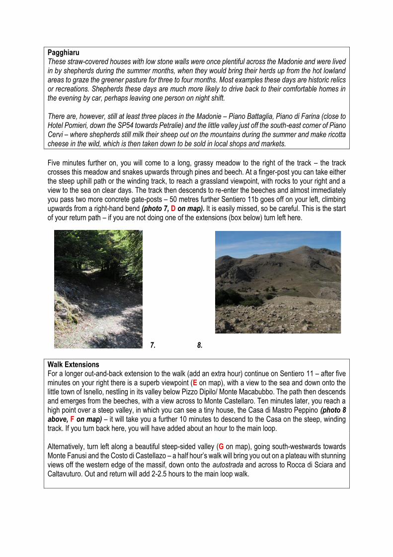
Pagghiaru These straw-covered houses with low stone walls were once plentiful across the Madonie and were lived in by shepherds during the summer months, when they would bring their herds up from the hot lowland areas to graze the greener pasture for three to four months. Most examples these days are historic relics or recreations. Shepherds these days are much more likely to drive back to their comfortable homes in the evening by car, perhaps leaving one person on night shift. There are, however, still at least three places in the Madonie – Piano Battaglia, Piano di Farina (close to Hotel Pomieri, down the SP54 towards Petralie) and the little valley just off the south-east corner of Piano Cervi – where shepherds still milk their sheep out on the mountains during the summer and make ricotta cheese in the wild, which is then taken down to be sold in local shops and markets.
Five minutes further on, you will come to a long, grassy meadow to the right of the track – the track crosses this meadow and snakes upwards through pines and beech. At a finger-post you can take either the steep uphill path or the winding track, to reach a grassland viewpoint, with rocks to your right and a view to the sea on clear days. The track then descends to re-enter the beeches and almost immediately you pass two more concrete gate-posts – 50 metres further Sentiero 11b goes off on your left, climbing upwards from a right-hand bend (photo 7, D on map). It is easily missed, so be careful. This is the start of your return path – if you are not doing one of the extensions (box below) turn left here. 7. 8.
Walk Extensions For a longer out-and-back extension to the walk (add an extra hour) continue on Sentiero 11 – after five minutes on your right there is a superb viewpoint (E on map), with a view to the sea and down onto the little town of Isnello, nestling in its valley below Pizzo Dipilo/ Monte Macabubbo. The path then descends and emerges from the beeches, with a view across to Monte Castellaro. Ten minutes later, you reach a high point over a steep valley, in which you can see a tiny house, the Casa di Mastro Peppino (photo 8 above, F on map) – it will take you a further 10 minutes to descend to the Casa on the steep, winding track. If you turn back here, you will have added about an hour to the main loop. Alternatively, turn left along a beautiful steep-sided valley (G on map), going south-westwards towards Monte Fanusi and the Costo di Castellazo – a half hour’s walk will bring you out on a plateau with stunning views off the western edge of the massif, down onto the autostrada and across to Rocca di Sciara and Caltavuturo. Out and return will add 2-2.5 hours to the main loop walk.

On the main walk, after the 11b turn-off, continue up the steepish climb for five minutes to an open meadow at the top and then descend straight ahead back into the beeches. The road bends right and then left and down into quite a dark part of the beech woods, where the constant coppicing of the beeches has created strange, bulbous trunks covered in moss (photo 9 below). After another five minutes, you reach the bottom and emerge in another long open meadow with forest-clad hills on three sides (H on Map) – as you rise up a short slope, on the right, half-hidden in rocks, you may find wild peonies in the spring (photo 10 below). To continue the walk, turn sharp left down the open meadow, to pick up the track going east. 9. 10.
The Ascent of Monte dei Cervi At this point you have the option of another extension to the walk – the ascent of Monte Cervi (1794 metres, 5830 feet) itself – about 30 minutes each way. Walk straight across the top of the meadow, instead of turning down to the left, and begin to climb up past a group of large trees and follow the path (J on map), first up to the left, then bending rightwards along the ridge and up to the peak (K on map). The climb up is fairly straightforward, with a number of options, BUT it is more difficult to re-trace your steps downwards, as the various rings of trees at the summit look very much the same. This is exacerbated by overcast skies, where you can’t use the sun for orientation. Therefore I would recommend carrying a small ball of ribbon or string and tying a piece to a low branch at each turn or significant change of direction. Alternatively (but more time- consuming) make a small cairn of stones at the same points.
For the main walk, enter the forest at the bottom of the meadow and the track will take you gently downwards, on a lovely trail, back to Piano Cervi – you will soon see a fence running along on your left. After about 50 minutes of delightful forest walking from the turn up Sentiero 11b, you will arrive back at Piano Cervi (photo 11 below). Cut left across the edge of the meadow and on to the track (Sentiero 11) you walked out on. From here it is another 40 minutes back to the Portella Colla. 11.
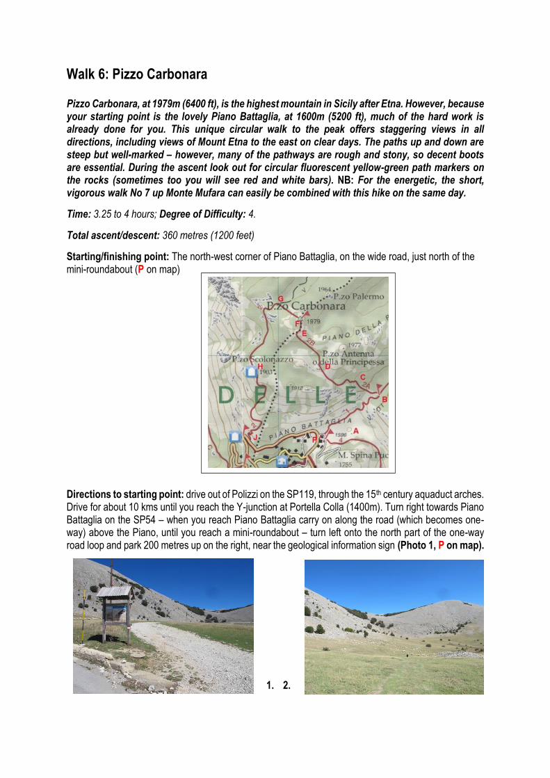
Walk 6: Pizzo Carbonara Pizzo Carbonara, at 1979m (6400 ft), is the highest mountain in Sicily after Etna. However, because your starting point is the lovely Piano Battaglia, at 1600m (5200 ft), much of the hard work is already done for you. This unique circular walk to the peak offers staggering views in all directions, including views of Mount Etna to the east on clear days. The paths up and down are steep but well-marked – however, many of the pathways are rough and stony, so decent boots are essential. During the ascent look out for circular fluorescent yellow-green path markers on the rocks (sometimes too you will see red and white bars). NB: For the energetic, the short, vigorous walk No 7 up Monte Mufara can easily be combined with this hike on the same day.
Time: 3.25 to 4 hours; Degree of Difficulty: 4.
Total ascent/descent: 360 metres (1200 feet)
Starting/finishing point: The north-west corner of Piano Battaglia, on the wide road, just north of the mini-roundabout (P on map)
Directions to starting point: drive out of Polizzi on the SP119, through the 15th century aquaduct arches. Drive for about 10 kms until you reach the Y-junction at Portella Colla (1400m). Turn right towards Piano Battaglia on the SP54 – when you reach Piano Battaglia carry on along the road (which becomes one-way) above the Piano, until you reach a mini-roundabout – turn left onto the north part of the one-way road loop and park 200 metres up on the right, near the geological information sign (Photo 1, P on map).
1. 2.
Piano Battaglia: this beautiful hanging ‘valley’ at 1600m, surrounded by beeches, lies between Monte Mufara and the Pizzo Carbonara massif, and is, in fact, an extensive karst depression. It got its name from a battle (battaglia) that was fought here in the 11th century between the Arabs and the Normans. It serves as the bowl where the ski-slopes of Monte Mufara finish – and in July-September it is a popular site for herds of sheep and cows brought up for the summer grasses. There are a couple of restaurants/ cafes located on the piano, which open during the winter and summer tourist seasons.
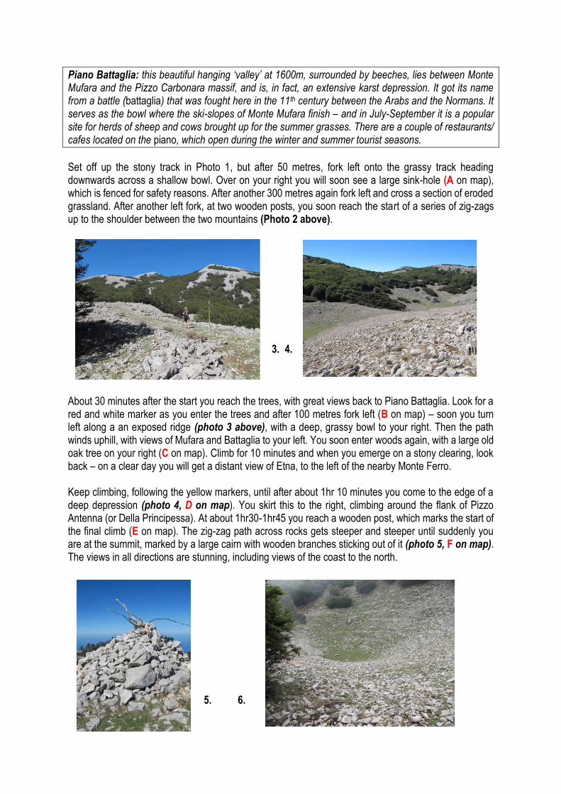
Set off up the stony track in Photo 1, but after 50 metres, fork left onto the grassy track heading downwards across a shallow bowl. Over on your right you will soon see a large sink-hole (A on map), which is fenced for safety reasons. After another 300 metres again fork left and cross a section of eroded grassland. After another left fork, at two wooden posts, you soon reach the start of a series of zig-zags up to the shoulder between the two mountains (Photo 2 above). 3. 4. About 30 minutes after the start you reach the trees, with great views back to Piano Battaglia. Look for a red and white marker as you enter the trees and after 100 metres fork left (B on map) – soon you turn left along a an exposed ridge (photo 3 above), with a deep, grassy bowl to your right. Then the path winds uphill, with views of Mufara and Battaglia to your left. You soon enter woods again, with a large old oak tree on your right (C on map). Climb for 10 minutes and when you emerge on a stony clearing, look back – on a clear day you will get a distant view of Etna, to the left of the nearby Monte Ferro. Keep climbing, following the yellow markers, until after about 1hr 10 minutes you come to the edge of a deep depression (photo 4, D on map). You skirt this to the right, climbing around the flank of Pizzo Antenna (or Della Principessa). At about 1hr30-1hr45 you reach a wooden post, which marks the start of the final climb (E on map). The zig-zag path across rocks gets steeper and steeper until suddenly you are at the summit, marked by a large cairn with wooden branches sticking out of it (photo 5, F on map). The views in all directions are stunning, including views of the coast to the north. 5. 6.

The route down Carbonara starts, unexpectedly, by going north-west towards the sea – look for a series of small posts and the yellow markers. It wends downhill and then enters beech woodland. After about 10-15 minutes from the peak, the path runs around a deep, grassy bowl (photo 6, G on map), where the path turns west and then south. For the next 20-25 minutes, the path runs along the west flank of Carbonara, with great views across to the Cervi massif (photo 7). You walk in and out of beeches, with only gentle uphill and downhill sections. After a sharp uphill section, the path plunges down into a wooded depression and starts to descend – you will see the peak of Pizzo Scalonazzo (1903m) above you and a ruined hut on the hillside (H on map). 7. 8. On a flat, open section of the descent, you get great views of Monte Mufara and the rear of the Quacella. After about 50-55 minutes the path starts to zig-zag more steeply downwards, first in the beeches then on the bare hillside. The final section is a series of long hair-pins which descend the curved flank of the mountain. After about 1hr20mins from the summit the path descends to a car-park (photo 8, J on map) on the loop road around Piano Battaglia. Walk straight ahead on the road, which bend leftwards, and in about 10 minutes you will be back at your car.
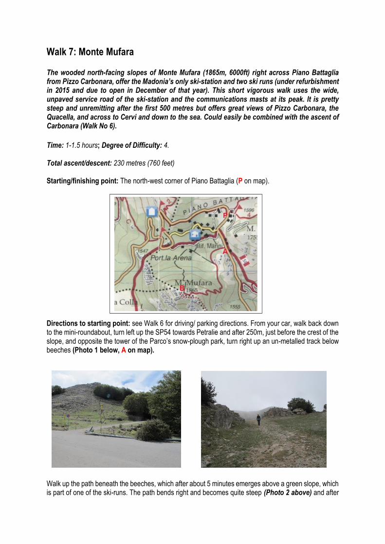
Walk 7: Monte Mufara The wooded north-facing slopes of Monte Mufara (1865m, 6000ft) right across Piano Battaglia from Pizzo Carbonara, offer the Madonia’s only ski-station and two ski runs (under refurbishment in 2015 and due to open in December of that year). This short vigorous walk uses the wide, unpaved service road of the ski-station and the communications masts at its peak. It is pretty steep and unremitting after the first 500 metres but offers great views of Pizzo Carbonara, the Quacella, and across to Cervi and down to the sea. Could easily be combined with the ascent of Carbonara (Walk No 6).
Time: 1-1.5 hours; Degree of Difficulty: 4. Total ascent/descent: 230 metres (760 feet) Starting/finishing point: The north-west corner of Piano Battaglia (P on map). Directions to starting point: see Walk 6 for driving/ parking directions. From your car, walk back down to the mini-roundabout, turn left up the SP54 towards Petralie and after 250m, just before the crest of the slope, and opposite the tower of the Parco’s snow-plough park, turn right up an un-metalled track below beeches (Photo 1 below, A on map). Walk up the path beneath the beeches, which after about 5 minutes emerges above a green slope, which is part of one of the ski-runs. The path bends right and becomes quite steep (Photo 2 above) and after

about 15 minutes, the hair-pin bends begin. About 15 minutes later the track flattens out, with fabulous views of Carbonara to your right, and runs around a rocky depression to the ski-station (B on map). To your right at the top you get great views of the Quacella formation – and if you climb the rocks in front of you, to the left of the communications masts, there are also great viewpoints over Piano Cervi, Pizzo Cervi and beyond. [NB: it is quite likely that the layout at the top may have changed by 2016, due to the construction of the ski-station at the end of 2015]