Embed Size (px)
Citation preview

The Agusta Westland 139
An introduction, overview, and utilization for Law Enforcement
Objectives
• Overview of the Aviation Command
• Introduction to the AW-139
• Review of utilization
• Review landing zone requirements and considerations
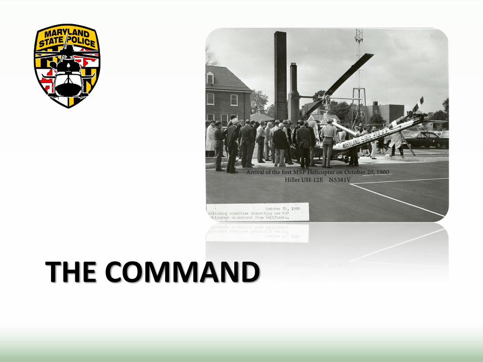
THE COMMAND

Mission
The Maryland State Police Aviation Command is a public safety organization. Our mission is to protect and improve the quality of life through the airborne delivery of emergency medical, law enforcement, search and rescue, homeland security and disaster assessment services to citizens of the State of Maryland and its neighbors 24 hours a day.
Brief History
• Established November 1, 1960
• Partnered with R Adams Cowley in 1970
• First civilian medevac on March 19, 1970
• Fleet upgrade to AS-365 (Dauphin) in the late 1980s
• Over 135,000 patients transported
• Nine fallen heroes

Command Personnel
• 151 personnel – 75 sworn
– 76 civilian
• 91 Flight crew
• 27 maintenance personnel
• 7 sections
• 11 AS-365 – Eurocopter Dauphin
• 2 Fixed-Wing – King Air B350
– Cessna P-210
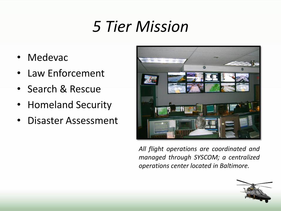
5 Tier Mission
• Medevac
• Law Enforcement
• Search & Rescue
• Homeland Security
• Disaster Assessment
All flight operations are coordinated and managed through SYSCOM; a centralized operations center located in Baltimore.
The Recent Evolution
• House EMS workgroup & roadmap – A House EMS Workgroup was convened to evaluate the State’s
needs, the current Command, and provided a path for the future.
• NTSB recommendations – The National Transportation Safety Board offered numerous
recommendations for improvement.
• Replacement of aging helicopter fleet
The Recent Evolution
• Enhancement of crew configuration – Increase minimum crew from one pilot and paramedic to a 4
person crew consisting of 2 pilots and 2 medical providers.
• Updated leadership structure – Creation of new key positions aligned with professional aviation
enterprises.
• Pursuit of FAA Part 135 certification
• Pursuit of air medical accreditation

System Enhancements
• Computerized Risk Matrix
• Adoption of FAA Part 135 guidelines – Weather
– En-route decision point
• Terrain Awareness and Warning Systems (TAWS)
• Scenario based crew training and evaluation
• Specialized certification of Syscom Duty Officers
• New Aircraft to fill safety equipment voids – 4 axis Auto Pilot / Night Vision Goggles / HTAWS
• Enhanced crew configuration

THE NEW AIRCRAFT
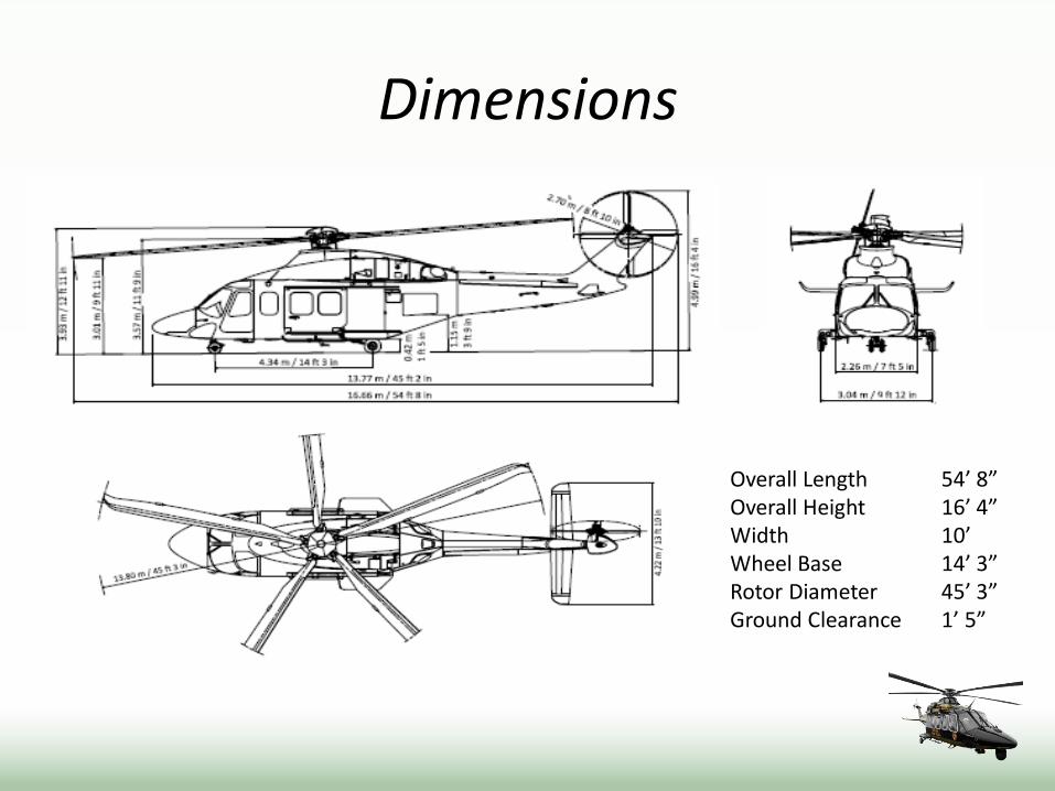
Dimensions
Overall Length 54’ 8” Overall Height 16’ 4” Width 10’ Wheel Base 14’ 3” Rotor Diameter 45’ 3” Ground Clearance 1’ 5”

Comparison Specification AS-365 AW-139
Maximum Overall Length 44’ 4” 54’ 8”
Maximum Gross Weight 9,480 lbs. 14,991 lbs.
Power Plants (2) Arriel® 1C1 turbines
724 shp each
(2) Pratt & Whittney® PT6C-67C turboshafts 1,872 shp each
Maximum Air Speed 165 mph 170 mph
Searchlight Nightsun® Trakka®
Imaging Device Forward looking infra-red
(FLIR) Wescam MX15i color camera
plus infra-red
Minimum Staffing 1 Pilot
1 Flight Paramedic
2 Pilots 1 Crew Chief
1 Rescue Technician
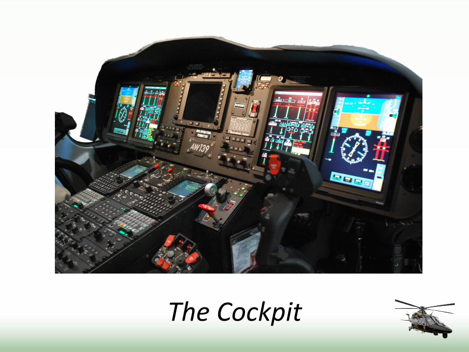
The Cockpit
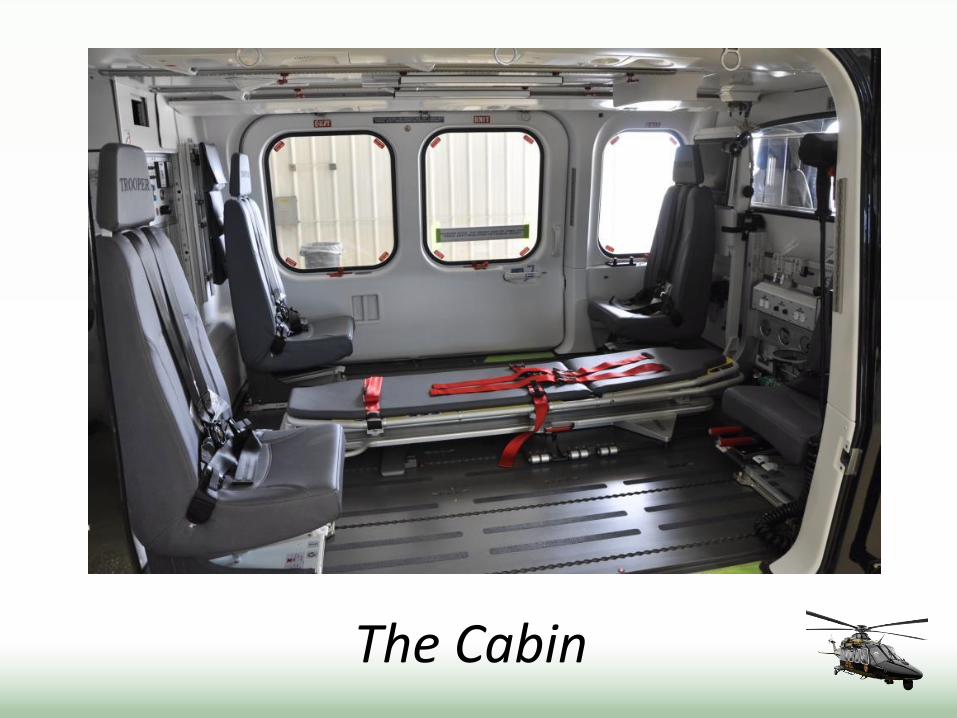
The Cabin

Forward Cabin

Aft Cabin
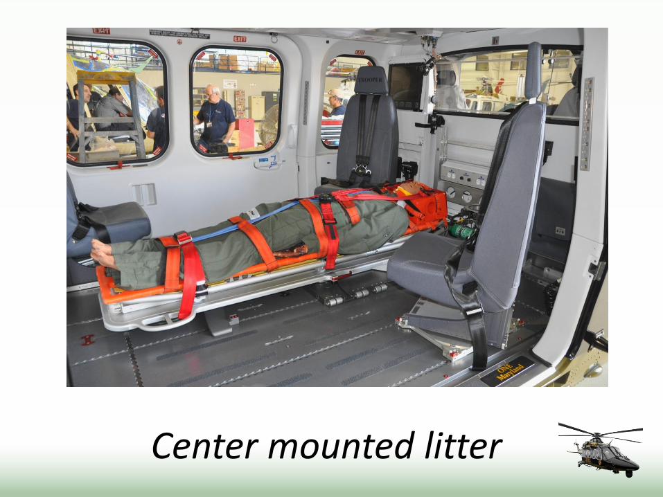
Center mounted litter

Two patient configuration
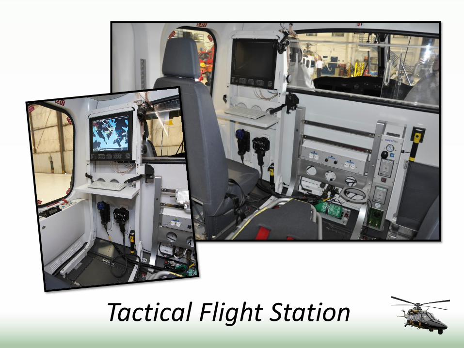
Tactical Flight Station
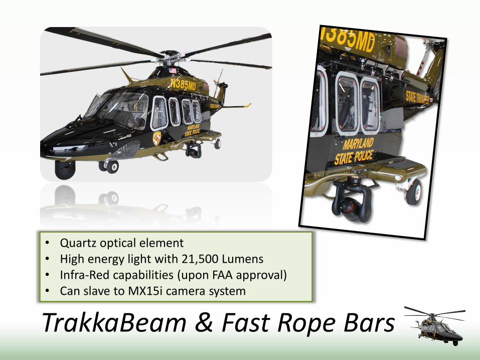
TrakkaBeam & Fast Rope Bars
• Quartz optical element • High energy light with 21,500 Lumens • Infra-Red capabilities (upon FAA approval) • Can slave to MX15i camera system

Hoist
• Retractable unit • 300 feet of spin resistant cable • 600 pound lifting capacity • Operates at 250 feet per minute • Dedicated light for night rescue

Wescam MX15i
• Modes • Infra-red • Color day • Color night
• Large flat screen monitor • Built in GPS for lock on address
or station • Auto sweep feature • Can downlink to aircraft
provided tablet • Allows for greater stand-off
distance making aircraft undetectable.
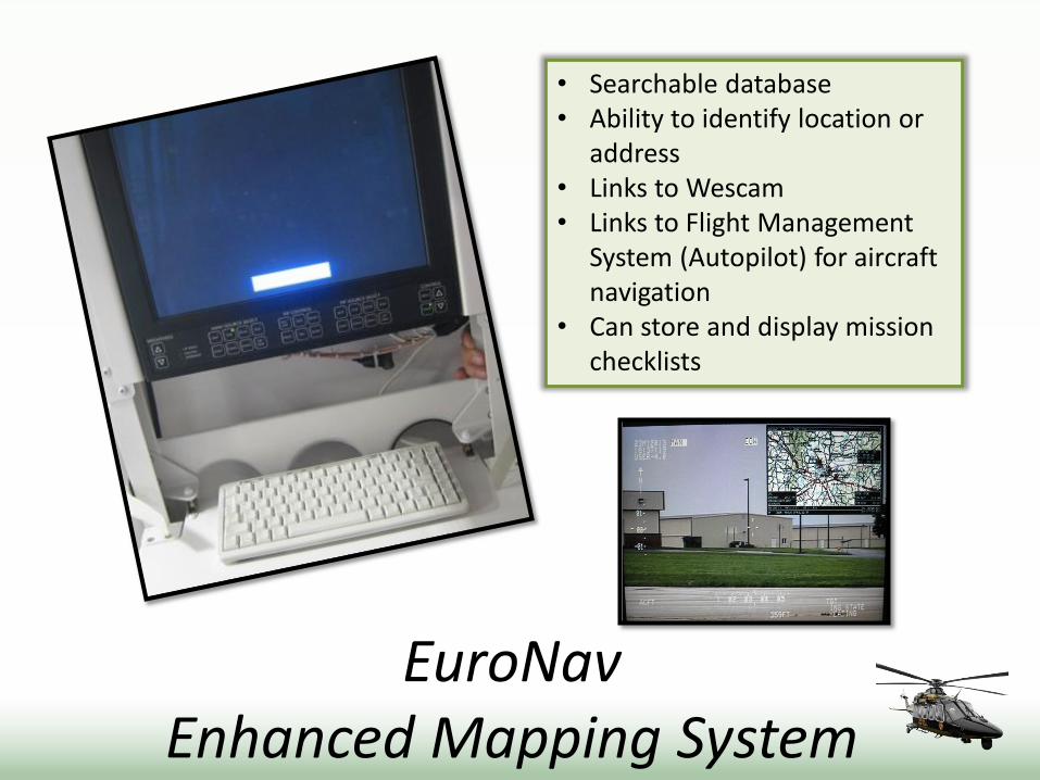
EuroNav Enhanced Mapping System
• Searchable database • Ability to identify location or
address • Links to Wescam • Links to Flight Management
System (Autopilot) for aircraft navigation
• Can store and display mission checklists

EuroNav Various Maps
Street Map Aeronautical VFR Sectional
Topographical (1:250K) IFR En Route Low

ULTILIZATION
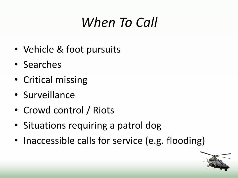
When To Call
• Vehicle & foot pursuits
• Searches
• Critical missing
• Surveillance
• Crowd control / Riots
• Situations requiring a patrol dog
• Inaccessible calls for service (e.g. flooding)
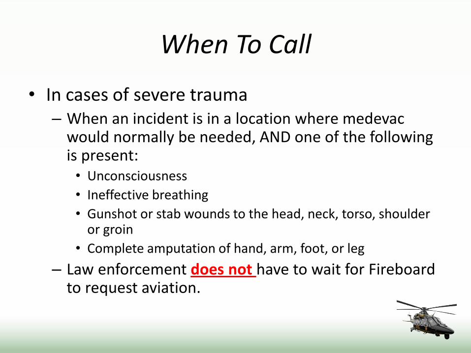
When To Call
• In cases of severe trauma – When an incident is in a location where medevac
would normally be needed, AND one of the following is present: • Unconsciousness
• Ineffective breathing
• Gunshot or stab wounds to the head, neck, torso, shoulder or groin
• Complete amputation of hand, arm, foot, or leg
– Law enforcement does not have to wait for Fireboard to request aviation.
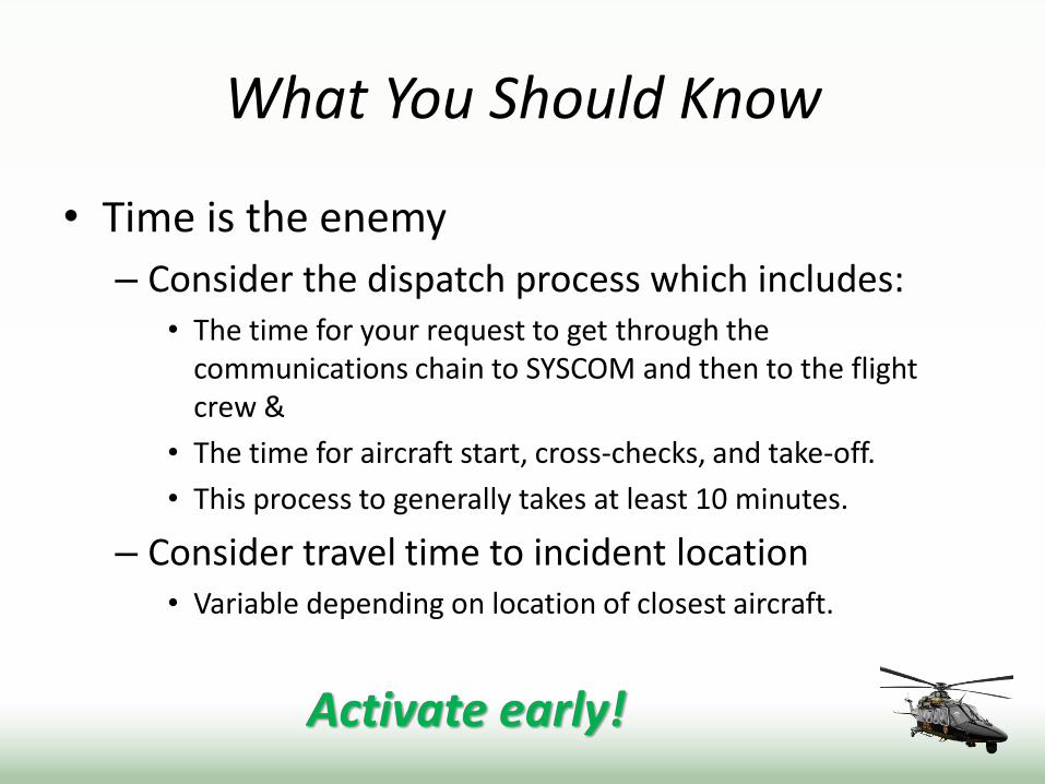
What You Should Know
• Time is the enemy
– Consider the dispatch process which includes: • The time for your request to get through the
communications chain to SYSCOM and then to the flight crew &
• The time for aircraft start, cross-checks, and take-off.
• This process to generally takes at least 10 minutes.
– Consider travel time to incident location • Variable depending on location of closest aircraft.
Activate early!
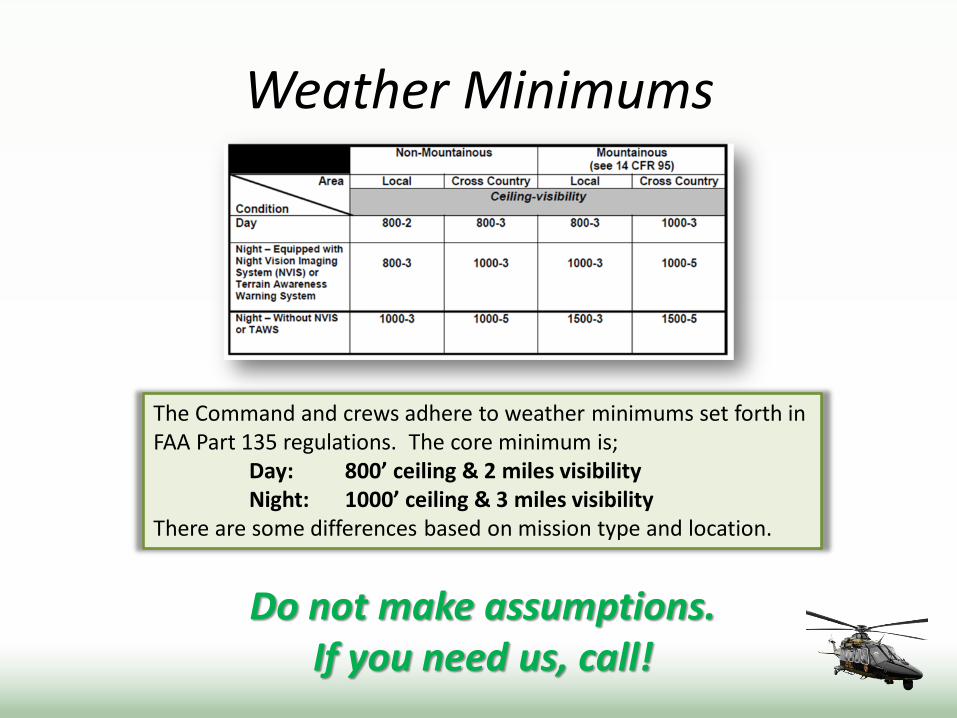
Weather Minimums
Do not make assumptions. If you need us, call!
The Command and crews adhere to weather minimums set forth in FAA Part 135 regulations. The core minimum is; Day: 800’ ceiling & 2 miles visibility Night: 1000’ ceiling & 3 miles visibility There are some differences based on mission type and location.
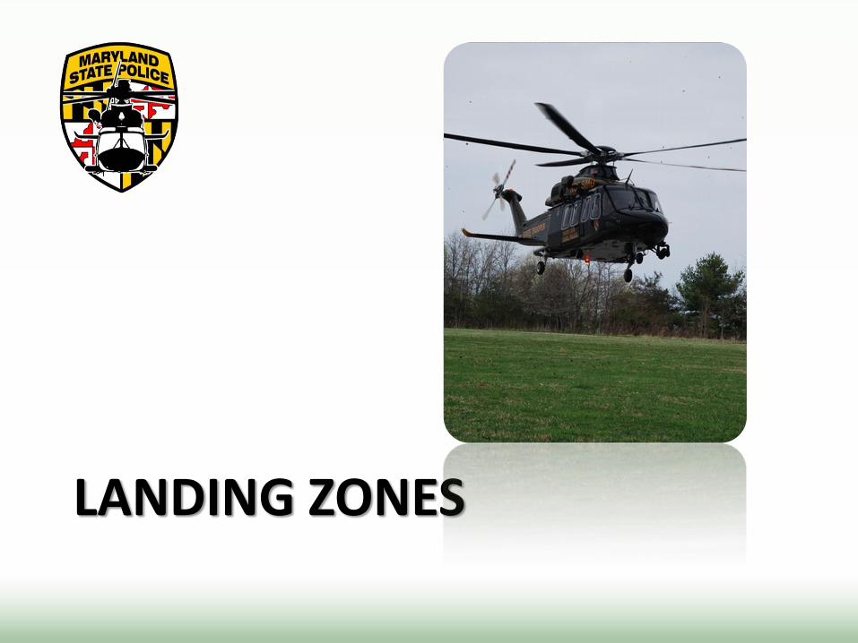
LANDING ZONES
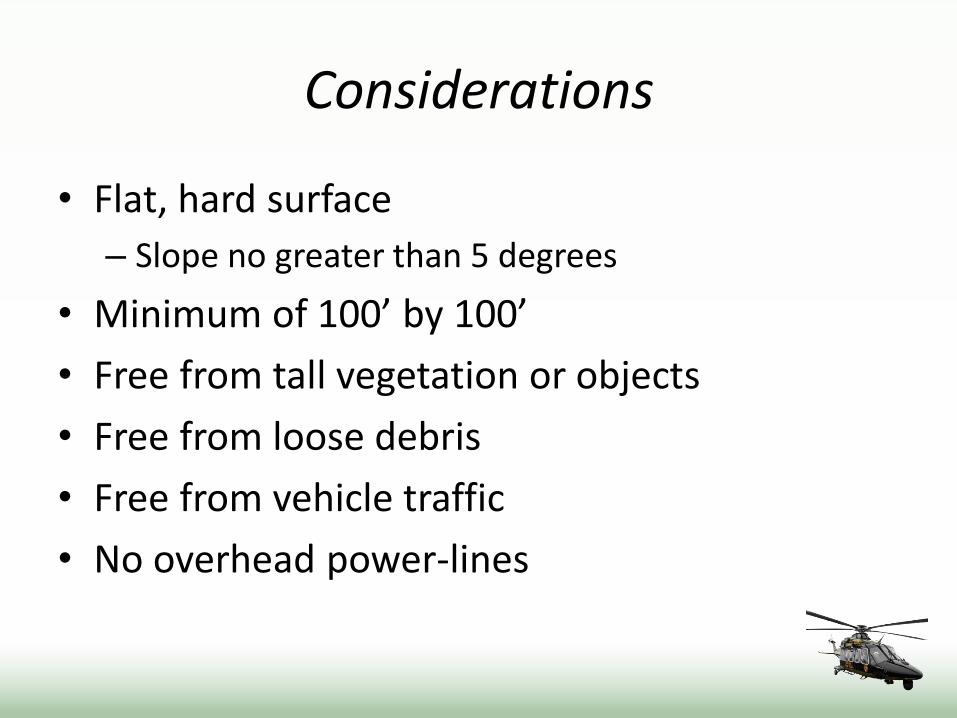
Considerations
• Flat, hard surface
– Slope no greater than 5 degrees
• Minimum of 100’ by 100’
• Free from tall vegetation or objects
• Free from loose debris
• Free from vehicle traffic
• No overhead power-lines

GPS Coordinates
• If you provide GPS coordinates to a location or landing zone, verify the proper format.
Degrees, Decimal Minutes (NXX° XX.XX’ WXXX° XX.XX’)
Decimal Degrees (XX.XXX° -°XX.XXX)
Degrees, Minutes, Seconds (NXX° XX’ XX.XX” WXXX° XX’ XX.XX”)

Crew considerations
• The crew must take certain factors into consideration during landing. These may guide the crew to changing the previously chosen LZ and include: – Winds
– Temperature
– Humidity
– Fuel on-board
– Number currently and expected to be onboard
– Mission type

LZ Safety Video
Click on the link below to review the AW139 safety video.
Landing Zone Safety Video
Special thanks to MPCTC and Mr. David Spikes for helping to make the video presentation.

Thank you for taking time to review this introduction and overview of the MSP Aviation Command and our new fleet of Agusta Westland 139 helicopters. We are excited about what this aircraft has to offer the State, the citizens, and all our allied agencies.
410-238-5800 [email protected]


![Basic Theory of Helicopter [Eurocopter]](https://img.pdfslide.net/doc/110x75/577cdae21a28ab9e78a6c99a/basic-theory-of-helicopter-eurocopter.jpg)