Embed Size (px)
Citation preview
The Centre for Australian Weather and Climate ResearchA partnership between CSIRO and the Bureau of Meteorology
Nowcasting and Short Range NWP at the Australian Bureau of Meteorology
Peter Steinle
Earth System Modelling Group
Alan Seed
Weather & Environmental Prediction Group
The Centre for Australian Weather and Climate Research A partnership between CSIRO and the Bureau of Meteorology
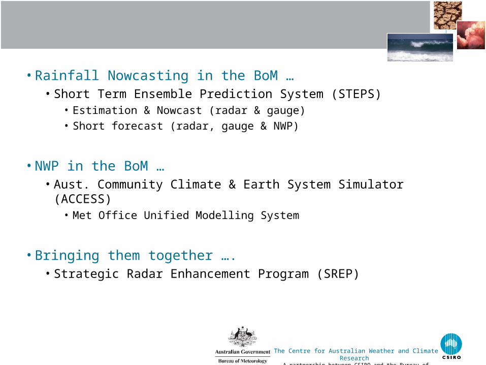
• Rainfall Nowcasting in the BoM …• Short Term Ensemble Prediction System (STEPS)
• Estimation & Nowcast (radar & gauge)• Short forecast (radar, gauge & NWP)
• NWP in the BoM … • Aust. Community Climate & Earth System Simulator (ACCESS)
• Met Office Unified Modelling System
• Bringing them together …. • Strategic Radar Enhancement Program (SREP)
The Centre for Australian Weather and Climate Research A partnership between CSIRO and the Bureau of Meteorology
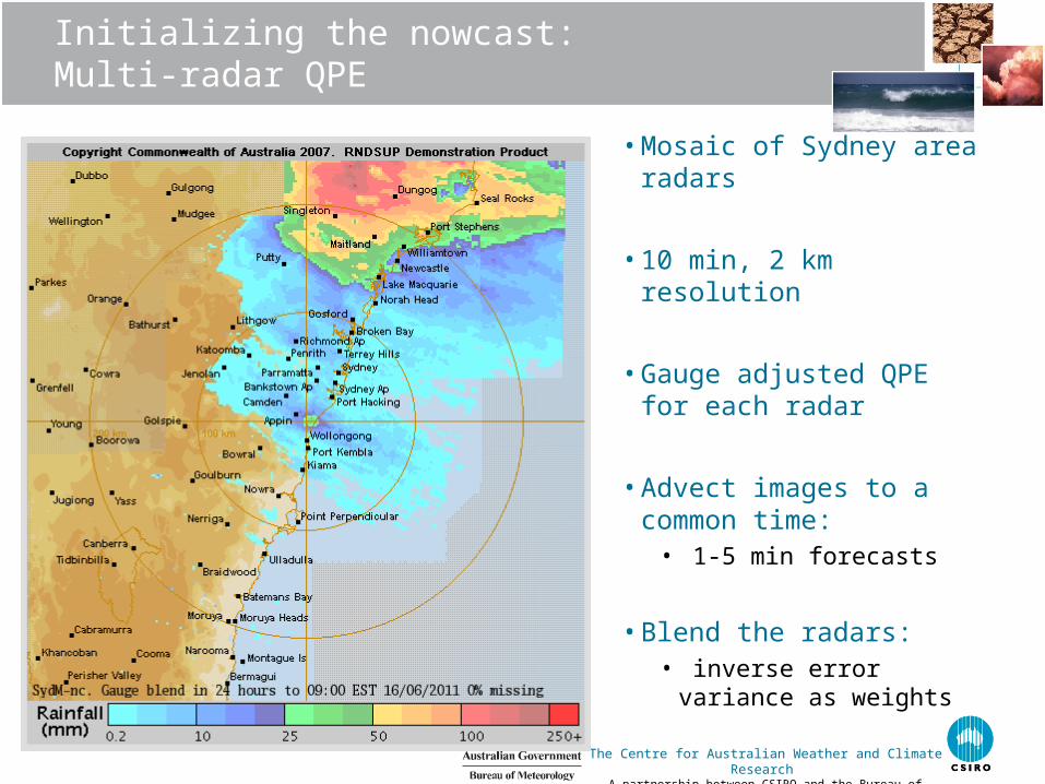
Initializing the nowcast:Multi-radar QPE
• Mosaic of Sydney area radars
• 10 min, 2 km resolution
• Gauge adjusted QPE for each radar
• Advect images to a common time:
• 1-5 min forecasts
• Blend the radars:• inverse error variance as
weights
The Centre for Australian Weather and Climate Research A partnership between CSIRO and the Bureau of Meteorology
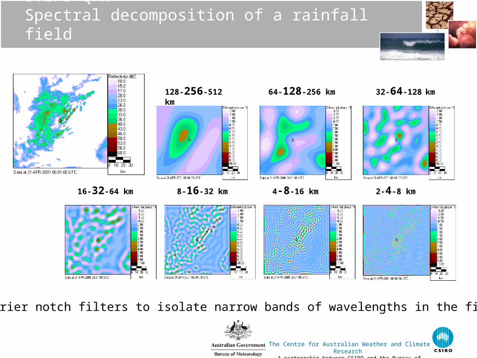
STEPS QPNSpectral decomposition of a rainfall field
128-256-512 km
64-128-256 km
32-64-128 km
16-32-64 km 8-16-32 km 2-4-8 km4-8-16 km
Use Fourier notch filters to isolate narrow bands of wavelengths in the field
The Centre for Australian Weather and Climate Research A partnership between CSIRO and the Bureau of Meteorology
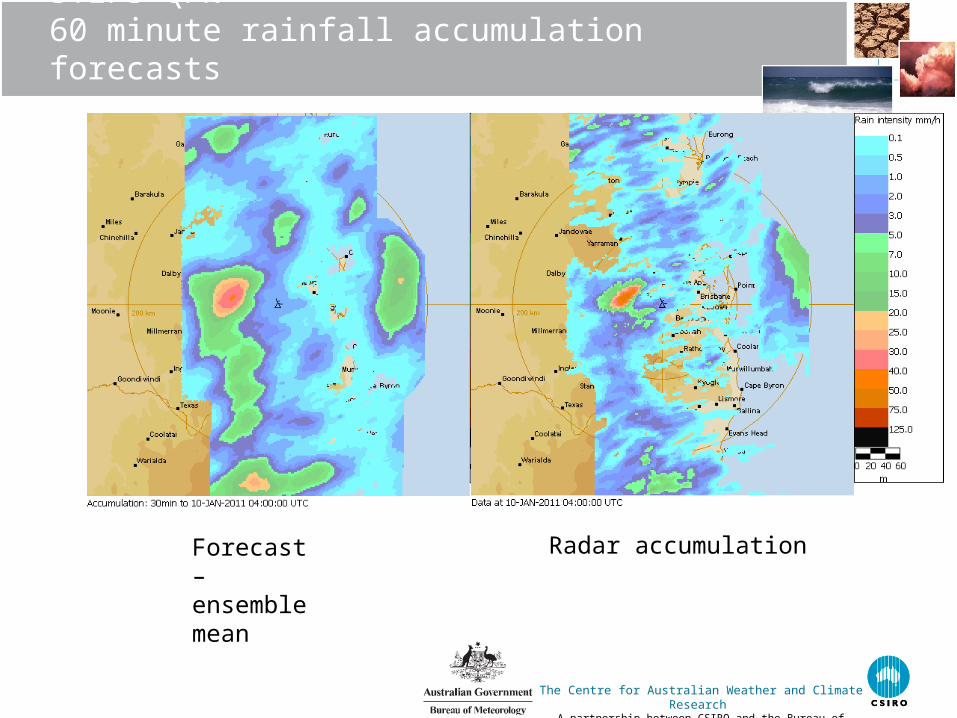
STEPS QPN60 minute rainfall accumulation forecasts
Forecast – ensemble mean
Radar accumulation
The Centre for Australian Weather and Climate Research A partnership between CSIRO and the Bureau of Meteorology
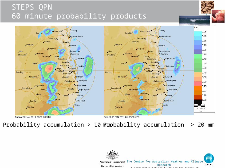
STEPS QPN60 minute probability products
Probability accumulation > 10 mm Probability accumulation > 20 mm
The Centre for Australian Weather and Climate Research A partnership between CSIRO and the Bureau of Meteorology
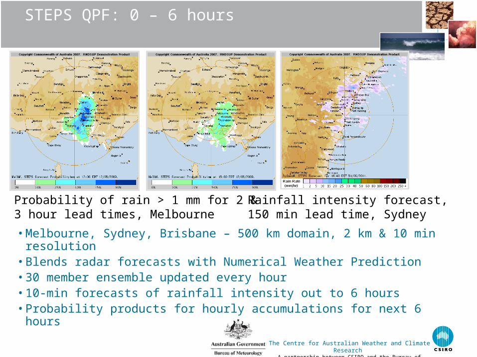
STEPS QPF: 0 – 6 hours
• Melbourne, Sydney, Brisbane – 500 km domain, 2 km & 10 min resolution
• Blends radar forecasts with Numerical Weather Prediction • 30 member ensemble updated every hour• 10-min forecasts of rainfall intensity out to 6 hours• Probability products for hourly accumulations for next 6 hours
Probability of rain > 1 mm for 2 & 3 hour lead times, Melbourne
Rainfall intensity forecast, 150 min lead time, Sydney
The Centre for Australian Weather and Climate Research A partnership between CSIRO and the Bureau of Meteorology
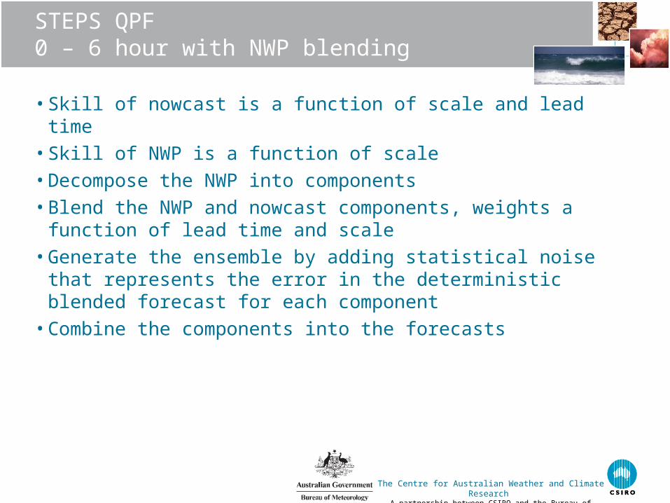
STEPS QPF 0 – 6 hour with NWP blending
• Skill of nowcast is a function of scale and lead time• Skill of NWP is a function of scale• Decompose the NWP into components• Blend the NWP and nowcast components, weights a function of lead
time and scale• Generate the ensemble by adding statistical noise that represents the
error in the deterministic blended forecast for each component• Combine the components into the forecasts
The Centre for Australian Weather and Climate Research A partnership between CSIRO and the Bureau of Meteorology
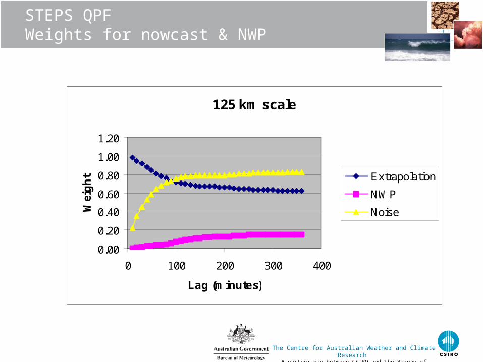
STEPS QPFWeights for nowcast & NWP
Ble
nd
ing
500 km scale
0.00
0.20
0.40
0.60
0.80
1.00
1.20
0 100 200 300 400
Lag (minutes)
Wei
gh
t Extrapolation
NWP
Noise
125 km scale
0.00
0.20
0.40
0.60
0.80
1.00
1.20
0 100 200 300 400
Lag (minutes)
Wei
gh
t Extrapolation
NWP
Noise

The Centre for Australian Weather and Climate Research A partnership between CSIRO and the Bureau of Meteorology
NWP systems
Global: N320 (~40km) + 4dVAR
Regional 0.11o +4dVAR
City: 4km ; no DA
• Met Office Unified Model (UM7.5,L70)• 6 hourly 4dVAR : Global, Region & TC
• 4km City Systems• No Assimilation (3dVAR expt.)
• 1.5km UM7.6/L70 (Experimental)• 3dVAR
• + radar winds & precip(LHN)
• Relocatable
• Ensembles• Global & Regional EPS in research• Need deterministic high res.
The Centre for Australian Weather and Climate Research A partnership between CSIRO and the Bureau of Meteorology
SREP to deliver:
• 4 new radars delivering QPE & F products as appropriate for radar location
• STEPS blending radar nowcasts with NWP in the Capital Cities
• NWP assimilating radar data operationally• Start with Latent Heat Nudging for simplicity & baseline• Begin moving to VAR soon
• Rapid update cycle and relocatable domains tested and made ready for transition into operations
• Prototype radar QC system ready for transition into operations
The Centre for Australian Weather and Climate Research A partnership between CSIRO and the Bureau of Meteorology
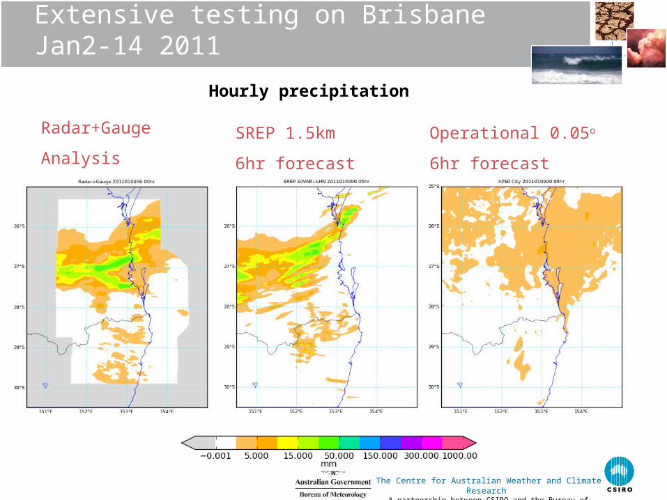
Extensive testing on Brisbane Jan2-14 2011
Radar+Gauge
Analysis
SREP 1.5km
6hr forecast
Operational 0.05o
6hr forecast
Hourly precipitation
The Centre for Australian Weather and Climate Research A partnership between CSIRO and the Bureau of Meteorology
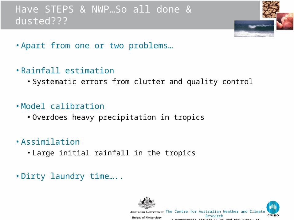
Have STEPS & NWP…So all done & dusted???
• Apart from one or two problems…
• Rainfall estimation• Systematic errors from clutter and quality control
• Model calibration• Overdoes heavy precipitation in tropics
• Assimilation • Large initial rainfall in the tropics
• Dirty laundry time…..
The Centre for Australian Weather and Climate Research A partnership between CSIRO and the Bureau of Meteorology
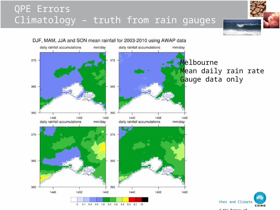
QPE Errors Climatology – truth from rain gauges
Melbourne Mean daily rain rateGauge data only
The Centre for Australian Weather and Climate Research A partnership between CSIRO and the Bureau of Meteorology
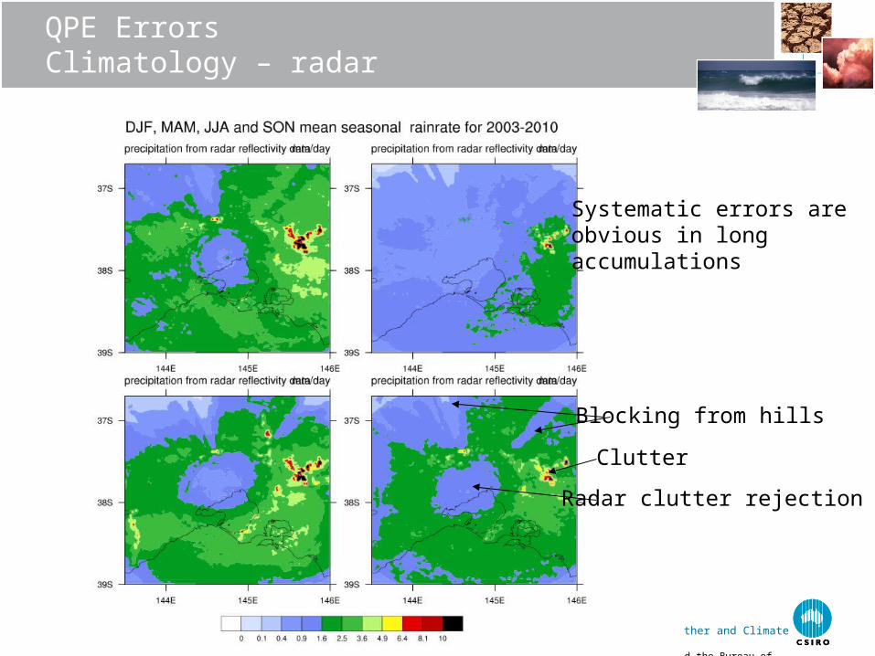
QPE ErrorsClimatology – radar
Blocking from hills
Clutter
Systematic errors areobvious in long accumulations
Radar clutter rejection
The Centre for Australian Weather and Climate Research A partnership between CSIRO and the Bureau of Meteorology
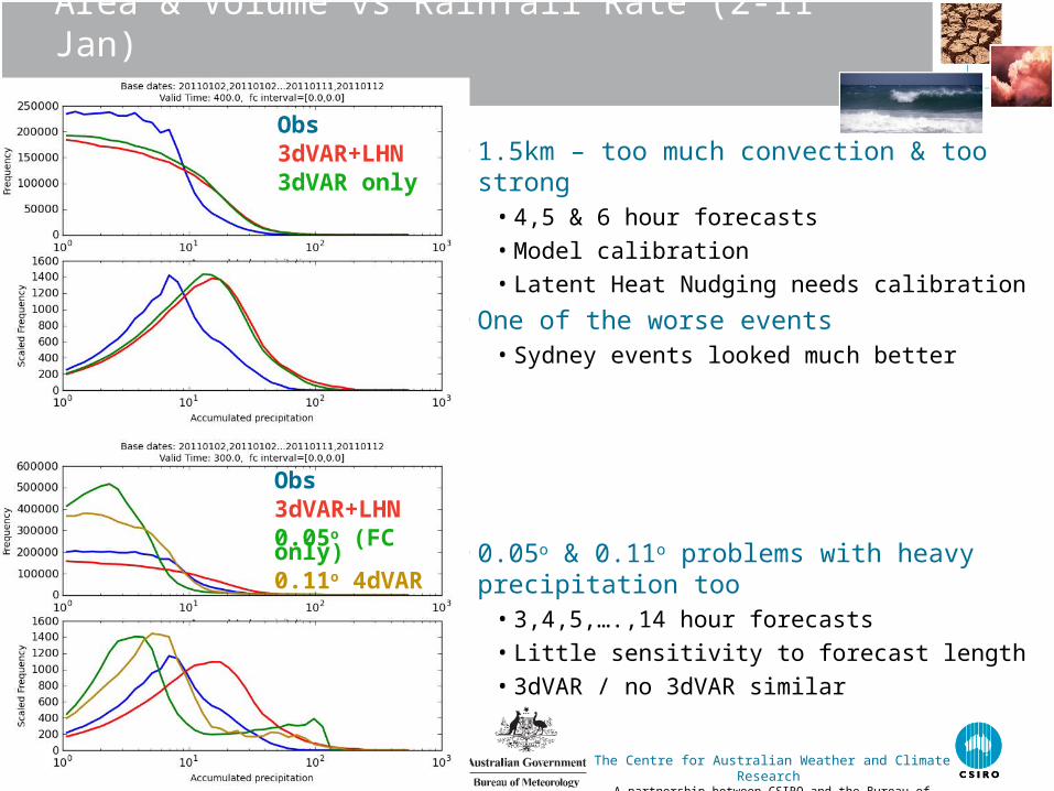
Area & Volume vs Rainfall Rate (2-11 Jan)
• 1.5km – too much convection & too strong• 4,5 & 6 hour forecasts
• Model calibration
• Latent Heat Nudging needs calibration
• One of the worse events• Sydney events looked much better
• 0.05o & 0.11o problems with heavy precipitation too
• 3,4,5,….,14 hour forecasts
• Little sensitivity to forecast length
• 3dVAR / no 3dVAR similar
Obs3dVAR+LHN3dVAR only
Obs3dVAR+LHN0.05o (FC only)0.11o 4dVAR
The Centre for Australian Weather and Climate Research A partnership between CSIRO and the Bureau of Meteorology
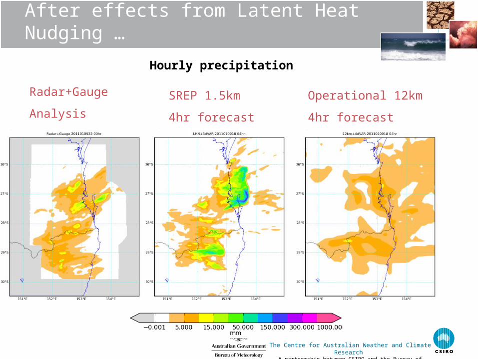
After effects from Latent Heat Nudging …
Radar+Gauge
Analysis
SREP 1.5km
4hr forecast
Operational 12km
4hr forecast
Hourly precipitation
The Centre for Australian Weather and Climate Research A partnership between CSIRO and the Bureau of Meteorology
Summary
• Rainfall nowcasting established• In the queue for operations
• Improved radar quality control being tested
• NWP “developing”• Seems better much behaved away from tropics
• More extensive trials in Sydney underway
• Tropical NWP still a challenge• Restrain LHN
• Systems are in place• Analysis → Nowcast → NWP blend → NWP
• Calibration/tuning of components ongoing