Embed Size (px)
Citation preview
Oregon Military Department
Office Of Emergency Management
The Impacts of the
Cascadia Subduction
Zone Earthquake on
Oregon

Everything you wanted to
know about plate tectonics…
… in 30 seconds or less
– Tectonic Plates move
around
– Tectonic Plates spread
apart and create new
land
– Tectonic Plates dive
under each other
– Tectonic Plates roll over
each other
SOURCE: http://sos.noaa.gov/videos/Scotese.mov

What are the
geologic hazards
in Oregon?
• Earthquakes
• Volcanoes
• Tsunami
• Landslides

Earthquakes
• Earthquakes occur when rock
underground suddenly breaks along a
fault. This sudden release of energy
causes the seismic waves that make
the ground shake.
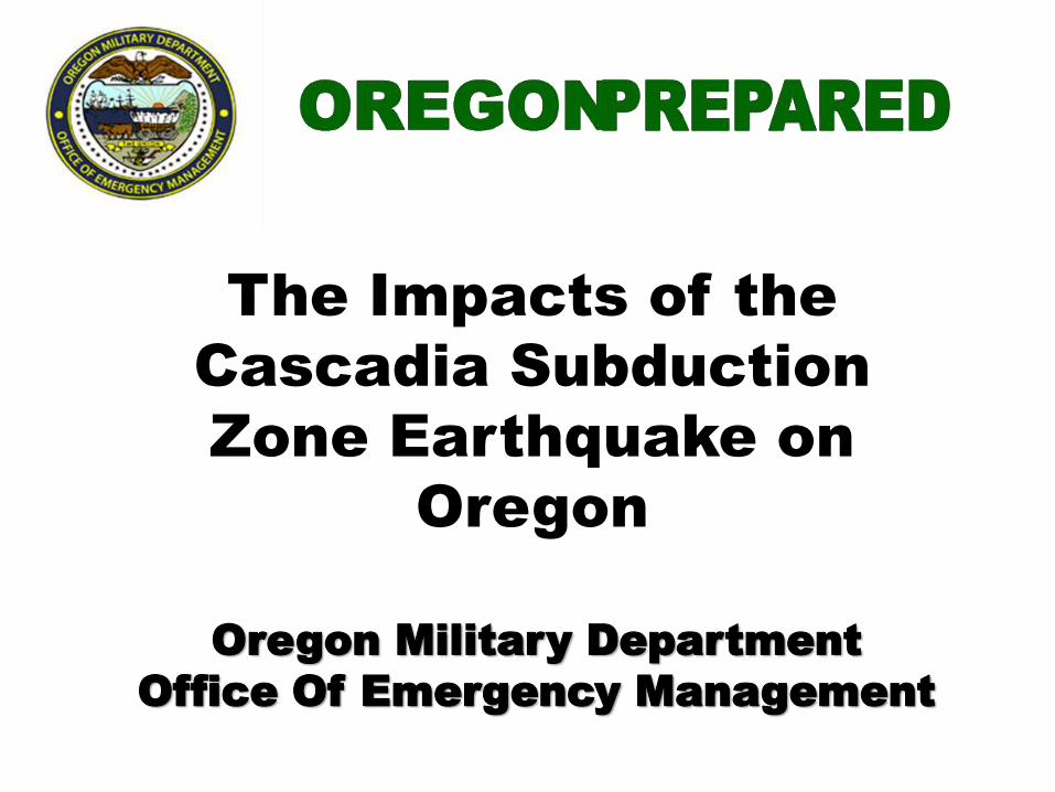
Tsunamis
• Tsunamis are generated
when geologic events cause
large, rapid movements in the
sea floor that displace the
water column above.
• The Pacific Coast is at risk
both from locally and
distantly generated tsunamis.
• Earthquakes
– Cascadia Subduction Zone
– Crustal
– Deep Intraplate
– Volcanic
• Tsunami
– Local (from subduction zone off our
coast)
– Distant (from subduction zone
elsewhere)

What is the Cascadia Subduction Zone?

Know your Cascadia
Subduction Zone
• 600 miles long, from northern California
to British Columbia
• Capable of producing very large
earthquakes (M9+) that impact a wide
area
• Similar in size and impact to the 2004
Sumatra earthquake
• Can produce devastating tsunamis
• 37% chance of a mega-thrust
earthquake in the next 50 years *

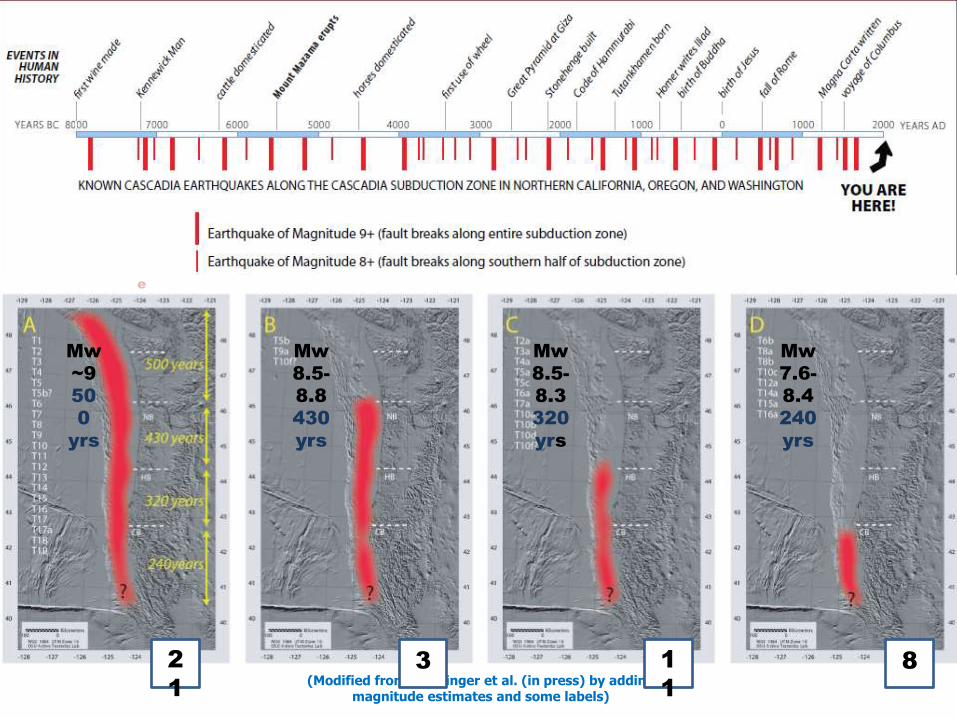
• Last Cascadia Subduction
Zone earthquake occurred in
1700
• When will the next one occur?
– We just don’t know
• Average recurrence:
– 240 years (south of Cape Blanco)
– 5-600 years (entire length)
– 190-1,200 years between EQ
Ghost forest at Copalis River, WA
Mw
~9
50
0
yrs
Mw
8.5-
8.8
430
yrs
Mw
8.5-
8.3
320
yrs
Mw
7.6-
8.4
240
yrs
(Modified from Goldfinger et al. (in press) by adding magnitude estimates and some labels)
Recurrenc
e
2
1
3 1
1
8
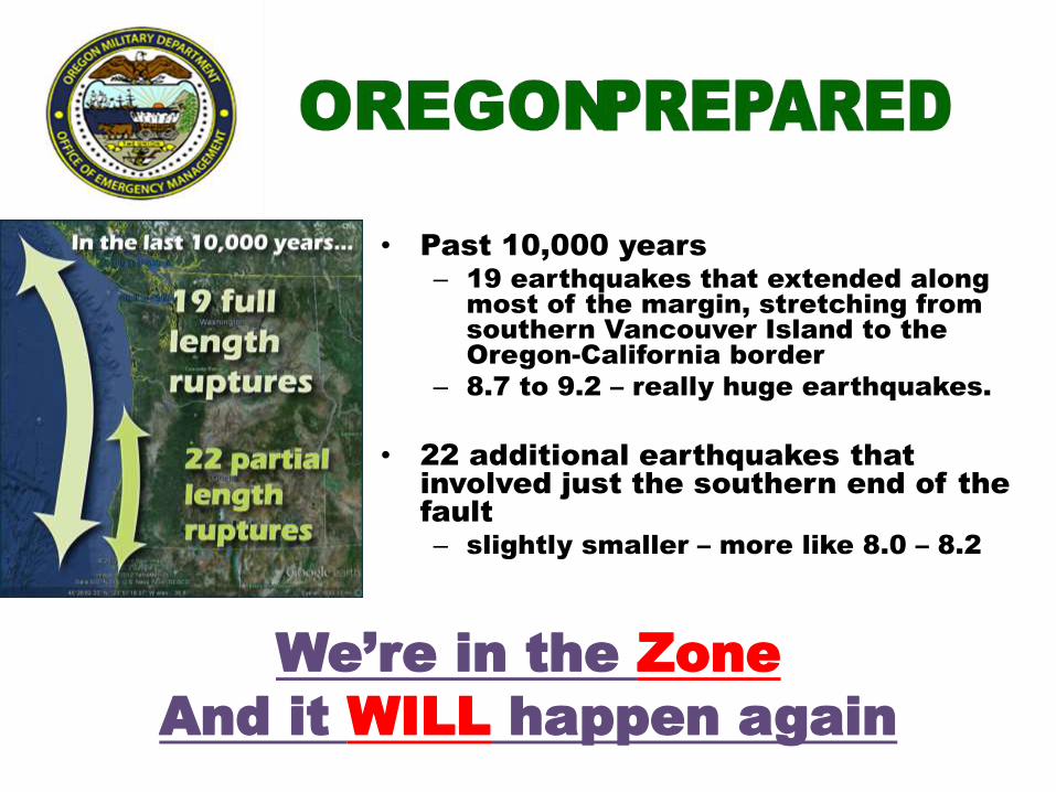
• Past 10,000 years
– 19 earthquakes that extended along
most of the margin, stretching from
southern Vancouver Island to the
Oregon-California border
– 8.7 to 9.2 – really huge earthquakes.
• 22 additional earthquakes that
involved just the southern end of the
fault
– slightly smaller – more like 8.0 – 8.2
We’re in the Zone
And it WILL happen again

Cascadia
=
Strong Shaking
and Tsunami
• Strong Ground Shaking
– M9 w/ 2 - 4 min shaking
• Tsunami
– within 15 to 25 minutes
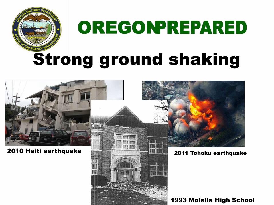
Strong ground shaking
2010 Haiti earthquake 2011 Tohoku earthquake
1993 Molalla High School
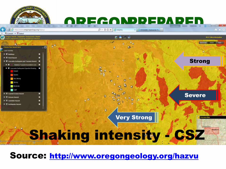
Shaking intensity - CSZ
Source: http://www.oregongeology.org/hazvu
Strong
Very Strong
Severe
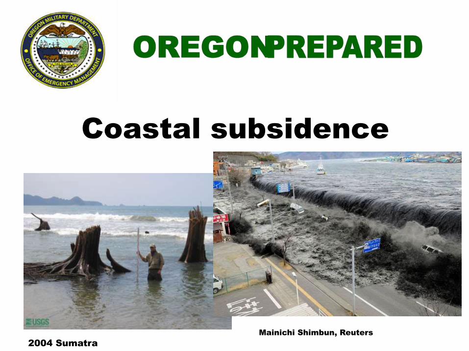
2004 Sumatra
Coastal subsidence
Mainichi Shimbun, Reuters
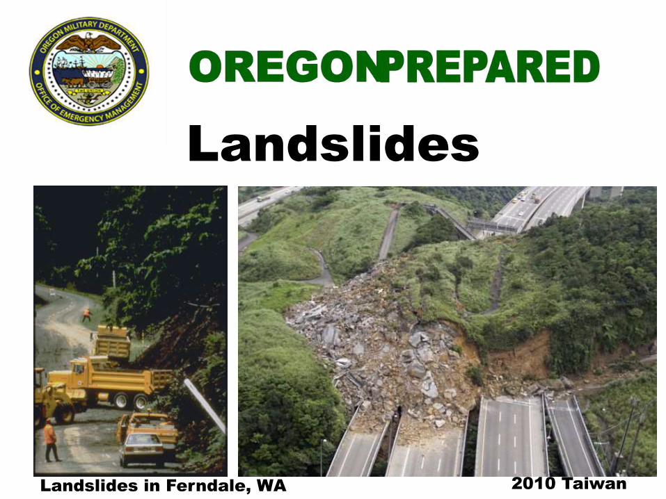
Landslides in Ferndale, WA
Landslides
2010 Taiwan
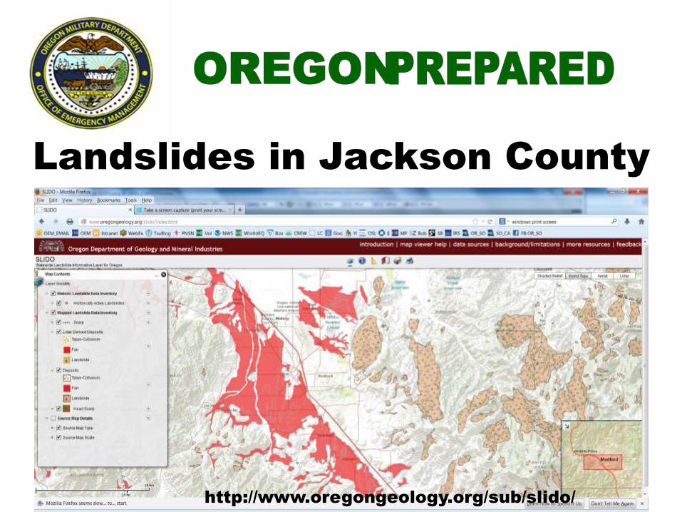
Landslides in Jackson County
http://www.oregongeology.org/sub/slido/
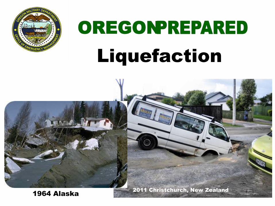
1964 Alaska 2011 Christchurch, New Zealand
Liquefaction

Liquefaction
Source: http://www.oregongeology.org/hazvu

2004 Indonesian tsunami
Tsunami
2011 Tohoku tsunami
Tsunami
• Local – Caused by a subduction zone
earthquake near the Oregon shore
• Distant – Caused by a subduction zone
earthquake far away from the Oregon
shore
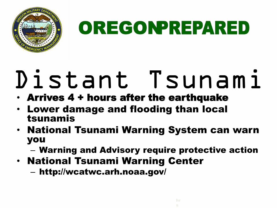
Distant Tsunami • Arrives 4 + hours after the earthquake
• Lower damage and flooding than local
tsunamis
• National Tsunami Warning System can warn
you
– Warning and Advisory require protective action
• National Tsunami Warning Center
– http://wcatwc.arh.noaa.gov/
hr
s
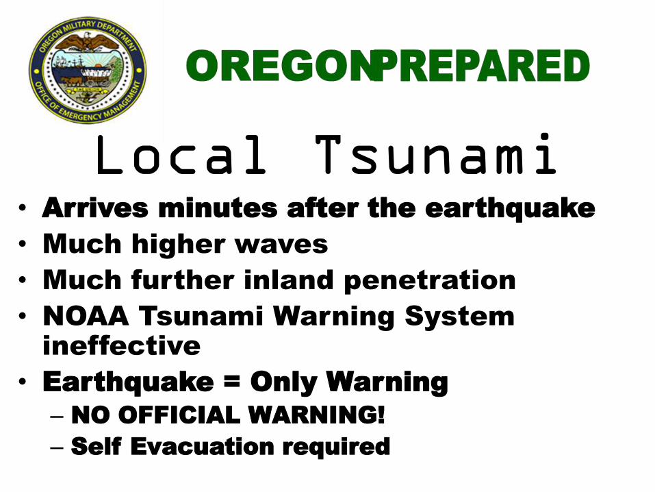
Local Tsunami • Arrives minutes after the earthquake
• Much higher waves
• Much further inland penetration
• NOAA Tsunami Warning System
ineffective
• Earthquake = Only Warning
– NO OFFICIAL WARNING!
– Self Evacuation required

Crustal faults
What are the Implications?
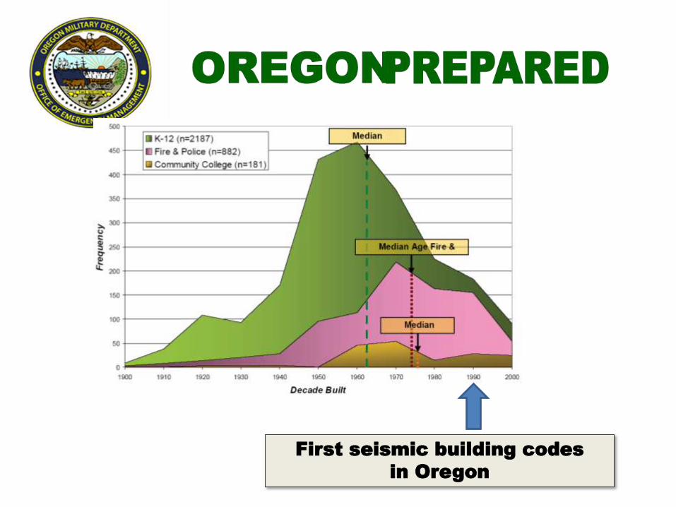
First seismic building codes
in Oregon
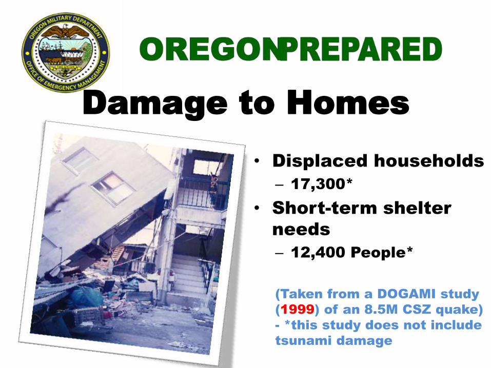
Damage to Homes
• Displaced households
– 17,300*
• Short-term shelter
needs
– 12,400 People*
(Taken from a DOGAMI study
(1999) of an 8.5M CSZ quake)
- *this study does not include
tsunami damage
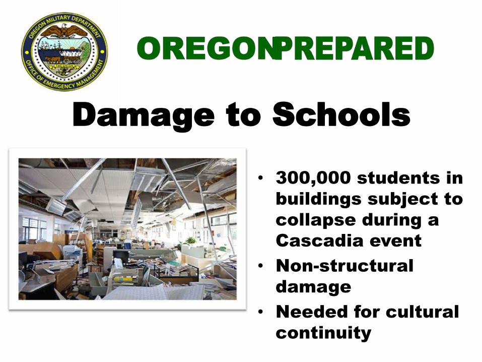
Damage to Schools
• 300,000 students in
buildings subject to
collapse during a
Cascadia event
• Non-structural
damage
• Needed for cultural
continuity
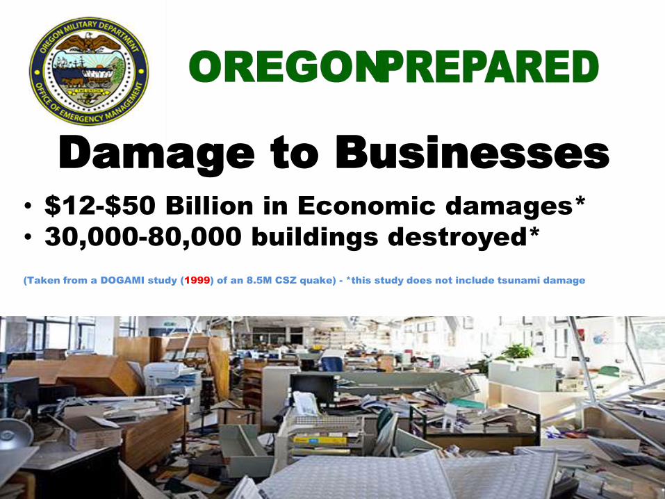
Damage to Businesses
• $12-$50 Billion in Economic damages*
• 30,000-80,000 buildings destroyed*
(Taken from a DOGAMI study (1999) of an 8.5M CSZ quake) - *this study does not include tsunami damage
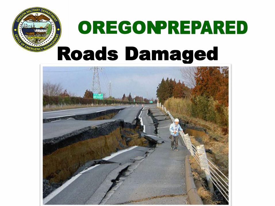
Roads Damaged

State of Oregon’s bridges

State of Oregon’s bridges
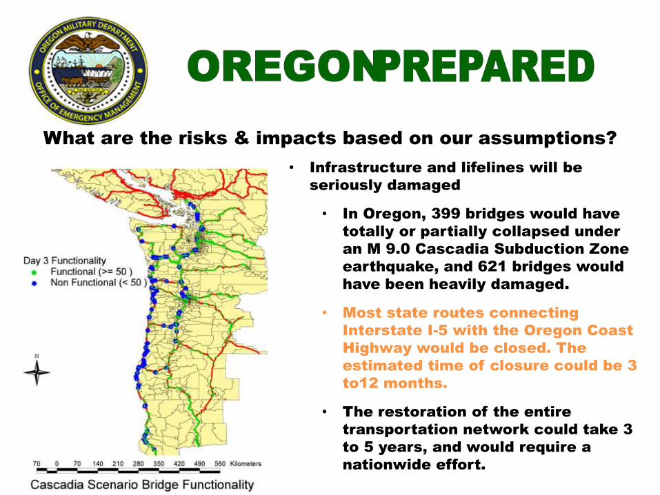
What are the risks & impacts based on our assumptions?
• Infrastructure and lifelines will be
seriously damaged
• In Oregon, 399 bridges would have
totally or partially collapsed under
an M 9.0 Cascadia Subduction Zone
earthquake, and 621 bridges would
have been heavily damaged.
• Most state routes connecting
Interstate I-5 with the Oregon Coast
Highway would be closed. The
estimated time of closure could be 3
to12 months.
• The restoration of the entire
transportation network could take 3
to 5 years, and would require a
nationwide effort.
Oregon is at risk
from an earthquake and
tsunami that can
significantly impact our
people and economy
for decades.
Cascadia Planning Assumption
• Widely accepted that a very large, 9+ subduction zone
earthquake is not just possible, but probable
• Strong to Very Strong shaking inland to Cascade
mountains
• Three metropolitan cities in impact zone
– Portland
– Seattle
– Vancouver, B.C.
• Heavy urbanization along the I-5 corridor
• Approximately 15 million people live in the hazard zone
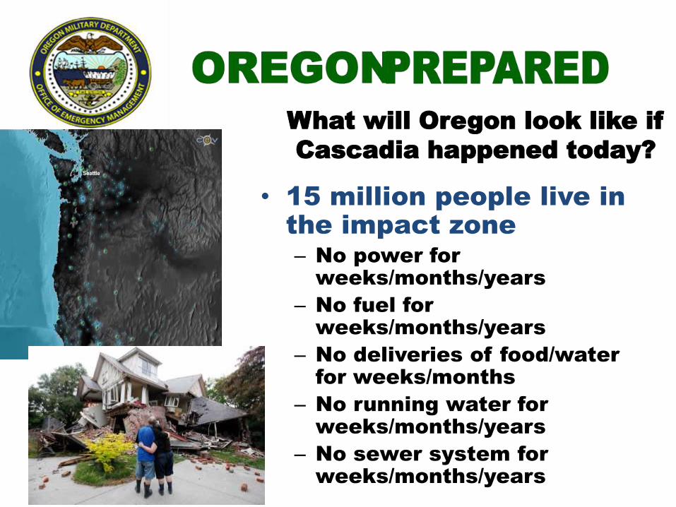
What will Oregon look like if
Cascadia happened today?
• 15 million people live in
the impact zone
– No power for
weeks/months/years
– No fuel for
weeks/months/years
– No deliveries of food/water
for weeks/months
– No running water for
weeks/months/years
– No sewer system for
weeks/months/years

Critical Service Zone Estimated Time to
Restore
Electricity Valley 1 to 3 months
Electricity Coast 3 to 6 months
Police and fire stations Valley 2 to 4 months
Drinking water and sewer Valley 1 month to 1 year
Drinking water and sewer Coast 1 to 3 years
Top-priority highways (partial
restoration)
Valley 6 to 12 months
Healthcare facilities Valley 18 months
Healthcare facilities Coast 3 years
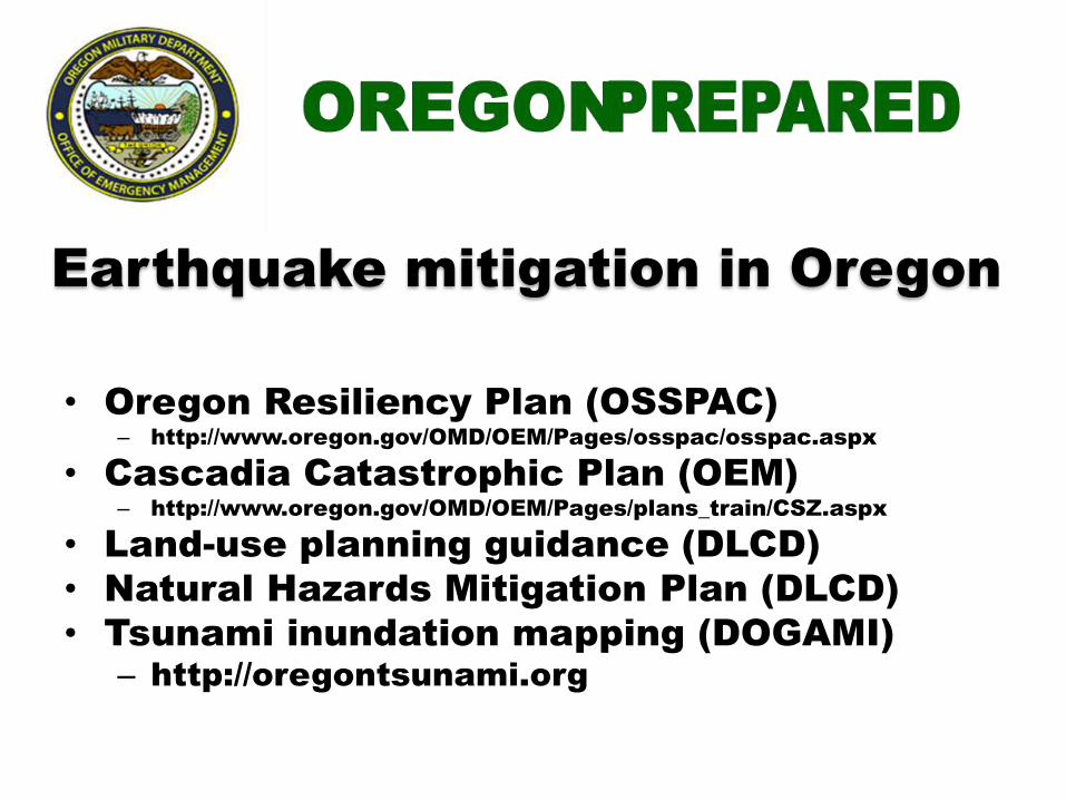
Earthquake mitigation in Oregon
• Oregon Resiliency Plan (OSSPAC)
– http://www.oregon.gov/OMD/OEM/Pages/osspac/osspac.aspx
• Cascadia Catastrophic Plan (OEM)
– http://www.oregon.gov/OMD/OEM/Pages/plans_train/CSZ.aspx
• Land-use planning guidance (DLCD)
• Natural Hazards Mitigation Plan (DLCD)
• Tsunami inundation mapping (DOGAMI)
– http://oregontsunami.org
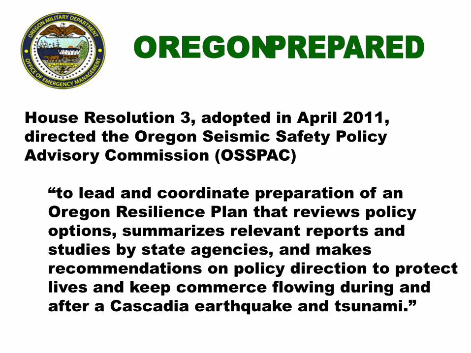
House Resolution 3, adopted in April 2011,
directed the Oregon Seismic Safety Policy
Advisory Commission (OSSPAC)
“to lead and coordinate preparation of an
Oregon Resilience Plan that reviews policy
options, summarizes relevant reports and
studies by state agencies, and makes
recommendations on policy direction to protect
lives and keep commerce flowing during and
after a Cascadia earthquake and tsunami.”

The Oregon Resilience Plan:
Reducing Risk and Improving Recovery
for the Next Cascadia Earthquake and Tsunami
• Report to the 77th
Legislative Assembly
from Oregon Seismic Safety Policy
Advisory Commission (OSSPAC)
• February 2013
• http://www.oregon.gov/OMD/OEM/osspac/docs/Oregon_Resilience_Plan_Final.pdf
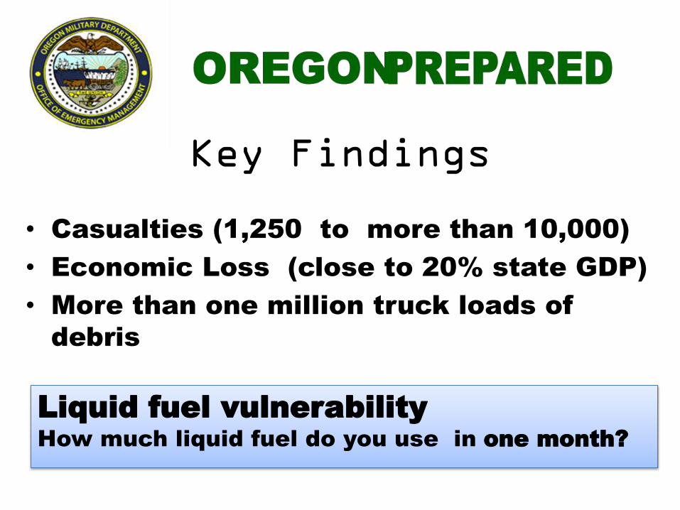
Key Findings
• Casualties (1,250 to more than 10,000)
• Economic Loss (close to 20% state GDP)
• More than one million truck loads of
debris
Liquid fuel vulnerability
How much liquid fuel do you use in one month?
Key recommendations
• Complete an inventory
– critical buildings
– local agency, transit, port, and rail
assets
– energy and information and
communications sectors
– water and wastewater

• Launch a sustained program of capital
investment in Oregon’s public
structures, including
– Fully funding Oregon’s Seismic
Rehabilitation Grants Program for K-12
schools, community colleges, and
emergency response facilities
– Seismically upgrading lifeline
transportation routes into and out of
major business centers statewide by 2030
• Craft a package of incentives to
engage Oregon’s private sector
– Developing a seismic rating system for new buildings to
incentivize construction of buildings more resilient than
building code compliance requires and to communicate
seismic risk to the public
– Tasking the Oregon Public Utilities Commission to provide
oversight for seismic preparedness of the energy
providers currently under its jurisdiction
– Working with the hospitality industry to develop plans to
assist visitors following a major earthquake and tsunami
and to plan strategies to rebuild the tourism industry

• Update Oregon’s public policies
– Revising individual preparedness
communications to specify preparation
from the old standard of 72 hours to a
minimum of two weeks, and possibly more
– Developing a policy and standards for
installation of temporary bridges following
earthquake disruption
Senate Bill 33 • Tasks the Resilience plan workgroup
to develop an implementation plan
• Report due to Oregon State Legislature
– October 1, 2014
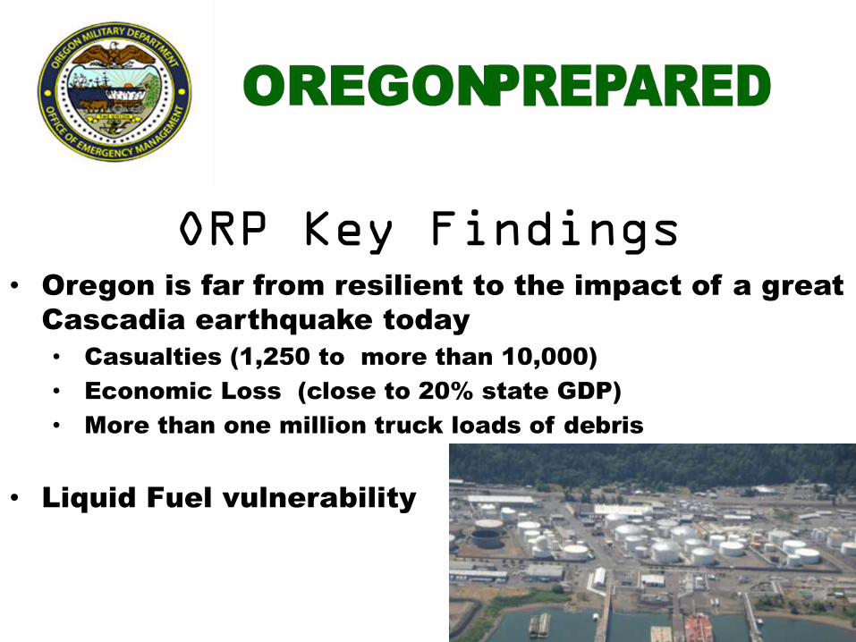
ORP Key Findings • Oregon is far from resilient to the impact of a great
Cascadia earthquake today
• Casualties (1,250 to more than 10,000)
• Economic Loss (close to 20% state GDP)
• More than one million truck loads of debris
• Liquid Fuel vulnerability
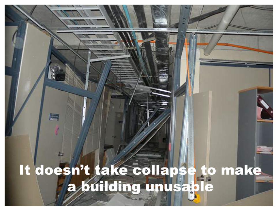
It doesn’t take collapse to make
a building unusable
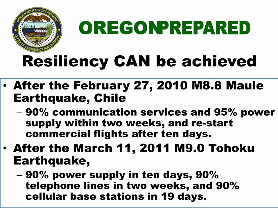
Resiliency CAN be achieved
• After the February 27, 2010 M8.8 Maule
Earthquake, Chile
– 90% communication services and 95% power
supply within two weeks, and re-start
commercial flights after ten days.
• After the March 11, 2011 M9.0 Tohoku
Earthquake,
– 90% power supply in ten days, 90%
telephone lines in two weeks, and 90%
cellular base stations in 19 days.
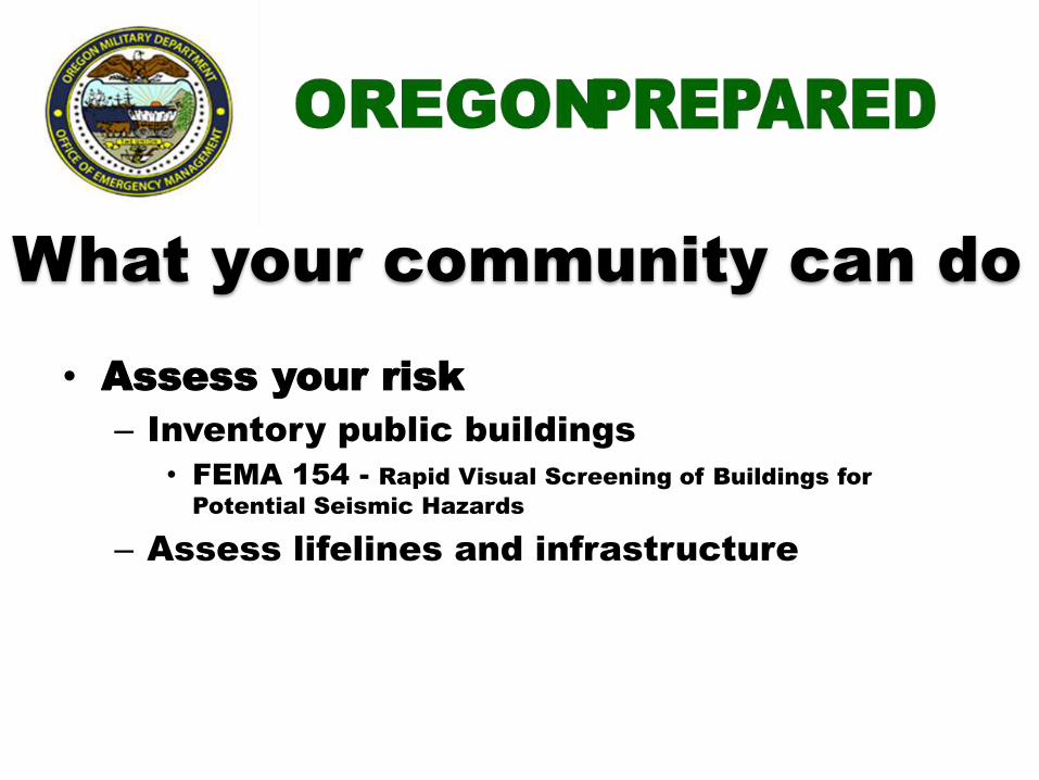
What your community can do
• Assess your risk
– Inventory public buildings
• FEMA 154 - Rapid Visual Screening of Buildings for
Potential Seismic Hazards
– Assess lifelines and infrastructure
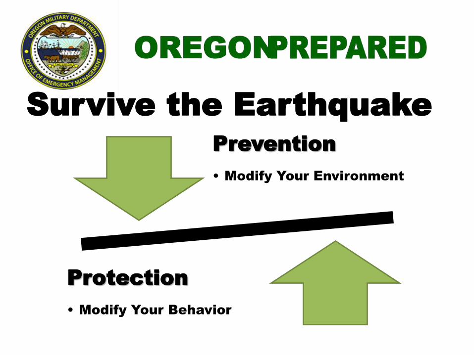
Survive the Earthquake
Prevention
• Modify Your Environment
Protection
• Modify Your Behavior
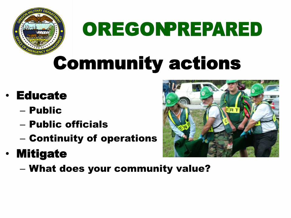
• Educate
– Public
– Public officials
– Continuity of operations
• Mitigate
– What does your community value?
Community actions

Secure your
space by
identifying
hazards and
securing
moveable items.
Key Preparedness Messages
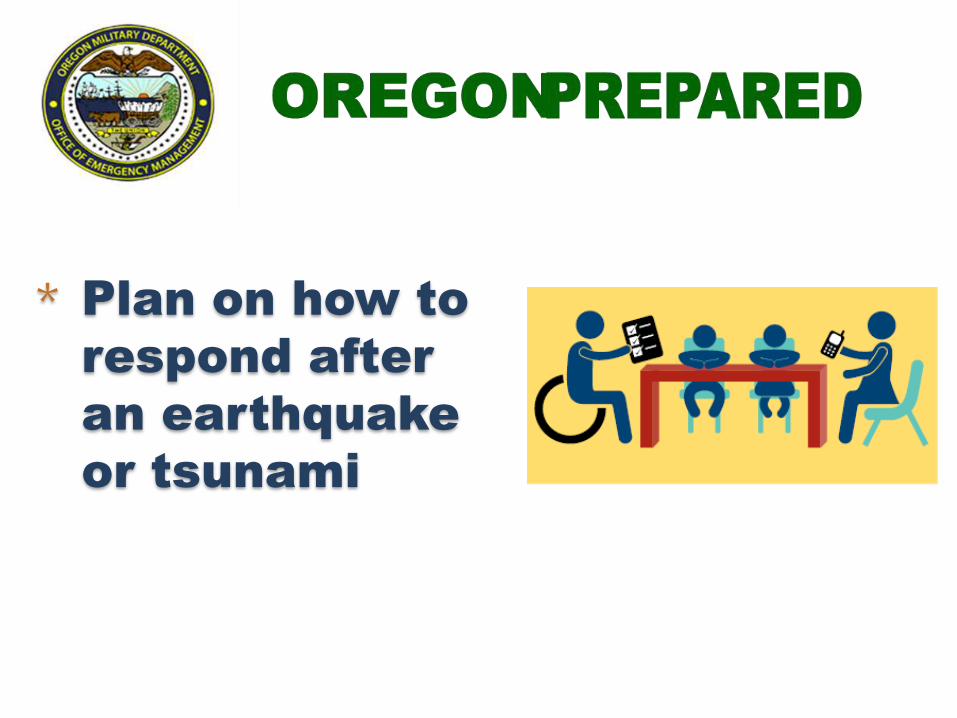
2- Plan to be safe * Plan on how to
respond after
an earthquake
or tsunami

Personal disaster supplies
kits
• Go-Kit – minimum of 72 hours
• Car – 7 to 10 days
• Home – 3+ weeks
http://www.ready.gov/america/getakit/
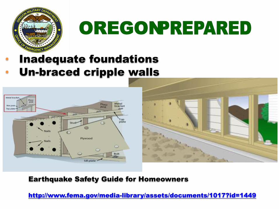
Common building problems
• Inadequate foundations
• Un-braced cripple walls
Earthquake Safety Guide for Homeowners
http://www.fema.gov/media-library/assets/documents/1017?id=1449

5- Protect yourself during
earthquake
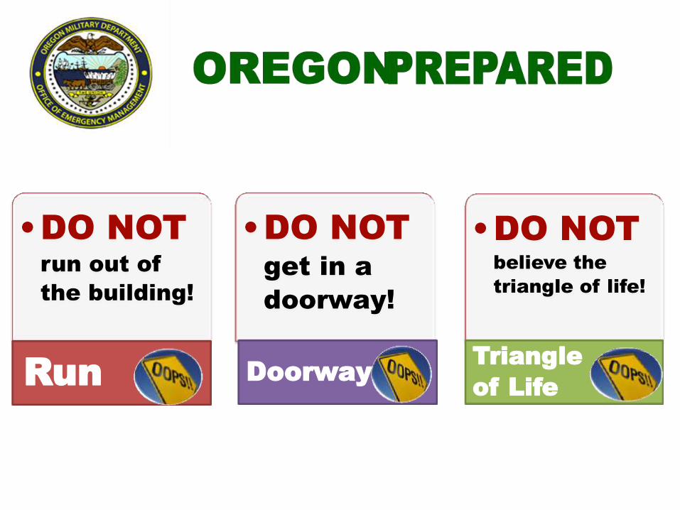
3 Common
MISTAKES •DO NOT
get in a
doorway!
Doorway
•DO NOT
run out of
the building!
Run
•DO NOT
believe the
triangle of life!
Triangle
of Life
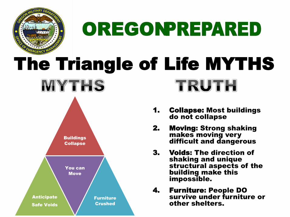
The Triangle of Life MYTHS
Buildings
Collapse
Anticipate
Safe Voids
You can
Move
Furniture
Crushed
1. Collapse: Most buildings
do not collapse
2. Moving: Strong shaking
makes moving very
difficult and dangerous
3. Voids: The direction of
shaking and unique
structural aspects of the
building make this
impossible.
4. Furniture: People DO
survive under furniture or
other shelters.
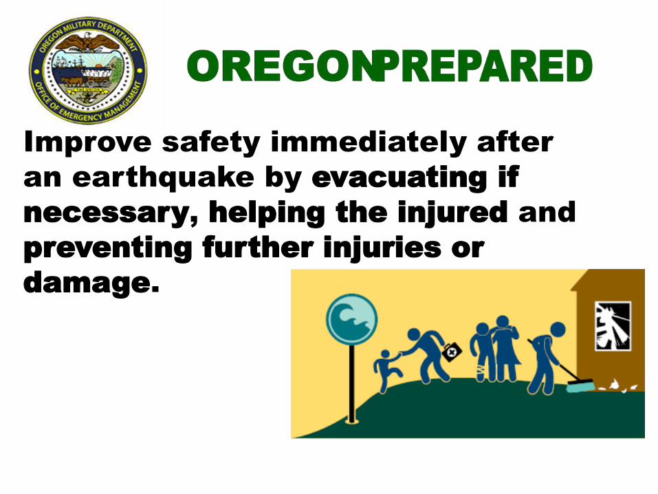
6- Improve safety
Improve safety immediately after
an earthquake by evacuating if
necessary, helping the injured and
preventing further injuries or
damage.
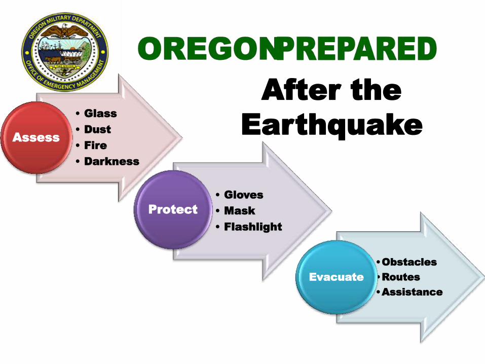
After the
Earthquake • Glass
• Dust
• Fire
• Darkness
Assess
• Gloves
• Mask
• Flashlight
Protect
•Obstacles
•Routes
•Assistance
Evacuate

Local (Cascadia) Tsunami
Waves &
Surges
Arrive in
15+
minutes
Continue
10-12+
hours
Back &
Forth
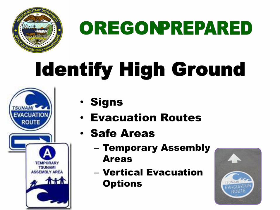
Identify High Ground
• Signs
• Evacuation Routes
• Safe Areas
– Temporary Assembly
Areas
– Vertical Evacuation
Options
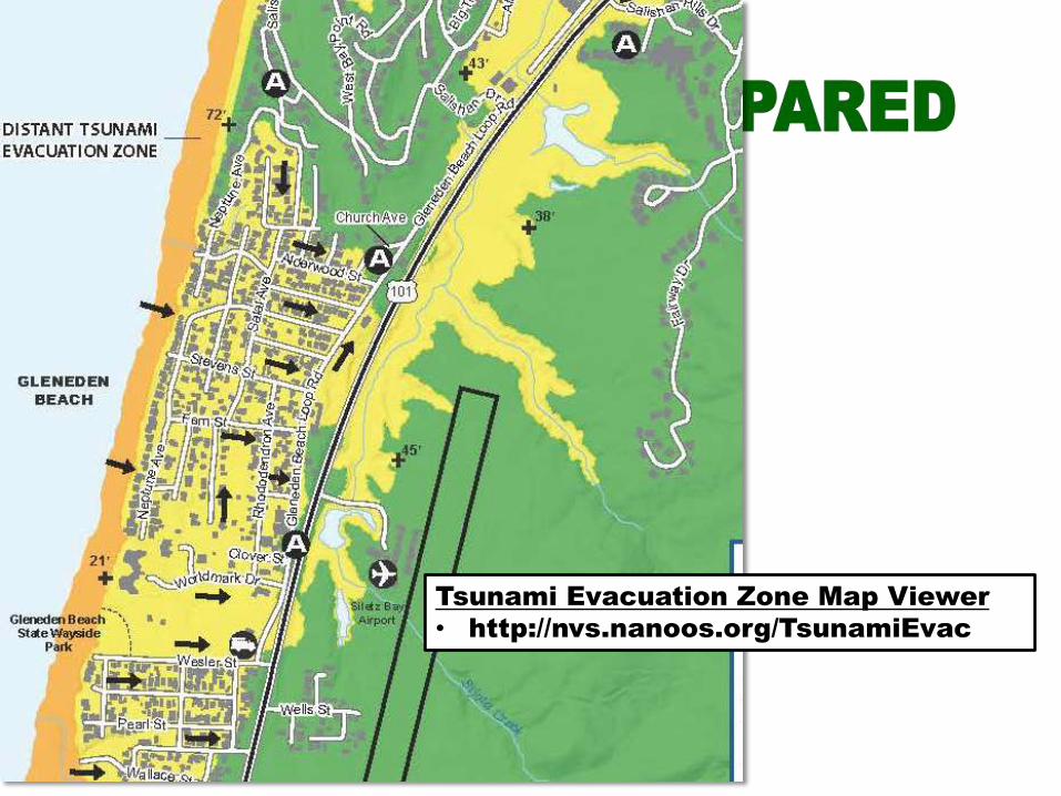
Tsunami Evacuation Zone Map Viewer
• http://nvs.nanoos.org/TsunamiEvac
Tsunami Inundation Maps
• http://www.oregongeology.org/tsuclearinghouse/p
ubs-inumaps.htm
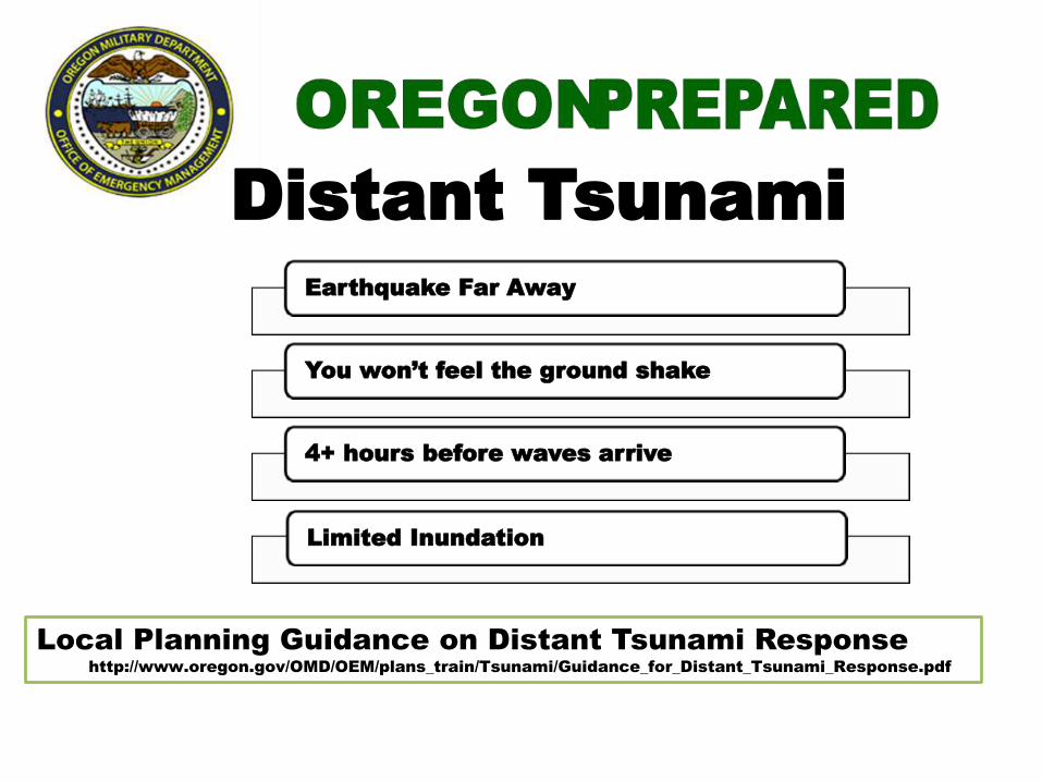
Distant Tsunami
Earthquake Far Away
You won’t feel the ground shake
4+ hours before waves arrive
Limited Inundation
Local Planning Guidance on Distant Tsunami Response
http://www.oregon.gov/OMD/OEM/plans_train/Tsunami/Guidance_for_Distant_Tsunami_Response.pdf
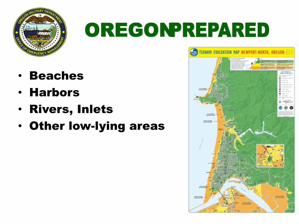
Know the “Distant” Zone • Beaches
• Harbors
• Rivers, Inlets
• Other low-lying areas
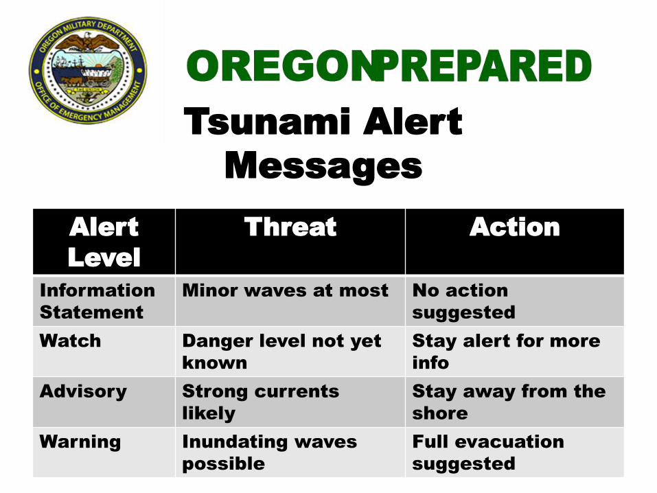
Tsunami Alert
Messages
National Tsunami Warning Center
Alert
Level
Threat Action
Information
Statement
Minor waves at most No action
suggested
Watch Danger level not yet
known
Stay alert for more
info
Advisory Strong currents
likely
Stay away from the
shore
Warning Inundating waves
possible
Full evacuation
suggested
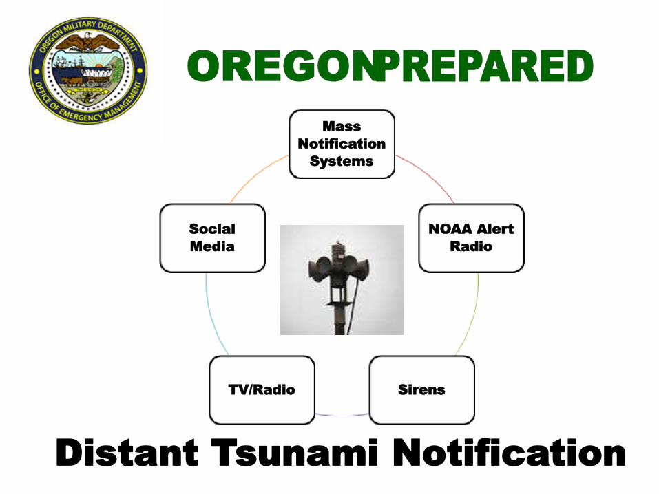
Mass
Notification
Systems
NOAA Alert
Radio
Sirens TV/Radio
Social
Media
Distant Tsunami Notification
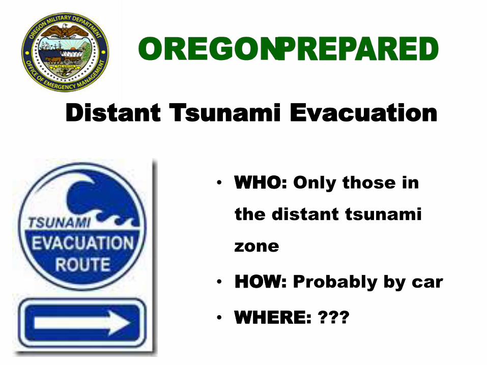
Distant Tsunami Evacuation
• WHO: Only those in
the distant tsunami
zone
• HOW: Probably by car
• WHERE: ???
Re-entry
After a Distant Tsunami • Cancellation Message
• Re-enter with Caution
• Damage
– Harbors
– Beaches
– Low-lying areas
– Roads, Bridges
• Clean up
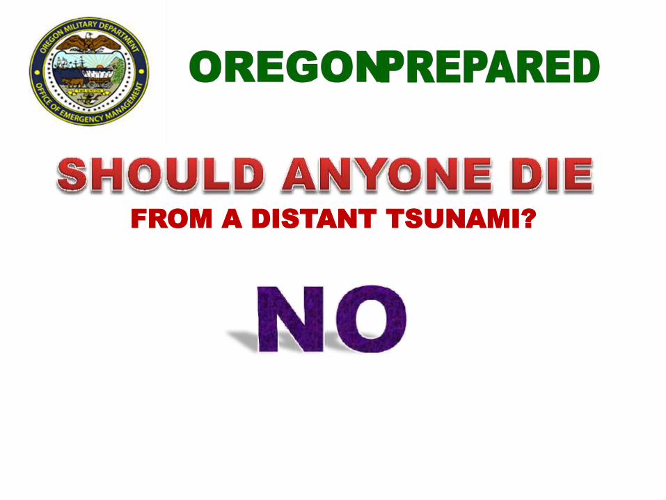
FROM A DISTANT TSUNAMI?
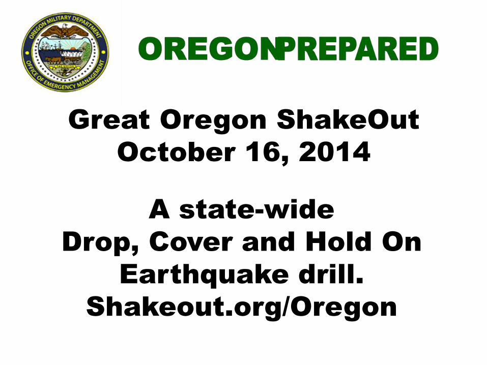
Great Oregon ShakeOut
October 16, 2014
A state-wide
Drop, Cover and Hold On
Earthquake drill.
Shakeout.org/Oregon
Contact Information
Geological Hazard
Program Coordinator
Althea Rizzo
(503) 378-2911 ext.
22237