Embed Size (px)
Citation preview
40 Creating a Community Vision: Silver Saddle Ranch & the Carson River
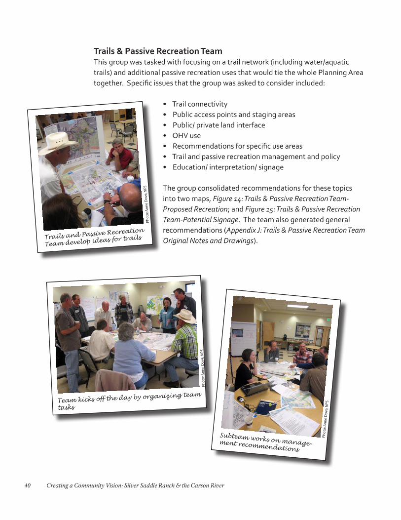
Trails & Passive Recreation TeamThis group was tasked with focusing on a trail network (including water/aquatic trails) and additional passive recreation uses that would tie the whole Planning Area together. Specific issues that the group was asked to consider included:
• Trail connectivity • Public access points and staging areas• Public/ private land interface• OHV use • Recommendations for specific use areas• Trail and passive recreation management and policy• Education/ interpretation/ signage
The group consolidated recommendations for these topics into two maps, Figure 14: Trails & Passive Recreation Team-Proposed Recreation; and Figure 15: Trails & Passive Recreation Team-Potential Signage. The team also generated general recommendations (Appendix J: Trails & Passive Recreation Team Original Notes and Drawings).
Subteam works on manage-ment recommendations
Pho
to: A
nn
e D
ove,
NPS
Trails and Passive Recreation
Team develop ideas for trails
Pho
to: A
nn
e D
ove,
NPS
Team kicks off the day by organizing team
tasks
Pho
to: A
nn
e D
ove,
NPS
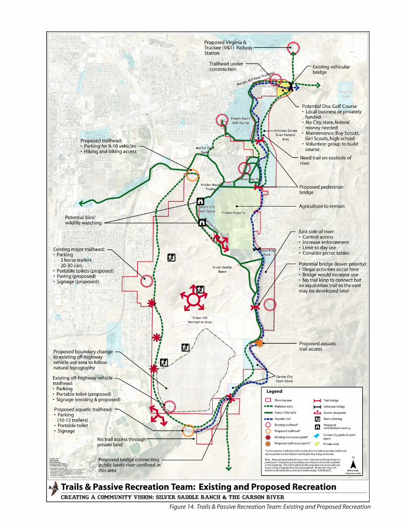
Figure 14. Trails & Passive Recreation Team: Existing and Proposed Recreation
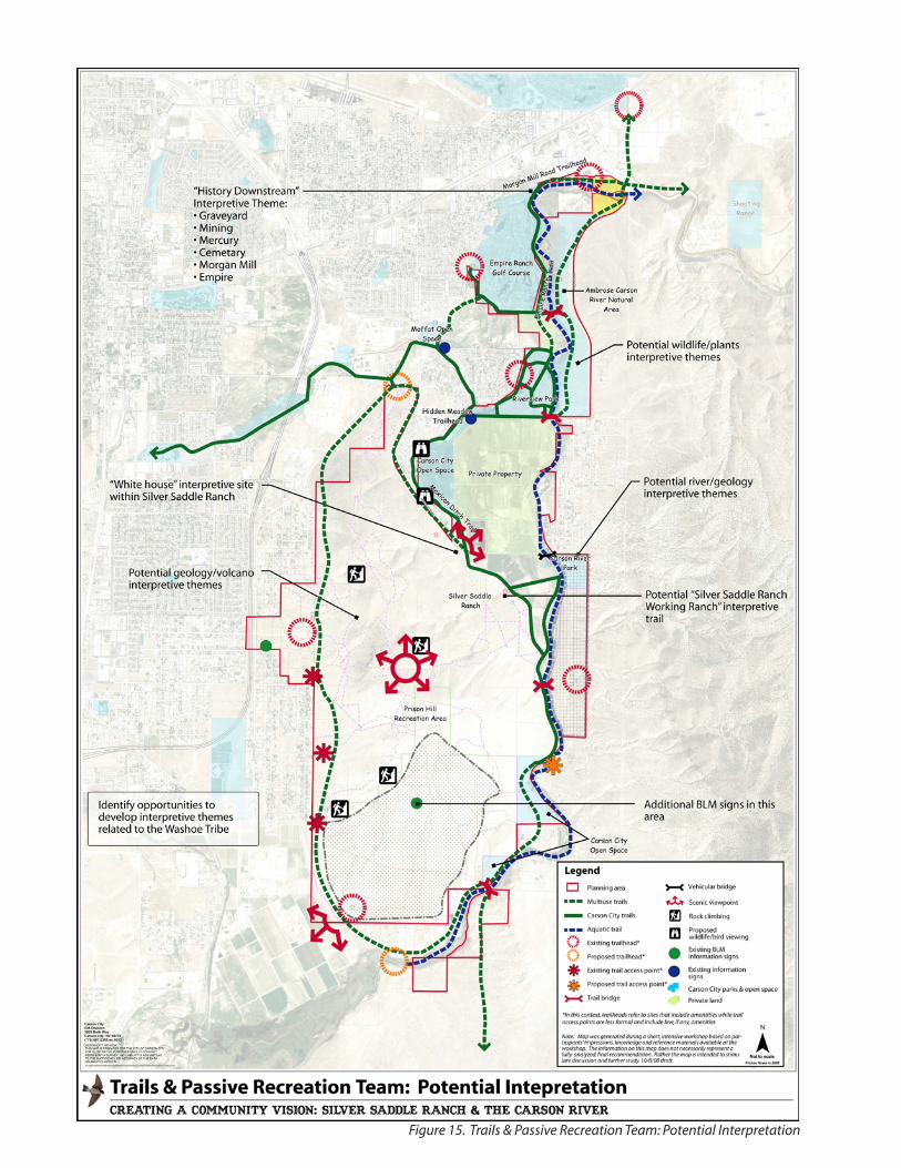
Figure 15. Trails & Passive Recreation Team: Potential Interpretation
43Charrette Results
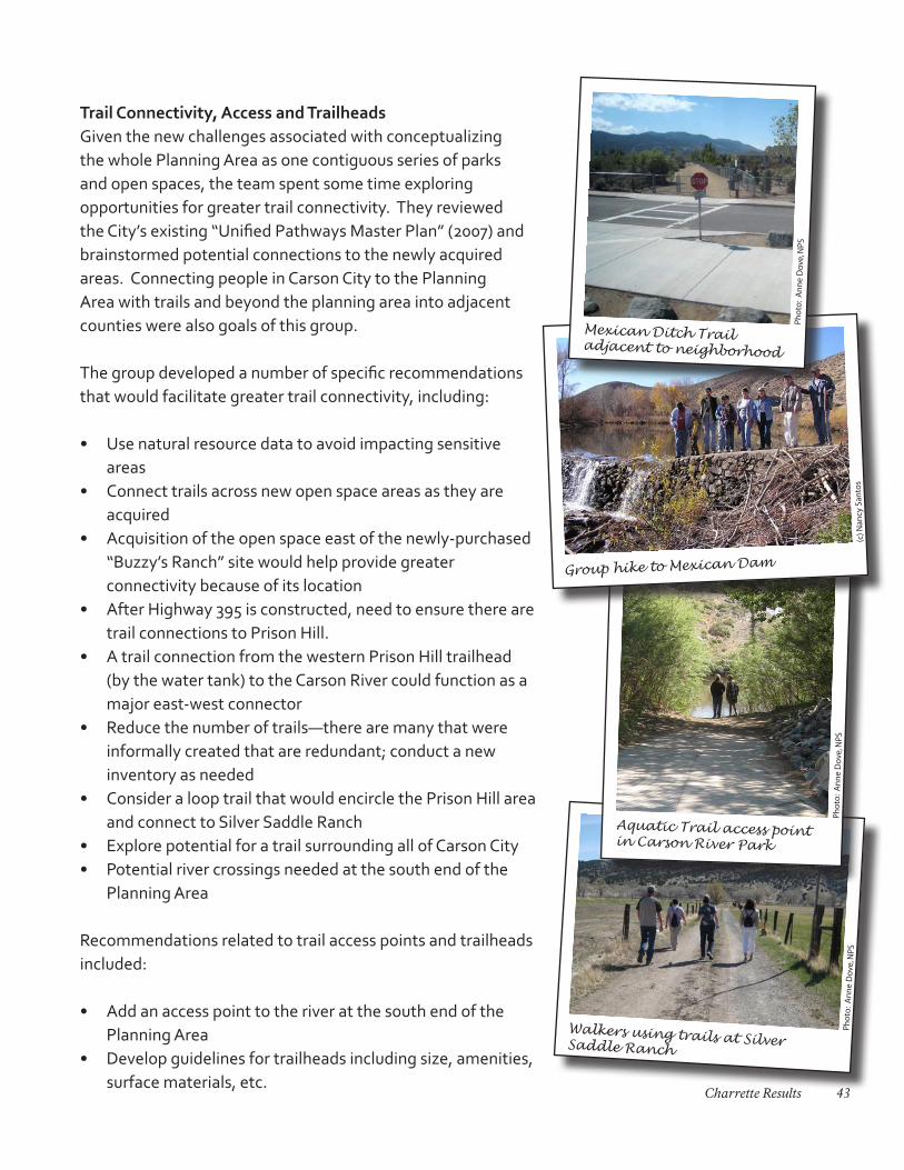
Trail Connectivity, Access and TrailheadsGiven the new challenges associated with conceptualizing the whole Planning Area as one contiguous series of parks and open spaces, the team spent some time exploring opportunities for greater trail connectivity. They reviewed the City’s existing “Unified Pathways Master Plan” (2007) and brainstormed potential connections to the newly acquired areas. Connecting people in Carson City to the Planning Area with trails and beyond the planning area into adjacent counties were also goals of this group.
The group developed a number of specific recommendations that would facilitate greater trail connectivity, including:
• Use natural resource data to avoid impacting sensitive areas
• Connect trails across new open space areas as they are acquired
• Acquisition of the open space east of the newly-purchased “Buzzy’s Ranch” site would help provide greater connectivity because of its location
• After Highway 395 is constructed, need to ensure there are trail connections to Prison Hill.
• A trail connection from the western Prison Hill trailhead (by the water tank) to the Carson River could function as a major east-west connector
• Reduce the number of trails—there are many that were informally created that are redundant; conduct a new inventory as needed
• Consider a loop trail that would encircle the Prison Hill area and connect to Silver Saddle Ranch
• Explore potential for a trail surrounding all of Carson City• Potential river crossings needed at the south end of the
Planning Area
Recommendations related to trail access points and trailheads included:
• Add an access point to the river at the south end of the Planning Area
• Develop guidelines for trailheads including size, amenities, surface materials, etc.
Walkers using trails at Silver Saddle Ranch
Pho
to:
An
ne
Dov
e, N
PS
Aquatic Trail access point in Carson River Park
Pho
to:
An
ne
Dov
e, N
PS
Group hike to Mexican Dam
(c) N
ancy
San
tos
Mexican Ditch Trail adjacent to neighborhood
Pho
to:
An
ne
Dov
e, N
PS
44 Creating a Community Vision: Silver Saddle Ranch & the Carson River
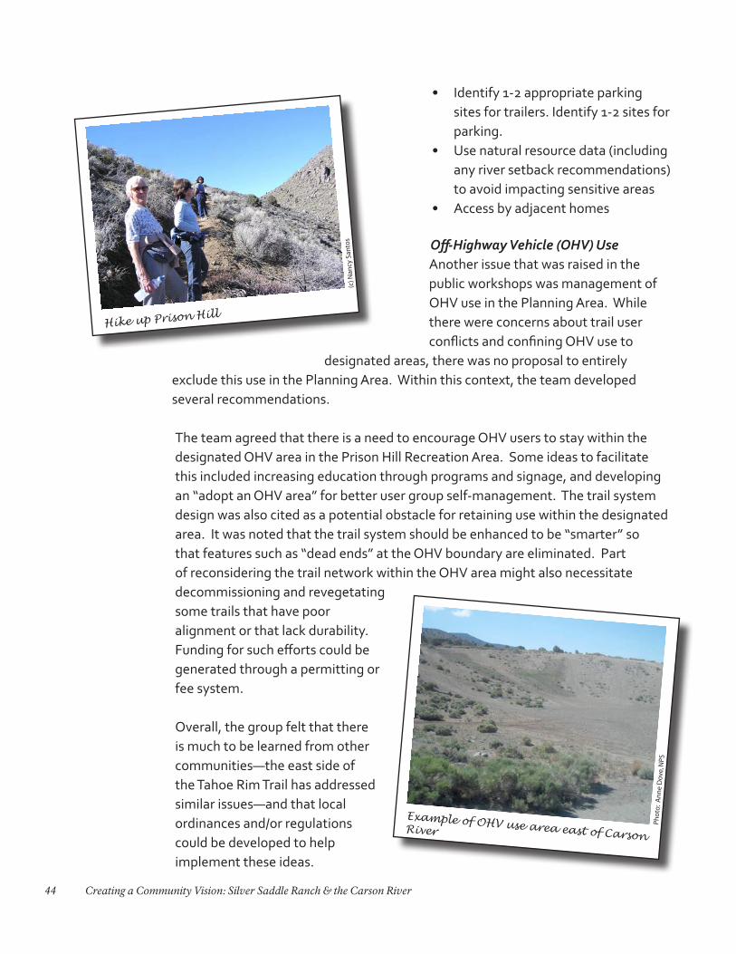
• Identify 1-2 appropriate parking sites for trailers. Identify 1-2 sites for parking.
• Use natural resource data (including any river setback recommendations) to avoid impacting sensitive areas
• Access by adjacent homes
Off-Highway Vehicle (OHV) UseAnother issue that was raised in the public workshops was management of OHV use in the Planning Area. While there were concerns about trail user conflicts and confining OHV use to
designated areas, there was no proposal to entirely exclude this use in the Planning Area. Within this context, the team developed several recommendations.
The team agreed that there is a need to encourage OHV users to stay within the designated OHV area in the Prison Hill Recreation Area. Some ideas to facilitate this included increasing education through programs and signage, and developing an “adopt an OHV area” for better user group self-management. The trail system design was also cited as a potential obstacle for retaining use within the designated area. It was noted that the trail system should be enhanced to be “smarter” so that features such as “dead ends” at the OHV boundary are eliminated. Part of reconsidering the trail network within the OHV area might also necessitate decommissioning and revegetating some trails that have poor alignment or that lack durability. Funding for such efforts could be generated through a permitting or fee system.
Overall, the group felt that there is much to be learned from other communities—the east side of the Tahoe Rim Trail has addressed similar issues—and that local ordinances and/or regulations could be developed to help implement these ideas.
Example of OHV use area east of Carson River
Pho
to:
An
ne
Dov
e, N
PS
Hike up Prison Hill
(c) N
ancy
San
tos
45Charrette Results
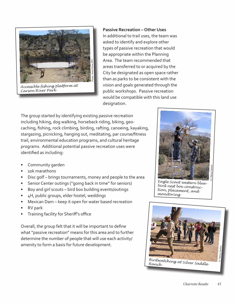
Passive Recreation – Other UsesIn additional to trail uses, the team was asked to identify and explore other types of passive recreation that would be appropriate within the Planning Area. The team recommended that areas transferred to or acquired by the City be designated as open space rather than as parks to be consistent with the vision and goals generated through the public workshops. Passive recreation would be compatible with this land use designation.
The group started by identifying existing passive recreation including hiking, dog walking, horseback riding, biking, geo-caching, fishing, rock climbing, birding, rafting, canoeing, kayaking, stargazing, picnicking, hanging out, meditating, par course/fitness trail, environmental education programs, and cultural heritage programs. Additional potential passive recreation uses were identified as including:
• Community garden• 10k marathons• Disc golf – brings tournaments, money and people to the area• Senior Center outings (“going back in time” for seniors)• Boy and girl scouts – bird box building events/outings• 4H, public groups, elder hostel, weddings• Mexican Dam – keep it open for water based recreation• RV park• Training facility for Sheriff’s office
Overall, the group felt that it will be important to define what “passive recreation” means for this area and to further determine the number of people that will use each activity/amenity to form a basis for future development.
(c)
Nan
cy S
anto
s
Birdwatching at Silver Saddle Ranch
Pho
to:
An
ne
Dov
e, N
PS
Accessible fishing platform at Carson River Park
(c)
Nan
cy S
anto
s
Eagle Scout western blue-bird nest box construc-tion, placement, and monitoring
46 Creating a Community Vision: Silver Saddle Ranch & the Carson River
Public-Private Land InterfaceOne concern that emerged from the public workshops leading up to the charrette related to the issue of trespassing over private land by recreation users, particularly where residences interface with the Prison Hill area. The team developed some recommendations related to this issue:
• Fencing of private land should be up to the landowner. Agencies should not be responsible for installing fences
• Standard demarcation (fences) should be maintained by landowners• Issue is likely related to not knowing where boundaries exist. Most people want
to respect private property but cannot with out adequate signs/fencing • Educate public with signs on both public and private lands
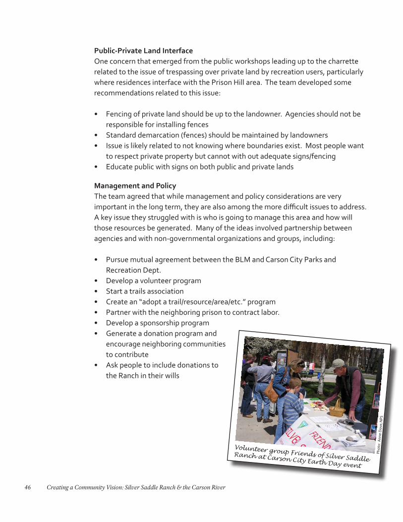
Management and PolicyThe team agreed that while management and policy considerations are very important in the long term, they are also among the more difficult issues to address. A key issue they struggled with is who is going to manage this area and how will those resources be generated. Many of the ideas involved partnership between agencies and with non-governmental organizations and groups, including:
• Pursue mutual agreement between the BLM and Carson City Parks and Recreation Dept.
• Develop a volunteer program• Start a trails association• Create an “adopt a trail/resource/area/etc.” program• Partner with the neighboring prison to contract labor. • Develop a sponsorship program• Generate a donation program and
encourage neighboring communities to contribute
• Ask people to include donations to the Ranch in their wills
Volunteer group Friends of Silver Saddle Ranch at Carson City Earth Day event
Pho
to:
An
ne
Dov
e, N
PS
47Charrette Results
Marketing & OutreachOne major issue that arose during the public workshops was that many were used to thinking about the Planning Area as a series of discrete, individual areas rather than as a network of interconnected spaces. This team spent some time thinking about how to alter peoples’ thinking about this area. To begin, they considered what the “big idea” was that would capture the essence of the area. The river emerged as a key feature and a concept of, “A Living River: Lifeblood of the Community” was developed, in recognition that the river is a common thread that is part of a living, dynamic system that represents the interface between people and the environment.
Using this overarching concept, the group then explored what they felt would be a major outreach focus, education and environmental interaction. The group developed topics that relate to this focus area:
• Yesterday: prehistory, Native American occupation, settlement including mining, V&T Railroad, ranching, etc.
• Today: Urbanism, education, mechanized and motorized recreation, non-motorized recreation, return to environmental concern for environmental participation/interaction
• Tomorrow: sustainable design, green building prototypes, solar/electric transportation system onsite, living laboratory, prototype demonstrations of solar/wind/water harvesting/other scientific/reclaimed water. Enhanced educational opportunities for outreach and tourism
In order to sustain the “Living River: Lifeblood of the Community” concept, the group generated some recommendations:
• Develop an advisory committee that would work with the administrator/manager(s) of the area
• Draft a marketing plan that addresses outreach, grant writing, and funding, including partnerships. Include local education leaders in the process
• Develop a storyline: who, what, where, why-yesterday, today, tomorrow that would tie into interpretation and education
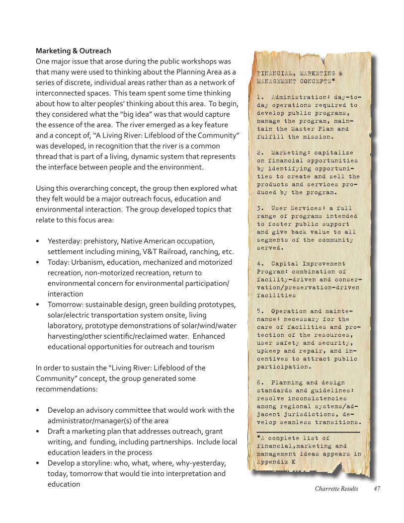
FINANCIAL, MARKETING & MANAGEMENT CONCEPTS*
1. Administration: day-to-day operations required to develop public programs, manage the program, main-tain the Master Plan and fulfill the mission.
2. Marketing: capitalize on financial opportunities by identifying opportuni-ties to create and sell the products and services pro-duced by the program.
3. User Services: a full range of programs intended to foster public support and give back value to all segments of the community served.
4. Capital Improvement Program: combination of facility-driven and conser-vation/preservation-driven facilities
5. Operation and mainte-nance: necessary for the care of facilities and pro-tection of the resources, user safety and security, upkeep and repair, and in-centives to attract public participation.
6. Planning and design standards and guidelines: resolve inconsistencies among regional systems/ad-jacent jurisdictions, de-velop seamless transitions.__________________________*A complete list of financial,marketing and management ideas appears in Appendix K
48 Creating a Community Vision: Silver Saddle Ranch & the Carson River
• Identify programs that will engage the community and define program scope• Natural resource management will need to be a component of sustaining this
concept
An additional summary of financial, marketing and management concepts and potential programs was generated by a member of the team that provides a wide range of ideas for consideration (Appendix K: Financial and Marketing Concepts).
Specific Use AreasWhile another team focused on the Silver Saddle Ranch and Prison Hill areas, this team was asked to consider any other specific use areas they deemed appropriate. The team chose to explore opportunities for the newly-acquired “Buzzy’s Ranch” area in addition to the open space to the east of there that the City is actively trying to purchase. Ideas for this area included:
• Wetlands integrated with passive uses such as trails, horses and pastures.• Use site for education about water resource issues including use of reclaimed/
effluent water• Identify a small facility for meetings• Use “Green” design standards, may enhance grant/funding opportunities • Include history, cultural information, and trail maps at the interpretive center
The group also identified a few uses that they would like to see sited somewhere within the Planning Area, including:
• A small amphitheater• Potential disc golf in the Morgan Hill /Deer Run area• Designate safe swimming areas Education, Interpretation & SignageUsing the “big idea” concept for the area, “A Living River: Lifeblood of the Community“, the group identified potential interpretive and education themes for the site including: history (mining, ranching, Native American—natural and human histories); geology; biology and ecology; and the river corridor and its influence on the Planning Area. These themes could be used in identifying interpretive trails, signs, programs and educational materials.
Some specific recommendations related to interpretation included:
• Divide the area into subsections, determine history, wildlife and interpretation for each
49Charrette Results
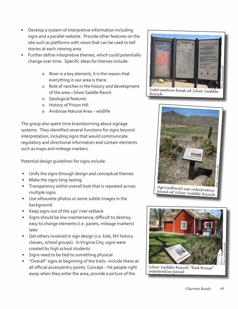
• Develop a system of interpretive information including signs and a parallel website. Provide other features on the site such as platforms with views that can be used to tell stories at each viewing area
• Further define interpretive themes, which could potentially change over time. Specific ideas for themes include:
o River is a key element, it is the reason that everything in our area is there.
o Role of ranches in the history and development of the area—Silver Saddle Ranch
o Geological featureso History of Prison Hillo Ambrose Natural Area – wildlife
The group also spent time brainstorming about signage systems. They identified several functions for signs beyond interpretation, including signs that would communicate regulatory and directional information and contain elements such as maps and mileage markers.
Potential design guidelines for signs include:
• Unify the signs through design and conceptual themes• Make the signs long-lasting• Transparency within overall look that is repeated across
multiple signs • Use silhouette photos or some subtle images in the
background. • Keep signs out of the 150’ river setback • Signs should be low maintenance; difficult to destroy,
easy to change elements (i.e. panels, mileage markers) later
• Get others involved in sign design (i.e. kids, NV history classes, school groups). In Virginia City, signs were created by high school students
• Signs need to be tied to something physical• “Overall” signs at beginning of the trails--include these at
all official access/entry points. Concept – hit people right away when they enter the area; provide a picture of the
Pho
to:
An
ne
Dov
e, N
PS
Silver Saddle Ranch “Red House” interpretive panel
Pho
to:
An
ne
Dov
e, N
PS
Agricultural use interpretive panel at Silver Saddle Ranch
Pho
to:
An
ne
Dov
e, N
PS
Information kiosk at Silver Saddle Ranch
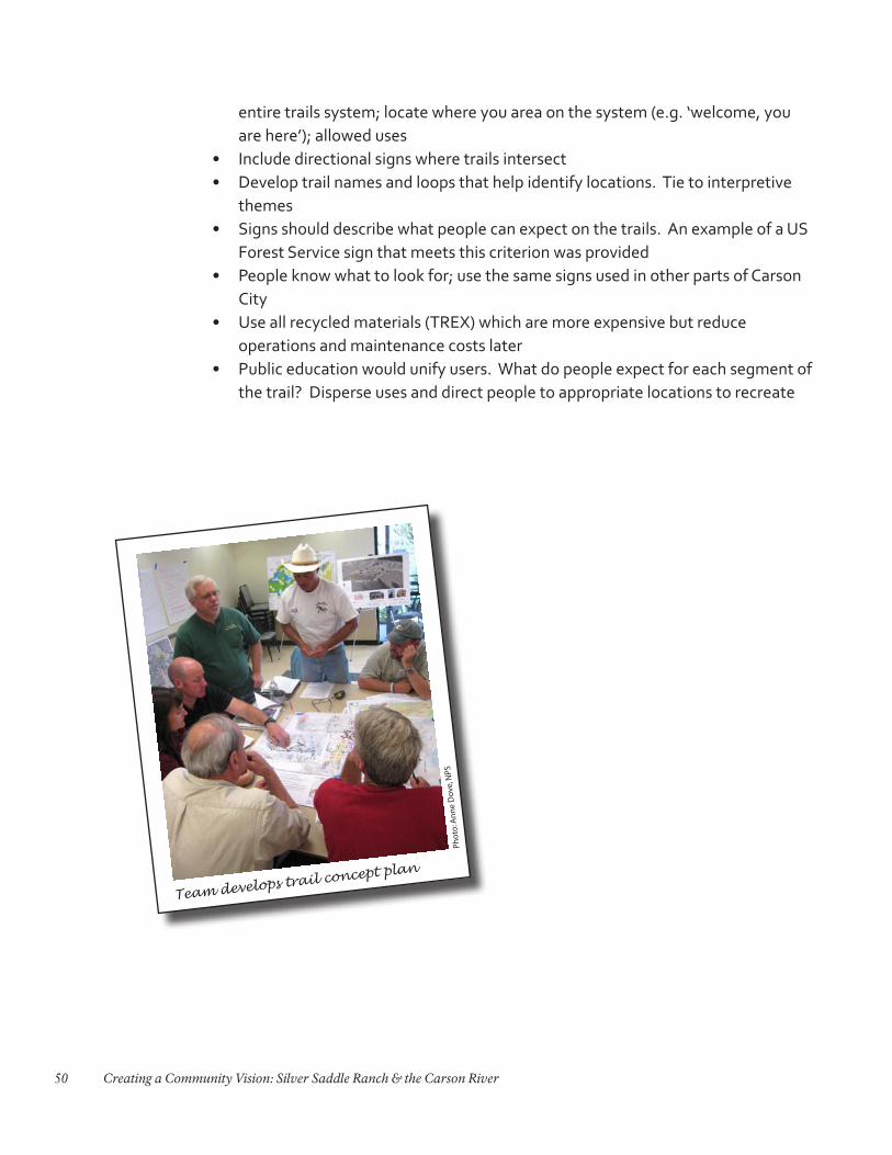
50 Creating a Community Vision: Silver Saddle Ranch & the Carson River
entire trails system; locate where you area on the system (e.g. ‘welcome, you are here’); allowed uses
• Include directional signs where trails intersect• Develop trail names and loops that help identify locations. Tie to interpretive
themes• Signs should describe what people can expect on the trails. An example of a US
Forest Service sign that meets this criterion was provided• People know what to look for; use the same signs used in other parts of Carson
City• Use all recycled materials (TREX) which are more expensive but reduce
operations and maintenance costs later• Public education would unify users. What do people expect for each segment of
the trail? Disperse uses and direct people to appropriate locations to recreate
Pho
to: A
nn
e D
ove,
NPS
Team develops trail concept plan